

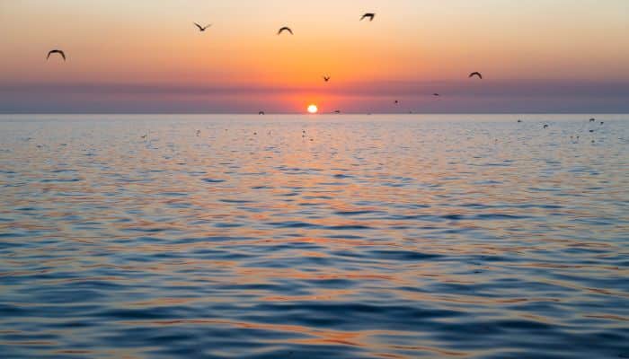
10 Major Gulfs In North America
North America is a continent of myriad landscapes and geographical features. It is also home to several gulfs that have shaped its history, culture and economy. The expansive water bodies surrounding the continent’s coastlines offer much more than natural beauty.
They are bearers of essential maritime routes, ecosystems and hubs of famous recreational activities. In this article, we will uncover the unique characteristics and importance of the major North American Gulfs.
Right from the icy waters of the Alaska Gulf to the tropical feel of the Gulf of Mexico, each gulf has a unique history of evolution and human interaction. The Gulfs in North America harbour diverse marine life and have facilitated trade between nations for hundreds of years.
These major gulfs also provide deep insights into the connections and linkages between North America’s aquatic ecosystems and communities residing near them, depending on their precious resources for livelihood.
By comprehending the role played by these gulfs, we can truly appreciate North America’s relations with the surrounding water bodies and its global impact on different sectors.
Read along as we dive into the major North American Gulfs, highlighting their features and significance in the present world.
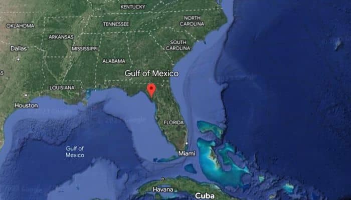
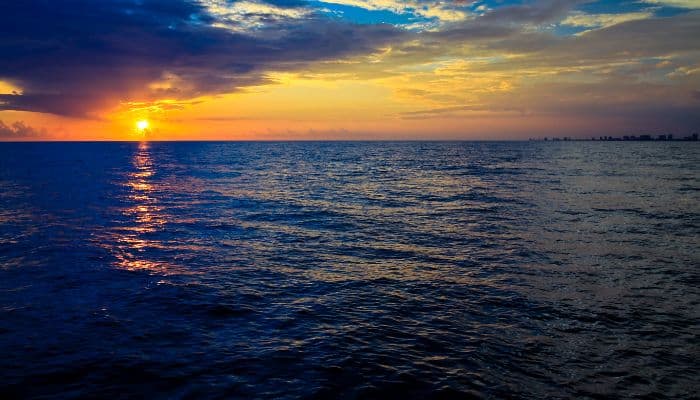
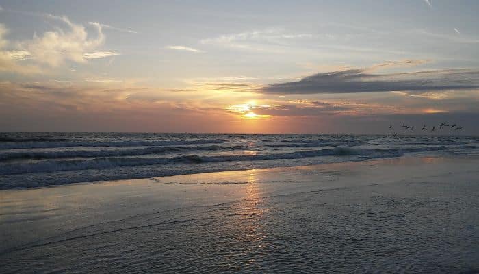
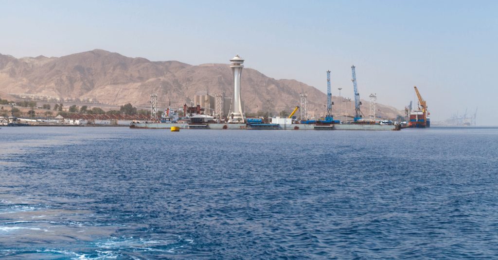
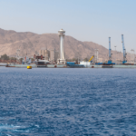
1. Gulf of Mexico
The Gulf of Mexico lies on the southeastern coast of North America and is connected to the Atlantic Ocean via the Florida Straits. It is linked to the Carribean Sea through the Yucatan Channel.
The Gulf of Mexico was formed around 300 million years ago due to plate tectonics. Covering around 600,000 square miles, its basin is oval in shape, having a width of 810 nautical miles. Its floor is lined with sedimentary rocks and sediments.
It borders the US, Mexico and Cuba. The main rivers flowing into the Gulf of Mexico include the Rio Grande and the Mississippi River.
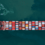
It is one of the largest and most productive offshore petroleum production regions in the world.
Principal ports on the Gulf are Veracruz in Mexico and New Orleans, Galveston, Tampa and Pensacola in the U.S.
The Gulf faces many environmental threats, including agricultural runoff and oil drilling. Red tide or algae blooms that kill marine life and lead to respiratory issues in humans, and animals are frequent near the gulf’s shores, especially along the Florida coast.
It has been reported to have high concentrations of microplastic. There are 27,000 abandoned oil and gas wells beneath the gulf.
2. Gulf of Alaska
An arm of the Pacific Ocean, the Gulf of Alaska covers 1,533,000 km2, spanning from Kodiak Island and the Alaska Peninsula to the Alexander Archipelago situated at Glacier Bay.
Its highly productive ecosystem contains many deep-water corals, leading to the categorisation of the gulf as a Habitat Area of Particular Concern.
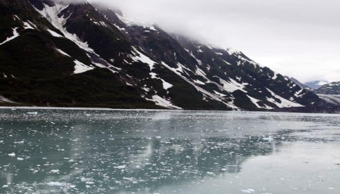
Malaspina Glacier and the Bering Glacier are the largest along the Gulf of Alaska Coastline, which is dotted with many indents like Cook Inlet, which stretches about 310 kilometres, and also the Prince William Sound.
Lituya Bay, along its coast, is the place of the largest ever recorded tsunami. This is because the conditions in the Gulf of Alaska generate many strong storms and dump snow and ice in southern Alaska. It has been seen that a few storms reached Southern California from British Colombia.
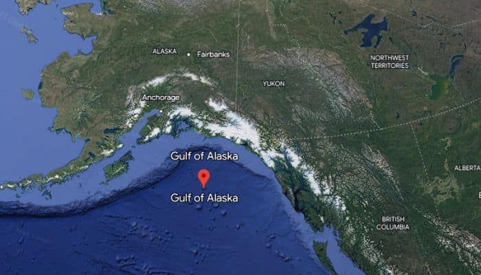
The Gulf of Alaska is also famous since the two oceans meet but never mix here. It has two kinds of water, natural bluewater and heavy sediment water.
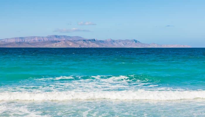
3. Gulf of California
The Gulf of California, a marginal water body of the Pacific Ocean, is also called the Sea of Cortes or the Vermilion Sea.
It separates the Baja California Peninsula from mainland Mexico. It has a long coastline stretching to approximately 4000 kilometres.
Several rivers flow into the Gulf of California, including the Fuerte, Sinaloa, Mayo, Sonora etc.
The gulf’s surface spans 160,000 square kilometres while its maximum depths are over 3000 m due to its complicated geology, a consequence of plate tectonic movements.
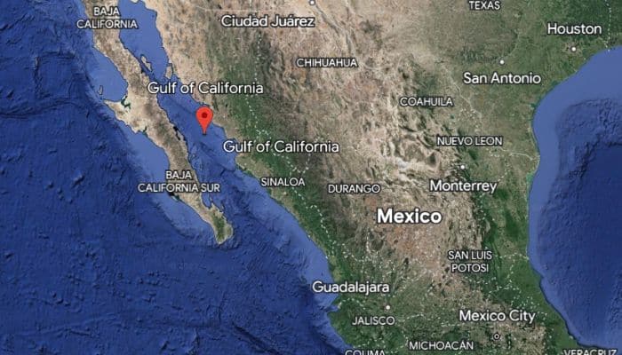
It is known to be a diverse and productive sea harbouring over 5000 micro-invertebrate species, making it a UNESCO World Heritage Site.
The gulf is a rich source of fisheries and is also home to 37 islands, the two biggest being Isla Ángel de la Guarda and Isla Tiburón.
4. Gulf of Honduras
An inlet of the Caribbean Sea, the Gulf or the Bay of Honduras indents the shores of Guatemala, Belize and Honduras. It spans 200 km from Dangriga to La Ceiba and receives 300,000 gallons of water per second from 12 major rivers.
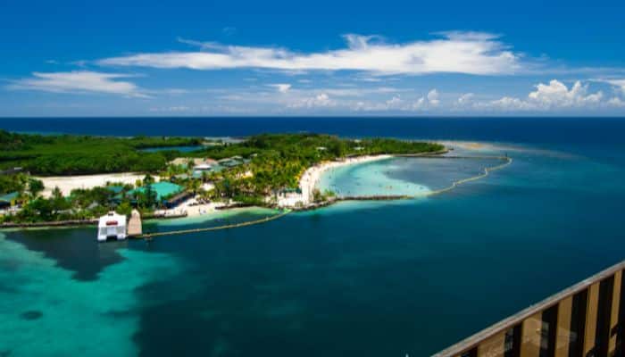
Its inner portion runs alongside the Belize Barrier Reef, which comprises islands and cays referred to as the Pelican Cays.
The Gulf of Honduras has coastal and open waters, ocean currents, barrier beaches, salt marshes, seagrass beds, barrier reefs, lagoons etc, making it a highly rich and productive ecosystem.
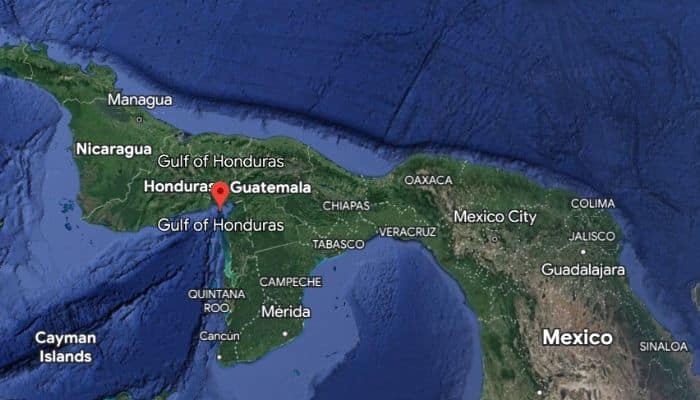
It is also a famous tourist spot, with famous boat trips to Pelican Cays, Caye Caulker and Ambergris Caye.
This is also the place where the infamous pirate Blackbeard spent the winters of 1717-1718.
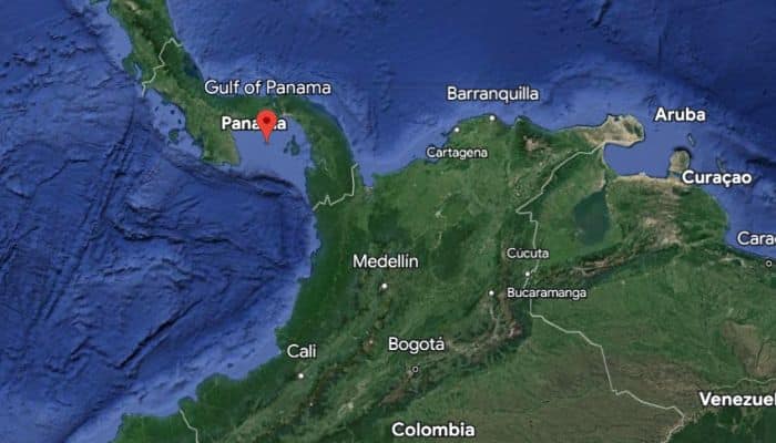
5. Gulf of Panama
The Gulf of Panama lies in the Pacific Ocean off the southern shores of Panama. It stretches 2400 sq km and is 250 km wide at its widest point, while its maximum depth is 220 m.
The Gulf of Panama is connected to the Caribbean Sea via the Panama Canal. The Gulf is home to other minor gulfs as well, like the San Miguel and Parita Gulfs. Principal ports along its shore include Panama City, La Palma and Chitrè.
Tourism is an intrinsic part of the Panamian economy, with the most popular tourist destination being Pearl Islands. The mangroves are yet another characteristic feature of the Bay of Panama. They support over 20 bird species, including the locals who depend on them for various reasons.
With the construction of the Panama Canal, the Gulf of Panama faces environmental threats in the form of oil spills, the destruction of mangroves, pollution from pesticides and insecticides used on nearby farms etc.
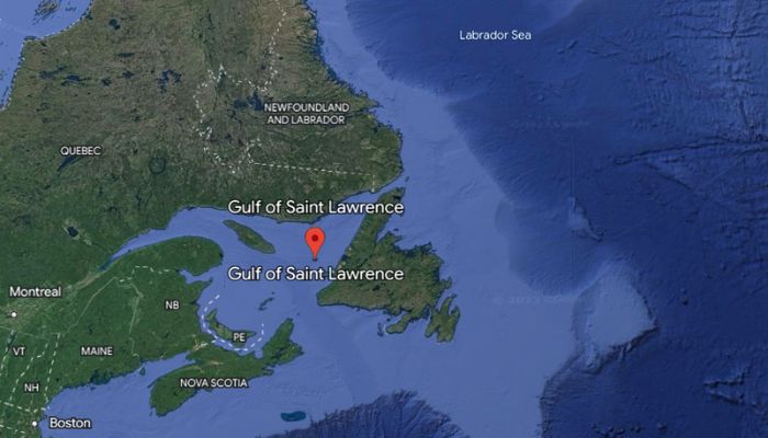
6. Gulf of St.Lawrence
The Gulf of St Lawrence serves as an outlet of the Great Lakes through the St Lawrence River into the Atlantic Ocean. It is partially enclosed and covers 87,000 square miles.
The Gulf is fed by many rivers like Miramchi, Romaine, Margaree, Humber, St Lawrence, Natashquan etc., that carry 34,500 m3 of water.
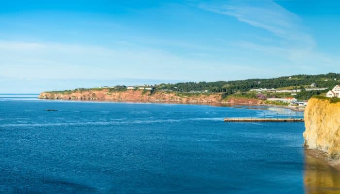
The Gulf branches out into several minor bays like Chaleur Bay, Fortune Bay, St. George’s Bay, Bay of Islands, Northumberland Strait etc.
The first European to visit the Gulf’s waters was the French explorer Jacques Cartier who also named the shores of St Lawrence River as ‘the country of Canadas’, after a native word meaning village or a settlement, hence naming the world’s second biggest country.
Whaling became pretty common in the St Lawrence Gulf by the 15th century. It was only after the English government closed its ports to oil imports from Spain, preventing the sale of a third of Basque Oil, that led to the ultimate collapse of whaling in the area.
7. Gulf of Boothia
The Gulf of Boothia is a water body in Nunavut, Canada, accessible via Prince Regent Inlet. It is surrounded by Baffin Island to the east and by the Boothia Peninsula to the west. It has a 275 m depth which decreases as one goes southward.
From an administrative point of view, the Gulf is shared between the Kitikmeot region on the western side and the Qikiqtaaluk region on the eastern side.
It was named after Felix Booth, who was a wealthy distiller from London. In 1829 he funded the Sir John Ross expedition that explored the gulf to find the northwest passage.
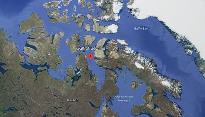
Prior to the expedition, it was explored by William Edward Parry’s men that waves along the ice-filled Fury and Hecla Strait. Later, the southern end of the Gulf was explored by John Rae in 1846, who reached here from the south.
8. Gulf of Maine
The Gulf of Maine is a dynamic environment enriched by the cold waters of the ocean and characterised by complex underwater geography, including deep basins, shallow banks, and semi-enclosed areas, making it biologically productive.
It covers 93,000 square km of ocean and has 12,000 km of coastline.
Stretching 36,000 square miles of water, the Gulf of Maine also has strong tides. These tides mix the North Atlantic waters with water from 60 rivers that drain an expansive watershed stretching over parts of New Brunswick, Nova Scotia, New Hampshire, Maine and Massachusetts.
The Gulf of Maine is also home to over 3000 species. The coastal marshes and estuaries are nursing and feeding grounds for fish, crabs, shellfish and plankton that attract large fish, seals and whales.
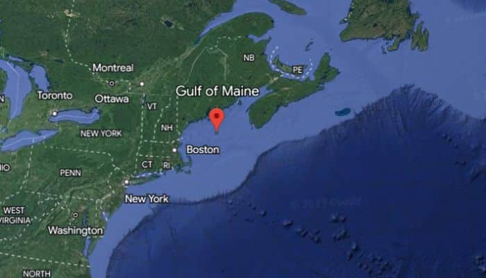
It is a dwelling place for many endangered and threatened species like the roseate tern and also the North Atlantic right whale.
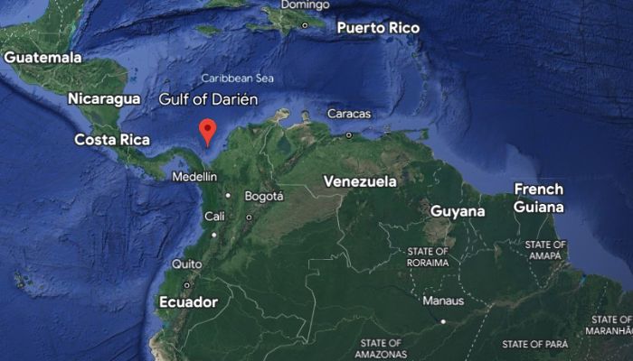
9. Gulf of Darien
The southernmost area of the Caribbean Sea, the Gulf of Darien, is situated between Panama and Colombia. The Gulf of Uraba lies within it, between Caribana Point and Cape Tiburón, Colombia.
The Atrato River Delta extends into the Darien Gulf. To the northwest along the Panama coast of the Darien Gulf lie the remains of a Scottish colony that once flourished in the 17th century, a shipwreck and a fort, Fort St Andrew, which were found by archaeologists in 1979.
It was also the site of the Darien Scheme, which was Scotland’s significant attempt at colonialism.
An expedition of 5 vessels sailed from Leith on 14th July 1968 with 1200 crew members ordered to proceed to Darien Bay and carve out a settlement on the mainland. After reaching Madeira and West Indies, the fleet landed on the Darien Coast, later christening their new home, ‘New Caledonia.
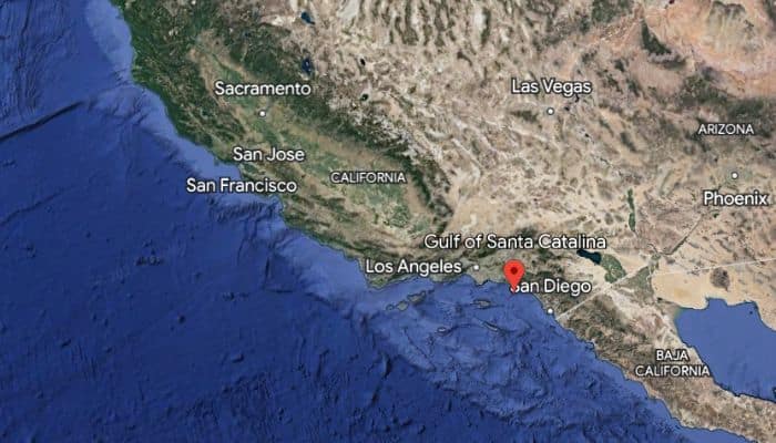
10. Gulf of Santa Catalina
The Gulf of Santa Catalina lies in the Pacific Ocean on the western coast of North America. The Gulf’s east coast belongs to the states of California, United States, and Baja, California, Mexico. San Diego is the biggest town on its shores, and another famous settlement is Santa Catalina Island.
The Gulf covers over 100 square miles and is located in a seismically active region. It is part of California’s Continental Borderland, with narrow shelves, steep slopes, deep basins and islands. It extends from Point Fermin to San Diego.
European discover Juan Rodriguez sailed to the Gulf in 1542 with a fleet of two vessels. Santa Catalina Island was rediscovered in 1602 by a Spanish explorer Viscaino who landed here on Saint Catherine’s Feast Day, naming it Santa Catalina Island in her honour.
You might also like to read-
- 10 Largest Fjords In The World
- 10 Best Great Lakes Ship Tracker Tools
- 10 Gulf of Martaban Facts You Might Not Know
- 12 Gulf Of Mannar Facts You Might Not Know
- 10 Celtic Sea Facts You Should Know
Disclaimer :
The information contained in this website is for general information purposes only. While we endeavour to keep the information up to date and correct, we make no representations or warranties of any kind, express or implied, about the completeness, accuracy, reliability, suitability or availability with respect to the website or the information, products, services, or related graphics contained on the website for any purpose. Any reliance you place on such information is therefore strictly at your own risk.
In no event will we be liable for any loss or damage including without limitation, indirect or consequential loss or damage, or any loss or damage whatsoever arising from loss of data or profits arising out of, or in connection with, the use of this website.
Do you have info to share with us ? Suggest a correction
Disclaimer :
The information contained in this website is for general information purposes only. While we endeavour to keep the information up to date and correct, we make no representations or warranties of any kind, express or implied, about the completeness, accuracy, reliability, suitability or availability with respect to the website or the information, products, services, or related graphics contained on the website for any purpose. Any reliance you place on such information is therefore strictly at your own risk.
In no event will we be liable for any loss or damage including without limitation, indirect or consequential loss or damage, or any loss or damage whatsoever arising from loss of data or profits arising out of, or in connection with, the use of this website.

About Author
Zahra is an alumna of Miranda House, University of Delhi. She is an avid writer, possessing immaculate research and editing skills. Author of several academic papers, she has also worked as a freelance writer, producing many technical, creative and marketing pieces. A true aesthete at heart, she loves books a little more than anything else.
Latest Maritime Knowledge Articles You Would Like:


Subscribe To Our Newsletters
By subscribing, you agree to our Privacy Policy and may receive occasional deal communications; you can unsubscribe anytime.