


<< Our Photo Pages >> Burnt Hill barrow - Long Barrow in England in Oxfordshire
Submitted by thecaptain on Tuesday, 04 April 2006 Page Views: 6086
Neolithic and Bronze AgeSite Name: Burnt Hill barrowCountry: England County: Oxfordshire Type: Long Barrow
Nearest Town: Chipping Norton Nearest Village: chastleton
Map Ref: SP26602850
Latitude: 51.954357N Longitude: 1.614343W
Condition:
| 5 | Perfect |
| 4 | Almost Perfect |
| 3 | Reasonable but with some damage |
| 2 | Ruined but still recognisable as an ancient site |
| 1 | Pretty much destroyed, possibly visible as crop marks |
| 0 | No data. |
| -1 | Completely destroyed |
| 5 | Superb |
| 4 | Good |
| 3 | Ordinary |
| 2 | Not Good |
| 1 | Awful |
| 0 | No data. |
| 5 | Can be driven to, probably with disabled access |
| 4 | Short walk on a footpath |
| 3 | Requiring a bit more of a walk |
| 2 | A long walk |
| 1 | In the middle of nowhere, a nightmare to find |
| 0 | No data. |
| 5 | co-ordinates taken by GPS or official recorded co-ordinates |
| 4 | co-ordinates scaled from a detailed map |
| 3 | co-ordinates scaled from a bad map |
| 2 | co-ordinates of the nearest village |
| 1 | co-ordinates of the nearest town |
| 0 | no data |
Internal Links:
External Links:
I have visited· I would like to visit
4clydesdale7 visited on 8th Apr 2012 - their rating: Cond: 1 Amb: 4 Access: 4 This has now been declared (after excavation) as a mere collection of rugg/rugge stones gathered over many years of field clearance and NOT a Long Barrow - more detail to follow
ChristopherJones couldn't find
")
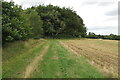
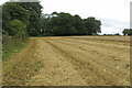
Some reasonable remains of the barrow are still to be found within the clump of trees in the field, along with some stones which were possibly once part of a chamber.
For more info, see here
You may be viewing yesterday's version of this page. To see the most up to date information please register for a free account.
")
")
")
Do not use the above information on other web sites or publications without permission of the contributor.
Nearby Images from Geograph Britain and Ireland:
©2021(licence)
©2021(licence)
©2010(licence)
©2012(licence)
©2009(licence)
The above images may not be of the site on this page, they are loaded from Geograph.
Please Submit an Image of this site or go out and take one for us!
Click here to see more info for this site
Nearby sites
Key: Red: member's photo, Blue: 3rd party photo, Yellow: other image, Green: no photo - please go there and take one, Grey: site destroyed
Download sites to:
KML (Google Earth)
GPX (GPS waypoints)
CSV (Garmin/Navman)
CSV (Excel)
To unlock full downloads you need to sign up as a Contributory Member. Otherwise downloads are limited to 50 sites.
Turn off the page maps and other distractions
Nearby sites listing. In the following links * = Image available
165m NNE 25° Burnt Hill Dolmen* Burial Chamber or Dolmen (SP26672865)
760m WSW 247° Chastleton Camp* Hillfort (SP259282)
946m WSW 252° Barrow Hill (Oxfordshire) Standing Stone (Menhir) (SP257282)
1.1km W 281° Goose Stones* Standing Stone (Menhir) (SP255287)
1.3km W 260° Adlestrop Hill* Long Barrow (SP25362827)
1.3km WSW 257° Adlestrop Hill (round) Round Barrow(s) (SP253282)
2.1km ESE 103° Salford Cross Cup Marks (Salford) Ancient Cross (SP2864428058)
3.7km NE 50° Gough's Barrow (Long Compton) Cairn (SP29463090)
3.8km NE 52° Rollright Stones* Stone Circle (SP29583087)
3.9km NE 51° King Stone at the Rollrights* Standing Stone (Menhir) (SP29623095)
3.9km NE 51° King Stone Round Cairn* Cairn (SP2961430968)
3.9km SE 136° Churchill Standing Stone* Standing Stone (Menhir) (SP29372568)
4.1km NE 55° Whispering Knights* Portal Tomb (SP29933084)
4.6km ESE 109° Serpent's Well (Chipping Norton) Holy Well or Sacred Spring (SP310270)
4.8km SSE 158° Churchill* Stone Circle (SP284241)
4.8km ESE 108° New Street Stone* Holed Stone (SP312270)
6.0km E 92° Druids Barrow Round Barrow(s) (SP32612835)
6.0km SSE 157° Old Vicarage* Standing Stone (Menhir) (SP290230)
7.4km SE 138° Knollbury Enclosure* Ancient Village or Settlement (SP316230)
7.6km WSW 251° Stow Camp* Hillfort (SP19442595)
7.6km W 259° Broadwell Chambered Tomb (SP191270)
7.6km NW 306° Batsford Camp* Ancient Village or Settlement (SP2038932974)
7.7km WSW 252° St Edwards (Stow Well) Well* Holy Well or Sacred Spring (SP1931126039)
7.8km SSE 155° Lyneham Camp* Hillfort (SP299214)
8.1km SSE 157° Lyneham Long Barrow* Long Barrow (SP29752107)
View more nearby sites and additional images


 We would like to know more about this location. Please feel free to add a brief description and any relevant information in your own language.
 Wir möchten mehr über diese Stätte erfahren. Bitte zögern Sie nicht, eine kurze Beschreibung und relevante Informationen in Deutsch hinzuzufügen.
 Nous aimerions en savoir encore un peu sur les lieux. S'il vous plaît n'hesitez pas à ajouter une courte description et tous les renseignements pertinents dans votre propre langue.
 Quisieramos informarnos un poco más de las lugares. No dude en añadir una breve descripción y otros datos relevantes en su propio idioma.