


<< Our Photo Pages >> Mossthorn Long Cairn 1 - Cairn in England in Cumbria
Submitted by Anne T on Friday, 24 November 2017 Page Views: 1188
Neolithic and Bronze AgeSite Name: Mossthorn Long Cairn 1 Alternative Name: Copt Howe 1; Newton Reigny 1Country: England County: Cumbria Type: Cairn
Nearest Town: Penrith Nearest Village: Newton Reigny / Greystoke / Newbeggin
Map Ref: NY4825830606
Latitude: 54.667859N Longitude: 2.803756W
Condition:
| 5 | Perfect |
| 4 | Almost Perfect |
| 3 | Reasonable but with some damage |
| 2 | Ruined but still recognisable as an ancient site |
| 1 | Pretty much destroyed, possibly visible as crop marks |
| 0 | No data. |
| -1 | Completely destroyed |
| 5 | Superb |
| 4 | Good |
| 3 | Ordinary |
| 2 | Not Good |
| 1 | Awful |
| 0 | No data. |
| 5 | Can be driven to, probably with disabled access |
| 4 | Short walk on a footpath |
| 3 | Requiring a bit more of a walk |
| 2 | A long walk |
| 1 | In the middle of nowhere, a nightmare to find |
| 0 | No data. |
| 5 | co-ordinates taken by GPS or official recorded co-ordinates |
| 4 | co-ordinates scaled from a detailed map |
| 3 | co-ordinates scaled from a bad map |
| 2 | co-ordinates of the nearest village |
| 1 | co-ordinates of the nearest town |
| 0 | no data |
Internal Links:
External Links:
I have visited· I would like to visit
Anne T visited on 20th Nov 2017 - their rating: Cond: 2 Amb: 4 Access: 3 Mossthorn Long Cairn, Copt Howe, Newton Reigny: We wrote to Mossthorn Farm immediately after our last visit here in February 2017, but our letter was ignored and we didn’t get a reply. A local historian, who we’d made contact with to find out more about the standing stones / stone row said he had contacts who would give permission for us to visit, but nothing.
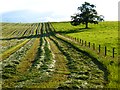
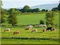
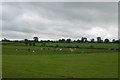
In our latest visit to Newbeggin, we went armed with wellington boots and socks and trudged down the lanes from the southern side of Newton Reigny. Whilst the lane is gated, it looks to be frequently used by walkers, so we followed the footpath to Copt Howe at NY 48258 30770. The gate into the field was wide open and a large dung heap had been placed near the field gate. As the rest of the field was pasture, we decided to walk quickly over to the long cairn and take a closer look. The field was very boggy and I was glad of my wellies.
Strangely, I noticed lots of quartz stones scattered around the perimeter of the cairn, shining white in the drizzle amongst the brown-red earth. This cairn had plenty of stones down its length.
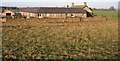
We saw the side of Mossthorn Long Cairn 2 that we hadn’t seen before from the eastern hedge line of the field but didn’t want to incur the wrath of the farmer, who was working on his tractor in the field nearby.
")
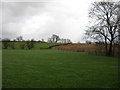
This cairn, situated 330 metres of Mossthorn Farm, cannot be seen from the B5288 road, but is visible from a footpath running from the southern end of Newton Reigny village, starting at NY 48014 31390. The footpath splits just after a gate at NY 48146 31158; take the right hand fork. Follow this to the field at the eastern end of Copt Howe wood at NY 48258 30770. Whilst this is on private land, the field gate was open at the time of our visit and the field had been put to pasture, so we took the opportunity to walk in and have a look around.
The long cairn is recorded as Historic England List Entry 1012818, which dates this to the Neolithic and says that "all positively identified long cairns are considered to be nationally important .... The monument includes a partly mutilated long cairn located on Copt How ridge 330m east of Mossthorn. It is aligned north west - south east and includes a turf-covered mound of cobbles and earth measuring 33m along its long axis by 20m wide and 1.5m - 2m high. A number of urns were reportedly discovered here several years ago but their present whereabouts is unknown."
Pastscape Monument No. 11276 casts doubt on its antiquity, saying: "The mound is orientated almost due N/S and appears to be more or less rectangular in shape. It is 29m long, with a maximum width of 13m towards the north end, where it is 1.30m high. Rounded boulders are visible along the spine of the mound and towards the north end. It appears convincing as an antiquity only when viewed from the west. There is a small quarry nearby to the east, and the possibility of quarry tipping must be considered. A dubious antiquity."
The mound is made up of medium sized stones and earth, and the area surrounding the cairn has a large number of small and medium sized white quartz stones scattered in the brown-red earth. Whilst walking around the Newbeggin and Newton Reigny area, I have not noticed any of these stones in other locations.
You may be viewing yesterday's version of this page. To see the most up to date information please register for a free account.
")
")
")
Do not use the above information on other web sites or publications without permission of the contributor.
Nearby Images from Geograph Britain and Ireland:
©2016(licence)
©2006(licence)
©2015(licence)
©2015(licence)
©2019(licence)
The above images may not be of the site on this page, they are loaded from Geograph.
Please Submit an Image of this site or go out and take one for us!
Click here to see more info for this site
Nearby sites
Key: Red: member's photo, Blue: 3rd party photo, Yellow: other image, Green: no photo - please go there and take one, Grey: site destroyed
Download sites to:
KML (Google Earth)
GPX (GPS waypoints)
CSV (Garmin/Navman)
CSV (Excel)
To unlock full downloads you need to sign up as a Contributory Member. Otherwise downloads are limited to 50 sites.
Turn off the page maps and other distractions
Nearby sites listing. In the following links * = Image available
169m S 169° Mossthorn Long Cairn 2* Cairn (NY4828930440)
846m SE 136° Sewborrans Stone* Standing Stone (Menhir) (NY48842999)
990m N 353° Newton Reigny Enclosure* Misc. Earthwork (NY4814031590)
1.1km S 190° Newbeggin Stone Row (Possible)* Standing Stone (Menhir) (NY4805829531)
1.2km NW 319° Newton Reigny Stone Row / Alignment (NY475315)
1.7km W 273° Kells Well (Newbeggin)* Holy Well or Sacred Spring (NY4654330728)
1.7km SW 220° Newbeggin Stone Row (Stone 1)* Standing Stone (Menhir) (NY4712629292)
1.7km SW 220° Newbeggin Stone Row* Stone Row / Alignment (NY47122929)
1.8km SW 223° Newbeggin Stone Row (Stone 3)* Standing Stone (Menhir) (NY4703929314)
1.8km SW 221° Newbeggin Stone Row (Stone 2)* Standing Stone (Menhir) (NY4705629248)
1.9km SW 215° Newbeggin Wells* Holy Well or Sacred Spring (NY47122902)
2.0km SW 215° Newbeggin Stone Row (Blue Stone)* Natural Stone / Erratic / Other Natural Feature (NY4713029010)
2.1km SW 218° Newbeggin Stone Row (Stone 4)* Standing Stone (Menhir) (NY4692428953)
2.2km SW 219° Newbeggin Stone Row (Stone 5)* Standing Stone (Menhir) (NY4684928893)
2.2km SE 131° Bell Mount* Natural Stone / Erratic / Other Natural Feature (NY49932914)
3.1km SSE 159° Dacre Parish* Stone Circle (NY49342771)
3.2km E 94° Penrith Museum* Museum (NY5144830339)
3.3km SSE 168° Snuff Mill (Stainton)* Standing Stone (Menhir) (NY4890927405)
3.3km SE 124° Skirsgill Standing Stone* Standing Stone (Menhir) (NY50972875)
3.4km SE 127° Skirsgill Holy Well (Skirsgill) Holy Well or Sacred Spring (NY5095028560)
3.4km E 97° Giants Grave, Penrith* Ancient Cross (NY51653017)
3.4km SE 145° Redhills Rock Art* Rock Art (NY50192776)
3.8km ESE 105° Plague Stone (Penrith)* Ancient Cross (NY5196329563)
3.9km W 272° Sanctuary Stone (Greystoke)* Early Christian Sculptured Stone (NY4433530785)
4.0km NNE 19° Lowhouse* Stone Circle (NY49623435)
View more nearby sites and additional images


 We would like to know more about this location. Please feel free to add a brief description and any relevant information in your own language.
 Wir möchten mehr über diese Stätte erfahren. Bitte zögern Sie nicht, eine kurze Beschreibung und relevante Informationen in Deutsch hinzuzufügen.
 Nous aimerions en savoir encore un peu sur les lieux. S'il vous plaît n'hesitez pas à ajouter une courte description et tous les renseignements pertinents dans votre propre langue.
 Quisieramos informarnos un poco más de las lugares. No dude en añadir una breve descripción y otros datos relevantes en su propio idioma.