


<< Our Photo Pages >> Gawsworth henge - Henge in England in Cheshire
Submitted by vicky on Saturday, 06 December 2003 Page Views: 10874
Neolithic and Bronze AgeSite Name: Gawsworth hengeCountry: England County: Cheshire Type: Henge
Nearest Town: Macclesfield Nearest Village: Gawsworth
Map Ref: SJ920696 Landranger Map Number: 118
Latitude: 53.223386N Longitude: 2.12128W
Condition:
| 5 | Perfect |
| 4 | Almost Perfect |
| 3 | Reasonable but with some damage |
| 2 | Ruined but still recognisable as an ancient site |
| 1 | Pretty much destroyed, possibly visible as crop marks |
| 0 | No data. |
| -1 | Completely destroyed |
| 5 | Superb |
| 4 | Good |
| 3 | Ordinary |
| 2 | Not Good |
| 1 | Awful |
| 0 | No data. |
| 5 | Can be driven to, probably with disabled access |
| 4 | Short walk on a footpath |
| 3 | Requiring a bit more of a walk |
| 2 | A long walk |
| 1 | In the middle of nowhere, a nightmare to find |
| 0 | No data. |
| 5 | co-ordinates taken by GPS or official recorded co-ordinates |
| 4 | co-ordinates scaled from a detailed map |
| 3 | co-ordinates scaled from a bad map |
| 2 | co-ordinates of the nearest village |
| 1 | co-ordinates of the nearest town |
| 0 | no data |
Internal Links:
External Links:
I have visited· I would like to visit
gritstone visited on 1st Jun 2020 - their rating: Cond: -1 Amb: 3 Access: 5 Close to home - nothing to see in 2020,
")
Until the 1980s the earthworks of a possible henge monument used to lie in a field alongside the Old Leek Road, just behind the Fool's Nook public house. The earthworks were roughly oval in shape with two entrances just slightly off a north-south axis. It had an inner bank of around 3 to 4m in height and an outer bank less than 1m, but no ditch. According to Gordon Rowley, 'in form it greatly resembles the 'henge' type of monument of the Late Neolithic era'.
Sadly the earthworks were destroyed in 1986 for agricultural reasons, so we will probably never know whether or not it was a henge. However, there is evidence of Neolithic activity in that area. Across the other side of the main Macclesfield to Leek road from the Fool's Nook, excavations at the Woodhouse End Beaker barrow produced a large amount of Neolithic pottery, suggesting there must have been a settlement close by. In addition, the Bridestones monument is only a few miles away.
References
Rowley, G. "Macclesfield in Prehistory", 1982
Note: Please note this site is located on private land but can be easily viewed from the nearby road.
You may be viewing yesterday's version of this page. To see the most up to date information please register for a free account.
")
")
")
Do not use the above information on other web sites or publications without permission of the contributor.
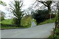
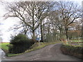
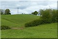
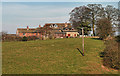
Nearby Images from Geograph Britain and Ireland:
©2017(licence)
©2011(licence)
©2017(licence)
©2014(licence)
©2008(licence)
The above images may not be of the site on this page, they are loaded from Geograph.
Please Submit an Image of this site or go out and take one for us!
Click here to see more info for this site
Nearby sites
Key: Red: member's photo, Blue: 3rd party photo, Yellow: other image, Green: no photo - please go there and take one, Grey: site destroyed
Download sites to:
KML (Google Earth)
GPX (GPS waypoints)
CSV (Garmin/Navman)
CSV (Excel)
To unlock full downloads you need to sign up as a Contributory Member. Otherwise downloads are limited to 50 sites.
Turn off the page maps and other distractions
Nearby sites listing. In the following links * = Image available
316m NNE 18° Broad Oak Farm* Round Barrow(s) (SJ921699)
499m W 270° Woodhouse End* Round Barrow(s) (SJ915696)
1.8km NNE 16° Sutton Hall* Round Barrow(s) (SJ925713)
3.5km NE 53° Langley Conical mound* Round Barrow(s) (SJ948717)
3.5km N 355° St Anne's Well (Macclesfield)* Holy Well or Sacred Spring (SJ917731)
3.6km E 96° The Plague Stone* Ancient Cross (SJ9561269221)
3.6km ENE 58° High Low* Round Barrow(s) (SJ951715)
3.9km SE 124° Clulow Cross* Round Barrow(s) (SJ952674)
3.9km NE 38° Teggs Nose Farm Round Barrow(s) (SJ944727)
3.9km SSE 149° Bosley Minn 4 & 5* Standing Stones (SJ940662)
4.0km NE 55° Teggs Nose reservoir* Round Barrow(s) (SJ953719)
4.0km NNE 26° Macclesfield Common I Round Barrow(s) (SJ938732)
4.0km ENE 60° Higher Ridgegate* Standing Stone (Menhir) (SJ9550671636)
4.1km ESE 119° Bullstones* Stone Circle (SJ9556867627)
4.1km ESE 111° Cessbank Common* Round Barrow(s) (SJ958681)
4.1km SSE 151° Bosley Minn 2 & 3* Standing Stones (SJ940660)
4.1km ESE 122° Longgutter* Round Barrow(s) (SJ955674)
4.2km NNE 27° Macclesfield Common II Round Barrow(s) (SJ939733)
4.2km SSE 153° Bosley Minn 1* Standing Stone (Menhir) (SJ93886585)
4.6km NNW 349° West Park Boulder* Natural Stone / Erratic / Other Natural Feature (SJ911741)
4.6km NW 314° New Farm, Henbury* Stone Circle (SJ887728)
4.7km N 349° West Park Crosses* Ancient Cross (SJ911742)
5.0km NNW 346° Macclesfield Cemetery* Round Barrow(s) (SJ908745)
5.1km WNW 289° Lower Pexhill Round Barrow(s) (SJ872713)
5.1km N 353° Beech Hall Round Barrow(s) (SJ914747)
View more nearby sites and additional images


 We would like to know more about this location. Please feel free to add a brief description and any relevant information in your own language.
 Wir möchten mehr über diese Stätte erfahren. Bitte zögern Sie nicht, eine kurze Beschreibung und relevante Informationen in Deutsch hinzuzufügen.
 Nous aimerions en savoir encore un peu sur les lieux. S'il vous plaît n'hesitez pas à ajouter une courte description et tous les renseignements pertinents dans votre propre langue.
 Quisieramos informarnos un poco más de las lugares. No dude en añadir una breve descripción y otros datos relevantes en su propio idioma.