


<< Our Photo Pages >> Nant Oesglyn Cairn - Cairn in Wales in Carmarthenshire
Submitted by geoffstickland on Saturday, 19 June 2021 Page Views: 367
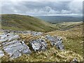
Neolithic and Bronze AgeSite Name: Nant Oesglyn CairnCountry: Wales County: Carmarthenshire Type: Cairn
Nearest Town: Llandeilo Nearest Village: Capel Gwynfe
Map Ref: SN74131882
Latitude: 51.853735N Longitude: 3.828963W
Condition:
| 5 | Perfect |
| 4 | Almost Perfect |
| 3 | Reasonable but with some damage |
| 2 | Ruined but still recognisable as an ancient site |
| 1 | Pretty much destroyed, possibly visible as crop marks |
| 0 | No data. |
| -1 | Completely destroyed |
| 5 | Superb |
| 4 | Good |
| 3 | Ordinary |
| 2 | Not Good |
| 1 | Awful |
| 0 | No data. |
| 5 | Can be driven to, probably with disabled access |
| 4 | Short walk on a footpath |
| 3 | Requiring a bit more of a walk |
| 2 | A long walk |
| 1 | In the middle of nowhere, a nightmare to find |
| 0 | No data. |
| 5 | co-ordinates taken by GPS or official recorded co-ordinates |
| 4 | co-ordinates scaled from a detailed map |
| 3 | co-ordinates scaled from a bad map |
| 2 | co-ordinates of the nearest village |
| 1 | co-ordinates of the nearest town |
| 0 | no data |
Internal Links:
External Links:
I have visited· I would like to visit
geoffstickland has visited here
")
A Bronze Age Cairn about 14' across and 18', grass covered with a few stones showing through. Set high on a west facing slope above the Oesglyn stream with commanding views.
You may be viewing yesterday's version of this page. To see the most up to date information please register for a free account.
Do not use the above information on other web sites or publications without permission of the contributor.
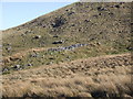
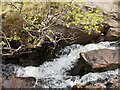
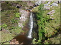
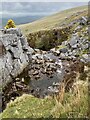
Nearby Images from Geograph Britain and Ireland:
©2008(licence)
©2021(licence)
©2011(licence)
©2021(licence)
©2021(licence)
The above images may not be of the site on this page, they are loaded from Geograph.
Please Submit an Image of this site or go out and take one for us!
Click here to see more info for this site
Nearby sites
Key: Red: member's photo, Blue: 3rd party photo, Yellow: other image, Green: no photo - please go there and take one, Grey: site destroyed
Download sites to:
KML (Google Earth)
GPX (GPS waypoints)
CSV (Garmin/Navman)
CSV (Excel)
To unlock full downloads you need to sign up as a Contributory Member. Otherwise downloads are limited to 50 sites.
Turn off the page maps and other distractions
Nearby sites listing. In the following links * = Image available
107m ENE 67° Moel Gornach Cairn I* Cairn (SN74231886)
515m W 264° Foel Fawr Cairn* Cairn (SN7361518783)
823m SSW 208° Garreg Lwyd Marker Stone* Natural Stone / Erratic / Other Natural Feature (SN73731810)
894m S 184° Garreg Lwyd Cairn* Cairn (SN74041793)
1.4km W 272° Carn Pen Rhiw Ddu* Cairn (SN72751890)
2.4km W 263° Carn Pen-y-Clogau* Cairn (SN71701859)
2.6km WSW 245° Garreg Fraith* Cairn (SN7172117756)
2.7km W 261° Brynaman* Rock Art (SN7146518453)
2.7km ESE 109° Nant-y-Llyn (Carmarthenshire)* Standing Stone (Menhir) (SN76701784)
3.2km ESE 119° Carn Fadog* Cairn (SN76861721)
3.9km N 354° Coitan Arthur Natural Stone / Erratic / Other Natural Feature (SN738227)
3.9km ENE 66° Carnau'r Garreg Las* Cairn (SN77752031)
4.5km NNE 32° Pant-y-Turnor standing stone* Standing Stone (Menhir) (SN766226)
4.6km SW 230° Deg Arbedd* Cairn (SN70501591)
4.7km NE 49° Carn y Gigfran* Cairn (SN7778621863)
4.8km SSE 148° Derlwyn Isaf* Cairn (SN76611467)
5.1km WSW 252° Tair Carn Uchaf* Cairn (SN69211737)
5.3km SE 134° Llwyncwmstabl* Cairn (SN77851509)
5.3km W 261° Banc Wernwgan Boundary Stone* Marker Stone (SN68851811)
5.6km SE 144° Dorwen* Standing Stones (SN7730414239)
5.7km E 94° Banwen Gwys 2* Cairn (SN7977318259)
5.7km E 92° Banwen Gwys 1* Cairn (SN7984818471)
5.9km SE 129° Llorfa* Stone Circle (SN7861915010)
5.9km NW 314° Trichrug* Cairn (SN69962298)
6.1km WSW 249° Tair Carn Isaf* Cairn (SN68331674)
View more nearby sites and additional images


 We would like to know more about this location. Please feel free to add a brief description and any relevant information in your own language.
 Wir möchten mehr über diese Stätte erfahren. Bitte zögern Sie nicht, eine kurze Beschreibung und relevante Informationen in Deutsch hinzuzufügen.
 Nous aimerions en savoir encore un peu sur les lieux. S'il vous plaît n'hesitez pas à ajouter une courte description et tous les renseignements pertinents dans votre propre langue.
 Quisieramos informarnos un poco más de las lugares. No dude en añadir una breve descripción y otros datos relevantes en su propio idioma.