


<< Our Photo Pages >> Gellybank - Standing Stones in Scotland in Perth and Kinross
Submitted by Mehir on Tuesday, 08 October 2002 Page Views: 6351
Neolithic and Bronze AgeSite Name: Gellybank Alternative Name: GellybanksCountry: Scotland County: Perth and Kinross Type: Standing Stones
Nearest Village: Luncarty
Map Ref: NO082313 Landranger Map Number: 52
Latitude: 56.464863N Longitude: 3.491468W
Condition:
| 5 | Perfect |
| 4 | Almost Perfect |
| 3 | Reasonable but with some damage |
| 2 | Ruined but still recognisable as an ancient site |
| 1 | Pretty much destroyed, possibly visible as crop marks |
| 0 | No data. |
| -1 | Completely destroyed |
| 5 | Superb |
| 4 | Good |
| 3 | Ordinary |
| 2 | Not Good |
| 1 | Awful |
| 0 | No data. |
| 5 | Can be driven to, probably with disabled access |
| 4 | Short walk on a footpath |
| 3 | Requiring a bit more of a walk |
| 2 | A long walk |
| 1 | In the middle of nowhere, a nightmare to find |
| 0 | No data. |
| 5 | co-ordinates taken by GPS or official recorded co-ordinates |
| 4 | co-ordinates scaled from a detailed map |
| 3 | co-ordinates scaled from a bad map |
| 2 | co-ordinates of the nearest village |
| 1 | co-ordinates of the nearest town |
| 0 | no data |
Internal Links:
External Links:
")
This little known stone row lies near Luncarty in Perthshire.Two stones lie about 8 inches apart,one standing 3.5ft the other nearly 3ft pointed towards another single stone at Over Benchil near Stanley 2km to the north east.
Both sites are quartzose schist and contain some wonderful displays of crystals.This site is very difficult to reach and permission must be sought from the landowner as they stand 100 metres from the track in planted crops.
Note: The site is on private land - permission should be sought from the landowner before visiting.
You may be viewing yesterday's version of this page. To see the most up to date information please register for a free account.
")
")
Do not use the above information on other web sites or publications without permission of the contributor.
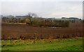
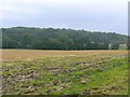
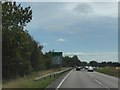
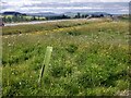
Nearby Images from Geograph Britain and Ireland:
©2017(licence)
©2007(licence)
©2018(licence)
©2022(licence)
©2021(licence)
The above images may not be of the site on this page, they are loaded from Geograph.
Please Submit an Image of this site or go out and take one for us!
Click here to see more info for this site
Nearby sites
Key: Red: member's photo, Blue: 3rd party photo, Yellow: other image, Green: no photo - please go there and take one, Grey: site destroyed
Download sites to:
KML (Google Earth)
GPX (GPS waypoints)
CSV (Garmin/Navman)
CSV (Excel)
To unlock full downloads you need to sign up as a Contributory Member. Otherwise downloads are limited to 50 sites.
Turn off the page maps and other distractions
Nearby sites listing. In the following links * = Image available
1.1km NNE 15° Newmill souterrain* Souterrain (Fogou, Earth House) (NO08513239)
1.2km SE 145° Cramflat* Standing Stone (Menhir) (NO0885530322)
1.6km NE 54° Overbenchil* Standing Stone (Menhir) (NO095322)
1.8km NNW 343° Loak Court Hill Round Barrow(s) (NO07733301)
1.9km NNW 339° Loak Stone Standing Stone (Menhir) (NO07573305)
2.7km WNW 285° Cowford Standing Stone (Menhir) (NO05633205)
2.8km E 93° Colen* Stone Circle (NO110311)
3.1km SSE 156° Denmarkfield Farm Standing Stone (Menhir) (NO09402844)
3.4km SSE 152° King's Stone* Standing Stone (Menhir) (NO09712828)
3.4km SW 221° Moneydie* Stone Circle (NO059288)
3.5km SSE 164° Broxy Kennels* Hillfort (NO09112788)
3.9km SSE 162° Whinny Hill Round Cairn (NO093276)
4.1km NW 319° Pitsundry* Stone Circle (NO0558834454)
4.3km E 88° Druids Seat* Stone Circle (NO12483132)
4.7km SE 134° Scone Cursus Cursus (NO11532797)
4.8km SE 132° Scone Cursus Cursus (NO11712803)
5.1km WSW 238° Lynedoch Cottage (3) Standing Stone (Menhir) (NO03792870)
5.1km WSW 242° Lynedoch Cottage (2) Standing Stone (Menhir) (NO03582902)
5.6km E 92° Williamston Stone Circle (NO138310)
5.7km WSW 245° Lynedoch Cottage (1) Standing Stone (Menhir) (NO02962898)
5.9km S 174° Hunting Tower Cursus (NO087254)
5.9km E 85° Blackfaulds* Stone Circle (NO14133167)
6.2km E 91° Tammieteeth* Cairn (NO14403109)
6.2km S 182° Mains Of Huntingtower Stone Circle (NO079251)
6.5km S 190° Huntingtower Cairn (NO069249)
View more nearby sites and additional images


 We would like to know more about this location. Please feel free to add a brief description and any relevant information in your own language.
 Wir möchten mehr über diese Stätte erfahren. Bitte zögern Sie nicht, eine kurze Beschreibung und relevante Informationen in Deutsch hinzuzufügen.
 Nous aimerions en savoir encore un peu sur les lieux. S'il vous plaît n'hesitez pas à ajouter une courte description et tous les renseignements pertinents dans votre propre langue.
 Quisieramos informarnos un poco más de las lugares. No dude en añadir una breve descripción y otros datos relevantes en su propio idioma.