 with our Megalithic Portal iPhone app")


<< Our Photo Pages >> Crug-y-biswal - Round Barrow(s) in Wales in Carmarthenshire
Submitted by vicky on Saturday, 24 January 2004 Page Views: 6305
Neolithic and Bronze AgeSite Name: Crug-y-biswalCountry: Wales County: Carmarthenshire Type: Round Barrow(s)
Nearest Town: Llanybydder Nearest Village: Llidiad-Nenog
Map Ref: SN518388 Landranger Map Number: 146
Latitude: 52.027757N Longitude: 4.161568W
Condition:
| 5 | Perfect |
| 4 | Almost Perfect |
| 3 | Reasonable but with some damage |
| 2 | Ruined but still recognisable as an ancient site |
| 1 | Pretty much destroyed, possibly visible as crop marks |
| 0 | No data. |
| -1 | Completely destroyed |
| 5 | Superb |
| 4 | Good |
| 3 | Ordinary |
| 2 | Not Good |
| 1 | Awful |
| 0 | No data. |
| 5 | Can be driven to, probably with disabled access |
| 4 | Short walk on a footpath |
| 3 | Requiring a bit more of a walk |
| 2 | A long walk |
| 1 | In the middle of nowhere, a nightmare to find |
| 0 | No data. |
| 5 | co-ordinates taken by GPS or official recorded co-ordinates |
| 4 | co-ordinates scaled from a detailed map |
| 3 | co-ordinates scaled from a bad map |
| 2 | co-ordinates of the nearest village |
| 1 | co-ordinates of the nearest town |
| 0 | no data |
Internal Links:
External Links:
")
Have you visited this site? Please add a comment below.
You may be viewing yesterday's version of this page. To see the most up to date information please register for a free account.
")
")
Do not use the above information on other web sites or publications without permission of the contributor.
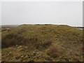
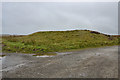
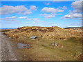
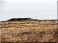
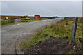
Nearby Images from Geograph Britain and Ireland:
©2015(licence)
©2015(licence)
©2018(licence)
©2023(licence)
©2015(licence)
The above images may not be of the site on this page, they are loaded from Geograph.
Please Submit an Image of this site or go out and take one for us!
Click here to see more info for this site
Nearby sites
Key: Red: member's photo, Blue: 3rd party photo, Yellow: other image, Green: no photo - please go there and take one, Grey: site destroyed
Download sites to:
KML (Google Earth)
GPX (GPS waypoints)
CSV (Garmin/Navman)
CSV (Excel)
To unlock full downloads you need to sign up as a Contributory Member. Otherwise downloads are limited to 50 sites.
Turn off the page maps and other distractions
Nearby sites listing. In the following links * = Image available
100m N 358° Mynydd Llanllwni* Round Barrow(s) (SN518389)
1.8km ENE 66° Crugiau Edryd* Barrow Cemetery (SN535395)
2.0km NNE 14° Blaen Plwyf round cairn* Round Cairn (SN52344068)
2.1km N 8° Goetre Derlwyn Barrow Cemetery (SN52174089)
2.1km N 0° Goetre Derlwyn de Barrow Cemetery (SN51874093)
2.2km N 357° Pen Wern Barrow Cemetery (SN51744105)
2.4km ENE 68° Mynydd Llanbyther* Stone Row / Alignment (SN5402639607)
2.4km SW 220° Crugiau Giar, South Cairn* Round Cairn (SN50193700)
2.9km ENE 76° Carreg Hir (Llanybydder)* Standing Stone (Menhir) (SN54613940)
3.7km SSW 203° Crug Penheol* Cairn (SN50233547)
3.8km ENE 60° Pant Teg* Standing Stone (Menhir) (SN552406)
3.9km ENE 77° Crug-Y-Bwdran* Round Barrow(s) (SN55633957)
3.9km ESE 121° Crug Cnwc Round Barrow(s) (SN55103667)
4.1km SSW 212° Crug-Y-Bedw* Cairn (SN49523543)
4.2km S 187° Hafod Tridrws* Round Barrow(s) (SN51153466)
4.7km N 6° Pen-Y-Gaer (Llanybydder)* Hillfort (SN52394342)
5.5km SSW 214° Crugyn Amlwg* Round Barrow(s) (SN48613432)
6.3km W 278° St Michael's Church (Llanvihangel-ar-Arth)* Early Christian Sculptured Stone (SN45603990)
6.6km SSW 211° Crugiau Rhos-Wen 2* Round Barrow(s) (SN48213326)
6.6km SW 215° Cruigau Ros-Wen 1* Round Barrow(s) (SN47883348)
7.0km ENE 60° Cefn Blaenau* Cairn (SN58034208)
7.6km ENE 62° Blaen-Ceiment* Round Barrow(s) (SN58594216)
8.0km SW 216° Eirth dant* Standing Stone (Menhir) (SN469324)
8.6km W 278° Craig Gwrtheyrn Hillfort (SN433402)
8.9km SSE 156° Carreg Castell-y-Gwynt* Burial Chamber or Dolmen (SN552306)
View more nearby sites and additional images


 We would like to know more about this location. Please feel free to add a brief description and any relevant information in your own language.
 Wir möchten mehr über diese Stätte erfahren. Bitte zögern Sie nicht, eine kurze Beschreibung und relevante Informationen in Deutsch hinzuzufügen.
 Nous aimerions en savoir encore un peu sur les lieux. S'il vous plaît n'hesitez pas à ajouter une courte description et tous les renseignements pertinents dans votre propre langue.
 Quisieramos informarnos un poco más de las lugares. No dude en añadir una breve descripción y otros datos relevantes en su propio idioma.