Routes 1 - 4
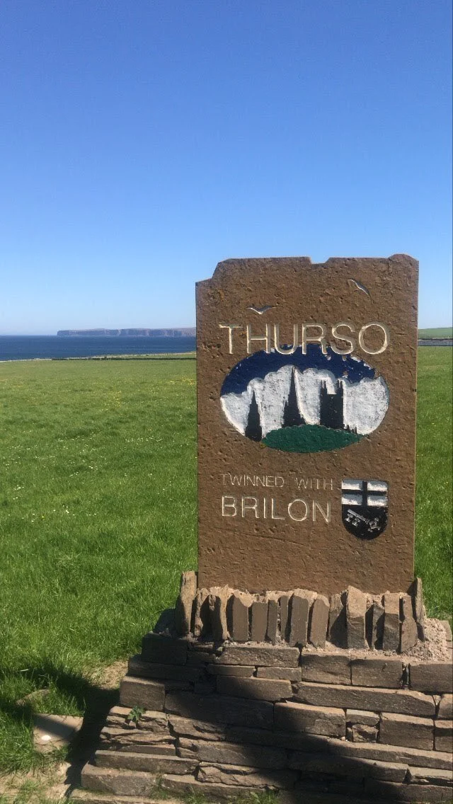
Thurso
8. Thurso (Thor’s river) Local Saint: Peter.
Dedications to Peter began with Curitan/(Boniface).
Start at North Coast Visitor Centre, where there is a display of carved stones and other artefacts from early times. These include the Ulbster Stone, the Skinnet Stone, the Watenan stone, baptismal fonts from St. Thomas’ at Skinnet and old St Peters, Thurso, a cross slab from Canisbay and two memorial stones from old St Peter’s.
Then follow Shore Street towards the river and admire the ruined St Peter’s church. Inventory No 41 gives a detailed description of the structure of St Peter’s, Thurso. The apsidal cell is typical of 12th century, the nave and transept belong to the 16th or 17th century. In the west wall, there is a grave stone dated to the middle of the 14th century. It may have been founded by Gilbert, bishop of Caithness, about 1220. It was used as a parish church until 1832 and, early in the 18th century, was used as a court-house and prison.
A path, Victoria Walk, follows the shore-line from the harbour at the mouth of Thurso river towards Scrabster. The original bishop’s palace was built at the mouth of the Wolf Burn along Victoria Walk. Any remains have been washed out to sea. It had probably been built when Caithness was overseen by the bishop of Orkney, who owned lands in Caithness and continued to receive tithes from Dunnet and Canisbay for some time after the separate diocese of Caithness was created (c.1150). Looking back towards the town, the modern houses are on Pennyland estate, possibly so called because of the penny tax paid by householders to the bishop.
Take the A836 from Thurso towards Reay. Approximately five miles along this road and just before the wooded dip that is the Forss burn and bridge, turn right.
7. Crosskirk (suggests a dedication to the Holy Cross or Rood) Local saint: Mary or Peter
This is among the oldest still-visible church buildings in Caithness, dating from the 12th century. It is known as St Mary’s Chapel. However some records give the dedication as to St Peter. There is a spring nearby known as St Mary’s well and a graveyard where grave stones can still be seen.
Just 30 yards from the chapel, near the sea, was the remains of a large Iron Age broch. A symbol stone, originally said to have been in the broch, was given to the king of Denmark by Sir George Sinclair. The broch itself was investigated and then bulldozed into the sea (see Caithness Field Club Bulletin 1985, available on their web site).
Return to the A836 and turn right towards Reay. Care is needed when approaching the A836 as there is no ‘give way’ sign on the minor road, which continues in a straight line on the other side of the A836, and the driver could easily not realise that he/she is approaching a junction where other drivers have priority.
6. Reay, Local Saint: Colman.
Note the market cross in the centre of the village.
The current church, to the North of the road, is similar in style to those in Dunnet and Canisbay. They all date from the 15th or 16th century and are on the sites of older churches. In Reay, the older church is on the South side of the road opposite the school.
The remains of the original church can be seen in the NE corner of the old graveyard, which also contains several tombstones with heraldic shields. The stone known as Reay 1, which was found over an 18thcentury grave, is set into the west wall of these remains. It is decorated with a fine cross. There are two Pictish stones at Sandside House, Reay. As this is a private house, the public cannot see them. Information about them can be found here and here.
Various local names indicate that the area was a significant religious centre – Lochan a’ Chleirich (the loch of the clergyman), Cnoc-an-Eireannaich (the Irishman’s Hill, probably Donnan).
Turn back along the A836 and turn right just after the Isauld Bridge on the road to Shebster. (There may have been a chapel among the sand dunes to the NE of the Isauld burn, 300-400 yards from its mouth.)
35. Shebster, Local Saint: Magnus
There was a chapel here (map reference MHG997) dedicated to Magnus, suggesting that this site was on a pilgrimage route to/from St Magnus Cathedral, Kirkwall. It is known that there was a pilgrimage trail between Kirkwall, Tain and points further south but the exact route is unclear. (See the section ‘Pilgrimage Trails’ for suggested routes.)
At Shebster, the traveller has two options – Routes 1 and 2 or the longer routes 3 and 4. For route1 and route 2, continue eastwards for just over three miles to Westfield.
36. Westfield, Local Saint: Drostan
Not far from the road on the East of the village and in a field behind farm buildings is a graveyard which was in use until recently. There is a sign ‘St Trostan’s Cemetery 600m, Achnavast 1.8Km’. It is accessed via a track that turns off the road to the right through the farm steading and along to a parking/turning point. Leave the car here and walk along the fenced-off path through the field to the gravesite. Built into the SE wall is an oval block of sandstone, presumed to be the font of the chapel dedicated to St Drostan, that once stood here.
Route B1 now returns to Thurso, via Glengolly. Route B2 back-tracks to the left-hand turning for Halkirk via Calder. About 1 ½ miles down this road, there is a bench on the verge and a small parking place. Here one can sit to admire the view or take the path down to the lochside.
37. Halkirk (In the Orkneyinga Saga, this is Ha Kirkia/Kirkja – the High Kirk) Local Saints: Fergus, Gilbert, Tarlogan, Katherine (with sites dedicated to Ciaran, Peter and Colum nearby).
On the edge of Halkirk, a road branches to the right towards the river at Gerston, where there was a chapel dedicated to St Katherine. There is nothing left to see. Continue to the main road and turn right into the village. Turn left into Sinclair Street and drive along to the site of the old church.
Halkirk became the main residence of the bishop of Caithness after Scrabster. His palace was on the opposite side of the river from the present Braal castle, near the current ruined church building, where an ancient chapel existed. It was made famous by the burning of Bishop Adam, in 1222. It is possible that the chapel was the private place of worship of the bishop and his household but the main bishop’s cathedral was on the Thurso side of the village at Skinnet.
Return to the main road and turn right towards Thurso.
38. Skinnet, Local Saint: Thomas
Skinnet Farm is just outside Halkirk. The site of the cathedral lies between the modern farmhouse and the River Thurso. The claim of this site to be the cathedral rests partly on the quality of the sculpted stone found at this site and now kept in Caithness Horizons. Other clues are the number of dedications in the area and the remains of earlier buildings, one of which may have been an abbey, as the Gaelic place-name is An Abaid.
Route 2 now returns to Thurso.
Routes 3 and 4 follow routes 1 and 2 to Shebster. Then they turn right towards Broubster and Shurrery.
39. Shurrery, House of Blessings (not Benedict!)
The site is sometimes assumed to have the dedication ‘Benedict’ but this is a mis-translation of the Latin ‘Benediction’ and the Gaelic ‘Bheannaich’, both meaning ‘blessing’. The croft land (HER map reference MHG18167) is known as Tigh a’ Bheannaich (House of Blessing) and is said to be the site of a chapel, well and burial ground (HER map references MHG39490 and MHG39489). This title suggests a rest-house for travellers, hence the suggestion that a pilgrimage route existed through Shurrery.
Ecc Hist p. 333 tells us that ‘The chapel, as the Rev John Kerr, Shurrery, informs me, stood close to the river. Two corner stones are still visible. There was a burial ground here also; the last burial in it took place about eighty years ago. About 150 yards to the south is Tobar a’mhannaich, the monks well. To the westward stand the ruins of the Priests House (Tigh a’ Mhannaich) which was occupied as late as some fifty years ago.’
40. Dorrery, Local Saint: Gavin
From Shurrery, follow the road eastwards to meet the B870. Apr. half way along this road, past Brawlbin Farm, there is a road turning right towards Dorrery. This road ends after two miles, with the entrance to Dorrery Lodge ahead. There is a small parking area to the left. A track to the left leads towards fields. At the second gate the traveller can see a walled-in graveyard in the distance. Within this graveyard are the ruins of Gavin’s kirk or Temple Gavin. The surrounding land once belonged to the bishops of Caithness. (Please do not go through these fields if there is livestock in them or if doing so might damage crops or otherwise upset the owner.) To the right of the entrance to the Lodge is a path signposted ‘Dorrery Hill’. At the corner of the Lodge garden and just before the farm buildings, this path branches, with the right branch going up the hill and the left meandering inland until it eventually disappears. It is worth going along the meandering path until you are clear of the buildings as you then get an attractive view over the fields. On a good day, it is also worth following the path up to the top of Dorrery Hill, where there is a panoramic view of Caithness.
Just past the junction with the B870, Routes 3 and 4 separate. Route 3 continues on to Halkirk and joins Route 2.
Route 4 branches off to the right and continues on the B870 for 1 mile to Olgrinbeg.
41. Olgrinbeg, Local Saint: Peter
Access to this site is through Olgrinbeg farm. There are the remains of a chapel dedicated to Peter on the bank of the Olgrimbeg Burn about ½ mile above its junction with the Thurso River. The field beside the chapel is called An Abair and a nearby hill is Appat Hill. Some sources suggest that this indicates an earlier dedication to a Celtic saint, others that it suggests that the land was owned by the abbot/bishop. Perhaps this is one of the dedications influenced by Curitan/Boniface.
42: Dirlot, Local Saint: Colum/Columba
From Olgrinbeg, travel towards Westerdale for a few miles. Where the B870 takes a sharp turn left towards Mybster, there is a minor road branching off to the right. This leads to Loch More. About two miles along this road an even smaller road branches off to the left towards Dirlot. There is a ‘Private’ sign at the junction but it refers to the fishing rights on the river, not to the road. At the farm buildings a gate to the right leads into a field and the path goes to the walled-in graveyard. Within the graveyard was a chapel dedicated to Colum (or possibly Columba) although no trace of it can be seen now. This would not be Columba of Iona but the Colum who worked mainly in Orkney. There was a holy well North of the graveyard near the shepherd’s house called Tobar Chalum-Cille. An attractive view of the river passing through a gorge can be seen from the path just past the graveyard.
This site is in a field used by the farmer to graze animals and care must be taken not to disturb them.
An optional extra: Return to the minor road, turn left towards Loch More and continue for about three miles, passing Strathmore Lodge. Keep to the left until close to the loch, where there is space to park the car. The track continues for over a mile to Achscoraclate, where the remains of a cottage can be seen, but is too rough to take a car. Achscoraclate was the site of a chapel and holy well dedicated to St Bridget.
43. Westerdale, Local Saint: Drostan
St Trostan’s Chapel and graveyard can no longer be seen. They lie under vegetation ½ mile North of Westerdale, near the Westerdale Mill but on the opposite bank of the river.
Continue on the B870 until it meets the A9 at Mybster. Turn left and you are almost at the village of Spittal.
44. Spittal (hospital or hostel for travellers), Local Saint: Magnus
The dedication to Magnus indicates that this was on a pilgrimage route to and from St Magnus Cathedral on Orkney. The site consisted of a hospital, chapel and graveyard, the remains of which are 250 yards NW of Spittal Mains farm.
The graveyard was the traditional resting place of the Gunn clan. The earliest known reference to the hospital is a charter dated 1476 granted by King James III to William Sinclaire, son of William, Earl of Caithness.
From Spittal, continue on the A9. At Georgemas Junction, you can stop at the station.
45 Georgemas, Local Saints: George, Mary, Katherine
The station is so called as it is near the hill where the St George’s Day Fair was held. It is also near the Sibster Burn, associated with chapels dedicated to Mary and Katherine. The sources are rather confusing here, as they place the Marykirk ½ mile S of Sibster House near Wick River, which is not in this area. They may also be confusing St Katherine’s chapel with that at Gerston, not far away but on the other side of Halkirk.
George is not a local name. Perhaps the dedication came from someone returning from the Crusades, which do have a connection with St George.
On leaving Georgemas, follow the A9 to the turn–off for Halkirk and join routes B2 and B3. If you are in a hurry, you can stay on the A9 into Thurso and the end of the trail.