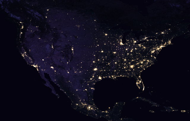
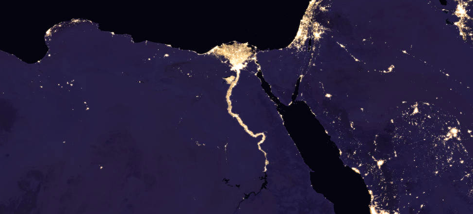
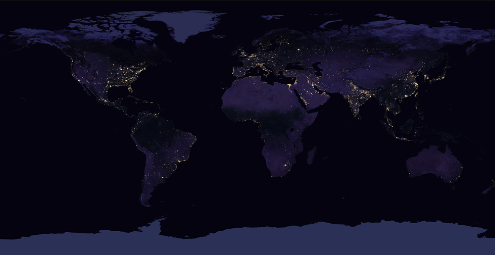
NASA has released their newest map of the Earth observed during the night, clearly showing how human activity and settlement spreads across the planet. These maps are not only beautiful images of our urban societies, but they also serve a science purpose, offering a resource to study human cities and movement around the globe.
The last time NASA released a global map like this was in 2012, and the agency says these nighttime world maps are both a "gee-whiz curiosity for the public and a tool for fundamental research for nearly 25 years." Creating such an image is difficult and time consuming, as light on the planet is constantly shifting. The team behind the photo must take into account the phases of the moon as well as "seasonal vegetation, clouds, aerosols, snow and ice cover, and even faint atmospheric emissions (such as airglow and auroras) change the way light is observed in different parts of the world."
However, new technology is improving the process. NASA's "workhorse" on the project is the Visible Infrared Imaging Radiometer Suite (VIIRS) on the Suomi National Polar-orbiting Partnership (Suomi NPP) weather satellite. VIIRS detects light reflected from Earth's surface and atmosphere in 22 different wavelengths and it is the first satellite instrument to take quantitative measurements of light emissions and reflections. Those measurements can be used to determine the intensity and source of light over a number of years.
In September of 2016, VIIRS detected power outages in the American southeast and the Caribbean in the wake of Hurricane Matthew. The instrument could be used in the future to create power outage maps for FEMA and the Department of Energy.
"Thanks to VIIRS, we can now monitor short-term changes caused by disturbances in power delivery, such as conflict, storms, earthquakes and brownouts," said NASA earth scientist Miguel Román in a press release. "We can monitor cyclical changes driven by reoccurring human activities such as holiday lighting and seasonal migrations. We can also monitor gradual changes driven by urbanization, out-migration, economic changes, and electrification. The fact that we can track all these different aspects at the heart of what defines a city is simply mind-boggling."
David Grossman is a staff writer for PopularMechanics.com. He's previously written for The Verge, Rolling Stone, The New Republic and several other publications. He's based out of Brooklyn.
