()
()
The steep ascent to the Dahner Felsenpfad's Buettelfels overlook is aided by stairsteps. (Matt Millham/Stars and Stripes)
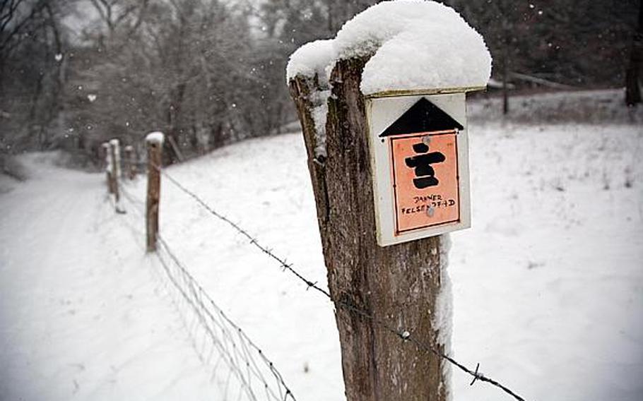
Most of the Dahner Felsenpfad near Dahn, Germany, cuts through the woods, but the trail occasionally follows farm roads. The trail and various offshoots are marked with similar orange markers. (Matt Millham/Stars and Stripes)
Buttes of sandstone cap a ridge along the Dahner Felsenpfad near Dahn, Germany. ()
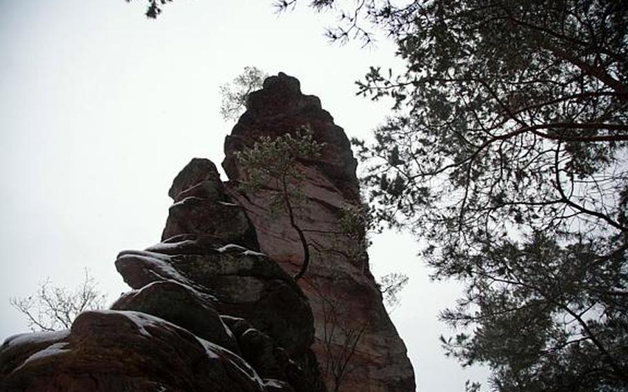
Small trees grow from the sandstone on Dahner Felsenpfad near Dahn, Germany. ()
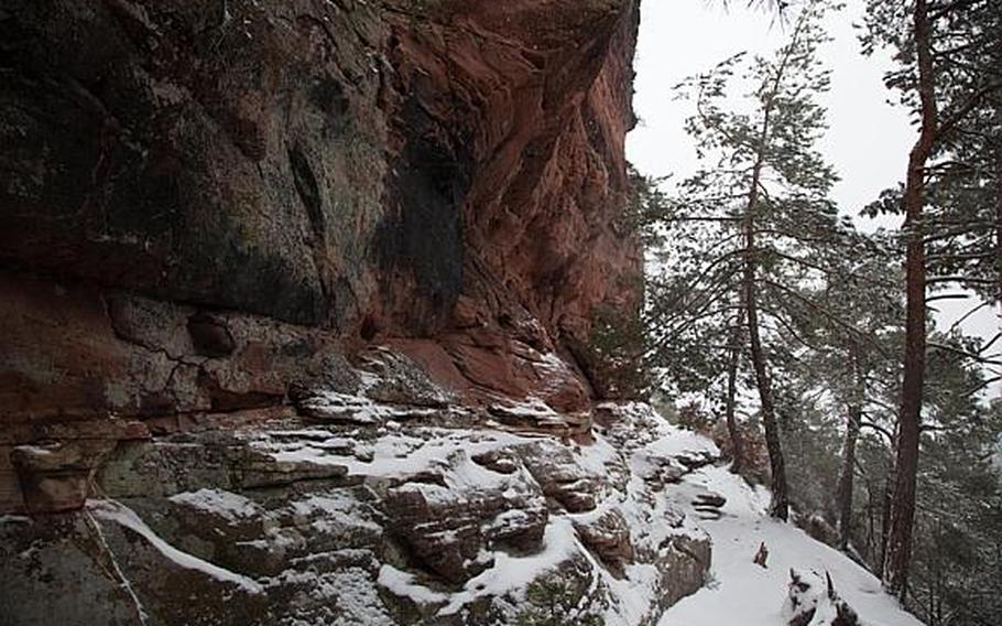
Winding alongside cliffs of red sandstone, the Dahner Felsenpfad near Dahn, Germany, occasionally leaves hikers without much path to walk on. (Matt Millham/Stars and Stripes)
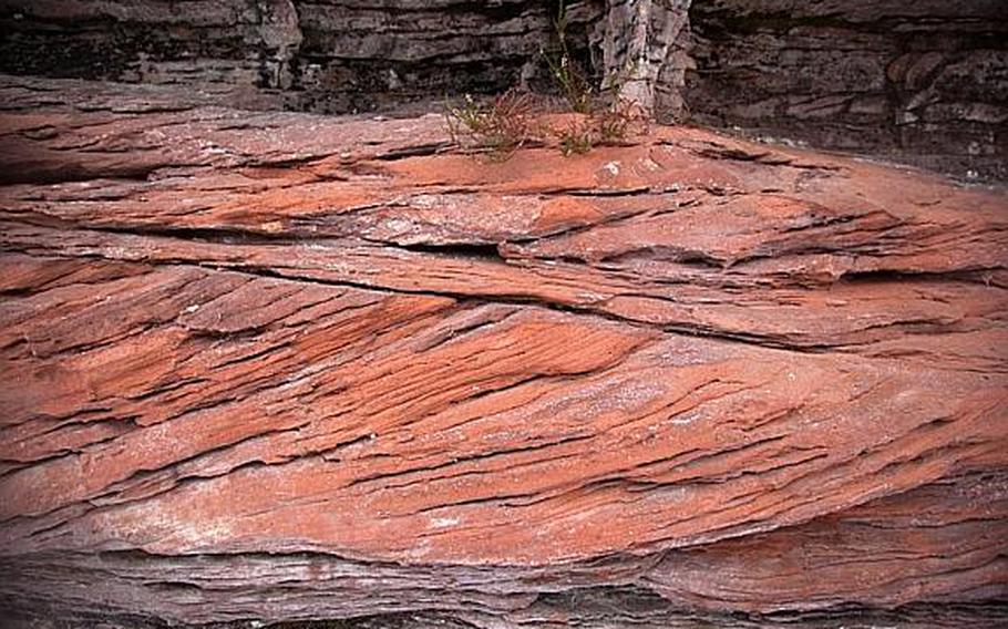
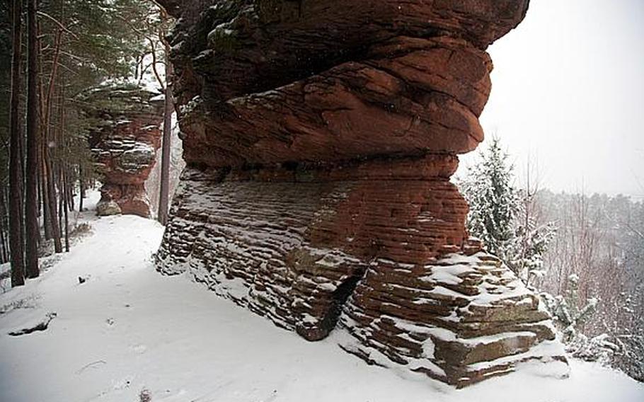
A red sandstone outcrop in the forest outside Dahn, Germany, shows laminated sediments likely laid down in the bed of an ancient stream. (Matt Millham/Stars and Stripes)
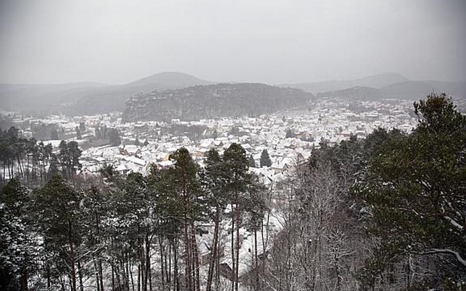
Hikers are rewarded with this view of Dahn, Germany, from the Dahner Felsenpfad's Buettelfels overlook. (Matt Millham/Stars and Stripes)
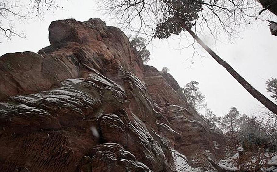
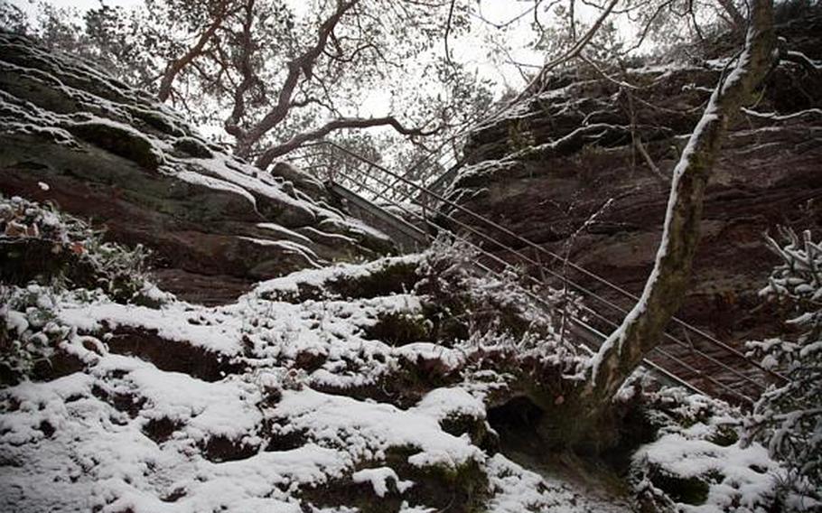
Upon climbing up a steep section of trail near Dahn, Germany, hikers come face to face with a sandstone cliff rising more than 200 feet from the forest floor. (Matt Millham/Stars and Stripes)
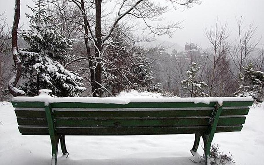
A snowy bench on the Dahner Felsenpfad's Lammerfelsen overlook has a permanent view of another sandstone spire rising out of the woods on another part of the trail near Dahn, Germany. (Matt Millham/Stars and Stripes)

Small trees grow from the sandstone on the Dahner Felsenpfad near Dahn, Germany. (Matt Millham/Stars and Stripes)
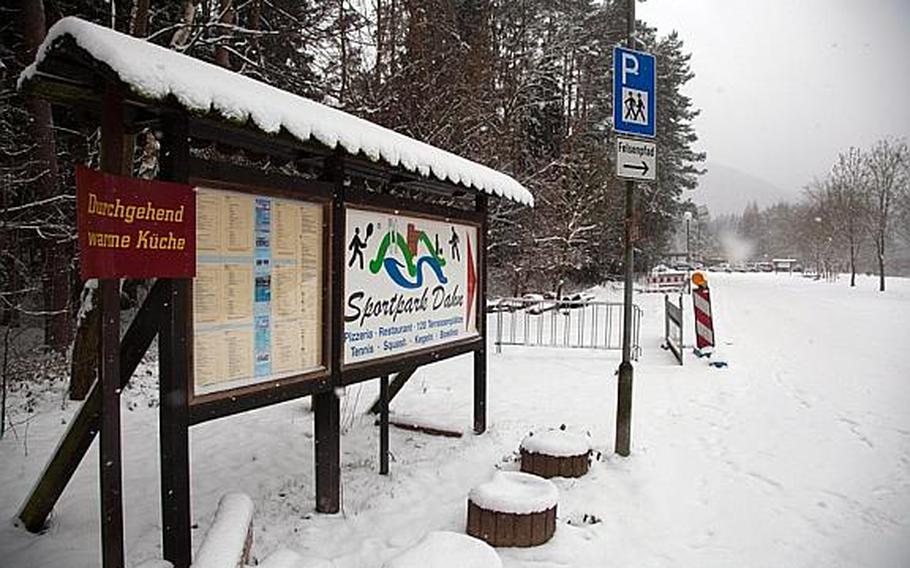
Sportpark Dahn in Germany is one of two recommended parking areas for hikers, and, with warm food and drinks, is also a good place to end a hike. (Matt Millham/Stars and Stripes)
Like many tall tales in Germany, the local legend about the sandstone cliffs doesn't exactly make a great bedtime story.
The way they tell it, a local girl was collecting berries in the woods when a "robber baron" snuck up and tried to "rob the virgin of her innocence." No dummy, the girl tore off through the woods.
We are told her skirt was quite voluminous, but the scads of fabric apparently did not slow her escape through the underbrush. Surely it's no coincidence that the legend hangs on this impractical fashion choice.
Because, wouldn't you know, she popped out of the woods only to find herself on the edge of a 230-foot cliff. The story goes that she jumped without thinking, but one would have to guess she'd done it all before. For when her billowy skirt caught the breeze, she floated to the ground like Mary Poppins, landing on her feet as softly as a dandelion seed.
The legend doesn't detail the fate of the would-be rapist, but it's safe to say he's no longer haunting the forests around Dahn, Germany. And that's a good thing, because there's a lot of great stuff here to explore. The Jungfernsprung, or "virgin jump" cliff, is just the beginning.
Cliffs, spines and buttes of the same red sandstone that makes up the Jungfernsprung poke through the forest all around Dahn, a sleepy valley town about an hour south of Kaiserslautern. The area is famous for its red rocks and forests, which manage to evoke America's desert southwest and Appalachian woods at the same time. The locals call it the Felsenland - "rock country."
The only real way to enjoy this splendor is to strike out into the woods, preferably on foot. While doing so this time of year might sound a bit nuts, the trees' winter nudity provides clearer views of the rock formations hiding among the trees.
And fortunately, unlike snorkeling or golf, hiking is pretty much a year-round activity. A pair of good boots and layered clothing are about all that's typically needed. Here, though, you'll be sure to want to bring a good map or a GPS with a tracking feature.
While all the trails around Dahn are marked, they're all marked in the same way. One of the easiest trails to access from town, a scenic 7.45-mile circuit,is difficult to follow with identicalorange markers pointing down both the main trail and various sub-trails and ancillary loops.
But don't worry too much about getting lost. The trails never wander too far from town, and hilltop vistas along the way provide sweeping views of Dahn and the surrounding area. Think twice about sprinting through the woods, though. That skirt thing - probably not true.
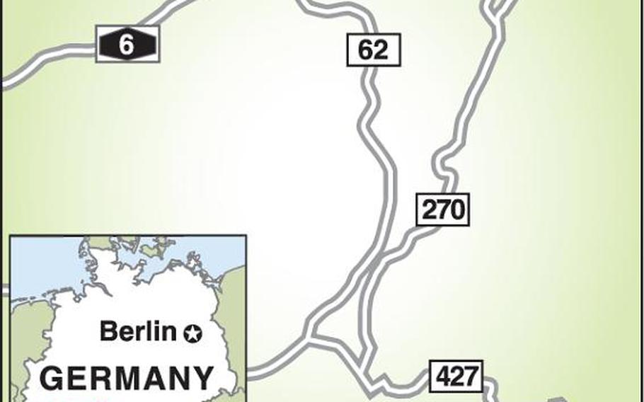
DIRECTIONSDahn is directly south of, and less than 40 miles from, Kaiserslautern and about six miles north of the French border. The Google Maps coordinates for parking at Dahn's Sportpark are 49.141871,7.769742.
TIMES: Open year-round.
FOOD: A map available on the area's website indicates places where food and drink are available along the paths. Parking is available at Sportpark Dahn, which has a large selection of food and drink and is a good place to end a hike.
INFORMATION: Download Dahn's Felsenpfad - "rocky path" - brochure and map at: dahner-felsenland.net/fileadmin/uploads/Tourismus/Wandern/dahn-felsenpfad_01.pdf
Website: http://tiny.cc/s403ow, in English.