The Mountains of Arizona
www.surgent.net |
|
Stinson Mountain • Camp Wood Mountain Today's tomfoolery was supposed to be happening over in the White Mountains, where we were looking at a handful of peaks in the 9,000-foot range. The heat in the deserts and most of the state is intense right about now, so time at 9K would be welcome. However, those plans got nixed when the main highways that get us from Phoenix to Show Low were shut due to fires. A brush fire had closed US-60 northeast of Globe, then a tanker truck apparently crashed and begat a brush fire that closed AZ-87 between Rye and Payson. Suddenly, eastern Arizona was off the table. We were aware of the US-60 situation, but the fire along AZ-87 had just happened and there was no way to know if the closure would be temporary or longer lasting. At 3:30 a.m., we see (via AZ511) that the highways are still closed. We start trading texts and emails for ideas. Last week, Matthias had brought up a couple peaks northwest of Prescott he was interested in, so I reminded him of that and he proposed a handful of peaks in the Santa Maria Mountains, a smallish range south of Juniper Mesa and abutting the O RO Ranch, about 40 miles northwest of Prescott. The range itself is not well defined. Hyde Creek Peak is the presumptive range highpoint. Nearby Camp Wood Mountain is almost a twin of Hyde Creek Mountain, its summit just 10 feet lower than that of Hyde Creek. We also had Stinson Mountain on the agenda, plus a couple more, depending on how we felt and how the timing was going. It would be the usual gang: me, Matthias and Scott Peavy.
Date: July 8, 2023
• Elevation: 6,416 feet
• Prominence: 416 feet
• Distance: 1.5 miles
• Time: 75 minutes
• Gain: 705 feet (gross)
• Conditions: Clear and warm
• Teammates: Matthias Stender, Scott Peavy
Arizona
•
Main
•
PB
•
LoJ
We met at dawn at the Denny's on the Carefree Highway at Interstate-17. Matthias drove us up the hill, then into and around Prescott, getting us onto Williamson Valley Road. We went north on that for about 25 miles, then west on County Road 68 (Prescott Forest Road 21). This latter road is a wide hardpack that winds into the mountains to the west. The road itself has mileage markers that start at around 46, and count down heading west and southwest, ending apparently at Mile 0, wherever that is. The last time I was on this road was with Scott in 2017 when we hiked Connell Mountains Highpoint. Prior to that, I was last here with my wife in 2005 when we hiked Hyde Creek Mountain.
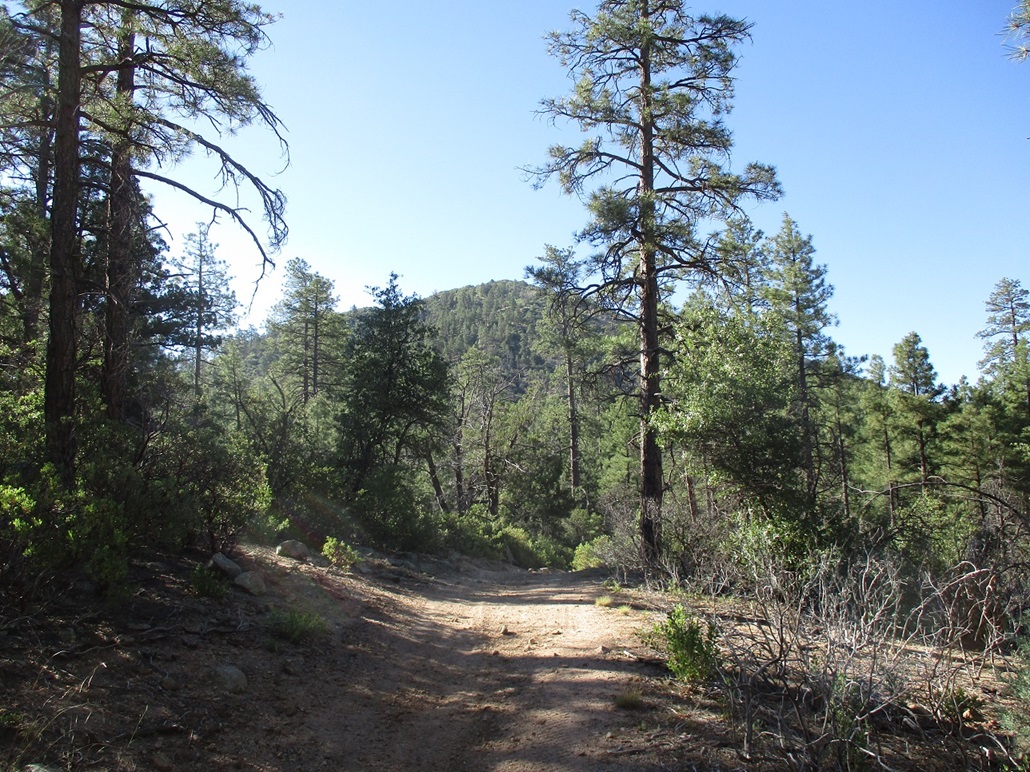
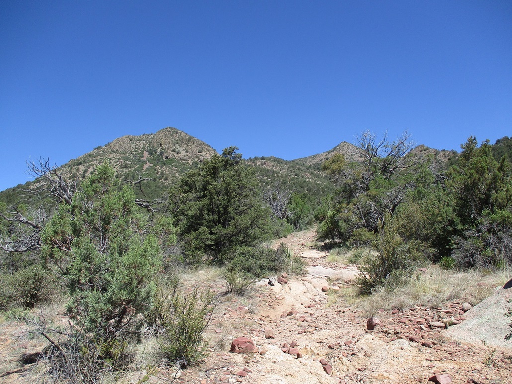
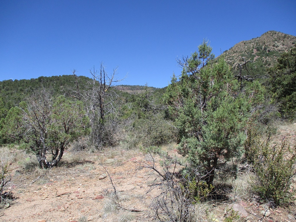
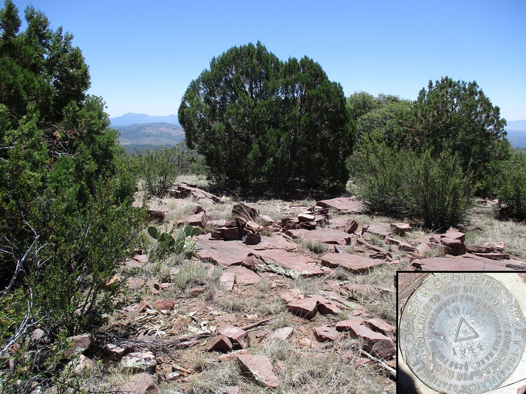
Stinson Mountain is a pyramid-shaped peak rising south of the road, with a mix of trees and brush on its slopes. Matthias drove to a little side road, marked for the Stinson Tank Trail. We got in about a half mile, placing us about a half mile northwest of the peak, which for now we could see partially through the trees. It was 7:45 when we parked. It was warm but pleasant for now, temperature about 70° F, a blue sky with almost no clouds, and calm but occasionally with a soft breeze.
We walked the road to a gate, which is where the trail starts. The trail is just the old road, no longer drivable. It parallels a creek. At a random lowpoint, where we had decent views of the slopes up close, we decided to leave the road and start up these steep slopes. According to the fellas, we were 0.3 mile from the top, but about 600 feet below it.
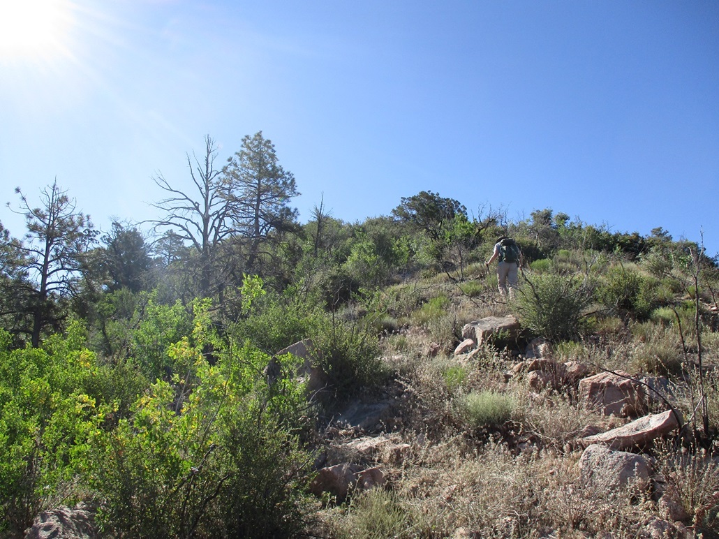
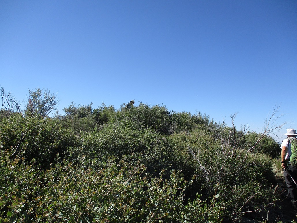
We hiked up the slope, leaving the trees quickly, now in the open amid waist-high woody brush. But we had good lanes most of the time, so we followed them. Whenever we seemed to lose a lane and think we had to start busting through the brush, we'd find another lane. The bushwhacking was minimal, just a few short stretches of pushing through the branches to get back onto an open lane again. Higher up, the slope started to level, then suddenly, there we were, on top of Stinson Mountain.
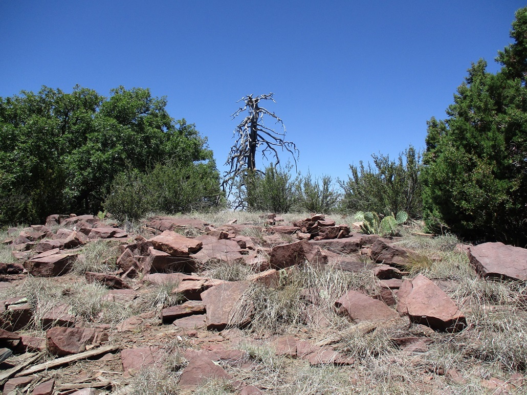
The uphill hike had gone very well, surprisingly easy given how it looked from below. We were all expecting some bushwhacking, and were surprised we had essentially none. But we had no complaints. The summit is rocky with brush, but with good views. It had taken us about 40 minutes from the car to get here. There were good sitting rocks, so we all sat for a little bit and looked around.
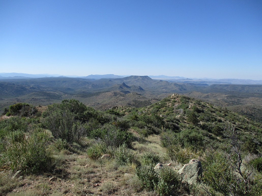
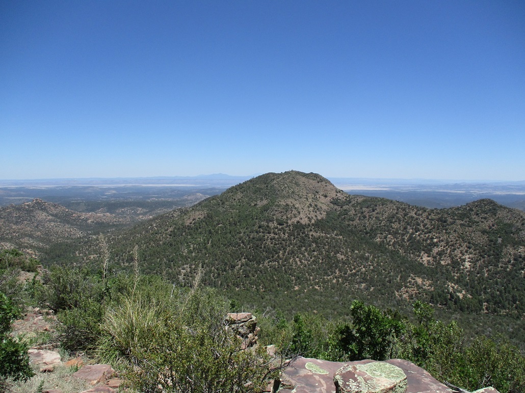
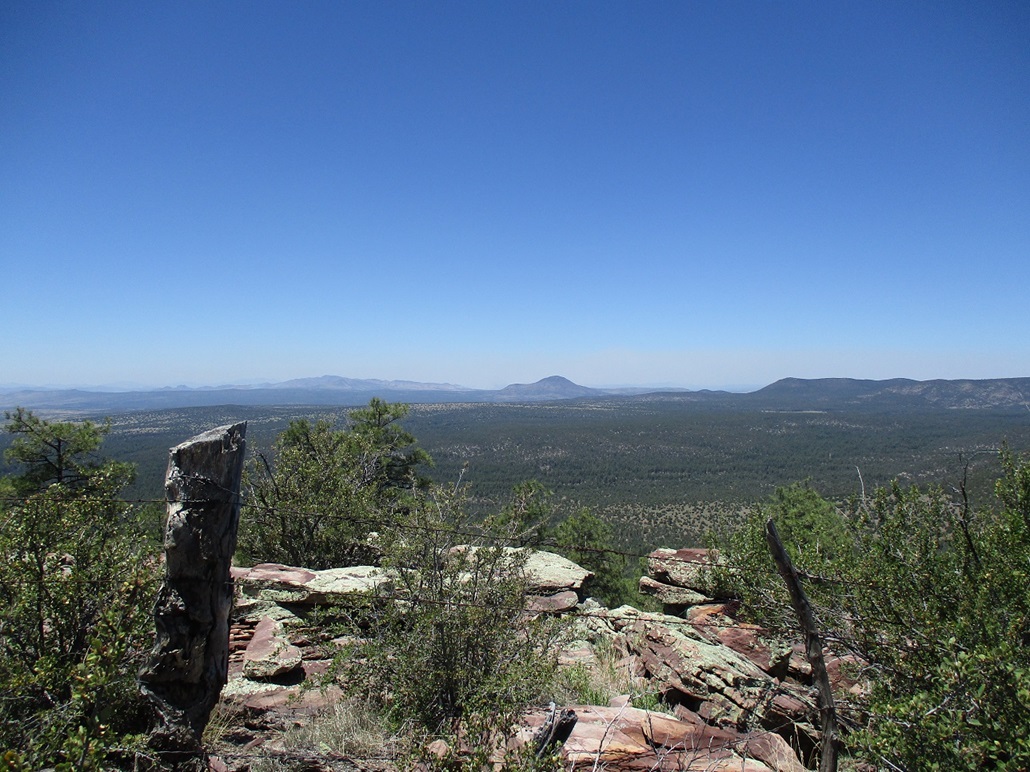
Peaks we could see were: West Spruce, Martin, Sheridan and Weaver looking south, Camp Wood and Hyde Creek looking north, Denny Mountain looking east, the Connell Mountains looking southwest, and Mount Hope on the O RO Ranch, looking northwest. Behind Mount Hope in the far distance was the distinctive prow-shaped summit ridge of Mohon Mountain, and on it, a plume of smoke. It was warming now, but a breeze would pick up ever few minutes and cool us. Conditions were very mild, all things considered.
For the hike down, we followed our ascent route, more or less, just following openings and lanes as we found them. We were back to the trail quickly and back to the car not long after, a round trip time of about 75 minutes. We all felt pretty good how our climb of Stinson Mountain went. It looked like a lot of work from below but ended up being very easy. It was a little after 9 a.m.. Camp Wood Mountain was up next on the docket.
Elevation: 7,260 feet (per USGS datasheet & Lidar)
• Prominence: 742 feet
• Distance: 5.9 miles
• Time: 4 hours, 30 minutes
• Gain: 1,425 feet
• Conditions: Sunny and hot
PB
•
LoJ
•
USGS BM Datasheet
We did not have far to drive, a mile or two east on CR-68 to the "Camp Wood" camping area, which is just some random open spots for people to set up tents, not a formal camping ground. We then followed another road northwest into Stringtown Wash, parking in a small clearing at its end. It was about 9:30 when we arrived, noticeably much warmer now.
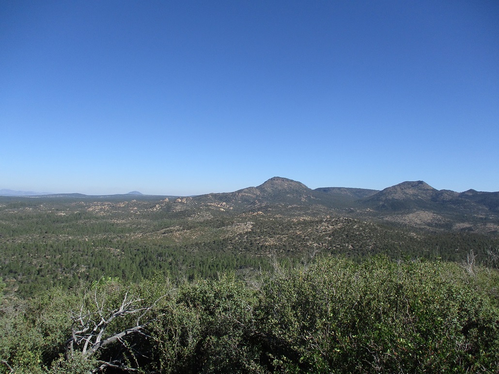
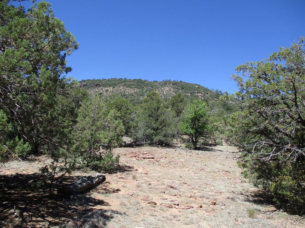
This was going to be a big hike with some off-trail segments over marginal terrain, not a 90-minute quickie. The first two miles was along a trail, the same one that leads to the lookout atop Hyde Creek Mountain. This trail parallels the canyon briefly, then starts a steep ascent out of the canyon before turning north and leveling slightly. Now out of the canyon, we could easily see the lookout atop Hyde Creek, and our peak, Camp Wood Mountain, off to the left, flanked on its sides by foreground hills.
The trail was rocky and not well-maintained. It has been 18 years since I was last on it and I don't recall it being as rocky and rubbly as it was today. Usually, I remember annoying things like that. I even checked on surgent.net to see what he said about the trail back in '05, and nothing. We took a brief water stop on this segment, then continued the hike.
The trail splits, a right going directly to Hyde Creek Lookout. We went left, the trail gaining elevation quickly. It then cuts west and traverses somewhat level below the slopes, then drops about a hundred feet before swinging north again, now heading up the small canyon separating Hyde Creek Mountain and Camp Wood Mountain. The tread ranged between smooth dirt and rubbly rocks. We hiked until we reached a saddle at elevation 6,518 feet. Scott's GPS said we'd hiked 2.06 miles in about an hour. We took another break here. It was very warm now, in the mid 80s.
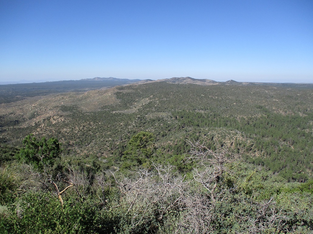
We had a good view of Camp Wood Mountain now, its summit about a half-mile away to the southwest, about 700 feet higher. It's shaped like a big ridge, with very steep sides and a couple cliff bands more toward the top. We started hiking through the trees, mainly juniper, piñon and gambel oak, following open lanes, not too concerned about sticking to a bearing. No matter what direction we followed, we'd meet the base of the mountain mass anyway, then we'd figure out what to do.
About a third of the way up, we looked over at a ridge that looked ever-so-slightly "friendlier" and debated going over to it, but as we did so, it became evident that we'd be sidehilling to it and chose not to bother, and just try our luck with a direct route, the one we were on.
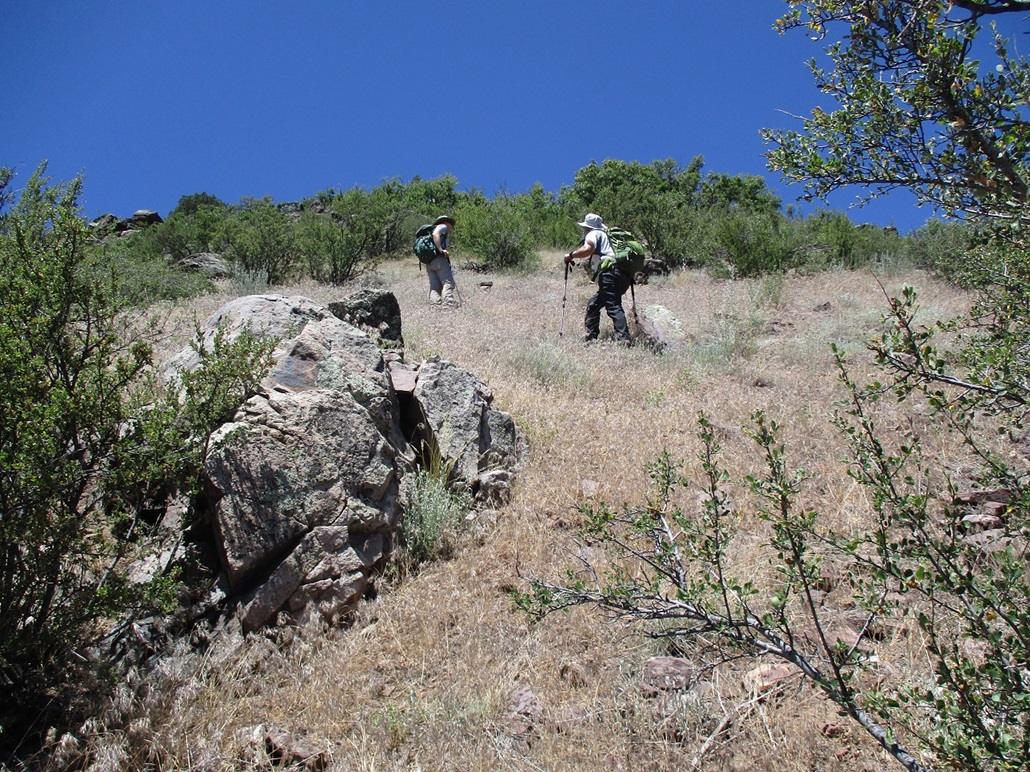
The slope steepened significantly. The trees thinned out and we were mainly on open grass, which held together moderately well ... most of the time. I slowed down a lot here. About every third step I'd take, I'd slide back down. I had to place each step carefully. Rocks in the ground were not solidly set, I quickly discovered.
Matthias and Scott were about twenty feet ahead of me. We came to the lower of two jumbly cliffs. They were already scouting ways up through the cliff band. Matthias went up one way and found himself on a sketchy slope of scree, the rocks about 6 inches to a foot long, not holding together well at all. He was able to bust up through it to more grassy ground. I have absolutely zero tolerance for loose blocky scree. I went up a parallel line that was a little brushier but with more solid rock, forming steps about two to three feet high. I was never more than thirty feet from the guys. At one point, Scott stepped on some big rock that completely gave way under him. This was not a fun slope and I did not like it very much.
The upper cliff band was next. We took mainly our own ways up through the rocks. The scrambling was mid class-3, not too difficult ... when the rocks stayed put. I was learning not even to trust the big ones. They've probably been teetering in place for millions of years, just waiting for the slightest touch to knock it loose. I ended up busting up a steep tier of rocks, about fifteen feet of vertical, that fed me right into a dense patch of woody mountain oak. But the good news was that we were above the cliffs and now on the high ridge. The tough stuff was behind us (or below us).
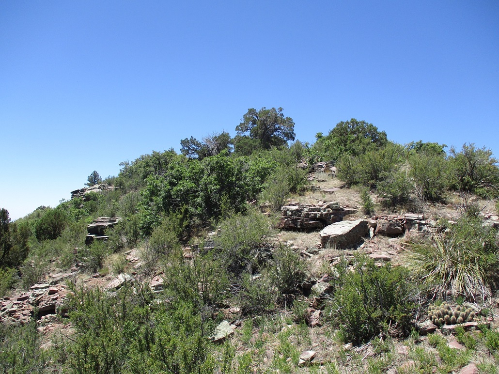
The summit was about a thousand feet to the south, about 150 feet higher, but now on a lovely ridge that was mostly open. We had to breach one fenceline along the way, which was easily done. Finally, we were on top the peak.
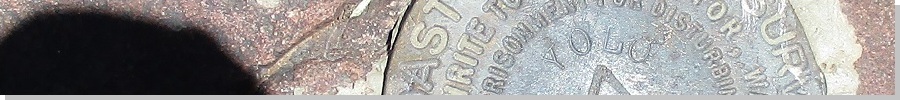
The summit features rocks low to the ground, a benchmark stamped "YOLO" after a big ranch in these parts, and a couple large trees to sit under or within for shade. We took a fifteen-minute break up top, rested, drank, and signed into the register. The peak sees one or two visitors a year, most who do it in a combined loop with Hyde Creek Mountain. The views were good, the air mostly clear except for the smoky haze from the fire atop Mohon Mountain. I was beat, but feeling alright. It was still warm and extremely dry, and I could feel myself getting dehydrated. I might be cutting this one close.
We hiked down the ridge the same way until we were at where we surmounted the ridge earlier. Scott and I were not eager to mess with those rocks again, and the topographic map showed that the ridge drops to the north and may offer a less steep way down. It would add distance, but possibly be safer. Matthias was willing to consider our variation.
We continued down the north ridge, which was steep and very rocky. Being unknown to us, we took it in segments, hoping each part would go. We'd get down to some point that looked like a cliff or barrier, then see some way down beyond it. I think we may have been on or near that earlier ridge I mentioned, the one that looked "slightly friendlier".
At some point, everything looked equally steep in all directions, so we picked a line and started down it. The flora was mostly brush, but almost no grass. The steep slopes were mostly dirt and rock, not holding together well. It was borderline, steep enough that a slip could mean a long slide, assuming a bush or downed log doesn't stop you first. We angled down in such a way that we inched back to our ascent route little by little. Finally, we got onto a soft ridge and boom, the slopes were much gentler and covered in grass. All the loose stuff was behind (or above) us now.
We then just had to walk downhill through the trees until we were back to the saddle. We took another break here. It had taken us a full hour to descend to here from the summit. All this effort, combined with the warmth and the non-existent humidity, left me parched. I sat and drank most of what remained in my liter bottle of water. I had about half a quart of liquid remaining, and I knew I was dehydrated, as I still felt thirsty, like that big drink had no effect. We had two miles to go still.
I knew if I just sat there, the simple action of breathing, even with my mouth shut, would continue to dehydrate me. I know myself well enough to know when I am at the borderline of dehydration trouble, and I was at it. Thus, the only sensible thing to do was get up and start walking, the sooner I was back to the car, the better. I told the guys I'm getting a move-on and that I'd meet them back at the car.
The hike out went fine. It was the same rubbly trail, but all downhill now (except for that hundred-foot regain that I really did not welcome). I kept my mouth shut, breathing through my nose. The guys were not far behind me, maybe a couple minutes. I never stopped. Matthias caught up to me just as we were at his vehicle. I had some more water in my stash there and despite being warm, I drank most of it at once. I was really close. Another mile or two and it would have been dire.
The round trip hike covered just shy of 6 miles with over 1,400 feet of gain. It was a well-earned peak and I am thrilled to have climbed it. It was a peak I'd wanted since way back when my wife and I hiked Hyde Creek Mountain all those years ago. But it was a much tougher customer than I planned on. The rubbly trail, the sketchy slopes, loose rock and awkward cliffs, along with temperatures pushing 90°, combined to make this into a small epic. I was thrashed.
It was 2:30 now, and warm. We had one other peak on the agenda but it would have meant driving back out to Williamson Valley Road, then back in a parallel forest road a number of miles. None of us were eager now. The thought of cold drinks at a Chevron we'd seen driving in were now forefront. We got two really cool peaks done. Camp Wood Mountain alone would be a worthy day's effort, so to get it, along with Stinson Mountain, was very satisfying. We did well for a bunch of old guys.
We stopped back at that Chevron, got gas, and got cold drinks. I got an Aleve for my general aches. We then spent a couple hours driving back into Phoenix and the Denny's on Carefree Highway, arriving there about 5:30, the temperature well above 110°. I called ahead for the 4-taco special at El Jefe and basically spent the rest of the day being a blob, satiated by tacos. It took a few more hours to get myself back to where I wasn't so thirsty all the time. Dehydration really throws one's body out of whack, and it takes time for it to re-equilibrate.
But, most of all, it was good to get out of the heat, get a couple nifty summits and have a good day out with the guys. Thanks to Matthias for driving and to both for the camaraderie.
|


|