


Hiking Trails on Härön
Härön, Tjörn
The old fishing village of Kyrkesund is situated on the north west of the island of Tjörn. Five minutes away by ferry across the sound, lies Härön, where there are some lovely hiking trails exploring the island and its nature reserve. You’ll find fantastic views, exciting nature and if you take a padlock with you, everlasting love.
Quick facts
Length: 3-7 km
Timing: approx. 45 min - 2 hours
Difficulty: Easy-hard
Terrain: Asphalt-/gravel roads, hilly paths, boardwalk
The nature reserves on Härön
The hiking trails on Härön go partly through a nature reserve and there are a number of alternative routes. The scenery is fantastic and varied. If you have luck when you’re passing the former farm at Änga the poppies will be flowering, among other plants specific to these particular natural habitats. For anyone interested in flora and fauna this is a paradise. There’s more detailed information in the Västkuststiftelsen brochure.
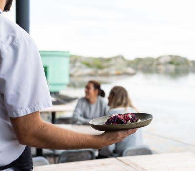
Härön’s tranquil surroundings are unique, and exploring its nature, plant and bird life is a special experience. The eastern side of the island is the most populated, where you’ll also find Magasinet Härön, a restaurant with tables outside overlooking the bay.
Hikes with a view
The southern stage of the walk, down towards Holmudden, offers lovely views of the sea out to the west and in towards Tjörn, with the town of Skärhamn on its southwest tip. On a clear day you can see the silhouette of Carlsten’s Fortress on Marstrand and the Trubadur and Pater Noster lighthouses, from the highest point on the south of the island. There’s a heart topping a cairn here. Take a padlock with you and fasten it to the heart. If you throw the key away it symbolises eternal love.
The path leading to Änga heads north from the ferry landing. The loop veers off to the west before continuing south towards the old farm at Änga, where there is a picnic area with wind shelter and barbecue facilities. You can also carry on going south to Rörberget with its magical view. Turn your gaze south east and you’ll see the 14 metre high sculpture ANNA, in Pilane Sculpture Park.
Fact about the trail
Length:
Holmudden: 3 km
Änga: 6 km
Rörberget: 7 km
Approximate times:
Holmudden: 45 min
Änga: 1.5 hours
Rörberget: Just under 2 hours
Marking:
All paths are marked with wooden posts painted green. In some places old waymarks can be seen, blue arrows painted directly onto the rocks.
Level of difficulty:
The trails leading from the ferry landing along the asphalt road going north to Rösseberget or south to Holmudden are very easy, and both pushchair and wheelchair friendly.
The path going down to Holmudden is classed as moderate, with steep climbs in a couple of places. The longer path to Änga and the loop passing Rörberget are also in moderate terrain. In certain places there are stairs and boardwalks over wetter areas.
Start and end:
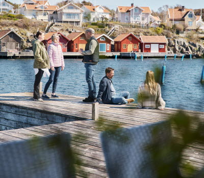
The trails start from the ferry landing among the houses, with lovely views of the narrow sound between Härön and Tjörn, and the lively boat traffic. There are information boards here and you can choose whether to walk north, west, or south.
All trails lead you back to where you started by the ferry landing on the east side of the island.
How to get here:
Car: From the E6 exit onto road 160 signposted Tjörn and Orust. After the Tjörn bridge turn left on road 169 to Rönnäng and Skärhamn. After 5 km take the first exit at the roundabout to Kållekärr. Drive through Kållekärr and then take the first exit at the roundabout, to Kyrkesund. Follow signs to Kyrkesund. Just before Kyrkesund you’ll see signs indicating car parking places for Kyrkesund Härön.
The ferry to Härön leaves from Kyrkesund’s jetty. See Västtrafik's Travel Planner. Tickets can be purchased on the Västtrafik ToGo app or on board.
Public transport: See Västtrafik's Travel Planner
The Orust/Tjörn Express and 357 buses travel from Stenungsund’s station to Kyrkesund’s jetty. The trip takes approximately 1 hour.
Map:
Södra Bohuslän Turism
Fregatten 2
44430 Stenungsund
Phone: +46 303 833 27
E-mail: info@sodrabohuslan.com
Website: sodrabohuslan.com

