PLANTS - California Department of Fish and Game
PLANTS - California Department of Fish and Game
PLANTS - California Department of Fish and Game

Erfolgreiche ePaper selbst erstellen
Machen Sie aus Ihren PDF Publikationen ein blätterbares Flipbook mit unserer einzigartigen Google optimierten e-Paper Software.
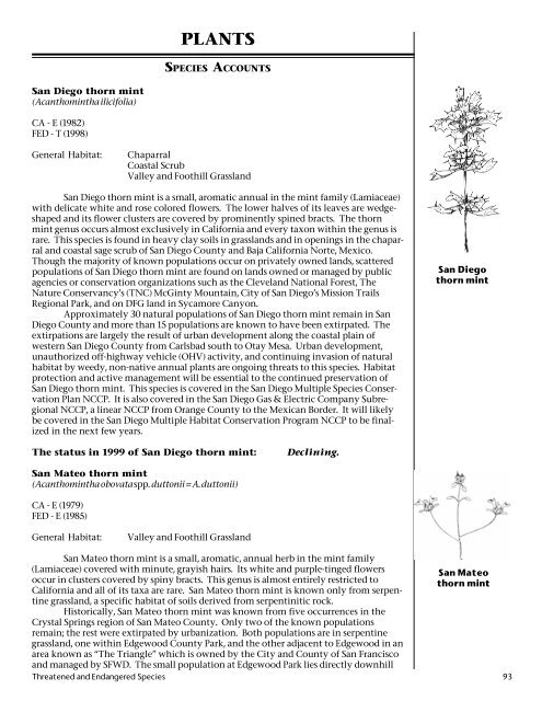
San Diego thorn mint<br />
(Acanthomintha ilicifolia)<br />
CA - E (1982)<br />
FED - T (1998)<br />
<strong>PLANTS</strong><br />
SPECIES ACCOUNTS<br />
General Habitat: Chaparral<br />
Coastal Scrub<br />
Valley <strong>and</strong> Foothill Grassl<strong>and</strong><br />
San Diego thorn mint is a small, aromatic annual in the mint family (Lamiaceae)<br />
with delicate white <strong>and</strong> rose colored flowers. The lower halves <strong>of</strong> its leaves are wedgeshaped<br />
<strong>and</strong> its flower clusters are covered by prominently spined bracts. The thorn<br />
mint genus occurs almost exclusively in <strong>California</strong> <strong>and</strong> every taxon within the genus is<br />
rare. This species is found in heavy clay soils in grassl<strong>and</strong>s <strong>and</strong> in openings in the chaparral<br />
<strong>and</strong> coastal sage scrub <strong>of</strong> San Diego County <strong>and</strong> Baja <strong>California</strong> Norte, Mexico.<br />
Though the majority <strong>of</strong> known populations occur on privately owned l<strong>and</strong>s, scattered<br />
populations <strong>of</strong> San Diego thorn mint are found on l<strong>and</strong>s owned or managed by public<br />
agencies or conservation organizations such as the Clevel<strong>and</strong> National Forest, The<br />
Nature Conservancy’s (TNC) McGinty Mountain, City <strong>of</strong> San Diego’s Mission Trails<br />
Regional Park, <strong>and</strong> on DFG l<strong>and</strong> in Sycamore Canyon.<br />
Approximately 30 natural populations <strong>of</strong> San Diego thorn mint remain in San<br />
Diego County <strong>and</strong> more than 15 populations are known to have been extirpated. The<br />
extirpations are largely the result <strong>of</strong> urban development along the coastal plain <strong>of</strong><br />
western San Diego County from Carlsbad south to Otay Mesa. Urban development,<br />
unauthorized <strong>of</strong>f-highway vehicle (OHV) activity, <strong>and</strong> continuing invasion <strong>of</strong> natural<br />
habitat by weedy, non-native annual plants are ongoing threats to this species. Habitat<br />
protection <strong>and</strong> active management will be essential to the continued preservation <strong>of</strong><br />
San Diego thorn mint. This species is covered in the San Diego Multiple Species Conservation<br />
Plan NCCP. It is also covered in the San Diego Gas & Electric Company Subregional<br />
NCCP, a linear NCCP from Orange County to the Mexican Border. It will likely<br />
be covered in the San Diego Multiple Habitat Conservation Program NCCP to be finalized<br />
in the next few years.<br />
The status in 1999 <strong>of</strong> San Diego thorn mint: Declining.<br />
San Mateo thorn mint<br />
(Acanthomintha obovata spp. duttonii = A. duttonii)<br />
CA - E (1979)<br />
FED - E (1985)<br />
General Habitat: Valley <strong>and</strong> Foothill Grassl<strong>and</strong><br />
San Diego<br />
thorn mint<br />
San Mateo thorn mint is a small, aromatic, annual herb in the mint family<br />
(Lamiaceae) covered with minute, grayish hairs. Its white <strong>and</strong> purple-tinged flowers<br />
San Mateo<br />
occur in clusters covered by spiny bracts. This genus is almost entirely restricted to<br />
thorn mint<br />
<strong>California</strong> <strong>and</strong> all <strong>of</strong> its taxa are rare. San Mateo thorn mint is known only from serpentine<br />
grassl<strong>and</strong>, a specific habitat <strong>of</strong> soils derived from serpentinitic rock.<br />
Historically, San Mateo thorn mint was known from five occurrences in the<br />
Crystal Springs region <strong>of</strong> San Mateo County. Only two <strong>of</strong> the known populations<br />
remain; the rest were extirpated by urbanization. Both populations are in serpentine<br />
grassl<strong>and</strong>, one within Edgewood County Park, <strong>and</strong> the other adjacent to Edgewood in an<br />
area known as “The Triangle” which is owned by the City <strong>and</strong> County <strong>of</strong> San Francisco<br />
<strong>and</strong> managed by SFWD. The small population at Edgewood Park lies directly downhill<br />
Threatened <strong>and</strong> Endangered Species 93
Marin bent grass<br />
Munz’s onion<br />
from a housing development; the resulting changes in drainage patterns <strong>and</strong> water<br />
chemistry threaten this population. Population sizes at both locations vary from year<br />
to year due to local rainfall <strong>and</strong> competition from nonnative plants.<br />
This taxon was the subject <strong>of</strong> a recovery workshop conducted by the DFG in<br />
cooperation with USFWS, in which paraticipants discussed the recent population<br />
distribution <strong>and</strong> abundance information <strong>and</strong> the apparent poor state <strong>of</strong> an introduced<br />
population. Current data suggest the introduced population has not built up a sufficient<br />
seedbank. To protect this plant from extinction, both natural populations must be<br />
preserved <strong>and</strong> further reintroduction into suitable habitat should be pursued. Management<br />
<strong>and</strong> recovery actions for the species have been addressed in the federal Recovery<br />
Plan for Serpentine Soil Species <strong>of</strong> the San Francisco Bay Area, finalized in 1998.<br />
The status in 1999 <strong>of</strong> San Mateo thorn mint: Declining.<br />
Marin bent grass<br />
(Agrostis blasdalei var. marinensis)<br />
CA - R (1978)<br />
FED - None<br />
General Habitat: Coastal Prairie<br />
Marin bent grass, a member <strong>of</strong> the grass family (Poaceae), has erect stems <strong>and</strong><br />
slender leaves. Its green flowers occur in narrow, spikelike clusters. This variety grows<br />
on a decomposed granite outcrop at a single location in Marin County. It is very closely<br />
related to Blasdale’s bent grass (Agrostis blasdalei var. blasdalei), which is found in northern<br />
coastal dunes, <strong>and</strong> one taxonomist questions the distinctness <strong>of</strong> the variety<br />
marinensis.<br />
The continued existence <strong>of</strong> Marin bent grass is precarious. The single known<br />
population usually consists <strong>of</strong> just over a dozen individuals growing near a popular<br />
parking area for picnickers; however in 1998 no plants could be found. Because Marin<br />
bent grass occurs on private l<strong>and</strong> near the junction <strong>of</strong> two roads, it is vulnerable to road<br />
maintenance <strong>and</strong> improvement activities. In addition, if it has not already been extirpated,<br />
this single surviving population could be eliminated by a chance event. There are<br />
no management efforts in effect to protect this plant.<br />
The status in 1999 <strong>of</strong> Marin bent grass: Declining or possibly extirpated.<br />
Munz’s onion<br />
(Allium munzii)<br />
CA - T (1990)<br />
FED - E (1998)<br />
General Habitat: Coastal Scrub<br />
Valley Foothill Grassl<strong>and</strong><br />
Munz’s onion is a small, bulb-bearing perennial herb in the lily family (Liliaceae)<br />
with white, aromatic flowers. Plants are restricted to clay soils in the rapidly disappearing<br />
grassl<strong>and</strong>s <strong>of</strong> western Riverside County. It shares its range <strong>and</strong> habitat with an<br />
onion <strong>of</strong> similar appearance, the red-skinned onion (Allium haematochiton). The two<br />
species occur within several feet <strong>of</strong> each other at some sites, but do not interbreed.<br />
Most <strong>of</strong> Munz’s onion’s historical habitat has been destroyed. The 16 remaining populations<br />
are fragmented <strong>and</strong> isolated <strong>and</strong> face such threats as urbanization, OHV activity,<br />
invasions <strong>of</strong> exotic plants, <strong>and</strong> road construction. One population is on USFS l<strong>and</strong>; four<br />
additional populations are within natural reserves or county parks.<br />
A researcher at UC Riverside has shown that a portion <strong>of</strong> bulbs do not send up<br />
leaves or flowers each year, <strong>and</strong> therefore cannot be counted. This is likely correlated<br />
with broad climatic patterns in annual temperature <strong>and</strong> rainfall. The same researcher<br />
94 <strong>Department</strong> <strong>of</strong> <strong>Fish</strong> <strong>and</strong> <strong>Game</strong>
has found that establishment <strong>of</strong> new plants in two populations is primarily by seed,<br />
rather than by bulbs.<br />
The status in 1999 <strong>of</strong> Munz’s onion: Declining.<br />
Yosemite onion<br />
(Allium yosemitense)<br />
CA -R (1982)<br />
FED - None<br />
General Habitat: Broadleaved Upl<strong>and</strong> Forest<br />
Chaparral<br />
Cismontane Woodl<strong>and</strong><br />
Montane Conifer Forest<br />
Yosemite onion, a member <strong>of</strong> the lily family (Liliaceae), is a perennial herb that<br />
grows from a bulb. It produces two linear, basal leaves, <strong>and</strong> its rose or white flowers<br />
occur in an umbel at the end <strong>of</strong> a leafless stem. The species occurs on open, steep, rocky<br />
slopes <strong>of</strong> metamorphic or granitic rock in the central Sierra Nevada. Populations occur<br />
in Mariposa <strong>and</strong> Tuolumne counties.<br />
Yosemite onion is known from 13 occurrences on federal l<strong>and</strong>s within Yosemite<br />
National Park <strong>and</strong> in the Sierra <strong>and</strong> Stanislaus National Forests. As <strong>of</strong> 1998, most <strong>of</strong> the<br />
occurrences appeared stable except one, which had declined. Most occurrences are in<br />
remote areas with few threats.<br />
The status in 1999 <strong>of</strong> Yosemite onion: Stable.<br />
Large-flowered fiddleneck<br />
(Amsinckia gr<strong>and</strong>iflora)<br />
CA - E (1982)<br />
FED - E (1985)<br />
General Habitat: Cismontane Woodl<strong>and</strong><br />
Valley <strong>and</strong> Foothill Grassl<strong>and</strong><br />
Large-flowered fiddleneck, the rarest <strong>of</strong> the ten <strong>California</strong> species <strong>of</strong> Amsinckia,<br />
is an erect, coarsely hairy annual herb in the borage family (Boraginaceae). The large,<br />
orange-red flowers are borne on stalks curved like the neck <strong>of</strong> a fiddle. The historic<br />
distribution <strong>of</strong> this species included the dry inl<strong>and</strong> hills <strong>of</strong> Alameda, Contra Costa <strong>and</strong><br />
San Joaquin counties. Much <strong>of</strong> the habitat <strong>of</strong> the species is now grazing l<strong>and</strong>. The<br />
primary current threat to the species is believed to be competition from non-native,<br />
annual grasses. Other threats include stochastic extinction due to small numbers <strong>of</strong><br />
populations, <strong>and</strong> fluctuations in numbers due to predation by rodents.<br />
At present, only three natural populations are known. These all occur in the<br />
Altamont Hills <strong>of</strong> the Diablo Range. Two are on Lawrence Livermore National Laboratory<br />
(LLNL) l<strong>and</strong> at what is known as Site 300 <strong>and</strong> are referred to as the Drop Tower <strong>and</strong><br />
Draney Canyon populations. The third is on private ranch l<strong>and</strong> in Carnegie Canyon<br />
near the southern border <strong>of</strong> Site 300. In 1989 <strong>and</strong> 1990, several experimental populations<br />
were planted in historic habitat: one at Connolly Ranch, southwest <strong>of</strong> Site 300, which is<br />
considered to have failed; one on DFG owned l<strong>and</strong> at Corral Hollow, which is also<br />
considered failed; two at Black Diamond Preserve in eastern Contra Costa County, one<br />
<strong>of</strong> which has apparently been somewhat successful; one at Drop Tower (near the<br />
natural population), which still persists; <strong>and</strong> two at Los Vaqueros, also considered failed.<br />
All <strong>of</strong> the populations, both native <strong>and</strong> experimental, have experienced dramatic<br />
declines in the last three years <strong>and</strong> we believe this is due to unusually heavy rainfall<br />
years <strong>and</strong> increased in nonnative grasses therefore increasing food sources to rodents<br />
<strong>and</strong> increasing rodent populations.<br />
Heavy rains during the winter <strong>of</strong> 1996-1997 resulted in a l<strong>and</strong>slide in the area <strong>of</strong><br />
Yosemite onion<br />
Large-flowered<br />
fiddleneck<br />
Threatened <strong>and</strong> Endangered Species 95
McDonald’s<br />
rock cress<br />
the Draney Canyon natural population. Only one plant was observed in 1997, <strong>and</strong> after<br />
further erosion in 1998, no plants were found. LLNL manages the populations on its<br />
l<strong>and</strong>, including controlling non-native species <strong>and</strong> developing techniques for native<br />
grass restoration.<br />
It is difficult to determine the overall trend within any given decade <strong>of</strong> monitoring,<br />
because the population size can fluctuate to a large degree every year. Because<br />
there are so few natural populations, the largest population is not protected, <strong>and</strong> reintroduction<br />
does not appear to be very successful, the long-term outlook for this species<br />
is still precarious.<br />
Note: In April 2000, beyond the date <strong>of</strong> information included in this report, the<br />
<strong>Department</strong> <strong>of</strong> Energy entered into an agreement with the USFWS which designated<br />
160 acres within LLNL Site 300 as the Amsinckia gr<strong>and</strong>iflora Reserve to provide for the<br />
survival <strong>and</strong> recovery <strong>of</strong> the species.<br />
The status in 1999 <strong>of</strong> large-flowered fiddleneck: Declining.<br />
McDonald’s rock cress<br />
(Arabis macdonaldiana)<br />
CA - E (1979)<br />
FED - E (1978)<br />
General Habitat: Lower Montane Conifer Forest<br />
McDonald’s rock cress, a member <strong>of</strong> the mustard family (Brassicaceae), is a small<br />
rosette-forming perennial herb with light purple flowers <strong>and</strong> erect flattened seed pods.<br />
It is restricted to serpentine soils in open, rocky areas <strong>of</strong> montane coniferous forests,<br />
<strong>of</strong>ten growing in rock crevices or on sites with naturally high soil disturbance such as<br />
steep, unstable slopes. Intolerance to competition seems to be the primary factor<br />
limiting the natural distribution <strong>of</strong> this species. McDonald’s rock cress is known in<br />
<strong>California</strong> from Red Mountain in Mendocino County <strong>and</strong> from Del Norte County; it<br />
also occurs in Curry County, Oregon. Other rare taxa known to occur on the serpentine<br />
soils <strong>of</strong> Red Mountain include the State listed endangered Kellogg’s buckwheat<br />
(Eriogonum kelloggii) <strong>and</strong> Red Mountain catchfly (Silene campanulata ssp. campanulata) as<br />
well as the unlisted but rare Red Mountain stonecrop (Sedum laxum ssp. eastwoodiae).<br />
McDonald’s rock cress on Red Mountain in Mendocino County is known from only<br />
two occurrences. The species is less restricted in Del Norte County, with nearly 30<br />
occurrences there.<br />
The main threat to this species is potential mining <strong>of</strong> the significant nickel <strong>and</strong><br />
chromium deposits under or adjacent to populations. Mining claims exist over much <strong>of</strong><br />
the restricted habitat <strong>of</strong> this plant. Within the boundaries <strong>of</strong> the Smith River National<br />
Recreation Area, about 35 percent <strong>of</strong> known occurrences could be affected by mining.<br />
In addition to direct impacts, the indirect effects <strong>of</strong> mining <strong>and</strong> nickel extraction<br />
operations (e.g., erosion <strong>and</strong> road construction) could endanger a majority <strong>of</strong> the populations<br />
located on the North Fork <strong>of</strong> the Smith River in Del Norte County. OHV activities<br />
may also threaten populations in this area. Outlying colonies growing in the Rough<br />
<strong>and</strong> Ready Creek watershed in Oregon may be threatened by a mining project in the<br />
Siskiyou National Forest. The species seems to be intolerant <strong>of</strong> competition, <strong>and</strong> fire<br />
suppression may also pose a threat to the species.<br />
McDonald’s rock cress occurs on private <strong>and</strong> BLM l<strong>and</strong>s in Mendocino County<br />
<strong>and</strong> on USFS l<strong>and</strong> in Del Norte County. BLM has designated Red Mountain as an ACEC<br />
<strong>and</strong> has conducted studies on the population dynamics <strong>and</strong> reproductive biology <strong>of</strong> the<br />
species there. These populations continue to be monitored as part <strong>of</strong> a long-term study<br />
being conducted by CSU Sacramento with support from BLM. The Six Rivers National<br />
Forest has designated 21,370 acres <strong>of</strong> the North Fork Smith River watershed as a Botanical<br />
Area <strong>and</strong> has developed a monitoring plan. The goals <strong>of</strong> this plan are to develop a<br />
habitat management guide, investigate habitat characteristics, <strong>and</strong> continue to survey<br />
for potential habitat.<br />
The status in 1999 <strong>of</strong> McDonald’s rock cress: Unknown.<br />
96 <strong>Department</strong> <strong>of</strong> <strong>Fish</strong> <strong>and</strong> <strong>Game</strong>
Baker’s manzanita<br />
(Arctostaphylos bakeri)<br />
CA - R (1979)<br />
FED - None<br />
General Habitat: Broadleaved Upl<strong>and</strong> Forest<br />
Chaparral<br />
Baker’s manzanita is an upright, evergreen shrub in the heath family (Ericaceae)<br />
with pinkish flowers, dark purple bark, pungent leaves, <strong>and</strong> bright red fruits. Its<br />
branchlets <strong>and</strong> leaves have sticky gl<strong>and</strong>ular hairs, <strong>and</strong> its flower stems are hairless. This<br />
species is largely restricted to serpentine soils in the localized chaparral communities <strong>of</strong><br />
Sonoma County. Nine <strong>of</strong> the 11 known occurrences are on private l<strong>and</strong>, with the<br />
remaining two owned by the DFG <strong>and</strong> CNPS.<br />
Most populations are clustered in the area near Occidental, Sonoma County. The<br />
chief threat to Baker’s manzanita is residential development, followed by agricultural<br />
conversion, OHVs, dumping, nonnative plant encroachment, <strong>and</strong> hybridization with<br />
common manzanitas. Two populations occur on l<strong>and</strong> planned for development. Succession<br />
toward oaks <strong>and</strong> <strong>California</strong> bay, which shade out Baker’s manzanita, is also<br />
occurring as a result <strong>of</strong> fire suppression at most locations.<br />
The status in 1999 <strong>of</strong> Baker’s manzanita: Declining.<br />
Vine Hill manzanita<br />
(Arctostaphylos densiflora)<br />
CA - E (1981)<br />
FED - None<br />
General Habitat: Chaparral<br />
Vine Hill manzanita is a low evergreen shrub in the heath family (Ericaceae)<br />
with shiny green leaves, black branches, <strong>and</strong> small white to pinkish flowers in a manyflowered,<br />
branched flower stalk. It roots from nodes along its spreading branches <strong>and</strong> a<br />
single plant can reach several meters across. Vine Hill manzanita is restricted to the<br />
“Sonoma Barren,” an area <strong>of</strong> acid marine s<strong>and</strong> deposits in western Sonoma County.<br />
Over the last 20 years, Vine Hill manzanita has come close to extinction. All but<br />
one population in the Vine Hill area have been destroyed by agriculture, residential<br />
development, or roadside weed abatement. The last known population, consisting <strong>of</strong><br />
several mature individuals <strong>and</strong> a number <strong>of</strong> younger plants grown from cuttings, occurs<br />
on CNPS’s one-acre Vine Hill Preserve. Plants at the preserve suffer from a persistent<br />
fungal disease.<br />
The status in 1999 <strong>of</strong> Vine Hill manzanita: Declining.<br />
Hanging Gardens manzanita<br />
(Arctostaphylos edmundsii var. parvifolia)<br />
CA - R (1981)<br />
FED - None<br />
General Habitat: Coastal Bluff Scrub<br />
Chaparral<br />
Hanging Gardens manzanita is a prostrate evergreen shrub without a basal burl,<br />
with glossy green leaves <strong>and</strong> bright red berries. This member <strong>of</strong> the heath family<br />
(Ericaceae) grows near the ocean on eroded ridges <strong>and</strong> s<strong>and</strong>stone banks subject to strong<br />
on-shore winds. It is known from one population on private l<strong>and</strong> near Point Sur in<br />
Monterey County. The plant grows down perpendicular banks in closely adherent<br />
Baker’s manzanita<br />
Vine Hill<br />
manzanita<br />
Hanging Gardens<br />
manzanita<br />
Threatened <strong>and</strong> Endangered Species 97
Hearst’s manzanita<br />
San Bruno<br />
Mountain<br />
manzanita<br />
drapes. A recent taxonomic treatment has consolidated Hanging Gardens manzanita<br />
with Little Sur manzanita (A. edmundsii), which is itself limited to only nine occurrences<br />
on the Little Sur coast, although it is not State or federally listed. DFG has no recent<br />
information on the status <strong>of</strong> this plant.<br />
The status in 1999 <strong>of</strong> Hanging Gardens manzanita: Unknown.<br />
Hearst’s manzanita<br />
(Arctostaphylos hookeri ssp. hearstiorum)<br />
CA - E (1979)<br />
FED - None<br />
General Habitat: Maritime Chaparral<br />
Coastal Scrub<br />
Valley <strong>and</strong> Foothill Grassl<strong>and</strong><br />
Foothill Grassl<strong>and</strong><br />
Hearst’s manzanita is an evergreen shrub in the heath family (Ericaceae) with<br />
shiny green leaves, tiny white flowers, <strong>and</strong> bright red fruits. This subspecies lacks a<br />
basal burl <strong>and</strong> is found on grassy hills <strong>and</strong> mesas in open areas <strong>of</strong> coastal prairie <strong>and</strong><br />
chaparral plant communities. It grows on s<strong>and</strong>y loam substrates derived from old,<br />
stabilized s<strong>and</strong> dunes near the coast. All five known occurrences <strong>of</strong> Hearst’s manzanita<br />
are located on the Hearst Ranch, owned by the Hearst Corporation, in San Luis Obispo<br />
County. The DFG’s most recent observation information for this species dates from the<br />
mid-1980s. The population status <strong>and</strong> habitat conditions for this species needs further<br />
investigation.<br />
The status in 1999 <strong>of</strong> Hearst’s manzanita: Unknown.<br />
Presidio manzanita<br />
(Arctostaphylos hookeri ssp. ravenii)<br />
CA - E (1978)<br />
FED - E (1979)<br />
General Habitat: Chaparral<br />
Coastal Prairie<br />
Presidio manzanita is a prostrate, evergreen shrub covered with fine gray hairs,<br />
with round leaves <strong>and</strong> compact flower stalks <strong>of</strong> urn shaped white to pink flowers. This<br />
member <strong>of</strong> the heath family (Ericaceae) grows on shallow, rocky serpentine soils in<br />
open areas with some exposure to fog within the Presidio <strong>of</strong> San Francisco. Historically,<br />
Presidio manzanita was known from three other sites in San Francisco County that<br />
were destroyed by urbanization in the late 1930s. This taxon has been reduced to a<br />
single wild plant plus some clones, which are managed by the National Park Service<br />
(NPS). The single wild plant was found in the winter <strong>of</strong> 1997-98 with a fungal pathogen<br />
resulting in approximately 10 percent dieback <strong>of</strong> branches; as <strong>of</strong> August 1998, vigorous<br />
regrowth had covered over most <strong>of</strong> the dieback. The plants are protected by fencing <strong>and</strong><br />
are measured <strong>and</strong> weeded each year.<br />
The status in 1999 <strong>of</strong> Presidio manzanita: Stable to declining.<br />
San Bruno mountain manzanita<br />
(Arctostaphylos imbricata)<br />
CA - E (1979)<br />
FED - None<br />
General Habitat: Coastal Scrub<br />
98 <strong>Department</strong> <strong>of</strong> <strong>Fish</strong> <strong>and</strong> <strong>Game</strong>
San Bruno Mountain manzanita is a low evergreen shrub in the heath family<br />
(Ericaceae) with white flowers. This species lacks a basal burl, has branchlets with short<br />
spreading hairs, bright green, closely overlapping leaves, <strong>and</strong> fruits with gl<strong>and</strong>ular hairs.<br />
It forms dense, mat-like colonies on shallow soils derived from Franciscan s<strong>and</strong>stone,<br />
greywacke, or shale. San Bruno Mountain manzanita is known only from the summit <strong>of</strong><br />
San Bruno Mountain in San Mateo County. Another endangered species, Pacific manzanita<br />
(Arctostaphylos pacifica), also occurs near the summit <strong>of</strong> San Bruno Mountain. At<br />
present there are six small populations <strong>of</strong> San Bruno Mountain manzanita. Five <strong>of</strong> these<br />
occur within San Mateo County Park, while one is located on privately owned property.<br />
In 1997, USFWS withdrew its Proposed Rule to list San Bruno Mountain manzanita<br />
as threatened based on protection given to the plant under the San Bruno Mountain<br />
HCP. The HCP preserves most <strong>of</strong> San Bruno Mountain <strong>and</strong> provides for monitoring <strong>and</strong><br />
management <strong>of</strong> San Bruno Mountain manzanita.<br />
A fungal pathogen infected the plants beginning in about 1997 <strong>and</strong> caused<br />
significant dieback or loss <strong>of</strong> entire plants. Since then, recovery has been generally good,<br />
although some management such as controlled burning may benefit the species.<br />
The status in 1999 <strong>of</strong> San Bruno Mountain manzanita: Stable.<br />
Pacific manzanita<br />
(Arctostaphylos pacifica)<br />
CA - E (1979)<br />
General Habitat: Coastal Scrub<br />
Pacific manzanita is a low, prostrate, evergreen shrub with white flowers in the<br />
heath family (Ericaceae). This plant has a basal burl, branchlets with fine hairs, pale<br />
green leaves with finely serrate margins, <strong>and</strong> fruits covered with short, stiff hairs. The<br />
bark <strong>of</strong> Pacific manzanita cracks <strong>and</strong> peels <strong>of</strong>f, leaving the trunk a polished light tan. It<br />
is part <strong>of</strong> the north coast scrub community in two distinct, historically limited populations<br />
on San Bruno Mountain, San Mateo County. One is on private l<strong>and</strong> <strong>and</strong> the other<br />
is within San Bruno Mountain County Park. The DFG has no recent information on the<br />
status <strong>of</strong> either occurrence.<br />
Previously, some botanists had believed Pacific manzanita to be a hybrid <strong>of</strong><br />
bearberry (A. uva-ursi) <strong>and</strong> A. gl<strong>and</strong>ulosa. A recent taxonomic treatment <strong>of</strong> the genus<br />
Arctostaphylos consolidated Pacific manzanita with bearberry. However, more recent<br />
morphological <strong>and</strong> molecular work by researchers at San Francisco State University<br />
suggests that, although there are other problems with the name A. pacifica, the population<br />
containing what was originally described as Pacific manzanita is distinct from<br />
bearberry found elsewhere, <strong>and</strong> may indeed be a separate taxonomic entity. The DFG is<br />
considering proposing Pacific manzanita for delisting based on invalid taxonomy.<br />
The status in 1999 <strong>of</strong> Pacific manzanita: Unknown.<br />
Alameda manzanita<br />
(Arctostaphylos pallida)<br />
CA - E (1979)<br />
FED - T (1998)<br />
General Habitat: Chaparral<br />
Alameda manzanita, a member <strong>of</strong> the heath family (Ericaceae), is a tall, erect,<br />
evergreen shrub without a basal burl. It has branchlets with short, bristly hairs, thin,<br />
smooth, pale green leaves that clasp the stems, white flowers, <strong>and</strong> bright red fruits. This<br />
species occurs on east or south facing slopes in pure st<strong>and</strong>s on somewhat sterile mineral<br />
soils. A member <strong>of</strong> the manzanita chaparral community, Alameda manzanita is found<br />
primarily at Sobrante Ridge Preserve <strong>and</strong> Huckleberry Preserve in Contra Costa <strong>and</strong><br />
Alameda counties. This plant’s habitat has been lost primarily to residential develop-<br />
Pacific manzanita<br />
Alameda<br />
manzanita<br />
Threatened <strong>and</strong> Endangered Species 99
Marsh s<strong>and</strong>wort<br />
ment, <strong>and</strong> approximately 13 occurrences remain. However, all but three populations on<br />
East Bay Regional Parks District (EBRPD) l<strong>and</strong>s are so isolated <strong>and</strong> small that their longterm<br />
viability is questionable.<br />
EBRPD has purchased some small lots that are contiguous with existing park<br />
l<strong>and</strong> <strong>and</strong> that support Alameda manzanita. EBRPD’s removal <strong>of</strong> non-native trees such as<br />
Monterey pine <strong>and</strong> eucalyptus also benefit the species. However, significant threats to<br />
the species include removal <strong>of</strong> the plants during construction <strong>of</strong> fuel breaks <strong>and</strong> the<br />
lack <strong>of</strong> a natural fire regime. Much <strong>of</strong> the species’ habitat is close to existing homes, <strong>and</strong><br />
controlled burns in this intermix <strong>of</strong> residential development <strong>and</strong> wildl<strong>and</strong> are difficult<br />
to conduct. An additional threat is loss <strong>of</strong> the plant’s habitat to the spread <strong>of</strong> periwinkle,<br />
Algerian ivy, <strong>and</strong> other l<strong>and</strong>scape species from adjacent homes.<br />
The status in 1999 <strong>of</strong> Alameda manzanita: Stable to declining.<br />
Marsh s<strong>and</strong>wort<br />
(Arenaria paludicola)<br />
CA - E (1990)<br />
FED - E (1993)<br />
General Habitat: Marsh <strong>and</strong> Swamp<br />
Marsh s<strong>and</strong>wort is a perennial herb in the pink family (Caryophyllaceae). It has<br />
rooting, trailing stems <strong>and</strong> small white flowers which bloom from May through August.<br />
Historically, this species occurred in swamps, freshwater marshes, <strong>and</strong> other wet areas<br />
in widely disjunct localities in <strong>California</strong> <strong>and</strong> Washington. It occurred in four counties<br />
in the coastal region <strong>of</strong> Washington, as well as in San Francisco, Santa Cruz, San Luis<br />
Obispo, <strong>and</strong> San Bernardino counties in <strong>California</strong>.<br />
Despite thorough searches, no populations <strong>of</strong> marsh s<strong>and</strong>wort have been verified<br />
in Washington in recent years. Seven <strong>of</strong> the nine known <strong>California</strong> occurrences<br />
have been lost because the fresh water habitat in which they occurred was eliminated.<br />
Today, the distribution <strong>of</strong> this species is limited to two locations in San Luis Obispo<br />
County on the Nipomo Mesa, <strong>and</strong> one recently discovered population in Mendocino<br />
County. In San Luis Obispo County, one population is in Black Lake Canyon, <strong>and</strong> one<br />
population was rediscovered in 1998 at Oso Flaco Lake. Two <strong>of</strong> three historically documented<br />
locations in Black Lake Canyon no longer appear to support plants; one was last<br />
seen during the 1980s, one in the mid-1990s, <strong>and</strong> the last site was documented in the<br />
summer <strong>of</strong> 1997. Even when extant, all the sites supported only a few plants in a limited<br />
area. Encroachment <strong>of</strong> non-native eucalyptus trees <strong>and</strong> drilling <strong>of</strong> water wells in the<br />
immediate watershed <strong>of</strong> Black Lake Canyon are serious threats to the continued existence<br />
<strong>of</strong> this species. The population in Mendocino County is in a fairly inaccessible<br />
location in Inglenook Fen.<br />
The L<strong>and</strong> Conservancy <strong>of</strong> San Luis Obispo County has acquired two acres in<br />
Black Lake Canyon which include the existing marsh s<strong>and</strong>wort site <strong>and</strong> one <strong>of</strong> the<br />
previously occupied marsh s<strong>and</strong>wort sites; they have prepared a management plan for<br />
the canyon which addresses marsh s<strong>and</strong>wort. In addition, TNC recently purchased a<br />
conservation easement in the Nipomo Dunes which includes a large dune lakes complex;<br />
this area, which has not been surveyed by botanists for half a century, will be<br />
surveyed to determine if other populations exist <strong>and</strong> if potential habitat is available for<br />
establishment <strong>of</strong> experimental populations <strong>of</strong> this species. Beginning in 1993, research<br />
into demography, general ecology, <strong>and</strong> recovery options was conducted by researchers<br />
from the University <strong>of</strong> <strong>California</strong>, Santa Barbara. Currently, cuttings <strong>of</strong> one plant have<br />
been propagated <strong>and</strong> are proposed to be planted into suitable habitat. In addition,<br />
researchers will attempt to recover seeds from the known occupied locations for<br />
propagation <strong>and</strong> planting.<br />
Protection measures for marsh s<strong>and</strong>wort are included in USFWS’s Recovery Plan<br />
for Marsh S<strong>and</strong>wort (Arenaria paludicola) <strong>and</strong> Gambel’s watercress (Rorippa gambellii),<br />
completed in 1999.<br />
The status in 1999 <strong>of</strong> marsh s<strong>and</strong>wort: Declining.<br />
100 <strong>Department</strong> <strong>of</strong> <strong>Fish</strong> <strong>and</strong> <strong>Game</strong>
Humboldt milk-vetch<br />
(Astragalus agnicidus)<br />
CA - E (1982)<br />
FED - None<br />
General Habitat: Mixed Evergreen Forest<br />
Humboldt milk-vetch, a member <strong>of</strong> the pea family (Fabaceae), is a low-shrubby<br />
perennial up to 3.5 feet tall, with hollow stems, divided leaves, <strong>and</strong> many small white<br />
flowers on a branched flower stalk. The known distribution consists <strong>of</strong> one occurrence<br />
<strong>of</strong> several small colonies on a private ranch south <strong>of</strong> Mir<strong>and</strong>a in Humboldt County, <strong>and</strong><br />
two populations discovered in 1999 on a ridge in the Jackson State Forest in Mendocino<br />
County.<br />
The milk-vetch was the target <strong>of</strong> a weed eradication effort during the 1920s<br />
when this reportedly toxic plant was implicated in the death <strong>of</strong> lambs on the ranch.<br />
Subsequently, the plant was not seen after 1954 <strong>and</strong> was presumed extinct for many<br />
years. Several attempts to relocate the plant during the 1970s were unsuccessful. In 1987,<br />
the species was rediscovered on the original ranch in Humboldt County. Dormant seeds<br />
which had persisted in the soil were stimulated by the opening <strong>of</strong> the tree canopy when<br />
a dead tree was felled <strong>and</strong> removed a few years earlier.<br />
Soon after rediscovery <strong>of</strong> the population on the ranch, the l<strong>and</strong>owner agreed to<br />
voluntarily protect the plant in coordination with TNC <strong>and</strong> volunteers <strong>of</strong> CNPS.<br />
Portions <strong>of</strong> the population were fenced <strong>and</strong> monitored by TNC <strong>and</strong> CNPS volunteers.<br />
Results <strong>of</strong> monitoring have demonstrated that Humboldt milk-vetch is an early<br />
successional species with specific germination requirements. It requires frequent<br />
openings in the forest to allow germination <strong>and</strong> growth <strong>and</strong> is shade intolerant. Studies<br />
on this species have indicated that it is subject to inbreeding depression, but there is a<br />
persistent seed bank, presumed to be genetically diverse.<br />
Within the last few years, the forest canopy openings have contracted in size<br />
<strong>and</strong>, since no new openings have occurred, the population size <strong>of</strong> Humboldt milk-vetch<br />
has declined. TNC had been the primary leader in coordinating protection <strong>and</strong><br />
monitoring on Humboldt milk-vetch for ten years. However, since 1998 the local<br />
chapter <strong>of</strong> CNPS is taking over the coordination <strong>of</strong> monitoring <strong>and</strong> protection activities.<br />
A new management plan is in preparation. No monitoring was conducted in 1999. The<br />
current l<strong>and</strong>owner is one <strong>of</strong> the active cooperators protecting Humboldt milk-vetch.<br />
Two populations <strong>of</strong> Humboldt milk-vetch were discovered on a ridge in 1999 in<br />
the Jackson State Forest in Mendocino County during a survey for a Timber Harvest<br />
Plan. The species thrives in the canopy openings <strong>and</strong> edge habitats created by timber<br />
harvesting; the difficulty is to manage for both the vetch <strong>and</strong> timber harvesting<br />
effectively.<br />
The status in 1999 <strong>of</strong> Humboldt milk-vetch: Declining.<br />
Clara Hunt’s milk-vetch<br />
(Astragalus clarianus)<br />
CA - T (1990)<br />
FED - E (1997)<br />
General Habitat: Cismontane Woodl<strong>and</strong><br />
Valley <strong>and</strong> Foothill Grassl<strong>and</strong><br />
Clara Hunt’s milk-vetch is a small annual herb in the pea family (Fabaceae). The<br />
milk-vetch has up to nine leaflets per leaf <strong>and</strong> white, purple-tipped flowers which<br />
bloom in March <strong>and</strong> April. This species occurs in Napa <strong>and</strong> Sonoma counties on rocky<br />
clay soils in sparsely vegetated openings within blue oak woodl<strong>and</strong> <strong>and</strong> grassl<strong>and</strong><br />
communities. There are five known occurrences <strong>of</strong> this plant.<br />
A large portion <strong>of</strong> one occurrence was accidentally buried in 1990 by dredge<br />
material which was subsequently removed, although plants have not been seen in the<br />
Humboldt<br />
milk-vetch<br />
Clara Hunt’s<br />
milk-vetch<br />
Threatened <strong>and</strong> Endangered Species 101
Long Valley<br />
milk-vetch<br />
Sodaville<br />
milk-vetch<br />
restored area. Forty-two plants were observed near this area in 1998, up from 9 in 1994.<br />
The second site, northeast <strong>of</strong> Santa Rosa, had 350 plants in 1997, 1100 plants in 1998, <strong>and</strong><br />
7 plants in 1999, down from a recorded high <strong>of</strong> 4,500 in 1992. The third site, at Bothe/<br />
Napa Valley State Park, had 30 plants in 1998. The fourth site, south <strong>of</strong> St. Helena,<br />
supported twice as many plants in 1998 as 1997; only a portion <strong>of</strong> these plants have been<br />
monitored each year <strong>and</strong> so the total is unknown. In 1997, a fifth population <strong>of</strong><br />
approximately 60 plants was discovered in Napa County in an area proposed for<br />
vineyard expansion. The l<strong>and</strong>owner agreed to a vineyard setback that will protect at<br />
least a portion <strong>of</strong> the plants, <strong>and</strong> in 1998, 290 plants were observed. Because this milkvetch<br />
is an annual plant with extremely small populations, sites could be eliminated<br />
through r<strong>and</strong>om fluctuations in population size from year to year or other chance<br />
events like drought or weed invasion.<br />
The status in 1999 <strong>of</strong> Clara Hunt’s milk-vetch: Stable to Declining.<br />
Long Valley milk-vetch<br />
(Astragalus johannis-howellii)<br />
CA - R (1982)<br />
FED - None<br />
General Habitat: Great Basin Scrub<br />
Long Valley milk-vetch is a slender-stemmed, perennial herb in the pea family<br />
(Fabaceae) with divided yellow-green leaves <strong>and</strong> whitish, purple-veined flowers. It<br />
grows on s<strong>and</strong>y soils derived from volcanic ash <strong>and</strong> mixed alluvium in the sagebrush<br />
scrub. There are approximately 65 occurrences located in the Long Valley <strong>and</strong> Bodie<br />
Hills <strong>of</strong> Mono County.<br />
Most <strong>of</strong> the sites are subject to the effects <strong>of</strong> seasonal cattle grazing, although<br />
light to moderate grazing may not threaten this plant. Long Valley milk-vetch is found<br />
on BLM, USFS, <strong>and</strong> LADWP l<strong>and</strong>s. The BLM prevents grazing <strong>of</strong> the occurrences during<br />
the peak growth period, <strong>and</strong> limits grazing during the rest <strong>of</strong> the year. The occurrences<br />
on BLM l<strong>and</strong> are stable.<br />
The status in 1999 <strong>of</strong> Long Valley milk-vetch: Stable.<br />
Sodaville milk-vetch<br />
(Astragalus lentiginosus var. sesquimetralis)<br />
CA - E (1979)<br />
FED - None<br />
General Habitat: Meadow <strong>and</strong> Seep<br />
Sodaville milk-vetch, a member <strong>of</strong> the pea family (Fabaceae), is a prostrate,<br />
perennial herb with divided leaves, an open inflorescence <strong>of</strong> purple flowers, <strong>and</strong><br />
inflated, elongated seed pods. This species is restricted to moist, alkaline clay flats<br />
around desert seeps <strong>and</strong> springs. There is only one known occurrence in <strong>California</strong> at<br />
Big S<strong>and</strong> Spring in Inyo County. Sodaville milk-vetch also occurs at two sites in Nevada.<br />
The <strong>California</strong> occurrence was formerly owned <strong>and</strong> managed by BLM, <strong>and</strong> is<br />
now within Death Valley National Park. Big S<strong>and</strong> Spring remains within a cattle<br />
grazing allotment. The population was almost destroyed by feral burros <strong>and</strong> cattle<br />
before BLM erected established a 25-acre enclosure in 1985 to keep the animals from<br />
entering the site. The only milk-vetch plants remaining at that time were being<br />
protected by shrubs. Since the fence was erected, there have been problems with<br />
breaks, so an electric fence was added in 1997, which has improved the situation. Plants<br />
have started to recover <strong>and</strong> have spread back into parts <strong>of</strong> their former areas, both<br />
inside <strong>and</strong> outside the enclosure. Census data indicate milk-vetch plants have made a<br />
substantial comeback, from only 10 individuals in 1995 to 1,500 individuals in 1997 <strong>and</strong><br />
3,000 in 1998.<br />
102 <strong>Department</strong> <strong>of</strong> <strong>Fish</strong> <strong>and</strong> <strong>Game</strong>
The status in 1999 <strong>of</strong> Sodaville milk-vetch: Increasing.<br />
Peirson’s milk-vetch<br />
(Astragalus magdalenae var. peirsonii)<br />
CA - E (1979)<br />
FED - T (1998)<br />
General Habitat: Desert Dunes<br />
Peirson’s milk-vetch is a stout, herbaceous perennial that sprouts from a woody<br />
base, with leaves divided into numerous oval leaflets. This purple-flowered member <strong>of</strong><br />
the pea family (Fabaceae) is covered with fine, silky hairs <strong>and</strong> produces inflated pods. In<br />
<strong>California</strong>, this plant occurs on s<strong>and</strong> dunes in the Algodones Dunes system <strong>of</strong> Imperial<br />
County. Historically, it was known from Borrego Valley in San Diego County <strong>and</strong> at a<br />
site southwest <strong>of</strong> the Salton Sea in Imperial County, but it has not been seen in these<br />
locations for years. Peirson’s milk-vetch also occurs in Baja <strong>California</strong> Norte <strong>and</strong> Sonora,<br />
Mexico.<br />
Recreational OHV activity has destroyed a portion <strong>of</strong> the vegetation in areas <strong>of</strong><br />
the Algodones Dunes open to public use. A portion <strong>of</strong> the Algodones Dunes is been<br />
designated as the North Algodones Dunes Wilderness under the <strong>California</strong> Desert<br />
Protection Act <strong>and</strong> is closed to OHV activity. Approximately 75 percent <strong>of</strong> the dune<br />
system remains open to OHVs, however, which poses a major threat to the species.<br />
In 1998 <strong>and</strong> 1999 DFG staff collaborated with the BLM, CNPS, <strong>and</strong> the USFWS to<br />
conduct spring monitoring surveys for Peirson’s milk-vetch <strong>and</strong> four other plant species<br />
<strong>of</strong> concern on the Algodones Dunes in Imperial County. The purpose <strong>of</strong> the surveys is to<br />
establish <strong>and</strong> monitor transects across the dunes, both within the OHV open areas <strong>and</strong><br />
the North Algodones Dunes Wilderness, for the presence <strong>and</strong> size <strong>of</strong> plant populations<br />
in those areas.<br />
The status in 1999 <strong>of</strong> Peirson’s milk-vetch: Declining.<br />
Mono milk-vetch<br />
(Astragalus monoensis= A. m. var. monoensis)<br />
CA - R (1982)<br />
FED - None<br />
General Habitat: Great Basin Scrub<br />
Mono milk-vetch is a small, prostrate, grayish perennial herb in the pea family<br />
(Fabaceae), with white to pale pink flowers in small clusters <strong>and</strong> curved, papery pods.<br />
Plants are covered by s<strong>of</strong>t hairs <strong>and</strong> have leaves divided into several folded leaflets. This<br />
species is endemic to sagebrush scrub <strong>and</strong> Jeffrey pine-lodgepole pine forests <strong>of</strong><br />
northern Mono County where it occurs on pumice flats in ashy to s<strong>and</strong>y soil. Most sites<br />
are located within the Inyo National Forest or on BLM l<strong>and</strong>.<br />
There are approximately 25 known Mono milk-vetch occurrences, five <strong>of</strong><br />
which occur on BLM l<strong>and</strong>. Some sites are threatened by livestock grazing, however BLM<br />
manages grazing to avoid impacts to the species on its l<strong>and</strong>. Researchers have stated that<br />
destruction <strong>of</strong> ground-dwelling bee pollinators by grazing animals could result in<br />
reduced reproduction levels for this species. OHV use has degraded habitat at some sites.<br />
The status in 1999 <strong>of</strong> Mono milk-vetch: Stable to Declining.<br />
Ventura marsh milk-vetch<br />
(Astragalus pycnostachys var. lanosissimus)<br />
CA - C<strong>and</strong>idate E (1999) CA-E (2000)<br />
FED - Proposed E (1999)<br />
Peirson’s<br />
milk-vetch<br />
Mono milk-vetch<br />
Threatened <strong>and</strong> Endangered Species 103
Coastal dunes<br />
milk-vetch<br />
General Habitat: Back Dune Habitat<br />
Coastal Meadows<br />
Near Coastal Salt Marshes<br />
Ventura marsh milk-vetch is a short-lived, herbaceous perennial in the pea<br />
family (Fabaceae), with dense clusters <strong>of</strong> small light yellow flowers. It has silvery white,<br />
pinnately compound leaves <strong>and</strong> flowers from June through October. Historically,<br />
Ventura marsh milk-vetch occurred in back dune habitat, coastal meadows <strong>and</strong> near<br />
coastal salt marshes from Ventura County to Orange County. Over the last century<br />
seven historical occurrences were known to exist. Ventura marsh milk-vetch was<br />
extirpated from these sites <strong>and</strong> was therefore thought to be extinct until it was<br />
rediscovered in June 1997 by a USFWS biologist at a proposed development site. It had<br />
only been seen twice in the last century.<br />
Today, only this one population <strong>of</strong> Ventura marsh milk-vetch is known to exist<br />
near the City <strong>of</strong> Oxnard, Ventura County, <strong>California</strong>, all within a 2,854 square feet area<br />
(less than 0.6 <strong>of</strong> an acre). The population occurs on disturbed coastal backdunes on fill<br />
material at a closed oil-waste dump site. Since 1997 between 192 <strong>and</strong> 374 Ventura marsh<br />
milk-vetch individuals have been observed at the site. Most <strong>of</strong> these individuals are<br />
seedlings or small juveniles. Southern <strong>California</strong> coastal wetl<strong>and</strong> habitats have declined<br />
by 80-90 percent <strong>and</strong> those remaining are frequently degraded. Very little is known<br />
about the ecological requirements <strong>of</strong> this species.<br />
The only known population <strong>of</strong> Ventura marsh milk-vetch is threatened by<br />
predation <strong>and</strong> potential habitat modification <strong>and</strong> may be susceptible to alterations in its<br />
hydrologic regime <strong>and</strong> competition from non-native plant species.<br />
The DFG is working closely with the l<strong>and</strong>owner, the USFWS <strong>and</strong> other<br />
interested parties to identify areas that may be suitable for introducing Ventura marsh<br />
milk-vetch as part <strong>of</strong> recovery for the species. Greenhouse studies on this species are<br />
ongoing, as well as research to learn more about the ecological requirements <strong>of</strong> this<br />
species.<br />
Note: Ventura marsh milkvetch was added to the State’s list <strong>of</strong> endangered<br />
species in April 2000, beyond the date <strong>of</strong> information included in this report. The<br />
USFWS <strong>and</strong> DFG reconvened a technical working group during the Fall <strong>of</strong> 2000 to<br />
continue to work on a recovery strategy for this species. The species’ status will be more<br />
thoroughly discussed in a subsequent report.<br />
Because <strong>of</strong> the extreme rarity <strong>and</strong> restricted nature <strong>of</strong> Ventura marsh milkvetch,<br />
the overall trend for Ventura marsh milk-vetch is one <strong>of</strong> decline to the brink <strong>of</strong><br />
extinction.<br />
The Status in 1999 <strong>of</strong> Ventura marsh milk-vetch: Stable, but consisting<br />
<strong>of</strong> very low numbers at its only known occurrence.<br />
Coastal dunes milk-vetch<br />
(Astragalus tener var. titi)<br />
CA - E (1982)<br />
FED - E (1998)<br />
General Habitat: Coastal Dunes<br />
Coastal dunes milk-vetch is a low, dwarf annual plant in the pea family<br />
(Fabaceae). It has slender stems, leaves divided into wedge-like or oval leaflets, terminal<br />
clusters <strong>of</strong> purple flowers, <strong>and</strong> straight or curved pods. This plant grows in moist<br />
depressions on clay soils in coastal terrace grassl<strong>and</strong>s <strong>and</strong> in coastal str<strong>and</strong> vegetation on<br />
s<strong>and</strong> dunes.<br />
Historically, coastal dunes milk-vetch was known from seven sites in Monterey,<br />
Los Angeles, <strong>and</strong> San Diego counties. Only one population, on the Monterey Peninsula,<br />
has been located in recent years, <strong>and</strong> numbers fluctuate greatly from year to year in<br />
response to local rainfall <strong>and</strong> competition with native <strong>and</strong> non-native species. The<br />
population is bisected by Seventeen-mile Drive <strong>and</strong> has two different owners. The<br />
inl<strong>and</strong> side <strong>of</strong> the road is subject to golfing <strong>and</strong> equestrian activities, some <strong>of</strong> which are<br />
104 <strong>Department</strong> <strong>of</strong> <strong>Fish</strong> <strong>and</strong> <strong>Game</strong>
detrimental to the milk-vetch. In 1997, the DFG began cooperating with the l<strong>and</strong>owner<br />
on the coast side <strong>of</strong> Seventeen-mile Drive to implement a recovery program based on<br />
recommendations from a federal Section 6 research project <strong>and</strong> a 1995 DFG recovery<br />
workshop. The program includes control <strong>of</strong> competing species such as cut-leaf plantain<br />
<strong>and</strong> pansa sedge.<br />
The status in 1999 <strong>of</strong> coastal dunes milk-vetch: Declining.<br />
Trask’s milk-vetch<br />
(Astragalus traskiae)<br />
CA - R (1979)<br />
FED - None<br />
General habitat: Coastal Bluff Scrub<br />
Trask’s milk-vetch is a spreading perennial herb in the pea family (Fabaceae)<br />
with evergreen leaves divided into many oval leaflets, yellowish-white flowers in small<br />
clusters, <strong>and</strong> gently curved pods. The plants are covered with short hairs that give them<br />
a gray-green color. This species is restricted to Santa Barbara <strong>and</strong> San Nicolas Isl<strong>and</strong>s.<br />
On San Nicolas Isl<strong>and</strong>, Trask’s milk-vetch is widespread <strong>and</strong> abundant around<br />
the perimeter <strong>of</strong> the isl<strong>and</strong>, especially in s<strong>and</strong> dunes, s<strong>and</strong>y coastal flats, <strong>and</strong> on open<br />
s<strong>and</strong>stone slopes. It occurs mostly at elevations between 50 <strong>and</strong> 800 feet. The Navy’s<br />
Environmental Division reviews all l<strong>and</strong> use plans <strong>and</strong> activities that may affect<br />
sensitive species. Surveys were conducted in 1992 to determine the distribution, habitat<br />
preference <strong>and</strong> population status <strong>of</strong> this species. Occurrences <strong>of</strong> this milk-vetch on<br />
Santa Barbara Isl<strong>and</strong> were intensively studied by Clark <strong>and</strong> Halvorson in the 1980s <strong>and</strong><br />
they reported a severe decline in the populations due to drought <strong>and</strong> severe winter<br />
storms in 1988. The DFG has no recent data on this species.<br />
The status in 1999 <strong>of</strong> Trask’s milk-vetch: Unknown.<br />
Bakersfield Saltbush<br />
(Atriplex tularensis)<br />
CA - E (1987)<br />
FED - None<br />
General Habitat: Chenopod Scrub<br />
Bakersfield saltbush, a member <strong>of</strong> the goosefoot family (Chenopodiaceae), is an<br />
erect, few-branched annual with a scaly surface on the stems, smooth ovate leaves, <strong>and</strong><br />
small dense clusters <strong>of</strong> greenish flowers. The species historically occurred on the<br />
borders <strong>of</strong> alkali sinks <strong>and</strong> on alkaline plains in the vicinity <strong>of</strong> Weed Patch in southern<br />
Kern County south <strong>of</strong> Bakersfield along Highway 99. Five <strong>of</strong> the six historically known<br />
populations have been destroyed by agricultural conversion <strong>of</strong> the habitat. First<br />
collected in the 1890s, the species had not been seen since the 1930s until rediscovered in<br />
1983 at Kern Dry Lake. Since the discovery, the site had been leased <strong>and</strong> managed by<br />
TNC as the Kern Lake Preserve until the lease was discontinued by the private<br />
l<strong>and</strong>owner.<br />
The plants at the one known location are threatened by l<strong>and</strong> conversion <strong>and</strong><br />
lowering <strong>of</strong> the water table. This latter threat was greatly exacerbated by a series <strong>of</strong><br />
drought years from 1987-1992. Monitoring has revealed very low numbers <strong>of</strong> plants in<br />
the population: 89 (1986); four (1988); four (1989); one (1990); five (1991); <strong>and</strong> 0 (1992), the<br />
last date for which information is available. The identity <strong>of</strong> the plants at the site has<br />
been questioned, because plants collected in the area historically differ in appearance<br />
from those observed in the 1980s. One opinion is that the plants are hybrids <strong>of</strong><br />
Bakersfield saltbush <strong>and</strong> bracted saltbush (A. serenana), which also grows in the area, <strong>and</strong><br />
that pure Bakersfield saltbush no longer occurs. Another opinion is that A. tularensis, as<br />
originally described, was never a distinct species, but was an variant <strong>of</strong> bracted saltbush<br />
Trask’s milk-vetch<br />
Bakersfield<br />
saltbush<br />
Threatened <strong>and</strong> Endangered Species 105
Encinitas baccharis<br />
Bensoniella<br />
that only appeared in high rainfall years. USFWS is negotiating with the l<strong>and</strong>owner to<br />
protect the site. Other protection measures for Bakersfield saltbush are included in<br />
USFWS’s 1998 Recovery Plan for Upl<strong>and</strong> Species <strong>of</strong> the San Joaquin Valley, <strong>California</strong>.<br />
The status in 1999 <strong>of</strong> Bakersfield saltbush: Unknown or Possibly<br />
Extirpated.<br />
Encinitas baccharis<br />
(Baccharis vanessae)<br />
CA - R (1982); E (1987)<br />
FED - T (1996)<br />
General Habitat: Chaparral<br />
Encinitas baccharis is a slender stemmed, dioecious shrub in the sunflower family<br />
(Asteraceae) that grows to a little over 3.5 feet tall. It has alternate leaves, reflexed floral<br />
bracts, <strong>and</strong> heads <strong>of</strong> whitish flowers. This plant occurs on steep slopes in the southern<br />
maritime chaparral communities <strong>of</strong> central San Diego County. It is known from fewer<br />
than 20 occurrences.<br />
This species has undergone rapid habitat loss due to residential development <strong>and</strong><br />
agricultural conversion <strong>and</strong> decline continues. A portion <strong>of</strong> the range <strong>of</strong> Encinitas<br />
baccharis occurs within the San Diego MSCP area, <strong>and</strong> the Plan addresses protection <strong>of</strong><br />
this species from development <strong>and</strong> human-related activities. This species is also covered<br />
in the San Diego Gas & Electric Company Subregional NCCP, a linear NCCP from<br />
Orange County to the Mexican Border. This species will also likely be covered in the<br />
San Diego Multiple Habitat Conservation Program NCCP to be finalized in the next few<br />
years.<br />
The status in 1999 <strong>of</strong> Encinitas baccharis: Declining.<br />
Bensoniella<br />
(Bensoniella oregona)<br />
CA - R (1982)<br />
FED - None<br />
General Habitat: Lower Montane Conifer Forest<br />
Meadow <strong>and</strong> Seep<br />
Bensoniella is a perennial herb with basal, heart-shaped leaves, unbranched<br />
flowering stems, <strong>and</strong> small, saucer-shaped flowers with vivid orange anthers. This<br />
member <strong>of</strong> the saxifrage family (Saxifragaceae) is found only in Humboldt County in<br />
<strong>California</strong> <strong>and</strong> in Curry <strong>and</strong> Josephine counties in Oregon’s Siskiyou Mountains.<br />
Bensoniella grows in the margins <strong>of</strong> moist, grassy meadows <strong>and</strong> in small openings in<br />
evergreen forests. Of the four recently observed <strong>California</strong> occurrences, three are<br />
found on private l<strong>and</strong>, <strong>and</strong> one occurs on Six Rivers National Forest.<br />
Some bensoniella populations have been damaged by cattle grazing, which<br />
appears to be the greatest threat to the species. The habitat on Six Rivers National Forest<br />
has been degraded by sedimentation, <strong>and</strong> is also threatened by channel bank erosion,<br />
increased exposure to light resulting from timber harvesting on adjacent l<strong>and</strong>, <strong>and</strong> the<br />
removal <strong>of</strong> woody debris by firewood gatherers.<br />
The status in 1999 <strong>of</strong> bensoniella: Declining.<br />
106 <strong>Department</strong> <strong>of</strong> <strong>Fish</strong> <strong>and</strong> <strong>Game</strong>
Nevin’s barberry<br />
(Berberis nevinii)<br />
CA - E (1987)<br />
FED - E (1998)<br />
General Habitat: Chaparral<br />
Coastal Scrub<br />
Nevin’s barberry is a blue-green evergreen shrub in the barberry family<br />
(Berberidaceae). It has prickly compound leaves <strong>and</strong> yellow flowers that produce round<br />
yellow-red berries. This species occurs in coastal sage scrub, alluvial scrub, <strong>and</strong> chaparral<br />
communities in the margins <strong>of</strong> dry washes in the foothills <strong>of</strong> the Transverse <strong>and</strong><br />
Peninsular ranges. Plants are found growing on either steep north-facing slopes or low<br />
grade s<strong>and</strong>y washes. Although once more widespread, the present day range <strong>of</strong> Nevin’s<br />
barberry includes less than 30 occurrences in portions <strong>of</strong> Los Angeles, San Bernardino,<br />
<strong>and</strong> Riverside counties. Ten <strong>of</strong> these are single plants last seen in the 1980s; seven are<br />
occurrences <strong>of</strong> less than ten plants last seen in the 1970s or 1980s; three are plantings;<br />
<strong>and</strong> the largest is 134 plants, last seen in 1987.<br />
Loss <strong>of</strong> habitat continues to be a major threat to this species. Of great concern is<br />
the lack <strong>of</strong> reproduction <strong>and</strong> recruitment at most sites, <strong>and</strong> the very low number <strong>of</strong><br />
individuals at most populations. Viable seed has been obtained from some populations<br />
<strong>and</strong> successfully grown in botanical gardens, but establishment in the wild appears<br />
limited. This species is covered in the San Diego Multiple Species Conservation Plan<br />
NCCP. It is also covered in the San Diego Gas & Electric Company Subregional NCCP, a<br />
linear NCCP from Orange County to the Mexican Border.<br />
The status in 1999 <strong>of</strong> Nevin’s barberry: Declining.<br />
Isl<strong>and</strong> barberry<br />
(Berberis pinnata ssp. insularis)<br />
CA - E (1979)<br />
FED - FE (1997)<br />
General Habitat: Closed-cone Conifer Forest<br />
Cismontane Woodl<strong>and</strong><br />
Coastal Scrub<br />
Isl<strong>and</strong> barberry is an evergreen shrub in the barberry family (Berberidaceae).<br />
The plants have glossy, divided leaves, yellow flowers, <strong>and</strong> blue berries. The species can<br />
sprout new shoots from underground rhizomes, indicating that many stems may<br />
actually represent one genetic clone. This endemic barberry was historically known<br />
from three <strong>of</strong> the Channel Isl<strong>and</strong>s: West Anacapa, Santa Cruz <strong>and</strong> Santa Rosa. It grows<br />
in closed-cone pine forest, coastal chaparral, <strong>and</strong> coastal sage scrub communities. Today,<br />
only three small populations on Santa Cruz Isl<strong>and</strong> are known to exist. Despite repeated<br />
surveys, no plants have been found on Santa Rosa Isl<strong>and</strong> in recent years. The species is<br />
believed to be extirpated on Anacapa Isl<strong>and</strong>; the one clone located there was found to<br />
have died as <strong>of</strong> 1994.<br />
Isl<strong>and</strong> Barberry is threatened by soil loss <strong>and</strong> habitat alteration caused by rooting<br />
<strong>of</strong> feral pigs. In the wild, no signs <strong>of</strong> successful reproduction have been found. Of the<br />
three Santa Cruz Isl<strong>and</strong> populations, the Diablo Peak occurrence has 24 large stems <strong>and</strong><br />
75 small stems; this may represent one or several clonal individuals. The Campo Raton<br />
occurrence was recently examined, <strong>and</strong> only two individuals were located. The Hazard<br />
Canyon population, which hadn’t been seen for 15 years, was just relocated <strong>and</strong> it<br />
appears to be vigorous. The USFWS completed a recovery plan for isl<strong>and</strong> barberry <strong>and</strong><br />
twelve other isl<strong>and</strong> plants in 1999.<br />
The status in 1999 <strong>of</strong> Isl<strong>and</strong> barberry: Unknown.<br />
Nevin’s barberry<br />
Isl<strong>and</strong> barberry<br />
Threatened <strong>and</strong> Endangered Species 107
Point Reyes<br />
blennosperma<br />
Sonoma sunshine<br />
(Blennosperma bakeri)<br />
CA - E (1992)<br />
FED - E (1991)<br />
General Habitat: Vernal Pools<br />
Sonoma sunshine is a small, annual herb in the sunflower family (Asteraceae)<br />
with yellow, daisy-like flowers that bloom during February through April. The yellow<br />
disk flowers bear white pollen <strong>and</strong> stigmas, <strong>and</strong> sterile ray flowers produce red stigmas,<br />
a character that separates Sonoma sunshine from other members <strong>of</strong> this genus.<br />
Sonoma sunshine is a <strong>California</strong> endemic, restricted to vernal pools, shallow<br />
depressions, <strong>and</strong> intermittent swales on the Santa Rosa Plain <strong>and</strong> the adjacent Sonoma<br />
Valley <strong>of</strong> Sonoma County. At the DFG’s Laguna de Santa Rosa Ecological Reserve,<br />
Sonoma sunshine occurs with two other State <strong>and</strong> federally listed endangered plant<br />
species: Burke’s goldfields (Lasthenia burkei) <strong>and</strong> Sebastopol meadowfoam (Limnanthes<br />
vinculans).<br />
At least 30 percent <strong>of</strong> the historic occurrences <strong>of</strong> Sonoma sunshine have been<br />
eliminated or seriously damaged, <strong>and</strong> most <strong>of</strong> the remaining sites are threatened with<br />
urbanization, irrigation with wastewater effluent, <strong>and</strong> conversion <strong>of</strong> habitat to<br />
agricultural l<strong>and</strong>s. At least two <strong>of</strong> five known occurrences <strong>of</strong> Sonoma sunshine in the<br />
Sonoma Valley have been extirpated. Westward expansion <strong>of</strong> the City <strong>of</strong> Santa Rosa<br />
threatens 50 to 70 percent <strong>of</strong> the remaining Sonoma sunshine habitat. An occurrence<br />
has been preserved at the Southwest Santa Rosa vernal pool mitigation bank. The DFG<br />
has been coordinating with the County <strong>and</strong> the City, as well as with other agencies,<br />
private l<strong>and</strong>owners <strong>and</strong> concerned citizens to protect vernal pools <strong>and</strong> associated<br />
endangered plants in the area since 1989. In 1998, the USFWS completed a<br />
programmatic consultation, which streamlines the development permitting process.<br />
Protection measures for this species are expected to be included in USFWS’s Draft<br />
<strong>California</strong> Vernal Pool Ecosystem Recovery Plan.<br />
The status in 1999 <strong>of</strong> Sonoma sunshine: Declining.<br />
Point Reyes blennosperma<br />
(Blennosperma nanum var. robustum)<br />
CA - R (1978)<br />
FED - None<br />
General Habitat: Coastal Prairie<br />
Coastal Scrub<br />
Point Reyes blennosperma, a member <strong>of</strong> the sunflower family (Asteraceae), is a<br />
yellow-flowered annual herb with hollow, sprawling stems. Plants occur mostly on<br />
s<strong>and</strong>y soils in the coastal prairie habitat <strong>of</strong> the Point Reyes Peninsula in Marin County,<br />
where there are approximately a dozen populations within Point Reyes National<br />
Seashore; one <strong>of</strong> these is being encroached upon by iceplant. One population occurs in<br />
Mendocino County in north coast bluff scrub overlying s<strong>and</strong> dunes. This population is<br />
entirely on private l<strong>and</strong>; its status is unknown.<br />
The status in 1999 <strong>of</strong> Point Reyes blennosperma: Unknown.<br />
108 <strong>Department</strong> <strong>of</strong> <strong>Fish</strong> <strong>and</strong> <strong>Game</strong>
Dwarf golden star<br />
(Bloomeria humilis)<br />
CA - R (1978)<br />
FED - None<br />
General Habitat: Coastal Bluff Scrub<br />
Chaparral<br />
Valley <strong>and</strong> Foothill Grassl<strong>and</strong><br />
Dwarf golden star is a perennial herb in the lily family (Liliaceae) with an<br />
umbrella-shaped cluster <strong>of</strong> bright golden flowers on thin, thread-like stalks. It grows<br />
from an underground bulb, <strong>and</strong> produces one or two linear leaves. It occurs in coastal<br />
prairie <strong>and</strong> chaparral communities on open mesas <strong>and</strong> ocean bluffs in the Arroyo de la<br />
Cruz area <strong>of</strong> San Luis Obispo County, which contains a large ensemble <strong>of</strong> rare plants.<br />
Associated State-listed species include the rare Hearst’s ceanothus (Ceanothus hearstiorum)<br />
<strong>and</strong> maritime ceanothus (Ceanothus maritimus), as well as the endangered Hearst’s<br />
manzanita (Arctostaphylos hookeri ssp. hearstiorum).<br />
Only two known occurrences <strong>of</strong> dwarf golden star are known to exist. There<br />
may be only about 2,000 total plants within a 10 square mile area; this is the total extent<br />
<strong>of</strong> this plant. Both known populations occur on the Hearst Ranch on l<strong>and</strong> used<br />
primarily for cattle grazing. No surveys <strong>of</strong> the plants have been conducted in at least ten<br />
years, to DFG’s knowledge. With so few plants in existence, its continued viability is<br />
considered precarious.<br />
The status in 1999 <strong>of</strong> dwarf golden star: Unknown.<br />
Indian Valley Brodiaea<br />
(Brodiaea coronaria ssp. rosea)<br />
CA - E (1979)<br />
FED - None<br />
General Habitat: Closed-cone Conifer Forest<br />
Indian Valley brodiaea produces long, linear leaves from a perennial corm. This<br />
member <strong>of</strong> the lily family (Liliaceae) also produces rosy pink flowers on a leafless<br />
flowering stem. Populations are restricted to serpentine clay <strong>and</strong> gravel in open areas<br />
along creeks, meadows <strong>and</strong> flood terraces, <strong>and</strong> gravel banks <strong>of</strong> ephemeral creeks. This<br />
subspecies <strong>of</strong>ten occurs with other rare serpentine plants.<br />
Historically, Indian Valley brodiaea was known from Lake, Colusa, <strong>and</strong> Glenn<br />
counties. Collections from Tehama County are believed to be erroneous. The filling <strong>of</strong><br />
Indian Valley Reservoir in 1975 eliminated much <strong>of</strong> the historic habitat for this species.<br />
A portion <strong>of</strong> the population’s occupied habitat in Glenn County is used as a local dump.<br />
BLM has established the Indian Valley Area <strong>of</strong> Critical Environmental Concern (ACEC)<br />
<strong>and</strong> Research Natural Area Management Plan to protect <strong>and</strong> enhance 40 acres <strong>of</strong><br />
existing Indian Valley brodiaea habitat on their l<strong>and</strong>.<br />
The status in 1999 <strong>of</strong> Indian Valley brodiaea: Declining.<br />
Thread-leaved brodiaea<br />
(Brodiaea filifolia)<br />
CA - E (1982)<br />
FED - T (1998)<br />
General Habitat: Valley <strong>and</strong> Foothill Grassl<strong>and</strong><br />
Vernal pools<br />
Thread-leaved brodiaea, a member <strong>of</strong> the lily family (Liliaceae), produces several<br />
Dwarf golden<br />
star<br />
Indian Valley<br />
brodiaea<br />
Thread-leaved<br />
brodiaea<br />
Threatened <strong>and</strong> Endangered Species 109
Kaweah brodiaea<br />
linear leaves from an underground corm <strong>and</strong> a leafless flowering stalk bearing blue to<br />
red-purple flowers. This species occurs on heavy soils in open grassl<strong>and</strong>s, at the edges <strong>of</strong><br />
vernal pools, in flood plains, <strong>and</strong> at the edge <strong>of</strong> hot springs (at Arrowhead Hot Springs).<br />
Thread-leaved brodiaea occurs in a few scattered localities within Los Angeles, Orange,<br />
western Riverside, <strong>and</strong> northwestern San Diego counties. The type locality at<br />
Arrowhead Hot Springs was recently rediscovered.<br />
Thread-leaved brodiaea is known from approximately 25 to 30 occurrences,<br />
many <strong>of</strong> which are threatened by continuing residential <strong>and</strong> commercial development<br />
in Southern <strong>California</strong>. A number <strong>of</strong> habitat occurrences for the species have been lost<br />
in the past decade in northwestern San Diego County. Proposed residential/commercial<br />
developments in San Diego, Orange <strong>and</strong> Los Angeles counties threaten additional<br />
populations. Small populations <strong>of</strong> the species occur on the DFG’s l<strong>and</strong>s at the San<br />
Jacinto Wildlife Area in Riverside County <strong>and</strong> Carlsbad Highl<strong>and</strong>s in San Diego County.<br />
A significant population occurs on TNC’s Santa Rosa Plateau in western Riverside<br />
County <strong>and</strong> a small population occurs in Aliso-Wood Canyons Regional Park in Orange<br />
County. A few efforts have been made to translocate populations <strong>of</strong> thread-leaved<br />
brodiaea that occurred in areas approved for development to new areas <strong>of</strong> presumably<br />
suitable but unoccupied habitat. Several <strong>of</strong> these have failed. The others are ongoing,<br />
<strong>and</strong> it will be several years before their outcome can be reasonably assessed. This species<br />
is covered in the San Diego Multiple Species Conservation Plan NCCP. It is also covered<br />
in the San Diego Gas & Electric Company Subregional NCCP, a linear NCCP from<br />
Orange County to the Mexican Border. In addition, it will likely be covered in the San<br />
Diego Multiple Habitat Conservation Program NCCP to be finalized in the next few<br />
years.<br />
The species has been observed to hybridize with Orcutt’s brodiaea in the<br />
southwestern San Bernardino Mountains. Hybridization is facilitated by cross<br />
pollination from non-native honey bees. Studies on the biology <strong>of</strong> thread-leaved<br />
brodiaea are needed before adequate recovery strategies can be developed for this<br />
species.<br />
The status in 1999 <strong>of</strong> thread-leaved brodiaea: Declining.<br />
Kaweah brodiaea<br />
(Brodiaea insignis)<br />
CA - E (1979)<br />
FED - None<br />
General Habitat: Cismontane Woodl<strong>and</strong><br />
Valley <strong>and</strong> Foothill Grassl<strong>and</strong><br />
Kaweah brodiaea is a showy, herbaceous perennial in the lily family (Liliaceae).<br />
From a fibrous corm, it produces several linear leaves which are crescent-shaped in<br />
cross-section, <strong>and</strong> a leafless stalk topped by a cluster <strong>of</strong> rose-purple to pink tubular<br />
flowers. It forms pink carpets in May <strong>and</strong> June within blue oak savannahs. This species<br />
is endemic to the Kaweah <strong>and</strong> Tule rivers’ drainages in Tulare County, where it grows<br />
on granitic substrates <strong>and</strong> deep, clayey soils on south- <strong>and</strong> southwest-facing slopes.<br />
Fewer than 25 extant populations are known, <strong>of</strong> which 90 percent are on private l<strong>and</strong><br />
or roadsides. Populations occur at the DFG’s Kaweah <strong>and</strong> Blue Ridge Ecological Reserves,<br />
Sequoia National Forest, CALTRANS rights-<strong>of</strong>-way, <strong>and</strong> private property.<br />
Residential development, roadside maintenance activities, road widening, <strong>and</strong><br />
livestock activities threaten Kaweah brodiaea. The number <strong>of</strong> flowering plants appears<br />
to vary greatly from year to year, <strong>and</strong> at least some amount <strong>of</strong> grazing appears to<br />
benefit the species by reducing competition by nonnative weeds.<br />
The status in 1999 <strong>of</strong> Kaweah brodiaea: Unknown.<br />
110 <strong>Department</strong> <strong>of</strong> <strong>Fish</strong> <strong>and</strong> <strong>Game</strong>
Chinese Camp brodiaea<br />
(Brodiaea pallida)<br />
CA - E (1978)<br />
FED - T (1998)<br />
General Habitat: Valley <strong>and</strong> Foothill Grassl<strong>and</strong><br />
Chinese Camp brodiaea is an herbaceous perennial in the lily family (Liliaceae).<br />
It forms an underground corm, linear basal leaves, <strong>and</strong> terminal clusters <strong>of</strong> rose pink to<br />
pale blue flowers. This species is confined to one occurrence southwest <strong>of</strong> Chinese<br />
Camp in Tuolumne County. It grows along a shallow, intermittent stream in clay<br />
derived from serpentine.<br />
Chinese Camp brodiaea is restricted to a narrow 10 to 20 foot-wide area along a<br />
half mile-long section <strong>of</strong> an intermittent stream entirely on private property.<br />
Occasional hybrids between Chinese camp brodiaea <strong>and</strong> a more common brodiaea<br />
from the area, Brodiaea elegans, have been observed. A portion <strong>of</strong> the population was<br />
destroyed prior to 1982. A subdivision has been proposed for the area that includes the<br />
Chinese Camp brodiaea population, which could disturb the hydrology upon which the<br />
species depends or increase disturbance from human activities, even if the plants are not<br />
directly affected by construction activities. In addition, species such as Chinese Camp<br />
brodiaea, that have very small populations <strong>and</strong> occupy only small areas, are vulnerable<br />
to decline <strong>and</strong> extinction due to genetic problems or r<strong>and</strong>om catastrophic events such as<br />
disease outbreaks, insect predation, or extended droughts. In 1994 a private l<strong>and</strong>owner<br />
expressed interest in selling his Chinese Camp brodiaea habitat to the DFG, but after<br />
lengthy negotiations, no agreement was reached. A very small portion <strong>of</strong> the<br />
population along a road has been fenced <strong>and</strong> is being leased by CNPS in order to protect<br />
the plants.<br />
The status in 1999 <strong>of</strong> Chinese Camp brodiaea: Stable.<br />
Leafy reed grass<br />
(Calamagrostis foliosa)<br />
CA - R (1979)<br />
FED - None<br />
General Habitat: Coastal Bluff Scrub<br />
Leafy reed grass is a low-growing, tufted perennial member <strong>of</strong> the grass family<br />
(Poaceae) with compact, densely flowered inflorescences. It is an early successional<br />
species found on rocky coastal bluffs, in riparian habitats <strong>and</strong> cliff slopes, <strong>and</strong> on steep<br />
roadcuts in Mendocino, Humboldt, <strong>and</strong> Del Norte counties. It occurs on low nutrient,<br />
low moisture substrates which are unstable <strong>and</strong> eroding. There are more than 30<br />
occurrences <strong>of</strong> leafy reed grass, two-thirds <strong>of</strong> which are in BLM’s King Range National<br />
Conservation Area. Other occurrences are in State parks <strong>and</strong> on private l<strong>and</strong>s. Most<br />
extant leafy reed grass occurrences are inaccessible to livestock <strong>and</strong> humans, though a<br />
few may be subject to development. DFG has no recent information on its status.<br />
The status in 1999 <strong>of</strong> leafy reed grass: Unknown.<br />
Dunn’s mariposa lily<br />
(Calochortus dunnii)<br />
CA - R (1979)<br />
FED - None<br />
General Habitat: Closed-cone Conifer Forest<br />
Chaparral<br />
Dunn’s mariposa lily is an herbaceous perennial <strong>of</strong> the lily family (Liliaceae) that<br />
Chinese Camp<br />
brodiaea<br />
Leafy reed grass<br />
Dunn’s mariposa<br />
lily<br />
Threatened <strong>and</strong> Endangered Species 111
Siskiyou mariposa<br />
lily<br />
Tiburon mariposa<br />
lily<br />
sprouts from a bulb. It has slender basal leaves, short stem leaves, <strong>and</strong> showy, bell-shaped<br />
white to pink flowers with a red spot at each petal’s base. This species is known only<br />
from the mountains <strong>of</strong> San Diego County <strong>and</strong> adjacent Baja <strong>California</strong> Norte, Mexico. It<br />
grows on dry, stony ridges <strong>and</strong> in open areas <strong>of</strong> the chaparral <strong>and</strong> yellow pine forests.<br />
Occurrences <strong>of</strong> Dunn’s mariposa lily appear to be restricted to gabbroic <strong>and</strong><br />
metavolcanic soils, <strong>and</strong> property ownership <strong>of</strong> its habitat includes the Clevel<strong>and</strong><br />
National Forest, BLM, Cuyamaca Rancho State Park, <strong>and</strong> private property owners.<br />
Approximately 20 occurrences <strong>of</strong> Dunn’s mariposa lily are known, some <strong>of</strong><br />
which are small populations <strong>of</strong> only a few plants. Threats to this showy plant include<br />
flower picking, as well as digging <strong>and</strong> removal <strong>of</strong> bulbs by bulb collectors. Several<br />
populations are adjacent to heavily used outdoor recreation areas <strong>and</strong> may need to be<br />
fenced to provide adequate protection for the plants. Recent proposals have been<br />
developed for introduction <strong>of</strong> non-native wild turkeys into the range <strong>of</strong> Dunn’s<br />
mariposa lily. Potential impacts <strong>of</strong> turkey introductions on the growth <strong>and</strong><br />
reproduction <strong>of</strong> small populations <strong>of</strong> Dunn’s mariposa lily will be assessed. The diet <strong>of</strong><br />
wild turkeys in other parts <strong>of</strong> <strong>California</strong> where they have been introduced included<br />
related species <strong>of</strong> mariposa lilies. Studies <strong>of</strong> the biology <strong>of</strong> Dunn’s mariposa lily are<br />
needed before adequate recovery or management plans for Dunn’s mariposa lily can be<br />
completed. This species is covered in the San Diego Multiple Species Conservation Plan<br />
NCCP. It is also covered in the San Diego Gas & Electric Company Subregional NCCP, a<br />
linear NCCP from Orange County to the Mexican Border.<br />
The status in 1999 <strong>of</strong> Dunn’s mariposa lily: Stable to Declining.<br />
Siskiyou mariposa lily<br />
(Calochortus persistens)<br />
CA - R (1982)<br />
FED - None<br />
General Habitat: Mixed Conifer Forest<br />
Siskiyou mariposa lily is an herbaceous perennial that arises from a bulb, with<br />
slender basal leaves, reduced stem leaves, <strong>and</strong> one or two striking lavender <strong>and</strong> yellow<br />
flowers. This showy member <strong>of</strong> the lily family (Liliaceae) is found on metavolcanic<br />
rock outcrops with very dry, shallow, well drained soils, growing in open areas near<br />
Gunsight Peak in the Klamath National Forest, Siskiyou County.<br />
In 1994, the Klamath National Forest adopted management guidelines for the<br />
entire habitat <strong>of</strong> all occurrences <strong>of</strong> Siskiyou mariposa lily. Near the summit <strong>of</strong> Gunsight<br />
Peak, the habitat has been disturbed by structures <strong>and</strong> access roads for radio repeater<br />
stations. Maintenance <strong>and</strong> further construction around these facilities may pose<br />
additional threats; however, USFS is managing all activities on this peak to minimize<br />
impacts to the lily. Weed control efforts are implemented periodically on Gunsight<br />
Peak as funding permits. Deer browsing <strong>and</strong> insect damage to floral buds <strong>and</strong> fruits may<br />
be damaging the population, but it is difficult to assess their impact as the populations<br />
vary widely in size from year to year. Further studies <strong>and</strong> monitoring are needed to<br />
assess impacts from deer, insects, <strong>and</strong> weeds on the long-term stability <strong>of</strong> Siskiyou<br />
mariposa lily.<br />
The status in 1999 <strong>of</strong> Siskiyou mariposa lily: Stable.<br />
Tiburon mariposa lily<br />
(Calochortus tiburonensis)<br />
CA - E (1978); T (1987)<br />
FED - T (1995)<br />
General Habitat: Valley <strong>and</strong> Foothill Grassl<strong>and</strong><br />
Tiburon mariposa lily is a bulb-forming, perennial herb in the lily family<br />
112 <strong>Department</strong> <strong>of</strong> <strong>Fish</strong> <strong>and</strong> <strong>Game</strong>
(Liliaceae) with long, narrow basal leaves <strong>and</strong> late-blooming, greenish-brown flowers.<br />
This lily was discovered on the Tiburon Peninsula <strong>of</strong> Marin County in 1972 <strong>and</strong> is<br />
known only from a serpentine grassl<strong>and</strong> on Ring Mountain. Its distribution<br />
encompasses roughly three populations, all <strong>of</strong> which occur in the Ring Mountain<br />
Preserve. The Marin County <strong>Department</strong> <strong>of</strong> Parks, Open Space, <strong>and</strong> Cultural Services<br />
owns <strong>and</strong> manages the Preserve.<br />
In 1997, the DFG held two recovery workshops to address Tiburon mariposa lily<br />
<strong>and</strong> 11 other plants known from serpentine habitats in the San Francisco Bay Area. At<br />
one workshop, a graduate student reported on her research showing that the Tiburon<br />
mariposa lily’s reproduction is highly dependent on its presumed primary pollinator, the<br />
bumblebee, so management activities that would affect the bee would also affect the<br />
plant. The highest priority recovery action for the plant identified by workshop<br />
participants is research into appropriate management practices to reduce competition<br />
from weedy species <strong>and</strong> to maintain high quality habitat.<br />
Management <strong>and</strong> recovery actions for Tiburon mariposa lily have been<br />
addressed in the federal Recovery Plan for Serpentine Soil Species <strong>of</strong> the San Francisco Bay<br />
Area, finalized in 1998.<br />
The status in 1999 <strong>of</strong> Tiburon mariposa lily: Stable.<br />
Stebbins’ morning glory<br />
(Calystegia stebbinsii)<br />
CA - E (1981)<br />
FED - E (1996)<br />
General Habitat: Chaparral<br />
Stebbins’ morning glory is a perennial, herbaceous vine with long slender stems,<br />
deeply divided leaves, <strong>and</strong> large, funnel-shaped, white flowers. This member <strong>of</strong> the<br />
morning glory family (Convolvulaceae) grows on red clay soils <strong>of</strong> the Pine Hill gabbro<br />
formation in the Sierra Nevada foothills <strong>of</strong> El Dorado County <strong>and</strong> on serpentine soils<br />
near Grass Valley in Nevada County. In El Dorado County, Stebbins’ morning glory is<br />
<strong>of</strong>ten associated with two other state listed plants: Pine Hill ceanothus (Ceanothus<br />
roderickii) <strong>and</strong> Layne’s butter-weed (Senecio layneae). The Pine Hill formation consists <strong>of</strong><br />
approximately 30,000 acres, approximately half <strong>of</strong> which contains the habitat types<br />
that support these rare species.<br />
In the southern half <strong>of</strong> the Pine Hill gabbro formation, residential development<br />
has occurred in unsurveyed habitat near known colonies <strong>of</strong> the morning glory. These<br />
projects went through the development approval process before El Dorado County was<br />
aware <strong>of</strong> these species. Potential habitat near known colonies has also been cleared<br />
under ministerial grading permits.<br />
The first phase <strong>of</strong> purchasing a 315-acre site in western El Dorado County,<br />
containing four State <strong>and</strong> federally listed plant species was completed in November <strong>of</strong><br />
1997, through a combination <strong>of</strong> federal, State, <strong>and</strong> local funding. This preserve is being<br />
established to protect Stebbins’ morning glory, Pine Hill ceanothus (Ceanothus roderickii),<br />
Layne’s butterweed (Senecio layneae), <strong>and</strong> El Dorado bedstraw (Galium californicum ssp.<br />
sierrae). This preserve, when complete, will also include a large <strong>of</strong> number species which<br />
are considered endemic to or characteristic <strong>of</strong> gabbroic <strong>and</strong> serpentine soils, including El<br />
Dorado mule ears (Wyethia reticulata), which is only found in the gabbro soil in western<br />
El Dorado County. The 315-acre preserve is one unit <strong>of</strong> a planned five-unit preserve<br />
system that is expected to total 3,400 acres. Approximately half <strong>of</strong> this area consists <strong>of</strong><br />
existing public l<strong>and</strong>s. The other four units will be exp<strong>and</strong>ing around existing public<br />
l<strong>and</strong>s, if private l<strong>and</strong>owners are willing to sell or dedicate title or conservation<br />
easements <strong>and</strong> if the program continues to receive support from local public agencies.<br />
In the northern half <strong>of</strong> the gabbro soil formation, approximately 250 acres have<br />
been purchased <strong>and</strong> transferred to the DFG. This area includes a population <strong>of</strong> Stebbins’<br />
morning glory. A prescribed fire on nearby property held by BLM appears to have<br />
rejuvenated a dwindling population on that site.<br />
The USFWS released the Draft Recovery Plan for Gabbro Soil Plants <strong>of</strong> the Central<br />
Stebbins’ morning<br />
glory<br />
Threatened <strong>and</strong> Endangered Species 113
White sedge<br />
Tompkins’ sedge<br />
Sierra Nevada Foothills in 1998 that addresses recovery needs for Stebbins’ morning glory.<br />
The status in 1999 <strong>of</strong> Stebbins’ morning glory: Declining.<br />
White sedge<br />
(Carex albida)<br />
CA - E (1979)<br />
FED - E (1997)<br />
General Habitat: Marsh <strong>and</strong> Swamp<br />
White sedge, a member <strong>of</strong> the sedge family (Cyperaceae), is a short, tufted, grasslike<br />
perennial herb with erect stems that sprout from a creeping rhizome, flattened<br />
leaves, <strong>and</strong> flowers in dense terminal spikes. This species is restricted to moist sites<br />
adjacent to freshwater marshes <strong>and</strong> creeks in Sonoma County. Historically, only five<br />
occurrences were reported. White sedge historically grew with two other State listed<br />
endangered plants: Pitkin Marsh lily (Lilium pitkinense) <strong>and</strong> Pitkin Marsh Indian<br />
paintbrush (Castilleja uliginosa).<br />
Habitat conversion has eliminated four <strong>of</strong> the historic white sedge occurrences<br />
from other Sonoma County freshwater marshes. Pitkin Marsh is the only extant<br />
habitat, though the most recent documentation <strong>of</strong> white sedge is from 1988. This site is<br />
subject to persistent development pressures. Any change in the hydrology <strong>of</strong> the marsh,<br />
including draining, could eliminate the white sedge <strong>and</strong> other rare plant species there.<br />
All <strong>of</strong> the marsh habitat is privately owned.<br />
The status in 1999 <strong>of</strong> white sedge: Unknown.<br />
Tompkins’ sedge<br />
(Carex tompkinsii)<br />
CA - R (1979)<br />
FED - None<br />
General Habitat: Chaparral<br />
Cismontane Woodl<strong>and</strong><br />
Lower Montane Conifer Forest<br />
Upper Montane Conifer Forest<br />
Tompkins’ sedge, a member <strong>of</strong> the sedge family (Cyperaceae), is a perennial,<br />
densely-tufted, grass-like herb. It grows in soils derived from metamorphic or granitic<br />
rock in the Sierra Nevada in the Kings River Canyon in Fresno County <strong>and</strong> the Merced<br />
River Canyon in Mariposa County. It grows not only on steep, dry, south-facing rocky<br />
slopes, but also on shady, mesic, north-facing slopes, <strong>and</strong> occasionally in moist riparian<br />
areas. Fires reduce competition <strong>and</strong> appear to invigorate Tompkins’ sedge plants. Most<br />
occurrences are on public l<strong>and</strong> within Sequoia <strong>and</strong> Sierra National Forests <strong>and</strong> Kings<br />
Canyon <strong>and</strong> Yosemite National Parks.<br />
Many additional populations have been discovered since Tompkins’ sedge was<br />
State-listed in 1979, <strong>and</strong> the species is now known to occur in a wider variety <strong>of</strong> habitat<br />
types than originally thought. Some roadside populations are threatened by road<br />
maintenance, highway improvement, flooding, <strong>and</strong> emergency repairs <strong>of</strong> flood<br />
damage.<br />
The relocation <strong>of</strong> NPS employee housing to outside <strong>of</strong> Yosemite Valley<br />
threatens some populations. In 1997, the species was reported from the Hetch Hetchy<br />
area in the Tuolumne River Canyon, <strong>and</strong> two new occurrences were discovered in<br />
Stanislaus National Forest in the area burned by the Ackerson Fire in 1996. Additionally,<br />
plants were transplanted along Highway 180 in the Kings River Canyon in Sequoia<br />
National Forest to serve as a seed source for revegetation efforts; the highway was<br />
damaged by flooding in January 1997. In 1998, the Forest Service removed this species<br />
from its Sensitive Species list because new populations have been discovered <strong>and</strong><br />
114 <strong>Department</strong> <strong>of</strong> <strong>Fish</strong> <strong>and</strong> <strong>Game</strong>
ecause most plants grow in areas unlikely to experience human impacts.<br />
The status in 1999 <strong>of</strong> Tompkins’ sedge: Increasing.<br />
Tree-anemone<br />
(Carpenteria californica)<br />
CA - T (1990)<br />
FED - None<br />
General Habitat: Cismontane Woodl<strong>and</strong><br />
Chaparral<br />
Tree-anemone, a member <strong>of</strong> the mock orange family (Philadelphaceae), is an<br />
erect to spreading evergreen shrub that grows to a height <strong>of</strong> three to 13 feet. It has glossy<br />
green leaves <strong>and</strong> pale bark that peels in large sheets in the fall. It has large <strong>and</strong> showy<br />
flowers with white petals <strong>and</strong> yellow centers. Tree-anemone is an extremely localized<br />
endemic species that occurs only about 30 miles northeast <strong>of</strong> Fresno in eastern Fresno<br />
County <strong>and</strong> in one small population nearby in Madera County. It grows on well-drained<br />
granitic soils <strong>and</strong> is most abundant on north-facing ravines <strong>and</strong> drainages in chaparral<br />
<strong>and</strong> cismontane woodl<strong>and</strong> communities. The total range <strong>of</strong> the species covers an area<br />
<strong>of</strong> approximately 225 square miles, within which there are six extant native<br />
populations. Tree-anemone appears to require specific conditions for successful sexual<br />
reproduction. No seed germination or seedling establishment in nature had ever been<br />
observed until 1990 when germination occurred following the 1989 Powerhouse fire.<br />
Fire appears to be an important ecological requirement <strong>of</strong> this species. Burned treeanemone<br />
plants can resprout vigorously, <strong>and</strong> fires reduce competition from native<br />
shrubs <strong>and</strong> trees. Sierra National Forest is considering using prescribed burning to<br />
conserve tree-anemone, <strong>and</strong> USFS <strong>and</strong> USFWS staff are investigating incorporating a<br />
prescribed burn plan into a habitat conservation agreement or recovery plan.<br />
About two-thirds <strong>of</strong> the extant tree-anemones occur on the Sierra National<br />
Forest <strong>and</strong> a third on private l<strong>and</strong>. It has been estimated that since the species was<br />
discovered in the 1840s, at least one-third <strong>of</strong> its distribution has been destroyed. Treeanemone<br />
is threatened by residential development, fire suppression <strong>and</strong> fire at the<br />
wrong time <strong>of</strong> year, highway construction, OHV use, road maintenance, hydroelectric<br />
operations, <strong>and</strong> logging. USFS has established a Carpenteria Botanical Area that includes<br />
a portion <strong>of</strong> the largest tree-anemone occurrence, <strong>and</strong> its Backbone Creek Research<br />
Natural Area supports another population. A portion <strong>of</strong> a tree-anemone population is<br />
protected on the Black Mountain Preserve that was transferred from TNC to the Sierra<br />
Foothill Conservancy in 1997. Also in 1997, the Preserve was exp<strong>and</strong>ed through the<br />
addition <strong>of</strong> a conservation easement. In 1997, the small population was discovered in<br />
Madera County.<br />
The status in 1999 <strong>of</strong> tree-anemone: Stable.<br />
Tiburon Indian paintbrush<br />
(Castilleja affinis ssp. neglecta)<br />
CA - T (1990)<br />
FED - E (1995)<br />
General Habitat: Valley <strong>and</strong> Foothill Grassl<strong>and</strong><br />
Tiburon Indian paintbrush is a perennial herb in the figwort family<br />
(Scrophulariaceae) with woody basal stems, narrow lobed leaves, <strong>and</strong> showy yellow to<br />
red-yellow flowers that appear from March through June. It is a root hemiparasite,<br />
meaning its roots develop interconnections with the roots <strong>of</strong> other plants to increase<br />
water <strong>and</strong> nutrient flow. Tiburon Indian paintbrush is endemic to serpentine-derived<br />
soils on south to west-facing slopes within native bunchgrass communities.<br />
There are seven known occurrences <strong>of</strong> the plant. Three occur on the Tiburon Peninsula<br />
Tiburon Indian<br />
paintbrush<br />
Threatened <strong>and</strong> Endangered Species 115
Succulent<br />
owl’s-clover<br />
in Marin County, with a total <strong>of</strong> approximately 250 plants in 1997. A portion <strong>of</strong> one <strong>of</strong><br />
these three populations was recently destroyed by a residential development, <strong>and</strong> a<br />
portion <strong>of</strong> the plants formerly seen at a second population have not been observed in<br />
recent years. A bond issue that passed in 1997 allowed the purchase for open space <strong>of</strong> a<br />
parcel upslope from this latter population. Because the plants grow on thin, lownutrient<br />
soils, preservation <strong>of</strong> this parcel was considered critical to protecting the<br />
Tiburon Indian paintbrush, as run<strong>of</strong>f containing herbicides <strong>and</strong> fertilizers from any<br />
homes built upslope could have eliminated the population. The Middle Ridge<br />
population on the Tiburon Peninsula may be impacted by human use (hiking <strong>and</strong> dog<br />
walking) in the area.<br />
Approximately 550 plants occur at a private quarry in American Canyon in<br />
Napa County. Two sites, with a total <strong>of</strong> approximately 75 plants, occur on Golden Gate<br />
National Recreation Area l<strong>and</strong>s in Marin County. One population exists on private l<strong>and</strong><br />
in Santa Clara County. A portion <strong>of</strong> this population has disappeared since 1993, possibly<br />
due to rooting by wild pigs, which was evident in 1999. Approximately 80 plants were<br />
observed at this location in 1999.<br />
In 1997, the DFG held two recovery workshops to address Tiburon Indian<br />
paintbrush <strong>and</strong> 11 other plants known from serpentine habitats in the San Francisco<br />
Bay Area. Several participants volunteered to work to remove pampas grass <strong>and</strong> broom<br />
plants that are threatening the Tiburon Peninsula populations. Priority recovery<br />
actions identified by workshop participants included research into the management<br />
needs <strong>of</strong> the plant <strong>and</strong> protecting the populations on private l<strong>and</strong>s.<br />
Management <strong>and</strong> recovery actions for the species have been addressed in the<br />
USFWS’s 1998 Recovery Plan for Serpentine Soil Species <strong>of</strong> the San Francisco Bay Area.<br />
The status in 1999 <strong>of</strong> Tiburon Indian paintbrush: Stable.<br />
Succulent owl’s-clover<br />
(Castilleja campestris ssp. succulenta)<br />
CA - E (1979)<br />
FED - T (1997)<br />
General Habitat: Vernal Pools<br />
Succulent owl’s-clover is a succulent, hemiparasitic (partly parasitic) annual herb<br />
in the figwort family (Scrophulariaceae). It has brittle narrow leaves <strong>and</strong> heads <strong>of</strong><br />
bright yellow flowers. This species grows in drying vernal pools in valley grassl<strong>and</strong><br />
areas <strong>of</strong> the San Joaquin Valley at the base <strong>of</strong> the Sierra Nevada foothills. Its<br />
discontinuous distribution extends through northern Fresno, western Madera, eastern<br />
Merced, southeastern San Joaquin, <strong>and</strong> Stanislaus counties. Thirty-two <strong>of</strong> the 35 extant<br />
populations occur on privately owned l<strong>and</strong>. Succulent owl’s-clover occurs in a few<br />
vernal pools on Big Table Mountain near Friant in Fresno County on l<strong>and</strong> owned by the<br />
DFG <strong>and</strong> BLM. It also occurs in a vernal pool complex in Madera County owned by<br />
CALTRANS. One population occurs on l<strong>and</strong> owned by BOR near the Madera<br />
Equalization Reservoir in Madera County. Seven privately owned populations occur on<br />
the Flying M Ranch in Merced County, portions over which TNC has a conservation<br />
easement. Two small occurrences were found in 1997 at the old Castle Air Force Base in<br />
Merced County.<br />
Conversion <strong>of</strong> habitat to agriculture, urbanization, proposed gravel <strong>and</strong><br />
aggregate mining, l<strong>and</strong> fills, flood control, highway expansion, discing <strong>of</strong> vernal pools,<br />
competition from non-native weeds, <strong>and</strong> inappropriate grazing practices have all been<br />
cited as threats to succulent owl’s clover. The type-locality <strong>of</strong> the species near Ryer in<br />
Merced County has been destroyed.<br />
In 1992, the DFG purchased l<strong>and</strong> on Big Table Mountain in Fresno County that<br />
supports succulent owl’s-clover. In 1995, CALTRANS purchased a vernal pool complex<br />
in Madera County for mitigation purposes. Just prior to their acquisition by<br />
CALTRANS, the pools had been disced. As a result <strong>of</strong> this disturbance, these pools have<br />
been invaded by upl<strong>and</strong> plants, but they still support succulent owl’s-clover <strong>and</strong> other<br />
rare species. In 1995, a USFWS/DFG-funded habitat characterization study <strong>of</strong> San<br />
116 <strong>Department</strong> <strong>of</strong> <strong>Fish</strong> <strong>and</strong> <strong>Game</strong>
Joaquin Valley vernal pools was completed. This study included vernal pools in which<br />
succulent owl’s-clover occurs. Protection measures for this species are expected to be<br />
included in USFWS’s Draft <strong>California</strong> Vernal Pool Ecosystem Recovery Plan.<br />
The status in 1999 <strong>of</strong> succulent owl’s-clover: Declining.<br />
Mount Gleason Indian paintbrush<br />
(Castilleja gleasonii)<br />
CA - R (1982)<br />
FED - None<br />
General Habitat: Lower Montane Conifer Forest<br />
Mount Gleason Indian paintbrush is a grayish, hairy perennial herb with scarlet<br />
flowers in the figwort family (Scrophulariaceae). It occurs on open flats or slopes in the<br />
granitic soils <strong>of</strong> ponderosa pine forests <strong>and</strong> montane chaparral plant communities in the<br />
San Gabriel Mountains, Los Angeles County. There are six known occurrences near<br />
Mount Gleason in the Angeles National Forest. In 1997, a seventh occurrence was<br />
discovered in the Forest within the Knapp Ranch area, <strong>and</strong> in 1998, two additional<br />
occurrences were found in the Forest.<br />
Threats to Mount Gleason Indian paintbrush have included illegal OHV use, foot<br />
traffic associated with campgrounds found within the plant’s habitat, grazing, <strong>and</strong><br />
timber harvest activities. DFG has no recent information on the status <strong>of</strong> species as a<br />
whole.<br />
The status in 1999 <strong>of</strong> Mount Gleason Indian paintbrush: Unknown.<br />
San Clemente Isl<strong>and</strong> Indian paintbrush<br />
(Castilleja grisea)<br />
CA - E (1982)<br />
FED - E (1977)<br />
General Habitat: Coastal Scrub<br />
San Clemente Isl<strong>and</strong> Indian paintbrush is a branched perennial herb in the<br />
figwort family (Scrophulariaceae). Plants are covered with matted hairs <strong>and</strong> produce<br />
elongated flower stalks <strong>of</strong> yellow flowers. This paintbrush grows in maritime desert<br />
scrub on the rocky slopes <strong>and</strong> canyons <strong>of</strong> San Clemente Isl<strong>and</strong>. Forty-four populations<br />
are scattered around the isl<strong>and</strong>, <strong>and</strong> about half contain fewer than 10 individuals. The<br />
DFG has no current information on the status <strong>of</strong> this species.<br />
The status in 1999 <strong>of</strong> San Clemente Isl<strong>and</strong> Indian paintbrush: Unknown.<br />
Pitkin Marsh Indian paintbrush<br />
(Castilleja uliginosa)<br />
CA - E (1978)<br />
FED - None<br />
General Habitat: Marsh <strong>and</strong> Swamp<br />
Pitkin Marsh Indian paintbrush is an herbaceous perennial in the figwort family<br />
(Scrophulariaceae). This extremely rare plant produces several unbranched stems with<br />
simple hairs <strong>and</strong> a spike <strong>of</strong> yellow flowers. Historically, it was restricted to the wet<br />
marsh habitat <strong>of</strong> upper Pitkin Marsh, Sonoma County. Reports in the 1950s suggest there<br />
was a larger population scattered throughout the area. Loss <strong>of</strong> marsh habitat has greatly<br />
reduced the distribution <strong>of</strong> this species. Since the late 1970s, only a single plant remains<br />
in the wild. Pitkin Marsh Indian paintbrush occurs with two other State listed<br />
Mount Gleason<br />
Indian paintbrush<br />
San Clemente<br />
Isl<strong>and</strong> Indian<br />
paintbrush<br />
Pitkin Marsh<br />
Indian paintbrush<br />
Threatened <strong>and</strong> Endangered Species 117
<strong>California</strong><br />
jewelflower<br />
endangered plants at Pitkin Marsh, which is privately owned: Pitkin Marsh lily (Lilium<br />
pitkinense) <strong>and</strong> white sedge (Carex albida).<br />
Pitkin Marsh Indian paintbrush requires two plants for pollination, so the single<br />
known plant cannot reproduce. Under a MOU with the DFG, the Jepson Herbarium<br />
developed tissue cultures <strong>and</strong> other vegetative propagation techniques to increase<br />
Pitkin March Indian paintbrush numbers. In addition, researchers have successfully<br />
hybridized <strong>and</strong> backcrossed the paintbrush with related species. In recent years, DFG<br />
personnel have not been allowed access to cut back competing vegetation or monitor<br />
the health <strong>of</strong> the single, fenced individual. This last wild plant is probably already gone.<br />
In order to properly manage the habitat, protection <strong>of</strong> the current hydrology <strong>and</strong><br />
control <strong>of</strong> competing vegetation will be necessary.<br />
In late 1996, the DFG, Jepson Herbarium, <strong>and</strong> other interested parties met to<br />
develop a conservation strategy for this species. The conservation strategy includes a<br />
possible reintroduction project, which would depend on the success <strong>of</strong> producing more<br />
plants for reintroduction <strong>and</strong> would depend on a successful arrangement with the<br />
l<strong>and</strong>owner.<br />
The status in 1999 <strong>of</strong> Pitkin Marsh Indian paintbrush: Declining,<br />
possibly extirpated.<br />
<strong>California</strong> jewelflower<br />
(Caulanthus californicus)<br />
CA - E (1987)<br />
FED - E (1990)<br />
General Habitat: Chenopod Scrub<br />
Valley <strong>and</strong> Foothill Grassl<strong>and</strong><br />
<strong>California</strong> jewelflower, a member <strong>of</strong> the mustard family (Brassicaceae), is an<br />
herbaceous annual that branches from the base, with upper leaves clasping the<br />
succulent stems, <strong>and</strong> purple-tipped (white upon opening) flowers arranged along one<br />
side <strong>of</strong> the stem. This species occurred historically in slightly alkaline s<strong>and</strong>y loam in<br />
native grassl<strong>and</strong>s <strong>of</strong> the southern San Joaquin Valley <strong>and</strong> adjacent valleys. Its range<br />
once included Fresno, Kern, Kings, Santa Barbara, San Luis Obispo <strong>and</strong> Tulare counties,<br />
but now it is known only from occurrences on the western edge <strong>of</strong> its range in Santa<br />
Barbara, San Luis Obispo, <strong>and</strong> Fresno counties.<br />
Loss <strong>of</strong> habitat as a result <strong>of</strong> conversion for agriculture or grazing has nearly<br />
eliminated this species from its native range. <strong>California</strong> jewelflower is now found in<br />
only three locales: the hills <strong>of</strong> southwestern Fresno County, the Carrizo Plain in eastern<br />
San Luis Obispo County, <strong>and</strong> farther south, in the Cuyama Valley <strong>of</strong> Santa Barbara<br />
County. The populations in Fresno County, owned by BLM, contain only a few<br />
hundred plants. The Carrizo Plain population is on public l<strong>and</strong>s managed as part <strong>of</strong> the<br />
Carrizo Plain Natural Area, a cooperative effort between BLM, TNC, <strong>and</strong> the DFG. The<br />
Cuyama Valley population consists <strong>of</strong> 19 known sites west <strong>of</strong> the Cuyama River, both<br />
north <strong>and</strong> south <strong>of</strong> Santa Barbara Canyon. BLM owns seven <strong>of</strong> these 19 sites <strong>and</strong> has<br />
fenced them to protect them from unauthorized grazing. The remaining 12 sites are on<br />
private l<strong>and</strong>.<br />
While grazing can result in direct predation <strong>of</strong> <strong>California</strong> jewelflower, another<br />
major threat to <strong>California</strong> jewelflower is competition from non-native, annual grasses.<br />
On the Carrizo Plain, <strong>California</strong> jewelflower frequently occurs on precincts <strong>of</strong> the<br />
State- <strong>and</strong> federally-listed endangered Giant Kangaroo Rat (Dipodomys ingens). Although<br />
the kangaroo rats kill some <strong>of</strong> the jewelflowers, the rat’s activities appear to reduce<br />
mulch <strong>and</strong> non-native seeds within their precincts, especially during the dry season,<br />
which may promote jewelflower the following year.<br />
Several experimental introductions <strong>of</strong> <strong>California</strong> jewelflower have been<br />
attempted in the last few years. In all instances, the number <strong>of</strong> plants at each site has<br />
declined precipitously following initial seeding. For example, in 1997 Los Padres<br />
National Forest staff surveyed two experimental introduction populations that were<br />
established in 1989, <strong>and</strong> no plants were found at either site. Protection measures for<br />
<strong>California</strong> jewelflower are included in USFWS’s Recovery Plan for Upl<strong>and</strong> Species <strong>of</strong> the<br />
118 <strong>Department</strong> <strong>of</strong> <strong>Fish</strong> <strong>and</strong> <strong>Game</strong>
San Joaquin Valley, <strong>California</strong>. The plan was completed in 1998.<br />
The status in 1999 <strong>of</strong> <strong>California</strong> jewelflower: Stable to declining.<br />
Slender-pod jewelflower<br />
(Caulanthus stenocarpus)<br />
CA - R (1979)<br />
FED - None<br />
General Habitat: Chaparral<br />
When listed as rare by FGC 1979, slender pod jewelflower was considered to be a<br />
distinct species, known from only approximately four reported locations in San Diego<br />
County <strong>and</strong> an unknown number <strong>of</strong> sites in Baja <strong>California</strong>. This “taxon” has since been<br />
determined to have been described from a mixed herbarium sheet containing material<br />
from Caulanthus heterophyllus var. heterophyllus <strong>and</strong> Guillenia lasiophylla, another<br />
mustard. The DFG has drafted a petition to delist this species because it is no longer a<br />
valid taxon.<br />
The status in 1999 <strong>of</strong> slender-pod jewelflower: Not applicable.<br />
Hearst’s ceanothus<br />
(Ceanothus hearstiorum)<br />
CA - R (1981)<br />
FED - None<br />
General Habitat: Maritime Chaparral<br />
Coastal Prairie<br />
Hearst’s ceanothus is a prostrate, mat-forming evergreen shrub in the buckthorn<br />
family (Rhamnaceae) with bright green leaves <strong>and</strong> deep blue flowers. It grows in coastal<br />
prairie <strong>and</strong> chaparral in the Arroyo de la Cruz region <strong>of</strong> San Luis Obispo County. It is<br />
associated with a number <strong>of</strong> State-listed plants including the State-listed endangered<br />
Hearst’s manzanita (Arctostaphylos hookeri ssp. hearstiorum) <strong>and</strong> the State-listed rare<br />
maritime ceanothus (Ceanothus maritimus) as well as several unlisted but equally rare<br />
species. All five known occurrences <strong>of</strong> Hearst’s ceanothus are located on the Hearst<br />
Ranch, owned by the Hearst Corporation, in San Luis Obispo County. The DFG’s most<br />
recent information on the species dates from the mid-1980s. A historical threat has been<br />
the conversion <strong>of</strong> habitat to grazing l<strong>and</strong>; the DFG has no current information<br />
regarding this or other potential threats.<br />
The status in 1999 <strong>of</strong> Hearst’s ceanothus: Unknown.<br />
Maritime ceanothus<br />
(Ceanothus maritimus)<br />
CA - R (1978)<br />
FED - None<br />
General Habitat: Maritime Chaparral<br />
Valley <strong>and</strong> Foothill Grassl<strong>and</strong><br />
Slender-pod<br />
jewelflower<br />
Hearst’s ceanothus<br />
Maritime ceanothus is a prostrate, mat-forming evergreen shrub in the<br />
buckthorn family (Rhamnaceae) with dark, glossy green leaves <strong>and</strong> small light to deep<br />
blue flowers. It occurs in coastal prairie <strong>and</strong> chaparral on coastal bluffs near Arroyo de<br />
la Cruz, San Luis Obispo County. Associated species include the State-listed rare Hearst’s<br />
ceanothus (Ceanothus hearstiorum) <strong>and</strong> the endangered Hearst’s manzanita<br />
(Arctostaphylos hookeri ssp. hearstiorum) as well as several unlisted but equally rare species.<br />
All six known occurrences <strong>of</strong> maritime ceanothus are located on the Hearst Ranch,<br />
Threatened <strong>and</strong> Endangered Species<br />
Maritime<br />
ceanothus<br />
119
Mason’s ceanothus<br />
owned by the Hearst Corporation, in San Luis Obispo County. In the mid-1980s, several<br />
<strong>of</strong> the occurrences were noted to have declined substantially. The DFG has no recent<br />
information on this species.<br />
The status in 1999 <strong>of</strong> maritime ceanothus: Unknown.<br />
Mason’s Ceanothus<br />
(Ceanothus masonii)<br />
CA - R (1978)<br />
FED - None<br />
General Habitat: Chaparral<br />
Mason’s ceanothus is an erect, spreading, evergreen shrub with shiny opposite<br />
leaves <strong>and</strong> dark blue to violet flowers. This member <strong>of</strong> the buckthorn family<br />
(Rhamnaceae) occurs in manzanita chaparral on Franciscan s<strong>and</strong>stone. The entire<br />
global distribution <strong>of</strong> Mason’s ceanothus is one confirmed occurrence at Bolinas Ridge<br />
in Marin County. This species may be a hybrid or variety <strong>of</strong> Ceanothus gloriosus;<br />
taxonomic work is needed. The only known occurrence <strong>of</strong> Mason’s ceanothus is<br />
owned jointly by Golden Gate National Recreation Area <strong>and</strong> Marin Municipal Water<br />
District, <strong>and</strong> thus is afforded some protection. Mason’s ceanothus depends on fire to<br />
reproduce. Long-term fire suppression may be detrimental to this species as plants are<br />
overtopped by taller shrubs in the absence <strong>of</strong> fire. DFG has no recent information on<br />
the status <strong>of</strong> this plant.<br />
The trend in 1999 for Mason’s ceanothus: Unknown.<br />
Vail Lake ceanothus<br />
(Ceanothus ophiochilus)<br />
CA - E (1994)<br />
FED - T (1998)<br />
General Habitat: Chaparral<br />
Vail Lake ceanothus is a rounded, rigidly-branched shrub in the buckthorn<br />
family (Rhamnaceae) with pale blue to pinkish-lavender flowers. This species was first<br />
discovered during a spring 1989 botanical survey <strong>of</strong> the property surrounding Vail Lake<br />
in southwestern Riverside County. Two additional populations <strong>of</strong> Vail Lake ceanothus<br />
were discovered in 1993 within the Agua Tibia Wilderness <strong>of</strong> the Clevel<strong>and</strong> National<br />
Forest, also in southwestern Riverside County. Both populations include hybrids<br />
between Vail Lake ceanothus <strong>and</strong> the common hoaryleaf ceanothus (Ceanothus<br />
crassifolius). All occurrences <strong>of</strong> the species are on north-facing slopes <strong>and</strong> on soils<br />
derived from an unusual pyroxenite-rich rock outcrop that may be gabbroic in origin.<br />
Soil on the outcrop is nutrient poor <strong>and</strong> constitutes harsh growing conditions for most<br />
plants. Extensive botanical surveys have been conducted in the Agua Tibia Mountains,<br />
but to date, no other populations have been found.<br />
While the Clevel<strong>and</strong> National Forest populations <strong>of</strong> Vail Lake ceanothus are<br />
adequately protected within National Wilderness, the Vail Lake population, the most<br />
genetically pure occurrence, has been threatened for nearly a decade by the potential<br />
for residential development <strong>of</strong> the area surrounding Vail Lake. Multi-agency efforts to<br />
acquire the Vail Lake property as public open space, <strong>and</strong> an attempt to establish the<br />
property as a conservation bank, to date, have been unsuccessful.<br />
Studies <strong>of</strong> the effects <strong>of</strong> fire frequency on the establishment, survival <strong>and</strong><br />
reproduction <strong>of</strong> Vail Lake ceanothus are critically needed. Unlike some chaparral<br />
shrubs, Vail Lake ceanothus lacks the ability to crown-sprout following a wildfire <strong>and</strong><br />
reproduces only from seed stored in the soil. Information from studies on the ecology<br />
<strong>of</strong> this species will be essential to the development <strong>of</strong> recovery strategies <strong>and</strong><br />
management plans, as well as the design <strong>of</strong> an adequate preserve for Vail Lake<br />
120 <strong>Department</strong> <strong>of</strong> <strong>Fish</strong> <strong>and</strong> <strong>Game</strong>
ceanothus. There is the potential for serious decline should the Vail Lake population be<br />
lost.<br />
The status in 1999 <strong>of</strong> Vail Lake ceanothus: Stable.<br />
Pine Hill ceanothus<br />
(Ceanothus roderickii)<br />
CA - R (1982)<br />
FED - E (1996)<br />
General Habitat: Chaparral<br />
Pine Hill ceanothus is an evergreen shrub in the buckthorn family<br />
(Rhamnaceae) with prostrate branches radiating from a central trunk as in a wagon<br />
wheel, <strong>and</strong> small white flowers tinged with blue. This ceanothus occurs on red clay soils<br />
<strong>of</strong> the Pine Hill gabbro formation within openings in chaparral in the Sierra foothills <strong>of</strong><br />
El Dorado County. It is commonly associated with two other State-listed plants:<br />
Stebbins’ morning glory (Calystegia stebbinsii), <strong>and</strong> Layne’s butterweed (Senecio layneae).<br />
It also occurs in habitats near Pine Hill flannelbush (Fremontodendron decumbens) <strong>and</strong> El<br />
Dorado bedstraw (Galium californicum ssp. sierrae). There are approximately 15<br />
occurrences <strong>of</strong> Pine Hill ceanothus. Portions <strong>of</strong> four occurrences <strong>of</strong> Pine Hill ceanothus<br />
are protected. Two <strong>of</strong> these sites are in the vicinity <strong>of</strong> Salmon Falls, to the north <strong>and</strong><br />
south <strong>of</strong> the South Fork <strong>of</strong> the American River, <strong>and</strong> managed by BLM <strong>and</strong> the DFG.<br />
Another site is 240 acres managed by the DFG on Pine Hill.<br />
Continued losses <strong>of</strong> habitat are occurring through grading being conducted<br />
under ministerial grading permits that are not subject to review under the <strong>California</strong><br />
Environmental Quality Act, development <strong>of</strong> telecommunications facilities on property<br />
managed by CDF on top <strong>of</strong> Pine Hill, <strong>and</strong> urban development in the vicinity <strong>of</strong> Cameron<br />
Park <strong>and</strong> Shingle Springs.<br />
The first phase <strong>of</strong> purchasing a 315-acre site in western El Dorado County,<br />
containing four State <strong>and</strong> federally listed plant species was completed in November <strong>of</strong><br />
1997, through a combination <strong>of</strong> federal, State, <strong>and</strong> local funding. This preserve is being<br />
established to protect Stebbins’ morning glory, Pine Hill ceanothus, Layne’s butterweed,<br />
<strong>and</strong> El Dorado bedstraw (Galium californicum ssp. sierrae). This preserve, when complete,<br />
will also include a large <strong>of</strong> number species which are considered endemic to or<br />
characteristic <strong>of</strong> gabbroic <strong>and</strong> serpentine soils, including El Dorado mule ears (Wyethia<br />
reticulata), which is only found in the gabbro soil in western El Dorado County. The 315acre<br />
preserve is one unit <strong>of</strong> a planned five-unit preserve system that is expected to total<br />
3,400 acres. Approximately half <strong>of</strong> this area consists <strong>of</strong> existing public l<strong>and</strong>s. The other<br />
four units will be exp<strong>and</strong>ing around existing public l<strong>and</strong>s, if private l<strong>and</strong>owners are<br />
willing to sell or dedicate title or conservation easements <strong>and</strong> if the program continues<br />
to receive support from local public agencies.<br />
The USFWS released the Draft Recovery Plan for Gabbro Soil Plants <strong>of</strong> the Central<br />
Sierra Nevada Foothills in 1998, which addresses recovery needs for Pine Hill ceanothus.<br />
The status in 1999 <strong>of</strong> Pine Hill ceanothus: Declining.<br />
Santa Catalina Isl<strong>and</strong> mountain mahogany<br />
(Cercocarpus traskiae)<br />
CA - E (1982)<br />
FED - E (1997)<br />
General Habitat: Chaparral<br />
Santa Catalina Isl<strong>and</strong> mountain mahogany is a small, evergreen tree in the rose<br />
family (Rosaceae). Plants have clusters <strong>of</strong> small greenish flowers <strong>and</strong> leathery leaves that<br />
are white-woolly beneath. It is found only on Santa Catalina Isl<strong>and</strong> <strong>and</strong> when first<br />
described in 1897, the population was comprised <strong>of</strong> 40 to 50 mature plants. Today, the<br />
Pine Hill ceanothus<br />
Santa Catalina<br />
Isl<strong>and</strong> mountain<br />
mahogany<br />
Threatened <strong>and</strong> Endangered Species 121
Camatta Canyon<br />
amole<br />
Howell’s<br />
spineflower<br />
natural distribution is limited to one small population <strong>of</strong> seven trees <strong>and</strong> numerous<br />
seedlings in Wild Boar Gully in the Salta Verde region <strong>of</strong> the isl<strong>and</strong>.<br />
Browsing by introduced deer <strong>and</strong> goats <strong>and</strong> rooting by feral pigs has disturbed<br />
the soil <strong>and</strong> inhibited the establishment <strong>and</strong> growth <strong>of</strong> seedlings. The Santa Catalina<br />
Isl<strong>and</strong> Conservancy owns <strong>and</strong> manages the isl<strong>and</strong> <strong>and</strong> is carrying out protection <strong>and</strong><br />
recovery actions. The individual trees were fenced in 1988 with enclosures <strong>of</strong> varying<br />
sizes. In the two largest fenced enclosures, a total <strong>of</strong> several hundred seedlings <strong>of</strong><br />
varying ages were evident in 1995. Enclosures around the remaining trees are smaller<br />
<strong>and</strong> few or no seedlings were observed. In 1999 the Conservancy fenced the entire<br />
perimeter <strong>of</strong> Wild Boar Gully. Two trees were identified as hybrids between Santa<br />
Catalina Isl<strong>and</strong> mountain mahogany <strong>and</strong> the more common isl<strong>and</strong> mountain<br />
mahogany (C. betuloides var. blancheae). Genetically, Santa Catalina Isl<strong>and</strong> mountain<br />
mahogany is threatened by both inbreeding depression <strong>and</strong> genetic assimilation<br />
through hybridization with isl<strong>and</strong> mountain mahogany. The establishment <strong>of</strong> other<br />
populations outside Wild Boar Gully will be important to the long-term survival <strong>of</strong> this<br />
species.<br />
The status in 1999 <strong>of</strong> Santa Catalina Isl<strong>and</strong> mountain mahogany:<br />
Declining.<br />
Camatta Canyon amole<br />
(Chlorogalum purpureum var. reductum)<br />
CA - R (1978)<br />
FED - FPT (1998)<br />
General Habitat: Cismontane Woodl<strong>and</strong><br />
Camatta Canyon amole is a perennial herb in the lily family (Liliaceae) that<br />
arises from a bulb. It has a basal cluster <strong>of</strong> long, linear leaves <strong>and</strong> an elongate openbranched<br />
flowering stem topped by deep blue-purple flowers. The entire global<br />
distribution <strong>of</strong> this plant is two occurrences in upper Camatta Canyon, San Luis Obispo<br />
County: one on the Los Padres National Forest <strong>and</strong> one on nearby private property.<br />
Camatta Canyon amole grows in open areas with low vegetation cover in hard-packed,<br />
gravelly, red serpentine soil within the blue oak woodl<strong>and</strong> community.<br />
In 1996, the DFG initiated research on the population on Los Padres National<br />
Forest property on Red Hill Road to determine appropriate methods for increasing<br />
numbers <strong>of</strong> Camatta Canyon amole, with funds from the <strong>California</strong> OHV Grant<br />
Program. Work continued through 1997. One indirect benefit <strong>of</strong> conducting this<br />
research was that an interested passer-by stopped to inquire about the work, <strong>and</strong> upon<br />
seeing the amole, reported that he had a population on his property. This has now been<br />
verified, <strong>and</strong> brings the total number <strong>of</strong> populations for this species to two. Though no<br />
surveys have been done for the newly discovered population, the site at Red Hill Road<br />
supported tens <strong>of</strong> thous<strong>and</strong>s <strong>of</strong> individuals in 1996, indicating that 1984 fencing from<br />
OHVs has resulted in increased numbers. Although the OHV grant has run out, the DFG<br />
will continue to gather data on the experimental restoration project.<br />
The research also revealed that using bulbs as propagules resulted in extremely<br />
high survival (approximately 90 percent) after two winters, however, the effort needed<br />
to procure the bulbs in the summer (dormant) season was very high. Propagation by<br />
seed was successful, however, seedlings grow extremely slowly <strong>and</strong> take years to mature<br />
<strong>and</strong> produce seed.<br />
The status in 1999 <strong>of</strong> Camatta Canyon amole: Stable to Increasing.<br />
Howell’s spineflower<br />
(Chorizanthe howellii)<br />
CA - T (1987)<br />
FED - E (1992)<br />
122 <strong>Department</strong> <strong>of</strong> <strong>Fish</strong> <strong>and</strong> <strong>Game</strong>
General Habitat: Coastal Dunes<br />
Coastal Prairie<br />
Howell’s spineflower is a small, shaggy-haired annual with spine-enclosed<br />
clusters <strong>of</strong> tiny white <strong>and</strong> rose-colored flowers. Plants branch from the base <strong>and</strong><br />
produce basal, oblong leaves. This member <strong>of</strong> the buckwheat family (Polygonaceae) is<br />
generally restricted to northern dune scrub habitat <strong>and</strong> occurs with the State-listed<br />
endangered Menzies’ wallflower (Erysimum menziesii) <strong>and</strong> the rare North coast phacelia<br />
(Phacelia insularis var. continentis). It is known from only three populations in the<br />
vicinity <strong>of</strong> MacKerricher State Park in the Ten Mile Dunes north <strong>of</strong> Fort Bragg,<br />
Mendocino County.<br />
The DPR is conducting dune restoration, including removal <strong>of</strong> invasive nonnative<br />
species such as ice plant, which will improve some habitat for Howell’s<br />
spineflower. In 1998, abundant spineflower emerged in areas from which iceplant <strong>and</strong><br />
European beachgrass was removed. MacKerricher State Park is proposing to reconstruct<br />
or reroute a 16-foot wide, paved trail through occupied habitat, <strong>and</strong> trampling by horses<br />
<strong>and</strong> people continues to threaten the plant. The USFWS completed a recovery plan for<br />
Howell’s spineflower <strong>and</strong> six other coastal plants in 1998.<br />
The status in 1999 <strong>of</strong> Howell’s spineflower: Stable.<br />
Orcutt’s spineflower<br />
(Chorizanthe orcuttiana)<br />
CA - E (1979)<br />
FED - E (1996)<br />
General Habitat: Coastal Scrub<br />
Orcutt’s spineflower is a prostrate annual herb in the buckwheat family<br />
(Polygonaceae). It has basal leaves, leaf-like bracts in pairs, <strong>and</strong> small yellow flowers.<br />
The historic range <strong>of</strong> Orcutt’s spineflower extended from Oceanside south to Point<br />
Loma in coastal San Diego County. Ten occurrences were known from s<strong>and</strong>y soils in<br />
coastal plains <strong>and</strong> mesas.<br />
By 1970, this species was thought to be extirpated throughout its known range<br />
until it was observed in 1979 at Torrey Pines State Reserve <strong>and</strong> later at Oakcrest<br />
Community Park. The Torrey Pines State Reserve population was last seen in 1987,<br />
despite the continued presence <strong>of</strong> suitable habitat <strong>and</strong> several efforts to relocate this<br />
occurrence. In the spring <strong>of</strong> 1997 a population <strong>of</strong> Orcutt’s spineflower was rediscovered<br />
on U.S. Navy l<strong>and</strong>s at Point Loma. Much <strong>of</strong> the original habitat for Orcutt’s spineflower<br />
in coastal San Diego County has been eliminated by residential <strong>and</strong> commercial<br />
development.<br />
Careful surveys <strong>of</strong> all known historic sites <strong>and</strong> potential habitat are needed in<br />
good rainfall years to accurately assess the remaining distribution <strong>of</strong> Orcutt’s<br />
spineflower. Studies to determine the habitat requirements <strong>and</strong> factors affecting the<br />
establishment, growth <strong>and</strong> reproduction <strong>of</strong> the species are critically needed for the<br />
development <strong>of</strong> recovery strategies <strong>and</strong> management plans. USFWS provided federal<br />
Section 6 funding to the DFG, beginning in 1998, for portions <strong>of</strong> this work. This species is<br />
covered in the San Diego Gas & Electric Company Subregional NCCP, a linear NCCP<br />
from Orange County to the Mexican Border. It will likely also be covered in the San<br />
Diego Multiple Habitat Conservation Program NCCP to be finalized in the next few<br />
years.<br />
The status in 1999 <strong>of</strong> Orcutt’s spineflower: Declining.<br />
Orcutt’s<br />
spineflower<br />
Threatened <strong>and</strong> Endangered Species 123
Sonoma<br />
spineflower<br />
Ashl<strong>and</strong> thistle<br />
Sonoma spineflower<br />
(Chorizanthe valida)<br />
CA - E (1990)<br />
FED - E (1992)<br />
General Habitat: Coastal Prairie<br />
Sonoma spineflower is a robust, erect annual herb in the buckwheat family<br />
(Polygonaceae). It has broad, lance-shaped basal leaves, <strong>and</strong> bears large, dense headlike<br />
clusters <strong>of</strong> spine-tipped bracts <strong>and</strong> pinkish flowers that bloom from June through<br />
August. Until its rediscovery in 1980, Sonoma spineflower was thought to be extinct.<br />
The distribution <strong>of</strong> Sonoma spineflower is limited to one site in Marin County, just<br />
south <strong>of</strong> Abbott’s Lagoon on a working cattle ranch within Point Reyes National<br />
Seashore at an elevation <strong>of</strong> 40 feet. This species occupies less than 2.5 acres <strong>of</strong> l<strong>and</strong><br />
within an enclosed pasture <strong>of</strong> about 360 acres, <strong>and</strong> consists <strong>of</strong> the main, native<br />
population <strong>and</strong> a reintroduction plot. The NPS believes there is a high degree <strong>of</strong> natural<br />
variability in plant numbers from year to year, <strong>and</strong> the overall population trend is<br />
unknown. NPS is attempting to secure funding to develop <strong>and</strong> implement repeatable<br />
monitoring protocols for the species. The USFWS completed a recovery plan for the<br />
Sonoma spineflower <strong>and</strong> six other coastal plants in 1998.<br />
The status in 1999 <strong>of</strong> Sonoma spineflower: Unknown.<br />
Ashl<strong>and</strong> thistle<br />
(Cirsium ciliolatum)<br />
CA - E (1982)<br />
FED - None<br />
General Habitat: Cismontane Woodl<strong>and</strong><br />
Ashl<strong>and</strong> thistle is a perennial member <strong>of</strong> the sunflower family (Asteraceae),<br />
with a tall stem, short lateral branches, <strong>and</strong> yellowish-white flower heads. <strong>California</strong><br />
populations are known from the vicinity <strong>of</strong> Montague in Siskiyou County, <strong>and</strong><br />
populations occur in southern Oregon. This thistle <strong>of</strong>ten grows in dry plains <strong>and</strong> open<br />
grassl<strong>and</strong> habitats, where the soils are thin with rocky outcrops present. There are only<br />
five known occurrences <strong>of</strong> Ashl<strong>and</strong> thistle in <strong>California</strong>.<br />
All occurrences are found on private l<strong>and</strong> in agricultural areas devoted to<br />
grazing or grain production. Most occurrences tend to have numbers <strong>of</strong> individuals<br />
ranging from 10 to 100. An introduced beetle used as a biological control <strong>of</strong> Italian<br />
thistle, musk thistle, <strong>and</strong> milk thistle is also attracted to Cirsium species <strong>and</strong> may be a<br />
threat to Ashl<strong>and</strong> thistle. There have been no surveys <strong>of</strong> the five known occurrences<br />
for this species in over 12 years. Efforts to locate Ashl<strong>and</strong> thistle on BLM parcels in the<br />
Montague area resulted only in finds <strong>of</strong> peregrine thistle (Cirsium cymosum). Surveys <strong>of</strong><br />
all known occurrences are needed, as is a monitoring program to determine the trend<br />
<strong>of</strong> Ashl<strong>and</strong> thistle. The limited occurrences <strong>and</strong> small number <strong>of</strong> individuals per<br />
occurrence suggest instability with a potential for decline for this species.<br />
The status in 1999 <strong>of</strong> Ashl<strong>and</strong> thistle: Unknown.<br />
Fountain thistle<br />
(Cirsium fontinale var. fontinale)<br />
CA - E (1979)<br />
FED - E (1995)<br />
General Habitat: Valley <strong>and</strong> Foothill Grassl<strong>and</strong> (Serpentine seeps)<br />
Fountain thistle is an herbaceous perennial with several stout, erect, reddish<br />
124 <strong>Department</strong> <strong>of</strong> <strong>Fish</strong> <strong>and</strong> <strong>Game</strong>
stems <strong>and</strong> large white to pinkish, nodding flowering heads. This member <strong>of</strong> the<br />
sunflower family (Asteraceae) occurs only in the extremely restricted serpentine seeps<br />
<strong>of</strong> the Crystal Springs region, San Mateo County. It sometimes grows with other rare<br />
plants like fragrant fritillary (Fritillaria liliaeca) <strong>and</strong> San Francisco wallflower (Erysimum<br />
franciscanum).<br />
The few existing fountain thistle occurrences are on public l<strong>and</strong> owned <strong>and</strong><br />
managed by CALTRANS <strong>and</strong> SFWD. An occurrence previously known from Edgewood<br />
County Park is thought to be extirpated; no plants have been seen there since one plant<br />
was observed in 1993. Construction <strong>of</strong> Interstate 280 contributed to the decline <strong>of</strong><br />
fountain thistle by destroying habitat <strong>and</strong> altering the drainage patterns feeding the<br />
seeps in its serpentine grassl<strong>and</strong> plant community; subsequent invasion <strong>of</strong> pampas grass<br />
into several <strong>of</strong> the colonies further threatens the species. The DFG, in cooperation with<br />
USFWS, conducted a recovery workshop addressing this species in April 1997, <strong>and</strong> as a<br />
result <strong>of</strong> recommendations made at that meeting, CALTRANS <strong>and</strong> SFWD have initiated<br />
pampas grass control programs to try to prevent further degradation <strong>of</strong> populations on<br />
their property. These eradication efforts will need to continue. Management <strong>and</strong><br />
recovery actions for the species have been addressed in the USFWS’s Recovery Plan for<br />
Serpentine Soil Species <strong>of</strong> the San Francisco Bay Area, finalized in 1998.<br />
The status in 1999 <strong>of</strong> fountain thistle: Declining.<br />
Chorro Creek bog thistle<br />
(Cirsium fontinale var. obispoense)<br />
CA - E (1993)<br />
FED - E (1994)<br />
General Habitat: Chaparral<br />
Cismontane Woodl<strong>and</strong><br />
Chorro Creek bog thistle is a short-lived perennial in the sunflower family<br />
(Asteraceae). This thistle is distinguished by its nodding, pinkish flower heads which<br />
bloom from February to September. Chorro Creek bog thistle is <strong>of</strong> extremely limited<br />
distribution, found only in perennial serpentine seeps <strong>and</strong> springs in western San Luis<br />
Obispo County.<br />
Ten populations <strong>of</strong> Chorro Creek bog thistle are known; nine populations occur<br />
within a five-mile radius <strong>of</strong> the City <strong>of</strong> San Luis Obispo, <strong>and</strong> one other about 30 miles to<br />
the northwest. Three populations are on publicly-owned property, one each managed<br />
by <strong>California</strong> Polytechnic State University, San Luis Obispo, the City <strong>of</strong> San Luis Obispo<br />
(only a portion <strong>of</strong> population), <strong>and</strong> the <strong>California</strong> National Guard. The National Guard<br />
has been monitoring the population at Camp San Luis Obispo since fencing the<br />
population from cattle grazing in October <strong>of</strong> 1994. Monitoring data indicated that in the<br />
absence <strong>of</strong> grazing by cattle, various native wetl<strong>and</strong> species increased, coupled with a<br />
drastic decrease in recruitment <strong>of</strong> Chorro Creek bog thistle, resulting in an overall<br />
decline in numbers <strong>of</strong> the thistle. However, recruitment <strong>of</strong> thistle into grazed wetl<strong>and</strong><br />
areas outside <strong>of</strong> the cattle exclosure was observed. Beginning in January 1998, cattle<br />
were allowed access to about half <strong>of</strong> the population <strong>of</strong> bog thistle. Two years later, the<br />
number <strong>of</strong> plants doubled in the grazed area <strong>and</strong> remained approximately the same in<br />
the ungrazed area. Although the cows eat <strong>and</strong> trample many <strong>of</strong> the plants, the increased<br />
recruitment under controlled grazing more than makes up for the impact. Protection<br />
measures for Chorro Creek bog thistle are included in USFWS’s Recovery Plan for Morro<br />
Shoulderb<strong>and</strong> Snail <strong>and</strong> Four Plants form Western San Luis Obispo County, <strong>California</strong>,<br />
completed in 1998.<br />
The status in 1999 <strong>of</strong> Chorro Creek bog thistle: Stable to Declining.<br />
Threatened <strong>and</strong> Endangered Species 125
La Graciosa thistle<br />
Surf thistle<br />
La Graciosa thistle<br />
(Cirsium loncholepis)<br />
CA - T (1990)<br />
FED - PE (1998)<br />
General habitat: Coastal Dunes<br />
Marsh <strong>and</strong> Swamp<br />
Riparian Scrub<br />
La Graciosa thistle is a bushy biennial or short-lived, perennial herb with large,<br />
smooth to slightly hairy leaves <strong>and</strong> clustered heads <strong>of</strong> white flowers. This member <strong>of</strong><br />
the sunflower family (Asteraceae) is known from coastal San Luis Obispo <strong>and</strong> Santa<br />
Barbara counties from Pismo Beach south to Los Alamos. Its habitat is freshwater <strong>and</strong><br />
brackish marshes, especially among dunes, <strong>and</strong> river bottom l<strong>and</strong>s with high subsurface<br />
moisture levels. Seven sites are known for this species, with the largest, consisting <strong>of</strong><br />
several thous<strong>and</strong> plants, at the mouth <strong>of</strong> the Santa Maria River. Other populations are<br />
small, generally with less than 50 individuals. Several have declined significantly in size<br />
in recent years, <strong>and</strong> a population south <strong>of</strong> Oso Flaco Lake may have been extirpated by<br />
encroaching vegetation.<br />
At least one population on Unocal property in the Guadalupe Dunes just north<br />
<strong>of</strong> the Santa Maria River <strong>and</strong> the population at the mouth <strong>of</strong> the Santa Maria River are<br />
at risk from long-term soil <strong>and</strong> water contamination from diluent on Unocal’s<br />
property. The DFG, the County <strong>of</strong> San Luis Obispo, <strong>and</strong> other agencies are currently<br />
reviewing a proposal by Unocal to clean up their site; remediation <strong>of</strong> the site may<br />
directly impact the population in the dunes. In 1999, the DFG met with DPR <strong>and</strong> the<br />
L<strong>and</strong> Conservancy <strong>of</strong> San Luis Obispo County to outline a program <strong>of</strong> dunegrass <strong>and</strong><br />
Veldtgrass removal within the Guadalupe Dunes. It is expected that at least one<br />
population <strong>of</strong> La Graciosa thistle will benefit from this program, to be conducted by the<br />
L<strong>and</strong> Conservancy.<br />
The status in 1999 <strong>of</strong> La Graciosa thistle: Declining.<br />
Surf thistle<br />
(Cirsium rhothophilum)<br />
CA - T (1990)<br />
FED - None<br />
General Habitat: Coastal Dunes<br />
Surf thistle is a low-growing, short-lived perennial in the sunflower family<br />
(Asteraceae) with whitish flowers in dense heads. It is characterized by large rosettes <strong>of</strong><br />
spiny, white-woolly, deeply lobed <strong>and</strong> undulating leaves. The deep roots <strong>and</strong> whitewoolly<br />
herbage are adaptations to the physical stresses <strong>of</strong> the dune habitat, such as high<br />
light intensity <strong>and</strong> s<strong>and</strong> movement <strong>and</strong> abrasion. Flowering occurs between May <strong>and</strong><br />
July. Surf thistle is endemic to the dunes <strong>of</strong> the central <strong>California</strong> coast, from the<br />
Nipomo Dunes <strong>of</strong> southern San Luis Obispo County to Point Concepcion in Santa<br />
Barbara County. It grows in coastal foredunes on the slopes <strong>of</strong> transverse ridges in areas<br />
<strong>of</strong> active s<strong>and</strong> accumulation. At the southern extreme <strong>of</strong> its range, it is found in s<strong>and</strong> at<br />
the bases or tops <strong>of</strong> cliffs.<br />
Several populations on Unocal property in the foredunes <strong>of</strong> the Guadalupe<br />
Dunes just north <strong>of</strong> the Santa Maria River are at risk from long-term soil <strong>and</strong> water<br />
contamination from diluent on Unocal’s property. The DFG, the County <strong>of</strong> San Luis<br />
Obispo, <strong>and</strong> other agencies are currently reviewing a proposal by Unocal to clean up<br />
their site; remediation <strong>of</strong> the site may directly impact the populations in the dunes. In<br />
1999, the DFG met with DPR <strong>and</strong> the L<strong>and</strong> Conservancy <strong>of</strong> San Luis Obispo County to<br />
outline a program <strong>of</strong> dunegrass <strong>and</strong> Veldtgrass removal within the Guadalupe Dunes. It<br />
is expected that at least one population <strong>of</strong> surf thistle will benefit from this program, to<br />
be conducted by the L<strong>and</strong> Conservancy.<br />
126 <strong>Department</strong> <strong>of</strong> <strong>Fish</strong> <strong>and</strong> <strong>Game</strong>
The status in 1999 <strong>of</strong> surf thistle: Stable to declining.<br />
Presidio clarkia<br />
(Clarkia franciscana)<br />
CA - E (1978)<br />
FED - E (1995)<br />
General habitat: Coastal Scrub<br />
Valley <strong>and</strong> Foothill Grassl<strong>and</strong><br />
Presidio clarkia is a slender, branched annual herb with narrow leaves <strong>and</strong><br />
lavender-pink flowers. This member <strong>of</strong> the evening-primrose family (Onagraceae)<br />
occurs on serpentine soils within the coastal prairie grassl<strong>and</strong> community at San<br />
Francisco’s Presidio <strong>and</strong> in the Oakl<strong>and</strong> Hills <strong>of</strong> Alameda County. At one location within<br />
the Presidio, this species grows in association with the State <strong>and</strong> federally-listed<br />
Endangered Presidio manzanita (Arctostaphylos hookeri ssp. ravenii). Current ownership<br />
includes EBRPD, NPS, <strong>and</strong> private l<strong>and</strong>owners.<br />
The NPS is working to protect <strong>and</strong> enhance habitat for this clarkia at the<br />
Presidio in San Francisco. Non-native trees <strong>and</strong> the duff layer have been removed from<br />
its habitat, which has also been fenced. The NPS is planning experiments to determine<br />
the best habitat management techniques for the species. A portion <strong>of</strong> the Oakl<strong>and</strong><br />
population is on property that is being redeveloped; the City’s permit requires<br />
protection that the site <strong>and</strong> long-term management for the benefit <strong>of</strong> the species.<br />
EBRPD recently removed nonnative trees <strong>and</strong> other vegetation that threatens the<br />
population at Redwood Regional Park. Management <strong>and</strong> recovery actions for the<br />
species have been addressed in the USFWS’s Recovery Plan for Serpentine Soil Species <strong>of</strong> the<br />
San Francisco Bay Area, finalized in 1998.<br />
The status in 1999 <strong>of</strong> Presidio clarkia: Stable to Declining.<br />
Vine Hill clarkia<br />
(Clarkia imbricata)<br />
CA -E (1978)<br />
FED -E (1997)<br />
General Habitat: Chaparral<br />
Vine Hill clarkia, a member <strong>of</strong> the evening primrose family (Onagraceae), is a<br />
late-blooming, slender annual herb with large white or pinkish flowers. This species<br />
grows in habitats with s<strong>and</strong>y loam soils. Historically, it is known from only two natural<br />
occurrences in the Vine Hill area <strong>of</strong> Sonoma County. One <strong>of</strong> these is extirpated, leaving<br />
a single native population. A transplanted population exists at the <strong>California</strong> Native<br />
Plant Society’s one-acre Vine Hill Preserve.<br />
In the past year, Vine Hill clarkia has significantly declined <strong>and</strong> is highly<br />
endangered. The native population <strong>of</strong> Vine Hill clarkia was formerly split between two<br />
privately owned parcels. Until several years ago, TNC had cooperative agreements with<br />
both l<strong>and</strong>owners to protect the population. Since then, the soil on one <strong>of</strong> the parcels<br />
was scraped, <strong>and</strong> the plants extirpated. The other parcel was sold in 1997 <strong>and</strong> a portion<br />
<strong>of</strong> the Vine Hill clarkia habitat on this second parcel was disturbed. Plants may not<br />
reestablish on the disturbed soil based on prior observations that the plant depends on<br />
the presence <strong>of</strong> an undisturbed soil crust. The new l<strong>and</strong>owner wants to build on the<br />
plant’s habitat, but is willing to sell the parcel instead. The DFG is seeking cooperation to<br />
protect this last remaining portion <strong>of</strong> the native population <strong>of</strong> Vine Hill clarkia.<br />
The status in 1999 <strong>of</strong> Vine Hill clarkia: Declining.<br />
Presidio clarkia<br />
Vine Hill clarkia<br />
Threatened <strong>and</strong> Endangered Species 127
Merced clarkia<br />
Pismo clarkia<br />
Merced clarkia<br />
(Clarkia lingulata)<br />
CA - R (1988); E (1989)<br />
FED - None<br />
General Habitat: Valley <strong>and</strong> Foothill Grassl<strong>and</strong><br />
Lower Montane Conifer Forest<br />
Merced clarkia is a slender annual herb in the evening primrose family<br />
(Onagraceae) with bright pink flowers. The distribution <strong>of</strong> Merced clarkia consists <strong>of</strong><br />
only two populations along Highway 140 in the Merced River Canyon <strong>of</strong> Mariposa<br />
County.<br />
Merced clarkia grows on l<strong>and</strong> administered by the Sierra National Forest; its<br />
roadside habitat is maintained by CALTRANS. The steep habitat occupied by Merced<br />
clarkia above Highway 140 is prone to rockslides <strong>and</strong> soil slippage, so road maintenance<br />
activities have the potential to harm the species. In 1989, USFS developed a species<br />
management guide for Merced clarkia.<br />
In 1994, a multi-agency MOU for the conservation <strong>and</strong> protection <strong>of</strong> sensitive<br />
species in the Merced River Canyon was signed by USFS, BLM, CALTRANS, DFG, <strong>and</strong><br />
PG&E. The MOU specifies guidelines for highway <strong>and</strong> power line maintenance <strong>and</strong><br />
repair, notification requirements, species monitoring, <strong>and</strong> annual reviews. The MOU<br />
has resulted in significant protection for Merced clarkia during both routine activities<br />
<strong>and</strong> emergency actions due to rockslides, a flood, <strong>and</strong> a gasoline spill. USFS annually<br />
monitors the Merced Clarkia populations. Merced Clarkia had vigorous populations in<br />
1995, but 1996 <strong>and</strong> 1997 were successively poorer years. The lowest numbers ever<br />
observed by Sierra National Forest personnel were in 1997, probably due to the lack <strong>of</strong><br />
rainfall during the entire spring after the massive flooding in early January. In 1997, the<br />
DFG, USFS, <strong>and</strong> CSU - Fresno, initiated a study <strong>of</strong> the genetics <strong>of</strong> Merced clarkia. In 1998,<br />
both Merced clarkia populations had returned to full vigor.<br />
The status in 1999 <strong>of</strong> Merced clarkia: Stable.<br />
Pismo clarkia<br />
(Clarkia speciosa ssp. immaculata)<br />
CA - R (1978)<br />
FED - E (1994)<br />
General Habitat: Cismontane Woodl<strong>and</strong><br />
Pismo clarkia is an erect annual herb in the evening primrose family<br />
(Onagraceae). Each flower has four lavender, fan-shaped petals that fade to pale yellow<br />
or white at the base. The plant flowers from May to July. This species grows on dry,<br />
s<strong>and</strong>y, <strong>of</strong>ten disturbed soils along the margins <strong>of</strong> oak woodl<strong>and</strong> in open grassy sites.<br />
This plant is known only from 12 occurrences in the Pismo Beach area <strong>of</strong> San Luis<br />
Obispo County. All sites are on private l<strong>and</strong>. Portions <strong>of</strong> two occurrences have been<br />
extirpated by residential development, <strong>and</strong> development has been proposed for six <strong>of</strong><br />
the other sites. Additional threats to some <strong>of</strong> the sites include improper grazing <strong>and</strong><br />
roadside mowing for vegetation control. One site was extirpated in the early 1990s,<br />
although an attempt is being made to establish a population at a new site using seed that<br />
was collected from the plants before their habitat was destroyed. The DFG has not<br />
been able to obtain data on the success or failure <strong>of</strong> this site, however. In 1998, a new<br />
location was discovered on the Nipomo Mesa north <strong>of</strong> Black Lake Canyon, however, it<br />
will be partly destroyed by road construction. A conservation easement was acquired<br />
<strong>and</strong> will be given to the City <strong>of</strong> San Luis Obispo to conserve Indian Knob, which<br />
supports a population <strong>of</strong> Pismo clarkia <strong>and</strong> the State- <strong>and</strong> federally-listed endangered<br />
Indian Knob mountainbalm (Eriodictyon altissimum). Protection measures for Pismo<br />
clarkia are included in USFWS’s Recovery Plan for Morro Shoulderb<strong>and</strong> Snail <strong>and</strong> Four<br />
Plants form Western San Luis Obispo County, <strong>California</strong>, completed in 1998.<br />
128 <strong>Department</strong> <strong>of</strong> <strong>Fish</strong> <strong>and</strong> <strong>Game</strong>
The status in 1999 <strong>of</strong> Pismo clarkia: Declining.<br />
Springville clarkia<br />
(Clarkia springvillensis)<br />
CA - E (1979)<br />
FED - T (1998)<br />
General Habitat: Chaparral<br />
Cismontane Woodl<strong>and</strong><br />
Springville clarkia is an annual herb with simple or branched stems, narrow<br />
leaves, <strong>and</strong> brilliant lavender-pink flowers punctuated by dark purplish basal spots. It is<br />
in the evening primrose family (Onagraceae). This wildflower is restricted to roadsides<br />
<strong>and</strong> grassy openings in blue oak woodl<strong>and</strong> near the Tule River in the Sierra Nevada<br />
foothills <strong>of</strong> Tulare County. Fifteen extant populations occur in a small area near the<br />
North <strong>and</strong> Middle Forks <strong>of</strong> the Tule River northeast <strong>of</strong> Springville. One occurs at the<br />
DFG’s Springville Ecological Reserve, eight on Sequoia National Forest, one at a Tulare<br />
County educational site, one on BLM l<strong>and</strong>, <strong>and</strong> three are privately owned. An additional<br />
population occurs 16 miles to the northwest near Salt Creek, a tributary <strong>of</strong> the Kaweah<br />
River near Three Rivers.<br />
Springville clarkia is a late-blooming species that may not develop mature seeds<br />
before its grassl<strong>and</strong> habitat is mowed annually for fire protection. In 1993, the DFG<br />
funded research that found that the species had a fair amount <strong>of</strong> genetic diversity<br />
despite its small population size <strong>and</strong> considerable annual fluctuation in population<br />
numbers. In 1997, many plants dried up <strong>and</strong> died before setting seeds, probably because<br />
<strong>of</strong> the extremely dry spring that followed a major storm in early January. Sequoia<br />
National Forest <strong>and</strong> the DFG are developing a Species Management Guide that will<br />
prescribe research <strong>and</strong> management actions to maintain the species.<br />
The status in 1999 <strong>of</strong> Springville clarkia: Declining.<br />
Salt marsh bird’s-beak<br />
(Cordylanthus maritimus ssp. maritimus)<br />
CA - E (1979)<br />
FED - E (1978)<br />
General Habitat: Marsh <strong>and</strong> Swamp<br />
Salt marsh bird’s-beak is a diffusely branched annual herb with grayish-green,<br />
tinged purple hairy leaves. This member <strong>of</strong> the figwort family (Scrophulariaceae) has<br />
spikes <strong>of</strong> bee pollinated flowers with two-lipped petals. Upper petals are beak-like with<br />
yellowish tips, <strong>and</strong> lower petals have a purplish pouch. The plants are hemiparasitic,<br />
sometimes obtaining moisture <strong>and</strong> nutrients from the roots <strong>of</strong> their host plants, which<br />
are usually perennials. Salt marsh bird’s-beak grows in the higher reaches <strong>of</strong> coastal salt<br />
marshes to intertidal <strong>and</strong> brackish areas influenced by freshwater input. Some plants<br />
occur in non-tidal areas or in areas <strong>of</strong> perched water tables; there may be different<br />
ecotypes.<br />
Historically, salt marsh bird’s-beak was widespread in coastal salt marshes from<br />
Morro Bay in San Luis Obispo County to San Diego County <strong>and</strong> northern Baja <strong>California</strong><br />
Norte. Presently, it occurs only in scattered sites at fewer than 10 remnant salt marshes.<br />
Half <strong>of</strong> the original occurrences are now extirpated. In <strong>California</strong>, it is currently found<br />
at Tijuana Estuary <strong>and</strong> Sweetwater Marsh in San Diego County, Upper Newport Bay <strong>and</strong><br />
possibly Anaheim Bay in Orange County, Ormond Beach <strong>and</strong> Mugu Lagoon in Ventura<br />
County, Carpenteria Marsh in Santa Barbara County, <strong>and</strong> Morro Bay in San Luis Obispo<br />
County. Occurrences are under the control <strong>of</strong> federal, State, <strong>and</strong> local governments,<br />
<strong>and</strong> private owners.<br />
A recently completed restoration plan has been developed for the privately<br />
owned Ormond Beach population which, if implemented, is expected to improve<br />
Springville clarkia<br />
Salt marsh<br />
bird’s-beak<br />
Threatened <strong>and</strong> Endangered Species 129
S<strong>of</strong>t bird’s-beak<br />
Mount Diablo<br />
bird’s-beak<br />
habitat for the bird’s-beak <strong>and</strong> other associated species. A project to restore salt marsh<br />
habitat <strong>and</strong> exp<strong>and</strong> the salt marsh bird’s-beak population is also in progress at<br />
Carpenteria Salt Marsh by the University <strong>of</strong> <strong>California</strong> Natural Reserve System.<br />
Maintenance <strong>of</strong> appropriate hydrological conditions for this species continues to be<br />
one <strong>of</strong> the most challenging management issues. The interaction between tidal flows<br />
<strong>and</strong> local surface <strong>and</strong> subsurface freshwater flows is complex <strong>and</strong> important to the<br />
species’ survival. Recently approved water diversions from Calleguas Creek may<br />
substantially reduce freshwater input into Mugu Lagoon <strong>and</strong> impair efforts being<br />
planned by the military to exp<strong>and</strong> habitat for salt marsh bird’s-beak. This species is also<br />
found in the DFG’s Upper Newport Bay Ecological Reserve (UNBER), <strong>and</strong> UNBER’s<br />
management plan addresses the conservation <strong>of</strong> the plant.<br />
Salt marsh bird’s-beak is highly vulnerable to loss <strong>of</strong> genetic variation, <strong>and</strong><br />
future reintroduction attempts should strive to create contiguous patches <strong>of</strong> plants or to<br />
periodically reseed existing patches. Maintenance <strong>of</strong> nearby upl<strong>and</strong> habitat supporting<br />
native pollinators is important to the species’ survival. Several non-native competitors<br />
are displacing salt marsh bird’s beak from their habitat, including sea lavender <strong>and</strong><br />
several exotic grasses. This species is covered in the San Diego Multiple Species<br />
Conservation Plan NCCP. It is also covered in the San Diego Gas & Electric Company<br />
Subregional NCCP, a linear NCCP from Orange County to the Mexican Border.<br />
The status in 1999 <strong>of</strong> salt marsh bird’s-beak: Stable to declining.<br />
S<strong>of</strong>t bird’s-beak<br />
(Cordylanthus mollis ssp. mollis)<br />
CA - R (1979)<br />
FED - E (1997)<br />
General Habitat: Marsh <strong>and</strong> Swamp<br />
S<strong>of</strong>t bird’s-beak is a sparingly branched, hemiparasitic, herbaceous annual plant<br />
in the figwort family (Scrophulariaceae). Its stems are covered by s<strong>of</strong>t hairs, <strong>and</strong> it bears<br />
white two-lipped flowers. S<strong>of</strong>t bird’s-beak grows in the coastal salt marshes <strong>and</strong><br />
brackish marshes from northern San Francisco Bay to Suisun Bay in Napa, Solano, <strong>and</strong><br />
Contra Costa counties. The plant likely once occurred in a ring around most <strong>of</strong> the<br />
entire estuary, but much <strong>of</strong> its habitat has been lost or fragmented due to development.<br />
Currently, there are 12 existing occurrences <strong>of</strong> s<strong>of</strong>t bird’s-beak. Eight historical<br />
occurrences have not been seen after extensive <strong>and</strong> repeated searches <strong>and</strong> have likely<br />
been extirpated. A DFG-sponsored study revealed that populations fluctuate greatly<br />
from year to year, depending on weather patterns. As an example, the population in<br />
Napa County increased eight-fold in 1999 from its 1998 size, but was still only eleven<br />
percent <strong>of</strong> its 1994 size.<br />
The status in 1999 <strong>of</strong> s<strong>of</strong>t bird’s-beak: Stable.<br />
Mount Diablo bird’s-beak<br />
(Cordylanthus nidularus)<br />
CA - R (1978)<br />
FED - None<br />
General Habitat: Chaparral<br />
Mount Diablo bird’s-beak, a member <strong>of</strong> the figwort family (Scrophulariaceae), is<br />
a prostrate to ascending, branched, mat-forming annual with small white <strong>and</strong> purpleveined<br />
flowers. Its interlacing branches form an unbroken mat over the serpentine<br />
chaparral habitat in which it grows. The entire global distribution <strong>of</strong> this unusual bird’sbeak<br />
consists <strong>of</strong> one occurrence on the northeast slope <strong>of</strong> Mount Diablo in Contra<br />
Costa County, within Mount Diablo State Park. This population is stable, although it<br />
appears to require some disturbance, such as fire.<br />
130 <strong>Department</strong> <strong>of</strong> <strong>Fish</strong> <strong>and</strong> <strong>Game</strong>
The status in 1999 <strong>of</strong> Mount Diablo bird’s-beak: Stable.<br />
Palmate-bracted (=Ferris’) bird’s-beak<br />
(Cordylanthus palmatus)<br />
CA - E (1984)<br />
FED - E (1986)<br />
General Habitat: Chenopod Scrub<br />
Valley <strong>and</strong> Foothill Grassl<strong>and</strong><br />
Palmate-bracted bird’s-beak is a pale green-gray annual herb in the figwort<br />
family (Scrophulariaceae). It branches from the base, <strong>and</strong> the leaves <strong>and</strong> bracts are<br />
covered by salt deposits extruded from special gl<strong>and</strong>s. This species is confined to the<br />
saline-alkaline soils <strong>and</strong> is a component <strong>of</strong> alkali sink scrub vegetation in relatively<br />
undisturbed, seasonally flooded lowl<strong>and</strong>s in the Central <strong>and</strong> Livermore valleys.<br />
Historically, occurrences were scattered throughout the San Joaquin Valley in Fresno<br />
<strong>and</strong> Madera counties, the Livermore Valley in Alameda County <strong>and</strong> the Sacramento<br />
Valley in Colusa <strong>and</strong> Yolo counties.<br />
Seven populations <strong>of</strong> palmate-bracted bird’s-beak are currently known. In<br />
Colusa County, a large population exists at Delevan National Wildlife Refuge, <strong>and</strong> a<br />
second scattered population occurs at Colusa National Wildlife Refuge. An artificially<br />
seeded population exists at the Sacramento National Wildlife Refuge. A portion <strong>of</strong> the<br />
population in Yolo County is on property owned by the City <strong>of</strong> Woodl<strong>and</strong>. The DFG’s<br />
Alkali Sink Ecological Reserve in Fresno County supports a good population; however,<br />
periodic discing <strong>of</strong> its roadside habitat by a neighboring l<strong>and</strong>owner, who has a right-<strong>of</strong>way<br />
easement, is threatening it. A small population occurs on a private ranch l<strong>and</strong> in<br />
Madera County.<br />
The seventh population occurs in the Springtown alkali sink, located north <strong>of</strong><br />
Livermore in Alameda County. This large <strong>and</strong> genetically diverse population occurs on<br />
l<strong>and</strong>s owned by the Federal Communication Commission, the City <strong>of</strong> Livermore, <strong>and</strong><br />
private l<strong>and</strong>owners. A recent study <strong>of</strong> the alkali sink hydrology found that the bird’sbeak<br />
occupies a narrow zone <strong>of</strong> favorable conditions depending on pH, salinity, <strong>and</strong><br />
moisture content, <strong>and</strong> that maintaining the hydrologic functioning <strong>of</strong> the system is<br />
important to maintaining the bird’s-beak at the site. A 1997 survey <strong>of</strong> the plants at the<br />
site found that the bird’s-beak is thriving in the alkali sink; however, many <strong>of</strong> the<br />
existing colonies are degraded by bicycle use <strong>and</strong> by heavy grazing.<br />
Protection measures for palmate-bracted bird’s-beak are included in USFWS’s<br />
Recovery Plan for Upl<strong>and</strong> Species <strong>of</strong> the San Joaquin Valley, <strong>California</strong>. The plan was<br />
completed in 1998.<br />
The status in 1999 <strong>of</strong> palmate-bracted bird’s-beak: Stable to<br />
Declining.<br />
Seaside bird’s-beak<br />
(Cordylanthus rigidus ssp. littoralis)<br />
CA - E (1982)<br />
FED - None<br />
General Habitat: Closed-cone Conifer Forest<br />
Central Coast Maritime Chaparral<br />
Cismontane Woodl<strong>and</strong><br />
Palmate-bracted<br />
bird’s-beak<br />
Seaside bird’s-beak is a bushy annual herb in the figwort family<br />
(Scrophulariaceae). The yellowish green branches <strong>and</strong> leaves are covered with fine<br />
hairs, <strong>and</strong> its pale yellow flowers are clustered at the ends <strong>of</strong> branches. Seaside bird’sbeak<br />
grows in s<strong>and</strong>y soils <strong>of</strong> stabilized dunes covered by closed-cone pine forest,<br />
cismontane woodl<strong>and</strong>, or maritime chaparral. Plants thrive in areas <strong>of</strong> recent surface<br />
soil disturbance or in areas with reduced levels <strong>of</strong> competition from shrubs <strong>and</strong> Seaside bird’s-beak<br />
Threatened <strong>and</strong> Endangered Species 131
Pennell’s<br />
bird’s-beak<br />
herbaceous plants. The historic distribution <strong>of</strong> this bird’s-beak was, until recently,<br />
thought to be restricted to northern Monterey County; the recent base closure <strong>of</strong> Fort<br />
Ord resulted in the protection <strong>of</strong> several <strong>of</strong> these populations. However, in the early<br />
1980s, several collections from Burton Mesa in Santa Barbara County were identified as<br />
this subspecies. About 10 sites are known at present on publicly <strong>and</strong> privately owned<br />
l<strong>and</strong>s <strong>and</strong> on V<strong>and</strong>enberg Air Force Base. At some <strong>of</strong> the Santa Barbara County sites,<br />
subspecies littoralis hybridizes with subspecies rigidus, with the latter also native to this<br />
area. In 1997, a new population was identified on V<strong>and</strong>enberg AFB.<br />
In Santa Barbara County, populations <strong>of</strong> seaside bird’s-beak are located on l<strong>and</strong><br />
managed <strong>and</strong> conserved by DPR at the La Purissima Mission State Park. Several<br />
populations <strong>of</strong> this species are also protected on the 5,125-acre Burton Mesa<br />
Management Area which was acquired by the State L<strong>and</strong>s Commission <strong>and</strong> surrounds<br />
the small community <strong>of</strong> V<strong>and</strong>enberg Village. There is currently little information on<br />
the status <strong>of</strong> these populations. Prescribed burning, wildfires, vegetation fuel break<br />
construction, invasive species, <strong>and</strong> recreational activities on protected l<strong>and</strong>s may pose a<br />
threat to the rare Burton Mesa chaparral plant community <strong>and</strong> populations <strong>of</strong> seaside<br />
bird’s-beak found there. High fire frequency <strong>and</strong> out-<strong>of</strong>-season burning may adversely<br />
affect the species. Fires, ground disturbing activities <strong>and</strong> recreational use contribute to<br />
the spread <strong>of</strong> invasive species like pampas grass, iceplant, <strong>and</strong> veldt grass, which are<br />
capable <strong>of</strong> overtaking bird’s-beak habitat. Additional data on the status <strong>of</strong> populations<br />
<strong>and</strong> threats is needed to better underst<strong>and</strong> long-term trends <strong>and</strong> guide management.<br />
The status in 1999 <strong>of</strong> seaside bird’s-beak: Stable.<br />
Pennell’s bird’s-beak<br />
Cordylanthus tenuis ssp. capillaris<br />
CA - R (1978)<br />
FED - E (1995)<br />
General habitat: Closed-cone Conifer Forest<br />
Chaparral<br />
Pennell’s bird’s-beak is a tall annual herb in the figwort family<br />
(Scrophulariaceae). It has three-parted, linear-lobed leaves, dark red stems <strong>and</strong> fewflowered,<br />
branched flower stalks <strong>of</strong> white <strong>and</strong> maroon-purple flowers. Pennell’s bird’sbeak<br />
is restricted to open sites <strong>and</strong> clearings in the serpentine chaparral plant<br />
community. This bird’s-beak is associated with the State-listed rare Baker’s manzanita<br />
(Arctostaphylos bakeri). Both plants are found a few miles southeast <strong>of</strong> Occidental at<br />
Harrison Grade in Sonoma County. There are two occurrences <strong>of</strong> Pennell’s bird’s-beak.<br />
One is on private l<strong>and</strong> <strong>and</strong> is being severely impacted by trespassing OHV users,<br />
campers, <strong>and</strong> hikers. A small portion <strong>of</strong> the other occurrence is on the DFG’s Harrison<br />
Grade Ecological Reserve, but most <strong>of</strong> this second population is on adjacent private l<strong>and</strong>.<br />
In 1997, the DFG held two recovery workshops to address Pennell’s bird’s-beak<br />
<strong>and</strong> 11 other plants known from serpentine habitats in the San Francisco Bay Area. The<br />
highest priority recovery action for the plant identified by workshop participants was<br />
preserving at least the majority <strong>of</strong> one <strong>of</strong> the populations either through acquisition or<br />
conservation easement, since the ecological reserve is too small to afford long-term<br />
protection for the species as a whole. Management <strong>and</strong> recovery actions for the species<br />
have been addressed in the USFWS’s Recovery Plan for Serpentine Soil Species <strong>of</strong> the San<br />
Francisco Bay Area, finalized in 1998.<br />
The status in 1999 <strong>of</strong> Pennell’s bird’s-beak: Declining.<br />
132 <strong>Department</strong> <strong>of</strong> <strong>Fish</strong> <strong>and</strong> <strong>Game</strong>
Wiggin’s croton<br />
(Croton wigginsii)<br />
CA - R (1982)<br />
FED - None<br />
General Habitat: Desert Dunes<br />
Sonoran Desert Scrub<br />
Wiggin’s croton is a silver-haired, much branched, perennial shrub in the spurge<br />
family (Euphorbiaceae). Male <strong>and</strong> female flowers are produced on separate plants. This<br />
species occurs on the Algodones Dunes in southeast Imperial County, with additional<br />
sites in Baja <strong>California</strong> Norte <strong>and</strong> Sonora, Mexico. In <strong>California</strong>, it grows primarily along<br />
the west side <strong>of</strong> the Algodones Dunes system.<br />
There are just over a dozen occurrences <strong>of</strong> Wiggin’s croton within the<br />
Algodones Dunes system. Approximately 75 percent <strong>of</strong> the dune system remains open to<br />
OHVs, which poses a major threat to the species. The remaining portion <strong>of</strong> the<br />
Algodones Dunes is been designated as the North Algodones Dunes Wilderness under the<br />
<strong>California</strong> Desert Protection Act <strong>and</strong> is closed to OHV activity.<br />
In 1998 <strong>and</strong> 1999 DFG staff collaborated with the BLM, CNPS, <strong>and</strong> the USFWS to<br />
conduct spring monitoring surveys for Wiggins’ croton <strong>and</strong> four other plant species <strong>of</strong><br />
concern on the Algodones Dunes in Imperial County. The purpose <strong>of</strong> the surveys is to<br />
establish <strong>and</strong> monitor transects across the dunes, both within the OHV open areas <strong>and</strong><br />
the North Algodones Dunes Wilderness, for the presence <strong>and</strong> size <strong>of</strong> plant populations<br />
in those areas.<br />
The status in 1999 <strong>of</strong> Wiggin’s croton: Declining.<br />
Bristlecone cryptantha<br />
(Cryptantha roosiorum)<br />
CA - R (1982)<br />
FED - None<br />
General Habitat: Subalpine Conifer Forest<br />
Bristlecone cryptantha is a member <strong>of</strong> the borage family (Boraginaceae) that<br />
produces dense cushions <strong>of</strong> grayish leaves <strong>and</strong> compact heads <strong>of</strong> small white flowers.<br />
This diminutive perennial plant is commonly found on the gentle slopes or flats <strong>of</strong><br />
dolomite or limestone formations, in open sunny sites <strong>of</strong> the bristlecone pine<br />
community. It occurs in the Inyo Mountains, Inyo County, where it is known from five<br />
occurrences, two <strong>of</strong> which were discovered in 1998. DFG has no recent information on<br />
the original three occurrences <strong>of</strong> this plant.<br />
The status in 1999 <strong>of</strong> bristlecone cryptantha: Unknown.<br />
Santa Cruz cypress<br />
(Cupressus abramsiana)<br />
CA - E (1979)<br />
FED - E (1987)<br />
General Habitat: Closed-cone Conifer Forest<br />
Chaparral<br />
Santa Cruz cypress, a member <strong>of</strong> the cypress family (Cupressaceae), is an erect,<br />
densely branched, compact, coniferous tree with slender branchlets <strong>and</strong> cones<br />
containing six to eight seeds per scale. It grows on old marine s<strong>and</strong>stones or granitic soils<br />
in chaparral <strong>and</strong> closed-cone pine forest communities. This cypress is restricted to a<br />
localized area within the Santa Cruz Mountains near Bonny Doon <strong>and</strong> Eagle Rock in<br />
Wiggin’s croton<br />
Bristlecone<br />
cryptantha<br />
Santa Cruz cypress<br />
Threatened <strong>and</strong> Endangered Species 133
July gold<br />
Santa Cruz County. It also occurs at Butano Ridge in San Mateo County. Its distribution<br />
suggests that Santa Cruz cypress is a relict species, representing a type <strong>of</strong> vegetation<br />
widespread during glacial times but now confined to scattered sites.<br />
Logging, agricultural conversion, residential development, <strong>and</strong> changes in<br />
natural fire regime have reduced further Santa Cruz cypress, <strong>and</strong> it is known from only<br />
five populations with a total <strong>of</strong> approximately 5,100 individuals. Half <strong>of</strong> the one<br />
population is protected by the DFG’s Bonny Doon Ecological Reserve, one population is<br />
protected within Big Basin Redwoods State Park, <strong>and</strong> a third is within Pescadero Creek<br />
County Park. Threats to the populations include competition with non-native species<br />
such as broom <strong>and</strong> pampas grass <strong>and</strong> the lack <strong>of</strong> fires to enable reproduction. USFWS<br />
released a recovery plan for Santa Cruz cypress in 1998.<br />
The status in 1999 <strong>of</strong> Santa Cruz cypress: Stable to Declining.<br />
July gold<br />
(Dedeckera eurekensis)<br />
CA - R (1978)<br />
FED - None<br />
General Habitat: · Mojavean Desert Scrub<br />
July gold, a species first described in 1976, is a low, rounded, densely branched shrub in the<br />
buckwheat family (Polygonaceae). Plants are covered with small, olive-green leaves <strong>and</strong>,<br />
when in bloom, masses <strong>of</strong> tiny golden flowers. It is a shrub <strong>of</strong> rocky ridges, cliffs, talus<br />
slopes, <strong>and</strong> washes in mixed desert shrub <strong>and</strong> shadscale scrub plant communities. About<br />
10 small disjunct populations are known, one <strong>of</strong> which was discovered in 1998. The plants<br />
seem to be restricted to dolomite <strong>and</strong> limestone formations in the Last Chance, White,<br />
Inyo, <strong>and</strong> Panamint mountains <strong>of</strong> Inyo <strong>and</strong> Mono counties on federal l<strong>and</strong> managed by<br />
USFS, BLM, <strong>and</strong> the NPS in Death Valley National Park.<br />
Potential threats to July gold’s habitat include mining, OHVs, <strong>and</strong> small hydroelectric<br />
projects. The ecological requirements <strong>of</strong> July gold remain largely unknown. No seedlings<br />
have been documented for this species; further study is needed to determine whether this<br />
shrub’s reproductive capacity is so limited that it may affect the ability <strong>of</strong> this species to<br />
survive into the future.<br />
The Status in 1999 <strong>of</strong> July gold: Stable.<br />
Baker’s larkspur<br />
(Delphinium bakeri)<br />
CA - R (1979)<br />
FED - PE (1997)<br />
General Habitat: Coastal Scrub<br />
Baker’s larkspur, a member <strong>of</strong> the buttercup family (Ranunculaceae), is an erect,<br />
leafy-stemmed perennial with showy blue <strong>and</strong> white flowers. It was once known from<br />
several populations in Marin <strong>and</strong> Sonoma counties, <strong>and</strong> has become endangered<br />
through extensive livestock grazing, roadside maintenance activities, <strong>and</strong> conversion <strong>of</strong><br />
its habitat to cultivated farml<strong>and</strong>. The single remaining occurrence is extremely small<br />
<strong>and</strong> privately owned, <strong>and</strong> appears to be declining gradually. This species is<br />
exceptionally vulnerable to chance catastrophic events. Although Baker’s larkspur has<br />
always been rare, habitat losses have nearly caused its extinction.<br />
The status in 1999 <strong>of</strong> Baker’s larkspur: Stable.<br />
134 <strong>Department</strong> <strong>of</strong> <strong>Fish</strong> <strong>and</strong> <strong>Game</strong>
Cuyamaca larkspur<br />
(Delphinium hesperium ssp. cuyamacae)<br />
CA - R (1982)<br />
FED - None<br />
General Habitat: Meadow <strong>and</strong> Seep<br />
Cuyamaca larkspur is a herbaceous perennial in the buttercup family<br />
(Ranunculaceae) with erect leafy stems that produce dense blue-violet blooms. This<br />
larkspur usually grows in low, moist areas within the grassy meadows bordering<br />
Cuyamaca Lake <strong>and</strong> nearby areas in eastern San Diego County. Approximately 20<br />
occurrences <strong>of</strong> Cuyamaca larkspur are known <strong>and</strong> nearly 70 percent <strong>of</strong> these are found<br />
within the boundaries <strong>of</strong> Cuyamaca Rancho State Park.<br />
DPR established the Cuyamaca Meadows Natural Preserve within the Park in<br />
1990 to provide additional protection to Cuyamaca larkspur habitat as well as habitats<br />
for other listed plant species found in that portion <strong>of</strong> the State Park. Following two<br />
years <strong>of</strong> extended negotiations, in 1996 the DFG entered into an interagency MOU with<br />
USFWS, Helix Water District, Lake Cuyamaca Recreation <strong>and</strong> Park District, DPR, <strong>and</strong><br />
USFS to protect Cuyamaca larkspur <strong>and</strong> two State-listed endangered species. These<br />
species, Cuyamaca Lake downingia (Downingia concolor var. brevior) <strong>and</strong> Parish’s<br />
meadowfoam (Limnanthes gracilis var. parishii), occur in the Cuyamaca Valley <strong>and</strong> other<br />
portions <strong>of</strong> the Cuyamaca, Laguna <strong>and</strong> Palomar Mountains in eastern San Diego County.<br />
The MOU identifies particular actions to be taken by each <strong>of</strong> the signatory l<strong>and</strong><br />
managers to preserve <strong>and</strong> protect the populations <strong>of</strong> Cuyamaca larkspur on their l<strong>and</strong>s.<br />
Grazing by cattle on private ranch l<strong>and</strong>s, highway maintenance activities, <strong>and</strong><br />
recreational <strong>and</strong> trail development are threats to Cuyamaca larkspur.<br />
The status in 1999 <strong>of</strong> Cuyamaca larkspur: Stable.<br />
Yellow larkspur<br />
(Delphinium luteum)<br />
CA - R (1979)<br />
FED - PE (1997)<br />
General Habitat: Coastal Scrub<br />
Yellow larkspur is a distinctively yellow flowered, herbaceous perennial in the<br />
buttercup family (Ranunculaceae). It grows on steep, rocky outcrops within the coastal<br />
sage scrub plant community. The restricted distribution <strong>of</strong> yellow larkspur is centered<br />
near the town <strong>of</strong> Bodega Bay, Sonoma County, with fewer than a dozen historic<br />
occurrences recorded. Rock quarrying activities, overcollecting, residential<br />
development, <strong>and</strong> sheep grazing have reduced the populations such that today there are<br />
only two known remaining populations <strong>of</strong> genetically pure yellow larkspur. Both are<br />
on private l<strong>and</strong>; one is completely inaccessible <strong>and</strong> must be observed with binoculars<br />
from the highway. The other population had 130 plants in 1985, 83 in 1997, <strong>and</strong> between<br />
50 <strong>and</strong> 100 in 1998. Several additional populations appear to be hybrids with another<br />
larkspur species.<br />
Under a research permit, a graduate student in Washington State is investigating<br />
the genetic diversity <strong>of</strong> the wild populations <strong>and</strong> two cultivated populations <strong>of</strong> the plant.<br />
It is hoped that plants from at least one <strong>of</strong> the cultivated populations can be introduced<br />
back into the wild without genetically contaminating the natural populations. To date,<br />
the study has revealed that yellow larkspur is not <strong>of</strong> hybrid origin.<br />
The status in 1999 <strong>of</strong> yellow larkspur: Declining.<br />
Cuyamaca larkspur<br />
Yellow larkspur<br />
Threatened <strong>and</strong> Endangered Species 135
San Clemente<br />
Isl<strong>and</strong> larkspur<br />
Geyser’s<br />
dichanthelium<br />
Beach spectacle<br />
pod<br />
San Clemente Isl<strong>and</strong> larkspur<br />
(Delphinium variegatum var. kinkiense)<br />
CA - E (1979)<br />
FED - E (1977)<br />
General Habitat: Valley <strong>and</strong> Foothill Grassl<strong>and</strong><br />
San Clemente Isl<strong>and</strong> larkspur is a perennial herb in the buttercup family<br />
(Ranunculaceae). Plants have divided, basal leaves <strong>and</strong> elongated stalks <strong>of</strong> pale violet<br />
flowers. This species is known from about 10 sites in grassl<strong>and</strong>s on the eastern slopes <strong>of</strong><br />
San Clemente Isl<strong>and</strong>, Los Angeles County.<br />
All San Clemente Isl<strong>and</strong> larkspur populations have been damaged by feral<br />
animals. Intense grazing by introduced goats, the accompanying soil loss, <strong>and</strong><br />
competition from introduced, weedy, annual plants resulted in serious threats to this<br />
larkspur <strong>and</strong> its associated species. The U.S. Navy, which has jurisdiction over the isl<strong>and</strong>,<br />
has an ongoing program to remove feral goats <strong>and</strong> pigs in an effort to restore the native<br />
vegetation. In the summer <strong>of</strong> 1989 a new phase <strong>of</strong> this eradication effort was initiated.<br />
Two fenced larkspur populations have grown to several hundred plants each. Over the<br />
last few years, the Isl<strong>and</strong>’s native vegetation has shown a general improvement. There<br />
is a lack <strong>of</strong> recent information, but it may be one <strong>of</strong> gradual movement toward stability.<br />
The status in 1999 <strong>of</strong> San Clemente Isl<strong>and</strong> larkspur: Unknown.<br />
Geyser’s Dichanthelium<br />
(Dichanthelium lanuginosum var. thermale)<br />
CA -E (1978)<br />
FED - None<br />
General Habitat: Closed-cone Conifer Forest<br />
Geyser’s dichanthelium, a member <strong>of</strong> the grass family (Poaceae), is a tufted,<br />
velvet-haired, perennial grass that is found only in the Big Sulfur Creek drainage <strong>of</strong> The<br />
Geysers area, Sonoma County. It is restricted to the hydrothermally altered soil near<br />
surface active geothermal sites <strong>and</strong> is adapted to the high acidity, high soil moisture, <strong>and</strong><br />
high soil temperatures at these sites. Extensive development for geothermal power<br />
altered the largest occurrence before its entire abundance was known. Currently,<br />
Geyser’s dichanthelium is known from eight occurrences.<br />
The DFG <strong>and</strong> the <strong>California</strong> Energy Commission have been working with<br />
private companies to avoid disturbance to the plant within the Little Geysers Natural<br />
Area, <strong>and</strong> the main owner/operator is monitoring the plants yearly under a MOU with<br />
the DFG. This monitoring, which has included detailed demographic research, has<br />
provided evidence that seedling emergence <strong>and</strong> mortality are strongly affected by<br />
variation in annual rainfall. Monitoring to date has not revealed any long-term trends<br />
in the species related to geothermal development.<br />
The status in 1999 <strong>of</strong> Geyser’s dichanthelium: Stable.<br />
Beach spectacle pod<br />
(Dithyrea maritima)<br />
CA - T (1990)<br />
FED - None<br />
General habitat: Coastal Dunes<br />
Beach spectacle pod is a low growing, whitish-flowered perennial herb in the<br />
mustard family (Brassicaceae). It is found in small transverse foredunes within<br />
approximately 50-300 meters from the surf. Beach spectacle pod is usually found in areas<br />
136 <strong>Department</strong> <strong>of</strong> <strong>Fish</strong> <strong>and</strong> <strong>Game</strong>
<strong>of</strong> these fragile dunes where the s<strong>and</strong> is relatively unstable. Although historically ranging<br />
as far south as Los Angeles County <strong>and</strong> possibly Baja <strong>California</strong> Norte, Mexico, this species<br />
currently occurs in the dunes <strong>of</strong> San Luis Obispo <strong>and</strong> Santa Barbara counties <strong>and</strong> on San<br />
Nicholas <strong>and</strong> San Miguel Isl<strong>and</strong>s.<br />
The U.S. Navy owns <strong>and</strong> manages San Nicolas Isl<strong>and</strong>, <strong>and</strong> the Navy’s<br />
Environmental Division reviews all l<strong>and</strong> use plans <strong>and</strong> activities that may affect<br />
sensitive species. Populations on the isl<strong>and</strong> appear to be healthy, <strong>and</strong> are limited to the<br />
s<strong>and</strong> dune communities on the west <strong>and</strong> southwest coasts. Exp<strong>and</strong>ing northern<br />
elephant seal populations are trampling some dune occurrences <strong>of</strong> this plant on the<br />
isl<strong>and</strong>. The Navy surveys beach spectacle pod populations regularly, <strong>and</strong> a study is being<br />
conducted to identify factors limiting population growth on the isl<strong>and</strong>.<br />
Several populations on Unocal property in the foredunes <strong>of</strong> the Guadalupe<br />
Dunes just north <strong>of</strong> the Santa Maria River are at risk from long-term soil <strong>and</strong> water<br />
contamination from a diluting substance on Unocal’s property. The DFG, the San Luis<br />
Obispo County, <strong>and</strong> other agencies are currently reviewing a proposal by Unocal to<br />
clean up their site; remediation <strong>of</strong> the site may directly impact the populations in the<br />
dunes. In 1999, the DFG met with DPR <strong>and</strong> the L<strong>and</strong> Conservancy <strong>of</strong> San Luis Obispo<br />
County to outline a program <strong>of</strong> dunegrass <strong>and</strong> Veldtgrass removal within the Guadalupe<br />
Dunes. It is expected that at least one population <strong>of</strong> beach spectacle pod will benefit<br />
from this program, to be conducted by the L<strong>and</strong> Conservancy.<br />
The status in 1999 <strong>of</strong> beach spectacle pod: Declining.<br />
Slender-horned spineflower<br />
(Dodecahema leptoceras)<br />
CA- E (1982)<br />
FED- E (1987)<br />
General Habitat: Alluvial Scrub<br />
Slender-horned spineflower is a small annual with a rosette <strong>of</strong> leaves <strong>and</strong><br />
spreading flowering stems. It produces up to five white flowers with a pink stripe from<br />
12-awned involucres. This member <strong>of</strong> the buckwheat family (Polygonaceae) is generally<br />
restricted to silty, flood-deposited, older alluvial surfaces in Los Angeles, San Bernardino,<br />
<strong>and</strong> Riverside counties. The alluvial fan sage scrub where it typically occurs is an<br />
endangered natural community.<br />
Populations occur within eight watersheds: Santa Clara River, Big Tujunga Wash,<br />
Lytle Creek, Santa Ana River, San Jacinto River, Bautista Creek, Temescal Canyon, <strong>and</strong><br />
Vail Lake. Most <strong>of</strong> these support only a small number <strong>of</strong> subpopulations. Santa Ana<br />
River supports as many as 22 subpopulations, although eight <strong>of</strong> those have not been seen<br />
in recent years. The Vail Lake area may support 28 subpopulations. Protected<br />
populations occur on public l<strong>and</strong>s at Santa Ana River, Bautista Creek, <strong>and</strong> Arroyo Seco<br />
Creek in San Bernardino <strong>and</strong> Riverside counties. Most <strong>of</strong> the remaining populations on<br />
private l<strong>and</strong>s are threatened by proposed development projects, flood control activities,<br />
s<strong>and</strong> <strong>and</strong> gravel mining, <strong>and</strong> recreational uses. Seven historically known populations are<br />
presumed extirpated.<br />
Several recently completed research projects overseen by the DFG with funding<br />
from federal Section 6 grants have increased our underst<strong>and</strong>ing <strong>of</strong> population biology,<br />
genetics, soils <strong>and</strong> habitat characteristics, geomorphic processes, <strong>and</strong> plant community<br />
classification.<br />
Population size <strong>and</strong> reproduction are highly variable <strong>and</strong> are influenced by<br />
climate patterns. Spineflower exhibits multiple germination events tied to rainfall<br />
events, suggesting the presence <strong>of</strong> a stored soil seed bank. The flowers are probably<br />
pollinated by insects, but floral visitation is extremely difficult to observe. A small wasp<br />
(Plenoculus davisii) carrying pollen has been collected. Spineflower soils typically are<br />
about 85 percent silt, with very low nitrogen levels. Populations <strong>of</strong>ten occur in shallow<br />
depressions. Dispersal to new sites may be aided by overl<strong>and</strong> sheetflow. Sediments<br />
supporting spineflower are usually older than 100 years <strong>and</strong> may even be remnants <strong>of</strong><br />
late to mid-Holocene deposits (1,000 to 5,000 thous<strong>and</strong> years old).<br />
Slender-horned<br />
spineflower<br />
Threatened <strong>and</strong> Endangered Species 137
Cuyamaca Lake<br />
downingia<br />
Short-leaved<br />
dudleya<br />
Spineflower habitat appears to be most <strong>of</strong>ten associated with the most diverse<br />
phases <strong>of</strong> alluvial fan sage scrub. Future studies are planned to examine<br />
microtopographic features, soil flora, <strong>and</strong> factors that may limit seed dispersal. In 1997,<br />
a draft recovery plan for slender-horned spineflower was released by USFWS; it is<br />
currently being revised.<br />
The status in 1999 <strong>of</strong> slender-horned spineflower: Stable to<br />
Declining.<br />
Cuyamaca Lake downingia<br />
(Downingia concolor var. brevior)<br />
CA - E (1982)<br />
FED - None<br />
General Habitat: Meadow <strong>and</strong> Seep<br />
Cuyamaca Lake downingia, a member <strong>of</strong> the bellflower family<br />
(Campanulaceae), is a small annual herb that produces blue <strong>and</strong> white flowers tinged<br />
with purple spots. It grows only on the vernally moist soils <strong>of</strong> Cuyamaca Lake <strong>and</strong><br />
Cuyamaca Valley in the Cuyamaca Mountains <strong>of</strong> eastern San Diego County.<br />
The annual distribution <strong>of</strong> Cuyamaca Lake downingia is dependent upon<br />
seasonal rainfall <strong>and</strong> st<strong>and</strong>ing water levels. Plant numbers <strong>and</strong> their locations within<br />
the Cuyamaca Valley may vary widely from year to year, depending upon these<br />
conditions. A small portion <strong>of</strong> the known population is found within Cuyamaca<br />
Rancho State Park <strong>and</strong> on private property at the eastern end <strong>of</strong> Cuyamaca Lake. The<br />
vast majority <strong>of</strong> the species habitat occurs on l<strong>and</strong> owned by the Helix Water District<br />
<strong>and</strong> managed jointly by the Water District <strong>and</strong> the Lake Cuyamaca Recreation <strong>and</strong> Park<br />
District.<br />
In 1990, DPR established the Cuyamaca Meadows Natural Preserve within<br />
Cuyamaca Rancho State Park to provide additional protection to Cuyamaca Lake<br />
downingia habitat as well as habitats for other rare species found in that portion <strong>of</strong> the<br />
State Park.<br />
Following two years <strong>of</strong> extended negotiations, in 1996 the DFG entered into an<br />
interagency MOU with USFWS, Helix Water District, Lake Cuyamaca Recreation <strong>and</strong><br />
Park District, DPR, <strong>and</strong> USFS to protect Cuyamaca Lake downingia, State-listed<br />
endangered Parish’s meadowfoam (Limnanthes gracilis var. parishii), <strong>and</strong> State-listed rare<br />
Cuyamaca larkspur (Delphinium hesperium ssp. cuyamacae). The MOU identifies<br />
particular actions to be taken by each <strong>of</strong> the signatory l<strong>and</strong> managers to preserve <strong>and</strong><br />
protect the populations <strong>of</strong> Cuyamaca Lake downingia on their l<strong>and</strong>s. Grazing by cattle<br />
on private ranch l<strong>and</strong>s remains a threat to Cuyamaca Lake downingia.<br />
The status in 1999 <strong>of</strong> Cuyamaca Lake downingia: Stable.<br />
Short-leaved dudleya<br />
(Dudleya blochmaniae ssp. brevifolia = D. brevifolia)<br />
CA - E (1982)<br />
General Habitat: Chaparral<br />
Coastal Scrub<br />
Short-leaved dudleya is a small, succulent perennial plant with a rosette <strong>of</strong><br />
leaves that sprout from a corm. This member <strong>of</strong> the stonecrop family (Crassulaceae)<br />
produces short stalks <strong>of</strong> white flowers with red or purple markings. Short-leaved<br />
dudleya may have never been widespread <strong>and</strong> it remains restricted to open sites in the<br />
chaparral communities <strong>of</strong> western San Diego County. It occurs on extremely shallow,<br />
s<strong>and</strong>y soils, <strong>of</strong>ten at the edges <strong>of</strong> canyons. Short-leaved dudleya is known from only<br />
five extant occurrences in 1997.<br />
In 1997, USFWS withdrew its Proposed Rule to list short-leaved dudleya as<br />
138 <strong>Department</strong> <strong>of</strong> <strong>Fish</strong> <strong>and</strong> <strong>Game</strong>
endangered based on the fact that the species will receive protection as a covered<br />
species in the MSCP <strong>of</strong> southern San Diego County. Because in some areas it grows in<br />
openings that are favored as overlooks by hikers, trampling by people <strong>and</strong> dogs is a<br />
considerable threat to these occurrences, <strong>and</strong> more site-specific measures to lessen these<br />
impacts are needed. This species is also covered in the San Diego Gas & Electric<br />
Company Subregional NCCP, a linear NCCP from Orange County to the Mexican<br />
Border. It will likely also be covered in the San Diego Multiple Habitat Conservation<br />
Program NCCP to be finalized in the next few years.<br />
The status in 1999 <strong>of</strong> short-leaved dudleya: Stable to Declining.<br />
Santa Monica Mountains dudleya<br />
(Dudleya cymosa ssp. marcescens)<br />
CA - R (1978)<br />
FED - T (1997)<br />
General Habitat: Chaparral<br />
Santa Monica Mountains dudleya is a succulent perennial in the stonecrop<br />
family (Crassulaceae) with a basal rosette <strong>of</strong> leaves. Its flowers are bright yellow <strong>and</strong><br />
<strong>of</strong>ten marked with red. This species grows on rocky volcanic cliffs <strong>and</strong> canyon walls in<br />
the Santa Monica Mountains from Hidden Valley to Malibu Creek State Park. From<br />
seven occurrences, the total number <strong>of</strong> known individuals is estimated to be less than<br />
1,000.<br />
Ownership is divided between NPS, DPR, <strong>and</strong> private individuals. Threats to the<br />
species include recreational activities such as rock climbing <strong>and</strong> bouldering. Alteration<br />
<strong>of</strong> surrounding vegetation <strong>and</strong> natural fire patterns <strong>and</strong> illegal collecting for garden or<br />
horticultural uses are also potential threats to habitat <strong>and</strong> population viability. Urban<br />
development may threaten privately owned populations.<br />
The status in 1999 <strong>of</strong> Santa Monica Mountains dudleya:Stable.<br />
Santa Cruz Isl<strong>and</strong> dudleya<br />
(Dudleya nesiotica)<br />
CA - R (1979)<br />
FED - T (1997)<br />
General Habitat: ·Coastal Bluff Scrub<br />
Santa Cruz Isl<strong>and</strong> dudleya is a succulent perennial in the stonecrop family<br />
(Crassulaceae) with a basal rosette <strong>of</strong> leaves, <strong>and</strong> a flower stalk <strong>of</strong> white flowers with<br />
erect petals. It grows on sea bluffs <strong>and</strong> coastal terraces near Fraser Point on the west end<br />
<strong>of</strong> Santa Cruz Isl<strong>and</strong>. It is known from only one extensive population that occupies<br />
about 32 acres. The population is estimated to be between 30,000 <strong>and</strong> 65,000 plants. The<br />
majority <strong>of</strong> Santa Cruz Isl<strong>and</strong> is owned <strong>and</strong> managed by TNC. Santa Cruz Isl<strong>and</strong> dudleya<br />
is vulnerable to soil loss, herbivory by feral pigs, <strong>and</strong> disturbance by pig rooting.<br />
In 1997, TNC drafted operating principles <strong>and</strong> ecological goals for the biological<br />
management <strong>of</strong> Santa Cruz Isl<strong>and</strong>. Isl<strong>and</strong> managers <strong>and</strong> resource specialists have<br />
recognized that isl<strong>and</strong> habitats have been substantially altered by historic activities,<br />
including impacts from feral pigs <strong>and</strong> grazing animals, invasion by non-native plant<br />
species, <strong>and</strong> changes in historic fire regimes. As drafted, the principles <strong>and</strong> goals<br />
recognize that plant <strong>and</strong> animal species are linked to ecological communities that are<br />
strongly influenced by complex ecological processes that have been severely stressed.<br />
Managers will adaptively manage the populations, <strong>and</strong> over time expect to improve the<br />
integrity <strong>of</strong> the isl<strong>and</strong>’s ecosystems <strong>and</strong> associated rare species. The USFWS completed a<br />
recovery plan for Santa Cruz Isl<strong>and</strong> dudleya <strong>and</strong> twelve other isl<strong>and</strong> plants in 1999.<br />
The status in 1999 <strong>of</strong> Santa Cruz Isl<strong>and</strong> dudleya: Stable to Declining.<br />
Santa Monica<br />
Mountains dudleya<br />
Santa Cruz Isl<strong>and</strong><br />
dudleya<br />
Threatened <strong>and</strong> Endangered Species 139
Laguna Beach<br />
dudleya<br />
Santa Barbara<br />
Isl<strong>and</strong> dudleya<br />
Santa Ana River<br />
woolly-star<br />
Laguna Beach dudleya<br />
(Dudleya stolonifera)<br />
CA - R (1979); T (1987)<br />
FED - T (1998)<br />
General Habitat: Chaparral<br />
Cismontane Woodl<strong>and</strong><br />
Coastal Scrub<br />
Valley <strong>and</strong> Foothill Grassl<strong>and</strong><br />
Laguna Beach dudleya is a succulent perennial in the stonecrop family<br />
(Crassulaceae) with basal leaves <strong>and</strong> a short flower stalk <strong>of</strong> yellow-green flowers. The<br />
global distribution is restricted to steep, north-facing cliffs in canyons near Laguna<br />
Beach, Orange County. It is known from nine occurrences, all but one on privately<br />
owned l<strong>and</strong>. DFG has no recent information on the status <strong>of</strong> this species.<br />
In October 1993, a wildl<strong>and</strong> fire burned habitat <strong>of</strong> Laguna Beach dudleya. Post-fire<br />
hydromulching <strong>and</strong> seeding were mistakenly undertaken at the DFG’s Laguna Laurel<br />
Ecological Reserve. Biologists monitored the population in 1994 <strong>and</strong> 1995 to determine<br />
the whether these post-fire rehabilitation treatments inhibited reestablishment <strong>of</strong><br />
Laguna Beach dudleya in the burned area; no definite conclusions were drawn. The<br />
populations appear to have survived the treatments. This species is covered in the<br />
Orange County Central-Coastal NCCP.<br />
The status in 1999 <strong>of</strong> Laguna Beach dudleya: Unknown.<br />
Santa Barbara Isl<strong>and</strong> dudleya<br />
(Dudleya traskiae)<br />
CA - E (1979)<br />
FED - E (1978)<br />
General Habitat: Coastal Bluff Scrub<br />
Santa Barbara Isl<strong>and</strong> dudleya is a small, succulent perennial in the stonecrop<br />
family (Crassulaceae). The plants have short stems <strong>and</strong> basal rosettes <strong>of</strong> broad,<br />
thickened leaves <strong>and</strong> yellow flowers on short stalks. This dudleya is endemic to Santa<br />
Barbara Isl<strong>and</strong>, the smallest <strong>of</strong> <strong>California</strong>’s Channel Isl<strong>and</strong>s, <strong>and</strong> is restricted to steep,<br />
rocky slopes <strong>and</strong> outcrops within canyons. It is found in the coastal bluff scrub plant<br />
community <strong>and</strong> known from four populations.<br />
The status in 1999 <strong>of</strong> Santa Barbara Isl<strong>and</strong> dudleya: Stable.<br />
Santa Ana River woolly-star<br />
(Eriastrum densifolium ssp. sanctorum)<br />
CA - E (1987)<br />
FED - E (1987)<br />
General Habitat: Alluvial Scrub<br />
Santa Ana River woolly-star is a much-branched, erect, bright blue flowered,<br />
perennial herb <strong>of</strong> the phlox family (Polemoniaceae). It occurs in the s<strong>and</strong>y soils <strong>of</strong> river<br />
flood plains or terraced alluvial deposits in the Santa Ana River drainage. Historically, it<br />
was known to extend along 60 river miles in Orange, Riverside <strong>and</strong> San Bernardino<br />
counties, but now plants occupy only about 18 linear miles <strong>of</strong> river floodplain along the<br />
Santa Ana River mainstem, City Creek, <strong>and</strong> Plunge Creek. Populations exhibiting<br />
intermediate characteristics between the subspecies sanctorum <strong>and</strong> a more widespread<br />
subspecies occur in the vicinity <strong>of</strong> Lytle <strong>and</strong> Cajon washes.<br />
The biggest threat to the continued existence <strong>of</strong> the Santa Ana River woolly-star<br />
140 <strong>Department</strong> <strong>of</strong> <strong>Fish</strong> <strong>and</strong> <strong>Game</strong>
stems from the construction <strong>of</strong> the Seven Oaks dam, currently in progress, which will<br />
substantially reduce historic floodplain areas necessary to support the species. Without<br />
habitat-rejuvenating flooding events, open, s<strong>and</strong>y substrates eventually will close in<br />
with vegetation, which is anticipated to make these areas eventually unsuitable for<br />
woolly-stars. Intensive management may be needed to artificially simulate flooding<br />
events that scour <strong>and</strong> deposit fresh s<strong>and</strong>s. The species is also directly threatened by s<strong>and</strong><br />
<strong>and</strong> gravel mining, which removes large areas <strong>of</strong> intact habitat, alters river hydrology,<br />
fragments remaining populations <strong>and</strong> generates dust which is believed to reduce<br />
pollination activity <strong>and</strong> speed up the expansion <strong>of</strong> competing vegetation. Considerable<br />
scientific information has been obtained on woolly-star pollinators, which are essential<br />
to seed production. An array <strong>of</strong> pollinators have been identified, including giant flower<br />
loving flies, sphinx moths, digger bees, hummingbirds <strong>and</strong> others.<br />
L<strong>and</strong>owners, l<strong>and</strong> managers, regulatory agencies <strong>and</strong> interested stakeholders<br />
have been meeting over the past two years to develop a consensus-based l<strong>and</strong> use<br />
strategy for the Santa Ana River alluvial fan, which supports most <strong>of</strong> the remaining<br />
st<strong>and</strong>s <strong>of</strong> Santa Ana River woolly-star, slender-horned spineflower (Dodecahema<br />
leptoceras), <strong>and</strong> other rare plant <strong>and</strong> animal species. The aim <strong>of</strong> this effort is to develop a<br />
reserve design that protects the most important habitat areas while consolidating s<strong>and</strong><br />
<strong>and</strong> gravel extraction <strong>and</strong> water spreading activities.<br />
The status in 1999 <strong>of</strong> Santa Ana River woolly-star: Declining.<br />
Tracy’s eriastrum<br />
(Eriastrum tracyi)<br />
CA - R (1982)<br />
FED - None<br />
General Habitat: Chaparral<br />
Cismontane Woodl<strong>and</strong><br />
Tracy’s eriastrum is a slender, brittle annual in the phlox family (Polemoniaceae).<br />
It grows a half foot high <strong>and</strong> produces light blue to white flowers in the spring. Tracy’s<br />
eriastrum occurs in open, dry gravelly flats within closed-cone forest, chaparral, <strong>and</strong><br />
serpentine scrub. Fewer than 20 Tracy’s eriastrum occurrences are known. Its range<br />
includes Trinity, Tehama, Glenn, Lake, Colusa, <strong>and</strong> Santa Clara counties.<br />
A taxonomic revision indicates that this species should be included in the species<br />
Eriastrum br<strong>and</strong>egeae, an equally rare taxon. Extant occurrences are being degraded by<br />
OHV activity, cattle grazing, <strong>and</strong> recreational use. Up-to-date information is lacking for<br />
several occurrences, <strong>and</strong> field surveys are needed. Site ownership is both private <strong>and</strong><br />
public (BLM <strong>and</strong> USFS). There are no active management programs or protection plans<br />
for Tracy’s eriastrum. More studies are needed to evaluate this species’ population trend.<br />
The status in 1999 <strong>of</strong> Tracy’s eriastrum: Unknown.<br />
Indian Knob mountainbalm<br />
(Eriodictyon altissimum)<br />
CA - E (1979)<br />
FED - E (1995)<br />
General Habitat: Chaparral<br />
Indian Knob mountainbalm, a member <strong>of</strong> the waterleaf family<br />
(Hydrophyllaceae), is a tall, evergreen shrub with dark green, sticky leaves, <strong>and</strong> clusters<br />
<strong>of</strong> tubular pale lavender flowers. This shrub is restricted to a limited area in the coastal<br />
region <strong>of</strong> San Luis Obispo County. It grows on shallow, s<strong>and</strong>y soils derived from<br />
siliceous s<strong>and</strong>stone in chamise chaparral, maritime chaparral, <strong>and</strong> coastal sage scrub.<br />
Indian Knob mountainbalm is known from six occurrences, one <strong>of</strong> which was not seen<br />
when it was last searched for in 1985. A conservation easement was acquired <strong>and</strong> will be<br />
Tracy’s eriastrum<br />
Indian Knob<br />
mountainbalm<br />
Threatened <strong>and</strong> Endangered Species 141
Lompoc yerba<br />
santa<br />
Trinity buckwheat<br />
given to the City <strong>of</strong> San Luis Obispo to conserve Indian Knob, which supports a<br />
population <strong>of</strong> Indian Knob mountainbalm <strong>and</strong> Pismo clarkia (Clarkia speciosa ssp.<br />
immaculata). The DFG has no other recent observation information for this species.<br />
Protection measures for Indian Knob mountainbalm are included in USFWS’s Recovery<br />
Plan for Morro Shoulderb<strong>and</strong> Snail <strong>and</strong> Four Plants form Western San Luis Obispo County,<br />
<strong>California</strong>, completed in 1998.<br />
The status in 1999 <strong>of</strong> Indian Knob mountainbalm: Unknown.<br />
Lompoc yerba santa<br />
(Eriodictyon capitatum)<br />
CA - R (1979)<br />
FED - PE (1998)<br />
General Habitat: Closed-cone Conifer Forest<br />
Central Maritime Chaparral<br />
Lompoc yerba santa is an evergreen shrub with smooth, sticky leaves, <strong>and</strong><br />
branched inflorescences <strong>of</strong> tubular, lavender flowers. It is in the waterleaf family<br />
(Hydrophyllaceae). This species is found in small populations at about 10 sites in the<br />
Santa Ynez Mountains, the Solomon Hills, <strong>and</strong> on Burton Mesa in Santa Barbara County.<br />
Communities in which it occurs are chaparral, coastal sage scrub, <strong>and</strong> closed-cone<br />
Bishop pine forest. At least three sites occur on V<strong>and</strong>enberg Air Force Base; the rest are<br />
on private l<strong>and</strong>s. None are protected.<br />
Populations on V<strong>and</strong>enberg Air Force Base are subjected to an intensive<br />
prescribed fire program to reduce fire risks. Reproduction <strong>of</strong> Lompoc yerba santa from<br />
seed following fire events has not been occurring; however some stems resprouted<br />
after a recent burn. Prescribed burning outside <strong>of</strong> the normal fire season may result in<br />
higher mortality <strong>of</strong> plants <strong>and</strong> seeds.<br />
The status in 1999 <strong>of</strong> Lompoc yerba santa : Stable to Declining.<br />
Trinity buckwheat<br />
(Eriogonum alpinum)<br />
CA - E (1979)<br />
FED - None<br />
General Habitat: Alpine Rock Fields<br />
Subalpine Conifer Forest<br />
Trinity buckwheat is a short, perennial herb in the buckwheat family<br />
(Polygonaceae). The plants are covered with a dense white felt <strong>and</strong> bear clusters <strong>of</strong><br />
yellow flowers on short leafless stems. This buckwheat grows on subalpine ridges <strong>and</strong><br />
slopes in the vicinity <strong>of</strong> the Scott <strong>and</strong> Eddy Mountains in Siskiyou <strong>and</strong> Trinity counties.<br />
It is restricted to ultrabasic rocks with serpentinitic talus <strong>and</strong> scree slopes <strong>and</strong> very little<br />
soil development. The plants prefer talus slopes where the rocks are a few inches in<br />
diameter. They are not found on sites composed <strong>of</strong> either larger (cobbles <strong>and</strong> boulders)<br />
or smaller (gravel or s<strong>and</strong>) material, or where soils are well developed.<br />
Due to the rocky, alpine habitat <strong>of</strong> Trinity buckwheat, there are few threats to<br />
it. All known occurrences are managed by the Klamath <strong>and</strong> Shasta-Trinity National<br />
Forests <strong>and</strong> periodically monitored as part <strong>of</strong> their sensitive plant program. The lack <strong>of</strong><br />
commercial timber <strong>and</strong> steep alpine slopes precludes impacts from timber harvesting or<br />
grazing activities. Limited threats may occur from mining, although most sites are very<br />
difficult to access. The last mining operation in the area was ab<strong>and</strong>oned in 1988, <strong>and</strong> no<br />
future mining activities are currently planned.<br />
The status in 1999 <strong>of</strong> Trinity buckwheat: Stable.<br />
142 <strong>Department</strong> <strong>of</strong> <strong>Fish</strong> <strong>and</strong> <strong>Game</strong>
Ione buckwheat<br />
(Eriogonum apricum var. apricum)<br />
CA - E (1981)<br />
FED - E (1999)<br />
General Habitat: Chaparral<br />
Ione buckwheat is a compact, erect, herbaceous perennial in the buckwheat<br />
family (Polygonaceae) with felt-covered lower leaves on short stems <strong>and</strong> white flowers<br />
with reddish midribs. It is confined to the gravelly kaolinitic clay soils <strong>of</strong> the Ione<br />
formation in the Sierra Nevada foothills <strong>of</strong> Amador County.<br />
While portions <strong>of</strong> two populations have been protected on small preserves (less<br />
than 100 acres) owned by the State <strong>and</strong> federal governments, the overall status <strong>of</strong> the<br />
species is unknown due to lack <strong>of</strong> access to private properties on which the majority <strong>of</strong><br />
the populations occur. Most <strong>of</strong> the known populations are within areas on these<br />
properties that are being mined for clay <strong>and</strong> other mineral resources. As far as is known,<br />
no systematic approach to reintroduction or avoidance is being conducted at present to<br />
mitigate for mining losses. Development <strong>of</strong> housing <strong>and</strong> mining continues to result in<br />
habitat loss for this species.<br />
The status in 1999 <strong>of</strong> Ione buckwheat: Unknown.<br />
Irish Hill buckwheat<br />
(Eriogonum apricum var. prostratum)<br />
CA - R (1981); E (1987)<br />
FED - E (1999)<br />
General Habitat: Chaparral<br />
Irish Hill buckwheat is a prostrate, perennial herb in the buckwheat family<br />
(Polygonaceae) with reddish-veined white flowers. This buckwheat grows on the Ione<br />
formation in a soil composed <strong>of</strong> gravelly kaolinitic clay <strong>of</strong> high acidity <strong>and</strong> high<br />
aluminum content. The two known populations occur in open barren areas within the<br />
Ione chaparral plant community on Irish Hill <strong>and</strong> Carbondale Mesa in Amador County.<br />
Both sites are on private property <strong>and</strong> the development <strong>of</strong> housing <strong>and</strong> mining<br />
continues to result in habitat loss for this species. OHV activity also impacts the plant.<br />
A portion <strong>of</strong> one <strong>of</strong> these populations is within an area that currently is being<br />
mined. The occupied habitat is marked on the reclamation plan maps as areas to be<br />
avoided, but the mining activity occurs immediately adjacent to the colonies, <strong>and</strong> there<br />
is no fencing or posted signs to ensure that these colonies will not be inadvertently lost<br />
due to mining activity. The reclamation plan calls for transplantation to mitigate for<br />
the loss <strong>of</strong> any <strong>of</strong> this population. The DFG has recently met with the representatives <strong>of</strong><br />
the mining company <strong>and</strong> the l<strong>and</strong>owner to start to address how mining can proceed<br />
without a net loss in habitat or population size.<br />
The status in 1999 <strong>of</strong> Irish Hill buckwheat: Unknown.<br />
Butterworth’s buckwheat<br />
(Eriogonum butterworthianum)<br />
CA - R (1979)<br />
FED - None<br />
General Habitat: Chaparral<br />
Butterworth’s buckwheat is a low, spreading, woody perennial herb in the<br />
buckwheat family (Polygonaceae) with reddish-brown leaves covered by white felt on<br />
both surfaces <strong>and</strong> small, yellowish flowers with reddish midribs. It resides in dry<br />
Ione buckwheat<br />
Irish Hill<br />
buckwheat<br />
Butterworth’s<br />
buckwheat<br />
Threatened <strong>and</strong> Endangered Species 143
Conejo buckwheat<br />
Thorne’s<br />
buckwheat<br />
s<strong>and</strong>stone outcrops <strong>and</strong> crevices within chaparral or mixed evergreen forests in the<br />
Santa Lucia Mountains near the headwaters <strong>of</strong> the Arroyo Seco River in Monterey<br />
County. The four known occurrences <strong>of</strong> this species are on USFS l<strong>and</strong>.<br />
Three occurrences <strong>of</strong> Butterworth’s buckwheat were seen in 1994. Cattle have<br />
continued to graze throughout the habitat, without apparent damage to Butterworth’s<br />
buckwheat populations. Little information is available on the ecology or population<br />
biology <strong>of</strong> this species. Updated surveys <strong>and</strong> a management plan are needed. There is a<br />
lack <strong>of</strong> information regarding the trend <strong>of</strong> this species, but the trend may be one <strong>of</strong><br />
stability due to lack <strong>of</strong> significant threats.<br />
The status in 1999 <strong>of</strong> Butterworth’s buckwheat: Unknown<br />
Conejo buckwheat<br />
(Eriogonum crocatum)<br />
CA - R (1979)<br />
FED - None<br />
General Habitat: Chaparral<br />
Coastal Scrub<br />
Valley <strong>and</strong> Foothill Grassl<strong>and</strong><br />
Conejo buckwheat, a member <strong>of</strong> the buckwheat family (Polygonaceae), is a<br />
short, loosely branched, woolly perennial with bright sulfur-yellow flowers.<br />
Populations are usually found on dry slopes <strong>of</strong> volcanic rock within coastal sage scrub<br />
<strong>and</strong> chaparral plant communities. About a dozen occurrences <strong>of</strong> this species are<br />
known; these are restricted to Conejo Grade <strong>and</strong> Long Grade <strong>of</strong> the Santa Monica<br />
Mountains in Ventura County. Most are very small <strong>and</strong> on private l<strong>and</strong>s. Threats<br />
include residential development in the area, rock quarrying, <strong>and</strong> trampling by hikers.<br />
The status in 1999 <strong>of</strong> Conejo buckwheat: Declining.<br />
Thorne’s buckwheat<br />
(Eriogonum ericifolium var. thornei)<br />
CA - E (1979)<br />
FED - None<br />
General Habitat: Pinyon <strong>and</strong> Juniper Woodl<strong>and</strong><br />
Thorne’s buckwheat, a low spreading subshrub in the buckwheat family<br />
(Polygonaceae), has leaves which are felty below <strong>and</strong> s<strong>of</strong>t-shaggy above, <strong>and</strong> bears<br />
white flowers in a compact flower stalk. It is found in the pinyon-juniper woodl<strong>and</strong><br />
community <strong>of</strong> two canyons in the New York Mountains <strong>of</strong> the eastern Mojave Desert<br />
in San Bernardino County. It grows on s<strong>and</strong>y loam soil derived from weathered quartz<br />
monzonite that is high in copper. The density <strong>and</strong> diversity <strong>of</strong> other typical desert<br />
plants decrease on this soil type.<br />
Past mining activities have negatively impacted Thorne’s buckwheat, <strong>and</strong><br />
because mining claims exist in the species’ habitat, there is potential for renewed<br />
mining activity which could threaten this plant. Several grazing allotments exist in the<br />
region, but the effects <strong>of</strong> livestock on this species are likely minimal, since the plants<br />
occur on ridges that are difficult to reach. All <strong>of</strong> the Thorne’s buckwheat occurrences<br />
are located in BLM’s New York Mountains ACEC. Although 19 mining claims made<br />
prior to 1985 are still in effect, BLM has withdrawn the area from future mining claims,<br />
<strong>and</strong> BLM also plans to monitor the effects <strong>of</strong> grazing on the habitat. Monitoring <strong>and</strong><br />
subsequent protection efforts should help to stabilize this species.<br />
The status in 1999 <strong>of</strong> Thorne’s buckwheat: Stable.<br />
144 <strong>Department</strong> <strong>of</strong> <strong>Fish</strong> <strong>and</strong> <strong>Game</strong>
Santa Barbara Isl<strong>and</strong> buckwheat<br />
(Eriogonum giganteum var. compactum)<br />
CA - R (1979)<br />
FED - None<br />
General Habitat: Coastal Bluff Scrub<br />
Santa Barbara Isl<strong>and</strong> buckwheat is a rounded, shrubby, white-woolly perennial<br />
in the buckwheat family (Polygonaceae) with stout flowering stems <strong>and</strong> small white<br />
flowers in a dense, horizontal flower stalk. It grows on rocky sea bluffs <strong>and</strong> within the<br />
coastal grassl<strong>and</strong>s on Santa Barbara Isl<strong>and</strong> <strong>and</strong> Sutil Isl<strong>and</strong>, which are part <strong>of</strong> Channel<br />
Isl<strong>and</strong>s National Park. One population is located on Sutil Isl<strong>and</strong> <strong>and</strong> about a dozen are<br />
known from Santa Barbara Isl<strong>and</strong>.<br />
In the past, grazing by goats <strong>and</strong> rabbits, soil erosion caused by these animals, <strong>and</strong><br />
plant collecting seriously threatened Santa Barbara Isl<strong>and</strong> buckwheat. Shortly after<br />
acquiring Santa Barbara Isl<strong>and</strong>, NPS eliminated the introduced exotic herbivores <strong>and</strong>, as<br />
a result, the native vegetation is recovering. NPS supported a monitoring program,<br />
funded in part by a federal Section 6 Grant from USFWS, that was conducted from 1985<br />
to 1989. During this period, nine <strong>of</strong> 11 sites were monitored. Numbers <strong>of</strong> individuals<br />
increased at some sites <strong>and</strong> decreased at others, with the total population at nine sites<br />
estimated to be fewer than 4,000 individuals. Current information on these populations<br />
is needed.<br />
The status in 1999 <strong>of</strong> Santa Barbara Isl<strong>and</strong> buckwheat: Unknown.<br />
San Nicolas Isl<strong>and</strong> buckwheat<br />
(Eriogonum gr<strong>and</strong>e var. timorum)<br />
CA - E (1979)<br />
FED - None<br />
General Habitat: Coastal Bluff Scrub<br />
San Nicolas Isl<strong>and</strong> buckwheat is a short, white-woolly perennial from a woody<br />
base with wavy or curled leaves <strong>and</strong> clusters <strong>of</strong> white flowers. It is in the buckwheat<br />
family (Polygonaceae). This subspecies is endemic to the east <strong>and</strong> southeastern slopes <strong>of</strong><br />
San Nicolas Isl<strong>and</strong>, one <strong>of</strong> <strong>California</strong>’s Channel Isl<strong>and</strong>s. Plants are found in a variety <strong>of</strong><br />
habitats, including exposed s<strong>and</strong>stone ridgetops <strong>and</strong> slopes, coastal flats, <strong>and</strong> s<strong>and</strong>y<br />
canyon walls <strong>and</strong> bottoms.<br />
Sheep ranching practices at the turn <strong>of</strong> the century diminished many native<br />
species, including San Nicolas Isl<strong>and</strong> buckwheat, <strong>and</strong> encouraged the spread <strong>of</strong> invasive<br />
nonnative species. The U.S. Navy has owned the isl<strong>and</strong> since 1933, <strong>and</strong> has conducted<br />
operations <strong>and</strong> construction projects that have modified the isl<strong>and</strong>’s vegetation over the<br />
years. Currently, the Navy’s Environmental Division reviews all l<strong>and</strong> use plans <strong>and</strong><br />
activities that may affect sensitive species. Surveys were conducted in 1992 to determine<br />
the distribution, habitat preference <strong>and</strong> population status <strong>of</strong> this species. Regular<br />
removal <strong>of</strong> introduced species <strong>of</strong> buckwheat is conducted to prevent potential<br />
hybridization with San Nicolas Isl<strong>and</strong> buckwheat.<br />
The status in 1999 <strong>of</strong> San Nicolas Isl<strong>and</strong> buckwheat: Stable.<br />
Kellogg’s buckwheat<br />
(Eriogonum kelloggii)<br />
CA - E (1982)<br />
FED - None<br />
General Habitat: Lower Montane Conifer Forest<br />
Santa Barbara<br />
Isl<strong>and</strong> buckwheat<br />
San Nicolas Isl<strong>and</strong><br />
buckwheat<br />
Threatened <strong>and</strong> Endangered Species 145
Twisselmann’s<br />
buckwheat<br />
Congdon’s woolly<br />
sunflower<br />
Kellogg’s buckwheat, a member <strong>of</strong> the buckwheat family (Polygonaceae), is a low,<br />
spreading, loosely-matted perennial, with short, erect inflorescences bearing white<br />
flowers with reddish midribs. This species is known only from the Red Mountain <strong>and</strong><br />
Little Red Mountain areas <strong>of</strong> Mendocino County. It occurs on serpentine soil found in<br />
open rocky areas within montane coniferous forest. Among its associates is McDonald’s<br />
rock cress (Arabis macdonaldiana), which is State <strong>and</strong> federally listed as endangered.<br />
Kellogg’s buckwheat is known from fewer than 10 occurrences.<br />
Much <strong>of</strong> Red Mountain is administered by BLM, but because <strong>of</strong> chromium <strong>and</strong><br />
nickel deposits, extensive mining claims exist. Although the region has been recognized<br />
by BLM as an ACEC, it remains open to mining <strong>and</strong> the rare plants are unprotected.<br />
Further studies are being conducted to determine the location <strong>and</strong> size <strong>of</strong> existing<br />
Kellogg’s buckwheat colonies <strong>and</strong> their associates on Red Mountain serpentines.<br />
Populations <strong>of</strong> this species occur on private l<strong>and</strong> <strong>and</strong> on BLM l<strong>and</strong>, <strong>and</strong> a small area <strong>of</strong><br />
this species’ habitat occurs within the DFG’s Little Red Mountain Ecological Reserve.<br />
The status in 1999 <strong>of</strong> Kellogg’s buckwheat: Stable.<br />
Twisselmann’s buckwheat<br />
(Eriogonum twisselmannii)<br />
CA - R (1982)<br />
FED - None<br />
General Habitat: Upper Montane Conifer Forest<br />
Twisselmann’s buckwheat, a member <strong>of</strong> the buckwheat family (Polygonaceae),<br />
is a loosely-matted, woody perennial with erect flowering stems <strong>and</strong> clusters <strong>of</strong> yellowbrown<br />
to reddish-brown flowers. It grows on open, granitic outcrops in the red fir<br />
forest community <strong>of</strong> the southern Sierra Nevada. It is endemic to Slate Mountain <strong>and</strong><br />
the Needles in Sequoia National Forest. There are about 13 occurrences. All<br />
Twisselmann’s buckwheat populations occur on USFS l<strong>and</strong>.<br />
The status in 1999 <strong>of</strong> Twisselmann’s buckwheat: Stable.<br />
Congdon’s woolly sunflower<br />
(Eriophyllum congdonii)<br />
CA - R (1982)<br />
FED - None<br />
General Habitat: Chaparral<br />
Cismontane Woodl<strong>and</strong><br />
Lower Montane<br />
Conifer Forest<br />
Congdon’s woolly sunflower is an erect, freely branched annual with heads <strong>of</strong><br />
yellow flowers. It is in the sunflower family (Asteraceae) <strong>and</strong> occurs on dry ridges <strong>of</strong><br />
metamorphic rock, scree, <strong>and</strong> talus within chaparral <strong>and</strong> oak woodl<strong>and</strong>s <strong>of</strong> the Merced<br />
River Canyon in Mariposa County. There are less than thirty occurrences, all within<br />
the Sierra or Stanislaus National Forests or near the western boundary <strong>of</strong> Yosemite<br />
National Park. Most <strong>of</strong> the occurrences on the Sierra NF are in remote areas or in areas<br />
managed for dispersed recreation <strong>and</strong> no timber harvest. Only one occurrence on the<br />
Stanislaus NF is in a remote area; the rest are in areas subject to timber harvest or<br />
mining. The Yosemite NP populations at Rancheria Flat are subject to potential<br />
development <strong>and</strong> other disturbances.<br />
The status in 1999 <strong>of</strong> Congdon’s woolly sunflower: Stable.<br />
146 <strong>Department</strong> <strong>of</strong> <strong>Fish</strong> <strong>and</strong> <strong>Game</strong>
San Mateo woolly sunflower<br />
(Eriophyllum latilobum)<br />
CA - E (1992)<br />
FED - E (1995)<br />
General Habitat: Cismontane Woodl<strong>and</strong><br />
San Mateo woolly sunflower is a late spring-flowering, short-lived herbaceous<br />
perennial in the sunflower family (Asteraceae) with golden flowers. It occurs in<br />
openings in live oak woodl<strong>and</strong>. San Mateo woolly sunflower is a highly restricted<br />
endemic whose distribution is limited to several hundred individuals in less than a dozen<br />
scattered subpopulations in the Crystal Springs area <strong>of</strong> San Mateo County.<br />
The steep slopes on which the plants grow are subject to erosion <strong>and</strong> soil slippage.<br />
One occurrence is immediately above a road, <strong>and</strong> road maintenance crews periodically<br />
reshape the slope. In addition, the lower portion <strong>of</strong> the slope is mowed periodically to<br />
reduce fuel loading. These <strong>and</strong> other road maintenance activities could inadvertently<br />
damage or eliminate San Mateo woolly sunflower plants.<br />
This plant was the subject <strong>of</strong> a recovery workshop conducted by the DFG in<br />
cooperation with USFWS. To protect San Mateo woolly sunflower from extinction,<br />
existing populations should be protected, <strong>and</strong> reintroduction <strong>of</strong> this species into suitable<br />
habitat may be an appropriate recovery strategy. Management <strong>and</strong> recovery actions for<br />
the species have been addressed in the USFWS’s Recovery Plan for Serpentine Soil Species <strong>of</strong><br />
the San Francisco Bay Area, finalized in 1998.<br />
The status in 1999 <strong>of</strong> San Mateo woolly sunflower: Declining.<br />
San Diego button-celery<br />
(Eryngium aristulatum var. parishii)<br />
CA - E (1979)<br />
FED - E (1993)<br />
General habitat: Vernal Pools<br />
San Diego button-celery, a member <strong>of</strong> the carrot family (Apiaceae), is an<br />
herbaceous perennial with heads <strong>of</strong> greenish flowers <strong>and</strong> spine-tipped bract margins at<br />
the base <strong>of</strong> the flower stalk. This species is restricted in <strong>California</strong> to vernal pools <strong>and</strong><br />
vernally moist areas in San Diego <strong>and</strong> Riverside counties; it is also known from Baja<br />
<strong>California</strong> Norte. Associated State-listed species include San Diego mesa mint (Pogogyne<br />
abramsii), <strong>California</strong> Orcutt grass (Orcuttia californica), <strong>and</strong> Otay mesa mint (Pogogyne<br />
nudiuscula). L<strong>and</strong>owners are DOD, San Diego County, the City <strong>of</strong> San Diego (Chollas<br />
Park), CALTRANS, TNC, <strong>and</strong> other private l<strong>and</strong>owners. Although this species was<br />
known from almost 80 occurrences, fewer than half are still in existence. Protection<br />
measures for San Diego button-celery are provided in the USFWS’s Recovery Plan for<br />
Vernal Pools <strong>of</strong> Southern <strong>California</strong>, released in 1998.<br />
This species is covered in the San Diego Gas & Electric Company Subregional<br />
NCCP, a linear NCCP from Orange County to the Mexican Border. This species also will<br />
likely be covered in the San Diego Multiple Habitat Conservation Program NCCP to be<br />
finalized in the next few years.<br />
The status in 1999 <strong>of</strong> San Diego button-celery: Declining.<br />
Loch Lomond button-celery<br />
(Eryngium constancei)<br />
CA -E (1987)<br />
FED - E (1986)<br />
General Habitat: Vernal Pools<br />
San Diego<br />
button-celery<br />
Loch Lomond<br />
button-celery<br />
Threatened <strong>and</strong> Endangered Species 147
Delta button-celery<br />
Loch Lomond button-celery is a slender, herbaceous annual in the carrot family<br />
(Apiaceae). The plants are covered with fine hairs, <strong>and</strong> produce open inflorescences <strong>of</strong><br />
tiny white to light purple flowers. This species grows in the bed <strong>of</strong> a small vernal lake,<br />
surrounded by a ponderosa pine <strong>and</strong> black oak forest, in the DFG’s Loch Lomond<br />
Ecological Reserve in Lake County. Another population <strong>of</strong> Loch Lomond button-celery<br />
was discovered in 1996 in two spring-fed, shallow pools in Sonoma County. A berm has<br />
been built to prevent run<strong>of</strong>f into the pools at this location from increased<br />
sedimentation due to logging in the area. A third population was discovered in Lake<br />
County in 1997. This population was threatened by soil erosion into its pool habitat due<br />
to vegetation removal along the edges; it is also risk from planned reservoir<br />
construction.<br />
The status in 1999 <strong>of</strong> Loch Lomond button-celery: Stable.<br />
Delta button-celery<br />
(Eryngium racemosum)<br />
CA - E (1981)<br />
FED - None<br />
General Habitat: Riparian Scrub<br />
Subalkaline Swales<br />
Delta button-celery, a member <strong>of</strong> the carrot family (Apiaceae), is a slender,<br />
prostrate herb with greenish, rounded flower heads. It occurs on clay soils on sparsely<br />
vegetated margins <strong>of</strong> seasonally flooded flood plains <strong>and</strong> swales. Periodic flooding<br />
maintains the species’ habitat through sustenance <strong>of</strong> seasonal wetl<strong>and</strong>s <strong>and</strong> reduction<br />
<strong>of</strong> competition due to scouring. The historical distribution <strong>of</strong> Delta button-celery<br />
includes Calaveras, Merced, Stanislaus, <strong>and</strong> San Joaquin counties. Currently known<br />
populations occur on private l<strong>and</strong>, USFWS National Wildlife Refuges, <strong>and</strong> the DFG’s<br />
North Grassl<strong>and</strong>s <strong>and</strong> Los Baños Wildlife Areas.<br />
About a fourth <strong>of</strong> the approximately 27 historically known Delta button-celery<br />
occurrences have been extirpated by flood control activities <strong>and</strong> conversion <strong>of</strong><br />
lowl<strong>and</strong>s to agriculture, including all <strong>of</strong> the occurrences in San Joaquin County <strong>and</strong><br />
most in Stanislaus County. Most <strong>of</strong> this species’ remaining occurrences are in Merced<br />
County along the historical floodplain <strong>of</strong> the San Joaquin River. Friant Dam on the San<br />
Joaquin River <strong>and</strong> an extensive levee system have greatly reduced the frequency <strong>and</strong><br />
intensity <strong>of</strong> flooding <strong>of</strong> Delta button-celery’s floodplain habitat.<br />
In the early 1990s, the DFG funded studies <strong>of</strong> Delta button-celery at the North<br />
Grassl<strong>and</strong>s Wildlife Area in Merced County. The DFG has continued to survey <strong>and</strong><br />
monitor populations there. Winter flooding was determined to be critical to the<br />
survival <strong>of</strong> Delta button-celery. During the 1986-94 drought, Delta button-celery<br />
populations in the San Joaquin River floodplain were greatly reduced. During the wet<br />
years <strong>of</strong> 1995 to 1997, populations increased in numbers <strong>and</strong> area occupied, particularly<br />
after the major flooding in January <strong>of</strong> 1997.<br />
Population locations <strong>and</strong> population characteristics differ in dry <strong>and</strong> wet years.<br />
In dry years, many populations occur only as annual plants. A strong population <strong>of</strong><br />
plants that were perennial during the drought disappeared during wet years. Successful<br />
conservation <strong>of</strong> the species will require protection <strong>and</strong> maintenance <strong>of</strong> habitat with a<br />
variety <strong>of</strong> hydrological regimes. A DFG project to enhance <strong>and</strong> restore historical<br />
wetl<strong>and</strong> habitat at the North Grassl<strong>and</strong>s Wildlife Area may affect Delta button-celery<br />
populations there. The DFG is seeking to minimize negative impacts <strong>and</strong> maximize<br />
benefits to Delta button-celery.<br />
The status in 1999 <strong>of</strong> Delta button-celery: Stable to Declining.<br />
148 <strong>Department</strong> <strong>of</strong> <strong>Fish</strong> <strong>and</strong> <strong>Game</strong>
Contra Costa wallflower<br />
(Erysimum capitatum var. angustatum)<br />
CA - E (1978)<br />
FED - E (1978)<br />
General Habitat: Isl<strong>and</strong> Dunes<br />
Contra Costa wallflower, a member <strong>of</strong> the mustard family (Brassicaceae), is a<br />
coarse-stemmed, erect, herbaceous biennial herb with yellowish-orange flowers. Its<br />
distinctive habitat consists <strong>of</strong> stabilized interior s<strong>and</strong> dunes that currently are densely<br />
covered with herbs, grasses, <strong>and</strong> shrubs. Only two populations remain, both at the 70acre<br />
Antioch Dunes along the San Joaquin River, near Antioch in Contra Costa County.<br />
The area is mainly protected as by USFWS at Antioch Dunes National Wildlife Refuge<br />
<strong>and</strong> by PG&E on its adjoining property.<br />
S<strong>and</strong> mining, industrial development, discing for fire control, <strong>and</strong> OHV activities<br />
have left this wallflower on the verge <strong>of</strong> extinction. The Antioch Dunes Refuge was<br />
closed to public use in 1988 to reduce erosion caused by trespass <strong>and</strong> OHVs. A recovery<br />
plan for this species <strong>and</strong> two other species endemic to the Antioch Dunes, prepared by<br />
USFWS, calls for enhancement <strong>of</strong> existing populations <strong>of</strong> Contra Costa wallflower <strong>and</strong><br />
establishment <strong>of</strong> new populations within its historic range. PG&E designed <strong>and</strong> paid for<br />
enhancement at the Antioch Dunes which was conducted by USFWS.<br />
Research on the Antioch Dunes populations had determined that, although<br />
Contra Costa wallflower is capable <strong>of</strong> producing large amounts <strong>of</strong> seed, seed production<br />
can be substantially reduced by environmental limitations such as low pollination rates<br />
<strong>and</strong> seed predation by insects. This species retains a large seed bank in the soil <strong>and</strong> shows<br />
some ability to grow on the clay substrate that remains in areas where overlying s<strong>and</strong><br />
has been stripped away. However, an attempt to experimentally establish plants on this<br />
clay substrate was unsuccessful. The USFWS is currently preparing a management plan<br />
for the Antioch Dunes, with the goal <strong>of</strong> increasing the viability <strong>of</strong> Antioch Dunes<br />
evening-primrose <strong>and</strong> Contra Costa wallflower.<br />
The status in 1999 <strong>of</strong> Contra Costa wallflower: Stable to Declining.<br />
Menzies’ Wallflower<br />
(Erysimum menziesii)<br />
CA -E (1984)<br />
FED - E (1992)<br />
General Habitat: Coastal Dunes<br />
Menzies’ wallflower is a biennial or perennial herb with clusters <strong>of</strong> bright yellow<br />
flowers. This member <strong>of</strong> the mustard family (Brassicaceae) is found on partially<br />
stabilized s<strong>and</strong> dunes. USFWS recognizes three subspecies <strong>of</strong> Menzies’ wallflower:<br />
Menzies (Erysimum menziesii ssp. menziesii), Humboldt Bay wallflower (E. m. ssp.<br />
eurekense), <strong>and</strong> Yadon’s wallflower (E. m. ssp. yadonii). The entire distribution is restricted<br />
to three coastal dune systems in Humboldt, Mendocino, <strong>and</strong> Monterey counties.<br />
Ownership is divided between BLM, DPR, TNC, City <strong>of</strong> Eureka, <strong>and</strong> private parties.<br />
Urbanization <strong>and</strong> industrialization <strong>of</strong> <strong>California</strong>’s coast have eliminated many<br />
dune communities, <strong>and</strong> few undisturbed dune regions remain. Most <strong>of</strong> the remaining<br />
populations on the Humboldt County <strong>and</strong> Mendocino County coastline are threatened<br />
by invasive, non-native species such as ice plant <strong>and</strong> European beach grass.<br />
In 1998, USFWS analyzed the results <strong>of</strong> a survey conducted by TNC in 1997 <strong>of</strong> the<br />
plants (E. m. ssp. eurekense) on the North Spit <strong>of</strong> Humboldt Bay. That population had<br />
increased 43 percent since 1988. The increase was not uniform, <strong>and</strong> some populations<br />
had declined during the 9-year period. An endemic fungus known as white crucifer rust,<br />
which infests Menzies’ wallflower around Humboldt Bay, was seen to decrease over the<br />
9-year period. A complete census <strong>of</strong> the North <strong>and</strong> South Spits will be conducted again<br />
in 2003 or 2004. In 1998, a previously unknown population <strong>of</strong> approximately 500 plants<br />
was found on the Elk River spit in Humboldt County. OHV tracks <strong>and</strong> invasive species<br />
Contra Costa<br />
wallflower<br />
Menzies’<br />
Wallflower<br />
Threatened <strong>and</strong> Endangered Species 149
Santa Cruz<br />
wallflower<br />
are present on the site. The population does not appear to be infected with white<br />
crucifer rust.<br />
DPR is planning a ten-foot wide trail through Menzies’ wallflower habitat at<br />
Ten Mile Dunes/MacKerricher State Park, although mitigation measures will be<br />
required. Menzies’ wallflower has been particularly decimated in the Monterey area<br />
due to residential development, s<strong>and</strong> mining, <strong>and</strong> foot traffic, <strong>and</strong> most <strong>of</strong> the six<br />
remaining populations there are severely threatened by deer browsing. However, DPR<br />
has done an excellent job <strong>of</strong> restoring populations on state parks in Monterey. At<br />
Asilomar State Beach (where it is E. m. ssp. menziesii), DPR installs cages over 500 plants<br />
per year to protect them from grazing. In 1986, there were 200 plants at Asilomar, <strong>and</strong><br />
in 1998, there were over 8,000 due to habitat restoration <strong>and</strong> protection activities.<br />
Habitat restoration at Marina State Beach (where it is E. m. ssp. yadonii) has resulted in an<br />
increase from less than 100 plants in 1985 to over 7,000 in 1994 (the last year for which<br />
numbers are available), <strong>and</strong> habitat restoration is continuing. However, many plants<br />
were lost from private l<strong>and</strong>s north <strong>of</strong> Marina due to erosion caused by El Niño storms in<br />
February <strong>and</strong> March <strong>of</strong> 1998. The USFWS completed a recovery plan for Menzies’<br />
wallflower <strong>and</strong> six other coastal plants in 1998.<br />
The status in 1999 <strong>of</strong> Menzies’ wallflower: Stable to Declining.<br />
Santa Cruz wallflower<br />
(Erysimum teretifolium)<br />
CA - E (1981)<br />
FED - E (1994)<br />
General Habitat: Lower Montane Conifer Forest<br />
Santa Cruz wallflower, a member <strong>of</strong> the mustard family (Brassicaceae), is an<br />
erect, usually simple-stemmed, herbaceous short-lived perennial, with orangish yellow<br />
flowers. Its range is restricted to inl<strong>and</strong> ponderosa pine s<strong>and</strong>hills near Felton, Ben<br />
Lomond, <strong>and</strong> Bonny Doon in Santa Cruz County. The habitat, which contains a<br />
combination <strong>of</strong> deep, coarse, <strong>and</strong> poorly developed dry soils in a relatively humid<br />
coastal climate, is rare in <strong>California</strong>.<br />
Distribution <strong>of</strong> this species is highly correlated with deep s<strong>and</strong>s which are<br />
valuable for mining. Only three populations are protected. The first is owned by the<br />
DFG at the Bonny Doon Ecological Reserve. The second population is on a parcel<br />
owned by the DFG <strong>and</strong> managed by the County as part <strong>of</strong> Quail Hollow Ranch County<br />
Park. The third population is at Quail Hollow Quarry. In 1998, the DFG <strong>and</strong> Santa Cruz<br />
County closed escrow on the largest block <strong>of</strong> habitat on the South Ridge at Quail<br />
Hollow Quarry; in addition, conservation easements were put over the west <strong>and</strong> north<br />
ridges <strong>of</strong> the quarry. These three ridges include the entire population <strong>of</strong> wallflower at<br />
the Quarry. These areas are managed under the terms <strong>of</strong> an HCP which covers Santa<br />
Cruz wallflower as well as Ben Lomond spineflower (Chorizanthe pungens var.<br />
hartwegiana), Zayante b<strong>and</strong>-winged grasshopper (Trimerotropis infantilis) <strong>and</strong> Mount<br />
Hermon June beetle (Polyphylla barbata). Research is ongoing to investigate the<br />
relationship between the listed species <strong>and</strong> exotic annual plant species, all <strong>of</strong> which<br />
respond positively to disturbance. In 1998, USFWS released a recovery plan on Santa<br />
Cruz wallflower <strong>and</strong> Scotts Valley spineflower (C. robusta var. hartwegii), the two<br />
previously mentioned insect species, <strong>and</strong> Scotts Valley polygonum (Polygonum<br />
hickmanii).<br />
The status in 1999 <strong>of</strong> Santa Cruz wallflower: Stable to Declining.<br />
150 <strong>Department</strong> <strong>of</strong> <strong>Fish</strong> <strong>and</strong> <strong>Game</strong>
Pine Hill flannelbush<br />
(Fremontodendron decumbens)<br />
CA - R (1979)<br />
FED - E (1996)<br />
General Habitat: Chaparral<br />
Cismontane Woodl<strong>and</strong><br />
Pine Hill flannelbush, a member <strong>of</strong> the cacao family (Sterculiaceae), is a lowgrowing,<br />
many-branched, spreading shrub with bright orange <strong>and</strong> yellow-orange<br />
flowers. It grows on reddish clay soils derived from gabbro. It is found in chaparral <strong>and</strong><br />
black oak woodl<strong>and</strong> <strong>of</strong> Pine Hill <strong>and</strong> on a few Sierra Nevada foothill ridges within one<br />
mile <strong>of</strong> Pine Hill in El Dorado County. Three State <strong>and</strong> federally listed rare plants grow<br />
in the same general areas as this species: El Dorado bedstraw (Galium californicum ssp.<br />
sierrae), Pine Hill ceanothus (Ceanothus roderickii), <strong>and</strong> Layne’s butterweed (Senecio<br />
layneae). Approximately six occurrences <strong>of</strong> Pine Hill flannelbush are known. The largest<br />
is on Pine Hill, with the majority <strong>of</strong> the plants occurring on private property or on<br />
property managed by CDF. Plants on the private properties have recently been lost as a<br />
result <strong>of</strong> construction <strong>of</strong> homes <strong>and</strong> access roads <strong>and</strong> logging activities.<br />
CDF manages its l<strong>and</strong> on Pine Hill primarily as a telecommunications facility.<br />
Potential to exp<strong>and</strong> these facilities or inadvertent losses due to maintenance activities<br />
threaten the flannelbush on this property. Some <strong>of</strong> the plants within this occurrence<br />
are protected on the DFG’s 240-acre Pine Hill Ecological Reserve. There is also a small<br />
protected occurrence on l<strong>and</strong> owned by BLM on the ridge to the north <strong>of</strong> Pine Hill.<br />
Four occurrences are on private l<strong>and</strong>s nearby, <strong>and</strong> it is difficult to assess their status. It<br />
appears likely that at least two <strong>of</strong> these occurrences have been extirpated.<br />
The DFG is working with federal <strong>and</strong> local agencies <strong>and</strong> private parties to<br />
establish a system <strong>of</strong> five preserves in the gabbro soil formation in El Dorado County to<br />
protect the high concentration <strong>of</strong> listed plant species that occur in this area. The goal is<br />
to protect 3,400 acres, about half <strong>of</strong> which is existing public l<strong>and</strong>s, including the l<strong>and</strong>s on<br />
the Pine Hill Ecological Reserve. The l<strong>and</strong>s that are currently private would be acquired<br />
or protected under conservation easements with willing participants.<br />
One population <strong>of</strong> the flannelbush occurs near Grass Valley in Nevada County<br />
on a county dump property. The dump has been closed for several years, although it is<br />
still used as a transfer station. As <strong>of</strong> 1994, the population was fenced <strong>and</strong> signed.<br />
Stebbins’ morning glory (Calystegia stebbinsii), a State <strong>and</strong> federally listed endangered<br />
species, also occurs in this area.<br />
The USFWS released the Draft Recovery Plan for Gabbro Soil Plants <strong>of</strong> the Central<br />
Sierra Nevada Foothills that addresses recovery needs for Pine Hill flannelbush.<br />
The status in 1999 <strong>of</strong> Pine Hill flannelbush: Declining.<br />
Mexican flannelbush<br />
(Fremontodendron mexicanum)<br />
CA - R (1982)<br />
FED - E (1998)<br />
General Habitat: Closed-cone Conifer Forest<br />
Chaparral<br />
Mexican flannelbush, a member <strong>of</strong> the cacao family (Sterculiaceae), is a stiff,<br />
robust, tree-like shrub with bright orange flowers. It is currently restricted to the<br />
chaparral <strong>and</strong> cypress woodl<strong>and</strong> plant community in Cedar Canyon on Otay Mesa in<br />
San Diego County, where it grows in the canyon bottoms. It once may have extended<br />
across the border into northern Baja <strong>California</strong> Norte, Mexico, but no plants have been<br />
seen there for years. This flannelbush is a showy plant that is used as a drought-tolerant<br />
ornamental shrub in gardens.<br />
Although no known Mexican flannelbush have burned in decades, the habitat<br />
<strong>of</strong> Mexican flannelbush is subject to human-caused fires which may occur too<br />
Pine Hill<br />
flannelbush<br />
Mexican<br />
flannelbush<br />
Threatened <strong>and</strong> Endangered Species 151
Roderick’s fritillary<br />
frequently to permit regrowth <strong>and</strong> reproduction <strong>of</strong> this chaparral species should the<br />
areas supporting the plants be burned. The potential for reproduction after fire is also<br />
an unknown. Occurrences <strong>of</strong> Mexican flannelbush are owned by BLM <strong>and</strong> private<br />
l<strong>and</strong>owners. At the present time there are no specific management plans for this<br />
species.<br />
The status in 1999 <strong>of</strong> Mexican flannelbush: Declining.<br />
Roderick’s fritillary<br />
(Fritillaria roderickii)<br />
CA - E (1979)<br />
FED - None<br />
General Habitat: Coastal Bluff Scrub<br />
Coastal Prairie<br />
Roderick’s fritillary, a member <strong>of</strong> the lily family (Liliaceae), is a slender<br />
perennial that arises from a bulb, with narrow, basal leaves <strong>and</strong> nodding, greenishbrown<br />
to purplish-brown flowers. This showy wildflower is found in heavy clay soils<br />
in the oak woodl<strong>and</strong> community near Boonville <strong>and</strong> in coastal prairies near sea bluffs<br />
south <strong>of</strong> Point Arena, Mendocino County.<br />
Only five native occurrences <strong>of</strong> Roderick’s fritillary have been known, one <strong>of</strong><br />
which is extirpated. One is in the Boonville Cemetery, with approximately 340 plants<br />
at last count reported to the DFG (1992). One, near the coast <strong>and</strong> privately owned with a<br />
portion in a CALTRANS right-<strong>of</strong>-way, was partially destroyed during work to improve<br />
State Highway 1; some plants were transplanted in 1985 during construction. None <strong>of</strong><br />
those plants survived. CALTRANS now works to avoid impacts to the plants within its<br />
right-<strong>of</strong>-way at this location. Another population, first reported in 1992 from private<br />
l<strong>and</strong> <strong>and</strong> consisting <strong>of</strong> 1000 plants, had declined sharply by 1998. The DFG’s most recent<br />
information from the fifth population dates from 1991, when ten plants were observed.<br />
There are no management plans for the species.<br />
The status in 1999 <strong>of</strong> Roderick’s fritillary: Declining.<br />
Striped adobe lily<br />
(Fritillaria striata)<br />
CA - T (1987)<br />
FED - None<br />
General Habitat: Cismontane Woodl<strong>and</strong><br />
Valley <strong>and</strong> Foothill Grassl<strong>and</strong><br />
Striped adobe lily, a member <strong>of</strong> the lily family (Liliaceae), is a slender, bulbous<br />
perennial with fragrant, white to pink bell-shaped flowers with burgundy stripes. It<br />
grows on heavy clay soils in open annual grassl<strong>and</strong>s <strong>and</strong> blue oak woodl<strong>and</strong>s <strong>of</strong> the<br />
southern Sierra Nevada foothills <strong>of</strong> eastern Tulare <strong>and</strong> Kern counties. At least 18 extant<br />
populations are known. The known populations are scattered through the species’<br />
range. All populations occur on private l<strong>and</strong>.<br />
Conversion <strong>of</strong> habitat for agricultural uses has eliminated at least four<br />
populations <strong>of</strong> striped adobe lily. Expansion <strong>of</strong> citrus orchards threatens three<br />
populations at lower elevations on the slopes <strong>of</strong> Lewis Hill near Frazier Valley.<br />
Although heavy grazing has negatively impacted some populations, light grazing <strong>and</strong><br />
avoidance during the flowering period appears to benefit the species. Road<br />
maintenance activities <strong>and</strong> urbanization threaten other populations.<br />
Controversy has developed concerning the status <strong>of</strong> this species since it was<br />
proposed for federal listing as threatened in 1994. Ranchers have questioned whether<br />
grazing could be harmful to the species since most remaining populations occur on<br />
ranch l<strong>and</strong>s that have been grazed for many decades. Ranchers <strong>and</strong> l<strong>and</strong>owners<br />
152 <strong>Department</strong> <strong>of</strong> <strong>Fish</strong> <strong>and</strong> <strong>Game</strong>
disputed <strong>of</strong>ficial tabulations <strong>of</strong> the number <strong>and</strong> size <strong>of</strong> populations. A l<strong>and</strong>ownersupported<br />
survey yielded: 1) population estimates much in excess <strong>of</strong> previous estimates,<br />
<strong>and</strong> 2) claims that many additional populations exist. To date, however, documentation<br />
<strong>of</strong> population numbers <strong>and</strong> new occurrences have not been shared with USFWS or<br />
reported to the DFG’s Natural Diversity Date Base. Thus, resource agencies have been<br />
constrained from making informed decisions about the status <strong>of</strong> the species. In 1997,<br />
USFWS convened a mediated group <strong>of</strong> l<strong>and</strong>owners, ranchers, <strong>and</strong> federal, State, <strong>and</strong><br />
local <strong>of</strong>ficials, but so far, the issue has not been resolved.<br />
The status in 1999 <strong>of</strong> striped adobe lily: Unknown.<br />
Borrego bedstraw<br />
(Galium angustifolium ssp. borregoense)<br />
CA - R (1979)<br />
FED - None<br />
General Habitat: Sonoran Desert Scrub<br />
Borrego bedstraw is a slender, low-growing perennial in the madder family<br />
(Rubiaceae) with wiry, square stems that are woody at the base <strong>and</strong> with a pyramidal<br />
cluster <strong>of</strong> yellowish flowers. It is found primarily on north-facing steep walls <strong>and</strong> rocky<br />
slopes <strong>of</strong> canyons <strong>and</strong> on hillsides in Anza-Borrego Desert State Park in eastern San<br />
Diego County.<br />
Surveys conducted in the spring <strong>of</strong> 1998 by the DPR as part <strong>of</strong> the preparation <strong>of</strong><br />
a Resource Inventory for Anza-Borrego Desert State Park found Borrego bedstraw at 22<br />
locations, primarily within the Culp Valley - Hellhole Canyon region, the Granite<br />
Mountain region, <strong>and</strong> the Pinyon Mountain area. Additional studies are needed to<br />
better underst<strong>and</strong> the ecology <strong>and</strong> reproductive biology <strong>of</strong> Borrego bedstraw.<br />
Continued monitoring <strong>of</strong> the known populations would help provide information<br />
necessary for the development <strong>of</strong> a management strategy. Within Anza-Borrego Desert<br />
State Park, there are moderate threats to approximately one-third <strong>of</strong> the known<br />
populations from camping, hiking <strong>and</strong> vehicular activities. Although historical records<br />
are lacking, it is probable that this subspecies has always been rare.<br />
The status in 1999 <strong>of</strong> Borrego bedstraw: Stable.<br />
Box bedstraw<br />
(Galium buxifolium)<br />
CA - R (1979)<br />
FED - E (1997)<br />
General habitat: Coastal Bluff Scrub<br />
Coastal Scrub<br />
Closed-cone Conifer Forest<br />
Box bedstraw, a member <strong>of</strong> the madder family (Rubiaceae), is a stout, leafy,<br />
widely branching, shrubby plant with small white flowers. It grows on dry rocky bluffs<br />
in coastal sage scrub or closed-cone pine forest plant communities on two <strong>of</strong> the<br />
Channel Isl<strong>and</strong>s. Eight populations are known from TNC l<strong>and</strong>s on Santa Cruz Isl<strong>and</strong><br />
<strong>and</strong> two from north facing sea cliffs at San Miguel Isl<strong>and</strong>. Most populations consist <strong>of</strong><br />
very few plants. The species is threatened by soil loss, habitat alteration, <strong>and</strong> herbivory<br />
from feral pig rooting <strong>and</strong> sheep grazing. TNC has removed sheep from most <strong>of</strong> Santa<br />
Cruz Isl<strong>and</strong> <strong>and</strong> is planning additional efforts to control feral pigs. NPS recently<br />
acquired the east end <strong>of</strong> Santa Cruz Isl<strong>and</strong> <strong>and</strong> is removing sheep. The USFWS<br />
completed a recovery plan for box bedstraw <strong>and</strong> twelve other isl<strong>and</strong> plants in 1999.<br />
The status in 1999 <strong>of</strong> box bedstraw: Declining.<br />
Borrego bedstraw<br />
Box bedstraw<br />
Threatened <strong>and</strong> Endangered Species 153
El Dorado bedstraw<br />
San Clemente<br />
Isl<strong>and</strong> bedstraw<br />
El Dorado bedstraw<br />
(Galium californicum ssp. sierrae)<br />
CA - R (1979)<br />
FED - E (1996)<br />
General Habitat: Cismontane Forest<br />
Chaparral<br />
El Dorado bedstraw is a low, simple or branched, slender-stemmed, herbaceous<br />
perennial with pale yellow flowers at the tips <strong>of</strong> its stems. It is a member <strong>of</strong> the madder<br />
family (Rubiaceae). Plants are restricted to gabbro-derived soils underlying chaparral<br />
<strong>and</strong> black oak or live oak woodl<strong>and</strong> in western El Dorado County. Four other State <strong>and</strong><br />
federally listed plants occur on the gabbro soil formation: Stebbins’ morning glory<br />
(Calystegia stebbinsii), Pine Hill ceanothus (Ceanothus roderickii), Pine Hill flannelbush<br />
(Fremontodendron decumbens),<strong>and</strong> Layne’s butterweed (Senecio layneae). There are<br />
approximately ten known occurrences <strong>of</strong> El Dorado bedstraw.<br />
The largest population <strong>of</strong> this species, consisting <strong>of</strong> thous<strong>and</strong>s <strong>of</strong> individuals,<br />
occurs in colonies in the black oak woodl<strong>and</strong> on Pine Hill where rural development,<br />
fire wood harvesting, <strong>and</strong> large scale clearing <strong>of</strong> the woodl<strong>and</strong> understory for fuel load<br />
management threaten this population. The majority <strong>of</strong> the second largest population,<br />
also in the thous<strong>and</strong>s, was destroyed for a development project in Cameron Park. The<br />
project was approved in the late 1980s <strong>and</strong> was recently built out with no mitigation for<br />
impacts to rare plants. A few small colonies, typically 50 to 200 individuals, <strong>of</strong> the<br />
bedstraw have been discovered in the last several years in the community <strong>of</strong> Shingle<br />
Springs. They receive some protection from deed restrictions, but it is unknown<br />
whether these restrictions will be sufficient to protect these colonies in the long-term,<br />
particularly as they become more isolated as surrounding habitat is developed.<br />
The DFG is working with federal <strong>and</strong> local agencies <strong>and</strong> private parties to<br />
establish a system <strong>of</strong> five preserves in the gabbro soil formation that total 3,400 acres to<br />
protect the high concentration <strong>of</strong> State <strong>and</strong> federally listed plant species that occur in<br />
this area. About half <strong>of</strong> the 3,400 acres is existing public l<strong>and</strong>s, including the l<strong>and</strong>s on<br />
Pine Hill. The l<strong>and</strong>s that are currently private would be acquired in fee or protected<br />
under conservation easements with willing participants. It is hoped that easements can<br />
be obtained to protect: 1) a greater proportion <strong>of</strong> the bedstraw population on Pine Hill,<br />
2) portions <strong>of</strong> two populations in the Cameron Park-Shingle Springs area, <strong>and</strong> 3) a<br />
population near the south fork <strong>of</strong> the American River, but the outcome <strong>of</strong> these efforts<br />
remains to be seen.<br />
The USFWS released the Draft Recovery Plan for Gabbro Soil Plants <strong>of</strong> the Central<br />
Sierra Nevada Foothills that addresses recovery needs for El Dorado bedstraw morning<br />
glory.<br />
The status in 1999 <strong>of</strong> El Dorado bedstraw: Declining.<br />
San Clemente Isl<strong>and</strong> bedstraw<br />
(Galium catalinense ssp. acrispum)<br />
CA - E (1982)<br />
FED - None<br />
General Habitat: Sea Cliffs<br />
Coastal Bluff Scrub<br />
San Clemente Isl<strong>and</strong> bedstraw is a small shrub in the madder family (Rubiaceae)<br />
with four small leaves in a whorl <strong>and</strong> clusters <strong>of</strong> tiny white or greenish-yellow flowers.<br />
It grows on steep, rocky cliffs <strong>and</strong> slopes overlooking the sea or in adjoining canyons on<br />
San Clemente Isl<strong>and</strong>, one <strong>of</strong> <strong>California</strong>’s Channel Isl<strong>and</strong>s.<br />
Feral goats <strong>and</strong> pig populations caused serious degradation <strong>of</strong> the native<br />
vegetation <strong>of</strong> the isl<strong>and</strong>. Steep, rocky slopes <strong>of</strong>fered the only refuge for San Clemente<br />
Isl<strong>and</strong> bedstraw. Erosion <strong>of</strong> canyon slopes, caused in part by loss <strong>of</strong> vegetation, has<br />
154 <strong>Department</strong> <strong>of</strong> <strong>Fish</strong> <strong>and</strong> <strong>Game</strong>
eliminated some <strong>of</strong> the cliff refuges. The U.S. Navy, which has jurisdiction over the<br />
isl<strong>and</strong>, has removed goats <strong>and</strong> pigs as part <strong>of</strong> its Feral Animal Removal Program <strong>and</strong><br />
noticeable improvements in the condition <strong>of</strong> the native vegetation have been noted<br />
since the completion <strong>of</strong> the program. Current management may result in a move<br />
toward population stability for San Clemente Isl<strong>and</strong> bedstraw. DFG has no recent<br />
information on the status <strong>of</strong> this plant.<br />
The status in 1999 <strong>of</strong> San Clemente Isl<strong>and</strong> bedstraw: Unknown.<br />
S<strong>and</strong> gilia<br />
(Gilia tenuiflora ssp. arenaria)<br />
CA - T (1987)<br />
FED - E (1992)<br />
General habitat: Coastal Dunes<br />
Chaparral (openings)<br />
S<strong>and</strong> gilia is a short, sticky-haired annual herb in the phlox family<br />
(Polemoniaceae) with a basal rosette <strong>of</strong> leaves with decumbent to semidecumbent stems<br />
that produces tiny purple flowers. Plants are confined to bare, wind-sheltered areas<br />
among the coastal s<strong>and</strong> dunes adjoining Monterey Bay <strong>and</strong> in openings in maritime<br />
chaparral. This species is typically found in the central dune scrub community from the<br />
Sunset Beach south to the Monterey Peninsula. Associated species include State-listed<br />
endangered Menzies’ wallflower (Erysimum menziesii ssp. menziesii) <strong>and</strong> the federally<br />
threatened Monterey spineflower (Chorizanthe pungens var. pungens).<br />
This species is known from approximately 20 populations in the dunes <strong>and</strong><br />
stabilized inl<strong>and</strong> dunes along Monterey Bay; two <strong>of</strong> these are large, stable populations,<br />
whose numbers fluctuate primarily in response to yearly precipitation. These are<br />
located at Fritzche Field on the Fort Ord-Marina boundary <strong>and</strong> in S<strong>and</strong> City. The<br />
numbers <strong>and</strong> locations <strong>of</strong> the remaining s<strong>and</strong> gilia populations vary greatly from year to<br />
year in response to disturbance as well as precipitation. A substantial number <strong>of</strong><br />
populations <strong>and</strong> individuals are found on Fort Ord. As a result <strong>of</strong> base closure <strong>and</strong><br />
realignment <strong>of</strong> this former military training area, they are covered under a Habitat<br />
Management Plan approved by USFWS <strong>and</strong> the DFG. The plan, which will not be fully<br />
implemented for several years, allows for specified levels <strong>of</strong> development as well as setasides<br />
<strong>and</strong> management <strong>of</strong> habitat l<strong>and</strong>s <strong>of</strong> the s<strong>and</strong> gilia. Until the Implementing<br />
Agreement for the plan is finalized, it is unclear whether the Fritzche Field area, one <strong>of</strong><br />
the two main population bases, will be protected. The USFWS completed a recovery<br />
plan for s<strong>and</strong> gilia <strong>and</strong> six other coastal plants in 1998.<br />
The status in 1999 <strong>of</strong> s<strong>and</strong> gilia: Stable to Declining.<br />
Boggs Lake hedge-hyssop<br />
(Gratiola heterosepala)<br />
CA - E (1978)<br />
FED - None<br />
General Habitat: Vernal Pools<br />
Lake Margins<br />
Boggs Lake hedge-hyssop is a small, semi-aquatic, herbaceous annual in the<br />
figwort family (Scrophulariaceae). It has opposite leaves, blunt, unequal sepals, <strong>and</strong><br />
yellow <strong>and</strong> white flowers on short stalks. It is found in shallow waters or moist clay soils<br />
<strong>of</strong> vernal pools <strong>and</strong> lake margins in scattered sites from Modoc County south to Fresno<br />
County. One population is known from Lake County, Oregon. South <strong>of</strong> San Joaquin<br />
County, it has not been reported from any valley floor vernal pools, but it does occur in<br />
five vernal pools in the Fresno County-Madera County Table Mountain complex near<br />
Friant.<br />
S<strong>and</strong> gilia<br />
Boggs Lake<br />
hedge-hyssop<br />
Threatened <strong>and</strong> Endangered Species 155
Algodones Dunes<br />
sunflower<br />
Red Rock tarplant<br />
When first described in 1954, Boggs Lake hedge-hyssop was known only from<br />
Boggs Lake in Lake County, <strong>and</strong> until the late 1980s, from only a limited number <strong>of</strong><br />
occurrences in vernal pool habitat in the State. Surveys <strong>of</strong> vernal pool habitat in recent<br />
years have located many additional occurrences <strong>of</strong> this species. As <strong>of</strong> 1999, 79<br />
occurrences have been documented within 11 <strong>California</strong> counties, but it is not known<br />
how many <strong>of</strong> these occurrences remain since many were found during surveys in<br />
proposed project areas. Boggs Lake hedge-hyssop occurs in vernal pools on private l<strong>and</strong><br />
<strong>and</strong> on l<strong>and</strong>s owned <strong>and</strong> managed by agencies <strong>and</strong> organizations including the DFG,<br />
BLM, DPR, TNC, <strong>and</strong> USFS. In addition, many <strong>of</strong> the known sites occur at the edges <strong>of</strong><br />
reservoirs <strong>and</strong> stock ponds, which probably should be considered temporary habitat at<br />
best.<br />
Although the known number <strong>of</strong> occurrences <strong>of</strong> Boggs Lake hedge-hyssop has<br />
increased as more surveys have been conducted, its vernal pool habitat has been<br />
declining simultaneously. The Boggs Lake population, managed by TNC, has been<br />
declining yearly <strong>and</strong> is now at very low levels. Reasons for the decline are unknown;<br />
however negative factors such as drought, habitat invasion by weedy upl<strong>and</strong> species,<br />
grazing by deer <strong>and</strong> horses may have all contributed to the decline. DFG’s Dales Lake<br />
Ecological Reserve supports a natural population <strong>and</strong> several transplanted populations<br />
in created vernal pools. Several other sites are known to incur varying levels <strong>of</strong> l<strong>and</strong><br />
disturbance that adversely affect the species, such as discing, grading, <strong>and</strong> overgrazing.<br />
The species tolerates light to moderate levels <strong>of</strong> grazing, but higher levels appear to be<br />
detrimental.<br />
The status in 1999 <strong>of</strong> Boggs Lake hedge-hyssop: Unknown.<br />
Algodones Dunes sunflower<br />
(Helianthus niveus ssp. tephrodes)<br />
CA - E (1979)<br />
FED - None<br />
General habitat: Desert Dunes<br />
Algodones Dunes sunflower is a silvery-white, semi-shrubby perennial in the<br />
sunflower family (Asteraceae) with a woody base, large hairy leaves, <strong>and</strong> reddish-purple<br />
centered flowers surrounded with bright yellow rays. It occurs on unstabilized s<strong>and</strong><br />
dunes in the Algodones Dunes system <strong>of</strong> Imperial County.<br />
Recreational OHV activity has destroyed a large portion <strong>of</strong> the vegetation in<br />
areas <strong>of</strong> the Algodones Dunes open to public use. A portion <strong>of</strong> the Algodones Dunes is<br />
designated the North Algodones Dunes Wilderness under the <strong>California</strong> Desert<br />
Protection Act <strong>and</strong> is closed to OHV activity. Nearly 75 percent <strong>of</strong> the dune system<br />
remains open to OHVs, however, which poses a major threat to the species.<br />
The status in 1999 <strong>of</strong> Algodones Dunes sunflower: Declining.<br />
Red Rock tarplant<br />
(Hemizonia arida)<br />
CA - R (1982)<br />
FED - None<br />
General Habitat: Mojavean Desert Scrub<br />
Red Rock tarplant, a member <strong>of</strong> the sunflower family (Asteraceae), is a muchbranched,<br />
gl<strong>and</strong>ular <strong>and</strong> mildly odorous annual, with deep yellow flowers. It occurs in<br />
washes along ephemeral seeps <strong>and</strong> streams <strong>and</strong> on adjacent s<strong>and</strong> flats in moist, gravelly<br />
s<strong>and</strong>. In wetter years, it may appear at the bases <strong>and</strong> on the lower slopes <strong>of</strong> ridges <strong>and</strong><br />
cliffs. There is some evidence that it may prefer soils produced by decomposition <strong>of</strong><br />
rhyolitic tuffs as well as arkosic s<strong>and</strong>stones high in iron content. The species is a local<br />
endemic to Red Rock Canyon <strong>and</strong> adjacent south-draining canyons <strong>of</strong> the Mojave<br />
156 <strong>Department</strong> <strong>of</strong> <strong>Fish</strong> <strong>and</strong> <strong>Game</strong>
Desert in Kern County. There are seven occurrences scattered in the canyons around<br />
Red Rock Canyon State Park, one <strong>of</strong> which was discovered in Last Chance Canyon in<br />
1997.<br />
Red Rock tarplant is threatened by disruption <strong>of</strong> its habitat by OHVs, mineral<br />
exploration, <strong>and</strong> competition from tamarisk, a non-native tree that invades desert<br />
wetl<strong>and</strong>s. Red Rock Canyon State Park has established two natural preserves to protect<br />
Red Rock tarplant, <strong>and</strong> rock barriers, signs, <strong>and</strong> patrols have been established to restrict<br />
OHVs from tarplant habitat. Through an MOU, the Park also has management<br />
responsibility for adjacent BLM l<strong>and</strong>s, beyond the allowable mining managed by BLM,<br />
<strong>and</strong> tarplant on these l<strong>and</strong>s has received additional protection. Thus, all known<br />
populations exist on l<strong>and</strong>s managed by Red Rock Canyon State Park. The Park has<br />
initiated a tamarisk eradication program.<br />
The status in 1999 <strong>of</strong> Red Rock tarplant: Stable to increasing.<br />
Otay tarplant<br />
(Hemizonia conjugens)<br />
CA - E (1979)<br />
FED - T (1998)<br />
General Habitat: Coastal Scrub<br />
Otay tarplant is an aromatic, gl<strong>and</strong>ular, <strong>and</strong> much-branched herbaceous annual<br />
with mostly solitary, yellow flower heads. This member <strong>of</strong> the sunflower family<br />
(Asteraceae) grows on clay soils in coastal southwestern San Diego County <strong>and</strong><br />
northwestern Baja <strong>California</strong>, Mexico. It is found within coastal sage scrub <strong>and</strong><br />
grassl<strong>and</strong> communities in open, sometimes mildly disturbed areas.<br />
Only a few remaining occurrences <strong>of</strong> Otay tarplant are known from<br />
southwestern San Diego County, in the vicinity <strong>of</strong> San Miguel Mountain, Telegraph<br />
Canyon, <strong>and</strong> Otay Mesa. Residential <strong>and</strong> commercial development, as well as highway<br />
construction in this region have led to a serious decline <strong>of</strong> the species. Habitat<br />
acquisition <strong>and</strong>/or protection is urgently needed in order to conserve Otay tarplant.<br />
Studies <strong>of</strong> the ecology <strong>and</strong> population biology <strong>of</strong> Otay tarplant are critically needed in<br />
order to develop prudent recovery <strong>and</strong> management strategies for the species. The role<br />
<strong>of</strong> wildfire in the maintenance <strong>of</strong> habitat for Otay tarplant is a management issue that<br />
has been previously identified, but not studied. This species is covered in the San Diego<br />
Multiple Species Conservation Plan NCCP. It is also covered in the San Diego Gas &<br />
Electric Company Subregional NCCP, a linear NCCP from Orange County to the<br />
Mexican Border.<br />
The status in 1999 <strong>of</strong> Otay tarplant: Declining.<br />
Gaviota tarplant<br />
(Hemizonia increscens ssp. villosa)<br />
CA - E (1990)<br />
FED - PE (1998)<br />
General Habitat: Coastal Scrub<br />
Coastal Grassl<strong>and</strong><br />
Gaviota tarplant is a summer-flowering, aromatic annual herb in the sunflower<br />
family (Asteraceae). Plants are widely branched, with small, gray-green, sticky leaves,<br />
<strong>and</strong> heads <strong>of</strong> small yellow flowers. This tarplant is largely restricted to one extended<br />
population along a two-mile stretch <strong>of</strong> coastal terrace near Gaviota in Santa Barbara<br />
County. Recently, several small populations have been identified up the coast on<br />
Hollister Ranch <strong>and</strong> near Pt. Sal. It grows only on s<strong>and</strong>y loam soils <strong>of</strong> the Milpitas-<br />
Positas-Concepcion series that have a subsurface clay layer. These areas are dominated<br />
by annual grassl<strong>and</strong> containing purple needle grass <strong>and</strong> scattered shrubs <strong>of</strong> the coastal<br />
Otay tarplant<br />
Gaviota tarplant<br />
Threatened <strong>and</strong> Endangered Species 157
Santa Susana<br />
tarplant<br />
Mojave tarplant<br />
sage scrub community. Ownership includes DPR <strong>and</strong> private l<strong>and</strong>owners. The DFG<br />
owns <strong>and</strong> manages a 35-acre preserve <strong>and</strong> mitigation bank for the species which was<br />
established in 1995 with the cooperation <strong>of</strong> Chevron USA <strong>and</strong> the All American<br />
Pipeline Company.<br />
The primary threat to Gaviota tarplant stems from loss <strong>of</strong> habitat <strong>and</strong> habitat<br />
disturbance associated with oil <strong>and</strong> gas development. Most <strong>of</strong> the range <strong>of</strong> Gaviota<br />
tarplant lies within one <strong>of</strong> two county-designated Consolidated Oil <strong>and</strong> Gas<br />
Development Zones. In 1996, voters approved a county initiative requiring voter<br />
approval for any onshore oil facility proposed for locations outside the Consolidated<br />
Zone. As a result, the Molino Gas Project, originally planned for outside the range <strong>of</strong><br />
Gaviota tarplant, was relocated to a parcel that supported the largest remaining intact<br />
habitat area for the species. A direct loss <strong>of</strong> four more acres <strong>of</strong> tarplant habitat has<br />
occurred there, further fragmenting remaining habitat areas. Project mitigation will<br />
include participation in the Gaviota Tarplant mitigation bank <strong>and</strong> dedication <strong>of</strong> other<br />
l<strong>and</strong>s in the area supporting the species.<br />
The status in 1999 <strong>of</strong> Gaviota tarplant: Declining.<br />
Santa Susana tarplant<br />
(Hemizonia minthornii)<br />
CA - R (1978)<br />
FED -None<br />
General Habitat: Santa Susana S<strong>and</strong>stone Outcrops<br />
Santa Susana tarplant is a perennial subshrub with slender ascending stems,<br />
sticky leaves, <strong>and</strong> yellow flower heads. This sunflower relative (Asteraceae) grows in<br />
crevices <strong>of</strong> s<strong>and</strong>stone bluffs <strong>and</strong> outcrops in chaparral <strong>and</strong> coastal sage scrub in the<br />
Santa Susana <strong>and</strong> Santa Monica Mountains <strong>of</strong> Los Angeles <strong>and</strong> Ventura counties. There<br />
are over 20 recorded occurrences <strong>of</strong> this tarplant, but one-fourth <strong>of</strong> these have not<br />
been seen in many years <strong>and</strong> their status is unknown. L<strong>and</strong> ownership is both private<br />
<strong>and</strong> public (LADWP, Santa Monica Mountains Conservancy, <strong>and</strong> Rancho Simi Park <strong>and</strong><br />
Recreation District).<br />
Santa Susana tarplant appears to be locally common within its limited<br />
geographic range around Santa Susana Pass. The species’ affinity for steep, rocky<br />
terrain has afforded some protection for its habitat. Populations in the Santa Monica<br />
Mountains are far more localized <strong>and</strong> isolated.<br />
The status in 1999 <strong>of</strong> Santa Susana tarplant: Stable.<br />
Mojave tarplant<br />
(Hemizonia mohavensis)<br />
CA - E (1981)<br />
FED - None<br />
General Habitat: Meadow <strong>and</strong> Seep<br />
Mojave tarplant is a sparsely branched, aromatic, sticky annual herb <strong>of</strong> the<br />
sunflower family (Asteraceae) with yellow flower heads arranged in compact clusters.<br />
Despite early floras that described the species as growing to 18 inches in height, it<br />
actually can be up to four feet in height in good conditions. This plant was<br />
rediscovered in 1994 at several localized sites within the Peninsular Ranges. It had not<br />
been seen since 1933 at the type locality on the Mojave River, although the plant had<br />
been collected twice at other locations but misidentified as another Hemizonia species<br />
after that year.<br />
Today Mojave tarplant is known from more than 10 highly localized<br />
populations in Riverside <strong>and</strong> San Diego counties. Eight populations occur on the north<br />
slope <strong>of</strong> the San Jacinto Mountains in Riverside County in grassy swales <strong>and</strong> seeps along<br />
158 <strong>Department</strong> <strong>of</strong> <strong>Fish</strong> <strong>and</strong> <strong>Game</strong>
low gradient stretches <strong>of</strong> intermittent streams in mountainous terrain. It typically<br />
occurs in clay, silty or gravelly seasonally saturated soils. It is also known from two sites<br />
in the Cutca Valley east <strong>of</strong> Eagle Crag Summit in San Diego County in vernally moist<br />
grassy areas, where it numbered over 10,000 individuals in 1995. The Riverside County<br />
occurrences are on the Morongo Indian Reservation <strong>and</strong> the San Bernardino National<br />
Forest; the San Diego County populations occur within the Clevel<strong>and</strong> National Forest.<br />
Unconfirmed reports indicate the species may also occur in the Cross Mountain area <strong>of</strong><br />
Kern County <strong>and</strong> Red Rock State Park.<br />
The status in 1999 <strong>of</strong> Mojave tarplant: Stable.<br />
Marin western flax<br />
(Hesperolinon congestum)<br />
CA - T (1992)<br />
FED - T (1995)<br />
General Habitat: Serpentine Grassl<strong>and</strong><br />
Serpentine Chaparral<br />
Marin western flax is a delicate annual plant in the flax family (Linaceae), with<br />
congested clusters <strong>of</strong> small rose to whitish flowers. It is found on serpentine ridges<br />
covered with bunchgrass from Marin County to San Mateo County <strong>and</strong> in a serpentine<br />
chaparral association in Marin County. There are now 20 known existing occurrences.<br />
Residential development <strong>and</strong> road <strong>and</strong> freeway construction have eliminated five <strong>of</strong><br />
the historically known populations <strong>of</strong> Marin western flax.<br />
In 1997, the DFG held two recovery workshops to address Marin western flax<br />
<strong>and</strong> 11 other plants known from serpentine habitats in the San Francisco Bay Area. The<br />
workshop participants identified invasive species such as broom, pampas grass, <strong>and</strong><br />
yellow star thistle as threats to the species. The non-native weed goat grass threatens a<br />
population on l<strong>and</strong> owned by the Marin Municipal Water District. In San Mateo<br />
County, a population is protected within a County Park; another population occurs on<br />
San Francisco Water District l<strong>and</strong>. NPS, which manages two occurrences within the<br />
Golden Gate National Recreation Area in San Francisco, is restoring one historical site<br />
by eradicating eucalyptus <strong>and</strong> other non-native trees. Research is needed to determine<br />
appropriate habitat management practices to conserve Marin western flax.<br />
Management <strong>and</strong> recovery actions for the species have been addressed in the USFWS’s<br />
Recovery Plan for Serpentine Soil Species <strong>of</strong> the San Francisco Bay Area, finalized in 1998.<br />
The status in 1999 <strong>of</strong> Marin western flax: Stable to Declining.<br />
Lake County western flax<br />
(Hesperolinon didymocarpum)<br />
CA - E (1981)<br />
FED - None<br />
General Habitat: Chaparral<br />
Cismontane Woodl<strong>and</strong><br />
Valley <strong>and</strong> Foothill Grassl<strong>and</strong><br />
Lake County western flax is an erect, narrow-stemmed, annual herb with widely<br />
spreading branches <strong>and</strong> open inflorescences <strong>of</strong> white to pink flowers. This member <strong>of</strong><br />
the flax family (Linaceae) is known only from serpentine soils in the Big Canyon<br />
drainage north <strong>of</strong> Middletown, Lake County. The surrounding plant community<br />
includes grassl<strong>and</strong> <strong>and</strong> chaparral. Presently there are six known occurrences <strong>of</strong> this<br />
species on serpentine isl<strong>and</strong>s in a six square mile area.<br />
Lake County western flax habitat is entirely privately owned <strong>and</strong> subject to<br />
moderate to heavy cattle grazing that reduces seed production in some populations.<br />
Increased grazing or other l<strong>and</strong> use changes could seriously endanger Lake County<br />
Threatened <strong>and</strong> Endangered Species 159
Tahquitz ivesia<br />
western flax populations because <strong>of</strong> its restricted distribution. DFG has no recent<br />
information on the status <strong>of</strong> this plant.<br />
The status in 1999 <strong>of</strong> Lake County western flax: Unknown.<br />
Santa Cruz tarplant<br />
(Holocarpha macradenia)<br />
CA - E (1979)<br />
FED - FTP (1998)<br />
General Habitat: Coastal Prairie<br />
Valley <strong>and</strong> Foothill Grassl<strong>and</strong><br />
Santa Cruz tarplant is a spreading, aromatic <strong>and</strong> gl<strong>and</strong>ular annual herb in the<br />
sunflower family (Asteraceae) with yellow flowers in dense heads. It occurs in clay soils<br />
in grassl<strong>and</strong>s <strong>and</strong> competes poorly with introduced annual grasses. This tarplant was<br />
once found in most San Francisco Bay Area counties <strong>and</strong> south to Monterey County.<br />
Development has resulted in the extirpation <strong>of</strong> all natural populations in the counties<br />
surrounding the Bay. The last <strong>of</strong> these was destroyed in 1993. The species is now limited<br />
to 12 natural occurrences in Santa Cruz <strong>and</strong> Monterey counties.<br />
In 1982, seed salvaged from a development site in Pinole was introduced to 22<br />
sites in Wildcat Canyon Regional Park <strong>and</strong> onto East Bay Municipal Utilities District<br />
(EBMUD) l<strong>and</strong>s. These introduction sites have been monitored fairly regularly for the<br />
past 17 years by EBRPD, EBMUD, CNPS volunteers, <strong>and</strong> DFG staff. In 1999, four <strong>of</strong> the 22<br />
sites had 74, 59, 2, <strong>and</strong> 10,000 plants, respectively. Only the last site consistently has over<br />
100 plants, <strong>and</strong> 13 <strong>of</strong> the sites have not supported any plants in the past four years.<br />
Artichoke thistle, a noxious weed, has been invading several <strong>of</strong> these sites; EBRPD<br />
recently began an artichoke thistle control program.<br />
In 1997, the DFG <strong>and</strong> the City <strong>of</strong> Santa Cruz entered into a MOU to continue the<br />
City’s successful active management <strong>of</strong> the Arana Gulch population <strong>of</strong> Santa Cruz<br />
tarplant. This population once numbered over 100,000 plants. Cessation <strong>of</strong> grazing in<br />
the 1980s allowed non-native annual grasses to outcompete the tarplant, <strong>and</strong> by 1994 no<br />
tarplants were observed. Although botanists believed that a substantial number <strong>of</strong><br />
viable seeds were still present in the soil, the seeds would not last indefinitely. In 1996<br />
the DFG <strong>and</strong> City experimented with mowing, raking, <strong>and</strong> hoeing techniques to<br />
remove the considerable amount <strong>of</strong> built-up thatch; more than 7,000 plants emerged.<br />
In 1997, 1998, <strong>and</strong> 1999 the City mowed a portion <strong>of</strong> the plant’s habitat in the spring <strong>and</strong><br />
conducted two fall controlled burns. These management actions resulted in increases<br />
in the number <strong>of</strong> tarplant onsite; however, the El Nino winter <strong>of</strong> 1998-99 appears to<br />
have depressed germination <strong>of</strong> tarplant, as numbers <strong>of</strong> tarplant in 1999 were very low.<br />
The largest population <strong>of</strong> Santa Cruz tarplant occurs at the Watsonville Airport, which<br />
is attempting to establish new sites <strong>and</strong> enhance existing sites on the airport as<br />
mitigation for expansion activities.<br />
In 1998, Wildlife Conservation Board (WCB) acquired a conservation easement<br />
over the one natural population <strong>of</strong> Santa Cruz tarplant in Monterey County. This site<br />
has the advantage <strong>of</strong> being able to be grazed in an economically viable way, <strong>and</strong> the<br />
long-term prospects for the population are excellent. In 1999, the DFG met with DPR to<br />
plan management <strong>of</strong> the population at the Twin Lakes State Park site in Santa Cruz<br />
County.<br />
The status in 1999 <strong>of</strong> Santa Cruz tarplant: Declining.<br />
Tahquitz ivesia<br />
(Ivesia callida)<br />
CA - R (1982)<br />
FED - None<br />
General Habitat: Upper Montane Conifer Forest<br />
160 <strong>Department</strong> <strong>of</strong> <strong>Fish</strong> <strong>and</strong> <strong>Game</strong>
The Tahquitz ivesia is a spreading dwarf perennial, with gl<strong>and</strong>ular, hairy, divided<br />
leaves, <strong>and</strong> small white flowers on a short flowering stalk. This member <strong>of</strong> the rose<br />
family (Rosaceae) is found on steep slopes <strong>of</strong> decomposing granitic outcrops in the San<br />
Jacinto Mountains <strong>of</strong> Riverside County. Previously presumed extinct, this plant was<br />
rediscovered in 1980 at two sites in the San Jacinto Wilderness Area <strong>of</strong> the San<br />
Bernardino National Forest.<br />
Human disturbances are unlikely due to the relative inaccessibility <strong>of</strong> Tahquitz<br />
ivesia’s rocky habitat. Potential threats include disturbance during fire suppression<br />
actions, trail building, <strong>and</strong> rock climbing activities. There are no management or<br />
protection plans for this species, although USFS is aware <strong>of</strong> the populations. In 1988, the<br />
DFG monitored both occurrences <strong>and</strong> found them to be stable; this is the last<br />
information the DFG has for the species.<br />
The status in 1999 <strong>of</strong> Tahquitz ivesia: Unknown.<br />
Burke’s goldfields<br />
(Lasthenia burkei)<br />
CA - E (1979)<br />
FED - E (1991)<br />
General Habitat: Vernal Pools<br />
Meadows <strong>and</strong> Seeps<br />
Burke’s goldfields is an erect, herbaceous annual, with narrow opposite leaves<br />
<strong>and</strong> small heads <strong>of</strong> yellow flowers. This sunflower relative (Asteraceae) grows in vernal<br />
pools <strong>and</strong> moist depressions in the vicinity <strong>of</strong> Santa Rosa in Sonoma County <strong>and</strong> to a<br />
lesser extent at sites in Lake County. It has been known to occur with two other State<br />
<strong>and</strong> federally listed endangered plants: Sebastopol meadowfoam (Limnanthes vinculans)<br />
<strong>and</strong> Sonoma sunshine (Blennosperma bakeri).<br />
Urbanization, conversion <strong>of</strong> l<strong>and</strong> to row crops, widening along Highway 101,<br />
effluent irrigation, <strong>and</strong> overgrazing by sheep <strong>and</strong> cattle have impacted this species in<br />
Sonoma County. Less than 30 percent <strong>of</strong> its historic occurrences remain. The species<br />
has been nearly extirpated in the Windsor area, although it had previously been quite<br />
extensive there. Gully erosion at Manning Flat in Lake County is destroying the habitat<br />
there. In recent years, many development projects have been approved in the Santa<br />
Rosa area with significant impacts to Burke’s goldfields <strong>and</strong> other vernal pool species.<br />
Approved mitigation focuses on preservation <strong>and</strong> restoration <strong>of</strong> existing habitat. Burke’s<br />
goldfields was known to occur at the DFG’s Todd Road Ecological Preserve in Santa Rosa,<br />
but has not been seen in several years, possibly due to the cessation <strong>of</strong> grazing <strong>and</strong><br />
subsequent invasion by non-native annual grasses.<br />
The DFG has been coordinating with the County <strong>and</strong> the City, as well as with<br />
other agencies, private l<strong>and</strong>owners, <strong>and</strong> concerned citizens, to protect vernal pools <strong>and</strong><br />
associated endangered plants in the area since 1989. Protection measures for this species<br />
are be included in USFWS’s Draft <strong>California</strong> Vernal Pool Ecosystem Recovery Plan.<br />
The status in 1999 <strong>of</strong> Burke’s goldfields: Declining.<br />
Beach layia<br />
(Layia carnosa)<br />
CA - E (1990)<br />
FED - E (1992)<br />
General Habitat: Coastal Dunes<br />
Burke’s goldfields<br />
Beach layia is a small, succulent annual herb with low spreading branches <strong>and</strong><br />
heads <strong>of</strong> small white to pink ray flowers <strong>and</strong> yellow disk flowers. The leaves <strong>and</strong><br />
branches have sticky gl<strong>and</strong>s that allow s<strong>and</strong> to adhere to the plant. This sunflower<br />
relative (Asteraceae) occurs on semi-stabilized s<strong>and</strong> in sparse coastal dune scrub Beach layia<br />
Threatened <strong>and</strong> Endangered Species 161
vegetation.<br />
This plant is known to occur on five dune systems along the <strong>California</strong><br />
coastline: in northern Santa Barbara County, on the Monterey Peninsula, at Point Reyes<br />
in Marin County, <strong>and</strong> in two dune systems in Humboldt County. Beach layia has been<br />
extirpated from at least four historic sites, <strong>and</strong> was assumed extirpated from Santa<br />
Barbara County until recent discoveries <strong>of</strong> two occurrences roughly 300 yards apart on<br />
V<strong>and</strong>enberg Air Force Base. A new occurrence with 10-15 plants was discovered in 1999<br />
on NPS l<strong>and</strong> in Humboldt County. Beach layia is now known from 20 occurrences, 12<br />
<strong>of</strong> which are at Point Reyes National Seashore. At various sites the species occurs with<br />
other State-listed plants, including Menzies’ wallflower (Erysimum menziesii) <strong>and</strong><br />
Tidestrom’s lupine (Lupinus tidestromii).<br />
Threats include residential development, trampling, OHVs, <strong>and</strong> encroachment<br />
by non-native plants. Beach layia has shown a steady decrease in numbers since 1989 on<br />
the Lanphere-Christensen Dunes in Humboldt County, <strong>and</strong> habitat for the species is<br />
being lost to invasion by ice plant, European beachgrass, <strong>and</strong> non-native annual grasses.<br />
A number <strong>of</strong> agencies involved in a group called the Dune Forum are cooperating on a<br />
study <strong>of</strong> annual grasses <strong>and</strong> possible methods for their control. Beach layia is in<br />
particular trouble on the Monterey Peninsula, where there were less than 100 plants at<br />
last count. The USFWS completed a recovery plan for beach layia <strong>and</strong> six other coastal<br />
plants in 1998.<br />
The status in 1999 <strong>of</strong> beach layia: Declining.<br />
San Francisco lessingia<br />
(Lessingia germanorum)<br />
CA - E (1990)<br />
FED - E (1997)<br />
General Habitat: Coastal Dunes<br />
Coastal Scrub<br />
San Francisco lessingia, a member <strong>of</strong> the sunflower family (Asteraceae), is a<br />
slender, annual herb with clusters <strong>of</strong> lemon-yellow flowers. This species occurs in<br />
remnant areas <strong>of</strong> coastal dune scrub habitat on the San Francisco Peninsula. It appears<br />
to require open s<strong>and</strong>y soils that are relatively free <strong>of</strong> competing plants. San Francisco<br />
lessingia probably evolved on semi-active dunes, for it appears to require some degree<br />
<strong>of</strong> s<strong>and</strong> movement <strong>and</strong> disturbance. Historic collections <strong>of</strong> San Francisco lessingia are<br />
all from the San Francisco area, including northern San Mateo County. Today, four<br />
natural populations <strong>and</strong> one experimentally introduced population exist within the<br />
Presidio <strong>of</strong> San Francisco, previously under the jurisdiction <strong>of</strong> the U.S. Army, <strong>and</strong> now<br />
administered by NPS. These populations are within one-half mile <strong>of</strong> each other on<br />
remnant areas <strong>of</strong> coastal dune scrub habitat. An additional occurrence was discovered<br />
in 1989 on San Bruno Mountain in San Mateo County. An HCP is in effect there which<br />
protects all endangered species on the mountain from development.<br />
Damage to lessingia habitat has occurred in the past from trampling by hikers,<br />
bikers, <strong>and</strong> joggers. At the Presidio, the NPS has been actively managing habitat for the<br />
species, <strong>and</strong> the populations are increasing in both suitable habitat area <strong>and</strong> population<br />
numbers; in 1998, there were over 300,000 plants. The populations there will be tracked<br />
to determine natural fluctuations in population size <strong>and</strong> the effects <strong>of</strong> the invasion <strong>of</strong><br />
native shrubs filling in areas currently open to lessingia colonization. Ice plant is a<br />
direct threat to San Francisco lessingia. In addition, pampas grass is encroaching on<br />
lessingia habitat on San Bruno Mountain.<br />
The status in 1999 <strong>of</strong> San Francisco lessingia: Stable.<br />
162 <strong>Department</strong> <strong>of</strong> <strong>Fish</strong> <strong>and</strong> <strong>Game</strong>
Congdon’s lewisia<br />
(Lewisia congdonii)<br />
CA - R (1982)<br />
FED - None<br />
General Habitat: Chaparral<br />
Lower Montane Conifer Forest<br />
Congdon’s lewisia, a perennial member <strong>of</strong> the purslane family (Portulacaceae),<br />
has a basal rosette <strong>of</strong> semi-succulent leaves <strong>and</strong> produces rose-colored flowers. It grows on<br />
dry talus slopes <strong>and</strong> in rock crevices in the chaparral <strong>and</strong> oak woodl<strong>and</strong> plant<br />
communities <strong>of</strong> the Merced River Canyon in Mariposa County, <strong>and</strong> along the Kings River<br />
Canyon in Fresno County. Fewer than ten occurrences <strong>of</strong> Congdon’s lewisia are known,<br />
<strong>and</strong> several <strong>of</strong> these are along roads where herbicide spraying, road improvement <strong>and</strong><br />
maintenance, <strong>and</strong> trash dumping are threats. Most <strong>of</strong> the occurrences are on USFS<br />
l<strong>and</strong>s. Additional field surveys may result in the discovery <strong>of</strong> new populations in<br />
suitable habitat between the presently known, scattered occurrences.<br />
In 1994, a multi-agency MOU for the conservation <strong>and</strong> protection <strong>of</strong> sensitive<br />
species in the Merced River Canyon was signed by the DFG, USFS, BLM, CALTRANS, <strong>and</strong><br />
PG&E. The MOU specifies guidelines for highway <strong>and</strong> power line maintenance <strong>and</strong><br />
repair, notification requirements, species monitoring, <strong>and</strong> annual reviews. The MOU<br />
emphasizes protection measures for State listed endangered Merced clarkia (Clarkia<br />
lingulata) but also improves protection for Congdon’s lewisia <strong>and</strong> other species.<br />
The status in 1999 <strong>of</strong> Congdon’s lewisia: Stable.<br />
Mason’s lilaeopsis<br />
(Lilaeopsis masonii)<br />
CA - R (1979)<br />
FED - None<br />
General Habitat: Marsh <strong>and</strong> Swamp<br />
Mason’s lilaeopsis is a minute, turf-forming, perennial plant in the carrot family<br />
(Apiaceae). It spreads by rhizomes <strong>and</strong> produces narrow, jointed leaves. This species is<br />
semi-aquatic <strong>and</strong> is usually found on saturated clay soils that are regularly inundated by<br />
waves <strong>and</strong> tidal action. Its known distribution extends from the margins <strong>of</strong> the Napa<br />
River in Napa County, east to the channels <strong>and</strong> sloughs <strong>of</strong> the Sacramento-San Joaquin<br />
Delta in Contra Costa, Solano, Sacramento, Yolo, <strong>and</strong> San Joaquin counties.<br />
Currently, approximately 130 occurrences <strong>of</strong> Mason’s lilaeopsis are recorded,<br />
some as small as one square foot, although DFG does not know how many <strong>of</strong> these still<br />
exist. Continuing threats include levee maintenance <strong>and</strong> construction, widening <strong>of</strong><br />
Delta channels for water transport, dredging <strong>and</strong> dumping <strong>of</strong> spoils, recreation, erosion<br />
<strong>and</strong>, potentially, changes in water quality in the Delta. Although much <strong>of</strong> the habitat is<br />
privately owned, several State <strong>and</strong> federal agencies have jurisdiction over the Delta<br />
waterways. The DFG owns one site in Solano County.<br />
The status in 1999 <strong>of</strong> Mason’s lilaeopsis: Stable to Declining.<br />
Western lily<br />
(Lilium occidentale)<br />
CA - E (1982)<br />
FED - E (1994)<br />
Congdon’s lewisia<br />
Mason’s lilaeopsis<br />
General Habitat: Coastal Scrub<br />
Marsh <strong>and</strong> Swamp<br />
North Coast Conifer Forest Western lily<br />
Threatened <strong>and</strong> Endangered Species 163
Pitkin Marsh lily<br />
Western lily is a tall, perennial herb that arises from a rhizome. It has a slender<br />
stem <strong>and</strong> long, narrow, whorled leaves. The flowers <strong>of</strong> this member <strong>of</strong> the lily family<br />
(Liliaceae) are crimson, except at the base <strong>of</strong> the petals, where they are yellow-orange<br />
or green with maroon spots. In <strong>California</strong>, this showy lily is known from near the<br />
southern perimeter <strong>of</strong> Humboldt Bay, Humboldt County, <strong>and</strong> from several sites<br />
approximately 90 miles to the north in Del Norte County. Approximately 20 small<br />
populations occur in Oregon between Brookings <strong>and</strong> Coos Bay. Overall, about 12 sites<br />
are monitored annually by volunteers or DFG.<br />
Habitat loss, bulb collecting, <strong>and</strong> livestock grazing threaten western lily. Yearly<br />
monitoring is needed to assess the rate <strong>of</strong> advancement by competing vegetation <strong>and</strong><br />
the need for vegetation control, <strong>and</strong> the effects <strong>of</strong> illegal bulb collecting <strong>and</strong> grazing on<br />
all populations. Some measures have already been taken to protect this species. The<br />
DFG’s Table Bluff Ecological Reserve contains a population that is monitored annually.<br />
Where shading spruces were thinned as part <strong>of</strong> an experimental management program,<br />
western lily has increased <strong>and</strong> successfully flowered. Additionally, seedlings grown<br />
from seed from this population have been transplanted back to the Ecological Reserve<br />
to attempt to establish four new sites there. The Crescent City Marsh population, a<br />
portion <strong>of</strong> which occurs within the DFG’s Crescent City Marsh Wildlife Area, is the<br />
largest population known. In 1997, the Draft Recovery Plan for Western Lily was<br />
developed by USFWS’s Oregon State <strong>of</strong>fice.<br />
In 1998, using Section 6 funds, work was initiated with <strong>California</strong> State<br />
University, Humboldt to evaluate two vegetation management techniques, controlled<br />
late season grazing <strong>and</strong> manual removal, <strong>and</strong> to develop strategies for maintaining <strong>and</strong><br />
exp<strong>and</strong>ing suitable habitat for the western lily. Information provided through this<br />
work, which will improve habitat management on DFG l<strong>and</strong>s <strong>and</strong> help achieve<br />
recovery goals for the species in both <strong>California</strong> <strong>and</strong> Oregon, will be available in June<br />
2000.<br />
In 1999, the DFG initiated a western lily working group to share information<br />
<strong>and</strong> develop recovery goals with the USFWS, the BLM, the Oregon <strong>Department</strong> <strong>of</strong><br />
Agriculture, the Oregon DPR, TNC, local counties <strong>and</strong> cities <strong>and</strong> other interested parties.<br />
The group discussed population trends <strong>and</strong> threats, reviewed management actions for<br />
western lily in <strong>California</strong> <strong>and</strong> Oregon, <strong>and</strong> discussed how to develop a cooperative<br />
monitoring plan, share data, fund recovery actions, <strong>and</strong> continue ongoing<br />
communication. The group will meet annually <strong>and</strong> may form a USFWS recovery team.<br />
The status in 1999 <strong>of</strong> western lily: Declining.<br />
Pitkin Marsh lily<br />
(Lilium pardalinum ssp. pitkinense)<br />
CA - E (1978)<br />
FED - E (1997)<br />
General Habitat: Marsh <strong>and</strong> Swamp<br />
Pitkin Marsh lily is an herbaceous perennial with tall slender stems, narrow<br />
whorled leaves, <strong>and</strong> showy, nodding yellow-orange flowers with deep maroon dots <strong>and</strong><br />
red tips. This member <strong>of</strong> the lily family (Liliaceae) arises from a rhizome. There are<br />
only three recorded occurrences <strong>of</strong> Pitkin Marsh lily, only two <strong>of</strong> which have been<br />
seen recently. These privately owned occurrences are confined to a small portion <strong>of</strong><br />
Sonoma County, near fresh water marshes in the vicinity <strong>of</strong> Sebastopol <strong>and</strong><br />
Cunningham.<br />
L<strong>and</strong> clearing <strong>and</strong> draining operations, cattle grazing, <strong>and</strong> horticultural bulb<br />
collecting have impacted all Pitkin Marsh lily populations. Introduced blackberry<br />
plants also compete with the lily at Pitkin Marsh.<br />
The status in 1999 <strong>of</strong> Pitkin Marsh lily: Declining.<br />
164 <strong>Department</strong> <strong>of</strong> <strong>Fish</strong> <strong>and</strong> <strong>Game</strong>
Baker’s meadowfoam<br />
(Limnanthes bakeri)<br />
CA - R (1978)<br />
FED - None<br />
General Habitat: Marsh <strong>and</strong> Swamp<br />
Valley <strong>and</strong> Foothill Grassl<strong>and</strong><br />
Baker’s meadowfoam is an herbaceous annual in the false mermaid family<br />
(Limnanthaceae) with dissected leaves <strong>and</strong> funnel-shaped flowers <strong>of</strong> white or cream.<br />
The primary habitat for this species is seasonally saturated or inundated clay soil in low<br />
swales, roadside ditches, <strong>and</strong> along margins <strong>of</strong> marshy areas. Its distribution is restricted<br />
to Mendocino County near Laytonville, Ukiah, <strong>and</strong> Little Lake Valley near Willits. Less<br />
than a dozen occurrences are known, <strong>and</strong> all are found on private l<strong>and</strong>s. An occurrence<br />
at Covelo was destroyed by development.<br />
Most <strong>of</strong> the habitat for Baker’s meadowfoam is used for grazing. Some discing<br />
has occurred, but meadowfoam populations appear to tolerate light disturbance or<br />
grazing. The greatest threats to this plant are the alteration <strong>of</strong> local drainage patterns <strong>and</strong><br />
the removal <strong>of</strong> st<strong>and</strong>ing water for agriculture <strong>and</strong> residential development. Through an<br />
MOU between the DFG <strong>and</strong> CALTRANS, completed in 1997, resulted in the analyses <strong>of</strong><br />
genetic variation between <strong>and</strong> within populations <strong>and</strong> assessed germination, dormancy,<br />
population size, <strong>and</strong> vigor <strong>of</strong> Baker’s meadowfoam populations. Previously unknown<br />
populations were discovered as a result <strong>of</strong> the study. Results are being used to evaluate<br />
impacts caused by a realignment <strong>of</strong> State Highway 101 around the City <strong>of</strong> Willits in Little<br />
Lake Valley, which supports most Baker’s meadowfoam populations.<br />
The status in 1999 <strong>of</strong> Baker’s meadowfoam: Stable to Declining.<br />
Point Reyes meadowfoam<br />
(Limnanthes douglasii var. sulphurea)<br />
CA -E (1982)<br />
FED - None<br />
General Habitat: Marsh <strong>and</strong> Swamp<br />
Point Reyes meadowfoam, a member <strong>of</strong> the false mermaid family<br />
(Limnanthaceae), is an herbaceous annual with three- to five-lobed leaves <strong>and</strong> bellshaped,<br />
yellow flowers. There are 13 occurrences <strong>of</strong> this species known; 12 <strong>of</strong> these are<br />
within the Point Reyes National Seashore in Marin County, <strong>and</strong> the other is on private<br />
property near Pescadero in San Mateo County. This species occurs primarily in vernally<br />
moist depressions in open, rolling coastal prairies <strong>and</strong> meadows. At Point Reyes, it is also<br />
found in roadside ditches. Plant numbers fluctuate widely year to year, <strong>and</strong> so a general<br />
trend is difficult to discern.<br />
The status in 1999 <strong>of</strong> Point Reyes meadowfoam: Stable.<br />
Butte County meadowfoam<br />
(Limnanthes floccosa ssp. californica)<br />
CA - E (1982)<br />
FED - E (1992)<br />
General Habitat: Vernal Pools<br />
Valley <strong>and</strong> Foothill Grassl<strong>and</strong><br />
Butte County meadowfoam is a small, white-flowered, annual herb in the false<br />
mermaid family (Limnanthaceae). The plants are covered with s<strong>of</strong>t hairs <strong>and</strong> have<br />
sparsely distributed leaves divided into five to 11 leaflets. This subspecies is potentially<br />
Baker’s<br />
meadowfoam<br />
Point Reyes<br />
meadowfoam<br />
Butte County<br />
meadowfoam<br />
Threatened <strong>and</strong> Endangered Species 165
Parish’s<br />
meadowfoam<br />
Sebastopol<br />
meadowfoam<br />
economically valuable because it possesses important traits that breeders are using to<br />
develop a commercial substitute for sperm whale oil. Butte County meadowfoam is<br />
restricted to vernal swales <strong>and</strong> the margins <strong>of</strong> vernal pools. There are approximately 13<br />
occurrences <strong>of</strong> Butte County Meadowfoam, 11 <strong>of</strong> which are in the City <strong>of</strong> Chico’s<br />
designated sphere <strong>of</strong> influence. Development is the primary threat to this species.<br />
The City decided not to pursue a multispecies HCP for State <strong>and</strong> federally listed<br />
species <strong>and</strong> sensitive habitat types within its jurisdiction. This plan would have focused<br />
conservation on fewer, larger preserves, including the majority <strong>of</strong> the meadowfoam<br />
populations, rather than the current project by project approach, which has a greater<br />
likelihood <strong>of</strong> resulting in a larger number <strong>of</strong> small, <strong>and</strong> potentially unviable, set-aside<br />
areas. With the termination <strong>of</strong> the conservation planning effort, the potential for<br />
decline <strong>of</strong> this species has increased.<br />
The status in 1999 <strong>of</strong> Butte County meadowfoam: Declining.<br />
Parish’s meadowfoam<br />
(Limnanthes gracilis var. parishii)<br />
CA - E (1979)<br />
FED - None<br />
General Habitat: Meadow <strong>and</strong> Seep<br />
Parish’s meadowfoam is a small, herbaceous annual in the meadowfoam family<br />
(Limnanthaceae) with wide-spreading branches, divided leaves, <strong>and</strong> white bowl-shaped<br />
flowers that fade to pink. This species is known from the mountain meadows <strong>of</strong><br />
northern <strong>and</strong> eastern San Diego County, as well as the Santa Rosa Plateau region in<br />
western Riverside County. It is a plant <strong>of</strong> moist habitats, <strong>of</strong>ten growing in vernal pools,<br />
wet meadows, <strong>and</strong> near springs <strong>and</strong> seeps.<br />
Today there are fewer than 30 known occurrences <strong>of</strong> Parish’s meadowfoam,<br />
mostly centered around the wet meadow habitats <strong>of</strong> the Cuyamaca Valley <strong>and</strong> Laguna<br />
Mountains in eastern San Diego County. Populations are also known from the<br />
Clevel<strong>and</strong> National Forest on Palomar Mountain in northern San Diego County <strong>and</strong> the<br />
Santa Rosa Plateau Preserve in Riverside County. A significant amount <strong>of</strong> habitat for<br />
Parish’s meadowfoam was probably lost in Cuyamaca Valley in the 1880s with the<br />
construction <strong>of</strong> Cuyamaca Dam <strong>and</strong> the permanent inundation <strong>of</strong> Cuyamaca Lake<br />
over a portion <strong>of</strong> what previously had been a vernal lake.<br />
DPR established the Cuyamaca Meadows Natural Preserve within Cuyamaca<br />
Rancho State Park in 1990 to provide additional protection to Parish’s meadowfoam<br />
habitat as well as habitats for other rare species found in that portion <strong>of</strong> the State Park.<br />
In 1996, following two years <strong>of</strong> extended negotiations, the DFG entered into an<br />
interagency MOU together with USFWS, Helix Water District, Lake Cuyamaca<br />
Recreation <strong>and</strong> Park District, DPR <strong>and</strong> USFS to protect Parish’s meadowfoam, Statelisted<br />
endangered Cuyamaca Lake downingia (Downingia concolor var. brevior), <strong>and</strong><br />
State-listed rare Cuyamaca larkspur (Delphinium hesperium ssp. cuyamacae). The MOU<br />
identifies particular actions to be taken by each <strong>of</strong> the signatory l<strong>and</strong> managers to<br />
preserve <strong>and</strong> protect the populations <strong>of</strong> Parish’s meadowfoam on their l<strong>and</strong>s. Grazing,<br />
highway maintenance activities, <strong>and</strong> recreational <strong>and</strong> trail development are threats to<br />
Parish’s meadowfoam.<br />
The status in 1999 <strong>of</strong> Parish’s meadowfoam: Stable to Declining.<br />
Sebastopol meadowfoam<br />
(Limnanthes vinculans)<br />
CA - E (1979)<br />
FED - E (1991)<br />
General Habitat: Meadow <strong>and</strong> Seep<br />
Vernal Pools<br />
166 <strong>Department</strong> <strong>of</strong> <strong>Fish</strong> <strong>and</strong> <strong>Game</strong>
Sebastopol meadowfoam is an annual herb with divided leaves <strong>and</strong> bowl-shaped<br />
white flowers. This member <strong>of</strong> the false mermaid family (Limnanthaceae) grows in<br />
seasonally wet meadows, pastures, <strong>and</strong> vernal pools primarily in the drainage <strong>of</strong> the<br />
Laguna de Santa Rosa in Sonoma County. Most occurrences are on private l<strong>and</strong> within<br />
five miles <strong>of</strong> the City <strong>of</strong> Santa Rosa. Sebastopol meadowfoam <strong>of</strong>ten occurs with two<br />
other State <strong>and</strong> federally listed endangered plants: Burke’s goldfields (Lasthenia burkei)<br />
<strong>and</strong> Sonoma sunshine (Blennosperma bakeri).<br />
Residential <strong>and</strong> commercial development, as well as indirect effects <strong>of</strong> urban<br />
growth, such as alteration <strong>of</strong> local <strong>and</strong> regional drainage patterns <strong>and</strong> effluent<br />
irrigation, also threaten this species. Heavy grazing <strong>and</strong> OHV recreation adversely affect<br />
populations as well. Populations occur on privately owned l<strong>and</strong>s as well as l<strong>and</strong>s owned<br />
by CALTRANS, the U.S. Army, <strong>and</strong> the City <strong>of</strong> Santa Rosa. The DFG protects populations<br />
at its Laguna de Santa Rosa Ecological Reserve <strong>and</strong> one <strong>of</strong> its nearby extensions. In<br />
recent years, many development projects with significant impacts to vernal pool species<br />
have been approved in the Santa Rosa area. Approved mitigation focuses on<br />
preservation <strong>and</strong> restoration <strong>of</strong> existing habitat. Some recent acquisitions <strong>and</strong> approved<br />
preservation banks protect Sebastopol meadowfoam, although the remaining<br />
populations continue to be significantly threatened by urban development <strong>and</strong><br />
agriculture.<br />
The DFG has been coordinating with the County <strong>and</strong> the City, as well as with<br />
other agencies, private l<strong>and</strong>owners, <strong>and</strong> concerned citizens, to protect vernal pools <strong>and</strong><br />
associated endangered plants in the area since 1989. Protection measures for this species<br />
are expected to be included in USFWS’s Draft <strong>California</strong> Vernal Pool Ecosystem Recovery<br />
Plan.<br />
The status in 1999 <strong>of</strong> Sebastopol meadowfoam: Declining.<br />
San Clemente Isl<strong>and</strong> woodl<strong>and</strong> star<br />
(Lithophragma maximum)<br />
CA - E (1982)<br />
FED - E (1997)<br />
General Habitat: Coastal Bluff Scrub<br />
Coastal Scrub<br />
San Clemente Isl<strong>and</strong> woodl<strong>and</strong> star is a perennial herb in the saxifrage family<br />
(Saxifragaceae). It has three-parted leaves, stout stems, <strong>and</strong> white to pinkish flowers. This<br />
species is extremely rare <strong>and</strong> at one time was thought to be extinct. Today, about 200<br />
plants are thought to remain in the wild, in moister habitats primarily on north-facing<br />
slopes in nearly inaccessible canyons on the east side <strong>of</strong> San Clemente Isl<strong>and</strong>.<br />
Much <strong>of</strong> this species’ essential habitat has been damaged by feral goats, feral pigs,<br />
former ranching activities, <strong>and</strong> military operations. The U.S. Navy, which has<br />
jurisdiction over the Isl<strong>and</strong>, removed goats <strong>and</strong> pigs as part <strong>of</strong> its Feral Animal Removal<br />
Program <strong>and</strong> the condition <strong>of</strong> the native vegetation improved. A propagation program<br />
may be needed to achieve recovery for this species.<br />
The status in 1999 <strong>of</strong> San Clemente Isl<strong>and</strong> woodl<strong>and</strong> star: Unknown.<br />
San Clemente Isl<strong>and</strong> bird’s-foot trefoil<br />
(Lotus argophyllus var. adsurgens)<br />
CA - (1979)<br />
FED - None<br />
General habitat: Coastal Scrub<br />
San Clemente Isl<strong>and</strong> bird’s-foot trefoil is an erect, shrubby perennial with<br />
crowded silvery leaves, short fruits, <strong>and</strong> small yellow-orange flowers. It is a member <strong>of</strong><br />
the pea family (Fabaceae). This species inhabits only a few sites on the southern tip <strong>of</strong><br />
San Clemente<br />
Isl<strong>and</strong><br />
woodl<strong>and</strong> star<br />
San Clemente<br />
Isl<strong>and</strong> bird’s-foot<br />
trefoil<br />
Threatened <strong>and</strong> Endangered Species 167
Santa Cruz Isl<strong>and</strong><br />
bird’s-foot trefoil<br />
San Clemente<br />
Isl<strong>and</strong> lotus<br />
San Clemente Isl<strong>and</strong>. Each site has fewer than 50 individuals. This plant grows on<br />
marine terraces in the cholla phase <strong>of</strong> maritime desert scrub vegetation.<br />
Ranching operations on the isl<strong>and</strong> resulted in overgrazing <strong>and</strong> elimination <strong>of</strong><br />
much <strong>of</strong> the native vegetation before the distribution <strong>of</strong> several rare plants were<br />
determined. The U.S. Navy, which has jurisdiction over San Clemente Isl<strong>and</strong>, uses it as a<br />
bombing <strong>and</strong> gunnery range, but military operations have only occasionally directly<br />
affected this plant. The Navy has removed goats <strong>and</strong> pigs as part <strong>of</strong> its Feral Animal<br />
Removal Program, <strong>and</strong> the condition <strong>of</strong> the native vegetation has improved since the<br />
completion <strong>of</strong> the program.<br />
The status in 1999 <strong>of</strong> San Clemente Isl<strong>and</strong> bird’s-foot trefoil:<br />
Unknown.<br />
Santa Cruz Isl<strong>and</strong> bird’s-foot trefoil<br />
(Lotus argophyllus var. niveus)<br />
CA - E (1981)<br />
FED - None<br />
General Habitat: Chaparral<br />
Coastal Scrub<br />
Santa Cruz Isl<strong>and</strong> bird’s-foot trefoil is a low, much-branched perennial covered<br />
with silvery silky hairs. The plants have divided leaves <strong>and</strong> produce yellow <strong>and</strong> brown<br />
or purple flowers. It is a member <strong>of</strong> the pea family (Fabaceae). This subspecies is found<br />
only on Santa Cruz Isl<strong>and</strong>, the largest <strong>of</strong> the Channel Isl<strong>and</strong>s. It grows on rocky slopes,<br />
stony flood plains, <strong>and</strong> dry canyon streambeds in coastal sage or chaparral plant<br />
communities.<br />
Long-term grazing by sheep <strong>and</strong> cattle degraded much <strong>of</strong> the native vegetation<br />
on Santa Cruz Isl<strong>and</strong>, <strong>and</strong> weedy exotic plants became established. TNC now owns <strong>and</strong><br />
manages most <strong>of</strong> the isl<strong>and</strong> <strong>and</strong> has eliminated all <strong>of</strong> the sheep. As a result, Santa Cruz<br />
Isl<strong>and</strong> bird’s-foot trefoil populations have recovered, especially on high ground within<br />
floodplain areas. DFG has no recent information on the status <strong>of</strong> this plant.<br />
The status in 1999 <strong>of</strong> Santa Cruz Isl<strong>and</strong> bird’s-foot trefoil:<br />
Unknown.<br />
San Clemente Isl<strong>and</strong> lotus<br />
(Lotus dendroideus var. traskiae)<br />
CA - E (1982)<br />
FED - E (1977)<br />
General Habitat: Coastal Scrub<br />
Valley <strong>and</strong> Foothill Grassl<strong>and</strong><br />
San Clemente Isl<strong>and</strong> lotus is a subshrub with erect, glabrous branches, leaflets<br />
usually in threes, <strong>and</strong> yellow or red-tinged flowers. This member <strong>of</strong> the pea family<br />
(Fabaceae) grows on open, grassy north-facing slopes at canyon mouths <strong>and</strong> on hillsides<br />
at several sites on San Clemente Isl<strong>and</strong>. The extent <strong>of</strong> its historic distribution is<br />
unknown. Currently, there are about 30 existing sites.<br />
San Clemente Isl<strong>and</strong> is under the jurisdiction <strong>of</strong> the U.S. Navy, which has<br />
completed a Feral Animal Control Program to remove the pigs <strong>and</strong> goats that destroyed<br />
much <strong>of</strong> the isl<strong>and</strong>’s native vegetation. Many populations have increased slightly in size<br />
since the removal <strong>of</strong> some feral animals.<br />
The status in 1999 <strong>of</strong> San Clemente Isl<strong>and</strong> lotus: Stable to Increasing.<br />
168 <strong>Department</strong> <strong>of</strong> <strong>Fish</strong> <strong>and</strong> <strong>Game</strong>
Mariposa lupine<br />
(Lupinus citrinus var. deflexus)<br />
CA - T (1990)<br />
FED - None<br />
General Habitat: Chaparral<br />
Cismontane Woodl<strong>and</strong><br />
Mariposa lupine, a member <strong>of</strong> the pea family (Fabaceae), is an annual plant with<br />
long spikes <strong>of</strong> white or pinkish flowers. This species occurs in foothill woodl<strong>and</strong>s on<br />
decomposed granite domes on the western slope <strong>of</strong> the Sierra Nevada in southwestern<br />
Mariposa County, south <strong>of</strong> the town <strong>of</strong> Mariposa.<br />
Although historical records are lacking, it is likely that this species was always<br />
rare. All six known occurrences <strong>of</strong> Mariposa lupine occur on private l<strong>and</strong>; the total area<br />
covered by this species is less than 125 acres. Urban expansion into this foothill area<br />
poses a serious threat to Mariposa lupine.<br />
The status in 1999 <strong>of</strong> Mariposa lupine: Unknown.<br />
Milo Baker’s lupine<br />
(Lupinus milo-bakeri)<br />
CA - R (1978); T (1987)<br />
FED - None<br />
General Habitat: Cismontane Woodl<strong>and</strong><br />
Milo Baker’s lupine, a member <strong>of</strong> the pea family (Fabaceae), is a tall, herbaceous<br />
annual with pale blue to yellow flowers <strong>and</strong> silky leaves. It occurs in the wet roadside<br />
ditches <strong>and</strong> streams <strong>of</strong> Round Valley near the town <strong>of</strong> Covelo in Mendocino County,<br />
<strong>and</strong> in the Bear Valley region <strong>of</strong> Colusa County. Approximately a dozen known<br />
occurrences <strong>of</strong> this species are known; most are in Mendocino County. Four<br />
occurrences in Mendocino County populations have been extirpated.<br />
Milo Baker’s lupine occurs on private l<strong>and</strong> <strong>and</strong> on highway rights-<strong>of</strong>-way. Up-todate<br />
information is needed on the status <strong>of</strong> this plant.<br />
The status in 1999 <strong>of</strong> Milo Baker’s lupine: Unknown.<br />
Nipomo Mesa lupine<br />
(Lupinus nipomensis)<br />
CA - E (1987)<br />
FED - PE (1998)<br />
General Habitat: Coastal Dunes<br />
Nipomo Mesa lupine is a low-growing, blue-flowered, annual herb in the pea<br />
family (Fabaceae). It is restricted to dry s<strong>and</strong>y flats <strong>of</strong> stabilized coastal dunes that lie<br />
west <strong>of</strong> Nipomo Mesa in San Luis Obispo County. Five populations are known. At least<br />
three historically known populations have been extirpated, including the type-locality.<br />
OHV activity <strong>and</strong> coastal development threaten the existing populations <strong>of</strong><br />
Nipomo Mesa lupine. Expansion <strong>of</strong> introduced weedy plants, such as veldt grass <strong>and</strong> ice<br />
plant within the backdune scrub community, also threatens this species. All but one<br />
existing occurrence are on private l<strong>and</strong> <strong>and</strong> remain unprotected. One occurrence is<br />
known from a CALTRANS right <strong>of</strong> way. In 1999, the DFG met with DPR <strong>and</strong> the L<strong>and</strong><br />
Conservancy <strong>of</strong> San Luis Obispo County to outline a program <strong>of</strong> dunegrass <strong>and</strong><br />
Veldtgrass removal on private l<strong>and</strong> within the Guadalupe Dunes. It is expected that at<br />
least one population <strong>of</strong> Nipomo Mesa lupine will benefit from this program, to be<br />
conducted by the L<strong>and</strong> Conservancy.<br />
Mariposa lupine<br />
Milo Baker’s lupine<br />
Nipomo Mesa<br />
lupine<br />
Threatened <strong>and</strong> Endangered Species 169
Father Crowley’s<br />
lupine<br />
Tidestrom’s lupine<br />
The status in 1999 <strong>of</strong> Nipomo Mesa lupine: Declining.<br />
Father Crowley’s lupine<br />
(Lupinus padre-crowleyi)<br />
CA - R (1981)<br />
FED - None<br />
General Habitat: Great Basin Scrub<br />
Riparian Scrub<br />
Upper Montane Conifer Forest<br />
Father Crowley’s lupine is a bushy perennial herb in the pea family (Fabaceae)<br />
that is covered with gray, spreading hairs. It has creamy white flowers, <strong>and</strong> its leaves<br />
are divided into seven to eight leaflets. It occurs in the understory <strong>of</strong> red fir forest <strong>and</strong><br />
on sagebrush flats on the eastern slope <strong>of</strong> the Sierra Nevada in Inyo County. There are<br />
four reported populations consisting <strong>of</strong> about 10 subpopulations. Local subpopulations<br />
are generally comprised <strong>of</strong> scattered individuals on steep avalanche chutes, in sunny<br />
sites in drainages, <strong>and</strong> in valley bottoms. All known sites are within Inyo National<br />
Forest.<br />
In 1998, the Inyo National Forest collected seed from a population <strong>of</strong> Father<br />
Crowley’s lupine for propagation <strong>and</strong> outplanting in the area <strong>of</strong> a former airstrip<br />
which is being restored. DFG has no recent information on the status <strong>of</strong> this species as a<br />
whole.<br />
The status in 1999 <strong>of</strong> Father Crowley’s lupine: Unknown.<br />
Tidestrom’s lupine<br />
(Lupinus tidestromii var. tidestromii)<br />
CA - E (1987)<br />
FED - E (1992)<br />
General Habitat: Coastal Dunes<br />
Tidestrom’s lupine is a low, creeping perennial with whorls <strong>of</strong> light blue to<br />
lavender flowers, black-spotted pods, <strong>and</strong> bright yellow roots. It occurs on partially<br />
stabilized coastal dunes <strong>of</strong> the Monterey Peninsula in Monterey County, at Point Reyes<br />
National Seashore <strong>and</strong> near Dillon Beach in Marin County, <strong>and</strong> at the Sonoma Coast<br />
State Beach in Sonoma County. This member <strong>of</strong> the pea family (Fabaceae) is sometimes<br />
associated with two other State-listed endangered plants: Menzies’ wallflower<br />
(Erysimum menziesii ssp. menziesii) <strong>and</strong> beach layia (Layia carnosa). There are 15 extant,<br />
natural occurrences <strong>of</strong> the species, one introduced occurrence, <strong>and</strong> two extirpated,<br />
historical occurrences <strong>of</strong> Tidestrom’s lupine.<br />
In November <strong>of</strong> 1996, the DFG held a recovery workshop for seven coastal<br />
plants, including Tidestrom’s lupine. At the workshop, participants discussed current<br />
threats, including residential development, trampling, <strong>and</strong> OHVs. In addition to these<br />
threats, non-native species such as ice plant threaten Tidestrom’s lupine at all<br />
occurrences. NPS is beginning a dune restoration program at Point Reyes National<br />
Seashore, which will benefit the seven Tidestrom’s lupine occurrences there. While the<br />
species’ status on Point Reyes is unknown, the species overall is declining. The USFWS<br />
completed a recovery plan for Tidestrom’s lupine <strong>and</strong> six other coastal plants in 1998.<br />
The status in 1999 <strong>of</strong> Tidestrom’s lupine: Declining.<br />
170 <strong>Department</strong> <strong>of</strong> <strong>Fish</strong> <strong>and</strong> <strong>Game</strong>
Laguna Mountains aster<br />
(Machaeranthera asteroides var. lagunensis)<br />
CA - R (1979)<br />
FED - None<br />
General Habitat: Lower Montane Conifer Forest<br />
Laguna Mountains aster is an herbaceous perennial in the sunflower family<br />
(Asteraceae). It has stout, branching stems covered with fine, gray hairs, <strong>and</strong> large<br />
lavender flowers. This species is found in a localized area <strong>of</strong> the southern Laguna<br />
Mountains in San Diego County growing on dry, s<strong>and</strong>y loam soils, <strong>of</strong>ten in disturbed<br />
sites <strong>of</strong> oak-pine woodl<strong>and</strong> plant community.<br />
The several known <strong>California</strong> occurrences <strong>of</strong> Laguna Mountains aster are found<br />
on Clevel<strong>and</strong> National Forest <strong>and</strong> private l<strong>and</strong>s. USFS has developed a management<br />
strategy to reduce or eliminate threats to these populations. Threats include heavy<br />
grazing, which prevents seed set, recreational activities, <strong>and</strong> roadside maintenance.<br />
Fencing to exclude cattle, <strong>and</strong> light soil disturbance to stimulate colonization by<br />
seedlings, have been suggested as management measures for this species.<br />
The status in 1999 <strong>of</strong> Laguna Mountains aster: Unknown.<br />
Truckee barberry<br />
(Mahonia (=Berberis) sonnei)<br />
CA - E (1979)<br />
FED - E (1979)<br />
General Habitat: Riparian Forest<br />
Truckee barberry is an upright, evergreen shrub in the barberry family<br />
(Berberidaceae) with divided spiny leaves, small clusters <strong>of</strong> yellow flowers, <strong>and</strong> blueblack<br />
berries. Only one natural occurrence <strong>of</strong> Truckee barberry exists. It occurs on<br />
alluvial granitic soils along the upper banks <strong>of</strong> the Truckee River in the town <strong>of</strong> Truckee,<br />
Nevada County. The only other occurrence <strong>of</strong> this species is a population that was<br />
experimentally introduced in 1988 to a site about five miles northeast <strong>of</strong> Truckee.<br />
Recent taxonomic treatments have merged the Truckee barberry with a<br />
common variety, Berberis aquifolium var. repens. The DFG plans to work with FGC to<br />
remove Truckee barberry from the State’s list <strong>of</strong> endangered species, <strong>and</strong> so has not<br />
changed the name <strong>of</strong> the genus to Berberis in the <strong>Fish</strong> <strong>and</strong> <strong>Game</strong> Code, as it has done for<br />
other valid barberry species.<br />
The 1999 Status <strong>of</strong> Truckee barberry: Not applicable (not a valid<br />
taxon).<br />
San Clemente Isl<strong>and</strong> bush mallow<br />
(Malacothamnus clementinus)<br />
CA - E (1982)<br />
FED - E (1977)<br />
General Habitat: Valley <strong>and</strong> Foothill Grassl<strong>and</strong><br />
San Clemente Isl<strong>and</strong> bush mallow is a rounded, evergreen shrub with numerous<br />
ascending branches, large leaves that are lobed <strong>and</strong> hairy, <strong>and</strong> inflorescences <strong>of</strong><br />
crowded, pink flowers. This member <strong>of</strong> the mallow family (Malvaceae) is found on<br />
sedimentary rock walls <strong>and</strong> ridges <strong>of</strong> San Clemente Isl<strong>and</strong>, Los Angeles County. The U.S.<br />
Navy manages San Clemente Isl<strong>and</strong>.<br />
Feral goats <strong>and</strong> pig populations caused serious degradation <strong>of</strong> the native<br />
vegetation <strong>of</strong> the isl<strong>and</strong>. The surviving populations <strong>of</strong> San Clemente Isl<strong>and</strong> bush mallow<br />
Laguna Mountains<br />
aster<br />
Truckee barberry<br />
San Clemente<br />
Isl<strong>and</strong> bush mallow<br />
Threatened <strong>and</strong> Endangered Species 171
Santa Cruz Isl<strong>and</strong><br />
bush mallow<br />
Rock lady<br />
are restricted to cliffs <strong>and</strong> steep slopes that isolated them from feral goat <strong>and</strong> pig<br />
browsing. Goats were removed during the Navy’s eradication program, <strong>and</strong> vegetation<br />
has recovered. San Clemente Isl<strong>and</strong> is used for military activities. Bush mallow habitat<br />
in one canyon is in an area used as a bombing impact zone, resulting in increased<br />
erosion <strong>and</strong> potentially posing a direct threat to the plants. USFWS has prepared a<br />
recovery plan that makes management recommendations for all the federally listed<br />
plant species on the isl<strong>and</strong>. The total population <strong>of</strong> San Clemente Isl<strong>and</strong> bush mallow is<br />
so small that it remains critically endangered.<br />
The status in 1999 <strong>of</strong> San Clemente Isl<strong>and</strong> bush mallow:Stable.<br />
Santa Cruz Isl<strong>and</strong> bush mallow<br />
(Malacothamnus fasciculatus var. nesioticus)<br />
CA - E (1979)<br />
FED - FE (1997)<br />
General habitat: Coastal Sage Scrub<br />
Santa Cruz Isl<strong>and</strong> bush mallow is a tall evergreen shrub with slender, w<strong>and</strong>-like<br />
branches covered with woolly hairs, large, lobed leaves, <strong>and</strong> open inflorescences <strong>of</strong><br />
pinkish flowers. It is a member <strong>of</strong> the mallow family (Malvaceae). This plant is known<br />
from two occurrences on Santa Cruz Isl<strong>and</strong>. It grows on a dry, south-facing canyon<br />
slope on the west end <strong>of</strong> Santa Cruz Isl<strong>and</strong> in coastal sage scrub vegetation; the more<br />
recently discovered population occurs further east in the isl<strong>and</strong>’s Central Valley.<br />
Recent genetic studies confirm that Santa Cruz Isl<strong>and</strong> bush mallow is a distinct<br />
variety. Genetic analyses <strong>of</strong> the Central Valley population indicate that although there<br />
are 19 individual shrubs, these shrubs consist <strong>of</strong> only three genotypes or three clones.<br />
The western population consists <strong>of</strong> about 50 individuals representing 10 clones. Soil loss,<br />
habitat alteration, <strong>and</strong> feral pig rooting threaten both populations. The USFWS<br />
completed a recovery plan for Santa Cruz Isl<strong>and</strong> bush mallow <strong>and</strong> twelve other isl<strong>and</strong><br />
plants in 1999.<br />
The status in 1999 <strong>of</strong> the Santa Cruz Isl<strong>and</strong> bush mallow:<br />
Declining.<br />
Rock lady<br />
(Maur<strong>and</strong>ya (=Holmgrenanthe) petrophila)<br />
CA - R (1982)<br />
FED - None<br />
General Habitat: Mojavean Desert Scrub<br />
Rock lady is a s<strong>of</strong>t-hairy, herbaceous perennial in the figwort family<br />
(Scrophulariaceae). It has short, hanging stems from a woody base, rounded, bristly<br />
leaves, <strong>and</strong> creamy yellow flowers. Rock lady is found in the transition zone <strong>of</strong> the<br />
mixed desert scrub <strong>and</strong> creosote bush scrub plant communities <strong>of</strong> one or more canyons<br />
in the Grapevine Mountains in Inyo County. It grows as scattered individuals in<br />
limestone rock crevices <strong>of</strong> steep canyon walls. The habitat is owned by NPS <strong>and</strong> is<br />
located in Death Valley National Park.<br />
This beautiful <strong>and</strong> extremely rare plant has been recently confirmed at three<br />
sites in Titus Canyon. Only 26 individuals were documented in 1998. Habitat that<br />
appears suitable for this species exists in unsearched canyons nearby, <strong>and</strong> the plant has<br />
been reported from Fall Canyon, immediately north <strong>of</strong> Titus Canyon. Little is known<br />
<strong>of</strong> the ecology or population biology <strong>of</strong> rock lady. Before a management plan can be<br />
developed, a full status survey <strong>and</strong> identification <strong>of</strong> any potential threats is needed. No<br />
threats to this plant are currently known.<br />
The status in 1999 <strong>of</strong> rock lady: Stable.<br />
172 <strong>Department</strong> <strong>of</strong> <strong>Fish</strong> <strong>and</strong> <strong>Game</strong>
Willowy monardella<br />
(Monardella linoides ssp. viminea)<br />
CA - E (1979)<br />
FED - E (1998)<br />
General Habitat: Riparian Scrub<br />
Willowy monardella, a member <strong>of</strong> the mint family (Lamiaceae), is a perennial<br />
with erect stems from a woody base, silvery minute hairs, narrow leaves, <strong>and</strong> tiny roselavender<br />
flowers in dense heads. It grows on secondary alluvial benches in cobbly,<br />
vernal washes. In <strong>California</strong>, it is restricted to San Diego County, mostly north <strong>of</strong> San<br />
Diego, just south <strong>and</strong> west <strong>of</strong> Poway. This subspecies also occurs in Baja <strong>California</strong>,<br />
although its status there is unknown. Most occurrences are on DOD <strong>and</strong> private l<strong>and</strong>s,<br />
with a few on City <strong>and</strong> County <strong>of</strong> San Diego property.<br />
Because <strong>of</strong> its location, willowy monardella is vulnerable to urbanization <strong>and</strong><br />
highway construction. Habitat that has not been directly lost to development is<br />
seriously threatened by increased flows from upstream development, increased<br />
moisture in stream from upstream urban l<strong>and</strong>scaping, <strong>and</strong> invasion by exotic species.<br />
About half <strong>of</strong> the approximately two dozen known occurrences <strong>of</strong> willowy monardella<br />
in <strong>California</strong> have been extirpated. Early attempts to translocate this plant as part <strong>of</strong><br />
mitigation for highway construction have all failed. Two occurrences were lost in<br />
spring 1999 due to erosion, <strong>and</strong> one <strong>of</strong> the remaining occurrences is slated for<br />
destruction in 1999/2000. Seeds will be collected from this occurrence to attempt to<br />
establish the plant elsewhere. This species is covered in the San Diego Multiple Species<br />
Conservation Plan NCCP. It is also covered in the San Diego Gas & Electric Company<br />
Subregional NCCP, a linear NCCP from Orange County to the Mexican Border.<br />
The status in 1999 <strong>of</strong> willowy monardella: Declining<br />
Few-flowered navarretia<br />
(Navarretia leucocephala ssp. pauciflora)<br />
CA - T (1990)<br />
FED - E (1997)<br />
General Habitat: Vernal Pools<br />
Few-flowered navarretia is a small, annual herb in the phlox family<br />
(Polemoniaceae). This plant grows unbranched or with a few short, spreading branches.<br />
The tiny white or pale blue flowers occur in clusters. Few-flowered navarretia occurs in<br />
drying vernal pools on volcanic substrate in the north coast ranges <strong>of</strong> Lake <strong>and</strong> Napa<br />
counties, where it is known from six sites. One is on the DFG’s Loch Lomond Ecological<br />
Reserve, where the plants appear to be the result <strong>of</strong> hybridization with many-flowered<br />
navarretia (Navarretia leucocephala ssp. plieantha). All other sites for few-flowered<br />
navarretia are on private l<strong>and</strong>, <strong>and</strong> several are threatened with habitat loss <strong>and</strong><br />
degradation.<br />
The status in 1999 <strong>of</strong> few-flowered navarretia: Declining.<br />
Many-flowered navarretia<br />
(Navarretia leucocephala ssp. plieantha)<br />
CA - E (1979)<br />
FED - E (1997)<br />
General Habitat: Vernal Pools<br />
Many-flowered navarretia is a prostrate, mat-forming, spiny annual herb with<br />
widely spaced, narrow leaves <strong>and</strong> heads <strong>of</strong> small, pale blue flowers. This member <strong>of</strong> the<br />
Willowy<br />
monardella<br />
Threatened <strong>and</strong> Endangered Species 173
Twisselmann’s<br />
nemacladus<br />
Colusa grass<br />
phlox family (Polemoniaceae) is known from moist habitats in volcanic ash vernal pool<br />
systems in Lake <strong>and</strong> Sonoma counties. Historically, about eight sites for many-flowered<br />
navarretia were known. Two <strong>of</strong> these have been extirpated. One occurrence is<br />
protected at the DFG’s Loch Lomond Ecological Reserve in Lake County. TNC <strong>and</strong> DFG<br />
own another Lake County occurrence, at Boggs Lake. In 1997, surveys revealed a large<br />
population <strong>of</strong> many-flowered navarretia, perhaps because it was a good rainfall year.<br />
The remaining four occurrences are on private l<strong>and</strong> <strong>and</strong> have not been observed in<br />
several years. The status <strong>of</strong> these four occurrences is unknown.<br />
The status in 1999 <strong>of</strong> many-flowered navarretia: Unknown.<br />
Twisselmann’s nemacladus<br />
(Nemacladus twisselmannii)<br />
CA - R (1982)<br />
FED - None<br />
General habitat: Upper Montane Conifer Forest<br />
Twisselmann’s nemacladus is an inch-high, gray, hairy annual herb with basal<br />
leaves in rosettes, <strong>and</strong> small, short stemmed, white flowers. This member <strong>of</strong> the<br />
bellflower family (Campanulaceae) grows in small colonies on loose gravels <strong>and</strong><br />
granitic soils amid sparse Jeffrey pine forests at the rim <strong>of</strong> the Kern Plateau in Kern <strong>and</strong><br />
Tulare counties. Both known occurrences are small in size (a few hundred plants at last<br />
count) <strong>and</strong> are on Sequoia National Forest l<strong>and</strong>s. DFG has no recent information on the<br />
status <strong>of</strong> this plant.<br />
The status in 1999 <strong>of</strong> Twisselmann’s nemacladus: Unknown.<br />
Colusa grass<br />
(Neostapfia colusana)<br />
CA - E (1979)<br />
FED - T (1997)<br />
General habitat: Vernal Pools<br />
Colusa grass is a coarse, pale green, sticky <strong>and</strong> aromatic annual member <strong>of</strong> the<br />
grass family (Poaceae) with several stems <strong>of</strong> loosely folded, clasping leaves, <strong>and</strong> thick,<br />
cylindrical terminal spikes <strong>of</strong> flowers. This grass occurs only on the muds <strong>of</strong> large or<br />
deep vernal pools in Merced, Stanislaus, Solano, <strong>and</strong> Yolo counties. Colusa grass has<br />
been extirpated at its type-locality in Colusa County. Associated species in some<br />
locations include State <strong>and</strong> federally listed hairy Orcutt grass (Orcuttia pilosa) <strong>and</strong> San<br />
Joaquin Valley Orcutt grass (O. inaequalis).<br />
Populations <strong>of</strong> Colusa grass <strong>and</strong> other associated species have been lost because<br />
much <strong>of</strong> <strong>California</strong>’s Central Valley vernal pool habitat has been converted for<br />
agriculture <strong>and</strong> urbanization. A 1989 USFWS-funded status survey on the Central<br />
Valley Orcuttieae, including Colusa grass, indicated that <strong>of</strong> the 47 historically known<br />
occurrences <strong>of</strong> Colusa grass, 20 percent had been eliminated, <strong>and</strong> an additional 20<br />
percent had been damaged or were declining. Heavy grazing <strong>and</strong> competition from<br />
introduced weedy species have been identified as threats. Unprotected occurrences on<br />
private l<strong>and</strong>s are subject to agricultural conversion. Solano County Farml<strong>and</strong>s <strong>and</strong><br />
Open Space Foundation protects one occurrence at its Jepson Prairie Preserve in Solano<br />
County. Protection measures for this species are expected to be included in USFWS’s<br />
Draft <strong>California</strong> Vernal Pool Ecosystem Recovery Plan.<br />
The status in 1999 <strong>of</strong> Colusa grass: Declining.<br />
174 <strong>Department</strong> <strong>of</strong> <strong>Fish</strong> <strong>and</strong> <strong>Game</strong>
Amargosa nitrophila<br />
(Nitrophila mohavensis)<br />
CA - E (1979)<br />
FED - E (1985)<br />
General Habitat: Meadow <strong>and</strong> Seep<br />
Amargosa nitrophila is a small, erect perennial in the goosefoot family<br />
(Chenopodiaceae). This compact plant has smooth, pinkish stems with rounded,<br />
opposite leaves which clasp the stems <strong>and</strong> minute rose-colored flowers at the base <strong>of</strong> the<br />
leaves. It is found in open alkali flats <strong>and</strong> low s<strong>and</strong> deposits in the Amargosa River<br />
drainage <strong>of</strong> Inyo County, <strong>California</strong>, <strong>and</strong> Nye County, Nevada. This area includes the<br />
Carson Slough drainage near Tecopa, <strong>and</strong> Ash Meadows, a unique desert oasis.<br />
Only two populations are known to occur in <strong>California</strong>. Maintenance <strong>of</strong> natural<br />
hydrological regimes is essential to this species’ survival. A private development project<br />
has damaged <strong>and</strong> reduced habitat at one population. The other is managed by BLM.<br />
The status in 1999 <strong>of</strong> Amargosa nitrophila: Declining.<br />
Dehesa nolina<br />
(Nolina interrata)<br />
CA - E (1979)<br />
FED - None<br />
General Habitat: Chaparral<br />
Dehesa nolina is a large, yucca-like perennial with rosettes <strong>of</strong> long, flat leaves <strong>and</strong><br />
tall, much-branched flower stalks. The white male <strong>and</strong> female flowers occur on<br />
separate plants. This member <strong>of</strong> the lily family (Liliaceae) is found in chaparral plant<br />
communities in a limited area <strong>of</strong> southwestern San Diego County <strong>and</strong> adjacent Baja<br />
<strong>California</strong>, Mexico.<br />
Dehesa nolina is limited to approximately six occurrences in San Diego County<br />
<strong>and</strong> three small occurrences in Baja <strong>California</strong> Norte. The San Diego County<br />
occurrences are threatened by exp<strong>and</strong>ing residential development <strong>and</strong> potential roadwidening<br />
projects. Recent efforts to protect the largest populations should help stabilize<br />
the trend <strong>and</strong> greatly reduce further loss <strong>of</strong> habitat. The three largest populations <strong>of</strong><br />
Dehesa nolina are found on Sycuan Peak, McGinty Mountain, <strong>and</strong> Dehesa mountains in<br />
southwestern San Diego County. A cooperative preserve on McGinty Mountain<br />
managed by the DFG, TNC, the County <strong>of</strong> San Diego DPR, <strong>and</strong> the Environmental Trust<br />
has protected much, but not all, <strong>of</strong> the Dehesa nolina population there. Since July 1995,<br />
the DFG <strong>and</strong> WCB have worked successfully with private l<strong>and</strong>owners to acquire more<br />
than 1, 270 acres <strong>of</strong> habitat on Sycuan Peak. An additional 220 acres <strong>of</strong> habitat in<br />
private ownership is needed to ensure to complete protection <strong>of</strong> the Sycuan Peak<br />
population. The San Diego MSCP by will ensure that a minimum <strong>of</strong> 80 percent <strong>of</strong> these<br />
three populations will be preserved.<br />
Studies are needed to determine the role <strong>of</strong> wildfire management <strong>and</strong>/or<br />
prescribed burning with respect to reproduction in populations <strong>of</strong> Dehesa nolina <strong>and</strong><br />
the sexual demography <strong>of</strong> the major populations. Wildfire has been noted to induce<br />
mass flowering in populations <strong>of</strong> Dehesa nolina <strong>and</strong> related species, but fire frequency<br />
<strong>and</strong> its role in establishment <strong>and</strong> perpetuation <strong>of</strong> the species has not been studied. At<br />
least one known small population <strong>of</strong> Dehesa nolina is, in fact, a unisexual clone<br />
representing a single genetic individual that has an areal extent <strong>of</strong> one-quarter acre or<br />
more. Information from these studies will be crucial to the development <strong>of</strong> recovery<br />
strategies for Dehesa nolina <strong>and</strong> essential for management <strong>of</strong> the species in the actual<br />
<strong>and</strong> proposed reserves. This species is covered in the San Diego Multiple Species<br />
Conservation Plan NCCP. It is also covered in the San Diego Gas & Electric Company<br />
Subregional NCCP, a linear NCCP from Orange County to the Mexican Border.<br />
Amargosa<br />
nitrophila<br />
Dehesa nolina<br />
Threatened <strong>and</strong> Endangered Species 175
Eureka Dunes<br />
evening-primrose<br />
Antioch Dunes<br />
evening-primrose<br />
The status in 1999 <strong>of</strong> Dehesa nolina: Stable to declining.<br />
Eureka Dunes evening-primrose<br />
(Oenothera californica ssp. eurekensis)<br />
CA - R (1978)<br />
FED - E (1978)<br />
General Habitat: Desert Dunes<br />
Eureka Dunes evening-primrose is a perennial herb with large, showy, white<br />
flowers that age to red. This member <strong>of</strong> the evening primrose family (Onagraceae)<br />
grows in the flat to gently sloping s<strong>and</strong> areas bordering larger desert s<strong>and</strong> dunes <strong>of</strong><br />
Eureka Valley in Inyo County. Eureka Dunes evening-primrose is short-lived, suffers<br />
high mortality, <strong>and</strong> produces abundant, long-lived seeds. It is associated with the Statelisted<br />
rare Eureka Valley dune grass (Swallenia alex<strong>and</strong>rae), although the grass generally<br />
grows much higher on the dunes. There are only three known occurrences <strong>of</strong> Eureka<br />
Dunes evening-primrose; all are confined to the southern portion <strong>of</strong> Eureka Valley.<br />
The Eureka Dunes are part <strong>of</strong> Death Valley National Park. Trampling <strong>and</strong> occasional<br />
OHV damage are threats <strong>and</strong> expansion <strong>of</strong> Russian thistle also threatens the habitat.<br />
This invasive non-native plant became established on the dunes during the period <strong>of</strong><br />
intense disturbance by OHVs prior to 1976 when the dunes were closed to OHVs.<br />
Populations vary tremendously based upon rainfall. In 1997, only 20 individuals were<br />
observed around the main dunes. In 1998, a high rainfall year, extensive fields <strong>of</strong><br />
evening-primrose were observed around the entire main dune system. There is no<br />
monitoring program in place currently.<br />
The status in 1999 <strong>of</strong> Eureka Dunes evening-primrose: Stable.<br />
Antioch Dunes evening-primrose<br />
(Oenothera deltoides var. howellii)<br />
CA - E (1978)<br />
FED - E (1978)<br />
General Habitat: Inl<strong>and</strong> Dunes<br />
Antioch Dunes evening-primrose is a showy, white-flowered, highly branched,<br />
perennial herb with grayish toothed or divided leaves. It is a member <strong>of</strong> the eveningprimrose<br />
family (Onagraceae). This plant grows in loose s<strong>and</strong> <strong>and</strong> semi-stabilized dunes<br />
in a small area along the San Joaquin River near Antioch in Contra Costa County. The<br />
area is protected by San Francisco Bay National Wildlife Refuge <strong>and</strong> PG&E. The State<br />
<strong>and</strong> federally endangered Contra Costa wallflower (Erysimum capitatum) grows in the<br />
same area as the evening-primrose.<br />
The Antioch Dunes have been reduced to about 70 acres as a result <strong>of</strong> industrial<br />
development, s<strong>and</strong> mining, <strong>and</strong> agricultural conversion. The remaining habitat has<br />
been degraded by fire control activities, OHV use, <strong>and</strong> invasion by exotic species. In<br />
1970, seed <strong>of</strong> Antioch dunes evening-primrose was introduced to Brannan Isl<strong>and</strong> State<br />
Recreation Area. The DFG does not have information on the current status or threats<br />
to this population.<br />
The native site on the Refuge was closed to public use to reduce erosion caused<br />
by trespass <strong>and</strong> OHVs. Research has shown that, although this species typically<br />
produces large amounts <strong>of</strong> seed, seed set by the plants at Antioch Dunes is low, possibly<br />
due to pollination limitations. This research also showed that seedlings were unable to<br />
survive on the clay soils now present in areas where overlaying dune s<strong>and</strong> was<br />
removed. The most recent population trend for Antioch Dunes evening-primrose is<br />
one <strong>of</strong> increase, but the taxon is still in a very precarious position. The USFWS is<br />
currently preparing a management plan for the Antioch Dunes, with the goal <strong>of</strong><br />
increasing the viability <strong>of</strong> Antioch Dunes evening-primrose <strong>and</strong> Contra Costa<br />
wallflower.<br />
176 <strong>Department</strong> <strong>of</strong> <strong>Fish</strong> <strong>and</strong> <strong>Game</strong>
The status in 1999 <strong>of</strong> Antioch Dunes evening-primrose: Stable.<br />
Bakersfield cactus<br />
(Opuntia basilaris var. treleasei)<br />
CA - E (1990)<br />
FED - E (1990)<br />
General Habitat: Chenopod Scrub<br />
Valley <strong>and</strong> Foothill Grassl<strong>and</strong><br />
Bakersfield cactus is a succulent, spiny member <strong>of</strong> the cactus family (Cactaceae)<br />
with large, showy magenta flowers that bloom from March through June. It is a<br />
spreading perennial plant with gray-green stems which form flat joints (pads). This<br />
species grows on coarse, cobbly, well-drained granitic s<strong>and</strong> on bluffs, low hills, <strong>and</strong> flats<br />
in the valley <strong>and</strong> foothill grassl<strong>and</strong>s <strong>of</strong> Kern County.<br />
Bakersfield cactus once formed extensive colonies in the area around<br />
Bakersfield, extending up the Kern River Canyon to the northeast, through the Caliente<br />
Creek drainage to the southeast, <strong>and</strong> to the Tejon Hills, about 20 miles to the south.<br />
Much <strong>of</strong> the historical habitat for the species has been destroyed by impacts associated<br />
with human activities. The rapidly accelerating urbanization <strong>of</strong> this area poses a severe<br />
threat to the species today. Agricultural conversion <strong>of</strong> l<strong>and</strong>, oil field development,<br />
overgrazing by sheep <strong>and</strong> cattle, OHV activity, dumping, <strong>and</strong> s<strong>and</strong> mining have<br />
contributed to the decline <strong>of</strong> this species <strong>and</strong> destruction <strong>of</strong> its habitat throughout its<br />
range. Dense st<strong>and</strong>s <strong>of</strong> non-native grasses compete with Bakersfield cactus. In wet years,<br />
these invasive grasses cover the cactus, <strong>and</strong> when dry, greatly increase the likelihood<br />
<strong>and</strong> destructiveness <strong>of</strong> wildfires. The grasses may reduce vegetative reproduction <strong>of</strong> the<br />
cactus by preventing broken pads from contacting <strong>and</strong> rooting in the soil. In 1995,<br />
extensive die-back in some populations was discovered, perhaps caused by high rainfall<br />
during the winter <strong>of</strong> 1994-1995.<br />
In 1997, three important areas <strong>of</strong> Bakersfield cactus habitat were acquired as<br />
mitigation under the Metropolitan Bakersfield HCP. These parcels are being managed<br />
for Bakersfield cactus. Protection measures for Bakersfield cactus are included in<br />
USFWS’s Draft Recovery Plan for Upl<strong>and</strong> Species <strong>of</strong> the San Joaquin Valley, <strong>California</strong>,<br />
completed 1998.<br />
The status in 1999 <strong>of</strong> Bakersfield cactus: Declining.<br />
<strong>California</strong> Orcutt grass<br />
(Orcuttia californica)<br />
CA - E (1979)<br />
FED - E (1993)<br />
General Habitat: Vernal Pools<br />
<strong>California</strong> Orcutt grass, a member <strong>of</strong> the grass family (Poaceae), is a bright green,<br />
sticky, aromatic annual with flowers borne in dense spikes. This species was once<br />
commonly found in the volcanic terrace <strong>and</strong> valley vernal pool systems <strong>of</strong> Southern<br />
<strong>California</strong> in Los Angeles, Riverside <strong>and</strong> San Diego counties.<br />
Within the northern portion <strong>of</strong> this species’ range, three populations <strong>of</strong> Orcutt<br />
grass remain in Ventura <strong>and</strong> Los Angeles counties. A large population was discovered in<br />
1992 near Moorpark; a housing development is in progress there which is slated to<br />
eliminate the natural watershed for the pool <strong>and</strong> will be replaced by an artificially<br />
maintained, hydrologic system. Two populations were discovered recently in northern<br />
Los Angeles County in the vicinity <strong>of</strong> Cruzan Mesa <strong>and</strong> Plum Canyon in the upper<br />
watershed <strong>of</strong> the Santa Clara River. The largest <strong>of</strong> these, at Cruzan Mesa, was discovered<br />
after the County <strong>of</strong> Los Angeles approved a housing project for the area that has yet to<br />
be constructed. Recent discing <strong>and</strong> tilling <strong>of</strong> the watershed has caused sedimentation<br />
into the pool basin which may threaten the habitat integrity <strong>of</strong> the pool. A very small<br />
Bakersfield cactus<br />
<strong>California</strong> Orcutt<br />
grass<br />
Threatened <strong>and</strong> Endangered Species 177
San Joaquin Valley<br />
Orcutt grass<br />
Hairy Orcutt grass<br />
population <strong>of</strong> several hundred plants was recently located in the Plum Canyon area.<br />
This population appears to occupy a pool created by a l<strong>and</strong>slide on a slide slope above a<br />
small stream. Development around Skunk Hollow in Riverside County will truncate a<br />
portion <strong>of</strong> the watershed which maintains this vary large vernal pool. Protection<br />
measures for <strong>California</strong> Orcutt grass are provided in the USFWS’s Recovery Plan for<br />
Vernal Pools <strong>of</strong> Southern <strong>California</strong>, released in 1998.<br />
This species is covered in the San Diego Gas & Electric Company Subregional<br />
NCCP, a linear NCCP from Orange County to the Mexican Border. It will likely be<br />
covered in the San Diego Multiple Habitat Conservation Program NCCP to be finalized<br />
in the next few years.<br />
The status in 1999 <strong>of</strong> <strong>California</strong> Orcutt grass: Declining.<br />
San Joaquin Valley Orcutt grass<br />
(Orcuttia inaequalis)<br />
CA - E (1979)<br />
FED - T (1997)<br />
General Habitat: Vernal Pools<br />
San Joaquin Valley Orcutt grass is a grayish-green, sticky, aromatic annual in the<br />
grass family (Poaceae) with a terminal inflorescence <strong>of</strong> overlapping flowers. This grass<br />
was once common in vernal pools in Stanislaus, Merced, Fresno, Madera, <strong>and</strong> Tulare<br />
counties. Associated species in some locations include Colusa grass (Neostapfia colusana),<br />
Boggs Lake hedge-hyssop (Gratiola heterosepala), <strong>and</strong> succulent owl’s-clover (Castilleja<br />
campestris ssp. succulenta), all <strong>of</strong> which are State listed as endangered.<br />
Nearly half <strong>of</strong> the approximately 45 historically known occurrences <strong>of</strong> San<br />
Joaquin Valley Orcutt grass have been destroyed, primarily due to conversion <strong>of</strong><br />
habitat to agriculture. Discing, hydrological modification, urbanization, <strong>and</strong> late spring<br />
grazing have also degraded <strong>and</strong> destroyed the species’ habitat. Since San Joaquin Valley<br />
Orcutt grass matures in early summer <strong>and</strong> occupies large vernal pools that retain water<br />
the longest, it is vulnerable to trampling by cattle, which are attracted to vernal pools as<br />
the annual grasses in the surrounding upl<strong>and</strong> dry out. Disturbed vernal pool soils are<br />
vulnerable to invasion by non-native, upl<strong>and</strong> grasses <strong>and</strong> forbs that may compete with<br />
San Joaquin Valley Orcutt grass <strong>and</strong> other vernal pool species. Most <strong>of</strong> the remaining<br />
occurrences <strong>of</strong> San Joaquin Valley Orcutt grass are concentrated in two small areas in<br />
eastern Merced County.<br />
Most <strong>of</strong> the approximately 25 remaining occurrences are privately owned. The<br />
species occurs in two vernal pools that are partially owned by BLM <strong>and</strong> partially on<br />
private l<strong>and</strong> on Big Table Mountain near Friant in Fresno County. It also occurs in a<br />
vernal pool complex in Madera County that was acquired by CALTRANS in 1995 for<br />
mitigation purposes. Just prior to their acquisition by CALTRANS, the pools had been<br />
disced. As a result <strong>of</strong> this disturbance, these pools have been invaded by upl<strong>and</strong> plants,<br />
but they still support rare species. In 1997, a small population <strong>of</strong> San Joaquin Valley<br />
Orcutt grass was discovered in one vernal pool on the DFG’s Stone Corral Ecological<br />
Reserve in Tulare County. Three occurrences <strong>of</strong> the species on the Flying M Ranch in<br />
Merced County are protected through conservation easements with TNC. Protection<br />
measures for this species are expected to be included in USFWS’s Draft <strong>California</strong> Vernal<br />
Pool Ecosystem Recovery Plan.<br />
The status in 1999 <strong>of</strong> San Joaquin Valley Orcutt grass: Declining.<br />
Hairy Orcutt grass<br />
(Orcuttia pilosa)<br />
CA - E (1979)<br />
FED - E (1997)<br />
General Habitat: Vernal Pools<br />
178 <strong>Department</strong> <strong>of</strong> <strong>Fish</strong> <strong>and</strong> <strong>Game</strong>
Hairy Orcutt grass is a yellow-green, aromatic, tufted, annual in the grass family<br />
(Poaceae), with dense hairs throughout <strong>and</strong> a flower stalk <strong>of</strong> numerous flowers, which<br />
are crowded near the tip. This grass occurs in vernal pools in Butte, Glenn, <strong>and</strong> Tehama<br />
counties in the Sacramento Valley <strong>and</strong> Stanislaus <strong>and</strong> Madera counties in the San<br />
Joaquin Valley. It had been known from Merced County, but all occurrences appear to<br />
have been extirpated. Associated species in some locations include two other State-listed<br />
grasses: Colusa grass (Neostapfia colusana) <strong>and</strong> Greene’s tuctoria (Tuctoria greenei).<br />
Habitat loss through conversion <strong>of</strong> vernal pool habitat to agricultural uses or<br />
development continues to threaten hairy Orcutt grass. Competition from weeds appears<br />
to be an increasing problem for hairy Orcutt grass throughout its range. Several extant<br />
occurrences are damaged or declining, <strong>and</strong> at least 11 occurrences contain less than<br />
1,000 individuals. Occurrences with such small numbers <strong>of</strong> individuals are particularly<br />
susceptible to decline over time <strong>and</strong> ultimate extirpation. Hairy Orcutt grass can tolerate<br />
some grazing, but ecologically appropriate livestock numbers, timing, <strong>and</strong> intensity are<br />
unknown. At TNC’s Vina Plains Preserve, where one-half <strong>of</strong> the 26 extant occurrences<br />
<strong>of</strong> the plant are located, a three-year study was recently completed to determine the<br />
effects <strong>of</strong> grazing <strong>and</strong> burning on vernal pool habitat; results <strong>of</strong> this study will be useful<br />
in guiding management. Protection measures for this species are expected to be<br />
included in USFWS’s Draft <strong>California</strong> Vernal Pool Ecosystem Recovery Plan.<br />
The status in 1999 Hairy Orcutt grass: Declining.<br />
Slender Orcutt grass<br />
(Orcuttia tenuis)<br />
CA - E (1979)<br />
FED - T (1997)<br />
General Habitat: Vernal Pools<br />
Slender Orcutt grass is a blue-green, somewhat sticky <strong>and</strong> aromatic annual<br />
member <strong>of</strong> the grass family (Poaceae), with a branched flower stalk. This grass occurs in<br />
the bottom <strong>of</strong> vernal pools associated with valley grassl<strong>and</strong>, blue oak woodl<strong>and</strong>, <strong>and</strong><br />
lower montane conifer forest. It has been reported from Lake, Lassen, Plumas,<br />
Sacramento, Shasta, Siskiyou, <strong>and</strong> Tehama counties. Associated species that are also Statelisted<br />
include many-flowered navarretia (Navarretia plieantha), Boggs lake hedge-hyssop<br />
(Gratiola heterosepala), <strong>and</strong> Greene’s tuctoria (Tuctoria greenei).<br />
Much <strong>of</strong> slender Orcutt grass’ vernal pool habitat has been damaged or lost as a<br />
result <strong>of</strong> agricultural conversion. Approximately 70 occurrences <strong>of</strong> slender Orcutt grass<br />
are known, approximately half <strong>of</strong> which occur on private l<strong>and</strong>s. The DFG is protecting<br />
a large population <strong>of</strong> slender Orcutt grass at Dales Lake Ecological Reserve in Tehama<br />
County. BLM is protecting populations at Hog Lake Plateau, Sevenmile Lake, <strong>and</strong> Spring<br />
Branch Plain in Tehama County. TNC protects populations at their Vina Plains <strong>and</strong><br />
Boggs Lake preserves. Other occurrences are on BLM, USFS, <strong>and</strong> privately owned l<strong>and</strong>s.<br />
Two new occurrences were discovered in Lassen National Forest in 1997, <strong>and</strong> two more<br />
in 1998. The USFS has fenced four <strong>of</strong> the occurrences on their l<strong>and</strong> to protect them<br />
from grazing; one occurrence is not on a grazing allotment, <strong>and</strong> the remaining<br />
populations are monitored for grazing effects <strong>and</strong> appear to be stable.<br />
Recently, a 139-acre parcel on the Stillwater Plains in Shasta County with two<br />
vernal pools supporting slender Orcutt grass was enrolled in the National Resource<br />
Conservation Service Wetl<strong>and</strong> Reserve Program, which will protect the species there.<br />
The same l<strong>and</strong>owner is nearing completion <strong>of</strong> a vernal pool mitigation bank that will<br />
protect the species in three additional pools on adjacent l<strong>and</strong>s. Additionally, CVPIA<br />
Conservation Program funds have been authorized for additional pool protection<br />
actions within the Stillwater Plains. Protection measures for this species are included in<br />
USFWS’s Draft <strong>California</strong> Vernal Pool Ecosystem Recovery Plan.<br />
The status in 1999 <strong>of</strong> slender Orcutt grass: Stable.<br />
Slender<br />
Orcutt grass<br />
Threatened <strong>and</strong> Endangered Species 179
Sacramento<br />
Orcutt grass<br />
Sacramento Orcutt grass<br />
(Orcuttia viscida)<br />
CA - E (1979)<br />
FED - E (1997)<br />
General Habitat: Vernal Pools<br />
Sacramento Orcutt grass is a blue-green, tufted, sticky aromatic annual plant in<br />
the grass family (Poaceae) with flowers crowded into bristly heads. It grows in dry<br />
vernal pool beds within either blue oak woodl<strong>and</strong> or valley grassl<strong>and</strong> communities.<br />
This grass is restricted to several vernal pool complexes in Sacramento County <strong>and</strong> is<br />
the rarest <strong>and</strong> most narrowly distributed member <strong>of</strong> the genus Orcuttia. At one site,<br />
Sacramento Orcutt grass is associated with the State-listed endangered Boggs Lake<br />
hedge-hyssop (Gratiola heterosepala). Fewer than 10 occurrences <strong>of</strong> Sacramento Orcutt<br />
grass have been reported; one <strong>of</strong> these was artificially established in 1979 by seeding a<br />
vernal pool. Most occurrences are on private l<strong>and</strong> <strong>and</strong> remain unprotected.<br />
One population occurs in the DFG’s Phoenix Field Ecological Reserve in<br />
Sacramento County. The population there has been threatened by displacement by<br />
wetl<strong>and</strong> species not typically associated with vernal pools that are spreading within the<br />
ecological reserve. This is occurring due to the alteration <strong>of</strong> the hydrology <strong>of</strong> the site<br />
that has occurred as a result <strong>of</strong> run<strong>of</strong>f entering the ecological reserve from a nearby<br />
housing development. Precautions planned for the road grading <strong>of</strong> the developed<br />
property were unsuccessful in directing run<strong>of</strong>f away from the ecological reserve.<br />
Money from a federal Section 6 grant was used in July 1998 to construct a drainage<br />
along the northern boundary <strong>of</strong> the Phoenix Field Ecological Reserve in Sacramento<br />
County. This drainage is now successfully diverting run<strong>of</strong>f from the housing<br />
development away from the Ecological Reserve, including the pools containing<br />
Sacramento Orcutt grass. A wildfire on the reserve in June 1999 made it difficult to<br />
assess any immediate effects <strong>of</strong> the new drain on the Orcutt grass population.<br />
Sacramento Orcutt grass is targeted for protection in the developing<br />
Sacramento County HCP, which should result in protection <strong>of</strong> the remaining<br />
populations in the County.<br />
The status in 1999 <strong>of</strong> Sacramento Orcutt grass: Declining.<br />
Baja <strong>California</strong> birdbush<br />
(Ornithostaphylos oppositifolia)<br />
CA - C<strong>and</strong>idate (1999)<br />
FED - None<br />
General Habitat: Chaparral<br />
Baja <strong>California</strong> birdbush is a rigidly-branched, erect shrub in the Heath family<br />
(Ericaceae) with leathery, narrow leaves, reddish-brown bark that peels to expose white<br />
or gray-green stems, <strong>and</strong> small greenish-white flowers in clusters. The 6' tall species<br />
grows slowly, is long-lived, <strong>and</strong> has low reproduction rates. It is known from only one<br />
location in the United States, just north <strong>of</strong> the U.S. - Mexico border on a mesa <strong>and</strong><br />
adjacent slopes in the Tijuana Hills in San Diego County. A total <strong>of</strong> 103 Baja <strong>California</strong><br />
birdbush shrubs has been documented there. The plants grow in cobbly loam soil in a<br />
chaparral community intermixed with coastal sage species. This birdbush is also known<br />
from northwestern Baja <strong>California</strong> Norte, Mexico.<br />
The sole U.S. population is threatened by fragmentation <strong>of</strong> its habitat by dirt<br />
roads <strong>and</strong> trails, brush clearing <strong>and</strong> cutting associated with illegal border crossings <strong>and</strong><br />
U.S. Border Patrol activities, <strong>and</strong>, possibly, a fire frequency that is too high. This<br />
population occurs within an area proposed for construction <strong>of</strong> the U.S. Border Patrol’s<br />
Border Fence project, which is still in the planning stages. It is likely that some <strong>of</strong> the<br />
birdbush plants will be destroyed during construction, so the DFG is working with the<br />
federal agencies involved to determine mitigation <strong>and</strong> conservation measures.<br />
180 <strong>Department</strong> <strong>of</strong> <strong>Fish</strong> <strong>and</strong> <strong>Game</strong>
The status in 1999 <strong>of</strong> Baja <strong>California</strong> birdbush: Declining.<br />
Lake County stonecrop<br />
(Parvisedum leiocarpum)<br />
CA - E (1990)<br />
FED - E (1997)<br />
General Habitat: Valley <strong>and</strong> Foothill Grassl<strong>and</strong><br />
Vernal Pools<br />
Lake County stonecrop is a diminutive, succulent annual in the stonecrop family<br />
(Crassulaceae). It has reddish stems one to two inches tall, small fleshy leaves, <strong>and</strong> pale<br />
yellow flowers that appear in April or May. This stonecrop grows in volcanic ash vernal<br />
pools that are seasonally wet <strong>and</strong> dry out in late spring. Lake County stonecrop has<br />
always been rare <strong>and</strong> is restricted to a few sites in Lake County.<br />
At least half <strong>of</strong> the historical habitat <strong>of</strong> Lake County stonecrop has been lost.<br />
Recent surveys documented only three sites, covering about three acres on private l<strong>and</strong>.<br />
These small populations remain vulnerable to changes in l<strong>and</strong> use, which could degrade<br />
or eliminate their habitat.<br />
The status in 1999 <strong>of</strong> Lake County stonecrop: Declining.<br />
Dudley’s lousewort<br />
(Pedicularis dudleyi)<br />
CA - R (1979)<br />
FED - None<br />
General Habitat: Chaparral<br />
North Coast Conifer Forest<br />
Valley <strong>and</strong> Foothill Grassl<strong>and</strong><br />
Dudley’s lousewort is a short, perennial herb with mostly compound, basal leaves<br />
<strong>and</strong> stalks <strong>of</strong> pinkish flowers. This member <strong>of</strong> the figwort family (Scrophulariaceae)<br />
grows under shaded conditions in the coastal redwood <strong>and</strong> mixed evergreen forest<br />
communities <strong>of</strong> San Luis Obispo, Monterey, Santa Cruz, <strong>and</strong> San Mateo counties.<br />
There are fewer than 10 known occurrences <strong>of</strong> Dudley’s lousewort. The<br />
majority <strong>of</strong> these are within Los Padres National Forest or on DPR l<strong>and</strong> <strong>and</strong> in areas <strong>of</strong><br />
recreational activities such as horseback riding <strong>and</strong> mountain biking. Two occurrences<br />
are located on the Hearst Ranch. Permanent management programs for this species are<br />
needed. DFG has no recent information on the status <strong>of</strong> this plant.<br />
The status in 1999 <strong>of</strong> Dudley’s lousewort: Unknown.<br />
White-rayed pentachaeta<br />
(Pentachaeta bellidiflora)<br />
CA - E (1992)<br />
FED - E (1995)<br />
General Habitat: Serpentine Grassl<strong>and</strong><br />
Valley <strong>and</strong> Foothill Grassl<strong>and</strong><br />
White-rayed pentachaeta is a small, annual plant with heads <strong>of</strong> yellow disk<br />
flowers surrounded by white to purple ray flowers. This member <strong>of</strong> the sunflower<br />
family (Asteraceae) is currently known from a serpentine bunchgrass community <strong>and</strong><br />
native prairie in two small areas <strong>of</strong> San Mateo County, both on San Francisco Water<br />
District l<strong>and</strong>s. It was formerly known from Marin to Santa Cruz counties.<br />
Population sizes vary from year to year due to local rainfall <strong>and</strong> competition<br />
Lake County<br />
stonecrop<br />
Dudley’s lousewort<br />
Lyon’s<br />
pentachaeta<br />
Threatened <strong>and</strong> Endangered Species 181
Yreka phlox<br />
from non-native plants. In 1997, this species was the subject <strong>of</strong> a recovery workshop<br />
conducted by the DFG in cooperation with USFWS. Participants discussed the need for<br />
permanently protecting <strong>and</strong> managing the existing populations, as well attempting to<br />
reintroduce populations into suitable protected habitat. Management <strong>and</strong> recovery<br />
actions for the species have been addressed in the USFWS’s Recovery Plan for Serpentine<br />
Soil Species <strong>of</strong> the San Francisco Bay Area, finalized in 1998.<br />
The status in 1999 <strong>of</strong> white-rayed pentachaeta: Declining.<br />
Lyon’s pentachaeta<br />
(Pentachaeta lyonii)<br />
CA - E (1990)<br />
FED - FE (1997)<br />
General Habitat: Chaparral<br />
Coastal Sage Scrub<br />
Valley <strong>and</strong> Foothill Grassl<strong>and</strong><br />
Lyon’s pentachaeta is an herbaceous, annual plant in the sunflower family<br />
(Asteraceae). It has yellow ray <strong>and</strong> disk flowers arranged in heads that bloom from<br />
March to August. Habitat for Lyon’s pentachaeta consists <strong>of</strong> sparsely vegetated<br />
openings in grassl<strong>and</strong>, coastal sage scrub, <strong>and</strong> chaparral. Currently, Lyon’s pentachaeta<br />
is known only from the coastal mountain region <strong>of</strong> northern Los Angeles County <strong>and</strong><br />
southern Ventura County in the Santa Monica Mountains <strong>and</strong> in the Simi Valley.<br />
Populations on the Palos Verdes Peninsula <strong>and</strong> on Santa Catalina Isl<strong>and</strong> have not been<br />
seen for many years.<br />
Approximately 27 populations remain. Two protected populations occur on<br />
l<strong>and</strong>s managed by the Santa Monica Mountains Conservancy <strong>and</strong> Conejo Open Space<br />
Agency. Two populations on NPS <strong>and</strong> DPR l<strong>and</strong>s are now extirpated, <strong>and</strong> another on<br />
NPS l<strong>and</strong> is in poor condition. The remaining populations are all on private l<strong>and</strong>s,<br />
largely within areas <strong>of</strong> proposed development. Lack <strong>of</strong> adequate l<strong>and</strong> buffers, increases<br />
in invasive plant species, unpermitted fuel clearance, loss <strong>of</strong> suitable habitat for<br />
population expansion, fragmentation <strong>of</strong> habitat connectivity, <strong>and</strong> lack <strong>of</strong> management<br />
<strong>of</strong> competing vegetation threaten most <strong>of</strong> these populations. Several populations have<br />
been severely damaged in recent years by activities including geotechnical trenching,<br />
vegetation fuel clearance, <strong>and</strong> bulldozing.<br />
An ongoing federal Section 6-funded research project is shedding light on<br />
biological <strong>and</strong> habitat requirements for this species. The plant’s natural habitat has<br />
been altered over many decades by the introduction <strong>of</strong> non-native annual grasses <strong>and</strong><br />
other weeds. The species is a poor competitor, <strong>and</strong> is currently limited to areas <strong>of</strong><br />
shallow soils or heavy clay with reduced shrub <strong>and</strong> grass competition. Areas <strong>of</strong> reduced<br />
competition have also been created by human activities that compact the soil or scrape<br />
the surface, such as construction <strong>of</strong> dirt roads, foot trails, <strong>and</strong> vegetation fuelbreaks.<br />
Lyon’s pentachaeta is a poor disperser, <strong>and</strong> plants are fragile <strong>and</strong> easily damaged by<br />
trampling <strong>and</strong> vehicular activity. Maintenance <strong>of</strong> suitable pollinator habitat <strong>and</strong><br />
pollinator access should also be considered in order to preserve the species. Protection<br />
measures for Lyon’s pentachaeta are provided in the USFWS’s Draft Recovery Plan for Six<br />
Plants from the Mountains Surrounding the Los Angeles Basin, <strong>California</strong>, released in 1999.<br />
The status in 1999 <strong>of</strong> Lyon’s pentachaeta: Declining.<br />
Yreka phlox<br />
(Phlox hirsuta)<br />
CA - E (1987)<br />
FED - E (1998)<br />
General Habitat: Lower Montane Conifer Forest<br />
182 <strong>Department</strong> <strong>of</strong> <strong>Fish</strong> <strong>and</strong> <strong>Game</strong>
Yreka phlox is a low, cushion-like, perennial subshrub, with hairs throughout,<br />
leaves crowded on short stems, <strong>and</strong> attractive pink to purple flowers. This member <strong>of</strong><br />
the phlox family (Polemoniaceae) occurs in juniper woodl<strong>and</strong>s <strong>and</strong> open Jeffrey pine<br />
forests on serpentine soils in the general vicinity <strong>of</strong> Yreka, Siskiyou County. There are<br />
two known occurrences, spread over private l<strong>and</strong>, Klamath National Forest l<strong>and</strong>, <strong>and</strong> a<br />
CALTRANS right-<strong>of</strong>-way.<br />
Historically, Yreka phlox occurrences have been disturbed by activities<br />
associated with road building <strong>and</strong> logging. USFS protects the occurrence on its l<strong>and</strong>, <strong>and</strong><br />
some l<strong>and</strong>owners are voluntarily protecting the phlox on their l<strong>and</strong>s. The China Hill<br />
site was last reported on in 1995 when 500 plants were seen. The Soap Creek Ridge<br />
occurrence was last seen in 1997 when 200 plants were seen on part <strong>of</strong> the site. Part <strong>of</strong><br />
this latter occurrence burned in 1994, <strong>and</strong> there may have been damage from the fire<br />
abatement activities.<br />
The status in 1999 <strong>of</strong> Yreka phlox: Unknown.<br />
San Francisco popcornflower<br />
(Plagiobothrys diffusus)<br />
CA - E (1979)<br />
FED - None<br />
General Habitat: Coastal Prairie<br />
Vernal Pools<br />
San Francisco popcornflower is a low, herbaceous annual, with narrow leaves<br />
<strong>and</strong> a branched flower stalk <strong>of</strong> white flowers. This member <strong>of</strong> the borage family<br />
(Boraginaceae) is known from a historic location on the Presidio <strong>of</strong> San Francisco <strong>and</strong><br />
from several occurrences in Santa Cruz County <strong>and</strong> one in northwest San Benito<br />
County. The type-locality near Mountain Lake in San Francisco has been altered by<br />
l<strong>and</strong>scaping with trees <strong>and</strong> shrubs <strong>and</strong> introduced annual grasses, <strong>and</strong> the<br />
popcornflower may be extirpated from that site.<br />
One population <strong>of</strong> San Francisco popcornflower is in joint public ownership<br />
under the University <strong>of</strong> <strong>California</strong> Natural Reserve System <strong>and</strong> DPR. Both portions <strong>of</strong><br />
this population are vulnerable to disturbance by recreational activities such as<br />
horseback riding <strong>and</strong> biking. A portion <strong>of</strong> a population on Moore Creek Upl<strong>and</strong>s was<br />
purchased by the City <strong>of</strong> Santa Cruz <strong>and</strong> WCB in 1998. A management plan for that<br />
property will be developed by the DFG, City <strong>of</strong> Santa Cruz, <strong>and</strong> the L<strong>and</strong> Trust <strong>of</strong> Santa<br />
Cruz County. The remaining portion <strong>of</strong> that population is on private l<strong>and</strong>. The City is<br />
also developing a management plan for Pogonip, the location <strong>of</strong> another population. A<br />
population in the City <strong>of</strong> Scotts Valley is included in a grassl<strong>and</strong> preserve, established by<br />
the Scotts Valley Unified School District. Four other populations on private property<br />
have the potential to be adversely affected by proposed residential development.<br />
The status in 1999 <strong>of</strong> San Francisco popcornflower: Stable.<br />
Calistoga popcornflower<br />
(Plagiobothrys strictus)<br />
CA - T (1990)<br />
FED - E (1997)<br />
General habitat: Meadow <strong>and</strong> Seep<br />
Valley <strong>and</strong> Foothill Grassl<strong>and</strong><br />
Calistoga popcornflower is an annual herb in the borage family (Boraginaceae).<br />
It is slender-stemmed with narrow leaves <strong>and</strong> small white flowers. This species grows in<br />
swales adjacent to active geysers <strong>and</strong> hot springs. These seasonal wetl<strong>and</strong>s are underlain<br />
by a gravelly loam intermixed with clay, <strong>and</strong> water tables are close to the surface.<br />
Concentrations <strong>of</strong> boron, arsenic, <strong>and</strong> sulphates are high in these areas <strong>and</strong> a unique<br />
flora has evolved in them. Only two <strong>of</strong> the three known occurrences <strong>of</strong> Calistoga<br />
San Francisco<br />
popcornflower<br />
Calistoga<br />
popcornflower<br />
Threatened <strong>and</strong> Endangered Species 183
North coast<br />
semaphore grass<br />
Napa blue grass<br />
San Diego<br />
mesa mint<br />
popcornflower ever known still remain. These are near the town <strong>of</strong> Calistoga in Napa<br />
County. Urbanization <strong>and</strong> viticulture have extirpated one historic occurrence <strong>and</strong><br />
eliminated much <strong>of</strong> the species’ habitat. Both remaining occurrences are on privately<br />
owned l<strong>and</strong>.<br />
The status in 1999 <strong>of</strong> Calistoga popcornflower: Unknown.<br />
North Coast semaphore grass<br />
(Pleuropogon hooverianus)<br />
CA - R (1979)<br />
FED - None<br />
General Habitat: Broadleaved Upl<strong>and</strong> Forest<br />
North Coast semaphore grass, a member <strong>of</strong> the grass family (Poaceae), is a large,<br />
succulent, perennial grass, with long <strong>and</strong> flat ribbon-like leaves <strong>and</strong> a terminal<br />
unbranched spike or widely spaced spikelets. It grows in moist sites <strong>of</strong> redwood forests<br />
<strong>and</strong> mixed evergreen forest communities <strong>and</strong> in the margins <strong>of</strong> vernal pools. This<br />
species is a northwest <strong>California</strong> endemic known only from Marin, Sonoma, <strong>and</strong><br />
Mendocino counties.<br />
There are about a dozen historically known occurrences <strong>of</strong> North Coast<br />
semaphore grass. Ten <strong>of</strong> these are likely extirpated, <strong>and</strong> two additional populations<br />
have been found. Elimination <strong>of</strong> habitat <strong>and</strong> disruption <strong>of</strong> natural hydrologic<br />
conditions have resulted in population declines at all sites. The Sonoma <strong>and</strong> Mendocino<br />
county occurrences are privately owned <strong>and</strong> subject to l<strong>and</strong> conversion.<br />
The status in 1999 <strong>of</strong> North Coast semaphore grass: Declining.<br />
Napa blue grass<br />
(Poa napensis)<br />
CA - E (1979)<br />
FED - E (1997)<br />
General Habitat: Meadow <strong>and</strong> Seep<br />
Napa blue grass is a tufted, perennial bunchgrass that lacks rhizomes <strong>and</strong> has<br />
fertile stems crowded with purplish flowers. This rare grass is known from just two sites<br />
near Calistoga in Napa County, which also correspond to the two known sites for the<br />
State-listed threatened Calistoga popcornflower (Plagiobothrys strictus), although Napa<br />
blue grass occurs in slightly higher, drier areas. It grows in moist meadows that are fed<br />
by run<strong>of</strong>f from nearby hot springs. Both Napa blue grass populations are on private<br />
l<strong>and</strong> <strong>and</strong> have been reduced by the development <strong>of</strong> health spas <strong>and</strong> other construction<br />
at both sites. Alteration <strong>of</strong> the hot springs hydrology, early season mowing prior to<br />
flowering or setting <strong>of</strong> seed, <strong>and</strong> residential <strong>and</strong> commercial development continue to<br />
threaten this species. Although both occurrences were still extant in 1997, they are<br />
small <strong>and</strong> at risk <strong>of</strong> extirpation by r<strong>and</strong>om events such as a severe disease outbreak or<br />
other natural or human-caused events.<br />
The status in 1999 <strong>of</strong> Napa blue grass: Declining.<br />
San Diego mesa mint<br />
(Pogogyne abramsii)<br />
CA - E (1979)<br />
FED - E (1978)<br />
General Habitat: Vernal Pools<br />
184 <strong>Department</strong> <strong>of</strong> <strong>Fish</strong> <strong>and</strong> <strong>Game</strong>
San Diego mesa mint, a member <strong>of</strong> the mint family (Lamiaceae), is a small,<br />
aromatic, herbaceous annual with opposite leaves <strong>and</strong> two-lipped, violet to reddishpurple<br />
flowers. It is restricted to vernal pools within grassl<strong>and</strong>s, chamise chaparral, <strong>and</strong><br />
coastal sage scrub on the mesas <strong>of</strong> western San Diego County. In some locations, this<br />
species is associated with San Diego button-celery (Eryngium aristulatum var. parishii), also<br />
State <strong>and</strong> federally listed as endangered. Most <strong>of</strong> the approximately 35 known, extant<br />
occurrences are on DOD l<strong>and</strong>s. Protection measures for San Diego mesa mint are<br />
provided in the USFWS’s Recovery Plan for Vernal Pools <strong>of</strong> Southern <strong>California</strong>, released in<br />
1998.<br />
This species is covered in the San Diego Multiple Species Conservation Plan<br />
NCCP. It is also covered in the San Diego Gas & Electric Company Subregional NCCP, a<br />
linear NCCP from Orange County to the Mexican Border.<br />
The status in 1999 <strong>of</strong> San Diego mesa mint: Unknown.<br />
Santa Lucia mint<br />
(Pogogyne clareana)<br />
CA - E (1979)<br />
FED - None<br />
General Habitat: Riparian Woodl<strong>and</strong><br />
Santa Lucia mint is a strong-smelling, herbaceous annual, with low-spreading<br />
branches, <strong>and</strong> narrow head-like clusters <strong>of</strong> reddish-purple flowers. This member <strong>of</strong> the<br />
mint family (Lamiaceae) is known only from the tributaries <strong>of</strong> the Nacimiento River on<br />
the Hunter-Liggett Military Reservation in Monterey County. It grows in moist, s<strong>and</strong>y<br />
soil in riparian habitats.<br />
A few new occurrences were located on Fort Hunter-Liggett in 1994 <strong>and</strong> 1995,<br />
but these new populations do not increase the range <strong>of</strong> the species. All occurrences on<br />
Army l<strong>and</strong> may be vulnerable to livestock grazing, feral pigs, military activities, road<br />
maintenance, too frequent fire, trampling, <strong>and</strong> OHVs, although all known sites seemed<br />
to be doing well as <strong>of</strong> 1998. A management plan should be developed <strong>and</strong> implemented<br />
to help protect the populations <strong>of</strong> Santa Lucia mint. Emphasis should be placed on<br />
working cooperatively with the Army to secure known occurrences <strong>and</strong> prevent their<br />
accidental destruction by military activities or by lack <strong>of</strong> management.<br />
The status in 1999 <strong>of</strong> Santa Lucia mint: Stable.<br />
Otay Mesa mint<br />
(Pogogyne nudiuscula)<br />
CA - E (1987)<br />
FED - E (1993)<br />
General Habitat: Vernal Pools<br />
Otay Mesa mint is an aromatic, annual herb with two-lipped, lavender flowers<br />
<strong>and</strong> a branched <strong>and</strong> somewhat spreading habit. This small member <strong>of</strong> the mint family<br />
(Lamiaceae) grows in vernal pools on Otay Mesa in southwestern San Diego County in<br />
association with San Diego button-celery (Eryngium aristulatum var. parishii). Otay Mesa<br />
mint also occurs on the extension <strong>of</strong> Otay Mesa in Baja <strong>California</strong> Norte.<br />
Approximately six occurrences <strong>of</strong> Otay Mesa mint are known to exist in<br />
<strong>California</strong>. Although once considered widespread near Balboa Park, Mission Valley, <strong>and</strong><br />
University Heights, urbanization has destroyed those occurrences. Urbanization,<br />
livestock grazing, agricultural conversion, <strong>and</strong> activities around the second<br />
International Border crossing with Mexico threaten Otay Mesa mint habitat. Most <strong>of</strong><br />
this plant’s habitat is privately owned. Protection measures for Otay Mesa mint are<br />
provided in the USFWS’s Recovery Plan for Vernal Pools <strong>of</strong> Southern <strong>California</strong>, released in<br />
1998.<br />
Santa Lucia mint<br />
Otay Mesa mint<br />
Threatened <strong>and</strong> Endangered Species 185
Hickman’s<br />
cinquefoil<br />
Hartweg’s golden<br />
sunburst<br />
This species is covered in the San Diego Multiple Species Conservation Plan<br />
NCCP. It is also covered in the San Diego Gas & Electric Company Subregional NCCP, a<br />
linear NCCP from Orange County to the Mexican Border.<br />
The status in 1999 <strong>of</strong> Otay Mesa mint: Declining.<br />
Hickman’s cinquefoil<br />
(Potentilla hickmanii)<br />
CA - E (1979)<br />
FED - E (1998)<br />
General Habitats: Coastal Bluff Scrub<br />
Coastal Prairie<br />
Hickman’s cinquefoil is an herbaceous, slender-stemmed perennial member <strong>of</strong><br />
the rose family (Rosaceae) with leaves divided into many leaflets <strong>and</strong> numerous yellow<br />
flowers. Historically, there were four occurrences <strong>of</strong> Hickman’s cinquefoil, one in<br />
coastal San Mateo County <strong>and</strong> three sites on the Monterey Peninsula. It was known<br />
from seepage areas <strong>and</strong> other wet sites in coastal prairies or open forested areas along<br />
the central coast.<br />
In 1995, a population <strong>of</strong> Hickman’s cinquefoil was discovered in San Mateo<br />
County. This population, a portion <strong>of</strong> which is located within a proposed construction<br />
zone <strong>of</strong> the State Highway 1 Devil’s Slide Bypass, was estimated to consist <strong>of</strong> 2,000 to<br />
3,000 individuals. In 1997 a decision was made to route Highway 1 through a tunnel,<br />
thus avoiding the population, which remains on private l<strong>and</strong>.<br />
Currently, only one <strong>of</strong> the Monterey peninsula populations, at Indian Village in<br />
Pebble Beach, is extant; fewer than 30 individuals were seen there in 1997. In 1995, the<br />
Del Monte Forest Foundation, owners <strong>of</strong> the property, relocated volleyball <strong>and</strong><br />
horseshoe areas to reduce impact to the population. Clones <strong>of</strong> one plant were planted<br />
in several locations in the vicinity <strong>of</strong> Indian Village to help identify suitable habitat in<br />
the winter <strong>of</strong> 1996-97; survival has not been very good, <strong>and</strong> the plants continue to be<br />
monitored. Seeds have been collected, <strong>and</strong> seedlings are proposed to be planted in those<br />
areas that the clones indicate will support plants.<br />
The status in 1999 <strong>of</strong> Hickman’s cinquefoil: Declining.<br />
Hartweg’s golden sunburst<br />
(Pseudobahia bahiifolia)<br />
CA - E (1981)<br />
FED - E (1997)<br />
General habitat: Valley <strong>and</strong> Foothill Grassl<strong>and</strong><br />
Hartweg’s golden sunburst is a small, sometimes branched, annual herb in the<br />
sunflower family (Asteraceae). It is covered with white, woolly hairs, has small heads <strong>of</strong><br />
bright yellow flowers, <strong>and</strong> its alternate leaves are entire or three-lobed but not divided.<br />
Historically, Hartweg’s golden sunburst was scattered but locally abundant in valley <strong>and</strong><br />
foothill grassl<strong>and</strong>s <strong>of</strong> the Central Valley from Yuba County south to Fresno County. It<br />
is now concentrated in two localized areas <strong>of</strong> the eastern San Joaquin Valley: the Friant<br />
region in Madera <strong>and</strong> Fresno counties <strong>and</strong> the Cooperstown-La Grange region in<br />
Stanislaus County. Its range is strongly correlated with the distribution <strong>of</strong> the Amador<br />
<strong>and</strong> Rocklin soil series. Hartweg’s golden sunburst typically occurs on the north- or<br />
northeast-facing slopes <strong>of</strong> mima mounds, with the highest densities on upper slopes<br />
with minimal grass cover. Mima mounds are small mounds <strong>of</strong>ten associated with<br />
vernal pools. Only 14 extant occurrences are known, 8 in Stanislaus County, two in<br />
Madera County, <strong>and</strong> four in Fresno County. Part <strong>of</strong> one population in Fresno County<br />
occurs on l<strong>and</strong> owned by BOR, <strong>and</strong> another part <strong>of</strong> the same population is protected by<br />
a conservation easement with TNC. All other populations are privately owned.<br />
186 <strong>Department</strong> <strong>of</strong> <strong>Fish</strong> <strong>and</strong> <strong>Game</strong>
Five <strong>of</strong> the historical occurrences <strong>of</strong> Hartweg’s golden sunburst have been<br />
extirpated, including the type-locality in Yuba County. Of the 14 extant occurrences <strong>of</strong><br />
Hartweg’s golden sunburst, 11 are very small <strong>and</strong> contained fewer than 200 plants each<br />
in 1990. Conversion <strong>of</strong> habitat to residential development is currently the most<br />
significant threat to the species. Additional threats include competition from nonnative<br />
grasses, incompatible grazing practices, mining, <strong>and</strong> conversion <strong>of</strong> habitat to<br />
agriculture. Approximately half <strong>of</strong> all Hartweg’s golden sunburst plants occur in Madera<br />
County in an area proposed for residential development. The two privately owned<br />
populations in Fresno County are in an area also planned for residential development.<br />
Species such as Hartweg’s golden sunburst that have very small populations are<br />
vulnerable to decline <strong>and</strong> extinction due to genetic problems or to r<strong>and</strong>om catastrophic<br />
events such as floods, attack by insects, disease outbreaks, or extended droughts.<br />
The status in 1999 <strong>of</strong> Hartweg’s golden sunburst: Declining.<br />
San Joaquin adobe sunburst<br />
(Pseudobahia peirsonii)<br />
CA - E (1987)<br />
FED - T (1997)<br />
General Habitat: Valley <strong>and</strong> Foothill Grassl<strong>and</strong><br />
San Joaquin adobe sunburst is a small, erect, yellow-flowered, woolly annual<br />
herb in the sunflower family (Asteraceae). Its leaves are twice divided <strong>and</strong> are arranged<br />
alternately on the stem. It is restricted to heavy adobe clay soils on the grassy valley<br />
floor <strong>and</strong> rolling foothills <strong>of</strong> the eastern San Joaquin Valley. It is concentrated in three<br />
major locations: east <strong>of</strong> Fresno in Fresno County, west <strong>of</strong> Lake Success in Tulare County,<br />
<strong>and</strong> northeast <strong>of</strong> Bakersfield in Kern County. One population occurs on l<strong>and</strong> owned <strong>and</strong><br />
managed by the Fresno Flood Control District, <strong>and</strong> two populations occur on l<strong>and</strong><br />
owned by COE. All other populations occur on privately owned l<strong>and</strong>.<br />
Twelve <strong>of</strong> the 43 historically known occurrences <strong>of</strong> San Joaquin adobe sunburst<br />
have been destroyed or are presumed destroyed, all in Tulare County. Of the 31 extant<br />
occurrences, 18 are small <strong>and</strong> contain fewer than 250 plants. Approximately 80 percent<br />
<strong>of</strong> all plants are contained in four populations. Conversion <strong>of</strong> natural habitat to<br />
residential development is the major current threat to the species. Other threats include<br />
flood control, competition from non-native grasses, incompatible grazing practices,<br />
road maintenance activities, conversion <strong>of</strong> habitat to agriculture, transmission line<br />
maintenance, <strong>and</strong> recreational activities. Species such as San Joaquin adobe sunburst<br />
that have very small populations are vulnerable to decline <strong>and</strong> extinction due to genetic<br />
problems or to r<strong>and</strong>om catastrophic events such as floods, attack by insects, disease<br />
outbreaks, or extended droughts.<br />
The largest historically known population <strong>of</strong> San Joaquin adobe sunburst has<br />
been reduced by a residential development in Fresno County east <strong>of</strong> Clovis. The species<br />
occurred as four subpopulations at the site. Mitigation for the project included<br />
protection <strong>of</strong> the two subpopulations with the highest density <strong>of</strong> plants, <strong>and</strong> an attempt<br />
was made to create a new subpopulation in 1993 from seeds <strong>and</strong> topsoil salvaged from a<br />
high density subpopulation that was destroyed. In 1994 <strong>and</strong> 1995, a few plants <strong>of</strong> San<br />
Joaquin adobe sunburst were seen at both the preserved <strong>and</strong> transplanted<br />
subpopulations, but no plants were seen in 1996 <strong>and</strong> 1997. The status <strong>of</strong> this population is<br />
unclear. The second-largest historically known population <strong>of</strong> San Joaquin adobe<br />
sunburst occurs within the Redbank-Fancher Creek Flood Control Project area, in<br />
Fresno County east <strong>of</strong> Clovis. Redbank Reservoir was constructed several years ago by<br />
the Fresno Metropolitan Flood Control District to temporarily detain water during<br />
floods. This project was predicted to impact approximately 40 percent <strong>of</strong> this<br />
population <strong>of</strong> San Joaquin adobe sunburst. The current status <strong>of</strong> this population is<br />
unknown. A population in Tulare County east <strong>of</strong> Porterville is threatened by a proposal<br />
to raise the water level <strong>of</strong> Lake Success.<br />
The status in 1999 <strong>of</strong> San Joaquin adobe sunburst: Declining.<br />
San Joaquin adobe<br />
sunburst<br />
Threatened <strong>and</strong> Endangered Species 187
Gambel’s<br />
watercress<br />
Tahoe yellow cress<br />
Gambel’s watercress<br />
(Rorippa gambellii)<br />
CA - T (1990)<br />
FED - E (1993)<br />
General Habitat: Marsh <strong>and</strong> Swamp<br />
Gambel’s watercress is an herbaceous perennial in the mustard family<br />
(Brassicaceae). This species characteristically roots from the stem, which bears scattered<br />
compound leaves <strong>and</strong> dense clusters <strong>of</strong> white flowers. Gambel’s watercress is found in<br />
freshwater or brackish marsh habitats at the margins <strong>of</strong> lakes <strong>and</strong> along slow-flowing<br />
streams. It grows in or just above the water level <strong>and</strong> requires a permanent source <strong>of</strong><br />
water. Historically, Gambel’s watercress occurred in interior wetl<strong>and</strong> areas <strong>of</strong> San<br />
Diego, San Bernardino, <strong>and</strong> Los Angeles counties, as well as coastal wetl<strong>and</strong> areas <strong>of</strong> San<br />
Luis Obispo <strong>and</strong> Santa Barbara counties. A population from Mexico is thought to be<br />
extirpated.<br />
Of a dozen historical locations <strong>of</strong> Gambel’s watercress in <strong>California</strong>, only two<br />
small populations remain. Both are in San Luis Obispo County, one at Little Oso Flaco<br />
Lake <strong>and</strong> one at Oso Flaco Lake. Additionally there is one newly discovered population<br />
on V<strong>and</strong>enberg Air Force Base in northern Santa Barbara County. These three<br />
populations support a total <strong>of</strong> approximately 700 plants. A historically known<br />
population in Black Lake Canyon in San Luis Obispo County has not been seen since<br />
1997. Encroachment <strong>of</strong> non-native eucalyptus trees <strong>and</strong> drilling <strong>of</strong> water wells in the<br />
immediate watershed are serious threats to the habitat <strong>of</strong> this species in Black Lake<br />
Canyon.<br />
The L<strong>and</strong> Conservancy <strong>of</strong> San Luis Obispo County has prepared a management<br />
plan for Black Lake Canyon that addresses Gambel’s watercress. In addition, TNC<br />
recently purchased a conservation easement in the Nipomo Dunes that includes a large<br />
dune lakes complex. This area, which has not been surveyed by botanists for half a<br />
century, will be surveyed to determine if other populations exist <strong>and</strong> if potential<br />
habitat is available for establishment <strong>of</strong> experimental populations <strong>of</strong> this species.<br />
Beginning in 1993, research into demography, general ecology, <strong>and</strong> recovery options<br />
has been conducted by researchers from the University <strong>of</strong> <strong>California</strong>, Santa Barbara.<br />
During 1999, researchers recovered seeds from the known occupied locations for<br />
propagation <strong>and</strong> planting. A cooperative effort to establish more populations <strong>of</strong> this<br />
species at V<strong>and</strong>enberg Air Force Base is in progress. Protection measures for Gambel’s<br />
watercress are included in USFWS’s Recovery Plan for Marsh S<strong>and</strong>wort (Arenaria<br />
paludicola) <strong>and</strong> Gambel’s watercress (Rorippa gambellii) completed in 1999.<br />
The status in 1999 <strong>of</strong> Gambel’s watercress: Declining.<br />
Tahoe yellow cress<br />
(Rorippa subumbellata)<br />
CA - E (1982)<br />
FED - None<br />
General Habitat: Lower Montane Conifer Forest<br />
Meadow <strong>and</strong> Seep<br />
Tahoe yellow cress is a creeping, herbaceous perennial with divided leaves <strong>and</strong><br />
terminal, elongated inflorescences <strong>of</strong> yellow to white flowers. This member <strong>of</strong> the<br />
mustard family (Brassicaceae) grows on course s<strong>and</strong> <strong>and</strong> cobble deposits in riparian<br />
communities <strong>and</strong> along lakeshore margins. Today, populations exist on the margins <strong>of</strong><br />
Lake Tahoe in El Dorado <strong>and</strong> Placer counties <strong>and</strong> in Nevada’s Douglas <strong>and</strong> Washoe<br />
counties. The plant was historically reported from Tallac Lake near Truckee in Nevada<br />
County, but this site does not contain suitable habitat; it has been postulated that the<br />
reference actually was meant to refer to a population near the mouth <strong>of</strong> Tallac Creek,<br />
which enters Lake Tahoe.<br />
188 <strong>Department</strong> <strong>of</strong> <strong>Fish</strong> <strong>and</strong> <strong>Game</strong>
In the early 1990s, surveys documented an increase in the number <strong>and</strong> size <strong>of</strong><br />
Tahoe yellow cress colonies. This was thought to be caused by more habitat being<br />
available due to lower lake levels. In recent years, including 1997, increased lake levels<br />
have “drowned” about half <strong>of</strong> the known colonies, <strong>and</strong> the remaining colonies have<br />
been heavily impacted by recreation activities being concentrated on upper levels <strong>of</strong><br />
the beaches <strong>and</strong> back dunes. The plant appears to depend on a moisture-retaining crust<br />
that forms in the upper portion <strong>of</strong> the s<strong>and</strong>. When this crust is churned <strong>and</strong> broken by<br />
heavy foot traffic or raking <strong>of</strong> beaches to remove litter <strong>and</strong> cobbles, the area is rendered<br />
inhabitable for this species. Beach raking has become much more prevalent in the last<br />
few years <strong>and</strong> poses a serious threat to the continued existence <strong>of</strong> Tahoe yellow cress.<br />
The status in 1999 <strong>of</strong> Tahoe yellow cress: Unknown.<br />
Small-leaved rose<br />
(Rosa minutifolia)<br />
CA - E (1989)<br />
FED - None<br />
General Habitat: Coastal Scrub<br />
Small-leaved rose is a densely spiny, low-growing shrub in the rose family<br />
(Rosaceae). It has slender, gray shoots, small compound leaves, <strong>and</strong> showy rose-pink<br />
flowers. It grows in the coastal sage scrub plant community <strong>of</strong> Southern <strong>California</strong> <strong>and</strong><br />
Baja <strong>California</strong>, Mexico. In the United States, this species was known from a single<br />
population, discovered in 1985 on private property on Otay Mesa in southwestern San<br />
Diego County.<br />
The Otay Mesa population <strong>of</strong> small-leaved rose was a large, healthy thicket<br />
occupying an area <strong>of</strong> approximately 100 square yards. The population appeared to<br />
represent a large clone, or single genetic individual. A major residential <strong>and</strong> commercial<br />
subdivision approved by the City <strong>of</strong> San Diego resulted in the elimination <strong>of</strong> the existing<br />
population in 1997. Efforts are presently underway by the developer to establish<br />
replacement populations on adjacent habitat in protected, open space preserves on Otay<br />
Mesa to serve as mitigation for the loss <strong>of</strong> the only known U.S. population. A number <strong>of</strong><br />
years following establishment <strong>of</strong> these replacement populations will be needed before a<br />
reasonable assessment <strong>of</strong> the translocation efforts can be made, although several<br />
hundred cuttings are surviving to date. This species is covered in the San Diego Multiple<br />
Species Conservation Plan NCCP. It is also covered in the San Diego Gas & Electric<br />
Company Subregional NCCP, a linear NCCP from Orange County to the Mexican<br />
Border.<br />
Development <strong>of</strong> the coastal plain in western Baja <strong>California</strong> is rapidly converting<br />
much <strong>of</strong> the Mexican habitat for small-leaved rose to farml<strong>and</strong> <strong>and</strong> other commercial<br />
or residential uses.<br />
The status in 1999 <strong>of</strong> small-leaved rose: Unknown.<br />
Adobe sanicle<br />
(Sanicula maritima)<br />
CA - R (1981)<br />
FED - None<br />
General Habitat: Meadow <strong>and</strong> Seep<br />
Valley <strong>and</strong> Foothill Grassl<strong>and</strong><br />
Adobe sanicle grows as a stout, aromatic, perennial herb with large basal leaves,<br />
smaller upper leaves, <strong>and</strong> yellow flowers in head-like clusters. This member <strong>of</strong> the<br />
carrot family (Apiaceae) is found in wet to dry clay soils <strong>of</strong> coastal prairie <strong>and</strong> coastal<br />
sage scrub plant communities. Its distribution is centered in the coastal hills <strong>of</strong> San Luis<br />
Obispo <strong>and</strong> Monterey counties with additional historical records from the San Francisco<br />
Small-leaved rose<br />
Threatened <strong>and</strong> Endangered Species 189
Rock sanicle<br />
G<strong>and</strong>er’s ragwort<br />
Bay Area.<br />
Fewer than 10 occurrences <strong>of</strong> adobe sanicle are still extant <strong>and</strong> all but two,<br />
located in the Los Padres National Forest <strong>and</strong> Andrew Molera State Park, are privately<br />
owned. Adobe sanicle would benefit from protection <strong>of</strong> both the privately <strong>and</strong><br />
publicly owned occurrences. Studies to determine its ecological requirements would<br />
also aid efforts to protect this plant. DFG has no recent information on the status <strong>of</strong> this<br />
plant.<br />
The status in 1999 <strong>of</strong> adobe sanicle: Unknown.<br />
Rock sanicle<br />
(Sanicula saxatilis)<br />
CA - R (1982)<br />
FED - None<br />
General Habitat: Broadleaved Upl<strong>and</strong> Forest<br />
Chaparral<br />
Rock sanicle is a low, stout, perennial herb in the carrot family (Apiaceae) with<br />
numerous dissected basal leaves <strong>and</strong> small pale yellow flowers borne in round stalked<br />
clusters. It can be found on rocky soil, rock outcrops, <strong>and</strong> talus slopes, usually within the<br />
chaparral plant community.<br />
About 10 occurrences <strong>of</strong> rock sanicle are known. In Contra Costa County, this<br />
species occurs on the main <strong>and</strong> north peaks in Mount Diablo State Park. Several<br />
populations along trails there appear stable <strong>and</strong> receive few impacts from hikers. In<br />
Santa Clara County, rock sanicle is known from the vicinity <strong>of</strong> Mount Hamilton, on<br />
privately owned l<strong>and</strong> or on property <strong>of</strong> the University <strong>of</strong> <strong>California</strong>’s Lick Observatory,<br />
<strong>and</strong> are located in remote areas <strong>and</strong> so receive little impacts.<br />
The status in 1999 <strong>of</strong> rock sanicle: Stable.<br />
G<strong>and</strong>er’s ragwort<br />
(Senecio g<strong>and</strong>eri)<br />
CA - R (1982)<br />
FED - None<br />
General Habitat: Chaparral<br />
G<strong>and</strong>er’s ragwort is a member <strong>of</strong> the sunflower family (Asteraceae). This basalleaved,<br />
perennial herb has compact, yellow-orange flowerheads <strong>and</strong> leaves suffused<br />
with purple. G<strong>and</strong>er’s ragwort usually grows in the understory <strong>of</strong> mature mixed<br />
chaparral, or in open areas <strong>of</strong> recently burned chaparral. It is found in the very<br />
southwestern part <strong>of</strong> Riverside County <strong>and</strong> the foothills <strong>of</strong> western San Diego County,<br />
<strong>and</strong> its habitat is limited to areas <strong>of</strong> gabbro soils on Lawson, Sycuan, <strong>and</strong> Tecate peaks;<br />
Barber, Black, El Cajon, <strong>and</strong> McGinty Mountains; <strong>and</strong> Magee Ridge.<br />
Fewer than a dozen occurrences <strong>of</strong> G<strong>and</strong>er’s ragwort have been reported. Some<br />
occurrences are in undisturbed, protected sites, while others exist in areas threatened<br />
by residential development. A cooperative preserve on McGinty Mountain managed by<br />
the DFG, TNC, the County <strong>of</strong> San Diego DPR, <strong>and</strong> the Environmental Trust protects the<br />
known population there. Since July 1995, the DFG <strong>and</strong> WCB have worked successfully<br />
with private l<strong>and</strong>owners to acquire 1,270 acres <strong>of</strong> habitat on Sycuan Peak. An<br />
additional 220 acres <strong>of</strong> habitat in private ownership is needed to ensure to complete<br />
protection <strong>of</strong> the Sycuan Peak population. Clevel<strong>and</strong> National Forest manages the<br />
Barber Mountain, Black Mountain, El Cajon Mountain, <strong>and</strong> Lawson Peak populations.<br />
At this time, the population most at risk is the northernmost occurrence <strong>of</strong> G<strong>and</strong>er’s<br />
ragwort on Magee Ridge, where residential development has been proposed. Recent<br />
efforts to protect the largest populations should help stabilize the current population<br />
trend <strong>and</strong> greatly reduce further loss <strong>of</strong> habitat.<br />
190 <strong>Department</strong> <strong>of</strong> <strong>Fish</strong> <strong>and</strong> <strong>Game</strong>
Studies are needed to determine the role <strong>of</strong> wildfire management <strong>and</strong>/or<br />
prescribed burning with respect to establishment <strong>and</strong> reproduction in populations <strong>of</strong><br />
G<strong>and</strong>er’s ragwort. Information from these studies will be crucial to the development <strong>of</strong><br />
recovery strategies for G<strong>and</strong>er’s ragwort <strong>and</strong> essential for management <strong>of</strong> the species in<br />
the actual <strong>and</strong> proposed reserves. This species is covered in the San Diego Multiple<br />
Species Conservation Plan NCCP, which should ensure that a minimum <strong>of</strong> 80 percent <strong>of</strong><br />
the populations within the southwestern portion <strong>of</strong> San Diego County will be preserved.<br />
It is also covered in the San Diego Gas & Electric Company Subregional NCCP, a linear<br />
NCCP from Orange County to the Mexican border.<br />
The status in 1999 <strong>of</strong> G<strong>and</strong>er’s ragwort: Declining.<br />
Layne’s ragwort<br />
(Senecio layneae)<br />
CA - R (1979)<br />
FED - T (1996)<br />
General Habitat: Chaparral<br />
Cismontane Woodl<strong>and</strong><br />
Layne’s ragwort is a perennial herb with basal leaves <strong>and</strong> reduced stem leaves<br />
<strong>and</strong> yellow flowers in small heads. The flowers have five to 10 petals arranged in a<br />
unique, irregular pattern around the head. It is a member <strong>of</strong> the sunflower family<br />
(Asteraceae). Its habitat is the gabbro- <strong>and</strong> serpentine-derived soils <strong>of</strong> chaparral <strong>and</strong><br />
black oak <strong>and</strong> interior live oak woodl<strong>and</strong>s in the vicinity <strong>of</strong> Pine Hill in western El<br />
Dorado County <strong>and</strong> the Red Hills <strong>of</strong> Tuolumne County. Associated species in El Dorado<br />
County include four other State listed plants: Stebbins’ morning glory (Calystegia<br />
stebbinsii), Pine Hill ceanothus (Ceanothus roderickii), Pine Hill flannel-bush<br />
(Fremontodendron decumbens), <strong>and</strong> El Dorado bedstraw (Galium californicum ssp. sierrae).<br />
The primary threat to Layne’s ragwort is the rapid urbanization <strong>of</strong> western El<br />
Dorado County. Although mitigation for impacts to habitat occurs when the County<br />
approves discretionary projects, the forms <strong>of</strong> protection that can be conducted on<br />
relatively small individual parcels is unlikely to result in long-term viability <strong>of</strong> the<br />
colonies located on these sites. Rural property owners can clear native understory<br />
vegetation, graze livestock, or build access roads <strong>and</strong> outbuildings under ministerial<br />
permits, resulting in unregulated losses <strong>of</strong> Layne’s ragwort.<br />
The DFG is working with federal agencies, local agencies, <strong>and</strong> interested private<br />
parties to establish a system <strong>of</strong> five preserves in the gabbro soil formation that total<br />
3,400 acres to protect the high concentration <strong>of</strong> State <strong>and</strong> federally listed plant species<br />
that occur in this area. About half <strong>of</strong> the 3,400 acres is existing public l<strong>and</strong>s, including<br />
the l<strong>and</strong>s on Pine Hill. Additional l<strong>and</strong>s would be acquired in fee or protected under<br />
conservation easements with willing participants. Although the County Board <strong>of</strong><br />
Supervisors <strong>and</strong> the El Dorado Irrigation District are currently participating in the<br />
development <strong>of</strong> this plan <strong>and</strong> recently contributed substantial funds towards the first<br />
phase <strong>of</strong> purchasing one <strong>of</strong> the preserve sites (117 acres), there are many details to be<br />
resolved regarding how all <strong>of</strong> the preserve sites will be protected <strong>and</strong> managed. These<br />
preserves would ensure at least the partial recovery <strong>of</strong> this species.<br />
One <strong>of</strong> the five preserves is an approximately 400-acre area <strong>of</strong> occupied habitat<br />
in the southern half <strong>of</strong> the Pine Hill gabbro formation in Cameron Park. The first phase<br />
<strong>of</strong> this project, protecting 117 acres, was implemented in 1997. This was accomplished<br />
through funding provided by the federal government, CALTRANS, the National <strong>Fish</strong><br />
<strong>and</strong> Wildlife Foundation, El Dorado County, <strong>and</strong> the El Dorado Irrigation District. In<br />
1998 the community <strong>of</strong> Cameron Park purchased another 68 acres <strong>of</strong> habitat. This<br />
parcel is adjacent to the 117 acres owned by the BLM that were purchased in 1997.<br />
Funding for the 1998 purchase was from federal <strong>and</strong> local government sources <strong>and</strong> the<br />
parcel is owned by the County. A draft cooperative management agreement is<br />
currently being circulated among federal, state <strong>and</strong> local agencies responsible for<br />
managing rare plant habitat in western El Dorado County.<br />
During 1997 in El Dorado National Forest, USFS staff worked to eradicate yellow<br />
Layne’s ragwort<br />
Threatened <strong>and</strong> Endangered Species 191
Owens Valley<br />
checkerbloom<br />
Cuesta Pass<br />
checkerbloom<br />
star thistle, a non-native species competing with Layne’s ragwort. Also in 1997, a BLM<br />
botanist discovered a new population <strong>of</strong> Layne’s ragwort in Yuba County on BLM<br />
property. Research is being conducted to compare the level <strong>of</strong> genetic diversity<br />
between populations <strong>of</strong> this species.<br />
The USFWS released the Draft Recovery Plan for Gabbro Soil Plants <strong>of</strong> the Central<br />
Sierra Nevada Foothills in 1998, which addresses recovery needs for Layne’s butterweed.<br />
The status in 1999 <strong>of</strong> Layne’s ragwort: Declining.<br />
Owens Valley checkerbloom<br />
(Sidalcea covillei)<br />
CA - E (1979)<br />
FED - None<br />
General Habitat: Meadow <strong>and</strong> Seep<br />
Owens Valley checkerbloom, a member <strong>of</strong> the mallow family (Malvaceae), is a<br />
several-stemmed, herbaceous perennial with mostly lobed basal leaves <strong>and</strong> pinkishlavender<br />
flowers in an elongated flower stalk. This species is endemic to moist, alkaline<br />
meadows, <strong>and</strong> freshwater seeps in Owens Valley, east <strong>of</strong> the Sierra Nevada, in Inyo<br />
County.<br />
Most <strong>of</strong> the occurrences <strong>of</strong> Owens Valley checkerbloom occur on l<strong>and</strong> owned<br />
by the LADWP; the others are owned by BLM, Bureau <strong>of</strong> Indian Affairs, <strong>and</strong> private<br />
l<strong>and</strong>owners. Historically, the species declined due to loss <strong>of</strong> moist habitat from<br />
groundwater pumping <strong>and</strong> water diversions. This threat has been reduced in recent<br />
years at most sites. Many populations are located in areas <strong>of</strong> livestock grazing. Studies<br />
into the effect <strong>of</strong> grazing on checkerbloom populations are needed. Moderate levels <strong>of</strong><br />
grazing appear to be compatible with maintaining populations, particularly where<br />
livestock graze down competing vegetation. Field studies have shown that plants in<br />
grazed areas produced fewer flowers <strong>and</strong> fruits than in ungrazed areas. In areas <strong>of</strong> very<br />
heavy grazing, plants appear stunted <strong>and</strong> sometimes fail to bloom. At certain sites,<br />
moist meadow habitat supporting this species is being overtaken by an invasive<br />
peppergrass. In 1998 USFWS, in cooperation with the DFG <strong>and</strong> other participants,<br />
developed the Owens Basin Wetl<strong>and</strong> <strong>and</strong> Aquatic Species Recovery Plan; a multispecies<br />
recovery plan for aquatic <strong>and</strong> wetl<strong>and</strong> habitats in the Owens Basin, including areas<br />
supporting Owens Valley checkerbloom. The plan proposes to create an array <strong>of</strong> large<br />
conservation areas, for which management plans will be prepared to address<br />
improvement in habitat conditions for a suite <strong>of</strong> rare, endemic species found here.<br />
The status in 1999 <strong>of</strong> Owens Valley checkerbloom: Stable.<br />
Cuesta Pass checkerbloom<br />
(Sidalcea hickmanii ssp. anomala)<br />
CA - R (1979)<br />
FED - None<br />
General Habitat: Closed-cone Conifer Forest<br />
Chaparral<br />
Cuesta Pass checkerbloom is a perennial herb in the mallow family (Malvaceae),<br />
distinguished by its covering <strong>of</strong> grayish, star-shaped hairs, rounded basal leaves <strong>and</strong><br />
deeply lobed stem leaves <strong>and</strong> pinkish-lavender flowers above broad bracts. It grows in<br />
open sites on serpentine rock <strong>and</strong> soils at in the vicinity <strong>of</strong> Sargent cypress forest. It is<br />
restricted to a small area <strong>of</strong> San Luis Obispo County on West Cuesta Ridge.<br />
The Highway 41 wildfire <strong>of</strong> August 1994 burned tens <strong>of</strong> thous<strong>and</strong>s <strong>of</strong> acres in<br />
Los Padres National Forest including the known population <strong>of</strong> the checkerbloom on<br />
West Cuesta Ridge. Prior to the fire, this population consisted <strong>of</strong> fewer than 50<br />
individuals. Surveys in 1995 <strong>and</strong> 1996 revealed that the checkerbloom extends<br />
192 <strong>Department</strong> <strong>of</strong> <strong>Fish</strong> <strong>and</strong> <strong>Game</strong>
throughout the Cuesta Ridge Botanical Area <strong>and</strong> beyond, including most <strong>of</strong> the<br />
serpentine soils on west Cuesta Ridge. The population boomed to tens <strong>of</strong> thous<strong>and</strong>s <strong>of</strong><br />
individuals after the 1994 wildfire.<br />
The status in 1999 <strong>of</strong> Cuesta Pass checkerbloom: Stable.<br />
Parish’s checkerbloom<br />
(Sidalcea hickmanii ssp. parishii)<br />
CA - R (1979)<br />
FED - None<br />
General Habitat: Chaparral<br />
Lower Montane Conifer Forest<br />
Parish’s checkerbloom is a woody, root-crowned perennial covered with coarse,<br />
gray hairs. This member <strong>of</strong> the mallow family (Malvaceae) has rounded leaves with<br />
scalloped edges <strong>and</strong> elongated inflorescences <strong>of</strong> pinkish-lavender flowers. It grows in<br />
burned or cleared areas on dry, rocky slopes <strong>of</strong> both scrub oak <strong>and</strong> yellow pine forest<br />
communities in the San Bernardino Mountains, San Bernardino County, <strong>and</strong> in several<br />
ranges <strong>of</strong> Santa Barbara County. Most sites are on l<strong>and</strong> owned by USFS.<br />
Thirteen occurrences <strong>of</strong> Parish’s checkerbloom are known, primarily from Los<br />
Padres <strong>and</strong> San Bernardino National Forests. Recent field surveys updated information<br />
on six <strong>of</strong> the occurrences in the Los Padres National Forest. All but one <strong>of</strong> these<br />
supported fewer than 25 plants, <strong>and</strong> most were threatened by road work <strong>and</strong> grazing.<br />
One population appeared to be extirpated. Parish’s checkerbloom would benefit from a<br />
management plan <strong>and</strong> from studies designed to determine the effects <strong>of</strong> grazing <strong>and</strong><br />
wildl<strong>and</strong> fire suppression.<br />
The status in 1999 <strong>of</strong> Parish’s checkerbloom: Declining.<br />
Kenwood Marsh checkerbloom<br />
(Sidalcea oregana ssp. valida)<br />
CA - E (1982)<br />
FED - E (1997)<br />
General Habitat: Marsh <strong>and</strong> Swamp<br />
Kenwood Marsh checkerbloom, a member <strong>of</strong> the mallow family (Malvaceae), is<br />
a many-stemmed, perennial herb with deeply lobed stem leaves <strong>and</strong> dense, spike-like<br />
inflorescences <strong>of</strong> pink to mauve flowers. Only two occurrences <strong>of</strong> this <strong>California</strong><br />
endemic are known, one in Kenwood Marsh <strong>and</strong> the other in Knights Valley, both in<br />
Sonoma County.<br />
Both sites are located on private l<strong>and</strong> <strong>and</strong> have had the natural hydrology altered<br />
<strong>and</strong> habitat eliminated by nearby housing development, cattle grazing, <strong>and</strong> agricultural<br />
practices. There are no management agreements with the private l<strong>and</strong>owners. Up-todate<br />
information <strong>and</strong> conservation actions are needed to prevent further impacts to<br />
Kenwood marsh checkerbloom <strong>and</strong> its marsh habitat.<br />
The status in 1999 <strong>of</strong> Kenwood Marsh checkerbloom: Declining.<br />
Pedate checkerbloom<br />
(Sidalcea pedata)<br />
CA - E (1982)<br />
FED - E (1984)<br />
Parish’s<br />
checkerbloom<br />
General Habitat: Meadow <strong>and</strong> Seep Pedate<br />
checkerbloom<br />
Threatened <strong>and</strong> Endangered Species 193
Scadden Flat<br />
checkerbloom<br />
Red Mountain<br />
catchfly<br />
Pedate checkerbloom is a slender, pinkish-rose flowered perennial in the<br />
mallow family (Malvaceae). This species is restricted to moist meadows, sparsely<br />
vegetated drier meadow margins <strong>and</strong> forested areas in Big Bear Valley, San Bernardino<br />
County. A large number <strong>of</strong> endemic species occur in the area, including the State <strong>and</strong><br />
federally endangered slender-petaled mustard (Thelypodium stenopetalum). Most<br />
occurrences are privately owned, although some <strong>of</strong> these are voluntarily protected<br />
through TNC’s Registry <strong>of</strong> Natural Areas. The other occurrences are on property<br />
owned by the DFG, the City <strong>of</strong> Big Bear, <strong>and</strong> USFS.<br />
Pedate checkerbloom was probably more widespread prior to construction <strong>of</strong> a<br />
dam in the 1890s that flooded much <strong>of</strong> its meadow habitat <strong>and</strong> created Big Bear Lake.<br />
The western portion <strong>of</strong> its range has been highly fragmented by urban development in<br />
the City <strong>of</strong> Big Bear Lake. Populations in the eastern portion around Baldwin Lake are<br />
in better condition. The chief threat to the species is loss <strong>of</strong> habitat from development,<br />
recreation, alterations in hydrology, intensive grazing, <strong>and</strong> excessive growth <strong>of</strong><br />
competing vegetation. The DFG carefully monitored protected populations at the<br />
North Baldwin Lake Ecological Reserve from 1990 through 1994 <strong>and</strong> found that the<br />
numbers <strong>of</strong> adult plants <strong>and</strong> first year plants increased in years with more rainfall.<br />
WCB recently acquired a 16-acre property on the western border <strong>of</strong> the ecological<br />
reserve, which will further strengthen protection <strong>of</strong> this remarkable botanical area.<br />
Habitat protection is urgently needed for populations in the City <strong>of</strong> Big Bear Lake.<br />
Unmitigated losses <strong>of</strong> plants continue in this area. In 1997, USFWS released a draft<br />
recovery plan, which provides a strategy to address protection <strong>and</strong> recovery <strong>of</strong> the<br />
species. Additional habitat acquisition <strong>and</strong> protection is key to preventing further<br />
declines.<br />
The status in 1999 <strong>of</strong> pedate checkerbloom: Stable to Declining.<br />
Scadden Flat checkerbloom<br />
(Sidalcea stipularis)<br />
CA - E (1982)<br />
FED - None<br />
General Habitat: Marsh <strong>and</strong> Swamp<br />
Scadden Flat checkerbloom is a perennial herb in the mallow family<br />
(Malvaceae). It grows from elongated rhizomes <strong>and</strong> has basal leaves without lobes, <strong>and</strong><br />
mauve flowers in densely branched inflorescences. It grows in a wet montane marsh<br />
habitat fed by local springs, which also supports many plants normally found at higher<br />
elevations. It is known from three small populations in Nevada County. One <strong>of</strong> the<br />
populations, in the vicinity <strong>of</strong> Peardale, is thought to have been established through<br />
transplanting. A portion <strong>of</strong> the Scadden Flat population is on a CALTRANS right-<strong>of</strong>way.<br />
DFG has no recent information on the status <strong>of</strong> this plant.<br />
The status in 1999 <strong>of</strong> Scadden Flat checkerbloom: Unknown.<br />
Red Mountain catchfly<br />
(Silene campanulata ssp. campanulata)<br />
CA - E (1982)<br />
FED - None<br />
General Habitat: Lower Montane Conifer Forest<br />
Red Mountain catchfly, a member <strong>of</strong> the pink family (Caryophyllaceae), is a<br />
short, much-branched, perennial herb with long, narrow leaves, short, gl<strong>and</strong>ular hairs<br />
<strong>and</strong> cream to greenish or pink flowers. It occurs on rocky, dry serpentine soils within<br />
lower montane coniferous forest <strong>and</strong> montane chaparral communities on Red<br />
Mountain <strong>and</strong> Little Red Mountain in Mendocino County. Among its associates in<br />
Mendocino County is McDonald’s rock cress (Arabis macdonaldiana), which is State <strong>and</strong><br />
194 <strong>Department</strong> <strong>of</strong> <strong>Fish</strong> <strong>and</strong> <strong>Game</strong>
federally listed as endangered. A population <strong>of</strong> Red Mountain catchfly also occurs on<br />
serpentine soils in the vicinity <strong>of</strong> Cook Springs, Colusa County.<br />
There are fewer than 13 occurrences <strong>of</strong> Red Mountain catchfly, 3 <strong>of</strong> which were<br />
discovered on the Shasta-Trinity National Forests in 1998. It occurs on private l<strong>and</strong> in<br />
Colusa County <strong>and</strong> on mining company l<strong>and</strong>, public l<strong>and</strong> administered by BLM <strong>and</strong><br />
USFS, <strong>and</strong> on the DFG’s Little Red Mountain Ecological Reserve in Mendocino County.<br />
Although there are no active mining claims in the Red Mountain area, all <strong>of</strong> the<br />
occurrences owned privately <strong>and</strong> by BLM are subject to mineral extraction by strip<br />
mining operations for nickel <strong>and</strong> chromium. BLM has designated Red Mountain as an<br />
ACEC <strong>and</strong> conducted studies on the population dynamics <strong>and</strong> reproductive biology <strong>of</strong><br />
the species there. These populations continue to be monitored as part <strong>of</strong> a long-term<br />
study being conducted by CSU Sacramento, with support from BLM.<br />
The status in 1999 <strong>of</strong> Red Mountain catchfly: Stable.<br />
Tiburon jewelflower<br />
(Streptanthus niger)<br />
CA - E (1990)<br />
FE - E (1995)<br />
General Habitat: Valley <strong>and</strong> Foothill Grassl<strong>and</strong><br />
Tiburon jewelflower is a simple to much branched, annual herb in the mustard<br />
family (Brassicaceae). The flowers with dark purple sepals <strong>and</strong> narrow, white petals<br />
with light-purple centers appear at the end <strong>of</strong> May. The long, narrow seed capsules open<br />
in late June, releasing seeds. Seedlings appear in March <strong>and</strong> April. This species grows on<br />
shallow, rocky soils derived from serpentine rock on south- or west-facing slopes within<br />
a native bunchgrass plant community. Tiburon jewelflower is known from only two<br />
occurrences on the Tiburon Peninsula in Marin County. Combined, the two<br />
occurrences <strong>of</strong> Tiburon jewelflower cover approximately 12 acres <strong>of</strong> habitat. Both<br />
occurrences are partially privately <strong>and</strong> publicly owned. This species was possibly once<br />
more widespread on the Peninsula, since other serpentine outcrop areas have been lost<br />
to residential development.<br />
In 1997, the DFG held two recovery workshops to address Tiburon jewelflower<br />
<strong>and</strong> 11 other plants known from serpentine habitats in the San Francisco Bay Area.<br />
Habitat loss to invasive species such as broom, pampas grass, <strong>and</strong> Himalaya berry, <strong>and</strong><br />
loss <strong>of</strong> some habitat to a proposed residential development were identified as threats to<br />
the two remaining populations. The workshop identified the development <strong>of</strong> habitat<br />
management methods to increase regeneration as a primary need. In 1998, plant<br />
numbers were up significantly from 1997, a very poor year for the species. Management<br />
<strong>and</strong> recovery actions for the species have been addressed in the USFWS’s Recovery Plan<br />
for Serpentine Soil Species <strong>of</strong> the San Francisco Bay Area, finalized in 1998.<br />
The status in 1999 <strong>of</strong> Tiburon jewelflower: Declining.<br />
Eureka Valley dune grass<br />
(Swallenia alex<strong>and</strong>rae)<br />
CA - R (1981)<br />
FED - E (1978)<br />
General Habitat: Desert Dunes<br />
Eureka Valley dune grass is a stiff, branched, perennial member <strong>of</strong> the grass<br />
family (Poaceae). This species grows from a long, branched, scaly rhizome, which<br />
spreads through the s<strong>and</strong>y substrate. Eureka Valley dune grass is confined to a few<br />
occurrences on the active desert dunes <strong>of</strong> Eureka Valley, Inyo County. Research done<br />
under contract with the DFG, using federal Section 6 grant funds, revealed that<br />
although seed production in Eureka Valley dune grass is low <strong>and</strong> variable, seeds <strong>and</strong><br />
Tiburon<br />
jewelflower<br />
Eureka Valley<br />
dune grass<br />
Threatened <strong>and</strong> Endangered Species 195
Slender-petaled<br />
thelypodium<br />
Santa Ynez<br />
false-lupine<br />
plants are long-lived.<br />
The Eureka Dunes are part <strong>of</strong> Death Valley National Park. The native vegetation<br />
<strong>of</strong> the Eureka Dunes is threatened by expansion <strong>of</strong> Russian thistle, which became<br />
established on the dunes during the period <strong>of</strong> intense disturbance by OHVs prior to<br />
closure to such vehicles when the dunes were managed by BLM. A new, legal<br />
recreational activity, s<strong>and</strong>boarding, also poses a direct threat to the dune grass.<br />
The status in 1999 <strong>of</strong> Eureka Valley dune grass: Stable to Declining.<br />
Slender-petaled thelypodium<br />
(Thelypodium stenopetalum)<br />
CA - E (1982)<br />
FED - E (1984)<br />
General Habitat: Meadow <strong>and</strong> Seep<br />
Slender-petaled thelypodium, a member <strong>of</strong> the mustard family (Brassicaceae), is<br />
a much-branched biennial herb with an open flower stalk <strong>of</strong> mauve flowers. This<br />
mustard is endemic to Big Bear Valley in San Bernardino County <strong>and</strong> grows in<br />
seasonally moist, alkaline clay soils associated with seeps, springs, <strong>and</strong> meadows. A large<br />
number <strong>of</strong> endemic species occurs in the area, including the State <strong>and</strong> federally<br />
endangered pedate checkerbloom (Sidalcea pedata).<br />
Slender-petaled thelypodium occurs in the north, south <strong>and</strong> west end <strong>of</strong><br />
Baldwin Lake, Eagle Point in the City <strong>of</strong> Big Bear Lake, <strong>and</strong> Upper Holcomb Valley.<br />
Populations at the North Baldwin Lake Ecological Reserve are protected by the DFG,<br />
<strong>and</strong> Upper Holcomb Valley is a USFS-designated Botanical Special Interest Area. The Big<br />
Bear Community Services District owns several populations around Pan Hot Springs<br />
(West Baldwin) <strong>and</strong> south Baldwin Lake <strong>and</strong> has cooperated with the DFG in providing<br />
protective management for some sites. The Eagle Point occurrence occupies a sevenacre<br />
meadow-pebble plain complex within a developing housing tract, <strong>and</strong> is partially<br />
protected through an open space designation. This site represents one <strong>of</strong> the few<br />
protected habitat areas for slender-petaled mustard, pedate checkerbloom, <strong>and</strong> other<br />
rare endemics on the west end <strong>of</strong> Big Bear Valley. In 1997, USFWS released a draft<br />
recovery plan for this species, which should aid in guiding management <strong>and</strong> recovery<br />
efforts.<br />
The status in 1999 <strong>of</strong> slender-petaled mustard: Stable.<br />
Santa Ynez false-lupine<br />
(Thermopsis macrophylla var. agnina)<br />
CA - R (1981)<br />
FED - None<br />
General Habitat: Chaparral<br />
Santa Ynez false-lupine is a stout, herbaceous perennial with woolly stems <strong>and</strong><br />
leaves <strong>and</strong> spikes <strong>of</strong> yellow flowers. It reaches a height <strong>of</strong> about six feet. This member<br />
<strong>of</strong> the pea family (Fabaceae) occurs in the Santa Ynez Mountains <strong>of</strong> Santa Barbara<br />
County. It can be seen growing in disturbed sites <strong>and</strong> openings in the chaparral, <strong>and</strong> it<br />
germinates well after fire. The occurrences are entirely within Los Padres National<br />
Forest.<br />
There are about 10 occurrences <strong>of</strong> the Santa Ynez false-lupine; only five have<br />
been seen since 1960. According to a recent study, this species responds to fire by<br />
producing great numbers <strong>of</strong> seed <strong>and</strong> may depend on fire to maintain a sizable seed<br />
bank in the soil. Although recognized as a sensitive species, Santa Ynez false-lupine<br />
lacks active management programs.<br />
The status in 1999 <strong>of</strong> Santa Ynez false-lupine: Declining.<br />
196 <strong>Department</strong> <strong>of</strong> <strong>Fish</strong> <strong>and</strong> <strong>Game</strong>
Pacific Grove clover<br />
(Trifolium polyodon)<br />
CA - R (1979)<br />
FED - None<br />
General Habitat: Vernal Pools<br />
Coastal Prairie<br />
Pacific Grove clover is a low, annual herb in the pea family (Fabaceae). This<br />
small clover has muted purple flowers with lighter tips <strong>and</strong> occurs in moist grassl<strong>and</strong><br />
areas in the vicinity <strong>of</strong> the Monterey Peninsula.<br />
This species is known from 13 sites on the Monterey <strong>and</strong> Point Lobos Peninsulas,<br />
sites immediately inl<strong>and</strong> from these areas, <strong>and</strong> from Fort Ord. The Fort Ord populations<br />
are owned <strong>and</strong> managed by the BLM. All <strong>of</strong> the remaining occurrences for Pacific<br />
Grove clover are in private ownership. In 1997, the DFG initiated recovery activities on<br />
the Monterey peninsula for the Pacific Grove clover, in cooperation with the<br />
l<strong>and</strong>owners, the Del Monte Forest Foundation, <strong>and</strong> the Pebble Beach Company. Actions<br />
include mowing <strong>and</strong> weeding to reduce competition by weedy native <strong>and</strong> non-native<br />
plants.<br />
The status in 1999 <strong>of</strong> Pacific Grove clover: Stable.<br />
Monterey clover<br />
(Trifolium trichocalyx)<br />
CA - E (1979)<br />
FED - E (1998)<br />
General Habitat: Closed-cone Conifer Forest<br />
Monterey clover is a small, low-growing, branched, herbaceous annual with<br />
wedge-shaped leaflets <strong>and</strong> small, pale purple flowers. This member <strong>of</strong> the pea family<br />
(Fabaceae) has an extremely limited distribution. It is confined to a small portion <strong>of</strong> the<br />
Monterey Peninsula in the Bishop pine/Monterey pine/pygmy cypress plant<br />
community. Nutrient-poor ancient podzol-like soils in this habitat are poorly drained<br />
<strong>and</strong> underlain with hardpan.<br />
This species appears in large numbers only after fire burns through its habitat<br />
removing the vegetative cover. Before the 1987 fire at Huckleberry hill, Monterey<br />
clover was known only from small occurrences at the Morse Botanical Reserve <strong>and</strong> near<br />
Highway 68 in the central portion <strong>of</strong> the Monterey peninsula. In spring 1988, much<br />
larger populations were identified along Costanilla Way <strong>and</strong> Los Altos Road <strong>and</strong> in the<br />
Morse Botanical Reserve. A small number <strong>of</strong> plants were observed near Highway 68<br />
following a fire in 1990. Surveys in 1995 identified two occurrences <strong>of</strong> Monterey clover<br />
with a total <strong>of</strong> 22 plants along Costanilla Way.<br />
As recommended in a 1995 recovery workshop that the DFG held in cooperation<br />
with USFWS, the DFG is using federal Section 6 grant funds to investigate the potential<br />
for different management scenarios, including prescribed fire, to encourage the<br />
Monterey clover. Various management techniques were applied to clover habitat in<br />
1998 <strong>and</strong> continue to be monitored. In the absence <strong>of</strong> fire, or a reasonable habitat<br />
disturbance alternative, this species could become extirpated <strong>and</strong> potentially rendered<br />
extinct.<br />
The status in 1999 <strong>of</strong> Monterey clover: Stable to Declining.<br />
Pacific Grove<br />
clover<br />
Monterey clover<br />
Threatened <strong>and</strong> Endangered Species 197
Greene’s Orcutt grass<br />
(Tuctoria greenei)<br />
CA - R (1979)<br />
FED - E (1997)<br />
General Habitat: Vernal Pools<br />
Valley <strong>and</strong> Foothill Grassl<strong>and</strong><br />
Greene’s Orcutt grass is a pale green, hairy, tufted annual grass. This unusual<br />
member <strong>of</strong> the grass family (Poaceae) grows in the dried bottom <strong>of</strong> vernal pools <strong>of</strong> the<br />
Central Valley. It is currently found in Butte, Merced, Shasta, <strong>and</strong> Tehama counties <strong>and</strong><br />
is believed to be extirpated from Fresno, Madera, San Joaquin, Stanislaus, <strong>and</strong> Tulare<br />
counties. Associated species in some locations include the State listed hairy Orcutt grass<br />
(Orcuttia pilosa), slender Orcutt grass (O. tenuis), San Joaquin Valley Orcutt grass (Orcuttia<br />
inaequalis), <strong>and</strong> Boggs Lake hedge-hyssop (Gratiola heterosepala).<br />
Over half <strong>of</strong> the nearly 40 known occurrences <strong>of</strong> Greene’s Orcutt grass have<br />
been extirpated through habitat conversion to irrigated agriculture <strong>and</strong> intensive cattle<br />
grazing. It continues to be threatened by destruction <strong>of</strong> vernal pools for agriculture <strong>and</strong><br />
urban developments. Additional threats to Greene’s Orcutt grass include competition<br />
from weeds, particularly cocklebur <strong>and</strong> swamp grass or swamp timothy, <strong>and</strong><br />
consumption by grasshoppers. Greene’s Orcutt grass is particularly sensitive to livestock<br />
trampling because it germinates as the pool water is receding, whereas many other<br />
vernal pool plants are already established at this phase. Research is currently being<br />
conducted on the effects <strong>of</strong> grazing. Despite intensive surveys <strong>of</strong> vernal pools during<br />
the past 10 years, only five new occurrences have been located. Protection measures for<br />
this species should be in USFWS’s Draft <strong>California</strong> Vernal Pool Ecosystem Recovery Plan.<br />
The status in 1999 <strong>of</strong> Greene’s Orcutt grass: Declining.<br />
Crampton’s Orcutt grass (= Solano grass)<br />
(Tuctoria mucronata)<br />
CA - E (1979)<br />
FED - E (1978)<br />
General Habitat: Vernal Pools<br />
Crampton’s Orcutt grass, a member <strong>of</strong> the grass family (Poaceae), is a sticky,<br />
aromatic annual grass with a dense spike <strong>of</strong> overlapping flower spikelets that emerge<br />
from the upper leaves. It grows in the clay bottoms <strong>of</strong> vernal pools <strong>of</strong> the Central<br />
Valley grassl<strong>and</strong>. Crampton’s Orcutt grass is known from only three locations.<br />
Only two plants have been observed since 1987 at the site at which Crampton’s<br />
Orcutt grass was first discovered, <strong>and</strong> despite extensive surveys, none have been seen in<br />
the past six years. The cause <strong>of</strong> the decline <strong>of</strong> this population is unknown; possible<br />
causes are overcollection, changes in hydrology, displacement by other species, or a<br />
combination <strong>of</strong> these or other factors. The second population, which has always been<br />
very small, occurs in Solano County on private l<strong>and</strong> <strong>and</strong> has not been visited since 1992;<br />
its status is unknown. The third population occurs at a communications facility in Yolo<br />
County owned by DOD, where 10,000 plants were observed in 1993 <strong>and</strong> 2,700 in 1996,<br />
the last year for which the DFG has data.<br />
The 1999 Status <strong>of</strong> Crampton’s Orcutt grass: Declining.<br />
198 <strong>Department</strong> <strong>of</strong> <strong>Fish</strong> <strong>and</strong> <strong>Game</strong>
<strong>California</strong> verbena<br />
(Verbena californica)<br />
CA - T (1994)<br />
FED - T (1998)<br />
General Habitat: Riparian Woodl<strong>and</strong><br />
<strong>California</strong> verbena, a member <strong>of</strong> the vervain family (Verbenaceae), is a tall,<br />
perennial herb with spikes <strong>of</strong> small, light purple flowers. It is restricted to intermittent<br />
or small, perennial streams underlain by serpentine rocks within the Red Hills area <strong>of</strong><br />
Tuolumne County. Only 10 populations <strong>of</strong> <strong>California</strong> verbena are known, all within a<br />
b<strong>and</strong> approximately one-half mile wide <strong>and</strong> five miles long.<br />
Historical placer mining activities appear to have reduced the size <strong>of</strong> several<br />
<strong>California</strong> verbena populations. Some existing populations are threatened by<br />
recreational gold mining <strong>and</strong> by livestock grazing <strong>and</strong> trampling. The greatest current<br />
threat to its survival is conversion <strong>of</strong> habitat to residential development. Tuolumne<br />
County is one <strong>of</strong> <strong>California</strong>’s fastest growing counties. Seven <strong>of</strong> the populations are<br />
located on BLM l<strong>and</strong> within the Red Hills Management Area, which has been designated<br />
an ACEC. The remaining three populations are on private l<strong>and</strong>, including the two<br />
largest populations which comprise approximately 85 percent <strong>of</strong> the total known plants.<br />
The second largest population, at Andrews Creek, adjoins BLM l<strong>and</strong>. In 1996, after a<br />
planned high-density subdivision at the Andrews Creek site was blocked in the courts, a<br />
previously county approved development with 38-acre lots became effective. Current<br />
zoning allows two residences to be built upon each <strong>of</strong> these lots. In 1997, after the DFG<br />
<strong>and</strong> BLM effort to purchase <strong>and</strong> add it to the Red Hills Management Area were<br />
unsuccessful, access roads for the development were built. There is great concern that the<br />
development will threaten the <strong>California</strong> verbena <strong>and</strong> many other rare species at the site<br />
through habitat destruction <strong>and</strong> fragmentation, groundwater depletion, decline in<br />
groundwater quality from septic system leachate, <strong>and</strong> livestock trampling. A major<br />
concern is that residential wells could lower the water table <strong>and</strong> dry up the moist areas<br />
that support <strong>California</strong> verbena at this site.<br />
The status in 1999 <strong>of</strong> <strong>California</strong> verbena: Declining.<br />
Big-leaved crown-beard<br />
(Verbesina dissita)<br />
CA - T (1990)<br />
FED - T (1996)<br />
General Habitat: Coastal Scrub<br />
Chaparral<br />
Big-leaved crown-beard is a semi-woody, perennial shrub in the sunflower<br />
family (Asteraceae). It grows up to three feet tall <strong>and</strong> bears terminal clusters <strong>of</strong> bright<br />
yellow flowers. This species occurs primarily on steep, rocky, north-facing slopes within<br />
1.5 miles <strong>of</strong> the ocean in a maritime chaparral plant community. The densest<br />
populations are found on shaded slopes under a layer <strong>of</strong> shrubs. Native occurrences <strong>of</strong><br />
big-leaved crown-beard are in two widely disjunct areas. In <strong>California</strong>, this species is<br />
restricted to a few canyons in southern Laguna Beach, Orange County. It also occurs in<br />
Baja <strong>California</strong> Norte approximately 90 miles south <strong>of</strong> San Diego. Slash <strong>and</strong> burn<br />
practices <strong>and</strong> resort <strong>and</strong> residential development have impacted Baja populations.<br />
In <strong>California</strong>, only two populations exist. They are located two miles from each<br />
other <strong>and</strong> cover between 20 <strong>and</strong> 25 acres. The primary threat to big-leaved crown-beard<br />
is destruction <strong>and</strong> modification <strong>of</strong> its habitat. In <strong>California</strong>, small-scale residential<br />
development continues to destroy <strong>and</strong> fragment suitable habitat. Other threats are<br />
grading, fire break maintenance, <strong>and</strong> vegetation fuel clearance zones.<br />
The status in 1999 <strong>of</strong> big-leaved crown-beard: Declining.<br />
Big-leaved<br />
crown-beard<br />
Threatened <strong>and</strong> Endangered Species 199
200 <strong>Department</strong> <strong>of</strong> <strong>Fish</strong> <strong>and</strong> <strong>Game</strong>