Guide to the Natural - Florida Natural Areas Inventory
Guide to the Natural - Florida Natural Areas Inventory
Guide to the Natural - Florida Natural Areas Inventory

You also want an ePaper? Increase the reach of your titles
YUMPU automatically turns print PDFs into web optimized ePapers that Google loves.
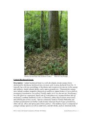
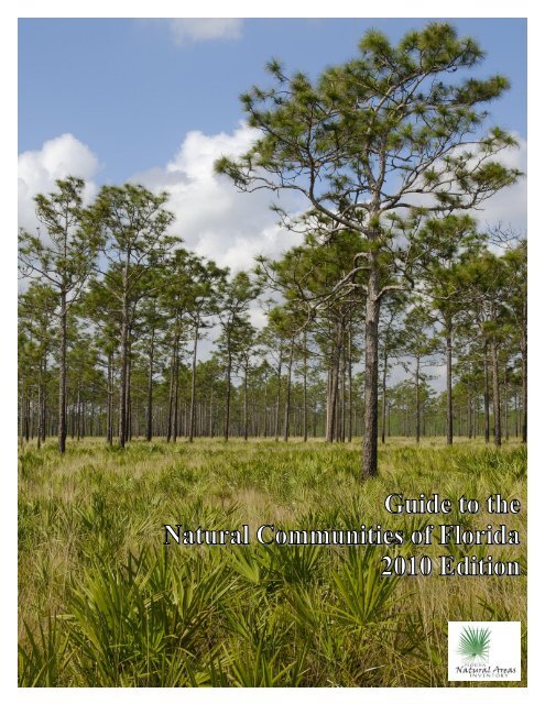
Cover Pho<strong>to</strong>graph:<br />
Mesic flatwoods at Triple N Ranch Wildlife Management Area, Osceola County (Gary Knight)<br />
Recommended citation: <strong>Florida</strong> <strong>Natural</strong> <strong>Areas</strong> Inven<strong>to</strong>ry (FNAI). 2010. <strong>Guide</strong> <strong>to</strong> <strong>the</strong> natural communities of<br />
<strong>Florida</strong>: 2010 edition. <strong>Florida</strong> <strong>Natural</strong> <strong>Areas</strong> Inven<strong>to</strong>ry, Tallahassee, FL.<br />
2010 Edition
2010 Edition<br />
PREFACE<br />
In 2007, with funding from <strong>the</strong> <strong>Florida</strong> Department of Environmental Protection (FDEP), Division of State Lands,<br />
<strong>the</strong> <strong>Florida</strong> <strong>Natural</strong> <strong>Areas</strong> Inven<strong>to</strong>ry (FNAI) began a process of updating <strong>the</strong> "<strong>Guide</strong> <strong>to</strong> <strong>the</strong> <strong>Natural</strong> Communities of<br />
<strong>Florida</strong>" (<strong>the</strong> <strong>Guide</strong>), which had been only slightly modified since it was first published in 1990 by FNAI and <strong>the</strong><br />
<strong>Florida</strong> Department of <strong>Natural</strong> Resources (now FDEP). The current update includes only <strong>the</strong> forty-five land-based<br />
communities (23 terrestrial and 20 palustrine communities, plus tidal marsh and tidal swamp in <strong>the</strong> marine and<br />
estuarine category), leaving <strong>the</strong> remaining communities <strong>to</strong> be updated at a later time, except for <strong>the</strong> updating of<br />
species names. The purpose of <strong>the</strong> update is <strong>to</strong> clarify distinctions between communities by listing characteristic<br />
species and features distinguishing similar communities, as well as <strong>to</strong> add information for each community on<br />
variations throughout its range (with common variants noted specifically), range, natural processes, management,<br />
exemplary sites, and references. The resulting 2010 <strong>Guide</strong> contains <strong>the</strong> original marine, estuarine, lacustrine,<br />
riverine, and subterranean communities, plus <strong>the</strong> updated 46 land-based communities, with 9 new community names<br />
added – alluvial forest, glades marsh, Keys cactus barren, Keys tidal rock barren, limes<strong>to</strong>ne outcrop, shrub bog,<br />
slough marsh, upland mixed woodland, and upland pine, and 8 original community names deleted (<strong>the</strong>ir names<br />
being changed or <strong>the</strong>ir concepts being subsumed under o<strong>the</strong>r communities) – bog, coastal rock barren, floodplain<br />
forest, freshwater tidal swamp, prairie hammock, swale, upland mixed forest, and upland pine forest. A complete<br />
crosswalk between <strong>the</strong> 1990 <strong>Guide</strong> and <strong>the</strong> 2010 <strong>Guide</strong> and vice versa is provided here with fur<strong>the</strong>r explanation of<br />
changes made (Appendix 1).<br />
The updated, land-based natural communities are grouped according <strong>to</strong> a new organization, emphasizing similarities<br />
in species composition, structure, and landscape position. Also included in <strong>the</strong> 2010 <strong>Guide</strong> are a list of altered<br />
landcover types and <strong>the</strong>ir definitions (Appendix 2). These are habitats that have been severely impacted by humans<br />
and do not fit in<strong>to</strong> FNAI’s <strong>Natural</strong> Community Classification. Altered landcover types can be used <strong>to</strong> describe <strong>the</strong><br />
most common non-natural habitats observed on conservation lands in <strong>Florida</strong>.
TABLE OF CONTENTS<br />
ACKNOWLEDGEMENTS.................................................................................................................................... 1<br />
INTRODUCTION .................................................................................................................................................... 2<br />
NATURAL COMMUNITY SHORT DESCRIPTIONS ........................................................................ 4<br />
HARDWOOD FORESTED UPLANDS<br />
Slope Forest ................................................................................................................................................... 12<br />
Upland Hardwood Forest .............................................................................................................................. 16<br />
Mesic Hammock ........................................................................................................................................... 19<br />
Rockland Hammock ...................................................................................................................................... 24<br />
Xeric Hammock ............................................................................................................................................ 29<br />
HIGH PINE AND SCRUB<br />
Upland Mixed Woodland .............................................................................................................................. 32<br />
Upland Pine ................................................................................................................................................... 35<br />
Sandhill ......................................................................................................................................................... 39<br />
Scrub ............................................................................................................................................................. 44<br />
PINE FLATWOODS AND DRY PRAIRIE<br />
Wet Flatwoods............................................................................................................................................... 49<br />
Mesic Flatwoods ........................................................................................................................................... 54<br />
Scrubby Flatwoods ........................................................................................................................................ 58<br />
Pine Rockland ............................................................................................................................................... 61<br />
Dry Prairie ..................................................................................................................................................... 67<br />
COASTAL UPLANDS<br />
Beach Dune ................................................................................................................................................... 70<br />
Coastal Berm ................................................................................................................................................. 73<br />
Coastal Grassland .......................................................................................................................................... 75<br />
Coastal Strand ............................................................................................................................................... 78<br />
Maritime Hammock ...................................................................................................................................... 82<br />
Shell Mound .................................................................................................................................................. 85<br />
SINKHOLES AND OUTCROP COMMUNITIES<br />
Upland Glade................................................................................................................................................. 88<br />
Sinkhole ......................................................................................................................................................... 91<br />
Limes<strong>to</strong>ne Outcrop ........................................................................................................................................ 94<br />
Keys Cactus Barren ....................................................................................................................................... 97<br />
FRESHWATER NON-FORESTED WETLANDS<br />
PRAIRIES AND BOGS<br />
Seepage Slope ............................................................................................................................................... 99<br />
Wet Prairie .................................................................................................................................................. 102<br />
Marl Prairie ................................................................................................................................................. 107<br />
Shrub Bog .................................................................................................................................................... 110<br />
MARSHES<br />
Depression Marsh ........................................................................................................................................ 113<br />
Basin Marsh ................................................................................................................................................ 117<br />
Coastal Interdunal Swale ............................................................................................................................. 120<br />
Floodplain Marsh ........................................................................................................................................ 122<br />
Slough Marsh .............................................................................................................................................. 126<br />
Glades Marsh............................................................................................................................................... 129<br />
Slough ......................................................................................................................................................... 134
FRESHWATER FORESTED WETLANDS<br />
CYPRESS/TUPELO<br />
Dome Swamp .............................................................................................................................................. 137<br />
Basin Swamp ............................................................................................................................................... 142<br />
Strand Swamp ............................................................................................................................................. 146<br />
Floodplain Swamp ....................................................................................................................................... 149<br />
HARDWOOD<br />
Baygall ........................................................................................................................................................ 154<br />
Hydric Hammock ........................................................................................................................................ 158<br />
Bot<strong>to</strong>mland Forest ....................................................................................................................................... 162<br />
Alluvial Forest ............................................................................................................................................. 166<br />
MARINE AND ESTUARINE VEGETATED WETLANDS<br />
Salt Marsh ................................................................................................................................................... 170<br />
Mangrove Swamp ....................................................................................................................................... 175<br />
Keys Tidal Rock Barren .............................................................................................................................. 179<br />
LACUSTRINE<br />
Clastic Upland Lake .................................................................................................................................... 181<br />
Coastal Dune Lake ...................................................................................................................................... 182<br />
Coastal Rockland Lake ................................................................................................................................ 183<br />
Flatwoods/Prairie Lake and Marsh Lake ..................................................................................................... 183<br />
River Floodplain Lake and Swamp Lake .................................................................................................... 184<br />
Sandhill Upland Lake .................................................................................................................................. 185<br />
Sinkhole Lake .............................................................................................................................................. 186<br />
RIVERINE<br />
Alluvial Stream ........................................................................................................................................... 187<br />
Blackwater Stream ...................................................................................................................................... 188<br />
Seepage Stream ........................................................................................................................................... 188<br />
Spring-run Stream ....................................................................................................................................... 189<br />
MARINE AND ESTUARINE<br />
MINERAL BASED<br />
Consolidated Substrate ................................................................................................................................ 191<br />
Unconsolidated Substrate ............................................................................................................................ 192<br />
FAUNAL BASED<br />
Coral Reef ................................................................................................................................................... 193<br />
Mollusk Reef ............................................................................................................................................... 194<br />
Oc<strong>to</strong>coral Bed .............................................................................................................................................. 195<br />
Sponge Bed ................................................................................................................................................. 195<br />
Worm Reef .................................................................................................................................................. 196<br />
FLORAL BASED<br />
Algal Bed .................................................................................................................................................... 196<br />
Seagrass Bed ............................................................................................................................................... 197<br />
COMPOSITE SUBSTRATE<br />
Composite Substrate .................................................................................................................................... 198<br />
SUBTERRANEAN<br />
Aquatic and Terrestrial Cave ....................................................................................................................... 199<br />
REFERENCES ...................................................................................................................................................... 201<br />
APPENDIX 1. CROSSWALK<br />
APPENDIX 2. ALTERED LANDCOVER TYPES
ACKNOWLEDGEMENTS<br />
We owe a large debt of gratitude <strong>to</strong> Dr. O. Greg Brock, bureau chief of <strong>the</strong> Office of Environmental Services at<br />
FDEP, whose support and encouragement made this project possible. We would like <strong>to</strong> thank <strong>the</strong> following experts<br />
for <strong>the</strong>ir helpful comments on <strong>the</strong> individual accounts: Richard Abbott, Guy Anglin, Wilson Baker, Chris Bergh,<br />
Keith Bradley, Susan Carr, Linda Chafin, Pete Colverson, Anne Cox, Melanie Darst, Linda Duever, Mark Deyrup,<br />
Janice Dusquesnel, Kathy Ewel, Elise Gornish, Dennis Hardin, Richard Hilsenbeck, Jean Huffman, Michael<br />
Jenkins, Erik Johnson, Adam Kent, Kay Kirkman, Helen Light, Matt Love, Eric Menges, Tom Miller, Gil Nelson,<br />
Eliane Norman, Dan Pearson, Kevin Robertson, Anne Rudloe, Paul Schmalzer, Bob Simons, James Snyder, Bruce<br />
Sorrie, Walter Taylor, Walt Thompson, John Tobe, Greg Walker (and <strong>the</strong> biologists of <strong>the</strong> <strong>Florida</strong> Park Service),<br />
and Samuel Wright.<br />
2010 Edition 1
INTRODUCTION<br />
This document presents <strong>the</strong> hierarchical classification of 81 <strong>Natural</strong> Communities, developed by <strong>the</strong> <strong>Florida</strong> <strong>Natural</strong><br />
<strong>Areas</strong> Inven<strong>to</strong>ry (FNAI) and identified as collectively constituting <strong>the</strong> original, natural biological associations of<br />
<strong>Florida</strong>. A <strong>Natural</strong> Community (NC) is defined as a distinct and recurring assemblage of populations of plants,<br />
animals, fungi and microorganisms naturally associated with each o<strong>the</strong>r and <strong>the</strong>ir physical environment.<br />
The 2010 FNAI natural community classification groups natural communities in<strong>to</strong> categories based on a<br />
combination of vegetation, landscape position, and hydrology. The categories, such as “hardwood forested uplands”<br />
are meant <strong>to</strong> be an intuitive grouping of similar natural communities that allows <strong>the</strong> user <strong>to</strong> apply a broader level<br />
name <strong>to</strong> an area when <strong>the</strong> community determination is uncertain. In some cases, an intermediate group (ex.<br />
“Cypress/Tupelo”) is identified for fur<strong>the</strong>r clarification. At <strong>the</strong> finest level, variants (if any) are described within <strong>the</strong><br />
community accounts. These variants are optional descriptions that can be used <strong>to</strong> convey more specific information<br />
about an individual community occurrence. For example, a swamp found at <strong>the</strong> mouth of a river might be<br />
designated “floodplain swamp – freshwater tidal swamp variant.” Variants have <strong>the</strong> same ranking as <strong>the</strong> natural<br />
community of which <strong>the</strong>y are a part. The treatment of each of <strong>the</strong> 46 communities updated in 2010 follows <strong>the</strong><br />
outline below.<br />
Description – gives an overall picture of <strong>the</strong> community with a description of <strong>the</strong> general<br />
vegetation structure and composition, landscape position, soils, hydrology, salinity, and/or fire.<br />
Characteristic Set of Species – short list of typical species.<br />
Rare Species – a discussion of rare species for which <strong>the</strong> community is critical habitat. This is<br />
not meant <strong>to</strong> be an exhaustive list.<br />
Range – discussion of <strong>Florida</strong> range and notes on <strong>the</strong> distribution of similar communities<br />
elsewhere in <strong>the</strong> US or worldwide.<br />
<strong>Natural</strong> Processes – a discussion of important natural processes including fire, hydrology, etc.<br />
Community Variations – discussion of commonly occurring variation, both regional and within<br />
community.<br />
Variant – names and short descriptions of notable variants of <strong>the</strong> natural community.<br />
These are informal names that are meant <strong>to</strong> convey fur<strong>the</strong>r information about specific<br />
community occurrences. Their ranks are <strong>the</strong> same as that of <strong>the</strong> entire community.<br />
Associated Communities – addresses similar and/or adjacent communities and gives guidelines<br />
for recognition.<br />
Management Considerations – addresses fire recommendations and any o<strong>the</strong>r management<br />
oriented issues stemming from disturbance of natural processes.<br />
Exemplary Sites – <strong>the</strong>se may be specific place names or managed areas (full name) with county<br />
listed in paren<strong>the</strong>ses.<br />
Global and State Ranks – current ranking of community by FNAI.<br />
Crosswalk and Synonyms – crosswalk <strong>to</strong> o<strong>the</strong>r classifications and a list of synonyms commonly<br />
found in <strong>the</strong> literature<br />
References – cited in text<br />
The classification of <strong>the</strong> remaining (primarily aquatic) communities that were not updated remains unchanged.<br />
These communities are grouped in<strong>to</strong> Lacustrine, Riverine, Subterranean, and Estuarine and Marine categories A<br />
second level of <strong>the</strong> hierarchy splits <strong>the</strong> Estuarine and Marine categories in<strong>to</strong> <strong>Natural</strong> Community Groups, including<br />
Faunal, Floral, and Substrate-based.<br />
<strong>Natural</strong> Communities are characterized and defined by a combination of physiognomy, vegetation structure and<br />
composition, <strong>to</strong>pography, land form, substrate, soil moisture condition, climate, and fire. They are named for <strong>the</strong>ir<br />
most characteristic biological or physical feature. <strong>Natural</strong> Communities could be fur<strong>the</strong>r subdivided in<strong>to</strong> Plant<br />
Communities based on <strong>the</strong> dominant plant species. This level of subdivision is not presented in this document.<br />
FNAI uses several criteria, including area covered and number of occurrences, <strong>to</strong> determine <strong>the</strong> relative rarity and<br />
threat <strong>to</strong> each community type; <strong>the</strong>se are summarized in<strong>to</strong> a global and a state rank, <strong>the</strong> G and S ranks, respectively.<br />
Most G ranks for NCs are tentative, pending more information from comparison and coordination with o<strong>the</strong>r states<br />
2010 Edition 2
and countries. Three NCs are given <strong>the</strong> highest rarity ranking (G1/S1): upland glade, Keys cactus barren, and pine<br />
rockland. The first two, being confined <strong>to</strong> limes<strong>to</strong>ne outcrops in wooded landscapes, are naturally of limited extent;<br />
<strong>the</strong> third occurs in <strong>the</strong> Miami-Dade urban area and has been largely altered for human use. Twelve NCs are ranked<br />
at <strong>the</strong> second most endangered level (G2/S2). Six of <strong>the</strong>se are of naturally limited extent: slope forest, seepage<br />
slope, sinkhole, limes<strong>to</strong>ne outcrop, shell mound, and strand swamp, and six have been largely altered for human use:<br />
dry prairie, wet prairie, scrub, scrubby flatwoods, upland mixed woodland, and rockland hammock. With <strong>the</strong><br />
exception of wet prairie and seepage slope which are found in adjacent states, all of <strong>the</strong>se rarest NCs are largely<br />
confined <strong>to</strong> <strong>Florida</strong>.<br />
Several o<strong>the</strong>r classification systems are in use in <strong>Florida</strong>, with four principal ones that cover <strong>the</strong> entire state. The<br />
widely used FLUCCS (<strong>Florida</strong> Land Use, Cover, and Forms Classification System) system, is a general purpose<br />
mapping system, devised by <strong>the</strong> <strong>Florida</strong> Department of Transportation, that includes both natural and altered (i.e.,<br />
residential areas, farmland, pastures, etc.) categories that are distinguishable on aerial pho<strong>to</strong>graphs. This system is<br />
used by <strong>the</strong> five <strong>Florida</strong> Water Management Districts <strong>to</strong> produce periodically updated, digitized maps of <strong>the</strong> entire<br />
state interpreted from current aerial pho<strong>to</strong>graphy. The <strong>Florida</strong> Land Cover map produced by <strong>the</strong> <strong>Florida</strong> Fish and<br />
Wildlife Conservation Commission (FWC) uses mechanical interpretation of satellite imagery (2003) <strong>to</strong> produce a<br />
single statewide map using 23 natural categories and 16 human-modified categories. More recently <strong>the</strong> FWC<br />
developed <strong>the</strong> <strong>Florida</strong> Land Cover Classification System (2009), a hierarchical classification consisting of more than<br />
200 classes that integrates <strong>the</strong> FNAI system with FLUCCS. This classification is <strong>the</strong> basis for Cooperative Land<br />
Cover Map (FNAI 2010), a statewide digital map that incorporates FLUCCS, high quality site-based land cover, and<br />
improvements <strong>to</strong> focal community maps through aerial pho<strong>to</strong> review. A finer-scale plant community level of<br />
classification called <strong>the</strong> U. S. National Vegetation Classification (USNVC), developed by The Nature Conservancy<br />
(and now maintained by NatureServe) for conservation purposes and continuously updated, uses dominant plant<br />
species <strong>to</strong> define its finest units, called “associations”, of which it has recognized over 350 in<br />
<strong>Florida</strong>. 287 NatureServe has also grouped <strong>the</strong> associations in<strong>to</strong> ecological systems, based on geographic location and<br />
landform, of which <strong>the</strong>re are 73 in <strong>Florida</strong>.<br />
The FNAI classification seeks <strong>to</strong> encompass all natural assemblages at a scale that is useful for mapping natural<br />
areas and communication about land management. It differs from <strong>the</strong> FLUCCS and <strong>the</strong> FWC landcover systems in<br />
its lack of non-natural categories and its greater detail in natural categories. It differs from <strong>the</strong> associations of <strong>the</strong><br />
USNVC Classification in not being based on dominant species and from <strong>the</strong> ecological systems of NatureServe in<br />
not being based on geographic area of <strong>the</strong> state in which <strong>the</strong> assemblage occurs.<br />
The FNAI classification is meant <strong>to</strong> be relatively stable in order <strong>to</strong> facilitate its usage in state conservation efforts.<br />
However, we believe that <strong>the</strong> guide should also remain flexible and dynamic <strong>to</strong> incorporate up-<strong>to</strong>-date information.<br />
Future editions of <strong>the</strong> <strong>Guide</strong> will be released as new data and research accumulate.<br />
2010 Edition 3
NATURAL COMMUNITY SHORT DESCRIPTIONS<br />
HARDWOOD FORESTED UPLANDS – mesic or xeric forest dominated mainly by hardwood trees.<br />
Slope Forest (G2?/S1) – steep slope on bluff or in sheltered ravine within <strong>the</strong> Apalachicola drainage;<br />
sand/clay substrate; mesic-hydric; central Panhandle; rare or no fire; closed canopy of mainly deciduous<br />
species; American beech, <strong>Florida</strong> maple, white oak, Ashe’s magnolia, sou<strong>the</strong>rn magnolia, spruce pine,<br />
Shumard’s oak.<br />
Upland Hardwood Forest (G5/S3) – upland with sand/clay and/or calcareous substrate; mesic; Panhandle<br />
<strong>to</strong> central peninsula; rare or no fire; closed deciduous or mixed deciduous/evergreen canopy; American<br />
beech, sou<strong>the</strong>rn magnolia, hackberry, swamp chestnut oak, white oak, horse sugar, flowering dogwood, and<br />
mixed hardwoods.<br />
DRY UPLAND HARDWOOD FOREST – on dry slopes or along upper slopes with sand/clay substrate;<br />
mesic; temperate; rare fire; closed canopy; laurel oak and/or live oak and/or pignut hickory,<br />
sou<strong>the</strong>rn magnolia, shortleaf pine, loblolly pine, and/or mixed hardwoods.<br />
Mesic Hammock (G3/S3?) – flatland with sand/organic soil; mesic; primarily central peninsula; occasional or<br />
rare fire; closed evergreen canopy; live oak, cabbage palm, sou<strong>the</strong>rn magnolia, pignut hickory, saw palmet<strong>to</strong>.<br />
PRAIRIE MESIC HAMMOCK – Isolated stands within a matrix of pyrogenic vegetation; occasional fire;<br />
live oak, cabbage palm, saw palmet<strong>to</strong>.<br />
Rockland Hammock (G2/S2) – flatland with limes<strong>to</strong>ne substrate; mesic; sou<strong>the</strong>rn peninsula and Keys; rare<br />
or no fire; closed canopy of evergreen mixed tropical hardwoods; gumbo limbo, pigeon plum, s<strong>to</strong>ppers.<br />
THORN SCRUB – along eco<strong>to</strong>nes or within openings in rockland hammock; low-statured; dominated<br />
by spiny species; saffron plum, blackbead, hog plum, but<strong>to</strong>nwood, plus o<strong>the</strong>r common rockland<br />
hammock species.<br />
Xeric Hammock (G3/S3) – upland with deep sand substrate; xeric; primarily eastern Panhandle <strong>to</strong> central<br />
peninsula; rare or no fire; closed canopy of evergreen hardwoods; sand live oak, saw palmet<strong>to</strong>.<br />
HIGH PINE AND SCRUB – hills with mesic or xeric woodlands or shrublands; canopy, if present, open and consisting of pine<br />
or a mixture of pine and deciduous hardwoods.<br />
Upland Mixed Woodland (G2/S2) – upland with loamy soils; mesic-xeric; central Panhandle <strong>to</strong> extreme<br />
nor<strong>the</strong>rn central peninsula; occasional fire (variable but as little as two up <strong>to</strong> 20 year interval); open <strong>to</strong><br />
partially closed canopy over an open unders<strong>to</strong>ry of mixed herbs and scattered shrubs; mixture of sou<strong>the</strong>rn<br />
red oak, mockernut hickory, and longleaf or shortleaf pine with o<strong>the</strong>r mixed hardwoods; wiregrass infrequent.<br />
Upland Pine (G3/S2) – upland with sand/clay substrate; mesic-xeric; Panhandle <strong>to</strong> extreme nor<strong>the</strong>rn central<br />
peninsula; frequent fire (1-3 years); savanna of widely spaced pines over primarily herbaceous unders<strong>to</strong>ry;<br />
longleaf pine and/or loblolly pine and/or shortleaf pine, sou<strong>the</strong>rn red oak, wiregrass.<br />
Sandhill (G3/S2) – upland with deep sand substrate; xeric; Panhandle <strong>to</strong> central peninsula; frequent fire (1-3<br />
years); savanna of widely spaced longleaf pine and/or turkey oak with wiregrass unders<strong>to</strong>ry.<br />
Scrub (G2/S2) – upland with deep sand substrate; xeric; statewide except extreme sou<strong>the</strong>rn peninsula and<br />
Keys, mainly coastal in Panhandle; occasional or rare fire (usually 5-20 years); open or dense shrubs with or<br />
without pine canopy; sand pine and/or scrub oaks and/or <strong>Florida</strong> rosemary.<br />
ROSEMARY SCRUB – on <strong>the</strong> driest ridge crests, particularly at <strong>the</strong> sou<strong>the</strong>rn end of <strong>the</strong> Lake Wales<br />
Ridge and on Panhandle barrier islands; occasional or rare fire (10-40 years); dominated by <strong>Florida</strong><br />
rosemary with large areas of bare sand visible between <strong>the</strong> shrubs.<br />
SAND PINE SCRUB – on ridges throughout <strong>the</strong> state; rare fire (20-80 years); canopy of sand pine and<br />
an unders<strong>to</strong>ry of <strong>the</strong> three shrubby oaks, or less commonly, <strong>Florida</strong> rosemary.<br />
2010 Edition Short Descriptions 4
PINE FLATWOODS AND DRY PRAIRIE – mesic or hydric pine woodland or mesic shrubland on flat sandy or limes<strong>to</strong>ne<br />
subtrates, may have a hard pan that impedes drainage.<br />
Wet Flatwoods (G4/S4) – flatland with sand substrate; seasonally inundated; statewide except extreme<br />
sou<strong>the</strong>rn peninsula and Keys; frequent fire (2-4 years for grassy wet flatwoods, 5-10 years for shrubby wet<br />
flatwoods); closed <strong>to</strong> open pine canopy with grassy or shrubby unders<strong>to</strong>ry; slash pine, pond pine, large<br />
gallberry, fetterbush, sweetbay, cabbage palm, wiregrass, <strong>to</strong>othache grass.<br />
CUTTHROAT GRASS FLATWOODS – on and near <strong>the</strong> Lake Wales Ridge; frequent fire (2-4 years);<br />
widely scattered pines over cutthroat grass and/or o<strong>the</strong>r hydrophytic herbs.<br />
CABBAGE PALM FLATWOODS – on shelly sand or where limes<strong>to</strong>ne is near <strong>the</strong> surface; central <strong>to</strong><br />
sou<strong>the</strong>rn peninsula; pine canopy over cabbage palm unders<strong>to</strong>ry.<br />
Mesic Flatwoods (G4/S4) – flatland with sand substrate; mesic; statewide except extreme sou<strong>the</strong>rn<br />
peninsula and Keys; frequent fire (2-4 years); open pine canopy with a layer of low shrubs and herbs;<br />
longleaf pine and/or slash pine, saw palmet<strong>to</strong>, gallberry, dwarf live oak, wiregrass.<br />
Scrubby Flatwoods (G2/S2?) – flatland with sand substrate; xeric-mesic; statewide except extreme<br />
sou<strong>the</strong>rn peninsula and Keys; occasional fire (5-15 years); widely scattered pine canopy over saw palmet<strong>to</strong><br />
and scrub oaks; longleaf pine, sand live oak, myrtle oak, Chapman’s oak, saw palmet<strong>to</strong>, wiregrass.<br />
Pine Rockland (G1/S1) – flatland with exposed limes<strong>to</strong>ne substrate; mesic-xeric; sou<strong>the</strong>rn peninsula and<br />
Keys; frequent <strong>to</strong> occasional fire (3-7 years); open pine canopy with mixed shrubs and herbs in unders<strong>to</strong>ry;<br />
South <strong>Florida</strong> slash pine, palms, mixed tropical and temperate shrubs, grasses, and herbs.<br />
Dry Prairie (G2/S2) – flatland with sand soils over an organic or clay hardpan; mesic-xeric; central<br />
peninsula; annual or frequent fire (1-2 years); treeless with a low cover of shrubs and herbs; wiregrass, dwarf<br />
live oak, stunted saw palmet<strong>to</strong>, bottlebrush threeawn, broomsedge bluestem.<br />
COASTAL UPLANDS – mesic or xeric communities restricted <strong>to</strong> barrier islands and near shore; woody or herbaceous<br />
vegetation; o<strong>the</strong>r communities may also occur in coastal environments.<br />
Beach Dune (G3/S2) – active coastal dune with sand substrate; xeric; statewide; rare or no fire; marine<br />
influence; open herbaceous vegetation with no canopy; sea oats, railroad vine, bitter panicum, and/or mixed<br />
salt-spray <strong>to</strong>lerant grasses and herbs.<br />
Coastal Berm (G3/S2) – old bar or s<strong>to</strong>rm debris with sand/shell substrate; xeric-mesic; sou<strong>the</strong>rn peninsula<br />
and Keys; rare or no fire; marine influence; variable vegetation structure; mixed tropical herbs, shrubs, and<br />
trees.<br />
Coastal Grassland (G3/S2) – coastal flatland behind dunes with stable sand substrate; mesic-hydric;<br />
statewide excluding Keys; occasional fire; marine influence; herbaceous vegetation with no canopy; salt<strong>to</strong>lerant<br />
grasses and herbs; sea oats, bitter panicum, camphorweed, hairawn muhly, Gulf bluestem.<br />
Coastal Strand (G3/S2) – stabilized coastal dune with sand substrate; xeric; peninsula; rare fire; marine<br />
influence; primarily dense shrubs; saw palmet<strong>to</strong> in temperate coastal strand or seagrape and/or saw<br />
palmet<strong>to</strong> in tropical coastal strand.<br />
Maritime Hammock (G3/S2) – stabilized coastal dune with sand substrate; xeric-mesic; statewide but rare in<br />
Panhandle and Keys; rare or no fire; marine influence; evergreen closed canopy; live oak, cabbage palm, red<br />
bay, red cedar in temperate maritime hammock; gumbo limbo, seagrape, and white or Spanish s<strong>to</strong>pper in<br />
tropical maritime hammock.<br />
Shell Mound (G2/S2) – small hill of shells deposited by native Americans; mesic-xeric; statewide; rare or no<br />
fire; marine influence; closed canopy of mixed hardwoods; soapberry, snowberry, white s<strong>to</strong>pper.<br />
SINKHOLES AND OUTCROP COMMUNITIES – small extent communities in karst features or on exposed limes<strong>to</strong>ne.<br />
Upland Glade (G1/S1) – upland with thin clay soils over limes<strong>to</strong>ne outcrops; hydric-xeric; central Panhandle<br />
only; sparse mixed grasses and herbs with occasional stunted trees and shrubs that are concentrated<br />
2010 Edition Short Descriptions 5
around <strong>the</strong> edge; black bogrush, poverty dropseed, diamondflowers, hairawn muhly, Boykin’s polygala, red<br />
cedar.<br />
Sinkhole (G2/S2) – karst feature with steep walls; mesic-hydric; statewide; variable vegetation structure.<br />
Limes<strong>to</strong>ne Outcrop (G2/S2) – exposed limes<strong>to</strong>ne; mesic-hydric; statewide; often with mosses, liverworts,<br />
and a diversity of rare ferns.<br />
Keys Cactus Barren (G1/S1) – small openings on flatland with exposed limes<strong>to</strong>ne; xeric; restricted <strong>to</strong> Keys;<br />
marine influence; open, herbaceous vegetation with some cacti, agave, and stunted trees; three-spined<br />
pricklypear, erect pricklypear, barbed wire cactus, Yucatan fly mallow, <strong>Florida</strong> Keys indigo, skyblue<br />
clustervine, dwarf bindweed.<br />
FRESHWATER NON-FORESTED WETLANDS – herbaceous or shrubby palustrine communities in floodplains or<br />
depressions; canopy trees, if present, very sparse and often stunted.<br />
PRAIRIES AND BOGS – short hydroperiod; dominated by grasses, sedges, and/or titi.<br />
Seepage Slope (G2/S2) – on or at base of slope with loamy sand substrate; maintained by downslope<br />
seepage, usually saturated but rarely inundated; Panhandle and nor<strong>the</strong>rn peninsula; frequent fire (1-3 years);<br />
dense herbaceous community; wiregrass, wiry beaksedges, flattened pipewort, <strong>to</strong>othache grass,<br />
pitcherplants.<br />
Wet Prairie (G2/S2) – flatland with sand or clayey sand substrate; usually saturated but only occasionally<br />
inundated; statewide excluding extreme sou<strong>the</strong>rn peninsula; frequent fire (2-3 years); treeless, dense<br />
herbaceous community with few shrubs; wiregrass, blue maidencane, cutthroat grass, wiry beaksedges,<br />
flattened pipewort, <strong>to</strong>othache grass, pitcherplants, coastalplain yellow-eyed grass.<br />
CUTTHROAT SEEP – eastern and western edges of <strong>the</strong> Lake Wales Ridge in central <strong>Florida</strong>;<br />
dominated by <strong>the</strong> endemic cutthroat grass.<br />
CALCAREOUS WET PRAIRIE – in central and south-central peninsula on calcareous soils; Gulf<br />
hairawn muhly typically dominant with o<strong>the</strong>r calcium-loving species.<br />
PITCHERPLANT PRAIRIE – in <strong>the</strong> Panhandle on wetter soils; dense stands of tall pitcherplants.<br />
Marl Prairie (G3/S3) – flatland with marl over limes<strong>to</strong>ne substrate; seasonally inundated (
Coastal Interdunal Swale (G3/S2) – linear wetlands between dunes on sandy barrier islands; inundated by<br />
local rainfall events; Panhandle <strong>to</strong> central peninsula; herbaceous or shrubby; sawgrass, hairawn muhly,<br />
broomsedge, seashore paspalum, Baker’s cordgrass, saltmeadow cordgrass, wax myrtle, coastalplain<br />
willow.<br />
Floodplain Marsh (G3/S3) – floodplain with organic/sand/alluvial substrate; seasonally inundated;<br />
Panhandle <strong>to</strong> central peninsula; frequent or occasional fire (ca. 3 years, much less frequent in freshwater<br />
tidal marshes); treeless herbaceous community with few shrubs; sawgrass, maidencane, sand cordgrass,<br />
and/or mixed emergents.<br />
FRESHWATER TIDAL MARSH – river mouth wetland on organic/alluvial substrates; receives pulses of<br />
freshwater in response <strong>to</strong> tides; sawgrass, giant cutgrass.<br />
Slough Marsh (G3?/S3?)– broad, shallow channel with sand/peat substrate; seasonally inundated;<br />
intermittently flowing water; central <strong>to</strong> sou<strong>the</strong>rn peninsula; frequent or occasional fire (3-10 years); sawgrass,<br />
maidencane, pickerelweed, and/or mixed emergents.<br />
Glades Marsh (G3/S3) – broad, shallow channel with peat/marl substrate directly overlying limes<strong>to</strong>ne;<br />
seasonally inundated; stagnant or slow flowing water; Everglades basin, Big Cypress region, and Keys;<br />
frequent <strong>to</strong> occasional fire (3-10 years); sawgrass, spikerush, maidencane, beaksedges, mixed emergents.<br />
KEYS FRESHWATER MARSH – limes<strong>to</strong>ne depression; restricted <strong>to</strong> <strong>Florida</strong> Keys; may be saline during<br />
dry season; sawgrass.<br />
Slough (G3/S3) – broad, shallow channel with peat; inundated except during droughts; flowing water;<br />
statewide excluding Keys; rare fire; sparsely canopied or with emergent or floating plants; alliga<strong>to</strong>r flag,<br />
American white waterlily.<br />
POND APPLE SLOUGH – canopied sloughs dominated by pond apple or Carolina ash, often with<br />
abundant epiphytes.<br />
FRESHWATER FORESTED WETLANDS – floodplains or depressions dominated by hydrophytic trees<br />
CYPRESS/TUPELO – dominated entirely by cypress or tupelo, or <strong>the</strong>se species important in <strong>the</strong> canopy; long<br />
hydroperiod.<br />
Dome Swamp (G4/S4) – small or large and shallow isolated depression in sand/marl/limes<strong>to</strong>ne substrate<br />
with peat accumulating <strong>to</strong>ward center; occurring within a fire-maintained community; seasonally inundated;<br />
still water; statewide excluding Keys; occasional or rare fire; forested, canopy often tallest in center; pond<br />
cypress, swamp tupelo.<br />
GUM POND – underlain by a clay lens; generally occurs in upland pine; mainly Panhandle; longer<br />
hydroperiod and lower fire frequency than cypress-dominated dome swamps; dominated by<br />
swamp tupelo.<br />
STRINGER SWAMP – narrow linear swamps; occur within a pyrogenic community along intermittent<br />
streams that only flow during heavy rainfall; Panhandle; dominated by pond cypress.<br />
Basin Swamp (G4/S3) – typically large basin wetland with peat substrate; seasonally inundated; still water<br />
or with water output; Panhandle <strong>to</strong> central peninsula; occasional or rare fire; forest of cypress/tupelo/mixed<br />
hardwoods; pond cypress, swamp tupelo.<br />
Strand Swamp (G2/S2) – broad, shallow channel with peat over mineral substrate; situated in limes<strong>to</strong>ne<br />
troughs; seasonally inundated; slow flowing water; vicinity of Lake Okeechobee and southward; occasional<br />
or rare fire; closed canopy of cypress and mixed hardwoods; cypress, pond apple, strangler fig, willow,<br />
abundant epiphytes.<br />
Floodplain Swamp (G4/S4) – along or near rivers and streams with organic/alluvial substrate; usually<br />
inundated; Panhandle <strong>to</strong> central peninsula; rare or no fire; closed canopy dominated by cypress, tupelo,<br />
and/or black gum.<br />
2010 Edition Short Descriptions 7
FRESHWATER TIDAL SWAMP – floodplain swamp a river mouth where occasional saltwater intrusion<br />
significantly affects vegetation composition; receives pulses of freshwater in response <strong>to</strong> tides;<br />
cypress absent or infrequent; closed/open canopy of swamp tupelo, pumpkin ash, sweetbay.<br />
HARDWOOD – dominated by a mix of hydrophytic hardwood trees; cypress or tupelo may be occasional or infrequent<br />
in <strong>the</strong> canopy; short hydroperiod.<br />
Baygall (G4/S4) – slope or depression wetland with peat substrate; usually saturated and occasionally<br />
inundated; statewide excluding Keys; rare or no fire; closed canopy of evergreen trees; loblolly bay,<br />
sweetbay, swamp bay, titi, fetterbush.<br />
BAY SWAMP – large or small peat filled depression; mainly eastern Panhandle <strong>to</strong> central peninsula;<br />
forested; dominated by bay species.<br />
SOUTH FLORIDA BAYHEAD – on tree islands in glades marsh on peat substrate; south of Lake<br />
Okeechobee in central and sou<strong>the</strong>rn peninsula; open or closed canopy; swamp bay, sweetbay,<br />
dahoon, coastalplain willow, and/or coco plum.<br />
Hydric Hammock (G4/S4) – lowland with sand/clay/organic soil over limes<strong>to</strong>ne or with high shell content;<br />
mesic-hydric; primarily eastern Panhandle and central peninsula; occasional <strong>to</strong> rare fire; diamond-leaved<br />
oak, live oak, cabbage palm, red cedar, and mixed hardwoods.<br />
COASTAL HYDRIC HAMMOCK – occurring adjacent <strong>to</strong> coastal marshes; central Panhandle <strong>to</strong> central<br />
peninsula; species composition limited by occasional salt water intrusion; cabbage palm, red cedar,<br />
and live oak.<br />
PRAIRIE HYDRIC HAMMOCK – isolated stands of hydric hammock within a pyrogenic community,<br />
usually floodplain marsh; shelly sand soils; central and sou<strong>the</strong>rn peninsula; occasional fire;<br />
cabbage palm, live oak, red cedar.<br />
Bot<strong>to</strong>mland Forest (G4/S3) – flatland with sand/clay/organic substrate; usually connected or adjacent <strong>to</strong> a<br />
riverine community; occasionally inundated; Panhandle <strong>to</strong> central peninsula; rare or no fire; closed canopy of<br />
mixed hardwoods; deciduous or mixed deciduous/evergreen; tuliptree, sweetbay, water oak, sweetgum,<br />
diamond-leaved oak, red maple, loblolly pine, spruce pine, Atlantic white cedar.<br />
Alluvial Forest (G4/S3) – floodplain with alluvial substrate of sand, silt, clay or organic soil; inundated yearly<br />
during growing season; influenced by disturbance from ongoing floodplain processes (deposition of point<br />
bars, creation of “ridge and swale” <strong>to</strong>pography); Panhandle <strong>to</strong> central peninsula; rare or no fire; closed<br />
canopy of mainly deciduous trees; water hickory, overcup oak, diamond-leaved oak, green ash, American<br />
elm, water locust, river birch.<br />
MARINE and ESTUARINE VEGETATED WETLANDS – intertidal or supratidal zone dominated by herbaceous or woody<br />
halophytic vascular plants; salinity >0.5 ppt.<br />
Salt Marsh (G5/S4) – estuarine wetland on muck/sand/or limes<strong>to</strong>ne substrate; inundated with saltwater by<br />
daily tides; statewide; occasional or rare fire; treeless, dense herb layer with few shrubs; saltmarsh<br />
cordgrass, needle rush, saltgrass, saltwort, perennial glasswort, seaside oxeye.<br />
SALT FLAT – salt marsh with much exposed bare soil on slightly higher areas within marsh; high<br />
salinity and dry conditions; sparse and stunted cover of succulents and/or shoregrass.<br />
Mangrove Swamp (G5/S4) – estuarine wetland on muck/sand/or limes<strong>to</strong>ne substrate; inundated with<br />
saltwater by daily tides; central peninsula and Keys; no fire; dominated by mangrove and mangrove<br />
associate species; red mangrove, black mangrove, white mangrove, but<strong>to</strong>nwood.<br />
BUTTONWOOD FOREST – upper tidal area dominated by but<strong>to</strong>nwood; often transitional <strong>to</strong> rockland<br />
hammock.<br />
2010 Edition Short Descriptions 8
Keys Tidal Rock Barren (G3/S3?) – flatland with exposed limes<strong>to</strong>ne in supratidal zone; restricted <strong>to</strong> Keys;<br />
no fire; open, mainly herbaceous vegetation of upper salt marsh species and stunted shrubs and trees;<br />
but<strong>to</strong>nwood, christmasberry, perennial glasswort, saltwort, seashore dropseed, shoregrass.<br />
PONDS and LAKES (LACUSTRINE) – non-flowing wetlands of natural depressions lacking persistent emergent vegetation<br />
except around <strong>the</strong> perimeter<br />
Clastic Upland Lake (G3/S2) – generally irregular basin in clay uplands; predominantly with inflows,<br />
frequently without surface outflow; clay or organic substrate; Panhandle <strong>to</strong> nor<strong>the</strong>rn central peninsula;<br />
colored, acidic, soft water with low mineral content (sodium, chloride, sulfate); oligo-mesotrophic <strong>to</strong> eutrophic.<br />
Coastal Dune Lake (G2/S1) – basin or lagoon influenced by recent coastal processes; predominantly sand<br />
substrate with some organic matter; Panhandle; salinity variable among and within lakes, and subject <strong>to</strong><br />
saltwater intrusion and s<strong>to</strong>rm surges; slightly acidic, hard water with high mineral content (sodium, chloride).<br />
Coastal Rockland Lake (G2/S1) – shallow basin influenced by recent coastal processes; predominantly<br />
barren oolitic or Miami limes<strong>to</strong>ne substrate; sou<strong>the</strong>rn peninsula and Keys; salinity variable among and within<br />
lakes, and subject <strong>to</strong> saltwater intrusion, s<strong>to</strong>rm surges and evaporation (because of shallowness); slightly<br />
alkaline, hard water with high mineral content (sodium, chloride).<br />
Flatwoods/Prairie Lake (G4/S3) – generally shallow basin in flatlands with high water table; frequently with<br />
a broad lit<strong>to</strong>ral zone; still water or flow-through; sand or peat substrate; statewide except extreme sou<strong>the</strong>rn<br />
peninsula and Keys; variable water chemistry, colored <strong>to</strong> clear, acidic <strong>to</strong> slightly alkaline, soft <strong>to</strong> moderately<br />
hard water with moderate mineral content (sodium, chloride, sulfate); oligo-mesotrophic <strong>to</strong> eutrophic.<br />
Marsh Lake (G4/S4) – generally shallow, open water area within wide expanses of freshwater marsh; still<br />
water or flow-through; peat, sand or clay substrate; statewide except Keys; variable water chemistry, but<br />
characteristically highly colored, acidic, soft water with moderate mineral content (sodium, chloride, sulfate);<br />
oligo-mesotrophic <strong>to</strong> eutrophic.<br />
River Floodplain Lake (G4/S2) – meander scar, backwater, or larger flow-through body within major river<br />
floodplains; sand, alluvial or organic substrate; statewide except extreme sou<strong>the</strong>rn peninsula and Keys;<br />
colored, alkaline or slightly acidic, hard or moderately hard water with high mineral content (sulfate, sodium,<br />
chloride, calcium, magnesium); mesotrophic <strong>to</strong> eutrophic.<br />
Sandhill Upland Lake (G3/S2) – generally rounded solution depression in deep sandy uplands; panhandle<br />
<strong>to</strong> sou<strong>the</strong>rn peninsula; predominantly without surface inflows/outflows; typically sand substrate with organic<br />
accumulations <strong>to</strong>ward middle; clear, acidic moderately soft water with varying mineral content; ultraoligotrophic<br />
<strong>to</strong> mesotrophic.<br />
Sinkhole Lake (G2/S2) – typically deep, funnel-shaped depression in limes<strong>to</strong>ne base; statewide;<br />
predominantly without surface inflows/outflows, but frequently with connection <strong>to</strong> <strong>the</strong> aquifer; clear, alkaline,<br />
hard water with high mineral content (calcium, bicarbonate, magnesium).<br />
Swamp Lake (G4/S3) – generally shallow, open water area within basin swamps; still water or flow-through;<br />
peat, sand or clay substrate; statewide except Keys; variable water chemistry, but characteristically highly<br />
colored, acidic, soft water with moderate mineral content (sodium, chloride, sulfate); oligo-mesotrophic <strong>to</strong><br />
eutrophic.<br />
2010 Edition Short Descriptions 9
RIVERS and STREAMS (RIVERINE) – natural, flowing waters from <strong>the</strong>ir source <strong>to</strong> <strong>the</strong> downstream limits of tidal influence<br />
and bounded by channel banks<br />
Alluvial Stream (G4/S2) – lower perennial or intermittent/seasonal watercourse characterized by turbid<br />
water with suspended silt, clay, sand and small gravel; Panhandle; generally with a distinct, sediment-derived<br />
(alluvial) floodplain and a sandy, elevated natural levee just inland from <strong>the</strong> bank.<br />
Blackwater Stream (G4/S3) – perennial or intermittent/seasonal watercourse characterized by tea-colored<br />
water with a high content of particulate and dissolved organic matter derived from drainage through swamps<br />
and marshes; statewide except Keys; generally lacking an alluvial floodplain.<br />
Seepage Stream (G3/S2) – upper perennial or intermittent/seasonal watercourse with clear <strong>to</strong> lightly colored<br />
water derived from shallow groundwater seepage; panhandle <strong>to</strong> sou<strong>the</strong>rn peninsula.<br />
Spring-run Stream (G2/S2) – perennial watercourse with deep aquifer headwaters and clear water,<br />
circumneutral pH and, frequently, a solid limes<strong>to</strong>ne bot<strong>to</strong>m; panhandle <strong>to</strong> central peninsula.<br />
SUBTERRANEAN – twilight, middle, and deep zones of natural chambers overlain by <strong>the</strong> earth's crust and characterized by<br />
climatic stability and assemblages of trogloxenic, troglophilic, and troglobitic organisms.<br />
Aquatic Cave (G3/S3) – cave permanently or periodically submerged; often supporting troglobitic<br />
crustaceans and salamanders; includes high energy systems which receive large quantities of organic<br />
detritus and low energy systems; statewide.<br />
Terrestrial Cave (G3/S2) – cave lacking standing water; often supporting bats, such as Myotis spp., and<br />
o<strong>the</strong>r terrestrial vertebrates and invertebrates; includes interstitial areas above standing water such as<br />
fissures in <strong>the</strong> ceiling of caves; statewide.<br />
MARINE and ESTUARINE – subtidal, intertidal, and supratidal zones of <strong>the</strong> sea, landward <strong>to</strong> <strong>the</strong> point at which seawater<br />
becomes significantly diluted with freshwater inflow from <strong>the</strong> land. (The distinction between <strong>the</strong><br />
Marine and Estuarine <strong>Natural</strong> Communities is often subtle, and <strong>the</strong> natural communities types<br />
found under <strong>the</strong>se two community categories have <strong>the</strong> same descriptions. For <strong>the</strong>se reasons<br />
<strong>the</strong>y have been grouped <strong>to</strong>ge<strong>the</strong>r.)<br />
MINERAL BASED<br />
FAUNAL BASED<br />
Consolidated Substrate (G3/S3) – expansive subtidal, intertidal, and supratidal area composed primarily of<br />
nonliving compacted or coherent and relatively hard, naturally formed mass of mineral matter (e.g., coquina<br />
limerock and relic reefs); statewide; oc<strong>to</strong>corals, sponges, s<strong>to</strong>ny corals, nondrift macrophytic algae, bluegreen<br />
mat-forming algae, and seagrasses sparse, if present.<br />
Unconsolidated Substrate (G5/S5) – expansive subtidal, intertidal, and supratidal area composed primarily<br />
of loose mineral matter (e.g., coralgal, gravel, marl, mud, sand and shell); statewide; oc<strong>to</strong>corals, sponges,<br />
s<strong>to</strong>ny corals, nondrift macrophytic algae, blue-green mat-forming algae and seagrasses sparse, if present.<br />
Coral Reef (G2/S1) – expansive subtidal area with elevational gradient or relief and occupied primarily by<br />
living sessile organisms of <strong>the</strong> Class Hydrozoa (e.g., fire corals and hydrocorals), Class Anthozoa, abd<br />
Subclass Zoantharia (e.g., s<strong>to</strong>ny corals and black corals); sou<strong>the</strong>rn peninsula and Keys; includes deepwater<br />
bank reefs, fringing barrier reefs, outer bank reefs and patch reefs, some of which may contain distinct zones<br />
of assorted macrophytes, oc<strong>to</strong>corals, & sponges.<br />
Mollusk Reef (G3/S3) – substantial subtidal or intertidal area with relief from concentrations of sessile<br />
organisms of <strong>the</strong> Phylum Mollusca, Class Bivalvia (e.g., mollusks, oysters, & worm shells); statewide;<br />
oc<strong>to</strong>corals, sponges, s<strong>to</strong>ny corals, macrophytic algae and seagrasses sparse, if present.<br />
Oc<strong>to</strong>coral Bed (G2/S1) – expansive subtidal area occupied primarily by living sessile organisms of <strong>the</strong> Class<br />
Anthozoa, Subclass Oc<strong>to</strong>corallia (e.g., soft corals, horny corals, sea fans, sea whips, and sea pens); likely<br />
statewide; sponges, s<strong>to</strong>ny corals, nondrift macrophytic algae and seagrasses spares, if present.<br />
2010 Edition Short Descriptions 10
Sponge Bed (G2/S2) – expansive subtidal area occupied primarily by living sessile organisms of <strong>the</strong> Phylum<br />
Porifera (e.g., sheepswool sponge, <strong>Florida</strong> loggerhead sponge and branching candle sponge); statewide;<br />
oc<strong>to</strong>corals, s<strong>to</strong>ny corals, nondrift macrophytic algae and seagrasses sparse, if present.<br />
Worm Reef (G1/S1) – substantial subtidal or intertidal area with relief from concentrations of sessile,<br />
tubicolous organisms of <strong>the</strong> Phylum Annelida, Class Polychaeta (e.g., chae<strong>to</strong>pterids and sabellarids);<br />
sou<strong>the</strong>rn peninsula (east coast only); oc<strong>to</strong>corals, sponges, s<strong>to</strong>ny corals, macrophytic algae and seagrasses<br />
sparse, if present.<br />
FLORAL BASED (mainly subtidal)<br />
Algal Bed (G3/S2) – expansive subtidal, intertidal, or supratidal area, occupied primarily by attached<br />
thallophytic or mat-forming prokaryotic algae (e.g, halimeda, blue-green algae); statewide; oc<strong>to</strong>corals,<br />
sponges, s<strong>to</strong>ny corals and seagrasses sparse, if present.<br />
Seagrass Bed (G3/S2) – expansive subtidal or intertidal area, occupied primarily by rooted vascular<br />
macrophytes, (e.g., shoal grass, halophila, widgeon grass, manatee grass and turtle grass); statewide; may<br />
include various epiphytes and epifauna; oc<strong>to</strong>corals, sponges, s<strong>to</strong>ny corals, and attached macrophytic algae<br />
sparse, if present.<br />
COMPOSITE SUBSTRATE<br />
Composite Substrate (G3/S3) – expansive subtidal, intertidal, or supratidal area, occupied primarily by<br />
natural community elements from more than one natural community category (e.g., grass bed and algal bed<br />
species; oc<strong>to</strong>coral and algal bed species); statewide; includes both patchy and evenly distributed<br />
occurrences.<br />
2010 Edition Short Descriptions 11
HARDWOOD FORESTED UPLANDS – mesic or xeric forest dominated mainly by hardwood trees<br />
Slope Forest<br />
Torreya State Park (Liberty County) Pho<strong>to</strong> by Gary Knight<br />
Description: Slope forest is a well-developed, closed canopy forest of upland hardwoods on steep slopes, bluffs,<br />
and in sheltered ravines within <strong>the</strong> Apalachicola River drainage. Slope forests have extremely high tree and shrub<br />
diversity, 328 largely because of <strong>the</strong>ir mixture of cold temperate and warm temperate elements. 145 Tree density is<br />
relatively high, inducing much competition for space, water, sunlight and nutrients. The mostly deciduous canopy<br />
commonly includes American beech (Fagus grandifolia), <strong>Florida</strong> maple (Acer saccharum ssp. floridanum), white<br />
oak (Quercus alba), tuliptree (Liriodendron tulipifera), Shumard’s oak (Q. shumardii), white ash (Fraxinus<br />
2010 Edition Hardwood Forested Uplands 12<br />
Slope Forest
americana), black oak (Q. velutina). Several evergreen species are common as well, including sou<strong>the</strong>rn magnolia<br />
(Magnolia grandiflora), spruce pine (Pinus glabra), live oak (Q. virginiana), and laurel oak (Q. hemisphaerica).<br />
The diverse unders<strong>to</strong>ry can be moderately dense <strong>to</strong> sparse and includes smaller canopy species plus American<br />
witchhazel (Hamamelis virginiana), needle palm (Rhapidophyllum hystrix), American holly (Ilex opaca), eastern<br />
redbud (Cercis canadensis), mountain laurel (Kalmia latifolia), oakleaf hydrangea (Hydrangea quercifolia),<br />
basswood (Tilia americana), <strong>Florida</strong> anisetree (Illicium floridanum), sourwood (Oxydendrum arboreum), Gulf<br />
Sebastian bush (Sebastiania fruticosa), white fringe tree (Chionanthus virginicus), flowering dogwood (Cornus<br />
florida), horse sugar (Symplocos tinc<strong>to</strong>ria), red buckeye (Aesculus pavia), silky camellia (Stewartia<br />
malacodendron), <strong>Florida</strong> yew (Taxus floridana), Ashe’s magnolia (Magnolia ashei), pyramid magnolia (Magnolia<br />
pyramidata), and <strong>the</strong> his<strong>to</strong>rically dominant but now declining <strong>Florida</strong> <strong>to</strong>rreya (Torreya taxifolia). 361 The herbaceous<br />
groundcover is often sparse and composed mainly of shade-<strong>to</strong>lerant species and spring ephemerals such as<br />
partridgeberry (Mitchella repens), <strong>Florida</strong> yam (Dioscorea floridana), woodland pinkroot (Spigelia marilandica),<br />
saw greenbrier (Smilax bona-nox), wild blue phlox (Phlox divaricata), sarsaparilla vine (Smilax pumila), prostrate<br />
blue violet (Viola walteri), heartleaf noseburn (Tragia cordata), switchcane (Arundinaria gigantea), trilliums<br />
(Trillium spp.), Christmas fern (Polystichum acrostichoides), and fringed campion (Silene polypetala).<br />
The combination of densely shaded slopes and cool, moist microclimates produces conditions that are conducive for<br />
<strong>the</strong> growth of many plant species that are more typical of <strong>the</strong> Piedmont and Sou<strong>the</strong>rn Appalachian Mountains. 361<br />
These include mountain laurel, black walnut (Juglans nigra), wild hydrangea (Hydrangea arborescens), sweet-shrub<br />
(Calycanthus floridus), burningbush (Euonymus atropurpureus), heartleaf (Hexastylis arifolia), common maidenhair<br />
fern (Adiantum capillus-veneris), smooth Solomon’s seal (Polygonatum biflorum), liverleaf (Hepatica nobilis),<br />
white baneberry (Actaea pachypoda), perfoliate bellwort (Uvularia perfoliata), bloodroot (Sanguinaria canadensis),<br />
false hellebore (Veratrum woodii), Canadian lousewort (Pedicularis canadensis), wild comfrey (Cynoglossum<br />
virginianum), downy rattlesnake plantain (Goodyera pubescens), American bladdernut (Staphylea trifolia), and<br />
eastern lea<strong>the</strong>rwood (Dirca palustris).<br />
Slope forest occurs in areas with substantial <strong>to</strong>pographic relief. Soils are generally composed of sands, sandy-clays,<br />
or clayey-sands with substantial organics and occasionally calcareous components. The Cody Scarp crosses <strong>the</strong><br />
range of slope forest near its sou<strong>the</strong>rn extent along <strong>the</strong> Big Sweetwater Creek. 361 The soils above this divide are<br />
clayey Miocene soils while <strong>the</strong> soils <strong>to</strong> <strong>the</strong> south are Pleis<strong>to</strong>cene sandy soils. Sandy soils are generally well drained,<br />
but clayey soils may shed much of <strong>the</strong> rainfall and exhibit significant surface water runoff. Thus, soil erosion is<br />
often a combination of seepage erosion, which occurs largely from <strong>the</strong> valley floors up (steepheads), and surface<br />
erosion, which occurs largely from <strong>the</strong> hill<strong>to</strong>ps down. 439<br />
Slope forests along <strong>the</strong> Apalachicola River are included in one of <strong>the</strong> six biodiversity hotspots in <strong>the</strong> United States<br />
designated by The Nature Conservancy. 388 These are relictual forests noted for <strong>the</strong>ir admixture of rare plants,<br />
coastalplain species, and species more common fur<strong>the</strong>r north. 178,328 Ravines along <strong>the</strong> Apalachicola River north of<br />
<strong>the</strong> Cody Scarp remained above sea level during <strong>the</strong> Pleis<strong>to</strong>cene, providing a safe refuge for southward-moving<br />
nor<strong>the</strong>rn species. Since <strong>the</strong> waters of <strong>the</strong> Apalachicola River originate in <strong>the</strong> Appalachian Mountains many nor<strong>the</strong>rn<br />
species had a direct conduit <strong>to</strong> <strong>the</strong> south during interglacial periods. The cool microclimate created by <strong>the</strong> narrow,<br />
shaded ravines allowed for <strong>the</strong>ir persistence during warm periods.<br />
Characteristic Set of Species: American beech, <strong>Florida</strong> <strong>to</strong>rreya, <strong>Florida</strong> yew, Ashe’s magnolia, croomia, fringed<br />
campion, eastern lea<strong>the</strong>rwood, Shumard’s oak, <strong>Florida</strong> maple<br />
Rare Species: Slope forest is well known for its high diversity of rare plants (approximately 41 species) within a<br />
very restricted geographic location. Two <strong>Florida</strong> endemic tree species, Ashe’s magnolia and <strong>Florida</strong> yew, are<br />
present in slope forest. 188,328 Rare plants characteristic of slope forest include fringed campio, <strong>Florida</strong> <strong>to</strong>rreya,<br />
<strong>Florida</strong> yew, croomia (Croomia pauciflora), burningbush, bay star-vine (Schisandra glabra), Baldwin’s spiny-pod<br />
(Matelea baldwyniana), pyramid magnolia, Ashe’s magnolia, eastern lea<strong>the</strong>rwood, narrow-leaved trillium (Trillium<br />
lancifolium), liverleaf, wood spurge (Euphorbia commutata), Godfrey’s privet (Forestiera godfreyi), American<br />
bladdernut, nor<strong>the</strong>rn prickly ash (Zanthoxylum americanum), <strong>Florida</strong> flame azalea (Rhododendron austrinum), and<br />
green violet (Hybanthus concolor).<br />
Rare animals that occupy slope forest are Apalachicola dusky salamander (Desmognathus apalachicolae),<br />
copperhead (Agkistrodon con<strong>to</strong>rtrix), hairy woodpecker (Picoides villosus), and worm-eating warbler (Helmi<strong>the</strong>ros<br />
vermivorum). Several rare invertebrates are found in <strong>Florida</strong> slope forests including <strong>the</strong> Torreya pygmy grasshopper<br />
2010 Edition Hardwood Forested Uplands 13<br />
Slope Forest
(Tettigidea empedonepia) and floodplain phanaeus scarab beetle (Phanaeus triangularis). The Apalachicola<br />
hydroptila caddisfly (Hydroptila apalachicola), is restricted <strong>to</strong> a single slope forest ravine.<br />
Range: Slope forest is restricted <strong>to</strong> a 35 km stretch along <strong>the</strong> eastern side of <strong>the</strong> Apalachicola River in <strong>the</strong> nor<strong>the</strong>rn<br />
<strong>Florida</strong> Panhandle and sou<strong>the</strong>rn Georgia. 361 In <strong>Florida</strong>, slope forest occurs south of Lake Seminole in Gadsden and<br />
Liberty counties, from <strong>the</strong> Georgia state line <strong>to</strong> just north of Bris<strong>to</strong>l, <strong>Florida</strong>, roughly following <strong>the</strong> range of <strong>Florida</strong><br />
<strong>to</strong>rreya. 361<br />
<strong>Natural</strong> Processes: Succession is generally restricted <strong>to</strong> single tree canopy gaps. Canopy damage on a larger scale<br />
can result from occasional hurricanes and strong s<strong>to</strong>rms. 19 Fire is rare in <strong>the</strong>se protected mesic forests. 83<br />
Slope forest has undergone a drastic change since <strong>the</strong> 1950s, <strong>the</strong> near extinction of one of its dominant, unders<strong>to</strong>ry<br />
species, <strong>the</strong> <strong>Florida</strong> <strong>to</strong>rreya. 361 The decline of <strong>the</strong> <strong>Florida</strong> <strong>to</strong>rreya is thought <strong>to</strong> be caused by a fungal infection,<br />
although no specific pathogen has been identified <strong>to</strong> date. 361 It is unclear and probably <strong>to</strong>o early <strong>to</strong> tell what longterm<br />
effects <strong>the</strong> absence of this tree will have on <strong>the</strong> community.<br />
Community Variations: Slope forest can vary with <strong>to</strong>pographic location. Higher elevations with deep sandy soils<br />
and thinner leaf mantles may exhibit nearly xeric soil conditions. Lower elevations on slopes near cool streams, or<br />
where seepage is prevalent, tend <strong>to</strong> be cooler, and soils may be nearly hydric. Slight changes in soil moisture along<br />
<strong>the</strong> slope gradient are often reflected by different plant species. 57,224,361 For example, <strong>Florida</strong> <strong>to</strong>rreya, <strong>Florida</strong> anise,<br />
mountain laurel, and tuliptree tend <strong>to</strong> be associated with lower slopes in soils with higher moisture and organic<br />
content, while mockernut hickory, laurel oak, and live oak tend <strong>to</strong> be associated with upper slopes of better-drained,<br />
drier soils. 57,361 The mid-slope is usually dominated by mesic forest species such as American beech, sou<strong>the</strong>rn<br />
magnolia, and <strong>Florida</strong> maple.<br />
Associated Communities: Apart from its narrow geographic range, slope forest may be distinguished from upland<br />
hardwood forest by steep slopes, a richer diversity of species, and a diversity of species more common <strong>to</strong> <strong>the</strong><br />
Appalachian region fur<strong>the</strong>r north. Two rare species, <strong>Florida</strong> <strong>to</strong>rreya and <strong>Florida</strong> yew are endemic <strong>to</strong> this community<br />
type. Slope forest and upland hardwood forest are mesic communities that can occur in close proximity <strong>to</strong> one<br />
ano<strong>the</strong>r. Slope forest is often associated with, and grades in<strong>to</strong>, upland pine or sandhill at <strong>the</strong>ir upper elevations, and<br />
baygall or floodplain communities at <strong>the</strong>ir lower elevations. Seepage streams commonly occur along <strong>the</strong> valley<br />
floors of slope forest.<br />
Management Considerations: Slope forests are sensitive <strong>to</strong> direct physical disturbances and <strong>to</strong> hydrological<br />
manipulations that affect seepage and surface water sources. Their steep slopes are highly susceptible <strong>to</strong> erosion<br />
when un-vegetated or damaged. Common disturbances include logging, development, foot or vehicular traffic, and<br />
feral hog rooting. Unsightly refuse dumps are frequently located in slope forest ravines and steepheads. This refuse<br />
can bury or damage vegetation and impact stream water quality. Impoundments of streams within ravines can also<br />
destroy slope forest on adjacent lower slopes.<br />
The unique assemblage of slope forest plants and animals attracts many outdoor enthusiasts. Uncontrolled<br />
collecting by hobbyists and professionals could, however, significantly impact populations of some plants and<br />
animals. Slope forests are very rare, and should be protected diligently from human-related disturbances. It is also<br />
important that adjoining upland communities be maintained. Disturbances such as logging in <strong>the</strong>se uplands can lead<br />
<strong>to</strong> accelerated erosion in <strong>the</strong> slope forest below. 385<br />
Invasive exotic species can be a problem even in <strong>the</strong> highest quality slope forest. Species that often invade <strong>the</strong>se<br />
forests include coral ardisia (Ardisia crenata), Chinese privet (Ligustrum sinense), Japanese climbing fern<br />
(Lygodium japonicum), heavenly bamboo (Nandina domestica), and silverthorn (Elaeagnus pungens).<br />
Exemplary Sites: Apalachicola Bluffs and Ravines Preserve (Liberty County), Torreya State Park (Liberty County)<br />
Global and State Rank: G2?/S1<br />
2010 Edition Hardwood Forested Uplands 14<br />
Slope Forest
Crosswalk and Synonyms: The 1990 <strong>Natural</strong> Community <strong>Guide</strong> 126 defined slope forest in a more general sense<br />
based primarily on <strong>to</strong>pography. Many forests in <strong>the</strong> <strong>Florida</strong> Panhandle and nor<strong>the</strong>rn peninsula (e.g., Eglin Air Force<br />
Base in Okaloosa, Washing<strong>to</strong>n, and Santa Rosa counties, and Goldhead Branch State Park in Clay County) that were<br />
previously classified as slope forest would be classified as upland hardwood following this update.<br />
Kuchler 112/sou<strong>the</strong>rn mixed forest<br />
included in 113/sou<strong>the</strong>rn floodplain forest<br />
Davis 4/mixed hardwoods and pines<br />
12/hardwood forests<br />
SCS 5/mixed hardwood and pine<br />
11/upland hardwood hammocks<br />
Myers and Ewel Temperate hardwood forests - relict forests<br />
SAF 82/loblolly pine - hardwood<br />
FLUCCS 431/beech - magnolia<br />
434/hardwood - conifer mixed<br />
438/mixed hardwoods<br />
439/o<strong>the</strong>r hardwoods<br />
O<strong>the</strong>r synonyms: ravine; steephead 224 ; mesic hardwood hammock, magnolia beech climax forest 83 ; <strong>to</strong>rreya ravines,<br />
bluff and slope forests 436<br />
2010 Edition Hardwood Forested Uplands 15<br />
Slope Forest
Blue Creek Ravine, with seepage stream (Alachua County) Pho<strong>to</strong> by Katy NeSmith<br />
Upland Hardwood Forest<br />
Description: Upland hardwood forest is a well-developed, closed-canopy forest dominated by deciduous hardwood<br />
trees on mesic soils in areas sheltered from fire. It typically has a diverse assemblage of deciduous and evergreen<br />
tree species in <strong>the</strong> canopy and mids<strong>to</strong>ry, shade-<strong>to</strong>lerant shrubs, and a sparse groundcover. Characteristic canopy<br />
trees include sou<strong>the</strong>rn magnolia (Magnolia grandiflora), pignut hickory (Carya glabra), sweetgum (Liquidambar<br />
styraciflua), <strong>Florida</strong> maple (Acer saccharum ssp. floridanum), live oak (Quercus virginiana), laurel oak (Q.<br />
hemisphaerica), swamp chestnut oak (Q. michauxii), sou<strong>the</strong>rn hackberry (Celtis occidentalis), white ash (Fraxinus<br />
americana), and loblolly pine (Pinus taeda). Species commonly found in <strong>Florida</strong> Panhandle and nor<strong>the</strong>rn peninsula<br />
but not far<strong>the</strong>r south include American beech (Fagus grandifolia), white oak (Q. alba), and spruce pine (Pinus<br />
glabra). The mids<strong>to</strong>ry layer is composed of younger canopy species as well as small trees, and tall shrubs, such as<br />
American holly (Ilex opaca), red bay (Persea borbonia), American hornbeam (Carpinus caroliniana), gum bully<br />
(Sideroxylon lanuginosum), devil's walkingstick (Aralia spinosa), eastern hophornbeam (Ostrya virginiana),<br />
flowering dogwood (Cornus florida), eastern redbud (Cercis canadensis), horse sugar (Symplocos tinc<strong>to</strong>ria),<br />
American strawberrybush (Euonymus americanus), silverbells (Halesia spp.), winged elm (Ulmus alata), black<br />
cherry (Prunus serotina), basswood (Tilia americana). The groundcover is composed of shade-<strong>to</strong>lerant herbs,<br />
graminoids, and vines, such as partridgeberry (Mitchella repens), Virginia creeper (Par<strong>the</strong>nocissus quinquefolia),<br />
violets (Viola spp.), sedges (Carex spp.), sarsaparilla vine (Smilax pumila), ebony spleenwort (Asplenium<br />
platyneuron), woodsgrass (Oplismenus hirtellus), and longleaf woodoats (Chasmanthium laxum var. sessiliflorum).<br />
Trilliums (Trillium spp.) can be found in <strong>the</strong> groundcover in <strong>the</strong> Panhandle and nor<strong>the</strong>rn peninsula.<br />
Upland hardwood forest occurs on rolling mesic hills, slopes above river floodplains, in smaller areas on <strong>the</strong> sides of<br />
sinkholes, and occasionally on rises within floodplains. Limes<strong>to</strong>ne or phosphatic rock may be near <strong>the</strong> surface. Soils<br />
are generally sandy clays or clayey sands with substantial organic and sometimes calcareous components. These<br />
soils have higher nutrient levels than <strong>the</strong> sandy soils prevalent in most of <strong>Florida</strong>. The moisture retention properties<br />
of clays and layers of leaf mulch conserve soil moisture and create decidedly mesic conditions. The dense canopy<br />
and multiple layers of mids<strong>to</strong>ry vegetation restrict air movement and light penetration, which maintains high relative<br />
humidity within <strong>the</strong> community.<br />
Characteristic Set of Species: flowering dogwood, American beech, sou<strong>the</strong>rn magnolia, white oak, horse sugar<br />
2010 Edition Hardwood Forested Uplands 16<br />
Upland Hardwood Forest
Rare Species: Over fifty species of rare plants occur in upland hardwood forest throughout its range. These<br />
include heartleaf (Hexastylis arifolia), pygmy-pipes (Monotropsis reynoldsiae), sweet-shrub (Calycanthus floridus),<br />
trout lily (Erythronium umbilicatum), several species of spiny-pods (Matelea floridana, M. alabamensis, M.<br />
flavidula), trailing arbutus (Epigaea repens), and <strong>the</strong> endemic Marianna columbine (Aquilegia canadensis var.<br />
australis). Several animal species reach <strong>the</strong>ir sou<strong>the</strong>rn limit within upland hardwood forest in nor<strong>the</strong>rn <strong>Florida</strong>:<br />
four-<strong>to</strong>ed salamander (Hemidactylium scutatum), copperhead (Agkistrodon con<strong>to</strong>rtrix), Louisiana waterthrush<br />
(Seiurus motacilla), American redstart (Se<strong>to</strong>phaga ruticilla), worm-eating warbler (Helmi<strong>the</strong>ros vermivorum), and<br />
eastern chipmunk (Tamias striatus).<br />
Range: Upland hardwood forest occurs throughout <strong>the</strong> sou<strong>the</strong>astern coastal plain from <strong>the</strong> Carolinas <strong>to</strong> east<br />
Texas. 328 Upland hardwood forest occurs in <strong>the</strong> <strong>Florida</strong> Panhandle south <strong>to</strong> <strong>the</strong> central peninsula. 359,416 Upland<br />
hardwood forest most commonly occurs within <strong>the</strong> inland portions of <strong>the</strong> state.<br />
<strong>Natural</strong> Processes: Light gap succession is <strong>the</strong> driving force behind tree recruitment in upland hardwood forest and<br />
can happen at many different scales from single tree sized gaps <strong>to</strong> larger canopy openings. 57,328 Localized damage<br />
from low intensity, naturally occurring fires that creep in<strong>to</strong> <strong>the</strong> forest edges from surrounding pyrogenic upland<br />
communities (e.g., upland pine, sandhill) appears <strong>to</strong> be a natural part of <strong>the</strong> forest dynamics of upland hardwood<br />
forest; however, fires rarely burn completely through <strong>the</strong> unders<strong>to</strong>ry, and even less frequently lead <strong>to</strong> crown or<br />
devastating fires. 19 Hurricanes are ano<strong>the</strong>r irregular natural process by which <strong>the</strong> canopy opens and <strong>the</strong> forest<br />
canopy regenerates. 19<br />
Community Variations: Geographic differences in species composition can be noted through <strong>the</strong> range of this<br />
community. Upland hardwood forest of <strong>the</strong> Panhandle support several herbaceous species that are more common<br />
north of <strong>Florida</strong>, including woodland pinkroot (Spigelia marilandica), bloodroot (Sanguinaria canadensis), heartleaf<br />
(Hexastylis arifolia), May apple (Podophyllum peltatum), and several species of trilliums (Trillium underwoodii,<br />
Trillium decipiens). In <strong>the</strong> peninsula, <strong>the</strong> proportion of evergreens tends <strong>to</strong> increase and species richness in <strong>the</strong><br />
canopy decreases as nor<strong>the</strong>rn deciduous species (e.g. American beech, white oak) reach <strong>the</strong>ir sou<strong>the</strong>rn limits. 145,328<br />
Upland hardwood forest is generally considered a mesic forest. However it may occur along a wide range of<br />
moisture conditions such as along upper slopes and eco<strong>to</strong>nes along upland communities where it can be dominated<br />
by species <strong>to</strong>lerant of drier conditions (e.g., laurel oak, live oak). Upland hardwood forest occurring in <strong>the</strong> Mariana<br />
Lowlands (e.g., <strong>Florida</strong> Caverns State Park) is noted for its calcareous slopes and prominent limes<strong>to</strong>ne outcrops on<br />
rich clayey soils, and abundance of nor<strong>the</strong>rn spring ephemeral species. 275,328 Upland hardwood forest species can<br />
invade pyrogenic communities where fire is excluded; however <strong>the</strong> forests that develop in this manner have a mixed<br />
species composition representing both community types. 57 Upland mixed woodland may develop in <strong>the</strong> eco<strong>to</strong>ne of<br />
upland hardwood forest and adjacent sandhill or upland pine in <strong>the</strong> Panhandle and nor<strong>the</strong>rn peninsula.<br />
One common variant of upland hardwood forest occurs within <strong>Florida</strong>.<br />
Variant: DRY UPLAND HARDWOOD FOREST – Occurring along upper slopes of upland hardwood<br />
or slope forest, on sandy ridges within more mesic upland hardwood forest, and mostly<br />
found in <strong>the</strong> nor<strong>the</strong>rn peninsula where upland hardwood forests tend <strong>to</strong> be drier. This<br />
drier and more evergreen forest is dominated by laurel oak in <strong>the</strong> canopy and also<br />
includes live oak, pignut hickory (Carya glabra), sou<strong>the</strong>rn magnolia, wild olive<br />
(Osmanthus americanus), Carolina laurelcherry (Prunus caroliniana), <strong>the</strong> rare Arkansas<br />
oak (Quercus arkansana), sparkleberry (Vaccinium arboreum), and horse sugar. This<br />
variant is distinguished from upland mixed woodland by its closed, evergreen canopy of<br />
laurel oak ra<strong>the</strong>r than an open mixed canopy of pines and deciduous species such as<br />
sou<strong>the</strong>rn red oak (Quercus falcata) and sand post oak (Quercus margaretta). This variant<br />
may have a live oak component in <strong>the</strong> canopy but is not dominated by live oak; those<br />
forests dominated by live oak are usually better classified as mesic hammock.<br />
Associated Communities: Upland hardwood forest often is associated with and grades in<strong>to</strong> upland pine, slope<br />
forest, bot<strong>to</strong>mland forest, or hydric hammock. Upland hardwood forest and slope forest are very similar community<br />
types which share characteristic species (e.g., American beech, sou<strong>the</strong>rn magnolia, white oak) and forest structure.<br />
Upland hardwood forest differs from slope forest primarily by its lack of <strong>the</strong> abundance and high diversity of rare<br />
species characteristic of slope forest (e.g., <strong>Florida</strong> <strong>to</strong>rreya [Torreya taxifolia], fringed campion [Silene polypetala],<br />
<strong>Florida</strong> yew [Taxus floridana]; see slope forest). Upland hardwood forest differs from mesic hammock by <strong>the</strong><br />
2010 Edition Hardwood Forested Uplands 17<br />
Upland Hardwood Forest
presence of nor<strong>the</strong>rn deciduous species in <strong>the</strong> canopy and subcanopy (e.g. <strong>Florida</strong> maple, white oak, white ash,<br />
swamp chestnut oak), a lack of cabbage palm (Sabal palmet<strong>to</strong>) and saw palmet<strong>to</strong> (Serenoa repens), and a typically<br />
diverse canopy that is not dominated by live oak. Upland hardwood forest located in Central <strong>Florida</strong>, at <strong>the</strong> sou<strong>the</strong>rn<br />
end of its range (particularly along <strong>the</strong> Brooksville Ridge), is often difficult <strong>to</strong> distinguish from mesic hammock as<br />
<strong>the</strong>re is a greater overlap of species in this geographic area. Upland hardwood forest differs from hydric hammocks<br />
in that <strong>the</strong> latter generally occupy lower, flat <strong>to</strong>pography, are dominated by hydrophytic species, and lack American<br />
beech and white oak. Upland hardwood forests often contain limes<strong>to</strong>ne outcrops.<br />
Management Considerations: Upland hardwood forest often occurs near streams, creeks, and rivers and can<br />
provide watershed protection. 362 Common disturbances include logging, development, foot or vehicular traffic, and<br />
feral hog rooting. Unsightly refuse dumps are frequently located in upland hardwood forests. This refuse can bury<br />
or damage vegetation and impact stream water quality.<br />
Damage from invasive exotic plants and animals is a common problem in upland hardwood forest. Plant species<br />
that often invade <strong>the</strong>se forests include coral ardisia (Ardisia crenata), Chinese privet (Ligustrum sinense), camphor<br />
tree (Cinnamomum camphora), Japanese climbing fern (Lygodium japonicum), and heavenly bamboo (Nandina<br />
domestica). Feral hog (Sus scrofa) foraging (rutting) damages soil and vegetation, may interfere with forest<br />
regeneration, and can lead <strong>to</strong> erosion problems, especially on slopes.<br />
Exemplary Sites: <strong>Florida</strong> Caverns State Park (Jackson County), Wakulla Springs State Park (Wakulla County),<br />
Ichetucknee River State Park (Columbia County), Withlacoochee State Forest (Hernando County)<br />
Global and State Rank: G5/S3<br />
Crosswalk and Synonyms:<br />
Kuchler 112/Sou<strong>the</strong>rn Mixed Forest<br />
Davis 4/Mixed Hardwoods and Pines<br />
12/Hardwood Forests<br />
SCS 11/Upland Hardwood Hammocks<br />
15/Oak Hammocks<br />
Myers and Ewel Temperate hardwood forests<br />
SAF 76/Shortleaf Pine - Oak<br />
FLUCCS 431/Beech - Magnolia<br />
434/Hardwood - Conifer Mixed<br />
438/Mixed Hardwoods<br />
O<strong>the</strong>r synonyms: upland mixed forest in part 126 ; sou<strong>the</strong>rn mixed hardwood forest 19 ; mesic hardwood forest 275<br />
2010 Edition Hardwood Forested Uplands 18<br />
Upland Hardwood Forest
Salt Lake Wildlife Management Area (Brevard County) Pho<strong>to</strong> by J. Richard Abbott<br />
Mesic Hammock<br />
Description: Mesic hammock is a well-developed evergreen hardwood and/or palm forest on soils that are rarely<br />
inundated. The canopy is typically closed and dominated by live oak (Quercus virginiana), with cabbage palm<br />
(Sabal palmet<strong>to</strong>) generally common in <strong>the</strong> canopy and subcanopy. Sou<strong>the</strong>rn magnolia (Magnolia grandiflora) and<br />
pignut hickory (Carya glabra) may be occasional in <strong>the</strong> subcanopy. These species become less important where<br />
<strong>the</strong>y reach <strong>the</strong>ir sou<strong>the</strong>rn extent just north of Lake Okeechobee. South of this region, <strong>the</strong> overs<strong>to</strong>ry may contain a<br />
few tropical species such as gumbo limbo (Bursera simaruba) and satinleaf (Chrysophyllum oliviforme). Water oak<br />
(Q. nigra) and laurel oak (Q. hemisphaerica) may also be frequent in this community. O<strong>the</strong>r than pignut hickory,<br />
only a few deciduous species such as sweetgum (Liquidambar styraciflua) and sugarberry (Celtis laevigata) are<br />
found in <strong>the</strong> canopy and subcanopy layers. Pine trees, particularly slash pine (Pinus elliottii) or loblolly pine (P.<br />
taeda), may form a sparse emergent layer.<br />
The shrubby unders<strong>to</strong>ry may be dense or open, tall or short, and is typically composed of a mix of saw palmet<strong>to</strong><br />
(Serenoa repens), American beautyberry (Callicarpa americana), American holly (Ilex opaca), gallberry (I. glabra),<br />
sparkleberry (Vaccinium arboreum), hog plum (Ximenia americana), common persimmon (Diospyros virginiana),<br />
highbush blueberry (Vaccinium corymbosum), Carolina laurelcherry (Prunus caroliniana), yaupon (I. vomi<strong>to</strong>ria),<br />
wild olive (Osmanthus americanus), and/or wax myrtle (Myrica cerifera). Tropical shrubs such as Simpson’s<br />
s<strong>to</strong>pper (Myrcian<strong>the</strong>s fragrans), myrsine (Rapanea punctata), and wild coffee (Psychotria nervosa) are common in<br />
more sou<strong>the</strong>rn mesic hammock. The herb layer is often sparse or patchy and consists of various graminoids,<br />
including low panic grasses (Panicum spp.), witchgrasses (Dichan<strong>the</strong>lium spp.), woodsgrass (Oplismenus hirtellus),<br />
longleaf woodoats (Chasmanthium laxum var. sessiliflorum), sedges (Cyperaceae), and whip nutrush (Scleria<br />
triglomerata), as well as various ferns and forbs such as bracken fern (Pteridium aquilinum) and partridgeberry<br />
(Mitchella repens). Toothpetal false rein orchid (Habenaria floribunda) and o<strong>the</strong>r ground orchids are occasional.<br />
2010 Edition Hardwood Forested Uplands 19<br />
Mesic Hammock
In <strong>the</strong> central and sou<strong>the</strong>rn peninsula, abundant epiphytes on live oaks and cabbage palms are a characteristic feature<br />
of mesic hammocks. In addition <strong>to</strong> <strong>the</strong> ubiqui<strong>to</strong>us Spanish moss (Tillandsia usneoides) and o<strong>the</strong>r air-plants<br />
(Tillandsia spp.), epiphytic ferns such as resurrection fern (Pleopeltis polypodioides var. michauxiana), golden<br />
polypody (Phlebodium aureum), and shoestring fern (Vittaria lineata) are common in undisturbed stands. The most<br />
nor<strong>the</strong>rn ranging epiphytic orchids in <strong>Florida</strong>, green fly orchid (Epidendrum conopseum) and <strong>Florida</strong> butterfly<br />
orchid (Encyclia tampensis), occur in mesic hammock. Vines are common and often abundant, occasionally<br />
creating a solid groundcover in disturbed hammocks. Species include muscadine (Vitis rotundifolia), sarsaparilla<br />
vine (Smilax pumila), greenbriers (Smilax spp.), yellow jessamine (Gelsemium sempervirens), eastern poison ivy<br />
(Toxicodendron radicans), crossvine (Bignonia capreolata) and Virginia creeper (Par<strong>the</strong>nocissus quinquefolia).<br />
Mesic hammock may occur as “islands” on high ground within basin or floodplain wetlands, as patches of oak/palm<br />
forest in dry prairie or flatwoods communities, on river levees, or in eco<strong>to</strong>nes between wetlands and upland<br />
communities. His<strong>to</strong>rically, mesic hammocks were likely restricted <strong>to</strong> naturally fire-protected areas such as islands<br />
and peninsulas of lakes. 156 O<strong>the</strong>r landscape positions that can provide protection from <strong>the</strong> spread of fire from one or<br />
more directions are thus likely places for mesic hammock development. These include edges of lakes, sinkholes,<br />
o<strong>the</strong>r depressional or basin wetlands, and river floodplains.<br />
Soils of mesic hammock are sands mixed with organic matter and may have a thick layer of leaf litter. Rock<br />
outcrops are common in some hammocks, especially where limes<strong>to</strong>ne is near <strong>the</strong> surface. In South <strong>Florida</strong>, tree<br />
islands in <strong>the</strong> Everglades occasionally develop mesic hammock on organic soils, while fur<strong>the</strong>r west in <strong>the</strong> Big<br />
Cypress, soils supporting mesic hammock are sandier. 424 Mesic hammocks occupy soils that, although well-drained,<br />
maintain high moisture by heavy shading of <strong>the</strong> ground layer and accumulation of litter. 416 Although mesic<br />
hammock is not generally considered a fire-adapted community, some small patches of hammock occurring as<br />
islands within marshes or prairies may experience occasional low-intensity ground fires.<br />
Characteristic Set of Species: live oak, sou<strong>the</strong>rn magnolia, cabbage palm, pignut hickory, American beautyberry<br />
Rare Species: Rare plants occurring in mesic hammock include auricled spleenwort (Asplenium erosum), dwarf<br />
spleenwort (Asplenium pumilum), hammock rein orchid (Habenaria distans), Cooley’s water-willow (Justicia<br />
cooleyi), <strong>Florida</strong> spiny-pod (Matelea floridana), pigmypipes (Monotropsis odorata), plume polypody (Pecluma<br />
plumula), terrestrial peperomia (Peperomia humilis), pinkroot (Spigelia loganioides), green ladies’-tresses<br />
(Spiran<strong>the</strong>s polyantha), Peters’ bristle fern (Trichomanes petersii), Craighead’s nodding-caps (Triphora<br />
craigheadii), and Rickett’s nodding-caps (Triphora rickettii).<br />
Rare animals that commonly utilize mesic hammocks include eastern diamondback rattlesnake (Crotalus<br />
adamanteus), eastern indigo snake (Drymarchon couperi), Cooper’s hawk (Accipiter cooperii), short-tailed hawk<br />
(Buteo brachyurus), crested caracara (Caracara cheriway), swallow-tailed kite (Elanoides forficatus), Rafinesque’s<br />
big-eared bat (Corynorhinus rafinesquii), <strong>Florida</strong> pan<strong>the</strong>r (Puma concolor coryi), sou<strong>the</strong>astern weasel (Mustela<br />
frenata olivacea), <strong>Florida</strong> long-tailed weasel (M. f. peninsulae), sou<strong>the</strong>astern bat (Myotis austroriparius), mangrove<br />
fox squirrel (Sciurus niger avicennia), and <strong>Florida</strong> black bear (Ursus americanus floridanus).<br />
Range: Mesic hammock occurs throughout most of <strong>the</strong> <strong>Florida</strong> peninsula southward <strong>to</strong> Dade and Collier counties.<br />
It also extends north <strong>to</strong> North Carolina and west through <strong>the</strong> <strong>Florida</strong> Panhandle <strong>to</strong> Texas, although it is uncommon<br />
except near <strong>the</strong> coast in <strong>the</strong>se areas. Mesic hammock is most common in Central <strong>Florida</strong>, south of <strong>the</strong> range of most<br />
deciduous tree species found in upland hardwood forests; however, <strong>the</strong>se two communities overlap broadly in<br />
distribution in <strong>the</strong> eastern Panhandle, on <strong>the</strong> Brooksville Ridge, and in <strong>the</strong> nor<strong>the</strong>rn peninsula. 145<br />
The term “hammock” often refers <strong>to</strong> a variety of hardwood forest types. In <strong>Florida</strong>, <strong>the</strong> name has been applied<br />
specifically <strong>to</strong> evergreen hardwood forests. 155 Harper 156 noted that this type of vegetation was predominant on<br />
peninsulas and islands in <strong>the</strong> Lake Region of <strong>Florida</strong>, and contrasted with <strong>the</strong> pine savannas of <strong>the</strong> surrounding land.<br />
<strong>Natural</strong> Processes: Mesic hammocks are not considered fire-adapted communities, although cabbage palms are<br />
fire <strong>to</strong>lerant and live oaks have a limited capacity <strong>to</strong> re-sprout from rhizomes. 52,423 These species tend <strong>to</strong> dominate in<br />
small mesic hammocks found in prairies that experience frequent low intensity fires. 416 Destructive ground fires<br />
capable of killing most of <strong>the</strong> hammock vegetation are possible on organic substrates where <strong>the</strong> upper soil layer may<br />
be completely consumed, damaging roots and preventing resprouting. 424 Although mesic hammock may develop on<br />
many soil types in peninsular <strong>Florida</strong> if protected from fire, whe<strong>the</strong>r naturally or artificially, <strong>the</strong>re is evidence that<br />
more fertile soils will support hammocks even in <strong>the</strong> presence of regular fire. 160,366<br />
2010 Edition Hardwood Forested Uplands 20<br />
Mesic Hammock
Mesic hammock can arise in pyrogenic, naturally pine-dominated areas when shielded from fire as a result of human<br />
activities, a common example being old home sites overgrown with oaks and cabbage palms. Once mature, oaks<br />
and cabbage palms can provide shade and leaf litter that subsequently “fire-proof” an area and allow for <strong>the</strong><br />
establishment of o<strong>the</strong>r hammock species. 74,79 Hardwoods will also invade from <strong>the</strong> edges of natural hammocks in<strong>to</strong><br />
pine-dominated communities in <strong>the</strong> absence of fire. These invading hammocks are generally more speciesdepauperate<br />
than natural hammocks in <strong>the</strong> unders<strong>to</strong>ry and often have an emergent pine canopy. 416 Even in areas that<br />
are often burned, frequent cool season burn regimes may still allow oak regeneration in pine-dominated<br />
communities and lead <strong>to</strong> hammock development. 187<br />
Mesic hammocks in South <strong>Florida</strong> contain a variety of tropical species that may be significantly influenced by frost<br />
events, although some species may be able <strong>to</strong> re-sprout from roots<strong>to</strong>ck or surviving branches. 416 Occasional natural<br />
disturbances, mainly wind, fire, and flooding, can also lead <strong>to</strong> variation in floristic composition among sites and<br />
across time within a site and maintain a state of non-equilibrium. 328,416 Infrequent deep floods, even in higher areas<br />
along floodplains, can favor live oaks. 423 Mesic hammock occurs across a broad gradient of soil moisture<br />
conditions, from somewhat xeric <strong>to</strong> almost hydric soils, and oak species characteristic of hammocks tend <strong>to</strong> show a<br />
broader <strong>to</strong>lerance of this range of conditions than do oaks in o<strong>the</strong>r habitats. 52<br />
Community Variations: Latitude is a primary cause of variation in species composition in mesic hammocks, with<br />
sou<strong>the</strong>rn magnolia and pignut hickory common in central <strong>to</strong> nor<strong>the</strong>rn hammocks, but absent from <strong>the</strong> sou<strong>the</strong>rnmost<br />
hammocks. Tropical species gradually increase in frequency from <strong>the</strong> central <strong>to</strong> sou<strong>the</strong>rn peninsula. Small portions<br />
of tree islands in <strong>the</strong> Everglades region may become dry enough <strong>to</strong> support a semi-tropical mesic hammock,<br />
although most “high hammocks” in South <strong>Florida</strong> are rockland hammock occurring on limes<strong>to</strong>ne. 249<br />
Because some mesic hammocks develop as a result of fire exclusion within his<strong>to</strong>rically pine-dominated<br />
communities, species composition can be dependent on fire his<strong>to</strong>ry. Vegetation in hammocks of more recent origin<br />
is typically intermediate <strong>to</strong> that of flatwoods communities, with saw palmet<strong>to</strong>, coastalplain staggerbush (Lyonia<br />
fruticosa), and shiny blueberry (Vaccinium myrsinites) frequent in <strong>the</strong> unders<strong>to</strong>ry below an emergent pine canopy.<br />
In addition <strong>to</strong> <strong>the</strong> typical form of mesic hammock, two variations are fur<strong>the</strong>r classified here.<br />
Variants: PRAIRIE MESIC HAMMOCK – Isolated patches of mesic hammock occurring within a<br />
larger matrix of pyrogenic vegetation, usually dry prairie or mesic flatwoods, but<br />
occasionally on higher rises within a basin marsh, wet prairie, or wet flatwoods. These<br />
hammocks may experience low intensity fires on a regular basis, leading <strong>to</strong> a somewhat<br />
species-depauperate canopy of cabbage palm, live oak, or a mixture of <strong>the</strong> two species,<br />
with saw palmet<strong>to</strong> common in <strong>the</strong> unders<strong>to</strong>ry. Also see Hydric Hammock in this guide<br />
for description of prairie hydric hammock.<br />
Associated Communities: Mesic hammock differs from hydric hammock by <strong>the</strong> absence of wetland trees such as<br />
sweetbay (Magnolia virginiana) and swamp tupelo (Nyssa sylvatica var. biflora), as well as by <strong>the</strong> presence of such<br />
mesic tree species as sou<strong>the</strong>rn magnolia and pignut hickory. Live oak is common in both communities. Soils are<br />
better drained in a mesic hammock than in a hydric hammock. These two hammock types often occur as intermixed<br />
stands.<br />
Xeric hammock is dominated by sand live oak, myrtle oak (Quercus myrtifolia), and o<strong>the</strong>r species of excessively<br />
drained sands. Mesic hammocks that are intermediate with xeric hammocks may include sand live oak (Q.<br />
geminata) in addition <strong>to</strong> live oak. Maritime hammock may have nearly identical dominant vegetation but is found<br />
exclusively in coastal situations on sand substrates of recent origin.<br />
Upland hardwood forest, <strong>the</strong> predominant hardwood forest community found in <strong>the</strong> Panhandle and nor<strong>the</strong>rn<br />
peninsular <strong>Florida</strong>, has greater tree species diversity, including many deciduous broad-leaved trees such as swamp<br />
chestnut oak (Q. michauxii), white oak (Q. alba), and flowering dogwood (Cornus florida). Upland hardwood forest<br />
is typically found on loamy or clay-based soils ra<strong>the</strong>r than <strong>the</strong> more sandy soils which support mesic hammock.<br />
Mesic hammocks may be distinguished from tropical rockland hammocks by <strong>the</strong> dominance of temperate species in<br />
<strong>the</strong> canopy. Rockland hammock is comprised of predominantly tropical woody species, and occurs on limes<strong>to</strong>ne or<br />
very shallow soils overlying limes<strong>to</strong>ne, ra<strong>the</strong>r than sandy or organic soils.<br />
2010 Edition Hardwood Forested Uplands 21<br />
Mesic Hammock
Mesic hammock is often a result of anthropogenic fire exclusion in pine-dominated natural communities. Older<br />
mesic hammocks should have a canopy of mature live oaks and cabbage palms. Young hammocks are often <strong>the</strong><br />
result of hardwood invasion in<strong>to</strong> his<strong>to</strong>ric pine communities. These areas often have a dense cover of younger<br />
mature water oak and laurel oak trees. If <strong>the</strong> community is altered significantly (and thus can no longer be<br />
considered a pine-dominated, fire-maintained system), <strong>the</strong> resultant community is a successional hardwood forest.<br />
This allows some distinction between mature mesic hammocks and vegetation that is clearly second growth.<br />
Management Considerations: Mesic hammocks are of considerable importance <strong>to</strong> wildlife, providing cover,<br />
nesting sites, and hardwood mast. Migra<strong>to</strong>ry birds use hammocks for resting cover and foraging, and animals of<br />
neighboring wetland communities may take refuge in mesic hammock islands during floods. 416 Many mesic<br />
hammocks have experienced disturbances from human activities, especially since <strong>the</strong>se hammocks provide desirable<br />
home, camp, and recreation sites. Logging, unders<strong>to</strong>ry clearing, cattle grazing, and introduction of feral hogs have<br />
altered natural mesic hammock canopies and disturbed soils. Cattle trample unders<strong>to</strong>ry plants as <strong>the</strong>y take refuge<br />
from <strong>the</strong> heat in shaded oak hammocks, and rooting by hogs causes severe soil disturbance.<br />
Past and ongoing disturbance leaves hammocks vulnerable <strong>to</strong> invasion by a wide variety of exotic invasive plants<br />
which compete with native plants and often become <strong>the</strong> dominant ground or vine cover. Rosary pea (Abrus<br />
preca<strong>to</strong>rius), coral ardisia (Ardisia crenata), air-pota<strong>to</strong> (Dioscorea bulbifera), Japanese climbing fern (Lygodium<br />
japonicum), melaleuca (Melaleuca quinquenervia), skunk vine (Paederia foetida), guava (Psidium guajava),<br />
Brazilian pepper (Schinus terebinthifolius), tropical soda apple (Solanum viarum), bowstring hemp (Sansevieria<br />
hyacinthoides), wedelia (Sphagneticola trilobata), and Caesar’s weed (Urena lobata) are common exotic pest plants<br />
that invade mesic hammocks. EPPC 114 reports that <strong>the</strong>se species displace native species in natural habitats or that<br />
<strong>the</strong>y have <strong>the</strong> most potential <strong>to</strong> do so in <strong>the</strong> future. Consumption of oak mast by feral hogs also puts stress on native<br />
animal species that must compete for food resources. White-tailed deer, turkey, and <strong>Florida</strong> black bear are<br />
negatively impacted, particularly during low mast years. 416<br />
Because mesic hammocks are often associated with wetlands, ei<strong>the</strong>r occurring as a matrix with hydric communities<br />
or as a transition <strong>to</strong> uplands, hammocks are sensitive <strong>to</strong> hydrologic alteration in <strong>the</strong> landscape. An increase in<br />
flooding frequency and/or duration can kill most characteristic mesic hammock tree species. Lowered water tables<br />
can result in a shift in vegetation <strong>to</strong> more xeric species or allow intense fires <strong>to</strong> burn and destroy <strong>the</strong> hammock.<br />
Intense fires can also destroy hammocks, particularly where surrounding uplands have been fire-excluded in <strong>the</strong><br />
past. 416,424<br />
Early aerial pho<strong>to</strong>graphy and accounts of <strong>Florida</strong>’s natural areas show that mesic hammocks originally existed in<br />
small, naturally fire-excluded pockets. Widespread fire suppression throughout <strong>the</strong> 20 th century has made this<br />
community far more common. 416 Placement of firebreaks around hammocks can disrupt <strong>the</strong> natural eco<strong>to</strong>nes with<br />
surrounding pyrogenic communities. Ecological management and protection of mesic hammock habitats should<br />
include limitations on development and grazing, res<strong>to</strong>ration of natural fire regimes and hydrology in <strong>the</strong> overall<br />
landscape, and control of invasive species.<br />
Exemplary Sites: Lake Panasofkee Outlet (Sumter County), Little Big Econ State Forest (Seminole County),<br />
Flying Eagle Ranch (Citrus County), Three Lakes Wildlife Management Area (Osceola County), Highlands<br />
Hammock State Park (Highlands County), Withlacoochee State Forest (Sumter County), Okaloacoochee Slough<br />
State Forest (Hendry County; Prairie Mesic Hammock variant), and Little River Conservation Area (Suwannee<br />
County)<br />
Global and State Rank: G3/S3?<br />
2010 Edition Hardwood Forested Uplands 22<br />
Mesic Hammock
Crosswalk and Synonyms: The term “mesic hammock” is often used broadly in <strong>the</strong> literature <strong>to</strong> denote any nonbot<strong>to</strong>mland<br />
hardwood forest. This classification attempts <strong>to</strong> split <strong>the</strong>se types in<strong>to</strong> three main groups that are similar<br />
<strong>to</strong> Greller. 145 Greller’s “sou<strong>the</strong>rn mixed hardwood forest” is broadly comparable <strong>to</strong> FNAI’s Upland Hardwood<br />
Forest, his Temperate Broadleaf Evergreen Forest <strong>to</strong> FNAI’s Mesic Hammock, and his Tropical Forest <strong>to</strong> FNAI’s<br />
Rockland Hammock. The divisions drawn between <strong>the</strong>se types, however, vary between <strong>the</strong> two systems.<br />
Kuchler 112/Sou<strong>the</strong>rn Mixed Forest<br />
Davis 12/Upland Hardwood Forests<br />
SCS 11/Upland Hardwood Hammocks<br />
15/Oak Hammocks<br />
Myers and Ewel Temperate Hardwood Forests<br />
SAF 89/Live Oak<br />
105/Tropical Hardwoods<br />
FLCFC 425/Temperate Hardwood<br />
426/Tropical Hardwoods<br />
427/Live Oak<br />
O<strong>the</strong>r synonyms: Magnolia grandiflora-Quercus virginiana association (MQa) 77 ; TBEF/SMHF – TBEF –<br />
TBEF/TRF 145 ; prairie hammock - in part 126 ; high hammock - in part 5<br />
2010 Edition Hardwood Forested Uplands 23<br />
Mesic Hammock
Ma<strong>the</strong>son Hammock (Miami-Dade County) Pho<strong>to</strong> by Gary Knight<br />
Rockland Hammock<br />
Description: Rockland hammock is a rich tropical hardwood forest on upland sites in areas where limes<strong>to</strong>ne is very<br />
near <strong>the</strong> surface and often exposed. Greater than 120 native tree and shrub species make up <strong>the</strong> diverse closed<br />
canopy and shrub layers, most of which reach <strong>the</strong> nor<strong>the</strong>rn extent of <strong>the</strong>ir ranges in <strong>Florida</strong>. 133,381 The forest floor is<br />
largely covered by leaf litter with varying amounts of exposed limes<strong>to</strong>ne and has few herbaceous species. Rockland<br />
hammocks typically have larger more mature trees in <strong>the</strong> interior, while <strong>the</strong> margins can be almost impenetrable in<br />
places with dense growth of smaller shrubs, trees, and vines. 322,439 There are differences in species composition<br />
between rockland hammocks found in <strong>the</strong> <strong>Florida</strong> Keys and <strong>the</strong> mainland (see Community Variations below).<br />
Typical canopy and subcanopy species include, gumbo limbo (Bursera simaruba), false tamarind (Lysiloma<br />
latisiliquum), pigeon plum (Coccoloba diversifolia), false mastic (Sideroxylon foetidissimum), strangler fig (Ficus<br />
aurea), Jamaican dogwood (Piscidia piscipula), lancewood (Ocotea coriacea), milkbark (Drypetes diversifolia),<br />
paradisetree (Simarouba glauca), willow bustic (Sideroxylon salicifolium), black ironwood (Krugiodendron<br />
ferreum), inkwood (Exo<strong>the</strong>a paniculata), live oak (Quercus virginiana), poisonwood (Me<strong>to</strong>pium <strong>to</strong>xiferum), and<br />
West Indies mahogany (Swietenia mahagoni). Mature hammocks can be open beneath a tall well-defined canopy<br />
and subcanopy. More commonly, in less mature or disturbed hammocks, dense woody vegetation of varying heights<br />
from canopy <strong>to</strong> short shrubs is often present. Species that generally make up <strong>the</strong> shrub layers within rockland<br />
hammock include several species of s<strong>to</strong>ppers (Eugenia spp.), thatch palms (Thrinax morrisii and T. radiata), sea<br />
<strong>to</strong>rchwood (Amyris elemifera), marlberry (Ardisia escallonioides), wild coffee (Psychotria nervosa), satinleaf<br />
(Chrysophyllum oliviforme), cabbage palm (Sabal palmet<strong>to</strong>), lignum-vitae (Guaiacum sanctum), hog plum (Ximenia<br />
americana), soldierwood (Colubrina elliptica), two species of blackbead (Pi<strong>the</strong>cellobium unguis-cati and<br />
Pi<strong>the</strong>cellobium keyense), seagrape (Coccoloba uvifera), and greenheart (Colubrina arborescens). Vines can be<br />
common and include eastern poison ivy (Toxicodendron radicans), earleaf greenbrier (Smilax auriculata),<br />
Everglades greenbrier (Smilax havanensis), Virginia creeper (Par<strong>the</strong>nocissus quinquefolia), medicine vine<br />
(Hippocratea volubilis), and redgal (Morinda royoc). The typically sparse short shrub layer may include coontie<br />
(Zamia pumila), and dildoe cactus (Acanthocereus tetragonus). Herbaceous species are occasionally present and<br />
generally sparse in coverage. Characteristic species include smallcane (Lasiacis divaricata), woodsgrass<br />
(Oplismenus hirtellus) and many species of ferns (i.e., Nephrolepis biserrata, and Thelypteris kunthii) among o<strong>the</strong>rs.<br />
Epiphytes, including orchids, ferns, and bromeliads, are often common on larger trees.<br />
2010 Edition Hardwood Forested Uplands 24<br />
Rockland Hammock
Rockland hammock occurs on a thin layer of highly organic soil covering limes<strong>to</strong>ne on high ground that does not<br />
regularly flood, 304 but it is often dependent upon a high water table <strong>to</strong> maintain reservoirs in solution features of <strong>the</strong><br />
limes<strong>to</strong>ne and <strong>to</strong> keep humidity levels high. Organic acids can dissolve <strong>the</strong> surface limes<strong>to</strong>ne causing collapsed<br />
depressions in <strong>the</strong> surface rock called solution holes. 311 Rockland hammocks are frequently located near wetlands;<br />
in <strong>the</strong> Everglades <strong>the</strong>y can occur on raised peaty platforms above surrounding wetlands; in <strong>the</strong> Keys <strong>the</strong>y occur<br />
inland from tidal flats. They also can occur within a larger matrix of pine rockland, but are now most commonly<br />
found as islands surrounded by development or agriculture.<br />
Characteristic Set of Species: gumbo limbo, pigeon plum, s<strong>to</strong>ppers<br />
Rare Species: Rare species are abundant within rockland hammock. Although some widespread rare species occur<br />
in rockland hammock as well as many o<strong>the</strong>r habitats (e.g. eastern indigo snake [Drymarchon couperi]), many rare<br />
species of plants and animals, are more specific <strong>to</strong> this habitat. Most rare plants typical of rockland hammock are<br />
tropical plant species more widespread outside <strong>the</strong> U.S. and have extremely limited distributions within <strong>the</strong> U.S<br />
(Table 1). Characteristic rare animals include Key Largo woodrat (Neo<strong>to</strong>ma floridana smalli), Key Largo cot<strong>to</strong>n<br />
mouse (Peromyscus gossypinus pop. 1), key deer (Odocoileus virginianus clavium), white-crowned pigeon<br />
(Patagioenas leucocephala), mangrove cuckoo (Coccyzus minor), black-whiskered vireo (Vireo altiloquus), red rat<br />
snake, <strong>Florida</strong> Lower Keys population (Elaphe guttata pop. 1), rim rock crowned snake (Tantilla oolitica) and<br />
Lower Keys ribbon snake (Thamnophis sauritus pop. 1). Schaus’ swallowtail (Papilio aris<strong>to</strong>demus ponceanus), tree<br />
snail (Liguus fasciatus), <strong>Florida</strong> Keys tree snail (Orthalicus reses nesodryas), Keys scaly cricket (Cycloptilum<br />
irregularis) and Strohecker’s ivory-spotted long-horned beetle (Eburia stroheckeri) are among <strong>the</strong> many rare<br />
invertebrates that inhabit rockland hammock.<br />
Range: Rockland hammocks are globally imperiled and extremely limited in distribution. In <strong>Florida</strong>, rockland<br />
hammock occurs in three general areas: along <strong>the</strong> sou<strong>the</strong>rn extreme of <strong>the</strong> Atlantic Coastal Ridge, also known as <strong>the</strong><br />
Miami Rock Ridge, which extends from around down<strong>to</strong>wn Miami southwest <strong>to</strong> Mahogany Hammock in Everglades<br />
National Park (Miami-Dade County); throughout <strong>the</strong> <strong>Florida</strong> Keys (Monroe County); and <strong>to</strong> a very limited extent in<br />
<strong>the</strong> Big Cypress Region (Monroe and Collier counties). Similar dry tropical forests occur in <strong>the</strong> Bahamas and West<br />
Indies, 20,65,322 and <strong>the</strong> Yucatan peninsula. 245 The tremendous development and agricultural pressures in <strong>the</strong> rapidly<br />
urbanizing areas where rockland hammock occurs have greatly reduced <strong>the</strong> extent of this community. Additionally,<br />
remnant pine rockland fragments that occur within developed areas under some conditions can succeed <strong>to</strong> rockland<br />
hammock without fire management.<br />
<strong>Natural</strong> Processes: Rockland hammock is a rare community that is susceptible <strong>to</strong> fire, frost, canopy disruption, and<br />
ground water reduction. The dense canopy minimizes temperature fluctuations by reducing soil warming during <strong>the</strong><br />
day and heat loss at night, which helps prevent frost damage <strong>to</strong> <strong>the</strong> interior of <strong>the</strong> hammock. 311 Mesic conditions are<br />
fur<strong>the</strong>r maintained by <strong>the</strong> hammock's rounded profile, which deflects winds, thus limiting desiccation during dry<br />
periods and reducing interior s<strong>to</strong>rm damage. Rockland hammock can be <strong>the</strong> advanced successional stage of pine<br />
rockland, especially in cases where rockland hammock is adjacent <strong>to</strong> pine rockland where hardwood seed rain is<br />
high. In such cases, when fire is excluded from pine rockland for 15-25 years it can succeed <strong>to</strong> rockland hammock<br />
vegetation 424 that can retain a relict overs<strong>to</strong>ry of pine. 381 His<strong>to</strong>rically rockland hammocks in South <strong>Florida</strong> evolved<br />
with fire in <strong>the</strong> landscape, fire most often extinguishing near <strong>the</strong> edges when it encounters <strong>the</strong> hammock’s moist<br />
microclimate and litter layer, or a natural moat that can form around hammocks in <strong>the</strong> Everglades caused by <strong>the</strong><br />
dissolution of limes<strong>to</strong>ne. 439 However, rockland hammocks are susceptible <strong>to</strong> damage from fire during extreme<br />
drought or when <strong>the</strong> water table is lowered. In <strong>the</strong>se cases fire can cause tree mortality and consume <strong>the</strong> organic soil<br />
layer. 304 Although rockland hammock can reestablish within 25 years after fire, maximum development of structure<br />
and diversity probably requires more than 100 fire-free years. The eco<strong>to</strong>ne between rockland hammock and pine<br />
rockland is abrupt when regular fire is present in <strong>the</strong> adjacent pine rockland. However when fire is removed, <strong>the</strong><br />
eco<strong>to</strong>ne becomes more gradual as hardwoods from <strong>the</strong> hammock push out in<strong>to</strong> <strong>the</strong> pineland. 424<br />
Rockland hammocks are also sensitive <strong>to</strong> <strong>the</strong> strong winds and s<strong>to</strong>rm surge associated with infrequent hurricanes.<br />
Canopy damage often occurs, which causes a change in <strong>the</strong> microclimate of <strong>the</strong> hammock. Decreased relative<br />
humidity and drier soils can leave rockland hammocks more susceptible <strong>to</strong> fire. 245<br />
Community Variations: The hammocks on <strong>the</strong> <strong>Florida</strong> Keys tend <strong>to</strong> be drier than those on <strong>the</strong> mainland because<br />
of increased ocean breezes and lowered rainfall. 439 They also have a higher percentage of tropical species in part<br />
because many temperate species, such as live oak, swamp bay (Persea palustris), sugarberry (Celtis laevigata), and<br />
2010 Edition Hardwood Forested Uplands 25<br />
Rockland Hammock
coontie, reach <strong>the</strong>ir sou<strong>the</strong>rn limits on <strong>the</strong> mainland or in <strong>the</strong> nor<strong>the</strong>rn Keys. Many tropical tree species within<br />
<strong>Florida</strong>, such as rough strongbark (Bourreria radula) and lignum-vitae only occur in rockland hammocks of <strong>the</strong><br />
Keys.<br />
In <strong>the</strong> Keys, <strong>the</strong>re is a structural difference between <strong>the</strong> rockland hammocks north and south of Big Pine Key. This<br />
is at least partially due <strong>to</strong> differences in geology, ground water salinity and rainfall. The surface rock in <strong>the</strong> nor<strong>the</strong>rn<br />
Keys from Soldier Key <strong>to</strong> Big Pine Key is Key Largo Limes<strong>to</strong>ne; <strong>the</strong> south portion from Big Pine Key <strong>to</strong> Key West<br />
is Miami Oolite. The Key Largo limes<strong>to</strong>ne is more permeable than <strong>the</strong> Miami Oolite and <strong>the</strong>refore hammocks in <strong>the</strong><br />
upper Keys tend <strong>to</strong> have higher ground water salinities. 345 Rainfall also decreases from <strong>the</strong> nor<strong>the</strong>rn <strong>to</strong> sou<strong>the</strong>rn<br />
Keys. 439 Much taller, more developed tree canopies (near 35 feet tall) occur in <strong>the</strong> nor<strong>the</strong>rn section, while <strong>the</strong><br />
hammocks in <strong>the</strong> sou<strong>the</strong>rn section are a more scrubby, xeric form of rockland hammock which average less than 20<br />
feet tall. 381 These often impenetrable hammocks in <strong>the</strong> sou<strong>the</strong>rn keys have previously been referred <strong>to</strong> as “low<br />
hammock” or “Keys hammock thicket.” 381<br />
Within <strong>the</strong> sou<strong>the</strong>rn Everglades, rockland hammock rarely may develop in <strong>the</strong> center of tear-drop shaped islands<br />
surrounded by glades marsh (e.g., Grossman and Mahogany Hammocks). In <strong>the</strong>se cases, <strong>the</strong> hammock develops on<br />
organic matter that accumulates on <strong>to</strong>p of <strong>the</strong> underlying limes<strong>to</strong>ne. 311<br />
One common variant of rockland hammock occurs within <strong>Florida</strong>.<br />
Variant: THORN SCRUB – occurring along <strong>the</strong> eco<strong>to</strong>ne of rockland hammock with Keys tidal rock<br />
barren or Keys cactus barren or within openings in rockland hammock. Thorn scrub is a<br />
low-statured scrubby hammock dominated by spiny species such as saffron plum<br />
(Sideroxylon celastrinum), blackbead, and hog plum as well as but<strong>to</strong>nwood (Conocarpus<br />
erectus), blolly (Guapira discolor), brittle thatch palm (Thrinax morissii), poisonwood,<br />
devil’s smooth-claw (Pisonia rotundata) and o<strong>the</strong>r rockland hammock species. This<br />
transition zone is variously referred <strong>to</strong> as ”Keys hammock thicket” 93 , “transitional thorn<br />
woodland” 345 , or “cactus scrub” 15 , in reference <strong>to</strong> its short stature and <strong>the</strong> prevalence of<br />
spiny species.<br />
Associated Communities: Rockland hammock can grade in<strong>to</strong> glades marsh, mangrove swamp, salt marsh, Keys<br />
cactus barren, Keys tidal rock barren, pine rockland, maritime hammock (e.g. Sands & Elliott Keys), or marl prairie.<br />
Rockland hammock can be distinguished from pine rockland in having a closed, hardwood canopy ra<strong>the</strong>r than an<br />
open pine canopy. Rockland hammock can have almost <strong>the</strong> same structure and species composition as <strong>the</strong> tropical<br />
form of maritime hammock. It differs by being on a rock substrate ra<strong>the</strong>r than <strong>the</strong> sand or shell substrate of barrier<br />
islands or high energy coasts. On <strong>the</strong> mainland in <strong>the</strong> nor<strong>the</strong>rn extent of <strong>the</strong> range of rockland hammock, it can<br />
resemble mesic hammock, which is dominated by live oak in <strong>the</strong> canopy, but may contain some tropical species.<br />
Although rockland hammock can include minor temperate canopy components (i.e., live oak, sugarberry), it can be<br />
distinguished from mesic hammock by its rocky substrate and dominance of tropical tree species in <strong>the</strong> canopy.<br />
Management Considerations: Rockland hammock occurs on prime development property and is disappearing<br />
rapidly. Many pieces that have been protected through land acquisition programs occur as islands within developed<br />
and developing lands. This poses management problems in terms of edge effects (e.g., trash dumping, exotic plant<br />
infestation, exotic and feral animal control) and loss of <strong>the</strong> natural eco<strong>to</strong>ne that forms between <strong>the</strong> hammock and <strong>the</strong><br />
adjacent (often fire-maintained) community. Some plants and animals of rockland hammocks (e.g., tree snails,<br />
orchids, bromeliads) are susceptible <strong>to</strong> collection pressures and must be protected from collec<strong>to</strong>rs.<br />
Exotics plant species infestations are an ongoing problem in rockland hammock. Species such as Brazilian pepper<br />
(Schinus terebinthifolius), lead tree (Leucaena leucocephala), seaside mahoe (Thespesia populnea), la<strong>the</strong>rleaf<br />
(Colubrina asiatica), and sapodilla (Manilkara zapota) invade and displace native species. Dumping of yard waste<br />
can lead <strong>to</strong> <strong>the</strong> invasion of species such as bowstring hemp (Sansevieria hyacinthoides) and golden pothos<br />
(Epipremnum pinnatum).<br />
Exemplary Sites: Dagny Johnson Key Largo Hammock Botanical State Park (Monroe County Keys), John<br />
Pennekamp Coral Reef State Park (Monroe County Keys), Lignumvitae Key Botanical State Park (Monroe County<br />
Keys), Ma<strong>the</strong>son Hammock (Miami-Dade County), Royal Palm Hammock, Everglades National Park (Miami-Dade<br />
County)<br />
2010 Edition Hardwood Forested Uplands 26<br />
Rockland Hammock
Global and State Rank: G2/S2<br />
Crosswalk and Synonyms:<br />
Kuchler 105/Mangrove<br />
116/Subtropical Pine Forest<br />
Davis 1/Coastal Strand<br />
3/Sou<strong>the</strong>rn Slash Pine Forests<br />
14/Region of open Scrub Cypress<br />
16b/Everglades Region Marshes, Sloughs, Wet Prairies<br />
and Tree Islands<br />
SCS 1/South <strong>Florida</strong> Coastal Strand<br />
14/Tropical Hammocks<br />
Myers and Ewel Subtropical Forests - high or rockland hammocks<br />
SAF 105/Tropical Hardwoods<br />
89/Live Oak<br />
FLUCCS 426/Tropical Hardwoods<br />
427/Live Oak<br />
O<strong>the</strong>r synonyms: Low, medium, and high productivity rockland hammock 345 ; evergreen seasonal forest 20<br />
Everglades National Park (Miami-Dade County) Pho<strong>to</strong> by Amy Jenkins<br />
2010 Edition Hardwood Forested Uplands 27<br />
Rockland Hammock
Table 1. Rare plant species (FNAI tracked) in rockland hammock.<br />
Species Occurring on Both <strong>the</strong> Mainland and<br />
Species Restricted <strong>to</strong> <strong>the</strong> Mainland<br />
<strong>Florida</strong> Keys<br />
Adiantum melanoleucum<br />
Byrsonima lucida Asplenium x biscaynianum<br />
Calyptran<strong>the</strong>s zuzygium Campyloneurum angustifolium<br />
Ca<strong>to</strong>psis berteroniana Ca<strong>to</strong>psis floribunda<br />
Coccothrinax argentata Ctenitis sloanei<br />
Colubrina cubensis var. floridana Eltroplectris calcarata<br />
Encyclia boothiana var. erythronioides Eupa<strong>to</strong>rium villosum<br />
Eugenia confusa Ilex krugiana<br />
Gyminda latifolia Galeandra bicarinata<br />
Hypelate trifolia Govenia floridana<br />
Jacquinia keyensis Lantana canescens<br />
Microgramma heterophylla Licaria triandra<br />
Prunus myrtifolia Lomariopsis kunzeana<br />
Psychotria ligustrifolia Macradenia lutescens<br />
Schaefferia frutescens Oncidium floridanum<br />
Swietenia mahagoni Passiflora pallens<br />
Thrinax morrisii Picramnia pentandra<br />
Thrinax radiata Tectaria coriandrifolia<br />
Vanilla barbellata Tectaria fimbriata<br />
Species Restricted <strong>to</strong> <strong>the</strong><br />
<strong>Florida</strong> Keys<br />
Thelypteris reptans<br />
Trichomanes krausii<br />
Bourreria radula Tropidia polystachya<br />
Canella winteriana<br />
Cupania glabra<br />
Cyperus fuligineus<br />
Drypetes diversifolia<br />
Eugenia rhombea<br />
Guaiacum sanctum<br />
Guapira floridana<br />
Hippomane mancinella<br />
Jacquemontia havanensis<br />
Manilkara jaimiqui<br />
Passiflora multiflora<br />
Phoradendron rubrum<br />
Pilosocereus bahamensis<br />
Pilosocereus robinii<br />
Pisonia rotundata<br />
Vallesia antillana<br />
2010 Edition Hardwood Forested Uplands 28<br />
Rockland Hammock
Lake Wales Ridge State Forest (Polk County) Pho<strong>to</strong> by Gary E. Schultz<br />
Xeric Hammock<br />
Description: Xeric hammock is an evergreen forest on well-drained sandy soils. The low canopy is more or less<br />
closed and dominated by sand live oak (Quercus geminata), although Chapman's oak (Q. chapmanii), turkey oak (Q.<br />
laevis), bluejack oak (Q. incana), sand post oak (Q. margaretta), and laurel oak (Q. hemisphaerica) may also be<br />
common. An emergent canopy of pine, ei<strong>the</strong>r sand pine (Pinus clausa), slash pine (P. elliottii), or longleaf pine (P.<br />
palustris), may be present. Hammocks that are intermediate with mesic hammock may have some live oak (Q.<br />
virginiana) in <strong>the</strong> canopy.<br />
The unders<strong>to</strong>ry is usually open and consists of shrubs characteristic of ei<strong>the</strong>r sandhill or scrub, depending on <strong>the</strong><br />
origin of <strong>the</strong> hammock. Common unders<strong>to</strong>ry plants include saw palmet<strong>to</strong> (Serenoa repens), myrtle oak (Q.<br />
myrtifolia), rusty staggerbush (Lyonia ferruginea), fetterbush (L. lucida), sparkleberry (Vaccinium arboreum),<br />
deerberry (V. stamineum), black cherry (Prunus serotina), American beautyberry (Callicarpa americana), common<br />
persimmon (Diospyros virginiana), scrub palmet<strong>to</strong> (Sabal e<strong>to</strong>nia), Hercules’ club (Zanthoxylum clava-herculis),<br />
wild olive (Osmanthus americanus) or scrub wild olive (O. megacarpus), garberia (Garberia heterophylla), <strong>Florida</strong><br />
rosemary (Ceratiola ericoides), and yaupon (Ilex vomi<strong>to</strong>ria). The herb layer is generally very sparse or absent, but<br />
may contain some scattered wiregrass (Aristida stricta var. beyrichiana), sandyfield beaksedge (Rhynchospora<br />
megalocarpa), witchgrass (Dichan<strong>the</strong>lium spp.), or forbs such as sweet goldenrod (Solidago odora). Muscadine<br />
(Vitis rotundifolia) and earleaf greenbrier (Smilax auriculata) are common vines. The epiphytes Spanish moss<br />
(Tillandsia usneoides) and ballmoss (T. recurvata) are often abundant.<br />
Xeric hammock typically develops on well-drained sands where fire-exclusion allows for <strong>the</strong> establishment of an<br />
oak canopy. This may occur naturally, when <strong>the</strong> area has significant barriers <strong>to</strong> fire, or more commonly, as <strong>the</strong><br />
result of human intervention. In <strong>the</strong>se areas, xeric hammock can form extensive stands or can occur as small patches<br />
within or near sandhill or scrub. Xeric hammock can also occur on high islands within flatwoods or even on a high,<br />
2010 Edition Hardwood Forested Uplands 29<br />
Xeric Hammock
well-drained ridge within a floodplain. Xeric hammock can occur on barrier islands and in o<strong>the</strong>r coastal situations,<br />
as an advanced successional stage of scrub.<br />
Characteristic Set of Species: sand live oak, saw palmet<strong>to</strong>; in scrub derived hammocks – myrtle oak, Chapman’s<br />
oak; in sandhill derived hammocks – turkey oak, bluejack oak<br />
Rare Species: Xeric hammock is not considered <strong>to</strong> be critical habitat for any rare plants tracked by FNAI, although<br />
some species adapted <strong>to</strong> scrub or sandhill communities may persist in hammocks.<br />
Several rare animals commonly utilize xeric hammocks for nesting or foraging. These include gopher frog (Rana<br />
capi<strong>to</strong>), gopher <strong>to</strong>r<strong>to</strong>ise (Gopherus polyphemus), eastern diamondback rattlesnake (Crotalus adamanteus), <strong>Florida</strong><br />
pine snake (Pituophis melanoleucus mugitus), short-tailed snake (Stilosoma extenuatum), Cooper’s hawk (Accipiter<br />
cooperii), short-tailed hawk (Buteo brachyurus), and <strong>Florida</strong> black bear (Ursus americanus floridanus).<br />
Range: Xeric hammock in <strong>Florida</strong> is most common in <strong>the</strong> central peninsula and its range generally corresponds <strong>to</strong><br />
<strong>the</strong> ranges of scrub and sandhill. It is less common north of <strong>the</strong> Cody Scarp where clayey soils create mesic<br />
conditions that instead support upland mixed woodland or mesic hammock in <strong>the</strong> absence of fire. Xeric hammock<br />
probably extends in<strong>to</strong> <strong>the</strong> coastal Carolinas and Mississippi, roughly equaling <strong>the</strong> extent of sand live oak.<br />
<strong>Natural</strong> Processes: Sand live oak and myrtle oak are both clonal species which establish large rhizome systems<br />
capable of quickly re-sprouting following injury. Sandhills in which fire has been excluded for seven <strong>to</strong> 16 years<br />
can establish clones of <strong>the</strong>se oak species that may <strong>the</strong>n persist even after fire is re-introduced in<strong>to</strong> <strong>the</strong> community.<br />
The thick bark of sand live oak makes <strong>the</strong> trees somewhat resistant <strong>to</strong> fire, particularly after <strong>the</strong> clone exceeds 2.0<br />
meters in height. These oaks may increase carbohydrates in roots in <strong>the</strong> fall, making <strong>the</strong>m more capable of resprouting<br />
after winter burns than summer burns. 146 Thus, cool season burns, especially, are not adequate <strong>to</strong> kill back<br />
<strong>the</strong>se clones, and <strong>the</strong> establishment of an “oak dome” may <strong>the</strong>n allow expansion <strong>to</strong> a patch of xeric hammock within<br />
<strong>the</strong> sandhill. The resulting shaded habitat of xeric hammocks can allow more fire-in<strong>to</strong>lerant species such as<br />
sou<strong>the</strong>rn magnolia (Magnolia grandiflora) <strong>to</strong> establish. 77<br />
Xeric hammocks also form from long unburned oak scrub. 228 Sand live oak and o<strong>the</strong>r scrub oaks, in <strong>the</strong> long-term<br />
absence of fire, grow upward <strong>to</strong> eventually form a canopy that shades <strong>the</strong> unders<strong>to</strong>ry and creates a layer of leaf litter,<br />
covering open patches of sand and leading <strong>to</strong> more shaded, mesic ground conditions.<br />
Community Variations: Xeric hammocks derived from scrub typically contain Chapman’s oak, myrtle oak, and<br />
saw palmet<strong>to</strong>. In hammocks derived from scrubby flatwoods, saw palmet<strong>to</strong> may form a dense monospecific shrub<br />
layer. If derived from sand pine scrub, emergent sand pine often persists above <strong>the</strong> oak canopy. Xeric hammock<br />
derived from sandhill will often contain turkey oak, bluejack oak, sparkleberry, and remnant wiregrass. Xeric<br />
hammocks that develop from scrub in coastal areas, particularly in <strong>the</strong> <strong>Florida</strong> Panhandle, often have some slash<br />
pine and sou<strong>the</strong>rn magnolia in <strong>the</strong> canopy. Younger hammocks may have a remnant, emergent pine canopy, but <strong>the</strong><br />
shaded oak habitat is not conducive <strong>to</strong> pine recruitment.<br />
Associated Communities: Xeric hammock may be distinguished from scrub, scrubby flatwoods, or sandhill by <strong>the</strong><br />
closed or nearly closed canopy of evergreen oaks. Xeric hammock should not be confused with a dense,<br />
impenetrable thicket of shrubby oaks (in <strong>the</strong> case of oak scrub), or a scattered canopy of oaks with a low ground<br />
cover still receiving abundant light (in <strong>the</strong> case of oak-invaded sandhill or scrubby flatwoods). There can be<br />
considerable overlap particularly between xeric hammock and oak scrub or scrubby flatwoods that have been<br />
protected from fire, allowing <strong>the</strong> sand live oaks <strong>to</strong> attain tree size and begin <strong>to</strong> form a low canopy. Mesic hammock<br />
and maritime hammock are also evergreen oak-dominated forests, but <strong>the</strong>y occur on mesic soils and are dominated<br />
by live oak ra<strong>the</strong>r than sand live oak. Upland mixed woodland is dominated by an open mixture of pine and<br />
deciduous oaks, e.g., sou<strong>the</strong>rn red oak (Quercus falcata) and post oak (Q. stellata), along with mockernut hickory<br />
(Carya alba). Successional hardwood forests, which may also develop in fire-excluded areas, are generally<br />
dominated by laurel oak or water oak (Q. nigra), ra<strong>the</strong>r than sand live oak.<br />
Management Considerations: The spreading oak canopy of xeric hammock provides a shady refuge in o<strong>the</strong>rwise<br />
open, sunny areas. As a result, hammocks have long been utilized (and disturbed) by humans seeking comfortable<br />
homesites or camping and recreation areas. Feral hog rooting and lives<strong>to</strong>ck grazing are sources of soil disturbance.<br />
2010 Edition Hardwood Forested Uplands 30<br />
Xeric Hammock
Xeric hammocks, whe<strong>the</strong>r of natural or anthropogenic origin, result from years of fire exclusion or leng<strong>the</strong>ned fire<br />
return intervals combined with low intensity winter burning. Oak cover produces a relatively incombustible oak<br />
litter and increased shading decreases growth of fine herbaceous fuels. Once sand live oaks form a canopy greater<br />
than 2.0 meters in height, even hot summer burns may not be sufficient <strong>to</strong> kill <strong>the</strong> dome, which can become<br />
established after only seven <strong>to</strong> 16 years of fire exclusion. 146 At that stage, oaks would be killed only through a<br />
severe burn during dry conditions. O<strong>the</strong>rwise, <strong>the</strong> spread of oaks could be halted through mechanical removal or <strong>the</strong><br />
use of herbicides if <strong>the</strong> management intent is <strong>the</strong> re-establishment of <strong>the</strong> fire-maintained community that was<br />
replaced by <strong>the</strong> xeric hammock.<br />
The decision <strong>to</strong> convert a xeric hammock of anthropogenic origin <strong>to</strong> its his<strong>to</strong>ric condition (sandhill, scrub, or<br />
scrubby flatwoods) should be site-specific and should fac<strong>to</strong>r in management objectives as well as <strong>the</strong> current<br />
condition of <strong>the</strong> hammock. For example, a hammock derived from sandhill may still support areas of wiregrass<br />
groundcover. Res<strong>to</strong>ration of such a hammock would require fewer resources and could halt fur<strong>the</strong>r decline of <strong>the</strong><br />
herbaceous layer. Likewise, <strong>the</strong> presence of rare species that require open habitats (e.g., gopher <strong>to</strong>r<strong>to</strong>ise, <strong>Florida</strong><br />
scrub jay, various plant species) would favor <strong>the</strong> removal of canopy oaks.<br />
Exemplary Sites: Eglin Air Force Base (Wal<strong>to</strong>n, Okaloosa, and Santa Rosa counties), Troy Springs Conservation<br />
Area (Lafayette counties), Cedar Keys National Wildlife Refuge – Atsena Otie Key (Levy County), Avon Park Air<br />
Force Range (Polk and Highlands counties), Lake Wales Ridge State Forest (Polk County), Welaka State Forest<br />
(Putnam County)<br />
Global and State Rank: G3/S3<br />
Crosswalk and Synonyms:<br />
Kuchler 112/Sou<strong>the</strong>rn Mixed Forest<br />
Davis 12/Hardwood Forests<br />
SCS 3/Sand Pine Scrub<br />
15/Oak Hammocks<br />
Myers and Ewel Temperate Hardwood Forests<br />
SAF 72/Sou<strong>the</strong>rn Scrub Oak<br />
FLUCCS 421/Xeric Oak<br />
425/Temperate Hardwood<br />
432/Sand Live Oak<br />
O<strong>the</strong>r synonyms: dry woods<br />
2010 Edition Hardwood Forested Uplands 31<br />
Xeric Hammock
HIGH PINE and SCRUB – hills with mesic or xeric woodlands or shrublands; canopy, if present, open and<br />
consisting of pine or a mixture of pine and deciduous hardwoods<br />
Apalachee Wildlife Management Area (Jackson County) Pho<strong>to</strong> by Amy Jenkins<br />
Upland Mixed Woodland<br />
Description: Upland mixed woodland has an open <strong>to</strong> partially closed canopy of sou<strong>the</strong>rn red oak (Quercus falcata),<br />
mockernut hickory (Carya alba), post oak (Quercus stellata), blackjack oak (Quercus marilandica), and, black oak<br />
(Quercus velutina), mixed with shortleaf and/or longleaf pines (Pinus echinata, P. palustris). Pignut hickory (Carya<br />
glabra) and white oak (Quercus alba) may also be present. The subcanopy includes widely spaced shrubs or small<br />
trees of flowering dogwood (Cornus florida), sparkleberry (Vaccinium arboreum), rusty blackhaw (Viburnum<br />
rufidulum), sassafras (Sassafras albidum), and hawthorns (Crataegus michauxii, C. pulcherrima). There is a dense<br />
ground layer of many species of grasses, forbs, and coppicing hardwoods. Typical ground layer species include<br />
New Jersey tea (Ceanothus americanus), eastern poison ivy (Toxicodendron radicans), eastern poison oak<br />
(Toxicodendron pubescens), little bluestem (Schizachyrium scoparium), slender bluestem (Schizachyrium tenerum),<br />
yellow indiangrass (Sorghastrum nutans), silver plumegrass (Saccharum alopecuroides), variable witchgrass<br />
(Dichan<strong>the</strong>lium commutatum), dog<strong>to</strong>ngue wild buckwheat (Eriogonum <strong>to</strong>men<strong>to</strong>sum), and oblongleaf twinflower<br />
(Dyschoriste oblongifolia), as well as many legumes (Lespedeza spp, Desmodium spp., Tephrosia virginiana) and<br />
composites (Ageratina jucunda, Liatris graminifolia, Solidago spp.).<br />
Upland mixed woodland occurs on loamy soils on drier sites than upland hardwood forest and is often found in <strong>the</strong><br />
eco<strong>to</strong>ne between upland hardwood forest and frequently burned sandhill or upland pine where fires burn in<strong>to</strong> <strong>the</strong><br />
hardwood forest edge. Its dominant hardwood species are more resistant <strong>to</strong> fire than are those in <strong>the</strong> upland<br />
hardwood forest and less resistant than those of <strong>the</strong> sandhills. 157<br />
2010 Edition High Pine and Scrub 32<br />
Upland Mixed Woodland
Characteristic Set of Species: sou<strong>the</strong>rn red oak, mockernut hickory, post oak, shortleaf pine, longleaf pine,<br />
flowering dogwood<br />
Rare Species: Rare plants in upland mixed woodland include Flyr’s brickell-bush (Brickellia cordifolia), <strong>Florida</strong><br />
spiny-pod (Matelea floridana), gentian pinkroot (Spigelia gentianoides), and Bluffs blazing star (Liatris gholsonii).<br />
Rare animal species found in this community include Sherman’s fox squirrel (Sciurus niger shermani) and two<br />
invertebrates, a beetle, Mycotrupes cartwrighti, currently known only from <strong>the</strong> Tallahassee Red Hills area, and a<br />
rare butterfly, <strong>the</strong> golden-banded skipper (Au<strong>to</strong>ch<strong>to</strong>n cellus) whose food plant, American hogpeanut (Amphicarpaea<br />
bracteata), is found in this community.<br />
Range: Upland mixed woodland is found in only a limited area in nor<strong>the</strong>rn <strong>Florida</strong> from Jackson <strong>to</strong> Marion<br />
counties 157,158 and extends a short way in<strong>to</strong> sou<strong>the</strong>astern Georgia. 436 Its range largely follows <strong>the</strong> extent of older<br />
uplands in <strong>Florida</strong> where Plio-Pleis<strong>to</strong>cene sediments near <strong>the</strong> surface give rise <strong>to</strong> richer soils, containing more clay,<br />
than <strong>the</strong> usual sandy soils found in most of <strong>the</strong> state. Much of <strong>the</strong> former area in upland mixed woodland has long<br />
been in cultivation, with only fragments remaining <strong>to</strong>day, and its range has had <strong>to</strong> be reconstructed from his<strong>to</strong>rical<br />
accounts. 56,57 Harper 157 lists <strong>the</strong> dominant species of this community in five of <strong>the</strong> regions he maps for nor<strong>the</strong>rn<br />
<strong>Florida</strong> which extend in a northward-curving arc from Jackson County through Liberty, Leon, Jefferson, Madison,<br />
Hamil<strong>to</strong>n, Columbia, and Alachua counties <strong>to</strong> <strong>the</strong> vicinity of Ocala in Marion County. It has also been reported<br />
from Suwannee, Levy and Gilchrist counties. 94 With <strong>the</strong> exception of <strong>the</strong> Tallahassee Red Hills area of Leon<br />
County, where it may have been <strong>the</strong> predominant cover over large areas, 45,56,220,360 upland mixed woodland occurs<br />
primarily in eco<strong>to</strong>nes between sandhill or upland pine and upland hardwood forest. 101,125,158,160,170,178,215,394<br />
Outside <strong>Florida</strong>, similar pine-oak-hickory communities have been described in Texas, 153,354 Louisiana, 82 western<br />
Arkansas, 383 and <strong>the</strong> sou<strong>the</strong>rn Piedmont. 369,429 These communities differ somewhat from those in <strong>Florida</strong> in<br />
containing more mesic (white oak, sweetgum [Liquidambar styraciflua]) or nor<strong>the</strong>rn (nor<strong>the</strong>rn red oak [Quercus<br />
rubra]) species, but tend <strong>to</strong> occur in similar situations between drier pine-dominated forests and more mesic<br />
hardwood forests. Several lines of evidence, including witness trees noted in General Land Office surveys,<br />
reconstruction of stand his<strong>to</strong>ry from age structure all trees in a stand, and old forest maps, suggest <strong>the</strong>se<br />
communities were present in presettlement times and are not <strong>the</strong> result of logging disturbance. 82,153,354<br />
Upland mixed woodland occurs on loamy sands or fine sandy loams, e.g., Orangeburg, Lochloosa, and Kendrick<br />
soils. 57,125 These soils are richer in phosphorus, potassium, and calcium than most <strong>Florida</strong> soils and often contain<br />
phosphatic pebbles. 400<br />
Community Variations: The canopy dominants are found throughout <strong>the</strong> range of this community, with <strong>the</strong><br />
exception of shortleaf pine which does not range southward <strong>to</strong> Alachua or Marion counties where it is replaced by<br />
longleaf pine<br />
<strong>Natural</strong> Processes: Since upland mixed woodland has not recently been recognized as a distinct community in<br />
<strong>Florida</strong>, little research has been done on <strong>the</strong> effects of fire in it (although fairly extensive research has been done<br />
outside <strong>Florida</strong>). There is evidence in <strong>Florida</strong> from charcoal accumulation that fires started in <strong>the</strong> drier and more<br />
flammable sandhill or upland pine community and burned in<strong>to</strong> <strong>the</strong> upland mixed woodland before extinguishing in<br />
<strong>the</strong> moist litter of <strong>the</strong> more heavily shaded upland hardwood forest. 278 Harper 162 surmised that upland mixed<br />
woodland naturally burned less frequently than <strong>the</strong> adjoining longleaf pine and wiregrass communities, perhaps<br />
every 10 years, and o<strong>the</strong>r authors have proposed fire intervals of one <strong>to</strong> two decades. 328 Recent research in o<strong>the</strong>r<br />
states suggests, however, that this is <strong>to</strong>o long an interval. Ware et al. 429 cite 5-10 years as an interval for mixed pine<br />
oak forest in <strong>the</strong> piedmont. In <strong>the</strong> Upper Coastal Plain of Arkansas a similar pine-oak-hickory woodland community<br />
is managed with 3 year fire intervals. 383 An upland mixed woodland at Tall Timbers Research Station in <strong>the</strong> <strong>Florida</strong><br />
Panhandle is burned on a 2 year interval and supports a high diversity of native herbaceous plants, while maintaining<br />
<strong>the</strong> hardwood component. 340<br />
Associated Communities: Upland mixed woodland is distinguished from sandhill and upland pine by <strong>the</strong> absence,<br />
or low cover of, turkey oak (Quercus laevis) and wiregrass (Aristida stricta var. beyrichiana), and <strong>the</strong> co-dominance<br />
of hardwoods such as mockernut hickory and sou<strong>the</strong>rn red oak with pines. It can be distinguished from upland<br />
hardwood forest by <strong>the</strong> absence or near absence of such mesic hardwoods as American beech (Fagus grandifolia)<br />
2010 Edition High Pine and Scrub 33<br />
Upland Mixed Woodland
and sou<strong>the</strong>rn magnolia (Magnolia grandiflora) and <strong>the</strong> presence of longleaf and/or shortleaf pines, sou<strong>the</strong>rn red oak,<br />
mockernut hickory, and a diverse ground layer dependent on relatively high light intensity.<br />
Management Considerations: Upland mixed woodland probably burned at longer intervals than adjoining sandhill<br />
and upland pine, so allowing prescribed fires in <strong>the</strong> latter <strong>to</strong> burn in<strong>to</strong> <strong>the</strong>se bordering areas and naturally extinguish<br />
would probably be sufficient <strong>to</strong> maintain <strong>the</strong>m. Where fire-sensitive hardwoods, such as laurel oak (Quercus<br />
hemisphaerica), sweetgum, and water oak (Quercus nigra), have invaded upland mixed woodland in <strong>the</strong> absence of<br />
fire and grown <strong>to</strong> (fire-proof) tree size, mechanical removal of <strong>the</strong>se invading species may be necessary <strong>to</strong> open up<br />
<strong>the</strong> canopy and allow light <strong>to</strong> reach <strong>the</strong> ground layer.<br />
There is some question as <strong>to</strong> whe<strong>the</strong>r <strong>the</strong> occurrence of upland mixed woodland is determined by fire frequency<br />
alone or by some o<strong>the</strong>r fac<strong>to</strong>r in <strong>the</strong> physical environment. One recent study in <strong>the</strong> Tallahassee Red Hills area found<br />
that depth <strong>to</strong> <strong>the</strong> Bt soil horizon was less, and mineral nutrients and pH higher, in stands of upland mixed woodland<br />
than in stands dominated by longleaf pine and wiregrass. 393<br />
Exemplary Sites: Three Rivers State Park and Apalachee Wildlife Management Area (Jackson County), Elinor<br />
Klapp Phipps Park (Leon County), Tall Timbers Research Station (Leon County) Wakulla Springs State Park<br />
(Wakulla County), Ichetucknee Springs State Park (Suwannee/Columbia counties), O’Leno State Park (Columbia<br />
County), San Felasco Hammock Preserve State Park (Alachua County)<br />
Global and State Rank: G2/S2<br />
Crosswalk and Synonyms:<br />
Kuchler 112/sou<strong>the</strong>rn mixed forest<br />
Davis 4/forests of mixed hardwood and pine; 6/forests of<br />
longleaf pine and xerophytic oaks<br />
SCS 5/mixed hardwood and pine<br />
Myers and Ewel temperate hardwoods – high hammock zone<br />
SAF 76/shortleaf pine-oak; 82 loblolly pine-hardwood<br />
FLUCCS 414/pine-mesic oak; 423/oak-pine-hickory<br />
Whitney Temperate hardwood hammock<br />
O<strong>the</strong>r synonyms: sou<strong>the</strong>rn red oak forest (Dunn 1982), red oak woods (Harper 1915), hardwood-pine woodlands<br />
(Burks 1992), shortleaf pine-oak-hickory (Delcourt 1976), upland pine (in part; <strong>Florida</strong> <strong>Natural</strong> <strong>Areas</strong> Inven<strong>to</strong>ry and<br />
Chicardi 1993), 83-broadleaf deciduous-needleleaf evergreen upland forest (Whar<strong>to</strong>n 1978)<br />
2010 Edition High Pine and Scrub 34<br />
Upland Mixed Woodland
Blue Springs Tract of Twin Rivers State Forest (Hamil<strong>to</strong>n County) Pho<strong>to</strong> by Carolyn Kindell<br />
Upland Pine<br />
Description: Upland pine is a woodland of widely spaced pines with a sparse <strong>to</strong> moderate shrub layer and a dense,<br />
species-rich groundcover of grasses and herbs, occurring on gently rolling terrain. The canopy is dominated by<br />
longleaf pine (Pinus palustris); shortleaf pine (P. echinata) also may be present. There is an intermittent subcanopy<br />
layer of smaller pines, and hardwoods including sou<strong>the</strong>rn red oak (Quercus falcata), blackjack oak (Q. marilandica),<br />
flowering dogwood (Cornus florida), bluejack oak (Q. incana), post oak (Q. stellata), sassafras (Sassafras albidum),<br />
laurel oak (Q. hemisphaerica), winged sumac (Rhus copallinum), common persimmon (Diospyros virginiana), sand<br />
post oak (Q. margaretta), mockernut hickory (Carya alba), and sourgum (Nyssa sylvatica). Though typically<br />
present as low shrubs and occasional mids<strong>to</strong>ry trees, <strong>the</strong>se species can form a dense mids<strong>to</strong>ry (subcanopy and tall<br />
shrubs layers) in areas that have experienced a lack of fire for many years. Shrub cover can vary from sparse <strong>to</strong><br />
dense, and includes low-growing species such as dwarf huckleberry (Gaylussacia dumosa), running oak (Q.<br />
elliottii), gallberry (Ilex glabra), and Darrow’s blueberry (Vaccinium darrowii). Herbaceous cover varies, from<br />
sparse <strong>to</strong> abundant, dependent upon <strong>the</strong> density and shading effects of <strong>the</strong> shrubs. Wiregrass (Aristida stricta var.<br />
beyrichiana) is often dominant, but a high diversity of grasses and forbs may be present; as many as 40-50 species<br />
m -2 . 214 In addition <strong>to</strong> wiregrass, o<strong>the</strong>r common grasses are little bluestem (Schizachyrium scoparium), broomsedge<br />
bluestem (Andropogon virginicus), hairawn muhly (Muhlenbergia capillaris), and indiangrass (Sorghastrum spp.).<br />
Typical forbs include oblongleaf twinflower (Dyschoriste oblongifolia), narrowleaf silkgrass (Pityopsis<br />
graminifolia), pineland silkgrass (Pityopsis aspera), scaleleaf aster (Symphyotrichum adnatum), bracken fern<br />
(Pteridium aquilinum), goldenrod (Solidago spp.), squarehead (Tetragono<strong>the</strong>ca helianthoides), soft greeneyes<br />
(Berlandiera pumila), yellow jessamine (Gelsemium sempervirens), rice but<strong>to</strong>n aster (Symphyotrichum dumosum),<br />
and often a diverse suite of legumes including sensitive pea (Chamaecrista nictitans), sensitive briar (Mimosa<br />
quadrivalvis), sidebeak pencil flower (Stylosan<strong>the</strong>s biflora), and goat’s rue (Tephrosia virginiana). Woody vines<br />
such as greenbrier (Smilax spp.) and summer grape (Vitis aestivalis) are occasionally present.<br />
2010 Edition High Pine and Scrub 35<br />
Upland Pine
Upland pine primarily occurs on <strong>the</strong> rolling hills of nor<strong>the</strong>rn <strong>Florida</strong> north of <strong>the</strong> Cody Scarp where <strong>the</strong> soils, classed<br />
as ultisols, are composed of sandy loams and loamy sands with clayey subsoils of Miocene and Pleis<strong>to</strong>cene origin. 283<br />
The presence of clay helps retain soil moisture, creating more mesic conditions than are found on <strong>the</strong> deep sands that<br />
support sandhill. Thus, some plant species (e.g., gallberry, Darrow’s blueberry) are found in upland pine that, on<br />
more sandy soils, are restricted <strong>to</strong> lowlands such as mesic flatwoods. Upland pine also occurs in a few locations<br />
south of <strong>the</strong> Cody Scarp in <strong>the</strong> <strong>Florida</strong> Panhandle, and in <strong>the</strong> nor<strong>the</strong>rn peninsula on soils that are influenced by clays,<br />
or where limes<strong>to</strong>ne is near <strong>the</strong> surface (e.g., calcitic and phosphatic influenced clayey soils, Citronelle influenced<br />
soils). 283<br />
Characteristic Set of Species: longleaf pine, wiregrass, sou<strong>the</strong>rn red oak, flowering dogwood, sassafras, and <strong>the</strong><br />
presence of a high diversity of legume species<br />
Rare Species: Rare plant species in upland pine include chaffseed (Schwalbea americana), Barbara’s but<strong>to</strong>ns<br />
(Marshallia obovata), and hairy wild indigo (Baptisia calycosa var. villosa; only in <strong>the</strong> western Panhandle). Rare<br />
animals include tiger salamander (Ambys<strong>to</strong>ma tigrinum), gopher <strong>to</strong>r<strong>to</strong>ise (Gopherus polyphemus), timber rattlesnake<br />
(Crotalus horridus), red-cockaded woodpecker (Picoides borealis), Bachman’s sparrow (Aimophila aestivalis),<br />
hairy woodpecker (Picoides villosus), Sherman’s fox squirrel (Sciurus niger shermani), sou<strong>the</strong>rn fox squirrel (S. n.<br />
niger), and eastern chipmunk (Tamias striatus). At least one rare invertebrate species, Cartwright’s mycotrupes<br />
beetle (Mycotrupes cartwrighti), appears <strong>to</strong> be restricted <strong>to</strong> upland pine and upland mixed woodland in <strong>the</strong> nor<strong>the</strong>rn<br />
<strong>Florida</strong> Panhandle above <strong>the</strong> Cody Scarp. 8<br />
Range: Upland pine occurs in nor<strong>the</strong>rn <strong>Florida</strong>, sou<strong>the</strong>rn Alabama, and Georgia. In <strong>Florida</strong> it is primarily in <strong>the</strong><br />
nor<strong>the</strong>rn Panhandle in <strong>the</strong> clay-rich soils north of <strong>the</strong> Cody scarp 283 from <strong>the</strong> western <strong>Florida</strong> boundary <strong>to</strong> at least<br />
Hamil<strong>to</strong>n County. Outside of this geographic range it occurs in areas where upland edaphic conditions are<br />
influenced by clays (Alachua and Marion counties) or where limes<strong>to</strong>ne is near <strong>the</strong> surface (e.g., Wakulla Springs<br />
State Park in Wakulla County).<br />
Upland pine is part of an extensive mosaic of longleaf pine-associated natural communities that his<strong>to</strong>rically<br />
dominated <strong>the</strong> sou<strong>the</strong>astern U.S. coastal plain. In <strong>Florida</strong>, this longleaf pine mosaic also included sandhills, mesic<br />
flatwoods, and wet flatwoods communities. This ecosystem has experienced a 98 percent decline in acreage<br />
throughout its range and is considered globally critically endangered. 295,388 From 1936 <strong>to</strong> 1995, <strong>Florida</strong> experienced<br />
a 90 percent decline in longleaf pinelands due <strong>to</strong> conversion <strong>to</strong> pine plantations, development, and agriculture. 206<br />
<strong>Natural</strong> Processes: Fire is <strong>the</strong> dominant fac<strong>to</strong>r in <strong>the</strong> ecology of upland pine. Frequent low-intensity ground fires<br />
during <strong>the</strong> growing season reduce hardwood competition and facilitate pine and wiregrass reproduction. 283 The<br />
abundance of woody unders<strong>to</strong>ry species increases with increasing time between fires. The his<strong>to</strong>ric fire frequency<br />
ranged from one <strong>to</strong> three years. 131 Without relatively frequent fires water oak (Q. nigra), live oak (Q. virginiana),<br />
sweetgum (Liquidambar styraciflua), common persimmon, laurel oak, and o<strong>the</strong>r fire-sensitive, fast growing trees<br />
invade and shade <strong>the</strong> o<strong>the</strong>rwise diverse ground layer.<br />
Community Variations: Vast differences in vegetation composition exist between natural upland pine and<br />
pinelands that have a his<strong>to</strong>ry of land clearing, agriculture, or heavy disturbance (often referred <strong>to</strong> as “old-field<br />
pinelands”). In <strong>the</strong> latter, longleaf pine is often replaced by loblolly pine (Pinus taeda) or shortleaf pine, and <strong>the</strong><br />
wiregrass-dominated groundcover is replaced with old-field species 309 such as broomsedges (Andropogon spp.),<br />
dogfennel (Eupa<strong>to</strong>rium capillifolium), and blackberries (Rubus spp.). Ostertag and Robertson 309 identified 17<br />
species of herbs that could be used as indica<strong>to</strong>rs of natural upland pine. A similar suite of herbaceous species was<br />
found <strong>to</strong> be sensitive <strong>to</strong> disturbance and have low re-colonization rates in a disturbed upland pine in southwest<br />
Georgia. 211 Absence of wiregrass is <strong>the</strong> clearest indica<strong>to</strong>r that an upland pine has a disturbance his<strong>to</strong>ry. 309 These<br />
studies both listed goat’s rue, oblongleaf twinflower, hairawn muhly, bracken fern, and rice but<strong>to</strong>n aster, among<br />
o<strong>the</strong>rs, as indica<strong>to</strong>rs of natural upland pine. Additionally, land-use his<strong>to</strong>ry plays an important role in <strong>the</strong> effect fire<br />
has on community structure; natural pinelands have higher fine fuels and generally higher fire intensity, thus having<br />
a greater effect on reduction of cover of woody species than do old-field pinelands with a his<strong>to</strong>ry of agriculture. 309<br />
Associated Communities: Upland pine is associated with and often grades in<strong>to</strong> upland mixed woodland, upland<br />
hardwood forest, or sandhill. It differs from upland mixed woodland and upland hardwood forest in being<br />
dominated by an open canopy of pines and having a dense herbaceous ground layer, often dominated by wiregrass.<br />
Upland hardwood forests have a dense hardwood canopy of mesophytic species such as American beech (Fagus<br />
grandifolia), sou<strong>the</strong>rn magnolia (Magnolia grandiflora), spruce pine (P. glabra), and American holly (Ilex opaca)<br />
2010 Edition High Pine and Scrub 36<br />
Upland Pine
and lack longleaf pine. Upland mixed woodland is dominated by a partially closed canopy of pines, large oaks (e.g.,<br />
sou<strong>the</strong>rn red oak, post oak, and blackjack oak) and mockernut hickory and sparse, if any, wiregrass. Upland mixed<br />
woodland can develop in <strong>the</strong> eco<strong>to</strong>ne between upland pine and upland hardwood forests. 57 Also, isolated pockets of<br />
this more oak-dominated community can also occur within large expanses of upland pine. Upland pine is often<br />
confused with sandhill. Sandhill can occur on small sandy rises or caps within upland pine. While <strong>the</strong>se two<br />
community types have a large overlap in species, some species of plants such as flowering dogwood, sassafras, and<br />
sou<strong>the</strong>rn red oak more commonly occur in upland pine, while turkey oak, pricklypear (Opuntia humifusa), and<br />
dog<strong>to</strong>ngue wild buckwheat (Eriogonum <strong>to</strong>men<strong>to</strong>sum) more commonly occurs in sandhill. Ano<strong>the</strong>r primary<br />
difference between <strong>the</strong>m resides in <strong>the</strong>ir soil characteristics (upland pine mostly occurs on sandy loam or loamy sand<br />
soils, whereas sandhill occurs on deep sands). Upland pine can be distinguished from mesic flatwoods by its<br />
occurrence on rolling hills ra<strong>the</strong>r than flatlands and by its lack of saw palmet<strong>to</strong> (Serenoa repens).<br />
Management Considerations: Frequent (1-3 year interval) fires are essential for <strong>the</strong> maintenance of <strong>the</strong> upland<br />
pine community. Frequent fires reduce ground litter and prevent hardwood and shrub encroachment in<strong>to</strong> <strong>the</strong><br />
mids<strong>to</strong>ry. These effects are essential for <strong>the</strong> regeneration and maintenance of longleaf pines, as well as <strong>the</strong> highly<br />
diverse herbaceous groundcover that characterizes upland pine communities. Variability in <strong>the</strong> season, frequency,<br />
and intensity of fire may also be important for preserving species diversity, since different species in <strong>the</strong> community<br />
flourish under different fire regimes. 283,339<br />
In order <strong>to</strong> maintain or res<strong>to</strong>re natural his<strong>to</strong>ric conditions, prescribed fire should be applied in upland pine on a 1-3<br />
year interval, primarily in <strong>the</strong> warm season (April – June). Longer fire intervals can lead <strong>to</strong> a build-up of fuel loads.<br />
When fuel loads are increased by an additional 2-3 years of accumulation, studies of fire physics show an<br />
exponential gain in heat-release rates which can be lethal <strong>to</strong> longleaf pine. 347,403 After long periods without fire, <strong>the</strong><br />
burning of accumulated duff during very dry conditions can burn live roots growing in <strong>the</strong> duff and cause pine<br />
mortality. 420 Where older, larger trees are rare due <strong>to</strong> past disturbances, reducing dense vegetation and removing<br />
duff around <strong>the</strong> tree bases is one option for protecting <strong>the</strong>se pines in long unburned sites. Lighting multiple lowintensity<br />
fires over a period of years, when <strong>the</strong> duff is relatively moist is ano<strong>the</strong>r effective means for gradually<br />
reducing accumulations of duff and heavier fuels.<br />
In areas where fire exclusion has resulted in heavy hardwood and shrub encroachment, reduction of <strong>the</strong> mids<strong>to</strong>ry by<br />
a combination of fire and mechanical or chemical treatments, may be appropriate. 433 However, widespread soil<br />
disturbance in longleaf pine-wiregrass communities should be avoided. Soil disturbance encourages <strong>the</strong><br />
establishment of weedy species and diminishes existing native groundcover, especially wiregrass. 43,238,334<br />
Provencher et al. 333 found that prescribed fire in <strong>the</strong> growing season was <strong>the</strong> most cost effective method of hardwood<br />
mids<strong>to</strong>ry removal in sandhills when compared <strong>to</strong> chainsaw felling and fire, or herbicide treatment and fire. The use<br />
of herbicides, while more expensive, had <strong>the</strong> greatest effect on hardwood mortality when followed with prescribed<br />
fire. 333,433 However, herbicide treatment had negative effects on several non-target species and reduced <strong>the</strong> overall<br />
richness of groundcover species. Provencher 334 also noted that, while chainsaw felling of mids<strong>to</strong>ry oaks reduced<br />
woody species density, it was no more effective at increasing groundcover diversity than prescribed fire alone.<br />
Where <strong>the</strong> original native groundcover has been eliminated or severely altered, res<strong>to</strong>ration <strong>to</strong> its original condition<br />
may not be possible or practical. Many species in <strong>the</strong> groundcover are unlikely <strong>to</strong> recover naturally once <strong>the</strong>y are<br />
lost 57,71,283 due <strong>to</strong> <strong>the</strong> dispersal limitations of many of <strong>the</strong> dominant herbaceous components. 211 It is labor intensive<br />
and sometimes very difficult <strong>to</strong> propagate and reestablish wiregrass where it has been extirpated. 71,283 Wiregrass is<br />
only one of dozens of groundcover species that are characteristic in natural upland pine systems, making reestablishment<br />
of <strong>the</strong> original plant species diversity, if possible, challenging.<br />
Invasive exotic plant species can be a problem in upland pine through competition for light and nutrients. Cogon<br />
grass (Imperata cylindrica), mimosa (Albizia julibrissin), Japanese climbing fern (Lygodium japonicum), Japanese<br />
honeysuckle (Lonicera japonica), and natal grass (Melinis repens) are especially problematic invaders of upland<br />
pine.<br />
Exemplary Sites: Blue Springs Tract of <strong>the</strong> Twin Rivers State Forest (Hamil<strong>to</strong>n County), Blackwater River State<br />
Forest (Okaloosa, Escambia, and Santa Rosa counties), Apalachee Wildlife Management Area (Jackson County)<br />
Global and State Rank: G3/S2<br />
2010 Edition High Pine and Scrub 37<br />
Upland Pine
Crosswalk and Synonyms:<br />
Kuchler 112/Sou<strong>the</strong>rn Mixed Forest<br />
Davis 4/Mixed Hardwoods and Pines<br />
SCS 5/Mixed Hardwood and Pine<br />
Myers and Ewel High pine - clayhill<br />
SAF 70/Longleaf Pine<br />
75/Shortleaf Pine<br />
76/Shortleaf Pine - Oak<br />
80/Loblolly Pine - Shortleaf Pine<br />
81/Loblolly Pine<br />
82/Loblolly Pine - Hardwood<br />
FLUCCS 414/Pine - Mesic Oak<br />
423/Oak - Pine - Hickory<br />
O<strong>the</strong>r synonyms: longleaf pine upland forest 436 ; longleaf pine savannah 57 ; sou<strong>the</strong>rn mesic longleaf woodland 318 ;<br />
longleaf pine upland forest 436<br />
Apalachee Wildlife Management Area (Jackson County) Pho<strong>to</strong> by Amy Jenkins<br />
2010 Edition High Pine and Scrub 38<br />
Upland Pine
Sandhill<br />
Eglin Air Force Base (Okaloosa County) Pho<strong>to</strong> by Dan Hipes<br />
Description: Sandhill is characterized by widely spaced pine trees with a sparse mids<strong>to</strong>ry of deciduous oaks and a<br />
moderate <strong>to</strong> dense groundcover of grasses, herbs, and low shrubs. Sandhill occurs on <strong>the</strong> rolling <strong>to</strong>pography and<br />
deep sands of <strong>the</strong> Sou<strong>the</strong>astern U.S. Coastal Plain. Typical associations or indica<strong>to</strong>r species are longleaf pine (Pinus<br />
palustris), turkey oak (Quercus laevis), and wiregrass (Aristida stricta var. beyrichiana). On <strong>the</strong> sou<strong>the</strong>rn Lake<br />
Wales Ridge, South <strong>Florida</strong> slash pine (P. elliottii var. densa) may replace longleaf pine. The mids<strong>to</strong>ry trees and<br />
low shrubs can be sparse <strong>to</strong> dense, depending on fire his<strong>to</strong>ry, and may include turkey oak, bluejack oak (Q. incana),<br />
sand live oak (Q. geminata), sand post oak (Q. margaretta), saw palmet<strong>to</strong> (Serenoa repens), sparkleberry<br />
(Vaccinium arboreum), dwarf huckleberry (Gaylussacia dumosa), pricklypear (Opuntia humifusa), and gopher apple<br />
(Licania michauxii). Earleaf greenbrier (Smilax auriculata) is <strong>the</strong> most common woody vine that occurs in sandhill.<br />
The greatest plant diversity within sandhill is in <strong>the</strong> herbaceous groundcover. Dominant grasses, in addition <strong>to</strong><br />
wiregrass, include o<strong>the</strong>r three-awns (Aristida spp.), pineywoods dropseed (Sporobolus junceus), lopsided<br />
indiangrass (Sorghastrum secundum), several species of bluestems (Andropogon spp.), and little bluestem<br />
(Schizachyrium scoparium). The latter is especially common in portions of <strong>the</strong> western <strong>Florida</strong> Panhandle where it<br />
can replace wiregrass. 209 Bracken fern (Pteridium aquilinum) can be common. Typical forbs include dog<strong>to</strong>ngue<br />
wild buckwheat (Eriogonum <strong>to</strong>men<strong>to</strong>sum) and such Aster family taxa as narrowleaf silkgrass (Pityopsis<br />
graminifolia), gayfea<strong>the</strong>rs and blazing stars (Liatris spp.), coastalplain honeycomb-head (Balduina angustifolia),<br />
sweet goldenrod (Solidago odora), and soft green eyes (Berlandiera pumila). Legumes also make up an important<br />
component of <strong>the</strong> sandhill groundcover. Typical species include sidebeak pencil flower (Stylosan<strong>the</strong>s biflora),<br />
sensitive brier (Mimosa quadrivalvis var. angustata), summer farewell (Dalea pinnata), milkpeas (Galactia spp.),<br />
snoutbeans (Rhynchosia spp.), spurred butterfly pea (Centrosema virginianum), and Atlantic pigeon-wing (Cli<strong>to</strong>ria<br />
mariana).<br />
Sandhill occurs on crests and slopes of rolling hills and ridges with steep or gentle <strong>to</strong>pography. Soils are deep,<br />
marine-deposited, often yellowish sands that are well-drained and relatively infertile. Sandhill is important for<br />
aquifer recharge because <strong>the</strong> porous sands allow water <strong>to</strong> percolate rapidly with little runoff and minimal<br />
evaporation. The deep, sandy soils and a lack of near surface hardpan or water table contribute <strong>to</strong> a xeric<br />
environment. Sandhill requires growing season fires <strong>to</strong> maintain open structure.<br />
2010 Edition High Pine and Scrub 39<br />
Sandhill
Characteristic Set of Species: longleaf pine, turkey oak, wiregrass<br />
Rare Species: Rare plants in sandhill vary across <strong>Florida</strong>. Peninsular sandhill supports <strong>Florida</strong> <strong>to</strong>othache-grass<br />
(Ctenium floridanum), clasping warea (Warea amplexifolia), scrub stylisma (Stylisma abdita), giant orchid<br />
(Pteroglossaspis ecristata), longspurred mint (Dicerandra cornutissima), variable-leaf crownbeard (Verbesina<br />
heterophylla), and scrub pigeon-wing (Cli<strong>to</strong>ria fragrans). Panhandle sandhill supports zigzag silkgrass (Pityopsis<br />
flexuosa), <strong>to</strong>o<strong>the</strong>d savory (Calamintha dentata), sandhill sedge (Carex tenax), pineland hoary-pea (Tephrosia<br />
mohrii), hairy wild indigo (Baptisia calycosa var. villosa) and, in <strong>the</strong> eco<strong>to</strong>ne and upper ridges between sandhill and<br />
upland hardwood forest, Arkansas oak (Q. arkansana).<br />
Sandhill provides important habitat for many rare animals such as gopher frog (Rana capi<strong>to</strong>), gopher <strong>to</strong>r<strong>to</strong>ise<br />
(Gopherus polyphemus), eastern indigo snake (Drymarchon couperi), <strong>Florida</strong> pine snake (Pituophis melanoleucus<br />
mugitus), short-tailed snake (Stilosoma extenuatum), Eastern diamondback rattlesnake (Crotalus adamanteus), redcockaded<br />
woodpecker (Picoides borealis), sou<strong>the</strong>astern American kestrel (Falco sparverius paulus), <strong>Florida</strong> mouse<br />
(Podomys floridanus), and sou<strong>the</strong>astern and Sherman’s fox squirrels (Sciurus niger niger and S. niger shermani,<br />
respectively). Several rare invertebrates species occur in sandhill including <strong>Florida</strong> deepdigger scarab beetle<br />
(Pel<strong>to</strong>trupes profundus), Ocala deepdigger scarab beetle (Pel<strong>to</strong>trupes youngi), north peninsular mycotrupes beetle<br />
(Mycotrupes gaigei), Skelley's june beetle (Phyllophaga skelleyi), pygmy anomala scarab beetle (Anomala exigua),<br />
McCrone’s burrowing wolf spider (Geolycosa xera), and several species of melanoplus grasshoppers including<br />
pygmy sandhill grasshopper (Melanoplus pygmaeus) and Tequesta grasshopper (Melanoplus tequestae). The gopher<br />
<strong>to</strong>r<strong>to</strong>ise and sou<strong>the</strong>astern pocket gopher (Geomys pinetis) are an especially important keys<strong>to</strong>ne species in sandhills.<br />
Gopher <strong>to</strong>r<strong>to</strong>ise burrows are used as shelter by more than 60 species of vertebrates and 300 species of<br />
invertebrates 186 and have commensal species of invertebrates. Many invertebrate species, including at least a dozen<br />
rare beetle species are commensals in sou<strong>the</strong>astern pocket gopher burrows. 370<br />
Range: In <strong>Florida</strong>, sandhill occurs predominantly in <strong>the</strong> nor<strong>the</strong>rn half of <strong>the</strong> state, extending south <strong>to</strong> Volusia<br />
County along <strong>the</strong> Atlantic coast, with a disjunct occurrence in Martin County, and <strong>to</strong> Manatee County on <strong>the</strong> Gulf<br />
coast. In <strong>the</strong> interior peninsula of <strong>Florida</strong>, sandhill is concentrated along, but not restricted <strong>to</strong>, high ridges (e.g.,<br />
Brooksville and Trail Ridges and extends south along <strong>the</strong> Lake Wales Ridge <strong>to</strong> Highlands County. 283<br />
Sandhill was his<strong>to</strong>rically widespread on well-drained sands throughout <strong>the</strong> Sou<strong>the</strong>astern U.S. Coastal Plain and was<br />
once a major part of an extensive mosaic of longleaf pine-dominated natural communities. This longleaf pine<br />
ecosystem has experienced a 98 percent decline in acreage throughout its range, and is considered critically<br />
endangered. 295,388 From 1936 <strong>to</strong> 1995, <strong>Florida</strong> experienced a 90 percent decline in longleaf pinelands due <strong>to</strong><br />
conversion <strong>to</strong> pine plantations, development, and agriculture. 206<br />
<strong>Natural</strong> Processes: Fire is a dominant environmental fac<strong>to</strong>r in sandhill ecology. 283 Frequency, intensity, and<br />
season are important fire characteristics that influence community structure and species composition. 283 Frequent<br />
low-intensity ground fires in <strong>the</strong> growing season reduce hardwood competition and perpetuate pines and<br />
grasses. 326,339 Provencher et al. 335 found that herbaceous and faunal species diversity in sandhill increases with<br />
application of prescribed fires in areas where fire had long been excluded. The natural or his<strong>to</strong>ric frequency of fire<br />
in sandhill is every 1-3 years. 131<br />
In <strong>the</strong> absence of regular fire, <strong>the</strong> abundance and density of sandhill shrubs and small trees such as turkey oak<br />
increases, and sand live oak, laurel oak (Q. hemisphaerica) or sand pine (P. clausa) can invade. Lack of fire may<br />
ultimately lead <strong>to</strong> <strong>the</strong> development of a xeric hammock, turkey oak barrens, or sand pine-dominated sandhill. The<br />
resulting dense woody vegetation reduces <strong>the</strong> herbaceous groundcover and, consequently, <strong>the</strong> fine fuels needed <strong>to</strong><br />
carry low-intensity ground fires.<br />
Community Variations: Sou<strong>the</strong>rn Ridge Sandhill occurs in south-central <strong>Florida</strong> along <strong>the</strong> Lake Wales Ridge. It<br />
is distinguished by <strong>the</strong> presence of South <strong>Florida</strong> slash pine in <strong>the</strong> canopy, abundant scrub hickory (Carya floridana)<br />
and evergreen oaks in <strong>the</strong> unders<strong>to</strong>ry, and stunted turkey oaks. 285 Turkey oak barrens can occur in areas of irregular<br />
fire. In sandhill adjacent <strong>to</strong> scrub, sand live oak, Chapman’s oak (Q. chapmanii), myrtle oak (Q. myrtifolia), and<br />
<strong>Florida</strong> rosemary (Ceratiola ericoides) may be present (e.g., Warea Tract of Seminole State Forest). In some<br />
examples, <strong>the</strong> occurrence of <strong>the</strong>se species may reflect invasion as a result of infrequent fire. 283 Several examples of<br />
sandhill in <strong>Florida</strong> support old growth longleaf pine and exemplify <strong>the</strong> presumed his<strong>to</strong>rical community structure and<br />
composition (e.g., Eglin Air Force Base, Patterson <strong>Natural</strong> Area and Extension and Mike Roess Gold Head Branch<br />
State Park).<br />
2010 Edition High Pine and Scrub 40<br />
Sandhill
Associated Communities: Sandhill is often associated with and grades in<strong>to</strong> scrub, scrubby flatwoods, mesic<br />
flatwoods, upland pine, upland mixed woodland, or xeric hammock. Sandhill differs from scrubby flatwoods by <strong>the</strong><br />
presence of deciduous mids<strong>to</strong>ry oaks (turkey oak, bluejack oak, or sand post oak), and <strong>the</strong> absence or infrequent<br />
occurrence of scrub oaks (Chapman’s oak, myrtle oak). Sandhill is distinguished from upland pine (found in<br />
nor<strong>the</strong>rn <strong>Florida</strong> only) by having sandy ra<strong>the</strong>r than clayey or loamy soil texture and by <strong>the</strong> absence of sou<strong>the</strong>rn red<br />
oak (Q. falcata) and flowering dogwood (Cornus florida). Upland mixed woodland can develop in <strong>the</strong> eco<strong>to</strong>ne<br />
between sandhill and upland hardwood forests and is dominated by a partially closed canopy of pines, large oaks<br />
such as sou<strong>the</strong>rn red oak, post oak (Q. stellata), and blackjack oak (Q. marilandica), mockernut hickory (Carya<br />
alba), and sparse, if any, wiregrass. Long unburned sandhill, in which xeric oaks form a closed canopy, may be<br />
indistinguishable from xeric hammock. The presence of longleaf pine, turkey oak, and wiregrass are helpful in<br />
distinguishing sandhill from xeric hammock. In some areas, wet prairies or seepage slopes, dominated by cutthroat<br />
grass (Panicum abscissum) or pitcherplants (Sarracenia spp.), occur as wetter inclusions at <strong>the</strong> bases of sandhill<br />
slopes.<br />
Management Considerations: Frequent fires are essential for <strong>the</strong> conservation of native sandhill flora and fauna.<br />
In order <strong>to</strong> maintain (or res<strong>to</strong>re) natural his<strong>to</strong>ric conditions, prescribed fire should be applied in sandhill on a 1-3<br />
year interval. Variability in <strong>the</strong> season, frequency, and intensity of fire is also important for preserving species<br />
diversity, since different species in <strong>the</strong> community flourish under different fire regimes. 283,339 Frequent fires reduce<br />
ground litter and prevent hardwood and shrub encroachment in<strong>to</strong> <strong>the</strong> mids<strong>to</strong>ry, <strong>the</strong>reby allowing ample sunlight <strong>to</strong><br />
reach <strong>the</strong> forest floor. This is essential for <strong>the</strong> regeneration and maintenance of longleaf pines, as well as <strong>the</strong> native<br />
grasses, herbs, and low shrubs that characterize sandhill communities. It is important <strong>to</strong> recognize, however, that<br />
<strong>to</strong>o many years of closely spaced burns (≤ 1 year) may decrease species diversity.<br />
By comparison, fires that consistently trend <strong>to</strong>ward longer burn intervals (> 3 years) can allow for a build-up of fuel<br />
loads and a greater potential for lethal heat-release temperatures. When fuel loads are increased by an additional 2-3<br />
years of accumulation, studies of fire physics show an exponential gain in heat-release rates which can be lethal <strong>to</strong><br />
longleaf pine. 347,403 Unnaturally high tree mortality, particularly of larger, older trees, can be a concern when fire is<br />
reintroduced in long-unburned sites with dense mids<strong>to</strong>ry and high duff accumulation. 420 Reducing dense vegetation<br />
and removing duff around larger pines is one option for protecting canopy trees. Application of multiple lowintensity<br />
fires over a series of years is ano<strong>the</strong>r effective means for gradually reducing accumulations of duff and<br />
heavier fuels while minimizing tree mortality. These considerations are particularly important in locations where<br />
older canopy trees are rare due <strong>to</strong> past timbering or fire exclusion practices. 420<br />
Avoiding widespread soil disturbance, such as mechanical roller chopping, can prevent <strong>the</strong> establishment of weedy<br />
species and protect <strong>the</strong> existing, established native groundcover. 334 This groundcover, especially wiregrass, is<br />
unlikely <strong>to</strong> recover if it is lost 71,283 and may require reintroduction through seeding or direct planting, both of which<br />
are labor-intensive and expensive.<br />
In areas where fire exclusion has resulted in heavy mids<strong>to</strong>ry hardwood and shrub encroachment, reduction of <strong>the</strong><br />
mids<strong>to</strong>ry by fire, or a combination of fire and mechanical or chemical treatment may be appropriate (Hay-Smith and<br />
Tanner 1994). In a study comparing three hardwood mids<strong>to</strong>ry removal techniques in sandhill (fire alone,<br />
mechanical + fire, herbicide + fire), Provencher et al. 333 found that prescribed fire alone in <strong>the</strong> growing season was<br />
<strong>the</strong> most cost effective method at Eglin Air Force Base. The use of herbicides (ULW ® form of hexazinone), while<br />
more expensive, has also been effective on hardwood mortality 166 especially when followed with prescribed fire. 333<br />
This method, however, had negative effects on several unders<strong>to</strong>ry species in Eglin sandhill, including legumes<br />
(Fabaceae), gopher apple, huckleberry, and little bluestem, reduced <strong>the</strong> overall richness of groundcover species, 333<br />
and reduced <strong>the</strong> biomass of wiregrass due <strong>to</strong> an initial <strong>to</strong>p-kill. 166 Provencher also found that mechanical mids<strong>to</strong>ry<br />
removal (chainsaw felling of oaks) reduced woody species density but was no more effective at increasing<br />
groundcover diversity than burning alone.<br />
Invasive exotic plants are ano<strong>the</strong>r management concern in sandhill. Cogon grass (Imperata cylindrica), 419<br />
centipedegrass (Eremochloa ophiuroides), mimosa (Albizia julibrissin), and natal grass (Melinis repens) are<br />
especially problematic invaders of sandhill. Lippincott 241 found that cogon grass invasion in sandhill reduced soil<br />
moisture and increased fuel loads. This ultimately led <strong>to</strong> higher intensity fires that resulted in greater mortality of<br />
juvenile longleaf pine as compared <strong>to</strong> non-invaded sandhill.<br />
2010 Edition High Pine and Scrub 41<br />
Sandhill
Exemplary Sites: Eglin Air Force Base (Santa Rosa, Okaloosa, and Wal<strong>to</strong>n counties), Mike Roess Gold Head<br />
Branch State Park (Clay County), “Riverside Island” in <strong>the</strong> nor<strong>the</strong>rn half of <strong>the</strong> Ocala National Forest (Marion<br />
County), “Red Hill” on Archbold Biological Station (Highlands County), Wekiwa Springs State Park (Orange<br />
County), and portions of <strong>the</strong> Citrus Tract in Withlacoochee State Forest (Citrus County), Tiger Creek Preserve (Polk<br />
County), St. Marks National Wildlife Refuge (Wakulla County)<br />
Global and State Rank: G3/S2<br />
Crosswalk and Synonyms:<br />
Kuchler 112/sou<strong>the</strong>rn mixed forest<br />
Davis 6/forests of longleaf pine and xerophytic oaks<br />
SCS 4/longleaf pine - turkey oak hills<br />
Myers and Ewel High pine – sandhill and sou<strong>the</strong>rn ridge sandhill<br />
SAF 70/longleaf pine<br />
71/longleaf pine - scrub oak<br />
72/sou<strong>the</strong>rn scrub oaks<br />
FLUCCS 412/longleaf pine - xeric oak<br />
421/xeric oak<br />
Whitney High pine grasslands<br />
2010 Edition High Pine and Scrub 42<br />
Sandhill
Archbold Biological Station (Highlands County) Pho<strong>to</strong> by Eric S. Menges<br />
2010 Edition High Pine and Scrub 43<br />
Sandhill
Scrub<br />
Lake June-in-Winter State Park (Highlands County) Pho<strong>to</strong> by Dan Hipes<br />
Description: Scrub is a community composed of evergreen shrubs, with or without a canopy of pines, and is found<br />
on dry, infertile, sandy ridges. The signature scrub species – three species of shrubby oaks, <strong>Florida</strong> rosemary<br />
(Ceratiola ericoides), and sand pine (Pinus clausa) – are common <strong>to</strong> scrubs throughout <strong>the</strong> state. The dominance of<br />
<strong>the</strong>se species, however, is variable from site <strong>to</strong> site. The most common form is oak scrub, dominated by three<br />
species of shrubby oaks – myrtle oak (Quercus myrtifolia), sand live oak (Q. geminata), and Chapman’s oak (Q.<br />
chapmanii) -- plus rusty staggerbush (Lyonia ferruginea) and saw palmet<strong>to</strong> (Serenoa repens). <strong>Florida</strong> rosemary and<br />
sand pine may also be present. On <strong>the</strong> Lake Wales Ridge in Central <strong>Florida</strong>, myrtle oak may be replaced by a close<br />
relative, scrub oak (Q. inopina), especially in un-shaded, lower elevation oak scrubs that grade in<strong>to</strong> mesic<br />
flatwoods. 192 Fetterbush (Lyonia lucida) and saw palmet<strong>to</strong> are also more frequent in <strong>the</strong>se lower elevation scrubs,<br />
both on <strong>the</strong> Lake Wales Ridge and at Merritt Island NWR. 355 The oaks form a dense cover interspersed with patchy<br />
openings that consist of bare sand with a sparse cover of herbs, particularly threeawns (Aristida spp.), hairsedges<br />
(Bulbostylis spp.), and sandyfield beaksedge (Rhynchospora megalocarpa), as well as subshrubs such as pinweeds<br />
(Lechea spp.) and jointweeds (Polygonella spp.), and ground lichens (Cladonia leporina, C. prostrata, Cladina<br />
subtenuis, and C. evansii).<br />
Some scrubs are dominated by <strong>Florida</strong> rosemary, especially on drier ridge crests. This needle-leaved evergreen<br />
shrub is also <strong>the</strong> main colonizer of recently stabilized dunes on <strong>Florida</strong> Panhandle barrier islands. 191 Rosemarydominated<br />
scrubs tend <strong>to</strong> retain openings between <strong>the</strong> shrubs, even long after fire, in contrast <strong>to</strong> oak-dominated<br />
scrubs where vegetation tends <strong>to</strong> fill in openings with time since fire. 165,445 Several rare herbs at <strong>the</strong> sou<strong>the</strong>rn end of<br />
<strong>the</strong> Lake Wales Ridge that favor <strong>the</strong>se sandy openings are more frequent in rosemary than in oak-dominated<br />
scrubs. 268<br />
Scrubs dominated by a canopy of sand pine are usually found on <strong>the</strong> highest sandy ridgelines. The pine canopy may<br />
range from widely scattered trees with a short, spreading growth form, <strong>to</strong> tall thin trees forming a dense canopy of<br />
uniform height. The sand pine scrub unders<strong>to</strong>ry is characterized by ei<strong>the</strong>r scrub oaks or <strong>Florida</strong> rosemary.<br />
2010 Edition High Pine and Scrub 44<br />
Scrub
Scrubs occur on ei<strong>the</strong>r white (St. Lucie, Archbold), or yellow (Astatula, Paola) low-nutrient, acid sands with little<br />
organic matter. Scrub is located on dry, infertile, sandy ridges which often mark <strong>the</strong> location of former Plio-<br />
Pleis<strong>to</strong>cene shorelines. 228,283,431<br />
Characteristic Set of Species: myrtle oak, Chapman’s oak, sand live oak, scrub oak sand pine, <strong>Florida</strong> rosemary<br />
Rare Species: Scrub harbors a wealth of species endemic <strong>to</strong> <strong>Florida</strong>, many of which are considered rare. Scrubs on<br />
<strong>the</strong> Lake Wales Ridge support 27 rare plant species, 14 of which are shared with scrubs on o<strong>the</strong>r peninsular<br />
ridges. 407 An additional ten species are found on near-coastal ridges or inland peninsular ridges o<strong>the</strong>r than <strong>the</strong> Lake<br />
Wales Ridge (Table 1). Many species have very narrow ranges, occurring on only a small portion of <strong>the</strong>ir respective<br />
ridges.<br />
Peninsular scrubs are home <strong>to</strong> four rare vertebrate animals, including <strong>the</strong> widely distributed <strong>Florida</strong> scrub-jay<br />
(Aphelocoma coerulescens) and scrub lizard (Sceloporus woodi), <strong>the</strong> more narrowly distributed sand skink (Neoseps<br />
reynoldsi), found only on <strong>the</strong> Lake Wales Ridge, and blue-tailed mole skink (Eumeces egregious lividus), found on<br />
<strong>the</strong> Lake Wales Ridge and in Ocala National Forest. Additional species endemic <strong>to</strong> scrub and o<strong>the</strong>r xeric habitats in<br />
<strong>Florida</strong> include <strong>the</strong> <strong>Florida</strong> mouse (Podomys floridanus) and <strong>the</strong> short-tailed snake (Stilosoma extenuatum). Scrub<br />
occurring near <strong>the</strong> coast (as well as coastal strand and xeric and maritime hammock) are important as refuges for<br />
endangered beach mice populations (subspecies of Peromyscus polionotus) during and after s<strong>to</strong>rm events that<br />
destroy <strong>the</strong> foredunes. 391 Scrub is also important for gopher <strong>to</strong>r<strong>to</strong>ise (Gopherus polyphemus) and its associated<br />
commensals. Roughly 56 arthropods from a wide variety of taxonomic groups are endemic <strong>to</strong> peninsular scrubs;<br />
examples of <strong>the</strong>se include <strong>the</strong> red widow spider, five wolf spiders, one cockroach, three grasshoppers, two tiger<br />
beetles, 12 scarab beetles, two fireflies, one moth, three velvet ants, and three ants. 84,85<br />
Range: Scrub is centered in <strong>Florida</strong> but extends westward on barrier islands <strong>to</strong> Alabama and Mississippi and small<br />
patches are found northward in<strong>to</strong> sou<strong>the</strong>astern Georgia. 436 In <strong>Florida</strong>, scrub tends <strong>to</strong> be distributed in long, narrow,<br />
ridges parallel <strong>to</strong> coastlines and is scarce or absent from <strong>the</strong> limes<strong>to</strong>ne-dominated sou<strong>the</strong>rnmost portion of <strong>the</strong> state.<br />
The largest continuous area of scrub is in <strong>the</strong> Ocala National Forest (ca. 200,000 acres) in Marion County, with<br />
ano<strong>the</strong>r concentration <strong>to</strong> <strong>the</strong> sou<strong>the</strong>ast in Lake and Seminole counties. O<strong>the</strong>r relatively large areas of scrub occur on<br />
<strong>the</strong> Lake Wales Ridge, <strong>the</strong> Atlantic Coastal Ridge, and along <strong>the</strong> Panhandle coast, including barrier islands. Scrub<br />
can also be found in small patches on xeric ridges and soils scattered across <strong>the</strong> central <strong>Florida</strong> peninsula. Scrub is<br />
rare on barrier islands of <strong>the</strong> peninsula. 198<br />
<strong>Natural</strong> Processes: While scrub is a fire-maintained community, it is not easily ignited. Scrub is thought <strong>to</strong> have<br />
burned less frequently than communities with a more easily ignited grassy groundcover, such as sandhill and mesic<br />
flatwoods. With direct evidence for <strong>the</strong> natural range of fire return intervals in scrub largely lacking, upper and<br />
lower limits have been inferred from life his<strong>to</strong>ry traits of <strong>the</strong> dominant plants or from <strong>the</strong> requirements of animal<br />
species dependent on scrub. 258,268,270<br />
Scrub oak-dominated oak scrub on <strong>the</strong> Lake Wales Ridge likely burned naturally at intervals within 5 and 20<br />
years 258 based on <strong>the</strong> habitat requirements of <strong>the</strong> <strong>Florida</strong> scrub-jay. Oak height is a critical limiting fac<strong>to</strong>r for <strong>Florida</strong><br />
scrub-jays which have been documented <strong>to</strong> abandon terri<strong>to</strong>ries where <strong>the</strong> oaks reached >3 m on <strong>the</strong> Lake Wales<br />
Ridge 112 and <strong>to</strong> suffer a net population loss in terri<strong>to</strong>ries on Merritt Island on <strong>the</strong> Atlantic coast where patches of oak<br />
scrub in <strong>the</strong>ir terri<strong>to</strong>ries were ei<strong>the</strong>r taller than 1.7 meters or shorter than 1.2 meters. 31 The lower limit of 5 years is<br />
based on <strong>the</strong> time required for re-sprouting oak stems <strong>to</strong> reach acorn-bearing height, 308 acorns being an important<br />
part of <strong>the</strong> scrub-jay’s diet.<br />
Rosemary scrub likely burned at intervals within 10 and 40 years, based on <strong>the</strong> life his<strong>to</strong>ry characteristics of <strong>Florida</strong><br />
rosemary, a species that is killed by fire and must re-establish from seed. The lower limit is set by <strong>the</strong> age at which<br />
rosemary first begins <strong>to</strong> produce seed and <strong>the</strong> upper limit by <strong>the</strong> age at which <strong>the</strong> shrub begins <strong>to</strong> die back and seed<br />
production declines. 189 Whereas most inland rosemary stands are even-aged and show little or no seedling<br />
recruitment between fires, those on <strong>the</strong> outermost coastal dunes in <strong>the</strong> Panhandle are uneven-aged and apparently do<br />
not require fire for regeneration. 135<br />
Sand pine scrub in <strong>the</strong> peninsula may have naturally burned at intervals of more than 10 years based on <strong>the</strong> life<br />
his<strong>to</strong>ry of <strong>the</strong> sand pine. The trees are usually killed by fire and must re-establish from seed. Although trees as<br />
young as five years may begin producing cones, 251 it probably takes somewhat longer <strong>to</strong> produce a crop of seeds<br />
2010 Edition High Pine and Scrub 45<br />
Scrub
large enough <strong>to</strong> replace a stand. Experience in Ocala National Forest has shown that two burns within a 10 year<br />
period will prevent or reduce sand pine regeneration. 64 Since <strong>the</strong> variety of sand pine that grows in <strong>the</strong> peninsula (P.<br />
clausa var. clausa, also known as <strong>the</strong> Ocala variety) tends <strong>to</strong> bear mostly closed cones that open only after a fire, <strong>the</strong><br />
extreme upper limit of fire return interval would be determined by <strong>the</strong> longevity of <strong>the</strong>se trees which is about 70<br />
years. After 50 years <strong>the</strong> pines start <strong>to</strong> die off (<strong>the</strong>ir susceptibility <strong>to</strong> root rot increases with age). As <strong>the</strong> canopy<br />
opens up shrub oaks, particularly sand live oak and myrtle oak form a mids<strong>to</strong>ry 15-20 feet tall. 310 In <strong>the</strong> absence of<br />
fire, <strong>the</strong> pines would continue <strong>to</strong> die off and <strong>the</strong> unders<strong>to</strong>ry scrub oaks would grow up <strong>to</strong> tree height <strong>to</strong> form a xeric<br />
hammock. However, fires within <strong>the</strong> sand pine community, or from surrounding, more flammable, communities,<br />
probably burned in<strong>to</strong> sand pine scrub more frequently than every 80 years, particularly during drought periods,<br />
which tend <strong>to</strong> recur periodically at roughly 20 year intervals following <strong>the</strong> El Nino Sou<strong>the</strong>rn Oscillation climate<br />
cycle. 421 Thus in <strong>the</strong>ir natural condition large sand pine scrub stands were probably a mosaic of different ages since<br />
<strong>the</strong> last burn. On plat maps and in surveyors’ notes for Ocala National Forest produced by <strong>the</strong> General Land Office<br />
surveys in <strong>the</strong> mid-1800s notations of “scrub” alternate with “spruce pine scrub” (“spruce pine” is <strong>the</strong> old name for<br />
sand pine) and dead pines killed by fire were often noted. Such a mosaic would have provided <strong>the</strong> open, unshaded<br />
areas required by scrub-jays and o<strong>the</strong>r rare plant and animal species that occur in scrub.<br />
The variety of sand pine in Panhandle scrubs (P. clausa var. immuginata, or <strong>the</strong> Choctawhatchee variety) is openconed<br />
and is <strong>the</strong>refore capable of maintaining its populations in <strong>the</strong> absence of fire. 314 Sand pines are highly<br />
susceptible <strong>to</strong> being killed by salt spray and wind throw from coastal s<strong>to</strong>rms. S<strong>to</strong>rm-related disturbances in sand<br />
pine scrub along <strong>the</strong> Panhandle coast play a significant role in stimulating stand regeneration in this region. 180<br />
Scrub occurs on deep nutrient-poor sands. More nutrients are concentrated in <strong>the</strong> plant biomass of scrubs than in <strong>the</strong><br />
soils. 357 A potentially significant nutrient source is nitrogen-fixing cyanobacteria found in soil crusts in rosemary<br />
scrubs. Density of cyanobacteria increases from zero immediately post-fire <strong>to</strong> a peak 8-15 years post-fire and<br />
declines <strong>the</strong>reafter. 164<br />
Community Variations: Whereas <strong>the</strong> signature scrub species (myrtle oak, sand live oak, and Chapman’s oak) are<br />
common <strong>to</strong> scrubs throughout <strong>the</strong> state, some variation in species composition exists between Panhandle and<br />
peninsular scrubs. Common species found only in Panhandle scrubs are woody goldenrod (Chrysoma<br />
pauciflosculosa) and false rosemary (Conradina canescens). Species that distinguish peninsular from Panhandle<br />
scrubs include scrub hickory (Carya floridana), garberia (Garberia heterophylla), scrub holly (Ilex opaca var.<br />
arenicola), scrub wild olive (Osmanthus megacarpus), Feay’s palafox (Palafoxia feayi), silk bay (Persea borbonia<br />
var. humilis), scrub palmet<strong>to</strong> (Sabal e<strong>to</strong>nia), and hog plum (Ximenia americana).<br />
Harper 161 noted that scrub on <strong>the</strong> sou<strong>the</strong>rn Lake Wales Ridge tended <strong>to</strong> be more open and often lacked <strong>the</strong> sand pine<br />
canopy common in scrubs fur<strong>the</strong>r north. This is <strong>the</strong> same area where oak scrubs are dominated by scrub oak ra<strong>the</strong>r<br />
than myrtle oak. Stems of <strong>the</strong> former have been shown <strong>to</strong> live only four or five years on average, indicative of a<br />
situation where it is not likely <strong>to</strong> be shaded out by competing species. 193<br />
Some smaller areas of oak scrub on <strong>the</strong> sou<strong>the</strong>rn end of Lake Wales Ridge are known locally as “yellow sand scrub”<br />
and are characterized by scrub hickory and myrtle oak and <strong>the</strong> absence of scrub oak. The absence of scrub oak<br />
contrasts with most o<strong>the</strong>r scrub in this region. Yellow sand scrubs are fur<strong>the</strong>r distinguished by a suite of rare <strong>Florida</strong><br />
endemic species, e.g., scrub buckwheat (Eriogonum longifolium var. gnaphalifolium), Garrett’s scrub balm<br />
(Dicerandra christmanii), different from that found in white sand scrubs 271 and have higher levels of nitrogen and<br />
phosphorus than white sand rosemary scrubs. 49<br />
Variants: ROSEMARY SCRUB – Scrub dominated by <strong>Florida</strong> rosemary (commonly referred <strong>to</strong> as<br />
“rosemary balds”), usually with large areas of bare sand visible between <strong>the</strong> shrubs.<br />
Occupies limited areas on <strong>the</strong> driest ridge crests, particularly at <strong>the</strong> sou<strong>the</strong>rn end of <strong>the</strong><br />
Lake Wales Ridge and Panhandle barrier islands. Suggested fire return intervals between<br />
15 and 30 years, in contrast <strong>to</strong> intervals of 3 <strong>to</strong> 20 years suggested for <strong>the</strong> typical scrub<br />
communities dominated by shrub oaks.<br />
SAND PINE SCRUB – Scrub with a canopy of sand pine and an unders<strong>to</strong>ry of <strong>the</strong> three<br />
shrubby oaks, or less commonly, <strong>Florida</strong> rosemary. Found throughout <strong>the</strong> state but less<br />
commonly on <strong>the</strong> sou<strong>the</strong>rn end of <strong>the</strong> Lake Wales Ridge. Probably originally occurred in<br />
limited areas somewhat protected from fire. Suggested variable fire return intervals<br />
2010 Edition High Pine and Scrub 46<br />
Scrub
(between 5 and 40 years) in peninsula <strong>to</strong> maintain mosaic of different ages; possibly<br />
longer intervals in Panhandle due <strong>to</strong> added disturbance of coastal s<strong>to</strong>rms.<br />
Associated Communities: Scrub may be associated with, and grade in<strong>to</strong>, mesic flatwoods, scrubby flatwoods,<br />
xeric hammock, sandhill, coastal strand, and maritime hammock. Scrub differs from mesic flatwoods in having<br />
little <strong>to</strong> no cover of slash or longleaf pines, wiregrass (Aristida stricta), or such flatwoods shrubs as gallberry (Ilex<br />
glabra). It differs from scrubby flatwoods in <strong>the</strong> lack of, or low cover of, <strong>the</strong> aforementioned species and in having<br />
a nearly continuous cover, as opposed <strong>to</strong> a patchy cover, of scrub oaks (myrtle oak, Chapman’s oak, and sand live<br />
oak). Scrub is distinguished from xeric hammock by <strong>the</strong> absence of a closed oak canopy. It differs from sandhill in<br />
having little <strong>to</strong> no cover of wiregrass or deciduous oaks, such as turkey oak (Quercus laevis), bluejack oak (Q.<br />
incana), and sand post oak (Q. margaretta), and by lacking a longleaf pine canopy. Scrub differs from coastal<br />
strand and maritime hammock in being dominated by myrtle oak and sand live oak and not by live oak (Quercus<br />
virginiana), cabbage palm (Sabal palmet<strong>to</strong>), buckthorn (Sideroxylon tenax), or red bay (Persea borbonia), or by<br />
tropical species such as Simpson's s<strong>to</strong>pper (Myrcian<strong>the</strong>s fragrans) and seagrape (Coccoloba uvifera). Scrub also<br />
occurs on acidic ra<strong>the</strong>r than calcareous sands. Shrub height in <strong>the</strong> coastal strand community is controlled by salt<br />
spray pruning, ra<strong>the</strong>r than <strong>the</strong> combination of frequent fire and nutrient-deficient soils that characterize scrubs.<br />
Management Considerations: There has been a concerted effort <strong>to</strong> preserve scrub through land acquisition at <strong>the</strong><br />
local, state, and federal levels beginning in <strong>the</strong> late 1980s. At that time, range-wide surveys indicated <strong>Florida</strong> scrubjay<br />
populations were in decline and rare plant species (including a number of newly described species) were not<br />
uniformly distributed in scrubs. 54 Many scrubs have been preserved through <strong>the</strong> state land acquisition program<br />
which identified projects containing scrub on <strong>the</strong> Lake Wales Ridge, <strong>the</strong> Atlantic Coastal Ridge and <strong>the</strong> Panhandle<br />
coast. 109 The United States Fish and Wildlife Service, as well as Brevard, Hillsborough, and Palm Beach counties<br />
also purchased important scrub areas. These efforts are ongoing. On <strong>the</strong> Lake Wales Ridge, for example, 21,500<br />
acres of scrub and sandhill were acquired within <strong>the</strong> last two decades, with nearly as many acres identified as<br />
needing <strong>to</strong> be preserved. 407<br />
Much of <strong>the</strong> scrub recently brought under protection is long unburned, raising <strong>the</strong> issue of how <strong>to</strong> manage it.<br />
Recommended intervals for prescribed fire in scrub cover a narrower range than <strong>the</strong> natural limits at which<br />
populations of dominant species or scrub-dependent plants and animals begin <strong>to</strong> decline. Oak scrub is thought <strong>to</strong><br />
have a range of natural fire return intervals considerably shorter than that of sand pine or rosemary scrub. For<br />
Quercus inopina-dominated oak scrub, fire return intervals between 8 and 15 years are recommended as optimal for<br />
maintaining scrub-jay populations. 443 Shorter intervals of 5-12 years have been suggested for <strong>the</strong> faster-growing<br />
yellow sand scrub on <strong>the</strong> Lake Wales Ridge based on a population viability model for <strong>the</strong> rare endemic scrub mint<br />
(Dicerandra frutescens). 268 In myrtle oak-dominated scrubs on Merritt Island on <strong>the</strong> Atlantic coast, Breininger et<br />
al. 32 suggest natural fire return limits of between 3 and 20 years. They found that scrub-jay terri<strong>to</strong>ries with patches<br />
of scrub burned at intervals between 10-20 years, which would be 1.2-1.7 meters tall, 355 surrounded by more<br />
frequently burned shorter scrub <strong>to</strong> be optimal for sustaining scrub-jay populations. Growth rates of scrub oaks are<br />
related <strong>to</strong> burn his<strong>to</strong>ry and environmental conditions of <strong>the</strong> site. Long unburned oak scrub may attain heights<br />
unsuitable for scrub-jays up <strong>to</strong> 50 percent faster after fire than regularly burned oak scrub and thus may at first<br />
require shorter burn intervals <strong>to</strong> maintain optimum heights following res<strong>to</strong>ration of burning. 356 In addition, small<br />
openings, needed by <strong>Florida</strong> scrub-jays for caching acorns, may need <strong>to</strong> be artificially res<strong>to</strong>red in long unburned<br />
scrubs by piling up fuel <strong>to</strong> create hotspots that kill <strong>the</strong> roots of <strong>the</strong> oaks. 356<br />
For rosemary scrub, fire return intervals of 15-30 years, allowing patchy burns <strong>to</strong> provide refuges for older rosemary<br />
plants, have been recommended based on population viability models for wedge-leaved but<strong>to</strong>n-snakeroot (Eryngium<br />
cuneifolium) and o<strong>the</strong>r rare endemics found in this community. 268<br />
Less is known about <strong>the</strong> effects of different fire return intervals in sand pine scrub due <strong>to</strong> lack of prescribed fires in<br />
this community, so a variable fire return interval is usually recommended <strong>to</strong> maintain patches of different ages.<br />
Crown fires in sand pine scrub can burn very hot and fast due <strong>to</strong> <strong>the</strong> close spacing, uniform height, and resinous<br />
needles of sand pines. A 1935 wildfire in Ocala National Forest burned 35,000 acres in four hours. 363 Although<br />
prescribed burns have been successfully conducted in sand pine scrub, 143 o<strong>the</strong>r methods have utilized mechanical<br />
felling of pines followed by burning which avoids crown fires, while mimicking <strong>the</strong> natural system in terms of<br />
releasing pine seeds, burning off unders<strong>to</strong>ry oaks, and returning nutrients <strong>to</strong> <strong>the</strong> system in <strong>the</strong> form of ash. 87 The<br />
lowered height of <strong>the</strong> sand pine scrub canopy following fire opens a time window for <strong>Florida</strong> scrub-jays <strong>to</strong> colonize<br />
an area until <strong>the</strong> sand pines again reach a height that excludes <strong>the</strong>m. Oak scrub that has become <strong>to</strong>o tall <strong>to</strong> burn<br />
2010 Edition High Pine and Scrub 47<br />
Scrub
under prescribed conditions may also be chopped and burned. By returning <strong>the</strong> community first <strong>to</strong> a desired height,<br />
<strong>the</strong> scrub can <strong>the</strong>n be burned under prescribed conditions and within <strong>the</strong> normal return interval. 356<br />
Some scrub species increase (e.g. ground lichens) while o<strong>the</strong>rs decrease (e.g. wedge-leaved but<strong>to</strong>n-snakeroot and<br />
o<strong>the</strong>r rare herbs) with time between fires. In order <strong>to</strong> preserve diversity it is important <strong>to</strong> burn at variable, ra<strong>the</strong>r<br />
than regular, intervals within <strong>the</strong> normal limits of fire return intervals for a given type of scrub 270 and <strong>to</strong> maintain<br />
spatial variety in fire frequency within scrubs by allowing more frequent fires set in mesic flatwoods <strong>to</strong> burn in<strong>to</strong><br />
embedded scrubs and naturally extinguish. 32<br />
Exemplary Sites: Topsail Hill State Park (Wal<strong>to</strong>n County), Ocala National Forest (Marion County), Lake June-in-<br />
Winter State Park and Archbold Biological Station (Highlands County), Merritt Island National Wildlife Refuge<br />
(Brevard County), Jonathan Dickinson State Park and Juno Dunes <strong>Natural</strong> Area (Martin County), Balm Boyette<br />
Scrub (Hillsborough County), Starkey Wilderness Park (Pasco County), St. Joseph Peninsula State Park (Gulf<br />
County), Lake Wales Ridge Wildlife and Environmental Area (Highlands and Polk counties), Saddle Blanket Lakes<br />
Preserve (Polk County), Three Lakes Wildlife Management Area (Osceola County), Cedar Key Scrub State Preserve<br />
(Levy County), Dunns Creek Preserve State Park (Putnam County), Yama<strong>to</strong> Scrub (Palm Beach County)<br />
Global and State Rank: G2/S2<br />
Crosswalk and Synonyms:<br />
Kuchler 115/sand pine scrub<br />
Davis 5/sand pine scrub<br />
SCS 3/sand pine scrub<br />
Myers and Ewel Scrub – sand pine, oak, and rosemary scrub; slash<br />
pine scrub<br />
SAF 69/sand pine<br />
FLUUCS 413/sand pine<br />
Whitney interior scrub<br />
O<strong>the</strong>r synonyms: oak-palmet<strong>to</strong> scrub 33 ; scrubby flatwoods sensu Laessle 228 and Abrahamson et al. 3<br />
Table 1. Ranges of rare plant species in <strong>Florida</strong> scrubs (county abbreviations are listed for species with restricted<br />
ranges) 407<br />
Lake Wales Ridge only Lake Wales Ridge plus Coastal ridges only O<strong>the</strong>r inland peninsular<br />
o<strong>the</strong>r peninsular ridges<br />
ridges only<br />
Chrysopsis highlandsensis- Bonamia grandiflora East coast: Conradina e<strong>to</strong>nia –<br />
HIGH<br />
PUTN<br />
Crotalaria avonensis -- Calamintha ashei Asimina tetramera –<br />
Dicerandra cornutissima -<br />
POLK/HIGH<br />
MART/PALM<br />
MARI<br />
Dicerandra christmanii - Centrosema arenicola Conradina grandiflora Lupinus westianus var.<br />
HIGH<br />
aridorum – ORAN/POLK<br />
Dicerandra frutescens Chionanthus pygmaeus Dicerandra immaculata – Panhandle coast and inland<br />
MART/PALM/STLU<br />
peninsular ridges<br />
Eryngium cuneifolium-HIGH Cli<strong>to</strong>ria fragrans Dicerandra thinicola - BREV Cladonia perforata<br />
Euphorbia rosescens Conradina brevifolia (sensu<br />
Shinners 1962)<br />
West coast:<br />
Hypericum cumulicola Eriogonum longifolium var.<br />
gnaphalifolium<br />
Chrysopsis floridana<br />
Liatris ohlingerae Lechea divaricata Panhandle coast:<br />
Paronychia chartacea Lechea cernua Chrysopsis gossypina ssp.<br />
cruiseana<br />
Polygonella basiramea Nolina brit<strong>to</strong>niana- Lupinus westianus var.<br />
westianus<br />
Polygonella myriophylla Polygala lew<strong>to</strong>nii Polygonella macrophylla<br />
Prunus geniculata Schizachyrium niveum<br />
Ziziphus celata<br />
(POLK/HIGH)<br />
Stylisma abdita<br />
Warea carteri<br />
2010 Edition High Pine and Scrub 48<br />
Scrub
PINE FLATWOODS and DRY PRAIRIE – mesic or hydric pine woodland or mesic shrubland on flat sandy<br />
or limes<strong>to</strong>ne subtrates, often with a hardpan that impedes drainage<br />
Avon Park Air Force Range (Polk County) with cutthroat grass (Panicum abscissum) unders<strong>to</strong>ry Pho<strong>to</strong> by Katy NeSmith<br />
Wet Flatwoods<br />
Description: Wet flatwoods are pine forests with a sparse or absent mids<strong>to</strong>ry and a dense groundcover of<br />
hydrophytic grasses, herbs, and low shrubs. The pine canopy typically consists of one or a combination of longleaf<br />
pine (Pinus palustris), slash pine (P. elliottii), pond pine (P. serotina), or South <strong>Florida</strong> slash pine (P. elliottii var.<br />
densa). The subcanopy, if present, consists of scattered sweetbay (Magnolia virginiana), swamp bay (Persea<br />
palustris), loblolly bay (Gordonia lasianthus), pond cypress (Taxodium ascendens), dahoon (Ilex cassine), titi<br />
(Cyrilla racemiflora), and/or wax myrtle (Myrica cerifera). Shrubs include large gallberry (Ilex coriacea),<br />
fetterbush (Lyonia lucida), titi, black titi (Clif<strong>to</strong>nia monophylla), sweet pepperbush (Clethra alnifolia), red<br />
chokeberry (Photinia pyrifolia), and azaleas (Rhododendron canescens, R. viscosum). Saw palmet<strong>to</strong> (Serenoa<br />
repens) and gallberry (I. glabra), species also found in mesic flatwoods sites, may be present. On calcareous sites<br />
cabbage palm (Sabal palmet<strong>to</strong>) is common, both in <strong>the</strong> subcanopy and shrub layers. Herbs include wiregrass<br />
(Aristida stricta var. beyrichiana), blue maidencane (Amphicarpum muhlenbergianum), and/or hydrophytic species<br />
such as <strong>to</strong>othache grass (Ctenium aromaticum), Curtiss’ sandgrass (Calamovilfa curtissii), cu<strong>to</strong>ver muhly<br />
(Muhlenbergia expansa), coastalplain yellow-eyed grass (Xyris ambigua), Carolina redroot (Lachnan<strong>the</strong>s<br />
caroliana), beaksedges (Rhynchospora chapmanii, R. latifolia, R. compressa), and pitcherplants (Sarracenia spp.),<br />
among o<strong>the</strong>rs. In central <strong>Florida</strong> in <strong>the</strong> vicinity of <strong>the</strong> Lake Wales Ridge, cutthroat grass (Panicum abscissum) can<br />
be dominant (see Variants).<br />
Wet flatwoods often occur in <strong>the</strong> eco<strong>to</strong>nes between mesic flatwoods and shrub bogs, wet prairies, dome swamps, or<br />
strand swamps. Wet flatwoods also occur in broad, low flatlands, often in a mosaic with <strong>the</strong>se communities.<br />
2010 Edition Pine Flatwoods and Dry Prairie 49<br />
Wet Flatwoods
The relative density of shrubs and herbs varies greatly in wet flatwoods. Shrubs tend <strong>to</strong> dominate where fire has<br />
been absent for a long period or where cool season fires predominate; herbs are more abundant in locations that are<br />
frequently burned. Soils and hydrology also influence relative density of shrubs and herbs. Soils of shrubby wet<br />
flatwoods are generally poorly <strong>to</strong> very poorly drained sands and include such series as Rutledge/Osier; <strong>the</strong>se soils<br />
generally have a mucky texture in <strong>the</strong> uppermost horizon. 136 Examples of typical soils in grassy wet flatwoods are<br />
loamy sands of <strong>the</strong> Leefield and Plummer Series. 410<br />
Characteristic Set of Species: slash pine, pond pine, large gallberry, fetterbush, sweetbay, wiregrass, <strong>to</strong>othache<br />
grass<br />
Rare Species: Most rare plants are found in grassy wet flatwoods. In <strong>the</strong> <strong>Florida</strong> Panhandle <strong>the</strong>se include pinewoods<br />
bluestem (Andropogon arctatus), sou<strong>the</strong>rn milkweed (Asclepias viridula), Curtiss’ sandgrass (Calamovilfa<br />
curtissii), wiregrass gentian (Gentiana pennelliana), Panhandle spiderlily (Hymenocallis henryae), white birds-in-anest<br />
(Macbridea alba), bog tupelo (Nyssa ursina), Apalachicola dragon-head (Physostegia godfreyi), pinewoods<br />
wild petunia (Ruellia pedunculata ssp. pine<strong>to</strong>rum), and <strong>Florida</strong> skullcap (Scutellaria floridana). In <strong>the</strong> peninsula of<br />
<strong>Florida</strong>, <strong>the</strong>se include purple honeycomb-head (Balduina atropurpurea), Bartram’s ixia (Calydorea coelestina),<br />
hartwrightia (Hartwrightia floridana), lake-side sunflower (Helianthus carnosus), and cutthroat grass (Panicum<br />
abscissum). Found in both <strong>the</strong> Panhandle and peninsula are St. John’s blackeyed susan (Rudbeckia nitida) and<br />
white-flowered wild petunia (Ruellia noctiflora).<br />
In Gulf, Liberty, and Gadsden counties, Chapman’s rhododendron (Rhododendron chapmanii) may be found in<br />
shrubby wet flatwoods in eco<strong>to</strong>nes between mesic flatwoods and shrub bogs or basin swamps. In wet flatwoods<br />
dominated by cabbage palm, hand fern (Ophioglossum palmatum) may be found growing in old leaf bases on<br />
cabbage palms and celestial lily (Nemastylis floridana) may be evident after recent burns.<br />
Rare animals dependent on this community include three species associated with small wetlands in a flatwoods<br />
matrix: <strong>the</strong> frosted flatwoods salamander (Ambys<strong>to</strong>ma cingulatum), found east of <strong>the</strong> Apalachicola/Flint Rivers, <strong>the</strong><br />
reticulated flatwoods salamander (A. bishopi), found west of <strong>the</strong>se rivers, 317 and <strong>the</strong> Panama City crayfish<br />
(Procambarus econfinae) found only in Bay County. The latter creates burrows in open, temporarily inundated<br />
depressions in wet flatwoods associated with redroot, lesser creeping rush (Juncus repens), and yellow-eyed<br />
grasses. 207<br />
Wet flatwoods, like shrub bogs and basin swamps, often occupy large areas of relatively inaccessible land, providing<br />
suitable habitat for <strong>the</strong> <strong>Florida</strong> black bear (Ursus americanus floridanus). In Lee and Charlotte counties in<br />
southwest <strong>Florida</strong>, red-cockaded woodpecker (Picoides borealis) colonies are concentrated in wet flatwoods; <strong>the</strong><br />
mangrove fox squirrels (Sciurus niger avicennia) also use this habitat for foraging and nesting. 21<br />
Range: Wet flatwoods are common throughout most of <strong>Florida</strong> except at <strong>the</strong> very sou<strong>the</strong>rnmost tip in <strong>the</strong><br />
Everglades and <strong>Florida</strong> Keys where limes<strong>to</strong>ne is near <strong>the</strong> surface. Outside of <strong>Florida</strong>, wet flatwoods with similar<br />
characteristic species are found in <strong>the</strong> outer coastal plain from South Carolina <strong>to</strong> Mississippi, 286 with disjunct<br />
occurrences in Louisiana and Texas. 38<br />
<strong>Natural</strong> Processes: The variations of vegetation structure and composition of wet flatwoods in <strong>Florida</strong> likely<br />
reflect variations in soil characteristics, hydrology and fire. The general his<strong>to</strong>ric fire frequency in pinelands across<br />
<strong>the</strong> sou<strong>the</strong>astern U.S. coastal plain is estimated <strong>to</strong> be every 1-3 years. 131 This interval is frequent enough <strong>to</strong> maintain<br />
grassy wet flatwoods and inhibit invasion by shrubs 91 and is consistent with management of longleaf pine<br />
systems. 183,231 Wet flatwoods that are naturally shrubbier and dominated by slash pine or pond pine may have had<br />
longer fire return intervals, or perhaps a few periods of longer intervals, on <strong>the</strong> order of 5-7 years, 231 or up <strong>to</strong> 5-10<br />
years, 144 in order <strong>to</strong> allow <strong>the</strong> pines <strong>to</strong> establish and shrubs <strong>to</strong> proliferate.<br />
South <strong>Florida</strong> slash pine seedlings have a grass stage and are more <strong>to</strong>lerant of frequent fire than slash pine found in<br />
central and nor<strong>the</strong>rn <strong>Florida</strong>. South <strong>Florida</strong> winters are considerably warmer and drier than those in North <strong>Florida</strong><br />
and wet flatwoods in this region alternate between being completely flooded <strong>to</strong> completely dry on a seasonal basis. 21<br />
Wet flatwoods supporting South <strong>Florida</strong> slash pines burned at intervals of around 4 years. 231<br />
2010 Edition Pine Flatwoods and Dry Prairie 50<br />
Wet Flatwoods
Community Variations: In addition <strong>to</strong> <strong>the</strong> widespread type of wet flatwoods, <strong>the</strong>re are two variants.<br />
Variants: CUTTHROAT GRASS FLATWOODS – On and near <strong>the</strong> Lake Wales Ridge cutthroat grass<br />
may replace wiregrass as <strong>the</strong> dominant species in <strong>the</strong> ground layer.<br />
CABBAGE PALM FLATWOODS – In some areas where limes<strong>to</strong>ne or calcareous substrates<br />
are near <strong>the</strong> surface, cabbage palm may form an unders<strong>to</strong>ry <strong>to</strong> <strong>the</strong> pine canopy. Loblolly<br />
pine may also be present. Herbaceous species may include hairawn muhly, sawgrass<br />
(Cladium jamaicense), saltmeadow cordgrass (Spartina patens), black bogrush (Schoenus<br />
nigricans), blue maidencane, and sand cordgrass (Spartina bakeri). Examples of this<br />
type, which is sometimes referred <strong>to</strong> as “sweet flatwoods” in reference <strong>to</strong> <strong>the</strong> less acid<br />
soils, can be found in at <strong>the</strong> St. Marks National Wildlife Refuge in coastal Wakulla<br />
County, in <strong>the</strong> upper St Johns River drainage and in inland areas of Charlotte County,<br />
among o<strong>the</strong>r areas.<br />
Associated Communities: Shrubby wet flatwoods can be similar <strong>to</strong> shrub bog, but differs in <strong>the</strong> having only a thin<br />
(< 1 inch) layer of muck, if any, and dominance by shrubs o<strong>the</strong>r than titi and black titi. The presence of a more than<br />
just a few, scattered pines differentiates grassy wet flatwoods from wet prairie and depression marsh. Wet flatwoods<br />
can be distinguished from mesic flatwoods by <strong>the</strong> presence of hydrophytic herbs (such as coastalplain yellow-eyed<br />
grass and redroot), shrubs (such as titi, black titi and sweet pepperbush), and trees (sweetbay, swamp bay, and pond<br />
cypress) and <strong>the</strong> absence or low frequency of saw palmet<strong>to</strong>.<br />
Management Considerations: Fire suppression policies practiced from <strong>the</strong> 1930s <strong>to</strong> <strong>the</strong> 1960s 429 allowed shrubs in<br />
wet flatwoods <strong>to</strong> proliferate and <strong>to</strong> expand in<strong>to</strong> adjacent wet prairies and depression marshes. Evidence from early<br />
aerial pho<strong>to</strong>graphs, surveyors’ notes from <strong>the</strong> general land office surveys of <strong>the</strong> mid-1800s, as well as early<br />
descriptions in soil surveys, can often help managers determine where shrub and hardwood encroachments have<br />
taken place.<br />
Fires at <strong>to</strong>o long intervals (5-10 years) can lead <strong>to</strong> an increase in woody species cover and decline in grasses and<br />
forb cover. It is uncertain whe<strong>the</strong>r increased fire frequency alone is adequate <strong>to</strong> res<strong>to</strong>re areas heavily invaded by<br />
shrubs and trees as a result of lack of fire. 92 In some cases physical removal or mowing of woody vegetation may be<br />
necessary; however, <strong>the</strong>se actions are much more costly than prescribed fire and can cause damage <strong>to</strong> soil structure<br />
and desirable vegetation, particularly perennial grasses and forbs. Many fac<strong>to</strong>rs o<strong>the</strong>r than frequency of fire, such as<br />
season of fire, pre- and post-fire soil moistures, groundwater levels, wea<strong>the</strong>r, and plant size or age at <strong>the</strong> time of fire,<br />
can greatly influence tree mortality 425 and vegetation responses <strong>to</strong> fire. 17 Fire in <strong>the</strong> growing season can reduce <strong>the</strong><br />
stature of woody vegetation, particularly hardwoods, 390 prevent increases in shrub densities (although it may not<br />
reduce stem densities), 92 and promote flowering of herbaceous groundcover. 326<br />
Drainage, ei<strong>the</strong>r directly by ditching or indirectly by drawdown of <strong>the</strong> water table, and soil disturbance render wet<br />
flatwoods in South <strong>Florida</strong> vulnerable <strong>to</strong> invasion by <strong>the</strong> exotic melaleuca (Melaleuca quinquenervia) which may be<br />
difficult <strong>to</strong> control once established since fire and herbicide treatments stimulate its seed release. 205 O<strong>the</strong>r invasive<br />
species in wet flatwoods include cogon grass (Imperata cylindrica) and Brazilian pepper (Schinus terebinthifolius).<br />
Exemplary Sites: Bradwell Bay Unit of Apalachicola National Forest (Wakulla County), Post Office Bay Unit of<br />
Apalachicola National Forest (Liberty County), St. Marks National Wildlife Refuge (Wakulla County), Tosohatchee<br />
Wildlife Management Area (Orange County), Triple N Ranch Wildlife Management Area (Osceola County), Fred<br />
C. Babcock-Cecil M. Webb Wildlife Management Area (Charlotte County), Picayune Strand State Forest (Collier<br />
County), Jonathan Dickinson State Park (Martin County)<br />
Global and State Rank: G4/S4<br />
2010 Edition Pine Flatwoods and Dry Prairie 51<br />
Wet Flatwoods
Crosswalk:<br />
Kuchler 112/Sou<strong>the</strong>rn Mixed Forest<br />
Davis 2/Pine Flatwoods<br />
SCS /South <strong>Florida</strong> Flatwoods<br />
7/North <strong>Florida</strong> Flatwoods<br />
8/Cabbage Palm Flatwoods<br />
Myers and Ewel Flatwoods - wet flatwoods and seepage savannas<br />
SAF 74/Cabbage Palmet<strong>to</strong><br />
84/Slash Pine<br />
85/Slash Pine - Hardwood<br />
98/Pond Pine<br />
FLCFC 411/Pine Flatwoods<br />
419/O<strong>the</strong>r Pines<br />
428/Cabbage Palm<br />
622/Pond Pine<br />
624/Cypress - Pine - Cabbage Palm<br />
630/Wetland Forested Mixed<br />
O<strong>the</strong>r synonyms: pine savanna 57 ; hydric pine flatwoods 21,136 ; boggy flatwoods 57 ; wetland pine savannas 38<br />
Grass-dominated wet flatwoods, Apalachicola National Forest (Liberty County) Pho<strong>to</strong> by Gary R. Knight<br />
2010 Edition Pine Flatwoods and Dry Prairie 52<br />
Wet Flatwoods
Cabbage palm flatwoods, St Marks National Wildlife Refuge (Wakulla County) Pho<strong>to</strong> by Ann F. Johnson<br />
Shrub-dominated wet flatwoods, Tate’s Hell State Forest<br />
(Franklin County) Pho<strong>to</strong> by Carolyn Kindell<br />
2010 Edition Pine Flatwoods and Dry Prairie 53<br />
Wet Flatwoods
Babcock Ranch (Charlotte County) Pho<strong>to</strong> by Katy NeSmith<br />
Mesic Flatwoods<br />
Description: Mesic flatwoods is characterized by an open canopy of tall pines and a dense, low ground layer of low<br />
shrubs, grasses, and forbs. Longleaf pine (Pinus palustris) is <strong>the</strong> principal canopy tree in nor<strong>the</strong>rn and Central<br />
<strong>Florida</strong>, and South <strong>Florida</strong> slash pine (P. elliottii var. densa) forms <strong>the</strong> canopy south of Lake Okeechobee. Although<br />
slash pine (Pinus elliottii) is currently more common than longleaf pine in mesic flatwoods in nor<strong>the</strong>rn <strong>Florida</strong>, this<br />
a result of invasion by, or planting of, slash pine after logging of longleaf pine followed by a long period of fire<br />
exclusion in <strong>the</strong> early part of <strong>the</strong> twentieth century. 134 Early accounts mention slash pine only in wet flatwoods<br />
sites. 57 Characteristic shrubs include saw palmet<strong>to</strong> (Serenoa repens), gallberry (Ilex glabra), coastalplain<br />
staggerbush (Lyonia fruticosa), and fetterbush (Lyonia lucida). Rhizoma<strong>to</strong>us dwarf shrubs, usually less than two<br />
feet tall, are common and include dwarf live oak (Quercus minima), runner oak (Q. elliottii), shiny blueberry<br />
(Vaccinium myrsinites), Darrow's blueberry (V. darrowii), and dwarf huckleberry (Gaylussacia dumosa). The<br />
herbaceous layer is predominantly grasses, including wiregrass (Aristida stricta var. beyrichiana), dropseeds<br />
(Sporobolus curtissii, S. floridanus), panicgrasses (Dichan<strong>the</strong>lium spp.), and broomsedges (Andropogon spp.), plus a<br />
large number of showy forbs.<br />
Mesic flatwoods is <strong>the</strong> most widespread natural community in <strong>Florida</strong>, covering <strong>the</strong> flat sandy terraces left behind<br />
by former high stands of sea level during <strong>the</strong> Plio-Pleis<strong>to</strong>cene. Soils are acidic, nutrient-poor fine sands with upper<br />
layers darkened by organic matter. Leon, Vero, and Smyrna fine sands are common examples. 136 Drainage in this<br />
flat terrain can be impeded by a loosely cemented organic layer (spodic horizon) formed within several feet of <strong>the</strong><br />
soil surface. The soils are alternately droughty during dry periods and saturated, or even inundated, after heavy rains<br />
2010 Edition Pine Flatwoods and Dry Prairie 54<br />
Mesic Flatwoods
Characteristic Set of Species: longleaf pine or south <strong>Florida</strong> slash pine, saw palmet<strong>to</strong>, gallberry, dwarf live oak,<br />
wiregrass.<br />
Rare Species: Many rare plants endemic <strong>to</strong> <strong>Florida</strong> are found in mesic flatwoods. In <strong>the</strong> Panhandle <strong>the</strong>se include<br />
pine-woods aster (Aster spinulosus), scare-weed (Baptisia simplicifolia), telephus spurge (Euphorbia telephioides),<br />
mock pennyroyal (Hedeoma graveolens), white birds-in-a-nest (Macbridea alba), and narrow-leaved phoebanthus<br />
(Phoebanthus tenuifolius). Peninsular mesic flatwoods harbor Canby’s wild indigo (Baptisia calycosa var.<br />
calycosa), beautiful pawpaw (Deeringothamnus pulchellus), Rugel’s pawpaw (Deeringothamnus rugelii), and<br />
variable-leaf crownbeard (Verbesina heterophylla). Found throughout <strong>Florida</strong> are pine-woods bluestem<br />
(Andropogon arctatus), many-flowered grass-pink (Calopogon multiflorus), and <strong>Florida</strong> beargrass (Nolina<br />
a<strong>to</strong>pocarpa).<br />
Rare animals in mesic flatwoods include <strong>the</strong> frosted flatwoods salamander (Ambys<strong>to</strong>ma cingulatum), reticulated<br />
flatwoods salamander (A. bishopi), eastern diamondback rattlesnake (Crotalus adamanteus), timber rattlesnake<br />
(Crotalus horridus), Bachman’s sparrow (Aimophila aestivalis), red-cockaded woodpecker (Picoides borealis),<br />
Sherman’s fox squirrel (Sciurus niger shermani), Big Cypress fox squirrel (Sciurus niger avicennia), and <strong>Florida</strong><br />
black bear (Ursus americanus floridanus). Among rare invertebrates, three rare butterflies are found in mesic<br />
flatwoods, <strong>the</strong> Arogos skipper (Atry<strong>to</strong>ne arogos arogos), <strong>the</strong> Loammi skipper (Atry<strong>to</strong>nopsis loammi), and <strong>the</strong> dusky<br />
roadside skipper (Amblyscirtes alternata). A long-horned beetle, <strong>the</strong> yellow-banded typocerus (Typocerus<br />
flavocinctus) is found in mesic flatwoods only in <strong>the</strong> central peninsular <strong>Florida</strong>, where it has been noted on flowers<br />
of gallberry and saw palmet<strong>to</strong>.<br />
Range: Mesic flatwoods occur throughout <strong>Florida</strong>, except for Monroe County and portions of <strong>the</strong> Big Cypress and<br />
Everglades areas. In <strong>the</strong> Panhandle north of <strong>the</strong> Cody Scarp, mesic flatwoods occupy relatively small, low-lying<br />
areas. Outside <strong>Florida</strong>, mesic flatwoods with saw palmet<strong>to</strong> and slash or longleaf pine are found on <strong>the</strong> lower coastal<br />
plain from South Carolina <strong>to</strong> Mississippi. 286<br />
<strong>Natural</strong> Processes: Unlike those of sandhill or scrub, plants of mesic flatwoods must be able <strong>to</strong> withstand <strong>the</strong> stress<br />
of soil saturation or inundation during <strong>the</strong> wet part of <strong>the</strong> year, as well as dry conditions at o<strong>the</strong>r times.<br />
Mesic flatwoods require frequent fire; all of its constituent plant species recover rapidly from fire and several<br />
species require fire <strong>to</strong> reproduce. South <strong>Florida</strong> slash and longleaf pines have thick bark <strong>to</strong> protect <strong>the</strong>m from fire<br />
and <strong>the</strong>ir seeds need <strong>the</strong> mineral soil and open sunlight that fire provides <strong>to</strong> germinate; both form a grass stage for<br />
several years after germination that is resistant <strong>to</strong> fire. Wiregrass requires fire <strong>to</strong> flower, along with a number of<br />
o<strong>the</strong>r characteristic herbs, including, but not limited <strong>to</strong>, white<strong>to</strong>p aster (Oclemena reticulata), many-flowered grasspink,<br />
crowpoison (Stenanthium densum), and grassleaf goldenaster (Pityopsis oligantha). Red-cockaded<br />
woodpeckers, which nest in cavities in mature living pines, will abandon a nesting site if <strong>the</strong> mids<strong>to</strong>ry becomes <strong>to</strong>o<br />
tall and dense, i.e. if fire is excluded for <strong>to</strong>o long. 61 The flatwoods salamander prefers a grassy border around its<br />
breeding ponds which is maintained against encroaching shrubs by frequent fire. 92<br />
Direct evidence for <strong>the</strong> natural fire return interval and season in mesic flatwoods comes from a study of fire scars on<br />
cross sections of old longleaf pine stumps in mesic flatwoods near <strong>the</strong> Gulf coast west of Apalachicola. 183 Scars<br />
from 61 fires were recorded over a 189 year period (1679 <strong>to</strong> 1868). The average fire return interval was 3.2 years,<br />
and most fires occurred at two year intervals (42%) with three year intervals having <strong>the</strong> next highest number (22%).<br />
Seventy-two percent of all fires occurred within one <strong>to</strong> three year intervals and 23% occurred within four <strong>to</strong> six year<br />
intervals. The maximum interval recorded was ten years. Over 95% of all fires Huffman recorded before European<br />
settlement in <strong>the</strong> area (1830) occurred in <strong>the</strong> growing season.<br />
Community Variations: The major variation in mesic flatwoods is <strong>the</strong> shift in <strong>the</strong> dominant canopy species from<br />
longleaf pines in North and Central <strong>Florida</strong> <strong>to</strong> South <strong>Florida</strong> slash pine at <strong>the</strong> latitude of Lake Okeechobee. The<br />
dominant species in shrub and herbaceous layers of mesic flatwoods are generally found throughout <strong>Florida</strong>. Some<br />
less abundant species, however, differ with region. 48 The following species are common in mesic flatwoods in<br />
nor<strong>the</strong>rn <strong>Florida</strong> and absent from South <strong>Florida</strong>: slimleaf pawpaw (Asimina angustifolia), vanillaleaf<br />
(Carphephorus odoratissimus), <strong>Florida</strong> pineland spurge (Euphorbia inundata), thistleleaf aster (Eurybia<br />
eryngiifolia) woolly huckleberry (Gaylussacia mosieri), hairy wicky (Kalmia hirsuta), grassleaf gayfea<strong>the</strong>r (Liatris<br />
elegantula), savannah meadowbeauty (Rhexia alifanus), and <strong>Florida</strong> dropseed (Sporobolus floridanus). Species<br />
found only in peninsular mesic flatwoods include netted pawpaw (Asimina reticulata), bigflower pawpaw (A.<br />
2010 Edition Pine Flatwoods and Dry Prairie 55<br />
Mesic Flatwoods
obovata), tarflower (Bejaria racemosa), false vanillaleaf (Carphephorus odoratissimus var. subtropicanus), Garber's<br />
gayfea<strong>the</strong>r (Liatris garberi), and yellow milkwort (Polygala rugelii).<br />
A minor variation is flatwoods on younger barrier islands which tend not <strong>to</strong> have wiregrass in ground layer, possibly<br />
due <strong>to</strong> lack of development of a spodic layer in <strong>the</strong> soils. One of <strong>the</strong> few places where wiregrass is found on a<br />
barrier island is <strong>the</strong> most landward portion of St. Vincent Island (Franklin County) which is geologically <strong>the</strong> oldest<br />
portion of <strong>the</strong> island. 86 The unders<strong>to</strong>ry of flatwoods on more recent portions of barrier islands is usually dominated<br />
by shrubs, particularly yaupon (Ilex vomi<strong>to</strong>ria), saw palmet<strong>to</strong>, and gallberry.<br />
Associated Communities: The unders<strong>to</strong>ry layers of mesic flatwoods are very similar <strong>to</strong> dry prairie from which it<br />
differs primarily in having a pine canopy consisting of more than just a few widely scattered pines. Flatwoods<br />
landscapes also tend <strong>to</strong> be more dissected than that of dry prairie with more forested wetlands that would inhibit <strong>the</strong><br />
spread of fires. 307 Mesic flatwoods is distinguished from shrub bog and wet flatwoods by <strong>the</strong> absence of wetland<br />
shrubs and trees such as sweetbay (Magnolia virginiana), large gallberry (Ilex coriacea), and titi or black titi<br />
(Cyrilla racemiflora or Clif<strong>to</strong>nia monophylla). Shrub bog and some wet flatwoods also have a muck or peat layer at<br />
<strong>the</strong> soil surface, not found in mesic flatwoods. Mesic flatwoods differs from scrub and scrubby flatwoods in that it<br />
lacks scrub oaks, i.e., sand live oak (Quercus geminata), scrub oak (Q. inopina), myrtle oak (Q. myrtifolia), and<br />
Chapman’s oak (Q. chapmanii). Sandhill and upland pine differ from mesic flatwoods in <strong>the</strong> presence of deciduous<br />
oaks, such as turkey oak (Quercus laevis), bluejack oak (Q. incana), and sou<strong>the</strong>rn red oak (Q. falcata), and <strong>the</strong><br />
absence, or sparse cover of, saw palmet<strong>to</strong>.<br />
Management Considerations: The need for frequent fire (2- <strong>to</strong> 4-year intervals) <strong>to</strong> control hardwood and off-site<br />
pine invasion of longleaf pine communities has been known for many years, 134,173 when it was realized that fire<br />
exclusion policies of <strong>the</strong> 1920s and 1930s had resulted in canopy destroying wildfires and lack of pine reproduction<br />
on some sites, in contrast <strong>to</strong> sites that had been regularly winter-burned for grazing. That fire stimulates flowering<br />
in many flatwoods herbs and that frequent fire (1-3 years) increases species richness and abundance of herbs were<br />
also noted from an early date. 236 Controlled burns in this matrix community will indirectly determine fire frequency<br />
and season for all <strong>the</strong> included communities, such as wet prairie, depression marsh, shrub bog, scrub, etc. 32<br />
Statistics from lightning-caused fires suggest that most areas in <strong>Florida</strong> would naturally have burned at <strong>the</strong><br />
beginning of <strong>the</strong> lightning season. 339 Growing season fires (April <strong>to</strong> mid-August) are known <strong>to</strong> be necessary for<br />
flowering and seed set in wiregrass. 283 His<strong>to</strong>rically, prescribed burns in early summer were avoided because of<br />
higher pine mortality, 134 unpredictable winds that made it difficult <strong>to</strong> control <strong>the</strong> fire, and inferred adverse impacts<br />
on bird ground nesting. A more recent long-term study in frequently burned longleaf flatwoods in <strong>the</strong> Panhandle has<br />
shown that season of burn (as distinct from conditions on <strong>the</strong> day of burn) has no significant impact on longleaf pine<br />
growth or mortality. 139,390 In frequently burned stands variability both in frequency and season of prescribed burning<br />
is desirable <strong>to</strong> allow pine reproduction and maintain herb diversity. 339<br />
In contrast <strong>to</strong> frequently burned stands, long unburned pine stands have suffered high mortality of sapling and<br />
mature pine trees upon reintroduction of prescribed fire in some cases. 420 Seventy-one percent of South <strong>Florida</strong><br />
slash pines over 3 meters tall were killed in prescribed fires in stands that had not burned in <strong>the</strong> previous 25 years at<br />
Archbold Biological Station in south-central <strong>Florida</strong>, and mortality was not correlated with tree diameter. 269 A<br />
wildfire that burned a portion of an upland longleaf stand in Alabama that had been unburned for 45 years killed 91<br />
percent of <strong>the</strong> longleaf pines over 35 centimeters dbh. In <strong>the</strong> latter case, pine death was not due <strong>to</strong> needle scorch but<br />
root death and damage <strong>to</strong> <strong>the</strong> stem cambial layers caused by fire smoldering for days in <strong>the</strong> duff at <strong>the</strong> base of large<br />
trees. In a subsequent prescribed fire in this stand, mature tree mortality was limited <strong>to</strong> 4 percent by cutting and<br />
removing unders<strong>to</strong>ry hardwoods and extinguishing smoldering fires in tree duff for several days post-fire. 420 Thus,<br />
fuel and litter build-up are important considerations in reintroducing fire on long-unburned sites.<br />
Long term experimental plots in mesic flatwoods burned in late winter at 1-, 2-, and 4-year intervals for 44 years at<br />
Osceola National Forest in nor<strong>the</strong>ast <strong>Florida</strong> have shown that annual burning increased herbaceous cover relative <strong>to</strong><br />
shrub cover compared <strong>to</strong> plots winter burned at 2- or 4-year intervals and increased species richness at smaller scales<br />
(< 100 m 2 ), but not at <strong>the</strong> largest scale (1000 m 2 ) measured. 140 Saw palmet<strong>to</strong> cover decreased but wiregrass cover<br />
remained <strong>the</strong> same in annually burned plots. The authors concluded that long-term, high frequency winter burning<br />
can maintain high quality ground cover in mesic flatwoods but early summer burns (while maintaining a high<br />
frequency) may be necessary <strong>to</strong> increase cover of bunchgrasses. Early summer burns, as opposed <strong>to</strong> those in late<br />
2010 Edition Pine Flatwoods and Dry Prairie 56<br />
Mesic Flatwoods
winter, increased <strong>the</strong> dominance of fall-flowering forbs in a study at St. Marks National Wildlife Refuge in Wakulla<br />
County. 326<br />
Wiregrass often does not withstand ground disturbance associated with planting pine plantations for commercial<br />
purposes. In some cases where <strong>the</strong> goal is <strong>to</strong> res<strong>to</strong>re pine plantations <strong>to</strong> mesic flatwoods, <strong>the</strong>re may not be enough<br />
wiregrass remaining <strong>to</strong> res<strong>to</strong>re <strong>the</strong> herbaceous ground cover by frequent fire and natural seeding, especially since<br />
wiregrass is known <strong>to</strong> be a poor colonizer. 211,324 In such cases direct seeding may be required <strong>to</strong> res<strong>to</strong>re <strong>the</strong><br />
wiregrass ground layer. Care should be taken that <strong>the</strong> wiregrass and o<strong>the</strong>r seed used for res<strong>to</strong>ration is not only from<br />
<strong>the</strong> same geographic area but also <strong>the</strong> same habitat type as <strong>the</strong> res<strong>to</strong>ration site <strong>to</strong> maintain geographic genetic<br />
diversity 427 and <strong>to</strong> improve chances of survival. 142,210<br />
Invasive exotic plants that may cause problems in mesic flatwoods include <strong>the</strong> shrub, downy rose-myrtle<br />
(Rhodomyrtus <strong>to</strong>men<strong>to</strong>sa), a major problem in South <strong>Florida</strong>, cogon grass (Imperata cylindrica), old world climbing<br />
fern (Lygodium microphyllum), camphor tree (Cinnamomum camphora), and natal grass (Melinis repens), all listed<br />
as Category I exotics (capable of displacing native species) by <strong>the</strong> <strong>Florida</strong> Exotic Pest Plant Council.<br />
Exemplary Sites: Apalachicola National Forest (Liberty and Wakulla counties), Jonathan Dickinson State Park<br />
(Martin County), Three Lakes Wildlife Management Area (Osceola and Polk counties), Triple N Ranch Wildlife<br />
Management Area (Osceola County), Fred C. Babcock-Cecil M. Webb Wildlife Management Area (Charlotte<br />
County), Jennings State Forest (Clay County), Myakka River State Park (Sarasota and Manatee counties), Starkey<br />
Wilderness Park (Pasco County)<br />
Global and State Rank: G4/S4<br />
Crosswalk and Synonyms:<br />
Kuchler 112/Sou<strong>the</strong>rn Mixed Forest<br />
Davis 2/Pine Flatwoods<br />
SCS 6/South <strong>Florida</strong> Flatwoods<br />
7/North <strong>Florida</strong> Flatwoods<br />
8/Cabbage Palm Flatwoods<br />
Myers and Ewel Flatwoods - mesic flatwoods<br />
SAF 70/Longleaf Pine<br />
74/Cabbage Palmet<strong>to</strong><br />
83/Longleaf Pine - Slash Pine<br />
84/Slash Pine<br />
111/South <strong>Florida</strong> Slash Pine<br />
FLUCCS 411/Pine Flatwoods<br />
414/Pine - Mesic Oak<br />
428/Cabbage Palm<br />
O<strong>the</strong>r synonyms: pine barrens, pine flatwoods, longleaf pine savanna<br />
2010 Edition Pine Flatwoods and Dry Prairie 57<br />
Mesic Flatwoods
Scrubby Flatwoods<br />
Jonathan Dickinson State Park (Martin County) Pho<strong>to</strong> by Gary Knight<br />
Description: Scrubby flatwoods have an open canopy of widely spaced pine trees and a low, shrubby unders<strong>to</strong>ry<br />
dominated by scrub oaks and saw palmet<strong>to</strong>, often interspersed with areas of barren white sand. Principal canopy<br />
species are longleaf pine (Pinus palustris) and slash pine (P. elliottii) in nor<strong>the</strong>rn and Central <strong>Florida</strong>, and South<br />
<strong>Florida</strong> slash pine (P. elliottii var. densa) south of Lake Okeechobee. The shrub layer consists of one or more of <strong>the</strong><br />
four scrub oaks, sand live oak (Quercus geminata), myrtle oak (Q. myrtifolia), Chapman’s oak (Q. chapmanii), and<br />
scrub oak (Q. inopina), and typical shrubs of mesic flatwoods including saw palmet<strong>to</strong> (Serenoa repens), gallberry<br />
(Ilex glabra), rusty staggerbush (Lyonia ferruginea), fetterbush (L. lucida), coastalplain staggerbush (L. fruticosa),<br />
and deerberry (Vaccinium stamineum). The shrub layer of scrubby flatwoods is not solely comprised of oaks;<br />
grasses and dwarf shrubs make up a substantial portion of <strong>the</strong> cover. Grasses include wiregrass (Aristida stricta var.<br />
beyrichiana), broomsedge bluestem (Andropogon virginicus), and little bluestem (Schizachyrium scoparium); dwarf<br />
shrubs include dwarf live oak (Quercus minima), runner oak (Q. elliottii), dwarf huckleberry (Gaylussacia dumosa),<br />
gopher apple (Licania michauxii), and shiny blueberry (Vaccinium myrsinites). A variety of forbs, many typical of<br />
drier types of mesic flatwoods, are present including coastalplain honeycomb-head (Balduina angustifolia),<br />
2010 Edition Pine Flatwoods and Dry Prairie 58<br />
Scrubby Flatwoods
narrowleaf silkgrass (Pityopsis graminifolia), Oc<strong>to</strong>ber flower (Polygonella polygama), and sweet goldenrod<br />
(Solidago odora). Bare sand openings are often present but are generally small.<br />
Scrubby flatwoods occur on slight rises within mesic flatwoods and in transitional areas between scrub and mesic<br />
flatwoods. Soils of scrubby flatwoods are moderately well-drained sands with or without a spodic horizon.<br />
Examples of soil types include Pomello and Satellite sands.<br />
Characteristic Set of Species: longleaf pine, slash pine (or South <strong>Florida</strong> slash pine), sand live oak, myrtle oak (or<br />
scrub oak), Chapman’s oak, saw palmet<strong>to</strong>, wiregrass<br />
Rare Species: Three rare plants are found primarily in scrubby flatwoods. <strong>Florida</strong> goldenaster (Chrysopsis<br />
floridana) and large-plumed beaksedge (Rhynchospora megaplumosa) are endemic <strong>to</strong> west-central <strong>Florida</strong>, and pine<br />
pinweed (Lechea divaricata) is endemic <strong>to</strong> central and sou<strong>the</strong>rn portions of peninsular <strong>Florida</strong>. O<strong>the</strong>r rare plants<br />
that occur in scrubby flatwoods include Carter's warea (Warea carteri) and nodding pinweed (Lechea cernua) in <strong>the</strong><br />
central peninsula, and large-leaved jointweed (Polygonella macrophylla) in coastal scrubby flatwoods of <strong>the</strong> <strong>Florida</strong><br />
Panhandle.<br />
Scrubby flatwoods are inhabited by many of <strong>the</strong> same rare animal species found in scrub. These include <strong>Florida</strong><br />
mouse (Podomys floridanus), <strong>Florida</strong> scrub-jay (Aphelocoma coerulescens), gopher <strong>to</strong>r<strong>to</strong>ise (Gopherus polyphemus)<br />
, and associated <strong>to</strong>r<strong>to</strong>ise commensal species such as <strong>the</strong> <strong>Florida</strong> gopher frog (Rana capi<strong>to</strong>). 413<br />
Range: Like scrub, scrubby flatwoods is largely confined <strong>to</strong> <strong>Florida</strong>. It occurs throughout <strong>the</strong> state except in<br />
extreme South <strong>Florida</strong> where limes<strong>to</strong>ne is close <strong>to</strong> <strong>the</strong> surface.<br />
<strong>Natural</strong> Processes: Since it has a more continuous ground cover, scrubby flatwoods burns more readily than<br />
scrub 413 and somewhat less readily than mesic flatwoods and it would thus naturally have burned at frequencies<br />
intermediate between <strong>the</strong> two. Light ground fires in <strong>the</strong> surrounding mesic flatwoods tend <strong>to</strong> enter <strong>the</strong> scrubby<br />
flatwoods and extinguish, leading <strong>to</strong> a patchwork of recently burned and unburned portions, a situation which has<br />
been found <strong>to</strong> be favorable for scrub-jays. 32<br />
For oak scrub on <strong>the</strong> Lake Wales Ridge a natural return interval between 8 and 15 years has been suggested based<br />
on requirements of <strong>the</strong> <strong>Florida</strong> scrub-jay. 443 An interval of 1-5 years is suggested for mesic flatwoods in <strong>the</strong> same<br />
area. 258 Since re-sprouting stems of scrub oak (Quercus inopina) in this region become reproductive at 3 years and<br />
reach peak reproduction at 5 years, 308 burning at intervals consistently less than 5 years could diminish acorn<br />
production and decrease food available for wildlife. Menges 268 observed a lower limit fire return interval in scrubby<br />
flatwoods of three years, based on fuel accumulation levels, but commented that frequent fires may exhaust<br />
carbohydrate reserves. Thus fire intervals greater than 5 years, but less than 15 years, likely would have been most<br />
common in scrubby flatwoods; <strong>the</strong> intervals were also likely highly variable , dependent upon yearly environmental<br />
conditions and fuel accumulation rates.<br />
Community Variations: Scrubby flatwoods on <strong>the</strong> Lake Wales Ridge may contain scrub oak (Quercus inopina) in<br />
addition <strong>to</strong> <strong>the</strong> o<strong>the</strong>r three shrubby oaks commonly found in scrub. In <strong>Florida</strong>, tarflower (Bejaria racemosa),<br />
scrubland goldenaster (Chrysopsis subulata), fragrant eryngo (Eryngium aromaticum), and wild pennyroyal<br />
(Piloblephis rigida) are found only in peninsular scrubby flatwoods, whereas false rosemary (Conradina canescens)<br />
and cot<strong>to</strong>ny goldenaster (Chrysopsis gossypina) are found only in <strong>the</strong> Panhandle scrubby flatwoods.<br />
Associated Communities: Scrubby flatwoods are associated with and often grade in<strong>to</strong> mesic flatwoods, scrub, dry<br />
prairie, or sandhills. Scrubby flatwoods differs from mesic flatwoods and dry prairie in <strong>the</strong> presence of shrubby<br />
oaks characteristic of scrub (i.e., Quercus myrtifolia, Q. geminata, Q. chapmanii, and Q. inopina). It differs from<br />
scrub in <strong>the</strong> presence of wiregrass, a greater abundance of saw palmet<strong>to</strong>, and/or <strong>the</strong> presence of typical flatwoods<br />
shrubs such as gallberry and fetterbushes (Lyonia spp.). Structurally it differs from scrub in its lack of a continuous<br />
cover of shrubby oaks. Scrubby flatwoods differ from sandhill by <strong>the</strong> absence or relatively low cover of deciduous<br />
oaks such as turkey oak (Quercus laevis) or bluejack oak (Q. incana).<br />
Management Considerations: Scrubby flatwoods probably naturally had a high variability of fire return intervals<br />
intermediate between that for mesic flatwoods and that of scrub. In some areas unders<strong>to</strong>ry re-growth may be so<br />
rapid as <strong>to</strong> require a temporary fire return interval as short as three years. 268 However, intervals of more than 5 years<br />
and less than 15 years would allow for maximal acorn production while preventing <strong>the</strong> oaks from attaining heights<br />
2010 Edition Pine Flatwoods and Dry Prairie 59<br />
Scrubby Flatwoods
unfavorable <strong>to</strong> <strong>Florida</strong> scrub-jays. Within <strong>the</strong>se upper and lower limits, variability in season and frequency of<br />
prescribed fires <strong>to</strong> produce a mosaic of burned and unburned patches would be most desirable for maintaining high<br />
biotic diversity in this community. Invasive exotic plants that can displace native species in disturbed scrubby<br />
flatwoods include Natal grass (Melinis repens), cogon grass (Imperata cylindrica), and downy rose-myrtle<br />
(Rhodomyrtus <strong>to</strong>men<strong>to</strong>sa).<br />
Exemplary Sites: Bald Point State Park (Franklin County), Wekiwa Springs State Park (Orange County), Three<br />
Lakes Wildlife Management Area (Osceola County), Jonathan Dickinson State Park (Martin County), St. Marks<br />
National Wildlife Refuge (Wakulla County), Lake Wales Ridge State Forest (Polk County), Split Oak Forest<br />
Mitigation Park Wildlife and Environmental Area (Orange County)<br />
Global and State Rank: G2/S2?<br />
Crosswalk and Synonyms:<br />
Kuchler 112/Sou<strong>the</strong>rn Mixed Forest<br />
Davis 2/Pine Flatwoods<br />
SCS 6/South <strong>Florida</strong> Flatwoods<br />
7/North <strong>Florida</strong> Flatwoods<br />
Myers and Ewel Flatwoods - scrubby, xeric, or dry flatwoods<br />
SAF 71/Longleaf Pine - Scrub Oak<br />
72/Sou<strong>the</strong>rn Scrub Oak<br />
84/Slash Pine<br />
111/South <strong>Florida</strong> Slash Pine<br />
FLUCCS 411/Pine Flatwoods<br />
419/O<strong>the</strong>r Pines<br />
O<strong>the</strong>r synonyms: In contrast <strong>to</strong> this treatment, scrubby flatwoods on <strong>the</strong> Lake Wales Ridge 3 and Welaka area 227 has<br />
been defined <strong>to</strong> include stands with a continuous cover of scrub oaks and little wiregrass. In this treatment such<br />
vegetation would be included under scrub.<br />
2010 Edition Pine Flatwoods and Dry Prairie 60<br />
Scrubby Flatwoods
Pine Rockland<br />
National Key Deer Refuge (Monroe County) Pho<strong>to</strong> by Gary Knight<br />
Description: Pine rockland is characterized by an open canopy of South <strong>Florida</strong> slash pine (Pinus elliottii var.<br />
densa) with a patchy unders<strong>to</strong>ry of tropical and temperate shrubs and palms and a rich herbaceous layer of mostly<br />
perennial species including numerous species endemic <strong>to</strong> South <strong>Florida</strong>. Outcrops of wea<strong>the</strong>red oolitic limes<strong>to</strong>ne,<br />
known locally as pinnacle rock, are common, and solution holes may be present. This subtropical, pyrogenic<br />
flatland can be mesic or xeric depending on landscape position and associated natural communities. There are<br />
differences in species composition between <strong>the</strong> pine rocklands found in <strong>the</strong> <strong>Florida</strong> Keys and <strong>the</strong> mainland (see<br />
Community Variations below).<br />
Pine rockland has an open canopy of South <strong>Florida</strong> slash pine, generally with multiple age classes. The diverse,<br />
open shrub/subcanopy layer is composed of more than 100 species of palms and hardwoods, 133 most derived from<br />
<strong>the</strong> tropical flora of <strong>the</strong> West Indies. 381 Many of <strong>the</strong>se species vary in height depending on fire frequency, getting<br />
taller with time since fire. These include saw palmet<strong>to</strong> (Serenoa repens), cabbage palm (Sabal palmet<strong>to</strong>), silver<br />
palm (Coccothrinax argentata), brittle thatch palm (Thrinax morrisii), wax myrtle (Myrica cerifera), myrsine<br />
(Rapanea punctata), poisonwood (Me<strong>to</strong>pium <strong>to</strong>xiferum), locustberry (Byrsonima lucida), varnishleaf (Dodonaea<br />
viscosa), tetrazygia (Tetrazygia bicolor), rough velvetseed (Guettarda scabra), marlberry (Ardisia escallonioides),<br />
2010 Edition Pine Flatwoods and Dry Prairie 61<br />
Pine Rockland
mangrove berry (Psidium longipes), willow bustic (Sideroxylon salicifolium), winged sumac (Rhus copallinum).<br />
Short-statured shrubs include running oak (Quercus elliottii), white indigoberry (Randia aculeata), Christmas berry<br />
(Crossopetalum ilicifolium), redgal (Morinda royoc), and snowberry (Chiococca alba). Grasses, forbs, and ferns<br />
make up a diverse herbaceous layer ranging from mostly continuous in areas with more soil development and little<br />
exposed rock <strong>to</strong> sparse where more extensive outcroppings of rock occur. Typical herbaceous species include<br />
bluestems (Andropogon spp.), several species of bluestem (Schizachyrium gracile, S. rhizomatum, and S.<br />
sanguineum), arrowleaf threeawn (Aristida purpurascens), lopsided indiangrass (Sorghastrum secundum), hairawn<br />
muhly (Muhlenbergia capillaris), <strong>Florida</strong> white-<strong>to</strong>p sedge (Rhynchospora floridensis), pineland noseburn (Tragia<br />
saxicola), devil’s pota<strong>to</strong> (Echites umbellata), pineland cro<strong>to</strong>n (Cro<strong>to</strong>n linearis), several species of sandmats<br />
(Chamaesyce spp.), partridge pea (Chamaecrista fasciculata), coontie (Zamia pumila), maidenhair pineland fern<br />
(Anemia adiantifolia), Bahama brake (Pteris bahamensis), and lacy bracken (Pteridium aquilinum var. caudatum).<br />
Pine rockland occurs on relatively flat, moderately <strong>to</strong> well drained terrain from two <strong>to</strong> seven meters above sea<br />
level. 381 The oolitic limes<strong>to</strong>ne is at or very near <strong>the</strong> surface, and <strong>the</strong>re is very little soil development. Soils are<br />
generally composed of small accumulations of nutrient-poor sand, marl, clayey loam, and organic debris in<br />
depressions and crevices in <strong>the</strong> rock surface. Organic acids occasionally dissolve <strong>the</strong> surface limes<strong>to</strong>ne causing<br />
collapsed depressions in <strong>the</strong> surface rock called solution holes. 311 Drainage varies according <strong>to</strong> <strong>the</strong> porosity of <strong>the</strong><br />
limes<strong>to</strong>ne substrate, but is generally rapid. Consequently, most sites are wet for only short periods following heavy<br />
rains. During <strong>the</strong> rainy season, however, some sites may be shallowly inundated by slow-flowing surface water for<br />
up <strong>to</strong> 60 days each year.<br />
Characteristic Set of Species: South <strong>Florida</strong> slash pine, Christmas berry, maidenhair pineland fern, <strong>Florida</strong> silver<br />
palm, <strong>Florida</strong> white-<strong>to</strong>p sedge<br />
Rare Species: Pine rocklands are rich with rare and endemic plants (Table 1). Numerous plants endemic <strong>to</strong> South<br />
<strong>Florida</strong> are found in pine rockland, including 18 species that are restricted <strong>to</strong> this community such as Carter’s smallflowered<br />
flax (Linum carteri var. carteri). 26 Some rare plant species of pine rocklands occur throughout <strong>the</strong> range of<br />
pine rockland, such as pineland noseburn and Christmas berry, while o<strong>the</strong>r species such as Big Pine partridge pea<br />
(Chamaecrista lineata var. keyensis) and few-flowered fingergrass (Digitaria pauciflora) have more restricted<br />
distributions (Table 1).<br />
Five federally listed animals, <strong>Florida</strong> pan<strong>the</strong>r (Puma concolor coryi), key deer (Odocoileus virginianus clavium),<br />
key rice rat (Oryzomys palustris pop. 1), eastern indigo snake (Drymarchon couperi), key ringneck snake<br />
(Diadophis punctatus acricus), and lower keys rabbit (Sylvilagus palustris hefneri), use pine rocklands ei<strong>the</strong>r for<br />
foraging or nesting (Bradley and Gann 1999). Pine rocklands are particularly important foraging habitat for key<br />
deer. 47 <strong>Florida</strong> leafwing (Anaea troglodyta floridalis), lesser wasp moth (Pseudocharis minima), Bartram’s scrubhairstreak<br />
(Strymon acis bartrami), and two species of rare katydid (Belocephalus micanopy and Belocephalus<br />
sleighti) are among <strong>the</strong> many rare invertebrates found in pine rockland.<br />
Range: Pine rockland is globally imperiled and extremely limited in distribution. In <strong>Florida</strong>, pine rockland occurs<br />
along <strong>the</strong> sou<strong>the</strong>rn extreme of <strong>the</strong> Atlantic Coastal Ridge, or <strong>the</strong> Miami Rock Ridge, which extends from around<br />
down<strong>to</strong>wn Miami southwest <strong>to</strong> Long Pine Key in Everglades National Park (Miami-Dade County); in scattered<br />
locations in <strong>the</strong> lower <strong>Florida</strong> Keys, most notably and extensively on Big Pine Key (Monroe County); and in a small<br />
isolated area in <strong>the</strong> Big Cypress National Preserve (Monroe and Collier counties). Pine rockland his<strong>to</strong>rically<br />
occurred in <strong>the</strong> upper <strong>Florida</strong> Keys; pine stumps and remnant species characteristic of pine rockland have been<br />
found in one area of Key Largo. 4<br />
Similar physiognomic pinelands occur in <strong>the</strong> Caribbean, particularly in <strong>the</strong> eastern Bahama Archipelago on Grand<br />
Bahama, Abaco, New Providence, and Andros, with disjunct pinelands in <strong>the</strong> Caicos Islands. 65 These communities,<br />
while dominated by Caribbean pine (Pinus caribaea), are o<strong>the</strong>rwise quite similar in species composition <strong>to</strong> <strong>Florida</strong><br />
pine rockland. 65<br />
Urban development and agriculture have greatly reduced <strong>the</strong> extent of pine rockland. The condition of some extant<br />
pine rocklands has declined because of inadequate management or because <strong>the</strong>y are isolated and confined by<br />
surrounding development that restricts <strong>the</strong> use of prescribed fire, a principal management <strong>to</strong>ol. Everglades National<br />
Park supports 80 percent of <strong>Florida</strong>’s remaining pine rocklands in <strong>Florida</strong>. 246 Only about two percent (2,273 acres)<br />
of <strong>the</strong> original Miami-Dade County pine rockland (approximately 126,500 acres) remains outside Everglades<br />
National Park. 408<br />
2010 Edition Pine Flatwoods and Dry Prairie 62<br />
Pine Rockland
<strong>Natural</strong> Processes: Pine rockland is maintained by regular fire, and susceptible <strong>to</strong> o<strong>the</strong>r natural disturbances such<br />
as hurricanes, frost events, and sea-level rise. 346 Fires his<strong>to</strong>rically burned on an interval of around 3 <strong>to</strong> 7<br />
years 381,408,424 and was typically started by lightning strikes during <strong>the</strong> frequent summer thunders<strong>to</strong>rms.<br />
Presently, prescribed fire must be periodically introduced in<strong>to</strong> pine rocklands <strong>to</strong> sustain community structure,<br />
prevent invasion by woody species, maintain high herbaceous diversity, 247 and prevent succession <strong>to</strong> rockland<br />
hammock. The degree of woody unders<strong>to</strong>ry growth is directly related <strong>to</strong> <strong>the</strong> length of time since <strong>the</strong> last fire. The<br />
eco<strong>to</strong>ne between pine rockland and rockland hammock is abrupt when regular fire is present in <strong>the</strong> system.<br />
However when fire is removed <strong>the</strong> eco<strong>to</strong>ne becomes more gradual and subtle as hammock hardwoods encroach in<strong>to</strong><br />
<strong>the</strong> pineland. 424<br />
Hurricanes and s<strong>to</strong>rms can have a major impact on pine rocklands. High winds can significantly affect plant<br />
structure or composition by causing canopy and subcanopy mortality, 325 resulting in subsequent stimulation of shrub<br />
or herbaceous growth. Pine rocklands near <strong>the</strong> coast may be temporarily inundated by saltwater during severe s<strong>to</strong>rm<br />
events which can kill or damage vegetation. 381,408 Rare frost events bringing below-freezing temperatures can<br />
reduce tropical hardwoods. Because tropical and subtropical plants in pine rocklands are more exposed <strong>to</strong> belowfreezing<br />
temperatures in <strong>the</strong> relatively open unders<strong>to</strong>ry, <strong>the</strong>y are more likely <strong>to</strong> succumb <strong>to</strong> freeze damage than <strong>the</strong>ir<br />
counterparts in sheltered rockland hammocks. The area of pine rockland in <strong>the</strong> <strong>Florida</strong> Keys has been reduced since<br />
<strong>the</strong> 1930s. 346 This is at least partially due <strong>to</strong> increased ground and soil salinity resulting from a 15 centimeters local<br />
rise in sea-level that has occurred since that time. 346<br />
Community Variations: Pine rockland occurs in three distinct areas: <strong>the</strong> Miami Rock Ridge, <strong>the</strong> <strong>Florida</strong> Keys,<br />
and <strong>the</strong> Big Cypress area. The woody unders<strong>to</strong>ry varies across this range. Big Cypress pine rockland contains more<br />
temperate species and is generally wetter than pine rockland on <strong>the</strong> Miami Rock Ridge or <strong>Florida</strong> Keys. 381 The<br />
<strong>Florida</strong> Keys pine rockland is more xeric due <strong>to</strong> lower rainfall and has a well developed subcanopy of silver palm,<br />
brittle thatch palm, and a higher percentage of tropical shrub species since many temperate species, such as running<br />
oak and coontie, reach <strong>the</strong>ir sou<strong>the</strong>rn limits on <strong>the</strong> mainland. Many tropical shrub species such as devil’s smoothclaw<br />
(Pisonia rotundata) do not extend <strong>to</strong> <strong>the</strong> mainland. The mainland pine rockland has a more diverse herbaceous<br />
layer due <strong>to</strong> a mixture of temperate species that do not reach <strong>the</strong> <strong>Florida</strong> Keys and tropical species not present in <strong>the</strong><br />
<strong>Florida</strong> Keys such as tetrazygia.<br />
Associated Communities: Pine rockland occurs mainly in a mosaic with two o<strong>the</strong>r natural community types:<br />
rockland hammock and marl prairie. Pine rockland grades in<strong>to</strong> and, in <strong>the</strong> absence of fire, succeeds <strong>to</strong> rockland<br />
hammock. Many species occur in both habitats; <strong>the</strong>se include locustberry, <strong>Florida</strong> thatch palm, and poisonwood.<br />
Pine rockland differs from rockland hammock in having an open pine canopy ra<strong>the</strong>r than a closed, hardwood<br />
canopy. Pine rockland can also occur within lower, seasonally flooded marl prairies on <strong>the</strong> Miami Rock Ridge.<br />
These marl prairies differ from pine rockland in having no pines, and an unders<strong>to</strong>ry dominated by grasses and<br />
sedges, typically hairawn muhly (Muhlenbergia capillaris) and sawgrass (Cladium jamaicense), and a minimal<br />
cover of shrubs. In areas where pine rockland is close <strong>to</strong> <strong>the</strong> ocean it may be bordered by mangrove swamp or salt<br />
marsh and can receive flooding by extremely high tides.<br />
Pine rocklands on <strong>the</strong> nor<strong>the</strong>rn Miami Rock Ridge grade in<strong>to</strong> scrub and sandhill vegetation where <strong>the</strong> three<br />
communities intermix in areas with deep sands and rock outcrops. 381 On <strong>the</strong> northwestern edge of <strong>the</strong> pine rockland<br />
range, in Big Cypress National Preserve, pine rocklands occur in a mosaic with wet flatwoods. Pine rocklands can<br />
be distinguished from wet flatwoods, scrub, and sandhills by <strong>the</strong> presence of exposed limes<strong>to</strong>ne rock and <strong>the</strong><br />
presence of rare plant species characteristic of pine rockland (Table 1).<br />
Management Considerations: Prescribed fire is <strong>the</strong> most important consideration in pine rockland management<br />
and should be administered every 3 <strong>to</strong> 7 years <strong>to</strong> maintain community structure and <strong>to</strong> prevent <strong>the</strong> community from<br />
succeeding <strong>to</strong> rockland hammock. Although hardwood species are a natural component of pine rockland, without<br />
fire <strong>the</strong>y tend <strong>to</strong> increase in cover and reduce <strong>the</strong> amount of light penetrating <strong>the</strong> forest floor. 424 Over time, shading<br />
from hardwoods will reduce herbaceous diversity, and a period of just 10 years without fire may result in a marked<br />
decrease in number of herbaceous species. Exclusion of fire for 25 years will result in gradual hammock<br />
development over that time period, leaving a system that is very fire resistant. 341,424<br />
Prescribed fire can be difficult <strong>to</strong> administer because of urban interface issues related <strong>to</strong> public perception and<br />
smoke management. Alternatives <strong>to</strong> prescribed fire, such as mechanical removal of woody vegetation are less<br />
ecologically effective, as <strong>the</strong>y do not mimic post-fire nutrient cycling processes 408 and <strong>the</strong> woody debris generated<br />
2010 Edition Pine Flatwoods and Dry Prairie 63<br />
Pine Rockland
must be removed <strong>to</strong> prevent organic soil development. 408 Use of heavy equipment can damage soils and herbaceous<br />
vegetation, and large-scale removal of vegetation debris could inadvertently include removal of non-target species<br />
and propagules.<br />
Shading from and competition with invasive exotic plants for limited resources can be a problem in pine rocklands.<br />
Brazilian pepper (Schinus terebinthifolius), Burma reed (Neyraudia reynaudiana), natal grass (Melinis repens), and<br />
more than 100 o<strong>the</strong>r non-native plant species have invaded many pine rocklands. 330,408 Prescribed fire, herbicide<br />
application, and manual removal are all useful <strong>to</strong>ols <strong>to</strong> remove invasive exotic species. The fragmentation of pine<br />
rockland in <strong>the</strong> Miami area and <strong>the</strong> <strong>Florida</strong> Keys increases <strong>the</strong> risk of invasion by exotic plants along <strong>the</strong> interface<br />
with disturbed or developed areas.<br />
Exemplary Sites: Ludlam Pineland (Miami-Dade County), Navy Wells Park (Miami-Dade County), Long Pine<br />
Key in Everglades National Park (Miami-Dade County), National Key Deer Refuge on Big Pine Key (Monroe<br />
County)<br />
Global and State Rank: G1/S1<br />
Crosswalk and Synonyms:<br />
Kuchler 105/Mangrove<br />
16/Subtropical Pine Forest<br />
Davis 3/Sou<strong>the</strong>rn Slash Pine Forests<br />
1/Coastal Strand<br />
SCS 2/South <strong>Florida</strong> Coastal Strand<br />
9/Everglades Flatwoods<br />
Myers and Ewel Subtropical Forests - subtropical pinelands<br />
SAF 111/South <strong>Florida</strong> Slash Pine<br />
74/Cabbage palmet<strong>to</strong><br />
FLUCCS 411/Pine Flatwoods<br />
419/O<strong>the</strong>r Pines<br />
2010 Edition Pine Flatwoods and Dry Prairie 64<br />
Pine Rockland
Table 1. Rare plant species (FNAI Tracked) in <strong>Florida</strong> pine rockland.<br />
Species Occurring on Both <strong>the</strong> Mainland and <strong>Florida</strong> Species Restricted <strong>to</strong> <strong>the</strong> Mainland<br />
Keys<br />
Argythamnia blodgettii Alvaradoa amorphoides<br />
Basiphyllaea corallicola Amorpha herbacea var. crenulata<br />
Bourreria cassinifolia Brickellia mosieri<br />
Byrsonima lucida Chamaesyce del<strong>to</strong>idea ssp. adhaerens<br />
Chamaesyce garberi Chamaesyce del<strong>to</strong>idea ssp. del<strong>to</strong>idea<br />
Chamaesyce porteriana Chamaesyce del<strong>to</strong>idea ssp. pine<strong>to</strong>rum<br />
Coccothrinax argentata Colubrina cubensis var. floridana<br />
Crossopetalum ilicifolium Digitaria pauciflora<br />
Forestiera segregata var. pine<strong>to</strong>rum Eupa<strong>to</strong>rium villosum<br />
Hypelate trifolia Galactia pine<strong>to</strong>rum<br />
Jacquemontia curtissii Galactia smallii<br />
Jacquinia keyensis Ilex krugiana<br />
Linum arenicola Ipomoea microdactyla<br />
Phyllanthus pentaphyllus var. floridanus Lantana depressa var. depressa<br />
Pteris bahamensis Linum carteri var. carteri<br />
Sachsia polycephala Linum carteri var. smallii<br />
Spiran<strong>the</strong>s <strong>to</strong>rta Polygala smallii<br />
Stylosan<strong>the</strong>s calcicola Ponthieva brit<strong>to</strong>niae<br />
Thrinax morrisii Selaginella ea<strong>to</strong>nii<br />
Tragia saxicola Tephrosia angustissima var. corallicola<br />
Tripsacum floridanum<br />
Species Restricted <strong>to</strong> <strong>the</strong> <strong>Florida</strong> Keys<br />
Caesalpinia pauciflora<br />
Catesbaea parviflora<br />
Chamaecrista lineata var. keyensis<br />
Chamaesyce del<strong>to</strong>idea ssp. serpyllum<br />
Odon<strong>to</strong>soria clavata<br />
Pisonia rotundata<br />
Savia bahamensis<br />
Strumpfia maritima<br />
2010 Edition Pine Flatwoods and Dry Prairie 65<br />
Pine Rockland
Ludlam Pineland (Miami-Dade County) Pho<strong>to</strong> by Gary Knight<br />
2010 Edition Pine Flatwoods and Dry Prairie 66<br />
Pine Rockland
Babcock Ranch (Charlotte County) Pho<strong>to</strong> by Katy NeSmith<br />
Dry Prairie<br />
Description: Dry prairie is a community of low shrubs and grasses occupying vast, level expanses in three major<br />
areas north and west of Lake Okeechobee in south-central <strong>Florida</strong>. Common shrubs are saw palmet<strong>to</strong> (Serenoa<br />
repens), which is often stunted, dwarf live oak (Quercus minima), gallberry (Ilex glabra), fetterbush (Lyonia lucida),<br />
shiny blueberry (Vaccinium myrsinites), netted pawpaw (Asimina reticulata), Atlantic St. John's wort (Hypericum<br />
reductum), dwarf wax myrtle (Myrica cerifera var. pumila), and dwarf huckleberry (Gaylussacia dumosa). 48 These<br />
are mixed with about an equal proportion of herbs, predominantly wiregrass (Aristida stricta var. beyrichiana),<br />
along with bottlebrush threeawn (Aristida spiciformis), hemlock witchgrass (Dichan<strong>the</strong>lium por<strong>to</strong>ricense),<br />
broomsedge bluestem (Andropogon virginicus), lopsided indiangrass (Sorghastrum secundum), and cypress<br />
witchgrass (Dichan<strong>the</strong>lium ensifolium), plus numerous forbs 48,174,179,307 including narrowleaf silkgrass (Pityopsis<br />
graminifolia), milkworts (Polygala spp.), meadowbeauties (Rhexia spp.), yellow-eyed grasses (Xyris spp.), and wild<br />
pennyroyal (Piloblephis rigida).<br />
Major soils of <strong>the</strong> dry prairie are poorly drained sandy spodosols with an organic hardpan including <strong>the</strong> series<br />
EauGallie, Myakka, Immokalee, Oldsmar, and Smyrna, as well as alfisols (Malabar soils) with a subsurface clay<br />
layer that impedes drainage. 307<br />
Characteristic Set of Species: wiregrass, lopsided indiangrass, dwarf live oak, shiny blueberry, stunted saw<br />
palmet<strong>to</strong><br />
Rare Species: Rare plants include many-flowered grass-pink (Calopogon multiflorus), beautiful pawpaw<br />
(Deeringothamnus pulchellus), and giant orchid (Pteroglossaspis ecristata). Rare animals include several bird<br />
species that prefer open habitat, including <strong>Florida</strong> grasshopper sparrow (Ammodramus savannarum floridanus),<br />
<strong>Florida</strong> burrowing owl (A<strong>the</strong>ne cunicularia floridana), crested caracara (Caracara cheriway), white-tailed kite<br />
(Elanus leucurus), and <strong>Florida</strong> sandhill crane (Grus canadensis pratensis). Of <strong>the</strong>se, only <strong>the</strong> grasshopper sparrow<br />
is confined <strong>to</strong> dry prairie habitat, preferring areas burned less than 24 months previously. Populations of this<br />
sedentary, ground nesting species have been declining since 1979. 332 Conversion of dry prairie <strong>to</strong> pasture and sod<br />
farms have accounted for most of <strong>the</strong> <strong>Florida</strong> grasshopper sparrow’s decline, but it has also declined at Avon Park<br />
2010 Edition Pine Flatwoods and Dry Prairie 67<br />
Dry Prairie
Air Force Range, one of three managed areas where it is protected (Three Lakes Wildlife Management Area and<br />
Kissimmee Prairie Preserve State Park being <strong>the</strong> o<strong>the</strong>r two), for reasons that are not clear. 332 Dry prairie is also<br />
home <strong>to</strong> a very rare and declining species of butterfly, <strong>the</strong> arogos skipper (Atry<strong>to</strong>ne arogos arogos) which inhabits<br />
grasslands in <strong>the</strong> eastern U.S. and <strong>the</strong> rare loammi skipper (Atry<strong>to</strong>nopsis loammi), endemic <strong>to</strong> <strong>Florida</strong>.<br />
Range: Dry prairie is confined <strong>to</strong> south-central <strong>Florida</strong>. Until recently <strong>the</strong> extent of dry prairie had been in question<br />
due <strong>to</strong> <strong>the</strong> difficulty in distinguishing natural dry prairie from cu<strong>to</strong>ver pinelands. 2,79,424 Bridges 35 produced a map of<br />
<strong>the</strong> pre-settlement extent of <strong>the</strong> dry prairie using his<strong>to</strong>rical sources that includes <strong>the</strong> Kissimmee River region<br />
(Osceola, Okeechobee, Polk, and Highlands counties), <strong>the</strong> Big Prairie (Deso<strong>to</strong>, Glades, and Charlotte counties), and<br />
<strong>the</strong> Myakka Prairie (Manatee and Sarasota counties). The presettlement extent of dry prairie encompassed roughly<br />
1.2 million acres. Mesic flatwoods within and surrounding <strong>the</strong> continuous dry prairie areas mapped by Orzell and<br />
Bridges may contain small inclusions of dry prairie 179 as well as areas of very sparse pine cover. Dry prairie in<br />
Hendry 163 and Brevard counties 160,274 have also been reported in <strong>the</strong> early literature. Although much has been<br />
converted <strong>to</strong> agriculture and pasture, examples of dry prairie can be found throughout its presettlement range <strong>to</strong>day.<br />
<strong>Natural</strong> Processes: There is as yet no definitive answer <strong>to</strong> <strong>the</strong> question of why dry prairie does not support pines.<br />
In examining <strong>the</strong> current landscape at <strong>the</strong> pine/prairie border as mapped by <strong>the</strong> mid-1800s public land surveyors in<br />
<strong>the</strong> Kissimmee Region, Bridges 36 noted that mesic flatwoods are often correlated with a greater degree of dissection<br />
of <strong>the</strong> landscape, i.e. with forested streams and swamps giving protection from at least some landscape-level fires, in<br />
contrast <strong>to</strong> <strong>the</strong> broad, flat prairies with little or no physical impediments <strong>to</strong> fire. Thus frequency of fire could have<br />
inhibited tree growth in <strong>the</strong> dry prairie region.<br />
Lack of drainage dissection of <strong>the</strong> landscape could result in flooding of dry prairies more frequently than in <strong>the</strong><br />
mesic flatwoods. Platt et al. 327 speculate that <strong>the</strong> stress of fire at <strong>the</strong> beginning of <strong>the</strong> rainy season followed<br />
immediately by <strong>the</strong> stress of flooding with <strong>the</strong> start of <strong>the</strong> summer rainy season, both of which would have been<br />
more frequent events in dry prairie compared <strong>to</strong> <strong>the</strong> surrounding flatwoods, may have been sufficient <strong>to</strong> prevent pine<br />
seedlings from becoming established in dry prairies. Thus a suite of conditions including soil impermeability and<br />
timing of fire and rain events in south-central <strong>Florida</strong> may intersect <strong>to</strong> produce dry prairie landscapes.<br />
Community Variations: The dominant species of dry prairie are fairly uniform throughout its range; drier sites<br />
tend <strong>to</strong> have fetterbush and coastalplain staggerbush (Lyonia fruticosa); wetter sites lack <strong>the</strong>se and have Elliott’s<br />
yellow-eyed grass (Xyris elliottii). 307<br />
Associated Communities: Often included within dry prairie are islands of scrub or scrubby flatwoods, shallow<br />
depression marshes, sometimes bordered by mesic hammocks of live oak (Quercus virginiana) and cabbage palm<br />
(Sabal palmet<strong>to</strong>); grassy wet prairies without saw palmet<strong>to</strong>; and islands of mesic flatwoods. Dry prairie differs from<br />
scrub and scrubby flatwoods by <strong>the</strong> absence of scrub oaks, and from mesic flatwoods in <strong>the</strong> nearly complete absence<br />
of pines, stumps, or stump holes. Wet prairies are often found in slightly lower areas within dry prairies and are<br />
distinguished from <strong>the</strong>m by <strong>the</strong> dominance of wiregrass or blue maidencane (Amphicarpum muhlenbergianum), <strong>the</strong><br />
absence of shrubs, and <strong>the</strong> presence of wetland herbs such as pineland rayless goldenrod (Bigelowia nudata), water<br />
cowbane (Oxypolis filiformis), and slenderfruit nutrush (Scleria georgiana). A transitional type between wet and<br />
dry prairie consisting of a grassy matrix with circular patches of saw palmet<strong>to</strong> was identified as a type of wet prairie<br />
by. 117 Bridges and Orzell 307 group it with dry prairie types (wet-mesic alfic prairie NC4) and note that it has a<br />
clayey subsoil. Dry prairie is distinguished from marl prairie by <strong>the</strong> presence of wiregrass, saw palmet<strong>to</strong>, and dwarf<br />
live oak, by <strong>the</strong> absence of Gulf hairawn muhly (Muhlenbergia sericea), and by <strong>the</strong> presence of sandy ra<strong>the</strong>r than<br />
marl (calcareous mud) soils.<br />
Management Considerations: <strong>Natural</strong> fire intervals in dry prairie are very short, on <strong>the</strong> order of 1-2 years.<br />
Preserves with large acreages of dry prairie in isolated areas may need exemptions from general burning restrictions<br />
under dry conditions <strong>to</strong> be able <strong>to</strong> burn frequently enough for optimal conditions for <strong>the</strong> <strong>Florida</strong> grasshopper<br />
sparrow. Res<strong>to</strong>ration of long unburned dry prairie may require growing season burns <strong>to</strong> reduce woody species.<br />
Three growing season burns (two in May and one in June) in <strong>the</strong> space of six years were successful at killing mature<br />
live oaks that had invaded dry prairie at Myakka River State Park during 46 years of fire exclusion. 184 However,<br />
reducing dense palmet<strong>to</strong> cover and increasing herbaceous cover in long fire-excluded prairie is more challenging.<br />
Although rollerchopping has been employed prior <strong>to</strong> fire <strong>to</strong> reduce saw palmet<strong>to</strong>, such treatment can damage nontarget<br />
species and lead <strong>to</strong> introduction of weedy species.<br />
2010 Edition Pine Flatwoods and Dry Prairie 68<br />
Dry Prairie
Exemplary Sites: Kissimmee Prairie Preserve State Park (Okeechobee County), Three Lakes Wildlife<br />
Management Area (Osceola and Polk counties), Myakka River State Park (Sarasota and Manatee counties), Babcock<br />
Ranch Preserve (Charlotte County)<br />
Global and State Rank: G2/S2<br />
Crosswalk and Synonyms:<br />
Kuchler 79/Palmet<strong>to</strong> Prairie<br />
Davis 13/Grasslands of Prairie Type<br />
SCS 6/South <strong>Florida</strong> Flatwoods<br />
7/North <strong>Florida</strong> Flatwoods<br />
Myers and Ewel Flatwoods - mesic flatwoods, dry prairies<br />
SAF N/A<br />
FLUCCS 321/Palmet<strong>to</strong> Prairies<br />
310/Herbaceous<br />
O<strong>the</strong>r synonyms: pineland threeawn range<br />
Three Lakes Wildlife Management Area (Osceola County) Pho<strong>to</strong> by Ann F. Johnson<br />
2010 Edition Pine Flatwoods and Dry Prairie 69<br />
Dry Prairie
COASTAL UPLANDS – mesic or xeric communities restricted <strong>to</strong> barrier islands and near shore; woody or<br />
herbaceous vegetation; o<strong>the</strong>r communities may also occur in coastal environments<br />
Bald Point State Park (Franklin County) Pho<strong>to</strong> by Carolyn Kindell<br />
Beach Dune<br />
Description: Beach dune is a predominantly herbaceous community of wide-ranging coastal specialist plants on <strong>the</strong><br />
vegetated upper beach and first dune above <strong>the</strong> beach (foredune). This community is usually built by seaoats<br />
(Uniola paniculata), a perennial rhizoma<strong>to</strong>us grass, whose stems trap <strong>the</strong> sand grains blown off <strong>the</strong> beach, building<br />
up <strong>the</strong> dune by growing upward <strong>to</strong> keep pace with sand burial. O<strong>the</strong>r grasses that can <strong>to</strong>lerate some sand burial<br />
include bitter panicgrass (Panicum amarum) and saltmeadow cordgrass (Spartina patens). Camphorweed<br />
(Hetero<strong>the</strong>ca subaxillaris) often grows with sea oats where sand burial is absent or moderate and seacoast<br />
marshelder (Iva imbricata), a succulent subshrub, is found at <strong>the</strong> seaward base of <strong>the</strong> foredune. These species may<br />
also occupy <strong>the</strong> seaward face and crests of taller backdunes or recent s<strong>to</strong>rm overwash plains where <strong>the</strong> sand is not<br />
stabilized by vegetation. The upper beach area seaward of <strong>the</strong> foredune is a less stable habitat, being disturbed<br />
annually by high spring tides or s<strong>to</strong>rm tides, and is continually re-colonized by annuals such as sea rocket (Cakile<br />
spp.), crested saltbush (Atriplex cristata), and dixie sandmat (Chamaesyce bombensis), by trailing species, such as<br />
beach morning glory (Ipomoea imperati) and railroad vine (Ipomoea pes-caprae ssp. brasiliensis), and by <strong>the</strong> salt<strong>to</strong>lerant<br />
grasses, seashore paspalum (Paspalum vaginatum) and seashore dropseed (Sporobolus virginicus).<br />
Characteristic Set of Species: sea oats, railroad vine, bitter panicum, beach elder<br />
Rare Species: Rare plant species found in <strong>the</strong> beach dune community include Godfrey’s goldenaster (Chrysopsis<br />
godfreyi), Gulf Coast lupine (Lupinus westianus - in dune blowouts), late flowering beach sunflower (Helianthus<br />
debilis ssp. tardiflorus), hairy beach sunflower (Helianthus debilis ssp. vestitus), Garber’s spurge (Chamaesyce<br />
garberi), sand-dune spurge (Chamaesyce cumulicola), coastal vervain (Glandularia maritima), Atlantic Coast<br />
<strong>Florida</strong> lantana (Lantana depressa var. floridana), coastal hoary-pea (Tephrosia angustissima var. curtissii),<br />
2010 Edition Coastal Uplands 70<br />
Beach Dune
urrowing four-o'clock (Okenia hypogaea), beachstar (Cyperus pedunculatus), and sea lavender (Argusia<br />
gnaphalodes).<br />
Several rare animal species are dependent on beaches for foraging or nesting, including beach mice, shorebirds, and<br />
sea turtles. Six subspecies of beach mouse are found on <strong>Florida</strong> beaches: four along <strong>the</strong> Panhandle coast, <strong>the</strong><br />
Perdido Key beach mouse (Peromyscus polionotus trissyllepsis), <strong>the</strong> Santa Rosa beach mouse (P. p. leucocephalus),<br />
<strong>the</strong> Choctawhatchee beach mouse (P. p. allophrys), and <strong>the</strong> St. Andrews beach mouse (P. p. peninsularis); and two<br />
along <strong>the</strong> Atlantic coast, <strong>the</strong> Anastasia Island beach mouse (P. p. phasma) and <strong>the</strong> sou<strong>the</strong>astern beach mouse (P. p.<br />
niveiventris).<br />
Many rare shorebirds use <strong>Florida</strong> beaches for nesting. These include <strong>the</strong> state-listed snowy plover (Charadrius<br />
alexandrinus), American oystercatcher (Haema<strong>to</strong>pus palliatus), black skimmer (Rynchops niger), least tern (Sterna<br />
antillarum), and roseate tern (S. dougallii). The federally listed piping plover (Charadrius melodus), which breeds<br />
fur<strong>the</strong>r north, winters along <strong>Florida</strong> beaches. FNAI-listed shorebirds using beaches include Wilson’s plover<br />
(Charadrius wilsonia), royal tern (Sterna maxima), and sandwich tern (Sterna sandvicensis).<br />
<strong>Florida</strong> beaches are one of <strong>the</strong> three major nesting areas in <strong>the</strong> world for loggerhead turtles (Caretta caretta). Eighty<br />
percent of <strong>the</strong> nests in <strong>Florida</strong> are found on <strong>the</strong> Atlantic coast from Brevard <strong>to</strong> Broward counties. O<strong>the</strong>r rare sea<br />
turtles that nest in <strong>Florida</strong> are <strong>the</strong> green (Chelonia mydas), <strong>the</strong> hawksbill (Eretmochelys imbricata), <strong>the</strong> lea<strong>the</strong>rback<br />
(Dermochelys coriacea), and Kemp’s Ridley (Lepidochelys kempii)<br />
Range: In <strong>Florida</strong>, sandy coasts with sea oats dunes are continuous on <strong>the</strong> Atlantic coast from <strong>the</strong> state line south <strong>to</strong><br />
Cape <strong>Florida</strong>, Miami-Dade County, and on <strong>the</strong> Gulf coast of <strong>the</strong> peninsula from Anclote Key, Pasco County, south<br />
<strong>to</strong> Cape Romano, Collier County. 198 Between Collier and Dade counties, beaches are discontinuous, being found at<br />
two sites on <strong>the</strong> <strong>Florida</strong> Keys, 217 four sites on <strong>the</strong> islands west of Key West, including <strong>the</strong> Marquesas 217 and <strong>the</strong> Dry<br />
Tortugas, 78 on Cape Sable, 217 and on a few of <strong>the</strong> larger outer islands of <strong>the</strong> Ten Thousand Islands. 197 On <strong>the</strong><br />
Panhandle coast sea oats dunes extend from <strong>the</strong> mouth of <strong>the</strong> Ochlockonee River west <strong>to</strong> <strong>the</strong> Alabama border. 200<br />
World wide, sea oats dunes are found on sandy shores around <strong>the</strong> Gulf of Mexico from eastern Mexico north of <strong>the</strong><br />
Yucatan Peninsula 353 <strong>to</strong> <strong>Florida</strong>, Cuba, and <strong>the</strong> Bahamas 65 and extend northward along <strong>the</strong> Atlantic coast <strong>to</strong><br />
Virginia. 387<br />
<strong>Natural</strong> Processes: Water and wind are <strong>the</strong> primary environmental forces that shape <strong>the</strong> ecology of beach dunes.<br />
Plants on <strong>the</strong> foredune are regularly exposed <strong>to</strong> salt spray and sand burial from onshore winds blowing across <strong>the</strong><br />
salt water and open sandy beach; plants on <strong>the</strong> upper beach are subject <strong>to</strong> <strong>the</strong>se stresses plus occasional inundation<br />
by high seasonal or s<strong>to</strong>rm tides and periodic destruction by waves. The plants of <strong>the</strong> beach dune community are<br />
adapted <strong>to</strong> ei<strong>the</strong>r withstand <strong>the</strong>se stresses or <strong>to</strong> rapidly re-colonize from seed or vegetative parts following<br />
destruction. S<strong>to</strong>rm waves may ei<strong>the</strong>r erode <strong>the</strong> seaward face of <strong>the</strong> foredune, moving sand offshore <strong>to</strong> form<br />
underwater bars, or break through <strong>the</strong> dune, moving sand inland as an overwash fan. 323 Dune and upper beach<br />
plants colonize this new area haphazardly at first, but gradually become organized in<strong>to</strong> foredune and upper beach<br />
zones as waves build <strong>the</strong> beach back up and wind moves <strong>the</strong> sand inland <strong>to</strong> build a new dune ridge. Fertilization<br />
from piles of seaweed washed up by <strong>the</strong> s<strong>to</strong>rm helps <strong>to</strong> speed plant growth and <strong>the</strong> re-colonization process. Once a<br />
new foredune ridge blocks salt spray and plant cover inhibits sand movement, inland herbaceous and eventually<br />
woody species can begin <strong>to</strong> replace <strong>the</strong> coastal pioneer species of <strong>the</strong> beach dune community in <strong>the</strong> backdune area.<br />
Fire is naturally rare in this community. The shoreline location prevents fires from spreading from at least half <strong>the</strong><br />
possible compass directions, and beach dunes typically lack <strong>the</strong> necessary fuel loads and continuity <strong>to</strong> carry fire for<br />
appreciable distances.<br />
Community Variations: On Panhandle and North <strong>Florida</strong> beaches, beach pennywort (Hydrocotyle bonariensis) is<br />
a common trailing species, especially where deposits of seaweed provide a fertile substrate. Found only on <strong>the</strong><br />
Panhandle coast is Gulf bluestem (Schizachyrium maritimum) which is dominant in <strong>the</strong> adjacent coastal grassland<br />
community but can also be found on <strong>the</strong> landward slope of <strong>the</strong> foredune. The tropical portions of <strong>the</strong> peninsula,<br />
from Brevard and Pasco counties southward, are distinguished by <strong>the</strong> presence of <strong>the</strong> baybean (Canavalia rosea) on<br />
<strong>the</strong> upper beach, and beachberry (Scaevola plumieri), bay cedar (Suriana maritima), coastal beach sandmat<br />
(Chamaesyce mesembrian<strong>the</strong>mifolia), and occasional shrubs of seagrape (Coccoloba uvifera) among <strong>the</strong> sea oats.<br />
Found throughout <strong>the</strong> Atlantic coast is east coast dune sunflower (Helianthus debilis) and found only on <strong>the</strong> tropical<br />
portion of <strong>the</strong> Atlantic coast are seaside joyweed (Alternan<strong>the</strong>ra maritima) and beachstar (Cyperus pedunculatus).<br />
2010 Edition Coastal Uplands 71<br />
Beach Dune
Associated Communities: Beach dune may be distinguished from coastal grassland by its position above <strong>the</strong><br />
immediate shoreline and by <strong>the</strong> dominance of burial-<strong>to</strong>lerant grasses such as sea oats and bitter panicum. It differs<br />
from coastal berm in its position facing <strong>the</strong> open ocean on a sandy coast ra<strong>the</strong>r than on a s<strong>to</strong>rm- deposited shell ridge<br />
on a mangrove-dominated shoreline. It is distinguished from coastal strand and maritime hammock in being<br />
dominated by herbaceous ra<strong>the</strong>r than woody species.<br />
Management Considerations: Fires are rare <strong>to</strong> non-existent in this community. Invasion by <strong>the</strong> exotic Australian<br />
pine (Casuarina equisetifolia) following s<strong>to</strong>rm disturbance is an ongoing threat especially on <strong>the</strong> Gulf coast where<br />
sand burial may not control it from becoming established above <strong>the</strong> beach, thus changing <strong>the</strong> beach dynamics that<br />
would lead <strong>to</strong> natural succession of native vegetation. The natural successional stages following s<strong>to</strong>rms are not<br />
known for <strong>the</strong> sou<strong>the</strong>rly coasts of <strong>the</strong> peninsula. Long-term moni<strong>to</strong>ring following removal of Australian pine would<br />
be helpful in determining what <strong>the</strong>se stages are for various coastal situations. Certain procedures intended <strong>to</strong> make<br />
<strong>the</strong> beach more pleasant or accessible for recreational use can interfere with natural processes. Raking seaweed off<br />
<strong>the</strong> beach deprives <strong>the</strong> plants of nutrients needed for luxuriant growth following s<strong>to</strong>rms. In areas with strong<br />
onshore winds and stable communities protected by <strong>the</strong> foredune, paths through <strong>the</strong> sea oats dunes at right angles <strong>to</strong><br />
<strong>the</strong> beach can promote blowouts, allowing a wave of sand <strong>to</strong> move inland burying existing stable vegetation. This<br />
can be prevented by using dune walkovers, or winding paths parallel <strong>to</strong> <strong>the</strong> shore. Beach re-nourishment and/or<br />
piling sand <strong>to</strong> make artificial dunes may produce changes both in <strong>the</strong> beach dune vegetation and in <strong>the</strong> backdune<br />
vegetation, by altering <strong>the</strong> conditions of salt spray and sand movement <strong>to</strong> which existing plants are exposed. If<br />
res<strong>to</strong>ration plantings are used, care should be taken not <strong>to</strong> plant coastal endemics outside <strong>the</strong>ir range. East coast<br />
dune sunflower, for example, is widely available in <strong>the</strong> nursery trade, but is native only <strong>to</strong> <strong>the</strong> Atlantic coast of<br />
<strong>Florida</strong>. If planted on <strong>the</strong> southwest Gulf coast outside its range, it could hybridize with <strong>the</strong> rare endemic hairy<br />
beach sunflower (H. debilis ssp. vestitus).<br />
Exemplary Sites: Gulf Islands National Seashore (Okaloosa County); Topsail Hill State Park (Wal<strong>to</strong>n County), St<br />
Joseph Peninsula State Park, Canaveral National Seashore (Volusia/Brevard County), Anclote Key State Park<br />
(Pasco County), Cayo Costa Island State Park (Lee County)<br />
Global and State Rank: G3/S2<br />
Crosswalk and Synonyms:<br />
Kuchler 90/Live oak - Sea oats<br />
Davis 1/Coastal Strand<br />
SCS 1/North <strong>Florida</strong> Coastal Strand<br />
2/South <strong>Florida</strong> Coastal Strand<br />
Myers and Ewel Coastal Strand<br />
SAF N/A<br />
FLUCCS 710/Beaches<br />
O<strong>the</strong>r synonyms: upper beach 194 ; foredune 194<br />
2010 Edition Coastal Uplands 72<br />
Beach Dune
<strong>Florida</strong> Keys Wildlife and Environmental Area (Monroe County) Pho<strong>to</strong> by Randy Grau<br />
Coastal Berm<br />
Description: Coastal berm is a short forest or shrub thicket found on long narrow s<strong>to</strong>rm-deposited ridges of loose<br />
sediment formed by a mixture of coarse shell fragments, pieces of coralline algae, and o<strong>the</strong>r coastal debris. These<br />
ridges parallel <strong>the</strong> shore and may be found on <strong>the</strong> seaward edge or landward edge of <strong>the</strong> mangroves or fur<strong>the</strong>r inland<br />
depending on <strong>the</strong> height of <strong>the</strong> s<strong>to</strong>rm surge that formed <strong>the</strong>m. They range in height from 1 <strong>to</strong> 10 feet. Structure and<br />
composition of <strong>the</strong> vegetation is variable depending on height and time since <strong>the</strong> last s<strong>to</strong>rm event. The most stable<br />
berms may share some tree species with rockland hammocks, but generally have a greater proportion of shrubs and<br />
herbs. 345 Tree species may include gumbo limbo (Bursera simaruba), seagrape (Coccoloba uvifera), silver palm<br />
(Coccothrinax argentata), blolly (Guapira discolor), milkbark (Drypetes diversifolia), sevenyear apple (Genipa<br />
clusiifolia), and poisonwood (Me<strong>to</strong>pium <strong>to</strong>xiferum). Characteristic tall shrub and short tree species include Spanish<br />
s<strong>to</strong>pper (Eugenia foetida), hog plum (Ximenia americana), white indigoberry (Randia aculeata), <strong>Florida</strong> Keys<br />
blackbead (Pi<strong>the</strong>cellobium keyense), and saffron plum (Sideroxylon celastrinum). Short shrubs and herbs include<br />
perfumed spiderlily (Hymenocallis latifolia), bayleaf capertree (Capparis flexuosa), but<strong>to</strong>nsage (Lantana<br />
involucrata), and rougeplant (Rivina humilis). 217,345 More seaward berms or those more recently affected by s<strong>to</strong>rm<br />
deposition may support a suite of plants similar <strong>to</strong> beaches, including shoreline seapurslane (Sesuvium<br />
portulacastrum), saltgrass (Distichlis spicata), and seashore dropseed (Sporobolus virginicus), or scattered <strong>to</strong> dense<br />
shrub thickets with but<strong>to</strong>nwood (Conocarpus erectus), stunted black, red, and white mangroves (Avicennia<br />
germinans, Rhizophora mangle, and Laguncularia racemosa), bay cedar (Suriana maritima), wild dilly (Manilkara<br />
jaimiqui), joewood (Jacquinia keyensis), and bushy seaside oxeye (Borrichia frutescens). 119<br />
Characteristic Set of Species: Coastal berm consists of a mixture of tropical herbs shrubs and trees – it is defined<br />
by its substrate of coarse, calcareous, s<strong>to</strong>rm-deposited sediment forming long narrow ridges.<br />
Rare Species: Rare plant species found on coastal berm include pride-of-big-pine (Strumpfia maritima), joewood<br />
(Jacquinia keyensis), and wild dilly (Manilkara jaimiqui).<br />
2010 Edition Coastal Uplands 73<br />
Coastal Berm
Range: Coastal berm is found along low energy coastlines in South <strong>Florida</strong> and <strong>the</strong> <strong>Florida</strong> Keys.<br />
<strong>Natural</strong> Processes: Coastal berm is deposited by s<strong>to</strong>rm waves along low-energy coasts. Their distance inland<br />
depends on <strong>the</strong> height of <strong>the</strong> s<strong>to</strong>rm surge. Tall berms may be <strong>the</strong> product of repeated s<strong>to</strong>rm deposition. Excavation<br />
of one berm in <strong>the</strong> <strong>Florida</strong> Keys revealed several layers of buried soils, evidence for burial by repeated s<strong>to</strong>rms at<br />
relatively long intervals. 217 Coastal berms that are deposited far enough inland and remain long-undisturbed may in<br />
time succeed <strong>to</strong> maritime hammock.<br />
Community Variations: This is a structurally variable community that may appear in various stages of succession<br />
following s<strong>to</strong>rm disturbance, from scattered herbaceous beach colonizers <strong>to</strong> a dense stand of tall shrubs.<br />
Associated Communities: Coastal berm is more easily distinguished from neighboring communities by its physical<br />
features than by <strong>the</strong>ir species composition. It is distinguished from Keys cactus barren and rockland hammock by<br />
occurring on coarse calcareous sediments ra<strong>the</strong>r than on limes<strong>to</strong>ne rock, or soils derived from limes<strong>to</strong>ne rock, and is<br />
distinguished from Keys tidal rock barren by its elevation above normal tide limits. 345 It is distinguished from<br />
maritime hammock by its lack of continuous canopy and occurrence on primarily shelly ra<strong>the</strong>r than sandy substrates.<br />
Management Considerations: Fires are rare <strong>to</strong> non-existent in this community. Invasion by <strong>the</strong> exotics, including<br />
Australian pine (Casuarina equisetifolia), Brazilian pepper (Schinus terebinthifolius), beach naupaka (Scaevola<br />
taccada var. sericea), portia (Thespesia populnea), and la<strong>the</strong>rleaf (also known as asiatic colubrina; Colubrina<br />
asiatica), following s<strong>to</strong>rm disturbance is an ongoing threat <strong>to</strong> this community.<br />
Exemplary Sites: Dagny Johnson Key Largo Hammock Botanical State Park (Monroe County), Long Key State<br />
Park (Monroe County); Marquesas Long Beach in Key West National Wildlife Refuge (Monroe County)<br />
Global and State Rank: G3/S2<br />
Crosswalk and Synonyms:<br />
Kuchler 105/mangrove<br />
Davis 9/mangrove swamp forests and coastal marshes<br />
SCS 14/ tropical hammocks<br />
SAF none<br />
FLUCCS none<br />
Whitney beach dune systems-coastal berm<br />
O<strong>the</strong>r synonyms: strand hammock 78 ; coastal strand forest 345<br />
2010 Edition Coastal Uplands 74<br />
Coastal Berm
Tyndall Air Force Base (Bay County) Pho<strong>to</strong> by Ann F. Johnson<br />
Coastal Grassland<br />
Description: Coastal grassland is a predominantly herbaceous community occupying <strong>the</strong> drier portions of <strong>the</strong><br />
transition zone between beach dunes on <strong>the</strong> immediate coast and communities dominated by woody species, such as<br />
coastal strand or maritime hammock, fur<strong>the</strong>r inland. It occurs primarily on <strong>the</strong> broader barrier islands and capes<br />
along <strong>the</strong> sandy coasts of <strong>Florida</strong>. The specialized dune building grasses of <strong>the</strong> beach dune community, seaoats<br />
(Uniola paniculata), bitter panicgrass (Panicum amarum), and saltmeadow cordgrass (Spartina patens), are usually<br />
present, along with a variety of o<strong>the</strong>r herbaceous species typically found on more stable soils, such as bluestem<br />
grasses (Andropogon spp., Schizachyrium spp.), camphorweed (Hetero<strong>the</strong>ca subaxillaris), and earleaf greenbrier<br />
(Smilax auriculata). 198<br />
Characteristic Set of Species: bluestem species, camphorweed, earleaf greenbrier<br />
Rare Species: Rare plant species of <strong>the</strong> coastal grassland community include Godfrey’s goldenaster (Chrysopsis<br />
godfreyi), Cruise’s goldenaster (Chrysopsis gossypina ssp. cruiseana), and Gulf Coast lupine (Lupinus westianus) in<br />
<strong>the</strong> Panhandle; Sanibel lovegrass (Eragrostis pectinacea var. tracyi), hairy beach sunflower (Helianthus debilis ssp.<br />
vestitus), and Gulf Coast <strong>Florida</strong> lantana (Lantana depressa var. sanibelensis) on <strong>the</strong> southwest Gulf coast; Garber’s<br />
spurge (Chamaesyce garberi) on Cape Sable in <strong>the</strong> Everglades; and coastal vervain (Glandularia maritima),<br />
Atlantic Coast <strong>Florida</strong> lantana (Lantana depressa subsp. floridana), coastal hoary-pea (Tephrosia angustissima var.<br />
curtissii), and beachstar (Cyperus pedunculatus) on <strong>the</strong> Atlantic coast.<br />
A number of rare animals use coastal grasslands for foraging and nesting, including six subspecies of beach mouse:<br />
four along <strong>the</strong> Panhandle coast, <strong>the</strong> Perdido Key beach mouse (Peromyscus polionotus trissyllepsis), <strong>the</strong> Santa Rosa<br />
beach mouse (P. p. leucocephalus), <strong>the</strong> Choctawhatchee beach mouse (P. p. allophrys), and <strong>the</strong> St. Andrews beach<br />
mouse (P.p. peninsularis), and two along <strong>the</strong> Atlantic coast, <strong>the</strong> Anastasia Island beach mouse (P. p. phasma) and<br />
<strong>the</strong> sou<strong>the</strong>astern beach mouse (P. p. niveiventris). Three rare shorebirds may nest in coastal grasslands, <strong>the</strong> snowy<br />
plover (Charadrius alexandrinus), Wilson’s plover (Charadrius wilsonia), and American oystercatcher<br />
(Haema<strong>to</strong>pus palliatus). Four rare invertebrates are found in this community along <strong>the</strong> <strong>Florida</strong> Panhandle coast.<br />
Woodruff's polyphyllan scarab beetle (Polyphylla woodruffi) and barrier island hesperapis bee (Hesperapis oraria)<br />
are restricted <strong>to</strong> <strong>the</strong> coast, and two o<strong>the</strong>r beetles (Gronocarus autumnalis and G. inornatus) also occur inland.<br />
Range: Coastal grassland is found primarily on broader barrier islands and capes along <strong>the</strong> sandy coasts of <strong>Florida</strong>.<br />
Outside of <strong>Florida</strong> it occurs westward <strong>to</strong> <strong>the</strong> Mississippi barrier islands and northward <strong>to</strong> <strong>the</strong> Carolinas. 194<br />
2010 Edition Coastal Uplands 75<br />
Coastal Grassland
<strong>Natural</strong> Processes: Coastal grassland develops in two ways: ei<strong>the</strong>r as a barrier island builds seaward, developing<br />
new dune ridges along <strong>the</strong> shore which protect <strong>the</strong> inland ridges from sand burial and salt spray, or as a beach<br />
recovers after s<strong>to</strong>rm overwash and a new foredune ridge builds up along <strong>the</strong> shore, protecting <strong>the</strong> overwashed area<br />
behind it from sand burial and salt spray. Distance from <strong>the</strong> coast and <strong>the</strong> physical barrier of <strong>the</strong> first dune ridge<br />
above <strong>the</strong> beach (foredune) diminish <strong>the</strong> intensity of sand burial and salt spray, which affect <strong>the</strong> coastal grassland<br />
community <strong>to</strong> a lesser extent than <strong>the</strong>y do <strong>the</strong> beach dune community. If s<strong>to</strong>rm waves breach <strong>the</strong> foredune and<br />
spread sand over <strong>the</strong> coastal grassland, a beach dune community will re-colonize at first. Fertilization from piles of<br />
seaweed washed up by <strong>the</strong> s<strong>to</strong>rm helps <strong>to</strong> speed plant growth and <strong>the</strong> re-colonization process. Once a new foredune<br />
ridge builds up above <strong>the</strong> beach and plant cover inhibits fur<strong>the</strong>r sand movement behind this ridge, o<strong>the</strong>r herbaceous<br />
species can colonize and occur with <strong>the</strong> coastal pioneer species <strong>to</strong> form <strong>the</strong> coastal grassland community. As time<br />
passes, absent fur<strong>the</strong>r s<strong>to</strong>rms, <strong>the</strong> coastal grassland community itself will gradually be replaced by woody species <strong>to</strong><br />
form scrub, coastal strand, or maritime hammock communities.<br />
Fire is naturally rare and localized in this community with water barriers and sparse fuels combining <strong>to</strong> limit its<br />
spread.<br />
Community Variations: Coastal grassland is well-developed in <strong>the</strong> Panhandle where it includes a number of<br />
species endemic <strong>to</strong> <strong>the</strong> stretch of Gulf coast from <strong>Florida</strong> <strong>to</strong> Mississippi. These include <strong>the</strong> dominant grass, Gulf<br />
bluestem (Schizachyrium maritimum), plus squareflower (Paronychia erecta), and coastalsand frostweed<br />
(Helian<strong>the</strong>mum arenicola). O<strong>the</strong>r species commonly found in <strong>the</strong>se coastal grasslands are coastalplain honeycombhead<br />
(Balduina angustifolia), eastern milkpea (Galactia regularis), and Le Conte’s flatsedge (Cyperus lecontei). 200<br />
On <strong>the</strong> southwest Gulf coast a distinctive coastal grassland community is found on <strong>the</strong> broad barrier islands fronting<br />
Pine Island Sound, e.g., Cayo Costa, North Captiva, and formerly Captiva and Sanibel. 63 It consists of a short, dense<br />
sward of hairy gramma (Bouteloua hirsuta), a western disjunct found in Texas and on <strong>the</strong> western high plains. 218<br />
O<strong>the</strong>r species present include beach creeper (Ernodea lit<strong>to</strong>ralis), erect pricklypear (Opuntia stricta), and Gulf Coast<br />
<strong>Florida</strong> lantana (Lantana depressa var. sanibelensis). 197 The herbaceous flats behind <strong>the</strong> foredunes at Amelia and<br />
Little Talbot Islands in nor<strong>the</strong>ast <strong>Florida</strong> may have more herbs than grasses, including beach pennywort<br />
(Hydrocotyle bonariensis), seabeach eveningprimrose (Oeno<strong>the</strong>ra humifusa), camphorweed, and cockspur<br />
pricklypear (Opuntia pusilla). 199 In <strong>the</strong> few instances where coastal grassland occurs on <strong>the</strong> sou<strong>the</strong>ast coast, e.g., at<br />
Cape Canaveral, St. Lucie Inlet State Park and, and <strong>the</strong> recently res<strong>to</strong>red Cape <strong>Florida</strong>, beach-star may be present<br />
with o<strong>the</strong>r common grasses and forbs in <strong>the</strong> coastal grassland community.<br />
Associated Communities: Coastal grassland is distinguished from <strong>the</strong> beach dune community by its position<br />
inland from <strong>the</strong> immediate coastline and <strong>the</strong> presence of a variety of grasses and forbs, such as bluestem grasses and<br />
camphorweed, in addition <strong>to</strong> <strong>the</strong> pioneer dune-building grasses such as sea oats. It differs from coastal berm in its<br />
position on a sandy coast, ra<strong>the</strong>r than on a s<strong>to</strong>rm-deposited shell ridge on a mangrove-dominated shoreline. It is<br />
distinguished from coastal interdunal swale by <strong>the</strong> absence of species <strong>to</strong>lerant of inundation, such as sawgrass<br />
(Cladium jamaicense) or needle rush (Juncus roemerianus) and <strong>the</strong> predominance of species found on dry sites.<br />
Hairawn muhly (Muhlenbergia capillaris) may be present in coastal grasslands, but dense stands of it are more<br />
characteristic of coastal interdunal swales. Coastal grassland is distinguished from coastal strand and maritime<br />
hammock in being dominated by herbaceous ra<strong>the</strong>r than woody species.<br />
Management Considerations: Fires are rare in this community. Most coastal species are good colonizers and will<br />
re-vegetate a beach naturally after s<strong>to</strong>rms. If res<strong>to</strong>ration plantings are used, care should be taken not <strong>to</strong> plant coastal<br />
endemics outside <strong>the</strong>ir range. For example, east coast dune sunflower (Helianthus debilis) is widely available in <strong>the</strong><br />
nursery trade, but it is native only <strong>to</strong> <strong>the</strong> Atlantic coast of <strong>Florida</strong> and could hybridize with <strong>the</strong> endemic hairy beach<br />
sunflower on <strong>the</strong> southwest Gulf coast if planted outside its range. The cultivated lantana (Lantana camara), which<br />
naturalizes in disturbed sites, regularly hybridizes with <strong>the</strong> two rare coastal subspecies of Lantana depressa and<br />
should be removed if found in <strong>the</strong> vicinity of <strong>the</strong> rare plants. Invasion by <strong>the</strong> exotic Australian pine (Casuarina<br />
equisetifolia) following s<strong>to</strong>rm disturbance is an ongoing threat, since it can establish above <strong>the</strong> upper beach, and<br />
interrupt <strong>the</strong> natural succession of native vegetation. The natural successional sequence following s<strong>to</strong>rms is not<br />
known for <strong>the</strong> sou<strong>the</strong>rly coasts of <strong>the</strong> peninsula; long-term moni<strong>to</strong>ring, following removal of Australian pines,<br />
would be helpful in determining <strong>the</strong>se stages particularly if done in a variety of coastal situations.<br />
Exemplary Sites: Gulf Islands National Seashore (Okaloosa County), Topsail Hill Preserve State Park (Wal<strong>to</strong>n<br />
County), St. Joseph Peninsula State Park (Gulf County), Canaveral National Seashore (Volusia/Brevard County),<br />
Anclote Key Preserve State Park (Pasco County), Cayo Costa Island State Park (Lee County)<br />
2010 Edition Coastal Uplands 76<br />
Coastal Grassland
Global and State Rank: G3/S2<br />
Crosswalk and Synonyms:<br />
Kuchler 90/Live oak - Sea oats<br />
Davis 1/Coastal Strand<br />
SCS 1/North <strong>Florida</strong> Coastal Strand<br />
2/South <strong>Florida</strong> Coastal Strand<br />
Myers and Ewel Dunes and maritime hammocks -transition zone<br />
SAF N/A<br />
FLUCCS 310/Herbaceous<br />
2010 Edition Coastal Uplands 77<br />
Coastal Grassland
Guana Toloma<strong>to</strong> Matanzas National Estuarine Research Reserve (St. Johns County) Pho<strong>to</strong> by Katy NeSmith<br />
Coastal Strand<br />
Description: Coastal strand is an evergreen shrub community growing on stabilized coastal dunes in <strong>the</strong> peninsula<br />
of <strong>Florida</strong>, often with a smooth canopy due <strong>to</strong> pruning by salt spray. It usually develops as a band between dunes<br />
dominated by sea oats (Uniola paniculata) along <strong>the</strong> immediate coast, and maritime hammock, scrub, or mangrove<br />
swamp communities fur<strong>the</strong>r inland. On broad barrier islands or prograding coasts, it may also occur as patches of<br />
shrubs within a coastal grassland matrix.<br />
Along <strong>the</strong> Atlantic coast, species composition of coastal strand changes from north <strong>to</strong> south. Temperate species<br />
dominate from <strong>the</strong> Georgia border south <strong>to</strong> Cape Canaveral, with dense saw palmet<strong>to</strong> (Serenoa repens) and scattered<br />
dwarfed cabbage palm (Sabal palmet<strong>to</strong>) on <strong>the</strong> seaward edge, which are gradually joined inland by taller shrubs,<br />
including <strong>to</strong>ugh bully (Sideroxylon tenax), yaupon (Ilex vomi<strong>to</strong>ria), Hercules’ club (Zanthoxylum clava-herculis),<br />
and shrubby forms of red bay (Persea borbonia), red cedar (Juniperus virginiana), and live oak (Quercus<br />
virginiana). 199 From Canaveral southward tropical species become more prevalent, including seagrape (Coccoloba<br />
uvifera) nearest <strong>the</strong> coast, joined fur<strong>the</strong>r inland by <strong>Florida</strong> swampprivet (Forestiera segregata), myrsine (Rapanea<br />
punctata), but<strong>to</strong>nsage (Lantana involucrata), white indigoberry (Randia aculeata), snowberry (Chiococca alba),<br />
Spanish s<strong>to</strong>pper (Eugenia foetida), blolly (Guapira discolor), wild lime (Zanthoxylum fagara) <strong>Florida</strong> Keys<br />
blackbead (Pi<strong>the</strong>cellobium keyense), coco plum (Chrysobalanus icaco), coinvine (Dalbergia ecastaphyllum), yellow<br />
necklacepod (Sophora <strong>to</strong>men<strong>to</strong>sa var. truncata), and gray nicker (Caesalpinia bonduc). 201<br />
Along <strong>the</strong> southwest coast, where prevailing easterlies do not blow across <strong>the</strong> water, coastal strand generally does<br />
not exhibit <strong>the</strong> low, even, spray-pruned profile and <strong>the</strong> expanses of saw palmet<strong>to</strong> seen on <strong>the</strong> Atlantic coast. Many<br />
of <strong>the</strong> same tropical species found on <strong>the</strong> east coast occur here; joewood (Jacquinia keyensis) is found only on <strong>the</strong><br />
west coast and saffron plum (Sideroxylon celastrinum), of limited occurrence on <strong>the</strong> east coast, is common here. 201<br />
Soils are deep well-drained sands and may be somewhat alkaline, consisting of quartz sand mixed with varying<br />
proportions of shell fragments (e.g., Palm Beach sand).<br />
2010 Edition Coastal Uplands 78<br />
Coastal Strand
Characteristic Set of Species: saw palmet<strong>to</strong>, cabbage palm, <strong>to</strong>ugh bully, red bay, and live oak are characteristic of<br />
temperate coastal strand; seagrape, myrsine, but<strong>to</strong>nsage, and <strong>Florida</strong> Keys blackbead characterize tropical coastal<br />
strand.<br />
Rare Species: Rare plant species found in coastal strand include Simpson's prickly apple (Harrisia simpsonii) on<br />
<strong>the</strong> Atlantic coast and joewood (Jacquinia keyensis) plus <strong>the</strong> highly endangered aboriginal prickly apple (Harrisia<br />
aboriginum) on <strong>the</strong> west coast. Species found in openings in coastal strand include coastal vervain (Glandularia<br />
maritima), Atlantic coast <strong>Florida</strong> lantana (Lantana depressa var. floridana), and beach jacquemontia (Jacquemontia<br />
reclinata) on <strong>the</strong> Atlantic coast and Gulf coast <strong>Florida</strong> lantana (Lantana depressa var. sanibelensis) on <strong>the</strong> west<br />
coast. Among rare animals, gopher <strong>to</strong>r<strong>to</strong>ises (Gopherus polyphemus) are common in this community and<br />
sou<strong>the</strong>astern beach mice (Peromyscus polionotus peninsularis) may use this community, particularly as a refuge<br />
during and after hurricanes.<br />
Range: In <strong>Florida</strong>, coastal strand is relatively continuous along <strong>the</strong> sandy portion of <strong>the</strong> Atlantic coast, patchily<br />
distributed on <strong>the</strong> southwest Gulf coast, and absent on <strong>the</strong> <strong>Florida</strong> Panhandle coast where <strong>the</strong> transition zone is<br />
occupied by scrub or coastal grassland communities. 198 Outside of <strong>Florida</strong>, coastal strand continues north <strong>to</strong> South<br />
Carolina, although a continuous band of shrubs dominated by saw palmet<strong>to</strong> and cabbage palm are found only on <strong>the</strong><br />
narrower barrier islands in <strong>Florida</strong>. To <strong>the</strong> west, <strong>the</strong> coasts of Alabama and Mississippi, like <strong>the</strong> Panhandle, have<br />
scrub and coastal grassland communities, ra<strong>the</strong>r than coastal strand, interpolated between <strong>the</strong> sea oats dune above<br />
<strong>the</strong> beach and <strong>the</strong> more stable inland communities<br />
<strong>Natural</strong> Processes: Coastal strand is usually <strong>the</strong> first woody plant community inland from <strong>the</strong> coast, behind grassy<br />
sea oats (Uniola paniculata) dunes or coastal grassland and in front of taller maritime hammock on its landward<br />
side. Salt spray, blown off <strong>the</strong> water when <strong>the</strong> wind speed is high enough <strong>to</strong> produce white caps (ca. 16 mph),<br />
maintains a low, even canopy by killing <strong>the</strong> most seaward twigs of <strong>the</strong> shrubs. 25 As salt spray is combed out of <strong>the</strong><br />
wind stream by <strong>the</strong> more seaward dead twigs, those landward of <strong>the</strong>m can grow a little taller <strong>to</strong> landward, producing<br />
a canopy that slants up away from <strong>the</strong> coast. 25 Eventually, at a certain distance from <strong>the</strong> coast, <strong>the</strong> canopy can grow<br />
tall enough for a maritime hammock <strong>to</strong> develop. S<strong>to</strong>rm waves periodically destroy sea oats dunes and <strong>the</strong> coastal<br />
strand behind <strong>the</strong>m, with <strong>the</strong> resulting bare area being re-colonized first by sea oats and pioneer beach species and<br />
<strong>the</strong>n by coastal grassland as <strong>the</strong> sea oats foredune is re-built and provides some protection from moving sand off <strong>the</strong><br />
beach. The resulting coastal grassland is in turn invaded by patches of woody species which eventually coalesce<br />
in<strong>to</strong> a continuous woody community of coastal strand. The width of <strong>the</strong> band of coastal strand is determined by <strong>the</strong><br />
degree of protection from spray provided by <strong>the</strong> foredune. If <strong>the</strong> foredune is tall and <strong>the</strong> land drops away behind it,<br />
maritime forest can grow immediately behind it and strand is confined <strong>to</strong> <strong>the</strong> <strong>to</strong>p of <strong>the</strong> dune, as can be seen at<br />
MacArthur Beach State Park. If <strong>the</strong> foredune is low and <strong>the</strong> land slopes up or is level behind it, strand covers a<br />
broader area, as can be seen at Canaveral National Seashore.<br />
There is little information on natural fire frequency in coastal strand. Since saw palmet<strong>to</strong> is a major component and<br />
is known be very flammable, fires, once started, could spread rapidly. Measurement of <strong>the</strong> inland penetration of salt<br />
spray on <strong>the</strong> <strong>Florida</strong> coast might help answer questions as <strong>to</strong> how this fac<strong>to</strong>r might interact with fire in maintaining<br />
<strong>the</strong> low shrubby stature of vegetation, especially on broader sections of <strong>the</strong> coast, such as at Cape Canaveral where<br />
scrub is present on <strong>the</strong> older dune ridges. On <strong>the</strong>se older ridges, <strong>the</strong> shell in <strong>the</strong> sand has been leached away over<br />
time, producing an acid, infertile substrate that favors scrub over strand species (Kurz 1942).<br />
Community Variations: In addition <strong>to</strong> north-south variation discussed above, species composition differs between<br />
<strong>the</strong> Atlantic and Gulf coasts. Coastal strand in Lee County on <strong>the</strong> west coast is characterized by joewood which<br />
does not occur in this community on <strong>the</strong> Atlantic coast; coastal strand on <strong>the</strong> east coast from Brevard <strong>to</strong> Palm Beach<br />
counties may be dominated by Simpson’s s<strong>to</strong>pper (Myrcian<strong>the</strong>s fragrans), which is rare in strands along <strong>the</strong> west<br />
coast. 197,201<br />
Associated Communities: Coastal strand may be distinguished from scrub by <strong>the</strong> presence of short-statured live<br />
oak, calciphilic species such as cabbage palm and Hercules’ club, or in <strong>the</strong> sou<strong>the</strong>rn portion of <strong>the</strong> state, by <strong>the</strong><br />
presence of tropical shrubs. Coastal strand lacks characteristic scrub oaks such as myrtle oak (Q. myrtifolia),<br />
Chapman’s oak (Q. chapmanii), and sand live oak (Q. geminata), as well as <strong>Florida</strong> rosemary (Ceratiola ericoides).<br />
The two communities may occur on adjacent ridges in parts of St. Johns, sou<strong>the</strong>rn Brevard, and nor<strong>the</strong>rn Palm<br />
Beach counties, where geologically older ridges of acid quartz sand (e.g. Welaka sand) support scrub just inland<br />
from younger deposits of quartz sand mixed with shell (e.g. Palm Beach sand) 181 that support coastal strand. Both<br />
2010 Edition Coastal Uplands 79<br />
Coastal Strand
communities look very similar, since <strong>the</strong>y are dominated by shrubby oak species and are spray-pruned by sea winds.<br />
However, in coastal strand, dwarfed live oak (Quercus virginiana) predominates, and in scrub, sand live oak (Q.<br />
geminata) predominates. The difference between scrub and coastal strand in this region is most apparent in April,<br />
when <strong>the</strong> scrub will still appear dark green from <strong>the</strong> old leaves of <strong>the</strong> sand live oak, while <strong>the</strong> coastal strand is light<br />
green from <strong>the</strong> new leaves of live oak, which leafs out earlier than sand live oak.<br />
Coastal strand is distinguished from maritime hammock by <strong>the</strong> absence of distinct tree canopy and unders<strong>to</strong>ry<br />
layers. It is distinguished from coastal berm and shell mound by its occurrence on sand deposits along a highenergy<br />
sandy coast, ra<strong>the</strong>r than on a shell deposits along a low-energy, mangrove-dominated coast. It is<br />
distinguished from coastal grassland by <strong>the</strong> dominance of woody, ra<strong>the</strong>r than herbaceous species.<br />
Management Considerations: As mentioned, <strong>the</strong> question of natural fire frequency in this community is<br />
unresolved. On <strong>the</strong> Atlantic coast chopping and burning strand or scrub near <strong>the</strong> coast has been used <strong>to</strong> maintain or<br />
return <strong>the</strong>se communities <strong>to</strong> a low stature and prevent <strong>the</strong>m from succeeding <strong>to</strong> hammock. If <strong>the</strong>re are hammocks<br />
inland of <strong>the</strong>se shrub stands, this treatment can suddenly expose <strong>the</strong> canopy trees <strong>to</strong> increased salt spray, since it<br />
removes <strong>the</strong> upward slanting shrub canopy that previously combed <strong>the</strong> spray out of <strong>the</strong> air before it reached <strong>the</strong><br />
hammock. Xeric and maritime hammocks along <strong>the</strong> coast are important resting and feeding sites for migrating<br />
songbirds. 72,272 Chopping and fire may also open <strong>the</strong> hammock and strand communities <strong>to</strong> invasion by exotics,<br />
particularly if <strong>the</strong> treatments happen <strong>to</strong> be followed by natural disturbances which also serve <strong>to</strong> open up <strong>the</strong>ir<br />
canopies, such as coastal s<strong>to</strong>rms or hard freezes in areas with tropical species present.<br />
Invasion by exotic plants, such as Australian pine (Casuarina equisetifolia), Brazilian pepper (Schinus<br />
terebinthifolius), la<strong>the</strong>rleaf (Colubrina asiatica), beach naupaka (Scaevola taccada), Burma reed (Neyraudia<br />
reynaudiana), and carrotwood (Cupaniopsis anacardioides) following natural disturbance is an ongoing threat.<br />
Although disturbance is a natural process on <strong>the</strong> coast and native species are presumably adapted <strong>to</strong> colonize after<br />
disturbance, Australian pine can grow taller, closer <strong>to</strong> <strong>the</strong> coast, than any native species, <strong>the</strong>reby pre-empting natural<br />
succession from coastal strand <strong>to</strong> native hammocks. 190 Australian pine has been removed at a number of sites<br />
including Keewaydin Island, Don Pedro Island State Park, Lovers Key, Hutchinson Island, and St. Lucie Inlet State<br />
Park. Re-colonization by native woody species, such as coinvine (Dalbergia ecastaphyllum), should not be<br />
interfered with, since <strong>the</strong> native colonizers help <strong>to</strong> deter re-invasion by exotics and are likely a successional stage<br />
leading <strong>to</strong> native maritime hammock re-establishment. <strong>Areas</strong> where Australian pine is removed require moni<strong>to</strong>ring<br />
and re-treatment (spot herbicide or hand pulling) <strong>to</strong> prevent reinvasion, especially until native species become wellestablished.<br />
Red bay in temperate coastal strand communities has been affected by Laurel Wilt Disease, which is caused by a<br />
fungus spread by an exotic wood-boring beetle (Xyleborus glabratus) and is fatal <strong>to</strong> shrubs over 1 inch dbh.<br />
Infestations were first discovered in Duval County in 2004 and, by 2009, had spread <strong>to</strong> Nassau County and<br />
southward down <strong>the</strong> coast as far as St. Lucie County. 411 As of 2009, <strong>the</strong>re were no known means of treating<br />
diseased trees or controlling <strong>the</strong> spread of <strong>the</strong> disease. Wood or mulch from dead infected trees should not be<br />
transported <strong>to</strong> avoid creating new centers of infection. This includes <strong>the</strong> transport of firewood in<strong>to</strong>, or near, coastal<br />
strand for <strong>the</strong> purposes of outdoor recreational fires (campfires, bonfires).<br />
Exemplary Sites: Guana Toloma<strong>to</strong> Matanzas National Estuarine Research Reserve – Guana site (formerly Guana<br />
River State Park, St. Johns County), Canaveral National Seashore (Volusia/Brevard County), Hollywood North<br />
Beach Regional Park (Broward County), Cayo Costa State Park (Lee County)<br />
Global and State Rank: G3/S2<br />
Crosswalk and Synonyms:<br />
Kuchler 90/Live oak - Sea oats<br />
Davis 1/Coastal Strand (in part)<br />
SCS 1/North <strong>Florida</strong> Coastal Strand<br />
2/South <strong>Florida</strong> Coastal Strand<br />
Myers and Ewel Dunes and maritime hammock-coastal scrub<br />
SAF N/A<br />
FLUCCS 322/Coastal Scrub<br />
426/Tropical Hardwoods<br />
Whitney beach dune systems<br />
2010 Edition Coastal Uplands 80<br />
Coastal Strand
O<strong>the</strong>r synonyms: saw palmet<strong>to</strong> shrubland 351 ; scrub zone 219 ; cactus thickets, shore hammocks 161 ; maritime shrub<br />
community 22<br />
Canaveral National Seashore (Volusia County) Pho<strong>to</strong> by Ann F. Johnson<br />
2010 Edition Coastal Uplands 81<br />
Coastal Strand
Fort Clinch State Park (Nassau County) Pho<strong>to</strong> by Ann F. Johnson<br />
Maritime Hammock<br />
Description: Maritime hammock is a predominantly evergreen hardwood forest growing on stabilized coastal<br />
dunes lying at varying distances from <strong>the</strong> shore. Species composition changes from north <strong>to</strong> south with temperate<br />
species dominating from <strong>the</strong> Georgia border <strong>to</strong> Cape Canaveral and tropical species increasingly prevalent south of<br />
Cape Canaveral. From <strong>the</strong> Georgia border <strong>to</strong> north of Cape Canaveral, live oak (Quercus virginiana), cabbage palm<br />
(Sabal palmet<strong>to</strong>), and red bay (Persea borbonia) combine <strong>to</strong> form a dense canopy. The low, streamlined profile<br />
deflects winds and generally prevents hurricanes from uprooting <strong>the</strong> trees. Additional canopy species include pignut<br />
hickory (Carya glabra) and sou<strong>the</strong>rn magnolia (Magnolia grandiflora). Characteristic subcanopy species are red<br />
cedar (Juniperus virginiana) and American holly (Ilex opaca). Yaupon (Ilex vomi<strong>to</strong>ria), <strong>to</strong>ugh bully (Sideroxylon<br />
tenax), wax myrtle (Myrica cerifera), and saw palmet<strong>to</strong> (Serenoa repens) are typical shrubs. The herb layer is<br />
sparse <strong>to</strong> absent. 199<br />
South of Cape Canaveral, tropical trees found in <strong>the</strong> canopy include gumbo limbo (Bursera simaruba), false mastic<br />
(Sideroxylon foetidissimum), inkwood (Exo<strong>the</strong>a paniculata), white s<strong>to</strong>pper (Eugenia axillaris), strangler fig (Ficus<br />
aurea) seagrape (Coccoloba uvifera), Spanish s<strong>to</strong>pper (Eugenia foetida), poisonwood (Me<strong>to</strong>pium <strong>to</strong>xiferum), blolly<br />
(Guapira discolor), and <strong>Florida</strong> Keys blackbead (Pi<strong>the</strong>cellobium keyense); tropical shrubs include myrsine<br />
(Rapanea punctata), Simpson’s s<strong>to</strong>pper (Myrcian<strong>the</strong>s fragrans), marlberry (Ardisia escallonioides), wild coffee<br />
(Psychotria nervosa), snowberry (Chiococca alba), and white indigoberry (Randia aculeata). 201<br />
The same species are found on <strong>the</strong> Gulf coast of <strong>the</strong> peninsula of <strong>Florida</strong> with temperate canopy species with<br />
tropical unders<strong>to</strong>ry shrubs being <strong>the</strong> prevailing type from Pasco <strong>to</strong> Lee counties, south of which more tropical trees<br />
are found in <strong>the</strong> canopy, including Jamaican dogwood (Piscidia piscipula) which is absent from <strong>the</strong> east coast. 197<br />
On <strong>the</strong> <strong>Florida</strong> Panhandle coast, <strong>the</strong> forested portions of barrier islands are largely occupied by pine-dominated<br />
communities such as scrub, scrubby flatwoods, and mesic flatwoods, and maritime hammock is found only in<br />
isolated pockets, often where shell is mixed with <strong>the</strong> sandy substrate. 194 West of Gulf County, sand live oak<br />
(Quercus geminata) replaces live oak in <strong>the</strong> canopy, occasionally mixed with sand pine (Pinus clausa) and slash<br />
2010 Edition Coastal Uplands 82<br />
Maritime Hammock
pine (P. elliottii); cabbage palm is absent, having reached its western range limit. 200 These hammocks are classified<br />
as xeric, ra<strong>the</strong>r than maritime, even though <strong>the</strong>y occur on barrier island dunes.<br />
Maritime hammock occurs on deep well-drained acid quartz sands, such as Fripp soils on Little Talbot Island, 430 or<br />
well-drained, moderately alkaline quartz sands mixed with shell fragments, such as Palm Beach soils 261 at<br />
MacArthur Beach State Park.<br />
Characteristic Set of Species: Live oak, cabbage palm, red bay, and red cedar are characteristic of temperate<br />
maritime hammock. Gumbo limbo, seagrape, and white or Spanish s<strong>to</strong>pper are characteristic of tropical maritime<br />
hammock.<br />
Rare Species: Rare plant species found in maritime hammock include Biscayne prickly ash (Zanthoxylum<br />
coriaceum), an unders<strong>to</strong>ry tree in Broward and Dade counties; silver palm (Coccothrinax argentata) in <strong>the</strong><br />
unders<strong>to</strong>ry of hammocks from Palm Beach <strong>to</strong> Dade counties, small-flowered lily thorn (Catesbaea parviflora) in <strong>the</strong><br />
Keys, and <strong>the</strong> globally imperiled aboriginal prickly apple (Harrisia aboriginum) in hammocks on <strong>the</strong> west coast of<br />
<strong>the</strong> peninsula from Manatee <strong>to</strong> Collier counties.<br />
Temperate and tropical maritime hammocks serve as crucial resting and foraging areas for songbirds on <strong>the</strong>ir fall<br />
and spring migrations <strong>to</strong> and from <strong>the</strong> tropics. 72 Though not primary habitat, maritime hammocks are often used by<br />
gopher <strong>to</strong>r<strong>to</strong>ise (Gopherus polyphemus).<br />
Range: North of <strong>Florida</strong>, maritime hammocks dominated by live oak with red bay, and red cedar are welldeveloped<br />
on <strong>the</strong> broad barriers known as “sea islands” in Georgia and South Carolina 22 and extend northward along<br />
<strong>the</strong> Atlantic coast as far as Cape Hatteras, North Carolina. 248 Cabbage palm and sou<strong>the</strong>rn magnolia range north only<br />
as far as South Carolina. Within <strong>Florida</strong>, broad barrier islands of <strong>the</strong> sea island type support large, well-developed<br />
maritime hammock south <strong>to</strong> Jacksonville. Maritime hammock is relatively continuous along <strong>the</strong> sandy Atlantic and<br />
southwest Gulf coasts of <strong>the</strong> peninsula and patchy along <strong>the</strong> Panhandle coast. From Jacksonville southward, <strong>the</strong><br />
barrier islands narrow and <strong>the</strong> hammocks occur as relatively thin, discontinuous strips on <strong>the</strong> inland side of <strong>the</strong><br />
barrier islands or mainland beaches and, occasionally, on <strong>the</strong> mainland shore of <strong>the</strong> lagoons, south <strong>to</strong> Cape <strong>Florida</strong>.<br />
On <strong>the</strong> Gulf coast of <strong>the</strong> peninsula most of <strong>the</strong> barrier islands and peninsulas are long and narrow with<br />
correspondingly small, narrow areas of hammock. Maritime hammock is best developed on <strong>the</strong> few broad islands,<br />
including Caladesi, Cayo Costa, North Captiva, and <strong>the</strong> inner barrier islands at Stump Pass and Keewaydin Island.<br />
Maritime hammock is rare in Franklin and Gulf counties. 198<br />
<strong>Natural</strong> Processes: Due <strong>to</strong> <strong>the</strong>ir coastal location with water barriers on at least one, if not two sides, fire was<br />
probably naturally rare and very spotty in maritime hammock, especially on <strong>the</strong> narrower barrier islands. Maritime<br />
hammocks are principally influenced by wind-borne salt spray, s<strong>to</strong>rm waves, and sand burial. Salt spray from both<br />
<strong>the</strong> ocean and bay sides of islands can enter and kill <strong>the</strong> upper buds, producing smooth, “pruned” canopies of evenly<br />
increasing height away from <strong>the</strong> coast. 25 If s<strong>to</strong>rm waves destroy <strong>the</strong> protective dunes seaward of <strong>the</strong> hammock, sand<br />
can blow inland, burying <strong>the</strong> trees. This process can be seen at Gray<strong>to</strong>n Beach State Park (Wal<strong>to</strong>n County) and Fort<br />
Clinch State Park (Nassau County). In addition <strong>to</strong> physical destruction by s<strong>to</strong>rm waves, hammock trees are<br />
susceptible <strong>to</strong> being killed by standing salt water deposited in low areas by s<strong>to</strong>rm surge.<br />
Community Variations: Although tropical maritime hammocks on <strong>the</strong> sou<strong>the</strong>rn Atlantic and Gulf coasts of <strong>the</strong><br />
peninsula are similar in species composition, <strong>the</strong> relative dominance of certain unders<strong>to</strong>ry species is different. For<br />
example, white s<strong>to</strong>pper and but<strong>to</strong>nwood are common in Gulf coast maritime hammocks, while Spanish s<strong>to</strong>pper,<br />
inkwood, paradisetree (Simarouba glauca), and lancewood (Ocotea coriacea) are common in Atlantic coast<br />
hammocks. A few species occur only on one coast. Jamaican dogwood is found only in Gulf coast hammocks and<br />
blolly and poisonwood are found only in <strong>the</strong> Atlantic coast hammocks. Harper 161 noted that cacti and o<strong>the</strong>r spiny<br />
species (Agave sisalana, Acanthocereus tetragonus) were generally more common in <strong>the</strong> unders<strong>to</strong>ry of hammocks<br />
on <strong>the</strong> west coast than on <strong>the</strong> east. These differences may be related <strong>to</strong> annual rainfall, which on <strong>the</strong> west coast<br />
averages about 4 inches (102 mm) less than on <strong>the</strong> east coast. 442<br />
Associated Communities: Temperate maritime hammock is distinguished from mesic hammock primarily by <strong>the</strong>ir<br />
occurrence on coastal sand dunes, <strong>the</strong> presence of red bay in <strong>the</strong> canopy, and by an even, spray-pruned canopy<br />
shape. They can be distinguished from xeric hammocks by <strong>the</strong> live oak canopy, instead of sand live oak, and by <strong>the</strong><br />
presence of cabbage palm. They differ from hydric hammock by <strong>the</strong>ir occurrence on better drained soils and <strong>the</strong><br />
absence of signs of flooding in <strong>the</strong> unders<strong>to</strong>ry. Tropical maritime hammock can be distinguished from rockland<br />
hammock by <strong>the</strong>ir occurrence on sand substrate, ra<strong>the</strong>r than limes<strong>to</strong>ne. They may be similar in species composition<br />
<strong>to</strong> coastal berm, being distinguished primarily by location along a high wave energy sandy coast, ra<strong>the</strong>r than a low-<br />
2010 Edition Coastal Uplands 83<br />
Maritime Hammock
energy mangrove-dominated coast, and <strong>the</strong> presence of a distinct canopy layer. They are very similar <strong>to</strong> shell<br />
mounds in species composition, being distinguished by <strong>the</strong>ir occurrence on a natural sand deposit ra<strong>the</strong>r than on<br />
pure shell.<br />
Management Considerations: Fires are naturally rare in this community, but probably occurred infrequently on<br />
larger barrier islands. 30 Fires may weaken <strong>the</strong> canopy trees making <strong>the</strong>m more susceptible <strong>to</strong> damage by o<strong>the</strong>r<br />
coastal stresses, such as salt spray and s<strong>to</strong>rm winds. Invasion by exotic Australian pine (Casuarina equisetifolia)<br />
and Brazilian pepper (Schinus terebinthifolius) following s<strong>to</strong>rm disturbance is an ongoing threat. Australian pine<br />
also colonizes newly formed barrier islands, <strong>the</strong>reby pre-empting succession <strong>to</strong> native maritime hammock. 190<br />
Res<strong>to</strong>ration of native woody species following removal of Australian pine has been successful at The Nature<br />
Conservancy’s Blowing Rocks Preserve and Cape <strong>Florida</strong> State Park. These efforts have shown that it is best <strong>to</strong><br />
start with low-growing woody species, ra<strong>the</strong>r than trees, in res<strong>to</strong>ring hammock communities <strong>to</strong> avoid salt spray burn<br />
of <strong>the</strong> foliage in taller species. Existing hammock canopies have also been killed back by salt spray after installation<br />
of parking lots exposed <strong>the</strong>m <strong>to</strong> winds off <strong>the</strong> water, e.g., Golden Sands County Park. 201<br />
The composition of temperate maritime hammock has been affected by Laurel Wilt Disease, which is fatal <strong>to</strong> trees<br />
of red bay over 1 inch dbh and is caused by a fungus spread by an exotic wood-boring beetle (Xyleborus glabratus).<br />
Infestations were first discovered in Duval County in 2004, and by 2009 had south spread along <strong>the</strong> east coast <strong>to</strong> St.<br />
Lucie County. 411 As of 2009, <strong>the</strong>re was no known means of treating diseased trees or controlling <strong>the</strong> spread of <strong>the</strong><br />
disease. Wood or mulch from dead infected trees should not be transported <strong>to</strong> avoid creating new centers of<br />
infection. This includes <strong>the</strong> transport of firewood in<strong>to</strong>, or nearby, coastal strand for <strong>the</strong> purposes of outdoor<br />
recreational fires (campfires, bonfires).<br />
Exemplary Sites: Amelia Island State Park (Nassau County), Sebastian Inlet State Park (Brevard County),<br />
MacArthur Beach State Park (Palm Beach County), Gumbo Limbo Nature Center (Palm Beach County), Cayo Costa<br />
State Park (Lee County), Rookery Bay National Estuarine Research Reserve-Cannon Island (Collier County)<br />
Global and State Rank: G3/S2<br />
Crosswalk and Synonyms:<br />
Kuchler 90/Live oak - Sea Oats<br />
Davis 1/Coastal Strand<br />
SCS 1/North <strong>Florida</strong> Coastal Strand<br />
2/South <strong>Florida</strong> Coastal Strand<br />
Myers and Ewel Maritime Forest<br />
SAF 73/Sou<strong>the</strong>rn Redcedar<br />
74/Cabbage Palmet<strong>to</strong><br />
89/Live Oak<br />
105/Tropical Hardwoods<br />
FLUCCS 425/Temperate Hardwood<br />
426/Tropical Hardwoods<br />
427/Live Oak<br />
432/Sand Live Oak<br />
Whitney beach dune systems<br />
O<strong>the</strong>r synonyms: maritime forest 22,248 ; coastal tropical hammock 351<br />
2010 Edition Coastal Uplands 84<br />
Maritime Hammock
Turtle Mound, Canaveral National Seashore (Volusia County) post-1938 pho<strong>to</strong>, <strong>Florida</strong> State Archives<br />
Shell Mound<br />
Description: Shell mounds are small hills, usually in coastal locations, composed entirely of shells (clams, oysters,<br />
whelks) discarded by generations of Native Americans which support an assemblage of calciphilic plant species.<br />
Archeological evidence indicates <strong>the</strong>y were occupied at <strong>the</strong> time Europeans first landed in <strong>Florida</strong>. Several are now<br />
surrounded by mangroves, evidence that <strong>the</strong>y were built when sea level was lower than <strong>to</strong>day. Originally <strong>the</strong>re were<br />
many such shell mounds along coastal lagoons and at <strong>the</strong> mouths of rivers (and even inland along <strong>the</strong> St. Johns<br />
River), but most were destroyed for road building in <strong>the</strong> early part of <strong>the</strong> last century. 377,386<br />
A rich calcareous soil develops on <strong>the</strong> deposited shells which supports a diverse hardwood forest on undisturbed<br />
mounds. Central <strong>Florida</strong> mounds are often characterized by tropical species occurring north of <strong>the</strong>ir normal range.<br />
On Turtle Mound at Canaveral National Seashore in Volusia County tropical trees such as white s<strong>to</strong>pper (Eugenia<br />
axillaris), sea <strong>to</strong>rchwood (Amyris elemifera), wild lime (Zanthoxylum fagara), false mastic (Sideroxylon<br />
foetidissimum), inkwood (Exo<strong>the</strong>a paniculata), and lancewood (Ocotea coriacea) were recorded at or near <strong>the</strong>ir<br />
nor<strong>the</strong>rn range limits in 1971. 292 Freezes eliminated or reduced <strong>the</strong> populations of many of <strong>the</strong>se by <strong>the</strong> time <strong>the</strong><br />
mound was re-sampled several decades later, 293,386 illustrating that <strong>the</strong> tropical flora of <strong>the</strong>se nor<strong>the</strong>rn mounds is in<br />
constant flux. Shell mounds on <strong>the</strong> Cedar Keys in Levy County on <strong>the</strong> Gulf coast are also nor<strong>the</strong>rn outposts for<br />
tropical species most likely brought in by migrating birds. Tropical species found on <strong>the</strong>se Keys such as white<br />
s<strong>to</strong>pper, <strong>Florida</strong> swampprivet (Forestiera segregata), snowberry (Chiococca alba), and saffron plum (Sideroxylon<br />
celastrinum) are all species whose fruits are eaten by migrating birds. 197,229 Shell mounds in <strong>the</strong> <strong>Florida</strong> Panhandle,<br />
i.e. on St. Vincent Island and on St. Joseph peninsula, support temperate canopy trees such as live oak (Quercus<br />
virginiana) and cabbage palm (Sabal palmet<strong>to</strong>) as well as calcium-loving temperate species not found in nearby<br />
maritime hammocks on sand, including soapberry (Sapindus saponaria) and Carolina buckthorn (Rhamnus<br />
caroliniana). 200 Even south of Tampa and Cape Canaveral, <strong>the</strong> species composition of shell mound forests tends <strong>to</strong><br />
2010 Edition Coastal Uplands 85<br />
Shell Mound
e more strictly tropical than that of maritime hammocks on sandy substrates in <strong>the</strong> same region, with white s<strong>to</strong>pper,<br />
<strong>Florida</strong> swampprivet, strangler fig, saffron plum, and gumbo limbo being <strong>the</strong> most commonly encountered woody<br />
species. 60<br />
Rare Species: Rare plant species found on shell mounds include iguana hackberry (Celtis iguanaea), spiny<br />
hackberry (Celtis pallida), sou<strong>the</strong>rn lip fern (Cheilan<strong>the</strong>s microphylla), aboriginal prickly apple (Harrisia<br />
aboriginum), yellow hibiscus (Pavonia spinifex), and terrestrial peperomia (Peperomia humilis).<br />
Characteristic Set of Species: saffron plum, soapberry, snowberry, white s<strong>to</strong>pper<br />
Range: Shell mounds are found along <strong>the</strong> coast throughout <strong>Florida</strong> and range westward and northward along <strong>the</strong><br />
coastlines of <strong>the</strong> sou<strong>the</strong>astern U.S. In <strong>the</strong> 1920s botanist John Kunkel Small noted <strong>the</strong> tropical flora on large shell<br />
mounds at Port Orange, 373 Hobe Sound, 373 Horti Point on <strong>the</strong> south end of Merritt Island, 375 Marco island, 376 and at<br />
<strong>the</strong> mouths of <strong>the</strong> Sebastian River, 375 Crystal River, 376 and Caloosahatchee River. 372 As mentioned, most of <strong>the</strong>se<br />
were destroyed for road building. Three of <strong>the</strong> mounds Small described, Turtle and Green Mounds 374 near New<br />
Smyrna and Madira Bickel Mound 372 near Tampa Bay, are preserved in State or Federal parks. O<strong>the</strong>rs are features<br />
in larger parks, including St. Joseph Bay State Buffer Preserve, Cedar Keys National Wildlife Refuge (North Key<br />
and Seahorse Key), Cayo Costa State Park, Charlotte Harbor Preserve State Park (Josselyn Island), Ding Darling<br />
National Wildlife Refuge (Wulfert Hammock), and Coconut Point Park (Brevard County).<br />
<strong>Natural</strong> Processes: The uniquely tropical flora of Central <strong>Florida</strong> shell mounds is in constant flux, with species<br />
being periodically exterminated by freezes and subsequently re-colonizing, most likely via bird dispersal.<br />
Community Variations: North <strong>Florida</strong> shell mounds have some temperate hammock species such as live oak and<br />
cabbage palm, plus calcium-loving temperate species such as soapberry, Carolina buckthorn, and sugarberry (Celtis<br />
laevigata). Central <strong>Florida</strong> shell mounds may have a combination of tropical and temperate canopy species with<br />
tropical unders<strong>to</strong>ry species, including white s<strong>to</strong>pper, snowberry, and marlberry (Ardisia escallonioides). Fur<strong>the</strong>r<br />
south shell mounds have a predominantly tropical flora in both <strong>the</strong> canopy and unders<strong>to</strong>ry.<br />
Associated Communities: Shell mounds may have vegetation similar <strong>to</strong> tropical or temperate types of maritime<br />
hammock, but differ in that <strong>the</strong>y grow on pure shells ra<strong>the</strong>r than sand or sand mixed with shell fragments.<br />
Management Considerations: Soil disturbance on shell mounds from old home sites, clearings, potholes from<br />
illegal digging, etc. can allow exotic species such as Brazilian pepper (Schinus terebinthifolius) and Australian pine<br />
(Casuarina equisetifolia) <strong>to</strong> invade. They require patrolling <strong>to</strong> prevent fur<strong>the</strong>r loss of <strong>the</strong> his<strong>to</strong>rical resource.<br />
Exemplary Sites: Canaveral National Seashore (Turtle Mound; Volusia County), Tomoka State Park (Volusia<br />
County), Green Mound Archaeological Site (Volusia County), Cedar Keys National Wildlife Refuge (North Key;<br />
Levy County), Madira Bickel Mound State Archeological Site (Manatee County), Mound Key Archeological State<br />
Park (Lee County)<br />
Global and State Ranks: G2/S2<br />
2010 Edition Coastal Uplands 86<br />
Shell Mound
Crosswalk and Synonyms:<br />
Kuchler 90/Live oak - Sea oats<br />
105/Mangrove<br />
112/Sou<strong>the</strong>rn Mixed Forest<br />
Davis 1/Coastal Strand<br />
9/Mangrove Swamp Forests and Coastal Marshes<br />
SCS 1/North <strong>Florida</strong> Coastal Strand<br />
2/South <strong>Florida</strong> Coastal Strand<br />
14/Tropical Hammocks<br />
19/Mangrove Swamp<br />
11/Upland Hardwood Hammocks<br />
Myers and Ewel Coastal Strand<br />
SAF 73/Sou<strong>the</strong>rn Redcedar<br />
89/Live Oak<br />
105/Tropical Hardwoods<br />
FLUCCS 425/Temperate Hardwood<br />
426/Tropical Hardwoods<br />
427/Live Oak<br />
O<strong>the</strong>r synonyms: shell midden, Indian midden, Indian mound<br />
2010 Edition Coastal Uplands 87<br />
Shell Mound
SINKHOLES and OUTCROP COMMUNITIES – small extent communities in karst features or on exposed<br />
limes<strong>to</strong>ne<br />
E.B. glade (Gadsden County) with black bogrush in foreground Pho<strong>to</strong> by Ann F. Johnson<br />
Upland Glade<br />
Description: Upland glade is a largely herbaceous community with woody inclusions that occurs on thin soils over<br />
limes<strong>to</strong>ne outcrops on steep <strong>to</strong>pography in Jackson and Gadsden counties. It is found in small openings ranging<br />
from 0.1 <strong>to</strong> 2 acres in size within an o<strong>the</strong>rwise forested landscape. Open portions of upland glade are dominated by<br />
black bogrush (Schoenus nigricans) and/or o<strong>the</strong>r graminoids, such as poverty dropseed (Sporobolus vaginiflorus),<br />
hairawn muhly (Muhlenbergia capillaris), <strong>the</strong> s<strong>to</strong>loniferous form of little bluestem (Schizachyrium scoparium),<br />
pineywoods dropseed (Sporobolus junceus), and spreading beaksedge (Rhynchospora divergens), with variable<br />
amounts of limes<strong>to</strong>ne rock exposed. O<strong>the</strong>r characteristic herbs include Cherokee sedge (Carex cherokeensis),<br />
lanceleaf tickseed (Coreopsis lanceolata), cypress witchgrass (Dichan<strong>the</strong>lium dicho<strong>to</strong>mum), false garlic<br />
(Nothoscordum bivalve), Boykin’s milkwort (Polygala boykinii), and starrush white<strong>to</strong>p (Rhynchospora colorata).<br />
<strong>Areas</strong> of thinner soil or bare rock support diamondflowers (Stenaria nigricans), Gulf spike-moss (Selaginella apoda<br />
var. ludoviciana), a short turf-like moss (Weissia jamaicense), and blue-green algae (Nos<strong>to</strong>c sp.). A set of<br />
limes<strong>to</strong>ne-loving shrubs and trees on deeper soil within <strong>the</strong> glade, or on <strong>the</strong> edges form a shrubby transition <strong>to</strong><br />
upland hardwood forest. Characteristic woody species include red cedar (Juniperus virginiana), eastern redbud<br />
(Cercis canadensis), sugarberry (Celtis laevigata), roughleaf dogwood (Cornus asperifolia), white ash (Fraxinus<br />
americana), yaupon (Ilex vomi<strong>to</strong>ria), and winged elm (Ulmus alata). Rattan vine (Berchemia scandens) is<br />
commonly found scrambling over <strong>the</strong>se shrubs and small trees.<br />
Upland glade was first mapped in <strong>the</strong> course of a survey of <strong>the</strong> Apalachicola ravines in Gadsden County. 237 More<br />
glades have recently been mapped in Jackson County. In Gadsden County upland glade occurs on limes<strong>to</strong>ne<br />
outcrops of <strong>the</strong> Miocene Chattahoochee Formation 266,350 primarily between <strong>the</strong> 90 and 120 foot con<strong>to</strong>ur lines. In<br />
2010 Edition Sinkholes and Outcrop Communities 88<br />
Upland Glade
Jackson County upland glade is found primarily on Oligocene Marianna Limes<strong>to</strong>ne 266,282 between <strong>the</strong> 130 and 150<br />
foot con<strong>to</strong>urs.<br />
Upland glade usually occupies areas <strong>to</strong>o small <strong>to</strong> be distinguished at <strong>the</strong> scale of county soil survey maps. They may<br />
occasionally be shown as rock outcrop symbols within <strong>the</strong> matrix of <strong>the</strong> surrounding forest soils. In Gadsden<br />
County <strong>the</strong>se matrix soils are Binnsville soils or Cuthbert, Boswell, and Susquehanna soils on moderate <strong>to</strong> steep<br />
slopes. 401 In Jackson County <strong>the</strong> matrix soils are <strong>the</strong> Oktibbeha variant rock outcrop complex. 99<br />
Characteristic Set of Species: black bogrush, poverty dropseed, diamondflowers, hairawn muhly, Boykin’s<br />
polygala, red cedar<br />
Rare Species: Ten nor<strong>the</strong>rn species that are listed as rare in <strong>Florida</strong>, but range widely outside <strong>the</strong> state, occur on<br />
upland glades: green milkweed (Asclepias viridiflora), poppy mallow (Callirhoe papaver), small-<strong>to</strong>o<strong>the</strong>d sedge<br />
(Carex microdonta), Carolina larkspur (Delphinium carolinianum), shootingstar (Dodeca<strong>the</strong>on meadia), eastern<br />
purple coneflower (Echinacea purpurea), little-people (Lepuropetalon spathulatum), pinnate-lobed coneflower<br />
(Rudbeckia triloba var. pinnatiloba), nettle-leaved sage (Salvia urticifolia), and shade be<strong>to</strong>ny (Stachys crenata).<br />
Eleven o<strong>the</strong>r species on upland glades that are rare in <strong>Florida</strong> but have widespread distributions outside <strong>the</strong> state also<br />
are being considered for listing by FNAI: meadow garlic (Allium canadense var. mobilense), sideoats gramma<br />
(Bouteloua curtipendula), smooth oxeye (Heliopsis helianthoides var. gracilis), Small’s ragwort (Packera<br />
anonyma), narrowleaf mountain-mint (Pycnan<strong>the</strong>mum tenuifolium), pinnate prairie coneflower (Ratibida pinnata),<br />
poverty dropseed (Sporobolus vaginiflorus), western silver aster (Symphyotrichum sericeum var. microphyllum),<br />
Short’s aster (Symphyotrichum shortii), smooth blue aster (S. laeve), and hairyjoint meadowparsnip (Thaspium<br />
barbinode). O<strong>the</strong>r possible candidates for listing include purple meadowparsnip (Thaspium trifoliatum) and golden<br />
alexanders (Zizia aurea).<br />
Range: Upland glade is found only in <strong>Florida</strong> and adjacent Decatur County, Georgia 428 in two clusters about 30<br />
miles apart. One cluster is in a four- square-mile area northwest of <strong>the</strong> <strong>to</strong>wn of Marianna in Jackson County,<br />
<strong>to</strong>taling 9 sites and 8.5 acres, and <strong>the</strong> o<strong>the</strong>r is an eighteen-square-mile area south and east of <strong>the</strong> <strong>to</strong>wn of<br />
Chattahoochee in Gadsden County, <strong>to</strong>taling 13 sites and 14.5 acres. New sites continue <strong>to</strong> be found within <strong>the</strong>se<br />
areas.<br />
Upland glade in <strong>Florida</strong> shares many species with o<strong>the</strong>r areas <strong>to</strong> <strong>the</strong> north and west where limes<strong>to</strong>ne is at or near <strong>the</strong><br />
surface. These include <strong>the</strong> cedar glades on limes<strong>to</strong>ne outcrops in Tennessee, nor<strong>the</strong>rn Alabama and northwest<br />
Georgia, 18 <strong>the</strong> shallow-soil Black Belt prairies on Selma Chalk in Alabama and Mississippi, 358 <strong>the</strong> Oaky Woods<br />
Wildlife Management Area in central Georgia, 103 and various outcrop and prairie communities in Louisiana 254,255<br />
and sou<strong>the</strong>astern Texas. 39 None of <strong>the</strong>se areas, however, have black bogrush, a dominant species on <strong>Florida</strong> glades.<br />
In <strong>the</strong> United States this species is found only in <strong>Florida</strong>, Texas, California and Nevada; it also occurs in western<br />
Europe, South Africa, <strong>the</strong> West Indies and Mexico. 384 The cedar glades of Tennessee and nor<strong>the</strong>rn Alabama are<br />
dominated by <strong>the</strong> annual grass, poverty dropseed 18,336 and <strong>the</strong> Black Belt Prairies of Alabama and Mississippi by<br />
little bluestem. 358 Both <strong>the</strong>se species may also dominate portions of upland glade in <strong>Florida</strong>. <strong>Florida</strong> glades have<br />
<strong>the</strong> most species in common with <strong>the</strong> Black Belt Prairies in Alabama and <strong>the</strong> Oaky Woods prairies of Georgia which<br />
are <strong>the</strong> closest source of many calcium-loving species on <strong>Florida</strong> upland glades, being less than 100 miles distant.<br />
Species rare in <strong>Florida</strong> that are also found in <strong>the</strong>se two areas include green milkweed, Carolina larkspur, and pinnate<br />
prairie coneflower; species shared with <strong>the</strong> Georgia Oaky Woods prairies also include smooth oxeye, Small’s<br />
ragwort, and golden alexanders 103 ; those shared with <strong>the</strong> Black Belt Prairies in Alabama also include small-<strong>to</strong>o<strong>the</strong>d<br />
sedge, nettle-leaved sage, and western silver aster. 358<br />
<strong>Natural</strong> Processes: Soil depth is cited as <strong>the</strong> fac<strong>to</strong>r inhibiting tree and shrub colonization of herbaceous portions of<br />
limes<strong>to</strong>ne glades in Tennessee and Alabama. 18,336,337 A small study measuring soil depth and pH on transects across<br />
three of <strong>the</strong> Gadsden County glades 67 lends support <strong>to</strong> this hypo<strong>the</strong>sis for <strong>the</strong> <strong>Florida</strong> upland glades. Soil depth <strong>to</strong><br />
hard limes<strong>to</strong>ne ranged from 4 <strong>to</strong> 14 inches in 13 samples taken along transects on <strong>the</strong> open herbaceous portions of<br />
three glades, with most samples falling in <strong>the</strong> 6 <strong>to</strong> 8 inch range. These figures are similar <strong>to</strong> soil depths measured on<br />
open glades in Tennessee. 18 Depth <strong>to</strong> limes<strong>to</strong>ne in four samples from <strong>the</strong> forest immediately surrounding <strong>the</strong> glades<br />
ranged from 21 <strong>to</strong> over 60 inches. 67 Soils on <strong>the</strong> open glade were more alkaline (pH 7.5-7.6) than soil of <strong>the</strong><br />
surrounding forest (pH 4.8-6.4). 67 An additional stress on plants on glades is <strong>the</strong> alternation between wet and dry<br />
soils. Soils on <strong>the</strong> herbaceous portion of <strong>the</strong> glades are often wet and “mushy” in early spring and become nearly<br />
completely dry by fall.<br />
2010 Edition Sinkholes and Outcrop Communities 89<br />
Upland Glade
Fire may have swept through upland glades at irregular intervals, especially those that were bordered by longleaf<br />
pine-dominated upland pine or sandhill communities that would have naturally tended <strong>to</strong> burn frequently.<br />
Community Variations: Although upland glades in Jackson and Gadsden counties share dominant and many<br />
characteristic species, <strong>the</strong>re is a set of characteristic species that serve <strong>to</strong> differentiate <strong>the</strong>m. Present on Gadsden, but<br />
not Jackson County glades are poppy mallow, small-<strong>to</strong>o<strong>the</strong>d sedge, littlehip hawthorn (Crataegus spathulata),<br />
orange coneflower (Rudbeckia fulgida), Gulf spike-moss, western silver aster, and <strong>Florida</strong> bully (Sideroxylon<br />
reclinatum). Present on Jackson but not Gadsden County glades are Coreopsis sp. (narrow, glabrous leaves),<br />
Carolina woollywhite (Hymenopappus scabiosaeus), Small’s ragwort, pinnate-lobed coneflower, and gum bully<br />
(Sideroxylon lanuginosum). Two species are more common in one or <strong>the</strong> o<strong>the</strong>r county: <strong>Florida</strong> maple (Acer<br />
saccharum var. floridanum) is more common around glades in Gadsden County; chinquapin oak (Quercus<br />
muehlenbergii) is more common around glades in Jackson County.<br />
Associated Communities: The woody component of upland glade can be distinguished from <strong>the</strong> adjacent upland<br />
hardwood forest by <strong>the</strong> presence of red cedar, <strong>the</strong> concentration of o<strong>the</strong>r calciphilic species, and <strong>the</strong> short stature of<br />
<strong>the</strong> trees and shrubs. Upland glade can be distinguished from mesic flatwoods, which sometimes also has black<br />
bogrush in <strong>the</strong> ground layer where limes<strong>to</strong>ne is near <strong>the</strong> surface, by <strong>the</strong> presence of green milkweed and o<strong>the</strong>r<br />
characteristic nor<strong>the</strong>rn calciphiles and <strong>the</strong> absence of saw palmet<strong>to</strong> (Serenoa repens), gallberry (Ilex glabra) and a<br />
pine canopy. Occasionally glade-like areas occur within <strong>the</strong> upland hardwood forest community where limes<strong>to</strong>ne is<br />
close <strong>to</strong>, but not at, <strong>the</strong> surface. These may be small grassy areas with a few of <strong>the</strong> characteristic glades herbs but<br />
without ei<strong>the</strong>r black bogrush or <strong>the</strong> o<strong>the</strong>r short graminoid species as dominants.<br />
Management Considerations: Although <strong>the</strong> ecology of <strong>the</strong> upland glade community has not been studied, it seems<br />
a reasonable working hypo<strong>the</strong>sis that soil depth prevents woody colonization on <strong>the</strong> rockier portions of <strong>the</strong> glades,<br />
such as those areas dominated by diamond flowers and poverty dropseed, as has been proposed for areas of similar<br />
vegetation in <strong>the</strong> Tennessee glades. 336 Portions of <strong>the</strong> glades supporting taller grasses such as Gulf hairawn muhly<br />
and little bluestem may be more susceptible <strong>to</strong> woody encroachment, since increases in cover of red cedar have been<br />
observed at some glades over <strong>the</strong> course of several decades. Thus it may be that infrequent fires play a role in<br />
preventing woody species from shading out <strong>the</strong> characteristic graminoid dominants, particularly in those glades<br />
bordered by pine communities. Occasional droughts may also play a similar role in retarding woody growth on <strong>the</strong><br />
glade. Casual observation of one burn on a glade indicated that <strong>the</strong> herbaceous species recovered <strong>to</strong> pre-burn levels<br />
of cover within a year or two, but <strong>the</strong> question of natural fire interval for this community needs more research.<br />
Growing season burns on experimental plots on a glade in Georgia also showed little effect on 14 herbaceous<br />
species of conservation concern two years later, but did result in a dramatic decline in populations of young trees on<br />
<strong>the</strong> glade. 100<br />
Threats <strong>to</strong> upland glades are primarily physical disturbance, since <strong>to</strong> non-botanists <strong>the</strong>y appear indistinguishable<br />
from an artificial clearing in <strong>the</strong> forest. Only three of <strong>the</strong> twenty-two known glades are on public lands. Known<br />
glades have been lost <strong>to</strong> road widening, plowing for a game food plot, and limes<strong>to</strong>ne mining. In <strong>the</strong> past, o<strong>the</strong>rs<br />
were probably destroyed by clearing, dumping, and disturbance from being used for parking logging machinery and<br />
as staging areas for timber operations. When <strong>the</strong> soil is disturbed, glades are vulnerable <strong>to</strong> being colonized by a<br />
dense sward of <strong>the</strong> exotic centipede grass (Eremochloa ophiuroides) which effectively precludes re-colonization by<br />
native glades species. O<strong>the</strong>r exotics invading disturbed glades include Formosa firethorn (Pyracantha koidzumii),<br />
and Chinese and glossy privets (Ligustrum sinense, L. lucidum).<br />
Exemplary Sites: The best developed glades are on private lands (Chalky, Brickyard, and E.B. glades in Gadsden<br />
County and Brooks 1 in Jackson County). Only a few glades are on public lands: one small glade in <strong>Florida</strong><br />
Caverns State Park (Jackson County), and several small glades on lands of <strong>the</strong> <strong>Florida</strong> Department of Corrections<br />
south of US 90, about one mile east of Chattahoochee; <strong>the</strong> latter are not specifically managed for protection of <strong>the</strong>ir<br />
natural resources.<br />
Global and State Rank: G1/S1<br />
Crosswalk and Synonyms:<br />
SAF 73/Sou<strong>the</strong>rn Redcedar<br />
O<strong>the</strong>r synonyms: cedar glades 18 ; limes<strong>to</strong>ne glades 37<br />
2010 Edition Sinkholes and Outcrop Communities 90<br />
Upland Glade
Sinkhole<br />
Big Dismal Sink (with sinkhole lake; Leon County) Pho<strong>to</strong> by Ann F. Johnson<br />
Description: Sinkholes are cylindrical or steep-sided conical depressions that are generally formed by <strong>the</strong> slumping<br />
of soil in<strong>to</strong> subterranean cavities or <strong>the</strong> solution of limes<strong>to</strong>ne near <strong>the</strong> surface. They are common in areas of karst<br />
terrain where <strong>the</strong> underlying limes<strong>to</strong>ne is riddled with solution cavities. Although <strong>the</strong>y may exist within most<br />
natural communities across <strong>Florida</strong>, which has more sinkholes than any o<strong>the</strong>r state, <strong>the</strong>y are most often associated<br />
with hardwood forest communities such as mesic hammock and upland hardwood forest in <strong>the</strong> <strong>Florida</strong> Panhandle<br />
and peninsula, or rockland hammock in extreme South <strong>Florida</strong>.<br />
Sinkhole vegetation is highly variable and usually influenced by <strong>the</strong> matrix community in which <strong>the</strong> sinkhole<br />
develops. Vertical or steep walls may be mostly devoid of plants. Where soil covers <strong>the</strong> underlying rock, <strong>the</strong><br />
vegetative structure may be that of a well-developed forest that is virtually indistinguishable from <strong>the</strong> surrounding<br />
environment. Species distribution along <strong>the</strong> slope of a sinkhole can be influenced by a number of different fac<strong>to</strong>rs<br />
that vary by sinkhole, such as light availability, temperature, humidity, soil presence and type, drainage and seepage,<br />
and steepness of <strong>the</strong> sinkhole walls. 154 The typically sheltered position of most sinkholes promotes a moist<br />
microclimate that is moderated from temperature extremes. Sinkholes with ephemeral standing water, and <strong>the</strong>refore<br />
less likely <strong>to</strong> support preda<strong>to</strong>ry fish, are important breeding sites for many amphibian species.<br />
2010 Edition Sinkholes and Outcrop Communities 91<br />
Sinkhole
Characteristic Set of Species: There is no specific set of species associated with sinkholes. Vegetation on <strong>the</strong><br />
steep slopes can range from almost absent <strong>to</strong> a well-developed hardwood forest.<br />
Rare Species: Rare plants in sinkholes are usually restricted <strong>to</strong> <strong>the</strong> limes<strong>to</strong>ne outcrop community, which is often<br />
present within sinkholes. Though sinkholes provide important habitat for many rare animal species, none are<br />
restricted <strong>to</strong> <strong>the</strong>se geologic features.<br />
Range: Sinkholes occur throughout <strong>Florida</strong> 110,368,439 but are most common in North and Central <strong>Florida</strong> ranging<br />
from Leon and Wakulla counties in <strong>the</strong> Panhandle, south <strong>to</strong> <strong>the</strong> east coast in Flagler County, and southwest in<strong>to</strong><br />
parts of Polk and Highlands counties. Elsewhere in <strong>the</strong> Panhandle, sinkholes are common in parts of Washing<strong>to</strong>n,<br />
Holmes, and Wal<strong>to</strong>n counties. 368 Small dissolution sinkholes, often called solution holes, are frequent in extreme<br />
South <strong>Florida</strong> within rockland hammock, marl prairie, and pine rockland.<br />
<strong>Natural</strong> Processes: Sinkholes can form in three ways. Dissolution sinkholes form when limes<strong>to</strong>ne is dissolved at<br />
or near <strong>the</strong> surface. Ongoing erosional processes result from <strong>the</strong> chemical and physical actions of underground<br />
water, which slowly dissolves <strong>the</strong> limes<strong>to</strong>ne and enlarges <strong>the</strong>se cavities. Subsidence sinkholes, <strong>the</strong> most common<br />
type in <strong>Florida</strong>, form when <strong>the</strong> land subsides as limes<strong>to</strong>ne beneath is dissolved. These sinkholes develop in<strong>to</strong> bowlshaped<br />
depressions 110 which can be shallow or deep. Collapse sinkholes can form when <strong>the</strong> water level in an<br />
underground cavern is lowered, ei<strong>the</strong>r naturally (e.g., drought) or unnaturally (e.g., water table drawdown), creating<br />
a space between <strong>the</strong> water level and <strong>the</strong> roof of <strong>the</strong> cavern, which can cause a collapse of <strong>the</strong> roof. These sinkholes<br />
form rapidly when <strong>the</strong> weight of overlying sediments cause a collapse in<strong>to</strong> <strong>the</strong> underground cavity. Where unnatural<br />
water manipulations have occurred, collapse sinkholes, such as <strong>the</strong> 1981 Winter Park Sinkhole may develop rapidly<br />
and more frequently. 110<br />
Sinkholes generally have higher relative humidity levels and lower light and temperature readings than <strong>the</strong><br />
surrounding natural community. 154 Whe<strong>the</strong>r <strong>the</strong>y form a complete canopy or not, trees on <strong>the</strong> upper slopes or rim<br />
shelter <strong>the</strong> sinkhole from intense solar radiation. The depression itself also limits <strong>the</strong> effects of desiccating winds.<br />
Standing water in <strong>the</strong> bot<strong>to</strong>m of <strong>the</strong> sinkhole, <strong>to</strong>ge<strong>the</strong>r with seepage from <strong>the</strong> surrounding uplands, helps <strong>to</strong> raise and<br />
maintain humidity levels. These conditions also buffer temperature extremes, providing frost-free habitats for cold<br />
sensitive species. This often allows for a unique mixture of tropical and temperate flora <strong>to</strong> exist in many <strong>Florida</strong><br />
sinkholes. The sheltered habitat of sinkholes is also naturally protected from fires. Sinkholes that develop in firemaintained<br />
communities often develop a hardwood canopy.<br />
Sinkholes drain readily and only contain standing water during, or for short periods following, heavy rains. Those<br />
that hold water throughout much of <strong>the</strong> year, drying down only during extreme droughts, are additionally classified<br />
as having a sinkhole lake. The size of an individual sinkhole is variable and depends in large part on <strong>the</strong> local<br />
geology and hydrology.<br />
Community Variations: The vegetation of sinkholes varies widely according <strong>to</strong> <strong>the</strong> surrounding natural<br />
community, geographic location, and sinkhole type and age. The geographic location of a sinkhole within <strong>the</strong> state<br />
also influences <strong>the</strong> vegetation. Sinkholes in South <strong>Florida</strong> are dominated by a mostly tropical species assemblage.<br />
Nor<strong>the</strong>rn and Central <strong>Florida</strong> sinkholes support a diverse array of temperate tree species.<br />
Associated Communities: Sinkholes may occur within most natural community types. In pyrogenic communities,<br />
sinkholes may form a natural barrier <strong>to</strong> fire that allows hardwood species <strong>to</strong> become established around <strong>the</strong> edge and<br />
upper slope and form an island of upland hardwood forest or mesic hammock.<br />
A sinkhole that holds water throughout most of <strong>the</strong> year and dries down only during extreme droughts is considered<br />
<strong>to</strong> have an included sinkhole lake. They may co-occur if <strong>the</strong> upper portions of <strong>the</strong> limes<strong>to</strong>ne are typically above<br />
water level, while <strong>the</strong> lower portions are typically below water level (e.g., Big Dismal Sink, Leon County; see<br />
pho<strong>to</strong>graph). Additionally, aquatic caves can occur within <strong>the</strong> sinkhole. Springs can emerge from <strong>the</strong>se aquatic<br />
caves in<strong>to</strong> <strong>the</strong> sinkhole lake.<br />
Management Considerations: Sinkholes are fragile communities, often with steep walls and limited soils. Human<br />
activities in <strong>the</strong> surrounding areas may affect <strong>the</strong> delicate microclimate of a sinkhole and induce deleterious<br />
responses. For example, logging of <strong>the</strong> surrounding canopy can increase both solar radiation and sedimentation<br />
levels. Major soil disturbances in <strong>the</strong> adjoining uplands could disrupt seepage water sources. Large withdrawals of<br />
groundwater could substantially lower water tables and reduce <strong>the</strong> hydroperiods of sinkholes.<br />
2010 Edition Sinkholes and Outcrop Communities 92<br />
Sinkhole
Sinkholes are sometimes used as dumpsites. Because sinkholes drain directly <strong>to</strong> underground aquifers, refuse<br />
dumping should be strongly discouraged. Chemical applications, waste treatments, and spills on <strong>the</strong> surrounding<br />
upland require active moni<strong>to</strong>ring <strong>to</strong> determine <strong>the</strong>ir potential impacts and mitigation requirements.<br />
Invasive exotic species are sometimes problematic in sinkholes. Their establishment is often facilitated by <strong>the</strong><br />
shaded, humid environmental conditions. Invasive species occurring in sinkholes include coral ardisia (Ardisia<br />
crenata), skunk vine (Paederia foetida), Japanese climbing fern (Lygodium japonicum), heavenly bamboo (Nandina<br />
domestica), giant reed (Arundo donax), and air-pota<strong>to</strong> (Dioscorea bulbifera). Steep slopes and <strong>the</strong> presence of<br />
sensitive plant and animal species can complicate <strong>the</strong> treatment of exotic plants. Fur<strong>the</strong>rmore, <strong>the</strong> close connection<br />
of sinkholes <strong>to</strong> aquifers requires especially careful applications of herbicides <strong>to</strong> avoid groundwater contamination.<br />
Exemplary Sites: Devil’s Millhopper State Park (Alachua County), Leon Sinks State Geological Area (Leon<br />
County), Falling Waters State Park (Washing<strong>to</strong>n County), Withlacoochee State Forest (Citrus County)<br />
Global and State Rank: G2/S2<br />
Crosswalk and Synonyms:<br />
O<strong>the</strong>r synonyms: sink, limesink, banana hole, solution pit, cenote, grot<strong>to</strong>, doline, chimney hole<br />
Suwannee Ridge Wildlife and Environmental Area<br />
(Hamil<strong>to</strong>n County) Pho<strong>to</strong> by Paul Russo<br />
2010 Edition Sinkholes and Outcrop Communities 93<br />
Sinkhole
Limes<strong>to</strong>ne Outcrop<br />
<strong>Florida</strong> Caverns State Park (Jackson County) Pho<strong>to</strong> by Gary Knight<br />
Description: Limes<strong>to</strong>ne outcrops are unique assemblages of plant species that occur on exposed limes<strong>to</strong>ne.<br />
Limes<strong>to</strong>ne outcrop communities commonly occur in <strong>Florida</strong>’s karst <strong>to</strong>pography and are often found within geologic<br />
features such as sinkholes. Limes<strong>to</strong>ne outcrops are often covered with mosses, liverworts, ferns or, occasionally,<br />
with herbs and shrubs in crevices. Among <strong>the</strong> more common species are partridgeberry (Mitchella repens), Gulf<br />
spike-moss (Selaginella apoda var. ludoviciana), common maidenhair fern (Adiantum capillus-veneris), fragrant<br />
maidenhair fern (Adiantum melanoleucum), netted chain fern (Woodwardia areolata), jack-in-<strong>the</strong>-pulpit (Arisaema<br />
triphyllum), sou<strong>the</strong>rn shield fern (Thelypteris kunthii), and various species of panicgrass (Panicum spp.). A variety<br />
of rare ferns may also thrive on <strong>the</strong> exposed limes<strong>to</strong>ne within this community.<br />
Limes<strong>to</strong>ne outcrops are common in areas of karst terrain where <strong>the</strong> limes<strong>to</strong>ne is near <strong>the</strong> surface. In addition <strong>to</strong> <strong>the</strong><br />
frequent inclusion of limes<strong>to</strong>ne outcrops in sinkholes, <strong>the</strong>y may also be found within hardwood forest communities<br />
such as mesic hammock, hydric hammock, slope forest, and upland hardwood forest in <strong>the</strong> <strong>Florida</strong> Panhandle and<br />
peninsula, and rockland hammock in extreme South <strong>Florida</strong>.<br />
Characteristic Set of Species: abundant ferns, mosses, and liverworts<br />
2010 Edition Sinkholes and Outcrop Communities 94<br />
Limes<strong>to</strong>ne Outcrop
Rare Species: Rare plants that may occur on limes<strong>to</strong>ne outcrops include ferns that thrive in moist microclimates;<br />
<strong>the</strong>se include spleenwort (Asplenium pumilum), modest spleenwort (Asplenium verecundum), brittle maidenhair fern<br />
(Adiantum tenerum), sinkhole fern (Blechnum occidentale), creeping maiden fern (Thelypteris reptans), sou<strong>the</strong>rn lip<br />
fern (Cheilan<strong>the</strong>s microphylla), Peters’ bristle fern (Trichomanes petersii), and <strong>Florida</strong> filmy fern (Trichomanes<br />
punctatum ssp. floridanum). Many rare fern species are restricted <strong>to</strong> limes<strong>to</strong>ne outcrops of extreme South <strong>Florida</strong><br />
such as Hattie Bauer halberd fern (Tectaria coriandrifolia), wedgelet fern (Odon<strong>to</strong>soria clavata), holly vine fern<br />
(Lomariopsis kunzeana), and Kraus’ bristle fern (Trichomanes krausii). O<strong>the</strong>r interesting rare plant species of<br />
limes<strong>to</strong>ne outcrops include false rue-anemone (Enemion biternatum), Marianna columbine (Aquilegia canadensis<br />
var. australis; only present in <strong>the</strong> central Panhandle), Craighead’s nodding-caps (Triphora craigheadii), Rickett’s<br />
nodding-caps (Triphora rickettii), terrestrial peperomia (Peperomia humilis), and yellow hibiscus (Pavonia<br />
spinifex). No rare animals are restricted <strong>to</strong> this community.<br />
Range: Limes<strong>to</strong>ne outcrops occur throughout <strong>Florida</strong> but are most common in North and Central <strong>Florida</strong>, in <strong>the</strong><br />
Panhandle, and in extreme South <strong>Florida</strong> within <strong>the</strong> range of rockland hammock, marl prairie, and pine rockland.<br />
<strong>Natural</strong> Processes: The often sheltered position of limes<strong>to</strong>ne outcrops supports a moist microclimate that<br />
moderates temperature extremes.<br />
Community Variations: The vegetation of limes<strong>to</strong>ne outcrops varies widely according <strong>to</strong> <strong>the</strong> surrounding natural<br />
community and geographic location. Limes<strong>to</strong>ne outcrops in South <strong>Florida</strong> are dominated by a mostly tropical<br />
species assemblage. Nor<strong>the</strong>rn and Central <strong>Florida</strong> limes<strong>to</strong>ne outcrop communities support a diverse array of<br />
temperate species.<br />
Limes<strong>to</strong>ne grot<strong>to</strong>es, often referred <strong>to</strong> as “fern grot<strong>to</strong>es,” are a type of limes<strong>to</strong>ne outcrop that support a diverse flora<br />
of mosses, liverworts, ferns, and flowering herbs growing on <strong>the</strong> exposed limes<strong>to</strong>ne. Several fern grot<strong>to</strong>s have been<br />
described in <strong>the</strong> vicinity of <strong>the</strong> Withlacoochee River and in South <strong>Florida</strong>. 12,159,230,371<br />
Associated Communities: Limes<strong>to</strong>ne outcrops may occur within most natural community types and often occur<br />
within geologic features such as sinkholes. Limes<strong>to</strong>ne outcrops are terrestrial communities, as opposed <strong>to</strong> rocky<br />
tidal areas, which are classified as consolidated substrate.<br />
Management Considerations: Limes<strong>to</strong>ne outcrops that occur within sinkholes and grot<strong>to</strong>es are extremely fragile<br />
communities, often with steep limes<strong>to</strong>ne walls, limited soils, and numerous rare plants. Human activities in <strong>the</strong><br />
surrounding areas may affect <strong>the</strong> delicate microclimate of a sinkhole/grot<strong>to</strong> and can induce deleterious vegetation<br />
responses. For example, logging of <strong>the</strong> surrounding canopy can increase both solar radiation and sedimentation<br />
levels. Major soil disturbances in <strong>the</strong> adjoining uplands could disrupt seepage water sources.<br />
Several of <strong>the</strong> most well known grot<strong>to</strong>es in <strong>Florida</strong> (i.e., Pineola Fern Grot<strong>to</strong> [Citrus County], Battle of Wahoo<br />
Swamp [Sumter County]) are not protected, have been used as limes<strong>to</strong>ne mine areas, 230 and are fur<strong>the</strong>r threatened by<br />
exotic invasive species. Protection of <strong>the</strong>se sites is important not only for <strong>the</strong> conservation of <strong>the</strong> rare species that<br />
occupy <strong>the</strong>m, but for <strong>the</strong> preservation of <strong>the</strong>se unique land features.<br />
Invasive exotic species are sometimes problematic in areas of limes<strong>to</strong>ne outcrops. Their establishment is often<br />
facilitated by <strong>the</strong> shaded, humid environmental conditions. Invasive species occurring in limes<strong>to</strong>ne outcrops include<br />
coral ardisia (Ardisia crenata), skunk vine (Paederia foetida), Japanese climbing fern (Lygodium japonicum),<br />
heavenly bamboo (Nandina domestica), giant reed (Arundo donax), air-pota<strong>to</strong> (Dioscorea bulbifera), Chinese brake<br />
fern (Pteris vittata), and Cretan brake (Pteris cretica). Steep slopes and <strong>the</strong> presence of sensitive plant and animal<br />
species can complicate <strong>the</strong> treatment of exotic plants.<br />
Exemplary Sites: Devil’s Millhopper State Park (Alachua County), Leon Sinks State Geological Area (Leon<br />
County), Falling Waters State Park (Washing<strong>to</strong>n County), Withlacoochee State Forest (Citrus County), Castellow<br />
Hammock Preserve (Dade County), <strong>Florida</strong> Caverns State Park (Jackson County)<br />
Global and State Rank: G2/S2<br />
Crosswalk and Synonyms:<br />
O<strong>the</strong>r synonyms: sink, limesink, banana hole, solution pit, cenote, grot<strong>to</strong>, doline, chimney hole<br />
2010 Edition Sinkholes and Outcrop Communities 95<br />
Limes<strong>to</strong>ne Outcrop
Limes<strong>to</strong>ne outcrop within sinkhole, Suwannee Ridge Wildlife and Environmental Area<br />
(Hamil<strong>to</strong>n County) Pho<strong>to</strong> by Paul Russo<br />
2010 Edition Sinkholes and Outcrop Communities 96<br />
Limes<strong>to</strong>ne Outcrop
Crawl Key (Monroe County) Pho<strong>to</strong> by Keith Bradley<br />
Keys Cactus Barren<br />
Description: Keys cactus barren is an open, primarily herbaceous community with scattered shrubs on rocky areas<br />
of Key Largo limes<strong>to</strong>ne with little soil or leaf litter. It occupies larger areas several acres in extent, or may occur as<br />
small, scattered patches within <strong>the</strong> thorn scrub variant of rockland hammock. The vegetation consists of a wide<br />
variety of herbaceous and succulent species which characteristically includes cacti, agaves, and several rare herbs.<br />
Among <strong>the</strong> latter are dwarf bindweed (Evolvulus convolvuloides), Yucatan flymallow (Cienfuegosia yucatanensis),<br />
skyblue clustervine (Jacquemontia pentanthos), and <strong>Florida</strong> Keys indigo (Indigofera mucronata var. keyensis).<br />
These frequently occur with grasses and sedges, such as green sprangle<strong>to</strong>p (Lep<strong>to</strong>chloa dubia), coral panicum<br />
(Paspalidium chapmanii), and royal flatsedge (Cyperus elegans). 15,27 Spiny species, particularly <strong>the</strong> rare threespined<br />
pricklypear (Opuntia triacantha), are characteristic but <strong>the</strong>ir abundance is variable. O<strong>the</strong>r spiny species<br />
include false sisal (Agave decipiens), barbed-wire cactus (Acanthocereus tetragonus), and erect pricklypear<br />
(Opuntia stricta). Scattered clumps of stunted trees may be present, including gumbo limbo (Bursera simaruba),<br />
but<strong>to</strong>nwood (Conocarpus erectus), Spanish s<strong>to</strong>pper (Eugenia foetida), and catclaw blackbead (Pi<strong>the</strong>cellobium<br />
unguis-cati). 15<br />
Characteristic Set of Species: three-spined pricklypear, erect pricklypear, barbed wire cactus, Yucatan fly mallow,<br />
<strong>Florida</strong> Keys indigo, skyblue clustervine, dwarf bindweed<br />
Rare Species: Rare plant species include Yucatan flymallow, dwarf bindweed, <strong>Florida</strong> Keys indigo, skyblue<br />
clustervine, and three-spined prickly pear.<br />
Range: Keys cactus barren is confined <strong>to</strong> <strong>the</strong> <strong>Florida</strong> Keys on limes<strong>to</strong>ne bedrock (Key Largo limes<strong>to</strong>ne) and is<br />
known from only six sites, four on <strong>the</strong> Upper Keys and two from <strong>the</strong> sou<strong>the</strong>rn arm of Big Pine Key which is<br />
composed of Key Largo limes<strong>to</strong>ne (unlike <strong>the</strong> rest of Big Pine Key and <strong>the</strong> o<strong>the</strong>r Lower Keys, which are composed<br />
of Miami oolite).<br />
<strong>Natural</strong> Processes: The natural process giving rise <strong>to</strong> cactus barrens is not known, but since <strong>the</strong>y occur on sites<br />
where <strong>the</strong> thin layer of organic soil over limes<strong>to</strong>ne bedrock is missing, <strong>the</strong>y may have formed by soil erosion<br />
following destruction of <strong>the</strong> plant cover by fire, s<strong>to</strong>rm, or artificial clearing.<br />
2010 Edition Sinkholes and Outcrop Communities 97<br />
Keys Cactus Barren
Community Variations: Keys cactus barren is known from only six sites which vary primarily in <strong>the</strong> degree of<br />
shrub cover.<br />
Associated Communities: Keys cactus barren is often surrounded by <strong>the</strong> thorn scrub variant of rockland hammock,<br />
consisting of low woody species such as but<strong>to</strong>nwood, blolly (Guapira discolor), catclaw blackbead, bayleaf<br />
capertree, poisonwood (Me<strong>to</strong>pium <strong>to</strong>xiferum), and brittle thatch palm (Thrinax morrisii), 381 forming a transition <strong>to</strong><br />
<strong>the</strong> taller rockland hammock upland community.<br />
Management Considerations: Prickly pear cacti in <strong>the</strong> genus Opuntia in this community are vulnerable <strong>to</strong> attack<br />
by <strong>the</strong> larvae of <strong>the</strong> cactus moth (Cac<strong>to</strong>blastis cac<strong>to</strong>rum) which was inadvertently introduced from South America in<br />
<strong>the</strong> mid-1990s. Cactus barrens are vulnerable <strong>to</strong> development, even on public conservation lands, since <strong>the</strong>ir<br />
vegetation resembles weedy clearings and disturbed areas. Sites that have shown increasing encroachment of<br />
woody species over time may require efforts <strong>to</strong> maintain <strong>the</strong> open nature of <strong>the</strong> habitat, which favors <strong>the</strong> rare<br />
herbaceous species. Invasion by <strong>the</strong> exotic Brazilian pepper (Schinus terebinthifolius) is also a problem on some<br />
sites.<br />
Exemplary Sites: Conrad’s Crazy Cactus Patch at Long Key State Park (Monroe County), Straehly Tract on Big<br />
Pine Key in National Key Deer Refuge (Monroe County), Windley Key Fossil Reef Geological State Park (Monroe<br />
County)<br />
Global and State Rank: G1/S1<br />
Crosswalk and Synonyms: The community formerly known as “coastal rock barren” has been split in<strong>to</strong> an upland<br />
community called “Keys cactus barren” and a tidally-influenced community called “Keys tidal rock barren.”<br />
O<strong>the</strong>r synonyms: coastal rock barren 126<br />
Long Key State Park (Conrad’s Crazy Cactus Patch; Monroe County) Pho<strong>to</strong> by FNAI<br />
2010 Edition Sinkholes and Outcrop Communities 98<br />
Keys Cactus Barren
FRESHWATER NON-FORESTED WETLANDS – herbaceous or shrubby palustrine communities in<br />
floodplains or depressions; canopy trees, if present, very sparse and often stunted<br />
PRAIRIES AND BOGS – short hydroperiod; dominated by grasses, sedges, and/or titi<br />
Blackwater River State Forest (Santa Rosa and Okaloosa counties) Pho<strong>to</strong> by Gary Knight<br />
Seepage Slope<br />
Description: Seepage slope is an open, grass-sedge dominated community kept continuously moist by groundwater<br />
seepage. It occurs in dissected <strong>to</strong>pography, with 30 <strong>to</strong> 50-foot elevation differences, and is usually bordered by<br />
well-drained sandhill or upland pine communities. Such areas include inland portions of <strong>the</strong> Panhandle, plus a small<br />
area along <strong>the</strong> St Mary’s River in nor<strong>the</strong>ast <strong>Florida</strong>. 124 Drier portions of seepage slope are dominated by wiregrass<br />
(Aristida stricta). O<strong>the</strong>r characteristic species include <strong>to</strong>othache grass (Ctenium aromaticum), cu<strong>to</strong>ver muhly<br />
(Muhlenbergia expansa), savannah meadowbeauty (Rhexia alifanus), flattened pipewort (Eriocaulon compressum),<br />
variableleaf sunflower (Helianthus heterophyllus), and clubmoss (Lycopodiella sp). Wetter portions of seepage<br />
slope are dominated by several species of beaksedge, including plumed beaksedge (Rhynchospora plumosa),<br />
fea<strong>the</strong>rbristle beaksedge (R. oligantha), and large beaksedge (Rhynchospora macra) and are characterized by<br />
carnivorous plants such as pitcherplants, sundews and butterworts. Pitcherplants in <strong>the</strong> Panhandle include yellow<br />
trumpets (Sarracenia flava), white-<strong>to</strong>p pitcherplant (S. leucophylla), sweet pitcherplant (S. rubra), and parrot<br />
pitcherplant (S. psittacina). In nor<strong>the</strong>ast <strong>Florida</strong>, <strong>the</strong> parrot pitcherplant and hooded pitcherplant (S. minor) are<br />
found. Sundews include dewthreads (Drosera tracyi) in <strong>the</strong> Panhandle, and pink sundew (D. capillaris) and dwarf<br />
sundew (D. brevifolia) in both <strong>the</strong> Panhandle and <strong>the</strong> nor<strong>the</strong>ast. Butterworts include Chapman’s butterwort<br />
(Pinguicula planifolia) and primrose-flowered butterwort (P. primuliflora) in <strong>the</strong> Panhandle. O<strong>the</strong>r species found in<br />
wetter portions include longleaf threeawn (Aristida palustris), Texas pipewort (Eriocaulon texense), shortleaf<br />
sneezeweed (Helenium brevifolium), sandbog deathcamas (Zigadenus glaberrimus), golden crest (Lophiola aurea),<br />
and rush fea<strong>the</strong>rling (Pleea tenuifolia). Georgia Indian plantain (Arnoglossum sulcatum), and switchcane<br />
(Arundinaria gigantea) are found on edges of seepage slopes where <strong>the</strong>y border shrub bogs. Scattered low shrubs<br />
are often present in seepage slopes, including woolly huckleberry (Gaylussacia mosieri), gallberry (Ilex glabra),<br />
2010 Edition Freshwater Non-Forested Wetlands – Prairies and Bogs 99<br />
Seepage Slope
evergreen bayberry (Myrica caroliniensis), coastalplain St. John’s Wort (Hypericum brachyphyllum), and poison<br />
sumac (Toxicodendron vernix). 120,195<br />
A common soil type is Albany loamy sand. The soil is often soft and mucky underfoot, in contrast <strong>to</strong> <strong>the</strong> firm<br />
texture of <strong>the</strong> bordering sandhill and upland pine soils. Crayfish chimneys are commonly present.<br />
Characteristic Set of Species: wiregrass, <strong>to</strong>othache grass, pitcherplants, plumed beaksedge, flattened pipewort,<br />
woolly huckleberry<br />
Rare Species: Rare plant species found in Panhandle seepage slopes include naked-stemmed panic-grass<br />
(Dichan<strong>the</strong>lium nudicaule), dark-headed hatpins (Eriocaulon nigrobracteatum) bog but<strong>to</strong>n (Lachnocaulon<br />
digynum), panhandle lily (Lilium iridollae), hummingbird flower (Macran<strong>the</strong>ra flammea), primrose-flowered<br />
butterwort (Pinguicula primuliflora), giant water-dropwort (Oxypolis greenmanii), yellow fringeless orchid<br />
(Platan<strong>the</strong>ra integra), white-<strong>to</strong>p pitcherplant (Sarracenia leucophylla), sweet pitcherplant (Sarracenia rubra), and<br />
Harper’s yellow-eyed grass (Xyris scabrifolia). Purple honeycomb-head (Balduina atropurpurea) is a rare plant in<br />
nor<strong>the</strong>ast <strong>Florida</strong> seepage slopes.<br />
Range: In <strong>Florida</strong> seepage slope ranges from <strong>the</strong> Alabama border eastward <strong>to</strong> Calhoun County in <strong>the</strong> <strong>Florida</strong><br />
Panhandle, plus small areas in <strong>the</strong> nor<strong>the</strong>rn peninsula. Outside <strong>Florida</strong> it is found in Conecuh National Forest in<br />
Alabama.<br />
In <strong>the</strong> western Panhandle (e.g. Blackwater River State Forest and Eglin Air Force Base) seepage slope occurs in<br />
rolling hilly <strong>to</strong>pography in slumps or concavities in <strong>the</strong> hillsides where clay lenses in <strong>the</strong> o<strong>the</strong>rwise sandy substrate<br />
(Pliocene Citronelle Formation) intersect <strong>the</strong> slope, impeding drainage and causing <strong>the</strong> soil <strong>to</strong> be saturated most of<br />
<strong>the</strong> year. In Bay and Calhoun counties in <strong>the</strong> central Panhandle seepage slopes occur on steep slopes above Juniper<br />
and Fourmile Creeks where <strong>the</strong>re is an abrupt transition from sandhill <strong>to</strong> shrub bog (titi) vegetation along <strong>the</strong> creek<br />
slope. In <strong>the</strong> nor<strong>the</strong>rn peninsula <strong>the</strong>y occur as steep narrow eco<strong>to</strong>nes along creeks between shrub bog and<br />
flatwoods. 203<br />
<strong>Natural</strong> Processes: <strong>Natural</strong> fires enter seepage slopes from surrounding pinelands and burn through when <strong>the</strong>y are<br />
dry enough <strong>to</strong> carry fire. The his<strong>to</strong>ric fire interval in <strong>the</strong> surrounding sandhill or upland pine communities is thought<br />
<strong>to</strong> be 1-3 years (Frost 1998). It may have been slightly longer in seepage slopes which would not always be dry<br />
enough <strong>to</strong> burn completely when <strong>the</strong> surrounding community burned. In <strong>the</strong> absence of fire, shrubs and trees begin<br />
<strong>to</strong> invade seepage slopes and shade out <strong>the</strong> light-loving herbaceous species. A fur<strong>the</strong>r indication of <strong>the</strong>ir dependence<br />
on fire is <strong>the</strong> requirement for fire <strong>to</strong> stimulate flowering of many herbs characteristic of seepage slopes, including <strong>the</strong><br />
dominant wiregrass.<br />
Community Variations: In inland portions of Santa Rosa and Okaloosa counties seepage slopes occur on slopes<br />
with several species that aren’t found in seepage slopes of <strong>the</strong> eastern Panhandle or nor<strong>the</strong>ast <strong>Florida</strong>, including<br />
sweet pitcherplant, shortleaf sneezeweed, and Texas pipewort.<br />
Associated Communities: Seepage slope differs from wet prairie in being situated on slopes in dissected<br />
landscapes surrounded by sandhill or upland pine, ra<strong>the</strong>r than on level or very gently sloping terraces surrounded by<br />
mesic flatwoods. It differs from depression and basin marshes in having a relatively complete cover of wiregrass or<br />
wiry beaksedges and in being saturated (at least in <strong>the</strong> wetter portions) but not inundated. It differs from <strong>the</strong> grassy<br />
form of wet flatwoods in <strong>the</strong> absence of upland shrubs such as saw palmet<strong>to</strong> (Serenoa repens), dwarf live oak<br />
(Quercus minima), or gallberry (Ilex glabra) and in having no, or only a very sparse, cover of pines.<br />
Management Considerations: In <strong>the</strong> absence of fire, woody shrubs may encroach on open seepage slopes from<br />
both <strong>the</strong> bordering uplands (e.g. gallberry, wax myrtle [Myrica cerifera]) and lowlands (e.g. peelbark St. John’s wort<br />
[Hypericum fasciculatum], titi [Cyrilla racemiflora], and black titi [Clif<strong>to</strong>nia monophylla]) and eventually shade out<br />
<strong>the</strong> sun-loving herbaceous species. 120,203 Seepage slopes are also sensitive <strong>to</strong> physical alterations <strong>to</strong> <strong>the</strong> soil surface<br />
which can permanently alter <strong>the</strong> hydrology. 168 Such disturbances include trampling, driving through <strong>the</strong>m, plowing<br />
fire lanes around <strong>the</strong>m, or placing roads and ditches near <strong>the</strong>m. Hog rooting can be a major problem leading <strong>to</strong><br />
lower plant diversity and <strong>the</strong> dominance of a few species of fast-growing colonizers, such as Carolina redroot<br />
(Lachnan<strong>the</strong>s caroliana). 195<br />
2010 Edition Freshwater Non-Forested Wetlands – Prairies and Bogs 100<br />
Seepage Slope
Exemplary Sites: Blackwater River State Forest (Santa Rosa and Okaloosa counties), Eglin Air Force Base (Brier<br />
Creek; Okaloosa County), Chipola Experimental Forest (USFS; Calhoun County), Ralph E. Simmons State Forest<br />
(Duval County)<br />
Global and State Ranks: G2/S2<br />
Crosswalk and Synonyms:<br />
Kuchler 112/Sou<strong>the</strong>rn Mixed Forest<br />
Davis 13/Grasslands of Prairie Type<br />
2/Pine Flatwoods<br />
SCS 23/Pitcher plant bog<br />
Myers Freshwater Marshes - wet prairies<br />
Flatwoods - wet flatwoods and seepage savannas<br />
SAF N/A<br />
FLUCCS 310/Herbaceous<br />
641/Wet Prairies<br />
O<strong>the</strong>r synonyms: hanging bog; pitcher plant bog 128 ; seepage bog 57<br />
2010 Edition Freshwater Non-Forested Wetlands – Prairies and Bogs 101<br />
Seepage Slope
Wet Prairie<br />
Kissimmee Prairie Preserve State Park (Osceola County) Pho<strong>to</strong> by Gary Knight<br />
Description: Wet prairie is an herbaceous community found on continuously wet, but not inundated, soils on<br />
somewhat flat or gentle slopes between lower lying depression marshes, shrub bogs, or dome swamps and slightly<br />
higher wet or mesic flatwoods, or dry prairie. It is typically dominated by dense wiregrass (Aristida stricta var.<br />
beyrichiana) in <strong>the</strong> drier portions, along with foxtail club-moss (Lycopodiella alopecuroides), cu<strong>to</strong>ver muhly<br />
(Muhlenbergia expansa), yellow butterwort (Pinguicula lutea), and savannah meadowbeauty (Rhexia alifanus). In<br />
<strong>the</strong> wetter portions, wiregrass may occur with, or be replaced by, species in <strong>the</strong> sedge family, such as plumed<br />
beaksedge (Rhynchospora plumosa), fea<strong>the</strong>rbristle beaksedge (R. oligantha), Baldwin’s nutrush (Scleria baldwinii),<br />
or slenderfruit nutrush (S. georgiana), plus longleaved threeawn (Aristida palustris). Also common in wetter areas<br />
are carnivorous species, such as pitcher plants (Sarracenia spp.), sundews (Drosera spp.), butterworts (Pinguicula<br />
spp), and bladderworts (Utricularia spp.). O<strong>the</strong>r characteristic species in this community include <strong>to</strong>othache grass<br />
(Ctenium aromaticum), pineland rayless goldenrod (Bigelowia nudata), flattened pipewort (Eriocaulon<br />
compressum), water cowbane (Oxypolis filifolia), and coastalplain yellow-eyed grass (Xyris ambigua).<br />
Wet prairies in nor<strong>the</strong>rn <strong>Florida</strong> and <strong>the</strong> calcareous variant in south-central <strong>Florida</strong> are some of <strong>the</strong> most diverse<br />
communities in <strong>the</strong> United States, with an average of over 20 species per square meter in some places and over 100<br />
2010 Edition Freshwater Non-Forested Wetlands – Prairies and Bogs 102<br />
Wet Prairie
<strong>to</strong>tal species in any given stand. 46,208,294,307,426 Fac<strong>to</strong>rs contributing <strong>to</strong> this diversity include subtle spatial differences<br />
in moisture conditions across <strong>the</strong> wet prairie and temporal differences in fire and flooding regime from year <strong>to</strong> year,<br />
which favor different species and prevent any one species from excluding <strong>the</strong> o<strong>the</strong>rs.<br />
Wet prairie is noted for its many showy flowering herbs including false foxgloves (Agalinis spp.), grass pinks<br />
(Calopogon spp.), pipeworts (Eriocaulon spp.),rein orchids (Platan<strong>the</strong>ra spp.), milkworts (Polygala spp.),<br />
meadowbeauties (Rhexia spp.), rosegentians (Sabatia spp.), yellow-eyed-grasses (Xyris spp.), white-<strong>to</strong>p sedge<br />
(Rhynchospora latifolia), and composites in <strong>the</strong> genera Balduina, Carphephorus, Coreopsis, Eupa<strong>to</strong>rium, Eurybia,<br />
Helenium, Helianthus, Rudbeckia, Solidago, and Symphyotrichum. Re-sprouting short shrubs that grow intermixed<br />
with <strong>the</strong> grasses, include two species of St. John’s wort (Hypericum brachyphyllum, H. myrtifolium), evergreen<br />
bayberry (Myrica caroliniensis) and, in Panhandle <strong>Florida</strong>, bog tupelo (Nyssa ursina). A few stunted trees of slash<br />
pine (Pinus elliottii), pond cypress (Taxodium ascendens), or swamp tupelo (Nyssa sylvatica var. biflora) may be<br />
present. In nor<strong>the</strong>rn <strong>Florida</strong> clumps of wetland shrubs such as titi (Cyrilla racemiflora), coastal sweet pepperbush<br />
(Clethra alnifolia), myrtle-leaved holly (Ilex cassine var. myrtifolia), and large gallberry (Ilex coriacea) are also<br />
seen.<br />
Wet prairie usually occurs on acidic, nutrient-deficient, saturated soils. Soil series associated with wet prairies in <strong>the</strong><br />
Panhandle include Plummer fine sands , Rutledge sandy loams, and Bladen sandy loams with clay subsoils. 410,432 In<br />
<strong>the</strong> <strong>Florida</strong> peninsula, wet prairies, including those dominated by cutthroat grass, 16 are often found on poorly drained<br />
Basinger fine sands. 307 Calcareous wet prairies are found in Central and south-central <strong>Florida</strong> on circum-neutral<br />
Felda or Wabasso fine sands with sandy loam subsoils. 262,307<br />
Characteristic Set of Species: pitcherplants, wiregrass, blue maidencane, cutthroat grass, wiry beaksedges,<br />
flattened pipewort, <strong>to</strong>othache grass, water cowbane, yellow-eyed grasses, pineland rayless goldenrod<br />
Rare Species: The Panhandle is a hotspot for rare plants of <strong>the</strong> wet prairie community with 25 out of <strong>the</strong> 30 rare<br />
species found in this community; 12 of <strong>the</strong>se are endemic <strong>to</strong> <strong>the</strong> Panhandle (Table 1).<br />
The rare Morse’s flightless grasshopper (Gymnoscirtetes morsei) is known only from open boggy habitats in<br />
nor<strong>the</strong>rn <strong>Florida</strong>.<br />
Range: Wet prairie occurs throughout <strong>Florida</strong> except for extreme South <strong>Florida</strong> where limes<strong>to</strong>ne soils<br />
predominate. 307 Outside <strong>Florida</strong>, wet prairies (also known as pitcher plant bogs) are found in <strong>the</strong> sou<strong>the</strong>astern<br />
coastal plain from eastern Texas <strong>to</strong> North Carolina. 128,256,426 Wet prairies in <strong>the</strong> Panhandle are closest floristically <strong>to</strong><br />
o<strong>the</strong>r areas in <strong>the</strong> East Gulf Coastal Plain, i.e. pitcher plant bogs in Mississippi, Alabama, and southwestern<br />
Georgia. 155,294,382<br />
<strong>Natural</strong> Processes: <strong>Natural</strong> fires likely entered wet prairie from surrounding pinelands and burned through <strong>the</strong>m<br />
when <strong>the</strong>y were dry enough <strong>to</strong> carry fire. Hermann 168 estimates a natural fire return interval of 2-3 years where wet<br />
prairie vegetation is adjacent <strong>to</strong> mesic/wet flatwoods or sandhill in <strong>the</strong> Apalachicola National Forest. A similar fire<br />
interval was also determined by Huffman 183 for mesic flatwoods near <strong>the</strong> Panhandle coast from an analysis of fire<br />
scars on pine stumps. In <strong>the</strong> absence of fire, shrubs and trees invade wet prairie and shade out <strong>the</strong> light-loving<br />
herbaceous species. A fur<strong>the</strong>r indication of <strong>the</strong>ir dependence on fire is <strong>the</strong> requirement for fire <strong>to</strong> stimulate<br />
flowering in many wet prairie herbs, including two of <strong>the</strong> dominant grasses, wiregrass and cutthroat grass. 284<br />
The nutrient-poor, acid sands of wet prairie in <strong>the</strong> Panhandle make <strong>the</strong>se habitats a center for both carnivorous plant<br />
diversity and for diversity of arthropod species dependent on <strong>the</strong>m. At least 16 arthropod species are obligate<br />
associates of <strong>the</strong> genus Sarracenia 352 including three species of moth in <strong>the</strong> genus Exyra (E. fax, E. ridingsii, and E.<br />
semicrocea) and a mosqui<strong>to</strong> (Wyeomyia smithii).<br />
Community Variations: Species present in Panhandle wet prairies and not in those of <strong>the</strong> peninsula include<br />
thistleleaf aster (Eurybia eryngiifolia), Chapman’s aster (Symphyotrichum chapmanii), <strong>Florida</strong> pineland spurge<br />
(Euphorbia inundata), and Chapman’s butterwort (Pinguicula planifolia). In <strong>the</strong> peninsula, Curtiss’ dropseed<br />
(Sporobolus curtissii), blue maidencane (Amphicarpum muhlenbergianum), cutthroat grass (Panicum abscissum), or<br />
Gulf hairawn muhly (Muhlenbergia sericea) may also be dominants or co-dominants with wiregrass.<br />
2010 Edition Freshwater Non-Forested Wetlands – Prairies and Bogs 103<br />
Wet Prairie
Three common variants of wet prairie occur within <strong>Florida</strong>.<br />
Variants: CUTTHROAT SEEP – Wet prairies dominated by <strong>the</strong> endemic cutthroat grass occur along<br />
<strong>the</strong> eastern and western edges of <strong>the</strong> Lake Wales Ridge in Central <strong>Florida</strong> and are<br />
characterized by many wildflowers in common with o<strong>the</strong>r acidic wet prairie areas. They<br />
are maintained in saturated condition by water seeping out from <strong>the</strong> deep sands of <strong>the</strong><br />
Lake Wales Ridge on<strong>to</strong> adjacent lower flat lands.<br />
CALCAREOUS WET PRAIRIE – In central and south-central peninsular <strong>Florida</strong> wiregrass<br />
may co-occur with Gulf hairawn muhly as a dominant species in wet prairies where<br />
calcareous substrate is not far below <strong>the</strong> surface and soils are circum-neutral. 307 O<strong>the</strong>r<br />
calcium-loving species found in <strong>the</strong>se prairies include pineland heliotrope (Heliotropium<br />
polyphyllum), sweet shaggytuft (Stenandrium dulce), and starrush white-<strong>to</strong>p<br />
(Rhynchospora colorata).<br />
PITCHERPLANT PRAIRIE – Wetter portions of wet prairies in <strong>the</strong> Panhandle are often<br />
characterized by dense stands of tall pitcherplants, primarily yellow pitcherplant<br />
(Sarracenia flava) near <strong>the</strong> Apalachicola River and white-<strong>to</strong>p pitcherplant (S.<br />
leucophylla) <strong>to</strong> <strong>the</strong> west. O<strong>the</strong>r species of pitcherplants found in this variant include<br />
sweet pitcherplant (S. rubra), parrot pitcherplant (S. psittacina), and Gulf purple<br />
pitcherplant (S. rosea).<br />
Associated Communities: Wet prairie has many species in common with seepage slope and differs mainly in its<br />
occurrence on low, gently sloping terraces surrounded by mesic or wet flatwoods, or dry prairie, ra<strong>the</strong>r than on<br />
steeper slopes surrounded by sandhill or upland pine communities. Wet prairies are maintained in saturated<br />
condition by lateral seepage of groundwater, but, unlike seepage slopes, <strong>the</strong>ir water table is not perched above <strong>the</strong><br />
level of <strong>the</strong> normal water table. Wet prairie differs from depression and basin marshes in having a relatively<br />
complete cover of wiregrass, cutthroat grass, nutrush (Scleria sp.), blue maidencane, or wiry beaksedges and in<br />
being inundated only <strong>to</strong> very shallow depth, if at all. It differs from <strong>the</strong> grassy form of wet flatwoods in having no,<br />
or only a very sparse, cover of pines. It differs from <strong>the</strong> wetter forms of dry prairie in <strong>the</strong> absence of upland shrubs<br />
such as saw palmet<strong>to</strong> (Serenoa repens), dwarf live oak (Quercus minima), or gallberry (Ilex glabra). 307 The<br />
calcareous variant of wet prairie differs from marl prairie, which is found in South <strong>Florida</strong> and may also be<br />
dominated by Gulf hairawn muhly, in having a more continuous herbaceous cover, without limes<strong>to</strong>ne exposed<br />
extensively at <strong>the</strong> surface, and without standing water or periphy<strong>to</strong>n mats characteristic of marl prairie. 424<br />
Management Considerations: In <strong>the</strong> absence of fire, woody shrubs may encroach on wet prairie from both <strong>the</strong><br />
bordering uplands (e.g. gallberry, wax myrtle [Myrica cerifera]) and wetlands (e.g. peelbark St. John’s wort<br />
[Hypericum fasciculatum], titi [Cyrilla racemiflora], and black titi [Clif<strong>to</strong>nia monophylla]) 168 and eventually shade<br />
out <strong>the</strong> sun-loving herbaceous species. Hermann 168 cites one area in <strong>the</strong> Apalachicola National Forest where fire had<br />
been absent for 12-15 years (based on ring counts of titi stems), where shrubs had invaded and <strong>the</strong> cover of<br />
herbaceous wet prairie species was reduced <strong>to</strong> 15-20 percent of <strong>the</strong> area, compared <strong>to</strong> 100 percent cover of<br />
herbaceous species in a nearby area burned every 2-4 years. A study comparing extent of shrub cover on georectified<br />
aerial pho<strong>to</strong>graphs of Apalachicola National Forest from <strong>the</strong> 1930s with current aerials shows expansion of<br />
shrubs in<strong>to</strong> formerly grassy areas. 171<br />
Wet prairies are sensitive <strong>to</strong> relatively slight physical alterations <strong>to</strong> <strong>the</strong> soil surface which can permanently alter <strong>the</strong><br />
hydrology. 168 Such disturbances include soil rutting within <strong>the</strong> prairies caused by trampling, vehicles, plowed fire<br />
lanes, or o<strong>the</strong>r heavy equipment damage, placing roads and ditches near <strong>the</strong> prairies and hog rooting. These<br />
disturbances can cause major changes in species composition that require expensive res<strong>to</strong>ration <strong>to</strong> repair. 276<br />
Exemplary Sites: Tarkiln Bayou Preserve State Park (Escambia County), Garcon Point Water Management Area<br />
(Santa Rosa County), Apalachicola National Forest (Apalachicola Unit; Liberty County), Avon Park Air Force<br />
Range (Highlands and Polk counties), Three Lakes Wildlife Management Area and Triple N Ranch Wildlife<br />
Management Area (Osceola County), Kissimmee Prairie Preserve State Park (Okeechobee County)<br />
Global and State Rank: G2/S2<br />
2010 Edition Freshwater Non-Forested Wetlands – Prairies and Bogs 104<br />
Wet Prairie
Crosswalk and Synonyms:<br />
Kuchler 112/Sou<strong>the</strong>rn Mixed Forest<br />
Davis 13/Grasslands of Prairie Type<br />
2/Pine Flatwoods<br />
SCS 10/Cutthroat Seeps<br />
23/Pitcher plant bog<br />
Myers and Ewel Freshwater Marshes - wet prairies<br />
Flatwoods - wet flatwoods and seepage savannas<br />
SAF N/A<br />
FLUCCS 310/Herbaceous<br />
641/Wet Prairies<br />
O<strong>the</strong>r synonyms: moist pine barrens 155 ; grass-sedge savannah 57 ; grass-sedge seepage bog 57 ; pine savanna 132 ; wet<br />
savanna 208 ; pitcher plant bog 128<br />
Table 1. Rare species in wet prairie community.<br />
Panhandle Endemic Panhandle and nor<strong>the</strong>rn peninsula<br />
Arnoglossum album Asclepias viridula<br />
Cuphea aspera Linum westii<br />
Eriocaulon nigrobracteatum Parnassia grandifolia<br />
Gentiana pennelliana Platan<strong>the</strong>ra integra<br />
Harperocallis flava * Ruellia noctiflora<br />
Justicia crassifolia<br />
Nyssa ursina<br />
Nor<strong>the</strong>ast <strong>Florida</strong><br />
Oxypolis filifolia ssp. greenmanii Balduina atropurpurea<br />
Physostegia godfreyi Cleistes divaricata<br />
Pinguicula ionantha*<br />
Scutellaria floridana*<br />
Peninsular <strong>Florida</strong> Endemic<br />
Verbesina chapmanii Hartwrightia floridana<br />
Helianthus carnosus<br />
Panhandle Panicum abscissum<br />
Dichan<strong>the</strong>lium nudicaule<br />
Lachnocaulon digynum<br />
Lilium iridollae<br />
Macran<strong>the</strong>ra flammea<br />
Parnassia caroliniana<br />
Sarracenia rubra<br />
Sarracenia leucophylla<br />
Xyris scabrifolia<br />
* Federally listed species<br />
2010 Edition Freshwater Non-Forested Wetlands – Prairies and Bogs 105<br />
Wet Prairie
Apalachicola National Forest (Liberty County) - Pitcherplant Prairie variant Pho<strong>to</strong> by Ann F. Johnson<br />
2010 Edition Freshwater Non-Forested Wetlands – Prairies and Bogs 106<br />
Wet Prairie
Everglades National Park (Miami-Dade County) Pho<strong>to</strong> by Amy Jenkins<br />
Marl Prairie<br />
Description: Marl prairie is a sparsely vegetated (20-40% cover), graminoid-dominated community found on marl<br />
substrates in South <strong>Florida</strong>. It is seasonally inundated (two <strong>to</strong> four months) <strong>to</strong> a shallow depth averaging about eight<br />
inches. It occupies large areas at intermediate elevations between marshes or dome and strand swamps with longer<br />
hydroperiod of six <strong>to</strong> twelve months, and pinelands or oak-palm hammocks that are seldom flooded. 415 In contrast<br />
<strong>to</strong> <strong>the</strong> longer hydroperiod marshes, with which it has sometimes been confused, marl prairie is a diverse community<br />
which may contain over 100 species, whereas most marsh types have fewer than 20 species. 415 Most of <strong>the</strong> many<br />
species in marl prairie contribute little cover and over 90 percent of <strong>the</strong> cover is contributed by only two or three<br />
dominant species in any given area. 304 Dominants may include one or more of <strong>the</strong> following: Gulf hairawn muhly<br />
(Muhlenbergia sericea), spreading beaksedge (Rhynchospora divergens), <strong>Florida</strong> little bluestem (Schizachyrium<br />
rhizomatum), black bogrush (Schoenus nigricans), Elliott’s lovegrass (Eragrostis elliottii), sand cordgrass (Spartina<br />
bakeri), and a short form of sawgrass (Cladium jamaicense). 149,329 (Taxonomy of Schizachyrium and Muhlenbergia<br />
follows treatments in Flora of North America 116 ). O<strong>the</strong>r characteristic species include sou<strong>the</strong>rn beaksedge<br />
(Rhynchospora microcarpa), bluejoint panicum (Panicum tenerum), Gulfdune paspalum (Paspalum<br />
monostachyum), rosy camphorweed (Pluchea rosea), starrush white<strong>to</strong>p (Rhynchospora colorata), alliga<strong>to</strong>rlily<br />
(Hymenocallis palmeri), arrowfea<strong>the</strong>r threeawn (Aristida purpurascens), and narrowleaf yellow<strong>to</strong>ps (Flaveria<br />
linearis). 149,329<br />
In <strong>the</strong> Big Cypress region, widely scattered, stunted pond cypress (Taxodium ascendens) is often present in <strong>the</strong> marl<br />
prairie. These trees, sometimes called dwarf, scrub, or hat rack cypress, can have huge buttresses, gnarled bonsailike<br />
crowns, and may be hundreds of years old. 115 They are usually less than 12 feet tall with a diameter at breast<br />
height of less than 4 inches, and a canopy cover of 33 percent or less. 424<br />
Soils are seasonally flooded marls or sandy marls, 2-24 inches deep, underlain by limes<strong>to</strong>ne. 74 Marls are fine white<br />
calcareous muds formed from calcite precipitated by a mixture of green algae, blue-green algae, and dia<strong>to</strong>ms, known<br />
2010 Edition Freshwater Non-Forested Wetlands – Prairies and Bogs 107<br />
Marl Prairie
as periphy<strong>to</strong>n. These soils are highly alkaline and impermeable, sealing off <strong>the</strong> underlying limes<strong>to</strong>ne and causing<br />
water <strong>to</strong> pond during <strong>the</strong> wet season. In <strong>the</strong> rocky glades region of <strong>the</strong> sou<strong>the</strong>astern Everglades marl prairies occur<br />
on exposed limes<strong>to</strong>ne bedrock where limes<strong>to</strong>ne pinnacles are exposed through <strong>the</strong> marl soils forming a micro-karst<br />
<strong>to</strong>pography. 415<br />
Characteristic Set of Species: purple muhly, sawgrass (stunted), spreading beaksedge, black bogrush, <strong>Florida</strong> little<br />
bluestem<br />
Rare Species: Two rare South <strong>Florida</strong> endemic species are dependent on marl prairie as <strong>the</strong>ir primary habitat: fewflowered<br />
fingergrass (Digitaria pauciflora) and Cape Sable Seaside Sparrow (Ammodramus maritimus mirabilis).<br />
Few-flowered fingergrass is a perennial bunchgrass that grows in <strong>the</strong> eco<strong>to</strong>ne between marl prairie and pine<br />
rockland. It is known from only two locations, a large population on Long Pine Key in Everglades National Park<br />
and a small, recently discovered population in Big Cypress National Preserve. The Cape Sable Seaside Sparrow is<br />
currently found only in marl prairie in <strong>the</strong> sou<strong>the</strong>astern portion of Big Cypress National Preserve and in <strong>the</strong> vicinity<br />
of Taylor Slough in Everglades National Park.<br />
O<strong>the</strong>r rare plant species endemic <strong>to</strong> South <strong>Florida</strong> found in marl prairies include meadow jointvetch (Aeschynomene<br />
pratensis), narrow-leaved Carolina scalystem (Elytraria caroliniensis var. angustifolia), and Carter’s large-flowered<br />
flax (Linum carteri var. smallii). The dwarf cypress may harbor rare epiphytes, most notably <strong>the</strong> cowhorn orchid<br />
(Cyr<strong>to</strong>podium punctatum).<br />
O<strong>the</strong>r rare animal species that use marl prairie are sou<strong>the</strong>rn mink (sou<strong>the</strong>rn <strong>Florida</strong> population; Mustela vision mink),<br />
<strong>Florida</strong> pan<strong>the</strong>r (Puma concolor coryi), and <strong>the</strong> short-tailed hawk (Buteo brachyurus), as well as a variety of wading<br />
birds that use <strong>the</strong> shallowly flooded habitat for fishing, including great egret (Ardea alba), little blue heron (Egretta<br />
caerulea), snowy egret (E. thula), tricolored heron (Egretta tricolor), white ibis (Eudocimus albus), and wood s<strong>to</strong>rk<br />
(Mycteria americana). Two West Indian damselflies are found in <strong>Florida</strong> only in <strong>the</strong> dwarf cypress in Big Cypress<br />
National Preserve, <strong>the</strong> tail-light damsel (Chrysobasis lucifer) and <strong>the</strong> blue strapped spreadwing (Lestes tenuatus).<br />
Range: Within <strong>the</strong> United States marl prairies are limited <strong>to</strong> extreme South <strong>Florida</strong>. Marl prairies with scattered<br />
dwarf cypress cover large areas of Big Cypress National Preserve in Collier and Monroe counties. In <strong>the</strong> Everglades<br />
region marl prairie forms <strong>the</strong> border between <strong>the</strong> Miami Rock Ridge and <strong>the</strong> lower slough and glades marsh and<br />
occurs in <strong>the</strong> narrow finger glades on Long Pine Key.<br />
<strong>Natural</strong> Processes: Marl prairie depends on a short hydroperiod of two <strong>to</strong> four months. Longer hydroperiods favor<br />
<strong>the</strong> development of peat and <strong>the</strong> dominance of sawgrass; shorter hydroperiods permit <strong>the</strong> invasion of woody species.<br />
Marl prairie normally dries out during <strong>the</strong> winter and is subject <strong>to</strong> fires at <strong>the</strong> end of <strong>the</strong> dry season; <strong>the</strong> most acres<br />
naturally burn in May. 150 Fires at this time (in contrast <strong>to</strong> dormant season fires) stimulate flowering of <strong>the</strong> dominant<br />
grasses. 259 The herbaceous species recover rapidly from fire and biomass reaches pre-fire levels at <strong>the</strong> end of two<br />
years. For <strong>the</strong> first two years after fire this community will burn only patchily, if at all. 169 Reasons for <strong>the</strong> presence<br />
of dwarf cypress in some marl prairies and not o<strong>the</strong>rs are unknown. 303 Wade et al. 424 estimated dwarf cypress stands<br />
in marl prairie burn about once a decade due <strong>to</strong> low fire-carrying capacity of <strong>the</strong>ir sparse unders<strong>to</strong>ry.<br />
Werner 434 found that <strong>the</strong> Cape Sable seaside sparrow ceased nesting in areas of marl prairie unburned for six or<br />
more years, suggesting that <strong>the</strong> natural fire frequency was less than six years and more than one year, since <strong>the</strong><br />
community will generally not carry a fire within one year post burn. 169 Marl prairies with sparse cover (generally on<br />
shallower soils) may remain suitable for nesting sparrows for longer intervals between fires, up <strong>to</strong> eight <strong>to</strong> ten<br />
years. 305,396<br />
Community Variations: The principal variation in marl prairies is <strong>the</strong> presence or absence of dwarf cypress.<br />
Associated Communities: Marl prairie is distinguished from calcareous wet prairie, both of which may have Gulf<br />
hairawn muhly as <strong>the</strong> dominant grass, by <strong>the</strong> presence of calcareous marl, ra<strong>the</strong>r than sandy, soil, regular seasonal<br />
flooding for several months, and <strong>the</strong> presence of Gulfdune paspalum and sawgrass. Marl prairie is distinguished<br />
from acidic wet prairie by <strong>the</strong> absence of a sandy substrate and <strong>the</strong> absence of wiregrass (Aristida stricta var.<br />
beyrichiana). 306 Marl prairie is distinguished from glades marsh and slough by its shorter hydroperiod, lack of peat<br />
substrate, and higher plant species diversity. Glades marshes near marl prairies may include flats dominated by Gulf<br />
Coast spikerush (Eleocharis cellulosa) or Tracy’s beaksedge (Rhynchospora tracyi). Glades marshes on peat<br />
2010 Edition Freshwater Non-Forested Wetlands – Prairies and Bogs 108<br />
Marl Prairie
substrates with longer hydroperiods are usually dominated by a single species including maidencane (Panicum<br />
hemi<strong>to</strong>mon), tall sawgrass, cattails (Typha spp.), bull<strong>to</strong>ngue arrowhead (Sagittaria lancifolia), pickerelweed<br />
(Pontederia cordata), or alliga<strong>to</strong>rflag (Thalia geniculata). 415<br />
Management Considerations: Several fac<strong>to</strong>rs have combined <strong>to</strong> reduce <strong>the</strong> area of marl prairie outside Everglades<br />
National Park and Big Cypress National Preserve. Hydrological modifications have produced an increase in<br />
sawgrass marsh at <strong>the</strong> expense of marl prairie, drainage and lack of fire have allowed invasion of exotic plants, and<br />
rock plowing for agriculture on <strong>the</strong> eastern edge of Everglades National Park has permanently changed <strong>the</strong> physical<br />
environment that formerly supported it. 175<br />
Prescribed fire is needed in marl prairie <strong>to</strong> prevent <strong>the</strong> buildup of litter <strong>to</strong> <strong>the</strong> point where it lowers <strong>the</strong> nesting<br />
frequency of <strong>the</strong> Cape Sable seaside sparrow and <strong>to</strong> control shrub invasion by native species from <strong>the</strong> adjacent pine<br />
rockland, as well as by woody invasives, such as Brazilian pepper (Schinus terebinthifolius), Australian pine<br />
(Casuarina equisetifolia), and melaleuca (Melaleuca quinquenervia). 150,175 Shrubs can also displace rare plant<br />
species, such as few-flowered fingergrass. 28<br />
Patchy fires are preferable <strong>to</strong> large scale fires in <strong>the</strong> Cape Sable Seaside Sparrow habitat, since up <strong>to</strong> six years after a<br />
fire may be needed before <strong>the</strong> prairie vegetation is again suitable for nesting. 396 Since it nests on or within 20<br />
centimeters of <strong>the</strong> ground from February <strong>to</strong> July, <strong>the</strong> breeding success of <strong>the</strong> Cape Sable seaside sparrow is also<br />
sensitive <strong>to</strong> flooding at <strong>the</strong> beginning of <strong>the</strong> wet season. Care should be taken in timing water releases <strong>to</strong> allow<br />
nesting <strong>to</strong> be completed; timing of water releases also needs <strong>to</strong> be coordinated with prescribed burns since flooding<br />
<strong>to</strong>o soon after a fire can kill resprouting grasses. 415 Due <strong>to</strong> <strong>the</strong>ir soft soils during <strong>the</strong> wet season marl prairies are<br />
also subject <strong>to</strong> scarring from off-road vehicle tracks.<br />
Exemplary Sites: Big Cypress National Preserve (Collier and Monroe counties), Everglades National Park (Miami-<br />
Dade County)<br />
Global and State Rank: G3/S3<br />
Crosswalk and Synonyms:<br />
Kuchler 91/Cypress Savanna<br />
Davis 14/Region of open Scrub Cypress<br />
17/Wet <strong>to</strong> Dry Prairie-Marshes on Marl and Rockland<br />
SCS 16/Scrub Cypress<br />
Myers and Ewel Freshwater Marshes - marl prairie<br />
SAF 100/Pondcypress<br />
FLUCCS 621/Cypress<br />
641/Freshwater Marshes<br />
O<strong>the</strong>r synonyms: cypress-prairie 149 ; dwarf cypress 74 ; sou<strong>the</strong>rn coast marsh prairies and marsh prairies, sou<strong>the</strong>rn<br />
Everglades 79 ; muhly or Muhlenbergia prairie 149,175 ; rocky glades 415<br />
2010 Edition Freshwater Non-Forested Wetlands – Prairies and Bogs 109<br />
Marl Prairie
Aucilla Wildlife Management Area (Jefferson County) Pho<strong>to</strong> by Ann F. Johnson<br />
Shrub Bog<br />
Description: Shrub bog consists of dense stands of broadleaved evergreen shrubs, vines, and short trees, one <strong>to</strong> five<br />
meters tall depending on time since fire, with or without an overs<strong>to</strong>ry of scattered pine or bay trees, growing in<br />
mucky soil where water is usually less than a foot deep. 157,364 Characteristic shrubs include titi (Cyrilla<br />
racemiflora), black titi (Clif<strong>to</strong>nia monophylla), fetterbush (Lyonia lucida), large gallberry (Ilex coriacea), gallberry<br />
(I. glabra), wax myrtle (Myrica cerifera), and sweet pepperbush (Clethra alnifolia), often laced <strong>to</strong>ge<strong>the</strong>r with laurel<br />
greenbrier (Smilax laurifolia). O<strong>the</strong>r shrubs that may be present include red chokeberry (Photinia pyrifolia),<br />
Virginia willow (Itea virginica), swamp doghobble (Leucothoe racemosa), and myrtle dahoon (Ilex cassine var.<br />
myrtifolia). Taller pines, ei<strong>the</strong>r pond (Pinus serotina), slash (P. elliottii), or loblolly (P. taeda), may be present.<br />
Dense clumps of slash pine may be present in long unburned stands. O<strong>the</strong>r occasional trees that may extend above<br />
<strong>the</strong> shrub layer are loblolly bay (Gordonia lasianthus), sweetbay (Magnolia virginiana), swamp bay (Persea<br />
palustris), pond cypress (Taxodium ascendens), and stunted red maple (Acer rubrum). Herbs are sparse and patchy,<br />
confined <strong>to</strong> sunny openings, and often include tenangle pipewort (Eriocaulon decangulare), Virginia chain fern<br />
(Woodwardia virginica), and pitcher plants (Sarracenia spp.). Small areas of open water have floating bladderworts<br />
(Utricularia spp.).<br />
Shrub bog is found on <strong>the</strong> border of swamps, in streamhead drainages, and in flat, poorly drained areas between<br />
rivers. It often forms <strong>the</strong> border between <strong>the</strong> mesic or wet flatwoods communities and dome swamp, basin swamp,<br />
or hydric hammock communities. Shrub bog may cover large portions of low-lying areas in <strong>the</strong> coastal plain known<br />
as “bays” (e.g., San Pedro Bay in Madison and Taylor counties and Bradwell Bay in <strong>the</strong> Apalachicola National<br />
Forest). Soils of shrub bogs frequently have an organic muck layer of varying depth at <strong>the</strong> surface underlain by sand<br />
or loamy sands. 66 Characteristic soil series include Rutledge, Donovan, Surrency, and Lynn Haven<br />
depressional. 204,410 Sphagnum moss (Sphagnum spp.) is common on <strong>the</strong> ground surface.<br />
2010 Edition Freshwater Non-Forested Wetlands – Prairies and Bogs 110<br />
Shrub Bog
Characteristic Set of Species: titi, black titi, sweet pepperbush , fetterbush, large gallberry, laurel greenbrier, pond<br />
pine, slash pine<br />
Rare Species: Among rare plants, primrose-flowered butterwort (Pinguicula primuliflora) is found along streams<br />
through shrub bogs. Panhandle lily (Lilium iridollae), hummingbird flower (Macran<strong>the</strong>ra flammea), and white-<strong>to</strong>p<br />
pitcherplant (Sarracenia leucophylla) are found along <strong>the</strong> edges of shrub bogs in upper stream drainages within<br />
upland pine communities in <strong>the</strong> western <strong>Florida</strong> Panhandle. Two shrubs, dwarf witch-alder (Fo<strong>the</strong>rgilla gardenii)<br />
and bog spicebush (Lindera subcoriacea), which are widespread in <strong>the</strong> sou<strong>the</strong>ast but rare in <strong>Florida</strong>, are found at <strong>the</strong><br />
edges of shrub bogs in <strong>the</strong> western Panhandle. The rare <strong>Florida</strong> endemic, Chapman’s rhododendron (Rhododendron<br />
chapmanii) is found along <strong>the</strong> borders of titi-dominated shrub bogs in <strong>the</strong> central Panhandle.<br />
Rare animals found in shrub bog include two species of frogs found along upper reaches of sandhill streams in <strong>the</strong><br />
western Panhandle, <strong>the</strong> endemic <strong>Florida</strong> bog frog (Rana okaloosae) and <strong>the</strong> pine barrens treefrog (Hyla<br />
andersonii). 265 Extensive shrub bogs provide large acreages of inaccessible natural habitat important for Panhandle<br />
populations of <strong>the</strong> <strong>Florida</strong> black bear (Ursus americanus floridanus).<br />
Range: North of <strong>Florida</strong>, shrub bogs range from North Carolina through <strong>the</strong> lower portions of <strong>the</strong> Atlantic coastal<br />
plain <strong>to</strong> <strong>the</strong> Okefenokee Swamp in Georgia. In this region <strong>the</strong>y are often referred <strong>to</strong> as “pocosins,” an Algonquin<br />
word meaning “swamp on a hill,” 338 and <strong>the</strong>y have been <strong>the</strong> subject of numerous studies. 53,216,244,364 Although <strong>the</strong>y<br />
share many species with <strong>Florida</strong> shrub bogs, <strong>the</strong> more nor<strong>the</strong>rn shrub bogs have different dominant species and<br />
physical characteristics. West of <strong>Florida</strong>, shrub bogs occur in <strong>the</strong> lower coastal plain of Alabama and Mississippi. 286<br />
In <strong>Florida</strong>, shrub bogs range throughout <strong>the</strong> state except for extreme sou<strong>the</strong>rn <strong>Florida</strong>. The most extensive shrub<br />
bogs are found from <strong>the</strong> St. Mary’s River on <strong>the</strong> Georgia border south through <strong>the</strong> Pinhook Swamp portion of<br />
Osceola National Forest and John M. Be<strong>the</strong>a State Forest (Columbia and Baker counties) 253 <strong>to</strong> Mallory Swamp in<br />
Lafayette County 204 and westward <strong>to</strong> <strong>the</strong> Alabama border.<br />
<strong>Natural</strong> Processes: Fires starting in <strong>the</strong> surrounding pinelands burn <strong>to</strong> <strong>the</strong> edges of shrub bogs, but burn through<br />
<strong>the</strong>m only during drought periods, probably on <strong>the</strong> order of every 10-20 years. 244 The shrubs and bay trees respond<br />
<strong>to</strong> fire by re-sprouting, ei<strong>the</strong>r from root crowns or rhizomes. During droughts <strong>the</strong> peat may become dry enough <strong>to</strong><br />
burn completely, killing <strong>the</strong> shrubs and producing a mosaic of open water areas and sedge-dominated marshes<br />
alternating with shrub bogs. 53<br />
Several lines of evidence indicate that shrub bog species have invaded bordering wet prairies and wet flatwoods in<br />
<strong>the</strong> absence of frequent fire. Aerial pho<strong>to</strong>graphs from <strong>the</strong> 1930s <strong>to</strong> 1950s often show a light-colored band of grasses<br />
around swamps and shrub bogs in <strong>the</strong> Panhandle that is replaced by dense shrub vegetation on current aerials. 171<br />
Senescent wiregrass (Aristida stricta var. beyrichiana) can occasionally be found among titi shrubs in shrub bogs<br />
where it is <strong>to</strong>o shady for wiregrass <strong>to</strong> have originated. Coultas et al., 69 in sampling soils and vegetation along a<br />
transect through a titi swamp in <strong>the</strong> Apalachicola National Forest, found cut longleaf pine stumps indicating that<br />
black titi had invaded about 60 meters in<strong>to</strong> adjacent pine flatwoods vegetation, presumably since <strong>the</strong> beginning of<br />
fire suppression in <strong>the</strong> 1930s, developing in <strong>the</strong> process a layer of peat eight inches deep. Drewa et al. 91 noted that<br />
shrubs along transects from flatwoods <strong>to</strong> shrub bog in <strong>Florida</strong> and Louisiana have broader <strong>to</strong>lerance limits along <strong>the</strong><br />
moisture gradient than do herbs, with shrubs tending <strong>to</strong> extend from both <strong>the</strong> drier and wetter ends of <strong>the</strong> transect<br />
in<strong>to</strong> <strong>the</strong> middle. They suggest that relatively frequent fire is <strong>the</strong> primary fac<strong>to</strong>r preventing incursion of shrubs in<strong>to</strong><br />
herbaceous zones.<br />
Community Variations: Variants of shrub bogs occur in particular physiographic situations. These include areas<br />
along seepage streams in steeply dissected <strong>to</strong>pography in <strong>the</strong> Panhandle that are dominated by <strong>Florida</strong> anise (Illicium<br />
floridanum). Ano<strong>the</strong>r example is an unusual area in Osceola National Forest dominated by <strong>the</strong> nor<strong>the</strong>rn shrub,<br />
willow herb (Decodon verticillatus).<br />
Associated Communities: Shrub bog differs from baygall in lacking a closed canopy or subcanopy of bay trees<br />
(swamp bay, loblolly bay, sweetbay). It can be distinguished from recently burned baygall in lacking a large resprouting<br />
component of bay trees and burned tree stumps. Although it may share many species with wet flatwoods,<br />
it differs in usually having few or no slash or longleaf pines, in <strong>the</strong> rarity or absence of saw palmet<strong>to</strong> (Serenoa<br />
repens) in <strong>the</strong> shrub layer, and in <strong>the</strong> presence of a peat layer on <strong>the</strong> soil surface. It differs from basin, dome, and<br />
floodplain swamps in lacking a canopy of hydrophytic trees, such as pond cypress, swamp tupelo (Nyssa sylvatica<br />
var. biflora), and red maple. It differs from wet prairie and seepage slope in <strong>the</strong> dominance of shrubby, instead of<br />
graminoid species. The presence of remnant clumps of wiregrass can be used <strong>to</strong> distinguish a shrub-invaded wet<br />
2010 Edition Freshwater Non-Forested Wetlands – Prairies and Bogs 111<br />
Shrub Bog
prairie or seepage slope from a natural shrub bog, since light-loving wiregrass would not be able <strong>to</strong> become<br />
established or maintain itself in a natural shrub bog community.<br />
Management Considerations: Physical disturbance in <strong>the</strong> form of logging, ditching, and planting of pine<br />
plantations can favor <strong>the</strong> spread of shrub bogs at <strong>the</strong> expense of dome and basin swamps, as well as wet prairies.<br />
His<strong>to</strong>rical sources may aid in determining <strong>the</strong> original extent of shrub bogs in a disturbed landscape, and allow a<br />
distinction <strong>to</strong> be made between natural shrub bog and fire-excluded seepage slope and wet prairie. At Aucilla<br />
Wildlife Management Area, for example, his<strong>to</strong>rical sources (i.e., 1949 aerial pho<strong>to</strong>graphy, General Land Office<br />
surveyors’ notes from <strong>the</strong> mid-1800s and a 1907 soil survey) were used <strong>to</strong> produce a geo-referenced vegetation map<br />
of <strong>the</strong> pre-disturbance landscape. Similar techniques have been used <strong>to</strong> map <strong>the</strong> original natural extent of shrub bog<br />
in o<strong>the</strong>r areas in North <strong>Florida</strong>. 204,208<br />
Frequent growing season fire in <strong>the</strong> surrounding pinelands is needed <strong>to</strong> prevent shrub bog species, particularly black<br />
titi, from encroaching on surrounding grassy wet flatwoods, seepage slopes and wet prairies. Once shrubs have<br />
expanded in<strong>to</strong> former herbaceous areas, <strong>the</strong>y may be difficult <strong>to</strong> remove using fire alone. Drewa et al. 92 found that<br />
shrub stem density along a savanna-shrub bog gradient did not decrease even with two growing season fires two<br />
years apart. Dormant season fires in <strong>the</strong> same sites actually increased shrub stem density along <strong>the</strong> gradient,<br />
particularly in species resprouting from root crowns.<br />
Swamp bay, a major component of some shrub bogs, is susceptible <strong>to</strong> Laurel Wilt Disease, which is caused by a<br />
fungus spread by an exotic wood-boring ambrosia beetle (Xyleborus glabratus). As of 2009, <strong>the</strong> infestation had<br />
spread <strong>to</strong> 20 counties in north <strong>Florida</strong>. 411 There is no known means of treating diseased trees or controlling <strong>the</strong><br />
spread of <strong>the</strong> disease, although root-flare injections of propiconazole have recently shown promise of providing<br />
temporary protection of individual trees. 260 Wood or mulch from areas with infected trees should not be transported<br />
<strong>to</strong> avoid creating new centers of infection.<br />
Exemplary Sites: Bradwell Bay Wilderness Area, Apalachicola National Forest (Wakulla County), Mallory<br />
Swamp Res<strong>to</strong>ration Area (Suwannee River Water Management District; Lafayette County), Aucilla Wildlife<br />
Management Area (Jefferson and Taylor counties), Pinhook Swamp in Osceola National Forest (Baker and<br />
Columbia counties)<br />
Global and State Rank: G4/S3<br />
Crosswalk and Synonyms:<br />
SCS 22/Shrub Bog<br />
Myers and Ewel Freshwater Swamp Forests – titi swamps<br />
FLUCCS 614/Titi Swamps<br />
O<strong>the</strong>r synonyms: scrub-shrub (Okefenokee NWR); shrub swamp (in part; FLUCCS); bay 157 ; titi swamp 57<br />
2010 Edition Freshwater Non-Forested Wetlands – Prairies and Bogs 112<br />
Shrub Bog
MARSHES – long hydroperiod; dominated by grasses, sedges, broadleaf emergents, floating aquatics, or<br />
shrubs<br />
Triple N Ranch Wildlife Management Area (Osceola County) Pho<strong>to</strong> by Ann F. Johnson<br />
Depression Marsh<br />
Description: Depression marsh is characterized as a shallow, usually rounded depression in sand substrate with<br />
herbaceous vegetation or subshrubs, often in concentric bands. Depression marshes typically occur in landscapes<br />
occupied by fire-maintained matrix communities such as mesic flatwoods, dry prairie, or sandhill. The concentric<br />
zones or bands of vegetation are related <strong>to</strong> length of <strong>the</strong> hydroperiod and depth of flooding. The outer, or driest,<br />
zone is often occupied by sparse herbaceous vegetation consisting of longleaf threeawn (Aristida palustris),<br />
beaksedges (Rhynchospora microcarpa, R. cephalantha, R. tracyi, R. filifolia, etc.), Elliott’s yellow-eyed grass<br />
(Xyris elliottii), <strong>the</strong> subshrub, myrtleleaf St. John’s wort (Hypericum myrtifolium), and patches of blue maidencane<br />
(Amphicarpum muhlenbergianum) or sand cordgrass (Spartina bakeri). This sparse zone may be followed<br />
downslope by a sparse <strong>to</strong> dense zone of peelbark St. John’s wort (Hypericum fasciculatum), water <strong>to</strong>othleaf<br />
(Stillingia aquatica) and scattered herbs, such as fringed yellow-eyed grass (Xyris fimbriata), pipeworts (Eriocaulon<br />
compressum and E. decangulare), narrowfruit horned beaksedge (Rhynchospora inundata), and Baldwin’s spikerush<br />
(Eleocharis baldwinii). The innermost, deepest zone is occupied by maidencane (Panicum hemi<strong>to</strong>mon),<br />
pickerelweed (Pontederia cordata), bull<strong>to</strong>ngue arrowhead (Sagittaria lancifolia), or sawgrass (Cladium<br />
jamaicense). Floating-leaved plants, such as white waterlily (Nymphaea odorata), may be found in open water<br />
portions of <strong>the</strong> marsh. Depending on depth and configuration, depression marshes can have varying combinations<br />
of <strong>the</strong>se zones and species within each zone. Depression marshes within xeric communities such as sandhill or<br />
scrub may have outer borders dominated by bluestem grasses, such as Andropogon brachystachyus, A. glomeratus,<br />
or A. virginicus var. glauca, or tall herbs such as falsefennel (Eupa<strong>to</strong>rium lep<strong>to</strong>phyllum). Where stands of <strong>the</strong>se<br />
species are sparse, small rosette plants, such as witchgrass (Dichan<strong>the</strong>lium spp.), Small’s bogbut<strong>to</strong>n (Lachnocaulon<br />
minus), and yellow hatpins (Syngonanthus flavidulus), may occupy <strong>the</strong> spaces between <strong>the</strong>m.<br />
2010 Edition Freshwater Non-Forested Wetlands – Marshes 113<br />
Depression Marsh
Depression marshes form <strong>the</strong> characteristic pockmarked landscape seen on aerial pho<strong>to</strong>graphs of <strong>the</strong> flat landscapes<br />
of <strong>the</strong> <strong>Florida</strong> peninsula. They form when <strong>the</strong> overlying sands slump in<strong>to</strong> depressions dissolved in underlying<br />
limes<strong>to</strong>ne. These marshes also frequently form an outer rim around swamp communities such as dome swamps.<br />
Depression marshes often burn with <strong>the</strong> surrounding landscape and are seasonally inundated. The deepest zones<br />
(dominated by pickerelweed, bull<strong>to</strong>ngue arrowhead or sawgrass) may have a peat substrate and a continuous layer of<br />
sphagnum moss, while shallower zones (dominated by peelbark St. John’s wort) have a sandy substrate.<br />
Maidencane may occur on ei<strong>the</strong>r sand or peat. 441 Common soil types include depressional phases of Basinger,<br />
Pompano, and Myakka fine sand. 3<br />
Characteristic Set of Species: longleaf threeawn, sand cordgrass, peelbark St. John’s wort, maidencane, sawgrass,<br />
pickerelweed, blue maidencane<br />
Rare Species: Rare plant species found in depression marshes include: Elliott’s cro<strong>to</strong>n (Cro<strong>to</strong>n elliottii) in <strong>the</strong><br />
nor<strong>the</strong>rn <strong>Florida</strong> Panhandle; karst pond xyris (Xyris longisepala), small-flowered meadowbeauty (Rhexia<br />
parviflora), panhandle meadowbeauty (Rhexia salicifolia), and St. Marks yellow-eyed grass (Xyris panacea), all<br />
endemic <strong>to</strong> <strong>the</strong> Panhandle; pondspice (Litsea aestivalis), found on edges of depression marshes in nor<strong>the</strong>rn and<br />
western <strong>Florida</strong>; Curtiss’ sandgrass (Calamovilfa curtissii), endemic <strong>to</strong> <strong>the</strong> western Panhandle with a disjunct<br />
occurrence on Merritt Island in Brevard County; piedmont jointgrass (Coelorachis tuberculosa) in northwest and<br />
Central <strong>Florida</strong>, and Edison’s ascyrum (Hypericum edisonianum) and cutthroat grass (Panicum abscissum), both<br />
endemic <strong>to</strong> <strong>the</strong> sou<strong>the</strong>rn Lake Wales Ridge and vicinity.<br />
Rare animal species include several amphibians, particularly those that require breeding sites that are free of<br />
preda<strong>to</strong>ry fishes (Moler and Franz 1987); <strong>the</strong>se include <strong>the</strong> frosted flatwoods salamander (Ambys<strong>to</strong>ma cingulatum),<br />
reticulated flatwoods salamander (A. bishopi), tiger salamander (Ambys<strong>to</strong>ma tigrinum), striped newt (No<strong>to</strong>phthalmus<br />
perstriatus), and gopher frog (Rana capi<strong>to</strong>). More than a dozen o<strong>the</strong>r species of frogs and salamanders also breed<br />
regularly in depression marshes, and <strong>the</strong>se constitute an important part of <strong>the</strong> food supply of wading birds and<br />
snakes, including <strong>the</strong> rare eastern indigo snake (Drymarchon couperi) and sou<strong>the</strong>rn hognose snake (Heterodon<br />
simus). 277 O<strong>the</strong>r rare species using this habitat include <strong>the</strong> <strong>Florida</strong> sandhill crane (Grus canadensis pratensis) and<br />
round-tailed muskrat (Neofiber alleni). Wading birds, in addition <strong>to</strong> feeding in depression marshes, use clumps of<br />
willows or o<strong>the</strong>r trees in <strong>the</strong> center for roosting or nesting. 289<br />
Range: Depression marshes occur throughout <strong>Florida</strong>, but are uncommon in <strong>the</strong> Panhandle and in extreme South<br />
<strong>Florida</strong> where marshes (e.g., glades marsh, marl prairie) become <strong>the</strong> matrix communities and uplands are <strong>the</strong><br />
included communities.<br />
<strong>Natural</strong> Processes: Depression marshes are generally thought <strong>to</strong> be maintained as herbaceous communities against<br />
woody invasion by hydrologic fluctuations or by fire or by both. 51,212 The frequency of fire in depression marshes is<br />
a function of <strong>the</strong> fire frequency in <strong>the</strong> surrounding matrix community, as well as <strong>the</strong> fire-carrying characteristics of<br />
<strong>the</strong> marsh vegetation. The very sparse outer zone of some marshes may act as a natural firebreak. There is little<br />
data on natural fire frequency in depression marshes. A lack of fire may lead <strong>to</strong> an increase in shrubs at <strong>the</strong> expense<br />
of herbaceous species. Peroni and Abrahamson, 320 using 1943 and 1981 aerial pho<strong>to</strong>graphy, documented expansion<br />
of bordering shrub communities in<strong>to</strong> two depression marshes at Archbold Biological Station during a period of fire<br />
exclusion.<br />
Peelbark St. John’s wort is killed by fire but germinates readily from seed. 225,441 It is also killed by prolonged<br />
inundation. 441 Thus its prominence in any given depression marsh may fluctuate considerably over relatively short<br />
time periods, depending on past rainfall his<strong>to</strong>ry and time since fire. Long-term sampling of permanent transects<br />
would be useful <strong>to</strong> determine how much depression marsh vegetation fluctuates naturally over time. During<br />
periodic droughts, upland species, such as slash pine (Pinus elliottii) and dogfennel (Eupa<strong>to</strong>rium capillifolium),<br />
colonize depression marshes, but are killed during subsequent intervals of prolonged high water. 1,250<br />
Community Variations: Depression marshes on <strong>the</strong> sou<strong>the</strong>rn end of <strong>the</strong> Lake Wales Ridge are distinguished by<br />
having <strong>the</strong> endemic cutthroat grass and Edison’s ascyrum as dominants. Sawgrass tends <strong>to</strong> dominate depression<br />
marshes near <strong>the</strong> coast or where limes<strong>to</strong>ne is near <strong>the</strong> surface. Some depression marshes found on <strong>the</strong> Panacea Unit<br />
of St. Marks National Wildlife Refuge have floating islands of soil and vegetation in <strong>the</strong> center, surrounded by open<br />
water with water lilies, and grassy zones of emergent vegetation <strong>to</strong>ward <strong>the</strong> shores. The floating islands are home <strong>to</strong><br />
<strong>the</strong> recently described St. Marks yellow-eyed grass. 10<br />
2010 Edition Freshwater Non-Forested Wetlands – Marshes 114<br />
Depression Marsh
Associated Communities: Depression marsh is distinguished from wetlands dominated by woody species (shrub<br />
bog, dome swamp, basin swamp) by its predominantly herbaceous and concentric zone pattern of vegetation.<br />
Depression marsh is distinguished from o<strong>the</strong>r herbaceous wetlands (basin marsh, wet prairie, seepage slope)<br />
primarily by its occurrence as isolated depressions within fire-maintained matrix communities. It is distinguished<br />
from wet prairie, which often borders its upper edges, by its concentric zones of vegetation, and its lack of wiregrass<br />
(Aristida stricta var. beyrichiana). Depression marsh is similar <strong>to</strong> <strong>the</strong> upper margins of sandhill upland lakes (“karst<br />
ponds”) found in Bay and Washing<strong>to</strong>n counties; however, <strong>the</strong> lakes rarely dry completely, and have a unique flora<br />
with several endemic species, including <strong>the</strong> dominant smoothbark St. John’s wort (Hypericum lissophloeus).<br />
Management Considerations: Fires in surrounding communities should be allowed <strong>to</strong> burn in<strong>to</strong> depression<br />
marshes and extinguish naturally or burn through <strong>the</strong>m. Encroachment of shrubs such as coastalplain willow (Salix<br />
caroliniana), common but<strong>to</strong>nbush (Cephalanthus occidentalis), groundsel tree (Baccharis halimifolia), and wax<br />
myrtle (Myrica cerifera) are typical signs of lack of fire in depression marshes. 184<br />
Physical disturbance, particularly from hog rooting, lives<strong>to</strong>ck, or vehicles (e.g., “mud bogging”) can cause serious<br />
damage in many marshes; <strong>the</strong>se activities can destroy native species and churn <strong>the</strong> soil which is often <strong>the</strong>n colonized<br />
by pure stands of Carolina redroot (Lachnan<strong>the</strong>s caroliana) and o<strong>the</strong>r weedy species. Such physical disturbances<br />
can allow invasive exotic plants <strong>to</strong> get a foothold, including <strong>to</strong>rpedo grass (Panicum repens), Peruvian<br />
primrosewillow (Ludwigia peruviana), common water hyacinth (Eichhornia crassipes), and Brazilian pepper<br />
(Schinus terebinthifolius).<br />
Drying of <strong>the</strong> marsh, ei<strong>the</strong>r through artificial drainage or drawn-down of <strong>the</strong> water table by wells, perhaps also aided<br />
by cattle trampling, can allow pasture grasses <strong>to</strong> invade depression marshes, especially where <strong>the</strong> surrounding<br />
community has been converted <strong>to</strong> pasture. 441 These include centipede grass (Eremochloa ophiuroides), big<br />
carpetgrass (Axonopus furcatus), bahiagrass (Paspalum notatum), and <strong>the</strong> invasive exotic West Indian marsh grass<br />
(Hymenachne amplexicaulis).<br />
Exemplary Sites: Munson Sandhills Bike Trail in Apalachicola National Forest (Leon County), Triple N Ranch<br />
Wildlife Management Area (Osceola County), Three Lakes Wildlife Management Area (Osceola County), Archbold<br />
Biological Station (Highlands County), Fred C. Babcock-Cecil M. Webb Wildlife Management Area (Charlotte<br />
County)<br />
Global and State Rank: G4/S4<br />
Crosswalk and Synonyms:<br />
Kuchler 112/Sou<strong>the</strong>rn Mixed Forest<br />
Davis 13/Grasslands of Prairie Type<br />
SCS 25/Freshwater Marsh and Ponds<br />
Myers and Ewel Freshwater Marshes - basin or depression marshes<br />
SAF N/A<br />
FLUCCS 641/Freshwater Marshes<br />
644/Emergent Aquatic Vegetation<br />
O<strong>the</strong>r synonyms: seasonal pond 3 ; temporary pond 225 ; flatwoods marsh 223 ; isolated ephemeral pond 226<br />
2010 Edition Freshwater Non-Forested Wetlands – Marshes 115<br />
Depression Marsh
Goe<strong>the</strong> State Forest (Levy County) Pho<strong>to</strong> by Paul Russo<br />
St. Marks National Wildlife Refuge (Panacea Unit; Wakulla County) Pho<strong>to</strong> by Ann F. Johnson<br />
2010 Edition Freshwater Non-Forested Wetlands – Marshes 116<br />
Depression Marsh
Salt Lake Wildlife Management Area (Brevard County) Pho<strong>to</strong> by Ann F. Johnson<br />
Basin Marsh<br />
Description: Basin marshes are regularly inundated freshwater herbaceous wetlands that may occur in a variety of<br />
situations but, in contrast <strong>to</strong> depression marshes, are not small or shallow inclusions within a fire-maintained matrix<br />
community. Species composition is heterogeneous both within and between marshes but can generally be divided<br />
in<strong>to</strong> submersed, floating-leaved, emergent, and grassy zones from deepest <strong>to</strong> shallowest portions; shrub patches may<br />
be present within any of <strong>the</strong>se zones. Common species found in <strong>the</strong> floating-leaved zone of basin marshes include<br />
white waterlily (Nymphaea odorata), American lotus (Nelumbo lutea), and yellow pondlily (Nuphar advena); <strong>the</strong><br />
emergent zone may have pickerelweed (Pontederia cordata), bull<strong>to</strong>ngue arrowhead (Sagittaria lancifolia), sou<strong>the</strong>rn<br />
cattail (Typha domingensis), sawgrass (Cladium jamaicense), and softstem bulrush (Scirpus tabernaemontani); <strong>the</strong><br />
grassy zone is typically characterized by maidencane (Panicum hemi<strong>to</strong>mon),smooth beggarticks (Bidens laevis),<br />
dotted smartweed (Polygonum punctatum), and sand cordgrass (Spartina bakeri), accompanied by a diverse mixture<br />
of less common forbs such as sweetscent (Pluchea odorata), spadeleaf (Centella asiatica), and lemon bacopa<br />
(Bacopa caroliniana). 117 Coastalplain willow (Salix caroliniana), common but<strong>to</strong>nbush (Cephalanthus occidentalis),<br />
elderberry (Sambucus nigra ssp. canadensis), and wax myrtle (Myrica cerifera) are common shrubby components.<br />
During droughts exposed marsh and lake beds may be colonized by large native weedy species such as sou<strong>the</strong>rn<br />
amaranth (Amaranthus australis) and dogfennel (Eupa<strong>to</strong>rium capillifolium). 250 Occasional isolated areas of salt flat<br />
vegetation, including shoreline seapurslane (Sesuvium portulacastrum) and perennial glasswort (Sarcocornia<br />
perennis) occur in <strong>the</strong> marshes of <strong>the</strong> St. Johns Basin. 122 These salt pockets are presumably relict deposits from an<br />
earlier geologic episode when <strong>the</strong> area was an arm of <strong>the</strong> sea.<br />
Basin marsh occurs in a variety of isolated or mostly isolated depressions. They occur around fluctuating shorelines<br />
of lakes, on <strong>the</strong> former lake bot<strong>to</strong>ms of “disappearing” lakes, at <strong>the</strong> head of broad, low basins which were former<br />
embayments of <strong>the</strong> sea during times of higher sea level, and as large deep inclusions within pyrogenic upland<br />
communities, or as inclusions in non-pyrogenic communities such as hardwood forests or basin swamps. They are<br />
regularly inundated with water originating from localized rainfall. While water is generally not flowing, some basin<br />
2010 Edition Freshwater Non-Forested Wetlands – Marshes 117<br />
Basin Marsh
marshes have outflow, particularly where large marsh systems form <strong>the</strong> headwaters of rivers, such as <strong>the</strong> St. Johns.<br />
Basin marsh may occur on ei<strong>the</strong>r sand or peat soils. Common soil series include Ledwith-Wauberg, Wabasso, and<br />
Riviera.<br />
Characteristic Set of Species: white water lily, maidencane, sawgrass, bull<strong>to</strong>ngue arrowhead, pickerelweed, sand<br />
cordgrass<br />
Rare Species: Rare plants found in basin marshes include <strong>Florida</strong> corkwood (Leitneria floridana), narrowleaf naiad<br />
(Najas filifolia), and Mexican tear-thumb (Polygonum meisnerianum var. beyrichianum) in nor<strong>the</strong>rn <strong>Florida</strong>, plus<br />
piedmont jointgrass (Coelorachis tuberculosa) and piedmont water milfoil (Myriophyllum laxum) from <strong>the</strong><br />
Panhandle <strong>to</strong> south-central <strong>Florida</strong>. Rare animal species found in basin marshes include American alliga<strong>to</strong>r<br />
(Alliga<strong>to</strong>r mississippiensis), snail kite (Rostrhamus sociabilis plumbeus), black rail (Laterallus jamaicensis), <strong>Florida</strong><br />
sandhill crane (Grus canadensis pratensis), numerous species of wading birds, and round-tailed muskrat (Neofiber<br />
alleni).<br />
Range: Basin marshes are found throughout <strong>the</strong> sou<strong>the</strong>astern United States and <strong>Florida</strong>.<br />
<strong>Natural</strong> Processes: <strong>Natural</strong> fires probably occasionally burned basin marshes at <strong>the</strong> end of <strong>the</strong> dry season. Dense<br />
sawgrass and maidencane marshes will burn even when <strong>the</strong>re is standing water. Frequency of fire varies depending<br />
on <strong>the</strong> hydrology of <strong>the</strong> marsh and its exposure <strong>to</strong> fire from surrounding areas. Few studies have indicated <strong>the</strong><br />
natural fire interval for marshes, except for glades marsh where intervals of 5-7 years are usually mentioned. 380,424<br />
<strong>Natural</strong> seasonal and longer-term fluctuations in water level are important for maintaining <strong>the</strong> diversity of marsh<br />
vegetation. If <strong>the</strong> water level is artificially stabilized, species such as cattail that can <strong>to</strong>lerate long periods of<br />
inundation will tend <strong>to</strong> dominate. This was observed when <strong>the</strong> Kissimmee River was channelized in <strong>the</strong> 1960s, 141<br />
diminishing <strong>the</strong> invertebrate base of <strong>the</strong> food chain and causing crashes in <strong>the</strong> populations of fish, ducks, and wading<br />
birds. 406<br />
Community Variations: Basin marshes occurring in different landscape positions share many of <strong>the</strong> same wetland<br />
herbaceous species, but zonation and dominance of <strong>the</strong>se species vary from place <strong>to</strong> place. In general <strong>the</strong>re is little<br />
species differentiation in marsh vegetation between North and South <strong>Florida</strong>. Of <strong>the</strong> more common species, willow<br />
herb (Decodon verticillatus) is confined <strong>to</strong> nor<strong>the</strong>rn <strong>Florida</strong> and alliga<strong>to</strong>rflag (Thalia geniculata) <strong>to</strong> sou<strong>the</strong>rn <strong>Florida</strong>.<br />
Common species in small, shaded depressions in hydric hammock in nor<strong>the</strong>rn <strong>Florida</strong> are <strong>Florida</strong> millet beaksedge<br />
(Rhynchospora miliacea) and lizard’s tail (Saururus cernuus). Depressions in basin swamps often are dominated by<br />
Walter’s sedge (Carex striata). Depressions in <strong>the</strong> <strong>Florida</strong> Keys occurring in pine rockland and rockland hammock<br />
are often dominated by sawgrass and spikerush (Eleocharis sp.) and have a peat or calcitic mud substrate. 345<br />
Variant: LAKE BOTTOM – Basin marshes may be present on former lake bot<strong>to</strong>ms of “disappearing”<br />
lakes in nor<strong>the</strong>rn <strong>Florida</strong>. These areas alternate between lake and marsh when <strong>the</strong><br />
sinkholes draining <strong>the</strong>m are plugged or re-opened. Well-known examples are Lake<br />
Miccosukee 45 and Paynes Prairie. 316 In addition <strong>to</strong> <strong>the</strong> common species mentioned<br />
above, <strong>the</strong> emergent zone of <strong>the</strong>se marshes is characterized by flatsedges (Cyperus<br />
odoratus or C. strigosus), willow herb, smallfruit beggarticks (Bidens mitis), and swamp<br />
smartweed (Polygonum hydropiperoides); and <strong>the</strong> grassy zone by sou<strong>the</strong>rn cutgrass<br />
(Leersia hexandra) and soft rush (Juncus effusus ssp. solutus). Floating islands of<br />
detached peat from <strong>the</strong> bot<strong>to</strong>m of <strong>the</strong> lake support floating marshpennywort (Hydrocotyle<br />
ranunculoides), waterspider false rein orchid (Habenaria repens), and frog's bit<br />
(Limnobium spongia). Patches of hydrophytic shrubs and trees are common. O<strong>the</strong>r<br />
marshes that may alternate between marsh and lake are those in shallow erosional valleys<br />
in <strong>the</strong> karst area of western peninsular <strong>Florida</strong>, such as Lake Tsala Apopka 121 and Lake<br />
Panasoffkee.<br />
Associated Communities: Unlike depression marsh, basin marsh is not a small or shallow inclusion in a pyrogenic<br />
community, but is ei<strong>the</strong>r a large landscape feature or an inclusion in an infrequently burned community. It is<br />
distinguished from floodplain marsh by its occurrence in a headwaters basin or adjacent depression ra<strong>the</strong>r than along<br />
a river floodplain subject <strong>to</strong> periodic flooding from <strong>the</strong> river drainage, and is distinguished from basin and dome<br />
swamps by <strong>the</strong> dominance of herbaceous and shrubby species, ra<strong>the</strong>r than trees. It is distinguished from slough<br />
2010 Edition Freshwater Non-Forested Wetlands – Marshes 118<br />
Basin Marsh
marsh by <strong>the</strong> absence of periodic directional water flow and by <strong>the</strong> absence of a surrounding pyrogenic landscape<br />
and from glades marsh by <strong>the</strong> absence of flow, as well as its occurrence north of <strong>the</strong> Everglades basin.<br />
Management Considerations: Hydrological alteration is <strong>the</strong> main threat <strong>to</strong> marshes in <strong>Florida</strong>. Ditching and<br />
cutting of canals <strong>to</strong> drain water lowers <strong>the</strong> water table and dampens <strong>the</strong> natural fluctuations of water levels in <strong>the</strong><br />
marsh, altering <strong>the</strong> vegetation. A lowered water table allows shrubby species such as coastalplain willow <strong>to</strong> invade<br />
<strong>the</strong> marsh, shading out <strong>the</strong> herbaceous vegetation. Water table draw-downs for human consumption have been<br />
shown <strong>to</strong> negatively affect nesting success in sandhill cranes in marshes. 102<br />
Stabilized water levels, along with increased nutrient levels from agricultural runoff, can result in <strong>the</strong> invasion of<br />
exotics, such as water hyacinth (Eichhornia crassipes) and Cuban bulrush (Scirpus cubensis) which invaded <strong>the</strong><br />
Kissimmee River marshes after <strong>the</strong> river was channelized in <strong>the</strong> 1960s. 141<br />
Fire has been used <strong>to</strong> control <strong>the</strong> spread of coastalplain willow in <strong>the</strong> St. Johns River upper basin marshes that were<br />
invaded by willow after <strong>the</strong> water levels were lowered by drainage. 233 Prescribed burns in marshes have <strong>to</strong> be<br />
conducted with caution <strong>to</strong> avoid peat fires that will kill <strong>the</strong> dominant species, especially in areas where <strong>the</strong> water<br />
table has been artificially lowered for human consumption. 17 Ano<strong>the</strong>r consideration is how completely a marsh area<br />
burns. Complete burns of marsh habitat leaving no patches as refuge areas can extirpate animals, such as black rails,<br />
snail kites, and round-tailed muskrats, that are dependent on marsh habitat for foraging and nesting. 234,273<br />
Exemplary Sites: Lake Miccosukee (Leon and Jefferson counties), Lake Kissimmee State Park (Osceola County),<br />
Blue Cypress Lake Conservation Area (St. Lucie County), Three Lakes Wildlife Management Area (Osceola and<br />
Polk counties), John C. and Mariana Jones/Hungryland Wildlife and Environmental Area (Martin and Palm Beach<br />
counties), Grassy Waters Preserve (Palm Beach County)<br />
Global and State Ranks: G4/S3<br />
Crosswalk and Synonyms:<br />
Davis 13/Grasslands of Prairie Type<br />
16/Fresh Water Marshes<br />
SCS 25/Freshwater Marsh and Ponds<br />
Myers and Ewel Freshwater Marshes - basin or depression marshes<br />
SAF N/A<br />
FLUCCS 641/Freshwater Marshes<br />
643/Wet Prairies<br />
644/Emergent Aquatic Vegetation<br />
O<strong>the</strong>r synonyms: prairie (in case of lake bot<strong>to</strong>m)<br />
2010 Edition Freshwater Non-Forested Wetlands – Marshes 119<br />
Basin Marsh
Timucuan Ecological and His<strong>to</strong>ric Preserve (Duval County) Pho<strong>to</strong> by Gary E. Schultz<br />
Coastal Interdunal Swale<br />
Description: Coastal interdunal swales are marshes, moist grasslands, dense shrubs, or damp flats in linear<br />
depressions formed between successive dune ridges as sandy barrier islands, capes, or beach plains build seaward.<br />
Dominant species are quite variable depending on local hydrology, substrate, and <strong>the</strong> age of <strong>the</strong> swale. Wetter areas<br />
are often dominated by sawgrass (Cladium jamaicense), cattail (Typha spp.), or needle rush (Juncus roemerianus),<br />
while shallower areas have a diverse mixture of herbs, including sou<strong>the</strong>rn umbrellasedge (Fuirena scirpoidea),<br />
Carolina redroot (Lachnan<strong>the</strong>s caroliana), spadeleaf (Centella asiatica), and broomsedges (Andropogon virginicus,<br />
A. glomeratus). 191 Shrubby areas are often dominated by wax myrtle (Myrica cerifera), with coastalplain willow<br />
(Salix caroliniana) on <strong>the</strong> Atlantic coast; on <strong>the</strong> Panhandle coast Atlantic St. John’s Wort (Hypericum reductum)<br />
forms clumps on <strong>the</strong> low flats in <strong>the</strong> more stable portions of <strong>the</strong> barrier islands. Moist grasslands may be dominated<br />
by hairawn muhly (Muhlenbergia capillaris), lovegrass (Eragrostis spp.), sand cordgrass (Spartina bakeri) or<br />
saltmeadow cordgrass (Spartina patens). Damp sand flats have a sparse cover of such herbs as yellow hatpins<br />
(Syngonanthus flavidulus), Le Conte’s flatsedge (Cyperus lecontei), and Engler’s bogbut<strong>to</strong>n (Lachnocaulon engleri).<br />
Nearer <strong>the</strong> shore, where swales are exposed <strong>to</strong> occasional salt water intrusion, <strong>the</strong>y may be dominated by halophytic<br />
species such as seashore paspalum (Paspalum vaginatum) and marsh fimbry (Fimbristylis spadicea). Hurricanes<br />
and tropical s<strong>to</strong>rms can flood swales with salt water, after which <strong>the</strong>y are colonized for a time by more salt-<strong>to</strong>lerant<br />
species such as needle rush, Gulf Coast spikerush (Eleocharis cellulosa), and yellow spikerush (Eleocharis<br />
flavescens). Loose, blowing sand prevalent after s<strong>to</strong>rms favors <strong>the</strong> spread of saltmeadow cordgrass which <strong>to</strong>lerates<br />
burial better than <strong>the</strong> o<strong>the</strong>r grass species. 196<br />
Coastal interdunal swales are found along sandy coastlines in <strong>Florida</strong>, principally along <strong>the</strong> Gulf coast and <strong>the</strong><br />
nor<strong>the</strong>ast Atlantic coast south <strong>to</strong> Cape Canaveral. The community varies from flooded <strong>to</strong> completely dry depending<br />
on rainfall, as well as on height and area of <strong>the</strong> surrounding dunes.<br />
2010 Edition Freshwater Non-Forested Wetlands – Marshes 120<br />
Coastal Interdunal Swale
Characteristic Set of Species: sawgrass, hairawn muhly, broomsedge, seashore paspalum, sand cordgrass,<br />
saltmeadow cordgrass<br />
Rare Species: none<br />
Range: Within <strong>Florida</strong>, coastal interdunal swales are found along <strong>the</strong> Panhandle coast from <strong>the</strong> Alabama border<br />
west <strong>to</strong> <strong>the</strong> Ochlockonee River and along <strong>the</strong> Gulf coast from Anclote Key <strong>to</strong> Cape Romano and on Cape Sable; on<br />
<strong>the</strong> Atlantic coast <strong>the</strong>y are found on <strong>the</strong> broader barrier islands from <strong>the</strong> Georgia border south <strong>to</strong> Cape Canaveral.<br />
Outside <strong>Florida</strong>, coastal interdunal swales with similar vegetation are found on barrier islands north <strong>to</strong> Virginia and<br />
west <strong>to</strong> Louisiana. 287<br />
<strong>Natural</strong> Processes: Barrier islands are naturally dynamic systems, subject <strong>to</strong> both building and erosion as sand is<br />
delivered or removed by waves. As barrier islands build seaward, a series of dune ridges are formed. The low areas<br />
between <strong>the</strong> dunes are progressively more protected from blowing sand and seawater intrusion, allowing a<br />
succession of several associations of herbaceous species, and ending with woody species. 191 Salt water intrusion and<br />
increased sand movement following s<strong>to</strong>rms can set this successional process back <strong>to</strong> its initial stages, or s<strong>to</strong>rm surge<br />
and s<strong>to</strong>rm waves may obliterate <strong>the</strong> ridge-swale <strong>to</strong>pography completely, leaving a level plain, 196 which is in turn<br />
colonized by <strong>the</strong> dune grassland community.<br />
Community Variations: Black mangrove (Avicennia germinans) may occur in interdunal swales in South <strong>Florida</strong>.<br />
Associated Communities: Coastal interdunal swale differs from both coastal grassland and beach dune<br />
communities in that it lacks species in<strong>to</strong>lerant of inundation, such as seaoats (Uniola paniculata), Gulf bluestem<br />
(Schizachyrium maritimum), and crimson bluestem (S. sanguineum).<br />
Management Considerations: Salt water intrusion and sand burial during s<strong>to</strong>rm overwash may leave coastal<br />
interdunal swales vulnerable <strong>to</strong> invasion by exotic species, principally <strong>to</strong>rpedo grass (Panicum repens) and Chinese<br />
tallow (Sapium sebiferum) in North <strong>Florida</strong> and Brazilian pepper (Schinus terebinthifolius) and Australian pine<br />
(Casuarina equisetifolia) in South <strong>Florida</strong>.<br />
Exemplary Sites: Gulf Islands National Seashore (Okaloosa County), St. George Island State Park (Franklin<br />
County), Little Talbot Island State Park (Nassau County), Anastasia Island State Park (Flagler County), Cayo Costa<br />
State Park (Lee County), Rookery Bay National Estuarine Research Reserve-Keewaydin Island (Collier County)<br />
Global and State Rank: G3/S2<br />
Crosswalk and Synonyms:<br />
O<strong>the</strong>r synonyms: interdune area 202 ; transitional zone 194<br />
2010 Edition Freshwater Non-Forested Wetlands – Marshes 121<br />
Coastal Interdunal Swale
St. Johns River at Tosohatchee Wildlife Management Area (Orange County) Pho<strong>to</strong> by Paul Russo<br />
Floodplain Marsh<br />
Description: Floodplain marsh is a wetland community occurring in river floodplains and dominated by herbaceous<br />
vegetation and/or shrubs. Sand cordgrass (Spartina bakeri), sawgrass (Cladium jamaicense), and maidencane<br />
(Panicum hemi<strong>to</strong>mon) are common dominants, but various o<strong>the</strong>r herbs may be found distributed along a hydrologic<br />
gradient. Broadleaf emergents and floating plants, particularly bull<strong>to</strong>ngue arrowhead (Sagittaria lancifolia),<br />
bladderworts (Utricularia spp.), pickerelweed (Pontederia cordata), yellow pondlily (Nuphar advena) occupy <strong>the</strong><br />
deepest, most frequently flooded sites, and mixed herbaceous stands are found in <strong>the</strong> somewhat higher portions of<br />
<strong>the</strong> marsh. 405 In wetter sites, coastalplain willow (Salix caroliniana) or common but<strong>to</strong>nbush (Cephalanthus<br />
occidentalis) may form shrub thickets. The highest part of <strong>the</strong> marsh is often a drier, wet prairie-like zone with a<br />
large diversity of graminoids and forbs. While <strong>the</strong> progression from high <strong>to</strong> low marsh occurs generally from <strong>the</strong><br />
upland edge <strong>to</strong> <strong>the</strong> river edge, <strong>the</strong>se vegetation patches may also be scattered throughout <strong>the</strong> marsh, which provides<br />
a diversity of habitats beneficial <strong>to</strong> wildlife. Additional herbs can include dotted smartweed (Polygonum<br />
punctatum), bulrushes (Scirpus spp.), common reed (Phragmites australis), tickseeds (Coreopsis spp.),<br />
primrosewillows (Ludwigia spp.), fimbries (Fimbristylis spp.), spikerushes (Eleocharis spp.), flatsedges (Cyperus<br />
spp.), manyflower marshpennywort (Hydrocotyle umbellata), soft rush (Juncus effusus ssp. solutus), grassleaf rush<br />
(Juncus marginatus), beaksedges (Rhynchospora spp.), rosy camphorweed (Pluchea rosea), lemon bacopa (Bacopa<br />
caroliniana), spadeleaf (Centella asiatica), swamp rosemallow (Hibiscus grandiflorus), saltmarsh morning glory<br />
(Ipomoea sagittata), cattails (Typha spp.), sou<strong>the</strong>rn cutgrass (Leersia hexandra), and climbing hempvine (Mikania<br />
scandens). 233,435 O<strong>the</strong>r than occasional thickets, woody vegetation is generally sparse, although some marshes can<br />
be dominated by common but<strong>to</strong>nbush, coastalplain willow, and/or wax myrtle (Myrica cerifera). Occasionally,<br />
cabbage palm (Sabal palmet<strong>to</strong>) and o<strong>the</strong>r flood <strong>to</strong>lerant trees are widely scattered in floodplain marsh, becoming<br />
more concentrated in <strong>the</strong> eco<strong>to</strong>ne <strong>to</strong> adjacent hydric hammocks.<br />
Most floodplain marshes are freshwater (salinity less than 0.5 parts per thousand); however, saltwater may influence<br />
marshes near <strong>the</strong> mouths of rivers (freshwater tidal marsh variant) and in areas where <strong>the</strong>re is upwelling<br />
2010 Edition Freshwater Non-Forested Wetlands – Marshes 122<br />
Floodplain Marsh
groundwater that is partly saline. In <strong>the</strong>se situations, dominant species are those <strong>to</strong>lerant of brackish conditions,<br />
particularly sawgrass, sand cordgrass, needle rush (Juncus roemerianus), perennial glasswort (Sarcocornia<br />
perennis), seashore dropseed (Sporobolus virginicus), giant cutgrass (Zizaniopsis miliacea), and shoreline<br />
seapurslane (Sesuvium portulacastrum).<br />
Floodplain marshes are found along rivers and streams from just below <strong>the</strong> headwaters <strong>to</strong> <strong>the</strong> freshwater portions of<br />
tidally influenced river mouths. They also occur in river overflow channels and lakes with both input and output of<br />
river flow. Floodplain marshes are directly influenced by river flooding on an annual or semi-annual basis where<br />
most of <strong>the</strong> marsh is inundated from approximately 120 <strong>to</strong> 350 days per year. 406 Soils are typically sand or a thin <strong>to</strong><br />
thick organic layer over sand and may be saturated for most of <strong>the</strong> year. Floodplain marsh may burn periodically<br />
depending on dominant vegetation.<br />
Characteristic Set of Species: sawgrass, maidencane, or sand cordgrass<br />
Rare Species: The rare lowland loosestrife (Lythrum flagellare) is known from floodplain marshes along <strong>the</strong><br />
Myakka River, and corkwood (Leitneria floridana) is known from <strong>the</strong> freshwater tidal marsh variant of floodplain<br />
marsh where sawgrass marsh grades in<strong>to</strong> low levees of floodplain swamp.<br />
Floodplain marshes are important habitat for black rail (Laterallus jamaicensis), limpkin (Aramus guarauna), bald<br />
eagle (Haliaeetus leucocephalus), and wading birds, particularly great egret (Ardea alba), white ibis (Eudocimus<br />
albus), little blue heron (Egretta caerulea), snowy egret (Egretta thula), tricolored heron (Egretta tricolor), blackcrowned<br />
night-heron (Nycticorax nycticorax), yellow-crowned night-heron (Nyctanassa violacea), and glossy ibis<br />
(Plegadis falcinellus). His<strong>to</strong>rically, snail kites (Rostrhamus sociabilis plumbeus) were found in floodplain marshes<br />
but are now absent, probably due <strong>to</strong> habitat degradation. 392<br />
Range: Floodplain marsh is most abundant in Central <strong>Florida</strong> along <strong>the</strong> St. Johns and his<strong>to</strong>ric Kissimmee Rivers,<br />
but also occurs at river mouths throughout <strong>the</strong> state north of Lake Okeechobee. Similar marshes are found<br />
throughout <strong>the</strong> sou<strong>the</strong>ast.<br />
<strong>Natural</strong> Processes: The characteristic herbaceous species re-sprout vigorously following burns, and <strong>the</strong>re is<br />
evidence that frequent fire helps <strong>to</strong> limit shrub invasion. 233,273 Frequent fires in <strong>the</strong> freshwater tidal floodplain<br />
marshes maintain a sawgrass dominance, but woody species, although widely spaced, often persist in <strong>the</strong>se marshes,<br />
coppicing from roots or quickly germinating seedlings. 58<br />
Flat <strong>to</strong>pography and slow drainage in <strong>the</strong> largest floodplain marshes create a prolonged inundation period from<br />
approximately 120 <strong>to</strong> 350 days per year with most of <strong>the</strong> marsh inundated over 250 days. 406 Hydrology alteration in<br />
<strong>the</strong>se systems has sometimes dramatically reduced this hydroperiod. Flood pulses provide oxygenated water <strong>to</strong> <strong>the</strong><br />
system and allow small fish and larvae of larger game fish <strong>to</strong> utilize large portions of <strong>the</strong> vegetated marsh. The<br />
rising and receding water levels help create a variable mosaic of plant communities, and at times of low water,<br />
concentrate prey. These areas can be critical feeding sites for wading bird populations, snail kites, and bald<br />
eagles. 406<br />
Community Variations: Within and among floodplain marshes, plant composition can vary based on variation in<br />
hydrology, salinity, and fire his<strong>to</strong>ry. Saltpans that are devoid of vegetation are common in floodplain marshes<br />
between Lake Poinsett and Puzzle Lake along <strong>the</strong> St. Johns River floodplain.<br />
One commonly occurring variant of floodplain marsh is recognized here.<br />
Variant: FRESHWATER TIDAL MARSH – Occurs in river mouths that receive pulses of freshwater in<br />
response <strong>to</strong> tides. Salt and freshwater marsh species intermingle as salt water is diluted<br />
by freshwater inflow and tidal fluctuation is damped. 59,402 These marshes are<br />
occasionally influenced by salt water during s<strong>to</strong>rms, seasonal high tides, and periods of<br />
low river flow. Sawgrass is dominant, forming large stands ei<strong>the</strong>r directly adjacent <strong>to</strong> <strong>the</strong><br />
river, or just behind slightly raised levees of floodplain swamp or hydric hammock<br />
vegetation.<br />
Associated Communities: Floodplain marsh is similar in vegetation composition and structure <strong>to</strong> o<strong>the</strong>r freshwater<br />
marshes in <strong>the</strong> state (e.g., depression and basin marshes). The primary feature distinguishing floodplain marsh is its<br />
position within a floodplain influenced by river flow, even if only during high flood stages. Basin marshes may<br />
2010 Edition Freshwater Non-Forested Wetlands – Marshes 123<br />
Floodplain Marsh
form <strong>the</strong> headwaters of a river or drain in<strong>to</strong> a riverine system, but do not receive water from <strong>the</strong> river; floodplain<br />
marshes, by contrast lie directly along <strong>the</strong> river’s course and are influenced by river flow. Floodplain marshes<br />
(especially <strong>the</strong> freshwater tidal marsh variant) may occur near salt marshes at river mouths. Although structurally<br />
similar <strong>to</strong> salt marshes, floodplain marshes are <strong>to</strong>lerant of only slight salinity levels, and do not contain halophytic<br />
species such as saltmarsh cordgrass (Spartina alterniflora).<br />
Management Considerations: Maintenance or res<strong>to</strong>ration of natural hydrology is an important consideration for<br />
floodplain marsh management. Channelization, as has occurred in <strong>the</strong> large Kissimmee River floodplain, may lead<br />
<strong>to</strong> a loss of plant diversity and more homogeneous plant assemblages as water levels are artificially stabilized. 405 In<br />
<strong>the</strong> Kissimmee, water control structures removed seasonal fluctuations in water levels and altered natural vegetation<br />
structure. 141 Channelizing <strong>the</strong> Kissimmee River also resulted in sharp declines in wading bird and game fish<br />
populations, and much of <strong>the</strong> natural sediment filtration function of <strong>the</strong> pre-channelized river was lost. 405 Vegetation<br />
in <strong>the</strong> wettest part of <strong>the</strong> marsh is probably most sensitive <strong>to</strong> long-term effects of hydrologic alterations. Wetzel et<br />
al. 435 showed that seed banks of characteristic species in <strong>the</strong>se zones are greatly diminished following prolonged<br />
drainage.<br />
Early work on res<strong>to</strong>ration of <strong>the</strong> Kissimmee River showed that weedy native and exotic species such as common<br />
ragweed (Ambrosia artemisiifolia), dogfennel (Eupa<strong>to</strong>rium capillifolium), and Caesar's weed (Urena lobata) were<br />
reduced after stream flow was re-established in <strong>the</strong> natural river channels. 405 Fish, wading birds, and waterfowl<br />
responded positively, at least partially in response <strong>to</strong> improvements in invertebrate populations. 405 A return of<br />
seasonal water fluctuations <strong>to</strong> <strong>the</strong> Kissimmee River marshes is reported <strong>to</strong> encourage growth of waterfowl food<br />
plants. 321<br />
Prescribed fire, in addition <strong>to</strong> maintenance or res<strong>to</strong>ration of natural hydrology, may aid in reducing shrub cover in<br />
floodplain marsh. Burning is often used as a <strong>to</strong>ol <strong>to</strong> decrease fuel loads and <strong>to</strong> maintain wildlife habitat and natural<br />
community structure. 273<br />
In a marsh along <strong>the</strong> St. Johns River, Lee et al. 233 found that although willow encroachment was reduced only<br />
slightly by a single dormant season fire, a similar fire within two years significantly decreased willow cover. A<br />
well-developed herbaceous unders<strong>to</strong>ry was needed <strong>to</strong> carry fire in<strong>to</strong> <strong>the</strong> willow, and <strong>the</strong>y postulated that thickets<br />
where <strong>the</strong> herb layer had been lost may be impossible <strong>to</strong> burn. In a similar study, wax myrtle, red maple (Acer<br />
rubrum), and groundsel tree (Baccharis halimifolia) were eliminated and but<strong>to</strong>nbush cover was significantly<br />
decreased by a single prescribed fire in <strong>the</strong> upper St. Johns River basin. 273<br />
Wildlife responses <strong>to</strong> prescribed fires should also be considered in implementing a prescribed fire regime in<br />
floodplain marsh. Legare et al. 234 surveyed black rail populations following two different prescribed fires in<br />
floodplain marsh dominated by sand cordgrass. They suggest that prescribed burns should leave a patchwork of<br />
unburned habitat <strong>to</strong> provide shelter for marsh wildlife. The same recommendation was given by Holder et al. 177<br />
after studying habitat for <strong>the</strong> dusky seaside sparrow (Ammodramus maritimus nigrescens), now extinct. They<br />
suggested that <strong>the</strong> sand cordgrass marshes of <strong>the</strong> St. Johns River should burn every three years. However, in<br />
freshwater tidal marshes, Nyman and Chabreck 296 recommend prescribed burns be used only when needed <strong>to</strong> control<br />
woody encroachment, and that fires be conducted in <strong>the</strong> fall and winter <strong>to</strong> avoid nesting wildlife and lower <strong>the</strong><br />
possibility of a peat fire.<br />
Cattle grazing has been a major land use in much of <strong>Florida</strong>’s floodplain marshes. 177 Marshes and wet prairies<br />
contain more than 100 species of native plants that cattle will use for forage. 349 Holder et al. 177 found that cattle<br />
grazing reduced plant diversity in sand cordgrass-dominated floodplain marshes along <strong>the</strong> St. Johns River, but did<br />
not significantly affect <strong>the</strong> dominant species. In addition <strong>to</strong> potential negative effects by cattle, feral hog rooting<br />
may also contribute <strong>to</strong> a degradation of marshes. 441 Off-road vehicle use for recreation and hunting is a common<br />
occurrence in floodplain marshes, and can cause alteration of <strong>the</strong> natural vegetation, particularly in sawgrassdominated<br />
marshes. 137<br />
These and o<strong>the</strong>r disturbances, particularly ditching and draining, can facilitate <strong>the</strong> establishment of invasive exotic<br />
plants in <strong>the</strong> marsh. In particular, <strong>to</strong>rpedo grass (Panicum repens), Peruvian primrosewillow (Ludwigia peruviana),<br />
alliga<strong>to</strong>r weed (Alternan<strong>the</strong>ra philoxeroides) para grass (Urochloa mutica), West Indian marsh grass (Hymenachne<br />
amplexicaulis), and Caesar's weed are all noxious weeds that are at times dominant in floodplain marsh.<br />
2010 Edition Freshwater Non-Forested Wetlands – Marshes 124<br />
Floodplain Marsh
Exemplary Sites: Tosohatchee Wildlife Management Area (Orange County), Kissimmee Prairie Preserve State<br />
Park (Okeechobee County), Myakka River State Park (Sarasota County), Apalachicola River Wildlife and<br />
Environmental Area (Franklin County)<br />
Global and State Rank: G3/S3<br />
Crosswalk and Synonyms:<br />
Kuchler 113/Sou<strong>the</strong>rn Floodplain Forest<br />
Davis 13/Grasslands of Prairie Type<br />
16/Fresh Water Marshes<br />
SCS 25/Freshwater Marsh and Ponds<br />
Myers and Ewel Freshwater Marshes - riverine or floodplain marshes<br />
SAF N/A<br />
FLUCCS 641/Freshwater Marshes<br />
O<strong>the</strong>r synonyms: river marsh and freshwater marsh 436 ; freshwater tidal marsh; tidal woods 58<br />
2010 Edition Freshwater Non-Forested Wetlands – Marshes 125<br />
Floodplain Marsh
Okaloacoochee Slough State Forest (Hendry County) Pho<strong>to</strong> by Gary Knight<br />
Slough Marsh<br />
Description: Slough marsh is a primarily herbaceous community growing in a narrow <strong>to</strong> broad shallow channel<br />
with intermittently flowing water in flat sandy landscapes. Grasses, sedges, and emergent herbs dominate <strong>the</strong><br />
mainly treeless landscape. Vegetation is found in zones based on length of hydroperiod and depth of flooding.<br />
Frequently flooded areas of slough marsh are often dominated by species such as bull<strong>to</strong>ngue arrowhead (Sagittaria<br />
lancifolia), pickerelweed (Pontederia cordata), alliga<strong>to</strong>rflag (Thalia geniculata), maidencane (Panicum hemi<strong>to</strong>mon),<br />
sawgrass (Cladium jamaicense), and cattails (Typha spp.). Drier marsh zones with less peat accumulation often are<br />
dominated by sand cordgrass (Spartina bakeri), longleaf threeawn (Aristida palustris), beaksedges (Rhynchospora<br />
spp.), Elliott’s yellow-eyed grass (Xyris elliottii), narrowfruit horned beaksedge (Rhynchospora inundata), and blue<br />
maidencane (Amphicarpum muhlenbergianum). O<strong>the</strong>r common herbs include rushes (Juncus spp.), fimbries<br />
(Fimbristylis spp.), spikerushes (Eleocharis spp.), fringed yellow-eyed grass (Xyris fimbriata), pipeworts<br />
(Eriocaulon compressum and E. decangulare), lemon bacopa (Bacopa caroliniana), water cowbane (Oxypolis<br />
filiformis), clustered bushmint (Hyptis alata), and Piedmont marshelder (Iva microcephala). This species list is<br />
based, in part, on McPherson and McCoy, 264 Bridges, 34 and <strong>Florida</strong> <strong>Natural</strong> <strong>Areas</strong> Inven<strong>to</strong>ry. 118 Woody species are<br />
generally low in cover and include peelbark St. John’s wort (Hypericum fasciculatum) and water <strong>to</strong>othleaf (Stillingia<br />
aquatica). Patches of coastalplain willow (Salix caroliniana), common but<strong>to</strong>nbush (Cephalanthus occidentalis),<br />
pond apple (Annona glabra), and wax myrtle (Myrica cerifera) are often scattered in deeper pockets of peat. 118<br />
Drought conditions can entirely dry out <strong>the</strong> marsh and associated sloughs, allowing o<strong>the</strong>r herbs <strong>to</strong> temporarily gain<br />
importance. These include sou<strong>the</strong>rn amaranth (Amaranthus australis), dogfennel (Eupa<strong>to</strong>rium capillifolium),<br />
sugarcane plumegrass (Saccharum giganteum), bluestems (Andropogon spp.), giant bristlegrass (Setaria magna),<br />
camphorweed (Pluchea spp.), thistles (Cirsium spp.), asters (Symphyotrichum spp.), and smartweeds (Polygonum<br />
spp.).<br />
Slough marsh is found in situations that are frequently flooded with slow moving water from upstream sources and<br />
local rainfall. They are found in areas of very flat <strong>to</strong>pography, particularly <strong>the</strong> dry prairie regions of south-central<br />
<strong>Florida</strong>, where freshwater marshes may form linear drainageways that provide a conduit for moving water. Slough<br />
marshes may be shallow or slightly deeper with a slough in <strong>the</strong> center. 412 They are situated on sand or a layer of<br />
accumulated peat over sand and are inundated at least during <strong>the</strong> late summer and early fall. 79<br />
Characteristic Set of Species: sawgrass, bull<strong>to</strong>ngue arrowhead, sand cordgrass<br />
Rare Species: There are no rare plant species that are characteristic of slough marsh. Rare animal species that use<br />
slough marsh include American alliga<strong>to</strong>r (Alliga<strong>to</strong>r mississippiensis), black rail (Laterallus jamaicensis), <strong>Florida</strong><br />
sandhill crane (Grus canadensis pratensis), limpkin (Aramus guarauna), numerous species of wading birds, and<br />
round-tailed muskrat (Neofiber alleni).<br />
2010 Edition<br />
Freshwater Non-Forested Wetlands – Marshes 126<br />
Slough Marsh
Range: Slough marsh is restricted <strong>to</strong> portions of central and sou<strong>the</strong>rn <strong>Florida</strong> where exceptionally flat <strong>to</strong>pography<br />
and sandy soils create shallow drainage systems. Shallow, sand-bot<strong>to</strong>med sloughs are common in <strong>the</strong> flatlands near<br />
Lake Okeechobee. 79<br />
<strong>Natural</strong> Processes: As in o<strong>the</strong>r wetland communities, <strong>the</strong> frequency of fire in slough marshes is a function of <strong>the</strong><br />
fire frequency in <strong>the</strong> surrounding matrix community, as well as <strong>the</strong> fire-carrying characteristics of <strong>the</strong> marsh<br />
vegetation itself. Sawgrass is particularly efficient at carrying fire, even during periods of inundation. Fire is<br />
usually beneficial, not only promoting sawgrass growth, but also benefiting wildlife. 424 Several dominant<br />
herbaceous plants, particularly maidencane and bull<strong>to</strong>ngue arrowhead, grow vigorously following fire under normal<br />
conditions, i.e. when water levels are still near <strong>the</strong> soil surface. 249 It is generally thought that lack of fire in marshes<br />
leads <strong>to</strong> an increase in <strong>the</strong> shrubby component at <strong>the</strong> expense of <strong>the</strong> herbaceous species. 233,320<br />
Community Variations: Species composition varies depending on hydroperiod, depth of flooding, and peat<br />
accumulation. Since <strong>the</strong> range of slough marsh is relatively limited, regional variation is not significant.<br />
Associated Communities: There is often a gradual change from linear wet prairies dominated by wiregrass<br />
(Aristida stricta var. beyrichiana) or Gulf hairawn muhly (Muhlenbergia sericea) <strong>to</strong> slough marsh dominated by<br />
sand cordgrass or o<strong>the</strong>r marsh species. The deeper drainageways of open water or floating plants that remain<br />
underwater nearly all year are classified as sloughs. Small prairie hydric hammocks are frequent in <strong>the</strong> landscape. 34<br />
Slough marshes are differentiated from similar basin marsh and depression marsh by <strong>the</strong>ir shape and function.<br />
Ra<strong>the</strong>r than being a collection basin for local rainfall, slough marshes act as drainageways <strong>to</strong> conduct surface water<br />
from large areas of flatlands <strong>to</strong> floodplains. In <strong>the</strong> Everglades basin and Big Cypress, glades marsh replaces slough<br />
marsh. A substrate of peat or marl deposited directly on a limes<strong>to</strong>ne platform distinguishes glades marsh from <strong>the</strong><br />
sandy slough marshes of nearby regions.<br />
Management Considerations: Slough marshes are highly susceptible <strong>to</strong> hydrologic alteration. Drainage ditches<br />
that quickly move water ra<strong>the</strong>r than allowing a slow sheet flow through <strong>the</strong> marsh have a dramatic effect on<br />
community structure. In a review of early land records, Bridges, 36 found that sawgrass marsh in <strong>the</strong> dry prairie<br />
region around <strong>the</strong> Kissimmee has been reduced in recent years. Water table drawn-downs for human consumption<br />
have been shown <strong>to</strong> negatively affect nesting success in sandhill cranes in marshes. 102 Woody species such as wax<br />
myrtle, live oak (Quercus virginiana), and cabbage palm (Sabal palmet<strong>to</strong>) encroach in<strong>to</strong> artificially drained marshes,<br />
especially exploiting <strong>the</strong> spoil banks along <strong>the</strong> ditches. In <strong>the</strong> deeper water of <strong>the</strong> ditches, <strong>the</strong> invasive exotic weeds<br />
water hyacinth (Eichhornia crassipes) and hydrilla (Hydrilla verticillata) commonly invade. 34 Where possible,<br />
efforts should be made <strong>to</strong> fill in ditches in order <strong>to</strong> return <strong>the</strong> marsh <strong>to</strong> a more natural state.<br />
Fires in surrounding communities should be allowed <strong>to</strong> burn in<strong>to</strong> marshes and extinguish naturally or burn through<br />
<strong>the</strong>m. Expanding cover of shrubs such as coastalplain willow, common but<strong>to</strong>nbush, wax myrtle, and groundsel tree<br />
(Baccharis halimifolia) are signs of lack of fire. Complete burns of marsh habitat leaving no patches as refuge areas<br />
can extirpate animals, such as black rails and round-tailed muskrats, that are dependent on marsh habitat for foraging<br />
and nesting. 234,273 The danger of peat fires is a consideration, although, slough marshes are underlain by sand so that<br />
long-lasting peat fires are unlikely.<br />
Hog rooting is a serious problem in many marshes; it destroys native species and may also allow invasive exotic<br />
plants <strong>to</strong> get a foothold; common invaders include <strong>to</strong>rpedo grass (Panicum repens), Peruvian primrosewillow<br />
(Ludwigia peruviana), common water hyacinth (Eichhornia crassipes), melaleuca (Melaleuca quinquenervia), and<br />
Brazilian pepper (Schinus terebinthifolius). Drainage, perhaps also aided by cattle trampling, can allow weedy<br />
pasture grasses <strong>to</strong> invade marshes, especially where <strong>the</strong> surrounding community has been converted <strong>to</strong> pasture. 441<br />
Overgrazing of marshes leads <strong>to</strong> an increase in cover of carpetgrasses (Axonopus spp.) and a decrease of<br />
maidencane. 395 O<strong>the</strong>r pasture grasses that are often present in grazed marshes include centipede grass (Eremochloa<br />
ophiuroides), bahiagrass (Paspalum notatum), and <strong>the</strong> invasive exotic West Indian marsh grass (Hymenachne<br />
amplexicaulis).<br />
Exemplary Sites: Kissimmee Prairie Preserve State Park (Okeechobee County), Okaloacoochee Slough State<br />
Forest (Hendry and Collier counties)<br />
Global and State Ranks: G3?/S3?<br />
2010 Edition<br />
Freshwater Non-Forested Wetlands – Marshes 127<br />
Slough Marsh
Crosswalk and Synonyms: The term slough is often used in <strong>the</strong> literature <strong>to</strong> refer <strong>to</strong> any broad shallow channel<br />
regardless of <strong>the</strong> dominant vegetation, particularly in <strong>the</strong> flatlands of <strong>the</strong> central and sou<strong>the</strong>rn peninsula. In<br />
reference <strong>to</strong> natural communities, <strong>the</strong> FNAI classification restricts <strong>the</strong> term slough <strong>to</strong> deep water marsh or open<br />
water, while slough marsh is an emergent or graminoid dominated marsh in <strong>the</strong> sense of Davis (1943) who describes<br />
“pond and slough marshes outside <strong>the</strong> Everglades” and associated wet prairies. O<strong>the</strong>r communities that occupy<br />
broad shallow channels in this region include glades marsh and strand swamp.<br />
2010 Edition<br />
Davis 13/Grasslands of Prairie Type<br />
16/Fresh Water Marshes<br />
SCS 26/Slough<br />
Myers and Ewel Freshwater Marshes - swale<br />
SAF NA<br />
FLUCCS 641/Freshwater Marshes<br />
643/Wet Prairies<br />
644/Emergent Aquatic Vegetation<br />
Freshwater Non-Forested Wetlands – Marshes 128<br />
Slough Marsh
Everglades National Park (Miami-Dade County) Pho<strong>to</strong> by Gary Knight<br />
Glades Marsh<br />
Description: Glades marsh is a primarily herbaceous wetland in South <strong>Florida</strong>, especially in <strong>the</strong> Everglades basin,<br />
that occurs in broad shallow channels or depressions over a substrate of peat or marl that directly overlies limes<strong>to</strong>ne.<br />
While commonly a dense, tall monoculture of sawgrass (Cladium jamaicense), deeper glades marsh may support an<br />
array of emergent plants that includes sparse sawgrass, maidencane (Panicum hemi<strong>to</strong>mon), Tracy’s beaksedge<br />
(Rhynchospora tracyi), or Gulf Coast spikerush (Eleocharis cellulosa). Various o<strong>the</strong>r herbs are common,<br />
particularly shortbristle horned beaksedge (R. corniculata), o<strong>the</strong>r beaksedges, slim spikerush (E. elongata), string<br />
lily (Crinum americanum), alliga<strong>to</strong>rlily (Hymenocallis palmeri), creeping primrosewillow (Ludwigia repens),<br />
bull<strong>to</strong>ngue arrowhead (Sagittaria lancifolia), pickerelweed (Pontederia cordata), and American cupscale<br />
(Sacciolepis striata). During periods of high water and in areas transitional <strong>to</strong> deeper sloughs, floating plants such<br />
as big floatingheart (Nymphoides aquatica), and bladderworts (Utricularia spp.) may be common. 249,344,424 Drought<br />
conditions may allow o<strong>the</strong>r herbs <strong>to</strong> temporarily gain importance, such as sou<strong>the</strong>rn amaranth (Amaranthus<br />
australis), dogfennel (Eupa<strong>to</strong>rium capillifolium), sugarcane plumegrass (Saccharum giganteum), broomsedges<br />
(Andropogon spp.), giant bristlegrass (Setaria magna), camphorweeds (Pluchea spp.), thistles (Cirsium spp.), asters<br />
(Symphyotrichum spp.), and knotweeds (Polygonum spp.). Saltmarsh morning glory (Ipomoea sagittata), and white<br />
twinevine (Sarcostemma clausum) may be found climbing sawgrass blades. 249 Woody vegetation is sparse, and<br />
generally only found around so-called “ga<strong>to</strong>r holes” or near <strong>the</strong> edges of <strong>the</strong> many tree islands that dot <strong>the</strong> landscape<br />
of <strong>the</strong> Everglades. Coastalplain willow (Salix caroliniana), coco plum (Chrysobalanus icaco), and common<br />
but<strong>to</strong>nbush (Cephalanthus occidentalis) are typical of <strong>the</strong>se locations. Cattails (Typha spp.) are increasingly<br />
abundant in areas of <strong>the</strong> Everglades where water quality is degraded by agricultural run-off or where water is<br />
impounded by roads and canals. In glades marsh with relatively sparse vegetation, mats of algae called periphy<strong>to</strong>n<br />
are commonly attached <strong>to</strong> plants in <strong>the</strong> water column. This periphy<strong>to</strong>n is often considered calcareous due <strong>to</strong> <strong>the</strong><br />
dominance of certain filamen<strong>to</strong>us blue-green algae species. 41<br />
Much of <strong>the</strong> <strong>Florida</strong> peninsula south of Lake Okeechobee is a flat limes<strong>to</strong>ne plain of fairly recent<br />
(Pliocene/Pleis<strong>to</strong>cene) origin with peat and marl substrates deposited directly on <strong>the</strong> limes<strong>to</strong>ne platform. Glades<br />
marsh is frequently flooded, and water may be slowly flowing, particularly in <strong>the</strong> Everglades basin. Soils are often<br />
2010 Edition Freshwater Non-Forested Wetlands – Marshes 129<br />
Glades Marsh
deep peats that have been deposited over <strong>the</strong> limes<strong>to</strong>ne, but some marshes may be found on marl (calcitic mud).<br />
Hydroperiod is typically at least 6 months. 303<br />
Characteristic Set of Species: sawgrass, spikerush, maidencane, beaksedges<br />
Rare Species: Rare species in glades marsh include meadow jointvetch (Aeschynomene pratensis) which grows in<br />
slightly deeper marsh. South <strong>Florida</strong> is <strong>the</strong> only location in <strong>the</strong> United States for this species. Glades marsh is also<br />
important habitat for <strong>the</strong> American alliga<strong>to</strong>r (Alliga<strong>to</strong>r mississippiensis), considered a keys<strong>to</strong>ne species in this<br />
community, as <strong>the</strong> small ponds created or maintained by alliga<strong>to</strong>rs provide a refuge for fish and invertebrates during<br />
droughts. 73,313 The Everglades are critical habitat for <strong>the</strong> federally endangered snail kite (Rostrhamus sociabilis<br />
plumbeus) in <strong>Florida</strong>, which feeds almost exclusively on apple snails. O<strong>the</strong>r rare birds, such as limpkin (Aramus<br />
guarauna), and wading birds, particularly great egret (Ardea alba), white ibis (Eudocimus albus), little blue heron<br />
(Egretta caerulea), snowy egret (Egretta thula), tricolored heron (Egretta tricolor), least bittern (Ixobrychus exilis),<br />
wood s<strong>to</strong>rk (Mycteria americana), black-crowned night-heron (Nycticorax nycticorax), and glossy ibis (Plegadis<br />
falcinellus), and two rare mammals, sou<strong>the</strong>rn mink (Neovison vison, sou<strong>the</strong>rn <strong>Florida</strong> population) and round-tailed<br />
muskrat (Neofiber alleni), utilize glades marsh for foraging and nesting. Glades marsh in <strong>the</strong> Everglades is <strong>the</strong><br />
major habitat of at least one rare invertebrate, <strong>the</strong> Everglades sprite (Nehalennia pallidula).<br />
Range: Glades marsh in <strong>Florida</strong> (and <strong>the</strong> United States) is restricted <strong>to</strong> South <strong>Florida</strong> in four physiographic<br />
divisions following Brooks. 40 It is mainly located in <strong>the</strong> Everglades basin (Everglades Province), in <strong>the</strong> associated<br />
Taylor Slough and <strong>the</strong> “sou<strong>the</strong>ast saline” marshes (Silver Bluff-Coastal Marsh Terrace Subdivision), and his<strong>to</strong>rically<br />
in several low-lying sloughs that once traversed <strong>the</strong> Atlantic Coastal Ridge and provided drainage from <strong>the</strong> basin<br />
eastward during floods. It is also found <strong>to</strong> a lesser extent in <strong>the</strong> <strong>Florida</strong> Keys and Big Cypress Provinces, including<br />
Fakahatchee Strand and Picayune Strand. Similar marshes may be found elsewhere in <strong>the</strong> Caribbean, particularly on<br />
<strong>the</strong> Zapata peninsula in Cuba.<br />
<strong>Natural</strong> Processes: The Everglades system is relatively young, less than 6,000 years old, as evidenced by <strong>the</strong><br />
earliest layers of peat deposited in <strong>the</strong> Holocene. As sea level rose and local rainfall increased, <strong>the</strong> large depression<br />
of <strong>the</strong> Everglades basin became flooded with freshwater which was confined by <strong>the</strong> Atlantic Ridge <strong>to</strong> <strong>the</strong> east and<br />
<strong>the</strong> higher elevation Big Cypress region <strong>to</strong> <strong>the</strong> west. 138 The broad, slightly sloped Everglades basin is commonly<br />
called a “River of Grass,” and while water does move in a general nor<strong>the</strong>ast <strong>to</strong> southwest direction, <strong>the</strong> rate is slow<br />
due <strong>to</strong> <strong>the</strong> extremely gentle slope that averages only a three centimeter drop per kilometer over <strong>the</strong> length of <strong>the</strong><br />
basin. 223<br />
The near constant flooding of glades marshes, combined with <strong>the</strong> warm sub-tropical climate, contributes <strong>to</strong> a lush<br />
growth of sawgrass on slightly higher “ridges” and waterlily (Nymphaea sp.) in <strong>the</strong> lowest sloughs and ponds. The<br />
long hydroperiod (>6 months) creates an anaerobic soil environment in which <strong>the</strong> breakdown of organic material is<br />
impeded, and sediments from dead vegetation continually accumulate, forming <strong>the</strong> characteristic peat soil. This peat<br />
deposition is known <strong>to</strong> have begun at least 5500 years ago near <strong>the</strong> south end of Lake Okeechobee. 138 The earliest<br />
peat layers are deposited over a layer of marl, indicating a gradual increase in hydroperiod as local rainfall increased<br />
and sea levels rose following <strong>the</strong> Wisconsin glacial maximum. 138 Although most glades marsh is located on<br />
accumulated peat, sometimes several meters thick, <strong>the</strong> substrate may vary due <strong>to</strong> soil oxidation, fire, or o<strong>the</strong>r fac<strong>to</strong>rs.<br />
Peat layers may be thin or absent, particularly in <strong>the</strong> sou<strong>the</strong>rn Everglades, with emergent plants growing directly on<br />
marl or sand/marl mixtures.<br />
Periphy<strong>to</strong>n, an algal mat found throughout <strong>the</strong> Everglades, is an important component of <strong>the</strong> entire ecosystem.<br />
Certain blue-green algae species function <strong>to</strong> precipitate calcium carbonate and will form a marl substrate. However,<br />
<strong>the</strong> long hydroperiod and deep water of most examples of glades marsh tend <strong>to</strong> favor non-calcareous ra<strong>the</strong>r than<br />
calcareous periphy<strong>to</strong>n, and generally leads <strong>to</strong> a buildup of peat, ra<strong>the</strong>r than marl substrates. 41<br />
Fire is a natural component of <strong>the</strong> glades marsh landscape. Sparse stands of spikerush and beaksedge do not burn<br />
frequently 424 ; however, Robertson 341 noted early observations of lightning strikes that frequently started wildfires in<br />
sawgrass and tree islands. <strong>Natural</strong> fires are most common during <strong>the</strong> summer months as <strong>the</strong> frequency of lightning<br />
strikes peaks in July, although <strong>the</strong> largest fires occur in May before water levels are high. 150 However, even during<br />
periods of inundation, sawgrass may carry a fire over water. Estimations of <strong>the</strong> natural fire return interval in <strong>the</strong><br />
Everglades range from 3 <strong>to</strong> 10 years with much variability depending on seasonal and longer term wea<strong>the</strong>r<br />
patterns. 150,424 Most dominant herbaceous plants in <strong>the</strong> Everglades, particularly sawgrass, maidencane, and<br />
bull<strong>to</strong>ngue arrowhead, grow vigorously following fire under normal conditions, i.e. when water levels are still near<br />
2010 Edition Freshwater Non-Forested Wetlands – Marshes 130<br />
Glades Marsh
<strong>the</strong> soil surface. 249 Under drought conditions, however, wildfires may burn down <strong>the</strong> peat layer, destroying sawgrass<br />
roots and converting <strong>the</strong>se areas <strong>to</strong> lower elevation emergent communities or <strong>to</strong> deeper water sloughs. 424<br />
Coastalplain willow, described by Loveless 249 as a “fire follower” can quickly become established around burned<br />
out peat holes, and its ability <strong>to</strong> withstand most low intensity fires also can allow it <strong>to</strong> replace o<strong>the</strong>r trees and shrubs<br />
destroyed by fire on tree islands.<br />
In areas with a shortened hydroperiod and lack of fire, wax myrtle (Myrica cerifera), dahoon (Ilex cassine),<br />
coastalplain willow, and groundsel tree (Baccharis halimifolia) are common invaders and may colonize areas of<br />
decadent sawgrass. 7 His<strong>to</strong>rically, this shift in vegetation may be responsible for <strong>the</strong> formation of large, cigarshaped,<br />
dahoon-dominated bayheads. 138<br />
Topographic variation may result not only from severe fires, but also from highs and lows in <strong>the</strong> underlying<br />
limes<strong>to</strong>ne bedrock, or from <strong>the</strong> formation of peat batteries. These batteries are most common in <strong>the</strong> nor<strong>the</strong>astern<br />
Everglades where solid masses of peat become dislodged from <strong>the</strong> floor of <strong>the</strong> marsh and drift <strong>to</strong> a new location,<br />
eventually reattaching <strong>to</strong> <strong>the</strong> bot<strong>to</strong>m. The <strong>to</strong>pographic high created by <strong>the</strong> peat formation may become colonized<br />
with woody vegetation, especially swamp bay (Persea palustris), and can ultimately become a bayhead, while <strong>the</strong><br />
hole left behind will become a much deeper slough. 138<br />
The Everglades is an oligotrophic system. 291 Sawgrass is adapted <strong>to</strong> low-phosphorus conditions and thus tends <strong>to</strong><br />
outcompete o<strong>the</strong>r plants in <strong>the</strong>se environments. 290,344 The porous limes<strong>to</strong>ne surface underlying <strong>the</strong> basin allows for<br />
some interaction between surface water and ground water within <strong>the</strong> limes<strong>to</strong>ne, leading <strong>to</strong> a slightly basic surface<br />
water environment with high calcium levels. 291 These conditions lower phosphorus bio-availability and tend <strong>to</strong><br />
perpetuate sawgrass dominance. 344<br />
Salinity is a limiting fac<strong>to</strong>r in <strong>the</strong> sou<strong>the</strong>rn Everglades, and species composition shifts <strong>to</strong> halophyte-dominated<br />
vegetation of salt marsh or mangrove swamp near <strong>Florida</strong> Bay. 303 As sea level rises, <strong>the</strong> freshwater environments of<br />
<strong>the</strong> sou<strong>the</strong>rnmost Everglades are being replaced by mangroves or salt marsh, as likely happened during <strong>the</strong> high sea<br />
levels of <strong>the</strong> last interglacial period, 138 although decreasing freshwater flow caused by water control measures over<br />
<strong>the</strong> past century may also have lead <strong>to</strong> mangrove expansion. 343<br />
Community Variations: Species composition can vary with slight differences in hydroperiod and maximum water<br />
depth. Tall, dense sawgrass stands occur at peat elevations only slightly higher than sparse sawgrass and spikerush<br />
stands, amounting <strong>to</strong> a nine centimeter difference in mean high water level. 344 Cattails are common in and near <strong>the</strong><br />
Everglades Agricultural Area, but <strong>the</strong>re is little his<strong>to</strong>rical evidence for this plant being frequent prior <strong>to</strong> drainage of<br />
that area. 138<br />
One geographically restricted variant of glades marsh occurs within <strong>Florida</strong>.<br />
Variant: KEYS FRESHWATER MARSH – Sawgrass dominated marsh occupying limes<strong>to</strong>ne<br />
depressions, primarily in <strong>the</strong> Lower Keys. Soils are deep peats or calcitic muds that have<br />
collected within <strong>the</strong> limes<strong>to</strong>ne basin. Although <strong>the</strong>se wetlands are freshwater habitats for<br />
most of <strong>the</strong> year, <strong>the</strong>y may become saline during <strong>the</strong> dry season, which allows <strong>the</strong><br />
establishment of white mangrove (Laguncularia racemosa) and but<strong>to</strong>nwood. 345<br />
Associated Communities: Glades marsh frequently grades in<strong>to</strong> marl prairie. These prairies are distinguished from<br />
glades marsh by having a shorter hydroperiod (
gradually replaced by upper salt marsh halophytic herbs such as cordgrasses (Spartina spp.), saltgrass (Distichlis<br />
spicata), and shoreline seapurslane (Sesuvium portulacastrum). 90,343<br />
Management Considerations: The Everglades has a long his<strong>to</strong>ry of anthropogenic manipulation of natural<br />
processes. Maintenance of a more natural hydrologic regime is <strong>the</strong> single most critical fac<strong>to</strong>r in preserving/res<strong>to</strong>ring<br />
glades marsh. Drainage of <strong>the</strong> his<strong>to</strong>ric Everglades began in <strong>the</strong> late 1800s, evolving over time in<strong>to</strong> an extensive<br />
system of canals and levees that provide flood protection and create agricultural land. 240,379 Immediately south of<br />
Lake Okeechobee, <strong>the</strong> deep peat soils have been cultivated in vegetables, sugarcane, and sod for most of <strong>the</strong> last<br />
century. Roughly 50 percent of <strong>the</strong> original extent of <strong>the</strong> Everglades has been converted <strong>to</strong> agricultural land or<br />
development, while <strong>the</strong> remaining wetlands have been compartmentalized by roads and canals. 80<br />
Armentano 11 noted that changes in vegetation dominance can occur quickly as water levels and hydroperiod are<br />
altered. North of Tamiami Trail in <strong>the</strong> Water Conservation <strong>Areas</strong>, an increase in hydroperiod and water depth has<br />
altered <strong>the</strong> his<strong>to</strong>ric spatial extent of Everglades vegetation by converting large areas of former sawgrass <strong>to</strong> emergent<br />
vegetation and sloughs, and creating favorable conditions for <strong>the</strong> spread of cattails. 7 A combination of deeper<br />
flooding and increased phosphorus as a result of altered hydrology and surface water run-off from agricultural areas<br />
encourages <strong>the</strong> growth of cattails. Newman 290 demonstrated that cattails show a greater increase in growth than<br />
ei<strong>the</strong>r sawgrass or spikerush under both higher water levels and increased phosphorus concentrations. This growth<br />
differential subsequently leads <strong>to</strong> a shift in dominance and expansion of cattail marshes. Conversely, fur<strong>the</strong>r south,<br />
in <strong>the</strong> Shark River Slough, decreased flow has lead <strong>to</strong> <strong>the</strong> expansion of sawgrass in<strong>to</strong> his<strong>to</strong>rically wetter areas. 302<br />
Increased phosphorus levels also have an effect on periphy<strong>to</strong>n growth, causing a shift from calcareous blue-green<br />
algae <strong>to</strong> filamen<strong>to</strong>us green algae. 263<br />
Modification <strong>to</strong> <strong>the</strong> amount and timing of natural flow in <strong>the</strong> Everglades is also implicated in bird population<br />
declines. Nesting wading bird populations (great egret, wood s<strong>to</strong>rk, tricolored heron, white ibis, snowy egret) have<br />
decreased by as much as 90 percent from <strong>the</strong> 1930s <strong>to</strong> <strong>the</strong> 1980s. 300 Snail kites that rely almost entirely on apple<br />
snails for food have also declined. Bennetts et al. 23 suggest that snail kites benefit from a hydrologic regime that<br />
maintains open water <strong>to</strong> promote apple snail populations, but that is not so wet as <strong>to</strong> eliminate woody vegetation<br />
entirely.<br />
Fire is usually beneficial, not only in promoting sawgrass growth, but also by benefiting wildlife. 424 However,<br />
evidence suggests that drainage-induced shifts in hydrology have lead <strong>to</strong> more severe, peat destroying fires,<br />
particularly in sou<strong>the</strong>rn Everglades where flow has been reduced. 303<br />
Hydrologic alteration has also facilitated <strong>the</strong> spread of invasive exotic plants. Brazilian pepper (Schinus<br />
terebinthifolius) is a widespread exotic that has gone from being almost absent in <strong>the</strong> mid-1950s <strong>to</strong> a severe threat,<br />
forming monotypic stands, particularly in agricultural areas. 7 Melaleuca (Melaleuca quinquenervia), introduced in<br />
<strong>the</strong> early 20 th century as part of <strong>the</strong> overall plan for draining <strong>the</strong> Everglades, underwent explosive growth, forming<br />
large monotypic stands in a variety of habitats including glades marsh. Two insects have been released as biological<br />
control agents for melaleuca and have been shown <strong>to</strong> be effective in reducing growth of this exotic. 404 Mechanical,<br />
physical, and herbicidal methods of removal are also required for <strong>the</strong> control of <strong>the</strong>se species. 24<br />
Exemplary Sites: Everglades National Park (Miami-Dade and Monroe counties), Everglades and Francis Taylor<br />
Wildlife Management Area (Miami-Dade, Broward, and Palm Beach counties)<br />
Global and State Rank: G3/S3<br />
2010 Edition Freshwater Non-Forested Wetlands – Marshes 132<br />
Glades Marsh
Crosswalk and Synonyms: A source of confusion in <strong>the</strong> literature is <strong>the</strong> use of <strong>the</strong> term “wet prairie” <strong>to</strong> refer <strong>to</strong><br />
longer hydroperiod marshes. 249,424 The FNAI classification restricts <strong>the</strong> use of <strong>the</strong> term “prairie” <strong>to</strong> communities<br />
with a shorter hydroperiod than most marshes. See USFWS 415 for fur<strong>the</strong>r discussion on this terminology.<br />
Kuchler 92/Everglades<br />
Davis 16a/Everglades Saw Grass Marshes<br />
16b/Everglades Region Marshes, Sloughs, Wet Prairies, and Tree Islands<br />
SCS 24/Sawgrass Marsh<br />
Myers and Ewel Freshwater Marshes - swale<br />
SAF NA<br />
FLUCCS 641/Freshwater Marshes<br />
643/Wet Prairies<br />
O<strong>the</strong>r synonyms: wet prairie (Loveless 1959), slough, river of grass, glades<br />
2010 Edition Freshwater Non-Forested Wetlands – Marshes 133<br />
Glades Marsh
Slough<br />
Everglades Wildlife and Environmental Area (Broward County) Pho<strong>to</strong> by Paul Russo<br />
Description: Sloughs are <strong>the</strong> deepest drainageways within swamps and marsh systems. They are broad channels<br />
inundated with slow moving or nearly stagnant water, except during extreme droughts. The vegetation structure is<br />
variable with some sloughs dominated by floating aquatics, o<strong>the</strong>rs by large emergent herbs, and still o<strong>the</strong>rs by a low<br />
or sparse canopy. Canopied sloughs are characterized by various swamp species, particularly Carolina ash<br />
(Fraxinus caroliniana) and coastalplain willow (Salix caroliniana), with or without a mixture of large emergent<br />
herbs and floating aquatic plants. In south <strong>Florida</strong>, pond apple (Annona glabra) is a frequent canopy component,<br />
and can withstand somewhat deeper water than Carolina ash. 14 Canopied sloughs in floodplains in <strong>the</strong> nor<strong>the</strong>rn<br />
<strong>Florida</strong> peninsula and Panhandle often contain ogeechee tupelo (Nyssa ogeche) and planer tree (Planera aquatica).<br />
O<strong>the</strong>r common woody species include cypress (Taxodium spp.) and common but<strong>to</strong>nbush (Cephalanthus<br />
occidentalis). Where emergent herbs are present, alliga<strong>to</strong>rflag (Thalia geniculata), bandana-of-<strong>the</strong>-Everglades<br />
(Canna flaccida), pickerelweed (Pontederia cordata), bull<strong>to</strong>ngue arrowhead (Sagittaria lancifolia), giant cutgrass<br />
(Zizaniopsis miliacea), and lizard’s tail (Saururus cernuus) are common. Deeper sloughs may contain floating and<br />
submerged aquatic plants such as American white waterlily (Nymphaea odorata), big floatingheart (Nymphoides<br />
aquatica), yellow pondlily (Nuphar advena), frog’s bit (Limnobium spongia), duckweeds (Lemna spp.), and<br />
bladderworts (Utricularia spp.). In south <strong>Florida</strong>, submerged plants and algae (including cyanobacteria, known as<br />
periphy<strong>to</strong>n, found in more alkaline waters) can form mats in sloughs that contribute food and oxygen. 148 South<br />
<strong>Florida</strong> pond apple sloughs are ideal, moist, warm habitats for rare and endangered tropical epiphytes. Pond apple<br />
branches are often densely covered with such epiphytes as orchids, bromeliads, ferns, and peperomias. Some<br />
epiphytic orchids, including several rarely found elsewhere in <strong>Florida</strong>, may be common in this habitat, especially<br />
dingy flowered star orchid (Epidendrum anceps), clamshell orchid (Encyclia cochleata var. triandra), stiff flower<br />
star orchid (Epidendrum rigidum), and night-scented orchid (Epidendrum nocturnum). 312<br />
Sloughs occur in irregular linear arrangements within strand swamp, floodplain swamp, basin swamp, glades marsh,<br />
or slough marsh communities, often forming an intricate mosaic of wetland communities. In strand swamps and<br />
2010 Edition Freshwater Non-Forested Wetlands – Marshes 134<br />
Slough
glades marsh, sloughs are often aligned with <strong>the</strong> lowest part of troughs in <strong>the</strong> underlying limes<strong>to</strong>ne bedrock. Within<br />
floodplain swamps sloughs occur as overflow channels within backswamps off <strong>the</strong> main river. In basin swamps,<br />
<strong>the</strong>y may occur as slow moving <strong>to</strong> stagnant drains. These channels are formed by flowing water during floods and<br />
periods of heavy rainfall. While <strong>the</strong>y may be common features within a swamp, sloughs are usually not described<br />
separately from <strong>the</strong> swamp vegetation. The soils in a slough are peat, unless consumed by catastrophic fires that<br />
may occur during droughts.<br />
Characteristic Set of Species: pond apple (in south <strong>Florida</strong>), Carolina ash, alliga<strong>to</strong>r flag, American white waterlily<br />
Rare Species: Many rare epiphytic plants depend on slough for its constant humidity afforded by <strong>the</strong> long<br />
hydroperiod. These include ribbon orchid (Campylocentrum pachyrrhizum), powdery ca<strong>to</strong>psis (Ca<strong>to</strong>psis<br />
berteroniana), nodding ca<strong>to</strong>psis (Ca<strong>to</strong>psis nutans), ghost orchid (Dendrophylax lindenii), Acuna’s epidendrum<br />
(Epidendrum acunae), night-scented orchid, pendant epidendrum (Epidendrum strobiliferum), hanging clubmoss<br />
(Huperzia dicho<strong>to</strong>ma), delicate ionopsis (Ionopsis utricularioides), tiny orchid (Lepanthopsis melanantha), hidden<br />
orchid (Maxillaria crassifolia), cypress peperomia (Peperomia glabella), blunt-leaved peperomia (Peperomia<br />
obtusifolia), frost-flower orchid (Pleurothallis gelida), clamshell orchid, and dwarf butterfly orchid (Pros<strong>the</strong>chea<br />
pygmaea).<br />
Many rare animals that occur in swamps and marshes are also typical of sloughs. American alliga<strong>to</strong>rs (Alliga<strong>to</strong>r<br />
mississippiensis) are particularly dependent on sloughs <strong>to</strong> maintain healthy populations. These animals require open<br />
water areas in <strong>the</strong> larger marsh and swamp systems for breeding, feeding, and, for juveniles, escape paths. 127<br />
Range: Sloughs are found throughout <strong>Florida</strong> and <strong>the</strong> Sou<strong>the</strong>astern coastal plain as features of swamps and<br />
marshes. In south <strong>Florida</strong>, sloughs are larger and more distinctive communities.<br />
<strong>Natural</strong> Processes: Sloughs may be formed by floodplain processes associated with meandering riverbeds in North<br />
and Central <strong>Florida</strong> that create variation in <strong>to</strong>pography within <strong>the</strong> floodplain. The water in <strong>the</strong>se sloughs is slow<br />
moving, and sloughs may dry completely during droughts.<br />
In South <strong>Florida</strong>, some sloughs have formed from <strong>the</strong> burning of underlying peat layers in strand swamps and glades<br />
marsh during droughts. These depressions <strong>the</strong>n fill with water when <strong>the</strong> site is once again flooded. As such, <strong>the</strong>se<br />
can be shifting communities, with old sloughs eventually filling in with peat while new ones are created by peat<br />
fires. Coastalplain willow is a common colonizer when fires have consumed soils in <strong>the</strong> Everglades. 148 Alliga<strong>to</strong>rs<br />
fur<strong>the</strong>r create heterogeneity in sloughs by wallowing and digging in <strong>the</strong> peat substrate, excavating “ga<strong>to</strong>r holes”<br />
which may <strong>the</strong>n provide a refuge for fish during droughts. 73,313<br />
Despite <strong>the</strong> vulnerability of some South <strong>Florida</strong> sloughs <strong>to</strong> fire, <strong>the</strong> high humidity and long hydroperiod of sites<br />
dominated by pond apple provide frost and fire protection. These fac<strong>to</strong>rs, in turn, allow for <strong>the</strong> proliferation of large<br />
populations of tropical epiphytes, including many endangered species. 13 Some of <strong>the</strong>se sloughs may never<br />
experience fire, as evidenced by peat core samples dating back 6,000 years at a site in <strong>the</strong> Fakahatchee Strand<br />
Preserve State Park. 312<br />
Community Variations: Variation in <strong>the</strong> community structure of sloughs is mainly attributable <strong>to</strong> climate, fire, and<br />
substrate differences across <strong>the</strong> state. Due <strong>to</strong> <strong>the</strong> abundance of rare plants, a variant is recognized and described<br />
below.<br />
Variant: POND APPLE SLOUGH – Found exclusively in South <strong>Florida</strong>, <strong>the</strong>se are canopied sloughs<br />
dominated by pond apple or Carolina ash, often with abundant epiphytes.<br />
Associated Communities: Slough occurs in swamp (strand, floodplain, or basin) or marsh, and often closely<br />
resembles <strong>the</strong>se communities. The distinction between slough and blackwater stream is obscure, with no absolute<br />
characters distinguishing <strong>the</strong> two types. Sloughs are relatively shallow, often with floating or emergent vegetation<br />
throughout. They are inundated with slow-moving or nearly stagnant water, except during periods of extreme<br />
drought when <strong>the</strong>y may dry out entirely. Blackwater streams, by contrast, have constantly moving water and are<br />
rarely covered in vegetation.<br />
Management Considerations: Sloughs are extremely vulnerable <strong>to</strong> hydrologic disturbances and must have a<br />
reliable water source <strong>to</strong> persist. In pond apple sloughs, <strong>the</strong> maintenance of a natural hydrology is important <strong>to</strong><br />
sustain epiphyte diversity. The mosaic of habitats formed by sloughs, marshes, and strand swamps in South <strong>Florida</strong><br />
2010 Edition Freshwater Non-Forested Wetlands – Marshes 135<br />
Slough
is critical for wildlife, especially wading birds that rely on an abundance of aquatic prey. 113 In sloughs that have<br />
been overly drained due <strong>to</strong> water management practices, bird populations have decreased following a decline in<br />
invertebrates, fishes, frogs, and turtles. 301 Maintaining deep water in sloughs is also necessary for alliga<strong>to</strong>r<br />
populations. 73<br />
Watershed disturbance from <strong>the</strong> creation of canals and roads can cause ponding in some areas, and unnatural<br />
drought conditions in o<strong>the</strong>rs. This can result in increased soil oxidation and fire frequency. 301 Canals also provide a<br />
portal through which exotic fish, amphibian, and snail species may invade natural slough habitats. 111 Floating and<br />
submerged invasive aquatic plants such as water-lettuce (Pistia stratiotes), water hyacinth (Eichhornia crassipes),<br />
and hydrilla (Hydrilla verticillata), can also encroach from canals. O<strong>the</strong>r exotic plant species, mainly melaleuca<br />
(Melaleuca quinquenervia), are occasionally found in slough, but seem <strong>to</strong> prefer eco<strong>to</strong>nes between slough and<br />
glades marsh. Emergent plant growth may be negatively impacted by continual airboat use that forms trails and may<br />
break up mats of vegetation in sloughs. 97 Poaching of epiphytes is also an ongoing threat along pond apple<br />
sloughs. 312<br />
Exemplary Sites: Fakahatchee Strand Preserve State Park (Collier County), Corkscrew Swamp Sanctuary (Collier<br />
County), Big Cypress National Preserve (Collier, Monroe, and Miami-Dade counties), Everglades National Park<br />
(Miami-Dade, Monroe, and Collier counties), Rock Bluff Scenic Area in Ochlockonee River floodplain in<br />
Apalachicola National Forest (Leon County)<br />
Global and State Rank: G3/S3<br />
Crosswalk and Synonyms: The term slough is often used in <strong>the</strong> literature <strong>to</strong> refer <strong>to</strong> any broad shallow channel<br />
regardless of <strong>the</strong> dominant vegetation, particularly in <strong>the</strong> flatlands of <strong>the</strong> central and sou<strong>the</strong>rn peninsula. This<br />
classification restricts slough <strong>to</strong> deep water marsh or open water. O<strong>the</strong>r communities that occupy broad shallow<br />
channels in this region include slough marsh, glades marsh, and strand swamp.<br />
Kuchler 113/Sou<strong>the</strong>rn Floodplain Forest<br />
Davis 7/Cypress Swamp Forests<br />
SCS 17/Cypress Swamp<br />
21/Swamp Hardwoods<br />
Myers and Ewel Freshwater Swamp Forests - sloughs and strands<br />
SAF 101/Baldcypress<br />
FLUCCS 621/Cypress<br />
O<strong>the</strong>r synonyms: flag pond, ga<strong>to</strong>r hole<br />
2010 Edition Freshwater Non-Forested Wetlands – Marshes 136<br />
Slough
FRESHWATER FORESTED WETLANDS – floodplains or depressions dominated by hydrophytic trees<br />
CYPRESS/TUPELO – dominated entirely by cypress or tupelo, or <strong>the</strong>se species important in <strong>the</strong> canopy;<br />
long hydroperiod<br />
Three Lakes Wildlife Management Area (Osceola County) Pho<strong>to</strong> by Caitlin Elam<br />
Dome Swamp<br />
Description: Dome swamp is an isolated, forested, depression wetland occurring within a fire-maintained<br />
community such as mesic flatwoods. These swamps are generally small, but may also be large and shallow. The<br />
characteristic dome shape is created by smaller trees that grow in <strong>the</strong> shallower waters of <strong>the</strong> outer edge, while taller<br />
trees grow in <strong>the</strong> deeper water in <strong>the</strong> interior of <strong>the</strong> swamp. Pond cypress (Taxodium ascendens) often dominates,<br />
but swamp tupelo (Nyssa sylvatica var. biflora), may also form pure stands or occur as a co-dominant. O<strong>the</strong>r<br />
canopy or subcanopy species include red maple (Acer rubrum), dahoon (Ilex cassine), swamp bay (Persea<br />
palustris), slash pine (Pinus elliottii), sweetbay (Magnolia virginiana), loblolly bay (Gordonia lasianthus), and, in<br />
South <strong>Florida</strong>, coco plum (Chrysobalanus icaco) and pond apple (Annona glabra). Shrubs are typically sparse <strong>to</strong><br />
moderate, but often are absent in dome swamps with a high fire frequency or dense in swamps where fire has long<br />
been absent. Shrubs common in dome swamps include Virginia willow (Itea virginica), fetterbush (Lyonia lucida),<br />
common but<strong>to</strong>nbush (Cephalanthus occidentalis), coastalplain willow (Salix caroliniana), wax myrtle (Myrica<br />
cerifera), titi (Cyrilla racemiflora), and St. John's wort (Hypericum spp.). Herbaceous species can be dense or<br />
absent and include a wide variety of ferns, graminoids, and herbs including Virginia chain fern (Woodwardia<br />
virginica), royal fern (Osmunda regalis var. spectabilis), cinnamon fern (Osmunda cinnamomea), <strong>to</strong>o<strong>the</strong>d midsorus<br />
fern (Blechnum serrulatum), maidencane (Panicum hemi<strong>to</strong>mon), sawgrass (Cladium jamaicense), various species of<br />
beaksedge (Rhynchospora spp.), lizard’s tail (Saururus cernuus), Carolina redroot (Lachnan<strong>the</strong>s caroliana),<br />
taperleaf waterhorehound (Lycopus rubellus), false nettle (Boehmeria cylindrica), and knotweeds (Polygonum spp.).<br />
Sphagnum moss (Sphagnum spp.) often occurs in patches where <strong>the</strong> soil is saturated but not flooded. 280 Vines such<br />
as eastern poison ivy (Toxicodendron radicans), white twinevine (Sarcostemma clausum), laurel greenbrier (Smilax<br />
laurifolia), epiphytes such as Spanish moss (Tillandsia usneoides), several species of wild pine (Tillandsia spp.),<br />
and orchids can be common in dome swamps. The center of <strong>the</strong> dome swamp contains <strong>the</strong> largest cypress trees and<br />
2010 Edition Freshwater Forested Wetlands – Cypress/Tupelo 137<br />
Dome Swamp
<strong>the</strong> unders<strong>to</strong>ry can be open with deeper water and floating and emergent species such as alliga<strong>to</strong>rflag (Thalia<br />
geniculata), big floatingheart (Nymphoides aquatica), floating water spangles (Salvinia minima), duckweeds<br />
(Lemna, Spirodela, and/or Landoltia), and bull<strong>to</strong>ngue arrowhead (Sagittaria lancifolia).<br />
Dome swamps are most often found on flat terraces, where <strong>the</strong>y develop when <strong>the</strong> overlying sand has slumped in<strong>to</strong> a<br />
depression in <strong>the</strong> underlying limes<strong>to</strong>ne, creating a rounded depression connected <strong>to</strong> a shallow water table. In<br />
uplands with clay subsoils, dome swamps may occupy depressions over a perched water table. Soils in dome<br />
swamps are variable 70 but are most often composed of a layer of peat, which may be thin or absent at <strong>the</strong> periphery,<br />
becoming thicker <strong>to</strong>ward <strong>the</strong> center of <strong>the</strong> dome. 280 This peat layer is generally underlain with acidic sands or marl<br />
and <strong>the</strong>n limes<strong>to</strong>ne or a clay lens. In South <strong>Florida</strong>, dome swamps also occur on peat directly overlying<br />
limes<strong>to</strong>ne. 105 Common soil types include Bladen, Coxville, and Bayboro.<br />
Characteristic Set of Species: pond cypress, swamp tupelo<br />
Rare Species: Dome swamps can host a suite of rare species, including pondspice (Litsea aestivalis), panhandle<br />
spiderlily (Hymenocallis henryae), and small-flowered meadowbeauty (Rhexia parviflora) in North <strong>Florida</strong>, and<br />
many-flowered ca<strong>to</strong>psis (Ca<strong>to</strong>psis floribunda) in South <strong>Florida</strong>. Dome swamps provide important habitat for many<br />
wildlife species, 50 including several rare animals. They provide critical breeding habitat for flatwoods salamanders<br />
(Ambys<strong>to</strong>ma cingulatum and Ambys<strong>to</strong>ma bishopi) and are important roosting sites for wading birds such as white<br />
ibis (Eudocimus albus) and wood s<strong>to</strong>rk (Mycteria americana).<br />
Range: Dome swamps are most common in Central <strong>Florida</strong> but occur throughout <strong>the</strong> state, except in <strong>the</strong> <strong>Florida</strong><br />
Keys. Similar cypress swamps in shallow depressions also occur throughout <strong>the</strong> sou<strong>the</strong>astern coastal plain. 50<br />
<strong>Natural</strong> Processes: Dome swamps are often formed when poor surface drainage causes water <strong>to</strong> move downward<br />
and dissolve <strong>the</strong> limes<strong>to</strong>ne bedrock. These depressions <strong>the</strong>n fill in with peat or marl. 98 Dome swamps derive much<br />
of <strong>the</strong>ir water through surficial runoff from surrounding uplands. 129 Water levels in dome swamps naturally<br />
fluctuate with seasonal rainfall changes. 167 They may also be connected directly <strong>to</strong> <strong>the</strong> aquifer, where groundwater<br />
influences <strong>the</strong> hydrological regime, especially during periods of drought. 167 Dome swamps can function as<br />
reservoirs that recharge <strong>the</strong> aquifer. 50,167 The normal hydroperiod for dome swamps is 180 <strong>to</strong> 270 days per year, 50<br />
with water being deepest, and remaining longest, near <strong>the</strong> center of <strong>the</strong> dome creating a larger buildup of peat <strong>the</strong>re.<br />
Ewel 106 suggests <strong>the</strong> most likely reason for <strong>the</strong> domed profile, where trees grow faster in <strong>the</strong> center of <strong>the</strong> dome<br />
swamp 108 is due <strong>to</strong> deeper peat and lower competition from o<strong>the</strong>r species.<br />
Dome swamps experience a wide range of water level variation. 42,222 Prolonged dry periods as well as prolonged<br />
wet periods can have a significant effect on cypress regeneration. Although adult cypress trees are <strong>to</strong>lerant of<br />
extended inundation, <strong>the</strong>ir seeds cannot germinate under water and cypress seedlings may not survive if<br />
submerged. 222,422<br />
Fire is essential for maintaining <strong>the</strong> structure and <strong>the</strong> species composition of a dome swamp community. 107 Without<br />
periodic fires cypress may become less dominant as hardwood or bay canopy species increase and peat accumulates.<br />
Cypress have fairly thick, fire-resistant bark and are <strong>to</strong>lerant of light surface fires, but catastrophic fires burning in<strong>to</strong><br />
<strong>the</strong> peat can kill cypress trees, especially when fire has long been absent. The consumption of muck fuels from such<br />
a catastrophic wildfire can lower <strong>the</strong> ground surface and transform a dome swamp in<strong>to</strong> a pond, wet prairie, or shrub<br />
bog. Fire frequency is generally greatest at <strong>the</strong> periphery of <strong>the</strong> dome and least in <strong>the</strong> interior, where long<br />
hydroperiods and deeper peat, and/or water, maintain high moisture levels. 222 The normal fire cycle might be as<br />
short as three <strong>to</strong> five years along <strong>the</strong> outer edge and as long as 100 <strong>to</strong> 150 years <strong>to</strong>wards <strong>the</strong> center. 130 The domed<br />
profile of <strong>the</strong>se swamps may be partly attributable <strong>to</strong> this frequent, peripheral fire regime. Fire in a long-unburned<br />
dome swamp may result in higher cypress mortality in <strong>the</strong> center of <strong>the</strong> dome where fire burns through a deeper<br />
layer of accumulated peat and kills <strong>the</strong> cypress roots. 107 Emergent marshes can develop in <strong>the</strong> center of such dome<br />
swamps.<br />
Topographic microsites can be important areas for tree, shrub, and herbaceous seedling recruitment in dome<br />
swamps. 182 Raised mats of root fiber and peat form hummocks at <strong>the</strong> bases of trees and shrubs, on old tree stumps,<br />
or among cypress knees, often creating microsites for more diverse and mesic species <strong>to</strong> establish above <strong>the</strong> water<br />
surface. 280<br />
2010 Edition Freshwater Forested Wetlands – Cypress/Tupelo 138<br />
Dome Swamp
Community Variations: Dome swamps are classically small (relative <strong>to</strong> o<strong>the</strong>r swamp types) and circular or<br />
elliptical in shape but can occur in any size or shape on <strong>the</strong> landscape, especially if <strong>the</strong> swamp is shallow. Dome<br />
swamps can completely surround, or appear as fringes, on <strong>the</strong> edge of basin or depression marshes. Some dome<br />
swamps have marsh vegetation or a small pond in <strong>the</strong>ir center, creating a “doughnut” appearance when viewed from<br />
above. Although most dome swamps are isolated on <strong>the</strong> landscape <strong>the</strong>y can also be loosely connected <strong>to</strong> one<br />
ano<strong>the</strong>r by wet prairie or depression marsh. They also may be present as a series of swamps connected <strong>to</strong>ge<strong>the</strong>r<br />
forming a shallow drainageway where water flows only during periods of heavy rain.<br />
Variation in species composition is partly attributable <strong>to</strong> geographic distribution. Dome swamps in South <strong>Florida</strong><br />
have a higher component of tropical species but <strong>the</strong> dominant species (i.e., pond cypress, swamp tupelo) are mostly<br />
temperate. Dome swamps generally have an epiphytic component throughout <strong>the</strong>ir range, with <strong>the</strong> highest density<br />
and diversity occurring in South <strong>Florida</strong>. 297 Dome swamps within <strong>the</strong> Everglades basin occur in a matrix of marl<br />
prairie or glades marsh and form where peat accumulates in limes<strong>to</strong>ne depressions or rises, and are locally referred<br />
<strong>to</strong> as “cypress domes” and “cypress heads,” respectively. 305 These dome swamps often consist of a canopy of<br />
cypress over an unders<strong>to</strong>ry of baygall vegetation. 303 Myrtle-leaved holly (Ilex cassine var. myrtifolia) may dominate<br />
shallow dome swamps in upland pine, sandhill, or scrub communities in North <strong>Florida</strong>.<br />
Two common variants of dome swamp occur within <strong>Florida</strong>.<br />
Variants: GUM POND – depressions dominated by swamp tupelo instead of cypress and found<br />
primarily in <strong>the</strong> <strong>Florida</strong> Panhandle, commonly occurring within upland pine. These<br />
swamps are underlain by a clay lens, have a longer hydroperiod and lower fire frequency<br />
than cypress-dominated dome swamps. 105<br />
STRINGER SWAMP – narrow linear swamps dominated by pond cypress occurring within a<br />
pyrogenic community along an intermittent stream that only flows during times of heavy<br />
rainfall. Stringer swamps often burn with <strong>the</strong> adjoining uplands.<br />
Associated Communities: Dome swamps only occur within a suite of pyrogenic matrix communities: mesic<br />
flatwoods, dry prairie, glades marsh, upland pine, wet flatwoods, and sandhill. They are often encircled by wet<br />
prairie or depression marsh. These dense and diverse herbaceous communities serve as a transition from <strong>the</strong> swamp<br />
<strong>to</strong> <strong>the</strong> adjacent upland community and can help carry fire in<strong>to</strong> <strong>the</strong> swamp.<br />
The species composition of dome swamps overlaps that of strand swamp, basin swamp, baygall, and floodplain<br />
swamp. Distinguishing features of dome swamps include <strong>the</strong>ir isolation (within <strong>the</strong> landscape) and relatively<br />
shallow nature. Dome swamps generally have fewer canopy species than o<strong>the</strong>r swamp types in <strong>Florida</strong> due <strong>to</strong> <strong>the</strong>ir<br />
more frequent fire regime and smaller size. Dome swamps can be distinguished from baygall by <strong>the</strong> dominance of<br />
deciduous species (i.e., cypress) ra<strong>the</strong>r than evergreen bay species. 279 Fire-excluded dome swamps, and especially<br />
those where cypress has been logged out, may succeed <strong>to</strong> baygall as evergreen bay species shade out <strong>the</strong> ground<br />
layer and peat accumulates. 280 Dome swamps have an isolated landscape position as opposed <strong>to</strong> floodplain swamps<br />
which occur along perennial streams. Distinguishing between basin, strand, and dome swamps is complicated and<br />
requires thorough ground and aerial investigation. Dome swamps are always found within fire-maintained<br />
communities and are generally, although not always, smaller, have a greater fire frequency, less peat accumulation,<br />
and lower species diversity than basin or strand swamps.<br />
Management Considerations: Dome swamps often suffer from anthropogenic alterations or influences such as<br />
regional hydrological modifications, 342 logging, nutrient enrichment, pollution from agricultural runoff, and invasive<br />
exotic species invasion. 129,417 Conversion of <strong>the</strong> adjacent uplands <strong>to</strong> pasture, development, or agriculture impedes<br />
natural fire and alters <strong>the</strong> hydrology of dome swamps that are left unconverted. 213 The hydroperiod also may be<br />
substantially shortened through ditching, or conversely increased by impoundment. It is important <strong>to</strong> maintain<br />
natural hydroperiods and natural (both seasonal and long term) fluctuations in water level in dome swamps.<br />
Extended hydroperiods can limit tree growth and prevent reproduction. Shortened hydroperiods can permit <strong>the</strong><br />
invasion of mesophytic species, which can change <strong>the</strong> character of <strong>the</strong> unders<strong>to</strong>ry and eventually allow hardwoods<br />
<strong>to</strong> replace cypress. Regional lowering of <strong>the</strong> water table can cause drastic effects (i.e., cypress mortality) in dome<br />
swamps, including colonization by herbaceous marsh or upland species. 123<br />
Since fire is important in <strong>the</strong> ecology of dome swamps, it should be allowed <strong>to</strong> burn in<strong>to</strong> dome swamps from <strong>the</strong><br />
adjacent uplands and extinguish naturally. The practice of putting firebreaks around dome swamps has been used in<br />
2010 Edition Freshwater Forested Wetlands – Cypress/Tupelo 139<br />
Dome Swamp
<strong>Florida</strong> <strong>to</strong> prevent fire from entering dome swamps, mostly in an effort <strong>to</strong> control peat fires. This practice negatively<br />
affects <strong>the</strong> structure and function of <strong>the</strong> dome swamp by altering drainage from adjoining uplands, 267 degrading <strong>the</strong><br />
wet prairie buffer, and impeding fire. Within <strong>the</strong> dome swamp, a heavy shrub layer resulting from fire suppression<br />
impedes wildlife movement between <strong>the</strong> swamp and uplands, and increases <strong>the</strong> likelihood of catastrophic wildfire.<br />
Additionally, <strong>the</strong> natural upland buffers around dome swamps are important for many dome swamp inhabitants such<br />
as turtles and salamanders, who use <strong>the</strong> buffer zones for specific stages of <strong>the</strong>ir life cycle. 44 Firebreaks should not<br />
be created around dome swamps and should be res<strong>to</strong>red where present in <strong>the</strong> landscape. 267<br />
Dome swamps have long been used for <strong>the</strong>ir timber resources. In fact, most cypress trees in <strong>the</strong> sou<strong>the</strong>ast were<br />
harvested in <strong>the</strong> late nineteenth and early twentieth centuries. 29 Unlike most pine plantations, cypress harvested in<br />
<strong>Florida</strong> generally is cut from natural stands and few areas are ever replanted. Although cypress trees are capable of<br />
regenerating, or resprouting from cut stumps, cypress regeneration in most dome swamps is from seed. It is<br />
<strong>the</strong>refore important that at least a few seed trees be left in place for canopy regeneration. Cypress seeds are waterdispersed<br />
and are infrequently moved from one depression <strong>to</strong> ano<strong>the</strong>r. The short-lived seeds will not germinate in<br />
standing water and seedling plants are in<strong>to</strong>lerant of prolonged inundation. Young cypress trees are also vulnerable<br />
<strong>to</strong> fire, especially in logged dome swamps that are undergoing canopy regeneration. 106 If cypress saplings and<br />
seedlings are destroyed by fire, or if cypress seed trees are removed, bay species, coastalplain willow, and swamp<br />
tupelo are likely <strong>to</strong> invade <strong>the</strong> swamp. 106,147<br />
Dome swamps are sometimes used as treatment areas for secondarily treated wastewater. 50 This causes increased<br />
nutrients, organic matter, and minerals <strong>to</strong> flow in<strong>to</strong> <strong>the</strong> dome swamp, which can have negative effects such as an<br />
increased cover of duckweed, decreased oxygen in <strong>the</strong> water, and declines in amphibian populations. Dome swamps<br />
treated with sewage can have higher water levels, litter production, and wood production. 42<br />
Invasive exotic plant species can be a problem in dome swamps through competition for light and nutrients. Species<br />
of particular concern include melaleuca (Melaleuca quinquenervia), both species of climbing fern (Lygodium<br />
japonicum and L. microphyllum), and Chinese tallow (Sapium sebiferum).<br />
Exemplary Sites: Eglin Air Force Base (Wal<strong>to</strong>n, Okaloosa, and Santa Rosa counties), Three Lakes Wildlife<br />
Management Area (Osceola County), Everglades National Park (Miami-Dade and Monroe counties), Big Cypress<br />
National Preserve (Monroe County)<br />
Global and State Rank: G4/S4<br />
Crosswalk and Synonyms:<br />
Kuchler 113/Sou<strong>the</strong>rn Floodplain Forest<br />
112/Sou<strong>the</strong>rn Mixed Forest<br />
Davis 7/Cypress Swamp Forests<br />
SCS 17/Cypress Swamp<br />
Myers and Ewel Freshwater Swamp Forests - depression or basin wetlands<br />
SAF 85/Slash Pine - Hardwood<br />
100/Pondcypress<br />
103/Water Tupelo - Swamp Tupelo<br />
FLUCCS 613/Gum Swamps<br />
616/Inland Ponds and Sloughs<br />
621/Cypress<br />
O<strong>the</strong>r synonyms: cypress dome 305 or pond; cypress head 280,303,305,422 ; gum pond; cypress gall; pine barrens pond;<br />
cypress doughnut 422 ; cypress ponds 436<br />
2010 Edition Freshwater Forested Wetlands – Cypress/Tupelo 140<br />
Dome Swamp
Eglin Air Force Base (Okaloosa County) Pho<strong>to</strong> by Don Herring<br />
2010 Edition Freshwater Forested Wetlands – Cypress/Tupelo 141<br />
Dome Swamp
Goe<strong>the</strong> State Forest (Levy County) Pho<strong>to</strong> by Paul Russo<br />
Basin Swamp<br />
Description: Basin swamp is a basin wetland vegetated with hydrophytic trees and shrubs that can withstand an<br />
extended hydroperiod. Basin swamps are highly variable in size, shape, and species composition. While mixed<br />
species canopies are common, <strong>the</strong> dominant trees are pond cypress (Taxodium ascendens) and swamp tupelo (Nyssa<br />
sylvatica var. biflora). O<strong>the</strong>r typical canopy and subcanopy trees include slash pine (Pinus elliottii), red maple<br />
(Acer rubrum), dahoon (Ilex cassine), swamp bay (Persea palustris), sweetbay (Magnolia virginiana), loblolly bay<br />
(Gordonia lasianthus), swamp laurel oak (Quercus laurifolia), sweetgum (Liquidambar styraciflua), water oak<br />
(Quercus nigra), green ash (Fraxinus pennsylvanica), American hornbeam (Carpinus caroliniana), and American<br />
elm (Ulmus americana). Depending on <strong>the</strong> hydrology and fire his<strong>to</strong>ry, shrubs may be found throughout a basin<br />
swamp or <strong>the</strong>y may be concentrated around <strong>the</strong> perimeter. Common species include Virginia willow (Itea<br />
virginica), swamp dogwood (Cornus foemina), swamp doghobble (Leucothoe racemosa), coastal sweetpepperbush<br />
(Clethra alnifolia), myrtle dahoon (Ilex cassine var. myrtifolia), fetterbush (Lyonia lucida), wax myrtle (Myrica<br />
cerifera), titi (Cyrilla racemiflora), black titi (Clif<strong>to</strong>nia monophylla), and common but<strong>to</strong>nbush (Cephalanthus<br />
occidentalis). The herbaceous layer is also variable and includes a wide array of species including maidencane<br />
(Panicum hemi<strong>to</strong>mon), Virginia chain fern (Woodwardia virginica), arrowheads (Sagittaria spp.), lizard’s tail<br />
(Saururus cernuus), false nettle (Boehmeria cylindrica), beaksedges (Rhynchospora spp.), bladderworts (Utricularia<br />
spp.), and royal fern (Osmunda regalis var. spectabilis). Sphagnum moss (Sphagnum spp.) often occurs in patches<br />
where <strong>the</strong> soil is saturated but not flooded. 280 Vines may be present, particularly coral greenbrier (Smilax walteri),<br />
laurel greenbrier (Smilax laurifolia), and eastern poison ivy (Toxicodendron radicans). Epiphytic species such as<br />
resurrection fern (Pleopeltis polypodioides var. michauxiana), Spanish moss (Tillandsia usneoides), and Bartram’s<br />
air-plant (Tillandsia bartramii) are common, especially in older, more mature examples of basin swamp.<br />
This natural community typically occurs in any type of large landscape depression such as old lake beds or river<br />
basins, or ancient coastal swales and lagoons that existed during higher sea levels. Basin swamps exist around lakes<br />
2010 Edition Freshwater Forested Wetlands – Cypress/Tupelo 142<br />
Basin Swamp
and are sometimes headwater sources for major rivers, such as <strong>the</strong> Suwannee. Soils are generally acidic, nutrientpoor<br />
peats often overlying a clay lens or o<strong>the</strong>r impervious layer.<br />
Characteristic Set of Species: pond cypress, swamp tupelo<br />
Rare Species: An epiphytic fern, swamp plume polypody (Pecluma ptilodon), thrives in basin swamps throughout<br />
<strong>the</strong> peninsula. Basin swamp provides important foraging and nesting grounds for several rare animals including<br />
blackbanded sunfish (Enneacanthus chae<strong>to</strong>don), frosted flatwoods salamander (Ambys<strong>to</strong>ma cingulatum), carpenter<br />
frog (Rana virgatipes), many-lined salamander (Stereochilus marginatus), spotted turtle (Clemmys guttata),<br />
swallow-tailed kite (Elanoides forficatus), wood s<strong>to</strong>rk (Mycteria americana), sou<strong>the</strong>astern weasel (Mustela frenata<br />
olivacea), and <strong>Florida</strong> long-tailed weasel (Mustela frenata peninsulae).<br />
Range: Basin swamps occur throughout <strong>the</strong> <strong>Florida</strong> Panhandle and peninsula south <strong>to</strong> <strong>the</strong> Lake Okeechobee area;<br />
<strong>the</strong>y are mostly replaced in South <strong>Florida</strong> by strand swamp. Similar cypress swamps also occur in large basins<br />
throughout <strong>the</strong> sou<strong>the</strong>astern coastal plain. 50<br />
<strong>Natural</strong> Processes: The primary source of water in basin swamps is local rainfall, with additional input from runoff<br />
and seepage from <strong>the</strong> surrounding uplands. A clay lens or o<strong>the</strong>r impervious layer often causes a perched water table<br />
above that of <strong>the</strong> adjacent uplands. 280 Basin swamps hold standing water for most of <strong>the</strong> year. Basin swamps are<br />
generally still water swamps but can flow during periods of high water. These swamps may contain streams and<br />
sloughs that drain <strong>the</strong> swamp, especially during periods of high rainfall.<br />
Fire intervals are variable and depend on such fac<strong>to</strong>rs as dominant vegetation, fire exposure, and drought. The<br />
interior of basin swamps may go without fire for decades or even centuries while <strong>the</strong> exposed outer edges can be<br />
more susceptible <strong>to</strong> frequent fire. Basin swamps that are situated within <strong>the</strong> matrix of a pyrogenic community, such<br />
as mesic flatwoods, will likely burn more frequently than basin swamps positioned within a matrix of mesic or<br />
hydric hammock. Without fire, bays and hardwoods increase in density and peat accumulates more rapidly.<br />
Cypress and pines are <strong>to</strong>lerant of light surface fires, but muck fires burning in<strong>to</strong> <strong>the</strong> peat can kill <strong>the</strong> trees, lower <strong>the</strong><br />
ground surface, and transform a swamp in<strong>to</strong> a pond, lake, marsh, or shrub bog.<br />
Topographic microsites can be important areas for tree, shrub, and herbaceous seedling recruitment in basin<br />
swamps. 182 Raised mats of root fiber and peat form hummocks at <strong>the</strong> bases of trees and shrubs, on old tree stumps,<br />
or among cypress knees, and often create microsites for mesic species <strong>to</strong> establish above <strong>the</strong> water surface. 105,280<br />
Community Variations: Basin swamps are generally large but can occur as small inclusions within non-pyrogenic<br />
communities such as hydric hammock. The structure of a basin swamp is variable, depending largely on fire and<br />
hydrological his<strong>to</strong>ry. A mature basin swamp is similar in structure <strong>to</strong> an old-growth forest with varying tree size<br />
classes represented. 417 Although pond cypress dominates <strong>the</strong> canopy of most basin swamps, hardwood trees<br />
including red maple, green ash, and swamp laurel oak also may be present. Higher woody plant and herbaceous<br />
species diversity is expected around <strong>the</strong> perimeter of <strong>the</strong> swamp where <strong>the</strong> soil is more aerated; fewer species are<br />
able <strong>to</strong> <strong>to</strong>lerate <strong>the</strong> longer hydroperiod and more anaerobic conditions of <strong>the</strong> interior. 105 Shrub diversity and density<br />
are typically higher around <strong>the</strong> edges of a basin swamp, particularly in fire excluded examples of this community.<br />
Basin swamps can be encircled by wet prairie or depression marsh especially where <strong>the</strong>y occur within a pyrogenic<br />
upland matrix community such as mesic flatwoods. These dense and diverse herbaceous communities serve as a<br />
transition from <strong>the</strong> swamp <strong>to</strong> <strong>the</strong> adjacent upland community and can help carry fire in<strong>to</strong> <strong>the</strong> swamp.<br />
In <strong>the</strong> nor<strong>the</strong>rn peninsula, basin swamps can be found within a complicated environment of hydric hammock and<br />
mesic hammock or, as in <strong>the</strong> Okefenokee Swamp, Pinhook Swamp, and San Pedro Bay, can form a complex matrix<br />
with basin marsh and shrub bog. The fire exposure for basin swamps is quite different in each of <strong>the</strong>se situations.<br />
Basin swamps that occur in and around hydric and mesic hammock have a low exposure <strong>to</strong> fire while basin swamps<br />
associated with basin marsh and shrub bog likely burn much more frequently.<br />
Associated Communities: Basin swamps can be surrounded by various upland communities and can also form<br />
complex mosaics with o<strong>the</strong>r wetland communities. The species composition of basin swamps overlaps with o<strong>the</strong>r<br />
swamp communities in <strong>Florida</strong>, including floodplain swamp, dome swamp, strand swamp, and baygall.<br />
Smaller basin swamps may be difficult <strong>to</strong> distinguish from large dome swamps as both are cypress-dominated<br />
communities that occupy isolated depressions in <strong>the</strong> landscape. Basin swamps are generally, although not always,<br />
2010 Edition Freshwater Forested Wetlands – Cypress/Tupelo 143<br />
Basin Swamp
larger swamps with a more irregular shape and a higher species richness, lower fire frequency, and deeper peat<br />
accumulation than dome swamps. Additionally, basin swamps can be, but are not always, surrounded by pyrogenic<br />
communities, whereas dome swamps are always surrounded by a pyrogenic community.<br />
Basin swamp often intergrades with floodplain swamp, especially when <strong>the</strong>y exist near, or within, <strong>the</strong> floodplain of<br />
a river, creek, or lake. Basin swamps are generally isolated and dominated by pond cypress, while floodplain<br />
swamps occur along rivers and creeks and are dominated by bald cypress (Taxodium distichum). Both swamp<br />
communities may occur around lakes that are part of, or connected <strong>to</strong>, a river floodplain. In general, lakes occurring<br />
as wider parts of a river are bordered by floodplain swamps, while lakes not closely associated with a river and not<br />
receiving input from flowing water are bordered by basin swamps.<br />
A roughly linear outline and cypress-dominated canopy are common <strong>to</strong> basin swamps and strand swamps; however<br />
<strong>the</strong>se two community types have different origins. Basin swamps usually develop in basins such as old lakes or<br />
former coast-parallel lagoons that were present during times of higher sea level. Strand swamps occupy troughs<br />
aligned with bedrock lows in a gently sloping limes<strong>to</strong>ne plain. In South <strong>Florida</strong>, roughly south of Lake Okeechobee,<br />
strand swamp more or less replaces basin swamp.<br />
Hydric hammock may occur in close proximity <strong>to</strong> basin swamp but this hammock community is distinguished by<br />
dominance of oaks ra<strong>the</strong>r than cypress. Similarly, baygall has a dominant cover of evergreen bay species as<br />
opposed <strong>to</strong> a canopy of pond cypress or swamp tupelo, although cypress logging activity can create confusion where<br />
it substantially changes <strong>the</strong> canopy composition.<br />
Management Considerations: Basin swamps can suffer from anthropogenic alterations such as regional<br />
hydrological modifications, logging, nutrient enrichment, pollution from agricultural runoff, and invasive exotic<br />
species invasion. 129,417 Conversion of <strong>the</strong> adjacent uplands <strong>to</strong> pasture, development, or agriculture impedes natural<br />
fire and alters hydrologic inputs <strong>to</strong> basin swamps that are left unconverted. 213<br />
Some basin swamps in <strong>Florida</strong> have been drained through ditching or have been impounded <strong>to</strong> alter water levels. It<br />
is important <strong>to</strong> maintain natural hydroperiods and natural (both seasonal and long term) fluctuations in water level in<br />
basin swamps. Extended hydroperiods can limit tree growth and prevent reproduction. Shortened hydroperiods can<br />
permit <strong>the</strong> invasion of mesophytic species, allow for increases in shrubs and hardwoods, and can increase fire<br />
potential. 105<br />
Basin swamps have long been used for <strong>the</strong>ir timber resources. Most cypress trees in <strong>the</strong> sou<strong>the</strong>ast were harvested in<br />
<strong>the</strong> late nineteenth and early twentieth centuries. 29 Unlike most pine plantations, cypress harvested in <strong>Florida</strong><br />
generally is cut from natural stands and few areas are ever replanted. Although cypress trees are capable of<br />
regenerating, or resprouting from cut stumps, cypress regeneration is usually from seed. It is <strong>the</strong>refore important<br />
that at least a few seed trees be left in place for canopy regeneration. Cypress seeds are water-dispersed and <strong>the</strong>y are<br />
infrequently moved from one area <strong>to</strong> ano<strong>the</strong>r. The short-lived seeds will not germinate in standing water and<br />
seedlings are in<strong>to</strong>lerant of prolonged inundation. 105 Young cypress trees are also vulnerable <strong>to</strong> fire, especially in<br />
logged swamps that are undergoing canopy regeneration (Ewel 1995). If cypress saplings and seedlings are<br />
destroyed by fire, or if cypress seed trees are removed, coastalplain willow, swamp tupelo, or bay species are likely<br />
<strong>to</strong> dominate <strong>the</strong> swamp. 106,147<br />
Silvicultural operations, particularly those including “bedding,” have altered many basin swamps throughout<br />
<strong>Florida</strong>. This forestry practice creates rows of mounded soil upon which pine seedlings (typically slash pine) are<br />
planted. The root zone of <strong>the</strong> young trees is raised above any standing water that may be present in troughs between<br />
<strong>the</strong> bedded rows. This practice alters <strong>the</strong> hydrology and structure of <strong>the</strong> swamp.<br />
Invasive exotic plant species can be a problem in basin swamps through competition for light and nutrients. Species<br />
of particular concern include both species of climbing fern (Lygodium japonicum and L. microphyllum) and Chinese<br />
tallow (Sapium sebiferum).<br />
Exemplary Sites: Goe<strong>the</strong> State Forest (Levy County), Lake Panasofkee (SWFWMD property, Sumter County),<br />
Osceola National Forest (Baker County), John M. Be<strong>the</strong>a State Forest (Baker County)<br />
Global and State Rank: G4/S3<br />
2010 Edition Freshwater Forested Wetlands – Cypress/Tupelo 144<br />
Basin Swamp
Crosswalk and Synonyms:<br />
Kuchler 113/Sou<strong>the</strong>rn Floodplain Forest<br />
Davis 7/Cypress Swamp Forests<br />
8/Swamp forests, mostly of hardwoods<br />
SCS 17/Cypress Swamp<br />
Myers and Ewel Freshwater Swamp Forests - depression or basin wetlands<br />
SAF 85/Slash Pine - Hardwood<br />
100/Pondcypress<br />
103/Water Tupelo - Swamp Tupelo<br />
FLUCCS 613/Gum Swamps<br />
616/Inland Ponds and Sloughs<br />
621/Cypress<br />
O<strong>the</strong>r synonyms: gum swamp; bog swamp 436 ; cypress forest 436<br />
2010 Edition Freshwater Forested Wetlands – Cypress/Tupelo 145<br />
Basin Swamp
Corkscrew Swamp Sanctuary (Collier County) Pho<strong>to</strong> by Gary Knight<br />
Strand Swamp<br />
Description: Strand swamp is a shallow, forested, usually elongated depression or channel situated in a trough<br />
within a flat limes<strong>to</strong>ne plain, and dominated primarily by bald cypress (Taxodium distichum). Smaller strand<br />
swamps and shallow edges may instead contain pond cypress (T. ascendens). Small, young cypress trees at <strong>the</strong><br />
outer edge of strand swamps grade in<strong>to</strong> large old ones in <strong>the</strong> deeper interior, giving a strand a distinctly rounded<br />
cross-sectional profile. 97 The variable woody unders<strong>to</strong>ry contains a mixture of temperate and tropical elements,<br />
mainly red maple (Acer rubrum), pond apple (Annona glabra), swamp laurel oak (Quercus laurifolia), cabbage<br />
palm (Sabal palmet<strong>to</strong>), strangler fig (Ficus aurea), swamp bay (Persea palustris), sweetbay (Magnolia virginiana),<br />
coastalplain willow (Salix caroliniana), wax myrtle (Myrica cerifera), myrsine (Rapanea punctata), and common<br />
but<strong>to</strong>nbush (Cephalanthus occidentalis). In <strong>the</strong> Fakahatchee Strand, <strong>Florida</strong> royal palm (Roys<strong>to</strong>nea regia) may also<br />
be present in <strong>the</strong> subcanopy. Herbs include string lily (Crinum americanum), giant lea<strong>the</strong>r fern (Acrostichum<br />
danaeifolium), <strong>to</strong>o<strong>the</strong>d midsorus fern (Blechnum serrulatum), royal fern (Osmunda regalis var. spectabilis),<br />
sawgrass (Cladium jamaicense), and waterhyssops (Bacopa spp). Vines such as eastern poison ivy (Toxicodendron<br />
radicans) and white twinevine (Sarcostemma clausum) may be common. The warm, humid climate in strand<br />
swamp make it ideal habitat for epiphytic orchids and bromeliads. While <strong>the</strong> greatest diversity of <strong>the</strong>se epiphytes<br />
may be found along <strong>the</strong> deeper sloughs, several are common throughout <strong>the</strong> swamp. These include a variety of airplants<br />
(Tillandsia spp.), particularly common wild-pine (Tillandsia fasciculata), which is often abundant.<br />
Strand swamp soils are peat and sand over limes<strong>to</strong>ne. Swamps with larger cypress and a more diverse unders<strong>to</strong>ry<br />
are on deep peat that acts as a wick <strong>to</strong> draw moisture from groundwater up in<strong>to</strong> <strong>the</strong> root zone during droughts. 97<br />
Swamp edges, however, often have little organic matter over deep sand. The normal hydroperiod ranges from 100-<br />
300 days. 96 Water levels rise with increasing rainfall around June and <strong>the</strong>n decrease <strong>to</strong> <strong>the</strong>ir lowest levels during<br />
winter and early spring. 97 Water is deepest and remains longest near <strong>the</strong> center.<br />
Characteristic Set of Species: cypress, pond apple, strangler fig<br />
Rare Species: Rare plants in strand swamps include many epiphytic species restricted in <strong>Florida</strong> <strong>to</strong> <strong>the</strong> sou<strong>the</strong>rn<br />
peninsula. These include American bird’s nest fern (Asplenium serratum), narrow-leaved strap fern<br />
(Campyloneurum angustifolium), tailed strap fern (C. costatum), many-flowered ca<strong>to</strong>psis (Ca<strong>to</strong>psis floribunda),<br />
2010 Edition Freshwater Forested Wetlands – Cypress/Tupelo 146<br />
Strand Swamp
cowhorn orchid (Cyr<strong>to</strong>podium punctatum), Fakahatchee guzmania (Guzmania monostachia), hand fern<br />
(Ophioglossum palmatum), fuzzy-wuzzy air-plant (Tillandsia pruinosa), entire-winged bristle fern (Trichomanes<br />
holopterum), and leafy vanilla (Vanilla phaeantha).<br />
Strand swamp provides important foraging and nesting habitat for several rare animals including American alliga<strong>to</strong>r<br />
(Alliga<strong>to</strong>r mississippiensis), short-tailed hawk (Buteo brachyurus), swallow-tailed kite (Elanoides forficatus),<br />
mangrove fox squirrel (Sciurus niger avicennia), American alliga<strong>to</strong>r (Alliga<strong>to</strong>r mississippiensis), <strong>Florida</strong> pan<strong>the</strong>r<br />
(Puma concolor coryi), <strong>Florida</strong> black bear (Ursus americanus floridanus), sou<strong>the</strong>rn mink (Neovison vison, sou<strong>the</strong>rn<br />
<strong>Florida</strong> population). Many wading birds depend on <strong>the</strong> mosaic of habitats found in strands for feeding and nesting,<br />
especially wood s<strong>to</strong>rks (Mycteria americana).<br />
Range: Strand swamps are restricted <strong>to</strong> South <strong>Florida</strong>, and probably do not occur north of Lake Okeechobee. They<br />
are mainly in Collier County where <strong>the</strong> Fakahatchee Strand and Corkscrew Swamp are perhaps <strong>the</strong> finest examples.<br />
<strong>Natural</strong> Processes: Fire occurs rarely in strand swamps, with <strong>the</strong> largest trees on <strong>the</strong> deepest peat <strong>to</strong>wards <strong>the</strong><br />
center of <strong>the</strong> strand burning least frequently. However, fires from surrounding pine-dominated communities can<br />
frequently burn in<strong>to</strong> <strong>the</strong> outer edges of strand swamps. Duever et al. 97 report that cypress trees along <strong>the</strong>se edges are<br />
typically both smaller and younger than those <strong>to</strong>ward <strong>the</strong> interior, resulting from greater fire frequency along <strong>the</strong><br />
edge that often kills adult cypress already stunted by poor sandy soils. In addition <strong>to</strong> having a shorter stature, strand<br />
edges are often a monospecific stand of cypress, owing <strong>to</strong> <strong>the</strong> vulnerability of <strong>the</strong> typical unders<strong>to</strong>ry components <strong>to</strong><br />
fire. 96,424 In this way, occasional fire contributes <strong>to</strong> <strong>the</strong> maintenance of a cypress dominated community; without<br />
fire, hardwood invasion and peat accumulation create a mixed hardwood and cypress swamp, and under certain<br />
conditions <strong>the</strong> strand may convert <strong>to</strong> hydric hammock. 319 Cypress is very <strong>to</strong>lerant of light surface fires, but muck<br />
fires burning in<strong>to</strong> <strong>the</strong> peat can kill <strong>the</strong> trees and lower <strong>the</strong> ground surface, transforming a strand swamp in<strong>to</strong> a<br />
slough. Where severe fires have killed cypress, coastalplain willow commonly establishes as a thicket.<br />
Community Variations: In undisturbed strand swamps, higher plant diversity is partly attributable <strong>to</strong> <strong>to</strong>pographical<br />
variations, such as depressions caused by peat fires, high spots on old stumps, and irregularities caused by unequal<br />
solution of <strong>the</strong> underlying limes<strong>to</strong>ne, that allow species of varying flood <strong>to</strong>lerance <strong>to</strong> become established. 96,232<br />
Associated Communities: Strand swamps are similar <strong>to</strong> o<strong>the</strong>r swamps in <strong>Florida</strong> that have a primarily cypress<br />
dominated canopy. Both basin and dome swamps, however, occur in relatively closed depressions with little water<br />
flow except during heavy rainfall. While many basin swamps north of Lake Okeechobee are roughly linear in<br />
outline, <strong>the</strong>se usually occupy basins of former lagoons parallel <strong>to</strong> <strong>the</strong> coast that formed during times of high sea<br />
level, ra<strong>the</strong>r than troughs aligned with bedrock lows in a very gently sloping limes<strong>to</strong>ne plain. Floodplain swamp is a<br />
similar community that also has flowing water. However, <strong>the</strong> flat landscape of South <strong>Florida</strong>, with its very slight<br />
elevation gradient, prevents <strong>the</strong> typical downcutting of flowing streams found elsewhere in <strong>the</strong> state. Thus<br />
floodplain swamps occur along streams and rivers, as opposed <strong>to</strong> strand swamps, which have an irregular network of<br />
lower sloughs. Due <strong>to</strong> climate differences, strand swamps have a more tropical unders<strong>to</strong>ry than most floodplain<br />
swamps, which tend <strong>to</strong> be found fur<strong>the</strong>r north. Dome swamps occur within <strong>the</strong> same range as strand swamps where<br />
solution sinkholes fill with peat. With additional subsidence in <strong>the</strong> limes<strong>to</strong>ne substrate, <strong>the</strong>se domes can grow<br />
<strong>to</strong>ge<strong>the</strong>r, forming an irregular strand. 97 Hydric hammocks often occur on slightly higher ground in strand swamps.<br />
These areas have drier soils and are oak dominated ra<strong>the</strong>r than cypress dominated.<br />
Management Considerations: Cypress wood is important <strong>to</strong> <strong>the</strong> forest products industry in <strong>Florida</strong>. Its natural<br />
resistance <strong>to</strong> rot makes it useful for many outdoor applications, including siding, outdoor furniture, fence posts, and<br />
garden mulch. Most strands were heavily disturbed by cypress logging in <strong>the</strong> early 20 th century but many have<br />
recovered well, and <strong>the</strong>re are a few small stands that are thought <strong>to</strong> be virgin, including within <strong>the</strong> Corkscrew<br />
Swamp Sanctuary. However, clearcutting of cypress for mulch is still practiced. 414 Although stands generally<br />
regenerate from resprouting stumps and fast growing seedlings, logging of cypress may lead <strong>to</strong> a shift in canopy<br />
dominance, with hardwoods normally restricted <strong>to</strong> <strong>the</strong> subcanopy replacing <strong>the</strong> cypress that was removed. 97 Logged<br />
swamps may be more vulnerable <strong>to</strong> destructive fires and <strong>the</strong> subsequent establishment of coastalplain willow<br />
thickets. 6 Soil compaction from machinery used for logging can also inhibit cypress regeneration. 29<br />
Conversion of surrounding lands <strong>to</strong> pasture, citrus groves, and developments that interfere with <strong>the</strong> natural fire and<br />
hydrological regimes can be highly detrimental <strong>to</strong> strand swamps. Roads and old logging trams running<br />
perpendicular <strong>to</strong> water flow can impede water, causing unnatural ponding on <strong>the</strong> upstream side and droughty<br />
2010 Edition Freshwater Forested Wetlands – Cypress/Tupelo 147<br />
Strand Swamp
conditions on <strong>the</strong> downstream side. 97,414 These effects are usually localized and may be partially ameliorated by<br />
bridge construction that distributes flow more evenly.<br />
Res<strong>to</strong>ration efforts in strand swamp should focus on landscape level management that re-establishes natural<br />
hydrology and maintains high quality surrounding uplands. Any clearcutting operation should leave a cypress seed<br />
source adjacent <strong>to</strong> <strong>the</strong> cleared area for regeneration <strong>to</strong> occur. Cypress seedlings require light and cannot withstand<br />
ei<strong>the</strong>r severe flooding or fire. 244,414 In order <strong>to</strong> maintain a natural eco<strong>to</strong>ne between strand swamp and surrounding<br />
communities, fires should be allowed <strong>to</strong> extinguish naturally in <strong>the</strong> edge of <strong>the</strong> swamp when possible.<br />
Exotic pest plants that show <strong>the</strong> greatest potential for disrupting strand swamp communities include old world<br />
climbing fern (Lygodium microphyllum), Java plum (Syzygium cumini), and Peruvian primrosewillow (Ludwigia<br />
peruviana). Brazilian pepper (Schinus terebinthifolius) and melaleuca (Melaleuca quinquenervia) can also invade<br />
artificially drained sites and drier edges. These species have <strong>the</strong> potential <strong>to</strong> crowd out native plants and form large<br />
monocultures. Old world climbing fern can cover trees and create a ladder for fires <strong>to</strong> burn in<strong>to</strong> <strong>the</strong> canopy. 114<br />
Exemplary Sites: Fakahatchee Strand Preserve State Park (Collier County), Corkscrew Swamp Sanctuary (Collier<br />
and Lee counties)<br />
Global and State Rank: G2/S2<br />
Crosswalk and Synonyms:<br />
Kuchler 113/Sou<strong>the</strong>rn Floodplain Forest<br />
Davis 7/Cypress Swamp Forests<br />
SCS 17/Cypress Swamp<br />
Myers and Ewel Freshwater Swamp forests - sloughs and strands<br />
SAF 101/Baldcypress<br />
FLUCCS 621/Cypress<br />
2010 Edition Freshwater Forested Wetlands – Cypress/Tupelo 148<br />
Strand Swamp
Torreya State Park (Liberty County) Pho<strong>to</strong> by Gary Knight<br />
Floodplain Swamp<br />
Description: Floodplain swamp is a closed-canopy forest of hydrophytic trees occurring on frequently or<br />
permanently flooded hydric soils adjacent <strong>to</strong> stream and river channels and in depressions and oxbows within<br />
floodplains. Trees are often buttressed, and <strong>the</strong> unders<strong>to</strong>ry and groundcover are sparse. The canopy is sometimes a<br />
pure stand of bald cypress (Taxodium distichum), but more commonly bald cypress shares dominance with one or<br />
more of <strong>the</strong> following tupelo species: water tupelo (Nyssa aquatica), swamp tupelo (N. sylvatica var. biflora), or<br />
ogeechee tupelo (N. ogeche). The “knees” arising from <strong>the</strong> root systems of both cypress and tupelo are common<br />
features in floodplain swamp. O<strong>the</strong>r canopy trees capable of withstanding frequent inundation may be present but<br />
rarely dominant, including water hickory (Carya aquatica), overcup oak (Quercus lyrata), red maple (Acer rubrum),<br />
green ash (Fraxinus pennsylvanica), American elm (Ulmus americana), and swamp laurel oak (Q. laurifolia). Pond<br />
cypress (T. ascendens) is sometimes present in backswamps and depressions of <strong>the</strong> more hydrologically isolated<br />
areas of <strong>the</strong> floodplain. Floodplain swamp can often occur within a complex mixture of communities including<br />
alluvial forest, bot<strong>to</strong>mland forest, and baygall. This produces a variable assemblage of canopy and subcanopy<br />
species, with less flood <strong>to</strong>lerant trees and shrubs found on small hummocks and ridges within <strong>the</strong> swamp. Shrubs<br />
and smaller trees such as Carolina ash (Fraxinus caroliniana), planer tree (Planera aquatica), black willow (Salix<br />
nigra), titi (Cyrilla racemiflora), Virginia willow (Itea virginica), common but<strong>to</strong>nbush (Cephalanthus occidentalis),<br />
cabbage palm (Sabal palmet<strong>to</strong>), and dahoon (Ilex cassine) may be present. A groundcover of flood <strong>to</strong>lerant ferns<br />
and herbs are found in some floodplain swamps, including lizard’s tail (Saururus cernuus), false nettle (Boehmeria<br />
cylindrica), creeping primrosewillow (Ludwigia repens), savannah panicum (Phanopyrum gymnocarpon), royal fern<br />
(Osmunda regalis var. spectabilis), dotted smartweed (Polygonum punctatum), climbing aster (Symphyotrichum<br />
carolinianum), and string lily (Crinum americanum). Swamps with stagnant water typically have a mixture of<br />
floating aquatics such as duckweeds (Lemna spp.) and <strong>Florida</strong> mudmidget (Wolffiella gladiata). Eastern poison ivy<br />
(Toxicodendron radicans) is a frequent vine. This species list is developed in part from Leitman et al. 235 and Darst<br />
et al. 76<br />
Floodplain swamp is located within floodplains of any permanently moving stream or river. It ranges from narrow<br />
strips of cypress along primary and secondary streams <strong>to</strong> expansive stands along large rivers <strong>to</strong> tidally influenced<br />
freshwater swamps near river mouths. Often, floodplain swamps immediately border <strong>the</strong> stream or river channel. In<br />
2010 Edition Freshwater Forested Wetlands – Cypress/Tupelo 149<br />
Floodplain Swamp
many cases, however, floodplain swamps are isolated from <strong>the</strong> main channel by riverbank levees and restricted <strong>to</strong><br />
oxbows, overflow channels, old stream beds, and expansive flats commonly called backswamps. Soils are variable<br />
mixtures of alluvial and organic materials, sometimes with layers of sand in <strong>the</strong> subsoil. Inundation is seasonal and<br />
usually prolonged, restricting <strong>the</strong> growth of most shrubs and herbs and leaving most of <strong>the</strong> ground surface open or<br />
thinly mantled with leaf litter.<br />
Characteristic Set of Species: bald cypress, pond cypress, water tupelo, swamp tupelo, ogeechee tupelo<br />
Rare Species: Rare plants found in floodplain swamp include serviceberry holly (Ilex amelanchier), Curtiss’<br />
loosestrife (Lythrum curtissii), Mexican tear-thumb (Polygonum meisnerianum var. beyrichianum), pinkroot<br />
(Spigelia loganioides), <strong>Florida</strong> willow (Salix floridana), and Washing<strong>to</strong>n hawthorn (Crataegus phaenopyrum). Rare<br />
animal species include blackbanded sunfish (Enneacanthus chae<strong>to</strong>don), lowland <strong>to</strong>pminnow (Fundulus blairae),<br />
cypress minnow (Hybognathus hayi), eastern mudminnow (Umbra pygmaea), one-<strong>to</strong>ed amphiuma (Amphiuma<br />
pholeter), American alliga<strong>to</strong>r (Alliga<strong>to</strong>r mississippiensis), spotted turtle (Clemmys guttata), South <strong>Florida</strong> rainbow<br />
snake (Farancia erytrogramma seminola), Mississippi green water snake (Nerodia cyclopion), Barbour’s map turtle<br />
(Graptemys barbouri), limpkin (Aramus guarauna), swallow-tailed kite (Elanoides forficatus), wood s<strong>to</strong>rk<br />
(Mycteria americana), yellow-crowned night-heron (Nyctanassa violacea), black-crowned night-heron (Nycticorax<br />
nycticorax), Rafinesque’s big-eared bat (Corynorhinus rafinesquii), big brown bat (Eptesicus fuscus), sou<strong>the</strong>astern<br />
bat (Myotis austroriparius), gray bat (Myotis grisescens), nor<strong>the</strong>rn long-eared myotis (Myotis septentrionalis),<br />
sou<strong>the</strong>astern weasel (Mustela frenata olivacea), <strong>Florida</strong> long-tailed weasel (Mustela frenata peninsulae), and <strong>Florida</strong><br />
black bear (Ursus americanus floridanus).<br />
Range: Floodplain swamp is distributed throughout <strong>Florida</strong> along river systems and is also widespread in <strong>the</strong><br />
Sou<strong>the</strong>astern Coastal Plain. South of Lake Okeechobee, however, strand swamp generally replaces floodplain<br />
swamp.<br />
<strong>Natural</strong> Processes: Floodplain swamp along channels may be regularly inundated by flowing aerobic water.<br />
However, backswamps are flooded with stagnant water for extensive periods of time, resulting in highly anaerobic<br />
conditions. The lack of available oxygen inhibits breakdown of leaf litter and leads <strong>to</strong> considerable peat<br />
accumulation. Anaerobic conditions may contribute <strong>to</strong> increased nutrient release from sediments through bacterial<br />
processes. 438 During dry summer months when evapotranspiration rates increase, surface water may be entirely<br />
lacking. 62<br />
Floods redistribute detrital accumulations <strong>to</strong> o<strong>the</strong>r portions of <strong>the</strong> floodplain or in<strong>to</strong> <strong>the</strong> main river channel. This<br />
rich organic debris is essential <strong>to</strong> <strong>the</strong> functional integrity of downriver ecosystems such as estuaries, providing a<br />
vital source of nutrients. Floodplain swamp may also act as a nutrient sink or transformer depending on local<br />
conditions, making <strong>the</strong>se wetlands particularly valuable in disposal of partially treated wastewater. 62<br />
The <strong>to</strong>pography of alluvial forest and floodplain swamp, particularly in larger alluvial river systems, is a result of a<br />
seasonal flooding pattern which builds levees and point bars, creates scour channels and depressions, and introduces<br />
flowing water in<strong>to</strong> backswamps. Old channels and levees left behind by <strong>the</strong> changing meander of <strong>the</strong> river itself<br />
become part of <strong>the</strong> complex mosaic. 437 The oxbows and backswamps created by meander processes are important<br />
breeding grounds for fish when high water connects <strong>the</strong>m <strong>to</strong> <strong>the</strong> river. 62<br />
In floodplain swamps located within tidal influence, flooding patterns, tidal range, and s<strong>to</strong>rm events are major<br />
driving fac<strong>to</strong>rs. These swamps are subject <strong>to</strong> daily freshwater inundation associated with tidal fluctuations. 81<br />
Periodic events such as s<strong>to</strong>rms and hurricanes may push saltwater in<strong>to</strong> <strong>the</strong> normally freshwater swamp. Low river<br />
flows during droughts also lead <strong>to</strong> more saltwater intrusion. 89 High river flood stages in <strong>the</strong> sou<strong>the</strong>astern U.S.<br />
usually correspond with low tides in winter and spring, while low river flow occurs at roughly <strong>the</strong> same time as<br />
seasonal high tides in summer and fall. This means that swamps potentially receive more saltwater stress during <strong>the</strong><br />
growing season, ra<strong>the</strong>r than during dormancy when <strong>the</strong> effects would be minimized. 89<br />
Floodplain swamp is usually <strong>to</strong>o wet <strong>to</strong> support fire; however, large cypress trees are somewhat fire-resistant, and<br />
thus infrequent fires during very dry conditions may contribute <strong>to</strong> cypress dominance. 62 Fires may greatly damage<br />
<strong>the</strong> unders<strong>to</strong>ry. 437<br />
Community Variations: Due <strong>to</strong> <strong>the</strong> complex nature of dynamic riverine systems, floodplain swamps are variable<br />
in canopy dominance and unders<strong>to</strong>ry composition depending on <strong>the</strong>ir placement in <strong>the</strong> landscape. Larger rivers with<br />
2010 Edition Freshwater Forested Wetlands – Cypress/Tupelo 150<br />
Floodplain Swamp
oad floodplains have many features such as levees and oxbows created by a high energy riverine system, and<br />
floodplain swamp differs in composition throughout <strong>the</strong>se features. Edges of stream channels that are inundated<br />
with flowing water nearly year-round are usually dominated by large bald cypress with tall “knees.” Large<br />
backswamps and depression swamps in floodplains are usually a mixture of bald cypress, water tupelo, and/or<br />
swamp tupelo, sometimes with less flood-<strong>to</strong>lerant species present but not dominant in <strong>the</strong> canopy. Pond cypress is<br />
more common in depressional swamps located in peninsular river floodplains. Water tupelo and ogeechee tupelo<br />
are mainly limited <strong>to</strong> nor<strong>the</strong>rn and Panhandle <strong>Florida</strong> swamps. Atlantic white cedar (Chamaecyparis thyoides) may<br />
be present with swamp tupelo and baygall species in some floodplain swamps of <strong>the</strong> Panhandle and central<br />
peninsula.<br />
One commonly occurring variant of floodplain swamp is recognized.<br />
Variant: FRESHWATER TIDAL SWAMP – As a river approaches <strong>the</strong> coast, increasing stresses from<br />
daily tidal-driven inundation and occasional saltwater intrusion gradually influence<br />
vegetation structure. At <strong>the</strong> lower end of this gradient, cypress becomes much less<br />
dominant, replaced by stunted tupelo, pumpkin ash, and sweetbay. The landward extent<br />
of this community is difficult <strong>to</strong> determine but it is roughly defined as occurring between<br />
<strong>the</strong> head of <strong>the</strong> tide, where <strong>the</strong> bot<strong>to</strong>m of <strong>the</strong> stream channel is higher than <strong>the</strong> mean tide<br />
range, and <strong>the</strong> point of tide reversal, where water flow is always downstream, even<br />
during high tide. 81<br />
Associated Communities: Floodplain swamp is often associated with and grades in<strong>to</strong> alluvial forest, bot<strong>to</strong>mland<br />
forest, hydric hammock, and occasionally baygall. Floodplain swamp is often found in a mosaic with bot<strong>to</strong>mland<br />
forest and alluvial forest where <strong>the</strong> ridge and swale <strong>to</strong>pography of <strong>the</strong> floodplain creates a mixture of habitats<br />
including low depressions that hold water most of <strong>the</strong> year. Oxbows that are permanently flooded with an open<br />
treeless center are generally considered <strong>to</strong> be river floodplain lakes.<br />
Narrow creeks often have ei<strong>the</strong>r baygall or bot<strong>to</strong>mland forest occurring between a narrow zone of floodplain swamp<br />
and adjacent uplands. In both cases, swamps can usually be distinguished by <strong>the</strong> dominance of cypress and/or<br />
tupelo.<br />
The species composition of floodplain swamp is similar <strong>to</strong> that of dome swamp, basin swamp, and strand swamp.<br />
Dome swamp and basin swamp are generally isolated communities within uplands with pond cypress dominant<br />
ra<strong>the</strong>r than bald cypress. Both basin swamp and floodplain swamp may occur around lakes that are part of or<br />
connected <strong>to</strong> a river floodplain such as <strong>the</strong> St. John’s. In general, lakes occurring as wider portions of <strong>the</strong> river are<br />
bordered by floodplain swamp, while those that are not closely associated with <strong>the</strong> river and thus not receiving input<br />
from flowing water are bordered by basin swamp.<br />
Strand swamp is similar <strong>to</strong> floodplain swamp, being a linear community that generally has intermittent moving<br />
water. In <strong>the</strong> flat <strong>to</strong>pography of <strong>the</strong> sou<strong>the</strong>rn peninsula, slow moving sloughs with associated strand swamps tend <strong>to</strong><br />
replace <strong>the</strong> floodplain systems that occur in central and nor<strong>the</strong>rn <strong>Florida</strong>. There is some intergradation between<br />
sloughs that contain moving water for most of <strong>the</strong> year and streams that occasionally dry up during droughts, and<br />
<strong>the</strong>refore <strong>the</strong>se swamps may not be easily distinguished.<br />
Management Considerations: Floodplain swamp communities provide important wildlife habitat, contribute <strong>to</strong><br />
flood attenuation, and help protect <strong>the</strong> overall water quality of streams and rivers. Artificial water impoundments on<br />
rivers can severely limit <strong>the</strong> effects of seasonal flooding that maintain <strong>the</strong> health of <strong>the</strong>se systems, including <strong>the</strong><br />
stabilization of deposits and flushing of detritus. 437 Alteration of <strong>the</strong> hydroperiod by impoundments or river<br />
diversions and <strong>the</strong> conversion of floodplain communities <strong>to</strong> forestry or agriculture uses have devastating<br />
consequences <strong>to</strong> river and bay systems. The natural hydroperiods of swamps promote <strong>the</strong>ir high productivity, and<br />
drainage of <strong>the</strong>se systems may greatly reduce biomass. 62<br />
Near <strong>the</strong> mouth of a river, channel dredging has <strong>the</strong> effect of lowering <strong>the</strong> stream<br />
bot<strong>to</strong>m in relation <strong>to</strong> <strong>the</strong> tide, <strong>the</strong>reby pushing <strong>the</strong> head of <strong>the</strong> tide fur<strong>the</strong>r upstream<br />
and magnifying saltwater intrusion in<strong>to</strong> <strong>the</strong> surrounding wetlands. 81 During<br />
s<strong>to</strong>rms, dredged channels and canals can provide a direct conduit for saltwater<br />
during s<strong>to</strong>rms. 89<br />
2010 Edition Freshwater Forested Wetlands – Cypress/Tupelo 151<br />
Floodplain Swamp
Vegetation composition change due <strong>to</strong> drying conditions in <strong>the</strong> floodplain can be detected first in swamps even if <strong>the</strong><br />
remainder of <strong>the</strong> floodplain is virtually unchanged. 75 A net increase in flooding or permanent water may also have<br />
an adverse affect on cypress and tupelo growth, as <strong>the</strong>se species require some dry periods in order for seedlings <strong>to</strong><br />
attain <strong>the</strong> size necessary <strong>to</strong> withstand flooding. 62<br />
Virtually all cypress/tupelo stands are second growth, having been intensively logged by <strong>the</strong> first half of <strong>the</strong> 20 th<br />
century. The damage caused by <strong>the</strong> removal of millions of trees as well as <strong>the</strong> physical methods used for extraction<br />
is still evident <strong>to</strong>day. Logging generally favors <strong>the</strong> dominance of tupelo, which can vigorously re-sprout after<br />
cutting. 365 Cypress has been re-introduced through planting in both natural and plantation conditions, with<br />
subsequent thinning resulting in larger diameter trees. 62 Several invasive exotic plants have encroached in<strong>to</strong><br />
floodplain swamp including Japanese climbing fern (Lygodium japonicum), old world climbing fern (Lygodium<br />
microphyllum), alliga<strong>to</strong>r weed (Alternan<strong>the</strong>ra philoxeroides), water hyacinth (Eichhornia crassipes), wetland<br />
nightshade (Solanum tampicense), Caesar’s weed (Urena lobata), cat’s claw vine (Macfadyena unguis-cati), and<br />
wild taro (Colocasia esculenta).<br />
Exemplary Sites: Escambia River, Apalachicola River, Choctawhatchee River, Suwannee River, Holmes Creek,<br />
Okalawaha River, Withlacoochee River, and most o<strong>the</strong>r rivers and streams in <strong>Florida</strong><br />
Global and State Rank: G4/S4<br />
Crosswalk and Synonyms:<br />
Kuchler 113/Sou<strong>the</strong>rn Floodplain Forest<br />
Davis 7/Cypress Swamp Forests<br />
8/Swamp Forests, mostly of Hardwoods<br />
SCS 17/Cypress Swamp<br />
21/Swamp Hardwoods<br />
Myers and Ewel Freshwater Swamp Forests - floodplain forests<br />
SAF 101/Baldcypress<br />
102/Baldcypress - Tupelo<br />
103/Water Tupelo - Swamp Tupelo<br />
104/Sweetbay - Swamp Tupelo - Redbay<br />
FLUCCS 613/Gum Swamp<br />
615/Stream and Lake Swamps<br />
621/Cypress<br />
624/Cypress - Pine - Cabbage Palm<br />
O<strong>the</strong>r synonyms: river swamp, bot<strong>to</strong>mland hardwoods, seasonally flooded basins or flats, oak-gum-cypress,<br />
cypress-tupelo, NWTC Zones II-III, tidewater swamp, river mouth swamp, sweetbay-swamp, tupelo-redbay;<br />
slough, backswamp, and oxbow features of floodplains treated in Whar<strong>to</strong>n 437 and o<strong>the</strong>rs<br />
2010 Edition Freshwater Forested Wetlands – Cypress/Tupelo 152<br />
Floodplain Swamp
Near <strong>the</strong> <strong>Florida</strong> River, Apalachicola Water Management Area (Liberty County) Pho<strong>to</strong> by Ann F. Johnson<br />
Cross <strong>Florida</strong> Greenway (Putnam County) Pho<strong>to</strong> by Brenda Herring<br />
2010 Edition Freshwater Forested Wetlands – Cypress/Tupelo 153<br />
Floodplain Swamp
Baygall<br />
HARDWOOD – dominated by a mix of hydrophytic hardwood trees; cypress or tupelo may be occasional<br />
or infrequent in <strong>the</strong> canopy; short hydroperiod<br />
Little Big Econ State Forest (Seminole County) Pho<strong>to</strong> by Kimberely Gulledge<br />
Description: Baygall is an evergreen forested wetland of bay species situated at <strong>the</strong> base of a slope or in a<br />
depression. Loblolly bay (Gordonia lasianthus), sweetbay (Magnolia virginiana), and/or swamp bay (Persea<br />
palustris) form an open <strong>to</strong> dense tree canopy and are also dominant in <strong>the</strong> unders<strong>to</strong>ry along with fetterbush (Lyonia<br />
lucida), large gallberry (Ilex coriacea), dahoon (I. cassine), myrtle dahoon (I. cassine var. myrtifolia), titi (Cyrilla<br />
racemiflora), black titi (Clif<strong>to</strong>nia monophylla), wax myrtle (Myrica cerifera), coastal doghobble (Leucothoe<br />
axillaris), swamp doghobble (L. racemosa), red maple (Acer rubrum), <strong>Florida</strong> anisetree (Illicium floridanum), coco<br />
plum (Chrysobalanus icaco), and/or Virginia willow (Itea virginica). Composition of <strong>the</strong> unders<strong>to</strong>ry varies<br />
regionally; coco plum is restricted <strong>to</strong> South <strong>Florida</strong>, <strong>Florida</strong> anisetree <strong>to</strong> <strong>the</strong> central and western Panhandle. Black<br />
titi is a dominant component of baygall in <strong>the</strong> <strong>Florida</strong> Panhandle, but uncommon in o<strong>the</strong>r areas. Loblolly pine<br />
(Pinus taeda), slash pine (P. elliottii), and/or pond pine (P. serotina) are often found in <strong>the</strong> canopy, as well as<br />
sweetgum (Liquidambar styraciflua), and in <strong>the</strong> Panhandle, Atlantic white cedar (Chamaecyparis thyoides). Wetter<br />
baygalls may also contain swamp tupelo (Nyssa sylvatica var. biflora) and/or pond cypress (Taxodium ascendens).<br />
The canopy and unders<strong>to</strong>ry do not generally form distinct strata but may appear as a dense, tall thicket. 57 Vines,<br />
especially laurel greenbrier (Smilax laurifolia), coral greenbrier (S. walteri), and muscadine (Vitis rotundifolia), may<br />
be abundant and contribute <strong>to</strong> <strong>the</strong> often impenetrable nature of <strong>the</strong> unders<strong>to</strong>ry. Herbs are absent or few, and<br />
typically consist of ferns such as cinnamon fern (Osmunda cinnamomea), netted chain fern (Woodwardia areolata),<br />
and Virginia chain fern (W. virginica). Sphagnum mosses (Sphagnum spp.) are common.<br />
Baygall typically develops on wet soils at <strong>the</strong> bases of slopes, edges of floodplains, in depressions, and in stagnant<br />
drainages. The soils are generally composed of peat with an acidic pH (3.5 - 4.5). Seepage from uplands, rainfall,<br />
and/or capillary action from adjacent wetlands maintains a saturated peat substrate. 95 While baygalls are not<br />
2010 Edition Freshwater Forested Wetlands – Hardwood 154<br />
Baygall
generally influenced by flowing water, <strong>the</strong>y are often drained by small blackwater streams. Within <strong>the</strong> slough and<br />
glades marsh communities of <strong>the</strong> Everglades in South <strong>Florida</strong>, baygall may develop on elevated islands of peat<br />
(often called “bayheads”). Although most baygalls are small in acreage, some form large, mature forests, often<br />
called “bay swamps.”<br />
Characteristic Set of Species: loblolly bay, sweetbay, swamp bay<br />
Rare Species: Baygall forests are important habitat for <strong>Florida</strong> black bear (Ursus americanus floridanus) and<br />
provide cover for <strong>the</strong>ir dens. South <strong>Florida</strong> bayheads are critical for supporting wading bird rookeries.<br />
Range: Baygall occurs throughout mainland <strong>Florida</strong> and much of <strong>the</strong> sou<strong>the</strong>astern coastal plain. The largest<br />
examples occur near <strong>the</strong> Georgia border in <strong>the</strong> Pinhook Swamp area south of Okefenokee Swamp.<br />
<strong>Natural</strong> Processes: Deep peat soils and seepage from uplands or adjacent wetlands work <strong>to</strong> maintain a constantly<br />
saturated but rarely flooded environment. Constant damp conditions limit decomposition of organic material, which<br />
in turn keeps available nutrient levels low. 232 In deep swamps dominated by cypress and swamp tupelo, baygall can<br />
eventually develop. Leaf litter accumulation raises <strong>the</strong> soil level and creates a shallower depression, allowing bay<br />
species that require a shorter hydroperiod <strong>to</strong> become established. As <strong>the</strong> broad-leaved species proliferate, <strong>the</strong> shadein<strong>to</strong>lerant<br />
cypress and swamp tupelo seedlings are inhibited, shifting vegetation and soil conditions <strong>to</strong> favor<br />
broadleaf species that can germinate and grow in low light. 244<br />
The dominant baygall species are fire-in<strong>to</strong>lerant, and a mature canopy indicates <strong>the</strong> lack of destructive fire for many<br />
years. 57 Although <strong>the</strong> saturated soils and humid conditions within baygalls typically inhibit fire, droughts may<br />
create conditions that allow <strong>the</strong>m <strong>to</strong> burn catastrophically. These fires not only destroy <strong>the</strong> canopy, but also may<br />
ignite <strong>the</strong> deep peat layers that can smolder for weeks, or even months. This occurs perhaps only a few times each<br />
century in <strong>the</strong> deepest baygalls.<br />
Where <strong>the</strong> peat layer is destroyed, <strong>the</strong> lower soil level may collect open water that can be re-colonized by marsh or<br />
cypress/tupelo swamp vegetation. If <strong>the</strong> root systems are not killed, bay species will readily re-sprout and form a<br />
shrub thicket. 57 Peat areas with more frequent fires develop shrub bog vegetation ra<strong>the</strong>r than baygall. 253 Thus,<br />
certain vegetation types (baygall, basin swamp, shrub bog, and open water) in <strong>the</strong> Okefenokee Swamp have been<br />
described as a “moving mosaic” of vegetation determined by fire his<strong>to</strong>ry and hydrology. 244 In South <strong>Florida</strong><br />
bayheads, severe fires that consume <strong>the</strong> peat can convert a bay-dominated forest <strong>to</strong> a lower thicket of coastalplain<br />
willow (Salix caroliniana). 424<br />
Community Variations: Several pine species can withstand hydric soil conditions (loblolly pine, pond pine, slash<br />
pine), and <strong>the</strong> occurrence of <strong>the</strong>se pines in baygall is apparently part of <strong>the</strong> natural variation. Many baygall species<br />
common in <strong>the</strong> nor<strong>the</strong>rn peninsula and Panhandle reach <strong>the</strong>ir sou<strong>the</strong>rn limits in <strong>the</strong> central peninsula (titi, black titi,<br />
coastal doghobble, and swamp doghobble). In <strong>the</strong> western Panhandle, Atlantic white cedar may be found in baygall<br />
which grades in<strong>to</strong> bot<strong>to</strong>mland forest along blackwater and seepage streams in <strong>the</strong> region.<br />
The following variants are defined for two common situations.<br />
Variants: BAY SWAMP – A large basin with deep peat soils and a well-developed baygall forest<br />
such as those found in Pinhook Swamp.<br />
SOUTH FLORIDA BAYHEAD – Occurs on tree islands in <strong>the</strong> Everglades. These are on<br />
small elevated sites of Gandy peat, a woody peat that is more resistant <strong>to</strong> decay under<br />
aerobic conditions. 243 These communities may or may not be underlain by a limes<strong>to</strong>ne<br />
bedrock high. The open or closed canopy and shrub layers are dominated by swamp bay,<br />
sweetbay, dahoon, coastalplain willow, and/or coco plum, and <strong>the</strong> unders<strong>to</strong>ry consists of<br />
ferns (on higher sites) or marsh species. 243,303 Portions of more elevated, drier sites may<br />
support hammock vegetation.<br />
Associated Communities: The dominance of evergreen bay trees ra<strong>the</strong>r than a mixture of deciduous and o<strong>the</strong>r<br />
evergreen species can be used <strong>to</strong> distinguish baygall from o<strong>the</strong>r forested wetlands. Baygall may be quite similar <strong>to</strong><br />
bot<strong>to</strong>mland forest, sometimes forming a transition between <strong>the</strong> floodplain where <strong>the</strong> bot<strong>to</strong>mland forest occurs and<br />
<strong>the</strong> adjacent uplands. Cypress/tupelo swamps are similar <strong>to</strong> baygalls (bay swamp variant), and <strong>the</strong>re are many<br />
instances of intermediate stages between <strong>the</strong>se communities caused primarily by fire and/or logging his<strong>to</strong>ry. Many<br />
2010 Edition Freshwater Forested Wetlands – Hardwood 155<br />
Baygall
swamps may have a baygall unders<strong>to</strong>ry, but retain a cypress or tupelo canopy. In general, cypress/tupelo swamps<br />
experience greater water fluctuation and maximum water depth than do baygalls. 279,436 Hydric hammocks are<br />
dominated by evergreen oaks and cabbage palms ra<strong>the</strong>r than bays.<br />
Shrub bogs lack a closed canopy of bay trees. Baygall that has burned recently may be shrubby, but will have a<br />
large component of re-sprouting bay trees and burned tree stumps. Overgrown wet or mesic flatwoods may contain<br />
a sizable amount of evergreen bay species, particularly along eco<strong>to</strong>nes between swamps and uplands. In addition,<br />
many baygalls can have a significant number of canopy pines, making <strong>the</strong>se communities difficult <strong>to</strong> distinguish.<br />
The dominance of flatwoods species in <strong>the</strong> unders<strong>to</strong>ry, such as saw palmet<strong>to</strong> (Serenoa repens), gallberry (Ilex<br />
glabra), coastalplain staggerbush (Lyonia fruticosa), and shiny blueberry (Vaccinium myrsinites), as well as a nearly<br />
continuous pine overs<strong>to</strong>ry, can indicate a recent development of baygall vegetation in his<strong>to</strong>ric flatwoods<br />
communities.<br />
Management Considerations: As with o<strong>the</strong>r wetlands, baygall communities are best managed with a landscape<br />
level focus on maintaining high quality adjacent natural uplands and upland-wetland eco<strong>to</strong>nes. When possible, fires<br />
from adjacent communities should be allowed <strong>to</strong> extinguish naturally at <strong>the</strong> edges of <strong>the</strong> baygall <strong>to</strong> prevent<br />
encroachment of bay species in<strong>to</strong> o<strong>the</strong>r communities and <strong>to</strong> maintain open, grassy wetland/upland eco<strong>to</strong>nes. The<br />
maintenance or res<strong>to</strong>ration of natural hydrology is critical <strong>to</strong> wetland communities. Artificial drainage of baygalls<br />
creates an opportunity for catastrophic peat fires.<br />
Invasive exotic plants are a concern in all natural communities of <strong>Florida</strong>. Old world climbing fern (Lygodium<br />
microphyllum) has been documented in baygall communities, and poses a current threat <strong>to</strong> tree islands in<br />
Loxahatchee Slough in <strong>the</strong> nor<strong>the</strong>rn Everglades. 242<br />
His<strong>to</strong>rically, many areas that were a mosaic of flatwoods, wet prairies, bay swamps, and shrub bogs were converted<br />
<strong>to</strong> pine plantation, and <strong>the</strong>se communities may be difficult <strong>to</strong> distinguish after such disturbance. Baygalls have been<br />
cleared in order <strong>to</strong> grow horticultural plants in <strong>the</strong> mucky soil, and many areas, including bayheads in <strong>the</strong> Everglades<br />
have also been altered by drainage manipulation. 418 These activities may expose <strong>the</strong> normally saturated peat soils <strong>to</strong><br />
air, speeding decomposition. Baygalls have also been damaged or eliminated by peat mining.<br />
Timber harvest and fire exclusion can encourage <strong>the</strong> replacement of o<strong>the</strong>r natural community types by baygall. For<br />
example, examination of his<strong>to</strong>ric aerial pho<strong>to</strong>graphy suggests that logging of cypress swamps led <strong>to</strong> a shift in<br />
vegetation <strong>to</strong> baygall. 244 Medium-depth depressions with evidence of pond cypress logging in north <strong>Florida</strong> show a<br />
pattern of increased loblolly bay and swamp tupelo dominance. 51 Baygall may also be generated by <strong>the</strong> removal of<br />
pine trees in wet flatwoods; shading from <strong>the</strong> remaining shrub layer may inhibit pine regeneration but does not limit<br />
bay species growth. This process is fur<strong>the</strong>r promoted by fire exclusion. 244<br />
Swamp bay, a major component of baygall, is susceptible <strong>to</strong> Laurel Wilt Disease, which is caused by a fungus<br />
spread by an exotic wood-boring ambrosia beetle (Xyleborus glabratus). As of 2009, <strong>the</strong> infestation had spread <strong>to</strong><br />
20 counties in north <strong>Florida</strong>. 411 There is no known means of treating diseased trees or controlling <strong>the</strong> spread of <strong>the</strong><br />
disease, although root-flare injections of propiconazole has recently shown promise <strong>to</strong> provide temporary protection<br />
of individual trees. 260 Wood or mulch from areas with infected trees should not be transported <strong>to</strong> avoid creating new<br />
centers of infection.<br />
Exemplary Sites: Blackwater River State Forest (Santa Rosa and Okaloosa counties), Lake Talquin State Forest<br />
(Gadsden and Leon counties), Osceola National Forest (Columbia and Baker counties), Avon Park Air Force Range<br />
(Highlands and Polk counties), and Everglades National Park (Dade and Monroe counties)<br />
Global and State Rank: G4/S4<br />
2010 Edition Freshwater Forested Wetlands – Hardwood 156<br />
Baygall
Crosswalk and Synonyms:<br />
Kuchler 112/Sou<strong>the</strong>rn Mixed Forest<br />
Davis 2/Pine Flatwoods<br />
8/Swamp Forests, mostly of Hardwoods<br />
SCS 12/Wetland Hardwood Hammocks<br />
Myers and Ewel Freshwater Swamp Forests - titi swamps, bayheads<br />
SAF 85/Slash Pine - Hardwood<br />
104/Sweetbay-Swamp Tupelo-Redbay<br />
FLUCCS 611/Bay Swamps<br />
O<strong>the</strong>r synonyms: seepage swamp, sandhill bog<br />
2010 Edition Freshwater Forested Wetlands – Hardwood 157<br />
Baygall
Hydric Hammock<br />
Big Bend Wildlife Management Area (Taylor County) Pho<strong>to</strong> by Ann F. Johnson<br />
Description: Hydric hammock is an evergreen hardwood and/or palm forest with a variable unders<strong>to</strong>ry typically<br />
dominated by palms and ferns occurring on moist soils, often with limes<strong>to</strong>ne very near <strong>the</strong> surface. While species<br />
composition varies, <strong>the</strong> community generally has a closed canopy of oaks and palms, an open unders<strong>to</strong>ry, and a<br />
sparse <strong>to</strong> a moderate groundcover of grasses and ferns. The canopy is dominated by swamp laurel oak (Quercus<br />
laurifolia) and/or live oak (Q. virginiana) with varying amounts of cabbage palm (Sabal palmet<strong>to</strong>), American elm<br />
(Ulmus americana), sweetbay (Magnolia virginiana), red cedar (Juniperus virginiana), red maple (Acer rubrum),<br />
sugarberry (Celtis laevigata), sweetgum (Liquidambar styraciflua), and water oak (Q. nigra). Cabbage palm is a<br />
common <strong>to</strong> dominant component of hydric hammock throughout most of <strong>Florida</strong>. Loblolly pine (Pinus taeda) may<br />
be frequent in some areas, but slash pine (Pinus elliottii) is less frequently encountered. In addition <strong>to</strong> saplings of<br />
canopy species, <strong>the</strong> unders<strong>to</strong>ry may contain a number of small trees and shrubs. American hornbeam (Carpinus<br />
caroliniana) is often frequent, and various o<strong>the</strong>r woody species may be present including swamp dogwood (Cornus<br />
foemina), small-leaf viburnum (Viburnum obovatum), common persimmon (Diospyros virginiana), swamp bay<br />
(Persea palustris), wax myrtle (Myrica cerifera), dwarf palmet<strong>to</strong> (Sabal minor), American beautyberry (Callicarpa<br />
americana), and needle palm (Rhapidophyllum hystrix). Vines may be frequent and diverse; common species are<br />
eastern poison ivy (Toxicodendron radicans), peppervine (Ampelopsis arborea), rattan vine (Berchemia scandens),<br />
trumpet creeper (Campsis radicans), climbing hydrangea (Decumaria barbara), yellow jessamine (Gelsemium<br />
sempervirens), greenbriers (Smilax spp.), summer grape (Vitis aestivalis), and muscadine (Vitis rotundifolia). Herb<br />
cover, when present includes mostly graminoids and ferns with <strong>the</strong> following species commonly encountered:<br />
sedges (Carex spp.), woodoats (Chasmanthium spp.), smooth elephantsfoot (Elephan<strong>to</strong>pus nudatus), Carolina<br />
2010 Edition Freshwater Forested Wetlands – Hardwood 158<br />
Hydric Hammock
scalystem (Elytraria caroliniensis), woodsgrass (Oplismenus hirtellus), maiden ferns (Thelypteris spp.), cinnamon<br />
fern (Osmunda cinnamomea), royal fern (Osmunda regalis var. spectabilis), <strong>to</strong>o<strong>the</strong>d midsorus fern (Blechnum<br />
serrulatum), netted chain fern (Woodwardia areolata), and Virginia chain fern (Woodwardia virginica). Epiphytes<br />
such as golden polypody (Phlebodium aureum), air-plants (Tillandsia spp.), and shoestring fern (Vittaria lineata)<br />
increase in frequency <strong>to</strong> <strong>the</strong> south along with o<strong>the</strong>r more subtropical shrubs such as myrsine (Rapanea punctata),<br />
and wild coffee (Psychotria nervosa; species list developed in part from Vince et al. 423 ).<br />
Species composition is mainly influenced by flooding patterns. In saturated and frequently flooded environments,<br />
hydrophytic trees such as swamp tupelo (Nyssa sylvatica var. biflora) become more abundant. Frequency and depth<br />
of inundation have a pronounced effect on oak canopy composition as well, with saturated soils supporting more<br />
swamp laurel oak, and areas of infrequent flooding supporting more live oak. 423 Increased salinity is a fac<strong>to</strong>r often<br />
limiting certain species. Rises in terrain as well as eco<strong>to</strong>nes <strong>to</strong> mesic hammock and upland hardwood forest induce<br />
a greater cover of upland species, specifically sou<strong>the</strong>rn magnolia (Magnolia grandiflora), pignut hickory (Carya<br />
glabra), and saw palmet<strong>to</strong> (Serenoa repens).<br />
Hydric hammock occurs on low, flat, wet sites where limes<strong>to</strong>ne may be near <strong>the</strong> surface and soil moisture is kept<br />
high mainly by rainfall accumulation on poorly drained soils. Periodic flooding from rivers, seepage, and spring<br />
discharge may also contribute <strong>to</strong> hydric conditions. 423 Soils are variable, usually somewhat acidic <strong>to</strong> slightly<br />
alkaline with little organic matter, and in all cases, alkaline materials are available in <strong>the</strong> substrate. 423 In <strong>the</strong><br />
extensive Gulf Hammock region shallow loamy soils (Waccasassa series) formed by marine sediments overlie a<br />
layer of Oligocene limes<strong>to</strong>ne near <strong>the</strong> surface that frequently outcrops. 157,409 Deeper soils over limes<strong>to</strong>ne (Aripeka<br />
series) and deep sands with calcium carbonate nodules and shell fragments underlie many hammocks in peninsular<br />
<strong>Florida</strong>. 409 These substrates are conducive for <strong>the</strong> growth of calciphiles characteristic of hydric hammock (red cedar,<br />
rattan vine, etc.). Hydric hammock is inundated only for short periods following heavy rains. The normal<br />
hydroperiod is seldom over 60 days per year. Fire may be rare or occasional depending on several fac<strong>to</strong>rs including<br />
how often <strong>the</strong> surrounding community burns and hammock size.<br />
Characteristic Set of Species: swamp laurel oak, live oak, cabbage palm, red cedar<br />
Rare Species: Rare plants occurring in hydric hammock include auricled spleenwort (Asplenium erosum),<br />
Chapman’s sedge (Carex chapmanii), hay scented fern (Dennstaedtia bipinnata), Tampa vervain (Glandularia<br />
tampensis), <strong>Florida</strong> hasteola (Hasteola robertiorum), star anise (Illicium parviflorum), hand fern (Ophioglossum<br />
palmatum), plume polypody (Pecluma plumula), terrestrial peperomia (Peperomia humilis), pinewoods dainties<br />
(Phyllanthus liebmannianus ssp. platylepis), and pinkroot (Spigelia loganioides). Hydric hammock is important<br />
habitat and foraging grounds for an array of rare animals including Gulf hammock dwarf siren (Pseudobranchus<br />
striatus lustricolus), spotted turtle (Clemmys guttata), eastern indigo snake (Drymarchon couperi), limpkin (Aramus<br />
guarauna), short-tailed hawk (Buteo brachyurus), swallow-tailed kite (Elanoides forficatus), yellow-crowned nigh<strong>the</strong>ron<br />
(Nyctanassa violacea), black-crowned night-heron (Nycticorax nycticorax), Sherman’s short-tailed shrew<br />
(Blarina carolinensis shermani), Homosassa shrew (Sorex longirostris eionis), Sou<strong>the</strong>astern bat (Myotis<br />
austroriparius), <strong>Florida</strong> black bear (Ursus americanus floridanus), <strong>Florida</strong> long-tailed weasel (Mustela frenata<br />
peninsulae), and Gulf salt marsh mink (Neovison vison halilimnetes).<br />
Range: Hydric hammock is restricted <strong>to</strong> <strong>Florida</strong> and coastal Georgia. 423 It mainly occurs in <strong>the</strong> <strong>Florida</strong> peninsula<br />
north of <strong>the</strong> Everglades and is most extensive between Pasco and Wakulla counties, with only small occurrences<br />
fur<strong>the</strong>r west immediately adjacent <strong>to</strong> salt marshes. Hydric hammock is less widespread on <strong>the</strong> east coast, but may be<br />
found on <strong>the</strong> St. John’s River floodplain and just inland of salt marshes along <strong>the</strong> nor<strong>the</strong>astern coast. Many o<strong>the</strong>r<br />
small hydric hammocks are scattered throughout <strong>the</strong> state, particularly along spring runs. The range of inland<br />
hammocks extends <strong>to</strong> approximately Alachua County.<br />
<strong>Natural</strong> Processes: Fire is not considered an important component of hydric hammock dynamics; however, <strong>the</strong>y do<br />
burn occasionally. Cabbage palms are fire <strong>to</strong>lerant and intense fires favor this species. Live oak can survive low<br />
intensity fires, but red cedar is highly susceptible <strong>to</strong> fire. Flooding duration and frequency are primary fac<strong>to</strong>rs in<br />
species composition. While most hydric hammock trees are at least somewhat adapted <strong>to</strong> flooding, <strong>the</strong> ranges of<br />
<strong>to</strong>lerance vary according <strong>to</strong> timing and depth of inundation. 423<br />
Community Variations: Along <strong>the</strong> Gulf coast where hammock and flatwoods vegetation grades in<strong>to</strong> salt marshes,<br />
salinity levels allow <strong>the</strong> persistence of only a subset of <strong>the</strong> hydric hammock vegetation, particularly cabbage palm,<br />
live oak, and red cedar. These coastal hydric hammocks extend west along <strong>the</strong> <strong>Florida</strong> Panhandle at least <strong>to</strong> <strong>the</strong><br />
2010 Edition Freshwater Forested Wetlands – Hardwood 159<br />
Hydric Hammock
Apalachicola basin and may be mixed stands of palms, oaks and loblolly pines. 328 Small stands of hammock that are<br />
surrounded by marsh or prairie are known as prairie hammocks, and are common along <strong>the</strong> St. John’s River.<br />
Isolated stands of Atlantic white cedar (Chamaecyparis thyoides) are known <strong>to</strong> occur in at least a few hydric<br />
hammocks in Central <strong>Florida</strong>.<br />
Two commonly occurring variants of hydric hammock are recognized here.<br />
Variants: COASTAL HYDRIC HAMMOCK – Strips of hammock immediately bordering salt marsh or<br />
o<strong>the</strong>r coastal communities. Species composition is limited by salinity <strong>to</strong> mostly cabbage<br />
palm, live oak, and red cedar.<br />
PRAIRIE HYDRIC HAMMOCK – Isolated pods of trees occurring within a larger matrix of<br />
pyrogenic vegetation, usually floodplain marsh. Dominant trees are cabbage palm, live<br />
oak, and red cedar with an open sparse unders<strong>to</strong>ry. Prairie hammock burns more<br />
frequently and is often completely dominated by cabbage palm. Also see Mesic<br />
Hammock in this guide for description of prairie mesic hammock.<br />
Associated Communities: Hydric hammock often grades in<strong>to</strong>, or may be difficult <strong>to</strong> differentiate from, mesic<br />
hammock, bot<strong>to</strong>mland forest, alluvial forest, swamps, and baygall. Hydric hammock may be distinguished from<br />
mesic hammock by its species composition that is dependent on occasional flooding. 367 Both are typically oakdominated.<br />
However, since mesic hammock is less saturated and does not flood frequently, it supports a higher<br />
frequency of sou<strong>the</strong>rn magnolia and pignut hickory, and often has a shrub layer of saw palmet<strong>to</strong>.<br />
Alluvial forest, influenced primarily by periodic flooding from rivers, tends <strong>to</strong> have a greater abundance of trees<br />
characteristic of riverine habitats, particularly water hickory (Carya aquatica) and overcup oak (Quercus lyrata),<br />
although <strong>the</strong> transition may be gradual where hydric hammock and alluvial forest occur in <strong>the</strong> same floodplain. 438<br />
Hydric hammock may occur finely intermixed with ei<strong>the</strong>r basin or floodplain swamp. Although cypress and tupelo<br />
may be present in hydric hammock, <strong>the</strong>y are not dominant trees.<br />
Perhaps <strong>the</strong> most difficult distinction <strong>to</strong> draw is between hydric hammock and bot<strong>to</strong>mland forest, a community<br />
usually found in broad floodplains or along primary streams. Both have a similar species composition and may be<br />
found in <strong>the</strong> same general situations, but bot<strong>to</strong>mland forest generally lacks <strong>the</strong> cabbage palm and red cedar<br />
components found in most hydric hammocks. Baygall is maintained by continual seepage from surrounding uplands<br />
and is dominated by bay species – loblolly bay (Gordonia lasianthus), sweetbay, and red bay (Persea borbonia) –<br />
ra<strong>the</strong>r than an oak/cedar/cabbage palm assemblage. Soils are more acid with a higher organic matter than <strong>the</strong><br />
slightly acidic <strong>to</strong> neutral soils of hydric hammock.<br />
Management Considerations: Preservation of good quality hydric hammock is important for a variety of reasons.<br />
In addition <strong>to</strong> <strong>the</strong> aes<strong>the</strong>tic qualities of <strong>the</strong> community that promote outdoor <strong>to</strong>urism, <strong>the</strong>se hammocks provide<br />
valuable habitat for game animals that rely on <strong>the</strong> large production of oak mast. The canopy and forest floor of<br />
hydric hammocks act <strong>to</strong> reduce soil erosion. During heavy rains, sheet flow is slowed across <strong>the</strong> forested floor of a<br />
hammock, allowing greater absorption in<strong>to</strong> <strong>the</strong> soil. Hammocks adjacent <strong>to</strong> salt marshes function <strong>to</strong> protect inland<br />
areas from damaging hurricane winds. 367,438<br />
Selective logging of <strong>the</strong> natural canopy trees such as live oak and red cedar has been a continual disturbance <strong>to</strong><br />
hydric hammock, and although forest structure may have been impacted by <strong>the</strong>se activities, species composition<br />
does not seem <strong>to</strong> have been greatly altered. 367 A greater threat has come from <strong>the</strong> conversion of hydric hammock<br />
in<strong>to</strong> pine plantation. Soil damage caused by site preparation and logging is particularly detrimental in hydric<br />
hammock, forming ruts and canals that increase surface water runoff and, consequentially, soil erosion. Once<br />
planted, <strong>the</strong> time required <strong>to</strong> return <strong>to</strong> a natural stand depends on <strong>the</strong> intensity of <strong>the</strong> site preparation prior <strong>to</strong><br />
planting. Crowded thickets of weedy shrubs and vines generally dominate clearcut hammocks for many years;<br />
however, with <strong>the</strong> removal of <strong>the</strong> planted pine canopy, hammock trees may re-establish a natural stand by re-seeding<br />
or resprouting from remaining trees. 367<br />
Projected rises in sea level over <strong>the</strong> next century threaten coastal hydric hammock. While adult cabbage palms may<br />
persist for years following increased saltwater flooding, regeneration of stands eventually halts and palm forests are<br />
replaced by salt marsh. 440<br />
2010 Edition Freshwater Forested Wetlands – Hardwood 160<br />
Hydric Hammock
Effective conservation management of hydric hammock primarily consists of maintaining natural hydrology and<br />
controlling exotic plant invasion. Ditching and water control structures should be avoided and existing ones should<br />
be removed or filled. Any activity that requires <strong>the</strong> use of heavy machinery should be limited <strong>to</strong> dry periods when<br />
<strong>the</strong> soil is not saturated, <strong>the</strong>reby reducing rutting which can cause unnatural water channelization.<br />
Exotic plants and animals pose significant problems in hydric hammock. This community may be <strong>the</strong> most<br />
preferred habitat of feral hogs (Sus scrofa). 367 Control of this species is not only important in order <strong>to</strong> reduce<br />
competition with native wildlife, but also <strong>to</strong> minimize soil disturbance which decreases diversity of native ground<br />
cover within hydric hammock. Soil disturbance and canopy openings allow <strong>the</strong> spread of exotic invasive plants,<br />
particularly Brazilian pepper (Schinus terebinthifolius), skunk vine (Paederia foetida), camphor tree (Cinnamomum<br />
camphora), Japanese climbing fern (Lygodium japonicum), old world climbing fern (L. microphyllum), whiteflowered<br />
wandering jew (Tradescantia fluminensis), sword fern (Nephrolepis cordifolia), Caesar’s weed (Urena<br />
lobata), and cogon grass (Imperata cylindrica). Once established <strong>the</strong>se species require costly efforts for control or<br />
removal.<br />
Exemplary Sites: Waccasassa Bay Preserve State Park (Levy County), Chassahowitska Wildlife Management<br />
Area (Hernando County), Lower Hillsborough River Flood Detention Area (Hillsborough County), St. Marks<br />
National Wildlife Refuge (Jefferson County), Triple N Ranch Wildlife Management Area (Osceola County),<br />
Highlands Hammock State Park (Highlands County), Bulow Creek State Park (Volusia County)<br />
Global and State Rank: G4/S4<br />
Crosswalk and Synonyms:<br />
Kuchler 113/Sou<strong>the</strong>rn Floodplain Forest<br />
Davis 8/Swamp Forests<br />
12/Hardwood Forests<br />
SCS 12/Wetland Hardwood Hammocks<br />
13/Cabbage Palm Hammocks<br />
Myers and Ewel Hydric hammocks<br />
SAF 73/Sou<strong>the</strong>rn Red Cedar<br />
74/Cabbage Palmet<strong>to</strong><br />
FLUCCS 617/Mixed Wetland Hardwoods<br />
O<strong>the</strong>r synonyms: wet hammock, Gulf Hammock<br />
2010 Edition Freshwater Forested Wetlands – Hardwood 161<br />
Hydric Hammock
Big Shoals State Forest (Hamil<strong>to</strong>n County) Pho<strong>to</strong> by Dan Hipes<br />
Bot<strong>to</strong>mland Forest<br />
Description: Bot<strong>to</strong>mland forest is a deciduous, or mixed deciduous/evergreen, closed-canopy forest on terraces and<br />
levees within riverine floodplains and in shallow depressions. Found in situations intermediate between swamps<br />
(which are flooded most of <strong>the</strong> time) and uplands, <strong>the</strong> canopy may be quite diverse with both deciduous and<br />
evergreen hydrophytic <strong>to</strong> mesophytic trees. Dominant species include sweetgum (Liquidambar styraciflua), spruce<br />
pine (Pinus glabra), loblolly pine (Pinus taeda), sweetbay (Magnolia virginiana), swamp laurel oak (Quercus<br />
laurifolia), water oak (Q. nigra), live oak (Q. virginiana), swamp chestnut oak (Q. michauxii), and sugarberry<br />
(Celtis laevigata). More flood <strong>to</strong>lerant species that are often present include American elm (Ulmus americana) and<br />
red maple (Acer rubrum), as well as occasional swamp tupelo (Nyssa sylvatica var. biflora) and bald cypress<br />
(Taxodium distichum). Evergreen bay species such as loblolly bay (Gordonia lasianthus), and sweetbay are often<br />
mixed in <strong>the</strong> canopy and unders<strong>to</strong>ry in acidic or seepage systems. Smaller trees and shrubs often include American<br />
hornbeam (Carpinus caroliniana), swamp dogwood (Cornus foemina), possumhaw (Ilex decidua), dahoon (I.<br />
cassine), dwarf palmet<strong>to</strong> (Sabal minor), swamp bay (Persea palustris), wax myrtle (Myrica cerifera), and highbush<br />
blueberry (Vaccinium corymbosum). The unders<strong>to</strong>ry is ei<strong>the</strong>r dense shrubs with little ground cover, or open, with<br />
few shrubs and a groundcover of ferns, herbs, and grasses. In <strong>the</strong> drier forests of this type, American holly (Ilex<br />
opaca), Gulf Sebastian bush (Sebastiania fruticosa), and sparkleberry (Vaccinium arboreum) may be frequent.<br />
Ground cover is also variable in composition and abundance, often with species overlap between herbs suited <strong>to</strong><br />
ei<strong>the</strong>r mesic or hydric conditions. Characteristic species include witchgrasses (Dichan<strong>the</strong>lium spp.), slender<br />
woodoats (Chasmanthium laxum), and sedges (Carex spp.). Species lists are based in part on Leitman et al. 235 , Light<br />
and Darst 239 , and Darst and Light 75 .<br />
Situations where bot<strong>to</strong>mland forest occurs include several distinct ecological settings in <strong>Florida</strong>: along rivers and<br />
tributaries, on higher terraces and levees in floodplains, and in somewhat isolated depressions that do not flood<br />
frequently. Bot<strong>to</strong>mland forests along smaller streams are prone <strong>to</strong> periodic flooding attributable <strong>to</strong> localized rainfall<br />
that increases seepage and runoff from surrounding uplands. In floodplains along larger rivers and tributaries,<br />
bot<strong>to</strong>mland forests on higher terraces, ridges, and levees are subject <strong>to</strong> short seasonal floods due <strong>to</strong> ei<strong>the</strong>r high relief<br />
or quickly drained sandy soils or both. Soils are a mixture of sand, clay, and organic materials. The water table in<br />
2010 Edition Freshwater Forested Wetlands – Hardwood 162<br />
Bot<strong>to</strong>mland Forest
<strong>the</strong>se forests is high in blackwater or spring-fed floodplains and relatively low in alluvial floodplains (during dry<br />
periods). Inundation occurs only during higher floods, regardless of <strong>the</strong> stream type.<br />
Characteristic Set of Species: water oak, sweetgum, swamp laurel oak, red maple, loblolly pine, spruce pine<br />
Rare Species: Rare plants found in bot<strong>to</strong>mland forest include sweet-shrub (Calycanthus floridus), ciliate-leaf<br />
tickseed (Coreopsis integrifolia), Indian cucumber-root (Medeola virginiana), little club-spur orchid (Platan<strong>the</strong>ra<br />
clavellata), and buckthorn (Sideroxylon lycioides).<br />
Rare animals that may be found in bot<strong>to</strong>mland forest include Apalachicola dusky salamander (Desmognathus<br />
apalachicolae), four-<strong>to</strong>ed salamander (Hemidactylium scutatum), copperhead (Agkistrodon con<strong>to</strong>rtrix), Mississippi<br />
green water snake (Nerodia cyclopion), yellow-crowned night-heron (Nyctanassa violacea), black-crowned nigh<strong>the</strong>ron<br />
(Nycticorax nycticorax), Louisiana waterthrush (Seiurus motacilla), Rafinesque’s big-eared bat (Corynorhinus<br />
rafinesquii), big brown bat (Eptesicus fuscus), sou<strong>the</strong>astern bat (Myotis austroriparius), gray bat (Myotis<br />
grisescens), nor<strong>the</strong>rn long-eared myotis (Myotis septentrionalis), sou<strong>the</strong>astern weasel (Mustela frenata olivacea),<br />
<strong>Florida</strong> long-tailed weasel (Mustela frenata peninsulae), and <strong>Florida</strong> black bear (Ursus americanus floridanus).<br />
Range: Bot<strong>to</strong>mland forest is found throughout <strong>Florida</strong>, associated mostly with blackwater and alluvial floodplains.<br />
Where limes<strong>to</strong>ne is near <strong>the</strong> surface, particularly along spring-run streams, hydric hammocks often replace<br />
bot<strong>to</strong>mland forest.<br />
<strong>Natural</strong> Processes: The complex <strong>to</strong>pography formed by alluvial rivers and some larger blackwater rivers such as<br />
<strong>the</strong> Suwannee River creates a mixture of bot<strong>to</strong>mland forest and more frequently flooded alluvial forest and<br />
floodplain swamp. Bot<strong>to</strong>mland forest vegetation may be found not only on higher terraces within <strong>the</strong> floodplain, but<br />
also on natural levees and ridges. Levees are formed during high floods when water from <strong>the</strong> main channel over<strong>to</strong>ps<br />
<strong>the</strong> banks. As flood waters are slowed by <strong>the</strong> process of spreading across <strong>the</strong> floodplain surface, sand and o<strong>the</strong>r<br />
heavy sediments are <strong>the</strong> first <strong>to</strong> be deposited along <strong>the</strong>se ridges, and thus levees are gradually built upward. 437<br />
Along oxbows that have become isolated from <strong>the</strong> main channel, levees persist as high ridges. In some cases, <strong>the</strong>se<br />
levees and ridges may be quite dry and support upland communities such as mesic or xeric hammock.<br />
Bot<strong>to</strong>mland forest, while not as prone <strong>to</strong> prolonged growing season inundations as alluvial forest, is never<strong>the</strong>less<br />
influenced by high water tables and peak seasonal flooding as well as irregular high flood events. 76 Variations in<br />
seedling establishment are often caused not only by flooding regimes, but also by windthrows and treefall gaps that<br />
allow for <strong>the</strong> establishment of shade in<strong>to</strong>lerant species. 365<br />
Organic debris from bot<strong>to</strong>mland forests is an important nutrient source for downstream ecosystems. Although<br />
annual floods do not always inundate bot<strong>to</strong>mland forest, large scale patterns of high water pulses occurring every 5-<br />
7 years along <strong>the</strong> Apalachicola River are critical in providing nutrients flushed from higher terraces of <strong>the</strong> floodplain<br />
in<strong>to</strong> <strong>the</strong> Apalachicola Bay and are correlated with a significant increase in commercial fish abundance in <strong>the</strong> bay. 437<br />
Fire is not a significant fac<strong>to</strong>r in bot<strong>to</strong>mland forest, and is primarily limited <strong>to</strong> individual trees affected by lightning<br />
strikes. 235<br />
Community Variations: Differences in hydrologic conditions across bot<strong>to</strong>mland forests (high vs. low water table,<br />
deep vs. shallow flood depths) lead <strong>to</strong> highly variable mixtures of species that fluctuate across different floodplains<br />
as well as within <strong>the</strong> same system. Bot<strong>to</strong>mland forests along small blackwater streams and rivers may immediately<br />
border <strong>the</strong> stream or form a transition between floodplain swamp and <strong>the</strong> surrounding uplands. Narrow bot<strong>to</strong>mland<br />
forests flanking small seepage streams often contain a large percentage of evergreen bay or oak species.<br />
Larger blackwater rivers and alluvial rivers may have bot<strong>to</strong>mland forest occurring in broad terraces, or on higher<br />
ridges and levees. High levees bordering <strong>the</strong> main river channel are often characterized by a dominance of<br />
sweetgum, live oak, and water oak, with unders<strong>to</strong>ry and groundcover species that are adapted <strong>to</strong> infrequent or short<br />
duration floods such as American holly and Gulf Sebastian bush. They may also contain less flood <strong>to</strong>lerant trees<br />
such as loblolly pine and spruce pine, with <strong>the</strong> specific composition in each case determined by elevation in <strong>the</strong><br />
floodplain.<br />
Bot<strong>to</strong>mland forest occurring along some blackwater and seepage streams in <strong>the</strong> western Panhandle are particularly<br />
exceptional, being a mixture of various hardwood species, Atlantic white cedar (Chamaecyparis thyoides), tuliptree<br />
(Liriodendron tulipifera), and bay species occurring on low, sandy deposits not introduced by <strong>the</strong> river. These<br />
2010 Edition Freshwater Forested Wetlands – Hardwood 163<br />
Bot<strong>to</strong>mland Forest
forests are not subject <strong>to</strong> <strong>the</strong> higher amounts of deposition occurring along alluvial or semi-alluvial streams 57 ;<br />
although <strong>the</strong> shifting river may rapidly move sand along meander loops and periodically overflow its banks. 438<br />
Atlantic white cedar trees of <strong>the</strong> western Panhandle are <strong>to</strong>lerant of this acidic, disturbance-prone habitat. 62<br />
Associated Communities: Although bot<strong>to</strong>mland forest may flood and even contain occasional tupelo and cypress<br />
trees, it is not dominated by <strong>the</strong>se species, as is floodplain swamp. The transition <strong>to</strong> upland communities is often<br />
gradual with much species overlap due <strong>to</strong> <strong>the</strong> large range of hydrologic conditions that many bot<strong>to</strong>mland forest<br />
species may <strong>to</strong>lerate; however, upland species such as pignut hickory (Carya glabra) and sou<strong>the</strong>rn magnolia<br />
(Magnolia grandiflora) are not common in bot<strong>to</strong>mland forest.<br />
Hydric hammock often closely resembles bot<strong>to</strong>mland forest, but <strong>the</strong> dominance of evergreen oaks and cabbage palm<br />
ra<strong>the</strong>r than a generalized mix of hydrophytic and mesophytic trees distinguish hydric hammock. Baygall<br />
communities are found in areas of high seepage and are dominated by bay species with o<strong>the</strong>r hydrophytic trees of<br />
secondary importance in <strong>the</strong> canopy. Bot<strong>to</strong>mland forest and alluvial forest often occur intermixed within a<br />
floodplain. In general, bot<strong>to</strong>mland forest is a drier community than alluvial forest, although this distinction may be<br />
difficult <strong>to</strong> draw, particularly when bot<strong>to</strong>mland forest grades in<strong>to</strong> floodplain swamp. Regardless of <strong>the</strong> mix of<br />
hydrophytic trees in various bot<strong>to</strong>mland forests, water hickory, overcup oak, and/or green ash, <strong>the</strong> set of species<br />
characteristic of alluvial forest, are generally not important elements in <strong>the</strong> canopy.<br />
Management Considerations: Nearly all bot<strong>to</strong>mland forests have suffered from timbering operations, which<br />
frequently leave long-lasting scars from soil disturbance. In addition <strong>to</strong> clearcutting, some bot<strong>to</strong>mland forests have<br />
been converted <strong>to</strong> pine plantations, usually with severe effects on species composition and leaving exposed <strong>to</strong>psoil<br />
that would normally have been bound by tree roots. 438 Clearcutting of bot<strong>to</strong>mland forest in <strong>the</strong> Panhandle often<br />
leads <strong>to</strong> a second growth canopy dominated by loblolly pine and sweetgum. 57 Sweetgum is often favored by<br />
disturbance due <strong>to</strong> its ability <strong>to</strong> sprout following damage <strong>to</strong> <strong>the</strong> tree. 365<br />
Bot<strong>to</strong>mland forest is generally unsuitable for development due <strong>to</strong> its location on substrates that occasionally are<br />
flooded or saturated. Construction that makes use of landfill, such as some road crossings, may be highly<br />
detrimental <strong>to</strong> bot<strong>to</strong>mland forest by effectively acting as dams, backing up floodwater and increasing sedimentation<br />
upstream of <strong>the</strong> landfill. 438<br />
Large mammals such as <strong>Florida</strong> black bears often rely on long corridors of wetlands, and <strong>the</strong> development of land in<br />
<strong>the</strong>se floodplains leads <strong>to</strong> population isolation and corresponding negative impacts, including increased highway<br />
collisions. 365 Beaver dams along streams may kill bot<strong>to</strong>mland forest canopies and lead <strong>to</strong> <strong>the</strong> development of open<br />
marshes by raising local water levels. 57 Similarly, man-made structures such as dikes which do not allow for<br />
adequate drainage of bot<strong>to</strong>mland forest also cause considerable damage <strong>to</strong> forest canopies which are not adapted <strong>to</strong><br />
long periods of inundation. 438 Invasive exotic plants, particularly Japanese climbing fern (Lygodium japonicum),<br />
Chinese privet (Ligustrum sinense), Chinese tallow (Sapium sebiferum), and white-flowered wandering jew<br />
(Tradescantia fluminensis), may form dense stands in bot<strong>to</strong>mland forest, particularly where <strong>the</strong> community borders<br />
development.<br />
Exemplary Sites: Blackwater River State Forest (Santa Rosa and Okaloosa counties), Lake Talquin State Forest<br />
(Leon County), San Felasco Preserve State Park (Alachua County), Jennings State Forest (Clay County), Myakka<br />
River State Park (Sarasota County)<br />
Global and State Rank: G4/S3<br />
2010 Edition Freshwater Forested Wetlands – Hardwood 164<br />
Bot<strong>to</strong>mland Forest
Crosswalk and Synonyms:<br />
Kuchler 113/Sou<strong>the</strong>rn Floodplain Forest<br />
Davis 8/Swamp Forests, mostly of Hardwoods<br />
SCS 20/Bot<strong>to</strong>mland Hardwoods<br />
Myers and Ewel Freshwater Swamp Forests - floodplain forests<br />
SAF 82/Loblolly Pine - Hardwood<br />
88/Willow Oak - Water Oak - Diamondleaf Oak<br />
91/Swamp Chestnut Oak - Cherrybark Oak<br />
92/Sweetgum - Willow Oak<br />
97/Atlantic White Cedar<br />
FLUCCS 615/Stream and Lake Swamps (Bot<strong>to</strong>mland)<br />
617/Mixed Wetland Hardwoods<br />
623/Atlantic White Cedar<br />
630/Wetland Forested Mixed<br />
O<strong>the</strong>r synonyms: high bot<strong>to</strong>mland forest 75 ; blackwater branch or creek swamp, in part 436 ; bot<strong>to</strong>mland; river bot<strong>to</strong>m;<br />
stream bot<strong>to</strong>m; white cedar swamp; NWTC Zones IV-V; levees; terraces; lowland hardwood forest<br />
Atlantic white cedar-dominated bot<strong>to</strong>mland forest along river, Blackwater River State Forest (Santa Rosa County)<br />
Pho<strong>to</strong> by Paul Russo<br />
2010 Edition Freshwater Forested Wetlands – Hardwood 165<br />
Bot<strong>to</strong>mland Forest
Apalachicola River Water Management Area (Liberty County) Pho<strong>to</strong> by Ann F. Johnson<br />
Alluvial Forest<br />
Description: Alluvial forest is a hardwood forest found in river floodplains on low levees, ridges and terraces that<br />
are slightly elevated above floodplain swamp and are regularly flooded for a portion of <strong>the</strong> growing season. The<br />
physical environment is greatly influenced by ongoing disturbances created by a fluctuating river bed which is both<br />
eroding and depositing substrates. 365 Primary trees found include overcup oak (Quercus lyrata), swamp laurel oak<br />
(Q. laurifolia), water hickory (Carya aquatica), American elm (Ulmus americana), green ash (Fraxinus<br />
pennsylvanica), water locust (Gleditsia aquatica), river birch (Betula nigra), and red maple (Acer rubrum). A great<br />
diversity of less flood-<strong>to</strong>lerant hardwoods or swamp species such as cypress (Taxodium spp.) and tupelo (Nyssa<br />
spp.) may also be present, but not dominant elements. Shrubs, small trees, and vines are usually sparse or moderate<br />
in abundance with green hawthorn (Crataegus viridis), swamp dogwood (Cornus foemina), eastern swampprivet<br />
(Forestiera acuminata), dwarf palmet<strong>to</strong> (Sabal minor), coastalplain willow (Salix caroliniana), black willow (S.<br />
nigra), American hornbeam (Carpinus caroliniana), Hypericum spp., possumhaw (Ilex decidua), and laurel<br />
greenbrier (Smilax laurifolia) common. Groundcover is variable in abundance with false nettle (Boehmeria<br />
cylindrica), butterweed (Packera glabella), netted chain fern (Woodwardia areolata), red<strong>to</strong>p panicum (Panicum<br />
rigidulum), and big carpetgrass (Axonopus furcatus) among <strong>the</strong> herbs most commonly encountered (species lists<br />
developed in part from Leitman et al. 235 ; Darst 75 ; and Darst 76 ). The ability of both adult plants and seedlings <strong>to</strong><br />
withstand specific flooding regimes throughout <strong>the</strong> “ridge and swale” <strong>to</strong>pography of <strong>the</strong> floodplain often creates a<br />
mix of mesophytic and hydrophytic tree species.<br />
Alluvial forest occurs in river floodplains and occupies low levees along channels, expansive flats located behind<br />
levees, low ridges alternating with swamps, and successional point bars. It is usually intermixed with lower areas of<br />
floodplain swamp and higher areas of bot<strong>to</strong>mland forest, baygall, or upland hardwood forest. This forest develops<br />
along tertiary or higher order streams where deposition of alluvium becomes a significant fac<strong>to</strong>r in floodplain<br />
development (ra<strong>the</strong>r than simply erosional forces). Soils are variable mixtures of sand and alluvial sediments that<br />
have been deposited by <strong>the</strong> current drainage system and are often distinctly layered. Alluvial forest occupies an<br />
2010 Edition Freshwater Forested Wetlands – Hardwood 166<br />
Alluvial Forest
elevation within <strong>the</strong> broader floodplain that is inundated seasonally from river bank overflow for one <strong>to</strong> four months<br />
of <strong>the</strong> year during <strong>the</strong> growing season. 76<br />
Characteristic Set of Species: water hickory, overcup oak, swamp laurel oak, green ash, American elm, water<br />
locust, river birch<br />
Rare Species: Examples of rare plants found in alluvial forest include variable-leaved indian-plantain<br />
(Arnoglossum diversifolium), Canada honewort (Cryp<strong>to</strong>taenia canadensis), and Thorne’s buckthorn (Sideroxylon<br />
thornei). Animal diversity is high, particularly in drier portions of <strong>the</strong> alluvial forest where forage is plentiful. 365<br />
The long list of rare animals found (or his<strong>to</strong>rically found) in alluvial forest includes one-<strong>to</strong>ed amphiuma (Amphiuma<br />
pholeter), American alliga<strong>to</strong>r (Alliga<strong>to</strong>r mississippiensis), Mississippi green water snake (Nerodia cyclopion),<br />
Barbour’s map turtle (Graptemys barbouri), ivory-billed woodpecker (Campephilus principalis), swallow-tailed kite<br />
(Elanoides forficatus), yellow-crowned night-heron (Nyctanassa violacea), black-crowned night-heron (Nycticorax<br />
nycticorax), hairy woodpecker (Picoides villosus), Louisiana waterthrush (Seiurus motacilla), Bachman’s warbler<br />
(Vermivora bachmanii), Rafinesque’s big-eared bat (Corynorhinus rafinesquii), big brown bat (Eptesicus fuscus),<br />
sou<strong>the</strong>astern bat (Myotis austroriparius), gray bat (M. grisescens), nor<strong>the</strong>rn long-eared myotis (M. septentrionalis),<br />
sou<strong>the</strong>astern weasel (Mustela frenata olivacea), <strong>Florida</strong> long-tailed weasel (M. frenata peninsulae), and <strong>Florida</strong><br />
black bear (Ursus americanus floridanus).<br />
Range: Alluvial forest is most widespread in <strong>the</strong> <strong>Florida</strong> Panhandle where alluvial rivers, particularly <strong>the</strong><br />
Apalachicola, create broad floodplains. Blackwater river systems may also contain alluvial forest; however, <strong>the</strong><br />
deficiency of suspended inorganic alluvium and shorter flood duration is not as conducive <strong>to</strong> <strong>the</strong>ir development. In<br />
<strong>the</strong> peninsula south of <strong>the</strong> Suwannee River, alluvial forest is usually restricted <strong>to</strong> small areas around oxbows and<br />
riverbanks where deposition occurs on <strong>the</strong> inside curve of meander loops or in narrow strips bordering floodplain<br />
swamps. In <strong>the</strong>se peninsular forests, overbank flooding does not contribute significant deposition <strong>to</strong> <strong>the</strong> remainder<br />
of <strong>the</strong> floodplain surface, and <strong>the</strong> majority of <strong>the</strong>se systems are usually ei<strong>the</strong>r hammocks or bot<strong>to</strong>mland forest with<br />
shorter flood durations accompanying periods of heavy rainfall in <strong>the</strong> late summer and early fall. Alluvial forest is<br />
not found south of Lake Okeechobee where broad strand swamp systems replace <strong>the</strong> floodplains found fur<strong>the</strong>r north.<br />
<strong>Natural</strong> Processes: Hydroperiod is <strong>the</strong> primary physical feature of alluvial forest, which is inundated by flood<br />
waters nearly every year for at least a portion of <strong>the</strong> growing season. This fac<strong>to</strong>r is critical <strong>to</strong> species composition,<br />
since many trees that can withstand frequent flooding are none<strong>the</strong>less sensitive <strong>to</strong> prolonged growing season<br />
inundation. Although flooding may be extensive, alluvial forest usually does not contain standing water during <strong>the</strong><br />
dry season.<br />
Seasonal inundation serves <strong>to</strong> flush <strong>the</strong> forest floor of leaf litter as accumulated organic material on <strong>the</strong> forest floor is<br />
picked up and redistributed in <strong>the</strong> floodplain or is washed downriver <strong>to</strong> provide a critical source of minerals and<br />
nutrients for downstream ecosystems, in particular estuarine systems. These floods also replenish soil minerals<br />
through deposition on <strong>the</strong> floodplain. 437 The unique <strong>to</strong>pography of alluvial forest and floodplain swamp is a result<br />
of <strong>the</strong> seasonal flooding pattern which not only builds levees and point bars, but also creates scour channels and<br />
depressions. The changing meander of <strong>the</strong> river itself leaves behind old channels and levees that become part of <strong>the</strong><br />
complex mosaic. 437 The formation of high levees along rivers may have a significant impact on alluvial forest and<br />
swamp located fur<strong>the</strong>r from <strong>the</strong> river, as <strong>the</strong>se levees block flow between <strong>the</strong> main channel and <strong>the</strong> rest of <strong>the</strong><br />
floodplain, leading <strong>to</strong> ponding of floodwaters and an increase in anaerobic soil conditions. 235<br />
The advancement of alluvial forest on<strong>to</strong> point bars follows a successional pattern with pioneer, shade-in<strong>to</strong>lerant<br />
species such as black willow and river birch initially stabilizing <strong>the</strong> soil and <strong>the</strong>n gradually giving way <strong>to</strong> less<br />
disturbance <strong>to</strong>lerant species such as overcup oak. This pattern results in point bars with vegetation that is<br />
progressively younger <strong>to</strong>ward <strong>the</strong> river channel.<br />
Fire is very infrequent, often restricted <strong>to</strong> individual trees. 235 Stands that burn during drought conditions sustain<br />
heavy damage <strong>to</strong> <strong>the</strong> unders<strong>to</strong>ry. 437 In addition <strong>to</strong> flooding regimes, variation in seedling establishment may be<br />
caused by individual tree death which creates canopy gaps necessary for <strong>the</strong> establishment of certain shade<br />
in<strong>to</strong>lerant seedlings such as river birch. 365<br />
Community Variations: Alluvial forest is heavily influenced by seasonal river flooding. Each floodplain contains<br />
its own unique set of physical and chemical environments that lead <strong>to</strong> multiple species assemblages both across<br />
different floodplains and at different points within <strong>the</strong> same floodplain. The overcup oak/water hickory forests are<br />
2010 Edition Freshwater Forested Wetlands – Hardwood 167<br />
Alluvial Forest
<strong>the</strong> best examples of this community; however, o<strong>the</strong>r variations such as point bar thickets are common. Overcup<br />
oak and river birch are entirely absent from <strong>the</strong> narrower floodplains of <strong>the</strong> peninsula, reaching <strong>the</strong>ir sou<strong>the</strong>rn limit<br />
just south of <strong>the</strong> Suwannee River. Peninsular alluvial forest usually contains a variable mixture of water hickory,<br />
water locust, American elm, swamp laurel oak, and/or green ash. Since peninsular rivers usually exhibit a stronger<br />
fall flooding pattern, <strong>the</strong>se forests could only marginally be considered alluvial forest ra<strong>the</strong>r than bot<strong>to</strong>mland forest.<br />
Associated Communities: Alluvial forest is often positioned between high riverbank levees and <strong>the</strong> lower<br />
floodplain swamp. It may also occur as a terrace uphill from <strong>the</strong> floodplain swamp or immediately adjacent <strong>to</strong> rivers<br />
on aggrading point bars where recent deposition favors species particular <strong>to</strong> <strong>the</strong>se conditions, particularly willows<br />
and river birch. Although many of <strong>the</strong> characteristic species of alluvial forest may be common in floodplain swamp,<br />
cypress and/or tupelo are dominant in <strong>the</strong>se swamps because of <strong>the</strong> longer hydroperiod. Bot<strong>to</strong>mland forest often<br />
occupies slightly higher terraces, ridges, and levees in <strong>the</strong> floodplain and usually does not receive annual springtime<br />
flooding, whe<strong>the</strong>r due <strong>to</strong> higher elevation or differences in stream type. These forests sometimes have loblolly pine<br />
(Pinus taeda) and generally lack water hickory, overcup oak, and/or green ash as dominants. Baygall is dominated<br />
by evergreen bay species and lacks <strong>the</strong> diverse assemblage of deciduous trees found in alluvial forest. Both<br />
bot<strong>to</strong>mland forest and baygall can line <strong>the</strong> courses of primary and secondary streams. The downstream transition <strong>to</strong><br />
a broader floodplain where seasonal flooding shapes <strong>the</strong> course of <strong>the</strong> river (conditions conducive <strong>to</strong> <strong>the</strong><br />
development of alluvial forest) is gradual. Hydric hammocks share many species of hydrophytic plants but are<br />
generally dominated by a mix of evergreen oaks, cabbage palm (Sabal palmet<strong>to</strong>), and red cedar (Juniperus<br />
virginiana).<br />
Management Considerations: Alluvial forest must be managed as part of <strong>the</strong> whole of a riverine system. These<br />
communities provide important wildlife habitat and contribute <strong>to</strong> <strong>the</strong> overall water quality of streams and rivers.<br />
The maintenance of natural hydrologic regimes is critical <strong>to</strong> <strong>the</strong> health of forested floodplains and <strong>to</strong> <strong>the</strong> downstream<br />
systems with which <strong>the</strong>y are connected. Species composition and <strong>the</strong> functional relationships throughout a river<br />
system are negatively impacted by hydrological alterations such as artificial impoundments, river diversion projects,<br />
pesticide use, forest clearcutting, or intensive agriculture. Upstream dam construction may severely limit <strong>the</strong> effects<br />
of seasonal flooding that maintain <strong>the</strong> health of <strong>the</strong>se systems, including <strong>the</strong> stabilization of deposits and flushing of<br />
detritus. 437 Channelization of rivers also leads <strong>to</strong> a reduction of sedimentation in <strong>the</strong> floodplain by contributing <strong>to</strong><br />
increased runoff. 185 These artificial channels may also increase flooding downstream, decrease <strong>the</strong> filtering effects<br />
of floodplains, and amplify erosion because of <strong>the</strong> lack of stabilizing root masses. 438<br />
Exemplary Sites: Torreya State Park (Apalachicola River; Liberty County), Apalachicola Water Management Area<br />
(<strong>Florida</strong> River; Liberty County), Gum Landing in Choctawhatchee River Water Management Area (Washing<strong>to</strong>n<br />
County), Log Landing and Wannee Conservation <strong>Areas</strong> (Suwannee River; Dixie and Gilchrist counties)<br />
Global and State Rank: G4/S3<br />
Crosswalk and Synonyms:<br />
Kuchler 113/Sou<strong>the</strong>rn Floodplain Forest<br />
Davis 8/Swamp Forests, mostly of Hardwoods<br />
SCS 20/Bot<strong>to</strong>mland Hardwoods<br />
Myers and Ewel Freshwater Swamp Forests - floodplain forests<br />
SAF 61/River Birch - Sycamore<br />
95/Black Willow<br />
96/Overcup oak - Water Hickory<br />
FLUCCS 615/Stream and Lake Swamps (Bot<strong>to</strong>mland)<br />
617/Mixed Wetland Hardwoods<br />
630/Wetland Forested Mixed<br />
O<strong>the</strong>r synonyms: bot<strong>to</strong>mland hardwoods, seasonally flooded basins of flats, oak-gum-cypress, elm-ashcot<strong>to</strong>nwoods,<br />
NWTC Zones III-IV, second bot<strong>to</strong>m, levees, point bars, terraces, river terrace, river ridge, mixed<br />
bot<strong>to</strong>mland hardwood<br />
2010 Edition Freshwater Forested Wetlands – Hardwood 168<br />
Alluvial Forest
Typical “ridge and swale” <strong>to</strong>pography resulting from an aggrading point bar on <strong>the</strong> Ochlockonee River, Lake Talquin State Forest (Leon<br />
County) Pho<strong>to</strong> by Ann Johnson<br />
2010 Edition Freshwater Forested Wetlands – Hardwood 169<br />
Alluvial Forest
MARINE and ESTUARINE VEGETATED WETLANDS – intertidal or supratidal zone dominated by<br />
herbaceous or woody halophytic vascular plants; salinity greater than 0.5 ppt<br />
St. Marks National Wildlife Refuge (Wakulla County) Pho<strong>to</strong> by Amy Jenkins<br />
Salt Marsh<br />
Description: Salt marsh is a largely herbaceous community that occurs in <strong>the</strong> portion of <strong>the</strong> coastal zone affected<br />
by tides and seawater and protected from large waves, ei<strong>the</strong>r by <strong>the</strong> broad, gently sloping <strong>to</strong>pography of <strong>the</strong> shore,<br />
by a barrier island, or by location along a bay or estuary. The width of <strong>the</strong> intertidal zone depends on <strong>the</strong> slope of<br />
<strong>the</strong> shore and <strong>the</strong> tidal range. Salt marsh may have distinct zones of vegetation, each dominated by a single species<br />
of grass or rush. Saltmarsh cordgrass (Spartina alterniflora) dominates <strong>the</strong> seaward edge and borders of tidal<br />
creeks, areas most frequently inundated by <strong>the</strong> tides. Needle rush (Juncus roemerianus) dominates higher, less<br />
frequently flooded areas. 104 O<strong>the</strong>r characteristic species include Carolina sea lavender (Limonium carolinianum),<br />
perennial saltmarsh aster (Symphyotrichum tenuifolium), wand loosestrife (Lythrum lineare), marsh fimbry<br />
(Fimbristylis spadicea), and shoreline seapurslane (Sesuvium portulacastrum). The landward edge of <strong>the</strong> marsh is<br />
influenced by freshwater influx from <strong>the</strong> uplands and may be colonized by a mixture of high marsh and inland<br />
species, including needle rush, sawgrass (Cladium jamaicense), saltmeadow cordgrass (Spartina patens), Gulf<br />
cordgrass (Spartina spartinae), and sand cordgrass (Spartina bakeri), among o<strong>the</strong>rs. A border of salt-<strong>to</strong>lerant<br />
shrubs, such as groundsel tree (Baccharis halimifolia), saltwater falsewillow (Baccharis angustifolia), marshelder<br />
(Iva frutescens), and christmasberry (Lycium carolinianum), often marks <strong>the</strong> transition <strong>to</strong> upland vegetation or low<br />
berms along <strong>the</strong> seaward marsh edge. 59<br />
Salt marsh soils range from deep mucks with high clay and organic content in <strong>the</strong> deeper portions <strong>to</strong> silts and fine<br />
sands in higher areas. The organic soils have a high salinity, neutral reaction, and high sulfur content; soil properties<br />
of salt flats on higher portions of <strong>the</strong> marsh are little studied. 68<br />
Characteristic Set of Species: saltmarsh cordgrass, needle rush, saltgrass, saltwort, perennial glasswort, seaside<br />
oxeye, saltmeadow cordgrass, marsh elder, christmasberry<br />
2010 Edition Marine and Estuarine Vegetated Wetlands 170<br />
Salt Marsh
Rare Species: Three rare plants are found in salt marshes: Godfrey’s spiderlily (Hymenocallis godfreyi), endemic<br />
<strong>to</strong> Wakulla County, golden lea<strong>the</strong>r fern (Acrostichum aureum) in South <strong>Florida</strong>, and beaked spikerush (Eleocharis<br />
rostellata) along brackish shores in <strong>the</strong> <strong>Florida</strong> Panhandle.<br />
A large number of rare animals are found in salt marshes. The saltmarsh <strong>to</strong>pminnow (Fundulus jenkinsi) is found in<br />
tidal channels in western Panhandle and ranges west <strong>to</strong> Texas. The Atlantic salt marsh snake (Nerodia clarkii<br />
taeniata) is endemic <strong>to</strong> Volusia County and its close relative, <strong>the</strong> Gulf coast salt marsh snake (N. c. clarkii), ranges<br />
from <strong>the</strong> vicinity of Cedar Key westward <strong>to</strong> Texas. The American crocodile (Crocodylus acutus) utilizes salt marsh<br />
as well as mangrove swamp at <strong>the</strong> south end of <strong>the</strong> <strong>Florida</strong> peninsula, in <strong>the</strong> <strong>Florida</strong> Keys, and on islands in <strong>Florida</strong><br />
Bay.<br />
Several bird species nest in salt marshes and are dependent on <strong>the</strong>m for <strong>the</strong>ir entire life cycle. These include three<br />
seaside sparrows: MacGillivray’s (Ammodramus maritimus macgillivraii) in Nassau and Duval counties; Scott’s (A.<br />
m. peninsulae) along <strong>the</strong> Gulf coast from Pinellas <strong>to</strong> Franklin County, and Louisiana (A. m. fisheri), ranging from<br />
Santa Rosa County west <strong>to</strong> Texas. Two marsh wrens also breed in salt marshes in <strong>Florida</strong>, preferring <strong>the</strong> taller<br />
vegetation along tidal creeks: Worthing<strong>to</strong>n’s marsh wren (Cis<strong>to</strong>thorus palustris griseus), which ranges from South<br />
Carolina <strong>to</strong> nor<strong>the</strong>ast <strong>Florida</strong>, and Marian’s marsh wren (C. p. marianae), which occurs in <strong>the</strong> Big Bend area from<br />
Pasco <strong>to</strong> Franklin County, with a disjunct population in upper Escambia Bay, Santa Rosa County. The <strong>Florida</strong><br />
clapper rail (Rallus longirostris scottii), utilizes salt marshes from Pensacola south <strong>to</strong> Cape Sable and north on <strong>the</strong><br />
Atlantic coast <strong>to</strong> Jupiter. The black rail (Laterallus jamaicensis) winters in nor<strong>the</strong>rn <strong>Florida</strong> where it utilizes upper<br />
marsh habitat. Among wading birds, <strong>the</strong> reddish egret (Egretta rufescens), tricolored heron (Egretta tricolor), and<br />
roseate spoonbill (Platalea ajaia) favor coastal flats and marshes. O<strong>the</strong>r wading birds that frequent coastal marshes<br />
include white ibis (Eudocimus albus), little blue heron (Egretta caerulea), and, in South <strong>Florida</strong>, great white heron<br />
(Ardea herodias occidentalis).<br />
Several rare mammals utilize <strong>the</strong> infrequently flooded upper marsh habitat, especially areas with saltgrass (Distichlis<br />
spicata). The common rice rat (Oryzomys palustris), which is found in salt marshes throughout <strong>the</strong> sou<strong>the</strong>ast, has<br />
two rare varieties in <strong>Florida</strong>: <strong>the</strong> Sanibel Island rice rat (O. p. pop. 2) and <strong>the</strong> key rice rat (O. p. pop. 3). The salt<br />
marsh vole (Microtus pennsylvanicus dukecampbelli) is known only from salt marshes in <strong>the</strong> vicinity of Cedar Key,<br />
Levy County. Several subspecies of mink utilize salt marshes in <strong>Florida</strong>: sou<strong>the</strong>rn mink (Neovison vison pop.1),<br />
found in <strong>the</strong> Everglades region, Gulf salt marsh mink (N. v. halilimnetes), found in <strong>the</strong> Big Bend from Franklin <strong>to</strong><br />
Pasco County, and Atlantic salt marsh mink (N. v. lutensis), found in Nassau, Duval, and St Johns counties. The<br />
Lower Keys rabbit (Sylvilagus palustris hefneri) is found on higher elevations within salt marshes from Big Pine <strong>to</strong><br />
Boca Chica Key.<br />
Rare invertebrates include three species of tiger beetle: <strong>the</strong> elusive tiger beetle (Cicindela striga), endemic <strong>to</strong> both<br />
east and west <strong>Florida</strong> salt marshes, <strong>the</strong> <strong>Florida</strong> big-headed tiger beetle (Tetracha floridana), found along <strong>the</strong> Gulf<br />
coast of <strong>Florida</strong>, and <strong>the</strong> saltmarsh tiger beetle (Cicindela severa), found along <strong>the</strong> Gulf coast of <strong>Florida</strong> and ranging<br />
west <strong>to</strong> Texas.<br />
Range: Salt marshes cover roughly 170,000 hectares in <strong>Florida</strong> 281 and occur along <strong>the</strong> coast throughout <strong>the</strong> state,<br />
except for <strong>the</strong> high wave energy shorelines of Palm Beach, Broward, and nor<strong>the</strong>rn Dade counties. The greatest<br />
acreage of salt marsh is concentrated in four areas: three with very gentle seaward slopes (<strong>the</strong> Big Bend from<br />
Wakulla <strong>to</strong> Pasco counties, <strong>the</strong> southwest coast inland from <strong>the</strong> extensive mangrove fringe in Collier, Monroe, and<br />
Dade counties, and <strong>the</strong> Indian River Lagoon from Volusia <strong>to</strong> Martin counties) and one with a high tidal range<br />
(nor<strong>the</strong>ast <strong>Florida</strong> at <strong>the</strong> mouths of <strong>the</strong> St Johns and Nassau Rivers). Outside <strong>Florida</strong>, salt marshes dominated by<br />
saltmarsh cordgrass and needle rush are found from Delaware <strong>to</strong> Texas.<br />
<strong>Natural</strong> Processes: Flooding frequency and soil salinity are <strong>the</strong> two major environmental fac<strong>to</strong>rs that influence salt<br />
marsh vegetation. 281 Needle rush and saltmarsh cordgrass both <strong>to</strong>lerate a wide range of salinities, but cordgrass is<br />
found where <strong>the</strong> marsh is flooded almost daily, whereas needle rush is found where <strong>the</strong> marsh is flooded less<br />
frequently. 104 Saltmarsh cordgrass dominates <strong>the</strong> low marsh (portion below mean high water level), whereas needle<br />
rush occupies <strong>the</strong> high marsh (portion above mean high water level). Both species tend <strong>to</strong> form taller stands along<br />
tidal creeks where salinity is lower and shorter stands where salinity is higher.<br />
Salt marshes are some of <strong>the</strong> most biologically productive natural communities known. The base of <strong>the</strong> food chain<br />
is supplied not only by <strong>the</strong> rooted plant matter, but also by algae and detritus found on <strong>the</strong> stems of plants, on <strong>the</strong><br />
sediment surface, and suspended in <strong>the</strong> water column of pools and tidal creeks. Commercial marine species that<br />
2010 Edition Marine and Estuarine Vegetated Wetlands 171<br />
Salt Marsh
spend all or part of <strong>the</strong>ir life cycle in tidal creeks include mullet (Mugil spp.), spot (Leios<strong>to</strong>mus xanthurus), blue<br />
crabs (Callinectes sapindus), oysters (Crassostrea virginica), and shrimp (Penaeus spp). The smaller minnows and<br />
juvenile fish in tidal creeks provide food for many recreationally important, preda<strong>to</strong>ry fish, such as tarpon<br />
(Megalops atlanticus), snook (Centropomus undecimalis), red drum (Sciaenops ocellatus), and spotted seatrout<br />
(Cynoscion nebulosus). 281<br />
While <strong>the</strong>re are no data on natural fire frequency in salt marshes, fires probably occurred sporadically, ei<strong>the</strong>r by<br />
spreading from nearby uplands or from lightning strikes in <strong>the</strong> marsh itself. Needle rush re-sprouts vigorously after<br />
fire but, if burned on an annual basis, declines and is replaced by upland species. 59 Seaside sparrows can quickly recolonize<br />
following small-scale fires; however catastrophic fires may kill even adult birds. 331 <strong>Natural</strong> barriers such as<br />
tidal creeks and salt barrens would probably have limited <strong>the</strong> area burned in each fire, allowing unburned marsh <strong>to</strong><br />
serve as a refuge for species dependent on marsh habitat.<br />
Community Variations: Although <strong>the</strong> two dominant marsh plants, salt marsh cordgrass and needle rush, range<br />
throughout <strong>Florida</strong>, <strong>the</strong> extent of <strong>the</strong> zone occupied by each varies with physical conditions. 221 On <strong>the</strong> Gulf coast,<br />
with a low tidal range of 0.6 <strong>to</strong> 0.9 meters (2 <strong>to</strong> 3 feet) and gentle seaward slope, most of <strong>the</strong> marsh is above mean<br />
high water level and is dominated by needle rush, with saltmarsh cordgrass often forming only a fringe along <strong>the</strong><br />
seaward edge of <strong>the</strong> marsh and along tidal creeks. On <strong>the</strong> nor<strong>the</strong>ast coast with a tidal range of 1.4 <strong>to</strong> 1.8 meters (5 <strong>to</strong><br />
6 feet), most of <strong>the</strong> marsh at <strong>the</strong> river mouths is below mean high water and is dominated by saltmarsh cordgrass,<br />
with needle rush confined <strong>to</strong> a fringe on <strong>the</strong> landward margin. Away from <strong>the</strong> river mouths, however, tidal flushing<br />
is reduced, and needle rush makes up most of <strong>the</strong> marsh area. The Indian River Lagoon has a small tidal range and<br />
its marshes are mostly above mean high water. Before impoundment, <strong>the</strong>y had a high marsh flora typical of salt<br />
flats (saltgrass, perennial glasswort, etc.), with needle rush forming a fringe at <strong>the</strong> landward edge. 281<br />
Most salt marsh species range throughout <strong>Florida</strong>, but a few are confined <strong>to</strong> South <strong>Florida</strong>. Species in South <strong>Florida</strong><br />
marshes that are rare or absent in North <strong>Florida</strong> marshes include golden lea<strong>the</strong>r fern, tree seaside oxeye (Borrichia<br />
arborescens), hurricanegrass (Fimbristylis cymosa), narrowleaf yellow<strong>to</strong>ps (Flaveria linearis), and seaside<br />
heliotrope (Heliotropium curassavicum).<br />
From Brevard and Pinellas counties southward, mangrove swamps (Rhizophora mangle, Avicennia germinans, and<br />
Laguncularia racemosa) dominate <strong>the</strong> seaward portion of <strong>the</strong> tidal zone (below mean high water) with salt marsh<br />
confined <strong>to</strong> <strong>the</strong> upper marsh zone where it is usually dominated by needle rush. Salt marsh cordgrass, if present,<br />
occurs as a fringe bordering <strong>the</strong> mangroves. 176,281 Salt marsh in <strong>the</strong> Keys is dominated by Gulf cordgrass. 345<br />
The following variant is defined for salt marsh.<br />
Variant: SALT FLAT – Slightly higher areas within <strong>the</strong> marsh, flooded only by s<strong>to</strong>rm tides or<br />
extreme high tides and isolated from freshwater influx from <strong>the</strong> surrounding uplands,<br />
become very saline and desiccated due <strong>to</strong> evaporation. These areas are dominated by<br />
species that can <strong>to</strong>lerate high salinities, consisting of ei<strong>the</strong>r succulents, such as saltwort<br />
(Batis maritima), perennial glasswort (Sarcocornia ambigua), annual glasswort<br />
(Salicornia bigelovii), and bushy seaside oxeye (Borrichia frutescens), or short grasses,<br />
such as saltgrass (Distichlis spicata), seashore paspalum (Paspalum vaginatum), and<br />
shoregrass (Monanthochloe lit<strong>to</strong>ralis). An extreme form of <strong>the</strong>se higher areas may<br />
become <strong>to</strong>o saline and desiccated <strong>to</strong> support much plant cover. Vegetation is limited <strong>to</strong> a<br />
very sparse and stunted cover of succulents and/or shoregrasses with much bare ground.<br />
Such areas appear on aerial pho<strong>to</strong>graphs as white patches within <strong>the</strong> marsh. 59<br />
Associated Communities: Salt marsh grades in<strong>to</strong> floodplain marsh as one travels up rivers and is distinguished<br />
from floodplain marsh by <strong>the</strong> dominance of needle rush or saltmarsh cordgrass ra<strong>the</strong>r than freshwater species, such<br />
as sawgrass. The higher portions of salt marsh adjacent <strong>to</strong> beach dune may include some dune species such as beach<br />
cordgrass, seashore paspalum, and seashore dropseed but can be distinguished from <strong>the</strong> dune by a lack of sea oats<br />
(Uniola paniculata), bitter panicgrass (Panicum amarum), and Gulf bluestem (Schizachyrium maritimum). Salt<br />
marsh is distinguished from coastal berm by <strong>the</strong> absence of <strong>the</strong> upland shrub species such as joewood (Jacquinia<br />
keyensis), <strong>Florida</strong> Keys blackbead (Pi<strong>the</strong>cellobium keyense), and o<strong>the</strong>rs. In its early developmental stages, coastal<br />
interdunal swale may be subject <strong>to</strong> periodic inundation by salt water and share some species with salt marsh, such as<br />
seashore paspalum and marsh fimbry, but as <strong>the</strong> dunes around it build up and it is cut off from <strong>the</strong> sea, <strong>the</strong> swale<br />
2010 Edition Marine and Estuarine Vegetated Wetlands 172<br />
Salt Marsh
ecomes dominated by freshwater species, such as hairawn muhly (Muhlenbergia capillaris). 191 Salt marsh is<br />
distinguished from mangrove swamp by <strong>the</strong> predominance of herbaceous, ra<strong>the</strong>r than woody, species.<br />
Management Considerations: Currently about 65 percent of <strong>the</strong> <strong>to</strong>tal area of salt marsh in <strong>the</strong> state is protected on<br />
conservation lands and aquatic preserves. Although large expanses of salt marsh remain in natural condition along<br />
<strong>the</strong> coasts of <strong>the</strong> Big Bend, nor<strong>the</strong>ast <strong>Florida</strong>, and <strong>the</strong> Everglades, many marshes closer <strong>to</strong> population centers have<br />
been destroyed by bulkheading and filling, or impacted by ditching and impoundment for mosqui<strong>to</strong> control. The<br />
state originally held title <strong>to</strong> all salt marshes as sovereign submerged lands but sale <strong>to</strong> private owners was encouraged<br />
prior <strong>to</strong> <strong>the</strong> 1960s before <strong>the</strong> value of marshes <strong>to</strong> marine life was recognized. 152,348 Close <strong>to</strong> half <strong>the</strong> area of salt<br />
marsh fringing Charlotte Harbor and Tampa Bay was lost <strong>to</strong> development between 1950 and 1980. Along with loss<br />
of marshes came loss of adjacent seagrass beds, due in part <strong>to</strong> <strong>the</strong> increased turbidity of <strong>the</strong> water caused by <strong>the</strong><br />
reduction in sediment filtration that <strong>the</strong> marsh once provided. 151<br />
Many salt marshes along <strong>the</strong> east coast south of Jacksonville were ditched and/or impounded for mosqui<strong>to</strong> control in<br />
<strong>the</strong> 1940s, denying female salt marsh mosqui<strong>to</strong>es (Aedes taeniorhynchus, A. sollicitans) <strong>the</strong> damp mud surface <strong>the</strong>y<br />
require for egg laying. Salt marsh plants, however, cannot <strong>to</strong>lerate permanent flooding and die when <strong>the</strong> marsh is<br />
impounded. Most of <strong>the</strong> publicly-owned marshes in Brevard and Volusia counties have since been re-opened <strong>to</strong><br />
tidal flushing. Some of <strong>the</strong>se areas have re-established <strong>to</strong> salt marsh, but o<strong>the</strong>rs have lost <strong>to</strong>o much sediment for<br />
marsh plants <strong>to</strong> re-colonize. 315<br />
Pesticides sprayed on marshes <strong>to</strong> control mosqui<strong>to</strong>es adversely affect <strong>the</strong> marsh food chain. Changes in <strong>the</strong> east<br />
coast marshes resulting from <strong>the</strong>se various mosqui<strong>to</strong> control measures contributed <strong>to</strong> <strong>the</strong> extinction of <strong>the</strong> dusky<br />
seaside sparrow (Ammodramus maritimus nigrescens) on Merritt Island and <strong>the</strong> reduction in range of<br />
MacGillivray’s seaside sparrow south of <strong>the</strong> St. Johns River. 331 Salt marshes in <strong>the</strong> Everglades and Big Bend region<br />
have not been as heavily impacted, but human population growth is increasing north of Tampa and on <strong>the</strong> nor<strong>the</strong>ast<br />
coast, and pressure for marinas, coastal development, and mosqui<strong>to</strong> control will follow. 151<br />
Prescribed burns have traditionally been used in salt marshes <strong>to</strong> provide tender shoots as food for geese and o<strong>the</strong>r<br />
wildlife and <strong>to</strong> decrease <strong>the</strong> possibility of wildfires. Fire should be used with caution in marshes so as not <strong>to</strong> cause<br />
destructive peat fires or adversely affect rare bird or o<strong>the</strong>r species dependent on <strong>the</strong> marsh habitat for nesting and<br />
foraging. 296<br />
Sea level rise is already affecting salt marsh distribution in at least one portion of <strong>Florida</strong>. Along <strong>the</strong> broad, flat Big<br />
Bend coast, sea level rise has led <strong>to</strong> <strong>the</strong> invasion of marsh grasses in<strong>to</strong> <strong>the</strong> lower parts of <strong>the</strong> hammock islands that<br />
dot <strong>the</strong>se marshes. These islands are dominated by sand live oak (Quercus geminata), slash pine (Pinus elliottii),<br />
red cedar (Juniperus virginiana), and cabbage palm (Sabal palmet<strong>to</strong>). The presence of former islands is marked by<br />
groups of trunks of dead cabbage palms (<strong>the</strong> most salt <strong>to</strong>lerant of <strong>the</strong> upland trees) standing in <strong>the</strong> middle of what is<br />
now salt marsh. 440<br />
Exemplary Sites: St. Marks National Wildlife Refuge, Big Bend Wildlife Management Area, Lower Suwannee<br />
National Wildlife Refuge, Nassau River - St. Johns River Marshes Aquatic Preserve, Everglades National Park,<br />
<strong>Florida</strong> Keys Wildlife and Environmental Area (Lower Sugarloaf Key)<br />
Global and State Ranks: G4/S4<br />
Crosswalk and Synonyms:<br />
Davis 9/Coastal marsh<br />
SCS 18/Salt Marsh<br />
Myers and Ewel Salt Marshes<br />
FLUCCS 642/Saltwater Marshes<br />
O<strong>the</strong>r synonyms: tidal marsh 126 ; saltmarsh; coastal wetlands; tidal wetlands; saltern<br />
2010 Edition Marine and Estuarine Vegetated Wetlands 173<br />
Salt Marsh
Timucuan Ecological and His<strong>to</strong>ric Preserve (Duval County; salt marsh cordgrass in foreground) Pho<strong>to</strong> by Gary Schultz<br />
2010 Edition Marine and Estuarine Vegetated Wetlands 174<br />
Salt Marsh
<strong>Florida</strong> Keys Wildlife and Environmental Area (Monroe County) Pho<strong>to</strong> by Amy Jenkins<br />
Mangrove Swamp<br />
Description: Mangrove swamp is a dense forest occurring along relatively flat, low wave energy, marine and<br />
estuarine shorelines. The dominant plants of mangrove swamp are red mangrove (Rhizophora mangle), black<br />
mangrove (Avicennia germinans), white mangrove (Laguncularia racemosa), and but<strong>to</strong>nwood (Conocarpus<br />
erectus). These four species can occur ei<strong>the</strong>r in mixed stands or often in differentiated, monospecific zones that<br />
reflect varying degrees of tidal influence, levels of salinity, and types of substrate. 298 Red mangrove often dominates<br />
<strong>the</strong> lowest (or deep-water) zone, followed by black mangrove in <strong>the</strong> intermediate zone, and white mangrove and<br />
but<strong>to</strong>nwood in <strong>the</strong> highest, least tidally-influenced zone. But<strong>to</strong>nwood often occupies an eco<strong>to</strong>ne, or transition zone,<br />
<strong>to</strong> <strong>the</strong> adjacent upland community. 299<br />
The density and height of mangroves and <strong>the</strong> diversity of associated herbaceous species can vary considerably<br />
within a mangrove swamp. Mangroves typically occur in dense stands but may be sparse, particularly in upper tidal<br />
reaches where salt marsh species predominate. Mangroves may range from trees more than 80 feet (25 m) tall <strong>to</strong><br />
dwarf shrubs growing on solid limes<strong>to</strong>ne rock, but most commonly exist at intermediate heights of 10 <strong>to</strong> 20 feet tall<br />
(3 <strong>to</strong> 7 m). Mangrove swamps often exist with no unders<strong>to</strong>ry, although shrubs such as seaside oxeye (Borrichia<br />
arborescens, B. frutescens) and vines including gray nicker (Caesalpinia bonduc), coinvine (Dalbergia<br />
ecastaphyllum), and rubbervine (Rhabdadenia biflora), and herbaceous species such as saltwort (Batis maritima),<br />
shoregrass (Monanthochloe lit<strong>to</strong>ralis), perennial glasswort (Sarcocornia perennis), and giant lea<strong>the</strong>r fern<br />
(Acrostichum danaeifolium), where present, occur most commonly in openings and along swamp edges.<br />
Mangrove swamp occurs in flat coastal areas along saline or brackish portions of rivers, <strong>the</strong> edges of low-energy<br />
estuaries, 444 and <strong>the</strong> seaward fringes of salt marshes and rockland hammocks. Soils are generally anaerobic and are<br />
saturated with brackish water at all times, becoming inundated during high tides. Mangrove swamp occurs on a<br />
wide variety of soils, ranging from sands and mud <strong>to</strong> solid limes<strong>to</strong>ne rock. Soils in South <strong>Florida</strong> are primarily<br />
calcareous marl muds or calcareous sands and, along <strong>the</strong> Central <strong>Florida</strong> coastline, siliceous sands. 299 In older<br />
2010 Edition Marine and Estuarine Vegetated Wetlands 175<br />
Mangrove Swamp
mangrove swamps containing red mangroves, a layer of peat can build up from decaying plant material (mostly red<br />
and black mangrove roots), covering <strong>the</strong> soil. 299<br />
Characteristic Set of Species: red mangrove, black mangrove, white mangrove, but<strong>to</strong>nwood<br />
Rare Species: Rare plants occurring within mangrove swamps include golden lea<strong>the</strong>r fern (Acrostichum aureum),<br />
worm-vine orchid (Vanilla barbellata), and several epiphytes such as banded wild-pine (Tillandsia flexuosa),<br />
powdery ca<strong>to</strong>psis (Ca<strong>to</strong>psis berteroniana), dollar orchid (Encyclia boothiana var. erythronioides), clamshell orchid<br />
(Encyclia cochleata var. triandra), and ribbon fern (Nevrodium lanceolatum). Most of <strong>the</strong>se rare plant species are<br />
restricted <strong>to</strong> South <strong>Florida</strong>. Mangrove swamp provides important habitat for many rare animal species, including<br />
mangrove gambusia (Gambusia rhizophorae), opossum pipefish (Microphis brachyurus), mangrove rivulus (Rivulus<br />
marmoratus), American crocodile (Crocodylus acutus), mangrove terrapin (Malaclemys terrapin rhizophorarum),<br />
white-crowned pigeon (Patagioenas leucocephala), mangrove cuckoo (Coccyzus minor ), great white heron (Ardea<br />
herodias occidentalis), black-whiskered vireo (Vireo altiloquus), roseate spoonbill (Platalea ajaja), reddish egret<br />
(Egretta rufescens), brown pelican (Pelecanus occidentalis), key rice rat (Oryzomys palustris pop. 3), Key Vaca<br />
raccoon (Procyon lo<strong>to</strong>r auspicatus), and manatee (Trichechus manatus). Rare invertebrates occurring in mangrove<br />
swamp include mangrove long-horned beetle (Heterach<strong>the</strong>s sablensis), tropical buckeye butterfly (Junonia evarete),<br />
and mangrove root crab (Goniopsis cruentata).<br />
Range: Within <strong>the</strong> United States, mangrove swamps are common along <strong>the</strong> Gulf of Mexico coastline, in <strong>the</strong><br />
tropical latitudes (south of Latitude 27) of <strong>Florida</strong> and Texas. 299 Similarly functioning mangrove forests occur along<br />
protected marine (salinity = 30-37 parts per thousand [ppt]) and estuarine (salinity = 0.5-30 ppt) shorelines<br />
throughout <strong>the</strong> tropical and subtropical regions of <strong>the</strong> world. Several estimates indicate that <strong>Florida</strong> has nearly<br />
500,000 acres (200,000 ha) of mangrove swamp, most of which occurs in <strong>the</strong> sou<strong>the</strong>rn peninsula. 298 Nearly twothirds<br />
of <strong>the</strong> mangrove swamp in <strong>Florida</strong> occurs within Everglades National Park. 303 Mangrove swamps in <strong>Florida</strong><br />
occur along both coasts where <strong>the</strong>y are buffered by barrier island formations. Mangrove swamps are most extensive<br />
from Cedar Key in Levy County southward along <strong>the</strong> Gulf coast, and from Ponce de Leon Inlet in Volusia County<br />
southward along <strong>the</strong> Atlantic coast. The three mangrove species and but<strong>to</strong>nwood have different ranges and<br />
<strong>to</strong>lerances for freezing temperatures. Black mangroves are <strong>the</strong> most freeze-<strong>to</strong>lerant, occurring in dense stands as far<br />
north as Cedar Key on <strong>the</strong> Gulf coast. They occur more as scattered shrubs fur<strong>the</strong>r north along <strong>the</strong> <strong>Florida</strong><br />
Panhandle coast and on <strong>the</strong> Atlantic coast as far north as St. Johns County. Red and white mangroves have less cold<br />
<strong>to</strong>lerance, occurring as dense forests only as far north as Cape Canaveral on <strong>the</strong> Atlantic coast and Tarpon Springs<br />
on <strong>the</strong> Gulf coast. Both species have been reported as scattered shrubs fur<strong>the</strong>r north in protected areas. 298,446 The<br />
most luxuriant growth of mangroves is found in <strong>the</strong> Ten Thousand Island area of southwest <strong>Florida</strong>. But<strong>to</strong>nwood is<br />
perhaps <strong>the</strong> least cold-<strong>to</strong>lerant species, suffering severe twig and stem damage at temperatures below 30F. 257<br />
Scattered, populations exist northward from <strong>the</strong> Keys along <strong>the</strong> Atlantic coastline <strong>to</strong> Merritt Island and <strong>to</strong> Hernando<br />
County on <strong>the</strong> west coast. 288<br />
<strong>Natural</strong> Processes: Temperature, salinity, tidal fluctuation, substrate, and wave energy are five physical fac<strong>to</strong>rs<br />
influencing <strong>the</strong> size and extent of mangrove swamps. Mangroves require an average annual water temperature<br />
above 66F (19C) <strong>to</strong> survive. They do not <strong>to</strong>lerate temperatures below freezing or temperatures that fluctuate widely<br />
over <strong>the</strong> course of a year. Mangroves have adapted <strong>to</strong> saltwater environments by ei<strong>the</strong>r excluding or excreting salt<br />
from plant tissues. 298 These specializations allow mangroves <strong>to</strong> flourish in a competition-free habitat where o<strong>the</strong>r<br />
woody plants are excluded by <strong>the</strong>ir sensitivity <strong>to</strong> salt. Red mangrove is unable <strong>to</strong> grow in soil salinities greater than<br />
60 ppt, while white and black mangroves can <strong>to</strong>lerate higher salinities around 80 <strong>to</strong> 90 ppt. 55 While <strong>the</strong>y can survive<br />
and grow in freshwater, mangroves are usually not found in large stands under such conditions in nature because<br />
<strong>the</strong>y succumb <strong>to</strong> competition. 298<br />
Water fluctuations, both fresh- and saltwater, help shape mangrove swamp systems. Freshwater, through runoff<br />
from adjacent uplands or from rivers, flushes salt from <strong>the</strong> swamp and delivers needed nutrients, while tidewaters<br />
push mangrove propagules landward and reduce competition by freshwater species. 298 The long-lived floating<br />
mangrove propagules are dispersed by water and require a relatively short time for root development allowing <strong>the</strong>m<br />
<strong>to</strong> establish quickly in new areas. 298 Waves along high energy coastlines discourage mangrove establishment and<br />
reduce anaerobic sediment accumulation, in which mangroves thrive. 298<br />
The prop-roots of red mangroves, <strong>the</strong> extensive pneuma<strong>to</strong>phores (aerial roots) of black mangroves, and <strong>the</strong> dense<br />
root mats of <strong>the</strong> white mangrove help <strong>to</strong> trap sediments and organic litter and recycle nutrients both from upland<br />
2010 Edition Marine and Estuarine Vegetated Wetlands 176<br />
Mangrove Swamp
areas and from tidal import. 298 This process was once thought <strong>to</strong> serve in land- or island-building but, more<br />
accurately, is an effective means of stabilizing land in coastal environments. 298 The root structures also provide<br />
substrate for <strong>the</strong> attachment of, and shelter for, numerous marine and estuarine organisms. This, along with <strong>the</strong><br />
continuous shedding of mangrove leaves and o<strong>the</strong>r plant components, produce as much as 80 percent of <strong>the</strong> <strong>to</strong>tal<br />
organic material available in <strong>the</strong> aquatic food web. In fact, mangrove swamps are generally among <strong>the</strong> most<br />
productive forests in <strong>the</strong> world. 298<br />
In addition <strong>to</strong> providing habitat for many rare species (listed above), mangrove swamps function as nursery grounds<br />
for many of <strong>Florida</strong>’s commercially and recreationally important fish and shellfish such as common snook<br />
(Centropomus undecimalis), shrimp, several species of grouper, and snapper. 172,398 Mangrove swamps and isolated<br />
mangrove islands also provide important roosting and nesting areas for substantial populations of wading birds and<br />
shorebirds.<br />
Though mangrove swamps help protect o<strong>the</strong>r inland communities by absorbing <strong>the</strong> brunt of tropical s<strong>to</strong>rms and<br />
hurricanes and by preventing coastal erosion, 9,397 <strong>the</strong>se s<strong>to</strong>rm events and periodic freezing temperatures have an<br />
influence on <strong>the</strong> stature of mangrove species and generally drive succession within mangrove swamps. 303,378 Often<br />
when canopy damage is incurred following a s<strong>to</strong>rm event, new mangrove propagules regenerate in <strong>the</strong>ir place. 378<br />
However, <strong>the</strong>re are examples in Everglades National Park where, after catastrophic s<strong>to</strong>rm events, mangrove swamp<br />
areas do not always regenerate <strong>to</strong> <strong>the</strong>ir his<strong>to</strong>rical state. Following <strong>the</strong> catastrophic damage caused by Hurricane<br />
Donna in 1960, areas of former mangrove swamp remained for decades as mud flats. 378 Smith suggests that this<br />
could be due <strong>to</strong> <strong>the</strong> fact that red and black mangrove roots aerate <strong>the</strong> soil and, when <strong>to</strong>tal destruction occurs, redox<br />
potential decreases and sulfide concentrations increase due <strong>to</strong> <strong>the</strong> lack of aeration, leaving <strong>the</strong> soil uninhabitable by<br />
any vascular plant. S<strong>to</strong>rms can also move sand in<strong>to</strong> mangroves in overwash areas and kill trees. Mangrove swamps<br />
are especially vulnerable <strong>to</strong> climate change impacts such as rising sea levels and <strong>the</strong> increasing intensity and<br />
frequency of tropical wea<strong>the</strong>r systems. 88<br />
Community Variations: Lugo and Snedaker 252 recognized several variations of mangrove swamps in <strong>Florida</strong>.<br />
These include (1) overwash swamps found on islands frequently inundated by tides; (2) narrow fringe swamps,<br />
located along waterways and <strong>the</strong> edges of islands and keys, that are often exposed <strong>to</strong> <strong>the</strong> stresses of high winds and<br />
<strong>the</strong>refore do not achieve <strong>the</strong> highest stature; (3) tall-statured mangrove swamps near <strong>the</strong> mouths of river floodplains<br />
that receive daily salt water flushes; (4) swamps in isolated depressions that are slightly inland from <strong>the</strong> coastline<br />
and often colonized by black and white mangroves; (5) mangrove swamps located on isolated <strong>to</strong>pographic rises; and<br />
(6) dwarfed swamps that occur over hard substrates, such as limes<strong>to</strong>ne marl, which are extensive in <strong>the</strong> <strong>Florida</strong><br />
Keys.<br />
Salt flats or barrens can form within mangrove swamp as mangrove-free zones in areas where water flushing (ei<strong>the</strong>r<br />
tidal or freshwater) is infrequent and salinity is beyond <strong>the</strong> <strong>to</strong>lerance of mangrove species. 298<br />
One common variant of mangrove swamp occurs within <strong>Florida</strong>.<br />
Variant: BUTTONWOOD FOREST – Forests dominated by but<strong>to</strong>nwood often exist in upper tidal<br />
areas, especially where mangrove swamp transitions <strong>to</strong> rockland hammock. These<br />
but<strong>to</strong>nwood forests often have an unders<strong>to</strong>ry dominated by sea oxeye daisy,<br />
christmasberry (Lycium carolinianum), and Carolina sealavender (Limonium<br />
carolinianum). Extensive well-developed but<strong>to</strong>nwood forests are common along <strong>Florida</strong><br />
Bay.<br />
Associated Communities: Mangrove swamps are closely associated with, and often grade in<strong>to</strong>, seagrass beds,<br />
unconsolidated substrate, salt marsh, shell mound, coastal berm, maritime hammock, Keys tidal rock barren, and<br />
o<strong>the</strong>r coastal communities. Seagrass beds and unconsolidated substrates are usually found in <strong>the</strong> sub-tidal regions<br />
surrounding mangrove swamps. Extensive areas of mangrove swamp in South <strong>Florida</strong>, most notably along <strong>the</strong><br />
southwest coast, exist in close association with salt marsh community. 299 Salt marshes can occur intermixed with<br />
mangrove swamp 303 and are often found along <strong>the</strong> inland boundary of mangrove swamps. While <strong>the</strong>y are dominated<br />
by graminoids, salt marshes may contain mangrove species or but<strong>to</strong>nwood as minor components. Floodplain swamp<br />
can occur in tidally-influenced areas at <strong>the</strong> mouth of large rivers, especially in North <strong>Florida</strong> and in <strong>the</strong> peninsula<br />
just inland from mangrove swamp. These floodplain swamps occur at salinities
scattered dwarfed mangroves and but<strong>to</strong>nwood over a limes<strong>to</strong>ne rock or marl substrate with patches of low, salt<strong>to</strong>lerant<br />
herbaceous species, including seaside oxeye, perennial glasswort, saltwort, shoregrass, saltgrass (Distichlis<br />
spicata), seashore dropseed (Sporobolus virginicus), and marsh fimbry (Fimbristylis spadicea). It differs from<br />
mangrove swamp by its extensive exposed limes<strong>to</strong>ne. Tropical hardwood species occupy coastal berm, rockland<br />
hammock, and shell mound, communities which may be surrounded by mangrove swamp. Coastal berm occurs on<br />
sand ridges on <strong>the</strong> edges of low-energy coastlines and may support mangrove species and but<strong>to</strong>nwood as minor<br />
components, as well as o<strong>the</strong>r species not found in mangrove swamp such as joewood (Jacquinia keyensis) and prideof-big-pine<br />
(Strumpfia maritima). Mangrove swamps do not develop in freshwater systems where mangrove species<br />
are easily outcompeted by o<strong>the</strong>r woody plants. 298<br />
Management Considerations: Mangrove swamps have been, and continue <strong>to</strong> be, areas of environmental concern<br />
because many acres were destroyed through diking and flooding, ditching for mosqui<strong>to</strong> control, and dredging and<br />
filling activities. Common disturbances in mangrove swamps are old mosqui<strong>to</strong> ditches that drain water from a<br />
swamp and alter its hydrology. Mangroves may perish if <strong>the</strong>ir root systems are permanently flooded or covered with<br />
fill dirt for an extended period of time, depriving <strong>the</strong> roots of adequate oxygen. 298 The 1985 “Mangrove Trimming<br />
and Preservation Act” (<strong>Florida</strong> Statute 403.9321 - 403.9333) provides specific legal protection for mangroves by<br />
regulating <strong>the</strong>ir removal and trimming. 399 However, mangroves continue <strong>to</strong> face survival pressure resulting from oil<br />
spills, altered tidal flows, and changes in <strong>the</strong> quantity, quality, and timing of <strong>the</strong> fresh water input as a result of<br />
development in adjacent uplands. Reducing estuarine salinity by increasing freshwater inputs and flushing chemical<br />
pollutants from adjacent uplands have resulted in <strong>the</strong> destruction of some mangrove swamp areas and <strong>the</strong> invasion<br />
by non-mangrove and non-native species. Mangrove swamps are sensitive <strong>to</strong> colonization by exotic species such as<br />
Brazilian pepper (Schinus terebinthifolius), carrotwood (Cupaniopsis anacardioides), seaside mahoe (Thespesia<br />
populnea), la<strong>the</strong>rleaf (Colubrina asiatica), and Australian pine (Casuarina equisetifolia).<br />
Replanting mangroves is an easy task, but res<strong>to</strong>ring mangrove swamp community function is difficult and<br />
considerable time is required before faunal species reestablish <strong>the</strong>mselves. 9 Res<strong>to</strong>ring tidal flow and natural<br />
hydrology <strong>to</strong> mangrove swamps can include dike removal and/or reconnecting <strong>the</strong> swamp <strong>to</strong> tidal flow via culverts.<br />
The best management practices include preventing fur<strong>the</strong>r destruction of existing mangrove swamps and<br />
maintaining a natural flow of fresh and salt water in<strong>to</strong> <strong>the</strong>se areas.<br />
Exemplary Sites: Everglades National Park (Miami-Dade and Monroe counties), Ten Thousand Islands (Collier<br />
County), Rookery Bay National Estuarine Research Reserve (Collier County), Charlotte Harbor Preserve State Park<br />
(Charlotte and Lee counties), <strong>Florida</strong> Keys Wildlife and Environmental Area (Monroe County)<br />
Global and State Rank: G5/S4<br />
Crosswalk and Synonyms:<br />
Davis 9/Mangrove Swamp Forests and Coastal Marshes<br />
SCS 19/Mangrove swamp<br />
Myers and Ewel Mangrove forests<br />
FLUCCS 6120/Mangrove Swamp<br />
2010 Edition Marine and Estuarine Vegetated Wetlands 178<br />
Mangrove Swamp
<strong>Florida</strong> Keys Wildlife and Environmental Area (Monroe County) Pho<strong>to</strong> by Amy Jenkins<br />
Keys Tidal Rock Barren<br />
Description: Keys tidal rock barren is a flat rockland in <strong>the</strong> supratidal zone with much exposed and eroded<br />
limes<strong>to</strong>ne and a sparse cover of stunted halophytic herbs and shrubs. The limes<strong>to</strong>ne has a white color, in contrast <strong>to</strong><br />
<strong>the</strong> grey or black color of <strong>the</strong> limes<strong>to</strong>ne exposed in lower tidal zones, 389 and it is inundated by salt water only during<br />
<strong>the</strong> extreme equinoctial high tides. 345 The amount of exposed rock varies from practically zero <strong>to</strong> over fifty percent<br />
of <strong>the</strong> area. Patches of low, salt-<strong>to</strong>lerant herbaceous species include seaside oxeye (Borrichia frutescens and B.<br />
arborescens), perennial glasswort (Sarcocornia perennis), saltwort (Batis maritima), shoregrass (Monanthochloe<br />
lit<strong>to</strong>ralis), saltgrass (Distichlis spicata), seashore dropseed (Sporobolus virginicus), and marsh fimbry (Fimbristylis<br />
spadicea). But<strong>to</strong>nwood (Conocarpus erectus) is <strong>the</strong> dominant woody plant. It varies from stunted, sprawling,<br />
multi-stemmed shrubs <strong>to</strong> tree size. O<strong>the</strong>r typical woody species are red mangrove (Rhizophora mangle), black<br />
mangrove (Avicennia germinans), white mangrove (Laguncularia racemosa), and christmasberry (Lycium<br />
carolinianum). At <strong>the</strong> transition <strong>to</strong> upland vegetation, but<strong>to</strong>nwood may be joined by a variety of shrubs and stunted<br />
trees of inland woody species, including saffron plum (Sideroxylon celastrinum), wild cot<strong>to</strong>n (Gossypium hirsutum),<br />
<strong>Florida</strong> Keys blackbead (Pi<strong>the</strong>cellobium keyense), bay cedar (Suriana maritima), white indigoberry (Randia<br />
aculeata), wild dilly (Manilkara jaimiqui), poisonwood (Me<strong>to</strong>pium <strong>to</strong>xiferum), joewood (Jacquinia keyensis),<br />
<strong>Florida</strong> mayten (Maytenus phyllanthoides), and barbed-wire cactus (Acanthocereus tetragonus).<br />
Characteristic Set of Species: but<strong>to</strong>nwood, christmasberry, perennial glasswort, saltwort, seashore dropseed,<br />
shoregrass<br />
Rare Species: Rare plants on Keys tidal rock barren include joewood (Jacquinia keyensis) and <strong>Florida</strong> semaphore<br />
cactus (Opuntia corallicola).<br />
Range: Keys tidal rock barren is confined <strong>to</strong> <strong>the</strong> <strong>Florida</strong> Keys on limes<strong>to</strong>ne bedrock along shores facing both<br />
<strong>Florida</strong> Bay and <strong>the</strong> Straits of <strong>Florida</strong>.<br />
2010 Edition Marine and Estuarine Vegetated Wetlands 179<br />
Keys Tidal Rock Barren
<strong>Natural</strong> Processes: Keys tidal rock barren occurs above <strong>the</strong> daily tidal range, but is subject <strong>to</strong> flooding by seawater<br />
during extreme tides and s<strong>to</strong>rm events. Salt spray from coastal winds, as well as shallow soils, may limit height<br />
growth of woody plants. Aside from bare rock substrate, discontinuous patches of thin marl soils may be present.<br />
Depressions with deeper peat and mud soils support mangrove swamp and salt marsh communities, dominated<br />
respectively by mangroves or Gulf cordgrass (Spartina spartinae). 345 Fires are rare <strong>to</strong> non-existent in this<br />
community.<br />
Community Variations: Salt-<strong>to</strong>lerant grasses (e.g., seashore dropseed, shoregrass, saltgrass) tend <strong>to</strong> form <strong>the</strong><br />
dominant herbaceous component in <strong>the</strong> supratidal portions of this community in <strong>the</strong> Lower Keys, whereas succulent<br />
halophytes (e.g., saltwort, shoreline perennial glasswort, seaside oxeye) are more prevalent in <strong>the</strong> Upper Keys. Ross<br />
et al. 345 attribute this difference <strong>to</strong> differences in salinity, with <strong>the</strong> less permeable Miami oolite keeping <strong>the</strong> Lower<br />
Keys rock barrens less saline than rock barrens on <strong>the</strong> more permeable Key Largo limes<strong>to</strong>ne of <strong>the</strong> Upper Keys.<br />
Associated Communities: At its seaward edge, Keys tidal rock barren borders regularly inundated mangrove<br />
swamp. <strong>Areas</strong> with greater than 50 percent cover of red and black mangroves, ei<strong>the</strong>r normal height or dwarfed, are<br />
considered mangrove swamp; areas with less than 50 percent cover of mangroves are Keys tidal rock barren. Keys<br />
tidal rock barren may also border salt marsh dominated by Gulf cordgrass, usually found growing on mud in<br />
depressions in <strong>the</strong> upper tidal zone. 345 At its upper inland limit, Keys tidal rock barren often borders <strong>the</strong> thorn scrub<br />
variant of rockland hammock, which, though it may have but<strong>to</strong>nwood, is mainly dominated by non-halophytic<br />
woody species such as blolly (Guapira discolor), <strong>Florida</strong> Keys blackbead (Pi<strong>the</strong>cellobium keyense), bayleaf<br />
capertree (Capparis flexuosa), poisonwood (Me<strong>to</strong>pium <strong>to</strong>xiferum), and brittle thatch palm (Thrinax morrisii). In<br />
o<strong>the</strong>r situations Keys tidal rock barren may grade directly in<strong>to</strong> rockland hammock communities with a welldeveloped<br />
forest structure, or in<strong>to</strong> pine rockland.<br />
Management Considerations: Ditches cut in<strong>to</strong> <strong>the</strong> limes<strong>to</strong>ne rock for mosqui<strong>to</strong> control are now prevalent in this<br />
community, as well as in <strong>the</strong> salt marsh and mangrove swamp communities. These may have had <strong>the</strong> effect of<br />
smoothing out <strong>the</strong> salinity variations in this supratidal zone by draining off salt water after s<strong>to</strong>rms and allowing salt<br />
water <strong>to</strong> penetrate fur<strong>the</strong>r inland on normal tides; such ditching should be avoided, or at least kept <strong>to</strong> a minimum, in<br />
<strong>the</strong> future.<br />
Exemplary Sites: <strong>Florida</strong> Keys Wildlife and Environmental Area, especially coastal areas of Sugarloaf Key south<br />
of US 1 (Monroe County), Dagny Johnson Key Largo Hammock Botanical State Park (Monroe County), Curry<br />
Hammock State Park (Monroe County), Lignumvitae Key Botanical State Park (Monroe County)<br />
Global and State Rank: G3/S3?<br />
Crosswalk and Synonyms: The community formerly known as “coastal rock barren” has been split in<strong>to</strong> an upland<br />
community called “Keys cactus barren” and a tidally influenced community called “Keys tidal rock barren.”<br />
Kuchler 105/mangrove<br />
Davis 9/mangrove swamp forests and coastal marshes<br />
SCS 14/ tropical hammocks<br />
19/mangrove<br />
Myers and Ewel south <strong>Florida</strong> rockland<br />
SAF 106/mangrove<br />
FLUCCS 642/saltwater marshes<br />
651/tidal flats<br />
Whitney beach dune systems-coastal rock barren<br />
O<strong>the</strong>r synonyms: exposed rocky platform-white zone 389 ; succulent supratidal scrub and graminoid supratidal<br />
scrub 345 ; coastal rock barren 126<br />
2010 Edition Marine and Estuarine Vegetated Wetlands 180<br />
Keys Tidal Rock Barren
LACUSTRINE – Non-flowing wetlands of natural depressions lacking persistent emergent vegetation except<br />
around <strong>the</strong> perimeter.<br />
*Lacustrine communities are unchanged from <strong>the</strong> 1990 <strong>Guide</strong><br />
Clastic Upland Lake<br />
Description: Clastic Upland Lakes are shallow <strong>to</strong> relatively deep, irregular- shaped depressions or basins occurring<br />
in uplands on clay substrates. They are lentic water bodies with surface inflows but often without significant<br />
outflows. Water is generally dissipated through evaporation and transpiration, but it may also disappear, especially<br />
during prolonged droughts, through sinks that connect with <strong>the</strong> aquifer.<br />
Vegetation varies substantially in Clastic Upland Lakes. Some portions of <strong>the</strong> water's edge may be dominated by<br />
hydrophytic shrubs, such as common but<strong>to</strong>nbush (Cephalanthus occidentalis), Virginia willow (Itea virginica), wax<br />
myrtle (Myrica cerifera), St. John’s wort (Hypericum spp.), Peruvian primrosewillow (Ludwigia peruviana),<br />
elderberry (Sambucus nigra ssp. canadensis), sweet pepperbush (Clethra alnifolia), black titi (Clif<strong>to</strong>nia<br />
monophylla), eastern swampprivet (Forestiera acuminata), Carolina ash (Fraxinus caroliniana), American<br />
witchhazel (Hamamelis virginiana), large gallberry (Ilex coriacea), and swamp doghobble (Leucothoe racemosa).<br />
O<strong>the</strong>r shorelines may be vegetated with sedges (Cyperus spp.), grasses (Poaceae), and rushes (Juncus spp.); or <strong>the</strong>y<br />
may be dominated by hydrophytic trees, such as bald cypress (Taxodium distichum), water hickory (Carya<br />
aquatica), water oak (Quercus nigra), laurel oak (Quercus hemisphaerica), planer tree (Planera aquatica), sweetbay<br />
(Magnolia virginiana), red bay (Persea borbonia), sweetgum (Liquidambar styraciflua), water locust (Gleditsia<br />
aquatica), red maple (Acer rubrum), loblolly bay (Gordonia lasianthus), and blackgum (Nyssa sylvatica). Shallow<br />
water zones of Clastic Upland Lakes are generally densely vegetated by concentric bands of emergents, floating, and<br />
submersed aquatics, including pickerelweed (Pontederia cordata), arrowheads (Sagittaria spp.), yellow waterlily<br />
(Nymphaea mexicana), American lotus (Nelumbo lutea), pondlilies (Nuphar spp.), white waterlily (Nymphaea<br />
odorata), coontail (Cera<strong>to</strong>phyllum demersum), water milfoil (Myriophyllum spp.), bladderworts (Utricularia spp.),<br />
Carolina fanwort (Cabomba caroliniana), and pondweed (Potamoge<strong>to</strong>n spp.).<br />
Typical animals include <strong>Florida</strong> gar (Lepisosteus platyrhincus), bowfin (Amia calva), threadfin shad (Dorosoma<br />
petenense), chain pickerel (Esox niger), golden shiner (Notemigonus crysoleucas), ironcolor shiner (Notropis<br />
chalybaeus), redeye chub (Notropis harperi), yellow bullhead (Ameiurus natalis), brown bullhead (Ameiurus<br />
nebulosus), pirate perch (Aphredoderus sayanus), golden <strong>to</strong>pminnow (Fundulus chrysotus), lined <strong>to</strong>pminnow<br />
(Fundulus lineolatus), pygmy killifish (Lep<strong>to</strong>lucania ommata), western mosqui<strong>to</strong>fish (Gambusia affinis), least<br />
killifish (Heterandria formosa), brook silverside (Labides<strong>the</strong>s sicculus), flier (Centrarchus macropterus),<br />
Okefenokee pygmy sunfish (Elassoma okefenokee), bluespotted sunfish (Enneacanthus gloriosus), warmouth<br />
(Lepomis gulosus), bluegill (Lepomis macrochirus), redear sunfish (Lepomis microlophus), largemouth bass<br />
(Micropterus salmoides), black crappie (Pomoxis nigromaculatus), swamp darter (E<strong>the</strong>os<strong>to</strong>ma fusiforme), two-<strong>to</strong>ed<br />
amphiuma (Amphiuma means), eastern newt (No<strong>to</strong>phthalmus viridescens), sirens (Siren spp), sou<strong>the</strong>rn cricket frog<br />
(Acris gryllus), bullfrog (Rana catesbeiana), pig frog (Rana grylio), sou<strong>the</strong>rn leopard frog (Rana sphenocephala),<br />
American alliga<strong>to</strong>r (Alliga<strong>to</strong>r mississippiensis), common snapping turtle (Chelydra serpintina), <strong>Florida</strong> cooter<br />
(Pseudemys floridana), yellow-bellied slider (Trachemys scripta scripta), eastern mud turtle (Kinosternon<br />
subrubrum), common musk turtle (Sterno<strong>the</strong>rus odoratus), <strong>Florida</strong> softshell turtle (Apalone floridana), mud snake<br />
(Farancia abacura), Mississippi green water snake (Nerodia cyclopion), banded water snake (Nerodia fasciata),<br />
common garter snake (Thamnophis sirtalis), cot<strong>to</strong>nmouth (Agkistrodon piscivorus), great blue heron (Ardea<br />
herodias), great egret (Ardea alba), snowy egret (Egretta thula), little blue heron (Egretta caerulea), green heron<br />
(Bu<strong>to</strong>rides virescens), white ibis (Eudocimus albus), wood s<strong>to</strong>rk (Mycteria americana), belted kingfisher<br />
(Megaceryle alcyon), beaver (Cas<strong>to</strong>r canadensis), and North American river otter (Lutra canadensis).<br />
Clastic Upland Lakes generally have clay and organic substrates. Their water is characteristically clear <strong>to</strong> colored,<br />
circumneutral <strong>to</strong> slightly acidic, and soft with a low mineral content (particularly sodium, chloride, and sulfate).<br />
Clastic Upland Lakes may be oligo-mesotrophic, with relatively low nutrient levels, <strong>to</strong> eutrophic, with very high<br />
nutrient levels, depending upon <strong>the</strong>ir geologic age and nutrient supplements from <strong>the</strong> surrounding uplands.<br />
Clastic Upland Lakes are important breeding areas for many terrestrial and semi-aquatic amphibians. They are<br />
frequently very important feeding and nesting areas for many wading birds, ducks, reptiles, and fish. Clastic Upland<br />
Lakes are vulnerable <strong>to</strong> hydrological manipulations which permanently lower <strong>the</strong> water levels and hasten<br />
2010 Edition Lacustrine 181
successional processes, and those which prevent periodic dry-downs and hasten eutrophication. They are also<br />
vulnerable <strong>to</strong> various activities in <strong>the</strong> surrounding uplands. Land clearing and timber harvests on <strong>the</strong> adjacent<br />
uplands generally increase sedimentation rates and, <strong>the</strong>refore, successional processes. Residential, agricultural, and<br />
industrial development within a lake's drainage basin generally increases pollution levels and accelerates<br />
eutrophication, which could be extremely detrimental <strong>to</strong> fish and o<strong>the</strong>r aquatic organisms. Human-related<br />
manipulations and activities within <strong>the</strong> drainage basin must be adequately controlled <strong>to</strong> avoid detrimental<br />
repercussions <strong>to</strong> <strong>the</strong>se important communities.<br />
Global and State Ranks: G3/S2<br />
Crosswalk and Synonyms: clay-bot<strong>to</strong>med lake, silt-bot<strong>to</strong>med lake, fluctuating or disappearing lake, deep water<br />
lake, limesink<br />
Coastal Dune Lake<br />
Description: Coastal Dune Lakes are shallow irregularly shaped or elliptic depressions occurring in coastal<br />
communities. They are generally permanent water bodies, although water levels may fluctuate substantially. They<br />
are typically lentic water bodies without significant surface inflows or outflows. Instead, water is largely derived<br />
from lateral ground water seepage through <strong>the</strong> surrounding well-drained coastal sands. S<strong>to</strong>rms occasionally provide<br />
large inputs of salt water and salinities vary dramatically over <strong>the</strong> long term.<br />
Vegetation may be largely restricted <strong>to</strong> a narrow band along <strong>the</strong> shore, composed of hydrophytic grasses and herbs<br />
or a dense shrub thicket, depending on fire frequency and/or water fluctuations. Shallow, gradually sloping<br />
shorelines may have much broader bands of emergent vegetation with submersed aquatic plants occasionally<br />
dominating much of <strong>the</strong> surface. Typical plants include rushes (Juncus spp.), sedges (Cyperus spp.), manyflower<br />
marshpennywort (Hydrocotyle umbellata), cattails (Typha spp.), sawgrass (Cladium jamaicense), waterlilies<br />
(Nymphaea spp.), watershield (Brasenia schreberi), royal fern (Osmunda regalis var. spectabilis), camphorweed<br />
(Pluchea spp.), marshelder (Iva frutescens), groundsel tree (Baccharis halimifolia), and black willow (Salix nigra).<br />
Typical animals include western mosqui<strong>to</strong>fish (Gambusia affinis), sailfin molly (Poecilia latipinna), American<br />
alliga<strong>to</strong>r (Alliga<strong>to</strong>r mississippiensis), eastern mud turtle (Kinosternon subrubrum), saltmarsh snake (Nerodia clarkii<br />
ssp.), little blue heron (Egretta caerulea), American coot (Fulica americana), and North American river otter (Lutra<br />
canadensis).<br />
The substrate of Coastal Dune Lakes is primarily composed of sands with organic deposits increasing with water<br />
depth. Coastal Dune Lakes characteristically have slightly acidic, hard water with high mineral content,<br />
predominately sodium and chloride. Salinity levels often vary greatly, depending on local rainfall and s<strong>to</strong>rms. They<br />
are generally oligotrophic with low nutrient levels.<br />
Coastal Dune Lakes develop from various coastal processes. They most commonly begin as a tidally influenced<br />
basin or lagoon that becomes closed by sand filling its inlet. Once isolated from <strong>the</strong> direct effects of tides, <strong>the</strong> water<br />
may become hypersaline, as salt water intrusion occurs readily through <strong>the</strong> sandy substrates, and <strong>the</strong> surface water<br />
evaporates rapidly. With fur<strong>the</strong>r isolation from subsurface and overwash saltwater intrusion, <strong>the</strong> water gradually<br />
becomes less saline, but still varies considerably with local wea<strong>the</strong>r conditions.<br />
Coastal Dune Lakes are very unusual coastal features, being relatively short-lived and likely <strong>to</strong> disappear rapidly.<br />
They are important breeding areas for many insects that form <strong>the</strong> base of numerous food chains. They may also be<br />
important watering holes for many mammals and birds inhabiting <strong>the</strong> surrounding xeric and coastal communities.<br />
Wading birds and ducks may also use <strong>the</strong>se lakes as feeding and resting areas.<br />
Coastal Dune Lakes are extremely vulnerable <strong>to</strong> hydrological manipulations. Excessive withdrawals of ground<br />
water could lower local water tables or increase salt water intrusion and, thus, induce successional responses in <strong>the</strong><br />
lake basin. Groundwater pollution, especially from misapplications of chemicals on <strong>the</strong> surrounding coastal<br />
communities, could significantly alter <strong>the</strong> nutrient balance and produce devastating effects on <strong>the</strong> fauna and flora.<br />
Global and State Ranks: G2/S1<br />
Crosswalk and Synonyms: lagoon, sand-bot<strong>to</strong>med lake, silt-bot<strong>to</strong>med lake, oligotrophic lake, coastal lake<br />
2010 Edition Lacustrine 182
Coastal Rockland Lake<br />
Description: Coastal Rockland Lakes are "bare bot<strong>to</strong>m" lacustrine systems of diminutive size with severely limited<br />
numbers and range (primarily confined <strong>to</strong> Monroe County). Lithophytic algae may occur sparsely on <strong>the</strong> limes<strong>to</strong>ne<br />
substrate that may be one of two types. In <strong>the</strong> Upper Keys from <strong>the</strong> nor<strong>the</strong>ast <strong>to</strong> approximately Big Pine Key,<br />
Miami limes<strong>to</strong>ne is prevalent, while west of this point a geologic shift <strong>to</strong> oolite occurs. The significance of this shift<br />
is not well known. Also characteristic of this community type are highly variable salinity ranges caused by saltwater<br />
intrusion and s<strong>to</strong>rm surges introducing saltwater in<strong>to</strong> <strong>the</strong> system. The water is generally alkaline due <strong>to</strong> <strong>the</strong><br />
limes<strong>to</strong>ne substrate and has a high mineral content.<br />
Although this <strong>Natural</strong> Community is generally sparsely vegetated, it is critical in supporting an assortment of<br />
animals in <strong>the</strong> Keys. Typical animals associated with <strong>the</strong>se communities include <strong>Florida</strong> Keys sheepshead minnow<br />
(Cyprinodon cf. variegatus) and <strong>Florida</strong> Keys sailfin molly (Poecilia cf. latipinna). The rare Key deer (Odocoileus<br />
virginianus clavium) and o<strong>the</strong>r terrestrial fauna are thought <strong>to</strong> be dependent on Coastal Rockland Lakes for drinking<br />
water. Coastal Rockland Lakes are generally surrounded by Mangrove Swamp, Pine Rockland, or Rockland<br />
Hammock, depending on <strong>the</strong> proximity <strong>to</strong> <strong>the</strong> shoreline and <strong>the</strong> elevation of <strong>the</strong> surrounding ground.<br />
Management of <strong>the</strong>se systems requires protection of <strong>the</strong> essential fresh groundwater lens that floats above <strong>the</strong> denser<br />
saline groundwater. Protection of <strong>the</strong> surrounding vegetated communities is also desirable <strong>to</strong> maintain <strong>the</strong><br />
association between <strong>the</strong> terrestrial and avian fauna dependent on Coastal Rockland Lakes.<br />
The primary threat <strong>to</strong> Coastal Rockland Lakes is development. Even limited use of <strong>the</strong> groundwater in <strong>the</strong> vicinity<br />
of this natural community may lead <strong>to</strong> elimination of <strong>the</strong> freshwater lens. Although less common than residential<br />
and commercial development in <strong>the</strong> Keys, rock mining activities occur in close proximity <strong>to</strong> Coastal Rockland<br />
Lakes and can destroy an entire cluster in a very limited time. The estimated number of Coastal Rockland Lakes<br />
thought <strong>to</strong> occur in <strong>Florida</strong> is very deceptive in that <strong>the</strong>y are often clustered and <strong>the</strong> range is extremely limited.<br />
Therefore, detrimental activities at one location could eliminate as much as 10 <strong>to</strong> 20 percent of <strong>the</strong> <strong>to</strong>tal number of<br />
Coastal Rockland Lakes.<br />
Global and State Ranks: G2/S1<br />
Crosswalk and Synonyms:<br />
Flatwoods/Prairie Lake and Marsh Lake<br />
Description: The distinctions between <strong>the</strong>se communities, and from Depression Marsh, are often quite subtle,<br />
because of <strong>the</strong>ir successional interrelationships. Depression Marsh is characterized as a shallow, generally round or<br />
elliptical depression vegetated with concentric bands of hydrophytic herbaceous plants. Depending upon <strong>the</strong> depth<br />
and slope of <strong>the</strong> depression, an open water zone with or without floating plants may occur at <strong>the</strong> center. The open<br />
water zone is considered <strong>to</strong> be a Marsh Lake if it is small in comparison <strong>to</strong> <strong>the</strong> surrounding marsh. O<strong>the</strong>rwise, <strong>the</strong><br />
system is considered <strong>to</strong> be a Flatwoods Lake or a Prairie Lake, depending upon <strong>the</strong> surrounding community.<br />
Both Flatwoods Lake and Prairie Lake are surrounded by ei<strong>the</strong>r a sparse, Wet Prairie-like zone or a dense ring of<br />
saw palmet<strong>to</strong> (Serenoa repens) and o<strong>the</strong>r shrubs. Typical plants include spikerush (Eleocharis spp.), yellow-eyed<br />
grasses (Xyris spp.), St. John’s wort (Hypericum spp.), chain fern (Woodwardia spp.), coastalplain willow (Salix<br />
caroliniana), maidencane (Panicum hemi<strong>to</strong>mon), wax myrtle (Myrica cerifera), creeping primrosewillow (Ludwigia<br />
repens), big floatingheart (Nymphoides aquatica), common but<strong>to</strong>nbush (Cephalanthus occidentalis), alliga<strong>to</strong>rflag<br />
(Thalia geniculata), pickerelweed (Pontederia cordata), arrowheads (Sagittaria spp.), bladderworts (Utricularia<br />
spp.), bottlebrush threeawn (Aristida spiciformis), <strong>to</strong>othache grass (Ctenium aromaticum), white-<strong>to</strong>p sedge<br />
(Rhynchospora latifolia), bulrushes (Scirpus spp.), sawgrass (Cladium jamaicense), and yellow nutgrass (Cyperus<br />
esculentus). Many animals utilize marshes primarily for feeding and breeding areas but spend most of <strong>the</strong>ir time in<br />
o<strong>the</strong>r habitats. O<strong>the</strong>r animals are more dependent on marshes, spending most of <strong>the</strong>ir time within <strong>the</strong>m. Typical<br />
animals include two-<strong>to</strong>ed amphiuma (Amphiuma means), lesser siren (Siren intermedia), greater siren (Siren<br />
lacertina), sou<strong>the</strong>rn cricket frog (Acris gryllus), green treefrog (Hyla cinerea), bullfrog (Rana catesbeiana), pig frog<br />
(Rana grylio), sou<strong>the</strong>rn leopard frog (Rana sphenocephala), American alliga<strong>to</strong>r (Alliga<strong>to</strong>r mississippiensis), eastern<br />
mud snake (Farancia abacura), banded water snake (Nerodia fasciata), Mississippi green water snake (Nerodia<br />
2010 Edition Lacustrine 183
cyclopion), striped crayfish snake (Regina alleni), black swamp snake (Seminatrix pygaea), American bittern<br />
(Botaurus lentiginosus), least bittern (Ixobrychus exilis), great blue heron (Ardea herodias), great egret (Ardea<br />
alba), snowy egret (Egretta thula), little blue heron (Egretta caerulea), tricolored heron (Egretta tricolor), green<br />
heron (Bu<strong>to</strong>rides virescens), black-crowned night-heron (Nycticorax nycticorax), white ibis (Eudocimus albus),<br />
glossy ibis (Plegadis falcinellus), bald eagle (Haliaeetus leucocephalus), nor<strong>the</strong>rn harrier (Circus cyaneus), king rail<br />
(Rallus elegans), Virginia rail (Rallus limicola), sora (Porzana carolina), limpkin (Aramus guarauna), marsh wren<br />
(Cis<strong>to</strong>thorus palustris), common yellowthroat (Geothlypis trichas), red-winged blackbird (Agelaius phoeniceus),<br />
boat-tailed grackle (Quiscalus major), and round-tailed muskrat (Neofiber alleni).<br />
The depressions in which <strong>the</strong>se communities develop are typically formed by one of two geological processes: (1)<br />
solution holes form in <strong>the</strong> underlying limes<strong>to</strong>ne, causing surface sands <strong>to</strong> slump in<strong>to</strong> a circular depression; or (2)<br />
during higher sea levels, offshore currents, waves, and winds scoured depressions that became seasonally or<br />
permanently inundated after <strong>the</strong> seas regressed. Soils in <strong>the</strong>se depressions generally consist of acidic sands with<br />
some peat and occasionally a clay lens.<br />
Water is derived mostly from runoff from <strong>the</strong> immediately surrounding uplands. These NC's function as aquifer<br />
recharge areas by acting as reservoirs which release groundwater when adjacent water tables drop during drought<br />
periods. Water generally remains throughout <strong>the</strong> year in a Flatwoods/Prairie Lake or a Marsh Lake, although water<br />
levels may fluctuate substantially.<br />
Global and State Ranks: Flatwoods/Prairie Lake - G4/S3<br />
Marsh Lake - G4/S4<br />
Crosswalk and Synonyms: Flatwoods pond, ephemeral pond, grass pond, St. John’s wort pond, freshwater lake,<br />
pineland depression, swale, prairie pond<br />
River Floodplain Lake and Swamp Lake<br />
Description: Swamp Lakes and River Floodplain Lakes are shallow open water zones, with or without floating and<br />
submerged aquatic plants that are surrounded by Basin Swamp or Floodplain Swamp. They are generally permanent<br />
water bodies, although water levels often fluctuate substantially and <strong>the</strong>y may become completely dry during<br />
extreme droughts. They are typically lentic water bodies occurring in confined basins or depressions. However,<br />
during floods or following heavy rains, <strong>the</strong>y may exhibit decidedly lotic characteristics, flowing with <strong>the</strong> flood water<br />
or overflowing <strong>the</strong>ir banks in<strong>to</strong> lower <strong>to</strong>pographic areas. Some may even exhibit a slow perennial sheet flow, but<br />
water movement is generally so slow that lentic conditions prevail.<br />
Except for <strong>the</strong> fringe of hydrophytic trees, shrubs and scattered emergents, plants may be absent al<strong>to</strong>ge<strong>the</strong>r, or <strong>the</strong>y<br />
may almost completely cover <strong>the</strong> water surface. When present, typical plants include white waterlily (Nymphaea<br />
odorata), yellow waterlily (Nymphaea mexicana), American lotus (Nelumbo lutea), pondlilies (Nuphar spp.),<br />
duckweed (Lemna spp.), watermeal (Wolffia spp.), mudmidget (Wolffiella spp.), water spangles (Salvinia minima),<br />
watershield (Brasenia schreberi), frog’s bit (Limnobium spongia), waterhyssop (Bacopa spp.), marshpennywort<br />
(Hydrocotyle spp.), coontail (Cera<strong>to</strong>phyllum demersum), water milfoil (Myriophyllum spp.), bladderwort<br />
(Utricularia spp.), stream bogmoss (Mayaca fluviatilis), and Carolina fanwort (Cabomba caroliniana). Several<br />
exotic plants may also occur, including water-lettuce (Pistia stratiotes), water hyacinth (Eichhornia crassipes),<br />
water spangles, alliga<strong>to</strong>r weed (Alternan<strong>the</strong>ra philoxeroides), water spinach (Ipomoea aquatica), parrot fea<strong>the</strong>r<br />
water milfoil (Myriophyllum aquaticum), watersprite (Cera<strong>to</strong>pteris thalictroides), hydrilla (Hydrilla verticillata),<br />
and Canadian waterweed (Elodea canadensis). Scattered emergent plants such as lizard’s tail (Saururus cernuus),<br />
pickerelweed (Pontederia cordata), slender spikerush (Eleocharis spp.) and goldenclub (Orontium aquaticum) may<br />
also occur, but <strong>the</strong> community will more appropriately be called Depression Marsh or Floodplain Marsh if<br />
emergents dominate <strong>the</strong> water body.<br />
Typical animals include <strong>Florida</strong> gar (Lepisosteus platyrhincus), bowfin (Amia calva), redfin pickerel (Esox<br />
americanus americanus), golden shiner (Notemigonus crysoleucas), taillight shiner (Notropis maculatus), lake<br />
chubsucker (Erimyzon sucetta), brown bullhead (Ameiurus nebulosus), tadpole mad<strong>to</strong>m (Noturus gyrinus), pirate<br />
perch (Aphredoderus sayanus), golden <strong>to</strong>pminnow (Fundulus chrysotus), pygmy killifish (Lep<strong>to</strong>lucania ommata),<br />
western mosqui<strong>to</strong>fish (Gambusia affinis), flier (Centrarchus macropterus), spot (Leios<strong>to</strong>mus xanthurus), bluegill<br />
2010 Edition Lacustrine 184
(Lepomis macrochirus), largemouth bass (Micropterus salmoides), swamp darter (E<strong>the</strong>os<strong>to</strong>ma fusiforme), mole<br />
salamander (Ambys<strong>to</strong>ma talpoideum), two-<strong>to</strong>ed amphiuma (Amphiuma means), Alabama waterdog (Necturus<br />
alabamensis), sirens (Siren spp.), sou<strong>the</strong>rn cricket frog (Acris gryllus), bullfrog (Rana catesbeiana), pig frog (Rana<br />
grylio), river frog (Rana heckscheri), sou<strong>the</strong>rn leopard frog (Rana sphenocephala), American alliga<strong>to</strong>r (Alliga<strong>to</strong>r<br />
mississippiensis), common snapping turtle (Chelydra serpintina), <strong>Florida</strong> cooter (Pseudemys floridana), yellowbellied<br />
slider (Trachemys scripta scripta), eastern mud turtle (Kinosternon subrubrum), common musk turtle<br />
(Sterno<strong>the</strong>rus odoratus), <strong>Florida</strong> softshell turtle (Apalone floridana), mud snake (Farancia abacura), plainbelly<br />
watersnake (Nerodia erythrogaster), banded water snake (Nerodia fasciata), brown water snake (Nerodia<br />
taxispilota), cot<strong>to</strong>nmouth (Agkistrodon piscivorus), great blue heron (Ardea herodias), great egret (Ardea alba),<br />
snowy egret (Egretta thula), little blue heron (Egretta caerulea), green heron (Bu<strong>to</strong>rides virescens), white ibis<br />
(Eudocimus albus), wood s<strong>to</strong>rk (Mycteria americana), belted kingfisher (Megaceryle alcyon), beaver (Cas<strong>to</strong>r<br />
canadensis), and North American river otter (Lutra canadensis).<br />
The substrates of Swamp Lakes and River Floodplain Lakes are variable and may be composed primarily of peats,<br />
sands, alluvial clays, or any combination of <strong>the</strong>se. Swamp Lakes characteristically have highly colored, acidic, soft<br />
water with moderate mineral content, while River Floodplain Lakes characteristically have colored, alkaline or<br />
slightly acidic, hard or moderately hard water with high mineral content (sulfate, chloride, calcium, magnesium).<br />
Both types are generally mesotrophic <strong>to</strong> eutrophic (i.e., have moderate <strong>to</strong> high nutrient levels and primary<br />
productivity), although <strong>the</strong>y sometimes exhibit partial oligotrophic characteristics, with low nutrient levels and<br />
primary productivity, because <strong>the</strong>ir darkly stained, acidic waters and surrounding tree canopy limit <strong>the</strong>ir<br />
productivity.<br />
Swamp Lakes may have originated from one or more of <strong>the</strong> following geological processes: (1) solution of <strong>the</strong><br />
underlying limes<strong>to</strong>ne and subsequent collapse of <strong>the</strong> surface <strong>to</strong> form a depression; (2) lowering of sea levels <strong>to</strong><br />
isolate ancient coastal features, such as lagoons or dune swales; or (3) isolation of ancient river systems within<br />
relatively confined basins. River Floodplain Lakes generally originate along former stream channels as oxbows that<br />
have been isolated when new channels cut across a meander loop in <strong>the</strong> river, or along erosion scours formed by <strong>the</strong><br />
tremendous forces of floodstage waters. They may also have been influenced by some of <strong>the</strong> processes that<br />
developed Swamp Lakes, or be <strong>the</strong> result of "nature's engineer", <strong>the</strong> beaver (Cas<strong>to</strong>r canadensis).<br />
Swamp Lakes and River Floodplain Lakes are important breeding areas for many terrestrial and semi-aquatic<br />
amphibians. They are frequently very important feeding areas for many wading birds, ducks, and reptiles. They are<br />
also important nursery grounds and habitats for several species of fish. Swamp Lakes and Floodplain Lakes are<br />
extremely vulnerable <strong>to</strong> hydrological manipulations which lower <strong>the</strong> water levels and hasten successional processes.<br />
They are also vulnerable <strong>to</strong> land clearing and timber harvest operations within <strong>the</strong> surrounding swamps or adjacent<br />
uplands. Upland activities generally increase sedimentation, while activities within <strong>the</strong> swamp may increase<br />
insolation levels, alter nutrient levels and, in <strong>the</strong> case of Floodplain Lakes, increase <strong>the</strong> effects of flood scouring.<br />
Global and State Ranks: River Floodplain Lake - G4/S2<br />
Swamp Lake - G4/S3<br />
Crosswalk and Synonyms: cypress pond, gum pond, oxbow lake, backwater, blackwater lake or pond<br />
Sandhill Upland Lake<br />
Description: Sandhill Upland Lakes are shallow rounded solution depressions occurring in sandy upland<br />
communities. They are generally permanent water bodies, although water levels may fluctuate substantially,<br />
sometimes becoming completely dry during extreme droughts. They are typically lentic water bodies without<br />
significant surface inflows or outflows. Instead, water may be largely derived from lateral ground water seepage<br />
through <strong>the</strong> surrounding well-drained uplands and/or from artesian sources via connections with <strong>the</strong> underlying<br />
limes<strong>to</strong>ne aquifer.<br />
Vegetation may be largely restricted <strong>to</strong> a narrow band along <strong>the</strong> shore, composed of hydrophytic grasses and herbs<br />
or a dense shrub thicket, depending on fire frequency and water fluctuations. Shallow, gradually sloping shorelines<br />
may have much broader bands of emergent vegetation with submerged aquatic plants occasionally dominating much<br />
of <strong>the</strong> water column; floating plants sometimes cover much of <strong>the</strong> surface. Typical plants include panic grasses<br />
2010 Edition Lacustrine 185
(Panicum spp.), rushes (Juncus spp.), bladderwort (Utricularia spp.), waterlily (Nymphaea spp.), sawgrass (Cladium<br />
jamaicense), pickerelweed (Pontederia cordata), white waterlily (Nymphaea odorata), watershield (Brasenia<br />
schreberi), St. John’s worts (Hypericum spp.), arrowheads (Sagittaria spp.), beakrushes (Rhynchospora spp.),<br />
yellow-eyed grass (Xyris spp.), hatpins (Eriocaulon spp.), meadowbeauty (Rhexia spp.), sundews (Drosera spp.),<br />
and spikerush (Eleocharis spp.).<br />
The substrate of Sandhill Upland Lakes is primarily composed of sands with organic deposits increasing with water<br />
depth. Sandhill Upland Lakes characteristically have clear, circumneutral <strong>to</strong> slightly acidic, moderately soft water<br />
with varying mineral content. They may be ultra-oligotrophic, with extremely low nutrient levels, seldom becoming<br />
eutrophic unless artificially fertilized by human-related activities.<br />
Sandhill Upland Lakes are frequently extremely important breeding areas for terrestrial amphibians, including <strong>the</strong><br />
threatened gopher frog (Rana capi<strong>to</strong>), as well as many unusual or endemic insects. They are also important<br />
watering holes for many mammals and birds inhabiting <strong>the</strong> surrounding xeric communities. Wading birds and ducks<br />
may also use <strong>the</strong>se lakes as feeding areas.<br />
Sandhill Upland Lakes are extremely vulnerable <strong>to</strong> hydrological manipulations. Excessive municipal, industrial, or<br />
agricultural withdrawals of ground water could lower regional water tables and, thus, induce successional responses<br />
in <strong>the</strong> lake basin. Groundwater pollution, especially from misapplications of chemicals on <strong>the</strong> surrounding welldrained<br />
uplands, could significantly alter <strong>the</strong> nutrient balance and produce devastating effects on <strong>the</strong> fauna and flora.<br />
Fur<strong>the</strong>rmore, because <strong>the</strong>y frequently have direct or indirect connections with <strong>the</strong> aquifer, Sandhill Upland Lakes<br />
often function as aquifer recharge areas and, thus, should be diligently protected from chemical pollution. Invasion<br />
by exotic species is also an important concern in Sandhill Upland Lake communities.<br />
Global and State Ranks: G3/S2<br />
Crosswalk and Synonyms: sand-bot<strong>to</strong>med lake, silt-bot<strong>to</strong>med lake, oligotrophic lake, sandhill lake<br />
Sinkhole Lake<br />
Description: Sinkhole Lakes occur typically in deep, funnel-shaped depressions in a limes<strong>to</strong>ne base. Although <strong>the</strong><br />
depression is relatively permanent, water levels may fluctuate dramatically. These lakes are characterized by clear,<br />
alkaline, hard water with high mineral content, including calcium, bicarbonate, and magnesium. Although <strong>the</strong>y<br />
occur in most physiographic regions, <strong>the</strong> major occurrences of this NC in <strong>the</strong> U.S. are in <strong>Florida</strong>, where <strong>the</strong>y are<br />
moderately widespread in <strong>the</strong> karst regions. They provide habitat for many species also found in accompanying<br />
subterranean NCs. The vegetation in some Sinkhole Lakes may be conspicuously absent or limited <strong>to</strong> a narrow<br />
fringe of emergents at <strong>the</strong> edge of <strong>the</strong> water. O<strong>the</strong>r Sinkhole Lakes are completely covered by floating plants.<br />
When <strong>the</strong>y occur, typical plants include American cupscale (Sacciolepis striata), stream bogmoss (Mayaca<br />
fluviatilis), smartweed (Polygonum spp.), rushes (Juncus spp.), cattails (Typha spp.), bladderwort (Utricularia spp.),<br />
duckweed (Lemna spp.), watermeal (Wolffia spp.), Carolina mosqui<strong>to</strong> fern (Azolla caroliniana), and water spangles<br />
(Salvinia minima). Typical animals include crayfish, isopods, amphipods, pirate perch (Aphredoderus sayanus),<br />
redeye chub (Notropis harperi), yellow bullhead (Ameiurus natalis), and eastern mud turtle (Kinosternon<br />
subrubrum).<br />
Sinkhole Lakes are considered endangered in <strong>Florida</strong>. They are threatened by erosion which causes destruction of<br />
surrounding vegetation and <strong>to</strong> pollution and o<strong>the</strong>r threats <strong>to</strong> <strong>the</strong> aquifers with which <strong>the</strong>y are connected.<br />
Global and State Ranks: G3/S3<br />
Crosswalk and Synonyms:<br />
2010 Edition Lacustrine 186
RIVERINE - <strong>Natural</strong>, flowing waters from <strong>the</strong>ir source <strong>to</strong> <strong>the</strong> downstream limits of tidal influence, and bounded<br />
by channel banks.<br />
*Riverine communities are unchanged from <strong>the</strong> 1990 <strong>Guide</strong><br />
Alluvial Stream<br />
Description: Alluvial Streams are perennial or intermittent seasonal watercourses originating in high uplands that<br />
are primarily composed of sandy clays and clayey-silty sands. Because clay is a substantial component of <strong>the</strong>se<br />
soils, surface runoff generally predominates over subsurface drainage. Thus, Alluvial Stream waters are typically<br />
turbid due <strong>to</strong> a high content of suspended particulates, including clays, silts, and sands, as well as detritus and o<strong>the</strong>r<br />
organic debris. Water temperatures may fluctuate substantially and are generally correlated with seasonal<br />
fluctuations in air temperature. Similarly, o<strong>the</strong>r water quality parameters vary substantially and generally fluctuate<br />
with seasonal rainfall patterns.<br />
The most important characteristics of Alluvial Streams are <strong>the</strong> large range of flow rates and sediment loads<br />
encountered. Thus, water depth fluctuates substantially and is generally separated in<strong>to</strong> two distinct stages, a normal<br />
or low flow stage and a flood or high flow stage. During <strong>the</strong> normal low flow stage <strong>the</strong> water is confined within <strong>the</strong><br />
stream banks, while during flood stage <strong>the</strong> water overflows <strong>the</strong> banks and inundates <strong>the</strong> adjacent floodplain<br />
communities. Flood stages generally occur once or twice each year during winter or early spring and occasionally in<br />
summer.<br />
Several important phenomena occur during floodstage. The flood waters transport detritus, minerals and nutrients<br />
from <strong>the</strong> surrounding uplands <strong>to</strong> <strong>the</strong> floodplain communities and beyond. This flushing action removes biological<br />
waste materials and simultaneously renourishes <strong>the</strong> floodplain communities. Most important, however, it provides a<br />
pulse of nutrient-rich water <strong>to</strong> <strong>the</strong> estuarine communities which occur where <strong>the</strong> stream empties in<strong>to</strong> <strong>the</strong> sea. As <strong>the</strong><br />
water spreads and moves more slowly over <strong>the</strong> broad floodplain communities, <strong>the</strong> heavy load of sediments, which<br />
was suspended by water currents, begins <strong>to</strong> settle. The heaviest sediments settle rapidly where <strong>the</strong> stream overflows<br />
its banks, causing a natural levee <strong>to</strong> develop. The flood waters are a controlling fac<strong>to</strong>r in <strong>the</strong> reproductive cycles of<br />
many aquatic and semi-aquatic organisms. The onset of flooding, or its subsequent regressions, stimulates some<br />
animals <strong>to</strong> breed and lay eggs, or it may induce <strong>the</strong> hatching of eggs and <strong>the</strong> development of larvae. The flood stage<br />
waters expand <strong>the</strong> feeding grounds and habitat of fish and o<strong>the</strong>r aquatic organisms that normally inhabit <strong>the</strong> main<br />
stream. The flood waters function as a primary dispersal mechanism for many organisms, transporting seeds and<br />
small animals <strong>to</strong> distant locations where <strong>the</strong>y o<strong>the</strong>rwise would probably not reach.<br />
Very few rooted plants occur within <strong>the</strong> main channel of Alluvial Streams, largely because <strong>the</strong> high natural turbidity<br />
reduces available light for pho<strong>to</strong>syn<strong>the</strong>sis. Waterlilies (Nymphaea spp.), pondliles (Nuphar spp.) and o<strong>the</strong>r floatingleaved<br />
plants occasionally occur along quiet stretches, while pickerelweed (Pontederia cordata), cattails (Typha<br />
spp.), and o<strong>the</strong>r emergents may fringe <strong>the</strong> banks. Willows (Salix spp.), cot<strong>to</strong>nwood (Populus spp.), river birch<br />
(Betula nigra), silver maple (Acer saccharinum), and o<strong>the</strong>r trees typically occur along <strong>the</strong> banks and natural levees.<br />
Typical animals include American eel (Anguilla rostrata), gizzard shad (Dorosoma cepedianum), speckled chub<br />
(Macrhybopsis aestivalis), mad<strong>to</strong>m (Noturus spp), pirate perch (Aphredoderus sayanus), striped bass (Morone<br />
saxatilis), redbreast sunfish (Lepomis auritus), warmouth (Lepomis gulosus), bluegill (Lepomis macrochirus),<br />
crappie (Pomoxis spp.), darters (Ammocrypta, Crystallaria, E<strong>the</strong>os<strong>to</strong>ma, and Percina spp.), Alabama waterdog<br />
(Necturus alabamensis), river frog (Rana heckscheri), American alliga<strong>to</strong>r (Alliga<strong>to</strong>r mississippiensis), common<br />
snapping turtle (Chelydra serpintina), alliga<strong>to</strong>r snapping turtle (Macrochelys temminckii), <strong>Florida</strong> cooter<br />
(Pseudemys floridana), river cooter (Pseudemys concinna), eastern mud turtle (Kinosternon subrubrum), common<br />
musk turtle (Sterno<strong>the</strong>rus odoratus), brown water snake (Nerodia taxispilota), belted kingfisher (Megaceryle<br />
alcyon), Louisiana waterthrush (Parkesia motacilla), beaver (Cas<strong>to</strong>r canadensis), and North American river otter<br />
(Lutra canadensis).<br />
Alluvial Streams are sparsely distributed in <strong>Florida</strong>, being primarily restricted <strong>to</strong> <strong>the</strong> nor<strong>the</strong>rn panhandle. Nearly all<br />
have been degraded <strong>to</strong> some degree by disturbances within <strong>the</strong>ir watersheds. More serious damage can occur<br />
through physical alterations of <strong>the</strong>ir main channels, such as dredging, filling or damming. Damming poses <strong>the</strong> most<br />
serious threat, because it disrupts <strong>the</strong> natural flood cycle, traps upstream nutrients, and can lead <strong>to</strong> permanent loss of<br />
<strong>the</strong> floodplains due <strong>to</strong> longterm flooding of areas upstream of <strong>the</strong> dam. The adjacent floodplain communities are an<br />
essential and interrelated component of a viable Alluvial Stream community.<br />
2010 Edition Riverine 187
Global and State Ranks: G4/S2<br />
Crosswalk and Synonyms: alluvial river, slow flowing river, deep river, muddy stream<br />
Blackwater Stream<br />
Description: Blackwater Streams are perennial or intermittent seasonal watercourses originating deep in sandy<br />
lowlands where extensive wetlands with organic soils function as reservoirs, collecting rainfall and discharging it<br />
slowly <strong>to</strong> <strong>the</strong> stream. The tea-colored waters of Blackwater Streams are laden with tannins, particulates, and<br />
dissolved organic matter and iron derived from drainage through swamps and marshes. They generally are acidic<br />
(pH = 4.0 - 6.0), but may become circumneutral or slightly alkaline during low-flow stages when influenced by<br />
alkaline groundwater. Water temperatures may fluctuate substantially and are generally correlated with seasonal<br />
fluctuations in air temperature. The dark-colored water reduces light penetration and, thus, inhibits pho<strong>to</strong>syn<strong>the</strong>sis<br />
and <strong>the</strong> growth of submerged aquatic plants. Emergent and floating aquatic vegetation may occur along shallower<br />
and slower moving sections, but <strong>the</strong>ir presence is often reduced because of typically steep banks and considerable<br />
seasonal fluctuations in water level. Typical plants include goldenclub (Orontium aquaticum), smartweed<br />
(Polygonum spp.), sedges (Cyperus spp.), and grasses (Poaceae). Typical animals include longnose gar (Lepisosteus<br />
osseus), gizzard shad (Dorosoma cepedianum), threadfin shad (Dorosoma petenense), redfin pickerel (Esox<br />
americanus americanus), chain pickerel (Esox niger), ironcolor shiner (Notropis chalybaeus), Bannerfin shiner<br />
(Cyprinella leedsi), weed shiner (Notropis texanus), blacktail shiner (Cyprinella venusta), lake chubsucker<br />
(Erimyzon sucetta), channel catfish (Ictalurus punctatus), banded <strong>to</strong>pminnow (Fundulus cingulatus), pygmy killifish<br />
(Lep<strong>to</strong>lucania ommata), western mosqui<strong>to</strong>fish (Gambusia affinis), mud sunfish (Acantharchus pomotis), flier<br />
(Centrarchus macropterus), Everglades pygmy sunfish (Elassoma evergladei), banded sunfish (Enneacanthus<br />
obesus), redbreast sunfish (Lepomis auritus), dollar sunfish (Lepomis marginatus), redear sunfish (Lepomis<br />
microlophus), spotted sunfish (Lepomis punctatus), black crappie (Pomoxis nigromaculatus), darters (Ammocrypta,<br />
Crystallaria, E<strong>the</strong>os<strong>to</strong>ma, and Percina spp.), Alabama waterdog (Necturus alabamensis), river frog (Rana<br />
heckscheri), American alliga<strong>to</strong>r (Alliga<strong>to</strong>r mississippiensis), common snapping turtle (Chelydra serpintina), alliga<strong>to</strong>r<br />
snapping turtle (Macrochelys temminckii), river cooter (Pseudemys concinna), <strong>Florida</strong> cooter (Pseudemys<br />
floridana), peninsula cooter (Pseudemys peninsularis), common musk turtle (Sterno<strong>the</strong>rus odoratus), spiny softshell<br />
(Apalone spinifera), plainbelly watersnake (Nerodia erythrogaster), <strong>Florida</strong> watersnake (Nerodia fasciata<br />
pictiventris), beaver (Cas<strong>to</strong>r canadensis), and North American river otter (Lutra canadensis).<br />
Blackwater Streams have sandy bot<strong>to</strong>ms overlain by organics and frequently underlain by limes<strong>to</strong>ne. Limes<strong>to</strong>ne<br />
outcrops may also occur. Blackwater Streams generally lack <strong>the</strong> continuous extensive floodplains and natural levees<br />
of Alluvial Streams. Instead, <strong>the</strong>y typically have high, steep banks alternating with Floodplain Swamps. High<br />
banks confine water movement except during major floods. The absence of significant quantities of suspended<br />
sediments reduces <strong>the</strong>ir ability <strong>to</strong> construct natural levees.<br />
Blackwater Streams are <strong>the</strong> most widely distributed and numerous Riverine systems in <strong>the</strong> sou<strong>the</strong>ast Coastal Plain.<br />
Very few, however, have escaped major disturbances and alteration. Clearcutting adjacent forested lands is one of<br />
<strong>the</strong> more devastating alterations for this community. Additionally, <strong>the</strong> limited buffering capacity of Blackwater<br />
Streams intensifies <strong>the</strong> detrimental impacts of agricultural and industrial effluents.<br />
Global and State Ranks: G4/S2<br />
Crosswalk and Synonyms: blackwater river, blackwater creek<br />
Seepage Stream<br />
Description: Seepage Streams are perennial or intermittent seasonal water courses originating from shallow ground<br />
waters that have percolated through deep, sandy, upland soils. Seepage Streams typically have clear <strong>to</strong> lightly<br />
colored water maintained at fairly constant temperatures of around 70°F, and are relatively short, shallow, and<br />
narrow. Although a stream may be classified as a Seepage Stream along its entire length, <strong>the</strong>y also form <strong>the</strong><br />
2010 Edition Riverine 188
headwaters of many Alluvial and Blackwater Streams. After large sediment loads are picked up or after drainage<br />
through extensive swamps, water clarity is diminished and <strong>the</strong> stream is <strong>the</strong>n classified as Alluvial or Blackwater.<br />
Because <strong>the</strong>y are generally sheltered by a dense overs<strong>to</strong>ry of broad-leaved hardwoods which block out most<br />
sunlight, Seepage Streams most often have depauperate aquatic floras. Filamen<strong>to</strong>us green algae occur sporadically<br />
within <strong>the</strong> stream, while mosses, ferns and liverworts may grow in clumps at <strong>the</strong> water's edge. In <strong>the</strong> lower, broader<br />
reaches where insolation levels are sometimes greater, narrow bands of pondlily (Nuphar spp.), goldenclub<br />
(Orontium aquaticum), spikerush (Eleocharis spp.) and pondweed (Potamoge<strong>to</strong>n spp.) may occur along <strong>the</strong><br />
shorelines, and tapegrass (Vallisneria americana) and pondweed may grow in <strong>the</strong> streambed. Typical animals<br />
include sailfin shiner (Pteronotropis hypselopterus), creek chub (Semotilus atromaculatus), speckled mad<strong>to</strong>m<br />
(Noturus leptacanthus), brown darter (E<strong>the</strong>os<strong>to</strong>ma edwini), blackbanded darter (Percina nigrofasciata), Alabama<br />
waterdog (Necturus alabamensis), sou<strong>the</strong>rn dusky salamander (Desmognathus auriculatus), sou<strong>the</strong>rn two-lined<br />
salamander (Eurycea cirrigera), mud salamander (Pseudotri<strong>to</strong>n montanus), sou<strong>the</strong>rn red salamander (Pseudotri<strong>to</strong>n<br />
ruber vioscai), green frog (Rana clamitans), common snapping turtle (Chelydra serpintina), loggerhead musk turtle<br />
(Sterno<strong>the</strong>rus minor), and rainbow snake (Farancia erytrogramma), plainbelly watersnake (Nerodia erythrogaster),<br />
<strong>Florida</strong> watersnake (Nerodia fasciata pictiventris).<br />
Percolation through deep soils slows <strong>the</strong> release of rainwater, filters <strong>the</strong> water, and buffers temperature extremes.<br />
Thus, Seepage Streams often exhibit perennial, slow flow rates of clear, cool, unpolluted water. Seepage Streams<br />
generally have sandy bot<strong>to</strong>ms, although clays, gravel and limes<strong>to</strong>ne may be prevalent along stretches where<br />
formations composed of <strong>the</strong>se sediments are exposed. Additionally, deep organic deposits may accumulate near<br />
stream bends and in o<strong>the</strong>r low areas where <strong>the</strong> leaf litter is not washed away by currents.<br />
Seepage Streams are generally confined <strong>to</strong> portions of <strong>the</strong> state where <strong>to</strong>pographic relief is pronounced, especially in<br />
nor<strong>the</strong>rn <strong>Florida</strong>. They are often associated with Seepage Slope and Slope Forest near <strong>the</strong>ir head waters, and<br />
Bot<strong>to</strong>mland Forest, Alluvial Forest and Floodplain Swamp near <strong>the</strong>ir mouths. Seepage Streams are readily<br />
distinguished from o<strong>the</strong>r <strong>Florida</strong> stream communities by <strong>the</strong>ir small magnitude, lack of a deep aquifer water source,<br />
and <strong>the</strong> absence of extensive swamp lowlands surrounding <strong>the</strong>ir head waters.<br />
A unique type of Seepage Stream, <strong>the</strong> steephead stream, develops by a ra<strong>the</strong>r unusual geologic process. Rainfall<br />
percolates through <strong>the</strong> deep sandy soils capping <strong>the</strong> surrounding uplands until it encounters impermeable clays or<br />
o<strong>the</strong>r non-porous sediments. Water <strong>the</strong>n travels laterally until reaching <strong>the</strong> surface and producing a seepage area<br />
along a slope or a spring. The seepage waters begin <strong>to</strong> erode <strong>the</strong> hill's base and cause <strong>the</strong> overburden <strong>to</strong> slump.<br />
Thus, <strong>the</strong> steephead stream valley is largely a product of seepage erosion which begins primarily at <strong>the</strong> bot<strong>to</strong>ms of<br />
valleys instead of at <strong>the</strong>ir <strong>to</strong>ps. Consequently, <strong>the</strong> gradient of steephead streams is generally much lower than that of<br />
o<strong>the</strong>r upland streams in similar <strong>to</strong>pography, because <strong>the</strong> head of a steephead stream is already near <strong>the</strong> bot<strong>to</strong>m of a<br />
valley.<br />
Seepage Streams may be threatened by various activities. Applications of fertilizers or biocides on <strong>the</strong> surrounding<br />
uplands, or dumping of hazardous wastes and o<strong>the</strong>r refuse within <strong>the</strong> drainage basin could pollute <strong>the</strong> shallow<br />
ground waters that feed <strong>the</strong> Seepage Streams. Deforestation of <strong>the</strong> surrounding slopes could increase surface<br />
erosion and cause excessive sedimentation of <strong>the</strong> stream valley, as well as increase insolation levels and cause <strong>the</strong><br />
stream <strong>to</strong> become overgrown with shrubs or emergent herbaceous species. Impounding <strong>the</strong> stream would destroy<br />
much of <strong>the</strong> lotic habitat and restrict <strong>the</strong> upstream movements of aquatic animals. Because <strong>the</strong>y are unique natural<br />
features of limited distribution within <strong>the</strong> state, Seepage Streams should be diligently protected from significant<br />
disturbances.<br />
Global and State Ranks: G3/S2<br />
Crosswalk and Synonyms: steephead stream, clear brook, swift brook, hammock stream<br />
Spring-run Stream<br />
Description: Spring-run Streams are perennial water courses that derive most, if not all, of <strong>the</strong>ir water from artesian<br />
openings in <strong>the</strong> underground aquifer. Waters issuing from <strong>the</strong> aquifer are generally clear, circumneutral <strong>to</strong> slightly<br />
alkaline (pH=7.0-8.2), and perennially cool (66-75°F). These conditions saturate <strong>the</strong> water with important minerals,<br />
2010 Edition Riverine 189
allow light <strong>to</strong> penetrate deeply, and reduce <strong>the</strong> limiting effects of environmental fluctuations, all of which are<br />
conducive for plant growth. Thus, Spring-run Streams are among <strong>the</strong> most productive aquatic habitats. Typical<br />
plants include tapegrass (Vallisneria americana), annual wild rice (Zizania aquatica), giant cutgrass (Zizaniopsis<br />
miliacea), arrowheads (Sagittaria spp.), sou<strong>the</strong>rn naiads (Najas quadalupensis), pondweed (Potamoge<strong>to</strong>n spp.), and<br />
chara (Chara spp.). Typical animals include mollusks, s<strong>to</strong>neflies, mayflies, caddisflies, simuliids, chironomids,<br />
American alliga<strong>to</strong>r (Alliga<strong>to</strong>r mississippiensis), alliga<strong>to</strong>r snapping turtle (Macrochelys temminckii), Suwannee<br />
cooter (Pseudemys concinna suwanniensis), loggerhead musk turtle (Sterno<strong>the</strong>rus minor), rainbow snake (Farancia<br />
erytrogramma), plainbelly watersnake (Nerodia erythrogaster), <strong>Florida</strong> watersnake (Nerodia fasciata pictiventris),<br />
and many fishes.<br />
Spring-run Streams generally have sand bot<strong>to</strong>ms or exposed limes<strong>to</strong>ne along <strong>the</strong>ir central channel. Calcareous silts<br />
may form thick deposits in quiet shallow zones, while leaf drift and o<strong>the</strong>r debris collect around fallen trees and quiet<br />
basins. The latter, along with limes<strong>to</strong>ne outcrops and rock debris, form important aquatic habitats for many small<br />
aquatic organisms. When undisturbed, submerged aquatic vegetation clo<strong>the</strong>s most of <strong>the</strong> spring-run stream bot<strong>to</strong>m<br />
and provides shelter and an abundant food source for <strong>the</strong> extensive web of life.<br />
The water emanating from <strong>the</strong> aquifer is generally clear because of <strong>the</strong> filtering and absorbing actions of <strong>the</strong> soils<br />
and aquifer limes<strong>to</strong>nes through which <strong>the</strong> water percolates and flows. When <strong>the</strong> water is deep, it may appear bluish<br />
because of light-refraction characteristics that are similar <strong>to</strong> those which cause <strong>the</strong> sky <strong>to</strong> be blue on clear days. If<br />
<strong>the</strong> water sources for <strong>the</strong> aquifer are substantially influenced by nearby swamps or flatwoods, <strong>the</strong> spring-run may<br />
temporarily become stained with tannins and o<strong>the</strong>r dissolved organics during or following periods of heavy rains.<br />
When extensive underground cavities connect <strong>the</strong> spring caverns with nearby sinks and swallow holes, <strong>the</strong> springrun<br />
may become turbid with suspended particulates during and following heavy rains and floods. Conversely during<br />
periods of low rainfall, <strong>the</strong> aquifer can become supersaturated with calcium, carbonates, and o<strong>the</strong>r ions. These<br />
chemicals readily precipitate when <strong>the</strong> water reaches <strong>the</strong> surface, causing <strong>the</strong> spring head or boil <strong>to</strong> appear milky.<br />
Human activities affect flow rates by withdrawing water from <strong>the</strong> aquifer through deep wells. When withdrawal is<br />
substantial within <strong>the</strong> recharge area, spring flow is reduced or, in some cases, ceases entirely. Normal flow rates<br />
may return when excessive withdrawals are eliminated.<br />
People can also substantially affect <strong>the</strong> quality of spring waters. Agricultural, residential, and industrial pollutants<br />
may readily leach through soils, especially when <strong>the</strong>y are improperly applied or disposed. If polluted groundwater<br />
infiltrates <strong>the</strong> deep aquifer feeding a Spring-run Stream, recovery may not be possible. Applications of herbicides <strong>to</strong><br />
control aquatic plant growth are also detrimental, because <strong>the</strong>ir use often induces eutrophication of <strong>the</strong> stream.<br />
O<strong>the</strong>r human-related impacts <strong>to</strong> Spring-run Streams include <strong>the</strong> destruction of aquatic vegetation by overuse or<br />
misuse, and <strong>the</strong> introduction and proliferation of exotic plants and animals. Both of <strong>the</strong>se impacts may be very<br />
difficult <strong>to</strong> control. Overuse is likely <strong>to</strong> increase because of <strong>the</strong> limited number of publicly-owned springs and <strong>the</strong><br />
desires of an increasing population <strong>to</strong> enjoy <strong>the</strong>ir clean, cool, aes<strong>the</strong>tic qualities and unique recreational<br />
opportunities. Exotic species are often severely detrimental <strong>to</strong> native species, and <strong>the</strong>y may also disrupt recreational<br />
activities. A delicate balance between recreation and preservation must be sought.<br />
Global and State Ranks: G2/S2<br />
Crosswalk and Synonyms: calcareous stream, spring, or creek<br />
2010 Edition Riverine 190
MARINE and ESTUARINE<br />
*Marine and Estuarine communities are unchanged from <strong>the</strong> 1990 <strong>Guide</strong>, with <strong>the</strong> exception of Salt Marsh and<br />
Mangrove Swamp(formerly Tidal Marsh and Tidal Swamp) which are now classified under ”Marine and Estuarine<br />
Vegetated Wetlands”<br />
General Information<br />
Marine <strong>Natural</strong> Communities and Estuarine <strong>Natural</strong> Communities occur along coastlines and include subtidal,<br />
intertidal, and supratidal zones. The distinction between Marine and Estuarine <strong>Natural</strong> Communities is often subtle.<br />
Estuarine Communities may temporarily exhibit freshwater conditions during periods of heavy rainfall or upland<br />
runoff or marine conditions when rainfall and upland runoff are low. Generally, however, estuarine areas are those<br />
areas within which seawater is significantly diluted with freshwater inflow from <strong>the</strong> land, while marine areas are<br />
those areas without significant freshwater inflow. The primary criterion for separation is <strong>the</strong> salinity level of <strong>the</strong><br />
water, which often varies with local and temporal climatic conditions. In general, freshwater communities have<br />
salinity levels below 0.5 parts per thousand (ppt), Estuarine <strong>Natural</strong> Communities have salinity levels between 0.5<br />
and 30 ppt, and Marine <strong>Natural</strong> Communities have salinity levels between 30 and 37 ppt. Differences in species<br />
compositions may exist between o<strong>the</strong>rwise similar Marine and Estuarine <strong>Natural</strong> Communities, because of<br />
differences in salinity <strong>to</strong>lerance or o<strong>the</strong>r physical or biological fac<strong>to</strong>rs.<br />
Both Marine <strong>Natural</strong> Communities and Estuarine <strong>Natural</strong> Communities of <strong>Florida</strong> may be separated in<strong>to</strong><br />
Mineral Based, Faunal Based and Floral Based Communities. Mineral Based Communities include Consolidated<br />
Substrate and Unconsolidated Substrate communities which occur in subtidal, intertidal and supratidal zones.<br />
Faunal-based Communities include Oc<strong>to</strong>coral Bed, Sponge Bed, Coral Reef, Mollusk Reef and Worm Reef<br />
Communities which occur in subtidal zones (Worm Reefs also occur in intertidal zones). Floral-based Communities<br />
include Algal Bed, Seagrass Bed, Tidal Marsh† and Tidal Swamp† Communities which occur in intertidal and<br />
supratidal zones (Seagrass Beds are subtidal only). Composite Substrate Communities include components of<br />
various o<strong>the</strong>r Marine and Estuarine <strong>Natural</strong> Communities in quantities <strong>to</strong>o sparse <strong>to</strong> be classified as those<br />
communities. Composite Substrate <strong>Natural</strong> Communities occur in subtidal, intertidal and supratidal zones.<br />
†These communities have been removed from this category (see * above)<br />
MINERAL BASED<br />
Consolidated Substrate<br />
Description: Marine and Estuarine Consolidated Substrates are Mineral Based <strong>Natural</strong> Communities generally<br />
characterized as expansive, relatively open areas of subtidal, intertidal, and supratidal zones which lack dense<br />
populations of sessile plant and animal species. Consolidated Substrates are solidified rock or shell conglomerates<br />
and include coquina, limerock or relic reef materials. These communities may be sparsely inhabited by sessile,<br />
plank<strong>to</strong>nic, epifaunal, and pelagic plants and animals but house few infaunal organisms (i.e., animals living within<br />
<strong>the</strong> substrate).<br />
The three kinds of Consolidated Substrate Communities occurring in <strong>Florida</strong> are of limited distribution. Coquina,<br />
which is a limes<strong>to</strong>ne composed of broken shells, corals and o<strong>the</strong>r organic debris, occurs primarily along <strong>the</strong> east<br />
coast, in marine areas in <strong>the</strong> vicinity of St. Johns and Flagler Counties.<br />
Limerock substrates occur as outcrops of bedded sedimentary deposits consisting primarily of calcium carbonate.<br />
This Consolidated Substrate is more widespread than coquina substrate and can be found in a patchy distribution<br />
under both marine and estuarine conditions from north <strong>Florida</strong> <strong>to</strong> <strong>the</strong> lower-most keys in Monroe County. Relic<br />
reefs, <strong>the</strong> skeletal remains of formerly living reefs, are more limited in distribution than limerock outcrops but more<br />
common than coquina substrate.<br />
Consolidated Substrates are important in that <strong>the</strong>y form <strong>the</strong> foundation for <strong>the</strong> development of o<strong>the</strong>r Marine and<br />
Estuarine <strong>Natural</strong> communities when conditions become appropriate. Consolidated Substrate Communities are<br />
easily destroyed through siltation or placement of fill, and deliberate removal by actions such as blasting or<br />
nondeliberate destruction by forces such as vehicular traffic.<br />
2010 Edition Marine and Estuarine 191
Ano<strong>the</strong>r type of disturbance involves <strong>the</strong> accumulation of <strong>to</strong>xic levels of heavy metals, oils, and pesticides in<br />
Consolidated Substrates. Significant amounts of <strong>the</strong>se components in <strong>the</strong> sediments will kill <strong>the</strong> infauna, <strong>the</strong>reby<br />
eliminating a food source for certain fishes, birds and o<strong>the</strong>r organisms. A film of pollutants engulfing Consolidated<br />
Substrates can render <strong>the</strong>se areas unsuitable for colonization by marine and estuarine flora and fauna. Such<br />
problems occur in some of <strong>the</strong> major port cities, in areas where <strong>the</strong>re is heavy industrial development, and along<br />
major shipping channels where oil spills are likely <strong>to</strong> occur.<br />
Global and State Ranks: G3/S3<br />
Crosswalk and Synonyms: hard bot<strong>to</strong>m, rock bot<strong>to</strong>m, limerock bot<strong>to</strong>m, coquina bot<strong>to</strong>m, relic reef<br />
Unconsolidated Substrate<br />
Description: Marine and Estuarine Unconsolidated Substrates are Mineral Based <strong>Natural</strong> Communities generally<br />
characterized as expansive, relatively open areas of subtidal, intertidal, and supratidal zones which lack dense<br />
populations of sessile plant and animal species. Unconsolidated Substrates are unsolidified material and include<br />
coralgal, marl, mud, mud/sand, sand or shell. This community may support a large population of infaunal organisms<br />
as well as a variety of transient plank<strong>to</strong>nic and pelagic organisms [e.g., tube worms, sand dollar (Clypeasteroida),<br />
mollusks, isopods, amphipods, burrowing shrimp (Thalassinidea), and an assortment of crabs].<br />
In general, Marine and Estuarine Unconsolidated Substrate Communities are <strong>the</strong> most widespread communities in<br />
<strong>the</strong> world. However, Unconsolidated Substrates vary greatly throughout <strong>Florida</strong>, based on surrounding parent<br />
material. Unconsolidated sediments can originate from organic sources, such as decaying plant tissues (e.g., mud)<br />
or from calcium carbonate depositions of plants or animals (e.g., coralgal, marl and shell substrates). Marl and<br />
coralgal substrates are primarily restricted <strong>to</strong> <strong>the</strong> sou<strong>the</strong>rn portion of <strong>the</strong> state. The remaining four kinds of<br />
Unconsolidated Substrate, mud, mud/sand, sand, and shell, are found throughout <strong>the</strong> coastal areas of <strong>Florida</strong>. While<br />
<strong>the</strong>se areas may seem relatively barren, <strong>the</strong> densities of infaunal organisms in subtidal zones can reach <strong>the</strong> tens of<br />
thousands per meter square, making <strong>the</strong>se areas important feeding grounds for many bot<strong>to</strong>m feeding fish, such as red<br />
drum (Sciaenops ocellatus), sou<strong>the</strong>rn flounder (Paralichthys lethostigma), spot (Leios<strong>to</strong>mus xanthurus), and<br />
sheepshead (Archosargus proba<strong>to</strong>cephalus). The intertidal and supratidal zones are extremely important feeding<br />
grounds for many shorebirds and invertebrates.<br />
Unconsolidated Substrates are important in that <strong>the</strong>y form <strong>the</strong> foundation for <strong>the</strong> development of o<strong>the</strong>r Marine and<br />
Estuarine <strong>Natural</strong> Communities when conditions become appropriate. Unconsolidated Substrate Communities are<br />
associated with and often grade in<strong>to</strong> Beach Dunes, Salt Marshes, Mangrove Swamps, Seagrass Beds, Coral Reefs,<br />
Mollusk Reefs, Worm Reefs, Oc<strong>to</strong>coral Beds, Sponge Beds, and Algal Beds.<br />
Unconsolidated Substrate Communities which are composed chiefly of sand (e.g., sand beaches) are <strong>the</strong> most<br />
important recreational areas in <strong>Florida</strong>, attracting millions of residents and <strong>to</strong>urists annually. This community is<br />
resilient and may recover from recreational disturbances. However, this community is vulnerable <strong>to</strong> compaction<br />
associated with vehicular traffic on beaches and disturbances from dredging activities and low dissolved oxygen<br />
levels, all of which can cause infaunal organisms <strong>to</strong> be destroyed or <strong>to</strong> migrate out of <strong>the</strong> area. Generally <strong>the</strong>se areas<br />
are easily recolonized ei<strong>the</strong>r by <strong>the</strong> same organisms or a series of organisms which eventually results in <strong>the</strong><br />
community returning <strong>to</strong> its original state once <strong>the</strong> disturbance has ceased. In extreme examples, such as significant<br />
alterations of elevation, <strong>the</strong>re is potential for serious long-term impacts from this type of disturbance.<br />
Ano<strong>the</strong>r type of disturbance involves <strong>the</strong> accumulation of <strong>to</strong>xic levels of heavy metals, oils, and pesticides within<br />
Unconsolidated Substrates. Significant amounts of <strong>the</strong>se compounds in <strong>the</strong> sediments will kill <strong>the</strong> infaunal<br />
organisms, <strong>the</strong>reby eliminating a food source for certain fishes, birds, and o<strong>the</strong>r organisms. Such problems occur in<br />
some of <strong>the</strong> major port cities, in areas where <strong>the</strong>re is heavy industrial development, and along major shipping<br />
channels where oil spills are likely <strong>to</strong> occur.<br />
Global and State Ranks: G5/S5<br />
Crosswalk and Synonyms: beach, shore, sand bot<strong>to</strong>m, shell bot<strong>to</strong>m, sand bar, mud flat, tidal flat, soft bot<strong>to</strong>m,<br />
coralgal substrate, marl, gravel, pebble, calcareous clay<br />
2010 Edition Marine and Estuarine 192
Coral Reef<br />
FAUNAL BASED<br />
Description: Marine and Estuarine Coral Reefs are Faunal Based <strong>Natural</strong> Communities generally characterized as<br />
expansive conglomerates of hard, sessile, limes<strong>to</strong>ne-building coral occurring in warm subtidal waters. Coral Reefs<br />
are formed from a diverse assemblage of carbonate precipitating organisms of <strong>the</strong> phylum Cnidaria (Coelenterata).<br />
Two classes of Cnidaria are <strong>the</strong> principal reef builders. Hydrozoa, <strong>the</strong> class which includes coral, are important fast<br />
growing, colonial reef builders that are capable of withstanding temperate water temperatures. Fire coral (Millepora<br />
alcicornis) are distributed as far north in <strong>Florida</strong> as Tarpon Springs in <strong>the</strong> Gulf of Mexico and at least <strong>to</strong> Cape<br />
Kennedy in <strong>the</strong> Atlantic Ocean. The second class of reef building Cnidarians are <strong>the</strong> Anthozoa. This class is<br />
divided in<strong>to</strong> two subclasses, <strong>the</strong> Oc<strong>to</strong>corallia [e.g., soft coral, sea fans (Gorgonacea) and sea fea<strong>the</strong>rs<br />
(Pseudopterogorgia sp.)] and <strong>the</strong> Zoantharia [e.g., true s<strong>to</strong>ny coral (Scleractinia), and colonial anemones]. The<br />
Oc<strong>to</strong>corallia represent <strong>the</strong> group of organisms comprising Oc<strong>to</strong>coral Bed communities. The Scleractinians, or true<br />
s<strong>to</strong>ny coral, are <strong>the</strong> primary hermatypic or reef building coral that belong in this subclass. Examples of <strong>the</strong> reef<br />
building, true s<strong>to</strong>ny coral, are: elkhorn coral (Acropora palmata), staghorn coral (Acropora spp.), mountainous star<br />
coral (Montastraea faveolata), massive starlet coral (Siderastrea siderea), great star coral (Montastraea cavernosa),<br />
sheet coral (Agaricia lamarcki), ivory tree coral (Oculina sp.), large grooved brain coral (Colpophyllia natans),<br />
grooved brain coral (Diploria labyrinthiformis), and pillar coral (Dendrogyra cylindrus). As many as thirty-four<br />
species of coral have been reported on individual Coral Reefs in <strong>the</strong> <strong>Florida</strong> Keys.<br />
Coral Reefs can be classified in<strong>to</strong> at least four kinds including: shallow and deep water barrier reefs and shallow and<br />
deep water patch reefs. Patch reef communities are roughly dome shaped with a <strong>to</strong>pographic relief of 5 <strong>to</strong> 10 feet.<br />
Patch reefs vary considerably in dimension, depending on <strong>the</strong> size and number of coral colonies comprising <strong>the</strong> reef.<br />
A patch reef may be as small as a single large grooved brain coral head with its associated biota, or as large as<br />
several acres. Common builders of patch reefs include mountainous star coral, large grooved brain coral, massive<br />
starlet coral, great star coral, symmetrical brain coral (Diploria strigosa), grooved brain coral and fire coral.<br />
Associated flora and fauna vary greatly between shallow water and deep water patch reefs.<br />
A common feature associated with patch reefs is <strong>the</strong> "halo" effect. A zone of barren solid substrate, sand, or rubble<br />
is formed as a result of grazing by various species of fishes and invertebrates. The organisms exit at night from <strong>the</strong><br />
refuge of <strong>the</strong> coral heads <strong>to</strong> forage on <strong>the</strong> attached algae and sea grasses, thus leaving a "halo" of barren, exposed<br />
substrate surrounding <strong>the</strong> patch reef. The halo is easy <strong>to</strong> spot from <strong>the</strong> surface, which aides in locating patch reef<br />
habitat. An important function of halos on solidified substrates is that reef-expansion is made possible because coral<br />
recruitment can take place only on hard (consolidated) substrates.<br />
Major barrier reef communities form <strong>the</strong> expansive, living structures oriented parallel <strong>to</strong> <strong>the</strong> shoreline and serving as<br />
natural, protective breakwaters. Barrier reefs may form as shallow-water reefs or deep-water reefs at <strong>the</strong> edge of <strong>the</strong><br />
shelf, providing light penetration is adequate. Barrier reefs are important in absorbing wave energy as a primary line<br />
of protection for <strong>the</strong> shoreline allowing formation of low energy communities such as Mangrove Swamps in areas<br />
that would be inhospitable o<strong>the</strong>rwise. Distinctive features of <strong>the</strong> barrier reef are <strong>the</strong> presence of staghorn and<br />
elkhorn corals, coral zonation by depth, and spur and groove formations oriented seaward. A generalized bank reef<br />
can be subdivided in<strong>to</strong> various biological zones including fore reef, back reef/rubble zone and spur and groove zone.<br />
This zonation is determined by water depth, degree of light penetration, and wave energy.<br />
A major barrier reef builder is elkhorn coral. This fast growing species forms <strong>the</strong> structural framework for <strong>the</strong> reef<br />
while supplying <strong>the</strong> necessary habitat for reef oriented organisms. O<strong>the</strong>r major reef builders in this type of reef<br />
habitat are: knobby brain coral (Diploria clivosa), mountainous star coral, symmetrical brain coral, large grooved<br />
brain coral, lettuce coral (Agaricia agaricites), and pillar coral. However, reef coral species and associated flora and<br />
fauna vary greatly between shallow-water and deep-water barrier reefs.<br />
Fac<strong>to</strong>rs affecting <strong>the</strong> distribution of Coral Reefs include temperature, light penetration (turbidity), salinity, water<br />
currents and availability of suitable substrates. Most corals are very sensitive <strong>to</strong> cold temperatures, being largely<br />
restricted <strong>to</strong> seas that average above 21°C (70°F). Additionally, <strong>the</strong> water must be quite clear, since <strong>the</strong> symbiotic<br />
algae living within <strong>the</strong> corals are generally restricted <strong>to</strong> water depths of less than 50 meters (164 feet). Most Coral<br />
Reefs occur in marine waters with salinities between 30 and 37 ppt. Exposure <strong>to</strong> freshwater kills most species of<br />
corals within 30 minutes. Water currents transport essential nutrients and remove biological waste materials, silts<br />
2010 Edition Marine and Estuarine 193
and sands which could smo<strong>the</strong>r <strong>the</strong> reef. A hard substrate is necessary for completion of development of <strong>the</strong><br />
plank<strong>to</strong>nic larvae of coral.<br />
Coral Reefs are among <strong>the</strong> most diverse and productive environments in <strong>the</strong> world. Coral Reefs provide shelter and<br />
food for a myriad of reef fishes and marine invertebrates. Gross production of calcium carbonate is between 100<br />
and 500 <strong>to</strong>ns per acre per year on actively growing reefs. Fragmented coral are often <strong>the</strong> primary source for creating<br />
and nourishing <strong>the</strong> beaches of nearby islands. These qualities, combined with <strong>the</strong>ir structural complexity, biological<br />
richness, and aes<strong>the</strong>tic appeal make Coral Reefs an extremely valuable resource wherever <strong>the</strong>y occur.<br />
Coral Reefs are biologically and structurally sensitive systems. They are slow growing, requiring decades <strong>to</strong> fully<br />
develop. Thus, structural damage caused by boat groundings, anchors, and o<strong>the</strong>r physical impacts may require<br />
decades <strong>to</strong> fully recover. Coral Reefs in <strong>Florida</strong> are at <strong>the</strong> nor<strong>the</strong>rn extent of <strong>the</strong>ir range. As such, <strong>the</strong>y are<br />
vulnerable <strong>to</strong> decreases in water temperature. High water temperatures also affect corals adversely. Sedimentation<br />
and turbid water restrict coral growth and, when significant, smo<strong>the</strong>r and kill Coral Reefs. Thus, dredge and fill<br />
operations or upland developments which increase <strong>the</strong> amount of suspended sediments in runoff water impact coral<br />
reefs. Pollutants may trigger plank<strong>to</strong>nic algal blooms, reduce oxygen levels, or o<strong>the</strong>rwise upset <strong>the</strong> delicate balance<br />
of <strong>the</strong> reef ecosystem, <strong>the</strong>reby damaging <strong>the</strong> Coral Reef community. Over-fishing, coral collecting, and o<strong>the</strong>r<br />
recreational activities may also create chronic problems in this community and should be periodically assessed.<br />
Global and State Ranks: G2/S1<br />
Crosswalk and Synonyms: deep-water barrier reef, deep-water patch reef, shallow-water barrier reef, shallowwater<br />
patch reef, live bot<strong>to</strong>m community, hard bot<strong>to</strong>m community, transitional reef, Hawk Channel reef, bank reef<br />
Mollusk Reef<br />
Description: Marine and Estuarine Mollusk Reefs are Faunal Based <strong>Natural</strong> Communities typically characterized<br />
as expansive concentrations of sessile mollusks occurring in intertidal and subtidal zones <strong>to</strong> a depth of 40 feet. In<br />
<strong>Florida</strong>, <strong>the</strong> most developed Mollusk Reefs are generally restricted <strong>to</strong> estuarine areas and are dominated by <strong>the</strong><br />
American oyster. Less common are Mollusk Reefs dominated by mussels and o<strong>the</strong>rs dominated by Vermetid worm<br />
shells. Numerous o<strong>the</strong>r sessile and benthic invertebrates live among, attached <strong>to</strong>, or within <strong>the</strong> collage of mollusk<br />
shells. Most common are burrowing sponge (Hadromerida), anemones, mussels, clams, oyster drill (Urosalpinx<br />
sp.), lightning whelk (Busycon contrarium), polychaetes, oyster leech (Stylochus sp.), barnacles, blue crab<br />
(Callinectes sapidus), mud crab (Xanthidae), s<strong>to</strong>ne crab (Menippe mercenaria), pea crab (Pinno<strong>the</strong>ridae),<br />
amphipods, and starfish (Asteroidea). Several fish also frequently occur near or feed among Mollusk Reefs,<br />
including cownose ray (Rhinopter bonasus), gulf menhaden (Brevoortia patronus), gaff<strong>to</strong>psail catfish (Bagre<br />
marinus), pinfish (Lagodon rhomboides), spotted seatrout (Cynoscion nebulosus), spot (Leios<strong>to</strong>mus xanthurus),<br />
black drum (Pogonias cromis), and striped mullet (Mugil cephalus). Mollusk Reefs that are exposed during low<br />
tides are frequented by a multitude of shorebirds, wading birds, raccoons (Procyon lo<strong>to</strong>r), and o<strong>the</strong>r vertebrates.<br />
Reef-building mollusks require a hard (consolidated) substrate on which <strong>the</strong> plank<strong>to</strong>nic larvae (i.e., spat) settle and<br />
complete development. The spat dies if it settles on soft (unconsolidated) substrates, such as mud, sand or grass.<br />
Hard substrates include rocks, limes<strong>to</strong>ne, wood and o<strong>the</strong>r mollusk shells. Hard substrates are often limited in<br />
Estuarine <strong>Natural</strong> Communities because of <strong>the</strong> large amounts of silt, sands and muds that are deposited around river<br />
mouths. Once established, however, Mollusk Reefs can generally persist and often expand by building upon<br />
<strong>the</strong>mselves.<br />
The most common kind of Mollusk Reef, oyster mollusk reefs, occur in water salinities from just above fresh water<br />
<strong>to</strong> just below full strength sea water, but develop most frequently in estuarine water with salinities between 15 and<br />
30 ppt. Their absence in marine water is largely attributed <strong>to</strong> <strong>the</strong> many preda<strong>to</strong>rs, parasites, and diseases of oysters<br />
that occur in higher salinities. Prolonged exposure <strong>to</strong> low salinities (less than 2 ppt.) is also known <strong>to</strong> be responsible<br />
for massive mortality of oyster reefs. Thus, significant increases or decreases in salinity levels through natural or<br />
unnatural alterations of freshwater inflow can be detrimental <strong>to</strong> oyster Mollusk Reef communities.<br />
Mollusk Reefs occupy a unique position among estuarine invertebrates and have been an important human food<br />
source since prehis<strong>to</strong>ric times. They present a dynamic community of estuarine ecology, forming refugia, nursery<br />
2010 Edition Marine and Estuarine 194
grounds, and feeding areas for a myriad of o<strong>the</strong>r estuarine organisms.<br />
The major threats <strong>to</strong> mollusk reefs continue <strong>to</strong> be pollution and substrate degradation due, in large part, <strong>to</strong> upland<br />
development. Mollusks are filter feeders, filtering up <strong>to</strong> 100 gallons of water a day. In addition <strong>to</strong> filtering food,<br />
<strong>the</strong>y also filter and accumulate <strong>to</strong>xins from polluted waters. Sources of <strong>the</strong>se pollutants can be from considerably<br />
distant areas, but are often more damaging when nearby. Substrate degradation occurs when silts, sludge and dredge<br />
spoils cover and bury <strong>the</strong> Mollusk Reefs. Declining oyster and o<strong>the</strong>r Mollusk Reef populations can be expected in<br />
coastal waters that are being dredged or are receiving chemicals mixed with rainwater flowing off <strong>the</strong> land, or from<br />
drainage of untreated residential or industrial sewage systems.<br />
Global and State Ranks: G3/S3<br />
Crosswalk and Synonyms: oyster bar, oyster reef, oyster bed, oyster rock, oyster grounds, mussel reef, worm shell<br />
reef, Vermetid reef<br />
Oc<strong>to</strong>coral Bed<br />
Description: Marine and Estuarine Oc<strong>to</strong>coral Beds are soft Faunal Based <strong>Natural</strong> Communities characterized as<br />
large populations of sessile invertebrates of <strong>the</strong> Class Anthozoa, Subclass Oc<strong>to</strong>corallia, Orders Gorgonacea and<br />
Pennatulacea. The dominant animal species are soft corals such as gorgonians, sea fans (Gorgonacea), sea fea<strong>the</strong>rs<br />
and sea plumes (Pseudopterogorgia spp.), sea fingers (Briareum asbetinum), sea pansies (Renilla spp.), sea rods<br />
(Plexaura spp.), and sea whips (Lep<strong>to</strong>gorgia spp.). This community is confined <strong>to</strong> <strong>the</strong> subtidal zone since <strong>the</strong> sessile<br />
organisms are highly susceptible <strong>to</strong> desiccation. O<strong>the</strong>r sessile animals typically occurring in association with <strong>the</strong>se<br />
soft corals are sea anemones (Actiniaria). An assortment of non-sessile benthic and pelagic invertebrates and<br />
vertebrates [e.g., sponges, mollusks, tube worms, burrowing shrimp (Thalassinidea), crabs, isopods, amphipods,<br />
sand dollars (Clypeasteroida), and fishes] are associated with Oc<strong>to</strong>coral Beds. Specific species of interest living on<br />
or among <strong>the</strong> soft corals include <strong>the</strong> flamingo <strong>to</strong>ngue snail (Cyphoma gibbosa) and <strong>the</strong> giant basket starfish<br />
(Astrophy<strong>to</strong>n muricatum). Sessile and drift algae can also be found scattered throughout Oc<strong>to</strong>coral Beds.<br />
Oc<strong>to</strong>coral Beds require hard bot<strong>to</strong>m (consolidated) substrate (i.e., coquina, limerock, relic reefs) on which <strong>to</strong> anchor.<br />
Hard bot<strong>to</strong>m substrate occurs sparsely throughout <strong>Florida</strong> in marine and estuarine areas; however, soft corals prefer<br />
<strong>the</strong> warmer waters of <strong>the</strong> sou<strong>the</strong>rn portion of <strong>the</strong> state, severely limiting <strong>the</strong> distribution.<br />
Oc<strong>to</strong>coral Beds may grade in<strong>to</strong> o<strong>the</strong>r marine and estuarine hard bot<strong>to</strong>m subtidal, intertidal, and supratidal<br />
communities (i.e., Consolidated Substrate, Sponge Bed, Coral Reef, Mollusk Reef, Worm Reef, lithophytic Algal<br />
Bed) as well as soft bot<strong>to</strong>m communities (i.e., Unconsolidated Substrate, sammophytic Algal Bed, Seagrass Bed,<br />
Salt Marsh, Mangrove Swamp).<br />
Management considerations should include locating all true Oc<strong>to</strong>coral Beds within <strong>the</strong> state, thought <strong>to</strong> be more<br />
prevalent off <strong>the</strong> Sou<strong>the</strong>ast coast, and providing protection for <strong>the</strong>m from external degradation. Primary threats <strong>to</strong><br />
Oc<strong>to</strong>coral Beds include siltation from beach "renourishment" or "res<strong>to</strong>ration" projects, anchor damage by nautical<br />
craft, trawling by commercial fishermen, collecting for <strong>to</strong>urist-oriented trade, and water pollution, particularly oil<br />
spills.<br />
Global and State Ranks: G2/S1<br />
Crosswalk and Synonyms: gorgonians, sea fans, sea fea<strong>the</strong>rs, sea fingers, sea pansies, sea plumes, sea rods, sea<br />
whips, soft corals<br />
Sponge Bed<br />
Description: Marine and Estuarine Sponge Beds are soft Faunal Based <strong>Natural</strong> Communities characterized as<br />
dense populations of sessile invertebrates of <strong>the</strong> phylum Porifera, Class Demospongiae. The dominant animal<br />
species are sponges such as branching candle sponge (Verongia longissima), <strong>Florida</strong> loggerhead sponge<br />
(Spheciospongia vesparium) and sheepswool sponge (Hippiospongia lachne). Although concentrations of living<br />
2010 Edition Marine and Estuarine 195
sponges can occur in marine and estuarine intertidal zones, Sponge Beds are confined primarily <strong>to</strong> subtidal zones.<br />
O<strong>the</strong>r sessile animals typically occurring in association with <strong>the</strong>se sponges are s<strong>to</strong>ny corals (Scleractinia), sea<br />
anemones (Actiniaria), mollusks, tube worms, isopods, amphipods, burrowing shrimp (Thalassinidea), crabs, sand<br />
dollars (Clypeasteroida), and fishes. Sessile and drift algae can also be found scattered throughout Sponge Beds.<br />
Sponge Beds require hard bot<strong>to</strong>m (consolidated) substrate (i.e., coquina, limerock, relic reefs) on which <strong>to</strong> anchor.<br />
Hard bot<strong>to</strong>m substrate occurs sparsely throughout <strong>Florida</strong> in marine and estuarine areas; however, sponges prefer <strong>the</strong><br />
warmer waters of <strong>the</strong> sou<strong>the</strong>rn portion of <strong>the</strong> state, significantly limiting <strong>the</strong> distribution severely.<br />
Sponge Beds may grade in<strong>to</strong> o<strong>the</strong>r marine and estuarine hard bot<strong>to</strong>m subtidal, intertidal and supratidal communities<br />
(i.e., Consolidated Substrate, Sponge Bed, Coral Reef, Mollusk Reef, Worm Reef, lithophytic Algal Bed) as well as<br />
soft bot<strong>to</strong>m communities (i.e., Unconsolidated Substrate, ammophytic Algal Bed, Seagrass Bed, Salt Marsh,<br />
Mangrove Swamp).<br />
Management considerations should include locating all true Sponge Beds within <strong>the</strong> state, thought <strong>to</strong> be more<br />
prevalent off <strong>the</strong> SW coast, and providing protection for <strong>the</strong>m from external degradation. Primary threats <strong>to</strong> Sponge<br />
Beds include siltation from beach "renourishment" or "res<strong>to</strong>ration" projects, anchor damage by nautical craft,<br />
trawling by commercial fishermen, collecting for <strong>to</strong>urist-oriented trade, and water pollution, particularly oil spills.<br />
Global and State Ranks: G2/S2<br />
Crosswalk and Synonyms: branching candle sponge, <strong>Florida</strong> loggerhead sponge, sheepswool sponge<br />
Worm Reef<br />
Description: Worm Reefs are Faunal Based <strong>Natural</strong> Communities characterized by large colonial conglomerates of<br />
rigid Sabellariid worm tubes of <strong>the</strong> species Phragma<strong>to</strong>poma lapidosa. These shallow water "reefs" are generally<br />
found in <strong>the</strong> lower reaches of <strong>the</strong> intertidal zone or upper reaches of <strong>the</strong> subtidal zone. Sabellariid reefs provide<br />
shelter for a diverse assortment of small benthic vertebrate and invertebrate organisms, particularly since <strong>the</strong><br />
surrounding habitat is generally bare substrate (e.g., Consolidated Substrate or Unconsolidated Substrate).<br />
Therefore, <strong>the</strong> mere presence of Worm Reefs greatly increases <strong>the</strong> faunal diversity of a given area.<br />
Of all <strong>the</strong> Marine and Estuarine <strong>Natural</strong> Communities, Worm Reefs are probably <strong>the</strong> least well known. Worm Reefs<br />
are known from several locations along <strong>the</strong> sou<strong>the</strong>rn coast of <strong>the</strong> state.<br />
A Worm Reef can be surrounded by and grade in<strong>to</strong> virtually any of <strong>the</strong> remaining Marine and Estuarine <strong>Natural</strong><br />
Communities but is more likely <strong>to</strong> grade in<strong>to</strong> an expanse of Unconsolidated Substrate. Information regarding<br />
effective management of Worm Reefs is lacking. However, excessive turbidity and siltation are probably significant<br />
fac<strong>to</strong>rs in <strong>the</strong> decline of Worm Reefs. A beach renourishment project in West Palm Beach threatens one of <strong>the</strong> few<br />
remaining productive Worm Reef sites, located in one <strong>to</strong> three meters of water near <strong>the</strong> shore.<br />
Global and State Ranks: G1/S1<br />
Crosswalk and Synonyms: Sabellariid Reef<br />
Algal Bed<br />
FLORAL BASED<br />
Description: Marine and Estuarine Algal Beds are Floral Based <strong>Natural</strong> Communities characterized as large<br />
populations of nondrift macro or micro algae. The dominant plant species include star algae (Anadyomene stellata),<br />
Argardhiella, Avrainvellea, Ba<strong>to</strong>phora, Bryopsis, Calothrix, Caulerpa, Chondria, Cladophora, Dictyota, Digenia,<br />
Gracilaria, Halimeda, Laurencia, Oscilla<strong>to</strong>ria, shaving brush (Penicillus capitatus), Rhipocephalus, and<br />
Sargassum. This community may occur in subtidal, intertidal, and supratidal zones on soft and hard bot<strong>to</strong>m<br />
substrates. Vascular plants (e.g., seagrasses) may occur in Algal Beds associated with soft bot<strong>to</strong>ms. Sessile animals<br />
2010 Edition Marine and Estuarine 196
associated with Algal Beds will vary based on bot<strong>to</strong>m type. For Algal Beds associated with hard bot<strong>to</strong>m substrate<br />
(lithophytic), faunal populations will be similar <strong>to</strong> populations associated with Oc<strong>to</strong>coral Beds and Sponge Beds.<br />
Those associated with soft bot<strong>to</strong>m substrate (psammophytic) may have similar benthic and pelagic species in<br />
addition <strong>to</strong> infauna species. Recent research has shown that Algal Beds provide critical habitat for juvenile spiny<br />
lobsters (Panulirus argus), a species of great commercial importance.<br />
Lithophytic Algal Beds are thought <strong>to</strong> be less widespread within <strong>Florida</strong> than psammophytic Algal Beds. The<br />
precise distribution of both kinds is not known; however, <strong>the</strong> distribution is thought <strong>to</strong> be less than for Marine and<br />
Estuarine Seagrass Beds.<br />
Marine and Estuarine Algal Beds may grade in<strong>to</strong> Seagrass Beds, Salt Marsh, Mangrove Swamp, or many of <strong>the</strong><br />
o<strong>the</strong>r Marine or Estuarine <strong>Natural</strong> Communities. Supratidal Algal Beds such as periphy<strong>to</strong>n beds (e.g., blue-green<br />
algal mats) may grade in<strong>to</strong> various coastal Palustrine and Terrestrial <strong>Natural</strong> Communities.<br />
Distribution information for Algal Beds is lacking. The location of major beds must be determined before this<br />
<strong>Natural</strong> Community can be managed adequately. Existing state dredge and fill laws provide specific protection for<br />
Marine and Estuarine Seagrass Beds but not for Algal Beds. The correction of this deficiency could prove <strong>to</strong> be <strong>the</strong><br />
most effective management <strong>to</strong>ol available.<br />
The primary threat <strong>to</strong> Marine and Estuarine Algal Beds are dredging and filling activities which physically remove<br />
or bury <strong>the</strong> beds. O<strong>the</strong>r damage occurs from increased turbidity in <strong>the</strong> water column which reduces available light;<br />
pollution, particularly from oil spills; and damage from boats.<br />
Global and State Ranks: G3/S2<br />
Crosswalk and Synonyms: algal mats, periphy<strong>to</strong>n mats<br />
Seagrass Bed<br />
Description: Marine and Estuarine Seagrass Beds are Floral Based <strong>Natural</strong> Communities typically characterized as<br />
expansive stands of vascular plants. This community occurs in subtidal (rarely intertidal) zones, in clear, coastal<br />
waters where wave energy is moderate. Seagrasses are not true grasses (Poaceae). The three most common species<br />
of seagrasses in <strong>Florida</strong> are turtlegrass (Thalassia testudinum), manateegrass (Syringodium filiforme), and shoalweed<br />
(Halodule wrightii). Nearly pure stands of any one of <strong>the</strong>se species can occur, but mixed stands are also common.<br />
Species of Halophila may be intermingled with <strong>the</strong> o<strong>the</strong>r seagrasses, but species of this genus are considerably less<br />
common than turtlegrass, manateegrass and shoalweed (Halodule wrightii). Wigeongrass (Ruppia maritima) can<br />
also be found occurring with <strong>the</strong> previously listed seagrasses although <strong>the</strong>y occur primarily under high salinities<br />
while wigeongrass occurs in areas of lower salinity.<br />
Attached <strong>to</strong> <strong>the</strong> seagrass leaf blades are numerous species of epiphytic algae and invertebrates. Toge<strong>the</strong>r, seagrasses<br />
and <strong>the</strong>ir epiphytes serve as important food sources for manatees, marine turtles, and many fish, including spotted<br />
seatrout (Cynoscion nebulosus), spot (Leios<strong>to</strong>mus xanthurus), sheepshead (Archosargus proba<strong>to</strong>cephalus), and red<br />
drum (Sciaenops ocellatus). The dense seagrasses also serve as shelter or nursery grounds for many invertebrates<br />
and fish, including marine snails, clams, scallops, polychaete worms, blue crab (Callinectes sapidus), starfish<br />
(Asteroidea), sea urchins (Echinoidea), tarpon (Megalops atlanticus), bonefish (Albula vulpes), seahorses<br />
(Hippocampus spp.), <strong>Florida</strong> pompano (Trachinotus carolinus), permit (Trachinotus falcatus), striped mullet (Mugil<br />
cephalus), great barracuda (Sphyraena barracuda), and long-horned cowfish (Lac<strong>to</strong>ria cornuta).<br />
Marine and Estuarine Seagrass Beds occur most frequently on Unconsolidated Substrates of marl, muck or sand,<br />
although <strong>the</strong>y may also occur on o<strong>the</strong>r Unconsolidated Substrates. The dense blanket of leaf blades reduces <strong>the</strong><br />
wave-energy on <strong>the</strong> bot<strong>to</strong>m and promotes settling of suspended particulates. The settled particles become stabilized<br />
by <strong>the</strong> dense roots and rhizomes of <strong>the</strong> seagrasses. Thus, Marine and Estuarine Seagrass Beds are generally areas of<br />
soil accumulation.<br />
O<strong>the</strong>r fac<strong>to</strong>rs affecting <strong>the</strong> establishment and growth of Seagrass Beds include water temperature, salinity, waveenergy,<br />
tidal activity, and available light. Generally, seagrasses are found in waters with temperatures ranging from<br />
between 20° and 30°C (68°-86°F). Seagrasses occur most frequently in areas with moderate current velocities, as<br />
2010 Edition Marine and Estuarine 197
opposed <strong>to</strong> ei<strong>the</strong>r low or high velocities. Although Marine and Estuarine Seagrass Beds are most commonly<br />
submerged in shallow subtidal zones, <strong>the</strong>y may be exposed for brief periods of time during extreme low tides.<br />
One of <strong>the</strong> more important fac<strong>to</strong>rs influencing seagrass communities is <strong>the</strong> amount of solar radiation reaching <strong>the</strong><br />
leaf blades. In general, <strong>the</strong> water must be fairly clear because turbidity blocks essential light necessary for<br />
pho<strong>to</strong>syn<strong>the</strong>sis. The rapid growth rate of seagrass under optimum conditions rivals that of most intensive<br />
agricultural practices, without energy input from man.<br />
Marine and Estuarine Seagrass Beds are often associated with and grade in<strong>to</strong> Unconsolidated Substrate, Coral Reefs,<br />
Mangrove Swamps, and Salt Marshes, but may also be associated with any o<strong>the</strong>r Marine and Estuarine <strong>Natural</strong><br />
Community.<br />
Marine and Estuarine Seagrass Beds are extremely vulnerable <strong>to</strong> human impacts. Many have been destroyed<br />
through dredging and filling activities or have been damaged by sewage outfalls and industrial wastes. In <strong>the</strong>se<br />
instances, <strong>the</strong> Seagrass Beds are ei<strong>the</strong>r physically destroyed, or succumb as a result of decreased solar radiation<br />
resulting from increased water turbidity.<br />
Seagrass Beds are also highly vulnerable <strong>to</strong> oil spills. Low concentrations of oil are known <strong>to</strong> greatly reduce <strong>the</strong><br />
ability of seagrasses <strong>to</strong> pho<strong>to</strong>syn<strong>the</strong>size. Extreme high temperatures also have adverse impacts on Seagrass Beds.<br />
The area surrounding power plant outfalls, where water temperatures may exceed 35°C (95°F), has been found <strong>to</strong> be<br />
lethal <strong>to</strong> seagrasses. Marine and Estuarine Seagrass Beds are susceptible <strong>to</strong> long term scarring cuts from boat<br />
propellers, anchors and trawls. Such gouges may require many years <strong>to</strong> become revegetated. When protected from<br />
disturbances, seagrasses have <strong>the</strong> ability <strong>to</strong> regenerate and recolonize areas. Additionally, some successful<br />
replantings of Seagrass Beds have been conducted. However, <strong>the</strong> best management is <strong>to</strong> preserve and protect<br />
Marine and Estuarine Seagrass Beds in <strong>the</strong>ir natural state.<br />
Global and State Ranks: G2/S2<br />
Crosswalk and Synonyms: seagrass meadows, grass beds, grass flats<br />
COMPOSITE SUBSTRATE<br />
Composite Substrate<br />
Description: Marine and Estuarine Composite Substrates consist of a combination of <strong>Natural</strong> Communities such as<br />
"beds" of algae and seagrasses or areas with small patches of consolidated and unconsolidated bot<strong>to</strong>m with or<br />
without sessile floral and faunal populations.<br />
Composite Substrates may be dominated by any combination of marine and estuarine sessile flora or fauna, or<br />
mineral substrate type. Typical combinations of plants, animals and substrates representing Composite Substrates<br />
include soft and s<strong>to</strong>ny corals (Scleractinia) with sponges on a hard bot<strong>to</strong>m such as a limerock outcrop;<br />
psammophytic algae and seagrasses scattered over a sand bot<strong>to</strong>m; and patch reefs throughout a coralgal bot<strong>to</strong>m.<br />
Any of <strong>the</strong> remaining Marine and Estuarine <strong>Natural</strong> Communities can grade in<strong>to</strong> Composite Substrate communities.<br />
Although Composite Substrates can occur in any marine or estuarine area in <strong>Florida</strong>, some combinations are<br />
common while o<strong>the</strong>rs are extremely rare. Combinations of Consolidated and Unconsolidated Substrate components<br />
offer <strong>the</strong> greatest opportunity for diversity, and should be high priority areas for protection. Management<br />
requirements are negligible providing <strong>the</strong> composite community is adequately protected.<br />
Protection efforts will vary slightly based on components of <strong>the</strong> Composite Substrate community. Generally,<br />
degradation of physical and chemical water quality parameters should be prevented, as well as mechanical<br />
disturbance from anchoring, dredging, trawling and similar activities.<br />
Global and State Ranks: G3/S3<br />
Crosswalk and Synonyms:<br />
2010 Edition Marine and Estuarine 198
SUBTERRANEAN – Occur below ground surface.<br />
*Subterranean communities are unchanged from <strong>the</strong> 1990 <strong>Guide</strong><br />
Aquatic and Terrestrial Cave<br />
Description: Aquatic and Terrestrial Caves are characterized as cavities below <strong>the</strong> surface of <strong>the</strong> ground in karst<br />
areas of <strong>the</strong> state. A cave system may contain portions classified as Terrestrial Caves and portions classified as<br />
Aquatic Caves. The latter vary from shallow pools highly susceptible <strong>to</strong> disturbance, <strong>to</strong> more stable, <strong>to</strong>tally<br />
submerged systems. Because all caves initially develop under aquatic conditions, Terrestrial Caves can be<br />
considered essentially dry Aquatic Caves. The limes<strong>to</strong>ne aquifers that underlie <strong>the</strong> entire state of <strong>Florida</strong> could be<br />
considered vast Aquatic Cave communities. Troglobites (also called phrea<strong>to</strong>bites) are organisms specially evolved<br />
<strong>to</strong> survive in deep cave habitats. The occasional observation of various species of troglobites in deep water wells<br />
from several regions in <strong>the</strong> state suggests that this community could be widespread. However, <strong>the</strong> dependence of<br />
troglobites on detrital inputs and o<strong>the</strong>r nutrients imported from <strong>the</strong> surface generally limits <strong>the</strong> distribution of well<br />
developed Aquatic Cave communities <strong>to</strong> karst areas with surface connections.<br />
The area around cave entrances may be densely vegetated with species from <strong>the</strong> surrounding <strong>Natural</strong> Community.<br />
Within <strong>the</strong> cave, however, illumination levels and, <strong>the</strong>reby, vegetation densities drop rapidly with increased distance<br />
from <strong>the</strong> entrance. Within <strong>the</strong> limits of light penetration, called <strong>the</strong> twilight zone, species of algae, mosses,<br />
liverworts, and an occasional fern or herbaceous plant may grow. Beyond <strong>the</strong> twilight zone, plants are generally<br />
absent or limited <strong>to</strong> a few inconspicuous species of fungi that grow on guano or o<strong>the</strong>r organic debris. Thus,<br />
Subterranean <strong>Natural</strong> Communities differ from most o<strong>the</strong>r <strong>Natural</strong> Communities in that living plants are not<br />
dominant elements.<br />
Animals inhabiting Subterranean <strong>Natural</strong> Communities are generally divided in<strong>to</strong> three groups according <strong>to</strong> <strong>the</strong>ir<br />
cave adaptations: trogloxenes, troglophiles, and troglobites. Trogloxenes spend much of <strong>the</strong>ir time in caves, but<br />
<strong>the</strong>y must periodically return <strong>to</strong> <strong>the</strong> surface <strong>to</strong> feed or breed. Eastern woodrats (Neo<strong>to</strong>ma floridana), harvestmen<br />
(Opiliones), cave crickets (Raphidophoridae), some salamanders, and many species of bats are typical examples of<br />
trogloxenes. Troglophiles may regularly live in caves, but <strong>the</strong>ir conspecifies also inhabit surface communities with<br />
moist microhabitats. Crickets, fish and salamanders are typical examples of troglophiles. Troglobites are obliga<strong>to</strong>ry<br />
cave dwellers with special adaptations for living in complete darkness. Cave crayfish (Cambarus spp.,<br />
Procambarus spp., Troglocambarus spp.), Georgia blind salamander (Haideotri<strong>to</strong>n wallacei), cave amphipods<br />
(Crangonyx sp.), and cave isopods (Caecidotea sp.) are typical troglobites in <strong>Florida</strong>'s Aquatic Caves; some cave<br />
spiders (Araneae) and cave springtails (Collembola ) are typical troglobites in some Terrestrial Caves of north<br />
<strong>Florida</strong>. Even though <strong>the</strong>y never leave <strong>the</strong>ir cave environments, troglobites and troglophiles depend on outside<br />
energy sources, such as detritus that washes in through sinkholes and o<strong>the</strong>r cave entrances. Fecal materials derived<br />
from trogloxenes which feed outside <strong>the</strong> cave are also important nutrients for troglobites. Without <strong>the</strong>se energy<br />
subsidies, <strong>the</strong> troglobitic elements could not exist.<br />
Two geologic processes are predominantly responsible for <strong>the</strong> development of caves: phreatic and vadose. Phreatic<br />
processes occur below <strong>the</strong> aquifer's surface where ground water is confined and subjected <strong>to</strong> hydrostatic pressure.<br />
Vadose processes occur at <strong>the</strong> <strong>to</strong>p of or above <strong>the</strong> aquifer, where air enters <strong>the</strong> passageways and water flows freely<br />
under <strong>the</strong> influence of gravity. In both processes, <strong>the</strong> dissolution and corrosion of limes<strong>to</strong>ne play active roles in<br />
enlarging cave passageways. These forces differ primarily in <strong>the</strong> slopes of <strong>the</strong> passageways which result. Phreatic<br />
passageways are generally circular or elliptic, while vadose passageways are more triangular with <strong>the</strong> broad base of<br />
<strong>the</strong> triangle at <strong>the</strong> bot<strong>to</strong>m. All limes<strong>to</strong>ne caves begin development under phreatic conditions in <strong>the</strong> aquifer. As<br />
water tables drop, vadose conditions eventually replace phreatic conditions. If <strong>the</strong> water table <strong>the</strong>n rises, ano<strong>the</strong>r<br />
reversal of processes occurs. Because water tables have fluctuated substantially with fluctuating sea levels during<br />
<strong>the</strong> Pleis<strong>to</strong>cene and o<strong>the</strong>r geologic epochs, most caves in <strong>Florida</strong> exhibit both phreatic and vadose characteristics.<br />
Since limes<strong>to</strong>ne caves initially develop in <strong>the</strong> aquifer, <strong>the</strong>y are frequently associated with aquifer-related surface<br />
features. Thus, a Spring Run Stream issues from an Aquatic Cave, while Sinkhole Lakes and occasionally<br />
Blackwater Streams lead in<strong>to</strong> Aquatic Caves. Similarly, Terrestrial Caves may occur at <strong>the</strong> bot<strong>to</strong>ms of dry sinkholes<br />
or be associated with ancient springs, swallow holes or Aquatic Caves that have since been exposed by lower water<br />
tables. Typically, Terrestrial Caves may also exhibit aquatic conditions during periods of heavy rainfall, or vice<br />
versa during droughts. Additionally, Terrestrial Caves may harbor relatively permanent pools or lakes that are<br />
2010 Edition Subterranean 199
formed in natural depressions in <strong>the</strong> floor of <strong>the</strong> cave from <strong>the</strong> buildup of rims<strong>to</strong>ne, or where <strong>the</strong> aquifer inundates<br />
<strong>the</strong> lower cavities. Thus, Terrestrial and Aquatic Caves often occur <strong>to</strong>ge<strong>the</strong>r.<br />
Cave waters are generally clear, with deep water appearing bluish. The water may become stained brown from<br />
tannins leached from decaying plant matter nearby and carried in with rainwater. The water may also become milky<br />
white if fine limes<strong>to</strong>ne mud from <strong>the</strong> bot<strong>to</strong>m of <strong>the</strong> Aquatic Cave is suspended in <strong>the</strong> water column following<br />
disturbance. A bot<strong>to</strong>m substrate of organic silts can also muddy <strong>the</strong> water with suspended particles. Waters are<br />
generally circumneutral <strong>to</strong> alkaline with a high mineral content (particularly calcium bicarbonate and magnesium)<br />
and with constant temperature. Flowing water within Aquatic Caves generally has a lower pH, is often<br />
undersaturated with respect <strong>to</strong> carbonates, and has a relatively richer fauna. Contrastingly, pools that are fed by<br />
seepage or dripping water are generally characterized by a high pH, high concentration of dissolved carbonates, low<br />
content of organic matter suitable for food, and a sparse fauna. Cave water characteristics may also vary seasonally<br />
because of fluvial inputs from interconnected surface streams, or because of detrital pulses and o<strong>the</strong>r surface inputs<br />
during periods of substantial aquifer recharge. In general, however, Aquatic Caves are very stable environments<br />
with relatively constant physical and chemical characteristics.<br />
Terrestrial Caves also are very stable environments, having relatively constant temperatures and humidities. Within<br />
<strong>the</strong> cave, however, <strong>the</strong>se fac<strong>to</strong>rs may vary with location. For example, <strong>the</strong> twilight zone (nearest <strong>to</strong> <strong>the</strong> light source)<br />
is generally warmer and experiences more temperature and humidity fluctuations than does <strong>the</strong> middle zone, a dark<br />
zone that is subject <strong>to</strong> air circulation due <strong>to</strong> "cave breathing" phenomena. The deep zone, when it occurs, is <strong>the</strong> most<br />
stable zone of a Terrestrial Cave, because <strong>the</strong> air in it is essentially static. Terrestrial Cave faunas often partition<br />
<strong>the</strong>ir distributions according <strong>to</strong> <strong>the</strong>se zones, with trogloxenes being more common in <strong>the</strong> twilight and middle zones,<br />
and troglobites being more common in <strong>the</strong> deep zone.<br />
Subterranean <strong>Natural</strong> Communities are extremely fragile. Their faunas are adapted <strong>to</strong> very stable environments and<br />
have a limited ability <strong>to</strong> survive even minor environmental perturbations. Terrestrial Caves are threatened by<br />
disturbances of spelunkers. The mere entry in<strong>to</strong> a bat roosting, maternity, or hibernation cave is often sufficient <strong>to</strong><br />
cause abandonment by bats, <strong>the</strong>reby causing a major reduction in an important energy source for <strong>the</strong> remainder of<br />
<strong>the</strong> cave ecosystem.<br />
Alterations in or around cave entrances will often upset detrital input levels and may also induce significant changes<br />
in air circulation patterns and <strong>the</strong> cave microclimate. Aquatic Caves are threatened by pollution of ground and<br />
surface waters from agricultural, industrial, and residential sources, as well as by disturbances from divers. The<br />
unique troglobitic species generally have very low population levels and can be severely impacted by overcollection<br />
or by changes in nutrient input levels that result from surface manipulations or hydrological alterations. Thus,<br />
special precautions and management procedures must be invoked <strong>to</strong> protect <strong>the</strong>se unique, fragile communities from<br />
deleterious activities.<br />
Global and State Ranks: G3/S2<br />
Crosswalk and Synonyms: cave, cavern grot<strong>to</strong>, chamber, chimney, sink, swallow hole, spring rise<br />
2010 Edition Subterranean 200
1. Abrahamson, W.G. 1991. South <strong>Florida</strong> slash pine mortality in<br />
seasonal ponds. <strong>Florida</strong> Scientist 54:80-83.<br />
2. Abrahamson, W.G. and D.C. Hartnett. 1990. Pine flatwoods<br />
and dry prairies. 103-149 in Myers, R.L. and J.J. Ewel.<br />
Ecosystems of <strong>Florida</strong>. University of Central <strong>Florida</strong> Press,<br />
Orlando.<br />
3. Abrahamson, W.G., A.F. Johnson, J.N. Layne, and P.A.<br />
Peroni. 1984. Vegetation of <strong>the</strong> Archbold Biological Station,<br />
<strong>Florida</strong>: an example of <strong>the</strong> sou<strong>the</strong>rn Lake Wales Ridge. <strong>Florida</strong><br />
Scientist 47:209-250.<br />
4. Alexander, T.R. 1953. Plant succession on Key Largo, <strong>Florida</strong>,<br />
involving Pinus caribaea and Quercus virginiana. <strong>Florida</strong><br />
Academy of Sciences Quarterly Journal 16:133-138.<br />
5. Alexander, T.R. 1958. High hammock vegetation of <strong>the</strong><br />
sou<strong>the</strong>rn <strong>Florida</strong> mainland. Quarterly Journal <strong>Florida</strong> Academy<br />
of Sciences 21:293-298.<br />
6. Alexander, T.R. and A.G. Crook. 1973. Recent and long-term<br />
vegetation changes and patterns in South <strong>Florida</strong>. Appendix G,<br />
Part 1. South <strong>Florida</strong> Ecological Study. University of Miami,<br />
Coral Gables, <strong>Florida</strong>.<br />
7. Alexander, T.R. and A.G. Crook. 1984. Recent vegetational<br />
changes in sou<strong>the</strong>rn <strong>Florida</strong>. 99-210 in Gleason, P.J.<br />
Environments of South <strong>Florida</strong>: Present and Past II. Miami<br />
Geological Society, Coral Gables.<br />
8. Almquist, D. Invertebrate Zoologist, <strong>Florida</strong> <strong>Natural</strong> <strong>Areas</strong><br />
Inven<strong>to</strong>ry. Personal Communication. 2007<br />
9. Alongi, D.M. 2002. Present state and future of <strong>the</strong> world's<br />
mangrove forests. Environmental Conservation 29:331-349.<br />
10. Anderson, L.C. and R. Kral. 2008. Xyris panacea (Xyridaceae)<br />
- a new yellow-eyed grass from <strong>the</strong> <strong>Florida</strong> panhandle. Journal<br />
of <strong>the</strong> Botanical Research Institute of Texas 2:1-5.<br />
11. Armentano, T.V., J.P. Sah, M.S. Ross, D.T. Jones, H.C.<br />
Cooley, and C.S. Smith. 2006. Rapid responses of vegetation<br />
<strong>to</strong> hydrological changes in Taylor Slough, Everglades National<br />
Park, <strong>Florida</strong>, USA. Hydrobiologia 569:293-309.<br />
12. Austin, D.F., G.B. Iverson, and C.E. Nauman. 1979. A tropical<br />
fern grot<strong>to</strong> in Broward County, <strong>Florida</strong>. American Fern<br />
Journal 14-16.<br />
13. Austin, D.F., J.L. Jones, and B.C. Bennett. 1990. Endangered<br />
plants of Fakahatchee Strand State Preserve. Rhodora 92:27-<br />
35.<br />
14. Austin, D.F., J.L. Jones, and B.C. Bennett. 1990. Vascular<br />
plants of <strong>the</strong> Fakahatchee Strand. <strong>Florida</strong> Scientist 53:85-88.<br />
15. Avery, G. 1982. Unpublished field reports. F82AVE02-<br />
F82AVE11. <strong>Florida</strong> <strong>Natural</strong> <strong>Areas</strong> Inven<strong>to</strong>ry, Tallahassee,<br />
<strong>Florida</strong>.<br />
REFERENCES<br />
16. Bacchus, S.T. 1991. Identification and review procedure for<br />
cutthroat seeps, a special habitat. Report <strong>to</strong> <strong>the</strong> Central <strong>Florida</strong><br />
Regional Planning Council 36. Report prepared by Applied<br />
Environmental Services for <strong>the</strong> Central <strong>Florida</strong> Regional<br />
Planning Council.<br />
17. Bacchus, S.T. 1995. Groundwater levels are critical <strong>to</strong> <strong>the</strong><br />
success of prescribed burns. 117-133 in Cerulean, S.I. and R.T.<br />
Engstrom. Fire in Wetlands: A Management Perspective.<br />
Proceedings of <strong>the</strong> Tall Timbers Fire Ecology Conference, No.<br />
19. Tall Timbers Research Station, Tallahassee, <strong>Florida</strong>.<br />
18. Baskin, J.M. and C.C. Baskin. 1999. Cedar glades of <strong>the</strong><br />
sou<strong>the</strong>astern United States. 206-219 in Anderson, R.C., J.S.<br />
Fralish, and J.M. Baskin. Savannas, Barrens, and Rock<br />
Outcrop Plant Communities of North America. Cambridge<br />
University Press, Cambridge.<br />
19. Batista, W.B. and W.J. Platt. 1997. An old-growth definition<br />
for sou<strong>the</strong>rn mixed hardwood forests. General Technical<br />
Report SRS-9. United States Department of Agriculture,<br />
Forest Service. Sou<strong>the</strong>rn Research Station, Asheville, North<br />
Carolina.<br />
20. Beard, J.S. 1944. Climax vegetation in tropical America.<br />
Ecology 25:127-158.<br />
21. Beever, J.W., III and K.A. Dryden. 1991. The hydric pine<br />
flatwoods of southwest <strong>Florida</strong>, a community profile.<br />
Unpublished report.FGFWFC <strong>Florida</strong> Fish and Wildlife<br />
Conservation Commission, Southwest <strong>Florida</strong> Field Office,<br />
Punta Gorda, <strong>Florida</strong>.<br />
22. Bellis, V.J. 1995. Ecology of maritime forests of <strong>the</strong> sou<strong>the</strong>rn<br />
Atlantic coast: a community profile. United States Department<br />
of <strong>the</strong> Interior, National Biological Service, Washing<strong>to</strong>n, D.C.<br />
23. Bennetts, R.E., M.W. Collopy, and J.A. Rodgers, Jr. 1994. The<br />
snail kite in <strong>the</strong> <strong>Florida</strong> Everglades: a food specialist in a<br />
changing environment. 507-532 in Davis, S.M. and J.C.<br />
Ogden. Everglades: The Ecosystem and its Res<strong>to</strong>ration. St.<br />
Lucie Press, Delray Beach.<br />
24. Bodle, M.J., A.P. Ferriter, and D.D. Thayer. 1994. The<br />
biology, distribution, and ecological consequences of<br />
Melaleuca quinquenervia in <strong>the</strong> Everglades. 341-355 in Davis,<br />
S.M. and J.C. Ogden. Everglades: The Ecosystem and its<br />
Res<strong>to</strong>ration. St. Lucie Press, Delray Beach.<br />
25. Boyce, S.G. 1954. The salt spray community. Ecological<br />
Monographs 24:29-67.<br />
26. Bradley, K. and G. Gann. 1999. The pine rockland forests of<br />
sou<strong>the</strong>rn <strong>Florida</strong>. The Palmet<strong>to</strong> 19:12-19.<br />
27. Bradley, K.A. Botanist, Institute for Regional Conservation.<br />
Personal Communication. 2004<br />
28. Bradley, K.A. and G.D. Gann. 1999. Status summaries of 12<br />
rockland plant taxa in sou<strong>the</strong>rn <strong>Florida</strong>. Institute for Regional<br />
Conservation. Report submitted <strong>to</strong> United States Fish and<br />
Wildlife Service, Vero Beach, <strong>Florida</strong>.<br />
2010 Edition 201
29. Brandt, K. and K.C. Ewel. 1989. Ecology and management of<br />
cypress swamps: a review. <strong>Florida</strong> Cooperative Extension<br />
Service, Gainesville, <strong>Florida</strong>.<br />
30. Brat<strong>to</strong>n, S.P. 1993. Survivorship of evergreen hardwoods after<br />
wildfire in maritime forest, Cumberland Island National<br />
Seashore, Georgia. Castanea 58:34-44.<br />
31. Breininger, D.R. and G.M. Carter. 2003. Terri<strong>to</strong>ry quality<br />
transitions and source-sink dynamics in a <strong>Florida</strong> scrub-jay<br />
population. Ecological Applications 13:516-529.<br />
32. Breininger, D.R., B.W. Duncan, and N.J. Dominy. 2002.<br />
Relationships between fire frequency and vegetation type in<br />
pine flatwoods of east-central <strong>Florida</strong>, USA. <strong>Natural</strong> <strong>Areas</strong><br />
Journal 22:186-193.<br />
33. Breininger, D.R. and P.A. Schmalzer. 1990. Effect of fire and<br />
disturbance on plants and animals in oak/palmet<strong>to</strong> scrub.<br />
American Midland <strong>Natural</strong>ist 123:64-74.<br />
34. Bridges, E.L. 1998. Vegetation mapping and natural<br />
community types of Kissimmee Prairie State Preserve.<br />
Kissimmee Prairie State Preserve unit management plan.<br />
<strong>Florida</strong> Department of Environmental Protection.<br />
35. Bridges, E.L. 2006. His<strong>to</strong>rical accounts of vegetation in <strong>the</strong><br />
Kissimmee River dry prairie landscape. 43-62 in Noss, R.F.<br />
Land of Fire and Water: The <strong>Florida</strong> Dry Prairie Ecosystem.<br />
Proceedings of <strong>the</strong> <strong>Florida</strong> Dry Prairie Conference. Painter,<br />
DeLeon Springs.<br />
36. Bridges, E.L. 2006. Landscape ecology of <strong>the</strong> <strong>Florida</strong> dry<br />
prairie landscape in <strong>the</strong> Kissimmee River region. 14-42 in<br />
Noss, R.F. Land of Fire and Water: The <strong>Florida</strong> Dry Prairie<br />
Ecosystem. Proceedings of <strong>the</strong> <strong>Florida</strong> Dry Prairie Conference.<br />
Painter, DeLeon Springs.<br />
37. Bridges, E.L. and S.L. Orzell. 1986. Distribution patterns of<br />
<strong>the</strong> non-endemic flora of Middle Tennessee limes<strong>to</strong>ne glades.<br />
Association of Sou<strong>the</strong>astern Biologists Bulletin 33:155-166.<br />
38. Bridges, E.L. and S.L. Orzell. 1989. Longleaf pine<br />
communities of <strong>the</strong> West Gulf Coastal Plain. <strong>Natural</strong> <strong>Areas</strong><br />
Journal 9:246-263.<br />
39. Bridges, E.L., S.L. Orzell, and L.C. Anderson. 1989. Carex<br />
microdonta Torr. & Hook. (Cyperaceae) new <strong>to</strong> <strong>Florida</strong>. Sida<br />
13:379-381.<br />
40. Brooks, H.K. 1981. <strong>Guide</strong> <strong>to</strong> <strong>the</strong> physiographic divisions of<br />
<strong>Florida</strong>. 8-5M-82. <strong>Florida</strong> Cooperative Extension Service,<br />
Institute of Food and Agriculture Sciences, University of<br />
<strong>Florida</strong>, Gainesville, <strong>Florida</strong>.<br />
41. Browder, J.A., P.J. Gleason, and D.R. Swift. 1994. Periphy<strong>to</strong>n<br />
in <strong>the</strong> Everglades: spatial variation, environmental correlates,<br />
and ecological implications. 379-418 in Davis, S.M. and J.C.<br />
Ogden. Everglades: The Ecosystem and its Res<strong>to</strong>ration. St.<br />
Lucie Press, Delray Beach.<br />
42. Brown, S. 1981. A comparison of <strong>the</strong> structure, primary<br />
productivity, and transpiration of cypress ecosystems in<br />
<strong>Florida</strong>. Ecological Monographs 51:403-427.<br />
43. Buckner, J.L. and J.L. Landers. 1979. Fire and disking effects<br />
on herbaceous food plants and seed supplies. Journal of<br />
Wildlife Management 43:807-811.<br />
44. Burke, V.J. and J.W. Gibbons. 1995. Terrestrial buffer zones<br />
and wetland conservation: a case study of freshwater turtles in<br />
a Carolina bay. Conservation Biology 1365-1369.<br />
45. Burks, K.C. 1992. A critical floristic study of Lake<br />
Miccosukee and environs. Thesis, <strong>Florida</strong> State University,<br />
Tallahassee.<br />
46. Burks, K.C. 1997. Vegetation moni<strong>to</strong>ring, Savanna Research<br />
<strong>Natural</strong> Area, Apalachicola National Forest, final report, part<br />
2: species richness. U.S. Forest Service, Bris<strong>to</strong>l, FL.<br />
47. Carlson, P.C., G.W. Tanner, J.M. Wood, and S.R. Humphrey.<br />
1993. Fire in key deer habitat improves browse, prevents<br />
succession, and preserves endemic herbs. The Journal of<br />
Wildlife Management 914-928.<br />
48. Carr, S.C. 2007. Floristic and environmental variation of<br />
pyrogenic pinelands in <strong>the</strong> Sou<strong>the</strong>astern Coastal Plain:<br />
Description, classification, and res<strong>to</strong>ration. Dissertation,<br />
University of <strong>Florida</strong>, Gainesville.<br />
49. Carring<strong>to</strong>n, M.E. and J.E. Keeley. 1999. Comparison of postfire<br />
seedling establishment between scrub communities in<br />
mediterranean and non-mediterranean climate ecosystems.<br />
Journal of Ecology 87:1025-1036.<br />
50. Casey, W.P. and K.C. Ewel. 1998. Soil redox potential in<br />
small pondcypress swamps after harvesting. Forest Ecology<br />
and Management 112:281-287.<br />
51. Casey, W.P. and K.C. Ewel. 2006. Patterns of succession in<br />
forested depressional wetlands in north <strong>Florida</strong>. Wetlands<br />
26:147-160.<br />
52. Cavender-Bares, J., K. Kitajima, and F.A. Bazzaz. 2004.<br />
Multiple trait associations in relation <strong>to</strong> habitat differentiation<br />
among 17 Floridian oak species. Ecological Monographs<br />
74:635-662.<br />
53. Christensen, N.L., R.B. Burchell, A. Liggett, and E.L. Simms.<br />
1981. The structure and developement of pocosin vegetation.<br />
43-61 in Richardson, C.J. Pocosin Wetlands. Hutchinson Ross<br />
Publishing Co., Hutchinson.<br />
54. Christman, S.P. and W.S. Judd. 1990. Notes on plants endemic<br />
<strong>to</strong> <strong>Florida</strong> scrub. <strong>Florida</strong> Scientist 53:52-73.<br />
55. Cintron, G., A.E. Lugo, D.J. Pool, and G. Morris. 1978.<br />
Mangroves of arid environments in Puer<strong>to</strong> Rico and adjacent<br />
islands. Biotropica 10:110-121.<br />
56. Clewell, A.F. 1980. Vegetation of Leon County. 386-440 in<br />
The Leon County Bicentennial Report. <strong>Florida</strong> Department of<br />
State, Tallahassee, <strong>Florida</strong>.<br />
57. Clewell, A.F. 1986. <strong>Natural</strong> setting and vegetation of <strong>the</strong><br />
<strong>Florida</strong> Panhandle - An account of <strong>the</strong> environments and plant<br />
communities of nor<strong>the</strong>rn <strong>Florida</strong> west of <strong>the</strong> Suwannee River.<br />
Report No. COESAM/PDEI-86/001. United States Army<br />
Corps of Engineers, Mobile District, Alabama.<br />
2010 Edition 202
58. Clewell, A.F. 1989. Botanical inven<strong>to</strong>ry of <strong>the</strong><br />
Choctawhatchee River valley, <strong>Florida</strong>. Report <strong>to</strong> <strong>the</strong> Northwest<br />
<strong>Florida</strong> Water Management District, Havana, <strong>Florida</strong>.<br />
59. Clewell, A.F. 1997. Vegetation. 77-109 in Coultas, C.L. and<br />
Y.P. Hsieh. Ecology and Management of Tidal Marshes: A<br />
Model from <strong>the</strong> Gulf of Mexico. St. Lucie Press, Delray<br />
Beach.<br />
60. Cole, D.P. 1975. Vegetational analysis of selected coastal<br />
Indian shell mounds in <strong>Florida</strong>. Thesis, University of South<br />
<strong>Florida</strong>, Tampa.<br />
61. Conner, R.N. and D.C. Rudolph. 1989. Red-cockaded<br />
woodpecker colony status and trends on <strong>the</strong> Angelina, Davy<br />
Crockett, and Sabine National Forests. Forest Service<br />
Research Paper SO-250. United States Department of<br />
Agriculture, Forest Service, Sou<strong>the</strong>rn Forest Experiment<br />
Station, New Orleans, Louisiana.<br />
62. Conner, W.H. and M.A. Buford. 1998. Sou<strong>the</strong>rn deepwater<br />
swamps. 261-287 in Messina, M.G. and W.H. Conner.<br />
Sou<strong>the</strong>rn Forested Wetlands: Ecology and Management. Lewis<br />
Publishers/CRC Press, Boca Ra<strong>to</strong>n.<br />
63. Cooley, G.R. 1955. The vegetation of Sanibel Island, Lee<br />
County, <strong>Florida</strong>. Rhodora 57:269-289.<br />
64. Cooper, R.W. 1973. Fire and sand pine. Sou<strong>the</strong>rn Forest Fire<br />
Labora<strong>to</strong>ry, Sou<strong>the</strong>ast Forest Experiment Station, Macon,<br />
Georgia.<br />
65. Correll, D.S. and H.B. Correll. 1982. Flora of <strong>the</strong> Bahama<br />
Archipelago. J. Cramer, Vaduz.<br />
66. Coultas, C.L. 1977. Soils of Apalachicola National Forest<br />
wetlands .1. Titi swamps and savannahs. Soil and Crop<br />
Science Society of <strong>Florida</strong> Proceedings 36:72-77.<br />
67. Coultas, C.L. 1983. Examination of soils associated with four<br />
small "limes<strong>to</strong>ne glade communities" surrounded by forest in<br />
<strong>the</strong> hills of western Gadsden County. <strong>Florida</strong> <strong>Natural</strong> <strong>Areas</strong><br />
Inven<strong>to</strong>ry, Tallahassee.<br />
68. Coultas, C.L. 1997. Soils. 53-75 in Coultas, C.L. and Y.P.<br />
Hsieh. Ecology and Management of Tidal Marshes: A Model<br />
from <strong>the</strong> Gulf of Mexico. St. Lucie Press, Delray Beach.<br />
69. Coultas, C.L., A.F. Clewell, and E.M. Taylor. 1979. Aberrant<br />
<strong>to</strong>posequence of soils through a titi swamp. Soil Science<br />
Society of America Journal 43:377-383.<br />
70. Coultas, C.L. and M.J. Duever. 1984. Soils of cypress swamps.<br />
51-59 in Ewel, K.C. and H.T. Odum. Cypress Swamps.<br />
University of <strong>Florida</strong> Press, Gainesville.<br />
71. Cox, A.C., D.R. Gordon, J.L. Slapcinsky, and G.S. Seamon.<br />
2004. Unders<strong>to</strong>ry res<strong>to</strong>ration in longleaf pine sandhills.<br />
<strong>Natural</strong> <strong>Areas</strong> Journal 24:4-14.<br />
72. Cox, J. 1988. The influence of forest size on transient and<br />
resident bird species occupying maritime hammocks of<br />
nor<strong>the</strong>astern <strong>Florida</strong>. <strong>Florida</strong> Field <strong>Natural</strong>ist 16:25-34.<br />
73. Craighead, F.C. 1968. The role of <strong>the</strong> alliga<strong>to</strong>r in shaping plant<br />
communities and maintaining wildlife in <strong>the</strong> sou<strong>the</strong>rn<br />
Everglades. <strong>Florida</strong> <strong>Natural</strong>ist 21:2-7, 68-74, 94.<br />
74. Craighead, F.C. 1971. The Trees of South <strong>Florida</strong>. University<br />
of Miami Press, Coral Gables.<br />
75. Darst, M.R. and H.M. Light. 2008. Drier forest composition<br />
associated with hydrologic change in <strong>the</strong> Apalachicola River<br />
floodplain, <strong>Florida</strong>. Scientific Investigations Report 2008-<br />
5062. United States Geological Survey, Res<strong>to</strong>n, Virginia.<br />
Available at: http://pubs.usgs.gov/sir/2008/5062/<br />
76. Darst, M.R., H.M. Light, and L.P. Lewis. 2002. Ground-cover<br />
vegetation in wetland forests of <strong>the</strong> lower Suwannee River<br />
floodplain, <strong>Florida</strong>, and potential impacts of flow reductions.<br />
Water-Resources Investigations Report 02-4027. United States<br />
Geological Survey, Tallahassee, <strong>Florida</strong>.<br />
77. Daubenmire, R. 1990. The Magnolia grandiflora-Quercus<br />
virginiana forest of <strong>Florida</strong>. American Midland <strong>Natural</strong>ist<br />
123:331-347.<br />
78. Davis, J.H., Jr. 1942. The ecology of <strong>the</strong> vegetation and<br />
<strong>to</strong>pography of <strong>the</strong> sand keys of <strong>Florida</strong>. Papers from <strong>the</strong><br />
Tortugas Labora<strong>to</strong>ry 33 (6) of <strong>the</strong> Carnegie Institution of<br />
Washing<strong>to</strong>n .<br />
79. Davis, J.H., Jr. 1943. The natural features of sou<strong>the</strong>rn <strong>Florida</strong>,<br />
especially <strong>the</strong> vegetation, and <strong>the</strong> Everglades. Geological<br />
Bulletin No. 25. <strong>Florida</strong> Geological Survey, Tallahassee,<br />
<strong>Florida</strong>.<br />
80. Davis, S.M., L.H. Gunderson, W.A. Park, J.R. Richardson, and<br />
J.E. Mattson. 1994. Landscape dimension, composition, and<br />
function in a changing Everglades ecosystem. 419-458 in<br />
Davis, S.M. and J.C. Ogden. Everglades: The Ecosystem and<br />
its Res<strong>to</strong>ration. St. Lucie Press, Delray Beach.<br />
81. Day, R.H., T.M. Williams, and C.M. Swarzenski. 2007.<br />
Hydrology of tidal freshwater forested wetlands of <strong>the</strong><br />
sou<strong>the</strong>astern United States. 29-63 in Conner, W.H., T.W.<br />
Doyle, and K.W. Krauss. Ecology of Tidal Freshwater<br />
Forested Wetlands of <strong>the</strong> Sou<strong>the</strong>astern United States. Springer<br />
Ne<strong>the</strong>rlands.<br />
82. Delcourt, H.R. 1976. Presettlement vegetation of <strong>the</strong> North of<br />
Red River Land District, Louisiana. Castanea 41:122-139.<br />
83. Delcourt, H.R. and P.A. Delcourt. 1977. Presettlement<br />
magnolia-beech climax of <strong>the</strong> Gulf Coastal Plain: quantitative<br />
evidence from <strong>the</strong> Apalachicola River Bluffs, North-Central<br />
<strong>Florida</strong>. Ecology 58:1085-1093.<br />
84. Deyrup, M. 1989. Arthropods endemic <strong>to</strong> <strong>Florida</strong> scrub.<br />
<strong>Florida</strong> Scientist 52:254-270.<br />
85. Deyrup, M. En<strong>to</strong>mologist, Archbold Biological Station, Lake<br />
Placid, <strong>Florida</strong>. Personal Communication. 2007<br />
86. Donoghue, J.F. and W.F. Tanner. 1992. Quaternary terraces<br />
and shorelines of <strong>the</strong> panhandle <strong>Florida</strong> region. 233-241 in<br />
Wehmiller, J.F. and C.H. Fletcher. Quaternary coasts of <strong>the</strong><br />
United States: marine and lacustrine systems, SEPM Special<br />
Publication No. 48. Society for Sedimentary Geology, Tulsa,<br />
OK.<br />
2010 Edition 203
87. Doren, R.F., D.R. Richardson, and R.E. Roberts. 1987.<br />
Prescribed burning of <strong>the</strong> sand pine scrub community: Yama<strong>to</strong><br />
Scrub, a test case. <strong>Florida</strong> Scientist 50:184-192.<br />
88. Doyle, T.W., G.F. Girod, and M.A. Books. 2003. Modeling<br />
mangrove forest migration along <strong>the</strong> southwest coast of<br />
<strong>Florida</strong> under climate change. 211-222 in Ning, Z.H., R.E.<br />
Turner, T. Doyle, and K. Abdollahi. Preparing for a changing<br />
climate: <strong>the</strong> potential consequence of climate variability and<br />
change: Gulf Coast region. Gulf Coast Climate Change<br />
Assessment Council, Ba<strong>to</strong>n Rouge, Louisiana.<br />
89. Doyle, T.W., C.P. O'Neil, M.P.V. Melder, A.S. From, and<br />
M.M. Palta. 2007. Tidal freshwater swamps of <strong>the</strong><br />
sou<strong>the</strong>astern United States: effects of land use, hurricanes, sealevel<br />
rise, and climate change. 1-28 in Conner, W.H., T.W.<br />
Doyle, and K.W. Krauss. Ecology of Tidal Freshwater<br />
Forested Wetlands of <strong>the</strong> Sou<strong>the</strong>astern United States. Springer<br />
Ne<strong>the</strong>rlands.<br />
90. Drew, R.D. and N.S. Schomer. 1984. Ecological<br />
characterization of <strong>the</strong> Caloosahatchee River/Big Cypress<br />
watershed. FWS/OBS-82/58-2. United States Fish and<br />
Wildlife Service, Office of Biological Services, Washing<strong>to</strong>n,<br />
D.C.<br />
91. Drewa, P.B., W.J. Platt, and E.B. Moser. 2002. Community<br />
structure along elevation gradients in headwater regions of<br />
longleaf pine savannas. Plant Ecology 160:61-78.<br />
92. Drewa, P.B., W.J. Platt, and E.B. Moser. 2002. Fire effects on<br />
resprouting of shrubs in headwaters of sou<strong>the</strong>astern longleaf<br />
pine savannas. Ecology 83:755-767.<br />
93. Duever, L.C. 1984. <strong>Natural</strong> communities of <strong>Florida</strong>'s<br />
rocklands. Palmet<strong>to</strong> 4:8-11.<br />
94. Duever, L.C. President, Conway Conservation, Micanopy, FL.<br />
Personal Communication. 2008<br />
95. Duever, L.C., J.F. Meeder, and M.J. Duever. 1982. Ecological<br />
portion, <strong>Florida</strong> peninsula natural region <strong>the</strong>me study. Report<br />
<strong>to</strong> <strong>the</strong> National Park Service. Ecosystem Research Unit,<br />
National Audubon Society, Naples, <strong>Florida</strong>.<br />
96. Duever, M.J. 1984. Environmental fac<strong>to</strong>rs controlling plant<br />
communities of <strong>the</strong> Big Cypress Swamp. 127-137 in Gleason,<br />
P.J. Environments of South <strong>Florida</strong>: Present and Past II. Miami<br />
Geological Society, Coral Gables.<br />
97. Duever, M.J., J.E. Carlson, J.F. Meeder, L.C. Duever, L.H.<br />
Gunderson, L.A. Riopelle, T.R. Alexander, R.L. Myers, and<br />
D.P. Spangler. 1986. The Big Cypress National Preserve.<br />
National Audubon Society, New York.<br />
98. Duever, M.J., J.F. Meeder, and L.C. Duever. 1984.<br />
Ecosystems of <strong>the</strong> Big Cypress Swamp. 294-303 in Ewel, K.C.<br />
and H.T. Odum. Cypress Swamps. University of <strong>Florida</strong> Press,<br />
Gainesville.<br />
99. Duffee, E.M., W.J. Allen, and H.C. Ammons. 1979. Soil<br />
survey of Jackson County, <strong>Florida</strong>. United States Department<br />
of Agriculture, Soil Conservation Service in cooperation with<br />
<strong>the</strong> University of <strong>Florida</strong> Institute of Food and Agricultural<br />
Sciences, Agricultural Experiment Stations, Soil Science<br />
Department, Gainesville, <strong>Florida</strong>.<br />
100. Duncan, R.S., C.B. Anderson, H.N. Sellers, and E.E. Robbins.<br />
2008. The effect of fire reintroduction on endemic and rare<br />
plants of a Sou<strong>the</strong>astern glade ecosystem. Res<strong>to</strong>ration Ecology<br />
16:39-49.<br />
101. Dunn, W.J. 1982. Plant communities and vascular flora of San<br />
Felasco Hammock, Alachua County, <strong>Florida</strong>. Thesis,<br />
University of <strong>Florida</strong>, Gainesville.<br />
102. Dwyer, N. 1990. Nesting ecology and nest-site selection of<br />
<strong>Florida</strong> sandhill cranes. Thesis, University of <strong>Florida</strong>,<br />
Gainesville, <strong>Florida</strong>.<br />
103. Echols, S.L., Jr. 2007. Vascular flora of remnant blackland<br />
prairies and associated vegetation of Georgia. Masters Thesis,<br />
University of Georgia, A<strong>the</strong>ns.<br />
104. Eleuterius, L.N. and C.K. Eleuterius. 1979. Tide levels and<br />
salt-marsh zonation. Bulletin of Marine Science 29:394-400.<br />
105. Ewel, K.C. 1990. Swamps. 281-323 in Myers, R.L. and J.J.<br />
Ewel. Ecosystems of <strong>Florida</strong>. University of Central <strong>Florida</strong><br />
Press, Orlando.<br />
106. Ewel, K.C. 1995. Fire in cypress swamps in <strong>the</strong> sou<strong>the</strong>astern<br />
United States. 111-116 in Cerulean, S.I. and R.T. Engstrom.<br />
Fire in Wetlands: A Management Perspective. Proceedings of<br />
<strong>the</strong> Tall Timbers Fire Ecology Conference, No. 19. Tall<br />
Timbers Research Station, Tallahassee, <strong>Florida</strong>.<br />
107. Ewel, K.C. and W.J. Mitsch. 1978. The effect of fire on<br />
species composition in cypress dome ecosystems. <strong>Florida</strong><br />
Scientist 41:25-30.<br />
108. Ewel, K.C. and L.P. Wickenheiser. 1988. Effect of swamp size<br />
on growth rates of cypress (Taxodium distichum) trees.<br />
American Midland <strong>Natural</strong>ist 120:362-370.<br />
109. <strong>Florida</strong> Department of Environmental Protection FDEP. 2004.<br />
<strong>Florida</strong> Forever five year plan. <strong>Florida</strong> Department of<br />
Environmental Protection, Office of State Lands, Tallahassee,<br />
<strong>Florida</strong>.<br />
110. Fernald, E.A., E.D. Purdum, J.R. Anderson, Jr., and P.A.<br />
Krafft, edi<strong>to</strong>rs. 1998. Water Resources Atlas of <strong>Florida</strong>.<br />
Institute of Science and Public Affairs, <strong>Florida</strong> State<br />
University, Tallahassee.<br />
111. Ferriter, A., B. Doren, C. Goodyear, D. Thayer, J. Burch, L.<br />
Toth, M. Bodle, J. Lane, D. Schmitz, and P. Pratt. 2006. The<br />
status of nonindigenous species in <strong>the</strong> South <strong>Florida</strong><br />
environment. South <strong>Florida</strong> Environmental Report 9-1.<br />
Available at:<br />
http://iswgfla.org/files/South%20Fla%20report%20Chap%20<br />
9.pdf<br />
112. Fitzpatrick, J.W., G.E. Woolfenden, and M.T. Kopeny. 1991.<br />
Ecology and development-related habitat requirements of <strong>the</strong><br />
<strong>Florida</strong> scrub jay (Aphelocoma coerulescens coerulescens).<br />
Nongame Wildlife Program Technical Report 8. <strong>Florida</strong> Game<br />
and Fresh Water Fish Commission, Tallahassee, <strong>Florida</strong>.<br />
113. Fleming, D.M., W.F. Wolff, and D.L. DeAngelis. 1994.<br />
Importance of landscape heterogeneity <strong>to</strong> wood s<strong>to</strong>rks in<br />
<strong>Florida</strong> Everglades. Environmental Management 18:743-757.<br />
2010 Edition 204
114. FLEPPC. 2007. <strong>Florida</strong> Exotic Pest Plant Council. <strong>Florida</strong><br />
Exotic Pest Plant Council. URL: http://www.fleppc.org/<br />
115. Flohrschutz, E.W. 1978. Dwarf cypress in <strong>the</strong> Big Cypress<br />
Swamp of southwestern <strong>Florida</strong>. Thesis, University of <strong>Florida</strong>,<br />
Gainesville.<br />
116. Flora of North America Edi<strong>to</strong>rial Committee. 2007. Flora of<br />
North America North of Mexico. New York and Oxford.<br />
117. <strong>Florida</strong> <strong>Natural</strong> <strong>Areas</strong> Inven<strong>to</strong>ry FNAI. 2004. <strong>Natural</strong><br />
community descriptions <strong>to</strong> accompany a vegetation map of<br />
Three Lakes Wildlife Management Area. Unpublished report<br />
<strong>to</strong> <strong>the</strong> <strong>Florida</strong> Fish and Wildlife Conservation Commission.<br />
<strong>Florida</strong> <strong>Natural</strong> <strong>Areas</strong> Inven<strong>to</strong>ry, Tallahassee, <strong>Florida</strong>.<br />
118. <strong>Florida</strong> <strong>Natural</strong> <strong>Areas</strong> Inven<strong>to</strong>ry FNAI. 2005. His<strong>to</strong>ric natural<br />
communities at Okaloacoochee Slough State Forest.<br />
Unpublished report <strong>to</strong> <strong>the</strong> <strong>Florida</strong> Department of Agriculture<br />
and Consumer Services, Division of Forestry. <strong>Florida</strong> <strong>Natural</strong><br />
<strong>Areas</strong> Inven<strong>to</strong>ry, Tallahassee, <strong>Florida</strong>.<br />
119. <strong>Florida</strong> <strong>Natural</strong> <strong>Areas</strong> Inven<strong>to</strong>ry FNAI. 2005. <strong>Natural</strong><br />
community descriptions <strong>to</strong> accompany a vegetation map of<br />
<strong>Florida</strong> Keys Wildlife and Environmental Area. Unpublished<br />
report <strong>to</strong> <strong>the</strong> <strong>Florida</strong> Fish and Wildlife Conservation<br />
Commission. <strong>Florida</strong> <strong>Natural</strong> <strong>Areas</strong> Inven<strong>to</strong>ry, Tallahassee,<br />
<strong>Florida</strong>.<br />
120. <strong>Florida</strong> <strong>Natural</strong> <strong>Areas</strong> Inven<strong>to</strong>ry FNAI. 2006. His<strong>to</strong>ric natural<br />
communities at Blackwater River State Forest. Unpublished<br />
report <strong>to</strong> <strong>the</strong> <strong>Florida</strong> Division of Forestry. <strong>Florida</strong> <strong>Natural</strong><br />
<strong>Areas</strong> Inven<strong>to</strong>ry, Tallahassee, <strong>Florida</strong>.<br />
121. <strong>Florida</strong> <strong>Natural</strong> <strong>Areas</strong> Inven<strong>to</strong>ry FNAI. 2006. <strong>Natural</strong><br />
community descriptions <strong>to</strong> accompany a vegetation map of<br />
Flying Eagle Ranch. Unpublished report <strong>to</strong> Southwest <strong>Florida</strong><br />
Water Management District. <strong>Florida</strong> <strong>Natural</strong> <strong>Areas</strong> Inven<strong>to</strong>ry,<br />
Tallahassee, <strong>Florida</strong>.<br />
122. <strong>Florida</strong> <strong>Natural</strong> <strong>Areas</strong> Inven<strong>to</strong>ry FNAI. 2006. <strong>Natural</strong><br />
community descriptions <strong>to</strong> accompany a vegetation map of<br />
Salt Lake Wildlife Management Area. Unpublished report <strong>to</strong><br />
<strong>the</strong> <strong>Florida</strong> Fish and Wildlife Conservation Commission.<br />
<strong>Florida</strong> <strong>Natural</strong> <strong>Areas</strong> Inven<strong>to</strong>ry, Tallahassee, <strong>Florida</strong>.<br />
123. <strong>Florida</strong> <strong>Natural</strong> <strong>Areas</strong> Inven<strong>to</strong>ry FNAI. 2006. <strong>Natural</strong><br />
community descriptions <strong>to</strong> accompany a vegetation map of<br />
Upper Hillsborough. Unpublished report <strong>to</strong> <strong>the</strong> Southwest<br />
<strong>Florida</strong> Water Management District. <strong>Florida</strong> <strong>Natural</strong> <strong>Areas</strong><br />
Inven<strong>to</strong>ry, Tallahassee, <strong>Florida</strong>.<br />
124. <strong>Florida</strong> <strong>Natural</strong> <strong>Areas</strong> Inven<strong>to</strong>ry FNAI. 2007. Current and<br />
his<strong>to</strong>rical natural communities at Ralph E. Simmons State<br />
Forest. Unpublished report <strong>to</strong> <strong>the</strong> <strong>Florida</strong> Division of Forestry.<br />
<strong>Florida</strong> <strong>Natural</strong> <strong>Areas</strong> Inven<strong>to</strong>ry, Tallahassee, <strong>Florida</strong>.<br />
125. <strong>Florida</strong> <strong>Natural</strong> <strong>Areas</strong> Inven<strong>to</strong>ry FNAI and E.J. Chicardi.<br />
1993. A natural areas inven<strong>to</strong>ry of Marion County, <strong>Florida</strong>.<br />
<strong>Florida</strong> <strong>Natural</strong> <strong>Areas</strong> Inven<strong>to</strong>ry, Tallahassee, <strong>Florida</strong>.<br />
126. <strong>Florida</strong> <strong>Natural</strong> <strong>Areas</strong> Inven<strong>to</strong>ry and <strong>Florida</strong> Department of<br />
<strong>Natural</strong> Resources FNAI and FDNR. 1990. <strong>Guide</strong> <strong>to</strong> <strong>the</strong><br />
natural communities of <strong>Florida</strong>. <strong>Florida</strong> <strong>Natural</strong> <strong>Areas</strong><br />
Inven<strong>to</strong>ry and <strong>Florida</strong> Department of <strong>Natural</strong> Resources,<br />
Tallahassee, <strong>Florida</strong>. Available at:<br />
http://www.fnai.org/PDF/<strong>Natural</strong>_Communities_<strong>Guide</strong>.pdf<br />
127. Fogarty, M.J. 1984. The ecology of <strong>the</strong> Everglades alliga<strong>to</strong>r.<br />
211-218 in Gleason, P.J. Environments of South <strong>Florida</strong>:<br />
Present and Past II. Miami Geological Society, Coral Gables.<br />
128. Folkerts, G.W. 1982. The Gulf-Coast pitcher plant bogs.<br />
American Scientist 70:260-267.<br />
129. Fowlkes, M.D., J.L. Michael, T.L. Crisman, and J.P. Prenger.<br />
2003. Effects of <strong>the</strong> herbicide Imazapyr on benthic<br />
macroinvertebrates in a logged pond cypress dome.<br />
Environmental Toxicology and Chemistry 22:900-907.<br />
130. Frost, C.C. 1995. Presettlement fire regimes in sou<strong>the</strong>astern<br />
marshes, peatlands, and swamps. 39-60 in Cerulean, S.I. and<br />
R.T. Engstrom. Fire in Wetlands: A Management Perspective.<br />
Proceedings of <strong>the</strong> Tall Timbers Fire Ecology Conference, No.<br />
19. Tall Timbers Research Station, Tallahassee, <strong>Florida</strong>.<br />
131. Frost, C.C. 1998. Presettlement fire frequency regimes of <strong>the</strong><br />
United States: a first approximation. 70-81 in Pruden, T.L. and<br />
L.A. Brennan. Fire in Ecosystem Management: Shifting <strong>the</strong><br />
Paradigm from Suppression <strong>to</strong> Prescription. Tall Timbers Fire<br />
Ecology Conference Proceedings, No. 20. Tall Timbers<br />
Research Station, Tallahassee, <strong>Florida</strong>.<br />
132. Gaddy, L.L. 1982. The floristics of three South Carolina pine<br />
savannas. Castanea 47:393-402.<br />
133. Gann, G.D., K.A. Bradley, and S.W. Woodmansee. 2009.<br />
Floristic Inven<strong>to</strong>ry of South <strong>Florida</strong> Database. Institute for<br />
Regional Conservation. URL:<br />
http://regionalconservation.org/ircs/database/database.asp<br />
134. Garren, K.H. 1943. Effects of fire on vegetation of <strong>the</strong><br />
sou<strong>the</strong>astern United States. Botanical Review 9:617-654.<br />
135. Gibson, D.J. and E.S. Menges. 1994. Population structure and<br />
spatial pattern in <strong>the</strong> dioecious shrub Ceratiola ericoides.<br />
Journal of Vegetation Science 5:337-346.<br />
136. Gilbert, K.M., J.D. Tobe, R.W. Cantrell, M.E. Sweeley, and<br />
J.R. Cooper. 1995. The <strong>Florida</strong> Wetlands Delineation Manual.<br />
<strong>Florida</strong> Department of Environmental Protection, <strong>Florida</strong><br />
Department of Environmental Regulation (in cooperation with<br />
<strong>the</strong> <strong>Florida</strong> Water Management Districts), Tallahassee, <strong>Florida</strong>.<br />
137. Girardon, D.L. and E.F. Lowe. 1986. The effects of off-road<br />
vehicle traffic on vegetation of <strong>the</strong> floodplain of <strong>the</strong> Upper St.<br />
Johns River. Technical Publication SJ 87-6. St. Johns River<br />
Water Management District, Department of Water Resources,<br />
Palatka, <strong>Florida</strong>.<br />
138. Gleason, P.J. and P. S<strong>to</strong>ne. 1994. Age, origin, and landscape<br />
evolution of <strong>the</strong> Everglades peatland. 149-198 in Davis, S.M.<br />
and J.C. Ogden. Everglades: The Ecosystem and its<br />
Res<strong>to</strong>ration. St. Lucie Press, Delray Beach.<br />
2010 Edition 205
139. Glitzenstein, J.S., W.J. Platt, and D.R. Streng. 1995. Effects of<br />
fire regime and habitat on tree dynamics in north <strong>Florida</strong><br />
longleaf pine savannas. Ecological Monographs 65:441-476.<br />
140. Glitzenstein, J.S., D.R. Streng, and D.D. Wade. 2003. Fire<br />
frequency effects on longleaf pine (Pinus palustris, P. Miller)<br />
vegetation in South Carolina and nor<strong>the</strong>ast <strong>Florida</strong>, USA.<br />
<strong>Natural</strong> <strong>Areas</strong> Journal 23:22-37.<br />
141. Goodrick, R.L. and J.F. Milleson. 1974. Studies of floodplain<br />
vegetation and water level fluctuation in <strong>the</strong> Kissimmee River<br />
Valley. Technical Publication 74-2. South <strong>Florida</strong> Water<br />
Management District, West Palm Beach, <strong>Florida</strong>.<br />
142. Gordon, D.R. and K.J. Rice. 1998. Patterns of differentiation<br />
in wiregrass (Aristida beyrichiana): implications for<br />
res<strong>to</strong>ration efforts. Res<strong>to</strong>ration Ecology 6:166-174.<br />
143. Greenberg, C.H. 2003. Vegetation recovery and stand structure<br />
following a prescribed stand-replacement burn in sand pine<br />
scrub. <strong>Natural</strong> <strong>Areas</strong> Journal 23:141-151.<br />
144. Grelen, H.E. 1980. Longleaf pine-slash pine. 52-53 in Eyre,<br />
F.H. Forest Cover Types of <strong>the</strong> United States and Canada.<br />
Society of American Foresters, Washing<strong>to</strong>n.<br />
145. Greller, A.M. 1980. Correlation of some climate statistics with<br />
distribution of broadleaved forest zones in <strong>Florida</strong>, USA.<br />
Bulletin of <strong>the</strong> Torrey Botanical Club 107:189-219.<br />
146. Guerin, D.N. 1993. Oak dome clonal structure and fire ecology<br />
in a <strong>Florida</strong> longleaf pine dominated community. Bulletin of<br />
<strong>the</strong> Torrey Botanical Club 120:107-114.<br />
147. Gunderson, L.H. 1984. Regeneration of cypress in logged and<br />
burned strands at Corkscrew Swamp Sanctuary, <strong>Florida</strong>. 349-<br />
357 in Ewel, K.C. and H.T. Odum. Cypress Swamps.<br />
University Press of <strong>Florida</strong>, Gainesville.<br />
148. Gunderson, L.H. and W.F. Loftus. 1993. The Everglades. 199-<br />
255 in Martin, W.H., S.G. Boyce, and A.C. Echternacht.<br />
Biodiversity of <strong>the</strong> Sou<strong>the</strong>astern United States: Lowland<br />
Terrestrial Communities. John Wiley and Sons, Inc., New<br />
York.<br />
149. Gunderson, L.H. and L.L. Loope. 1982. An inven<strong>to</strong>ry of <strong>the</strong><br />
plant communities within <strong>the</strong> Deep Lake Strand area, Big<br />
Cypress National Preserve. South <strong>Florida</strong> Research Center T-<br />
666. Everglades National Park, Homstead, <strong>Florida</strong>.<br />
150. Gunderson, L.H. and J.R. Snyder. 1994. Fire patterns in <strong>the</strong><br />
sou<strong>the</strong>rn Everglades. 291-305 in Davis, S.M. and J.C. Ogden.<br />
Everglades: The Ecosystem and its Res<strong>to</strong>ration. St. Lucie<br />
Press, Delray Beach.<br />
151. Haddad, K.D. and E.A. Joyce, Jr. 1997. Management. 309-329<br />
in Coultas, C.L. and Y.P. Hsieh. Ecology and Management of<br />
Tidal Marshes: A Model from <strong>the</strong> Gulf of Mexico. St. Lucie<br />
Press, Delray Beach.<br />
152. Hamann, R. and J. Tucker. 1997. Legal protection. 277-308 in<br />
Coultas, C.L. and Y.P. Hsieh. Ecology and Management of<br />
Tidal Marshes: A Model from <strong>the</strong> Gulf of Mexico. St. Lucie<br />
Press, Delray Beach.<br />
153. Harcombe, P.A., J.S. Glitzenstein, R.G. Knox, S.L. Orzell, and<br />
E.L. Bridges. 1993. Vegetation of <strong>the</strong> longleaf pine region of<br />
<strong>the</strong> West Gulf Coastal Plain. 83-104 in Hermann, S.M., K.<br />
Ross, and K. Gainey. The Longleaf Pine Ecosyatem: Ecology,<br />
Res<strong>to</strong>ration and Management. Proceedings of <strong>the</strong> Tall Timbers<br />
Fire Ecology Conference, 18. Tall Timers Research, Inc.,<br />
Tallahassee, <strong>Florida</strong>.<br />
154. Hardin, J.W. 1954. The vegetation pattern around a <strong>Florida</strong><br />
sinkhole. Contributions <strong>to</strong> Science 2:6-17.<br />
155. Harper, R.M. 1905. 'Hammock,' 'hommock' or 'hummock'?<br />
Science 22:400-402.<br />
156. Harper, R.M. 1911. The relation of climax vegetation <strong>to</strong><br />
islands and peninsulas. Bulletin of <strong>the</strong> Torrey Botanical Club<br />
38:515-525.<br />
157. Harper, R.M. 1914. Geography and vegetation of nor<strong>the</strong>rn<br />
<strong>Florida</strong>. 172-451 in 6th Annual Report. <strong>Florida</strong> Geological<br />
Survey, Tallahassee, <strong>Florida</strong>.<br />
158. Harper, R.M. 1915. Vegetation types. 135-188 in Sellards,<br />
E.H., R.M. Harper, E.N. Mooney, W.J. Gunter, and E. Gunter.<br />
<strong>Natural</strong> resources survey of an area in central <strong>Florida</strong>. 7th<br />
Annual Report of <strong>the</strong> <strong>Florida</strong> Geological Survey, Tallahassee,<br />
<strong>Florida</strong>.<br />
159. Harper, R.M. 1916. The fern grot<strong>to</strong>es of Citrus County,<br />
<strong>Florida</strong>. American Fern Journal 68-81.<br />
160. Harper, R.M. 1921. Geography of central <strong>Florida</strong>. 13th Annual<br />
Report. <strong>Florida</strong> Geological Survey, Tallahassee, <strong>Florida</strong>.<br />
161. Harper, R.M. 1927. <strong>Natural</strong> resources of sou<strong>the</strong>rn <strong>Florida</strong>. 27-<br />
206 in 18th Annual Report. <strong>Florida</strong> Geological Survey,<br />
Tallahassee, <strong>Florida</strong>.<br />
162. Harper, R.M. 1943. Forests of Alabama. Alabama geological<br />
survey monograph 10:1-230.<br />
163. Harshberger, J.W. 1914. The vegetation of south <strong>Florida</strong> south<br />
of 27 degrees 30 minutes north, exclusive of <strong>the</strong> <strong>Florida</strong> Keys.<br />
Transactions of <strong>the</strong> Wagner Free Institute of Science of<br />
Philadelphia 7:51-189.<br />
164. Hawkes, C.V. and V.R. Flechtner. 2002. Biological soil crusts<br />
in a xeric <strong>Florida</strong> shrubland: composition, abundance, and<br />
spatial heterogeneity of crusts with different disturbance<br />
his<strong>to</strong>ries. Microbial Ecology 43:1-12.<br />
165. Hawkes, C.V. and E.S. Menges. 1996. The relationship<br />
between open space and fire for species in a xeric <strong>Florida</strong><br />
shrubland. Bulletin of <strong>the</strong> Torrey Botanical Club 123:81-92.<br />
166. Hay-Smith, L. and G.W. Tanner. 1999. Res<strong>to</strong>ring longleaf<br />
pine sandhill communities with an herbicide. Publication<br />
Document WEC-131. University of <strong>Florida</strong>, Department of<br />
Wildlife Ecology and Conservation, Institute of Food and<br />
Agricultural Sciences, Gainesville, <strong>Florida</strong>.<br />
167. Heimburg, K. 1984. Hydrology of north-central <strong>Florida</strong><br />
cypress domes.<br />
2010 Edition 206
168. Hermann, S.M. 1995. Status and management of <strong>Florida</strong>'s<br />
carnivorous plant communities. Nongame Wildlife Program<br />
project no. GFC-84-033. <strong>Florida</strong> Fish and Wildlife<br />
Conservation Commission, Tallahassee, <strong>Florida</strong>.<br />
169. Herndon, A. and D. Taylor. 1986. Response of a<br />
Muhlenbergia prairie <strong>to</strong> repeated burning: changes in aboveground<br />
biomass. South <strong>Florida</strong> Reserach Center Report#<br />
SFRC-86/05. Everglades National Park, Homestead, <strong>Florida</strong>.<br />
170. Herring, B.J. and W.S. Judd. 1995. A floristic study of<br />
Ichetucknee Springs State Park, Suwannee and Columbia<br />
Counties, <strong>Florida</strong>. Castanea 60:318-369.<br />
171. Hess, C. 2007. His<strong>to</strong>rical landscape of Apalachicola National<br />
Forest. Lecture presented at <strong>Florida</strong> State University.<br />
172. Hettler, W.F., Jr. 1989. Food habits of juveniles of spotted<br />
seatrout and gray snapper in western <strong>Florida</strong> Bay. Bulletin of<br />
Marine Science 44:155-162.<br />
173. Heyward, F. 1939. The relation of fire <strong>to</strong> stand composition of<br />
longleaf pine forests. Ecology 20:287-304.<br />
174. Hilmon, J.B. 1964. Plants of <strong>the</strong> Caloosa Experimental Range.<br />
Forest Service Research Paper SE-12. Sou<strong>the</strong>astern Forest<br />
Experiment Station, Asheville, North Carolina.<br />
175. Hilsenbeck, C.E., R.H. Hofstetter, and T.R. Alexander. 1979.<br />
Preliminary synopsis of major plant communities in <strong>the</strong> east<br />
Everglades area: vegetation map supplement. Unpublished<br />
Report Department of Biology, University of Miami, Miami,<br />
<strong>Florida</strong>.<br />
176. Hine, A.C. and D.F. Belknap. 1986. Recent geological his<strong>to</strong>ry<br />
and modern sedimentary processes of <strong>the</strong> Pasco, Hernando,<br />
and Citrus County coastline, west central <strong>Florida</strong>. <strong>Florida</strong> Sea<br />
Grant Report 79. <strong>Florida</strong> Sea Grant College, Gainesville,<br />
<strong>Florida</strong>.<br />
177. Holder, G.L., M.K. Johnson, and J.L. Baker. 1980. Cattle<br />
grazing and management of dusky seaside sparrow habitat.<br />
Wildlife Society Bulletin 8:105-109.<br />
178. Hubbell, T.H., A.M. Laessle, and J.C. Dickinson. 1956. The<br />
Flint-Chattahoochee-Apalachicola region and its<br />
environments. Bulletin of <strong>the</strong> <strong>Florida</strong> State Museum 1:1-72.<br />
179. Huck, R.B. 1987. Plant communities along an edaphic<br />
continuum in a central <strong>Florida</strong> watershed. <strong>Florida</strong> Scientist<br />
50:111-128.<br />
180. Huck, R.B., A.F. Johnson, A.J. Parker, K.C. Parker, W.J. Platt,<br />
and D.B. Ward. 1996. Management of natural communities of<br />
Choctawhatchee sand pine [Pinus clausa (Englem.) Sarg. var.<br />
immuginata Ward] in <strong>the</strong> <strong>Florida</strong> Panhandle. 89-91 in<br />
Resource Management Notes, Vol. 8 No. 4. <strong>Florida</strong> Park<br />
Service, <strong>Florida</strong> Department of Environmental Protection,<br />
Tallahassee, <strong>Florida</strong>.<br />
181. Huckle, H.F., H.D. Dollar, and R.F. Pendle<strong>to</strong>n. 1974. Soil<br />
survey of Brevard County, <strong>Florida</strong>. United States Department<br />
of Agriculture, Soil Conservation Service in cooperation with<br />
<strong>the</strong> University of <strong>Florida</strong> Institute of Food and Agricultural<br />
Sciences, Agricultural Experiment Stations, Soil Science<br />
Department, Gainesville, <strong>Florida</strong>.<br />
182. Huenneke, L.F. and R.R. Sharitz. 1986. Microsite abundance<br />
and distribution of woody seedlings in a South Carolina<br />
cypress-tupelo swamp. American Midland <strong>Natural</strong>ist 115:328-<br />
335.<br />
183. Huffman, J.M. 2006. His<strong>to</strong>rical fire regimes in sou<strong>the</strong>astern<br />
pine savannahs. Dissertation, Louisiana State University and<br />
Agricultural and Mechanical College, Ba<strong>to</strong>n Rouge.<br />
184. Huffman, J.M. and S.W. Blanchard. 1991. Changes in woody<br />
vegetation in <strong>Florida</strong> dry prairie and wetlands during a period<br />
of fire exclusion and after dry-growing-season fire. 75-83 in<br />
Nodvin, S.C. and T.A. Waldrop. Fire and <strong>the</strong> environment:<br />
ecological and cultural perspectives. Forest Service General<br />
Technical Report SE-69. Sou<strong>the</strong>astern Forest Experiment<br />
Station, Asheville, North Carolina.<br />
185. Hupp, C.R. 2000. Hydrology, geomorphology and vegetation<br />
of Coastal Plain rivers in <strong>the</strong> south-eastern USA. Hydrological<br />
Processes 14:2991-3010.<br />
186. Jackson, D.R. and E.G. Milstrey. 1989. The fauna of gopher<br />
<strong>to</strong>r<strong>to</strong>ise burrows. 86-98 in Diemer, J.E., D.R. Jackson, J.L.<br />
Landers, J.N. Lane, and D.A. Wood. Gopher Tor<strong>to</strong>ise<br />
Relocation Symposium Proceedings, Nongame Wildlife<br />
Program Technical Report #5. <strong>Florida</strong> Game and Fresh Water<br />
Fish Commission, Tallahassee, <strong>Florida</strong>.<br />
187. Jacqmain, E.I., R.H. Jones, and R.J. Mitchell. 1999. Influences<br />
of frequent cool-season burning across a soil moisture gradient<br />
on oak community structure in longleaf pine ecosystems.<br />
American Midland <strong>Natural</strong>ist 141:85-100.<br />
188. James, C.W. 1961. Endemism in <strong>Florida</strong>. Brit<strong>to</strong>nia 13:225-<br />
244.<br />
189. Johnson, A.F. 1982. Some demographic characteristics of <strong>the</strong><br />
<strong>Florida</strong> rosemary, Ceratiola ericoides Michx. American<br />
Midland <strong>Natural</strong>ist 108:170-174.<br />
190. Johnson, A.F. 1994. Coastal impacts on non-indigenous<br />
species. in Schmitz, D.C. and T.C. Brown. An assessment of<br />
invasive non-indigenous species in <strong>Florida</strong>'s public lands.<br />
<strong>Florida</strong> Department of Environmental Protection, Tallahassee,<br />
<strong>Florida</strong>.<br />
191. Johnson, A.F. 1997. Rates of vegetation succession on a<br />
coastal dune system in northwest <strong>Florida</strong>. Journal of Coastal<br />
Research 13:373-384.<br />
192. Johnson, A.F. and W.G. Abrahamson. 1982. Quercus inopina:<br />
a species <strong>to</strong> be recognized from south-central <strong>Florida</strong>. Bulletin<br />
of <strong>the</strong> Torrey Botanical Club 109:392-395.<br />
193. Johnson, A.F. and W.G. Abrahamson. 2002. Stem turnover in<br />
<strong>the</strong> rhizoma<strong>to</strong>us scrub oak, Quercus inopina, from southcentral<br />
<strong>Florida</strong>. The American Midland <strong>Natural</strong>ist 147:237-<br />
246.<br />
194. Johnson, A.F. and M.G. Barbour. 1990. Dunes and maritime<br />
forest. 429-480 in Myers, R.L. and J.J. Ewel. Ecosystems of<br />
<strong>Florida</strong>. University of Central <strong>Florida</strong> Press, Orlando.<br />
2010 Edition 207
195. Johnson, A.F. and D. Hipes. 1997. A survey of gopher<br />
<strong>to</strong>r<strong>to</strong>ises and high quality seepage slopes at Backwater River<br />
State Forest: an FNAI ecological inven<strong>to</strong>ry. Unpublished<br />
report <strong>to</strong> <strong>the</strong> <strong>Florida</strong> Department of Environmental Protection.<br />
<strong>Florida</strong> <strong>Natural</strong> <strong>Areas</strong> Inven<strong>to</strong>ry, Tallahassee, <strong>Florida</strong>.<br />
196. Johnson, A.F., H.E. Horne, and C.E. Kindell. 2000. Status of<br />
rare plant and lichen species and natural communities on Eglin<br />
Air Force Base, Santa Rosa Island, <strong>Florida</strong>. Unpublished<br />
report <strong>to</strong> Eglin Air Force Base. <strong>Florida</strong> <strong>Natural</strong> <strong>Areas</strong><br />
Inven<strong>to</strong>ry, Tallahassee, <strong>Florida</strong>.<br />
197. Johnson, A.F. and J.W. Muller. 1992. An assessment of<br />
<strong>Florida</strong>'s remaining coastal upland natural communities:<br />
southwest <strong>Florida</strong>. Unpublished report submitted <strong>to</strong> <strong>the</strong> <strong>Florida</strong><br />
Department of Environmental Protection. <strong>Florida</strong> <strong>Natural</strong><br />
<strong>Areas</strong> Inven<strong>to</strong>ry, Tallahassee, <strong>Florida</strong>.<br />
198. Johnson, A.F. and J.W. Muller. 1993. An assessment of<br />
<strong>Florida</strong>'s remaining coastal upland natural communities: final<br />
summary report. Unpublished report submitted <strong>to</strong> <strong>the</strong> <strong>Florida</strong><br />
Department of Environmental Protection. <strong>Florida</strong> <strong>Natural</strong><br />
<strong>Areas</strong> Inven<strong>to</strong>ry, Tallahassee, <strong>Florida</strong>.<br />
199. Johnson, A.F. and J.W. Muller. 1993. An assessment of<br />
<strong>Florida</strong>'s remaining coastal upland natural communities:<br />
nor<strong>the</strong>ast <strong>Florida</strong>. Unpublished report submitted <strong>to</strong> <strong>the</strong> <strong>Florida</strong><br />
Department of Environmental Protection. <strong>Florida</strong> <strong>Natural</strong><br />
<strong>Areas</strong> Inven<strong>to</strong>ry, Tallahassee, <strong>Florida</strong>.<br />
200. Johnson, A.F., J.W. Muller, and K.A. Bettinger. 1992. An<br />
assessment of <strong>Florida</strong>'s remaining coastal upland natural<br />
communities: panhandle. Unpublished report submitted <strong>to</strong> <strong>the</strong><br />
<strong>Florida</strong> Department of Environmental Protection. <strong>Florida</strong><br />
<strong>Natural</strong> <strong>Areas</strong> Inven<strong>to</strong>ry, Tallahassee, <strong>Florida</strong>.<br />
201. Johnson, A.F., J.W. Muller, and K.A. Bettinger. 1992. An<br />
assessment of <strong>Florida</strong>'s remaining coastal upland natural<br />
communities: sou<strong>the</strong>ast <strong>Florida</strong>. Unpublished report submitted<br />
<strong>to</strong> <strong>the</strong> <strong>Florida</strong> Department of Environmental Protection.<br />
<strong>Florida</strong> <strong>Natural</strong> <strong>Areas</strong> Inven<strong>to</strong>ry, Tallahassee, <strong>Florida</strong>.<br />
202. Johnson, A.S., H.O. Hillestad, S.F. Shanholtzer, and G.F.<br />
Shanholtzer. 1974. An ecological survey of <strong>the</strong> coastal region<br />
of Georgia. National Park Service Scientific Monograph Series<br />
No. 3. United States Government Printing Office, Washing<strong>to</strong>n,<br />
D.C.<br />
203. Johnson, E.D. 2001. Pitcherplants and <strong>the</strong>ir habitats in <strong>the</strong><br />
<strong>Florida</strong> State Park system: resource conditions, trends, and<br />
management needs. Resource Managment Evaluation.<br />
Division of Recreation and Parks, <strong>Florida</strong> Department of<br />
Environmental Protection, Tallahassee.<br />
204. Johns<strong>to</strong>ne, J., P. Russo, and C. Kindell. 2004. His<strong>to</strong>ric<br />
vegetation of Mallory Swamp. Unpublished report <strong>to</strong> <strong>the</strong><br />
Suwanee River Water Management District. <strong>Florida</strong> <strong>Natural</strong><br />
<strong>Areas</strong> Inven<strong>to</strong>ry, Tallahassee, <strong>Florida</strong>.<br />
205. Jordan, J. 1994. After melaleuca tree removal: no money and<br />
little time. 154 in Schmitz, D.C. and T.C. Brown. An<br />
assessment of invasive non-indigenous species in <strong>Florida</strong>'s<br />
public lands. <strong>Florida</strong> Department of Environmental Protection,<br />
Tallahassee, <strong>Florida</strong>.<br />
206. Kautz, R.S. 1998. Land use and land cover trends in <strong>Florida</strong><br />
1936-1995. <strong>Florida</strong> Scientist 61:171-187.<br />
207. Keppner, E. Biologist, Panama City, FL. Personal<br />
Communication. 2008<br />
208. Kindell, C.E. 1997. His<strong>to</strong>ric distribution of wet savannas in<br />
Tate's Hell State Forest. Report <strong>to</strong> <strong>the</strong> United States Fish and<br />
Wildlife Service and Northwest <strong>Florida</strong> Water Management<br />
District. <strong>Florida</strong> <strong>Natural</strong> <strong>Areas</strong> Inven<strong>to</strong>ry, Tallahassee, <strong>Florida</strong>.<br />
209. Kindell, C.E., B.J. Herring, C. Nordman, J. Jensen, A.R.<br />
Schotz, and L.G. Chafin. 1997. <strong>Natural</strong> community survey of<br />
Eglin Air Force Base, 1993-1996: Final Report. <strong>Florida</strong><br />
<strong>Natural</strong> <strong>Areas</strong> Inven<strong>to</strong>ry, Tallahassee, <strong>Florida</strong> <strong>Natural</strong> <strong>Areas</strong><br />
Inven<strong>to</strong>ry, Tallahassee, <strong>Florida</strong>.<br />
210. Kindell, C.E., A.A. Winn, and T.E. Miller. 1996. The effects<br />
of surrounding vegetation and transplant age on <strong>the</strong> detection<br />
of local adaptation in <strong>the</strong> perennial grass Aristida stricta.<br />
Journal of Ecology 84:745-754.<br />
211. Kirkman, L.K., K.L. Coffey, R.J. Mitchell, and E.B. Moser.<br />
2004. Ground cover recovery patterns and life-his<strong>to</strong>ry traits:<br />
implications for res<strong>to</strong>ration obstacles and opportunities in a<br />
species-rich savanna. Journal of Ecology 92:409-421.<br />
212. Kirkman, L.K., P.C. Goebel, M.B. Drew, and B.J. Palik. 2000.<br />
Depressional wetland vegetation types: a question of plant<br />
community development. Wetlands 20:373-385.<br />
213. Kirkman, L.K., S.W. Golladay, L. Laclaire, and R. Sutter.<br />
1999. Biodiversity in sou<strong>the</strong>astern, seasonally ponded, isolated<br />
wetlands: management and policy perspectives for research<br />
and conservation. Journal of <strong>the</strong> North American<br />
Benthological Society 18:553-562.<br />
214. Kirkman, L.K., R.J. Mitchell, R.C. Hel<strong>to</strong>n, and M.B. Drew.<br />
2001. Productivity and species richness across an<br />
environmental gradient in a fire-dependent ecosystem.<br />
American Journal of Botany 88:2119-2128.<br />
215. Knight, G.R. 1986. A floristic study of Three Rivers State<br />
Recreation Area and Apalachee Game Management Area,<br />
Jackson County, <strong>Florida</strong>. Thesis, <strong>Florida</strong> State University,<br />
Tallahassee.<br />
216. Kologiski, R.L. 1977. The phy<strong>to</strong>sociology of <strong>the</strong> Green<br />
Swamp, North Carolina. Technical Bulletin 250. North<br />
Carolina Agricultural Experiment Station, Raleigh, North<br />
Carolina.<br />
217. Kruer, C.R. 1992. An assessment of <strong>Florida</strong>'s remaining<br />
coastal upland natural communities: <strong>Florida</strong> Keys.<br />
Unpublished report submitted <strong>to</strong> <strong>the</strong> <strong>Florida</strong> Department of<br />
Environmental Protection. <strong>Florida</strong> <strong>Natural</strong> <strong>Areas</strong> Inven<strong>to</strong>ry,<br />
Tallahassee, <strong>Florida</strong>.<br />
218. Kuchler, A.W. 1964. Potential natural vegetation of <strong>the</strong><br />
conterminous United States: manual <strong>to</strong> accompany <strong>the</strong> map.<br />
36. American Geographical Society, New York.<br />
219. Kurz, H. 1942. <strong>Florida</strong> dunes and scrub, vegetation and<br />
geology. <strong>Florida</strong> Geological Survey Bulletin 23:1-154.<br />
220. Kurz, H. 1944. Secondary forest succession in <strong>the</strong> Tallahassee<br />
Red Hills. Proceedings of <strong>the</strong> <strong>Florida</strong> Academy of Science<br />
7:59-100.<br />
2010 Edition 208
221. Kurz, H. and K. Wagner. 1957. Tidal marshes of <strong>the</strong> Gulf and<br />
Atlantic coasts of north <strong>Florida</strong> and Charles<strong>to</strong>n, South<br />
Carolina. <strong>Florida</strong> State University Studies 24:1-168.<br />
222. Kurz, H. and K.A. Wagner. 1953. Fac<strong>to</strong>rs in cypress dome<br />
development. Ecology 34:157-164.<br />
223. Kushlan, J.A. 1990. Freshwater marshes. 324-363 in Myers,<br />
R.L. and J.J. Ewel. Ecosystems of <strong>Florida</strong>. University of<br />
Central <strong>Florida</strong> Press, Orlando.<br />
224. Kwit, C., M.W. Schwartz, W.J. Platt, and J.P. Geaghan. 1998.<br />
The distribution of tree species in steepheads of <strong>the</strong><br />
Apalachicola River Bluffs, <strong>Florida</strong>. Journal of <strong>the</strong> Torrey<br />
Botanical Society 125:309-318.<br />
225. LaClaire, L.V. 1995. Vegetation of selected upland temporary<br />
ponds in north and north-central <strong>Florida</strong>. Bulletin <strong>Florida</strong><br />
Museum of <strong>Natural</strong> His<strong>to</strong>ry 38:69-96.<br />
226. LaClaire, L.V. and R. Franz. 1991. Importance of isolated<br />
wetlands in upland landscapes. 9-15 in Kelly, M. The Role of<br />
Aquatic Plants in <strong>Florida</strong>'s Lakes and Rivers. Proceedings of<br />
<strong>the</strong> second annual meeting of <strong>the</strong> <strong>Florida</strong> Lake Management<br />
Society. <strong>Florida</strong> Lake Management Society, Orlando, <strong>Florida</strong>.<br />
227. Laessle, A.M. 1942. The plant communities of <strong>the</strong> Welaka<br />
area with special reference <strong>to</strong> correlations between soils and<br />
vegetational succession. Biological Sciences Series Vol. 4 No.<br />
1. University of <strong>Florida</strong> Publication, Gainesville, <strong>Florida</strong>.<br />
228. Laessle, A.M. 1958. The origin and successional relationship<br />
of sandhill vegetation and sand-pine scrub. Ecological<br />
Monographs 28:361-387.<br />
229. Laessle, A.M. and C.H. Whar<strong>to</strong>n. 1959. Nor<strong>the</strong>rn extensions in<br />
<strong>the</strong> recorded ranges of plants on Seahorse Key and associated<br />
Keys, Levy County, <strong>Florida</strong>. Quarterly Journal <strong>Florida</strong><br />
Academy of Sciences 22:105-113.<br />
230. Lakela, O. 1964. Fewer <strong>Florida</strong> rarities: changing flora of<br />
Pineola Grot<strong>to</strong>, Citrus County. Sida 1:299-305.<br />
231. Landers, J.L. 1991. Disturbance influences on pine traits in <strong>the</strong><br />
sou<strong>the</strong>astern United States. 39-60 in High intensity fire in<br />
wildlands: management challenges and opportunities.<br />
Proceedings of <strong>the</strong> Tall Timbers Fire Ecology Conference, No.<br />
17. Tall Timbers Research Station, Tallahassee, <strong>Florida</strong>.<br />
232. Larson, R. 1995. Swamp Song: A <strong>Natural</strong> His<strong>to</strong>ry of <strong>Florida</strong>'s<br />
Swamps. University Press of <strong>Florida</strong>, Gainesville.<br />
233. Lee, M.A.B., K.L. Snyder, P. Valentine-Darby, S.J. Miller,<br />
and K.J. Ponzio. 2005. Dormant season prescribed fire as a<br />
management <strong>to</strong>ol for <strong>the</strong> control of Salix caroliniana Michx. in<br />
a floodplain marsh. Wetlands Ecology and Management<br />
13:479-487.<br />
234. Legare, M., H. Hill, R. Farinetti, and F.T. Cole. 1998. Marsh<br />
bird response during two prescribed fires at <strong>the</strong> St. Johns<br />
National Wildlife Refuge, Brevard County, <strong>Florida</strong>. 114 in<br />
Pruden, T.L. and L.A. Brennan. Fire in Ecosystem<br />
Management: Shifting <strong>the</strong> Paradigm from Suppression <strong>to</strong><br />
Prescription. Tall Timbers Fire Ecology Conference<br />
Proceedings, No. 20. Tall Timbers Research Station,<br />
Tallahassee, <strong>Florida</strong>.<br />
235. Leitman, H.M., J.E. Sohm, and M.A. Franklin. 1982. Wetland<br />
hydrology and tree distribution of <strong>the</strong> Apalachicola River<br />
flood plain, <strong>Florida</strong>. 2196-A. United States Geological Survey<br />
Water Supply, Alexandria.<br />
236. Lemon, P.C. 1949. Successional responses of herbs in <strong>the</strong><br />
longleaf-slash pine forest after fire. Ecology 30:135-145.<br />
237. Leonard, S.W. and W.W. Baker. 1982. Biological survey of<br />
<strong>the</strong> Apalachicola Ravines biotic region of <strong>Florida</strong>. Report <strong>to</strong><br />
<strong>the</strong> <strong>Florida</strong> state office of The Nature Conservancy and <strong>to</strong> <strong>the</strong><br />
<strong>Florida</strong> <strong>Natural</strong> <strong>Areas</strong> Inven<strong>to</strong>ry, Tallahassee, <strong>Florida</strong>.<br />
238. Lewis, C.E. 1970. Responses <strong>to</strong> chopping and rock phosphate<br />
on south <strong>Florida</strong> ranges. Journal of Range Management<br />
23:276-282.<br />
239. Light, H.M. and M.R. Darst. 1993. Hydrology, vegetation, and<br />
soils of four north <strong>Florida</strong> river flood plains with an evaluation<br />
of state and federal wetland determinations. Water Resources<br />
Investigation Report 93-4033. United States Geological<br />
Survey, Tallahassee, <strong>Florida</strong>.<br />
240. Light, S.S. and J.W. Dineen. 1994. Water control in <strong>the</strong><br />
Everglades: a his<strong>to</strong>rical perspective. 47-84 in Davis, S.M. and<br />
J.C. Ogden. Everglades: The Ecosystem and its Res<strong>to</strong>ration.<br />
St. Lucie Press, Delray Beach.<br />
241. Lippincott, C.L. 1997. Ecological consequences of Imperata<br />
cylindrica (cogongrass) invasion in <strong>Florida</strong> sandhill.<br />
Dissertation, University of <strong>Florida</strong>, Gainesville.<br />
242. Lockhart, C. Lygodium specialist, <strong>Florida</strong> <strong>Natural</strong> <strong>Areas</strong><br />
Inven<strong>to</strong>ry. Personal Communication. 2008<br />
243. Lodge, T.E. 2005. The Everglades Handbook: Understanding<br />
<strong>the</strong> Ecosystem. CRC Press, Boca Ra<strong>to</strong>n.<br />
244. Loftin, C.S. 1998. Assessing pattern and processes of<br />
landscape change in Okeefenokee Swamp, Georgia.<br />
Dissertation, University of <strong>Florida</strong>, Gainesville.<br />
245. Loope, L., M. Duever, A. Herndon, J. Snyder, and D. Jansen.<br />
1994. Hurricane impact on uplands and freshwater swamp<br />
forest. Bioscience 44:238-246.<br />
246. Loope, L.L., D.W. Black, S. Black, and G.N. Avery. 1979.<br />
Distribution and abundance of flora in limes<strong>to</strong>ne rockland pine<br />
forests of sou<strong>the</strong>astern <strong>Florida</strong>. South <strong>Florida</strong> Research Center,<br />
Everglades National Park, Homestead, <strong>Florida</strong>.<br />
247. Loope, L.L. and V.L. Dunevitz. 1981. Impact of fire exclusion<br />
and invasion of Schinus terebinthifolius on limes<strong>to</strong>ne rockland<br />
pine forests of sou<strong>the</strong>astern <strong>Florida</strong>. Report T-645. South<br />
<strong>Florida</strong> Research Center, Everglades National Park,<br />
Homestead, <strong>Florida</strong>.<br />
248. Lopanski, M.J., J.P. Evans, and R.E. Shaw. 1988. An<br />
assessment of maritime forest resources on <strong>the</strong> North Carolina<br />
coast. 108. A final report submitted <strong>to</strong> <strong>the</strong> North Carolina<br />
Department of <strong>Natural</strong> Resources and Community<br />
Development, Division of Coastal Management, Raleigh,<br />
North Carolina.<br />
249. Loveless, C.M. 1959. A study of <strong>the</strong> vegetation in <strong>the</strong> <strong>Florida</strong><br />
Everglades. Ecology 40:1-9.<br />
2010 Edition 209
250. Lowe, E.F. 1986. The relationship between hydrology and<br />
vegetational pattern within <strong>the</strong> floodplain marsh of a<br />
subtropical, <strong>Florida</strong> lake. <strong>Florida</strong> Scientist 49:213-233.<br />
251. Lowery, L. Ocala National Forest. Personal Communication.<br />
2007<br />
252. Lugo, A.E. and S.C. Snedaker. 1974. The ecology of<br />
mangroves. Annual Review of Ecological Systems 5:39-64.<br />
253. Lynch, J.M. and W.W. Baker. 1988. <strong>Natural</strong> areas inven<strong>to</strong>ry of<br />
<strong>the</strong> St. Marys River, Georgia-<strong>Florida</strong>. The Nature Conservancy<br />
Sou<strong>the</strong>ast Region, Chapel Hill, North Carolina.<br />
254. MacRoberts, B.R. and M.H. MacRoberts. 1995. Vascular flora<br />
of two calcareous prairie remnants on <strong>the</strong> Kisatchie National<br />
Forest, Louisiana. Phy<strong>to</strong>logia 78:18-27.<br />
255. MacRoberts, B.R. and M.H. MacRoberts. 1996. The floristics<br />
of calcareous prairies on <strong>the</strong> Kisatchie National Forest,<br />
Louisiana. Phy<strong>to</strong>logia 81:35-43.<br />
256. MacRoberts, M.H. and B.R. MacRoberts. 2001. Bog<br />
communities of west Gulf Coastal Plain: a profile. Bog<br />
Research papers in Botany and Ecology No.1. Bog Research,<br />
Shreveport, LA.<br />
257. Madison, M. and J. Waldberg. 2009. The Knowledge of<br />
Bonsai Forums. URL:<br />
http://www.knowledgeofbonsai.org/species_specific/but<strong>to</strong>nwoo<br />
d.php<br />
258. Main, K.N. and E.S. Menges. 1997. Archbold Biological<br />
Station fire management plan. 97-1 Land Management<br />
Publication. Archbold Biological Station, Lake Placid, <strong>Florida</strong>.<br />
259. Main, M.B. and M.J. Barry. 2002. Influence of season of fire<br />
on flowering of wet prairie grasses in South <strong>Florida</strong>, USA.<br />
Wetlands 22:430-434.<br />
260. Mayfield, A.E., III, E.L. Barnard, J.A. Smith, S.C. Bernick,<br />
J.M. Eickwort, and T.J. Dreaden. 2008. The effect of<br />
propiconazole on laurel wilt disease development in redbay<br />
trees and on <strong>the</strong> pathogen in vitro. Arboriculture & Urban<br />
Forestry 35:317-324.<br />
261. McCollum, S.H., O.E. Cruz, L.T. Stem, W.H. Wittstruck, R.D.<br />
Ford, and F.C. Watts. 1978. Soil survey of Palm Beach County<br />
area, <strong>Florida</strong>. United States Department of Agriculture, Soil<br />
Conservation Service in cooperation with <strong>the</strong> University of<br />
<strong>Florida</strong> Institute of Food and Agricultural Sciences,<br />
Agricultural Experiment Stations, Soil Science Department,<br />
Gainesville, <strong>Florida</strong>.<br />
262. McCollum, S.H. and R.F. Pendle<strong>to</strong>n. 1971. Soil survey of<br />
Okeechobee County, <strong>Florida</strong>. United States Department of<br />
Agriculture, Soil Conservation Service in cooperation with <strong>the</strong><br />
University of <strong>Florida</strong> Institute of Food and Agricultural<br />
Sciences, Agricultural Experiment Stations, Soil Science<br />
Department, Gainesville, <strong>Florida</strong>.<br />
263. McCormick, P.V. and M.B. O'Dell. 1996. Quantifying<br />
periphy<strong>to</strong>n responses <strong>to</strong> phosphorus in <strong>the</strong> <strong>Florida</strong> Everglades:<br />
A synoptic-experimental approach. Journal of <strong>the</strong> North<br />
American Benthological Society 15:450-468.<br />
264. McPherson, B.F. and H.J. McCoy. 1974. Physiographic map<br />
of <strong>the</strong> Okaloacoochee Slough in Collier County, <strong>Florida</strong>.<br />
United States Geological Survey Open-File Report FL-74022.<br />
265. Means, D.B. and C.J. Longden. 1976. Aspects of <strong>the</strong> biology<br />
and zoogeography of <strong>the</strong> pine barrens treefrog (Hyla<br />
andersonii) in nor<strong>the</strong>rn <strong>Florida</strong>. Herpe<strong>to</strong>logica 32:117-130.<br />
266. Means, H. Geologist with <strong>the</strong> <strong>Florida</strong> Geological Survey,<br />
Tallahassee. Personal Communication. 2007<br />
267. Means, R. 2008. Management strategies for <strong>Florida</strong>'s<br />
ephemeral ponds and pond breeding ambhibians. FWC<br />
Agreement Number 05039. Coastal Plains Institute,<br />
Tallahassee, <strong>Florida</strong>. Available at:<br />
http://www.coastalplains.org/pdf/Final%20Report%202008.pd<br />
f<br />
268. Menges, E.S. 2007. Integrating demography and fire<br />
management: an example from <strong>the</strong> <strong>Florida</strong> scrub. Australian<br />
Journal of Botany 55:261-272.<br />
269. Menges, E.S. and M.A. Deyrup. 2001. Postfire survival in<br />
south <strong>Florida</strong> slash pine: interacting effects of fire intensity,<br />
fire season, vegetation, burn size, and bark beetles.<br />
International Journal of Wildland Fire 10:53-63.<br />
270. Menges, E.S. and N. Kohfeldt. 1995. Life his<strong>to</strong>ry strategies of<br />
<strong>Florida</strong> scrub plants in relation <strong>to</strong> fire. Bulletin of <strong>the</strong> Torrey<br />
Botanical Club 122:282-297.<br />
271. Menges, E.S., C.W. Weekley, S.I. Hamze, and R.L. Pickert.<br />
2007. Soil preferences for federally-listed plants on <strong>the</strong> Lake<br />
Wales Ridge in Highlands County, <strong>Florida</strong>. <strong>Florida</strong> Scientist<br />
70:24-39.<br />
272. Meyer, K.D. 1997. Migrant and resident bird populations<br />
during spring and fall in coastal oak scrub and maritime<br />
hammock natural communities at Cape Canaveral Air Station.<br />
<strong>Florida</strong> <strong>Natural</strong> <strong>Areas</strong> Inven<strong>to</strong>ry, Tallahassee, <strong>Florida</strong>.<br />
273. Miller, S.J., K.J. Ponzio, M.A. Lee, L.W. Keenan, and S.R.<br />
Miller. 1998. The use of fire in wetland preservation and<br />
res<strong>to</strong>ration: are <strong>the</strong>re risks? 127-139 in Pruden, T.L. and L.A.<br />
Brennan. Fire in Ecosystem Management: Shifting <strong>the</strong><br />
Paradigm from Suppression <strong>to</strong> Prescription. Tall Timbers Fire<br />
Ecology Conference Proceedings, No. 20. Tall Timbers<br />
Research Station, Tallahassee, <strong>Florida</strong>.<br />
274. Minno, M.C., S.J. Miller, and K.J. Ponzio. 2001. Assessing <strong>the</strong><br />
potential occurrence of rare, threatened and endangered<br />
species in <strong>the</strong> upper St. Johns River Basin. Technical<br />
Publication SJ2001-3. St. Johns River Water Management<br />
District, Palatka, <strong>Florida</strong>.<br />
275. Mitchell, R.S. 1963. Phy<strong>to</strong>geography and floristic survey of a<br />
relic area in <strong>the</strong> Marianna Lowlands, <strong>Florida</strong>. The American<br />
Midland <strong>Natural</strong>ist 69:328-366.<br />
276. Mize, R., R.E. Evans, B.R. MacRoberts, M.H. MacRoberts,<br />
and D.C. Rudolph. 2005. Res<strong>to</strong>ration of pitcher plant bogs in<br />
eastern Texas, USA. <strong>Natural</strong> <strong>Areas</strong> Journal 25:197-201.<br />
2010 Edition 210
277. Moler, P.E. and R. Franz. 1987. Wildlife values of small,<br />
isolated wetlands in <strong>the</strong> sou<strong>the</strong>astern coastal plain. 234-241 in<br />
Odum, R.R., K.A. Riddleberger, and J.C. Ozier. Proceedings<br />
of <strong>the</strong> third Sou<strong>the</strong>astern Nongame and Endangered Wildlife<br />
Symposium. Georgia Department of <strong>Natural</strong> Resources,<br />
Atlanta, Georgia.<br />
278. Monk, C.D. 1960. A preliminary study on <strong>the</strong> relationships<br />
between <strong>the</strong> vegetation of a mesic hammock community and a<br />
sandhill community. Quarterly Journal of <strong>the</strong> <strong>Florida</strong> Academy<br />
of Science 23:1-12.<br />
279. Monk, C.D. 1966. An ecological study of hardwood swamps<br />
in north-central <strong>Florida</strong>. Ecology 47:649-654.<br />
280. Monk, C.D. and T.W. Brown. 1965. Ecological consideration<br />
of cypress heads in northcentral <strong>Florida</strong>. American Midland<br />
<strong>Natural</strong>ist 74:126-140.<br />
281. Montague, C.L. and R.G. Wiegert. 1990. Salt marshes. 481-<br />
516 in Myers, R.L. and J.J. Ewel. Ecosystems of <strong>Florida</strong>.<br />
University of Central <strong>Florida</strong> Press, Orlando.<br />
282. Moore, W.E. 1955. Geology of Jackson County. <strong>Florida</strong>:<br />
<strong>Florida</strong> Geological Survey Bulletin 37:1-101.<br />
283. Myers, R.L. 1990. Scrub and high pine. 150-193 in Myers,<br />
R.L. and J.J. Ewel. Ecosystems of <strong>Florida</strong>. University of<br />
Central <strong>Florida</strong> Press, Orlando.<br />
284. Myers, R.L. and S. Boettcher. 1987. Flowering response of<br />
cutthroat grass (Panicum abscissum) following fire. Bulletin of<br />
<strong>the</strong> Ecological Society of America 68:375.<br />
285. Myers, R.L. and D.L. White. 1987. Landscape his<strong>to</strong>ry and<br />
changes in sandhill vegetation in north-central and southcentral<br />
<strong>Florida</strong>. Bulletin of <strong>the</strong> Torrey Botanical Club 114:21-<br />
32.<br />
286. NatureServe. 2008. NatureServe Explorer website.<br />
http://www.natureserve.org/explorer/. URL:<br />
http://www.natureserve.org/explorer/<br />
287. NatureServe. 2009. NatureServe Explorer: An online<br />
encyclopedia of life [web application]. Version 7.1.<br />
http://www.natureserve.org/explorer/. URL:<br />
http://www.natureserve.org/explorer/<br />
288. Nelson, G. 1996. The Shrubs and Woody Vines of <strong>Florida</strong>: A<br />
Reference and Field <strong>Guide</strong>. Pineapple Press Inc, Sarasota.<br />
289. NeSmith, C. Zoologist, <strong>Florida</strong> <strong>Natural</strong> <strong>Areas</strong> Inven<strong>to</strong>ry,<br />
Tallahassee, <strong>Florida</strong>. Personal Communication. 2008<br />
290. Newman, S., J.B. Grace, and J.W. Koebel. 1996. Effects of<br />
nutrients and hydroperiod on Typha, Cladium, and Eleocharis:<br />
Implications for Everglades res<strong>to</strong>ration. Ecological<br />
Applications 6:774-783.<br />
291. Noe, G.B., D.L. Childers, and R.D. Jones. 2001. Phosphorus<br />
biogeochemistry and <strong>the</strong> impact of phosphorus enrichment:<br />
Why is <strong>the</strong> Everglades so unique? Ecosystems 4:603-624.<br />
292. Norman, E.M. 1976. An analysis of <strong>the</strong> vegetation at Turtle<br />
Mound. <strong>Florida</strong> Scientist 39:19-31.<br />
293. Norman, E.M. and S.S. Hawley. 1995. An analysis of <strong>the</strong><br />
vegetation at Turtle Mound, Volusia County, <strong>Florida</strong>: twenty<br />
years later. <strong>Florida</strong> Scientist 58:258-269.<br />
294. Norquist, H.C. 1984. A comparative study of <strong>the</strong> soils and<br />
vegetation of savannas in Mississippi. Thesis, Mississippi<br />
State University,<br />
295. Noss, R.F., E.T. LaRoe, III, and J.M. Scott. 1995. Endangered<br />
ecosystems of <strong>the</strong> United States: a preliminary assessment of<br />
loss and degradation. Biological Report 28. United States<br />
Department of Interior, National Biological Service,<br />
Washing<strong>to</strong>n, D.C.<br />
296. Nyman, J.A. and R.H. Chabreck. 1995. Fire in coastal<br />
marshes: his<strong>to</strong>ry and recent concerns. 134-141 in Cerulean,<br />
S.I. and R.T. Engstrom. Fire in Wetlands: A Management<br />
Perspective. Proceedings of <strong>the</strong> Tall Timbers Fire Ecology<br />
Conference, No. 19. Tall Timbers Research Station,<br />
Tallahassee, <strong>Florida</strong>.<br />
297. Oberbauer, S.F., K. von Kleist, K.R.T. Whelan, and S. Koptur.<br />
1996. Effects of Hurricane Andrew on epiphyte communities<br />
within cypress domes of Everglades National Park. Ecology<br />
77:964-967.<br />
298. Odum, W.E. and C.C. McIvor. 1990. Mangroves. 517-548 in<br />
Myers, R.L. and J.J. Ewel. Ecosystems of <strong>Florida</strong>. University<br />
of Central <strong>Florida</strong> Press, Orlando.<br />
299. Odum, W.E., C.C. McIvor, and T.J. Smith, III. 1982. The<br />
ecology of <strong>the</strong> mangroves of south <strong>Florida</strong>: a community<br />
profile. FWS/OBS-81/24. United States Fish and Wildlife<br />
Service, Office of Biological Services, Washing<strong>to</strong>n, D.C.<br />
300. Ogden, J.C. 1994. A comparison of wading bird nesting<br />
colony dynamics (1931-1946 and 1974-1989) as an indication<br />
of ecosystem conditions in <strong>the</strong> sou<strong>the</strong>rn Everglades. 533-570<br />
in Davis, S.M. and J.C. Ogden. Everglades: The Ecosystem<br />
and its Res<strong>to</strong>ration. St. Lucie Press, Delray Beach.<br />
301. Ogden, J.C. 2005. Everglades ridge and slough conceptual<br />
ecological model. Wetlands 25:810-820.<br />
302. Olmsted, I.C. and T.V. Armentano. 1997. Vegetation of Shark<br />
Slough, Everglades National Park. South <strong>Florida</strong> <strong>Natural</strong><br />
Resources Center Report 97-001. National Park Service,<br />
Homestead, <strong>Florida</strong>.<br />
303. Olmsted, I.C. and L.L. Loope. 1984. Plant communities of<br />
Everglades National Park. 167-184 in Gleason, P.J.<br />
Environments of South <strong>Florida</strong>: Present and Past II. Miami<br />
Geological Society, Coral Gables.<br />
304. Olmsted, I.C., L.L. Loope, and C.E. Hilsenbeck. 1980.<br />
Tropical hardwood hammocks of <strong>the</strong> interior of Everglades<br />
National Park and Big Cypress National Preserve. Report T-<br />
604. South <strong>Florida</strong> Research Center, Everglades National<br />
Park, Homestead, <strong>Florida</strong>.<br />
305. Olmsted, I.C., L.L. Loope, and R.E. Rintz. 1980. A survey and<br />
baseline analysis of aspects of <strong>the</strong> vegetation of Taylor Slough,<br />
Everglades National Park. Report T-586. South <strong>Florida</strong><br />
Research Center, Everglades National Park, Homestead,<br />
<strong>Florida</strong>.<br />
2010 Edition 211
306. Orzell, S.L. and E.L. Bridges. 2006. Floristic composition and<br />
species richness of subtropical seasonally wet Muhlenbergia<br />
sericea prairies in portions of central and south <strong>Florida</strong>. 136-<br />
175 in Noss, R.F. Land of Fire and Water: The <strong>Florida</strong> Dry<br />
Prairie Ecosystem. Proceedings of <strong>the</strong> <strong>Florida</strong> Dry Prairie<br />
Conference. Painter, DeLeon Springs.<br />
307. Orzell, S.L. and E.L. Bridges. 2006. Species composition and<br />
environmental characteristics of <strong>Florida</strong> dry prairies from <strong>the</strong><br />
Kissimmee River region of south-central <strong>Florida</strong>. 100-135 in<br />
Noss, R.F. Land of Fire and Water: The <strong>Florida</strong> Dry Prairie<br />
Ecosystem. Proceedings of <strong>the</strong> <strong>Florida</strong> Dry Prairie Conference.<br />
Painter, DeLeon Springs.<br />
308. Ostertag, R. and E.S. Menges. 1994. Patterns of reproductive<br />
effort with time since last fire in <strong>Florida</strong> scrub plants. Journal<br />
of Vegetation Science 5:303-310.<br />
309. Ostertag, T.E. and K.M. Robertson. 2006. A comparison of<br />
native versus old-field vegetation in upland pinelands managed<br />
with frequent fire, South Georgia, USA. Masters, R.E. and<br />
K.E.M. Galley. Fire in grassland and shrubland ecosystems.<br />
Tall Timbers Fire Ecology Conference Proceedings, No. 23.<br />
Tall Timbers Ressearch Station, Tallahassee, <strong>Florida</strong>.<br />
310. Outcalt, K.W. 1997. An old-growth definition for sand pine<br />
forests. General Technical Report SRS-012. United States<br />
Department of Agriculture Forest Service, Sou<strong>the</strong>rn Research<br />
Station, Asheville, North Carolina.<br />
311. Outcalt, K.W. 1997. An old-growth definition for tropical and<br />
subtropical forests in <strong>Florida</strong>. General Technical Report SRS-<br />
013. United States Department of Agriculture Forest Service,<br />
Sou<strong>the</strong>rn Research Station, Asheville, North Carolina.<br />
312. Owen, M. Biologist, Fakahatchee Strand State Preserve.<br />
Personal Communication. 2008<br />
313. Palmer, M.L. and F.J. Mazzotti. 2004. Structure of Everglades<br />
alliga<strong>to</strong>r holes. Wetlands 24:115-122.<br />
314. Parker, K.C., J.L. Hamrick, A.J. Parker, and J.D. Nason. 2001.<br />
Fine-scale genetic structure in Pinus clausa (Pinaceae)<br />
populations: effects of disturbance his<strong>to</strong>ry. Heredity 87:99-<br />
113.<br />
315. Parkinson, R.W., R.R. DeLaune, C.T. Hutcherson, and J.<br />
Stewart. 2006. Tuning surface water management and wetland<br />
res<strong>to</strong>ration programs with his<strong>to</strong>ric sediment accumulation<br />
rates: Merritt Island National Wildlife Refuge, East-Central<br />
<strong>Florida</strong>, USA. Journal of Coastal Research 22:1268-1277.<br />
316. Pat<strong>to</strong>n, J.E. and W.S. Judd. 1986. Vascular flora of Paynes<br />
Prairie Basin and Alachua Sink Hammock, Alachua County,<br />
<strong>Florida</strong>. Castanea 51:88-110.<br />
317. Pauly, G.B., O. Piskurek, and H.B. Shaffer. 2007.<br />
Phylogeographic concordance in <strong>the</strong> sou<strong>the</strong>astern United<br />
States: <strong>the</strong> flatwoods salamander, Ambys<strong>to</strong>ma cingulatum, as a<br />
test case. Molecular Ecology 16:415-429.<br />
318. Peet, R.K. and D.J. Allard. 1993. Longleaf pine vegetation of<br />
<strong>the</strong> sou<strong>the</strong>rn Atlantic and eastern Gulf Coast regions: a<br />
preliminary classification. 45-82 in Hermann, S.M. The<br />
Longleaf Pine Ecosystem: Ecology, Res<strong>to</strong>ration and<br />
Management. Proceedings of <strong>the</strong> Tall Timbers Fire Ecology<br />
Conference, No. 23. Tall Timbers Research Station,<br />
Tallahassee, <strong>Florida</strong>.<br />
319. Penfound, W.T. 1952. Sou<strong>the</strong>rn swamps and marshes.<br />
Botanical Review 18:413-446.<br />
320. Peroni, P.A. and W.G. Abrahamson. 1986. Succession in<br />
<strong>Florida</strong> sandridge vegetation: a retrospective study. <strong>Florida</strong><br />
Scientist 49:176-190.<br />
321. Perrin, L.S., M.J. Allen, L.A. Rowse, F. Montalbano, III, K.J.<br />
Foote, and M.W. Olinde. 1982. A report on fish and wildlife<br />
studies in <strong>the</strong> Kissimmee River Basin and recommendations<br />
for res<strong>to</strong>ration. <strong>Florida</strong> Game and Fresh Water Fish<br />
Commission, Office of Biological Services, Okeechobee,<br />
<strong>Florida</strong>.<br />
322. Phillips, W.S. 1940. A tropical hammock on <strong>the</strong> Miami<br />
(<strong>Florida</strong>) limes<strong>to</strong>ne. Ecology 21:166-175.<br />
323. Pilkey, O.H., Jr., D.C. Sharma, H.R. Wanless, L.J. Doyle,<br />
O.H. Pilkey, Sr., W.J. Neal, and B.L. Gruver. 1984. Living<br />
with <strong>the</strong> East <strong>Florida</strong> Shore. Duke University Press, Durham.<br />
324. Platt, W.J. 1999. Sou<strong>the</strong>astern pine savannas. 23-51 in<br />
Anderson, R.C., J.S. Fralish, and J.M. Baskin. Savannas,<br />
Barrens, and Rock Outcrop Plant Communities of North<br />
America. Cambridge University Press, Cambridge.<br />
325. Platt, W.J., R.F. Doren, and T.V. Armentano. 2000. Effects of<br />
Hurricane Andrew on stands of slash pine (Pinus elliottii var.<br />
densa) in <strong>the</strong> everglades region of south <strong>Florida</strong> (USA). Plant<br />
Ecology 146:43-60.<br />
326. Platt, W.J., G.W. Evans, and M.M. Davis. 1988. Effects of fire<br />
season on flowering of forbs and shrubs in longleaf pine<br />
forests. Oecologia 76:353-363.<br />
327. Platt, W.J., J.M. Huffman, and M.G. Slocum. 2006. Fire<br />
regimes and trees in <strong>Florida</strong> dry prairie landscapes. 3-13 in<br />
Noss, R.F. Land of Fire and Water: The <strong>Florida</strong> Dry Prairie<br />
Ecosystem. Proceedings of <strong>the</strong> <strong>Florida</strong> Dry Prairie Conference.<br />
Painter, DeLeon Springs.<br />
328. Platt, W.J. and M.W. Schwartz. 1990. Temperate hardwood<br />
forests. 194-229 in Myers, R.L. and J.J. Ewel. Ecosystems of<br />
<strong>Florida</strong>. University of Central <strong>Florida</strong> Press, Orlando.<br />
329. Porter, C.L., Jr. 1967. Composition and productivity of a<br />
subtropical prairie. Ecology 48:937-942.<br />
330. Possley, J. and J. Maschinski. 2006. Competitive effects of <strong>the</strong><br />
invasive grass Rhynchelytrum repens (Willd.) CE Hubb. on<br />
pine rockland vegetation. <strong>Natural</strong> <strong>Areas</strong> Journal 26:391-395.<br />
331. Post, W. and J.S. Greenlaw. 1994. Seaside Sparrow. 1-28 in<br />
Poole, A. and F. Gill. Birds of North America. American<br />
Ornithologists Union, Washing<strong>to</strong>n, DC.<br />
2010 Edition 212
332. Pranty, B. and J.W. Tucker, Jr. 2006. Ecology and<br />
management of <strong>the</strong> <strong>Florida</strong> Grasshopper Sparrow. 188-200 in<br />
Noss, R.F. Land of Fire and Water: The <strong>Florida</strong> Dry Prairie<br />
Ecosystem. Proceedings of <strong>the</strong> <strong>Florida</strong> Dry Prairie Conference.<br />
Painter, DeLeon Springs.<br />
333. Provencher, L., K.E.M. Galley, B.J. Herring, J.P. Sheehan,<br />
N.M. McAdoo, S.J. Gobris, A.R. McAdoo, A.R. Litt, G.W.<br />
Gordon, G.W. Tanner, L.A. Brennan, and J.L. Hardesty. 1999.<br />
Effects of hardwood reduction on trees and community<br />
similarity and sand pine harvest on groundcover vegetation in<br />
longleaf pine sandhills at Eglin Air Force Base. Science<br />
Division, The Nature Conservancy, Gainesville, <strong>Florida</strong>.<br />
334. Provencher, L., A.R. Litt, K.E.M. Galley, D.R. Gordon, G.W.<br />
Tanner, L.A. Brennan, N.M. Gobris, S.J. McAdoo, J.P.<br />
McAdoo, and B.J. Herring. 2001. Res<strong>to</strong>ration of firesuppressed<br />
longleaf pine sandhills at Eglin Air Force Base,<br />
<strong>Florida</strong>. Final report <strong>to</strong> <strong>the</strong> <strong>Natural</strong> Resources Management<br />
Division, Eglin Air Force Base. The Nature Conservancy,<br />
Gainesville, <strong>Florida</strong>.<br />
335. Provencher, L., A.R. Litt, and D.R. Gordon. 2003. Predic<strong>to</strong>rs<br />
of species richness in northwest <strong>Florida</strong> longleaf pine<br />
sandhills. Conservation Biology 17:1660-1671.<br />
336. Quarterman, E. 1950. Major plant communities of Tennessee<br />
Cedar Glades. Ecology 31:234-254.<br />
337. Quarterman, E., M.P. Burbanck, and D.J. Shure. 1993. Rock<br />
outcrop communities: limes<strong>to</strong>ne, sands<strong>to</strong>ne, and granite. 35-86<br />
in Martin, W.H., S.G. Boyce, and A.C. Echternacht.<br />
Biodiversity of <strong>the</strong> Sou<strong>the</strong>astern United States: Upland<br />
Terrestrial Communities. John Wiley and Sons, Inc., New<br />
York.<br />
338. Richardson, C.J., M.L. Mat<strong>the</strong>ws, and S.A. Anderson. 1981.<br />
Pocosin Wetlands: An Integrated Analysis of Coastal Plain<br />
Freshwater Bogs in North Carolina. Hutchinson Ross<br />
Publishing Company, Hutchinson.<br />
339. Robbins, L.E. and R.L. Myers. 1992. Seasonal effects of<br />
prescribed burning in <strong>Florida</strong>: a review. Miscellaneous<br />
Publication No. 8. Tall Timbers Research Station, Tallahassee,<br />
<strong>Florida</strong>.<br />
340. Robertson, K. Fire Ecology Research Scientist, Tall Timbers<br />
Research Station. Personal Communication. 2007<br />
341. Robertson, W.B., Jr. 1953. A survey of <strong>the</strong> effects of fire in<br />
Everglades National Park. United States Department of <strong>the</strong><br />
Interior, National Park Service, Homestead, <strong>Florida</strong>.<br />
342. Rochow, T.F. 1985. Hydrologic and vegetational changes<br />
resulting from underground pumping at <strong>the</strong> Cypress Creek<br />
Well Field, Pasco County, <strong>Florida</strong>. <strong>Florida</strong> Scientist 48:65-80.<br />
343. Ross, M.S., J.F. Meeder, J.P. Sah, P.L. Ruiz, and G.J.<br />
Telesnicki. 2000. The sou<strong>the</strong>ast saline Everglades revisited: 50<br />
years of coastal vegetation change. Journal of Vegetation<br />
Science 11:101-112.<br />
344. Ross, M.S., S. Mitchell-Bruker, J.P. Sah, S. S<strong>to</strong>thoff, P.L.<br />
Ruiz, D.L. Reed, K. Jayachandran, and C.L. Coultas. 2006.<br />
Interaction of hydrology and nutrient limitation in <strong>the</strong> ridge<br />
and slough landscape of <strong>the</strong> sou<strong>the</strong>rn Everglades.<br />
Hydrobiologia 569:37-59.<br />
345. Ross, M.S., J.J. O'Brien, and L.J. Flynn. 1992. Ecological site<br />
classification of <strong>Florida</strong> Keys terrestrial habitats. Biotropica<br />
24:488-502.<br />
346. Ross, M.S., J.J. O'Brien, and L.d.S. Sternberg. 1994. Sea-level<br />
rise and <strong>the</strong> reduction in pine forests in <strong>the</strong> <strong>Florida</strong> Keys.<br />
Ecological Applications 4:144-156.<br />
347. Ro<strong>the</strong>rmel, R.C. 1983. How <strong>to</strong> predict <strong>the</strong> spread and intensity<br />
of forest and range fires. General Technical Report INT-143.<br />
United States Department of Agriculture, Forest Service,<br />
Intermountain Forest and Range Experiment Station, Ogden,<br />
UT.<br />
348. Rudloe, J. 1972. Northwest <strong>Florida</strong>: a last frontier. Underwater<br />
<strong>Natural</strong>ist 6:8-15.<br />
349. Rummell, R.S. 1957. Beef cattle production and range<br />
practices in south <strong>Florida</strong>. Journal of Range Management<br />
10:71-78.<br />
350. Rupert, F.R. 1990. Geology of Gadsden County, <strong>Florida</strong>.<br />
<strong>Florida</strong> Geological Survey, Tallahasseem <strong>Florida</strong>.<br />
351. Rutchey, K., T.N. Schall, R.F. Doren, A. Atkinson, M.S. Ross,<br />
D.T. Jones, M. Madden, L. Vilcheck, K.A. Bradley, J.R.<br />
Snyder, J.N. Burch, T. Pernas, B. Witcher, M. Pyne, R. White,<br />
T.J. Smith, III, J. Sadie, C.S. Smith, M.E. Patterson, and G.D.<br />
Gann. 2006. Vegetation classification for south <strong>Florida</strong> natural<br />
areas. Open-File Report 2006-1240. United States Department<br />
of <strong>the</strong> Interior, United States Geological Survey, Res<strong>to</strong>n,<br />
Virginia.<br />
352. Rymal, D.F. and G.W. Folkerts. 1982. Insects associated with<br />
pitcher plants (Sarracenia: Sarraceniaceae), and <strong>the</strong>ir<br />
relationship <strong>to</strong> pitcher plant conservation: a review. Journal of<br />
<strong>the</strong> Alabama Academy of Science 53:131-151.<br />
353. Sauer, J.D. 1967. Geographic reconnaissance of seashore<br />
vegetation along <strong>the</strong> Mexican Gulf Coast. Louisiana State<br />
University Coastal Studies Series No.21 DTIC Research<br />
Report AD0665777.<br />
354. Schafale, M.P. and P.A. Harcombe. 1983. Presettlement<br />
vegetation of Hardin County, Texas. American Midland<br />
<strong>Natural</strong>ist 109:355-366.<br />
355. Schmalzer, P.A. 2003. Growth and recovery of oak-saw<br />
palmet<strong>to</strong> scrub through ten years after fire. <strong>Natural</strong> <strong>Areas</strong><br />
Journal 23:5-13.<br />
356. Schmalzer, P.A. and F.W. Adrian. 2001. Scrub res<strong>to</strong>ration on<br />
Kennedy Space Center/Merritt Island National Wildlife<br />
Refuge, 1992-2000. 17-20 in Zattau, D.P. Proceedings of <strong>the</strong><br />
<strong>Florida</strong> Scrub Symposium 2001. United States Fish and<br />
Wildlife Service, Jacksonville, <strong>Florida</strong>.<br />
2010 Edition 213
357. Schmalzer, P.A. and C.R. Hinkle. 1987. Effects of fire on<br />
composition, biomass, and nutrients in oak scrub vegetation on<br />
John F. Kennedy Space Center, <strong>Florida</strong>. Technical<br />
Memorandum 100305. NASA, Kennedy Space Center.<br />
358. Schotz, A. 2005. A checklist of vascular flora in <strong>the</strong> Black Belt<br />
Prairies of Alabama. Alabama <strong>Natural</strong> Heritage Program,<br />
Montgomery, Alabama.<br />
359. Schwartz, M.W. 1988. Species diversity patterns in woody<br />
flora on three North American peninsulas. Journal of<br />
Biogeography 15:759-774.<br />
360. Schwartz, M.W. 1994. <strong>Natural</strong> distribution and abundance of<br />
forest species and communities in nor<strong>the</strong>rn <strong>Florida</strong>. Ecology<br />
75:687-705.<br />
361. Schwartz, M.W. and S.M. Hermann. 1993. The continuing<br />
population decline of Torreya taxifolia Arn. Bulletin of <strong>the</strong><br />
Torrey Botanical Club 120:275-286.<br />
362. Soil Conservation Service SCS. 1989. 26 ecological<br />
communities of <strong>Florida</strong>. United States Department of<br />
Agriculture.<br />
363. Sekerak, C.M. and J.K. Hinchee. 2001. The evolution of Ocala<br />
National Forest's current sand pine scrub management<br />
program. 21-24 in Zattau, D.P. Proceedings of <strong>the</strong> <strong>Florida</strong><br />
Scrub Symposium 2001. United States Fish and Wildlife<br />
Service, Jacksonville, <strong>Florida</strong>.<br />
364. Sharitz, R.R. and J.W. Gibbons. 1982. The ecology of<br />
sou<strong>the</strong>astern shrub bogs (pocosins) and Carolina bays: a<br />
community profile. FWS/OBS-82/04. United States Fish and<br />
Wildlife Service, Division of Biological Services, Washing<strong>to</strong>n,<br />
D.C.<br />
365. Sharitz, R.R. and W.J. Mitsch. 1993. Sou<strong>the</strong>rn floodplain<br />
forests. 311-372 in Martin, W.H., S.G. Boyce, and A.C.<br />
Echternacht. Biodiversity of <strong>the</strong> Sou<strong>the</strong>astern United States:<br />
Lowland Terrestrial Communities. John Wiley and Sons, Inc.,<br />
New York.<br />
366. Simons, R.W. 1990. Terrestrial and freshwater habitats. 99-<br />
157 in Wolfe, S.H. An ecological characterization of <strong>the</strong><br />
<strong>Florida</strong> Springs Coast: Pithlachascotee <strong>to</strong> Waccasassa Rivers.<br />
Biological Report 90(21). United States Fish and Wildlife<br />
Service, Washing<strong>to</strong>n, DC.<br />
367. Simons, R.W., S.W. Vince, and S.R. Humphrey. 1989. Hydric<br />
hammocks: a guide <strong>to</strong> management. 85 (7.26 Supplement).<br />
United States Fish and Wildlife Service, Washing<strong>to</strong>n, DC.<br />
368. Sinclair, W.C. and J.W. Stewart. 1985. Sinkhole type,<br />
development, and distribution in <strong>Florida</strong>. Map Series No. 110.<br />
<strong>Florida</strong> Department of <strong>Natural</strong> Resources, Bureau of Geology,<br />
Tallahassee, <strong>Florida</strong>.<br />
369. Skeen, J.N., P.D. Doerr, and D.H. Van Lear. 1993. Oakhickory-pine<br />
forests. 1-33 in Martin, W.H., S.G. Boyce, and<br />
A.C. Echternacht. Biodiversity of <strong>the</strong> Sou<strong>the</strong>astern United<br />
States: Upland Terrestrial Communities. John Wiley & Sons,<br />
New York.<br />
370. Skelley, P. Collections Manager, <strong>Florida</strong> Department of<br />
Agriculture and Consumer Services - <strong>Florida</strong> State Collection<br />
of Arthropods. Personal Communication. 2009<br />
371. Small, J.K. 1920. Of grot<strong>to</strong>es and ancient dunes, a record of<br />
exploration in <strong>Florida</strong> in December 1918. Journal of <strong>the</strong> New<br />
York Botanical Garden 21:25-54.<br />
372. Small, J.K. 1921. Old trails and new discoveries: a record of<br />
exploration in <strong>Florida</strong> in <strong>the</strong> spring of 1919. Journal of <strong>the</strong><br />
New York Botanical Garden 22:25-40; 49-64.<br />
373. Small, J.K. 1922. The botanical fountain of youth: a record of<br />
exploration in <strong>Florida</strong> in April 1920. Journal of <strong>the</strong> New York<br />
Botanical Garden 23:117-133; 139-154.<br />
374. Small, J.K. 1923. Green deserts and dead gardens: a record of<br />
exploration in <strong>the</strong> spring of 1921. Journal of <strong>the</strong> New York<br />
Botanical Garden 24:193-247.<br />
375. Small, J.K. 1927. Among floral aborigines: a record of<br />
exploration in <strong>Florida</strong> in <strong>the</strong> winter of 1922. Journal of <strong>the</strong><br />
New York Botanical Garden 28:1-40.<br />
376. Small, J.K. 1928. Botanical fields, his<strong>to</strong>ric and prehis<strong>to</strong>ric: a<br />
record of exploration in Sou<strong>the</strong>astern Coastal Plain in <strong>the</strong><br />
spring of 1923. Journal of <strong>the</strong> New York Botanical Garden<br />
29:149-209; 223-235.<br />
377. Small, J.K. 1929. From Eden <strong>to</strong> Sahara: <strong>Florida</strong>'s Tragedy.<br />
Privately printed by author (re-printed in 2004 by Seminole<br />
Soil and Water Conservation District), Sanford.<br />
378. Smith, T.J., III, M.B. Robblee, H.R. Wanless, and T.W. Doyle.<br />
1994. Mangroves, hurricanes, and lightning strikes. Bioscience<br />
44:256.<br />
379. Snyder, G.H. and J.M. Davidson. 1994. Everglades<br />
agriculture: past, present, and future. 85-115 in Davis, S.M.<br />
and J.C. Ogden. Everglades: The Ecosystem and its<br />
Res<strong>to</strong>ration. St. Lucie Press, Delray Beach.<br />
380. Snyder, J.R. 1991. Fire regimes in subtropical south <strong>Florida</strong>.<br />
303-319 in High Intensity Fire in Wildlands: Management<br />
Challenges and Options. Proceedings of <strong>the</strong> Tall Timbers Fire<br />
Ecology Conference, No. 17. Tall Timbers Research Station,<br />
Tallahassee, <strong>Florida</strong>.<br />
381. Snyder, J.R., A. Herndon, and W.B. Robertson, Jr. 1990.<br />
South <strong>Florida</strong> rockland. 230-280 in Myers, R.L. and J.J. Ewel.<br />
Ecosystems of <strong>Florida</strong>. University of Central <strong>Florida</strong> Press,<br />
Orlando.<br />
382. Sorrie, B.A. 1997. Alabama and Mississippi seepage bog<br />
survey. Final report <strong>to</strong> <strong>the</strong> Alabama <strong>Natural</strong> Heritage Program<br />
and United States Fish and Wildlife Service, Montgomery,<br />
Alabama.<br />
383. Sparks, J.C., R.E. Masters, D.M. Engle, M.W. Palmer, and<br />
G.A. Bukenhofer. 1998. Effects of late growing-season and<br />
late dormant-season prescribed fire on herbaceous vegetation<br />
in res<strong>to</strong>red pine-grassland communities. Journal of Vegetation<br />
Science 9:133-142.<br />
2010 Edition 214
384. Sparling, J.H. 1968. Biological flora of <strong>the</strong> British Isles:<br />
Schoenus nigricans L. (Chae<strong>to</strong>spora nigricans Kunth). Journal<br />
of Ecology 56:883-899.<br />
385. Stallins, J.A. and J. Griggs. 2004. Influence of his<strong>to</strong>ric upland<br />
silviculture on <strong>the</strong> composition of ravine forests along <strong>the</strong><br />
Apalachicola River, <strong>Florida</strong>, USA. <strong>Natural</strong> <strong>Areas</strong> Journal<br />
24:242-250.<br />
386. Stalter, R. and D. Kincaid. 2004. The vascular flora of five<br />
<strong>Florida</strong> shell middens. Journal of <strong>the</strong> Torrey Botanical Society<br />
93-103.<br />
387. Stalter, R. and E.E. Lamont. 1997. Flora of North Carolina's<br />
Outer Banks, Ocracoke Island <strong>to</strong> Virginia. Journal of <strong>the</strong><br />
Torrey Botanical Society 124:71-88.<br />
388. Stein, B.A., L.S. Kutner, and J.S. Adams, edi<strong>to</strong>rs. 2000.<br />
Precious Heritage: The Status of Biodiversity in <strong>the</strong> United<br />
States. Oxford University Press, USA, New York.<br />
389. Stephenson, T.A. and A. Stephenson. 1950. Life between tidemarks<br />
in North America. I. The <strong>Florida</strong> Keys. Journal of<br />
Ecology 38:354-402.<br />
390. Streng, D.R., J.S. Glitzenstein, and W.J. Platt. 1993.<br />
Evaluating effects of season of burn in longleaf pine forests: a<br />
critical literature review and some results from an ongoing<br />
long-term study. 227-264 in Hermann, S.M. Proceedings of<br />
<strong>the</strong> Tall Timbers Fire Ecology Conference, No. 18. Tall<br />
Timbers Research Station, Tallahassee, <strong>Florida</strong>.<br />
391. Swilling, R.W., Jr., M.C. Wooten, M.R. Holler, and W.J.<br />
Lynn. 1998. Population dynamics of Alabama beach mice<br />
(Peromyscus polionotus ammobates) following Hurricane<br />
Opal. American Midland <strong>Natural</strong>ist 140:287-298.<br />
392. Sykes, P.W., Jr. 1984. The range of <strong>the</strong> snail kite and its<br />
his<strong>to</strong>ry in <strong>Florida</strong>. Bulletin of <strong>the</strong> <strong>Florida</strong> State Museum<br />
Biological Science 29:211-264.<br />
393. Tall Timbers Research Station. 2007. Unpublished research.<br />
Tall Timbers Research Station, Tallahassee, FL.<br />
394. Tan, B.H. and W.S. Judd. 1995. A floristic inven<strong>to</strong>ry of<br />
O'Leno State Park and nor<strong>the</strong>ast River Rise State Preserve,<br />
Alachua and Columbia Counties, <strong>Florida</strong>. Castanea 60:141-<br />
165.<br />
395. Tanner, G.W., W.S. Terry, and L.L. Yarlett. 1982. Vegetation<br />
dynamics of three freshwater marshes within <strong>the</strong> Kissimmee<br />
River Valley. Final Report submitted <strong>to</strong> Coordinating Council<br />
on <strong>the</strong> Res<strong>to</strong>ration of <strong>the</strong> Kissimmee River Valley and Taylor<br />
Creek-Nubbin Slough, Tallahassee, <strong>Florida</strong>. School of Forest<br />
Resources and Conservation, University of <strong>Florida</strong>,<br />
Gainesville, <strong>Florida</strong>.<br />
396. Taylor, D.L. 1983. Fire management and <strong>the</strong> Cape Sable<br />
seaside sparrow. 147-152 in Quay, T., J. Funderburg, D. Lee,<br />
E. Potter, and C. Robbins. The Seaside Sparrow, its Biology<br />
and Management. North Carolina State Museum of <strong>Natural</strong><br />
His<strong>to</strong>ry, Raleigh.<br />
397. Teas, H.J. 1977. Ecology and res<strong>to</strong>ration of mangrove<br />
shorelines in <strong>Florida</strong>. Environmental Conservation 4:51-58.<br />
398. Thayer, G.W., D.R. Colby, and W.F. Hettler, Jr. 1987.<br />
Utilization of <strong>the</strong> red mangrove prop root habitat. Marine<br />
Ecology - Progress Series 35:25-38.<br />
399. The <strong>Florida</strong> Senate. 2009. The <strong>Florida</strong> Senate website. URL:<br />
http://www.flsenate.gov/Welcome/index.cfm?CFID=12092731<br />
7&CFTOKEN=16710813<br />
400. Thomas, B.P., L. Law, and D.L. Stankey. 1979. Soil survey of<br />
Marion County, <strong>Florida</strong>. United States Department of<br />
Agriculture, Soil Conservation Service in cooperation with <strong>the</strong><br />
University of <strong>Florida</strong> Institute of Food and Agricultural<br />
Sciences, Agricultural Experiment Stations, Soil Science<br />
Department, Gainesville, <strong>Florida</strong>.<br />
401. Thomas, B.P., H.H. Weeks, and M.W. Hazen, Jr. 1961. Soil<br />
Survey of Gadsden County, <strong>Florida</strong>. United States Department<br />
of Agriculture, Soil Conservation Service in cooperation with<br />
<strong>the</strong> University of <strong>Florida</strong> Institute of Food and Agricultural<br />
Sciences, Agricultural Experiment Stations, Soil Science<br />
Department, Gainesville, <strong>Florida</strong>.<br />
402. Thompson, S.M. 1977. Vascular plant communities and<br />
environmental parameters under tidal influence on <strong>the</strong> Wakulla<br />
and St. Marks Rivers, <strong>Florida</strong>. Thesis, <strong>Florida</strong> State University,<br />
Tallahassee.<br />
403. Thompson, W. Central region conservation direc<strong>to</strong>r, The<br />
Nature Conservancy, <strong>Florida</strong> Chapter. Personal<br />
Communication. 2006<br />
404. Tipping, P.W., M.R. Martin, K.R. Nimmo, R.M. Pierce, M.D.<br />
Smart, E. White, P.T. Madeira, and T.D. Center. 2009.<br />
Invasion of a West Everglades wetland by Melaleuca<br />
quinquenervia countered by classical biological control.<br />
Biological Control 48:73-78.<br />
405. Toth, L.A. 1993. The ecological basis of <strong>the</strong> Kissimmee River<br />
res<strong>to</strong>ration plan. <strong>Florida</strong> Scientist 56:25-51.<br />
406. Toth, L.A., S.L. Melvin, D.A. Arring<strong>to</strong>n, and J. Chamberlain.<br />
1998. Hydrologic manipulations of <strong>the</strong> channelized Kissimmee<br />
River - implications for res<strong>to</strong>ration. Bioscience 48:757-764.<br />
407. Turner, W.R., D.S. Wilcove, and H.M. Swain. 2006. State of<br />
<strong>the</strong> scrub: conservation progress, management responsibilities,<br />
and land acquisition priorities for imperiled species of<br />
<strong>Florida</strong>'s Lake Wales Ridge. Archbold Biological Station,<br />
Lake Placid, <strong>Florida</strong>.<br />
408. URS Corporation Sou<strong>the</strong>rn, Institute for Regional<br />
Conservation, and Muller and Associates, Inc. 2007. Miami-<br />
Dade County environmentally endangered lands program<br />
management plan, part II: management of specific habitat<br />
types. Chapter 1: The pine rockland habitat. Miami-Dade<br />
County, Miami, <strong>Florida</strong>.<br />
409. United States Department of Agriculture USDA. 2007.<br />
Official soil series descriptions. <strong>Natural</strong> Resources<br />
Conservation Service. URL:<br />
http://www.soils.usda.gov/technical/classification/osd/index.ht<br />
ml<br />
410. United States Forest Service USFS. 1984. Soils and<br />
vegetation of Apalachicola National Forest. United States<br />
Forest Service, Tallahassee, <strong>Florida</strong>.<br />
2010 Edition 215
411. United States Forest Service USFS. 2009. Laurel Wilt. United<br />
States Department of Agriculture. URL:<br />
http://www.fs.fed.us/r8/fores<strong>the</strong>alth/laurelwilt/index.shtml<br />
412. United States Fish and Wildlife Service USFWS. 1999. Dry<br />
prairie. South <strong>Florida</strong> multi-species recovery plan - Ecological<br />
communities. United States Fish and Wildlife Service. URL:<br />
http://www.fws.gov/verobeach/images/pdfLibrary/dry%20prai<br />
rie.pdf<br />
413. United States Fish and Wildlife Service USFWS. 1999.<br />
<strong>Florida</strong> scrub (including scrubby flatwoods and scrubby high<br />
pine). South <strong>Florida</strong> multi-species recovery plan - Ecological<br />
communities. U.S.Fish and Wildlife Service. URL:<br />
http://www.fws.gov/verobeach/images/pdflibrary/<strong>Florida</strong>%20s<br />
crub.pdf<br />
414. United States Fish and Wildlife Service USFWS. 1999.<br />
Flowing water swamp. South <strong>Florida</strong> multi-species recovery<br />
plan - Ecological communities. United States Fish and<br />
Wildlife Service. URL:<br />
http://www.fws.gov/verobeach/images/pdfLibrary/flowing%20<br />
water%20swamps.pdf<br />
415. United States Fish and Wildlife Service USFWS. 1999.<br />
Freshwater marshes and wet prairies. South <strong>Florida</strong> multispecies<br />
recovery plan - Ecological communities. United States<br />
Fish and Wildlife Service. URL:<br />
http://www.fws.gov/verobeach/images/pdflibrary/marshes%20<br />
wet%20prairies.pdf<br />
416. United States Fish and Wildlife Service USFWS. 1999. Mesic<br />
temperate hammock. South <strong>Florida</strong> multi-species recovery<br />
plan - Ecological communities. United States Fish and<br />
Wildlife Service. URL:<br />
http://www.fws.gov/sou<strong>the</strong>ast/vbpdfs/commun/mth.pdf<br />
417. United States Fish and Wildlife Service USFWS. 1999. Pond<br />
swamps. South <strong>Florida</strong> multi-species recovery plan -<br />
Ecological communities. United States Fish and Wildlife<br />
Service.<br />
418. United States Fish and Wildlife Service USFWS. 1999.<br />
Seepage swamps. South <strong>Florida</strong> multi-species recovery plan -<br />
Ecological communities. U.S.Fish and Wildlife Service. URL:<br />
http://www.fws.gov/verobeach/images/pdflibrary/marshes%20<br />
wet%20prairies.pdf<br />
419. Van Loan, A.N., J.R. Meeker, and M.C. Minno. 2002. Cogon<br />
grass. 353-364 in Van Driesche, R., S. Lyon, B. Blossey, M.<br />
Hoddle, and R. Reardon. Biological control of invasive plants<br />
in <strong>the</strong> eastern United States. Publication FHTET-2002-04.<br />
United States Department of Agriculture Forest Service.<br />
420. Varner, J.M., D.R. Gordon, F.E. Putz, and J.K. Hiers. 2005.<br />
Res<strong>to</strong>ring fire <strong>to</strong> long-unburned Pinus palustris ecosystems:<br />
novel fire effects and consequences for long-unburned<br />
ecosystems. Res<strong>to</strong>ration Ecology 13:536-544.<br />
421. Verdi, R.J., S.A. Tomlinson, and R.L. Marella. 2006. The<br />
drought of 1998-2002: impacts on <strong>Florida</strong>'s hydrology and<br />
landscape. United States Geological Survey Circular 1295.<br />
422. Vernon, R.O. 1947. Cypress domes. Science 105:97-99.<br />
423. Vince, S.W., S.R. Humphrey, and R.W. Simons. 1989. The<br />
ecology of hydric hammocks: a community profile. 85(7.26).<br />
Biological Report. United States Fish and Wildlife Service,<br />
Washing<strong>to</strong>n, DC.<br />
424. Wade, D., J. Ewel, and R. Hofstetter. 1980. Fire in South<br />
<strong>Florida</strong> ecosystems. Forest Service General Technical Report<br />
SE-17. Sou<strong>the</strong>astern Forest Experiment Station, Asheville,<br />
North Carolina.<br />
425. Wade, D. and R.W. Johansen. 1986. Effect of fire on sou<strong>the</strong>rn<br />
pine: observations and recommendations. General Technical<br />
Report SE-41. U.S. Forest Service Sou<strong>the</strong>astern Forest<br />
Experiment Station, Asheville, N.C.<br />
426. Walker, J. and R.K. Peet. 1983. Composition and species<br />
diversity of pine-wiregrass savannas of <strong>the</strong> Green Swamp,<br />
North Carolina. Vegetatio 55:163-179.<br />
427. Walters, T.W., D.S. Decker-Walters, and D.R. Gordon. 1994.<br />
Res<strong>to</strong>ration considerations for wiregrass (Aristida stricta):<br />
allozymic diversity of populations. Conservation Biology<br />
8:581-585.<br />
428. Ward, D.B. and A.K. Gholson. 1987. The hidden abundance of<br />
Lepuropetalon spathulatum (Saxifragaceae) and its first<br />
reported occurrence in <strong>Florida</strong>. Castanea 52:59-67.<br />
429. Ware, S., C. Frost, and P.D. Doerr. 1993. Sou<strong>the</strong>rn mixed<br />
hardwood forest: <strong>the</strong> former longleaf pine forest. 447-493 in<br />
Martin, W.H., S.G. Boyce, and A.C. Echternacht. Biodiversity<br />
of <strong>the</strong> Sou<strong>the</strong>astern United States: Upland Terrestrial<br />
Communities. John Wiley and Sons, Inc., New York.<br />
430. Watts, F.C. 1997. Soil survey of <strong>the</strong> city of Jacksonville,<br />
Duval County. United States Department of Agriculture,<br />
<strong>Natural</strong> Resources Conservation Service in cooperation with<br />
University of <strong>Florida</strong> Institute of Food and Agricultural<br />
Sciences, Agricultural Experiment Stations, Soil Science<br />
Department, Gainesville, <strong>Florida</strong>.<br />
431. Webb, D.S. 1990. His<strong>to</strong>rical biogeography. 70-100 in Myers,<br />
R.L. and J.J. Ewel. Ecosystems of <strong>Florida</strong>. University of<br />
Central <strong>Florida</strong> Press, Orlando.<br />
432. Weeks, H.H., A.G. Hyde, A. Roberts, D. Lewis, and C.R.<br />
Peters. 1980. Soil survey of Santa Rosa County, <strong>Florida</strong>.<br />
United States Department of Agriculture, Soil Conservation<br />
Service in cooperation with <strong>the</strong> University of <strong>Florida</strong> Institute<br />
of Food and Agricultural Sciences, Agricultural Experiment<br />
Stations, Soil Science Department, Gainesville, <strong>Florida</strong>.<br />
433. Welch, J.R., K.V. Miller, W.E. Palmer, and T.B. Harring<strong>to</strong>n.<br />
2004. Response of unders<strong>to</strong>ry vegetation important <strong>to</strong> <strong>the</strong><br />
nor<strong>the</strong>rn bobwhite following imazapyr and mechanical<br />
treatments. Wildlife Society Bulletin 32:1071-1076.<br />
434. Werner, D. 1975. The biology of <strong>the</strong> Cape Sable seaside<br />
sparrow. United States Fish and Wildlife Service, Everglades<br />
National Park, Homestead, <strong>Florida</strong>.<br />
435. Wetzel, P.R., A.G. van der Valk, and L.A. Toth. 2001.<br />
Res<strong>to</strong>ration of wetland vegetation on <strong>the</strong> Kissimmee River<br />
floodplain: Potential role of seed banks. Wetlands 21:189-198.<br />
2010 Edition 216
436. Whar<strong>to</strong>n, C.H. 1978. The <strong>Natural</strong> Environments of Georgia.<br />
Geologic and Water Resources Division and Resource<br />
Planning Section, Office of Planning and Research, Georgia<br />
Department of <strong>Natural</strong> Resources, Atlanta.<br />
437. Whar<strong>to</strong>n, C.H., W.M. Kitchens, E.C. Pendle<strong>to</strong>n, and T.W.<br />
Sipe. 1982. The ecology of bot<strong>to</strong>mland hardwood swamps of<br />
<strong>the</strong> sou<strong>the</strong>ast: a community profile. FWS/OBS-81/37. United<br />
States Fish and Wildlife Service, Biological Service Program,<br />
Washing<strong>to</strong>n, D.C.<br />
438. Whar<strong>to</strong>n, C.H., H.T. Odum, K. Ewel, M. Duever, A. Lugo, R.<br />
Boyt, J. Bartholomew, E. DeBellevue, S. Brown, M. Brown,<br />
and L. Duever. 1977. Forested wetlands of <strong>Florida</strong> - Their<br />
management and use. Final Report <strong>to</strong> <strong>Florida</strong> Division of State<br />
Planning, DSP-BCP-19-77. Center for Wetlands, University of<br />
<strong>Florida</strong>, Gainesville, <strong>Florida</strong>.<br />
439. Whitney, E., D.B. Means, and A. Rudloe. 2004. Priceless<br />
<strong>Florida</strong>: <strong>Natural</strong> Ecosystems and Native Species. Pineapple<br />
Press, Sarasota.<br />
440. Williams, K., K.C. Ewel, R.P. Stumpf, F.E. Putz, and T.W.<br />
Workman. 1999. Sea-level rise and coastal forest retreat on <strong>the</strong><br />
west coast of <strong>Florida</strong>, USA. Ecology 80:2045-2063.<br />
441. Winchester, B.H., J.S. Bays, J.C. Higman, and R.L. Knight.<br />
1985. Physiography and vegetation zonation of shallow<br />
emergent marshes in southwestern <strong>Florida</strong>. Wetlands 5:99-118.<br />
442. Winsberg, M.D. 1992. Wea<strong>the</strong>r and climate. 40-57 in Fernald,<br />
E.A., E.D. Purdum, J.R. Anderson, Jr., and P.A. Krafft. Atlas<br />
of <strong>Florida</strong>. University Press of <strong>Florida</strong>, Gainesville.<br />
443. Woolfenden, G.E. and J.W. Fitzpatrick. 1992. <strong>Florida</strong> scrub<br />
jay (Aphelocoma coerulescens). 1-28 in Poole, A.F. and F.B.<br />
Gill. The Birds of North America No. 228. The Academy of<br />
<strong>Natural</strong> Sciences of Philadelphia and <strong>the</strong> American<br />
Ornithologists' Union, Washing<strong>to</strong>n, D.C., Philadelphia.<br />
444. Wunderlin, R.P. and B.F. Hansen. 2000. Flora of <strong>Florida</strong>.<br />
Volume I. Pteridophytes and Gymnosperms. University Press<br />
of <strong>Florida</strong>, Gainesville.<br />
445. Young, C.C. and E.S. Menges. 1999. Postfire gap-phase<br />
regeneration in scrubby flatwoods on <strong>the</strong> Lake Wales Ridge.<br />
<strong>Florida</strong> Scientist 62:1-12.<br />
446. Zomlefer, W.B., W.S. Judd, and D.E. Giannasi. 2006.<br />
Nor<strong>the</strong>rnmost Limit of Rhizophora mangle (Red Mangrove;<br />
Rhizophoraceae) in St. Johns County, <strong>Florida</strong>. Castanea<br />
71:239-244.<br />
2010 Edition 217
2010 Edition<br />
APPENDIX 1. CROSSWALK<br />
1990 <strong>to</strong> 2010 Crosswalk<br />
1990 NC <strong>Guide</strong> Name 2010 NC <strong>Guide</strong> Name Explanation for Major Changes<br />
Basin Marsh Basin Marsh<br />
Basin Swamp Basin Swamp<br />
Baygall Baygall<br />
Beach Dune Beach Dune<br />
Bog Shrub Bog The concept of "bog" was restricted <strong>to</strong> shrubby species and<br />
<strong>the</strong> name changed <strong>to</strong> reflect this.<br />
Bot<strong>to</strong>mland Forest Bot<strong>to</strong>mland Forest<br />
Coastal Berm Coastal Berm<br />
Coastal Grassland Coastal Grassland<br />
Coastal Interdunal Swale Coastal Interdunal Swale<br />
Coastal Rock Barren Keys Cactus Barren<br />
Keys Tidal Rock Barren<br />
The "coastal rock barren" community was split in<strong>to</strong> an<br />
upland "Keys cactus barren" community and an intertidal<br />
"Keys tidal rock barren" community.<br />
Coastal Strand Coastal Strand<br />
Depression Marsh Depression Marsh<br />
Dome Swamp Dome Swamp<br />
Dry Prairie Dry Prairie<br />
Floodplain Forest Alluvial Forest The name has been changed <strong>to</strong> "alluvial forest" <strong>to</strong><br />
emphasize <strong>the</strong> role of active floodplain dynamics in <strong>the</strong><br />
structure and composition of <strong>the</strong> community.<br />
Floodplain Marsh Floodplain Marsh<br />
Floodplain Swamp Floodplain Swamp<br />
Freshwater Tidal Swamp Floodplain Swamp<br />
Freshwater tidal swamp is recognized in <strong>the</strong> 2009 update as<br />
(Freshwater Tidal Swamp) a variant of floodplain swamp.<br />
Hydric Hammock Hydric Hammock<br />
Maritime Hammock Maritime Hammock<br />
Marl Prairie Marl Prairie<br />
Mesic Flatwoods Mesic Flatwoods<br />
Mesic Hammock Mesic Hammock<br />
Pine Rockland Pine Rockland<br />
Prairie Hammock Mesic Hammock<br />
(Prairie Mesic Hammock)<br />
Hydric Hammock<br />
(Prairie Hydric Hammock)<br />
Rockland Hammock Rockland Hammock<br />
Sandhill Sandhill<br />
Scrub Scrub<br />
Scrubby Flatwoods Scrubby Flatwoods<br />
Seepage Slope Wet Prairie<br />
Seepage Slope<br />
Small isolated hammocks are recognized as variants of<br />
ei<strong>the</strong>r mesic or hydric hammock based on <strong>the</strong>ir hydrology<br />
and vegetation.<br />
Seepage slope was re-defined as an herbaceous community<br />
within high pine and scrub communities. Some<br />
communities previously referred <strong>to</strong> as seepage slope may<br />
now fall under wet prairie if <strong>the</strong>y are in a pine flatwoods<br />
system. The shrubby type of seepage slope (not due <strong>to</strong> fire<br />
suppression) would now be called shrub bog.
1990 NC <strong>Guide</strong> Name 2010 NC <strong>Guide</strong> Name Explanation for Major Changes<br />
Shell Mound Shell Mound<br />
Sinkhole Sinkhole<br />
Exposed limes<strong>to</strong>ne is now classified as "limes<strong>to</strong>ne outcrop."<br />
Limes<strong>to</strong>ne Outcrop<br />
This community often occurs within sinkholes.<br />
Slope Forest Slope Forest<br />
Geographically restricted <strong>to</strong> <strong>the</strong> upper Apalachicola River<br />
Upland Hardwood Forest<br />
bluffs and ravines. <strong>Areas</strong> that were classified as slope<br />
forest outside of this range, under <strong>the</strong> 1990 <strong>Guide</strong>, should<br />
now be classified as upland hardwood forest.<br />
Slough Slough<br />
Strand Swamp Strand Swamp Geographically restricted <strong>to</strong> south <strong>Florida</strong>.<br />
Swale Glades Marsh<br />
Two marsh categories are recognized in place of <strong>the</strong> 1990<br />
Slough Marsh<br />
"swale" community. Marshes with a substrate of peat or<br />
peat/marl directly overlying limes<strong>to</strong>ne in <strong>the</strong> Everglades<br />
and Big Cypress region are "glades marsh." Drainageway<br />
marshes on peat overlying sand substrates in flat<br />
<strong>to</strong>pography are "slough marsh."<br />
Tidal Marsh Salt Marsh The common term "salt marsh" was chosen <strong>to</strong> avoid<br />
potential confusion.<br />
Tidal Swamp Mangrove Swamp<br />
The common term "mangrove swamp" was chosen <strong>to</strong> avoid<br />
Keys Tidal Rock Barren<br />
potential confusion.<br />
Upland Glade Upland Glade<br />
Upland Hardwood Forest Upland Hardwood Forest<br />
Upland Mixed Forest Upland Mixed Woodland<br />
Upland mixed forest is no longer included as a community<br />
Upland Hardwood Forest<br />
in <strong>the</strong> 2009 update. Much of what was classified as upland<br />
mixed forest under <strong>the</strong> 1990 <strong>Guide</strong> will now be classified as<br />
upland hardwood forest (Dry upland hardwood forest<br />
variant),successional hardwood forest (a new altered<br />
landcover type recognized in this update), or <strong>the</strong> new<br />
upland mixed woodland community.<br />
Upland Pine Forest Upland Pine<br />
The name has been changed <strong>to</strong> upland pine so as not <strong>to</strong><br />
Upland Mixed Woodland<br />
imply a closed canopy. Upland mixed woodland is a new<br />
community that encompasses <strong>the</strong> eco<strong>to</strong>ne between upland<br />
pine and upland hardwood forest.<br />
Wet Flatwoods Wet Flatwoods<br />
Wet Prairie Wet Prairie<br />
Xeric Hammock Xeric Hammock<br />
2010 Edition
2010 Edition<br />
2010 <strong>to</strong> 1990 Crosswalk<br />
2010 NC <strong>Guide</strong> Name 1990 NC <strong>Guide</strong> Name Explanation for Major Changes<br />
Alluvial Forest Floodplain Forest<br />
Bot<strong>to</strong>mland Forest (misapplied)<br />
Basin Marsh Basin Marsh<br />
Basin Swamp Basin Swamp<br />
Baygall Baygall<br />
Beach Dune Beach Dune<br />
Bot<strong>to</strong>mland Forest Bot<strong>to</strong>mland Forest<br />
Floodplain Forest (misapplied)<br />
Coastal Berm Coastal Berm<br />
Coastal Grassland Coastal Grassland<br />
Coastal Interdunal Swale Coastal Interdunal Swale<br />
Coastal Strand Coastal Strand<br />
Depression Marsh Depression Marsh<br />
Dome Swamp Dome Swamp<br />
Dry Prairie Dry Prairie<br />
Floodplain Marsh Floodplain Marsh<br />
Floodplain Swamp Floodplain Swamp<br />
Freshwater Tidal Swamp<br />
The name has been changed <strong>to</strong> "alluvial forest" <strong>to</strong> emphasize<br />
<strong>the</strong> role of active floodplain dynamics in <strong>the</strong> structure and<br />
composition of <strong>the</strong> community.<br />
Freshwater tidal swamp is recognized in <strong>the</strong> 2009 update as a<br />
variant of floodplain swamp.<br />
Glades Marsh Swale Two marsh categories are recognized in place of <strong>the</strong> 1990<br />
"swale" community. Marshes with a substrate of peat or<br />
peat/marl directly overlying limes<strong>to</strong>ne in <strong>the</strong> Everglades and<br />
Big Cypress region are "glades marsh." Drainageway<br />
marshes on peat overlying sand substrates in flat <strong>to</strong>pography<br />
Hydric Hammock Hydric Hammock<br />
Prairie Hammock (in part)<br />
are "slough marsh."<br />
Small isolated hammocks are recognized as variants of ei<strong>the</strong>r<br />
mesic or hydric hammock based on <strong>the</strong>ir hydrology and<br />
vegetation.<br />
Keys Cactus Barren Coastal Rock Barren The "coastal rock barren" community was split in<strong>to</strong> an upland<br />
"Keys cactus barren" community and an intertidal "Keys tidal<br />
rock barren" community.<br />
Keys Tidal Rock Barren Coastal Rock Barren The "coastal rock barren" community was split in<strong>to</strong> an upland<br />
"Keys cactus barren" community and an intertidal "Keys tidal<br />
rock barren" community.<br />
Limes<strong>to</strong>ne Outcrop Sinkhole (in part) New community consisting of unique species assemblages<br />
occurring on exposed limes<strong>to</strong>ne. Often occurs within<br />
sinkholes.<br />
Maritime Hammock Maritime Hammock<br />
Marl Prairie Marl Prairie<br />
Mesic Flatwoods Mesic Flatwoods<br />
Mesic Hammock Mesic Hammock<br />
Prairie Hammock (in part)<br />
Pine Rockland Pine Rockland<br />
Rockland Hammock Rockland Hammock<br />
Sandhill Sandhill<br />
Scrub Scrub<br />
Scrubby Flatwoods Scrubby Flatwoods<br />
Small isolated hammocks are recognized as variants of ei<strong>the</strong>r<br />
mesic or hydric hammock based on <strong>the</strong>ir hydrology and<br />
vegetation.
2010 NC <strong>Guide</strong> Name 1990 NC <strong>Guide</strong> Name Explanation for Major Changes<br />
Seepage Slope Seepage Slope<br />
Shell Mound Shell Mound<br />
Shrub Bog Bog<br />
2010 Edition<br />
Baygall<br />
The concept of "bog" was restricted <strong>to</strong> shrubby species and<br />
<strong>the</strong> name changed <strong>to</strong> reflect this.<br />
Sinkhole Sinkhole<br />
Slope Forest Slope Forest Geographically restricted <strong>to</strong> <strong>the</strong> upper Apalachicola River<br />
bluffs and ravines. <strong>Areas</strong> that were classified as slope forest<br />
outside of this range, under <strong>the</strong> 1990 <strong>Guide</strong>, should now be<br />
classified as upland hardwood forest.<br />
Slough Slough<br />
Slough Marsh Swale Two marsh categories are recognized in place of <strong>the</strong> 1990<br />
"swale" community. Marshes with a substrate of peat or<br />
peat/marl directly overlying limes<strong>to</strong>ne in <strong>the</strong> Everglades and<br />
Big Cypress region are "glades marsh." Drainageway<br />
marshes on peat overlying sand substrates in flat <strong>to</strong>pography<br />
are "slough marsh."<br />
Strand Swamp Strand Swamp<br />
Salt Marsh Tidal Marsh<br />
Mangrove Swamp Tidal Swamp<br />
Upland Glade Upland Glade<br />
Upland Hardwood Forest Upland Hardwood Forest<br />
Slope Forest<br />
Upland Mixed Forest<br />
Upland Mixed Woodland Upland Hardwood Forest<br />
Upland Mixed Forest<br />
Upland Pine Forest<br />
Upland mixed forest is no longer included as a community in<br />
<strong>the</strong> 2009 update. Much of what was classified as upland<br />
mixed forest under <strong>the</strong> 1990 <strong>Guide</strong> will now be classified as<br />
upland hardwood forest (Dry upland hardwood forest<br />
variant),successional hardwood forest (a new altered<br />
landcover type recognized in this update), or <strong>the</strong> new upland<br />
mixed woodland community.<br />
Upland mixed woodland is a new community often found in<br />
<strong>the</strong> eco<strong>to</strong>ne between upland pine and upland hardwood forest.<br />
It was formerly encompassed in <strong>the</strong> descriptions of <strong>the</strong> three<br />
communities listed but differs from any of <strong>the</strong>m in having an<br />
open, mixed pine-hardwood canopy and non-wiregrass<br />
unders<strong>to</strong>ry.<br />
Upland Pine Upland Pine Forest The name has been changed <strong>to</strong> upland pine so as not <strong>to</strong> imply<br />
a closed canopy.<br />
Wet Flatwoods Wet Flatwoods<br />
Wet Prairie Seepage Slope<br />
Wet Prairie<br />
Bog<br />
Xeric Hammock Xeric Hammock<br />
Seepage slope was re-defined as an herbaceous community<br />
within high pine and scrub communities. Some communities<br />
previously referred <strong>to</strong> as seepage slope may now fall under<br />
wet prairie if <strong>the</strong>y are in a pine flatwoods system. The<br />
shrubby type of seepage slope (not due <strong>to</strong> fire suppression)<br />
would now be called shrub bog.
2010 Edition<br />
APPENDIX 2. ALTERED LANDCOVER TYPES<br />
FNAI recognizes that not all habitats and landscapes in <strong>Florida</strong> are in natural condition. Some have been completely<br />
converted from <strong>the</strong>ir his<strong>to</strong>ric natural community (e.g., agriculture, pasture) while o<strong>the</strong>rs have been severely altered<br />
by human impacts such as fire suppression or silvicultural activities. These altered habitats do not fit in<strong>to</strong> FNAI’s<br />
<strong>Natural</strong> Community Classification. For <strong>the</strong>se reasons FNAI recognizes <strong>the</strong> following altered landcover types <strong>to</strong><br />
describe <strong>the</strong> most common non-natural habitats observed on conservation lands in <strong>Florida</strong>.<br />
Abandoned field – Old fields, early successional areas formerly in agriculture. These areas are often dominated by<br />
weedy native (e.g., Rubus spp., Myrica cerifera) and non-native species (e.g., Indigofera hirsuta).<br />
Abandoned pasture – Improved pastures without recent activity (grazing, mowing, burning) <strong>to</strong> maintain <strong>the</strong><br />
community as a pasture. Generally designated when weedy cover from woody species (Rubus spp., Myrica cerifera,<br />
etc) is greater than 20 percent.<br />
Agriculture – Row crops, citrus groves, and sod fields that are currently being maintained <strong>to</strong> grow products for<br />
human or domesticated animal use.<br />
Canal/ditch – Artificial drainageway<br />
Clearcut pine plantation – <strong>Areas</strong> of pine plantation that have undergone clearcutting of <strong>the</strong> pine canopy but have<br />
not yet been replanted with pine trees. These areas are often dominated by weedy native and non-native species.<br />
<strong>Natural</strong> communities that have been clearcut but not fur<strong>the</strong>r altered should be classified as <strong>the</strong> natural community.<br />
Clearing – Dove fields, wildlife food plots, clearing of unknown origin, etc.<br />
Developed – Mines, check stations, ORV use areas, parking lots, buildings, maintained lawns (as part of<br />
recreational, business, or residential areas), campgrounds, recreational, industrial, and residential areas<br />
Invasive exotic monoculture – Stand of invasive exotic plant species that have eliminated <strong>the</strong> native vegetation, or<br />
nearly so<br />
Impoundment/artificial pond – Stream or watershed impoundment, water retention ponds, cattle ponds, and<br />
borrow pits<br />
Pasture - improved – Dominated by planted non-native or domesticated native forage species and evidence of<br />
current or recent pasture activity and/or cultural treatments (mowing, grazing, burning, fertilizing; Agro-Ecology<br />
Grazing Issues Working Group 2009). Improved pastures have been cleared of <strong>the</strong>ir native vegetation. Most<br />
improved pastures in <strong>Florida</strong> are planted with bahiagrass (Paspalum notatum) and <strong>to</strong> a lesser extent with<br />
Bermudagrass (Cynodon dactylon) or pangolagrass (Digitaria eriantha). Weedy native species are often common in<br />
improved pastures in <strong>Florida</strong> and include dogfennel (Eupa<strong>to</strong>rium capillifolium), many species of flatsedge (Cyperus<br />
spp.), carpetgrasses (Axonopus spp.), crabgrasses (Digitaria spp.), and rustweed (Polypremum procumbens) among<br />
many o<strong>the</strong>rs. Lawns or turf areas that are being maintained by mowing for human/recreational-use should be<br />
classified as developed (see above).<br />
Pasture - semi-improved – Dominated by a mix of planted non-native or domesticated native forage species and<br />
native groundcover, due <strong>to</strong> an incomplete conversion <strong>to</strong> pasture, not regeneration. Semi-improved pastures have<br />
been cleared of a significant percentage of <strong>the</strong>ir native vegetation and planted in non-native or domesticated native<br />
forage species, but still retain scattered patches of native vegetation with natural species composition and structure<br />
(most often small areas of mesic flatwoods) among <strong>the</strong> pastured areas. The planted areas are usually dominated by<br />
bahiagrass (Paspalum notatum) and can resemble improved pastures. Seeding of bahiagrass can also occur within<br />
areas of native groundcover. This category should apply regardless of recent pasture maintenance.<br />
Pine plantation – <strong>Areas</strong> altered by silvicultural activities. These include lands where ei<strong>the</strong>r 1) planted pines are<br />
having or will have an ongoing detrimental effect on native groundcover, 2) <strong>the</strong> his<strong>to</strong>ry of planted pines has<br />
damaged ground cover <strong>to</strong> <strong>the</strong> point where fur<strong>the</strong>r res<strong>to</strong>ration beyond thinning and burning is required, and/or 3) <strong>the</strong><br />
method of planting (e.g. bedding) has severely impacted groundcover. Pine plantations in <strong>Florida</strong> are often<br />
dominated by even-aged loblolly, sand, or slash pine (Pinus taeda, P. clausa, or P. elliottii, respectively). Dense<br />
pine plantations typically have sparse <strong>to</strong> absent herbaceous vegetation as a result of shading or a cover of deep pine<br />
needle duff. These plantations may be very shrubby or vine-dominated or open at ground level. The groundcover in
most cases has been severely impacted by mechanical site preparation, such as roller chopping and bedding.<br />
However, while perennial grasses such as wiregrass (Aristida stricta var. beyrichiana) may be greatly reduced, many<br />
components of <strong>the</strong> native groundcover persist even though <strong>the</strong> relative abundance is altered. Groundcover can be<br />
partially res<strong>to</strong>red by thinning and/or frequent burning, although some planting of perennial grasses such as<br />
wiregrass may be required. With activities such as thinning and burning, plantations with intact native groundcover<br />
can be res<strong>to</strong>red <strong>to</strong> <strong>the</strong> former natural community.<br />
Road – Paved or unpaved<br />
Spoil area – Area where dredge or spoil material is deposited, may be re-colonized by plants<br />
Successional hardwood forest – Closed-canopied forest dominated by fast growing hardwoods such as laurel oak<br />
(Quercus hemisphaerica), water oak (Quercus nigra), and/or sweetgum (Liquidambar styraciflua), often with<br />
remnant pines. These forests are ei<strong>the</strong>r invaded natural habitat (i.e., mesic flatwoods, sandhill, upland pine, upland<br />
mixed woodland) due <strong>to</strong> lengthy fire-suppression or old fields that have succeeded <strong>to</strong> forest. The subcanopy and<br />
shrub layers of <strong>the</strong>se forests are often dense and dominated by smaller individuals of <strong>the</strong> canopy species.<br />
Successional hardwood forests can contain remnant species of <strong>the</strong> former natural community such as turkey oak<br />
(Quercus laevis), saw palmet<strong>to</strong> (Serenoa repens), gallberry (Ilex glabra), and infrequently wiregrass (Aristida stricta<br />
var. beyrichiana). Additionally, species such as beautyberry (Callicarpa americana), muscadine (Vitis<br />
rotundifolia), and sparkleberry (Vaccinium arboreum) are common. Res<strong>to</strong>ration of <strong>the</strong>se forests includes<br />
mechanical tree removal and reintroduction of fire. Where characteristic herbaceous species (e.g., wiregrass) have<br />
been lost, reintroduction via seed or plants may be necessary <strong>to</strong> res<strong>to</strong>re natural species composition and community<br />
function.<br />
Utility corridor – Electric, gas, telephone right-of-ways<br />
References:<br />
Agro-Ecology Grazing Issues Working Group. 2009. <strong>Florida</strong> Land Terms. The <strong>Florida</strong> Center for Environmental<br />
Studies. <strong>Florida</strong> Atlantic University. URL: www.ces.fau.edu/agro/dl/<strong>Florida</strong>_Land_Terms%20.pdf<br />
2010 Edition