

State of the Bay Report 2010-Final - Anchor Environmental
State of the Bay Report 2010-Final - Anchor Environmental
State of the Bay Report 2010-Final - Anchor Environmental

Create successful ePaper yourself
Turn your PDF publications into a flip-book with our unique Google optimized e-Paper software.
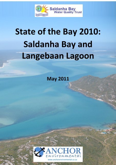
<strong>State</strong> <strong>of</strong> <strong>the</strong> <strong>Bay</strong> <strong>2010</strong>:<br />
Saldanha <strong>Bay</strong> and<br />
Langebaan Lagoon<br />
May 2011<br />
ANCHOR<br />
e n v i r o n m en t a l<br />
www.anchorenvironmental.co.za
<strong>State</strong> <strong>of</strong> <strong>the</strong> <strong>Bay</strong> <strong>2010</strong>:<br />
Saldanha <strong>Bay</strong> and<br />
Langebaan Lagoon<br />
Prepared by:<br />
B.M. Clark, K. Tunley, A. Angel, K. Hutchings,<br />
N. Steffani and J. Turpie<br />
Cover picture: Pierre De Villers<br />
May 2011<br />
Prepared for:
TABLE OF CONTENTS<br />
<strong>Anchor</strong> <strong>Environmental</strong><br />
TABLE OF CONTENTS 5<br />
LIST OF FIGURES 9<br />
LIST OF TABLES 18<br />
GLOSSARY 31<br />
1 INTRODUCTION 33<br />
2 STRUCTURE OF THIS REPORT 35<br />
3 BACKGROUND TO ENVIRONMENTAL MONITORING AND WATER QUALITY<br />
MANAGEMENT 36<br />
3.1 INTRODUCTION 36<br />
3.2 MECHANISMS FOR MONITORING CONTAMINANTS AND THEIR EFFECTS ON THE ENVIRONMENT36<br />
3.3 INDICATORS OF ENVIRONMENTAL HEALTH AND STATUS IN SALDANHA BAY AND LANGEBAAN<br />
LAGOON 38<br />
4 ACTIVITIES AND DISCHARGES AFFECTING THE HEALTH OF THE BAY 41<br />
4.1 INTRODUCTION 41<br />
4.2 URBAN AND INDUSTRIAL DEVELOPMENT 42<br />
4.3 DISCHARGES AND ACTIVITIES AFFECTING ENVIRONMENTAL HEALTH 50<br />
4.3.1 Dredging and port expansion 50<br />
4.3.2 Development <strong>of</strong> <strong>the</strong> Salamander <strong>Bay</strong> Boat yard 53<br />
4.3.3 Shoreline erosion in Saldanha <strong>Bay</strong> and Langebaan lagoon 54<br />
4.3.4 Shipping, ballast water discharges, and oil spills 61<br />
4.3.5 Reverse Osmosis Desalination Plant 65<br />
4.3.6 Sewage and associated waste waters 67<br />
4.3.7 Storm water 77<br />
4.3.8 Fish processing plants 79<br />
4.3.9 Mariculture 81<br />
4.3.10 Development <strong>of</strong> a Liquid Petroleum Gas Facility in Saldanha <strong>Bay</strong> 84<br />
5 WATER QUALITY 85<br />
5.1 WATER TEMPERATURE 85<br />
5.2 SALINITY 87<br />
5.3 DISSOLVED OXYGEN 88<br />
5.4 CURRENTS AND WAVES 91<br />
5.5 MICROBIOLOGICAL MONITORING 93<br />
5.6 TRACE METAL CONTAMINANTS IN THE WATER COLUMN 107<br />
5.7 SUMMARY OF WATER QUALITY IN SALDANHA BAY AND LANGEBAAN LAGOON 112<br />
<strong>State</strong> <strong>of</strong> <strong>the</strong> <strong>Bay</strong> <strong>2010</strong>: Saldanha <strong>Bay</strong> and Langebaan Lagoon 5
<strong>Anchor</strong> <strong>Environmental</strong><br />
6 SEDIMENTS 113<br />
6.1 SEDIMENT PARTICLE SIZE COMPOSITION 113<br />
6.1.1 Historical data 113<br />
6.1.2 Sediment Particle size results for <strong>2010</strong> 115<br />
6.2 PARTICULATE ORGANIC CARBON (POC) AND NITROGEN (PON) 122<br />
6.3 TRACE METALS 127<br />
6.3.1 <strong>State</strong> <strong>of</strong> <strong>the</strong> <strong>Bay</strong> survey results for <strong>2010</strong> 128<br />
6.3.2 Trends in sediment metal concentrations over time 135<br />
6.4 HYDROCARBONS 145<br />
6.5 SUMMARY OF SEDIMENT HEALTH STATUS OF SALDANHA BAY 147<br />
7 AQUATIC MACROPHYTES IN LANGEBAAN LAGOON 148<br />
7.1 LONG TERM CHANGES IN SEAGRASS IN LANGEBAAN LAGOON 149<br />
7.2 LONG TERM CHANGES IN SALTMARSHES IN LANGEBAAN LAGOON 151<br />
8 BENTHIC MACROFAUNA 152<br />
8.1 BACKGROUND 152<br />
8.2 HISTORIC DATA ON BENTHIC MACROFAUNA COMMUNITIES IN SALDANHA BAY 152<br />
8.3 APPROACH AND METHODS USED IN MONITORING BENTHIC MACROFAUNA IN <strong>2010</strong> 154<br />
8.3.1 Sample collection 154<br />
8.3.2 Statistical Analysis 154<br />
8.4 BENTHIC MACROFAUNA SURVEY RESULTS 159<br />
8.4.1 Community Structure and Composition 159<br />
8.4.2 Abundance Biomass Indices 173<br />
8.4.3 Species Diversity Indices 177<br />
8.4.4 Linking Ecological Indices to <strong>Environmental</strong> Variables 180<br />
8.5 DISCUSSION 184<br />
8.6 SUMMARY OF BENTHIC MACROFAUNA FINDINGS 187<br />
9 INTERTIDAL INVERTEBRATES (ROCKY SHORES) 190<br />
9.1 BACKGROUND 190<br />
9.2 APPROACH AND METHODOLOGY 191<br />
9.2.1 Study Sites 191<br />
9.2.2 Survey Method 192<br />
9.2.3 Data Analysis 195<br />
9.3 RESULTS AND DISCUSSION 196<br />
9.3.1 <strong>2010</strong> Survey 196<br />
9.4 TEMPORAL COMPARISON 205<br />
9.5 SUMMARY OF RESULTS 216<br />
10 FISH COMMUNITY COMPOSITION AND ABUNDANCE 218<br />
10.1 INTRODUCTION 218<br />
<strong>State</strong> <strong>of</strong> <strong>the</strong> <strong>Bay</strong> <strong>2010</strong>: Saldanha <strong>Bay</strong> and Langebaan Lagoon 6
11 BIRDS 234<br />
<strong>Anchor</strong> <strong>Environmental</strong><br />
10.2 METHODS 219<br />
10.2.1 Field sampling 219<br />
10.2.2 Data analysis 219<br />
10.3 RESULTS 221<br />
10.3.1 Description <strong>of</strong> inter annual trends in fish species diversity 221<br />
10.3.2 Description <strong>of</strong> inter-annual trends in fish abundance and current status <strong>of</strong> fish<br />
communities in Small <strong>Bay</strong>, Big <strong>Bay</strong> and Langebaan lagoon 226<br />
10.3.3 Status <strong>of</strong> fish populations at individual sites sampled during <strong>2010</strong> 227<br />
10.3.4 Multivariate analysis <strong>of</strong> spatial and temporal trends in fish communities 229<br />
10.4 CONCLUSIONS 233<br />
11.1 INTRODUCTION 234<br />
11.2 BIRDS OF SALDANHA BAY AND THE ISLANDS 234<br />
11.2.1 National importance <strong>of</strong> Saldanha <strong>Bay</strong> and <strong>the</strong> islands for birds 234<br />
11.2.2 Ecology and status <strong>of</strong> <strong>the</strong> principle bird species 235<br />
11.3 BIRDS OF LANGEBAAN LAGOON 247<br />
11.3.1 National importance <strong>of</strong> Langebaan Lagoon for birds 247<br />
11.3.2 The main groups <strong>of</strong> birds and <strong>the</strong>ir use <strong>of</strong> habitats and food 247<br />
11.3.3 Inter-annual variability in bird numbers 249<br />
11.4 OVERALL STATUS OF BIRDS IN SALDANHA BAY AND LANGEBAAN LAGOON 250<br />
12 ALIEN INVASIVE SPECIES IN SALDANHA BAY-LANGEBAAN LAGOON 252<br />
12.1 THE OCCURRENCE AND SPREAD OF THE WESTERN PEA CRAB PINNIXA OCCIDENTALIS IN<br />
SALDANHA BAY 255<br />
13 MANAGEMENT AND MONITORING RECOMMENDATIONS 257<br />
13.1 ACTIVITIES AND DISCHARGES AFFECTING THE HEALTH OF THE BAY 257<br />
13.1.1 Human settlements, storm water and sewage 257<br />
13.1.2 Dredging 258<br />
13.1.3 Sewage 258<br />
13.1.4 Fish factories 258<br />
13.1.5 Mariculture 259<br />
13.1.6 Shipping, ballast water discharges and oil spills 259<br />
13.1.7 O<strong>the</strong>r development in and around <strong>the</strong> <strong>Bay</strong> 259<br />
13.2 WATER QUALITY 260<br />
13.2.1 Temperature, Salinity and Dissolved Oxygen 260<br />
13.2.2 Chlorophyll a and Nutrients 260<br />
13.2.3 Currents and waves 260<br />
13.2.4 Trace metal concentrations in biota (MCM Mussel Watch Programme and Mariculture<br />
Operators) 260<br />
13.2.5 Microbiological monitoring (Faecal coliform) 261<br />
13.3 SEDIMENTS 261<br />
<strong>State</strong> <strong>of</strong> <strong>the</strong> <strong>Bay</strong> <strong>2010</strong>: Saldanha <strong>Bay</strong> and Langebaan Lagoon 7
<strong>Anchor</strong> <strong>Environmental</strong><br />
13.3.1 Particle size, Particulate Organic Carbon and Trace metals 261<br />
13.3.2 Hydrocarbons 261<br />
13.4 BENTHIC MACROFAUNA 262<br />
13.5 ROCKY INTERTIDAL 262<br />
13.6 FISH 262<br />
13.7 BIRDS 263<br />
13.8 SUMMARY OF ENVIRONMENTAL MONITORING REQUIREMENTS 263<br />
14 REFERENCES 266<br />
<strong>State</strong> <strong>of</strong> <strong>the</strong> <strong>Bay</strong> <strong>2010</strong>: Saldanha <strong>Bay</strong> and Langebaan Lagoon 8
LIST OF FIGURES<br />
<strong>Anchor</strong> <strong>Environmental</strong><br />
Figure 1.1. Regional map <strong>of</strong> Saldanha <strong>Bay</strong> and Langebaan Lagoon showing development (grey<br />
shading) and conservation areas. .............................................................................. 33<br />
Figure 3.1. Possible alterations in abundance/biomass and community composition. Overall<br />
abundance/biomass is represented by <strong>the</strong> size <strong>of</strong> <strong>the</strong> circles and community<br />
composition by <strong>the</strong> various types <strong>of</strong> shading. After Hellawell (1986)......................... 39<br />
Figure 4.1. Map <strong>of</strong> Saldanha <strong>Bay</strong> indicating anthropogenic developments established since 1973<br />
referred to in text. ..................................................................................................... 43<br />
Figure 4.2. Composite aerial photo <strong>of</strong> Saldanha <strong>Bay</strong> and Langebaan Lagoon taken in 1960.<br />
(Source Department <strong>of</strong> Surveys and Mapping). Note <strong>the</strong> absence <strong>of</strong> <strong>the</strong> ore terminal<br />
and causeway and limited development at Saldanha and Langebaan. ....................... 44<br />
Figure 4.3. Composite aerial photo <strong>of</strong> Saldanha <strong>Bay</strong> and Langebaan Lagoon taken in 1989.<br />
(Source Department <strong>of</strong> Surveys and Mapping). Note <strong>the</strong> presence <strong>of</strong> <strong>the</strong> ore terminal,<br />
<strong>the</strong> causeway linking Marcus Island with <strong>the</strong> mainland, and expansion <strong>of</strong> settlements<br />
at Saldanha and Langebaan. ...................................................................................... 45<br />
Figure 4.4. Composite aerial photo <strong>of</strong> Saldanha <strong>Bay</strong> and Langebaan Lagoon taken in 2007.<br />
(Source Department <strong>of</strong> Surveys and Mapping). Note expansion in residential<br />
settlements particularly around <strong>the</strong> town <strong>of</strong> Langebaan. ........................................... 46<br />
Figure 4.5. Aerial photograph <strong>of</strong> Langebaan showing absence <strong>of</strong> development setback zone<br />
between <strong>the</strong> town and <strong>the</strong> lagoon. ............................................................................ 48<br />
Figure 4.6. Satellite image <strong>of</strong> Saldanha (Small <strong>Bay</strong>) showing little or no setback zone between <strong>the</strong><br />
town and <strong>the</strong> <strong>Bay</strong>. ..................................................................................................... 48<br />
Figure 4.7. Numbers <strong>of</strong> tourists visiting <strong>the</strong> West Coast National Park since 2005 (Data from Pierre<br />
Nel WCNP). ............................................................................................................... 49<br />
Figure 4.8. Location <strong>of</strong> <strong>the</strong> maintenance dredging site between Caissons 3 and 4 on <strong>the</strong> ore<br />
terminal. ................................................................................................................... 52<br />
Figure 4.9. A) Under natural circumstances, dune vegetation can “move” with <strong>the</strong> beach as it<br />
erodes and accrete under <strong>the</strong> influence <strong>of</strong> natural processes. B) Protection <strong>of</strong><br />
infrastructure erected too close to <strong>the</strong> high water mark, on <strong>the</strong> o<strong>the</strong>r hand,<br />
necessitates construction <strong>of</strong> artificial barriers and leads to <strong>the</strong> loss <strong>of</strong> <strong>the</strong> beach<br />
ecosystem and associated amenities. ........................................................................ 55<br />
Figure 4.10. Change in relative beach area, in thousands <strong>of</strong> m 2 , since 1960 to 2000 in Paradise and<br />
Spreeuwal beaches, based on aerial photographs (Figure courtesy <strong>of</strong> J. Gericke 2008).<br />
56<br />
Figure 4.11. Rock revetments constructed along <strong>the</strong> beach at Langebaan in an effort to protect<br />
coastal infrastructure. ............................................................................................... 58<br />
Figure 4.12. Groyne construction site Langebaan north beach. 1st groyne is completed and<br />
position <strong>of</strong> 2nd groyne is show in white. Area A and B are sand “slurry” sites (see text<br />
for explanation). Area C sand dredging site for beach reclamation. Source: Prestedge<br />
Retief Dresner Wijnberg. ........................................................................................... 58<br />
Figure 4.13. <strong>State</strong> <strong>of</strong> <strong>the</strong> beach north <strong>of</strong> Groyne 2 in May <strong>2010</strong>. Top: looking south from <strong>the</strong> middle<br />
<strong>of</strong> Leentjiesklip 1 beach towards <strong>the</strong> groyne, Middle: Looking north from <strong>the</strong> middle <strong>of</strong><br />
<strong>State</strong> <strong>of</strong> <strong>the</strong> <strong>Bay</strong> <strong>2010</strong>: Saldanha <strong>Bay</strong> and Langebaan Lagoon 9
<strong>Anchor</strong> <strong>Environmental</strong><br />
<strong>the</strong> beach towards Leentjiesklip 1, Bottom: looking north towards Leentjieklip from<br />
<strong>the</strong> position where <strong>the</strong> sea still reaches right up to <strong>the</strong> rock revetment. .................... 59<br />
Figure 4.14. Coastal erosion at Paradise Beach near Clun Mykonos. ............................................. 60<br />
Figure 4.15. Number and types <strong>of</strong> vessels entering Saldanha Port from 1994-<strong>2010</strong>. (Sources:<br />
Marangoni 1998; Awad et al. 2003, Transnet-NPA). .................................................. 63<br />
Figure 4.16. Volumes <strong>of</strong> ballast water discharge in million tonnes by <strong>the</strong> different types <strong>of</strong> vessels<br />
entering Saldanha Port between 1994 and <strong>2010</strong>. The data for 1999-2002 is an average<br />
<strong>of</strong> <strong>the</strong> total volume <strong>of</strong> discharge for those years (). (Sources: Marangoni 1998; Awad et<br />
al. 2003, Transnet-NPA)............................................................................................. 63<br />
Figure 4.17. Location <strong>of</strong> waste water treatment works, sewage pump stations and conservancy<br />
tanks in Saldanha and Langebaan area ...................................................................... 69<br />
Figure 4.18. Monthly trends in <strong>the</strong> volume <strong>of</strong> (a) effluent released from <strong>the</strong> Saldanha WWTW, Apr<br />
2003-February 2011, and authorised total volume per year expressed as a daily limit<br />
(red line) (b) in <strong>the</strong> numbers <strong>of</strong> Faecal Coliforms, (c) and Total Suspended Solids, and<br />
(d) Chemical Oxygen Demand in effluent released from <strong>the</strong> Saldanha WWTW, April<br />
2003-February 2011. Allowable limits as specified in terms <strong>of</strong> a General Authorisation<br />
under <strong>the</strong> National Water Act 1998 for graphs b-d are represented by <strong>the</strong> dotted red<br />
line. 72<br />
Figure 4.19. Monthly trends in water quality parameters (a) Chemical Oxygen Demand, (b)<br />
Ammonia Nitrogen, (c) Nitrate Ammonia, (d) Orthophosphate and (e) Free Active<br />
Chlorine for effluent released from <strong>the</strong> Saldanha WWTW Apr 2003-February 2011, and<br />
general limits specific under <strong>the</strong> National Water Act 36 <strong>of</strong> 1998 (red line on each<br />
graph). 73<br />
Figure 4.20. Monthly trends in <strong>the</strong> volume <strong>of</strong> effluent discharged from <strong>the</strong> Langebaan WWTW in<br />
<strong>the</strong> period June 2009-February 2011, and allowable limits as specified in terms <strong>of</strong> a<br />
General Authorisation under <strong>the</strong> National Water Act 1998 (red line). ........................ 74<br />
Figure 4.21. Monthly trends in (a) <strong>the</strong> numbers <strong>of</strong> Faecal Coliforms, (b) Total Suspended Solids, and<br />
(c) Chemical Oxygen Demand in effluent released To from <strong>the</strong> Langebaan WWTW,<br />
June 2009-February 2011. Allowable limits as specified in terms <strong>of</strong> a General<br />
Authorisation under <strong>the</strong> National Water Act 1998 are represented by <strong>the</strong> red line. ... 75<br />
Figure 4.22. Monthly trends in <strong>the</strong> volume <strong>of</strong> Ammonia Nitrate, Ortho Phosphorus and Nitrate<br />
Nitrogen present in effluent from Langebaan WWTW, June 2009-February 2011.<br />
Allowable limits as specified in terms <strong>of</strong> a General Authorisation under <strong>the</strong> National<br />
Water Act 1998 (red line). ......................................................................................... 76<br />
Figure 4.23. Spatial extent <strong>of</strong> residential and industrial areas surrounding Saldanha <strong>Bay</strong> and<br />
Langebaan Lagoon from which storm water run<strong>of</strong>f is likely to enter <strong>the</strong> sea (areas<br />
outlined in white). Note that Note that run<strong>of</strong>f from <strong>the</strong> Port <strong>of</strong> Saldanha and ore<br />
terminal have been excluded as run<strong>of</strong>f from this site is now reportedly all diverted to<br />
storm water evaporation ponds. Material settling in <strong>the</strong>se ponds is trucked to a<br />
landfill site. ............................................................................................................... 78<br />
Figure 4.24. Location <strong>of</strong> seawater intakes and discharges for seafood processing in Saldanha <strong>Bay</strong><br />
toge<strong>the</strong>r with location <strong>of</strong> current and proposed mariculture operations ................... 80<br />
Figure 4.25. Total monthly discharge <strong>of</strong> fresh fish processing effluent (FFP) disposed to sea by Sea<br />
Harvest 81<br />
Figure 4.26. Allocated mariculture concession areas in Saldanha <strong>Bay</strong> <strong>2010</strong> ................................... 82<br />
<strong>State</strong> <strong>of</strong> <strong>the</strong> <strong>Bay</strong> <strong>2010</strong>: Saldanha <strong>Bay</strong> and Langebaan Lagoon 10
<strong>Anchor</strong> <strong>Environmental</strong><br />
Figure 4.27. Overall annual mussel productivity (tons) in Saldanha <strong>Bay</strong> between 2000 and 2009<br />
(source: DAFF, <strong>2010</strong>) ................................................................................................. 83<br />
Figure 5.1. Water temperature time series at <strong>the</strong> surface and at 10m depth for Big <strong>Bay</strong> and Small<br />
<strong>Bay</strong>, Saldanha <strong>Bay</strong> ..................................................................................................... 86<br />
Figure 5.2. Time series <strong>of</strong> salinity records for Saldanha <strong>Bay</strong>......................................................... 88<br />
Figure 5.3. Time series <strong>of</strong> chlorophyll and nitrate concentration measurements for Saldanha <strong>Bay</strong>.<br />
................................................................................................................................. 89<br />
Figure 5.4. Apparent oxygen utilization (AOU) time series Small <strong>Bay</strong> and Big <strong>Bay</strong>, Saldanha <strong>Bay</strong>.<br />
(Note: Positive values in red indicate an oxygen deficit). ........................................... 90<br />
Figure 5.5. Schematic representation <strong>of</strong> <strong>the</strong> surface currents and circulation <strong>of</strong> Saldanha <strong>Bay</strong> (A)<br />
prior to <strong>the</strong> harbour development (Pre-1973) and (B) after construction <strong>of</strong> <strong>the</strong><br />
causeway and iron-ore jetty (Present). (Adapted from Shannon and Stander 1977 and<br />
Weeks et al. 1991a) ................................................................................................... 92<br />
Figure 5.6. Faecal coliform and E. coli counts at 4 <strong>of</strong> <strong>the</strong> 10 sampling stations within Small <strong>Bay</strong>.<br />
(Feb 1999-Feb <strong>2010</strong>). A downward slope <strong>of</strong> <strong>the</strong> regression (solid red and blue lines) is<br />
indicative <strong>of</strong> improving water quality, while an upward slope in <strong>the</strong>se lines in<br />
indicative <strong>of</strong> decreasing water quality. .................................................................... 103<br />
Figure 5.7. Faecal coliform and E. coli counts at 3 <strong>of</strong> <strong>the</strong> 10 sampling stations within Small <strong>Bay</strong>.<br />
(Feb 1999-Feb <strong>2010</strong>). A downward slope <strong>of</strong> <strong>the</strong> regression (solid red and blue lines) is<br />
indicative <strong>of</strong> improving water quality, while an upward slope in <strong>the</strong>se lines in<br />
indicative <strong>of</strong> decreasing water quality. .................................................................... 104<br />
Figure 5.8. Faecal coliform and E. coli counts at 4 sampling stations within Big <strong>Bay</strong>. (Feb 1999-Feb<br />
<strong>2010</strong>). A Downward slope <strong>of</strong> <strong>the</strong> regression (solid red and blue lines) is indicative <strong>of</strong><br />
improving water quality, while an upward slope in <strong>the</strong>se lines in indicative <strong>of</strong><br />
decreasing water quality. ........................................................................................ 105<br />
Figure 5.9. Faecal coliform and E. coli counts at 3 sampling stations within Langebaan Lagoon (Feb<br />
1999-Feb <strong>2010</strong>). A Downward slope <strong>of</strong> <strong>the</strong> regression (solid red and blue lines) is<br />
indicative <strong>of</strong> improving water quality, while an upward slope in <strong>the</strong>se lines in<br />
indicative <strong>of</strong> decreasing water quality. .................................................................... 106<br />
Figure 5.10. Trace metal concentrations in mussels collected from five sites in Saldanha <strong>Bay</strong> as part<br />
<strong>of</strong> <strong>the</strong> Mussel Watch Programme. (Source <strong>of</strong> data: G. Kiviets, Marine and Coastal<br />
Management, Department <strong>of</strong> <strong>Environmental</strong> Affairs and Tourism). Recommended<br />
maximum limits for trace metals in seafood as stipulated in South African legislation or<br />
internationally are shown as a dotted red line (see Table 5.10 for more details on this).<br />
110<br />
Figure 5.11. Concentrations <strong>of</strong> Cadmium, Lead and Mercury in mussels and oysters from four<br />
bivalve culture operations in Saldanha <strong>Bay</strong> covering <strong>the</strong> period 1993 to <strong>2010</strong>. ........ 111<br />
Figure 6.1. Particle size composition <strong>of</strong> sediment at six locations in Saldanha <strong>Bay</strong> between 1977<br />
and <strong>2010</strong> ................................................................................................................. 118<br />
Figure 6.2. Particle size composition (percentage gravel, sand and mud) <strong>of</strong> sediment at five<br />
locations in <strong>Bay</strong> and one at <strong>the</strong> entrance to Langebaan Lagoon ............................... 119<br />
Figure 6.3. Particle size composition (percentage gravel, sand and mud) <strong>of</strong> sediment at five<br />
locations in Langebaan Lagoon in 2004, 2008 and 2009 ........................................... 120<br />
Figure 6.4. Variation in <strong>the</strong> percentage mud in sediments in Saldanha <strong>Bay</strong> and Langebaan Lagoon<br />
as indicated by <strong>the</strong> <strong>2010</strong> survey results. .................................................................. 121<br />
<strong>State</strong> <strong>of</strong> <strong>the</strong> <strong>Bay</strong> <strong>2010</strong>: Saldanha <strong>Bay</strong> and Langebaan Lagoon 11
<strong>Anchor</strong> <strong>Environmental</strong><br />
Figure 6.5. Average (± 95% confidence intervals) percentage mud occurring in Small <strong>Bay</strong>, Big <strong>Bay</strong><br />
and Langebaan Lagoon sediments over time ........................................................... 121<br />
Figure 6.6. Variation in <strong>the</strong> % Organic Carbon in <strong>the</strong> sediments in Saldanha <strong>Bay</strong> and Langebaan<br />
Lagoon as indicated by <strong>the</strong> <strong>2010</strong> survey results ....................................................... 124<br />
Figure 6.7. Variation in <strong>the</strong> % Organic Nitrogen in <strong>the</strong> sediments in Saldanha <strong>Bay</strong> and Langebaan<br />
Lagoon as indicated by <strong>the</strong> <strong>2010</strong> survey results ....................................................... 124<br />
Figure 6.8. Particulate Organic Carbon (POC) percentage occurring in sediments <strong>of</strong> Saldanha <strong>Bay</strong><br />
at six locations between 1974 and <strong>2010</strong> .................................................................. 125<br />
Figure 6.9. Particulate Organic Nitrogen (PON) percentage occurring in sediments <strong>of</strong> Saldanha <strong>Bay</strong><br />
at six locations between 1999 and <strong>2010</strong> .................................................................. 126<br />
Figure 6.10. Percentage particulate organic carbon and nitrogen found in <strong>the</strong> sediments at two<br />
sites near Donkergat. .............................................................................................. 127<br />
Figure 6.11. Sediment sampling sites in Saldanha <strong>Bay</strong> and Langebaan Lagoon for <strong>2010</strong>. Sites<br />
sampled from pre-1980 to <strong>2010</strong> are marked and labelled in red .............................. 129<br />
Figure 6.12. Variation in <strong>the</strong> concentration <strong>of</strong> Cadmium (Cd) in <strong>the</strong> sediments in Saldanha <strong>Bay</strong> and<br />
Langebaan Lagoon as indicated by <strong>the</strong> <strong>2010</strong> survey results...................................... 131<br />
Figure 6.13. Variation in <strong>the</strong> concentration <strong>of</strong> Copper (Cu) in <strong>the</strong> sediments in Saldanha <strong>Bay</strong> and<br />
Langebaan Lagoon as indicated by <strong>the</strong> <strong>2010</strong> survey results...................................... 131<br />
Figure 6.14. Variation in <strong>the</strong> concentration <strong>of</strong> Lead (Pb) in <strong>the</strong> sediments in Saldanha <strong>Bay</strong> and<br />
Langebaan Lagoon as indicated by <strong>the</strong> <strong>2010</strong> survey results...................................... 132<br />
Figure 6.15. Variation in <strong>the</strong> concentration <strong>of</strong> Nickel (Ni) in <strong>the</strong> sediments in Saldanha <strong>Bay</strong> and<br />
Langebaan Lagoon as indicated by <strong>the</strong> <strong>2010</strong> survey results...................................... 132<br />
Figure 6.16. Metal:Al ratios for Copper, Lead, Cadmium and Nickel for sediments sampled in <strong>2010</strong><br />
from Saldanha <strong>Bay</strong>-Small <strong>Bay</strong> (SB), Big <strong>Bay</strong> (BB) and Langebaan Lagoon (LL) ............ 133<br />
Figure 6.17. Variation in <strong>the</strong> concentration <strong>of</strong> Iron (Fe) in <strong>the</strong> sediments in Saldanha <strong>Bay</strong> and<br />
Langebaan Lagoon as indicated by <strong>the</strong> <strong>2010</strong> survey results...................................... 136<br />
Figure 6.18. Concentrations <strong>of</strong> Cadmium (Cd) in mg/kg recorded at six sites in Saldanha <strong>Bay</strong><br />
between 1980 and 2009. Red lines indicate Effects Range Low values for sediments139<br />
Figure 6.19. Concentrations <strong>of</strong> Lead (Pb) in mg/kg recorded at six sites in Saldanha <strong>Bay</strong> between<br />
1980 and 2009. Red lines indicate Effects Range Low values for sediments ............. 140<br />
Figure 6.20. Concentrations <strong>of</strong> Copper (Cu) in mg/kg recorded at six sites in Saldanha <strong>Bay</strong> between<br />
1980 and 2009. Red lines indicate Effects Range Low values for sediments ............. 141<br />
Figure 6.21. Concentrations <strong>of</strong> Nickel (Ni) in mg/kg recorded at six sites in Saldanha <strong>Bay</strong> between<br />
1980 and 2009. Red lines indicate Effects Range Low values for sediments. ............ 142<br />
Figure 6.22. Trends in sediment Iron concentrations over time at sediment sampling sites in <strong>the</strong><br />
vicinity <strong>of</strong> <strong>the</strong> bulk terminal Saldanha. ..................................................................... 143<br />
Figure 6.23. Variation <strong>of</strong> trace metal concentrations in sediments in <strong>the</strong> Donkergat area and Big<br />
<strong>Bay</strong> as indicated by <strong>the</strong> <strong>2010</strong> results. ....................................................................... 144<br />
Figure 7.1. Seagrass (black) and saltmarsh (green) near Bottelarey in Langebaan Lagoon. Source:<br />
Google Earth. .......................................................................................................... 148<br />
Figure 7.2. Width <strong>of</strong> <strong>the</strong> Zostera beds and density <strong>of</strong> Siphonia at Klein Oesterwal and Bottelary in<br />
Langebaan Lagoon, 1972-2006. ............................................................................... 150<br />
<strong>State</strong> <strong>of</strong> <strong>the</strong> <strong>Bay</strong> <strong>2010</strong>: Saldanha <strong>Bay</strong> and Langebaan Lagoon 12
<strong>Anchor</strong> <strong>Environmental</strong><br />
Figure 7.3. Change in saltmarsh area over time in Langebaan Lagoon. (Data from Gerricke 2008)<br />
............................................................................................................................... 151<br />
Figure 7.4. Change in <strong>the</strong> number <strong>of</strong> discrete saltmarsh patches over time in Langebaan Lagoon.<br />
(Data from Gerricke 2008) ....................................................................................... 151<br />
Figure 8.1. Benthic macr<strong>of</strong>auna sampling stations in 1975, 1999, 2004 and 2008. .................... 153<br />
Figure 8.2. Benthic macr<strong>of</strong>auna stations sampled within Saldanha <strong>Bay</strong> and Langebaan Lagoon in<br />
<strong>2010</strong>. ....................................................................................................................... 156<br />
Figure 8.3. Hypo<strong>the</strong>tical ABC curves for species biomass and abundance showing undisturbed,<br />
moderately disturbed and grossly disturbed conditions (after Warwick 1993). ........ 157<br />
Figure 8.4. Dendrogram (a) and MDS ordination plot (b) showing similarities between sites based on<br />
<strong>the</strong> species composition for benthic macr<strong>of</strong>auna in Saldanha <strong>Bay</strong>, <strong>2010</strong>. SB = Small<br />
<strong>Bay</strong>, BB = Big <strong>Bay</strong>, LL = Langebaan Lagoon. Brackets on <strong>the</strong> dendrogram show groups<br />
<strong>of</strong> samples at <strong>the</strong> 25% level <strong>of</strong> similarity. ................................................................. 161<br />
Figure 8.5. Overall trends in <strong>the</strong> biomass and abundance <strong>of</strong> benthic macr<strong>of</strong>auna in Small <strong>Bay</strong> as<br />
shown by taxonomic and functional groups. ............................................................ 164<br />
Figure 8.6. Trends in <strong>the</strong> biomass <strong>of</strong> dominant benthic macr<strong>of</strong>auna species at six sites in Small<br />
<strong>Bay</strong>. (important to note different scales used on graphs). ........................................ 165<br />
Figure 8.7. Trends in <strong>the</strong> abundance <strong>of</strong> dominant benthic macr<strong>of</strong>auna species at six sites in Small<br />
<strong>Bay</strong>. (important to note different scales used on graphs) ......................................... 166<br />
Figure 8.8. Overall trends in <strong>the</strong> biomass and abundance <strong>of</strong> benthic macr<strong>of</strong>auna in Big <strong>Bay</strong> as<br />
shown by taxonomic and functional groups. ............................................................ 169<br />
Figure 8.9. Trends in <strong>the</strong> biomass <strong>of</strong> dominant benthic macr<strong>of</strong>auna species at six sites in Small<br />
<strong>Bay</strong>. (important to note different scales used on graphs) ......................................... 170<br />
Figure 8.10. Trends in <strong>the</strong> abundance <strong>of</strong> dominant benthic macr<strong>of</strong>auna species at six sites in Small<br />
<strong>Bay</strong>. (important to note different scales used on graphs) ......................................... 171<br />
Figure 8.11. Overall trends in <strong>the</strong> abundance and biomass <strong>of</strong> benthic macr<strong>of</strong>auna in Langebaan<br />
Lagoon as shown by taxonomic and functional groups. ........................................... 172<br />
Figure 8.12. Variation in <strong>the</strong> W statistic calculated for <strong>the</strong> benthic macr<strong>of</strong>auna in Saldanha <strong>Bay</strong> and<br />
Langebaan Lagoon as indicated by <strong>the</strong> <strong>2010</strong> survey results. (1 = Undisturbed, 0 =<br />
moderately disturbed, -1 = disturbed) ..................................................................... 174<br />
Figure 8.13. Mean W statistic (± 0.95 confidence intervals) for all years sampled in Small <strong>Bay</strong>, Big<br />
<strong>Bay</strong> and Langebaan Lagoon (W = 1 indicates undisturbed, W = 0 indicates moderately<br />
disturbed, W = -1 indicates grossly disturbed) ......................................................... 175<br />
Figure 8.14. Mean (± 0.95 confidence intervals) Species diversity (H'), Species richness (d'),<br />
Evenness (J') and Total number <strong>of</strong> species (S) for benthic macr<strong>of</strong>auna samples<br />
collected from Small <strong>Bay</strong> (SB), Big <strong>Bay</strong> (BB) and Langebaan Lagoon (LL), Saldanha,<br />
<strong>2010</strong>. 178<br />
Figure 8.15: Variation in <strong>the</strong> diversity <strong>of</strong> <strong>the</strong> benthic macr<strong>of</strong>auna in Saldanha <strong>Bay</strong> and Langebaan<br />
Lagoon as indicated by <strong>the</strong> <strong>2010</strong> survey results. (H’ = 1.5 indicates low diversity, H’ =<br />
3.5 indicates high diversity) ..................................................................................... 179<br />
Figure 8.16. Average Shannon Weiner diversity indices (H’) (± 0.95 confidence intervals) for Big<br />
<strong>Bay</strong>, Small <strong>Bay</strong> and Langebaan Lagoon in 1999, 2004, 2008, 2009 and <strong>2010</strong>. ........... 180<br />
<strong>State</strong> <strong>of</strong> <strong>the</strong> <strong>Bay</strong> <strong>2010</strong>: Saldanha <strong>Bay</strong> and Langebaan Lagoon 13
<strong>Anchor</strong> <strong>Environmental</strong><br />
Figure 8.17. MDS <strong>of</strong> Saldanha <strong>Bay</strong> and Langebaan Lagoon benthic macr<strong>of</strong>auna abundance (<strong>2010</strong>)<br />
with superimposed circles representing depth (Increasing circle size = deeper) ....... 181<br />
Figure 8.18. MDS <strong>of</strong> Saldanha <strong>Bay</strong> and Langebaan Lagoon benthic macr<strong>of</strong>auna abundance (<strong>2010</strong>)<br />
with superimposed circles representing abiotic factors: Particulate Organic Carbon<br />
(POC), Particulate Organic Nitrogen (PON), % Gravel and % Mud (Increasing circle size<br />
= larger measurement). ........................................................................................... 182<br />
Figure 8.19. MDS <strong>of</strong> Saldanha <strong>Bay</strong> benthic macr<strong>of</strong>auna abundance (2009) with superimposed<br />
circles representing concentrations <strong>of</strong> select metals: Cu, Cd, Pb and Ni. Circle size is<br />
proportional to magnitude <strong>of</strong> concentration (increasing circle size = larger<br />
concentration) ........................................................................................................ 183<br />
Figure 8.20. Two-dimensional PCA ordination <strong>of</strong> <strong>the</strong> environmental variables (metals, POC and<br />
PON; transformed and normalized) for Saldanha <strong>Bay</strong> <strong>2010</strong>...................................... 183<br />
Figure 8.21. Benthic macr<strong>of</strong>auna species frequently found to occur in Saldanha <strong>Bay</strong> and Langebaan<br />
Lagoon, photographs by: Charles Griffiths. .............................................................. 188<br />
Figure 8.22. Benthic macr<strong>of</strong>auna species frequently found to occur in Saldanha <strong>Bay</strong> and Langebaan<br />
Lagoon, photographs by: Charles Griffiths. .............................................................. 189<br />
Figure 9.1. Positions <strong>of</strong> <strong>the</strong> eight rocky intertidal study sites in Saldanha <strong>Bay</strong>. ........................... 192<br />
Figure 9.2. The rocky shore study sites in 2009 from top right to left bottom: Dive School, Jetty,<br />
Schaapen Island East, and Schaapen Island West. .................................................... 193<br />
Figure 9.3. The rocky shore study sites in 2009 from top right to bottom left: Iron Ore Jetty, Lynch<br />
Point, North <strong>Bay</strong>, and Marcus Island. ....................................................................... 194<br />
Figure 9.4. Top left to bottom right: High shores at Dive School, Iron Ore Jetty, Schaapen West<br />
with blue green algal cover, and at Marcus Island. .................................................. 197<br />
Figure 9.5. From top right to bottom left: Mid shores at Jetty, Schaapen East showing rock<br />
depression with orange sponge and Ulva spp., Iron Ore Jetty with dense Balanus<br />
glandula cover (insert showing Afrolittorina knysnaensis nestling among barnacles),<br />
and Mytilus galloprovincialis, B. glandula and Ulva spp. partially growing on mussels<br />
recruits at Marcus Island. ........................................................................................ 198<br />
Figure 9.6. Low shore at <strong>the</strong> sheltered site Dive School dominated by <strong>the</strong> algae Gigartina<br />
polycarpa (top left), Ralfsia verrucosa and Ulva spp.(top right), <strong>the</strong> anemone<br />
Pseudoactinia flagellifera (bottom left), and <strong>the</strong> sea urchin Parechinus angulosus in<br />
rock pools with sparse cover <strong>of</strong> <strong>the</strong> indigenous mussels Aulacomya ater and<br />
Choromytilus meridionalis (bottom right). ............................................................... 199<br />
Figure 9.7. Top: Low shore at <strong>the</strong> semi-exposed/exposed site North <strong>Bay</strong> showing mussel band and<br />
emerging kelp Ecklonia maxima. Bottom: Low shore at <strong>the</strong> exposed site Marcus Island<br />
with <strong>the</strong> mussel bed overgrown by red algae and patches <strong>of</strong> ‘pink’ encrusting<br />
corallines in between. The limpet Scutellastra cochlear, which is associated with <strong>the</strong><br />
encrusting corallines, is fringed by a narrow garden <strong>of</strong> fine red algae. ..................... 202<br />
Figure 9.8. The mean abundance (number/0.5 m 2 ) <strong>of</strong> <strong>the</strong> most important mobile species at <strong>the</strong><br />
eight rocky shores in <strong>2010</strong>. ...................................................................................... 202<br />
Figure 9.9. Dendrogram (top) and multi-dimensional scaling (MDS) plot (bottom) <strong>of</strong> <strong>the</strong> rocky<br />
shore communities at <strong>the</strong> eight study sites in <strong>2010</strong>. The circles in <strong>the</strong> MDS plot<br />
indicate a 40% (black) and 50% (red) similarity level. See text for fur<strong>the</strong>r explanation.<br />
............................................................................................................................... 203<br />
<strong>State</strong> <strong>of</strong> <strong>the</strong> <strong>Bay</strong> <strong>2010</strong>: Saldanha <strong>Bay</strong> and Langebaan Lagoon 14
<strong>Anchor</strong> <strong>Environmental</strong><br />
Figure 9.10. Contribution <strong>of</strong> <strong>the</strong> various functional groups to <strong>the</strong> biotic cover (%) at <strong>the</strong> eight rocky<br />
shore sites. The sites are sorted from left to right according to increase in wave<br />
exposure. ................................................................................................................ 205<br />
Figure 9.11. Box & whisker plots comparing species number (top) and percentage cover (bottom)<br />
among <strong>the</strong> years 2005, 2008, 2009 and <strong>2010</strong> at <strong>the</strong> eight study sites. The ovals<br />
encircle <strong>the</strong> sites with significant differences and different letters indicate which <strong>of</strong> <strong>the</strong><br />
years differ (see text). ............................................................................................. 206<br />
Figure 9.12. Box & whisker plots comparing evenness (top) and Shannon-Wiener diversity indices<br />
(bottom) among <strong>the</strong> years 2005, 2008, 2009 and <strong>2010</strong> at <strong>the</strong> eight study sites. The<br />
ovals encircle <strong>the</strong> sites with significant differences and different letters indicate which<br />
<strong>of</strong> <strong>the</strong> years differ (see text). ................................................................................... 207<br />
Figure 9.13. Multi-dimensional scaling (MDS) plot <strong>of</strong> <strong>the</strong> rocky shore communities at <strong>the</strong> eight<br />
study sites in 2005 (red symbols), 2008 (green symbols), 2009 (blue symbols) and <strong>2010</strong><br />
(grey symbols). The line separates samples at a 40% similarity level, and <strong>the</strong> blue<br />
circles delineate <strong>the</strong> 50% similarity level.................................................................. 209<br />
Figure 9.14. The mean percentage cover <strong>of</strong> <strong>the</strong> various functional groups at <strong>the</strong> study sites in 2005,<br />
2008, 2009 and <strong>2010</strong>. .............................................................................................. 212<br />
Figure 9.15. Mean percentage cover <strong>of</strong> <strong>the</strong> indigenous Aulacomya ater (green) and <strong>the</strong> aliens<br />
Mytilus galloprovincialis (red) and Balanus glandula (blue) at <strong>the</strong> eight study sites over<br />
<strong>the</strong> years. Note <strong>the</strong> difference in scale between <strong>the</strong> top and <strong>the</strong> bottom four graphs.<br />
214<br />
Figure 10.1. Sampling sites within Saldanha <strong>Bay</strong> and Langebaan lagoon where seine net hauls were<br />
conducted during 2005, 2007, 2008, 2009 and <strong>2010</strong> sampling events, 1: North <strong>Bay</strong><br />
west, 2: North <strong>Bay</strong> east, 3:Small craft harbour, 4: Hoedtjiesbaai, 5: Caravan site, 6:<br />
Blue water <strong>Bay</strong>, 7: Sea farm dam, 8: Spreeuwalle, 9: Lynch point, 10: Strandloper, 11:<br />
Schaapen Island, 12: Klein Oesterwal, 13: Bottelary, 14: Churchhaven, 15: Kraal aai 220<br />
Figure 10.2. Fish species richness during seven seine-net surveys in Saldanha <strong>Bay</strong> and Langebaan<br />
lagoon conducted over <strong>the</strong> period 1986-<strong>2010</strong>. The total area netted in each area and<br />
survey is shown. ...................................................................................................... 222<br />
Figure 10.3. Average abundance <strong>of</strong> fish species (number.m -2 ) recorded during annual beach seinenet<br />
surveys in Small <strong>Bay</strong> Saldanha. (Ave. = average, SE = standard error). Species not<br />
previously recorded are shown in bold font. ............................................................ 223<br />
Figure 10.4. Average fish abundance (all species) during five seine-net surveys conducted in<br />
Saldanha <strong>Bay</strong> and Langebaan lagoon. (Error bars show one Standard Error <strong>of</strong> <strong>the</strong><br />
mean). 226<br />
Figure 10.5. Abundance <strong>of</strong> <strong>the</strong> most common fish species recorded in annual seine-net surveys<br />
within Saldanha <strong>Bay</strong> and Langebaan Lagoon (1986/87, 1994, 2005, 2007-<strong>2010</strong>) (Error<br />
bars show one standard error <strong>of</strong> <strong>the</strong> mean)............................................................. 227<br />
Figure 10.6. Average abundance <strong>of</strong> <strong>the</strong> four most common fish species at each <strong>of</strong> <strong>the</strong> sites sampled<br />
within Small <strong>Bay</strong> and Big <strong>Bay</strong> during <strong>the</strong> earlier surveys (1994, 2005, 2007-2009) and<br />
during <strong>the</strong> <strong>2010</strong> survey. Errors bars show plus 1 Standard error. Note <strong>the</strong> scale change<br />
on vertical axis shows a maximum <strong>of</strong> ei<strong>the</strong>r 1 or 3 fish.m -2 . ..................................... 228<br />
Figure 10.7. Average abundance <strong>of</strong> <strong>the</strong> four most common fish species at each <strong>of</strong> <strong>the</strong> sites sampled<br />
within Langebaan lagoon during <strong>the</strong> earlier surveys (1994, 2005, 2007-2009) and<br />
during <strong>the</strong> <strong>2010</strong> survey. Errors bars show plus 1 Standard error. Note <strong>the</strong> scale<br />
change on vertical axis shows a maximum <strong>of</strong> between 1 and 80 fish.m -2 . ................ 229<br />
<strong>State</strong> <strong>of</strong> <strong>the</strong> <strong>Bay</strong> <strong>2010</strong>: Saldanha <strong>Bay</strong> and Langebaan Lagoon 15
<strong>Anchor</strong> <strong>Environmental</strong><br />
Figure 10.8. Multidimensional scaling plots showing similarities between <strong>the</strong> fish communities<br />
sampled at four sites within Small <strong>Bay</strong> during 1994, 2005, 2007, 2008, 2009 and <strong>2010</strong><br />
sampling events. Note that three replicate samples were collected at each site in each<br />
year. 230<br />
Figure 10.9. Multidimensional scaling plots showing similarities between <strong>the</strong> fish communities<br />
sampled at seven Big <strong>Bay</strong> sites during 1994, 2005, 2007, 2008, 2009 & <strong>2010</strong> sampling<br />
events. Note that three replicate samples were collected at each site in each year. 231<br />
Figure 10.10. Multidimensional scaling plots showing similarities between <strong>the</strong> fish communities<br />
sampled at six Lagoon sites during 1994, 2005, 2007, 2008, 2009 & <strong>2010</strong> sampling<br />
events. 232<br />
Figure 11.1. Trends in African Penguin populations at Malgas, Marcus, Jutten and Vondeling islands<br />
in Saldanha <strong>Bay</strong> (Data source: Rob Crawford, Oceans & Coasts, Department <strong>of</strong><br />
<strong>Environmental</strong> Affairs)............................................................................................. 236<br />
Figure 11.2. Trends in breeding population <strong>of</strong> Kelp gulls at Malgas, Jutten, Schaapen, Vondeling<br />
and Meeuw Islands in Saldanha <strong>Bay</strong> (Data source: Rob Crawford, Oceans & Coasts,<br />
Department <strong>of</strong> <strong>Environmental</strong> Affairs). ND = No data .............................................. 237<br />
Figure 11.3. Trends in breeding population <strong>of</strong> Hartlaub’s Gulls at Malgas, Marcus, Jutten, Schaapen<br />
and Vondeling Islands in Saldanha <strong>Bay</strong> (Data source: Rob Crawford, Oceans & Coasts,<br />
Department <strong>of</strong> <strong>Environmental</strong> Affairs). .................................................................... 238<br />
Figure 11.4. Trends in breeding population <strong>of</strong> Swift Terns at Malgas, Marcus, Jutten and Schaapen<br />
islands in Saldanha <strong>Bay</strong> (Data source: Rob Crawford, Oceans & Coasts, Department <strong>of</strong><br />
<strong>Environmental</strong> Affairs)............................................................................................. 239<br />
Figure 11.5. Trends in breeding population <strong>of</strong> Cape Gannets at Malgas Island, Saldanha <strong>Bay</strong> ((Data<br />
source: Rob Crawford, Oceans & Coasts, Department <strong>of</strong> <strong>Environmental</strong> Affairs). ND =<br />
No data 240<br />
Figure 11.6. Trends in breeding population <strong>of</strong> Cape Cormorants at Malgas, Jutten, Schaapen,<br />
Vondeling and Meeuw islands in Saldanha <strong>Bay</strong> (Data source: Rob Crawford, Oceans &<br />
Coasts, Department <strong>of</strong> <strong>Environmental</strong> Affairs). ........................................................ 242<br />
Figure 11.7. Trends in breeding population <strong>of</strong> Bank Cormorants at Malgas, Marcus, Jutten and<br />
Vondeling islands in Saldanha <strong>Bay</strong> (Data source: Rob Crawford, Oceans & Coasts,<br />
Department <strong>of</strong> <strong>Environmental</strong> Affairs). .................................................................... 243<br />
Figure 11.8. Trends in breeding population <strong>of</strong> White-breasted Cormorants at Marcus, Jutten,<br />
Schaapen, Vondeling and Meeuw islands in Saldanha <strong>Bay</strong> (Data source: Rob Crawford,<br />
Oceans & Coasts, Department <strong>of</strong> <strong>Environmental</strong> Affairs). ........................................ 244<br />
Figure 11.9. Trends in breeding population <strong>of</strong> White-breasted Cormorants at Malgas, Marcus,<br />
Jutten, Schaapen, Vondeling and Meeuw islands in Saldanha <strong>Bay</strong> (Data source: Rob<br />
Crawford, Oceans & Coasts, Department <strong>of</strong> <strong>Environmental</strong> Affairs). ND = No data . 245<br />
Figure 11.10. Trend in breeding population <strong>of</strong> African Black Oystercatchers older than 1 year, on<br />
Marcus, Malgas and Jutten Islands in Saldanha <strong>Bay</strong>. (Data source: Douglas Loewenthal,<br />
Oystercatcher Conservation Programme). ............................................................... 246<br />
Figure 11.11. Numerical composition <strong>of</strong> <strong>the</strong> birds on Langebaan Lagoon during summer and winter<br />
249<br />
Figure 11.12. Long term trends in <strong>the</strong> numbers <strong>of</strong> summer migratory waders on Langebaan Lagoon<br />
250<br />
Figure 11.13. Long term trends in <strong>the</strong> numbers <strong>of</strong> winter resident waders on Langebaan Lagoon . 250<br />
<strong>State</strong> <strong>of</strong> <strong>the</strong> <strong>Bay</strong> <strong>2010</strong>: Saldanha <strong>Bay</strong> and Langebaan Lagoon 16
<strong>Anchor</strong> <strong>Environmental</strong><br />
Figure 12.1. No <strong>of</strong> sites (top) at which <strong>the</strong> Western Pea crab Pinnixa occidentalis has been recorded<br />
in Saldanha <strong>Bay</strong> and Langebaan lagoon in <strong>the</strong> period 2004 and top number <strong>of</strong><br />
individuals collected from <strong>the</strong>se sites (bottom). ...................................................... 255<br />
Figure 12.2. Map showing changes in <strong>the</strong> distribution <strong>of</strong> <strong>the</strong> Western Pea crab Pinnixa occidentalis<br />
in Saldanha <strong>Bay</strong> and Langebaan lagoon in <strong>the</strong> period 2004-<strong>2010</strong>. ............................ 256<br />
<strong>State</strong> <strong>of</strong> <strong>the</strong> <strong>Bay</strong> <strong>2010</strong>: Saldanha <strong>Bay</strong> and Langebaan Lagoon 17
LIST OF TABLES<br />
<strong>Anchor</strong> <strong>Environmental</strong><br />
Table 3.1. Ranking categories and classification <strong>the</strong>re<strong>of</strong> as applied to Saldanha <strong>Bay</strong> and<br />
Langebaan Lagoon for <strong>the</strong> purposes <strong>of</strong> this report. .................................................... 40<br />
Table 4.1. Summary <strong>of</strong> major development in Saldanha <strong>Bay</strong> ...................................................... 45<br />
Table 4.2. Total human population and population growth rates for <strong>the</strong> towns <strong>of</strong> Saldanha and<br />
Langebaan from 1996 to 2004 (Saldanha <strong>Bay</strong> Municipality, 2005). ............................ 47<br />
Table 4.3. Projected total human population and population growth rates for <strong>the</strong> towns <strong>of</strong><br />
Saldanha and Langebaan (Saldanha <strong>Bay</strong> Municipality, 2005). .................................... 47<br />
Table 4.4. Mean trace metal concentrations in ballast water (mg/l) and ballast tank sediments<br />
from ships deballasting in Saldanha <strong>Bay</strong> (Source: Carter 1996) and SA Water Quality<br />
Guideline limits (DWAF 1995a). ................................................................................. 62<br />
Table 4.5. General standards as specified under <strong>the</strong> Water Act 54 (1956) and revised general<br />
limits specified under <strong>the</strong> National Water Act 36 <strong>of</strong> 1998. ......................................... 70<br />
Table 4.6. Monthly rainfall data (mm) for Saldanha <strong>Bay</strong> over <strong>the</strong> period 1895-1999 (source Visser<br />
et al. 2007). ............................................................................................................... 78<br />
Table 4.7. Typical concentrations <strong>of</strong> water quality constituents in storm water run<strong>of</strong>f (residential<br />
and Industrial) (from CSIR 2002) and South Africa Water Quality Guidelines for <strong>the</strong><br />
Natural Environment (*) and Recreational Use (**). Values that exceed guideline<br />
limits are indicated in red. ......................................................................................... 79<br />
Table 4.8. Characterisation <strong>of</strong> effluent from Sea Harvest and Sou<strong>the</strong>rn Seas Fishing factories in<br />
2001 and 1996/7, respectively (Data from Entech 1996 In CSIR 2002). ...................... 80<br />
Table 4.9. Details <strong>of</strong> marine aquaculture rights issued in Saldanha <strong>Bay</strong> (source: DAFF pers. comm.<br />
2011) ........................................................................................................................ 83<br />
Table 5.1. Maximum acceptable count <strong>of</strong> faecal coliforms (per 100 ml sample) for mariculture<br />
and recreational use .................................................................................................. 93<br />
Table 5.2. Percentage <strong>of</strong> samples in which <strong>the</strong> concentration <strong>of</strong> E. coli was above <strong>the</strong> 80 th<br />
percentile limit specified in South African Water Quality Guidelines for recreational<br />
use (100 organisms/ml) for 10 sites in Small <strong>Bay</strong>, 4 sites in Big <strong>Bay</strong> and 4 sites in<br />
Langebaan Lagoon. Blue shading indicates compliance with regulations, while pink<br />
shading indicates non-compliance. Dashes (-) with no shading indicate that no samples<br />
were collected in that year. (Source: Saldanha <strong>Bay</strong> Water Quality Forum Trust). ...... 95<br />
Table 5.3. Percentage <strong>of</strong> samples in which <strong>the</strong> concentration <strong>of</strong> E. coli was above <strong>the</strong> 95 th<br />
percentile limit specified in South African Water Quality Guidelines for recreational<br />
use (2 000 organisms/ml) for 10 sites in Small <strong>Bay</strong>, 4 sites in Big <strong>Bay</strong> and 4 sites in<br />
Langebaan Lagoon. Blue shading indicates compliance with regulations, while pink<br />
shading indicates non-compliance. Dashes (-) with no shading indicate that no samples<br />
were collected in that year. (Source: Saldanha <strong>Bay</strong> Water Quality Forum Trust). ...... 96<br />
Table 5.4. Percentage <strong>of</strong> samples in which <strong>the</strong> concentration <strong>of</strong> Faecal coliforms were above <strong>the</strong><br />
80 th percentile limit specified in South African Water Quality Guidelines for<br />
recreational use (100 organisms/ml) for 10 sites in Small <strong>Bay</strong>, 4 sites in Big <strong>Bay</strong> and 4<br />
sites in Langebaan Lagoon. Blue shading indicates compliance with regulations, while<br />
pink shading indicates non-compliance. Dashes (-) with no shading indicate that no<br />
<strong>State</strong> <strong>of</strong> <strong>the</strong> <strong>Bay</strong> <strong>2010</strong>: Saldanha <strong>Bay</strong> and Langebaan Lagoon 18
<strong>Anchor</strong> <strong>Environmental</strong><br />
samples were collected in that year. (Source: Saldanha <strong>Bay</strong> Water Quality Forum<br />
Trust). ....................................................................................................................... 97<br />
Table 5.5. Percentage <strong>of</strong> samples in which <strong>the</strong> concentration <strong>of</strong> Faecal coliforms were above <strong>the</strong><br />
95 th percentile limit specified in South African Water Quality Guidelines for<br />
recreational use (2 000 organisms/ml) for 10 sites in Small <strong>Bay</strong>, 4 sites in Big <strong>Bay</strong> and 4<br />
sites in Langebaan Lagoon. Blue shading indicates compliance with regulations, while<br />
pink shading indicates non-compliance. Dashes (-) with no shading indicate that no<br />
samples were collected in that year. (Source: Saldanha <strong>Bay</strong> Water Quality Forum<br />
Trust). ....................................................................................................................... 98<br />
Table 5.6. Percentage <strong>of</strong> samples in which <strong>the</strong> concentration <strong>of</strong> E. coli was above <strong>the</strong> 80 th<br />
percentile limit specified in South African Water Quality Guidelines for mariculture use<br />
(20 organisms/ml) for 10 sites in Small <strong>Bay</strong>, 4 sites in Big <strong>Bay</strong> and 4 sites in Langebaan<br />
Lagoon. Blue shading indicates compliance with regulations, while pink shading<br />
indicates non-compliance. Dashes (-) with no shading indicate that no samples were<br />
collected in that year. (Source: Saldanha <strong>Bay</strong> Water Quality Forum Trust). ............... 99<br />
Table 5.7. Percentage <strong>of</strong> samples in which <strong>the</strong> concentration <strong>of</strong> E. coli was above <strong>the</strong> 95 th<br />
percentile limit specified in South African Water Quality Guidelines for mariculture use<br />
(60 organisms/ml) for 10 sites in Small <strong>Bay</strong>, 4 sites in Big <strong>Bay</strong> and 4 sites in Langebaan<br />
Lagoon. Blue shading indicates compliance with regulations, while pink shading<br />
indicates non-compliance. Dashes (-) with no shading indicate that no samples were<br />
collected in that year. (Source: Saldanha <strong>Bay</strong> Water Quality Forum Trust). ............. 100<br />
Table 5.8. Percentage <strong>of</strong> samples in which <strong>the</strong> concentration <strong>of</strong> Faecal coliforms were above <strong>the</strong><br />
80 th percentile limit specified in South African Water Quality Guidelines for<br />
mariculture use (20 organisms/ml) for 10 sites in Small <strong>Bay</strong>, 4 sites in Big <strong>Bay</strong> and 4<br />
sites in Langebaan Lagoon. Blue shading indicates compliance with regulations, while<br />
pink shading indicates non-compliance. Dashes (-) with no shading indicate that no<br />
samples were collected in that year. (Source: Saldanha <strong>Bay</strong> Water Quality Forum<br />
Trust). ..................................................................................................................... 101<br />
Table 5.9. Percentage <strong>of</strong> samples in which <strong>the</strong> concentration <strong>of</strong> Faecal coliforms were above <strong>the</strong><br />
95 th percentile limit specified in South African Water Quality Guidelines for<br />
mariculture use (60 organisms/ml) for 10 sites in Small <strong>Bay</strong>, 4 sites in Big <strong>Bay</strong> and 4<br />
sites in Langebaan Lagoon. Blue shading indicates compliance with regulations, while<br />
pink shading indicates non-compliance. Dashes (-) with no shading indicate that no<br />
samples were collected in that year. (Source: Saldanha <strong>Bay</strong> Water Quality Forum<br />
Trust). ..................................................................................................................... 102<br />
Table 5.10. Regulations relating to maximum levels for metals in molluscs in different countries<br />
109<br />
Table 6.1. Sediment Composition <strong>of</strong> samples collected from Small <strong>Bay</strong> (SB), Big <strong>Bay</strong> (BB) and<br />
Langebaan Lagoon (LL) in <strong>2010</strong>; Particulate organic nitrogen (PON), particulate organic<br />
carbon (POC) and grain size composition (Sediment analyzed by Scientific Services) 116<br />
Table 6.2. Concentrations <strong>of</strong> metals (mg/kg) surface sediments collected from Small <strong>Bay</strong> (SB), Big<br />
<strong>Bay</strong> (BB) and Langebaan Lagoon in <strong>2010</strong> (Sediment analyzed by Scientific Services) 117<br />
Table 6.3. Summary <strong>of</strong> BCLME and NOAA metal concentrations in sediment quality guidelines128<br />
Table 6.4: Concentrations (mg/kg) <strong>of</strong> metals in sediments collected from Saldanha <strong>Bay</strong> in <strong>2010</strong>. ... 130<br />
Table 6.5. Enrichment factors for Cadmium, Copper and Lead in sediments collected from<br />
Saldanha <strong>Bay</strong> in 2009 relative to sediments from 1980 ............................................ 134<br />
<strong>State</strong> <strong>of</strong> <strong>the</strong> <strong>Bay</strong> <strong>2010</strong>: Saldanha <strong>Bay</strong> and Langebaan Lagoon 19
<strong>Anchor</strong> <strong>Environmental</strong><br />
Table 6.6. Poly-aromatic hydrocarbons in sediment samples collected from Saldanha <strong>Bay</strong> and<br />
Langebaan Lagoon in April <strong>2010</strong>. ............................................................................. 146<br />
Table 8.1. Depth at each <strong>of</strong> <strong>the</strong> sites sampled in <strong>2010</strong>. ............................................................ 155<br />
Table 8.2. Five most dominant species within Small <strong>Bay</strong>, Big <strong>Bay</strong> and Langebaan Lagoon recorded<br />
in sampling conducted during <strong>2010</strong>. ........................................................................ 160<br />
Table 8.3. W statistics at all stations sampled between 1999 and <strong>2010</strong> in Small <strong>Bay</strong> (1 =<br />
Undisturbed, 0 = moderately disturbed, -1 = Grossly disturbed) (Red indicates a<br />
decrease an green indicates an increase since <strong>the</strong> previous year) ............................ 176<br />
Table 8.4. W statistics at all stations sampled between 1999 and <strong>2010</strong> in Big <strong>Bay</strong> (1 =<br />
Undisturbed, 0 = moderately disturbed, -1 = Grossly disturbed)(Red indicates a<br />
decrease and green indicates an increase since <strong>the</strong> previous year). ......................... 176<br />
Table 8.5. W statistics at all stations sampled between 2004 and <strong>2010</strong> in Langebaan Lagoon (1 =<br />
Undisturbed, 0 = moderately disturbed, -1 = Grossly disturbed)(Red indicates a<br />
decrease an green indicates an increase since <strong>the</strong> previous year) ............................ 177<br />
Table 9.1. GPS positions (in WGS84), wave exposure, and topographical description <strong>of</strong> <strong>the</strong> eight<br />
rocky intertidal study sites in Saldanha <strong>Bay</strong>. ............................................................ 191<br />
Table 9.2. Total and average (±standard deviation) number <strong>of</strong> species, and average (±standard<br />
deviation) percentage cover, evenness (J’) and Shannon-Wiener diversity index (H’) for<br />
<strong>the</strong> intertidal communities at <strong>the</strong> eight study sites in Saldanha <strong>Bay</strong> in <strong>2010</strong>. ........... 200<br />
Table 9.3. Results <strong>of</strong> one-way ANOVA’s analyzing differences in species number, percentage<br />
cover, evenness and Shannon-Wiener diversity index among <strong>the</strong> years 2005, 2008,<br />
2009 and <strong>2010</strong> at <strong>the</strong> eight study sites. Site name abbreviations used in <strong>the</strong> figure are<br />
provided in brackets behind <strong>the</strong> site name. df = 3,20 for all analyses; significant tests<br />
are highlighted in bold italic. ................................................................................... 208<br />
Table 9.4. PERMANOVA pairwise-testing results following significant main-tests. Only <strong>the</strong><br />
relevant pairwise comparisons for <strong>the</strong> years 2005 versus 2008, 2008 versus 2009, and<br />
2009 versus <strong>2010</strong> per site are shown. Significant (p < 0.05) differences are highlighted<br />
in italic. Number <strong>of</strong> permutations are 462 for all pairwise comparisons. Percent<br />
similarity among <strong>the</strong> years tested are also provided. ............................................... 210<br />
Table 9.5. Results from <strong>the</strong> SIMPER analysis listing <strong>the</strong> species that contribute >5% to <strong>the</strong><br />
dissimilarity among <strong>the</strong> years at each site. The % cover data are averages across <strong>the</strong><br />
six replicates per site, and are on <strong>the</strong> fourth-root transformed scale. ...................... 211<br />
Table 10.1. Average abundance <strong>of</strong> fish species (number.m -2 ) recorded during annual beach seinenet<br />
surveys in Big <strong>Bay</strong> Saldanha. Ave. = average, SE = standard error. Species not<br />
previously recorded are shown in bold font. ............................................................ 224<br />
Table 10.2. Average abundance <strong>of</strong> fish species (number.m -2 ) recorded during annual beach seinenet<br />
surveys in Langebaan Lagoon. Ave. = average, SE = standard error. .................. 225<br />
Table 11.1. Taxonomic composition <strong>of</strong> waterbirds in Langebaan Lagoon (excluding rare or vagrant<br />
species). .................................................................................................................. 248<br />
Table 12.1. List <strong>of</strong> introduced and cryptogenic species from Saldanha <strong>Bay</strong>-Langebaan Lagoon.<br />
Occurrence is listed as confirmed or likely (not confirmed from <strong>the</strong> <strong>Bay</strong> but inferred<br />
from <strong>the</strong>ir distribution in <strong>the</strong> region). Region <strong>of</strong> origin and likely vector for<br />
introduction (SB = ship boring, SF = ship fouling, BW = ballast water, BS = solid ballast,<br />
OR = oil rigs, M = mariculture, F = Fisheries activities, I = intentional release) are also<br />
listed. (Data from Mead et al. in prep. a & b) ........................................................... 252<br />
<strong>State</strong> <strong>of</strong> <strong>the</strong> <strong>Bay</strong> <strong>2010</strong>: Saldanha <strong>Bay</strong> and Langebaan Lagoon 20
EXECUTIVE SUMMARY<br />
<strong>Anchor</strong> <strong>Environmental</strong><br />
Regular, long-term environmental monitoring is essential to identify and to act pro-actively<br />
in minimising negative human impacts on <strong>the</strong> environment (e.g. pollution), and in so doing maintain<br />
<strong>the</strong> beneficial value <strong>of</strong> an area for all users. This is particularly pertinent to an area such as Saldanha<br />
<strong>Bay</strong> –Langebaan Lagoon, which serves as a major industrial node and port while at <strong>the</strong> same time<br />
supporting important tourism and fishing industries. The development <strong>of</strong> <strong>the</strong> Saldanha <strong>Bay</strong> port has<br />
significantly altered <strong>the</strong> physical structure and hydrodynamics <strong>of</strong> <strong>the</strong> <strong>Bay</strong>, whilst all developments<br />
within <strong>the</strong> area (industrial, residential, tourism etc) have <strong>the</strong> potential to negatively impact on<br />
ecosystem health. Various techniques are available to monitor <strong>the</strong> health <strong>of</strong> <strong>the</strong> environment,<br />
including measuring <strong>of</strong> physical parameters (e.g. water temperature, oxygen levels, and circulation<br />
patterns), actual pollutants (e.g. heavy metals, hydrocarbons, microbiological indicators) and<br />
biological components <strong>of</strong> <strong>the</strong> ecosystem (e.g. birds, fish, and invertebrates). Nearly all measurable<br />
parameters exhibit substantial natural variability, and it is essential that environmental monitoring is<br />
conducted over <strong>the</strong> long term (years-decades) at sufficient frequency to enable identification <strong>of</strong><br />
anthropogenic induced changes.<br />
Saldanha <strong>Bay</strong> and Langebaan Lagoon have long been <strong>the</strong> focus <strong>of</strong> scientific study and<br />
interest largely owing to <strong>the</strong> conservation importance and it many unique features. The<br />
establishment <strong>of</strong> <strong>the</strong> Saldanha <strong>Bay</strong> Water Quality Forum Trust (SBWQFT) in 1996, a voluntary<br />
organization representing various organs <strong>of</strong> <strong>State</strong>, local industry and o<strong>the</strong>r relevant stakeholders and<br />
interest groups, gave much impetus to <strong>the</strong> monitoring and understanding <strong>of</strong> changes in <strong>the</strong> health<br />
and ecosystem functioning <strong>of</strong> this unique <strong>Bay</strong>-lagoon ecosystem. Direct monitoring <strong>of</strong> a number <strong>of</strong><br />
important ecosystem indicators was initiated by <strong>the</strong> SBWQFT in 1999 including water quality (faecal<br />
coliform, temperature, oxygen and pH), sediment quality (trace metals, hydrocarbons, particulate<br />
organic carbon and nitrogen) and benthic macr<strong>of</strong>auna. The range <strong>of</strong> parameters monitored has<br />
expanded considerably since this time to include surf zone fish and rocky intertidal macr<strong>of</strong>auna<br />
(both initiated in 2005) and has culminated in <strong>the</strong> commissioning <strong>of</strong> a “<strong>State</strong> <strong>of</strong> <strong>the</strong> <strong>Bay</strong>” report<br />
series that has been produced annually since 2008. These report present data on parameters<br />
monitored directly by <strong>the</strong> SBWQFT as well as those monitored by o<strong>the</strong>r agency (government, private<br />
industry, academic institutes and NGOs).<br />
In this report, <strong>the</strong> <strong>2010</strong> <strong>State</strong> <strong>of</strong> <strong>the</strong> <strong>Bay</strong> report, available data on a variety <strong>of</strong> physical and<br />
biological parameters including activities and discharges affecting <strong>the</strong> health <strong>of</strong> <strong>the</strong> <strong>Bay</strong> (residential<br />
and industrial development, dredging, coastal erosion, shipping, and sewage and o<strong>the</strong>r waste<br />
waters), water quality in <strong>the</strong> <strong>Bay</strong> itself (temperature, oxygen, salinity, nutrients, and pH), sediment<br />
quality (particle size, heavy metal and hydrocarbon contaminants, particulate organic carbon and<br />
nitrogen) and ecological indicators (Chlorophyll a, aquatic macrophytes, benthic macr<strong>of</strong>auna, fish<br />
and birds) are presented and where possible trends and areas <strong>of</strong> concern are identified.<br />
Recommendations for future monitoring are made with a view to fur<strong>the</strong>r improving <strong>the</strong> existing<br />
environmental monitoring program for Saldanha <strong>Bay</strong>.<br />
Activities and Discharges Affecting <strong>the</strong> <strong>Bay</strong><br />
Human settlements surrounding Saldanha <strong>Bay</strong> and Langebaan Lagoon have expanded<br />
tremendously in recent years. This is brought home very strongly by population growth rates <strong>of</strong> over<br />
9% per annum in Langebaan and nearly 7% in Saldanha over <strong>the</strong> period 2002 to 2004. This<br />
translates to a doubling in <strong>the</strong> population size every 8 years in <strong>the</strong> former case and every 10 years in<br />
<strong>the</strong> latter. Numbers <strong>of</strong> tourists visiting <strong>the</strong> area every year are increasing a similarly rapid rate. This<br />
rapid rate in development translates to an equally rapid increase in <strong>the</strong> amounts <strong>of</strong> waste and waste<br />
water that is produced and has to be treated. Major developments within <strong>the</strong> bay include <strong>the</strong><br />
construction <strong>of</strong> <strong>the</strong> Marcus Island causeway and <strong>the</strong> iron ore jetty, <strong>the</strong> establishment <strong>of</strong> a three<br />
<strong>State</strong> <strong>of</strong> <strong>the</strong> <strong>Bay</strong> <strong>2010</strong>: Saldanha <strong>Bay</strong> and Langebaan Lagoon 21
<strong>Anchor</strong> <strong>Environmental</strong><br />
small craft harbours, mariculture farms and several fish processing factories, while extensive<br />
industrial and residential development have become established around <strong>the</strong> periphery <strong>of</strong> <strong>the</strong> <strong>Bay</strong>.<br />
Anthropogenic pollutants and wastes find <strong>the</strong>ir way into <strong>the</strong> <strong>Bay</strong> from a range <strong>of</strong> activities and<br />
developments within <strong>the</strong> study area. These include dredging and port expansion, port activities,<br />
shipping, ballast water discharges and oil spills, municipal (sewage) and household discharges,<br />
discharge from fish processing factories, biological waste associated with mariculture, and storm<br />
water run<strong>of</strong>f.<br />
Coastal developments in Langebaan and Saldanha extend right to <strong>the</strong> waters edge. The lack<br />
<strong>of</strong> a development setback zone or coastal buffer places stress on <strong>the</strong> marine environment due to<br />
increased risk <strong>of</strong> erosion, trampling and habitat loss as well as allowing large volumes <strong>of</strong> storm water<br />
run<strong>of</strong>f to enter <strong>the</strong> bay/lagoon.<br />
Several dredge events have occurred in Saldanha <strong>Bay</strong> to facilitate <strong>the</strong> development <strong>of</strong> <strong>the</strong><br />
port, namely <strong>the</strong> construction <strong>of</strong> <strong>the</strong>; Marcus Island Causeway (1973), General Maintenance Quay<br />
and Rock Quay (1974-1976), Multi-Purpose Terminal (1980), Small Craft Harbour (1984). The Multi-<br />
Purpose Terminal was extended in 1997/1998 which required fur<strong>the</strong>r dredging. Maintenance<br />
dredging was performed at <strong>the</strong> Mossgas terminal and <strong>the</strong> Multi-Purpose Terminal at <strong>the</strong> end <strong>of</strong><br />
2007. Additional dredging was conducted between caisson 3 and 4 on <strong>the</strong> Saldanha side <strong>of</strong> ore jetty<br />
in 2009/10 when 7 300 m 3 <strong>of</strong> material was removed from an area <strong>of</strong> approximately 3 000 m 2 in<br />
extent at <strong>the</strong> end <strong>of</strong> <strong>the</strong> causeway. Transnet has also proposed a Phase 2 expansion <strong>of</strong> <strong>the</strong> iron ore<br />
terminal (Big <strong>Bay</strong> side) to increase its holding capacity, which would require extensive dredging and<br />
marine blasting. This proposal is currently on hold pending improvements in <strong>the</strong> international iron<br />
ore market. O<strong>the</strong>r development in and around <strong>the</strong> <strong>Bay</strong> include a reverse osmosis desalination plant<br />
has been constructed at <strong>the</strong> Ore Terminal in Big <strong>Bay</strong> which is set to start discharging effluent into <strong>the</strong><br />
<strong>Bay</strong> in <strong>the</strong> near future and <strong>the</strong> refurbishment and expansion <strong>of</strong> <strong>the</strong> small craft harbour at<br />
Salamander <strong>Bay</strong> in Langebaan Lagoon. The possibility <strong>of</strong> establishing <strong>of</strong> an Industrial Development<br />
Zone along <strong>the</strong> north shore <strong>of</strong> <strong>the</strong> <strong>Bay</strong> and a new LPG gas terminal in <strong>the</strong> <strong>Bay</strong> are also under<br />
consideration.<br />
Human induced changes within Saldanha <strong>Bay</strong> (mostly changes in current circulation and<br />
wave activity) have also contributed to <strong>the</strong> erosion <strong>of</strong> Langebaan beach and Paradise beach. In<br />
order to mitigate this and to alter wave dynamics and reduce erosion, groynes have been<br />
constructed at <strong>the</strong> mouth <strong>of</strong> Langebaan Lagoon, which required dredging <strong>of</strong> marine sands. Dredging<br />
<strong>of</strong> <strong>the</strong> seabed has significantly altered sediment composition and had a devastating effect on <strong>the</strong><br />
Saldanha <strong>Bay</strong> marine environment in <strong>the</strong> past, principally through <strong>the</strong> loss <strong>of</strong> benthic species. The<br />
impacts <strong>of</strong> dredging are mostly observed in <strong>the</strong> vicinity <strong>of</strong> <strong>the</strong> iron ore jetty and within Small <strong>Bay</strong>.<br />
Storm water enters Saldanha <strong>Bay</strong>/Langebaan Lagoon via multiple storm water drains and<br />
tarred surfaces. Storm water is a major source <strong>of</strong> non-point pollutants to <strong>the</strong> bay and typically<br />
contains contaminants such as metals, bacteria, fertilizers (nutrients), hydrocarbons, plastics,<br />
pesticides and solvents. Increased volumes <strong>of</strong> storm water run<strong>of</strong>f (as a result <strong>of</strong> development) are<br />
associated with degradation <strong>of</strong> aquatic environments. Studies conducted by <strong>the</strong> CSIR indicate that<br />
<strong>the</strong> concentrations <strong>of</strong> several contaminants (nitrate, ammonia, metals and faecal coliforms) in<br />
Saldanha <strong>Bay</strong> storm water run<strong>of</strong>f are well above water quality guidelines.<br />
Historically, two fish processing factories have discharged effluent into Small <strong>Bay</strong>, namely<br />
Sou<strong>the</strong>rn Seas Fishing and Sea Harvest. The former is no longer operational but <strong>the</strong>re is an<br />
indication that this factory may be brought back into commission soon. Sea Harvest discharges fresh<br />
fish processing effluent into <strong>the</strong> sea daily, with historical monthly discharges ranging between 50<br />
000 to 90 000 kl. Fish factory effluents contain large quantities <strong>of</strong> organic wastes, which accumulate<br />
in Small <strong>Bay</strong> and lead to significant degradation <strong>of</strong> <strong>the</strong> marine environment. There is currently one<br />
main mariculture operation in Small <strong>Bay</strong> (Blue <strong>Bay</strong> Aquafarm which farms mussels) and several areas<br />
have been earmarked for future mariculture developments. Elevated concentrations <strong>of</strong> organic<br />
<strong>State</strong> <strong>of</strong> <strong>the</strong> <strong>Bay</strong> <strong>2010</strong>: Saldanha <strong>Bay</strong> and Langebaan Lagoon 22
<strong>Anchor</strong> <strong>Environmental</strong><br />
matter in <strong>the</strong> vicinity <strong>of</strong> <strong>the</strong> mussel rafts have been attributed to biogenic waste. Problems<br />
associated with high concentrations <strong>of</strong> nutrients in fish factory waste and adjacent to mariculture<br />
farms include eutrophication, algal growth and anoxia. Organic matter is prone to accumulate in <strong>the</strong><br />
sediments in Small <strong>Bay</strong> due to restricted water circulation, and this has led to a decline in <strong>the</strong> health<br />
<strong>of</strong> <strong>the</strong> marine environment and changes in marine species composition within Small <strong>Bay</strong>.<br />
Ships entering <strong>the</strong> port <strong>of</strong> Saldanha take up and discharge large volumes <strong>of</strong> ballast water in<br />
order to stabilize <strong>the</strong> ship before and after cargo loading/<strong>of</strong>floading. Water from foreign ports is<br />
thus introduced to Saldanha <strong>Bay</strong> and is associated with several environmental risks such as transfer<br />
<strong>of</strong> alien species and <strong>the</strong> release <strong>of</strong> water containing high concentrations <strong>of</strong> contaminants. Volumes<br />
<strong>of</strong> ballast water discharge are greatest at <strong>the</strong> iron ore terminal and have increased steadily from<br />
2002 to <strong>2010</strong>. Historical measurements suggest that <strong>the</strong> mean concentrations <strong>of</strong> <strong>the</strong> trace metals<br />
(Cd, Cu, Zn, Pb and Cr) in ballast water discharged into Saldanha <strong>Bay</strong> exceed <strong>the</strong> South African water<br />
quality guidelines, indicating that ballast water discharge contributes significantly to metal<br />
contamination within <strong>the</strong> bay. Concentrations <strong>of</strong> trace metals in ballast water at present are unlikely<br />
to be as high as <strong>the</strong> historic data suggest, given <strong>the</strong> introduction <strong>of</strong> new ballast water management<br />
technique such as open ocean exchange, but this remains to be confirmed.<br />
Water Quality<br />
Aspects <strong>of</strong> water quality (temperature, salinity and dissolved oxygen, nutrients and<br />
chlorophyll concentrations) are <strong>of</strong>ten measured in an attempt to understand <strong>the</strong> origin <strong>of</strong> a body <strong>of</strong><br />
sea water and <strong>the</strong> impacts it has on <strong>the</strong> physical and biological processes in <strong>the</strong> environment.<br />
Investigation <strong>of</strong> <strong>the</strong> available long-term data sets <strong>of</strong> temperature, salinity and dissolved oxygen<br />
suggest no evidence <strong>of</strong> long-term trends (nei<strong>the</strong>r increases nor decreases) in <strong>the</strong>se parameters that<br />
can solely be attributed to anthropogenic factors. Natural, regional oceanographic processes appear<br />
to be <strong>the</strong> dominant processes driving <strong>the</strong> variation in water temperature, salinity, dissolved oxygen,<br />
nutrients and chlorophyll concentrations observed in Saldanha <strong>Bay</strong>. However, <strong>the</strong>re is clear<br />
evidence <strong>of</strong> altered current strengths and circulation patterns within <strong>the</strong> <strong>Bay</strong> which are ascribed to<br />
<strong>the</strong> construction <strong>of</strong> <strong>the</strong> ore jetty and causeway. The water entering Small <strong>Bay</strong> appears to remain<br />
within <strong>the</strong> confines <strong>of</strong> <strong>the</strong> <strong>Bay</strong> for longer periods than was historically <strong>the</strong> case (i.e. an increased<br />
residence time). There is also an enhanced clockwise circulation and increased current strength<br />
flowing alongside unnatural obstacles (i.e. enhanced boundary flow for example alongside <strong>the</strong> ore<br />
jetty). The wave exposure patterns in Small <strong>Bay</strong> and Big <strong>Bay</strong> has also been altered as a result <strong>of</strong><br />
harbour developments in Saldanha <strong>Bay</strong>. The extent <strong>of</strong> sheltered and semi-sheltered areas has<br />
increased in both Small and Big <strong>Bay</strong>.<br />
Coastal waters in Small <strong>Bay</strong> have faecal coliform counts in excess <strong>of</strong> safety guidelines for<br />
both mariculture and recreational use <strong>the</strong> majority <strong>of</strong> <strong>the</strong> time. There have been noticeable<br />
improvements in water quality in Small bay from 2004 to <strong>2010</strong> in terms <strong>of</strong> recreational use; however<br />
faecal coliform counts are still well above guideline limits in some area. The highest faecal coliform<br />
counts are routinely recorded at <strong>the</strong> beach sewage outlet (Bok River) and in Pepper <strong>Bay</strong>. Faecal<br />
coliform and E. coli counts are lower in Big <strong>Bay</strong> and Langebaan Lagoon when compared to Small <strong>Bay</strong>,<br />
but several sites (Paradise Beach, Seafarm at TNPA and Mykonos Harbour) still suffer from bacterial<br />
contamination, and appear to be getting worse. Considering <strong>the</strong> likely growth <strong>of</strong> mariculture and<br />
tourism industries on Saldanha <strong>Bay</strong>, it is imperative that fur<strong>the</strong>r steps be taken to remedy this source<br />
<strong>of</strong> pollution into <strong>the</strong> <strong>Bay</strong>. Waste water from <strong>the</strong> Langebaan WWTW has historically always been<br />
used to water <strong>the</strong> golf course with little or none <strong>of</strong> this being discharged to sea. However, <strong>the</strong><br />
supply <strong>of</strong> treated wastewater from Langebaan Lagoon now outstrips <strong>the</strong> irrigation requirements,<br />
and a considerable volume <strong>of</strong> <strong>the</strong> water from this plant now makes its way into <strong>the</strong> <strong>Bay</strong>. This<br />
obviously set to increase dramatically in future as development in this area continues to expand<br />
apace. Fur<strong>the</strong>r improvements to storm water and sewerage management methods are urgently<br />
<strong>State</strong> <strong>of</strong> <strong>the</strong> <strong>Bay</strong> <strong>2010</strong>: Saldanha <strong>Bay</strong> and Langebaan Lagoon 23
<strong>Anchor</strong> <strong>Environmental</strong><br />
required in <strong>the</strong> whole <strong>of</strong> <strong>the</strong> Saldanha-Langebaan area. It is imperative that monitoring <strong>of</strong> bacterial<br />
contaminants in <strong>the</strong> <strong>Bay</strong> and Lagoon continue into <strong>the</strong> future and that serious consideration be given<br />
to fur<strong>the</strong>r expanding and upgrade <strong>the</strong> sewage and storm water treatment facilities in <strong>the</strong>se areas.<br />
Concentrations <strong>of</strong> trace metals in marine organisms (mostly mussels) in Saldanha <strong>Bay</strong> are<br />
routinely monitored by <strong>the</strong> Department <strong>of</strong> Agriculture, Forestry and Fisheries (DAFF) and by <strong>the</strong><br />
mariculture farm owners. The DAFF Mussel Watch Programme records concentrations <strong>of</strong> cadmium,<br />
copper, lead, zinc, iron and manganese present in <strong>the</strong> flesh <strong>of</strong> mussels at several sites along <strong>the</strong><br />
shoreline <strong>of</strong> <strong>the</strong> <strong>Bay</strong>. Data supplied by <strong>the</strong> Mussel Watch Programme show that concentrations <strong>of</strong><br />
Lead in mussels at <strong>the</strong> monitored sites are consistently are above guideline limits for foodstuffs for<br />
at least <strong>the</strong> last 10 years, while concentrations <strong>of</strong> Cadmium frequently exceed <strong>the</strong>se limits, and those<br />
for Zinc do so occasionally. Concentrations <strong>of</strong> Copper are, however, well below specified levels. No<br />
clear trends over time are evident for any <strong>of</strong> <strong>the</strong> trace metals, although recent data (post 2007) are<br />
lacking. High concentrations <strong>of</strong> trace metals along <strong>the</strong> shore is very clearly <strong>of</strong> concern and points to<br />
<strong>the</strong> need for management intervention that can address this issue as it poses a very clear risk to <strong>the</strong><br />
health <strong>of</strong> people harvesting mussels from <strong>the</strong> shore. It is vitally important that this monitoring<br />
continue in <strong>the</strong> future and that data are made available to <strong>the</strong> public for <strong>the</strong>ir own safety.<br />
Data on trace metals concentrations in shellfish from <strong>the</strong> mariculture farms in <strong>the</strong> <strong>Bay</strong> were<br />
also obtained from DAFF (courtesy <strong>of</strong> <strong>the</strong> farm operators). These results show that trace metal<br />
concentrations away from <strong>the</strong> shore are much lower than those in nearshore water and mostly meet<br />
guidelines for foodstuffs for human consumption. The reasons for <strong>the</strong> lower concentrations <strong>of</strong> trace<br />
metals in farmed mussels compared with those on <strong>the</strong> shore may be linked with higher growth rates<br />
for <strong>the</strong> farmed mussels, and <strong>the</strong> fact that <strong>the</strong> cultured mussels are feeding on phytoplankton blooms<br />
in freshly upwelled water that has only recently been advected into <strong>the</strong> <strong>Bay</strong> from outside, compared<br />
with those along <strong>the</strong> shore that filtering water that has been in <strong>the</strong> <strong>Bay</strong> for a longer period and may<br />
contain a greater quality <strong>of</strong> suspended sediment and associated contaminants.<br />
Sediments<br />
The distribution <strong>of</strong> mud, sand or gravel within Saldanha <strong>Bay</strong> is influenced by wave action,<br />
currents and mechanical disturbance (e.g. dredging). Under natural circumstances <strong>the</strong> prevailing<br />
high wave energy and strong currents would tend to flush fine sediment and mud particles out <strong>the</strong><br />
<strong>Bay</strong>, leaving behind <strong>the</strong> heavier, coarser sand and gravel. Obstructions to current flow and wave<br />
energy can result in greater deposition <strong>of</strong> finer sediment (mud). Large-scale disturbances (e.g.<br />
dredging) <strong>of</strong> sediments, re-suspends fine particles that were buried beneath <strong>the</strong> sand and gravel.<br />
Contaminants (trace metals and toxic pollutants) are largely associated with <strong>the</strong> mud component <strong>of</strong><br />
<strong>the</strong> sediment and can have a negative impact on <strong>the</strong> environment. Accumulation <strong>of</strong> organic matter<br />
in benthic sediments can also give rise to problems as it depletes oxygen both in <strong>the</strong> sediments and<br />
surrounding water column as it decomposes. Historically, it was reported that <strong>the</strong> proportion <strong>of</strong><br />
mud in <strong>the</strong> sediments <strong>of</strong> Saldanha <strong>Bay</strong> was very low, to <strong>the</strong> extent that it was considered negligible.<br />
Reduced water circulation in <strong>the</strong> <strong>Bay</strong> and dredging activities has resulted in an overall increase in <strong>the</strong><br />
mud fraction in sediments in <strong>the</strong> <strong>Bay</strong>. The most significant increases in mud content in <strong>the</strong> surficial<br />
(surface) sediments has been observed following dredging events, however, with time (several<br />
years), significant proportions <strong>of</strong> <strong>the</strong> mud has ei<strong>the</strong>r been flushed out or re-buried beneath sand and<br />
gravel, and <strong>the</strong> sediment composition has returned to one mostly dominated by sand and gravel.<br />
The most recent studies investigating <strong>the</strong> sediment particle size in Saldanha <strong>Bay</strong> (2004-<strong>2010</strong>)<br />
indicate that <strong>the</strong> sediment in <strong>the</strong> <strong>Bay</strong> is currently predominantly made up <strong>of</strong> sand and is not<br />
considered to contain high levels <strong>of</strong> contaminants, except in <strong>the</strong> most sheltered parts <strong>of</strong> <strong>the</strong> <strong>Bay</strong> (e.g.<br />
Yacht Club Basin and multipurpose quay).<br />
Particulate Organic Carbon (POC) and Nitrogen (PON) are present at elevated levels in <strong>the</strong><br />
sediments in certain areas <strong>of</strong> <strong>the</strong> <strong>Bay</strong>, notably near <strong>the</strong> Yacht Club basin and <strong>the</strong> Mussel Farm. It is<br />
<strong>State</strong> <strong>of</strong> <strong>the</strong> <strong>Bay</strong> <strong>2010</strong>: Saldanha <strong>Bay</strong> and Langebaan Lagoon 24
<strong>Anchor</strong> <strong>Environmental</strong><br />
considered most likely that <strong>the</strong> origin <strong>of</strong> <strong>the</strong> POC and PON is associated with waste discharge from<br />
<strong>the</strong> fish factories and faecal waste from <strong>the</strong> mussel rafts. Accumulation <strong>of</strong> organic waste, especially<br />
in sheltered areas where <strong>the</strong>re is limited water flushing, can lead to anoxic conditions and negatively<br />
impact on <strong>the</strong> marine environment as has been seen from <strong>the</strong> species composition and abundance<br />
<strong>of</strong> <strong>the</strong> benthic communities inhabiting <strong>the</strong> sediments in <strong>the</strong> affected areas. Data collected between<br />
2004 and 2009 indicate generally low organic matter concentrations occurring in Saldanha <strong>Bay</strong>,<br />
except at <strong>the</strong> Yacht Club basin and Mussel Farm sites. PON concentrations have increased notably at<br />
<strong>the</strong> Yacht Club basin and at <strong>the</strong> multipurpose quay from 1999 to 2009. Organic levels should thus<br />
continue to be monitored on a regular basis, especially in Small <strong>Bay</strong>.<br />
Contaminants (metals and toxic pollutants) are commonly associated with fine sediments<br />
and mud. In areas <strong>of</strong> <strong>the</strong> <strong>Bay</strong> where fine sediments tend to accumulate <strong>the</strong>se contaminants<br />
sometimes exceed acceptable threshold levels. This is believed to be due ei<strong>the</strong>r to naturally<br />
occurring high levels <strong>of</strong> <strong>the</strong> contaminants in <strong>the</strong> environment (e.g. in <strong>the</strong> case <strong>of</strong> cadmium) or due to<br />
impacts <strong>of</strong> human activities (e.g. lead, copper and nickel associated with ore exports). While such<br />
trace metals are generally biologically inactive when buried in <strong>the</strong> sediment, <strong>the</strong>y can become toxic<br />
to <strong>the</strong> environment when re-suspended as a result <strong>of</strong> mechanical disturbance (e.g. dredging). On<br />
average, <strong>the</strong> concentrations <strong>of</strong> all metals were highest in Small <strong>Bay</strong>, lower in Big <strong>Bay</strong> and below<br />
detection limits in Langebaan lagoon. Following <strong>the</strong> major dredging event in 1999, cadmium<br />
concentrations in certain areas in Small <strong>Bay</strong> exceeded internationally accepted safety levels, while<br />
concentrations <strong>of</strong> o<strong>the</strong>r trace metals (e.g. lead, copper and nickel) approached threshold levels. At<br />
most sites contaminants have returned to natural or close to natural levels since this time, as fine<br />
sediments along with <strong>the</strong> associated contaminants have ei<strong>the</strong>r been flushed out <strong>of</strong> <strong>the</strong> bay or have<br />
been reburied, but none<strong>the</strong>less are likely to become a serious risk again following any future<br />
dredging events. Key areas <strong>of</strong> concern regarding heavy metal pollution within Small <strong>Bay</strong> include <strong>the</strong><br />
Yacht Club basin and <strong>the</strong> multipurpose terminal. Regular monitoring <strong>of</strong> trace metal concentrations is<br />
strongly recommended to provide an early warning <strong>of</strong> any future increases.<br />
Much concern was expressed over <strong>the</strong> possible contamination <strong>of</strong> <strong>the</strong> <strong>Bay</strong> and Lagoon by<br />
trace metals following <strong>the</strong> dredge event at Salamander <strong>Bay</strong> between 2009 and <strong>2010</strong>. Data included<br />
in this report show that while concentrations <strong>of</strong> some trace metals (e.g. lead, copper and nickel) did<br />
increase in sediments in <strong>the</strong> area around <strong>the</strong> development site, <strong>the</strong>se did not reach levels that could<br />
be considered to be <strong>of</strong> concern.<br />
Hydrocarbons measured in <strong>the</strong> sediments <strong>of</strong> Saldanha <strong>Bay</strong> in 1999 were reported to be very<br />
low and not considered an environmental risk. No poly-cyclic, poly-nuclear compounds or pesticides<br />
were detected in sediments <strong>of</strong> Saldanha <strong>Bay</strong>. Sediment samples from <strong>the</strong> vicinity <strong>of</strong> <strong>the</strong> ore terminal<br />
were collected and tested for hydrocarbon contamination again in <strong>2010</strong>. The total petroleum<br />
hydrocarbon contamination for all sites, with <strong>the</strong> exception <strong>of</strong> one, fell below <strong>the</strong> level where toxic<br />
effects on marine organisms is expected. (<strong>the</strong> latter site fell exactly on this limit). Hydrocarbons are<br />
thus not considered to be <strong>of</strong> major concern at present, but it is recommended that petroleum<br />
hydrocarbons in <strong>the</strong> vicinity <strong>of</strong> <strong>the</strong> ore terminal continue to be monitored in future.<br />
Aquatic macrophytes (seagrass and salt marshes)<br />
Three distinct intertidal habitats exist within Langebaan Lagoon: seagrass beds, such as<br />
those <strong>of</strong> <strong>the</strong> eelgrass Zostera capensis; salt marsh dominated by cordgrass Spartina maritime and<br />
Sarcocornia perennis; and unvegetated sandflats dominated by <strong>the</strong> sand prawn, Calianassa krausii<br />
and <strong>the</strong> mudprawn Upogebia capensis. Seagrass and saltmarsh beds are extremely important as<br />
<strong>the</strong>y increase habitat diversity in <strong>the</strong> lagoon, provide important an food source, increase sediment<br />
stability, provide protection to juvenile fish and invertebrates from natural predators and generally<br />
support higher species richness, diversity, abundance and biomass <strong>of</strong> invertebrate fauna compared<br />
to unvegetated areas. Seagrass and saltmarsh beds are also important for waterbirds some <strong>of</strong><br />
<strong>State</strong> <strong>of</strong> <strong>the</strong> <strong>Bay</strong> <strong>2010</strong>: Saldanha <strong>Bay</strong> and Langebaan Lagoon 25
<strong>Anchor</strong> <strong>Environmental</strong><br />
which feed directly on <strong>the</strong> shoots and rhizomes, forage amongst <strong>the</strong> leaves or use <strong>the</strong>m as roosting<br />
areas at high tide. Recent studies show that <strong>the</strong> aerial extent <strong>of</strong> seagrass beds in Langebaan Lagoon<br />
has decline by an estimated 38% since <strong>the</strong> 1960s, this being more dramatic in some areas than<br />
o<strong>the</strong>rs (e.g. seagrass beds at Klein Oesterwal near <strong>the</strong> entrance to <strong>the</strong> lagoon have declined by<br />
almost 99% over this period). Corresponding changes have been observed in densities <strong>of</strong> benthic<br />
macr<strong>of</strong>auna at sites where seagrass cover has declined, with species that were commonly associated<br />
with seagrass having declining in abundance, while those species that burrow predominantly in<br />
unvegetated sand have increased in density. Fluctuations in <strong>the</strong> abundance <strong>of</strong> wading birds such as<br />
Terek sandpiper, which feeds exclusively in Zostera beds has also been linked to changes in <strong>the</strong> size<br />
<strong>of</strong> <strong>the</strong>se beds, with population crashes in this species coinciding with periods <strong>of</strong> lowest seagrass. By<br />
contrast, <strong>the</strong>y were able to show that populations <strong>of</strong> wader species that do not feed in seagrass beds<br />
were more stable over time. The loss <strong>of</strong> seagrass beds from Langebaan Lagoon is a strong indicator<br />
that <strong>the</strong> ecosystem is undergoing a shift, most likely due to anthropogenic disturbances. It is critical<br />
that this habitat and <strong>the</strong> communities associated with it be monitored in future as fur<strong>the</strong>r reductions<br />
are certain to have long term implications, not only for <strong>the</strong> invertebrate fauna but also for species <strong>of</strong><br />
higher trophic levels.<br />
By contrast, little change has been reported in <strong>the</strong> extent <strong>of</strong> salt marshes in Langebaan<br />
Lagoon, <strong>the</strong>se having declined by no more than 8% since <strong>the</strong> 1960s.<br />
Benthic macr<strong>of</strong>auna<br />
S<strong>of</strong>t-bottom benthic macr<strong>of</strong>auna (animals living in <strong>the</strong> sediment that are larger than 1 mm)<br />
are frequently used as a measure to detect changes in <strong>the</strong> health <strong>of</strong> <strong>the</strong> marine environment<br />
resulting from anthropogenic impacts. Measures <strong>of</strong> species abundance and biomass (<strong>the</strong> numbers<br />
and mass <strong>of</strong> species making up <strong>the</strong> benthic community) and species diversity (how many different<br />
species are present) from historical studies conducted prior to development <strong>of</strong> Saldanha <strong>Bay</strong> are<br />
compared to data from recent surveys (2005, 2008, 2009) in order to interpret <strong>the</strong> overall health <strong>of</strong><br />
<strong>the</strong> marine environment. Pre-development benthic macr<strong>of</strong>auna surveys <strong>of</strong> Saldanha <strong>Bay</strong> and<br />
Langebaan Lagoon were conducted using slightly different methods to those <strong>of</strong> more recent studies<br />
which make accurate comparison between <strong>the</strong> data sets difficult. However, taking into<br />
consideration <strong>the</strong> differences in sampling techniques, it is evident that <strong>the</strong>re have been significant<br />
changes in benthic communities within <strong>the</strong> <strong>Bay</strong>. The most dramatic change was observed in Small<br />
<strong>Bay</strong> where <strong>the</strong>re has been a substantial increase in <strong>the</strong> abundance <strong>of</strong> crustaceans (mudprawns,<br />
sandprawns, amphipods and isopods) and tongue worms, and an overall decrease in species<br />
diversity. The abundance <strong>of</strong> crustaceans has similarly increased in Big <strong>Bay</strong> over time, although <strong>the</strong><br />
species diversity (number <strong>of</strong> species present) appears to have remained fairly consistent. The sea<br />
pen (Virgularia schultzei), a species highly sensitive to disturbance and pollution, disappeared from<br />
both Big and Small <strong>Bay</strong> subsequent to <strong>the</strong> initial survey in <strong>the</strong> 1970’s, but have again occurred in<br />
recent samples from Big <strong>Bay</strong> suggesting an improvement in <strong>the</strong> health <strong>of</strong> <strong>the</strong> benthic community in<br />
this area.. Analysis <strong>of</strong> recent trends in Big <strong>Bay</strong> and Small <strong>Bay</strong> suggest that conditions in Small <strong>Bay</strong><br />
most likely deteriorated between 1999 and 2008, but has recently (2009 and <strong>2010</strong> surveys) started<br />
to show signs <strong>of</strong> recovery. Benthic health within Big <strong>Bay</strong> improved marginally between 1999 and<br />
2008 after which it decreased again to a state similar to that observed in 1999. Recent fluctuations<br />
in <strong>the</strong> health <strong>of</strong> <strong>the</strong>se two areas seem to be closely linked to dredging activities which place severe<br />
stress on <strong>the</strong>se areas, and from which it takes a significant period <strong>of</strong> time to recover. Conditions in<br />
Small <strong>Bay</strong> remain very much poorer than those in Big <strong>Bay</strong> or Langebaan Lagoon, however. The most<br />
severely impacted sites within Small <strong>Bay</strong> in <strong>2010</strong> remain <strong>the</strong> Yacht Club basin and <strong>the</strong> base <strong>of</strong> <strong>the</strong> ore<br />
jetty. These sites are prone to <strong>the</strong> accumulation <strong>of</strong> pollutants due to restricted water movement in<br />
<strong>the</strong>se areas. Benthic fauna have been almost entirely eliminated from <strong>the</strong> Yacht Club basin in Small<br />
<strong>Bay</strong>, which is also <strong>the</strong> site registering <strong>the</strong> highest concentrations <strong>of</strong> metals and o<strong>the</strong>r contaminants<br />
(POC, Cu, Cd and Ni). Benthic macr<strong>of</strong>auna present in Langebaan Lagoon were sampled in 1975 and<br />
<strong>State</strong> <strong>of</strong> <strong>the</strong> <strong>Bay</strong> <strong>2010</strong>: Saldanha <strong>Bay</strong> and Langebaan Lagoon 26
<strong>Anchor</strong> <strong>Environmental</strong><br />
again in 2004, 2008, 2009 and <strong>2010</strong>. In 1975, as many as six species were found in samples from<br />
Langebaan Lagoon, however, data collected in 2004, 2008, 2009 and <strong>2010</strong> indicate an almost<br />
complete dominance by crustaceans with a low diversity and abundance <strong>of</strong> polychaetes occurring in<br />
Lagoon samples. Previous reports suggested that <strong>the</strong> anthropogenic changes occurring in Saldanha<br />
<strong>Bay</strong> had limited impacts on Langebaan Lagoon, however, analysis <strong>of</strong> recent benthic macr<strong>of</strong>auna data<br />
suggest this is not <strong>the</strong> case and are a concern for <strong>the</strong> Lagoon environment. It is strongly<br />
recommended that regular benthic macr<strong>of</strong>auna monitoring continue in Saldanha <strong>Bay</strong> and Langebaan<br />
Lagoon.<br />
Rocky intertidal<br />
Species occurring in <strong>the</strong> intertidal rocky shore zone are readily impacted on by negative<br />
changes in <strong>the</strong> environment. No known studies examined <strong>the</strong> rocky intertidal species composition in<br />
Saldanha <strong>Bay</strong> prior to 1980, at which time <strong>the</strong> alien, invasive Mediterranean mussel (Mytilus<br />
galloprovincialis) had already begun to displace indigenous species from <strong>the</strong> rocky shore. Studies<br />
conducted in 1980 at Marcus Island compared to surveys conducted in 2001, clearly show strong<br />
links between <strong>the</strong> invasion <strong>of</strong> <strong>the</strong> Mediterranean mussel and changes in <strong>the</strong> intertidal rocky shore<br />
communities. The mid-to-low shore <strong>of</strong> <strong>the</strong> intertidal area is most impacted on by <strong>the</strong> invasive<br />
mussel, and local species like <strong>the</strong> black mussel and ribbed mussel have been displaced from <strong>the</strong> low<br />
shore by <strong>the</strong> highly competitive Mediterranean mussel. It is considered most likely that <strong>the</strong><br />
Mediterranean mussel was first introduced with ballast water discharged by ore carriers visiting<br />
Saldanha <strong>Bay</strong> and has since spread along <strong>the</strong> coast as far as Namibia and to Port Elizabeth.<br />
As a component <strong>of</strong> this <strong>State</strong> <strong>of</strong> <strong>the</strong> <strong>Bay</strong> evaluation, baseline conditions relating to rocky<br />
intertidal biota present at eight sites in Saldanha <strong>Bay</strong> were first surveyed in 2005 and were surveyed<br />
again in 2008, 2009, and <strong>2010</strong>. Comparisons between <strong>the</strong>se datasets shows that <strong>the</strong> most important<br />
factor responsible for community differences among sites is <strong>the</strong> exposure to wave action and to a<br />
lesser extent shoreline topography (boulder shore being different to large rocky platforms). Species<br />
composition and abundance has remained similar between years and any differences that are<br />
evident are most likely to be natural seasonal and inter-annual phenomena, ra<strong>the</strong>r than<br />
anthropogenically driven changes. The only exception being <strong>the</strong> alien barnacle, Balanus glandula,<br />
which was not recorded in <strong>the</strong> 2005 baseline survey, when it was most likely misidentified as <strong>the</strong><br />
native barnacle Chthamalus dentatus. The alien barnacle typically dominates <strong>the</strong> mid-shores <strong>of</strong><br />
semi-exposed sites. Its presence in South Africa has only recently been noticed, having previously<br />
been confused with <strong>the</strong> native barnacle, and evidence shows that it has been present in South Africa<br />
since at least 1992.<br />
Fish<br />
The current status <strong>of</strong> fish and fisheries within Saldanha <strong>Bay</strong>-Langebaan appears satisfactory.<br />
Long term monitoring by means <strong>of</strong> experimental seine-netting has revealed no statistically<br />
significant, negative trends since fish sampling began in 1986-87. It is likely that <strong>the</strong> major changes<br />
reflected in <strong>the</strong> macrobenthos and concurrent reduction in <strong>the</strong> extent <strong>of</strong> eelgrass (Zostera capensis)<br />
in Langebaan lagoon since <strong>the</strong> 1970’s did have a dramatic impact on <strong>the</strong> ichthy<strong>of</strong>auna. These<br />
changes would have caused ecosystem wide effects that included changes in both <strong>the</strong> physical<br />
habitat (extent <strong>of</strong> eel grass, sediment structure etc) and food sources (reductions in bivalves and<br />
polychaetes and increases in sand prawns) available to fish. This would have likely favoured some<br />
fish species and had a negative impact on o<strong>the</strong>rs. The abundance <strong>of</strong> two species that tend to favour<br />
aquatic macrophyte habitats namely pipefish and super klipvis, does appear to have declined in<br />
Langebaan lagoon since <strong>the</strong> 1986/87 sampling. However, <strong>the</strong> major changes that probably occurred<br />
in <strong>the</strong> system would have taken place at <strong>the</strong> same time that <strong>the</strong> changes in benthos and eelgrass<br />
<strong>State</strong> <strong>of</strong> <strong>the</strong> <strong>Bay</strong> <strong>2010</strong>: Saldanha <strong>Bay</strong> and Langebaan Lagoon 27
<strong>Anchor</strong> <strong>Environmental</strong><br />
took place (i.e. 1970s-1980s), and as no fish sampling took place over this period, <strong>the</strong>se are not<br />
reflected in <strong>the</strong> available data which only exists from <strong>the</strong> late 1980’s.<br />
The <strong>2010</strong> sampling event recorded comparable data to earlier surveys in Big <strong>Bay</strong> and Small<br />
<strong>Bay</strong> with clear reductions in <strong>the</strong> abundance <strong>of</strong> some species. In Langebaan lagoon, <strong>the</strong> <strong>2010</strong><br />
sampling revealed <strong>the</strong> highest densities <strong>of</strong> white stumpnose and harder juveniles yet recorded in all<br />
<strong>the</strong> annual seine net sampling conducted to date. This reflects natural and human induced<br />
variations in <strong>the</strong> adult population size, recruitment success and use <strong>of</strong> <strong>the</strong> near shore habitat by fish<br />
species; but may also be a result <strong>of</strong> <strong>the</strong> benefits <strong>of</strong> protection from exploitation and reduced<br />
disturbance at some sites due to <strong>the</strong> presence <strong>of</strong> <strong>the</strong> Langebaan MPA. Certainly <strong>the</strong> study by<br />
Kerwath et al. (2009) demonstrated <strong>the</strong> benefits <strong>of</strong> <strong>the</strong> MPA for white stumpnose and <strong>the</strong> protection<br />
<strong>of</strong> harders from net fishing in <strong>the</strong> MPA undoubtedly benefits <strong>the</strong> stock. Although correlation should<br />
not be interpreted as cause and effect, it is notable that white stumpnose density recorded during<br />
<strong>2010</strong> was higher than <strong>the</strong> long-term average at sites fur<strong>the</strong>r away from anthropogenic disturbance<br />
(Lagoon and North <strong>Bay</strong> sites), whilst densities decreased at most Small <strong>Bay</strong> and Big bay sites. The<br />
presence and proposed expansion <strong>of</strong> heavy industrial activity, increased urbanization and associated<br />
pollutants entering <strong>the</strong> <strong>Bay</strong> system as well as future large scale dredging and port expansion plans<br />
undoubtedly places strain on <strong>the</strong> supporting environment and ecosystem, whilst increased human<br />
exploitation places direct pressure on fish stocks. Ongoing, regular monitoring <strong>of</strong> <strong>the</strong> ichthy<strong>of</strong>auna<br />
and fisheries in Saldanha <strong>Bay</strong> and Langebaan Lagoon is <strong>the</strong>refore strongly recommended.<br />
Birds<br />
Saldanha <strong>Bay</strong>, Langebaan Lagoon and <strong>the</strong> associated islands provide important shelter,<br />
feeding and breeding habitat for at least 53 species <strong>of</strong> seabirds, 11 <strong>of</strong> which are known to breed on<br />
<strong>the</strong> islands. The islands <strong>of</strong> Malgas, Marcus, Jutten, Schaapen and Vondeling support breeding<br />
populations <strong>of</strong> African Penguin (a red data species), Cape Gannet, four species <strong>of</strong> marine<br />
cormorants, Kelp and Hartlaub’s Gulls, and Swift Terns. The islands also support important<br />
populations <strong>of</strong> <strong>the</strong> rare and endemic African Black Oystercatcher. The diversity <strong>of</strong> birds utilising<br />
Saldanha <strong>Bay</strong> and <strong>the</strong> islands are considered low, however, this region supports substantial<br />
proportions <strong>of</strong> <strong>the</strong> total population <strong>of</strong> many <strong>of</strong> <strong>the</strong>se species. Regular surveys <strong>of</strong> breeding<br />
populations <strong>of</strong> <strong>the</strong>se birds have been conducted.<br />
Annual counts <strong>of</strong> breeding African Penguin pairs indicate that <strong>the</strong>re has been an overall<br />
decrease in population size at all four islands in <strong>the</strong> <strong>Bay</strong> (Malgas, Marcus, Jutten and Vondeling). The<br />
decrease in numbers has been attributed to migration to o<strong>the</strong>r islands (Robben and Dassen Islands)<br />
and a reduced availability <strong>of</strong> anchovy, which is <strong>the</strong> primary food source for <strong>the</strong>se birds. The<br />
population in Saldanha <strong>Bay</strong> has decreased from 2 049 breeding pairs in 1987 to 506 breeding pairs in<br />
<strong>2010</strong>, representing a 75% decrease in 24 years. This trend currently shows no sign <strong>of</strong> reversing, and<br />
immediate conservation action is required to prevent fur<strong>the</strong>r declines.<br />
Populations <strong>of</strong> Kelp Gulls showed steady year-on-year increases in Saldanha <strong>Bay</strong> region, until<br />
2000 most likely due to <strong>the</strong> increase in availability <strong>of</strong> food as a result <strong>of</strong> <strong>the</strong> introduction and spread<br />
<strong>of</strong> <strong>the</strong> invasive alien mussel species Mytilus galloprovincialus. Since 2000, however, populations on<br />
<strong>the</strong> islands have been steadily decreasing following large scale predation by Great White Pelicans<br />
Pelecanus onocrotalus that was first observed in <strong>the</strong> mid 1990s. During 2005 and 2006 pelicans<br />
caused total breeding failure <strong>of</strong> kelp gulls at Jutten and Schaapen Islands <strong>the</strong> effects <strong>of</strong> which are still<br />
apparent in <strong>2010</strong>.<br />
Hartlaub’s Gull and Swift Tern populations vary erratically, with numbers fluctuating widely<br />
each year. There have been no long-term increases or decreases in populations <strong>of</strong> <strong>the</strong>se birds.<br />
There is some concern though that Swift terns have not bred on any <strong>of</strong> <strong>the</strong> islands in <strong>the</strong> <strong>Bay</strong> for<br />
three years.<br />
<strong>State</strong> <strong>of</strong> <strong>the</strong> <strong>Bay</strong> <strong>2010</strong>: Saldanha <strong>Bay</strong> and Langebaan Lagoon 28
<strong>Anchor</strong> <strong>Environmental</strong><br />
Populations <strong>of</strong> Cape Gannets and Cape Cormorants also vary each year. Cape Gannets on<br />
<strong>the</strong> West coast have been declining since <strong>the</strong> start <strong>of</strong> <strong>the</strong> eastward shift <strong>of</strong> <strong>the</strong> pelagic fish in <strong>the</strong> late<br />
1990’s. This is to some extent compensated for by an increase in <strong>the</strong> numbers <strong>of</strong> breeding birds on<br />
<strong>the</strong> east coast (Bird Island). Recent increases in predation by Cape fur seals (Arctocephalus pusilus<br />
pusillus) and <strong>the</strong> Great White Pelican (Pelecanus onocrotalus) on islands in Saldanha <strong>Bay</strong> are also <strong>of</strong><br />
concern, having been responsible for a 25% reduction in <strong>the</strong> size <strong>of</strong> <strong>the</strong> colony at Malgas Island<br />
between 2001 and 2006.<br />
Bank Cormorant numbers have shown steady declines since 1991, which could be related to<br />
increasing numbers in o<strong>the</strong>r areas, however, <strong>the</strong> overall total population decline is <strong>of</strong> concern.<br />
Numbers <strong>of</strong> Crowned Cormorants are ei<strong>the</strong>r stable or increasing. This species is not considered to<br />
be threatened in <strong>the</strong> region.<br />
White-breasted Cormorants are recent arrival in <strong>the</strong> <strong>Bay</strong> (first sighted in large numbers on<br />
Schaapen Island in 1995), but has since shown a steadily decline with only two breeding pairs being<br />
counted in 2004, and none since <strong>the</strong>n. These birds are highly sensitive to disturbance and <strong>the</strong><br />
observed decrease in numbers is likely to be as a result <strong>of</strong> increased human activity in <strong>the</strong> region.<br />
The islands in Saldanha <strong>Bay</strong> support an important number <strong>of</strong> African Black Oystercatchers.<br />
They are most numerous on Marcus, Malgas and Jutten Islands, where <strong>the</strong>ir populations currently<br />
fluctuate between 200 and 270, and between 100 and 160 birds, respectively. In <strong>the</strong> last 35 years<br />
(since 1980) <strong>the</strong> population has grown by 100 breeding pairs on <strong>the</strong> three main breeding islands in<br />
Saldanha <strong>Bay</strong>. Populations appear to have stabilised in <strong>the</strong> recent years, most likely due to <strong>the</strong> fact<br />
that <strong>the</strong> carrying capacity <strong>of</strong> <strong>the</strong> islands has probably been reached<br />
Langebaan Lagoon and its associated warm, sheltered waters and abundance <strong>of</strong> prey,<br />
provides an important habitat for migrant waterbirds, specifically from <strong>the</strong> Palaearctic region <strong>of</strong><br />
Eurasia. As much as 98% <strong>of</strong> <strong>the</strong> waterbirds present in <strong>the</strong> Lagoon during summer months are<br />
migrant species with only an average <strong>of</strong> 2% being resident during <strong>the</strong> remainder <strong>of</strong> <strong>the</strong> year.<br />
Langebaan Lagoon has been identified as <strong>the</strong> most important wetland for waders on <strong>the</strong> west coast<br />
<strong>of</strong> sou<strong>the</strong>rn Africa. Annual counts <strong>of</strong> <strong>the</strong> numbers <strong>of</strong> waders over <strong>the</strong> period 1975 to 1980 showed<br />
stable summer populations, but large variations in <strong>the</strong> number <strong>of</strong> migrants that remained over<br />
winter. Subsequent to 1980, data show a dramatic downward trend in <strong>the</strong> numbers <strong>of</strong> Palaearctic<br />
waders at <strong>the</strong> Lagoon with similar decreasing trends being echoed by resident waders. The likely<br />
cause <strong>of</strong> this decrease in both migrant and resident waders (<strong>the</strong> latter being <strong>of</strong> most concern) has<br />
been attributed to <strong>the</strong> siltation <strong>of</strong> <strong>the</strong> Lagoon reducing <strong>the</strong> amount <strong>of</strong> suitable feeding grounds and<br />
increasing levels <strong>of</strong> human disturbance.<br />
Introduced species<br />
To date, an estimated 85 marine species have been recorded as introduced to South African<br />
waters mostly though shipping activities or mariculture (Mead et al. in prep). At least 62 <strong>of</strong> <strong>the</strong>se<br />
are thought to occur in Saldanha <strong>Bay</strong>-Langebaan Lagoon. Many <strong>of</strong> <strong>the</strong>se are considered invasive,<br />
including <strong>the</strong> Mediterranean mussel Mytilus galloprovincialis, <strong>the</strong> European green crab Carcinus<br />
maenas and <strong>the</strong> recently detected barnacle Balanus glandula. An additional twenty five species are<br />
currently regarded as cryptogenic (<strong>of</strong> unknown origin – i.e. potentially introduced) but very likely<br />
introduced. Most <strong>of</strong> <strong>the</strong> introduced species in this country have been found in sheltered areas such<br />
as harbours, and are believed to have been introduced through shipping activities, mostly ballast<br />
water. Because ballast water tends to be loaded in sheltered harbours <strong>the</strong> species that are<br />
transported originate from <strong>the</strong>se habitats and have a difficult time adapting to South Africa’s<br />
exposed coast. Future surveys in <strong>the</strong> <strong>Bay</strong> will be used to confirm <strong>the</strong> presence <strong>of</strong> all listed species<br />
and will be used to ascertain if any additional or newly arrived introduced species are present.<br />
<strong>State</strong> <strong>of</strong> <strong>the</strong> <strong>Bay</strong> <strong>2010</strong>: Saldanha <strong>Bay</strong> and Langebaan Lagoon 29
Summary<br />
<strong>Anchor</strong> <strong>Environmental</strong><br />
In summary, it can be said that developments in Saldanha <strong>Bay</strong> and Langebaan Lagoon during<br />
<strong>the</strong> past thirty years have inevitably impacted on <strong>the</strong> environment. This <strong>State</strong> <strong>of</strong> <strong>the</strong> <strong>Bay</strong> <strong>Report</strong><br />
aimed to examine long-term trends in available data sets to highlight long-term changes in <strong>the</strong><br />
environment. Most parameters investigated in this study, with <strong>the</strong> exception <strong>of</strong> fish (very limited<br />
available data), indicated some degree <strong>of</strong> negative impact occurring. Decreasing populations <strong>of</strong><br />
resident waterbirds in Langebaan Lagoon and decreased numbers <strong>of</strong> White-breasted and Bank<br />
Cormorants are perhaps <strong>of</strong> greatest concern. However, <strong>the</strong> decreased numbers <strong>of</strong> birds may well be<br />
a reflection <strong>of</strong> poor fish, benthic macr<strong>of</strong>auna, sediment and water quality. Negative environmental<br />
conditions imposed on <strong>the</strong> water quality or sediments, will, in time, negatively impact on <strong>the</strong> top<br />
predators (birds and fish) <strong>of</strong> <strong>the</strong> system. A holistic approach in monitoring and assessing <strong>the</strong> overall<br />
health status <strong>of</strong> <strong>the</strong> <strong>Bay</strong> is essential, and regular (in some cases increased) monitoring <strong>of</strong> all<br />
parameters reported on here is strongly recommended.<br />
<strong>State</strong> <strong>of</strong> <strong>the</strong> <strong>Bay</strong> <strong>2010</strong>: Saldanha <strong>Bay</strong> and Langebaan Lagoon 30
GLOSSARY<br />
Alien species An introduced species that has become naturalized.<br />
<strong>Anchor</strong> <strong>Environmental</strong><br />
Articulated coralline algae Articulated corallines are branching, tree-like plants which are<br />
attached to <strong>the</strong> substratum by crustose or calcified, root-like<br />
holdfasts.<br />
Biodiversity The variability among living organisms from all terrestrial, marine,<br />
and o<strong>the</strong>r aquatic ecosystems, and <strong>the</strong> ecological complexes <strong>of</strong><br />
which <strong>the</strong>y are part: this includes diversity within species, between<br />
species and <strong>of</strong> ecosystems.<br />
Biota All <strong>the</strong> plant and animal life <strong>of</strong> a particular region.<br />
Community structure Taxonomic and quantitative attributes <strong>of</strong> a community <strong>of</strong> plants and<br />
animals inhabiting a particular habitat, including species richness and<br />
relative abundance structurally and functionally.<br />
Coralline algae Coralline algae are red algae in <strong>the</strong> Family Corallinaceae <strong>of</strong> <strong>the</strong> order<br />
Corallinales characterized by a thallus that is hard as a result <strong>of</strong><br />
calcareous deposits contained within <strong>the</strong> cell walls.<br />
Corticated algae An alga that has a secondarily formed outer cellular covering over<br />
part or all <strong>of</strong> an algal thallus. Usually relatively large and long-lived.<br />
Crustose (or encrusting) coralline algae Crustose corallines are typically slow growing crusts <strong>of</strong><br />
varying thickness that can occur on rock, shells, or o<strong>the</strong>r algae.<br />
Ephemeral algae Opportunistic algae with a short life cycle that are usually <strong>the</strong> first<br />
settlers on a rocky shore.<br />
Fauna General term for all <strong>of</strong> <strong>the</strong> animals found in a particular location.<br />
Flora General term for all <strong>of</strong> <strong>the</strong> plant life found in a particular location.<br />
Foliose algae Leaf-like, broad and flat; having <strong>the</strong> texture or shape <strong>of</strong> a leaf.<br />
Filter-feeders Animals that feed by straining suspended matter and food particles<br />
from water.<br />
Functional group A collection <strong>of</strong> organisms <strong>of</strong> specific morphological, physiological,<br />
and/or behavioral properties.<br />
Grazer An herbivore that feeds on plants/algae by abrasion from <strong>the</strong><br />
surface.<br />
Indigenous Native to <strong>the</strong> country not introduced.<br />
Intertidal The shore area between <strong>the</strong> high- and <strong>the</strong> low-tide levels.<br />
Invertebrate Animals that do not have a backbone. Invertebrates ei<strong>the</strong>r have an<br />
exoskeleton (e.g. crabs) or no skeleton at all (worms).<br />
Kelp A member <strong>of</strong> <strong>the</strong> order Laminariales, <strong>the</strong> more massive brown algae.<br />
Opportunistic Capable <strong>of</strong> rapidly occupying newly available space.<br />
Rocky shore community A group <strong>of</strong> interdependent organisms inhabiting <strong>the</strong> same rocky<br />
shore region and interacting with each o<strong>the</strong>r.<br />
Scavenger An animals that eats already dead or decaying animals.<br />
<strong>State</strong> <strong>of</strong> <strong>the</strong> <strong>Bay</strong> <strong>2010</strong>: Saldanha <strong>Bay</strong> and Langebaan Lagoon 31
<strong>Anchor</strong> <strong>Environmental</strong><br />
Shore height zone Zone on <strong>the</strong> intertidal shore recognizable by its community.<br />
Thallus General form <strong>of</strong> an alga that, unlike a plant, is not differentiated into<br />
stems, roots, or leaves.<br />
Topography The relief features or surface configuration <strong>of</strong> an area.<br />
Trappers Limpets that trap kelp fronds beneath <strong>the</strong>ir shells.<br />
<strong>State</strong> <strong>of</strong> <strong>the</strong> <strong>Bay</strong> <strong>2010</strong>: Saldanha <strong>Bay</strong> and Langebaan Lagoon 32
1 INTRODUCTION<br />
<strong>Anchor</strong> <strong>Environmental</strong><br />
Saldanha <strong>Bay</strong> is situated on <strong>the</strong> west coast <strong>of</strong> South Africa, approximately 100 km north <strong>of</strong><br />
Cape Town and is directly linked to <strong>the</strong> shallow, tidal Langebaan Lagoon. The <strong>Bay</strong> and Lagoon are<br />
considered to be one <strong>of</strong> <strong>the</strong> biodiversity “hot spots” in <strong>the</strong> country and an area <strong>of</strong> exceptional<br />
beauty.<br />
A number <strong>of</strong> marine protected areas have been proclaimed in and around <strong>the</strong> <strong>Bay</strong>, while<br />
Langebaan Lagoon and much <strong>of</strong> <strong>the</strong> surrounding land falls within <strong>the</strong> West Coast National Park<br />
(Figure 1.1). Langebaan Lagoon was also declared a Ramsar Site in 1988, along with a series <strong>of</strong><br />
islands within Saldanha <strong>Bay</strong> (Schaapen, Marcus, Malgas and Jutten).<br />
Figure 1.1. Regional map <strong>of</strong> Saldanha <strong>Bay</strong> and Langebaan Lagoon showing development (grey shading)<br />
and conservation areas.<br />
<strong>State</strong> <strong>of</strong> <strong>the</strong> <strong>Bay</strong> <strong>2010</strong>: Saldanha <strong>Bay</strong> and Langebaan Lagoon 33
<strong>Anchor</strong> <strong>Environmental</strong><br />
In spite <strong>of</strong> <strong>the</strong>se noteworthy successes, <strong>the</strong> history <strong>of</strong> <strong>the</strong> area has been one that is also<br />
tainted with overexploitation and abuse, <strong>the</strong> environment generally being <strong>the</strong> loser in both<br />
instances.<br />
Saldanha <strong>Bay</strong> and Langebaan Lagoon have long been <strong>the</strong> focus <strong>of</strong> scientific study and<br />
interest largely owing to <strong>the</strong> conservation importance and it’s many unique features. A symposium<br />
on research in <strong>the</strong> natural sciences <strong>of</strong> Saldanha <strong>Bay</strong> and Langebaan Lagoon was hosted by <strong>the</strong> Royal<br />
Society <strong>of</strong> South Africa in 1976 in an attempt to draw toge<strong>the</strong>r information from <strong>the</strong> various<br />
research studies that had been and were being conducted in <strong>the</strong> area. The symposium served to<br />
focus <strong>the</strong> attention <strong>of</strong> scientific researchers from a wide range <strong>of</strong> disciplines on <strong>the</strong> <strong>Bay</strong> and resulted<br />
in <strong>the</strong> development <strong>of</strong> a large body <strong>of</strong> data and information on <strong>the</strong> status <strong>of</strong> <strong>the</strong> <strong>Bay</strong> and Lagoon at a<br />
time prior to any major developments in <strong>the</strong> <strong>Bay</strong>.<br />
More recently (in 1996), <strong>the</strong> Saldanha <strong>Bay</strong> Water Quality Forum Trust (SBWQFT), a voluntary<br />
organization representing various organs <strong>of</strong> <strong>State</strong>, local industry and o<strong>the</strong>r relevant stakeholders and<br />
interest groups, was inaugurated with <strong>the</strong> aim <strong>of</strong> promoting an integrated approach to <strong>the</strong><br />
management, conservation and development <strong>of</strong> <strong>the</strong> waters <strong>of</strong> Saldanha <strong>Bay</strong> and <strong>the</strong> Langebaan<br />
Lagoon, and <strong>the</strong> land areas adjacent to, and influencing it. Since its inauguration <strong>the</strong> SBWQFT has<br />
played an important role in guiding and influencing management <strong>of</strong> <strong>the</strong> <strong>Bay</strong> and in commissioning<br />
scientific research aimed at supporting informed decision making and sustainable management <strong>of</strong><br />
<strong>the</strong> Saldanha <strong>Bay</strong>/Langebaan Lagoon ecosystem. Monitoring <strong>of</strong> a number <strong>of</strong> important ecosystem<br />
indicators was initiated by <strong>the</strong> SBWQFT in 1999 including water quality (faecal coliform,<br />
temperature, oxygen and pH), sediment quality (trace metals, hydrocarbons, particulate organic<br />
carbon and nitrogen) and benthic macr<strong>of</strong>auna. The range <strong>of</strong> parameters monitored has since<br />
increased to include surf zone fish and rocky intertidal macr<strong>of</strong>auna (both initiated in 2005) and has<br />
culminated in <strong>the</strong> commissioning <strong>of</strong> a “<strong>State</strong> <strong>of</strong> <strong>the</strong> <strong>Bay</strong>” report series that has been produced<br />
annually since 2008.<br />
The first <strong>State</strong> <strong>of</strong> <strong>the</strong> <strong>Bay</strong> report was produced in 2006 by <strong>Anchor</strong> <strong>Environmental</strong> and served<br />
to draw toge<strong>the</strong>r all available information on <strong>the</strong> heath status and trends in a wide range <strong>of</strong><br />
parameters that provide insights into <strong>the</strong> health <strong>of</strong> <strong>the</strong> Saldanha <strong>Bay</strong>/Langebaan Lagoon ecosystem.<br />
The 2006 report incorporated information on trends in a full range <strong>of</strong> physico-chemical indicators<br />
including water quality (temperature, oxygen, salinity, nutrients, and pH), sediment quality (particle<br />
size, heavy metal and hydrocarbon contaminants, particulate organic carbon and nitrogen) and<br />
ecological indicators (Chlorophyll a, benthic macr<strong>of</strong>auna, fish and birds). This information was<br />
drawn from work commissioned by <strong>the</strong> SBWQFT as well as a range <strong>of</strong> o<strong>the</strong>r scientific monitoring<br />
programmes and studies. The 2006 report was presented in two formats – one data rich form that<br />
was designed to provide detailed technical information in trends in each <strong>of</strong> <strong>the</strong> monitored<br />
parameters and <strong>the</strong> second in an easy to read form that was accessible to all stakeholders.<br />
The success <strong>of</strong> <strong>the</strong> first <strong>State</strong> <strong>of</strong> <strong>the</strong> <strong>Bay</strong> report and <strong>the</strong> ever increasing pace <strong>of</strong> development<br />
in and around <strong>the</strong> Saldanha <strong>Bay</strong> encouraged <strong>the</strong> SBWQFT to produce <strong>the</strong> second Sate <strong>of</strong> <strong>the</strong> <strong>Bay</strong><br />
report in 2008, and this report (<strong>State</strong> <strong>of</strong> <strong>the</strong> <strong>Bay</strong> <strong>2010</strong>), <strong>the</strong> fourth in <strong>the</strong> series. This (<strong>2010</strong>) report<br />
provides an update on <strong>the</strong> health <strong>of</strong> all monitored parameters in Saldanha <strong>Bay</strong> and Langebaan<br />
Lagoon in <strong>the</strong> time since <strong>the</strong> last <strong>State</strong> <strong>of</strong> <strong>the</strong> <strong>Bay</strong> assessment (2009), and includes information on<br />
trends in all <strong>of</strong> <strong>the</strong> parameters reported on in <strong>the</strong> previous reports (2006, 2008, and 2009). It also<br />
incorporates a number <strong>of</strong> additional indicators not previously covered by <strong>the</strong> <strong>State</strong> <strong>of</strong> <strong>the</strong> <strong>Bay</strong><br />
reports (focussing mostly on activities and discharges that affect <strong>the</strong> health <strong>of</strong> <strong>the</strong> system).<br />
<strong>State</strong> <strong>of</strong> <strong>the</strong> <strong>Bay</strong> <strong>2010</strong>: Saldanha <strong>Bay</strong> and Langebaan Lagoon 34
2 STRUCTURE OF THIS REPORT<br />
<strong>Anchor</strong> <strong>Environmental</strong><br />
This report draws toge<strong>the</strong>r all available information on water quality and aquatic ecosystem<br />
health <strong>of</strong> Saldanha <strong>Bay</strong> and Langebaan Lagoon, and on activities and discharges affecting <strong>the</strong> health<br />
<strong>of</strong> <strong>the</strong> <strong>Bay</strong>. The emphasis has been on using data from as wide a range <strong>of</strong> parameters as possible<br />
that are comparable in both space and time and cover extended periods which provide a good<br />
reflection <strong>of</strong> <strong>the</strong> long term environmental health in <strong>the</strong> <strong>Bay</strong> as well as recent changes in <strong>the</strong> health<br />
status <strong>of</strong> <strong>the</strong> system. The report is composed <strong>of</strong> twelve chapters each <strong>of</strong> which addresses different<br />
aspects <strong>of</strong> <strong>the</strong> health <strong>of</strong> <strong>the</strong> system.<br />
Chapter One introduces <strong>the</strong> <strong>State</strong> <strong>of</strong> <strong>the</strong> <strong>Bay</strong> <strong>Report</strong>ing programme and explains <strong>the</strong> origin<br />
<strong>of</strong> and rationale for <strong>the</strong> programme<br />
Chapter Two provides an outline <strong>of</strong> <strong>the</strong> structure <strong>of</strong> this report (this chapter).<br />
Chapter Three provides background information to anthropogenic impacts on <strong>the</strong><br />
environment and <strong>the</strong> range <strong>of</strong> different approaches to monitoring <strong>the</strong>se impacts, which captures <strong>the</strong><br />
differences in <strong>the</strong> nature and temporal and spatial scale <strong>of</strong> <strong>the</strong>se impacts.<br />
Chapter Four provides a summary <strong>of</strong> available information on historic and ongoing activities,<br />
discharges and o<strong>the</strong>r anthropogenic impacts to <strong>the</strong> <strong>Bay</strong> that are likely to have had some impact on<br />
environmental health.<br />
Chapter Five summarises available information on water quality parameters that have<br />
historically been monitored in <strong>the</strong> <strong>Bay</strong> and Lagoon and reflects on what can be deduced from <strong>the</strong>se<br />
parameters regarding <strong>the</strong> health <strong>of</strong> <strong>the</strong> <strong>Bay</strong>.<br />
Chapter Six summarises available information on sediment monitoring that has been<br />
conducted in Saldanha <strong>Bay</strong> and Langebaan Lagoon with fur<strong>the</strong>r interpretation <strong>of</strong> <strong>the</strong> implication <strong>of</strong><br />
<strong>the</strong> changing sediment composition over time and/or related to dredging events.<br />
Chapter Seven summarises available information on long-term trends in aquatic<br />
macrophytes (seagrasses and salt marshes) in Langebaan Lagoon<br />
Chapter Eight presents data on changes in benthic macr<strong>of</strong>auna in Saldanha <strong>Bay</strong> and<br />
Langebaan Lagoon from <strong>the</strong> 1970’s to <strong>the</strong> present day<br />
Chapter Nine addresses changes that have occurred in <strong>the</strong> rocky intertidal zones in and<br />
around Saldanha <strong>Bay</strong> over <strong>the</strong> past 20 years and presents results from a rocky intertidal monitoring<br />
survey initiated in 2005.<br />
Chapter Ten summarises all available information on <strong>the</strong> fish community and composition in<br />
<strong>the</strong> <strong>Bay</strong> and Lagoon, as deduced from both seine and gill net surveys, and presents results from a<br />
surf zone fish monitoring survey initiated in 2005.<br />
Chapter Eleven provides detailed information on <strong>the</strong> status <strong>of</strong> key bird species utilising <strong>the</strong><br />
<strong>of</strong>fshore islands around Saldanha <strong>Bay</strong> and both resident and migrant waders utilising <strong>the</strong> feeding<br />
grounds in Langebaan Lagoon as well as providing an indication <strong>of</strong> <strong>the</strong> national importance <strong>of</strong> <strong>the</strong><br />
area for birds.<br />
Chapter Twelve summarise available information <strong>of</strong> marine alien species known to be<br />
present in Saldanha <strong>Bay</strong> and Langebaan Lagoon as well as trends in <strong>the</strong>ir distribution and<br />
abundance.<br />
Chapter Thirteen provides a tabulated summary <strong>of</strong> <strong>the</strong> key changes detected in each<br />
parameter covered in this report and assigns a health status rank to each. This chapter also provides<br />
recommendations for future environmental monitoring for <strong>the</strong> <strong>Bay</strong> and <strong>of</strong> management measures<br />
that ought to be adopted in <strong>the</strong> future.<br />
<strong>State</strong> <strong>of</strong> <strong>the</strong> <strong>Bay</strong> <strong>2010</strong>: Saldanha <strong>Bay</strong> and Langebaan Lagoon 35
<strong>Anchor</strong> <strong>Environmental</strong><br />
3 BACKGROUND TO ENVIRONMENTAL MONITORING AND<br />
WATER QUALITY MANAGEMENT<br />
3.1 Introduction<br />
Pollution is defined by <strong>the</strong> United Nations Convention on <strong>the</strong> Law <strong>of</strong> <strong>the</strong> Sea as ‘<strong>the</strong><br />
introduction by man, directly or indirectly, <strong>of</strong> substances or energy into <strong>the</strong> marine environment,<br />
including estuaries, which results in such deleterious effects as harm to living resources and marine<br />
life, hazards to human health, hindrance to marine activities, including fishing and o<strong>the</strong>r legitimate<br />
uses <strong>of</strong> <strong>the</strong> sea, impairment <strong>of</strong> quality for use <strong>of</strong> <strong>the</strong> sea water and reduction <strong>of</strong> amenities’. A wide<br />
variety <strong>of</strong> pollutants are generated by man, many <strong>of</strong> which are discharged to <strong>the</strong> environment in one<br />
form or ano<strong>the</strong>r. Pollutants or contaminants can broadly be grouped into five different types: trace<br />
metals, hydrocarbons, organochlorines, radionuclides, and nutrients. Certain metals, normally<br />
found in very low concentrations in <strong>the</strong> environment (hence referred to as trace metals) are highly<br />
toxic to aquatic organisms. These include for example Mercury, Cadmium, Arsenic, Lead, Chromium,<br />
Zinc and Copper. These metals occur naturally in <strong>the</strong> earth’s crust, but mining <strong>of</strong> metals by man is<br />
increasing <strong>the</strong> rate at which <strong>the</strong>se are being mobilised which is enormously over that achieved by<br />
geological wea<strong>the</strong>ring. Many <strong>of</strong> <strong>the</strong>se metals are also used as catalysts in industrial processes and<br />
are discharged to <strong>the</strong> environment toge<strong>the</strong>r with industrial effluent and waste water. Hydrocarbons<br />
discharged to <strong>the</strong> marine environment include mostly oil (crude oil and bunker oil) and various types<br />
<strong>of</strong> fuel (diesel and petrol). Sources <strong>of</strong> hydrocarbons include spills from tankers, o<strong>the</strong>r vessels,<br />
refineries, storage tanks, and various industrial and domestic sources. Hydrocarbons are lethal to<br />
most marine organisms due to <strong>the</strong>ir toxicity, but particularly to marine mammals and birds due to<br />
<strong>the</strong>ir propensity to float on <strong>the</strong> surface <strong>of</strong> <strong>the</strong> water where <strong>the</strong>y come into contact with seabirds and<br />
marine mammals. Organochlorines do not occur naturally in <strong>the</strong> environment, and are<br />
manufactured entirely by man. A wide variety <strong>of</strong> <strong>the</strong>se chemicals exists, <strong>the</strong> most commonly known<br />
ones being plastics (e.g. polyvinylchloride or PVC), solvents and insecticides (e.g. DDT). Most<br />
organochlorines are toxic to marine life and have a propensity to accumulate up <strong>the</strong> food chain.<br />
Nutrients are derived from a number <strong>of</strong> sources, <strong>the</strong> major one being sewage, industrial effluent,<br />
and agricultural run<strong>of</strong>f. They are <strong>of</strong> concern owing to <strong>the</strong> vast quantities discharged to <strong>the</strong><br />
environment each year which has <strong>the</strong> propensity to cause eutrophication <strong>of</strong> coastal and inland<br />
waters. Eutrophication in turn can result in proliferation <strong>of</strong> algae, phytoplankton (red tide) blooms,<br />
and deoxygenation <strong>of</strong> <strong>the</strong> water (black tides).<br />
It is important to monitor both <strong>the</strong> concentration <strong>of</strong> <strong>the</strong>se contaminants in <strong>the</strong> environment<br />
and <strong>the</strong>ir effects on biota such that negative effects on <strong>the</strong> environment can be detected at an early<br />
stage before <strong>the</strong>y begin to pose a major risk to environmental and/or human health.<br />
3.2 Mechanisms for monitoring contaminants and <strong>the</strong>ir effects on <strong>the</strong><br />
environment<br />
The effects <strong>of</strong> pollutants on <strong>the</strong> environment can be detected in a variety <strong>of</strong> ways as can <strong>the</strong><br />
concentrations <strong>of</strong> <strong>the</strong> pollutants <strong>the</strong>mselves in <strong>the</strong> environment. Three principal ways exists for<br />
assessing <strong>the</strong> concentration <strong>of</strong> pollutants in aquatic ecosystems - through <strong>the</strong> analysis <strong>of</strong> pollutant<br />
concentrations in <strong>the</strong> water itself, in sediments or in living organisms. Each has <strong>the</strong>ir advantages and<br />
disadvantages. For example, <strong>the</strong> analysis <strong>of</strong> pollutant concentrations in water samples is <strong>of</strong>ten<br />
problematic owing to <strong>the</strong> fact that even at concentrations lethal to living organisms, <strong>the</strong>y are<br />
difficult to detect without highly sophisticated sampling and analytical techniques. Pollutant<br />
concentrations in natural waters may vary with factors such as season, state <strong>of</strong> <strong>the</strong> tide, currents,<br />
extent <strong>of</strong> freshwater run<strong>of</strong>f, sampling depth, and <strong>the</strong> intermittent flow <strong>of</strong> industrial effluents, which<br />
<strong>State</strong> <strong>of</strong> <strong>the</strong> <strong>Bay</strong> <strong>2010</strong>: Saldanha <strong>Bay</strong> and Langebaan Lagoon 36
<strong>Anchor</strong> <strong>Environmental</strong><br />
complicates matters even fur<strong>the</strong>r. In order to accurately elucidate <strong>the</strong> degree <strong>of</strong> contamination <strong>of</strong> a<br />
particular environment, a large number <strong>of</strong> water samples usually have to be collected and analysed<br />
over a long period <strong>of</strong> time. The biological availability <strong>of</strong> pollutants in water also presents a problem<br />
in itself. It must be understood that some pollutants present in a water sample may be bound<br />
chemically to o<strong>the</strong>r compounds that renders <strong>the</strong>m unavailable or non-toxic to biota (this is common<br />
in <strong>the</strong> case <strong>of</strong> heavy metals).<br />
Ano<strong>the</strong>r way <strong>of</strong> examining <strong>the</strong> degree <strong>of</strong> contamination <strong>of</strong> a particular environment is<br />
through <strong>the</strong> analysis <strong>of</strong> pollutant concentrations in sediments. This has several advantages over <strong>the</strong><br />
analysis <strong>of</strong> water samples. Most contaminants <strong>of</strong> concern found in aquatic ecosystems tend to<br />
associate preferentially with (i.e. adhere to) suspended particulate material ra<strong>the</strong>r than being<br />
maintained in solution. This behaviour leads to pollutants becoming concentrated in sediments over<br />
time. By analysing <strong>the</strong>ir concentrations in <strong>the</strong> sediments (as opposed to in <strong>the</strong> water) one can<br />
eliminate many <strong>of</strong> <strong>the</strong> problems associated with short-term variability in contaminant<br />
concentrations (as <strong>the</strong>y reflect conditions prevailing over several weeks or months) and<br />
concentrations tend to be much higher which makes detection much easier. The use <strong>of</strong> sediments<br />
for ascertaining <strong>the</strong> degree <strong>of</strong> contamination <strong>of</strong> a particular system or environment is thus <strong>of</strong>ten<br />
preferred over <strong>the</strong> analysis <strong>of</strong> water samples. However, several problems still exist with inferring <strong>the</strong><br />
degree <strong>of</strong> contamination <strong>of</strong> a particular environment from <strong>the</strong> analysis <strong>of</strong> sediment samples.<br />
Some contaminants (e.g. bacteria and o<strong>the</strong>r pathogens) do not accumulate in sediments and<br />
can only be detected reliably through o<strong>the</strong>r means (e.g. through <strong>the</strong> analysis <strong>of</strong> water samples).<br />
Concentrations <strong>of</strong> contaminants in sediments can also be affected by sedimentation rates (i.e. <strong>the</strong><br />
rate at which sediment is settling out <strong>of</strong> <strong>the</strong> water column) and <strong>the</strong> sediment grain size and organic<br />
content. As a general rule, contaminant concentrations usually increase with decreasing particle<br />
size, and increase with increasing organic content, independent <strong>of</strong> <strong>the</strong>ir concentration in <strong>the</strong><br />
overlying water. Reasons for this are believed to be due to increases in overall sediment particle<br />
surface area and <strong>the</strong> greater affinity <strong>of</strong> most contaminants for organic as opposed to inorganic<br />
particles (Phillips 1980, Phillips & Rainbow 1994). The issue <strong>of</strong> contaminant bioavailability remains a<br />
problem as well, as it is not possible to determine <strong>the</strong> biologically available portion <strong>of</strong> any<br />
contaminant present in sediments using chemical methods <strong>of</strong> analysis alone.<br />
One final way <strong>of</strong> assessing <strong>the</strong> degree <strong>of</strong> contamination <strong>of</strong> a particular environment is by<br />
analysing concentrations <strong>of</strong> contaminants in <strong>the</strong> biota <strong>the</strong>mselves. There are several practical and<br />
<strong>the</strong>oretical advantages with this approach. Firstly, it eliminates any uncertainty regarding <strong>the</strong><br />
bioavailability <strong>of</strong> <strong>the</strong> contaminant in question as it is by nature ‘bio-available’. Secondly, biological<br />
organisms tend to concentrate contaminants within <strong>the</strong>ir tissues several hundred or even thousands<br />
<strong>of</strong> times above <strong>the</strong> concentrations in <strong>the</strong> environment and hence eliminate many <strong>of</strong> <strong>the</strong> problems<br />
associated with detecting and measuring low levels <strong>of</strong> contaminants. Biota also integrates<br />
concentrations over time and can reflect concentrations in <strong>the</strong> environment over periods <strong>of</strong> days,<br />
weeks, or months depending on <strong>the</strong> type <strong>of</strong> organism selected. Not all pollutants accumulate in <strong>the</strong><br />
tissues <strong>of</strong> living organisms, including for example nutrients and particulate organic matter. Thus,<br />
while it is advantageous to monitor contaminant concentrations in biota, monitoring <strong>of</strong> sediment<br />
and water quality is <strong>of</strong>ten also necessary.<br />
Different types <strong>of</strong> organisms tend to concentrate contaminants at different rates and to<br />
different extents. In selecting what type <strong>of</strong> organism to use for bio monitoring it is generally<br />
recommended that it should be sedentary (to ensure that it is not able to move in and out <strong>of</strong> <strong>the</strong><br />
contaminated area), should accumulate contaminants in direct proportion with <strong>the</strong>ir concentration<br />
in <strong>the</strong> environment, and should be able to accumulate <strong>the</strong> contaminant in question without lethal<br />
impact (such that organisms available in <strong>the</strong> environment reflect prevailing conditions and do not<br />
simply die after a period <strong>of</strong> exposure). Giving cognisance to <strong>the</strong>se criteria, <strong>the</strong> most commonly<br />
selected organisms for bio monitoring purposes include bivalves (e.g. mussels and oysters) and algae<br />
(i.e. seaweed).<br />
<strong>State</strong> <strong>of</strong> <strong>the</strong> <strong>Bay</strong> <strong>2010</strong>: Saldanha <strong>Bay</strong> and Langebaan Lagoon 37
<strong>Anchor</strong> <strong>Environmental</strong><br />
Aside from monitoring concentrations <strong>of</strong> contaminant levels in water, sediments, and biota,<br />
it is also possible, and <strong>of</strong>ten more instructive, to examine <strong>the</strong> species composition <strong>of</strong> <strong>the</strong> biota at a<br />
particular site or in a particular environment to ascertain <strong>the</strong> level <strong>of</strong> health <strong>of</strong> <strong>the</strong> system. Some<br />
species are more tolerant <strong>of</strong> certain types <strong>of</strong> pollution than o<strong>the</strong>rs. Indeed, some organisms are<br />
extremely sensitive to disturbance and disappear before contaminant concentrations can even be<br />
detected reliably whereas o<strong>the</strong>rs proliferate even under <strong>the</strong> most noxious conditions. Such highly<br />
tolerant and intolerant organisms are <strong>of</strong>ten termed biological indicators as <strong>the</strong>y indicate <strong>the</strong><br />
existence or concentration <strong>of</strong> a particular contaminant or contaminants simply by <strong>the</strong>ir presence or<br />
absence in a particular site, especially if this changes over time. Changes in community composition<br />
(defined as <strong>the</strong> relative abundance or biomass <strong>of</strong> all species) at a particular site can thus indicate a<br />
change in environmental conditions. This may be reflected simply as: (a) an overall<br />
increase/decrease in biomass or abundance <strong>of</strong> all species, (b) as a change in community structure<br />
and/or overall biomass/abundance but where <strong>the</strong> suite <strong>of</strong> species present remain unchanged, or (c)<br />
as a change in species and community structure and/or a change in overall biomass/abundance<br />
(Figure 3.1). Monitoring abundance or biomass <strong>of</strong> a range <strong>of</strong> different organisms from different<br />
environments and taxonomic groups with different longevities, including for example invertebrates,<br />
fish and birds, <strong>of</strong>fers <strong>the</strong> most comprehensive perspective on change in environmental health<br />
spanning months, years and decades.<br />
The various methods for monitoring environmental health all have advantages and<br />
disadvantages. A comprehensive monitoring programme typically requires that a variety <strong>of</strong><br />
parameters be monitored covering water, sediment, biota and community health indices.<br />
3.3 Indicators <strong>of</strong> environmental health and status in Saldanha <strong>Bay</strong> and<br />
Langebaan Lagoon<br />
For <strong>the</strong> requirements <strong>of</strong> <strong>the</strong> Saldanha <strong>Bay</strong> and Langebaan Lagoon <strong>State</strong> <strong>of</strong> <strong>the</strong> <strong>Bay</strong><br />
monitoring programme a ranking system has been devised that incorporates both <strong>the</strong> drivers <strong>of</strong><br />
changes (i.e. activities and discharges that affect environmental health) and a range <strong>of</strong> different<br />
measures <strong>of</strong> ecosystem health from contaminant concentrations in seawater to change in species<br />
composition <strong>of</strong> a range <strong>of</strong> different organisms (Figure 3.1 and Table 3.1). Collectively <strong>the</strong>se<br />
parameters provide a comprehensive picture <strong>of</strong> <strong>the</strong> <strong>State</strong> <strong>of</strong> <strong>the</strong> <strong>Bay</strong> and also a baseline against<br />
which future environmental change can be measured. Each <strong>of</strong> <strong>the</strong> threats and environmental<br />
parameters incorporated within <strong>the</strong> ranking system was allocated a health category depending on<br />
<strong>the</strong> ecological status and management requirements in particular areas <strong>of</strong> Saldanha <strong>Bay</strong> and<br />
Langebaan Lagoon. An overall Desired Health category is also proposed for each environmental<br />
parameter in each area, which should serve as a target to be achieved or maintained through<br />
management intervention.<br />
Various physical, chemical and biological factors influence <strong>the</strong> overall health <strong>of</strong> <strong>the</strong><br />
environment. <strong>Environmental</strong> parameters or indices were selected that can be used to represent <strong>the</strong><br />
broader health <strong>of</strong> <strong>the</strong> environment and are feasible to measure, both temporally and spatially. The<br />
following environmental parameters or indices are reported on:<br />
Activities and discharges affecting <strong>the</strong> environment: Certain activities (e.g. shipping and<br />
small vessel traffic, <strong>the</strong> mere presence <strong>of</strong> people and <strong>the</strong>ir pets, trampling) can cause disturbance in<br />
<strong>the</strong> environment especially to sensitive species, that, along with discharges to <strong>the</strong> marine<br />
environment (e.g. effluent from fish factories, treated sewage, and ballast water discharged by<br />
ships) can lead to degradation <strong>of</strong> <strong>the</strong> environment through loss <strong>of</strong> species (i.e. loss <strong>of</strong> biodiversity),<br />
or increases in <strong>the</strong> abundance <strong>of</strong> pest species (e.g. red tides), or <strong>the</strong> introduction <strong>of</strong> alien species.<br />
Monitoring activity patterns and levels <strong>of</strong> discharges can provide insight into <strong>the</strong> reasons for any<br />
<strong>State</strong> <strong>of</strong> <strong>the</strong> <strong>Bay</strong> <strong>2010</strong>: Saldanha <strong>Bay</strong> and Langebaan Lagoon 38
<strong>Anchor</strong> <strong>Environmental</strong><br />
observed deterioration in ecosystem health and can help in formulating solutions for addressing<br />
negative trends.<br />
(a) Species composition<br />
remains <strong>the</strong> same and<br />
overall abundance/biomass<br />
changes<br />
(b) Species present remain <strong>the</strong><br />
same , community composition<br />
changes and overall abundance/<br />
biomass may also change.<br />
(c) Species and community<br />
composition changes and overall<br />
Abundance/biomass may also change.<br />
Figure 3.1. Possible alterations in abundance/biomass and community composition. Overall<br />
abundance/biomass is represented by <strong>the</strong> size <strong>of</strong> <strong>the</strong> circles and community composition by<br />
<strong>the</strong> various types <strong>of</strong> shading. After Hellawell (1986).<br />
Water Quality: Water quality is a measure <strong>of</strong> <strong>the</strong> suitability <strong>of</strong> water for supporting aquatic<br />
life and <strong>the</strong> extent to which key parameters (temperature, salinity, dissolved oxygen, nutrients and<br />
chlorophyll a, faecal coliforms and heavy metal concentrations) have been altered from <strong>the</strong>ir natural<br />
state. Water quality parameters can vary widely over short time periods and are principally affected<br />
by <strong>the</strong> origin <strong>of</strong> <strong>the</strong> water, physical and biological processes and effluent discharge. Water quality<br />
parameters provide only an immediate (very short term – hours to days) perspective on changes in<br />
<strong>the</strong> environment and do not integrate changes over time.<br />
Sediments: Sediment quality is a measure <strong>of</strong> <strong>the</strong> extent to which <strong>the</strong> nature <strong>of</strong> benthic<br />
sediments (particle size composition, organic content and contaminant concentrations) has been<br />
altered from its natural state. This is important as it influences <strong>the</strong> types and numbers <strong>of</strong> organisms<br />
inhabiting <strong>the</strong> sediments and is in turn, strongly affected by <strong>the</strong> extent <strong>of</strong> water movement (wave<br />
action and current speeds), mechanical disturbance (e.g. dredging) and quality <strong>of</strong> <strong>the</strong> overlying<br />
water. Sediment parameters respond quickly to changes in <strong>the</strong> environment but are able to<br />
<strong>State</strong> <strong>of</strong> <strong>the</strong> <strong>Bay</strong> <strong>2010</strong>: Saldanha <strong>Bay</strong> and Langebaan Lagoon 39
<strong>Anchor</strong> <strong>Environmental</strong><br />
integrate changes over short periods <strong>of</strong> time (weeks to months) and are thus good indicators or<br />
short to very short-term changes in environmental health.<br />
Table 3.1. Ranking categories and classification <strong>the</strong>re<strong>of</strong> as applied to Saldanha <strong>Bay</strong> and Langebaan<br />
Lagoon for <strong>the</strong> purposes <strong>of</strong> this report.<br />
Health category Ecological perspective Management perspective<br />
Natural<br />
Good<br />
Fair<br />
Poor<br />
<br />
<br />
<br />
<br />
No or negligible modification from <strong>the</strong><br />
natural state<br />
Minimal alteration to <strong>the</strong> physical<br />
environment, <strong>the</strong> biodiversity and<br />
integrity <strong>of</strong> <strong>the</strong> environment remains<br />
largely intact<br />
Significant change evident in <strong>the</strong><br />
physical environment and associated<br />
biological communities; sensitive<br />
species may be lost, while tolerant or<br />
opportunistic species are beginning to<br />
dominate.<br />
Extensive changes evident in <strong>the</strong><br />
physical environment and associated<br />
biological communities, majority <strong>of</strong><br />
sensitive species lost, and tolerant or<br />
opportunistic species dominate.<br />
Relatively little human impact<br />
Some human-related<br />
disturbance, but ecosystems<br />
essentially in a good state,<br />
however, continued regular<br />
monitoring is strongly suggested<br />
Moderate human-related<br />
disturbance with good ability to<br />
recover. Regular ecosystem<br />
monitoring to be initiated to<br />
ensure no fur<strong>the</strong>r deterioration<br />
takes place.<br />
High levels <strong>of</strong> human related<br />
disturbance. Urgent<br />
management intervention is<br />
required to avoid permanent<br />
damage to <strong>the</strong> environment or<br />
human health.<br />
Macr<strong>of</strong>auna: Benthic macr<strong>of</strong>auna are mostly short lived organisms (1-3 years) and hence are<br />
good indicators <strong>of</strong> short to medium term (months to years) changes in <strong>the</strong> health <strong>of</strong> <strong>the</strong><br />
environment. They are particularly sensitive to changes in sediment composition (e.g. particle size,<br />
organic content and heavy metal concentrations) and water quality.<br />
Rocky intertidal: Rocky intertidal invertebrates are also mostly short lived organisms (1-3<br />
years) and as such are good indicators <strong>of</strong> short to medium term changes in <strong>the</strong> environment (months<br />
to years). Rocky intertidal communities are susceptible to invasion by exotic species (e.g.<br />
Mediterranean mussel), deterioration in water quality (e.g. nutrient enrichment), structural<br />
modification <strong>of</strong> <strong>the</strong> intertidal zone (e.g. causeway construction) and human disturbance resulting<br />
from trampling and harvesting (e.g. bait collecting).<br />
Fish: Fish are mostly longer lived animals (3-10 years +) and as such are good indicators <strong>of</strong><br />
medium to long term changes in <strong>the</strong> health <strong>of</strong> <strong>the</strong> environment. They are particularly sensitive to<br />
changes in water quality, changes in <strong>the</strong>ir food supply (e.g. benthic macr<strong>of</strong>auna) and fishing<br />
pressure.<br />
Birds: Birds are mostly long lived animals (6-15 years +) and as such are good indicators <strong>of</strong><br />
long term changes in <strong>the</strong> health <strong>of</strong> <strong>the</strong> environment. They are particularly susceptible to disturbance<br />
by human presence and infrastructural development (e.g. housing development), and changes in<br />
food supply (e.g. pelagic fish and intertidal invertebrates).<br />
<strong>State</strong> <strong>of</strong> <strong>the</strong> <strong>Bay</strong> <strong>2010</strong>: Saldanha <strong>Bay</strong> and Langebaan Lagoon 40
<strong>Anchor</strong> <strong>Environmental</strong><br />
4 ACTIVITIES AND DISCHARGES AFFECTING THE HEALTH OF THE<br />
BAY<br />
4.1 Introduction<br />
Industrial development <strong>of</strong> Saldanha <strong>Bay</strong> dates back to <strong>the</strong> early 1900’s with <strong>the</strong> growth <strong>of</strong> a<br />
commercial fishing and rock lobster industry. By <strong>the</strong> mid-1900’s Sou<strong>the</strong>rn Seas Fishing Enterprises<br />
and Sea Harvest Corporation had been formed, with Sea Harvest becoming <strong>the</strong> largest fishing<br />
operation in Saldanha <strong>Bay</strong> to date. Human settlement and urbanization grew from village status in<br />
1916, to an important city today with well over 28 000 people and an average population growth<br />
rate <strong>of</strong> 5.73% per year. With increasing numbers <strong>of</strong> fishing vessels operating in Saldanha <strong>Bay</strong>, and to<br />
facilitate <strong>the</strong> export <strong>of</strong> iron ore from <strong>the</strong> Nor<strong>the</strong>rn Cape, <strong>the</strong> harbour was targeted for development<br />
in <strong>the</strong> early 1970’s. The most significant developments introduced at this time were <strong>the</strong> causeway<br />
linking Marcus Island to <strong>the</strong> mainland, to provide shelter for ore-carriers, and <strong>the</strong> construction <strong>of</strong> <strong>the</strong><br />
iron ore jetty. By <strong>the</strong> end <strong>of</strong> <strong>the</strong> 1970’s Saldanha <strong>Bay</strong> harbour was an international port able to<br />
accommodate large ore-carriers and deep-sea trawlers. During <strong>the</strong> 1980’s a multi-purpose terminal<br />
was added to <strong>the</strong> jetty and a small-craft harbour was built to accommodate increasing recreational<br />
and tourism activities in <strong>the</strong> bay. Development <strong>of</strong> <strong>the</strong> port is ongoing. The growth in industry and<br />
urban development has meant an increase in <strong>the</strong> different types <strong>of</strong> discharges into <strong>the</strong> bay such as<br />
fish factory and mariculture discharges, storm water, and discharges relating to shipping activities<br />
such as ballast water and oil spills. Shipping channels in <strong>the</strong> <strong>Bay</strong> are also periodically dredged to<br />
ensure unrestricted access to <strong>the</strong> ore terminal by bulk carriers and oil tankers.<br />
Sewage discharge is arguably <strong>the</strong> most important waste product in terms <strong>of</strong> continuous<br />
environmental impact that is discharged into Saldanha <strong>Bay</strong>. Sewage is harmful to biota due to its<br />
high concentrations <strong>of</strong> nutrients which stimulate primary productivity that in turn leads to changes<br />
in species composition, decreased biodiversity, increased dominance, and toxicity effects. The<br />
changes to <strong>the</strong> surrounding biota are likely to be permanent depending on distance to outlets and<br />
are also likely to continue increasing in future given <strong>the</strong> growth in industrial development and<br />
urbanisation in <strong>the</strong> area. These impacts are however manageable, can be monitored and mitigated<br />
so as to cause minimum effects.<br />
Ballast water discharges are by far <strong>the</strong> highest in terms <strong>of</strong> volume and also continuous due<br />
to constant and increasing shipping traffic. Ballast water has, through <strong>the</strong> transport <strong>of</strong> potentially<br />
alien invasive species to new areas, <strong>the</strong> potential to impact native species and ecosystem functions,<br />
fishing and aquaculture industries, as well as public health. Ballast water discharges can, however,<br />
be effectively managed and <strong>the</strong> remit <strong>of</strong> <strong>the</strong> International Maritime Organization (IMO) is to reduce<br />
<strong>the</strong> risks posed by ballast water to a minimum through <strong>the</strong> direct treatment <strong>of</strong> <strong>the</strong> water while on<br />
board <strong>the</strong> ship, as well as by regulating <strong>the</strong> way in which ballast water is managed while <strong>the</strong> ship is at<br />
sea.<br />
Storm water discharges are a seasonal concern and can introduce large volumes <strong>of</strong> polluted<br />
surface water such as pesticides and trace metals which can in turn be harmful to <strong>the</strong> environment<br />
and have been shown to exceed permissible concentrations in Saldanha <strong>Bay</strong> particularly after <strong>the</strong><br />
rainy season. Storm water discharges are very difficult to manage and are bound to increase with<br />
increasing urbanization and industrial development in <strong>the</strong> areas surrounding <strong>the</strong> <strong>Bay</strong>.<br />
Dredging in Saldanha <strong>Bay</strong> has had tremendous immediate impact on benthic micro and<br />
macr<strong>of</strong>auna, <strong>the</strong> particle suspension in <strong>the</strong> water column kills many suspension feeders like fish and<br />
zooplankton. It also blocks sunlight from penetrating <strong>the</strong> water column and causes die <strong>of</strong>fs <strong>of</strong> algae<br />
and phytoplankton. The damage caused is reversible in <strong>the</strong> long term, and although <strong>the</strong> particle<br />
composition <strong>of</strong> <strong>the</strong> settled material is likely to be different, ecological functions as well as major<br />
<strong>State</strong> <strong>of</strong> <strong>the</strong> <strong>Bay</strong> <strong>2010</strong>: Saldanha <strong>Bay</strong> and Langebaan Lagoon 41
<strong>Anchor</strong> <strong>Environmental</strong><br />
species groups will probably return. The mitigation options for this kind <strong>of</strong> activity are limited and<br />
extremely costly.<br />
The final important type <strong>of</strong> discharge to <strong>the</strong> <strong>Bay</strong> are oil spills. Although, extremely harmful<br />
to all biota, large oil spills are fortunately rare, and Saldanha <strong>Bay</strong> has never experienced a major spill<br />
to date. The management options in place in Saldanha are <strong>the</strong> best in South Africa with prevention<br />
being <strong>the</strong> primary focus.<br />
4.2 Urban and industrial development<br />
The first mention <strong>of</strong> Saldanha <strong>Bay</strong> in recorded history dates to 1601 when Joris van<br />
Spilbergen mistook <strong>the</strong> present Saldanha <strong>Bay</strong> for Table <strong>Bay</strong>. Since <strong>the</strong>n <strong>the</strong> name has remained,<br />
while <strong>the</strong> original Aguada de Saldanha “watering place <strong>of</strong> Saldanha” has become known as Table <strong>Bay</strong><br />
(Axelson 1977). In 1623, an Icelander by <strong>the</strong> name <strong>of</strong> Jon Olaffsson entered Saldanha <strong>Bay</strong> in search<br />
<strong>of</strong> whaling opportunities, only to find that French sailors had already commenced with such lucrative<br />
activities in <strong>the</strong> <strong>Bay</strong>.<br />
Shortly after his arrival in Table <strong>Bay</strong> in 1652, Jan van Riebeek sent a small vessel to explore<br />
<strong>the</strong> possibility <strong>of</strong> local trade opportunities in Saldanha <strong>Bay</strong> (Axelson 1977). At this stage <strong>the</strong> French<br />
had virtually hunted out <strong>the</strong> seal population, which fetched a high price for <strong>the</strong>ir skins. However, <strong>the</strong><br />
abundance <strong>of</strong> sheep, fish (4 000 harders being caught in a single day) and bird’s eggs rendered <strong>the</strong><br />
<strong>Bay</strong> sufficiently valuable for <strong>the</strong> Dutch East India Company to erect markers denoting <strong>the</strong>ir<br />
possession <strong>of</strong> <strong>the</strong> <strong>Bay</strong> in 1657. A shortage <strong>of</strong> freshwater, however, limited development or<br />
permanent European colonization in Saldanha <strong>Bay</strong>, although four small communities eventually<br />
became established near Langebaan Lagoon.<br />
Saldanha <strong>Bay</strong> was reported to be “rich in fish” and although <strong>the</strong> price for fish was deemed<br />
“poor”, <strong>the</strong>re are records <strong>of</strong> a fish trading post being established at Oosterwal, Langebaan Lagoon in<br />
<strong>the</strong> early 1700’s (Axelson 1977). A commercial fishing industry was slow to develop in Saldanha <strong>Bay</strong>,<br />
however, by <strong>the</strong> early 1900’s fishing was considered a growing industry. In 1903, a rock lobster<br />
fishery was introduced in Saldanha <strong>Bay</strong> with <strong>the</strong> North <strong>Bay</strong> Canning Company and <strong>the</strong> Saldanha <strong>Bay</strong><br />
Canning Company being established in <strong>the</strong> early 1900’s (Axelson 1977). With increasing catches <strong>of</strong><br />
sardines in <strong>the</strong> vicinity <strong>of</strong> <strong>the</strong> <strong>Bay</strong>, canning companies soon expanded <strong>the</strong>ir business to incorporate<br />
sardine canning. In 1948 <strong>the</strong> North <strong>Bay</strong> Canning Company was absorbed into Sou<strong>the</strong>rn Seas Fishing<br />
Enterprises, while in 1964 Sea Harvest Corporation was formed, subsequently becoming <strong>the</strong> largest<br />
fishing operation in Saldanha <strong>Bay</strong>, operating a fleet <strong>of</strong> deep-sea trawlers and purse seiners and<br />
providing an onshore fish packing and freezing facility.<br />
The first whaling factory was built in 1909 at Donkergat, followed by a second in 1911 at<br />
Salamander <strong>Bay</strong>. In 1930 however, <strong>the</strong> international price for whale oil plummeted, resulting in <strong>the</strong><br />
closure <strong>of</strong> both <strong>the</strong>se factories. Whaling activities were re-established for a short period between<br />
1960 and 1967, after which no fur<strong>the</strong>r whaling took place in Saldanha <strong>Bay</strong> (Axelson 1977).<br />
The establishment <strong>of</strong> fish processing factories and <strong>the</strong> substantial growth <strong>of</strong> <strong>the</strong> fishing<br />
industry in Saldanha <strong>Bay</strong> resulted in an ever increasing number <strong>of</strong> pelagic fishing vessels harbouring<br />
in <strong>the</strong> <strong>Bay</strong> and <strong>of</strong>floading <strong>the</strong>ir catch. During <strong>the</strong> early 1970’s, <strong>the</strong> methods employed to <strong>of</strong>fload <strong>the</strong><br />
catch involved releasing substantial amounts <strong>of</strong> water, loaded with organic matter (biological waste<br />
and fish factory effluent), back into <strong>the</strong> <strong>Bay</strong> (known as “wet <strong>of</strong>floading”). Within a short period <strong>of</strong><br />
time <strong>the</strong> marine environment within <strong>the</strong> <strong>Bay</strong> began showing severe signs <strong>of</strong> organic overloading and<br />
in 1972 a mass mortality event <strong>of</strong> marine organisms (fish and shellfish) brought <strong>the</strong> pollution<br />
situation to attention. By 1974, <strong>of</strong>ficial waste management practices (primarily “dry <strong>of</strong>floading” <strong>of</strong><br />
<strong>the</strong> catch) were being implemented by <strong>the</strong> fish factories to reduce <strong>the</strong> amount <strong>of</strong> organic loading in<br />
<strong>the</strong> <strong>Bay</strong> (Christie and Molden 1977).<br />
<strong>State</strong> <strong>of</strong> <strong>the</strong> <strong>Bay</strong> <strong>2010</strong>: Saldanha <strong>Bay</strong> and Langebaan Lagoon 42
Fish factories<br />
Small craft<br />
harbour<br />
Mussel rafts<br />
Causeway<br />
Small <strong>Bay</strong><br />
Marcus Island<br />
Big <strong>Bay</strong><br />
Multipurpose terminal<br />
Langebaan<br />
Lagoon<br />
Iron ore jetty<br />
<strong>Anchor</strong> <strong>Environmental</strong><br />
Figure 4.1. Map <strong>of</strong> Saldanha <strong>Bay</strong> indicating anthropogenic developments established since 1973 referred<br />
to in text.<br />
Saldanha <strong>Bay</strong>, being considered <strong>the</strong> only natural harbour <strong>of</strong> significant size on <strong>the</strong> west coast<br />
<strong>of</strong> South Africa, was targeted for development, and in 1971 was upgraded into an international port<br />
(Fuggle 1977). The primary purpose <strong>of</strong> <strong>the</strong> port at that stage was to facilitate <strong>the</strong> export <strong>of</strong> iron ore<br />
as part <strong>of</strong> <strong>the</strong> Sishen-Saldanha <strong>Bay</strong> Ore Export Project. The first major development in <strong>the</strong> <strong>Bay</strong> was a<br />
causeway built in 1973 that linked Marcus Island to <strong>the</strong> mainland, providing shelter for ore-carriers.<br />
During 1973 and 1974 <strong>the</strong> General Maintenance Quay and Rock Quay were built, making up <strong>the</strong> iron<br />
ore jetty. Between 1974 and 1976 extensive dredging was conducted to accommodate a deepwater<br />
port for use by large ore-carriers. The iron ore jetty was built with <strong>the</strong> initial intention <strong>of</strong><br />
being used for export <strong>of</strong> ore, however, was later extended to provide for <strong>the</strong> import <strong>of</strong> oil. The<br />
construction <strong>of</strong> <strong>the</strong> iron ore jetty essentially divided Saldanha <strong>Bay</strong> into two sections: a smaller area<br />
bounded by <strong>the</strong> causeway, <strong>the</strong> nor<strong>the</strong>rn shore and <strong>the</strong> ore jetty (called Small <strong>Bay</strong>); and a larger ,<br />
more exposed area adjacent called Big <strong>Bay</strong>, leading into Langebaan lagoon (Figure 4.1). A multipurpose<br />
terminal had been added to <strong>the</strong> jetty by 1980 and a small-craft harbour was built in 1984 to<br />
cater for <strong>the</strong> increase in recreational and tourism activities in <strong>the</strong> <strong>Bay</strong>. Due to <strong>the</strong> increase in heavy<br />
industries in <strong>the</strong> area in <strong>the</strong> 1990’s (Namakwa Sands, Saldanha Steel), <strong>the</strong> Multi-Purpose Terminal<br />
was extended in 1998. During each phase <strong>of</strong> development undertaken in Saldanha <strong>Bay</strong> (summarized<br />
in Table 4.1), dredging and submarine blasting has been necessary. Development <strong>of</strong> <strong>the</strong> causeway<br />
<strong>State</strong> <strong>of</strong> <strong>the</strong> <strong>Bay</strong> <strong>2010</strong>: Saldanha <strong>Bay</strong> and Langebaan Lagoon 43
<strong>Anchor</strong> <strong>Environmental</strong><br />
and iron-ore jetty in Saldanha <strong>Bay</strong> greatly modified <strong>the</strong> natural water circulation and current<br />
patterns (Weeks et al. 1991) in <strong>the</strong> <strong>Bay</strong>. This led to reduced water exchange and increased nutrient<br />
loading <strong>of</strong> water within <strong>the</strong> <strong>Bay</strong>.<br />
Figure 4.2. Composite aerial photo <strong>of</strong> Saldanha <strong>Bay</strong> and Langebaan Lagoon taken in 1960. (Source<br />
Department <strong>of</strong> Surveys and Mapping). Note <strong>the</strong> absence <strong>of</strong> <strong>the</strong> ore terminal and causeway and<br />
limited development at Saldanha and Langebaan.<br />
In addition to <strong>the</strong> increasing fish factory effluent and <strong>the</strong> structural modifications <strong>of</strong> <strong>the</strong> <strong>Bay</strong>,<br />
<strong>the</strong> establishment <strong>of</strong> mussel mariculture ventures (<strong>of</strong> <strong>the</strong> Spanish mussel Mytilus galloprovincialis) in<br />
<strong>the</strong> sheltered waters <strong>of</strong> Small <strong>Bay</strong> in 1984, exacerbated <strong>the</strong> pollution and organic loading problems<br />
in <strong>the</strong> area (Stenton-Dozey et al. 1999).<br />
<strong>State</strong> <strong>of</strong> <strong>the</strong> <strong>Bay</strong> <strong>2010</strong>: Saldanha <strong>Bay</strong> and Langebaan Lagoon 44
<strong>Anchor</strong> <strong>Environmental</strong><br />
Aerial photographs taken in 1960 (Figure 4.2), 1989 (Figure 4.3) and in 2007 (Figure 4.4)<br />
clearly show <strong>the</strong> extent <strong>of</strong> development that has taken place within Saldanha By over <strong>the</strong> last 50<br />
years.<br />
Table 4.1. Summary <strong>of</strong> major development in Saldanha <strong>Bay</strong><br />
Year Development<br />
1973 Causeway built linking Marcus Island and mainland<br />
1973 – 1974 General Maintenance Quay and Rock Quay<br />
1974 – 1976 Iron-ore jetty<br />
1980 Multi-purpose terminal added to Iron-ore jetty<br />
1984 Small craft harbour<br />
1998 Multi-purpose jetty extended<br />
Figure 4.3. Composite aerial photo <strong>of</strong> Saldanha <strong>Bay</strong> and Langebaan Lagoon taken in 1989. (Source<br />
Department <strong>of</strong> Surveys and Mapping). Note <strong>the</strong> presence <strong>of</strong> <strong>the</strong> ore terminal, <strong>the</strong> causeway<br />
linking Marcus Island with <strong>the</strong> mainland, and expansion <strong>of</strong> settlements at Saldanha and<br />
Langebaan.<br />
<strong>State</strong> <strong>of</strong> <strong>the</strong> <strong>Bay</strong> <strong>2010</strong>: Saldanha <strong>Bay</strong> and Langebaan Lagoon 45
<strong>Anchor</strong> <strong>Environmental</strong><br />
Figure 4.4. Composite aerial photo <strong>of</strong> Saldanha <strong>Bay</strong> and Langebaan Lagoon taken in 2007. (Source<br />
Department <strong>of</strong> Surveys and Mapping). Note expansion in residential settlements particularly<br />
around <strong>the</strong> town <strong>of</strong> Langebaan.<br />
Data on population growth in <strong>the</strong> town <strong>of</strong> Saldanha and Langebaan Lagoon are available<br />
from <strong>the</strong> 1996 census and 2001 census. The total population <strong>of</strong> Saldanha <strong>Bay</strong> increased from 16 820<br />
in 1996 to 21 636 in 2001, with a growth rate <strong>of</strong> 5.73%/yr. The total population in Langebaan<br />
Lagoon increased from 2 735 to 4 272 between 1996 and 2001, with a growth rate <strong>of</strong> 7.02%/yr<br />
(Table 4.2). The human population in Saldanha <strong>Bay</strong> is thus expanding rapidly which has been<br />
attributed to <strong>the</strong> in-migration <strong>of</strong> people from surrounding municipalities in search <strong>of</strong> real or<br />
perceived jobs (IDP 2006 – 2011). It is projected that by 2020 Saldanha and Langebaan will have a<br />
total human population <strong>of</strong> 77 006 and 22 312 respectively (Table 4.3.). This will place increasing<br />
pressure on <strong>the</strong> marine environment and <strong>the</strong> health <strong>of</strong> <strong>the</strong> <strong>Bay</strong> through increased demand for<br />
resources, trampling <strong>of</strong> <strong>the</strong> shore and coastal environments, increased municipal (sewage) and<br />
household discharges (which are ultimately disposed <strong>of</strong> in Saldanha <strong>Bay</strong>) and increased storm water<br />
run<strong>of</strong>f due to expansion <strong>of</strong> tarred and concreted areas.<br />
Urban development around Langebaan Lagoon has encroached right up to <strong>the</strong> coastal<br />
margin, leaving little or no coastal buffer zone (Figure 4.5 and Figure 4.6). Allowing an urban core to<br />
extend to <strong>the</strong> waters’ edge places <strong>the</strong> marine environment under considerable stress due to<br />
trampling and habitat loss. It also increases <strong>the</strong> risks <strong>of</strong> erosion due to removal <strong>of</strong> vegetation and<br />
<strong>State</strong> <strong>of</strong> <strong>the</strong> <strong>Bay</strong> <strong>2010</strong>: Saldanha <strong>Bay</strong> and Langebaan Lagoon 46
<strong>Anchor</strong> <strong>Environmental</strong><br />
interferes with certain coastal processes such as sand deposition and migration. Expansion <strong>of</strong> tarred<br />
areas will also increase <strong>the</strong> volumes <strong>of</strong> storm water entering <strong>the</strong> marine environment, which<br />
ultimately has a detrimental effect on ecosystem health via <strong>the</strong> input <strong>of</strong> various contaminants and<br />
nutrients (See section §4.3 for more detail on <strong>the</strong>se issues).<br />
Table 4.2. Total human population and population growth rates for <strong>the</strong> towns <strong>of</strong> Saldanha and<br />
Langebaan from 1996 to 2004 (Saldanha <strong>Bay</strong> Municipality, 2005).<br />
Location Total Population<br />
1996<br />
Total Population<br />
<strong>State</strong> <strong>of</strong> <strong>the</strong> <strong>Bay</strong> <strong>2010</strong>: Saldanha <strong>Bay</strong> and Langebaan Lagoon 47<br />
2001<br />
Growth 1996-2001<br />
(%/yr)<br />
Saldanha 16 820 21 626 5.73<br />
Langebaan 2 735 4 272 7.02<br />
Table 4.3. Projected total human population and population growth rates for <strong>the</strong> towns <strong>of</strong> Saldanha and<br />
Langebaan (Saldanha <strong>Bay</strong> Municipality, 2005).<br />
Location 2005 <strong>2010</strong> 2015 2020<br />
Saldanha 28 265 39 477 55 136 77 006<br />
Langebaan 6 050 9 348 14 442 22 312<br />
Industrial development in and around Saldanha <strong>Bay</strong> has been matched with increasing<br />
tourism development in <strong>the</strong> area, specifically with <strong>the</strong> declaration <strong>of</strong> <strong>the</strong> West Coast National Park,<br />
Langebaan Lagoon being declared a National Wetland RAMSAR site and establishment <strong>of</strong> holiday<br />
resorts like Club Mykonos and Blue Water <strong>Bay</strong>. The increasing tourism capacity results in higher<br />
levels <strong>of</strong> impact on <strong>the</strong> environment in <strong>the</strong> form <strong>of</strong> increased pollution, traffic, fishing and<br />
disturbance. Recent data on numbers <strong>of</strong> visitors to <strong>the</strong> West Coast National Park indicate strong<br />
seasonal trends in numbers <strong>of</strong> people visiting <strong>the</strong> area (peaking in <strong>the</strong> summer months) but no<br />
indication <strong>of</strong> growth in numbers in recent years since (Figure 4.7).<br />
In terms <strong>of</strong> <strong>the</strong> Municipal Systems Act 2000 (Act 32 <strong>of</strong> 2000) every local municipality must<br />
prepare an Integrated Development Plan (IDP) to guide development, planning and management<br />
over <strong>the</strong> five year period in which a municipality is in power. An IDP was prepared for <strong>the</strong> Saldanha<br />
Municipality in 2006 and is due for revision in 2011 following <strong>the</strong> municipal elections. A core<br />
component <strong>of</strong> an IDP is <strong>the</strong> Spatial Development Framework (SDF) which is meant to relate <strong>the</strong><br />
development priorities and <strong>the</strong> objectives <strong>of</strong> geographic areas <strong>of</strong> <strong>the</strong> municipality and indicate how<br />
<strong>the</strong> development strategies will be co-ordinated. The objective <strong>of</strong> an SDF is to guide decision making<br />
on an ongoing basis such that changes, needs and growth in <strong>the</strong> area can be managed to <strong>the</strong> benefit<br />
<strong>of</strong> <strong>the</strong> environment and its inhabitants. The SDF for <strong>the</strong> Saldanha <strong>Bay</strong> Municipality is currently under<br />
revision and a draft is available on <strong>the</strong> Saldanha <strong>Bay</strong> Municipality website for viewing and comment.<br />
The “Growth Potential <strong>of</strong> Towns” study conducted as part <strong>of</strong> <strong>the</strong> provincial SDF identifies Langebaan<br />
and Saldanha as having a high growth potential. It was estimated that, given <strong>the</strong> projected<br />
population figures, <strong>the</strong>re would be a future residential demand <strong>of</strong> 7 200 units in Saldanha and 2 793<br />
units in Langebaan. The draft SDF proposes addressing <strong>the</strong>se demands by increasing <strong>the</strong> residential<br />
density in specified nodes in both towns and by extending <strong>the</strong> urban edge <strong>of</strong> Saldanha towards<br />
Vredenberg, and that <strong>of</strong> Langebaan inland towards <strong>the</strong> east. Fur<strong>the</strong>rmore a feasibility study is<br />
currently underway to determine whe<strong>the</strong>r an industrial development zone can be established within<br />
<strong>the</strong> Saldanha Municipal Area.
<strong>Anchor</strong> <strong>Environmental</strong><br />
Figure 4.5. Aerial photograph <strong>of</strong> Langebaan showing absence <strong>of</strong> development setback zone between <strong>the</strong><br />
town and <strong>the</strong> lagoon.<br />
Figure 4.6. Satellite image <strong>of</strong> Saldanha (Small <strong>Bay</strong>) showing little or no setback zone between <strong>the</strong> town<br />
and <strong>the</strong> <strong>Bay</strong>.<br />
<strong>State</strong> <strong>of</strong> <strong>the</strong> <strong>Bay</strong> <strong>2010</strong>: Saldanha <strong>Bay</strong> and Langebaan Lagoon 48
<strong>Anchor</strong> <strong>Environmental</strong><br />
Figure 4.7. Numbers <strong>of</strong> tourists visiting <strong>the</strong> West Coast National Park since 2005 (Data from Pierre Nel<br />
WCNP).<br />
The National <strong>Environmental</strong> Management: Integrated Coastal Management Act 24 <strong>of</strong> 2008<br />
(ICMA), which came into effect in December 2009, aims to ensure <strong>the</strong> integrated management <strong>of</strong><br />
<strong>the</strong> coastline and <strong>the</strong> sustainable use <strong>of</strong> its resources. ICMA obligates municipalities to prepare and<br />
adopt Coastal Management Programmes for <strong>the</strong> coastal zone, or specific parts <strong>of</strong> <strong>the</strong> coastal zone in<br />
areas under <strong>the</strong>ir jurisdiction, within four years <strong>of</strong> <strong>the</strong> Act coming into effect. These statutory<br />
programmes must incorporate a vision and management objectives for <strong>the</strong> coastal zone; priorities<br />
and strategies to achieve <strong>the</strong> objectives; and performance indicators to measure management<br />
effectiveness. The Coastal Management Programme must be consistent with o<strong>the</strong>r municipal plans,<br />
such as <strong>the</strong> IDP. Moreover section 51 requires that an IDP be aligned with, contain <strong>the</strong> provisions <strong>of</strong>,<br />
and give effect to national and <strong>the</strong> applicable provincial coastal management programmes.<br />
The coastal zone, as defined by ICMA, includes <strong>the</strong> following areas and any aspect <strong>of</strong> <strong>the</strong><br />
environment on, in, under and above <strong>the</strong>se areas:<br />
All coastal public property (Comprises <strong>of</strong> coastal waters; land submerged by coastal waters;<br />
islands within coastal waters; <strong>the</strong> sea shore, excluding that which was lawfully alienated<br />
before this Act came into force; <strong>State</strong> owned land declared as coastal public property; and<br />
<strong>the</strong> natural resources on or in coastal public property, <strong>the</strong> exclusive economic zone (up to<br />
200 nautical miles <strong>of</strong>fshore) and any harbour, work or o<strong>the</strong>r installation in coastal public<br />
property);<br />
The coastal protection zone (Comprises <strong>of</strong> <strong>the</strong> land 1km inland from <strong>the</strong> high water mark<br />
zoned for agricultural or undetermined use and <strong>the</strong> wetlands, lakes, lagoons or dams<br />
situated on this land; any land within 100m inland <strong>of</strong> <strong>the</strong> high water mark; seashore and<br />
admiralty reserves which are not coastal public property; and land inundated by 1:50 year<br />
floods or storm events);<br />
All coastal access land; (Strips <strong>of</strong> land designated by municipal by-laws to secure public<br />
access to coastal public property);<br />
Coastal protected areas (those protected areas situated wholly or partially in <strong>the</strong> coastal<br />
zone and recognised under <strong>the</strong> Protected Areas Act. Marine Protected Areas declared under<br />
<strong>the</strong> Marine Living Resources Act are recognised as protected areas);<br />
The seashore (<strong>the</strong> area between <strong>the</strong> low water mark and <strong>the</strong> high water mark);<br />
Coastal waters (territorial and internal waters <strong>of</strong> <strong>the</strong> Republic).<br />
<strong>State</strong> <strong>of</strong> <strong>the</strong> <strong>Bay</strong> <strong>2010</strong>: Saldanha <strong>Bay</strong> and Langebaan Lagoon 49
<strong>Anchor</strong> <strong>Environmental</strong><br />
Future developments in and around Saldanha and Langebaan will have to be conducted in<br />
accordance with <strong>the</strong> provisions <strong>of</strong> ICMA. The following aspects <strong>of</strong> ICMA will affect future<br />
development activities in Saldanha and Langebaan:<br />
Section 15 <strong>of</strong> ICMA prevents any person, owner or occupier <strong>of</strong> land adjacent to <strong>the</strong> seashore<br />
from requiring any organ <strong>of</strong> state or any o<strong>the</strong>r person to take measures to prevent <strong>the</strong><br />
erosion or accretion <strong>of</strong> <strong>the</strong> seashore, or <strong>of</strong> land adjacent to coastal public property, unless<br />
<strong>the</strong> erosion is caused by an intentional act or omission <strong>of</strong> that organ <strong>of</strong> state or o<strong>the</strong>r<br />
person. Moreover it prohibits <strong>the</strong> construction, maintenance or extension <strong>of</strong> any structure,<br />
or <strong>the</strong> conduct <strong>of</strong> any o<strong>the</strong>r measures on coastal public property to prevent or promote<br />
erosion or accretion <strong>of</strong> <strong>the</strong> seashore except as provided for in ICMA.<br />
Coastal setback lines, determined by an MEC in accordance with section 25 <strong>of</strong> <strong>the</strong> Act, will<br />
demarcate an area within which development will be prohibited or controlled in order to<br />
achieve <strong>the</strong> objects <strong>of</strong> ICMA or coastal management objectives;<br />
Section 58 places a duty <strong>of</strong> care on every person who causes, has caused or may cause<br />
significant pollution or degradation <strong>of</strong> <strong>the</strong> environment, including an adverse effect to <strong>the</strong><br />
coastal environment, to take reasonable measures to prevent such pollution or degradation<br />
from occurring, continuing or recurring, and to minimise and rectify such pollution or<br />
degradation <strong>of</strong> <strong>the</strong> coastal environment;<br />
Section 60 provides <strong>the</strong> Minister or MEC with <strong>the</strong> power to give notice to repair or remove<br />
structures in <strong>the</strong> coastal zone if <strong>the</strong> structures are likely to cause adverse effects to <strong>the</strong><br />
coastal environment<br />
4.3 Discharges and activities affecting environmental health<br />
4.3.1 Dredging and port expansion<br />
Dredging <strong>of</strong> <strong>the</strong> seabed is performed worldwide in order to expand and deepen existing<br />
harbours/ports or to maintain navigation channels and harbour entrances (Erftemeijer and Lewis<br />
2006), and dredging has thus been touted as one <strong>of</strong> <strong>the</strong> most common anthropogenic disturbance <strong>of</strong><br />
<strong>the</strong> marine environment (Bonvicini Pagliai et al. 1985). The potential impacts <strong>of</strong> dredging on <strong>the</strong><br />
marine environmental can stem from both <strong>the</strong> removal <strong>of</strong> substratum from <strong>the</strong> seafloor and <strong>the</strong><br />
disposal <strong>of</strong> dredged sediments, and include:<br />
Direct destruction <strong>of</strong> benthic fauna populations due to substrate removal<br />
Burial <strong>of</strong> organisms due to disposal <strong>of</strong> dredged sediments<br />
Alterations in sediment composition which changes nature and diversity <strong>of</strong> benthic<br />
communities (e.g. decline in species density, abundance and biomass)<br />
Enhanced sedimentation<br />
Changes in bathymetry which alters current velocities and wave action<br />
Increase in concentration <strong>of</strong> suspended matter and turbidity due to suspension <strong>of</strong><br />
sediments. The re-suspension <strong>of</strong> sediments may give rise to:<br />
o Decrease in water transparency<br />
o Release in nutrients and hence eutrophication<br />
o Release <strong>of</strong> toxic metals and hydrocarbons due to changes in physical/chemical<br />
equilibria<br />
<strong>State</strong> <strong>of</strong> <strong>the</strong> <strong>Bay</strong> <strong>2010</strong>: Saldanha <strong>Bay</strong> and Langebaan Lagoon 50
o Decrease in oxygen concentrations in <strong>the</strong> water column<br />
o Bioaccumulation <strong>of</strong> toxic pollutants<br />
<strong>Anchor</strong> <strong>Environmental</strong><br />
o Transport <strong>of</strong> fine sediments to adjacent areas, and hence transport <strong>of</strong> pollutants<br />
o Decreased primary production due to decreased light penetration to water column<br />
(Erftemeijer and Lewis 2006, Bonvicini Pagliai et al. 1985, OSPAR Commission 2004, National<br />
Ports Authority 2007).<br />
Aside from dredging itself, dredged material may be suspended during transport to <strong>the</strong><br />
surface, overflow from barges or leaking pipelines, during transport to dump sites and during<br />
disposal <strong>of</strong> dredged material (Jensen and Mogensen 2000 in Erftemeijer and Lewis 2006).<br />
Saldanha <strong>Bay</strong> is South Africa’s largest and deepest natural port and as a result has<br />
undergone extensive harbour development and has been subjected to several bouts <strong>of</strong> dredging and<br />
marine blasting. Saldanha is perfectly situated for <strong>the</strong> shipment <strong>of</strong> large quantities <strong>of</strong> iron ore from<br />
<strong>the</strong> Sishen mines in <strong>the</strong> Nor<strong>the</strong>rn Cape. However, before <strong>the</strong> first shipment could be loaded <strong>the</strong> port<br />
had to be protected from strong wave activity. To remedy this, <strong>the</strong> first major development<br />
occurred in 1973 whereby Marcus Island was joined to <strong>the</strong> mainland via <strong>the</strong> construction <strong>of</strong> a<br />
causeway. Fur<strong>the</strong>r development involved <strong>the</strong> construction <strong>of</strong> <strong>the</strong> General Maintenance Quay and<br />
<strong>the</strong> Rock Quay over <strong>the</strong> period 1974 to 1976. During this process 25 million cubic meters <strong>of</strong><br />
sediment were dredged from <strong>the</strong> <strong>Bay</strong> to facilitate <strong>the</strong> entrance <strong>of</strong> large ore carriers, and <strong>the</strong><br />
resulting dredged material was used to construct <strong>the</strong> harbour wall (Moldan 1978). A Multi-Purpose<br />
Terminal was added to <strong>the</strong> iron ore jetty in 1980 and <strong>the</strong> Small Craft Harbour was built in 1984.<br />
These developments all required extensive dredging and submarine blasting which significantly<br />
impacted sediment composition (§6.1) and benthic community structure (see §0). Since this time<br />
three fur<strong>the</strong>r dredging operations have been implemented in Saldanha <strong>Bay</strong>.<br />
The first <strong>of</strong> <strong>the</strong>se was associated with <strong>the</strong> expansion <strong>of</strong> <strong>the</strong> Multi-Purpose Terminal in<br />
1996/7 when 2 million m 3 <strong>of</strong> material was removed from an area approximately 500 000 m 2 in<br />
extent on <strong>the</strong> Small <strong>Bay</strong> side <strong>of</strong> <strong>the</strong> ore terminal. The dredge spoil was disposed <strong>of</strong> on land in a<br />
retention pond on <strong>the</strong> eastern side <strong>of</strong> <strong>the</strong> causeway. The bottom material in Saldanha <strong>Bay</strong> consists<br />
mainly <strong>of</strong> sand interspersed with thin layers <strong>of</strong> calcrete, some silt/clay and shelly material. Early<br />
borehole samples collected in 1995 from proposed dredging areas revealed that <strong>the</strong> substrate<br />
contained an average <strong>of</strong> 33% silt/clay <strong>of</strong> which ~73% <strong>of</strong> <strong>the</strong> silt/clay fraction had a grain size <strong>of</strong> less<br />
than 5 microns. It is thus apparent that a significant proportion <strong>of</strong> <strong>the</strong> substrate that was dredged in<br />
1997 comprised very fine particles such as clay and calcrete (chalk is simply pulverized calcrete).<br />
When calcrete is dredged white plumes <strong>of</strong> fine particles are released into <strong>the</strong> water column<br />
(Schoonees et al. 1995), which occurred during <strong>the</strong> 1997 Saldanha <strong>Bay</strong> dredge event.<br />
Maintenance dredging was required at <strong>the</strong> Mossgas quay and <strong>the</strong> Multi Purpose Terminal in<br />
order to deepen <strong>the</strong> berth. Maintenance dredging took place at <strong>the</strong>se locations from <strong>the</strong> end <strong>of</strong><br />
2007 to March/April 2008 with an estimated 50 000 m 3 <strong>of</strong> seabed material being removed from both<br />
terminals. The Mossgas terminal was constructed in <strong>the</strong> 80’s and <strong>the</strong> depth has reduced from<br />
approximately 9m to 6m over <strong>the</strong> last 20 years due to sediment build-up. A similar reduction in<br />
depth has also occurred at <strong>the</strong> Multi Purpose Terminal. The sediment that was to be dredged was<br />
mainly fine silt, fine to coarse sand, shelly fragments and seaweed. At <strong>the</strong> Multipurpose berth 201 it<br />
was also expected that lead and copper would occur in elevated concentrations in <strong>the</strong> dredged<br />
sediments. The concentrations <strong>of</strong> lead (Pb) at several sites within <strong>the</strong> proposed dredge area fall in<br />
<strong>the</strong> range <strong>of</strong> special care requirements in terms <strong>of</strong> <strong>the</strong> London Convention for <strong>of</strong>f-shore disposal <strong>of</strong><br />
sediments. It has been calculated that <strong>of</strong> <strong>the</strong> 3 000m 3 <strong>of</strong> sediments to be dredged at berth 201,<br />
approximately 300m 3 would be Pb product that had accumulated over two decades <strong>of</strong> loading<br />
operations (National Ports Authority 2007). This material was not dumped <strong>of</strong>fshore but was mixed<br />
<strong>State</strong> <strong>of</strong> <strong>the</strong> <strong>Bay</strong> <strong>2010</strong>: Saldanha <strong>Bay</strong> and Langebaan Lagoon 51
<strong>Anchor</strong> <strong>Environmental</strong><br />
with <strong>the</strong> rest <strong>of</strong> <strong>the</strong> dredged material to achieve appropriate dilution and disposed <strong>of</strong> on land.<br />
<strong>Environmental</strong> specifications have been published by <strong>the</strong> National Ports Authority in which <strong>the</strong><br />
potential impacts <strong>of</strong> this maintenance dredging were outlined and recommendations were proposed<br />
for avoiding, minimizing and controlling <strong>the</strong> impacts (National Ports Authority 2007). The impacts <strong>of</strong><br />
<strong>the</strong> maintenance dredging are summarized above. It is expected that far<strong>the</strong>r maintenance dredging<br />
at <strong>the</strong> Mossgas and Multi Purpose terminals will not be required for a fur<strong>the</strong>r 10 – 20 years (Mr<br />
Lyndon Metcalf, pers. comm.). This is due to <strong>the</strong> fact that <strong>the</strong> port is situated in a sheltered area and<br />
most loose sediments were removed during harbour construction. The depth <strong>of</strong> <strong>the</strong> port fur<strong>the</strong>r<br />
reduces sediment transport, which might have o<strong>the</strong>rwise fill in navigation channels more rapidly<br />
(Schoonees et al. 1995).<br />
The third <strong>of</strong> <strong>the</strong>se dredge events was undertaken in 2009/10 and completed in December<br />
<strong>2010</strong>, during which 7,300 m 3 <strong>of</strong> material was removed from an area <strong>of</strong> approximately 3,000 m 2 at<br />
<strong>the</strong> end <strong>of</strong> <strong>the</strong> cause way, between Caisson 3 and 4 on <strong>the</strong> Saldanha side <strong>of</strong> ore jetty (Figure 4.8) (N.<br />
Jansen – Port <strong>of</strong> Saldanha pers. comm. 2011). The environmental impact assessment for <strong>the</strong><br />
proposed dredge event was undertaken by <strong>Environmental</strong> Resources Management in April 2008.<br />
The purpose <strong>of</strong> <strong>the</strong> dredging was to increase <strong>the</strong> export capacity <strong>of</strong> <strong>the</strong> iron ore terminal though <strong>the</strong><br />
use <strong>of</strong> a staggered ship loading arrangement, that enables both ship loaders to operate<br />
independently and simultaneously. The dredged material was used to fill <strong>the</strong> two scour holes<br />
between Caissons 5 and 6. These were revealed, during a bathymetric survey in June 2007, to have<br />
been caused by <strong>the</strong> scouring currents produced by <strong>the</strong> propellers <strong>of</strong> bulkcarriers while berthing and<br />
un-berthing (ERM 2008). A final report <strong>of</strong> <strong>the</strong> outcome <strong>of</strong> <strong>the</strong> dredging operation is still to be made<br />
available by Ports <strong>of</strong> Saldanha (N. Jansen – Port <strong>of</strong> Saldanha pers. comm. 2011).<br />
Figure 4.8. Location <strong>of</strong> <strong>the</strong> maintenance dredging site between Caissons 3 and 4 on <strong>the</strong> ore terminal.<br />
Transnet has also proposed a Phase 2 Expansion <strong>of</strong> <strong>the</strong> Iron ore quay in order to increase its<br />
export capacity from, 45 million tonnes/annum to 90 million tonnes/annum. This will require<br />
extensive dredging <strong>of</strong> s<strong>of</strong>t sediments, powder calcrete, limestone, calcernite/calcretes and <strong>the</strong><br />
removal <strong>of</strong> 90 000 m 3 granite by underwater blasting (PRDW, 2007a, b). The expansion involves <strong>the</strong><br />
development <strong>of</strong> two new berths on <strong>the</strong> sou<strong>the</strong>rn side (Big <strong>Bay</strong> side) <strong>of</strong> <strong>the</strong> iron ore quay.<br />
<strong>State</strong> <strong>of</strong> <strong>the</strong> <strong>Bay</strong> <strong>2010</strong>: Saldanha <strong>Bay</strong> and Langebaan Lagoon 52
<strong>Anchor</strong> <strong>Environmental</strong><br />
Upgrades to <strong>the</strong> iron ore terminal that will impact <strong>the</strong> marine environment include:<br />
Deepening <strong>of</strong> shipping channels<br />
Disposal <strong>of</strong> dredged materials<br />
Possible reclamation into <strong>the</strong> bay using dredged materials<br />
Addition <strong>of</strong> 2 new shipping berths<br />
Addition <strong>of</strong> 3 stockpile areas<br />
Three alternatives are currently being considered for <strong>the</strong> addition <strong>of</strong> <strong>the</strong> stockpile areas<br />
(PDNA and SRK Consulting 2006), namely;<br />
1. Southward expansion requiring reclamation <strong>of</strong> approximately 50 ha <strong>of</strong> <strong>the</strong> bay<br />
2. Northward expansion <strong>of</strong> approximately 36 ha into <strong>the</strong> undeveloped dune area<br />
3. Eastward expansion <strong>of</strong> approximately 55 ha into <strong>the</strong> reclamation dam<br />
An environmental impact assessment was initiated for <strong>the</strong> project in 2008, but has since<br />
been put on hold and is currently in a pre-feasibility stage (N. Jansen – Port <strong>of</strong> Saldanha pers. comm.<br />
2011).<br />
4.3.2 Development <strong>of</strong> <strong>the</strong> Salamander <strong>Bay</strong> Boat yard<br />
The Special Forces Regiment <strong>of</strong> <strong>the</strong> South African National Defence Force (SANDF)<br />
commenced <strong>the</strong> construction <strong>of</strong> a boat park in Salamander <strong>Bay</strong> at <strong>the</strong> entrance to Langebaan Lagoon<br />
in 2009, designed to house boats belonging to <strong>the</strong> regiment. The shores within Salamander <strong>Bay</strong> are<br />
dominated by sandy beaches and are considered sheltered. S<strong>of</strong>t bottom habitat dominates <strong>the</strong><br />
subtidal benthos, which attains depths <strong>of</strong> no greater than 5 m. In order to increase <strong>the</strong> size <strong>of</strong> <strong>the</strong><br />
boat house an area <strong>of</strong> 550 m 2 within <strong>the</strong> rocky intertidal zone was excavated and an area <strong>of</strong> 275 m 2<br />
<strong>of</strong> subtidal s<strong>of</strong>t bottom habitat was dredged to allow for <strong>the</strong> placement <strong>of</strong> two column footings and<br />
25 wet column bases.<br />
The construction activities commenced before an <strong>Environmental</strong> Impact Assessment (EIA)<br />
had been conducted. An EIA was commissioned retrospectively in terms <strong>of</strong> section 24G <strong>of</strong> <strong>the</strong><br />
National <strong>Environmental</strong> Management Act (Act no 107 <strong>of</strong> 1998). A marine ecology report was<br />
compiled as part <strong>of</strong> <strong>the</strong> EIA which assessed <strong>the</strong> impacts which had already occurred through <strong>the</strong><br />
development <strong>of</strong> <strong>the</strong> boat yard, and <strong>the</strong> potential impacts which may result through <strong>the</strong> long-term<br />
use <strong>of</strong> <strong>the</strong> facility. The excavation <strong>of</strong> <strong>the</strong> intertidal and subtidal areas involved <strong>the</strong> mechanical<br />
removal <strong>of</strong> large boulders and <strong>the</strong> dredging <strong>of</strong> sediments. It was indicated that <strong>the</strong> impact <strong>of</strong> this<br />
excavation was <strong>of</strong> a high consequence as it resulted in a permanent loss <strong>of</strong> habitat and organisms in<br />
both <strong>the</strong> intertidal and subtidal zones. However, <strong>the</strong> affected area was acknowledged to be small,<br />
and <strong>the</strong> habitat common to <strong>the</strong> Saldanha <strong>Bay</strong> system.<br />
The dredging <strong>of</strong> <strong>the</strong> subtidal zone, which took place between May 2009 and May <strong>2010</strong>, led<br />
to <strong>the</strong> release <strong>of</strong> a grey coloured sediment plume. Chemical analyses <strong>of</strong> <strong>the</strong> water and <strong>the</strong> dredged<br />
sediment indicated that <strong>the</strong>re had been no contamination <strong>of</strong> cadmium or arsenic and only slightly<br />
elevated levels <strong>of</strong> lead and organic material were detected. The impact <strong>of</strong> <strong>the</strong> dredging was<br />
considered to be <strong>of</strong> a low intensity as it was local in extent and occurred intermittently, while <strong>the</strong><br />
impacts associated with <strong>the</strong> presence <strong>of</strong> <strong>the</strong> plume were considered to be <strong>of</strong> low consequence and<br />
significance for <strong>the</strong> marine environment. The potentially very serious impacts that may result from<br />
<strong>the</strong> unearthing <strong>of</strong> iron-sulphide rich sediment were prevented by a combination <strong>of</strong> natural features<br />
and mitigation measures. Sediments were contained behind <strong>the</strong> quay wall and <strong>the</strong>n removed from<br />
<strong>State</strong> <strong>of</strong> <strong>the</strong> <strong>Bay</strong> <strong>2010</strong>: Saldanha <strong>Bay</strong> and Langebaan Lagoon 53
<strong>Anchor</strong> <strong>Environmental</strong><br />
<strong>the</strong> construction site, while <strong>the</strong> calcites present in <strong>the</strong> surface sediments minimised <strong>the</strong> release <strong>of</strong><br />
sulphuric acid into <strong>the</strong> environment through oxidation <strong>of</strong> <strong>the</strong> iron sulphide present.<br />
The potential impacts, which may result from <strong>the</strong> long-term use <strong>of</strong> <strong>the</strong> new facility, were<br />
identified to include beach erosion and accretion, oil and diesel spills, disturbance <strong>of</strong> fauna and flora<br />
associated with increased boat traffic, and <strong>the</strong> unintentional release <strong>of</strong> chemicals used in boat<br />
cleaning and maintenance. Erosion and accretion <strong>of</strong> <strong>the</strong> beaches may occur as a result <strong>of</strong> <strong>the</strong> hard<br />
flat surfaces <strong>of</strong> <strong>the</strong> quay increasing flow rates in Salamander <strong>Bay</strong>. Rocks and sediment were to be<br />
reinstated against <strong>the</strong> quay wall and it was anticipated that this would mitigate any changes to water<br />
flow. The impacts <strong>of</strong> oil and diesel spills, disturbance <strong>of</strong> fauna and flora associated with increased<br />
boat traffic, and <strong>the</strong> unintentional release <strong>of</strong> chemicals used in boat cleaning and maintenance were<br />
considered to be <strong>of</strong> low significance given that oil and diesel spills are improbable and that <strong>the</strong><br />
actual number <strong>of</strong> boats to be housed at <strong>the</strong> facility will remain relatively low. Taking into<br />
consideration all <strong>the</strong> impacts caused by <strong>the</strong> construction <strong>of</strong> <strong>the</strong> facility and all <strong>the</strong> potential impacts<br />
associated with <strong>the</strong> use <strong>the</strong>re<strong>of</strong>, it was concluded that <strong>the</strong> development <strong>of</strong> <strong>the</strong> Salamander boat yard<br />
was not expected to have significantly negative impacts on <strong>the</strong> marine environment <strong>of</strong> Salamander<br />
<strong>Bay</strong>.<br />
Baseline data for trace metals and benthic macr<strong>of</strong>auna were collected in Salamander <strong>Bay</strong> in<br />
June <strong>2010</strong> (following <strong>the</strong> dredge events). It was recommended that sites within Salamander <strong>Bay</strong> be<br />
monitored in future, possibly as part <strong>of</strong> <strong>the</strong> regular <strong>State</strong> <strong>of</strong> <strong>the</strong> <strong>Bay</strong> monitoring work.<br />
4.3.3 Shoreline erosion in Saldanha <strong>Bay</strong> and Langebaan lagoon<br />
Coastal zones contain diverse complex ecosystems including productive habitats important<br />
for human settlements, development and local subsistence. With more than half <strong>the</strong> world’s<br />
population living within 60 km <strong>of</strong> <strong>the</strong> shoreline, increased pressures <strong>of</strong> population growth,<br />
demographic shifts, economic development and global climate change pose unprecedented threats<br />
to sandy beach ecosystems worldwide (Schlacher et al. 2008). Coastal areas are also highly dynamic<br />
and subject to interacting marine and terrestrial processes that alter <strong>the</strong> deposition and movement<br />
<strong>of</strong> sediments along <strong>the</strong> coast in <strong>of</strong>ten unpredictable ways (Cooper and Pilkey 2004). The<br />
conservation <strong>of</strong> beaches as functional ecosystems <strong>the</strong>refore requires management interventions<br />
that not only mitigate threats to physical properties <strong>of</strong> sandy shores, but also <strong>the</strong>ir ecological value<br />
and ecosystem functioning.<br />
Beach erosion can occur as a result <strong>of</strong> human settlements and activities which alter <strong>the</strong><br />
landscape and change <strong>the</strong> sedimentary processes leading to a net accumulation or erosion <strong>of</strong><br />
sediments (Bird 1985). As much as 70% <strong>of</strong> <strong>the</strong> worlds sandy beaches are affected by erosion a<br />
problem which has been greatly exacerbated by development <strong>of</strong> human settlements in <strong>the</strong> coastal<br />
zone (Bird 1985). Climate change poses a fur<strong>the</strong>r threat to coastal ecosystems, and beaches in<br />
particular. Beaches will experience <strong>the</strong> direct impact <strong>of</strong> sea level change, changes in storm and wave<br />
regimes as well as altered sediment budgets (Slott et al. 2006). Depending on <strong>the</strong> shape <strong>of</strong> <strong>the</strong><br />
coastline, as storm and wave regiments change, <strong>the</strong>re will be areas with greatly accelerated coastal<br />
erosion alternated by areas <strong>of</strong> shoreline accretion (Slott et al 2006). Globally, 70% <strong>of</strong> beaches are<br />
already receding, 20–30% are stable, while 10% or less are accreting (Schlacher et al. 2008). Under<br />
natural conditions, sea level rise would cause entire coastal system, including beach and dune<br />
systems, to retreat inland. In instances where coastal system are bound by barriers, walls, or heavily<br />
vegetated dunes, <strong>the</strong>se features are likely to restrict inland migration and would result in beach loss<br />
ra<strong>the</strong>r than migration, see (Figure 4.11, Feagin et al. 2005). Salt marshes are under immediate<br />
threat if <strong>the</strong> rate <strong>of</strong> sea level rise exceeds that <strong>of</strong> vertical accretion.<br />
<strong>State</strong> <strong>of</strong> <strong>the</strong> <strong>Bay</strong> <strong>2010</strong>: Saldanha <strong>Bay</strong> and Langebaan Lagoon 54
<strong>Anchor</strong> <strong>Environmental</strong><br />
Figure 4.9. A) Under natural circumstances, dune vegetation can “move” with <strong>the</strong> beach as it erodes and<br />
accrete under <strong>the</strong> influence <strong>of</strong> natural processes. B) Protection <strong>of</strong> infrastructure erected too<br />
close to <strong>the</strong> high water mark, on <strong>the</strong> o<strong>the</strong>r hand, necessitates construction <strong>of</strong> artificial barriers<br />
and leads to <strong>the</strong> loss <strong>of</strong> <strong>the</strong> beach ecosystem and associated amenities.<br />
The movement <strong>of</strong> beach sediment is a result <strong>of</strong> a process called “littoral drift” driven mainly<br />
by wave action. As <strong>the</strong> waves hit <strong>the</strong> shore <strong>the</strong>y do so at an angle <strong>the</strong>reby displacing sediment along<br />
<strong>the</strong> shore. Beaches in areas prone to violent storms will have greater potential for sedimentary<br />
change, which will occur in single events ra<strong>the</strong>r than by long term trends. It is not clear whe<strong>the</strong>r<br />
storms in <strong>the</strong> Saldanha/Langebaan region will increase in frequency or intensity but it is a possible<br />
scenario, which coupled with long term changes in sea level and average wave height, would result<br />
in greater shifts in shoreline over less time. This may necessitate greater setback lines for<br />
development that those currently in place (Gericke 2008).<br />
4.3.3.1 Changes in beach and dune morphology in Saldanha <strong>Bay</strong> and Langebaan Lagoon<br />
Beach erosion in Saldanha <strong>Bay</strong>, particularly at Langebaan Beach, has been <strong>the</strong> subject <strong>of</strong><br />
much controversy in recent years. Ongoing erosion for <strong>the</strong> past 30 years has been documented with<br />
<strong>the</strong> loss <strong>of</strong> over 100 m <strong>of</strong> beach since 1960 with 40 m just in <strong>the</strong> last 5 years (McClarty et al. 2006;<br />
Gericke 2008). In some places <strong>the</strong> width <strong>of</strong> <strong>the</strong> beach has been reduced by as much as 150 m,<br />
leaving <strong>the</strong> house built on <strong>the</strong> first set <strong>of</strong> dunes unprotected against storm damage (Gericke 2008,<br />
Figure 4.9).<br />
Gericke (2008) studied aerial photographs from Saldanha <strong>Bay</strong> between 1960 and 2000, to<br />
assess changes to beaches, coastal dunes and salt marshes, due to sedimentary forces, and <strong>the</strong><br />
possible influence <strong>of</strong> anthropogenic factors. He focussed on two sites, Langebaan Beach (opposite<br />
<strong>the</strong> town <strong>of</strong> Langebaan) and Spreeuwalle (situated between Lynch point and <strong>the</strong> ore terminal).<br />
These two beaches fluctuated considerably in size over this 40 year period (Figure 4.10). The<br />
trajectory <strong>of</strong> change on <strong>the</strong> two beaches was initially similar, both beaches reached a low point in<br />
1972 (<strong>the</strong> lowest recorded in <strong>the</strong> case <strong>of</strong> Spreeuwalle) following which time <strong>the</strong>y both increased in<br />
size until 1982 whereafter <strong>the</strong>ir paths diverged. Langebaan beach began declining precipitously in<br />
size at this point, a trend which continued until <strong>the</strong> end <strong>of</strong> <strong>the</strong> monitoring period (2000) where it<br />
reached <strong>the</strong> small size on record. By contrast, <strong>the</strong> beach at Spreeuwalle continued increasing slowly<br />
in size from 1983 until <strong>the</strong> end <strong>of</strong> <strong>the</strong> monitoring period. Nett change over <strong>the</strong> 40 year period was<br />
quite different for <strong>the</strong> two beaches, with Spreewalle having increased in area by 32,101 m 2 by <strong>the</strong><br />
end <strong>of</strong> <strong>the</strong> period, while Langebaan beach had decreased in area by 179,322 m 2 .<br />
<strong>State</strong> <strong>of</strong> <strong>the</strong> <strong>Bay</strong> <strong>2010</strong>: Saldanha <strong>Bay</strong> and Langebaan Lagoon 55
Relative Area (x 1 000 m 2 )<br />
150<br />
100<br />
50<br />
0<br />
-50<br />
-100<br />
-150<br />
-200<br />
-250<br />
<strong>Anchor</strong> <strong>Environmental</strong><br />
1955 1960 1965 1970 1975 1980 1985 1990 1995 2000<br />
Figure 4.10. Change in relative beach area, in thousands <strong>of</strong> m 2 , since 1960 to 2000 in Paradise and<br />
Spreeuwal beaches, based on aerial photographs (Figure courtesy <strong>of</strong> J. Gericke 2008).<br />
His conclusion regarding <strong>the</strong>se changes were as follows:<br />
The reason for <strong>the</strong> marked dip in <strong>the</strong> sediment area in 1977 is unexplained and could relate to<br />
<strong>the</strong> tide <strong>the</strong> day <strong>the</strong> picture was taken, which was not recorded, or transitory storm influence.<br />
The significant increase in sediment accumulation since 1977 to 1988 in Spreeuwal beach is<br />
attributed to <strong>the</strong> construction <strong>of</strong> <strong>the</strong> harbour wall between 1973 and 1976, and subsequent<br />
filling in <strong>of</strong> <strong>the</strong> wall with close to 250,000 m 2 <strong>of</strong> beach sand. After <strong>the</strong> construction, however,<br />
sediment has been trapped at Spreeuwal beach due to <strong>the</strong> harbour decreasing <strong>the</strong> longshore<br />
drift south towards Langebaan beach and (McClarty 2008).<br />
The sediment area at Langebaan beach also increased between 1977 and 1988, and is attributed<br />
to <strong>the</strong> additional beach sand added to Spreeuwal beach and an increase in <strong>the</strong> littoral drift <strong>of</strong> <strong>the</strong><br />
sediment to Langebaan beach. After 1988, however, <strong>the</strong> significant drop in sediment area <strong>of</strong><br />
about 270,000 m 2 between 1988 and 2000 is, at least, partially related to sediment transport<br />
being cut <strong>of</strong>f by <strong>the</strong> harbour wall. It would be expected that should <strong>the</strong> sands at Lentjiesklip 1, 2<br />
and 3 become depleted, Langebaan beach would lose sediment at a more rapid rate.<br />
In summary, Gericke (2008) concluded that <strong>the</strong> construction <strong>of</strong> <strong>the</strong> ore terminal had led to a<br />
reduction in sediment transport from Spreeuwalle beach which is currently being trapped in<br />
nor<strong>the</strong>rn corner <strong>of</strong> <strong>the</strong> beach, reducing <strong>the</strong> supply <strong>of</strong> sands to <strong>the</strong> beaches fur<strong>the</strong>r south. He also<br />
pointed out that changes on <strong>the</strong> two beaches are at times out-<strong>of</strong>-sync from one ano<strong>the</strong>r, with major<br />
accretion and erosion events on Langebaan beach lagging that at Spreeuwalle by as much as five<br />
years. These reasons advocated for this is that <strong>the</strong>re are a number <strong>of</strong> beaches in between <strong>the</strong>se two<br />
sites that act as intermediate reservoirs for sediment. If this is indeed correct, <strong>the</strong>n changes on<br />
<strong>the</strong>se beaches, notably <strong>the</strong> recent erosion observed on <strong>the</strong> sou<strong>the</strong>rn end <strong>of</strong> Spreeuwalle beach<br />
<strong>State</strong> <strong>of</strong> <strong>the</strong> <strong>Bay</strong> <strong>2010</strong>: Saldanha <strong>Bay</strong> and Langebaan Lagoon 56<br />
Year<br />
Langebaan Beach Spreeuwal Beach
<strong>Anchor</strong> <strong>Environmental</strong><br />
(possibly linked to severe storm event in 2008), which poses a significant risk to houses in this area,<br />
does not bode well for what will happen to Langebaan beach in <strong>the</strong> future!<br />
Gericke (2008) also analysed <strong>the</strong> Geelbek dune system and <strong>the</strong> loss <strong>of</strong> bare sands in this area<br />
over <strong>the</strong> period 1960 to 2000. He recorded a massive 70% reduction <strong>of</strong> bare sands from close to 13<br />
million m 2 present in 1960 to little under 4 million m 2 in 2000. The reason behind <strong>the</strong> loss is alien<br />
vegetation encroachment by Port Jackson (Acacia saligna) and Rooikraans (Acacia cyclops). The<br />
consequences <strong>of</strong> this encroachment at Langebaan have not yet been studied, however. It is known<br />
though that heavily vegetated dunes restrict <strong>the</strong> natural movement <strong>of</strong> dune systems and possible<br />
inland migration <strong>of</strong> <strong>the</strong> coastal system (Feagin 2005). The salt marshes on Langebaan Lagoon have<br />
not suffered any significant changes in area over <strong>the</strong> same time period (Gericke 2008).<br />
4.3.3.2 Nor<strong>the</strong>rn Langebaan beach erosion management measures<br />
In 1997 after severe storms resulted in <strong>the</strong> loss <strong>of</strong> property and houses <strong>the</strong> need to protect<br />
and restore nor<strong>the</strong>rn Langebaan beach became apparent. A temporary solution was sought through<br />
<strong>the</strong> construction <strong>of</strong> three sections <strong>of</strong> rock revetment along <strong>the</strong> beach (Figure 4.11), in an effort to<br />
prevent any fur<strong>the</strong>r loss <strong>of</strong> property. Erosion continued along <strong>the</strong> sections <strong>of</strong> coastline adjacent to<br />
<strong>the</strong> revetment, however. This prompted <strong>the</strong> <strong>the</strong>n <strong>the</strong> Department <strong>of</strong> <strong>Environmental</strong> Affairs and<br />
Tourism (DEAT) to contract Sou<strong>the</strong>rn Oceaneering CC in 2003, to carry out a beach reclamation<br />
programme. This involved <strong>the</strong> deposition <strong>of</strong> large quantities <strong>of</strong> sand to extend <strong>the</strong> beach area. Two<br />
groynes were also constructed using sand filled bags, technically referred to as Geotextile Sand<br />
Containers (GSC’s), which were stacked in a linear formation for <strong>the</strong> construction <strong>of</strong> <strong>the</strong> groynes.<br />
Different sized bags (i.e. 2.5m³, 12m³ and 20m³) were filled with sand collected from two<br />
adjacent areas (Figure 4.12- Area A or B) where sand was mixed continually with pumped sea water<br />
creating a “slurry” which was <strong>the</strong>n emptied into <strong>the</strong> bags and stitched closed. The GSC units are<br />
<strong>the</strong>n positioned with a crane in <strong>the</strong> water and with <strong>the</strong> assistance <strong>of</strong> a diver. The first 250 m groyne<br />
was completed in 2005 and <strong>the</strong> second 360m groyne in 2007. Critical to <strong>the</strong> project was <strong>the</strong> beach<br />
replenishment programme which involved dredging large amounts <strong>of</strong> sand from areas in <strong>the</strong> vicinity<br />
<strong>of</strong> groyne 1 (Figure 4.12– Area C), and depositing sand north <strong>of</strong> <strong>the</strong> 2nd groyne up to <strong>the</strong> sou<strong>the</strong>rn<br />
extent <strong>of</strong> Leentjiesklip No.1 (Figure 4.13). Approximately 380 000m³ <strong>of</strong> material was dredged until<br />
<strong>the</strong> end <strong>of</strong> <strong>the</strong> programme in November 2008.<br />
<strong>State</strong> <strong>of</strong> <strong>the</strong> <strong>Bay</strong> <strong>2010</strong>: Saldanha <strong>Bay</strong> and Langebaan Lagoon 57
<strong>Anchor</strong> <strong>Environmental</strong><br />
Figure 4.11. Rock revetments constructed along <strong>the</strong> beach at Langebaan in an effort to protect coastal<br />
infrastructure.<br />
Figure 4.12. Groyne construction site Langebaan north beach. 1st groyne is completed and position <strong>of</strong> 2nd<br />
groyne is show in white. Area A and B are sand “slurry” sites (see text for explanation). Area C<br />
sand dredging site for beach reclamation. Source: Prestedge Retief Dresner Wijnberg.<br />
<strong>State</strong> <strong>of</strong> <strong>the</strong> <strong>Bay</strong> <strong>2010</strong>: Saldanha <strong>Bay</strong> and Langebaan Lagoon 58
<strong>Anchor</strong> <strong>Environmental</strong><br />
Prestedge Retief Dresner Wijnberg (PRDW) have been monitoring <strong>the</strong> state <strong>of</strong> <strong>the</strong> groynes<br />
and beach since dredging was completed in November 2008. Some structural damage became<br />
evident on <strong>the</strong> Nor<strong>the</strong>rn Groyne (<strong>the</strong> second one constructed), with some <strong>of</strong> <strong>the</strong> bags suffering from<br />
wave damage (Anton Vonk, PRDW <strong>2010</strong> pers. comm.). These need to be repaired to ensure no<br />
fur<strong>the</strong>r deterioration, and await budget from <strong>the</strong> municipality (Andrew McCarthy, PRDW 2011 pers.<br />
comm.). The sou<strong>the</strong>rn end Groyne is reported to be working well and is retaining material. A<br />
bathymetric survey was conducted at <strong>the</strong> end <strong>of</strong> <strong>the</strong> project and a second bathymetric survey is<br />
pending. Once <strong>the</strong> necessary budget has been approved for <strong>the</strong> pending repair work and survey, a<br />
final report will be compiled which will mark <strong>the</strong> end <strong>of</strong> <strong>the</strong> monitoring period for this project<br />
(Andrew McCarthy, PRDW 2011 pers. comm.).<br />
Figure 4.13. <strong>State</strong> <strong>of</strong> <strong>the</strong> beach north <strong>of</strong> Groyne 2 in May <strong>2010</strong>. Top: looking south from <strong>the</strong> middle <strong>of</strong><br />
Leentjiesklip 1 beach towards <strong>the</strong> groyne, Middle: Looking north from <strong>the</strong> middle <strong>of</strong> <strong>the</strong> beach<br />
towards Leentjiesklip 1, Bottom: looking north towards Leentjieklip from <strong>the</strong> position where<br />
<strong>the</strong> sea still reaches right up to <strong>the</strong> rock revetment.<br />
<strong>State</strong> <strong>of</strong> <strong>the</strong> <strong>Bay</strong> <strong>2010</strong>: Saldanha <strong>Bay</strong> and Langebaan Lagoon 59
4.3.3.3 Paradise beach erosion management<br />
<strong>Anchor</strong> <strong>Environmental</strong><br />
Paradise Beach is located close to <strong>the</strong> town <strong>of</strong> Langebaan next to <strong>the</strong> Club Mykonos Holiday<br />
Resort and is within <strong>the</strong> jurisdiction <strong>of</strong> <strong>the</strong> Saldanha Local Municipality. Erosion along Paradise<br />
Beach has been ongoing at least since 2005 (Karen Opitz, Common Ground pers. comm. 2007) and is<br />
currently threatening <strong>the</strong> houses built along <strong>the</strong> beach front (Figure 4.14). Unmitigated erosion also<br />
threatens to destroy sewage collection tanks, which at <strong>the</strong> moment lie buried 3-4m from <strong>the</strong> duneedge,<br />
and this would result in pollution <strong>of</strong> <strong>the</strong> marine environment via leaking sewage.<br />
Figure 4.14. Coastal erosion at Paradise Beach near Clun Mykonos.<br />
An environmental impact assessment was commissioned by <strong>the</strong> Paradise Beach<br />
Homeowners Association (PBHA) in 2007 and undertaken by Common Ground Consulting (Coetzee<br />
2007), with input from coastal engineer Anton Vonk and a botanist. They listed various possible<br />
reasons for <strong>the</strong> erosion at Paradise beach including <strong>the</strong> construction <strong>of</strong> <strong>the</strong> Marcus island causeway,<br />
iron ore jetty and o<strong>the</strong>r large-scale developments in <strong>the</strong> <strong>Bay</strong> that might have influenced current<br />
patterns or wave action in this area, as well as <strong>the</strong> destruction <strong>of</strong> dune vegetation which would<br />
o<strong>the</strong>rwise have helped stabilize <strong>the</strong> dunes and prevent erosion, and inappropriate discharge <strong>of</strong><br />
storm water within <strong>the</strong> frontal dune area in <strong>the</strong> past.<br />
To prevent fur<strong>the</strong>r erosion and protect <strong>the</strong> houses, <strong>the</strong> construction <strong>of</strong> a gabion wall (rockfilled<br />
wire mesh cages) was proposed as a short-term solution to prevent fur<strong>the</strong>r erosion while an<br />
appropriate long-term solution was investigated. The gabion wall, some 190-230 m long with 1:1<br />
slope, would run at <strong>the</strong> foot <strong>of</strong> <strong>the</strong> existing frontal dune. The proposed long -term solution included<br />
<strong>State</strong> <strong>of</strong> <strong>the</strong> <strong>Bay</strong> <strong>2010</strong>: Saldanha <strong>Bay</strong> and Langebaan Lagoon 60
<strong>Anchor</strong> <strong>Environmental</strong><br />
<strong>the</strong> construction <strong>of</strong> an <strong>of</strong>fshore structure, such as a groyne, to change <strong>the</strong> wave and current<br />
dynamics suspected to be underlying cause <strong>of</strong> <strong>the</strong> erosion. A positive Record <strong>of</strong> Decision (ROD) for<br />
<strong>the</strong> construction <strong>of</strong> <strong>the</strong> gabion wall was issued by <strong>the</strong> Department <strong>of</strong> <strong>Environmental</strong> Affairs and<br />
Development Planning, Western Cape (DEADP), and construction was begun during <strong>2010</strong> and is<br />
ongoing (J. Kotze – Langebaan Ratepayers Association, pers. comm. 2011).<br />
4.3.4 Shipping, ballast water discharges, and oil spills<br />
4.3.4.1 Shipping and ballast water<br />
Shipping traffic comes with a number <strong>of</strong> attendant risks, especially in a port environment,<br />
where <strong>the</strong> risks <strong>of</strong> collisions and breakdowns increase owing to <strong>the</strong> fact that shipping traffic becomes<br />
concentrated, vessels are required to perform difficult manoeuvres, and are required to discharge or<br />
take up ballast water in lieu <strong>of</strong> cargo that has been loaded or unloaded. Saldanha <strong>Bay</strong> is home to <strong>the</strong><br />
Port <strong>of</strong> Saldanha, which is one <strong>of</strong> <strong>the</strong> largest ports in South Africa receiving over 400 ships per<br />
annum. The Port comprises <strong>of</strong> an Iron export terminal for export <strong>of</strong> iron ore, an oil terminal for<br />
import <strong>of</strong> crude oil, a multi-purpose terminal dedicated mostly for export <strong>of</strong> lead, copper and zinc<br />
concentrates, and <strong>the</strong> Sea Harvest/Cold Store terminal that is dedicated to frozen fish products<br />
(Figure 4.1). There are also facilities for small vessel within <strong>the</strong> Port <strong>of</strong> Saldanha including <strong>the</strong><br />
Government jetty used mostly by fishing vessels, <strong>the</strong> TNPA small boat harbour used mainly for <strong>the</strong><br />
berthing and maintenance <strong>of</strong> TNPA workboats and tugs, and <strong>the</strong> Mossgas quay. Discharge <strong>of</strong> ballast<br />
by vessels visiting <strong>the</strong> iron ore terminal in particular poses a significant risk to <strong>the</strong> health <strong>of</strong> Saldanha<br />
<strong>Bay</strong> and Langebaan Lagoon.<br />
Ships carrying ballast water has been recorded since <strong>the</strong> late nineteenth century and by <strong>the</strong><br />
1950’s had completely phased out <strong>the</strong> older practice <strong>of</strong> carrying dry ballast. Ballast is essential for<br />
<strong>the</strong> efficient handling and stability <strong>of</strong> ships during ocean crossings and when entering a port. Ballast<br />
water is ei<strong>the</strong>r freshwater or seawater taken up from ports <strong>of</strong> departure and discharged on arrival<br />
where new water can be taken on, depending on <strong>the</strong> cargo load. The conversion to ballast water set<br />
<strong>of</strong>f a new wave <strong>of</strong> marine invasions, as species with a larval or planktonic phase in <strong>the</strong>ir life cycle<br />
where now able to be transported long distances between ports onboard ships . Fur<strong>the</strong>rmore,<br />
because ballast water is usually loaded in shallow and <strong>of</strong>ten turbid port areas, sediment is also<br />
loaded along with <strong>the</strong> water and this can support a host <strong>of</strong> infaunal species (Hewitt et al 2009). The<br />
global nature <strong>of</strong> <strong>the</strong> shipping industry makes it inevitable that many ships must load ballast water in<br />
one area and discharge it in ano<strong>the</strong>r, which has an increasing potential to transport non-indigenous<br />
species to new areas. It has been estimated that major cargo vessels annually transport nearly 10<br />
billion tonnes <strong>of</strong> ballast water worldwide, indicating <strong>the</strong> global dimension <strong>of</strong> <strong>the</strong> problem (Gollasch<br />
et al. 2002). It is estimated that on average, 3,000-4,000 species are transported between<br />
continents by ships each day (Carlton and Geller 1993). Once released into ports, <strong>the</strong>se nonindigenous<br />
species have <strong>the</strong> potential to establish <strong>the</strong>mselves in a new environment which is<br />
potentially free <strong>of</strong> predators, parasites and diseases, and <strong>the</strong>reby outcompete and impact on native<br />
species and ecosystem functions, fishing and aquaculture industries, as well as public health<br />
(Gollasch et al. 2002). Invasive species include planktonic din<strong>of</strong>lagellates and copepods, nektonic<br />
Scyphozoa, Ctenophora, Mysidacea, benthos such as annelid oligochaeta and polychaeta, crustacean<br />
brachyura and molluscan bivalves, and fish (Carlton and Geller 1993). Carlton and Geller (1993)<br />
record 45 'invasions' attributable to ballast water discharges in various coastal states around <strong>the</strong><br />
world. In view <strong>of</strong> <strong>the</strong> recorded negative effects <strong>of</strong> alien species transfers, <strong>the</strong> International Maritime<br />
Organisation (IMO) considers <strong>the</strong> introduction <strong>of</strong> harmful aquatic organisms and pathogens to new<br />
environments via ships ballast water as one <strong>of</strong> <strong>the</strong> four greatest threats to <strong>the</strong> world’s oceans (Awad<br />
et al. 2003).<br />
<strong>State</strong> <strong>of</strong> <strong>the</strong> <strong>Bay</strong> <strong>2010</strong>: Saldanha <strong>Bay</strong> and Langebaan Lagoon 61
<strong>Anchor</strong> <strong>Environmental</strong><br />
In South Africa to date, an estimated total <strong>of</strong> 85 marine species are recorded as introduced<br />
mostly through shipping activities or mariculture and at least 62 <strong>of</strong> <strong>the</strong>se are thought to occur in<br />
Saldanha <strong>Bay</strong>-Langebaan Lagoon (Mead et al. in press). Three <strong>of</strong> <strong>the</strong> species recorded in Saldanha<br />
<strong>Bay</strong> are considered invasive: <strong>the</strong> Mediterranean mussel Mytilus galloprovincialis, <strong>the</strong> European<br />
green crab Carcinus maenas (Griffiths et al. 1992; Robinson et al. 2005) and <strong>the</strong> recently detected<br />
barnacle Balanus glandula (Laird and Griffiths 2008). Most <strong>of</strong> <strong>the</strong> introduced species are found in<br />
sheltered areas such as harbours and are believed to have been introduced through shipping<br />
activities, mostly ballast water. Because ballast water is normally loaded in sheltered harbours, <strong>the</strong><br />
species that are transported also originate from <strong>the</strong>se habitats and thus have a difficult time<br />
adapting to South Africa’s exposed coast. This might, in part, explain <strong>the</strong> low number <strong>of</strong> introduced<br />
species that have become invasive along <strong>the</strong> coast (Griffiths et al. 2008). Most introduced species in<br />
South Africa occur along <strong>the</strong> west and south coasts and very few have been recorded north <strong>of</strong> Port<br />
Elizabeth. This corresponds with <strong>the</strong> predominant trade routes being between South Africa and <strong>the</strong><br />
cooler temperate regions <strong>of</strong> Europe, from where most <strong>of</strong> <strong>the</strong> marine introductions in South Africa<br />
originate (Awad et al. 2003). (Section 12 <strong>of</strong> this report deals with alien invasive species in Saldanha<br />
<strong>Bay</strong> in more detail.)<br />
O<strong>the</strong>r potentially negative effects <strong>of</strong> ballast water discharges are contaminants that may be<br />
transported with <strong>the</strong> water. Carter (1996) reports on concentrations <strong>of</strong> trace metals such as<br />
cadmium, copper, zinc and lead amongst o<strong>the</strong>rs that have been detected in ballast water and ballast<br />
tank sediments from ships deballasting in Saldanha <strong>Bay</strong>. Of particular concern are <strong>the</strong> high<br />
concentrations <strong>of</strong> copper and zinc that in many instances exceeded <strong>the</strong> South African Water Quality<br />
Criteria (DWAF 1995a) (Table 4.4). These discharges are almost certainly contributing to trace metal<br />
loading in <strong>the</strong> water column (as indicated by <strong>the</strong>ir concentration in filter-feeding organisms in <strong>the</strong><br />
<strong>Bay</strong> - see § 5.6 for more on this) and in sediments in <strong>the</strong> <strong>Bay</strong> (see §127 for more on this issue).<br />
Ballast water carried by ships visiting <strong>the</strong> Port <strong>of</strong> Saldanha is released in two stages - a first<br />
release is made upon entering Saldanha <strong>Bay</strong> (i.e. Big <strong>Bay</strong>) and <strong>the</strong> second once <strong>the</strong> ship is ber<strong>the</strong>d<br />
and loading (Awad et al. 2003). As a result as much as 50% <strong>of</strong> <strong>the</strong> ballast water is released in <strong>the</strong><br />
vicinity <strong>of</strong> <strong>the</strong> iron ore quay on ei<strong>the</strong>r <strong>the</strong> Small <strong>Bay</strong> side or Big <strong>Bay</strong> side <strong>of</strong> <strong>the</strong> quay depending on<br />
what side <strong>the</strong> ship is ber<strong>the</strong>d (Figure 4.1).<br />
Table 4.4. Mean trace metal concentrations in ballast water (mg/l) and ballast tank sediments from ships<br />
deballasting in Saldanha <strong>Bay</strong> (Source: Carter 1996) and SA Water Quality Guideline limits<br />
(DWAF 1995a).<br />
Water Sediment SA WQ Guideline limit<br />
Cd 0.005 0.040 0.004<br />
Cu 0.005 0.057 0.005<br />
Zn 0.130 0.800 0.025<br />
Pb 0.015 0.003 0.012<br />
Cr 0.025 0.056 0.008<br />
Ni 0.010 0.160 0.025<br />
The total number <strong>of</strong> ships entering <strong>the</strong> Port <strong>of</strong> Saldanha has nearly doubled in <strong>the</strong> last two decades<br />
and currently averages some 400 ships per year (Figure 4.15). As a result, <strong>the</strong> volume <strong>of</strong> ballast<br />
water discharged to <strong>the</strong> <strong>Bay</strong> has also increased by more than double since 2004, with close to 20<br />
million tons <strong>of</strong> ballast water being discharged each year (Figure 4.16). Iron ore tankers are<br />
responsible for most <strong>of</strong> <strong>the</strong> observed increase in vessel traffic and are <strong>the</strong> ones responsible for<br />
discharging <strong>the</strong> greatest volume <strong>of</strong> ballast water into <strong>the</strong> <strong>Bay</strong>.<br />
<strong>State</strong> <strong>of</strong> <strong>the</strong> <strong>Bay</strong> <strong>2010</strong>: Saldanha <strong>Bay</strong> and Langebaan Lagoon 62
Number and types <strong>of</strong> vessels entering<br />
Saldanha Port<br />
500<br />
450<br />
400<br />
350<br />
300<br />
250<br />
200<br />
150<br />
100<br />
50<br />
0<br />
Iron ore terminal<br />
Multipurpose terminal<br />
Tanker vessels<br />
O<strong>the</strong>r<br />
Total<br />
<strong>Anchor</strong> <strong>Environmental</strong><br />
1994<br />
1995<br />
1996<br />
1997<br />
1998<br />
1999<br />
2000<br />
2001<br />
2002<br />
2003<br />
2004<br />
2005<br />
2006<br />
2007<br />
2008<br />
2009<br />
<strong>2010</strong><br />
Figure 4.15. Number and types <strong>of</strong> vessels entering Saldanha Port from 1994-<strong>2010</strong>. (Sources: Marangoni<br />
1998; Awad et al. 2003, Transnet-NPA).<br />
Ballast water discharge in mt<br />
25,000,000<br />
20,000,000<br />
15,000,000<br />
10,000,000<br />
5,000,000<br />
0<br />
Iron ore terminal<br />
Multipurpose terminal<br />
Tanker vessels<br />
Total<br />
1994<br />
1995<br />
1996<br />
<strong>State</strong> <strong>of</strong> <strong>the</strong> <strong>Bay</strong> <strong>2010</strong>: Saldanha <strong>Bay</strong> and Langebaan Lagoon 63<br />
Year<br />
1997<br />
1998<br />
1999<br />
2000<br />
2001<br />
2002<br />
Year<br />
2003<br />
2004<br />
2005<br />
2006<br />
2007<br />
2008<br />
2009<br />
<strong>2010</strong><br />
Figure 4.16. Volumes <strong>of</strong> ballast water discharge in million tonnes by <strong>the</strong> different types <strong>of</strong> vessels entering<br />
Saldanha Port between 1994 and <strong>2010</strong>. The data for 1999-2002 is an average <strong>of</strong> <strong>the</strong> total<br />
volume <strong>of</strong> discharge for those years (). (Sources: Marangoni 1998; Awad et al. 2003, Transnet-<br />
NPA).
<strong>Anchor</strong> <strong>Environmental</strong><br />
Associated with this increase in shipping traffic, is an increase in <strong>the</strong> incidence and risk <strong>of</strong> oil<br />
spills, <strong>the</strong> risk introducing alien species, increases in <strong>the</strong> volume <strong>of</strong> trace metals entering <strong>the</strong> <strong>Bay</strong>,<br />
and direct disturbance <strong>of</strong> marine life and sediment in <strong>the</strong> <strong>Bay</strong>. While <strong>the</strong> risks associated with<br />
introduction <strong>of</strong> alien species to <strong>the</strong> <strong>Bay</strong> are being addressed through various mechanisms including<br />
open-ocean exchange and treatment <strong>of</strong> ballast water, risks <strong>of</strong> oil spills are being addressed through<br />
oil spill contingency planning, no measures have yet been put in place to address trace metal<br />
discharges to <strong>the</strong> <strong>Bay</strong>. Trace metals discharges thus probably pose possibly <strong>the</strong> greatest shippingassociated<br />
risk to <strong>the</strong> <strong>Bay</strong> at present.<br />
4.3.4.2 Oil spills<br />
In South Africa <strong>the</strong>re have been a total <strong>of</strong> four mayor oil spills, two <strong>of</strong>f Cape Town (1983 and<br />
2000), one in <strong>the</strong> vicinity <strong>of</strong> Dassen Island (1994), and one in close to St. Lucia wetlands (2002). In<br />
Saldanha <strong>Bay</strong> <strong>the</strong>re have to date been no comparable oils spills (Martin Slabber – SAMSA, pers.<br />
comm.). Minor spills do occur however, which have <strong>the</strong> potential to severely impact <strong>the</strong><br />
surrounding environment. In April 2002, about 10 tons <strong>of</strong> oil spilled into <strong>the</strong> sea in Saldanha <strong>Bay</strong><br />
when a relief valve malfunctioned on a super-tanker. Booms were immediately placed around <strong>the</strong><br />
tanker and <strong>the</strong> spill was contained. More recently in July 2007, a Sea Harvest ship spilled oil into <strong>the</strong><br />
harbour while re-fuelling, <strong>the</strong> spill was managed but left oil on rocks and probably affected small<br />
invertebrates living on <strong>the</strong> rocks and in <strong>the</strong> surrounding sand.<br />
In 2007 Transnet National Ports Authority and Oil Pollution Control South Africa (OPC), a<br />
subsidiary <strong>of</strong> CEF (Central Energy Fund) signed an agreement which substantially improved<br />
procedures in <strong>the</strong> event <strong>of</strong> oil spills and put in place measures to effectively help prevent spills in <strong>the</strong><br />
Port <strong>of</strong> Saldanha. These are laid out in detail in <strong>the</strong> “Port <strong>of</strong> Saldanha oil spill contingency plan”<br />
(Transnet <strong>2010</strong>). The plan is intended to ensure a rapid response to oil spills within <strong>the</strong> port itself<br />
and by approaching vessels. The plan interfaces with <strong>the</strong> “National oil spill contingency plan” and<br />
with <strong>the</strong> “Terminal oil spill contingency plan” and has a three tiered response to oils spills:<br />
Tier 1: Spill up to approximately 7 tonnes<br />
Response where <strong>the</strong> containment, clean up and rescue <strong>of</strong> contaminated fauna can<br />
be dealt with within <strong>the</strong> boundaries <strong>of</strong> <strong>the</strong> vessel, berth or a small geographical<br />
area. The incident has no impact outside <strong>the</strong> operational area but poses a<br />
potential emergency condition.<br />
Tier 2: Spill between 7-300 tonnes<br />
Response where <strong>the</strong> nature <strong>of</strong> <strong>the</strong> incident puts it beyond <strong>the</strong> containment, clean<br />
up and rescue <strong>of</strong> contaminated fauna capabilities <strong>of</strong> <strong>the</strong> ship or terminal operator.<br />
The containment <strong>of</strong> clean up requires <strong>the</strong> use <strong>of</strong> some <strong>of</strong> or <strong>the</strong> government and<br />
industry resources.<br />
Tier 3: Spill in excess <strong>of</strong> 300 tonnes.<br />
Response where <strong>the</strong> nature <strong>of</strong> <strong>the</strong> incident puts it beyond containment, clean up<br />
and rescue <strong>of</strong> contaminated fauna capabilities <strong>of</strong> a national or regional response.<br />
This is a large spill which has <strong>the</strong> probability <strong>of</strong> causing severe environmental and<br />
human health problems.<br />
Upon entry to <strong>the</strong> port, all vessels undergo an inspection by <strong>the</strong> Pollution Control Officer<br />
(PCO) to minimise risks <strong>of</strong> pollution in <strong>the</strong> port through checking overboard valves and ensuring <strong>the</strong><br />
master and crew <strong>of</strong> <strong>the</strong> vessel are familiar with <strong>the</strong> Port’s environmental requirements. Every tanker<br />
<strong>State</strong> <strong>of</strong> <strong>the</strong> <strong>Bay</strong> <strong>2010</strong>: Saldanha <strong>Bay</strong> and Langebaan Lagoon 64
<strong>Anchor</strong> <strong>Environmental</strong><br />
is contained by booms while oil is being pumped, ensuring immediate containment <strong>of</strong> any minor<br />
spills (Martin Sabber – SAMSA, pers. comm.). The OPC has facilities and equipment to effectively<br />
secure an oil spill as well as for <strong>the</strong> handling <strong>of</strong> shore contamination including oiled sea birds and<br />
beach-cleaning equipment. However, given <strong>the</strong> environmental sensitivity <strong>of</strong> <strong>the</strong> Saldanha <strong>Bay</strong> area,<br />
particularly Langebaan Lagoon, prevention is <strong>the</strong> most important focus (CEF 2008).<br />
4.3.5 Reverse Osmosis Desalination Plant<br />
Desalination refers to a water treatment process whereby salts are removed from saline<br />
water to produce fresh water. Reverse Osmosis (RO) involves forcing water through a semipermeable<br />
membrane under high pressure, leaving <strong>the</strong> dissolved salts and o<strong>the</strong>r solutes behind on<br />
<strong>the</strong> surface <strong>of</strong> <strong>the</strong> membrane. Transnet have recently (within <strong>the</strong> last year) built 1 200m³/day RO<br />
desalination facility to supplement <strong>the</strong> supply <strong>of</strong> freshwater to <strong>the</strong> Iron Ore Terminal in <strong>the</strong> Port <strong>of</strong><br />
Saldanha. Freshwater is required at <strong>the</strong> terminal for dust mitigation during <strong>the</strong> loading and<br />
<strong>of</strong>floading <strong>of</strong> iron ore. An additional 1 200m³/day (1 RO module) <strong>of</strong> fresh water is currently required<br />
to supplement <strong>the</strong> current municipal allocation, however, in <strong>the</strong> long-term it is envisioned that <strong>the</strong><br />
RO Plant will produce a total capacity <strong>of</strong> 3 600m³/day potable water (up to 3 RO modules). The<br />
project which involved <strong>the</strong> design, manufacture, supply, delivery to site, installation, testing and<br />
commissioning <strong>of</strong> one 1200m³/day RO train, was awarded to VWS Envig in 2008. The installation <strong>of</strong><br />
<strong>the</strong> plant commenced in <strong>2010</strong> and <strong>the</strong> plant was expected to be in operation in early 2011.<br />
4.3.5.1 Technical details and design<br />
To achieve <strong>the</strong> planned 1 200 m³/day production <strong>of</strong> potable water, <strong>the</strong> plant will require an<br />
intake <strong>of</strong> more than twice that amount <strong>of</strong> seawater (2 667 m³/day); with approximately 45% being<br />
converted to potable water, and 55% being returned to <strong>the</strong> sea as brine (1 467 m³/day) and<br />
backwash waste. The seawater will be passed through a pre-treatment process to remove<br />
suspended solids, biological matter and o<strong>the</strong>r particles that may clog <strong>the</strong> RO membranes. Pretreatment<br />
will also entail <strong>the</strong> addition <strong>of</strong> a non-oxidising biocide to control biological activity, and a<br />
coagulant to assist with <strong>the</strong> removal <strong>of</strong> suspended solids and organics and reduce <strong>the</strong> turbidity.<br />
Water will be passed through a dual media filter (DMF) to remove suspended solids and organics.<br />
This filter will need be backwashed periodically. The pre-treated sea water will <strong>the</strong>n be dosed with<br />
anti-scalant and forced through a semi-permeable membrane (within <strong>the</strong> RO modules) by a high<br />
pressure pump. This process results in a high salinity solution (brine) and a very low salinity solution<br />
(fresh water). The brine and DMF backwash water will be discharged into <strong>the</strong> sea and <strong>the</strong> potable<br />
water will be diverted to <strong>the</strong> storage reservoir(s), with a capacity <strong>of</strong> 5 Ml, for use (dust mitigation).<br />
The flocculant and non-oxidising biocide used during <strong>the</strong> pretreatment process as well as <strong>the</strong><br />
antiscalant will be blended and discharged with <strong>the</strong> brine into <strong>the</strong> sea. Cleaning In Place (CIP)<br />
chemicals will be used for <strong>the</strong> cleaning <strong>of</strong> <strong>the</strong> RO membranes, and <strong>the</strong> wash water containing <strong>the</strong>se<br />
chemicals will be disposed <strong>of</strong> ei<strong>the</strong>r via <strong>the</strong> municipal sewer system (with approval from <strong>the</strong><br />
municipality) or at a suitable disposal site, and will not be contained in <strong>the</strong> brine discharged back<br />
into <strong>the</strong> ocean.<br />
The RO plant is located on <strong>the</strong> sou<strong>the</strong>rn section <strong>of</strong> <strong>the</strong> quay <strong>of</strong> <strong>the</strong> iron ore handling facility, on a<br />
gravel area adjacent to <strong>the</strong> Multi-Purpose Terminal. The environment at this site was entirely<br />
transformed and <strong>the</strong>re was no indigenous vegetation found on <strong>the</strong> site prior to <strong>the</strong> construction.<br />
The intake system comprises 6 boreholes located on <strong>the</strong> causeway, alongside <strong>the</strong> Multi-Purpose<br />
Terminal. The discharge pipeline is located at Caisson 3 and consists <strong>of</strong> a single port diffuser at -16<br />
to -18 m water depth.<br />
<strong>State</strong> <strong>of</strong> <strong>the</strong> <strong>Bay</strong> <strong>2010</strong>: Saldanha <strong>Bay</strong> and Langebaan Lagoon 65
4.3.5.2 Potential Impacts<br />
<strong>Anchor</strong> <strong>Environmental</strong><br />
A Basic Assessment commenced in 2007 and was conducted by PD Naidoo & Associates (Pty)<br />
Ltd and SRK Consulting Scientists and Engineers Joint Venture (PDNA/SRK Joint Venture). A total <strong>of</strong><br />
four specialist studies were commissioned to assess <strong>the</strong> potential impacts. These studies included a<br />
botanical study, a marine study, a groundwater resources study and a heritage resources<br />
assessment. Three alternative sites for <strong>the</strong> location <strong>of</strong> <strong>the</strong> RO Plant and various site specific<br />
alternatives with regards to intake and discharge location and infrastructure were considered in<br />
each <strong>of</strong> <strong>the</strong> studies. The site and specifications authorised for <strong>the</strong> construction <strong>of</strong> <strong>the</strong> RO plant<br />
(described above) are hereafter referred to as <strong>the</strong> “authorized site”. The botanical study,<br />
groundwater resources study and heritage study indicated that <strong>the</strong> construction and operation <strong>of</strong><br />
<strong>the</strong> RO plant would have no significant impacts on <strong>the</strong> indigenous flora or vegetation, <strong>the</strong><br />
groundwater or any heritage resources, at <strong>the</strong> authorized site respectively.<br />
The key impacts to <strong>the</strong> marine environment that were identified in <strong>the</strong> marine study fell into two<br />
main categories; those associated with <strong>the</strong> construction phase and those associated with <strong>the</strong><br />
operational phase (Van Ballegooyen et al. 2007). The issues associated with <strong>the</strong> construction phase<br />
included:<br />
Onshore construction issues: human activity, air, noise and vibration pollution, dust, blasting<br />
and piling driving, disturbance <strong>of</strong> coastal flora and fauna);<br />
Construction and installation <strong>of</strong> a water discharge and intake pipeline issues: construction<br />
site, pipe lay-down areas, trenching <strong>of</strong> pipeline(s) in <strong>the</strong> marine environment and<br />
consequent disturbance <strong>of</strong> subtidal biota); and<br />
Construction and installation <strong>of</strong> intake boreholes.<br />
The issues associated with <strong>the</strong> operational phase included:<br />
altered flows at <strong>the</strong> discharge resulting in ecological impacts (e.g. flow distortion/changes at<br />
<strong>the</strong> discharge, and affects on natural sediment dynamics);<br />
<strong>the</strong> effect <strong>of</strong> elevated salinities in <strong>the</strong> brine water discharged to <strong>the</strong> bay;<br />
biocidal action <strong>of</strong> non-oxidising biocides such as dibromonitrilopropionamide (DBNPA) in <strong>the</strong><br />
effluent;<br />
<strong>the</strong> effects <strong>of</strong> co-discharged waste water constituents, including possible tainting effects<br />
affecting both mariculture activities and fish factory processing in <strong>the</strong> bay;<br />
<strong>the</strong> effect <strong>of</strong> <strong>the</strong> discharged effluent having a higher temperature than <strong>the</strong> receiving<br />
environment;<br />
direct changes in dissolved oxygen content due to <strong>the</strong> difference between <strong>the</strong> ambient<br />
dissolved oxygen concentrations and those in <strong>the</strong> discharged effluent; and<br />
indirect changes in dissolved oxygen content <strong>of</strong> <strong>the</strong> water column and sediments due to<br />
changes in phytoplankton production as a result <strong>of</strong> altered nutrient dynamics (both in terms<br />
<strong>of</strong> changes in nutrient inflows and vertical mixing <strong>of</strong> nutrients) and altered remineralisation<br />
rates (with related changes in nutrient concentrations in near bottom waters) associated<br />
with near bottom changes in seawater temperature due to <strong>the</strong> brine discharge plume.<br />
The marine specialist report assessed <strong>the</strong> impacts <strong>of</strong> RO plants with several different designs<br />
at a three sites. It was expected that <strong>the</strong> impacts <strong>of</strong> construction at <strong>the</strong> authorized site would be<br />
very low as <strong>the</strong>se construction activities would have utilized existing infrastructure as <strong>the</strong>ir basis and<br />
construction activities would not have been extensive. Operational impacts associated with <strong>the</strong><br />
intake <strong>of</strong> water through boreholes were expected to be insignificant to low. All potential impacts<br />
associated with <strong>the</strong> discharge <strong>of</strong> brine through a pipeline at Caisson 3 (<strong>the</strong> authorized site) were<br />
expected to be <strong>of</strong> a low to very low level, with <strong>the</strong> exception <strong>of</strong> <strong>the</strong> use <strong>of</strong> oxygen scavengers with no<br />
mitigation measures, which was expected to have a medium level impact. A monitoring programme<br />
was outlined in <strong>the</strong> marine specialist report. Aspects <strong>of</strong> <strong>the</strong> environment which require monitoring<br />
<strong>State</strong> <strong>of</strong> <strong>the</strong> <strong>Bay</strong> <strong>2010</strong>: Saldanha <strong>Bay</strong> and Langebaan Lagoon 66
<strong>Anchor</strong> <strong>Environmental</strong><br />
include <strong>the</strong> benthic macr<strong>of</strong>auna communities, dissolved oxygen levels in <strong>the</strong> near bottom waters in<br />
<strong>the</strong> immediate vicinity, trace metals and tainting substances in <strong>the</strong> RO plant effluent, toxicity <strong>of</strong> <strong>the</strong><br />
effluent, and temperature, salinity and suspended solids in <strong>the</strong> near-field. Monitoring activities<br />
commenced during <strong>the</strong> second half <strong>of</strong> <strong>2010</strong> in order to establish a baseline prior to <strong>the</strong> RO plant<br />
coming into operation.<br />
4.3.6 Sewage and associated waste waters<br />
Sewage is by far <strong>the</strong> most dominant (by volume) waste product discharged into rivers,<br />
estuaries and coastal waters worldwide. However, sewage is not <strong>the</strong> only organic constituent <strong>of</strong><br />
waste water, received by sewage treatment plants, o<strong>the</strong>r degradable organic wastes, which can<br />
result in nutrient loading, include:<br />
Ulva spp that thrive in high<br />
nutrient<br />
conditions<br />
Agricultural waste<br />
Food processing wastes (e.g. from fish factories and<br />
slaughter houses)<br />
Brewing and distillery wastes<br />
Paper pulp mill wastes<br />
Chemical industry wastes<br />
Oil spillages<br />
Our present knowledge, <strong>of</strong> <strong>the</strong> impacts <strong>of</strong> waste waters on water systems, has until recently<br />
largely been based on lake-river eutrophication studies. However, recent focus on how<br />
anthropogenic nutrient enrichment is affecting near-shore coastal ecosystems is emerging (for a<br />
review see Cloern 2001; Howarth et al 2011). In general, <strong>the</strong> primarily organic discharge in waste<br />
water effluents contains high concentrations <strong>of</strong> nutrients such as nitrates and phosphates<br />
(essentially <strong>the</strong> ingredients in fertilizers). Existing records provide compelling evidence <strong>of</strong> a rapid<br />
increase in <strong>the</strong> availability <strong>of</strong> Nitrogen and Phosphorus to coastal ecosystems since <strong>the</strong> mid-1950’s<br />
(Cloern 2001). These will stimulate <strong>the</strong> growth and primary production <strong>of</strong> fast-growing algae such as<br />
phytoplankton and ephemeral macroalgae, at <strong>the</strong> expense <strong>of</strong> slower-growing vascular plants and<br />
perennial macroalgae (seagrasses) which are better adapted to low-nutrient environments. This<br />
process requires oxygen, and with high nutrient input oxygen concentrations in <strong>the</strong> water can<br />
become reduced which would lead to deoxygenation or hypoxia in <strong>the</strong> receiving water (Cloern<br />
2001). When <strong>the</strong> phytoplankton die and settle to <strong>the</strong> bottom, aerobic and anaerobic bacteria<br />
continue <strong>the</strong> process <strong>of</strong> degradation. However, if <strong>the</strong> supply rate <strong>of</strong> organic material continues for<br />
an extended period, sediments can become depleted <strong>of</strong> oxygen leaving only anaerobic bacteria to<br />
process <strong>the</strong> organic matter, This <strong>the</strong>n generates chemical by-products such as hydrogen sulphide<br />
and methane which are toxic to most marine organisms (Clark, 1986). The sediments and <strong>the</strong><br />
benthic communities <strong>the</strong>y support are thus amongst <strong>the</strong> most sensitive components <strong>of</strong> coastal<br />
ecosystems to hypoxia and eutrophication (Cloern 2001). The ecological responses associated with<br />
decreasing oxygen saturation in shallow coastal systems include <strong>the</strong> initial escape <strong>of</strong> sensitive<br />
demersal fish, followed by mortality <strong>of</strong> bivalves and crustaceans, and finally mortality <strong>of</strong> molluscs,<br />
with extreme loss <strong>of</strong> benthic diversity (Vaquer-Sunyer and Duarte 2008; Howarth et al 2011).<br />
Vaquer-Sunyer and Duarte (2008) propose a precautionary limit for oxygen concentrations at 4.6 mg<br />
O2/liter equivalent to <strong>the</strong> 90th percentile <strong>of</strong> mean lethal concentrations, to avoid catastrophic<br />
mortality events, except for <strong>the</strong> most sensitive crab species, and effectively conserve marine<br />
biodiversity.<br />
<strong>State</strong> <strong>of</strong> <strong>the</strong> <strong>Bay</strong> <strong>2010</strong>: Saldanha <strong>Bay</strong> and Langebaan Lagoon 67
<strong>Anchor</strong> <strong>Environmental</strong><br />
Some <strong>of</strong> <strong>the</strong> indirect consequences <strong>of</strong> an increase in phytoplankton biomass and high levels<br />
<strong>of</strong> nutrient loading are a decrease in water transparency and an increase in epiphyte grown, both <strong>of</strong><br />
which have been shown to limit <strong>the</strong> habitat <strong>of</strong> benthic plants such as seagrasses (Orth and Moore<br />
1983). Fur<strong>the</strong>rmore, <strong>the</strong>re are several studies documenting <strong>the</strong> effects that shifts in natural marine<br />
concentrations, and ratios <strong>of</strong> nitrates, phosphates and elements such ammonia and silica, have on<br />
marine organisms (Herman et al 1996; van Katwijk et al 1997; Hodgkiss and Ho 1997; Howarth et al<br />
2011). For instance, <strong>the</strong> depletion <strong>of</strong> dissolved Silica in coastal systems, as a result <strong>of</strong> nutrient<br />
enrichment, water management and <strong>the</strong> building <strong>of</strong> dams, is believed to be linked to worldwide<br />
increases in flagellate/din<strong>of</strong>lagellate species which are associated with harmful algal blooms, and are<br />
toxic to o<strong>the</strong>r biota (Hodgkiss and Ho 1997; Howarth et al 2011). The toxic effect that elevated<br />
concentrations <strong>of</strong> ammonia have on plants has been documented for Zostera marina, and shows<br />
that plants held for two weeks in concentrations as low as 125 µM start to become necrotic and die<br />
(van Katwijk et al 1997).<br />
The effects <strong>of</strong> organic enrichment, on benthic macr<strong>of</strong>auna in Saldanha <strong>Bay</strong>, have been well<br />
documented (Jackson and Gibbon 1991, Kruger 2002, Kruger et al. 2005, Stenton-Dozey 2001).<br />
Tourism and mariculture are both important growth industries in and around Saldanha <strong>Bay</strong>, and<br />
both are dependent on good water quality (Jackson and Gibbon 1991). The growth <strong>of</strong> attached<br />
algae such as Ulva sp. and Enteromorpha sp. on beaches is a common sign <strong>of</strong> sewage pollution (Clark<br />
1986). Nitrogen loading in Langebaan Lagoon associated with leakage <strong>of</strong> conservancy/septic tanks<br />
and storm water run<strong>of</strong>f has resulted in localised blooms <strong>of</strong> Ulva sp. in <strong>the</strong> past. In <strong>the</strong> summer 1993-<br />
94, a bloom <strong>of</strong> Ulva lactuca in Saldanha <strong>Bay</strong> was linked to discharge <strong>of</strong> nitrogen from pelagic fish<br />
processing plants (Monteiro et al. 1997). Dense patches <strong>of</strong> Ulva sp. are also occasionally found in<br />
<strong>the</strong> shallow embayment <strong>of</strong> Oudepos (CSIR 2002). Organic loading is a particular problem in Small<br />
<strong>Bay</strong> due to reduced wave action and water movement in this part <strong>of</strong> <strong>the</strong> <strong>Bay</strong> caused by harbour<br />
structures such as <strong>the</strong> Ore Jetty and <strong>the</strong> Causeway, as well as <strong>the</strong> multitude <strong>of</strong> organic pollution<br />
sources within this area (e.g. fish factories, mariculture farms, sewage outfalls, sewage overflow<br />
from pump stations, and storm water run<strong>of</strong>f). Langebaan Lagoon is also sheltered from wave action<br />
but strong tidal action and <strong>the</strong> shallow nature <strong>of</strong> <strong>the</strong> lagoon make it less susceptible to <strong>the</strong> long term<br />
deposition <strong>of</strong> pollutants and organic matter (Monteiro 1999 in CSIR 2002).<br />
There is one waste water treatment works (WWTW) in Saldanha and one in Langebaan. The<br />
WWTW in Saldanha disposes <strong>of</strong> treated effluent into <strong>the</strong> Bok River where it drains into Small <strong>Bay</strong><br />
adjacent to <strong>the</strong> Blouwaterbaai Resort. In addition to sewage waste, <strong>the</strong> WWTW in Saldanha also<br />
receives and treats industrial waste water from a range <strong>of</strong> industries in Saldanha:<br />
Sea Harvest<br />
Hoedtjiesbaai Hotel<br />
Protea Hotel<br />
Sou<strong>the</strong>rn Seas Fishing (no longer in operation)<br />
Bongolethu Fishing Enterprises<br />
SA Lobster<br />
Cape Reef Products<br />
TNPA<br />
-Arcelor Mittal<br />
Namaqua Sands<br />
Abattoir<br />
Duferco<br />
<strong>State</strong> <strong>of</strong> <strong>the</strong> <strong>Bay</strong> <strong>2010</strong>: Saldanha <strong>Bay</strong> and Langebaan Lagoon 68
o<br />
33 3’S<br />
o<br />
33 10’S<br />
Saldanha<br />
<strong>Bay</strong><br />
0m 1500m 3000m 4500m 6000m<br />
o<br />
17 50’E<br />
Small <strong>Bay</strong><br />
Waste water treatment works<br />
Sewage pump stations<br />
Conservance tanks<br />
Bok River<br />
Big <strong>Bay</strong><br />
Oudepos<br />
St<strong>of</strong>bergsfontein<br />
Club Mykonos<br />
Langebaan<br />
Langebaan<br />
Lagoon<br />
Oosterwal<br />
<strong>Anchor</strong> <strong>Environmental</strong><br />
Figure 4.17. Location <strong>of</strong> waste water treatment works, sewage pump stations and conservancy<br />
tanks in Saldanha and Langebaan area<br />
These discharges reportedly <strong>of</strong>ten place <strong>the</strong> plant under considerable stress and result in <strong>the</strong><br />
discharge <strong>of</strong> substandard effluent (CSIR 2002).<br />
<strong>State</strong> <strong>of</strong> <strong>the</strong> <strong>Bay</strong> <strong>2010</strong>: Saldanha <strong>Bay</strong> and Langebaan Lagoon 69
<strong>Anchor</strong> <strong>Environmental</strong><br />
Until recently <strong>the</strong> Langebaan WWTW did not discharge any effluent into <strong>the</strong> sea as all <strong>of</strong> it<br />
was used it to irrigate <strong>the</strong> local golf course. However, increasing volumes <strong>of</strong> effluent received by this<br />
plant is yielding more water than is required for irrigation and some <strong>of</strong> this is now discharged into<br />
<strong>the</strong> <strong>Bay</strong>. There are nine sewage pump stations in Saldanha <strong>Bay</strong> and two conservancy tanks, all <strong>of</strong><br />
which are situated on <strong>the</strong> western border <strong>of</strong> Small <strong>Bay</strong>. The conservancy tanks are positioned<br />
adjacent to <strong>the</strong> Yacht Club. There are eighteen sewage pump stations in Langebaan situated<br />
throughout <strong>the</strong> town, many <strong>of</strong> which are near <strong>the</strong> edge <strong>of</strong> <strong>the</strong> lagoon, and three conservancy tanks<br />
spread around <strong>the</strong> edge <strong>of</strong> <strong>the</strong> lagoon at Oosterwal, St<strong>of</strong>bergsfontein and Oudepos (Figure 4.17).<br />
Sewage effluent can enter <strong>the</strong> Saldanha/Langebaan marine environment via three routes,<br />
namely;<br />
Discharge <strong>of</strong> treated sewage effluent in <strong>the</strong> Bok River which drains into Small <strong>Bay</strong><br />
Overflow <strong>of</strong> sewage pump stations as a result <strong>of</strong> pump malfunction <strong>of</strong> power failures<br />
Seepage or overflow from septic or conservancy tanks<br />
Historically a number <strong>of</strong> <strong>the</strong>se pump stations used to overflow from time to time directly<br />
into <strong>the</strong> <strong>Bay</strong> when <strong>the</strong> pumps malfunctioned. This has now a rare event, however, as much <strong>of</strong> <strong>the</strong><br />
associated infrastructure has been upgraded recently and is now regularly maintained.<br />
The Saldanha WWTW operates under an exemption issued by <strong>the</strong> Department <strong>of</strong> Water<br />
Affairs (DWAF) in terms <strong>of</strong> <strong>the</strong> Water Act <strong>of</strong> 1956 which authorises <strong>the</strong> release <strong>of</strong> a total volume <strong>of</strong><br />
958 000 m 3 per year. Table 4 shows <strong>the</strong> general standards as specified under <strong>the</strong> Water Act 54<br />
(1956), and <strong>the</strong> revised general limits specified under <strong>the</strong> National Water Act 36 <strong>of</strong> 1998 for various<br />
o<strong>the</strong>r parameters and substances contained in <strong>the</strong> released waters <strong>of</strong> <strong>the</strong> WWTW <strong>of</strong> Saldanha and<br />
Langebaan.<br />
4.3.6.1 Water quality parameters associated with <strong>the</strong> Saldanha WWTW<br />
Trends over time for water quality parameters associated with effluent from <strong>the</strong> Saldanha<br />
WWTW are shown in Figure 4.18-Figure 4.19. Before 2005, <strong>the</strong> daily volume discharged never<br />
exceeded 2000 m 3 , but volumes <strong>of</strong> effluent released have subsequently been increasing steadily<br />
over time and are now approaching <strong>the</strong> maximum annual limit allowed in terms <strong>of</strong> <strong>the</strong> exemption<br />
issued by DWAF. Numbers <strong>of</strong> faecal coliforms in <strong>the</strong> effluent from <strong>the</strong> WWTW exceeded allowable<br />
limits specified on 14 occasions since 2003 (15% <strong>of</strong> <strong>the</strong> time) (Figure 4.18). Allowable limits for Total<br />
Suspended Solids were exceeded on 12% <strong>of</strong> <strong>the</strong> occasions on which measurements were made, and<br />
measurements for Chemical Oxygen Demand (COD) exceeded allowable limits 28% <strong>of</strong> <strong>the</strong> time<br />
(Figure 4.18). Chemical Oxygen Demand is commonly used to indirectly measure <strong>the</strong> amount<br />
<strong>of</strong> organic compounds in water. A worrying sign is <strong>the</strong> levels <strong>of</strong> Ammonia Nitrogen discharged<br />
which are consistently above <strong>the</strong> allowable margin <strong>of</strong> 3 mg/l; allowable limits being exceeded 94% <strong>of</strong><br />
<strong>the</strong> time. Nitrate Nitrogen limits were exceeded on 19% <strong>of</strong> <strong>the</strong> occasions (Figure 4.19).<br />
Table 4.5. General standards as specified under <strong>the</strong> Water Act 54 (1956) and revised general limits<br />
specified under <strong>the</strong> National Water Act 36 <strong>of</strong> 1998.<br />
SUBSTANCE/PARAMETER GENERAL STANDARDS<br />
UNDER THE WATER ACT<br />
GENERAL LIMIT FOR<br />
GENERAL AUTHORISATION<br />
<strong>State</strong> <strong>of</strong> <strong>the</strong> <strong>Bay</strong> <strong>2010</strong>: Saldanha <strong>Bay</strong> and Langebaan Lagoon 70
<strong>Anchor</strong> <strong>Environmental</strong><br />
(1956) UNDER THE NATIONAL<br />
WATER ACT (1998)<br />
Temperature 35oC -<br />
Electrical Conductivity measured in milliSiemens<br />
per meter (mS/m)<br />
75 70 above intake to a<br />
maximum <strong>of</strong> 150<br />
pH 5.5-9.5 5.5-9.5<br />
Chemical Oxygen Demand (mg/l) 75 75 (after removal <strong>of</strong> algae)<br />
Suspended Solids (mg/l) 25 25<br />
Soap, oil or grease (mg/l) 2.5 2.5<br />
Ortho-Phosphate as P (mg/l) - 10<br />
Nitrate/Nitrite as Nitrogen (mg/l) - 15<br />
Ammonia (ionised and un-ionised) as N (mg/l) 10 3<br />
Fluoride (mg/l) 1 1<br />
Chlorine as Free Chlorine (mg/l) 0.1 0,25<br />
Dissolved Cyanide (mg/l) 0.5 0.02<br />
Dissolved Arsenic (mg/l) 0.5 0.02<br />
Dissolved Cadmium(mg/l) 0.05 0.005<br />
Dissolved Chromium (VI) (mg/l) 0.05 0.05<br />
Dissolved Copper (mg/l) 1 0.01<br />
Dissolved Iron (mg/l) - 0.3<br />
Dissolved Lead (mg/l) 0.1 0.01<br />
Dissolved Manganese (mg/l) 0.4 0.1<br />
Mercury and its compounds (mg/l) 0.02 0.005<br />
Dissolved Selenium (mg/l) 0.05 0.02<br />
Dissolved Zinc (mg/l) 5.0 0.1<br />
Boron (mg/l) 1 1<br />
Phenolic compounds as phenol (mg/l) 0.1 -<br />
Faecal Coliforms (per 100 ml) 100 1000<br />
<strong>State</strong> <strong>of</strong> <strong>the</strong> <strong>Bay</strong> <strong>2010</strong>: Saldanha <strong>Bay</strong> and Langebaan Lagoon 71
Faecal coliforms (org/100 ml))<br />
Flow (m 3 /day)<br />
Total Suspended Solids (mg/l)<br />
Chemical oxygen demand (mg/l)<br />
3000<br />
2500<br />
2000<br />
1500<br />
1000<br />
500<br />
0<br />
2500<br />
2000<br />
1500<br />
1000<br />
500<br />
0<br />
140<br />
120<br />
100<br />
80<br />
60<br />
40<br />
20<br />
0<br />
400<br />
350<br />
300<br />
250<br />
200<br />
150<br />
100<br />
50<br />
0<br />
Apr-03<br />
Apr-03<br />
Apr-03<br />
Apr-03<br />
Jul-03<br />
Jul-03<br />
Jul-03<br />
Jul-03<br />
Nov-03<br />
Nov-03<br />
Nov-03<br />
Nov-03<br />
Mar-04<br />
Mar-04<br />
Mar-04<br />
Mar-04<br />
Jul-04<br />
Jul-04<br />
Jul-04<br />
Jul-04<br />
Nov-04<br />
Nov-04<br />
Nov-04<br />
Nov-04<br />
Mar-05<br />
Mar-05<br />
Mar-05<br />
Mar-05<br />
Jul-05<br />
Jul-05<br />
Jul-05<br />
Jul-05<br />
Nov-05<br />
Nov-05<br />
Nov-05<br />
Nov-05<br />
Mar-06<br />
Mar-06<br />
Mar-06<br />
Mar-06<br />
Jul-06<br />
Jul-06<br />
Jul-06<br />
Jul-06<br />
Nov-06<br />
Nov-06<br />
Nov-06<br />
Nov-06<br />
<strong>Anchor</strong> <strong>Environmental</strong><br />
Figure 4.18. Monthly trends in <strong>the</strong> volume <strong>of</strong> (a) effluent released from <strong>the</strong> Saldanha WWTW, Apr 2003-<br />
February 2011, and authorised total volume per year expressed as a daily limit (red line) (b) in<br />
<strong>the</strong> numbers <strong>of</strong> Faecal Coliforms, (c) and Total Suspended Solids, and (d) Chemical Oxygen<br />
Demand in effluent released from <strong>the</strong> Saldanha WWTW, April 2003-February 2011. Allowable<br />
limits as specified in terms <strong>of</strong> a General Authorisation under <strong>the</strong> National Water Act 1998 for<br />
graphs b-d are represented by <strong>the</strong> dotted red line.<br />
<strong>State</strong> <strong>of</strong> <strong>the</strong> <strong>Bay</strong> <strong>2010</strong>: Saldanha <strong>Bay</strong> and Langebaan Lagoon 72<br />
Mar-07<br />
Mar-07<br />
Mar-07<br />
Mar-07<br />
Jul-07<br />
Jul-07<br />
Jul-07<br />
Jul-07<br />
Nov-07<br />
Nov-07<br />
Nov-07<br />
Nov-07<br />
Mar-08<br />
Mar-08<br />
Mar-08<br />
Mar-08<br />
Jul-08<br />
Jul-08<br />
Jul-08<br />
Jul-08<br />
Oct-08<br />
Oct-08<br />
Oct-08<br />
Oct-08<br />
Feb-09<br />
Feb-09<br />
Feb-09<br />
Feb-09<br />
Jun-09<br />
Jun-09<br />
Jun-09<br />
Jun-09<br />
Oct-09<br />
Oct-09<br />
Oct-09<br />
Oct-09<br />
Feb-10<br />
Feb-10<br />
Feb-10<br />
Feb-10<br />
Jun-10<br />
Jun-10<br />
Jun-10<br />
Jun-10<br />
Oct-10<br />
Oct-10<br />
Oct-10<br />
Oct-10<br />
Feb-11<br />
Feb-11<br />
Feb-11<br />
Feb-11
Free ACtive Chlorine (mg/l)<br />
Amonia (mg/l as N)<br />
Nitrate (mg/l as N)<br />
Orthophosphorus (mg/l as P)<br />
70<br />
60<br />
50<br />
40<br />
30<br />
20<br />
10<br />
0<br />
60<br />
50<br />
40<br />
30<br />
20<br />
10<br />
0<br />
16<br />
14<br />
12<br />
10<br />
8<br />
6<br />
4<br />
2<br />
0<br />
5<br />
5<br />
4<br />
4<br />
3<br />
3<br />
2<br />
2<br />
1<br />
1<br />
0<br />
Apr-03<br />
Apr-03<br />
Apr-03<br />
Apr-03<br />
Jul-03<br />
Jul-03<br />
Jul-03<br />
Jul-03<br />
Nov-03<br />
Nov-03<br />
Nov-03<br />
Nov-03<br />
Mar-04<br />
Mar-04<br />
Mar-04<br />
Mar-04<br />
Jul-04<br />
Jul-04<br />
Jul-04<br />
Jul-04<br />
Nov-04<br />
Nov-04<br />
Nov-04<br />
Nov-04<br />
Mar-05<br />
Mar-05<br />
Mar-05<br />
Mar-05<br />
Jul-05<br />
Jul-05<br />
Jul-05<br />
Jul-05<br />
Nov-05<br />
Nov-05<br />
Nov-05<br />
Nov-05<br />
Mar-06<br />
Mar-06<br />
Mar-06<br />
Mar-06<br />
Jul-06<br />
Jul-06<br />
Jul-06<br />
Jul-06<br />
Nov-06<br />
Nov-06<br />
Nov-06<br />
Nov-06<br />
<strong>Anchor</strong> <strong>Environmental</strong><br />
Figure 4.19. Monthly trends in water quality parameters (a) Chemical Oxygen Demand, (b) Ammonia<br />
Nitrogen, (c) Nitrate Ammonia, (d) Orthophosphate and (e) Free Active Chlorine for effluent<br />
released from <strong>the</strong> Saldanha WWTW Apr 2003-February 2011, and general limits specific under<br />
<strong>the</strong> National Water Act 36 <strong>of</strong> 1998 (red line on each graph).<br />
<strong>State</strong> <strong>of</strong> <strong>the</strong> <strong>Bay</strong> <strong>2010</strong>: Saldanha <strong>Bay</strong> and Langebaan Lagoon 73<br />
Mar-07<br />
Mar-07<br />
Mar-07<br />
Mar-07<br />
Jul-07<br />
Jul-07<br />
Jul-07<br />
Jul-07<br />
Nov-07<br />
Nov-07<br />
Nov-07<br />
Nov-07<br />
Mar-08<br />
Mar-08<br />
Mar-08<br />
Mar-08<br />
Jul-08<br />
Jul-08<br />
Jul-08<br />
Jul-08<br />
Oct-08<br />
Oct-08<br />
Oct-08<br />
Oct-08<br />
Feb-09<br />
Feb-09<br />
Feb-09<br />
Feb-09<br />
Jun-09<br />
Jun-09<br />
Jun-09<br />
Jun-09<br />
Oct-09<br />
Oct-09<br />
Oct-09<br />
Oct-09<br />
Feb-10<br />
Feb-10<br />
Feb-10<br />
Feb-10<br />
Jun-10<br />
Jun-10<br />
Jun-10<br />
Jun-10<br />
Oct-10<br />
Oct-10<br />
Oct-10<br />
Oct-10<br />
Feb-11<br />
Feb-11<br />
Feb-11<br />
Feb-11
<strong>Anchor</strong> <strong>Environmental</strong><br />
The concentration <strong>of</strong> phosphorus in <strong>the</strong> effluent has only been measured since October<br />
2007 showing a distinct seasonal pattern, with <strong>the</strong> highest values occurring mostly during <strong>the</strong><br />
summer months and lowest values in winter. This is consistent with <strong>the</strong> higher influx <strong>of</strong> visitors<br />
during summer. In recent years values have remained below <strong>the</strong> allowable limit <strong>of</strong> 10mg/l (Figure<br />
20).<br />
Chlorine gas, generated through a process <strong>of</strong> electrolysis, is toxic to most organisms and is<br />
used to sterilise <strong>the</strong> final effluent (i.e. kill bacteria and o<strong>the</strong>r pathogens present in <strong>the</strong> effluent)<br />
before it is released into settling ponds or <strong>the</strong> environment. Chlorine breaks down naturally through<br />
reaction with organic matter and in <strong>the</strong> presence <strong>of</strong> sunlight, but must not exceed a concentration<br />
0.25 mg/l in terms <strong>of</strong> <strong>the</strong> general authorisation under which <strong>the</strong> Langebaan WWTW operates. The<br />
frequency <strong>of</strong> exeedence for this parameters since 2003 is 47.3% (i.e. nearly 50% <strong>of</strong> <strong>the</strong> readings are<br />
above <strong>the</strong> allowable limit).<br />
4.3.6.2 Water quality parameters associated with <strong>the</strong> Langebaan WWTW<br />
Water quality parameters associated with effluent from <strong>the</strong> Langebaan WWTW have only<br />
been measured since June 2009 (Figure 4.20-Figure 4.22). Faecal coliforms counts have exceeded<br />
<strong>the</strong> allowable limits specified on 4 occasions since 2009, which correspond to 19% <strong>of</strong> time (Figure<br />
4.21). Total Suspended Solids have only once exceeded <strong>the</strong> allowable limits, while measurements<br />
for Chemical Oxygen Demand exceeded allowable limits on 29% <strong>of</strong> <strong>the</strong> occasions (Figure 4.21).<br />
Flow (m 3 /day)<br />
7000<br />
6000<br />
5000<br />
4000<br />
3000<br />
2000<br />
1000<br />
0<br />
May-09<br />
Aug-09<br />
Dec-09<br />
Figure 4.20. Monthly trends in <strong>the</strong> volume <strong>of</strong> effluent discharged from <strong>the</strong> Langebaan WWTW in <strong>the</strong> period<br />
June 2009-February 2011, and allowable limits as specified in terms <strong>of</strong> a General Authorisation<br />
under <strong>the</strong> National Water Act 1998 (red line).<br />
The levels <strong>of</strong> Ammonia Nitrogen discharged from <strong>the</strong> Langebaan WWTW have exceeded <strong>the</strong><br />
allowable limit <strong>of</strong> 3 mg/l since measurements began in June 2009, while <strong>the</strong> levels <strong>of</strong> Ortho<br />
Phosphorus fluctuate in a seasonal pattern similar to that seen at <strong>the</strong> Saldanha WWTW and have in<br />
<strong>the</strong> last two years remained mostly below <strong>the</strong> allowable limits (Figure 4.22). The levels <strong>of</strong> Nitrate<br />
Nitrogen have not exceeded allowable limits since measurements began in 2009, while levels <strong>of</strong> free<br />
active chlorine have exceeded allowable limits more than half (58%) <strong>of</strong> <strong>the</strong> time since monitoring<br />
commenced (Figure 4.21).<br />
<strong>State</strong> <strong>of</strong> <strong>the</strong> <strong>Bay</strong> <strong>2010</strong>: Saldanha <strong>Bay</strong> and Langebaan Lagoon 74<br />
Mar-10<br />
Jun-10<br />
Sep-10<br />
Jan-11
Faecal coliforms (org/100 ml)<br />
Chemical oxygen demand (mg/l)<br />
Total Suspended Solids (mg/l)<br />
1600<br />
1400<br />
1200<br />
1000<br />
800<br />
600<br />
400<br />
200<br />
0<br />
60<br />
50<br />
40<br />
30<br />
20<br />
10<br />
0<br />
180<br />
160<br />
140<br />
120<br />
100<br />
80<br />
60<br />
40<br />
20<br />
0<br />
May-09<br />
May-09<br />
May-09<br />
Aug-09<br />
Aug-09<br />
Aug-09<br />
Dec-09<br />
Dec-09<br />
Dec-09<br />
<strong>Anchor</strong> <strong>Environmental</strong><br />
Figure 4.21. Monthly trends in (a) <strong>the</strong> numbers <strong>of</strong> Faecal Coliforms, (b) Total Suspended Solids, and (c)<br />
Chemical Oxygen Demand in effluent released To from <strong>the</strong> Langebaan WWTW, June 2009-<br />
February 2011. Allowable limits as specified in terms <strong>of</strong> a General Authorisation under <strong>the</strong><br />
National Water Act 1998 are represented by <strong>the</strong> red line.<br />
4.3.6.3 Summary<br />
In general <strong>the</strong> waste water treatment plans at Saldanha and Langebaan are having<br />
difficulties in keeping effluent levels and water quality parameters under <strong>the</strong> general limits specified<br />
under <strong>the</strong> National Water Act 36 <strong>of</strong> 1998. Of particular concern are <strong>the</strong> consistently high<br />
concentrations <strong>of</strong> Nitrates, in <strong>the</strong> form <strong>of</strong> Ammonia, being discharged at Saldanha. Ammonia has<br />
been shown to be toxic to plants and seagrasses at very low concentrations. Levels <strong>of</strong> chlorine in <strong>the</strong><br />
effluent from both WWTWs is high, above <strong>the</strong> limits for a general authorisation around 50% <strong>of</strong> <strong>the</strong><br />
time.<br />
<strong>State</strong> <strong>of</strong> <strong>the</strong> <strong>Bay</strong> <strong>2010</strong>: Saldanha <strong>Bay</strong> and Langebaan Lagoon 75<br />
Mar-10<br />
Mar-10<br />
Mar-10<br />
Jun-10<br />
Jun-10<br />
Jun-10<br />
Sep-10<br />
Sep-10<br />
Sep-10<br />
Jan-11<br />
Jan-11<br />
Jan-11
Amonia (mg/l as N)<br />
Nitrate(mg/l as N)<br />
Orthophosphorus (mg/l as P)<br />
Free Active Chlorine (mg/l)<br />
70<br />
60<br />
50<br />
40<br />
30<br />
20<br />
10<br />
0<br />
16<br />
14<br />
12<br />
10<br />
8<br />
6<br />
4<br />
2<br />
0<br />
16<br />
14<br />
12<br />
10<br />
8<br />
6<br />
4<br />
2<br />
0<br />
4<br />
3<br />
3<br />
2<br />
2<br />
1<br />
1<br />
0<br />
May-09<br />
May-09<br />
May-09<br />
May-09<br />
Aug-09<br />
Aug-09<br />
Aug-09<br />
Aug-09<br />
Dec-09<br />
Dec-09<br />
Dec-09<br />
Dec-09<br />
<strong>Anchor</strong> <strong>Environmental</strong><br />
Figure 4.22. Monthly trends in <strong>the</strong> volume <strong>of</strong> Ammonia Nitrate, Ortho Phosphorus and Nitrate Nitrogen<br />
present in effluent from Langebaan WWTW, June 2009-February 2011. Allowable limits as<br />
specified in terms <strong>of</strong> a General Authorisation under <strong>the</strong> National Water Act 1998 (red line).<br />
<strong>State</strong> <strong>of</strong> <strong>the</strong> <strong>Bay</strong> <strong>2010</strong>: Saldanha <strong>Bay</strong> and Langebaan Lagoon 76<br />
Mar-10<br />
Mar-10<br />
Mar-10<br />
Mar-10<br />
Jun-10<br />
Jun-10<br />
Jun-10<br />
Jun-10<br />
Sep-10<br />
Sep-10<br />
Sep-10<br />
Sep-10<br />
Jan-11<br />
Jan-11<br />
Jan-11<br />
Jan-11
4.3.7 Storm water<br />
<strong>Anchor</strong> <strong>Environmental</strong><br />
Storm water run<strong>of</strong>f, which occurs when rain flows over <strong>the</strong> impervious surfaces into<br />
waterways, is one <strong>of</strong> <strong>the</strong> major sources <strong>of</strong> non-point pollution in Saldanha (CSIR 2002). Sealed<br />
surfaces such as driveways, streets and pavements prevent rainwater from soaking into <strong>the</strong> ground<br />
and <strong>the</strong> run<strong>of</strong>f is typically directed directly into rivers, estuaries or coastal waters. Storm water<br />
running over <strong>the</strong>se surfaces accumulates debris and chemical contaminants, which <strong>the</strong>n enter water<br />
bodies untreated and may eventually lead to environmental degradation. Contaminants that are<br />
commonly introduced into coastal areas via storm water run<strong>of</strong>f include metals (Lead and Zinc in<br />
particular), fertilizers, hydrocarbons (oil and petrol from motor vehicles), debris (plastics), bacteria<br />
and pathogens and hazardous household wastes such as insecticides, pesticides and solvents (EPA,<br />
2003).<br />
It is very difficult to characterise and treat storm water run<strong>of</strong>f prior to discharge, and this is<br />
due to <strong>the</strong> varying composition <strong>of</strong> <strong>the</strong> discharge as well as <strong>the</strong> large number <strong>of</strong> discharge points. The<br />
best way <strong>of</strong> dealing with contaminants in storm water run<strong>of</strong>f is to target <strong>the</strong> source <strong>of</strong> <strong>the</strong> problem<br />
by finding ways that prevent contaminants from entering storm water systems. This involves public<br />
education as well as effort from town planning and municipalities to implement storm water<br />
management programmes.<br />
The volume <strong>of</strong> storm water run<strong>of</strong>f entering waterways is directly related to <strong>the</strong> catchment<br />
characteristics and rainfall. The larger <strong>the</strong> urban footprint and <strong>the</strong> higher rainfall, <strong>the</strong> greater <strong>the</strong><br />
run<strong>of</strong>f will be. At <strong>the</strong> beginning <strong>of</strong> a storm a “first flush effect” is observed, in which accumulated<br />
contaminants are washed from surfaces resulting in a peak in <strong>the</strong> concentrations <strong>of</strong> contaminants in<br />
<strong>the</strong> waterways (CSIR 2002). Several studies have shown degradation in aquatic environments in<br />
response to an increase in <strong>the</strong> volume <strong>of</strong> storm water run<strong>of</strong>f (Booth and Jackson 1997, <strong>Bay</strong> et al.<br />
2003).<br />
Storm water run<strong>of</strong>f can be divided into two categories, namely urban and rural run<strong>of</strong>f.<br />
Storm water run<strong>of</strong>f that could potentially impact <strong>the</strong> marine environment in Saldanha and<br />
Langebaan originates from <strong>the</strong> Saldanha <strong>Bay</strong> industrial area (36 ha), <strong>the</strong> Saldanha <strong>Bay</strong> residential<br />
area (398 ha), <strong>the</strong> Port <strong>of</strong> Saldanha and surrounding industrial sites (323 ha) and Langebaan to Club<br />
Mykonos (711 ha). All residential and industrial storm water outlets drain into <strong>the</strong> sea. There are<br />
approximately 15 outlets in <strong>the</strong> Saldanha <strong>Bay</strong> residential area. Historically, storm water from <strong>the</strong><br />
Port <strong>of</strong> Saldanha and ore terminal was allowed to overflow into <strong>the</strong> <strong>Bay</strong> but now most <strong>of</strong> this is<br />
diverted to storm water evaporation ponds and any material settling in <strong>the</strong>se ponds is trucked to a<br />
landfill site. The number <strong>of</strong> storm water outlets in Saldanha <strong>Bay</strong> industrial zone (along <strong>the</strong> western<br />
margin <strong>of</strong> Small <strong>Bay</strong>) is not known, nor is <strong>the</strong> number <strong>of</strong> drains between Langebaan and Club<br />
Mykonos (CSIR 2002).<br />
The CSIR (2002) estimated <strong>the</strong> monthly flow <strong>of</strong> storm water entering Saldanha <strong>Bay</strong> and<br />
Langebaan Lagoon using rainfall data and run<strong>of</strong>f coefficients for residential and industrial areas. In<br />
this report, <strong>the</strong>se estimates have been updated by obtaining more recent area estimates <strong>of</strong><br />
industrial and residential developments surrounding Saldanha <strong>Bay</strong> and Langebaan Lagoon using<br />
Google Earth and acquiring longer term rainfall data (Table 4.6 and Figure 4.23). Run<strong>of</strong>f coefficients<br />
used to calculate storm water run<strong>of</strong>f from rainfall data were 0.3 for residential areas and 0.45 for<br />
industrial areas (CSIR 2002). Note that run<strong>of</strong>f from <strong>the</strong> Port <strong>of</strong> Saldanha and ore terminal have been<br />
excluded from <strong>the</strong>se calculations.<br />
<strong>State</strong> <strong>of</strong> <strong>the</strong> <strong>Bay</strong> <strong>2010</strong>: Saldanha <strong>Bay</strong> and Langebaan Lagoon 77
<strong>Anchor</strong> <strong>Environmental</strong><br />
Figure 4.23. Spatial extent <strong>of</strong> residential and industrial areas surrounding Saldanha <strong>Bay</strong> and Langebaan<br />
Lagoon from which storm water run<strong>of</strong>f is likely to enter <strong>the</strong> sea (areas outlined in white). Note<br />
that Note that run<strong>of</strong>f from <strong>the</strong> Port <strong>of</strong> Saldanha and ore terminal have been excluded as run<strong>of</strong>f<br />
from this site is now reportedly all diverted to storm water evaporation ponds. Material<br />
settling in <strong>the</strong>se ponds is trucked to a landfill site.<br />
Table 4.6. Monthly rainfall data (mm) for Saldanha <strong>Bay</strong> over <strong>the</strong> period 1895-1999 (source Visser et al.<br />
2007).<br />
Jan Feb Mar Apr May Jun Jul Aug Sep Oct Nov Dec Total<br />
MAP 6 8 11 25 47 61 64 46 25 18 13 8 332<br />
Ave. rain days 1.4 1.4 2.2 3.8 6.2 7.1 7.5 6.4 4.8 3.0 1.9 1.8 47.5<br />
Ave./day 4.1 5.5 5.1 6.6 7.6 8.5 8.5 7.3 5.2 6.0 6.6 4.6 7.0<br />
MAP = mean annual precipitation<br />
Storm water run<strong>of</strong>f that could potentially impact <strong>the</strong> marine environment in Saldanha and<br />
Langebaan thus originates from industrial areas (490 ha), <strong>the</strong> Saldanha <strong>Bay</strong> residential area (475 ha),<br />
industrial sites surrounding <strong>the</strong> Port <strong>of</strong> Saldanha (281 ha), and Langebaan to Club Mykonos (827 ha)<br />
(Figure 4.23). Typical concentrations <strong>of</strong> various storm water constituents (metals, nutrients,<br />
bacteriological) for industrial and residential storm water from South Africa and elsewhere were<br />
extracted from <strong>the</strong> literature by <strong>the</strong> CSIR in 2002 (Table 4.7). These values are obviously rough<br />
estimates as site specific activities will have a strong influence on storm water composition and<br />
ideally more accurate data should be acquired by monitoring <strong>of</strong> contaminants in <strong>the</strong> storm water<br />
systems <strong>of</strong> Saldanha and Langebaan. Storm water contaminant concentrations entering <strong>the</strong> sea<br />
from <strong>the</strong> Port <strong>of</strong> Saldanha were available from average monthly concentrations measured from four<br />
<strong>State</strong> <strong>of</strong> <strong>the</strong> <strong>Bay</strong> <strong>2010</strong>: Saldanha <strong>Bay</strong> and Langebaan Lagoon 78
<strong>Anchor</strong> <strong>Environmental</strong><br />
sites (concentrate shed wash bay, concentrate shed, multi-purpose quay and <strong>the</strong> concentrate quay)<br />
over four years (1999-2002). It is clear that <strong>the</strong> estimated concentrations <strong>of</strong> many <strong>of</strong> <strong>the</strong> potentially<br />
toxic compounds are above <strong>the</strong> South African water quality guidelines for coastal and marine waters<br />
(marked in red). It is likely that introduction <strong>of</strong> contaminants via storm water run<strong>of</strong>f negatively<br />
impact <strong>the</strong> health <strong>of</strong> <strong>the</strong> marine environment, especially during <strong>the</strong> “first flush” period as winter<br />
rains arrive.<br />
Table 4.7. Typical concentrations <strong>of</strong> water quality constituents in storm water run<strong>of</strong>f (residential and<br />
Industrial) (from CSIR 2002) and South Africa Water Quality Guidelines for <strong>the</strong> Natural<br />
Environment (*) and Recreational Use (**). Values that exceed guideline limits are indicated in<br />
red.<br />
Parameter Residential Industrial Water Quality<br />
Guidelines<br />
Total Suspended Solids (mg/l) 500 600 -<br />
Chemical Oxygen Demand (mg/l) 60 170 -<br />
Nitrate-N (mg/l) 1.2 1.4 0.015*<br />
Total Ammonia-N (mg/l) 0.3 0.4 0.6*<br />
Orthophosphate-P (mg/l) 0.07 0.1 -<br />
Cadmium (mg/l) 0.006 0.005 0.004*<br />
Copper (mg/l) 0.05 0.05 0.005*<br />
Lead (mg/l) 0.3 0.1 0.012*<br />
Zinc (mg/l) 0.4 1.1 0.025*<br />
Faecal coliform counts (counts/100 ml) 48 000 48 000 100**<br />
Storm water run<strong>of</strong>f is highly seasonal and peaks in <strong>the</strong> wet months <strong>of</strong> May to August. Due to<br />
<strong>the</strong> rapid pace <strong>of</strong> holiday and retail development in <strong>the</strong> area, Langebaan residential area produces<br />
<strong>the</strong> greatest volumes <strong>of</strong> storm water run<strong>of</strong>f, followed by <strong>the</strong> industrial areas, with lower volumes<br />
arising from <strong>the</strong> Saldanha residential area (CSIR 2002). The actual load <strong>of</strong> pollutants entering <strong>the</strong><br />
<strong>Bay</strong> and Lagoon via this storm water can only be accurately estimated when measurements <strong>of</strong> storm<br />
water contaminants in <strong>the</strong> storm water systems <strong>of</strong> <strong>the</strong>se areas are made.<br />
4.3.8 Fish processing plants<br />
Three fishing companies discharge wastewater into Saldanha <strong>Bay</strong>: Sea Harvest, SA Lobster<br />
Exporters (Marine Products), Live Fish Tanks (West Coast) – Lusithania (CSIR 2002). Sou<strong>the</strong>rn Seas<br />
Fishing previously discharged wastewater into <strong>the</strong> <strong>Bay</strong> but closed its factories approximately 5 years<br />
ago. The locations <strong>of</strong> <strong>the</strong> fish factory intake and discharge points are shown in Figure 4.24. The<br />
composition <strong>of</strong> <strong>the</strong> effluent from Sou<strong>the</strong>rn Seas Fishing and Sea Harvest was surveyed in 1996/7 and<br />
2001, respectively (Entech 1996 In CSIR 2002). Monthly discharge for <strong>the</strong> Sea Harvest factory was in<br />
<strong>the</strong> region <strong>of</strong> 70 000 m 3 /month in 2001 and from Sou<strong>the</strong>rn Seas Fishing more than double that (160<br />
000 m 3 /month) in 1996/7. Although <strong>the</strong> water quality <strong>of</strong> <strong>the</strong> outflow from SA Lobster Exporters and<br />
Live Fish Tanks are not monitored, it is reported to be not markedly different from ambient<br />
seawater, as it basically cycles through tanks where live lobsters are kept prior to packaging (CSIR<br />
2002).<br />
<strong>State</strong> <strong>of</strong> <strong>the</strong> <strong>Bay</strong> <strong>2010</strong>: Saldanha <strong>Bay</strong> and Langebaan Lagoon 79
SA Lobster<br />
Live Fish Tanks<br />
Sea Harvest<br />
Current Mariculture Areas<br />
Proposed Mariculture Areas<br />
Blue <strong>Bay</strong> Aquafarm<br />
<strong>Anchor</strong> <strong>Environmental</strong><br />
Figure 4.24. Location <strong>of</strong> seawater intakes and discharges for seafood processing in Saldanha <strong>Bay</strong> toge<strong>the</strong>r<br />
with location <strong>of</strong> current and proposed mariculture operations<br />
Table 4.8. Characterisation <strong>of</strong> effluent from Sea Harvest and Sou<strong>the</strong>rn Seas Fishing factories in 2001 and<br />
1996/7, respectively (Data from Entech 1996 In CSIR 2002).<br />
Sea Harvest Sou<strong>the</strong>rn Sea<br />
Fishing<br />
Effluent volume (m 3 /month) 69 595 160 674<br />
Suspended solids(mg/l) 164 652 *<br />
Combustable solids (mg/l) 144 522 *<br />
Fat, Oil and grease(mg/l) 212 390 *<br />
SA WQ<br />
Guidelines<br />
Ammonia-N (mg/l) 164 137 0.020 mg/l<br />
KjeldahlNitrogen-N (mg/l) 83 317<br />
Phosphate-P (mg/l) 34 28<br />
Faecal coliform (CFU/100 ml) 751 -<br />
E. coli (CFU/100ml) 5 - †<br />
* Water should not contain floating particulate matter, debris, oil, grease, wax, scum, foam or any similar<br />
floating materials and residues from land-based sources in concentrations that may cause nuisance.<br />
Water should not contain materials from non-natural land-based sources which will settle to form<br />
putrescence.<br />
† Max 100 CFU in 80 % <strong>of</strong> <strong>the</strong> samples and max 2 000 in 95 % <strong>of</strong> <strong>the</strong> samples<br />
<strong>State</strong> <strong>of</strong> <strong>the</strong> <strong>Bay</strong> <strong>2010</strong>: Saldanha <strong>Bay</strong> and Langebaan Lagoon 80
<strong>Anchor</strong> <strong>Environmental</strong><br />
Discharges from <strong>the</strong> fish factories are subject to National Water Act (1998) under <strong>the</strong><br />
jurisdiction <strong>of</strong> <strong>the</strong> Department <strong>of</strong> Water Affairs. These activities are classified as a water use and<br />
require a license (DWAF, 2000a). Due to earlier uncertainties regarding <strong>the</strong> responsibilities <strong>of</strong><br />
government departments, licenses under <strong>the</strong> National Water Act have not been issued to <strong>the</strong><br />
seafood processing industries discharging effluent into Saldanha <strong>Bay</strong> (Ms W Kloppers, DWAF, pers.<br />
comm.).<br />
Sea Harvest discharge fresh fish processing (FFP) effluent into <strong>the</strong> sea daily. This includes<br />
seawater that has been used as wash-water as well as freshwater effluent originating from <strong>the</strong> fish<br />
processing. Monthly volumes <strong>of</strong> effluent disposed <strong>of</strong> in <strong>the</strong> sea from 2004 to 2007 by Sea Harvest<br />
are shown in Figure 4.25. The volume <strong>of</strong> effluent disposed <strong>of</strong> to sea by Sea Harvest increased<br />
radically from August 2006 to November 2007, and <strong>the</strong>n decreased drastically again. It is not clear<br />
why this increase occurred, as data reporting and environmental monitoring at Sea Harvest have<br />
suffered irregularities due to high staff turnover (F Hickley, pers. Comm.). The volumes <strong>of</strong> effluent<br />
discharge released from May 2004 to May 2006 resemble those reported by <strong>the</strong> CSIR for 2001 and<br />
2002, which ranged between 50 000 to 90 000 kL. Regular monitoring <strong>of</strong> <strong>the</strong> volumes and quality <strong>of</strong><br />
effluent produced has recently recommenced (2011, Paul Cloete, <strong>Environmental</strong> Officer, Sea Harvest<br />
Corporation (Pty) Ltd, pers. comm.).<br />
Volume <strong>of</strong> Effluent (kL)<br />
450000<br />
400000<br />
350000<br />
300000<br />
250000<br />
200000<br />
150000<br />
100000<br />
50000<br />
0<br />
2001<br />
2004<br />
2005<br />
2006<br />
2007<br />
Jan-01<br />
Feb-01<br />
Mar-01<br />
Apr-01<br />
May-01<br />
Jun-01<br />
Jul-01<br />
Aug-01<br />
Sep-01<br />
Oct-01<br />
Nov-01<br />
Dec-01<br />
May-04<br />
Jun-04<br />
Jul-04<br />
Aug-04<br />
Sep-04<br />
Nov-04<br />
Dec-04<br />
Jan-05<br />
Feb-05<br />
Mar-05<br />
Apr-05<br />
May-05<br />
Jun-05<br />
Jul-05<br />
Aug-05<br />
Sep-05<br />
Oct-05<br />
Nov-05<br />
Dec-05<br />
Jan-06<br />
Feb-06<br />
Mar-06<br />
Apr-06<br />
May-06<br />
Jun-06<br />
Jul-06<br />
Aug-06<br />
Sep-06<br />
Oct-06<br />
Nov-06<br />
Dec-06<br />
Jan-07<br />
Feb-07<br />
Mar-07<br />
Figure 4.25. Total monthly discharge <strong>of</strong> fresh fish processing effluent (FFP) disposed to sea by Sea Harvest<br />
SA Lobster Exporters discharges seawater from <strong>the</strong>ir operations into Pepper <strong>Bay</strong>. The<br />
average monthly effluent volumes range from 40 000 m 3 to approximately 60 000m 3 , and this water<br />
cycles through tanks where live lobsters are kept prior to packing (CSIR 2002). Live Fish Tanks (West<br />
Coast)-Lusithania take up and release wash water from Pepper <strong>Bay</strong>. Nei<strong>the</strong>r discharge volume or<br />
water quality is being monitored on a routine basis (CSIR 2002).<br />
4.3.9 Mariculture<br />
Saldanha <strong>Bay</strong> is <strong>the</strong> only natural sheltered embayment in South Africa and as a result it is<br />
regarded as <strong>the</strong> major area for mariculture (Stenton-Dozey et al. 2001). The <strong>Bay</strong> was zoned to cater<br />
for mariculture operations in 1997 and approximately 1 000 ha were demarcated for mariculture<br />
(Stenton-Dozey et al. 2001). A total area <strong>of</strong> approximately 145 ha has been allocated to seven<br />
mariculture operators within Saldanha <strong>Bay</strong> (Table 4.9 and Figure 4.26). All operators farm mussels<br />
and six <strong>of</strong> <strong>the</strong> operators also farm oysters. Abalone, scallops, red bait and seaweed are each<br />
cultured on one <strong>of</strong> <strong>the</strong> farms. Blue <strong>Bay</strong> Aquafarm, <strong>the</strong> largest and oldest <strong>of</strong> <strong>the</strong> current farms, have<br />
had rights to approximately 50 hectares <strong>of</strong> water at <strong>the</strong> entrance <strong>of</strong> Small <strong>Bay</strong> since 2002. The o<strong>the</strong>r<br />
<strong>State</strong> <strong>of</strong> <strong>the</strong> <strong>Bay</strong> <strong>2010</strong>: Saldanha <strong>Bay</strong> and Langebaan Lagoon 81<br />
Date
<strong>Anchor</strong> <strong>Environmental</strong><br />
six operators have had rights to smaller areas in both Small <strong>Bay</strong> and Big <strong>Bay</strong> since <strong>2010</strong>. All rights<br />
have a maximum duration <strong>of</strong> 14 years.<br />
Blue Sapphire Pearls<br />
West Coast Oyster Growers<br />
West Coast Seaweeds<br />
± 0 0.5 1 2 km<br />
West Coast Aquaculture<br />
Blue <strong>Bay</strong> Aqua Farm<br />
Figure 4.26. Allocated mariculture concession areas in Saldanha <strong>Bay</strong> <strong>2010</strong><br />
Striker Fishing<br />
West Coast Seaweeds<br />
West Coast<br />
Oyster Growers<br />
The raft culture <strong>of</strong> mussels has taken place in Saldanha <strong>Bay</strong> since 1985 (Stenton-Dozey et al.<br />
2001). Larvae <strong>of</strong> <strong>the</strong> mussels Mytilus galloprovincialis and Choromytilus meridionalis attach<br />
<strong>the</strong>mselves to ropes hanging from rafts and are harvested when mature. Mussels are graded,<br />
washed and harvested on board a boat. Overall mussel productivity peaked at approximately 740<br />
tons in 2008 following a lull in productivity between 2005 and 2007 (Figure 4.27). There was a<br />
decrease in productivity by 54 tons between 2008 and 2009. In 2009 <strong>the</strong> mussel sub-sector (based<br />
in Saldanha <strong>Bay</strong>) was <strong>the</strong> second highest contributor to <strong>the</strong> overall mariculture productivity for <strong>the</strong><br />
country (DAFF <strong>2010</strong>).<br />
<strong>State</strong> <strong>of</strong> <strong>the</strong> <strong>Bay</strong> <strong>2010</strong>: Saldanha <strong>Bay</strong> and Langebaan Lagoon 82
<strong>Anchor</strong> <strong>Environmental</strong><br />
Table 4.9. Details <strong>of</strong> marine aquaculture rights issued in Saldanha <strong>Bay</strong> (source: DAFF pers. comm. 2011)<br />
Company<br />
Mussels<br />
Products<br />
Oysters<br />
Abalone<br />
<strong>State</strong> <strong>of</strong> <strong>the</strong> <strong>Bay</strong> <strong>2010</strong>: Saldanha <strong>Bay</strong> and Langebaan Lagoon 83<br />
Scallops<br />
Red Bait<br />
Seaweed<br />
Area (Location*)<br />
Duration <strong>of</strong><br />
right<br />
Blue <strong>Bay</strong> Aquafarm (Pty) Ltd x x 50.9 ha (SB) 2002-2016<br />
Blue Sapphire Pearls CC x x x x 5 ha (SB) <strong>2010</strong>-2024<br />
Masiza Mussel Farm (Pty) Ltd x 30 ha (SB) <strong>2010</strong>-2024<br />
Striker Fishing CC x x x 25 (BB) <strong>2010</strong>-2024<br />
West Coast Aquaculture (Pty)<br />
Ltd<br />
x x x 15 ha (SB) <strong>2010</strong>-2024<br />
West Coast Oyster Growers CC x x 5 ha (SB) 5 ha (BB) <strong>2010</strong>-2024<br />
West Coast Seaweeds (Pty) Ltd x x 5 ha (SB) 5 ha (BB) <strong>2010</strong>-2024<br />
A study was conducted between 1997 and 1998 which found that <strong>the</strong> culture <strong>of</strong> mussels in<br />
Saldanha <strong>Bay</strong> created organic enrichment and anoxia in sediments under mussel rafts (Stenton-<br />
Dozey et al. 2001). The ratios <strong>of</strong> carbon to nitrogen indicated that <strong>the</strong> source <strong>of</strong> <strong>the</strong> contamination<br />
was mainly faeces, decaying mussels and fouling species. In addition, it was found that <strong>the</strong> biomass<br />
<strong>of</strong> macr<strong>of</strong>auna was reduced under <strong>the</strong> rafts and <strong>the</strong> community structure and composition had been<br />
altered (Stenton-Dozey et al. 2001).<br />
Figure 4.27. Overall annual mussel productivity (tons) in Saldanha <strong>Bay</strong> between 2000 and 2009 (source:<br />
DAFF, <strong>2010</strong>)
4.3.10 Development <strong>of</strong> a Liquid Petroleum Gas Facility in Saldanha <strong>Bay</strong><br />
<strong>Anchor</strong> <strong>Environmental</strong><br />
Sunrise Energy has proposed to build an import facility for Liquid Petroleum Gas (LPG) in<br />
Saldanha <strong>Bay</strong> to supplement current LPG refineries in <strong>the</strong> Western Cape and ensure that industries<br />
dependant on LPG can remain in operation. The LPG facility could also aid in replacing electricity in<br />
heating applications, supporting <strong>the</strong> diversification <strong>of</strong> energy sources in <strong>the</strong> automotive sector,<br />
reducing South Africa’s carbon footprint through replacement <strong>of</strong> coal, wood and fuel oil burning and<br />
replacing wood and cardboard burning for domestic heating in <strong>the</strong> Cape Flats. The information<br />
presented below is based upon <strong>the</strong> information contained in <strong>the</strong> Licence Application to <strong>the</strong><br />
Department <strong>of</strong> <strong>Environmental</strong> Affairs and Development Planning (NERSA <strong>2010</strong>), and conveyed in a<br />
presentation to <strong>the</strong> Saldanha <strong>Bay</strong> Water Quality Forum Trust in <strong>2010</strong>. The project involves:<br />
(i) An <strong>of</strong>fshore marine component for <strong>the</strong> <strong>of</strong>f-loading <strong>of</strong> LPG;<br />
(ii) Onshore storage facility comprising six (6m in diameter and 60m long) mild steel storage<br />
bullets lying horizontally alongside each o<strong>the</strong>r in a mounded (buried) storage area;<br />
(iii) A pipeline to <strong>the</strong> on-shore storage facility;<br />
(iv) Two transfer bullets;<br />
(v) Rail and road gantries and access; and<br />
(vi) A wrapped buried pipeline to industrial customers in Saldanha <strong>Bay</strong>.<br />
An <strong>Environmental</strong> Impact Assessment (EIA) process in terms <strong>of</strong> section 24 <strong>of</strong> <strong>the</strong> National<br />
<strong>Environmental</strong> Management Act (Act No 107 <strong>of</strong> 1998) (NEMA) has been initiated and is expected to<br />
be completed by July 2011. Three alternative marine <strong>of</strong>f-loading options are being investigated in<br />
<strong>the</strong> EIA process, namely; jetty <strong>of</strong>f-loading, single point mooring and a conventional buoy mooring<br />
(preferred option) (ERM <strong>2010</strong>). None <strong>of</strong> <strong>the</strong> <strong>of</strong>f-loading options will require dredging. Potential sites<br />
being considered for <strong>the</strong> <strong>of</strong>f-loading facility are in <strong>the</strong> vicinity <strong>of</strong> <strong>the</strong> ore jetty in both Big <strong>Bay</strong> and<br />
Small <strong>Bay</strong>. The preferred site is to <strong>the</strong> east <strong>of</strong> <strong>the</strong> Ore Jetty in Big <strong>Bay</strong>. Potential impacts to <strong>the</strong><br />
marine environment, being investigated through <strong>the</strong> EIA process, include changes in water quality,<br />
change in sediment dynamics, impacts to benthic fauna, visual and landscape impacts, noise, socioeconomic<br />
impacts and cumulative impacts (ERM <strong>2010</strong>). Impacts to <strong>the</strong> marine environment may<br />
also be incurred as a result <strong>of</strong> storm water effluents from <strong>the</strong> on-shore storage facility.<br />
<strong>State</strong> <strong>of</strong> <strong>the</strong> <strong>Bay</strong> <strong>2010</strong>: Saldanha <strong>Bay</strong> and Langebaan Lagoon 84
5 WATER QUALITY<br />
<strong>Anchor</strong> <strong>Environmental</strong><br />
The temperature, salinity (salt content) and dissolved oxygen concentration occurring in<br />
marine waters are <strong>the</strong> variables most frequently measured by oceanographers in order to<br />
understand <strong>the</strong> origins, physical and biological processes impacting on, or occurring within a body <strong>of</strong><br />
sea water. Long-term data series <strong>of</strong> <strong>the</strong>se three variables exist for Saldanha <strong>Bay</strong> and <strong>the</strong>se are<br />
discussed in some detail below. O<strong>the</strong>r measurable physical and chemical variables such as nutrient<br />
levels (specifically dissolved nitrate – a limiting nutrient for phytoplankton growth), chlorophyll<br />
concentration (a measure <strong>of</strong> primary production), current strengths and circulation patterns have<br />
been reported on in various studies and <strong>the</strong> key findings or trends are also summarised in this<br />
chapter.<br />
5.1 Water temperature<br />
Water temperature records for Saldanha <strong>Bay</strong> and Langebaan Lagoon were first collected<br />
during 1974-75 as part <strong>of</strong> a detailed survey by <strong>the</strong> <strong>the</strong>n Sea Fisheries Branch, Department <strong>of</strong><br />
Industries (now Marine and Coastal Management, Department <strong>of</strong> <strong>Environmental</strong> Affairs and<br />
Tourism). The survey was initiated to collect baseline data <strong>of</strong> <strong>the</strong> physical and chemical water<br />
characteristics prior to <strong>the</strong> development <strong>of</strong> <strong>the</strong> <strong>Bay</strong> as an industrial port. The findings <strong>of</strong> this survey<br />
were published in a paper by Shannon and Stander (1977). Surface water temperatures prior to <strong>the</strong><br />
construction <strong>of</strong> <strong>the</strong> iron ore/oil jetty and Marcus Island causeway varied from 16-18.5 ° C during<br />
summer (January 1975) and 14.5-16 ° C during winter (July 1975). During both periods, higher<br />
temperatures were measured in what is now <strong>the</strong> nor<strong>the</strong>rn part <strong>of</strong> Small <strong>Bay</strong> and within Langebaan<br />
Lagoon, whilst cooler temperatures were measured at sampling stations in Outer <strong>Bay</strong> and Big <strong>Bay</strong>.<br />
The water column was found to be fairly uniform in temperature during winter and spring (i.e.<br />
temperature did not change dramatically with depth) and <strong>the</strong> absence <strong>of</strong> a <strong>the</strong>rmocline (a clear<br />
boundary layer separating warm and cool water) was interpreted as evidence <strong>of</strong> wind driven vertical<br />
mixing <strong>of</strong> <strong>the</strong> shallow waters in <strong>the</strong> <strong>Bay</strong>. A clear shallow <strong>the</strong>rmocline was observed at about 5 m<br />
depth, during <strong>the</strong> summer and autumn months at some deeper stations and was thought to be <strong>the</strong><br />
result <strong>of</strong> warm lagoon water flowing over cooler sea water. The absence <strong>of</strong> a <strong>the</strong>rmocline at o<strong>the</strong>r<br />
shallow sampling stations was once again considered evidence <strong>of</strong> strong wind driven vertical mixing.<br />
Shannon and Stander (1977) suggested that <strong>the</strong>re was little interchange between <strong>the</strong> relatively sunwarmed<br />
Saldanha <strong>Bay</strong> water and <strong>the</strong> cooler coastal water through <strong>the</strong> mouth <strong>of</strong> <strong>the</strong> <strong>Bay</strong>, but ra<strong>the</strong>r<br />
a “slopping backwards and forwards tidal motion”.<br />
The Sea Fisheries Research Institute continued regular monitoring (quarterly) <strong>of</strong> water<br />
temperature (and o<strong>the</strong>r variables) in Saldanha <strong>Bay</strong> until October 1982. These data were presented<br />
and discussed in papers by Monteiro et al. (1990) and Monteiro and Brundrit (1990). The<br />
temperature time series for Small <strong>Bay</strong> and Big <strong>Bay</strong> is shown in Figure 5.1. This expanded data series<br />
allowed for a better understanding <strong>of</strong> <strong>the</strong> oceanography <strong>of</strong> Saldanha <strong>Bay</strong>. The temperature <strong>of</strong> <strong>the</strong><br />
surface waters was observed to fluctuate seasonally with surface sun warming in summer and<br />
cooling in winter, whilst <strong>the</strong> temperature <strong>of</strong> deeper (10 m depth) water shows a smaller magnitude,<br />
non-seasonal variation, with summer and winter temperatures being similar (Figure 5.1). In most<br />
years, a strong <strong>the</strong>rmocline separating <strong>the</strong> sun warmed surface layer from <strong>the</strong> cooler deeper water<br />
was present during <strong>the</strong> summer months at between 5-10 m depth. During <strong>the</strong> winter months, <strong>the</strong><br />
<strong>the</strong>rmocline breaks down due to surface cooling and increased turbulent mixing, and <strong>the</strong> water<br />
column becomes nearly iso<strong>the</strong>rmal (surface and deeper water similar in temperature) (Figure 5.1).<br />
Unusually warm, deeper water was observed during December 1974 and December 1976 and was<br />
attributed to <strong>the</strong> unusual influx <strong>of</strong> warm oceanic water during <strong>the</strong>se months (Figure 5.1).<br />
<strong>State</strong> <strong>of</strong> <strong>the</strong> <strong>Bay</strong> <strong>2010</strong>: Saldanha <strong>Bay</strong> and Langebaan Lagoon 85
Temperature (C)<br />
Temperature (C)<br />
22<br />
20<br />
18<br />
16<br />
14<br />
12<br />
10<br />
8<br />
22<br />
20<br />
18<br />
16<br />
14<br />
12<br />
10<br />
8<br />
Oct-79<br />
Jul-79<br />
Apr-79<br />
Jan-79<br />
Sep-78<br />
Jun-78<br />
Mar-78<br />
Dec-77<br />
Oct-77<br />
Aug-77<br />
Jun-77<br />
Mar-77<br />
Dec-76<br />
Sep-76<br />
Jun-76<br />
Mar-76<br />
Jan-76<br />
Oct-75<br />
Jul-75<br />
Apr-75<br />
Mar-75<br />
Feb-75<br />
Jan-75<br />
Dec-74<br />
Oct-74<br />
Sep-74<br />
Aug-74<br />
Jul-74<br />
May-74<br />
Apr-74<br />
1 m 10 m<br />
Big <strong>Bay</strong> water temperature<br />
1 m 10 m<br />
Small <strong>Bay</strong> water temperature<br />
<strong>Anchor</strong> <strong>Environmental</strong><br />
Figure 5.1. Water temperature time series at <strong>the</strong> surface and at 10m depth for Big <strong>Bay</strong> and Small <strong>Bay</strong>,<br />
Saldanha <strong>Bay</strong><br />
Warm oceanic water is typically more saline and nutrient-deficient than <strong>the</strong> cool upwelled<br />
water that usually occurs below <strong>the</strong> <strong>the</strong>rmocline in Saldanha <strong>Bay</strong>. This was reflected in <strong>the</strong> high<br />
salinity (Figure 5.2), and low nitrate and chlorophyll concentration (a measure <strong>of</strong> phytoplankton<br />
production) measurements taken at <strong>the</strong> same time (Monteiro and Brundrit 1990). Monteiro et al.<br />
(1990) suggested that <strong>the</strong> construction <strong>of</strong> <strong>the</strong> Marcus Island causeway and <strong>the</strong> iron ore/oil jetty in<br />
1975 had physically impeded water movement into and out <strong>of</strong> Small <strong>Bay</strong>, thus increasing <strong>the</strong><br />
residence time and leading to systematically increasing surface water temperatures when compared<br />
with Big <strong>Bay</strong>. There appears to be little support for this in <strong>the</strong> long-term temperature time series<br />
(Figure 5.1) and although <strong>the</strong> pre-construction data record is limited to only one year, Shannon and<br />
<strong>State</strong> <strong>of</strong> <strong>the</strong> <strong>Bay</strong> <strong>2010</strong>: Saldanha <strong>Bay</strong> and Langebaan Lagoon 86<br />
Oct-82<br />
Jul-82<br />
Apr-82<br />
Jan-82<br />
Oct-81<br />
Jul-81<br />
Apr-81<br />
Jan-81<br />
Apr 94<br />
Oct-82<br />
Jul-82<br />
Apr-82<br />
Jan-82<br />
Oct-81<br />
Jul-81<br />
Apr-81<br />
Jan-81<br />
Feb 97<br />
Feb-00<br />
Jan-00<br />
Dec-99<br />
Nov-99<br />
Oct-99<br />
Sep-99<br />
Aug-99<br />
Jul-99<br />
Jun-99<br />
May-99<br />
Apr-99<br />
Mar-99<br />
Apr 94<br />
Feb 97
<strong>Anchor</strong> <strong>Environmental</strong><br />
Stander (1977) show Small <strong>Bay</strong> surface water being 2 ° C warmer than that in Big <strong>Bay</strong> during summer,<br />
prior to any harbour development. It is likely that <strong>the</strong> predominant sou<strong>the</strong>rly winds during summer<br />
concentrate sun warmed surface water in Small <strong>Bay</strong>, whilst much <strong>of</strong> <strong>the</strong> warm surface layer is driven<br />
out <strong>of</strong> Big <strong>Bay</strong> into <strong>the</strong> outer <strong>Bay</strong> by <strong>the</strong>se same winds.<br />
More detailed continuous monitoring <strong>of</strong> temperature throughout <strong>the</strong> water column at<br />
various sites in Outer <strong>Bay</strong>, Small <strong>Bay</strong> and Big <strong>Bay</strong> during a two week period in February-March 1997,<br />
also allowed better understanding <strong>of</strong> <strong>the</strong> mechanisms causing <strong>the</strong> observed differences in <strong>the</strong><br />
temperature layering <strong>of</strong> <strong>the</strong> water column. The summer <strong>the</strong>rmocline is not a long-term feature, but<br />
has a 6-8 day cycle. Cold water, being denser than warmer water, will flow into Saldanha <strong>Bay</strong> from<br />
<strong>the</strong> adjacent coast when wind driven upwelling brings this cold water near to <strong>the</strong> surface. The<br />
inflow <strong>of</strong> cold, upwelled water into <strong>the</strong> <strong>Bay</strong> results in a <strong>the</strong>rmocline, which is <strong>the</strong>n broken down<br />
when <strong>the</strong> cooler bottom water flows out <strong>the</strong> <strong>Bay</strong> again. This density driven exchange flow between<br />
Saldanha <strong>Bay</strong> and coastal waters is estimated to be capable <strong>of</strong> flushing <strong>the</strong> bay within 6-8 days,<br />
substantially less than <strong>the</strong> approximately 20 day flushing time calculated based on tidal exchange<br />
alone by Shannon and Stander (1977). The influx <strong>of</strong> nutrient rich upwelled water into Saldanha <strong>Bay</strong><br />
is critical in sustaining primary productivity within <strong>the</strong> <strong>Bay</strong>, with implications for human activities<br />
such as fishing and mariculture. The fact that <strong>the</strong> <strong>the</strong>rmocline is seldom shallower than 5 m depth<br />
means that <strong>the</strong> shallower parts <strong>of</strong> Saldanha <strong>Bay</strong>, particularly Langebaan Lagoon, are not exposed to<br />
<strong>the</strong> nutrient (mainly nitrate) import from <strong>the</strong> Benguela upwelling system. As a result <strong>the</strong>se shallow<br />
water areas do not support large plankton blooms and are usually clear.<br />
The most recent monitoring <strong>of</strong> water temperature in Saldanha <strong>Bay</strong> was conducted by <strong>the</strong><br />
CSIR (Monteiro et al. 2000) over <strong>the</strong> period March 1999-February 2000. This was <strong>the</strong> most intensive<br />
long-term temperature record to date, with continuous measurements (every 30 minutes) taken at 1<br />
m depth intervals over <strong>the</strong> 11 m depth range <strong>of</strong> <strong>the</strong> water column where <strong>the</strong> monitoring station was<br />
situated in Small <strong>Bay</strong>. The average monthly temperature at <strong>the</strong> surface (1m) and bottom (10 m) for<br />
this period is shown in Figure 5.1. These data confirmed <strong>the</strong> pattern evident in earlier data, showing<br />
a stratified (layered) water column for spring-summer caused by wind driven upwelling, with <strong>the</strong><br />
water column being more or less iso<strong>the</strong>rmal (<strong>of</strong> equal temperatures) during <strong>the</strong> winter (Figure 5.1).<br />
The continuous monitoring <strong>of</strong> temperature also identified a 3 week break in <strong>the</strong> usual upwelling<br />
cycle during December 1999, with a consequent gradual warming <strong>of</strong> <strong>the</strong> bottom water. Once again,<br />
this “warm water” event (although <strong>the</strong> water column remained stratified indicating that <strong>the</strong><br />
magnitude <strong>of</strong> this event was not as great as those observed during December 1974 and 1976 events)<br />
was associated with a decrease in phytoplankton production (due to reduced import <strong>of</strong> nitrate)<br />
which, in turn, impacted negatively on local mussel mariculture yields (Monteiro et al. 2000).<br />
5.2 Salinity<br />
The salinity data time series covers much <strong>of</strong> <strong>the</strong> same period as that for water temperature<br />
and salinity data was extracted from <strong>the</strong> studies <strong>of</strong> Shannon and Stander (1977), Monteiro and<br />
Brundrit 1990, Monteiro et al. (1990) and Monteiro et al. (2000) (Figure 5.2). There was little<br />
variation in <strong>the</strong> salinity with depth in <strong>the</strong> water column and <strong>the</strong> values recorded at 10 m depth are<br />
presented in Figure 5.2. Under summer conditions when <strong>the</strong> water column is stratified, surface<br />
salinities may be slightly elevated due to evaporation and <strong>the</strong>refore salinity measurements from <strong>the</strong><br />
deeper water more accurately reflect those <strong>of</strong> <strong>the</strong> source water. Salinities <strong>of</strong> <strong>the</strong> inshore waters<br />
along <strong>the</strong> west coast typically vary between 34.6-34.9 parts-per-thousand (ppt), or grams <strong>of</strong> salt per<br />
kilogram <strong>of</strong> sea water) (Shannon 1966), and <strong>the</strong> salinity values recorded for Saldanha <strong>Bay</strong> usually fall<br />
within this range. During summer months when wind driven coastal upwelling within <strong>the</strong> Benguela<br />
region brings cooler South Atlantic Central Water to <strong>the</strong> surface, salinities are usually lower than<br />
<strong>State</strong> <strong>of</strong> <strong>the</strong> <strong>Bay</strong> <strong>2010</strong>: Saldanha <strong>Bay</strong> and Langebaan Lagoon 87
<strong>Anchor</strong> <strong>Environmental</strong><br />
during <strong>the</strong> winter months when <strong>the</strong> upwelling front breaks down and South Atlantic surface waters<br />
move against <strong>the</strong> coast (warm surface waters are more saline due to evaporation).<br />
Salinity (PSU)<br />
35.3<br />
35.2<br />
35.1<br />
35<br />
34.9<br />
34.8<br />
34.7<br />
34.6<br />
34.5<br />
Oct-79<br />
Jul-79<br />
Apr-79<br />
Jan-79<br />
Sep-78<br />
Jun-78<br />
Mar-78<br />
Dec-77<br />
Oct-77<br />
Aug-77<br />
Jun-77<br />
Mar-77<br />
Dec-76<br />
Sep-76<br />
Jun-76<br />
Mar-76<br />
Jan-76<br />
Oct-75<br />
Jul-75<br />
Apr-75<br />
Mar-75<br />
Feb-75<br />
Jan-75<br />
Dec-74<br />
Oct-74<br />
Sep-74<br />
Aug-74<br />
Jul-74<br />
May-74<br />
Apr-74<br />
Figure 5.2. Time series <strong>of</strong> salinity records for Saldanha <strong>Bay</strong><br />
The salinity time series shows salinity peaks in December 1974 and 1976 which reflects <strong>the</strong><br />
warm water inflows that occurred at this time (Figure 5.2). Higher than normal salinity values were<br />
also recorded in August 1977 and July 1979 and although this was not reflected in <strong>the</strong> temperature<br />
time series (probably due to rapid heat loss and mixing during winter), <strong>the</strong> salinity peaks do indicate<br />
periodic inflows <strong>of</strong> surface oceanic water into Saldanha <strong>Bay</strong>.<br />
Oceanic surface waters tend to be low in nutrients and <strong>the</strong>refore limit primary production<br />
(phytoplankton growth). These oceanic water intrusions into Saldanha <strong>Bay</strong>, that were identified<br />
from <strong>the</strong> temperature and salinity measurements, corresponded to low levels <strong>of</strong> nitrate and<br />
chlorophyll concentrations measured at <strong>the</strong> same time as salinity and temperature peaks (Monteiro<br />
and Brundrit 1990) (Figure 5.3). This highlights <strong>the</strong> impacts <strong>of</strong> <strong>the</strong> changes in physical oceanography<br />
(water temperature and salinity) in <strong>the</strong> immediate area on <strong>the</strong> biological processes (nitrate and<br />
chlorophyll) occurring within Saldanha <strong>Bay</strong> (Monteiro and Brundrit 1990). Data concerning <strong>the</strong>se<br />
parameters cover a short period only (1974-1979) and as such are little use in examining effects <strong>of</strong><br />
human development on <strong>the</strong> <strong>Bay</strong>.<br />
5.3 Dissolved oxygen<br />
Sufficient dissolved oxygen in sea water is essential for <strong>the</strong> survival <strong>of</strong> nearly all marine<br />
organisms. Low oxygen (or anoxic conditions) can be caused by excessive discharge <strong>of</strong> organic<br />
effluents (for example, from fish factory waste or municipal sewage) and microbial breakdown <strong>of</strong><br />
this excessive organic matter depletes <strong>the</strong> oxygen in <strong>the</strong> water. The well known “black tides” and<br />
associated mass mortality <strong>of</strong> numerous marine species, which occasionally occur along <strong>the</strong> west<br />
<strong>State</strong> <strong>of</strong> <strong>the</strong> <strong>Bay</strong> <strong>2010</strong>: Saldanha <strong>Bay</strong> and Langebaan Lagoon 88<br />
Oct-82<br />
Jul-82<br />
Apr-82<br />
Jan-82<br />
Oct-81<br />
Jul-81<br />
Apr-81<br />
Jan-81<br />
Apr 94<br />
Feb-00<br />
Jan-00<br />
Dec-99<br />
Nov-99<br />
Oct-99<br />
Sep-99
<strong>Anchor</strong> <strong>Environmental</strong><br />
coast, result from <strong>the</strong> decay <strong>of</strong> large plankton blooms under calm conditions. Once all <strong>the</strong> oxygen in<br />
<strong>the</strong> water is depleted, anaerobic bacteria (not requiring oxygen) continue <strong>the</strong> decay process, causing<br />
<strong>the</strong> characteristic sulphurous smell. Apparent oxygen utilization (AOU - a measure <strong>of</strong> <strong>the</strong> potential<br />
available oxygen in <strong>the</strong> water that has been used by biological processes) values for Small and Big<br />
<strong>Bay</strong> over <strong>the</strong> period April 1974 - October 1982 and July 1988 are given in Monteiro et al. (1990).<br />
AOU is defined as <strong>the</strong> difference between <strong>the</strong> saturated oxygen concentration (<strong>the</strong> highest oxygen<br />
concentration that could occur at a given water temperature e.g. 5 ml/l) and <strong>the</strong> measured value<br />
(e.g. 1 ml/l) – hence positive AOU (5 ml/l – 1 ml/l = 4 ml/l) values indicate an oxygen deficit<br />
(indicated in red in Figure 5.4). More recent data on oxygen concentration in Small <strong>Bay</strong> (covering<br />
<strong>the</strong> period September 1999-February 2000) were provided by Monteiro et al. (2000). During this<br />
study, oxygen concentration at 10 m depth was recorded hourly by an instrument moored in Small<br />
<strong>Bay</strong>, <strong>the</strong>se values were converted to AOU and <strong>the</strong> monthly average plotted in Figure 5.3.<br />
Chlorophyll concentration (ug/l )<br />
Nitrate concentration ( uM )<br />
34<br />
32<br />
30<br />
28<br />
26<br />
24<br />
22<br />
20<br />
18<br />
16<br />
14<br />
12<br />
10<br />
8<br />
6<br />
4<br />
2<br />
0<br />
34<br />
32<br />
30<br />
28<br />
26<br />
24<br />
22<br />
20<br />
18<br />
16<br />
14<br />
12<br />
10<br />
8<br />
6<br />
4<br />
2<br />
0<br />
Apr-74<br />
Aug-74<br />
Jun-74<br />
Oct-74<br />
Oct-74<br />
Aug-74<br />
Jun-74<br />
Apr-74<br />
Feb-75<br />
Dec-74<br />
Feb-75<br />
Dec-74<br />
Apr-75<br />
Jun-75<br />
Jun-75<br />
Apr-75<br />
Oct-75<br />
Aug-75<br />
Dec-75<br />
Feb-76<br />
Dec-75<br />
Oct-75<br />
Aug-75<br />
Apr-76<br />
Feb-76<br />
Jun-76<br />
Apr-76<br />
Aug-76<br />
Jun-76<br />
Oct-76<br />
Aug-76<br />
Oct-76<br />
Feb-77<br />
Dec-76<br />
Feb-77<br />
Dec-76<br />
<strong>State</strong> <strong>of</strong> <strong>the</strong> <strong>Bay</strong> <strong>2010</strong>: Saldanha <strong>Bay</strong> and Langebaan Lagoon 89<br />
Apr-77<br />
Jun-77<br />
Oct-77<br />
Aug-77<br />
Jun-77<br />
Apr-77<br />
Aug-77<br />
Feb-78<br />
Dec-77<br />
Dec-77<br />
Oct-77<br />
Jun-78<br />
Apr-78<br />
Apr-78<br />
Feb-78<br />
Aug-78<br />
Jun-78<br />
Feb-79<br />
Dec-78<br />
Oct-78<br />
Aug-78<br />
Oct-78<br />
Jun-79<br />
Apr-79<br />
Feb-79<br />
Dec-78<br />
Apr-79<br />
Oct-79<br />
Aug-79<br />
Figure 5.3. Time series <strong>of</strong> chlorophyll and nitrate concentration measurements for Saldanha <strong>Bay</strong>.
AOU (ml/l)<br />
AOU (ml/l)<br />
5<br />
4<br />
3<br />
2<br />
1<br />
0<br />
-1<br />
-2<br />
-3<br />
-4<br />
2<br />
1.5<br />
1<br />
0.5<br />
0<br />
-0.5<br />
-1<br />
-1.5<br />
-2<br />
-2.5<br />
-3<br />
-3.5<br />
Increasing<br />
oxygen deficit<br />
Oct-79<br />
Jul-79<br />
Apr-79<br />
Jan-79<br />
Sep-78<br />
Jun-78<br />
Mar-78<br />
Dec-77<br />
Oct-77<br />
Aug-77<br />
Jun-77<br />
Mar-77<br />
Dec-76<br />
Sep-76<br />
Jun-76<br />
Mar-76<br />
Jan-76<br />
Oct-75<br />
Jul-75<br />
Apr-75<br />
Mar-75<br />
Feb-75<br />
Jan-75<br />
Dec-74<br />
Oct-74<br />
Sep-74<br />
Aug-74<br />
Jul-74<br />
May-74<br />
Apr-74<br />
Oct-79<br />
Jul-79<br />
Apr-79<br />
Jan-79<br />
Sep-78<br />
Jun-78<br />
Mar-78<br />
Dec-77<br />
Oct-77<br />
Aug-77<br />
Jun-77<br />
Mar-77<br />
Dec-76<br />
Sep-76<br />
Jun-76<br />
Mar-76<br />
Jan-76<br />
Oct-75<br />
Jul-75<br />
Apr-75<br />
Mar-75<br />
Feb-75<br />
Jan-75<br />
Dec-74<br />
Oct-74<br />
Sep-74<br />
Aug-74<br />
Jul-74<br />
May-<br />
Apr-74<br />
Small <strong>Bay</strong><br />
Big <strong>Bay</strong><br />
<strong>Anchor</strong> <strong>Environmental</strong><br />
Figure 5.4. Apparent oxygen utilization (AOU) time series Small <strong>Bay</strong> and Big <strong>Bay</strong>, Saldanha <strong>Bay</strong>. (Note:<br />
Positive values in red indicate an oxygen deficit).<br />
There is no clear trend evident in <strong>the</strong> AOU time series, low oxygen concentrations (high AOU<br />
values) occur during both winter and summer months (Figure 5.4). Small <strong>Bay</strong> does experience a<br />
fairly regular oxygen deficit during <strong>the</strong> winter months, whilst Big <strong>Bay</strong> experiences less frequent and<br />
lower magnitude oxygen deficits. Monteiro et al. (1990) attributed <strong>the</strong> oxygen deficit in Small <strong>Bay</strong><br />
largely to anthropogenic causes, namely reduced flushing rates (due to <strong>the</strong> causeway and ore jetty<br />
construction) and discharges <strong>of</strong> organic rich effluents. The most recent data (September 1999-<br />
February 2000) indicate a persistent and increasing oxygen deficit as summer progresses (Figure<br />
5.4). It is clear that oxygen levels within Small <strong>Bay</strong> are very low during <strong>the</strong> late summer months,<br />
<strong>State</strong> <strong>of</strong> <strong>the</strong> <strong>Bay</strong> <strong>2010</strong>: Saldanha <strong>Bay</strong> and Langebaan Lagoon 90<br />
Oct-82<br />
Jul-82<br />
Apr-82<br />
Jan-82<br />
Oct-81<br />
Jul-81<br />
Apr-81<br />
Jan-81<br />
Oct-82<br />
Jul-82<br />
Apr-82<br />
Jan-82<br />
Oct-81<br />
Jul-81<br />
Apr-81<br />
Jan-81<br />
Jul 88<br />
Feb-00<br />
Jan-00<br />
Dec-99<br />
Nov-99<br />
Oct-99<br />
Sep-99<br />
Jul 88
<strong>Anchor</strong> <strong>Environmental</strong><br />
likely as a result <strong>of</strong> naturally occurring conditions, however, <strong>the</strong> ecological functioning <strong>of</strong> <strong>the</strong> system<br />
could be fur<strong>the</strong>r compromised by organic pollutants entering <strong>the</strong> <strong>Bay</strong>. There is evidence <strong>of</strong> anoxia in<br />
localised areas <strong>of</strong> Small <strong>Bay</strong> (e.g. under <strong>the</strong> mussel rafts, within <strong>the</strong> yacht basin) that is caused by<br />
excessive organic inputs. Monteiro et al. (1997) identified <strong>the</strong> effluent from a pelagic fish processing<br />
factory as <strong>the</strong> source <strong>of</strong> nitrogen that resulted in an Ulva seaweed bloom in Small <strong>Bay</strong>.<br />
5.4 Currents and waves<br />
Circulation patterns and current strengths prior to <strong>the</strong> development (1974-75) in Saldanha<br />
<strong>Bay</strong> were investigated using several techniques (drogues, dye-tracing, drift cards and sea-bed<br />
drifters). Surface currents (within <strong>the</strong> upper five meters) are complex and appeared to be<br />
dependent on wind strength and direction as well as <strong>the</strong> tidal state. Within Small <strong>Bay</strong>, currents were<br />
weak (5-15 cm.s -1 ) and tended to be clockwise (towards <strong>the</strong> NE) irrespective <strong>of</strong> <strong>the</strong> tidal state or <strong>the</strong><br />
wind (Figure 5.5A). Greater current strengths were observed within Big <strong>Bay</strong> (10-20 cm.s -1 ) and<br />
current direction within <strong>the</strong> main channels was dependent on <strong>the</strong> tidal state (Figure 5.5A). The<br />
strongest tidal currents were recorded at <strong>the</strong> mouth <strong>of</strong> Langebaan Lagoon (50-100 cm.s -1 ), <strong>the</strong>se<br />
being ei<strong>the</strong>r enhanced or retarded by <strong>the</strong> prevailing wind direction (Figure 5.5A). Currents within<br />
<strong>the</strong> main channels in Langebaan Lagoon were also relatively strong (20-25 cm.s -1 ). Outside <strong>of</strong> <strong>the</strong><br />
main tidal channels, surface currents tended to flow in <strong>the</strong> approximate direction <strong>of</strong> <strong>the</strong> prevailing<br />
wind with velocities <strong>of</strong> 2-3 % <strong>of</strong> <strong>the</strong> wind speed (Shannon and Stander 1977). Current strength and<br />
direction at 5 m depth was similar to that at <strong>the</strong> surface, but was less dependent on wind direction<br />
and velocity and appeared to be more influenced by <strong>the</strong> tidal state. Currents at 10 m depth at <strong>the</strong><br />
mouth <strong>of</strong> <strong>the</strong> <strong>Bay</strong> were found to be tidal (up to 10 cm. s -1 , ei<strong>the</strong>r eastwards or westwards) and in <strong>the</strong><br />
remainder <strong>of</strong> <strong>the</strong> <strong>Bay</strong>, a slow (5 cm.s -1 ) southward or eastward movement, irrespective <strong>of</strong> <strong>the</strong> tidal<br />
state, was recorded.<br />
The currents and circulation <strong>of</strong> Saldanha <strong>Bay</strong> subsequent to <strong>the</strong> construction <strong>of</strong> <strong>the</strong> Marcus<br />
Island causeway and <strong>the</strong> iron ore/oil jetty were described by Weeks et al. (1991a). Historical data <strong>of</strong><br />
drogue tracking collected by <strong>the</strong> Sea Fisheries Research Institute during 1976-1979 were analysed in<br />
this paper. This study confirmed that wind is <strong>the</strong> primary determinant <strong>of</strong> surface currents in both<br />
Small <strong>Bay</strong> and Big <strong>Bay</strong>; although tidal flows do influence currents below <strong>the</strong> <strong>the</strong>rmocline and are <strong>the</strong><br />
dominant forcing factor in <strong>the</strong> proximity <strong>of</strong> Langebaan Lagoon. Weeks et al. (1991a) noted that<br />
because much <strong>of</strong> <strong>the</strong> drogue tracking was conducted under conditions <strong>of</strong> weak or moderate wind<br />
speeds, <strong>the</strong> surface current velocities measured (5-20cm.s -1 ), were probably underestimated. The<br />
authors concluded that <strong>the</strong> harbour construction had constrained water circulation within Small <strong>Bay</strong>,<br />
enhancing <strong>the</strong> general clockwise pattern and increasing current speeds along <strong>the</strong> boundaries,<br />
particularly <strong>the</strong> south-westward current flow along <strong>the</strong> iron ore/oil jetty (Figure 5.5B). More recent<br />
data collected during strong NNE wind conditions in August 1990 revealed that greater wind<br />
velocities do indeed influence current strength and direction throughout <strong>the</strong> water column (Weeks<br />
et al. 1991b). These strong NNE winds were observed to enhance <strong>the</strong> surface flowing SSW currents<br />
along <strong>the</strong> ore jetty in Small <strong>Bay</strong> (out <strong>of</strong> <strong>the</strong> <strong>Bay</strong>), but resulted in a northward replacement flow (into<br />
<strong>the</strong> <strong>Bay</strong>) along <strong>the</strong> bottom, under both ebb and flood tides. The importance <strong>of</strong> wind as <strong>the</strong><br />
dominant forcing factor <strong>of</strong> bottom, as well as surface, waters was fur<strong>the</strong>r confirmed by Monteiro<br />
and Largier (1999) who described <strong>the</strong> density driven inflow-outflow <strong>of</strong> cold bottom water into<br />
Saldanha <strong>Bay</strong> during summer conditions when prevailing SSW winds cause regional scale upwelling.<br />
<strong>State</strong> <strong>of</strong> <strong>the</strong> <strong>Bay</strong> <strong>2010</strong>: Saldanha <strong>Bay</strong> and Langebaan Lagoon 91
)<br />
A<br />
)<br />
<strong>Anchor</strong> <strong>Environmental</strong><br />
Figure 5.5. Schematic representation <strong>of</strong> <strong>the</strong> surface currents and circulation <strong>of</strong> Saldanha <strong>Bay</strong> (A) prior to <strong>the</strong> harbour development (Pre-1973) and (B) after<br />
construction <strong>of</strong> <strong>the</strong> causeway and iron-ore jetty (Present). (Adapted from Shannon and Stander 1977 and Weeks et al. 1991a)<br />
<strong>State</strong> <strong>of</strong> <strong>the</strong> <strong>Bay</strong> <strong>2010</strong>: Saldanha <strong>Bay</strong> and Langebaan Lagoon 92<br />
B
<strong>Anchor</strong> <strong>Environmental</strong><br />
Construction <strong>of</strong> <strong>the</strong> iron ore jetty and <strong>the</strong> Marcus Island causeway altered <strong>the</strong> wave<br />
exposure zones evident in <strong>the</strong> <strong>Bay</strong>. Prior to harbour development in Saldanha <strong>Bay</strong>, Flemming (1977)<br />
distinguished four wave-energy zones in <strong>the</strong> <strong>Bay</strong>, defined as being a centrally exposed zone in <strong>the</strong><br />
area directly opposite <strong>the</strong> entrance to <strong>the</strong> <strong>Bay</strong>, two adjacent semi-exposed zones on ei<strong>the</strong>r side and<br />
a sheltered zone in <strong>the</strong> far nor<strong>the</strong>rn corner <strong>of</strong> <strong>the</strong> <strong>Bay</strong> (Figure 5.5A). The iron ore jetty essentially<br />
divided <strong>the</strong> <strong>Bay</strong> into Small <strong>Bay</strong> and Big <strong>Bay</strong> and altered <strong>the</strong> wave energy and exposure patterns<br />
within <strong>the</strong> <strong>Bay</strong>. The causeway increased <strong>the</strong> extent <strong>of</strong> sheltered and semi-sheltered zones in Small<br />
<strong>Bay</strong> with no semi-exposed degree <strong>of</strong> wave energy being present in this area (Luger et al. 1999).<br />
Wave exposure in Big <strong>Bay</strong> was altered less dramatically, however, <strong>the</strong> extent <strong>of</strong> sheltered and semisheltered<br />
wave exposure areas increased after harbour development (Luger et al. 1999).<br />
5.5 Microbiological monitoring<br />
Faecal pollution contained in, for example, untreated sewage or storm water run<strong>of</strong>f, may<br />
introduce disease-causing micro-organisms into coastal waters. These pathogenic micro-organisms<br />
constitute a threat to water users and consumers <strong>of</strong> seafood. Bacterial indicators are used to detect<br />
<strong>the</strong> presence <strong>of</strong> faecal pollution. These bacterial indicators, however, only provide indirect evidence<br />
<strong>of</strong> <strong>the</strong> possible presence <strong>of</strong> water borne pathogens and may not accurately represent <strong>the</strong> risk to<br />
water users (Monteiro et al. 2000). Target limits, based on <strong>the</strong> faecal coliform count, for<br />
recreational water use, are provided in <strong>the</strong> Water Quality Guidelines for Use in South African Coastal<br />
Marine Waters (Department <strong>of</strong> Water Affairs and Forestry 1995a, b) and are indicated below (Table<br />
5.1).<br />
Table 5.1. Maximum acceptable count <strong>of</strong> faecal coliforms (per 100 ml sample) for mariculture and<br />
recreational use<br />
Purpose/Use Guideline value<br />
Mariculture 20 faecal coliforms in 80 % <strong>of</strong> samples<br />
60 faecal coliforms in 95% <strong>of</strong> samples<br />
Recreational 100 faecal coliforms in 80 % <strong>of</strong> samples<br />
(full water contact) 2 000 faecal coliforms in 95% <strong>of</strong> samples<br />
In 1998 <strong>the</strong> council for Scientific and Industrial research (CSIR) were contracted by <strong>the</strong><br />
Saldanha <strong>Bay</strong> Water Quality Forum Trust to undertake fortnightly sampling <strong>of</strong> microbiological<br />
indicators at 15 stations within Saldanha <strong>Bay</strong>. The initial report by <strong>the</strong> CSIR, covering <strong>the</strong> period<br />
February 1999 to March 2000, revealed that within Small <strong>Bay</strong>, faecal coliform counts frequently<br />
exceeded <strong>the</strong> guidelines for both mariculture and contact recreation (100 faecal coliforms occurring<br />
in 80% <strong>of</strong> samples analysed) at 9 <strong>of</strong> 10 sampling stations. These results indicated that <strong>the</strong>re was<br />
indeed a health risk associated with <strong>the</strong> collection and consumption <strong>of</strong> filter feeding shellfish<br />
(mussels) and with contact recreation water (i.e. swimming, diving etc.) in Small <strong>Bay</strong>. Much lower<br />
faecal coliform counts were recorded at stations within Big <strong>Bay</strong>, with <strong>the</strong> exception <strong>of</strong> <strong>the</strong> 80 th<br />
percentile guideline for mariculture being exceeded at one station (Paradise beach); all o<strong>the</strong>r<br />
stations ranged within <strong>the</strong> guidelines for mariculture and recreational use (Monteiro et al. 2000).<br />
Regular monitoring <strong>of</strong> microbiological indicators within Saldanha <strong>Bay</strong> has continued to <strong>the</strong><br />
present day, now undertaken by <strong>the</strong> SBWQFT, and <strong>the</strong> available data now covers <strong>the</strong> period<br />
February 1999 to December <strong>2010</strong> for 18 stations (10 in Small <strong>Bay</strong>, 4 in Big <strong>Bay</strong> and 4 in Langebaan<br />
Lagoon). This updated data set is summarized in this report to assess and highlight changes in faecal<br />
<strong>State</strong> <strong>of</strong> <strong>the</strong> <strong>Bay</strong> <strong>2010</strong>: Saldanha <strong>Bay</strong> and Langebaan Lagoon 93
<strong>Anchor</strong> <strong>Environmental</strong><br />
pollution within Saldanha <strong>Bay</strong> over <strong>the</strong> past 12 years. Data during this period has, for <strong>the</strong> most part,<br />
been collected on a bimonthly basis (twice per month) since 1999 at 14 stations within Small and Big<br />
<strong>Bay</strong> in Saldanha, with <strong>the</strong> exception <strong>of</strong> Station 11 (Seafarm - TNPA) where no data was collected<br />
during 2003-2004 and 2008 (Table 5.2 – Table 5.9, and Figure 5.6 - Figure 5.9). At three stations<br />
within Big <strong>Bay</strong> regular data collection only started in 2001.<br />
In general <strong>the</strong> data from <strong>the</strong> microbial monitoring programme suggest that nearshore<br />
coastal waters in Saldanha <strong>Bay</strong> can be classed as fair, with some sites coming out as good but an<br />
equal number <strong>of</strong> sites coming out as poor. Levels <strong>of</strong> E. coli and faecal coliforms were similar for<br />
most sites. Only four sites in <strong>the</strong> <strong>Bay</strong> (all in Small <strong>Bay</strong>) did not meet <strong>the</strong> 80% guideline limit for<br />
recreational use in <strong>2010</strong>, while only one site (Site 8 opposite <strong>the</strong> municipal caravan park in Small<br />
<strong>Bay</strong>) did not meet <strong>the</strong> 95% guideline limit for faecal coliforms. (All sites with compliant with <strong>the</strong> 95%<br />
limit for E. coli). The most contaminated site in <strong>2010</strong> was <strong>the</strong> site in front <strong>of</strong> <strong>the</strong> Hoedjiesbaai Hotel<br />
(Site 7) which exceeds <strong>the</strong> 80% guideline limit by 16 and 30%, respectively in <strong>2010</strong>. Overall levels <strong>of</strong><br />
compliance are similar to that observed in 2009 but not as good as results achieved in 2006 and<br />
2007.<br />
As far as <strong>the</strong> guideline limits for mariculture are concerned, which are much stricter than<br />
those are recreational use, levels <strong>of</strong> compliance were predictably much lower than for <strong>the</strong><br />
recreational guidelines. A total <strong>of</strong> 11 sites (out <strong>of</strong> a total <strong>of</strong> 17) were not compliant in respect <strong>of</strong> <strong>the</strong><br />
80% limits for E. coli, while 9 were not compliant in respect <strong>of</strong> <strong>the</strong> 95% limits in <strong>2010</strong>. Many <strong>of</strong> <strong>the</strong><br />
non-compliant sites exceeded <strong>the</strong> limit by quite a large margin (up to 71 over in <strong>the</strong> case <strong>of</strong> <strong>the</strong> 80%<br />
limit and up to 40% in <strong>the</strong> case <strong>of</strong> <strong>the</strong> 95% limit). The worst sites were all located in Small <strong>Bay</strong> (Sites<br />
5-9, Hoedjiesbaai to <strong>the</strong> Bok River mouth). The problem was not as bad in respect <strong>of</strong> faecal coliform<br />
counts, with 5 and only 1 out <strong>of</strong> 17 sites registering non-compliance in <strong>2010</strong> for <strong>the</strong> 80 and 95%<br />
limits, respectively. Sites showing <strong>the</strong> highest exeedence were also all in Small <strong>Bay</strong> (Hoedjiesbaai<br />
and Bluewater <strong>Bay</strong>). Overall levels <strong>of</strong> compliance are similar to that observed in previous years.<br />
Time series plots and linear regression analysis <strong>of</strong> <strong>the</strong> faecal coliform and E. coli counts were<br />
carried out for selected sites within Small <strong>Bay</strong> (Figure 5.6 and Figure 5.7), Big <strong>Bay</strong> (Figure 5.8) and<br />
Langebaan (Figure 5.9). Most stations within Small <strong>Bay</strong> show a statistically significant decrease, in<br />
faecal coliform and E. coli concentrations, over <strong>the</strong> last ten years. Stations 7 (Hoedjies <strong>Bay</strong>), 8 (Beach<br />
at Caravan park) and 10 (General cargo Quay) are <strong>the</strong> exceptions, showing ei<strong>the</strong>r no significant<br />
change, with constantly high concentrations faecal coliform and E. coli or a significant increase over<br />
time (Figure 5.6 and Figure 5.7). Overall health rankings for small bay have not changed since 2009,<br />
with <strong>the</strong> exception <strong>of</strong> Hoedjies <strong>Bay</strong> which ranks Poor with no trend ei<strong>the</strong>r way.<br />
Time series plots for <strong>the</strong> four most frequently sampled sites in Big <strong>Bay</strong> are shown in Figure<br />
5.8. Although <strong>the</strong> levels <strong>of</strong> faecal coliforms and E. coli at <strong>the</strong>se stations are mostly lower than at<br />
stations in Small <strong>Bay</strong>, <strong>the</strong> trend over time is that <strong>of</strong> deterioration in two <strong>of</strong> <strong>the</strong> sites, Seafarm at TNPA<br />
and Paradise Beach. No significant trend was recorded at Mykonos Harbour and overall health<br />
ranking remains good. Station 16 (Leentjiesklip) shows a significant improvement over <strong>the</strong> past 10<br />
years, although <strong>the</strong>re are sampling gaps in <strong>the</strong> data, and its overall health ranking is that <strong>of</strong> Fair<br />
tending to Good.<br />
Langebaan North shows no significant change over time with its overall health remains Good<br />
(Figure 5.9). Langebaan main beach, however, shows significant improvement over time, with<br />
overall health ranking going from Fair to Good. This year we have included sampling records at<br />
Langebaan Yacht club that show significant improvement in water quality since sampling began in<br />
2005, although <strong>the</strong> 80 th percentile for mariculture is still regularly exceeded. The overall health<br />
ranking for this site is Fair tending to Good. The trend at <strong>the</strong> remaining sites in Langebaan Lagoon<br />
indicated conditions are improving over time, which is encouraging.<br />
<strong>State</strong> <strong>of</strong> <strong>the</strong> <strong>Bay</strong> <strong>2010</strong>: Saldanha <strong>Bay</strong> and Langebaan Lagoon 94
<strong>Anchor</strong> <strong>Environmental</strong><br />
Table 5.2. Percentage <strong>of</strong> samples in which <strong>the</strong> concentration <strong>of</strong> E. coli was above <strong>the</strong> 80 th percentile limit specified in South African Water Quality Guidelines for<br />
recreational use (100 organisms/ml) for 10 sites in Small <strong>Bay</strong>, 4 sites in Big <strong>Bay</strong> and 4 sites in Langebaan Lagoon. Blue shading indicates compliance with<br />
regulations, while pink shading indicates non-compliance. Dashes (-) with no shading indicate that no samples were collected in that year. (Source:<br />
Saldanha <strong>Bay</strong> Water Quality Forum Trust).<br />
Year<br />
1. Beach at mussel rafts<br />
2. Small Craft Harbour<br />
3. Small Quay - Sea Harvest<br />
4. Saldanha Yacht Club<br />
5. Pepper <strong>Bay</strong> - Big Quay<br />
Small <strong>Bay</strong> Big <strong>Bay</strong> Langebaan<br />
6. Pepper <strong>Bay</strong>- "Cape Reef"<br />
7. Hoedjies <strong>Bay</strong> Hotel - Beach<br />
8. Beach at caravan park<br />
9. Beach - Bok River Mouth<br />
1999 25% 10% 27% 57% 43% 32% 32% 9% 39% 0% 0% 0% 10% - 0% - - -<br />
2000 0% 0% 20% 20% 20% 0% 0% 0% 20% 0% 0% 0% 0% - 0% - - -<br />
2001 0% 9% 17% 59% 63% 40% 41% 27% 69% 0% 0% 0% 0% 29% 33% 38% - -<br />
2002 14% 0% 19% 50% 27% 13% 32% 22% 54% 0% 0% 0% 20% - 8% 18% - -<br />
2003 0% 0% 29% 32% 53% 19% 24% 7% 71% 0% - 0% 20% - 11% 7% - -<br />
2004 0% 14% 18% 63% 30% 14% 27% 23% 52% 0% - 0% 0% - 17% 8% 25% 0%<br />
2005 0% 33% 11% 33% 24% 10% 38% 20% 37% 33% 33% 0% 0% 0% 0% 0% 20% 0%<br />
2006 0% 0% 14% 9% 25% 8% 19% 13% 8% 0% 0% 0% 17% 0% 0% 0% 17% 0%<br />
2007 0% 0% 0% 0% 8% 11% 29% 18% 17% 0% 0% 0% 20% 0% 0% 0% 13% 13%<br />
2008 0% 0% 0% 0% 10% 17% 7% 27% 21% 0% - 0% 0% 0% 0% 0% 0% 0%<br />
2009 0% 0% 21% 0% 8% 10% 33% 20% 43% 0% 0% 0% 15% 15% 0% 7% 7% 11%<br />
<strong>2010</strong> 0% 0% 0% 0% 9% 26% 36% 32% 25% 0% - 0% 17% 0% 0% 0% 11% 0%<br />
<strong>State</strong> <strong>of</strong> <strong>the</strong> <strong>Bay</strong> <strong>2010</strong>: Saldanha <strong>Bay</strong> and Langebaan Lagoon 95<br />
10. General Cargo Quay - TNPA<br />
11. Seafarm - TNPA<br />
12. Mykonos - Paradise Beach<br />
13. Mykonos - harbour<br />
16. Leentjiesklip<br />
14. Langebaan North - Leentjiesklip<br />
15. Langebaan Main Beach<br />
17. Langebaan Yacht Club<br />
18. Tooth Rock
<strong>Anchor</strong> <strong>Environmental</strong><br />
Table 5.3. Percentage <strong>of</strong> samples in which <strong>the</strong> concentration <strong>of</strong> E. coli was above <strong>the</strong> 95 th percentile limit specified in South African Water Quality Guidelines for<br />
recreational use (2 000 organisms/ml) for 10 sites in Small <strong>Bay</strong>, 4 sites in Big <strong>Bay</strong> and 4 sites in Langebaan Lagoon. Blue shading indicates compliance with<br />
regulations, while pink shading indicates non-compliance. Dashes (-) with no shading indicate that no samples were collected in that year. (Source:<br />
Saldanha <strong>Bay</strong> Water Quality Forum Trust).<br />
Year<br />
1. Beach at mussel rafts<br />
2. Small Craft Harbour<br />
3. Small Quay - Sea Harvest<br />
4. Saldanha Yacht Club<br />
5. Pepper <strong>Bay</strong> - Big Quay<br />
6. Pepper <strong>Bay</strong>- "Cape Reef"<br />
7. Hoedjies <strong>Bay</strong> Hotel - Beach<br />
8. Beach at caravan park<br />
9. Beach - Bok River Mouth<br />
1999 0% 0% 0% 5% 0% 5% 0% 0% 0% 0% 0% 0% 0% - 0% - - -<br />
2000 0% 0% 0% 0% 0% 0% 0% 0% 0% 0% 0% 0% 0% - 0% - - -<br />
2001 0% 0% 0% 12% 31% 7% 12% 0% 13% 0% 0% 0% 0% 0% 0% 0% - -<br />
2002 0% 0% 0% 0% 0% 0% 4% 11% 15% 0% 0% 0% 0% - 0% 5% - -<br />
2003 0% 0% 0% 0% 0% 0% 0% 0% 0% - 0% 0% 0% - 0% - - -<br />
2004 0% 0% 0% 5% 5% 0% 0% 8% 0% 0% - 0% 0% - 0% 0% 0% 0%<br />
2005 0% 0% 0% 0% 6% 0% 0% 10% 5% 0% 0% 0% 0% 0% 0% 0% 0% 0%<br />
2006 0% 0% 0% 0% 17% 0% 0% 0% 0% 0% 0% 0% 0% 0% 0% 0% 0% 0%<br />
2007 0% 0% 0% 0% 0% 0% 6% 0% 0% 0% 0% 0% 0% 0% 0% 0% 0% 0%<br />
2008 0% 0% 0% 0% 0% 0% 0% 0% 0% 0% - 0% 0% 0% 0% 0% 0% 0%<br />
2009 0% 0% 0% 0% 0% 0% 0% 0% 0% 0% 0% 0% 0% 0% 0% 0% 0% 0%<br />
<strong>2010</strong> 0% 0% 0% 0% 0% 0% 0% 0% 0% 0% - 0% 0% 0% 0% 0% 0% 0%<br />
<strong>State</strong> <strong>of</strong> <strong>the</strong> <strong>Bay</strong> <strong>2010</strong>: Saldanha <strong>Bay</strong> and Langebaan Lagoon 96<br />
10. General Cargo Quay - TNPA<br />
11. Seafarm - TNPA<br />
12. Mykonos - Paradise Beach<br />
13. Mykonos - harbour<br />
16. Leentjiesklip<br />
14. Langebaan North - Leentjiesklip<br />
15. Langebaan Main Beach<br />
17. Langebaan Yacht Club<br />
18. Tooth Rock
<strong>Anchor</strong> <strong>Environmental</strong><br />
Table 5.4. Percentage <strong>of</strong> samples in which <strong>the</strong> concentration <strong>of</strong> Faecal coliforms were above <strong>the</strong> 80 th percentile limit specified in South African Water Quality<br />
Guidelines for recreational use (100 organisms/ml) for 10 sites in Small <strong>Bay</strong>, 4 sites in Big <strong>Bay</strong> and 4 sites in Langebaan Lagoon. Blue shading indicates<br />
compliance with regulations, while pink shading indicates non-compliance. Dashes (-) with no shading indicate that no samples were collected in that<br />
year. (Source: Saldanha <strong>Bay</strong> Water Quality Forum Trust).<br />
Year<br />
1. Beach at mussel rafts<br />
2. Small Craft Harbour<br />
3. Small Quay - Sea Harvest<br />
4. Saldanha Yacht Club<br />
5. Pepper <strong>Bay</strong> - Big Quay<br />
Small <strong>Bay</strong> Big <strong>Bay</strong> Langebaan<br />
6. Pepper <strong>Bay</strong>- "Cape Reef"<br />
7. Hoedjies <strong>Bay</strong> Hotel - Beach<br />
8. Beach at caravan park<br />
9. Beach - Bok River Mouth<br />
1999 32% 23% 64% 68% 77% 64% 55% 23% 48% 0% 0% 0% 9% - 0% - - -<br />
2000 0% 0% 20% 40% 40% 20% 20% 0% 40% 0% 0% 0% 0% - 0% - - -<br />
2001 0% 9% 17% 65% 63% 47% 41% 27% 69% 0% 0% 0% 0% 29% 33% 38% - -<br />
2002 14% 0% 19% 50% 32% 13% 32% 22% 54% 0% 0% 0% 20% - 8% 18% - -<br />
2003 0% 0% 25% 37% 53% 19% 24% 7% 71% 0% - 0% 20% - 11% 7% - -<br />
2004 0% 13% 18% 68% 38% 21% 27% 23% 57% 0% - 0% 0% 0% 17% 8% 25% 0%<br />
2005 0% 33% 11% 33% 24% 10% 38% 20% 42% 33% 33% 0% 0% 0% 0% 0% 20% 0%<br />
2006 0% 0% 14% 9% 31% 8% 19% 14% 8% 0% 0% 0% 17% 0% 0% 0% 20% 0%<br />
2007 0% 0% 0% 0% 8% 11% 29% 18% 17% 0% 0% 0% 20% 0% 0% 0% 13% 13%<br />
2008 0% 0% 0% 0% 20% 17% 13% 25% 37% 0% - 0% 0% 0% 0% 0% 0% 11%<br />
2009 0% 13% 19% 0% 7% 8% 44% 19% 50% 0% 0% 0% 14% 31% 22% 7% 19% 10%<br />
<strong>2010</strong> 33% 0% 0% 0% 8% 32% 50% 37% 24% 0% - 0% 10% 0% 0% 0% 18% 0%<br />
<strong>State</strong> <strong>of</strong> <strong>the</strong> <strong>Bay</strong> <strong>2010</strong>: Saldanha <strong>Bay</strong> and Langebaan Lagoon 97<br />
10. General Cargo Quay - TNPA<br />
11. Seafarm - TNPA<br />
12. Mykonos - Paradise Beach<br />
13. Mykonos - harbour<br />
16. Leentjiesklip<br />
14. Langebaan North - Leentjiesklip<br />
15. Langebaan Main Beach<br />
17. Langebaan Yacht Club<br />
18. Tooth Rock
<strong>Anchor</strong> <strong>Environmental</strong><br />
Table 5.5. Percentage <strong>of</strong> samples in which <strong>the</strong> concentration <strong>of</strong> Faecal coliforms were above <strong>the</strong> 95 th percentile limit specified in South African Water Quality<br />
Guidelines for recreational use (2 000 organisms/ml) for 10 sites in Small <strong>Bay</strong>, 4 sites in Big <strong>Bay</strong> and 4 sites in Langebaan Lagoon. Blue shading indicates<br />
compliance with regulations, while pink shading indicates non-compliance. Dashes (-) with no shading indicate that no samples were collected in that<br />
year. (Source: Saldanha <strong>Bay</strong> Water Quality Forum Trust).<br />
Year<br />
1. Beach at mussel rafts<br />
2. Small Craft Harbour<br />
3. Small Quay - Sea Harvest<br />
4. Saldanha Yacht Club<br />
5. Pepper <strong>Bay</strong> - Big Quay<br />
Small <strong>Bay</strong> Big <strong>Bay</strong> Langebaan<br />
6. Pepper <strong>Bay</strong>- "Cape Reef"<br />
7. Hoedjies <strong>Bay</strong> Hotel - Beach<br />
8. Beach at caravan park<br />
9. Beach - Bok River Mouth<br />
1999 0% 0% 9% 9% 14% 14% 5% 5% 9% 0% 0% 0% 5% - 0% - - -<br />
2000 0% 0% 0% 0% 0% 0% 0% 0% 0% 0% 0% 0% 0% - 0% - - -<br />
2001 0% 0% 0% 18% 31% 7% 12% 0% 13% 0% 0% 0% 0% 0% 0% 0% - -<br />
2002 0% 0% 0% 0% 0% 0% 4% 11% 15% 0% 0% 0% 0% - 0% 5% - -<br />
2003 0% 0% 0% 0% 0% 0% 0% 0% 10% 0% - 0% 0% - 0% 0% - -<br />
2004 0% 0% 0% 5% 5% 0% 0% 8% 0% 0% - 0% 0% 0% 0% 0% 0% 0%<br />
2005 0% 0% 0% 0% 6% 0% 0% 10% 5% 0% 0% 0% 0% 0% 0% 0% 0% 0%<br />
2006 0% 0% 0% 0% 15% 0% 0% 0% 0% 0% 0% 0% 0% 0% 0% 0% 0% 0%<br />
2007 0% 0% 0% 0% 0% 0% 6% 0% 0% 0% 0% 0% 0% 0% 0% 0% 0% 0%<br />
2008 0% 0% 0% 0% 0% 0% 0% 0% 0% 0% - 0% 0% 0% 0% 0% 0% 0%<br />
2009 0% 0% 0% 0% 0% 0% 0% 0% 0% 0% 0% 0% 0% 0% 0% 0% 0% 0%<br />
<strong>2010</strong> 0% 0% 0% 0% 0% 0% 0% 5% 0% 0% - 0% 0% 0% 0% 0% 0% 0%<br />
<strong>State</strong> <strong>of</strong> <strong>the</strong> <strong>Bay</strong> <strong>2010</strong>: Saldanha <strong>Bay</strong> and Langebaan Lagoon 98<br />
10. General Cargo Quay - TNPA<br />
11. Seafarm - TNPA<br />
12. Mykonos - Paradise Beach<br />
13. Mykonos - harbour<br />
16. Leentjiesklip<br />
14. Langebaan North - Leentjiesklip<br />
15. Langebaan Main Beach<br />
17. Langebaan Yacht Club<br />
18. Tooth Rock
<strong>Anchor</strong> <strong>Environmental</strong><br />
Table 5.6. Percentage <strong>of</strong> samples in which <strong>the</strong> concentration <strong>of</strong> E. coli was above <strong>the</strong> 80 th percentile limit specified in South African Water Quality Guidelines for<br />
mariculture use (20 organisms/ml) for 10 sites in Small <strong>Bay</strong>, 4 sites in Big <strong>Bay</strong> and 4 sites in Langebaan Lagoon. Blue shading indicates compliance with<br />
regulations, while pink shading indicates non-compliance. Dashes (-) with no shading indicate that no samples were collected in that year. (Source:<br />
Saldanha <strong>Bay</strong> Water Quality Forum Trust).<br />
Year<br />
1. Beach at mussel rafts<br />
2. Small Craft Harbour<br />
3. Small Quay - Sea Harvest<br />
4. Saldanha Yacht Club<br />
5. Pepper <strong>Bay</strong> - Big Quay<br />
Small <strong>Bay</strong> Big <strong>Bay</strong> Langebaan<br />
6. Pepper <strong>Bay</strong>- "Cape Reef"<br />
7. Hoedjies <strong>Bay</strong> Hotel - Beach<br />
8. Beach at caravan park<br />
9. Beach - Bok River Mouth<br />
1999 38% 29% 68% 71% 76% 79% 73% 18% 74% 0% 0% 0% 10% - 13% - - -<br />
2000 0% 0% 40% 60% 40% 25% 80% 0% 60% 0% 50% 0% 0% - 0% - - -<br />
2001 0% 27% 33% 76% 94% 93% 76% 67% 94% 20% 33% 0% 0% 71% 50% 62% - -<br />
2002 14% 27% 62% 65% 77% 50% 84% 50% 88% 33% 0% 100% 50% - 42% 68% - -<br />
2003 33% 36% 64% 74% 84% 44% 76% 47% 90% 0% - 0% 20% - 33% 27% - -<br />
2004 0% 57% 41% 79% 70% 64% 68% 62% 91% 0% - 20% 40% - 67% 38% 50% 50%<br />
2005 0% 33% 44% 60% 59% 50% 77% 70% 84% 33% 67% 57% 0% 0% 33% 38% 40% 33%<br />
2006 0% 33% 43% 18% 50% 17% 50% 25% 75% 33% 50% 50% 67% 0% 0% 20% 33% 20%<br />
2007 20% 0% 27% 42% 54% 44% 47% 55% 83% 33% 33% 0% 30% 100% 14% 44% 50% 25%<br />
2008 0% 0% 0% 40% 50% 50% 53% 64% 58% 0% - 0% 33% 0% 17% 14% 50% 33%<br />
2009 20% 67% 43% 20% 38% 30% 61% 60% 62% 50% 0% 29% 46% 46% 0% 27% 21% 22%<br />
<strong>2010</strong> 50% 25% 13% 0% 64% 53% 91% 63% 63% 0% - 33% 17% 20% 0% 18% 22% 33%<br />
<strong>State</strong> <strong>of</strong> <strong>the</strong> <strong>Bay</strong> <strong>2010</strong>: Saldanha <strong>Bay</strong> and Langebaan Lagoon 99<br />
10. General Cargo Quay - TNPA<br />
11. Seafarm - TNPA<br />
12. Mykonos - Paradise Beach<br />
13. Mykonos - harbour<br />
16. Leentjiesklip<br />
14. Langebaan North - Leentjiesklip<br />
15. Langebaan Main Beach<br />
17. Langebaan Yacht Club<br />
18. Tooth Rock
<strong>Anchor</strong> <strong>Environmental</strong><br />
Table 5.7. Percentage <strong>of</strong> samples in which <strong>the</strong> concentration <strong>of</strong> E. coli was above <strong>the</strong> 95 th percentile limit specified in South African Water Quality Guidelines for<br />
mariculture use (60 organisms/ml) for 10 sites in Small <strong>Bay</strong>, 4 sites in Big <strong>Bay</strong> and 4 sites in Langebaan Lagoon. Blue shading indicates compliance with<br />
regulations, while pink shading indicates non-compliance. Dashes (-) with no shading indicate that no samples were collected in that year. (Source:<br />
Saldanha <strong>Bay</strong> Water Quality Forum Trust).<br />
Year<br />
1. Beach at mussel rafts<br />
2. Small Craft Harbour<br />
3. Small Quay - Sea Harvest<br />
4. Saldanha Yacht Club<br />
5. Pepper <strong>Bay</strong> - Big Quay<br />
Small <strong>Bay</strong> Big <strong>Bay</strong> Langebaan<br />
6. Pepper <strong>Bay</strong>- "Cape Reef"<br />
7. Hoedjies <strong>Bay</strong> Hotel - Beach<br />
8. Beach at caravan park<br />
9. Beach - Bok River Mouth<br />
1999 25% 14% 50% 62% 52% 47% 45% 18% 52% 0% 0% 0% 10% - 6% - - -<br />
2000 0% 0% 20% 20% 20% 0% 0% 0% 40% 0% 0% 0% 0% - 0% - - -<br />
2001 0% 9% 25% 65% 69% 67% 41% 27% 75% 0% 0% 0% 0% 57% 50% 46% - -<br />
2002 14% 0% 33% 60% 45% 19% 40% 33% 69% 0% 0% 0% 30% - 17% 41% - -<br />
2003 0% 9% 50% 42% 79% 31% 38% 27% 76% 0% - 0% 20% - 11% 20% - -<br />
2004 0% 14% 35% 68% 55% 50% 32% 31% 65% 0% - 0% 20% - 33% 23% 25% 0%<br />
2005 0% 33% 11% 47% 29% 30% 46% 50% 53% 33% 33% 14% 0% 0% 0% 13% 20% 0%<br />
2006 0% 0% 14% 9% 42% 8% 25% 25% 33% 0% 50% 0% 33% 0% 0% 0% 17% 0%<br />
2007 20% 0% 9% 0% 15% 22% 29% 18% 50% 0% 0% 0% 20% 0% 0% 11% 13% 13%<br />
2008 0% 0% 0% 20% 20% 17% 13% 45% 26% 0% - 0% 0% 0% 0% 0% 0% 0%<br />
2009 0% 17% 21% 20% 8% 20% 44% 47% 52% 50% 0% 0% 15% 31% 0% 13% 7% 11%<br />
<strong>2010</strong> 0% 0% 0% 0% 18% 32% 55% 37% 25% 0% - 0% 17% 10% 0% 0% 11% 17%<br />
<strong>State</strong> <strong>of</strong> <strong>the</strong> <strong>Bay</strong> <strong>2010</strong>: Saldanha <strong>Bay</strong> and Langebaan Lagoon 100<br />
10. General Cargo Quay - TNPA<br />
11. Seafarm - TNPA<br />
12. Mykonos - Paradise Beach<br />
13. Mykonos - harbour<br />
16. Leentjiesklip<br />
14. Langebaan North - Leentjiesklip<br />
15. Langebaan Main Beach<br />
17. Langebaan Yacht Club<br />
18. Tooth Rock
<strong>Anchor</strong> <strong>Environmental</strong><br />
Table 5.8. Percentage <strong>of</strong> samples in which <strong>the</strong> concentration <strong>of</strong> Faecal coliforms were above <strong>the</strong> 80 th percentile limit specified in South African Water Quality<br />
Guidelines for mariculture use (20 organisms/ml) for 10 sites in Small <strong>Bay</strong>, 4 sites in Big <strong>Bay</strong> and 4 sites in Langebaan Lagoon. Blue shading indicates<br />
compliance with regulations, while pink shading indicates non-compliance. Dashes (-) with no shading indicate that no samples were collected in that<br />
year. (Source: Saldanha <strong>Bay</strong> Water Quality Forum Trust).<br />
Year<br />
1. Beach at mussel rafts<br />
2. Small Craft Harbour<br />
3. Small Quay - Sea Harvest<br />
4. Saldanha Yacht Club<br />
5. Pepper <strong>Bay</strong> - Big Quay<br />
Small <strong>Bay</strong> Big <strong>Bay</strong> Langebaan<br />
6. Pepper <strong>Bay</strong>- "Cape Reef"<br />
7. Hoedjies <strong>Bay</strong> Hotel - Beach<br />
8. Beach at caravan park<br />
9. Beach - Bok River Mouth<br />
1999 0% 0% 60% 100% 80% 80% 80% 40% 100% 0% 25% 0% 20% - 0% - - -<br />
2000 0% 27% 33% 76% 94% 93% 76% 73% 94% 20% 33% 0% 0% 71% 50% 62% - -<br />
2001 14% 27% 67% 75% 86% 56% 84% 56% 88% 25% 0% 100% 50% - 42% 68% - -<br />
2002 33% 36% 56% 74% 84% 50% 76% 47% 90% 0% - 0% 20% - 33% 27% - -<br />
2003 0% 50% 47% 79% 67% 64% 73% 62% 91% 0% - 20% 40% 0% 67% 38% 50% 50%<br />
2004 0% 33% 44% 60% 59% 60% 77% 70% 84% 33% 67% 57% 0% 0% 33% 38% 40% 33%<br />
2005 0% 33% 43% 18% 54% 25% 50% 29% 67% 25% 50% 50% 67% 0% 0% 18% 40% 20%<br />
2006 20% 0% 27% 42% 54% 44% 47% 55% 83% 33% 33% 0% 30% 100% 14% 40% 50% 25%<br />
2007 0% 33% 17% 40% 50% 50% 53% 58% 74% 50% - 0% 43% 0% 14% 14% 50% 44%<br />
2008 17% 50% 38% 31% 33% 33% 72% 69% 64% 33% 0% 20% 43% 46% 22% 27% 38% 20%<br />
2009 67% 25% 10% 0% 58% 53% 91% 68% 76% 0% - 33% 20% 20% 0% 15% 36% 33%<br />
<strong>2010</strong> 33% 0% 0% 0% 8% 32% 50% 37% 24% 0% - 0% 10% 0% 0% 0% 18% 0%<br />
<strong>State</strong> <strong>of</strong> <strong>the</strong> <strong>Bay</strong> <strong>2010</strong>: Saldanha <strong>Bay</strong> and Langebaan Lagoon 101<br />
10. General Cargo Quay - TNPA<br />
11. Seafarm - TNPA<br />
12. Mykonos - Paradise Beach<br />
13. Mykonos - harbour<br />
16. Leentjiesklip<br />
14. Langebaan North - Leentjiesklip<br />
15. Langebaan Main Beach<br />
17. Langebaan Yacht Club<br />
18. Tooth Rock
<strong>Anchor</strong> <strong>Environmental</strong><br />
Table 5.9. Percentage <strong>of</strong> samples in which <strong>the</strong> concentration <strong>of</strong> Faecal coliforms were above <strong>the</strong> 95 th percentile limit specified in South African Water Quality<br />
Guidelines for mariculture use (60 organisms/ml) for 10 sites in Small <strong>Bay</strong>, 4 sites in Big <strong>Bay</strong> and 4 sites in Langebaan Lagoon. Blue shading indicates<br />
compliance with regulations, while pink shading indicates non-compliance. Dashes (-) with no shading indicate that no samples were collected in that<br />
year. (Source: Saldanha <strong>Bay</strong> Water Quality Forum Trust).<br />
Year<br />
1. Beach at mussel rafts<br />
2. Small Craft Harbour<br />
3. Small Quay - Sea Harvest<br />
4. Saldanha Yacht Club<br />
5. Pepper <strong>Bay</strong> - Big Quay<br />
Small <strong>Bay</strong> Big <strong>Bay</strong> Langebaan<br />
6. Pepper <strong>Bay</strong>- "Cape Reef"<br />
7. Hoedjies <strong>Bay</strong> Hotel - Beach<br />
8. Beach at caravan park<br />
9. Beach - Bok River Mouth<br />
1999 0% 0% 20% 60% 40% 20% 60% 0% 40% 0% 0% 0% 0% - 0% - - -<br />
2000 0% 9% 25% 71% 75% 73% 41% 27% 75% 0% 0% 0% 0% 57% 50% 46% - -<br />
2001 14% 0% 33% 65% 45% 19% 40% 33% 73% 0% 0% 0% 30% - 25% 45% - -<br />
2002 0% 9% 44% 53% 79% 31% 43% 27% 76% 0% - 0% 20% - 11% 20% - -<br />
2003 0% 13% 35% 68% 52% 50% 32% 31% 65% 0% - 0% 20% 0% 33% 23% 25% 0%<br />
2004 0% 33% 11% 47% 29% 30% 54% 50% 58% 33% 33% 14% 0% 0% 0% 13% 20% 0%<br />
2005 0% 0% 14% 9% 46% 8% 25% 29% 25% 0% 50% 0% 33% 0% 0% 0% 20% 0%<br />
2006 20% 0% 9% 0% 15% 22% 35% 18% 50% 0% 0% 0% 20% 0% 0% 10% 13% 13%<br />
2007 0% 0% 0% 20% 20% 17% 20% 42% 42% 50% - 0% 0% 0% 0% 0% 0% 11%<br />
2008 0% 25% 19% 15% 7% 17% 50% 56% 55% 33% 0% 0% 21% 38% 22% 13% 19% 10%<br />
2009 33% 25% 0% 0% 25% 47% 73% 42% 29% 0% - 0% 10% 10% 0% 0% 18% 17%<br />
<strong>2010</strong> 0% 0% 0% 0% 0% 0% 0% 5% 0% 0% - 0% 0% 0% 0% 0% 0% 0%<br />
<strong>State</strong> <strong>of</strong> <strong>the</strong> <strong>Bay</strong> <strong>2010</strong>: Saldanha <strong>Bay</strong> and Langebaan Lagoon 102<br />
10. General Cargo Quay - TNPA<br />
11. Seafarm - TNPA<br />
12. Mykonos - Paradise Beach<br />
13. Mykonos - harbour<br />
16. Leentjiesklip<br />
14. Langebaan North - Leentjiesklip<br />
15. Langebaan Main Beach<br />
17. Langebaan Yacht Club<br />
18. Tooth Rock
Counts per 100ml <strong>of</strong> sample<br />
Counts per 100ml <strong>of</strong> sample<br />
Counts per 100ml <strong>of</strong> sample<br />
10000<br />
1000<br />
100<br />
10<br />
1<br />
0.1<br />
10000<br />
1000<br />
100<br />
10<br />
1<br />
0.1<br />
10000<br />
1000<br />
100<br />
20-Jan-99<br />
24-May-99<br />
25-Sep-99<br />
27-Jan-00<br />
10<br />
1<br />
0<br />
Faecal Coliform<br />
y = 1E+14e -0.0007x<br />
R 2 = 0.2058 p0.05<br />
30-May-00<br />
1-Oct-00<br />
2-Feb-01<br />
6-Jun-01<br />
8-Oct-01<br />
9-Feb-02<br />
14-Jun-02<br />
16-Oct-02<br />
17-Feb-03<br />
21-Jun-03<br />
23-Oct-03<br />
24-Feb-04<br />
27-Jun-04<br />
29-Oct-04<br />
2-Mar-05<br />
4-Jul-05<br />
7<br />
<strong>Anchor</strong> <strong>Environmental</strong><br />
<strong>State</strong> <strong>of</strong> <strong>the</strong> <strong>Bay</strong> <strong>2010</strong>: Saldanha <strong>Bay</strong> and Langebaan Lagoon 103<br />
4<br />
3<br />
5<br />
6<br />
2<br />
8<br />
Hoedjies <strong>Bay</strong> Hotel - Beach<br />
1<br />
9<br />
6-Nov-05<br />
10-Mar-06<br />
12-Jul-06<br />
10<br />
Faecal Coliform<br />
E. coli<br />
Expon. (E. coli)<br />
Expon. (Faecal Coliform)<br />
E. coli<br />
y = 1109.2e -8E-05x<br />
R 2 = 0.0043 p>0.05<br />
13-Nov-06<br />
17-Mar-07<br />
19-Jul-07<br />
20-Nov-07<br />
23-Mar-08<br />
25-Jul-08<br />
26-Nov-08<br />
31-Mar-09<br />
2-Aug-09<br />
4-Dec-09<br />
7-Apr-10<br />
9-Aug-10<br />
11-Dec-10<br />
Trend shown<br />
Trend not shown<br />
Figure 5.6. Faecal coliform and E. coli counts at 4 <strong>of</strong> <strong>the</strong> 10 sampling stations within Small <strong>Bay</strong>. (Feb 1999-Feb <strong>2010</strong>). A downward slope <strong>of</strong> <strong>the</strong> regression (solid red<br />
and blue lines) is indicative <strong>of</strong> improving water quality, while an upward slope in <strong>the</strong>se lines in indicative <strong>of</strong> decreasing water quality.
7<br />
4<br />
3<br />
5<br />
6<br />
2<br />
95 th Percentile recreational 80 th Percentile recreational 95 th Percentile mariculture<br />
8<br />
1<br />
9<br />
10<br />
Trend shown<br />
Trend not shown<br />
Counts per 100ml <strong>of</strong> sample<br />
Counts per 100ml <strong>of</strong> sample<br />
Counts per 100ml <strong>of</strong> sample<br />
10000<br />
1000<br />
100<br />
10<br />
0.1<br />
Faecal Coliform<br />
y = 0.1308e 0.0001x<br />
R 2 = 0.0119 p>0.05<br />
E. coli<br />
y = 0.0017e 0.0003x<br />
<strong>Anchor</strong> <strong>Environmental</strong><br />
<strong>State</strong> <strong>of</strong> <strong>the</strong> <strong>Bay</strong> <strong>2010</strong>: Saldanha <strong>Bay</strong> and Langebaan Lagoon 104<br />
1<br />
10000<br />
1000<br />
100<br />
0.1<br />
20-Jan-99<br />
24-May-99<br />
25-Sep-99<br />
27-Jan-00<br />
10<br />
1<br />
10000<br />
1000<br />
100<br />
20-Jan-99<br />
24-May-99<br />
25-Sep-99<br />
27-Jan-00<br />
10<br />
1<br />
0.1<br />
20-Jan-99<br />
24-May-99<br />
25-Sep-99<br />
27-Jan-00<br />
30-May-00<br />
1-Oct-00<br />
2-Feb-01<br />
6-Jun-01<br />
8-Oct-01<br />
9-Feb-02<br />
14-Jun-02<br />
16-Oct-02<br />
17-Feb-03<br />
21-Jun-03<br />
23-Oct-03<br />
24-Feb-04<br />
27-Jun-04<br />
29-Oct-04<br />
2-Mar-05<br />
4-Jul-05<br />
Faecal Coliform<br />
y = 1E+07e -0.0003x<br />
R 2 = 0.0439 p
Counts per 100ml <strong>of</strong> sample<br />
10000<br />
1000<br />
100<br />
10<br />
1<br />
0<br />
Faecal Coliform<br />
y = 0.0004e 0.0003x<br />
20-Jan-99<br />
24-May-99<br />
25-Sep-99<br />
27-Jan-00<br />
R 2 = 0.0841 p>0.05<br />
30-May-00<br />
1-Oct-00<br />
2-Feb-01<br />
6-Jun-01<br />
8-Oct-01<br />
9-Feb-02<br />
14-Jun-02<br />
16-Oct-02<br />
17-Feb-03<br />
21-Jun-03<br />
23-Oct-03<br />
24-Feb-04<br />
27-Jun-04<br />
29-Oct-04<br />
2-Mar-05<br />
4-Jul-05<br />
95 th Percentile recreational 80 th Percentile recreational 95 th Percentile mariculture<br />
Seafarm - Portnet<br />
6-Nov-05<br />
10-Mar-06<br />
12-Jul-06<br />
11<br />
Faecal Coliform<br />
E. Coli<br />
Expon. (E. Coli)<br />
Expon. (Faecal Coliform)<br />
E. coli<br />
y = 8E-05e 0.0003x<br />
R 2 = 0.1086 p0.05<br />
Myconos - Harbour<br />
30-May-00<br />
1-Oct-00<br />
2-Feb-01<br />
6-Jun-01<br />
8-Oct-01<br />
9-Feb-02<br />
14-Jun-02<br />
16-Oct-02<br />
17-Feb-03<br />
21-Jun-03<br />
23-Oct-03<br />
24-Feb-04<br />
27-Jun-04<br />
29-Oct-04<br />
2-Mar-05<br />
4-Jul-05<br />
Lientjies Klip<br />
6-Nov-05<br />
10-Mar-06<br />
12-Jul-06<br />
6-Nov-05<br />
10-Mar-06<br />
12-Jul-06<br />
6-Nov-05<br />
10-Mar-06<br />
12-Jul-06<br />
Faecal Coliform<br />
E. Coli<br />
Expon. (E. Coli)<br />
Expon. (Faecal Coliform)<br />
E. coli<br />
y = 3E-07e 0.0004x<br />
R 2 = 0.3285 p0.05<br />
13-Nov-06<br />
17-Mar-07<br />
19-Jul-07<br />
20-Nov-07<br />
23-Mar-08<br />
25-Jul-08<br />
26-Nov-08<br />
31-Mar-09<br />
2-Aug-09<br />
4-Dec-09<br />
7-Apr-10<br />
9-Aug-10<br />
11-Dec-10<br />
Faecal Coliform<br />
E. Coli<br />
Expon. (E. Coli)<br />
Expon. (Faecal Coliform)<br />
E. coli<br />
y = 1E+07e -0.0003x<br />
R 2 = 0.0712 p>0.05<br />
13-Nov-06<br />
17-Mar-07<br />
19-Jul-07<br />
20-Nov-07<br />
23-Mar-08<br />
25-Jul-08<br />
26-Nov-08<br />
31-Mar-09<br />
2-Aug-09<br />
4-Dec-09<br />
7-Apr-10<br />
9-Aug-10<br />
11-Dec-10
Counts per 100ml <strong>of</strong> sample<br />
10000<br />
1000<br />
100<br />
10<br />
1<br />
0<br />
20-Jan-99<br />
24-May-99<br />
25-Sep-99<br />
27-Jan-00<br />
Faecal Coliform<br />
y = 0.0222e 0.0002x<br />
R 2 = 0.0198 p>0.05<br />
30-May-00<br />
1-Oct-00<br />
2-Feb-01<br />
6-Jun-01<br />
8-Oct-01<br />
9-Feb-02<br />
14<br />
15<br />
17<br />
14-Jun-02<br />
16-Oct-02<br />
17-Feb-03<br />
21-Jun-03<br />
95 th Percentile recreational 80 th Percentile recreational 95 th Percentile mariculture<br />
23-Oct-03<br />
24-Feb-04<br />
27-Jun-04<br />
29-Oct-04<br />
2-Mar-05<br />
4-Jul-05<br />
6-Nov-05<br />
10-Mar-06<br />
12-Jul-06<br />
Langebaan North - Windsurf centre<br />
18<br />
13-Nov-06<br />
17-Mar-07<br />
19-Jul-07<br />
Faecal Coliform<br />
E. Coli<br />
Expon. (E. Coli)<br />
Expon. (Faecal Coliform)<br />
E. coli<br />
y = 0.862e 6E-05x<br />
R 2 = 0.0031 p>0.05<br />
20-Nov-07<br />
23-Mar-08<br />
25-Jul-08<br />
26-Nov-08<br />
31-Mar-09<br />
2-Aug-09<br />
4-Dec-09<br />
7-Apr-10<br />
9-Aug-10<br />
11-Dec-10<br />
Counts per 100ml <strong>of</strong> sample<br />
10000<br />
1000<br />
<strong>Anchor</strong> <strong>Environmental</strong><br />
Figure 5.9. Faecal coliform and E. coli counts at 3 sampling stations within Langebaan Lagoon (Feb 1999-Feb <strong>2010</strong>). A Downward slope <strong>of</strong> <strong>the</strong> regression (solid red<br />
and blue lines) is indicative <strong>of</strong> improving water quality, while an upward slope in <strong>the</strong>se lines in indicative <strong>of</strong> decreasing water quality.<br />
<strong>State</strong> <strong>of</strong> <strong>the</strong> <strong>Bay</strong> <strong>2010</strong>: Saldanha <strong>Bay</strong> and Langebaan Lagoon 106<br />
Counts per 100ml <strong>of</strong> sample<br />
100<br />
10<br />
1<br />
0<br />
Faecal Coliform<br />
y = 1E+09e -0.0005x<br />
R 2 = 0.1224 p0.05<br />
14-Jun-02<br />
16-Oct-02<br />
30-May-00<br />
1-Oct-00<br />
2-Feb-01<br />
6-Jun-01<br />
8-Oct-01<br />
9-Feb-02<br />
17-Feb-03<br />
21-Jun-03<br />
14-Jun-02<br />
16-Oct-02<br />
23-Oct-03<br />
24-Feb-04<br />
27-Jun-04<br />
29-Oct-04<br />
2-Mar-05<br />
4-Jul-05<br />
6-Nov-05<br />
10-Mar-06<br />
12-Jul-06<br />
Langebaan main beach - Pearly's<br />
17-Feb-03<br />
21-Jun-03<br />
23-Oct-03<br />
24-Feb-04<br />
27-Jun-04<br />
29-Oct-04<br />
13-Nov-06<br />
17-Mar-07<br />
19-Jul-07<br />
2-Mar-05<br />
4-Jul-05<br />
6-Nov-05<br />
10-Mar-06<br />
12-Jul-06<br />
Langebaan Yacht club<br />
Faecal Coliform<br />
E. Coli<br />
Expon. (E. Coli)<br />
Expon. (Faecal Coliform)<br />
E. coli<br />
y = 8E+08e -0.0005x<br />
R 2 = 0.1142 p0.05<br />
20-Nov-07<br />
23-Mar-08<br />
25-Jul-08<br />
26-Nov-08<br />
31-Mar-09<br />
2-Aug-09<br />
4-Dec-09<br />
7-Apr-10<br />
9-Aug-10<br />
11-Dec-10
5.6 Trace Metal Contaminants in <strong>the</strong> water column<br />
<strong>State</strong> <strong>of</strong> <strong>the</strong> <strong>Bay</strong> <strong>2010</strong>: Saldanha <strong>Bay</strong> and Langebaan Lagoon<br />
<strong>Anchor</strong> <strong>Environmental</strong><br />
There is an increasing global trend emerging in countries like Canada, Australia, New Zealand<br />
and South Africa to monitor <strong>the</strong> long‐term effects <strong>of</strong> water quality by assessing <strong>the</strong> impacts <strong>the</strong>re<strong>of</strong><br />
on specific marine species or species assemblages. Mussels and oysters, i.e. filter feeding organisms,<br />
are considered to be good indicator species for <strong>the</strong> purpose <strong>of</strong> monitoring water quality as <strong>the</strong>y tend<br />
to accumulate trace metals, hydrocarbons and pesticides in <strong>the</strong>ir flesh. Mussels are sessile<br />
organisms (anchored in one place for <strong>the</strong>ir entire life) and will be affected by both short‐term and<br />
long‐term trends in water quality. Monitoring <strong>the</strong> contaminant levels in mussels can <strong>the</strong>refore<br />
provide early warnings for poor water quality and dramatic changes in contaminant levels in <strong>the</strong><br />
water column.<br />
Trace/heavy metals are <strong>of</strong>ten regarded as pollutants <strong>of</strong> aquatic ecosystems. However, <strong>the</strong>y<br />
are naturally occurring elements, some <strong>of</strong> which (e.g. copper & zinc) are actually required by<br />
organisms in considerable quantities (Phillips 1995). Aquatic organisms accumulate essential trace<br />
metals that occur naturally in water as a result <strong>of</strong>, for example, geological wea<strong>the</strong>ring. All <strong>of</strong> <strong>the</strong>se<br />
metals, however, have <strong>the</strong> potential to be toxic to living organisms at elevated concentrations<br />
(Rainbow 1995). Human activities greatly increase <strong>the</strong> rates <strong>of</strong> mobilization <strong>of</strong> trace metals from <strong>the</strong><br />
earth’s crusts and this can lead to increases in <strong>the</strong>ir bioavailability in coastal waters via natural run<strong>of</strong>f<br />
and pipeline discharges (Phillips 1995). Dissolved metal concentrations in water are typically low<br />
(and <strong>the</strong>refore present analytical problems), have high temporal and spatial variability (e.g. with<br />
tides, rainfall events etc.) and most importantly reflect <strong>the</strong> total metal concentration ra<strong>the</strong>r than <strong>the</strong><br />
portion that is available for uptake by aquatic organisms (Rainbow 1995). Measuring metal<br />
concentrations in sediments resolves some <strong>of</strong> <strong>the</strong> analytical and temporal variability problems (as<br />
metals accumulate in sediments over time & typically occur at higher concentrations than dissolved<br />
levels), but still does not reflect <strong>the</strong>ir bioavailability. Measuring metal concentrations in <strong>the</strong> tissues<br />
<strong>of</strong> aquatic organisms appears to be <strong>the</strong> most suitable method for assessing ecotoxicity as <strong>the</strong> metals<br />
are frequently accumulated to high (easily measurable) concentrations and reflect a time–integrated<br />
measure <strong>of</strong> bioavailable metal levels (Rainbow 1995).<br />
Filter feeding organisms such as mussels <strong>of</strong> <strong>the</strong> genus Mytilus have been successfully used as<br />
bio-indicator organisms in environmental monitoring programs throughout <strong>the</strong> world (Kljakovic-<br />
Gaspic et al. <strong>2010</strong>). These mussels are abundant, have a wide spatial distribution, are sessile, are<br />
able to tolerate changes in salinity, are resistant to stress, and have <strong>the</strong> ability to accumulate a wide<br />
range <strong>of</strong> contaminants (Phillips & Rainbow 1993, Desideri et al. 2009, Kljakovic-Gaspic et al. <strong>2010</strong>).<br />
Elevated levels <strong>of</strong> cadmium reduce <strong>the</strong> ability <strong>of</strong> bivalves to efficiently filter water and<br />
extract nutrients, <strong>the</strong>reby impeding successful metabolism <strong>of</strong> food. Cadmium can also lead to injury<br />
<strong>of</strong> <strong>the</strong> gills <strong>of</strong> bivalves fur<strong>the</strong>r reducing <strong>the</strong> effectiveness <strong>of</strong> nutrient extraction. Similarly elevated<br />
levels <strong>of</strong> lead result in damage to mussel gills and increased growth deficiencies and mortality.<br />
Elevated levels <strong>of</strong> zinc are known to suppress growth <strong>of</strong> bivalves and at levels between 470 to 860<br />
mg/l and can result in mortality <strong>of</strong> <strong>the</strong> mussels (South African Water Quality Guidelines for Coastal<br />
Marine Waters, Mariculture).<br />
In 1985 <strong>the</strong> Directorate: Marine and Coastal Management (MCM) <strong>of</strong> <strong>the</strong> Department <strong>of</strong><br />
<strong>Environmental</strong> Affairs and Tourism initiated a “Mussel Watch” Programme whereby mussels (ei<strong>the</strong>r<br />
brown mussels Perna perna or Mediterranean mussels Mytilus galloprovincialis) are collected every<br />
six months (Apr/May and October) from 26 coastal sites. Mussels have been collected from five<br />
stations in Saldanha <strong>Bay</strong> since 1997. Data from Saldanha <strong>Bay</strong> Mussel Watch programme are<br />
currently, however, only available between 1997-2001 and 2005-2007 due to a backlog in processing<br />
<strong>of</strong> samples. No new data were received for <strong>the</strong> <strong>2010</strong> period. The mussel samples are analysed for<br />
<strong>the</strong> metals cadmium (Cd), copper (Cu), lead (Pb), zinc (Zn), iron (Fe) and manganese (Mn),<br />
hydrocarbons and pesticides. A new automated method for sample preparation, including
<strong>State</strong> <strong>of</strong> <strong>the</strong> <strong>Bay</strong> <strong>2010</strong>: Saldanha <strong>Bay</strong> and Langebaan Lagoon<br />
<strong>Anchor</strong> <strong>Environmental</strong><br />
microwave digestion, has recently been adopted, and should ensure that such problems do not<br />
recur in <strong>the</strong> future (Watling 1981; G. Kiviet pers. comm.). Data from <strong>the</strong> mussel watch programme<br />
are represented in Figure 5.10 where <strong>the</strong> maximum legal limits prescribed for each contaminant in<br />
shellfish for human consumption in South Africa, as stipulated by <strong>the</strong> Regulation R.500 (2004)<br />
published under <strong>the</strong> Foodstuffs, Cosmetics and Disinfectants Act, 1972 (Act 54 <strong>of</strong> 1972), are<br />
indicated in red text. Where guideline have not been specified in national legislation those adopted<br />
by o<strong>the</strong>r countries have been used (Table 5.10).<br />
Data supplied by <strong>the</strong> Mussel Watch Programme (Figure 5.10) show that concentrations <strong>of</strong><br />
Lead in mussels at <strong>the</strong> monitored sites are consistently are above guideline limits for foodstuffs for<br />
at least <strong>the</strong> last 10 years, while concentrations <strong>of</strong> Cadmium frequently exceed <strong>the</strong>se limits, and those<br />
for Zinc do so occasionally. Concentrations <strong>of</strong> Copper are, however, well below specified levels<br />
(Table 5.10). No clear trends over time are evident for any <strong>of</strong> <strong>the</strong> trace metals, although recent data<br />
(post 2007) are lacking.<br />
Concentrations <strong>of</strong> Lead in mussel from Saldanha <strong>Bay</strong> tend be consistently high at <strong>the</strong> TNPA<br />
site (at <strong>the</strong> base <strong>of</strong> <strong>the</strong> iron ore terminal on <strong>the</strong> Small <strong>Bay</strong> side, values generally greater than 60<br />
ppm), occasionally spiking to very high level at this site (715 ppm in Oct 2001), but tend to be lower<br />
at <strong>the</strong> o<strong>the</strong>r sites (mostly below 10 ppm), although <strong>the</strong>y occasionally spike to high levels at <strong>the</strong>se<br />
sites as well (e.g. 250 ppm at <strong>the</strong> mussel rafts site at <strong>the</strong> base <strong>of</strong> <strong>the</strong> Marcus Island causeway).<br />
Compared with <strong>the</strong> guideline limit <strong>of</strong> 0.5 ppm <strong>the</strong>se levels are extremely high and are very<br />
concerning. These high levels <strong>of</strong> Lead in are almost certainly linked to <strong>the</strong> export <strong>of</strong> lead ore from<br />
<strong>the</strong> multipurpose quay, which is situated in close proximity to <strong>the</strong> TNPA site. Levels <strong>of</strong> Cadmium in<br />
mussels from Saldanha <strong>Bay</strong> are less variable than lead and appear to be <strong>of</strong> a similar magnitude at all<br />
sites (mostly between 1-10 ppm) but occasionally exceed this level. Relative to guideline levels this<br />
is very high and is also cause for concern for anyone who may be consuming <strong>the</strong>se mussels. Levels<br />
<strong>of</strong> Zinc are mostly within <strong>the</strong> range <strong>of</strong> 50-200 ppm but occasionally have been observed to spike to<br />
levels as high as 400 ppm or more which is way in excess <strong>of</strong> <strong>the</strong> guideline limit <strong>of</strong> 150 ppm listed by<br />
<strong>the</strong> Canadian authorities (Table 5.10).<br />
Rights holders engaged in bivalve culture (mussels and oysters) in South Africa are also<br />
required to report on concentrations in harvested organisms on an annual basis. Data were<br />
obtained for three trace metal indicators (Cadmium, Lead and Mercury) for three farms (Blue <strong>Bay</strong><br />
Aquafarm, West Coast Aquaculture, West Coast Oyster Growers and Striker Fishing) in Saldanha <strong>Bay</strong><br />
covering <strong>the</strong> period 1993-<strong>2010</strong> (Figure 5.11). Data from <strong>the</strong>se farms suggest that <strong>the</strong> situation in <strong>the</strong><br />
deeper parts <strong>of</strong> <strong>the</strong> <strong>Bay</strong> where <strong>the</strong> farms are located are less <strong>of</strong> a problem than is <strong>the</strong> case with <strong>the</strong><br />
nearshore coastal water where <strong>the</strong> samples for <strong>the</strong> Mussel Watch programme are collected.<br />
Concentrations <strong>of</strong> Lead were consistently above guideline levels in <strong>the</strong> period prior to 2000, albeit<br />
nowhere near as high as for <strong>the</strong> nearshore mussel samples (never more than 3 ppm), but since this<br />
time have been mostly within guideline limits (i.e. less than 0.5 ppm). Concentrations <strong>of</strong> Mercury in<br />
<strong>the</strong> mussel flesh from <strong>the</strong> farms has also mostly been within guideline limits (i.e. less than 0.5 ppm),<br />
apart from one or two spikes above this level (maximum concentration recorded = 1.7 ppm in 1994).<br />
Concentrations <strong>of</strong> Cadmium have always been within guideline limits (
<strong>State</strong> <strong>of</strong> <strong>the</strong> <strong>Bay</strong> <strong>2010</strong>: Saldanha <strong>Bay</strong> and Langebaan Lagoon<br />
<strong>Anchor</strong> <strong>Environmental</strong><br />
Table 5.10. Regulations relating to maximum levels for metals in molluscs in different countries<br />
Country Cu (ppm) Pb (ppm) Zn (ppm) As (ppm) Cd (ppm) Hg (ppm)<br />
South Africa 1<br />
0.5<br />
3.0 3.0 0.5<br />
Canada 2 70.0 2.5 150.0 1.0 2.0<br />
Australia & NZ 3<br />
European Union 4<br />
Japan 5<br />
Switzerland 2<br />
Russia 6<br />
South Korea 2<br />
2.0<br />
1.5<br />
10.0<br />
1.0<br />
10.0<br />
0.3<br />
USA 7, 8 1.7 4.0<br />
China 9<br />
Brazil 10<br />
Israel 10<br />
2.0 0.5<br />
1.0 0.5<br />
2.0 0.2<br />
0.6 0.5<br />
1. Regulation R.500 (2004) published under <strong>the</strong> Foodstuffs, Cosmetics and Disinfectants Act, 1972 (Act 54 <strong>of</strong><br />
1972)<br />
2. Fish Products Standard Method Manual, Fisheries & Oceans, Canada (1995).<br />
3. Food Standard Australia and New Zealand (website)<br />
4. Commission Regulation (EC) No. 221/2002<br />
5. Specifications and Standards for Foods. Food Additives, etc. Under <strong>the</strong> Food Sanitation Law JETRO (Dec<br />
1999)<br />
6. Food Journal <strong>of</strong> Thailand. National Food Institute (2002)<br />
7. FDA Guidance Documents<br />
8. Compliance Policy Guide 540.600<br />
9. Food and Agricultural Import Regulations and Standards.<br />
10. Fish Products Inspection Manual, Fisheries and Oceans, Canada, Chapter 10, Amend. No. 5 BR-1, 1995.<br />
2.0<br />
2.0<br />
0.5<br />
1.0
Concentrations (ppm)<br />
Concentrations (ppm)<br />
Concentrations (ppm)<br />
Concentrations (ppm)<br />
Concentrations (ppm)<br />
Concentrations (ppm)<br />
Concentrations (ppm)<br />
Concentrations (ppm)<br />
Concentrations (ppm)<br />
Concentrations (ppm)<br />
Concentrations (ppm)<br />
Concentrations (ppm)<br />
14<br />
12<br />
10<br />
8<br />
6<br />
4<br />
2<br />
0<br />
12<br />
10<br />
8<br />
6<br />
4<br />
2<br />
0<br />
300<br />
250<br />
200<br />
150<br />
100<br />
50<br />
0<br />
450<br />
400<br />
350<br />
300<br />
250<br />
200<br />
150<br />
100<br />
50<br />
0<br />
250<br />
200<br />
150<br />
100<br />
50<br />
0<br />
14<br />
12<br />
10<br />
14<br />
12<br />
10<br />
8<br />
6<br />
4<br />
2<br />
0<br />
12<br />
10<br />
8<br />
6<br />
4<br />
2<br />
0<br />
300<br />
250<br />
200<br />
150<br />
100<br />
50<br />
0<br />
450<br />
400<br />
350<br />
300<br />
250<br />
200<br />
150<br />
100<br />
50<br />
0<br />
8<br />
6<br />
4<br />
2<br />
0<br />
250<br />
200<br />
150<br />
100<br />
50<br />
0<br />
10<br />
9<br />
8<br />
7<br />
6<br />
5<br />
4<br />
3<br />
2<br />
1<br />
0<br />
May-<br />
97<br />
Oct-<br />
97<br />
May- Oct-<br />
97 97<br />
May-<br />
97<br />
May-<br />
97<br />
May-<br />
98<br />
May-<br />
99<br />
Oct-<br />
99<br />
May-<br />
00<br />
Recommended limit = 70 ppm<br />
May-<br />
98<br />
May- Oct-<br />
99 99<br />
Recommended limit = 0.5 ppm<br />
Oct-<br />
97<br />
Oct-<br />
97<br />
May- Oct-<br />
97 97<br />
May- Oct-<br />
97 97<br />
May-<br />
97<br />
Oct-<br />
97<br />
May- Oct-<br />
97 97<br />
May-<br />
97<br />
May-<br />
97<br />
May- May-<br />
98 99<br />
May- May-<br />
98 99<br />
Cadmium<br />
Oct-<br />
00<br />
Copper<br />
May- Oct-<br />
00 00<br />
Lead<br />
Oct- May-<br />
99 00<br />
Oct- May-<br />
99 00<br />
Fish factory<br />
May- Oct- Oct- Apr- Oct- Apr-<br />
01 01 05 06 06 07<br />
May- Oct- Oct- Apr- Oct- Apr-<br />
01 01 05 06 06 07<br />
Oct- May- Oct- Oct- Apr- Oct- Apr-<br />
00 01 01 05 06 06 07<br />
Zinc<br />
Iron<br />
Oct- May- Oct- Oct- Apr- Oct- Apr-<br />
00 01 01 05 06 06 07<br />
May- May- Oct- May- Oct- May- Oct- Oct- Apr- Oct- Apr-<br />
98 99 99 00 00 01 01 05 06 06 07<br />
May- May- Oct- May- Oct- May- Oct- Oct- Apr- Oct- Apr-<br />
98 99 99 00 00 01 01 05 06 06 07<br />
May-<br />
98<br />
May-<br />
99<br />
Oct-<br />
99<br />
May-<br />
00<br />
Recommended limit = 70 ppm<br />
May-<br />
98<br />
May- Oct-<br />
99 99<br />
Recommended limit = 0.5 ppm<br />
Oct-<br />
97<br />
Oct-<br />
97<br />
May- Oct-<br />
97 97<br />
May- Oct-<br />
97 97<br />
May- May-<br />
98 99<br />
May- May-<br />
98 99<br />
Manganese<br />
Cadmium<br />
Oct-<br />
00<br />
Copper<br />
May- Oct-<br />
00 00<br />
Lead<br />
Oct- May-<br />
99 00<br />
Oct- May-<br />
99 00<br />
May- Oct- Oct- Apr- Oct- Apr-<br />
01 01 05 06 06 07<br />
May- Oct- Oct- Apr- Oct- Apr-<br />
01 01 05 06 06 07<br />
Oct- May- Oct- Oct- Apr- Oct- Apr-<br />
00 01 01 05 06 06 07<br />
Zinc<br />
Oct- May- Oct- Oct- Apr- Oct- Apr-<br />
00 01 01 05 06 06 07<br />
Iron<br />
May- May- Oct- May- Oct- May- Oct- Oct- Apr- Oct- Apr-<br />
98 99 99 00 00 01 01 05 06 06 07<br />
Manganese<br />
May- May- Oct- May- Oct- May- Oct- Oct- Apr- Oct- Apr-<br />
98 99 99 00 00 01 01 05 06 06 07<br />
Saldanha <strong>Bay</strong> North<br />
<strong>State</strong> <strong>of</strong> <strong>the</strong> <strong>Bay</strong> <strong>2010</strong>: Saldanha <strong>Bay</strong> and Langebaan Lagoon<br />
Concentrations (ppm)<br />
Concentrations (ppm)<br />
Concentrations (ppm)<br />
Concentrations (ppm)<br />
Concentrations (ppm)<br />
Concentrations (ppm)<br />
14<br />
12<br />
10<br />
8<br />
6<br />
4<br />
2<br />
0<br />
16<br />
14<br />
12<br />
10<br />
8<br />
6<br />
4<br />
2<br />
0<br />
300<br />
250<br />
200<br />
150<br />
100<br />
50<br />
0<br />
450<br />
400<br />
350<br />
300<br />
250<br />
200<br />
150<br />
100<br />
50<br />
0<br />
250<br />
200<br />
150<br />
100<br />
50<br />
0<br />
12<br />
10<br />
8<br />
6<br />
4<br />
2<br />
0<br />
May- Oct-<br />
97 97<br />
May-<br />
97<br />
May-<br />
97<br />
May-<br />
97<br />
Oct-<br />
97<br />
May-<br />
98<br />
May- Oct-<br />
99 99<br />
May- May-<br />
98 99<br />
Cadmium<br />
May- Oct-<br />
00 00<br />
Recommended limit = 70 ppm<br />
Oct-<br />
97<br />
May- May-<br />
98 99<br />
Oct- May-<br />
99 00<br />
Recommended limit = 0.5 ppm<br />
Oct-<br />
97<br />
May- Oct-<br />
97 97<br />
May- Oct-<br />
97 97<br />
May- May-<br />
98 99<br />
Oct- May-<br />
99 00<br />
Copper<br />
Lead<br />
Oct- May-<br />
99 00<br />
May- Oct- Oct- Apr- Oct- Apr-<br />
01 01 05 06 06 07<br />
Oct- May- Oct- Oct- Apr- Oct- Apr-<br />
00 01 01 05 06 06 07<br />
Oct- May- Oct- Oct- Apr- Oct- Apr-<br />
00 01 01 05 06 06 07<br />
Zinc<br />
Iron<br />
Oct- May- Oct- Oct- Apr- Oct- Apr-<br />
00 01 01 05 06 06 07<br />
May- May- Oct- May- Oct- May- Oct- Oct- Apr- Oct- Apr-<br />
98 99 99 00 00 01 01 05 06 06 07<br />
Manganese<br />
May- May- Oct- May- Oct- May- Oct- Oct- Apr- Oct- Apr-<br />
98 99 99 00 00 01 01 05 06 06 07<br />
Concentrations (ppm)<br />
Concentrations (ppm)<br />
Concentrations (ppm)<br />
Concentrations (ppm)<br />
Concentrations (ppm)<br />
Concentrations (ppm)<br />
9<br />
8<br />
7<br />
6<br />
5<br />
4<br />
3<br />
2<br />
1<br />
0<br />
16<br />
14<br />
12<br />
10<br />
8<br />
6<br />
4<br />
2<br />
0<br />
300<br />
250<br />
200<br />
150<br />
100<br />
50<br />
0<br />
450<br />
400<br />
350<br />
300<br />
250<br />
200<br />
150<br />
100<br />
50<br />
0<br />
250<br />
200<br />
150<br />
100<br />
50<br />
0<br />
9<br />
8<br />
7<br />
6<br />
5<br />
4<br />
3<br />
2<br />
1<br />
0<br />
May- Oct-<br />
97 97<br />
May-<br />
97<br />
May-<br />
97<br />
Oct-<br />
97<br />
<strong>Anchor</strong> <strong>Environmental</strong><br />
May-<br />
98<br />
May- Oct-<br />
99 99<br />
Recommended limit = 70 ppm<br />
Oct-<br />
97<br />
May- Oct-<br />
97 97<br />
May- May-<br />
98 99<br />
May- May-<br />
98 99<br />
May-<br />
98<br />
Cadmium<br />
Oct- May-<br />
99 00<br />
May- Oct-<br />
00 00<br />
Copper<br />
Lead<br />
Oct- May-<br />
99 00<br />
May- Oct-<br />
99 99<br />
Portnet<br />
May- Oct- Oct- Apr- Oct- Apr-<br />
01 01 05 06 06 07<br />
Oct- May- Oct- Oct- Apr- Oct- Apr-<br />
00 01 01 05 06 06 07<br />
714.6↑<br />
Recommended limit<br />
= 0.5 ppm<br />
Oct- May- Oct- Oct- Apr- Oct- Apr-<br />
00 01 01 05 06 06 07<br />
Zinc<br />
May- Oct-<br />
00 00<br />
Iron<br />
May- Oct- Oct- Apr- Oct- Apr-<br />
01 01 05 06 06 07<br />
May- Oct- May- May- Oct- May- Oct- May- Oct- Oct- Apr- Oct- Apr-<br />
97 97 98 99 99 00 00 01 01 05 06 06 07<br />
Mussel Raft 26/27 Iron Ore Jetty<br />
Concentrations (ppm)<br />
Concentrations (ppm)<br />
Concentrations (ppm)<br />
Concentrations (ppm)<br />
Concentrations (ppm)<br />
Concentrations (ppm)<br />
14<br />
12<br />
10<br />
8<br />
6<br />
4<br />
2<br />
0<br />
12<br />
10<br />
8<br />
6<br />
4<br />
2<br />
0<br />
300<br />
250<br />
200<br />
150<br />
100<br />
50<br />
0<br />
450<br />
400<br />
350<br />
300<br />
250<br />
200<br />
150<br />
100<br />
50<br />
0<br />
250<br />
200<br />
150<br />
100<br />
50<br />
0<br />
12<br />
10<br />
8<br />
6<br />
4<br />
2<br />
0<br />
May- Oct-<br />
97 97<br />
May-<br />
97<br />
Oct-<br />
97<br />
May- Oct-<br />
97 97<br />
May-<br />
97<br />
May-<br />
97<br />
Manganese<br />
May- May- Oct- May- Oct- May- Oct- Oct- Apr- Oct- Apr-<br />
98 99 99 00 00 01 01 05 06 06 07<br />
May-<br />
98<br />
May-<br />
98<br />
May-<br />
99<br />
Oct-<br />
99<br />
May- Oct-<br />
99 99<br />
Cadmium<br />
May-<br />
00<br />
Recommended limit = 70 ppm<br />
Oct-<br />
97<br />
May- May-<br />
98 99<br />
Oct-<br />
00<br />
Copper<br />
May- Oct-<br />
00 00<br />
Lead<br />
Recommended limit = 0.5 ppm<br />
Oct-<br />
97<br />
May- Oct-<br />
97 97<br />
May- Oct-<br />
97 97<br />
May- May-<br />
98 99<br />
Oct- May-<br />
99 00<br />
Oct- May-<br />
99 00<br />
May- Oct- Oct- Apr- Oct- Apr-<br />
01 01 05 06 06 07<br />
May- Oct- Oct- Apr- Oct- Apr-<br />
01 01 05 06 06 07<br />
Oct- May- Oct- Oct- Apr- Oct- Apr-<br />
00 01 01 05 06 06 07<br />
Zinc<br />
Iron<br />
Oct- May- Oct- Oct- Apr- Oct- Apr-<br />
00 01 01 05 06 06 07<br />
May- May- Oct- May- Oct- May- Oct- Oct- Apr- Oct- Apr-<br />
98 99 99 00 00 01 01 05 06 06 07<br />
Manganese<br />
May- May- Oct- May- Oct- May- Oct- Oct- Apr- Oct- Apr-<br />
98 99 99 00 00 01 01 05 06 06 07<br />
Figure 5.10. Trace metal concentrations in mussels collected from five sites in Saldanha <strong>Bay</strong> as part <strong>of</strong> <strong>the</strong><br />
Mussel Watch Programme. (Source <strong>of</strong> data: G. Kiviets, Marine and Coastal Management,<br />
Department <strong>of</strong> <strong>Environmental</strong> Affairs and Tourism). Recommended maximum limits for trace<br />
metals in seafood as stipulated in South African legislation or internationally are shown as a<br />
dotted red line (see Table 5.10 for more details on this).
Lead(mg/kg)<br />
Mercury (mg/kg)<br />
Cadmium (mg/kg)<br />
4<br />
3.5<br />
3<br />
2.5<br />
2<br />
1.5<br />
1<br />
0.5<br />
0<br />
2<br />
1.8<br />
1.6<br />
1.4<br />
1.2<br />
1<br />
0.8<br />
0.6<br />
0.4<br />
0.2<br />
0<br />
3.5<br />
3<br />
2.5<br />
2<br />
1.5<br />
1<br />
0.5<br />
0<br />
<strong>State</strong> <strong>of</strong> <strong>the</strong> <strong>Bay</strong> <strong>2010</strong>: Saldanha <strong>Bay</strong> and Langebaan Lagoon<br />
<strong>Anchor</strong> <strong>Environmental</strong><br />
West Coast Aquaculture (Pty) Ltd<br />
Blue <strong>Bay</strong> Aquafarm<br />
West Coast Oyster Growers<br />
Striker Fishing<br />
West Coast Aquaculture (Pty) Ltd Blue <strong>Bay</strong> Aquafarm<br />
West Coast Oyster Growers Striker Fishing<br />
West Coast Aquaculture (Pty) Ltd Blue <strong>Bay</strong> Aquafarm<br />
West Coast Oyster Growers Striker Fishing<br />
Figure 5.11. Concentrations <strong>of</strong> Cadmium, Lead and Mercury in mussels and oysters from four bivalve<br />
culture operations in Saldanha <strong>Bay</strong> covering <strong>the</strong> period 1993 to <strong>2010</strong>.
<strong>State</strong> <strong>of</strong> <strong>the</strong> <strong>Bay</strong> <strong>2010</strong>: Saldanha <strong>Bay</strong> and Langebaan Lagoon<br />
<strong>Anchor</strong> <strong>Environmental</strong><br />
5.7 Summary <strong>of</strong> Water Quality in Saldanha <strong>Bay</strong> and Langebaan Lagoon<br />
There are no long term trends evident in <strong>the</strong> water temperature, salinity and dissolved<br />
oxygen data series that solely indicate anthropogenic causes. In <strong>the</strong> absence <strong>of</strong> actual discharge <strong>of</strong><br />
industrially heated sea water into <strong>the</strong> <strong>Bay</strong>, water temperature is unlikely to show any change that is<br />
discernable from that imposed by natural variability. Admittedly <strong>the</strong>re is limited pre-development<br />
data (pre 1975), so although it is conceivable that construction <strong>of</strong> <strong>the</strong> causeway and ore/oil jetty has<br />
impeded water flow thus increasing residence time and increasing water temperatures, salinity and<br />
likely decreasing oxygen concentration, particularly in Small <strong>Bay</strong>, <strong>the</strong>re is little data to support this.<br />
Given that cold, nutrient rich water influx during summer is density driven; dredging shipping<br />
channels could have facilitated this process which would be evident as a decrease in water<br />
temperature and salinity and an increase in nitrate and chlorophyll concentrations. Once again<br />
<strong>the</strong>re is little evidence <strong>of</strong> this in <strong>the</strong> available data series. Natural, regional oceanographic processes<br />
(wind driven upwelling or downwelling and extensive coast–<strong>Bay</strong> exchange) ra<strong>the</strong>r than internal,<br />
anthropogenic causes, appear to remain <strong>the</strong> major factors affecting physical and chemical water<br />
characteristics in Saldanha <strong>Bay</strong>. The construction <strong>of</strong> physical barriers (<strong>the</strong> iron ore/oil jetty and <strong>the</strong><br />
Marcus Island causeway) do appear to have changed current strengths and circulation within Small<br />
<strong>Bay</strong>, resulting in increased residence time (decreased flushing rate), enhanced clockwise circulation<br />
and enhanced boundary flows. There has also been an increase in sheltered and semi-sheltered<br />
wave exposure zones in both Small and Big <strong>Bay</strong> subsequent to harbour development.<br />
The microbiological monitoring program provides evidence that while many <strong>of</strong> <strong>the</strong><br />
monitoring sites in Small <strong>Bay</strong> still have faecal coliform counts in excess <strong>of</strong> <strong>the</strong> safety guidelines for<br />
both mariculture and recreational use, <strong>the</strong>re is a trend <strong>of</strong> improving compliance at most sites for<br />
which <strong>the</strong> relevant authorities should be commended. The situation in Small <strong>Bay</strong> remains<br />
concerning though, with many sites exceeding levels for safe bathing. Given <strong>the</strong> current importance<br />
and likely future growth <strong>of</strong> both <strong>the</strong> mariculture and tourism industries within Saldanha <strong>Bay</strong>, it is<br />
imperative that whatever efforts have been taken in recent years (e.g. upgrading <strong>of</strong> sewage and<br />
storm water facilities to keep pace with development and population growth) to combat pollution<br />
by faecal coliforms in Small <strong>Bay</strong> should be increased and applied more widely. Continued monitoring<br />
<strong>of</strong> bacterial indicators, to assess <strong>the</strong> effectiveness <strong>of</strong> adopted measures, is also required.<br />
Large volumes <strong>of</strong> ballast water are discharged into Saldanha <strong>Bay</strong> on an annual basis. This<br />
poses an enormous risks in respect <strong>of</strong> <strong>the</strong> introduction <strong>of</strong> alien species as well as contaminants in <strong>the</strong><br />
ballast water (trace metals, faecal coliforms, etc.). Compliance with ballast water treatment<br />
requirements (e.g. open ocean exchange, chlorination and ozonation) designed to minimize <strong>the</strong> risks<br />
<strong>of</strong> alien introductions should be rigourously enforced and voluntary compliance with any additional<br />
measures strongly encouraged.<br />
Data supplied by <strong>the</strong> Mussel Watch Programme (DEA) and mariculture operators in Saldanha<br />
<strong>Bay</strong> suggest that concentrations <strong>of</strong> trace metals are high along <strong>the</strong> shore (particularly for lead near<br />
<strong>the</strong> multipurpose quay) and frequently or even consistently (in <strong>the</strong> case <strong>of</strong> lead) above published<br />
guidelines for foodstuff, concentrations <strong>of</strong>fshore are clearly much lower and less <strong>of</strong> a concern. High<br />
concentrations <strong>of</strong> trace metals along <strong>the</strong> shore is very clearly <strong>of</strong> concern and points to <strong>the</strong> need for<br />
management intervention that can address this issue as it poses a very clear risk to <strong>the</strong> health <strong>of</strong><br />
people harvesting mussels from <strong>the</strong> shore. Regrettably no new data have been available from this<br />
programme since 2007.
6 SEDIMENTS<br />
6.1 Sediment particle size composition<br />
<strong>State</strong> <strong>of</strong> <strong>the</strong> <strong>Bay</strong> <strong>2010</strong>: Saldanha <strong>Bay</strong> and Langebaan Lagoon<br />
<strong>Anchor</strong> <strong>Environmental</strong><br />
The types <strong>of</strong> sediments occurring in Saldanha <strong>Bay</strong> are strongly influenced by wave energy<br />
and current circulation patterns occurring in <strong>the</strong> system. High wave energy and strong currents<br />
suspend fine sediment particles (mud) which are <strong>the</strong>n flushed out <strong>the</strong> <strong>Bay</strong>, leaving behind <strong>the</strong><br />
coarser (heavier) sand or gravel particles. Conversely, reduced wave action and disturbed current<br />
patterns can result in <strong>the</strong> deposition <strong>of</strong> mud in quiescent areas. Since 1975, industrial developments<br />
in Saldanha <strong>Bay</strong> (iron ore jetty, multi-purpose jetty, mussel rafts and establishment <strong>of</strong> a yacht<br />
harbour) have resulted in some level <strong>of</strong> obstruction to <strong>the</strong> natural patterns <strong>of</strong> wave action and<br />
current circulation prevailing in <strong>the</strong> <strong>Bay</strong>. The extent to which changes in wave exposure and current<br />
patterns has impacted on sediment deposition and consequently on benthic macr<strong>of</strong>auna (animals<br />
living in <strong>the</strong> sediments), has been an issue <strong>of</strong> concern for many years. The quantity and distribution<br />
<strong>of</strong> different sediment grain particle sizes (gravel, sand and mud) through Saldanha <strong>Bay</strong> prescribes <strong>the</strong><br />
status <strong>of</strong> biological communities and <strong>the</strong> extent <strong>of</strong> possible organic loading that may occur in<br />
Saldanha <strong>Bay</strong>.<br />
Contaminants, such as metals and organic toxic pollutants, are predominantly associated<br />
with fine sediment particles (mud or cohesive sediments). This is related to <strong>the</strong> fact that fine grained<br />
particles have a relatively larger surface area for <strong>the</strong> adsorption and binding <strong>of</strong> pollutants than do<br />
coarse sedoments. Higher proportions <strong>of</strong> mud, relative to sand or gravel, can thus lead to elevated<br />
organic loading and trace metal contamination. It follows <strong>the</strong>n that with a disturbance to natural<br />
wave action and current patterns, an increase in <strong>the</strong> proportion <strong>of</strong> mud in <strong>the</strong> sediments <strong>of</strong> Saldanha<br />
<strong>Bay</strong>, could result in higher organic loading and dangerous levels <strong>of</strong> metals occurring (even if <strong>the</strong> rate<br />
at which pullutants discharged to <strong>the</strong> system does not change). Contaminants in <strong>the</strong> sediment can<br />
become buried over time and are effecteively sealed from <strong>the</strong> overlying water column. However,<br />
disturbance to <strong>the</strong>se sediment (e.g. dredging) can lead to re-suspension <strong>of</strong> <strong>the</strong> mud component from<br />
underlying sediments, along with <strong>the</strong> associated organic pollutants and metals. It may take several<br />
months or years following a dredging event before <strong>the</strong> mud component that has settled on surface<br />
layers become buried or are scoured out <strong>of</strong> <strong>the</strong> <strong>Bay</strong> by prevailing wave and tidal action. Changes in<br />
sediment particle size in Saldanha <strong>Bay</strong> are thus <strong>of</strong> considerable interest here, and are summarised in<br />
Figure 6.1, Figure 6.3 and Figure 6.4 and in <strong>the</strong> text that follows.<br />
6.1.1 Historical data<br />
The earliest studies reporting on <strong>the</strong> sediments <strong>of</strong> Saldanha <strong>Bay</strong> and Langebaan Lagoon were<br />
conducted by Flemming (1977) prior to large scale development <strong>of</strong> <strong>the</strong> area. Flemming (1977),<br />
however, did not report on <strong>the</strong> distribution <strong>of</strong> <strong>the</strong> mud component <strong>of</strong> <strong>the</strong> sediments in Saldanha <strong>Bay</strong><br />
and Langebaan Lagoon as, at that time, <strong>the</strong>y were considered to have an “overall low content”. The<br />
mud component in Saldanha <strong>Bay</strong> prior to development (1977) was thus considered to be negligible<br />
and <strong>the</strong> sediments comprised predominantly sand particles (size range from 1 mm to 60 µm, Figure<br />
6.1).<br />
Due to concern in <strong>the</strong> deteriorating water quality in Saldanha <strong>Bay</strong>, sediment samples were<br />
collected again in 1989 and 1990, <strong>the</strong>se data are presented in this report (Jackson and McGibbon<br />
1991). At <strong>the</strong> time <strong>of</strong> <strong>the</strong> Jackson and McGibbon study, <strong>the</strong> iron ore jetty had been established<br />
dividing <strong>the</strong> <strong>Bay</strong> into Small <strong>Bay</strong> and Big <strong>Bay</strong>, <strong>the</strong> multi-purpose terminal had been added to <strong>the</strong> jetty,<br />
various holiday complexes had been established on <strong>the</strong> periphery <strong>of</strong> <strong>the</strong> <strong>Bay</strong> and <strong>the</strong> mariculture<br />
industry had begun farming mussels in <strong>the</strong> sheltered waters <strong>of</strong> Small <strong>Bay</strong>. The 1989 and 1990<br />
studies revealed that sediments occurring in both Small <strong>Bay</strong> and Big <strong>Bay</strong> were still primarily
<strong>State</strong> <strong>of</strong> <strong>the</strong> <strong>Bay</strong> <strong>2010</strong>: Saldanha <strong>Bay</strong> and Langebaan Lagoon<br />
<strong>Anchor</strong> <strong>Environmental</strong><br />
comprised <strong>of</strong> sand particles but that mud now made up a noticeable, albeit small, component at<br />
most sites in <strong>the</strong> <strong>Bay</strong> (Figure 6.1). The Jackson and McGibbon (1991) study concluded that an<br />
increase in organic loading in <strong>the</strong> <strong>Bay</strong> had indeed occurred although this was not strongly reflected<br />
in <strong>the</strong> sediment analysis conducted at <strong>the</strong> time.<br />
The next study on sediment particle size in Saldanha <strong>Bay</strong> occurred nearly a decade later, in<br />
1999. However, immediately preceding this (in 1997/98) an extensive area adjacent to <strong>the</strong> ore jetty<br />
was dredged (indicated by arrows in Figure 6.1), resulting in a massive disturbance to <strong>the</strong> sediments<br />
<strong>of</strong> <strong>the</strong> <strong>Bay</strong>. The 1999 study clearly shows a substantial increase in <strong>the</strong> percentage <strong>of</strong> mud particles<br />
making up <strong>the</strong> sediment composition, specifically at <strong>the</strong> Multi-purpose Quay, Channel end <strong>of</strong> <strong>the</strong> ore<br />
jetty, <strong>the</strong> Yacht Club basin and <strong>the</strong> Mussel Farm area (Figure 6.1). Two sites least affected by <strong>the</strong><br />
dredging event were <strong>the</strong> North Channel site in Small <strong>Bay</strong> and <strong>the</strong> site in Big <strong>Bay</strong>. The North Channel<br />
site is located in shallow water where <strong>the</strong> influence <strong>of</strong> strong wave action and current velocities are<br />
expected to have facilitated in flushing out <strong>the</strong> fine sediment particles (mud) that are likely to have<br />
arisen from dredging activities. Big <strong>Bay</strong> remained largely unaffected by <strong>the</strong> dredging event that<br />
occurred in Small <strong>Bay</strong> and is presumably mediated to some extent by <strong>the</strong> scouring action <strong>of</strong> oceanic<br />
waves prevalent at this site.<br />
Subsequent studies conducted in 2000 and 2001 indicated that <strong>the</strong> mud content <strong>of</strong> <strong>the</strong><br />
sediment remained high but that <strong>the</strong>re was an unexplained influx <strong>of</strong> coarse sediment (gravel) in<br />
2000 followed by what appears to be some recovery over <strong>the</strong> 1999 situation. The 2000 results are<br />
somewhat anomalous and may be related to an unidentified processing error that arose when <strong>the</strong><br />
samples were analysed. Sampling conducted in 2004 indicated almost complete recovery <strong>of</strong><br />
sediments over <strong>the</strong> 1999 situation to a majority percentage <strong>of</strong> sand in five <strong>of</strong> <strong>the</strong> six sites examined<br />
for this study (Figure 6.1). The only site where a substantial mud component remains is at <strong>the</strong> Multipurpose<br />
Quay. The shipping channel adjacent to <strong>the</strong> Quay is <strong>the</strong> deepest section <strong>of</strong> Small <strong>Bay</strong><br />
(artificially maintained to allow passage <strong>of</strong> vessels) and is expected to concentrate <strong>the</strong> denser<br />
(heavier) mud component <strong>of</strong> sediment occurring in <strong>the</strong> <strong>Bay</strong>.<br />
The survey conducted in 2008 revealed that <strong>the</strong>re had been an increase in <strong>the</strong> percentage <strong>of</strong><br />
mud at all sites, most notably in <strong>the</strong> Yacht Club basin and at <strong>the</strong> Multi-purpose Quay. This was<br />
probably due to <strong>the</strong> maintenance dredging that took place at <strong>the</strong> Mossgas and multipurpose<br />
terminals at <strong>the</strong> end <strong>of</strong> 2007/beginning <strong>of</strong> 2008 (see §4.3.1 for more details on this). The Yacht Club<br />
basin and <strong>the</strong> Small <strong>Bay</strong> side <strong>of</strong> <strong>the</strong> Multi-purpose quay are sheltered sites with reduced wave<br />
energy and are subject to long term deposition <strong>of</strong> fine grained particles. There has been a<br />
progressive increase in <strong>the</strong> mud content <strong>of</strong> sediments adjacent to <strong>the</strong> Multi-purpose Quay from<br />
2000-2008, and this is having a noticeable effect on <strong>the</strong> health <strong>of</strong> <strong>the</strong> macrobenthic community in<br />
this area. The 2008 benthic macr<strong>of</strong>auna survey revealed that benthic health at both <strong>the</strong> Yacht Club<br />
basin and adjacent to <strong>the</strong> Multi-purpose Quay is alos severely compromised, with benthic organisms<br />
being virtually absent from <strong>the</strong> former (see §8 for more details on this).<br />
In summary, <strong>the</strong> natural, pre-development state <strong>of</strong> sediment in Saldanha <strong>Bay</strong> comprised<br />
predominantly sand particles, however, increasing development and human impact in <strong>the</strong> <strong>Bay</strong> has<br />
reduced <strong>the</strong> overall wave energy and altered <strong>the</strong> current circulation patterns. As a result, mud<br />
(cohesive sediment) has been accumulating progressively in surface sediments in <strong>the</strong> <strong>Bay</strong>. Dredging<br />
<strong>of</strong> Small <strong>Bay</strong> in 1997/98 also re-suspended large amounts <strong>of</strong> mud from <strong>the</strong> deeper lying sediments,<br />
which <strong>the</strong>n settled out in <strong>the</strong> surface sediments. These fine sediments have, however, gradually<br />
been washed out <strong>of</strong> <strong>the</strong> <strong>Bay</strong> or have been reburied through <strong>the</strong> course <strong>of</strong> time. The situation in<br />
2008/2009 reflected that <strong>of</strong> <strong>the</strong> reduced wave action and current velocities with slightly higher than<br />
normal amounts <strong>of</strong> mud in <strong>the</strong> sediments. Any future dredging or o<strong>the</strong>r such large-scale disturbance<br />
to <strong>the</strong> sediment in Saldanha <strong>Bay</strong> are likely to result in similar increases in <strong>the</strong> mud proportion as was<br />
evident in 1999, with accompanying increase in metal content (refer to §6.3.2 for more details on<br />
this).
6.1.2 Sediment Particle size results for <strong>2010</strong><br />
<strong>State</strong> <strong>of</strong> <strong>the</strong> <strong>Bay</strong> <strong>2010</strong>: Saldanha <strong>Bay</strong> and Langebaan Lagoon<br />
<strong>Anchor</strong> <strong>Environmental</strong><br />
Results from <strong>the</strong> <strong>2010</strong> survey are presented in Figure 6.4. These results indicate that muddy<br />
sediments are mostly located in Small <strong>Bay</strong> at <strong>the</strong> yacht club basin and along <strong>the</strong> ore jetty, and at two<br />
sites in <strong>the</strong> middle <strong>of</strong> Big <strong>Bay</strong>. There has been a reduction in <strong>the</strong> mud content <strong>of</strong> sediments at <strong>the</strong><br />
Mussel Farm and at all sites along <strong>the</strong> ore jetty in Small <strong>Bay</strong> between 2009 and <strong>2010</strong>. This suggests<br />
ei<strong>the</strong>r improved flushing <strong>of</strong> fine sediments out <strong>of</strong> Small <strong>Bay</strong> (with <strong>the</strong> exception <strong>of</strong> <strong>the</strong> Yacht Club<br />
basin) or reduced deposition. This is a sign <strong>of</strong> improved environmental health within Small <strong>Bay</strong>. The<br />
mud content <strong>of</strong> <strong>the</strong> sediments at <strong>the</strong> Yacht club basin has fluctuated drastically over <strong>the</strong> last decade.<br />
Indeed, <strong>the</strong> mud content was found to have increased between 2009 and <strong>2010</strong> (from 5.3% to 16.5%)<br />
following <strong>the</strong> reduction observed between 2008 and 2009 (from 53% to 5.3%). It is not clear why<br />
<strong>the</strong>re have been such marked fluctuations in <strong>the</strong> mud content <strong>of</strong> <strong>the</strong> sediments at <strong>the</strong> Yacht Club<br />
Basin over time, except possibly due to small-scale spatial variations in mud content.<br />
Dredging <strong>of</strong> <strong>the</strong> shallow subtidal zone in Salamander <strong>Bay</strong> occurred between May 2009 and<br />
May <strong>2010</strong> as part <strong>of</strong> <strong>the</strong> construction <strong>of</strong> a new boat park for <strong>the</strong> Special Forces Regiment <strong>of</strong> <strong>the</strong><br />
South African National Defence Force (SANDF) at Donkergat (indicated by blue arrow in Figure 6.2).<br />
A marine ecology report was prepared retrospectively in July <strong>2010</strong> as <strong>the</strong> required EIA had not been<br />
conducted prior to commencing development (Robinson <strong>2010</strong>). As a result, sediment particle size<br />
composition in Salamander <strong>Bay</strong> was not assessed prior to and after dredging. The sites BB29, BB30<br />
and LL38 are <strong>the</strong> closest to Salamander <strong>Bay</strong> <strong>of</strong> all <strong>the</strong> sites monitored in this report. Data from <strong>the</strong><br />
<strong>State</strong> <strong>of</strong> <strong>the</strong> <strong>Bay</strong> surveys indicate that <strong>the</strong>re has been a stepwise increase in <strong>the</strong> mud content <strong>of</strong> <strong>the</strong><br />
sediments at site BB29 since 2004, however <strong>the</strong> mud content is still much lower than that recorded<br />
in 1999 following <strong>the</strong> dredging for <strong>the</strong> ore jetty (Figure 6.2). A stepwise increase in <strong>the</strong> mud content<br />
<strong>of</strong> sediments between 2004 and 2009 was also observed at o<strong>the</strong>r Big <strong>Bay</strong> sites, however, this<br />
decreased for all sites o<strong>the</strong>r than BB29 between 2009 and <strong>2010</strong> (Figure 6.1). Given that <strong>the</strong> mud<br />
content <strong>of</strong> sediments at all sites within Big <strong>Bay</strong>, o<strong>the</strong>r than BB29, decreased between 2009 and <strong>2010</strong><br />
it is possible that <strong>the</strong> increase at BB29 (from 8% to 10.4%) may be associated with <strong>the</strong> dredging<br />
events that took place in Salamander <strong>Bay</strong> in 2009. The mud content <strong>of</strong> <strong>the</strong> sediments at <strong>the</strong> next<br />
closest sites to Salamander <strong>Bay</strong> (LL38 and SB30) decreased between 2009 and <strong>2010</strong> (Figure 6.2).<br />
This indicates that <strong>the</strong> dredging had no impact on <strong>the</strong> sediment size composition at <strong>the</strong>se sites and,<br />
in fact, conditions seem to be improving. The results <strong>of</strong> this survey <strong>the</strong>refore indicate that <strong>the</strong><br />
dredging conducted in 2009 may have had a minor, localized impact on <strong>the</strong> sediments particle size<br />
composition in <strong>the</strong> south western region <strong>of</strong> Big <strong>Bay</strong>, and that <strong>the</strong> system is recovering elsewhere.<br />
Langebaan Lagoon has extremely low to negligible mud content in <strong>the</strong> sediments<br />
throughout. The deposition <strong>of</strong> fine grained particles in Langebaan Lagoon is most likely prevented<br />
by strong currents. Unfortunately no historical data was available for grain size distribution in<br />
Langebaan Lagoon, and only <strong>the</strong> recent results from <strong>the</strong> 2004, 2008, 2009 and <strong>2010</strong> surveys could be<br />
included in this report. During <strong>the</strong>se surveys, <strong>the</strong> sediments in Langebaan Lagoon were principally<br />
composed <strong>of</strong> medium to fine grained sands with a very small percentage <strong>of</strong> mud (Figure 6.3). A<br />
slight reduction in <strong>the</strong> mud content <strong>of</strong> sediments at several sites in Langebaan was noted between<br />
2009 and <strong>2010</strong> in <strong>the</strong> previous (2009) <strong>State</strong> <strong>of</strong> <strong>the</strong> <strong>Bay</strong> report. The only site within Langebaan<br />
Lagoon that has shown considerable temporal variation in sediment composition is site LL 37, East <strong>of</strong><br />
<strong>the</strong> Channel. This site was comprised principally <strong>of</strong> sand in 2004, and contained a high fraction <strong>of</strong><br />
gravel in 2008. In 2009 <strong>the</strong>re was a dramatic increase in mud at this site, comprising 52% <strong>of</strong> <strong>the</strong><br />
sediment sample, while in <strong>2010</strong> <strong>the</strong> mud content was reduced to 1%. The high degree <strong>of</strong> variation in<br />
sediment composition at this site may indicate that it is an area <strong>of</strong> variable water flow and current<br />
strength. Flemming (1977) found that <strong>the</strong> major energy responsible for <strong>the</strong> deposition and transport<br />
<strong>of</strong> sediments in Langebaan Lagoon is tidal and current energy. The Lagoon can be divided into four<br />
specific units according to <strong>the</strong>ir physiographic characteristics, namely: tidal channels, subtidal flats
<strong>State</strong> <strong>of</strong> <strong>the</strong> <strong>Bay</strong> <strong>2010</strong>: Saldanha <strong>Bay</strong> and Langebaan Lagoon<br />
<strong>Anchor</strong> <strong>Environmental</strong><br />
and sandbanks, inter tidal flats, and salt marshes. East <strong>of</strong> <strong>the</strong> channel, fine sands dominate whereas<br />
west <strong>of</strong> <strong>the</strong> channel coarser sands dominate (Flemming 1977). Grain size composition <strong>of</strong> sediment<br />
samples collected from Small <strong>Bay</strong> (SB), Big <strong>Bay</strong> (BB) and Langebaan Lagoon (LL) in <strong>2010</strong> are listed in<br />
Table 6.1 and Table 6.2.<br />
Table 6.1. Sediment Composition <strong>of</strong> samples collected from Small <strong>Bay</strong> (SB), Big <strong>Bay</strong> (BB) and Langebaan<br />
Lagoon (LL) in <strong>2010</strong>; Particulate organic nitrogen (PON), particulate organic carbon (POC) and<br />
grain size composition (Sediment analyzed by Scientific Services)<br />
%POC %PON %Gravel %Sand %Mud<br />
SB1 4.491 0.57 0.059078 83.47775 16.46317<br />
SB2 0.237 0.024 0.605871 98.23235 1.161774<br />
SB3 0.381 0.048 1.135427 95.42023 3.444339<br />
SB8 0.634 0.087 0.049533 95.31918 4.631292<br />
SB9 1.052 0.144 0.891784 85.54804 13.56018<br />
SB10 0.277 0.036 0.778182 98.02182 1.2<br />
SB14 3.963 0.545 0.056029 83.34827 16.5957<br />
SB15 2.714 0.367 2.304725 96.39344 1.301832<br />
SB16 0.895 0.118 0.055854 92.97633 6.967814<br />
BB20 0.687 0.105 1.200966 94.64134 4.157692<br />
BB21 0.416 0.056 0.342759 93.94898 5.708259<br />
BB22 0.565 0.06 0.445143 92.26892 7.285939<br />
BB25 0.184 0.022 0.089296 98.63824 1.272463<br />
BB26 0.484 0.067 0.104603 88.33682 11.55858<br />
BB29 0.592 0.083 0.704095 88.9383 10.35761<br />
BB30 0.103 0.009 0.0205 99.8975 0.082001<br />
LL31 0.227 0.031 0.050352 99.32024 0.629406<br />
LL32 0.116 0.01 0.061013 99.23734 0.701647<br />
LL33 0.187 0.024 0 99.44188 0.558117<br />
LL34 0.32 0.045 0.327953 97.91653 1.755514<br />
LL37 0.124 0.013 0.104545 98.89921 0.996249<br />
LL38 0.619 0.091 3.415906 94.25684 2.327249<br />
LL39 0.042 0.003 0.006338 99.3979 0.595766<br />
LL40 0.15 0.019 0.026566 99.10341 0.870027<br />
LL41 0.087 0.009 0.033706 99.67642 0.289875<br />
Figure 6.5 represents <strong>the</strong> average concentration <strong>of</strong> mud found within <strong>the</strong> sediment <strong>of</strong> Small<br />
<strong>Bay</strong>, Big <strong>Bay</strong> and Langebaan Lagoon samples over time. It is clear from <strong>the</strong> graph <strong>of</strong> Small <strong>Bay</strong> that<br />
<strong>the</strong> concentrations on fine grained particles were highest in 1999 after <strong>the</strong> dredge event, and have<br />
been showing a decreasing trajectory <strong>of</strong> change since <strong>the</strong>n. As mentioned earlier, <strong>the</strong> peak in <strong>the</strong><br />
% mud in <strong>the</strong> 2008 samples may be a result <strong>of</strong> maintenance dredging within Small <strong>Bay</strong>. The
<strong>State</strong> <strong>of</strong> <strong>the</strong> <strong>Bay</strong> <strong>2010</strong>: Saldanha <strong>Bay</strong> and Langebaan Lagoon<br />
<strong>Anchor</strong> <strong>Environmental</strong><br />
concentrations <strong>of</strong> mud in <strong>the</strong> sediments <strong>of</strong> Big <strong>Bay</strong> and Langebaan Lagoon are well below those <strong>of</strong><br />
Small <strong>Bay</strong>. The average concentration <strong>of</strong> fine grained particles has decreased at both Big <strong>Bay</strong> and<br />
Langebaan Lagoon between 2009 and <strong>2010</strong> (Figure 6.5). The mud content in <strong>the</strong> lagoon is lower<br />
than <strong>the</strong> level recorded in 2004, while that in Big <strong>Bay</strong> still exceeds <strong>the</strong> levels recorded in 2004 (Figure<br />
6.5). The increase and subsequent reduction <strong>of</strong> fine grained particles in <strong>the</strong> Lagoon may be<br />
indicative <strong>of</strong> variable flows and current strengths in this environment. The decreasing trend in <strong>the</strong><br />
concentration <strong>of</strong> mud in Big <strong>Bay</strong> may be due to a reduction <strong>the</strong> deposition <strong>of</strong> fine particles or <strong>the</strong><br />
increased flushing <strong>of</strong> <strong>the</strong> <strong>Bay</strong>. The reduction <strong>of</strong> fine grained particles in both Small <strong>Bay</strong> and Big <strong>Bay</strong><br />
since 2008 is an indication <strong>of</strong> improved environmental health.<br />
Table 6.2. Concentrations <strong>of</strong> metals (mg/kg) surface sediments collected from Small <strong>Bay</strong> (SB), Big <strong>Bay</strong><br />
(BB) and Langebaan Lagoon in <strong>2010</strong> (Sediment analyzed by Scientific Services)<br />
Al Fe Cd Cu Ni Pb Zn<br />
SB1 8180 8049 1 34.3 10.2 18.4 78.3<br />
SB2 1405 1876 0 2.3 1.7 2.0 6.0<br />
SB3 1596 1749 0 3.5 1.0 11.0 6.4<br />
SB8 1677 1835 0 2.0 1.4 1.4 5.3<br />
SB9 2951 4093 0 3.7 3.1 3.3 11.6<br />
SB10 824 1295 0 1.5 0.6 0.8 3.9<br />
SB14 4976 6747 0 13.9 7.6 44.8 32.1<br />
SB15 4013 5577 0 8.5 5.4 23.4 24.1<br />
SB16 2178 2849 0 3.7 2.5 2.4 9.3<br />
BB20 2032 1985 0 2.8 2.4 0 6.3<br />
BB21 2222 2554 0 2.3 2.4 0.7 10.2<br />
BB22 2917 3365 0 3.0 2.9 2.4 12.1<br />
BB25 698 866 0 1.2 0.4 0 2.3<br />
BB26 2254 2387 0 2.2 2.1 0 8.6<br />
BB29 2637 2256 0 2.7 3.0 0 7.3<br />
BB30 579 691 0 1.0 0 0 2.1<br />
LL31 2316 3460 0 2.8 3.7 0.6 4.6<br />
LL32 1996 4293 0 2.7 3.1 0.9 4.3<br />
LL33 1381 3215 0 3.2 4.1 0 1.8<br />
LL34 2356 2764 0 2.6 3.8 0 6.7<br />
LL37 1367 2562 0 2.7 3.2 0 4.4<br />
LL38 3691 4717 0 3.7 5.6 2.0 9.1<br />
LL39 892 1620 0 1.7 1.1 0 1.5<br />
LL40 780 1601 0 2.1 1.4 0 2.1<br />
LL41 652 930 0 1.9 1.1 0 0.4
100%<br />
90%<br />
80%<br />
70%<br />
60%<br />
50%<br />
40%<br />
30%<br />
20%<br />
10%<br />
0%<br />
100%<br />
90%<br />
80%<br />
70%<br />
60%<br />
50%<br />
40%<br />
30%<br />
20%<br />
10%<br />
0%<br />
1977<br />
1977<br />
1989<br />
1989<br />
1990<br />
1990<br />
Dredge 1997<br />
Dredge 1997<br />
1999<br />
1999<br />
2000<br />
2000<br />
Yacht club basin (SB1)<br />
Mussel Farm (SB9)<br />
2001<br />
2001<br />
2004<br />
2004<br />
2008<br />
2008<br />
2009<br />
2009<br />
<strong>2010</strong><br />
<strong>2010</strong><br />
Gravel<br />
Sand<br />
Mud<br />
Gravel<br />
Sand<br />
Mud<br />
100%<br />
90%<br />
80%<br />
70%<br />
60%<br />
50%<br />
40%<br />
30%<br />
20%<br />
10%<br />
0%<br />
1977<br />
1989<br />
1990<br />
1999<br />
2000<br />
North channel Small <strong>Bay</strong> (SB3)<br />
2001<br />
<strong>Anchor</strong> <strong>Environmental</strong><br />
Figure 6.1. Particle size composition <strong>of</strong> sediment at six locations in Saldanha <strong>Bay</strong> between 1977 and <strong>2010</strong><br />
2004<br />
<strong>State</strong> <strong>of</strong> <strong>the</strong> <strong>Bay</strong> <strong>2010</strong>: Saldanha <strong>Bay</strong> and Langebaan Lagoon 118<br />
2008<br />
2009<br />
<strong>2010</strong><br />
Gravel<br />
Sand<br />
Mud<br />
100%<br />
90%<br />
80%<br />
70%<br />
60%<br />
50%<br />
40%<br />
30%<br />
20%<br />
10%<br />
0%<br />
100%<br />
90%<br />
80%<br />
70%<br />
60%<br />
50%<br />
40%<br />
30%<br />
20%<br />
10%<br />
0%<br />
1977<br />
1977<br />
1989<br />
1989<br />
1990<br />
1990<br />
Dredge 1997<br />
1999<br />
2000<br />
Multi-purpose Quay (SB14)<br />
1999<br />
2000<br />
Channel end <strong>of</strong> ore jetty (SB16)<br />
2001<br />
2001<br />
2004<br />
2004<br />
2008<br />
2008<br />
2009<br />
2009<br />
<strong>2010</strong><br />
<strong>2010</strong><br />
Gravel<br />
Sand<br />
Mud<br />
Gravel<br />
Sand<br />
Mud
100%<br />
90%<br />
80%<br />
70%<br />
60%<br />
50%<br />
40%<br />
30%<br />
20%<br />
10%<br />
0%<br />
100%<br />
90%<br />
80%<br />
70%<br />
60%<br />
50%<br />
40%<br />
30%<br />
20%<br />
10%<br />
0%<br />
1999 2004 2008 2009 <strong>2010</strong><br />
BB29<br />
2004 2009 <strong>2010</strong><br />
LL38<br />
100%<br />
90%<br />
80%<br />
70%<br />
60%<br />
50%<br />
40%<br />
30%<br />
20%<br />
10%<br />
0%<br />
1999 2004 2008 2009 <strong>2010</strong><br />
BB22<br />
Gravel<br />
Sand<br />
Mud<br />
Gravel<br />
Sand<br />
Mud<br />
Gravel<br />
Sand<br />
Mud<br />
100%<br />
90%<br />
80%<br />
70%<br />
60%<br />
50%<br />
40%<br />
30%<br />
20%<br />
10%<br />
0%<br />
<strong>Anchor</strong> <strong>Environmental</strong><br />
1999 2004 2008 2009 <strong>2010</strong><br />
<strong>State</strong> <strong>of</strong> <strong>the</strong> <strong>Bay</strong> <strong>2010</strong>: Saldanha <strong>Bay</strong> and Langebaan Lagoon 119<br />
BB21<br />
100%<br />
90%<br />
80%<br />
70%<br />
60%<br />
50%<br />
40%<br />
30%<br />
20%<br />
10%<br />
0%<br />
100%<br />
90%<br />
80%<br />
70%<br />
60%<br />
50%<br />
40%<br />
30%<br />
20%<br />
10%<br />
0%<br />
1977<br />
Gravel<br />
Sand<br />
Mud<br />
1989<br />
1990<br />
1999<br />
2000<br />
BB26<br />
1999 2009 <strong>2010</strong><br />
Figure 6.2. Particle size composition (percentage gravel, sand and mud) <strong>of</strong> sediment at five locations in <strong>Bay</strong> and one at <strong>the</strong> entrance to Langebaan Lagoon<br />
BB30<br />
2001<br />
2004<br />
2008<br />
2009<br />
<strong>2010</strong><br />
Gravel<br />
Sand<br />
Mud<br />
Gravel<br />
Sand<br />
Mud
100%<br />
90%<br />
80%<br />
70%<br />
60%<br />
50%<br />
40%<br />
30%<br />
20%<br />
10%<br />
0%<br />
100%<br />
90%<br />
80%<br />
70%<br />
60%<br />
50%<br />
40%<br />
30%<br />
20%<br />
10%<br />
0%<br />
100%<br />
90%<br />
80%<br />
70%<br />
60%<br />
50%<br />
40%<br />
30%<br />
20%<br />
10%<br />
0%<br />
2004 2008 2009 <strong>2010</strong><br />
Entrance to Lagoon (LL31)<br />
2004 2008 2009 <strong>2010</strong><br />
Oudepos site (LL32)<br />
2004 2008 2009 <strong>2010</strong><br />
Postberg (LL33)<br />
%Gravel<br />
%Sand<br />
%Mud<br />
%Gravel<br />
%Sand<br />
%Mud<br />
%Gravel<br />
%Sand<br />
%Mud<br />
<strong>Anchor</strong> <strong>Environmental</strong><br />
<strong>State</strong> <strong>of</strong> <strong>the</strong> <strong>Bay</strong> <strong>2010</strong>: Saldanha <strong>Bay</strong> and Langebaan Lagoon 120<br />
100%<br />
90%<br />
80%<br />
70%<br />
60%<br />
50%<br />
40%<br />
30%<br />
20%<br />
10%<br />
0%<br />
100%<br />
90%<br />
80%<br />
70%<br />
60%<br />
50%<br />
40%<br />
30%<br />
20%<br />
10%<br />
0%<br />
2004 2008 2009 <strong>2010</strong><br />
East <strong>of</strong> Channel (LL37)<br />
2004 2008 2009 <strong>2010</strong><br />
Kraalbaai (LL34)<br />
Figure 6.3. Particle size composition (percentage gravel, sand and mud) <strong>of</strong> sediment at five locations in Langebaan Lagoon in 2004, 2008 and 2009<br />
%Gravel<br />
%Sand<br />
%Mud<br />
%Gravel<br />
%Sand<br />
%Mud
<strong>State</strong> <strong>of</strong> <strong>the</strong> <strong>Bay</strong> <strong>2010</strong>: Saldanha <strong>Bay</strong> and Langebaan Lagoon<br />
<strong>Anchor</strong> <strong>Environmental</strong><br />
Figure 6.4. Variation in <strong>the</strong> percentage mud in sediments in Saldanha <strong>Bay</strong> and Langebaan Lagoon as<br />
indicated by <strong>the</strong> <strong>2010</strong> survey results.<br />
Small <strong>Bay</strong> Big <strong>Bay</strong><br />
Langebaan Lagoon<br />
Figure 6.5. Average (± 95% confidence intervals) percentage mud occurring in Small <strong>Bay</strong>, Big <strong>Bay</strong> and<br />
Langebaan Lagoon sediments over time
6.2 Particulate Organic Carbon (POC) and Nitrogen (PON)<br />
<strong>State</strong> <strong>of</strong> <strong>the</strong> <strong>Bay</strong> <strong>2010</strong>: Saldanha <strong>Bay</strong> and Langebaan Lagoon<br />
<strong>Anchor</strong> <strong>Environmental</strong><br />
Particulate organic carbon (POC) and particulate organic nitrogen (PON) accumulates in <strong>the</strong><br />
same areas as mud (cohesive sediment) as most organic particulate matter is <strong>of</strong> a similar particle size<br />
range to that <strong>of</strong> mud particles (less than 60 µm) and settles out <strong>of</strong> <strong>the</strong> water column toge<strong>the</strong>r with<br />
<strong>the</strong> mud. The most likely sources <strong>of</strong> organic matter in Saldanha <strong>Bay</strong> are from phytoplankton<br />
production at sea and <strong>the</strong> associated detritus that forms from <strong>the</strong> decay <strong>the</strong>re<strong>of</strong>, fish factory waste<br />
discharged into <strong>the</strong> <strong>Bay</strong>, faecal waste concentrated beneath <strong>the</strong> mussel and oyster rafts in <strong>the</strong> <strong>Bay</strong>,<br />
and treated sewage effluent discharged into <strong>the</strong> <strong>Bay</strong> from <strong>the</strong> waste water treatment works at<br />
Saldanha and Langebaan, and leakage from sewage transfer stations, septic tanks and conservancy<br />
tanks. POC and PON is most likely to accumulate in sheltered areas with low current strengths,<br />
where <strong>the</strong>re is limited wave action and hence limited dispersal <strong>of</strong> organic matter. Elevated<br />
concentrations <strong>of</strong> PON in <strong>the</strong> sediments may indicate <strong>the</strong> presence <strong>of</strong> relatively fresh organic matter<br />
originating from phytoplankton. High carbon to nitrogen ratios in <strong>the</strong> past suggests that <strong>the</strong> matter<br />
was nitrogen depleted which may indicate that <strong>the</strong> matter was <strong>of</strong> fish waste origin (Monteiro et al.<br />
1997), at least at this time anyway. Accumulation <strong>of</strong> organic matter in <strong>the</strong> sediments doesn’t<br />
directly impact <strong>the</strong> environment, however, bacterial breakdown <strong>of</strong> <strong>the</strong> organic matter may lead to<br />
anoxic conditions. Under such conditions anaerobic decomposition prevails, which results in <strong>the</strong><br />
formation <strong>of</strong> sulphides such as hydrogen sulphide (H2S). Sediments high in H2S concentrations are<br />
characteristically black, foul smelling, and toxic for most living organisms.<br />
The percentage <strong>of</strong> POC and PON recorded in <strong>the</strong> sediments in Saldanha <strong>Bay</strong> and Langebaan<br />
Lagoon is presented in Figure 6.6 and Figure 6.7. The concentrations <strong>of</strong> both POC and PON are<br />
highest in <strong>the</strong> deeper parts <strong>of</strong> Saldanha <strong>Bay</strong>, particularly around <strong>the</strong> ore jetty and in <strong>the</strong> north east<br />
corner <strong>of</strong> <strong>the</strong> <strong>Bay</strong> near <strong>the</strong> yacht basin. POC levels in Saldanha <strong>Bay</strong> have not always been as high as<br />
<strong>the</strong>y are now, and were in fact very low (between 0.2 and 0.5%) throughout <strong>the</strong> <strong>Bay</strong> prior to any<br />
major development (pre-1974). The next available POC data was collected in 1989 after <strong>the</strong><br />
construction <strong>of</strong> <strong>the</strong> iron ore jetty and <strong>the</strong> establishment <strong>of</strong> <strong>the</strong> mussel farms in Small <strong>Bay</strong>. At this<br />
stage all sites monitored had considerably elevated levels <strong>of</strong> POC with <strong>the</strong> greatest increase<br />
occurring in <strong>the</strong> vicinity <strong>of</strong> <strong>the</strong> Mussel Farm. POC levels peaked at a record high (16.9%) at this site<br />
in 1990. The reason for this extremely high POC percentage is uncertain. Through all subsequent<br />
years <strong>of</strong> POC monitoring (1990, 1999, 2000, 2001, 2004, 2008, 2009 and <strong>2010</strong>), levels have remained<br />
higher than those reported prior to development.<br />
The sediments from <strong>the</strong> Yacht Club basin, Mussel Farm and Multi-purpose Quay have<br />
consistently had <strong>the</strong> highest POC content <strong>of</strong> <strong>the</strong> six sites sampled over <strong>the</strong> last 20 years. High<br />
organic carbon concentrations at <strong>the</strong> Mussel Farm site is attributed to <strong>the</strong> deposition <strong>of</strong> faecal<br />
pellets and biogenic waste, while high organic carbon content <strong>of</strong> <strong>the</strong> sediments at <strong>the</strong> Yacht Club<br />
basin and Multi-purpose Quay is due to long term deposition at <strong>the</strong>se sheltered sites. Organic<br />
carbon content <strong>of</strong> <strong>the</strong> sediments at <strong>the</strong> end <strong>of</strong> <strong>the</strong> ore jetty and within Big <strong>Bay</strong> show irregular<br />
temporal trends, with concentrations spiking and dipping from one year to <strong>the</strong> next. These<br />
fluctuations are most likely due <strong>the</strong> higher wave energy and tidal forcing at <strong>the</strong>se sites, which would<br />
prevent long term accumulation <strong>of</strong> organic matter by continually scouring and flushing sediments.<br />
All POC levels recorded in 2004 were lower than in 2000 and 2001, except at <strong>the</strong> Mussel Farm site,<br />
suggesting some degree <strong>of</strong> recovery in Saldanha <strong>Bay</strong> between 2001 and 2004. However, <strong>the</strong> POC<br />
content increased at all sites in 2008, except <strong>the</strong> Mussel Farm, with <strong>the</strong> greatest increases observed<br />
in Big <strong>Bay</strong>, at <strong>the</strong> Yacht Club basin and <strong>the</strong> Multi-purpose quay. The increase in POC at <strong>the</strong> two latter<br />
sites corresponded to an increase in fine grained sediments in 2008.<br />
POC at <strong>the</strong> Mussel Farm increased from 1.3% in 2008 to 3.4% in 2009 and decreased to 1.1%<br />
in <strong>2010</strong>. The increase between 2008 and 2009 may have been due to increased deposition <strong>of</strong> faecal<br />
matter from <strong>the</strong> mussel rafts given that mussel production in <strong>the</strong> <strong>Bay</strong> was at its highest during 2008.<br />
Similarly <strong>the</strong> reduced level <strong>of</strong> POC recorded at <strong>the</strong> Mussel Farm site in <strong>2010</strong> may be due to <strong>the</strong>
<strong>State</strong> <strong>of</strong> <strong>the</strong> <strong>Bay</strong> <strong>2010</strong>: Saldanha <strong>Bay</strong> and Langebaan Lagoon<br />
<strong>Anchor</strong> <strong>Environmental</strong><br />
reduced production <strong>of</strong> mussels in <strong>the</strong> <strong>Bay</strong> during <strong>the</strong> course <strong>of</strong> 2009 (see section §4.2 for more<br />
details on this). The noticeable decline in POC at <strong>the</strong> Yacht Club basin over <strong>the</strong> decade is<br />
encouraging and may indicate recovery <strong>of</strong> sediment health at this site. In addition, POC levels<br />
recorded in <strong>2010</strong> at <strong>the</strong> Channel end <strong>of</strong> <strong>the</strong> ore jetty, North Channel small bay and Big <strong>Bay</strong> are lower<br />
than in 2009, and are close to those measured prior to development. This is indicative <strong>of</strong> improved<br />
environmental health.<br />
No historical percentage organic nitrogen (PON) data were attainable for <strong>the</strong> purposes <strong>of</strong><br />
this report, however, data from 1999 to 2009 <strong>of</strong> <strong>the</strong> PON measured at selected sites within Small<br />
and Big <strong>Bay</strong> indicates that <strong>the</strong> highest levels <strong>of</strong> organic nitrogen in Saldanha <strong>Bay</strong> were recorded at<br />
<strong>the</strong> Yacht Club basin and near <strong>the</strong> Mussel rafts (Figure 6.9). This is predicted to be as a result <strong>of</strong> fish<br />
factory waste discharge and faecal waste accumulating beneath <strong>the</strong> mussel rafts. The<br />
concentrations <strong>of</strong> PON in <strong>the</strong> sediments <strong>of</strong> <strong>the</strong> Yacht Club basin and Multi-purpose Quay have<br />
increased steadily over <strong>the</strong> last decade, which indicates long term deposition <strong>of</strong> nitrogen-rich<br />
matter. Only in <strong>the</strong> 2009 survey was a reduction in PON observed at <strong>the</strong> Yacht Club basin. This site<br />
has also shown a reduction in mud content as well as POC content, suggesting improved health <strong>of</strong><br />
<strong>the</strong> sediments possibly linked to increased flushing or water movement. The nitrogen content <strong>of</strong> <strong>the</strong><br />
sediments at all o<strong>the</strong>r sites remained fairly constant between 2008 and 2009. Sources <strong>of</strong> organic<br />
nitrogen in Small <strong>Bay</strong> include fish factory wastes, biogenic waste from mussel and oyster culture,<br />
sewage effluent from <strong>the</strong> waste water treatment works and leaking <strong>of</strong> sewage from septic tanks.<br />
The high organic loading at <strong>the</strong>se sites has had a detrimental impact on marine benthic fauna as is<br />
evident from <strong>the</strong> macr<strong>of</strong>auna survey results (see §8). An increase in <strong>the</strong> organic loading <strong>of</strong> <strong>the</strong><br />
sediments generally results in hypoxic conditions, which are unsuitable for most life forms.<br />
A slightly elevated concentration <strong>of</strong> organic content in <strong>the</strong> sediments in Salamander <strong>Bay</strong> was<br />
noted in July <strong>2010</strong> following <strong>the</strong> dredging <strong>of</strong> <strong>the</strong> shallow subtidal zone for <strong>the</strong> construction <strong>of</strong> <strong>the</strong><br />
boat park (Robinson <strong>2010</strong>). The results <strong>of</strong> <strong>the</strong> <strong>2010</strong> <strong>State</strong> <strong>of</strong> <strong>the</strong> <strong>Bay</strong> survey indicated that <strong>the</strong>re were<br />
no notable increases in <strong>the</strong> percentage POC or PON in <strong>the</strong> sediments at sites BB29 or LL38 (closest<br />
sampled sites to Salamander <strong>Bay</strong>) between 2009 and <strong>2010</strong> (Figure 6.10). This suggests that <strong>the</strong><br />
impact <strong>of</strong> <strong>the</strong> dredging on <strong>the</strong> organic content <strong>of</strong> <strong>the</strong> sediments was limited to a small area.
Figure 6.6. Variation in <strong>the</strong> % Organic Carbon in <strong>the</strong> sediments in Saldanha<br />
<strong>Bay</strong> and Langebaan Lagoon as indicated by <strong>the</strong> <strong>2010</strong> survey<br />
results<br />
<strong>Anchor</strong> <strong>Environmental</strong><br />
Figure 6.7. Variation in <strong>the</strong> % Organic Nitrogen in <strong>the</strong> sediments in Saldanha<br />
<strong>Bay</strong> and Langebaan Lagoon as indicated by <strong>the</strong> <strong>2010</strong> survey<br />
results<br />
<strong>State</strong> <strong>of</strong> <strong>the</strong> <strong>Bay</strong> <strong>2010</strong>: Saldanha <strong>Bay</strong> and Langebaan Lagoon 124
% POC<br />
18<br />
16<br />
14<br />
12<br />
10<br />
8<br />
6<br />
4<br />
2<br />
0<br />
% POC<br />
18<br />
16<br />
14<br />
12<br />
10<br />
8<br />
6<br />
4<br />
2<br />
0<br />
% POC<br />
18<br />
16<br />
14<br />
12<br />
10<br />
8<br />
6<br />
4<br />
2<br />
0<br />
Yacht club basin<br />
Mussel farm<br />
North Channel - Small <strong>Bay</strong><br />
% POC<br />
% POC<br />
<strong>Anchor</strong> <strong>Environmental</strong><br />
18<br />
16<br />
14<br />
12<br />
10<br />
8<br />
6<br />
4<br />
2<br />
0<br />
<strong>State</strong> <strong>of</strong> <strong>the</strong> <strong>Bay</strong> <strong>2010</strong>: Saldanha <strong>Bay</strong> and Langebaan Lagoon 125<br />
% POC<br />
18<br />
16<br />
14<br />
12<br />
10<br />
8<br />
6<br />
4<br />
2<br />
0<br />
% POC<br />
18<br />
16<br />
14<br />
12<br />
10<br />
8<br />
6<br />
4<br />
2<br />
0<br />
Channel end <strong>of</strong> ore jetty<br />
Multi -purpose Quay<br />
Figure 6.8. Particulate Organic Carbon (POC) percentage occurring in sediments <strong>of</strong> Saldanha <strong>Bay</strong> at six locations between 1974 and <strong>2010</strong><br />
Big <strong>Bay</strong>
% PON<br />
1.2<br />
1<br />
0.8<br />
0.6<br />
0.4<br />
0.2<br />
0<br />
% PON<br />
% PON<br />
1.2<br />
1<br />
0.8<br />
0.6<br />
0.4<br />
0.2<br />
0<br />
1999 2000 2001 2004 2008 2009 <strong>2010</strong><br />
North Channel - Small <strong>Bay</strong><br />
1999 2000 2001 2004 2008 2009 <strong>2010</strong><br />
1.2<br />
1<br />
0.8<br />
0.6<br />
0.4<br />
0.2<br />
0<br />
Yacht club basin<br />
1999 2000 2001 2004 2008 2009 <strong>2010</strong><br />
Mussel farm<br />
<strong>Anchor</strong> <strong>Environmental</strong><br />
% PON<br />
<strong>State</strong> <strong>of</strong> <strong>the</strong> <strong>Bay</strong> <strong>2010</strong>: Saldanha <strong>Bay</strong> and Langebaan Lagoon 126<br />
% PON<br />
1.2<br />
1<br />
0.8<br />
0.6<br />
0.4<br />
0.2<br />
0<br />
% PON<br />
1.2<br />
1<br />
0.8<br />
0.6<br />
0.4<br />
0.2<br />
0<br />
1999 2000 2001 2004 2008 2009 <strong>2010</strong><br />
% PON<br />
1.2<br />
0.8<br />
0.6<br />
0.4<br />
0.2<br />
Multi -purpose Quay<br />
1999 2000 2001 2004 2008 2009 <strong>2010</strong><br />
1<br />
0<br />
Channel end <strong>of</strong> ore jetty<br />
1999 2000 2001 2004 2008 2009 <strong>2010</strong><br />
Figure 6.9. Particulate Organic Nitrogen (PON) percentage occurring in sediments <strong>of</strong> Saldanha <strong>Bay</strong> at six locations between 1999 and <strong>2010</strong><br />
Big <strong>Bay</strong>
Percentage<br />
Percentage<br />
1.8<br />
1.6<br />
1.4<br />
1.2<br />
1<br />
0.8<br />
0.6<br />
0.4<br />
0.2<br />
0<br />
1.8<br />
1.6<br />
1.4<br />
1.2<br />
1<br />
0.8<br />
0.6<br />
0.4<br />
0.2<br />
0<br />
POC PON<br />
BB29<br />
POC PON<br />
LL38<br />
1999<br />
2004<br />
2008<br />
2009<br />
<strong>2010</strong><br />
2004<br />
2009<br />
<strong>2010</strong><br />
<strong>State</strong> <strong>of</strong> <strong>the</strong> <strong>Bay</strong> <strong>2010</strong>: Saldanha <strong>Bay</strong> and Langebaan Lagoon<br />
<strong>Anchor</strong> <strong>Environmental</strong><br />
Figure 6.10. Percentage particulate organic carbon and nitrogen found in <strong>the</strong> sediments at two sites near<br />
Donkergat.<br />
6.3 Trace Metals<br />
Several metals occur naturally in <strong>the</strong> marine environment, and some are important in<br />
fulfilling certain physiological roles. Disturbance to <strong>the</strong> natural environment by ei<strong>the</strong>r anthropogenic<br />
or natural factors can lead to an increase in metal concentrations occurring in <strong>the</strong> sediment. An<br />
increase in metal concentrations above certain established safety thresholds can result in negative<br />
impacts on various marine organisms, especially filter feeders like mussels that tend to accumulate<br />
metals in <strong>the</strong>ir flesh. High concentrations <strong>of</strong> metals can also render some marine species unsuitable<br />
for human consumption. Metals are strongly associated with <strong>the</strong> cohesive fraction <strong>of</strong> sediment (i.e.<br />
<strong>the</strong> mud component) and with particulate organic carbon (POC). Metals occurring in sediments are<br />
generally inert (non-threatening) when buried in <strong>the</strong> sediment but can become toxic to <strong>the</strong><br />
environment when <strong>the</strong>y are converted to <strong>the</strong> more soluble form <strong>of</strong> metal sulphides. Metal sulphides<br />
are known to form as a result <strong>of</strong> natural re-suspension <strong>of</strong> <strong>the</strong> sediment (strong wave action resulting<br />
from storms) and from anthropogenic induced disturbance events like dredging activities.<br />
The Benguela Current Large Marine Ecosystem (BCLME) Programme reviewed international<br />
sediment quality guidelines in order to develop a common set <strong>of</strong> sediment quality guidelines for <strong>the</strong><br />
coastal zone <strong>of</strong> <strong>the</strong> BCLME (Angola, Namibia and west coast <strong>of</strong> South Africa) (Table 6.3). The BCLME<br />
guidelines cover a broad concentration range and need to be refined to meet <strong>the</strong> specific<br />
requirements <strong>of</strong> each country within <strong>the</strong> BCLME region (BCLME 2006). There are thus no <strong>of</strong>ficial<br />
sediment quality guidelines that have been published for <strong>the</strong> South African marine environment as<br />
yet, and it is necessary to adopt international guidelines when screening sediment metal<br />
concentrations. The National Oceanic and Atmospheric Administration (NOAA) has published a<br />
series <strong>of</strong> sediment screening values, which cover a broad spectrum <strong>of</strong> concentrations from toxic to<br />
non-toxic levels as shown in Table 6.3.
<strong>State</strong> <strong>of</strong> <strong>the</strong> <strong>Bay</strong> <strong>2010</strong>: Saldanha <strong>Bay</strong> and Langebaan Lagoon<br />
<strong>Anchor</strong> <strong>Environmental</strong><br />
The Effects Range Low (ERL) represents <strong>the</strong> concentration at which toxicity may begin to be<br />
observed in sensitive species. The ERL is calculated as lower 10 th percentile <strong>of</strong> sediment<br />
concentrations reported in literature that co-occur with any biological effect. The Effects Range<br />
Median (ERM) is <strong>the</strong> median concentration <strong>of</strong> available toxicity data. It is calculated as lower 50 th<br />
percentile <strong>of</strong> sediment concentrations reported in literature that co-occur with a biological effect<br />
(Buchman 1999). The ERL values represent <strong>the</strong> most conservative screening concentrations for<br />
sediment toxicity proposed by <strong>the</strong> NOAA, and ERL values have been used to screen <strong>the</strong> Saldanha <strong>Bay</strong><br />
sediments.<br />
Table 6.3. Summary <strong>of</strong> BCLME and NOAA metal concentrations in sediment quality guidelines<br />
Metal<br />
(mg/kg dry wt.)<br />
South Africa 1<br />
NOAA 2<br />
Special care Prohibited ERL ERM<br />
Cd 1.5 – 10 > 10 1.2 9.6<br />
Cu 50 – 500 >500 34 270<br />
Pb 100 – 500 > 500 46.7 218<br />
Ni 50 – 500 > 500 20.9 51.6<br />
Zn 150 – 750 > 750 150 410<br />
1 (BCLME 2006), 2 (Long et al. 1995, Buchman 1999)<br />
6.3.1 <strong>State</strong> <strong>of</strong> <strong>the</strong> <strong>Bay</strong> survey results for <strong>2010</strong><br />
A total <strong>of</strong> 25 sites were sampled for sediment metal concentrations in <strong>2010</strong>, nine <strong>of</strong> which<br />
were in Small <strong>Bay</strong>, seven in Big <strong>Bay</strong> and nine in Langebaan Lagoon (Figure 6.11). Sediments were<br />
analyzed for concentrations <strong>of</strong> aluminium (Al), iron (Fe), copper (Cu), cadmium (Cd), nickel (Ni), lead<br />
(Pb) and zinc (Zn). For <strong>the</strong> purpose <strong>of</strong> this report only <strong>the</strong> data for Cd, Cu, Pb and Ni are presented as<br />
<strong>the</strong>se are <strong>the</strong> metals deemed to pose <strong>the</strong> greatest threat to <strong>the</strong> health <strong>of</strong> <strong>the</strong> marine environment.<br />
Metals in <strong>the</strong> sediments were analyzed by Scientific Services using a Nitric Acid (HNO3) / Perchloric<br />
Acid (HClO3)/ Hydrogen Peroxide (H2O2)/ Microwave digestion and JY Ultima Inductively Coupled<br />
Plasma Optical Emission Spectrometer.<br />
The concentrations <strong>of</strong> metals in <strong>the</strong> sediments <strong>of</strong> Saldanha <strong>Bay</strong> and Langebaan Lagoon in<br />
<strong>2010</strong> are shown in Table 6.4 and Figure 6.13, Figure 6.14, and Figure 6.15. The concentrations <strong>of</strong> <strong>the</strong><br />
majority <strong>of</strong> metals were highest at sites SB 1 (Yacht Club basin) and SB 14 (Multi-purpose Quay).<br />
This is consistent with results observed in 2008 and 2009. The concentration <strong>of</strong> cadmium detected at<br />
<strong>the</strong> Yacht Club basin (SB1) fell below <strong>the</strong> ERL values (<strong>the</strong> concentration at which toxic effects are<br />
observed in sensitive species), indicating a reduction <strong>of</strong> cadmium since 2009. In addition, cadmium<br />
was not detected at any o<strong>the</strong>r site sampled in <strong>2010</strong>. Concentrations <strong>of</strong> copper were detected at all<br />
sites in Saldanha <strong>Bay</strong> and Langebaan Lagoon in <strong>2010</strong> (Table 6.4). This is unusual given that copper<br />
was only detected at sites SB1 (Yacht Club Basin), SB 14 (Multi-purpose Quay) and SB 15 and at no<br />
o<strong>the</strong>r sites throughout <strong>the</strong> system in 2009. However, all sites, with <strong>the</strong> exception <strong>of</strong> sites SB1 and<br />
SB14, had low concentrations <strong>of</strong> copper. The concentration <strong>of</strong> copper found in <strong>the</strong> sediments at <strong>the</strong><br />
yacht club increased between 2009 and <strong>2010</strong> such that <strong>the</strong>y exceeded <strong>the</strong> ERL in <strong>2010</strong>. The<br />
concentration <strong>of</strong> lead at site SB 14 (Multi-purpose Quay) fell just below <strong>the</strong> ERL value in <strong>2010</strong>,<br />
<strong>the</strong>reby indicating an improvement in sediment quality since 2008. Lead was detected at just over<br />
half <strong>of</strong> <strong>the</strong> sites sampled; however <strong>the</strong> concentrations detected did not exceed <strong>the</strong> ERL value at any<br />
site. Nickel was recorded at nearly all <strong>the</strong> sites; however <strong>the</strong> concentrations were well below <strong>the</strong><br />
toxic effects guidelines stipulated by <strong>the</strong> NOAA.
o<br />
33 3’S<br />
o<br />
33 10’S<br />
Yacht Club<br />
Basin<br />
0m 1500m 3000m 4500m 6000m<br />
o<br />
17 50’E<br />
North Channel Small <strong>Bay</strong><br />
1<br />
Small <strong>Bay</strong><br />
2<br />
Mussel Farm<br />
8<br />
9<br />
<strong>State</strong> <strong>of</strong> <strong>the</strong> <strong>Bay</strong> <strong>2010</strong>: Saldanha <strong>Bay</strong> and Langebaan Lagoon<br />
20<br />
10<br />
16<br />
14<br />
15<br />
3<br />
22<br />
Multi-purpose<br />
quay<br />
21<br />
Big <strong>Bay</strong><br />
29<br />
26<br />
Channel end <strong>of</strong> ore jetty<br />
Big <strong>Bay</strong><br />
LL 38<br />
LL 31<br />
25<br />
30<br />
LL 32<br />
LL 34<br />
LL 37<br />
LL 39<br />
LL 33<br />
Langebaan Lagoon<br />
LL 40<br />
LL 41<br />
<strong>Anchor</strong> <strong>Environmental</strong><br />
Figure 6.11. Sediment sampling sites in Saldanha <strong>Bay</strong> and Langebaan Lagoon for <strong>2010</strong>. Sites sampled from<br />
pre-1980 to <strong>2010</strong> are marked and labelled in red
Table 6.4: Concentrations (mg/kg) <strong>of</strong> metals in sediments collected from Saldanha <strong>Bay</strong> in <strong>2010</strong>.<br />
<strong>State</strong> <strong>of</strong> <strong>the</strong> <strong>Bay</strong> <strong>2010</strong>: Saldanha <strong>Bay</strong> and Langebaan Lagoon<br />
<strong>Anchor</strong> <strong>Environmental</strong><br />
Sample Al Fe Cd Cu Ni Pb<br />
*ERL Guideline (mg/kg) - - 1.2 34 20.9 46.7<br />
Small <strong>Bay</strong> (SB) SB1 8180 8049 1 34.3 10.2 18.4<br />
SB2 1405 1876
Figure 6.12. Variation in <strong>the</strong> concentration <strong>of</strong> Cadmium (Cd) in <strong>the</strong> sediments<br />
in Saldanha <strong>Bay</strong> and Langebaan Lagoon as indicated by <strong>the</strong> <strong>2010</strong><br />
survey results.<br />
<strong>Anchor</strong> <strong>Environmental</strong><br />
Figure 6.13. Variation in <strong>the</strong> concentration <strong>of</strong> Copper (Cu) in <strong>the</strong> sediments in<br />
Saldanha <strong>Bay</strong> and Langebaan Lagoon as indicated by <strong>the</strong> <strong>2010</strong><br />
survey results.<br />
<strong>State</strong> <strong>of</strong> <strong>the</strong> <strong>Bay</strong> <strong>2010</strong>: Saldanha <strong>Bay</strong> and Langebaan Lagoon 131
Figure 6.14. Variation in <strong>the</strong> concentration <strong>of</strong> Lead (Pb) in <strong>the</strong> sediments in<br />
Saldanha <strong>Bay</strong> and Langebaan Lagoon as indicated by <strong>the</strong> <strong>2010</strong><br />
survey results.<br />
<strong>Anchor</strong> <strong>Environmental</strong><br />
Figure 6.15. Variation in <strong>the</strong> concentration <strong>of</strong> Nickel (Ni) in <strong>the</strong> sediments in<br />
Saldanha <strong>Bay</strong> and Langebaan Lagoon as indicated by <strong>the</strong> <strong>2010</strong><br />
survey results.<br />
<strong>State</strong> <strong>of</strong> <strong>the</strong> <strong>Bay</strong> <strong>2010</strong>: Saldanha <strong>Bay</strong> and Langebaan Lagoon 132
The concentrations <strong>of</strong> metals in sediments are affected by grain size, total organic content<br />
and mineralogy. Since <strong>the</strong>se factors vary in <strong>the</strong> environment, one cannot simply use high absolute<br />
concentrations <strong>of</strong> metals as an indicator for anthropogenic metal contamination. Metal<br />
concentrations are <strong>the</strong>refore commonly normalized to a grain-size parameter or a suitable<br />
substitute for grain size, and only <strong>the</strong>n can <strong>the</strong> correct interpretation <strong>of</strong> sediment metal<br />
concentrations be made (Summers et al. 1996). A variety <strong>of</strong> sediment parameters can be used to<br />
normalize metal concentrations, and <strong>the</strong>se include Al, Fe and total organic carbon. Aluminium or<br />
iron are commonly used as normalizes for trace metal content as <strong>the</strong>y ubiquitously coat all<br />
sediments and occur in proportion to <strong>the</strong> surface area <strong>of</strong> <strong>the</strong> sediment (Gibbs 1994); <strong>the</strong>y are<br />
abundant in <strong>the</strong> earth’s crust and are not likely to have a significant anthropogenic source (Gibbs<br />
1994, Summers et al. 1996); and ratios <strong>of</strong> metal concentrations to Al or Fe concentrations are<br />
relatively constant in <strong>the</strong> earth’s crust (Summers et al. 1996). Normalized metal/aluminium ratios<br />
can be used to estimate <strong>the</strong> extent <strong>of</strong> metal contamination within <strong>the</strong> marine environment, and to<br />
assess whe<strong>the</strong>r <strong>the</strong>re has been enrichment <strong>of</strong> metals from anthropogenic activities. In this study<br />
metal concentrations were normalized against (divided by) aluminium and not iron due to <strong>the</strong><br />
known anthropogenic input <strong>of</strong> iron from <strong>the</strong> iron ore terminal and industrial activity in Saldanha <strong>Bay</strong>.<br />
Enrichment factors were also calculated for Saldanha <strong>Bay</strong> samples by dividing metal concentrations<br />
obtained in 2009 by <strong>the</strong> average metal concentrations recorded for pre-development sediments in<br />
1980.<br />
Figure 6.16. Metal:Al ratios for Copper, Lead, Cadmium and Nickel for sediments sampled in <strong>2010</strong> from<br />
Saldanha <strong>Bay</strong>-Small <strong>Bay</strong> (SB), Big <strong>Bay</strong> (BB) and Langebaan Lagoon (LL)<br />
The concentration <strong>of</strong> cadmium and <strong>the</strong> normalized Cd:Al ratios were highest at site SB 1<br />
(Yacht Club Basin) which is historically an area <strong>of</strong> high metal contamination (Figure 6.16 and Figure<br />
6.18). This may be due to <strong>the</strong> discharge <strong>of</strong> a variety <strong>of</strong> anthropogenic contaminants related to<br />
boating activity (fuel leakage, anti fouling paints etc). The normalized Cu:Al ratios show a<br />
considerable amount <strong>of</strong> spatial variability. The sites in <strong>the</strong> sou<strong>the</strong>rn region <strong>of</strong> <strong>the</strong> lagoon (LL33, LL37,<br />
LL39, LL40 and LL41) and along <strong>the</strong> ore jetty (SB3, SB14 and SB15) and in <strong>the</strong> yacht club basin (SB1)<br />
in Small <strong>Bay</strong> have high normalized copper concentrations. Sites SB1, SB14 and SB15 correspond to<br />
areas <strong>of</strong> high boating activity, and also exhibited elevated Cu:Al ratios in 2008 and 2009. The input<br />
<strong>of</strong> copper at <strong>the</strong>se sites may thus be related to <strong>the</strong> use <strong>of</strong> antifouling paints which characteristically<br />
<strong>State</strong> <strong>of</strong> <strong>the</strong> <strong>Bay</strong> <strong>2010</strong>: Saldanha <strong>Bay</strong> and Langebaan Lagoon
have a high copper content. There is no apparent reason for <strong>the</strong> elevated Cu:Al ratios found at <strong>the</strong><br />
sou<strong>the</strong>rn end <strong>of</strong> <strong>the</strong> lagoon and this may warrant fur<strong>the</strong>r investigation.<br />
It is clear that lead contamination was highest in Small <strong>Bay</strong> at sites SB1, SB3, SB14 and SB15.<br />
The normalized Pb:Al ratios were highest at sites SB3, SB14 and SB15, suggesting anthropogenic<br />
input at <strong>the</strong>se points. The lead concentrations and normalized Pb:Al ratios were also elevated at<br />
<strong>the</strong>se sites in 2008 and 2009. Normalized nickel concentration show a considerable amount <strong>of</strong><br />
spatial variability. Since nickel was found ubiquitously throughout Small <strong>Bay</strong>, Big <strong>Bay</strong> and Langebaan<br />
Lagoon at low concentrations it is likely to be <strong>of</strong> natural origin. The only sites where concentrations<br />
may have been ‘unnaturally’ elevated (according to Ni:Al ratio) would be sites LL33 and LL37.<br />
Metal enrichment factors were calculated for Cd, Pb and Cu relative to <strong>the</strong> 1980 sediments<br />
(Table 6.5). Unfortunately historic enrichment factors could not be calculated for Ni as no data was<br />
available for this metal in 1980. Enrichment factors equal to (or less than) 1 indicate no elevation<br />
relative to pre-development sediments, while enrichment factors greater that 1 indicate a degree <strong>of</strong><br />
metal enrichment within <strong>the</strong> sediments over time. Enrichment factors were not calculated for<br />
Langebaan Lagoon since all concentrations were below <strong>the</strong> detection limits.<br />
Table 6.5. Enrichment factors for Cadmium, Copper and Lead in sediments collected from Saldanha <strong>Bay</strong><br />
in 2009 relative to sediments from 1980<br />
Sample Cd Cu Pb<br />
1980 average 0.075 0.41 0.80<br />
Small <strong>Bay</strong> SB1 15.92000 83.609760 23.03875<br />
SB2 - 5.729268 2.456250<br />
SB3 - 8.639024 13.713750<br />
SB8 - 4.970732 1.716250<br />
SB9 - 9.014634 4.110000<br />
SB10 - 3.741463 0.988750<br />
SB14 - 33.824390 56.036250<br />
SB15 - 20.614630 29.305000<br />
SB16 - 9.019512 2.9387500<br />
Big <strong>Bay</strong> BB20 - 6.775610 -<br />
BB21 - 5.612195 0.8825000<br />
BB22 - 7.285366 2.9662500<br />
BB25 - 2.853659 -<br />
BB26 - 5.429268 -<br />
BB29 - 6.617073 -<br />
BB30 - 2.375610 -<br />
At <strong>the</strong> Yacht Club Basin (SB1) cadmium concentrations are approximately 16 times higher<br />
than <strong>the</strong> 1980 average, lead concentrations are 23 times higher, and copper concentrations are 70<br />
times higher. Concentrations <strong>of</strong> copper are 33 and 20 times greater than <strong>the</strong> historical average at<br />
sites SB14 and SB15 respectively (Multi-purpose Quay and Iron Ore terminal), while Lead<br />
<strong>State</strong> <strong>of</strong> <strong>the</strong> <strong>Bay</strong> <strong>2010</strong>: Saldanha <strong>Bay</strong> and Langebaan Lagoon
concentrations are 56 and 29 times higher respectively. These sites are depositional zones for<br />
organic matter and are also associated with a high degree <strong>of</strong> boating/shipping activity and <strong>the</strong><br />
export <strong>of</strong> iron and lead ore. Elevated Lead concentrations in Saldanha <strong>Bay</strong>, particularly along <strong>the</strong><br />
iron ore terminal can be attributed to <strong>the</strong> export <strong>of</strong> lead ore, storm water run<strong>of</strong>f and <strong>the</strong> discharge<br />
<strong>of</strong> ballast water (in which Pb concentrations are higher than guideline limits). Small <strong>Bay</strong> has clearly<br />
been subject to greater accumulation <strong>of</strong> metals relative to Big <strong>Bay</strong>. It should also be noted though<br />
that <strong>the</strong> concentration <strong>of</strong> lead at all sites around <strong>the</strong> Multi-Purpose Terminal is still lower than <strong>the</strong><br />
critical sediment concentration <strong>of</strong> 100mg/kg determined in <strong>the</strong> Water Quality Management Plan for<br />
Saldanha <strong>Bay</strong> (Monteiro and Kemp 2004), which implies that <strong>the</strong> contribution from this source to<br />
lead concentrations elsewhere in <strong>the</strong> <strong>Bay</strong> remains below 10% <strong>of</strong> background (natural levels) as<br />
suggested by <strong>the</strong>ir hydrodynamic modelling studies.<br />
The concentration <strong>of</strong> iron in sediments recorded during <strong>2010</strong> sampling was highest at sites<br />
along <strong>the</strong> Small <strong>Bay</strong> side <strong>of</strong> <strong>the</strong> ore jetty, in <strong>the</strong> Yacht Club Basin and at <strong>the</strong> nor<strong>the</strong>rn end <strong>of</strong> <strong>the</strong><br />
Lagoon. The elevated iron concentrations in <strong>the</strong> vicinity <strong>of</strong> <strong>the</strong> ore jetty and <strong>the</strong> yacht club basin<br />
generally correlate well with <strong>the</strong> distribution <strong>of</strong> mud (as expected due to <strong>the</strong> cohesion <strong>of</strong> iron to fine<br />
sediment particles) in <strong>the</strong> <strong>Bay</strong> (Figure 6.4 and Figure 6.17). The notable exceptions are in <strong>the</strong> region<br />
<strong>of</strong> <strong>the</strong> base <strong>of</strong> <strong>the</strong> ore jetty (multipurpose quay) on <strong>the</strong> Small <strong>Bay</strong> side and <strong>the</strong> northwestern end <strong>of</strong><br />
<strong>the</strong> lagoon where mud concentrations are average to low, and it appears likely that anthropogenic<br />
sources <strong>of</strong> iron are responsible for <strong>the</strong> observed high concentrations in <strong>the</strong>se areas. In <strong>the</strong> case <strong>of</strong><br />
<strong>the</strong> ore jetty, spillages and losses due to windborne dispersal <strong>of</strong> iron oxide during iron ore loading,<br />
stockpiling and transfer are <strong>the</strong> most likely sources <strong>of</strong> iron enrichment to <strong>the</strong> sediments in this<br />
locality. Monitoring <strong>of</strong> <strong>the</strong> windblown dust flux, at <strong>the</strong> multipurpose jetty, stock piles and ship<br />
loaders revealed average monthly iron oxide concentrations frequently greater than 300 mg.m -2. day -<br />
1 , and exceeding 2 400 mg.m -2. day -1 during December 2009- January <strong>2010</strong> at <strong>the</strong> multipurpose jetty<br />
(Zuncknel <strong>2010</strong>). The source <strong>of</strong> elevated iron concentrations in <strong>the</strong> northwest end <strong>of</strong> <strong>the</strong> lagoon is<br />
unknown. It does not appear to be associated with <strong>the</strong> dredging activities and wharf construction<br />
taking place Donkergat as Fe concentrations in <strong>the</strong>se localities are low (Figure 6.17).<br />
6.3.2 Trends in sediment metal concentrations over time<br />
The concentrations <strong>of</strong> twelve different metals have been evaluated on various occasions in<br />
Saldanha <strong>Bay</strong>; however, <strong>the</strong> overall fluctuations in concentrations are similarly reflected by several<br />
key metals throughout <strong>the</strong> time period. For <strong>the</strong> purposes <strong>of</strong> this report, four metals that have <strong>the</strong><br />
greatest potential impact on <strong>the</strong> environment were selected from <strong>the</strong> group. These are cadmium<br />
(Cd), lead (Pb), copper (Cu) and nickel (Ni). The trends in <strong>the</strong> concentration <strong>of</strong> <strong>the</strong>se metals in<br />
sediments were plotted for several Small <strong>Bay</strong> sites as <strong>the</strong> concentrations <strong>of</strong> <strong>the</strong>se metals have shown<br />
<strong>the</strong> greatest fluctuations and have most <strong>of</strong>ten exceeded <strong>the</strong> ERL value in this area.<br />
The earliest data on metal concentrations in Saldanha <strong>Bay</strong> were collected in 1980, prior to<br />
<strong>the</strong> time at which iron ore concentrate was first exported from <strong>the</strong> ore jetty. The sites sampled were<br />
2 km north <strong>of</strong> <strong>the</strong> Multi-purpose Quay (Small <strong>Bay</strong>) and 3 km south <strong>of</strong> <strong>the</strong> Multi-purpose Quay (Big<br />
<strong>Bay</strong>) and metals reported on included lead (Pb), cadmium (Cd) and copper (Cu). Concentrations <strong>of</strong><br />
<strong>the</strong>se metals in 1980 were very low, well below <strong>the</strong> sediment toxicity thresholds (Figure 6.18, Figure<br />
6.19, Figure 6.20 and Figure 6.21). Subsequent sampling <strong>of</strong> metals in Saldanha <strong>Bay</strong> (for which data is<br />
available) only took place nearly 20 years later in 1999. During <strong>the</strong> period between <strong>the</strong>se sampling<br />
events, a considerable volume <strong>of</strong> ore had been exported from <strong>the</strong> <strong>Bay</strong>, areas <strong>of</strong> Saldanha <strong>Bay</strong> had<br />
been dredged (1997/98), and <strong>the</strong> Mussel Farm and <strong>the</strong> small craft harbour (Yacht Club basin) had<br />
been established (1984). As a result <strong>of</strong> <strong>the</strong>se activities, <strong>the</strong> concentrations <strong>of</strong> metals in 1999 were<br />
very much higher (up to 60 fold higher) at all stations monitored (Figure 6.18, Figure 6.19, Figure<br />
6.20 and Figure 6.21). This reflects <strong>the</strong> accumulation <strong>of</strong> metals in <strong>the</strong> intervening 20 years, much <strong>of</strong><br />
which had recently been re-suspended during <strong>the</strong> dredging event and had settled in <strong>the</strong> surficial<br />
<strong>State</strong> <strong>of</strong> <strong>the</strong> <strong>Bay</strong> <strong>2010</strong>: Saldanha <strong>Bay</strong> and Langebaan Lagoon
(surface) sediments in <strong>the</strong> <strong>Bay</strong>. Concentrations <strong>of</strong> most metals in Saldanha <strong>Bay</strong> were considerably<br />
lower in <strong>the</strong> period 2000-2009, although nowhere near levels measured in 1980. This closely mirrors<br />
changes in <strong>the</strong> proportion <strong>of</strong> mud in <strong>the</strong> sediments, and most likely reflects <strong>the</strong> removal <strong>of</strong> fine<br />
sediments toge<strong>the</strong>r with <strong>the</strong> trace metal contaminants from <strong>the</strong> <strong>Bay</strong>, by wave and tidal action.<br />
Monitoring events between 2001 and <strong>2010</strong> (most recent), have revealed that with a few exceptions,<br />
metal concentrations have continued to decrease in Saldanha <strong>Bay</strong> and are much reduced from <strong>the</strong><br />
exceptionally high concentrations recorded in 1999 and 2000.<br />
Figure 6.17. Variation in <strong>the</strong> concentration <strong>of</strong> Iron (Fe) in <strong>the</strong> sediments in Saldanha <strong>Bay</strong> and Langebaan<br />
Lagoon as indicated by <strong>the</strong> <strong>2010</strong> survey results.<br />
There was a considerable increase in <strong>the</strong> concentrations <strong>of</strong> Cadmium detected in <strong>the</strong><br />
sediments <strong>of</strong> Saldana <strong>Bay</strong> between 1980 and 1999. In 1999, <strong>the</strong> levels <strong>of</strong> cadmium recorded at <strong>the</strong><br />
Mussel Farm, <strong>the</strong> Yacht Club basin and <strong>the</strong> Channel End <strong>of</strong> <strong>the</strong> Ore Jetty exceeded <strong>the</strong> ERL toxicity<br />
<strong>State</strong> <strong>of</strong> <strong>the</strong> <strong>Bay</strong> <strong>2010</strong>: Saldanha <strong>Bay</strong> and Langebaan Lagoon
threshold <strong>of</strong> 1.2 mg/kg established by NOAA (Figure 6.18). Since 1999, cadmium concentrations<br />
have shown a progressive decrease over time (2000-<strong>2010</strong>) in <strong>the</strong> Yacht Club basin, at Mussel Farm,<br />
at <strong>the</strong> end <strong>of</strong> ore jetty and in Big <strong>Bay</strong>. Cadmium concentrations fell below detection limits at all <strong>the</strong><br />
sites o<strong>the</strong>r than <strong>the</strong> Yacht Club basin in <strong>2010</strong> and <strong>the</strong> concentration detected at <strong>the</strong> Yacht Club basin<br />
had reduced below <strong>the</strong> ERL.<br />
The temporal variations in <strong>the</strong> concentration <strong>of</strong> lead in Saldanha <strong>Bay</strong> sediments can be seen<br />
in Figure 6.19. In 1980, <strong>the</strong> concentrations <strong>of</strong> lead in <strong>the</strong> sediments were very low at all sites (~0.8<br />
mg/kg), but increased notably at all sites after <strong>the</strong> 1997 dredge event. In 1999 <strong>the</strong> concentrations <strong>of</strong><br />
lead at <strong>the</strong> Yacht Club basin and Mussel Farm exceeded <strong>the</strong> lower threshold value set by NOAA at<br />
which toxic effects are likely to be observed in sensitive species (ERL = 46.7 mg/kg). Concentrations<br />
<strong>of</strong> lead at <strong>the</strong> Multi-purpose quay exceeded <strong>the</strong> ERL value in 2000 and again in 2008 and 2009. The<br />
sediments from all sites within Small <strong>Bay</strong> (except <strong>the</strong> end <strong>of</strong> <strong>the</strong> ore jetty) showed an increase in lead<br />
concentrations in 2008. This is concerning considering that <strong>the</strong>re was an apparent decline in lead<br />
concentrations at <strong>the</strong>se sites between 1999/2000-2004. This increase in lead in <strong>the</strong> sediments may<br />
be linked to <strong>the</strong> maintenance dredging that took place at <strong>the</strong> Multi-Purpose Terminal and Mossgas<br />
Quay at <strong>the</strong> end <strong>of</strong> 2007/beginning <strong>of</strong> 2008 (see §4.3.1). The concentration <strong>of</strong> lead decreased again<br />
at all sites within Small <strong>Bay</strong> except <strong>the</strong> Multi-purpose Quay and <strong>the</strong> Channel End <strong>of</strong> <strong>the</strong> Ore Jetty in<br />
2009. Subsequent samples taken in <strong>2010</strong> revealed that lead concentrations had been fur<strong>the</strong>r<br />
reduced at all sites with <strong>the</strong> exception <strong>of</strong> <strong>the</strong> Yacht Club basin, which increased very slightly. All lead<br />
concentrations detected in <strong>2010</strong> fell below <strong>the</strong> ERL indicating <strong>the</strong> recovery <strong>of</strong> <strong>the</strong> system since <strong>the</strong><br />
2007/2008 dredge event. The sites where lead concentrations remain high are those associated<br />
with <strong>the</strong> export <strong>of</strong> lead and iron ore. The concentrations <strong>of</strong> lead in Big <strong>Bay</strong> have decreased<br />
progressively over <strong>the</strong> last eight years, which is encouraging and ei<strong>the</strong>r indicates a reduction in <strong>the</strong><br />
input <strong>of</strong> lead or an improvement in flushing/scouring <strong>of</strong> <strong>the</strong> sediments in this area.<br />
Figure 6.20 shows <strong>the</strong> temporal variation in copper concentrations within Saldanha bay<br />
sediments. As with all <strong>the</strong> o<strong>the</strong>r metals in Saldanha <strong>Bay</strong> sediments, copper concentrations peaked in<br />
1999 after <strong>the</strong> major 1997 dredging event. There was a subsequent decline in copper<br />
concentrations over <strong>the</strong> period 1999-2004 at <strong>the</strong> Mussel Farm, Channel end <strong>of</strong> <strong>the</strong> ore jetty, at <strong>the</strong><br />
Multi-purpose quay and within Big <strong>Bay</strong>. The concentrations <strong>of</strong> copper in Big <strong>Bay</strong> and at <strong>the</strong> Mussel<br />
Farm have remained low (
published by <strong>the</strong> NOAA. Both lead and copper concentrates are exported from Saldanha <strong>Bay</strong> and it<br />
was hypo<strong>the</strong>sised that <strong>the</strong> overall increase <strong>of</strong> metal concentrations was directly associated with <strong>the</strong><br />
export <strong>of</strong> <strong>the</strong>se metals. Detailed studies examining <strong>the</strong> origin <strong>of</strong> <strong>the</strong> metals present in <strong>the</strong> <strong>Bay</strong><br />
revealed that o<strong>the</strong>r metals occurring in Saldanha <strong>Bay</strong> are mostly <strong>of</strong> natural origin, except for <strong>the</strong> area<br />
adjacent to <strong>the</strong> Multi-purpose Quay where elevated concentrations are associated with ore dust fallout<br />
occurring during loading and unloading activities. Cadmium concentrations have been found to<br />
occur in naturally high concentrations in <strong>the</strong> organic rich sediments <strong>of</strong> <strong>the</strong> near shore zone <strong>of</strong> <strong>the</strong><br />
sou<strong>the</strong>rn Benguela (including Saldanha <strong>Bay</strong> area).<br />
The temporal variations in <strong>the</strong> concentration <strong>of</strong> iron in sediments around <strong>the</strong> ore jetty in<br />
Saldanha <strong>Bay</strong> can be seen in (Figure 6.22). The concentration <strong>of</strong> iron increased between 1999 and<br />
2004 at sites 14 and 15 which are closest in proximity to and on <strong>the</strong> downwind side (<strong>of</strong> <strong>the</strong><br />
predominant SE winds) <strong>of</strong> <strong>the</strong> multi-purpose terminal. This may have been due to increases in<br />
volumes <strong>of</strong> ore handled or increases in losses into <strong>the</strong> sea over this period, or simply reflects<br />
accumulation <strong>of</strong> iron in <strong>the</strong> sediments over time. There was a reduction in <strong>the</strong> concentration <strong>of</strong> iron<br />
in <strong>the</strong> sediments at most sites on <strong>the</strong> Small <strong>Bay</strong> side <strong>of</strong> <strong>the</strong> ore jetty between 2004 and <strong>2010</strong>.<br />
Dredging took place at <strong>the</strong> multi-purpose terminal in 2007 and <strong>the</strong> removal <strong>of</strong> iron rich sediment at<br />
site 15 is probably <strong>the</strong> reason for <strong>the</strong> dramatic decrease in iron concentration recorded at this<br />
station between 2008 and 2008 sampling. Sediment iron concentration at this site did increase to<br />
<strong>the</strong> highest levels yet recorded in 2009, but decreased again in <strong>2010</strong> samples.<br />
The concentrations <strong>of</strong> iron around <strong>the</strong> ore jetty and multi-purpose terminal in Saldanha <strong>Bay</strong><br />
decreased progressively at all sites between 2009 and <strong>2010</strong>, which is encouraging and ei<strong>the</strong>r<br />
indicates a reduction in <strong>the</strong> input <strong>of</strong> iron or an improvement in flushing <strong>of</strong> <strong>the</strong> sediments in this area.<br />
Transnet has implemented numerous new and improvements to existing dust suppression ion<br />
measures in recent years (SRK 2009, Viljoen et al. <strong>2010</strong>). Dust suppression mitigation measures<br />
implemented since mid 2007 include conveyer covers, a moisture management system, chemical<br />
dust suppression, surfacing <strong>of</strong> roads and improved housekeeping (road sweeper, conveyer belt<br />
cleaning, vacuum system, dust dispersal modeling and monitoring) amongst o<strong>the</strong>rs. The volume <strong>of</strong><br />
ore handled at <strong>the</strong> bulk terminal has increased from around 4.5 million tons per month during 2007-<br />
2008 to around 6.5 million tons during 2009-<strong>2010</strong> (~50% increase), yet <strong>the</strong> concentration <strong>of</strong> iron in<br />
<strong>the</strong> sediments at sites adjacent to <strong>the</strong> jetty have remained stable or decreased. This does suggest<br />
that <strong>the</strong> improved dust control methods implemented since 2007 have been successful in reducing<br />
<strong>the</strong> input to <strong>the</strong> marine environment. Ongoing monitoring <strong>of</strong> sediment iron concentration will reveal<br />
if this reduction can be sustained at <strong>the</strong> anticipated higher volumes <strong>of</strong> ore handling in <strong>the</strong> near<br />
future.<br />
Much concern was expressed over <strong>the</strong> possible contamination <strong>of</strong> <strong>the</strong> <strong>Bay</strong> and Lagoon by<br />
trace metals following <strong>the</strong> dredge event at Salamander <strong>Bay</strong> between 2009 and <strong>2010</strong>. The trace<br />
metal concentrations in sediment collected from Donkergat and Salamander <strong>Bay</strong> were determined<br />
during <strong>the</strong> impact assessment process (Robinson <strong>2010</strong>). It was revealed that none <strong>of</strong> <strong>the</strong> metals<br />
detected exceeded <strong>the</strong> ERL value, however <strong>the</strong> ratios <strong>of</strong> Cu:Al, Pd:Al and Ni:Al in Salamander <strong>Bay</strong><br />
were found to exceed those reported in Big <strong>Bay</strong> and Langebaan Lagoon in 2008. The <strong>2010</strong> survey<br />
results revealed that both copper and nickel concentrations increased at sites BB29 and LL38<br />
(nearest to Salamander <strong>Bay</strong>) between 2009 and <strong>2010</strong> (Figure 6.23). Lead concentrations were found<br />
to increase dramatically at LL38, while lead was not detected at BB29. Increases in copper<br />
concentration were noted throughout <strong>the</strong> Big <strong>Bay</strong> and it is <strong>the</strong>refore unlikely that <strong>the</strong> dredge event<br />
lead to this increase at <strong>the</strong>se sites. Fur<strong>the</strong>rmore <strong>the</strong> Cu:Al ratios at <strong>the</strong>se sites are not elevated in<br />
relation to o<strong>the</strong>r sites in Big <strong>Bay</strong> and Langebaan Lagoon suggesting that <strong>the</strong> driver <strong>of</strong> this increase in<br />
Cu concentration may not be anthropogenic.<br />
<strong>State</strong> <strong>of</strong> <strong>the</strong> <strong>Bay</strong> <strong>2010</strong>: Saldanha <strong>Bay</strong> and Langebaan Lagoon
Cadmium (mg/kg)<br />
8<br />
7<br />
6<br />
5<br />
4<br />
3<br />
2<br />
1<br />
0<br />
Cadmium (mg/kg)<br />
8<br />
7<br />
6<br />
5<br />
4<br />
3<br />
2<br />
1<br />
0<br />
Cadmium (mg/kg)<br />
8<br />
7<br />
6<br />
5<br />
4<br />
3<br />
2<br />
1<br />
0<br />
1980 1999 2000 2001 2004 2008 2009 <strong>2010</strong><br />
1980 1999 2000 2001 2004 2008 2009 <strong>2010</strong><br />
Yacht Club Basin<br />
1980 1999 2000 2001 2004 2008 2009 <strong>2010</strong><br />
Mussel Farm<br />
North Channel - Small <strong>Bay</strong><br />
Cadmium<br />
Cadmium (mg/kg)<br />
8<br />
7<br />
6<br />
5<br />
4<br />
3<br />
2<br />
1<br />
0<br />
<strong>Anchor</strong> <strong>Environmental</strong><br />
<strong>State</strong> <strong>of</strong> <strong>the</strong> <strong>Bay</strong> <strong>2010</strong>: Saldanha <strong>Bay</strong> and Langebaan Lagoon 139<br />
Cadmium (mg/kg)<br />
8<br />
7<br />
6<br />
5<br />
4<br />
3<br />
2<br />
1<br />
0<br />
1980 1999 2000 2001 2004 2008 2009 <strong>2010</strong><br />
Cadmium (mg/kg)<br />
8<br />
7<br />
6<br />
5<br />
4<br />
3<br />
2<br />
1<br />
0<br />
Multi -Purpose Quay<br />
1980 1999 2000 2001 2004 2008 2009 <strong>2010</strong><br />
Channel end <strong>of</strong> ore jetty<br />
1980 1999 2000 2001 2004 2008 2009 <strong>2010</strong><br />
Figure 6.18. Concentrations <strong>of</strong> Cadmium (Cd) in mg/kg recorded at six sites in Saldanha <strong>Bay</strong> between 1980 and 2009. Red lines indicate Effects Range Low values for<br />
sediments<br />
Big <strong>Bay</strong>
Lead (mg/kg)<br />
80<br />
70<br />
60<br />
50<br />
40<br />
30<br />
20<br />
10<br />
0<br />
Lead (mg/kg)<br />
80<br />
70<br />
60<br />
50<br />
40<br />
30<br />
20<br />
10<br />
0<br />
Lead (mg/kg)<br />
80<br />
70<br />
60<br />
50<br />
40<br />
30<br />
20<br />
10<br />
0<br />
1980 1999 2000 2001 2004 2008 2009 <strong>2010</strong><br />
1980 1999 2000 2001 2004 2008 2009 <strong>2010</strong><br />
Yacht Club Basin<br />
1980 1999 2000 2001 2004 2008 2009 <strong>2010</strong><br />
Mussel Farm<br />
North Channel - Small <strong>Bay</strong><br />
Lead<br />
<strong>Anchor</strong> <strong>Environmental</strong><br />
<strong>State</strong> <strong>of</strong> <strong>the</strong> <strong>Bay</strong> <strong>2010</strong>: Saldanha <strong>Bay</strong> and Langebaan Lagoon 140<br />
Lead (mg/kg)<br />
80<br />
70<br />
60<br />
50<br />
40<br />
30<br />
20<br />
10<br />
0<br />
Lead (mg/kg)<br />
80<br />
70<br />
60<br />
50<br />
40<br />
30<br />
20<br />
10<br />
0<br />
1980 1999 2000 2001 2004 2008 2009 <strong>2010</strong><br />
Lead (mg/kg)<br />
80<br />
70<br />
60<br />
50<br />
40<br />
30<br />
20<br />
10<br />
0<br />
Multi -Purpose Quay<br />
1980 1999 2000 2001 2004 2008 2009 <strong>2010</strong><br />
Channel end <strong>of</strong> ore jetty<br />
1980 1999 2000 2001 2004 2008 2009 <strong>2010</strong><br />
Figure 6.19. Concentrations <strong>of</strong> Lead (Pb) in mg/kg recorded at six sites in Saldanha <strong>Bay</strong> between 1980 and 2009. Red lines indicate Effects Range Low values for<br />
sediments<br />
Big <strong>Bay</strong>
Copper (mg/kg)<br />
45<br />
40<br />
35<br />
30<br />
25<br />
20<br />
15<br />
10<br />
5<br />
0<br />
Copper (mg/kg)<br />
45<br />
40<br />
35<br />
30<br />
25<br />
20<br />
15<br />
10<br />
5<br />
0<br />
Copper (mg/kg)<br />
45<br />
40<br />
35<br />
30<br />
25<br />
20<br />
15<br />
10<br />
5<br />
0<br />
1980 1999 2000 2001 2004 2008 2009 <strong>2010</strong><br />
1980 1999 2000 2001 2004 2008 2009 <strong>2010</strong><br />
Yacht Club Basin<br />
1980 1999 2000 2001 2004 2008 2009 <strong>2010</strong><br />
Mussel Farm<br />
North Channel - Small <strong>Bay</strong><br />
Copper<br />
<strong>Anchor</strong> <strong>Environmental</strong><br />
<strong>State</strong> <strong>of</strong> <strong>the</strong> <strong>Bay</strong> <strong>2010</strong>: Saldanha <strong>Bay</strong> and Langebaan Lagoon 141<br />
Copper (mg/kg)<br />
45<br />
40<br />
35<br />
30<br />
25<br />
20<br />
15<br />
10<br />
5<br />
0<br />
Copper (mg/kg)<br />
45<br />
40<br />
35<br />
30<br />
25<br />
20<br />
15<br />
10<br />
5<br />
0<br />
1980 1999 2000 2001 2004 2008 2009 <strong>2010</strong><br />
Cu (mg/kg)<br />
45<br />
40<br />
35<br />
30<br />
25<br />
20<br />
15<br />
10<br />
5<br />
0<br />
Multi -Purpose Quay<br />
1980 1999 2000 2001 2004 2008 2009 <strong>2010</strong><br />
Channel end <strong>of</strong> ore jetty<br />
1980 1999 2000 2001 2004 2008 2009 <strong>2010</strong><br />
Figure 6.20. Concentrations <strong>of</strong> Copper (Cu) in mg/kg recorded at six sites in Saldanha <strong>Bay</strong> between 1980 and 2009. Red lines indicate Effects Range Low values for<br />
sediments<br />
Big <strong>Bay</strong>
Nickel (mg/kg)<br />
35<br />
30<br />
25<br />
20<br />
15<br />
10<br />
5<br />
0<br />
Nickel (mg/kg)<br />
35<br />
30<br />
25<br />
20<br />
15<br />
10<br />
5<br />
0<br />
Nickel (mg/kg)<br />
35<br />
30<br />
25<br />
20<br />
15<br />
10<br />
5<br />
0<br />
1999 2000 2001 2004 2008 2009 <strong>2010</strong><br />
1999 2000 2001 2004 2008 2009 <strong>2010</strong><br />
Yacht Club Basin<br />
1999 2000 2001 2004 2008 2009 <strong>2010</strong><br />
Mussel Farm<br />
North Channel - Small <strong>Bay</strong><br />
Nickel<br />
<strong>Anchor</strong> <strong>Environmental</strong><br />
<strong>State</strong> <strong>of</strong> <strong>the</strong> <strong>Bay</strong> <strong>2010</strong>: Saldanha <strong>Bay</strong> and Langebaan Lagoon 142<br />
Nickel (mg/kg)<br />
35<br />
30<br />
25<br />
20<br />
15<br />
10<br />
5<br />
0<br />
Nickel (mg/kg)<br />
35<br />
30<br />
25<br />
20<br />
15<br />
10<br />
5<br />
0<br />
1999 2000 2001 2004 2008 2009 <strong>2010</strong><br />
Nickel (mg/kg)<br />
35<br />
30<br />
25<br />
20<br />
15<br />
10<br />
5<br />
0<br />
Multi -Purpose Quay<br />
1999 2000 2001 2004 2008 2009 <strong>2010</strong><br />
Channel end <strong>of</strong> ore jetty<br />
1999 2000 2001 2004 2008 2009 <strong>2010</strong><br />
Figure 6.21. Concentrations <strong>of</strong> Nickel (Ni) in mg/kg recorded at six sites in Saldanha <strong>Bay</strong> between 1980 and 2009. Red lines indicate Effects Range Low values for<br />
sediments.<br />
Big <strong>Bay</strong>
16000<br />
14000<br />
12000<br />
10000<br />
8000<br />
6000<br />
4000<br />
2000<br />
0<br />
16000<br />
14000<br />
12000<br />
10000<br />
8000<br />
6000<br />
4000<br />
2000<br />
0<br />
1999 2000 2001 2004 2008 2009 <strong>2010</strong><br />
1999 2000 2001 2004 2008 2009 <strong>2010</strong><br />
16000<br />
14000<br />
12000<br />
10000<br />
8000<br />
6000<br />
4000<br />
2000<br />
0<br />
15<br />
16<br />
14<br />
1999 2000 2001 2004 2008 2009 <strong>2010</strong><br />
±0 1 2 km<br />
Iron (mg/kg)<br />
!(<br />
Small <strong>Bay</strong><br />
!(<br />
!(<br />
<strong>Anchor</strong> <strong>Environmental</strong><br />
<strong>State</strong> <strong>of</strong> <strong>the</strong> <strong>Bay</strong> <strong>2010</strong>: Saldanha <strong>Bay</strong> and Langebaan Lagoon 143<br />
!(<br />
!(<br />
Big <strong>Bay</strong><br />
Figure 6.22. Trends in sediment Iron concentrations over time at sediment sampling sites in <strong>the</strong> vicinity <strong>of</strong> <strong>the</strong> bulk terminal Saldanha.<br />
16000<br />
14000<br />
12000<br />
10000<br />
8000<br />
6000<br />
4000<br />
2000<br />
0<br />
16000<br />
14000<br />
12000<br />
10000<br />
8000<br />
6000<br />
4000<br />
2000<br />
0<br />
21<br />
1999 2000 2001 2004 2008 2009 <strong>2010</strong><br />
22<br />
1999 2000 2001 2004 2008 2009 <strong>2010</strong>
35<br />
30<br />
25<br />
20<br />
15<br />
10<br />
6<br />
5<br />
4<br />
3<br />
2<br />
1<br />
0<br />
5<br />
0<br />
50<br />
45<br />
40<br />
35<br />
30<br />
25<br />
20<br />
15<br />
10<br />
Cu Ni Pb<br />
BB29<br />
Cu Ni Pb<br />
LL38<br />
5<br />
0<br />
Cu Ni Pb<br />
1999<br />
2004<br />
2008<br />
2009<br />
<strong>2010</strong><br />
2004<br />
2009<br />
<strong>2010</strong><br />
BB22<br />
1999<br />
2004<br />
2008<br />
2009<br />
<strong>2010</strong><br />
25<br />
20<br />
15<br />
10<br />
5<br />
0<br />
Cu Ni Pb<br />
Figure 6.23. Variation <strong>of</strong> trace metal concentrations in sediments in <strong>the</strong> Donkergat area and Big <strong>Bay</strong> as indicated by <strong>the</strong> <strong>2010</strong> results.<br />
<strong>Anchor</strong> <strong>Environmental</strong><br />
<strong>State</strong> <strong>of</strong> <strong>the</strong> <strong>Bay</strong> <strong>2010</strong>: Saldanha <strong>Bay</strong> and Langebaan Lagoon 144<br />
BB21<br />
25<br />
20<br />
15<br />
10<br />
35<br />
30<br />
25<br />
20<br />
15<br />
10<br />
5<br />
0<br />
5<br />
0<br />
1999<br />
2004<br />
2008<br />
2009<br />
<strong>2010</strong><br />
Cu Ni Pb<br />
BB26<br />
Cu Ni Pb<br />
BB30<br />
1999<br />
2004<br />
2008<br />
2009<br />
<strong>2010</strong><br />
1999<br />
2009<br />
<strong>2010</strong>
In summary, elevated trace metal concentrations recorded in Saldanha <strong>Bay</strong> in 1999 were<br />
ascribed to an accumulation <strong>of</strong> <strong>the</strong>se metals in <strong>the</strong> sediments <strong>of</strong> <strong>the</strong> <strong>Bay</strong> over <strong>the</strong> preceding 20<br />
years, much <strong>of</strong> which was re-suspended as a result <strong>of</strong> dredging operations and had settled in <strong>the</strong><br />
surface layers. Construction <strong>of</strong> <strong>the</strong> Marcus Island causeway and <strong>the</strong> ore jetty had contributed to this<br />
process by reducing wave action and modifying circulation patterns prevailing in <strong>the</strong> <strong>Bay</strong>.<br />
Subsequent monitoring has revealed a substantial overall decrease in <strong>the</strong> concentrations <strong>of</strong> metals<br />
in <strong>the</strong> <strong>Bay</strong>, suggesting that a disturbance, like dredging which remobilises <strong>the</strong> fine sediments and resuspends<br />
metals, can severely affect <strong>the</strong> health <strong>of</strong> <strong>the</strong> <strong>Bay</strong> and that it takes between three to six<br />
years before <strong>the</strong> contaminated sediments are removed from <strong>the</strong> <strong>Bay</strong> by natural processes. It was<br />
also shown that metal concentrations were elevated near <strong>the</strong> Multi-purpose Quay as a result <strong>of</strong> lead<br />
and copper ore dust entering <strong>the</strong> environment during export activities. In addition, metal<br />
concentrations were high (<strong>of</strong>ten exceeding ERL values) in <strong>the</strong> Yacht Club basin and this may be due<br />
to <strong>the</strong> fact that this area is a depositional zone for fine grained sediments and organic matter onto<br />
which metals adsorb.<br />
6.4 Hydrocarbons<br />
Poly-aromatic hydrocarbons (PAH) (also known as polynuclear- or polycyclic-aromatic<br />
hydrocarbons) are present in significant amounts in fossil fuels (natural crude oil and coal deposits),<br />
tar and various edible oils. They are also formed through <strong>the</strong> incomplete combustion <strong>of</strong> carboncontaining<br />
fuels such as wood, fat and fossil fuels. PAHs are one <strong>of</strong> <strong>the</strong> most wide-spread organic<br />
pollutants and <strong>the</strong>y are <strong>of</strong> particular concern as some <strong>of</strong> <strong>the</strong> compounds have been identified as<br />
carcinogenic for humans (Nikolaou et al. 2009). PAHs are introduced to <strong>the</strong> marine environment by<br />
anthropogenic means (combustion <strong>of</strong> fuels) and by natural means (oil welling up or products <strong>of</strong><br />
biosyn<strong>the</strong>sis) (Nikolaou et al. 2009). PAHs in <strong>the</strong> environment are found primarily in soil, sediment<br />
and oily substances, as opposed to in water or air, as <strong>the</strong>y are lipophilic (mix more easily with oil<br />
than water) and <strong>the</strong> larger particles are less prone to evaporation. The highest values <strong>of</strong> PAHs<br />
recorded in <strong>the</strong> marine environment have been in estuaries and coastal areas, and in areas with<br />
intense vessel traffic and oil treatment (Nikolaou et al. 2009).<br />
Samples collected in Saldanha <strong>Bay</strong> in 1999 were analysed for <strong>the</strong> presence <strong>of</strong> hydrocarbons.<br />
No PAHs were detected in <strong>the</strong> samples. Low levels <strong>of</strong> contamination by aliphatic (straight chain)<br />
molecules, which pose <strong>the</strong> lowest ecological risk, were detected suggesting that <strong>the</strong> main source <strong>of</strong><br />
contamination is <strong>the</strong> spilling and combustion <strong>of</strong> lighter fuels from fishing boats and recreational craft<br />
(Monteiro et al. 1999).<br />
Sediment samples were collected at five sites in <strong>the</strong> vicinity <strong>of</strong> <strong>the</strong> ore terminal and in April<br />
<strong>2010</strong> and tested for hydrocarbon contamination. The total petroleum hydrocarbon contamination<br />
for all sites, with <strong>the</strong> exception <strong>of</strong> SB14, fell below <strong>the</strong> ERL value stipulated by <strong>the</strong> NOAA. The total<br />
petroleum hydrocarbon concentration at site SB14 was equal to <strong>the</strong> ERL value. While this is not <strong>of</strong><br />
major concern at present, it is recommended that petroleum hydrocarbons in <strong>the</strong> vicinity <strong>of</strong> <strong>the</strong> ore<br />
terminal continue to be monitored in future.<br />
<strong>State</strong> <strong>of</strong> <strong>the</strong> <strong>Bay</strong> <strong>2010</strong>: Saldanha <strong>Bay</strong> and Langebaan Lagoon 145
Table 6.6. Poly-aromatic hydrocarbons in sediment samples collected from Saldanha <strong>Bay</strong> and Langebaan<br />
Lagoon in April <strong>2010</strong>.<br />
Hydrocarbon (mg/kg) ERL * ERM** SB14 SB15 SB16 SB21 SB22<br />
Acenaph<strong>the</strong>ne 0.016 0.5
6.5 Summary <strong>of</strong> sediment health status <strong>of</strong> Saldanha <strong>Bay</strong><br />
The overall health <strong>of</strong> sediments in Saldanha <strong>Bay</strong> have been monitored through four closely<br />
related aspects, namely; 1) sediment particle size composition, 2) concentrations <strong>of</strong> particulate<br />
organic matter (particulate organic carbon or POC, and particulate organic nitrogen or PON), 3) trace<br />
metal concentrations and 4) Poly-aromatic hydrocarbon concentrations. Organic matter and trace<br />
metals have been shown to be present in higher concentrations with an increasing cohesive fraction<br />
(mud) <strong>of</strong> sediment (i.e. a greater percentage <strong>of</strong> mud component results in higher concentrations <strong>of</strong><br />
both organic matter and trace metals). The earliest records from Saldanha <strong>Bay</strong> (pre-development)<br />
indicate that <strong>the</strong> major component <strong>of</strong> <strong>the</strong> sediment comprised <strong>of</strong> sand particles, with an associated<br />
low concentration <strong>of</strong> POC, PON and trace metals. Construction <strong>of</strong> <strong>the</strong> Marcus Island causeway and<br />
ore jetty in <strong>the</strong> 1970’s led to a disruption (reduction) in water movement and circulation in <strong>the</strong> <strong>Bay</strong>,<br />
accompanied by an increase in <strong>the</strong> fine particulate fraction (mud) in <strong>the</strong> sediments <strong>of</strong> <strong>the</strong> <strong>Bay</strong>. This<br />
was also accompanied by a significant increase in concentrations <strong>of</strong> trace metals in <strong>the</strong> sediment<br />
(ei<strong>the</strong>r from natural or anthropogenic sources) over <strong>the</strong> same period. Small <strong>Bay</strong> was dredged<br />
extensively in 1997/98 resulting in a massive disturbance to <strong>the</strong> sediment during which <strong>the</strong> mud<br />
fraction, toge<strong>the</strong>r with <strong>the</strong> associated trace metals, was re-suspended and subsequently settled in<br />
<strong>the</strong> surface layers <strong>of</strong> <strong>the</strong> sediment. Subsequent to <strong>the</strong> dredging (1999), <strong>the</strong> percentage <strong>of</strong> mud<br />
present in Saldanha <strong>Bay</strong> was dramatically higher with a concomitant increase in organic matter and<br />
trace metal concentrations. Frequent sediment health monitoring (2000, 2001, 2004, 2008, 2009<br />
and <strong>2010</strong>) has revealed an overall decrease in mud component and an increase in sand component<br />
since this time. This has been associated with an overall decrease in POC and trace metal<br />
concentrations over <strong>the</strong> same time period. Trace metals concentrations in <strong>the</strong> sediments in<br />
Saldanha <strong>Bay</strong> have improved dramatically since <strong>the</strong> extremely high levels recorded in 1999.<br />
However, concentrations are still elevated somewhat over natural levels. Two areas <strong>of</strong> concern in<br />
<strong>the</strong> <strong>Bay</strong> (consistently having comparatively high percentage mud component) are <strong>the</strong> Yacht Club<br />
basin and <strong>the</strong> Multi-purpose Quay. Concentrations <strong>of</strong> organic nitrogen in <strong>the</strong> <strong>Bay</strong> appear to be<br />
increasing with time, however, <strong>the</strong> increase is not directly associated with dredging events alone.<br />
The highest nitrogen concentrations are evident at <strong>the</strong> Yacht Club basin where high nitrogen load is<br />
expected due to fish factory waste effluent.<br />
Concentrations <strong>of</strong> Poly-aromatic hydrocarbons in sediment in <strong>the</strong> <strong>Bay</strong> has recently<br />
commenced again owing to concerns over crude oil imports and exports from <strong>the</strong> oil terminal in <strong>the</strong><br />
<strong>Bay</strong>. Results at this stage indicate that concentration <strong>of</strong> poly-aromatic hydrocarbons in <strong>the</strong><br />
immediate vicinity <strong>of</strong> <strong>the</strong> oil terminal are elevated above natural level but are not necessarily <strong>of</strong><br />
concern.<br />
<strong>State</strong> <strong>of</strong> <strong>the</strong> <strong>Bay</strong> <strong>2010</strong>: Saldanha <strong>Bay</strong> and Langebaan Lagoon 147
7 AQUATIC MACROPHYTES IN LANGEBAAN LAGOON<br />
Three distinct intertidal habitats exist within Langebaan Lagoon: seagrass beds, such as<br />
those <strong>of</strong> <strong>the</strong> eelgrass Zostera capensis; salt marsh dominated by cordgrass Spartina maritime and<br />
Sarcocornia perennis; and unvegetated sandflats dominated by <strong>the</strong> sand prawn, Calianassa krausii<br />
and <strong>the</strong> mudprawn Upogebia capensis (Siebert and Branch 2005a,b). Sand and mud pawns are<br />
considered ecosystem engineers as <strong>the</strong>ir feeding and burrowing activities modify <strong>the</strong> local<br />
environmental conditions, which in turn modify <strong>the</strong> composition <strong>of</strong> <strong>the</strong> faunal communities (Rhoads<br />
and Young 1970, Woodin 1976, Wynberg and Branch 1991). Seagrass beds and salt marshes<br />
perform an opposite and antagonistic engineering role to that <strong>of</strong> <strong>the</strong> sand and mud prawns as <strong>the</strong><br />
root-rhizome networks <strong>of</strong> <strong>the</strong> seagrass and saltmarsh plants stabilize <strong>the</strong> sediments (Siebert and<br />
Branch 2005a). In addition, <strong>the</strong> three dimensional leaf canopies <strong>of</strong> <strong>the</strong> seagrass and saltmarsh plants<br />
reduce <strong>the</strong> local current velocities <strong>the</strong>reby trapping nutrients and increasing sediment accretion<br />
(Kikuchi and Peres 1977; Whitfield 1989, Hemmingra and Duarte 2000). The importance <strong>of</strong> seagrass<br />
and saltmarsh beds as ecosystem engineers has been widely recognized. The increased food<br />
abundance, sediment stability, protection from predation and habitat complexity <strong>of</strong>fered by<br />
seagrass and saltmarsh beds provide nursery areas for many species <strong>of</strong> fish and invertebrates and<br />
support, in many cases a, higher species richness, diversity, abundance and biomass <strong>of</strong> invertebrate<br />
fauna compared to unvegetated areas (Kikuchi and Peres 1977, Whitfield 1989, Hemmingra and<br />
Duarte 2000, Heck et al. 2003, Orth et al. 2006, Siebert and Branch 2007). Seagrass and saltmarsh<br />
beds are also important for waterbirds some <strong>of</strong> which feed directly on <strong>the</strong> shoots and rhizomes,<br />
forage amongst <strong>the</strong> leaves or use <strong>the</strong>m as roosting areas at high tide (Baldwin & Lovvorn 1994,<br />
Ganter 2000, Orth et al. 2006).<br />
Seagrass<br />
Saltmarsh<br />
Figure 7.1. Seagrass (black) and saltmarsh (green) near Bottelarey in Langebaan Lagoon. Source: Google<br />
Earth.<br />
<strong>State</strong> <strong>of</strong> <strong>the</strong> <strong>Bay</strong> <strong>2010</strong>: Saldanha <strong>Bay</strong> and Langebaan Lagoon 148
7.1 Long term changes in seagrass in Langebaan Lagoon<br />
Seagrass beds are particularly sensitive to disturbance and are declining around <strong>the</strong> world at<br />
rates comparable to <strong>the</strong> loss <strong>of</strong> tropical rainforests, placing <strong>the</strong>m amongst <strong>the</strong> most threatened<br />
ecosystems on <strong>the</strong> planet (Waycott et al. 2009). The loss <strong>of</strong> seagrass beds is attributed primarily to<br />
anthropogenic impacts such as coastal eutrophication, alterations to food webs caused by <strong>the</strong><br />
overexploitation <strong>of</strong> predatory fish, and modified sediment dynamics associated with coastal and<br />
harbour development (Waycott et al. 2009). The loss <strong>of</strong> seagrass meadows has been shown to have<br />
pr<strong>of</strong>ound implications for <strong>the</strong> biodiversity associated with <strong>the</strong>m, including loss <strong>of</strong> invertebrate<br />
diversity, fish populations, that use <strong>the</strong> sheltered habitat as nurseries, and waterbirds, that use <strong>the</strong><br />
seagrass meadows as foraging grounds during <strong>the</strong>ir non-breeding period (Hughes et al. 2002).<br />
Long-term changes in seagrass beds in Langebaan Lagoon have been investigated by Angel<br />
et al. 2006 and Pillay et al. (<strong>2010</strong>). Angel et al. (2006) focused on long term trends at Klein<br />
Oesterwal and Bottelary, and was able to show that <strong>the</strong> width <strong>of</strong> <strong>the</strong> Z. capensis bed changed<br />
substantially between 1972 and 2004, with three major declines evident in this period (Figure 7.2).<br />
The first occurred in <strong>the</strong> late 1970s, and was followed by a slow recovery in <strong>the</strong> early 1980’s, <strong>the</strong><br />
second occurred between 1988 and 1993 and <strong>the</strong> third between 2002 to 2004 (Angel et al. 2006).<br />
Mirroring this decline were <strong>the</strong> striking fluctuations <strong>of</strong> <strong>the</strong> small endemic limpet Siphonaria<br />
compressa, which lives on <strong>the</strong> leaves <strong>of</strong> Z. capensis and is completely dependent on <strong>the</strong> seagrass for<br />
its survival. The densities <strong>of</strong> S. compressa collapsed twice in this period to <strong>the</strong> point <strong>of</strong> local<br />
extinction, corresponding with periods <strong>of</strong> reduced seagrass abundance (Figure 7.2). At Bottelary, <strong>the</strong><br />
width <strong>of</strong> <strong>the</strong> seagrass bed and densities <strong>of</strong> S. compressa followed <strong>the</strong> same pattern as at Klein<br />
Oesterwal, with a dramatic collapse <strong>of</strong> <strong>the</strong> population between 2002 and 2004, followed by a rapid<br />
recovery in 2005 (Angel et al. 2006). The first decline in seagrass cover coincided with blasting and<br />
dredging operations in <strong>the</strong> adjacent Saldanha <strong>Bay</strong>, but <strong>the</strong>re is no obvious explanation for <strong>the</strong><br />
second decline (Angel et al. 2006).<br />
Pillay et al. (<strong>2010</strong>) documents changes in seagrass Zostera capensis abundance at four sites<br />
in <strong>the</strong> Lagoon – Klein Oesterwal, Oesterwal, Bottelary and <strong>the</strong> Centre banks using a series <strong>of</strong> aerial<br />
photographs covering <strong>the</strong> period 1960 to 2007. During this time <strong>the</strong> total loss <strong>of</strong> Z. capensis<br />
amounted to 38% or a total <strong>of</strong> 0.22 km 2 across all sites. The declines were most dramatic at Klein<br />
Oesterwal where close to 99% <strong>of</strong> <strong>the</strong> seagrass beds were lost during this period, but were equally<br />
concerning at Oesterwal (82% loss), Bottelary (45% loss) and Centre Bank (18% loss) (Pillay et al.<br />
<strong>2010</strong>). Corresponding changes were also observed in densities <strong>of</strong> benthic macr<strong>of</strong>auna at <strong>the</strong>se sites,<br />
with species that were commonly associated with Zostera beds such as <strong>the</strong> starfish Parvulastra<br />
exigua and <strong>the</strong> limpets Siphoneria compressa and Fisurella mutabilis and general surface dwellers<br />
such as <strong>the</strong> gastropods Assiminea globules, Littorina saxatilis, and Hydrobia sp. declining in<br />
abundance, while those species that burrowed predominantly in unvegetated sand, such as<br />
amphopods Urothoe grimaldi and <strong>the</strong> polychaetes Scoloplos johnstonei and Orbinia angrapequensis<br />
increased in density. Pillay et al. (<strong>2010</strong>) was also able to show that <strong>the</strong> abundance <strong>of</strong> at least one<br />
species <strong>of</strong> wading bird Terek sandpiper which feeds exclusively in Zostera beds was linked to<br />
changes in <strong>the</strong> size <strong>of</strong> <strong>the</strong>se beds, with population crashes in this species coinciding with periods <strong>of</strong><br />
lowest seagrass abundance at Klein Oesterwal. By contrast, <strong>the</strong>y were able to show that populations<br />
<strong>of</strong> wader species that do not feed in seagrass beds were more stable over time.<br />
While <strong>the</strong> precise reasons for <strong>the</strong> loss <strong>of</strong> Z. capensis beds remain speculative, <strong>the</strong> impact <strong>of</strong><br />
human disturbance cannot be discounted, particularly at Klein Oesterwal where bait collection is<br />
common (Pillay et al. 2006). By 2007 <strong>the</strong> intertidal habitat at Klein Oesterwal had been transformed<br />
from a seagrass bed community to an unvegetated sand flat which was colonized by <strong>the</strong> burrowing<br />
sandprawn Callinassa kraussi and o<strong>the</strong>r sandflat species that cannot live in <strong>the</strong> stabilized sediments<br />
promoted by <strong>the</strong> seagrass (Pillay et al. <strong>2010</strong>). The burrowing sandprawn turns over massive<br />
quantities <strong>of</strong> sediment and once established effectively prevents <strong>the</strong> re-colonization <strong>of</strong> seagrass and<br />
<strong>State</strong> <strong>of</strong> <strong>the</strong> <strong>Bay</strong> <strong>2010</strong>: Saldanha <strong>Bay</strong> and Langebaan Lagoon 149
<strong>the</strong> species associated with it (Siebert and Branch 2005, Angel et al. 2006). The long-term effects <strong>of</strong><br />
<strong>the</strong> loss <strong>of</strong> seagrass at Klein Oesterwal, and to lesser degree at Bottelary and <strong>the</strong> Central banks, are<br />
not yet fully understood. However, studies suggest that <strong>the</strong> reduced seagrass bed coverage and <strong>the</strong><br />
associated changes to macro-invertebrates may have cascading effects on higher trophic levels<br />
(Whitfield et al. 1989, Orth et al. 2006). Alterations to fish species diversity and abundance, and<br />
changes in <strong>the</strong> numbers <strong>of</strong> water birds that forage or are closely linked to seagrass beds may be seen<br />
in Langebaan Lagoon as a result <strong>of</strong> <strong>the</strong> loss <strong>of</strong> seagrass beds (Whitfield et al. 1989, Orth et al. 2006).<br />
The loss <strong>of</strong> seagrass beds from Langebaan Lagoon is a strong indicator that <strong>the</strong> ecosystem is<br />
undergoing a shift, most likely due to anthropogenic disturbances. It is critical that this habitat and<br />
<strong>the</strong> communities associated with it be monitored in future as fur<strong>the</strong>r reductions are certain to have<br />
long term implications, not only for <strong>the</strong> invertebrate fauna but also for species <strong>of</strong> higher trophic<br />
levels.<br />
Figure 7.2. Width <strong>of</strong> <strong>the</strong> Zostera beds and density <strong>of</strong> Siphonia at Klein Oesterwal and Bottelary in<br />
Langebaan Lagoon, 1972-2006.<br />
<strong>State</strong> <strong>of</strong> <strong>the</strong> <strong>Bay</strong> <strong>2010</strong>: Saldanha <strong>Bay</strong> and Langebaan Lagoon 150
7.2 Long term changes in Saltmarshes in Langebaan Lagoon<br />
Saltmarshes in Langebaan are reportedly an important habitat and breeding ground for a<br />
range <strong>of</strong> fish, bird and invertebrate species (Christie 1981, Day 1981, Gerrike 2008). Langebaan<br />
Lagoon incorporates <strong>the</strong> second largest salt marsh area in South Africa, accounting for<br />
approximately 30% <strong>of</strong> this habitat type in <strong>the</strong> country, being second only to that in <strong>the</strong> Knysna<br />
estuary (Allanson et al. 1999).<br />
Long term changes in salt marshes in Langebaan Lagoon were investigated by Gerrike (2008)<br />
using aerial photographs taken in 1960, 1968, 1977, 1988 and 2000. He found that overall saltmarsh<br />
area had shrunk by a only a small amount between 1960 and 2000, losing on average 8 000 m 2 per<br />
annum. Total loss during this period was estimated at 325 000 m 2 , or 8% <strong>of</strong> <strong>the</strong> total (Figure 7.3,).<br />
Most <strong>of</strong> this loss has been from <strong>the</strong> smaller patches <strong>of</strong> salt marsh that existed on <strong>the</strong> seaward edge<br />
<strong>of</strong> <strong>the</strong> main marsh. This is clearly evident from <strong>the</strong> change in <strong>the</strong> number <strong>of</strong> saltmarsh patches in <strong>the</strong><br />
lagoon over time, which has declined from between 20 and 30 in <strong>the</strong> 1960s and 70s to less than 10<br />
at present. Gerrike (2008) attributed <strong>the</strong> observed change over time to increases in sea level that<br />
would have drown <strong>the</strong> seaward edges <strong>of</strong> <strong>the</strong> marshes or possibly reduced sediment inputs from <strong>the</strong><br />
terrestrial edge (i.e. reduced input <strong>of</strong> windblown sand due to stabilization by alien vegetation and<br />
development).<br />
Saltmarsh area (million m 2 )<br />
20<br />
15<br />
10<br />
5<br />
0<br />
1955 1960 1965 1970 1975 1980 1985 1990 1995 2000 2005<br />
Figure 7.3. Change in saltmarsh area over time in Langebaan Lagoon. (Data from Gerricke 2008)<br />
No. saltmarsh patches<br />
30<br />
25<br />
20<br />
15<br />
10<br />
5<br />
0<br />
1955 1960 1965 1970 1975 1980 1985 1990 1995 2000 2005<br />
Figure 7.4. Change in <strong>the</strong> number <strong>of</strong> discrete saltmarsh patches over time in Langebaan Lagoon. (Data<br />
from Gerricke 2008)<br />
<strong>State</strong> <strong>of</strong> <strong>the</strong> <strong>Bay</strong> <strong>2010</strong>: Saldanha <strong>Bay</strong> and Langebaan Lagoon 151
8 BENTHIC MACROFAUNA<br />
8.1 Background<br />
It is important to monitor biological criteria in addition to physio-chemical and<br />
ecotoxicological variables as biological indicators provide a direct measure on <strong>the</strong> state <strong>of</strong> <strong>the</strong><br />
ecosystem. Benthic macr<strong>of</strong>auna are <strong>the</strong> biotic component most frequently monitored to detect<br />
changes in <strong>the</strong> health <strong>of</strong> <strong>the</strong> marine environment. This is largely because <strong>the</strong>se species are short<br />
lived and <strong>the</strong>refore <strong>the</strong>ir community composition responds relatively rapidly to changes in<br />
environment quality over time (Warwick 1993). Given that <strong>the</strong>y are also relatively non-mobile (as<br />
compared with fish and birds) <strong>the</strong>y tend to be directly affected by pollution and <strong>the</strong>y are easy to<br />
sample quantitatively (Warwick 1993). Fur<strong>the</strong>rmore <strong>the</strong>y are well-studied scientifically, compared<br />
with o<strong>the</strong>r sediment-dwelling components (e.g. mei<strong>of</strong>auna and micr<strong>of</strong>auna) and taxonomic keys are<br />
available for most groups. In addition, community response to a number <strong>of</strong> anthropogenic<br />
influences has been well documented.<br />
Benthic macr<strong>of</strong>auna community responses to anthropogenic impacts include changes in <strong>the</strong><br />
growth rates <strong>of</strong> individual organisms, changes in reproductive output, and mortality, all <strong>of</strong> which can<br />
lead to changes in <strong>the</strong> relative abundance <strong>of</strong> individual species and hence community composition,<br />
reduction in <strong>the</strong> number <strong>of</strong> species present, and even complete disappearance <strong>of</strong> benthic organisms<br />
under severe circumstances (Warwick 1993). Common anthropogenic impacts <strong>of</strong> benthic<br />
macr<strong>of</strong>auna communities include physical disturbance (e.g. dredging), increased organic inputs<br />
(eutrophication) which can lead to hypoxia or even anoxia in sediment, elevated levels <strong>of</strong> trace<br />
metals, hydrocarbons and/or o<strong>the</strong>r anthopogenically produced compounds (e.g. pesticides) in<br />
sediments.<br />
The main aim <strong>of</strong> monitoring <strong>the</strong> health <strong>of</strong> an area is to detect <strong>the</strong> effects <strong>of</strong> stress, as well as<br />
to monitor recovery after an environmental perturbation. There are numerous indices that can be<br />
used to examine changes in community structure and hence ecosystem health, which are based on<br />
benthic invertebrate fauna information. These indices include those based on community<br />
composition, diversity and species abundance and/or biomass. Given <strong>the</strong> complexity inherent in<br />
environmental assessment it is recommended that several indices be used (Salas et al. 2006). The<br />
community composition, diversity, and species abundance and biomass <strong>of</strong> s<strong>of</strong>t bottom benthic<br />
macr<strong>of</strong>auna samples, collected in Saldanha <strong>Bay</strong> and Langebaan Lagoon in <strong>2010</strong>, are considered in<br />
this chapter.<br />
8.2 Historic data on benthic macr<strong>of</strong>auna communities in Saldanha <strong>Bay</strong><br />
The oldest records <strong>of</strong> benthic macr<strong>of</strong>auna species occurring in Saldanha <strong>Bay</strong> date back to <strong>the</strong><br />
1940’s, prior to <strong>the</strong> construction <strong>of</strong> <strong>the</strong> iron-ore jetty and Marcus Island causeway. Available data<br />
from this time is mostly anecdotal (i.e. non-quantitative), and is not comparable with subsequent<br />
studies, and as such cannot be used for establishing conditions in <strong>the</strong> environment prior to any <strong>of</strong><br />
<strong>the</strong> major developments that occurred in <strong>the</strong> <strong>Bay</strong>. Moldan (1978) conducted a study in 1975 where<br />
<strong>the</strong> effects <strong>of</strong> dredging in Saldanha <strong>Bay</strong> on <strong>the</strong> benthic macr<strong>of</strong>auna were evaluated. Unfortunately,<br />
this study only provided benthic macr<strong>of</strong>auna data after <strong>the</strong> majority <strong>of</strong> Saldanha <strong>Bay</strong> (Small <strong>Bay</strong> and<br />
Big <strong>Bay</strong>) had been dredged. A similar study conducted in 1975 (Christie and Moldan 1977),<br />
examined <strong>the</strong> benthic macr<strong>of</strong>auna in Langebaan Lagoon, using a diver-operated suction sampler,<br />
and <strong>the</strong> results <strong>the</strong>re<strong>of</strong> provide a useful description <strong>of</strong> baseline conditions present in <strong>the</strong> Lagoon<br />
from this time.<br />
<strong>State</strong> <strong>of</strong> <strong>the</strong> <strong>Bay</strong> <strong>2010</strong>: Saldanha <strong>Bay</strong> and Langebaan Lagoon 152
Figure 8.1. Benthic macr<strong>of</strong>auna sampling stations in 1975, 1999, 2004 and 2008.<br />
Several subsequent studies, conducted in <strong>the</strong> period 1975-1990, examined <strong>the</strong> benthic<br />
macr<strong>of</strong>auna communities <strong>of</strong> Saldanha <strong>Bay</strong> and/or Langebaan Lagoon, but are also, regrettably not<br />
comparable owing to <strong>the</strong> fact that techniques used to collect <strong>the</strong>se samples were different from<br />
those used in earlier and subsequent studies. Samples from <strong>the</strong>se earlier studies were mostly<br />
collected using some form <strong>of</strong> grab sampler, while <strong>the</strong> more recent studies (and some <strong>of</strong> <strong>the</strong> older<br />
studies - Christie and Moldan 1977, Bickerton 1999 and <strong>Anchor</strong> <strong>Environmental</strong> Consultants 2004,<br />
<strong>State</strong> <strong>of</strong> <strong>the</strong> <strong>Bay</strong> <strong>2010</strong>: Saldanha <strong>Bay</strong> and Langebaan Lagoon 153
2009, <strong>2010</strong>) all employed diver-operated suction sampling equipment to collect <strong>the</strong>ir samples. For<br />
example, <strong>the</strong> study conducted in 1975 in Saldanha <strong>Bay</strong> (Moldan 1978) made use <strong>of</strong> a modified von<br />
Veen grab sampler weighted to 20 kg which sampled an area <strong>of</strong> 0.2 m 2 from <strong>the</strong> surface fraction <strong>of</strong><br />
sediment whilst all <strong>of</strong> <strong>the</strong> studies since 1999 have made use <strong>of</strong> a diver-operated suction sampler<br />
which sampled an area <strong>of</strong> 0.08 m 2 to a depth <strong>of</strong> 30 cm. The former sampling technique (von Veen<br />
grab) would be expected to sample a smaller proportion and a different range <strong>of</strong> benthic<br />
macr<strong>of</strong>auna due to its limited ability to penetrate <strong>the</strong> sediment beyond <strong>the</strong> surface layers. The<br />
suction sampler employed in subsequent studies effectively samples to a much deeper depth, where<br />
many <strong>of</strong> <strong>the</strong> larger organisms, like prawns and worm, are expected to occur. The exact location <strong>of</strong><br />
sites sampled during 1975 and 1999-2009 studies also differed slightly (Figure 8.1), which fur<strong>the</strong>r<br />
confounds comparisons between <strong>the</strong>se different data sets.<br />
Sampling for <strong>the</strong> <strong>State</strong> <strong>of</strong> <strong>the</strong> <strong>Bay</strong> reporting has been standardised to be comparable with<br />
<strong>the</strong> techniques employed in <strong>the</strong> later studies (Christie and Moldan 1977, Bickerton 1999 and <strong>Anchor</strong><br />
<strong>Environmental</strong> Consultants 2004, 2009, <strong>2010</strong>) both in terms <strong>of</strong> <strong>the</strong> equipment employed (diver<br />
operated suction sampler) and sites that are sampled. This is to ensure that direct comparisons<br />
between sampling events is possible and any changes in <strong>the</strong> community composition reflect real<br />
changes in <strong>the</strong> environment and are not an artefact <strong>of</strong> <strong>the</strong> sampling techniques used. Details <strong>of</strong><br />
<strong>the</strong>se methods are provided below.<br />
8.3 Approach and methods used in monitoring benthic macr<strong>of</strong>auna in<br />
<strong>2010</strong><br />
8.3.1 Sample collection<br />
A total <strong>of</strong> 25 sites were sampled for benthic macr<strong>of</strong>auna in <strong>2010</strong>, nine <strong>of</strong> which were in Small<br />
<strong>Bay</strong>, seven in Big <strong>Bay</strong> and nine in Langebaan Lagoon (Figure 8.2). Samples were collected using a<br />
diver-operated suction sampler, which sampled an area <strong>of</strong> 0.08 m 2 to a depth <strong>of</strong> 30 cm and retained<br />
benthic fauna >1 mm in size in a muslin bag. Three suction samples were taken at each site and<br />
pooled, resulting in a total sampling surface area <strong>of</strong> 0.24 m 2 per site. These methods correspond<br />
exactly with those employed in 1999, 2004, 2008 and 2009 and thus facilitate comparisons between<br />
<strong>the</strong>se sets <strong>of</strong> data. The water depth ranged at <strong>the</strong> sampling stations ranged from 1.8 m to 21.0 m,<br />
with <strong>the</strong> shallowest sites being those in Langebaan Lagoon (Table 8.1). Samples were stored in<br />
plastic bottles and preserved with 5% formalin.<br />
In <strong>the</strong> laboratory, samples were rinsed <strong>of</strong> formalin, stained with Rose Bengal to aid in<br />
identification <strong>of</strong> biological material. All fauna were removed and preserved in 1% phenoxetol<br />
(Ethylene glycol monophenyl e<strong>the</strong>r) solution. The macr<strong>of</strong>auna were <strong>the</strong>n identified to species level<br />
where possible, but at least to family level in all instances. The biomass (blotted wet mass to four<br />
decimal places) and <strong>the</strong> abundance <strong>of</strong> species were recorded for each sample.<br />
8.3.2 Statistical Analysis<br />
The data collected from this survey were used for two purposes 1) to assess spatial<br />
variability in <strong>the</strong> benthic macr<strong>of</strong>auna community structure and composition between sites (Small<br />
<strong>Bay</strong>, Big <strong>Bay</strong> and Langebaan Lagoon) in <strong>2010</strong> and 2) to assess changes in benthic community<br />
structure over time (i.e. in relation to <strong>the</strong> 1999, 2004, 2008 and 2009 surveys). Both <strong>the</strong> spatial and<br />
temporal assessments are necessary to provide a good indication <strong>of</strong> <strong>the</strong> state <strong>of</strong> <strong>the</strong> system. In<br />
addition, <strong>the</strong> ecological indicators were linked to environmental variables in an effort to ascertain<br />
what <strong>the</strong> dominant drivers <strong>of</strong> change are.<br />
<strong>State</strong> <strong>of</strong> <strong>the</strong> <strong>Bay</strong> <strong>2010</strong>: Saldanha <strong>Bay</strong> and Langebaan Lagoon 154
Table 8.1. Depth at each <strong>of</strong> <strong>the</strong> sites sampled in <strong>2010</strong>.<br />
Small <strong>Bay</strong> Depth (m) Big <strong>Bay</strong> Depth (m) Langebaan Lagoon Depth (m)<br />
SB1 9.9 BB20 21.0 LL31 4.6<br />
SB2 8.0 BB21 10.2 LL32 4.0<br />
SB3 6.3 BB22 12.5 LL33 3.1<br />
SB8 11.1 BB25 11.6 LL34 4.9<br />
SB9 15.5 BB26 16.0 LL37 1.8<br />
SB10 7.4 BB29 16.6 LL38 6.3<br />
SB14 16.0 BB30 3.9 LL39 4.7<br />
SB15 13.0<br />
SB16 17.0<br />
8.3.2.1 Community structure and composition<br />
LL40 3.8<br />
LL41 3.3<br />
Changes in benthic species composition can be <strong>the</strong> first indicator <strong>of</strong> disturbance, as certain<br />
species are more sensitive (i.e. likely to decrease in abundance in response to stress) while o<strong>the</strong>rs<br />
are more tolerant <strong>of</strong> adverse conditions (and may increase in abundance in response to stress,<br />
taking up space or resources vacated by <strong>the</strong> more sensitive species).<br />
The statistical package PRIMER 6 (Clarke and Warwick 1993) was used to analyze <strong>the</strong> benthic<br />
macr<strong>of</strong>auna data. Cluster analysis was performed in order to identify ‘natural groupings’ between<br />
samples (sites). Prior to cluster analysis data were root-root (fourth root) transformed and<br />
converted to a similarity matrix using <strong>the</strong> Bray-Curtis similarity coefficient. A dendrogram and a<br />
multi-dimensional scaling plot (MDS) were constructed from <strong>the</strong> similarity matrix in order to<br />
graphically view similarities between sample sites (Figure 8.4). Samples (sites) with similar species<br />
composition and abundance cluster toge<strong>the</strong>r in such a plot, while those that are less similar are<br />
placed fur<strong>the</strong>r apart in <strong>the</strong> cluster diagrams and ordination plots. Stress values associated with MDS<br />
plots are influenced by reduced dimensionality and increasing quantity <strong>of</strong> data (Clarke and Warwick<br />
1994), both <strong>of</strong> <strong>the</strong>se factors resulting in higher stress values. Stress values
Figure 8.2. Benthic macr<strong>of</strong>auna stations sampled within Saldanha <strong>Bay</strong> and Langebaan Lagoon in <strong>2010</strong>.<br />
8.3.2.2 Abundance Biomass Indices<br />
Abundance-Biomass Comparison (ABC) curves (Warwick 1993), also called k-dominance<br />
curves, were plotted using PRIMER v6. This procedure is a graphic method that compares <strong>the</strong><br />
contribution by individual species to abundance and biomass in a particular sample (Warwick 1993).<br />
The <strong>the</strong>ory supporting ABC curves states that under stable conditions where <strong>the</strong> frequency or<br />
intensity <strong>of</strong> disturbance is low, k-selected or larger, long-lived species make an important<br />
contribution to communities present (Warwick 1993). While <strong>the</strong>y seldom dominate numerically,<br />
<strong>State</strong> <strong>of</strong> <strong>the</strong> <strong>Bay</strong> <strong>2010</strong>: Saldanha <strong>Bay</strong> and Langebaan Lagoon 156
<strong>the</strong>se species usually provide <strong>the</strong> largest contribution to biomass. Smaller r-selected, opportunistic<br />
species with a shorter life-span are also represented, and usually dominate numerically but make a<br />
small (<strong>of</strong>ten insignificant) contribution to overall biomass (Warwick 1993). However, in an area<br />
affected by pollution (or some o<strong>the</strong>r form <strong>of</strong> disturbance), <strong>the</strong> large and long-lived (k-selected)<br />
species are less favoured and opportunistic (r-selected) species eventually become dominant in both<br />
biomass and numbers. When cumulative contributions by species to overall abundance and biomass<br />
are plotted toge<strong>the</strong>r on <strong>the</strong> same graph, in <strong>the</strong> case <strong>of</strong> undisturbed communities <strong>the</strong> curve for<br />
biomass generally lies above <strong>the</strong> curve for abundance for its entire length (Figure 8.3a). However,<br />
under moderate or low levels <strong>of</strong> pollution, <strong>the</strong> large competitive species are eliminated and <strong>the</strong><br />
inequality between abundance and biomass dominants is reduced so that <strong>the</strong> curves coincide closely<br />
and may cross one ano<strong>the</strong>r (Figure 8.3b). As pollution becomes more severe, benthic communities<br />
become increasingly dominated by one or a few small species and <strong>the</strong> abundance curve lies above<br />
<strong>the</strong> biomass curve throughout its length (Figure 8.3c).<br />
Cumulative %<br />
100<br />
50<br />
0<br />
UNDISTURBED<br />
1 5 10<br />
a b c<br />
MODERATELY<br />
DISTURBED<br />
GROSSLY<br />
DISTURBED<br />
1 5 10 1 5 10<br />
Species Rank (log scale)<br />
Figure 8.3. Hypo<strong>the</strong>tical ABC curves for species biomass and abundance showing undisturbed, moderately<br />
disturbed and grossly disturbed conditions (after Warwick 1993).<br />
When examining large numbers <strong>of</strong> ABC curves, <strong>the</strong> area between <strong>the</strong> abundance curve and<br />
biomass curve is important, and is represented by <strong>the</strong> W statistic (Warwick 1993). Algebraically, <strong>the</strong><br />
W statistic ranges between –1 and +1 with W = +1 for even abundance across species but biomass<br />
dominated by a single species (undisturbed) and W = –1 for patchy abundance and biomass being<br />
compiled <strong>of</strong> many species (severely disturbed) (Clarke and Warwick 1994).<br />
For <strong>2010</strong> data, <strong>the</strong> W statistic was calculated for each individual sampling station within<br />
Small <strong>Bay</strong>, Big <strong>Bay</strong> and Langebaan Lagoon to indicate <strong>the</strong> level <strong>of</strong> disturbance at different locations.<br />
The average W-statistic was also <strong>the</strong>n calculated for Small <strong>Bay</strong>, Big <strong>Bay</strong> and Langebaan Lagoon for<br />
1999, 2004, 2008, 2009 and <strong>2010</strong>. In order to test if <strong>the</strong> observed changes in W-statistic were<br />
statistically significant (p
8.3.2.3 Diversity Indices<br />
A number <strong>of</strong> indices (single numbers) can be used as measures <strong>of</strong> community structure;<br />
<strong>the</strong>se include <strong>the</strong> total number <strong>of</strong> individuals (N), total number <strong>of</strong> species (S), <strong>the</strong> total biomass (B),<br />
and <strong>the</strong> species equability or evenness, which is a measure <strong>of</strong> how evenly individuals are distributed<br />
among different species. Diversity indices provide a measure <strong>of</strong> diversity, i.e. <strong>the</strong> way in which <strong>the</strong><br />
total number <strong>of</strong> individuals is divided up among different species. Understanding changes in benthic<br />
diversity is important because increasing levels <strong>of</strong> environmental stress generally decrease diversity.<br />
Two different aspects <strong>of</strong> community structure contribute to community diversity, namely<br />
species richness and equability (evenness). Species richness refers to <strong>the</strong> total number <strong>of</strong> species<br />
present while equability or evenness expresses how evenly <strong>the</strong> individuals are distributed among<br />
different species. A sample with greater evenness is considered to be more diverse. It is important<br />
to note when interpreting diversity values that predation, competition and disturbance all play a role<br />
in shaping a community. For this reason it is important to consider physical parameters as well as<br />
o<strong>the</strong>r biotic indices when drawing a conclusion from a diversity index.<br />
The following measures <strong>of</strong> diversity were calculated for each sampling location using<br />
PRIMER V 6:<br />
The Shannon-Weiner diversity index (H’): H’ = - Σipi(log pi) (1)<br />
Where pi is <strong>the</strong> proportion <strong>of</strong> <strong>the</strong> total count arising from <strong>the</strong> ith species. This is <strong>the</strong><br />
most commonly used diversity measure and it incorporates both species richness and<br />
equability.<br />
The Pielou’s evenness index (J’): J’ = H’observed / H’max<br />
Where H’max is <strong>the</strong> maximum possible diversity which would be achieved if all<br />
species were equally abundant (= log S). This is <strong>the</strong> most common expression <strong>of</strong> equability.<br />
The Margalef’s index (d) <strong>of</strong> species richness: D = (S-1)/ log N (3)<br />
Where S is <strong>the</strong> total number <strong>of</strong> species and N is <strong>the</strong> total number <strong>of</strong> individuals.<br />
Species richness is <strong>of</strong>ten simply referred to as <strong>the</strong> total number <strong>of</strong> species (S), but this is very<br />
dependent on sample size. The Margalef’s index thus incorporates <strong>the</strong> total number <strong>of</strong> individuals<br />
(N) and is a measure <strong>of</strong> <strong>the</strong> total number <strong>of</strong> species present for a given number <strong>of</strong> individuals.<br />
8.3.2.4 Integration <strong>of</strong> Indices with <strong>Environmental</strong> Variables<br />
The aim <strong>of</strong> <strong>the</strong>se analyses was to determine how <strong>the</strong> environmental variables (metal<br />
concentrations, organic content <strong>of</strong> sediment, grain size) relate to <strong>the</strong> observed biological patterns in<br />
macrobenthic community structure. This was done in two ways. Firstly, <strong>the</strong> concentrations <strong>of</strong><br />
individual environmental variables were superimposed onto biotic MDS plots as circles <strong>of</strong> varying<br />
diameter (<strong>the</strong> larger <strong>the</strong> circle, <strong>the</strong> higher <strong>the</strong> concentration). These are known as ‘bubble plots’ and<br />
<strong>the</strong>y allow one to easily identify <strong>the</strong> sites at which certain contaminants are elevated, as well as to<br />
determine if contamination patterns have any correlation to biotic structure. The second approach<br />
was to run principal component analysis (PCA) on environmental data, and determine if <strong>the</strong>re was<br />
any contamination gradient among <strong>the</strong> sediment samples.<br />
Principal component analysis has been widely used for <strong>the</strong> analysis <strong>of</strong> environmental data as<br />
it can ‘unmask’ significant relationships between variables and relationships between samples<br />
<strong>State</strong> <strong>of</strong> <strong>the</strong> <strong>Bay</strong> <strong>2010</strong>: Saldanha <strong>Bay</strong> and Langebaan Lagoon 158<br />
(2)
(clustering <strong>of</strong> similar groups) (Meglen 1992). PCA is thus very similar to <strong>the</strong> MDS analysis that was<br />
used to discern similarities in biological data. PCA has also been used as a tool to characterize <strong>the</strong><br />
anthropogenic loads <strong>of</strong> metals by <strong>the</strong> extraction <strong>of</strong> ‘latent’ variables (principal components) that<br />
explain <strong>the</strong> underlying variability in <strong>the</strong> data set (Simeonov et al. 2000, Wenchuan et al. 2001,<br />
Boruvka et al. 2005). PCA was applied using <strong>the</strong> PRIMER V 6 s<strong>of</strong>tware package to sediment data<br />
(metals concentrations: Al, Fe, As Cd, Cr, Cu, Ni, Pb, Zn and organic carbon and nitrogen) to reduce<br />
<strong>the</strong> dimensionality <strong>of</strong> data set and understand <strong>the</strong> underlying variability in <strong>the</strong> data (Meglen 1992).<br />
Data were log transformed and normalized prior to analysis. The principal component that<br />
represented increasing/decreasing contamination load was thus extracted.<br />
8.4 Benthic macr<strong>of</strong>auna survey results<br />
8.4.1 Community Structure and Composition<br />
Five species that can be described as ‘typical’ <strong>of</strong> Small <strong>Bay</strong>, Big <strong>Bay</strong> and Langebaan Lagoon<br />
(based on Bray-Curtis Similarities) are shown in Table 8.2. Small <strong>Bay</strong> samples were mostly<br />
dominated in terms <strong>of</strong> abundance, by <strong>the</strong> mud prawn Upogebia capensis, <strong>the</strong> bivalve Tellina<br />
gilchristi, <strong>the</strong> gastropod Nassarius speciosus and <strong>the</strong> polychaete Nephtys hombergii. Upogebia<br />
capensis, an opportunistic species, is typically found in sheltered bays where it creates burrows in<br />
fine muddy substrate. The mud prawn, which is common at most sites in Small <strong>Bay</strong>, has been<br />
dominant within Small <strong>Bay</strong> since <strong>the</strong> early nineties. Their initial increase in Small <strong>Bay</strong> was attributed<br />
to a reduction in water movement resulting from <strong>the</strong> construction <strong>of</strong> <strong>the</strong> iron ore jetty and <strong>the</strong><br />
Marcus Island causeway (Jackson and McGibbon 1991). The deposit feeding bivalve T. gilchristi and<br />
<strong>the</strong> carnivorous purple-lipped dog whelk N. speciosus are also opportunistic species that can tolerate<br />
anoxic conditions, and have been known to occur in high abundance under <strong>the</strong> mussel rafts in Small<br />
<strong>Bay</strong> (Stenton-Dozey 2001). The large bristle worm, N. hombergii, is a burrowing predator that feeds<br />
on juvenile molluscs, crustaceans, o<strong>the</strong>r polychaetes, diatoms and detritus. N. hombergii prefers to<br />
live in fine grained sediments, and <strong>the</strong> abundance <strong>of</strong> this species generally increases as grain size<br />
decreases. The species is also known to tolerate a low oxygen concentration (Fauchald and Bellan<br />
2009), which is characteristic <strong>of</strong> Small <strong>Bay</strong>. The predatory crown crab (Hymenosoma obiculare), also<br />
found at most <strong>of</strong> <strong>the</strong> Small <strong>Bay</strong> sites, lives in s<strong>of</strong>t sediments, spending <strong>the</strong> day buried and coming out<br />
at night to feed on small crustaceans (Hill and Forbes 1979).<br />
The Big <strong>Bay</strong> sites were dominated by <strong>the</strong> polychaetes Scolaricia dubia, Glycera convoluta and<br />
Mediomastus capensis. The deposit feeding bivalve T. gilchristi and <strong>the</strong> carnivorous purple-lipped<br />
dog whelk N. speciosus, were also common at sites in Big <strong>Bay</strong>. The polychaete M. capensis is an<br />
opportunistic species that can tolerate anoxic conditions, and have been known to occur in high<br />
abundance under <strong>the</strong> mussel rafts in Small <strong>Bay</strong> (Stenton-Dozey 2001). The highly active carnivorous<br />
predator, G. convoluta, burrows in s<strong>of</strong>t sediment and feeds on crustaceans and o<strong>the</strong>r polychaetes<br />
(Meunier et al. 2002). The deposit feeding polychaete S. dubia has been found in s<strong>of</strong>t bottom<br />
habitats with a fine grained sediment texture and a high percentage <strong>of</strong> organic matter (Jayaraj et al.<br />
2008). Many <strong>of</strong> <strong>the</strong> same species are found within Small <strong>Bay</strong> and Big <strong>Bay</strong> indicating that <strong>the</strong>se two<br />
locations are characterised by similar environmental variables which govern species distribution.<br />
The macr<strong>of</strong>auna in Langebaan Lagoon was dominated by three species <strong>of</strong> polychaetes,<br />
Marphysa depressa, G. convoluta and a species <strong>of</strong> Maldanidae. M. depressa and Maldanidae are<br />
deposit feeding polychaetes which burrow in s<strong>of</strong>t sediment. In addition, <strong>the</strong> opportunistic isopod<br />
Cirolana hirtipes was found in high numbers at eight <strong>of</strong> <strong>the</strong> sites sampled in Langebaan Lagoon,<br />
while Ostracoda were found at six <strong>of</strong> <strong>the</strong> sites.<br />
<strong>State</strong> <strong>of</strong> <strong>the</strong> <strong>Bay</strong> <strong>2010</strong>: Saldanha <strong>Bay</strong> and Langebaan Lagoon 159
Table 8.2. Five most dominant species within Small <strong>Bay</strong>, Big <strong>Bay</strong> and Langebaan Lagoon recorded in<br />
sampling conducted during <strong>2010</strong>.<br />
Small <strong>Bay</strong> Big <strong>Bay</strong> Langebaan Lagoon<br />
Species Common Species Common Species Common<br />
Name<br />
Name<br />
Name<br />
Upogebia capensis Mud prawn Scolaricia dubia Polychaete Marphysa<br />
depressa<br />
Polychaete<br />
Tellina gilchristi Gilchrist's Glycera convoluta Polychaete Cirolana hirtipes Hairy-<br />
tellin<br />
legged<br />
cirolanid<br />
Nassarius speciosus Dog whelk Nassarius speciosus Dog whelk Glycera convoluta Polychaete<br />
Nephtys hombergi Sand worm Tellina gilchristi Gilchrist's<br />
tellin<br />
Maldanidae sp. Polychaete<br />
Hymenosoma Crown crab Mediomastus Polychaete Ostracoda Sp. Ostracod<br />
orbiculare<br />
capensis<br />
8.4.1.1 Spatial analyses<br />
Dendrogram and 2-dimensional MDS ordination plots (Figure 8.4, representing <strong>the</strong> similarity<br />
<strong>of</strong> benthic macr<strong>of</strong>auna communities between <strong>the</strong> sites sampled in <strong>2010</strong>), indicates that at <strong>the</strong> 20%<br />
level <strong>of</strong> similarity <strong>the</strong>re is a clear distinction between samples collected from Langebaan Lagoon (LL)<br />
and those collected in Saldanha <strong>Bay</strong> (SB and BB). In addition <strong>the</strong>re was a grouping <strong>of</strong> Big <strong>Bay</strong><br />
samples BB25 and BB29 at <strong>the</strong> 35% level <strong>of</strong> similarity, and Small <strong>Bay</strong> samples SB3, SB2, SB8 and SB10<br />
at <strong>the</strong> 45% level <strong>of</strong> similarity. The site BB30, which previously clustered with BB25 and BB29, is now<br />
grouped at <strong>the</strong> 20% level with <strong>the</strong> Langebaan Lagoon sites. The results from <strong>the</strong> ANOSIM analysis<br />
confirm that <strong>the</strong> species composition in Langebaan Lagoon is significantly different from that in Big<br />
<strong>Bay</strong> (p = 0.02) and Small <strong>Bay</strong> (p = 0.01), but that <strong>the</strong>re is no significant difference in species<br />
composition between Big <strong>Bay</strong> and Small <strong>Bay</strong> (p = 0.66). Langebaan Lagoon thus appears to support a<br />
different benthic community to Saldanha <strong>Bay</strong>, and this is consistent with results obtained in 2004,<br />
2008 and 2009.<br />
The cluster analysis and MDS also allows us to identify sampling sites that are ‘outliers’,<br />
meaning that <strong>the</strong>y have a very different species composition to o<strong>the</strong>r samples taken from <strong>the</strong> same<br />
area and thus do not fit into any groups. Species composition may differ at <strong>the</strong>se sites due to<br />
anthropogenic impacts (such as pollution discharge) or certain environmental variables (e.g. a<br />
sudden increase in depth or change in <strong>the</strong> size <strong>of</strong> sediment particles). As was observed in 2008 and<br />
2009, <strong>the</strong> site SB1 is an obvious outlier, most likely due to <strong>the</strong> fact that it had very low species<br />
abundance and diversity (only 2 species in 2008 and 4 species in 2009 and <strong>2010</strong>). As found in 2008<br />
and 2009, this site is characterized by very high levels <strong>of</strong> organic pollution and high trace metal<br />
concentrations. One Langebaan Lagoon sample is separated from all <strong>the</strong> o<strong>the</strong>r Lagoon samples,<br />
namely LL38. The sediment at this site contains a very high percentage <strong>of</strong> coarse grained particles<br />
(% Gravel), is deeper than all <strong>the</strong> o<strong>the</strong>r Langebaan Lagoon sites and hence has a very different<br />
species composition to <strong>the</strong> o<strong>the</strong>r sites within <strong>the</strong> lagoon.<br />
The water depth at site BB30 in Big <strong>Bay</strong> is similar to that <strong>of</strong> <strong>the</strong> Lagoon. The macr<strong>of</strong>auna<br />
sample taken at BB30 was, like <strong>the</strong> samples from Langebaan Lagoon, characterised by <strong>the</strong> presence<br />
<strong>of</strong> <strong>the</strong> polychaete M. depressa and Ostracoda sp., and <strong>the</strong> absence <strong>of</strong> <strong>the</strong> mud prawn U. capensis<br />
and <strong>the</strong> dog whelk N. speciosus, which was found at all o<strong>the</strong>r Saldanha <strong>Bay</strong> sites. This clearly<br />
indicates that depth plays a major role in influencing <strong>the</strong> community composition in this system,<br />
whe<strong>the</strong>r it be a direct or indirect influence. Given <strong>the</strong> depth and <strong>the</strong> similar community<br />
composition, it is likely that <strong>the</strong> conditions experienced at BB30 are more similar to those<br />
experienced in <strong>the</strong> Lagoon than those at <strong>the</strong> o<strong>the</strong>r Saldanha <strong>Bay</strong> sites.<br />
<strong>State</strong> <strong>of</strong> <strong>the</strong> <strong>Bay</strong> <strong>2010</strong>: Saldanha <strong>Bay</strong> and Langebaan Lagoon 160
The Big <strong>Bay</strong> samples BB 25 and BB29 grouped at <strong>the</strong> 35% level <strong>of</strong> similarity. These samples<br />
were characterized by <strong>the</strong> virtual absence <strong>of</strong> <strong>the</strong> coastal mud prawn U. capensis which was common<br />
throughout Small <strong>Bay</strong> and <strong>the</strong> rest <strong>of</strong> Big <strong>Bay</strong>. The opportunistic whelk N. speciosus, which was in<br />
2009 absent at BB25 and BB29, was recorded at <strong>the</strong>se sites in <strong>2010</strong>. The suspension feeding Sea-Pen<br />
Virgularia schultzei was found in high abundance at BB25, BB29 and BB30 in 2004 and 2009. It was<br />
not recorded at <strong>the</strong>se sites in 1999 and 2008 and was found at a much lower abundance in <strong>2010</strong>.<br />
These three sites are <strong>the</strong> only sites within Saldanha <strong>Bay</strong> where <strong>the</strong> sea pen has been recorded since<br />
1999 and it is possible that <strong>the</strong>se sites are more exposed and have better water circulation than <strong>the</strong><br />
o<strong>the</strong>r Big <strong>Bay</strong> sites. The fluctuations in <strong>the</strong> numbers <strong>of</strong> sea pens at <strong>the</strong>se sites may be indicative <strong>of</strong> a<br />
very patchy distribution.<br />
(a)<br />
(b)<br />
Figure 8.4. Dendrogram (a) and MDS ordination plot (b) showing similarities between sites based on <strong>the</strong><br />
species composition for benthic macr<strong>of</strong>auna in Saldanha <strong>Bay</strong>, <strong>2010</strong>. SB = Small <strong>Bay</strong>, BB = Big<br />
<strong>Bay</strong>, LL = Langebaan Lagoon. Brackets on <strong>the</strong> dendrogram show groups <strong>of</strong> samples at <strong>the</strong> 25%<br />
level <strong>of</strong> similarity.<br />
<strong>State</strong> <strong>of</strong> <strong>the</strong> <strong>Bay</strong> <strong>2010</strong>: Saldanha <strong>Bay</strong> and Langebaan Lagoon 161
SIMPER analysis revealed that <strong>the</strong> species that contributed most to <strong>the</strong> dissimilarity in<br />
species composition between Langebaan Lagoon and Saldanha <strong>Bay</strong>, were Upogebia capensis,<br />
Marphysa depressa, Notomastus latericeus and Ampelisca spinimama. The numbers <strong>of</strong> <strong>the</strong> mud<br />
prawn U. capensis and <strong>the</strong> amphipod A. spinimama were relatively low in Langebaan Lagoon when<br />
compared to Small and Big <strong>Bay</strong>, whereas <strong>the</strong> polychaetes M. depressa and N. latericeus were found<br />
almost exclusively within Langebaan Lagoon. Species composition within Langebaan Lagoon was<br />
also characterized by large numbers <strong>of</strong> Ostracods, which were not common in ei<strong>the</strong>r Small <strong>Bay</strong> or Big<br />
<strong>Bay</strong>. Ostracods are small crustaceans (1-4 mm), commonly known as seed shrimps, that mostly<br />
crawl through surface layers <strong>of</strong> sand or mud. They may be carnivores, filter feeders or scavengers<br />
(Branch and Griffiths 1994). In addition <strong>the</strong> scavenging isopod Cirolana hirtipes was found<br />
exclusively in Langebaan Lagoon in while <strong>the</strong> dog whelk Nassarius speciosus was found exclusively<br />
Saldanha <strong>Bay</strong>.<br />
8.4.1.2 Temporal Analysis<br />
Small <strong>Bay</strong><br />
The suspension feeding sea-pen communities, which were reported to occur in abundance<br />
in Small <strong>Bay</strong> in 1975, have never been recovered at any sites in Small <strong>Bay</strong> since this time. To some<br />
extent this species seems to have been replaced by a range <strong>of</strong> detritivores which have become <strong>the</strong><br />
dominant functional group in terms <strong>of</strong> biomass and abundance in Small <strong>Bay</strong>. The dominance <strong>of</strong><br />
detritivores and loss <strong>of</strong> a suspension feeding community from Small <strong>Bay</strong> is most likely a function <strong>of</strong><br />
reduced flow, altered wave energy, deposition <strong>of</strong> fine sediments and increased organic matter,<br />
which resulted from harbour construction and fish factory, mussel farm and sewerage effluents that<br />
have been discharged into <strong>the</strong> <strong>Bay</strong> over <strong>the</strong> years.<br />
Crustaceans have dominated <strong>the</strong> benthic macr<strong>of</strong>auna in terms <strong>of</strong> biomass and abundance in<br />
all surveys conducted since 1999. The 2008 survey revealed that <strong>the</strong>re had been a drastic reduction<br />
in <strong>the</strong> overall biomass and abundance <strong>of</strong> benthic macr<strong>of</strong>auna in Small <strong>Bay</strong>. This was most likely a<br />
result <strong>of</strong> <strong>the</strong> dredging activities conducted at <strong>the</strong> Mossgas quay and <strong>the</strong> Multi Purpose Terminal in<br />
2007/08. Much <strong>of</strong> <strong>the</strong> reduction in biomass in 2008 could be accounted for by <strong>the</strong> reduced biomass<br />
<strong>of</strong> crustaceans, however <strong>the</strong> abundance <strong>of</strong> crustaceans did not decrease in <strong>the</strong> same manner. This<br />
indicates that many small crustaceans (most likely r-selective) dominated <strong>the</strong> benthic community<br />
following dredging.<br />
Since 2008 <strong>the</strong> average biomass in Small <strong>Bay</strong> has been increasing. This increase in biomass<br />
can be principally accounted for by <strong>the</strong> increased biomass <strong>of</strong> crustaceans and tongue worms<br />
(Echiuroidea) between 2008 and <strong>2010</strong>. Interestingly <strong>the</strong> abundance <strong>of</strong> crustaceans reduced<br />
between 2008 and 2009, while <strong>the</strong> biomass increased. This suggests that <strong>the</strong> community had shifted<br />
from one composed primarily <strong>of</strong> small, opportunistic crustaceans to one composed <strong>of</strong> fewer, larger,<br />
(most likely K-selective) crustaceans in 2009. Small (low biomass) 1 polychaetes increased<br />
substantially in abundance between 2008 and 2009 and <strong>the</strong>n reduced in <strong>2010</strong>. This suggests that<br />
<strong>the</strong> polychaetes were able to compete with small opportunistic crustaceans and colonise <strong>the</strong><br />
recently disturbed benthic habitat between 2008 and 2009. It is likely that <strong>the</strong> polychaetes were<br />
<strong>the</strong>n outcompeted between 2009 and <strong>2010</strong> by <strong>the</strong> growing populations <strong>of</strong> larger crustacean species.<br />
This is possibly an indication <strong>of</strong> <strong>the</strong> succession <strong>of</strong> <strong>the</strong> benthic macr<strong>of</strong>auna communities following <strong>the</strong><br />
1 This is evident given that <strong>the</strong> overall biomass <strong>of</strong> polychaetes did not increase substantially while <strong>the</strong> abundance<br />
did. These are most likely small, fast growing r-selected species.<br />
<strong>State</strong> <strong>of</strong> <strong>the</strong> <strong>Bay</strong> <strong>2010</strong>: Saldanha <strong>Bay</strong> and Langebaan Lagoon 162
2007/08 dredging. O<strong>the</strong>r signs <strong>of</strong> <strong>the</strong> recovery <strong>of</strong> <strong>the</strong> system evident from <strong>the</strong> <strong>2010</strong> survey include<br />
<strong>the</strong> increase in <strong>the</strong> average biomass and abundance <strong>of</strong> gastropods and bivalves between 2008 and<br />
<strong>2010</strong>.<br />
Temporal differences in <strong>the</strong> community composition could also be seen at a finer scale<br />
within Small <strong>Bay</strong>. These differences were not however significant. Sites SB14 and SB15, at <strong>the</strong> Multi<br />
Purpose Terminal, grouped separately to all o<strong>the</strong>r Small <strong>Bay</strong> sites at a 30% level <strong>of</strong> similarity, while<br />
SB1, in <strong>the</strong> yacht club basin, was a clear outlier. Both <strong>the</strong> Yacht Club Basin and <strong>the</strong> Small <strong>Bay</strong> side <strong>of</strong><br />
<strong>the</strong> Multi-purpose quay are sheltered sites with reduced wave energy and are subject to long term<br />
deposition <strong>of</strong> fine grained particles. The macrobenthic community at <strong>the</strong> yacht club basin is in a<br />
depauperate state. The overall abundance and biomass has been significantly lower than all o<strong>the</strong>r<br />
sites in Small <strong>Bay</strong> since 1999 and <strong>the</strong>re has been no consistency in <strong>the</strong> community composition. This<br />
ei<strong>the</strong>r suggests that <strong>the</strong> community is extremely patchy or that it is in a constant state <strong>of</strong> change<br />
given <strong>the</strong> high levels <strong>of</strong> environmental stress. The biomass <strong>of</strong> <strong>the</strong> macrobenthic communities at <strong>the</strong><br />
Multi Purpose Terminal has been consistently lower than o<strong>the</strong>r Small <strong>Bay</strong> sites, while <strong>the</strong> abundance<br />
<strong>of</strong> organisms has been comparable to o<strong>the</strong>r sites in Small <strong>Bay</strong>. This indicates that <strong>the</strong> macrobenthic<br />
communities at <strong>the</strong> Multi Purpose Terminal comprise mostly r-selected opportunistic species with<br />
low biomass. The benthic community around <strong>the</strong> Multi Purpose Terminal is characterised, in terms<br />
<strong>of</strong> biomass, by <strong>the</strong> carnivorous whelk N. speciosus and <strong>the</strong> deposit feeding bivalve T. gilchristi while<br />
o<strong>the</strong>r sites in Small <strong>Bay</strong> are characterised by <strong>the</strong> detritivores Upogebia capensis and Ochaestoma<br />
capense. These differences may be attributed to differences in particle size composition and organic<br />
loading at <strong>the</strong> sites.<br />
The biomass <strong>of</strong> <strong>the</strong> benthic community in Small <strong>Bay</strong> decreased between 2004 and 2008. The<br />
most noticeable decreases <strong>of</strong> biomass were seen at <strong>the</strong> multipurpose terminal. The maintenance<br />
dredging that took place at <strong>the</strong> Multi Purpose Terminal in 2007/8, is most likely <strong>the</strong> main contributor<br />
to this change, however <strong>the</strong> effects cannot be isolated from o<strong>the</strong>r anthropogenic activities in this<br />
area <strong>of</strong> <strong>the</strong> <strong>Bay</strong> given <strong>the</strong> lack <strong>of</strong> data between 2005 and 2007. Since 2008 most <strong>of</strong> <strong>the</strong> sites have<br />
shown clear signs <strong>of</strong> recovery, however this recovery process is not consistent at all sites in Small<br />
<strong>Bay</strong>. The differences in <strong>the</strong> recovery process include differences in <strong>the</strong> species assemblages<br />
colonising sites as well as differences in <strong>the</strong> rates <strong>of</strong> increase <strong>of</strong> large, k-selected species. These<br />
differences are most likely due to <strong>the</strong> varied current conditions in <strong>the</strong> <strong>Bay</strong> as well as o<strong>the</strong>r localised<br />
anthropogenic impacts such as sewerage, mussel farm and fish factory effluent.<br />
<strong>State</strong> <strong>of</strong> <strong>the</strong> <strong>Bay</strong> <strong>2010</strong>: Saldanha <strong>Bay</strong> and Langebaan Lagoon 163
Proportion <strong>of</strong> total number <strong>of</strong> individuals<br />
Average number <strong>of</strong> individuals per m²<br />
2500<br />
2000<br />
1500<br />
1000<br />
500<br />
0<br />
100%<br />
90%<br />
80%<br />
70%<br />
60%<br />
50%<br />
40%<br />
30%<br />
20%<br />
10%<br />
0%<br />
1999 2004 2008 2009 <strong>2010</strong><br />
Small <strong>Bay</strong><br />
1999 2004 2008 2009 <strong>2010</strong><br />
Small <strong>Bay</strong><br />
<strong>State</strong> <strong>of</strong> <strong>the</strong> <strong>Bay</strong> <strong>2010</strong>: Saldanha <strong>Bay</strong> and Langebaan Lagoon 164<br />
Average wet mass per m²<br />
Proportion <strong>of</strong> total Biomass<br />
1400<br />
1200<br />
1000<br />
800<br />
600<br />
400<br />
200<br />
0<br />
100%<br />
90%<br />
80%<br />
70%<br />
60%<br />
50%<br />
40%<br />
30%<br />
20%<br />
10%<br />
0%<br />
1999 2004 2008 2009 <strong>2010</strong><br />
Small <strong>Bay</strong><br />
1999 2004 2008 2009 <strong>2010</strong><br />
Small <strong>Bay</strong><br />
Figure 8.5. Overall trends in <strong>the</strong> biomass and abundance <strong>of</strong> benthic macr<strong>of</strong>auna in Small <strong>Bay</strong> as shown by taxonomic and functional groups.<br />
Polychaeta<br />
Crustacea<br />
Gastropoda<br />
Bivalvia<br />
Echinodermata<br />
<strong>Anchor</strong> <strong>Environmental</strong><br />
Pennatulacea (sea pen)<br />
Echiuroidea (Tongue worm)<br />
O<strong>the</strong>r<br />
SCAVENGER<br />
PREDATOR<br />
GRAZER<br />
FILTER FEEDER<br />
DETRITIVORE
Wet mass per m²<br />
Wet mass per m²<br />
45<br />
40<br />
35<br />
30<br />
25<br />
20<br />
15<br />
10<br />
5<br />
0<br />
3500<br />
3000<br />
2500<br />
2000<br />
1500<br />
1000<br />
500<br />
0<br />
DREDGE<br />
DREDGE<br />
BIOMASS/m²<br />
Yacht Club Basin<br />
DREDGE<br />
1999 2004 2008 2009 <strong>2010</strong><br />
SB1<br />
Mussel Farm<br />
DREDGE<br />
1999 2004 2008 2009 <strong>2010</strong><br />
SB9<br />
Wet mass per m²<br />
3500<br />
3000<br />
2500<br />
2000<br />
1500<br />
1000<br />
500<br />
0<br />
1999 2004 2008 2009 <strong>2010</strong><br />
Upogebia capensis Thaumastoplax spiralis Tellina sp. Squilla armata Polydora sp.<br />
Philine aperta O<strong>the</strong>r Ochaetostoma capense Nephtys hombergi Nassarius sp.<br />
Mediomastus capensis Marphysa sp. Hymenosoma orbiculare Ampelisca sp.<br />
<strong>State</strong> <strong>of</strong> <strong>the</strong> <strong>Bay</strong> <strong>2010</strong>: Saldanha <strong>Bay</strong> and Langebaan Lagoon 165<br />
DREDGE<br />
Bok River Mouth<br />
DREDGE<br />
SB3<br />
Wet mass per m²<br />
450<br />
400<br />
350<br />
300<br />
250<br />
200<br />
150<br />
100<br />
50<br />
0<br />
DREDGE<br />
Wet mass per m²<br />
1999 2004 2008 2009 <strong>2010</strong><br />
Wet mass per m²<br />
450<br />
400<br />
350<br />
300<br />
250<br />
200<br />
150<br />
100<br />
50<br />
0<br />
3500<br />
3000<br />
2500<br />
2000<br />
1500<br />
1000<br />
500<br />
0<br />
DREDGE<br />
DREDGE<br />
Multi Purpose Terminal<br />
DREDGE<br />
SB14<br />
Multi Purpose Terminal<br />
DREDGE<br />
1999 2004 2008 2009 <strong>2010</strong><br />
SB15<br />
Ore Jetty<br />
DREDGE<br />
1999 2004 2008 2009 <strong>2010</strong><br />
Figure 8.6. Trends in <strong>the</strong> biomass <strong>of</strong> dominant benthic macr<strong>of</strong>auna species at six sites in Small <strong>Bay</strong>. (important to note different scales used on graphs).<br />
SB16<br />
<strong>Anchor</strong> <strong>Environmental</strong>
Number <strong>of</strong> individuals per m²<br />
Number <strong>of</strong> individuals per m²<br />
700<br />
600<br />
500<br />
400<br />
300<br />
200<br />
100<br />
0<br />
4500<br />
4000<br />
3500<br />
3000<br />
2500<br />
2000<br />
1500<br />
1000<br />
500<br />
0<br />
700<br />
600<br />
500<br />
400<br />
300<br />
200<br />
100<br />
0<br />
DREDGE<br />
DREDGE<br />
ABUNDANCE/m²<br />
1999 2004 2008 2009 <strong>2010</strong><br />
SB1<br />
1999 2004 2008 2009 <strong>2010</strong><br />
1999 2004 2008 2009 <strong>2010</strong><br />
Yacht Club Basin<br />
DREDGE<br />
Mussel Farm<br />
DREDGE<br />
SB9<br />
Number <strong>of</strong> individuals per m²<br />
4500<br />
4000<br />
3500<br />
3000<br />
2500<br />
2000<br />
1500<br />
1000<br />
500<br />
0<br />
1999 2004 2008 2009 <strong>2010</strong><br />
Upogebia capensis Thaumastoplax spiralis Tellina sp. Squilla armata Polydora sp.<br />
Philine aperta O<strong>the</strong>r Ochaetostoma capense Nephtys hombergi Nassarius sp.<br />
Mediomastus capensis Marphysa sp. Hymenosoma orbiculare Ampelisca sp.<br />
DREDGE<br />
Bok River Mouth<br />
<strong>State</strong> <strong>of</strong> <strong>the</strong> <strong>Bay</strong> <strong>2010</strong>: Saldanha <strong>Bay</strong> and Langebaan Lagoon 166<br />
DREDGE<br />
SB3<br />
Number <strong>of</strong> individuals per m²<br />
4500<br />
4000<br />
3500<br />
3000<br />
2500<br />
2000<br />
1500<br />
1000<br />
500<br />
0<br />
DREDGE<br />
Number <strong>of</strong> individuals per m²<br />
Number <strong>of</strong> individuals per m²<br />
1999 2004 2008 2009 <strong>2010</strong><br />
4500<br />
4000<br />
3500<br />
3000<br />
2500<br />
2000<br />
1500<br />
1000<br />
500<br />
0<br />
4500<br />
4000<br />
3500<br />
3000<br />
2500<br />
2000<br />
1500<br />
1000<br />
500<br />
0<br />
DREDGE<br />
DREDGE<br />
Multi Purpose Terminal<br />
DREDGE<br />
SB14<br />
DREDGE<br />
1999 2004 2008 2009 <strong>2010</strong><br />
Ore Jetty<br />
Multi Purpose Terminal<br />
DREDGE<br />
SB15<br />
1999 2004 2008 2009 <strong>2010</strong><br />
SB16<br />
<strong>Anchor</strong> <strong>Environmental</strong><br />
Figure 8.7. Trends in <strong>the</strong> abundance <strong>of</strong> dominant benthic macr<strong>of</strong>auna species at six sites in Small <strong>Bay</strong>. (important to note different scales used on graphs)
Big <strong>Bay</strong><br />
Crustaceans and polychaetes have dominated <strong>the</strong> benthic macr<strong>of</strong>auna community in Big <strong>Bay</strong><br />
in terms <strong>of</strong> abundance in all surveys conducted since 1999, while crustaceans and tongue worms<br />
(Echiuroidea) have dominated in terms <strong>of</strong> biomass. The overall biomass and abundance <strong>of</strong> benthic<br />
macr<strong>of</strong>auna in Big <strong>Bay</strong> increased between 1999 and 2004. This is an indication that benthic<br />
environment in Big <strong>Bay</strong> may have been recovering since <strong>the</strong> dredging events <strong>of</strong> 1997/8. A dramatic<br />
decrease in both <strong>the</strong> abundance and biomass <strong>of</strong> benthic macr<strong>of</strong>auna in Big <strong>Bay</strong> was seen between<br />
2004 and 2008. It is likely that this was a response to <strong>the</strong> dredging events in Small <strong>Bay</strong> (maintenance<br />
dredging <strong>of</strong> <strong>the</strong> Multi Purpose Terminal) in 2007/8 and <strong>of</strong>f north beach at <strong>the</strong> nor<strong>the</strong>rn end <strong>of</strong><br />
Langebaan Lagoon. Much <strong>of</strong> <strong>the</strong> reduction in biomass and abundance could be attributed to <strong>the</strong> loss<br />
<strong>of</strong> crustaceans. There was also a dramatic reduction in <strong>the</strong> density <strong>of</strong> polychaetes between 2004<br />
and 2008.<br />
There was a substantial increase in <strong>the</strong> abundance and biomass <strong>of</strong> benthic macr<strong>of</strong>auna in Big<br />
<strong>Bay</strong> between 2008 and 2009. Much <strong>of</strong> <strong>the</strong> increase in abundance was attributed to a large increase<br />
in <strong>the</strong> numbers <strong>of</strong> polychaetes (low biomass species) within Big <strong>Bay</strong>. This increase in polychaetes in<br />
2009 was principally owing to <strong>the</strong> presence <strong>of</strong> Spionidae sp. and Prionospio saldanha, although <strong>the</strong>ir<br />
distribution was mostly limited to site BB30 and BB25 (also sites where <strong>the</strong> sea-pen was most<br />
abundant). O<strong>the</strong>r detritus feeding polychaetes found throughout Big <strong>Bay</strong> in both 2008 and 2009<br />
include Nephtys hombergi and Glycera convoluta. It is not clear why <strong>the</strong>re was this increase in <strong>the</strong><br />
numbers <strong>of</strong> polychaetes in Big <strong>Bay</strong> between 2008 and 2009. The increase in <strong>the</strong> overall biomass <strong>of</strong><br />
<strong>the</strong> benthic community between 2008 and 2009 was principally attributed to an increase in large<br />
crustacean species such as <strong>the</strong> mud prawn Upogebia capensis, several species <strong>of</strong> crab as well as <strong>the</strong><br />
mantis shrimp Pterygosquilla armata capensis.<br />
The results <strong>of</strong> <strong>the</strong> <strong>2010</strong> survey revealed that <strong>the</strong> abundance <strong>of</strong> benthic macr<strong>of</strong>auna had<br />
decreased while <strong>the</strong> biomass had increased. This indicates that fewer, larger organisms were<br />
dominating, and possibly leading to a reduction in <strong>the</strong> number <strong>of</strong> smaller organisms through<br />
predatory or competitive community interactions. Indeed, much <strong>of</strong> <strong>the</strong> reduced abundance could<br />
be attributed to <strong>the</strong> decrease in <strong>the</strong> numbers <strong>of</strong> small bodied polychaetes. This is a typical sign <strong>of</strong><br />
succession in a system following a disturbance, and indicates that <strong>the</strong> benthic macr<strong>of</strong>auna<br />
community is probably recovering following disturbances that occurred in Saldanha <strong>Bay</strong> between<br />
2004 and 2008.<br />
The biomass <strong>of</strong> <strong>the</strong> benthic community in Big <strong>Bay</strong> has been dominated by detritivores in all<br />
years except 2008 where scavengers became dominant. The increased proportion <strong>of</strong> scavengers<br />
was not reflected in terms <strong>of</strong> abundance suggesting that few, large scavenging species and many,<br />
small opportunistic detritivores colonised <strong>the</strong> benthic habitat following dredging. Since 2008, <strong>the</strong><br />
benthic community has shifted back to one dominated by detritivores both in terms <strong>of</strong> abundance<br />
and biomass, indicating that larger detritivores had re-established <strong>the</strong>mselves in this part <strong>of</strong> <strong>the</strong> <strong>Bay</strong>.<br />
Filter feeding organisms are more abundant and make a greater contribution to <strong>the</strong> biomass <strong>of</strong><br />
benthic macr<strong>of</strong>auna in Big <strong>Bay</strong> than in Small <strong>Bay</strong>.<br />
Spatial and temporal differences in <strong>the</strong> community composition could also be seen at a finer<br />
scale within Big <strong>Bay</strong>. These differences were not significant, however. The sites along <strong>the</strong> ore jetty<br />
and at <strong>the</strong> mouth <strong>of</strong> <strong>the</strong> <strong>Bay</strong> were, like most sites in Small <strong>Bay</strong>, dominated by <strong>the</strong> detritivores<br />
Upogebia capensis and Ochaestoma capense. These sites have consistently supported higher<br />
biomass and lower abundance <strong>of</strong> benthic macr<strong>of</strong>auna than sites fur<strong>the</strong>r south. This is related to <strong>the</strong><br />
fact that <strong>the</strong> community at <strong>the</strong>se sites is dominated by <strong>the</strong> relatively large coastal mud prawn<br />
Upogebia capensis. The benthic community composition varied between sites fur<strong>the</strong>r south and in<br />
<strong>the</strong> middle <strong>of</strong> <strong>the</strong> <strong>Bay</strong> with no clear pattern. The sensitive sea-pen communities have made up a<br />
notable proportion <strong>of</strong> <strong>the</strong> overall biomass and abundance <strong>of</strong> two sites along <strong>the</strong> eastern edges <strong>of</strong> Big<br />
<strong>Bay</strong> since 2004. These sites had a lower percentage mud than o<strong>the</strong>r sites in Big <strong>Bay</strong> suggesting that<br />
<strong>State</strong> <strong>of</strong> <strong>the</strong> <strong>Bay</strong> <strong>2010</strong>: Saldanha <strong>Bay</strong> and Langebaan Lagoon 167
<strong>the</strong> spatial differences in community composition in Big <strong>Bay</strong> could be attributed to particle size<br />
composition.<br />
Both <strong>the</strong> abundance and biomass <strong>of</strong> benthic macr<strong>of</strong>auna decreased at site BB29 between<br />
2009 and <strong>2010</strong>. The results <strong>of</strong> <strong>the</strong> sediment analysis revealed that <strong>the</strong>re had been an increase in <strong>the</strong><br />
percentage mud at BB29 between 2009 and <strong>2010</strong>, which may have been related to <strong>the</strong> dredging<br />
conducted in Salamander <strong>Bay</strong> in 2009. The results <strong>of</strong> this survey suggest <strong>the</strong>refore that <strong>the</strong> dredging<br />
conducted in 2009 may have had minor localized impacts on <strong>the</strong> benthic macr<strong>of</strong>auna community in<br />
<strong>the</strong> south western region <strong>of</strong> Big <strong>Bay</strong>. However, it is not possible to isolate <strong>the</strong> disturbance that may<br />
have lead to this reduction in biomass and abundance as <strong>the</strong> abundance and biomass <strong>of</strong> benthic<br />
macr<strong>of</strong>auna was reduced at two o<strong>the</strong>r sites (BB20 and BB30) which were fur<strong>the</strong>r from <strong>the</strong> dredged<br />
site and experienced no increase in <strong>the</strong> percentage mud content <strong>of</strong> <strong>the</strong> sediment.<br />
The biomass and abundance <strong>of</strong> <strong>the</strong> benthic community at <strong>the</strong> nor<strong>the</strong>rn end <strong>of</strong> Big <strong>Bay</strong><br />
decreased between 2004 and 2008. The maintenance dredging that took place at <strong>the</strong> Multi-Purpose<br />
Terminal in 2007/8, is most likely <strong>the</strong> main contributor to this change, however, <strong>the</strong> effects cannot<br />
be isolated from o<strong>the</strong>r anthropogenic activities in <strong>the</strong> <strong>Bay</strong> given <strong>the</strong> lack <strong>of</strong> data between 2005 and<br />
2007. Since 2008, most <strong>of</strong> <strong>the</strong> sites at <strong>the</strong> nor<strong>the</strong>rn end <strong>of</strong> Big <strong>Bay</strong> have shown clear signs <strong>of</strong><br />
recovery, however, this recovery process has differed in terms <strong>of</strong> species composition and in <strong>the</strong><br />
extent <strong>of</strong> increases in biomass and abundance. These differences are most likely due to <strong>the</strong> varied<br />
current conditions in <strong>the</strong> bay as well as o<strong>the</strong>r localised anthropogenic impacts such as minor<br />
dredging events.<br />
Langebaan Lagoon<br />
Langebaan Lagoon generally supports a much lower abundance and biomass <strong>of</strong> benthic<br />
macr<strong>of</strong>auna than Saldanha <strong>Bay</strong>. This may be due to <strong>the</strong> fast water movements and high levels <strong>of</strong><br />
tidal variation experienced in <strong>the</strong> Lagoon. The Lagoon is dominated in terms <strong>of</strong> abundance by<br />
polychaetes and crustaceans and in terms <strong>of</strong> biomass by crustaceans.<br />
The overall biomass in Langebaan Lagoon declined sharply between 1975 and 2004. The<br />
reduction in biomass was linked to a loss or reduction in <strong>the</strong> abundance <strong>of</strong> many <strong>of</strong> <strong>the</strong> taxa present<br />
in 1975 (bivalves, polychaete worms, gastropods, echinoderms, and sea-pens). The 2008 survey also<br />
indicated that <strong>the</strong> proportion <strong>of</strong> filter feeders had been drastically reduced. These results were<br />
possibly linked to <strong>the</strong> dredging that took place at <strong>the</strong> nor<strong>the</strong>rn end <strong>of</strong> lagoon as part <strong>of</strong> <strong>the</strong> beach<br />
erosion mitigation.<br />
The biomass <strong>the</strong>n almost doubled between 2008 and 2009, principally owing to a marked<br />
increase in crustaceans (Figure 8.11). The abundance <strong>of</strong> macr<strong>of</strong>auna did not increase<br />
proportionately suggesting that larger-bodied crustaceans colonised <strong>the</strong> lagoon between 2008 and<br />
2009. There were fur<strong>the</strong>r increases in <strong>the</strong> abundance and biomass <strong>of</strong> benthic macr<strong>of</strong>auna between<br />
2009 and <strong>2010</strong>. The increase in <strong>the</strong> overall biomass in Langebaan Lagoon was mainly due to<br />
increases in <strong>the</strong> biomass <strong>of</strong> polychaetes and echinoderms, while <strong>the</strong> increased abundance <strong>of</strong><br />
macr<strong>of</strong>auna was principally attributed to a marked increase in detritivorous crustaceans. The overall<br />
biomass measured in <strong>2010</strong> exceeded that measured in 1975, however, <strong>the</strong> diversity <strong>of</strong> taxa has been<br />
reduced and crustaceans overwhelmingly dominate <strong>the</strong> benthic macr<strong>of</strong>auna biomass. This suggests<br />
that <strong>the</strong> system is in a disturbed state and may have undergone an ecosystem shift. The <strong>2010</strong> survey<br />
reveals that <strong>the</strong> benthic community in <strong>the</strong> Lagoon is in a state <strong>of</strong> recovery and that conditions are<br />
potentially improving given <strong>the</strong> increase in <strong>the</strong> proportion <strong>of</strong> filter feeder present.<br />
<strong>State</strong> <strong>of</strong> <strong>the</strong> <strong>Bay</strong> <strong>2010</strong>: Saldanha <strong>Bay</strong> and Langebaan Lagoon 168
Average number <strong>of</strong> individuals per m²<br />
Proportion <strong>of</strong> total number <strong>of</strong> individuals<br />
3000<br />
2500<br />
2000<br />
1500<br />
1000<br />
500<br />
0<br />
100%<br />
90%<br />
80%<br />
70%<br />
60%<br />
50%<br />
40%<br />
30%<br />
20%<br />
10%<br />
0%<br />
1999 2004 2008 2009 <strong>2010</strong><br />
Big <strong>Bay</strong><br />
1999 2004 2008 2009 <strong>2010</strong><br />
Big <strong>Bay</strong><br />
<strong>State</strong> <strong>of</strong> <strong>the</strong> <strong>Bay</strong> <strong>2010</strong>: Saldanha <strong>Bay</strong> and Langebaan Lagoon 169<br />
Average wet mass per m²<br />
Proportion <strong>of</strong> total biomass<br />
800<br />
700<br />
600<br />
500<br />
400<br />
300<br />
200<br />
100<br />
0<br />
100%<br />
90%<br />
80%<br />
70%<br />
60%<br />
50%<br />
40%<br />
30%<br />
20%<br />
10%<br />
0%<br />
1999 2004 2008 2009 <strong>2010</strong><br />
Big <strong>Bay</strong><br />
1999 2004 2008 2009 <strong>2010</strong><br />
Figure 8.8. Overall trends in <strong>the</strong> biomass and abundance <strong>of</strong> benthic macr<strong>of</strong>auna in Big <strong>Bay</strong> as shown by taxonomic and functional groups.<br />
Big <strong>Bay</strong><br />
Polychaeta<br />
Crustacea<br />
Gastropoda<br />
Bivalvia<br />
Echinodermata<br />
<strong>Anchor</strong> <strong>Environmental</strong><br />
Pennatulacea (sea pen)<br />
Echiuroidea (Tongue worm)<br />
O<strong>the</strong>r<br />
SCAVENGER<br />
PREDATOR<br />
GRAZER<br />
FILTER FEEDER<br />
DETRITIVORE
Wet mass per m²<br />
Wet mass per m²<br />
Wet mass per m²<br />
3000<br />
2500<br />
2000<br />
1500<br />
1000<br />
500<br />
0<br />
3000<br />
2500<br />
2000<br />
1500<br />
1000<br />
500<br />
700<br />
600<br />
500<br />
400<br />
300<br />
200<br />
100<br />
0<br />
0<br />
DREDGE<br />
DREDGE<br />
1999 2004 2008 2009 <strong>2010</strong><br />
N/S<br />
DREDGE<br />
DREDGE<br />
BB21<br />
1999 2004 2008 2009 <strong>2010</strong><br />
BB20<br />
1999 2004 2008 2009 <strong>2010</strong><br />
BB29<br />
DREDGE<br />
SALAMANDER<br />
Wet mass per m²<br />
3000<br />
2500<br />
2000<br />
1500<br />
1000<br />
500<br />
0<br />
DREDGE<br />
1999 2004 2008 2009 <strong>2010</strong><br />
<strong>State</strong> <strong>of</strong> <strong>the</strong> <strong>Bay</strong> <strong>2010</strong>: Saldanha <strong>Bay</strong> and Langebaan Lagoon 170<br />
DREDGE<br />
BB22<br />
Wet mass per m²<br />
Wet mass per m²<br />
Wet mass per m²<br />
700<br />
600<br />
500<br />
400<br />
300<br />
200<br />
100<br />
700<br />
600<br />
500<br />
400<br />
300<br />
200<br />
100<br />
700<br />
600<br />
500<br />
400<br />
300<br />
200<br />
100<br />
0<br />
0<br />
0<br />
DREDGE<br />
DREDGE<br />
1999 2004 2008 2009 <strong>2010</strong><br />
DREDGE<br />
DREDGE<br />
BB26<br />
1999 2004 2008 2009 <strong>2010</strong><br />
DREDGE<br />
BEACH<br />
BB25<br />
N/S<br />
1999 2004 2008 2009 <strong>2010</strong><br />
BB30<br />
Wet mass per m²<br />
1400<br />
1200<br />
1000<br />
800<br />
600<br />
400<br />
200<br />
0<br />
1999<br />
2008<br />
BB20<br />
<strong>2010</strong><br />
<strong>Anchor</strong> <strong>Environmental</strong><br />
Virgularia schultzei<br />
Upogebia sp.<br />
Tellina sp.<br />
Pterygosquilla armata capensis<br />
Philine aperta<br />
O<strong>the</strong>r<br />
Ochaetostoma capense<br />
Nautilocorystes ocellata<br />
Nassarius sp.<br />
Macoma sp.<br />
Hydroids<br />
Holothurian sp.<br />
Goneplax rhomboides<br />
Dosinia spp.<br />
Diopatra sp.<br />
Choromytilus meridionalis<br />
Callianassa sp.<br />
Bullia annulata<br />
Figure 8.9. Trends in <strong>the</strong> biomass <strong>of</strong> dominant benthic macr<strong>of</strong>auna species at six sites in Small <strong>Bay</strong>. (important to note different scales used on graphs)<br />
Anemone
Number Individuals per m²<br />
Number Individuals per m²<br />
Number Individuals per m²<br />
4500<br />
4000<br />
3500<br />
3000<br />
2500<br />
2000<br />
1500<br />
1000<br />
500<br />
4500<br />
4000<br />
3500<br />
3000<br />
2500<br />
2000<br />
1500<br />
1000<br />
500<br />
0<br />
0<br />
7000<br />
6000<br />
5000<br />
4000<br />
3000<br />
2000<br />
1000<br />
0<br />
DREDGE<br />
DREDGE<br />
N/S<br />
DREDGE<br />
1999 2004 2008 2009 <strong>2010</strong><br />
DREDGE<br />
BB21<br />
1999 2004 2008 2009 <strong>2010</strong><br />
BB20<br />
DREDGE<br />
SALAMANDER<br />
1999 2004 2008 2009 <strong>2010</strong><br />
BB29<br />
Number Individuals per m²<br />
4500<br />
4000<br />
3500<br />
3000<br />
2500<br />
2000<br />
1500<br />
1000<br />
<strong>State</strong> <strong>of</strong> <strong>the</strong> <strong>Bay</strong> <strong>2010</strong>: Saldanha <strong>Bay</strong> and Langebaan Lagoon 171<br />
500<br />
0<br />
DREDGE<br />
DREDGE<br />
1999 2004 2008 2009 <strong>2010</strong><br />
BB22<br />
Abundance/m²<br />
Number Individuals per m²<br />
Number Individuals per m²<br />
Number Individuals per m²<br />
7000<br />
6000<br />
5000<br />
4000<br />
3000<br />
2000<br />
1000<br />
4500<br />
4000<br />
3500<br />
3000<br />
2500<br />
2000<br />
1500<br />
1000<br />
7000<br />
6000<br />
5000<br />
4000<br />
3000<br />
2000<br />
1000<br />
500<br />
0<br />
0<br />
0<br />
DREDGE<br />
DREDGE<br />
DREDGE<br />
DREDGE<br />
1999 2004 2008 2009 <strong>2010</strong><br />
1999 2004 2008 2009 <strong>2010</strong><br />
DREDGE<br />
BEACH<br />
BB26<br />
BB25<br />
N/S<br />
1999 2004 2008 2009 <strong>2010</strong><br />
Figure 8.10. Trends in <strong>the</strong> abundance <strong>of</strong> dominant benthic macr<strong>of</strong>auna species at six sites in Small <strong>Bay</strong>. (important to note different scales used on graphs)<br />
BB30<br />
Number Individuals per m²<br />
1200<br />
1000<br />
800<br />
600<br />
400<br />
200<br />
0<br />
BB20<br />
<strong>Anchor</strong> <strong>Environmental</strong><br />
Virgularia schultzei<br />
Urothoe sp.<br />
Upogebia capensis<br />
Spionidae sp.<br />
Sabellides sp.<br />
Prionospio sp.<br />
Polydora sp.<br />
Pinnixa occidentalis<br />
O<strong>the</strong>r<br />
Orbinia sp.<br />
Ochaetostoma capense<br />
Nemertea<br />
Nassarius sp.<br />
Maldanidae sp.<br />
Hydroids<br />
Holothuroidea<br />
Dosinia sp.<br />
Diopatra sp.<br />
Cirratulus sp.<br />
Callianassa kraussi<br />
Brachyura sp.<br />
Anemone<br />
Ampelisca sp.
Proportion <strong>of</strong> total number <strong>of</strong> individuals<br />
Average number <strong>of</strong> individuals per m²<br />
1800<br />
1500<br />
1200<br />
900<br />
600<br />
300<br />
0<br />
100%<br />
90%<br />
80%<br />
70%<br />
60%<br />
50%<br />
40%<br />
30%<br />
20%<br />
10%<br />
0%<br />
1999 2004 2008 2009 <strong>2010</strong><br />
Langebaan Lagoon<br />
1999 2004 2008 2009 <strong>2010</strong><br />
Langebaan Lagoon<br />
<strong>State</strong> <strong>of</strong> <strong>the</strong> <strong>Bay</strong> <strong>2010</strong>: Saldanha <strong>Bay</strong> and Langebaan Lagoon 172<br />
Average wet mass per m²<br />
Proportion <strong>of</strong> total biomass<br />
350<br />
300<br />
250<br />
200<br />
150<br />
100<br />
50<br />
0<br />
100%<br />
90%<br />
80%<br />
70%<br />
60%<br />
50%<br />
40%<br />
30%<br />
20%<br />
10%<br />
0%<br />
1975 1999 2004 2008 2009 <strong>2010</strong><br />
Langebaan Lagoon<br />
1975 1999 2004 2008 2009 <strong>2010</strong><br />
Langebaan Lagoon<br />
<strong>Anchor</strong> <strong>Environmental</strong><br />
Polychaeta<br />
Crustacea<br />
Gastropoda<br />
Bivalvia<br />
Echinodermata<br />
Pennatulacea (sea pen)<br />
Echiuroidea (Tongue worm)<br />
O<strong>the</strong>r<br />
SCAVENGER<br />
PREDATOR<br />
GRAZER<br />
FILTER FEEDER<br />
DETRITIVORE<br />
Figure 8.11. Overall trends in <strong>the</strong> abundance and biomass <strong>of</strong> benthic macr<strong>of</strong>auna in Langebaan Lagoon as shown by taxonomic and functional groups.
8.4.2 Abundance Biomass Indices<br />
8.4.2.1 Spatial analyses<br />
The W statistics calculated for Small <strong>Bay</strong>, Big <strong>Bay</strong> and Langebaan Lagoon in <strong>2010</strong> are<br />
represented in Figure 8.12. The majority <strong>of</strong> sites within Small <strong>Bay</strong> appear to be moderately<br />
disturbed, with <strong>the</strong> exception <strong>of</strong> site SB15 (lowest W-statistics), which is slightly more than<br />
moderately disturbed (< 0). The area below <strong>the</strong> ore jetty in Small <strong>Bay</strong> has been recognized as a ‘key<br />
problem area’ that suffers from reduced water movement. Fine grained particles and organic<br />
matter, to which toxic substances such as metals and hydrocarbons adsorb, tend to accumulate in<br />
this area (CSIR 2002). Indeed hydrocarbons were detected at sites SB14 and SB15 and <strong>the</strong> highest<br />
concentration <strong>of</strong> lead was reported at <strong>the</strong>se sites in <strong>2010</strong>.<br />
The sites in Big <strong>Bay</strong> range from moderately disturbed in <strong>the</strong> region near <strong>the</strong> ore jetty (BB21,<br />
BB22 and BB26) and at <strong>the</strong> sou<strong>the</strong>rn extent <strong>of</strong> <strong>the</strong> <strong>Bay</strong>, near <strong>the</strong> opening to Langebaan Lagoon, to<br />
undisturbed in <strong>the</strong> middle section <strong>of</strong> <strong>the</strong> <strong>Bay</strong> (BB25 and BB29). It is likely that <strong>the</strong> middle section <strong>of</strong><br />
Big <strong>Bay</strong> is comparatively well flushed, which would ensure that pollution loading at <strong>the</strong>se sites<br />
remains low. The slightly higher levels <strong>of</strong> disturbance at <strong>the</strong> sou<strong>the</strong>rn end <strong>of</strong> Big <strong>Bay</strong> (BB30) is most<br />
likely natural disturbance given that this site is relatively shallow and is most likely subject to high<br />
water movements (Table 8.1). The W statistic for <strong>the</strong> Langebaan Lagoon sites varied and appeared<br />
patchy. Sites LL39 and LL41 were moderately disturbed. The disturbance at <strong>the</strong>se sites may be due<br />
to natural variability given that <strong>the</strong>se are shallow sites which are subjected to high water movement<br />
and tidal variation. The remainder <strong>of</strong> <strong>the</strong> lagoon was slightly less disturbed in comparison.<br />
Overall <strong>the</strong> W statistic indicates that Saldanha <strong>Bay</strong> and Langebaan Lagoon are both<br />
moderately disturbed systems (W statistic ranging between -0.05 and 0.33) with some areas<br />
subjected to slightly higher levels <strong>of</strong> disturbance which is most likely a result <strong>of</strong> both anthropogenic<br />
(Small <strong>Bay</strong> area) and natural (sou<strong>the</strong>rn reaches <strong>of</strong> Langebaan Lagoon) disturbance.<br />
8.4.2.2 Temporal Analysis<br />
Figure 8.13 shows <strong>the</strong> average W-statistic for Small <strong>Bay</strong>, Big <strong>Bay</strong> and Langebaan Lagoon for<br />
each <strong>of</strong> <strong>the</strong> sampling years (1999, 2004, 2008, 2009 and <strong>2010</strong>). It is clear that <strong>the</strong>re was a significant<br />
decrease in benthic health within Small <strong>Bay</strong> (decreased W-statistic) between 1999 and 2008, and<br />
that high-abundance low-biomass species were becoming more dominant over this time period. The<br />
average W-statistic however increased significantly within Small <strong>Bay</strong> between 2008 and 2009,<br />
indicating improved benthic health and a reduction in <strong>the</strong> numbers <strong>of</strong> opportunistic r-selective<br />
species. This was reflected in <strong>the</strong> composition <strong>of</strong> species recorded in 2009 which revealed an<br />
increase in <strong>the</strong> percentage contribution <strong>of</strong> bivalves and gastropods between 2008 and 2009. The W<br />
statistic however reduced between 2009 and <strong>2010</strong>.<br />
<strong>State</strong> <strong>of</strong> <strong>the</strong> <strong>Bay</strong> <strong>2010</strong>: Saldanha <strong>Bay</strong> and Langebaan Lagoon 173
Figure 8.12. Variation in <strong>the</strong> W statistic calculated for <strong>the</strong> benthic macr<strong>of</strong>auna in Saldanha <strong>Bay</strong> and<br />
Langebaan Lagoon as indicated by <strong>the</strong> <strong>2010</strong> survey results. (1 = Undisturbed, 0 = moderately<br />
disturbed, -1 = disturbed)<br />
Changes in <strong>the</strong> average W-statistic for Big <strong>Bay</strong> over <strong>the</strong> last decade show a positive<br />
trajectory <strong>of</strong> change until 2008. Between 2008 and 2009 <strong>the</strong> average W-statistic for Big <strong>Bay</strong><br />
decreased, and this may be due to <strong>the</strong> proliferation <strong>of</strong> <strong>the</strong> polychaetes as discussed above. A<br />
sudden increase in <strong>the</strong> abundance <strong>of</strong> small opportunistic species such as polychaetes (and hence a<br />
reduction in <strong>the</strong> W-statistic) typically indicates that <strong>the</strong>re has been some form <strong>of</strong> environmental<br />
disturbance. This disturbance may however be natural, which is most likely <strong>the</strong> case since Big <strong>Bay</strong> is<br />
an area subjected to high wave activity and good water circulation. Examination <strong>of</strong> <strong>the</strong> sediment<br />
results reveals that <strong>the</strong>re had not been a significant increase in <strong>the</strong> percentage organic carbon (POC)<br />
<strong>State</strong> <strong>of</strong> <strong>the</strong> <strong>Bay</strong> <strong>2010</strong>: Saldanha <strong>Bay</strong> and Langebaan Lagoon 174
and percentage organic nitrogen (PON) between 2008 and 2009 in Big <strong>Bay</strong>, and <strong>the</strong> concentrations<br />
<strong>of</strong> mud and heavy metals were very low within Big <strong>Bay</strong>. These results toge<strong>the</strong>r with <strong>the</strong> lack <strong>of</strong><br />
obvious anthropogenic discharges into Big <strong>Bay</strong> suggest that <strong>the</strong> changes in species composition<br />
within <strong>the</strong> <strong>Bay</strong> are most likely a result <strong>of</strong> natural perturbations. The sites at which <strong>the</strong> numbers <strong>of</strong><br />
polychaetes increased <strong>the</strong> most were also <strong>the</strong> sites where <strong>the</strong> sensitive sea-pen were found. It is<br />
thus unlikely that <strong>the</strong> sudden appearance <strong>of</strong> polychaetes is due to an increase in pollution. The<br />
average W statistic calculated for Big <strong>Bay</strong> in <strong>2010</strong> was higher than that <strong>of</strong> 2009. This may be due to<br />
<strong>the</strong> reduction in <strong>the</strong> densities <strong>of</strong> polychaetes which suggests that pollution levels had reduced<br />
between 2009 and <strong>2010</strong>. However, this does not correlate with physical data recorded in Big <strong>Bay</strong>,<br />
which suggests that <strong>the</strong>se fluctuations may be a consequence <strong>of</strong> natural perturbations and<br />
community interactions.<br />
The W statistics calculated for each <strong>of</strong> <strong>the</strong> sites in Big <strong>Bay</strong> in 1999, 2004, 2008, 2009 and<br />
<strong>2010</strong> were compared in Table 8.4. The W statistic at three <strong>of</strong> <strong>the</strong> seven sites in Big <strong>Bay</strong> has reduced<br />
since <strong>the</strong>se sites were first surveyed (in 1999 or 2008). All three sites were positioned near <strong>the</strong> ore<br />
jetty at <strong>the</strong> nor<strong>the</strong>rn end <strong>of</strong> Big <strong>Bay</strong>. The disturbance level, as indicated by <strong>the</strong> W statistic, at <strong>the</strong>se<br />
sites is moderate and it is most likely that <strong>the</strong> source <strong>of</strong> <strong>the</strong> disturbance is primarily anthropogenic.<br />
The W statistic increased at six <strong>of</strong> <strong>the</strong> seven sites in Big <strong>Bay</strong> between 2009 and <strong>2010</strong> indicating that<br />
<strong>the</strong> proportion <strong>of</strong> large, long-lived species in <strong>the</strong> community had increased. This suggests that<br />
disturbance has been reduced and that <strong>the</strong> benthic community is recovering at <strong>the</strong>se sites.<br />
Average W statistic<br />
Average W statistic<br />
0.35<br />
0.30<br />
0.25<br />
0.20<br />
0.15<br />
0.10<br />
0.05<br />
0.00<br />
-0.05<br />
-0.10<br />
0.35<br />
0.30<br />
0.25<br />
0.20<br />
0.15<br />
0.10<br />
0.05<br />
Year; LS Means<br />
Current effect: F(4, 53)=3.8349, p=.00825<br />
Effective hypo<strong>the</strong>sis decomposition<br />
Vertical bars denote 0.95 confidence intervals<br />
Include condition: V3="SB"$<br />
1999<br />
Year; LS Means<br />
Current effect: F(3, 24)=.33708, p=.79866<br />
Effective 2004hypo<strong>the</strong>sis 2008 decomposition 2009 <strong>2010</strong><br />
Vertical bars denote 0.95 confidence intervals<br />
Include condition: Year V3="LL"$<br />
2004 2008 2009 <strong>2010</strong><br />
Year<br />
Small <strong>Bay</strong><br />
Langebaan Lagoon<br />
Year; LS Means<br />
Current effect: F(4, 34)=1.6740, p=.17873<br />
Effective hypo<strong>the</strong>sis decomposition<br />
Vertical bars denote 0.95 confidence intervals<br />
Include condition: V3="BB"$<br />
1999 2004 2008 2009 <strong>2010</strong><br />
<strong>State</strong> <strong>of</strong> <strong>the</strong> <strong>Bay</strong> <strong>2010</strong>: Saldanha <strong>Bay</strong> and Langebaan Lagoon 175<br />
Average W statistic<br />
0.5<br />
0.4<br />
0.3<br />
0.2<br />
0.1<br />
0.0<br />
-0.1<br />
Year<br />
Big <strong>Bay</strong><br />
Figure 8.13. Mean W statistic (± 0.95 confidence intervals) for all years sampled in Small <strong>Bay</strong>, Big <strong>Bay</strong> and<br />
Langebaan Lagoon (W = 1 indicates undisturbed, W = 0 indicates moderately disturbed, W = -1<br />
indicates grossly disturbed)
Table 8.3. W statistics at all stations sampled between 1999 and <strong>2010</strong> in Small <strong>Bay</strong> (1 = Undisturbed, 0 =<br />
moderately disturbed, -1 = Grossly disturbed) (Red indicates a decrease an green indicates an<br />
increase since <strong>the</strong> previous year)<br />
1999 2004 2008 2009 <strong>2010</strong><br />
SB1 0.203 0.135 0.033 0.834556 0.194043<br />
SB2 0.201 0.128 0.059 0.127981 0.21042<br />
SB3 0.237 0.158 0.131 0.078899 0.17621<br />
SB8 0.145 0.094 0.02 0.091269 0.072487<br />
SB9 0.321 0.121 0.097 0.15265 0.03729<br />
SB10 0.251 0.144 0.018 0.222488 0.213037<br />
SB14 0.37 0.212 0.07 0.048497 0.123344<br />
SB15 0.073 0.01 -0.067 0.043537 -0.0529<br />
SB16 0.326 0.199 0.082 0.155185 0.148646<br />
Table 8.4. W statistics at all stations sampled between 1999 and <strong>2010</strong> in Big <strong>Bay</strong> (1 = Undisturbed, 0 =<br />
moderately disturbed, -1 = Grossly disturbed)(Red indicates a decrease and green indicates an<br />
increase since <strong>the</strong> previous year).<br />
1999 2004 2008 2009 <strong>2010</strong><br />
BB 20 - - 0.523014 0.121988 0.167017<br />
BB21 0.277 0.223 0.078068 0.063047 0.162386<br />
BB22 0.098 0.147 -0.07879 0.035334 0.109971<br />
BB25 -0.07 0.182 0.028515 0.108905 0.290485<br />
BB26 0.306 0.094 0.549562 0.180872 0.112742<br />
BB29 0.083 0.266 0.419399 0.226174 0.248659<br />
BB30 0.07 0.153 - -0.03724 0.095815<br />
The W statistics calculated for each <strong>of</strong> <strong>the</strong> sites in Langebaan Lagoon in 2004, 2008, 2009<br />
and <strong>2010</strong> were compared in Table 8.5. The long term fluctuations in <strong>the</strong> mean W statistic for<br />
Langebaan Lagoon did not correlate with physical parameters or any obvious anthropogenic<br />
discharges suggesting that <strong>the</strong> variations in <strong>the</strong> benthic community is caused predominantly by<br />
natural disturbance. The W statistic at six <strong>of</strong> <strong>the</strong> nine sites in Langebaan Lagoon reduced between<br />
2009 and <strong>2010</strong>. Most <strong>of</strong> <strong>the</strong> disturbance in <strong>the</strong> lagoon, particularly in <strong>the</strong> sanctuary (sou<strong>the</strong>rn<br />
reaches), is most likely a result <strong>of</strong> <strong>the</strong> shallow nature <strong>of</strong> <strong>the</strong> lagoon and <strong>the</strong> fact that it is subject to<br />
strong currents and tidal activity. Indeed, <strong>the</strong> mud content recorded in <strong>the</strong> sediments in <strong>2010</strong> had<br />
reduced at most sites since 2009, suggesting increased flushing.<br />
<strong>State</strong> <strong>of</strong> <strong>the</strong> <strong>Bay</strong> <strong>2010</strong>: Saldanha <strong>Bay</strong> and Langebaan Lagoon 176
Table 8.5. W statistics at all stations sampled between 2004 and <strong>2010</strong> in Langebaan Lagoon (1 =<br />
Undisturbed, 0 = moderately disturbed, -1 = Grossly disturbed)(Red indicates a decrease an<br />
green indicates an increase since <strong>the</strong> previous year)<br />
2004 2008 2009 <strong>2010</strong><br />
LL 31 0.276 0.178 0.26497 0.220529<br />
LL 32 0.108 0.303 0.077271 0.232452<br />
LL 33 0.216 0.099 0.415304 0.281207<br />
LL 34 0.233 0.057 0.265976 0.247906<br />
LL 37 0.295 0.362 0.256901 0.333258<br />
LL 38 - - 0.166232 0.183672<br />
LL 39 - - 0.244047 -0.06678<br />
LL 40 - - 0.188317 0.184814<br />
LL 41 - - 0.195189 0.032135<br />
8.4.3 Species Diversity Indices<br />
8.4.3.1 Spatial Analysis<br />
Mean values (± SE) for various diversity indices associated with macrobenthic communities<br />
in Small <strong>Bay</strong>, Big <strong>Bay</strong> and Langebaan Lagoon have been represented graphically in Figure 8.14.<br />
Species diversity (H’), species evenness (J), species richness (d) and <strong>the</strong> total number <strong>of</strong> species (S) is<br />
notably higher in Big <strong>Bay</strong> and Langebaan Lagoon when compared to Small <strong>Bay</strong>, but <strong>the</strong> difference is<br />
not significant (p > 0.05). These results, coupled with <strong>the</strong> W statistics and <strong>the</strong> results <strong>of</strong> <strong>the</strong><br />
sediment analysis (see §6), indicate that macrobenthic communities in Small <strong>Bay</strong> are subject to <strong>the</strong><br />
greatest degree <strong>of</strong> anthropogenic stress when compared to Big <strong>Bay</strong> and Langebaan Lagoon.<br />
The species diversity (represented by <strong>the</strong> Shannon Weiner Index, H’) for Saldanha <strong>Bay</strong> and<br />
Langebaan Lagoon in <strong>2010</strong> is represented in Figure 8.15. The diversity <strong>of</strong> species in Small <strong>Bay</strong> is<br />
lowest at <strong>the</strong> Yacht Club Basin (SB1), Mussel farm (SB9), along <strong>the</strong> Multi-Purpose Terminal (SB15)<br />
and in <strong>the</strong> middle <strong>of</strong> <strong>the</strong> bay (SB8). The low species diversity in <strong>the</strong> Yacht Club Basin is most likely<br />
due to <strong>the</strong> polluted state <strong>of</strong> this site (see §6), while <strong>the</strong> low diversity at <strong>the</strong> Multi-Purpose Terminal is<br />
most likely due to dredging that occurred in <strong>the</strong> area in 2007/08. Fur<strong>the</strong>rmore both <strong>the</strong> yacht club<br />
basin and <strong>the</strong> area below <strong>the</strong> ore jetty in Small <strong>Bay</strong> have been recognized as ‘key problem areas’ that<br />
suffer from reduced water movement which leads to <strong>the</strong> accumulation <strong>of</strong> fine grained particles and<br />
organic matter, to which toxic substances such as metals and hydrocarbons adsorb (CSIR 2002). The<br />
remaining five sites in Small <strong>Bay</strong> have low levels <strong>of</strong> diversity (H’ values ranging from 0.91 to 1.90).<br />
Overall <strong>the</strong> diversity in Big <strong>Bay</strong> is low to moderate (H’ values ranging between 1.4 and 2.3).<br />
The diversity <strong>of</strong> benthic macr<strong>of</strong>auna in Big <strong>Bay</strong> was lowest at sites near <strong>the</strong> ore jetty and Small <strong>Bay</strong>.<br />
The lower levels <strong>of</strong> diversity are most likely a consequence <strong>of</strong> anthropogenic disturbances that have<br />
occurred along <strong>the</strong> ore jetty (dredging) and within Small <strong>Bay</strong> (fish factory effluent, mussel farms,<br />
sewerage). Sites BB25 and BB29 both had a relatively high diversity compared to o<strong>the</strong>r Big <strong>Bay</strong> sites.<br />
Examination <strong>of</strong> <strong>the</strong> sediment characteristics and <strong>the</strong> concentration <strong>of</strong> contaminants provide no<br />
apparent reason for <strong>the</strong> variation in diversity between sites.<br />
<strong>State</strong> <strong>of</strong> <strong>the</strong> <strong>Bay</strong> <strong>2010</strong>: Saldanha <strong>Bay</strong> and Langebaan Lagoon 177
Total no species (S)<br />
Species richness (d)<br />
28<br />
26<br />
24<br />
22<br />
20<br />
18<br />
16<br />
14<br />
12<br />
4.4<br />
4.2<br />
4.0<br />
3.8<br />
3.6<br />
3.4<br />
3.2<br />
3.0<br />
2.8<br />
2.6<br />
2.4<br />
2.2<br />
Site; LS Means<br />
Current effect: F(2, 22)=.52297, p=.59994<br />
Effective hypo<strong>the</strong>sis decomposition<br />
Vertical bars denote 0.95 confidence intervals<br />
Site; LS Means<br />
SB Current effect: F(2, 22)=1.0900, BB p=.35369 LL<br />
Effective hypo<strong>the</strong>sis decomposition<br />
Vertical bars denote 0.95 Site confidence intervals<br />
SB BB LL<br />
Site<br />
Site; LS Means<br />
SB Current effect: F(2, 22)=3.5247, BB p=.04700 LL<br />
Effective hypo<strong>the</strong>sis decomposition<br />
Site<br />
Vertical bars denote 0.95 confidence intervals<br />
SB BB LL<br />
<strong>State</strong> <strong>of</strong> <strong>the</strong> <strong>Bay</strong> <strong>2010</strong>: Saldanha <strong>Bay</strong> and Langebaan Lagoon 178<br />
Eveness (J')<br />
0.9<br />
0.8<br />
0.7<br />
0.6<br />
0.5<br />
0.4<br />
0.3<br />
Site; LS Means<br />
Current effect: F(2, 22)=6.6612, p=.00547<br />
Effective hypo<strong>the</strong>sis decomposition<br />
Vertical bars denote 0.95 confidence intervals<br />
Figure 8.14. Mean (± 0.95 confidence intervals) Species diversity (H'), Species richness (d'), Evenness (J')<br />
and Total number <strong>of</strong> species (S) for benthic macr<strong>of</strong>auna samples collected from Small <strong>Bay</strong> (SB),<br />
Big <strong>Bay</strong> (BB) and Langebaan Lagoon (LL), Saldanha, <strong>2010</strong>.<br />
The diversity <strong>of</strong> benthic macr<strong>of</strong>auna recorded in <strong>2010</strong> in <strong>the</strong> lagoon appeared patchy, with<br />
moderate levels <strong>of</strong> diversity at most sites and low levels <strong>of</strong> diversity at sites LL39 and LL41. The W<br />
statistic was also lowest at sites LL39 and LL41 compared to o<strong>the</strong>r sites in <strong>the</strong> lagoon. The low<br />
diversity value is most likely a consequence <strong>of</strong> natural disturbance due to <strong>the</strong> fact that Langebaan<br />
Lagoon is very shallow and is subjected to strong currents and tidal activity.<br />
8.4.3.2 Temporal Analysis<br />
Species Diversity (H’) within Small <strong>Bay</strong>, decreased significantly between 1999 and 2008<br />
(p
Figure 8.15: Variation in <strong>the</strong> diversity <strong>of</strong> <strong>the</strong> benthic macr<strong>of</strong>auna in Saldanha <strong>Bay</strong> and Langebaan Lagoon as<br />
indicated by <strong>the</strong> <strong>2010</strong> survey results. (H’ = 1.5 indicates low diversity, H’ = 3.5 indicates high<br />
diversity)<br />
The average species diversity (H’) in Big <strong>Bay</strong> decreased between 2004 and 2009. The <strong>2010</strong><br />
survey revealed that <strong>the</strong>re had been a slight increase in <strong>the</strong> diversity <strong>of</strong> benthic macr<strong>of</strong>auna in Big<br />
<strong>Bay</strong> since 2009. The W statistic revealed that <strong>the</strong>re had been an increase in <strong>the</strong> proportion <strong>of</strong> slow<br />
<strong>State</strong> <strong>of</strong> <strong>the</strong> <strong>Bay</strong> <strong>2010</strong>: Saldanha <strong>Bay</strong> and Langebaan Lagoon 179
growing, large bodied species in Big <strong>Bay</strong> between 2009 and <strong>2010</strong> suggesting that disturbance had<br />
been reduced. It is possible that <strong>the</strong> slightly reduced level <strong>of</strong> disturbance occurring in Big <strong>Bay</strong><br />
between 2009 and <strong>2010</strong> allowed for a greater diversity <strong>of</strong> species (both r and K strategists) to coexist.<br />
This is a sign <strong>of</strong> <strong>the</strong> recovery <strong>of</strong> <strong>the</strong> system following disturbance.<br />
The average diversity <strong>of</strong> macr<strong>of</strong>auna in Langebaan Lagoon was relatively low in 2004, but<br />
increased between 2004 and 2008 and 2008 and 2009 such that <strong>the</strong> lagoon supported a moderate<br />
level <strong>of</strong> diversity. The <strong>2010</strong> survey revealed that <strong>the</strong>re had been a very slight decrease in <strong>the</strong><br />
diversity <strong>of</strong> macr<strong>of</strong>auna. The W statistic revealed that <strong>the</strong>re had been a slightly increased level <strong>of</strong><br />
disturbance in <strong>the</strong> lagoon between 2009 and <strong>2010</strong>. This was most likely a natural fluctuation in<br />
response to community interactions and natural changes to <strong>the</strong> physical environment. Indeed <strong>the</strong><br />
results <strong>of</strong> <strong>the</strong> <strong>2010</strong> sediment survey suggest that <strong>the</strong>re had been improved flushing <strong>of</strong> fine sediments<br />
in <strong>the</strong> sou<strong>the</strong>rn reaches YEAR; <strong>of</strong> LS Means <strong>the</strong> Lagoon, suggesting stronger water movements YEAR; LS Means in <strong>the</strong> area.<br />
Diversity (H')<br />
Diversity (H')<br />
2.2<br />
2.0<br />
1.8<br />
1.6<br />
1.4<br />
1.2<br />
1.0<br />
0.8<br />
0.6<br />
0.4<br />
2.5<br />
2.4<br />
2.3<br />
2.2<br />
2.1<br />
2.0<br />
1.9<br />
1.8<br />
1.7<br />
1.6<br />
1.5<br />
Current effect: F(4, 54)=7.9270, p=.00004<br />
Effective hypo<strong>the</strong>sis decomposition<br />
Vertical bars denote 0.95 confidence intervals<br />
Include condition: V3="SB"$<br />
1999<br />
YEAR; LS Means<br />
Current effect: F(3, 24)=.39626, p=.75686<br />
Effective 2004 hypo<strong>the</strong>sis 2008 decomposition 2009<br />
Vertical bars denote 0.95 confidence intervals<br />
Include condition: YEAR V3="LL"$<br />
<strong>2010</strong><br />
Langebaan Lagoon<br />
Small <strong>Bay</strong><br />
2004 2008 2009 <strong>2010</strong><br />
YEAR<br />
Current effect: F(4, 33)=.68502, p=.60741<br />
Effective hypo<strong>the</strong>sis decomposition<br />
Vertical bars denote 0.95 confidence intervals<br />
Include condition: V3="BB"$<br />
1999 2004 2008 2009 <strong>2010</strong><br />
<strong>State</strong> <strong>of</strong> <strong>the</strong> <strong>Bay</strong> <strong>2010</strong>: Saldanha <strong>Bay</strong> and Langebaan Lagoon 180<br />
Diversity (H')<br />
2.4<br />
2.2<br />
2.0<br />
1.8<br />
1.6<br />
1.4<br />
1.2<br />
1.0<br />
Big <strong>Bay</strong><br />
Figure 8.16. Average Shannon Weiner diversity indices (H’) (± 0.95 confidence intervals) for Big <strong>Bay</strong>, Small<br />
<strong>Bay</strong> and Langebaan Lagoon in 1999, 2004, 2008, 2009 and <strong>2010</strong>.<br />
8.4.4 Linking Ecological Indices to <strong>Environmental</strong> Variables<br />
MDS plots were generated from macrobenthic abundance data to detect any similarities in<br />
community structure between samples drawn from different areas <strong>of</strong> <strong>the</strong> <strong>Bay</strong> and Lagoon.<br />
<strong>Environmental</strong> data was <strong>the</strong>n superimposed on top <strong>of</strong> <strong>the</strong> MDS plots in <strong>the</strong> form <strong>of</strong> bubbles that are<br />
scaled in accordance with <strong>the</strong> magnitude/concentration <strong>of</strong> <strong>the</strong> parameter in question (i.e. larger<br />
bubbles represent higher concentrations <strong>of</strong> metals for example). The aim <strong>of</strong> superimposing bubble<br />
plots onto <strong>the</strong> macrobenthic MDS was to assess whe<strong>the</strong>r <strong>the</strong> spatial variability in <strong>the</strong> benthic<br />
community composition was linked to any specific contamination gradients or environmental<br />
variable(s).<br />
Depth and <strong>the</strong> percentage mud appear to be <strong>the</strong> principle abiotic factors that correlate with,<br />
and most likely lead to distinctions in <strong>the</strong> benthic macr<strong>of</strong>auna community composition between<br />
Langebaan Lagoon and Saldanha <strong>Bay</strong>. Saldanha <strong>Bay</strong> is deeper and <strong>the</strong> sediments contain a higher<br />
YEAR
percentage <strong>of</strong> mud compared to Langebaan Lagoon. This higher proportion <strong>of</strong> fine grained particles<br />
enhances <strong>the</strong> level <strong>of</strong> trace metals accumulated in <strong>the</strong> sediments. This is clearly seen at site SB1,<br />
which had <strong>the</strong> highest mud content and <strong>the</strong> highest concentrations <strong>of</strong> trace metals. The benthic<br />
community composition at this site was a clear outlier.<br />
Site SB1 represents an impoverished community with a very low abundance and diversity <strong>of</strong><br />
benthic macr<strong>of</strong>auna (only 4 species and 14 individuals found). This site was also identified as<br />
impoverished in 2008 and 2009, most likely owing to <strong>the</strong> high concentrations <strong>of</strong> organic matter and<br />
anoxic conditions within <strong>the</strong> sediments. This site also has an extremely elevated concentration <strong>of</strong><br />
cadmium relative to all <strong>the</strong> o<strong>the</strong>r sites sampled. In addition it has relatively high concentrations <strong>of</strong><br />
lead, copper, nickel, organic nitrogen (PON), organic carbon (POC) and mud. Any fur<strong>the</strong>r distinction<br />
between <strong>the</strong> o<strong>the</strong>r sites sampled in Saldanha <strong>Bay</strong> according to benthic macr<strong>of</strong>auna community<br />
composition does not clearly correlate with any <strong>of</strong> <strong>the</strong> o<strong>the</strong>r environmental variables measured. It is<br />
likely that natural community interactions and possibly o<strong>the</strong>r environmental variables not measured<br />
in this report are having an influence on <strong>the</strong> community composition in Big <strong>Bay</strong> and Small <strong>Bay</strong>.<br />
Figure 8.17. MDS <strong>of</strong> Saldanha <strong>Bay</strong> and Langebaan Lagoon benthic macr<strong>of</strong>auna abundance (<strong>2010</strong>) with<br />
superimposed circles representing depth (Increasing circle size = deeper)<br />
Figure 8.18, Figure 8.17 and Figure 8.19 clearly shows that Langebaan Lagoon is<br />
characterised by shallow water depths, and sediments with low mud, particulate organic carbon,<br />
particulate organic nitrogen compositions and no or very low to negligible concentrations <strong>of</strong> trace<br />
metals. This suite <strong>of</strong> abiotic factors clearly correlates with <strong>the</strong> cluster <strong>of</strong> Langebaan sites that have<br />
been grouped according to benthic macr<strong>of</strong>auna community structure. This indicates that this<br />
particular suite <strong>of</strong> abiotic factors strongly influences <strong>the</strong> benthic macr<strong>of</strong>auna communities. More<br />
fine scale differences between <strong>the</strong> benthic communities within <strong>the</strong> lagoon are clearly not shaped by<br />
<strong>the</strong> abiotic variables considered here and it is likely that o<strong>the</strong>r factors such as water circulation and<br />
vegetation cover as well as community interactions influence <strong>the</strong> species composition within <strong>the</strong><br />
lagoon.<br />
<strong>State</strong> <strong>of</strong> <strong>the</strong> <strong>Bay</strong> <strong>2010</strong>: Saldanha <strong>Bay</strong> and Langebaan Lagoon 181
Figure 8.18. MDS <strong>of</strong> Saldanha <strong>Bay</strong> and Langebaan Lagoon benthic macr<strong>of</strong>auna abundance (<strong>2010</strong>) with<br />
superimposed circles representing abiotic factors: Particulate Organic Carbon (POC),<br />
Particulate Organic Nitrogen (PON), % Gravel and % Mud (Increasing circle size = larger<br />
measurement).<br />
<strong>Environmental</strong> variables (Al, Fe, As Cd, Cr, Cu, Ni, Pb, Zn and organic carbon and nitrogen)<br />
were analyzed using principal component analysis, and <strong>the</strong> results are shown in Figure 8.20. The<br />
sediment sample SB1 is clearly different from all o<strong>the</strong>rs (characterized by a high pollution load), and<br />
this is also <strong>the</strong> case with <strong>the</strong> benthic macr<strong>of</strong>auna sample. Sediment samples SB14 and SB15 have<br />
been grouped toge<strong>the</strong>r and have a very similar chemical make-up, and this too has resulted in<br />
similar groups <strong>of</strong> pollution tolerant species being found at <strong>the</strong>se sites.<br />
<strong>State</strong> <strong>of</strong> <strong>the</strong> <strong>Bay</strong> <strong>2010</strong>: Saldanha <strong>Bay</strong> and Langebaan Lagoon 182
Cu (mg/kg) Cd (mg/kg)<br />
Ni (mg/kg) Pb (mg/kg)<br />
Figure 8.19. MDS <strong>of</strong> Saldanha <strong>Bay</strong> benthic macr<strong>of</strong>auna abundance (2009) with superimposed circles<br />
representing concentrations <strong>of</strong> select metals: Cu, Cd, Pb and Ni. Circle size is proportional to<br />
magnitude <strong>of</strong> concentration (increasing circle size = larger concentration)<br />
Figure 8.20. Two-dimensional PCA ordination <strong>of</strong> <strong>the</strong> environmental variables (metals, POC and PON;<br />
transformed and normalized) for Saldanha <strong>Bay</strong> <strong>2010</strong>.<br />
<strong>State</strong> <strong>of</strong> <strong>the</strong> <strong>Bay</strong> <strong>2010</strong>: Saldanha <strong>Bay</strong> and Langebaan Lagoon 183
8.5 Discussion<br />
Macrobenthic community structure within Saldanha <strong>Bay</strong> has been <strong>the</strong> subject <strong>of</strong> several<br />
studies, most <strong>of</strong> which focus on anthropogenic impacts to benthic health. Kruger et al. (2005)<br />
studied <strong>the</strong> changes in epibenthos within Saldanha <strong>Bay</strong> between <strong>the</strong> 1960s and 2001, and found that<br />
<strong>the</strong>re was a substantial change in benthic communities before and after harbour development. A<br />
number <strong>of</strong> species had declined severely and <strong>the</strong>re was a shift in feeding groups, with a reduction in<br />
<strong>the</strong> number <strong>of</strong> suspension feeders and an increase in <strong>the</strong> numbers <strong>of</strong> opportunistic scavengers and<br />
predators (Kruger et al. 2005). Organisms that preferred sheltered habitats also became more<br />
common. These changes were attributed to <strong>the</strong> restricted flow, altered wave energy, deposition <strong>of</strong><br />
fine sediments and increased organic matter, which resulted from harbour construction and fish<br />
factory and mussel farm effluents (Kruger et al. 2005).<br />
Previous studies indicate that <strong>the</strong> most significant changes in benthic faunal structure<br />
occurred directly after dredging and deepening <strong>of</strong> <strong>the</strong> harbour from 1974 to 1976. Up to 25 million<br />
cubic meters <strong>of</strong> sediment were dredged from <strong>the</strong> <strong>Bay</strong>, and <strong>the</strong> dredge spill was used to construct <strong>the</strong><br />
new harbour wall (Moldan 1978). Dredging directly impacts benthic community structure for a<br />
variety <strong>of</strong> reasons: many organisms are ei<strong>the</strong>r directly removed or buried, <strong>the</strong>re is an increase in<br />
turbidity and suspended solids, organic matter and toxic pollutants are released and anoxia results<br />
from <strong>the</strong> decomposition <strong>of</strong> organic matter (Moldan 1978). Within Saldanha <strong>Bay</strong>, many species<br />
disappeared completely after dredging (most notably <strong>the</strong> sea-pen, Virgularia schultzei), only to be<br />
replaced by opportunistic species such as crabs and polychaetes (Moldan 1978). Harbours are<br />
known to be some <strong>of</strong> <strong>the</strong> most highly altered coastal areas that characteristically suffer poor water<br />
circulation, low oxygen concentrations and high concentrations <strong>of</strong> pollutants in <strong>the</strong> sediment<br />
(Guerra-Garcia and Garcia-Gomez 2004). Beckley (1981) found that <strong>the</strong> marine benthos near <strong>the</strong><br />
iron-ore loading terminal in Saldanha <strong>Bay</strong> was dominated by pollution-tolerant, hardy polychaetes.<br />
This is not surprising since sediments below <strong>the</strong> jetty were found to be anoxic and high in hydrogen<br />
sulphide (characteristically foul smelling black sludge).<br />
Small <strong>Bay</strong><br />
The 2008 survey <strong>of</strong> sediments revealed that <strong>the</strong>re had been increases in <strong>the</strong> percentage<br />
mud, particulate organic carbon, cadmium, lead, copper and nickel at most <strong>of</strong> <strong>the</strong> Small <strong>Bay</strong> sites<br />
since 2004. The 2008 survey <strong>of</strong> <strong>the</strong> benthic macr<strong>of</strong>auna in Small <strong>Bay</strong> revealed that <strong>the</strong>re had been<br />
drastic changes in <strong>the</strong> benthic macr<strong>of</strong>auna community. The average abundance and biomass <strong>of</strong><br />
benthic macr<strong>of</strong>auna decreased, <strong>the</strong> diversity index (H’) decreased, and <strong>the</strong> W statistic decreased<br />
indicating that <strong>the</strong> proportion <strong>of</strong> fast growing opportunistic species in <strong>the</strong> community had increased.<br />
Indeed <strong>the</strong> opportunistic shrimps Ampelisca spinimana and A. anomala had become dominant<br />
species in <strong>the</strong> Small <strong>Bay</strong> macr<strong>of</strong>auna community. Ampelisca sp. are detritivores and are abundant in<br />
dredging and on fine sand, and thus it is not surprising that <strong>the</strong>y had become dominant at several<br />
sites in Small <strong>Bay</strong>. Analysis <strong>of</strong> sediment data in 2008 revealed that species diversity (H’) was<br />
inversely correlated to an increasing contamination gradient. The correlation was significant (R 2 =<br />
0.312) and suggests that contaminants are one <strong>of</strong> <strong>the</strong> main drivers <strong>of</strong> change within Saldanha <strong>Bay</strong><br />
benthic communities. All <strong>the</strong>se results indicate that <strong>the</strong>re had been substantial anthropogenic<br />
impacts on <strong>the</strong> benthic community in Small <strong>Bay</strong> between 2004 and 2008.<br />
There are a variety <strong>of</strong> activities within Small <strong>Bay</strong> which are likely sources <strong>of</strong> contamination.<br />
These include <strong>the</strong> discharge <strong>of</strong> effluents from fish factories, mariculture operations, shipping traffic,<br />
port and boating activity, discharge <strong>of</strong> sewerage effluent (via <strong>the</strong> Bok River, which drains into Small<br />
<strong>Bay</strong>), seepage or overflow from sewerage pump stations and septic tanks, and residential and<br />
industrial storm-water run<strong>of</strong>f (CSIR 2002). <strong>Environmental</strong> perturbations caused by <strong>the</strong>se activities<br />
are most likely exacerbated by <strong>the</strong> poor water circulation and reduced wave energy within Small<br />
<strong>Bay</strong>, which effectively reduces <strong>the</strong> flushing capacity <strong>of</strong> <strong>the</strong> <strong>Bay</strong> and results in <strong>the</strong> build-up <strong>of</strong><br />
<strong>State</strong> <strong>of</strong> <strong>the</strong> <strong>Bay</strong> <strong>2010</strong>: Saldanha <strong>Bay</strong> and Langebaan Lagoon 184
contaminants. Fur<strong>the</strong>rmore dredging activities can lead to <strong>the</strong> suspension <strong>of</strong> fine particles and <strong>the</strong><br />
release <strong>of</strong> contaminants adsorbed to sediments. Maintenance dredging took place at Mossgas quay<br />
and <strong>the</strong> Multi-Purpose Terminal from <strong>the</strong> end <strong>of</strong> 2007 to March/April 2008 with an estimated 50 000<br />
m 3 <strong>of</strong> seabed material being removed from both terminals in order to deepen <strong>the</strong> berth. The baywide<br />
increases in <strong>the</strong> percentage mud, particulate organic carbon and various trace metals suggests<br />
that <strong>the</strong> principle driver <strong>of</strong> change was <strong>the</strong> dredging event which suspended fine sediments and<br />
released contaminants that had accumulated from a variety <strong>of</strong> sources due to <strong>the</strong> poor circulation<br />
and reduced wave energy within Small <strong>Bay</strong>.<br />
The 2009 survey indicated that percentage mud, particulate organic carbon and trace metal<br />
concentrations had reduced since 2008. Thus physical parameters were improving in <strong>the</strong> <strong>Bay</strong>. The<br />
benthic macr<strong>of</strong>auna community also showed signs <strong>of</strong> recovery. The average biomass <strong>of</strong> benthic<br />
macr<strong>of</strong>auna increased, <strong>the</strong> diversity index (H’) increased, and <strong>the</strong> W statistic increased. The<br />
community composition had shifted such that <strong>the</strong> abundance and biomass <strong>of</strong> Ampelisca sp. had<br />
reduced drastically while polychaetes had become dominant. Interestingly <strong>the</strong> abundance <strong>of</strong><br />
individuals did not increase, while <strong>the</strong> biomass did (this is reflected by <strong>the</strong> increased W statistic)<br />
indicating that <strong>the</strong> proportion <strong>of</strong> slow growing, larger species in <strong>the</strong> community had increased,<br />
suggesting that disturbance had decreased.<br />
The assessment <strong>of</strong> sediment samples collected in <strong>2010</strong> revealed that <strong>the</strong>re had been fur<strong>the</strong>r<br />
improvements <strong>of</strong> <strong>the</strong> physical parameters in Small <strong>Bay</strong>. The percentage mud, particulate organic<br />
carbon and concentrations <strong>of</strong> trace metals (with <strong>the</strong> exception <strong>of</strong> copper) had reduced at most sites<br />
in <strong>the</strong> <strong>Bay</strong> (<strong>the</strong> most notable exception being <strong>the</strong> Yacht Club Basin). The benthic macr<strong>of</strong>auna survey<br />
conducted in <strong>2010</strong> revealed that <strong>the</strong>re had been fur<strong>the</strong>r recovery <strong>of</strong> <strong>the</strong> benthic community in Small<br />
<strong>Bay</strong> with overall increases in biomass, abundance and diversity. The community composition,<br />
broken down by taxonomic groups, indicated that <strong>the</strong>re had been an increase in <strong>the</strong> proportion <strong>of</strong><br />
gastropods, bivalves and crustaceans and a decrease in <strong>the</strong> proportion <strong>of</strong> polychaetes in <strong>the</strong><br />
community since 2009. Indeed, <strong>the</strong> bivalve Tellina gilchristi and <strong>the</strong> gastropod Nassarius speciosus<br />
were dominant species in <strong>2010</strong> while <strong>the</strong> abundance and biomass <strong>of</strong> <strong>the</strong> mud prawn, Upogebia<br />
capensis, also increased between 2009 and <strong>2010</strong>. When assessed at a finer scale, <strong>the</strong> <strong>2010</strong> survey<br />
revealed that <strong>the</strong>re was considerable spatial variation in <strong>the</strong> recovery process which is likely to be a<br />
result <strong>of</strong> different anthropogenic and environmental drivers experienced at different locations<br />
throughout <strong>the</strong> <strong>Bay</strong>.<br />
Big <strong>Bay</strong><br />
The survey conducted in 2008 revealed that <strong>the</strong>re had been an increase in <strong>the</strong> percentage<br />
mud throughout Big <strong>Bay</strong> since 2004, while <strong>the</strong> overall abundance, biomass and diversity <strong>of</strong> benthic<br />
macr<strong>of</strong>auna had decreased at sites throughout <strong>the</strong> <strong>Bay</strong>. The average W statistic decreased between<br />
2004 and 2008 indicating that <strong>the</strong> proportion <strong>of</strong> fast growing opportunistic species in <strong>the</strong> community<br />
had increased. It is likely that <strong>the</strong>se changes in <strong>the</strong> benthic community are related to <strong>the</strong> dredging<br />
activities that were conducted during 2007 and 2008 at <strong>the</strong> Multi-Purpose Terminal in Small <strong>Bay</strong> and<br />
along Langebaan North Beach.<br />
There was no clear trend regarding <strong>the</strong> percentage mud in <strong>the</strong> sediments at sites in Big <strong>Bay</strong><br />
between 2008 and 2009. Some sites experienced an increase while at o<strong>the</strong>rs <strong>the</strong>re was a reduction<br />
in <strong>the</strong> percentage mud. The biomass and abundance <strong>of</strong> benthic macr<strong>of</strong>auna increased considerably<br />
between 2008 and 2009. Much <strong>of</strong> <strong>the</strong> increase in abundance was attributed to substantial increases<br />
in <strong>the</strong> number <strong>of</strong> small-bodied opportunistic polychaetes, while <strong>the</strong> increased biomass was<br />
dominated by large crustacean species such as <strong>the</strong> mud prawn Upogebia capensis, several species <strong>of</strong><br />
crab as well as <strong>the</strong> mantis shrimp Pterygosquilla armata capensis. The increased biomass and<br />
abundance results suggested that Big <strong>Bay</strong> benthic communities were in a state <strong>of</strong> recovery between<br />
2008 and 2009. Indeed, <strong>the</strong> total biomass and abundance <strong>of</strong> benthic macr<strong>of</strong>auna found within Big<br />
<strong>State</strong> <strong>of</strong> <strong>the</strong> <strong>Bay</strong> <strong>2010</strong>: Saldanha <strong>Bay</strong> and Langebaan Lagoon 185
<strong>Bay</strong> for 2009 was very similar to those values for 2004. In addition, recent surveys (2004, 2008, 2009<br />
and <strong>2010</strong>) revealed that <strong>the</strong> filter-feeding sea-pen returned to selected sites in Big <strong>Bay</strong>, possibly<br />
indicating improved water circulation and localized recovery within Big <strong>Bay</strong>. However, <strong>the</strong> diversity<br />
and <strong>the</strong> W statistic decreased suggesting that <strong>the</strong>re had been an increase in <strong>the</strong> level <strong>of</strong> disturbance.<br />
It is important to note, when interpreting diversity values, that predation, competition and natural<br />
and anthropogenic disturbance all play a role in shaping a community. It is likely that benthic<br />
macr<strong>of</strong>auna community interactions and natural environmental fluctuations in <strong>the</strong> <strong>Bay</strong> may have<br />
lead to a reduced diversity between 2008 and 2009.<br />
The <strong>2010</strong> survey <strong>of</strong> benthic macr<strong>of</strong>auna provided evidence <strong>of</strong> <strong>the</strong> recovery <strong>of</strong> <strong>the</strong> Big <strong>Bay</strong><br />
benthic community. There was an increase in <strong>the</strong> overall biomass <strong>of</strong> macr<strong>of</strong>auna between 2009 and<br />
<strong>2010</strong> and <strong>the</strong> average biomass <strong>of</strong> gastropods and bivalves increased. In addition, <strong>the</strong> W statistic<br />
increased between 2009 and <strong>2010</strong> indicating and increase in <strong>the</strong> proportion <strong>of</strong> large organisms in<br />
<strong>the</strong> community which suggests a reduction in disturbance.<br />
Langebaan Lagoon<br />
Cluster analysis <strong>of</strong> 2004, 2008, 2009 and <strong>2010</strong> benthic abundance data revealed that<br />
Langebaan Lagoon supports communities that are distinct from those in Small and Big <strong>Bay</strong>. This is<br />
most likely due to differences in <strong>the</strong> physical and biogeochemical processes predominating in <strong>the</strong><br />
marine environment <strong>of</strong> Langebaan Lagoon compared with those in <strong>the</strong> <strong>Bay</strong> (CSIR 2002). In general,<br />
benthic communities in Langebaan Lagoon appear healthier than those in <strong>the</strong> <strong>Bay</strong>. However, it is<br />
concerning that <strong>the</strong>re was a drastic reduction in species diversity in <strong>the</strong> Lagoon after <strong>the</strong> 1975<br />
dredge programme. Langebaan Lagoon is shallow and benthic organisms would be subjected to<br />
extreme tidal activity and strong currents, which may alter community structure over time. Changes<br />
in macrobenthos in Langebaan Lagoon may also be related to <strong>the</strong> recent invasion by <strong>the</strong> European<br />
mussel Mytilus galloprovincialis.<br />
During <strong>the</strong> mid-1990s M. galloprovincialis began establishing dense intertidal beds on two<br />
intertidal sand flats close to <strong>the</strong> mouth <strong>of</strong> Langebaan Lagoon (Hanekom and Nel 2002). The mussel<br />
beds reached an estimated biomass <strong>of</strong> close to eight tons in 1999 raising concerns that <strong>the</strong> invasion<br />
could spread to <strong>the</strong> rest <strong>of</strong> <strong>the</strong> lagoon and o<strong>the</strong>r sandy substrata (Hanekom and Nel 2002). A<br />
comparative study between invaded and non-invaded areas showed a replacement <strong>of</strong> sandbank<br />
species communities by those typically found in rocky shores where <strong>the</strong> mussel provided <strong>the</strong> hard<br />
substratum suitable for <strong>the</strong>ir settlement (Robinson and Griffiths 2002). In early 2001, however, <strong>the</strong><br />
mussels had started to die <strong>of</strong>f and by mid- 2001 only dead shells and anoxic sands remained. The<br />
precise causes <strong>of</strong> <strong>the</strong> die <strong>of</strong>f have not been established but siltation and lowered food availability are<br />
suggested as possible reasons behind <strong>the</strong> declines (Hanekom and Nel 2002). In an effort to prevent<br />
<strong>the</strong> re-settlement <strong>of</strong> <strong>the</strong> mussel South African National Parks began to remove dead mussel shells in<br />
late 2001 (Robinson et al. 2007b). A study looking at <strong>the</strong> ecological impacts <strong>of</strong> <strong>the</strong> invasion and<br />
subsequent clearing <strong>of</strong> <strong>the</strong> dead shells was done comparing pristine non-invaded areas, invaded<br />
areas that had living mussel beds, un-cleared areas with no living mussels but a thick remnant<br />
mussel shell layer, and areas cleared <strong>of</strong> dead mussels (Robinson et al. 2007). The study found that<br />
community composition differed significantly between non-invaded and invaded areas where<br />
mussel created a multilayered complex habitat promoting <strong>the</strong> colonization <strong>of</strong> rocky-shore species.<br />
This significantly increased biomass but not species diversity, reflecting a replacement <strong>of</strong> <strong>the</strong> natural<br />
sandy ecosystem for a typical rocky-shore system (Robinson et al. 2007). After <strong>the</strong> die-<strong>of</strong>f and<br />
subsequent clearing <strong>of</strong> <strong>the</strong> dead shell remains, some recovery was already evident between noninvaded<br />
and cleared areas after only 5 months. Although no significant differences were found<br />
between non-invaded and cleared areas, <strong>the</strong> absence <strong>of</strong> more than 50% <strong>of</strong> <strong>the</strong> species from <strong>the</strong><br />
cleared areas shows that total recovery had still not been attained. The mussel invasion thus<br />
dramatically altered natural community composition which remained different from non-invaded<br />
<strong>State</strong> <strong>of</strong> <strong>the</strong> <strong>Bay</strong> <strong>2010</strong>: Saldanha <strong>Bay</strong> and Langebaan Lagoon 186
areas even 5 months after <strong>the</strong> clearing, when <strong>the</strong> study ended. Fortunately this invasion was short<br />
lived and hopefully we will see evidence <strong>of</strong> recovery in <strong>the</strong> benthic macr<strong>of</strong>aunal communities in <strong>the</strong><br />
lagoon in <strong>the</strong> future. Given <strong>the</strong> high conservation status <strong>of</strong> Langebaan Lagoon it is important to<br />
continually monitor <strong>the</strong> health <strong>of</strong> <strong>the</strong> benthic environment, so that human induced impacts can be<br />
identified and mitigated before it’s too late.<br />
The overall abundance <strong>of</strong> macr<strong>of</strong>auna in Langebaan Lagoon declined sharply between 2004<br />
and 2008. The 2008 survey also indicated that <strong>the</strong> proportion <strong>of</strong> filter feeders had been drastically<br />
reduced. These results were possibly linked to <strong>the</strong> dredging that took place at <strong>the</strong> nor<strong>the</strong>rn end <strong>of</strong><br />
lagoon as part <strong>of</strong> <strong>the</strong> beach erosion mitigation. The abundance <strong>the</strong>n increased between 2008 and<br />
<strong>2010</strong>, principally owing to a marked increase in crustaceans. The overall biomass measured in <strong>2010</strong><br />
exceeded that measured in 1975, however, <strong>the</strong> diversity <strong>of</strong> taxa has been reduced and crustaceans<br />
overwhelmingly dominate <strong>the</strong> benthic macr<strong>of</strong>auna biomass. The <strong>2010</strong> survey revealed that <strong>the</strong><br />
increase in <strong>the</strong> overall biomass in Langebaan Lagoon was mainly due to increases in <strong>the</strong> biomass <strong>of</strong><br />
polychaetes and echinoderms. This is potentially a sign <strong>of</strong> <strong>the</strong> recovery <strong>of</strong> <strong>the</strong> system.<br />
8.6 Summary <strong>of</strong> benthic macr<strong>of</strong>auna findings<br />
A range <strong>of</strong> benthic community health indicators examined in this study over <strong>the</strong> period 1999<br />
to <strong>2010</strong> has revealed that benthic health most likely deteriorated in Small <strong>Bay</strong> from 1999 to 2008,<br />
but has recently (2009 and <strong>2010</strong> surveys) started to show signs <strong>of</strong> recovery. Benthic health within<br />
Big <strong>Bay</strong> improved marginally between 1999 and 2008 after which it decreased again to a state<br />
similar to that observed in 1999. There has been little change in benthic health within Langebaan<br />
Lagoon over <strong>the</strong> last decade. Small <strong>Bay</strong> and Big <strong>Bay</strong> have both suffered a significant reduction in<br />
species diversity over <strong>the</strong> last decade, although Small <strong>Bay</strong>, and in some cases Big <strong>Bay</strong>, is showing<br />
signs <strong>of</strong> recovery. Most notable is <strong>the</strong> return <strong>of</strong> <strong>the</strong> suspension feeding sea-pen Virgularia schultzei<br />
to Big <strong>Bay</strong> since 2004 as well as an increase in <strong>the</strong> percentage biomass <strong>of</strong> large, long lived species<br />
such as <strong>the</strong> tongue worm Ochaetostoma capense, and several gastropods. Although benthic health<br />
within Small <strong>Bay</strong> is showing signs <strong>of</strong> improvement, <strong>the</strong> health status <strong>of</strong> this site is still lower than that<br />
<strong>of</strong> Big <strong>Bay</strong> and Langebaan Lagoon. In order to ensure <strong>the</strong> continued improvement in <strong>the</strong> health <strong>of</strong><br />
<strong>the</strong> Small <strong>Bay</strong> marine environment it is recommended that stringent controls are placed on <strong>the</strong><br />
discharge <strong>of</strong> effluents into Small <strong>Bay</strong> to facilitate recovery <strong>of</strong> benthic communities in this extremely<br />
important area.<br />
<strong>State</strong> <strong>of</strong> <strong>the</strong> <strong>Bay</strong> <strong>2010</strong>: Saldanha <strong>Bay</strong> and Langebaan Lagoon 187
Isopod spp Amphipod spp<br />
Polychaete spp Polychaete spp<br />
Whelks ( Nucella spp) White mussels ( Donaxspp )<br />
Figure 8.21. Benthic macr<strong>of</strong>auna species frequently found to occur in Saldanha <strong>Bay</strong> and Langebaan Lagoon,<br />
photographs by: Charles Griffiths.<br />
<strong>State</strong> <strong>of</strong> <strong>the</strong> <strong>Bay</strong> <strong>2010</strong>: Saldanha <strong>Bay</strong> and Langebaan Lagoon 188
Brittle star ( Ophiuroidea spp)<br />
Sea Cucumber ( Holothuroidea spp.)<br />
Sand Prawn ( Callianassa craussi) Mud prawn ( Upogebia capensis)<br />
Figure 8.22. Benthic macr<strong>of</strong>auna species frequently found to occur in Saldanha <strong>Bay</strong> and Langebaan Lagoon,<br />
photographs by: Charles Griffiths.<br />
<strong>State</strong> <strong>of</strong> <strong>the</strong> <strong>Bay</strong> <strong>2010</strong>: Saldanha <strong>Bay</strong> and Langebaan Lagoon 189
9 INTERTIDAL INVERTEBRATES (ROCKY SHORES)<br />
9.1 Background<br />
Despite <strong>the</strong> known changes that have taken place within <strong>the</strong> Saldanha <strong>Bay</strong> system over <strong>the</strong><br />
last fifty years, almost no historical data exists on <strong>the</strong> state <strong>of</strong> rocky-shores in <strong>the</strong> area. Species<br />
presence/absence data was collected by undergraduate students <strong>of</strong> <strong>the</strong> University <strong>of</strong> Cape Town at<br />
Lynch Point Schaapen Island between 1965 and 1974 (Griffith pers. comm.). The accuracy and<br />
reliability <strong>of</strong> this data is, however, questionable and it is thus <strong>of</strong> limited value for monitoring changes<br />
in <strong>the</strong> health <strong>of</strong> <strong>the</strong> <strong>Bay</strong> ecosystems. Only a single historical study by Robinson et al. (2007) has<br />
examined <strong>the</strong> species composition <strong>of</strong> rocky intertidal communities Saldanha <strong>Bay</strong> in any level <strong>of</strong><br />
detail. This study examined changes in community composition on <strong>the</strong> rocky-shores <strong>of</strong> Marcus Island<br />
between 1980 and 2001, focusing on <strong>the</strong> impact <strong>of</strong> <strong>the</strong> alien invasive Mediterranean mussel, Mytilus<br />
galloprovincialis<br />
Monitoring <strong>of</strong> rocky intertidal communities in <strong>the</strong> <strong>Bay</strong> was thus initiated as part <strong>of</strong> <strong>the</strong> <strong>State</strong><br />
<strong>of</strong> <strong>the</strong> <strong>Bay</strong> monitoring programme. The first rocky shore survey for this programme was conducted<br />
in 2005, <strong>the</strong> results <strong>of</strong> which are presented in <strong>the</strong> first ‘<strong>State</strong> <strong>of</strong> <strong>the</strong> <strong>Bay</strong>’ report (<strong>Anchor</strong><br />
<strong>Environmental</strong> Consultants 2006). Eight rocky shores spanning across a wave exposure gradient from<br />
very sheltered to exposed, were sampled in Small <strong>Bay</strong>, Big <strong>Bay</strong> and Outer <strong>Bay</strong> as part <strong>of</strong> this baseline.<br />
These surveys were repeated in 2008 and 2009 (<strong>Anchor</strong> <strong>Environmental</strong> Consultants 2009, <strong>2010</strong>). In<br />
agreement with results from <strong>the</strong> baseline survey, it was concluded that wave force is primarily<br />
responsible for shaping <strong>the</strong> intertidal rocky shore communities. More sheltered shores are<br />
dominated by seaweeds, while sites more exposed to higher wave energy are characterised by filterfeeders.<br />
It was suggested that <strong>the</strong> construction <strong>of</strong> <strong>the</strong> Marcus Island causeway and <strong>the</strong> Iron Ore Jetty<br />
had reduced <strong>the</strong> wave energy reaching rocky shores in Small <strong>Bay</strong>, having thus led to a change in<br />
community structure. As no historical data exist from <strong>the</strong>se shores for confirmation, this remains<br />
speculative though. The results fur<strong>the</strong>r indicated that <strong>the</strong> topography <strong>of</strong> <strong>the</strong> shore also influences<br />
community structure as sites consisting <strong>of</strong> rocky boulders had different biotic cover to shores with a<br />
flatter pr<strong>of</strong>ile. Geographic location is also <strong>of</strong> importance, for example sampling stations on <strong>the</strong> bird<br />
breeding island Schaapen Island are situated in a transitional zone between <strong>the</strong> Saldanha <strong>Bay</strong> and <strong>the</strong><br />
Langebaan Lagoon system. These same sites are also affected by high nutrient input through seabird<br />
guano that favours algal growth. Generally, <strong>the</strong> Saldanha <strong>Bay</strong> communities were healthy apart from<br />
<strong>the</strong> presence <strong>of</strong> two alien invasive species, <strong>the</strong> Mediterranean mussel Mytilus galloprovincialis and<br />
<strong>the</strong> North American barnacle Balanus glandula.<br />
This chapter present results from <strong>the</strong> third annual monitoring survey conducted in May <strong>2010</strong>.<br />
<strong>State</strong> <strong>of</strong> <strong>the</strong> <strong>Bay</strong> <strong>2010</strong>: Saldanha <strong>Bay</strong> and Langebaan Lagoon 190
9.2 Approach and Methodology<br />
9.2.1 Study Sites<br />
The locations <strong>of</strong> <strong>the</strong> eight study sites are illustrated in Figure 9.1. The sites Dive School and<br />
Jetty are situated along <strong>the</strong> nor<strong>the</strong>rn shore in Small <strong>Bay</strong>. Marcus Island, Iron Ore Jetty and Lynch<br />
Point are in Big <strong>Bay</strong>, as are <strong>the</strong> sites Schaapen Island East and West, located on Schaapen Island in<br />
<strong>the</strong> entrance to Langebaan Lagoon. The site North <strong>Bay</strong> is situated in Outer <strong>Bay</strong> at <strong>the</strong> outlet <strong>of</strong><br />
Saldanha <strong>Bay</strong>. The sites have first been sampled during <strong>the</strong> baseline survey in 2005, followed by<br />
annual monitored since 2008. The <strong>2010</strong> survey was conducted from 26-29 May.<br />
Table 9.1. GPS positions (in WGS84), wave exposure, and topographical description <strong>of</strong> <strong>the</strong> eight rocky<br />
intertidal study sites in Saldanha <strong>Bay</strong>.<br />
Sampling Site<br />
Dive School<br />
Jetty<br />
Schaapen Island<br />
East<br />
Schaapen Island<br />
West<br />
Iron Ore Jetty<br />
Lynch Point<br />
North <strong>Bay</strong><br />
Marcus Island<br />
GPS Position<br />
(WGS84)<br />
S 33°00.598’<br />
E 017°56.927’<br />
S 33°00.490’<br />
E 017°56.838’<br />
S 30°05.528’<br />
E 018°01.465’<br />
S 33°05.408’<br />
E 018°01.121’<br />
S 33°00.500’<br />
E 018°00.010’<br />
S 33°02.680’<br />
E 018°02.260’<br />
S 33°02.020’<br />
E 017°56.099’<br />
S 33°02.580’<br />
E 017°58.285’<br />
Wave Exposure Topography<br />
Very Sheltered Boulders and rubble<br />
Very Sheltered Boulders and rubble<br />
Sheltered – Semiexposed<br />
Sheltered – Semiexposed<br />
Flattish with some ragged sections<br />
Semi-steep with some ragged sections<br />
Semi-exposed Very steep with large boulders<br />
Semi-exposed Flat with crevices<br />
Semi-exposed -<br />
exposed<br />
Exposed Flat shore<br />
Flat mid and high shore, large<br />
boulders in <strong>the</strong> low shore<br />
Sampling sites had specifically been chosen to take into account <strong>the</strong> effects <strong>of</strong> differing<br />
degrees <strong>of</strong> wave exposure and topographical heterogeneity (type <strong>of</strong> rock surface and slope). Dive<br />
School (DS) and Jetty (J) are very sheltered sites with gentle slopes, consisting <strong>of</strong> boulders and rubble<br />
interspersed with sandy gravel (Figure 9.2). Schaapen Island East is situated in a little baylet and is<br />
relatively sheltered and mostly flattish with some rougher rock sections (Figure 9.2). Schaapen Island<br />
West is slightly more exposed, flat with some parts <strong>of</strong> ragged topography (Figure 9.2). The site at <strong>the</strong><br />
Iron Ore Jetty (IO) is sheltered to semi-exposed with a very steep slope resulting in a very narrow<br />
total shore width (distance from low water to high water mark). The rocky surface <strong>of</strong> this site<br />
comprises <strong>of</strong> medium-sized broken boulders that are piled up to support a side arm <strong>of</strong> <strong>the</strong> iron ore<br />
jetty (Figure 9.1), which encircles a small area that was previously used for aquaculture purposes.<br />
<strong>State</strong> <strong>of</strong> <strong>the</strong> <strong>Bay</strong> <strong>2010</strong>: Saldanha <strong>Bay</strong> and Langebaan Lagoon 191
The semi-exposed site Lynch Point (L) has a relatively smooth surface with occasionally deep crevices<br />
running across (Figure 9.1). North <strong>Bay</strong> (NB) is semi-exposed to exposed with a relatively flat high and<br />
mid shore (Figure 9.1). The low shore consists <strong>of</strong> large unmovable square boulders separated by<br />
channels. The rocky intertidal site on Marcus Island (M) is very flat and openly exposed to <strong>the</strong> swell<br />
(Figure 9.1). Detailed geographic positions and shore descriptions are provided in Table 9.1.<br />
Figure 9.1. Positions <strong>of</strong> <strong>the</strong> eight rocky intertidal study sites in Saldanha <strong>Bay</strong>.<br />
9.2.2 Survey Method<br />
The unique physical environment <strong>of</strong> <strong>the</strong> rocky intertidal alternately exposes it to air and<br />
submerges it under water, creating a steep vertical environmental gradient for <strong>the</strong> biota that inhabits<br />
<strong>the</strong>se shores. Rocky shores can thus be partitioned into different zones according to shore height<br />
level whereby each zone is distinguishable by <strong>the</strong>ir different biological communities (Menge &<br />
Branch 2001). At each study site, <strong>the</strong> rocky intertidal was divided into three shore height zones: <strong>the</strong><br />
high, mid and low shore. In each <strong>of</strong> <strong>the</strong>se zones, six 100°x°50-cm quadrats were randomly placed on<br />
<strong>the</strong> shore and <strong>the</strong> percentage cover <strong>of</strong> all visible species recorded as primary (occurring on <strong>the</strong> rock)<br />
and secondary (occurring on o<strong>the</strong>r benthic fauna or flora) cover, and individual mobile organisms<br />
counted to calculate densities within <strong>the</strong> quadrat area (0.5 m 2 ). The quadrat was subdivided into<br />
smaller squares, to aid in <strong>the</strong> estimation <strong>of</strong> <strong>the</strong> percentage cover. <strong>Final</strong>ly, <strong>the</strong> primary and secondary<br />
<strong>State</strong> <strong>of</strong> <strong>the</strong> <strong>Bay</strong> <strong>2010</strong>: Saldanha <strong>Bay</strong> and Langebaan Lagoon 192
cover data for both mobile and sessile organisms were combined and down-scaled to 100%. This<br />
survey protocol is consistent with <strong>the</strong> previous survey protocols.<br />
Sampling is non-destructive, i.e. <strong>the</strong> biota is not removed from <strong>the</strong> shore, and smaller<br />
infaunal species (e.g. polychaetes, amphipods, isopods) that live in <strong>the</strong> complex matrix <strong>of</strong> mussel<br />
beds or dense stands <strong>of</strong> algae are thus not recorded in this survey protocol. Additionally, some algae<br />
and invertebrates cannot be easily identified to generic or species level in <strong>the</strong> field and are thus<br />
recorded under a general heading only (e.g. crustose and articulate corallines, red turfs, sponge,<br />
colonial ascidian).<br />
For fur<strong>the</strong>r analysis, intertidal species were categorized into ten functional groups: a)<br />
grazers, mostly limpet species, b) trappers, limpet species that specifically trap kelp fronds beneath<br />
<strong>the</strong>ir shells, c) filter-feeders, particularly sessile suspension feeders such as mussels and barnacles, d)<br />
mobile predators and scavengers, such as carnivorous whelks, e) anemones, f) crustose and g)<br />
articulated coralline algae, h) corticated and i) ephemeral foliose seaweeds and j) kelps.<br />
Dive School<br />
Schaapen Island East<br />
<strong>State</strong> <strong>of</strong> <strong>the</strong> <strong>Bay</strong> <strong>2010</strong>: Saldanha <strong>Bay</strong> and Langebaan Lagoon 193<br />
Jetty<br />
Schaapen Island West<br />
Figure 9.2. The rocky shore study sites in 2009 from top right to left bottom: Dive School, Jetty, Schaapen<br />
Island East, and Schaapen Island West.
Iron Ore Jetty<br />
North <strong>Bay</strong><br />
Lynch Point<br />
Marcus Island<br />
Figure 9.3. The rocky shore study sites in 2009 from top right to bottom left: Iron Ore Jetty, Lynch Point,<br />
North <strong>Bay</strong>, and Marcus Island.<br />
<strong>State</strong> <strong>of</strong> <strong>the</strong> <strong>Bay</strong> <strong>2010</strong>: Saldanha <strong>Bay</strong> and Langebaan Lagoon 194
9.2.3 Data Analysis<br />
The similarities or dissimilarities among <strong>the</strong> quadrats from <strong>the</strong> eight different study sites<br />
were analyzed with multivariate analyses techniques employing <strong>the</strong> s<strong>of</strong>tware package PRIMER 6.<br />
These methods are useful for a graphical presentation <strong>of</strong> <strong>the</strong> results obtained from <strong>the</strong> typically large<br />
data sets collected during ecological sampling. The principle aim <strong>of</strong> <strong>the</strong>se techniques is to discern <strong>the</strong><br />
most conspicuous patterns in <strong>the</strong> community data. Comparisons between intertidal communities are<br />
based on <strong>the</strong> extent to which <strong>the</strong>y share particular species at similar levels <strong>of</strong> occurrence. Patterns in<br />
<strong>the</strong> data are represented graphically through hierarchical clustering (dendrogram) and multidimensional<br />
scaling (MDS) ordination techniques. The former produces a dendrogram in which<br />
samples with <strong>the</strong> greatest similarity are fused into groups, and <strong>the</strong>se are successively grouped into<br />
clusters as <strong>the</strong> similarity criteria defining <strong>the</strong> groups are gradually reduced. MDS techniques<br />
compliment hierarchical clustering methods by more accurately ‘mapping’ <strong>the</strong> sample groupings<br />
two-dimensionally in such a way that <strong>the</strong> distances between samples represent <strong>the</strong>ir relative<br />
similarities or dissimilarities.<br />
Whe<strong>the</strong>r (a priori defined) groups <strong>of</strong> samples (e.g. sites, treatments, years) are statistically<br />
different is analysed by means <strong>of</strong> <strong>the</strong> PERMANOVA routine, contained in <strong>the</strong> PERMANOVA+ for<br />
PRIMER 6 s<strong>of</strong>tware package. PERMANOVA is a routine for testing <strong>the</strong> simultaneous response <strong>of</strong> one<br />
or more variables to one or more factors in an analysis <strong>of</strong> variance (ANOVA) experimental design on<br />
<strong>the</strong> basis <strong>of</strong> any resemblance measure, using permutation methods (Anderson et al. 2008). In<br />
essence, <strong>the</strong> routine performs a partitioning <strong>of</strong> <strong>the</strong> total sum <strong>of</strong> squares according to <strong>the</strong> specified<br />
experimental design, including appropriate treatment <strong>of</strong> factors that are fixed or random, crossed or<br />
nested, and all interaction terms. A distance-based pseudo-F statistic is calculated in a fashion that is<br />
analogue to <strong>the</strong> construction <strong>of</strong> <strong>the</strong> F statistic for multi-factorial ANOVA models. P-values are<br />
subsequently obtained using an appropriate permutation procedure for each term. Following <strong>the</strong><br />
main overall test, pair-wise comparisons are conducted. Significance level for <strong>the</strong> PERMANOVA<br />
routine is p
9.3 Results and Discussion<br />
9.3.1 <strong>2010</strong> Survey<br />
A total <strong>of</strong> 82 species/taxa were recorded from <strong>the</strong> eight sampling stations, <strong>of</strong> which <strong>the</strong><br />
majority were invertebrates (48 species/taxa or 58.5%) were 34 are (41.5%) algae. In terms <strong>of</strong><br />
functional groups, 21 algal species/taxa were corticated 2 (or foliose) seaweeds, 6 ephemerals 3 , 2<br />
kelps, 4 crustose (or encrusting) 4 corallines and 1 articulated 5 coralline (this is an underestimation <strong>of</strong><br />
coralline species as most species cannot be identified in <strong>the</strong> field and were thus lumped into groups).<br />
The faunal component was represented by 18 species <strong>of</strong> filter-feeders, 17 grazers, 3 trappers, 6<br />
predators, and 4 predatory anemones. The species are generally common to <strong>the</strong> South African West<br />
Coast (Day 1974, Branch et al. <strong>2010</strong>), and most species were also recorded in <strong>the</strong> previous<br />
monitoring years (<strong>Anchor</strong> <strong>Environmental</strong> Consultants 2006, 2008, 2009), and are listed by o<strong>the</strong>r<br />
studies conducted in <strong>the</strong> Saldanha <strong>Bay</strong> area (e.g. Simons 1977, Schils et al. 2001, Robinson et al.<br />
2007a).<br />
The dominant barnacle species, <strong>the</strong> acorn barnacle Balanus glandula, is an alien invasive<br />
species, which is native to <strong>the</strong> west coast <strong>of</strong> North America. The presence <strong>of</strong> B. glandula in South<br />
Africa has only been noticed recently as it has up to <strong>the</strong>n always been misidentified as <strong>the</strong> native<br />
barnacle Chthamalus dentatus (Simon-Blecher et al. 2008). At <strong>the</strong> monitoring study sites it was first<br />
confidently identified in 2008. It is, however, assumed that it had been present in 2005 but was<br />
confused with <strong>the</strong> indigenous barnacle. Consequently, in all analyses involving <strong>the</strong> 2005 dataset, C.<br />
dentatus abundances are converted to B. glandula.<br />
Rocky intertidal community structure at <strong>the</strong> sites was strongly influenced by <strong>the</strong> degree <strong>of</strong><br />
wave exposure as well as shore topography, and within a site by height on <strong>the</strong> shore. The effects <strong>of</strong><br />
wave action are attenuated upshore and superseded by <strong>the</strong> uniformly severe desiccation<br />
experienced high on <strong>the</strong> shore. Consequently <strong>the</strong> high shores were relatively similar among <strong>the</strong> sites<br />
being mostly barren with few species. At <strong>the</strong> very sheltered boulder shores Dive School and Jetty,<br />
considerable amounts <strong>of</strong> sand and gravel had accumulated amongst <strong>the</strong> boulders across <strong>the</strong> whole<br />
shore. High shore species included <strong>the</strong> winkle Oxystele variegata and <strong>the</strong> barnacle Amphibalanus<br />
amphitrite (Figure 9.4). The small snail Afrolittorina knysnaensis frequented high shores <strong>of</strong> sheltered<br />
to exposed sites, congregating in moist crevices (Figure 9.4). The alien barnacle Balanus glandula<br />
was present at most sites but scarcely. Algal presence in <strong>the</strong> high shore is usually sparse consisting <strong>of</strong><br />
Porphyra capensis and <strong>the</strong> occasional tuft <strong>of</strong> <strong>the</strong> ephemeral green alga Ulva spp. At Schaapen East<br />
and West, however, <strong>the</strong> high shore was for <strong>the</strong> most part covered by an encrusting layer <strong>of</strong> dried-out<br />
blue green algae mixed with low growing Ulva spp. (Figure 9.4).<br />
O. variegata and A. amphitrite continued into <strong>the</strong> mid shore at <strong>the</strong> very sheltered sites,<br />
joined by ano<strong>the</strong>r winkle, O. tigrina and <strong>the</strong> limpet Cymbula granatina (Figure 9.5). Algal cover was<br />
low with <strong>the</strong> encrusting coralline Ralfsia verrucosa and some Ulva spp. Algal presence at <strong>the</strong> mid<br />
shore increased at <strong>the</strong> two sheltered to semi-exposed Schaapen Island sites where Ulva spp. reached<br />
2<br />
Corticated algae - Algae that have secondarily formed outer cellular covering over part or all <strong>of</strong> an algal<br />
thallus. Usually relatively large and long-lived.<br />
3<br />
Ephemeral algae – Opportunistic algae with a short life cycle that are usually <strong>the</strong> first settlers on a rocky<br />
shore.<br />
4<br />
Crustose (or encrusting) corallines – Crustose corallines are typically slow growing crusts <strong>of</strong> varying thickness<br />
that can occur on rock, shells, or o<strong>the</strong>r algae.<br />
5<br />
Articulated corallines – Articulated corallines are branching, small tree-like plants, which are attached to <strong>the</strong><br />
substratum by crustose or calcified, root-like holdfasts.<br />
<strong>State</strong> <strong>of</strong> <strong>the</strong> <strong>Bay</strong> <strong>2010</strong>: Saldanha <strong>Bay</strong> and Langebaan Lagoon 196
40%, co-occurring with sponges especially around rock-depressions (Figure 9.5). The pulmonate<br />
false-limpet Siphonaria serrata could also be found in <strong>the</strong>se depressions. O<strong>the</strong>r algae were primarily<br />
crustose corallines. Animals included <strong>the</strong> cushion star Parvulastra (=Patiriella) exigua, <strong>the</strong> scavenging<br />
whelk Burnupena spp. and B. glandula.<br />
Oxystele variegata<br />
Blue-green algae<br />
Afrolittorina knysnaensis<br />
Porphyra capensis<br />
Figure 9.4. Top left to bottom right: High shores at Dive School, Iron Ore Jetty, Schaapen West with blue<br />
green algal cover, and at Marcus Island.<br />
With increasing wave activity, mid shores were characterized by sessile filter-feeders such as<br />
<strong>the</strong> alien barnacle B. glandula and <strong>the</strong> alien Mediterranean mussel Mytilus galloprovincialis. At Iron<br />
Ore Jetty in particular, mid-shore barnacle spread could exceed 80% (Figure 9.5). Mobile animals<br />
included <strong>the</strong> limpets Scutellastra granularis, Siphonaria serrata, S. capensis, few O. variegata and A.<br />
knysnaensis seeking shelter amongst <strong>the</strong> barnacles (Figure 9.5). Algal cover was generally low with<br />
<strong>the</strong> exception <strong>of</strong> <strong>the</strong> exposed site Marcus Island where ephemeral algae (e.g. Ulva spp.) flourished<br />
(Figure 9.5). O<strong>the</strong>r seaweeds included P. capensis, Caulacanthus ustulatus, and various coralline<br />
algae.<br />
Differences among sites were most pronounced in <strong>the</strong> low-shore zone were differences in<br />
wave action is most effective. Generally, species cover was for all sites greatest in <strong>the</strong> low shore, but<br />
a clear trend <strong>of</strong> increasing cover with increasing wave force is also noticeable (e.g. from 25% at Jetty<br />
to 97% cover at Marcus Island). Sheltered low-shores were seaweed dominated, particularly by <strong>the</strong><br />
red alga Gigartina polycarpa, <strong>the</strong> crustose coralline R. verrucosa and <strong>the</strong> green alga Ulva spp. Filterfeeders,<br />
on <strong>the</strong> o<strong>the</strong>r hand, were rare with <strong>the</strong> occasional barnacle and/or mussel. Despite this low<br />
<strong>State</strong> <strong>of</strong> <strong>the</strong> <strong>Bay</strong> <strong>2010</strong>: Saldanha <strong>Bay</strong> and Langebaan Lagoon 197
mussel abundance, <strong>the</strong> sheltered boulder sites Dive School and Jetty are <strong>the</strong> only sites were all three<br />
mytilids, <strong>the</strong> indigenous mussels Aulacomya ater and Choromytilus meridionalis as well as <strong>the</strong> alien<br />
M. galloprovincialis, co-occur (Figure 9.6). O<strong>the</strong>r invertebrates included <strong>the</strong> predatory anemone<br />
Pseudoactinia flagellifera and <strong>the</strong> sea urchin Parechinus angulosus, both typically found in pools<br />
(Figure 9.6), as well as Oxystele tigrina, C. granatina, P. exigua and <strong>the</strong> scavenging whelk Burnupena<br />
spp. At Schaapen East and West, dense clusters <strong>of</strong> <strong>the</strong> red-chested sea cucumber Pseudocnella<br />
insolens <strong>of</strong> up to 150 individuals/0.5m 2 were recorded. This sea cucumber was not found at any <strong>of</strong><br />
<strong>the</strong> o<strong>the</strong>r sites.<br />
Balanus amphitrite<br />
Balanus glandula<br />
Ulva spp.<br />
Mytilus<br />
galloprovincialis<br />
Balanus glandula<br />
Siphonaria<br />
serrata<br />
Sponge<br />
Ulva spp.<br />
Figure 9.5. From top right to bottom left: Mid shores at Jetty, Schaapen East showing rock depression with<br />
orange sponge and Ulva spp., Iron Ore Jetty with dense Balanus glandula cover (insert showing<br />
Afrolittorina knysnaensis nestling among barnacles), and Mytilus galloprovincialis, B. glandula<br />
and Ulva spp. partially growing on mussels recruits at Marcus Island.<br />
With an increase in wave exposure, <strong>the</strong> low shores became increasingly dominated by filterfeeders,<br />
primarily M. galloprovincialis, which achieved on average >50% cover at Marcus Island.<br />
Barnacles were less common. In 2009, <strong>the</strong> indigenous ribbed mussel Aulacomya ater was <strong>the</strong><br />
dominant species in <strong>the</strong> low zone at Marcus Island but in this survey, A. ater contributed on average<br />
stands <strong>of</strong> <strong>the</strong> kelp Ecklonia maxima emerged (Figure 9.7). Limpet species included Scutellastra<br />
granularis, S. barbara and S. cochlear. The latter limpet typically maintains a narrow ‘garden’ around<br />
its shell <strong>of</strong> fast-growing, fine red algae on which <strong>the</strong> limpet feeds and which are territorially defended<br />
and fertilized by <strong>the</strong> limpet (Branch et al. <strong>2010</strong>). The predatory whelk Burnupena spp. could be<br />
found in and around <strong>the</strong> mussel matrix, feeding on <strong>the</strong> mussels.<br />
Gigartina polycarpa<br />
Pseudoactinia<br />
flagellifera<br />
Parechinus<br />
angulosus<br />
Ralfsia verrucosa<br />
Ulva spp.<br />
Choromy<br />
tilus meridionalis<br />
Aula<br />
comya ater<br />
Figure 9.6. Low shore at <strong>the</strong> sheltered site Dive School dominated by <strong>the</strong> algae Gigartina polycarpa (top<br />
left), Ralfsia verrucosa and Ulva spp.(top right), <strong>the</strong> anemone Pseudoactinia flagellifera<br />
(bottom left), and <strong>the</strong> sea urchin Parechinus angulosus in rock pools with sparse cover <strong>of</strong> <strong>the</strong><br />
indigenous mussels Aulacomya ater and Choromytilus meridionalis (bottom right).<br />
Table 9.2 lists <strong>the</strong> diversity measures <strong>of</strong> <strong>the</strong> rocky shore communities at <strong>the</strong> eight study sites.<br />
The boulder beaches Jetty and Iron Ore Jetty had <strong>the</strong> lowest total species numbers (number <strong>of</strong> all<br />
species recorded from all quadrats combined). The o<strong>the</strong>r sites had total species counts <strong>of</strong> 37-38,<br />
with <strong>the</strong> exception <strong>of</strong> North <strong>Bay</strong> where 45 species were recorded. On average, species number was<br />
also lowest at Jetty, followed by <strong>the</strong> o<strong>the</strong>r two boulder beaches, and Lynch Point and Schaapen East.<br />
Highest average species number was found at Marcus Island. The amount <strong>of</strong> rock surface covered by<br />
invertebrates and seaweeds tended to increase with increasing wave exposure. Exceptions are<br />
Schaapen West and North <strong>Bay</strong>. The first had relatively high cover, which was due to <strong>the</strong> blue-green<br />
algae high at <strong>the</strong> shore. North <strong>Bay</strong>, on <strong>the</strong> o<strong>the</strong>r hand, had despite its higher wave exposure<br />
relatively low cover, especially in <strong>the</strong> mid shore where much <strong>of</strong> <strong>the</strong> smooth rock surface was devoid<br />
<strong>of</strong> intertidal life. It is likely that <strong>the</strong> smooth surface is firstly a less suitable ground for larval<br />
settlement (Eckman 1990, Herbert & Hawkins 2006), and secondly <strong>of</strong>fers little protection from<br />
hydrodynamic forces (O’Donnell & Denny 2008). Many mobile species avoid topographically simple<br />
<strong>State</strong> <strong>of</strong> <strong>the</strong> <strong>Bay</strong> <strong>2010</strong>: Saldanha <strong>Bay</strong> and Langebaan Lagoon 199
surfaces and prefer those with more structural complexity (e.g. crevices, rugged surface)<br />
(McGuinness & Underwood 1986, Menconi et al. 1999, Kostylev et al. 2005, O’Donnell & Denny<br />
2008). Species evenness was lowest at Marcus Island and Lynch Point and highest at <strong>the</strong> two very<br />
sheltered boulder-shores Dive School and Jetty. The o<strong>the</strong>r sites had intermediate values. This<br />
indicates that Marcus Island and Lynch Point were primarily dominated by one or few species. Both<br />
sites had extensive cover <strong>of</strong> <strong>the</strong> mussel Mytilus galloprovincialis and/or <strong>the</strong> barnacle Balanus<br />
glandula. In contrast, Dive School and Jetty have no single or few species that characterize <strong>the</strong> shore<br />
as most species were similarly abundant. The Shannon-Wiener diversity varied only from 1.92 to<br />
2.51, and was greatest at Dive School and lowest at Lynch Point.<br />
Table 9.2. Total and average (±standard deviation) number <strong>of</strong> species, and average (±standard deviation)<br />
percentage cover, evenness (J’) and Shannon-Wiener diversity index (H’) for <strong>the</strong> intertidal<br />
communities at <strong>the</strong> eight study sites in Saldanha <strong>Bay</strong> in <strong>2010</strong>.<br />
Site<br />
Total Species<br />
Number<br />
(per site)<br />
Species Number<br />
(mean)<br />
Percentage<br />
cover<br />
Evenness<br />
Shannon<br />
diversity<br />
Dive School 37 22.3 ±2.7 25.7 ±4.0 0.81 ±0.05 2.51 ±0.22<br />
Jetty 29 15.3 ±2.8 14.4 ±4.0 0.79 ±0.08 2.15 ±0.20<br />
Schaapen East 38 23.2 ±5.5 39.7 ±15.0 0.67 ±0.15 2.09 ±0.47<br />
Schaapen West 37 27.3 ±3.6 67.7 ±12.9 0.66 ±0.07 2.19 ±0.29<br />
Iron Ore Jetty 31 24.3 ±4.4 46.9 ±7.8 0.68 ±0.06 2.16 ±0.28<br />
Lynch Point 38 23.0 ±2.4 62.1 ±6.0 0.61 ±0.05 1.92 ±0.16<br />
North <strong>Bay</strong> 45 27.8 ±2.3 33.3 ±11.9 0.71 ±0.10 2.37 ±0.33<br />
Marcus Island 38 29.2 ±4.7 70.3 ±6.8 0.60 ±0.03 2.01 ±0.12<br />
The abundances (as opposed to <strong>the</strong> space <strong>the</strong>y occupy on <strong>the</strong> rock surface specified as<br />
percentage cover) <strong>of</strong> <strong>the</strong> most important mobile species per site are illustrated in Figure 9.8. At <strong>the</strong><br />
very sheltered sites Dive School and Jetty, Oxystele variegata was common at <strong>the</strong> high shore and O.<br />
tigrina at <strong>the</strong> low shore. O. variegata occasionally also occurred at more exposed sites high at <strong>the</strong><br />
shore. With increasing wave exposure, A. knysnaensis was particularly abundant at <strong>the</strong> high shore,<br />
while <strong>the</strong> mid and low shores were occupied by Scutellastra granularis. The pear-shaped S. cochlear<br />
is also restricted to semi-exposed to exposed sites. The dwarf cushion star Parvulastra exigua could<br />
be locally abundant, concentrated in small rock pools and depressions. The keyhole limpet Fissurella<br />
mutabilis, occurring generally in low numbers, was very abundant at Schaapen West due to a recent<br />
successful settlement event. Most <strong>of</strong> <strong>the</strong> specimens counted were recruits <strong>of</strong>
Plocamium spp.<br />
Ecklonia maxima<br />
Scutellastra cochlear<br />
Mytilus<br />
galloprovincialis<br />
‘pink’ encrusting<br />
coralline algae<br />
<strong>State</strong> <strong>of</strong> <strong>the</strong> <strong>Bay</strong> <strong>2010</strong>: Saldanha <strong>Bay</strong> and Langebaan Lagoon 201
Abundance (no/0.5m 2 )<br />
Figure 9.7. Top: Low shore at <strong>the</strong> semi-exposed/exposed site North <strong>Bay</strong> showing mussel band and<br />
emerging kelp Ecklonia maxima. Bottom: Low shore at <strong>the</strong> exposed site Marcus Island with <strong>the</strong><br />
mussel bed overgrown by red algae and patches <strong>of</strong> ‘pink’ encrusting corallines in between. The<br />
limpet Scutellastra cochlear, which is associated with <strong>the</strong> encrusting corallines, is fringed by a<br />
narrow garden <strong>of</strong> fine red algae.<br />
100<br />
90<br />
80<br />
70<br />
60<br />
50<br />
40<br />
30<br />
20<br />
10<br />
0<br />
Dive<br />
School<br />
Jetty Schaapen<br />
East<br />
Schaapen<br />
West<br />
Figure 9.8. The mean abundance (number/0.5 m 2 ) <strong>of</strong> <strong>the</strong> most important mobile species at <strong>the</strong> eight rocky<br />
shores in <strong>2010</strong>.<br />
The within-site similarity at each site was relatively high (between 60-80%), as evidenced by<br />
<strong>the</strong> close grouping <strong>of</strong> <strong>the</strong> six replicates per site both in <strong>the</strong> dendrogram and <strong>the</strong> MDS plot (Figure<br />
9.9). At a 40% similarity level, <strong>the</strong> sites separate into two major groups according to wave exposure:<br />
Group 1 consists <strong>of</strong> <strong>the</strong> very sheltered boulder sites Dive School and Jetty, as well as <strong>the</strong> two<br />
sheltered Schaapen Island sites, whereas all o<strong>the</strong>r more exposed shores are contained in Group 2.<br />
Wave exposure as <strong>the</strong> critical shaping force <strong>of</strong> rocky shore communities at a local scale is a well<br />
described phenomenon (e.g. McQuaid & Branch 1984, Petraitis 1991, Bustamante et al. 1997, Menge<br />
& Branch 2001, Schils et al. 2001, Steffani & Branch 2003a, Hammond & Griffith 2004, Blamey &<br />
Branch 2009). Specifically, wave action enhances filter-feeders (McQuaid & Branch 1985) by<br />
increasing <strong>the</strong> concentration and turnover <strong>of</strong> particulate food (Bustamante & Branch 1996), leading<br />
to an elevation <strong>of</strong> overall biomass (Bustamante et al. 1995). In contrast, sheltered shores are<br />
typically dominated by algae as filter-feeder cover is typically lower.<br />
<strong>State</strong> <strong>of</strong> <strong>the</strong> <strong>Bay</strong> <strong>2010</strong>: Saldanha <strong>Bay</strong> and Langebaan Lagoon 202<br />
37<br />
Iron Ore<br />
Jetty<br />
5<br />
Lynch<br />
Point<br />
Scutellastra granularis Scutellastra cochlear<br />
Cymbula granatina Fissurella mutabilis<br />
Siphonaria serrata Afrolittorina knysnaensis<br />
Oxystele tigrina Oxystele variegata<br />
Patiriella exigua Burnupena spp.<br />
North <strong>Bay</strong> Marcus<br />
Island
20<br />
40<br />
A<br />
Group 1<br />
B<br />
60<br />
Similarity<br />
C<br />
Group 2<br />
Stress: 0.12<br />
Dive School<br />
Jetty<br />
Schaapen East<br />
Schaapen West<br />
Iron Ore Jetty<br />
Lynch Point<br />
North <strong>Bay</strong><br />
Marcus Island<br />
Figure 9.9. Dendrogram (top) and multi-dimensional scaling (MDS) plot (bottom) <strong>of</strong> <strong>the</strong> rocky shore<br />
communities at <strong>the</strong> eight study sites in <strong>2010</strong>. The circles in <strong>the</strong> MDS plot indicate a 40% (black)<br />
and 50% (red) similarity level. See text for fur<strong>the</strong>r explanation.<br />
<strong>State</strong> <strong>of</strong> <strong>the</strong> <strong>Bay</strong> <strong>2010</strong>: Saldanha <strong>Bay</strong> and Langebaan Lagoon 203<br />
80<br />
D<br />
100
With an increase in similarity (50%), <strong>the</strong> sites separate fur<strong>the</strong>r into smaller clusters: Group 1<br />
splits into subgroups A, containing <strong>the</strong> boulder beaches, and B, consisting <strong>of</strong> <strong>the</strong> flattish Schaapen<br />
Island sites. In Group 2, <strong>the</strong> steep boulder shore Iron Ore Jetty splits from <strong>the</strong> o<strong>the</strong>r sites. This<br />
secondary clustering is most likely linked to <strong>the</strong> difference in shore topography. Boulder shores<br />
typically contain greater micro-habitat diversity (e.g. upper and lower side <strong>of</strong> <strong>the</strong> boulders) than<br />
rocky platforms (McGuiness & Underwood 1986, Hir & Hily 2005). Where boulders are large, <strong>the</strong><br />
tops <strong>of</strong> <strong>the</strong>se boulders stay immersed for a significantly longer period than smaller boulders (or flat<br />
platforms), with each single boulder essentially having its own shore height zonation. During low<br />
tide, <strong>the</strong> top layer <strong>of</strong> boulders provides <strong>the</strong> lower layers with shade, thus maintaining lower<br />
temperatures and higher moisture content (Takada 1999). Layers <strong>of</strong> boulders increase <strong>the</strong> surface<br />
area for attachment <strong>of</strong> organisms, but may decrease <strong>the</strong> water current and accumulate detritus,<br />
potentially leading to low oxygen conditions. Large boulders have been shown to considerably<br />
reduce <strong>the</strong> water flow velocity with invertebrate biomass decreasing significantly downstream <strong>of</strong><br />
boulders (Guichard & Bourget 1998). Smaller boulders, on <strong>the</strong> o<strong>the</strong>r hand, may be unstable as <strong>the</strong>y<br />
can turn over in heavy wea<strong>the</strong>r, and have <strong>of</strong>ten been found to have a more impoverished community<br />
than large rocks (McGuinness 1987, Londoño-Cruz & Tokeshi 2007, McClintock et al. 2007). Boulder<br />
fields are typically found to differ in <strong>the</strong>ir species assemblages to flatter shores (e.g. Sousa 1979,<br />
McGuinness 1984, McQuaid et al. 1985, McGuiness & Underwood 1986, Takada 1999, Cruz-Motta et<br />
al. 2003, Davidson et al. 2004).<br />
The difference in community structure between Dive School and Jetty, and <strong>the</strong> rocky shores<br />
on Schaapen Island is probably also related to <strong>the</strong> fact that Schaapen Island lies in <strong>the</strong> transition zone<br />
between Saldanha <strong>Bay</strong> and Langebaan Lagoon. The water in <strong>the</strong> Lagoon is generally warmer with<br />
also slightly higher salinities compared to <strong>the</strong> <strong>Bay</strong>. This in turn translates into differences in <strong>the</strong>ir<br />
biological communities (Day 1959, Robinson et al. 2007a). For example, <strong>the</strong>re is a distinct separation<br />
in algal composition between communities from <strong>the</strong> <strong>Bay</strong> and <strong>the</strong> Lagoon, as <strong>the</strong> latter harbors a<br />
considerable number <strong>of</strong> South Coast seaweeds due to its warmer waters (Schils et al. 2001).<br />
Perlemoenpunt, located less than 1 km from Schaapen Island on <strong>the</strong> western site <strong>of</strong> <strong>the</strong> entrance to<br />
Langebaan Lagoon (see Figure 9.1), is described as <strong>the</strong> transition area between <strong>the</strong> <strong>Bay</strong> and <strong>the</strong><br />
Lagoon, but with a marked Lagoon affinity (i.e. high similarity with <strong>the</strong> Lagoon sites) in its overall<br />
algal composition. Differences in community composition between <strong>the</strong> <strong>Bay</strong> and <strong>the</strong> Lagoon are also<br />
described for zooplankton, and rocky and sandy substrate assemblages (Day 1959, Grindley 1977,<br />
Atkinson et al. 2006, Clark et al. 2009, <strong>2010</strong>).<br />
The various functional groups were nearly equally represented at Jetty and Dive School, with<br />
a slightly greater proportion <strong>of</strong> grazers at <strong>the</strong> latter (Figure 9.10). Schaapen East and West were<br />
clearly dominated by algae particularly encrusting corallines, as well as ephemerals at Schaapen<br />
West. Schaapen Island is an important bird sanctuary providing refuge for breeding colonies <strong>of</strong> Kelp<br />
and Hartlaub’s gulls, and Cape and Crowned cormorants. The presence <strong>of</strong> ample amounts <strong>of</strong><br />
terrestrial and upper intertidal guano deposits that are washed through <strong>the</strong> intertidal zone is likely to<br />
supply a substantial nutrient input into <strong>the</strong> intertidal system, probably sustaining this abundant floral<br />
cover. The hypo<strong>the</strong>sis that guano run-<strong>of</strong>f enhances intertidal algal growth was demonstrated<br />
experimentally at a site on <strong>the</strong> west coast <strong>of</strong> South Africa (Bosman et al. 1986), and is described for<br />
o<strong>the</strong>r seabird islands along <strong>the</strong> coast (Bosman & Hockey 1986, 1988).<br />
As expected, filter-feeders dominated <strong>the</strong> shores <strong>of</strong> <strong>the</strong> more exposed sites. Grazers and<br />
encrusting corallines were <strong>the</strong> second largest groups, but Marcus Island had also substantial cover <strong>of</strong><br />
ephemerals. As <strong>the</strong> most exposed site, physical disturbances by wave action are a constant feature<br />
at this site leading to a mosaic <strong>of</strong> patches in various stages <strong>of</strong> recovery, and ephemerals are typical<br />
early stage colonizers after disturbances (Sousa 1985).<br />
<strong>State</strong> <strong>of</strong> <strong>the</strong> <strong>Bay</strong> <strong>2010</strong>: Saldanha <strong>Bay</strong> and Langebaan Lagoon 204
Percentage Cover<br />
80<br />
70<br />
60<br />
50<br />
40<br />
30<br />
20<br />
10<br />
0<br />
Dive<br />
School<br />
Jetty Schaapen<br />
East<br />
Figure 9.10. Contribution <strong>of</strong> <strong>the</strong> various functional groups to <strong>the</strong> biotic cover (%) at <strong>the</strong> eight rocky shore<br />
sites. The sites are sorted from left to right according to increase in wave exposure.<br />
9.4 Temporal Comparison<br />
Schaapen<br />
West<br />
Iron Ore<br />
Jetty<br />
Lynch<br />
Point<br />
North <strong>Bay</strong> Marcus<br />
Island<br />
Corticated Algae Ephemeral Algae Kelp<br />
Crustose Coralline Articulated Coralline Filter Feeders<br />
Grazers Trappers Predators&Scavengers<br />
Anemone<br />
Temporal changes in population measures (e.g. biotic cover, species number, evenness, and<br />
species diversity) are illustrated in Figure 9.11 and Figure 9.12, and univariate statistical tests results<br />
(ANOVA) are contained in Table 9.3. Changes at <strong>the</strong> sheltered boulder shore Dive School site were<br />
small with a significant increase in biotic cover from 2008 to <strong>2010</strong>. At <strong>the</strong> o<strong>the</strong>r sheltered boulder<br />
beach Jetty, <strong>the</strong>re is a general trend <strong>of</strong> increase in all indices, which was significant for all but<br />
evenness. Schaapen East had also experienced increases in species number, evenness and diversity<br />
from 2005 to 2009, but <strong>the</strong>se decreased again in <strong>2010</strong>. At Schaapen West, on <strong>the</strong> o<strong>the</strong>r hand,<br />
percentage cover had constantly increased since 2005 due to <strong>the</strong> overabundance <strong>of</strong> ephemeral and<br />
blue-green algae. This temporal dominance <strong>of</strong> ephemerals has probably led to <strong>the</strong> considerable<br />
decline observed for evenness and diversity from 2005 to 2008, which are, however, on <strong>the</strong> increase<br />
again over <strong>the</strong> last two years. The same trend can be seen for species number, although this is<br />
statistically non-significant. Rocky shore communities at Iron Ore Jetty changed little in terms <strong>of</strong><br />
species number and cover, but both evenness and diversity have, after being constant for some<br />
years, drastically increased in <strong>2010</strong>. Variations in population measures are small or non-significant at<br />
Lynch Point and North <strong>Bay</strong>. The most obvious changes had occurred at Marcus Island were species<br />
number and especially biotic cover had increased in 2009, continuing into <strong>2010</strong>. After a similar<br />
increase in evenness and diversity from 2008 to 2009, <strong>the</strong>se two indices are reduced again in <strong>2010</strong>.<br />
<strong>State</strong> <strong>of</strong> <strong>the</strong> <strong>Bay</strong> <strong>2010</strong>: Saldanha <strong>Bay</strong> and Langebaan Lagoon 205
Percentage cover<br />
Species Number<br />
36<br />
34<br />
32<br />
30<br />
28<br />
26<br />
24<br />
22<br />
20<br />
18<br />
16<br />
14<br />
12<br />
10<br />
8<br />
90<br />
80<br />
70<br />
60<br />
50<br />
40<br />
30<br />
20<br />
10<br />
0<br />
M10<br />
M09<br />
M08<br />
M05<br />
NB10<br />
NB09<br />
NB08<br />
NB05<br />
L10<br />
L09<br />
L08<br />
L05<br />
IO10<br />
IO09<br />
IO08<br />
IO05<br />
SW10<br />
SW09<br />
SW08<br />
SW05<br />
SE10<br />
SE09<br />
SE08<br />
SE05<br />
J10<br />
J09<br />
J08<br />
J05<br />
DS10<br />
DS09<br />
DS08<br />
DS05<br />
a<br />
b<br />
a a<br />
ab<br />
ab<br />
ab<br />
a<br />
a<br />
ab<br />
b<br />
b<br />
a<br />
b<br />
abc<br />
c<br />
Mean<br />
Mean±SE<br />
Mean±SD<br />
Figure 9.11. Box & whisker plots comparing species number (top) and percentage cover (bottom) among<br />
<strong>the</strong> years 2005, 2008, 2009 and <strong>2010</strong> at <strong>the</strong> eight study sites. The ovals encircle <strong>the</strong> sites with<br />
significant differences and different letters indicate which <strong>of</strong> <strong>the</strong> years differ (see text).<br />
<strong>State</strong> <strong>of</strong> <strong>the</strong> <strong>Bay</strong> <strong>2010</strong>: Saldanha <strong>Bay</strong> and Langebaan Lagoon 206<br />
a<br />
b<br />
ab a<br />
a<br />
b<br />
a a<br />
b<br />
b<br />
b<br />
b
Evenness<br />
Shannon Wiener<br />
0.9<br />
0.8<br />
0.7<br />
0.6<br />
0.5<br />
0.4<br />
0.3<br />
3.0<br />
2.8<br />
2.6<br />
2.4<br />
2.2<br />
2.0<br />
1.8<br />
1.6<br />
1.4<br />
1.2<br />
1.0<br />
M10<br />
M09<br />
M08<br />
M05<br />
NB10<br />
NB09<br />
NB08<br />
NB05<br />
L10<br />
L09<br />
L08<br />
L05<br />
IO10<br />
IO09<br />
IO08<br />
IO05<br />
SW10<br />
SW09<br />
SW08<br />
SW05<br />
SE10<br />
SE09<br />
SE08<br />
SE05<br />
J10<br />
J09<br />
J08<br />
J05<br />
DS10<br />
DS09<br />
DS08<br />
DS05<br />
a<br />
ab<br />
ab<br />
b<br />
a<br />
a<br />
ab<br />
ab<br />
b<br />
b<br />
ab<br />
ab<br />
a<br />
a<br />
b<br />
b<br />
ab ab<br />
ab<br />
ab<br />
a a a<br />
a<br />
a<br />
Mean<br />
Mean±SE<br />
Mean±SD<br />
Figure 9.12. Box & whisker plots comparing evenness (top) and Shannon-Wiener diversity indices (bottom)<br />
among <strong>the</strong> years 2005, 2008, 2009 and <strong>2010</strong> at <strong>the</strong> eight study sites. The ovals encircle <strong>the</strong><br />
sites with significant differences and different letters indicate which <strong>of</strong> <strong>the</strong> years differ (see<br />
text).<br />
<strong>State</strong> <strong>of</strong> <strong>the</strong> <strong>Bay</strong> <strong>2010</strong>: Saldanha <strong>Bay</strong> and Langebaan Lagoon 207<br />
a<br />
b<br />
b<br />
a<br />
a<br />
a a<br />
b<br />
b<br />
a<br />
a
Table 9.3. Results <strong>of</strong> one-way ANOVA’s analyzing differences in species number, percentage cover,<br />
evenness and Shannon-Wiener diversity index among <strong>the</strong> years 2005, 2008, 2009 and <strong>2010</strong> at<br />
<strong>the</strong> eight study sites. Site name abbreviations used in <strong>the</strong> figure are provided in brackets<br />
behind <strong>the</strong> site name. df = 3,20 for all analyses; significant tests are highlighted in bold italic.<br />
Site Species Number<br />
Dive School (DS)<br />
Jetty (J)<br />
Schaapen East (SE)<br />
Schaapen West (SW)<br />
Iron Ore Jetty (IO)<br />
Lynch Point (L)<br />
North <strong>Bay</strong> (NB)<br />
Marcus Island (M)<br />
F = 1.86<br />
p >0.05<br />
F = 4.26<br />
p = 0.018<br />
F = 2.31<br />
p >0.05<br />
F = 2.69<br />
p >0.05<br />
F = 2.13<br />
p >0.05<br />
F = 3.70<br />
p = 0.03<br />
F = 2.24<br />
p >0.05<br />
F = 7.86<br />
p = 0.001<br />
Percentage<br />
cover<br />
F= 10.02<br />
p 0.05<br />
F = 34.45<br />
p 0.05<br />
F = 2.06<br />
p >0.05<br />
F = 1.13<br />
p >0.05<br />
F = 19.63<br />
p 0.05<br />
F = 3.04<br />
p >0.05<br />
F =4.90<br />
p = 0.01<br />
F = 5.37<br />
p = 0.007<br />
F = 10.17<br />
p 0.05<br />
F = 0.28<br />
p >0.05<br />
F = 13.84<br />
p 0.05<br />
F = 3.83<br />
p = 0.025<br />
F = 6.77<br />
p = 0.002<br />
F = 5.31<br />
p = 0.007<br />
F = 9.04<br />
p 0.05<br />
F = 2.24<br />
p >0.05<br />
F = 17.47<br />
p 5% to <strong>the</strong> dissimilarity at any<br />
specific site are listed in Table 9.5. For <strong>the</strong> sake <strong>of</strong> brevity, only comparisons between 2009 and <strong>the</strong><br />
current dataset are presented here.<br />
<strong>State</strong> <strong>of</strong> <strong>the</strong> <strong>Bay</strong> <strong>2010</strong>: Saldanha <strong>Bay</strong> and Langebaan Lagoon 208
2005 2008 2009 <strong>2010</strong><br />
Dive School<br />
Jetty<br />
Schaapen East<br />
Schaapen West<br />
Iron Ore Jetty<br />
Lynch Point<br />
North <strong>Bay</strong><br />
Marcus Island<br />
Stress: 0.18<br />
Figure 9.13. Multi-dimensional scaling (MDS) plot <strong>of</strong> <strong>the</strong> rocky shore communities at <strong>the</strong> eight study sites in<br />
2005 (red symbols), 2008 (green symbols), 2009 (blue symbols) and <strong>2010</strong> (grey symbols). The<br />
line separates samples at a 40% similarity level, and <strong>the</strong> blue circles delineate <strong>the</strong> 50%<br />
similarity level.<br />
At most sites, only one or two species contributed to <strong>the</strong> differences between <strong>the</strong> years 2009<br />
and <strong>2010</strong>, but even <strong>the</strong>se <strong>of</strong>ten contributed
Table 9.4. PERMANOVA pairwise-testing results following significant main-tests. Only <strong>the</strong> relevant<br />
pairwise comparisons for <strong>the</strong> years 2005 versus 2008, 2008 versus 2009, and 2009 versus <strong>2010</strong><br />
per site are shown. Significant (p < 0.05) differences are highlighted in italic. Number <strong>of</strong><br />
permutations are 462 for all pairwise comparisons. Percent similarity among <strong>the</strong> years tested<br />
are also provided.<br />
Groups Pseudo-F Significance Level % Similarity<br />
Dive School 2005 vs. 2008 2.504 0.0024 62.1<br />
Dive School 2008 vs. 2009 2.920 0.0019 59.3<br />
Dive School 2009 vs. <strong>2010</strong> 1.595 0.0045 70.2<br />
Jetty 2005 vs. 2008 2.813 0.002 54.1<br />
Jetty 2008 vs. 2009 3.442 0.0025 47.7<br />
Jetty 2009 vs. <strong>2010</strong> 2.253 0.0051 59.5<br />
Schaapen East 2005 vs. 2008 3.495 0.0021 52.9<br />
Schaapen East 2008 vs. 2009 2.364 0.0015 64.5<br />
Schaapen East 2009 vs. <strong>2010</strong> 2.476 0.0022 58.4<br />
Schaapen West 2005 vs. 2008 3.465 0.0027 48.0<br />
Schaapen West 2008 vs. 2009 2.893 0.0027 55.8<br />
Schaapen West 2009 vs. <strong>2010</strong> 2.487 0.0018 66.9<br />
Iron Ore Jetty 2005 vs. 2008 3.262 0.003 50.2<br />
Iron Ore Jetty 2008 vs. 2009 2.798 0.0034 60.6<br />
Iron Ore Jetty 2009 vs. <strong>2010</strong> 3.141 0.0018 61.8<br />
Lynch Point 2005 vs. 2008 2.402 0.0023 56.3<br />
Lynch Point 2008 vs. 2009 2.683 0.0029 58.2<br />
Lynch Point 2009 vs. <strong>2010</strong> 2.609 0.0021 60.0<br />
North <strong>Bay</strong> 2005 vs. 2008 1.935 0.0019 59.5<br />
North <strong>Bay</strong> 2008 vs. 2009 1.801 0.0023 63.4<br />
North <strong>Bay</strong> 2009 vs. <strong>2010</strong> 1.722 0.0047 67.1<br />
Marcus Island 2005 vs. 2008 3.559 0.0026 56.8<br />
Marcus Island 2008 vs. 2009 2.568 0.0018 63.7<br />
Marcus Island 2009 vs. <strong>2010</strong> 2.867 0.0017 67.2<br />
<strong>State</strong> <strong>of</strong> <strong>the</strong> <strong>Bay</strong> <strong>2010</strong>: Saldanha <strong>Bay</strong> and Langebaan Lagoon 210
Table 9.5. Results from <strong>the</strong> SIMPER analysis listing <strong>the</strong> species that contribute >5% to <strong>the</strong> dissimilarity<br />
among <strong>the</strong> years at each site. The % cover data are averages across <strong>the</strong> six replicates per site,<br />
and are on <strong>the</strong> fourth-root transformed scale.<br />
Site Species<br />
<strong>State</strong> <strong>of</strong> <strong>the</strong> <strong>Bay</strong> <strong>2010</strong>: Saldanha <strong>Bay</strong> and Langebaan Lagoon 211<br />
2008<br />
% cover<br />
2009<br />
% cover<br />
Contribution<br />
Dive School Nothogenia erinacea 0.32 0.66 5.11<br />
Jetty<br />
Gigartina polycarpa 0.24 1.02 8.62<br />
Porphyra capensis 0.82 0.11 8.21<br />
Ulva spp. 0.41 1.03 7.41<br />
Cymbula granatina 0.49 1.01 5.75<br />
Schaapen East Blue-green algae 0 1.76 9.47<br />
Schaapen West Blue-green algae 0 1.85 11.54<br />
Iron Ore Jetty<br />
Amphibalanus amphitrite 0 1.24 7.59<br />
Hildenbrandia lecanellierii 0 1.22 7.41<br />
Centroceras clavulatum 1.10 0 6.77<br />
Austromegabalanus<br />
cylindricus<br />
0.96 0.11 5.25<br />
Lynch Point Porphyra capensis 1.43 0.5 4.90*<br />
North <strong>Bay</strong> Mytilus galloprovincialis 1.15 1.78 4.06*<br />
Marcus Island<br />
Cladophora spp. 1.93 0.27 9.15<br />
Blue-green algae 0 1.05 5.78<br />
*Note that at <strong>the</strong>se sites none <strong>of</strong> <strong>the</strong> species contributed >5% to <strong>the</strong> dissimilarity. The species with <strong>the</strong> highest<br />
contribution is thus listed.<br />
Figure 9.14 depicts <strong>the</strong> contributions <strong>of</strong> <strong>the</strong> various functional groups to <strong>the</strong> biotic<br />
community at <strong>the</strong> study sites over <strong>the</strong> four survey years. At <strong>the</strong> two sheltered boulder shores, filterfeeders<br />
had decreased over <strong>the</strong> years, whereas corticated algae and grazers had increased. At<br />
Schaapen East, filter-feeders have slightly increased with time. Ephemeral algae were highest in<br />
2008, replacing encrusting algae, but this had reversed in <strong>2010</strong>. At Schaapen West, <strong>the</strong>re was a<br />
continuous increase in biotic cover, especially in <strong>the</strong> amount <strong>of</strong> encrusting algae but also in filterfeeders.<br />
Functional groups showed minor variations at Iron Ore Jetty and Lynch Point, whereas<br />
North <strong>Bay</strong> experienced an increase in filter-feeders with a concomitant decline in encrusting algae.<br />
At Marcus Island, ephemeral algae had greatly increased from 2005 to 2009 while at <strong>the</strong> same time<br />
corticated algae and filter-feeders declined. The substantial ephemeral cover resulted in an overall<br />
greater biotic cover in 2009. In <strong>2010</strong>, however, ephemerals have reduced and corticated algae as<br />
well as filter-feeders are starting to return.<br />
%
Percentage cover<br />
Percentage cover<br />
Percentage cover<br />
Percentage cover<br />
80<br />
70<br />
60<br />
50<br />
40<br />
30<br />
20<br />
10<br />
0<br />
80<br />
70<br />
60<br />
50<br />
40<br />
Corticated<br />
Encrusting<br />
30<br />
Grazers 20<br />
Ephemeral<br />
80 Articulated<br />
Trappers<br />
Kelp<br />
Filter-Feeders<br />
Predators&Scavengers<br />
Anemones 10<br />
70<br />
0<br />
80<br />
70<br />
60<br />
50<br />
40<br />
Corticated 30 Ephemeral Kelp<br />
Filter-Feeders<br />
Encrusting 30<br />
Articulated Filter-Feeders Articulated<br />
Grazers 20<br />
20 Trappers Predators&Scavengers Encrusting<br />
Anemones<br />
10<br />
10<br />
Kelp<br />
0<br />
Ephemeral<br />
80<br />
0<br />
Corticated<br />
70<br />
60<br />
50<br />
40<br />
Corticated Ephemeral Kelp<br />
Encrusting 30<br />
Articulated Filter-Feeders<br />
Grazers 20<br />
Anemones<br />
10<br />
Trappers Predators&Scavengers<br />
0<br />
Percentage cover<br />
60<br />
50<br />
40<br />
Anemones<br />
Predators&Scavengers<br />
Trappers<br />
Grazers<br />
Corticated Ephemeral Kelp<br />
Figure 9.14. The mean percentage cover <strong>of</strong> <strong>the</strong> various functional groups at <strong>the</strong> study sites in 2005, 2008,<br />
Encrusting Articulated Filter-Feeders<br />
2009 and <strong>2010</strong>.<br />
Grazers Trappers Predators&Scavengers<br />
Anemones<br />
<strong>State</strong> <strong>of</strong> <strong>the</strong> <strong>Bay</strong> <strong>2010</strong>: Saldanha <strong>Bay</strong> and Langebaan Lagoon 212
In general, <strong>the</strong> inter-annual differences at <strong>the</strong> sites were relatively small and not related to<br />
sudden drastic increases/decreases or appearances/disappearances <strong>of</strong> important species. For many<br />
shores, differences were primarily due to varying cover <strong>of</strong> ephemeral algae. Ephemeral algae<br />
typically show strong temporal variation in <strong>the</strong>ir abundances (Griffin et al. 1999, Maneveldt et al.<br />
2009). They generally have short life-cycles and dense populations are <strong>the</strong>refore only temporarily.<br />
In <strong>the</strong> Western Cape, recruitment <strong>of</strong> <strong>the</strong> common ephemeral Porphyra peaks in spring and autumn,<br />
leading <strong>of</strong>ten too dense summer and winter populations. Recruitment and survival success is also<br />
strongly related to environmental conditions that will vary from year to year. Fur<strong>the</strong>rmore, within a<br />
specific site, <strong>the</strong> ephemeral algae can occupy different zones dependent on season. For example,<br />
during <strong>the</strong> summer <strong>the</strong> common ephemeral alga Porphyra can grow in <strong>the</strong> low shore (mostly<br />
attached to o<strong>the</strong>r algae or animal shells) but is restricted to <strong>the</strong> upper shore in winter (Griffin et al.<br />
1999). Ephemeral assemblages also vary in <strong>the</strong>ir species distribution and density according to <strong>the</strong><br />
successional stage <strong>of</strong> <strong>the</strong> shore or patch on <strong>the</strong> shore. For example, limpet exclusion experiments on<br />
<strong>the</strong> south-western Cape resulted in an immediate recruitment <strong>of</strong> blue-green algae and Porphyra,<br />
which were after a couple <strong>of</strong> months replaced by Ulva spp. This green alga in turn, was <strong>the</strong>n<br />
replaced by encrusting and corticated algae with time (1-2 years, Maneveldt et al. 2009). Changes in<br />
ephemeral algae cover over <strong>the</strong> years are thus likely to be a natural seasonal and inter-annual<br />
phenomenon, and <strong>the</strong>re is no reason to assume anthropogenic influences.<br />
Next to changes in seaweed cover, temporal differences in filter-feeder abundances were<br />
also observed. A closer look at <strong>the</strong> relative changes in cover <strong>of</strong> <strong>the</strong> three most important filterfeeders,<br />
<strong>the</strong> two alien species Balanus glandula and Mytilus galloprovincialis and <strong>the</strong> indigenous<br />
ribbed mussel Aulacomya ater, revealed some clear spatial and temporal trends (Figure 9.15). At<br />
sheltered shores, B. glandula is mostly restricted to <strong>the</strong> high shore with very low cover, but it has<br />
now also invaded <strong>the</strong> mid shore at Schaapen Island achieving >10% cover. At semi-exposed sites, <strong>the</strong><br />
barnacle is increasingly common and occasionally <strong>the</strong> most dominant species at <strong>the</strong> mid-shores. At<br />
<strong>the</strong> Iron Ore Jetty, for example, barnacle cover could exceed on average 70%. Its presence at <strong>the</strong><br />
high or low shore <strong>of</strong> semi-exposed sites, however, is sparse.<br />
At sites with greater wave exposure (e.g. Marcus Island), barnacle cover in <strong>the</strong> mid shore is<br />
reduced again. A similar shore-distribution pattern was observed during a survey along <strong>the</strong> West<br />
Coast (Laird & Griffiths 2008). There was a consistent increase in barnacle cover from 2005 to 2009<br />
for most sites and shore heights, which was particularly apparent for <strong>the</strong> mid-shore zones at Iron Ore<br />
Jetty and Lynch Point. In <strong>2010</strong>, however, barnacle cover at Iron Ore Jetty had reduced by nearly 20%,<br />
and even halved at <strong>the</strong> mid shore at Lynch Point.<br />
The second alien invasive in <strong>the</strong> Saldanha <strong>Bay</strong> system is <strong>the</strong> Mediterranean mussel M.<br />
galloprovincialis. A worldwide well known coastal invader, M. galloprovincialis is ecologically <strong>the</strong><br />
most important and numerically dominant marine alien species along <strong>the</strong> sou<strong>the</strong>rn African coast<br />
(Robinson et al. 2005). It was first recorded in 1979 in Saldanha <strong>Bay</strong>, and has now a distribution<br />
bridging three marine biogeographic provinces, covering over 2000 km <strong>of</strong> coastline (Robinson et al.<br />
2005). The rate <strong>of</strong> increase and abundance <strong>of</strong> M. galloprovincialis is generally promoted by exposure<br />
to strong wave action (Branch et al. 2008). Along <strong>the</strong> west coast <strong>of</strong> South Africa, M. galloprovincialis<br />
dominates <strong>the</strong> rocky intertidal at <strong>the</strong> expense <strong>of</strong> various competitively inferior indigenous mussel and<br />
limpet species (Griffiths et al. 1992, Steffani & Branch 2003a, b, Branch & Steffani, 2004; Robinson et<br />
al. 2007, Branch et al. 2008, <strong>2010</strong>). In general, it’s competitive strength and its impact on o<strong>the</strong>r<br />
elements <strong>of</strong> <strong>the</strong> fauna increases with wave exposure (Branch et al. 2008, <strong>2010</strong>). In comparison with<br />
<strong>the</strong> indigenous mussels Choromytilus meridionalis and Aulacomya ater, M. galloprovincialis has a<br />
faster growth rate, greater fecundity, and superior tolerance to desiccation (van Erkom Schurink &<br />
Griffiths 1991, 1993, Hockey & van Erkom Schurink 1992). This led to an upshore broadening <strong>of</strong> <strong>the</strong><br />
width <strong>of</strong> intertidal mussel beds where this species has invaded (Hockey & van Erkom Schurink 1992).<br />
<strong>State</strong> <strong>of</strong> <strong>the</strong> <strong>Bay</strong> <strong>2010</strong>: Saldanha <strong>Bay</strong> and Langebaan Lagoon 213
Percentage cover<br />
Percentage cover Percentage cover<br />
Percentage cover<br />
12<br />
12<br />
10<br />
10<br />
8<br />
6<br />
4<br />
2<br />
0<br />
8<br />
6<br />
4<br />
80<br />
70<br />
60<br />
50<br />
40<br />
30<br />
20<br />
10<br />
0<br />
80<br />
70<br />
60<br />
50<br />
40<br />
30<br />
20<br />
10<br />
0<br />
2<br />
0<br />
High 05<br />
High 08<br />
High 09<br />
High 05<br />
High 08<br />
High 09<br />
High 10<br />
Mid 05<br />
Mid 08<br />
Aulacomya ater<br />
Mytilus<br />
galloprovincialis<br />
High 05<br />
High 08<br />
High 09<br />
High 05<br />
High 08<br />
High 09<br />
High 10<br />
Mid 05<br />
Mid 08<br />
Mid 09<br />
Mid 10<br />
Mid 09<br />
Mid 10<br />
Low 05<br />
Low 08<br />
Low 05<br />
Low 08<br />
Aulacomya ater<br />
Mytilus galloprovincialis<br />
Balanus glandula<br />
High 10<br />
Mid 05<br />
Mid 08<br />
Mid 09<br />
Mid 10<br />
Dive School 10<br />
Jetty<br />
Low 05<br />
Low 08<br />
Aulacomya ater<br />
Mytilus galloprovincialis<br />
Balanus glandula<br />
High 10<br />
Mid 05<br />
Mid 08<br />
North <strong>Bay</strong><br />
Mid 09<br />
Mid 10<br />
Low 05<br />
Low 08<br />
Low 09<br />
Low 10<br />
Schaapen<br />
Low 09<br />
Low 10<br />
Low 09<br />
Low 10<br />
Low 09<br />
Low 10<br />
East<br />
Iron<br />
Ore Jetty<br />
<strong>State</strong> <strong>of</strong> <strong>the</strong> <strong>Bay</strong> <strong>2010</strong>: Saldanha <strong>Bay</strong> and Langebaan Lagoon 214<br />
12<br />
8<br />
12<br />
6<br />
10<br />
8<br />
4<br />
6<br />
2<br />
4<br />
0<br />
2<br />
0<br />
80<br />
70<br />
60<br />
50<br />
40<br />
30<br />
20<br />
10<br />
0<br />
High 05<br />
High 08<br />
High 09<br />
High 05<br />
High 08<br />
High 09<br />
High 05<br />
High 08<br />
High 09<br />
High 10<br />
Mid 05<br />
Mid 08<br />
Mid 09<br />
Mid 10<br />
Low 05<br />
Low 08<br />
Aulacomya ater<br />
Mytilus galloprovincialis<br />
Balanus glandula<br />
High 10<br />
Mid 05<br />
Mid 08<br />
Mid 09<br />
Mid 10<br />
Low 05<br />
Low 08<br />
Aulacomya ater<br />
Mytilus galloprovincialis<br />
Balanus glandula<br />
High 10<br />
Mid 05<br />
Mid 08<br />
Mid 09<br />
Mid 10<br />
Low 05<br />
Low 08<br />
Aulacomya ater<br />
Mytilus galloprovincialis<br />
Balanus glandula<br />
Low 09<br />
Low 10<br />
Low 09<br />
Low 10<br />
Low 09<br />
Low 10<br />
Figure 9.15. Mean percentage cover <strong>of</strong> <strong>the</strong> indigenous Aulacomya ater (green) and <strong>the</strong> aliens Mytilus<br />
galloprovincialis (red) and Balanus glandula (blue) at <strong>the</strong> eight study sites over <strong>the</strong> years. Note<br />
Aulacomya ater<br />
Aulacomya ater<br />
<strong>the</strong> difference in scale between <strong>the</strong> top and <strong>the</strong> bottom four graphs.<br />
Mytilus galloprovincialis<br />
Mytilus galloprovincialis<br />
Balanus glandula<br />
Balanus glandula<br />
80<br />
70<br />
60<br />
50<br />
40<br />
30<br />
20<br />
10<br />
0<br />
High 05<br />
High 08<br />
High 09<br />
High 10<br />
Mid 05<br />
Mid 08<br />
Schaapen West<br />
Mid 09<br />
Mid 10<br />
Lynch Point<br />
Marcus Island<br />
Low 05<br />
Low 08<br />
Low 09<br />
Low 10
The temporal distribution <strong>of</strong> M. galloprovincialis at <strong>the</strong> study sites demonstrated <strong>the</strong><br />
opposite pattern to that <strong>of</strong> <strong>the</strong> alien barnacle. The mussels’ presence had clearly declined from 2005<br />
to 2009, which was noticeable at all semi-exposed to exposed sites, but most striking at Marcus<br />
Island in <strong>the</strong> low shore and Lynch Point in <strong>the</strong> mid shore (Figure 9.15). This decrease in alien mussel<br />
cover was accompanied by an increase in abundance <strong>of</strong> <strong>the</strong> local mussel Aulacomya ater. In <strong>2010</strong>,<br />
however, M. galloprovincialis populations have recovered to similar or even higher values than<br />
before, whereas A. ater reduced to
is determined by <strong>the</strong> mussel. The future annual surveys will at least help in determining whe<strong>the</strong>r <strong>the</strong><br />
contrasting abundance patterns observed for <strong>the</strong> two species continuous, which would strongly<br />
point towards competitive interaction between <strong>the</strong>m.<br />
Invasive alien species have been identified as one <strong>of</strong> <strong>the</strong> major threats to <strong>the</strong> maintenance <strong>of</strong><br />
biodiversity in <strong>the</strong> marine environment (Carlton & Geller 1993, Carlton 1999, Ruiz et al. 1999, IUCN<br />
2009), particularly in <strong>the</strong> context <strong>of</strong> global climate change (Occhipinti-Ambrogi 2007, Occhipinti-<br />
Ambrogi & Galil <strong>2010</strong>). To date, 22 confirmed extant marine aliens, plus 18 cryptogenic species, have<br />
been recorded from South African waters, with one additional species found in on-land mariculture<br />
facilities (Griffiths et al. 2009). The true number <strong>of</strong> introduced species may well exceed <strong>the</strong>se<br />
estimates by several times. The major means <strong>of</strong> introduction is international shipping, i.e. via ballast<br />
water and as attachment to <strong>the</strong> hulls <strong>of</strong> ships, followed by aquaculture (Galil et al. 2008). Saldanha<br />
<strong>Bay</strong> is a deepwater harbor receiving vessels from all over <strong>the</strong> world and it thus likely that one <strong>of</strong> <strong>the</strong><br />
greatest perils to <strong>the</strong> intertidal (and in fact all o<strong>the</strong>r) communities in Saldanha <strong>Bay</strong> is <strong>the</strong> introduction<br />
<strong>of</strong> alien species, and <strong>the</strong>ir potential to become invasive.<br />
9.5 Summary <strong>of</strong> Results<br />
A total <strong>of</strong> 82 species/taxa were recorded from <strong>the</strong> eight sampling stations in Saldanha <strong>Bay</strong>, <strong>of</strong><br />
which 58.5% were invertebrates and <strong>the</strong> rest seaweeds. The species are generally common to <strong>the</strong><br />
South African West Coast, and most species were also recorded in <strong>the</strong> previous surveys.<br />
The most important factor responsible for community differences among <strong>the</strong> sites is <strong>the</strong><br />
exposure to wave action. There was a general trend <strong>of</strong> increasing biotic cover with increasing wave<br />
force. Multivariate analysis identifies two distinct groups according to wave exposure: one group<br />
consists <strong>of</strong> <strong>the</strong> very sheltered boulder sites Dive School and Jetty, as well as <strong>the</strong> two sheltered<br />
Schaapen Island sites, whereas all o<strong>the</strong>r more exposed shores are contained in a second group.<br />
Sheltered sites were typically dominated by seaweeds and grazers, whereas more exposed sites are<br />
characterized by filter-feeders.<br />
A secondary factor structuring <strong>the</strong> communities is shore topography. At a higher similarity<br />
level, <strong>the</strong> boulder shores separate from <strong>the</strong> flattish rocky platforms. Four groups thus emerge, i) <strong>the</strong><br />
two very sheltered Small <strong>Bay</strong> boulder beaches Dive School and Jetty, ii) <strong>the</strong> two Schaapen Island<br />
sites, iii) <strong>the</strong> semi-exposed boulder shore Iron Ore Jetty, and iv) <strong>the</strong> semi-exposed to exposed shores<br />
at Lynch Point, North <strong>Bay</strong> and Marcus Island.<br />
Differences between <strong>the</strong> sheltered sites in Small <strong>Bay</strong> (e.g. Dive School and Jetty) and <strong>the</strong> two<br />
sites on Schaapen Island may also be linked <strong>the</strong> geographic locations <strong>of</strong> <strong>the</strong> sites in <strong>the</strong> overall<br />
Saldanha <strong>Bay</strong> system with <strong>the</strong> Schaapen Island sites belonging to a transitional zone between <strong>the</strong> <strong>Bay</strong><br />
and <strong>the</strong> Lagoon, and <strong>the</strong> nutrient input through seabird guano that favors algal growth on Schaapen<br />
Island.<br />
Temporal comparison <strong>of</strong> rocky shore communities shows that <strong>the</strong> grouping <strong>of</strong> <strong>the</strong> sites<br />
according to wave exposure and, at a higher similarity level to topography, is consistent throughout<br />
<strong>the</strong> years. There is, however, also a certain grouping according to years, which is more evident at<br />
some sites than at o<strong>the</strong>rs. Generally, <strong>the</strong>se inter-annual differences were minor and mostly related<br />
to temporal changes in ephemeral algae cover. Particularly <strong>the</strong> two Schaapen Island sites as well as<br />
Marcus Island had greatly increased cover <strong>of</strong> blue-green algae in <strong>the</strong> high shore, which might be<br />
linked to nutrient input from terrestrial seabird guano. Ephemeral algae typically show strong<br />
temporal variation in <strong>the</strong>ir abundances and dense populations are <strong>the</strong>refore only temporarily.<br />
Changes in ephemeral algae cover over <strong>the</strong> years are thus likely to be a natural seasonal and interannual<br />
phenomenon, and <strong>the</strong>re is no reason to assume anthropogenic influences.<br />
<strong>State</strong> <strong>of</strong> <strong>the</strong> <strong>Bay</strong> <strong>2010</strong>: Saldanha <strong>Bay</strong> and Langebaan Lagoon 216
Consistent with <strong>the</strong> previous years, <strong>the</strong> alien invasive barnacle Balanus glandula was most<br />
common at semi-exposed shores reaching highest densities in <strong>the</strong> mid shore. There was an increase<br />
in barnacle cover from 2005 to 2009 at most sites, particularly in <strong>the</strong> mid shores. Barnacle cover in<br />
<strong>2010</strong>, however, had at some sites declined by 20-50%. The alien mussel M. galloprovincialis, on <strong>the</strong><br />
contrary, had reduced in abundance from 2005 to 2009, both in <strong>the</strong> mid and <strong>the</strong> low shores. This<br />
was most evident at <strong>the</strong> low shore at Marcus Island, where <strong>the</strong> decline in M. galloprovincialis was<br />
accompanied by an increase in <strong>the</strong> indigenous mussel Aulacomya ater, which historically was <strong>the</strong><br />
dominant mussel in this zone prior to <strong>the</strong> invasion by Mytilus. In <strong>2010</strong>, Mytilus returned and<br />
outcompeted A. ater again from <strong>the</strong> low shore. The reason for <strong>the</strong> temporary decline in Mytilus<br />
abundance at <strong>the</strong> low shore is unknown. The reduction in mussel cover in <strong>the</strong> mid shore might, on<br />
<strong>the</strong> o<strong>the</strong>r hand, be related to competitive interaction with <strong>the</strong> alien barnacle, but experimental work<br />
is needed to substantiate this.<br />
It is likely that one <strong>of</strong> <strong>the</strong> greatest threats to rocky shore communities in Saldanha <strong>Bay</strong> is <strong>the</strong><br />
introduction <strong>of</strong> alien species, and <strong>the</strong>ir potential to become invasive.<br />
<strong>State</strong> <strong>of</strong> <strong>the</strong> <strong>Bay</strong> <strong>2010</strong>: Saldanha <strong>Bay</strong> and Langebaan Lagoon 217
10 FISH COMMUNITY COMPOSITION AND ABUNDANCE<br />
10.1 Introduction<br />
The waters <strong>of</strong> Saldanha <strong>Bay</strong> and Langebaan Lagoon support an abundant and diverse fish<br />
fauna. Commercial exploitation <strong>of</strong> <strong>the</strong> fish within <strong>the</strong> <strong>Bay</strong> and lagoon began in <strong>the</strong> 1600’s by which<br />
time <strong>the</strong> Dutch colonists had established beach-seine fishing operations in <strong>the</strong> region (Poggenpoel<br />
1996). These fishers’ targeted harders Liza richardsonii and o<strong>the</strong>r shoaling species such as white<br />
steenbras Lithognathus lithognathus and white stumpnose Rhabdosargus globiceps, with much <strong>of</strong><br />
<strong>the</strong> catch dried and salted for supply to <strong>the</strong> Dutch East India Company boats, troops and slaves at <strong>the</strong><br />
Castle in Cape Town (Griffiths et al. 2004). Commercial net fishing continues in <strong>the</strong> area today, and<br />
although beach-seines are no longer used, gill-net permits holders targeting harders landed an<br />
estimated 590 tons valued at approximately R1.8 million during 1998-1999 (Hutchings and Lamberth<br />
2002a). Species such as white stumpnose, white steenbras, silver kob Argyrosomus inodorus, elf<br />
Pomatomus saltatrix, steentjie Spodyliosoma emarginatum, yellowtail Seriola lalandi and<br />
smoothhound shark Mustelus mustelus support large shore angling, recreational and commercial<br />
boat line-fisheries which contribute significantly to <strong>the</strong> tourism appeal and regional economy <strong>of</strong><br />
Saldanha <strong>Bay</strong> and Langebaan. In addition to <strong>the</strong> importance <strong>of</strong> <strong>the</strong> area for commercial and<br />
recreational fisheries, <strong>the</strong> sheltered, nutrient rich and sun warmed waters <strong>of</strong> <strong>the</strong> <strong>Bay</strong> provide a<br />
refuge from <strong>the</strong> cold, rough seas <strong>of</strong> <strong>the</strong> adjacent coast and constitute an important nursery area for<br />
<strong>the</strong> juveniles <strong>of</strong> many fish species that are integral to ecosystem functioning.<br />
Despite <strong>the</strong> importance and long history <strong>of</strong> fisheries in <strong>the</strong> <strong>Bay</strong> and Lagoon, scientific data on<br />
<strong>the</strong> fish community in <strong>the</strong> area was until recently, limited to a few studies, mostly by students and<br />
staff <strong>of</strong> <strong>the</strong> University <strong>of</strong> Cape Town. Gill net sampling with <strong>the</strong> aim <strong>of</strong> quantifying bycatch in <strong>the</strong><br />
commercial and illegal gill net fishery was undertaken during 1998-99 (Hutchings and Lamberth<br />
2002b). A once <strong>of</strong> survey for small cryptic species utilizing rotenone, a fish specific, biodegradable<br />
toxin that prevents <strong>the</strong> uptake oxygen by small fish, was conducted by <strong>Anchor</strong> <strong>Environmental</strong><br />
Consultants (AEC) during April 2001 (Awad et al. 2003). The data from <strong>the</strong> earlier gill netting and<br />
rotenone sampling survey was presented in <strong>the</strong> “<strong>State</strong> <strong>of</strong> <strong>the</strong> <strong>Bay</strong> 2006” report (AEC 2006). Seine-net<br />
sampling <strong>of</strong> near-shore, sandy beach fish assemblages was conducted over short periods during<br />
1986-1987 (UCT Zoology Department unpublished data), in 1994 (Clark 1997), and 2007 (<strong>Anchor</strong><br />
<strong>Environmental</strong> Consultants, UCT Zoology Department). Monthly seine-net hauls at a number <strong>of</strong> sites<br />
throughout Saldanha <strong>Bay</strong>-Langebaan over <strong>the</strong> period November 2007-November 2008 were also<br />
conducted by UCT MSc student Clement Arendse who was investigating white stumpnose<br />
recruitment. These data were reported on in <strong>the</strong> “<strong>State</strong> <strong>of</strong> <strong>the</strong> <strong>Bay</strong> 2008” report (<strong>Anchor</strong><br />
<strong>Environmental</strong> Consultants 2009).<br />
O<strong>the</strong>r recent research on <strong>the</strong> fish fauna <strong>of</strong> <strong>the</strong> area includes acoustic tracking and research<br />
on <strong>the</strong> biology <strong>of</strong> white stumpnose within Langebaan lagoon and Saldanha <strong>Bay</strong>, monitoring <strong>of</strong><br />
recreational shore and boat angler catches and research on <strong>the</strong> taxonomy and life history <strong>of</strong><br />
steentjies and sand sharks and (Kerwath et al 2009, Næsje et al. 2008, Tunley et al. 2009, Attwood et<br />
al. <strong>2010</strong>). Key findings <strong>of</strong> <strong>the</strong>se studies include evidence that <strong>the</strong> Langebaan lagoon MPA effectively<br />
protects white stumpnose during <strong>the</strong> summer months that coincides with peak spawning and peak<br />
recreational fishing effort (Kerwath et al. 2009). White stumpnose within <strong>the</strong> Saldanha-Langebaan<br />
system grow more rapidly and mature earlier than populations elsewhere on <strong>the</strong> South African south<br />
coast (Attwood et al <strong>2010</strong>). Male white stumpnose in Saldanha <strong>Bay</strong> reach maturity in <strong>the</strong>ir second<br />
year at around 19 cm fork length (FL) and females in <strong>the</strong>ir third year at around 22 cm FL (Attwood et<br />
al. <strong>2010</strong>). Similar differences in growth rate and <strong>the</strong> onset <strong>of</strong> maturity for steentjies between<br />
Saldanha <strong>Bay</strong> and south coast populations were reported by Tunley et al. (2009). These life history<br />
strategies (relatively rapid growth and early maturity) are probably part <strong>of</strong> <strong>the</strong> reason that stocks <strong>of</strong><br />
<strong>the</strong>se species have to date been resilient to rapidly increasing recreational fishing pressure in<br />
<strong>State</strong> <strong>of</strong> <strong>the</strong> <strong>Bay</strong> <strong>2010</strong>: Saldanha <strong>Bay</strong> and Langebaan Lagoon 218
Saldanha and Langebaan. Results from angler surveys indicate that approximately 92 tons <strong>of</strong> white<br />
stumpnose is landed by anglers each year (Næsje et al. 2008). Fur<strong>the</strong>r details <strong>of</strong> <strong>the</strong> results <strong>of</strong> <strong>the</strong>se<br />
studies were reported on in <strong>the</strong> <strong>State</strong> <strong>of</strong> <strong>the</strong> <strong>Bay</strong> 2008 report (<strong>Anchor</strong> <strong>Environmental</strong> Consultants<br />
2009). The research on sand sharks suggests that <strong>the</strong> common sand shark species in bay and lagoon<br />
is actually Rhinobatos blockii, not R. annulatus as previously thought (Dunn & Schultz UCT Zoology<br />
Department personal communication). New information on <strong>the</strong> life history <strong>of</strong> this species has been<br />
collected and will be published in <strong>the</strong> near future.<br />
The Saldanha <strong>Bay</strong> Water Quality Forum Trust (SBWQFT) commissioned AEC to undertake<br />
experimental seine-net sampling <strong>of</strong> near shore fish assemblages at a number <strong>of</strong> sites throughout <strong>the</strong><br />
Saldanha-Langebaan system during 2005, 2008, 2009 and <strong>2010</strong> as part <strong>of</strong> <strong>the</strong> monitoring <strong>of</strong><br />
ecosystem health programme. In <strong>the</strong> 2006 report it was noted that <strong>the</strong> existing seine-net survey<br />
data was <strong>the</strong> most suitable for comparative analyses over time and it was recommended that future<br />
seine-net surveys were conducted during late summer - early autumn, as this was <strong>the</strong> timing <strong>of</strong> peak<br />
recruitment <strong>of</strong> juveniles to <strong>the</strong> near-shore environment, as well as <strong>the</strong> timing <strong>of</strong> most <strong>of</strong> <strong>the</strong> earlier<br />
surveys. Since 2008, seine-net surveys have <strong>the</strong>refore been conducted during March-April <strong>of</strong> each<br />
year. These studies have made a valuable contribution to <strong>the</strong> understanding <strong>of</strong> <strong>the</strong> fish and fisheries<br />
<strong>of</strong> <strong>the</strong> region.<br />
This chapter presents and summarizes <strong>the</strong> data for <strong>the</strong> <strong>2010</strong> seine-net survey and<br />
investigates trends in <strong>the</strong> fish communities by comparing this with data from previous seine-net<br />
surveys (1986/87, 1994, 2005, 2007, 2008 & 2009) in <strong>the</strong> Saldanha- Langebaan system.<br />
10.2 Methods<br />
10.2.1 Field sampling<br />
Experimental seine netting for all surveys covered in this report were conducted using a<br />
beach-seine net, 30 m long, 2 m deep, with a stretched mesh size <strong>of</strong> 12 mm. Replicate hauls (3-5)<br />
were conducted approximately 50m apart at each site during daylight hours. The net was usually<br />
deployed from a small rowing dinghy 30-50m from <strong>the</strong> shore. Areas swept by <strong>the</strong> net were<br />
calculated as <strong>the</strong> distance <strong>of</strong>fshore multiplied by <strong>the</strong> mean width <strong>of</strong> <strong>the</strong> haul. Sampling during 1986-<br />
87 was only conducted within <strong>the</strong> lagoon where 30 hauls were made, whilst 39 and 33 replicate hauls<br />
were made at 8 and 11 different sites during 1994 and 2005 surveys respectively in <strong>the</strong> <strong>Bay</strong> and<br />
Lagoon. During 2007, 21 hauls were made at seven sites in <strong>the</strong> both <strong>Bay</strong>s and Lagoon and for <strong>the</strong> last<br />
three years, 2-3 hauls have been made at each <strong>of</strong> 15 standard sites every April (2008-<strong>2010</strong>) (Figure<br />
10.1). Large hauls were sub-sampled at <strong>the</strong> site, <strong>the</strong> size <strong>of</strong> <strong>the</strong> sub-sample estimated visually and<br />
<strong>the</strong> remainder <strong>of</strong> <strong>the</strong> catch released alive.<br />
10.2.2 Data analysis<br />
Numbers and mass <strong>of</strong> fish caught were corrected for any sub-sampling prior to data analyses.<br />
All fish captured were identified to species level where possible and abundance calculated as <strong>the</strong><br />
number <strong>of</strong> fish per square meter sampled. During <strong>the</strong> five most recent seine-net surveys (2005,<br />
2007, 2008, 2009 & <strong>2010</strong>) <strong>the</strong> total <strong>of</strong> each species caught was weighed to <strong>the</strong> nearest gram. The<br />
weight <strong>of</strong> any fish released alive was calculated from published length-weight relationships (Mann<br />
2000). For <strong>the</strong> purposes <strong>of</strong> this report, abundance data were used for analysis <strong>of</strong> spatial and<br />
temporal patterns. The number <strong>of</strong> species caught, average abundance and associated variance <strong>of</strong><br />
fish (all species combined) during each survey were calculated and graphed. The average abundance<br />
<strong>State</strong> <strong>of</strong> <strong>the</strong> <strong>Bay</strong> <strong>2010</strong>: Saldanha <strong>Bay</strong> and Langebaan Lagoon 219
<strong>of</strong> <strong>the</strong> most common fish species caught in <strong>the</strong> three main areas <strong>of</strong> <strong>the</strong> system, namely Small <strong>Bay</strong>, Big<br />
<strong>Bay</strong> and Langebaan lagoon during each survey, were similarly calculated and presented graphically.<br />
Figure 10.1. Sampling sites within Saldanha <strong>Bay</strong> and Langebaan lagoon where seine net hauls were<br />
conducted during 2005, 2007, 2008, 2009 and <strong>2010</strong> sampling events, 1: North <strong>Bay</strong> west, 2:<br />
North <strong>Bay</strong> east, 3:Small craft harbour, 4: Hoedtjiesbaai, 5: Caravan site, 6: Blue water <strong>Bay</strong>, 7:<br />
Sea farm dam, 8: Spreeuwalle, 9: Lynch point, 10: Strandloper, 11: Schaapen Island, 12: Klein<br />
Oesterwal, 13: Bottelary, 14: Churchhaven, 15: Kraal aai<br />
<strong>State</strong> <strong>of</strong> <strong>the</strong> <strong>Bay</strong> <strong>2010</strong>: Saldanha <strong>Bay</strong> and Langebaan Lagoon 220
The average abundance <strong>of</strong> <strong>the</strong> four most ubiquitous species in <strong>the</strong> system over all survey<br />
years was calculated and plotted for each sampling site. In order to investigate changes in <strong>the</strong> entire<br />
fish community composition between sites and years, multivariate statistical analysis were<br />
conducted using <strong>the</strong> PRIMER s<strong>of</strong>tware. Fish density data were fourth-root transformed and <strong>the</strong> <strong>Bay</strong>-<br />
Curtis similarity index was used to create similarity matrices. Relationships between sites and years<br />
were represented using multidimensional scaling and <strong>the</strong>se were statistically tested using a one way<br />
or nested (sites nested within years) ANOSIM tests. The principal species contributing to<br />
dissimilarities between years or sites were identified using <strong>the</strong> SIMPER routine.<br />
10.3 Results<br />
10.3.1 Description <strong>of</strong> inter annual trends in fish species diversity<br />
At least thirty-six fish species have been recorded in <strong>the</strong> six seine-net surveys conducted<br />
during 1986-87, 1994, 2005, 2007-<strong>2010</strong>. This is one less than recorded previously as both sand shark<br />
species, R annulatus and R. blockii were thought to occur in <strong>the</strong> area and new research indicates that<br />
only <strong>the</strong> latter species inhabits <strong>the</strong> <strong>Bay</strong> and lagoon (Dunn & Schultz in prep.). During recent surveys<br />
three different species <strong>of</strong> goby <strong>of</strong> <strong>the</strong> genus Caffrogobius, namely: C. nudiceps, C. gilchristi and C.<br />
caffer have been identified. Due to <strong>the</strong> uncertainty surrounding identification <strong>of</strong> <strong>the</strong>se species in<br />
earlier surveys, <strong>the</strong>y have been grouped at <strong>the</strong> generic level for data presented in this report. The<br />
species list and abundance <strong>of</strong> each species caught in Small <strong>Bay</strong>, Big <strong>Bay</strong> and <strong>the</strong> Lagoon during each<br />
<strong>of</strong> <strong>the</strong> different surveys are shown in Figure 10.3, Table 10.1 & Table 10.2 respectively. Considering<br />
data from all surveys combined, a similar number <strong>of</strong> species have been captured in Big <strong>Bay</strong> (26) and<br />
Small <strong>Bay</strong> (26) with slightly fewer found in <strong>the</strong> Lagoon (19) (Figure 10.3, Table 10.1 & Table 10.2).<br />
Species richness was usually highest in Small <strong>Bay</strong> and varied little over time, although in 2009 & <strong>2010</strong><br />
<strong>the</strong>re was a slight reduction in <strong>the</strong> number <strong>of</strong> species caught in Small <strong>Bay</strong> (Figure 10.2). Little<br />
variation in <strong>the</strong> number <strong>of</strong> species caught over <strong>the</strong> period <strong>of</strong> sampling is apparent for Langebaan<br />
lagoon and <strong>the</strong> decrease in <strong>the</strong> number <strong>of</strong> species caught in Big <strong>Bay</strong> between 2008 & 2009 noted in<br />
last year’s report appears more a result <strong>of</strong> increased diversity in 2008 catches as all <strong>the</strong> o<strong>the</strong>r annual<br />
surveys in Big <strong>Bay</strong> recorded similar number <strong>of</strong> species in catches (Figure 10.2).<br />
The actual species composition in <strong>the</strong> different areas between <strong>the</strong> five surveys did, however<br />
change substantially (Figure 10.3, Table 10.1 & Table 10.2). Despite <strong>the</strong> small decrease in species<br />
caught in Small <strong>Bay</strong> during <strong>the</strong> 2009 and <strong>2010</strong> sampling surveys, <strong>the</strong> same nine occurred in all<br />
surveys. For <strong>the</strong> first time in <strong>2010</strong>, <strong>the</strong> Knysna sand goby was found in hauls made in Small <strong>Bay</strong> at<br />
both <strong>the</strong> campsite and Blue Water <strong>Bay</strong> sites. Five <strong>of</strong> <strong>the</strong> 25 species recorded in Big <strong>Bay</strong> occurred in all<br />
surveys with two more, silversides and elf only absent in one survey each (2007 and 2009<br />
respectively). Similarly, only six <strong>of</strong> <strong>the</strong> 19 species found in <strong>the</strong> lagoon occurred in all surveys. It<br />
appears that Small <strong>Bay</strong> has <strong>the</strong> highest proportion <strong>of</strong> “resident” species that occur <strong>the</strong>re consistently,<br />
whilst a larger proportion <strong>of</strong> <strong>the</strong> Big <strong>Bay</strong> and Langebaan Lagoon ichthy<strong>of</strong>auna occur seasonally or<br />
sporadically in <strong>the</strong>se areas. This is probably related to <strong>the</strong> greater temporal variation in<br />
oceanographic conditions in Big <strong>Bay</strong> and Langebaan Lagoon than in Small <strong>Bay</strong> and to differences in<br />
habitat type. Short term fluctuations in diversity and abundance <strong>of</strong> nearshore sandy beach fish<br />
communities with changes in oceanographic conditions are <strong>the</strong> norm ra<strong>the</strong>r than <strong>the</strong> exception (see<br />
for e.g. Clark 1994). In <strong>the</strong> earlier surveys (1994-2008), average species richness and abundance (all<br />
species combined) was usually highest in Small <strong>Bay</strong> and lowest in Big <strong>Bay</strong> (Figure 10.2, Figure 10.4).<br />
Although this pattern still holds in <strong>the</strong> 2009 and <strong>2010</strong> surveys, with <strong>the</strong> average fish density in Small<br />
<strong>Bay</strong> still double that recorded for Big <strong>Bay</strong>, similar or greater average abundance was recorded in <strong>the</strong><br />
Lagoon samples (Figure 10.4). This was mostly a result <strong>of</strong> some very large harder catches at two <strong>of</strong><br />
<strong>the</strong> lagoon sites (Schaapen Island and Bottelary) and is simply an indication <strong>of</strong> <strong>the</strong> high variability in<br />
surf zone fish densities that will be recorded when shoaling species are part <strong>of</strong> <strong>the</strong> fish assemblage<br />
<strong>State</strong> <strong>of</strong> <strong>the</strong> <strong>Bay</strong> <strong>2010</strong>: Saldanha <strong>Bay</strong> and Langebaan Lagoon 221
a<strong>the</strong>r than an indication in fundamental changes in <strong>the</strong> fish communities. The general trend <strong>of</strong><br />
increasing fish diversity and abundance with decreasing wave exposure between Big and Small <strong>Bay</strong>,<br />
identified by Clark (1997) still holds for all <strong>of</strong> <strong>the</strong> more recent surveys.<br />
In <strong>the</strong> 2006 report, concern was expressed over <strong>the</strong> apparent disappearance <strong>of</strong> pipefish<br />
during <strong>the</strong> 2005 survey. This species was once again present, albeit in low numbers, in hauls made in<br />
Small <strong>Bay</strong> during 2009. It is noteworthy that elf were absent in Big <strong>Bay</strong> samples for <strong>the</strong> first time and<br />
also from Small <strong>Bay</strong> samples, where it occurred during most years. Steentjies that had also<br />
previously been recorded in Small <strong>Bay</strong> samples were absent in 2009, whilst two species, dark<br />
shyshark and False <strong>Bay</strong> klipvis were caught for <strong>the</strong> first time. With <strong>the</strong> exception <strong>of</strong> pipe fish, no<br />
species that was consistently present in <strong>the</strong> earlier Langebaan Lagoon surveys (1986/87, 1994, 2005)<br />
are absent from <strong>the</strong> latter surveys (2007-2009). The continued absence <strong>of</strong> pipefish is probably <strong>the</strong><br />
result <strong>of</strong> excluding <strong>the</strong> remote Geelbek sampling site, where its eelgrass habitat exists, from <strong>the</strong><br />
latter surveys. The blenny, Parablennius cornutus was caught in <strong>the</strong> lagoon for <strong>the</strong> first time during<br />
<strong>the</strong> 2009 survey.<br />
Number <strong>of</strong> species<br />
18<br />
16<br />
14<br />
12<br />
10<br />
8<br />
6<br />
4<br />
2<br />
0<br />
2250m 2<br />
7200m2 3750m2 1986 1994 2005 2007 2008 2009 <strong>2010</strong><br />
5600m 2<br />
4950m 2<br />
4275m 2<br />
5525m 2<br />
<strong>State</strong> <strong>of</strong> <strong>the</strong> <strong>Bay</strong> <strong>2010</strong>: Saldanha <strong>Bay</strong> and Langebaan Lagoon 222<br />
5400m 2<br />
6250m 2<br />
Small <strong>Bay</strong> Big <strong>Bay</strong> Lagoon<br />
Area<br />
Figure 10.2. Fish species richness during seven seine-net surveys in Saldanha <strong>Bay</strong> and Langebaan lagoon<br />
conducted over <strong>the</strong> period 1986-<strong>2010</strong>. The total area netted in each area and survey is shown.<br />
10500m 2<br />
5850 m 2<br />
7500m 2<br />
1800m 2<br />
7125m 2<br />
7200m 2<br />
6000m 2<br />
9000m 2<br />
6150m 2<br />
11325m 2
<strong>State</strong> <strong>of</strong> <strong>the</strong> <strong>Bay</strong> <strong>2010</strong>: Saldanha <strong>Bay</strong> and Langebaan Lagoon 223<br />
<strong>Anchor</strong> <strong>Environmental</strong><br />
Figure 10.3. Average abundance <strong>of</strong> fish species (number.m -2 ) recorded during annual beach seine-net surveys in Small <strong>Bay</strong> Saldanha. (Ave. = average, SE = standard<br />
error). Species not previously recorded are shown in bold font.<br />
Year<br />
Apr-94<br />
Oct-05 Apr-07 Apr-08<br />
Apr-09 Apr-10<br />
Species Common name Ave SE Ave SE Ave SE Ave SE Ave SE Ave SE<br />
A<strong>the</strong>rina breviceps silverside 1.3084 0.4004 0.0410 0.0136 0.9690 0.1802 1.6505 0.6931 0.109 0.052 0.3397 0.1121<br />
Caffrogobius sp. goby 0.0160 0.0035 0.1294 0.0983 1.0888 0.5198 0.0162 0.0122 0.019 0.009 0.0039 0.0024<br />
Cheilidonichthys capensis gurnard 0.0022 0.0010 0.0082 0.0023 0.0003 0.0003 0.0004 0.0004 0.0006 0.0003 0.0007 0.0007<br />
Clinus latipennis False <strong>Bay</strong> Klipvis 0.0004 0.0004 0.0006 0.0006<br />
Clinus sp. larvae Klipvis larvae 0.0004 0.0004<br />
Clinus superciliosus super klipvis 0.0080 0.0018 0.0028 0.0016 0.0090 0.0044 0.0142 0.0049 0.0030 0.0022 0.0017 0.0007<br />
Diplodus sargus capensis black tail 0.0022 0.0017 0.0178 0.0086 0.0532 0.0202 0.4437 0.2204 0.062 0.043 0.0011 0.0011<br />
Etrumeus terres red eye sardine 0.0009 0.0009<br />
Gilchristella aestuaria estuarine round herring 0.0026 0.0020<br />
Gonorhynchus gonorhynchus beaked sand eel 0.0001 0.0001 0.0004 0.0004<br />
Haploblepherus pictus dark Shy Shark 0.0002 0.0002<br />
Heteromycteris capensis Cape sole 0.0049 0.0018 0.0017 0.0011 0.0162 0.0074 0.0022 0.0013 0.026 0.009 0.0108 0.0037<br />
Lithognathus sp steenbras sp. 0.0079 0.0037<br />
Liza richardsonii harder 0.6951 0.4400 0.5847 0.3283 2.1429 0.8870 0.8742 0.4165 0.4181 0.1867 1.1895 0.2816<br />
Mustelus mustelus smoothhound shark 0.0027 0.0022 0.0009 0.0007<br />
Myliobatis aquila eagle ray 0.0013 0.0005 0.0004 0.0003 0.0079 0.0074<br />
Pomatomus saltatrix elf 0.0009 0.0009 0.0013 0.0013 0.0003 0.0003<br />
Poroderma africana striped catshark 0.0009 0.0005<br />
Psammogobius knysnaensis Knysna sand goby<br />
0.0028 0.0026<br />
Raja clavata thornback skate 0.0011 0.0007<br />
Rhabdosargus globiceps white stumpnose 0.0618 0.0259 0.0079 0.0031 5.0564 1.1656 0.4191 0.1487 0.0562 0.0179 0.0822 0.0328<br />
Rhinobatos blockii bluntnose guitar fish 0.0009 0.0005 0.0013 0.0005 0.0153 0.0092 0.0007 0.0004 0.0010 0.0006 0.0008 0.0008<br />
Spondyliosoma emarginatum steentjie 0.0013 0.0009 0.0092 0.0072 0.0003 0.0003<br />
Syngnathus temminckii pipe fish 0.0022 0.0012 0.0037 0.0019 0.0257 0.0125 0.0004 0.0002 0.0035 0.0021<br />
Trachurus trachurus horse mackerel 0.0094 0.0094<br />
Total<br />
2.11 0.51 0.81 0.32 9.37 2.30 3.46 1.17 0.70 0.21 1.64 0.26<br />
Number <strong>of</strong> species 26 16 14 14 15 12 12<br />
Number <strong>of</strong> hauls 59 5 12 6 12 12 12<br />
Total area sampled(m 2 ) 28025 2250 7200 3750 5600 4950 4275
<strong>State</strong> <strong>of</strong> <strong>the</strong> <strong>Bay</strong> <strong>2010</strong>: Saldanha <strong>Bay</strong> and Langebaan Lagoon 224<br />
<strong>Anchor</strong> <strong>Environmental</strong><br />
Table 10.1. Average abundance <strong>of</strong> fish species (number.m -2 ) recorded during annual beach seine-net surveys in Big <strong>Bay</strong> Saldanha. Ave. = average, SE = standard error.<br />
Species not previously recorded are shown in bold font.<br />
Year<br />
Apr-94<br />
Oct-05 Apr-07 Apr-08 Apr-09 Apr-<strong>2010</strong><br />
Species Common name Ave SE Ave SE Ave SE Ave SE Ave SE Ave SE<br />
A<strong>the</strong>rina breviceps silverside 0.0003 0.0002 0.0025 0.0012 0.1257 0.0624 0.0946 0.0687 0.0289 0.0133<br />
Blennophis blenny sp. 0.0001 0.0001 0.0001 0.0001<br />
Caffrogobius sp. goby<br />
0.0002 0.0002 0.0031 0.0020<br />
Callorhinchus capensis St Joseph 0.0017 0.001<br />
Cancelloxus longior Snake eel 0.0001 0.0001<br />
0.0003 0.0003<br />
Cheilidonichthys capensis gurnard 0.0021 0.0012 0.0079 0.0043 0.0005 0.0003 0.0054 0.0023 0.0022 0.0010 0.0001 0.0001<br />
Chorisochismus sp? suckerfish sp.<br />
0.0001 0.0001<br />
Clinus latipennis False <strong>Bay</strong> Klipvis 0.0017 0.0006 0.0003 0.0002 0.0007 0.0003 0.0007 0.0004 0.0002 0.0002<br />
Clinus sp. larvae Klipvis larvae<br />
0.0027 0.0019<br />
Clinus superciliosus super klipvis 0.0037 0.001<br />
0.0017 0.0008 0.0006 0.0006 0.0002 0.0001<br />
Dasyatis chrysonota Blue Stingray<br />
0.0004 0.0004 0.0001 0.0001<br />
Diplodus sargus capensis black tail<br />
0.0004 0.0004 0.0009 0.0004<br />
Engraulis japonicus anchovy<br />
0.0002 0.0002<br />
Gonorhynchus gonorhynchus beaked sand eel 0.0005 0.0003<br />
Haploblepherus pictus Dark Shy Shark<br />
0.0002 0.0002<br />
Heteromycteris capensis Cape sole 0.0725 0.0347 0.0014 0.0006 0.0897 0.0437 0.0433 0.0232 0.0141 0.0083 0.0107 0.0051<br />
Liza richardsonii harder 0.3877 0.1218 0.2098 0.0595 1.4077 0.7576 0.1805 0.0450 0.1201 0.0365 0.2153 0.0777<br />
Mustelus mustelus smoothhound shark 0.0013 0.0006 0.0001 0.0001<br />
Myliobatis aquila eagle ray 0.0049 0.0027<br />
0.0003 0.0003<br />
Pomatomus saltatrix elf 0.0005 0.0003 0.0001 0.0001 0.0159 0.0157 0.0430 0.0265<br />
0.0068 0.0031<br />
Psammogobius knysnaensis Knysna sand gobi<br />
0.0006 0.0004<br />
Rhabdosargus globiceps white stumpnose 0.003 0.0012 0.0207 0.0177 0.3358 0.1098 0.2012 0.0523 0.0501 0.0266 0.051 0.023<br />
Rhinobatos blockii bluntnose guitar fish 0.0066 0.0022 0.0022 0.0017 0.0029 0.0017 0.0019 0.0013 0.0001 0.0001 0.0009 0.0008<br />
Spondyliosoma emarginatum steentjie 0.0004 0.0004 0.0002 0.0003 0.0002<br />
Syngnathus temminckii pipe fish 0.0002 0.0002<br />
0.0004 0.0003 0.0002 0.0002 0.0002 0.0002<br />
Trachurus trachurus horse mackerel<br />
0.0001 0.0001<br />
Total<br />
0.48 0.12 0.25 0.06 1.85 0.77 0.61 0.14 0.29 0.09 0.31 0.08<br />
Number <strong>of</strong> species 26 14 12 10 17 12 13<br />
Number <strong>of</strong> hauls 86 14 12 6 18 18 18<br />
Total area sampled(m 2 ) 41025 5525 5400 6250 10500 5850 7500
<strong>State</strong> <strong>of</strong> <strong>the</strong> <strong>Bay</strong> <strong>2010</strong>: Saldanha <strong>Bay</strong> and Langebaan Lagoon 225<br />
<strong>Anchor</strong> <strong>Environmental</strong><br />
Table 10.2. Average abundance <strong>of</strong> fish species (number.m -2 ) recorded during annual beach seine-net surveys in Langebaan Lagoon. Ave. = average, SE = standard<br />
error.<br />
Species Apr&Jun Apr-94 Oct-05 Apr-07 Apr-08 Apr-09 Apr-10<br />
Common name 1986-87 SE Ave SE Ave SE Ave SE Ave SE Ave SE Ave SE<br />
A<strong>the</strong>rina breviceps silverside 1.1916 0.2595 1.1865 0.3068 0.0524 0.0246 0.0786 0.0335 0.1416 0.0492 0.0654 0.0267 0.1206 0.0377<br />
Blennophis blenny sp.<br />
0.0001 0.0001<br />
Caffrogobius sp. goby 0.0888 0.0530 0.0608 0.0184 0.1776 0.1267 0.3072 0.1262 0.0626 0.0150 0.0748 0.0335 0.0973 0.0318<br />
Cheilidonichthys capensis gurnard 0.0020 0.0010 0.0038 0.0019 0.0001 0.0001<br />
Clinus latipennis False <strong>Bay</strong> Klipvis<br />
0.0163 0.0085 0.0001 0.0001 0.0002 0.0002<br />
Clinus superciliosus super klipvis 0.0698 0.0369 0.0063 0.0038 0.0006 0.0005 0.0031 0.0029<br />
Diplodus sargus capensis black tail 0.0120 0.0111<br />
0.0003 0.0002<br />
Heteromycteris capensis Cape sole 0.0009 0.0004 0.0014 0.0007 0.0027 0.0033 0.0331 0.0139 0.0145 0.0083 0.0148 0.0080<br />
Lichia amia leervis 0.0002 0.0002<br />
Liza richardsonii harder 0.2452 0.0971 0.7182 0.1941 0.3452 0.1453 3.8468 3.3679 0.1548 0.1066 0.3750 0.0980 9.5032 7.4567<br />
Parablennius cornutus blenny<br />
0.0002 0.0002<br />
Pomatomus saltatrix elf 0.0001 0.0001<br />
0.0002 0.0002<br />
Psammogobius knysnaensis Knysna sand gobi 0.0958 0.0455 0.4916 0.1487 0.1411 0.0457 0.6768 0.2501 0.2237 0.0700 0.2736 0.0661 0.1691 0.0336<br />
Rhabdosargus globiceps white stumpnose 0.0009 0.0008 0.0055 0.0025 0.0001 0.0001 0.2016 0.2170 0.0354 0.0293 0.0263 0.0167 0.2445 0.1582<br />
Rhinobatos blockii bluntnose guitar fish 0.0176 0.0100 0.0011 0.0006 0.0008 0.0004 0.0065 0.0032<br />
Solea bleekeri blackhand sole 0.0006 0.0003 0.0004 0.0003 0.0003 0.0002<br />
0.0001 0.0001<br />
Spondyliosoma emarginatum steentjie 0.0001 0.0001<br />
0.0009 0.0009<br />
0.0001 0.0001<br />
Syngnathus temminckii pipe fish 0.0063 0.0025 0.0007 0.0004<br />
Trachurus trachurus horse mackerel 0.0001 0.0001<br />
Total 1.71 0.30 2.49 0.431 0.69 0.18 5.12 3.20 0.65 0.16 0.84 0.13 10.15 7.44<br />
Number <strong>of</strong> species 19 9 14<br />
11<br />
8 11 11<br />
9<br />
Number <strong>of</strong> hauls 114 30 20<br />
12<br />
9 15 13<br />
15<br />
Total area sampled(m 2 ) 64800 18000 7125 7200 6000 9000 6150 11325
<strong>Anchor</strong> <strong>Environmental</strong><br />
10.3.2 Description <strong>of</strong> inter-annual trends in fish abundance and current status <strong>of</strong> fish<br />
communities in Small <strong>Bay</strong>, Big <strong>Bay</strong> and Langebaan lagoon<br />
Within <strong>the</strong> Saldanha-Langebaan system, harders, silversides and gobies numerically<br />
dominated <strong>the</strong> catches for all surveys. White stumpnose and blacktail were also abundant during<br />
<strong>the</strong> 2007 and 2008 surveys but <strong>the</strong> density <strong>of</strong> <strong>the</strong>se two species had returned to, or below historical<br />
levels in 2009. Overall fish abundance (all species combined) in Small <strong>Bay</strong>, Big <strong>Bay</strong> and Langebaan<br />
Lagoon during <strong>the</strong> 2007 survey was substantially greater than during earlier two (1994 & 2005) and<br />
<strong>the</strong> following two surveys (2008 & 2009)(Figure 10.4). Higher than average fish density was again<br />
observed in Small <strong>Bay</strong> during <strong>the</strong> 2008 sampling, but fish densities in Big <strong>Bay</strong> and Langebaan Lagoon<br />
were similar to <strong>the</strong> levels recorded during earlier surveys. During <strong>the</strong> 2009 survey, <strong>the</strong> densities <strong>of</strong><br />
all <strong>the</strong> more common fish species in Small and Big <strong>Bay</strong> were lower than <strong>the</strong> preceding two years and<br />
in some cases <strong>the</strong> lowest recorded during sampling thus far. The <strong>2010</strong> survey saw a recovery in <strong>the</strong><br />
density <strong>of</strong> harders and white stumpnose in Small <strong>Bay</strong> and Big <strong>Bay</strong>, and elf in Big <strong>Bay</strong>, to <strong>the</strong> levels<br />
recorded during earlier surveys. Indeed <strong>the</strong> elf densities recorded in Big <strong>Bay</strong> during <strong>the</strong> <strong>2010</strong><br />
sampling were <strong>the</strong> highest yet and harder densities in Small bay were second only to those recorded<br />
during <strong>the</strong> 2007 survey (Figure 10.5)<br />
It appears that <strong>the</strong> unfavourable environmental conditions that reduced <strong>the</strong> spawning<br />
success <strong>of</strong> adults and caused high mortality rates <strong>of</strong> eggs, larval and juveniles <strong>of</strong> several species<br />
during <strong>the</strong> 2008-2009 periods have passed and <strong>the</strong> results <strong>of</strong> slightly better recruitment are seen in<br />
<strong>the</strong> <strong>2010</strong> data. Naturally high variability in recruitment strength is however, frequently observed for<br />
marine fish species and it is likely that natural environmental fluctuations ra<strong>the</strong>r than anthropogenic<br />
factors that caused <strong>the</strong> poor recruitment in 2009. In Langebaan lagoon, <strong>the</strong> number <strong>of</strong> silverside<br />
remained low in <strong>the</strong> <strong>2010</strong> sample (for <strong>the</strong> fifth consecutive year) and it does appear that <strong>the</strong><br />
relatively high densities recorded during <strong>the</strong> first two surveys are <strong>the</strong> exceptions. The abundance <strong>of</strong><br />
Knysna sand gobies and gobies <strong>of</strong> <strong>the</strong> genus Caffrogobius were similar to densities recorded during<br />
earlier surveys (Figure 10.5). The observed density <strong>of</strong> white stumpnose and harders in Langebaan<br />
lagoon recorded during <strong>the</strong> <strong>2010</strong> sampling were higher than that recorded during all six earlier<br />
surveys, suggesting good recruitment in this area and possibly reflecting <strong>the</strong> demonstrated benefits<br />
<strong>of</strong> <strong>the</strong> Langebaan Lagoon marine protected area for exploited fish species (Figure 10.5).<br />
Fish abundance (No.m -2 )<br />
18<br />
16<br />
14<br />
12<br />
10<br />
8<br />
6<br />
4<br />
2<br />
0<br />
1986 1994 2005 2007 2008 2009 <strong>2010</strong><br />
Small <strong>Bay</strong> Big <strong>Bay</strong> Lagoon<br />
Area<br />
Figure 10.4. Average fish abundance (all species) during five seine-net surveys conducted in Saldanha <strong>Bay</strong><br />
and Langebaan lagoon. (Error bars show one Standard Error <strong>of</strong> <strong>the</strong> mean).<br />
<strong>State</strong> <strong>of</strong> <strong>the</strong> <strong>Bay</strong> <strong>2010</strong>: Saldanha <strong>Bay</strong> and Langebaan Lagoon 226
<strong>Anchor</strong> <strong>Environmental</strong><br />
Figure 10.5. Abundance <strong>of</strong> <strong>the</strong> most common fish species recorded in annual seine-net surveys within<br />
Saldanha <strong>Bay</strong> and Langebaan Lagoon (1986/87, 1994, 2005, 2007-<strong>2010</strong>) (Error bars show one<br />
standard error <strong>of</strong> <strong>the</strong> mean).<br />
10.3.3 Status <strong>of</strong> fish populations at individual sites sampled during <strong>2010</strong><br />
The average abundance <strong>of</strong> <strong>the</strong> four most abundant species in catches made during all earlier<br />
surveys and <strong>the</strong> most recent <strong>2010</strong> survey at each <strong>of</strong> <strong>the</strong> sites sampled is shown in Figure 10.6 &<br />
Figure 10.7. The fish species include two commercially important species, (white stumpnose,<br />
harders), benthic gobies <strong>of</strong> <strong>the</strong> genus Caffrogobius and <strong>the</strong> ubiquitous shoaling silverside (an<br />
important forage fish species). The generally higher abundance <strong>of</strong> <strong>the</strong>se species within Small <strong>Bay</strong><br />
compared to Big <strong>Bay</strong> is clear, with <strong>the</strong> exception <strong>of</strong> <strong>the</strong> Sea Farm Dam site where catches are similar<br />
to <strong>the</strong> Small <strong>Bay</strong> sites (Figure 10.6). Within each <strong>of</strong> <strong>the</strong> three main areas, <strong>the</strong>re are also some<br />
differences in <strong>the</strong> fish communities between sites, with sites on <strong>the</strong> nor<strong>the</strong>rn shore <strong>of</strong> Small <strong>Bay</strong><br />
having consistently higher densities <strong>of</strong> <strong>the</strong>se four species than sites along <strong>the</strong> western shore <strong>of</strong> Small<br />
<strong>State</strong> <strong>of</strong> <strong>the</strong> <strong>Bay</strong> <strong>2010</strong>: Saldanha <strong>Bay</strong> and Langebaan Lagoon 227
<strong>Anchor</strong> <strong>Environmental</strong><br />
<strong>Bay</strong> or sites within Big <strong>Bay</strong> (Figure 10.6). Although <strong>the</strong> average densities <strong>of</strong> <strong>the</strong>se more common<br />
species are variable, <strong>the</strong> differences between Small <strong>Bay</strong> and most Big <strong>Bay</strong> sites are up to an order <strong>of</strong><br />
magnitude and are significant (more than two standard errors) (Figure 10.6).<br />
The densities <strong>of</strong> silverside, harders and white stump within Big <strong>Bay</strong> were highest at <strong>the</strong> Sea<br />
Farm Dam site and generally higher than at <strong>the</strong> two North <strong>Bay</strong> sites (Figure 10.6). With <strong>the</strong><br />
exception <strong>of</strong> <strong>the</strong> North <strong>Bay</strong>, Strandloper and Small craft sites, <strong>2010</strong> sampling revealed a significant<br />
reduction from <strong>the</strong> long term average in estimated abundance <strong>of</strong> white stumpnose at all o<strong>the</strong>r sites.<br />
The density <strong>of</strong> <strong>the</strong> o<strong>the</strong>r species in Small <strong>Bay</strong> and Bog <strong>Bay</strong> was comparable to historical levels at<br />
most sites.<br />
In <strong>the</strong> earlier surveys, most sites within <strong>the</strong> Lagoon had lower estimate fish abundance than<br />
that recorded in Small <strong>Bay</strong> and had similar fish densities to those found at <strong>the</strong> Big <strong>Bay</strong> sites (Figure<br />
10.6 & Figure 10.7). However, <strong>the</strong> <strong>2010</strong> densities <strong>of</strong> harders and white stump were at four <strong>of</strong> <strong>the</strong><br />
five lagoon sites <strong>the</strong> highest yet recorded, and comparable to and/or greater than those recorded at<br />
sites in Small <strong>Bay</strong> and Big <strong>Bay</strong>.<br />
Figure 10.6. Average abundance <strong>of</strong> <strong>the</strong> four most common fish species at each <strong>of</strong> <strong>the</strong> sites sampled within<br />
Small <strong>Bay</strong> and Big <strong>Bay</strong> during <strong>the</strong> earlier surveys (1994, 2005, 2007-2009) and during <strong>the</strong> <strong>2010</strong><br />
survey. Errors bars show plus 1 Standard error. Note <strong>the</strong> scale change on vertical axis shows a<br />
maximum <strong>of</strong> ei<strong>the</strong>r 1 or 3 fish.m -2 .<br />
<strong>State</strong> <strong>of</strong> <strong>the</strong> <strong>Bay</strong> <strong>2010</strong>: Saldanha <strong>Bay</strong> and Langebaan Lagoon 228
<strong>Anchor</strong> <strong>Environmental</strong><br />
Figure 10.7. Average abundance <strong>of</strong> <strong>the</strong> four most common fish species at each <strong>of</strong> <strong>the</strong> sites sampled within<br />
Langebaan lagoon during <strong>the</strong> earlier surveys (1994, 2005, 2007-2009) and during <strong>the</strong> <strong>2010</strong><br />
survey. Errors bars show plus 1 Standard error. Note <strong>the</strong> scale change on vertical axis shows a<br />
maximum <strong>of</strong> between 1 and 80 fish.m -2 .<br />
10.3.4 Multivariate analysis <strong>of</strong> spatial and temporal trends in fish communities<br />
The use <strong>of</strong> multivariate statistical techniques allows for <strong>the</strong> analysis <strong>of</strong> any patterns in <strong>the</strong><br />
complete fish community, taking account <strong>of</strong> both <strong>the</strong> community species composition, and <strong>the</strong><br />
abundance <strong>of</strong> each species. In <strong>the</strong> 2009 <strong>State</strong> <strong>of</strong> <strong>the</strong> <strong>Bay</strong> <strong>Report</strong>, multivariate analyses showed that<br />
on average, <strong>the</strong> fish communities from each <strong>of</strong> <strong>the</strong> three areas (Small <strong>Bay</strong>, Big <strong>Bay</strong> and Langebaan<br />
Lagoon) were significantly different from one ano<strong>the</strong>r. This was related to environmental<br />
differences between <strong>the</strong> three areas (primarily water temperature and productivity). It was<br />
concluded that although <strong>the</strong> whole Saldanha <strong>Bay</strong>- Langebaan Lagoon system is connected, <strong>the</strong> nearshore<br />
environment in one area (i.e. Small <strong>Bay</strong>, Big <strong>Bay</strong> or <strong>the</strong> Lagoon) on average, appears more<br />
suitable to <strong>the</strong> juveniles <strong>of</strong> particular species than <strong>the</strong> o<strong>the</strong>r areas.<br />
The statistically significant differences in <strong>the</strong> fish communities found in <strong>the</strong> three main areas<br />
(Small <strong>Bay</strong>, Big <strong>Bay</strong> and Langebaan Lagoon), as well as <strong>the</strong> similarities between sites within each <strong>of</strong><br />
<strong>the</strong>se areas, supported <strong>the</strong> analysis <strong>of</strong> temporal trends (which provide information on possible<br />
changes in <strong>the</strong> health <strong>of</strong> <strong>the</strong> environment) on an area specific basis. An multidimensional scaling<br />
(MDS) plot that displays similar sites close toge<strong>the</strong>r and dissimilar sites fur<strong>the</strong>r apart, shows some<br />
separation <strong>of</strong> <strong>the</strong> different sites within Small <strong>Bay</strong> (Figure 10.8). Similar to <strong>the</strong> overall trend between<br />
in fish communities throughout <strong>the</strong> bay and lagoon, a pattern relating to <strong>the</strong> degree <strong>of</strong> exposure <strong>of</strong><br />
each site is evident, from <strong>the</strong> most exposed Small craft harbour samples (left hand side <strong>of</strong> plot)<br />
through to <strong>the</strong> most sheltered Hoedtjies <strong>Bay</strong> samples (Figure 10.8). With <strong>the</strong> exception <strong>of</strong> <strong>the</strong> Small<br />
craft harbour samples taken during 2005, <strong>the</strong>re is however, very little separation <strong>of</strong> samples by<br />
years. A two way nested design ANOSIM (sites nested within sample years) indicated significant<br />
<strong>State</strong> <strong>of</strong> <strong>the</strong> <strong>Bay</strong> <strong>2010</strong>: Saldanha <strong>Bay</strong> and Langebaan Lagoon 229
<strong>Anchor</strong> <strong>Environmental</strong><br />
differences in <strong>the</strong> fish community between sites averaged across all sample years (Global R = 0.45,<br />
P< 0.01) and between sample years (Global R = 0.268, P< 0.05). Pairwise tests indicate that <strong>the</strong> only<br />
significant differences between year groups were between 2005 and <strong>2010</strong> samples. However, it is<br />
clear from <strong>the</strong> MDS plot that <strong>2010</strong> samples were similar to most sites sampled in all o<strong>the</strong>r years<br />
(including some <strong>of</strong> <strong>the</strong> 2005 samples) and it is <strong>the</strong> 2005 samples that are “outliers” ra<strong>the</strong>r than <strong>the</strong><br />
<strong>2010</strong> samples. SIMPER analyses identified higher abundance <strong>of</strong> harders, silversides, white<br />
stumpnose and Cape sole and lower abundance <strong>of</strong> blacktail, gobies, gurnards and klipvis in <strong>the</strong> <strong>2010</strong><br />
samples compared to <strong>the</strong> 2005 samples, as <strong>the</strong> dominant causes (80%) <strong>of</strong> dissimilarity between<br />
<strong>the</strong>se two sampling events.<br />
Transform: Fourth root<br />
Resemblance: S17 Bray Curtis similarity<br />
2D Stress: 0.19<br />
site<br />
Bluewater <strong>Bay</strong><br />
Campsite<br />
Smallcraft harbour<br />
Hoedtjies <strong>Bay</strong><br />
Transform: Fourth root<br />
Resemblance: S17 Bray Curtis similarity<br />
2D Stress: 0.19<br />
year<br />
94<br />
2005<br />
2007<br />
2008<br />
2009<br />
<strong>2010</strong><br />
Figure 10.8. Multidimensional scaling plots showing similarities between <strong>the</strong> fish communities sampled at<br />
four sites within Small <strong>Bay</strong> during 1994, 2005, 2007, 2008, 2009 and <strong>2010</strong> sampling events.<br />
Note that three replicate samples were collected at each site in each year.<br />
<strong>State</strong> <strong>of</strong> <strong>the</strong> <strong>Bay</strong> <strong>2010</strong>: Saldanha <strong>Bay</strong> and Langebaan Lagoon 230
<strong>Anchor</strong> <strong>Environmental</strong><br />
Within Big <strong>Bay</strong> too, some site grouping is evident, with particularly <strong>the</strong> outer bay<br />
(Plankiesbaai and North <strong>Bay</strong>) sites, differing somewhat from <strong>the</strong> o<strong>the</strong>r Big <strong>Bay</strong> sites, but little<br />
grouping <strong>of</strong> sampling years in <strong>the</strong> MDS plots (Figure 10.9). It is clear that all <strong>of</strong> <strong>the</strong> <strong>2010</strong> samples fall<br />
within <strong>the</strong> range <strong>of</strong> samples collected in earlier years, indicating no substantial changes in <strong>the</strong> Big<br />
<strong>Bay</strong> fish communities overall at sampled sites. A nested ANOSIM test indicated significant<br />
differences between sites (Global R = 0.618, P < 0.01) but not between sampling events (Global R =<br />
0.05, P > 0.05).<br />
Transform: Fourth root<br />
Resemblance: S17 Bray Curtis similarity<br />
2D Stress: 0.19<br />
Transform: Fourth root<br />
Resemblance: S17 Bray Curtis similarity<br />
2D Stress: 0.19<br />
site<br />
Plankies Baai<br />
Strandloper<br />
Lynch Point<br />
Seafarm Dam<br />
North <strong>Bay</strong> east<br />
North <strong>Bay</strong> west<br />
Spreeuwalle<br />
year<br />
1994<br />
2005<br />
2007<br />
2008<br />
2009<br />
<strong>2010</strong><br />
Figure 10.9. Multidimensional scaling plots showing similarities between <strong>the</strong> fish communities sampled at<br />
seven Big <strong>Bay</strong> sites during 1994, 2005, 2007, 2008, 2009 & <strong>2010</strong> sampling events. Note that<br />
three replicate samples were collected at each site in each year.<br />
<strong>State</strong> <strong>of</strong> <strong>the</strong> <strong>Bay</strong> <strong>2010</strong>: Saldanha <strong>Bay</strong> and Langebaan Lagoon 231
Transform: Fourth root<br />
Resemblance: S17 Bray Curtis similarity<br />
2D Stress: 0.22<br />
<strong>Anchor</strong> <strong>Environmental</strong><br />
Transform: Fourth root<br />
Resemblance: S17 Bray Curtis similarity<br />
site<br />
Schaapen Island<br />
Geelbek<br />
Churchaven<br />
Kraal Baai<br />
KleinOostewal<br />
Botlery<br />
2D Stress: 0.22<br />
year<br />
1994<br />
2005<br />
2007<br />
2008<br />
2009<br />
<strong>2010</strong><br />
Figure 10.10. Multidimensional scaling plots showing similarities between <strong>the</strong> fish communities sampled at<br />
six Lagoon sites during 1994, 2005, 2007, 2008, 2009 & <strong>2010</strong> sampling events.<br />
The Schaapen Island site at <strong>the</strong> mouth <strong>of</strong> Langebaan lagoon that is exposed to strong tidal<br />
currents, as well as <strong>the</strong> sheltered Geelbek sites at <strong>the</strong> sou<strong>the</strong>rn end <strong>of</strong> <strong>the</strong> Lagoon grouped<br />
discernibly from <strong>the</strong> o<strong>the</strong>r lagoon sites in <strong>the</strong> MDS plots (Figure 10.10). There was however, little<br />
evidence <strong>of</strong> separation between sampling years (Figure 10.10). The differences between sites are<br />
significantly different (Global R = 0.67, p
<strong>Anchor</strong> <strong>Environmental</strong><br />
2008 and 2009 samples. It is unlikely that <strong>the</strong> season <strong>of</strong> sampling has much to do with this as <strong>the</strong><br />
1994 sampling event took place in early April – <strong>the</strong> same timing as <strong>the</strong> 2007-2009 sampling events<br />
(Intuitively it was expected that <strong>the</strong> October 2005 sampling that took place during Spring would be<br />
<strong>the</strong> outlier). SIMPER identified <strong>the</strong> high densities <strong>of</strong> silversides in <strong>the</strong> lagoon during 1994 as been <strong>the</strong><br />
primary contributor (>20% in every case) to <strong>the</strong> dissimilarity in samples between this year and all<br />
o<strong>the</strong>r years. As discussed in <strong>the</strong> 2009 <strong>State</strong> <strong>of</strong> <strong>the</strong> <strong>Bay</strong> report, <strong>the</strong> decrease in silverside densities in<br />
<strong>the</strong> latter surveys is mostly a result <strong>of</strong> natural population size fluctuations, <strong>the</strong> tidal state during<br />
actual surveys and <strong>the</strong> specific sites sampled. There were no significant changes in <strong>the</strong> fish<br />
community between <strong>the</strong> 2005-<strong>2010</strong> sampling events, indeed, despite <strong>the</strong> increases in abundance <strong>of</strong><br />
harders and white stumpnose at most lagoon sites, <strong>the</strong> <strong>2010</strong> samples as a group are not significantly<br />
different from any o<strong>the</strong>r year.<br />
10.4 Conclusions<br />
The current status <strong>of</strong> fish and fisheries within Saldanha <strong>Bay</strong>-Langebaan appears satisfactory.<br />
Long term monitoring by means <strong>of</strong> experimental seine-netting has revealed no statistically<br />
significant, negative trends since fish sampling began in 1986-87. It is likely that <strong>the</strong> major changes<br />
reflected in <strong>the</strong> macrobenthos and concurrent reduction in <strong>the</strong> extent <strong>of</strong> eelgrass (Zostera capensis)<br />
in Langebaan lagoon since <strong>the</strong> 1970’s (see §7 for more details on this) did have a dramatic impact on<br />
<strong>the</strong> ichthy<strong>of</strong>auna. These changes would have caused ecosystem wide effects that included changes<br />
in both <strong>the</strong> physical habitat (extent <strong>of</strong> eel grass, sediment structure etc) and food sources<br />
(reductions in bivalves and polychaetes and increases in sand prawns) available to fish. This would<br />
have likely favoured some fish species and had a negative impact on o<strong>the</strong>rs. The abundance <strong>of</strong> two<br />
species that tend to favour aquatic macrophyte habitats namely pipefish and super klipvis, does<br />
appear to have declined in Langebaan lagoon since <strong>the</strong> 1986/87 sampling. However, <strong>the</strong> major<br />
changes that probably occurred in <strong>the</strong> system would have taken place at <strong>the</strong> same time that <strong>the</strong><br />
changes in benthos and eelgrass took place (i.e. 1970s-1980s), and as no fish sampling took place<br />
over this period, <strong>the</strong>se are not reflected in <strong>the</strong> available data which only exists from <strong>the</strong> late 1980’s.<br />
The <strong>2010</strong> sampling event recorded comparable data to earlier surveys in Big <strong>Bay</strong> and Small<br />
<strong>Bay</strong> with clear reductions in <strong>the</strong> abundance <strong>of</strong> some species. In Langebaan lagoon, <strong>the</strong> <strong>2010</strong><br />
sampling revealed <strong>the</strong> highest densities <strong>of</strong> white stumpnose and harder juveniles yet recorded in all<br />
<strong>the</strong> annual seine net sampling conducted to date. This reflects natural and human induced<br />
variations in <strong>the</strong> adult population size, recruitment success and use <strong>of</strong> <strong>the</strong> near shore habitat by fish<br />
species; but may also be a result <strong>of</strong> <strong>the</strong> benefits <strong>of</strong> protection from exploitation and reduced<br />
disturbance at some sites due to <strong>the</strong> presence <strong>of</strong> <strong>the</strong> Langebaan MPA. Certainly <strong>the</strong> study by<br />
Kerwath et al. (2009) demonstrated <strong>the</strong> benefits <strong>of</strong> <strong>the</strong> MPA for white stumpnose and <strong>the</strong> protection<br />
<strong>of</strong> harders from net fishing in <strong>the</strong> MPA undoubtedly benefits <strong>the</strong> stock. Although correlation should<br />
not be interpreted as cause and effect, it is notable that white stumpnose density recorded during<br />
<strong>2010</strong> was higher than <strong>the</strong> long-term average at sites fur<strong>the</strong>r away from anthropogenic disturbance<br />
(Lagoon and North <strong>Bay</strong> sites), whilst densities decreased at most Small <strong>Bay</strong> and Big bay sites. The<br />
presence and proposed expansion <strong>of</strong> heavy industrial activity, increased urbanization and associated<br />
pollutants entering <strong>the</strong> <strong>Bay</strong> system as well as future large scale dredging and port expansion plans<br />
undoubtedly places strain on <strong>the</strong> supporting environment and ecosystem, whilst increased human<br />
exploitation places direct pressure on fish stocks. Ongoing, regular monitoring <strong>of</strong> <strong>the</strong> ichthy<strong>of</strong>auna<br />
and fisheries in Saldanha <strong>Bay</strong> and Langebaan Lagoon is <strong>the</strong>refore strongly recommended.<br />
<strong>State</strong> <strong>of</strong> <strong>the</strong> <strong>Bay</strong> <strong>2010</strong>: Saldanha <strong>Bay</strong> and Langebaan Lagoon 233
11 BIRDS<br />
11.1 Introduction<br />
<strong>Anchor</strong> <strong>Environmental</strong><br />
Toge<strong>the</strong>r with <strong>the</strong> five islands within <strong>the</strong> <strong>Bay</strong> and Vondeling Island slightly to <strong>the</strong> South,<br />
Saldanha <strong>Bay</strong> and Langebaan Lagoon provide extensive and varied habitat for waterbirds. This<br />
includes sheltered deepwater marine habitats associated with Saldanha <strong>Bay</strong> itself, sheltered beaches<br />
in <strong>the</strong> <strong>Bay</strong>, islands that serve as breeding refuges for seabirds, rocky shoreline surrounding <strong>the</strong><br />
islands and at <strong>the</strong> mouth <strong>of</strong> <strong>the</strong> <strong>Bay</strong>, and <strong>the</strong> extensive intertidal salt marshes, mud- and sandflats <strong>of</strong><br />
<strong>the</strong> sheltered Langebaan Lagoon. Langebaan Lagoon has 1 750 ha <strong>of</strong> intertidal mud- and sandflats<br />
and 600 ha <strong>of</strong> salt marshes (Summers 1977). Sea grass Zostera capensis beds are more extensive at<br />
<strong>the</strong> sou<strong>the</strong>rn end <strong>of</strong> <strong>the</strong> lagoon. Beds <strong>of</strong> <strong>the</strong> red seaweed Gracilaria verrucosa are mainly found at<br />
<strong>the</strong> mouth and patchily distributed over <strong>the</strong> sandflats. There are also small saltpans and drainage<br />
channels which add habitat diversity around <strong>the</strong> lagoon. Most <strong>of</strong> <strong>the</strong> plant communities bordering<br />
<strong>the</strong> lagoon belong to <strong>the</strong> West Coast Strandveld, a vegetation type which is seriously threatened by<br />
agricultural activities and urban development. Twelve percent <strong>of</strong> this vegetation type is conserved<br />
within <strong>the</strong> park (Boucher and Jarman 1977, Jarman 1986). Although <strong>the</strong>re is no river flowing into <strong>the</strong><br />
Lagoon, it has some estuarine characteristics due to <strong>the</strong> input <strong>of</strong> fresh groundwater in <strong>the</strong> sou<strong>the</strong>rn<br />
portion <strong>of</strong> <strong>the</strong> lagoon.<br />
Saldanha <strong>Bay</strong> and Langebaan Lagoon are not only extensive in area but provide much <strong>of</strong> <strong>the</strong><br />
sheltered habitat along <strong>the</strong> o<strong>the</strong>rwise very exposed West Coast <strong>of</strong> South Africa. There are only four<br />
o<strong>the</strong>r large estuarine systems which provide sheltered habitat comparable to Langebaan Lagoon for<br />
birds along <strong>the</strong> West Coast – <strong>the</strong> Orange, Olifants and Berg and Rietvlei/Diep. There are no<br />
comparable sheltered bays and relatively few <strong>of</strong>fshore islands. Indeed, <strong>the</strong>se habitats are even <strong>of</strong><br />
significance at a national scale. While South Africa’s coastline has numerous estuaries (about 290), it<br />
has few very large sheltered coastal habitats such as bays, lagoons or estuaries. Indeed, <strong>the</strong><br />
Langebaan-Saldanha area is comparable in its conservation value to systems such as Kosi, St Lucia<br />
and <strong>the</strong> Knysna estuary.<br />
Saldanha <strong>Bay</strong>, and particularly Langebaan Lagoon, are thus <strong>of</strong> tremendous importance in<br />
terms <strong>of</strong> <strong>the</strong> diversity and abundance <strong>of</strong> waterbird populations supported. A total <strong>of</strong> 283 species <strong>of</strong><br />
birds have been recorded within <strong>the</strong> boundaries <strong>of</strong> <strong>the</strong> West Coast National Park, <strong>of</strong> which 11 are<br />
seabirds, known to breed on <strong>the</strong> islands within <strong>the</strong> <strong>Bay</strong> (Birdlife International 2011).<br />
11.2 Birds <strong>of</strong> Saldanha <strong>Bay</strong> and <strong>the</strong> Islands<br />
11.2.1 National importance <strong>of</strong> Saldanha <strong>Bay</strong> and <strong>the</strong> islands for birds<br />
Saldanha <strong>Bay</strong> and <strong>the</strong> islands are important not so much for <strong>the</strong> diversity <strong>of</strong> birds <strong>the</strong>y<br />
support, but for <strong>the</strong> sheer numbers <strong>of</strong> birds <strong>of</strong> a few species in particular.<br />
The islands <strong>of</strong>, Vondeling (21 ha), Schaapen (29 ha), Malgas (18 ha) and Jutten (43 ha),<br />
Meeuw (7 ha) and Marcus (17 ha), support important seabird breeding colonies and forms one <strong>of</strong><br />
only a few such breeding areas along <strong>the</strong> West Coast <strong>of</strong> South Africa. They support nationallyimportant<br />
breeding populations <strong>of</strong> African Penguin (recently up-listed to Endangered under IUCN’s<br />
red data list criteria), Cape Gannet (Vulnerable), Cape Cormorant (Near-threatened), White-breasted<br />
Cormorant, Crowned Cormorant (Near Threatened), and Bank Cormorant (Vulnerable), Kelp and<br />
Hartlaub’s gulls and Swift Tern.<br />
In addition to seabird breeding colonies, <strong>the</strong> islands also support important populations <strong>of</strong><br />
<strong>the</strong> rare and endemic African Black Oystercatcher (Near-threatened). These birds are resident on<br />
<strong>State</strong> <strong>of</strong> <strong>the</strong> <strong>Bay</strong> <strong>2010</strong>: Saldanha <strong>Bay</strong> and Langebaan Lagoon 234
<strong>Anchor</strong> <strong>Environmental</strong><br />
<strong>the</strong> islands, but are thought to form a source population for mainland coastal populations through<br />
dispersal <strong>of</strong> young birds.<br />
11.2.2 Ecology and status <strong>of</strong> <strong>the</strong> principle bird species<br />
The African Penguin Spheniscus demersus is<br />
endemic to sou<strong>the</strong>rn Africa, and breeds in three regions:<br />
central to sou<strong>the</strong>rn Namibia, Western Cape and Eastern<br />
Cape in South Africa (Whittington et al. 2005a). The<br />
species has recently been up-listed to Endangered, under<br />
IUCN’s ‘red data list’ due to recent data revealing rapid<br />
population declines as a result <strong>of</strong> competition with<br />
commercial fisheries for food and shifts in prey<br />
populations (Birdlife International 2011; Pichegru et al.<br />
2009). The Namibian population collapsed in tandem<br />
with <strong>the</strong> collapse <strong>of</strong> its main prey species, <strong>the</strong> sardine<br />
(Sardinops sagax) (Ludynia <strong>2010</strong>). In South Africa <strong>the</strong><br />
penguins breed mainly on <strong>of</strong>fshore islands in <strong>the</strong><br />
Western and Eastern Cape with strongly downward<br />
trends at all major colonies (Whittington et al. 2005b).<br />
The changes in population sizes at islands in Saldanha is believed to be partially linked to<br />
patterns <strong>of</strong> immigration and emigration by young birds recruiting to colonies o<strong>the</strong>r than where <strong>the</strong>y<br />
fledged, with birds tending to move to Robben and Dassen Islands in recent years (Whittington et al.<br />
2005b). However, once <strong>the</strong>y recruit (start breeding) at an island, <strong>the</strong>y will not breed anywhere else.<br />
Penguin survival and breeding success is closely tied to <strong>the</strong> availability <strong>of</strong> pelagic sardines Sardinops<br />
sagax and anchovies Engraulis encrasicolus within 20– 30 km <strong>of</strong> <strong>the</strong>ir breeding sites (Pichegru et al.<br />
2009). Diet samples taken from penguins at Marcus and Jutten Islands showed that <strong>the</strong> diet <strong>of</strong><br />
African penguins in <strong>the</strong> Sou<strong>the</strong>rn Benguela from 1984 to 1993 was dominated by anchovy (Laugksch<br />
and Adams 1993). During periods when anchovy are dominant, food is more consistently available<br />
to penguins on <strong>the</strong> western Agulhas Bank than at o<strong>the</strong>r times (older anchovy remain <strong>the</strong>re<br />
throughout <strong>the</strong> year and sardines are available in <strong>the</strong> region in <strong>the</strong> early part <strong>of</strong> <strong>the</strong> year). Penguin<br />
colonies closest to <strong>the</strong> Agulhas Bank would benefit during periods <strong>of</strong> anchovy dominance while<br />
those colonies between Lüderitz and Table <strong>Bay</strong> (including Saldanha <strong>Bay</strong>) would be faced with a<br />
diminished food supply as <strong>the</strong> anchovy population contracts to <strong>the</strong> north <strong>of</strong>f Namibia and <strong>the</strong> south<br />
<strong>of</strong>f South Africa (Whittington et al. 2005b). The reduced abundance <strong>of</strong> anchovy may explain <strong>the</strong><br />
decrease in <strong>the</strong> African penguin population evident from 1987 to 1993 clearly reflected in Saldanha<br />
(Figure 11.1). Fur<strong>the</strong>rmore, both prey species are exploited by purse-seine fisheries which toge<strong>the</strong>r<br />
with <strong>the</strong> recent eastward displacement <strong>of</strong> <strong>the</strong> pelagic fish <strong>of</strong>f <strong>the</strong> South African coast, between 1997<br />
and 2005, fur<strong>the</strong>r reduced food availability for <strong>the</strong> penguins.<br />
The number <strong>of</strong> African penguins breeding in <strong>the</strong> Western Cape decreased from some 92 000<br />
pairs in 1956, to 18 000 pairs in 1996, <strong>the</strong>re was a slight recovery to a maximum <strong>of</strong> 38 000 pairs in<br />
2004, before ano<strong>the</strong>r dramatic collapse to 11 000 pairs in 2009, equating to a total decline <strong>of</strong> 60.5%<br />
in 28 years (Crawford et al. 2008a, b, R. Crawford unpubl. data). In Saldanha <strong>Bay</strong> <strong>the</strong> population has<br />
decreased from 2 049 breeding pairs in 1987 to 506 breeding pairs in <strong>2010</strong>, representing a 75%<br />
decrease in 24 years (Figure 11.1). This trend currently shows no sign <strong>of</strong> reversing, and immediate<br />
conservation action is required to prevent fur<strong>the</strong>r declines.<br />
<strong>State</strong> <strong>of</strong> <strong>the</strong> <strong>Bay</strong> <strong>2010</strong>: Saldanha <strong>Bay</strong> and Langebaan Lagoon 235
Number <strong>of</strong> breeding pairs<br />
2400<br />
2200<br />
2000<br />
1800<br />
1600<br />
1400<br />
1200<br />
1000<br />
800<br />
600<br />
400<br />
200<br />
0<br />
1987<br />
1988<br />
1989<br />
1990<br />
1991<br />
1992<br />
1993<br />
1994<br />
1995<br />
1996<br />
1997<br />
<strong>Anchor</strong> <strong>Environmental</strong><br />
<strong>State</strong> <strong>of</strong> <strong>the</strong> <strong>Bay</strong> <strong>2010</strong>: Saldanha <strong>Bay</strong> and Langebaan Lagoon 236<br />
1998<br />
1999<br />
Year<br />
2000<br />
2001<br />
2002<br />
2003<br />
2004<br />
2005<br />
2006<br />
Total<br />
Malgas<br />
Marcus<br />
Jutten<br />
Vondeling<br />
2007<br />
2008<br />
Figure 11.1. Trends in African Penguin populations at Malgas, Marcus, Jutten and Vondeling islands in<br />
Saldanha <strong>Bay</strong> (Data source: Rob Crawford, Oceans & Coasts, Department <strong>of</strong> <strong>Environmental</strong><br />
Affairs).<br />
There is considerable uncertainty around <strong>the</strong> cause <strong>of</strong> <strong>the</strong> decreases, however. One <strong>of</strong> <strong>the</strong><br />
measures currently being employed to curb <strong>the</strong>se declines is <strong>the</strong> use <strong>of</strong> no-take zones for purseseine<br />
fishing. This strategy recently tested, at St Croix Island in <strong>the</strong> Eastern Cape, was effective in<br />
decreasing breeding penguin’s foraging efforts by 30% within 3 months <strong>of</strong> closing a 20 km zone to<br />
purse-seine fisheries (Pichegru et al. <strong>2010</strong>). In this case <strong>the</strong> use <strong>of</strong> small no-take zones has<br />
represented immediate benefits for a top predator, dependent on pelagic prey, with minimum cost<br />
to <strong>the</strong> fishing industry while protecting ecosystems within <strong>the</strong>se habitats and important species.<br />
However, research at Dassen and Robben Islands has not delivered such positive results.<br />
The reduction in colony sizes at most <strong>of</strong> <strong>the</strong> islands in Saldanha has severe negative<br />
consequences for penguins. When <strong>the</strong>y bred in large colonies, packed close to one ano<strong>the</strong>r, <strong>the</strong>y<br />
were better able to defend <strong>the</strong>mselves against egg and chick predation by Kelp gulls. Also, <strong>the</strong>se<br />
losses were trivial at <strong>the</strong> colony level. However, <strong>the</strong> fragmented colonies, and <strong>the</strong> massive rise in gull<br />
numbers associated with <strong>the</strong> rapidly expanding human settlements in <strong>the</strong> area, means that gull<br />
predation is increasingly problematic. Similarly, predation by seals (on land and around colonies) is<br />
having an increasingly negative impact on <strong>the</strong>se dwindling colonies (Makhado et al. 2009).<br />
Additional stress, such as turbidity and increased vessel traffic, will not only impact penguins<br />
directly, but is likely to influence <strong>the</strong> location <strong>of</strong> schooling fish that <strong>the</strong> penguins are targeting and<br />
<strong>the</strong> penguins’ ability to locate <strong>the</strong>se schools. There are also concerns that toxin loads influence<br />
individual birds’ fitness, reducing <strong>the</strong>ir breeding success and/or longevity (Game et al. 2009).<br />
In summary, <strong>the</strong> initial collapse <strong>of</strong> <strong>the</strong> penguin colonies in <strong>the</strong> area is probably related to<br />
food availability around breeding islands and in areas where birds not engaged in breeding are<br />
foraging. However, now that colonies have shrunk so dramatically, <strong>the</strong> net effect <strong>of</strong> local conditions<br />
2009<br />
<strong>2010</strong>
<strong>Anchor</strong> <strong>Environmental</strong><br />
at Saldanha are believed to be an increasingly important factor in <strong>the</strong> continued demise <strong>of</strong> African<br />
penguin colonies at <strong>the</strong> islands.<br />
The Kelp Gull, Larus dominicanus, breeds<br />
exclusively on <strong>of</strong>fshore islands, apart from one<br />
mainland site. The Islands in Saldanha <strong>Bay</strong> support<br />
a significant proportion <strong>of</strong> South Africa’s breeding<br />
population. Within this area, <strong>the</strong> majority breed on<br />
Schaapen, Meeuw and Jutten Islands with a small<br />
but consistent sized population on Vondeling and<br />
Malgas islands. Small numbers <strong>of</strong> breeding kelp<br />
gulls were recorded on Marcus Island in 1978, 1985<br />
and 1990-92, but breeding has since ceased,<br />
probably due to <strong>the</strong> causeway connecting <strong>the</strong> island<br />
to <strong>the</strong> mainland allowing access to mammal<br />
predators (Hockey et al. 2005). Overall, <strong>the</strong> number <strong>of</strong> Kelp gulls on <strong>the</strong> islands increased until 2000<br />
(Figure 11.2), probably due to <strong>the</strong> increase in availability <strong>of</strong> food as a result <strong>of</strong> <strong>the</strong> introduction and<br />
spread <strong>of</strong> <strong>the</strong> invasive alien mussel species Mytilus galloprovincialus. This does not necessarily<br />
represent a good impact on <strong>the</strong> ecosystem, however, as Kelp Gulls are known to eat <strong>the</strong> eggs <strong>of</strong><br />
several o<strong>the</strong>r bird species (e.g. Cape Cormorants and Hartlaub's Gulls). Since 2000 <strong>the</strong> populations<br />
on <strong>the</strong> islands have been steadily decreasing following large-scale predation by Great White Pelicans<br />
Pelecanus onocrotalus that was first observed in <strong>the</strong> mid-1990s (Crawford et al. 1997). During 2005<br />
and 2006 pelicans caused total breeding failure <strong>of</strong> kelp gulls at Jutten and Schaapen Islands (de<br />
Ponte Machado 2007) <strong>the</strong> effects <strong>of</strong> which are still apparent in <strong>2010</strong> (Figure 11.2).<br />
Number <strong>of</strong> Breeding Pairs<br />
14000<br />
12000<br />
10000<br />
8000<br />
6000<br />
4000<br />
2000<br />
0<br />
1978<br />
Total<br />
Malgas<br />
Jutten<br />
Schaapen<br />
Vondeling<br />
Meeuw<br />
1979-1984:No data<br />
1985<br />
1986<br />
1987:No data<br />
1988<br />
1989<br />
1990<br />
1991<br />
1992<br />
1993<br />
1994<br />
1995<br />
1996<br />
1997<br />
1998<br />
1999<br />
2000<br />
2001<br />
2002<br />
2003<br />
2004<br />
2005<br />
2006<br />
2007<br />
2008<br />
2009<br />
<strong>2010</strong><br />
Figure 11.2. Trends in breeding population <strong>of</strong> Kelp gulls at Malgas, Jutten, Schaapen, Vondeling and<br />
Meeuw Islands in Saldanha <strong>Bay</strong> (Data source: Rob Crawford, Oceans & Coasts, Department <strong>of</strong><br />
<strong>Environmental</strong> Affairs). ND = No data<br />
<strong>State</strong> <strong>of</strong> <strong>the</strong> <strong>Bay</strong> <strong>2010</strong>: Saldanha <strong>Bay</strong> and Langebaan Lagoon 237<br />
Year
Number <strong>of</strong> breeding pairs<br />
<strong>Anchor</strong> <strong>Environmental</strong><br />
Hartlaub's Gull, Larus hartlaubii, is about <strong>the</strong> 10th<br />
rarest <strong>of</strong> <strong>the</strong> world's roughly 50 gull species. It is endemic to<br />
sou<strong>the</strong>rn Africa, occurring along <strong>the</strong> coast between Cape<br />
Agulhas and Swakopmund. It breeds mainly on protected<br />
islands but has also been found to breed in sheltered inland<br />
waters. Hartlaub’s Gulls are relatively nomadic, and can<br />
alter breeding localities from one year to <strong>the</strong> next (Crawford<br />
et al. 2003).<br />
The numbers breeding on <strong>the</strong> different islands are<br />
highly erratic, as are <strong>the</strong> total numbers in <strong>the</strong> <strong>Bay</strong>. The<br />
highest and most consistent numbers <strong>of</strong> breeding birds are<br />
found on Malgas, Jutten and Schaapen islands, with a few birds breeding Vondeling Island between<br />
1991 and 1999. They have also been recorded breeding on Meeuw Island in 1996 and from 2002 to<br />
2004. There are substantial inter-annual fluctuations in numbers <strong>of</strong> birds breeding, suggesting that in<br />
some years an appreciable proportion <strong>of</strong> <strong>the</strong> adults do not breed (Crawford et al. 2003). Natural<br />
predators <strong>of</strong> this gull are <strong>the</strong> Kelp Gulls, African Sacred Ibis, and Cattle Egrets, which eat eggs, chicks<br />
and occasionally adults (Williams et al. 1990). In Saldanha <strong>the</strong>re is no discernable upward or<br />
downward trend over time, but <strong>the</strong>re is some concern in that numbers have been at lower-thanaverage<br />
levels for <strong>the</strong> past three years (Figure 11.3).<br />
3500<br />
3000<br />
2500<br />
2000<br />
1500<br />
1000<br />
500<br />
0<br />
1987<br />
1988<br />
1989<br />
1990<br />
1991<br />
1992<br />
1993<br />
1994<br />
1995<br />
1996<br />
1997<br />
<strong>State</strong> <strong>of</strong> <strong>the</strong> <strong>Bay</strong> <strong>2010</strong>: Saldanha <strong>Bay</strong> and Langebaan Lagoon 238<br />
1998<br />
1999<br />
Year<br />
2000<br />
2001<br />
2002<br />
2003<br />
2004<br />
2005<br />
Total<br />
Malgas<br />
Marcus<br />
Jutten<br />
Vondeling<br />
Schaapen<br />
Figure 11.3. Trends in breeding population <strong>of</strong> Hartlaub’s Gulls at Malgas, Marcus, Jutten, Schaapen and<br />
Vondeling Islands in Saldanha <strong>Bay</strong> (Data source: Rob Crawford, Oceans & Coasts, Department<br />
<strong>of</strong> <strong>Environmental</strong> Affairs).<br />
The Swift Tern, Sterna bergii, is a widespread species that occurs as a common resident in<br />
sou<strong>the</strong>rn Africa. Swift Terns breed synchronously in colonies, usually on protected islands, and <strong>of</strong>ten<br />
in association with Hartlaub’s Gulls. Sensitive to human disturbance, <strong>the</strong>ir nests easily fall prey to Kelp<br />
Gulls, Hartlaub’s Gulls and Sacred Ibis (Le Roux 2002). During <strong>the</strong> breeding season, fish form 86% <strong>of</strong><br />
all prey items taken, particularly pelagic shoaling fish, <strong>of</strong> which <strong>the</strong> Cape Anchovy (Engraulis<br />
encrasicolus) is <strong>the</strong> most important prey species. Since 2001 <strong>the</strong>re has been an increase in <strong>the</strong> Swift<br />
Tern population number in South Africa. This increase coincided with a greater abundance <strong>of</strong> two <strong>of</strong><br />
2006<br />
2007<br />
2008<br />
2009<br />
<strong>2010</strong>
<strong>the</strong>ir main prey species, sardines and anchovies, since<br />
2005 however, population numbers decreased in <strong>the</strong><br />
North and central portions <strong>of</strong> <strong>the</strong> Western Cape and<br />
increased fur<strong>the</strong>r South, coinciding with <strong>the</strong> eastward<br />
shift <strong>of</strong> <strong>the</strong>ir prey species (Crawford 2009). In sou<strong>the</strong>rn<br />
Africa, swift terns show low fidelity to breeding<br />
localities, unlike <strong>the</strong> African Penguin, Cape Gannet and<br />
Cape Cormorant, which enables <strong>the</strong>m to rapidly adjust<br />
to changes in prey availability (Crawford 2009).<br />
<strong>Anchor</strong> <strong>Environmental</strong><br />
In Saldanha <strong>Bay</strong>, Jutten Island is <strong>the</strong> most<br />
important island for breeding Swift Terns, but breeding numbers are erratic at all <strong>the</strong> islands. No long<br />
term trends are discernible, but <strong>the</strong>re is some concern in that <strong>the</strong>re has been no breeding for three<br />
years on any <strong>of</strong> <strong>the</strong> island (Figure 11.4).<br />
Number <strong>of</strong> breeding pairs<br />
4000<br />
3500<br />
3000<br />
2500<br />
2000<br />
1500<br />
1000<br />
500<br />
0<br />
1987<br />
1988<br />
1989<br />
1990<br />
1991<br />
1992<br />
1993<br />
1994<br />
1995<br />
1996<br />
1997<br />
<strong>State</strong> <strong>of</strong> <strong>the</strong> <strong>Bay</strong> <strong>2010</strong>: Saldanha <strong>Bay</strong> and Langebaan Lagoon 239<br />
1998<br />
Year<br />
1999<br />
2000<br />
Total<br />
Malgas<br />
Marcus<br />
Jutten<br />
Schaapen<br />
Figure 11.4. Trends in breeding population <strong>of</strong> Swift Terns at Malgas, Marcus, Jutten and Schaapen islands<br />
in Saldanha <strong>Bay</strong> (Data source: Rob Crawford, Oceans & Coasts, Department <strong>of</strong> <strong>Environmental</strong><br />
Affairs).<br />
2001<br />
2002<br />
2003<br />
Cape Gannets Morus capensis are<br />
restricted to <strong>the</strong> coast <strong>of</strong> Africa, from <strong>the</strong> Western<br />
Sahara, around Cape Agulhas to <strong>the</strong> Kenyan coast.<br />
They breed on six <strong>of</strong>fshore islands, three <strong>of</strong>f <strong>the</strong><br />
Namibian coast, and two <strong>of</strong>f <strong>the</strong> west coast <strong>of</strong><br />
South Africa (Bird Island in Lambert's <strong>Bay</strong>, and<br />
Malgas Island in Saldanha <strong>Bay</strong>), and one (Bird<br />
Island) at Port Elizabeth. The Cape Gannet is listed<br />
as Vulnerable IUCN’s ‘red data list’ due to its<br />
restricted range and population declines (Birdlife<br />
International 2011).<br />
2004<br />
Cape Gannets feed out at sea and will <strong>of</strong>ten<br />
2005<br />
2006<br />
2007<br />
2008<br />
2009<br />
<strong>2010</strong>
<strong>Anchor</strong> <strong>Environmental</strong><br />
forage more than 100 kilometres away from <strong>the</strong>ir nesting sites (Adams and Navarro 2005). This<br />
means that very few will actually feed in Saldanha <strong>Bay</strong>. Therefore, choice <strong>of</strong> nesting area is more<br />
influenced by protection from predators. The quality <strong>of</strong> water in Saldanha <strong>Bay</strong> should <strong>the</strong>refore not<br />
have a significant effect on <strong>the</strong> Cape Gannet population.<br />
The bird colony at Malgas Island has shown population fluctuation since <strong>the</strong> early 1990’s and<br />
a steady decline since 1996 (Figure 11.5). This contrasts with population figures for Bird Island, <strong>of</strong>f<br />
Port Elizabeth, where numbers have increased. A recent study suggested that Cape Gannet<br />
population trends are driven by food availability during <strong>the</strong>ir breeding season (Lewis et al. 2006).<br />
Pichegru et al. (2007) showed that Cape Gannets on <strong>the</strong> West coast have been declining since <strong>the</strong><br />
start <strong>of</strong> <strong>the</strong> eastward shift <strong>of</strong> <strong>the</strong> pelagic fish in <strong>the</strong> late 1990’s. This has resulted in West Coast<br />
gannets having to increase <strong>the</strong>ir foraging efforts, during <strong>the</strong> breeding season, forage in areas with<br />
very low abundance <strong>of</strong> <strong>the</strong>ir preferred prey, and feed primarily on low-energy fishery discards (93%<br />
<strong>of</strong> total prey intake; Crawford et al. 2006, Pichegru et al. 2007). A bioenergetics model showed that<br />
enhanced availability <strong>of</strong> low-energy fishery discards does not seem to compensate for <strong>the</strong> absence<br />
<strong>of</strong> natural prey (Pichegru et al. 2007). In addition to <strong>the</strong> above, and <strong>of</strong> more concern at a local level,<br />
is <strong>the</strong> recent increase in predation by Cape fur seals (Arctocephalus pusilus pusillus) and <strong>the</strong> Great<br />
White Pelican (Pelecanus onocrotalus) (Makhado et al. 2006; Pichegru et al. 2007). Predation by <strong>the</strong><br />
seals, between 2001 and 2006 was responsible for a 25% reduction in <strong>the</strong> size <strong>of</strong> <strong>the</strong> colony at<br />
Malgas Island (Makhado et al. 2006). These added threats weigh heavily on an already vulnerable<br />
species.<br />
Number <strong>of</strong> breeding pairs<br />
60000<br />
50000<br />
40000<br />
30000<br />
20000<br />
10000<br />
0<br />
1956<br />
1957/66:No<br />
1967<br />
1968<br />
1969<br />
1970/77:No<br />
1978<br />
1979: No data<br />
1980<br />
1981<br />
1982<br />
1983<br />
1984<br />
1985<br />
1986<br />
1987<br />
1988<br />
1989<br />
1990<br />
1991<br />
1992<br />
1993<br />
1994<br />
1995<br />
1996<br />
1997<br />
1998<br />
1999: No data<br />
2000<br />
2001<br />
2002: No data<br />
2003<br />
2004: No data<br />
2005<br />
2006<br />
2007<br />
2008<br />
2009<br />
<strong>State</strong> <strong>of</strong> <strong>the</strong> <strong>Bay</strong> <strong>2010</strong>: Saldanha <strong>Bay</strong> and Langebaan Lagoon 240<br />
Year<br />
Malgas<br />
Figure 11.5. Trends in breeding population <strong>of</strong> Cape Gannets at Malgas Island, Saldanha <strong>Bay</strong> ((Data source:<br />
Rob Crawford, Oceans & Coasts, Department <strong>of</strong> <strong>Environmental</strong> Affairs). ND = No data<br />
These recent findings have changed <strong>the</strong> overall health <strong>of</strong> <strong>the</strong> Gannet population on Malgas<br />
Island from Good to Fair based on <strong>the</strong> increase in predation by fur seals and recently observed<br />
predation by <strong>the</strong> Great White Pelican (Pichegru et al. 2007). Management measures were<br />
implemented between 1993 and 2001 and 153 fur seal, seen to kill Gannets, were shot (Makhado et<br />
al. 2006). This practice has continued in an effort to improve breeding success (Makhado et al.
<strong>Anchor</strong> <strong>Environmental</strong><br />
2009). The effects <strong>of</strong> this may be manifest in <strong>the</strong> slight recovery in Gannet numbers between 2006<br />
and 2009.<br />
Cape Cormorants Phalacrocorax capensis, are endemic to<br />
sou<strong>the</strong>rn Africa, where <strong>the</strong>y are abundant on <strong>the</strong> west coast but<br />
less common on <strong>the</strong> east coast, occurring as far as Seal Island in<br />
Algoa <strong>Bay</strong>. They breed between Ilha dos Tigres, Angola, and Seal<br />
Island in Algoa <strong>Bay</strong>, South Africa. They generally feed within 10-<br />
15 km <strong>of</strong> <strong>the</strong> shore, preying on Pelagic Goby Sufflogobius<br />
bibarbatus, Cape Anchovy Engraulis capensis, Pilchard Sardinops<br />
occelatus and Cape Horse Mackerel Trachurus trachurus (du Toit<br />
2004).<br />
The Cape Cormorant is regarded as Near Threatened<br />
owing to a decrease in <strong>the</strong> breeding population during <strong>the</strong> late<br />
1970’s (Cooper et al. 1982). Numbers decreased again during <strong>the</strong><br />
early 1990’s following an outbreak <strong>of</strong> avian cholera, predation by<br />
Cape fur seals and White Pelicans as well as <strong>the</strong> eastward<br />
displacement <strong>of</strong> sardines <strong>of</strong>f South Africa (Crawford et al. 2007).<br />
As a result <strong>the</strong>re are large inter-annual fluctuations in breeding numbers due to breeding failure,<br />
nest desertion and mass mortality related to <strong>the</strong> abundance <strong>of</strong> prey, for which <strong>the</strong>y compete with<br />
commercial fisheries. This makes it difficult to accurately determine population trends. In addition,<br />
during outbreaks <strong>of</strong> avian cholera, tens <strong>of</strong> thousands <strong>of</strong> birds die. Cape Cormorants are also<br />
vulnerable to oiling, and are difficult to catch and clean. Discarded fishing gear and marine debris<br />
also entangles and kills many birds. Kelp Gulls also prey on Cape Cormorant eggs and chicks; which<br />
is exacerbated by human disturbance, especially during <strong>the</strong> early stages <strong>of</strong> breeding, and <strong>the</strong><br />
increase in gull numbers (du Toit, 2004).<br />
The population on Malgas Island has been relatively stable since 1988 showing small yearon-year<br />
fluctuations. Since 2005, however, <strong>the</strong> population has been steadily decreasing and<br />
breeding birds dropped by an order <strong>of</strong> magnitude between 2005 and 2008 with a slight increase in<br />
2009 but dropping again in <strong>2010</strong> as <strong>the</strong> population on Vondeling dropped dramatically from 5 000<br />
birds so fewer than 300 (Figure 11.6). The population on Jutten Island has <strong>the</strong> largest breeding<br />
population although numbers <strong>the</strong>re also fluctuate greatly from year to year (Figure 11.6). Although<br />
no long term trends are discernable <strong>the</strong> population has not recovered to its 1993 levels <strong>of</strong> over<br />
23,000 breeding pairs and ongoing monitoring is still necessary.<br />
<strong>State</strong> <strong>of</strong> <strong>the</strong> <strong>Bay</strong> <strong>2010</strong>: Saldanha <strong>Bay</strong> and Langebaan Lagoon 241
Number <strong>of</strong> breeding pairs<br />
26000<br />
24000<br />
22000<br />
20000<br />
18000<br />
16000<br />
14000<br />
12000<br />
10000<br />
8000<br />
6000<br />
4000<br />
2000<br />
0<br />
1988<br />
1989<br />
1990<br />
1991<br />
1992<br />
1993<br />
1994<br />
1995<br />
1996<br />
1997<br />
<strong>Anchor</strong> <strong>Environmental</strong><br />
<strong>State</strong> <strong>of</strong> <strong>the</strong> <strong>Bay</strong> <strong>2010</strong>: Saldanha <strong>Bay</strong> and Langebaan Lagoon 242<br />
1998<br />
1999<br />
2000<br />
Year<br />
2001<br />
2002<br />
2003<br />
2004<br />
2005<br />
2006<br />
2007<br />
2008<br />
Total<br />
Malgas<br />
Jutten<br />
Schaapen<br />
Vondeling<br />
Meeuw<br />
Figure 11.6. Trends in breeding population <strong>of</strong> Cape Cormorants at Malgas, Jutten, Schaapen, Vondeling and<br />
Meeuw islands in Saldanha <strong>Bay</strong> (Data source: Rob Crawford, Oceans & Coasts, Department <strong>of</strong><br />
<strong>Environmental</strong> Affairs).<br />
Bank Cormorants Phalacrocorax<br />
neglectus, are endemic to <strong>the</strong> Benguela<br />
upwelling region <strong>of</strong> sou<strong>the</strong>rn Africa, breeding<br />
from Hollamsbird Island, Namibia, to Quoin<br />
Rock, South Africa. They seldom range far<strong>the</strong>r<br />
than 10 km <strong>of</strong>fshore; <strong>the</strong>ir distribution roughly<br />
matches that <strong>of</strong> kelp Ecklonia maxima beds.<br />
They prey on various fish, crustaceans and<br />
cephalopods, feeding mainly amongst kelp beds<br />
where <strong>the</strong>y catch West Coast rock lobster, Jasus<br />
lalandii, with Pelagic Goby, Sufflogobius<br />
bibarbatus, taken in mid-water (du Toit 2004).<br />
Total population decreased from ca. 9,000<br />
breeding pairs in 1975 to less than 5 000 pairs in 1991-1997 to 2 800 by 2006 (Kemper et al. 2007).<br />
One <strong>of</strong> <strong>the</strong> main contributing factors to <strong>the</strong> decrease in <strong>the</strong> North and Western Cape colonies was a<br />
major shift in <strong>the</strong> availability <strong>of</strong> <strong>the</strong> West Coast rock lobster from <strong>the</strong> West Coast to <strong>the</strong> more<br />
sou<strong>the</strong>rn regions, observed between <strong>the</strong> late 1980s and early 1990s to <strong>the</strong> turn <strong>of</strong> <strong>the</strong> century<br />
(Cockcr<strong>of</strong>t et al. 2008). The abundance <strong>of</strong> lobsters was fur<strong>the</strong>r severely affected by an increase in<br />
<strong>the</strong> number and severity <strong>of</strong> mass lobster strandings (walkouts) during <strong>the</strong> 1990s (Cockcr<strong>of</strong>t et al.<br />
2008). The Bank Cormorant has as a result <strong>of</strong> ongoing population decrease been re-classified from<br />
Vulnerable to Endangered (Birdlife International 2011). It is very susceptible to human disturbance<br />
and eggs and chicks are taken by Kelp Gulls and Great White Pelicans. Increased predation has been<br />
2009<br />
<strong>2010</strong>
<strong>Anchor</strong> <strong>Environmental</strong><br />
attributed to <strong>the</strong> loss <strong>of</strong> four colonies in o<strong>the</strong>r parts <strong>of</strong> South Africa and Namibia (Hockey et al.<br />
2005). Smaller breeding colonies are more vulnerable to predation which would fur<strong>the</strong>r accelerate<br />
<strong>the</strong>ir decline. Birds are also known to occasionally drown in rock-lobster traps, and nests are <strong>of</strong>ten<br />
lost to rough seas.<br />
Count data from <strong>the</strong> Saldanha <strong>Bay</strong> area shows <strong>the</strong> dramatic decrease in <strong>the</strong> population at<br />
Malgas Island, which was previously <strong>the</strong> most important island for this species. Data suggest that<br />
some <strong>of</strong> <strong>the</strong>se birds moved to o<strong>the</strong>r islands, with number <strong>of</strong> breeding birds increasing on Marcus<br />
and Jutten islands but <strong>the</strong>re has been no recovery to peak numbers breeding in 1991 (Figure 11.7).<br />
In Saldanha <strong>Bay</strong> <strong>the</strong> declines are mainly attributed to scarcity <strong>of</strong> <strong>the</strong>ir main prey, <strong>the</strong> rock lobster<br />
(Jasus lalandii), which in turn has reduced recruitment to <strong>the</strong> colonies (Crawford 2007; Crawford et<br />
al. 2008c).<br />
350<br />
300<br />
250<br />
200<br />
150<br />
100<br />
50<br />
0<br />
1977<br />
1978<br />
1979<br />
1980<br />
1981<br />
1982<br />
1983<br />
1984<br />
1985<br />
1986<br />
1987<br />
1988<br />
1989<br />
1990<br />
1991<br />
1992<br />
1993<br />
1994<br />
1995<br />
1996<br />
1997<br />
1998<br />
1999<br />
2000<br />
2001<br />
2002<br />
2003<br />
2004<br />
2005<br />
2006<br />
2007<br />
2008<br />
2009<br />
<strong>2010</strong><br />
<strong>State</strong> <strong>of</strong> <strong>the</strong> <strong>Bay</strong> <strong>2010</strong>: Saldanha <strong>Bay</strong> and Langebaan Lagoon 243<br />
Total<br />
Malgas<br />
Marcus<br />
Jutten<br />
Vondeling<br />
Figure 11.7. Trends in breeding population <strong>of</strong> Bank Cormorants at Malgas, Marcus, Jutten and Vondeling<br />
islands in Saldanha <strong>Bay</strong> (Data source: Rob Crawford, Oceans & Coasts, Department <strong>of</strong><br />
<strong>Environmental</strong> Affairs).<br />
White-breasted Cormorant Phalacrocorax carbo<br />
lucidus, also known as Great Cormorant occurs along <strong>the</strong> entire<br />
sou<strong>the</strong>rn African coastline, and is common in <strong>the</strong> eastern and<br />
sou<strong>the</strong>rn interior, but occurs only along major river systems<br />
and wetlands in <strong>the</strong> arid western interior. The coastal<br />
population breeds from Ilha dos Tigres in sou<strong>the</strong>rn Angola, to<br />
Morgan <strong>Bay</strong> in South Africa. Along <strong>the</strong> coast, White-breasted<br />
Cormorants occur mainly within 10 km <strong>of</strong>fshore, <strong>of</strong>ten near<br />
reefs. White-breasted Cormorants that forage in <strong>the</strong> marine<br />
environment feed on bottom-living, mid-water and surfacedwelling<br />
prey, such as sparid fishes (e.g. Steentjies and White<br />
stumpnose, du Toit 2004). This species forages in Saldanha<br />
<strong>Bay</strong> and Langebaan Lagoon, making it susceptible to local water quality (Hockey et al. 2005).
<strong>Anchor</strong> <strong>Environmental</strong><br />
No breeding pairs have been counted on Malgas Island since <strong>the</strong> 1920’s. A low number <strong>of</strong><br />
breeding pairs were counted on Marcus and Jutten Islands intermittently between 1973 and 1987<br />
when <strong>the</strong>y stopped breeding <strong>the</strong>re and colonized Schaapen, Meeuw and Vondeling islands<br />
(Crawford et al. 1994). In 1995, 130 breeding pairs were present on Schaapen Island but this<br />
population declined to 45 pairs by 2003 with only two pairs were seen in 2004, after which breeding<br />
stopped (Figure 11.8). Vondeling Island had just a few breeding pairs <strong>of</strong> birds (between two and<br />
nine) that used <strong>the</strong> island intermittently between 1987 and 1997 with no recorded breeding since.<br />
Meeuw Island is currently <strong>the</strong> only island with breeding birds on. There are yearly counts available<br />
from all 6 islands since 1989 and in that time <strong>the</strong> total population has halved, from 202 pairs to 92<br />
pairs, indicating that conditions in Saldanha <strong>Bay</strong> have deteriorated for <strong>the</strong>se birds.<br />
Number <strong>of</strong> breeding pairs<br />
250<br />
200<br />
150<br />
100<br />
50<br />
0<br />
1973<br />
1976<br />
1977<br />
1978<br />
1979<br />
1980<br />
1981<br />
1982<br />
1983<br />
1984<br />
1985<br />
1986<br />
1987<br />
1988<br />
1989<br />
1990<br />
1991<br />
1992<br />
1993<br />
1994<br />
1995<br />
1996<br />
1997<br />
1998<br />
1999<br />
2000<br />
2001<br />
2002<br />
2003<br />
2004<br />
2005<br />
2006<br />
2007<br />
2008<br />
2009<br />
<strong>2010</strong><br />
<strong>State</strong> <strong>of</strong> <strong>the</strong> <strong>Bay</strong> <strong>2010</strong>: Saldanha <strong>Bay</strong> and Langebaan Lagoon 244<br />
Year<br />
Total<br />
Marcus<br />
Jutten<br />
Schaapen<br />
Vondeling<br />
Meeuw<br />
Figure 11.8. Trends in breeding population <strong>of</strong> White-breasted Cormorants at Marcus, Jutten, Schaapen,<br />
Vondeling and Meeuw islands in Saldanha <strong>Bay</strong> (Data source: Rob Crawford, Oceans & Coasts,<br />
Department <strong>of</strong> <strong>Environmental</strong> Affairs).<br />
Human disturbance poses a serious threat at breeding sites. These cormorants are more<br />
susceptible to disturbance than <strong>the</strong> o<strong>the</strong>r marine cormorants, and leave <strong>the</strong>ir nests for extended<br />
periods if disturbed, exposing eggs and chicks to Kelp Gull predation. O<strong>the</strong>r mortality factors include<br />
Avian Cholera, oil pollution, discarded fishing line and hunting inland (du Toit 2004). Due to<br />
Schaapen Islands’ close proximity to <strong>the</strong> town <strong>of</strong> Langebaan with high boating, kite-boarding and<br />
o<strong>the</strong>r recreational use <strong>of</strong> <strong>the</strong> area, it is possible that <strong>the</strong> decline in White-breasted cormorants is due<br />
at least in part to increased levels <strong>of</strong> human disturbance.<br />
Crowned Cormorants, Phalacrocorax coronatus, are endemic to Namibia and South Africa<br />
occurring between <strong>the</strong> Bird Rock Guano Platform in sou<strong>the</strong>rn Namibia and Quoin Rock, South Africa.<br />
It is listed as Near Threatened on <strong>the</strong> IUCN’s Red Data List due to its small and range restricted<br />
population, making it very vulnerable to threats at <strong>the</strong>ir breeding colonies (Birdlife International<br />
2011). This species is highly susceptible to human disturbance and predation by fur seals,<br />
particularly <strong>of</strong> fledglings. Crowned Cormorants generally occur within 10 km from <strong>the</strong> coastline and<br />
occasionally in estuaries and sewage works up to 500 m from <strong>the</strong> sea. They feed on slow-moving
Number <strong>of</strong> breeding pairs<br />
800<br />
700<br />
600<br />
500<br />
400<br />
300<br />
200<br />
100<br />
0<br />
Total<br />
Malgas<br />
Marcus<br />
Jutten<br />
Schaapen<br />
Vondeling<br />
Meeuw<br />
1977<br />
1978<br />
1979<br />
1980<br />
1981<br />
1982<br />
1983<br />
1984:ND<br />
1985<br />
1986<br />
1987<br />
1988<br />
1989<br />
1990<br />
1991<br />
1992<br />
<strong>Anchor</strong> <strong>Environmental</strong><br />
benthic fish and invertebrates, which <strong>the</strong>y forage for in<br />
shallow coastal waters and among kelp beds (du Toit<br />
2004).<br />
The overall population in Saldanha <strong>Bay</strong> has<br />
increased since 1989. Populations on Malgas and Jutten<br />
Islands show general stability in <strong>the</strong> number <strong>of</strong> breeding<br />
birds, and while <strong>the</strong> populations on Schaapen and Meeuw<br />
Islands are larger, <strong>the</strong>y do show greater fluctuation in<br />
numbers making <strong>the</strong>m less predictable (Figure 11.9). In<br />
general <strong>the</strong> Crowned Cormorant population does not<br />
seem threatened by lack <strong>of</strong> food or predation in <strong>the</strong><br />
Saldanha <strong>Bay</strong> area.<br />
<strong>State</strong> <strong>of</strong> <strong>the</strong> <strong>Bay</strong> <strong>2010</strong>: Saldanha <strong>Bay</strong> and Langebaan Lagoon 245<br />
1993<br />
1994<br />
1995<br />
1996<br />
1997<br />
1998<br />
1999<br />
2000<br />
2001<br />
2002<br />
2003<br />
2004<br />
2005<br />
2006<br />
2007<br />
2008<br />
2009<br />
<strong>2010</strong><br />
Figure 11.9. Trends in breeding population <strong>of</strong> White-breasted Cormorants at Malgas, Marcus, Jutten,<br />
Schaapen, Vondeling and Meeuw islands in Saldanha <strong>Bay</strong> (Data source: Rob Crawford, Oceans<br />
& Coasts, Department <strong>of</strong> <strong>Environmental</strong> Affairs). ND = No data<br />
African Black Oystercatchers, Haematopus<br />
moquini, are endemic to sou<strong>the</strong>rn Africa is listed as<br />
Neat Threatened in <strong>the</strong> IUCN’s a Red Data List owing<br />
to its small population and limited range (Birdlife<br />
International 2011). They breed in rocky intertidal<br />
and sandy beach areas from Namibia to <strong>the</strong> sou<strong>the</strong>rn<br />
KwaZulu-Natal coast. The islands in Saldanha <strong>Bay</strong><br />
support an important number <strong>of</strong> <strong>the</strong>se birds. They are<br />
most numerous on Marcus, Malgas and Jutten Islands,<br />
where <strong>the</strong>ir populations currently fluctuate between<br />
200 and 270, and between 100 and 160 birds, respectively. Their numbers have increased<br />
dramatically over <strong>the</strong> past 25 years. In <strong>the</strong> last 35 years (since 1980) <strong>the</strong> population has grown by<br />
100 breeding pairs on <strong>the</strong> three main breeding islands in Saldanha <strong>Bay</strong> (Figure 11.10). This steady<br />
Year
<strong>Anchor</strong> <strong>Environmental</strong><br />
increase in Oystercatcher numbers over <strong>the</strong> past two decades is due primarily to <strong>the</strong> introduction<br />
and proliferation <strong>of</strong> <strong>the</strong> alien mussel Mytilus galloprovincialis, as well as due to <strong>the</strong> enhanced<br />
protection <strong>of</strong> this species throughout much <strong>of</strong> its range (Loewenthal in prep.).<br />
African Black Oystercatchers are resident on <strong>the</strong> islands, feeding in <strong>the</strong> rocky intertidal.<br />
While <strong>the</strong> mussels arrived and became important in <strong>the</strong> diet between <strong>the</strong> late 1980s and <strong>the</strong> early<br />
1990s, <strong>the</strong> effects on population only began to show much later because <strong>of</strong> <strong>the</strong> age at first breeding<br />
and slow breeding rate <strong>of</strong> <strong>the</strong>se birds (Hockey 1983). The population has stabilised in <strong>the</strong> recent<br />
years and <strong>the</strong> carrying capacity <strong>of</strong> <strong>the</strong> islands has probably been reached (Loewenthal in prep.).<br />
Oystercatchers are unlikely to be affected by water quality in Saldanha <strong>Bay</strong> except in as much as it<br />
affects intertidal invertebrate abundance. Like most <strong>of</strong> <strong>the</strong> birds described above, <strong>the</strong>y are,<br />
however, vulnerable to catastrophic events such as oil spills.<br />
Number <strong>of</strong> breeding pairs<br />
600<br />
500<br />
400<br />
300<br />
200<br />
100<br />
0<br />
1976<br />
1978<br />
1980<br />
1982<br />
1984<br />
Total<br />
Marcus<br />
Malgas<br />
Jutten<br />
1986<br />
1988<br />
1990<br />
<strong>State</strong> <strong>of</strong> <strong>the</strong> <strong>Bay</strong> <strong>2010</strong>: Saldanha <strong>Bay</strong> and Langebaan Lagoon 246<br />
1992<br />
Figure 11.10. Trend in breeding population <strong>of</strong> African Black Oystercatchers older than 1 year, on Marcus,<br />
Malgas and Jutten Islands in Saldanha <strong>Bay</strong>. (Data source: Douglas Loewenthal, Oystercatcher<br />
Conservation Programme).<br />
Year<br />
1994<br />
1996<br />
1998<br />
2000<br />
2002<br />
2004<br />
2006<br />
2008<br />
<strong>2010</strong>
11.3 Birds <strong>of</strong> Langebaan Lagoon<br />
11.3.1 National importance <strong>of</strong> Langebaan Lagoon for birds<br />
<strong>Anchor</strong> <strong>Environmental</strong><br />
Langebaan Lagoon supports an average <strong>of</strong> about 50 000 waterbirds during summer and<br />
about 18 000 during winter. Fifty-five species <strong>of</strong> waterbirds are regularly recorded at Langebaan<br />
Lagoon. About two thirds <strong>of</strong> <strong>the</strong> waterbird species are waders, <strong>of</strong> which 18 species are regular<br />
migrants from <strong>the</strong> Palearctic region <strong>of</strong> Eurasia; <strong>the</strong>se make up 87% <strong>of</strong> <strong>the</strong> summer wader population<br />
by numbers. Important non-waders which utilise <strong>the</strong> system are Kelp and Hartlaub's Gulls, Greater<br />
Flamingo, Sacred Ibis and Common Tern. Resident waterbird species which utilise <strong>the</strong> rocky and<br />
sandy coastlines include <strong>the</strong> African Black Oystercatcher and <strong>the</strong> White-fronted Plover, both <strong>of</strong><br />
which breed in <strong>the</strong> area.<br />
The thousands <strong>of</strong> migratory waders visit Langebaan Lagoon during <strong>the</strong> austral summer<br />
making it <strong>the</strong> most important ‘wintering’ area for <strong>the</strong>se birds in South Africa (Underhill 1987). Since<br />
Langebaan Lagoon regularly supports over 20 000 waders it is recognised as an internationally<br />
important site under <strong>the</strong> Ramsar Convention on Wetlands <strong>of</strong> International Importance, to which<br />
South Africa is a signatory. With regard to density and biomass <strong>of</strong> waders, Langebaan Lagoon<br />
compares favourably to o<strong>the</strong>r internationally important coastal wetlands in West Africa and Europe.<br />
The true importance <strong>of</strong> Langebaan Lagoon for waders cannot be assessed without recourse<br />
to a comparison with wader populations at o<strong>the</strong>r wetlands in sou<strong>the</strong>rn Africa. During <strong>the</strong> summer <strong>of</strong><br />
1976 to 1977, <strong>the</strong> wader populations’ at all coastal wetlands in <strong>the</strong> south-western Cape were<br />
counted (Siegfried 1977). The total population was estimated at 119 000 birds <strong>of</strong> which 37 000<br />
occurred at Langebaan. Only one o<strong>the</strong>r coastal wetland, <strong>the</strong> Berg River estuary, contained more<br />
than 10 000 waders. Thus, Langebaan Lagoon held approximately one third <strong>of</strong> all <strong>the</strong> waders in <strong>the</strong><br />
south-western Cape (Siegfried 1977). Studies were extended to Namibia (<strong>the</strong>n South West Africa) in<br />
<strong>the</strong> summer <strong>of</strong> 1976-77. Walvis <strong>Bay</strong> Lagoon contained up to 29 000 waders and Sandvis had<br />
approximately 12 000 waders. Therefore, it was determined that Langebaan Lagoon was <strong>the</strong> most<br />
important wetland for waders on <strong>the</strong> west coast <strong>of</strong> sou<strong>the</strong>rn Africa (Siegfried, 1977). Langebaan<br />
Lagoon is ranked fourth <strong>of</strong> all South African coastal lagoons and estuaries in terms <strong>of</strong> its<br />
conservation importance for waterbirds (Turpie 1995).<br />
In 1985, Langebaan Lagoon was declared a National Park, and recreational activities such as<br />
boating, angling and swimming have since been strictly controlled within <strong>the</strong> Lagoon through<br />
zonation.<br />
11.3.2 The main groups <strong>of</strong> birds and <strong>the</strong>ir use <strong>of</strong> habitats and food<br />
The waterbirds <strong>of</strong> Langebaan Lagoon can be divided into nine different taxonomic orders<br />
(Table 11.1), <strong>the</strong> most species-rich being <strong>the</strong> Charadriiformes, which include <strong>the</strong> waders, gulls and<br />
terns. Table 11.1 also shows <strong>the</strong> more commonly used groupings <strong>of</strong> waterbirds, each <strong>of</strong> which is<br />
described in more detail below. Their relative contribution to <strong>the</strong> bird numbers on <strong>the</strong> estuary<br />
differs substantially in summer and winter, due to <strong>the</strong> prevalence <strong>of</strong> migratory birds in summer<br />
(Figure 11.11). Waders account for about 88% <strong>of</strong> <strong>the</strong> birds on Langebaan Lagoon during summer,<br />
nearly all <strong>of</strong> <strong>the</strong>se being migratory. In winter, resident wader numbers increase slightly, and<br />
numbers <strong>of</strong> flamingos increase substantially.<br />
<strong>State</strong> <strong>of</strong> <strong>the</strong> <strong>Bay</strong> <strong>2010</strong>: Saldanha <strong>Bay</strong> and Langebaan Lagoon 247
<strong>Anchor</strong> <strong>Environmental</strong><br />
Table 11.1. Taxonomic composition <strong>of</strong> waterbirds in Langebaan Lagoon (excluding rare or vagrant species).<br />
Common groupings Order SA<br />
Resident<br />
Waterfowl Podicipediformes (Grebes) 1<br />
Cormorants, darters,<br />
pelicans<br />
Anseriformes (Ducks, geese) 9<br />
Gruiformes (Rails, crakes, gallinules, coots) 7<br />
Pelecaniformes (Cormorants, darters, pelicans) 7<br />
Wading birds Ciconiiformes (Herons, egrets, ibises, spoonbill, etc.) 14<br />
Phoenicopteriformes (Flamingos) 2<br />
Birds <strong>of</strong> prey Falconiformes (Birds <strong>of</strong> prey) 4<br />
Migrant<br />
Waders Charadriiformes: Waders 8 18<br />
Gulls Gulls 2<br />
Terns Terns 3 4<br />
Kingfishers Alcediniformes (Kingfishers) 2<br />
Total 59 22<br />
Waders are <strong>the</strong> most important group <strong>of</strong> birds on Langebaan Lagoon in terms <strong>of</strong> numbers.<br />
The influx <strong>of</strong> waders into <strong>the</strong> area during summer accounts for most <strong>of</strong> <strong>the</strong> seasonal change in<br />
community composition. Most <strong>of</strong> <strong>the</strong> Palaearctic migrants depart quite synchronously around early<br />
April, but <strong>the</strong> immature birds <strong>of</strong> many <strong>of</strong> <strong>the</strong>se species remain behind and do not don <strong>the</strong> breeding<br />
plumage <strong>of</strong> <strong>the</strong> rest <strong>of</strong> <strong>the</strong> flock. The resident species take advantage <strong>of</strong> relief in competition for<br />
resources and use this period to breed. The migrants return more gradually in spring, with birds<br />
beginning to trickle in from August, and numbers rising rapidly during September to November.<br />
Waders feed on invertebrates that mainly live in intertidal areas, at low tide, both by day<br />
and night (Turpie and Hockey 1995). They feed on a whole range <strong>of</strong> crustaceans, polychaete worms<br />
and gastropods, and adapting <strong>the</strong>ir foraging techniques to suit <strong>the</strong> type <strong>of</strong> prey available. Among<br />
<strong>the</strong> waders, plovers stand apart from <strong>the</strong> rest in that <strong>the</strong>y have insensitive, robust bills and rely on<br />
<strong>the</strong>ir large eyes for locating prey visually. Oystercatchers have similar characteristics, using <strong>the</strong>ir<br />
strong bills to prise open shellfish. Most o<strong>the</strong>r waders have s<strong>of</strong>t, highly sensitive bills and can locate<br />
prey by touch as well as visually. Those feeding by sight tend to defend feeding territories, whereas<br />
tactile foragers <strong>of</strong>ten forage in dense flocks.<br />
Flamingos<br />
2%<br />
Cormorants<br />
1%<br />
Pelicans<br />
0%<br />
Waterfowl<br />
0%<br />
Herons,<br />
egrets, ibises<br />
1%<br />
Summer<br />
Gulls, terns<br />
8%<br />
Resident<br />
waders<br />
1%<br />
Migratory<br />
waders<br />
87%<br />
Gulls, terns<br />
15%<br />
Herons,<br />
egrets, ibises<br />
7%<br />
Flamingos<br />
37%<br />
Winter<br />
Resident<br />
waders<br />
7% Migratory<br />
waders<br />
30%<br />
Waterfowl<br />
1%<br />
Pelicans<br />
1%<br />
Cormorants<br />
2%<br />
<strong>State</strong> <strong>of</strong> <strong>the</strong> <strong>Bay</strong> <strong>2010</strong>: Saldanha <strong>Bay</strong> and Langebaan Lagoon 248
<strong>Anchor</strong> <strong>Environmental</strong><br />
Figure 11.11. Numerical composition <strong>of</strong> <strong>the</strong> birds on Langebaan Lagoon during summer and winter<br />
Waders require undisturbed sandflats in order to feed at low tide and undisturbed roosting<br />
sites at high tide. In <strong>the</strong> 1970’s it was determined that <strong>the</strong> most important sandflats, in terms <strong>of</strong> <strong>the</strong><br />
density <strong>of</strong> waders <strong>the</strong>y support, were in Rietbaai, in <strong>the</strong> upper section <strong>of</strong> Langebaan Lagoon, and at<br />
<strong>the</strong> mouth, near Oesterwal. The important roosting sites were <strong>the</strong> salt marshes, particularly<br />
between Bottelary and Geelbek (Summers 1977).<br />
Gulls and terns are common throughout <strong>the</strong> area. Although <strong>the</strong>ir diversity is relatively low,<br />
<strong>the</strong>y make up for this in overall biomass, and form an important group. Both Kelp Gulls and<br />
Hartlaub’s Gulls occur commonly in <strong>the</strong> lagoon.<br />
Cormorants, darters and pelicans are common as a group, but are dominated by <strong>the</strong> marine<br />
cormorants which breed on <strong>the</strong> Saldanha <strong>Bay</strong> islands. Great White Pelicans visit <strong>the</strong> bay and lagoon<br />
to feed, but <strong>the</strong>y breed beyond <strong>the</strong> area at Dassen Island. African Darters Anhinga rufa are<br />
uncommon, and are more typical <strong>of</strong> lower salinities and habitats with emergent vegetation which is<br />
relatively uncommon in <strong>the</strong> study area.<br />
Waterfowl occur in fairly large numbers because <strong>of</strong> <strong>the</strong> sheer size <strong>of</strong> <strong>the</strong> study area, but <strong>the</strong>y<br />
are not as dense as <strong>the</strong>y might be in freshwater wetland habitats or nearby areas such as <strong>the</strong> Berg<br />
River floodplain.<br />
O<strong>the</strong>r birds that commonly occur on <strong>the</strong> lagoon include birds <strong>of</strong> prey such as African Fish-<br />
Eagle Haliaeetus vocifer, Osprey Pandion haliaetus and African Marsh-Harrier Circus ranivorus, and<br />
species such as Pied Kingfisher Ceryle rudis and Cape Wagtail Motacilla capensis.<br />
11.3.3 Inter-annual variability in bird numbers<br />
Irregular waterbird surveys were conducted at Langebaan Lagoon from 1934, but, due to <strong>the</strong><br />
large size <strong>of</strong> <strong>the</strong> lagoon, <strong>the</strong>se early counts were confined to small areas. It was not until 1975 that<br />
annual summer (January or February) and winter (June or July) surveys <strong>of</strong> <strong>the</strong> total population <strong>of</strong><br />
waders at high tide, when waders congregate to roost on saltmarshes and sand spits, were<br />
conducted by members <strong>of</strong> <strong>the</strong> Western Cape Water Study Group (WCWSG) (Underhill, 1987). An<br />
analysis <strong>of</strong> <strong>the</strong> numbers <strong>of</strong> waders over <strong>the</strong> period 1975 to 1980 showed stable summer populations,<br />
but large year to year variations in <strong>the</strong> number <strong>of</strong> Palearctic migrants that over-wintered (Robertson,<br />
1981). The Western Cape Water Study Group monitored Langebaan continuously up to 1991, and<br />
since 1992, <strong>the</strong> Lagoon has been monitored bi-annually by <strong>the</strong> Co-ordinated Waterbird Counts<br />
(CWAC), organised by <strong>the</strong> Avian Demography Unity at <strong>the</strong> University <strong>of</strong> Cape Town.<br />
The above data sets provide <strong>the</strong> opportunity to examine <strong>the</strong> long term trends in bird<br />
numbers at Langebaan Lagoon up to <strong>the</strong> present day. This reveals a dramatic downward trend in<br />
<strong>the</strong> numbers <strong>of</strong> Palearctic waders at <strong>the</strong> Lagoon (Figure 11.12).<br />
The reasons for <strong>the</strong>se declines are diverse and poorly understood, but seem to be a<br />
combination <strong>of</strong> loss and degradation <strong>of</strong> <strong>the</strong>ir breeding sites as well as <strong>of</strong> <strong>the</strong>ir over-wintering<br />
grounds during <strong>the</strong>ir non-breeding period (Dias et al. 2006). However, while <strong>the</strong> downward trend<br />
may echo global trends in certain wader populations, what is <strong>of</strong> more concern is that <strong>the</strong> trend<br />
appears to be echoed by resident waders, although in recent years populations numbers seem to be<br />
stabilizing (Figure 11.13). This does suggests that conditions at Langebaan Lagoon are at least<br />
partially to blame. The most likely problems are that <strong>of</strong> siltation <strong>of</strong> <strong>the</strong> system reducing <strong>the</strong> area <strong>of</strong><br />
suitable (e.g. muddy) intertidal foraging habitat, loss <strong>of</strong> seagrass beds with <strong>the</strong>ir associated<br />
invertebrate fauna (Pillay et al. 2011; see §7) and human disturbance, which has been shown to<br />
have a dramatic impact on bird numbers in o<strong>the</strong>r estuaries (Turpie and Love 2000).<br />
<strong>State</strong> <strong>of</strong> <strong>the</strong> <strong>Bay</strong> <strong>2010</strong>: Saldanha <strong>Bay</strong> and Langebaan Lagoon 249
Number <strong>of</strong> birds<br />
45000<br />
40000<br />
35000<br />
30000<br />
25000<br />
20000<br />
15000<br />
10000<br />
5000<br />
0<br />
<strong>Anchor</strong> <strong>Environmental</strong><br />
1976<br />
1977<br />
1978<br />
1979<br />
1980<br />
1981<br />
1982<br />
1983<br />
1984<br />
1985<br />
1986<br />
1987<br />
1988<br />
1989<br />
1990<br />
1991<br />
1992<br />
1993<br />
1994<br />
1995<br />
1996<br />
1997<br />
1999<br />
2000<br />
2001<br />
2002<br />
2003<br />
2004<br />
2005<br />
2006<br />
2007<br />
2008<br />
2009<br />
Figure 11.12. Long term trends in <strong>the</strong> numbers <strong>of</strong> summer migratory waders on Langebaan Lagoon<br />
Number <strong>of</strong> birds<br />
1200<br />
1000<br />
800<br />
600<br />
400<br />
200<br />
0<br />
1976<br />
1977<br />
1978<br />
1979<br />
1980<br />
1981<br />
1982<br />
1983<br />
1984<br />
1985<br />
1986<br />
1987<br />
1988<br />
1989<br />
1990<br />
1991<br />
1992<br />
1993<br />
1994<br />
1995<br />
1996<br />
1997<br />
1999<br />
2000<br />
2001<br />
2002<br />
2003<br />
2004<br />
2005<br />
2006<br />
2007<br />
2008<br />
2009<br />
Figure 11.13. Long term trends in <strong>the</strong> numbers <strong>of</strong> winter resident waders on Langebaan Lagoon<br />
11.4 Overall status <strong>of</strong> birds in Saldanha <strong>Bay</strong> and Langebaan Lagoon<br />
Populations <strong>of</strong> two cormorant species, namely Bank Cormorants and White-breasted<br />
Cormorants, that utilise islands within <strong>the</strong> Saldanha <strong>Bay</strong> region for shelter and breeding, have<br />
decreased since early to mid-1990. This has been attributed to <strong>the</strong> construction <strong>of</strong> <strong>the</strong> causeway<br />
linking Marcus Island to <strong>the</strong> mainland, and to increased human disturbance. The Cape Gannet<br />
population on Malgas Island has also undergone increased decline due mainly to predation by Cape<br />
fur seals and more recently by Great White Pelicans. Predation by <strong>the</strong> seals was responsible for a<br />
25% reduction in <strong>the</strong> size <strong>of</strong> <strong>the</strong> colony at Malgas Island, between 2001 and 2006. Management<br />
measures have been put in place, through selective culling <strong>of</strong> seals, which has improved conditions<br />
<strong>State</strong> <strong>of</strong> <strong>the</strong> <strong>Bay</strong> <strong>2010</strong>: Saldanha <strong>Bay</strong> and Langebaan Lagoon 250
<strong>Anchor</strong> <strong>Environmental</strong><br />
for <strong>the</strong> gannets at Malgas Island. The African Penguin populations are also under considerable<br />
pressure, partially due to causes unrelated to conditions on <strong>the</strong> island such as <strong>the</strong> eastward shift <strong>of</strong><br />
<strong>the</strong> sardines, one <strong>of</strong> <strong>the</strong>ir main prey species. However, because populations are so depressed,<br />
conditions at <strong>the</strong> islands in Saldanha have now become an additional factor in driving current<br />
population decreases. Direct amelioration actions to decrease <strong>the</strong>se impacts at <strong>the</strong> islands are<br />
difficult to find, however, support for conservation activities that improve penguin conservation, as a<br />
means to <strong>of</strong>fset <strong>the</strong>se impacts, should be considered. All o<strong>the</strong>r species <strong>of</strong> seabirds investigated in<br />
this study in <strong>the</strong> Saldanha <strong>Bay</strong> region appear to have healthy populations with ei<strong>the</strong>r stable numbers<br />
or increasing numbers.<br />
Decreasing numbers <strong>of</strong> migrant waders utilising Langebaan Lagoon reflects a global trend <strong>of</strong><br />
this nature, largely due to increasing disturbance to breeding grounds <strong>of</strong> many species. The<br />
decreasing populations <strong>of</strong> resident waterbirds present in Langebaan Lagoon, a concern in itself,<br />
suggests that local conditions may be partly to blame for <strong>the</strong> decrease in migratory birds. This longterm<br />
trend is most likely due to unfavourable conditions persisting in Langebaan Lagoon as a result<br />
<strong>of</strong> anthropogenic impacts. It is highly recommended that <strong>the</strong> status <strong>of</strong> key species be monitored and<br />
used as an indication <strong>of</strong> environmental conditions in <strong>the</strong> area.<br />
<strong>State</strong> <strong>of</strong> <strong>the</strong> <strong>Bay</strong> <strong>2010</strong>: Saldanha <strong>Bay</strong> and Langebaan Lagoon 251
<strong>Anchor</strong> <strong>Environmental</strong><br />
12 ALIEN INVASIVE SPECIES IN SALDANHA BAY-LANGEBAAN<br />
LAGOON<br />
To date, an estimated 85 marine species have been recorded as introduced to South African<br />
waters mostly though shipping activities or mariculture (Mead et al. in prep). At least 62 <strong>of</strong> <strong>the</strong>se<br />
are thought to occur in Saldanha <strong>Bay</strong>-Langebaan Lagoon (Table 12.1). Many <strong>of</strong> <strong>the</strong>se are considered<br />
invasive, including <strong>the</strong> Mediterranean mussel Mytilus galloprovincialis, <strong>the</strong> European green crab<br />
Carcinus maenas (Griffiths et al. 1992; Robinson et al. 2005) and <strong>the</strong> recently detected barnacle<br />
Balanus glandula (Laird and Griffiths, in press). An additional twenty five species are currently<br />
regarded as cryptogenic (<strong>of</strong> unknown origin – i.e. potentially introduced) but very likely introduced.<br />
Comprehensive genetic analyses are required to determine <strong>the</strong>ir definite status, however (Griffiths<br />
et al. 2008).<br />
Most <strong>of</strong> <strong>the</strong> introduced species in this country have been found in sheltered areas such as<br />
harbours, and are believed to have been introduced through shipping activities, mostly ballast<br />
water. Because ballast water tends to be loaded in sheltered harbours <strong>the</strong> species that are<br />
transported originate from <strong>the</strong>se habitats and have a difficult time adapting to South Africa’s<br />
exposed coast. This might explain <strong>the</strong> low number <strong>of</strong> introduced species that have become invasive<br />
along <strong>the</strong> coast (Griffiths et al. 2008).<br />
Future surveys in <strong>the</strong> <strong>Bay</strong> will be used to confirm <strong>the</strong> presence <strong>of</strong> all listed species and will be<br />
used to ascertain if any additional or newly arrived introduced species are present. Information on<br />
this nature for a newly discovered marine alien species known only from Saldanha <strong>Bay</strong> and identified<br />
through <strong>the</strong> <strong>State</strong> <strong>of</strong> <strong>the</strong> <strong>Bay</strong> monitoring programme is presented below<br />
Table 12.1. List <strong>of</strong> introduced and cryptogenic species from Saldanha <strong>Bay</strong>-Langebaan Lagoon. Occurrence<br />
is listed as confirmed or likely (not confirmed from <strong>the</strong> <strong>Bay</strong> but inferred from <strong>the</strong>ir distribution<br />
in <strong>the</strong> region). Region <strong>of</strong> origin and likely vector for introduction (SB = ship boring, SF = ship<br />
fouling, BW = ballast water, BS = solid ballast, OR = oil rigs, M = mariculture, F = Fisheries<br />
activities, I = intentional release) are also listed. (Data from Mead et al. in prep. a & b)<br />
Taxon<br />
PROTOCTISTA<br />
Occurrence<br />
in Saldanha<br />
<strong>Bay</strong> Origin Vector<br />
Mir<strong>of</strong>olliculina limnoriae Likely Unknown SB<br />
Zoothamnium sp. Likely Unknown SF<br />
DINOFLAGELLATA<br />
Alexandrium tamarense-complex: Likely N Atlantic/N Pacific BW<br />
Alexandrium minutum Likely Europe BW<br />
Dinophysis acuminata Likely Europe BW<br />
PORIFERA<br />
Suberites tylobtusa Likely Red Sea F<br />
CNIDARIA<br />
Anthozoa<br />
Sagartia ornata Confirmed Europe SF/BW<br />
Metridium senile Likely N Atlantic/N Pacific SF/OR<br />
Hydrozoa<br />
Pachycordyle navis Likely Europe SF/BW<br />
Coryne eximia Likely N Atlantic/N Pacific SF/BW<br />
Pinauay larynx Likely North Atlantic SF/BW<br />
Pinauay ralphi Likely North Atlantic SF/BW<br />
<strong>State</strong> <strong>of</strong> <strong>the</strong> <strong>Bay</strong> <strong>2010</strong>: Saldanha <strong>Bay</strong> and Langebaan Lagoon 252
Taxon<br />
<strong>Anchor</strong> <strong>Environmental</strong><br />
Occurrence<br />
in Saldanha<br />
<strong>Bay</strong> Origin Vector<br />
Laomedea calceolifera Likely North Atlantic SF/BW<br />
Gonothyraea loveni Likely North Atlantic SF/BW<br />
Obelia bidentata Confirmed Unknown SF/BW<br />
Obelia dichotoma Confirmed Unknown SF/BW<br />
Obelia geniculata Confirmed Unknown SF/BW<br />
ANNELIDA<br />
Polychaeta<br />
Boccardia proboscidea* Likely Eastern Pacific SF/BW<br />
Capitella sp. / spp. complex Likely Unknown SF/BW<br />
Polydora hoplura Confirmed Europe SF/BW<br />
Dodecaceria fewkesi Likely North American Pacific SF/BW<br />
Hydroides elegans Likely Indo-Pacific SF/BW<br />
Neodexiospira brasiliensis Likely Indo-Pacific SF/BW<br />
Janua pagenstecheri Likely Europe SF/BW<br />
Simplicaria pseudomilitaris Likely Unknown SF/BW<br />
CRUSTACEA<br />
Cirripedia<br />
Balanus glandula Confirmed North American Pacific SF/BW<br />
Isopoda<br />
Dynamene bidentata Likely Europe SF/BW<br />
Paracerceis sculpta Likely Nor<strong>the</strong>ast Pacific SF/BW<br />
Synidotea hirtipes Confirmed Indian Ocean SF/BW<br />
Synidotea variegata Confirmed Indo-Pacific SF/BW<br />
Ligia exotica Confirmed Unknown SB<br />
Limnoria quadripunctata Confirmed Unknown SB<br />
Limnoria tripunctata Confirmed Unknown SB<br />
Amphipoda<br />
Chelura terebrans Confirmed Pacific Ocean SF/SB<br />
Ischyrocerus anguipes Confirmed North Atlantic SF/BW<br />
Erichthonius brasiliensis Confirmed North Atlantic SF/BW<br />
Cymadusa filosa Likely Unknown BS<br />
Caprella equilibra Confirmed Unknown SF/BW<br />
Caprella penantis Confirmed Unknown SF/BW<br />
Paracaprella pusilla Confirmed Unknown SF/BW<br />
Jassa marmorata Likely North Atlantic SF/BW<br />
Jassa slatteryi Confirmed North Pacific SF/BW<br />
Orchestia gammarella Confirmed Europe BS<br />
Cerapus tubularis Confirmed North American Atlantic BS<br />
Decapoda<br />
Carcinus maenas Confirmed Europe SF/BW/OR<br />
INSECTA<br />
Coleoptera<br />
Cafius xantholoma Likely Europe BS<br />
MOLLUSCA<br />
<strong>State</strong> <strong>of</strong> <strong>the</strong> <strong>Bay</strong> <strong>2010</strong>: Saldanha <strong>Bay</strong> and Langebaan Lagoon 253
Taxon<br />
Gastropoda<br />
<strong>Anchor</strong> <strong>Environmental</strong><br />
Occurrence<br />
in Saldanha<br />
<strong>Bay</strong> Origin Vector<br />
Littorina saxatilis Confirmed Europe BS<br />
Catriona columbiana Likely North Pacific SF/BW<br />
Tritonia nilsodhneri Likely Europe SF/BW<br />
Kaloplocamus ramosus Likely Unknown SF/BW<br />
Thecacera pennigera Likely Unknown SF/BW<br />
Anteaeolidiella indica Confirmed Unknown SF/BW<br />
Bivalvia<br />
Mytilus galloprovincialis Confirmed Europe SF/BW<br />
Ostrea edulis Confirmed Europe m<br />
Teredo navalis Likely Europe SB<br />
Lyrodus pedicellatus Likely Unknown SB<br />
Bankia carinata Likely Unknown SB<br />
Bankia martensi Likely Unknown SB<br />
Dicyathifer manni Likely Unknown SB<br />
Teredo somersi Likely Unknown SB<br />
BRACHIOPODA<br />
Discinisca tenuis Confirmed Namibia M<br />
BRYOZOA<br />
Watersipora subtorquata Confirmed Caribbean SF<br />
Bugula neritina Confirmed Unknown SF<br />
Bugula flabellata Confirmed Unknown SF<br />
Conopeum seurati Confirmed Europe SF<br />
Cryptosula pallasiana Confirmed Europe SF<br />
CHORDATA<br />
Ascidiacea<br />
Ascidia sydneiensis Likely Pacific Ocean SF<br />
Ascidiella aspersa Likely Europe SF<br />
Botryllus schlosseri Confirmed Unknown SF<br />
Ciona intestinalis Confirmed Unknown SF<br />
Clavelina lepadiformis Confirmed Europe SF<br />
Cnemidocarpa humilis Likely Unknown SF<br />
Corella eumyota Confirmed Unknown SF<br />
Diplosoma listerianum Confirmed Europe SF<br />
Microcosmus squamiger Likely Australia SF<br />
Tridemnun cerebriforme Confirmed Unknown SF<br />
RHODOPHYTA<br />
Schimmelmannia elegans Likely Tristan da Cunha BW<br />
Antithamnionella ternifolia Likely Australia SF/BW<br />
Antithamnionella spirographidis Confirmed North Pacific SF/BW<br />
CHLOROPHYTA<br />
Codium fragile fragile (tomentosoides strain) Confirmed Japan SF/BW<br />
VASCULAR PLANTS<br />
Ammophila arenaria Confirmed Europe I<br />
<strong>State</strong> <strong>of</strong> <strong>the</strong> <strong>Bay</strong> <strong>2010</strong>: Saldanha <strong>Bay</strong> and Langebaan Lagoon 254
Taxon<br />
<strong>Anchor</strong> <strong>Environmental</strong><br />
Occurrence<br />
in Saldanha<br />
<strong>Bay</strong> Origin Vector<br />
Spartina maritima Confirmed Europe BS<br />
12.1 The occurrence and spread <strong>of</strong> <strong>the</strong> Western pea crab Pinnixa<br />
occidentalis in Saldanha <strong>Bay</strong><br />
The Western Pea crab Pinnixa occidentalis was originally described from California by M. J.<br />
Rathbun in 1893, but is presently reported to occur along <strong>the</strong> whole west coast <strong>of</strong> North America<br />
from Alaska to Mexico (Ocean Biogeographic Information System 2011). The depth range<br />
distribution for this species is reported to range from 11-319 m. This species was recently (in <strong>the</strong><br />
latter part <strong>of</strong> <strong>2010</strong>) identified in <strong>the</strong> collections from <strong>the</strong> Saldanha <strong>Bay</strong>: <strong>State</strong> <strong>of</strong> <strong>the</strong> <strong>Bay</strong> surveys<br />
(Clark et al. 2011), previously being listed as unidentified owing to it not having been previously<br />
reported from South Africa waters. Sampling for <strong>the</strong> <strong>State</strong> <strong>of</strong> <strong>the</strong> <strong>Bay</strong> surveys entails <strong>the</strong> collection <strong>of</strong><br />
three replicate sediment samples from 20-25 sites in Salnaha <strong>Bay</strong> and Langebaan using a diveroperated<br />
suction sampler, which sampled an area <strong>of</strong> 0.08 m 2 to a depth <strong>of</strong> 30. It appears to be an<br />
alien species that established itself in <strong>the</strong> <strong>Bay</strong> in <strong>the</strong> period between 1999 (at which time no<br />
specimens were recorded in a comprehensive set <strong>of</strong> samples from <strong>the</strong> <strong>Bay</strong>) and 2004 when it was<br />
recorded at four <strong>of</strong> <strong>the</strong> 30 sampling sites in <strong>the</strong> <strong>Bay</strong>. Subsequent to it becoming established in <strong>the</strong><br />
<strong>Bay</strong>, both <strong>the</strong> abundance and range occupied by this species expanded fairly rapidly (increasing from<br />
4 sites and 10.1 individuals m -2 ) to a maximum <strong>of</strong> 8 sites and 37.2 individuals m -2 in 2009 and <strong>2010</strong>,<br />
respectively (Figure 12.1). The initial distribution (2004) took <strong>the</strong> form <strong>of</strong> a narrow swa<strong>the</strong> extending<br />
right across Saldanha <strong>Bay</strong> from Hoedjiesbaai to <strong>the</strong> Lagoon entrance, which filled out a little in 2008,<br />
and <strong>the</strong>n extended through into <strong>the</strong> upper reaches <strong>of</strong> Langebaan lagoon in 2009 (Figure 12.1). The<br />
distribution in <strong>2010</strong> was similar to that in 2008 and 2009 but did not include any sites in <strong>the</strong> lagoon<br />
which suggests that <strong>the</strong> habitat here may not be entirely suited to <strong>the</strong> species which favours deeper<br />
water (>10 m) in its native area (Ocean Biogeographic Information System 2011).<br />
No. sites<br />
Abundance (no. ind. m -2 )<br />
10<br />
8<br />
6<br />
4<br />
2<br />
0<br />
40<br />
30<br />
20<br />
10<br />
0<br />
1999 2004 2008 2009 <strong>2010</strong><br />
1999 2004 2008 2009 <strong>2010</strong><br />
Figure 12.1 No <strong>of</strong> sites (top) at which <strong>the</strong> Western Pea crab Pinnixa occidentalis has been recorded in<br />
Saldanha <strong>Bay</strong> and Langebaan lagoon in <strong>the</strong> period 2004 and top number <strong>of</strong> individuals<br />
collected from <strong>the</strong>se sites (bottom).<br />
<strong>State</strong> <strong>of</strong> <strong>the</strong> <strong>Bay</strong> <strong>2010</strong>: Saldanha <strong>Bay</strong> and Langebaan Lagoon 255
<strong>Anchor</strong> <strong>Environmental</strong><br />
Figure 12.2. Map showing changes in <strong>the</strong> distribution <strong>of</strong> <strong>the</strong> Western Pea crab Pinnixa occidentalis in<br />
Saldanha <strong>Bay</strong> and Langebaan lagoon in <strong>the</strong> period 2004-<strong>2010</strong>.<br />
<strong>State</strong> <strong>of</strong> <strong>the</strong> <strong>Bay</strong> <strong>2010</strong>: Saldanha <strong>Bay</strong> and Langebaan Lagoon 256
<strong>Anchor</strong> <strong>Environmental</strong><br />
13 MANAGEMENT AND MONITORING RECOMMENDATIONS<br />
Monitoring <strong>of</strong> aquatic health and activities and discharges potentially affecting health <strong>of</strong><br />
Saldanha <strong>Bay</strong> and Langebaan Lagoon has escalated considerably in recent years owing to concerns<br />
over declining health in <strong>the</strong> <strong>Bay</strong>. This section provides a summary <strong>of</strong> <strong>the</strong> state <strong>of</strong> health <strong>of</strong> Saldanha<br />
<strong>Bay</strong> and Langebaan Lagoon as reflected by <strong>the</strong> various environmental parameters reported on in this<br />
study. It also briefly describes current monitoring efforts and provides recommendations as to<br />
management actions that need to be implemented in order to mitigate some <strong>of</strong> <strong>the</strong> threats that<br />
have been detected. It also provides recommendations on how existing monitoring activities may<br />
need to be modified in <strong>the</strong> future to accommodate changes in <strong>the</strong> state <strong>of</strong> <strong>the</strong> <strong>Bay</strong>.<br />
13.1 Activities and discharges affecting <strong>the</strong> health <strong>of</strong> <strong>the</strong> <strong>Bay</strong><br />
13.1.1 Human settlements, storm water and sewage<br />
Human settlements surrounding Saldanha <strong>Bay</strong> and Langebaan Lagoon have expanded<br />
tremendously in recent years. This is brought home very strongly by population growth rates <strong>of</strong> over<br />
9% per annum in Langebaan and nearly 7% in Saldanha over <strong>the</strong> period 2002 to 2004. This<br />
translates to a doubling in <strong>the</strong> population size every 8 years in <strong>the</strong> former case and every 10 years in<br />
<strong>the</strong> latter. Numbers <strong>of</strong> tourists visiting <strong>the</strong> area every year are increasing a similarly rapid rate. This<br />
rapid rate in development translates to an equally rapid increase in <strong>the</strong> amounts <strong>of</strong> waste and waste<br />
water that is produced and has to be treated. Expansion and upgrades <strong>of</strong> treatment facilities have<br />
for <strong>the</strong> most part not been able to cope with such a rapid rate <strong>of</strong> expansion, with <strong>the</strong> result that<br />
much <strong>of</strong> <strong>the</strong> effluent produced is discharged to <strong>the</strong> environment without adequate treatment. The<br />
amount <strong>of</strong> hardened (as opposed to naturally vegetated) surfaces surround <strong>the</strong> <strong>Bay</strong> and Lagoon have<br />
also expanded at break-neck speed in recent years, with concomitant increases in volumes <strong>of</strong><br />
contaminated storm water running <strong>of</strong>f into <strong>the</strong> <strong>Bay</strong>. The contaminant loads in waste water running<br />
<strong>of</strong>f into <strong>the</strong> <strong>Bay</strong> is not adequately monitored (e.g. <strong>the</strong>re is no monitoring <strong>of</strong> storm water quality or<br />
run <strong>of</strong>f from Saldanha or Langebaan, or from <strong>the</strong> Langebaan golf course which is irrigated with<br />
treated sewage effluent), nor is it adequately controlled at present (e.g. <strong>the</strong> Saldanha sewage works<br />
still operates <strong>of</strong>f an exemption issued under <strong>the</strong> old Water Act <strong>of</strong> 1956 in spite <strong>of</strong> <strong>the</strong> fact that <strong>the</strong><br />
new National Water Act with attendant water quality guidelines came into force in 1998). The<br />
contribution to trace metal and organic loading in <strong>the</strong> <strong>Bay</strong> from <strong>the</strong>se sources is thus largely<br />
unknown, but is <strong>of</strong> concern.<br />
Provision has not been made for adequate buffers zones around <strong>the</strong> Lagoon and <strong>Bay</strong> with<br />
<strong>the</strong> result that development encroaches right up to <strong>the</strong> waters’ edge and is now widely threatened<br />
by coastal erosion. Disturbance from increasing numbers <strong>of</strong> people recreating in <strong>the</strong> <strong>Bay</strong> and lagoon<br />
<strong>of</strong> is taking its toll <strong>of</strong> sensitive habitats and species, especially seagrass, water birds and fish in<br />
Langebaan Lagoon.<br />
Urgent management intervention is required to limit fur<strong>the</strong>r degradation <strong>of</strong> <strong>the</strong><br />
environment from <strong>the</strong>se pressures, and should focus on <strong>the</strong> following issues in particular:<br />
Ensuring that all discharges to <strong>the</strong> <strong>Bay</strong> are properly licensed and adequate monitored (both<br />
volume and water quality) and that <strong>the</strong> quality <strong>of</strong> <strong>the</strong> effluent is compliant with existing<br />
South African Water Quality Guidelines for <strong>the</strong> Coast Zone and any o<strong>the</strong>r legislative<br />
requirements;<br />
Development setback lines are established around <strong>the</strong> perimeter <strong>of</strong> <strong>the</strong> <strong>Bay</strong> and Lagoon that<br />
are compliant with new national legislation (specifically <strong>the</strong> Integrated Coast Management<br />
<strong>State</strong> <strong>of</strong> <strong>the</strong> <strong>Bay</strong> <strong>2010</strong>: Saldanha <strong>Bay</strong> and Langebaan Lagoon 257
<strong>Anchor</strong> <strong>Environmental</strong><br />
Act, 2009) and allow for adequate protection <strong>of</strong> <strong>the</strong> environment and infrastructure arising<br />
from current and future (i.e. climate change) pressures; and<br />
Sensitive habitats and fauna and flora in <strong>the</strong> <strong>Bay</strong> are assigned levels <strong>of</strong> protection that<br />
ensure minimal disturbance to <strong>the</strong>se areas/populations.<br />
13.1.2 Dredging<br />
Dredging interventions in <strong>the</strong> <strong>Bay</strong> in <strong>the</strong> past, particularly those associated with <strong>the</strong> Iron Ore<br />
terminal have been shown to have devastating impacts on <strong>the</strong> ecology <strong>of</strong> <strong>the</strong> <strong>Bay</strong>. Effects <strong>of</strong> <strong>the</strong><br />
most recent major dredging event are still discernable in <strong>the</strong> sediments and faunal communities in<br />
<strong>the</strong> <strong>Bay</strong> more than one decade after <strong>the</strong>ir occurrence. Likely ecological impacts arising from any<br />
future proposed dredging programmes need to be carefully considered and <strong>the</strong>se need to be<br />
weighed up very carefully against social and economic benefits that may be derived from such<br />
programmes or projects. Where such impacts are unavoidable, mitigation measures applied must<br />
follow international best practice and seek to minimize and impacts to <strong>the</strong> ecology <strong>of</strong> <strong>the</strong> <strong>Bay</strong>.<br />
13.1.3 Sewage<br />
Effluent from two waste water treatment works (Saldanha and Langebaan) finds way into<br />
<strong>the</strong> <strong>Bay</strong> at present. The Saldanha WWTW operates on an exemption issued by <strong>the</strong> Department <strong>of</strong><br />
Water Affairs (DWAF) in terms <strong>of</strong> <strong>the</strong> Water Act <strong>of</strong> 1956 which authorises <strong>the</strong> release <strong>of</strong> a total<br />
volume <strong>of</strong> 958 000 m 3 into <strong>the</strong> Bok river (and ultimately Saldanha <strong>Bay</strong>) per year. Until recently <strong>the</strong><br />
Langebaan WWTW did not discharge any effluent into <strong>the</strong> sea as all <strong>of</strong> it was used it to irrigate <strong>the</strong><br />
local golf course. However, increasing volumes <strong>of</strong> effluent received by this plant is yielding more<br />
water than is required for irrigation and some <strong>of</strong> this is now discharged into <strong>the</strong> <strong>Bay</strong>. There are also<br />
nine sewage pump stations in Saldanha <strong>Bay</strong> and two conservancy tanks, all <strong>of</strong> which are situated<br />
close to <strong>the</strong> coast. There are eighteen sewage pump stations in Langebaan situated throughout <strong>the</strong><br />
town, many <strong>of</strong> which are near <strong>the</strong> edge <strong>of</strong> <strong>the</strong> lagoon, and three conservancy tanks spread around<br />
<strong>the</strong> edge <strong>of</strong> <strong>the</strong> lagoon at Oosterwal, St<strong>of</strong>bergsfontein and Oudepos. Historically a number <strong>of</strong> <strong>the</strong>se<br />
pumpstations used to overflow from time to time directly into <strong>the</strong> <strong>Bay</strong> when <strong>the</strong> pumps<br />
malfunctioned. This has now a rare event, however, as much <strong>of</strong> <strong>the</strong> associated infrastructure has<br />
been upgraded recently and is now regularly maintained. The effluent released by <strong>the</strong>se two<br />
WWTW is compliant with regulations in respect <strong>of</strong> some but not all contaminants.<br />
13.1.4 Fish factories<br />
Data on effluent discharged from fish factory effluent discharged in to Saldanha <strong>Bay</strong> is<br />
patchy and not considered very reliable, particularly that available in recent years. Data on effluent<br />
quality is even scarcer, being restricted to data collected from two processing plants over a period <strong>of</strong><br />
one year in 1996 and 2002, respectively. Data available for one <strong>of</strong> <strong>the</strong> principal processing factories<br />
in <strong>the</strong> <strong>Bay</strong> indicate that effluent volumes have, until recently at least, been increasing steadily each<br />
year. Given <strong>the</strong> high organic loading <strong>of</strong> <strong>the</strong>se effluents, as indicated by <strong>the</strong> historic water quality<br />
data, <strong>the</strong>se discharges have presumably contributed significantly to organic loading in <strong>the</strong> <strong>Bay</strong>,<br />
particularly in Small <strong>Bay</strong>.<br />
Although <strong>the</strong> available data do not show this, it is quite likely that effluent discharge to <strong>the</strong><br />
<strong>Bay</strong> from this source has tailed <strong>of</strong>f sharply, owing mostly to <strong>the</strong> fact that pelagic fish stocks (sardine<br />
and anchovy) have moved beyond <strong>the</strong> reach <strong>of</strong> fishing vessels stationed in Saldanha <strong>Bay</strong> (now<br />
centered <strong>of</strong>f Gansbaai). One <strong>of</strong> <strong>the</strong> two major fish processing establishments has in fact shut down<br />
<strong>State</strong> <strong>of</strong> <strong>the</strong> <strong>Bay</strong> <strong>2010</strong>: Saldanha <strong>Bay</strong> and Langebaan Lagoon 258
<strong>Anchor</strong> <strong>Environmental</strong><br />
<strong>the</strong>ir operations in Saldanha (although operations are set to recommence in <strong>the</strong> near future again).<br />
In spite <strong>of</strong> this likely reduction in effluent discharge volumes it is strongly recommended that both<br />
<strong>the</strong> volume and quality <strong>of</strong> all effluent discharged from fish processing facilities in Saldanha be<br />
monitored, and that <strong>the</strong> quality <strong>of</strong> <strong>the</strong> effluent be made compliant with existing South African<br />
Water Quality Guidelines for <strong>the</strong> Coast Zone. All <strong>of</strong> <strong>the</strong> existing establishments still operate <strong>of</strong>f<br />
exemptions issued under <strong>the</strong> old 1956 Water Act and need to be made compliant with <strong>the</strong> new 1998<br />
National Water Act.<br />
13.1.5 Mariculture<br />
Saldanha <strong>Bay</strong> is <strong>the</strong> only natural sheltered embayment in South Africa and as a result it is<br />
regarded as <strong>the</strong> major area for mariculture. A total area <strong>of</strong> approximately 145 ha has been allocated<br />
to seven mariculture operators within Saldanha <strong>Bay</strong>. All operators farm mussels and six <strong>of</strong> <strong>the</strong><br />
operators also farm oysters. Abalone, scallops, red bait and seaweed are each cultured on one <strong>of</strong><br />
<strong>the</strong> farms. These farms have been shown to cause organic enrichment and anoxia in sediments<br />
under <strong>the</strong> rafts owing to contamination by <strong>the</strong> farmed animals <strong>the</strong>mselves, faeces, and fouling<br />
species.<br />
13.1.6 Shipping, ballast water discharges and oil spills<br />
Shipping traffic and ballast water discharges to <strong>the</strong> <strong>Bay</strong> are currently monitored by <strong>the</strong> Port<br />
<strong>of</strong> Saldanha. Data indicate a steady growth in <strong>the</strong> numbers <strong>of</strong> vessels visiting <strong>the</strong> <strong>Bay</strong> and a<br />
concomitant increase in <strong>the</strong> volume <strong>of</strong> ballast water discharged to <strong>the</strong> <strong>Bay</strong>, especially since 2002 (up<br />
by about 75%). Associated with this increase in shipping traffic, is an increase in <strong>the</strong> incidence and<br />
risk <strong>of</strong> oil spills, an increased risk <strong>of</strong> introducing alien species to <strong>the</strong> <strong>Bay</strong>, increased volume <strong>of</strong> trace<br />
metals entering <strong>the</strong> <strong>Bay</strong>, and direct disturbance <strong>of</strong> marine life and sediment in <strong>the</strong> <strong>Bay</strong>. Of particular<br />
concern is <strong>the</strong> potential input <strong>of</strong> trace metals to <strong>the</strong> <strong>Bay</strong> from this source. Trace metal<br />
concentrations in ballast water discharged to Saldanha <strong>Bay</strong> have in <strong>the</strong> past (1996), been shown to<br />
exceed South Africa Water Guidelines. Whe<strong>the</strong>r this is still <strong>the</strong> case or not is unknown, given that<br />
<strong>the</strong> concentrations <strong>of</strong> <strong>the</strong>se contaminants in ballast water discharges has not been assessed in<br />
recent years. It may well be that measures introduced to minimise risk from alien species’<br />
introduction (such as open ocean ballast water exchange) have gone a long way towards addressing<br />
water quality issues as well.<br />
It is strongly recommended that shipping traffic and ballast water discharges continue to be<br />
monitored in <strong>the</strong> future and that this be accompanied by a contaminant monitoring programme.<br />
13.1.7 O<strong>the</strong>r development in and around <strong>the</strong> <strong>Bay</strong><br />
There are a range <strong>of</strong> o<strong>the</strong>r development that are planned (e.g. oil and gas terminals),<br />
commissioned and/or are under construction (e.g. reverse osmosis desalination plant) in and around<br />
<strong>the</strong> <strong>Bay</strong> that will add pressure on <strong>the</strong> ecological function and integrity <strong>of</strong> <strong>the</strong> system. Potential<br />
impacts from <strong>the</strong>se activities need to be carefully considered and monitored especially in light <strong>of</strong> <strong>the</strong><br />
existing pressures on <strong>the</strong> <strong>Bay</strong> which have already caused severe degradation in some areas.<br />
<strong>State</strong> <strong>of</strong> <strong>the</strong> <strong>Bay</strong> <strong>2010</strong>: Saldanha <strong>Bay</strong> and Langebaan Lagoon 259
13.2 Water Quality<br />
13.2.1 Temperature, Salinity and Dissolved Oxygen<br />
<strong>Anchor</strong> <strong>Environmental</strong><br />
From a water quality perspective, key physico-chemical changes that have resulted from<br />
anthropogenic impacts on <strong>the</strong> <strong>Bay</strong> include modification in circulation patterns and wave exposure<br />
gradients in <strong>the</strong> <strong>Bay</strong>, leading to a reduction in water movement and exchange between <strong>the</strong> <strong>Bay</strong> and<br />
<strong>the</strong> adjacent marine environment.<br />
There is currently no continuous monitoring <strong>of</strong> physico-chemical parameters (temperature,<br />
salinity and dissolved oxygen) taking place in Saldanha <strong>Bay</strong> whereby <strong>the</strong> data are readily accessible<br />
to <strong>the</strong> Saldanha <strong>Bay</strong> Water Quality Trust. It is strongly recommended that continuous (at least<br />
hourly) monitoring <strong>of</strong> temperature and (if possible) oxygen be implemented at a minimum <strong>of</strong> three<br />
locations in <strong>the</strong> <strong>Bay</strong>, including two stations in Small <strong>Bay</strong> (one specifically in <strong>the</strong> Yacht Club Basin), and<br />
one station in Big <strong>Bay</strong> using similar methodology and station locations to that employed by <strong>the</strong> CSIR<br />
(1999). It should be possible to download this data remotely and it should be analysed on a regular<br />
basis. Fur<strong>the</strong>rmore, it would be beneficial to obtain such data from both surface and bottom waters<br />
(i.e. 1 m and 10 m) to enable ongoing comparisons with historical data.<br />
13.2.2 Chlorophyll a and Nutrients<br />
There is currently no regular monitoring <strong>of</strong> chlorophyll a or nutrient concentrations<br />
(specifically nitrogen and ammonia) taking place in Saldanha <strong>Bay</strong>. It is strongly recommended that<br />
monthly monitoring <strong>of</strong> <strong>the</strong>se parameters be implemented at a minimum <strong>of</strong> <strong>the</strong> same two stations<br />
identified for temperature, salinity and oxygen monitoring. This may require manual samples to be<br />
collected on a monthly basis and sent for laboratory analysis. Ongoing data analysis and<br />
interpretation should form a part <strong>of</strong> such monitoring programs. These data would be invaluable in<br />
calibrating existing hydrodynamic and biological production models that have been developed for<br />
<strong>the</strong> <strong>Bay</strong>.<br />
13.2.3 Currents and waves<br />
Long term changes in <strong>the</strong> patterns <strong>of</strong> current flow and wave energy should be quantified<br />
through a formal dedicated study to be conducted approximately every five years.<br />
13.2.4 Trace metal concentrations in biota (MCM Mussel Watch Programme and<br />
Mariculture Operators)<br />
The concentrations <strong>of</strong> metals in <strong>the</strong> flesh <strong>of</strong> mussels are currently monitored by <strong>the</strong> Mussel<br />
Watch Programme, which is conducted by <strong>the</strong> Department <strong>of</strong> Agriculture, Forestry, and Fisheries.<br />
Data are available for <strong>the</strong> period between 1997-2001 and 2005-2007 but not since this time<br />
apparently due to a backlog in processing <strong>of</strong> samples. The mussel samples collected from <strong>the</strong> shore<br />
are analysed for <strong>the</strong> metals cadmium (Cd), copper (Cu), lead (Pb), zinc (Zn), iron (Fe) and manganese<br />
(Mn), hydrocarbons and pesticides. No long term trends are evident in <strong>the</strong> data but it is clear that<br />
concentrations <strong>of</strong> trace metals in <strong>the</strong> mussels from some sites in <strong>the</strong> <strong>Bay</strong> are way in excess <strong>of</strong><br />
guideline limits for foodstuffs for human consumption and are cause for considerable concern.<br />
Data on trace metals concentrations in shellfish from <strong>the</strong> mariculture farms in <strong>the</strong> <strong>Bay</strong> were<br />
also obtained from DAFF (courtesy <strong>of</strong> <strong>the</strong> farm operators). These results show that trace metal<br />
<strong>State</strong> <strong>of</strong> <strong>the</strong> <strong>Bay</strong> <strong>2010</strong>: Saldanha <strong>Bay</strong> and Langebaan Lagoon 260
<strong>Anchor</strong> <strong>Environmental</strong><br />
concentrations away from <strong>the</strong> shore are much lower than those in nearshore water and mostly meet<br />
guidelines for foodstuffs for human consumption.<br />
In <strong>the</strong> light <strong>of</strong> <strong>the</strong> fact that large qualities <strong>of</strong> shellfish are harvested and consumed by<br />
recreational and subsistence fishers from <strong>the</strong> shore <strong>of</strong> <strong>the</strong> <strong>Bay</strong>, it is imperative that this Mussel<br />
Watch Program is continued and possibly extended to cover o<strong>the</strong>r species as well (e.g. fish).<br />
13.2.5 Microbiological monitoring (Faecal coliform)<br />
Water samples are currently analysed fortnightly for faecal coliform and E. coli<br />
concentrations from 18 stations in Saldanha <strong>Bay</strong> and Langebaan Lagoon. Faecal coliform counts in<br />
Small <strong>Bay</strong> regularly exceed water quality guidelines for recreational and mariculture use. Despite<br />
guideline values being exceeded in Small <strong>Bay</strong>, <strong>the</strong>re has been a general improvement in water<br />
quality over <strong>the</strong> last decade. Water quality (bacterial counts) for Big <strong>Bay</strong> fall mostly below guideline<br />
limits, however <strong>the</strong>re has been a notable decline in water quality within Big <strong>Bay</strong> over time and this is<br />
<strong>of</strong> some concern. There does not appear to be any bacterial contamination within Langebaan<br />
Lagoon (with occasional exceptions), but unmitigated erosion <strong>of</strong> Langebaan beach may increase <strong>the</strong><br />
risk <strong>of</strong> sewage pollution via broken or leaking sewage holding tanks. It is imperative that<br />
management steps are taken to improve water quality within Small <strong>Bay</strong>, especially in <strong>the</strong> vicinity <strong>of</strong><br />
<strong>the</strong> Bok River mouth (sewage outlet). The upgrading <strong>of</strong> sewage treatment and storm water facilities<br />
needs to match <strong>the</strong> rate <strong>of</strong> development in order to prevent any fur<strong>the</strong>r degradation <strong>of</strong> water<br />
quality within <strong>the</strong> <strong>Bay</strong>. The current level <strong>of</strong> monitoring should continue as such with regular analysis<br />
and interpretation <strong>of</strong> data taking place.<br />
13.3 Sediments<br />
13.3.1 Particle size, Particulate Organic Carbon and Trace metals<br />
Sediment monitoring in <strong>the</strong> <strong>Bay</strong> has revealed that key heavy metal contaminants (Cd, Pb, Cu,<br />
Ni) are increasing at a number <strong>of</strong> sites in <strong>the</strong> <strong>Bay</strong>, particularly in Small <strong>Bay</strong>, to <strong>the</strong> extent that <strong>the</strong>y<br />
are almost certainly impacting on benthic fauna and possibly o<strong>the</strong>r faunal groups in <strong>the</strong> <strong>Bay</strong>. These<br />
contaminants are typically associated with <strong>the</strong> finer sediment fraction and are highest in <strong>the</strong> most<br />
quiescent areas <strong>of</strong> <strong>the</strong> <strong>Bay</strong> (i.e. In <strong>the</strong> Yacht basin and adjacent <strong>of</strong> <strong>the</strong> Multipurpose terminal).<br />
Sediment monitoring (particle size, particulate organic carbon and trace metals) should<br />
continue to be conducted annually at <strong>the</strong> same suite <strong>of</strong> stations that have been monitored since<br />
1999 along with additional stations added since this time (e.g. those in Langebaan Lagoon).<br />
Dredging in <strong>the</strong> <strong>Bay</strong> should be avoided if at all possible, and appropriate precautions need to be<br />
taken when dredging become necessary to ensure that suspended trace metals do not reach<br />
cultured organisms in <strong>the</strong> <strong>Bay</strong>.<br />
13.3.2 Hydrocarbons<br />
Poly-cyclic, poly-nuclear compounds, and pesticides were considered to pose no threat<br />
during analysis conducted in 1999. This has been confirmed through more recent studies (<strong>2010</strong>). It<br />
is recommended, however, that <strong>the</strong>se pollutants should be monitored approximately every five<br />
years.<br />
<strong>State</strong> <strong>of</strong> <strong>the</strong> <strong>Bay</strong> <strong>2010</strong>: Saldanha <strong>Bay</strong> and Langebaan Lagoon 261
13.4 Benthic macr<strong>of</strong>auna<br />
<strong>Anchor</strong> <strong>Environmental</strong><br />
A range <strong>of</strong> benthic community health indicators examined in this study over <strong>the</strong> period 1999<br />
to <strong>2010</strong> has revealed that benthic health most likely deteriorated in Small <strong>Bay</strong> from 1999 to 2008,<br />
but has recently (2009 and <strong>2010</strong> survey) started to show signs <strong>of</strong> recovery. Benthic health within Big<br />
<strong>Bay</strong> improved marginally between 1999 and 2008 after which it decreased again to a state similar to<br />
that observed in 1999. There has been little change in benthic health within Langebaan Lagoon over<br />
<strong>the</strong> last decade. Small <strong>Bay</strong> and Big <strong>Bay</strong> have both suffered a significant reduction in species diversity<br />
over <strong>the</strong> last decade, although Small <strong>Bay</strong>, and in some cases Big <strong>Bay</strong>, is showing signs <strong>of</strong> recovery.<br />
Most notable is <strong>the</strong> return <strong>of</strong> <strong>the</strong> suspension feeding sea-pen Virgularia schultzei to Big <strong>Bay</strong> since<br />
2004 as well as an increase in <strong>the</strong> percentage biomass <strong>of</strong> large, long lived species such as <strong>the</strong> tongue<br />
worm Ochaetostoma capense, and several gastropods. Although benthic health within Small <strong>Bay</strong> is<br />
showing signs <strong>of</strong> improvement, <strong>the</strong> health status <strong>of</strong> this site is still lower than that <strong>of</strong> Big <strong>Bay</strong> and<br />
Langebaan Lagoon. In order to ensure <strong>the</strong> continued improvement in <strong>the</strong> health <strong>of</strong> <strong>the</strong> Small <strong>Bay</strong><br />
marine environment it is recommended that stringent controls are placed on <strong>the</strong> discharge <strong>of</strong><br />
effluents into Small <strong>Bay</strong> to facilitate recovery <strong>of</strong> benthic communities in this extremely important<br />
area.<br />
The most impoverished site was situated in <strong>the</strong> Yacht Club harbour, where benthic species<br />
were virtually absent and <strong>the</strong> concentration <strong>of</strong> certain contaminants was highest. The Yacht Club<br />
harbour\ should thus be targeted as a key area <strong>of</strong> concern more stringent management procedures<br />
should be implemented to reduce <strong>the</strong> discharge and contamination <strong>of</strong> contaminants at this site.<br />
This regularity (annually) and intensity <strong>of</strong> benthic macr<strong>of</strong>auna monitoring should continue at all <strong>of</strong><br />
<strong>the</strong> current stations.<br />
13.5 Rocky intertidal<br />
Key changes in <strong>the</strong> rocky intertidal ecosystem reflect <strong>the</strong> regional invasion by <strong>the</strong><br />
Mediterranean mussel Mytilus galloprovincialis and <strong>the</strong> North American barnacle Balanus glandula<br />
which compete for space on most <strong>of</strong> <strong>the</strong> rocky intertidal substrata in <strong>the</strong> bay at <strong>the</strong> expense <strong>of</strong> <strong>the</strong><br />
native species. Their spread throughout <strong>the</strong> <strong>Bay</strong> has significantly altered natural community<br />
structure in <strong>the</strong> mid and lower intertidal, particularly in wave exposed areas.<br />
The intertidal transects (and <strong>the</strong> quadrats along those transects) that were established in <strong>the</strong><br />
survey initiated in 2005 should continue to be monitored annually for ano<strong>the</strong>r year but could <strong>the</strong>n<br />
be reduced in frequency to once every five years <strong>the</strong>reafter.<br />
13.6 Fish<br />
The current status <strong>of</strong> fish and fisheries within Saldanha <strong>Bay</strong>-Langebaan appears satisfactory.<br />
Long term monitoring by means <strong>of</strong> experimental seine-netting has revealed no statistically<br />
significant, negative trends since fish sampling began in 1986-87. It is likely that <strong>the</strong> major changes<br />
reflected in <strong>the</strong> macrobenthos and concurrent reduction in <strong>the</strong> extent <strong>of</strong> eelgrass (Zostera capensis)<br />
in Langebaan lagoon since <strong>the</strong> 1970’s (see §7 for more details on this) did have a dramatic impact on<br />
<strong>the</strong> ichthy<strong>of</strong>auna. These changes would have caused ecosystem wide effects that included changes<br />
in both <strong>the</strong> physical habitat (extent <strong>of</strong> eel grass, sediment structure etc) and food sources<br />
(reductions in bivalves and polychaetes and increases in sand prawns) available to fish. This would<br />
have likely favoured some fish species and had a negative impact on o<strong>the</strong>rs. The abundance <strong>of</strong> two<br />
species that tend to favour aquatic macrophyte habitats namely pipefish and super klipvis, does<br />
appear to have declined in Langebaan lagoon since <strong>the</strong> 1986/87 sampling. However, <strong>the</strong> major<br />
<strong>State</strong> <strong>of</strong> <strong>the</strong> <strong>Bay</strong> <strong>2010</strong>: Saldanha <strong>Bay</strong> and Langebaan Lagoon 262
<strong>Anchor</strong> <strong>Environmental</strong><br />
changes that probably occurred in <strong>the</strong> system would have taken place at <strong>the</strong> same time that <strong>the</strong><br />
changes in benthos and eelgrass took place (i.e. 1970s-1980s), and as no fish sampling took place<br />
over this period, <strong>the</strong>se are not reflected in <strong>the</strong> available data which only exists from <strong>the</strong> late 1980’s.<br />
Fish sampling surveys should be conducted annually at <strong>the</strong> same sites selected during <strong>the</strong><br />
2005 study for <strong>the</strong> next two years but could <strong>the</strong>n be reduced in frequency to once every five years<br />
<strong>the</strong>reafter. This sampling should be confined to <strong>the</strong> same seasonal period each year for comparative<br />
purposes. Additional data on daily catch records from anglers (West Coast National Park and fishing<br />
clubs) is now being collected by Marine and Coastal Management. This initiative should be strongly<br />
supported as it will provide invaluable information that will contribute to an improved<br />
understanding <strong>of</strong> <strong>the</strong> overall health <strong>of</strong> fish populations in <strong>the</strong> <strong>Bay</strong>.<br />
13.7 Birds<br />
An alarming decrease in <strong>the</strong> abundance <strong>of</strong> both resident and migrant waders utilising<br />
Langebaan Lagoon is evident over <strong>the</strong> past decade and is believed to be a function <strong>of</strong> increased<br />
human utilisation <strong>of</strong> <strong>the</strong> area and possible reduction in available food. Similar declines are evident in<br />
some bird species breeding on <strong>the</strong> <strong>of</strong>fshore islands in <strong>the</strong> <strong>Bay</strong>. This is believed to be a function <strong>of</strong><br />
reductions in <strong>the</strong>ir food supply (largely pelagic fish e.g. pilchard) outside <strong>of</strong> <strong>the</strong> <strong>Bay</strong> and human<br />
disturbance within <strong>the</strong> <strong>Bay</strong>. Encouraging increases in numbers <strong>of</strong> African Black Oystercatchers have<br />
been observed on some <strong>of</strong> <strong>the</strong> islands in <strong>the</strong> <strong>Bay</strong> and is believed to be related to <strong>the</strong> proliferation <strong>of</strong><br />
alien mussels on rocky shores in <strong>the</strong> area, which constitute an important food source for <strong>the</strong>se birds.<br />
Populations <strong>of</strong> key bird species are currently monitored annually on <strong>the</strong> <strong>of</strong>fshore islands<br />
within <strong>the</strong> Saldanha <strong>Bay</strong> area, whilst bird populations in Langebaan Lagoon are monitored twice per<br />
annum. These bird counts are conducted as part <strong>of</strong> an ongoing monitoring programme, managed by<br />
<strong>the</strong> Avian Demography Unit <strong>of</strong> <strong>the</strong> University <strong>of</strong> Cape Town and Oceans and Coasts (Department <strong>of</strong><br />
<strong>Environmental</strong> Affairs). The data from <strong>the</strong>se surveys should be regularly obtained from <strong>the</strong>se<br />
organisations and examined on an annual basis.<br />
13.8 Summary <strong>of</strong> environmental monitoring requirements<br />
In summary, <strong>the</strong> environmental monitoring currently implemented in Saldanha <strong>Bay</strong> and<br />
Langebaan Lagoon (e.g. sediment, benthic macr<strong>of</strong>auna and birds) should continue with some small<br />
adjustments or additions, however, monitoring <strong>of</strong> o<strong>the</strong>r environmental parameters that are not<br />
currently assessed on a regular basis (e.g. temperature, oxygen, rocky intertidal and fish<br />
populations) require structured, maintained monitoring to be implemented.<br />
<strong>State</strong> <strong>of</strong> <strong>the</strong> <strong>Bay</strong> <strong>2010</strong>: Saldanha <strong>Bay</strong> and Langebaan Lagoon 263
<strong>Anchor</strong> <strong>Environmental</strong><br />
Table 11.1. Tabulated summary <strong>of</strong> <strong>Environmental</strong> parameters reported on in <strong>the</strong> <strong>State</strong> <strong>of</strong> <strong>the</strong> <strong>Bay</strong>: Saldanha<br />
<strong>Bay</strong> and Langebaan Lagoon.<br />
Parameter monitored Time period Anthropogenic induced impact<br />
Water Quality<br />
Physical aspects<br />
(temperature, salinity,<br />
dissolved oxygen, nutrients<br />
and chlorophyll)<br />
Current circulation patterns<br />
and current strengths<br />
Microbiological (faecal<br />
coliform)<br />
Heavy metal contaminants<br />
in water<br />
SEDIMENTS<br />
Particle size<br />
(mud/sand/gravel)<br />
Particulate Organic Carbon<br />
(POC)<br />
Particulate Organic Nitrogen<br />
(PON)<br />
Trace metal contaminants<br />
in sediments<br />
BENTHIC MACROFAUNA<br />
1974-2000 No clear change attributable to development<br />
1977 vs. 1991 Reduced wave energy, and impaired circulation<br />
and rate <strong>of</strong> exchange in Small <strong>Bay</strong><br />
Increased current strength alongside obstructions<br />
(e.g. ore jetty)<br />
1999-<strong>2010</strong> Faecal coliform counts in Small <strong>Bay</strong> frequently<br />
exceed safety levels.<br />
Big <strong>Bay</strong> and Langebaan Lagoon mostly remain<br />
within safety levels for faecal coliform pollution<br />
1997-2008 Concentrations <strong>of</strong> cadmium, copper, lead, zinc,<br />
iron and manganese in mussel flesh currently well<br />
below required safety levels, but this may change<br />
following any future dredging events owing to<br />
elevated metal concentration in sediments.<br />
1977-<strong>2010</strong> Mud component <strong>of</strong> sediments has increased as a<br />
result <strong>of</strong> reduced water movement and dredging<br />
(negative impact) but has recovered somewhat<br />
since <strong>the</strong> last major dredging events (1999 and<br />
2007).<br />
1974-<strong>2010</strong> Elevated levels <strong>of</strong> POC evident at Yacht Club basin<br />
and Mussel Farm (negative impacts). POC<br />
increased in 2008-2009 at Multi-Purpose Terminal<br />
and Yacht Club basin.<br />
1974-<strong>2010</strong> PON concentrations have increased steadily over<br />
time in Yacht Club basin and at multipurpose quay.<br />
PON concentrations remain low in Big <strong>Bay</strong>.<br />
1980-<strong>2010</strong> Cadmium, lead, copper and nickel are currently<br />
elevated considerably above historic levels.<br />
Concentrations were highest in 1999 following<br />
major dredge event. Pb, Cu, Ni elevated in 2008-<br />
<strong>2010</strong> at Yacht Club and multipurpose terminal,<br />
which may be related to maintenance dredging<br />
that occurred at end 2007/beginning 2008.<br />
Species biomass 1975-<strong>2010</strong> Increased biomass <strong>of</strong> benthic macr<strong>of</strong>auna in Small<br />
<strong>Bay</strong> and Big <strong>Bay</strong><br />
Decreased biomass <strong>of</strong> benthic macr<strong>of</strong>auna in<br />
Langebaan Lagoon<br />
Significant decrease in benthic health in Small <strong>Bay</strong>,<br />
<strong>State</strong> <strong>of</strong> <strong>the</strong> <strong>Bay</strong> <strong>2010</strong>: Saldanha <strong>Bay</strong> and Langebaan Lagoon 264
<strong>Anchor</strong> <strong>Environmental</strong><br />
and slight improvement in Big <strong>Bay</strong> from 2004 -<br />
2008<br />
Species diversity 1975-<strong>2010</strong> Significant decreased species diversity at all Small<br />
<strong>Bay</strong> sites, increased species diversity in Big <strong>Bay</strong>, no<br />
significant changes in Langebaan Lagoon<br />
ROCKY INTERTIDAL<br />
Impact <strong>of</strong> alien mussel and<br />
barnacle introductions<br />
FISH<br />
Community composition<br />
and abundance<br />
BIRDS<br />
Population numbers <strong>of</strong> key<br />
species in Saldanha <strong>Bay</strong> and<br />
islands<br />
Population numbers <strong>of</strong> key<br />
species in Langebaan<br />
Lagoon<br />
1980-<strong>2010</strong> Displacement <strong>of</strong> local mussel and o<strong>the</strong>r native<br />
species from <strong>the</strong> lower shore leading to decreased<br />
species diversity (negative).<br />
1986-<strong>2010</strong> Baseline conditions established against which to<br />
measure future changes.<br />
Causes <strong>of</strong> changes in fish communities not clearly<br />
discernable from natural variability, but some<br />
concern due to mounting anthropogenic pressures<br />
on fish stocks and <strong>the</strong> supporting environment.<br />
1977-<strong>2010</strong> Decreasing populations <strong>of</strong> Cape, Bank and Whitebreasted<br />
Cormorants are attributed to<br />
construction <strong>of</strong> causeway and increasing human<br />
disturbance.<br />
1976-<strong>2010</strong> Some recovery <strong>of</strong> resident populations <strong>of</strong> waders<br />
in Langebaan Lagoon. Continued decrease in<br />
migrant waders utilising Langebaan Lagoon,<br />
attributed to diminishing feeding grounds and<br />
human disturbance.<br />
<strong>State</strong> <strong>of</strong> <strong>the</strong> <strong>Bay</strong> <strong>2010</strong>: Saldanha <strong>Bay</strong> and Langebaan Lagoon 265
14 REFERENCES<br />
<strong>Anchor</strong> <strong>Environmental</strong><br />
Adams, N.J. and Navarro, R.A. 2005. Foraging <strong>of</strong> a coastal seabird: flight patterns and movements <strong>of</strong><br />
breeding Cape gannets Morus capensis. African Journal <strong>of</strong> Marine Science, 27(1): 239-248.<br />
Agency for Toxic Substances and Disease Registry (ATSDR). 2008. Toxicological Pr<strong>of</strong>ile for Manganese<br />
(Draft for Public Comment). Atlanta, GA: U.S. Department <strong>of</strong> Health and Human Services,<br />
Public Health Service.<br />
<strong>Anchor</strong> <strong>Environmental</strong> Consultants 2004. Saldanha <strong>Bay</strong> water quality monitoring programme:<br />
benthic macr<strong>of</strong>aunal monitoring: 2004. Prepared for: Saldanha <strong>Bay</strong> Water Quality Trust.<br />
<strong>Anchor</strong> <strong>Environmental</strong> Consultants, Cape Town, 27 pp.<br />
<strong>Anchor</strong> <strong>Environmental</strong> Consultants 2006. <strong>State</strong> <strong>of</strong> <strong>the</strong> <strong>Bay</strong> 2006: Saldanha <strong>Bay</strong> and Langebaan<br />
Lagoon. Technical <strong>Report</strong>. Prepared for Saldanha <strong>Bay</strong> Water Quality Trust:93 pp. +<br />
Appendices.<br />
<strong>Anchor</strong> <strong>Environmental</strong> Consultants 2008. <strong>State</strong> <strong>of</strong> <strong>the</strong> <strong>Bay</strong> 2008: Saldanha <strong>Bay</strong> and Langebaan<br />
Lagoon. Prepared for Saldanha <strong>Bay</strong> water quality monitoring programme: benthic<br />
macr<strong>of</strong>aunal monitoring: 2004. Prepared for: Saldanha <strong>Bay</strong> Water Quality Tust. <strong>Anchor</strong><br />
<strong>Environmental</strong> Consultants, Cape Town, 174pp.<br />
Anderson M.J., Gorley R.N., Clarke K.R. 2008. PERMANOVA+ for PRIMER: Guide to S<strong>of</strong>tware and<br />
Statistical Methods. PRIMER-E: Plymouth, UK, pp. pp. 214<br />
Angel, A., Branch, G.M, Wanless, R.M. and Siebert T. 2006. Causes <strong>of</strong> rarity and range restriction <strong>of</strong><br />
an endangered, endemic limpet, Siphonaria compressa. Journal <strong>of</strong> Experimental Marine<br />
Biology and Ecology 330: 245–260<br />
Attwood, C.G., Naesje, T.F., Fairhurst, L. and S.E. Kerwath <strong>2010</strong> Life History parameters <strong>of</strong> white<br />
stumpnose Rhabdosargus globiceps (Pisces: Sparidae) in Saldanha <strong>Bay</strong>, South Africa, with<br />
evidence for stock separation. African Journal <strong>of</strong> Marine Science 32: 23-36.<br />
Awad, A.A., Clarke, C., Greyling, L., Hillard, R., Polglaze, J. and Raaymakers, S. 2003. Ballast water risk<br />
assessment, Port <strong>of</strong> Saldanha <strong>Bay</strong>, Republic <strong>of</strong> South Africa, <strong>Final</strong> <strong>Report</strong> November 2003.<br />
Global Ballast Water Management Programme. Globallast Monograph Series 13. 64 pp.<br />
Axelson, E. 1977. A summary <strong>of</strong> <strong>the</strong> history <strong>of</strong> human settlement at Saldanha <strong>Bay</strong>. Transactions <strong>of</strong><br />
<strong>the</strong> Royal Society <strong>of</strong> South Africa 42: 215-221.<br />
Baldwin, J. R. and Lovvorn, J. R. 1994. Expansion <strong>of</strong> seagrass habitat by <strong>the</strong> exotic Zostera japonica,<br />
and its use by dabbling ducks and brant in Boundary <strong>Bay</strong>, British Columbia. Marine Ecology<br />
Progress Series 103: 119-127<br />
<strong>Bay</strong>, S., Jones, B.H., Schiff, K. and Washburn, L. 2003. Water quality impacts <strong>of</strong> storm water<br />
discharges to Santa Monica <strong>Bay</strong>. Marine <strong>Environmental</strong> Research 56 (1-2): 205-223.<br />
BCLME. 2006. The development <strong>of</strong> a common set <strong>of</strong> water and sediment quality guidelines for <strong>the</strong><br />
coastal zone <strong>of</strong> BCLME, South Africa. CSIR/NRE/ECO/2006/0011/C. CSIR. CSIR <strong>Report</strong>.<br />
Beckley, L. E. 1981. Marine benthos near <strong>the</strong> Saldanha <strong>Bay</strong> iron-ore loading terminal. South African<br />
Journal <strong>of</strong> Zoology 16(4): 269-271.<br />
Bickerton, I. B. 1999. Saldanha <strong>Bay</strong> Water Quality Programme: Benthic Macr<strong>of</strong>aunal Monitoring.<br />
CSIR, Cape Town, 18 pp.<br />
Birdlife International. 2004. Threatened Birds <strong>of</strong> <strong>the</strong> World 2004. CD Rom version. BirdLife<br />
international, Cambridge, UK.<br />
<strong>State</strong> <strong>of</strong> <strong>the</strong> <strong>Bay</strong> <strong>2010</strong>: Saldanha <strong>Bay</strong> and Langebaan Lagoon 266
Birdlife International. <strong>2010</strong>. URL www.birdlife.org/datazone/species.<br />
<strong>Anchor</strong> <strong>Environmental</strong><br />
BirdLife International 2011. IUCN Red List for birds. Downloaded from http://www.birdlife.org<br />
Blamey L.K., Branch G.M. 2009. Habitat diversity relative to wave action on rocky shores:<br />
implications for <strong>the</strong> selection <strong>of</strong> marine protected areas. Aquatic Conserv: Mar Freshw<br />
Ecosyst 19:645-657<br />
Bonvicini Pagliai, A.M., Cognetti Varriale, A.M., Crema, R., Curini Galletti, M. and Vandini Zunarelli, R.<br />
1985. <strong>Environmental</strong> impact <strong>of</strong> extensive dredging in a coastal marine area. Marine Pollution<br />
Bulletin 16 (12): 483-488.<br />
Booth, D.B. and Jackson, C.R. 1997. Urbanization <strong>of</strong> aquatic systems: degradation thresholds, storm<br />
water detection, and <strong>the</strong> limits <strong>of</strong> mitigation. Journal <strong>of</strong> <strong>the</strong> American Water Resources<br />
Association 33 (5): 1077 – 1090.<br />
Boruvka L., Vaceck O., and Jehlicha, J. 2005. Principal component analysis as a tool to indicate <strong>the</strong><br />
origin <strong>of</strong> potentially toxic elements in soils. Geoderma 128: 289-300.<br />
Bosman A.L., Du Toit J.T., Hockey P.A.R., Branch G.M. 1986. A field experiment demonstrating <strong>the</strong><br />
influence <strong>of</strong> seabird guano on intertidal primary production. Estuarine, Coastal and Shelf<br />
Science, Volume 23, Issue 3, September 1986, Pages 283-294.<br />
Bosman A.L., Hockey P.A.R. 1986. Seabird guano as a determinant <strong>of</strong> rocky intertidal community<br />
structure. Mar Ecol Prog Ser 32:247-257.<br />
Bosman A.L., Hockey P.A.R. 1988. The influence <strong>of</strong> seabird guano on <strong>the</strong> biological structure <strong>of</strong> rocky<br />
intertidal communities on islands <strong>of</strong>f <strong>the</strong> west coast <strong>of</strong> sou<strong>the</strong>rn Africa. South African Journal<br />
<strong>of</strong> Marine Science Vol. 7, pp. 61-68.<br />
Boucher C. and Jarman M.L. 1977. The vegetation <strong>of</strong> <strong>the</strong> Langebaan area, South Africa. Transaction<br />
<strong>of</strong> <strong>the</strong> royal Society <strong>of</strong> South Africa 42: 241 - 272.<br />
Branch G.M., Griffiths C.L., Branch M.L., Beckley L.E. <strong>2010</strong>. Two Oceans, David Philip Publishers, Cape<br />
Town, South Africa.<br />
Branch G.M, Odendaal F., Robinson T.B. 2008. Long-term monitoring <strong>of</strong> <strong>the</strong> arrival, expansion and<br />
effects <strong>of</strong> <strong>the</strong> alien mussel Mytilus galloprovincialis relative to wave action. Mar Ecol Prog<br />
Ser 370:171-183<br />
Branch G.M., Odendaal F., Robinson T.B. <strong>2010</strong>. Competition and facilitation between <strong>the</strong> alien<br />
mussel Mytilus galloprovincialis and indigenous species: Moderation by wave action. Journal<br />
<strong>of</strong> Experimental Marine Biology and Ecology 383:65-78<br />
Branch G.M., Steffani C.N. 2004. Can we predict <strong>the</strong> effects <strong>of</strong> alien species? A case-history <strong>of</strong> <strong>the</strong><br />
invasion <strong>of</strong> South Africa by Mytilus galloprovincialis (Lamarck). Journal <strong>of</strong> Experimental<br />
Marine Biology and Ecology 300:189-215.<br />
Branch, G. M., and Branch, M. 1981. The Living Shores <strong>of</strong> Sou<strong>the</strong>rn Africa. C. Struik, Cape Town.<br />
Buchman M.F. 1999. NOAA screening quick reference tables. 99-1, 1-12. Seattle WA, Coastal<br />
Protection and Restoration Division, National Oceanic and Atmospheric Administration.<br />
NOAA HAZMAT <strong>Report</strong>.<br />
Bustamante, R. H., and Branch, G. M. 1996. Large scale patterns and trophic structure <strong>of</strong> sou<strong>the</strong>rn<br />
African rocky shores: <strong>the</strong> roles <strong>of</strong> geographic variation and wave exposure. Journal <strong>of</strong><br />
Biogeography 23:339-351.<br />
Bustamante, R. H., Branch, G. M. and Eekhout, S. 1997. The influences <strong>of</strong> physical factors on <strong>the</strong><br />
distribution and zonation patterns <strong>of</strong> South African rocky-shore communities. South African<br />
Journal <strong>of</strong> Marine Science 18:119-136.<br />
<strong>State</strong> <strong>of</strong> <strong>the</strong> <strong>Bay</strong> <strong>2010</strong>: Saldanha <strong>Bay</strong> and Langebaan Lagoon 267
<strong>Anchor</strong> <strong>Environmental</strong><br />
Bustamante R.H., Branch G.M., Eekhout S., Robertson B., Zoutendyk P., Schleyer M., Dye A.,<br />
Hanekom N., Keats D., Jurd M., McQuaid C. 1995. Gradients <strong>of</strong> intertidal primary<br />
productivity around <strong>the</strong> coast <strong>of</strong> South Africa and <strong>the</strong>ir relationships with consumer<br />
biomass. Oecologia 102:189-201<br />
C.E.F. 2008. Central Energy Fund –Newsroom: A state <strong>of</strong> <strong>the</strong> art oil spill protection, Tuesday, 22 April<br />
2008. www.cef.org.za - Accessed 10 April 2009<br />
Carlton, J.T. 1992. Marine species introductions by ships’ ballast water: an overview. In: DeVoe R<br />
(Ed) Introduction and Transfers <strong>of</strong> Marine Species. Williams College, Connecticut, 23–25 pp.<br />
Carlton J.T. 1996 Pattern, process, and prediction in marine invasion ecology. Biological Conservation<br />
78: 97– 106.<br />
Carlton J.T. 1999. The scale and ecological consequences <strong>of</strong> biological invasions in <strong>the</strong> world’s<br />
oceans. In: Sandlund, O.T., et al., (Ed.), Invasive Species and Biodiversity Management.<br />
Kluwer Academic Publishing, Ne<strong>the</strong>rlands, pp. 195– 212.<br />
Carlton, J.T. and Geller, J.B. 1993. Ecological roulette: <strong>the</strong> global transport and invasion <strong>of</strong> non<br />
indigenous marine organisms. Science 261: 78–82.<br />
Carlton, J.T., Vermeij, G.J., Lindberg, D.R., Carlton, D.A. and Dudley, E.C., 1991. The first historical<br />
extinction <strong>of</strong> a marine invertebrate in an ocean basin: <strong>the</strong> demise <strong>of</strong> <strong>the</strong> eelgrass limpet<br />
Lottia alveus. Biological Bulletin 180: 72–80.<br />
Carter, R.A. 1996. <strong>Environmental</strong> impact assessment SSF Saldanha: <strong>the</strong> potential ecological impacts<br />
<strong>of</strong> ballast water discharge by oil tankers in <strong>the</strong> Saldanha <strong>Bay</strong> Langebaan lagoon System. CSIR<br />
report EMAS-C 96005D, Stellenbosch.<br />
Christie, N.D. and Moldan, A. 1977. Affects <strong>of</strong> fish factory effluent on <strong>the</strong> benthic macr<strong>of</strong>auna <strong>of</strong><br />
Saldanha <strong>Bay</strong>. Marine Pollution Bulletin 8: 41-45.<br />
Clark, B. M. 1997. Variation in surf-zone fish community structure across a wave-exposure gradient.<br />
Estuarine and Coastal Shelf Science 44(6): 659-674.<br />
Clark, R.B. 1986. Marine Pollution. Claredon Press, Oxford, 215pp.<br />
Clarke, K.R. and Warwick, R.M. 1994. Change in marine communities: an approach to statistical<br />
analysis and interpretation, 2 nd edition. National <strong>Environmental</strong> Research Council, UK,<br />
144pp.<br />
Cockcr<strong>of</strong>t A.C., van Zyl D. and Hutchings, L. 2008. Large-scale changes in <strong>the</strong> spatial distribution <strong>of</strong><br />
South African West Coast rock lobsters: an overview. African Journal <strong>of</strong> Marine Science<br />
30:149 — 159<br />
Coetzee, M. 2007. Proposed Construction <strong>of</strong> Erosion Protection Measures on Paradise Beach,<br />
Langebaan, <strong>Environmental</strong> Impact Assessment. Common Ground URL:<br />
www.commonground.co.za.<br />
Crawford, R.J.M. 2007. Trends in <strong>the</strong> numbers <strong>of</strong> three cormorants Phalacrocorax spp. breeding in<br />
South Africa’s Western Cape Province. In: Kirkman, S.P. (ed.) <strong>Final</strong> <strong>Report</strong> <strong>of</strong> <strong>the</strong> BCLME<br />
(Benguela Current Large Marine Ecosystem). Project on Top Predators as Biological<br />
Indicators <strong>of</strong> Ecosystem Change in <strong>the</strong> BCLME:173-178. Avian Demography Unit, Cape Town.<br />
Crawford R.J.M. 2009. A recent increase <strong>of</strong> swift terns Thalasseus bergii <strong>of</strong>f South Africa – The<br />
possible influence <strong>of</strong> an altered abundance and distribution <strong>of</strong> prey. Progress in<br />
Oceanography 83:398–403<br />
Crawford, R.J.M., Barham, P.J., Underhill, L.G., Shannon, L.J., Coetzee, J.C, Dyer, B.M., Mario Leshoro,<br />
T. and Upfold, L. 2006. The influence <strong>of</strong> food availability on breeding success <strong>of</strong> African<br />
<strong>State</strong> <strong>of</strong> <strong>the</strong> <strong>Bay</strong> <strong>2010</strong>: Saldanha <strong>Bay</strong> and Langebaan Lagoon 268
<strong>Anchor</strong> <strong>Environmental</strong><br />
penguins Spheniscus demersus at Robben Island, South Africa. Biological Conservation<br />
132:119-125.<br />
Crawford R.J.M., Cockcr<strong>of</strong>t A.C., Dyer B.M. and Upfold L. 2008. Divergent trends in bank cormorants<br />
Phalacrocorax neglectus breeding in South Africa’s Western Cape consistent with a<br />
distributional shift <strong>of</strong> rock lobsters Jasus lalandii. African Journal <strong>of</strong> Marine Science 30: 161–<br />
166<br />
Crawford, R.J.M., Dundee, B.L., Dyer, B.M., Klages, N.T., Meyer, M.A., and Upfold, L. 2007. Trends in<br />
numbers <strong>of</strong> Cape gannets (Morus capensis), 1956/57–2005/06, with a consideration <strong>of</strong> <strong>the</strong><br />
influence <strong>of</strong> food and o<strong>the</strong>r factors. ICES Journal <strong>of</strong> Marine Science 64: 169–177.<br />
Crawford R.J.M., Dyer B.M. and Brooke R.K. 1994. Breeding nomadism in sou<strong>the</strong>rn African seabirds –<br />
constraints, causes and conservation. Ostrich 65: 231–246.<br />
Crawford, R.J.M., Dyer, B.M., Kemper, J., Simmons, R.E. and Upfold, L. 2007. Trends in numbers <strong>of</strong><br />
Cape Cormorants (Phalacrocorax capensis) over a 50 year period, 1956-57 to 2006-07. Emu<br />
107:253-261<br />
Crawford, R.J.M., Dyer, B.M. and Upfold, L. 2000. Age at first breeding and change in plumage <strong>of</strong><br />
Kelp gulls Larus dominicanus in South Africa. South African Journal <strong>of</strong> Marine Science 22: 27-<br />
32.<br />
Crawford, R.J.M., Nel, D.C., Williams, A.J. and Scott, A. 1997. Seasonal patterns <strong>of</strong> abundance <strong>of</strong> Kelp<br />
Gulls Larus dominicanus at breeding and non-breeding localities in sou<strong>the</strong>rn Africa. Ostrich<br />
68: 37-41.<br />
Crawford R.J.M., Sabarros P.S, Fairwea<strong>the</strong>r T., Underhill L.G. and Wolfaardt A.C. 2008. Implications<br />
for seabirds <strong>of</strong>f South Africa <strong>of</strong> a long-term change in <strong>the</strong> distribution <strong>of</strong> sardine. African<br />
Journal <strong>of</strong> Marine Science 30: 177–184<br />
Crawford, R. J. M., and Underhill, L. G. 2003. Aspects <strong>of</strong> breeding, molt, measurements and<br />
population trend <strong>of</strong> Hartlaub’s gull Larus hartlaubii in Western Cape, South Africa.<br />
Waterbirds, 26: 139e149.<br />
Crawford R.J.M., Underhill L.G., Coetzee J.C., Fairwea<strong>the</strong>r T., Shannon L.J. and Wolfaardt A.C. 2008.<br />
Influences <strong>of</strong> <strong>the</strong> abundance and distribution <strong>of</strong> prey on African penguins Spheniscus<br />
demersus <strong>of</strong>f western South Africa. African Journal <strong>of</strong> Marine Science 30: 167–175<br />
Cruz-Motta JJ, Underwood AJ, Chapman MG, Rossi F (2003) Benthic assemblages in sediments<br />
associated with intertidal boulder-fields. Journal <strong>of</strong> Experimental Marine Biology and Ecology<br />
285-286:383-401<br />
CSIR. 1999. The biogeochemical status <strong>of</strong> surface sediments in Saldanha <strong>Bay</strong> in 1999. CSIR <strong>Report</strong><br />
ENV-S-C 99093A. 38 pp.<br />
CSIR. 1999. Saldanha <strong>Bay</strong> Water Quality Monitoring Programme: Benthic macr<strong>of</strong>aunal monitoring<br />
1999. CSIR <strong>Report</strong> ENV-S-C 99104. 18 pp.<br />
CSIR. 2001. Saldanha <strong>Bay</strong> Sediment Monitoring Programme 1999 – 2001. CSIR report ENV-S-C 2001-<br />
116. 21 pp.<br />
CSIR. 2002. Saldanha <strong>Bay</strong> marine water quality management plan. Phase I: Situation Assessment.<br />
<strong>Report</strong> to <strong>the</strong> Saldanha <strong>Bay</strong> Water Quality Forum Trust. CSIR <strong>Report</strong> ENV-S-C, Stellenbosch.<br />
CSIR. 2004. The biogeochemical status <strong>of</strong> surface sediments in Saldanha <strong>Bay</strong> and Langebaan Lagoon<br />
2004. CSIR <strong>Report</strong> ENV-S-C 2004080. 41 pp.<br />
Cubit J.D. 1984. Herbivory and <strong>the</strong> seasonal abundance <strong>of</strong> algae on a high intertidal rocky shore.<br />
Ecology 66:1904-1917<br />
<strong>State</strong> <strong>of</strong> <strong>the</strong> <strong>Bay</strong> <strong>2010</strong>: Saldanha <strong>Bay</strong> and Langebaan Lagoon 269
<strong>Anchor</strong> <strong>Environmental</strong><br />
Davidson IC, Crook AC, Barnes DKA (2004) Quantifying spatial patterns <strong>of</strong> intertidal biodiversity: is<br />
movement important? Marine Ecology 25:15-34<br />
Day, J.H. 1969. A guide to marine life on <strong>the</strong> South African shores. A.A. Balkema, Cape Town. Vol1-<br />
289pp.<br />
Department <strong>of</strong> Water Affairs & Forestry (DWAF). 1991. Water quality management policies and<br />
strategies in <strong>the</strong> RSA. Pretoria. 32 pp.<br />
Department <strong>of</strong> Water Affairs & Forestry (DWAF). 1995a. South African water quality guidelines for<br />
coastal marine waters. Volume 1. Natural Environment. Pretoria.<br />
Department <strong>of</strong> Water Affairs & Forestry (DWAF). 1995b. South African water quality guidelines for<br />
coastal marine waters. Volume 2. Recreation. Pretoria.<br />
Department <strong>of</strong> Water Affairs & Forestry (DWAF). 1995c. South African water quality guidelines for<br />
coastal marine waters. Volume 3. Industrial use. Pretoria.<br />
Department <strong>of</strong> Water Affairs & Forestry (DWAF). 1995d. South African water quality guidelines for<br />
coastal marine waters. Volume 4. Mariculture. Pretoria.<br />
Dias M.P. 2009. Use <strong>of</strong> salt ponds by wintering shorebirds throughout <strong>the</strong> tidal cycle. Waterbirds 32:<br />
531–537.<br />
Dias M.P., Granadeiro J.P., Lecog M., Santos C.D., Palmeirim J.M. 2006. Distance to high-tide roosts<br />
constrains <strong>the</strong> use <strong>of</strong> foraging areas by dunlins: implications for <strong>the</strong> management <strong>of</strong><br />
estuarine wetlands. Biological Conservation 131: 446–452.<br />
Du Toit, M. 2004. Avian Demography Unit, Dept <strong>of</strong> Statistical Sciences, University <strong>of</strong> Cape Town.<br />
http://web.uct.ac.za/depts/stats/adu/species/bankcormorant.htm ;<br />
http://web.uct.ac.za/depts/stats/adu/species/capecormorant.htm ;<br />
http://web.uct.ac.za/depts/stats/adu/species/crcormorant.htm and<br />
http://web.uct.ac.za/depts/stats/adu/species/wbcormorant.htm<br />
Eckman J.E. 1990. A model <strong>of</strong> passive settlement by planktonic larvae onto bottoms <strong>of</strong> differing<br />
roughness. Limnology and Oceanography 35:887-901<br />
Engledow H.R., Bolton J.J. 1994. Seaweed a-diversity within <strong>the</strong> lower eulittoral zone in Namibia: <strong>the</strong><br />
effects <strong>of</strong> wave action, sand inundation, mussels and limpets. Botanica Marina 37:267-276.<br />
EPA. 2003. After <strong>the</strong> storm. US <strong>Environmental</strong> Protection Agency. EPA 833-B-03-002.<br />
http://epa.gov/wea<strong>the</strong>rchannel/storm water.html.<br />
Erftemeijer, P.L.A and Lewis R.R. R. 2006. <strong>Environmental</strong> impacts <strong>of</strong> dredging on seagrasses: A<br />
review. Marine Pollution Bulletin, 52 (12): 1553-1572.<br />
ERM 2008. <strong>Environmental</strong> Impact Assessment (Basic Assessment) Process: Background Information<br />
Document. Proposed dredging (caissons 3 and 4) on <strong>the</strong> Saldanha side <strong>of</strong> <strong>the</strong> iron ore<br />
handling facility and scour hole protection works, Port <strong>of</strong> Saldanha. <strong>Environmental</strong> Resources<br />
Management, April 2008. ERM Ref: 0080265, DEAT Ref: 12/12/20/1143.<br />
Flemming, B. W. 1977. Distribution <strong>of</strong> recent sediments in Saldanha <strong>Bay</strong> and Langebaan Lagoon.<br />
Transactions <strong>of</strong> <strong>the</strong> Royal Society <strong>of</strong> South Africa 42 (3&4): 317-340.<br />
Fuggle. R. F. 1977. A review <strong>of</strong> a symposium on research in <strong>the</strong> natural sciences at Saldanha <strong>Bay</strong> and<br />
Langebaan Lagoon. Transactions <strong>of</strong> <strong>the</strong> Royal Society <strong>of</strong> South Africa 42 (3&4):211-214.<br />
Galil B.S., Occhipinti-Ambrogi A., Gollasch S. 2008. Biodiversity impacts <strong>of</strong> species introductions via<br />
marine vessels. In: Abdulla A, Linden O (eds) Maritime traffic effects on biodiversity in <strong>the</strong><br />
Mediterranean Sea Volume 1 - Review <strong>of</strong> impacts, priority areas and mitigation measures,<br />
Malaga, Spain: IUCN Centre for Mediterranean Cooperation, Chapter 4: 117-158<br />
<strong>State</strong> <strong>of</strong> <strong>the</strong> <strong>Bay</strong> <strong>2010</strong>: Saldanha <strong>Bay</strong> and Langebaan Lagoon 270
<strong>Anchor</strong> <strong>Environmental</strong><br />
Game, E.T., Grantham, H.S., Hobday, A.J., Pressey, R.L., Lombard, A.T., Beckley, L.E., Gjerde, K.,<br />
Bustamante, R., Possingham, H.P., Richardson, A.J., 2009. Pelagic protected areas: <strong>the</strong><br />
missing dimension in ocean conservation. Trends in Ecology & Evolution 24, 360-369<br />
Ganter B. 2000. Seagrass (Zostera spp.) as food for brent geese (Branta bernicla): an overview.<br />
Helgol Marine Research 54: 63–70<br />
Gibbons, M.J. 1999.The taxonomic richness <strong>of</strong> South Africa’s marine fauna: a crisis at hand. South<br />
African Journal <strong>of</strong> Science 96:8–12<br />
Gibbs R.J. 1994. Metals in sediments along <strong>the</strong> Hudson River Estuary. <strong>Environmental</strong> International<br />
20, 507-516.<br />
Gollasch, S., Macdonald, E., Belson, S., Botnen, H., Christensen, J. T., Hamer, J.P., Houvenaghel, G.,<br />
Jelmert, A., Lucas, I., Masson, D., Mccollin, T., Olenin, S., Persson, A., Wallentinus, I.,<br />
Wetsteyn, L.P.M.J., and Wittling, T. 2002. Life in Ballast tanks In: Invasive Aquatic Species <strong>of</strong><br />
Europe: Distribution, Impacts and Management. LEPPÄKOSKI, ERKKI; GOLLASCH, STEPHAN;<br />
OLENIN, SERGEJ (Eds.), Academic Publishers, Ne<strong>the</strong>rlands. 217-231 pp.<br />
Goss-Custard J.D. and Yates M.G. 1992. Towards predicting <strong>the</strong> effect <strong>of</strong> saltmarsh reclamation on<br />
feeding bird numbers on <strong>the</strong> Wash. Journal <strong>of</strong> Applied Ecology 29: 330-340.<br />
Grall, J. and Glemarec, M. 1997. Using biotic indices to estimate macrobenthic community<br />
perturbations in <strong>the</strong> <strong>Bay</strong> <strong>of</strong> Brest. Estuarine, Coastal and Shelf Science 44: 43-53.<br />
Griffin, N.J., Bolton, J.J. and Anderson, R.J. 1999. Distribution and population dynamics <strong>of</strong> Porphyra<br />
(Bangailes, Rhodophyta) in <strong>the</strong> sou<strong>the</strong>rn Western Cape, South Africa. Journal <strong>of</strong> Applied<br />
Phycology 11: 429-436.<br />
Griffiths, C.L. 1999. Crustacean systematics in South Africa: status and historical overview.<br />
Transcripts from <strong>the</strong> Royal Society <strong>of</strong> South Africa 54:43–52.<br />
Griffiths, C. L., Hockey, P.A.R., Van Erkom Schurink, C. and Roux. P. J. L. 1992. Marine invasive aliens<br />
on South African shores: implications for community structure and trophic functioning.<br />
South African Journal <strong>of</strong> Marine Science 12:713-722.<br />
Griffiths, C.L., Robinson, T.B. and Mead, A. 2008. The status and distribution <strong>of</strong> marine alien species<br />
in South Africa. In: Rilov, G. & Crooks, J. Marine Bioinvasions: Ecology, Conservation and<br />
Management Perspectives. Springer, Heidelberg. 204: 393-408.<br />
Griffiths C.L., Robinson T.B., and Mead A. 2009. The status and distribution <strong>of</strong> marine alien species in<br />
South Africa. Biological Invasions in Marine Ecosystems. Ecological Studies 204:393-408<br />
Griffiths, C.L., van Sittert, L., Best, P.B., Brown, A.C., Clark, B.M., Cook, P.A., Crawford, R.J.M., David,<br />
J.H.M., Davies, B.R., Griffiths, M.H., Hutchings, K., Jerardino, A., Kruger, N., Lamberth, S.,<br />
Leslie, R.W., Melville-Smith, R., Tarr, R. and Van Der Lingen, C.D. 2004. Impacts <strong>of</strong> human<br />
activities on marine animal life in <strong>the</strong> Benguela: A historical overview. Oceanography and<br />
Marine Biology, an Annual Review 42: 303-392.<br />
Grindley J.R. 1977. The zooplankton <strong>of</strong> Langebaan Lagoon and Saldanha <strong>Bay</strong>. Trans R Soc S Afr<br />
42:341-369<br />
Guerra-Garcia, J.M. and Garcia-Gomez, C.J. 2004. Polychaete assemblages and sediment pollution in<br />
a harbour with two opposing entrances. Helgol Marine Research 58: 183-191.<br />
Guichard F., Bourget E. 1998. Topographic heterogeneity, hydrodynamics, and benthic community<br />
structure: a scale-dependent cascade. Marine Ecology Progress Series 171:59-70.<br />
Hammond, W. and Griffiths, C. L. 2004. Influence <strong>of</strong> wave exposure on South African mussel beds<br />
and <strong>the</strong>ir associated infaunal communities. Marine Biology 144:547-552.<br />
<strong>State</strong> <strong>of</strong> <strong>the</strong> <strong>Bay</strong> <strong>2010</strong>: Saldanha <strong>Bay</strong> and Langebaan Lagoon 271
<strong>Anchor</strong> <strong>Environmental</strong><br />
Hanekom, N. and Nel, P. 2002. Invasion <strong>of</strong> sandflats in Langebaan Lagoon, South Africa, by <strong>the</strong> alien<br />
mussel Mytilus galloprovincialis: size, composition and decline <strong>of</strong> <strong>the</strong> populations. African<br />
Zoology 37:197–208<br />
Heck KL, Hays C and Orth RJ. 2003. A critical evaluation <strong>of</strong> <strong>the</strong> nursery role hypo<strong>the</strong>sis for seagrass<br />
meadows. Marine Ecology Progress Series 253: 123-136.<br />
Hellawell, J.M. 1986. Biological indicators <strong>of</strong> freshwater pollution and environmental management.<br />
Elsevier Applied Science Publishers, London.<br />
Herbert R.J.H., Hawkins S.J. 2006. Effect <strong>of</strong> rock type on <strong>the</strong> recruitment and early mortality <strong>of</strong> <strong>the</strong><br />
barnacle Chthamalus montagui. Journal <strong>of</strong> Experimental Marine Biology and Ecology 334:96-<br />
108<br />
Hir M.L., Hily C. 2005. Macr<strong>of</strong>aunal diversity and habitat structure in intertidal boulder fields.<br />
Biodiversity and Conservation 14:233-250<br />
Hockey, P.A.R. 1983. Aspects <strong>of</strong> <strong>the</strong> breeding biology <strong>of</strong> <strong>the</strong> African Black Oystercatcher. Ostrich 54:<br />
26-35.<br />
Hockey P.A.R., Dean W.R.J. and Ryan P.G., (Eds.) 2005. Roberts Birds <strong>of</strong> Sou<strong>the</strong>rn Africa, 7th ed.<br />
Trustees <strong>of</strong> <strong>the</strong> John Voelcker Bird Book Fund, Cape Town. 1,296 pp.<br />
Hockey, P.A.R. and Van Erkom Schurink, C. 1992. The invasive biology <strong>of</strong> <strong>the</strong> mussel Mytilus<br />
galloprovincialis on <strong>the</strong> sou<strong>the</strong>rn African coast. Transactions <strong>of</strong> <strong>the</strong> Royal Society <strong>of</strong> South<br />
Africa 48:123-139.<br />
Hughes J.E., Deegan l.A., Wyda J.C., Weaver M.J. and Wright A. 2002. The effect <strong>of</strong> eelgrass habitat<br />
loss on estuarine fish communities <strong>of</strong> Sou<strong>the</strong>rn New England. Estuaries 25: 235-249.<br />
Hutchings, K. and Lamberth, S. J. 2002a. Bycatch in <strong>the</strong> gillnet and beach-seine fisheries in <strong>the</strong><br />
Western Cape, South Africa, with implications for management. South African Journal <strong>of</strong><br />
Marine Science 24: 227-241<br />
Hutchings, K. and Lamberth, S. J. 2002b. Catch and effort estimates for <strong>the</strong> gillnet and beach-seine<br />
fisheries in <strong>the</strong> Western Cape, South Africa. South African Journal <strong>of</strong> Marine Science 24: 205-<br />
225<br />
Integrated Development Plan. 2006 – 2011. Saldanha <strong>Bay</strong> Municipality.<br />
http://www.saldanhabay.co.za/<br />
International Wader Study Group, 2003. Waders are declining worldwide. Wader Study Group<br />
Bulletin 101 (102): 8–12.<br />
IUCN 2009. Marine Menace. Alien invasive species in <strong>the</strong> marine environment.<br />
http://wwwvlizbe/imisdocs/publications/153100pdf<br />
Jackson, L.F. and McGibbon, S. 1991. Human activities and factors affecting <strong>the</strong> distribution <strong>of</strong><br />
macrobenthic fauna in Saldanha <strong>Bay</strong>. South African Journal <strong>of</strong> Aquatic Science 17 (1/2): 89-<br />
102.<br />
Jarman, M.L. (Ed) 1986. Conservation priorities in lowland regions <strong>of</strong> <strong>the</strong> fynbos biome. South<br />
African national scientific Programme <strong>Report</strong> No 87. CSIR, Pretoria: 55 pp.<br />
Kalejta B. 1993. Diets <strong>of</strong> shorebirds at Berg River estuary, South Africa: spatial and temporal<br />
variation. Ostrich 64: 123-133.<br />
Kemper J., Underhill L.G., Crawford R.J.M. and Kirkman S.P. 2007. Revision <strong>of</strong> <strong>the</strong> conservation status<br />
<strong>of</strong> seabirds and seals breeding in <strong>the</strong> Benguela Ecosystem. In Kirkman S.P. (ed.). <strong>Final</strong> <strong>Report</strong><br />
<strong>of</strong> <strong>the</strong> BCLME (Benguela Current Large Marine Ecosystem) pp. 325-342<br />
<strong>State</strong> <strong>of</strong> <strong>the</strong> <strong>Bay</strong> <strong>2010</strong>: Saldanha <strong>Bay</strong> and Langebaan Lagoon 272
<strong>Anchor</strong> <strong>Environmental</strong><br />
Kerwath, S. E., Thorstad, E. B., Naesje, T. F., Attwood, P. D. Cowley, C., Okland, F. And C. G., Wilke<br />
2009. Crossing invisible boundaries: <strong>the</strong> effectiveness <strong>of</strong> <strong>the</strong> Langebaan lagoon marine<br />
protected area as a harvest refuge for a migratory fish species in South Africa. In press:<br />
Conservation Biology<br />
Kerwath, S.E., Thorstad, E.B., Naesje, T.F., Attwood, C.G., Wilke, C., Okland, F. and Cowley, P. D.<br />
2008. Can a Marine Protected Area protect mobile fish? A South African case study. Oral<br />
presentation at <strong>the</strong> South African Marine Science Symposium29-June-3rd July 2008,<br />
University <strong>of</strong> Cape Town, Cape Town.<br />
Kostylev V.E., Erlandsson J., Ming M.Y., Williams G.A. 2005. The relative importance <strong>of</strong> habitat<br />
complexity and surface area in assessing biodiversity: Fractal application on rocky shores.<br />
Ecological Complexity 2:272-286.<br />
Kruger, N. 2002. Long term changes in <strong>the</strong> benthic macr<strong>of</strong>auna <strong>of</strong> Saldanha <strong>Bay</strong>. MSc Thesis.<br />
University <strong>of</strong> Cape Town. 1-96pp.<br />
Kruger, N., Branch, G.M., Griffiths, C.L. and Field, J.G. 2005. Changes in <strong>the</strong> epibenthos <strong>of</strong> Saldanha<br />
<strong>Bay</strong>, South Africa, between <strong>the</strong> 1960s and 2001: an analysis based on dredge samples.<br />
African Journal <strong>of</strong> Marine Science 27 (2): 471-477.<br />
Laird, M. and Griffiths, C. 2008. Present distribution and abundance <strong>of</strong> <strong>the</strong> introduced barnacle<br />
Balanus glandula Darwin in South Africa. African Journal <strong>of</strong> Marine Science 30(1): in press.<br />
Laugksch, R.C. and Adams, N.J. 1993. Trends in pelagic fish populations <strong>of</strong> <strong>the</strong> Saldanha <strong>Bay</strong> region,<br />
Sou<strong>the</strong>rn Benguela upwelling system, 1980-1990: A predator’s perspective. South African<br />
Journal <strong>of</strong> Marine Science 13: 295-307.<br />
Le Roux, J. 2002. Avian Demography Unit, Dept <strong>of</strong> Statistical Sciences, University <strong>of</strong> Cape Town.<br />
http://web.uct.ac.za/depts/stats/adu/species/sp324_00.htm<br />
Lewis S., Grémillet D., Daunt F., Ryan P.G., Crawford R.J.M. and Wanless S. 2006. Using behavioural<br />
variables to identify proximate causes <strong>of</strong> population change in a seabird. Oecologia 147:606–<br />
614<br />
Londoño-Cruz E, Tokeshi M. 2007. Testing scale variance in species-area and abundance-area<br />
relationships in a local assemblage: an example from a subtropical boulder shore. Popul Ecol<br />
49:275-285<br />
Long E.R., MacDonald D.D., Smith S.L. and Calder F.D. 1995. Incidence <strong>of</strong> adverse biological effects<br />
within ranges <strong>of</strong> concentrations in marine and estuarine sediments. <strong>Environmental</strong><br />
Management 19: 81-97.<br />
Lowenthal D., Hockey P.A.R. and Haupt P. (in prep). African Black Oystercatcher Haematopus<br />
moquini 25 years on: Causes <strong>of</strong> population recovery.<br />
Ludynia K., Roux J-P, Jones R., Kemper J. and Underhill L.G. <strong>2010</strong>. Surviving <strong>of</strong>f junk: low-energy prey<br />
dominates <strong>the</strong> diet <strong>of</strong> African penguins Spheniscus demersus at Mercury Island, Namibia,<br />
between 1996 and 2009. African Journal <strong>of</strong> Marine Science 32: 563–572<br />
Luger, S., Van Ballegooyen, R. and Monteiro. 1999 . A Modelling-driven environmental baseline<br />
assessment for <strong>the</strong> proposed New Hood Point outfall in East London: Hydrodynamic and<br />
water quality modelling study. CSIR <strong>Report</strong> ENV-S-C 99109B. CSIR Environmentek,<br />
Stellenbosch, South Africa.<br />
Makhado A.B., Crawford R.J.M. and Underhill L.G. 2006. Impact <strong>of</strong> predation by Cape fur seals<br />
Arctocephalus pusillus pusillus on Cape Gannets Morus capensis at Malgas Island, Western<br />
Cape, South Africa. African Journal <strong>of</strong> Marine Science 28: 681–687<br />
<strong>State</strong> <strong>of</strong> <strong>the</strong> <strong>Bay</strong> <strong>2010</strong>: Saldanha <strong>Bay</strong> and Langebaan Lagoon 273
<strong>Anchor</strong> <strong>Environmental</strong><br />
Makhado, A.B., Meÿer, M.A., Crawford, R.J.M., Underhill, L.G., Wilke, C., 2009. The efficacy <strong>of</strong> culling<br />
seals seen preying on seabirds as a means <strong>of</strong> reducing seabird mortality. African Journal <strong>of</strong><br />
Ecology 47: 335-340<br />
Maneveldt GW, Eager RC, Bassier A (2009) Effects <strong>of</strong> long-term exclusion <strong>of</strong> <strong>the</strong> limpet Cymbula<br />
oculus (Born) on <strong>the</strong> distribution <strong>of</strong> intertidal organisms on a rocky shore. African Journal <strong>of</strong><br />
Marine Science 31:171-179<br />
Mann, B. Q. 2000. Sou<strong>the</strong>rn African Marine Linefish Status <strong>Report</strong>s. Special Publication.<br />
Oceanographic Research Institute 7: 257 pp.<br />
Marangoni, C. 1998. The potential for <strong>the</strong> introduction <strong>of</strong> alien phytoplankton by shipping ballast<br />
water: observations in Saldanha <strong>Bay</strong>. MSc <strong>the</strong>sis for <strong>the</strong> Faculty <strong>of</strong> Science, University <strong>of</strong> <strong>the</strong><br />
Witwatersrand, Johanesburg 1998. Volume 1 – Text.<br />
McClintock JB, Angus RA, McClintock FE (2007) Abundance, diversity and fidelity <strong>of</strong><br />
macroinvertebrates sheltering beneath rocks during tidal emersion in an intertidal cobble<br />
field: Does <strong>the</strong> intermediate disturbance hypo<strong>the</strong>sis hold for less exposed shores with<br />
smaller rocks? Journal <strong>of</strong> Experimental Marine Biology and Ecology 352:351-360<br />
McCook LJ, Chapman ARO (1997) Patterns and variations in natural succession following massive icescour<br />
<strong>of</strong> a rocky intertidal seashore. Journal <strong>of</strong> Experimental Marine Biology and Ecology<br />
214:121-147<br />
McGuinness K.A. 1984. Species-area relations <strong>of</strong> communities on intertidal boulders: testing <strong>the</strong> null<br />
hypo<strong>the</strong>sis. Journal <strong>of</strong> Biogeography 11:439-456<br />
McGuinness K.A. 1987. Disturbance and organisms on boulders II. Causes <strong>of</strong> patterns in diversity and<br />
abundance. Oecologia 71:420-430<br />
Mcguiness, K. A. and Underwood, A. J. 1986. Habitat structure and <strong>the</strong> nature <strong>of</strong> communities on<br />
intertidal boulders. Journal <strong>of</strong> Experimental Marine Biology and Ecology 104:97-123.<br />
Mcquaid, C. D. and Branch, G. M. 1984. Influence <strong>of</strong> sea temperature, substratum and wave<br />
exposure on rocky intertidal communities: an analysis <strong>of</strong> faunal and floral biomass. Marine<br />
Ecology Progress Series 19:145-151.<br />
Mcquaid, C. D. and Branch, G. M. 1985. Trophic structure <strong>of</strong> rocky intertidal communities: response<br />
to wave action and implications for energy flow. Marine Ecology Progress Series 22:153-161.<br />
Mcquaid, C. D., Branch, G. M. and Crowe, A.A. 1985. Biotic and abiotic influences on rocky intertidal<br />
biomass and richness in <strong>the</strong> sou<strong>the</strong>rn Benguela region. South African Journal <strong>of</strong> Zoology<br />
20:115-122.<br />
Mead, A., Carlton, J. T., Griffiths C. L. & M. Rius. In prep. A. Introduced and Cryptogenic Marine and<br />
Estuarine Species: South African Examples.<br />
Mead, A., Carlton, J. T., Griffiths C. L. & M. Rius. In prep. B. Revealing <strong>the</strong> scale <strong>of</strong> marine<br />
bioinvasions in developing regions: <strong>the</strong> South African example<br />
Meglen, R.R. 1992. Examining large databases: a chemometric approach using principal component<br />
analysis. Marine Chemistry 39: 217-237.<br />
Menconi M, Benedetti-Cecchi L, Cinelli F (1999) Spatial and temporal variability in <strong>the</strong> distribution <strong>of</strong><br />
algae and invertebrates on rocky shores in <strong>the</strong> northwest Mediterranean. Journal <strong>of</strong><br />
Experimental Marine Biology and Ecology 233:1-23<br />
Menge, B.A, Branch, G.M 2001 Rocky Intertidal Communities. In: Burtness MD, Gaines S, Hay ME<br />
(eds) Marine Community Ecology. Sinauer Associates, Sunderland, p 221-251.<br />
<strong>State</strong> <strong>of</strong> <strong>the</strong> <strong>Bay</strong> <strong>2010</strong>: Saldanha <strong>Bay</strong> and Langebaan Lagoon 274
<strong>Anchor</strong> <strong>Environmental</strong><br />
Moldan, A. 1978. A Study <strong>of</strong> <strong>the</strong> Effects <strong>of</strong> dredging on <strong>the</strong> benthic macr<strong>of</strong>auna in Saldanha <strong>Bay</strong>.<br />
South African Journal <strong>of</strong> Science 74: 106-108.<br />
Monteiro, P.M.S and Brundrit, G. B. 1990. Interannual chlorophyll variability in South Africa’s<br />
Saldanha <strong>Bay</strong> system, 1974-1979. South African Journal <strong>of</strong> marine Science 9: 281-288.<br />
Monteiro, P.M.S and Kemp, A. 2004. Water quality management plan for Saldanha <strong>Bay</strong>: Phase III:<br />
Setting <strong>of</strong> critical loads using a modelling based ecosystem approach. CSIR <strong>Report</strong> ENV-S-C<br />
2004-083.<br />
Monteiro, P.M.S, Anderson, R. J. and Woodbourne, S. 1997. 15 N as a tool to demonstrate <strong>the</strong><br />
contribution <strong>of</strong> fish-waste-derived nitrogen to an Ulva bloom in Saldanha <strong>Bay</strong>, South Africa.<br />
South African Journal <strong>of</strong> marine Science 18: 1-10.<br />
Monteiro, P.M.S. et al. 1999. The Biogeochemical Status <strong>of</strong> Near-Surface Sediments in Saldanha <strong>Bay</strong><br />
in 1999. CSIR <strong>Report</strong> ENV-S-C 99093A.<br />
Monteiro, P.M.S and Largier, J.L. 1999. Thermal stratification in Saldanha <strong>Bay</strong> (South Africa) and<br />
subtidal, density-driven exchange with <strong>the</strong> coastal waters <strong>of</strong> <strong>the</strong> Benguela Upwelling System.<br />
Estuarine and Coastal Shelf Science 49: 877-890.<br />
Monteiro, P.M.S., Mcgibbon, S. and Henry, J.L. 1990. A decade <strong>of</strong> change in Saldanha <strong>Bay</strong>: natural or<br />
anthropogenic? South African Journal <strong>of</strong> Science 86: 454-456.<br />
Monteiro, P.M.S, Warwick, P. A., Pascall, A. and Franck, M. 2000. Saldanha <strong>Bay</strong> Water Quality<br />
Monitoring Programme. Parts 1 & 2. CSIR.<br />
Næsje, T.J., Attwood, C.G., Kerwath, S., Cowley, P.D., Keulder, F. and Arendse, C. 2008. Patterns and<br />
volumes <strong>of</strong> commercial and recreational harvest <strong>of</strong> white stumpnose in Saldanha <strong>Bay</strong>: an<br />
assessment <strong>of</strong> <strong>the</strong> fishery. Oral presentation at <strong>the</strong> South African Marine Science<br />
Symposium; 29-June-3rd July 2008, University <strong>of</strong> Cape Town, Cape Town.<br />
National Ports Authority. 2007. <strong>Environmental</strong> specification for <strong>the</strong> dredging activity at Mossgas<br />
quay and multipurpose terminal. Transnet National Ports Authority <strong>of</strong> South Africa, Port <strong>of</strong><br />
Saldanha, Saldanha. 19pp.<br />
Newman, W.A. and Abbott, D.P. 1980. Cirripedia: <strong>the</strong> barnacles. In: Morriss R.H., Abbott D.P.,<br />
Haderlie E.C. (eds) Intertidal Invertebrates <strong>of</strong> California. Stanford University Press, California,<br />
504–535 pp.<br />
Nikolaou, A., Kostopoulou, M., L<strong>of</strong>rano, G., Meric, S., Petsas, A. and Vagi, M. 2009. Levels and<br />
toxicity <strong>of</strong> polycyclic aromatic hydrocarbons in marine sediments. Trends in Analytical<br />
Chemistry 28, 653-664<br />
Ocean Biogeographic Information System 2011. www.iobis.org. Accessed 28 July 2011<br />
Occhipinti-Ambrogi A. 2007. Global change and marine communities: Alien species and climate<br />
change. Marine Pollution Bulletin 55:342-352<br />
Occhipinti-Ambrogi A., Galil B. <strong>2010</strong>. Marine alien species as an aspect <strong>of</strong> global change. Advances in<br />
Oceanography and Limnology 1:143-156<br />
O'Donnell, M.J, Denny, M.W 2008. Hydrodynamic forces and surface topography: Centimeter-scale<br />
spatial variation in wave forces. Limnology and Oceanography 53:579-588.<br />
Orth R.J., Carru<strong>the</strong>rs T.J.B., Dennison W.C., Duarte C.M., Fourqurean J.W., Heck K.L., Hughes A.R.,<br />
Kendrick G.A., Kenworthy W.J., Olyarnik S., Short F.T., Waycott M. and Williams S.L. 2006. A<br />
global crisis for seagrass ecosystems. BioScience 56: 987–996.<br />
OSPAR Commission. 2004. Biodiversity Series: <strong>Environmental</strong> impacts to marine species and habitats<br />
<strong>of</strong> dredging for navigational purposes. ISBN 1-904426-50-6. 1-22 pp.<br />
<strong>State</strong> <strong>of</strong> <strong>the</strong> <strong>Bay</strong> <strong>2010</strong>: Saldanha <strong>Bay</strong> and Langebaan Lagoon 275
<strong>Anchor</strong> <strong>Environmental</strong><br />
PDNA and SRK Consulting. 2006. Proposed phase 2 expansion <strong>of</strong> <strong>the</strong> Transnet iron ore handling<br />
facility, Saldanha: Background information document. 15 pp.<br />
Petraitis, P.S. 1991. Recruitment <strong>of</strong> <strong>the</strong> mussel Mytilus edulis L. on sheltered and exposed shores in<br />
Maine, USA. Journal <strong>of</strong> Experimental Marine Biology and Ecology 147:65-80.<br />
Phillips, D.J.H. 1980. Quantitative aquatic biological indicators: <strong>the</strong>ir use to monitor trace metal and<br />
organochlorine pollution. Applied Science Publishers, London.<br />
Phillips, D.J.H. and Rainbow, P.S. 1994. Biomonitoring <strong>of</strong> trace aquatic contaminants. Chapman &<br />
Hall, London.<br />
Pichegru L, Grémillet D., Ryan P.G. and Crawford R.J.M. <strong>2010</strong>. Marine no-take zone rapidly benefits<br />
endangered penguin. Biology Letters 6: 498-501.<br />
Pichegru L, Ryan P.G., Le Bohec C., van der Lingen C.D., Navarro R., Petersen S., Lewis S., van der<br />
Westhuizen J. and Grémillet D. 2009. Overlap between vulnerable top predators and<br />
fisheries in <strong>the</strong> Benguela upwelling system: implications for marine protected areas.<br />
Marine Ecology Progress Series 391: 199–208<br />
Pichegru L., Ryan P.G., van der Lingen C.D., Coetzee J., Ropert-Coudert Y. and Grémillet D Foraging<br />
behaviour and energetics <strong>of</strong> Cape gannets Morus capensis feeding on live prey and fishery<br />
discards in <strong>the</strong> Benguela upwelling system. Marine Ecology Progress Series 350: 127–136<br />
Pillay D, Branch GM, Griffiths CL, Williams C and Prinsloo A (<strong>2010</strong>). Ecosystem change in south<br />
African marine reserve 1960-2009): role <strong>of</strong> seagrass loss and anthropogenic disturbance.<br />
Marine Ecology Progress Series 415:35-48<br />
Pinedo S, Garcia M, Satta MP, de Torres M, Ballesteros E (2007) Rocky-shore communities as<br />
indicators <strong>of</strong> water quality: A case study in <strong>the</strong> Northwestern Mediterranean. Marine<br />
Pollution Bulletin 55:126-135<br />
Poggenpoel, C. E. 1996. The exploitation <strong>of</strong> fish during <strong>the</strong> Holocene in <strong>the</strong> south-western Cape,<br />
South Africa. M. A. <strong>the</strong>sis, University <strong>of</strong> Cape Town: xxii+225p.<br />
PRDW. 2007a. Prestige Retief Dresner Wijnberg (Pty) Ltd; Port <strong>of</strong> Saldanha Development Framework<br />
Plan. <strong>Report</strong> No. 491/01/006 Rev 01; December 2007.<br />
PRDW. 2007b. Prestige Retief Dresner Wijnberg (Pty) Ltd; Port <strong>of</strong> Saldanha Iron Ore Berth Location<br />
Assessment. <strong>Report</strong> No. 491/01/003 Rev 01; May 2007.<br />
Quammen M.L. 1982 Influence <strong>of</strong> subtle substrate differences on feeding by shorebirds on intertidal<br />
mudflats. Marine Biology 71: 339-343.<br />
Riuz, G.M, F<strong>of</strong>on<strong>of</strong>f, P., Hines, A.H. 1999. Non-indigenous species as stressors in estuarine and<br />
marine communities: assessing invasion impacts and interactions. Limnology and<br />
Oceanography. 44: 950–972.<br />
Robertson, H.G. 1981. Annual summer and winter fluctuations <strong>of</strong> Palearctic and resident waders<br />
(Charadrii) at Langebaan Lagoon, South Africa, 1975-1979. In: COOPER, J. (Ed.) Proceedings<br />
<strong>of</strong> <strong>the</strong> Symposium on Birds <strong>of</strong> <strong>the</strong> Sea and Shore, 1979. Cape Town: African Seabird Group.<br />
Pp.335-345.<br />
Robinson, T. <strong>2010</strong>. Marine Ecology <strong>Report</strong>. Prepared for <strong>the</strong> Department <strong>of</strong> Public Works as part <strong>of</strong><br />
<strong>the</strong> New Boat Park at <strong>the</strong> Langebaan 4 Special Forces Base 24 G Process and Public<br />
Participation <strong>Report</strong> (JW de Jager, Arcus GIBB Pty Ltd).<br />
Robinson, T.B., Branch, G.M. Griffiths, C.L., Govender, A. and Hockey, P.A.R. 2007. Effects <strong>of</strong> <strong>the</strong><br />
invasive mussel Mytilus galloprovincialis on rocky intertidal community structure in South<br />
Africa. Marine Ecology Progress Series 340:163–171.<br />
<strong>State</strong> <strong>of</strong> <strong>the</strong> <strong>Bay</strong> <strong>2010</strong>: Saldanha <strong>Bay</strong> and Langebaan Lagoon 276
<strong>Anchor</strong> <strong>Environmental</strong><br />
Robinson, T.B., Branch, G.M., Griffiths, C.L., Govender, A., Hockey, P.A.R. 2007. Changes in South<br />
African rocky intertidal invertebrate community structure associated with <strong>the</strong> invasion <strong>of</strong> <strong>the</strong><br />
mussel Mytilus galloprovincialis. Marine Ecology Progress Series 340:163-171.<br />
Robinson, T.B. and Griffiths, C.L. 2002. Invasion <strong>of</strong> Langebaan Lagoon, South Africa, by Mytilus<br />
galloprovincialis—effects on natural communities. African Zoology 37:151–158<br />
Robinson, T.B., Griffiths, C.L., Branch, G.M. and Govender, A. 2007b. The invasion and subsequent<br />
die-<strong>of</strong>f <strong>of</strong> Mytilus galloprovincialis in Langebaan Lagoon, South Africa: effects on natural<br />
communities. Marine Biology 152: 225-232<br />
Robinson T.B., Griffiths C.L. and Kruger, N. 2004. Distribution and status <strong>of</strong> marine alien invasive<br />
species in and bordering <strong>the</strong> West Coast National Park. Koedoe 47: 79-87.<br />
Robinson T.B., Griffiths C.L., Mcquaid, C.D. and Rius, M. 2005. Marine alien species <strong>of</strong> South Africa –<br />
status and impacts. African Journal <strong>of</strong> Marine Science 27: 297-306.<br />
Robles C. 1982. Disturbance and predation in an assemblage <strong>of</strong> herbivorous Diptera and algae on<br />
rocky shores. Oecologia 54:23-31<br />
Rogers D.I., Piersma T. and Hassell C. 2006. Roost availability may constrain shorebird distribution:<br />
exploring <strong>the</strong> energetic costs <strong>of</strong> roosting and disturbance around a tropical bay. Biological<br />
Conservation 133: 225–235.<br />
Saldanha <strong>Bay</strong> Municipality. 2004. Water services development plan 2005/2006: Executive summary.<br />
2005-07-07/206320KSO. 7 pp http://www.saldanhabay.co.za/<br />
Schils, T, Clerck, O.D., Leliaert, F., Bolton, J.J., Coppejans, E. 2001. The change in macroalgal<br />
assemblages through <strong>the</strong> Saldanha <strong>Bay</strong>/Langebaan Lagoon ecosystem (South Africa).<br />
Botanica Marina 44:295-305.<br />
Schoonees, J.S., Huizinga, P. and Taljaard, S. 1995. Saldanha <strong>Bay</strong>: turbidity caused by dredging,<br />
shipping and storms. Appendix 11 In TNPA Saldanha: Proposed extension <strong>of</strong> <strong>the</strong> general<br />
Cargo Quay. CSIR <strong>Report</strong> EMAS-C 94095D, CSIR, Stellenbosch. 87pp.<br />
Shannon, L.V. 1966. Hydrology <strong>of</strong> <strong>the</strong> south and west coasts <strong>of</strong> South Africa. Investigational <strong>Report</strong>,<br />
Sea Fisheries Research Institute, South Africa 58: 1-52.<br />
Shannon, L.V. and Stander, G.H. 1977. Physical and chemical characteristics <strong>of</strong> water in Saldanha <strong>Bay</strong><br />
and Langebaan Lagoon. Transactions <strong>of</strong> <strong>the</strong> Royal Society <strong>of</strong> South Africa 42: 441-459.<br />
Siebert T. and Branch G.M., 2005. Interactions between Zostera capensis, Callianassa kraussi and<br />
Upogebia africana: deductions from field surveys in Langebaan Lagoon, South Africa. South<br />
African Journal <strong>of</strong> Marine Science 27: 357–373.<br />
Siebert T. and Branch G.M. 2006. Ecosystem engineers: Interactions between eelgrass Zostera<br />
capensis and <strong>the</strong> sandprawn Calianassa kraussi and <strong>the</strong>ir indirect effects on <strong>the</strong> mudprawn<br />
Upogebia africana. 338: 253-270.<br />
Siebert T. and Branch G.M. 2007. Influences <strong>of</strong> biological interactions on community structure within<br />
seagrass beds and sandprawn-dominated sandflats. Journal <strong>of</strong> Experimental Marine Biology<br />
and Ecology. 340: 11-24<br />
Siegfried, W.R. 1977. Wading Bird Studies at Langebaan Lagoon. Interim <strong>Report</strong> submitted March<br />
1977.<br />
Simeonov V., Massart D.L., Andreev G., and Tsakovski S. 2000. Assessment <strong>of</strong> metal pollution based<br />
on multivariate statistical modelling <strong>of</strong> 'hot spot' sediments from <strong>the</strong> Black Sea.<br />
Chemosphere 41: 1411-1417.<br />
<strong>State</strong> <strong>of</strong> <strong>the</strong> <strong>Bay</strong> <strong>2010</strong>: Saldanha <strong>Bay</strong> and Langebaan Lagoon 277
<strong>Anchor</strong> <strong>Environmental</strong><br />
Simon-Blecher, N., Granevitze, Z., Achituv, Y. 2008. Balanus glandula: from North-West America to<br />
<strong>the</strong> west coast <strong>of</strong> South Africa. African Journal <strong>of</strong> Marine Science 30(1):85-92<br />
Simons, R.H. 1977. The algal flora <strong>of</strong> Saldanha <strong>Bay</strong>. Trans. Roy. Soc. South Africa 42: 461-482.<br />
Sousa, W. P. 1979. Disturbance in marine intertidal boulder fields: <strong>the</strong> non-equilibrium maintenance<br />
<strong>of</strong> species diversity. Ecology 60:1225-1239.<br />
Sousa W.P. 1985. Disturbance and patch dynamics on rocky intertidal shores. In: Pickett STA, White<br />
PS (eds) The Ecology <strong>of</strong> Natural Disturbance and Patch Dynamics. Academic Press, New York,<br />
p 101-124<br />
SRK Consulting 2009. Saldanha Air Quality Permit Basic Assessment: Air Quality Specialist Baseline<br />
Study and Impact Assessment. SRK Project Number 399449.<br />
Steffani, C. N. and Branch, G. M. 2003a. Spatial comparisons <strong>of</strong> populations <strong>of</strong> an indigenous limpet<br />
Scutellastra argenvillei and <strong>the</strong> alien mussel Mytilus galloprovincialis along a gradient <strong>of</strong><br />
wave energy. African Journal <strong>of</strong> marine Science 25:195-212.<br />
Steffani, C. N. and Branch, G. M. 2003b. Temporal changes in an interaction between an indigenous<br />
limpet Scutellastra argenvillei and an alien mussel Mytilus galloprovincialis: effects <strong>of</strong> wave<br />
exposure. African Journal <strong>of</strong> marine Science 25:213-229.<br />
Stenton-Dozey, J. M. E., Jackson, L. F. and Busby, A. J. 1999. Impact <strong>of</strong> mussel culture on<br />
macrobenthic community structure in Saldanha <strong>Bay</strong>, South Africa. Marine Pollution Bulletin<br />
39: 357-366.<br />
Stenton-Dozey, J., Probyn, T. and Busby, A. 2001. Impact <strong>of</strong> mussel (Mytilus galloprovincialis) raftculture<br />
on benthic macr<strong>of</strong>auna, in situ oxygen uptake and nutrient fluxes in Saldanha <strong>Bay</strong>,<br />
South Africa. Canadian Journal <strong>of</strong> Fisheries and Aquatic Sciences 58: 1021-1031.<br />
Stroud D.A., Baker A., Blanco D.E., Davidson N.C., Delany S., Ganter B., Gill R., González P., Haanstra<br />
L., Morrison R.I.G., Piersma T., Scott D.A., Thorup O., West R., Wilson J. and Zöckler C., 2006.<br />
The conservation and population status <strong>of</strong> <strong>the</strong> world’s waders at <strong>the</strong> turn <strong>of</strong> millennium.<br />
Waterbirds around <strong>the</strong> world. In: Boere G.C., Galbraith C.A., Stroud D.A. (Eds.). The<br />
Stationery Office. Edinburgh, UK, pp. 643–648.<br />
Summers J.K., Wade T.L., Engle V.W., and Malaeb Z.A. 1996. Normalization <strong>of</strong> metal concentrations<br />
in estuarine sediments from <strong>the</strong> Gulf <strong>of</strong> Mexico. Estuaries 19, 581-594.<br />
Summers, R.W. 1977. Distribution, abundance and energy relationships <strong>of</strong> waders (Aves: Charadrii)<br />
at Langebaan Lagoon. Transactions <strong>of</strong> <strong>the</strong> Royal Society <strong>of</strong> South Africa 42 (3&4): 483 - 495.<br />
Summers, R.W., Cooper, J. and Pringle, J.S. 1977. Distribution and numbers <strong>of</strong> coastal waders<br />
(Charadrii) in <strong>the</strong> South-western Cape, South Africa, Summer 1975-76. Ostrich 48: 85-97.<br />
Summers, R.W. and Kalejta-Summers, B. 1996. Seasonal use <strong>of</strong> sandflats and saltmarshes by waders<br />
at low and high tide at Langebaan Lagoon, South Africa. Ostrich 67:72-79.<br />
Takada, Y. 1999. Influence <strong>of</strong> shade and number <strong>of</strong> boulder layers on mobile organisms on a warm<br />
temperate boulder shore. Marine Ecology Progress Series 189:171-179<br />
Taljaard, S. and Monteiro, P.M.S. 2002. Saldanha <strong>Bay</strong> Marine Water Quality Management Plan.<br />
Phase I: Situation Assessment. <strong>Report</strong> to <strong>the</strong> Saldanha <strong>Bay</strong> Water Quality Forum Trust. CSIR<br />
<strong>Report</strong> ENV-S-C<br />
Transnet National Ports Authority 2009.<br />
http://www.transnetnationalportsauthority.net/NPA_ports_saldana_overview.html<br />
(Accessed March 2009).<br />
<strong>State</strong> <strong>of</strong> <strong>the</strong> <strong>Bay</strong> <strong>2010</strong>: Saldanha <strong>Bay</strong> and Langebaan Lagoon 278
<strong>Anchor</strong> <strong>Environmental</strong><br />
Tunley KL, Attwood, CG, Moloney, CL and L Fairhurst 2009 – Variation in population structure and<br />
life history parameters <strong>of</strong> steentjies Spondyliosoma emarginatum: effects <strong>of</strong> exploitation<br />
and biogeography. African Journal <strong>of</strong> Marine Science 31: 133-143.<br />
Turpie, J.K. 1995. Prioritizing South African estuaries for conservation: a practical example using<br />
waterbirds. Biological Conservation 74: 175-185.<br />
Turpie, J.K. and Love, V.C. 2000. Avifauna and human disturbance on and around Thesen Island,<br />
Knysna estuary: implications for <strong>the</strong> island's marina development and management plan.<br />
<strong>Report</strong> to Chris Mulder & Associates.<br />
Underhill, L.G. 1987. Waders (Charadrii) and o<strong>the</strong>r waterbirds at Langebaan Lagoon, South Africa,<br />
1975-1986. Ostrich 58(4): 145-155.<br />
Unit for Marine Studies 2000. South Africa’s maritime industries. Published by M.E.R.I.T.<br />
van Erkom Schurink C., Griffiths C.L. 1991. A comparison <strong>of</strong> reproductive cycles and reproductive<br />
output in four sou<strong>the</strong>rn African mussel species. Marine Ecology Progress Series 76:123-134<br />
van Erkom Schurink C., Griffiths C.L. 1993. Factors affecting relative rates <strong>of</strong> growth in four South<br />
African mussel species. Aquaculture 109:257-273<br />
Viljoen, R., Silomntu, M., Reu<strong>the</strong>r, S. and S. Jones (<strong>2010</strong>). Transnet Port Terminal - Bulk Terminal<br />
Saldanha: Draft <strong>Environmental</strong> Management Programme for Air Quality Permit Amendment<br />
Application.<br />
Visser, D, Goes, M & P Rosewarne 2007. <strong>Environmental</strong> Impact Assessment: Port Of Saldanha<br />
Proposed Reverse Osmosis Water Desalination Plant Groundwater Resources Impact<br />
Assessment.SRK Consulting <strong>Report</strong>.<br />
Warwick, R.M. 1993. <strong>Environmental</strong> impact studies on marine communities: Pragmatical<br />
considerations. Australian Journal <strong>of</strong> Ecology 18: 63-80.<br />
Watling, R.J. 1981. Manual <strong>of</strong> methods for use in <strong>the</strong> South African Marine Pollution Monitoring<br />
Programme, South African National Scientific Programmes, <strong>Report</strong> no. 44.<br />
Waycott M., Duarte C.M., Carru<strong>the</strong>rs T.J.B., Orth R.J., Dennison W.C., Olyarnik S., Calladine A.,<br />
Fourqurean J.W., Heck K.L., Hughes A.R., Kendrick G.A., Kenworthy W.J., Short F.T. and<br />
Williams S.L. 2009. Accelerating loss <strong>of</strong> seagrasses across <strong>the</strong> globe threatens coastal<br />
ecosystems. PNAS 106: 12377-12381<br />
Weeks, S. J., Monteiro, P. M. S., Nelson, G. and Cooper, R. M. 1991a. A note on wind-driven<br />
replacement flow <strong>of</strong> <strong>the</strong> bottom layer in Saldanha <strong>Bay</strong>, South Africa: implications for<br />
pollution. South African Journal <strong>of</strong> Marine Science 11: 579-583.<br />
Weeks, S.J., Boyd, A.J., Monteiro, P.M.S. and Brundrit, G.B.. 1991b. The currents and circulation in<br />
Saldanha <strong>Bay</strong> after 1975 deduced from historical measurements <strong>of</strong> drogues. South African<br />
Journal <strong>of</strong> marine Science 11: 525-535.<br />
Wenchuan, Qu., Dickman, M. and Sumin, W. 2001. Multivariate analysis <strong>of</strong> heavy metals and<br />
nutrient concentrations in sediments <strong>of</strong> Taihu Lake, China. Hydrobiologia 450: 83-89.<br />
Whitfield, A. K. 1998. Biology and ecology <strong>of</strong> fishes in Sou<strong>the</strong>rn African estuaries. Ichthyological<br />
Monographs <strong>of</strong> <strong>the</strong> J. L. B. Smith Institute <strong>of</strong> Ichthyology 2: 233pp.<br />
Whitfield A.K., Beckley L.E., Bennett B.A. Branch, G.M. Kok, H.M. Potter, I.C. and van der Elst R.P.<br />
1989. Composition, species richness and similarity <strong>of</strong> ichthy<strong>of</strong>aunas in eelgrass Zostera<br />
capensis beds <strong>of</strong> sou<strong>the</strong>rn Africa. South African Journal <strong>of</strong> Marine Science 8: 251–259.<br />
<strong>State</strong> <strong>of</strong> <strong>the</strong> <strong>Bay</strong> <strong>2010</strong>: Saldanha <strong>Bay</strong> and Langebaan Lagoon 279
<strong>Anchor</strong> <strong>Environmental</strong><br />
Whittington, P.A., Randall, B.M. Wolfaardt, A.C., Crawford, R.J.M., Klages, N.T.W., Bartlett, P.A.,<br />
Chesselet, Y.J. and Jones, R. 2005a. Patterns <strong>of</strong> movements <strong>of</strong> <strong>the</strong> African penguin in South<br />
Africa and Namibia. African Journal <strong>of</strong> Marine Science 27(1): 215-229.<br />
Whittington, P.A., Randall, R.M., Wolfaardt, A.C., Klages, N.T.W., Randall, B.M., Bartlett, P.A.,<br />
Chesselet, Y.J. and Jones, R. 2005b. Patterns <strong>of</strong> immigration to and emigration from<br />
breeding colonies by African penguins. African Journal <strong>of</strong> Marine Science 27(1): 205-213.<br />
Williams, A. J., Steele, W. K., Cooper, J. and Crawford, R. J. M. (1990) Distribution, population size<br />
and conservation <strong>of</strong> Hartlaub's Gull Larus hartlaubii. Ostrich 61: 66-76.<br />
Zmarzly, D.L. 1992. Taxonomic review <strong>of</strong> pea crabs in <strong>the</strong> genus Pinnixa (Decapoda: Brachyura:<br />
Pinno<strong>the</strong>ridae) occurring on <strong>the</strong> California Shelf, with descriptions <strong>of</strong> two new species.<br />
Journal <strong>of</strong> Crustacean Biology 12 (4): 677–713.<br />
Zuncknel, M (<strong>2010</strong>) Dust Flux Monitoring Bulk Terminal Saldanha Phase IV: October 2009 –<br />
September <strong>2010</strong> Presentation to Saldanha <strong>Bay</strong> Forum – 18 November <strong>2010</strong>.<br />
<strong>State</strong> <strong>of</strong> <strong>the</strong> <strong>Bay</strong> <strong>2010</strong>: Saldanha <strong>Bay</strong> and Langebaan Lagoon 280


