

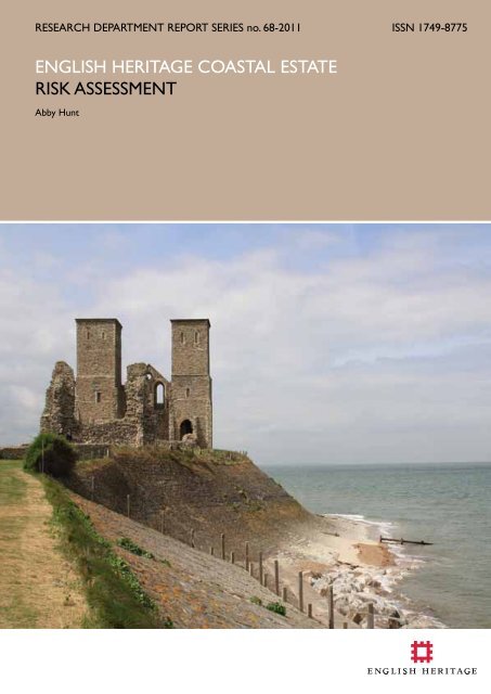
ENGLISH HERITAGE COASTAL ESTATE RISK ASSESSMENT
ENGLISH HERITAGE COASTAL ESTATE RISK ASSESSMENT
ENGLISH HERITAGE COASTAL ESTATE RISK ASSESSMENT

You also want an ePaper? Increase the reach of your titles
YUMPU automatically turns print PDFs into web optimized ePapers that Google loves.
RESEARCH DEPARTMENT REPORT SERIES no. 68-2011 ISSN 1749-8775<br />
<strong>ENGLISH</strong> <strong>HERITAGE</strong> <strong>COASTAL</strong> <strong>ESTATE</strong><br />
<strong>RISK</strong> <strong>ASSESSMENT</strong><br />
Abby Hunt
Research Department Report Series<br />
68- 2011<br />
<strong>ENGLISH</strong> <strong>HERITAGE</strong> <strong>COASTAL</strong> <strong>ESTATE</strong><br />
<strong>RISK</strong> <strong>ASSESSMENT</strong><br />
Abby Hunt<br />
© English Heritage<br />
ISSN 1749-8775<br />
The Research Department Report Series incorporates reports from all the specialist teams within the English<br />
Heritage Research Department: Archaeological Science; Archaeological Archives; Historic Interiors Research and<br />
Conservation; Archaeological Projects; Aerial Survey and Investigation; Archaeological Survey and Investigation;<br />
Architectural Investigation; Imaging, Graphics and Survey, and the Survey of London. It replaces the former<br />
Centre for Archaeology Reports Series, the Archaeological Investigation Report Series and the Architectural<br />
Investigation Report Series.<br />
Many of these are interim reports which make available the results of specialist investigations in advance of full<br />
publication. They are not usually subject to external refereeing, and their conclusions may sometimes have to be<br />
modified in the light of information not available at the time of the investigation. Where no final project report<br />
is available, readers are advised to consult the author before citing these reports in any publication. Opinions<br />
expressed in Research Department reports are those of the author(s) and are not necessarily those of English<br />
Heritage.<br />
Requests for further hard copies, after the initial print run, can be made by emailing:<br />
Res.reports@english-heritage.org.uk<br />
or by writing to:<br />
English Heritage, Fort Cumberland, Fort Cumberland Road, Eastney, Portsmouth PO4 9LD<br />
Please note that a charge will be made to cover printing and postage.<br />
© <strong>ENGLISH</strong> <strong>HERITAGE</strong> 68 - 2011
EXECUTIVE SUMMARY<br />
Climate change has direct and immediate impacts on the coast and on historic assets<br />
located close to our shores. The necessity of defence in coastal locations and the abundance<br />
of natural resources in these areas have resulted in many millennia of human activity and<br />
occupation around the coast of England and many sites and monuments have survived in<br />
this now increasingly threatened environment. English Heritage (EH) has over 400 historic<br />
properties in its care nationwide; of these, eighty are classified as being in the coastal zone.<br />
This risk assessment has been undertaken to assess the likely impacts of accelerated coastal<br />
erosion and increasingly frequent and severe flood events on the EH portfolio of historic<br />
properties. In order to make an assessment of the level of risk, projections of future coastal<br />
erosion and information about areas potentially at risk of flooding, supplied principally<br />
by the Environment Agency, have been compared with data on the EH coastal estate.<br />
Collation of these datasets in a Geographical Information System (GIS) has facilitated the<br />
cross-referencing, analysis and efficient management of the data collected during the course<br />
of the study. From the analysis of these data, the properties have been assigned a risk level,<br />
based upon the likelihood of flooding or coastal erosion and the severity of the potential<br />
risk, according to the proportion of the property likely to be affected.<br />
Overall, eighty sites (approximately 19.5% of EH’s entire historic property portfolio) are<br />
located within or intersect the coastal zone; this figure was reduced to fifty-four sites (or<br />
13% of the total) when further selection criteria were applied, providing the core sample<br />
for this study. Coastal properties not considered in this study are principally in urban areas<br />
where continued maintenance of flood or erosion defences may be assumed. Of the fiftyfour<br />
EH coastal estate historic properties included in this assessment, forty-eight (89% of<br />
the total) were recognised to be at risk of flooding, while thirty-eight (70% of the total)<br />
were deemed to be potentially at risk of coastal erosion. All properties had some level<br />
of potential threat, but this level varies significantly between sites, as would be expected,<br />
given differing geological and topographical conditions. Two sites (Berney Arms Windmill<br />
and Landguard Fort) were assessed to have a high risk of flooding and four (Reculver<br />
Roman Fort, Daw's Castle, Garrison Walls and Innisidgen Burial Chambers) to have a high<br />
risk of coastal erosion.<br />
The two sites at high risk of flooding, while not necessarily at risk of complete destruction<br />
by flood waters, will potentially be at risk of damage and partial loss from more regular<br />
inundation and possibly threatened by long-term rises in sea levels. Of the four sites at<br />
high risk from coastal erosion, three (Daw's Castle, Garrison Walls and Innisidgen Burial<br />
Chambers) are situated on stretches of coast which are not presently provided with sea<br />
defences, and are unlikely to be in the future, since current government policy is based<br />
around adaptation to coastal change, rather than defence. In these cases, it will be essential<br />
to ensure adequate recording, monitoring and understanding of the sites prior to their<br />
partial, or even complete, loss in the longer term. At Reculver, there are hard coastal<br />
defences protecting the site, which will need to be well maintained. Nevertheless, the<br />
preferred Shoreline Management Plan policy for adjacent stretches of coastline at Reculver<br />
(including an area of ‘Managed Realignment’) has the potential to impact upon the landscape<br />
setting of the property.<br />
© <strong>ENGLISH</strong> <strong>HERITAGE</strong> 68 - 2011
The information gathered for this study will inform future management of the coastal<br />
estate properties, helping to ensure that any predicted damage and/or loss from flooding<br />
and coastal erosion can be mitigated, and action taken, where feasible, to minimise<br />
potential risks. The risk assessment will also allow a prioritisation of relevant maintenance<br />
and protection measures, where possible and affordable.<br />
CONTRIBUTORS<br />
This report was written by Abby Hunt with contributions by Peter Murphy, who also<br />
edited the text. Linda Kilroy (EH Estates Team), Steve Trow (EH National Rural and<br />
Environmental Advice Team), Paul Pattison (EH Properties Presentation Team) and Dave<br />
Went (EH Archaeological Survey & Investigation Team) commented on the text. The<br />
Illustrations were prepared by Abby Hunt.<br />
ACKNOWLEDGEMENTS<br />
Thanks are due to the Environment Agency, in particular Nick Hardiman and Ed Wilson.<br />
The assistance of the SMP2 consultants and authorities who supplied the coastal erosion<br />
digital data was gratefully received, in particular, Jenny Jakeways (Isle of Wight), Andrew<br />
Colenutt (New Forest), Robin Siddle (North Yorkshire), Aaron McNeill (Northumberland),<br />
Stuart Dawks (Royal Haskoning), Delyth John (EA) and Sam Box (Halcrow). Many thanks<br />
also to the EH staff, past & present, who took the time to discuss the sites included in the<br />
study and to share their knowledge and information about the properties; Eleanor Breen,<br />
Richard Baker, Rob Harding, Mark Douglas, Jon Tate, Roy Porter, Mark Simmons, Gabriella<br />
Smith, Sara Rushton, Heather Sebire, Morgan Cowles and the Visitor Operations staff at<br />
all the sites visited in the course of this study.<br />
DATE OF STUDY<br />
May 2010 - July 2011<br />
CONTACT DETAILS<br />
English Heritage, 37 Tanner Row, York. YO1 6WP<br />
Abby Hunt, tel: (01904) 601910, email: abby.hunt@english-heritage.org.uk<br />
English Heritage, Fort Cumberland, Fort Cumberland Road, Eastney, Portsmouth PO4<br />
9LD<br />
Peter Murphy, tel: (023) 9285 6724, email: peter.murphy@english-heritage.org.uk<br />
© <strong>ENGLISH</strong> <strong>HERITAGE</strong> 68 - 2011
CONTENTS<br />
1. INTRODUCTION 1<br />
1.1 Climate change 1<br />
1.2 The coastal environment and its management 2<br />
1.3 A risk assessment 4<br />
2. METHODOLOGY 6<br />
2.1 Selecting the properties 6<br />
2.2 Compiling the project GIS 7<br />
2.3 Additional information 8<br />
2.4 Assessing risk 9<br />
2.5 Limitations 10<br />
2.6 Outputs 10<br />
Environment Agency ‘flood zones’ explained 11<br />
3. SUMMARY OF ASSETS AT <strong>RISK</strong> 12<br />
4. OVERVIEW OF <strong>RISK</strong> BY REGION 14<br />
4.1 North East 16<br />
4.2 Yorkshire & The Humber 17<br />
4.3 East Midlands 18<br />
4.4 East of England 18<br />
4.5 South East 19<br />
4.6 South West 20<br />
4.7 North West 22<br />
5. CASE STUDIES 23<br />
5.1 Case study 1: Reculver Roman Fort and Reculver Towers 23<br />
5.2 Case study 2: Landguard Fort 28<br />
5.3 Case studies 3a & b: St Mary’s, Isles of Scilly (Garrison Walls & Innisidgen Burial Chambers)<br />
32<br />
3a. Garrison Walls 32<br />
3b. Innisidgen Burial Chambers 36<br />
5.4 Case study 4: Hurst Castle 41<br />
5.5 Case study 5: Scarborough Castle 45<br />
© <strong>ENGLISH</strong> <strong>HERITAGE</strong> 68 - 2011
5.6 Case study 6: Daw's Castle 49<br />
6. CONCLUSION AND RECOMMENDATIONS 53<br />
7. BIBLIOGRAPHY 56<br />
APPENDIX 1: GAZETTEER OF EH <strong>COASTAL</strong> PROPERTIES INCLUDED IN THE STUDY 60<br />
North-East Region 60<br />
Yorkshire and the Humber Region 64<br />
East Midlands Region 65<br />
East of England Region 66<br />
South-East Region 68<br />
South-West Region 78<br />
North-West Region 91<br />
APPENDIX 2: NOTES ON SITE VISIT TO PIEL CASTLE 93<br />
APPENDIX 3 96<br />
APPENDIX 4: DATA SOURCES 97<br />
APPENDIX 5 99<br />
© <strong>ENGLISH</strong> <strong>HERITAGE</strong> 68 - 2011
LIST OF ILLUSTRATIONS<br />
Figure 1. Distribution map 6<br />
Figure 2. North East region location map 16<br />
Figure 3. Yorkshire & The Humber region location map 17<br />
Figure 4. East Midlands region location map 18<br />
Figure 5. East of England region location map 18<br />
Figure 6. South East region (eastern part) location map 19<br />
Figure 7. South East region (western part) location map 20<br />
Figure 8. South West region location map 21<br />
Figure 9. Isles of Scilly (South West region) location map 21<br />
Figure 10. North West region location map 22<br />
Figure 11. Photograph of Reculver Towers from the east 24<br />
Figure 12. Map showing the extent of EH's area of responsibility at Reculver 25<br />
Figure 13. Photograph from the north-east corner of St Mary's Church at Reculver 27<br />
Figure 14. Photograph of Landguard Fort 28<br />
Figure 15. Aerial photograph of Landguard Fort with superimposed Lidar data 30<br />
Figure 16. Photograph of active erosion below the breastwork to the south-west of King Charles'<br />
Battery 32<br />
Figure 17. Garrison Walls location map 33<br />
Figure 18. Photograph of active erosion of the low cliff to the north-west of Woolpack Point 34<br />
Figure 19. Photograph of the lower entrance grave at Innisidgen 37<br />
Figure 20. Photograph of the coastline below Innisidgen Burial Chambers 38<br />
Figure 21. Orthorectified aerial view of the coastline around Innisidgen Burial Chambers 39<br />
Figure 22. Photograph of groynes and sea defences to the south-east of Hurst Castle 42<br />
Figure 23. Photograph of the western end of the west wing of Hurst Castle 43<br />
Figure 24. Photograph of Scarborough Castle 46<br />
Figure 25. Orthorectified aerial photograph of Daw's Castle 50<br />
Figure 26. Photograph of cliffs immediately to the east of Daw's Castle 51<br />
Figure 27. Map showing the area of Berwick Castle in the care of EH 60<br />
Figure 28. Photograph of Dunstanburgh Castle from the south 61<br />
Figure 29. Map showing the EH guardianship area around Gainsborough Old Hall 66<br />
© <strong>ENGLISH</strong> <strong>HERITAGE</strong> 68 - 2011
Figure 30. Photograph of Calshot Castle 69<br />
Figure 31. Photograph from Deal Castle curtain wall 69<br />
Figure 32. Photograph of Dover Castle 70<br />
Figure 33. Photograph of Dymchurch Martello Tower. 71<br />
Figure 34. Map showing the north-eastern part of the Osborne House EH guardianship site 73<br />
Figure 35. Photograph of Portchester Castle 74<br />
Figure 36. Lidar surface data for Portchester Castle with superimposed flood zone data 74<br />
Figure 37. Photograph from the east side of Richborough Roman fort 75<br />
Figure 38. Photograph from the curtain wall of Walmer Castle 77<br />
Figure 39. Photograph of Bant's Carn Burial Chamber 79<br />
Figure 40. Photograph of Bayard's Cove Fort, Dartmouth 80<br />
Figure 41. Photograph of Cromwell's Castle, Tresco 81<br />
Figure 42. Photograph of erosion along the access path leading to Cromwell's Castle. 81<br />
Figure 43. Photograph of King Charles' Castle, Tresco 84<br />
Figure 44. Photograph of Old Blockhouse 84<br />
Figure 45. Photograph of Little Dennis Blockhouse 86<br />
Figure 46. Photograph of Porth Hellick Down entrance grave 87<br />
Figure 47. Photograph of Portland Castle 88<br />
Figure 48. Photograph of the cliff at Castle Cove, near St Mawes Castle 89<br />
Figure 49. Photograph of Merlin's Cave, Tintagel Island 90<br />
Figure 50. Photograph of the eastern elevation of Piel Castle 92<br />
Figure 51. Photograph of circular earthwork close to Piel Castle keep 93<br />
Figure 52. Photograph of erosion to the east of Piel Castle keep 94<br />
© <strong>ENGLISH</strong> <strong>HERITAGE</strong> 68 - 2011
TABLES<br />
Table 1. Risk matrix used for assessing risk level to EH coastal estate sites and properties for the<br />
purposes of the current study 9<br />
Table 2. Table summarising the number of EH properties at risk from flooding or coastal erosion and<br />
the level of the risk 12<br />
Table 3. Table showing the number of EH historic sites and properties by principal functional period at<br />
potential risk from flooding and/or coastal erosion, including the number at high risk 13<br />
Table 4. Table showing the number of EH historic sites and properties in each region at potential risk<br />
from flooding and/or coastal erosion, including the number at high risk 14<br />
Table 5. Table of properties included in the study, by EH region, showing the level of risk from flooding<br />
and coastal erosion. 15<br />
© <strong>ENGLISH</strong> <strong>HERITAGE</strong> 68 - 2011
1. INTRODUCTION<br />
English Heritage (EH) is guardian of over 400 historic properties 1 across England, ranging<br />
in date from the Neolithic to the 20 th century; these sites and properties range from<br />
small, individual buildings or ruins to large estates. The management and curation of this<br />
portfolio presents a myriad of challenges, including dealing with a range of threats to the<br />
fabric of structures, surviving archaeological remains and their landscape settings. One<br />
particular geographical area which will inevitably experience an increase in the severity<br />
and frequency of threat in the coming decades is the coast. With a changing global<br />
climate and rising sea levels, properties in coastal areas will face a new and increasingly<br />
serious set of conservation and management issues. Of all the EH historic sites and<br />
properties, eighty lie within 200m of the ‘Coastal Zone’, which is defined as ‘areas of<br />
marsh or mudflat, or elsewhere a 200m band inland of mean high water’ (Natural<br />
England 2007). This equates to approximately 10.4km of coastal frontage within the EH<br />
portfolio, and a further 2km of estuary frontage. In order to assess the potential risk<br />
to the EH properties in the coastal zone, it was decided to take the presently available<br />
data on flood risk and coastal erosion projections and examine where, and with what<br />
potential level of severity, this would impact on the properties in our care.<br />
1.1 Climate change<br />
Global climate change, for which there is growing, strong evidence, is the underpinning<br />
factor necessitating a risk assessment for EH coastal properties. While continuing<br />
research into climate change is showing that its effects, such as sea level rise and<br />
increasing occurrences of severe weather events, are clearly an issue, of greater concern<br />
is the rate at which these factors are changing; original estimates of the time-scale and<br />
scope of these impacts are continually being revised upwards to reflect the increasing<br />
pace and scale of change. Figures for the UK, published in 2006, indicated that sea level<br />
rise could equate to 0.99-1.21m, depending on location, by 2115 (Defra 2006, 3). Data<br />
from the UKCP09 (United Kingdom Climate Projections, http://ukclimateprojections.<br />
defra.gov.uk/), which is based on three different scenarios of greenhouse gas emissions<br />
(high, medium and low), indicates that by 2095 sea level rise in the southern part of<br />
the UK could be in the range of 0.21-0.68m (UKCP09, chapter 3). This figure takes into<br />
account vertical land movement and is based on the ‘medium’ scenario. The report also<br />
indicates that under a ‘high++’ scenario, although this has a very low (
As well as continuous processes, such as sea level rise (albeit not necessarily proceeding<br />
at a constant rate), climate change is having an impact on episodic, occasional events,<br />
such as storms, which are much more difficult to predict and mitigate. The frequency<br />
and severity of such events, whilst broadly unpredictable with any reasonable degree<br />
of probability, seems unlikely to decrease in the coming decades, given general climatic<br />
trends and environmental factors. It may be that using information from the impacts of<br />
past storm events will be the best means of preparing a future mitigation strategy.<br />
The broad implication of this rapidly developing evidence is that those responsible for<br />
managing coastal landscapes, whether they are valued for environmental, historic or<br />
current residential reasons, are going to be faced with increasingly testing problems in the<br />
coming century. In terms of the properties in the care of EH, the approaches to managing<br />
some of the most vulnerable will potentially need to be adjusted to take account of the<br />
increasing threats posed by climate change.<br />
1.2 The coastal environment and its management<br />
The coastal environment is dynamic and the process of coastal change is often episodic,<br />
rather than linear, which makes prediction and mitigation difficult. Isolated occurrences,<br />
such as storm surges, which may only last a matter of hours, can have immediate<br />
significant effects. In other cases, the changes are not immediate and the effect may occur<br />
some decades after the cause.<br />
England has a diverse and varied coastline, from hard-rock cliffs to low-lying soft coasts,<br />
which react differently, and at different rates, to changes in sea level, storminess and<br />
prevailing wave climate. The response of the coastline to erosion or accretion can also<br />
be affected by pre-existing man-made, management measures. In the last 100 years,<br />
approximately 865km of coastal protection has been constructed around England’s<br />
shores (MacInnes 2008, 32). The use of ‘hard’ defences (such as concrete sea walls) is<br />
now less common, as the ongoing costs are often untenable and the potential negative<br />
knock-on effects further along a coastline are better understood. Instead, there is now<br />
more emphasis on ‘soft’ defences and managed realignment; but this practice, whilst<br />
often beneficial to natural ecosystems, has the potential for negative impacts on the<br />
historic environment (English Heritage 2008, 7).<br />
The emphasis in coastal management now is on adaptation to coastal change rather<br />
than defence, wherever this is thought most appropriate. Some locations, such as those<br />
of major settlements or infrastructure, are of such national economic significance that<br />
defence is the obvious response. Elsewhere, in sparsely populated areas especially, the<br />
costs of defence are not justified in relation to the value of the assets protected, and<br />
so adaptation will be required. These principles underpin the document ‘Adapting to<br />
Coastal Change: Developing a Policy Framework’ (Defra 2010a). In the future many of<br />
the decisions about the best form of adaptation for individual rural communities will be<br />
made at a local or regional level. To facilitate this, Defra has funded a series of ‘Coastal<br />
Change Pathfinders’ around the country. Their aim is to generate new innovative ideas<br />
in terms of improving understanding of how coastal communities can adapt to coastal<br />
change and what the costs and benefits of different approaches are; these also provide<br />
© <strong>ENGLISH</strong> <strong>HERITAGE</strong><br />
2<br />
68 - 2011
practical lessons and examples which can be shared with other practitioners (www.defra.<br />
gov.uk/environment/flooding/coastal-change-pathfinders). This is entirely consistent with<br />
the Coalition Government’s emphasis on Localism, to be embodied in new legislation.<br />
Given the changing nature of the coastal environment, managing the coastline is a<br />
challenge. From the mid-1990s, a first generation of Shoreline Management Plans<br />
(SMPs) were produced for each section of the English coast. The aim was to provide a<br />
large-scale assessment of the risks associated with coastal processes, to ensure that the<br />
risks to people and the developed, historic and natural environments were reduced,<br />
and to promote coordinated management of the coastline. These original SMPs have<br />
been revisited in the past few years, incorporating revisions and changes in policy and<br />
responses from public consultation. Most of the SMP2s have now been finalised and<br />
published. The SMP model works on a time frame of short term (0-20 years), medium<br />
term (20-50 years) and long term (50-100 years), a definition which will be adopted<br />
throughout this report. For each stretch of coast, or ‘Policy Unit’, a preferred policy<br />
option is selected for the successive time frames: ‘Hold The Line’, ‘Advance The Line’,<br />
‘Managed Realignment’ or ‘No Active Intervention’. The historic environment is only<br />
one of a wide range of factors which influence policy selection. SMP documents play<br />
an important role in understanding potential coastal changes and developing policies<br />
to address any threats, which may impact upon EH properties and the landscapes<br />
surrounding them. They are not statutory documents, but they are now being used to<br />
help define Coastal Change Management Areas (CCMAs) as defined in the Department<br />
for Communities and Local Government’s Planning Policy Statement (PPS) 25 Supplement:<br />
Development and Coastal Change. This presents a range of planning options including<br />
provision for ‘roll-back’ of threatened coastal settlements within these areas. Although<br />
planning guidance is now being reviewed, it seems probable that some elements of the<br />
PPS25 supplement, including CCMAs, are likely to be retained.<br />
The review led by Sir Michael Pitt in 2008, undertaken in response to the floods which<br />
struck across the United Kingdom in the summer of 2007, resulted in a number of<br />
recommendations to improve resilience to increasing risks of flooding. It also identified<br />
problems inherent in previous legislation which had given local authorities the authority<br />
to drain land, build defences and provide flood warning, but did not define a local<br />
leadership role for this nor specify a national overview role for the Environment Agency<br />
(EA). The results of the Pitt Review were subsequently addressed by the Flood and<br />
Water Management Act 2010 and are being implemented through the National Flood<br />
and Coastal Erosion Risk Management Strategy for England (Defra/Environment Agency<br />
2011). In the preparation of the Strategic Environmental Assessment (SEA) report to<br />
support the development of the National Flood and Coastal Erosion Risk Management<br />
(FCERM) Strategy, the EA identified that the implementation of FCERM measures had<br />
the potential to impact upon cultural heritage and landscape. However, it was considered<br />
that the impacts tended to be location specific and the identification of significant<br />
issues in these areas on a national scale was difficult and fell outwith the scope of the<br />
assessment, thus the identification of heritage issues was to be ‘passed down’ to be<br />
assessed at a more appropriate, location-specific level (Environment Agency 2010b,<br />
3). To some degree the current study provides this level of assessment for sites and<br />
© <strong>ENGLISH</strong> <strong>HERITAGE</strong><br />
3<br />
68 - 2011
monuments in the care of EH, but does not extend to the wider historic environment. 2<br />
One of the key points to be taken forward from the Pitt Review was the need to<br />
reconsider the assumption that long-term flood and coastal erosion risk management<br />
plans in England would be funded by central Government. The funding system for flood<br />
and coastal erosion risk management authorities has, until recently, been 95% funded<br />
by central Government. The proposal for projects from 1 st April 2012 is that there will<br />
be a ‘payment for outcomes’ funding approach. This would encourage local investment<br />
in flood and coastal erosion risk management, giving those areas at risk more of a say in<br />
action taken (Defra 2010b, 7). It is envisaged that the burden of funding flood and coastal<br />
risk management projects will be shifted away from the general taxpayer and central<br />
government and be devolved to local groups and communities (those who would be<br />
direct beneficiaries of the schemes), who would be required to raise funds, but could<br />
then apply for an allocation of capital Flood Defence Grant-in-Aid, providing the project<br />
met stated criteria and delivered one of four outcome measures. This change has the<br />
potential to impact on the management of sites in the care of EH, for example, where a<br />
change in overall coastline management policy is to cease maintaining existing defences.<br />
It also remains to be defined whether EH, in a case where an EH historic property was<br />
seen potentially to benefit from the construction of a flood protection scheme, might be<br />
invited to contribute towards the cost.<br />
In the light of changes in funding for maintenance of sea defences, the EA has produced<br />
an information pack for landowners and asset owners. Included in this is the Asset<br />
maintenance policy protocol for sea defences (for England only) (Environment Agency 2010a),<br />
a document which provides guidance and sets out the decisions and options involved in<br />
a situation where the EA has historically maintained sea defences, but such activities are<br />
planned to be discontinued.<br />
1.3 A risk assessment<br />
Clearly, it is a difficult matter to quantify with certainty the effects of coastal erosion or<br />
flooding that will affect EH’s coastal properties over the coming decades. However, it is<br />
possible to indicate those properties most at risk and to identify the parts of the sites and<br />
monuments with the highest vulnerability. Using the available data, this study will examine<br />
the probability of flood events or coastal erosion, consider the level of severity that their<br />
impacts could have on heritage assets, and rank the risk accordingly.<br />
In taking a risk-based approach, the aim is to address a number of questions, namely<br />
what could happen, why, and what is the probability of it happening? Once this has been<br />
established, it is then a case of identifying what losses or damage may be caused, so<br />
that the effects can be reduced or managed (MacInnes 2008, 32). Although risks can be<br />
assessed, and management measures suggested and implemented to reduce the threat,<br />
the risk can rarely be totally eliminated. In managing historic properties and landscapes,<br />
being prepared for the risk of flooding or coastal erosion and aware of the potential<br />
2. English Heritage intends to undertake a wider national study of the impacts of flooding and erosion on the coastal<br />
historic environment; this will be initiated with a regional study of the county of Yorkshire (see National Heritage<br />
Protection Plan. Activity 2C1: Major Environmental Threats, Protection Result 2C1.3).<br />
© <strong>ENGLISH</strong> <strong>HERITAGE</strong><br />
4<br />
68 - 2011
consequences is key. This includes the acknowledgement that protection of historic<br />
environment sites from natural processes may not always be possible. In such cases,<br />
other measures to ensure that historic assets are fully understood and recorded to the<br />
highest available standards may be the only means to ensure a measure of preservation<br />
for future generations.<br />
The results of this study are set out in this report initially through an explanation of the<br />
methodology and sources used, followed by a broad summary of the assets at risk. A<br />
regional overview follows, considering the general character of the coastline in each EH<br />
region and the general trends of risk. A selection of properties have been selected for<br />
more detailed case studies; these have been selected because of particular risk factors<br />
or high levels of risk to the sites. The remaining properties in the study sample are<br />
summarised in a gazetteer. The conclusion includes some generic recommendations<br />
which may assist in future planning and management of some of the properties. As well<br />
as this report, the output of this study is the project Geographical Information System<br />
(GIS). This will be available for interrogation and consultation by internal stakeholders<br />
wishing to view the various datasets, and will be a useful tool for those preparing future<br />
management plans for sites and monuments in the care of EH. The structure of the GIS<br />
can also potentially be transferred to future projects looking at similar themes.<br />
This report and its recommendations do not commit EH to any course of action, but<br />
it envisaged that the results will be considered and discussed when formulating future<br />
management plans for the relevant properties. It is hoped that some measures can be<br />
implemented as appropriate, if funding permits, in the medium- to long-term.<br />
© <strong>ENGLISH</strong> <strong>HERITAGE</strong><br />
5<br />
68 - 2011
2. METHODOLOGY<br />
2.1 Selecting the properties<br />
In the first instance, a query was run on the entire dataset of EH properties held in the<br />
corporate GIS to select those that lay within 200m of the coastal zone (see Section 1 for<br />
definition of the latter). This returned a sample of eighty properties, distributed around<br />
the country. This group was further reduced by discounting those monuments within<br />
large, urban areas, where major flood or erosion defence systems exist, coastal erosion<br />
is not an issue, and where a ‘Hold The Line’ policy option is in place. The result, a list of<br />
fifty-four properties, form the core of the study (see Figure 1).<br />
N<br />
Figure 1. Map showing the distribution of the fifty-four EH historic properties included in<br />
the study. Background mapping SRTM data courtesy of the CGIAR Consortium for Spatial<br />
Information.<br />
© <strong>ENGLISH</strong> <strong>HERITAGE</strong><br />
6<br />
68 - 2011
2.2 Compiling the project GIS<br />
In order to manage the datasets and interrogate the spatial data effectively, it was<br />
decided to bring the information together in a project GIS, compiled in ESRI’s ArcGIS<br />
software (version 9.3.1). Background mapping, to provide an overall context for the<br />
sites, was created by using digital tiles of the relevant areas of Ordnance Survey (OS)<br />
mapping at 1:10 000 scale and the national dataset from the OS depicting the High Water<br />
Mark around the coast of the UK, supplied by the EH Corporate GIS team. Historic<br />
OS mapping was also acquired for some individual sites (where relevant), imported into<br />
the project GIS, and georeferenced, if the positional information had not already been<br />
created. Statutory datasets were also added to the GIS to illustrate environmental and<br />
heritage designations relating directly to the properties or their surrounding areas; these<br />
include SSSIs, AONBs, Ramsar areas, Listed Buildings, Scheduled Monuments and World<br />
Heritage Sites. The EH Corporate GIS team also provided data layers (in ESRI shapefile<br />
format) depicting the EH regions and the extent of the area in the care of EH for each of<br />
the fifty-four properties included in the study.<br />
Where there was existing spatial data for individual sites, this was incorporated<br />
into the GIS. In some cases, archaeological survey plans of sites, produced by the<br />
EH Archaeological Survey & Investigation Team, were available and these were<br />
georeferenced to bring them in to the correct location on the British National Grid.<br />
Examples of orthophotography, produced by the former EH Metric Survey Team, were<br />
also imported. In the specific case of the Garrison Walls, on the Isles of Scilly, a trial GIS<br />
was compiled in 2007 to assess the viability of such a system as a site management tool;<br />
this site-specific GIS and its associated data were also incorporated into the current<br />
project GIS.<br />
Datasets from other organisations were also obtained to add further information to the<br />
GIS and to give a fuller picture of the local setting of the properties. Geological mapping<br />
at 1:625 000 scale (bedrock geology), covering the whole of the UK, was downloaded<br />
from the British Geological Survey website (www.bgs.ac.uk). Aerial photography and<br />
Lidar data were acquired from two sources. Firstly, the Channel Coastal Observatory<br />
(CCO; www.channelcoast.org/), which is the website for the Strategic Regional Coastal<br />
Monitoring Programmes of England. This website provides a free, online download<br />
facility for the data held by the organisation, which includes good quality, rectified aerial<br />
photography and Lidar data. The limitation of this resource is that the primary area of<br />
coverage is limited to the south of England, from the Bristol Channel around to the<br />
Thames Estuary. For areas outside the CCO data holding, aerial photography and Lidar<br />
data were acquired from GeoStore (www.geostore.com/PGA), which provides Infoterra<br />
data products (aerial photography and digital height data) through Next Perspectives<br />
under a Pan Governmental Agreement (PGA), to which EH is a signatory.<br />
The Environment Agency (EA) has produced flood risk mapping for the UK and the<br />
digital version of this dataset for inclusion in the project GIS was acquired direct from<br />
the EA. The data include mapping of the potential extent of flood zones 2 and 3 (see<br />
‘EA Flood zones explained’ information box below, after Section 2.6), historic flood<br />
data and flood storage areas. The EA also provided data on individual sites which was<br />
incorporated into the project GIS.<br />
© <strong>ENGLISH</strong> <strong>HERITAGE</strong><br />
7<br />
68 - 2011
At the outset of the project, it was hoped that a digital dataset of the coastal erosion<br />
risk mapping for England, produced by the EA, would be available. Unfortunately the<br />
release of the complete nationwide dataset was postponed, and at the time of writing<br />
(May 2011) was still awaiting approval. Consequently, it was decided that the coastal<br />
erosion data for each individual coastal management area, used in the preparation of<br />
the SMP2, would, where possible, be obtained separately and incorporated into the<br />
project GIS. The relevant SMP2 authorities or consultants were contacted and, in most<br />
cases, the data was successfully obtained. This resulted in variants between some of the<br />
datasets, but generally the information included potential erosion rates over 20, 50 and<br />
100 year periods, in some cases presented as a ‘with present management’ scenario with<br />
additional data illustrating a ‘no active intervention’ scenario.<br />
2.3 Additional information<br />
As well as digital datasets, other documents were consulted during the study to provide<br />
contextual information for the sites and site-specific detail. The data sources used are<br />
tabulated in Appendix 4.<br />
A study called ‘Futurecoast’ was commissioned by Defra in 2002, the work for which<br />
was undertaken by the Halcrow Group (Halcrow 2002). The aim of the study was to<br />
gain a better understanding of the coastal change in the coming century for the open<br />
coastline of England and Wales, focusing on larger-scale coastal behaviour and taking<br />
a geomorphological-based approach. It was intended to be used as an underpinning<br />
element of the SMP2s to allow longer-term trends to be incorporated into forward<br />
plans for coastal defences. The results of this study, the analysis of 6,000km of shoreline,<br />
have been made available on an interactive CD-ROM along with thematic reports, data,<br />
interpretative reports and predictive mapping. This information was consulted in the<br />
course of the present study to augment other data sources and to provide a fuller image<br />
of predicted coastal change at various sites.<br />
As mentioned above, SMPs are a crucial element in the management of coastal<br />
environments. The latest generation of SMPs (SMP2s), were consulted, where available,<br />
to provide information about the proposed management policies for various sections<br />
of coastline. Many of the SMP2s also include maps of possible extents of future coastal<br />
erosion; where it was not possible to obtain this mapped data digitally, the hard copy<br />
reports were consulted.<br />
The maintenance of EH properties is the responsibility of the Estates Team, which sits<br />
within the Conservation Department of the National Collections group. The team<br />
delivers cyclical and response maintenance to the sites and produces maintenance project<br />
plans for the entire estate on an annual basis. These projects are prioritised based<br />
on information contained within the AMP (Asset Management Plan) system. Periodic<br />
Condition Surveys and Reports, conducted to EH’s Standard for Periodic Condition<br />
Surveys and Reports (ref. EHS0004/2:2006) specification, are commissioned for each<br />
of the properties by the EH Estates Programme Development Team every five years.<br />
These documents contain a schedule of the individual assets comprising the area in<br />
guardianship (where applicable), record condition and defects, provide a prioritisation of<br />
© <strong>ENGLISH</strong> <strong>HERITAGE</strong><br />
8<br />
68 - 2011
action and recommend further assessment; these generally focus on repairs and remedial<br />
works. Where relevant, these have been consulted in the course of this study to provide<br />
information about defects relating to flooding and/or coastal erosion which have already<br />
been noted and are part of the maintenance plans, but also to highlight potentially<br />
vulnerable areas of sites which are perhaps not currently being monitored or addressed<br />
by the maintenance schedule.<br />
The EH Scheduled Monuments at Risk (SM@R) database, which contains assessments of<br />
all scheduled EH sites and a categorization of principal threats, was also consulted. The<br />
risk levels assigned to the sites in this study in the SM@R database are tabulated in Table<br />
5 (see below, Section 4).<br />
2.4 Assessing risk<br />
The method for assessing the risk to the sites and monuments in the care of EH in this<br />
study was to visually examine the digital data in the project GIS in order to establish the<br />
potential threat from coastal erosion or flooding. This was achieved by viewing datasets<br />
together in the GIS and noting where the predicted flood zones and potential extents<br />
of coastal erosion intersected the polygons defining the extent of the area in the care<br />
of EH. If there was no correspondence between the EH estate area and the potential<br />
risk zones, then the site was deemed to be at low risk. Where there was an overlap, the<br />
size of the overlap was ascertained and the percentage of the property potentially under<br />
threat from flooding and/or coastal erosion was calculated. Other factors, such as the<br />
nature of underlying geology, site staff observations, condition reports and SMP policies<br />
for Policy Units (as outlined above), were also taken into consideration at this stage, to<br />
further refine the risk level. In some published risk assessments, the level of significance of<br />
a property or site is taken into consideration; however, in this case, as all the properties<br />
are in the care of EH and are either scheduled or listed, indicating that they are all of<br />
national importance, this criteria was not considered to be a useful quantifier. A basic<br />
risk matrix (Table 1, below) was developed to allow a definition of the risk level. Where<br />
possible, site visits were made to confirm the data and analysis derived from the project<br />
GIS, and to obtain up-to-date photography of known problem areas.<br />
% area of site<br />
affected<br />
Probability of flooding/coastal<br />
erosion<br />
Low Moderate Significant<br />
Negligible Low Low Low<br />
up to 25% Low Low Medium<br />
25-50% Low Medium Medium<br />
50-75% Medium Medium High<br />
75-100% Medium High High<br />
Risk level<br />
Table 1: Risk matrix used for assessing risk level to EH coastal estate sites and properties for<br />
the purposes of the current study<br />
© <strong>ENGLISH</strong> <strong>HERITAGE</strong><br />
9<br />
68 - 2011
2.5 Limitations<br />
The prediction of future trends in coastal erosion, and indeed flooding, is not a precise<br />
science. There are various digital modelling routines which enable potential flood<br />
patterns to be predicted, but these do not provide a definitive statement of future<br />
flood events, they merely indicate the most likely extents of flooding given a certain set<br />
of circumstances and factors. As research into climatic patterns and changes advances,<br />
models of potential impacts will doubtless be revised. The EA flood zone mapping used<br />
for this project, must be viewed as a projection of future events rather than a certainty.<br />
Variables which cannot be predicted mean that future flooding could be less severe than<br />
the maps suggest, but by the same token, it may be more severe. This latter situation is<br />
perhaps more likely in view of the recent upward revisions of the rate of climate change<br />
and sea level rise. In addition, individual severe storms may precipitate damaging flood<br />
events, which are almost impossible to predict. Modelling for worst case scenarios is not<br />
a pessimistic exercise, it is simply a matter of being forearmed against the full range of<br />
possibilities.<br />
The caveats attached to flood risk mapping also apply to coastal erosion risk mapping.<br />
Although a number of SMP2s provide maps with lines indicating the extent of coastal<br />
retreat over 20, 50 and 100 years, these lines are based on projections of current rates<br />
of change and models and are not guaranteed statements of future events. Often, the<br />
scale of the coastal erosion maps does not allow for discrete areas of geology, which<br />
may impact on rates of erosion or susceptibility to wave action, to be factored in to the<br />
generic erosion lines. Clearly these may have an impact at an individual site scale. The<br />
projections often assume the good maintenance of existing coastal defences into the<br />
future. However, with increasingly restricted funding, this cannot be taken for granted. In<br />
addition, even well-maintained defences can be over-topped in severe storm episodes<br />
and the extent of erosion behind the defences that this may cause is difficult to predict.<br />
Despite the inherent difficulties in predicting future climate patterns and storm<br />
frequencies, the available data give a reasonable indication of possible future impacts<br />
based on the current understanding of general trends. By using these data, a baseline<br />
understanding of threats and risk level to the EH coastal estate can be ascertained. Then,<br />
as future studies allow the refinement of predictions, updated data can be fed in to the<br />
project GIS, compared against the EH property portfolio and any changed priorities can<br />
be addressed.<br />
2.6 Outputs<br />
As noted in the introduction, this report is one element of the project’s outputs. The<br />
main product is the GIS tool created to assist the future management of the coastal<br />
sites. It is possible to derive maps from the system illustrating site-specific data with<br />
relative ease. Queries can also be run on the data to answer particular management<br />
issues and assist with forward planning. The project data will be available digitally to any<br />
EH staff with access to ArcMap GIS software (stand-alone or via DeskGIS); options for<br />
disseminating the data via read-only methods which do not require the full software,<br />
such as free-to-download GIS readers, will also be investigated. The GIS model has been<br />
designed to be transferable, so that the GIS structure and datasets can, where relevant,<br />
be adopted by comparable projects.<br />
© <strong>ENGLISH</strong> <strong>HERITAGE</strong><br />
10<br />
68 - 2011
Environment Agency ‘flood zones’ explained<br />
Data provided by the EA on areas potentially at risk from flood are illustrated in zones<br />
on maps, relating to fluvial (river) and tidal flooding. The areas of risk are categorized<br />
as ‘flood zone 2’ or ‘flood zone 3’ and it is assumed that these are the extents of the<br />
areas that would be affected by flooding if there were no flood defences.<br />
• Flood zone 2 shows areas of land which have an annual probability of flooding of<br />
between 0.1-1% (from rivers) or 0.1-0.5% (from the sea); this equates to a 1 in<br />
1,000 to 1 in 100 chance of flooding from rivers or 1 in 1,000 to 1 in 200 chance<br />
of flooding from the sea. Flooding to the full extent of this outlying zone has a low<br />
probability, but would potentially be an extreme event.<br />
• Flood zone 3 shows areas of land which have an annual probability of flooding 1%<br />
or greater (from rivers) and 0.5% or greater (from the sea); this equates to a 1 in<br />
100 or greater chance of flooding from rivers or a 1 in 200 or greater chance of<br />
flooding from the sea.<br />
The EA categorizes the level of risk of flood as:<br />
• Significant (chance of flooding in any year greater than 1.3% or 1 in 75)<br />
• Moderate (chance of flooding in any year is 1.3-0.5% (between 1 in 75 and 1 in<br />
200)<br />
• Low (chance of flooding in any year is 0.5% (1 in 200) or less<br />
These definitions are used throughout this report.<br />
Information from:<br />
http://www.environment-agency.gov.uk/homeandleisure/floods/default.aspx<br />
© <strong>ENGLISH</strong> <strong>HERITAGE</strong><br />
11<br />
68 - 2011
3. SUMMARY OF ASSETS AT <strong>RISK</strong><br />
Having assessed the historic properties in the EH coastal estate against the available<br />
risk datasets, the results demonstrate that all the sites in the study face some level of<br />
threat from either flooding, coastal erosion or both. Thirty-two are considered to be<br />
at risk from both coastal erosion and flooding, with fifteen of these at low risk in both<br />
categories. Considering the risk types individually, the majority of the properties fall<br />
into the low risk or no risk categories (68% for flood risk and 79% for coastal erosion<br />
risk). While the level of risk to most of these properties is low, it should by no means<br />
be ignored. The threat is still present and could be exacerbated by one-off climatic<br />
events, but in terms of general trends, they are unlikely to be at immediate, serious risk.<br />
In terms of prioritizing mitigation works, defensive measures and maintenance work,<br />
the properties in the lower risk categories would be given lower weighting. Those sites<br />
at medium or high risk from flooding (28% of the study sample) or coastal erosion<br />
(19%) are potentially going to be at greater risk and possibly within a shorter time<br />
scale. Accordingly, these sites should be given a greater weighting when considering<br />
prioritisation of works and particular attention paid to the parts of the area in the care of<br />
EH identified as being most at risk from flooding and/or erosion.<br />
Risk level<br />
Flooding<br />
Risk type<br />
Coastal<br />
Erosion<br />
Low 31 27<br />
Low/Medium 2 1<br />
Medium 13 6<br />
High 2 4<br />
n/a 6 16<br />
Total 54 54<br />
Table 2: Table summarising the number of EH properties at risk from flooding or coastal<br />
erosion and the level of the risk<br />
The fifty-four EH sites and properties included in this study range in date from the<br />
Bronze Age period (approximately 2700-700BC) to the 19 th century, although a number<br />
are multi-period landscapes or structures. As with the chronology of the sites, many are<br />
also multi-functional, having fulfilled a number of roles over the centuries; Portchester<br />
Castle, for example, incorporates a Roman fort, a medieval castle and priory, and a<br />
17 th century prisoner of war camp. The sites are tabulated below (Table 3) by principal<br />
construction or functional period against the risk type; where there are significant phases<br />
of use across a number of time periods, the site has been classed as ‘multi-period’. The<br />
high number of medieval and Tudor sites reflects the importance of the coast in military<br />
terms, particularly the latter period when Henry VIII’s programme of strengthening<br />
England’s coastal defence resulted in the construction of a number of forts at strategic<br />
locations. As the figures indicate, risk is spread relatively evenly across all periods of site.<br />
© <strong>ENGLISH</strong> <strong>HERITAGE</strong><br />
12<br />
68 - 2011
The most common broad category of sites in the study sample comprises defensive<br />
fortifications, indicating the crucial, strategic role that coastal locations have played in<br />
England’s military past, as mentioned above; of the fifty-four sites in the study, thirtyseven<br />
(of varying dates) fall into this category. The next most numerous category is<br />
religious, ritual and funerary monuments, which account for thirteen of the sites. The<br />
remainder fall into the categories of domestic, transport, commercial, and gardens, parks<br />
and open spaces.<br />
Period<br />
Number of sites by risk type<br />
Flooding<br />
Coastal<br />
Erosion<br />
Flood &<br />
Coastal<br />
Erosion<br />
Total<br />
High risk<br />
Prehistoric 0 1 3 4 1<br />
Roman 2 0 2 4 1<br />
Saxon 0 1 0 1 1<br />
Medieval 8 2 7 17 0<br />
Tudor 2 2 11 15 0<br />
Post medieval 2 0 3 5 1<br />
19th Century 2 0 2 4 1<br />
Multi-period 0 0 4 4 1<br />
Table 3: Table showing the number of EH historic sites and properties by principal functional<br />
period at potential risk from flooding and/or coastal erosion, including the number at high risk<br />
54<br />
© <strong>ENGLISH</strong> <strong>HERITAGE</strong><br />
13<br />
68 - 2011
4. OVERVIEW OF <strong>RISK</strong> BY REGION<br />
The properties comprising EH’s coastal estate are each described in summary, with an<br />
assessment of risk level, in Appendix 1, with seven covered in more detailed case studies<br />
(Section 5). This section provides a regional overview of the character of the coastal<br />
zone, summarizes the property data in each region and gives an outline of the principal<br />
risks. Information on the general coastal character of each region has, in the main, been<br />
taken from the Process Reports in the Thematic Report section of the Futurecoast study<br />
(Halcrow 2002). More detailed information about the geology and coastal character in<br />
the vicinity of each individual site in the study is presented in the relevant cases studies<br />
(Section 5) or gazetteer section (Appendix 1).<br />
Of EH’s nine regions, two contained no properties fulfilling the criteria for inclusion in this<br />
study; the West Midlands region, which has no coastline, and the London region, where<br />
monuments in the care of EH are considered to be adequately protected by the flood<br />
defences for the city. The figures for the sites in each EH region are summarized in the<br />
table below (Table 4).<br />
EH Region<br />
Coastal<br />
Erosion<br />
Number of sites by risk type<br />
Flooding<br />
Coastal<br />
Erosion &<br />
Flooding<br />
Total<br />
High Risk<br />
North East 0 4 4 8 0<br />
Yorkshire & Humber 2 0 0 2 0<br />
East Midlands 0 1 0 1 0<br />
East of England 0 5 1 6 2<br />
South East 0 4 13 17 1<br />
London - - - 0 -<br />
South West 4 2 12 18 3<br />
West Midlands - - - 0 -<br />
North West 0 0 2 2 0<br />
6 16 32 54 6<br />
Table 4: Table showing the number of EH historic sites and properties in each region at<br />
potential risk from flooding and/or coastal erosion, including the number at high risk<br />
Table 5 (opposite): Properties included in the study, by EH region, showing the level of risk from<br />
flooding and coastal erosion. The final column also shows the level of risk assigned to the sites<br />
in EH’s Scheduled Monuments at Risk (SM@R) database; those highlighted in blue are sites<br />
whose primary vulnerability is ‘erosion’ (although ‘erosion’ can include coast, natural, wind or<br />
visitor). 'CERA' is an abbreviation of Coastal Estate Risk Assessment.<br />
© <strong>ENGLISH</strong> <strong>HERITAGE</strong><br />
14<br />
68 - 2011
Property name<br />
EH Region<br />
CERA risk<br />
level (flood)<br />
CERA risk<br />
level (coastal<br />
erosion)<br />
SM@R<br />
risk level<br />
Berwick Castle North East Low n/a Low<br />
Berwick Ramparts North East Low Low Medium<br />
Dunstanburgh Castle North East Low Medium Low<br />
Lindisfarne Priory North East Low Low Low<br />
St Paul’s Monastery North East Low n/a Low<br />
Tynemouth Castle and Priory North East Low Low Low<br />
Warkworth Castle North East Low n/a Low<br />
Warkworth Hermitage North East Low/Medium n/a Low<br />
Scarborough Castle Yorkshire & The Humber n/a Medium Low<br />
Whitby Abbey Yorkshire & The Humber n/a Low Medium<br />
Gainsborough Old Hall East Midlands Medium n/a n/a<br />
Berney Arms Windmill East of England High n/a Low<br />
Burgh Castle East of England Low n/a Low<br />
Landguard Fort East of England High Low Medium<br />
Mistley Towers East of England Low n/a Low<br />
St Olave's Priory East of England Low n/a Medium<br />
Tilbury Fort East of England Medium n/a Low<br />
Calshot Castle South East Medium Low Low<br />
Deal Castle South East Medium Low Low<br />
Dover Castle South East Low Low Low<br />
Dover, Archcliffe Fort South East Low Low Medium<br />
Dymchurch Martello Tower South East Low Low Low<br />
Fort Cumberland South East Medium Low Medium<br />
Hurst Castle South East Medium Medium Low<br />
Netley Abbey South East Low Low Medium<br />
Osborne House South East Low/Medium Low/Medium n/a<br />
Portchester Castle South East Medium Low Low<br />
Reculver Roman Fort and Reculver<br />
Towers<br />
Richborough Roman Fort and<br />
Amphitheatre<br />
South East Low High Medium<br />
South East Low n/a Medium<br />
Rochester Castle South East Low n/a Medium<br />
Temple Manor, Strood South East Low n/a Medium<br />
Upnor Castle South East Medium n/a Low<br />
Walmer Castle South East Low Low Low<br />
Yarmouth Castle South East Medium Low Low<br />
Ballowall Barrow South West n/a Low Low<br />
Dartmouth Bayards Cove South West Medium Low Low<br />
Dartmouth Castle South West Low Low Medium<br />
© <strong>ENGLISH</strong> <strong>HERITAGE</strong><br />
15<br />
68 - 2011
Daw's Castle South West n/a High Medium<br />
IOS - Bant's Carn Burial Chamber South West Low Low Medium<br />
IOS - Cromwell’s Castle South West Low Medium Medium<br />
IOS - Garrison Walls South West Low High High<br />
IOS - Harry’s Walls South West Low n/a Medium<br />
IOS - Innisidgen Burial Chambers South West Low High Medium<br />
IOS - King Charles’ Castle South West n/a Low Medium<br />
IOS - Old Block House South West n/a Low Medium<br />
IOS - Porth Hellick Down South West Low Low Medium<br />
Over Bridge South West Medium n/a Medium<br />
Pendennis Castle South West Low Low Low<br />
Portland Castle South West Medium Low Low<br />
St Catherine’s Castle, Fowey South West Low Low Low<br />
St Mawes Castle South West Low Low Low<br />
Tintagel Castle South West Low Medium Medium<br />
Piel Castle North West Medium Medium Medium<br />
Ravenglass Roman Bath House North West Low Low Low<br />
4.1 North East<br />
N<br />
Alnwick<br />
NORTH EAST<br />
Berwick Castle<br />
Berwick Ramparts<br />
Lindisfarne Priory<br />
Newcastle-upon-Tyne<br />
0 30 60 km<br />
Dunstanburgh Castle<br />
Warkworth Castle<br />
Warkworth Hermitage<br />
Durham<br />
Middlesbrough<br />
Tynemouth Castle<br />
& Priory<br />
St Paul’s Monastery<br />
Figure 2. Location map showing EH historic sites and properties<br />
in the coastal zone in the North East region. Background<br />
mapping SRTM data courtesy of the CGIAR Consortium for<br />
Spatial Information.<br />
The coastal area of the EH<br />
North East region stretches<br />
from Berwick-upon-Tweed to<br />
Staithes. The general character of<br />
this stretch of coastline consists<br />
of long sandy beaches on the<br />
Northumberland coast, limestone<br />
cliffs and foreshore along the<br />
County Durham coast, and rock<br />
platforms and cliffs cut into the<br />
Magnesian limestone around South<br />
Shields and Sunderland. The coast<br />
of the southern part of the region<br />
tends to be composed of relatively<br />
softer rocks.<br />
Along this coastline, EH has<br />
responsibility for eight properties<br />
in the coastal zone. The threat<br />
level is generally low, with no<br />
properties at immediate serious<br />
risk from coastal erosion or<br />
flooding. However, there is a<br />
moderate risk of coastal erosion<br />
© <strong>ENGLISH</strong> <strong>HERITAGE</strong><br />
16<br />
68 - 2011
occurring in the next 100 years around Dunstanburgh Castle and the potential for<br />
flooding to occur in the vicinity of Warkworth Hermitage, which could potentially affect<br />
access to the site.<br />
4.2 Yorkshire & The Humber<br />
The EH Yorkshire and The Humber region covers the coastline from Staithes to<br />
Cleethorpes, including the Humber Estuary. The region is broadly characterised by<br />
eroding cliff and beach units north of Flamborough Head, with softer, less resilient<br />
geology to the south giving rise to salt marshes and sand dunes. Erosion along this<br />
stretch of coast is a well-documented and wide-spread phenomenon; in places along the<br />
Yorkshire coast, particularly within the East Riding of Yorkshire, the average rate of loss<br />
is 1.8m per year, although this does fluctuate greatly over time and between locations<br />
(Defra 2010a, 34). This is most clearly demonstrated by the cliffs of Holderness where<br />
there is significant erosion, averaging a loss of 1-3m each year (Halcrow 2002). The<br />
shoreline to the south of the River Humber is typically more low-lying than elsewhere in<br />
this region.<br />
EH has responsibility for two sites within the coastal zone in this region, neither of which<br />
is at significant risk from coastal erosion or flooding. However, both properties (Whitby<br />
Abbey and Scarborough Castle) are in areas which have witnessed significant landslips<br />
and loss of land from local cliffs; some of these events are related to coastal erosion, but<br />
some are a result of the local geological conditions and groundwater drainage.<br />
Whitby Abbey<br />
N<br />
Northallerton<br />
Scarborough Castle<br />
YORKSHIRE & THE HUMBER<br />
Flamborough<br />
Head<br />
York<br />
Leeds<br />
Kingston-upon-Hull<br />
Humber Estuary<br />
Sheffield<br />
0 30 60 km<br />
Figure 3. Location map showing EH historic sites and properties in the coastal zone in<br />
the Yorkshire & The Humber region. Background mapping SRTM data courtesy of the<br />
CGIAR Consortium for Spatial Information.<br />
© <strong>ENGLISH</strong> <strong>HERITAGE</strong><br />
17<br />
68 - 2011
4.3 East Midlands<br />
N<br />
EAST MIDLANDS<br />
Leicester<br />
River Trent<br />
Nottingham<br />
Gainsborough Old Hall<br />
Northampton<br />
Lincoln<br />
The<br />
Wash<br />
0 30 60 km<br />
Figure 4. Location map showing the EH portfolio<br />
in the coastal zone in the East Midlands region.<br />
Background mapping SRTM data courtesy of the<br />
CGIAR Consortium for Spatial Information.<br />
The EH East Midlands region includes<br />
a length of coastline from Cleethorpes<br />
to the middle of The Wash, c15km<br />
north-west of King’s Lynn. Parts of the<br />
coastline, particularly the Lincolnshire<br />
coast, consist of relatively soft geology<br />
and are low-lying. The coast in this region<br />
also consists of areas of salt marsh and<br />
estuarine systems, while The Wash<br />
itself is a marine basin carved out of the<br />
Jurassic clays of eastern England (Halcrow<br />
2002).<br />
The sole EH historic property within the<br />
study area in this region is Gainsborough<br />
Old Hall, situated in the vicinity of the<br />
River Trent. The site is at moderate risk<br />
of flooding.<br />
4.4 East of England<br />
N<br />
Peterborough<br />
Cambridge<br />
LONDON<br />
The<br />
Wash<br />
Tilbury Fort<br />
Norwich<br />
EAST OF ENGLAND<br />
Ipswich<br />
Mistley Towers<br />
Thames Estuary<br />
Berney Arms<br />
Windmill<br />
Burgh<br />
Castle<br />
Landguard Fort<br />
St Olave’s<br />
Priory<br />
0 30 60 km<br />
Figure 5. Location map showing EH historic sites and<br />
properties in the coastal zone in the East of England region.<br />
Background mapping SRTM data courtesy of the CGIAR<br />
Consortium for Spatial Information.<br />
The EH East of England<br />
region includes the coastline<br />
from the middle of The Wash<br />
around the coast of Norfolk<br />
and Suffolk to the northern<br />
side of the Thames Estuary.<br />
This part of the coast is long<br />
and diverse, consisting of<br />
sandy/gravelly beaches, cliffs,<br />
low-lying marshland and sand<br />
dune units in the north of the<br />
region (the north Norfolk<br />
coast), with sand/shingle<br />
beaches and unconsolidated<br />
cliff and dune units along<br />
the eastern coast of Norfolk<br />
and the Suffolk coast. To<br />
the south of the region, the<br />
coast consists primarily of<br />
eroding cliffs with mud and<br />
sand flats and a number of<br />
substantial estuaries. There<br />
has been extensive land-claim<br />
© <strong>ENGLISH</strong> <strong>HERITAGE</strong><br />
18<br />
68 - 2011
across the region. The eastern coast of Norfolk and the Suffolk coasts are particularly<br />
susceptible to erosion and to storm surges; the effects of the latter are magnified by the<br />
soft geology and low-lying coastline. Storm surges along this part of the coast can reach<br />
heights of 2m in extreme circumstances and surges of c1m in height occur several times<br />
each year (Halcrow 2002).<br />
Within the coastal zone of the East of England region there are six properties in the care<br />
of EH. Four of the properties have a low or medium flood risk and no coastal erosion<br />
risk (due to their location on estuaries). Berney Arms Windmill and Landguard Fort (see<br />
Section 5, Case Study 2) are both at high risk of tidal flooding, as the entirety of each<br />
area of EH responsibility lies within the projected flood zone 3. Despite Landguard’s<br />
coastal location, the risk from coastal erosion is low, assuming that the present flood<br />
defences are maintained and continue to function efficiently.<br />
4.5 South East<br />
The EH South East region covers the coastline from the south side of the Thames<br />
Estuary all the way to the Hampshire/Dorset border, just east of Christchurch. The<br />
coastline has a varied character, with eroding cliffs, mud and sand flats, and estuary units<br />
along the north Kent coast, and cliffs and shingle beaches, which are generally subject to<br />
erosion, around the coast in the east of the region; this region includes the highest chalk<br />
cliffs in Britain at Beachy Head. The southern coast of the region consists of cliffs, beaches<br />
(some shingle), estuary units and ebb tidal deltas. There are also three natural harbours<br />
(Chichester, Langstone and Portsmouth). The Isle of Wight is also within the South East<br />
Upnor Castle<br />
Temple<br />
Manor<br />
Rochester<br />
Castle<br />
Thames Estuary<br />
Maidstone<br />
SOUTH EAST<br />
Hastings<br />
Reculver Roman Fort<br />
& Towers<br />
Richborough<br />
Roman Fort<br />
Margate<br />
Dymchurch Martello Tower<br />
Deal Castle<br />
Walmer<br />
Castle<br />
Dover Castle<br />
Archcliffe Fort<br />
0 20 40 km<br />
Figure 6. Location map showing EH historic sites and<br />
properties in the coastal zone in the South East region (eastern<br />
part). Background mapping SRTM data courtesy of the CGIAR<br />
Consortium for Spatial Information.<br />
N<br />
region and almost all the<br />
cliff stretches on the island<br />
are eroding; there have<br />
been major landslides on<br />
the southern coast of the<br />
island (Halcrow 2002).<br />
There are seventeen<br />
properties in the care<br />
of EH within the coastal<br />
zone of the South East<br />
region. Just over half of<br />
these are at low risk from<br />
flooding, while eight have<br />
been identified as being<br />
at moderate risk from<br />
flooding. A number of<br />
the sites at risk from tidal<br />
flooding are located in<br />
exposed, coastal positions,<br />
often in a low-lying<br />
situation, which makes<br />
them more susceptible to<br />
© <strong>ENGLISH</strong> <strong>HERITAGE</strong><br />
19<br />
68 - 2011
potential flood events. There are also two sites in the region at medium risk of coastal<br />
erosion and one at high risk. The latter is Reculver Roman Fort and Reculver Towers,<br />
which has suffered from erosion over many centuries (see Section 5, Case Study 1).<br />
SOUTH EAST<br />
N<br />
Bournemouth<br />
Hurst Castle<br />
Calshot Castle<br />
Southampton<br />
Netley Abbey<br />
T h e<br />
S o l e n t<br />
Yarmouth Castle<br />
Portchester Castle<br />
Fort Cumberland<br />
Osborne House<br />
0 20 40 km<br />
Figure 7. Location map showing EH historic sites and properties<br />
in the coastal zone in the South East region (western part).<br />
Background mapping SRTM data courtesy of the CGIAR<br />
Consortium for Spatial Information.<br />
4.6 South West<br />
With the longest coastline of all the EH regions, the character of the coast around<br />
the South West region is diverse. The south-eastern part of the region includes Poole<br />
Harbour, one of the world’s largest natural harbours. The south-western section of<br />
the coast is predominantly rocky with beaches, cliffs (many of which are eroding) and<br />
estuaries; the beaches on the south Devon and Cornwall coast tend to be sandy and<br />
backed with eroding cliffs and headlands. Land’s End and the north Cornwall coast are<br />
characterised by high cliffs with rocky fringes, detached rocky outcrops and numerous<br />
indentations, with some sandy beaches. Along the north Devon and Somerset coast,<br />
there are cliffs, beaches, dunes and mudflats, with some erosion resistant limestone<br />
headlands. The beaches and dunes are subject to erosion in localised areas (Halcrow<br />
2002). The significant estuary systems in the region include Plymouth Sound, the Dart<br />
Estuary, the Fal Estuary and the Camel Estuary.<br />
With such a long coastline, it is not surprising that the South West region also has the<br />
largest number of EH historic sites and properties in the coastal zone, a total of eighteen.<br />
Of these, eight are located on the Isles of Scilly. Across the EH properties in this region,<br />
© <strong>ENGLISH</strong> <strong>HERITAGE</strong><br />
20<br />
68 - 2011
N<br />
Over Bridge<br />
Bristol Channel<br />
Bristol<br />
SOUTH WEST<br />
Daw’s Castle<br />
Tintagel Castle<br />
Exeter<br />
Bayard’s<br />
Newquay<br />
Cove Fort Portland Castle<br />
Plymouth<br />
Ballowall Barrow<br />
St Catherine’s Dartmouth Castle<br />
Castle<br />
Pendennis<br />
St Mawes Castle<br />
Castle<br />
0 30 60 km<br />
Figure 8. Location map showing EH historic sites and properties in the coastal zone in the<br />
South West region. Background mapping SRTM data courtesy of the CGIAR Consortium for<br />
Spatial Information.<br />
King Charles’<br />
Castle<br />
BRYHER<br />
Cromwell’s<br />
Castle<br />
New Grimsby<br />
TRESCO<br />
Old Blockhouse<br />
Bants Carn Burial Chamber<br />
& Halangy Down<br />
Ancient Village<br />
Harry’s Walls<br />
ST MARY’S<br />
ST MARTIN’S<br />
N<br />
Innisidgen Burial<br />
Chambers<br />
the flood risk level is relatively low;<br />
eleven sites are assessed as being at low<br />
flood risk and three at medium flood<br />
risk. Coastal erosion may affect sixteen<br />
of the sites in this region within the next<br />
100 years. Of these sixteen sites, two<br />
are at medium risk and three at high risk.<br />
Of the sites at high risk, two are on the<br />
Isles of Scilly (Innisidgen Burial Chambers<br />
and Garrison Walls; see Section 5,<br />
Case Study 3) and one is on the north<br />
Somerset coast (Daw's Castle; see<br />
Section 5, Case Study 6).<br />
Garrison Walls<br />
0 1 2 km<br />
Hugh Town<br />
Porth Hellick Down<br />
Burial Chamber<br />
Figure 9. Location map showing EH historic sites and properties in the coastal zone on the<br />
Isles of Scilly (South West region). © Crown Copyright and database right 2011. All rights<br />
reserved. Ordnance Survey Licence number 100024900.<br />
© <strong>ENGLISH</strong> <strong>HERITAGE</strong><br />
21<br />
68 - 2011
4.7 North West<br />
The EH North West region incorporates the coast from the Dee Estuary in the<br />
south to the Solway Firth in the north, including Morecambe Bay. In general, the coast<br />
between the Dee Estuary and the Fylde Peninsula consists of a backshore of limestone<br />
promontories, clay cliffs and a low-lying alluvial plain with former marshland, with a<br />
foreshore of sand and shingle beaches, and clay cliffs along the Blackpool frontage<br />
(Halcrow 2002). To the north of this, Morecambe Bay is characterised by extensive<br />
intertidal flats with salt marsh areas. The northern part of the coast in this region consists<br />
mainly of shingle and sand beaches backed by soft clay cliff and dunes; this part of the<br />
coast is susceptible to erosion.<br />
There are two sites in the care of EH within the coastal zone of the North West region,<br />
Piel Castle and Ravenglass Roman Bath House. The latter is not at immediate risk from<br />
either flooding or coastal erosion. Piel Castle is located on an island in the western part<br />
of Morecambe Bay. This situation puts it at moderate risk from future coastal erosion<br />
and flooding. There is also evidence of historical erosion of the castle and the southern<br />
part of the island. Piel Castle was visited as part of the current study; field notes from this<br />
visit are included in this report as Appendix 2.<br />
N<br />
Solway Firth<br />
Carlisle<br />
Ravenglass<br />
Roman Bath<br />
House<br />
NORTH WEST<br />
Piel Castle<br />
Morecambe<br />
Bay<br />
Blackpool<br />
0 30 60 km<br />
Liverpool<br />
Figure 10. Location map showing<br />
EH historic sites and properties<br />
in the coastal zone in the North<br />
West region. Background mapping<br />
SRTM data courtesy of the CGIAR<br />
Consortium for Spatial Information.<br />
© <strong>ENGLISH</strong> <strong>HERITAGE</strong><br />
22<br />
68 - 2011
5. CASE STUDIES<br />
The following sites were selected as case studies from the fifty-four properties in the<br />
study sample because of present or projected specific, significant risks. The case studies<br />
represent desktop studies, augmented in some cases by field visits, which summarise<br />
the history of the site, the geological nature of its location, previous research, potential<br />
impacts of flooding and/or erosion, and put forward recommendations, where relevant.<br />
5.1 Case study 1: Reculver Roman Fort and Reculver Towers<br />
Flood risk Low Erosion risk High<br />
NGR TR 228 693 Scheduled Monument 1018784<br />
NMR no.<br />
TR 26 NW 1<br />
TR 26 NW 2 SSSI<br />
Thanet Coast<br />
TR 26 NW 72<br />
EH Estates no. 517 RAMSAR<br />
Thanet Coast &<br />
Sandwich Bay<br />
EH region South East SPA<br />
Thanet Coast &<br />
Sandwich Bay<br />
The site<br />
Reculver Roman Fort and Reculver Towers are located on a low, sandy cliff on the<br />
North Kent coast. The archaeological remains on the site include traces of an Iron<br />
Age farmstead, a temporary Roman military camp, a Saxon Shore Fort, a monastery<br />
and a medieval church. Much of the site is a Scheduled Ancient Monument (scheduled<br />
monument no. 1018784, formerly RSM no. 31399). The area in the care of EH is smaller<br />
than the scheduled area and consists of four contiguous land parcels. The parcel including<br />
St Mary’s Church was indentured to the state in 1925, the parcel to the south of the<br />
church was gifted to the state in 1934, the parcel to the east also came into the care<br />
of the state in 1934 via conveyance and the parcel to the south-east came into state<br />
guardianship in 1966. The EH area of responsibility around Reculver includes c165m of<br />
coastline. The EA owns some land parcels nearby, including land which adjoins the area in<br />
the care of EH at its north-east corner (see Figure 12). The site is adjacent to the Thanet<br />
Coast SSSI and the Thanet Coast and Sandwich Bay RAMSAR area.<br />
Coastal erosion has long been an issue at Reculver and attempts have been made for at<br />
least 200 years to try and stabilise the coastline. Documentary evidence suggests that<br />
the loss of the north wall of the Roman fort occurred around 1800: ‘The walls on three<br />
sides are very visible, but the fourth, towards the north, has been very lately, nearly all<br />
of it, destroyed by the falling of the cliff down on the sea shore, where vast fragments<br />
of it lie’ (Hasted 1800). Having purchased the towers at Reculver in 1809, in order to<br />
preserve them as navigation marks, Trinity House initially built groynes around the coast<br />
to prevent further erosion, supplementing this with a facing of ragstone blocks around<br />
the cliff in 1866. The coastal defences, which abut the northern side of the area in EH<br />
© <strong>ENGLISH</strong> <strong>HERITAGE</strong><br />
23<br />
68 - 2011
Figure 11. View of Reculver from the east, showing the present defences at the foot of the<br />
Towers and illustrating the amount of coastline already lost here. Photograph by Abby Hunt.<br />
care and consist of sea walls, groynes and beach recharge schemes, are owned and<br />
maintained by the EA. The ragstone apron immediately to the north of St Mary’s Church<br />
is regularly maintained by EH; observations of this area in the recent Periodic Condition<br />
Survey Report (Bailey Partnership 2010b) indicate that minor cracking and vegetation<br />
growth was occurring on the area of sloping masonry, which was addressed by raking out<br />
and applying mastic pointing.<br />
Archaeological knowledge and previous research<br />
A number of documented campaigns of excavation have been undertaken at the site<br />
from the 1870s, along with two watching briefs (1994 & 2004). Over the past 200<br />
years, numerous articles on Reculver and finds recovered at the site have appeared in<br />
The Archaeological Journal, The Journal of Roman Studies, Archaeologia and Archaeologia<br />
Cantiana, among other journals. The archaeological rescue and research work on the<br />
Roman shore-fort have been brought together in a monograph published through the<br />
Kent Archaeological Trust focusing, which also place the site in its broader context (Philp<br />
2005).<br />
Field observations of the site were recorded by the Ordnance Survey in 1963 enabling<br />
the revision of the 25-inch scale map.<br />
Geology/predicted trends<br />
The geology around Reculver is predominantly Thanet Sand Formation (consisting of<br />
sand, silt and clay), with a London Clay Formation (clay and silt) shore platform. With<br />
limited availability of drifting foreshore sediments affecting the natural coastal process of<br />
beach replenishment, the potential for erosion is relatively high. Coastal retreat has been<br />
occurring at this location for centuries, if not millennia; the coastline was possibly as much<br />
as 3km further north during the Roman period, giving an indication of the scale of retreat<br />
© <strong>ENGLISH</strong> <strong>HERITAGE</strong><br />
24<br />
68 - 2011
Area in the care of EH<br />
Environment Agency owned area<br />
Potential area of ‘Managed Realignment’<br />
0 250 500 m<br />
Figure 12. Map showing the extent of EH's area of responsibility at Reculver. The coloured lines<br />
to the west of the site represent the potential mean erosion rate over the next 20, 50 and 100<br />
years (from north to south). © Crown Copyright and database right. 2011. All rights reserved.<br />
Ordnance Survey Licence number 100024900.<br />
here. The line of ‘sand and mud’ as shown on the Ordnance Survey mapping of the area<br />
can be seen to have receded landwards by approximately 130m between the present<br />
map edition and the first edition (Ordnance Survey 1894). Current predictions place<br />
the future rate of change for the stretch of coast to the north of Reculver Country Park<br />
(west of the EH property) at something in the region of 15m over the next 50 years and<br />
a further 15m in the following 50 years, equating to roughly 30m in 100 years. This is an<br />
approximated figure, assuming a progressive and uniform rate of recession. The cliffs in<br />
this area are ‘simple cliffs’ (i.e. cliffs which are generally characterised by a steep cliff face,<br />
narrow foreshore zone and rapid removal of toe debris, with erosion occurring as rock<br />
falls, topples or slides depositing material directly on to the foreshore), with a maximum<br />
height of 5m AOD, which are marginally stable where toe protection exists. Futurecoast<br />
software indicates that future erosion rates, for the Reculver to Minnis Bay area, are in<br />
the ‘high’ band and that the area will suffer foreshore narrowing.<br />
Future management of this stretch of coastline, as proposed in the SMP2 document<br />
for the Isle of Grain to South Foreland, is to ‘Hold The Line’ in the immediate vicinity<br />
of the site. In practice, this means that a section of sea defence, some 700m in length<br />
and primarily consisting of boulders, is programmed to be retained and maintained over<br />
the next 100 years. However, the policies for the adjacent stretches of coast (Reculver<br />
Country Park to the west and the shellfish hatchery to Plumpudding Island to the east)<br />
© <strong>ENGLISH</strong> <strong>HERITAGE</strong><br />
25<br />
68 - 2011
are ‘No Active Intervention’ and ‘Managed Realignment’ respectively. The potential<br />
erosion to the west of the EH historic property over the next century could amount to<br />
17m in the first 50 years, with an additional 16m in 100 years, resulting in a loss of 33m<br />
of coastal land. Whilst not impacting directly on the area in EH care, this level of erosion<br />
could affect the Roman road to the west of the fort, alleged to run between Sturry and<br />
Reculver. To the east of the site, the policy of ‘Managed Realignment’ will potentially<br />
result in the loss of a section of land up to c250 ha. At present the exact extent of<br />
the realignment is unknown and the intention is to monitor change as it happens, with<br />
the construction or upgrading of secondary defences to mitigate the risk of large scale<br />
flooding. It is envisaged that realignment would be stopped on the seaward side of the<br />
railway line to the south of Reculver, which joins Whitstable and Margate. Although not<br />
directly impacting on the area of the monument in the care of EH itself, the loss of land<br />
will affect the context and landscape setting of the property. Loss of coastline on either<br />
side of the site would result in it the Roman fort and towers gradually coming to occupy<br />
a promontory-type location on the coast.<br />
Whilst the height of the land that the fort and church are built on (generally 10-13m<br />
AOD) make overtopping of the defences unlikely, the danger is that a breach of the<br />
defensive wall could lead to rapid erosion of the soft material upon which the site stands.<br />
With coastal erosion occurring on either side of the site, there is also the possibility that<br />
the erosion could be focused on the edges of the maintained, hard defences, eventually<br />
cutting back around behind (to the south) of the monument.<br />
The EA Flood zone data indicates that the elevated area, upon which the historic<br />
property stands, would potentially not be at risk of tidal flooding, however, the<br />
surrounding land would be (flood zone 3 – i.e. a greater than 0.5% annual probability of<br />
flooding).<br />
Recommendations<br />
• The extent and impact of the policy of ‘Managed Realignment’ to the east of Reculver<br />
Roman Fort and Reculver Towers is not fully known and the shoreline’s response is<br />
similarly uncertain. The coastline in this area is clearly vulnerable to change and clear<br />
communication with the agencies monitoring the effect of the realignment will be<br />
crucial to assess future impacts on the EH historic property at this location.<br />
• The maintenance of the ragstone apron revetting the cliff upon which the property<br />
stands, in conjunction with the EA maintaining the broader sea defences along this<br />
part of the coast, will ensure some degree of protection, but good maintenance is<br />
essential to safeguard the future of the northern side of the historic property.<br />
• Monitoring of the coastal side of the site after severe stormy weather could<br />
potentially highlight any issues at an early stage and allow remedial works to be<br />
undertaken in order to stem any erosion before significant damage is done. This may<br />
be of further importance if land to the east of the site is allowed to retreat, thus<br />
potentially exposing the eastern side of the historic property to increased risk of<br />
erosion or flooding.<br />
© <strong>ENGLISH</strong> <strong>HERITAGE</strong><br />
26<br />
68 - 2011
• In the event of significant erosion, a programme of inspection of exposed deposits or<br />
sections to assess the archaeological significance of any finds. Recording of these finds<br />
(whether drawn, surveyed or excavated) would allow preservation by record and<br />
incorporation into the archaeological record for the site.<br />
• A comprehensive desktop study to assess and synthesise existing research and<br />
accurately locate previous excavations on a map would allow areas which have<br />
been under-researched or are little understood to identified, allowing a prioritised<br />
programme of recording and research to be undertaken. A firm understanding of<br />
the landscape context of the site would also need to be achieved, particularly if<br />
surrounding areas are to be sacrificed to coastal erosion.<br />
Figure 13. View from the north-east corner of St Mary's Church at Reculver, looking east; the<br />
area in the distance is subject to a proposed 'Managed Realignment' policy. Photograph by<br />
Abby Hunt.<br />
© <strong>ENGLISH</strong> <strong>HERITAGE</strong><br />
27<br />
68 - 2011
5.2 Case study 2: Landguard Fort<br />
Flood risk High Erosion risk Low<br />
NGR TM 284 319 Scheduled Monument 1018969<br />
NMR no.<br />
TM 23 SE 2<br />
TM 23 SE 230-3 Listed Building 1030415<br />
TM 23 SE 268<br />
EH Estates no. 375 SSSI Landguard Common<br />
EH region East of England Local Nature Reserves Landguard Common<br />
Natural Areas<br />
Suffolk Coast and<br />
Heaths<br />
The site<br />
Landguard Fort is situated at the end of a peninsula to the south-east of Felixstowe,<br />
Suffolk; there have been defensive fortifications in this location since the mid-16 th century.<br />
The defensive value of this peninsula lies in its command of the approaches and eastern<br />
side of Harwich Haven, a natural harbour at the confluence of the rivers Stour and<br />
Orwell; the channel of the latter would have forced most vessels to pass very close to<br />
Landguard Point (and thus, the defensive fortification), at the south end of the peninsula.<br />
A series of forts has been built on the site, starting during the reign of Henry VIII with<br />
the construction of an earthen fortification reinforced with timber and brushwood in<br />
1543, which was rebuilt in 1588; the site of this fortification is thought to have been lost<br />
Figure 14. Landguard Fort with Felixstowe Container Port and the River Orwell in the distance.<br />
Photograph by Peter Murphy.<br />
© <strong>ENGLISH</strong> <strong>HERITAGE</strong><br />
28<br />
68 - 2011
to coastal erosion (Scheduling Document 2001, ref. AA 41490/1). A second fort was<br />
built on the site in the 1620s, with an augmentation of the defences begun in 1665. This<br />
structure was demolished in the early 18 th century, to make way for a replacement. A<br />
new battery was started in 1717, with rebuilding work undertaken in 1745-50 along with<br />
some other lesser alterations in the latter half of the 18 th century. Partial remains of the<br />
17 th -century fort and its moat survive as buried features, to the east of the extant fort,<br />
under the glacis of the mid-18 th -century fort. A further rebuilding of the fort, to bring it<br />
up to date and improve its defensibility, was undertaken between 1870-8. The present<br />
structure principally consists of elements dating to 1745-50 and 1870-8, with parts<br />
from 1717-20 (Brown et al 2004, 4). The demolition and redevelopment of the forts<br />
has reflected the changing nature of military engineering and changes in coastal defence<br />
requirements over a number of centuries. It is this continuity of defences and the survival<br />
of buried and above-ground remains of a relict military landscape which contribute to the<br />
outstanding importance of Landguard Fort.<br />
The site is under pressure from the development of the port of Felixstowe to the north.<br />
Expansion and development of the docks has already compromised the landscape setting<br />
of the monument and there are further plans for construction on the peninsula.<br />
Archaeological knowledge and previous research<br />
Excavations focusing on the 17 th -century defences at Landguard were commissioned by<br />
EH and carried out by Suffolk County Council in 2001. The results of the excavations<br />
have been published in Post-Medieval Archaeology (Meredith et al 2008).<br />
Landguard Fort was subject to an analytical investigation by the EH Archaeological<br />
Survey & Investigation Team in 2003. This resulted in two reports, focusing on Right<br />
Battery and Darell’s Battery (Brown et al 2004; Pattison et al 2005); both elements of the<br />
fort were extensively photographed and surveyed for the purposes of this work.<br />
There are in excess of 250 maps, plans and surveys of Landguard Fort held in the EH<br />
Plans Room (collection ref. PF/LAF); these include annotated maps, excavation drawings,<br />
maritime charts, measured drawings, measured surveys, rectified photography and sketch<br />
plans, dating from 1779 to 1999. There is also an album containing 44 photographs of<br />
Landguard Fort, taken in 1975, in the EH archive (ref. AL0667).<br />
Geology/predicted trends<br />
Landguard Fort is situated on a sand and shingle spit which has, historically, been<br />
extending in length through natural processes (Halcrow 2002, Local-Scale Shoreline<br />
Response, Felixstowe Pier to Landguard Point). There is a concrete seawall along this<br />
stretch of coast as far as the south end of Landguard Common (to the north-east of the<br />
fort), beyond which there are timber groynes and at the end of the spit is a jetty. The<br />
jetty, added in 1867 to restrain the movement of the spit, has acted as a terminal groyne<br />
and has assisted the build-up of the wide shingle beach. From the late 19 th century, there<br />
has been a slight accretion at Landguard Point, but the changes have been limited due to<br />
the presence of sea defences.<br />
© <strong>ENGLISH</strong> <strong>HERITAGE</strong><br />
29<br />
68 - 2011
Assuming present management practices are retained and continued (which is the<br />
preferred policy set out in the SMP2 for this policy unit, sub-cell 3C, MA 20), then the<br />
presence of the jetty will ensure that the wide beach is maintained at Landguard Point.<br />
The section of the coast with the seawall, to the north-east of the fort, may see some<br />
steepening of the foreshore in response to sea level rise. Data from the Futurecoast<br />
report suggests that in a situation of unconstrained coastal processes, over a period<br />
of 100 years, there is still likely to be sufficient shingle to maintain a barrier along this<br />
frontage, with some slight movement, but in general, the area would remain stable<br />
(Halcrow 2002).<br />
According to the EA flood risk maps the area in the care of EH is situated within<br />
flood zones 2 and 3 and is at risk from tidal flooding, with a greater than 0.5% annual<br />
probability of flooding. Some estimates put the potential sea level rise in this area (the<br />
East of England) at 1.2m by 2115 (Defra 2006), which could have an impact on the<br />
monument and increase the possibility of flooding. The moat surrounding the fort, for<br />
example, is, in places, only 1-2m above current mean low water level.<br />
Figure 15. Aerial photograph of Landguard Fort with a tile of Lidar data superimposed. The<br />
Lidar data illustrates the relative height of the land surface - in this case, graduating from blue<br />
(low-lying land at c0m AOD) to red (land up to c16m AOD). The area in the care of EH is<br />
shown by the red line; the blue line represents the Mean High Water level. Height data and<br />
aerial photography licensed to English Heritage for PGA, through Next Perspectives.<br />
© <strong>ENGLISH</strong> <strong>HERITAGE</strong><br />
30<br />
68 - 2011
Recommendations<br />
• Collate the archaeological interpretation and survey plans (including unpublished<br />
survey data) and ensure that they are included in future management plans for the<br />
site. At present, the Periodic Condition Survey and Report for the site states that<br />
‘there does not appear to be any record of any earlier archaeological survey’ of the<br />
site (Donald Insall Associates 2009, section A7.0), despite several publications, freely<br />
available, from 2003-5.<br />
• The Periodic Condition Survey Report for the site notes that the property is<br />
generally in ‘fair’ condition, but that some of the batteries are in ‘poor’ condition.<br />
With the increased risk of flooding, any areas of defect which are low-level and could<br />
potentially be exacerbated by rising water levels should be given increased priority.<br />
© <strong>ENGLISH</strong> <strong>HERITAGE</strong><br />
31<br />
68 - 2011
5.3 Case studies 3a & b: St Mary’s, Isles of Scilly (Garrison Walls & Innisidgen<br />
Burial Chambers)<br />
3a. Garrison Walls<br />
Flood risk Low Erosion risk High<br />
NGR SV 898 103 Scheduled Monument 1018370<br />
NMR no. SV 81 SE 30 Listed Building 1291751<br />
EH Estates no. 329 AONB Isles of Scilly AONB<br />
EH region South West Heritage Coast<br />
Isles of Scilly Heritage<br />
Coast<br />
SAC Isles of Scilly Complex Natural Areas Isles of Scilly<br />
The site<br />
The Garrison Walls are the surviving defences around the headland, known as The<br />
Garrison, at the west of Hugh Town on St Mary’s, the largest of the Scilly Isles. The<br />
extent of the defences and their scale reflect the strategic importance of the Isles of<br />
Scilly. The extant remains, which range from earthwork banks and ditches to substantially<br />
built sections of curtain wall with stone-built batteries, represent phases of fortification<br />
starting at the end of the 16 th century and stretching through to the Second World War.<br />
It is the excellent preservation of these coastal fortifications, and their multi-phase, multiperiod<br />
development, that makes them nationally important. A full history and analysis<br />
of the development of the Garrison Walls has been presented in a recent publication<br />
(Bowden and Brodie 2011).<br />
The entirety of the Garrison Walls is a Scheduled Ancient Monument (scheduled<br />
monument no. 1018370, formerly RSM 15434), but not all of the scheduled monument is<br />
in guardianship. The part of the Walls in the care of EH is approximately 2km in length,<br />
consisting primarily of the stone-built walls and a number of batteries and bastions, and<br />
incorporates two listed buildings; the monument was placed in guardianship in 1972.<br />
The part of the defences excluded from the guardianship area is a 400m section of<br />
breastwork, consisting of earthwork bank and ditch, at the north-west of the headland,<br />
between Steval Point Battery and King Charles’ Battery. There are a further five<br />
Figure 16. An example of active<br />
erosion of the low cliffs just<br />
below the breastwork to the<br />
south-west of King Charles'<br />
Battery. Photograph by Abby<br />
Hunt.<br />
© <strong>ENGLISH</strong> <strong>HERITAGE</strong><br />
32<br />
68 - 2011
N<br />
Newman’s<br />
Platform<br />
King Charles’ Battery<br />
Steval Point<br />
^<br />
^<br />
^<br />
^<br />
Lower Benham<br />
Battery<br />
The Garrison<br />
^<br />
Upper Broom<br />
Platform<br />
^<br />
Colonel George<br />
Boscawen's Battery<br />
^^<br />
^<br />
^<br />
Lower Broom<br />
Platform<br />
^<br />
Woolpack<br />
Point<br />
0 250 m<br />
^<br />
Morning Point<br />
Battery<br />
EH guardianship area<br />
Active erosion (Sept 2010)<br />
Figure 17. Map of Garrison Walls showing features and<br />
places mentioned in the text; active erosion observed in<br />
September 2010 is also shown.<br />
scheduled monuments in the centre of the headland which are enclosed by the Garrison<br />
Walls. The site lies within an area covered by a number of environmental designations<br />
(see table above).<br />
All around the headland, the effects of coastal erosion are visible (Figure 16). Storms<br />
battering the headland have caused undercutting of the cliffs and, in some cases,<br />
collapse. There are several places where this erosion will potentially have, or is already<br />
having, an impact on the part of the monument in the care of EH. During the course<br />
of the 2005 archaeological survey of the site, vulnerable areas of the monument were<br />
identified. Undercutting of the cliff was observed in the vicinity of King Charles’ Battery,<br />
along the eastern side of the headland (between Upper Broom Platform and Morning<br />
Point Battery), between Morning Point Battery and Woolpack Point, around Colonel<br />
George Boscawen’s Battery and south of Steval Battery (see Figure 17). A site visit for<br />
the purposes of this current study, in September 2010, confirmed that a number of the<br />
affected locations identified in 2005 are still actively eroding. Parts of the scheduled<br />
monument not in EH guardianship (the breastwork to the south-west of King Charles’<br />
© <strong>ENGLISH</strong> <strong>HERITAGE</strong><br />
33<br />
68 - 2011
Figure 18. Active erosion of the low cliff to the north-west of Woolpack Point. Photograph by<br />
Abby Hunt.<br />
Battery) were also observed to be under threat from cliff collapse during the 2010 field<br />
visit; erosion was recorded in additional locations to those observed during the 2005<br />
survey, suggesting that it is a recent occurrence.<br />
Archaeological knowledge and previous research<br />
There is a rich resource of historic mapping available for the site, which provides<br />
information about the development of the Garrison Walls and indicates the nature of<br />
changes in the coastline of the headland.<br />
An album of 117 photographs of various locations around the Garrison Walls, taken<br />
between 1948 & 1976, is held in the EH archive (ref. AL0899). These could potentially be<br />
a useful resource for ascertaining levels of erosion at various locations around the walls.<br />
There are virtually no records of archaeological excavation on the headland prior to<br />
2006, with the exception of two watching briefs in 1990 and 1993 (Fletcher 2007, section<br />
3). Archaeological surveys of the site have been undertaken in 1978, 1991 and 2005.<br />
A broad range of research work has been done on the Garrison Walls by English<br />
Heritage, mainly in 2005-6, including archaeological excavation, a photographic survey,<br />
elements of photogrammetry and archaeological and architectural surveys. Much of this<br />
work has been brought together in the recent publication Defending Scilly (Bowden and<br />
Brodie 2011) and various specific site research reports are currently in preparation. A<br />
preliminary conservation plan for the site was prepared in 2007, outlining the site and the<br />
threats, issues and summarising previous research (Fletcher 2007).<br />
© <strong>ENGLISH</strong> <strong>HERITAGE</strong><br />
34<br />
68 - 2011
Geology/predicted trends<br />
The geology of the western part of St Mary’s is granite bedrock topped with a layer<br />
of stone and clay, often 1-3m in thick, which is known locally as ‘ram’. The ram is<br />
unconsolidated and thus susceptible to wave action; erosion of the low cliffs often occurs<br />
in the form of undercutting, which creates substantial ‘caves’ at their toes, which will<br />
eventually cause the cliffs to collapse. On top of the ram is often a layer of black earth<br />
and peat, which can be 0.5-1m deep (visible in Figures 16 and 18).<br />
The data drawn together for the SMP2 for this part of the Isles of Scilly suggests that the<br />
predicted coastal erosion around the Garrison headland with the present management<br />
policy (which is ‘No Active Intervention’) is minimal, in the order of up to 2m in the next<br />
century. Whilst gradual, regular erosion may be minimal, the main threat to this part<br />
of the island is the occasional, substantial erosion caused by severe storm events. This<br />
erosion is clearly less easy to predict and model, but is potentially a greater threat.<br />
Certain erosion ‘hotspots’ have already been identified through the survey work<br />
and ongoing maintenance programme. The Periodic Condition Survey and Report<br />
commissioned in 2009 by the EH Estates Programme Development Team identifies<br />
the stretch of the wall between King Charles’ Battery and Newman's Platform as being<br />
vulnerable to erosion, particularly during stormy weather (Van der Steen Hall Architects<br />
2009). The current recommendation is to negotiate repair and protection of the cliff<br />
face here. The other areas which are at risk of erosion, as itemised in the 2009 defects<br />
survey, are mainly on the eastern side of the headland, between Lower Broom Platform<br />
and Lower Benham Battery. The latter feature has already been repaired, following<br />
storm damage in 2004 and also in the 1970s. The current management regime clearly<br />
makes allowance for the identified areas of erosion and monitoring programmes are in<br />
place for some of these areas (for example, Upper Broom Platform). In other places,<br />
around Upper and Lower Broom Platforms, the insertion of a boulder barrage has been<br />
recommended.<br />
Recommendations<br />
• The existing research and survey work should be collated and made easily accessible,<br />
as this will provide an excellent baseline for future monitoring work. A programme<br />
of monitoring, particularly in the aftermath of storm events, would enable rates of<br />
change and loss of parts of the monument to be accurately ascertained. This would<br />
allow timely mitigation where possible, or further recording where new information<br />
was exposed.<br />
• A GIS, or similar system, should continue to be developed to allow data, research<br />
and monitoring information to be collated and analysed to inform future management<br />
of the monument.<br />
• Areas of protection works should be monitored to ensure that erosion is not shifted<br />
further along the coast, particularly in the case of ‘hard’ protection.<br />
• The Estates Team maintenance plan should be compared with archaeological survey<br />
© <strong>ENGLISH</strong> <strong>HERITAGE</strong><br />
35<br />
68 - 2011
information and erosion data to ensure that all the areas at risk from erosion are<br />
regularly inspected and maintained, where appropriate.<br />
• The occurrence of cliff undercutting in the vicinity of the EH guardianship monument<br />
should be mapped and monitored, to allow a pattern of change to be built up and to<br />
predict areas at risk from future cliff collapse.<br />
3b. Innisidgen Burial Chambers<br />
Flood risk Low Erosion risk High<br />
NGR SV 922 127 Scheduled Monument 1013271<br />
NMR no. SV 91 SW 30 AONB Isles of Scilly AONB<br />
EH Estates no. 329 Heritage Coast<br />
Isles of Scilly Heritage<br />
Coast<br />
EH region South West Natural Areas Isles of Scilly<br />
SAC<br />
Isles of Scilly Complex<br />
The site<br />
The Innisidgen Burial Chambers are located on the north-east coast of St Mary’s.<br />
The monument consists of a pair of entrance graves/chambered tombs, known as<br />
the upper (or Innisidgen Carn) and lower burial chambers. These are good examples<br />
of Bronze Age funerary monuments, with capstones and kerbing surviving on both<br />
monuments; the upper tomb is the better preserved and more complete. Both tombs<br />
are scheduled ancient monuments (scheduled monument no. 1013271, formerly RSM<br />
15400), designated along with a prehistoric field system on Innisidgen Hill, and are in the<br />
guardianship of EH. The area in guardianship only covers the area of the burial chambers<br />
themselves, not the intervening land. Consequently, two discrete areas, one of 12m by<br />
10m (lower) and one of 9m by 7m (upper), along with the access to the site, represent<br />
the extent of EH’s responsibility. The monuments have been in the care of the State<br />
since 1950 and are located in an area covered by a number of environmental designations<br />
(see table above). Visitors access the site via a coastal footpath from Halangy Down.<br />
There are no coastal defences around this part of the island, and so it is susceptible<br />
to erosion, particularly from the action of the sea during extreme storm events;<br />
undercutting wave action is one of the main threats to the relatively low, soft cliffs.<br />
The northern edge of the lower burial cairn is currently situated just 14m from the cliff<br />
edge. During prehistory the monuments would have been further inland from their<br />
contemporary coastline, but rising sea levels over the past centuries have altered their<br />
topographic setting.<br />
Archaeological knowledge and previous research<br />
The Innisidgen Burial Chambers have not been formally excavated; infill from the lower<br />
chamber was removed in 1950, but this was an unrecorded and unauthorised excavation.<br />
© <strong>ENGLISH</strong> <strong>HERITAGE</strong><br />
36<br />
68 - 2011
Figure 19. The lower entrance grave at Innisidgen. Photograph by Abby Hunt.<br />
A plan of the upper chamber (Innisidgen Carn), with two sections, reproduced from the<br />
notes and observations of George Bonsor (who visited the Scillonian megalithic sites in<br />
1899-1901), has been published (Hencken 1933, 18). A further article on the chambered<br />
tombs on St Mary’s was published in 1963 which includes a basic plan of the lower<br />
chamber at Innisidgen (referred to as ‘Innisidgen North’ in the article; Ashbee 1963, 12).<br />
There are plans of the burial chambers held in the EH Plans Room. There are three<br />
plans of the upper chamber, dating to 1949, 1968 and 1982. These are all very similar, and<br />
appear to be derivations of the same drawing.<br />
Other general works on the prehistory and prehistoric burial monuments on the islands<br />
are available, but there are no other detailed studies of the Innisidgen burial chambers.<br />
Geology/predicted trends<br />
This part of St Mary’s is characterised by its low cliffs (approximately 4m high) with<br />
rocky foreshore. The cliffs around the Isles of Scilly in general are simple cliffs, standing<br />
to a height of no more than 10m AOD, consisting of weak superficial deposits on hard<br />
rock (granite) and susceptible to erosion. There is potential for foreshore narrowing in<br />
this location, which will increasingly expose the backshore and lead to a greater risk of<br />
erosion during storm events. Active erosion, in the form of undercutting of the low cliffs,<br />
can be seen at this location, as well at other points on the coastline of St Mary’s (see<br />
Figure 20), and is clearly a current issue of concern.<br />
The data drawn together for the SMP2 for the Isles of Scilly indicate that this part of the<br />
island will potentially be susceptible to substantial coastal erosion. The indicative rates of<br />
coastal erosion suggest that in the next 50 years, approximately 12m will be lost from<br />
the coastline in this area, with a further 23m over the following 50 years, amounting to<br />
35m lost in total over the next century (see Figure 21). This has serious implications for<br />
the Innisidgen Burial Chambers, in particular the lower tomb, which would be entirely<br />
lost in this scenario. Given the location of the monument and the local topography and<br />
© <strong>ENGLISH</strong> <strong>HERITAGE</strong><br />
37<br />
68 - 2011
Figure 20. The coastline below Innisidgen Burial Chambers. The low cliffs are being eroded,<br />
with wave action undercutting them and creating 'caves', visible along the foot of the cliff.<br />
Photograph by Abby Hunt.<br />
geology, there is little that can be done to prevent this loss. The upper tomb, located at<br />
a higher elevation (c19.5m AOD) and further inland, would not be so severely affected<br />
by such erosion, although in 100 years it will potentially be less than 20m from the cliff<br />
edge. These rates give an indication of gradual coastal change over time, but they do not<br />
allow for individual, severe storm events, which may have dramatic and more immediate<br />
impacts on the erosion of the coast. Coastal erosion is clearly an active issue in the<br />
vicinity of this site and while the lower burial chamber itself may not be immediately at<br />
risk for another 50 years or so, the gradual erosion of the coastline has the potential to<br />
reveal archaeological deposits associated with the monuments. In addition to the threat<br />
to the archaeological remains themselves, the predicted coastal erosion will also affect<br />
access to the site. The coastal path which approaches the lower burial chamber from<br />
the north-west is also likely to be partially lost to coastal erosion within 50 years, with<br />
further loss over the subsequent 50 years. There are potential implications for access to<br />
the site if this path is lost and the rerouting of the access path is perhaps an option which<br />
needs to be assessed.<br />
The predicted level of erosion in this area will not only affect the guardianship monument<br />
and access paths, but will also have a direct impact on two scheduled monuments. The<br />
first of these is scheduled monument no. 1013271, which includes the burial chambers<br />
and the associated field system. The potential erosion over the coming 100 years<br />
could see a loss of 70% of the area of this scheduled monument (c1.3 ha), representing<br />
important contextual information for the prehistoric monuments. In addition, an adjacent<br />
scheduled monument (scheduled monument no. 1013272, formerly RSM 15401),<br />
consisting of a civil war breastwork and two prehistoric hut circles, could be lost in its<br />
entirety within 50 years, if the erosion predictions are correct. As mentioned previously,<br />
the rate of predicted loss may not be gradual and could occur much more quickly in the<br />
event of a number of severe storm events.<br />
© <strong>ENGLISH</strong> <strong>HERITAGE</strong><br />
38<br />
68 - 2011
N<br />
Mean High Water level<br />
Area of EH responsibility<br />
Monument<br />
Access<br />
Potenital extent of erosion by:<br />
2025<br />
2055<br />
2105<br />
0 25 50 100 m<br />
Figure 21. Orthorectified aerial view of the coastline around Innisidgen Burial Chambers, with<br />
the potential extent of erosion over the coming century superimposed. The lower tomb is the<br />
left-hand monument. Image courtesy of Channel Coastal Observatory www.channelcoast.org.<br />
Recommendations<br />
• The burial chambers and their landscape context should be fully recorded and<br />
interpreted. Non-intrusive archaeological investigation of the monument and its<br />
setting would offer a cost-efficient assessment of the area and would allow previous<br />
research to be validated and augmented. As there is a strong possibility that the<br />
site may be lost in the coming century, consideration may be given to archaeological<br />
excavation of parts of the site if it was felt this would further add to the evidence<br />
base for the monument. If this cannot be accommodated prior to erosion of the<br />
monument, then plans should be put in place for rescue excavation as and when<br />
erosion does occur.<br />
© <strong>ENGLISH</strong> <strong>HERITAGE</strong><br />
39<br />
68 - 2011
• Laser scanning of the chambers, in particular the lower tomb which is at greater risk<br />
of erosion, should be considered. This would provide a highly accurate, 3D record of<br />
the structure(s) and would also offer a number of future presentation options.<br />
• Re-routing access paths to the monument should be considered. Whilst the current<br />
path may be ‘safe’ for 50 years, a particularly severe storm event could accelerate the<br />
rate of erosion and impact upon the coastal path much sooner.<br />
• The cliff face should be monitored regularly (and following any severe storm events<br />
and subsequent collapses or erosion) to ascertain if any archaeological deposits<br />
are being exposed. This may include artefacts, environmental deposits or sections<br />
through earthworks.<br />
Plans (held in EH Plans Room)<br />
649/8 Annotated plans and sections of Porth Hellick Down, Innisidgen and Bant's Carn<br />
burial chambers (March 1949)<br />
649/46 Plans and sections of Porth Hellick Down and Innisidgen burial chambers<br />
(September 1968)<br />
469/P7 Location plan and sections of Porth Hellick Down, Innisidgen and Bant’s Carn<br />
burial chambers (4 March 1982)<br />
1958 Survey. Sketch floor plan of the lower burial chamber. 1” to 2’ (4 June 1958)<br />
© <strong>ENGLISH</strong> <strong>HERITAGE</strong><br />
40<br />
68 - 2011
5.4 Case study 4: Hurst Castle<br />
Flood risk Medium Erosion risk Medium (assuming continuation of<br />
present shoreline management processes)<br />
NGR SZ 318 897 Scheduled Monument 1015699<br />
NMR no.<br />
SZ 38 NW 1<br />
SZ 38 NW 195<br />
National Park New Forest<br />
EH Estates no. 309 SSSI<br />
Hurst Castle &<br />
Lymington River Estuary<br />
EH region South East RAMSAR<br />
Solent & Southampton<br />
Water<br />
SPA<br />
Solent &<br />
Southampton Water<br />
SAC<br />
Solent Maritime<br />
The site<br />
Hurst Castle is a coastal artillery fortress located at the end of a 1¼ mile (2km) long<br />
shingle spit (Hurst Beach) at the western entrance to the Solent. The core of the<br />
monument is a Tudor artillery fortress built in the early 1540s, which was subsequently<br />
altered in the early to mid-19 th century, with two casemated wings added in the 1860s.<br />
The castle remained in active use until after the Second World War. The area in the care<br />
of EH covers 21.25 ha (52 acres), incorporating the castle, earthwork elements of the<br />
castle’s defences, two lighthouses (one of which, Hurst Lighthouse, is a Listed Building,<br />
no. 1275169), a pier, the quay (currently used by the passenger ferry) and an area of<br />
mud flats to the north-west of the castle. The site was transferred into the care of the<br />
State in 1930. The castle itself, including the lighthouse, is a scheduled ancient monument<br />
(scheduled monument no. 1015699, formerly RSM 26716). The scheduling document<br />
mentions that the earthworks of a battery, built in 1852, with the footings of barracks at<br />
the rear, still survive to the west of the West Wing, but are ‘considerably eroded by the<br />
sea’ (file ref. AA66279/1).<br />
The castle is accessed by a spur of the Solent Way public footpath and it is managed<br />
by Hurst Castle Services. The site is situated in an area with a number of ecological/<br />
environmental designations. The Hurst castle and Lymington River Estuary SSSI is<br />
designated as such due to the nationally important breeding populations of terns and<br />
black-headed gulls, as well as rich invertebrate fauna, an important assemblage of<br />
brackish water organisms and an especially rich salt marsh fauna community on the spit<br />
itself. The spit is also noted for coastal geomorphology; it represents a classic shingle spit<br />
formation (SSSI citation, 2).<br />
As it is located on a spit, a dynamic and mobile landform, Hurst Castle is at the mercy of<br />
potentially extreme environmental conditions. It has been noted by the Property Curator<br />
(National Collections, Curatorial Team) that the castle’s caponier is regularly flooded. It<br />
was also noted that the shingle on the south and south-west side of the castle can be<br />
removed by the sea in rough weather, revealing the castle’s foundations (R Porter, pers<br />
comm).<br />
© <strong>ENGLISH</strong> <strong>HERITAGE</strong><br />
41<br />
68 - 2011
Figure 22. Groynes and sea defences to the south-east of Hurst Castle. Photograph by Abby<br />
Hunt.<br />
Archaeological knowledge and previous research<br />
Hurst Castle has been subject to some research in the past, and features in thematic<br />
publications, such as The History of the King’s Works. There have also been three editions<br />
of the guide book to the castle published (Ministry of Works 1949; Coad 1985a, 1990).<br />
There have been no analytical investigations of the site carried out by the EH Research<br />
Department teams, with the exception of a wall painting condition audit (ref. 48/1997).<br />
There are 355 sheets of various types of plan relating to Hurst Castle and the<br />
surrounding area held in the EH Plans Room; these plans include measured drawings,<br />
measured surveys, photogrammetric surveys, maritime charts, excavation plans, lists and<br />
sketches, ranging in date from 1742 to 1998 (collection ref. PF/HUR). In addition, EH also<br />
holds a Ministry of Works ‘Blue Album’ containing 140 photographic prints of the site,<br />
dating from the early 1930s (ref. AL0756).<br />
Geology/predicted trends<br />
Hurst Castle is located at the end of a long, shingle spit. Spits are naturally mobile,<br />
dynamic coastal features and are potentially susceptible to climate change and associated<br />
sea level changes. Historic mapping demonstrates that the form of the spit at Hurst has<br />
changed considerably over the last 150 years or so; the first edition 25-inch to the mile<br />
OS map, dating to 1868 (Ordnance Survey 1868), shows that, at that date, the spit was<br />
© <strong>ENGLISH</strong> <strong>HERITAGE</strong><br />
42<br />
68 - 2011
some 100m further to the south-west than it is on modern mapping. In addition, over<br />
the past 150 years, there has been accretion, in the order of 60-70m, at the eastern end<br />
of the spit, to the north-east of the castle, and the formation of a shingle bar across the<br />
entrance to Keyhaven and Mount Lakes, behind the spit.<br />
The foreshore along this stretch of coast consists of mud/clay and shingle, with a beach<br />
ridge forming the backshore. There is likely to be foreshore narrowing in the future;<br />
historically there has been a relatively high level of foreshore change (in a landward<br />
direction). Although, with a continuation of the current management regime, there is<br />
unlikely to be significant change in the shoreline, in an unconstrained scenario, this would<br />
become change of very high magnitude.<br />
Presently, the spit is maintained by the New Forest District Council, on behalf<br />
of Hampshire County Council and EH, through a process of beach recycling and<br />
replenishment. The policy option for Hurst Spit for the next 100 years, as proposed in<br />
the SMP2 for this stretch of coastline, is to ‘Hold The Line’. The maintenance of the spit<br />
is recognised as being essential, as a breach of the feature could result in tidal flooding of<br />
residential properties in Keyhaven, Lymington and the broader West Solent area (North<br />
Solent SMP, 264). In addition, the internationally important inter-tidal habitats in the lee<br />
of the spit, and the castle itself, benefit from the maintenance of the spit. These factors<br />
make it very likely that central government funding for the maintenance of the spit will be<br />
ongoing.<br />
Figure 23. The western end of the west wing of Hurst Castle with fragments of brick ruins in<br />
the foreground. Photograph by Abby Hunt.<br />
© <strong>ENGLISH</strong> <strong>HERITAGE</strong><br />
43<br />
68 - 2011
Recommendations<br />
• The castle has been subject to numerous recording projects, primarily focussing on<br />
the structural elements, however the broader landscape context of the castle and<br />
any outlying features, such as earthwork defences, should also be subject to detailed<br />
recording. A search of the plans archive, to assess the extent of the pre-existing<br />
plans/surveys, would be necessary to ensure there was no duplication of work. The<br />
current Periodic Condition Survey and Report, commissioned by the EH Estates<br />
Programme Development Team, notes that there are brick ruins to the north-east<br />
and west of the castle on the beach which are susceptible to sea spray and erosion<br />
(see Figure 23); the survey’s recommendation is to record and monitor these items<br />
(item no. 84 asset no. 255, Bailey Partnership 2010). A survey and analysis of the<br />
setting of the castle and features outside the structure itself would provide a baseline<br />
for future monitoring and would enhance the understanding of the site’s setting and<br />
context.<br />
• The Periodic Condition Survey and Report also identifies a number of issues<br />
relating to erosion of fabric due to sea/wave action and recommends that these are<br />
addressed as a matter of importance. In addition, monitoring of exposures of the<br />
foundations of the castle undertaken in the aftermath of extreme storm events,<br />
particularly when significant movement of shingle has occurred, would be a sensible<br />
measure to take.<br />
References<br />
SSSI Information (Hurst Castle and Lymington River Estuary) http://www.english-nature.<br />
org.uk/special/sssi/sssi_details.cfm?sssi_id=1001019, accessed April 2011<br />
© <strong>ENGLISH</strong> <strong>HERITAGE</strong><br />
44<br />
68 - 2011
5.5 Case study 5: Scarborough Castle<br />
Flood risk n/a Erosion risk Medium<br />
NGR TA 050 892 Scheduled Monument 1011374<br />
TA 08 NW 35<br />
North Bay to South<br />
NMR no.<br />
SSSI<br />
TA 08 NE 4<br />
Toll House Cliff<br />
Yorkshire & The<br />
EH Estates no. 557 EH region<br />
Humber<br />
The site<br />
Scarborough Castle is situated at the east of the town of Scarborough, on a headland<br />
protruding into the North Sea with steep cliffs to the seaward side. The south-west,<br />
inland side of the headland is defined by Castle Dikes, a steep natural escarpment.<br />
Archaeological remains on the headland include the still partially extant medieval castle,<br />
a Roman signal station, buried evidence of Late Bronze Age/Early Iron Age occupation,<br />
various structures relating to 18 th and 19 th century military occupation and a Second<br />
World War direction finding station (Pearson 1999). The area in EH’s care includes the<br />
castle’s outer bailey area as well as the flanking cliffs, including Castle Cliff and The Holms,<br />
up to the inland side of Marine Drive. However, only the flat-topped area of the headland<br />
containing the outer bailey is a Scheduled Ancient Monument (scheduled monument no.<br />
1011374, formerly RSM 13300). This area was transferred into the care of the State in<br />
1920. The area incorporating the flanking cliffs is also in the care of EH, but it is leased<br />
out to Scarborough Borough Council. The EH area of responsibility does not directly<br />
include coastal land, as Marine Drive skirts the foot of the cliffs. The area in the care of<br />
EH incorporates parts of the North Bay to South Toll House Cliff SSSI, designated for its<br />
geological interest.<br />
Erosion has affected the castle headland in the past, as evidenced by boulder debris at<br />
the foot of the cliffs and visible scars from cliff slips. Marine Drive, which links the North<br />
and South Bays, was constructed between 1898 and 1908 (Pearson 2009, 103) and<br />
has provided an effective coastal defence for the castle headland. The defences were<br />
enhanced in 2002 with the addition of a rock barrier to further protect the road. Despite<br />
this protection, there has still been slippage and rock falls along the cliff face.<br />
Archaeological knowledge and previous research<br />
In 1998, an analytical archaeological investigation of the site was undertaken by the<br />
former RCHME (now English Heritage) (Pearson 1999). The entire area of the site in<br />
the care of EH was surveyed at 1:1000 scale, using a total station theodolite to establish<br />
a network of control points from which archaeological features were measured and<br />
drawn, producing a metrically accurate plan. The analytical report also draws together<br />
and summarises the history of the site and previous archaeological research on the castle<br />
headland; this includes the discovery of buried drains as far back as 1746, with subsequent<br />
excavations in 1888, 1907 and 1921-5, the latter being the most extensive and important<br />
(Pearson 1999, 6-8). Further small-scale watching briefs have occurred since this date, but<br />
© <strong>ENGLISH</strong> <strong>HERITAGE</strong><br />
45<br />
68 - 2011
Figure 24. Scarborough Castle viewed from the north-west across North Bay. The scars of<br />
former landslips can be seen along the cliff face below the castle. Photograph by Abby Hunt.<br />
have added little to the record. Since the mid-1980s, geophysical and earthwork surveys<br />
have been undertaken to augment and enhance the information about the site revealed<br />
by excavation.<br />
York University compiled a conservation plan in 1999 which also drew together previous<br />
research and described the headland’s history (York University 1999).<br />
Most recently, in 2010, the EH Properties Curatorial Team commissioned a geophysical<br />
survey of the site to try to further elucidate the unexcavated archaeology on the site, in<br />
particular, the early occupation of the headland. The survey did identify some anomalies<br />
which have little or no surface expression and may have some archaeological potential,<br />
but it was not able to substantially further enhance the understanding of these features<br />
(Archaeological Services Durham University 2010).<br />
Despite the series of archaeological investigations on the site, there are still a number<br />
of questions remaining, especially in relation to the early occupation. Much of the<br />
uncertainty centres on the edge of the cliff-top area, which is, by its very nature, the<br />
most difficult area to investigate for health and safety reasons.<br />
As part of the current management regime, Scarborough Borough Council commissions<br />
abseil inspections of the headland cliffs at regular intervals, approximately every 4 years.<br />
It is possible that the photographic evidence gathered during these surveys could be<br />
assessed for archaeological potential and any exposures of buried features. The most<br />
© <strong>ENGLISH</strong> <strong>HERITAGE</strong><br />
46<br />
68 - 2011
ecent EH Periodic Condition Survey and Report for the site, undertaken in 2008/9,<br />
identifies a need to regularly monitor the cliff-edge and parts of the curtain wall (Purcell<br />
Miller Tritton 2009b). It also suggests the use of the photography from the abseil survey<br />
to allow assessment of parts of the curtain wall for maintenance purposes. The eastern<br />
end of the curtain wall at the southern end of the site is perhaps most vulnerable to<br />
damage in the event of cliff slippage and further erosion.<br />
Geology/predicted trends<br />
Scarborough Castle is situated on a headland consisting of bedded sandstone and<br />
limestone, capped with boulder clay. Futurecoast classifies the cliffs at Castle Hill,<br />
Scarborough as composite cliffs of jointed weak rock up to a maximum height of 80m<br />
AOD, which are inactive and have a low sensitivity to climate change and very low<br />
recession potential – assuming that toe protection is in place. If the protection, i.e. Marine<br />
Drive, was removed or became ineffective, then the cliff movement would become<br />
reactivated and there would be substantial debris/falls. However, it is to be assumed that<br />
Marine Drive, as an element of the local infrastructure will be maintained and kept in<br />
good repair. In terms of future shoreline movement along this part of the coast, there<br />
is predicted to be negligible change. However, there is the likelihood of the foreshore<br />
narrowing, due to low sediment supply as a result of the toe protection works, which<br />
could result in more frequent overtopping of the defences, particularly during severe<br />
storm events. This could lead to the possibility of inactive landslips being reactivated.<br />
Whilst direct, wave-action coastal erosion is largely kept in check by the existence of<br />
Marine Drive, the headland at Scarborough is susceptible to weather erosion; as the<br />
effects of climate change become more pronounced and extreme weather events<br />
become commonplace, the potential for rotational slips will increase. Increasingly stormy<br />
weather patterns and extremes of temperature will have a potentially disruptive effect<br />
on the geological bedding here, with the reactivation of landslips. While the degree of<br />
threat is difficult to predict, regular monitoring (as included in the current EH cyclical<br />
maintenance programme) will allow appropriate engineering solutions to be developed as<br />
problems become apparent.<br />
The EA flood zone data suggests that there is no risk to the castle site from tidal<br />
flooding, assuming the maintenance and efficacy of the Marine Drive defences.<br />
Recommendations<br />
• The cliff abseil survey photography should be assessed for archaeological potential<br />
or exposure of buried archaeological remains/deposits, as well as for maintenance<br />
purposes.<br />
• Building fabric should be recorded, where possible, in case elements are lost due to<br />
cliff falls. The possibility of using remote methods, for example, reflectorless EDM,<br />
photogrammetry or kite aerial photography, should be investigated.<br />
• Planned replacement of the cliff-top fence in the next 10-20 years (as recommended<br />
in the Periodic Condition Survey and Report) may necessitate archaeological<br />
© <strong>ENGLISH</strong> <strong>HERITAGE</strong><br />
47<br />
68 - 2011
investigation of this area. Potential excavation or a watching brief should be written<br />
into the planned works.<br />
• The value of acquiring a remote dataset, such as Lidar, for monitoring the cliff-edge<br />
area should be assessed. It would need to be at suitable resolution (25 or 50cm) to<br />
show changes to the cliff-top and would be a repeatable monitoring method. Lidar<br />
may also show subtle features in these areas which are difficult to access.<br />
© <strong>ENGLISH</strong> <strong>HERITAGE</strong><br />
48<br />
68 - 2011
5.6 Case study 6: Daw's Castle<br />
Flood risk n/a Erosion risk High<br />
NGR ST 062 432 Scheduled Monument 1020882<br />
NMR no.<br />
ST 04 SE 1<br />
Blue Anchor to<br />
SSSI<br />
ST 04 SE 112<br />
Lilstock Coast<br />
EH Estates no. 179 Natural Areas<br />
Vale of Taunton and<br />
Quantock Fringes<br />
EH region South West<br />
The site<br />
Daw’s Castle is located approximately 1km to the west of Watchet on the North<br />
Somerset coast. It is located at approximately 75m AOD and occupies a cliff-top location,<br />
overlooking Warren Bay. The site comprises of the earthwork remains of a fortified<br />
Saxon stronghold (or ‘burh’) known from documentary and excavated evidence to date<br />
from the late 9 th century. Research suggests that the earthwork bank originally formed a<br />
complete circuit, enclosing just over 2 ha (c5 acres) and measuring around 700m in length<br />
(McAvoy 1986, 57); the northern/north-western section of this defensive work has been<br />
lost to coastal erosion in the form of earlier cliff collapse. Partial loss of the monument<br />
has occurred in the past century, as traces of the seaward earthwork defences to the<br />
western end of the site were depicted on the OS First Edition 25-inch to 1 mile scale<br />
map dating to 1888. It is difficult to ascertain the full extent of the part of the monument<br />
which has already been lost. In 2004, it was noted that there was evidence of recent<br />
coastal erosion at the foot of the cliffs below the monument, possibly caused by coastal<br />
protection works elsewhere along the coast (Fletcher 2004, 4).<br />
The site was purchased by EH and taken into the care of the state in 1983, as a response<br />
to ongoing damage from agricultural activity. The area of EH’s responsibility incorporates<br />
the cliff-top field, containing the earthwork remains of the monument, down to the High<br />
Water Mark at the foot of the cliffs; this is an area of approximately 6.8 ha (17 acres).<br />
The area of EH responsibility excludes the disused limekilns at the east of the site (listed<br />
building no. 1180302), although the pots and some structural material relating to these<br />
kilns do fall within this area.<br />
Due to potential difficulties and danger accessing the site through the main gate to<br />
the south (off the busy B3191 road), the site does not appear in EH literature and is<br />
not generally advertised. However, the site lies on the West Somerset coastal path, a<br />
permissive right of way which is located close to the cliff edge.<br />
Archaeological knowledge and previous research<br />
Excavations were undertaken at the site in 1982; these consisted of two trenches across<br />
the main earthwork bank, one across the south-western half of it and one across the<br />
south-eastern half of it. In addition three square sondages were cut into the area of<br />
high ground in the interior, which returned very little evidence. The trenches allowed<br />
© <strong>ENGLISH</strong> <strong>HERITAGE</strong><br />
49<br />
68 - 2011
N<br />
0 75 150 m<br />
Figure 25. Orthorectified aerial photograph of Daw's Castle with the 2004 EH archaeological<br />
survey (showing the surviving earthworks and excavation trench locations) superimposed. The<br />
red line indicates the extent of the area in the care of EH. Image courtesy of Channel Coastal<br />
Observatory www.channelcoast.org<br />
the identification of two distinct phases of the defences, one possibly dating to the later<br />
9 th century (871-899AD), consisting of a relatively small mortared wall with a c7m-wide<br />
bank behind it, and another dating to the late 10 th century, consisting of a larger, wider<br />
mortared wall with a bank to the rear and a berm and ditch in front of it.<br />
An archaeological survey of the site was undertaken in 2004 by the EH Archaeological<br />
Survey and Investigation Team and a report on the work is available (Fletcher 2004).<br />
As part of this survey, a plan of the earthwork remains was made (see Figure 25),<br />
which provides a metrically accurate plan against which future monitoring work can<br />
be measured. One of the reasons for undertaking the survey was to record the<br />
archaeological remains in advance of the moving of the West Somerset coastal path; the<br />
path now follows the cliff edge, cutting across the earthworks at the western end of the<br />
site.<br />
© <strong>ENGLISH</strong> <strong>HERITAGE</strong><br />
50<br />
68 - 2011
Figure 26. The cliffs immediately to the east of Daw's Castle; recent slippage visible in the<br />
photograph illustrate the friable nature of the rock. Photograph by Abby Hunt.<br />
Geology/predicted trends<br />
This stretch of coastline, from Blue Anchor to St Audrie’s Bay, is characterised by<br />
complex cliffs, standing up to 80m AOD, with a mud/clay foreshore. The cliffs are<br />
composed of jointed weak rock and are active, with potential for erosion, falls and<br />
rotational slides (Figure 26). The predominant geology is blue lias and marl with<br />
limestone and gravel. The geological layers are bedded with bands of various soft rocks,<br />
including clay, which leave this area particularly prone to slumping.<br />
Information from Futurecoast (Halcrow 2002) indicates that future erosion rates along<br />
this stretch of coastline are in the ‘moderate’ band and that the area will suffer foreshore<br />
narrowing at a rate similar to the observed historic rate. The data also suggest that the<br />
cliffs have a low rate of recession potential (i.e. annual erosion), in the range of 0.1-0.5m<br />
per year, while there is a medium rate of recession potential in a single landslide event in<br />
the range of 10-50m (or a potential area of 0.2-1ha). The latter scenario has a possible<br />
frequency of 10-100 years.<br />
The draft SMP2 for this stretch of coast (Hartland Point to Anchor Head SMP2:<br />
Blue Anchor to Watchet, Policy Unit 7d24) opts for a preferred policy of ‘No Active<br />
Intervention’ through all three epochs under consideration, i.e. up to 2105. The intention<br />
is to allow the continuation of natural coastal evolution in this area, enabling geological<br />
processes which are central to the importance of the Blue Anchor to Lilstock Coast<br />
SSSI to continue. The SMP2 acknowledges that one of the implications of the policy is<br />
that there will potentially be loss of parts of the Daw's Castle scheduled monument, and<br />
thus the area of EH responsibility, although it does highlight that this is dependent on the<br />
location of future erosion.<br />
© <strong>ENGLISH</strong> <strong>HERITAGE</strong><br />
51<br />
68 - 2011
The Periodic Condition Survey and Report for the site, completed in 2009 for EH,<br />
recommended an annual inspection of the coastal slope and cliffs to the north of the<br />
monument (Hughes 2009b). This should enable any cliff slips which may have an impact<br />
on the monument to be noted and assessed. It should be noted that two of the ‘drainage<br />
channels’ which are recorded in the Periodic Condition Survey and Report as cutting<br />
across the crest of the scarp (DC1 and DC6) are in fact not drainage channels, but the<br />
excavation trenches from 1982, within which the backfill has sunk leaving ‘channels’ across<br />
the earthwork bank.<br />
Recommendations<br />
• The results of annual coastal slope and cliff inspections should be clearly<br />
communicated and any advanced warning of imminent cliff collapse should be<br />
highlighted.<br />
• The archaeological survey plan should be used to identify the most ‘at risk’ elements<br />
of the site and in the event of deterioration of the condition of the site, in particular<br />
around the area of the cliff edge, the opportunity to further investigate the<br />
earthwork remains should be taken.<br />
• In the event of cliff slippage, the acquisition of Lidar imagery would potentially be<br />
useful to assess the scale of loss at the site and to provide an accurate record of the<br />
new profile of the cliff. This would need to be at a suitable resolution to serve this<br />
purpose, i.e. 25cm or 50cm resolution.<br />
© <strong>ENGLISH</strong> <strong>HERITAGE</strong><br />
52<br />
68 - 2011
6. CONCLUSION AND RECOMMENDATIONS<br />
Given the diversity of properties within the EH portfolio and their various topographical<br />
and geological settings, there is no single, uniform solution to the risks posed to the<br />
structures, archaeological remains and historic landscapes by flooding and coastal erosion.<br />
In some cases, there will not be a solution to the predicted changes and thorough<br />
recording allied to an acceptance of loss may be the only viable course of action. In other<br />
cases, the future management of the sites and properties may be shaped to minimise the<br />
risk to the historic fabric of the sites and the landscape setting of the monuments.<br />
This study has brought together a number of datasets relating to EH’s coastal estate<br />
and it is vital to ensure that this information is available to those formulating the future<br />
management plans for the sites. The information can be fed into the AMP Project, so that<br />
the Estates Team can identify areas of properties most likely to be affected by flooding<br />
and/or coastal erosion and maintenance plans can be adjusted to take this into account,<br />
possibly in terms of prioritizing repairs and ensuring that parts of sites exposed to<br />
wave action, for example, are kept in a good state of repair. EH’s Integrated Emergency<br />
Planning (IEP) Department, which sits within the National Safety Team in the National<br />
Collections Group, maintains a register recording risks to EH properties. The results<br />
of this assessment will also be supplied to the IEP Team so that information about risk<br />
from flooding and coastal erosion can usefully be fed into EH’s Emergency Strategy and<br />
Emergency Response Plan for relevant properties, so that in the event of a severe flood<br />
or erosion event, there are contingency plans in place. Maintaining good communication<br />
between the internal stakeholders from the various parts of the organisation and sharing<br />
information relating to coastal erosion and flooding between groups and departments<br />
is crucial. Ensuring that there is a high level of awareness of the potential level of risk<br />
from coastal erosion and flooding at specific sites is an important part of positioning the<br />
organisation to deal with future eventualities and enabling planning to minimise potential<br />
negative impact to the coastal estate.<br />
With the shift in the funding of flood and coastal erosion defence schemes away from<br />
central government, as outlined by Defra (2010b), it is possible that EH will be invited to<br />
contribute to future schemes. However, the funding basis for managing nationally-owned<br />
coastal assets has yet to be determined. This will be an additional consideration in future<br />
management of sites and properties in EH care and it will be necessary to monitor how<br />
the funding systems for coastal defences develop.<br />
Although many properties in the present study are assessed as being at low risk of<br />
coastal erosion and/or flooding, this does not mean that these threats can be ignored.<br />
There is still a substantial risk of flooding or erosion, just a relatively lower risk than at<br />
some other sites. As highlighted in the introduction, the available data allows an analysis<br />
of risk to sites from predicted flood events, but does not permit a comprehensive<br />
assessment of potential damage from one-off extreme events, such as storm surges.<br />
In managing the sites, the potential for these extreme events to occur must be borne<br />
in mind when planning for the future and contingencies should be put in place, where<br />
possible.<br />
© <strong>ENGLISH</strong> <strong>HERITAGE</strong><br />
53<br />
68 - 2011
The following general recommendations are suggested in the light of the findings of the<br />
study, in addition to those outlined for specific sites in the case studies (Section 5) and<br />
gazetteer (Appendix 1). These are not an indication of commitment to these options, but<br />
they are areas which should be included in discussions about the future management of<br />
the EH coastal estate.<br />
• The EA offer a free service providing flood warnings direct by telephone, mobile<br />
telephone, email, SMS text message, fax or pager are available to try and provide<br />
as much warning of one-off flood events as possible (currently accessible via<br />
https://fwd.environment-agency.gov.uk/app/olr/home). Where EH properties are<br />
at risk from flooding, whether low or high risk, registering for this service must<br />
be seen as essential to allow as much warning as possible in the event of an<br />
unpredicted, one-off flood episode.<br />
• Where a property in the care of EH has been highlighted as being at risk from<br />
coastal erosion, the development a future programme of monitoring to maintain<br />
an understanding of the progression of the process is a key element of managing<br />
the site going forward. This risk assessment has been completed using currently<br />
available projections for coastal erosion, but this is liable to revision as further<br />
research and studies are completed in the future. It is vital that the most up-todate<br />
coastal erosion risk mapping, and any changes in the impacts this would entail<br />
for EH properties, is made available to those involved in managing the sites or<br />
monuments, so that decisions can be made as to the best future course of action.<br />
• As with flood risk, coastal erosion can also happen in one-off, unpredictable<br />
events, such as landslips following severe storms. In cases such as this, it would be<br />
useful to have baseline data against which to quantify land lost through isolated<br />
events. Potential sources of such information are orthophotography or Lidar; both<br />
types of imagery are georeferenced and can be used digitally to analyse changes<br />
between two periods of time. Whilst these are costly to commission specifically,<br />
data can be obtained from sources such as GeoStore for PGA (utilising data freely<br />
available through the Pan Governmental Agreement) and the Channel Coastal<br />
Observatory. However, there is no guarantee that imagery for the required dates,<br />
or indeed sufficiently up-to-date imagery, would be available, nor that the imagery<br />
would be of high enough resolution to show the level of detail along coastal<br />
edges.<br />
• Where properties have been identified as being at high risk of erosion, but there<br />
is no financially viable or sustainable way of arresting this problem, it is crucial<br />
to ensure that the sites have been fully understood, analysed and recorded, so<br />
that any future losses can be recreated from records. This may take the form of<br />
excavation, archaeological survey, remote sensing or a combination of methods,<br />
but the programmes need to be agreed and put in place, so that recording is<br />
undertaken before any losses occur. This need is particularly acute at sites where<br />
losses may happen in sudden, one-off events, such as landslips or storm surges,<br />
which cannot be predicted with any certainty.<br />
© <strong>ENGLISH</strong> <strong>HERITAGE</strong><br />
54<br />
68 - 2011
• Information about high-level coastal management policy for sections of coastline<br />
incorporating sites and properties in the care of EH, as well as the policy for<br />
adjacent areas, should be taken into consideration when looking at future<br />
management. Whilst historic monuments may be protected by a ‘Hold The<br />
Line’ policy, neighbouring policy units may not fall under the same preferred<br />
management option. In the case of Reculver Roman Fort and Reculver Towers,<br />
as explained in Case Study 1 (section 5.1), the adjacent land to the east is<br />
subject to a policy of ‘Managed Realignment’, the eventual full extent of which is<br />
acknowledged as being unknown, but will be monitored as it occurs. In this case,<br />
liaison with the relevant agencies to ensure information about predicted changes<br />
adjacent to the site will be crucial to ensure any potential impacts are flagged up<br />
in good time to allow mitigation measures to be put in place, if appropriate.<br />
• EH site staff and other EH staff visiting unstaffed sites on a regular basis will be<br />
well-placed to report on one-off events, such as landslides, rock falls and erosion<br />
episodes in the aftermath of storm surges. These observations, which are not part<br />
of a regular inspection or maintenance regime, need to be collated, added to the<br />
information about the site and made centrally available, enabling the highlighting of<br />
any issues as they occur and the escalation of problems as soon as possible.<br />
It is clear that future projections of sea level rise and flooding events are going to pose<br />
increasing threats to many historic assets in the coastal zone. The current study has<br />
shown that using presently available datasets for projected flood and erosion risks and<br />
comparing them with a sample historic asset group, in this case the EH coastal estate, it<br />
is possible to assess levels of risk. Ongoing management of the threats posed by climatic<br />
change to the EH coastal estate will require regular consultation of the most up-todate<br />
projections available, to ensure that alterations in potential impacts of flooding or<br />
erosion are fully understood and the organisational response is aligned to the revised<br />
information. By utilising a GIS to collate, manage and analyse the data, it is straightforward<br />
to run queries on the dataset and will allow future, revised datasets to be loaded into the<br />
GIS and queries to be repeated to ascertain levels of change. The methodology is easily<br />
adaptable and it is proposed that it could be rolled out to larger groups of historic assets,<br />
possibly on a regional or thematic basis.<br />
The Coastal Estate Risk Assessment has brought together a diverse range of sites and<br />
properties in the care of EH and has highlighted and quantified, using the best currently<br />
available data, potential flood and erosion issues facing the sites in the future. It is hoped<br />
that by raising awareness of the threats to the properties from flooding and coastal<br />
erosion, measures can be put in place to minimise future negative impacts on the national<br />
collection of monuments in the care of EH.<br />
© <strong>ENGLISH</strong> <strong>HERITAGE</strong><br />
55<br />
68 - 2011
7. BIBLIOGRAPHY<br />
Ainsworth, S, Bowden, M, McOmish, D and Pearson, T 2007 Understanding the<br />
Archaeology of Landscapes: A guide to good recording practice. Swindon: English Heritage<br />
Archaeological Services Durham University 2010 Scarborough Castle, Scarborough, North<br />
Yorkshire. Geophysical surveys, report 2378. Durham University<br />
Ashbee, P 1963 ‘The Chambered Tombs on St Mary’s, Isles of Scilly’ in Cornish<br />
Archaeology, 2, 9-18<br />
Bailey Partnership 2010a Hurst Castle: Periodic Condition Survey Report. Report number:<br />
309/2008<br />
Bailey Partnership 2010b Reculver Towers and Roman Fort: Periodic Condition Survey Report.<br />
Report number: 517/2008<br />
Bowden, M and Brodie, A 2011 Defending Scilly. Swindon: English Heritage<br />
Brown, M, Barrett, N and Pattison, P 2004 Landguard Fort report no.3: Right Battery,<br />
Felixstowe, Suffolk. Archaeological Investigation Report Series AI/22/2004. Swindon:<br />
English Heritage<br />
Campbell, A (ed) 2004 Heritage Unlocked: Guide to free sites in Cornwall and the Isles of<br />
Scilly. London: English Heritage<br />
Coad, J 1985a Hurst Castle, Hampshire Guidebook. London: English Heritage<br />
Coad, J 1985b ‘Hurst Castle: the evolution of a Tudor fortress 1790-1945’ in Post Med<br />
Arch. 63-104<br />
Coad, J 1990 Hurst Castle: Hampshire. London: English Heritage<br />
Colvin, H M et al 1982 The History of the King’s Works, Volume 4: 1485-1660 (Part 2).<br />
London: HMSO. 539-44<br />
Curwen, J F 1910 ‘Piel Castle, Lancashire’ Trans Cumberland Westmorland Antiq Archaeol<br />
Soc 10, 271-87<br />
DEFRA 2006 Flood and Coastal Defence Appraisal Guidance FCDPAG3 Economic Appraisal.<br />
Supplementary Note to Operating Authorities – Climate Change Impacts http://archive.Defra.<br />
gov.uk/environment/flooding/documents/policy/guidance/fcdpag/fcd3climate.pdf, accessed<br />
22nd June 2011<br />
DEFRA 2010a Adapting to Coastal Change: Developing a Policy Framework. http://archive.<br />
Defra.gov.uk/environment/flooding/documents/manage/coastalchange-policyframework.<br />
pdf, accessed 14th June 2011<br />
© <strong>ENGLISH</strong> <strong>HERITAGE</strong><br />
56<br />
68 - 2011
DEFRA 2010b Future funding for flood and coastal erosion risk management. http://archive.<br />
Defra.gov.uk/environment/flooding/funding/documents/flood-coastal-resilience-policystatement.pdf,<br />
accessed 7th June 2011<br />
DEFRA/Environment Agency 2011 Understanding the risks, empowering communities,<br />
building resilience: the national flood and coastal erosion risk management strategy for<br />
England. London: TSO<br />
Donald Insall Associates 2009 Landguard Fort: Periodic Condition Survey Report. Report<br />
number: 375/2008<br />
English Heritage 2008 Climate Change and the Historic Environment. Swindon: English<br />
Heritage<br />
English Heritage 2010 English Heritage Information Pack 2010. London: English Heritage<br />
English Heritage 2011 The National Heritage Protection Plan. Version 1. http://www.englishheritage.org.uk/professional/protection/national-heritage-protection-plan/plan/,<br />
accessed<br />
7th June 2011<br />
Environment Agency 2006 Understanding flood risk: Using our Flood Map. Bristol:<br />
Environment Agency<br />
Environment Agency 2010a Asset maintenance policy protocol for sea defences (for England<br />
only). Bristol: Environment Agency<br />
Environment Agency 2010b National flood and coastal erosion risk management strategy:<br />
Strategic environmental assessment report. Consultation Document. Bristol: Environment<br />
Agency<br />
Fletcher, M 2004 Daw’s Castle, Somerset. An archaeological survey. Swindon: English<br />
Heritage<br />
Fletcher, M 2007 Conservation Plan for St Mary’s Garrison, St Mary’s, Isles of Scilly. English<br />
Heritage: Unpublished report<br />
Halcrow 2002 Futurecoast. CD-ROM, project code FD2002, produced for Defra<br />
Halcrow 2004 National Trust. Coastal Risk Assessment. Phase One Report. October 2004.<br />
Report prepared for the National Trust<br />
Hasted, E 1800 ‘Parishes: Reculver’ in The History and Topographical Survey of the County<br />
of Kent: Volume 9, 109-25. [via British History Online] http://www.british-history.ac.uk/<br />
report.aspx?compid=63544, accessed 4 May 2011<br />
Hencken, H O’N 1933 ‘Notes on the Megalithic Monuments in the Isles of Scilly’ in<br />
Antiquaries Journal, XIII, 13-29<br />
© <strong>ENGLISH</strong> <strong>HERITAGE</strong><br />
57<br />
68 - 2011
Hughes, P 2009a Bayards Cove Fort: Periodic Condition Survey Report. Report number:<br />
180/2009<br />
Hughes, P 2009b Daws Castle: Periodic Condition Survey Report. Report number: 179/2009<br />
Linzey, R 2003 ‘Landguard Fort and Batteries: Conservation and Management’ in<br />
Conservation Bulletin 44, 15-17.<br />
MacInnes, R 2008 Coastal Risk Management - A Non-Technical Guide. SCOPAC<br />
McAvoy, F 1986 ‘Excavations at Daw’s Castle, Watchet, 1982’ in Proceedings of the<br />
Somerset Archaeological and Natural History Society 130, 47-61<br />
Meredith, J, Anderson, S, Egan, G, Higgins, D and Pattison, P 2008 ‘Excavation<br />
at Landguard Fort: an investigation of the 17th-century defences’ in Post-Medieval<br />
Archaeology 42 (2), 229-275<br />
Ministry of Works 1949 Hurst Castle Guide. London: HMSO<br />
Natural England 2007 Improving coastal access: Our advice to Government<br />
http://www.naturalengland.org.uk/ourwork/enjoying/places/coastalaccess/<br />
improvingcoastalaccessreport.aspx, accessed 7th June 2011<br />
Newman, R 1987 ‘Excavations and survey at Piel Castle, near Barrow-in-Furness,<br />
Cumbria’ in Trans Cumberland Westmorland Antiq Archaeol Soc 87, 101-16<br />
Newman, R 1996 ‘Further structural analysis at Piel Castle,1987-94’ in Trans Cumberland<br />
Westmorland Antiq Archaeol Soc 96, 121-37<br />
North Solent Shoreline Management Plan (December 2010) www.northsolentsmp.co.uk ,<br />
accessed April 2011<br />
Ordnance Survey 1868 County Series 25-Inch to the mile map. Hampshire, sheets 88.14 and<br />
93.2<br />
Ordnance Survey 1888 County Series 25-Inch to the mile map. Somerset, sheet 36.13<br />
Ordnance Survey 1894 County Series 25-Inch to the mile map. Kent, sheets 24.6 and 24.7<br />
Pattison, P, Williams, A and Barker, L 2005 Landguard Fort report no.4: Darell’s Battery,<br />
Felixstowe, Suffolk. Archaeological Investigation Report Series AI/8/2005. Swindon: English<br />
Heritage<br />
Pearson, T 1999 Scarborough Castle, North Yorkshire. Archaeological Investigation Report<br />
Series AI/11/1999 Swindon: English Heritage.<br />
Pearson, T 2009 Scarborough: A History. Chichester: Phillimore<br />
© <strong>ENGLISH</strong> <strong>HERITAGE</strong><br />
58<br />
68 - 2011
Philp, B 2005 The Excavation of the Roman Fort at Reculver, Kent. Dover: Kent<br />
Archaeological Rescue Unit<br />
Pitt, Sir M 2008 Learning lessons from the 2007 floods, independent review by Sir Michael<br />
Pitt. London: The Cabinet Office<br />
Purcell Miller Tritton 2009a Piel Castle: Periodic Condition Survey Report. Report number:<br />
489/2008<br />
Purcell Miller Tritton 2009b Scarborough Castle: Periodic Condition Survey Report. Report<br />
number: 557/2008<br />
Scheduling Document 2001 Landguard Fort and Associated Field Works, RSM 21407, File<br />
ref. AA 41490/1<br />
UKCP09 2009 Online Marine & coastal projections report. http://ukclimateprojections.<br />
Defra.gov.uk/content/view/825/500/, accessed 27th June 2011<br />
UKCIP 2011 UKCIP Climate Digest: April 2011. http://www.ukcip.org.uk/climate-digest/cdapril-2011/,<br />
accessed 12th May 2011<br />
Van der Steen Hall Architects 2009 Garrison Walls IOS: Periodic Condition Survey Report.<br />
Report number: 329-03/2009<br />
York University 1999 A management and conservation plan for Scarborough Castle. York<br />
University: Unpublished report<br />
© <strong>ENGLISH</strong> <strong>HERITAGE</strong><br />
59<br />
68 - 2011
APPENDIX 1: GAZETTEER OF EH <strong>COASTAL</strong> PROPERTIES INCLUDED<br />
IN THE STUDY<br />
North-East Region<br />
Berwick Castle<br />
Flood risk Low Erosion risk n/a<br />
NGR NT 993 534 Listed Building 1290213<br />
Scheduled Monument 1015520<br />
N<br />
Figure 27. Map showing the area of Berwick<br />
Castle in the care of EH (shaded pink) with the<br />
possible extent of the EA flood zones 2 and 3 (in<br />
blue). © Crown Copyright and database right 2011. All<br />
rights reserved. Ordnance Survey licence no. 100024900.<br />
Berwick Castle formed part of the<br />
defences of the town of Berwick-upon-<br />
Tweed and, in part, dates back to the<br />
12th century. The surviving remains in<br />
EH guardianship relate mainly to the<br />
late 13th century remodelling of the<br />
earlier castle and the early/mid-16th<br />
century; they are an integral part of the<br />
internationally significant town defences.<br />
Water Tower and White Wall extend<br />
beyond the 5m contour and form part<br />
of the Mean High Water line. It is these<br />
sections of the castle remains which<br />
are potentially at risk from flooding;<br />
the south-western 20m of the wall and<br />
tower are within the EA’s predicted<br />
flood zone 2 (tidal flood risk with an<br />
annual probability of 0.1-0.5%; see<br />
Figure 27).<br />
Recommendation<br />
• Monitoring of areas of property at risk from flooding, particularly in the aftermath of<br />
storm surges/flood events.<br />
Berwick Ramparts<br />
Flood risk Low Erosion risk Low<br />
NGR NU 003 530 Listed Building -<br />
Scheduled Monument 1015968<br />
Forming part of the defences of the town of Berwick-upon-Tweed, the ramparts which<br />
survive today were constructed in the 16th century. The ramparts in guardianship cover<br />
© <strong>ENGLISH</strong> <strong>HERITAGE</strong><br />
60<br />
68 - 2011
approximately 9ha, but only a small proportion of the monument is located close to the<br />
edge of the River Tweed estuary. As a result, the risk to the monument from flooding is<br />
minimal. The EA’s projected flood zone 2 overlaps with a small part of the monument to<br />
the north of the old Berwick Bridge and Fisher’s Fort and Four Gun Battery.<br />
Dunstanburgh Castle<br />
Flood risk Low Erosion risk Medium<br />
NGR NU 257 219 Listed Building 1153477<br />
Scheduled Monument 1007507<br />
Figure 28. Dunstanburgh Castle from the south. Photograph by Al Oswald.<br />
Dunstanburgh Castle, built in the 14th century, occupies a coastal headland<br />
approximately 2km to the north of the village of Craster. The rocky headland is at the<br />
northern point of the Great Whin Sill, a geological formation consisting of igneous<br />
quartz-dolerite black basalt. This hard rock formation is generally resistant to erosion,<br />
but there are defiles at points along the Sill, occasionally allowing water through the<br />
cliff-line; this is often witnessed to the west of the castle, beyond the boundary of the<br />
EH guardianship area. The area of the guardianship property includes c570m of coastal<br />
frontage and the SMP2 for Northumberland suggests a general figure of 2m of shoreline<br />
lost to coastal erosion over the next 100 years, with a potential sea level rise of 0.8m,<br />
although these are only indicative figures. However, digital data used to compile the<br />
SMP2 erosion risk mapping indicates that around the castle headland, erosion could be<br />
up to 12m in the next 100 years. In this scenario, much of the eastern curtain wall of the<br />
castle and the northern end of the western curtain wall would potentially be at risk of<br />
collapse.<br />
© <strong>ENGLISH</strong> <strong>HERITAGE</strong><br />
61<br />
68 - 2011
A detailed archaeological survey of the castle and its surrounding landscape, using<br />
differential survey-grade GPS, was undertaken in 2003-4 by the EH Archaeological<br />
Survey & Investigation Team. The survey provides a metrically accurate plot (c2-<br />
4cm accuracy) of the castle and associated shoreline, suitable as a baseline for future<br />
monitoring.<br />
Lindisfarne Priory<br />
Flood risk Low Erosion risk Low<br />
NGR NU 126 417 Listed Building 1042304<br />
Scheduled Monument 1011650<br />
Although there was an early monastic foundation on Lindisfarne, no visible remains of<br />
this now survive; what is visible today dates to the re-foundation of the monastery, a<br />
Benedictine house, in the early 12th century. The EH guardianship area, which has been<br />
in the care of the State since 1913, incorporates the church and claustral buildings of the<br />
12th century foundation and is located at the south-west of the eastern part of Holy<br />
Island. The southern part of the guardianship area, which is adjacent to the coastline,<br />
stands at approximately 8m AOD (Above Ordnance Datum). The SMP2 indicates that<br />
it lies within a policy unit (4.8) which is assigned a policy of ‘Hold The Line’. As a result<br />
of this policy, there is potentially no significant risk from coastal erosion at this location.<br />
The issue for the site is the access road from the mainland, which currently becomes<br />
submerged at high tide, thus limiting access to the island. With a potential net sea level<br />
rise of 0.99m in the north-east of England (DEFRA 2006, 3), the causeway, which is at an<br />
average of 2m AOD, could be further restricted. The responsibility for the maintenance<br />
of this lies elsewhere and as an element of essential infrastructure, it must be assumed<br />
that it will be maintained into the long-term.<br />
St Paul’s Monastery<br />
Flood risk Low Erosion risk n/a<br />
NGR NZ 339 652 Listed Building 1025198<br />
Scheduled Monument 1002978<br />
St Paul’s Monastery, located close to the edge of the River Don, some 700m south of<br />
the River Tyne, originated as an Anglo-Saxon foundation of the late 7th century. The<br />
extant ruins, which are presently in the guardianship of EH, consist primarily of parts<br />
of the 12th century Benedictine priory adjacent to the south side of the parish church.<br />
The guardianship area covers approximately 0.34ha. The site stands above 5m AOD<br />
and is outwith the EA’s predicted Flood zones 2 and 3 (tidal flood risk), thus placing it at<br />
minimal risk of flooding. Its estuary location removes it from the threat of coastal erosion.<br />
© <strong>ENGLISH</strong> <strong>HERITAGE</strong><br />
62<br />
68 - 2011
Tynemouth Castle and Priory<br />
Flood risk Low Erosion risk Low<br />
NGR NZ 373 694 Listed Building -<br />
Scheduled Monument 1015519<br />
Tynemouth Castle and Priory, situated on a headland to the north of the mouth of the<br />
River Tyne, contains evidence of human activity from the Iron Age through to the 20th<br />
century. Extant remains include 13th-century elements of a Benedictine monastery<br />
founded on the site in the late 11th century, Napoleonic defences and 20th-century gun<br />
emplacements. The EH guardianship area covers 6.96ha and the site stands at 30m<br />
AOD, with the guardianship area extending to Mean High Water mark at the northern<br />
side. The SMP2 coastal erosion data suggests that the preferred policy (‘Hold The Line’)<br />
for this section of coastline (Policy Unit 26.7) provides some level of protection against<br />
significant erosion at the site. Estimates of loss to erosion are in the region of 1m over<br />
100 years at the north of the guardianship area and up to 5m in the same period at the<br />
east of the site. Slightly greater erosion (up to 15m) may occur at Prior’s Haven, the bay<br />
to the south of the site, however, the guardianship area should be protected from any<br />
significant effect, as the access road on to North Pier lies between the site and the area<br />
of possible erosion. The EA flood zone data suggests that the northern and southern<br />
edges of the guardianship area are potentially at risk from tidal flooding; this would not<br />
impact on the structural remains, as they are at the top of the cliff, but there is possibly<br />
a risk of the cliffs being undercut, thus causing landslips or cliff falls. The cliffs around the<br />
guardianship site are currently subject to regular stability assessments, which identify any<br />
risk of cliff collapse and advise remedial works.<br />
Recommendation<br />
• Visual inspection for evidence of exposed archaeological deposits in cliff-face sections,<br />
particularly in the aftermath of storms or cliff collapse.<br />
Warkworth Castle<br />
Flood risk Low Erosion risk n/a<br />
NGR NU 247 058 Listed Building 1041690<br />
Scheduled Monument 1011649<br />
Warkworth Castle is a fine example of an aristocratic fortified residence, set on the<br />
eastern bank of the River Coquet. The surviving remains date in part to the 12th century,<br />
with many subsequent alterations, rebuilds and restoration up to the mid-19th century.<br />
The EH guardianship area covers 2.8ha and within that area the castle keep stands<br />
at around 25m AOD, while the western edge of the guardianship area is adjacent to<br />
the river at less than 5m AOD. The majority of the site is outwith the EA’s indicative<br />
flood zones, but a band at the western side of the site could potentially be affected by<br />
© <strong>ENGLISH</strong> <strong>HERITAGE</strong><br />
63<br />
68 - 2011
tidal flooding (encroaching some 15m onto the guardianship site) and fluvial flooding<br />
(encroaching some 10m onto the guardianship site); the latter is indicated by flood zone<br />
3, which represents an annual probability of flooding of greater than 1%, or a 1 in 100<br />
year event. The possible effects of such flooding may be to undercut the river bank,<br />
which is steep on the western side of the guardianship area, thus affecting elements of<br />
the castle bailey in this part of the site. A more detailed desktop exercise should indicate<br />
the scope of archaeological potential affected by this scenario in this area of the site.<br />
Recommendation<br />
• Ascertain the likely presence and nature of archaeological remains in the area which<br />
might potentially be affected by flooding. In the case of a severe flooding event,<br />
monitor any impact on the western side of the bailey, in particular observing and<br />
recording any features exposed by erosion.<br />
Warkworth Hermitage<br />
Flood risk<br />
Low (historic fabric);<br />
Medium (access)<br />
Erosion risk<br />
n/a<br />
NGR NU 242 059 Listed Building 1041684<br />
Scheduled Monument 1011648<br />
Warkworth Hermitage dates from around 1400 and was the chantry chapel associated<br />
with Warkworth Castle; it was abandoned after the mid-16th century. The monument<br />
consists of a chapel, sacristy and the hermit/priest’s lodgings, created by cutting chambers<br />
into the sandstone cliff. The Hermitage itself stands at around 5m AOD, while the<br />
landing stage and path, giving access to the monument, lie between 0-5m AOD. The site<br />
lies on the northern bank of the River Coquet, so it is not susceptible to coastal erosion.<br />
However, the EA’s indicative flood zone data suggests that tidal flooding (both flood<br />
zones 2 and 3) could potentially encroach upon the landing stage and access path. The<br />
site has recently been affected by flooding (although this was caused by heavy rainfall)<br />
and it is clear that this has the potential to be an issue in the future, particularly in relation<br />
to tidal flooding.<br />
Recommendation<br />
• Ensure that access to the site is not compromised in the aftermath of a flooding<br />
event.<br />
Yorkshire and the Humber Region<br />
Scarborough Castle<br />
See Section 5.5, Case Study 5<br />
© <strong>ENGLISH</strong> <strong>HERITAGE</strong><br />
64<br />
68 - 2011
Whitby Abbey<br />
Flood risk n/a Erosion risk Low<br />
NGR NZ 903 112 Listed Building 1316347<br />
Scheduled Monument 1017941 Park & Garden 1001467<br />
Whitby Abbey is a Benedictine monastery, with its origins in the 11th century, although<br />
the medieval structure stands directly on the site of a 7th century religious house. The<br />
abbey stands on a headland overlooking the town of Whitby. The guardianship area is<br />
smaller than the area of the scheduled ancient monument and does not extend north<br />
beyond Abbey Lane; it is thus set back some distance from the cliff edge. East Cliff, the<br />
area to the north of the abbey, is susceptible to erosion and cliff slips have occurred<br />
here in the recent past. With the present management regime, SMP2 data suggests that<br />
there may be as much as 70m of cliff lost over the next 100 years. This will not impact<br />
directly on the guardianship area but will potentially impact on the broader landscape<br />
setting of the abbey. A programme of excavation, geophysics and photogrammetry (part<br />
of the Whitby Abbey Headland Project) has been undertaken in the area to the north<br />
and north-east of the abbey precisely to address these losses, so a substantial quantity of<br />
preservation by record has already taken place.<br />
East Midlands Region<br />
Gainsborough Old Hall<br />
Flood risk Medium Erosion risk n/a<br />
NGR SK 813 900 Listed Building 1359773<br />
Scheduled Monument -<br />
Gainsborough Old Hall is a 15th-century timber-framed house which has served many<br />
functions in its history, including a linen factory, a theatre, a ballroom and an auction<br />
house. It is currently used as a museum and offices by Lincolnshire County Council,<br />
who administer the building on behalf of EH. The hall is situated just below 10m AOD<br />
in the east of the town of Gainsborough; it is located around 140m from the eastern<br />
bank of the River Trent. The EA flood risk mapping indicates that the hall is within an<br />
area potentially affected by tidal flooding in flood zones 2 and 3 (the latter indicating an<br />
annual probability of flooding greater than 1%, or 1 in 100; see Figure 29). Given that the<br />
property is situated within the conurbation of Gainsborough, the responsibility for wider<br />
flood defences in this area does not fall to EH; the EA maps show that there are flood<br />
defences in place along the banks of the Trent, in the vicinity of the hall, which would<br />
potentially reduce the likelihood of a significant flood event.<br />
Recommendation<br />
• Ensure that a disaster management plan is in existence for the property to cover the<br />
eventuality of a flood.<br />
© <strong>ENGLISH</strong> <strong>HERITAGE</strong><br />
65<br />
68 - 2011
N<br />
Figure 29. Map showing the EH<br />
guardianship area around Gainsborough<br />
Old Hall (shaded pink) with the extent of<br />
EA flood zones 2 and 3 (shaded blue). The<br />
blue line along the river indicates EA flood<br />
defences.<br />
© Crown Copyright and database right 2011.<br />
All rights reserved. Ordnance Survey licence no.<br />
100024900.<br />
East of England Region<br />
Berney Arms Windmill<br />
Flood risk High Erosion risk n/a<br />
NGR TG 465 050 Listed Building -<br />
Scheduled Monument 1003957<br />
Berney Arms Windmill was built in 1865, initially to grind material in the cement making<br />
process and subsequently, after conversion in 1883, it was used in the process of<br />
draining surrounding marshland. The mill remained in use until 1951. The mill is low-lying,<br />
occupying a position at approximately 0m AOD on the western bank of Berney Arms<br />
Reach, and as a result the whole of the guardianship area is susceptible to tidal flooding,<br />
in both flood zones 2 and 3. There are flood defences in the river bank, consisting of a<br />
steel sheet pile wall with earth backfill behind, installed by the EA in the late 1990s; these<br />
defences block the mill’s tidal sluice gate, but also seal the scoopwheel chamber against<br />
tidal intrusion.<br />
Burgh Castle<br />
Flood risk Low Erosion risk n/a<br />
NGR TG 475 047 Listed Building 1372902<br />
Scheduled Monument 1013094<br />
Burgh Castle is a Roman, late 3rd century ‘Saxon Shore’ fort (Gariannonum Roman Fort),<br />
situated on the eastern bank of the River Waveney, adjacent to Glebe Marshes. In the<br />
11th-12th century a Norman motte & bailey castle was built within the fort; by this date,<br />
the west wall of the fort had already partially, or completely, collapsed. The guardianship<br />
area only incorporates the remaining walls of the fort and not the fort interior. The<br />
EA flood zone data indicates that the EH guardianship area lies just outside flood zone<br />
© <strong>ENGLISH</strong> <strong>HERITAGE</strong><br />
66<br />
68 - 2011
2 (tidal), and is therefore not at immediate risk of flooding. However, the site is also<br />
designated as a Scheduled Ancient Monument, which encompasses a much broader area<br />
than the guardianship site. Flood zone 2 overlaps with the fringes of the western side of<br />
the scheduled monument, which may need to be a consideration in future management<br />
of the site.<br />
Landguard Fort<br />
See Section 5.2, Case Study 2<br />
Mistley Towers<br />
Flood risk Low Erosion risk n/a<br />
NGR TM 116 320 Listed Building 1240390<br />
1261061<br />
Scheduled Monument 1002154<br />
Mistley Towers are all that remains of the parish church built by Robert Adam in 1735.<br />
The majority of the church was demolished c1870, leaving just the two towers standing.<br />
The EH area of responsibility includes the towers and a curtilage around them; the<br />
guardianship area totals just under 1900m 2 . The property stands at approximately 5m<br />
AOD and is just over 100m from the bank of the River Stour. The EA flood risk maps<br />
show that the property lies outwith the predicted flood risk zones. The situation of the<br />
property negates the risk of coastal erosion in the next 100 years.<br />
St Olave's Priory<br />
Flood risk Low Erosion risk n/a<br />
NGR TM 459 995 Listed Building 1172374<br />
Scheduled Monument 1003909<br />
St Olave's Priory, a 13th-century Augustinian priory incorporated into a post-Dissolution<br />
mansion, stands at approximately 3m AOD, some 140m to the east of the River<br />
Waveney. EA flood risk mapping shows that the property is not within the predicted<br />
flood zones, thus indicating that there is a very low probability of fluvial or tidal flooding<br />
reaching the guardianship area. The situation of the property negates the risk of coastal<br />
erosion in the next 100 years.<br />
Tilbury Fort<br />
Flood risk Medium Erosion risk n/a<br />
NGR TQ 651 753 Listed Building 1375568<br />
Scheduled Monument 1021092<br />
© <strong>ENGLISH</strong> <strong>HERITAGE</strong><br />
67<br />
68 - 2011
The existing Tilbury Fort, located on the northern bank of the River Thames, was built<br />
in 1670, replacing an earlier, Henrician artillery blockhouse. The fort served as a defence<br />
of the approach to London and the strategically important dockyards at Woolwich and<br />
Deptford and was reused in the First and Second World Wars. The fort is substantially<br />
unaltered and has been in the care of the State since 1948. The EA flood risk maps<br />
show that Tilbury Fort sits within flood zones 2 and 3, which places the whole of the<br />
EH guardianship area at risk from tidal flooding. However, the EA data also indicates that<br />
the site is located in an area identified as benefitting from flood defences during a major<br />
flood. The existence of the defences is expected to reduce the frequency of flooding<br />
in these areas (Environment Agency 2006, 4); for this reason, the risk level has been<br />
reduced to medium, rather than high.<br />
South-East Region<br />
Archcliffe Fort, Dover<br />
Flood risk Low Erosion risk Low<br />
NGR TR 315 403 Listed Building -<br />
Scheduled Monument 1016420<br />
Archcliffe Fort has its origins in the 16th century as a Henrician fort, but the surviving<br />
remains are primarily of a 17th-century bastion trace fortification, with 19th-century<br />
modifications. The location of a railway to the seaward side of the fort, constructed in<br />
1928, offers the site a good degree of defence from the sea. The fort is located at just<br />
over 15m AOD and is not at risk of flood, based on the EA projected flood zones.<br />
Calshot Castle<br />
Flood risk Medium Erosion risk Low<br />
NGR SU 489 025 Listed Building 1302351<br />
Scheduled Monument 1014619<br />
Calshot Castle is a Henrician artillery castle, built in 1539-40. It consists of a central tower<br />
surrounded by a concentric curtain wall and a moat. It was used for various military,<br />
defensive functions up until the Second World War, and thereafter as a sea plane base,<br />
until 1961. The castle is positioned at the end of a spit at the entrance to Southampton<br />
Water. EA flood zone data indicates that there is a risk of flooding at the site, both from<br />
flood zone 2 and 3 events, the latter indicating an annual probability of flooding from the<br />
sea of 0.5% or greater. The impact of flooding on the monument would clearly depend<br />
on the flood level reached, and it may be access to the site which is more at risk. The<br />
Periodic Condition Survey Report notes that pointing in the stone apron on the seaward<br />
side is being eroded by wave action; in the event of flooding this may be exacerbated and<br />
© <strong>ENGLISH</strong> <strong>HERITAGE</strong><br />
68<br />
68 - 2011
deteriorate more quickly. Data collated for the SMP2 for this area suggests that with the<br />
continuation of the present management regime, Calshot Castle is unlikely to be affected<br />
by coastal erosion.<br />
Figure 30. Calshot Castle. Photograph by Peter Murphy.<br />
Deal Castle<br />
Flood risk Medium Erosion risk Low<br />
NGR TR 378 522 Listed Building -<br />
Scheduled Monument 1013380<br />
Deal Castle is a relatively unaltered Henrician artillery castle, dating from 1539-40. It<br />
formed parted of a broader defence scheme along this stretch of coast, and indeed<br />
Figure 31. View from Deal Castle curtain wall to the south-east showing the proximity of the<br />
broad shingle beach. Photograph by Abby Hunt<br />
© <strong>ENGLISH</strong> <strong>HERITAGE</strong><br />
69<br />
68 - 2011
nationwide, from this period, which also included Walmer Castle (see below). The<br />
castle itself consists of a central, circular keep with six semi-circular bastions at its base,<br />
surrounded by six larger, semi-circular bastions and a dry moat. The guardianship area<br />
also includes the Captain’s Garden, situated to the west of the castle on the opposite<br />
side of the road. All of the guardianship area falls within the EA flood zones 2 and 3, the<br />
latter indicating an annual probability of tidal flooding of 0.5% or greater. The flood zone<br />
maps show that there are flood defences to the north-east of the castle, but these do<br />
not continue across the entire coastal frontage of the castle. Data contained in the SMP2<br />
document for this area (Isle of Grain to South Foreland, Policy Unit 4b23, Sandown<br />
Castle to Oldstairs Bay) suggests that, with the present management regime, there<br />
will be a narrowing of the foreshore, but no significant coastal erosion that will have an<br />
impact on the area in the care of EH.<br />
Dover Castle<br />
Flood risk Low Erosion risk Low<br />
NGR TR 325 419 Listed Building 1070326<br />
Scheduled Monument 1019075<br />
Dover Castle is a multi-period site, perhaps best known for its medieval royal castle, but<br />
also incorporating remains of an Iron Age hillfort, a Roman lighthouse, a Saxon church,<br />
a possible Saxon settlement site, a 16th-century gun battery, and tunnels dating to the<br />
medieval and post-medieval periods. The secret, Second World War tunnels under the<br />
castle have recently been re-interpreted with a new presentation scheme by EH. The<br />
EA flood zone data indicates that the castle, and the broader area in the care of EH<br />
guardianship, is not likely to be at risk from flooding. Information in the revised SMP for<br />
this area (South Foreland to Beachy Head, Policy Unit 4c2, revised 2006) indicates that<br />
the preferred policy is to ‘Hold The Line’, which would result in no significant coastal<br />
erosion over the next 100 years.<br />
Figure 32. Dover Castle. Photograph by Abby Hunt<br />
© <strong>ENGLISH</strong> <strong>HERITAGE</strong><br />
70<br />
68 - 2011
Dymchurch Martello Tower<br />
Flood risk Low Erosion risk Low<br />
NGR TR 102 293 Listed Building 1061124<br />
Scheduled Monument 1014626<br />
Dymchurch Martello Tower was one (no. 24) of a chain of 74 martello towers built<br />
along the Kent and Sussex coasts at the start of the 19th century, as a defence against<br />
the threat of invasion from France. By the 1870s the tower was obsolete in military<br />
terms, but was subsequently re-used as a coastguard station and lookout. The tower<br />
is approximately 35m from the Mean High Water level and is situated at less than<br />
5m AOD. However, recent multi-million pound defensive works have included the<br />
construction of a 2.5km sea defence wall, which runs in front of Martello Tower no.24<br />
(Figure 33). Assuming the effectiveness of the defences and their continued good<br />
maintenance and upkeep, flooding and/or erosion are unlikely to affect this site greatly.<br />
Figure 33. Dymchurch Martello Tower (left of centre) with the construction of the new<br />
defensive works visible along the seafront; photograph taken from a kite-mounted camera.<br />
© English Heritage. Photograph by Bill Blake Heritage Documentation.<br />
Fort Cumberland<br />
Flood risk Medium Erosion risk Low<br />
NGR SZ 683 992 Listed Building 1104273<br />
Scheduled Monument 1015700<br />
© <strong>ENGLISH</strong> <strong>HERITAGE</strong><br />
71<br />
68 - 2011
Fort Cumberland, a bastion fortress, was built in 1746, reconstructed in 1786 and had<br />
additions and alterations made to it in the 19th century. The present fortress is a wide<br />
pentagon on-plan and has a sharply-angled bastion at each of the five points. It was<br />
among the last fortresses of this type to be built in Britain and is a very good example of<br />
18th-century military architecture. Part of the monument is currently in use as EH offices.<br />
It is located at the south-east of Portsea Island at the entrance to Langstone Harbour,<br />
and is situated at less than 4m AOD. Digital data from the North Solent SMP2 indicates<br />
that there is no significant risk of coastal erosion to the site over the coming 100 years.<br />
However, the site does lie, almost entirely, within the EA’s flood zone 2 (tidal), which<br />
indicates that there is a 0.1-0.5% (or less than 1 in 200) annual probability of a flooding<br />
event.<br />
Hurst Castle<br />
See Section 5.4, Case Study 4<br />
Netley Abbey<br />
Flood risk Low Erosion risk Low<br />
NGR SZ 683 992 Listed Building 1104273<br />
Scheduled Monument 1015700<br />
Netley Abbey was a Cistercian house founded in the mid-13th century, making it one<br />
of the last Cistercian foundations in England. The standing remains show evidence of<br />
modification in the 15th century and the buildings were re-used as a private residence in<br />
the 16th century, after the Suppression. There is evidence that gardens associated with<br />
this later use were created to the east of the claustral area. The house had gone out of<br />
use by the end of the 17th century, and from the 1730s onwards it was depicted as an<br />
overgrown ruin in various engravings and paintings. The EH guardianship area lies outside<br />
the EA flood zones, indicating that it is at minimal risk of tidal flooding. Coastal erosion<br />
data, from the North Solent SMP2, indicates that over the next 100 years, there may be<br />
up to 25m lost from the coast near Netley Abbey, but the site would still be 200m inland<br />
of the high water mark, placing it at very low risk from coastal erosion.<br />
Osborne House<br />
Flood risk<br />
Low (across most of<br />
estate); Medium (Queen's<br />
Alcove/Bathing Pavilion)<br />
Erosion risk<br />
Low (across most<br />
of estate); Medium<br />
(Barton Wood)<br />
NGR SZ 516 948 Listed Building 1223802; 1223967<br />
(Queen's Alcove)<br />
Scheduled Monument - Park & Garden 1000929<br />
Osborne House on the Isle of Wight was purchased by Queen Victoria in the mid-1840s<br />
and remained a favoured royal residence until her death. The appearance of the estate<br />
© <strong>ENGLISH</strong> <strong>HERITAGE</strong><br />
72<br />
68 - 2011
N<br />
Queen’s Alcove<br />
Barton Wood<br />
Figure 34. Map showing the north-eastern part of the Osborne House EH guardianship site.<br />
The guardianship site is shaded pink, the extent of EA flood zone 2 is shaded blue and the<br />
green dots represent listed buildings. The lines illustrate the potential extent of coastal erosion<br />
in the next 20 (pink), 50 (green) and 100 (purple) years.<br />
© Crown copyright and database right 2011. All rights reserved. Ordnance Survey licence no. 100019088<br />
today broadly dates to the work done in the 1840s, although it had previously been in<br />
residential use since at least the 17th century. The area in the care of EH covers the<br />
house and estate, an area of approximately 154 ha; this also includes 1.25km of coastal<br />
frontage. The EA flood zone mapping indicates that there is a minimal threat of tidal<br />
flooding to the estate, focussed on the eastern fringes of the estate. However, this area<br />
does include the Bathing Pavilion and the Queen’s Alcove (the latter a Grade II Listed<br />
building), both of which could potentially be affected by tidal flooding. In addition, the<br />
eastern fringes of the estate are potentially at risk from coastal erosion. The data from<br />
the Isle of Wight SMP2 suggests that there could be a loss of 80-90m from the coast<br />
over the next 100 years in the Barton Wood area, approximately up to the line of<br />
Boundary Drive (see Figure 34).<br />
Portchester Castle<br />
Flood risk Medium Erosion risk Low<br />
NGR SU 625 046 Listed Building 1229190<br />
Scheduled Monument 1015698<br />
Portchester Castle originated as a Roman Saxon Shore fort in the late 3rd century.<br />
Subsequently, there was Anglo-Saxon settlement within the walls; evidence of buildings,<br />
© <strong>ENGLISH</strong> <strong>HERITAGE</strong><br />
73<br />
68 - 2011
Figure 35. Portchester Castle. Photograph by Peter Murphy.<br />
ploughing and cultivation from this period has been discovered. In the north-west corner<br />
of the fort is a medieval castle, which is believed to have been started in the early 12th<br />
century, and to have seen a number of further phases of repair, extension and alteration<br />
throughout the medieval period. There was also an Augustinian priory founded within<br />
the walls of the fort in 1120; the priory church of St Mary’s survives in the south-eastern<br />
corner of the fort and is still in use, although it is excluded from the EH guardianship<br />
area. The site was used intermittently as a prisoner of war camp from the mid-1600s<br />
N<br />
Figure 36. 1m resolution Lidar<br />
surface data for Portchester Castle,<br />
overlain by the EH guardianship<br />
area (pink shading) and the<br />
possible extent of flood zones 2<br />
(blue hatched area) and 3 (pale<br />
blue cross-hatched area).<br />
Height data licensed to English<br />
Heritage for PGA, through Next<br />
Perspectives.<br />
© <strong>ENGLISH</strong> <strong>HERITAGE</strong><br />
74<br />
68 - 2011
until the early 19th century. Portchester Castle is located on the northern edge of<br />
Portsmouth Harbour, at approximately 2-4m AOD. Data from the SMP2 indicates<br />
that, with no active intervention, there could be a loss of 6m within 20 years, 9m in<br />
20-50 years and 14m in 50-100 years time. However, assuming a continuation of the<br />
present management, there will be no substantial coastal erosion in this area. The SMP2<br />
proposes a ‘Hold The Line’ policy in this area, so significant erosion is unlikely to occur.<br />
EA flood zone data indicates that the site is at moderate risk from flooding. Tidal flooding<br />
in flood zone 3 (i.e. a greater than 0.5% likelihood of annual flooding) could potentially<br />
encroach onto the ditches surrounding the fort, right up to the base of the eastern and<br />
southern walls. A larger area of the fort could be affected by tidal flooding in flood zone<br />
2, with the potential extent of flooding covering the eastern part of the fort and the<br />
north-eastern corner of the castle (see Figure 36); this latter scenario has a 0.1-0.5% (or 1<br />
in 1000 to 1 in 200) probability of happening.<br />
Reculver Roman Fort and Reculver Towers<br />
See Section 5.1, Case Study 1<br />
Richborough Roman Fort and Amphitheatre<br />
Flood risk Low Erosion risk n/a<br />
NGR TR 324 602 Listed Building 1363256<br />
Scheduled Monument 1014642<br />
Figure 37. View from the east side of<br />
Richborough Roman fort, showing the adjacent<br />
railway line and River Stour. Photograph by<br />
Abby Hunt.<br />
Richborough Roman Fort was originally<br />
located at the south-eastern end of the<br />
Wantsum Channel, a body of water<br />
which formerly separated the Isle of<br />
Thanet from the mainland. This channel<br />
was originally 3 miles wide in places and<br />
was a busy route for trade and travel. By<br />
the 16th century, however, the channel<br />
had all but dried up. The site played a key<br />
role in the history of Roman Britain, as<br />
it is thought to be one of the potential<br />
locations from which the invasion was<br />
launched in 43AD and certainly provided<br />
a bridgehead for the invading forces<br />
thereafter. The surviving remains include<br />
various phases of the port and town<br />
founded on the site and the subsequent<br />
Saxon Shore fort, constructed c275AD; there was a Roman presence on the site into the<br />
5th century. The east wall of the 3rd century fort no longer survives, having succumbed<br />
to erosion after the site had fallen out of use. The River Stour flows along the eastern<br />
side of the site and there is a railway line at the foot of the escarpment (Figure 37), which<br />
offers some degree of protection. The EA flood zone data indicates that there is minimal<br />
© <strong>ENGLISH</strong> <strong>HERITAGE</strong><br />
75<br />
68 - 2011
isk of flooding to the guardianship area, potentially just at the eastern extremity of the<br />
site. The amphitheatre is located at a height and distance from the River Stour which<br />
removes it from any flood risk.<br />
Rochester Castle<br />
Flood risk Low Erosion risk n/a<br />
NGR TQ 741 686 Listed Building 1336100<br />
Scheduled Monument 1011030<br />
Rochester Castle is a Norman construction – the keep dates to the early 12th century<br />
– with 14th century alterations. It is located at a strategic point on the River Medway,<br />
controlling the important crossing point of the London-Canterbury road (Watling Street).<br />
The parts of the site under EH guardianship are the keep and sections of the curtain wall.<br />
The bailey is maintained by Medway Council as an open amenity space. The western<br />
side of the bailey is presently skirted by the Esplanade road. The site is situated at 7-14m<br />
AOD, elevating it above substantial flood risk. The EA flood zone data shows that a small<br />
part of the northern section of surviving curtain wall may be affected by tidal flooding<br />
(flood zone 3), while a small section of the western curtain wall is also potentially at risk<br />
from fluvial flooding (flood zone 2). The likelihood of floods of the extent predicted<br />
causing substantial damage, however, is limited.<br />
Temple Manor, Strood<br />
Flood risk Low Erosion risk n/a<br />
NGR TQ 733 685 Listed Building 1120910<br />
Scheduled Monument 1011805<br />
Temple Manor is situated to the west of the River Medway, in Strood. It is a 13th-century<br />
manorial building, constructed by the Templars, with 17th century brick additions and<br />
extensions. The building is situated between an industrial estate and a railway line. The<br />
railway line runs between the EH guardianship area and the River Medway, thus affording<br />
the site some degree of protection against river flooding. The EA flood zone mapping<br />
suggests that the site is at minimal risk of flooding from the river. Assuming that the<br />
railway, as an item of critical infrastructure, is well maintained, then this will ensure a level<br />
of flood protection for the site into the foreseeable future.<br />
Upnor Castle<br />
Flood risk Medium Erosion risk n/a<br />
NGR TQ 759 706 Listed Building 1204365<br />
Scheduled Monument 1012980<br />
© <strong>ENGLISH</strong> <strong>HERITAGE</strong><br />
76<br />
68 - 2011
Upnor Castle is situated on the western bank of the River Medway, just under 3km<br />
north-east of Rochester Castle. The first stage of the defensive fortification on the<br />
site was built during the Elizabethan period, around 1560, and was then expanded and<br />
added to in the 17th century. A barrack block was added to the south-west of the castle<br />
in 1719. The EA flood zone data indicates that there is a risk of fluvial flooding (flood<br />
zone 2, i.e. 1 in 100 annual probability), although this generally seems to be restrained<br />
by the breakwater forming the eastern extent of the castle. However, the risk from<br />
tidal flooding is more significant and both flood zones 2 and 3 (indicating a 1 in 100 in 1<br />
in 200 annual probability) could potentially extend over the breakwater and up to the<br />
main castle buildings. The SMP2 for this section of the estuary (Policy Unit E4 06, Lower<br />
Upnor to Medway Bridge) is to ‘Hold The Line’ for the next century, which will see the<br />
maintenance of existing defences. The protection of scheduled monuments within this<br />
policy unit is also an aim of the SMP2. Although there is a flood risk to this guardianship<br />
site, the retention of defences in this area, including the good maintenance and upkeep of<br />
the Upnor Castle breakwater, should minimise the potential impact of flooding.<br />
Walmer Castle<br />
Flood risk Low Erosion risk Low<br />
NGR TR 378 501 Listed Building -<br />
Scheduled Monument 1013381 Park & Garden 1000291<br />
Figure 38. View from the curtain wall of Walmer Castle, looking east. The road adjacent to the<br />
castle can be seen in the middle of the photograph, with a footpath and broad shingle beach<br />
beyond it. Photograph by Abby Hunt.<br />
© <strong>ENGLISH</strong> <strong>HERITAGE</strong><br />
77<br />
68 - 2011
Walmer Castle is a Henrician artillery fort, built in the late 1530s, consisting of a central<br />
circular keep within a curtain wall; the latter has four projecting bastions, giving the castle<br />
a quatrefoil plan. Since the early 18th century, the castle has been the home of the Lords<br />
Warden of the Cinque Ports, a ceremonial role which it still fulfils today. The area in the<br />
care of EH includes the castle and the surrounding gardens. The castle is situated to the<br />
east of a broad shingle beach (Figure 38), and stands approximately 200m away from the<br />
Mean High Water mark. There is also a road (Kingsdown Road) to the east of the castle,<br />
skirting the moat. The EA flood zone data indicates that the guardianship area is not at<br />
risk from flooding. Data contained in the SMP2 document for this area (Isle of Grain to<br />
South Foreland, Policy Unit 4b23, Sandown Castle to Oldstairs Bay) suggests that, with<br />
the present management regime, there will be a narrowing of the foreshore, but no<br />
significant coastal erosion that will have an impact on the area in EH care.<br />
Yarmouth Castle<br />
Flood risk Medium Erosion risk Low<br />
NGR SZ 354 898 Listed Building 1292631<br />
Scheduled Monument 1009391<br />
Yarmouth Castle, on the Isle of Wight, was one of the last coastal forts to be built by<br />
Henry VIII. Construction began in 1547, and was followed by continuous occupation until<br />
1901. The fort is quadrangular in form with an unusual arrow-head bastion incorporated<br />
into the south-east corner. The original entrance to the east was abandoned in the<br />
late 17th century and a new one inserted to the south; the south side of the castle also<br />
includes a range of 16th- and 17th-century buildings. At the same time as this phase of<br />
occupation, the courtyard was filled with earth to create a level gun platform; the extra<br />
weight of this alteration was supported by the construction of angular buttresses on the<br />
seaward side of the west and north walls. Together with Hurst Castle on the mainland,<br />
Yarmouth Castle forms a pair of defensive castles guarding the western approach to the<br />
Solent. The EA flood zone data indicates that the whole of the guardianship area is at<br />
risk from flooding (tidal flooding, flood zones 2 and 3). The Isle of Wight SMP2 for this<br />
section of coast (Policy Unit IW51, Yarmouth Town and Bouldnor) presents a scenario<br />
of continuing the present management regime by maintaining the defences, which would<br />
result in a prevention of coastal retreat and erosion. However, the policy does not<br />
remove the risk of tidal flooding, which will remain a significant risk.<br />
South-West Region<br />
Ballowall Barrow<br />
Flood risk n/a Erosion risk Low<br />
NGR SW 355 313 Listed Building -<br />
Scheduled Monument 1013666<br />
© <strong>ENGLISH</strong> <strong>HERITAGE</strong><br />
78<br />
68 - 2011
Ballowall Barrow, a multi-phase, prehistoric funerary monument, is situated<br />
approximately 160m to the north-east of the coast, defined here by Ballowall Cliff.<br />
The barrow is situated just over 95m AOD. Its situation, the geology of this area and<br />
predicted erosion rates make it unlikely that the site will be subject to coastal erosion or<br />
flooding in the short, medium or long term.<br />
Bant's Carn Burial Chamber and Halangy Down Ancient Village, St Mary’s (Isles of Scilly)<br />
Flood risk Low Erosion risk Low<br />
NGR SV 910 124 Listed Building -<br />
Scheduled Monument 1013273<br />
Bant's Carn Burial Chamber and Halangy Down Ancient Village consist of a number<br />
of well-preserved and interrelated remains from prehistoric to Roman times. Bant's<br />
Carn Burial Chamber is a very good example of a Bronze Age entrance grave, one of a<br />
number of such monuments to be found on the Isles of Scilly. It is located at the top of<br />
the coastal slope, around 35m AOD, placing it out of the way of immediate risk from<br />
flooding or erosion, and making it unlikely that it will be adversely affected in the next<br />
100 years. The ‘Ancient Village’, which dates predominantly to the later Iron Age and<br />
Roman periods, consists of agricultural terraces and banks, and a group of stone-built<br />
houses. The latter were excavated in the 1950s and late 1960s, revealing many internal<br />
details and a number of finds. The area of the field system and settlement in EH care<br />
is located on a coastal slope between 11.5 and 33m AOD; the western corner of the<br />
area is over 40m away from the current coastline. To the south-west of the guardianship<br />
monument, towards Carn Morval Down but part of the same designated scheduled<br />
monument group, are prehistoric settlement remains much closer to the coastline which<br />
Figure 39. Bant's Carn Burial Chamber at the southern end of Halangy Down Ancient Village.<br />
Photograph by Abby Hunt<br />
© <strong>ENGLISH</strong> <strong>HERITAGE</strong><br />
79<br />
68 - 2011
are presently subject to erosion. Coastal erosion data from the SMP2 suggests that<br />
there will be coastal recession in the order of 15m in the next 100 years, which would<br />
not represent a significant threat to the guardianship area, but would present continuing<br />
erosion issues for the broader scheduled monument.<br />
Bayard’s Cove Fort, Dartmouth<br />
Flood risk Medium Erosion risk Low<br />
NGR SX 879 510 Listed Building 1208168<br />
Scheduled Monument 1014668<br />
Figure 40. Bayard's Cove Fort, Dartmouth showing the apron wall on<br />
the estuary frontage. Photograph by Abby Hunt<br />
Bayard’s Cove Fort, located on the southern edge of the town of Dartmouth and on<br />
the western side of the Dart estuary, was built in the first half of the 16th century.<br />
The artillery fort acted as second line of defence for Dartmouth Harbour and was<br />
held by both sides in the Civil War. It was also used as a machine-gun post for a short<br />
period during the Second World War. The fort is constructed of local limestone rubble<br />
mortared walls and has 11 equally-spaced gunports at ground level. The eastern elevation<br />
of the fort fronts onto the Dart Estuary and there is an apron wall at the foot which acts<br />
as a sea defence. The EA flood zone data suggests that there is a risk of tidal flooding<br />
to part of the monument; this monument is in flood zone 3, which indicates an annual<br />
probability of flooding of more than 0.5% (a 1 in 200 year event).<br />
Recommendation<br />
• The Periodic Condition Survey for the monument records that, whilst generally<br />
sound, there are some open joints in the apron wall at the foot of the east elevation<br />
of the fort (Hughes 2009a, A3.0, item 32). In the aftermath of severe flooding,<br />
inspection of the apron wall would potentially allow any deterioration in the fabric of<br />
the wall to be monitored and the integrity of the sea defence to be maintained.<br />
© <strong>ENGLISH</strong> <strong>HERITAGE</strong><br />
80<br />
68 - 2011
Figure 41. Cromwell's Castle, Tresco, viewed from the east. Various repairs and revetment along<br />
the neck of land joining the castle to the island are visible. Photograph by Abby Hunt.<br />
Figure 42. Erosion of the access path leading to Cromwell's Castle. Further erosion, caused<br />
by the undercutting of the low, friable cliffs, can be seen towards the top of the photograph.<br />
Photograph by Abby Hunt.<br />
© <strong>ENGLISH</strong> <strong>HERITAGE</strong><br />
81<br />
68 - 2011
Cromwell’s Castle, Tresco (Isles of Scilly)<br />
Flood risk Low Erosion risk<br />
Medium (access path and<br />
neck of land to east of castle)<br />
NGR SV 882 160 Listed Building 1141198<br />
Scheduled Monument 1013275<br />
Cromwell’s Castle, on the north-west coast of Tresco, was built in the early 1650s,<br />
replacing an earlier blockhouse, and had a seaward gun platform added in the 18th<br />
century. The castle was built once Tresco had been taken by the Parliamentarians to<br />
more effectively guard the deep-water anchorage and channel between Bryher and<br />
Tresco, a primary access route into the heart of the Isles of Scilly. The castle itself is built<br />
on a solid, projecting bedrock shelf, which appears to be relatively resistant to erosion.<br />
This would suggest that the main castle structure is unlikely to be significantly affected by<br />
coastal erosion in the coming century, in line with the SMP2 data which suggests erosion<br />
of 1m in the next 100 years. However, during a site visit in September 2010 it was noted<br />
that there had been recent erosion to the southern side of the neck of land leading<br />
to the castle, which is included in the EH guardianship area, and there was evidence<br />
of recent maintenance work to revet the sections in question (see Figure 41). The<br />
recommended access path to the south-east of the castle, which is also the signposted<br />
access route to King Charles’ Castle, also showed evidence of substantial active erosion,<br />
which in places had caused almost the entire width of the path to collapse (see Figure<br />
42). These issues have been noted in the Periodic Condition Survey and Report for the<br />
site and their ongoing maintenance, and, in the case of the path, possible re-routing is<br />
prioritised. As noted in this document, however, it is possible that one severe storm<br />
event could accelerate the issues significantly and cause substantial damage. It is also quite<br />
possible that in the long-term, the castle could become virtually cut off from the island.<br />
These are factors which will need to be addressed in the longer term management of the<br />
site.<br />
Dartmouth Castle<br />
Flood risk Low Erosion risk Low<br />
NGR SX 887 503 Listed Building 1197563<br />
Scheduled Monument 1014610<br />
Dartmouth Castle is an enclosure castle located on a rocky outcrop at the mouth of the<br />
River Dart estuary. There has been a castle on the site since the 14th century, but the<br />
present structure dates from the 1480s, when a chain tower was built to protect the<br />
harbour. Modifications were made to the structure in the first half of the 16th century as<br />
part of Henry VIII’s overhaul of the coastal defences of England. The guardianship area<br />
includes this castle, a mansion and a post-medieval coastal battery. The EA flood zone<br />
data indicates that there is a risk of flooding, but this is only predicted to affect a relatively<br />
small area at the northern part of the guardianship area (tidal flooding, flood zones 2<br />
© <strong>ENGLISH</strong> <strong>HERITAGE</strong><br />
82<br />
68 - 2011
and 3) and a small part of the southern end of the area (the latter in flood zone 2, i.e.<br />
0.1-0.5% or less than 1 in 200). The part of the site most likely to be affected by tidal<br />
flooding is the Guntower (Old Castle) which is situated immediately to the north-east of<br />
St Petrox Church. The Dart Estuary is a deep water channel which is constrained by high,<br />
resistant rock cliffs. The draft SMP2 for this stretch of coast (Durlston Head to Rame<br />
Head SMP2, Berry Head to Strete) indicates that there will be some coastal erosion, but<br />
not a significant level.<br />
Daw’s Castle<br />
See Section 5.6, Case Study 6<br />
Garrison Walls, St Mary’s (Isles of Scilly)<br />
See Section 5.3, Case Study 3a<br />
Harry’s Walls, St Mary’s (Isles of Scilly)<br />
Flood risk Low Erosion risk n/a<br />
NGR SV 910 109 Listed Building -<br />
Scheduled Monument 1013274<br />
Harry’s Walls is an unfinished artillery fort, dating to 1552-3, which formed part of the<br />
broader, mid-16th-century for the islands’ defence. The importance of the fort lies in its<br />
design, the first of its kind in England, which was developed in Italy and represented the<br />
forefront of military engineering. The fort itself is situated on a knoll, some 18m above<br />
the High Water Mark (or 20-24m AOD), to the north-east of Porth Mellon Sand. To the<br />
south and west of the monument are private dwellings. Predicted erosion suggests that<br />
there is not likely to be any impact directly on the monument and even with a rise in the<br />
sea level, the elevated position of the monument will keep it out of direct danger.<br />
Innisidgen Burial Chambers, St Mary’s (Isles of Scilly)<br />
See Section 5.3, Case Study 3b<br />
King Charles’ Castle, Tresco (Isles of Scilly)<br />
Flood risk n/a Erosion risk Low<br />
NGR SV 883 161 Listed Building 1328850<br />
Scheduled Monument 1013667<br />
King Charles’ Castle, situated on the north-west coast of Tresco and overlooking New<br />
Grimsby Harbour, was built around 1550 in response to a threat from the French. The<br />
castle is cruciform on plan and the walls containing the gun ports still survive to just<br />
© <strong>ENGLISH</strong> <strong>HERITAGE</strong><br />
83<br />
68 - 2011
Figure 43. King Charles' Castle, Tresco. Photograph by<br />
Abby Hunt.<br />
over 3m high. By the 1590s, the<br />
principal stronghold on the Isles of<br />
Scilly was Star Castle on St Mary’s<br />
and King Charles’ Castle had lost<br />
its earlier importance. During<br />
the English Civil War, an earthen<br />
artillery defence was added to the<br />
north and east of the castle by<br />
the Royalists, designed to protect<br />
the castle from landward attack.<br />
Archaeological and documentary<br />
evidence indicate that the castle<br />
fell out of use after the 1650s. It<br />
is situated approximately 150m<br />
north-east of Cromwell’s Castle, a later structure which replaced it. The castle is<br />
situated on high ground at approximately 42m AOD and is over 100m inland of the<br />
present coastline. This elevation and position means that the guardianship area is at no<br />
significant risk of flooding or coastal erosion. The only potential indirect threat to the site,<br />
which could impact on its management, is the erosion of the access path to the south<br />
(see Cromwell’s Castle description above for further detail).<br />
Old Blockhouse, Tresco (Isles of Scilly)<br />
Flood risk n/a Erosion risk Low<br />
NGR SV 897 155 Listed Building 1219196<br />
Scheduled Monument 1013662<br />
Old Blockhouse, situated on the east coast of Tresco, is a small gun blockhouse built in<br />
the mid-16th century, which was used by the Royalists in the Civil War and was still in<br />
use in the mid-18th century. As well as the structure surrounding the gun platform, Old<br />
Blockhouse also includes earthwork defensive elements. The monument stands at c20m<br />
AOD, which means that<br />
it is not at risk of flooding.<br />
However, the potential coastal<br />
erosion at this location (as<br />
indicated by the SMP2 data)<br />
suggests that within 100 years,<br />
the coast could recede by up<br />
to 25m, leaving the edge of<br />
the EH guardianship area just<br />
16m from the shoreline. This<br />
is not an immediate threat,<br />
but the general trend is one<br />
of coastal erosion, and this<br />
Figure 44. Old Blockhouse viewed from the north-west,<br />
across Old Grimsby Harbour. Photograph by Abby Hunt.<br />
should be a consideration in<br />
the management/conservation<br />
© <strong>ENGLISH</strong> <strong>HERITAGE</strong><br />
84<br />
68 - 2011
of the monument in the much longer term. Evidence of further, seaward defences within<br />
the deep deposits of blown-sand has been revealed by erosion and this is likely to<br />
accelerate as the shoreline recedes; however, in terms of direct management, this area of<br />
the site, to the north-east of the blockhouse, is outwith the EH guardianship area.<br />
Over Bridge<br />
Flood risk Medium Erosion risk n/a<br />
NGR SO 816 196 Listed Building -<br />
Scheduled Monument 1015873<br />
Over Bridge was designed by Thomas Telford in 1825 and opened in 1830. It is a singlespan,<br />
stone-built bridge, c100m in length and 9m wide, crossing the western channel<br />
of the River Severn on the outskirts of Gloucester. The bridge is no longer in use and<br />
the approaches are grassed over. EA flood zone data shows that there is a risk of<br />
tidal/fluvial flooding in flood zone 2, which could affect much of the bridge structure,<br />
c50% of the area in the care of EH. According to the 2009 Periodic Condition Survey<br />
Report for the site, there are a number of examples of cracking in the bridge masonry<br />
and an observation that there has been some distortion of the bridge structure and<br />
movement in the span. The report recommends that these issues are addressed, for<br />
example, through the use of precise locational targets around the bridge to allow future<br />
monitoring of movement, with an initial priority level of ‘1’, i.e. within a matter of months<br />
or a year, and to be repeated every 4 years. Given the flood risk, it is also important that<br />
the fabric of the structure is in a good state of repair to prevent any damage from water<br />
ingress during a flooding episode. Assuming the fabric is maintained in a good state of<br />
repair, the severity of damage from flooding could be limited, although in the case of a<br />
severe flooding episode, damage from waterborne debris may also prove to be an issue.<br />
Pendennis Castle<br />
Flood risk<br />
Low (Pendennis Castle);<br />
Medium (Little Dennis<br />
Blockhouse)<br />
Erosion risk<br />
Low (Pendennis<br />
Castle); Low (Little<br />
Dennis Blockhouse)<br />
NGR SW 824 318 Listed Building 1270096; 1270099 (Little<br />
Dennis Blockhouse)<br />
Scheduled Monument 1012134<br />
Pendennis Castle originated in the 1540s as an artillery fort and then saw continuous<br />
military occupation until the 1950s. Its longevity as a defensive fortification is due to<br />
its strategic location on a peninsula at the north of Falmouth Bay, protecting the large<br />
natural anchorage of Carrick Roads to the north. The structural remains of the castle<br />
buildings and batteries illustrate the development of coastal defence over a period of<br />
400 years. The main part of the guardianship area, including the castle and Civil War<br />
defences, is located at an elevation of 40-50m AOD and is at negligible risk from flooding<br />
© <strong>ENGLISH</strong> <strong>HERITAGE</strong><br />
85<br />
68 - 2011
Figure 45. Little Dennis Blockhouse to the south-east of<br />
Pendennis Castle, viewed from the north. Photograph by<br />
Abby Hunt.<br />
and coastal erosion. However,<br />
a small blockhouse, known<br />
as Little Dennis Blockhouse,<br />
also in the care of EH (List<br />
number 1270099, Grade 1), is<br />
situated close to the shoreline<br />
(at 1.5-5m AOD) at the end<br />
of the peninsula to the southeast<br />
of the main castle. The<br />
blockhouse was built in the<br />
mid-16th century. Resistant<br />
geology means that there is<br />
little risk of coastal erosion<br />
to the majority of the area<br />
in the care of EH. However,<br />
EA flood zone data indicates<br />
that a small part of this area,<br />
around the base of Little<br />
Dennis Blockhouse, could<br />
be affected by tidal flooding<br />
(flood zone 2). A site visit in September 2010 revealed some evidence of active erosion<br />
in the foreshore adjacent to Little Dennis blockhouse and a rock-cut gully to the north of<br />
it. Increased wave action on these areas and severe flooding episodes could exacerbate<br />
this problem.<br />
Recommendation<br />
• Monitor the condition of the erosion and gully to the north of Little Dennis<br />
blockhouse. If the problem becomes more pronounced, assess whether this will<br />
impact on the structural integrity of the blockhouse and take appropriate action.<br />
Porth Hellick Down Burial Chamber, St Mary’s (Isles of Scilly)<br />
Flood risk Low Erosion risk Low<br />
NGR SV 928 108 Listed Building -<br />
Scheduled Monument 1011950<br />
Porth Hellick Down is one of the largest and best-preserved Bronze Age entrance<br />
graves on the Isles of Scilly. It is also a typical example of this monument type. The<br />
tomb was excavated in 1899, but very few contemporary artefacts were found, the<br />
majority having been removed by an even earlier, unrecorded excavation. The Ministry<br />
of Works restored the tomb for public presentation in the mid-20th century; this work<br />
resulted in the modification of some parts of the monument and the loss of the tomb’s<br />
outer kerb. The monument forms part of a wider prehistoric landscape, as it is one of<br />
a number of Neolithic and Bronze Age burial monuments in this area and is associated<br />
with a prehistoric field system to the north-west. The entrance grave is located at 27m<br />
© <strong>ENGLISH</strong> <strong>HERITAGE</strong><br />
86<br />
68 - 2011
Figure 46. Porth Hellick Down entrance grave. Photograph by Abby Hunt.<br />
AOD, which places it at negligible risk of flooding. The threat of coastal erosion to the<br />
monument is also minimal, as it lies over 150m inland from the current coastline and<br />
predictions suggest that only 1-2m will be lost from the coastline in this vicinity in the<br />
next 100 years.<br />
Portland Castle<br />
Flood risk Medium Erosion risk Low<br />
NGR SY 685 744 Listed Building 1205262<br />
Scheduled Monument 1015326<br />
Portland Castle is located at the north of the Isle of Portland, a tied island joined to the<br />
mainland by Chesil Beach. The castle, one of Henry VIII’s defensive fortifications, was<br />
built in the 1540s overlooking Portland Harbour and in a strategically important position<br />
in relation to the English Channel. It saw various periods of military activity through<br />
until the 20th century, including use as a seaplane station during the First World War.<br />
The construction of the castle is primarily Portland ashlar with a rubble apron below<br />
the outer defensive wall on the coast side, which offers a degree of protection from<br />
the sea; the apron was observed to be in relatively good condition during a site visit in<br />
September 2010. EA flood zone data indicates that there is a risk of inundation to over<br />
50% guardianship area (the north-western part, including the keep and car park) from<br />
flood zone 2 tidal flooding. There is also a risk to a smaller area (the northern part of<br />
the car park and possibly the garden area to the south of the castle) from flood zone<br />
3 tidal flooding, although this would potentially be minimised by the castle’s defensive<br />
walls acting as flood defences. This section of the coast is presently well defended<br />
against erosion. However, the SMP2 (South Devon & Dorset Coastal Authorities Group,<br />
Durlston Head to Rame Head SMP2, Osprey Quay to Grove Point) indicates that to<br />
maintain current levels of protection into the long term, present defences may need to<br />
be upgraded.<br />
© <strong>ENGLISH</strong> <strong>HERITAGE</strong><br />
87<br />
68 - 2011
Figure 47. The north-eastern side of Portland Castle. Photograph by Abby Hunt.<br />
St Catherine’s Castle, Fowey<br />
Flood risk Low Erosion risk Low<br />
NGR SX 119 509 Listed Building 1218875<br />
Scheduled Monument 1013664<br />
St Catherine’s Castle is one of a number of Henrician coastal forts dating to the late<br />
1530s, constructed as a response to heightened threats to attack from France and Spain,<br />
following the English Reformation. It was brought into service and re-armed during both<br />
the Napoleonic and Second World Wars. The blockhouse is built on a platform cut<br />
into the rock and is situated approximately 20m AOD, some 60m from the Mean High<br />
Water level. There is a slight risk of tidal flooding to the south of the castle, but this is not<br />
predicted to encroach on the area under English Heritage’s guardianship.<br />
St Mawes Castle<br />
Flood risk Low Erosion risk Low (castle); Medium (land above<br />
Castle Cove)<br />
NGR SW 841 328 Listed Building 1136705<br />
Scheduled Monument 1013807<br />
St Mawes Castle, an artillery castle situated at the southern tip of a broad headland<br />
on the eastern side of the mouth of the River Fal, opposite Pendennis Castle, was<br />
© <strong>ENGLISH</strong> <strong>HERITAGE</strong><br />
88<br />
68 - 2011
Figure 48. The cliff at Castle Cove, below the overflow car park to the north-west of St Mawes<br />
Castle, showing signs of erosion. Photograph by Abby Hunt.<br />
completed by the mid-16th century. The castle and the surrounding landscape then<br />
continued in military use until the Second World War; features from this latter period<br />
include a searchlight battery beyond the coastal revetment wall. The castle itself, which<br />
is constructed of local rubble sandstone with granite for quoins, coping and other<br />
architectural detailing, displays a high quality of architectural finish. The EA flood zone<br />
data indicates that the fringes of the area in the care of EH may be affected by flood<br />
zone 2 tidal flooding, but around the castle, this will generally be contained by the outer<br />
defensive wall – assuming the wall is maintained in good condition. The SMP2 data<br />
for this stretch of coast suggests that there will be little in the way of coastal erosion.<br />
However, a site visit in September 2010 revealed that there is erosion taking place<br />
within part of the area in EH's care to the north-west of the castle, on low, soft cliffs at<br />
Castle Cove, just below the area currently used as an overflow car park (see Figure 48).<br />
Although vegetation is binding some of the cliff material, there is evidence of relatively<br />
recent slippage and there is potential for undercutting in the event of further sustained,<br />
heavy wave action and raised sea levels.<br />
Recommendation<br />
• Ensure that the low cliff below the overflow car park is inspected for signs of active<br />
erosion, particularly in the aftermath of severe storm events.<br />
© <strong>ENGLISH</strong> <strong>HERITAGE</strong><br />
89<br />
68 - 2011
Tintagel Castle<br />
Flood risk Low Erosion risk Medium<br />
NGR SX 049 891 Listed Building -<br />
Scheduled Monument 1014793<br />
Tintagel Castle, on the north Cornwall coast, is built on a rocky promontory, linked to<br />
the mainland by a narrow neck of land. The castle itself dates to the early part of the<br />
13th century, but there has been settlement at Tintagel for much longer, including a<br />
post-Roman occupation dating from the 5th-7th centuries. The site has been extensively<br />
excavated and surveyed. The guardianship area is at a slight risk from flooding, but this<br />
is limited to the area along Castle Road. Site staff have reported recent rock falls in<br />
Merlin’s Cave and at the beach to the east of the promontory (Sept 2010). These rock<br />
falls are undoubtedly a result of wave action/coastal erosion. The 2008 EH Periodic<br />
Condition Survey Report addresses the issue of rock falls and erosion and notes that<br />
the EH structural engineer is regularly monitoring the situation and emphasises the need<br />
to continue this monitoring, as cliff failure could have a potentially serious impact on the<br />
monument and site staff/visitors.<br />
Recommendation<br />
• Further rock falls should be reported and monitored so that any patterns can be<br />
predicted and significant falls pre-empted. Information should be fed back into the<br />
Estates Team’s reporting process.<br />
Figure 49. Merlin's Cave (the left-hand cave) at the foot of the cliff on the eastern side of<br />
Tintagel Island, where recent rock falls have occurred; there are a number of structural and<br />
archaeological remains on the cliff above. Photograph by Abby Hunt.<br />
© <strong>ENGLISH</strong> <strong>HERITAGE</strong><br />
90<br />
68 - 2011
North-West Region<br />
Ravenglass Roman Bath House<br />
Flood risk Low Erosion risk Low<br />
NGR SD 088 959 Listed Building -<br />
Scheduled Monument 1009352<br />
Ravenglass Roman Bath House was associated with the nearby Roman fort. The surviving<br />
fabric of the bath house stands over 100m inland from the Mean High Water level and<br />
is situated at a little under 15m AOD; it is outside the EA’s projected flood zones. The<br />
scheduled Roman fort is located approximately 50m to the south of the bath house and<br />
is not under the guardianship of English Heritage. The Roman fort has been bisected<br />
by the insertion of a railway line in the mid-19th century. This offers some degree of<br />
protection to the remains of the fort and to the east of the railway and the bath house,<br />
but the remains to the west have suffered from significant coastal erosion.<br />
The Roman fort and bath house were surveyed in 1998 by the RCHME Archaeological<br />
Field Survey team; a survey report was produced, including a metrically accurate plan of<br />
the site at that date.<br />
Piel Castle<br />
Flood risk Medium Erosion risk Medium<br />
NGR SD 223 636 Listed Building 1283004<br />
Scheduled Monument 1009097<br />
Piel Castle was built in the early 14th century by the monks of Furness Abbey. It is<br />
situated at approximately 7m AOD on a small island at the mouth of the deep water<br />
harbour of Barrow-in-Furness; this location was chosen to allow the monks to control<br />
the shipping and trade with the Isle of Man and Ireland via Piel Harbour, which was also<br />
held by the abbey. The castle is built of coursed stone collected from the beach, with<br />
imported sandstone for architectural details and finishing. The main part of the structure<br />
is the large keep, which was originally divided into three parallel compartments; the<br />
easternmost of these no longer survives intact, as the eastern wall of the castle has<br />
collapsed, due to erosion. Parts of the inner and outer curtain walls also survive and<br />
the earthworks of an inner and outer moat are still well-defined. The SMP2 for North<br />
West England and North Wales sets out a planned policy of ‘No Active Intervention’<br />
for Piel Island (Policy Unit 13.5), with the predicted implication that the castle would be<br />
at increasing risk from flooding and erosion in the short term, and at risk from further<br />
erosion in the long term (i.e. 50-100 years). However, the SMP2 does indicate that<br />
consent could be available for localised defence schemes to allow for the management<br />
of Piel Castle as a nationally important monument. A coastal assessment of the site was<br />
commissioned by EH in 2009 and the report notes that some of the defences are in a<br />
© <strong>ENGLISH</strong> <strong>HERITAGE</strong><br />
91<br />
68 - 2011
poor or very poor condition (Purcell Miller Tritton 2009a, A 7.0); a recommendation of<br />
repair in the short term and the development of more robust coastal protection in the<br />
medium- to long-term is made.<br />
For notes on a site visit in September 2010 and details of previous excavation and survey<br />
work done on the site, see Appendix 2.<br />
Figure 50. The eastern elevation of Piel Castle. Large chunks of collapsed masonry can be seen<br />
on the beach in the foreground, a result of erosion in the 18th century. Photograph by Abby<br />
Hunt.<br />
© <strong>ENGLISH</strong> <strong>HERITAGE</strong><br />
92<br />
68 - 2011
APPENDIX 2: NOTES ON SITE VISIT TO PIEL CASTLE<br />
Abby Hunt and Marcus Jecock of EH’s Archaeological Survey & Investigation Team<br />
visited Piel Castle on 2nd September 2010. A rapid walk-over inspection of the site was<br />
undertaken to compare the extant remains on the ground with those depicted on a<br />
survey plan completed in 1983-4 by the former Cumbria and Lancashire Archaeological<br />
Unit and to evaluate the site as part of the EH Coastal Estate Risk Assessment.<br />
The history of the monument is covered in the two recent articles on archaeological<br />
investigation at Piel Castle (Newman 1987 and 1996) and in an earlier work (Curwen<br />
1910). The majority of the architectural detail at the site, both in situ and found amongst<br />
the tumbled masonry on the beach, is also recorded in the two more recent accounts.<br />
However, the survey plan of the castle included in the report on the 1983-4 work<br />
(Newman 1987, 104) is somewhat lacking in detail, particularly in relation to earthwork<br />
remains within the inner and outer baileys. The major earthworks, such as the moat, are<br />
depicted, but more subtle features and variations within the larger earthworks are not.<br />
Some of these features are under threat from erosion and recording and interpretation<br />
is therefore advisable in advance of any future loss. A particular example noted during<br />
the site visit is a circular feature at the north-eastern corner of the keep, situated at the<br />
edge of the island (Figure 51). This earthwork appears to represent the remains of a<br />
buried structure, the full extent of which is not totally clear as part of it is overgrown,<br />
but the eastern side appears to have already been lost to erosion; further investigation<br />
could clarify the nature of the feature. Elsewhere, to the west of the outer bailey moat,<br />
Figure 51. Circular earthwork surviving to the north-east of the keep within the inner bailey.<br />
Photograph by Abby Hunt.<br />
© <strong>ENGLISH</strong> <strong>HERITAGE</strong><br />
93<br />
68 - 2011
approximately 30m north-west of the outer south-west tower, the remains of a low wall<br />
were observed on the external bank of the moat. In addition, traces of ridge and furrow<br />
were observed in the outer bailey along with other earthworks, which may be field<br />
boundaries. Further investigation of these features would elucidate the nature of activity<br />
in this area after the castle had fallen out of use.<br />
Some evidence of small-scale active erosion was noted (on the sloping edge of the island,<br />
just to the east of the keep), although recent consolidation work has been undertaken<br />
to arrest this (see Figure 52). Recent repairs to the foot of the grouted stone revetment<br />
protecting the south of the island were also noted. Early prints and engravings suggest<br />
that most of the substantial collapse, due to coastal erosion, of the eastern part of the<br />
keep occurred in the eighteenth and early nineteenth century, prior to the construction<br />
of sea defences in the mid-nineteenth century by the Duke of Buccleuch (Newman<br />
1987, 101). The state of the various coastal defences around the south and east of the<br />
island, which include stone-filled gabions, grouted stone revetment and rock armour, is<br />
summarised in the Coastal Inspection report which appears as an annexe of the Periodic<br />
Condition Survey Report for the site (Purcell Miller Tritton 2009a, A7.0). During the<br />
present site visit, a number of points around the south and east of the island were noted<br />
where parts of the castle structure are now situated very close to the edge of the island<br />
(for example, the central southern buttress of the keep is currently c3.5m from the edge<br />
of the island). Continuation of the current maintenance and repair programme is essential<br />
to minimise the risk from coastal erosion to the southern end of the island and the<br />
potential loss of more archaeological<br />
evidence. A programme of monitoring<br />
to track any changes to the island’s<br />
coastline would be beneficial, so that<br />
mitigation work can be targeted on<br />
those areas most immediately at risk<br />
of further erosion.<br />
Figure 52. Erosion to the east of the keep.<br />
Photograph by Abby Hunt.<br />
Overall, while the history of the site<br />
and architectural remains have been<br />
well served by previous research,<br />
there is potential for further useful<br />
work to be done on the extant<br />
archaeological remains of the castle<br />
and features associated with it. A<br />
detailed earthwork survey (to Level 3<br />
standard, as defined in Ainsworth et<br />
al 2007, 23-4) and possibly geophysical<br />
exploration would enhance the<br />
current knowledge of the context<br />
of the castle and potentially provide<br />
more detail about its development.<br />
Some of the questions raised by the<br />
more recent work on the site, such<br />
as the location of a well, whether the<br />
© <strong>ENGLISH</strong> <strong>HERITAGE</strong><br />
94<br />
68 - 2011
kitchen was a detached building (Newman 1996, 135), the purpose of the rectangular<br />
building adjacent to the north-east tower and if there was a barn and/or bakehouse<br />
within the outer bailey (Newman 1987, 110), could be addressed by a more detailed<br />
survey. In addition, it would enable the accurate mapping of the current position of the<br />
island’s coastline, providing a baseline against which to monitor future erosion.<br />
© <strong>ENGLISH</strong> <strong>HERITAGE</strong><br />
95<br />
68 - 2011
APPENDIX 3<br />
Flow chart illustrating how properties were selected for this study<br />
All sites and monuments in EH portfolio<br />
Yes<br />
Is the<br />
property<br />
within 200m<br />
of the ‘coastal<br />
zone’?<br />
No<br />
Exclude property<br />
from study<br />
Is the property<br />
within an urban,<br />
built-up area<br />
with good flood<br />
defences?<br />
Yes<br />
Exclude property<br />
from study<br />
No<br />
Is the property<br />
at significant risk<br />
from flooding<br />
and/or coastal<br />
erosion?<br />
No<br />
Include in gazetteer<br />
& summarise property<br />
details<br />
Yes<br />
Assess level of risk from<br />
flood and/or erosion<br />
Yes<br />
Is the<br />
property<br />
suitable<br />
as a case<br />
study?<br />
Include in relevant<br />
table(s), gazetteer &<br />
summarise property<br />
details<br />
Research<br />
& prepare case<br />
study<br />
No<br />
FINISH<br />
© <strong>ENGLISH</strong> <strong>HERITAGE</strong><br />
96<br />
68 - 2011
APPENDIX 4: DATA SOURCES<br />
Tables of types of data source used in the study and layers used in the project GIS, with<br />
suppliers of data.<br />
Data source<br />
Type<br />
1:10 000 Ordnance Survey mapping Digital<br />
High Water Mark data (OS)<br />
Digital<br />
Historic OS mapping<br />
Digital<br />
Statutory designation datasets<br />
Digital<br />
EH regions<br />
Digital<br />
EH estate boundaries<br />
Digital<br />
Archaeological surveys<br />
Digital<br />
Orthophotography<br />
Digital<br />
Geological mapping<br />
Digital<br />
Garrison Walls GIS<br />
Digital<br />
Aerial Photography (CCO)<br />
Digital<br />
Aerial Photography (PGA)<br />
Digital<br />
Lidar (CCO)<br />
Digital<br />
Lidar (PGA)<br />
Digital<br />
EA Flood Risk Mapping<br />
Digital<br />
SMP2 erosion data<br />
Digital & Hard copy<br />
Futurecoast<br />
Digital<br />
SMP2 reports<br />
Digital & Hard copy<br />
EH Periodic Condition Survey Reports Hard copy<br />
EH Scheduled Monuments At Risk database Digital<br />
GIS layer<br />
EH Datasets<br />
EH estate boundaries<br />
EH regions<br />
OS 1:10000 mapping for EH coastal<br />
properties<br />
Scheduled Ancient Monuments<br />
Listed Buildings<br />
Registered Parks & Gardens<br />
Environmental Designations<br />
AONB<br />
Supplier<br />
EH Corporate GIS Team<br />
EH Corporate GIS Team<br />
EH Corporate GIS Team<br />
EH Corporate GIS Team<br />
EH Corporate GIS Team<br />
EH Corporate GIS Team<br />
EH Corporate GIS Team<br />
© <strong>ENGLISH</strong> <strong>HERITAGE</strong><br />
97<br />
68 - 2011
Heritage Coasts<br />
National Nature Reserves<br />
RAMSAR<br />
SSSI<br />
Marine Data<br />
High Water Mark<br />
National data<br />
England and Wales boundaries<br />
Risk Mapping<br />
Flood Risk Mapping<br />
SMP2 coastal erosion<br />
Geological mapping<br />
DiGMapGB-625 data 1: 625 000 ESRI®<br />
[Bedrock geology]<br />
Aerial Photography<br />
25cm resolution PGA aerial photography<br />
for EH coastal properties (where available)<br />
25cm resolution aerial photography for EH<br />
coastal properties (where available)<br />
Lidar<br />
2m resolution Lidar coverage for EH<br />
coastal properties (where available)<br />
Lidar terrain data 1m resolution<br />
Lidar surface data 1m resolution<br />
EH Corporate GIS Team<br />
EH Corporate GIS Team<br />
EH Corporate GIS Team<br />
EH Corporate GIS Team<br />
EH Corporate GIS Team<br />
EH Corporate GIS Team<br />
Environment Agency<br />
SMP2 authorities/consultants<br />
British Geological Survey<br />
PGA supplier Next Perspectives<br />
Channel Coast Observatory<br />
Channel Coast Observatory<br />
PGA supplier Next Perspectives<br />
PGA supplier Next Perspectives<br />
© <strong>ENGLISH</strong> <strong>HERITAGE</strong><br />
98<br />
68 - 2011
APPENDIX 5<br />
Table showing properties from the original group of eighty properties which were<br />
excluded from the final study sample; the reasons for exclusion are shown.<br />
Property name<br />
Sir Walter Raleigh, statue of (Old Royal Naval<br />
College, Greenwich, London)<br />
General Gordon, statue of (Victoria<br />
Embankment, London)<br />
Lord Portal, statue of (Victoria Embankment,<br />
London)<br />
Carabiniers Memorial (Chelsea Embankment,<br />
London)<br />
Belgian War Memorial (Victoria Embankment,<br />
London)<br />
Samuel Plimsoll, statue of (Victoria Embankment,<br />
London)<br />
Lord Trenchard, statue of (Victoria<br />
Embankment, London)<br />
EH Region<br />
London<br />
London<br />
London<br />
London<br />
London<br />
London<br />
London<br />
Reason for<br />
exclusion<br />
Urban location<br />
Urban location<br />
Urban location<br />
Urban location<br />
Urban location<br />
Urban location<br />
Urban location<br />
Montgomery, statue of (Whitehall, London) London Urban location<br />
The Cenotaph (Whitehall, London) London Urban location<br />
Viscount Alanbrooke, statue of (Whitehall,<br />
London)<br />
London<br />
Urban location<br />
Viscount Slim, statue of (Whitehall, London) London Urban location<br />
Bessie Surtees House, Newcastle-upon-Tyne North East Urban location<br />
Blakeney Guildhall, Norfolk East of England Urban location<br />
Chapter House and Pyx Chamber, Westminster<br />
Abbey<br />
Chester Castle: Agricola Tower and Castle<br />
Walls, Cheshire<br />
London<br />
North West<br />
Urban location<br />
Urban location<br />
© <strong>ENGLISH</strong> <strong>HERITAGE</strong><br />
99<br />
68 - 2011
Christchurch Castle, Dorset South West Urban location<br />
Greyfriars’ Cloisters, Great Yarmouth, Norfolk East of England Urban location<br />
Jewel Tower, London London Urban location<br />
Jordan Hill Roman Temple, Dorset South West Elevation<br />
Marble Hill House, Twickenham, Middlesex London Inland<br />
Milton Chantry, Gravesend, Kent South East Urban location<br />
Cow Tower, Norwich, Norfolk East of England Urban location<br />
The Old Merchant’s House, Great Yarmouth,<br />
Norfolk<br />
East of England<br />
Urban location<br />
Royal Garrison Church, Portsmouth South East Urban location<br />
Row III Houses, Great Yarmouth, Norfolk East of England Urban location<br />
Winchester Palace, Southwark London Urban location<br />
© <strong>ENGLISH</strong> <strong>HERITAGE</strong><br />
100<br />
68 - 2011
<strong>ENGLISH</strong> <strong>HERITAGE</strong> RESEARCH DEPARTMENT<br />
English Heritage undertakes and commissions research into the historic<br />
environment, and the issues that affect its condition and survival, in order to<br />
provide the understanding necessary for informed policy and decision making,<br />
for sustainable management, and to promote the widest access, appreciation<br />
and enjoyment of our heritage.<br />
The Research Department provides English Heritage with this capacity<br />
in the fields of buildings history, archaeology, and landscape history. It brings<br />
together seven teams with complementary investigative and analytical skills<br />
to provide integrated research expertise across the range of the historic<br />
environment. These are:<br />
* Aerial Survey and Investigation<br />
* Archaeological Projects (excavation)<br />
* Archaeological Science<br />
* Archaeological Survey and Investigation (landscape analysis)<br />
* Architectural Investigation<br />
* Imaging, Graphics and Survey (including measured and<br />
metric survey, and photography)<br />
* Survey of London<br />
The Research Department undertakes a wide range of investigative and<br />
analytical projects, and provides quality assurance and management support<br />
for externally-commissioned research. We aim for innovative work of the<br />
highest quality which will set agendas and standards for the historic<br />
environment sector. In support of this, and to build capacity and promote best<br />
practice in the sector, we also publish guidance and provide advice and training.<br />
We support outreach and education activities and build these in to our projects<br />
and programmes wherever possible.<br />
We make the results of our work available through the Research Department<br />
Report Series, and through journal publications and monographs. Our<br />
publication Research News, which appears three times a year, aims to keep<br />
our partners within and outside English Heritage up-to-date with our projects<br />
and activities. A full list of Research Department Reports, with abstracts and<br />
information on how to obtain copies, may be found on www.english-heritage.<br />
org.uk/researchreports<br />
For further information visit www.english-heritage.org.uk


