Garig Gunak Barlu National Park - Parks and Wildlife Commission ...
Garig Gunak Barlu National Park - Parks and Wildlife Commission ...
Garig Gunak Barlu National Park - Parks and Wildlife Commission ...

You also want an ePaper? Increase the reach of your titles
YUMPU automatically turns print PDFs into web optimized ePapers that Google loves.
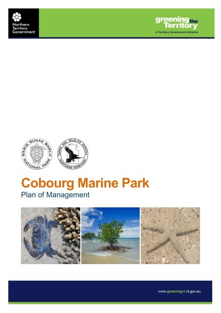
Cobourg Marine <strong>Park</strong><br />
Plan of Management
Cobourg Marine <strong>Park</strong> Plan of Management<br />
Prepared by the Cobourg Peninsula Sanctuary <strong>and</strong> Marine <strong>Park</strong> Board<br />
<strong>and</strong><br />
<strong>Park</strong>s <strong>and</strong> <strong>Wildlife</strong> Service of the Northern Territory,<br />
Department of Natural Resources, Environment, The Arts <strong>and</strong> Sport<br />
Published August 2011<br />
ISBN 1 920772 53 7
Foreword<br />
It would take many pages <strong>and</strong> a long time for me to explain how important<br />
the Cobourg Marine <strong>Park</strong> is to traditional owners <strong>and</strong> their families who live<br />
on, <strong>and</strong> are related to the gunak <strong>and</strong> lala (l<strong>and</strong> <strong>and</strong> sea) of the Cobourg<br />
Peninsula. Traditional owners <strong>and</strong> their families belong to this place <strong>and</strong><br />
their future is tied to it. The story of our connection to our l<strong>and</strong> <strong>and</strong> sea<br />
continues into the stories of our children <strong>and</strong> gr<strong>and</strong>children to come.<br />
Traditional owners <strong>and</strong> their families are proud to be able to manage the<br />
gunak <strong>and</strong> lala of Cobourg Peninsula <strong>and</strong> to share this place with others.<br />
We work with the Northern Territory Government through the Cobourg<br />
Peninsula Sanctuary <strong>and</strong> Marine <strong>Park</strong> Board so that everyone can enjoy<br />
<strong>and</strong> benefit from the <strong>Park</strong>.<br />
The Board has developed this Plan of Management so everyone knows<br />
how the Marine <strong>Park</strong> is managed <strong>and</strong> how the Traditional Owners <strong>and</strong> the<br />
Northern Territory Government look after l<strong>and</strong> <strong>and</strong> sea country according to<br />
Aboriginal tradition <strong>and</strong> Territory law.<br />
The Traditional owners <strong>and</strong> the NT Government take the responsibility of<br />
writing <strong>and</strong> putting in place this Plan of Management very seriously.<br />
Traditional owners, their families <strong>and</strong> the Board know that the Marine <strong>Park</strong><br />
is important to many people. They have taken a long time to develop the<br />
plan, <strong>and</strong> listened <strong>and</strong> talked to a lot of people so the plan reflects <strong>and</strong><br />
balances different opinions as much as possible. We hope this makes the<br />
Plan strong.<br />
Now the Plan is written the real job of managing the park together begins.<br />
But good management can only happen if the Board keeps talking to the<br />
people who use the <strong>Park</strong> or have interests in it.<br />
The Board looks forward to the challenges ahead <strong>and</strong> hopes that this<br />
strong Plan of Management will help to protect the Marine <strong>Park</strong>, <strong>and</strong> that<br />
future generations of traditional owners <strong>and</strong> their families, Territorians, park<br />
visitors <strong>and</strong> others will continue to enjoy <strong>and</strong> benefit from the wonderful<br />
natural <strong>and</strong> cultural environments that make the Marine <strong>Park</strong> so important<br />
nationally <strong>and</strong> internationally.<br />
Mr Shane Cooper<br />
Chairman<br />
Cobourg Peninsula Sanctuary <strong>and</strong> Marine <strong>Park</strong> Board<br />
August 2011
CONTENTS<br />
1. INTRODUCTION 1<br />
1.1 BACKGROUND ................................................................................. 2<br />
1.2 REGIONAL CONTEXT ........................................................................ 3<br />
2.0 MANAGEMENT OF THE PARK 5<br />
2.1 OBJECTIVES OF MANAGEMENT ......................................................... 7<br />
2.2 MANAGEMENT VALUES ..................................................................... 7<br />
2.3 MAKING DECISIONS AND EVALUATING PROPOSALS ............................. 8<br />
3.0 MANAGEMENT FOR CONSERVATION AND SCIENTIFIC VALUES 9<br />
3.1 MARINE HABITATS AND ECOSYSTEMS ............................................... 9<br />
3.2 FLORA AND FAUNA ........................................................................ 10<br />
4.0 MANAGING FOR ABORIGINAL VALUES 14<br />
4.1 TRADITIONAL RESOURCE USE AND CULTURAL SIGNIFICANCE. ........... 15<br />
4.2 ABORIGINAL ECONOMIC DEVELOPMENT ........................................... 16<br />
5.0 MANAGING FOR HISTORICAL VALUES 17<br />
6.0 MANAGING FOR TOURISM AND RECREATIONAL VALUES 19<br />
6.1 RECREATIONAL FISHING AND TOURISM ............................................ 19<br />
6.2 SHIPPING AND BOATING ................................................................. 21<br />
6.3 VISITOR ACCESS AND SAFETY ........................................................ 21<br />
7.0 MANAGING FOR ECONOMIC VALUES 23<br />
7.1 COMMERCIAL FISHING ................................................................... 23<br />
7.2 PEARLING ..................................................................................... 25<br />
7.3 AQUACULTURE .............................................................................. 25<br />
7.4 MINING AND EXPLORATION ............................................................. 26<br />
8.0 MANAGING FOR EDUCATIONAL VALUES 27<br />
9.0 STRATEGIES FOR MANAGEMENT 28<br />
9.1 ZONING SCHEME ........................................................................... 28<br />
9.2 OTHER MANAGEMENT STRATEGIES................................................. 36<br />
Cobourg Marine <strong>Park</strong> Plan of Management – August 2011 i
10.0 ENFORCEMENT OF THE PLAN 45<br />
11.0 EVALUATION AND REVIEW OF THE PLAN 45<br />
12.0 REFERENCES 46<br />
TABLE 1: SUMMARY OF ZONES 30<br />
TABLE 2: USES AND ACTIVITIES WITHIN EACH ZONE 32<br />
FIGURE 1: LOCATION MAP iii<br />
FIGURE 2: ZONING SCHEME 33<br />
SCHEDULE 1: CO-ORDINATES FOR ZONING SCHEME 49<br />
APPENDIX 1: DESCRIPTIONS OF IMCRA 54<br />
APPENDIX 2: PRELIMINARY FAUNA LIST 59<br />
Cobourg Marine <strong>Park</strong> Plan of Management – August 2011 ii
FIGURE 1<br />
GARIG GUNAK BARLU NATIONAL PARK<br />
LOCATION MAP<br />
LEGEND<br />
BAT HUR ST<br />
ISLAND<br />
BEAGLE GULF<br />
Tiwi-Co bou rg B io region<br />
Hig hwa y<br />
Roa d<br />
DARWIN<br />
MELV ILLE IS LA ND<br />
VERNON<br />
ISLANDS<br />
#<br />
S T UA R T<br />
Sou rce s:<br />
To po grap hic an d cada stral d ata ob tain ed from th e<br />
De partm e nt o f L an ds, Plan ning an d E nvironm en t.<br />
H IG HW A Y<br />
D JUK BINJ<br />
NATIONA L<br />
PA RK<br />
ARAFURA SEA<br />
AR NHE M<br />
PR OPO SED<br />
MAR Y<br />
R IVE R<br />
NATIONA L<br />
VAN DIEMEN GULF<br />
GARIG GUNAK BARLU<br />
Cobourg Marine <strong>Park</strong> Plan of Management – August 2011 iii<br />
PA RK<br />
NATIONAL PARK<br />
H IG H W AY<br />
CR OKER<br />
IS LAND<br />
KA KADU<br />
NATIONA L<br />
PA RK<br />
KA K A D U<br />
H IG HW AY<br />
#<br />
ARN HEM<br />
LA ND
This page is left intentionally blank<br />
Cobourg Marine <strong>Park</strong> Plan of Management – August 2011 iv
1. INTRODUCTION<br />
This Plan of Management is prepared pursuant to Part IV of the Cobourg Peninsula Aboriginal<br />
L<strong>and</strong>, Sanctuary <strong>and</strong> Marine <strong>Park</strong> Act, <strong>and</strong> Section 23 of the Northern Territory Fisheries Act.<br />
This Plan of Management states the intent of the Cobourg Board, <strong>Park</strong>s <strong>and</strong> <strong>Wildlife</strong><br />
<strong>Commission</strong> (Department of Natural Resources, Environment, The Arts <strong>and</strong> Sport), Traditional<br />
Owners <strong>and</strong> the Fisheries Group (Department of Primary Industry, Fisheries <strong>and</strong> Mines) with<br />
regard to management of the Cobourg Marine <strong>Park</strong>. It sets management objectives <strong>and</strong><br />
values, outlines current issues <strong>and</strong> proposes management strategies to guide future<br />
management <strong>and</strong> development of the Cobourg Marine <strong>Park</strong>.<br />
The co-operative approach that was established in preparing this Plan of Management will<br />
continue throughout the life of the Plan. The Cobourg Fishery Management Advisory<br />
Committee was established as a forum for key stakeholder involvement in developing the<br />
Cobourg Marine <strong>Park</strong> Plan of Management.<br />
The Plan will be in operation for a maximum of ten years unless amended or revoked by the<br />
preparation of a new plan in accordance with the provisions of either of the above named Acts.<br />
A review of the Plan <strong>and</strong> its provisions will be conducted once the Plan has been in operation<br />
for 5 years (mid term review). The Cobourg Board in consultation with recreational <strong>and</strong><br />
commercial fishers will review the management programs annually to assess the progress of<br />
implementation of the plan <strong>and</strong> the effectiveness of those programs.<br />
In March 2007 the full bench of the Federal Court ruled that under the Commonwealth<br />
Aboriginal L<strong>and</strong> Rights Act (Northern Territory) traditional Aboriginal owners have exclusive<br />
possession of the waters over the Arnhem L<strong>and</strong> Aboriginal L<strong>and</strong> Trust l<strong>and</strong> including intertidal<br />
areas <strong>and</strong> tidal estuaries. The implications of the ruling for the management of Cobourg<br />
Marine <strong>Park</strong> are unclear <strong>and</strong> the judgement may be subject to an appeal. This Plan of<br />
Cobourg Marine <strong>Park</strong> Plan of Management – August 2011 1
Management may need to be amended to comply with <strong>and</strong> reflect any High Court decision <strong>and</strong><br />
relevant Northern Territory <strong>and</strong> Commonwealth legislation.<br />
1.1 Background<br />
Cobourg Marine <strong>Park</strong> is located in the waters surrounding Cobourg Peninsula, approximately<br />
220 km north-east of Darwin (Figure 1) <strong>and</strong> occupies an area of approximately 229,000 ha.<br />
The Marine <strong>Park</strong> was first declared in July 1983 under Section 12 of the Territory <strong>Park</strong>s <strong>and</strong><br />
<strong>Wildlife</strong> Conservation Act (the Act). The <strong>Park</strong> was re-declared in November 2002 under<br />
section 12 (1) (aa) of the Act in order to recognise the possibility of the existence of native title<br />
interests <strong>and</strong> rights in the Marine <strong>Park</strong>.<br />
The Marine <strong>Park</strong> is part of the larger <strong>Garig</strong> <strong>Gunak</strong> <strong>Barlu</strong> <strong>National</strong> <strong>Park</strong>. <strong>Garig</strong> <strong>Gunak</strong> <strong>Barlu</strong><br />
<strong>National</strong> <strong>Park</strong> includes both the Marine <strong>Park</strong> <strong>and</strong> the Cobourg Sanctuary. The Sanctuary<br />
extends to low water mark <strong>and</strong> includes the intertidal zone <strong>and</strong> waters covering the peninsula<br />
whilst the Marine <strong>Park</strong> extends seaward from the low water mark.<br />
An area of sea surrounding Cobourg Peninsula <strong>and</strong> corresponding closely to the boundary of<br />
the Cobourg Marine <strong>Park</strong>, but extending to the high water mark, has been declared a Fishery<br />
Management Area under section 22(a) of the Fisheries Act. The Fishery Management Area<br />
includes the water <strong>and</strong> beds of the Sanctuary between high <strong>and</strong> low water (the intertidal zone).<br />
The waters of the <strong>Park</strong> are generally less than 15 metres in depth. Wave energy is relatively low<br />
except during periods of strong storm activity <strong>and</strong> cyclonic events. This wave energy tends to be<br />
stronger in the Van Diemen Gulf in the southern area of the <strong>Park</strong>. Tides are generally between<br />
2 – 2.5 metres in the northern section of the <strong>Park</strong> <strong>and</strong> 3 metres in the southern section of the<br />
<strong>Park</strong>. There are no major creeks or rivers on the adjoining Sanctuary <strong>and</strong> consequently there is<br />
no major freshwater discharge from the Sanctuary into the Marine <strong>Park</strong>.<br />
The waters of the Van Diemen Gulf section of the <strong>Park</strong> are always turbid due to the relatively<br />
large tidal range <strong>and</strong> discharge from the large tidally influenced rivers in the southern part of<br />
the Gulf. Conversely the northern section of the park experiences low turbidity due to the<br />
small tidal range <strong>and</strong> small discharge from creeks <strong>and</strong> estuaries on the Sanctuary.<br />
Currents tend to flow in accordance with prevailing winds. Between March <strong>and</strong> August the<br />
currents flow east to west with the predominantly easterly winds. Between September <strong>and</strong><br />
February the currents generally flow west to east with the predominantly westerly winds. The<br />
northern portion of the <strong>Park</strong> is situated in an area of sea that experiences some of the<br />
strongest currents in the Territory.<br />
Cobourg Marine <strong>Park</strong> Plan of Management – August 2011 2
The Marine <strong>Park</strong> is characterised by a number of deeply incised bays <strong>and</strong> estuaries on its<br />
northern shores. These bays are ancient river valleys that were drowned during periods of<br />
sea level rise <strong>and</strong> provide a varied environment <strong>and</strong> habitat that is quite distinct from the open<br />
water areas of the <strong>Park</strong>. The areas of the <strong>Park</strong> that have been studied <strong>and</strong> where extensive<br />
collections have been made indicates that the <strong>Park</strong> supports rich <strong>and</strong> diverse marine life<br />
including live coral reefs, seagrass, diverse reef <strong>and</strong> pelagic fish populations <strong>and</strong> threatened<br />
marine turtles <strong>and</strong> dugong.<br />
The waters <strong>and</strong> resources of the Marine <strong>Park</strong> are used by Aboriginal people of Cobourg,<br />
recreational <strong>and</strong> commercial fishermen, fishing tour operators, yachtsmen <strong>and</strong> other pleasure<br />
craft users as well as visitors to the adjacent Sanctuary.<br />
1.2 Regional Context<br />
The Cobourg Marine <strong>Park</strong> is the only marine park declared under the Territory <strong>Park</strong>s <strong>and</strong><br />
<strong>Wildlife</strong> Conservation Act. However, a number of parks <strong>and</strong> reserves, such as Charles Darwin<br />
<strong>National</strong> <strong>Park</strong>, Berry Springs Nature <strong>Park</strong>, Casuarina Coastal Reserve, Shoal Bay Coastal<br />
Reserve, Tree Point Conservation Area <strong>and</strong> Kakadu <strong>National</strong> <strong>Park</strong> include marine <strong>and</strong> coastal<br />
areas. Two aquatic life reserves have been declared under the Northern Territory Fisheries Act,<br />
one at Doctors Gully <strong>and</strong> one at East Point.<br />
The Cobourg Marine <strong>Park</strong> takes in two of the thirteen marine biogeographic regions (bioregions)<br />
identified in the Interim Marine <strong>and</strong> Coastal Regionalisation for Australia (IMCRA) for Northern<br />
Territory waters (IMCRA Technical Group 1998). Bioregions are discrete geographic localities<br />
containing distinctive physical <strong>and</strong> biological attributes, <strong>and</strong> provide a basic framework for<br />
development of comprehensive, adequate <strong>and</strong> representative networks of marine protected<br />
areas <strong>and</strong> a base for the protection of marine biodiversity across Australia. The Cobourg Marine<br />
<strong>Park</strong> is located in the Cobourg <strong>and</strong> Van Diemen Gulf marine bioregions with the northern portion<br />
of the <strong>Park</strong> covered by the Cobourg marine bioregion <strong>and</strong> the southern portion covered by the<br />
Van Diemen Gulf marine bioregion. A description of these bioregions is in Appendix 1.<br />
The Northern Territory Coastal Management Policy provides the broad policy framework for<br />
protection of marine <strong>and</strong> coastal areas with high conservation values. The Northern Territory<br />
Government may develop a more detailed framework for establishing marine protected areas<br />
<strong>and</strong> implementing other marine conservation initiatives, through the development of the <strong>Park</strong>s<br />
<strong>and</strong> Conservation Masterplan. The purpose of the Masterplan is to develop strategies for the<br />
conservation of the Territory‟s marine <strong>and</strong> terrestrial biodiversity.<br />
Cobourg Marine <strong>Park</strong> Plan of Management – August 2011 3
In accordance with Australia‟s Ocean Policy the Australian Government is in the process of<br />
developing a bioregional plan under the Environmental Protection <strong>and</strong> Biodiversity Conservation<br />
Act for Commonwealth waters. This includes bioregional planning for Commonwealth waters<br />
extending from Cape York to the border between the Northern Territory <strong>and</strong> Western Australia<br />
(Northern Planning Area). The Northern Territory Government is also in the process of<br />
preparing a Marine Biodiversity Conservation Strategy <strong>and</strong> a Marine Protected Area Strategy for<br />
the Territory.<br />
Most of the Territory‟s marine environment has not been surveyed <strong>and</strong> there is a distinct lack of<br />
detailed knowledge of the marine environment that hampers the process of establishing marine<br />
protected areas. The strategic planning processes established through the <strong>Park</strong>s <strong>and</strong><br />
Conservation Masterplan, Northern Territory Marine Biodiversity Conservation Strategy <strong>and</strong><br />
Marine Protected Area Strategy <strong>and</strong> the Australian Governments bioregional marine planning<br />
initiatives may help to fill some of these knowledge gaps <strong>and</strong> develop processes to improve our<br />
knowledge.<br />
Cobourg Marine <strong>Park</strong> Plan of Management – August 2011 4
2. MANAGEMENT OF THE PARK<br />
The main pieces of legislation that apply to the Marine <strong>Park</strong> are the Cobourg Peninsula<br />
Aboriginal, L<strong>and</strong>, Sanctuary <strong>and</strong> Marine <strong>Park</strong> Act (CPS&MP Act), the Territory <strong>Park</strong>s <strong>and</strong><br />
<strong>Wildlife</strong> Conservation Act (TP&WC Act) <strong>and</strong> the Northern Territory Fisheries Act.<br />
The Cobourg Marine <strong>Park</strong> is managed jointly by the Northern Territory Government <strong>and</strong> the<br />
Cobourg Aboriginal people through the Cobourg Peninsula Sanctuary <strong>and</strong> Marine <strong>Park</strong> Board<br />
under the provisions of the Cobourg Peninsula Aboriginal L<strong>and</strong>, Sanctuary <strong>and</strong> Marine <strong>Park</strong><br />
Act. The <strong>Park</strong>s <strong>and</strong> <strong>Wildlife</strong> <strong>Commission</strong> have responsibility for the day to day management of<br />
the park <strong>and</strong> are responsible for administration of the Cobourg Peninsula Aboriginal L<strong>and</strong>,<br />
Sanctuary <strong>and</strong> Marine <strong>Park</strong> Act on behalf of the Department of Natural Resources,<br />
Environment, The Arts <strong>and</strong> Sport <strong>and</strong> the Northern Territory Government. The Board <strong>and</strong><br />
<strong>Commission</strong> are responsible for the preparation of Plans of Management for the Marine <strong>Park</strong>.<br />
The functions of the Board <strong>and</strong> the <strong>Commission</strong> are detailed under Sections 24 <strong>and</strong> 25 of the<br />
Cobourg Peninsula Aboriginal L<strong>and</strong>, Sanctuary <strong>and</strong> Marine <strong>Park</strong> Act. Nothing in this Plan of<br />
Management is to be construed or taken as a delegation of the Board <strong>and</strong> <strong>Commission</strong>‟s<br />
functions <strong>and</strong> powers under the Cobourg Peninsula Aboriginal L<strong>and</strong>, Sanctuary <strong>and</strong> Marine<br />
<strong>Park</strong> Act to another agent. The Board‟s power to make by-laws in regard to the Sanctuary<br />
remains.<br />
Fish <strong>and</strong> aquatic life in the Marine <strong>Park</strong> (below low water) with the exception of turtle, dugong<br />
<strong>and</strong> crocodiles are regulated under the Northern Territory Fisheries Act. A Fishery<br />
Management Area Advisory Committee has been established under the Northern Territory<br />
Fisheries Act to provide advice to the Director of Fisheries on the appropriate management of<br />
fish <strong>and</strong> aquatic life in the Fishery Management Area <strong>and</strong> the Marine <strong>Park</strong>. The committee<br />
consists of commercial, recreational, prawning, pearling <strong>and</strong> traditional Aboriginal owner<br />
interests. This committee has also operated as an advisory group to the Cobourg Board <strong>and</strong><br />
as a forum to facilitate key stakeholder input into the preparation of this Plan of Management.<br />
Cobourg Marine <strong>Park</strong> Plan of Management – August 2011 5
It should be noted that the Cobourg Board has requested the Northern Territory Government<br />
consider amending the Cobourg Peninsula Aboriginal, L<strong>and</strong>, Sanctuary <strong>and</strong> Marine <strong>Park</strong> Act<br />
to enable the Board to determine bylaws for the Marine <strong>Park</strong>. At this stage, the Board only<br />
has the powers to determine bylaws for the Sanctuary to the low water mark.<br />
The Board believes that, without appropriate powers to determine bylaws for the Marine <strong>Park</strong>,<br />
it cannot effectively discharge its management responsibilities under the CPS&MP Act. The<br />
traditional owners of Cobourg Peninsula support this position.<br />
It is intended that the Cobourg Fishery Management Area that includes the Marine <strong>Park</strong> <strong>and</strong><br />
the intertidal area of the Sanctuary will be managed under a Fishery Management Area<br />
Management Plan in accordance with part 3 of the Northern Territory Fisheries Act. The<br />
provisions of the Fishery Management Area Management Plan will mirror those established in<br />
this plan of management.<br />
Following the implementation of this Plan, there will be continued close co-operation between<br />
the Cobourg Board, Cobourg Aboriginal people, <strong>Park</strong>s <strong>and</strong> <strong>Wildlife</strong> <strong>Commission</strong>, Fisheries <strong>and</strong><br />
key fisheries stakeholders (eg Northern Territory Seafood Council, Amateur Fishermen‟s<br />
Association of the Northern Territory) in the management of fisheries in the Marine <strong>Park</strong>. The<br />
Cobourg Fishery Management Area Advisory Committee will be retained as the forum for key<br />
fisheries stakeholder involvement in management of the Marine <strong>Park</strong>. Consultation processes<br />
for other stakeholders including marine conservation <strong>and</strong> environment groups will be<br />
developed by the Board”<br />
If the Board gains bylaw making powers over the marine park the Northern Territory Seafood<br />
Council <strong>and</strong> Amateur Fishermen‟s Association of the Northern Territory would be invited to<br />
attend Board meetings when fisheries issues are considered.<br />
By arrangement between the Northern Territory <strong>and</strong> Commonwealth Government under the<br />
Offshore Constitutional Settlement <strong>and</strong> incorporated within Territory <strong>and</strong> Commonwealth<br />
fisheries legislation, jurisdiction for management of the penaeid prawn fishery rests with the<br />
Commonwealth. In view of this, close consultation will be undertaken with the Commonwealth<br />
Government over matters related to prawn trawl activities within the Marine <strong>Park</strong>.<br />
Cobourg Marine <strong>Park</strong> Plan of Management – August 2011 6
2.1 Objectives of Management<br />
It is intended that Cobourg Marine <strong>Park</strong> be managed as a multiple use marine park, providing<br />
for protection of the ecology of the marine environment whilst allowing for ecologically<br />
sustainable commercial, recreational <strong>and</strong> customary use of the area.<br />
The principle objective in managing the Marine <strong>Park</strong> is to protect the marine biodiversity whilst<br />
allowing continued sustainable use of its resources <strong>and</strong> enjoyment of its values.<br />
More specific management objectives for the Marine <strong>Park</strong> include:<br />
Maintaining biological productivity, species diversity <strong>and</strong> abundance.<br />
Providing for sustainable customary use by traditional owners.<br />
Providing for sustainable commercial, recreational <strong>and</strong> tourism use.<br />
Improving knowledge, underst<strong>and</strong>ing <strong>and</strong> management of the Northern Territory‟s marine<br />
environment.<br />
Protection of cultural <strong>and</strong> historical values in accordance with Commonwealth <strong>and</strong> NT<br />
legislation <strong>and</strong> Traditional Aboriginal Owner directions.<br />
Provision of appropriate, safe <strong>and</strong> enjoyable visitor experiences.<br />
Management of marine resources under a co-operative framework.<br />
2.2 Management Values<br />
There are a number of stakeholder groups that have an interest in the Marine <strong>Park</strong> <strong>and</strong> its<br />
management. Major stakeholder groups include commercial <strong>and</strong> recreational fishers, pearl<br />
farmers, <strong>Park</strong> visitors <strong>and</strong> tourists.<br />
These stakeholder groups value the <strong>Park</strong> <strong>and</strong> its resources for a variety of reasons. These<br />
reasons can be categorised into the following broad areas:<br />
(i) Conservation <strong>and</strong> Scientific Values;<br />
(ii) Aboriginal Cultural Values;<br />
(iii) Historical Values;<br />
(iv) Tourism <strong>and</strong> Recreational Values;<br />
(v) Economic Values; <strong>and</strong><br />
(vi) Educational Values.<br />
The <strong>Park</strong> will be managed to protect <strong>and</strong> maintain these values.<br />
Cobourg Marine <strong>Park</strong> Plan of Management – August 2011 7
2.3 Making Decisions <strong>and</strong> Evaluating Proposals<br />
The Board may be called upon to make decisions on a broad range of matters related to the<br />
management <strong>and</strong> operations of the <strong>Park</strong>. It is important that Board decisions are well<br />
informed, consistent with relevant legal requirements <strong>and</strong> take into account the views of<br />
traditional owners <strong>and</strong> key stakeholders.<br />
In considering proposals <strong>and</strong> other matters requiring a resolution of the Board, its members<br />
may require written advice from the <strong>Park</strong>s <strong>and</strong> <strong>Wildlife</strong> <strong>Commission</strong>, Fisheries or other parties<br />
on particular issues before making a decision. Wherever possible, such advice will be provided<br />
in agenda papers for Board meetings <strong>and</strong> may include reference to:<br />
issues to be considered in relation to relevant legislation, such as the Cobourg Peninsula<br />
Aboriginal L<strong>and</strong>, Sanctuary <strong>and</strong> Marine <strong>Park</strong> Act, the Northern Territory Fisheries Act <strong>and</strong><br />
the Northern Territory Aboriginal Sacred Sites Act,<br />
whether a proposal is consistent with the Plan of Management in operation for the <strong>Park</strong>,<br />
whether a proposal is consistent with relevant strategies or policies endorsed by the Board<br />
for the management of the <strong>Park</strong><br />
potential implications for <strong>Park</strong> operations <strong>and</strong> the <strong>Park</strong> budget, <strong>and</strong><br />
the views of traditional owners or key stakeholders.<br />
A fundamental feature of Aboriginal decision making in relation to l<strong>and</strong> <strong>and</strong> sea country is the<br />
primary right of traditional Aboriginal owner groups to make decisions about matters affecting<br />
their country. Exercising this right can be difficult in the context of joint management<br />
arrangements <strong>and</strong> the legislated role of the Board in making decisions about the <strong>Park</strong>.<br />
Some traditional owners have expressed concern that, on occasions, it may not be possible or<br />
appropriate for them to consider their views on particular issues in the context of a Board<br />
meeting. This is particularly so if a proposal is likely to have a significant impact primarily on<br />
the l<strong>and</strong> <strong>and</strong> marine interests of one group. In such circumstances, the group may request an<br />
opportunity to meet for the purpose of considering <strong>and</strong> forming an opinion on a matter before<br />
the Board is asked to make a decision.<br />
The Board may, during the life of this Plan, develop <strong>and</strong> endorse more specific protocols to<br />
provide guidance on consulting traditional owners <strong>and</strong> processes for decision making by the<br />
Board.<br />
Cobourg Marine <strong>Park</strong> Plan of Management – August 2011 8
3.0 MANAGEMENT FOR CONSERVATION AND SCIENTIFIC VALUES<br />
The <strong>Park</strong>‟s conservation <strong>and</strong> scientific values derive from:<br />
the presence of a variety of marine habitats supporting a rich diversity of marine life,<br />
the occurrence of live coral reefs <strong>and</strong> seagrass,<br />
its role as a habitat for dugongs, marine turtles, sea-birds, saltwater crocodiles, reef fish<br />
<strong>and</strong> a variety of other animals which inhabit the sea <strong>and</strong> coastal margins,<br />
a well-developed benthos (flora <strong>and</strong> fauna of the ocean floor) in the bays <strong>and</strong> estuaries<br />
which are important nursery areas for marine life, <strong>and</strong><br />
a rare <strong>and</strong> unusual association of coral reef with closed mangrove forest at Popham<br />
Creek.<br />
The <strong>Park</strong> protects habitat for threatened species, including the dugong <strong>and</strong> six species of<br />
marine turtle including three species that nest on the beaches of Cobourg Peninsula. The<br />
<strong>Park</strong> affords scientists with the opportunity to study these animals <strong>and</strong> develop strategies for<br />
their management <strong>and</strong> conservation across the NT.<br />
The intertidal zone that forms part of the Sanctuary <strong>and</strong> the adjacent sub-tidal zone in the<br />
Marine <strong>Park</strong> contain the most significant diversity <strong>and</strong> structure for the known marine benthic<br />
fauna of the Sanctuary <strong>and</strong> Marine <strong>Park</strong>.<br />
3.1 Marine Habitats <strong>and</strong> Ecosystems<br />
The Cobourg Marine <strong>Park</strong> is known to contain a large number of diverse marine habitats<br />
including coral reefs, rocky reefs, s<strong>and</strong> <strong>and</strong> mudflats, <strong>and</strong> areas of mangroves, seagrass <strong>and</strong><br />
seaweed. Scientists generally agree that certain areas show a distinctly greater species diversity<br />
<strong>and</strong> abundance than others. These include Orontes Reef (just outside the <strong>Park</strong>) the Sargassum<br />
beds near Gul Gul (Danger Point) <strong>and</strong> the fringing reefs near Black Point, S<strong>and</strong>y Isl<strong>and</strong> I <strong>and</strong><br />
Caiman Creek.<br />
Cobourg Marine <strong>Park</strong> Plan of Management – August 2011 9
The semi-enclosed water bodies such as Port Essington <strong>and</strong> the bays along the coast provide<br />
a range of marine environments with different salinity <strong>and</strong> temperature regimes. These<br />
environments are thought to be of high scientific, conservation, economic education <strong>and</strong><br />
recreational value as they are likely to support diverse habitats that are important nursery<br />
areas for marine life. Unlike many major bays <strong>and</strong> harbours along the NT coastline, the bays<br />
<strong>and</strong> estuaries at Cobourg Peninsula have restricted freshwater input <strong>and</strong> therefore scouring of<br />
benthos in channels is minimal.<br />
To date, the habitat of the inshore waters of the Marine <strong>Park</strong> between Vashon Head <strong>and</strong><br />
Danger Point (Gul Gul) including Port Bremmer <strong>and</strong> the bays of Port Essington have been<br />
surveyed <strong>and</strong> studied. Of the areas surveyed, the fringing rocky <strong>and</strong> coral reefs, <strong>and</strong> oyster<br />
beds have been studied in detail. The structure of the rocky <strong>and</strong> fringing coral reefs within the<br />
Marine <strong>Park</strong> is typical of northwest inshore waters.<br />
In 2001, a network of reef monitoring stations was established on fringing coral reef at Coral<br />
Bay, S<strong>and</strong>y Isl<strong>and</strong> I <strong>and</strong> near Black Point, to monitor changes <strong>and</strong> impacts to the reefs <strong>and</strong> to<br />
improve underst<strong>and</strong>ing of these habitats in the <strong>Park</strong>. The studies show that, despite their<br />
small size, the coral communities around S<strong>and</strong>y Isl<strong>and</strong> I <strong>and</strong> in the bay between Black Point<br />
<strong>and</strong> Smith Point are highly diverse in both coral <strong>and</strong> fish fauna. This study found that the once<br />
diverse <strong>and</strong> relatively extensive coral communities at Coral Bay are now in decline. This<br />
decline may be due to both environmental factors such as coral bleaching <strong>and</strong> siltation <strong>and</strong><br />
human activities. A study of the effects of coral bleaching events in 2002-03 showed that most<br />
of the fringing reefs have been severely impacted. In 2003, 90% of live coral cover was lost in<br />
some areas of the <strong>Park</strong>.<br />
3.2 Flora <strong>and</strong> Fauna<br />
The mangrove flora of the sanctuary is diverse <strong>and</strong> includes species that have a restricted<br />
distribution in the NT. Based on a broad definition of mangroves, there are 51 species in the<br />
NT. Off these, 35 species have been recorded from the Sanctuary, <strong>and</strong> it is estimated that a<br />
further eight species occur within the Marine <strong>Park</strong> but as yet have not been formally recorded.<br />
Mangrove areas on the northern coastline of the Marine <strong>Park</strong> are small in area, while those on<br />
the protected southern coastline are generally larger <strong>and</strong> better developed. An extensive area<br />
of mangroves occurs at the south-east extremity of the <strong>Park</strong> in the Ilamaryi River system. This<br />
system represents one of the largest mangrove communities in the NT. The Mangrove Palm<br />
(Nypa fruticans) occurs at Trepang Bay <strong>and</strong> is known from only two other locations in the NT.<br />
The Native Frangipani (Cerbera manghas) is only known from the Cobourg Sanctuary <strong>and</strong> the<br />
Wessel Isl<strong>and</strong>s.<br />
Cobourg Marine <strong>Park</strong> Plan of Management – August 2011 10
There is a broad range of traditional Aboriginal knowledge relating to the mangrove<br />
communities of the <strong>Park</strong>. The names <strong>and</strong> uses of mangrove plants associated with the Iwaidja<br />
language has been recorded by traditional owners <strong>and</strong> scientists.<br />
The <strong>Park</strong>‟s seagrass beds provide a direct food source for dugongs <strong>and</strong> turtles, <strong>and</strong> some fish<br />
<strong>and</strong> crustaceans. They also provide an important input into the detrital food chain <strong>and</strong> act as<br />
nursery areas for many animals including fish, crustacea <strong>and</strong> trepang. No systematic survey<br />
of seagrass communities has been undertaken in the <strong>Park</strong>, however the presence of a large<br />
number of dugong in certain areas of the <strong>Park</strong> would suggest that there is significant seagrass<br />
habitat.<br />
Dugong are present in most areas of the Marine <strong>Park</strong>, however there are some areas where<br />
the total number <strong>and</strong> density is particularly high. One of these areas is along the coast from<br />
Aiton Bay east to Wurgurlu Bay <strong>and</strong> surrounding Greenhill Isl<strong>and</strong>. In this area the density of<br />
dugong ranges up to 20 animals per square kilometre with the total population estimated to be<br />
in excess of 1000 animals.<br />
The Marine <strong>Park</strong> is considered to be one of the most significant areas for dugong in the NT<br />
<strong>and</strong> Australia. Dugongs are classified as near threatened in the NT <strong>and</strong> are listed under the<br />
Convention on the Conservation of Migratory Species of Wild Animal (Bonn Convention). The<br />
Bonn Convention is an international agreement between many governments including<br />
Australia to protect wild animals that migrate across international boundaries.<br />
Cetaceans are common within the Marine <strong>Park</strong>. Little is known about their distribution,<br />
abundance <strong>and</strong> genetic composition. All are listed marine species under the Commonwealth‟s<br />
Environmental Protection <strong>and</strong> Biodiversity Conservation Act.<br />
Six species of marine turtle - green, flatback, olive ridley, loggerhead, leatherback, <strong>and</strong><br />
hawksbill - inhabit the waters of the Marine <strong>Park</strong>. In the NT the loggerhead is listed as<br />
endangered <strong>and</strong> the leatherback is listed as vulnerable. The olive ridley, flatback <strong>and</strong><br />
hawksbill turtles are considered to be data deficient (ie not enough is known about the<br />
populations of these species) in the NT to properly assess their conservation status. As such,<br />
a more conservative approach to management <strong>and</strong> further research is warranted.<br />
The beaches from Black Point around the mainl<strong>and</strong> to opposite S<strong>and</strong>y Isl<strong>and</strong> II, the Danger<br />
Point area <strong>and</strong> the larger isl<strong>and</strong>s in the southern area of the <strong>Park</strong> all have significant numbers<br />
of marine turtle (mainly the green <strong>and</strong> flatback) nesting on their beaches.<br />
The isl<strong>and</strong>s <strong>and</strong> waters of the Cobourg Peninsula are considered to be some of the most<br />
important flatback nesting areas (along with Bare S<strong>and</strong> <strong>and</strong> Quail Isl<strong>and</strong>s off Bynoe Harbour)<br />
Cobourg Marine <strong>Park</strong> Plan of Management – August 2011 11
in the NT. Although breeding can occur at any time of year, the majority occurs between May<br />
<strong>and</strong> October.<br />
<strong>National</strong>ly, all six species of turtles found in the Marine <strong>Park</strong> are listed as threatened. The<br />
loggerhead <strong>and</strong> olive ridley turtles are listed as endangered <strong>and</strong> the green, flatback, hawksbill<br />
<strong>and</strong> leatherback are listed at a national level. All marine turtle species except the flatback<br />
turtle are listed on the Bonn Convention (International Convention on Migratory Species).<br />
Cobourg Peninsula may contain the last regular nesting by leatherback turtles in Australia.<br />
In other parts of Australia <strong>and</strong> Indonesia, marine turtle populations are in decline. It is likely<br />
that marine turtles present in the Marine <strong>Park</strong> migrate between the <strong>Park</strong> <strong>and</strong> other parts of<br />
Australia <strong>and</strong> possibly Indonesia. Declines in populations in these areas are likely to be<br />
reflected in NT populations.<br />
The Marine <strong>Park</strong> is also an important feeding ground for several species of seabird with S<strong>and</strong>y<br />
Isl<strong>and</strong>s I <strong>and</strong> II regularly used for breeding by significant numbers of crested terns (low 1000‟s)<br />
<strong>and</strong> significant numbers of black-naped terns (100+). The Isl<strong>and</strong>s are a nationally significant<br />
breeding site for crested terns <strong>and</strong> regionally significant breeding site for black-naped terns.<br />
Other species such as silver gull, roseate <strong>and</strong> bridled terns also use these isl<strong>and</strong>s to breed but<br />
not in significant numbers.<br />
S<strong>and</strong>y Isl<strong>and</strong>s I <strong>and</strong> II, along with Seagull Isl<strong>and</strong> (off Melville Isl<strong>and</strong> also in the NT), are the<br />
only regular crested tern breeding sites between the Cobourg Peninsula <strong>and</strong> the Western<br />
Australian border.<br />
The breeding seabirds on S<strong>and</strong>y Isl<strong>and</strong>s I <strong>and</strong> II are very susceptible to disturbance. The<br />
mere presence of people in the area causes adult birds to leave their nests, <strong>and</strong> as a<br />
consequence mortality rates for young birds are high <strong>and</strong> successful egg hatching rates are<br />
lowered. Access to these areas by people needs to be carefully managed.<br />
A number of the seabirds that use the Marine <strong>Park</strong> including the black-naped tern are listed on<br />
international agreements (JAMBA <strong>and</strong> CAMBA) for the Protection of Migratory Birds <strong>and</strong> their<br />
habitats.<br />
The Estuarine Crocodile is present on Cobourg Peninsula <strong>and</strong> in the surrounding waters. It is<br />
classified as a protected species under the Territory <strong>Park</strong>s <strong>and</strong> <strong>Wildlife</strong> Conservation Act.<br />
Estuarine Crocodiles are also listed on the Convention on International Trade in Endangered<br />
Species of Flora <strong>and</strong> Fauna (CITES). Although numbers are not known, there are sufficient<br />
numbers of crocodiles in the area to render most forms of water-based recreation hazardous.<br />
Cobourg Marine <strong>Park</strong> Plan of Management – August 2011 12
The hard corals are one of the more conspicuous life forms at the seaward end of Port<br />
Essington <strong>and</strong> at Orontes Reef (just outside the <strong>Park</strong>). A total of 136 species have been<br />
identified, including one probable new species of Acropora (tabular/plate coral). Some of the<br />
species were of special interest, being otherwise known in Australian waters only from the<br />
Solitary Isl<strong>and</strong>s, off New South Wales. By way of comparison, the Capricorn-Bunker Reefs at<br />
the southern end of the Great Barrier Reef, have only 174 species. Some data is also<br />
available for the alcyonarians (soft corals) <strong>and</strong> gorgonians (sea fans) with some 22 genera<br />
being represented.<br />
Although diverse communities of fish are known to inhabit the <strong>Park</strong>, very little appears to be<br />
known about the establishment or maintenance of the communities or their habitat<br />
requirements. Appendix 4 lists the 465 nominal species known (including sharks, manta rays<br />
<strong>and</strong> stingrays). Nine are new species, including one known only from Coral Bay. The area is<br />
also the type locality (site from which the species became known to western science) for 21<br />
species of fish that were collected by the early British expeditions <strong>and</strong> visitors to Victoria<br />
Settlement between 1838-49. Many of the fish species occur in the intertidal zone <strong>and</strong> the<br />
inshore waters on rocky <strong>and</strong> coral reefs. Commercial <strong>and</strong> recreational fishers target a number<br />
of these fish species in the <strong>Park</strong>.<br />
Extensive collections of bryozoans (10-15 species described), annelids (300 species<br />
described), crustaceans (75 species described including shrimps <strong>and</strong> crab spp.), molluscs<br />
(331 species described including gastropod, bivalve <strong>and</strong> cephalopod spp.) <strong>and</strong> echinoderms<br />
(100 species described including crinoid <strong>and</strong> holothurian spp) were made in the Marine <strong>Park</strong>.<br />
Not all of the specimens collected in the <strong>Park</strong> have been described, however of those<br />
specimens that have been described, three species of gastropods <strong>and</strong> three species of<br />
echinoderms are new records for the NT. The new species of echinoderms are also new to<br />
Australia.<br />
After fish species, the most recognised marine species in the <strong>Park</strong> are probably the rock<br />
oyster (Sacrostrea cucculata amasa) <strong>and</strong> mud crab (Scylla serrata). Rock oysters <strong>and</strong> mud<br />
crabs are relatively abundant in the <strong>Garig</strong> <strong>Gunak</strong> <strong>Barlu</strong> <strong>National</strong> <strong>Park</strong> with rock oysters<br />
generally occurring in the intertidal zone of the Sanctuary <strong>and</strong> mud crabs occurring in both the<br />
Marine <strong>Park</strong> <strong>and</strong> the Sanctuary.<br />
Cobourg Marine <strong>Park</strong> Plan of Management – August 2011 13
4.0 MANAGING FOR ABORIGINAL VALUES<br />
Cobourg Aboriginal people refer to the Marine <strong>Park</strong> as sea country. They are connected to<br />
this sea country through Aboriginal tradition <strong>and</strong> law <strong>and</strong> this connection remains an intimate<br />
part of their everyday existence today.<br />
Aboriginal tradition <strong>and</strong> law places cultural rights, responsibilities <strong>and</strong> obligations on Cobourg<br />
people including the responsibility <strong>and</strong> obligation to care for sea country. These rights,<br />
obligations <strong>and</strong> responsibilities have been h<strong>and</strong>ed on from their ancestors through many<br />
generations.<br />
Cobourg people care for sea country by managing <strong>and</strong> maintaining sacred sites <strong>and</strong> sites of<br />
cultural significance through ceremony <strong>and</strong> ritual <strong>and</strong> by passing on indigenous knowledge of<br />
the marine environment, its resources <strong>and</strong> traditional management to younger generations.<br />
This knowledge is generally passed on through participation in customary activities including<br />
ceremony <strong>and</strong> ritual <strong>and</strong> hunting <strong>and</strong> use of marine resources. This is an important cultural<br />
reason for Cobourg people to continue customary use <strong>and</strong> management practices.<br />
Additionally, in a contemporary marine management context, developing commercial <strong>and</strong><br />
employment opportunities from the sustainable use of the Marine <strong>Park</strong>‟s natural resources is<br />
important to Cobourg people <strong>and</strong> stems from their desire to develop a secure economic base<br />
from their traditional estates. Cobourg Aboriginal people are also interested in developing<br />
opportunities <strong>and</strong> capacity within their communities for employment as <strong>Park</strong>s <strong>and</strong> <strong>Wildlife</strong><br />
<strong>Commission</strong> rangers <strong>and</strong> community based l<strong>and</strong> <strong>and</strong> sea rangers, in addition to employment<br />
in commercial fisheries.<br />
Cobourg Aboriginal people continue to hunt <strong>and</strong> use marine resources <strong>and</strong> carry out<br />
customary management practices in the Marine <strong>Park</strong>. Finally, managing for Aboriginal values<br />
also include regulation of outside interests (forces), such as regulation of marine debris, by-<br />
catch, pearling <strong>and</strong> impact of recreational <strong>and</strong> commercial fishing.<br />
Cobourg Marine <strong>Park</strong> Plan of Management – August 2011 14
4.1 Traditional Resource Use <strong>and</strong> Cultural Significance<br />
Section 122 of the Territory <strong>Park</strong>s <strong>and</strong> <strong>Wildlife</strong> Conservation Act provides for traditional use of<br />
l<strong>and</strong> <strong>and</strong> water by Aboriginal people that have traditional rights.<br />
Section 53 of the NT Fisheries Act reaffirms the rights of Aboriginal people to continue to use<br />
the resources of an area of l<strong>and</strong> or water in the traditional manner in which they have done so<br />
historically. Traditional manner effectively recognises that Aboriginal clans have marine<br />
estates <strong>and</strong> have cultural rights <strong>and</strong> responsibilities in those estates.<br />
The Marine <strong>Park</strong> is used extensively by the traditional owners of Cobourg Peninsula. The<br />
traditional owners generally access the Marine <strong>Park</strong> <strong>and</strong> its resources from the outstations that<br />
have been established on the adjacent Sanctuary. There are currently six outstations<br />
established on the Sanctuary. Some traditional owners also live on Croker Isl<strong>and</strong> <strong>and</strong> access<br />
the Marine <strong>Park</strong> <strong>and</strong> its resources from there. Dugong, turtle, crabs, fish <strong>and</strong> shellfish have<br />
always been an important part of Aboriginal people‟s diet. Additionally, many marine species<br />
such as dugong <strong>and</strong> turtle have spiritual, ritual <strong>and</strong> mythological significance in Aboriginal<br />
traditions.<br />
The <strong>Park</strong> contains a number of sacred sites <strong>and</strong> sites of significance to the Cobourg people;<br />
there are dreaming tracks <strong>and</strong> sacred sites in <strong>and</strong> under the sea. Whilst the location <strong>and</strong><br />
traditions associated with some of these sites <strong>and</strong> dreaming tracks have been recorded, many<br />
more sites remain unrecorded. Much information relating to the traditional management of the<br />
Marine <strong>Park</strong> also remains unrecorded <strong>and</strong> there are concerns that this knowledge will be lost<br />
with the passing of senior elders. This indigenous knowledge is also important to the<br />
management of the Marine <strong>Park</strong>, particularly in relation to managing sacred sites <strong>and</strong> marine<br />
species in a culturally appropriate manner.<br />
Protecting <strong>and</strong> managing sacred sites <strong>and</strong> sites of significance in accordance with Aboriginal<br />
law <strong>and</strong> tradition is part of the obligation <strong>and</strong> responsibility of traditional custodians. In a<br />
Marine <strong>Park</strong> context, this may include regulating access <strong>and</strong> activities in some areas of the<br />
Marine <strong>Park</strong>. The zoning scheme is the primary management tool used for the management<br />
of activities <strong>and</strong> developments in the Cobourg Marine <strong>Park</strong>.<br />
Sacred sites are also protected under the provisions of the Northern Territory Aboriginal<br />
Sacred Sites Act whether they are registered or not. The provisions of the Northern Territory<br />
Heritage Conservation Act may also provide protection for Aboriginal cultural heritage sites if<br />
they are listed on the NT Heritage Register.<br />
Cobourg Marine <strong>Park</strong> Plan of Management – August 2011 15
4.2 Aboriginal Economic Development<br />
Of prime importance to the traditional owners of Cobourg Peninsula is the establishment of a<br />
viable economic base to provide Cobourg Aboriginal people with the ability to live on the<br />
Sanctuary if they choose <strong>and</strong> continue traditional cultural practices <strong>and</strong> obligations for both the<br />
Marine <strong>Park</strong> <strong>and</strong> Sanctuary.<br />
Generally, opportunities for employment <strong>and</strong> training for Aboriginal people in the <strong>Park</strong> include:<br />
direct employment by the <strong>Park</strong>s <strong>and</strong> <strong>Wildlife</strong> <strong>Commission</strong> as Rangers <strong>and</strong> trainees;<br />
short term employment through Community Development Employment Programs (CDEP)<br />
for specific l<strong>and</strong> <strong>and</strong> sea management projects. These projects are generally performed in<br />
conjunction with <strong>Park</strong> staff;<br />
employment through establishment of community based l<strong>and</strong> <strong>and</strong> sea management ranger<br />
programs, <strong>and</strong><br />
employment stemming from agreements with commercial operators in the <strong>Park</strong>, including<br />
commercial fisheries <strong>and</strong> pearling operations.<br />
employment in respect of managing the marine park according to traditional management<br />
practices.<br />
Opportunities also exist for employment of individuals in commercial enterprises established<br />
by the Gurig Association or other representative organisations of the Cobourg Aboriginal<br />
people.<br />
Cobourg Marine <strong>Park</strong> Plan of Management – August 2011 16
5.0 MANAGING FOR HISTORICAL VALUES<br />
During the life of the Plan the Board will research, record <strong>and</strong> underst<strong>and</strong> the Aboriginal<br />
marine history in the <strong>Park</strong> with emphasis on post contact <strong>and</strong> contemporary history.<br />
The use of the Marine <strong>Park</strong> during the operation of the early European settlement of Fort<br />
Wellington (1827-29) in Raffles Bay <strong>and</strong> Victoria Settlement (1838-49) in Port Essington has<br />
been well documented <strong>and</strong> is of historic interest. Also of historic interest is the fact that some<br />
of the first western scientific descriptions <strong>and</strong> records of NT marine fauna come from<br />
specimens collected in Port Essington by residents <strong>and</strong> visitors to Victoria Settlement.<br />
There are also several known shipwrecks within the <strong>Park</strong>. All shipwrecks over 75 years old<br />
are declared historic shipwrecks under the Commonwealth Historic Shipwrecks Act. The<br />
Museum <strong>and</strong> Art Gallery of the Northern Territory, within the Department of Natural<br />
Resources, Environment <strong>and</strong> the Arts, administers this Act. Shipwrecks, which lie within NT<br />
waters, are also subject to the Heritage Conservation Act administered by the Department<br />
Natural Resources, Environment, The Arts <strong>and</strong> Sport.<br />
To date, there are six recorded shipwrecks within the Cobourg Marine <strong>Park</strong>; four have been<br />
inspected, seven are known but still unallocated <strong>and</strong> there are a further five that still remain<br />
unverified. The inspected wrecks are of European origin, however, there are also thought to<br />
be Macassan wrecks within the <strong>Park</strong>.<br />
The wreck of the Australian off Vashon head is probably the most well known <strong>and</strong> best<br />
surveyed wreck in the Marine <strong>Park</strong>. Information on this wreck is provided as part of the<br />
display in the cultural centre at Black Point. The wreck of the Australian is still relatively intact,<br />
enhancing its heritage value. The Museum <strong>and</strong> Art Gallery of the Northern Territory has<br />
prepared a management plan for this wreck.<br />
Cobourg Marine <strong>Park</strong> Plan of Management – August 2011 17
The major threat to most wreck sites is physical deterioration due to environmental conditions<br />
such as oxidation. There is also a potential risk of v<strong>and</strong>alism <strong>and</strong> anchor damage. Education<br />
<strong>and</strong> controlled access assist in reducing the risk of v<strong>and</strong>alism <strong>and</strong> anchor damage.<br />
Cobourg Marine <strong>Park</strong> Plan of Management – August 2011 18
6.0 MANAGING FOR TOURISM AND RECREATIONAL VALUES<br />
The Marine <strong>Park</strong> is currently used by three categories of visitors; those who are visiting <strong>and</strong><br />
staying at Cobourg Sanctuary, sailors who moor in the area <strong>and</strong> stay on their boats <strong>and</strong> guests<br />
of Seven Spirit Bay Resort at Coral Bay.<br />
The coastal scenery <strong>and</strong> opportunities for fishing, including sports <strong>and</strong> game fishing makes the<br />
Marine <strong>Park</strong> attractive. Passive recreational pursuits such as boating, sightseeing <strong>and</strong> wildlife<br />
viewing are also popular activities undertaken in the <strong>Park</strong>. The <strong>Park</strong> provides ideal conditions<br />
for sailing <strong>and</strong> cruising with sheltered waters <strong>and</strong> safe anchorage for all types of vessels.<br />
The reefs <strong>and</strong> wrecks provide interesting <strong>and</strong> challenging opportunities for scuba divers <strong>and</strong><br />
there are opportunities for observing marine turtles, dolphins <strong>and</strong> dugong within the <strong>Park</strong>. To<br />
date, these significant opportunities for commercial ecotourism activities with the <strong>Park</strong> have<br />
not been exploited to any great extent.<br />
There may also be recreational <strong>and</strong> tourism opportunities for visitors seeking an indigenous<br />
cultural experience. These opportunities whilst desired by visitors have not always been able<br />
to be realised. The board <strong>and</strong> /or <strong>Park</strong>s <strong>and</strong> <strong>Wildlife</strong> <strong>Commission</strong> will investigate opportunities<br />
to facilitate, support, mentor <strong>and</strong> build aboriginal capacity in the <strong>Park</strong>.<br />
6.1 Recreational Fishing <strong>and</strong> Tourism<br />
The <strong>Park</strong> is very attractive for recreational fishing <strong>and</strong> tourism purposes. It features beautiful<br />
coastal scenery with safe anchorages for all types of vessels, <strong>and</strong> offers excellent<br />
opportunities for pleasure cruising, fishing, <strong>and</strong> boat trips to various parts of the Cobourg<br />
Sanctuary, including Victoria Settlement. The sheltered waters are ideal for sailing <strong>and</strong> are<br />
within one day‟s journey from Darwin.<br />
Cobourg Marine <strong>Park</strong> Plan of Management – August 2011 19
The fishing is particularly good with opportunities for sport <strong>and</strong> game fishing for mackerel,<br />
queenfish, trevally, shark, barramundi, snapper <strong>and</strong> a variety of reef fish. Small sailfish <strong>and</strong><br />
marlin have also been sighted in the <strong>Park</strong>. Of interest to visitors, <strong>and</strong> especially to divers, are<br />
the six known shipwrecks off the coast of the Cobourg Sanctuary.<br />
Visitors to the Sanctuary often bring small dinghies with them <strong>and</strong> use these to explore the<br />
Marine <strong>Park</strong> <strong>and</strong> go fishing. Those who do not bring a boat have the option of joining a tour<br />
boat for fishing <strong>and</strong> sightseeing, including a visit to the ruins of Victoria Settlement at Port<br />
Essington.<br />
Yachtsmen generally moor in sheltered bays, often in Port Essington, <strong>and</strong> cruise the seas of<br />
the Marine <strong>Park</strong> sightseeing, fishing, <strong>and</strong> in many instances, visiting Victoria Settlement.<br />
The Seven Spirit Bay Resort at Coral Bay in the Cobourg Sanctuary is a relatively small scale,<br />
low impact development catering for approximately sixty guests <strong>and</strong> providing them with a<br />
variety of outdoor recreational opportunities.<br />
The Resort runs its own boats <strong>and</strong> provides guests with a range of activities in the Marine<br />
<strong>Park</strong>, including fishing, sightseeing, <strong>and</strong> sailing. These activities are conducted according to<br />
the terms of the Marine <strong>Park</strong> Agreement entered into by the Resort <strong>and</strong> the <strong>Park</strong>s <strong>and</strong> <strong>Wildlife</strong><br />
<strong>Commission</strong>. Under the terms of an agreement entered into with the Resort interests, the<br />
<strong>Park</strong>s <strong>and</strong> <strong>Wildlife</strong> <strong>Commission</strong> has issued the proprietor with a permit, renewable on a five<br />
yearly basis for the purpose of conducting tourism <strong>and</strong> tourism-oriented activities.<br />
The tour operators based at Black Point <strong>and</strong> Cape Don on the Sanctuary provide sport fishing<br />
tours within the Marine <strong>Park</strong>. Sightseeing boat tours to Victoria Settlement are also operated<br />
from Black Point <strong>and</strong> the tour operator based at Cape Don has a permit to take clients by boat<br />
to Popham Creek where they can view corals under a closed canopy of mangroves.<br />
In recent times, there have been a number of requests for the Board to permit additional<br />
fishing tour operators to operate in the <strong>Park</strong>. These requests have come from operators<br />
wanting permission to conduct „mothership‟ type operations. Such operations do not require<br />
establishment of l<strong>and</strong> based facilities, however mooring facilities may need to be provided for<br />
these vessels in some areas of the Marine <strong>Park</strong>, particularly in areas where there is potential<br />
for mooring <strong>and</strong> anchoring to damage important marine habitats <strong>and</strong> <strong>Park</strong> values. It is likely<br />
that the number of these types of requests will increase during the life of the Plan.<br />
With the possibility of increasing number of large boats <strong>and</strong> yachts entering the <strong>Park</strong>, there is<br />
a need to develop mooring facilities in the more popular locations of the Marine <strong>Park</strong>.<br />
Cobourg Marine <strong>Park</strong> Plan of Management – August 2011 20
The relative presence of coral reefs <strong>and</strong> the presence <strong>and</strong> abundance of marine turtles,<br />
dugong <strong>and</strong> whales in the Marine <strong>Park</strong> may provide opportunities for developing tours<br />
focussed on marine wildlife. These types of tours will require careful management.<br />
6.2 Shipping <strong>and</strong> Boating<br />
The <strong>Park</strong> presently receives a range of boating traffic including small recreational dinghies,<br />
sailing <strong>and</strong> cruising yachts, large naval patrol vessels, vessels used for <strong>Park</strong> management<br />
purposes, cruise ships, freight <strong>and</strong> supply barges, commercial fishing vessels <strong>and</strong> mother<br />
ships supplying commercial fishing boats. A major shipping lane is located in the vicinity of<br />
Cape Don.<br />
It is anticipated that both powered <strong>and</strong> sailing craft will increase in numbers in the future. It is<br />
therefore important that management is able to respond to the varying needs of different<br />
vessels as well as the potential for oil spills <strong>and</strong> increased incidence of solid <strong>and</strong> liquid waste<br />
disposal. The natural <strong>and</strong> cultural values of the <strong>Park</strong> are recognised as a high priority area in<br />
the NT Oil Spill Response Atlas.<br />
6.3 Visitor Access <strong>and</strong> Safety<br />
A vast majority of visitors access the Cobourg Marine <strong>Park</strong> via the adjoining Sanctuary. There<br />
is a limit to the number of vehicles allowed within the Sanctuary at any one time (maximum 20<br />
vehicles). There are no restrictions on visitor numbers accessing the Marine <strong>Park</strong> via the sea.<br />
At this stage, the number of visitors entering the Marine <strong>Park</strong> via the sea is unknown, but it is<br />
estimated to be less than 1000 visitors per year.<br />
The safety of visitors in the <strong>Park</strong> is of prime importance to the Cobourg traditional owners, the<br />
Board <strong>and</strong> the <strong>Park</strong>s <strong>and</strong> <strong>Wildlife</strong> <strong>Commission</strong>. The remote locality of Cobourg Marine <strong>Park</strong><br />
adds to its sense of adventure <strong>and</strong> self-reliance, but also requires that people take added care<br />
<strong>and</strong> caution in planning their visit.<br />
The weather has a strong influence on the comfort level <strong>and</strong> safety of people visiting the <strong>Park</strong><br />
<strong>and</strong> also has a strong bearing on the degree of access to the <strong>Park</strong>; flooding, strong winds,<br />
even cyclones <strong>and</strong> high seas can <strong>and</strong> do occur between November <strong>and</strong> April. As such, it<br />
presents life-threatening hazards to boat users. In addition, the presence of estuarine<br />
crocodiles, box jellyfish <strong>and</strong> sharks in the waters presents serious hazards to swimmers <strong>and</strong>,<br />
to a lesser extent, to divers.<br />
Cobourg Marine <strong>Park</strong> Plan of Management – August 2011 21
While the Board will make every effort to ensure the safety of visitors to the <strong>Park</strong>, the onus is<br />
on visitors to comply with the legal requirements of the Ports <strong>and</strong> Harbour Authority with<br />
regard to the operation of vessels <strong>and</strong> with the requirements of the Northern Territory Marine<br />
Act. Pre-visit information <strong>and</strong> information provided at the visitor centre in the adjoining<br />
sanctuary that outlines visitor safety issues <strong>and</strong> preparedness will help to improve safety in the<br />
<strong>Park</strong>. Costs associated with search <strong>and</strong> rescue arising as a result of carelessness or<br />
disregard of regulations may be sought from the individuals concerned.<br />
There are three serviced airstrips in the adjoining Sanctuary including one at Black Point, one<br />
at Cape Don <strong>and</strong> one in the vicinity of the Seven Spirit Bay Resort on Coral Bay. In the event<br />
of an emergency, these airstrips would provide important emergency response capacity <strong>and</strong><br />
medical evacuation capacity.<br />
Cobourg Marine <strong>Park</strong> Plan of Management – August 2011 22
7.0 MANAGING FOR ECONOMIC VALUES<br />
7.1 Commercial Fishing<br />
A variety of commercial fishing operations take place within the boundaries of the Marine <strong>Park</strong>.<br />
These include net fishing for sharks <strong>and</strong> barramundi, longline fishing for sharks, drop lining<br />
<strong>and</strong> trapping of finfish, mud crab fishing, mackerel trolling <strong>and</strong> to a much lesser degree reef<br />
fishing. Commercial h<strong>and</strong> harvesting of trepang (sea cucumber) also takes place in the<br />
Marine <strong>Park</strong>.<br />
NT Fisheries in consultation with key stakeholders manage the sustainable use of marine<br />
resources in the Marine <strong>Park</strong> under the NT Fisheries Act. To achieve this, a number of<br />
management strategies are used including limiting the number of licences, catch shares based<br />
on estimated sustainable catch, restrictions on fishing gear <strong>and</strong> areas of operation restrictions,<br />
as well as seasonal closures. Each of the fisheries that operate in the <strong>Park</strong> is currently<br />
managed using one of more of these mechanisms. In addition, a number of the fisheries<br />
operating within the Marine <strong>Park</strong>, including the Northern Prawn, Spanish Mackerel, Offshore<br />
Net <strong>and</strong> Line, Trepang <strong>and</strong> Mud Crab Fisheries, have been assessed by the Department of<br />
Environment <strong>and</strong> Heritage under the EPBC Act as sustainable <strong>and</strong> have been licensed to<br />
continue to export.<br />
There is currently little information available on the impact of commercial fishing operations on<br />
the flora <strong>and</strong> fauna <strong>and</strong> ecosystems within the Marine <strong>Park</strong>. Fisheries conducts research <strong>and</strong><br />
monitoring of the commercial fishing industry in the NT. This research <strong>and</strong> monitoring includes<br />
research into the biology of important commercial species, collection of data on fish stocks <strong>and</strong><br />
collection of data on fishing catch <strong>and</strong> effort. If managed fisheries are to be sustainable in the<br />
Marine <strong>Park</strong>, more site specific monitoring <strong>and</strong> research will be required such as information<br />
on the levels of commercial fishing effort from commercial fishers operating within the <strong>Park</strong>.<br />
Cobourg Marine <strong>Park</strong> Plan of Management – August 2011 23
The Northern Prawn Fishery also operates within the Marine <strong>Park</strong>, although catch <strong>and</strong> effort<br />
information suggest, that areas outside the boundary of the Marine <strong>Park</strong> are likely to be of<br />
greater importance to the Northern Prawn Fishery. The Northern Prawn Fishery is managed<br />
by the Australian Fisheries Management Authority under the Fisheries Management Act 1991<br />
<strong>and</strong> the Northern Prawn Fishery Management Plan. In general, prawn trawling takes place at<br />
depths of 10-80 metres over mud or s<strong>and</strong>y bottom. Historically, prawn trawling has occurred<br />
within Port Essington <strong>and</strong> Port Bremer.<br />
It is known that prawn trawling generally has a substantial by-catch. The introduction of turtle<br />
exclusion devices (TED) has reduced the incidence of marine turtle <strong>and</strong> other large marine<br />
species by-catch however large numbers of other smaller non-target species are caught <strong>and</strong><br />
discarded. The impact of this by-catch on fish stocks in the Marine <strong>Park</strong> is not known. The<br />
Northern Prawn Fishery is also developing by-catch reduction devices to reduce the amount of<br />
small by-catch in the fishery.<br />
The Board is also concerned about the impact of prawn trawling on the <strong>Park</strong>‟s benthic<br />
environment. Currently CSIRO is conducting a study on the effects of trawling on benthos in<br />
the Gulf of Carpentaria <strong>and</strong> the Board would like similar research to be undertaken within the<br />
<strong>Park</strong>.<br />
A considerable amount of discarded net <strong>and</strong> other marine debris is washed ashore. Most of<br />
the nets are of Asian origin however some is from Australian fisheries. Marine debris,<br />
including discarded nets, presents a significant threat to marine species such as marine<br />
turtles.<br />
The code of practice for individual commercial fisheries requires commercial fishermen to<br />
collect <strong>and</strong> dispose of discarded gear <strong>and</strong> debris. The codes of practice also require that any<br />
accidental loss of gear be reported to the appropriate authorities immediately <strong>and</strong> all attempts<br />
are made to retrieve the gear.<br />
Traditional owners have expressed interest in participating in commercial fishing industry in<br />
the Marine <strong>Park</strong> <strong>and</strong> more generally. Traditional owners should continue to be encouraged to<br />
participate in sustainable commercial fishing operations.<br />
It is important that use of the Marine <strong>Park</strong>, including use by all commercial fishing interests, is<br />
consistent with the overall objectives of the management of the Marine <strong>Park</strong>.<br />
Cobourg Marine <strong>Park</strong> Plan of Management – August 2011 24
7.2 Pearling<br />
The pearling industry within Australia‟s northern waters is recognised as one of the best in the<br />
world. The main areas of pearling activity in the NT are Bynoe Harbour, Cobourg Peninsula<br />
<strong>and</strong> English Company Isl<strong>and</strong>s. The pearling industry has operated in Northern Territory<br />
waters since the late 19 th Century. Diving for pearl shells probably occurred in the waters off<br />
Cobourg Peninsula from the early 1940‟s until the mid 1950‟s when the pearl shell industry<br />
declined. Pearling leases for the cultured pearl industry in the waters surrounding the<br />
Cobourg Peninsula were first granted in 1979 although pearl farms were operating at Cobourg<br />
before this time. These pearling leases were granted before the Marine <strong>Park</strong> was declared in<br />
1983 <strong>and</strong> these leases do not form part of the Marine <strong>Park</strong>.<br />
Pearl culture in the NT is open water farming. Pearl oysters, either collected from the wild or<br />
hatchery reared, are impregnated with “nuclei” which stimulates the pearl oyster to cover it<br />
with nacre. Seeded oysters are normally suspended in panels that are attached to floating<br />
long-lines within a pearling lease area. Quality pearls are retrieved from the oyster after<br />
approximately two years.<br />
Within the area bounded by the Cobourg Marine <strong>Park</strong>, pearling lease areas exist in Port<br />
Bremer, Raffles Bay, Berkley Bay as well as Knocker <strong>and</strong> Curlew Bays in Port Essington.<br />
However, these lease areas are leasehold areas <strong>and</strong> as such do not form part of the Marine<br />
<strong>Park</strong>. The pearling lease site in Raffles Bay is directly adjacent to an outstation living area.<br />
There is great potential for increased use of the Marine <strong>Park</strong> for pearling culture. However,<br />
any future pearling lease areas will be subject to this Plan of Management <strong>and</strong> Aboriginal<br />
aspirations to participate in this industry.<br />
7.3 Aquaculture<br />
There are currently no aquaculture practices being undertaken within the boundaries of the<br />
Cobourg Marine <strong>Park</strong>. However, there are certain characteristics of this area <strong>and</strong> the adjacent<br />
sanctuary, which make the Marine <strong>Park</strong> potentially attractive for aquaculture purposes. Such<br />
characteristics include numerous indented bays, sheltered conditions, close proximity to<br />
Darwin <strong>and</strong> its relatively small population. Potential viable aquaculture opportunities may<br />
include (but not limited to) coastal mariculture for edible oysters, ranching practices for trepang<br />
<strong>and</strong> sponge culture.<br />
In accordance with this Plan of Management, aquaculture is only allowed, by permit, in the<br />
Multiple Use A, Multiple Use B <strong>and</strong> Port Essington Zones of the Marine <strong>Park</strong>.<br />
Cobourg Marine <strong>Park</strong> Plan of Management – August 2011 25
Aquaculture may provide opportunities for traditional owners to develop partnerships with<br />
commercial fishery operators <strong>and</strong> help to fulfil their desire to build a more secure economic<br />
future for residents <strong>and</strong> traditional owners of the Cobourg Peninsula.<br />
7.4 Mining <strong>and</strong> Exploration<br />
There are currently no operations for the recovery of minerals in the <strong>Park</strong>, nor any mining<br />
permits or petroleum exploration licences over the Marine <strong>Park</strong>. Proposals for mineral<br />
resource recovery <strong>and</strong> exploration in the waters in the <strong>Park</strong> have the potential to impact upon<br />
the <strong>Park</strong> values. These activities may also impact nationally threatened species <strong>and</strong> migratory<br />
species listed under international treaties <strong>and</strong> conventions.<br />
Under the provisions of the Cobourg Peninsula Aboriginal L<strong>and</strong>, Sanctuary <strong>and</strong> Marine <strong>Park</strong><br />
Act, the Board may provide advice to the Minister for <strong>Park</strong>s <strong>and</strong> <strong>Wildlife</strong> <strong>Commission</strong> on<br />
matters relating to the exploration <strong>and</strong> recovery or proposals for the exploration <strong>and</strong> recovery<br />
of minerals from the Marine <strong>Park</strong>.<br />
Cobourg Marine <strong>Park</strong> Plan of Management – August 2011 26
8.0 MANAGING FOR EDUCATIONAL VALUES<br />
To adequately manage visitors <strong>and</strong> help to ensure their safety within the Marine <strong>Park</strong>,<br />
provision of appropriate communication programs that provide clear directions, orientation <strong>and</strong><br />
information is essential. A range of educational <strong>and</strong> interpretive material has been developed<br />
for both the Marine <strong>Park</strong> <strong>and</strong> the Sanctuary to assist the Traditional Aboriginal Owner‟s with<br />
educational <strong>and</strong> interpretative tourism opportunities. The Board will continue to monitor <strong>and</strong><br />
improve interpretive material for the <strong>Park</strong>.<br />
It is recognised that there is a need for more information about the Marine <strong>Park</strong> so that visitors<br />
may appreciate the range of recreational opportunities available <strong>and</strong> the management strategy<br />
being adopted to conserve the values of the <strong>Park</strong>. By increasing public awareness of the<br />
area, its enjoyment by visitors can be improved while at the same time increasing the<br />
protection afforded to the Marine <strong>Park</strong>‟s natural resources. Additionally, explaining the<br />
reasons for management practices can increase the level of compliance with <strong>Park</strong> regulations.<br />
The lifestyle <strong>and</strong> culture of the Aboriginal people, <strong>and</strong> opportunities for contact with Cobourg<br />
Aboriginal people, especially in regard to their use of the Marine <strong>Park</strong>, represents an added<br />
dimension to the <strong>Park</strong>. Aspects of Aboriginal culture, lifestyle <strong>and</strong> resource use are of<br />
considerable interest to the visiting public.<br />
Cobourg Marine <strong>Park</strong> Plan of Management – August 2011 27
9.0 STRATEGIES FOR MANAGEMENT<br />
9.1 Zoning Scheme<br />
The Zoning Scheme for the <strong>Park</strong> is one of the major strategies used in pursuing the intent of<br />
the Plan <strong>and</strong> provides a broad basis for the management of activities <strong>and</strong> developments within<br />
defined zones. This is to ensure that the uses of the <strong>Park</strong> are compatible with the overall<br />
objectives <strong>and</strong> values for management of the Marine <strong>Park</strong> (Section 2).<br />
The Board, <strong>Park</strong>s <strong>and</strong> <strong>Wildlife</strong> <strong>Commission</strong>, traditional owners of l<strong>and</strong> <strong>and</strong> sea in the region<br />
<strong>and</strong> Fisheries Group have developed the zoning scheme in co-operation with key stakeholder<br />
groups including commercial, recreational fishing <strong>and</strong> pearling interests.<br />
It is intended that this zoning scheme <strong>and</strong> other management strategies will be mirrored in the<br />
Cobourg Marine <strong>Park</strong> Fishery Management Area Management Plan prepared under part 3 of<br />
the Northern Territory Fisheries Act.<br />
The following management zones have been developed to assist in the regulation <strong>and</strong><br />
management of the Marine <strong>Park</strong>.<br />
Multiple Use A Zone<br />
Multiple Use B Zone<br />
Port Essington Zone<br />
Conservation Zone<br />
Scientific Reference Zone<br />
Coral Bay Zone<br />
Outstation Privacy Area Zone<br />
There are currently six outstations in the Sanctuary adjacent to the Marine <strong>Park</strong>; Araru,<br />
Ardbinae, Gumuragi, Gul Gul, Meriah <strong>and</strong> Irgul.<br />
Cobourg Marine <strong>Park</strong> Plan of Management – August 2011 28
The traditional owners of Cobourg Peninsula <strong>and</strong> surrounding marine areas acknowledge the<br />
interests of various stakeholders in the use <strong>and</strong> enjoyment of the <strong>Park</strong>. However, they also<br />
wish to ensure a degree of privacy in the vicinity of their outstations, including adjacent marine<br />
areas. Consequently, they have requested the establishment of Outstation Privacy Area Zones<br />
in the Marine <strong>Park</strong>. This request has been supported by the Board <strong>and</strong> is reflected in the <strong>Park</strong><br />
zoning scheme.<br />
The <strong>Park</strong> Zoning Scheme is provided at Figure 2. A description of the management zones,<br />
management objectives <strong>and</strong> strategies is provided in Table 1. A list of the uses <strong>and</strong> activities<br />
within each zone is outlined in Table 2. A description of the zones by way of co-ordinates is<br />
outlined in Schedule 1.<br />
The <strong>Park</strong> Zoning Scheme will be legislated pursuant to existing Territory <strong>and</strong> Commonwealth<br />
Legislation. That is, the Territory <strong>Park</strong>s <strong>and</strong> <strong>Wildlife</strong> Conservation Act, Fisheries Act, Cobourg<br />
Peninsula Aboriginal, L<strong>and</strong>, Sanctuary <strong>and</strong> Marine <strong>Park</strong> Act, Marine Act <strong>and</strong> the<br />
Commonwealth Fisheries Act unless otherwise stated. Activities <strong>and</strong> access to the Outstation<br />
privacy zone will not be legislated.<br />
The regulation of activities <strong>and</strong> access within any of the zones may be adjusted if activities or<br />
access is shown to be inconsistent with the objectives of the <strong>Park</strong> <strong>and</strong> where values are<br />
threatened.<br />
Cobourg Marine <strong>Park</strong> Plan of Management – August 2011 29
TABLE 1: COBOURG MARINE PARK SUMMARY OF ZONES<br />
MANAGEMENT ZONE PURPOSE MANAGEMENT STRATEGY ACCESS<br />
Multiple Use A<br />
Multiple Use B<br />
Port Essington<br />
Conservation<br />
To provide for multiple use of the<br />
park‟s resources including more<br />
intensive commercial fishing<br />
activities, protection of important<br />
conservation <strong>and</strong> scientific values<br />
<strong>and</strong> sustainable use of natural<br />
resources<br />
To provide for multiple use of the<br />
park‟s resources including less<br />
intensive commercial fishing<br />
activities, protection of important<br />
conservation <strong>and</strong> scientific values<br />
<strong>and</strong> sustainable use of natural<br />
resources<br />
To provide for a higher level of<br />
protection of marine biodiversity<br />
<strong>and</strong> habitats, <strong>and</strong> significant<br />
cultural heritage sites in an area of<br />
the Marine <strong>Park</strong> that sustains a<br />
higher level of visitor/ recreation<br />
use.<br />
To protect significant species <strong>and</strong><br />
their habitat including dugong <strong>and</strong><br />
marine turtle populations.<br />
Cobourg Marine <strong>Park</strong> Plan of Management – August 2011<br />
To provide appropriate areas for more<br />
intensive commercial fishing activities such<br />
as prawn trawling <strong>and</strong> netting <strong>and</strong> establish<br />
co- operative monitoring programs to monitor<br />
<strong>and</strong> manage those fisheries in the <strong>Park</strong>.<br />
Undertake research to better underst<strong>and</strong> the<br />
values of this part of the <strong>Park</strong>.<br />
To provide appropriate areas for less<br />
intensive commercial fishing activities <strong>and</strong><br />
establish co- operative monitoring programs<br />
to monitor <strong>and</strong> manage those fisheries in the<br />
<strong>Park</strong>. Undertake research to better<br />
underst<strong>and</strong> the values of this part of the<br />
<strong>Park</strong>.<br />
Limit the range of commercial <strong>and</strong><br />
recreational activities to those consistent with<br />
higher levels of visitor use. Establish cooperative<br />
monitoring programs <strong>and</strong> research<br />
to improve management <strong>and</strong> knowledge of<br />
the values of this part of the <strong>Park</strong>. H<strong>and</strong><br />
harvest of Trepang is permitted in this zone<br />
by agreement with Traditional Owners.<br />
To provide a high level of protection to the<br />
conservation values within the zone by<br />
limiting commercial, recreational <strong>and</strong><br />
traditional owner activities <strong>and</strong> providing a<br />
focus for conservation initiatives.<br />
Uses consistent with <strong>Park</strong> management<br />
objectives <strong>and</strong> values will be permitted to<br />
continue. Scope has been provided for<br />
future aquaculture prospects. These will be<br />
considered on a case by case basis.<br />
Uses consistent with <strong>Park</strong> management<br />
objectives <strong>and</strong> values will be permitted to<br />
continue. Commercial netting, trawling <strong>and</strong><br />
longlining is not permitted in this zone.<br />
Recreational drag netting is not permitted in<br />
this zone. Scope has been provided for<br />
continued fishing <strong>and</strong> non-extractive<br />
tourism, as well as aquaculture prospects.<br />
These will be considered on a case by case<br />
basis.<br />
Commercial fishing is restricted to trepang<br />
fishing only in this area. Recreational drag<br />
netting, crab potting <strong>and</strong> spearfishing is not<br />
permitted in this zone. Scope has been<br />
provided for continued fishing <strong>and</strong> nonextractive<br />
tourism, as well as aquaculture<br />
prospects. These will be considered on a<br />
case by case basis.<br />
No commercial or recreational fishing <strong>and</strong><br />
no fishing tourism. Provision is made for<br />
non-extractive tours to be undertaken on a<br />
permit basis. No traditional hunting of turtle<br />
or dugong. Speed restriction of max 15<br />
knots on motor boats in order to reduce<br />
incidence of dugong <strong>and</strong> turtle strikes.<br />
Anchoring <strong>and</strong> mooring will only be<br />
permitted on a permit basis.<br />
30
MANAGEMENT ZONE PURPOSE MANAGEMENT STRATEGY ACCESS<br />
Scientific Reference<br />
Coral Bay<br />
Outstation Privacy Areas *<br />
To provide special protection to<br />
areas of high ecological<br />
significance <strong>and</strong> monitor condition<br />
over time. To protect sites of<br />
Aboriginal cultural significance.<br />
To provide privacy to resort guests<br />
at Seven Spirit Bay Resort at<br />
Coral Bay.<br />
To protect the privacy of the<br />
Traditional Owners in the vicinity<br />
of their outstations <strong>and</strong> to provide<br />
for traditional Aboriginal resource<br />
use.<br />
Cobourg Marine <strong>Park</strong> Plan of Management – August 2011<br />
Limit <strong>and</strong> regulate access. Establish<br />
research <strong>and</strong> monitoring programs for<br />
significant ecosystems <strong>and</strong> habitat. Manage<br />
Aboriginal sites of significance in accordance<br />
with relevant Commonwealth <strong>and</strong> NT<br />
legislation <strong>and</strong> in accordance with directions<br />
from Traditional Owners.<br />
Manage the area in accordance with the<br />
Lease Agreement <strong>and</strong> Marine <strong>Park</strong><br />
Agreement. Access restricted to Seven Spirit<br />
Bay Resort staff <strong>and</strong> guests only.<br />
Through educational <strong>and</strong> promotional<br />
initiatives, enhance public awareness to<br />
ensure the protection of privacy for residents<br />
at outstations established on the sanctuary.<br />
Activities in this zone will not be regulated<br />
through legislation. Vessels may traverse<br />
zone, no fishing or anchoring (except in<br />
emergency). The number of outstation<br />
privacy areas is restricted to a maximum of<br />
eight within the life of this plan.<br />
Highly restrictive access in order to protect<br />
values of outst<strong>and</strong>ing scientific <strong>and</strong><br />
conservation significance. Access by<br />
permit only.<br />
Fishing Tourism opportunities, day use<br />
anchorage <strong>and</strong> traditional owner use will be<br />
permitted. Speed restriction of max 15<br />
knots on motor boats in order to reduce<br />
incidence of dugong <strong>and</strong> turtle strikes.<br />
Anchoring <strong>and</strong> mooring will only be<br />
permitted on a permit basis.<br />
Through education <strong>and</strong> promotion enhance<br />
public awareness of the range of activities<br />
to provide for traditional Aboriginal resource<br />
use <strong>and</strong> to protect the privacy of the<br />
Traditional Owners in the vicinity of their<br />
outstations. Vessels may traverse zone, no<br />
fishing or anchoring (except in emergency<br />
conditions).<br />
* the outstation privacy area surrounding the Meriah outstation does not form part of the Marine <strong>Park</strong> however the same respect for traditional owner privacy should<br />
be exercised as per the other outstation privacy areas.<br />
31
TABLE 2: USES AND ACTIVITIES WITHIN EACH ZONE<br />
ZONING SCHEME Multiple Use A Multiple Use B Port Essington Conservation<br />
Cobourg Marine <strong>Park</strong> Plan of Management – August 2011<br />
Scientific<br />
Reference<br />
Coral Bay<br />
Outstation<br />
Privacy Areas*<br />
COMMERCIAL<br />
Prawn Trawling Yes No No No No No No<br />
Netting (all types) Yes No No No No No No<br />
Longlining Yes No No No No No No<br />
Line fishing Yes Yes No No No No No<br />
Fish Trawling No No No No No No No<br />
Crab potting Yes Yes No No No No No<br />
Aquaculture Permit Permit Permit No No No No<br />
H<strong>and</strong> harvest (eg trepang) Yes Yes Yes 1 No No No No<br />
Aquarium collecting 2 Yes Yes No No No No No<br />
RECREATIONAL<br />
Line fishing Yes Yes Yes No No No No<br />
Crab potting Yes Yes No No No No No<br />
Cast netting Yes Yes Yes No No No No<br />
Drag netting (baitnet) Yes No No No No No No<br />
H<strong>and</strong> harvest (eg shellfish) Yes Yes Yes No No No No<br />
Spearfishing Yes Yes No No No No No<br />
Diving (non extractive) Yes Yes Yes Yes No Yes 5 No<br />
Boating Yes Yes Yes Yes 3 No No Yes (traverse)<br />
OTHER ACTIVITIES<br />
Traditional owner use Yes Yes Yes Yes 4 Yes Yes Yes<br />
Anchoring & moorings Yes Yes Yes Permit Permit Permit Permit<br />
Authorized research Permit Permit Permit Permit Permit Permit Permit<br />
Fishing Tour Operator Permit Permit Yes No Permit Yes 5 No<br />
Day Use Anchorage Yes Yes Yes Yes No Yes 5 No<br />
Non Extractive Tours Permit Permit Permit Permit Permit No No<br />
1 Port Essington remains open for h<strong>and</strong> harvest of trepang subject to the agreement between Traditional Owners <strong>and</strong> the trepang licencee.<br />
2 A review of management arrangements for aquarium fish collecting is to be conducted if in any one year four or more aquarium collectors‟ licences become active.<br />
3 15 knot limit on motorised craft.<br />
4 No traditional hunting of dugong <strong>and</strong> turtle.<br />
5 Visitors (clients, staff <strong>and</strong> staff guests) of Seven Spirit Bay Resort <strong>and</strong> approved <strong>and</strong> licenced fishing tour operators only.<br />
*Compliance with uses <strong>and</strong> activities in the Outstation Privacy Areas will be promoted through education not legislation.<br />
32
FIGURE 2<br />
GARIG GUNAK BARLU<br />
COBOURG MARINE PARK ZONING SCHEME<br />
LEGEND<br />
CAPE<br />
DON<br />
#<br />
ALCARO<br />
BAY<br />
Multiple Use A Zone<br />
Multiple Use B Zone<br />
Port Essington Zone<br />
Conservation Zone<br />
POP HAM BAY<br />
Î<br />
Aboriginal Outstation Privacy Zone<br />
Coral Bay Buffer Zone<br />
Pearling Leases<br />
(Excluded from park)<br />
Lingi<br />
Point<br />
Scientific Reference Zone<br />
Blac k#<br />
Allaru Isl<strong>and</strong><br />
Point<br />
Mid jar i<br />
GUM U R AGI<br />
Po int<br />
#<br />
Araru<br />
Î<br />
Walford<br />
Point<br />
CORAL<br />
Point<br />
AR AR U BAY<br />
Ree f<br />
#<br />
Low<br />
Po int<br />
Po int Turtle<br />
Î<br />
Point<br />
KENNEDY<br />
BLUE MUD<br />
TREPANG BAY<br />
BA Y<br />
BAY<br />
#<br />
AR DB IN AE<br />
AITON BAY<br />
Topographic data obtained from the Information<br />
Services Section, D epartm ent of Inf rastructure,<br />
Planning <strong>and</strong> E nv ironment.<br />
CAU TIO N: R oads are repres entative only. D o<br />
not treat as acc urate.<br />
Cobourg Marine <strong>Park</strong> Plan of Management – August 2011<br />
SHARK<br />
BAY<br />
High Black<br />
Rock<br />
SHAMROCK<br />
BAY<br />
Wan ar aij<br />
Po int<br />
Va sh on<br />
Hea d<br />
SILVID<br />
BAY<br />
Burford<br />
Isl<strong>and</strong><br />
ARAFURA SEA<br />
TW O HILLS<br />
BA Y<br />
CURL EW<br />
BAY<br />
Cur lew<br />
Point<br />
Kangaroo<br />
Point<br />
KNOCK ER<br />
BAY<br />
Be df or d<br />
Hea d<br />
Smith<br />
Point<br />
PO R T ES SIN G TO N<br />
Fa lse Tu rt le<br />
Po int<br />
Warigili Point<br />
Oyster<br />
Point<br />
GUL GU L<br />
#<br />
# MER IA H<br />
GARIG GUNAK BARLU NATIONAL PARK<br />
Greenh ill<br />
Isl<strong>and</strong><br />
Î<br />
Spear<br />
Point<br />
Min to<br />
Hea d<br />
Ad am<br />
Hea d<br />
Rec ord<br />
Point<br />
Wan ge wan ja Cove<br />
Mangrov e<br />
Point<br />
BERKE LEY<br />
BAY<br />
Ta ble<br />
Hea d<br />
Wes t<br />
Ba y<br />
Warla<br />
Isl<strong>and</strong><br />
Sa ndy Isl<strong>and</strong><br />
No. 1<br />
BARROW BAY<br />
East<br />
Bay<br />
Ku pe r<br />
Po int<br />
P O RT BR E MER<br />
St ewa rt<br />
Po int<br />
Wang oindju ng<br />
Isl<strong>and</strong><br />
Warldag aw aji<br />
Isl<strong>and</strong><br />
Ed wa rds<br />
Po int<br />
LIZ ARD<br />
BAY<br />
WURGURLU<br />
BAY<br />
Ea st<br />
St atio n<br />
Po int<br />
SIR G E ORG E H O PE<br />
ISLA ND S<br />
Sa ndy Isl<strong>and</strong><br />
No. 2<br />
Danger<br />
Point<br />
Morse<br />
Isl<strong>and</strong><br />
WANGARLU<br />
B AY<br />
Wu nmiyi<br />
Isl<strong>and</strong><br />
VAN DIEMEN GULF<br />
D'Urville Point<br />
RAFFLES<br />
BA Y<br />
High<br />
Point<br />
BO W E N<br />
Mogo gou t Is l<strong>and</strong><br />
Giles<br />
Po int<br />
STR A IT<br />
IR GUL<br />
#<br />
Irg ul<br />
Po int<br />
#<br />
Cobourg Marine <strong>Park</strong><br />
Boundary<br />
Coastline<br />
Low W ater Mark<br />
(Approx.)<br />
Territorial<br />
Sea Baseline<br />
Road<br />
Fence<br />
Outstation<br />
Î Preferred Anchorages<br />
Guia lun g<br />
Po int<br />
N<br />
5 0 5 10<br />
KIL OME TRE S<br />
Map Produc ed by <strong>Park</strong> s <strong>and</strong> W ildlife Serv ice. AU GU ST 2004<br />
33
All commercial operations are required to operate under a permit, lease, licence <strong>and</strong>/or<br />
concession agreement issued by the Board <strong>and</strong>/or under the provisions of the NT<br />
Fisheries Act. The Board may approve the issuing of leases, licences <strong>and</strong> permits in<br />
accordance with the provisions of the Territory <strong>Park</strong>s <strong>and</strong> <strong>Wildlife</strong> Conservation Bylaws.<br />
The leases, licences or concession agreements specify conditions associated with the<br />
operation of commercial activities within the <strong>Park</strong>.<br />
A permit from the Cobourg Board is required to undertake the following activities in part<br />
of or all of the Marine <strong>Park</strong>:<br />
Commercial Aquaculture (including future pearling activities)<br />
Research<br />
Fishing Tour Operations (including the use of motherships)<br />
Non Extractive Tours (sightseeing/wildlife viewing tours)<br />
Anchoring <strong>and</strong> Mooring<br />
(refer to Table 1 Uses <strong>and</strong> Activities Permitted within each Zone for details).<br />
The Director of Fisheries will consider any aspirations or issues raised by the Board<br />
when requested to issue aquaculture permits for the <strong>Park</strong>.<br />
Individuals, institutions, groups or companies wanting to undertake one or more of these<br />
activities in areas of the Marine <strong>Park</strong> where a permit is required will need to apply to the<br />
Cobourg Peninsula Sanctuary <strong>and</strong> Marine <strong>Park</strong> Board for a permit.<br />
In assessing an application, the Board will take account of the following:<br />
Benefit to management of the Marine <strong>Park</strong>;<br />
Benefit to residents of the <strong>Park</strong> <strong>and</strong> members of the group;<br />
Protection of natural <strong>and</strong> cultural values;<br />
Adequacy of information provided in the application;<br />
Existing arrangements or operations;<br />
Likely impact on management operations of the <strong>Park</strong>;<br />
Provisions of this Plan of Management;<br />
Requirement for Environmental Assessment;<br />
Provisions of the Cobourg Peninsula Aboriginal L<strong>and</strong>, Sanctuary <strong>and</strong> Marine <strong>Park</strong> Act<br />
<strong>and</strong> other relevant Legislation;<br />
Cobourg Marine <strong>Park</strong> Plan of Management – August 2011<br />
34
Permits <strong>and</strong>/or licence requirements of other management authorities;<br />
Area, location <strong>and</strong> time of operation;<br />
The number of persons permitted to undertake activity at any one time<br />
The number <strong>and</strong> type of equipment that can be used;<br />
Facilities that can be used;<br />
Specific environmental requirements (eg type <strong>and</strong> number of species that can be<br />
taken <strong>and</strong> requirement to prepare environmental management plan);<br />
Specific access requirements (eg route that can be taken, access site to be used,<br />
area to be used for mooring or anchoring);<br />
Reporting requirements; <strong>and</strong><br />
Fees <strong>and</strong> royalty payments.<br />
The Board will not be limited to considering only these elements of an application <strong>and</strong><br />
the processes <strong>and</strong> timeframe for assessing an application will vary depending on the<br />
type of activity <strong>and</strong> specific proposals in the application. The Board will however,<br />
undertake a transparent <strong>and</strong> open, fair <strong>and</strong> equitable process in its assessment of<br />
applications.<br />
In approving a specific operation or use, the Board may set conditions in regards to the<br />
permit. The range of conditions applied to a permit will vary depending on the specific<br />
proposal. An open, consistent <strong>and</strong> transparent process will be undertaken in negotiating<br />
with applicants the conditions applied to each permit. The Board will endeavour to<br />
maintain consistency in permit conditions wherever possible <strong>and</strong> appropriate. When<br />
assessing applications to conduct research, the Board should take into account<br />
compliance with existing relevant ethical guidelines <strong>and</strong> protocols.<br />
The Board shall determine the tenure of a permit, having due regard for other legislative<br />
requirements.<br />
Cobourg Marine <strong>Park</strong> Plan of Management – August 2011<br />
35
9.2 Other Management Strategies<br />
9.2.1 Conservation <strong>and</strong> Scientific Values<br />
i) Establishment of a working group to identify <strong>and</strong> coordinate research <strong>and</strong> monitoring<br />
activities within the <strong>Park</strong>. A primary function of the group will be to remedy current<br />
deficiencies in knowledge about the natural environment <strong>and</strong> human impact on the<br />
ecosystems of the <strong>Park</strong>. Areas that the working group may wish to investigate<br />
include:<br />
mapping of marine environments <strong>and</strong> habitats of the <strong>Park</strong>, particularly coral reefs<br />
<strong>and</strong> seagrass beds;<br />
investigation of the cultural importance of the <strong>Park</strong> <strong>and</strong> Aboriginal use of marine<br />
resources;<br />
investigation of the significance of bays <strong>and</strong> estuaries as breeding areas for<br />
marine life;<br />
research into the invertebrates of the <strong>Park</strong>;<br />
long term <strong>and</strong> short term monitoring of commercial (including fishing tour<br />
operators) <strong>and</strong> recreational fishing, including possible changes in the fish<br />
resource, <strong>and</strong> the prawn catch, effect of fishing on reef areas, <strong>and</strong> the effects of<br />
trawlers <strong>and</strong> commercial fishing on dugong, turtles <strong>and</strong> other marine wildlife <strong>and</strong><br />
habitats;<br />
monitoring for water quality;<br />
Monitoring of marine debris;<br />
location <strong>and</strong> survey of historic shipwrecks; <strong>and</strong><br />
traditional management practices <strong>and</strong> its incorporation into marine park<br />
management.<br />
ii) The <strong>Park</strong>s <strong>and</strong> <strong>Wildlife</strong> <strong>Commission</strong> will establish a mapping program to identify <strong>and</strong><br />
characterise the marine environments, substrata <strong>and</strong> habitats of the <strong>Park</strong>.<br />
Information obtained from the mapping program will be used to identify significant<br />
habitat <strong>and</strong> to develop research <strong>and</strong> monitoring programs <strong>and</strong> management<br />
strategies for significant marine habitat <strong>and</strong> species in the Marine <strong>Park</strong>.<br />
iii) Monitoring <strong>and</strong> survey of rocky reefs <strong>and</strong> coral reefs will continue as a matter of<br />
priority in the <strong>Park</strong>.<br />
iv) Develop a mooring policy for the Marine <strong>Park</strong>.<br />
Cobourg Marine <strong>Park</strong> Plan of Management – August 2011<br />
36
v) An oil spill emergency response plan will be prepared for the <strong>Park</strong> detailing<br />
procedures to be followed in the event of a spill.<br />
vi) The management of the intertidal areas of the Sanctuary with the adjacent areas of<br />
the Marine <strong>Park</strong> will be integrated through the development of complementary<br />
management strategies <strong>and</strong> zoning in the Sanctuary Plan of Management.<br />
vii) The <strong>Park</strong>s <strong>and</strong> <strong>Wildlife</strong> <strong>Commission</strong>, in cooperation with the Cobourg Board <strong>and</strong><br />
<strong>Park</strong>‟s traditional Aboriginal owners, custodians, <strong>and</strong> park residents will develop a<br />
monitoring program of traditional resource use within the Marine <strong>Park</strong>. The program<br />
will assist in establishing sustainable use of marine resources <strong>and</strong> assist in<br />
incorporating traditional management practices into marine management.<br />
viii) The Board will employ Aboriginal people in the researching <strong>and</strong> monitoring<br />
programs for the <strong>Park</strong>, particularly programs that aim to establish sustainable<br />
traditional harvesting <strong>and</strong> commercial harvesting <strong>and</strong> will identify commercial<br />
opportunities for aboriginal people in harvesting marine resources.<br />
ix) The Museum <strong>and</strong> Art Gallery of the Northern Territory will be encouraged to<br />
continue with its research into the fauna <strong>and</strong> flora of Cobourg Marine <strong>Park</strong>, with a<br />
particular focus on Port Essington. Close liaison will be maintained to ensure that<br />
the Museum‟s work is integrated with the overall Research <strong>and</strong> Monitoring Program,<br />
<strong>and</strong> that the results are made available for <strong>Park</strong> management purposes.<br />
x) Other research bodies such as the Australian Institute of Marine Science <strong>and</strong><br />
Charles Darwin University will be encouraged to assist in the conduct of priority projects<br />
in the <strong>Park</strong>.<br />
xi) Detailed proposals of all research <strong>and</strong> monitoring projects will require Board<br />
approval before any field work commences. Project proposals should provide<br />
information on the purpose <strong>and</strong> significance of the project, areas of the <strong>Park</strong> to be<br />
visited, procedures to be adopted, equipment to be used, likely impacts on the <strong>Park</strong><br />
<strong>and</strong> the duration of the project. The Board in reaching a decision on any proposal<br />
will consider:<br />
desirability of the research from the traditional owners‟ point of view,<br />
benefits which may flow to the traditional owners in conducting the research,<br />
Cobourg Marine <strong>Park</strong> Plan of Management – August 2011<br />
37
the extent to which the proposal fits within the framework of this Plan of<br />
Management,<br />
the professional status of the researcher (or researcher‟s supervisor),<br />
the potential for impacts on the <strong>Park</strong>‟s cultural <strong>and</strong> natural resources, <strong>and</strong><br />
its relevance to <strong>Park</strong> management.<br />
In providing approval for a research or monitoring project, the Board will specify<br />
any restrictions on movements <strong>and</strong> activities of the research personnel. Failure<br />
to comply with these requirements may result in the withdrawal of approval for<br />
the project to continue. A report on the research undertaken <strong>and</strong> summary of the<br />
results must be submitted to the Board, at the completion of the project.<br />
9.2.2 Aboriginal Values<br />
i) Within the constraints imposed by existing agreements with the Seven Spirit Bay<br />
Resort, the traditional owners of Cobourg Peninsula will be encouraged to develop<br />
appropriate tourist enterprises which provide a wider variety of experiences for<br />
visitors together with an appreciation of Aboriginal culture.<br />
ii) The <strong>Park</strong>s <strong>and</strong> <strong>Wildlife</strong> <strong>Commission</strong> will encourage the integration of Aboriginal<br />
tourist-based enterprises. This will be an important consideration in reaching<br />
decisions about commercial operations in the <strong>Park</strong>.<br />
iii) Joint venture style commercial operations will be encouraged.<br />
iv) If requested the <strong>Park</strong>s <strong>and</strong> <strong>Wildlife</strong> <strong>Commission</strong> will assist the traditional custodians<br />
in the care, management <strong>and</strong> control of Aboriginal sites of significance in<br />
accordance with their direction. If requested the Board <strong>and</strong> <strong>Park</strong>s <strong>and</strong> <strong>Wildlife</strong><br />
<strong>Commission</strong> will facilitate the recording <strong>and</strong> registration of sacred sites under the<br />
provisions of the Northern Territory Aboriginal Sacred Sites Act.<br />
v) The Board will assist the traditional owners in having their history <strong>and</strong> cultural<br />
heritage, including sites of significance, documented according to their wishes. In<br />
most instances, this will mean referral to outside authorities or experts, in particular,<br />
the Aboriginal Areas Protection Authority. This documentation will be undertaken<br />
under conditions specified by the Board <strong>and</strong> the resulting information may be used<br />
to guide <strong>Park</strong> management or for interpretive purposes, but only in so far as the<br />
traditional custodians permit.<br />
Cobourg Marine <strong>Park</strong> Plan of Management – August 2011<br />
38
vi) The <strong>Park</strong>s <strong>and</strong> <strong>Wildlife</strong> <strong>Commission</strong> will employ <strong>and</strong> train Aboriginal people as<br />
rangers in the <strong>Park</strong> in accordance with the <strong>Commission</strong>‟s Indigenous Employment<br />
Strategy.<br />
vii) Wherever possible, the number of Aboriginal employees <strong>and</strong> opportunities for<br />
different kinds of employment in the <strong>Park</strong> will be increased. Where there are<br />
opportunities for part-time, temporary or contract employment, the <strong>Park</strong>s <strong>and</strong><br />
<strong>Wildlife</strong> <strong>Commission</strong> will, in the first instance, employ qualified <strong>and</strong> experienced<br />
Aboriginal people.<br />
viii) The Board will develop a program for the employment of Aboriginal people in<br />
management of the Marine <strong>Park</strong> including using CDEP <strong>and</strong> community ranger<br />
programs.<br />
ix) If requested the Board <strong>and</strong> <strong>Park</strong>s <strong>and</strong> <strong>Wildlife</strong> <strong>Commission</strong> will assist traditional<br />
owners in establishing a community sea ranger program for the <strong>Park</strong>.<br />
x) In order to provide privacy in the vicinity of Aboriginal living areas <strong>and</strong> to meet<br />
obligations under the Marine <strong>Park</strong> Agreement entered into with the proprietor of the<br />
Seven Spirit Bay Resort, some areas will be accessible only by permit.<br />
xi) The Board may further regulate access to any areas within the <strong>Park</strong> if it becomes<br />
apparent that such access is having a negative impact on values of the <strong>Park</strong>.<br />
9.2.3 Historical Values<br />
i) The Board will be responsible for setting guidelines <strong>and</strong> conditions for scuba diving<br />
on wrecks within the Marine <strong>Park</strong>.<br />
ii) Consideration will be given to identifying <strong>and</strong> installing safe anchoring <strong>and</strong>/or<br />
mooring facilities in the vicinity of wrecks.<br />
iii) Removal of artefacts <strong>and</strong> damaging of wrecks is not permitted.<br />
iv) All survey <strong>and</strong> protection work on historic shipwrecks will be in accordance with the<br />
Historic Shipwrecks Act <strong>and</strong> the Heritage Conservation Act.<br />
Cobourg Marine <strong>Park</strong> Plan of Management – August 2011<br />
39
9.2.4 Tourism <strong>and</strong> Recreational Fishing Values<br />
i) All recreational fishing activities will be managed in accordance with the <strong>Park</strong> Zoning<br />
Scheme <strong>and</strong> relevant NT <strong>and</strong> Commonwealth legislation.<br />
ii) Visitor access <strong>and</strong> activities will be regulated in accordance with the <strong>Park</strong>‟s Zoning<br />
Scheme.<br />
iii) Changes to the management practices or licensing arrangements for recreational<br />
fishing in the Marine <strong>Park</strong> will be developed through a cooperative process <strong>and</strong> in<br />
consultation with the key stakeholder groups.<br />
iv) Recreational fishing surveys will be undertaken within the <strong>Park</strong> within the life of this<br />
plan.<br />
v) All boats entering the Marine <strong>Park</strong> must comply with relevant Commonwealth <strong>and</strong><br />
NT boating <strong>and</strong> shipping regulations.<br />
vi) Information will be provided to ships <strong>and</strong> boats operating in the <strong>Park</strong> about safety<br />
requirements, access <strong>and</strong> zoning <strong>and</strong> conditions of use including waste disposal<br />
regulations within the Marine <strong>Park</strong>.<br />
vii) A Visitor Safety <strong>and</strong> Disaster Contingency Plan will be prepared for the <strong>Park</strong>. The<br />
Plan will take into account the following:<br />
provision of printed information <strong>and</strong> signs relating to hazards in the <strong>Park</strong><br />
including crocodiles, box jellyfish, sharks, snakes <strong>and</strong> potential driving <strong>and</strong><br />
boating hazards,<br />
the provision of safety information with regard to cyclones,<br />
the inclusion of safety warnings on permits <strong>and</strong> booking slips issued to visitors,<br />
the provision of information on general safety procedures with regard to boating<br />
<strong>and</strong> vehicle transport,<br />
safety <strong>and</strong> emergency procedures to be adopted,<br />
staff training in first aid <strong>and</strong> search <strong>and</strong> rescue procedures.<br />
viii) Safety st<strong>and</strong>ards will be followed in all aspects of <strong>Park</strong> management.<br />
Cobourg Marine <strong>Park</strong> Plan of Management – August 2011<br />
40
ix) The <strong>Park</strong> Zoning Scheme designates preferred sites for anchoring within the <strong>Park</strong><br />
based on natural <strong>and</strong> cultural values. Boat owners are encouraged to use these<br />
sites.<br />
x) Discharge of solid <strong>and</strong> liquid waste is prohibited in the Marine <strong>Park</strong> under the<br />
provisions of the Territory <strong>Park</strong>s <strong>and</strong> <strong>Wildlife</strong> Conservation Bylaws.<br />
xi) Dumping of bilge water or disposal of waste from boats is not be permitted within the<br />
Marine <strong>Park</strong>.<br />
xii) During the life of the plan, the Board will give consideration to establishing approved<br />
procedures for disposing of bilge water <strong>and</strong> waste by visitors to the area.<br />
xiii) The carrying of firearms or ammunition in the <strong>Park</strong> by visitors is regulated under the<br />
Bylaws, except in the case of the traditional owners of the Sanctuary for purposes of<br />
hunting traditional food sources. All persons must comply with the provisions of the<br />
Northern Territory Firearms Act.<br />
xiv) Recreational diving is permitted within the Marine <strong>Park</strong> under the provisions of the<br />
<strong>Park</strong> Zoning Scheme. Where diving is permitted, there is to be no site disturbance<br />
<strong>and</strong> no material is to be carried away.<br />
xv) <strong>Park</strong>s <strong>and</strong> <strong>Wildlife</strong> <strong>Commission</strong> rangers will have the right to inspect <strong>and</strong> monitor<br />
tourism <strong>and</strong> recreational activities being undertaken within the Marine <strong>Park</strong>.<br />
xvi) All fishing tour operations including those regulated under the provisions of the NT<br />
Fisheries Act are required to operate under a permit, lease, licence <strong>and</strong>/or<br />
concession agreement issued by the Board. Leases, licences <strong>and</strong> permits are<br />
issued under the provisions of the Territory <strong>Park</strong>s <strong>and</strong> <strong>Wildlife</strong> Conservation Bylaws.<br />
The leases, licences or concession agreements will specify conditions associated<br />
with the operation of commercial activities within the <strong>Park</strong>. In approving the issuing<br />
of leases, permits <strong>and</strong> concessions the Board will take account of the following:<br />
potential impacts on the <strong>Park</strong>‟s natural <strong>and</strong> cultural values <strong>and</strong> the possible<br />
need for environmental protection measures <strong>and</strong> the preparation of an<br />
Environmental Impact Statement,<br />
employment <strong>and</strong> income earning opportunities for the <strong>Park</strong>‟s traditional owners,<br />
Cobourg Marine <strong>Park</strong> Plan of Management – August 2011<br />
41
protection of sites <strong>and</strong> relics of historical significance,<br />
maintenance of scenic <strong>and</strong> recreational values,<br />
potential impacts on health, safety, social <strong>and</strong> cultural issues,<br />
the capacity of the company to carry out the agreement in accordance with the<br />
values of the park <strong>and</strong> comply with the legal <strong>and</strong> management requirements.<br />
9.2.5 Economic Values<br />
i) Commercial fisheries operating in the Marine <strong>Park</strong> will be managed in accordance<br />
with the <strong>Park</strong> Zoning Scheme / Fisheries Management Area Management Plan <strong>and</strong><br />
relevant NT <strong>and</strong> Commonwealth legislation.<br />
ii) Any changes to the management practices or licensing arrangements for<br />
commercial fisheries operating in the Marine <strong>Park</strong> will be developed through a co-<br />
operative process <strong>and</strong> in consultation with the key stakeholder groups.<br />
iii) Any mining or exploration proposals in relation to the <strong>Park</strong> must be conducted in<br />
accordance with the relevant NT <strong>and</strong> Commonwealth legislation including the<br />
Northern Territory Environmental Assessment Act <strong>and</strong> the Commonwealth EPBC<br />
Act.<br />
iv) The board will encourage <strong>and</strong> support Aboriginal involvement in commercial<br />
fisheries, pearling <strong>and</strong> aquaculture operations in the park.<br />
v) The Board will seek to have biologically important areas of the <strong>Park</strong> such as the<br />
Conservation Zone <strong>and</strong> Scientific Reference Zones reserved from occupation of<br />
mining.<br />
vi) In accordance with Section 34A of the Act, the Board in consultation with the<br />
Cobourg Fisheries Management Area Advisory Committee (CFMAAC) may consider<br />
the impact of mineral recovery <strong>and</strong> exploration in the waters surrounding the Marine<br />
<strong>Park</strong> <strong>and</strong> provide appropriate advice to the Minister responsible for the Mining Act.<br />
9.2.6 Educational Values<br />
i) A Communication Plan will be developed for the <strong>Park</strong> in consultation with the Board<br />
<strong>and</strong> traditional owners. The Plan will clearly identify:<br />
Cobourg Marine <strong>Park</strong> Plan of Management – August 2011<br />
42
stakeholders <strong>and</strong> audience,<br />
resources for interpretation,<br />
messages <strong>and</strong> interpretive themes,<br />
media, communication techniques <strong>and</strong> sites, <strong>and</strong><br />
evaluation techniques.<br />
ii) The Communication Plan will:<br />
provide opportunities for visitors to gain an underst<strong>and</strong>ing <strong>and</strong> appreciation of the<br />
values of the Marine <strong>Park</strong>;<br />
increase visitor awareness <strong>and</strong> appreciation of the variety <strong>and</strong> significance of<br />
marine life <strong>and</strong> habitats;<br />
include messages that encourage a low impact ethos in the Marine <strong>Park</strong> <strong>and</strong><br />
inform visitors about potential threatening processes in the <strong>Park</strong>;<br />
increase public awareness of the importance of the Marine <strong>Park</strong> in protecting<br />
marine biodiversity;<br />
include strategies to ensure that accurate information about the <strong>Park</strong>‟s special<br />
cultural significance, physical features <strong>and</strong> joint management arrangements are<br />
presented to visitors;<br />
include strategies to ensure that visitors receive adequate information <strong>and</strong> advise<br />
on the hazards <strong>and</strong> risks present in parts of the <strong>Park</strong> or associated with certain<br />
activities;<br />
include strategies to ensure that traditional owners have opportunities to directly<br />
interpret their culture <strong>and</strong> traditions for visitors; <strong>and</strong><br />
make provision for interpretive training for interested traditional owners.<br />
iii) Efforts will be made in the Communication Plan to increase visitor awareness <strong>and</strong><br />
appreciation of Aboriginal culture <strong>and</strong> lifestyle.<br />
iv) Pre-visit information will be made available to intending visitors informing them of<br />
permit requirements, safety precautions <strong>and</strong> other relevant information to better<br />
prepare them for their visit.<br />
v) Provision will be made for the traditional owners, in so far as they wish, to be<br />
involved in the interpretation of the <strong>Park</strong> <strong>and</strong> to communicate to visitor‟s aspects of<br />
Aboriginal lifestyle <strong>and</strong> culture. This may provide an opportunity for traditional<br />
owners to develop commercial tourism opportunities relating to visitor education.<br />
Cobourg Marine <strong>Park</strong> Plan of Management – August 2011<br />
43
vi) The <strong>Park</strong>‟s traditional owners will be consulted in the development of the<br />
educational <strong>and</strong> interpretive program for the <strong>Park</strong>, <strong>and</strong> will have the right to<br />
determine its Aboriginal content.<br />
vii) Interpretative measures will be used, where appropriate, to inform visitors of any<br />
restrictions on their access to or use of certain areas <strong>and</strong> to bring relevant bylaws or<br />
other regulations to their attention in a positive way. These measures will include an<br />
explanation of the reasons underlying such regulations <strong>and</strong> restrictions.<br />
Cobourg Marine <strong>Park</strong> Plan of Management – August 2011<br />
44
10.0 ENFORCEMENT OF THE PLAN<br />
The Plan of Management for the Marine <strong>Park</strong> will be enforced by the <strong>Park</strong>s <strong>and</strong> <strong>Wildlife</strong><br />
<strong>Commission</strong> rangers as well as the Police, Marine <strong>and</strong> Fisheries Enforcement Unit.<br />
Opportunities for greater involvement of traditional owners to contribute to the<br />
enforcement <strong>and</strong> education of the general public on the permitted uses of the <strong>Park</strong> will<br />
be investigated <strong>and</strong> supported during the life of the Plan by the Board. The Fisheries<br />
Group will implement a marine ranger program in conjunction with all other interested<br />
parties during the life of the Plan.<br />
11.0 EVALUATION AND REVIEW OF THE PLAN<br />
The Plan will be in operation for a maximum of ten years unless amended or revoked by<br />
the preparation of a new plan in accordance with the provisions of either of the above<br />
named Acts. A review of the Plan <strong>and</strong> its provisions will be conducted once the Plan has<br />
been in operation for five years (mid term review).<br />
It will be the responsibility of the Cobourg Board <strong>and</strong> the Cobourg Fisheries<br />
Management Area Advisory Committee (CFMAAC) to review the management programs<br />
annually to assess the progress of implementation of the plan <strong>and</strong> the effectiveness of<br />
those programs. Measures of effectiveness of the management strategies will be<br />
developed by the Cobourg Board in consultation with the CFMAAC within the first two<br />
years of the life of the Plan. If necessary, consideration will be given to means of<br />
improving the effectiveness of a particular management strategy within the life of the<br />
Plan.<br />
Cobourg Marine <strong>Park</strong> Plan of Management – August 2011<br />
45
12.0 REFERENCES<br />
Bayliss, P (1986) “Factors Affecting Aerial Surveys of Marine Fauna, <strong>and</strong> their<br />
Relationship to a Census of Dugong in the Coastal waters of the Northern Territory”,<br />
Aust. Wild. Res. 13, 27-37<br />
Blake, N. M., Wightman, G. M., Williams, L. L. V. 1998. Iwaidja Ethnobotany: Aboriginal<br />
plant knowledge from Gurig <strong>National</strong> <strong>Park</strong>, Northern Australia. Northern Territory<br />
Botanical Bulletin No. 23, <strong>Park</strong>s <strong>and</strong> <strong>Wildlife</strong> <strong>Commission</strong> of the Northern Territory,<br />
Palmerston.<br />
Bruce, A. J. (1986) “Three New Species of Commensal Shrimps from Port Essington,<br />
Arnhem L<strong>and</strong>, Northern Australia”, The Beagle, Occasional Papers of the N.T. Museum<br />
of Arts <strong>and</strong> Sciences, 3(1), 143-166<br />
California State Department of <strong>Park</strong>s <strong>and</strong> Recreation, Underwater <strong>Park</strong>s Masterplan,<br />
Sacramento, California<br />
Chatto, R <strong>and</strong> Warneke, R. M. (2000) Records of cetacean str<strong>and</strong>ings in the Northern<br />
Territory of Australia. The Beagles, Record of the useums <strong>and</strong> Art Gallery of the<br />
Northern Territory 16:163 – 175.<br />
Conservation <strong>Commission</strong> of the Northern Territory (1987) Area Statement for Cobourg<br />
Marine <strong>Park</strong>. Unpublished.<br />
Conservation <strong>Commission</strong> of the Northern Territory (1987) Coastal Resources Atlas of<br />
the N.T. Unpublished.<br />
Conservation <strong>Commission</strong> of the Northern Territory (1987) <strong>Garig</strong> <strong>Gunak</strong> <strong>Barlu</strong> <strong>National</strong><br />
<strong>Park</strong> <strong>Gunak</strong> (Sanctuary) Plan of Management, Darwin, N.T.<br />
Craik, W. (1978) Fisheries Factors Affecting Marine <strong>Park</strong> Management, Great Barrier<br />
Reef Marine <strong>Park</strong> Authority<br />
Cobourg Marine <strong>Park</strong> Plan of Management – August 2011<br />
46
Dodd, C. K. (1988) Synopsis of the Biological Data on the Loggerhead Sea Turtle, Fish<br />
<strong>and</strong> <strong>Wildlife</strong> Service, U.S. Department of the Interior<br />
Edgar, G. (1981) An Initial Survey of Potential Marine Reserves in Tasmania, Tasmania<br />
<strong>National</strong> <strong>Park</strong>s <strong>and</strong> <strong>Wildlife</strong> Service<br />
Ferns, L (1999) Interim Marine Biophysical Regionalisation for the Northern Territory<br />
Version I: A bioregional framework for marine conservation in the Northern Territory,<br />
Northern Territory <strong>Park</strong>s <strong>and</strong> <strong>Wildlife</strong> <strong>Commission</strong>, Darwin Australia.<br />
Gomeluk V.E (2002) Assessment of Condition of Rock Oysters at Cobourg Marine <strong>Park</strong>,<br />
Northern Territory <strong>Park</strong>s <strong>and</strong> <strong>Wildlife</strong> Service, Darwin Australia<br />
Gomeluk V.E (2003) Checklist of Coral <strong>and</strong> Rock Reef Fish Species at <strong>Garig</strong> <strong>Gunak</strong><br />
<strong>Barlu</strong> <strong>National</strong> <strong>Park</strong>, Northern Territory <strong>Park</strong>s <strong>and</strong> <strong>Wildlife</strong> Service, Darwin Australia<br />
Gomeluk V.E (2003) Coral Bleaching at Cobourg Marine <strong>Park</strong> in 2002-2003, Northern<br />
Territory <strong>Park</strong>s <strong>and</strong> <strong>Wildlife</strong> Service, Darwin Australia<br />
Gomeluk V.E (2003) First Months of Coral Environment Monitoring at Cobourg<br />
Peninsula, Northern Territory <strong>Park</strong>s <strong>and</strong> <strong>Wildlife</strong> Service, Darwin Australia<br />
Hope R., <strong>and</strong> Smit N. (1998) Marine Turlte Monitoring in Gurig <strong>National</strong> <strong>Park</strong> <strong>and</strong><br />
Cobourg Marie <strong>Park</strong>. In Kennett, R., Webb, A., Duff, G., Guinea, M. <strong>and</strong> Hill, G. Marine<br />
Turtle Conservation ad Management in Northern Australia. CINCRM <strong>and</strong> CTWM,<br />
Darwin. Pp 53 – 62.<br />
House of Representatives St<strong>and</strong>ing Committee on Environment, (1980) Management of<br />
the Australian Coastal Zone, AGPS, Canberra<br />
Interim Marine <strong>and</strong> Coastal Regionalisation Technical Group (1998) Interim Marine <strong>and</strong><br />
Coastal Regionalisation of Australia: an ecosystem based classification for marine <strong>and</strong><br />
coastal environments. Version 3.3, Environment Australia, Commonwealth Department<br />
of the Environment, Canberra<br />
Marsh, H. (1979) The Dugong, James Cook University of North Queensl<strong>and</strong>, Townsville<br />
Morgan, G. J. (1987) “Hermit Crabs of Darwin <strong>and</strong> Port Essington, Northern Australia”,<br />
The Beagle, Records of the Northern Territory Museum of Arts <strong>and</strong> Sciences, 4(1), 165-<br />
186<br />
Poiner, I. <strong>and</strong> Roberts, G. (1986) A Brief Review of Seagrass Studies in Australia,<br />
CSIRO Division of Fisheries Research, Clevel<strong>and</strong>, Qld.<br />
Porter, L. <strong>and</strong> Chivers, B. L. (2005). Small Cetacean Survey of the Timor Sea: Australian<br />
– Indonesian Timor Leste Marine Mammal Reasearch Training Programme <strong>and</strong><br />
Cobourg Marine <strong>Park</strong> Plan of Management – August 2011<br />
47
Demonstration Survey. A Final Report prepared for Environment Australia. WWF<br />
Australia. Pp50.<br />
Salm,R. <strong>and</strong> Clark, J.R. (1984) Marine <strong>and</strong> Coastal Protected Areas: A Guide for<br />
Planners <strong>and</strong> Managers, IUCN, Gl<strong>and</strong>, Switzerl<strong>and</strong><br />
Spillet, P.G. (1972) Forsaken Settlement, L<strong>and</strong>sdowne Press, Melbourne<br />
Steinberg, D (1999) The Australian Historic Shipwreck Plan of Management, Museum<br />
<strong>and</strong> Art Gallery of the Northern Territory, Darwin Australia.<br />
Cobourg Marine <strong>Park</strong> Plan of Management – August 2011<br />
48
SCHEDULE 1 Co-ordinates for Zoning Scheme<br />
Latitude Longitude<br />
Point Deg Min Sec Deg Min Sec<br />
A -11 9 2.86339 131 52 29.15978<br />
B -11 4 12.84399 132 0 46.24606<br />
C -11 4 17.83572 132 7 53.24096<br />
D -11 2 56.8393 132 16 31.23803<br />
E -11 1 16.83347 132 20 4.23925<br />
F -11 7 1.45082 132 24 20.77962<br />
G -11 6 59.1842 132 20 2.01605 Eastern side of Danger Point<br />
H -11 6 58.91949 132 19 57.84218 Western side of Danger Point.<br />
I -11 5 51.27105 132 17 25.53151<br />
From this point the boundary of zone follows the<br />
Territorial Sea baseline to point A.<br />
Description<br />
Multiple Use A Zone (Northern): All that area of sea<br />
from the Seaward boundary of the Marine <strong>Park</strong> to the<br />
Territorial Sea Baseline <strong>and</strong> including the areas<br />
between the territorial sea baseline <strong>and</strong> a straight line<br />
between point F <strong>and</strong> G <strong>and</strong> a straight line between H<br />
<strong>and</strong> I.<br />
A -11 32 25.58299 132 6 57.07113 Warigili Point Multiple Use A Zone (Southern): All area of sea <strong>and</strong><br />
estuary (below high water mark) extending out to 2 km<br />
from high water mark running parallel to the coast<br />
B -11 32 26.25847 132 8 11.78165<br />
between points B <strong>and</strong> C <strong>and</strong> all area of sea from high<br />
water mark to the straight line between point A (Warigili<br />
C -11 36 22.9781 132 31 39.25677 Boundary of the Marine <strong>Park</strong><br />
point) <strong>and</strong> point B.<br />
Cobourg Marine <strong>Park</strong> Plan of Management – August 2011 49
Latitude Longitude<br />
Point Deg Min Sec Deg Min Sec<br />
A -11 7 30.48439 131 59 38.59525<br />
B -11 7 25.75432 131 59 38.64653<br />
C -11 9 2.86339 131 52 29.15978<br />
D -11 9 34.87431 131 51 34.24176<br />
E -11 10 52.84553 131 48 12.24078<br />
F -11 18 54.87134 131 44 12.22905<br />
North west boundary of Port Essington zone<br />
G -11 36 56.20768 132 4 52.2569 Western boundary of Conservation Zone between<br />
Warigilli Point <strong>and</strong> seaward boundary of the <strong>Park</strong>.<br />
H -11 32 25.58299 132 6 57.07113<br />
I -11 30 21.80628 132 39 21.64317<br />
J -11 28 46.90264 132 40 34.19846<br />
K -11 7 1.45082 132 24 20.77962<br />
L -11 6 59.1842 132 20 2.01605<br />
M -11 6 58.91949 132 19 57.84218<br />
N -11 5 51.27105 132 17 25.53151<br />
O -11 7 18.37468 132 8 11.68917<br />
P -11 7 21.14225 132 8 11.65778<br />
Southern Boundary of Multiple Use A Zone (Northern)<br />
North east boundary of Port Essington zone<br />
Description<br />
Multiple Use B Zone (West): All areas below high<br />
water mark to the <strong>Park</strong> Boundary from a line between A<br />
<strong>and</strong> B (North west boundary of Port Essington zone)<br />
following the territorial sea baseline to point A. <strong>and</strong> then<br />
to the line between G <strong>and</strong> H (Western boundary of<br />
Conservation Zone) but not including the Scientific<br />
Reference Zone.<br />
Multiple Use B Zone (east): All areas below high water<br />
mark to the <strong>Park</strong> Boundary <strong>and</strong> the southern boundary<br />
of Multiple Use A zone (Northern) from I to the line<br />
between O <strong>and</strong> P (North east boundary of Port<br />
Essington zone) but not including the Scientific<br />
Reference Zone.<br />
Cobourg Marine <strong>Park</strong> Plan of Management – August 2011 50
Latitude Longitude<br />
Point Deg Min Sec Deg Min Sec<br />
A -11 7 18.37468 132 8 11.68917<br />
B -11 7 21.14225 132 8 11.65778<br />
C -11 7 30.48439 131 59 38.59525<br />
D -11 7 25.75432 131 59 38.64653<br />
A -11 32 25.58299 132 6 57.07113<br />
B -11 36 56.20768 132 4 52.2569<br />
C -11 32 26.25847 132 8 11.78165<br />
D -11 36 22.9781 132 31 39.25677<br />
E -11 38 32.90903 132 27 48.19649<br />
F -11 38 38.89735 132 6 50.20988<br />
Port Essington Zone (Northeast): Territorial Sea<br />
Baseline at point A to highwater at point B.<br />
Port Essington Zone (Northwest): Territorial Sea<br />
Baseline at point C to highwater at point D.<br />
Western boundary of Conservation Zone<br />
Description<br />
Port Essington Zone: All that area below high water<br />
bounded by the territorial sea baseline <strong>and</strong> the northeast<br />
<strong>and</strong> north-west boundary; but not including coral bay or<br />
pearling leases in Knocker, Curlew <strong>and</strong> Berkley Bays or<br />
privacy zone around Gumeragi outstation.<br />
Conservation Zone: All that area of sea between the<br />
seaward boundary of the Marine <strong>Park</strong> east of a straight<br />
line between Points A <strong>and</strong> B to the seaward boundary<br />
of Multiple Use A Zone (Southern).<br />
Cobourg Marine <strong>Park</strong> Plan of Management – August 2011 51
Latitude Longitude<br />
Point Deg Min Sec Deg Min Sec<br />
A -11 11 6.57058 132 9 43.68729<br />
B -11 11 6.33125 132 9 18.54965<br />
C -11 9 55.60812 132 9 28.74998<br />
D -11 9 55.8234 132 9 51.42077<br />
A -11 10 6.85951 132 19 9.80209<br />
B -11 9 55.6923 132 18 47.36502<br />
C -11 7 14.12368 132 19 33.85644<br />
D -11 7 14.32858 132 19 56.90859<br />
E -11 7 37.89985 132 20 32.44847<br />
F -11 7 38.10362 132 20 55.50111<br />
G -11 8 5.52501 132 21 3.45032<br />
H -11 8 25.41477 132 20 52.19887<br />
A -11 13 44.03659 132 22 49.73398<br />
A -11 19 2.91391 132 31 4.7461<br />
B -11 20 33.62453 132 32 51.53045<br />
A -11 11 35.08058 131 52 34.46502<br />
B -11 11 43.50414 131 52 3.20714<br />
C -11 11 10.52631 131 54 5.55534<br />
D -11 11 18.95288 131 53 34.2983<br />
A -11 14 10.78996 131 57 56.49648<br />
Gumeragi – All area seaward extending from high water<br />
mark between points B <strong>and</strong> D bounded by the lines A<br />
<strong>and</strong> B to the south <strong>and</strong> C <strong>and</strong> D to the north.<br />
Gul Gul<br />
West: All area extending 700 m seaward of high water<br />
mark from a line between points A <strong>and</strong> B to a line<br />
between Points C <strong>and</strong> D.<br />
East: All area extending 700 m seaward of high water<br />
mark from a line between points E <strong>and</strong> F to a line<br />
between Points G <strong>and</strong> H.<br />
Meriah - All area seaward of high water mark within a 1<br />
km radius of this point (A).<br />
Irgul - All area seaward of high water mark to a line<br />
extending between these two points (A <strong>and</strong> B).<br />
Araru - All area seaward extending 1 km from high water<br />
mark between points B <strong>and</strong> D bounded by the lines A<br />
<strong>and</strong> B to the south <strong>and</strong> C <strong>and</strong> D to the north.<br />
Ardbinae - All area seaward of high water mark within a<br />
1 km radius of this point.<br />
Description<br />
Outstation Privacy Zones<br />
Cobourg Marine <strong>Park</strong> Plan of Management – August 2011 52
Latitude Longitude<br />
Point Deg Min Sec Deg Min Sec<br />
-11 23 47.56 131 54 53.889<br />
Scientific Reference Zone High Black Rock: All that<br />
area of sea extending 500 metres from high water mark<br />
at High Black Rock.<br />
A -11 16 52.50796 131 50 21.13107<br />
Scientific Reference Zone - northern Popham Creek<br />
All that area of sea below high water between points A<br />
<strong>and</strong> B.<br />
B -11 15 48.93844 131 50 54.20606<br />
C -11 18 49.73739 131 50 26.15672 Scientific Reference Zone - southern Popham Creek<br />
All that area of sea below high water between points C<br />
<strong>and</strong> D.<br />
D -11 18 20.28183 131 53 13.04391<br />
A -11 7 32.78961 132 11 4.56382 Scientific Reference zone S<strong>and</strong>y Isl<strong>and</strong> I: All that area<br />
seaward of the Isl<strong>and</strong> between high <strong>and</strong> low Water to<br />
the North, East <strong>and</strong> West extending approximately 500<br />
metres from high water <strong>and</strong> 500 metres to the south to a<br />
B -11 7 16.7117 132 11 24.12197 line extending between these A <strong>and</strong> B.<br />
Scientific Reference zone S<strong>and</strong>y Isl<strong>and</strong> II: All that area<br />
seaward of the Isl<strong>and</strong> between High <strong>and</strong> Low Water<br />
extending approximately 300 m from high water.<br />
Description<br />
Scientific Reference Zone High Black Rock<br />
Scientific Reference Zone (Popham Creek)<br />
Scientific Reference Zone (S<strong>and</strong>y Isl<strong>and</strong> I <strong>and</strong> II)<br />
Cobourg Marine <strong>Park</strong> Plan of Management – August 2011 53
This page is left intentionally blank<br />
Cobourg Marine <strong>Park</strong> Plan of Management – August 2011 54
APPENDIX 1 Descriptions of Interim Marine <strong>and</strong> Coastal<br />
Regionalisation for Cobourg Marine <strong>Park</strong><br />
Taken from the Interim Marine <strong>and</strong> Coastal Regionalisation Technical Group (1998) Interim<br />
Marine <strong>and</strong> Coastal Regionalisation of Australia: an ecosystem based classification for<br />
marine <strong>and</strong> coastal environments. Version 3.3, Environment Australia, Commonwealth<br />
Department of the Environment, Canberra<br />
Cobourg<br />
Location: Cape Don to Turner Point, <strong>and</strong> seaward from the High Water Mark to the<br />
30m isobath. Includes the northern side of Cobourg Peninsula <strong>and</strong> Croker <strong>and</strong> Golbourn<br />
Isl<strong>and</strong>s.<br />
Remarks: Coast of numerous bays <strong>and</strong> inlets lined by s<strong>and</strong>y beaches. Lack of rivers<br />
with small tidal range (2–3 m) infers minimal sediment debouchment <strong>and</strong> relatively low<br />
turbidity throughout the region. Mangroves restricted to narrow strips along bays <strong>and</strong> creek<br />
inlets. Numerous fringing reefs throughout entire region.<br />
Climate: Climate is monsoon tropical with annual rainfall averaging from 1200–1400<br />
mm. Runoff is between 500–100 mm of annual rainfall, however no major rivers occur<br />
along the coastline of this region. Cyclone frequency is low to moderate.<br />
Oceanography: The region is meso-tidal with a 2–3 m variation although north-east of<br />
Croker Isl<strong>and</strong> micro-tidal conditions (
Geology <strong>and</strong> geomorphology: Geology is dominated by lateritised Cretaceous<br />
siltstones, s<strong>and</strong>stones <strong>and</strong> mudstones of the Bathurst Isl<strong>and</strong> Formation. The coastline<br />
consists of deeply incised bays terminating in beaches or muddy mangrove creeks. Coastal<br />
relief is low with numerous rocky headl<strong>and</strong>s with fringing coral <strong>and</strong> coralline algal reefs.<br />
Rocky patch reefs are common offshore. Numerous isl<strong>and</strong>s occur in the eastern portion of<br />
the region, the largest being Croker Isl<strong>and</strong>. The majority of isl<strong>and</strong>s are rocky, continental<br />
isl<strong>and</strong>s with fringing reefs, however coral cays, such as New Year Isl<strong>and</strong> <strong>and</strong> the S<strong>and</strong>y<br />
Isl<strong>and</strong>s, also occur. Sediments are primarily biogenic s<strong>and</strong>s <strong>and</strong> muds.<br />
Biota: Mangrove diversity is lower than sites in the Darwin region although the locally rare<br />
mangrove palm Nypa fruticans is present. Coral diversity is high in this region, particularly<br />
on fringing reefs surrounding isl<strong>and</strong>s to the east <strong>and</strong> north-east of Croker Isl<strong>and</strong>. Sea turtles<br />
breed on the numerous beaches in the region. The offshore isl<strong>and</strong>s support numerous<br />
seabird rookeries. Substantial dugong populations occur across the region <strong>and</strong> seagrass<br />
beds are abundant inshore. The region is a major trawling ground for the Northern Prawn<br />
Fishery. Prawn by-catch data indicate that inshore (
Climate: Climate is monsoon tropical. Rainfall averages between 1200–1400 mm<br />
annually. Cyclone frequency is low to moderate. Runoff ranges from 500–1000 m of annual<br />
rainfall. Wet season river discharges are high from the Mary, South Alligator <strong>and</strong> East<br />
Alligator River systems. The coastline is relatively sheltered from south-easterly dry season<br />
winds, but is exposed to north-west monsoons.<br />
Oceanography: Due to physical restriction of gross water movement at the Vernon<br />
Isl<strong>and</strong>s <strong>and</strong> Dundas Strait circulation is largely internal. Tidal amplitude is macro tidal,<br />
ranging from 4–6 m. Waters are turbid due to fine grained sediments, macro tides, riverine<br />
sediment discharges <strong>and</strong> shallow waters. Sea surface temperatures vary 4–5 o C annually.<br />
Coastal waters experience periods of lowered salinity during wet season riverine flows.<br />
Geology & geomorphology: Geology consists of sediments (s<strong>and</strong>stones,<br />
siltstones) <strong>and</strong> basement igneous <strong>and</strong> metamorphic rocks (granite, migmatite, gneiss,<br />
schist) of the Pine creek geosyncline overlain in the north-east by Cretaceous s<strong>and</strong>stones<br />
<strong>and</strong> siltstones of the Bathurst Isl<strong>and</strong> Formation. L<strong>and</strong>forms are dominated by extensive<br />
riverine plains fringed at the coast by chenier ridges <strong>and</strong> saline mudflats. Rocky reefs are<br />
scattered infrequently offshore, <strong>and</strong> a number of small isl<strong>and</strong>s occur, particularly in the<br />
north-east of the region, with Greenhill Isl<strong>and</strong> being the most noteworthy. Sediments are<br />
largely terrigenous s<strong>and</strong>s <strong>and</strong> muds coastally grading to biogenic muds offshore.<br />
Biota: Mangrove diversity is high (38 species) in vicinity of the Alligator Rivers. Areas of<br />
seagrass provide dugong (Dugong dugon) habitat in the north-east of the region, while<br />
flatback turtles (Natator depressus) nest on most of the regions beaches. The coastline<br />
exhibits excellent wader <strong>and</strong> water bird feeding habitat.<br />
Estuaries: Estuary types dominated by straight-banked river mouths (6 of 14 major<br />
estuaries) <strong>and</strong> deltaic river mouths (5 of 14 major estuaries). Major estuaries: The<br />
Wildman, West Alligator, South Alligator, <strong>and</strong> East Alligator Rivers, Tommycut, Sampan,<br />
Mini-mini <strong>and</strong> Ilyamari Creeks, <strong>and</strong> Shamrock Bay.<br />
Cobourg Marine <strong>Park</strong> Plan of Management – August 2011 57
Northern Province<br />
Location: Extending from east of Cape Hotham to west of Cape York.<br />
Remarks: This Province represents a core area traversed by a large suite of tropical<br />
Indo-West Pacific fishes whose ranges extend variably down the eastern <strong>and</strong> western<br />
Australian coasts. It is not demarcated by an obvious suite of indicator species. The Gulf<br />
of Carpentaria is represented by a comparatively simple range of habitats (i.e. coral reef<br />
habitats <strong>and</strong> their faunas are poorly represented) that may contain unique faunal elements<br />
that so far remain undefined. A weak disjunction exists at Gove (north-western tip of Gulf of<br />
Carpentaria) possibly indicating a boundary at the meso-scale level. It is bounded in the<br />
east by a major faunal disjunction <strong>and</strong> the North-eastern Biotone (NEB). Further work is<br />
needed to evaluate substructure within this Province <strong>and</strong> adjacent biotones. Meso-scale<br />
regions: Includes West Cape York, Wellesly, Karumba-Nassau, Pellew, Carpentaria,<br />
Groote, Arafura, Arnhem Wessel <strong>and</strong> Cobourg regions.<br />
Cobourg Marine <strong>Park</strong> Plan of Management – August 2011 58
APPENDIX 2: Preliminary Fauna List of Cobourg Peninsula<br />
by Helen K. Larson<br />
Northern Territory Museum<br />
Marine <strong>Park</strong> <strong>and</strong> Adjacent Areas<br />
This preliminary list is based on specimens held at the Northern Territory Museum, <strong>and</strong> on<br />
all available published scientific literature as of 1988. The list does not include records<br />
based on specimens held at other museums (interstate <strong>and</strong> overseas). Several species are<br />
represented by literature records only. These may be erroneous identifications, or be truly<br />
rare fish.<br />
Species are arranged by family, with the family number given beside each family name. In<br />
some cases, fish are identified only to family or genus. Species which were originally<br />
described from Port Essington have (usually) a basic reference accompanying them.<br />
Please note that this list has not been updated since 1988; therefore for a number of<br />
species, their names have changed, or they have been described, synonymised with other<br />
species, or split into more than one species. Work is continuing on a complete checklist of<br />
all Northern Territory fishes, including the Cobourg Marine <strong>Park</strong>.<br />
Family Genus species<br />
Fishes<br />
Orectolobidae (wobbegongs) Chiloscyllium punctatum<br />
Hemiscyllium trispeculare<br />
Stegostoma fasciatum<br />
Scylliorhinidae (catsharks) Atelomycterus macleayi<br />
Carcharhinidae (whaler sharks) Carcharhinus brevipinna<br />
Carcharhinus dussumieri<br />
Carcharhinus limbatus<br />
Carcharhinus melanopterus<br />
Carcharhinus sealei<br />
Carcharhinus tilstoni<br />
Hemipristis elongatus<br />
Rhizoprionodon acutus<br />
Sphyrnidae (hammerhead sharks) Sphyrna lewini<br />
Sphyrna mokarran<br />
Cobourg Marine <strong>Park</strong> Plan of Management – August 2011 59
Family Genus species<br />
Rhynchobatidae (shovelnose rays) Rhynchobatus djiddensis<br />
Dasyatidae (stingrays) Amphotistius kuhli<br />
Dasyatis sp.<br />
Himantura uarnak<br />
Gymnuridae (butterfly rays) Gymnura australis<br />
Megalopidae (tarpons) Megalops cyprinoides<br />
Muraenidae (moray eels) Gymnothorax fimbriata<br />
Gymnothorax sp.1 (Bali book)<br />
Muraenesocidae (pike eels) Muraenesox cinereus<br />
Congridae (conger eels) Conger wilsoni<br />
Lumiconger arafura<br />
Uroconger lepturus<br />
Ophichthidae (snake eels) Muraenichthys<br />
Pisoodonophis cancrivorus<br />
Clupeidae (sardines <strong>and</strong> herrings) Anodontostoma chacunda<br />
Herklotsichthys<br />
Herklotsichthys koningsbergeri<br />
Herklotsichthys lippa<br />
Pellona ditchela<br />
Sardinella<br />
Spratelloides<br />
Engraulidae (anchovies) Setipinna<br />
Spratelloides delicatulus<br />
Stolephorus<br />
Stolephorus advenus<br />
Stolephorus waitei<br />
Thryssa<br />
Thryssa hamiltoni Gray 1832<br />
Thryssa setirostris<br />
Chirocentridae (wolf herrings) Chirocentrus dorab<br />
Synodontidae (grinners) Saurida<br />
Saurida micropectoralis<br />
Chanidae (milkfish) Chanos chanos<br />
Ariidae (forktailed catfish) Arius bilineatus<br />
Arius polystaphylodon<br />
Cobourg Marine <strong>Park</strong> Plan of Management – August 2011 60
Family Genus species<br />
Arius proximus<br />
Arius thalassinus<br />
Plotosidae (eeltailed catfish) Euristhmus<br />
Euristhmus nudiceps<br />
Paraplotosus albilabrus<br />
Paraplotosus butleri<br />
Batrachoididae (frogfish) Batrachomoeus<br />
Batrachomoeus trispinosus<br />
Halophryne diemensis<br />
Halophryne ocellatus<br />
Antennariidae (anglerfishes) Lophiocharon trisignatus<br />
Tathicarpus butleri<br />
Tetrabrachium ocellatum<br />
Bregmacerotidae (unicorn codlets) Bregmaceros<br />
Ophidiidae (cuskeels) Dinematichthys<br />
Sirembo<br />
Exocoetidae (flying fishes) Cheilopogon<br />
Parexocoetus mento<br />
Hemiramphidae (garfish or halfbeaks) Arrhamphus sclerolepis<br />
Hemiramphus far<br />
Hyporhamphus neglectissimus<br />
Hyporhamphus quoyi<br />
Zenarchopterus buffonis<br />
Zenarchopterus gilli<br />
Belonidae (longtoms or needlefish) Strongylura strongylura<br />
Strongylura caudimaculata<br />
Melanotaeniidae (rainbowfishes) Melanotaenia nigrans<br />
Atherina nigrans<br />
Pseudomugil cyanodorsalis<br />
Atherinidae (hardyheads) Alanetta mugiloides<br />
Atherinomorus endrachtensis<br />
Hypoatherina temminckii<br />
Pranesus<br />
Holocentridae (squirrelfishes) Adioryx ruber<br />
Myripristis violaceus<br />
Cobourg Marine <strong>Park</strong> Plan of Management – August 2011 61
Family Genus species<br />
Veliferidae (veilfins) Velifer<br />
Fistulariidae (flutemouths) Fistularia<br />
Centriscidae (razorfishes) Centriscus<br />
Fistularia commersonii<br />
Syngnathidae (pipefishes) Choeroichthys brachysoma<br />
Haliichthys taeniophorus<br />
Scorpaenidae (scorpionfishes) Dendrochirus<br />
Micrognathus micronotopterus<br />
Syngnathoides biaculeatus<br />
Trachyrhamphus bicoarctata<br />
Trachyrhamphus intermedius<br />
Trachyrhamphus longirostris<br />
Hypodytes carinatus<br />
Inimicus<br />
Minous versicolor<br />
Parascorpaena picta<br />
Pterois lunulata ?<br />
Scorpaenodes<br />
Scorpaenopsis<br />
Synanceia horrida<br />
Triglidae (gurnards) unidentified: 2 lots<br />
Aploactinidae (velvetfishes) Adventor elongatus<br />
Platycephalidae (flatheads) Elates ransonetti<br />
Inegocia japonica<br />
Papilloculiceps nematophthalmus<br />
Platycephalus indicus<br />
Suggrundus bosschei<br />
Suggrundus celebicus<br />
Suggrundus harrisii ?<br />
Suggrundus japonica<br />
Suggrundus rodericensis ?<br />
Suggrundus staigeri<br />
Dactylopteridae (flying gurnards) Dactyloptena<br />
Dactyloptena papilio<br />
Pegasidae (seamoths) Parapegasus natans<br />
Ambassidae (glass-perchlets) Ambassis commersoni<br />
Cobourg Marine <strong>Park</strong> Plan of Management – August 2011 62
Family Genus species<br />
Ambassis nalua<br />
Centropomidae (giant perches) Hypopterus macropterus<br />
Lates calcarifer<br />
Psammoperca vaigiensis<br />
Serranidae (groupers) Centrogenys vaigiensis<br />
Cephalopholis boenack<br />
Cromileptes altivelis<br />
Epinephelus<br />
Epinephelus bleekeri<br />
Epinephelus caeruleopunctatus<br />
Epinephelus fasciatus<br />
Epinephelus quoyanus<br />
Epinephelus sexfasciatus<br />
Epinephelus suillus<br />
Epinephelus tauvina<br />
Plectropomus maculatus<br />
Pseudochromidae (dottybacks) Congrogadus subducens<br />
Pseudochromis<br />
Pseudochromis fuscus<br />
Pseudochromis punctatus<br />
Pseudochromis wilsoni<br />
Teraponidae (grunters) Amniataba caudovittata<br />
Pelates quadrilineatus<br />
Pelates sexlineatus<br />
Terapon<br />
Terapon jarbua<br />
Terapon puta<br />
Terapon theraps<br />
Priacanthidae (bulls‟-eyes) Priacanthus macracanthus<br />
Priacanthus tayenus<br />
Apogonidae (cardinalfishes) Apogon sp.<br />
Apogon albimaculosus<br />
Cobourg Marine <strong>Park</strong> Plan of Management – August 2011 63
Family Genus species<br />
Sillaginidae (whiting) Sillago<br />
Apogon brevicaudatus<br />
Apogon coccineus<br />
Apogon cooki<br />
Apogon crassiceps<br />
Apogon darnleyensis<br />
Apogon ellioti<br />
Apogon opercularis<br />
Apogon poecilopterus<br />
Apogon quadrifasciatus<br />
Apogon ruppellii<br />
Apogon victoriae<br />
Archamia fucata<br />
Fowleria aurita<br />
Glossamia aprion<br />
Gymnapogon cf. philippinus<br />
Pseudamia n.sp.<br />
Sillago analis<br />
Sillago maculata<br />
Sillago sihama<br />
Lactariidae (milk trevally) Lactarius lactarius<br />
Rachycentridae (cobia) Rachycentron canadus<br />
Echeneidae (remoras) Echeneis naucrates<br />
Carangidae (trevallies) Alepes<br />
Remora remora<br />
Carangoides caeruleopinnatus<br />
Carangoides chrysophrys<br />
Carangoides hedl<strong>and</strong>ensis<br />
Carangoides humerosus<br />
Carangoides talamparoides<br />
Caranx bucculentus<br />
Caranx ignobilis<br />
Caranx para<br />
Caranx sexfasciatus<br />
Carangidae (trevallies) Gnathanodon speciosus<br />
Megalaspis cordyla<br />
Cobourg Marine <strong>Park</strong> Plan of Management – August 2011 64
Family Genus species<br />
Scomberoides<br />
Scomberoides commersonianus<br />
Scomberoides tala<br />
Scomberoides tol<br />
Selaroides leptolepis<br />
Seriolina nigrofasciata<br />
Trachinotus bailloni<br />
Ulua aurochs<br />
Parastromatidae (pomfrets) Parastromateus niger<br />
Menidae (moonfish) Mene maculata<br />
Leiognathidae (ponyfish) Equula equula<br />
Equula interrupta<br />
Gazza minuta<br />
Leiognathus<br />
Leiognathus bindus<br />
Leiognathus decorus<br />
Leiognathus cf berbis<br />
Leiognathus novaeholl<strong>and</strong>iae<br />
Leiognathus splendens<br />
Secutor insidiator<br />
Secutor ruconius<br />
Lutjanidae (snappers) Caesio cuning<br />
Lutjanus<br />
Lutjanus argentimaculatus<br />
Lutjanus carponotatus<br />
Lutjanus erythropterus<br />
Lutjanus fulvus<br />
Lutjanus vaigiensis<br />
Lutjanus lemniscatus<br />
Lutjanus russelli<br />
Lutjanus sanguineus<br />
Lutjanus vitta<br />
Mesoprion yapilli<br />
Nemipteridae (threadfin bream) Nemipterus hexodon<br />
Nemipterus marginatus<br />
Cobourg Marine <strong>Park</strong> Plan of Management – August 2011 65
Family Genus species<br />
Nemipterus peronii<br />
Scaevius millii<br />
Scolopsis<br />
Gerrididae (silver biddies) Gerres<br />
Scolopsis monogramma<br />
Scolopsis temporalis<br />
Gerres abbreviatus<br />
Gerres filamentosus<br />
Haemulidae (sweetlips) Plectorhynchus<br />
Plectorhynchus chaetodontoides<br />
Plectorhynchus pictus<br />
Plectorhynchus polytaenia<br />
Pomadasys<br />
Lethrinidae (emperors) Lethrinus<br />
Pomadasys kaakan<br />
Pomadasys maculatus<br />
Pomadasys trifasciatus<br />
Lethrinus choerorhynchus<br />
Sparidae (bream) Chrysophrys auratus (record probably<br />
Sciaenidae (jewfish) Atrobucca<br />
L=Acarthopagrus berda)<br />
Johnius<br />
Johnius johnius<br />
Nibea<br />
Mullidae (goatfish) Mulloidichthys<br />
Upeneus sp.<br />
Upeneus sulphureus<br />
Upeneus sundaicus<br />
Pempheridae (sweepers) Leptobrama muelleri<br />
Ephippidae (batfishes) Platax orbicularis<br />
Zabidius novamaculeatus<br />
Scatophagidae (scats) Selenotoca multifasciata<br />
Rhinoprenidae (threadfin scat) Rhinoprenes pentanemus<br />
Chaetodontidae (butterflyfishes) Chaetodon aureofasciatus<br />
Chaetodontoplus duboulayi<br />
Cobourg Marine <strong>Park</strong> Plan of Management – August 2011 66
Family Genus species<br />
Chelmon marginalis<br />
Chelmon muelleri<br />
Euxiphipops sexstriatus<br />
Heniochus acuminatus<br />
Parachaetodon ocellatus<br />
Pomacentridae (damselfishes) Abudefduf bengalensis<br />
Abudefduf septemfasciatus<br />
Amphiprion ocellaris<br />
Amphiprion rubrocinctus<br />
Dischistodus fasciatus<br />
Neopomacentrus cyanomos<br />
Neopomacentrus filamentosus<br />
Neopomacentrus violascens<br />
Pomacentrus littoralis<br />
Pomacentrus milleri<br />
Stegastes<br />
Stegastes obreptus<br />
Cepolidae (b<strong>and</strong>fishes) Acanthocepola abbreviata<br />
Mugilidae (mullet)<br />
Oedalechilus labiosus<br />
Oedalechilus kesteveni<br />
Liza<br />
Liza alata<br />
Liza melinoptera<br />
Liza vaigiensis<br />
Valamugil<br />
Valamugil buchanani<br />
Valamugil cunnesius<br />
Valamugil seheli<br />
Sphyraenidae (barracudas) Sphyraena<br />
Sphyraena barracuda<br />
Cobourg Marine <strong>Park</strong> Plan of Management – August 2011 67
Family Genus species<br />
Sphyraena jello<br />
Sphyraena obtusata<br />
Sphyraenella<br />
Polynemidae (threadfins) Polydactylus<br />
Polynemus<br />
Polynemus heptadactylus<br />
Polynemus multiradiatus<br />
Polynemus sheridani<br />
Polynemus sexfilis<br />
Labridae (wrasses) Choerodon cyanodus<br />
Choerodon vitta<br />
Choerodon schoenleinii<br />
Halichoeres<br />
Scaridae (parrotfishes) Scarus<br />
Halichoeres dussumieri<br />
Halichoeres melanochir<br />
Halichoeres melanurus<br />
Labroides dimidiatus<br />
Thalassoma lunare<br />
Scarus ghobban<br />
Opistognathidae (jawfishes) Opistognathus castelnaui<br />
Mugiloididae (grubfishes) Parapercis<br />
Opistognathus darwinensis<br />
Opistognathus latitabunda<br />
Opistognathus papuensis<br />
Uranoscopidae (stargazers) Ichthyoscopus fasciatus<br />
Uranoscopus<br />
Uranoscopus cognatus<br />
Blenniidae (blennies) Atrosalarias fuscus<br />
Cirripectes filamentosus<br />
Istiblennius<br />
Laiphognathus multimaculatus<br />
Meiacanthus grammistes<br />
Omobranchus ferox<br />
Blenniidae (blennies) Omobranchus germaini<br />
Omobranchus punctatus<br />
Cobourg Marine <strong>Park</strong> Plan of Management – August 2011 68
Family Genus species<br />
Omobranchus rotundiceps<br />
Omobranchus verticalis<br />
Omox biporos<br />
Petroscirtes mitratus<br />
Petroscirtes variabilis<br />
Salarias<br />
Notograptidae (eel-blennies) Notograptus<br />
Notograptus guttatus<br />
Tripterygiidae (triplefins) Enneapterygius n.sp.<br />
Enneapterygius n.sp.<br />
Enneapterygius n.sp.<br />
Helcogramma striata<br />
Callionymidae (dragonets) Callionymus<br />
Callionymus belcheri belcheri<br />
Callionymus enneactis<br />
Callionymus grossi<br />
Callionymus pleurostictus<br />
Gobiidae (gobies) Acentrogobius cf caninus<br />
Acentrogobius viridipunctatus<br />
Amblyeleotris gymnocephala<br />
Amblygobius bynoensis<br />
Amblygobius phalaena<br />
Amoya gracilis<br />
Bathygobius<br />
Bathygobius fuscus<br />
Bathygobius laddi<br />
Bathygobius sp.9<br />
Bryaninops amplus<br />
Callogobius cf okinawae<br />
Callogobius sp.15<br />
Cryptocentroides insignis<br />
Cryptocentrus<br />
Gobiidae (gobies) Drombus<br />
Cryptocentrus cf strigilliceps<br />
Cryptocentrus russus<br />
Drombus triangularis<br />
Cobourg Marine <strong>Park</strong> Plan of Management – August 2011 69
Family Genus species<br />
Eviota prasina<br />
Eviota queensl<strong>and</strong>ica<br />
Eviota storthynx<br />
Eviota sigillata<br />
Favonigobius melanobranchus<br />
Gnatholepis<br />
Gobiodon<br />
Gobiodon histrio<br />
Gobiodon okinawae<br />
Gobiodon sp.3 ?<br />
Gobiodon sp.4 ?<br />
Gobiopsis aporia<br />
Gobius voigtii<br />
Istigobius nigroocellatus<br />
Istigobius ornatus<br />
Istigobius perspicillatus<br />
Macrodontogobius wilburi<br />
Mugilogobius sp.5<br />
Mugilogobius stigmaticus<br />
Mugilogobius<br />
Oxyurichthys<br />
Oxyurichthys papuensis ?<br />
Oxyurichthys tentacularis<br />
Palutris<br />
P<strong>and</strong>aka lidwilli<br />
Parachaeturichthys polynema<br />
Parioglossus philippinus<br />
Priolepis nuchifasciatus<br />
Pseudogobius<br />
Ptereleotris microlepis<br />
Silhouettea hoesei<br />
Valenciennea n.sp.<br />
Valenciennea muralis<br />
Valenciennea puellaris<br />
Gobiidae (gobies) Yongeichthys criniger<br />
Eleotrididae (gudgeons) Mogurnda mogurnda<br />
Cobourg Marine <strong>Park</strong> Plan of Management – August 2011 70
Family Genus species<br />
Oxudercidae (mudskippers) Periophthalmus argentilineatus<br />
Amblyopidae (worm gobies) Brachyamblyopus<br />
Ctenotrypauchen microcephalus<br />
Trypauchenichthys<br />
Trypauchenichthys typus<br />
Acanthuridae (surgeonfishes) Acanthurus grammoptilus<br />
Siganidae (rabbitfishes) Siganus cf. doliatus<br />
Siganus fuscescens<br />
Siganus nebulosus<br />
Siganus virgata<br />
Trichiuridae (cutlassfishes) Trichiurus<br />
Scombridae (tunas) Euthynnus affinis<br />
Rastrelliger kanagurta<br />
Scomberomorus<br />
Scomberomorus queensl<strong>and</strong>icum<br />
Scomberomorus semifasciatum<br />
Istiophoridae (spearfishes) Istiophorus platypterus<br />
Makaira indica<br />
Psenopsidae (ruffes) Psenopsis<br />
Psettodidae (Queensl<strong>and</strong> halibut) Psettodes erumei<br />
Bothidae (right-eyed flounders) Arnoglossus<br />
Grammatobothus polyophthalmus<br />
Pseudorhombus<br />
Pseudorhombus arsius<br />
Pseudorhombus elevatus<br />
Pseudorhombus russelli<br />
Pleuronectidae (left-eyed flounders) Brachypleura novaezeel<strong>and</strong>iae<br />
Soleidae (soles) Aesopia heterorhinos<br />
Aseraggodes<br />
Dexillichthys muelleri<br />
Paradicula setifer<br />
Pardachirus pavoninus<br />
Zebrias quagga<br />
Cynoglossidae (tongue soles) Cynoglossus<br />
Cynoglossus bilineatus<br />
Cobourg Marine <strong>Park</strong> Plan of Management – August 2011 71
Family Genus species<br />
Cynoglossus puncticeps<br />
Paraplagusia blochi ?<br />
Triacanthidae (tripodfishes) Triacanthus<br />
Triacanthus biaculeatus<br />
Tripodichthys<br />
Tripodichthys angustifrons<br />
Trixiphichthys weberi<br />
Monacanthidae (leatherjackets) Anacanthus barbatus<br />
Monacanthus chinensis<br />
Paramonacanthus<br />
Pervagor<br />
Ostraciidae (boxfishes) Ostracion cubicus<br />
Rhynchostracion nasus<br />
Rhynchostracion rhinorhynchus<br />
Tetraodontidae (pufferfishes) Amblyrhynchotes<br />
Arothron<br />
Arothron alboreticulatus<br />
Arothron manilensis<br />
Chelonodon<br />
Chelonodon patoca<br />
Lagocephalus<br />
Lagocephalus gloveri<br />
Lagocephalus lunaris<br />
Lagocephalus sceleratus<br />
Lagocephalus spadiceus<br />
Tetraodon<br />
Torquigener tuberculiferus<br />
Torquigener whitleyi<br />
Diodontidae (spiny pufferfishes) Diodon liturosus<br />
Tragulichthys jaculiferus<br />
Cobourg Marine <strong>Park</strong> Plan of Management – August 2011 72
Family Genus species Common Name<br />
Reptiles<br />
Crocodylidae Crocodylus porosus Estuarine or Saltwater Crocodile<br />
Chelonidae Caretta careta Loggerhead Turtle<br />
Chelonia depressa Flatback Turtle<br />
Chelonia mydas Green Turtle<br />
Eretmochelys imbricata Hawksbill Turtle<br />
Lepidochelys olivacea Pacific Ridley (Olive Ridley Turtle)<br />
Dermochelyidae Dermochelys coriacea Leathery or Luth Turtle<br />
Hydrophiidae Acalyptophis peronii<br />
Mammals<br />
Aipysurus apraefrontalis<br />
Aipysurus duboisii<br />
Aipysurus eydouxii<br />
Aipysurus laevis<br />
Astrotia stokesii Stoke‟s Sea Snake<br />
Disteira kingii<br />
Disteira major<br />
Emydocephalus annulatus<br />
Enhydrina schistosa Beaked Sea Snake<br />
Hydrelaps darwiniensis<br />
Hydrophis atriceps<br />
Hydrophis czeblukovi<br />
Hydrophis elegans<br />
Hydrophis inornatus<br />
Hydrophis medowelli<br />
Hydrophis ornatus<br />
Hydrophis pacificus<br />
Lapemis hardwickii<br />
Parahydrophis mertoni<br />
Pelamis platurus Yellow-bellied Sea Snake<br />
Dugongidae Dugong dugon Dugong<br />
Cobourg Marine <strong>Park</strong> Plan of Management – August 2011 73