File:Map Skagerak-Kattegat.PNG
Jump to navigation
Jump to search
No higher resolution available.
Map_Skagerak-Kattegat.PNG (445 × 508 pixels, file size: 239 KB, MIME type: image/png)
Captions
Captions
Add a one-line explanation of what this file represents
Summary[edit]
| Description |
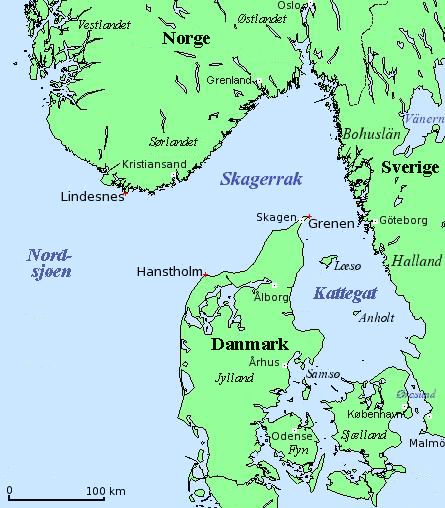
English: Map of Skagerrak and Kattegat — straits/bays of the North Sea, along Denmark, Norway, and Sweden.
Dansk: Kort over Skagerrak og Kattegat (Danmark, Norge, Sverige).
Deutsch: Karte von Skagerrak und Kattegat (Dänemark, Norwegen, Schweden).
Français : Carte du Skagerrak et du Kattegat (Danemark, Norvège, Suède).
|
| Source |
English: Modification of
Dansk: Bearbejdelse af
Deutsch: Bearbeitung von
File:Carte_Skagerrak-Kattegat.png |
| Author | Hallvard Straume |
| Other versions |
|


Licensing[edit]
| I, the copyright holder of this work, release this work into the public domain. This applies worldwide. In some countries this may not be legally possible; if so: I grant anyone the right to use this work for any purpose, without any conditions, unless such conditions are required by law. |
File history
Click on a date/time to view the file as it appeared at that time.
| Date/Time | Thumbnail | Dimensions | User | Comment | |
|---|---|---|---|---|---|
| current | 12:23, 25 September 2005 | | 445 × 508 (239 KB) | Hallvard Straume (talk | contribs) | Based on existing image: "Carte Skagerak-Kattegat.png". Scandinavian names set by Hallvard Straume |
You cannot overwrite this file.
File usage on Commons
The following 6 pages use this file:
File usage on other wikis
The following other wikis use this file:
- Usage on af.wikipedia.org
- Usage on bg.wikipedia.org
- Usage on br.wikipedia.org
- Usage on da.wikipedia.org
- Usage on de.wikinews.org
- Usage on et.wikipedia.org
- Usage on fi.wikipedia.org
- Usage on fo.wikipedia.org
- Usage on it.wikipedia.org
- Usage on nn.wikipedia.org
- Usage on no.wikipedia.org
- Usage on sv.wikipedia.org