Southwest Highlands (28th March – 2nd April 2024)

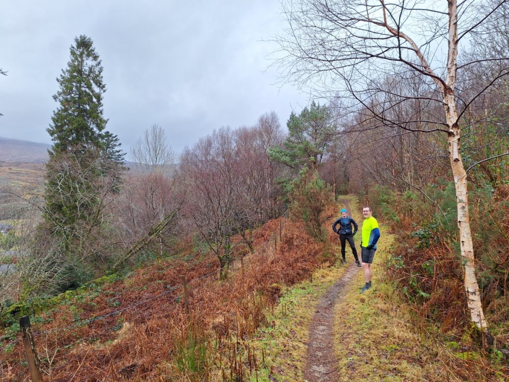
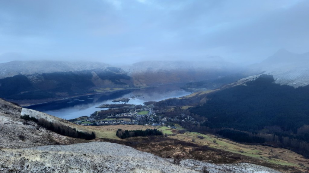
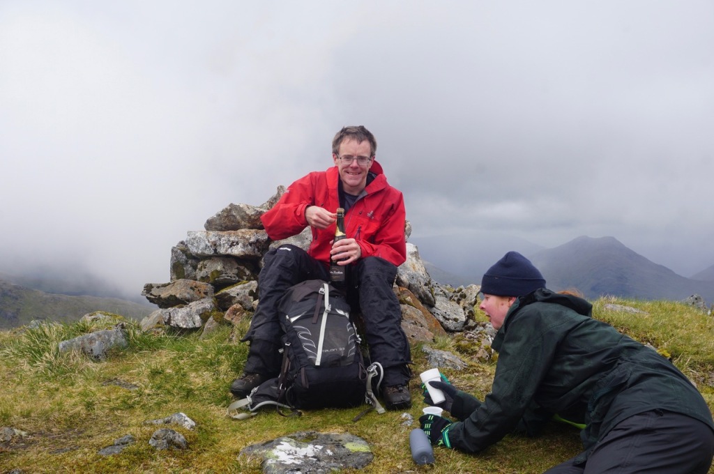
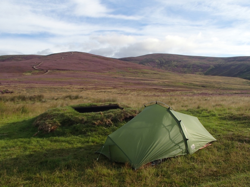
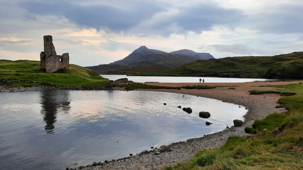
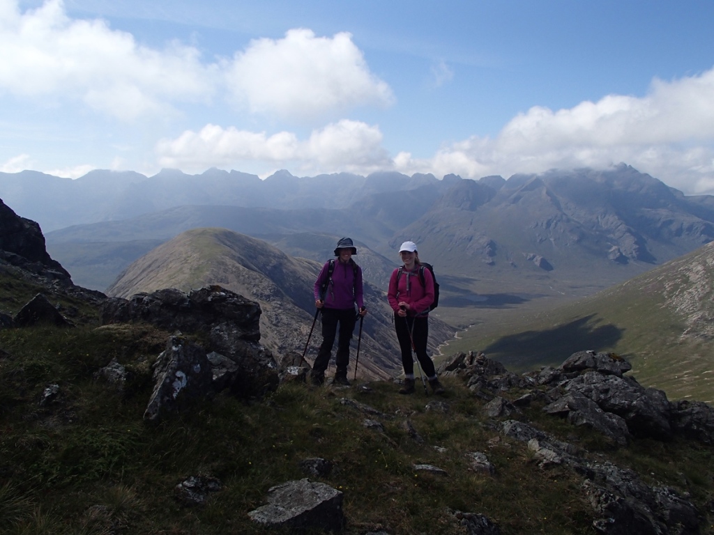
As usual, I took a trip to the Highlands for the long Easter weekend, this year a solo trip staying in hostels. I travelled up as far as Mum and Dad’s house in Kendal on the Wednesday evening, and spent the night there. Then after breakfast on Thursday, I continued north to Lochgoilhead, where my first objective of the trip was the recently-promoted Graham, Cruach nam Miseag (one of the few that are below 2000ft but above 600m and thus meet the new Graham criteria).

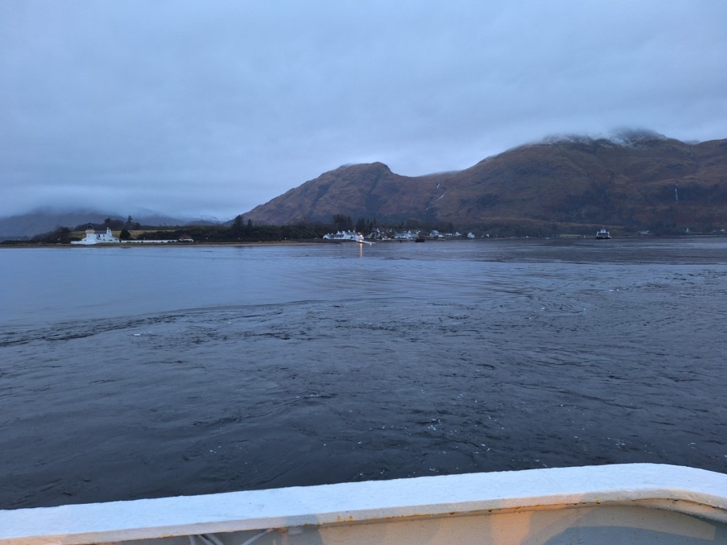
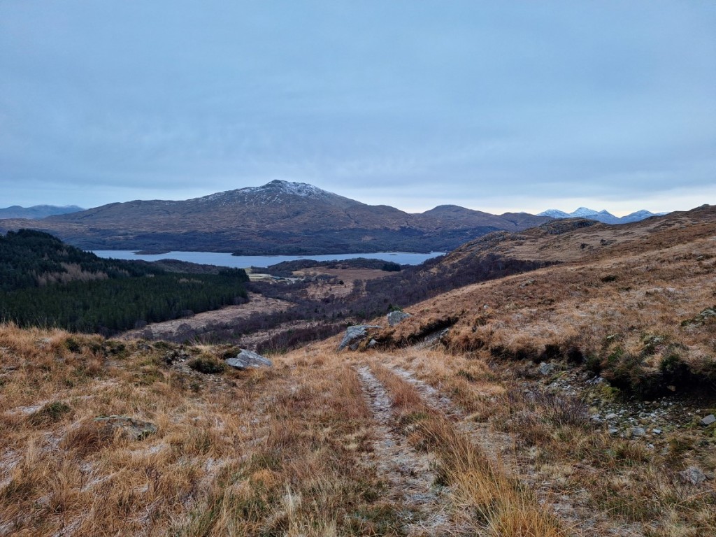
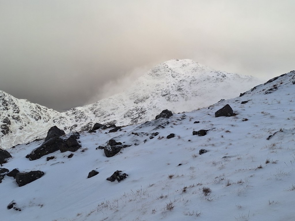
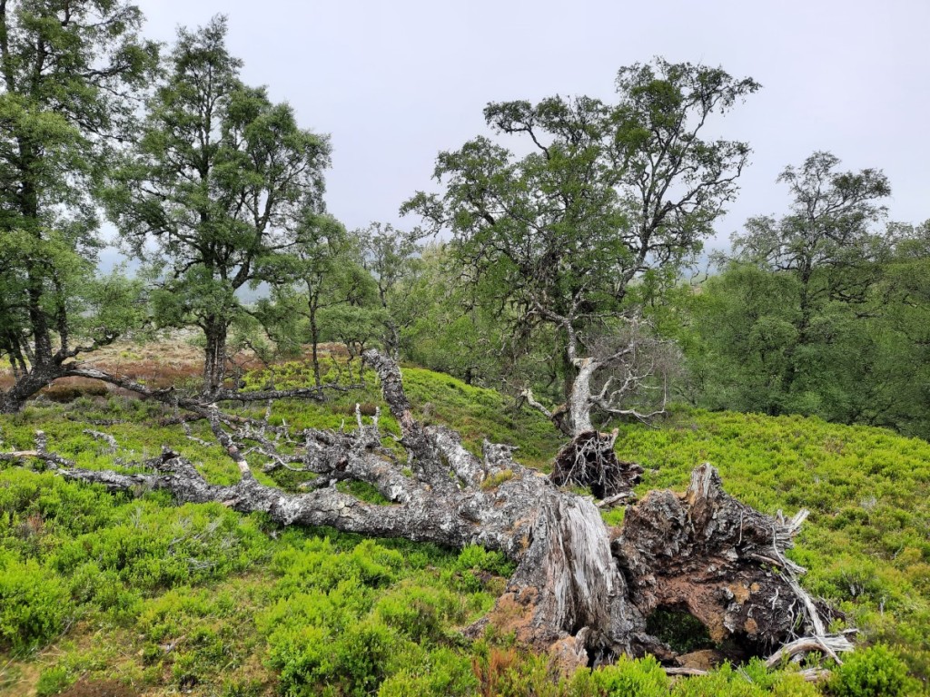
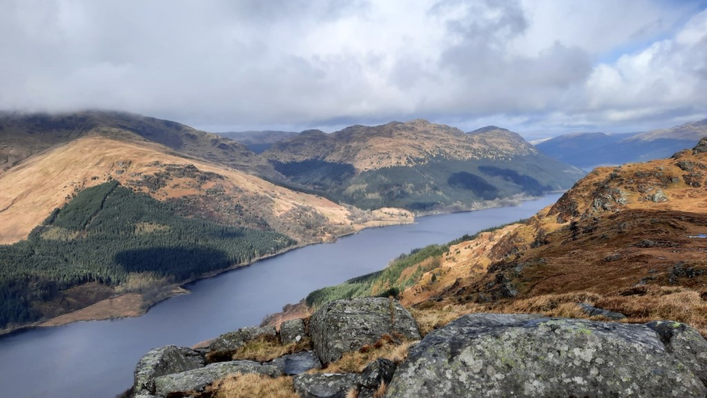
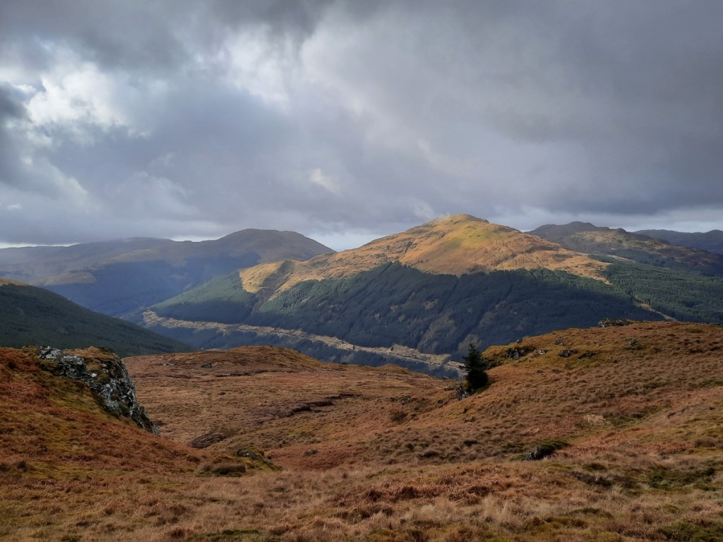
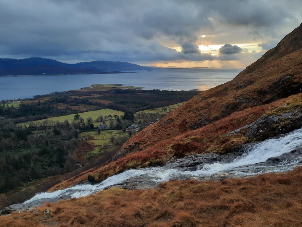
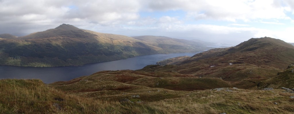
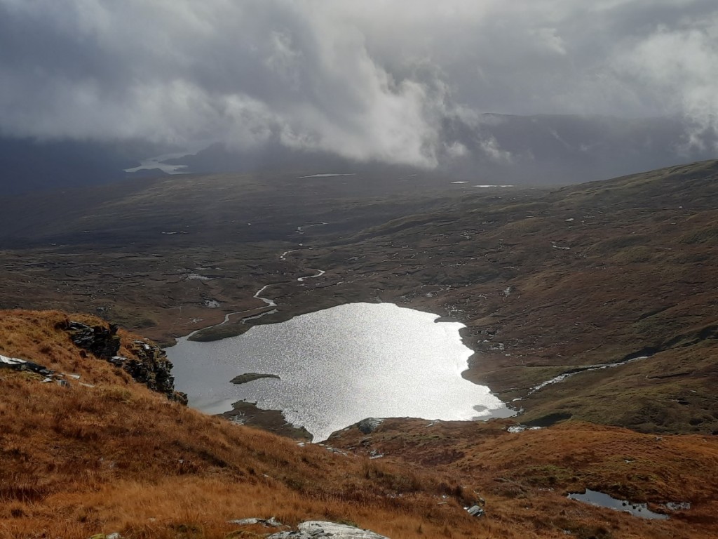
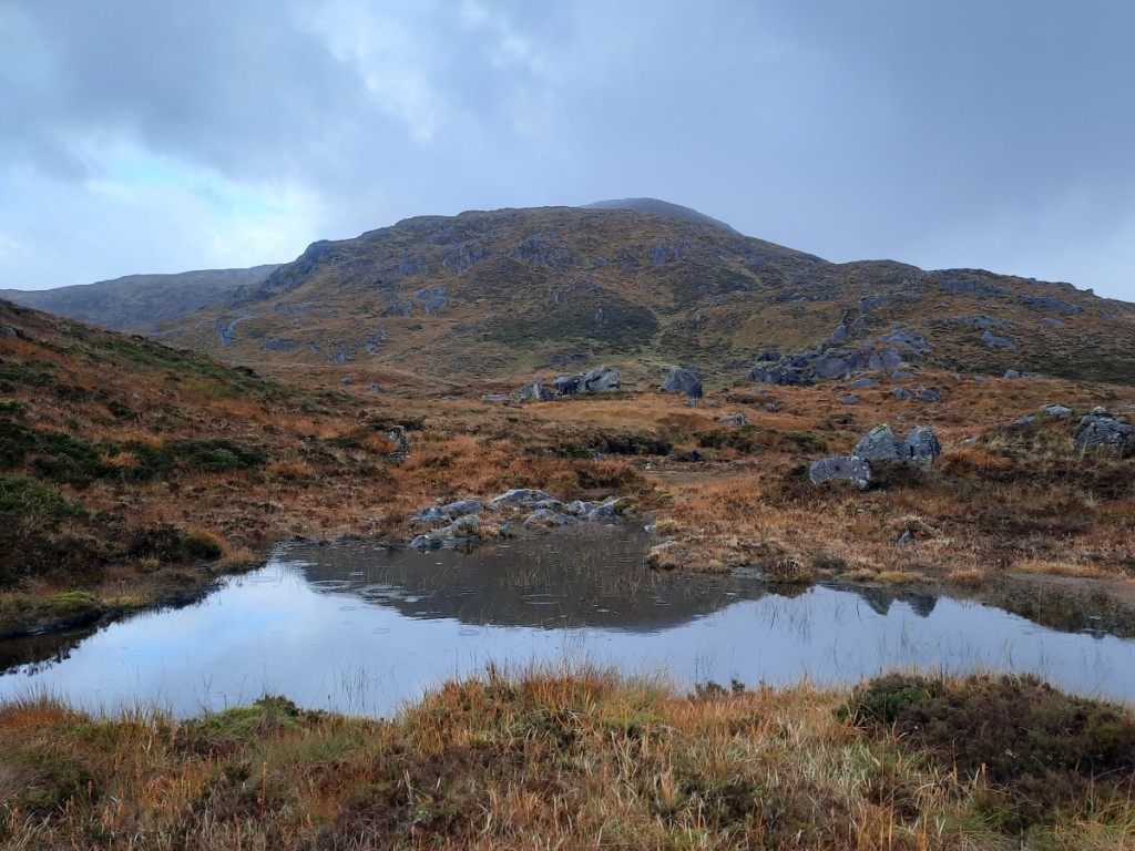
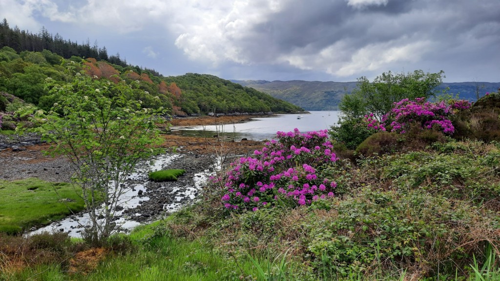
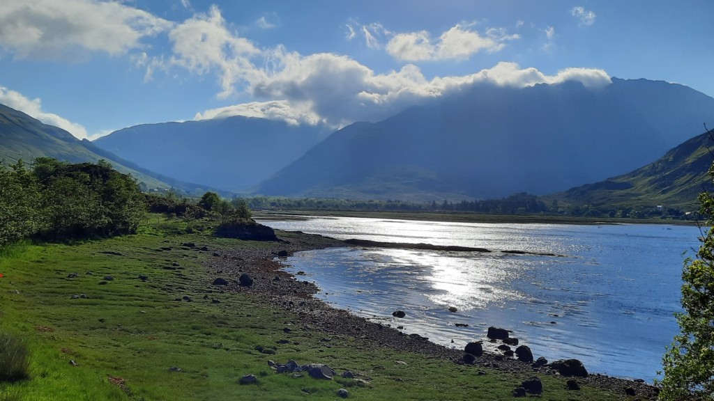
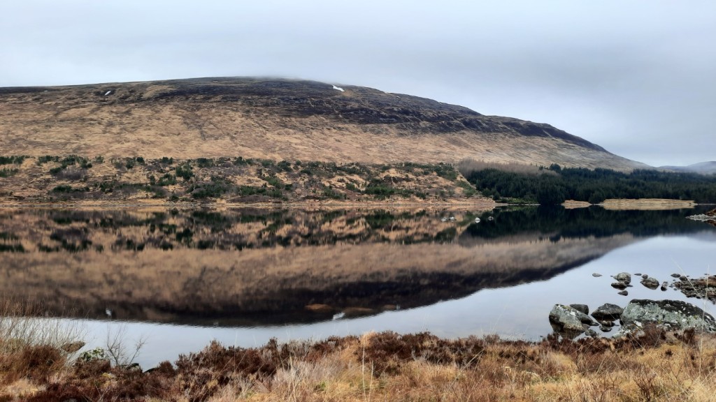
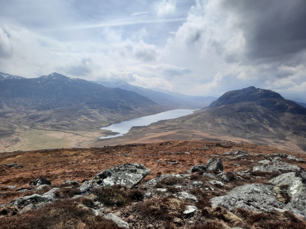
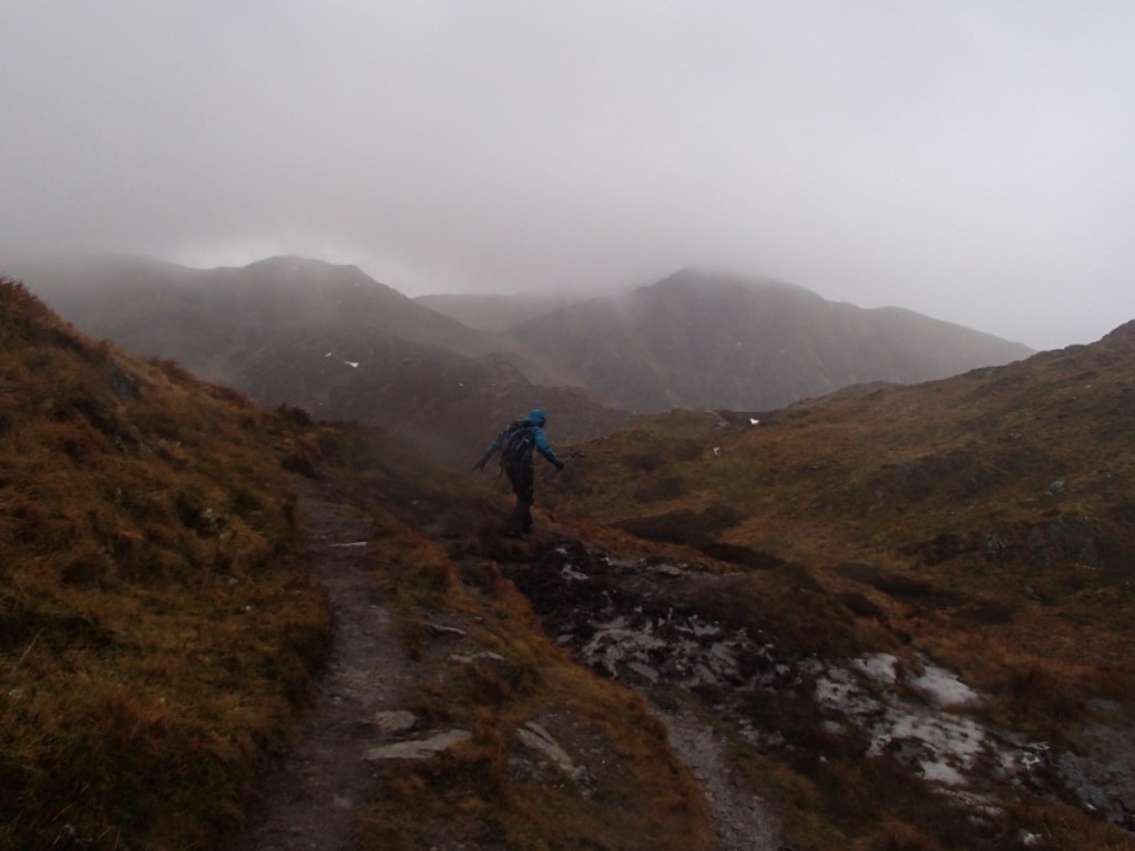
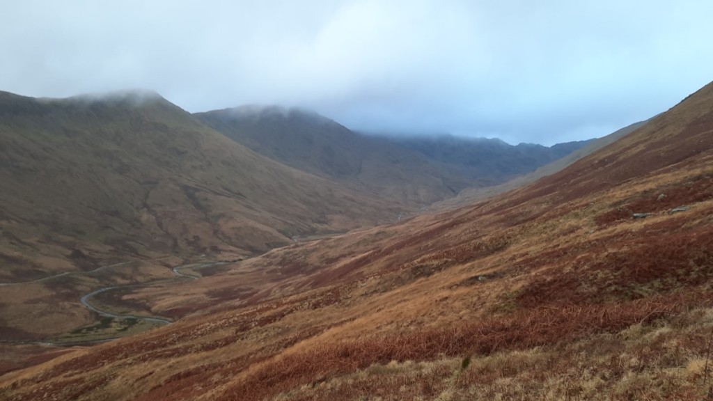
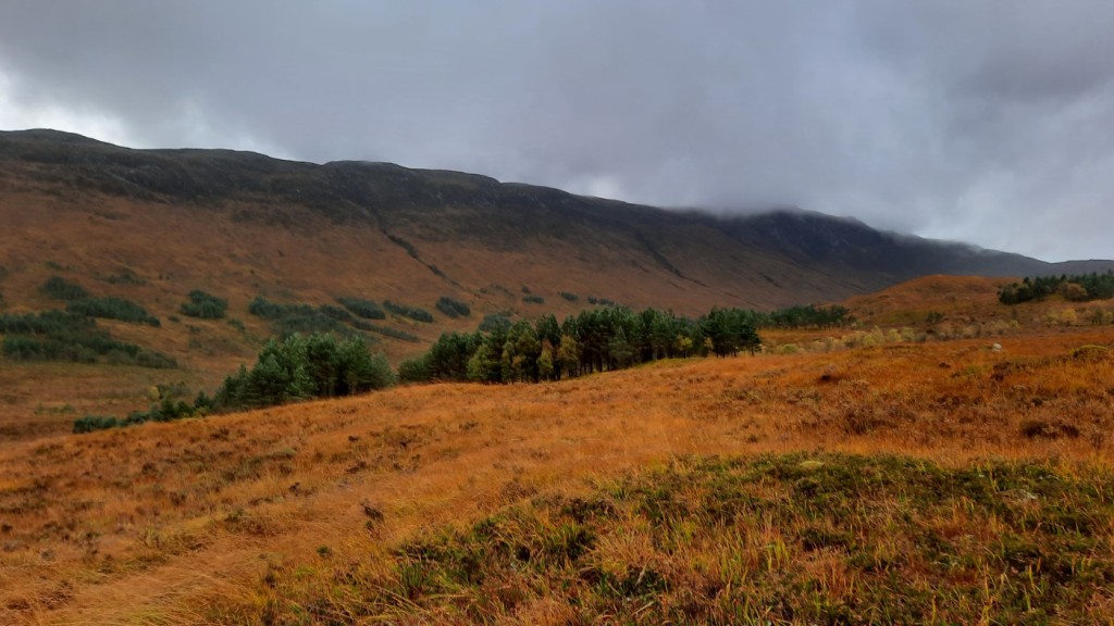
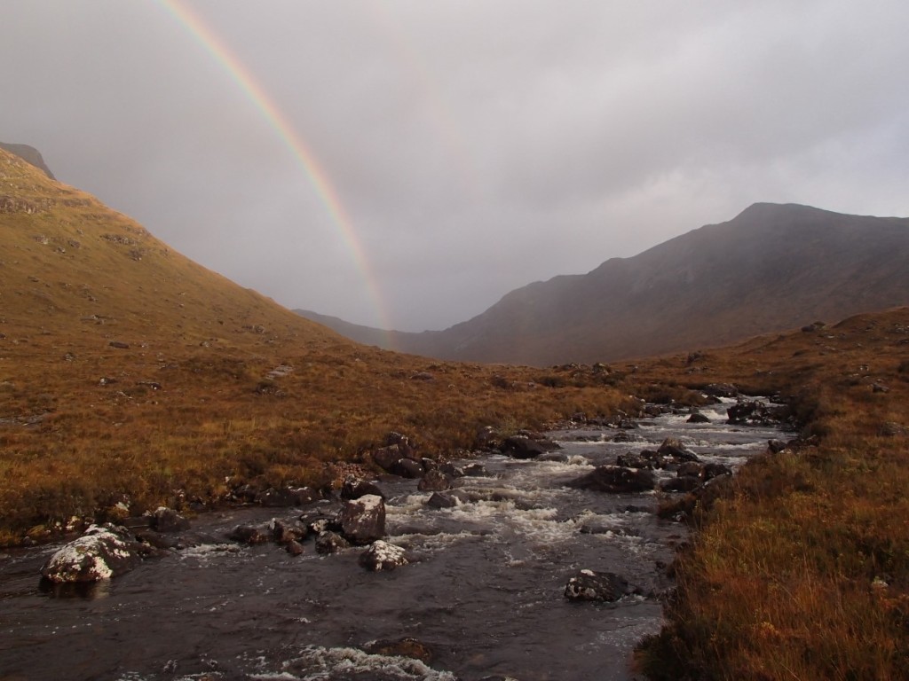
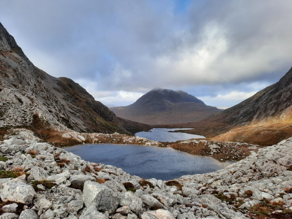
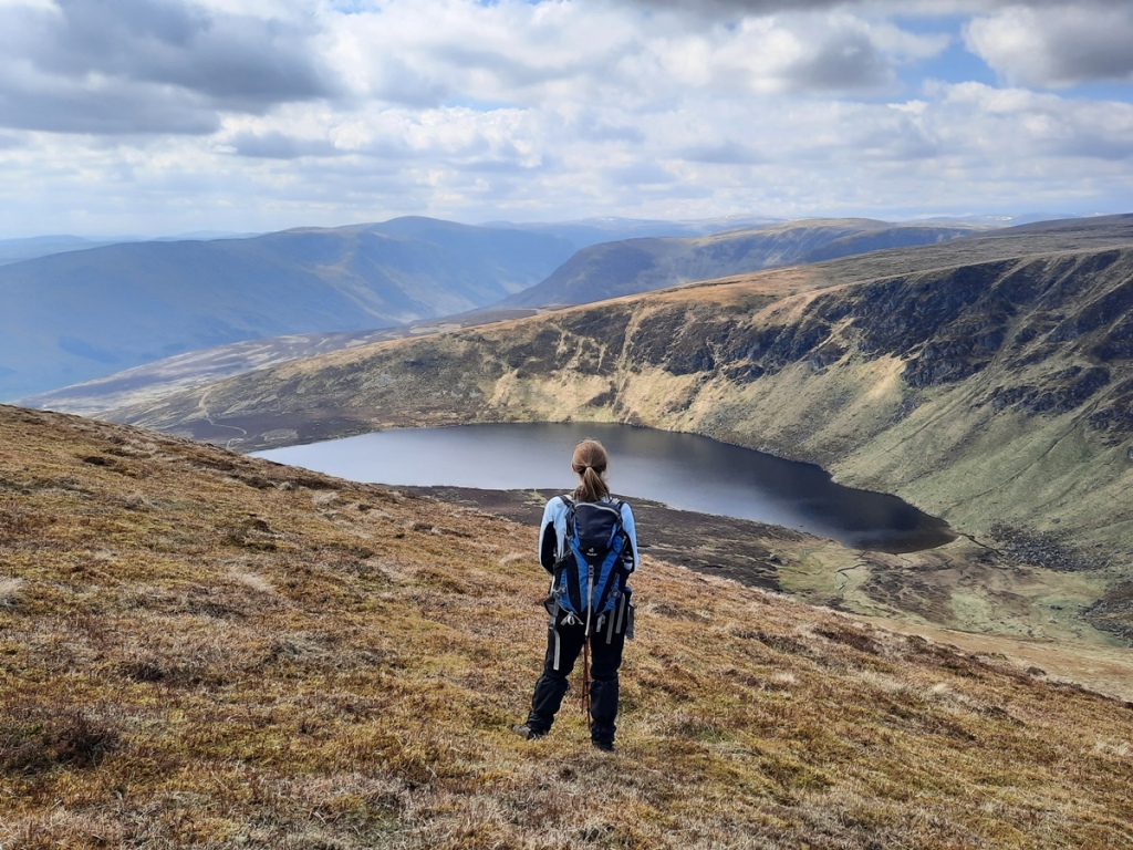
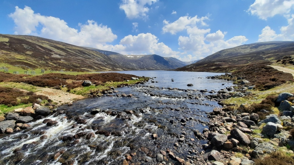
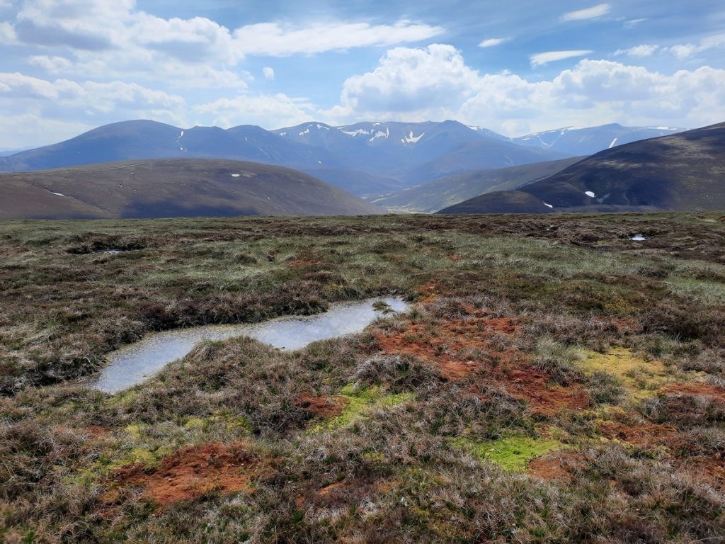
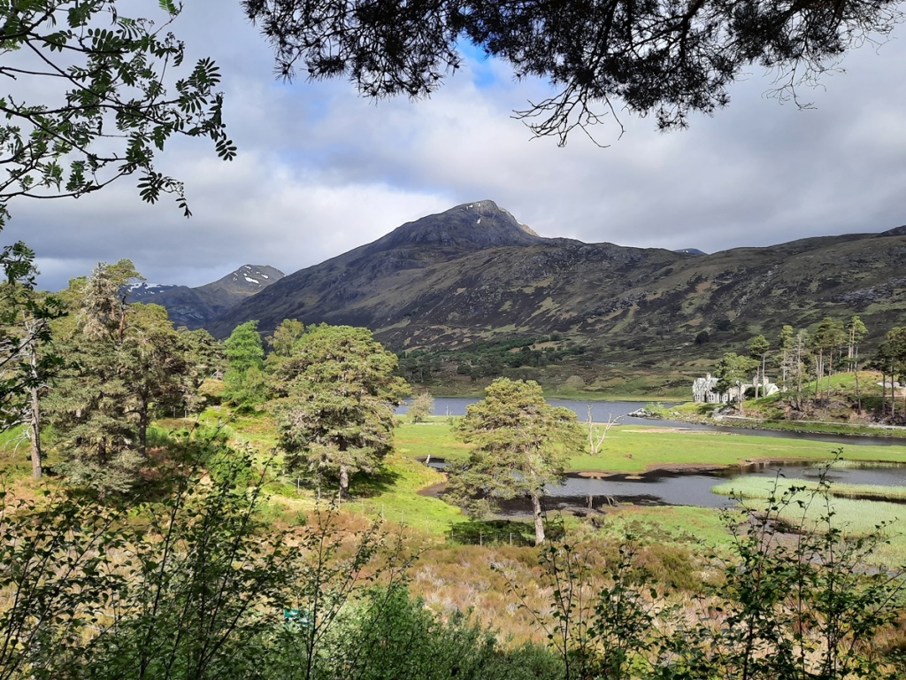
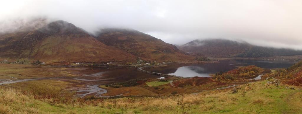
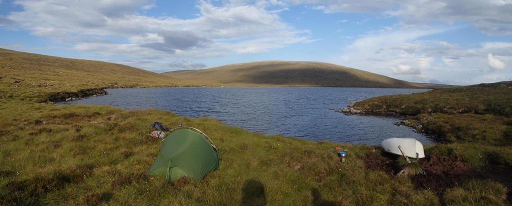
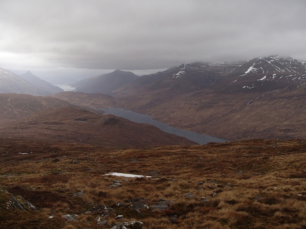
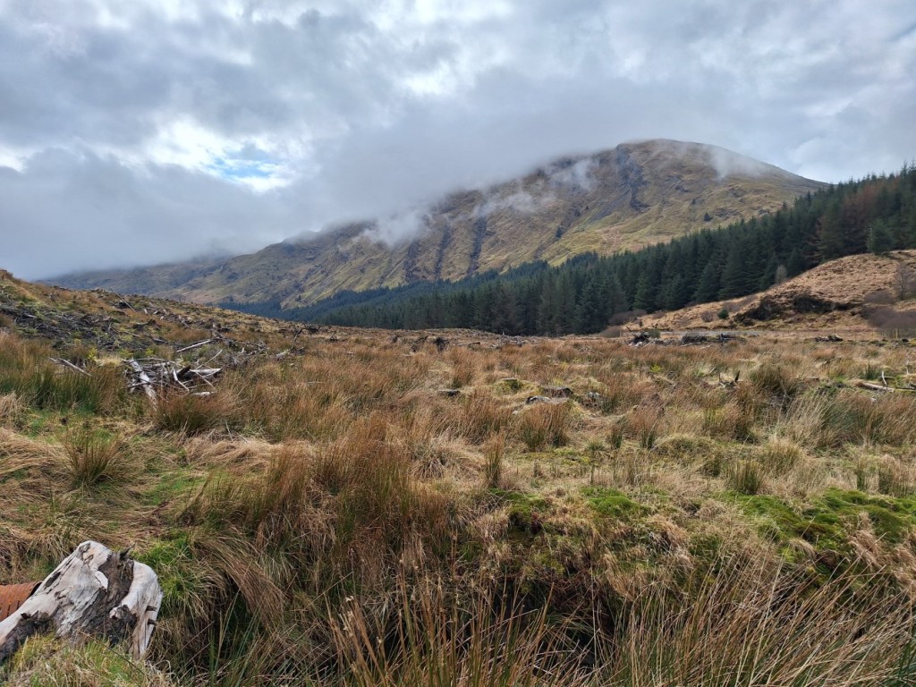
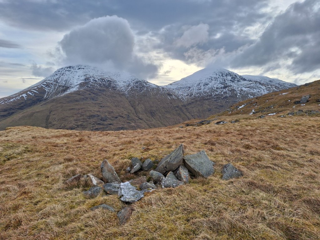
I parked by the shore of Loch Goil at Corrow, and set off up good forest tracks, then paths up the valley to Lochan nan Cnaimh. Clouds shrouded Beinn Bheula and Beinn Lochain as a prolonged shower blew through, but the rain had stopped by the time I paused for lunch in the shelter of some crags.

Beinn Lochain ahead
Beinn Bheula from my lunch spot by Lochan nan Cnaimh

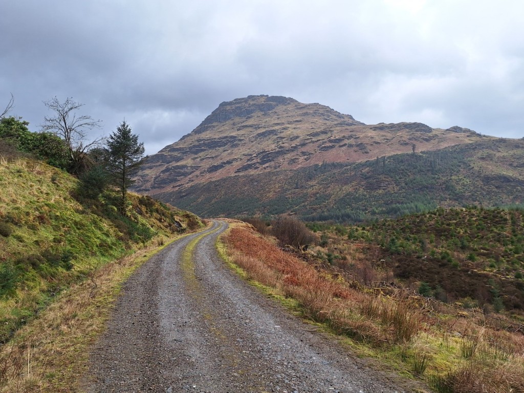
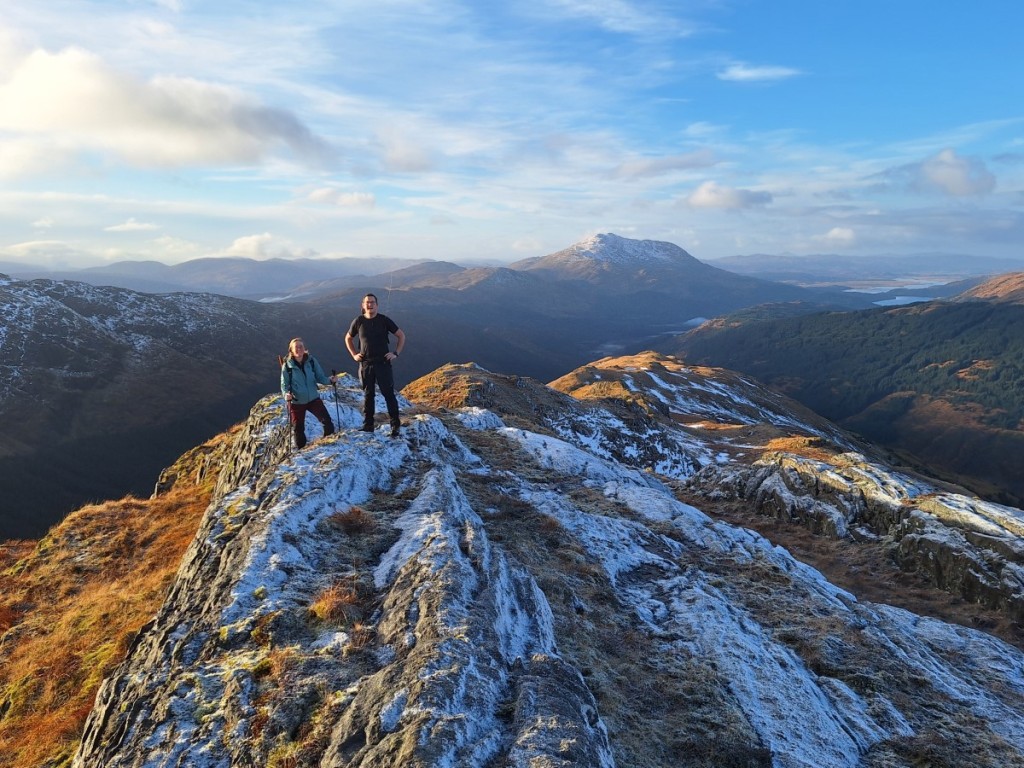
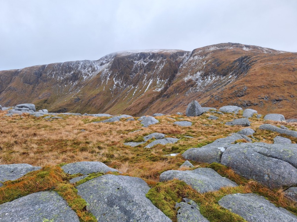
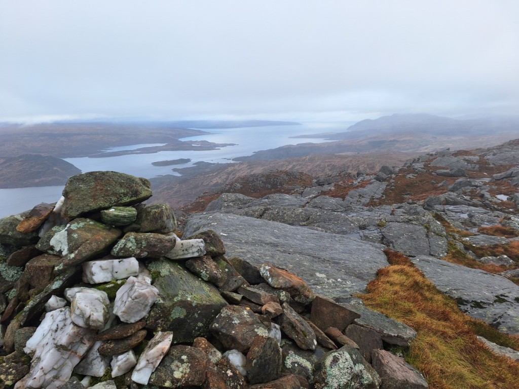
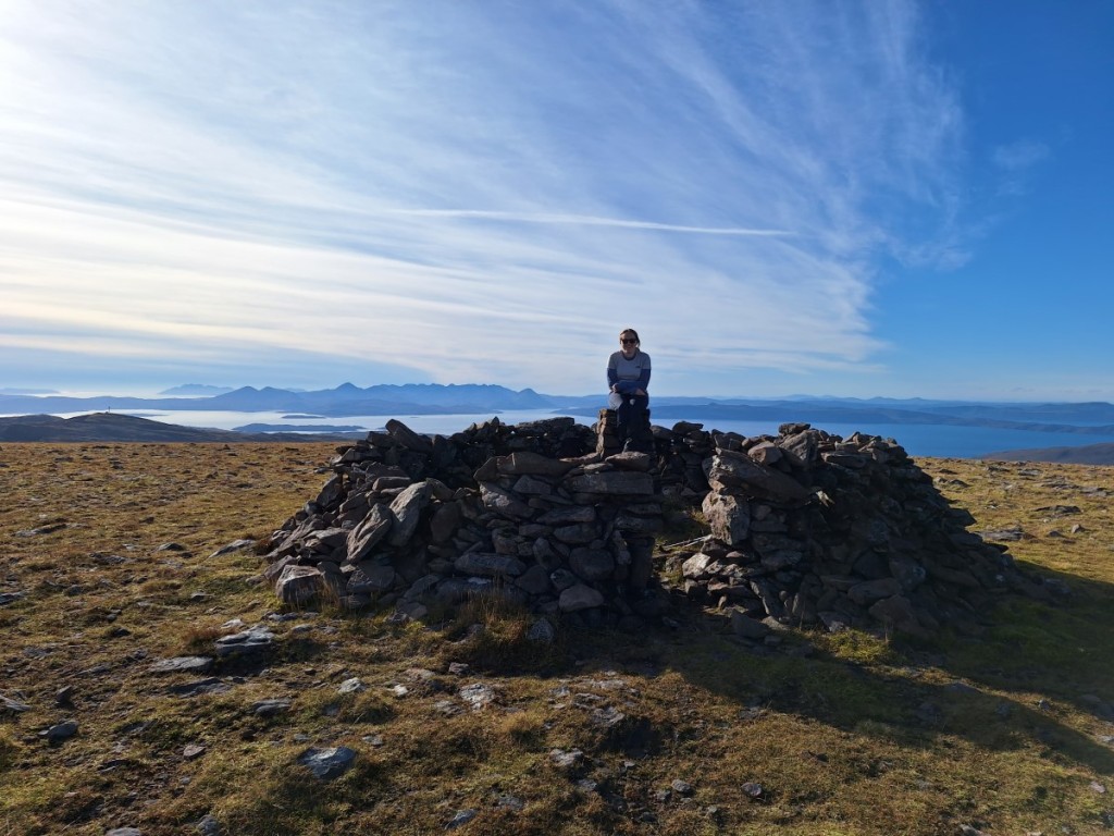
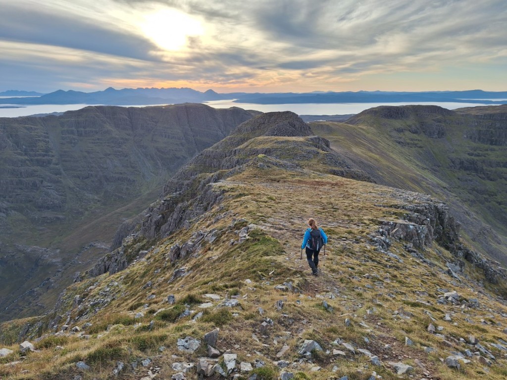
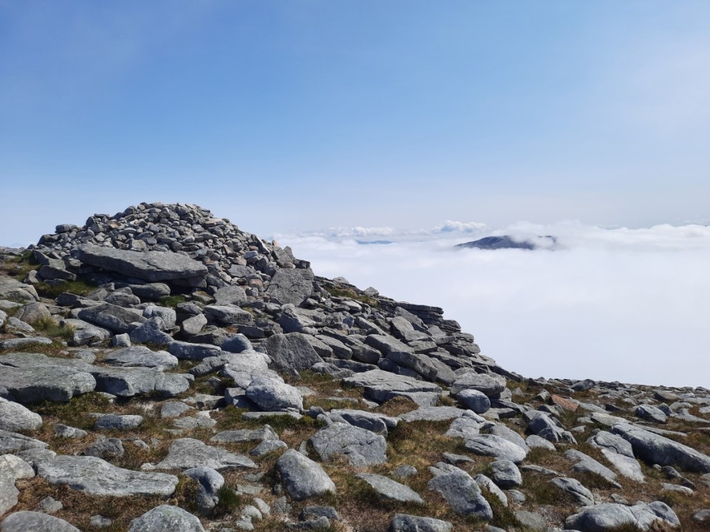
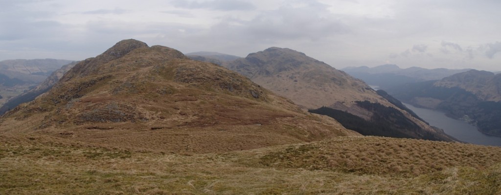
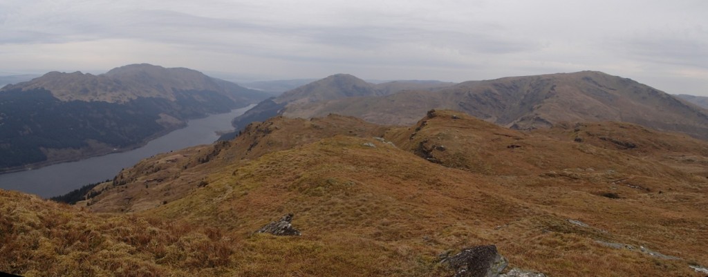
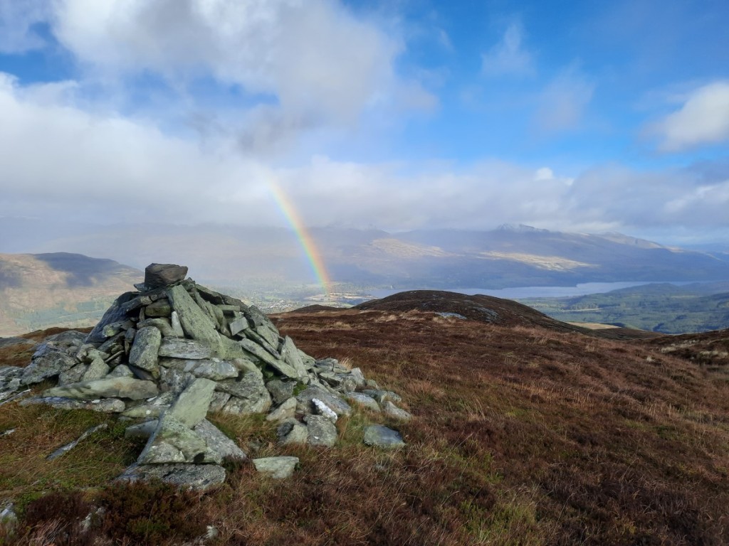
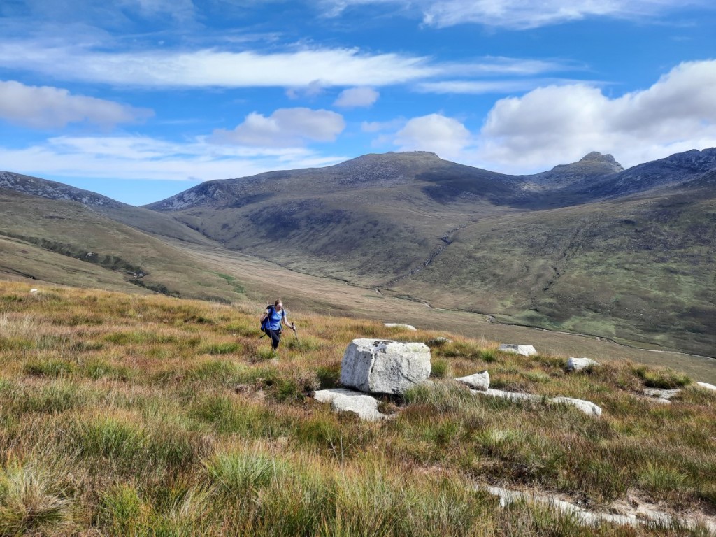
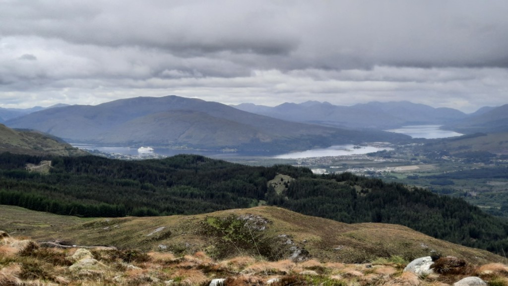
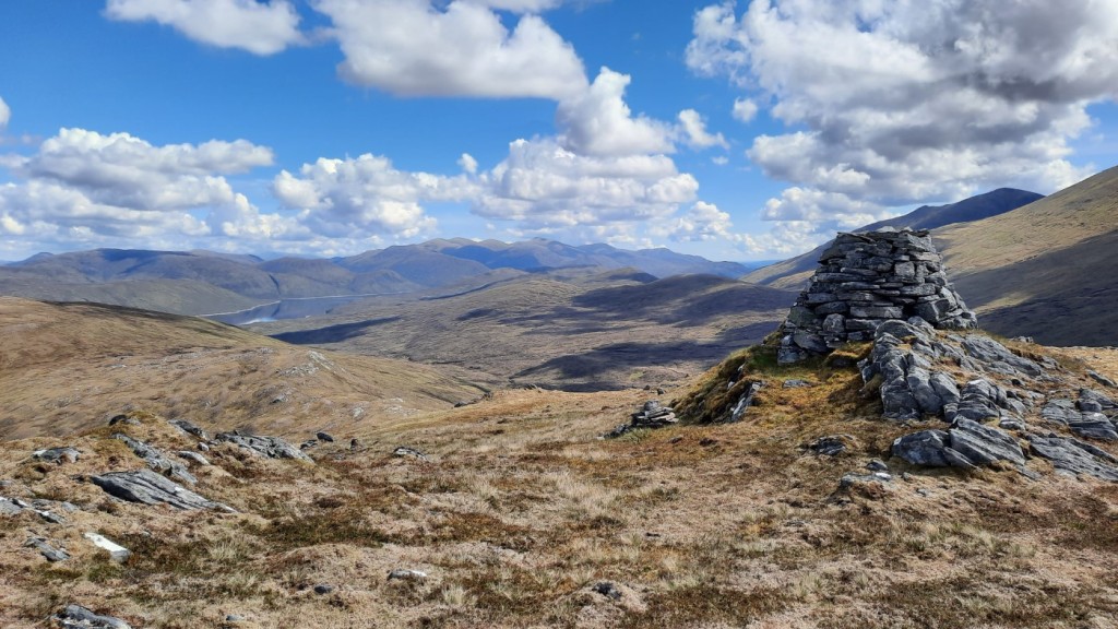
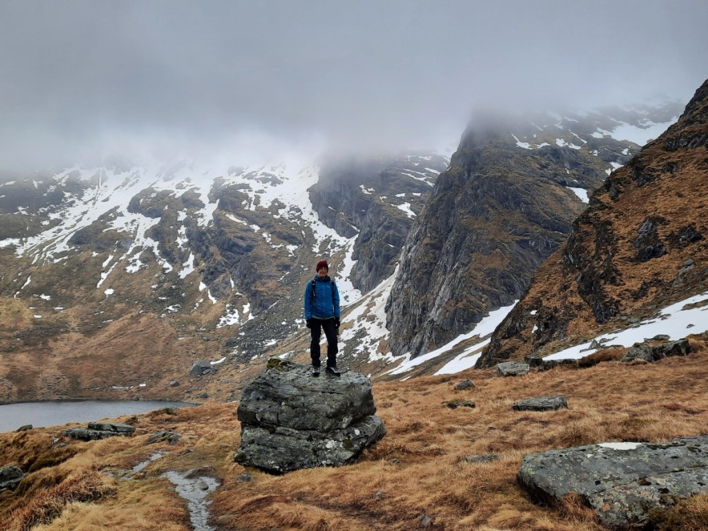
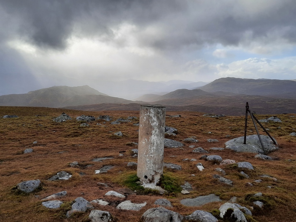
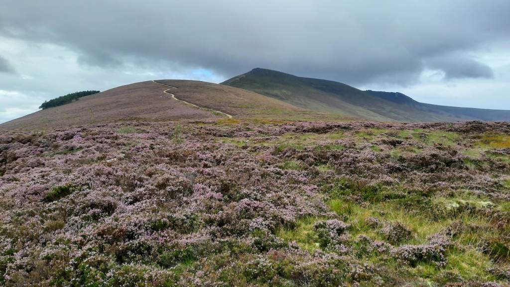
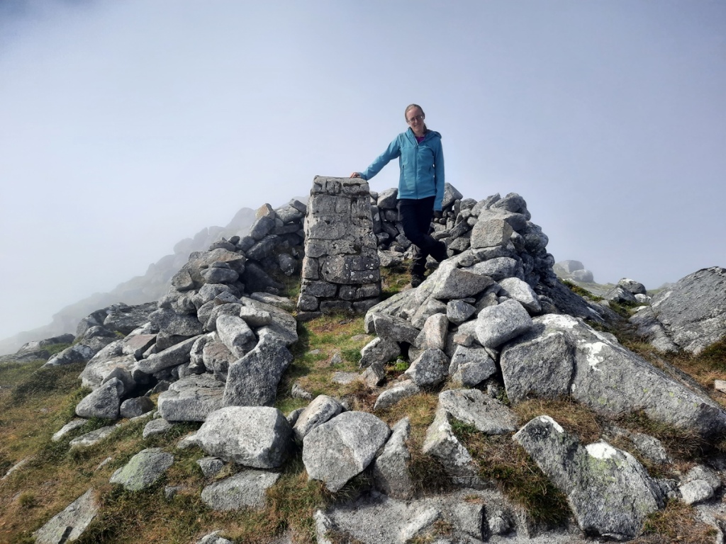
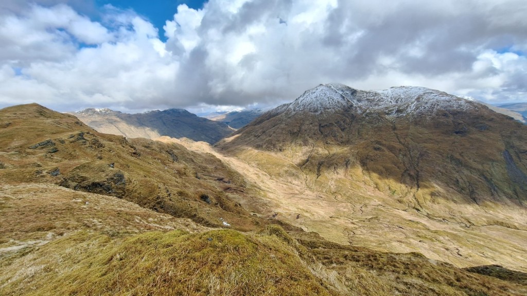
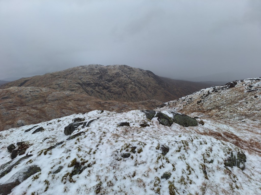
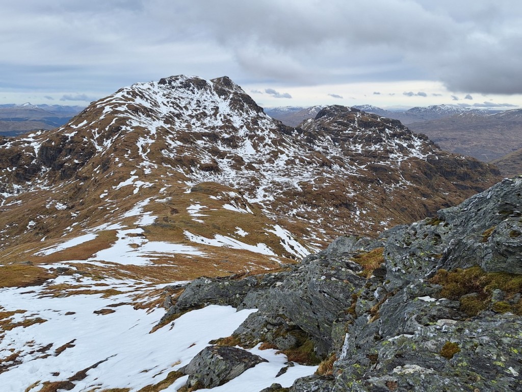
Doubling back on myself to continue up the ridge, it was a sharp climb up on rough grass, soon gaining views of the summit and down to Loch Goil. I passed over a couple of minor tops on the way to the blustery Graham summit, only pausing briefly there to take in the views before seeking the shelter of lower ground. At the start of the walk, I had been in two minds whether to descend directly north or back the way I’d come. It hadn’t looked too tricky to find a way through the forest, so I opted for the direct way, but somewhat regretted it as I did end up picking my way through the brashings and pits of a deforested slope for around 1km on the approach back to the forest track, failing to locate the timber extraction track that I’d seen from below. It was good to get back on easy ground for the final part of the descent.
Route map: https://www.plotaroute.com/route/2565414

The ridge of Cruach nam Miseag
Loch Goil

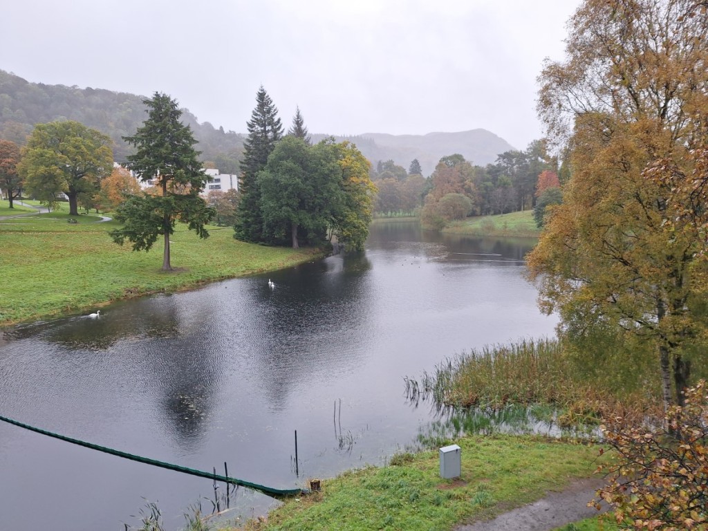
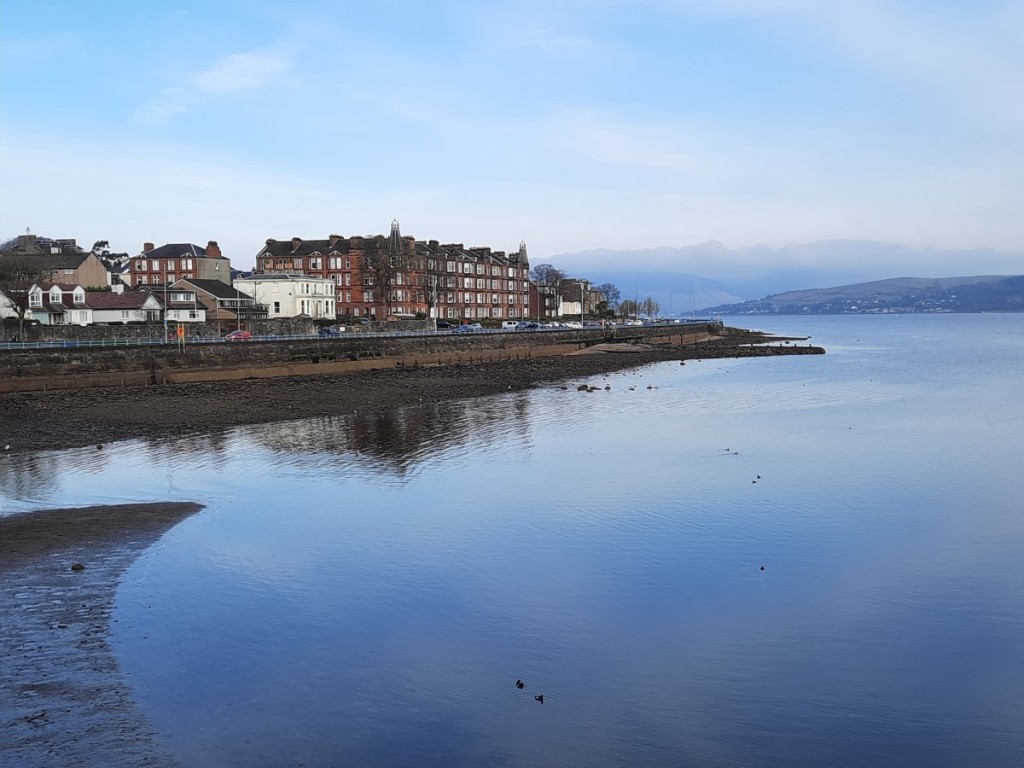
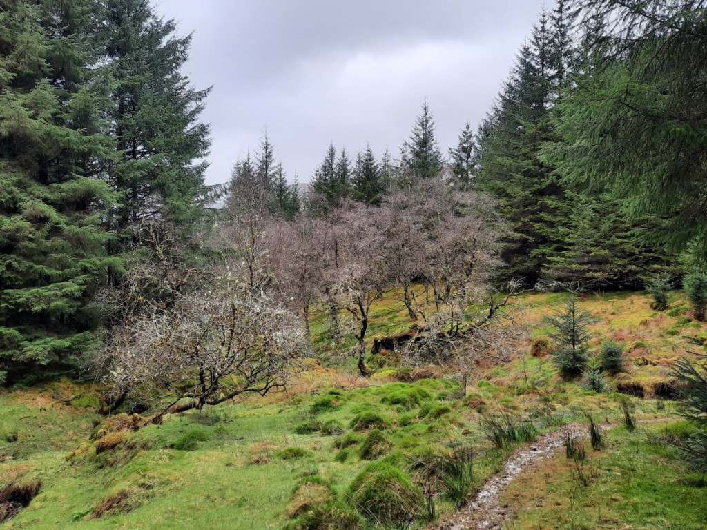
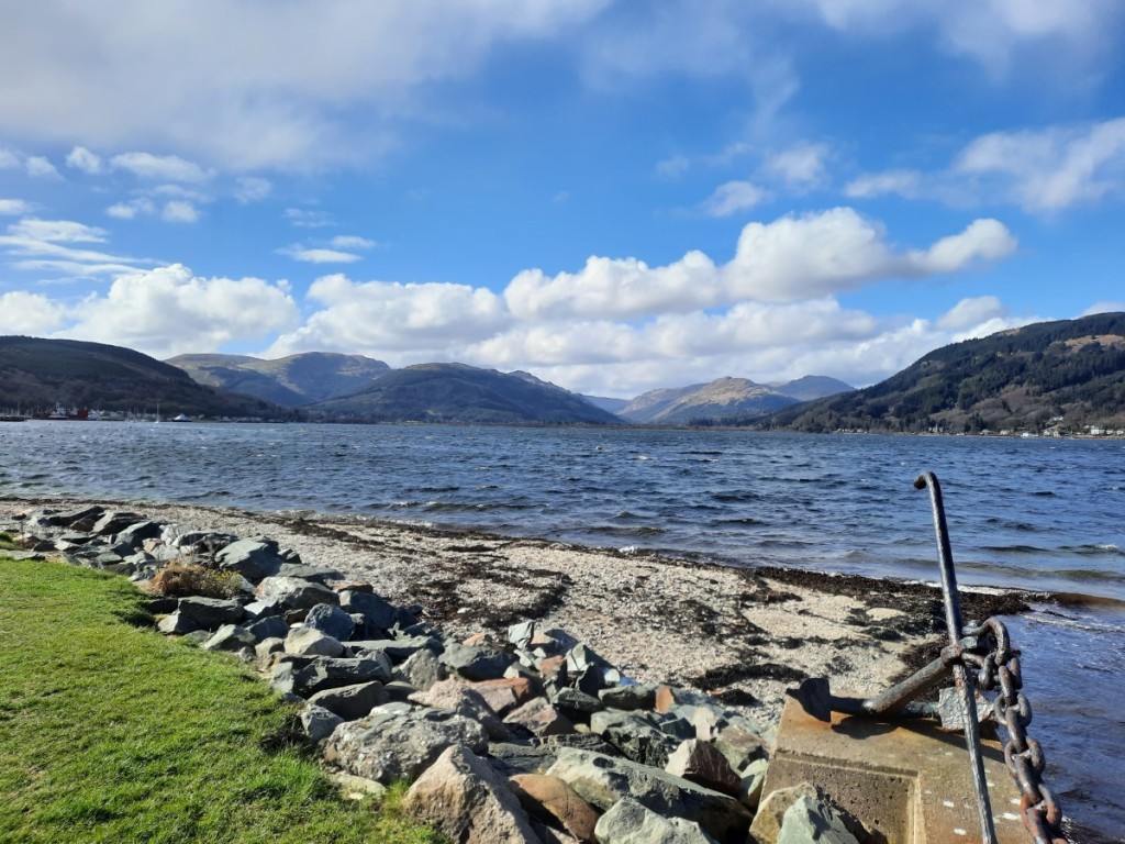
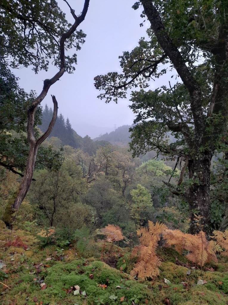
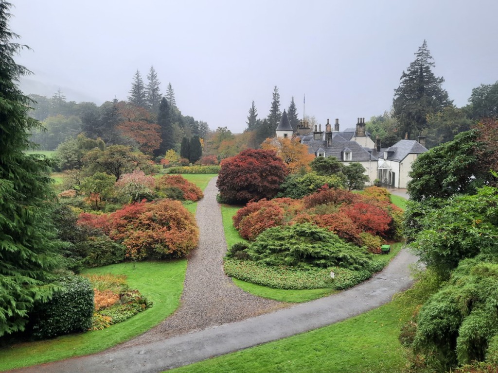
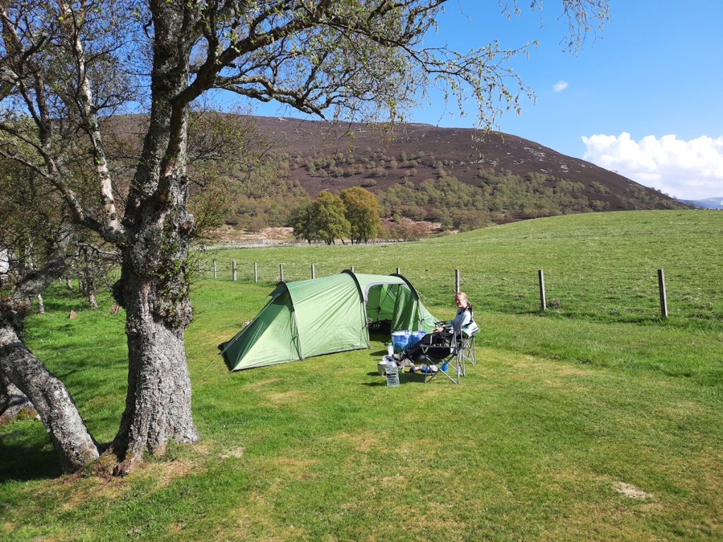
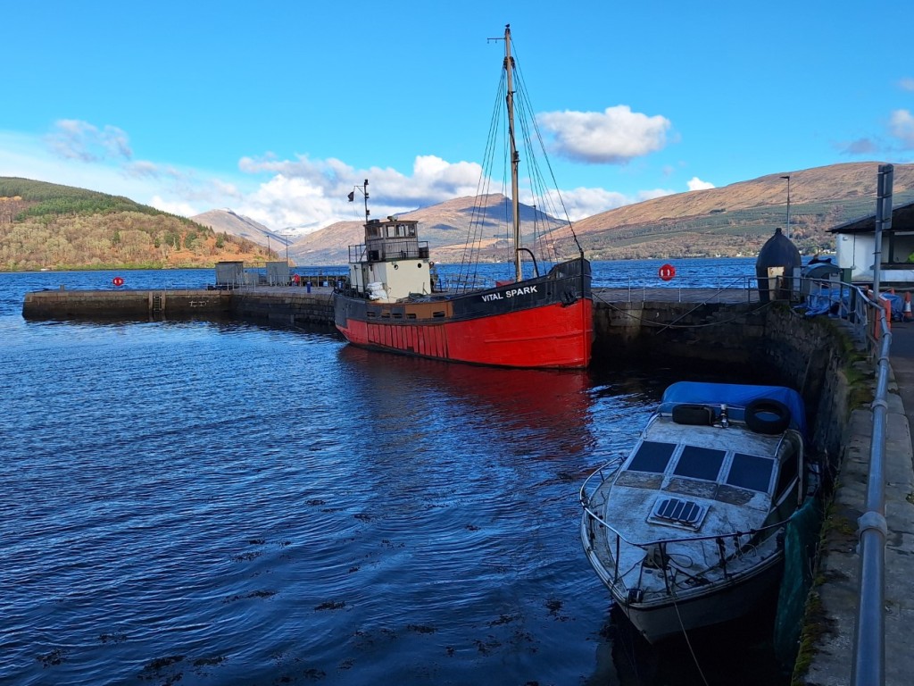
I then drove half an hour or so to Inveraray Hostel for the night, where the warden informed me that I was the first guest of the year, that being their first day of opening and me the first arrival. I settled into my private twin room, then walked into town to buy groceries at Co-op, enjoying the sunshine over Loch Fyne on the way back. After cooking and eating dinner, I had a relaxing evening planning for the coming days.

A sunny evening in Inveraray

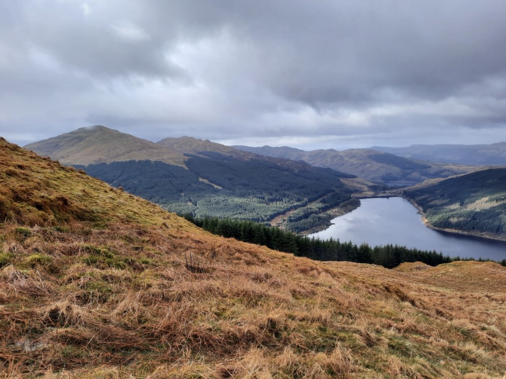
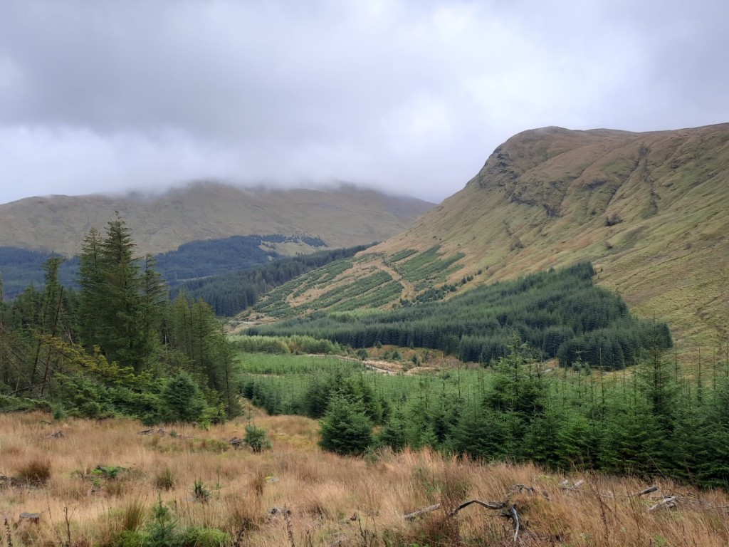
Friday’s weather was supposed to improve as the day went on, so I didn’t rush to get out really early. My twin objectives were the Grahams on either side of Hell’s Glen, the other side of Loch Fyne, which are both easily accessible from the top of the 200m pass. First up was Cruach nam Mult. I followed the main track up Coire No, then a timber extraction track up through a deforested area to reach the open ground northwest of the hill. Then it was a simple climb up grass to the fairly unremarkable summit, the final 100m or so being in mist. It didn’t look like the cloud would break up imminently, so I headed straight back down the way I’d come, only getting fleeting views of Loch Fyne.

Cruach nam Mult from near the pass

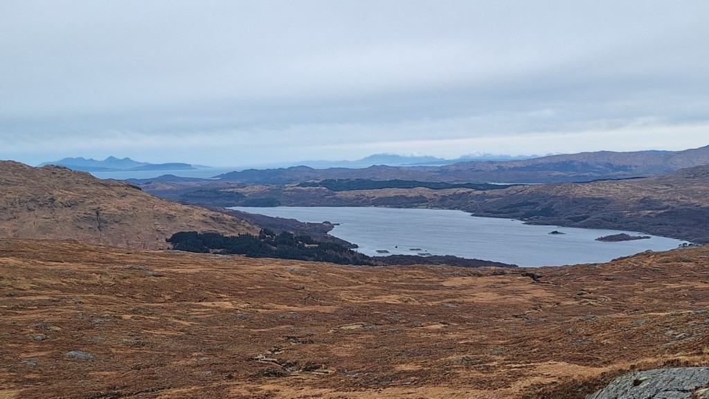
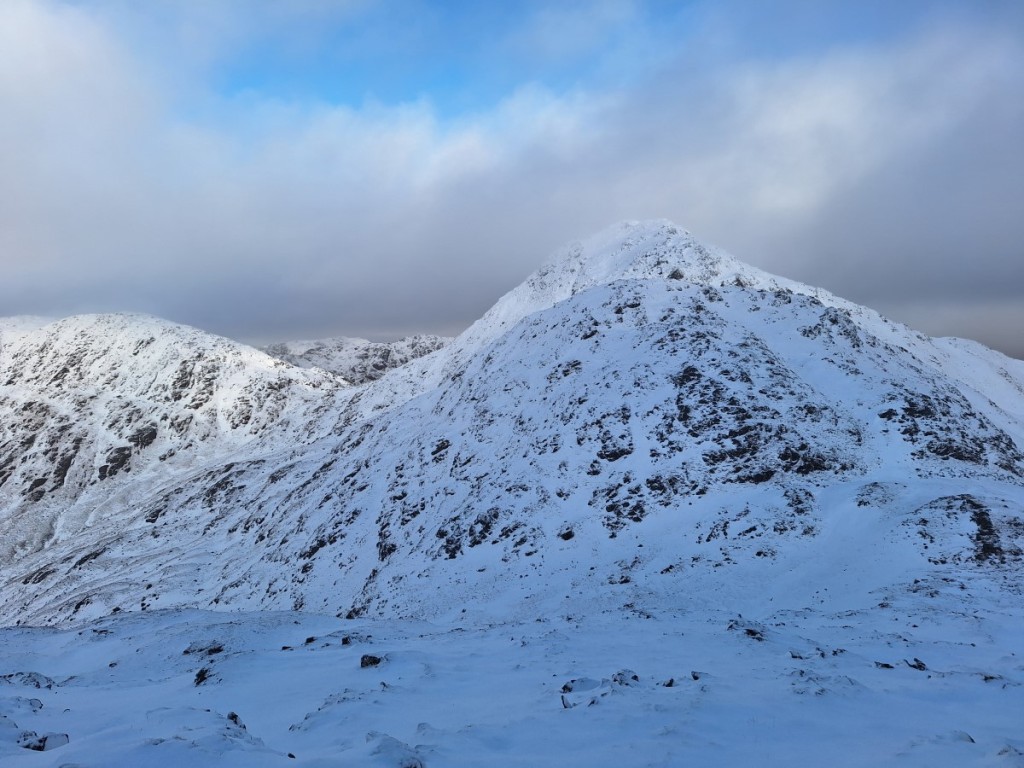
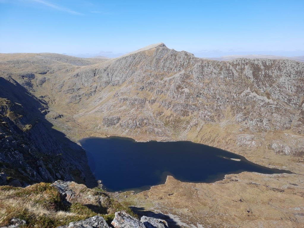
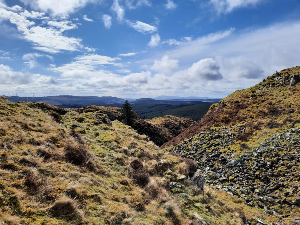
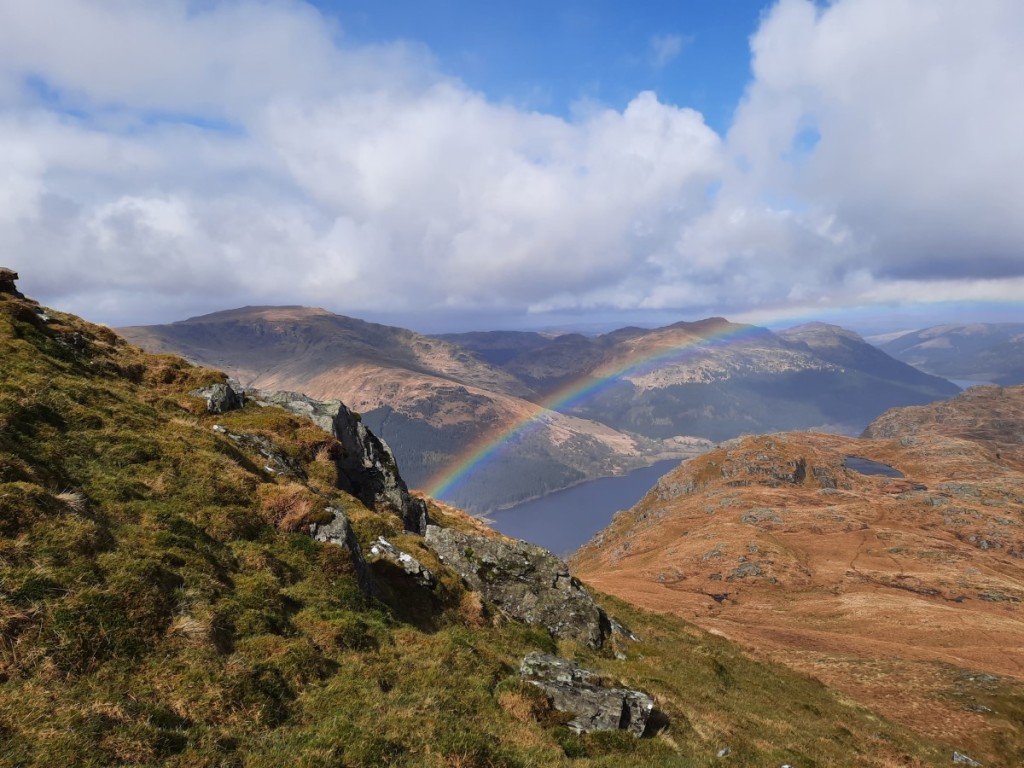
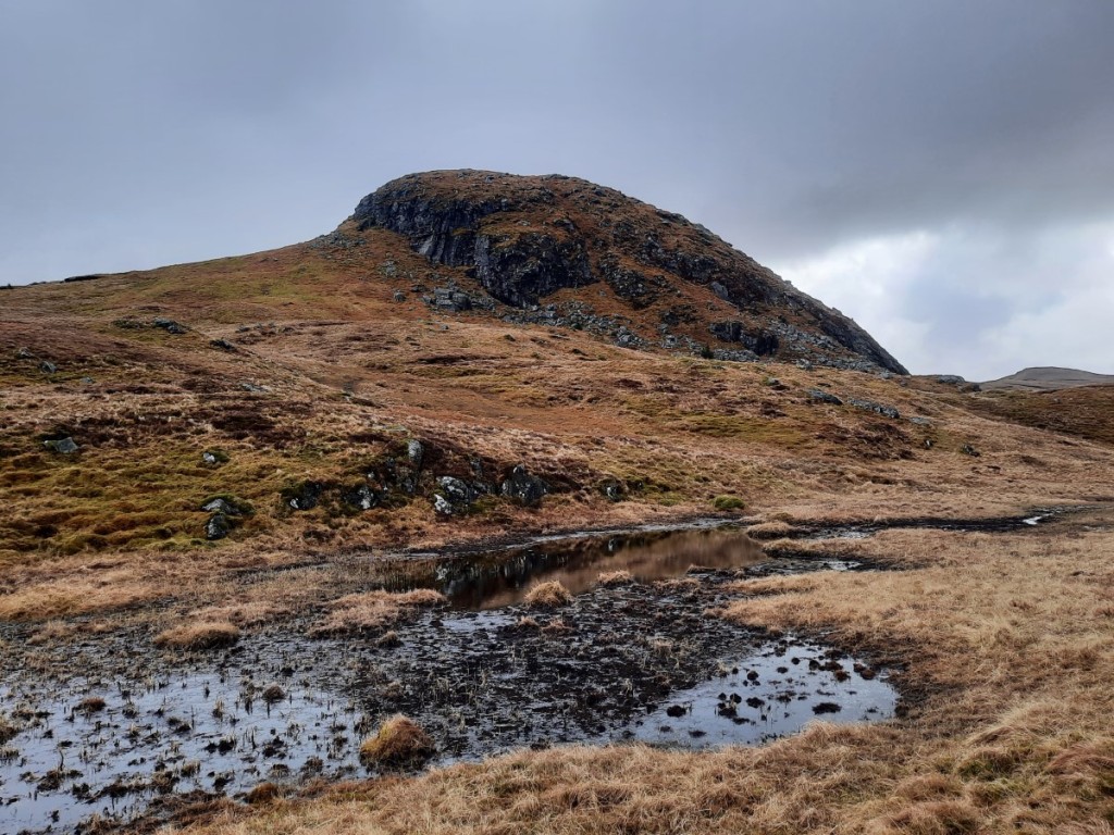
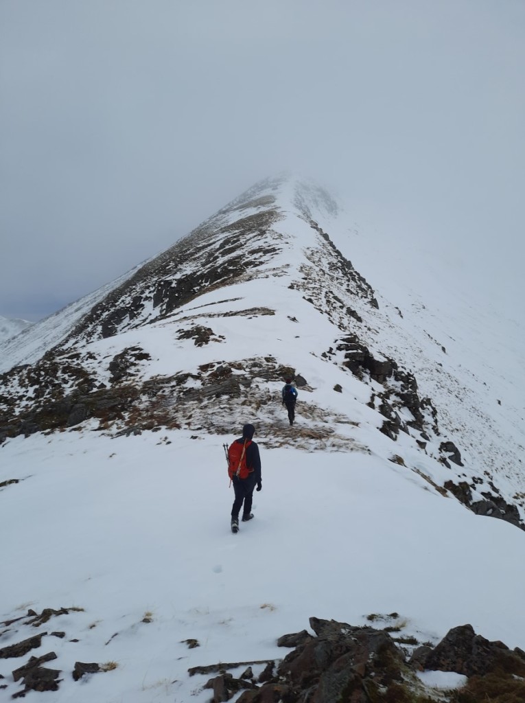
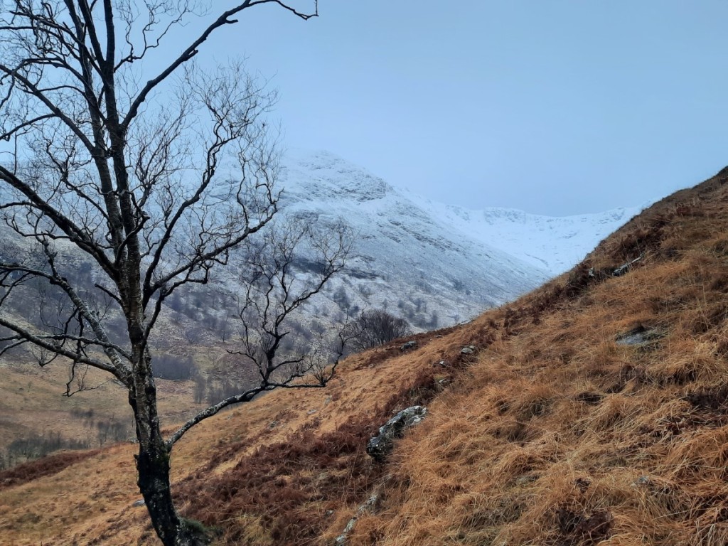
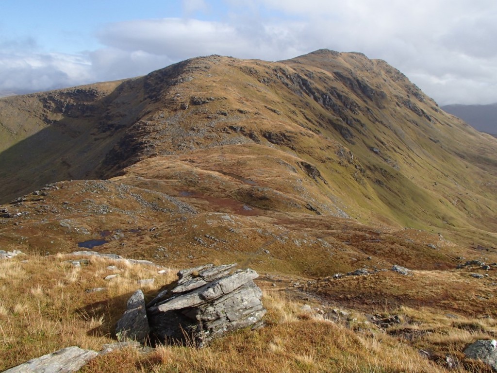
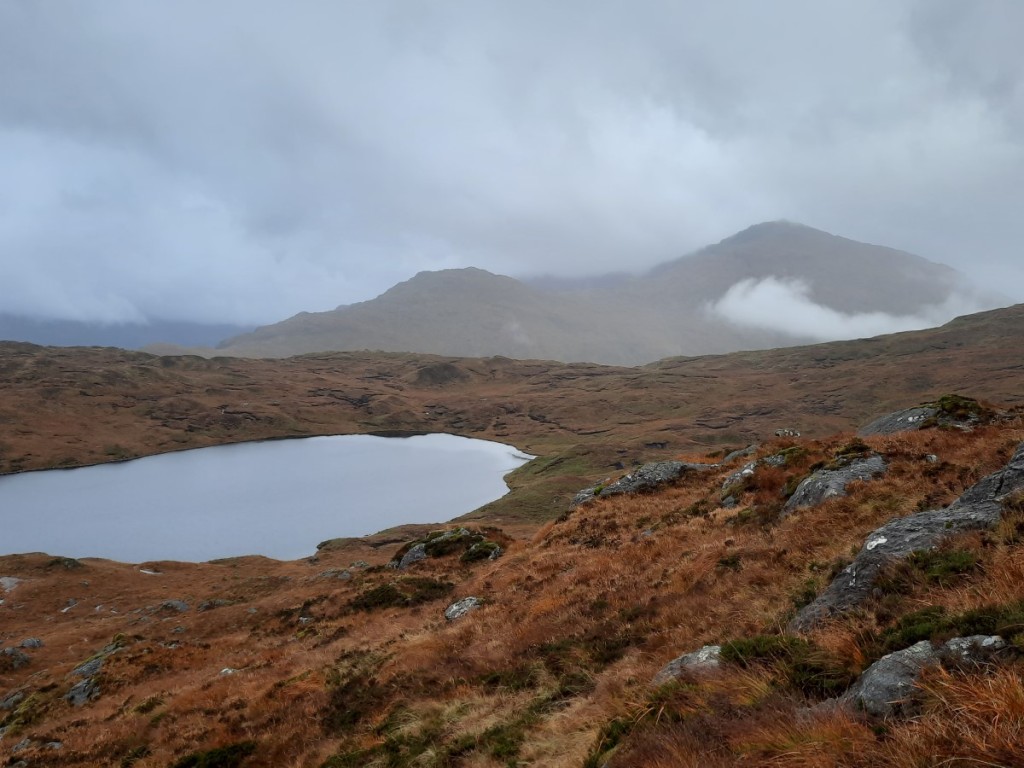
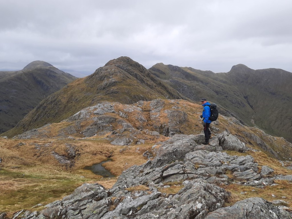
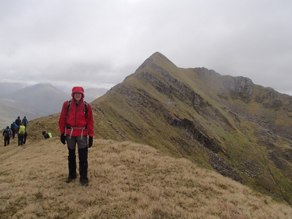
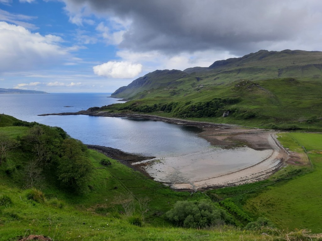
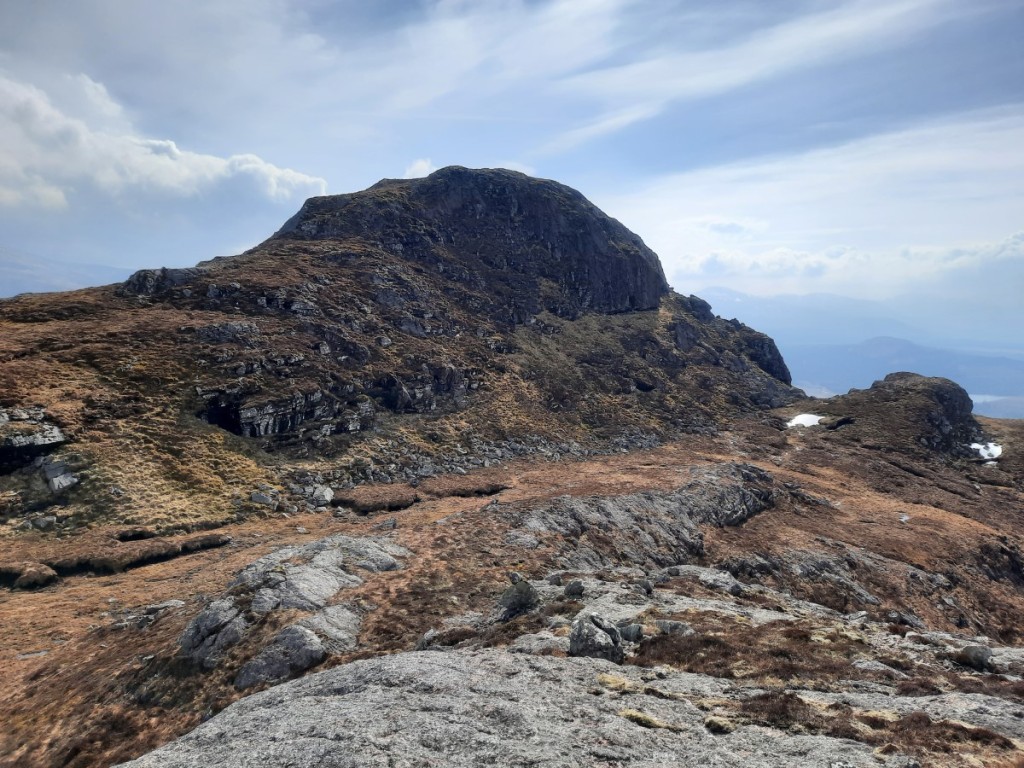
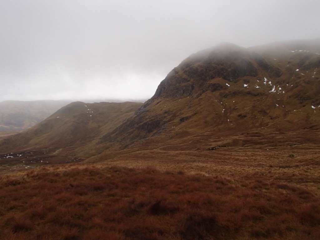
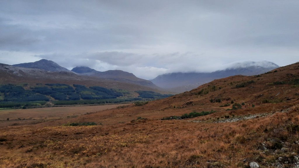
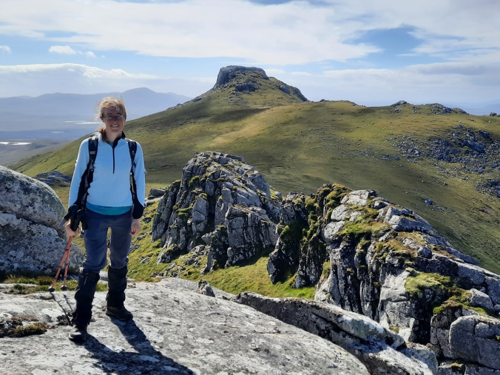
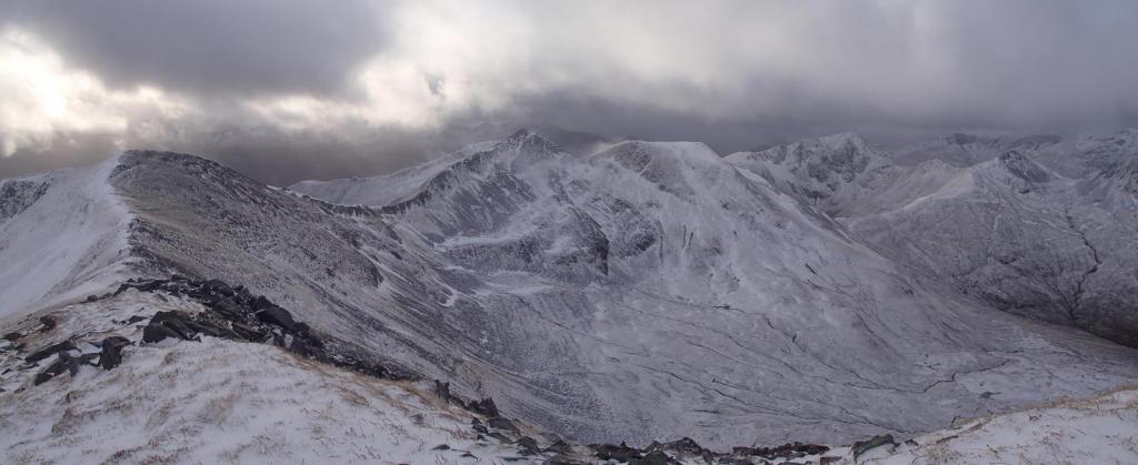
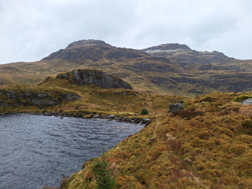
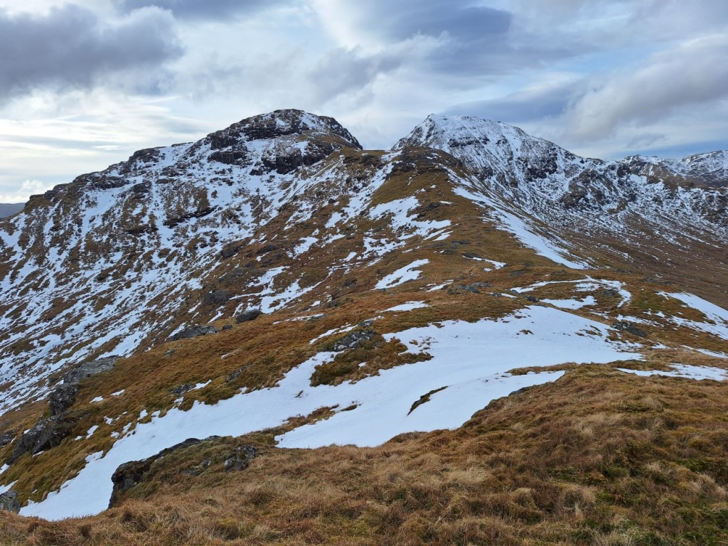
Back at the road, I crossed straight over and followed the zigzagging track up the opposite side, then ascended steeply beside the burn almost to the summit of Stob an Eas, the Graham summit. There were a few rocky steps to make the climb more interesting, and the weather was brightening nicely to give views towards both Loch Goil and Loch Fyne.

Loch Fyne from near the summit of Stob an Eas

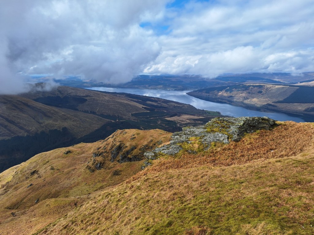
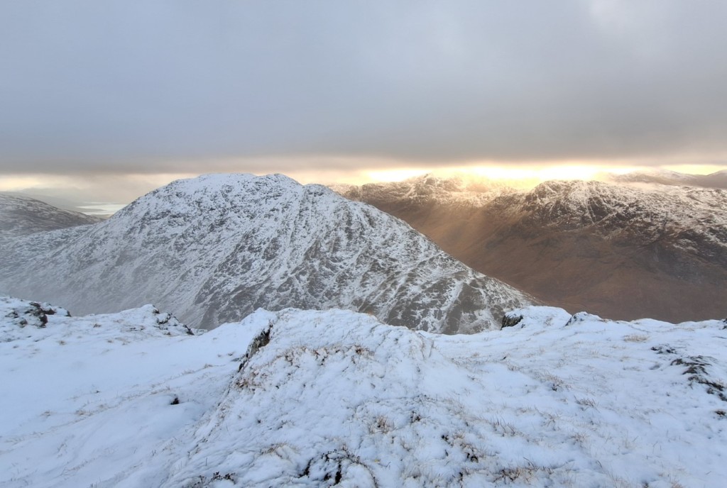
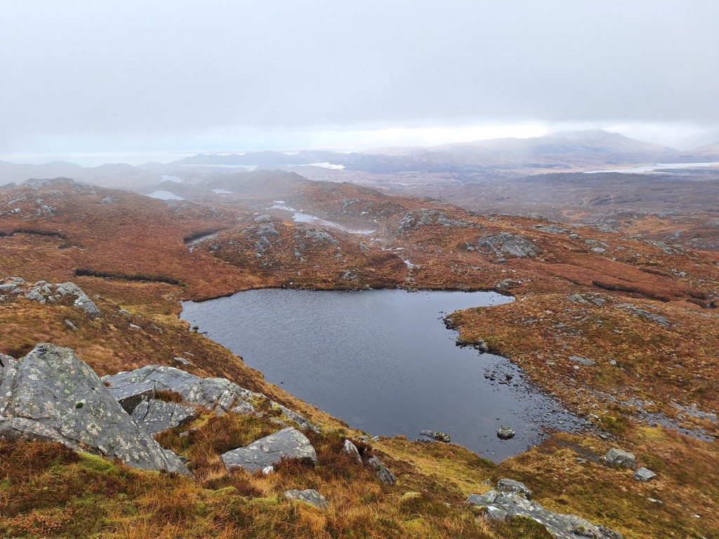
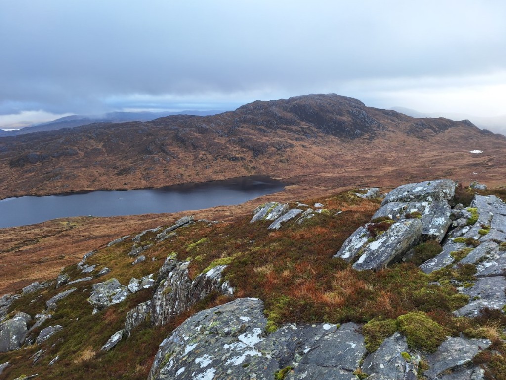
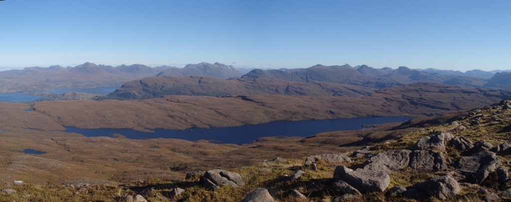
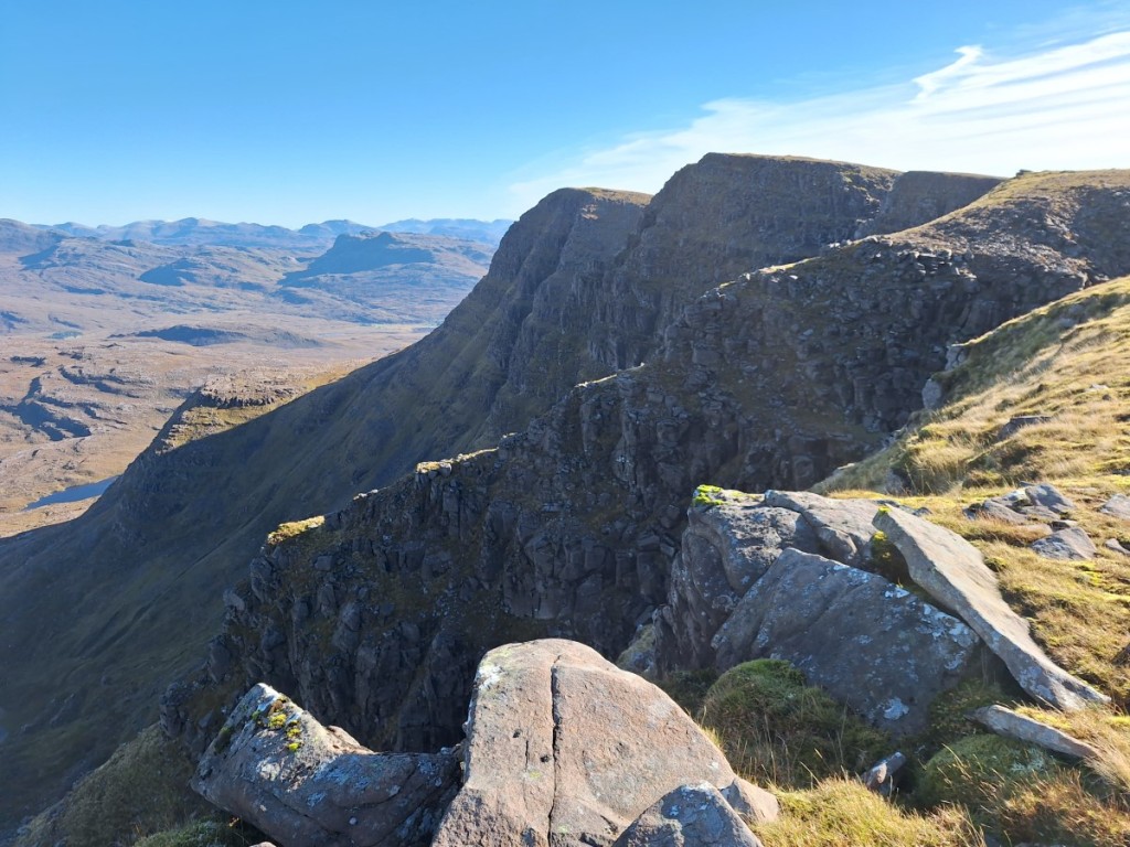
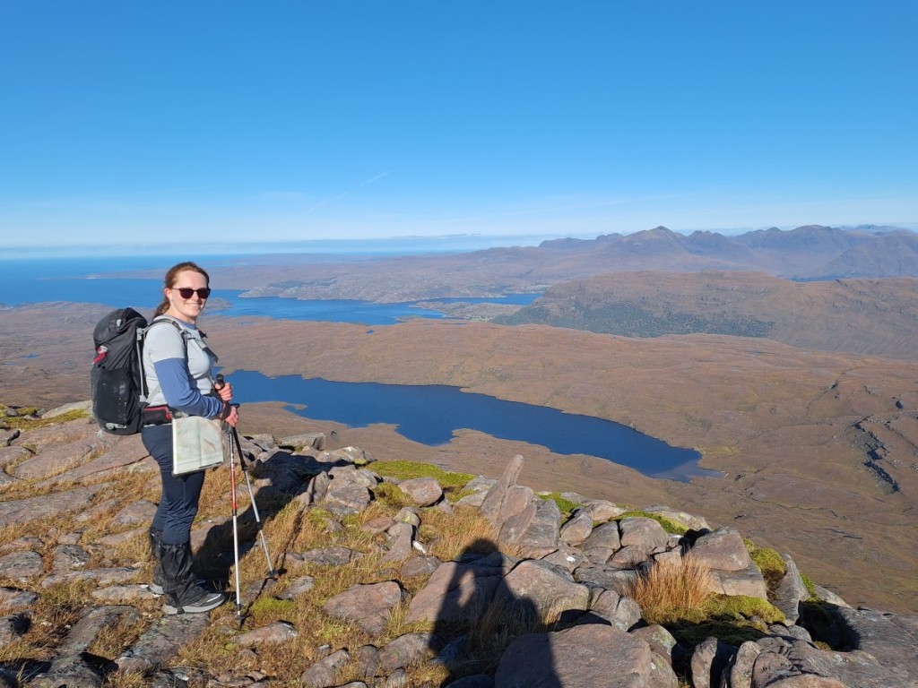
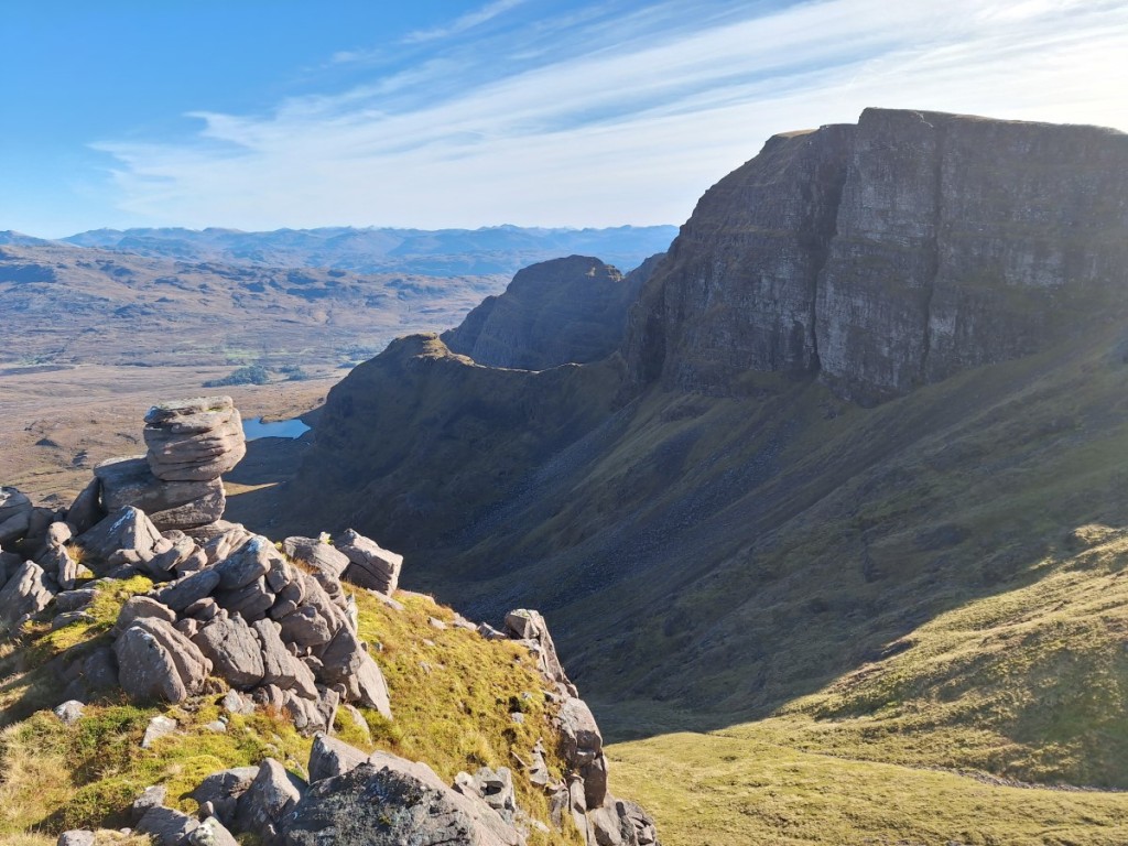
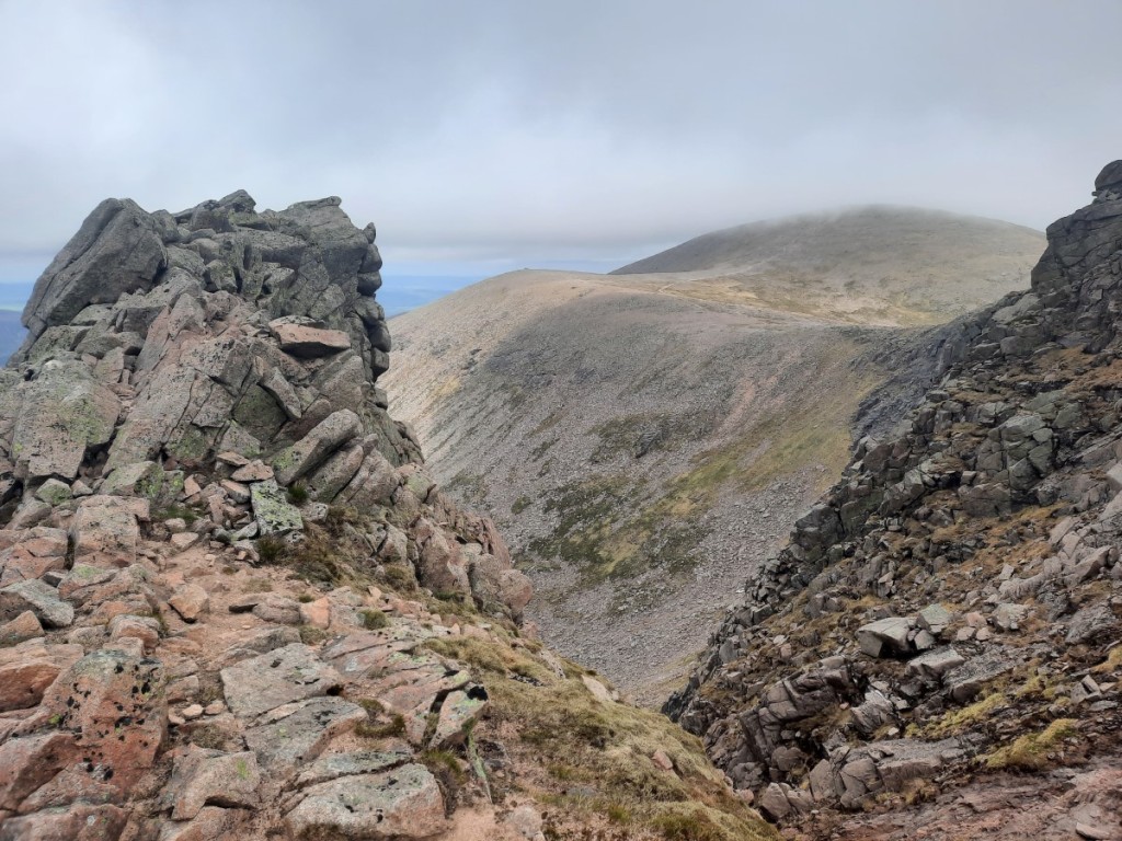
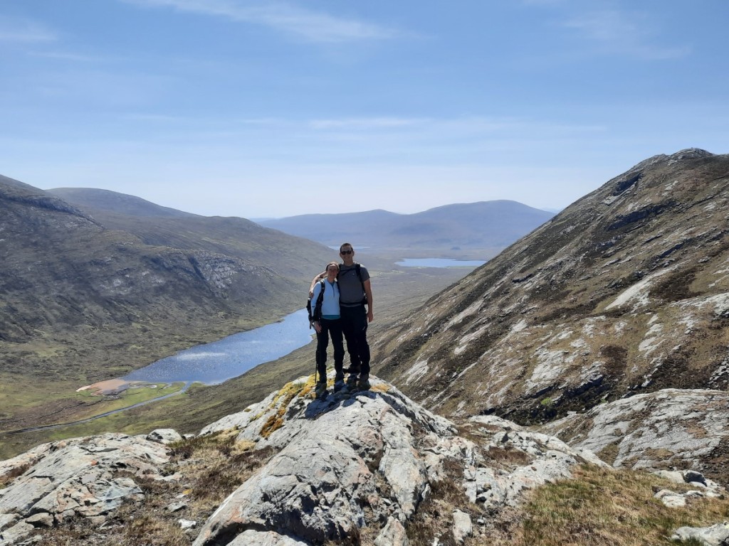
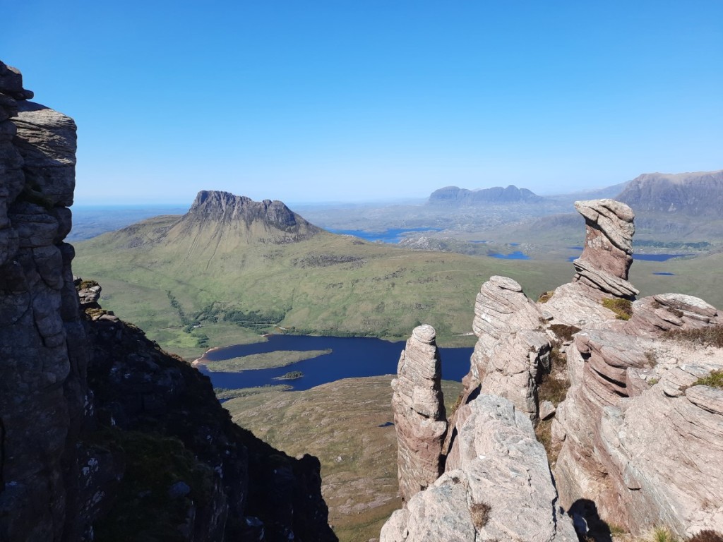
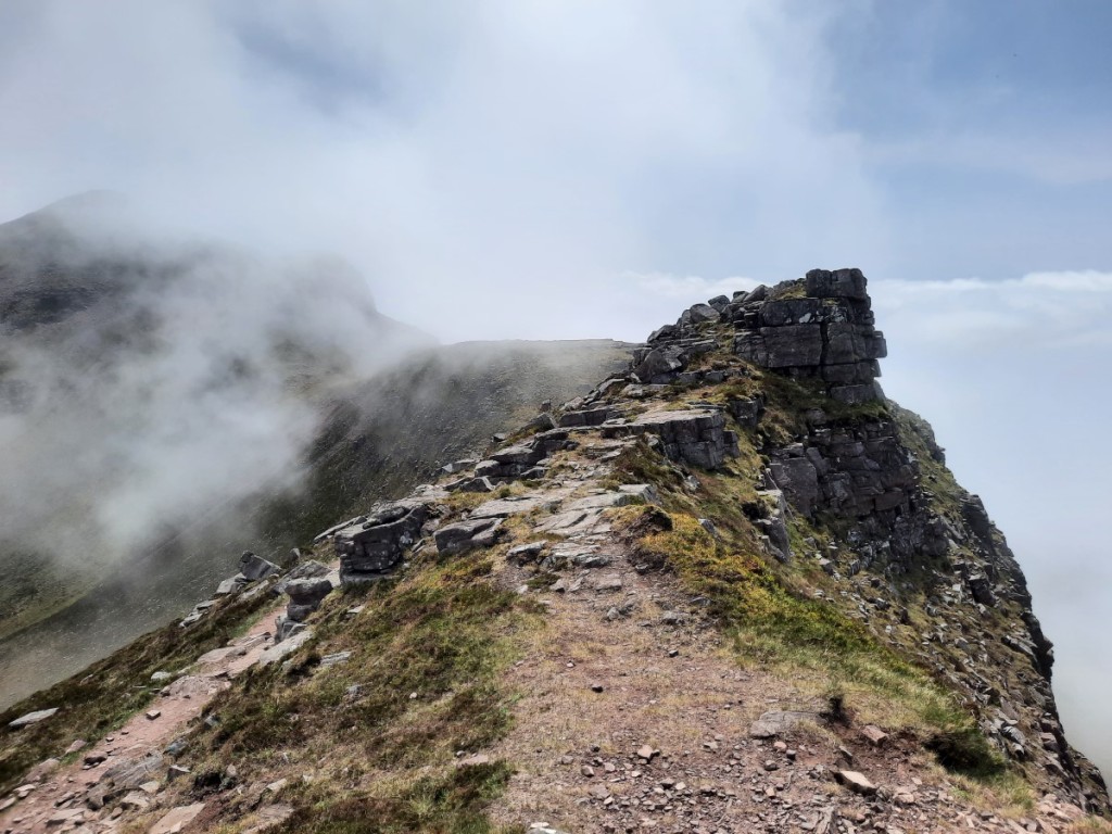
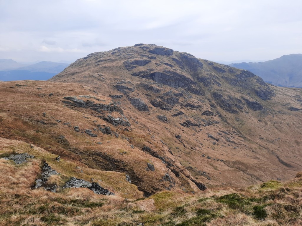
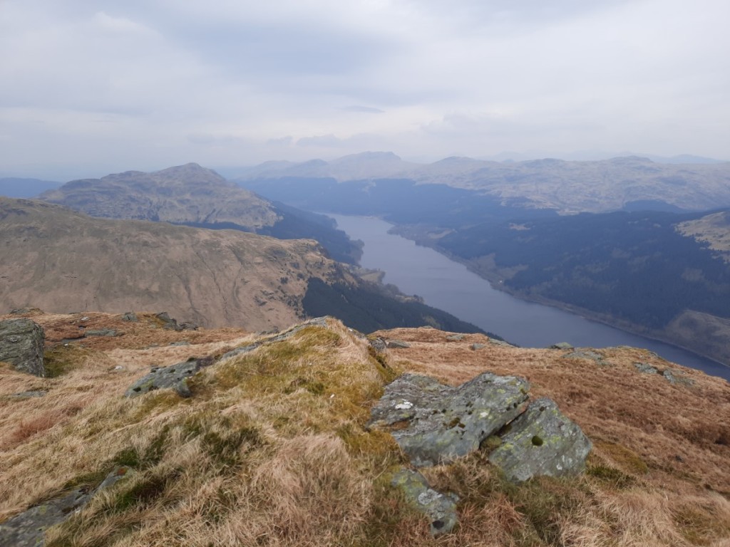
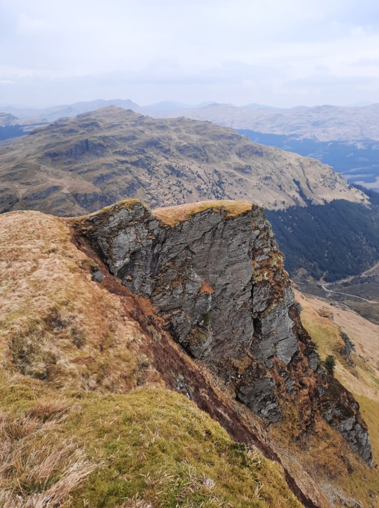
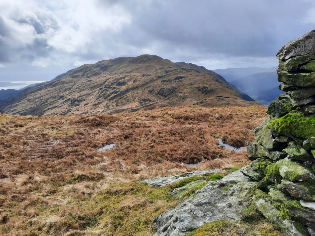
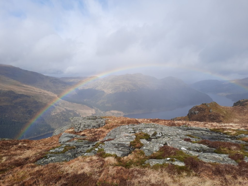
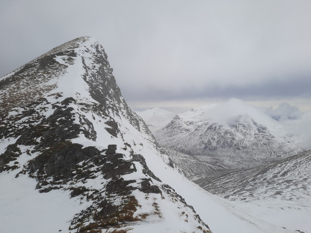
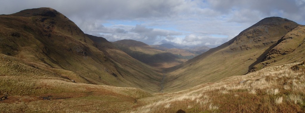
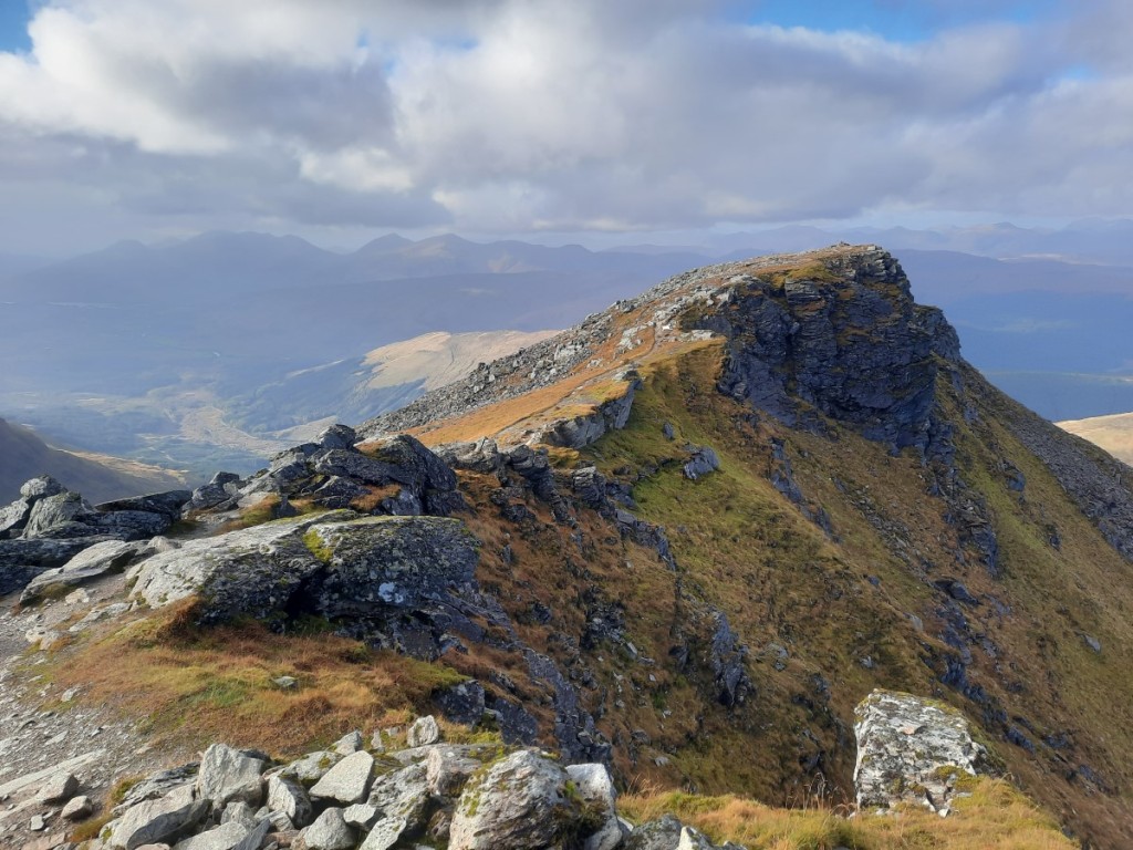
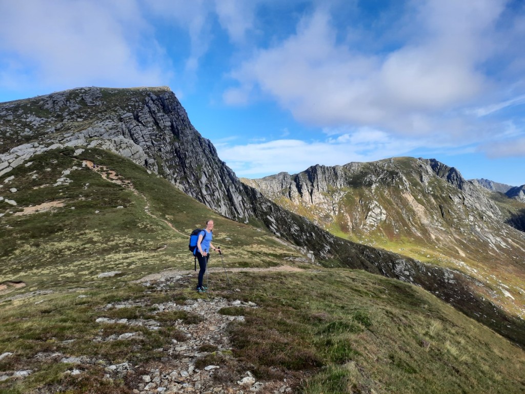
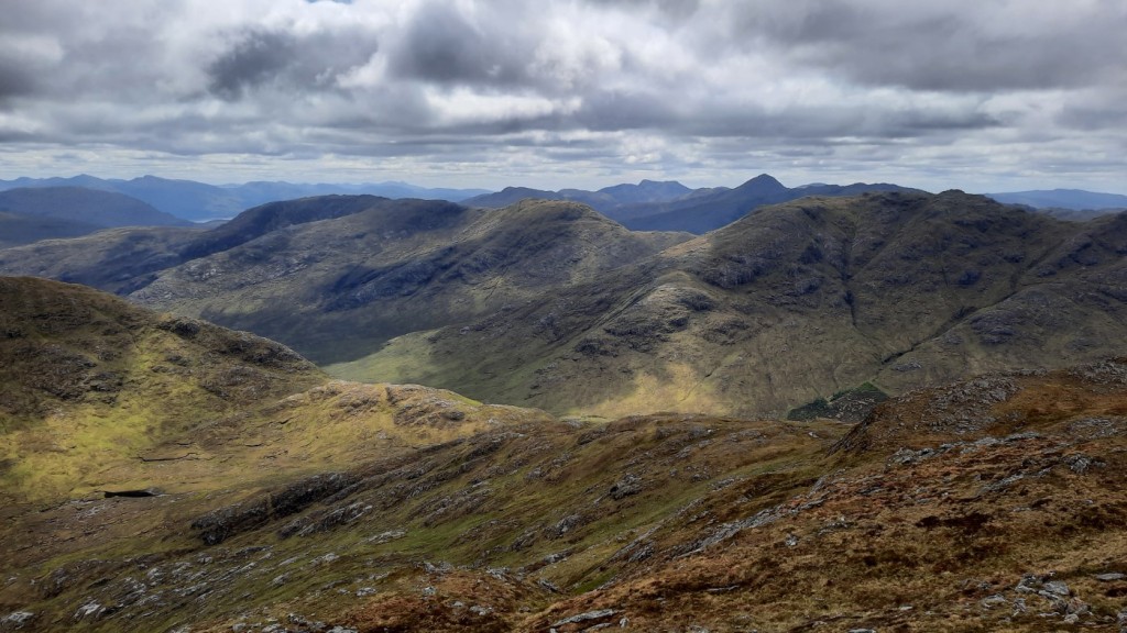
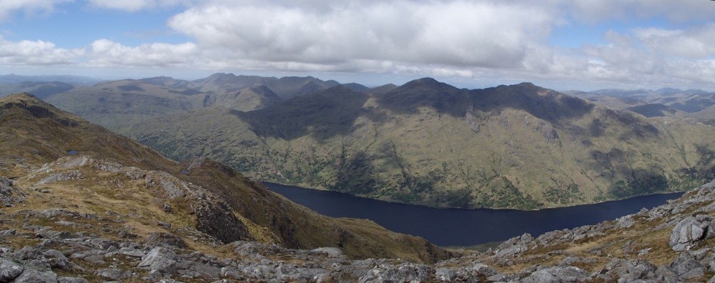
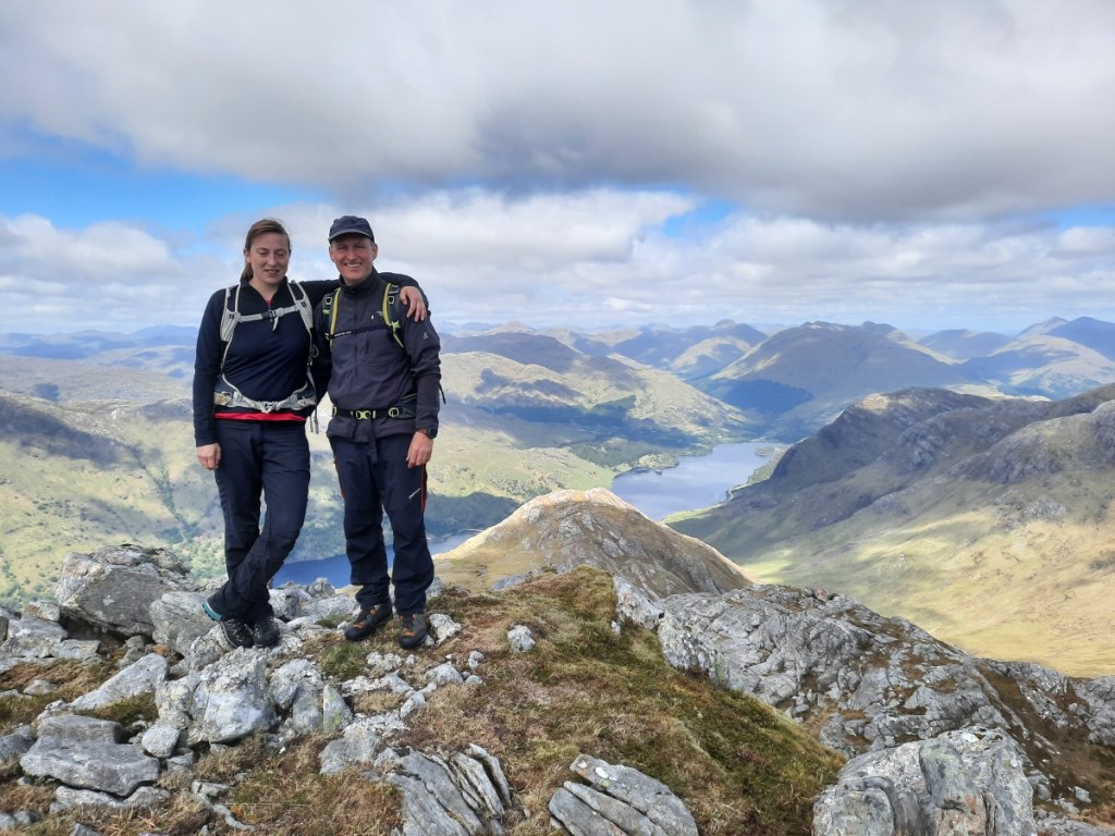
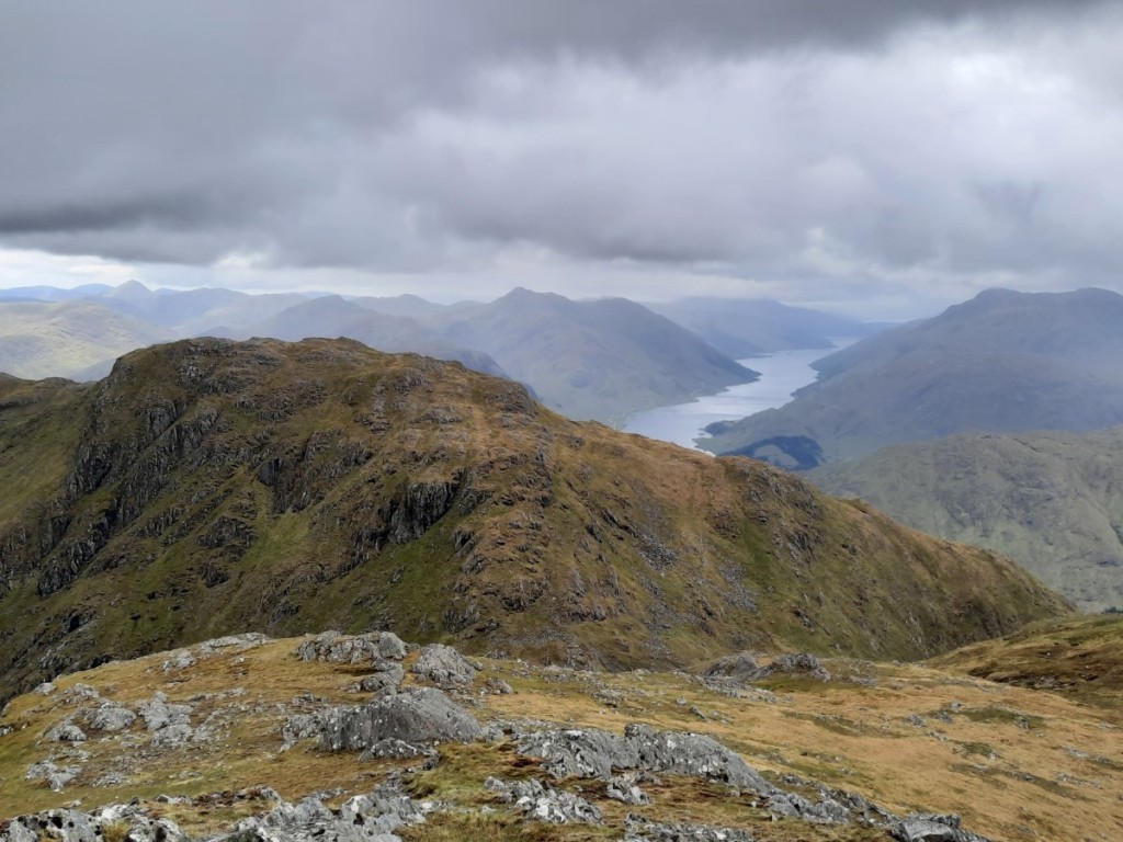
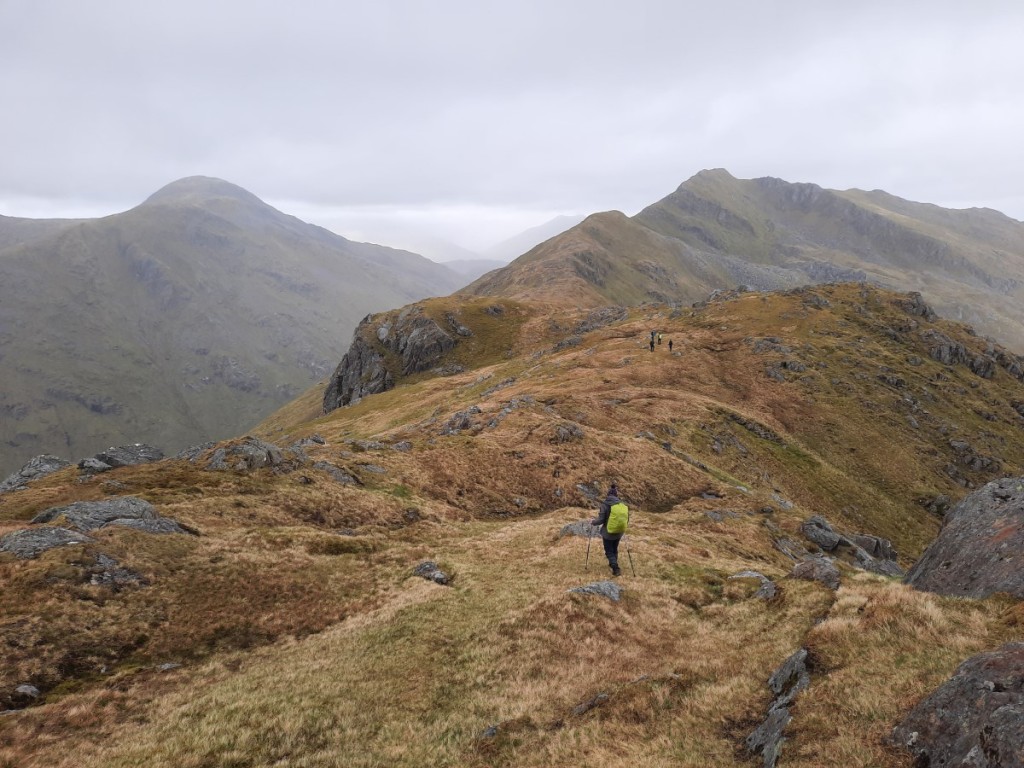
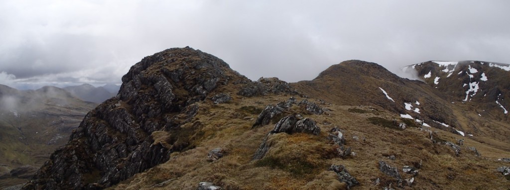
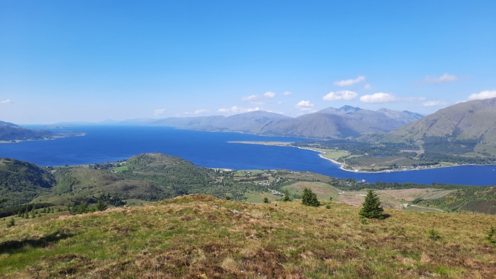
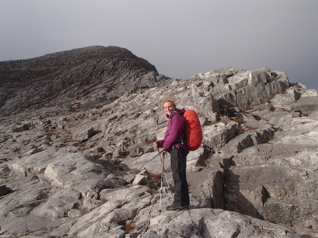
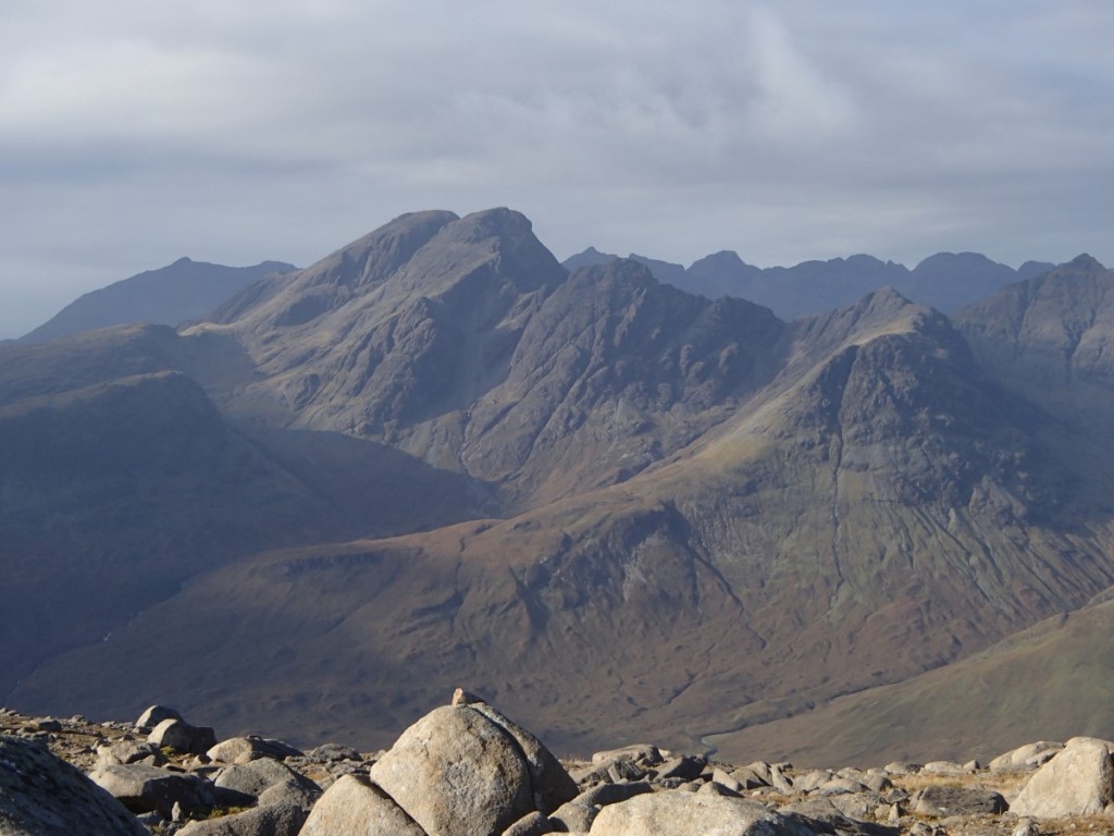
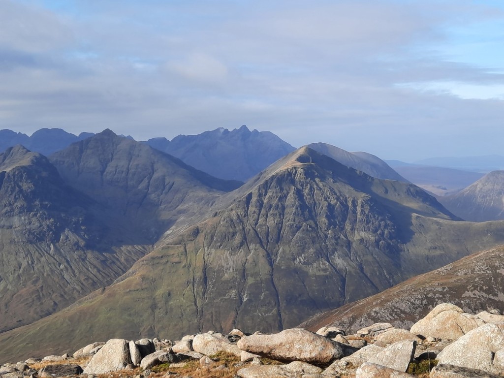
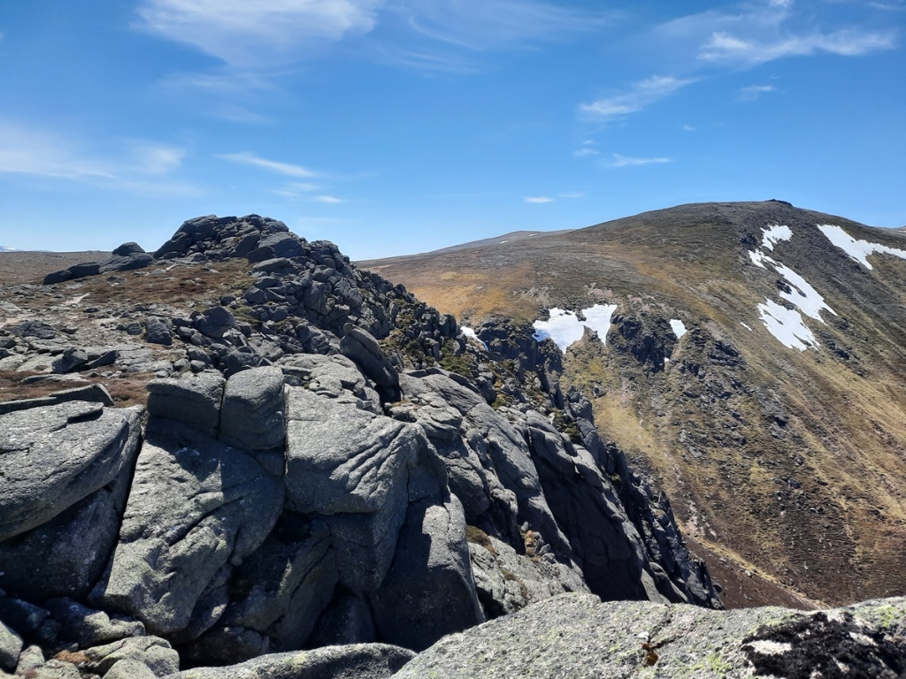
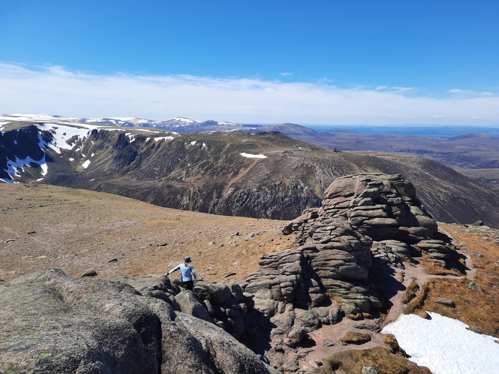
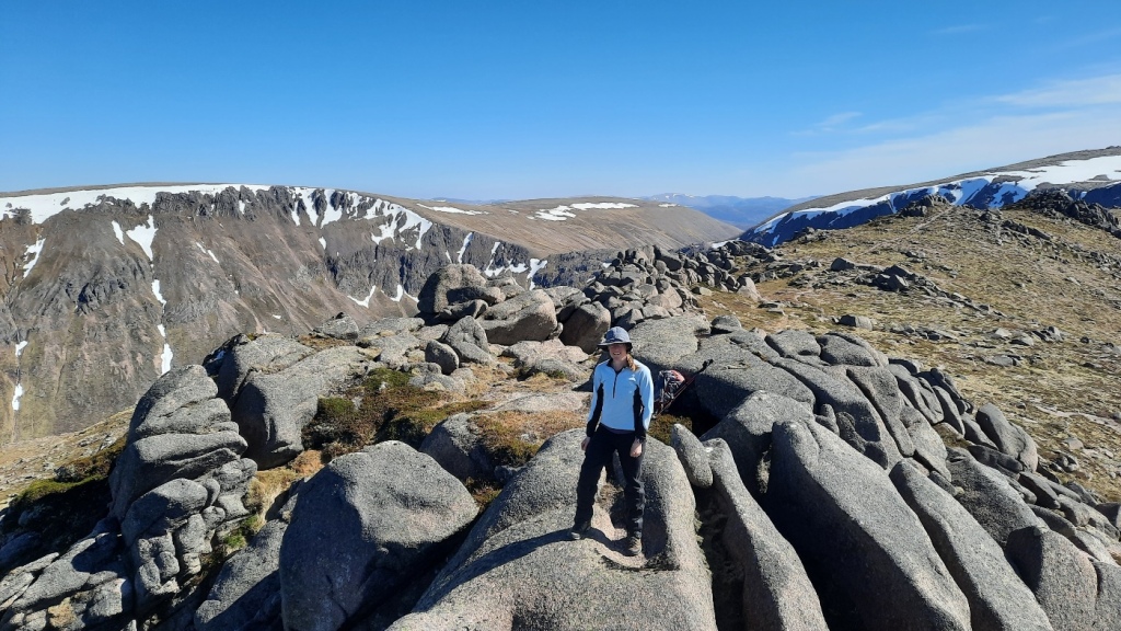
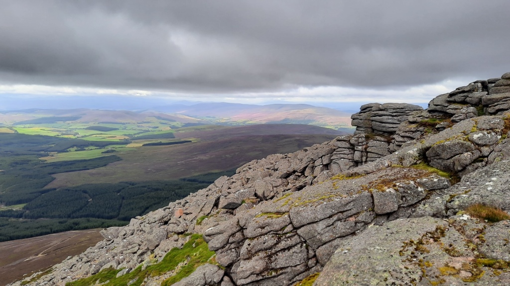
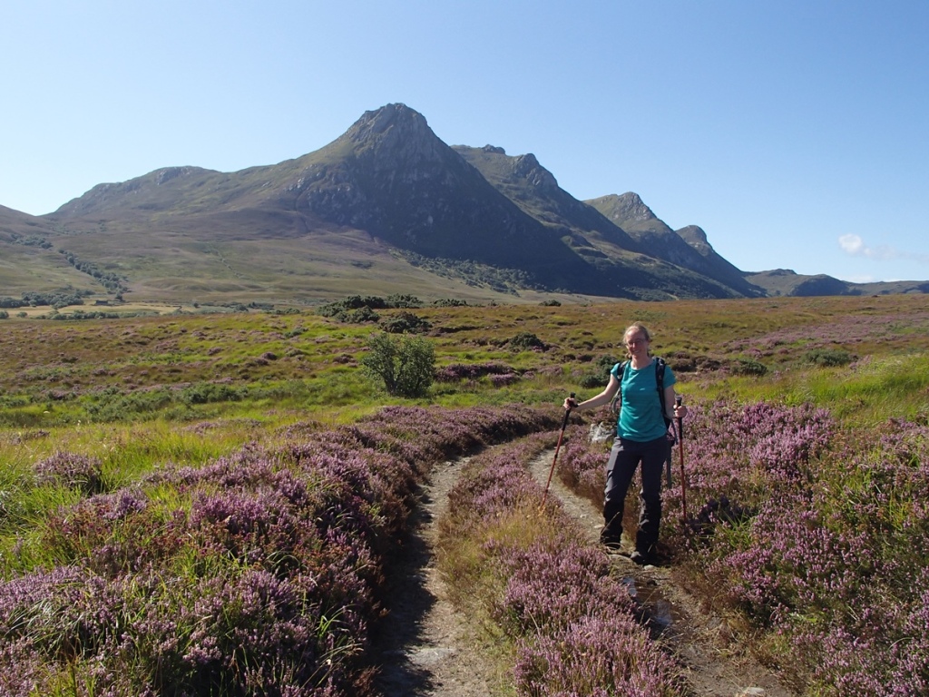
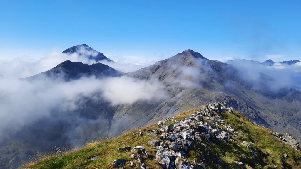
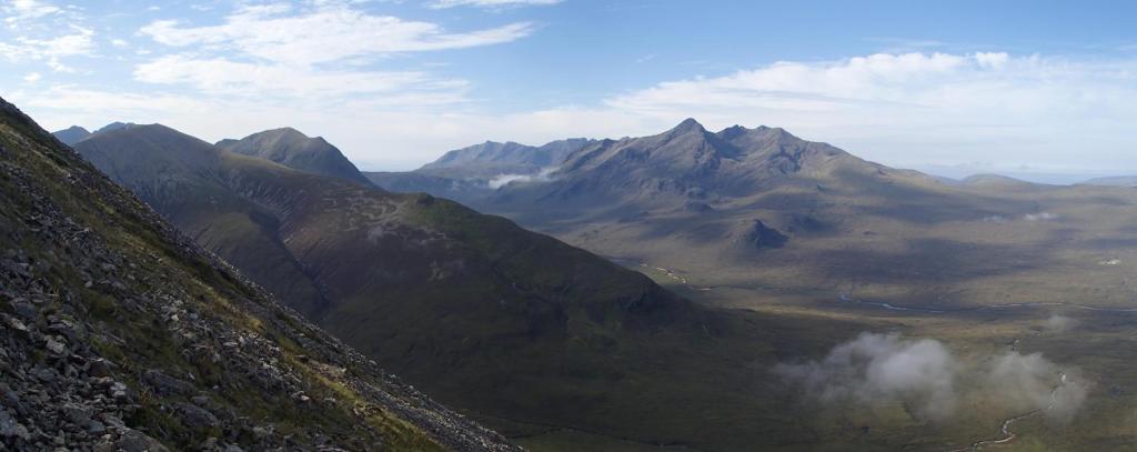
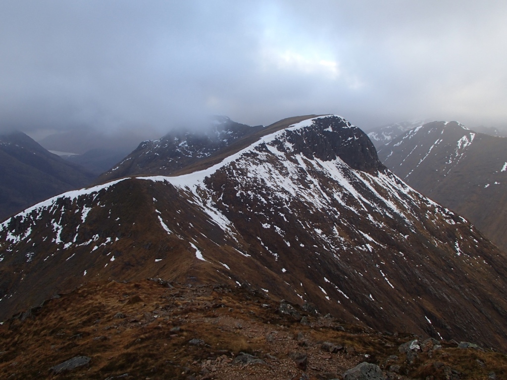
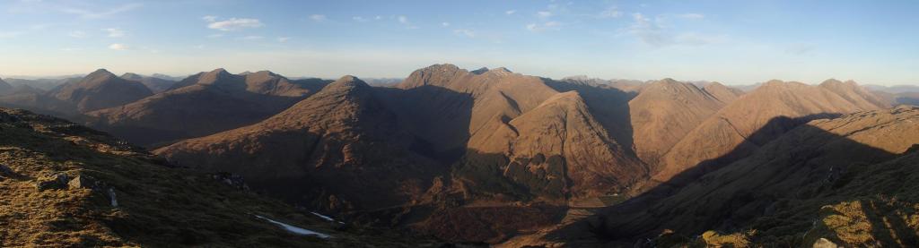
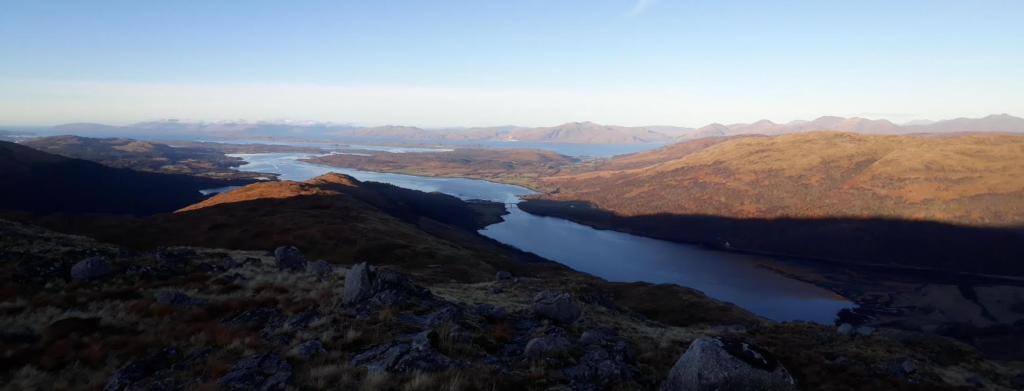
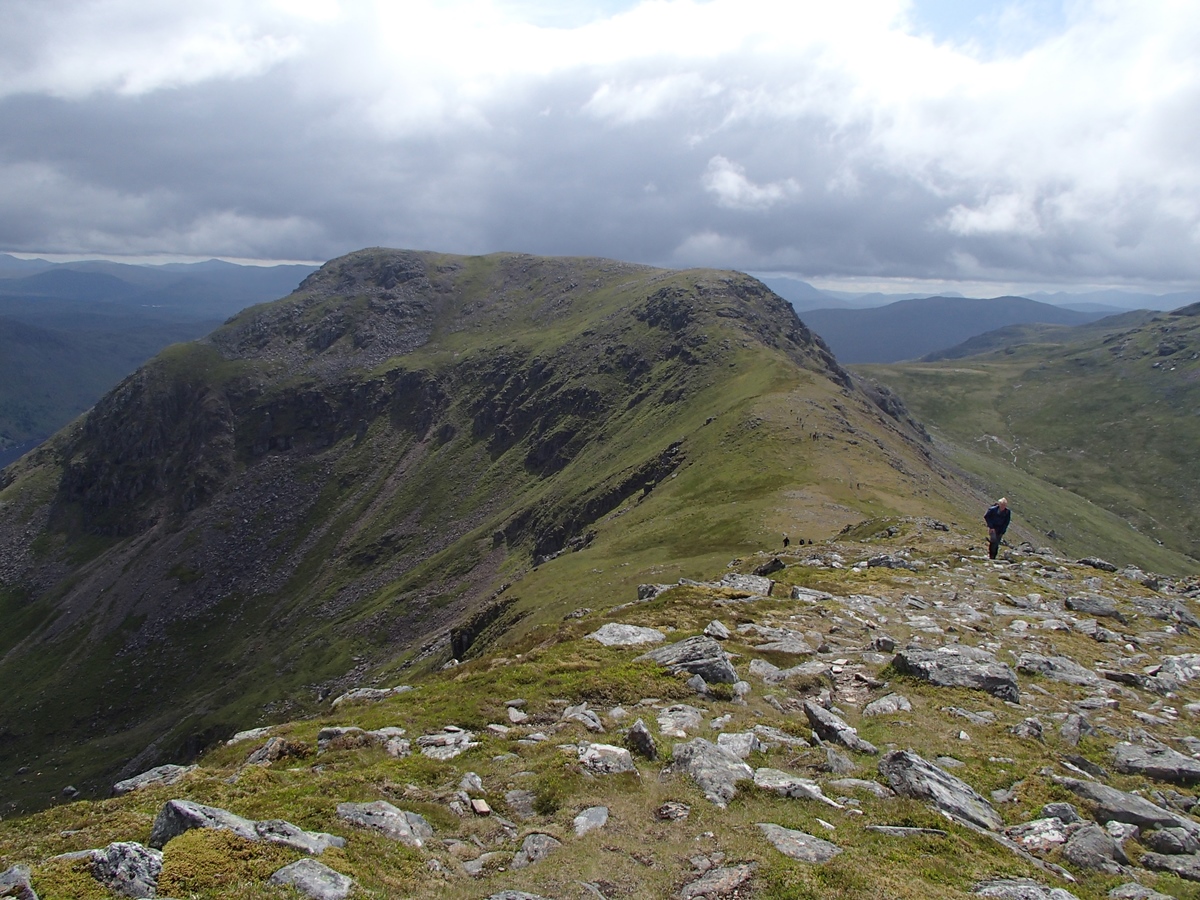
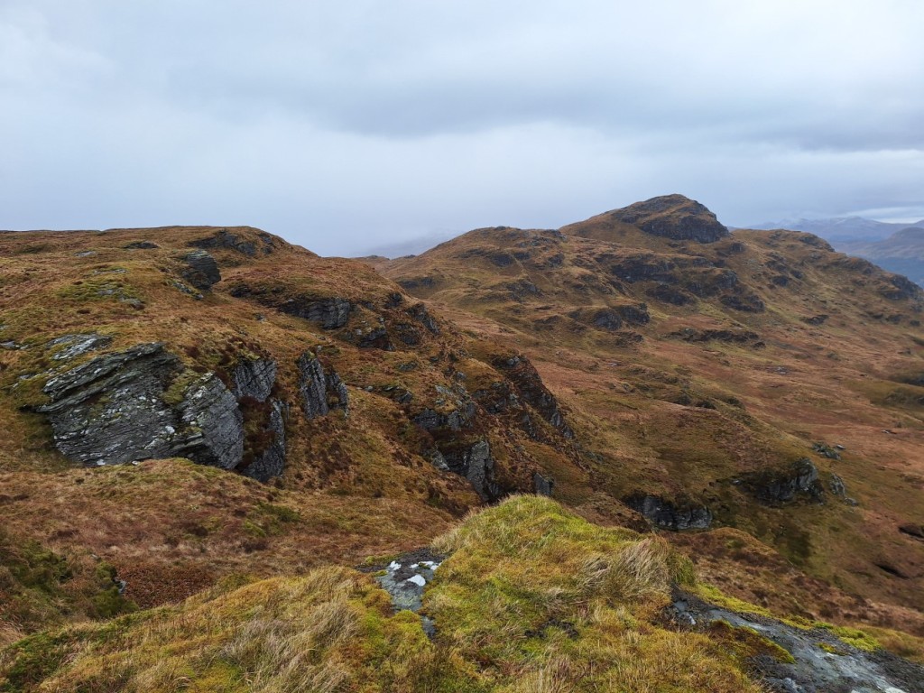
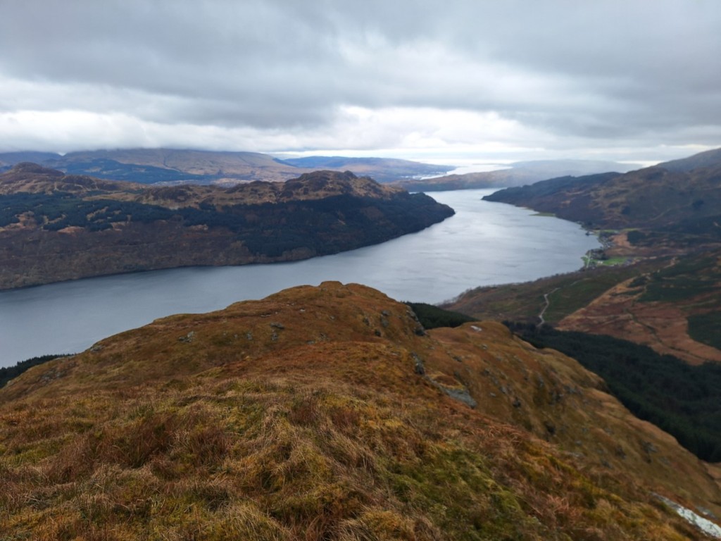
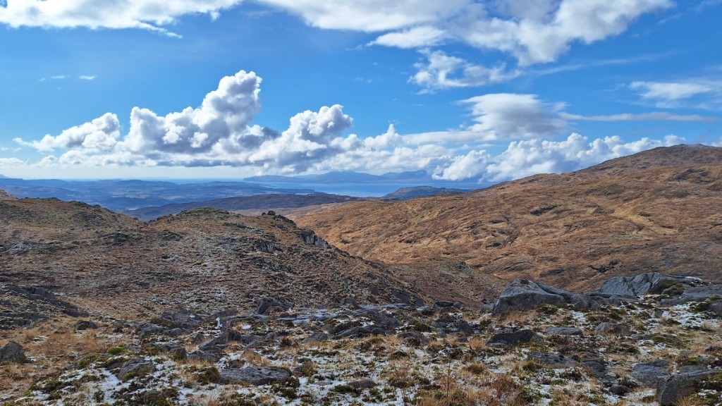
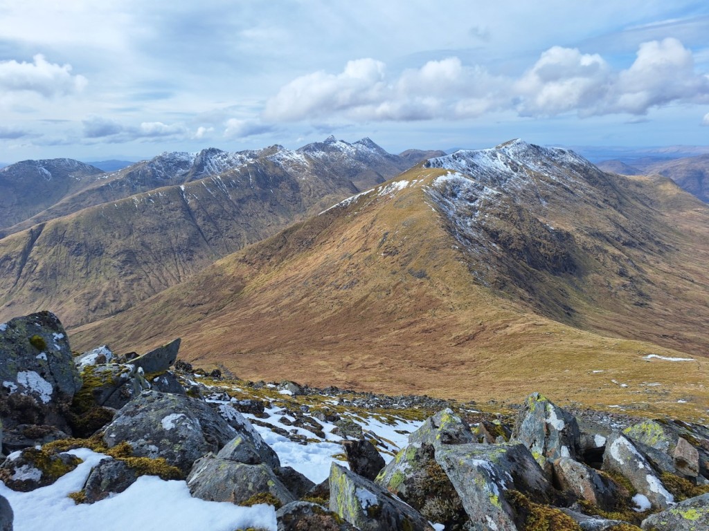
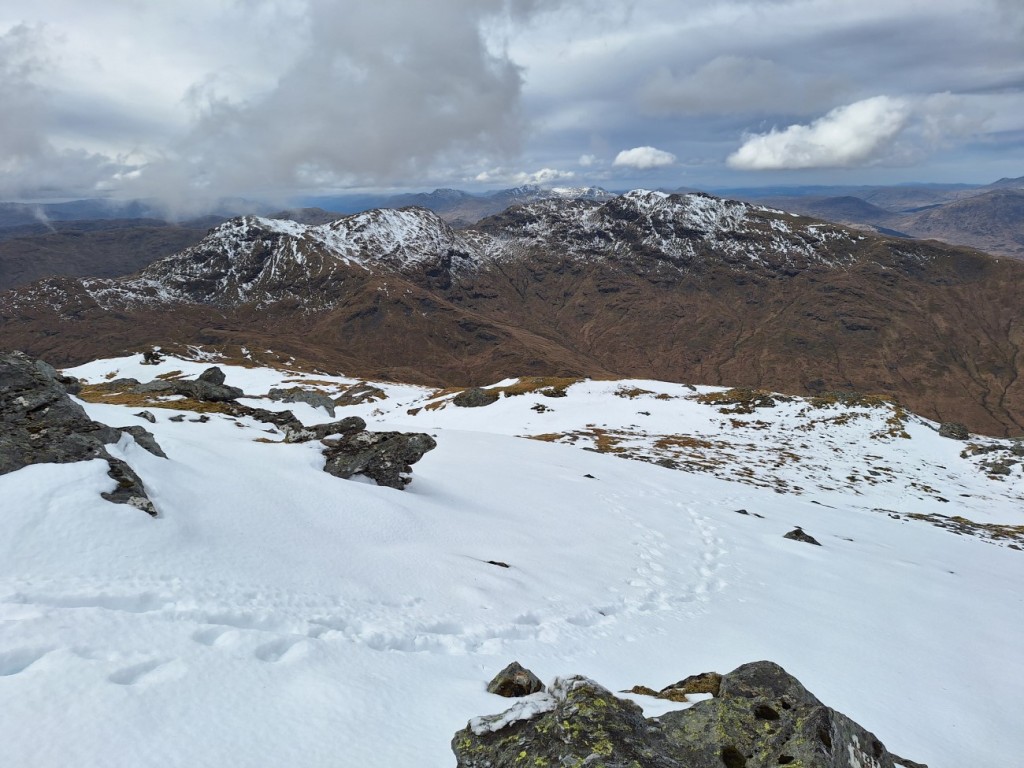
It was pretty cold and windy at the summit, so I soon continued northeast along the ridge to the subsidiary top of Beinn an t-Seilich. This was a better viewpoint both up Glen Kinglas and towards the Arrochar Alps, Beinn an Lochain dominating the view to the east. I found a sheltered spot for a late lunch in the sunshine, then meandered south along the craggy crest, taking lots of photo stops as The Cobbler and Beinn Narnain came into view, and the views to Loch Goil gradually opened up to the south.

Looking back to Stob an Eas
Beinn an Lochain
Beinn an Lochain and Ben Donich

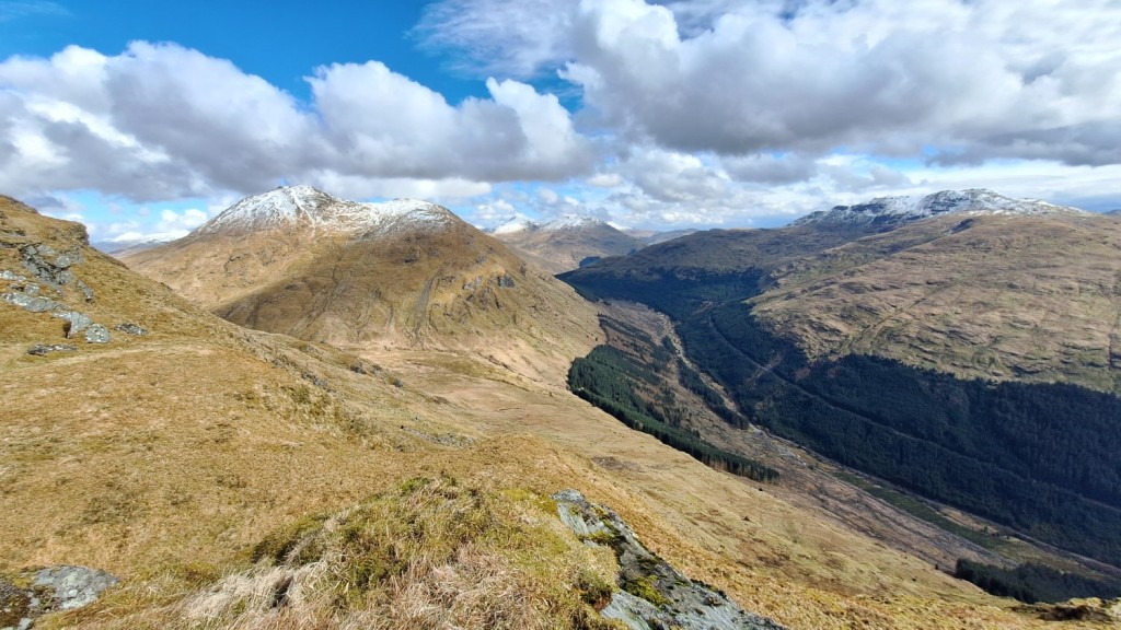
From there, it was an easy descent west down smooth grassy slopes to pick up my ascent track again at the edge of the forest below Stob an Eas.
Route map: https://www.plotaroute.com/route/2566337

It was about an hour’s drive to Oban, where I would stay for the next two nights. Arriving at 4pm, I had an hour to wait before check-in opened at the Backpackers Hostel, but was happy just to sit in the lounge and drink tea. Once I’d checked into the dormitory – which I was fortunate to have to myself that night – I strolled along to Tesco to pick up a couple of extra bits and pieces, then had another lazy evening.

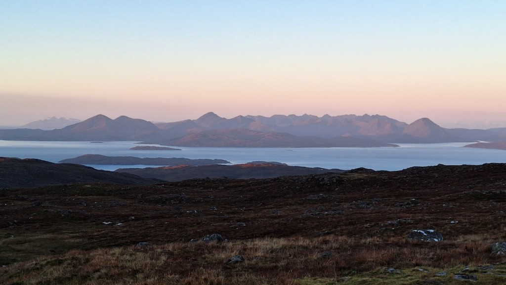
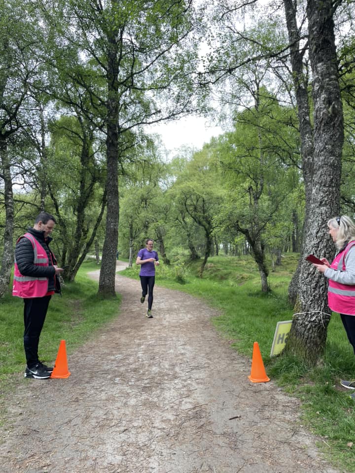
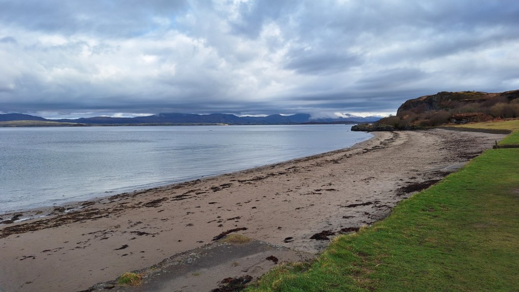
Ganavan Sands parkrun had been on my to-do list for some time, so I was pleased to have created the opportunity to visit it on this trip. I arrived promptly and went for a warm-up jog along the first part of the course, amused by the sign warning of a steep ascent from the off. By 9:30am, 93 runners – their third highest turnout ever – had amassed. Two were very quick, well ahead of me within a few hundred metres and three minutes ahead by the end, but I managed to establish a bit of a gap between myself and fourth place. On a hilly course, I was happy to finish in just a touch over 20 minutes. The views of Mull and Morvern were excellent in the sunny spells.

Ganavan Sands

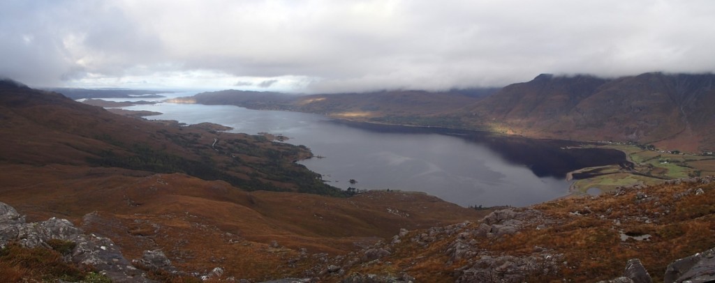
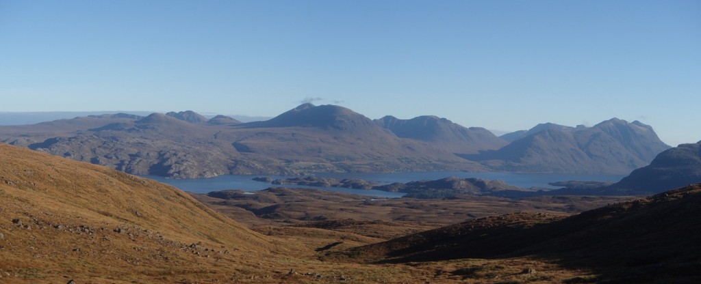
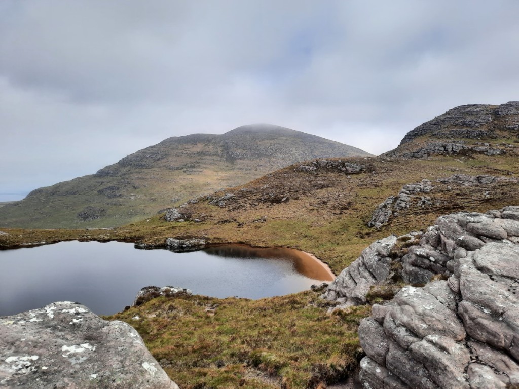
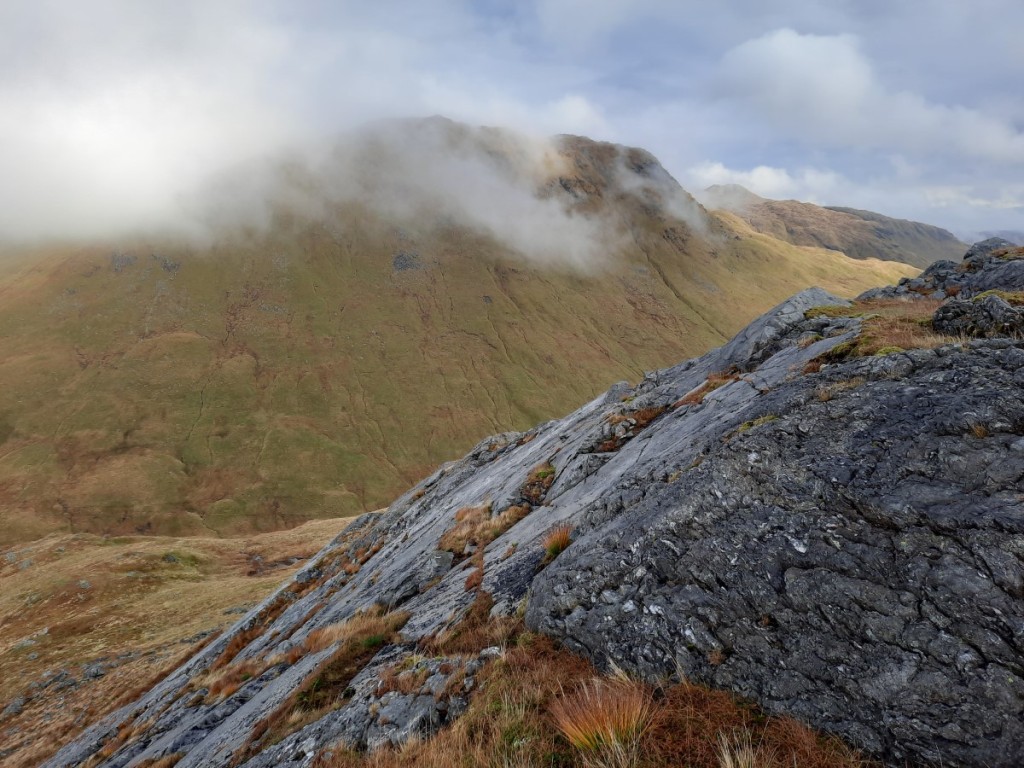
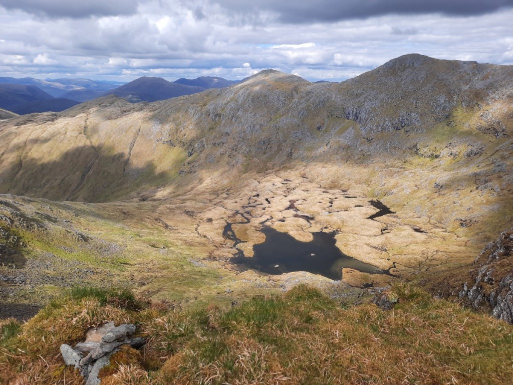
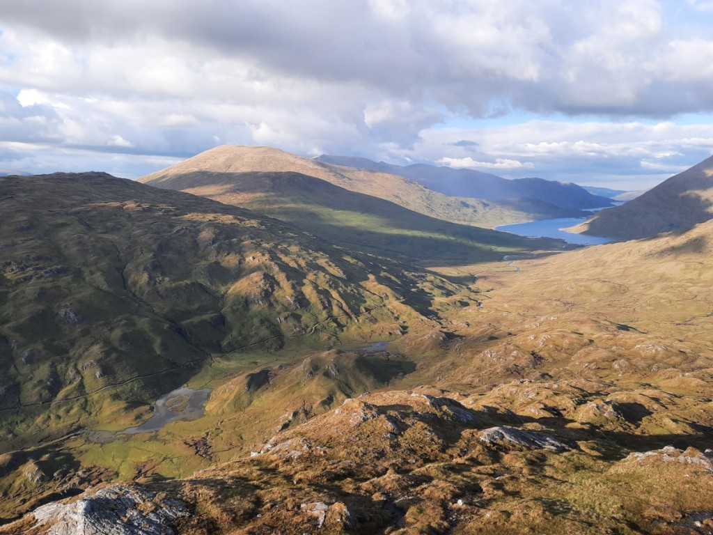
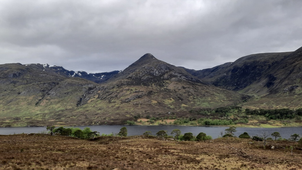
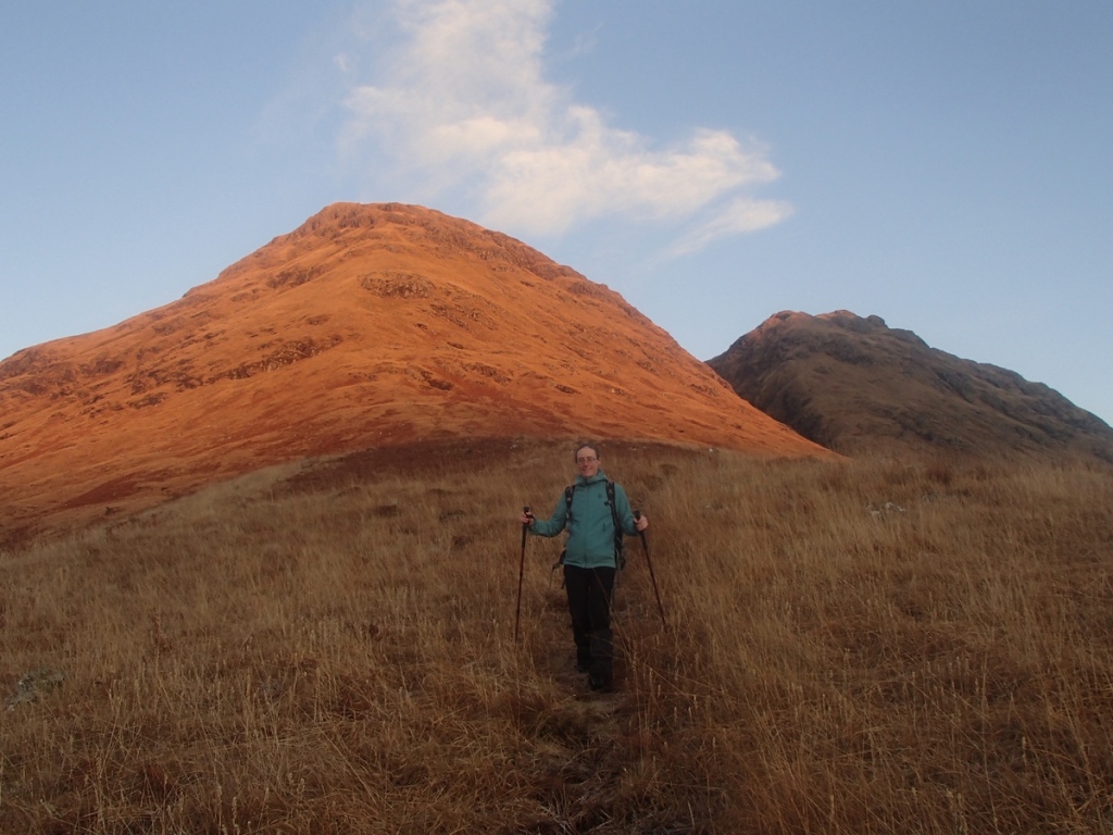
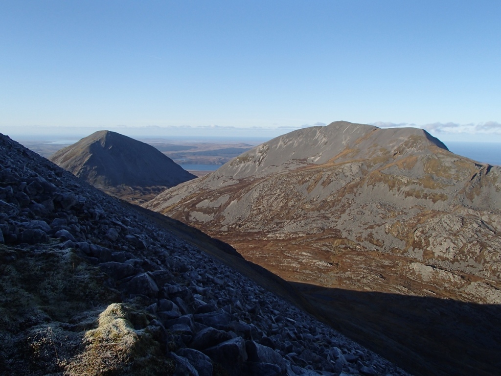
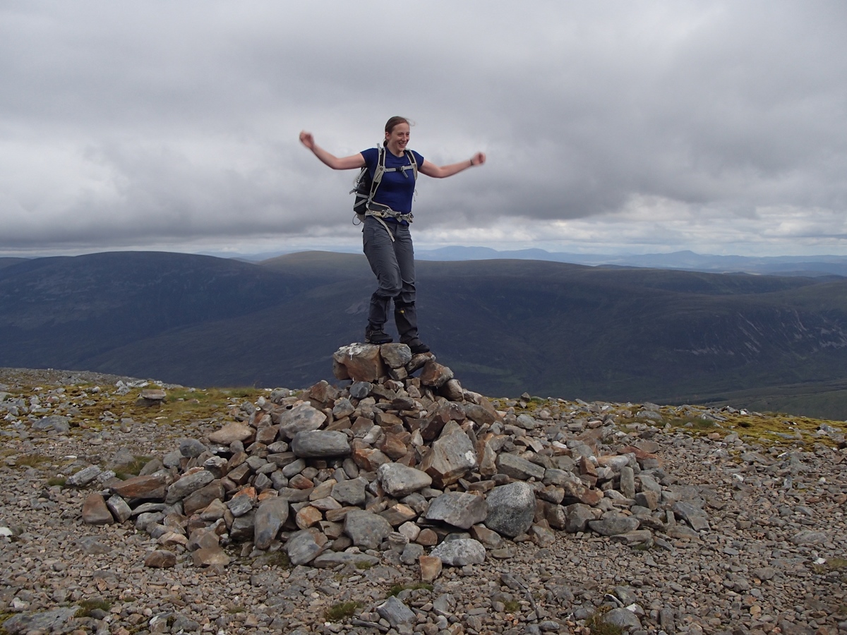
After parkrun, I took a short drive north to park in Gleann Salach, the other side of Loch Etive, where my objectives were a horseshoe of three Grahams around the River Esragan. First up was Beinn Bhreac, a broad and grassy hill with an ATV track leading about half way, then rough and rather boggy grass. It had been dry so far, but I could see some dark clouds approaching as I continued to the 726m Graham summit, Mam Hael.

Looking towards Beinn Mheadhonach from part-way up Beinn Bhreac

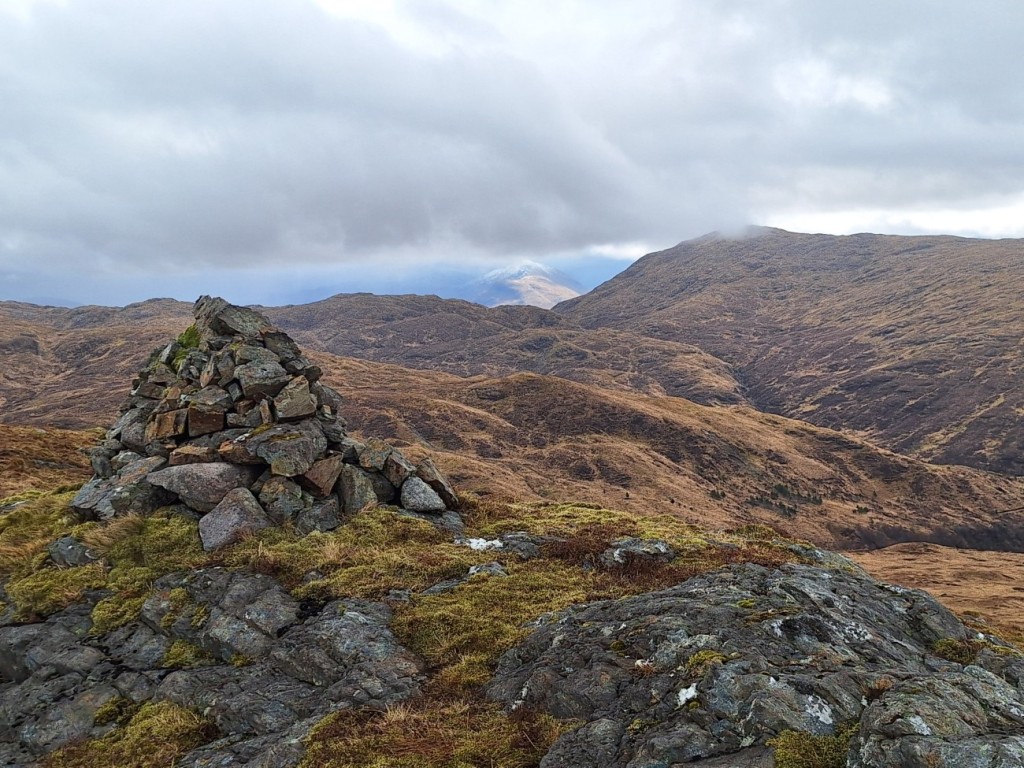
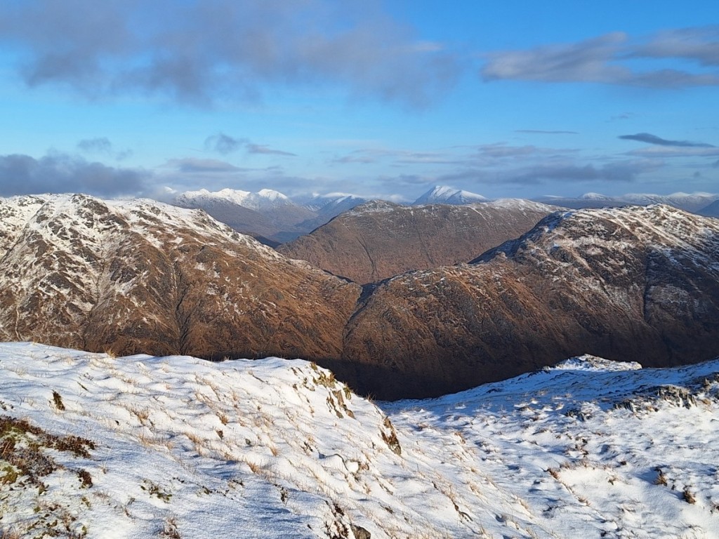
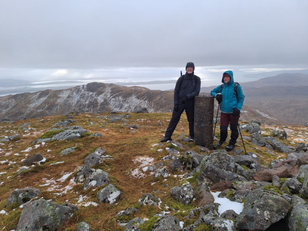
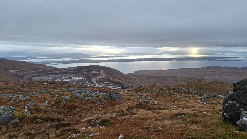
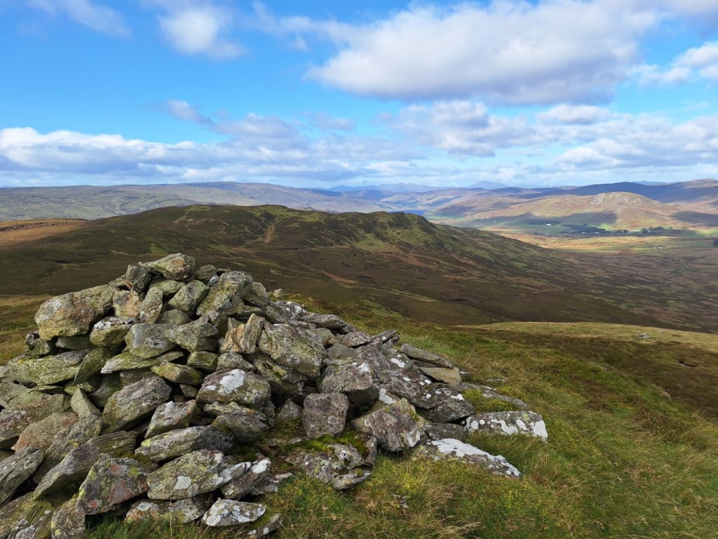
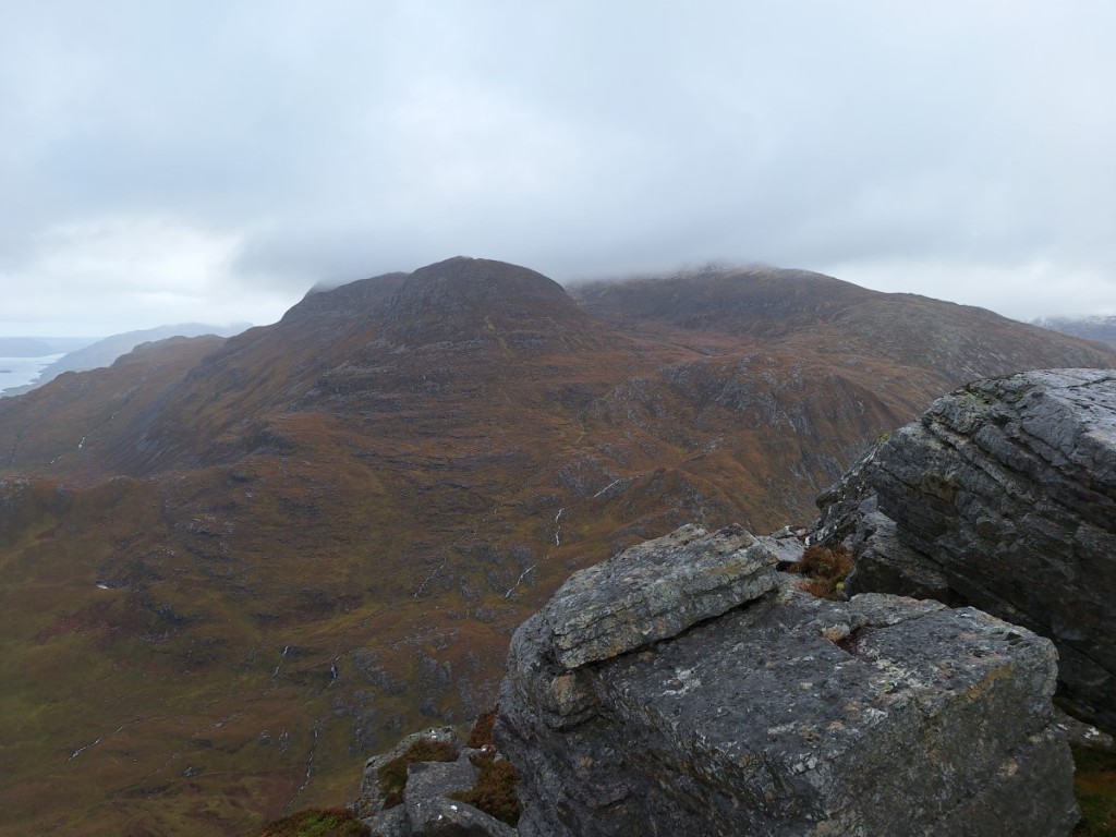
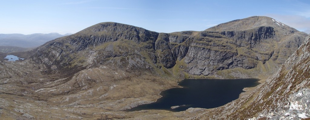
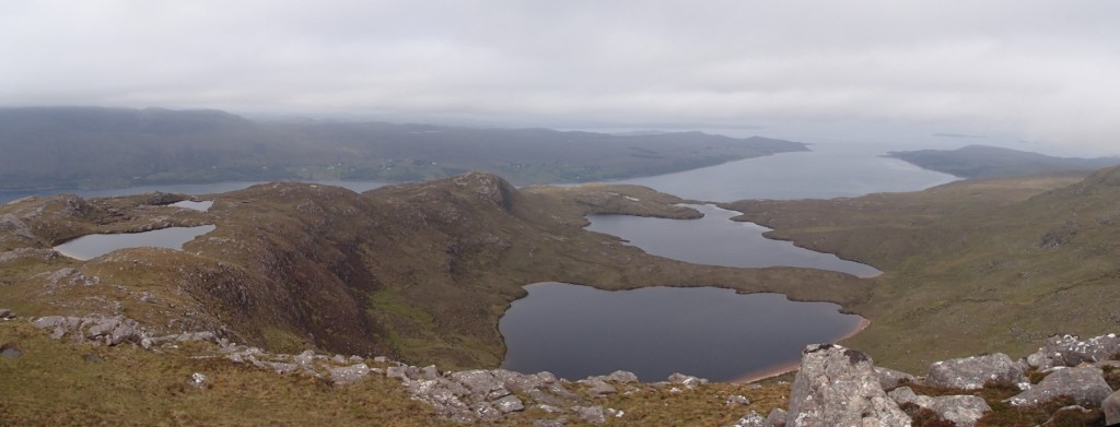
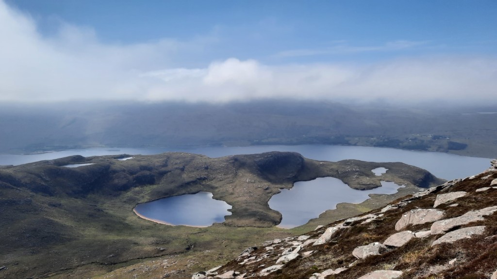
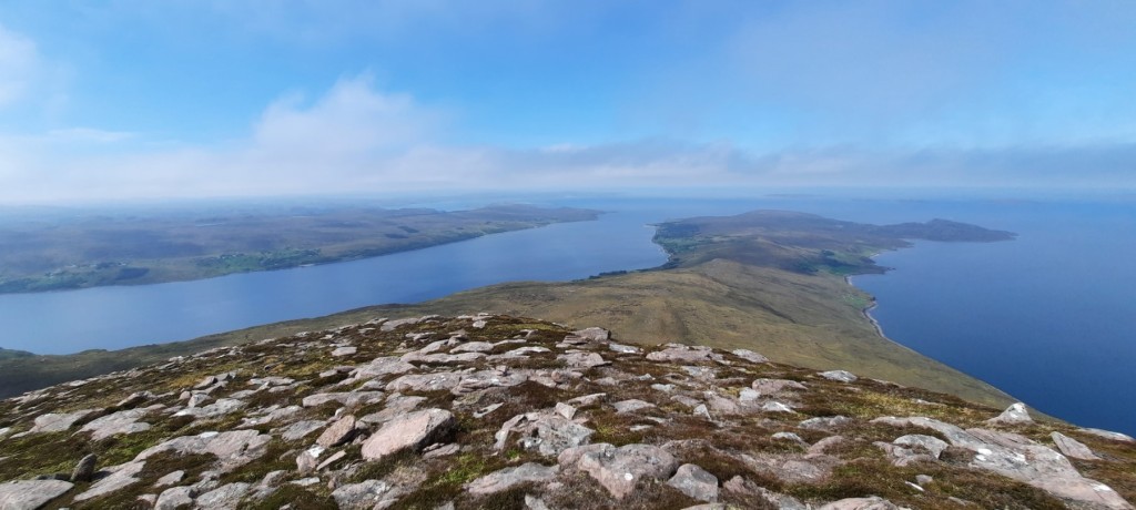
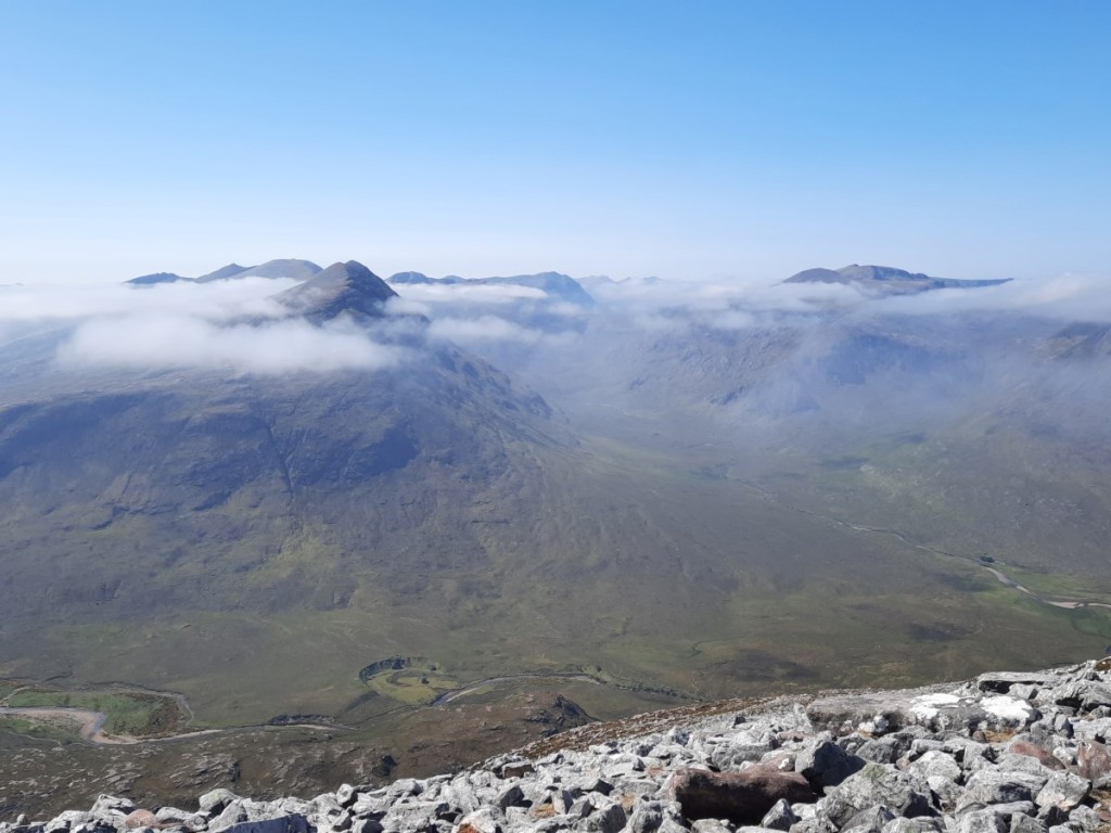
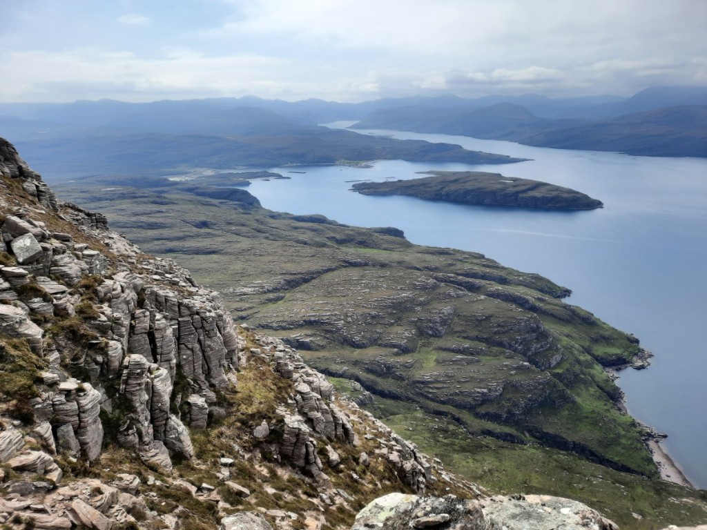
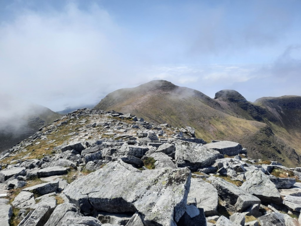
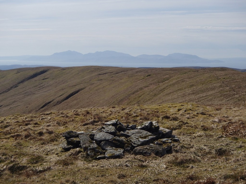
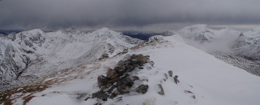
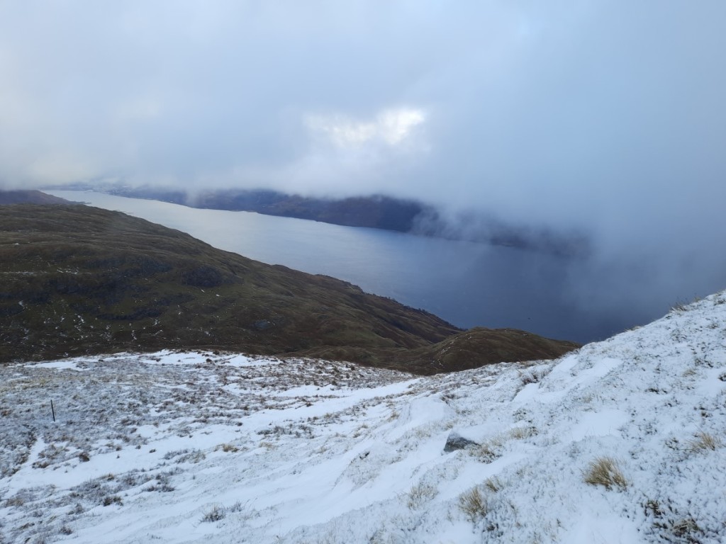
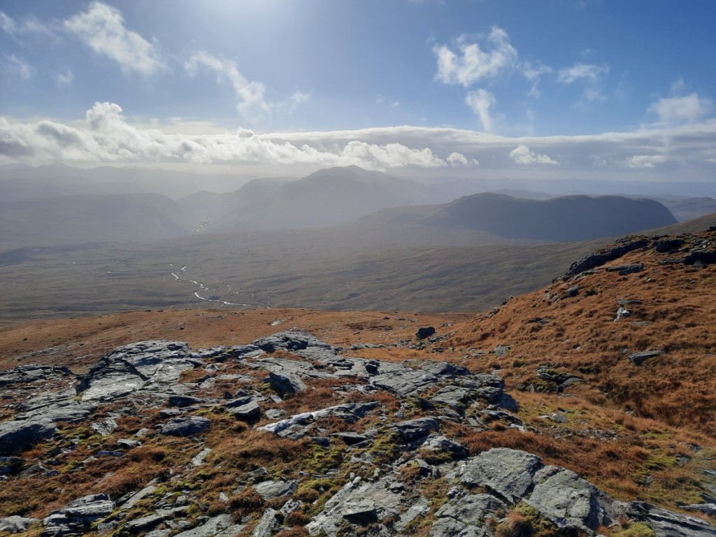
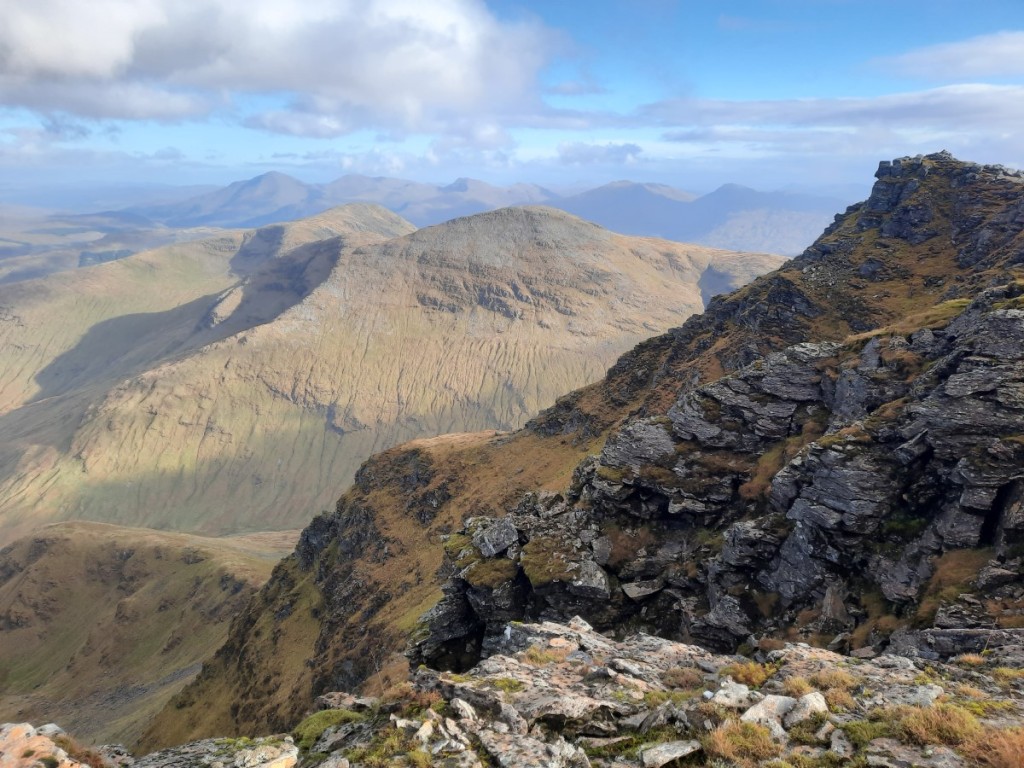
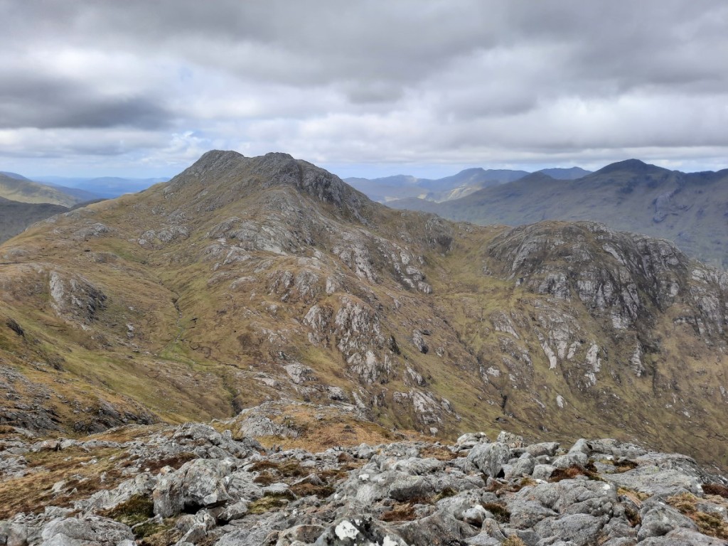
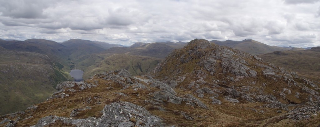
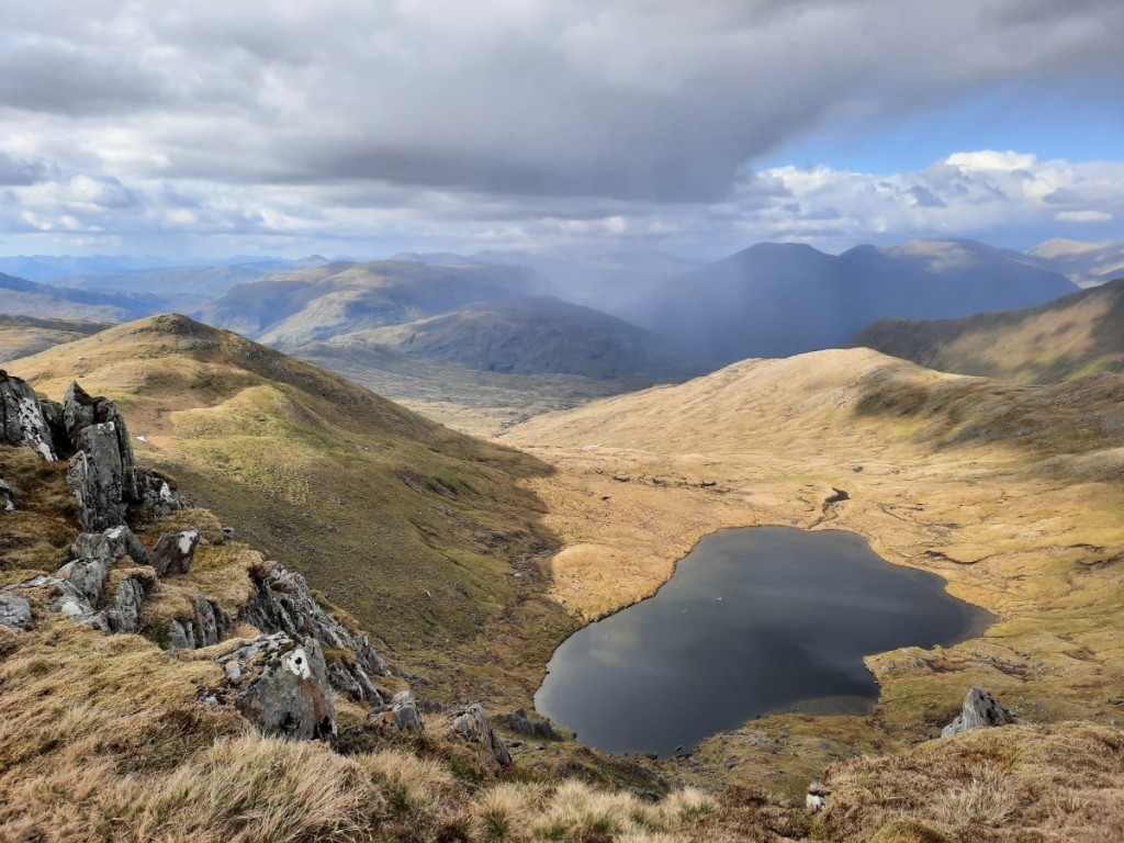
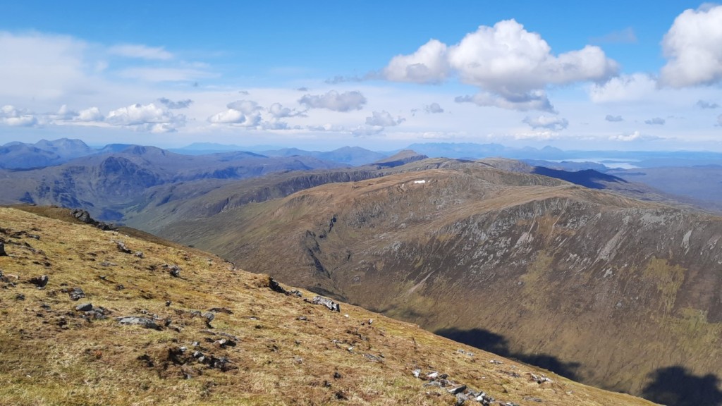
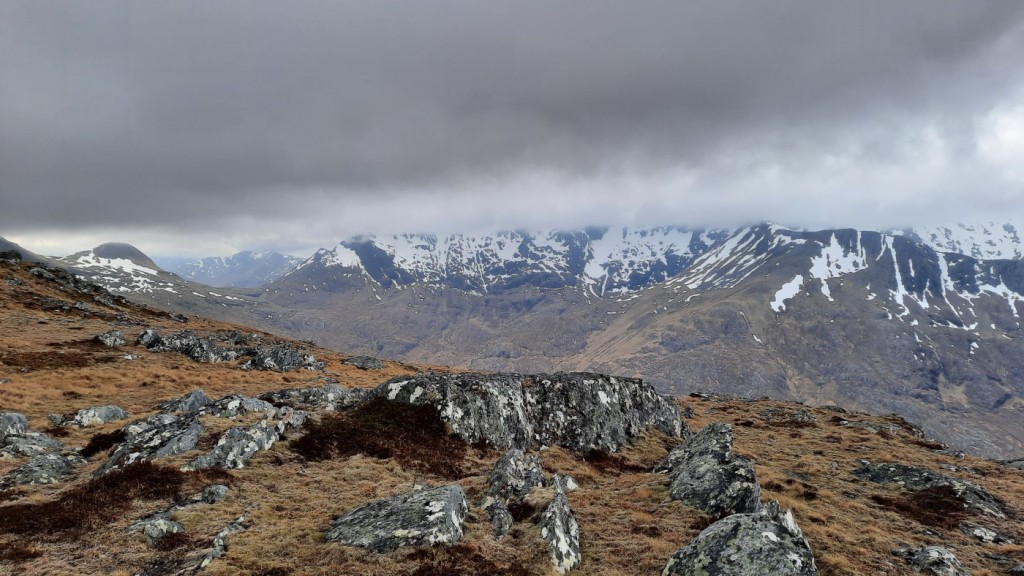
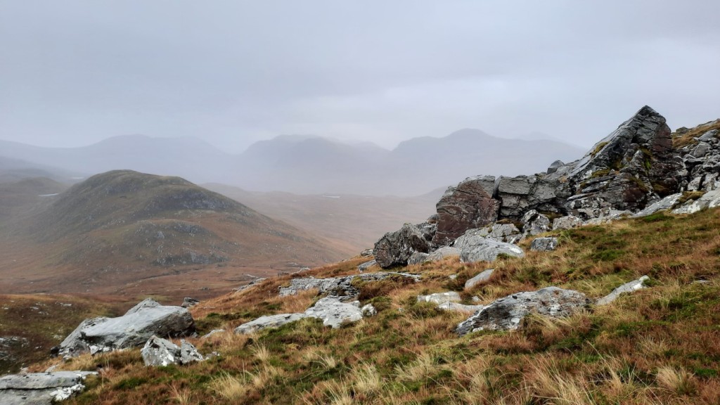
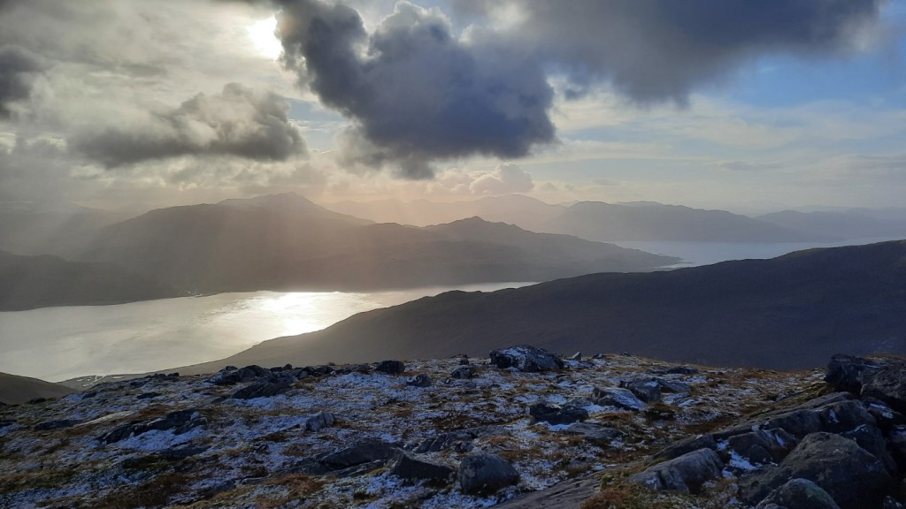
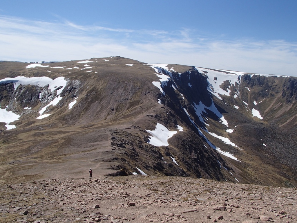
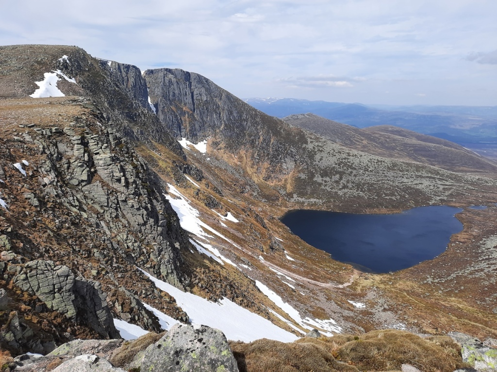
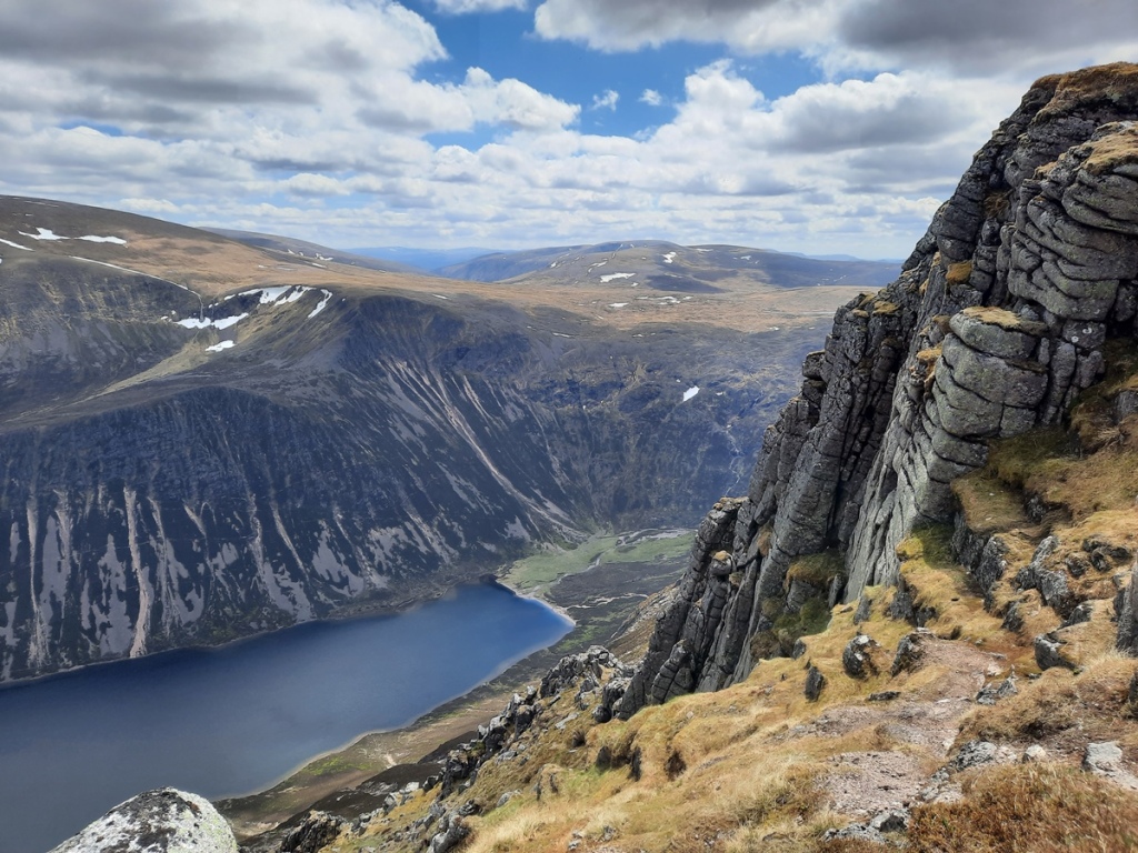
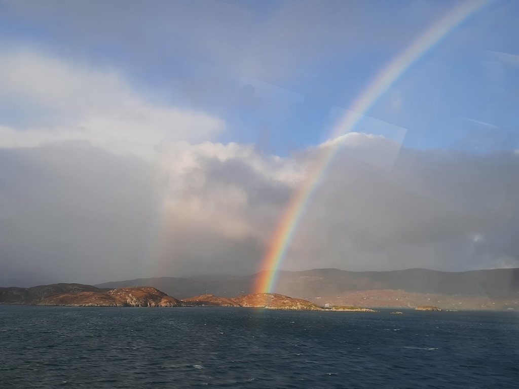
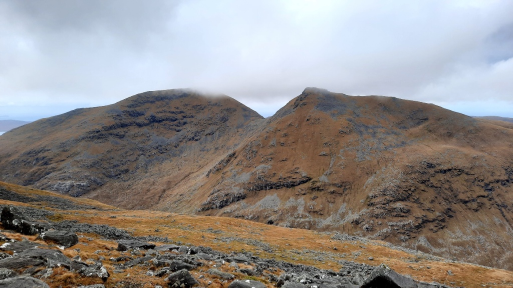
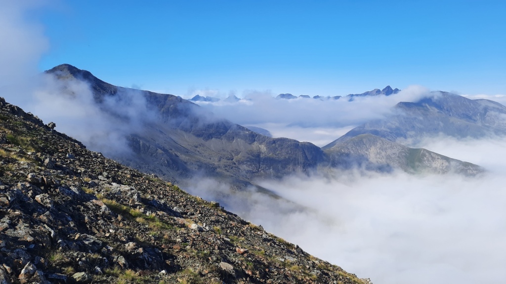
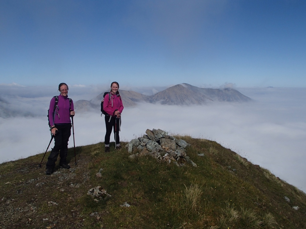
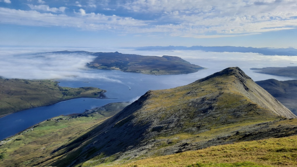
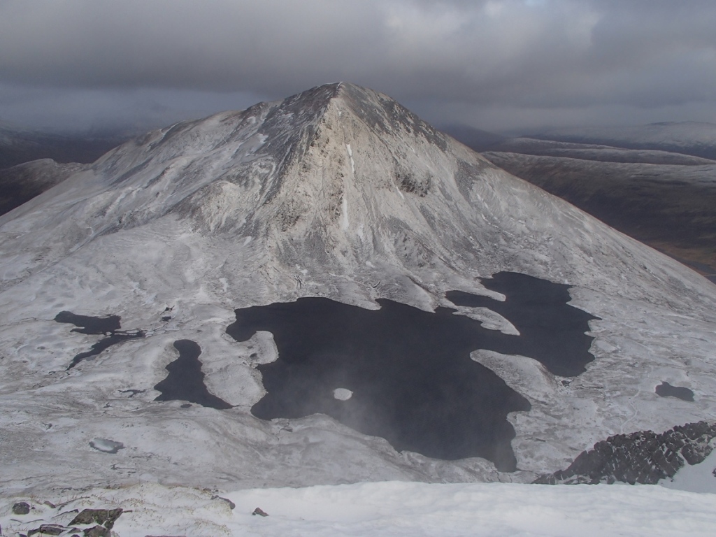
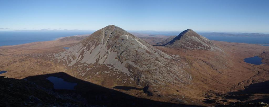
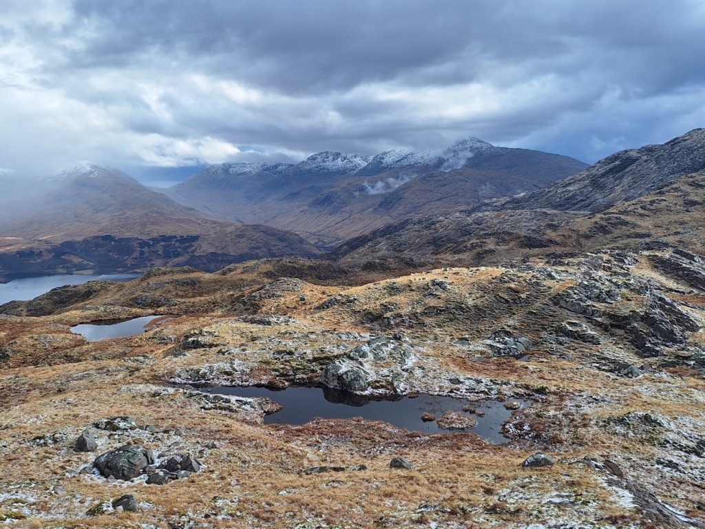
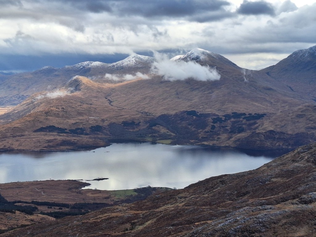
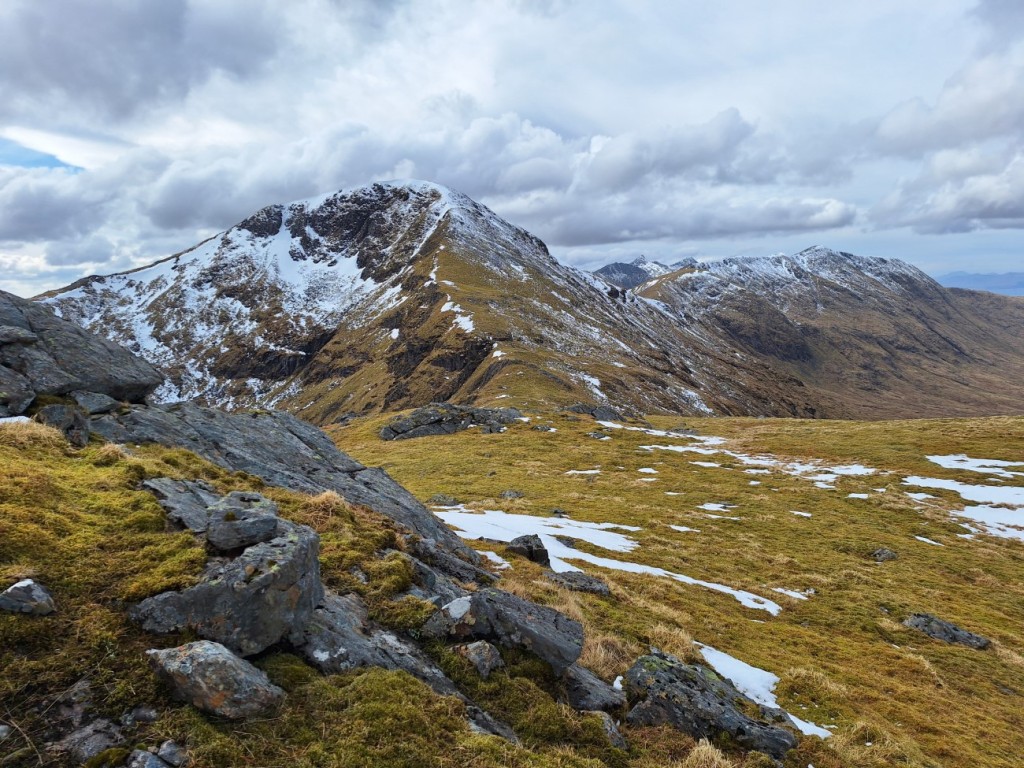
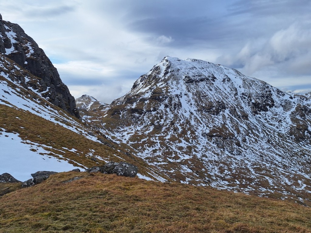
Appropriately, a heavy hail storm began as I left the top, and I descended rapidly towards the saddle with Beinn Molurgainn as I could hear some thunder around. Thankfully, the thunder soon stopped and I could see brighter weather approaching, so I decided it was safe to continue back up. The hail had made the ground pretty white, but did turn to rain for a few minutes before petering out. Soon I was on the Graham summit and continuing southeast towards the minor top of Meall Dearg. The various cairns along its ridge proved to be excellent viewpoints over Loch Etive towards the higher, snowy peaks of Ben Starav and Ben Cruachan, and there were a few sunny spells.

Creach Bheinn (Corbett) from a hail-covered Beinn Molurgainn
Sunshine after the storm, looking towards Mull
Ben Cruachan
Loch Etive and Ben Starav

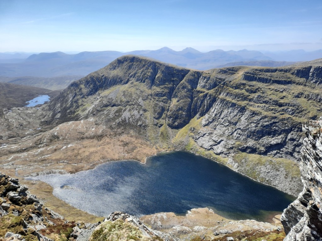
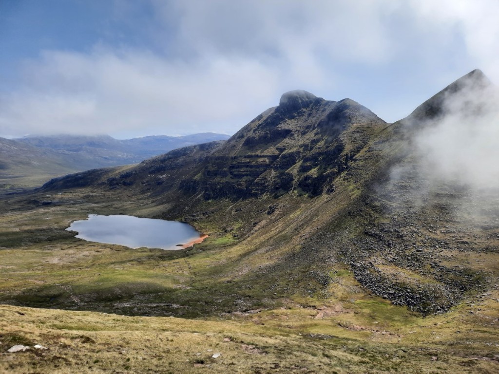
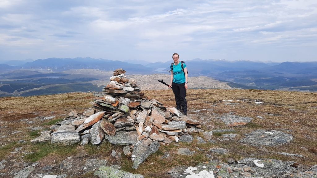
Once I’d reached Bealach Carra, it was an easy scramble up the spur to the summit of Beinn Mheadhonach, the final Graham of the day. I overtook another walker, whose footprints I had seen in the hail earlier, on the way up, but didn’t pass closely enough to speak as he had chosen a less rocky line further right. The summit gave good views towards the sea and Mull.

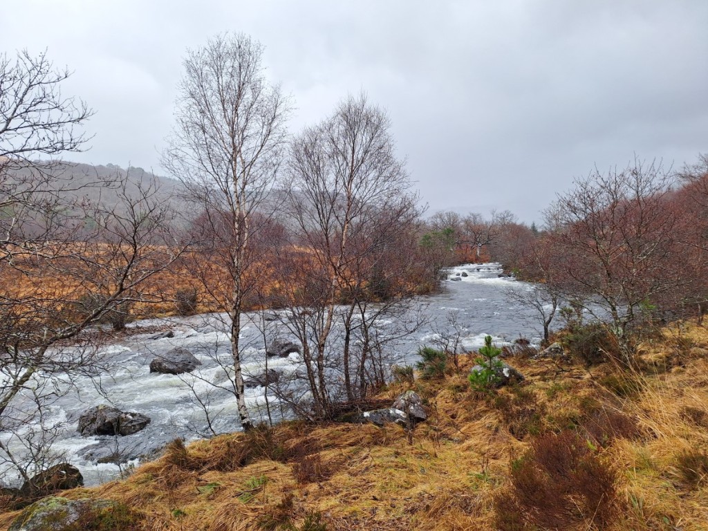
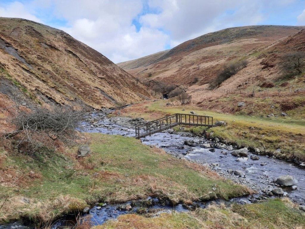
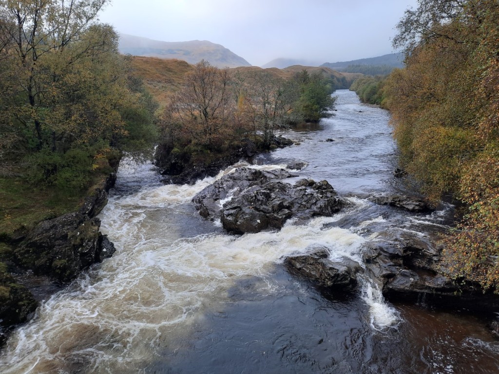
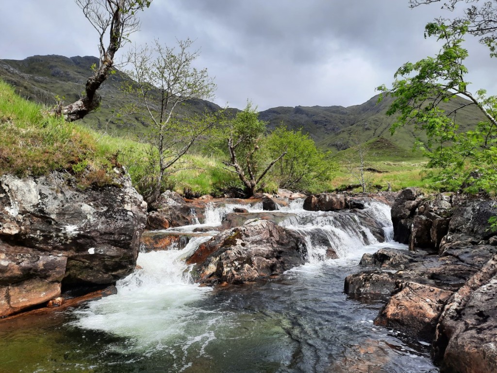
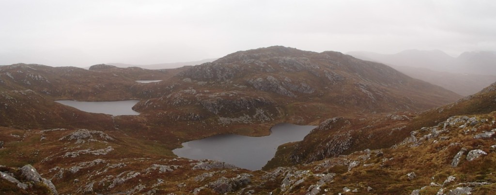
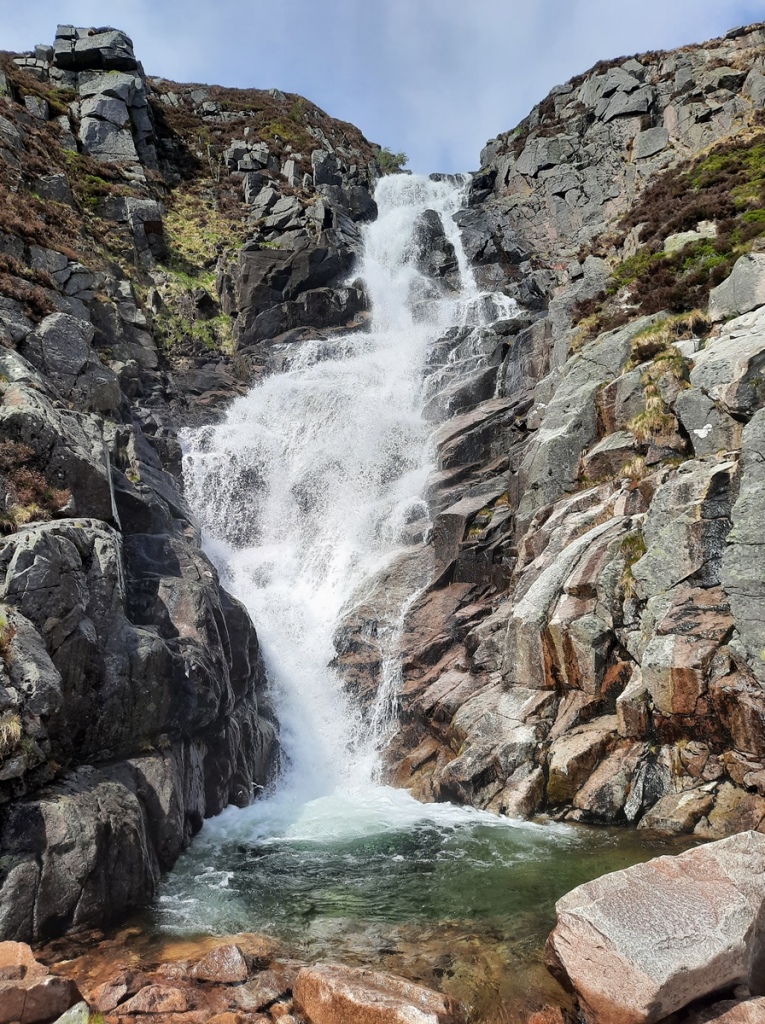
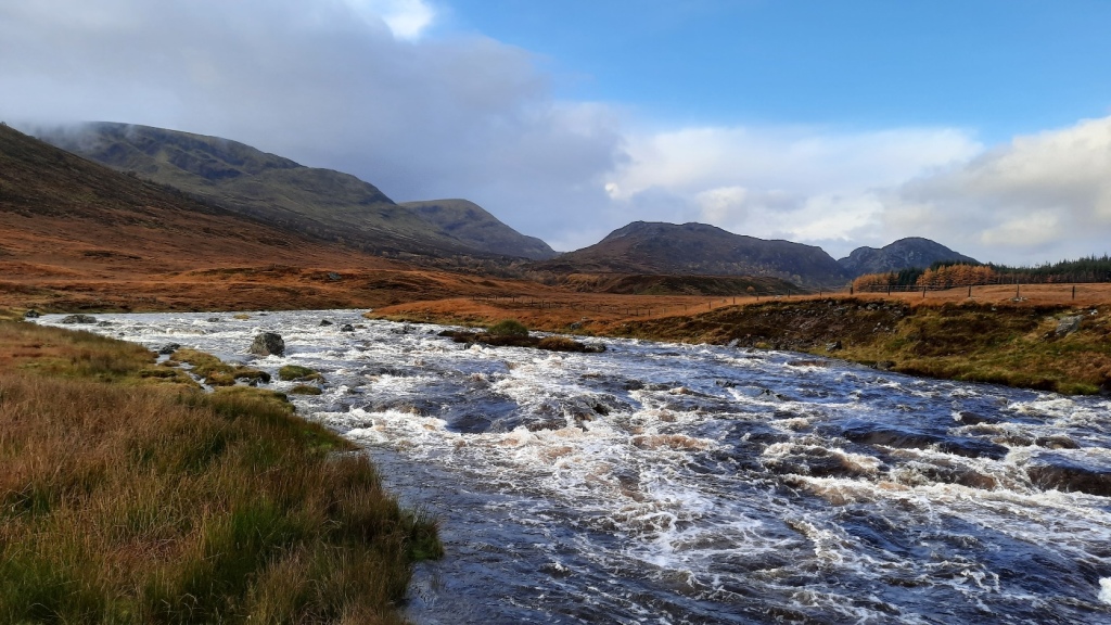
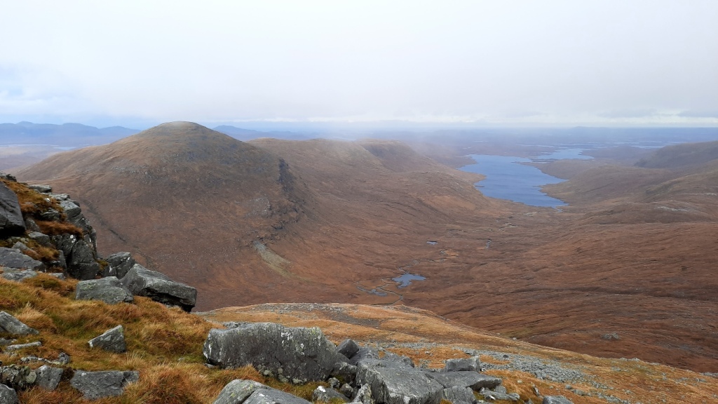
I descended west then northwest down rough, grassy slopes to reach the confluence of the Eas a’ Chrinlet and Eas na Gearr, where the former could be crossed on stepping stones beside an ATV ford, and the latter had a very helpful bridge. Beyond the bridge, an obvious ATV track led quite steeply up onto the opposite hillside then traversed southwest back to my start point. The attractive rocky ground of the second and third Grahams had definitely made up for the boggy first hill and unpleasant hailstorm to give a good day overall!
Route map: https://www.plotaroute.com/route/2567681

Beinn Eunaich, from Beinn Mheadhonach

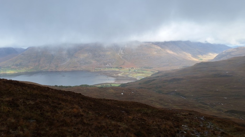
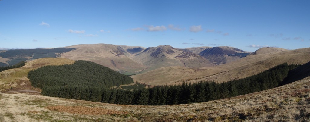
I had been told that I would be sharing the dormitory that night, so was surprised when nobody had turned up by the time I went to bed. Sadly, five others did arrive around midnight and disturb my sleep! Nevertheless, I was well rested by morning and decided to head to a couple of Munros, Beinn a’ Chochuill and Beinn Eunaich, which had looked good across Loch Etive the previous day. The forecast was also good, particularly for the morning, with light winds and sunshine.

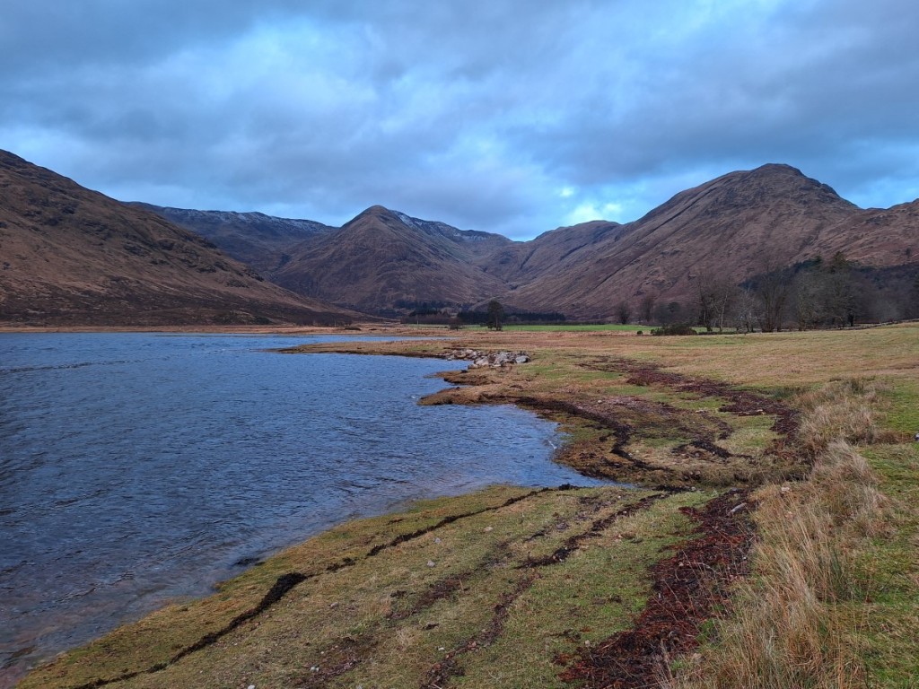
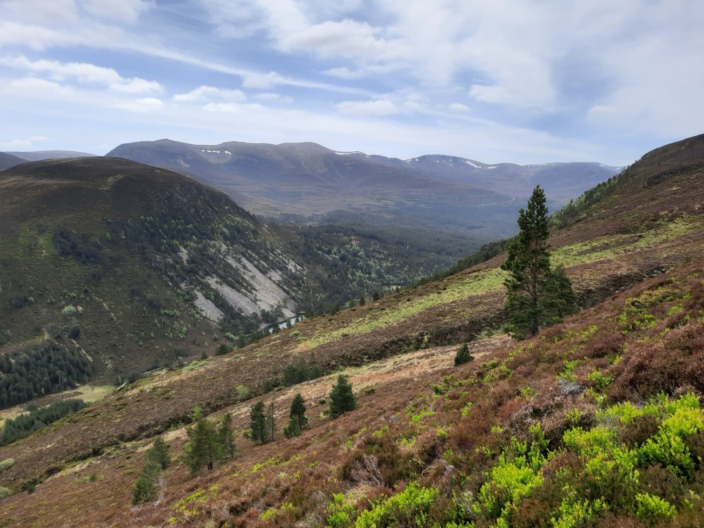
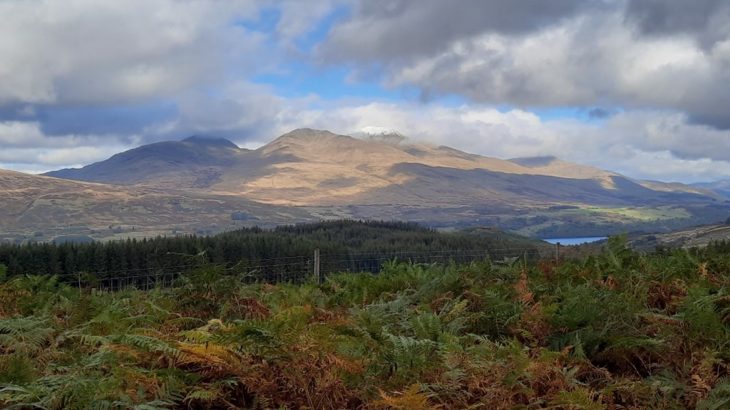
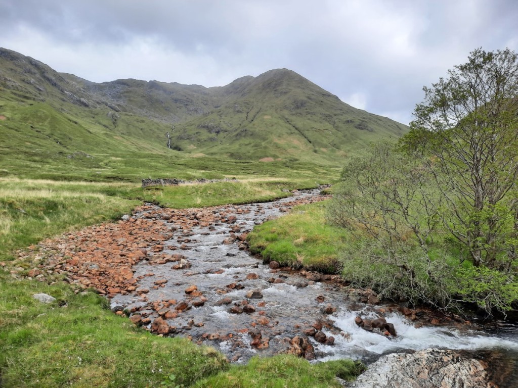
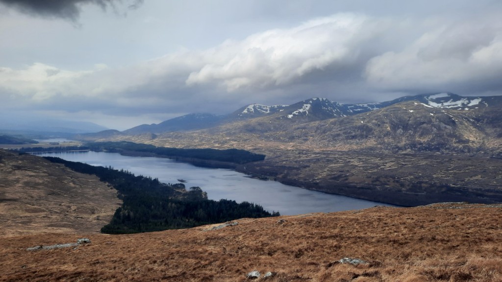
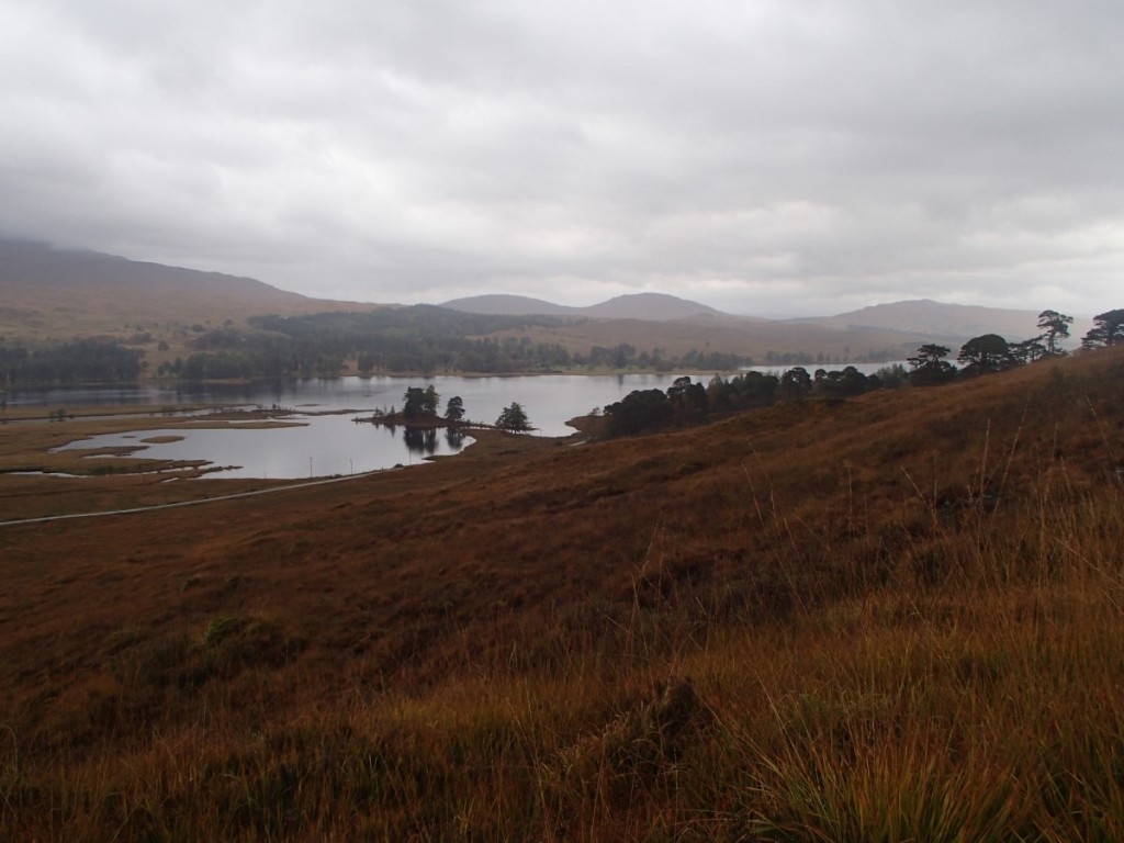
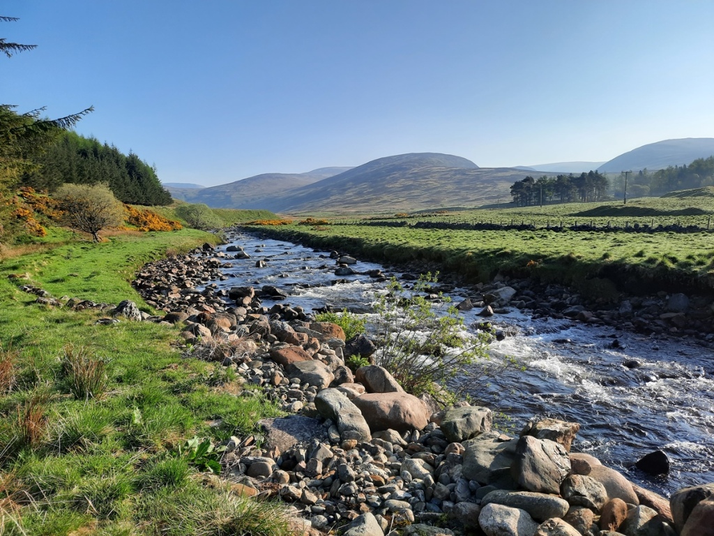
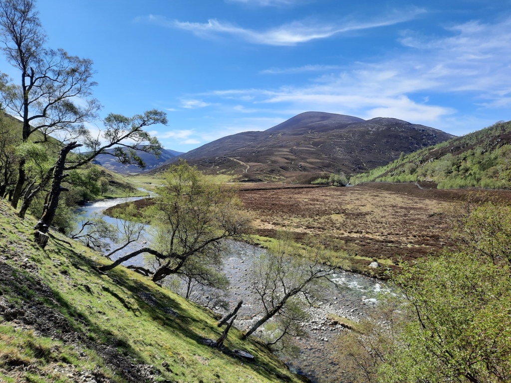
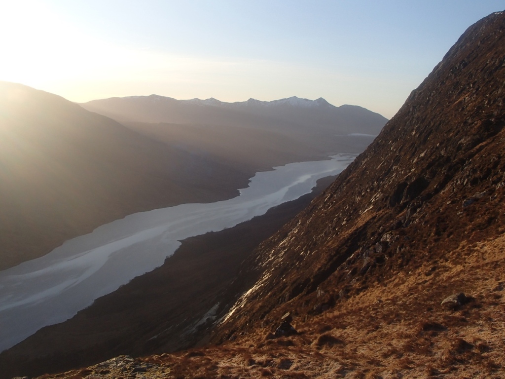
Once I’d had breakfast and checked out of the hostel, I drove the half hour to Lochawe and parked by the B8077 junction, wrongly assuming that any places further along the lane were already taken. The first few kilometres were on a good hydro track up the valley, with improving views of the Ben Cruachan group to the left.

Looking up to Stob Diamh from the valley

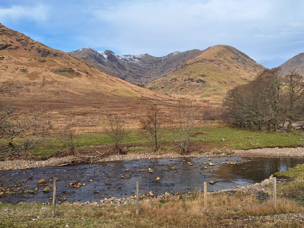
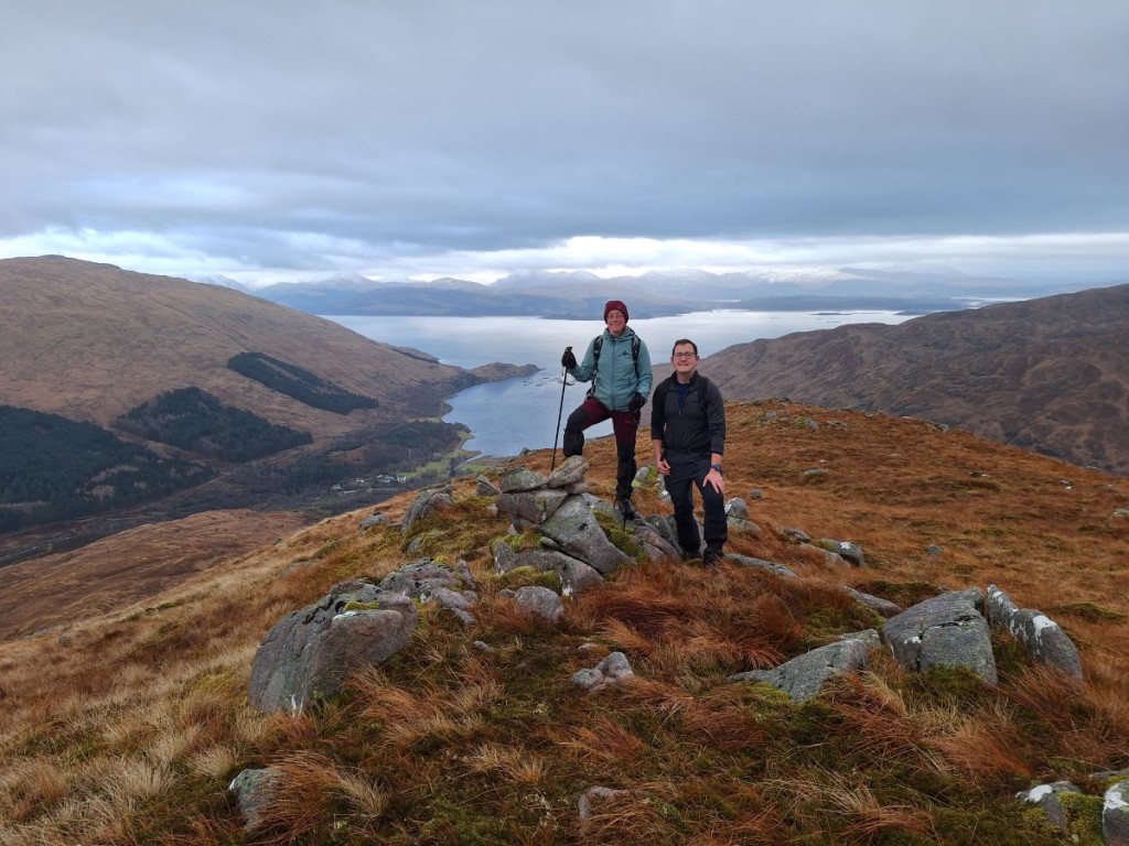
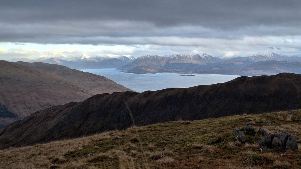
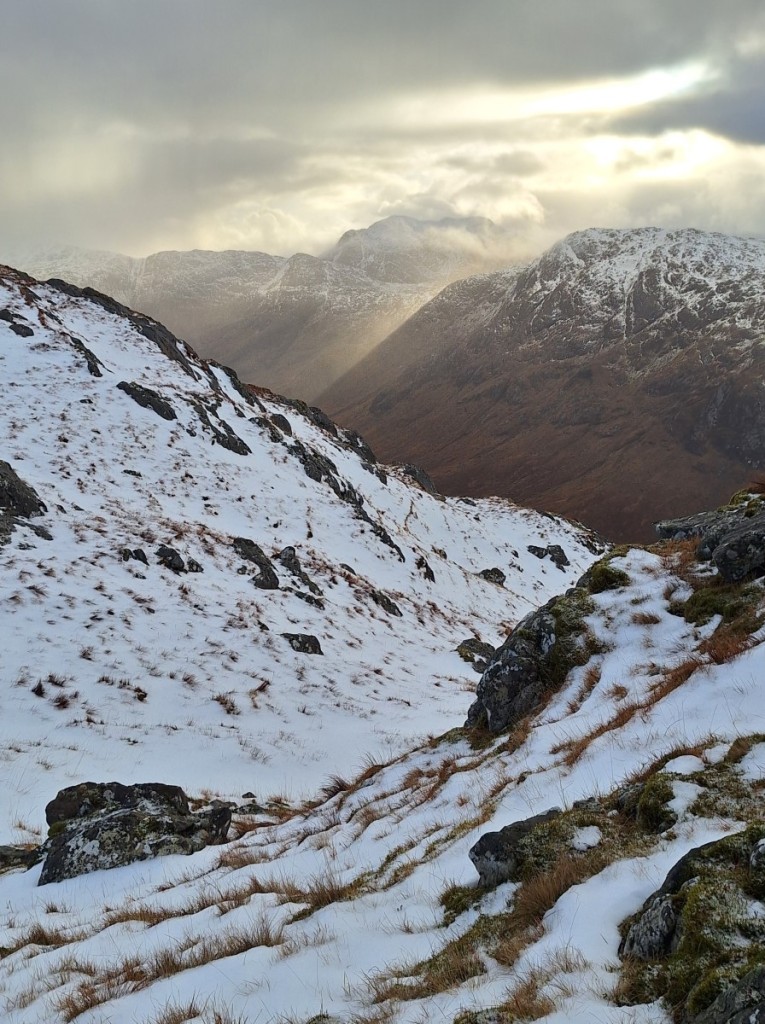
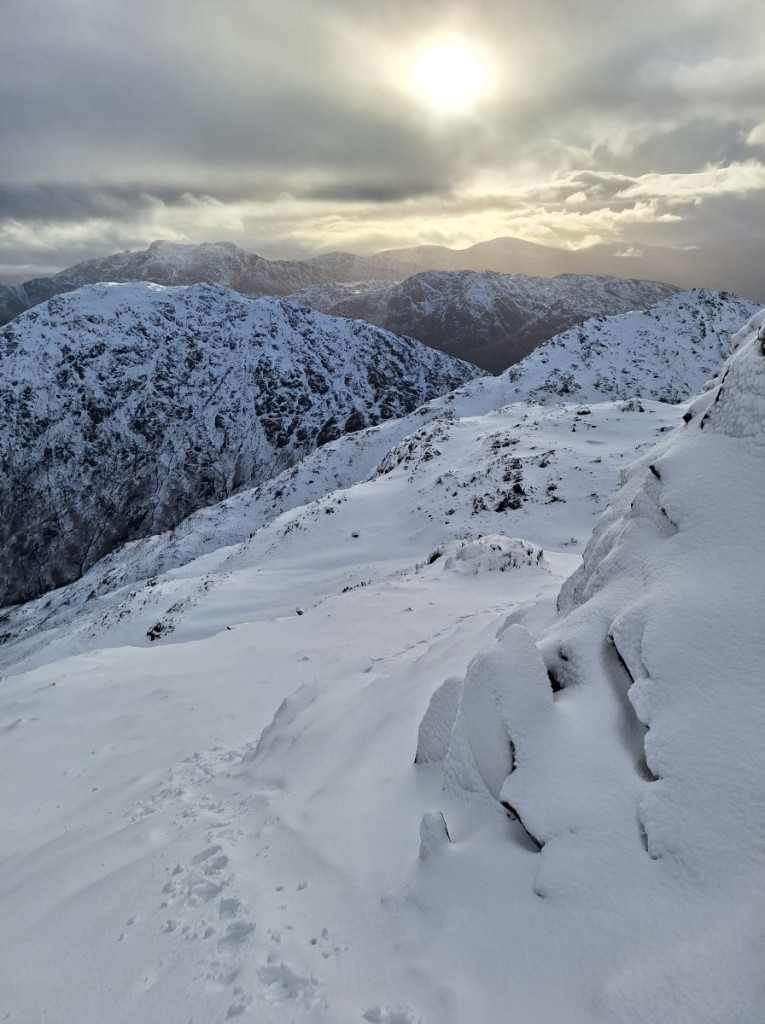
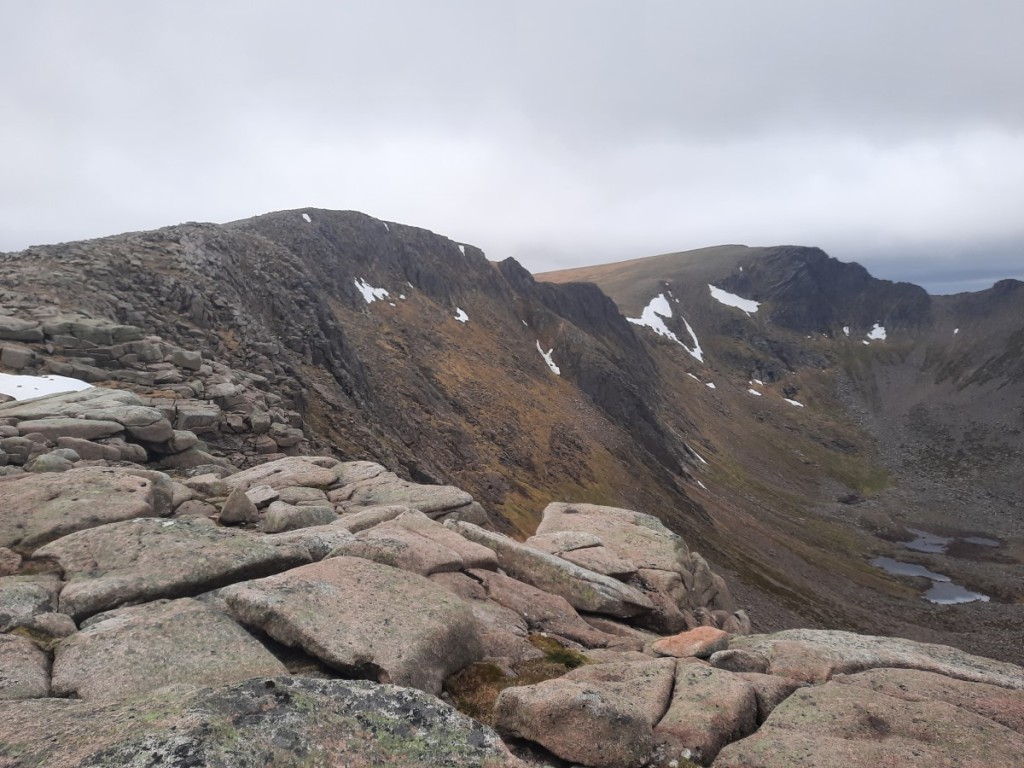
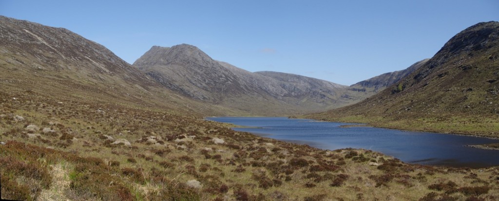
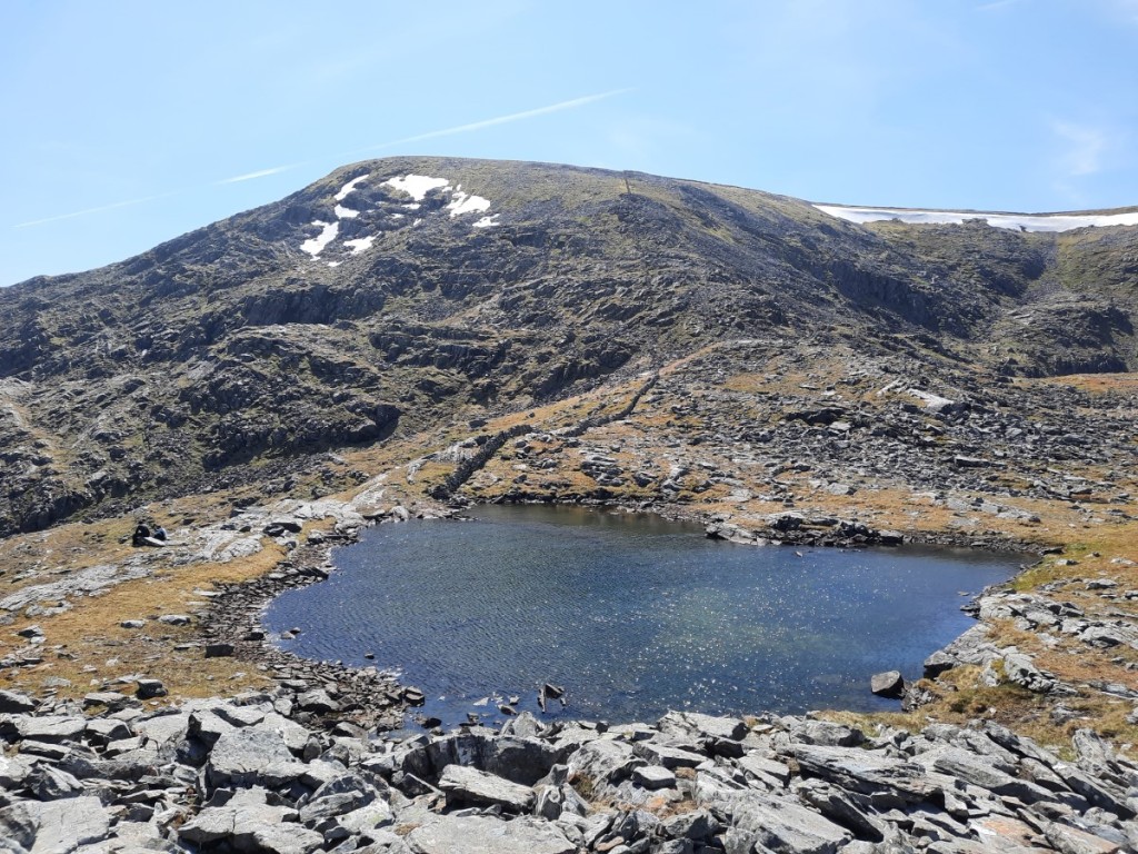
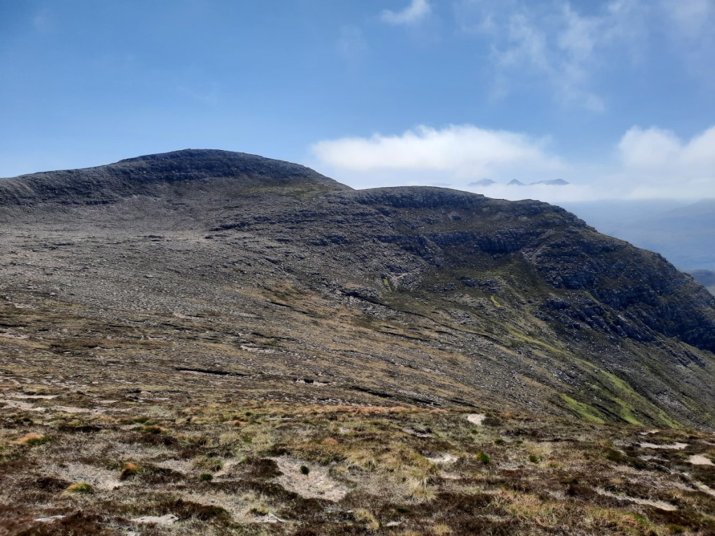
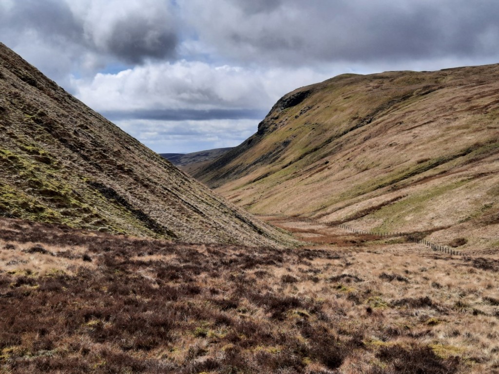
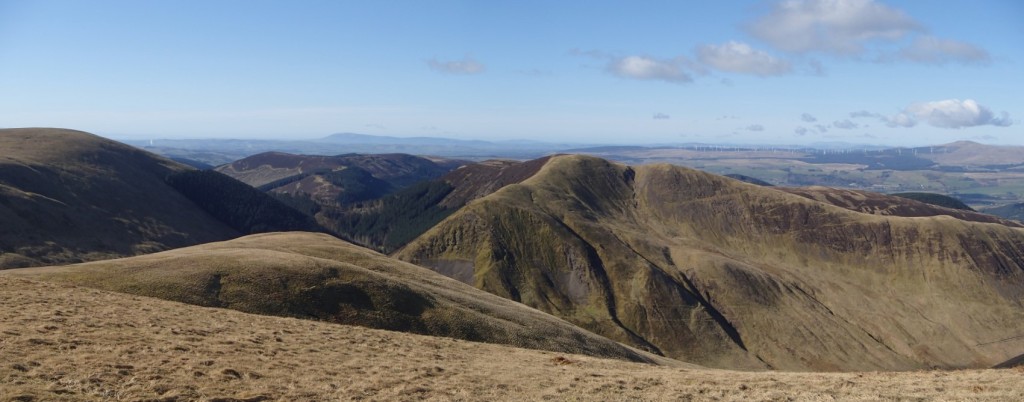
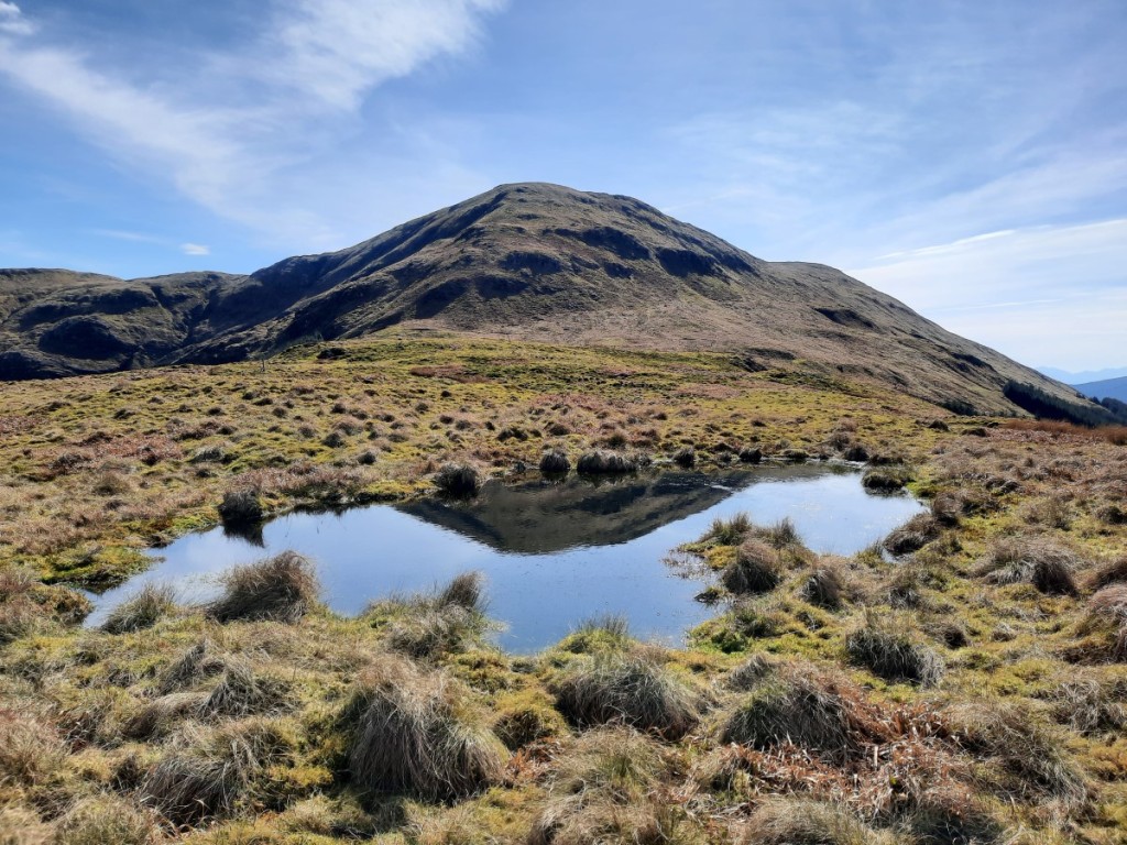
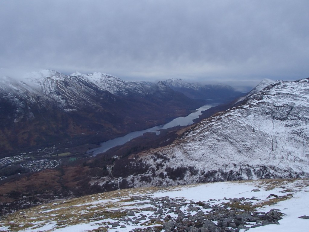
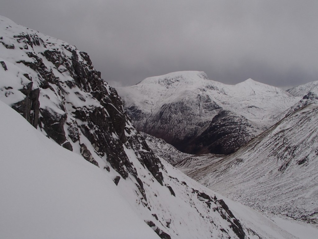
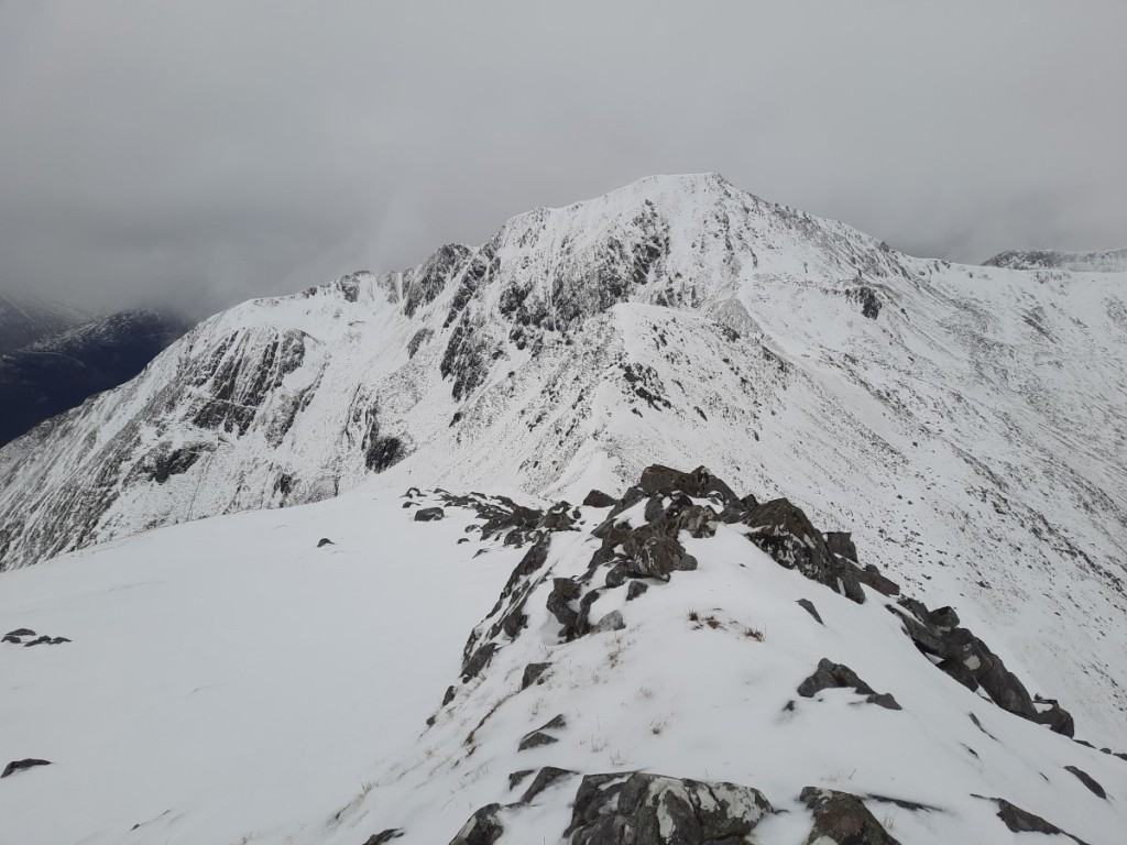
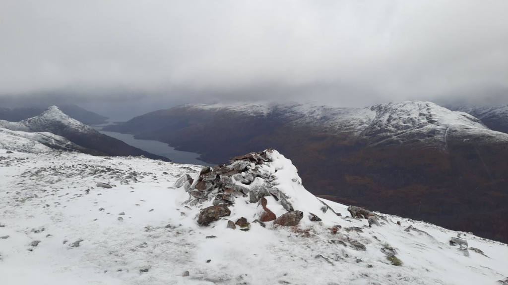
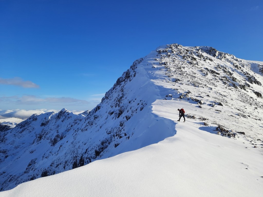
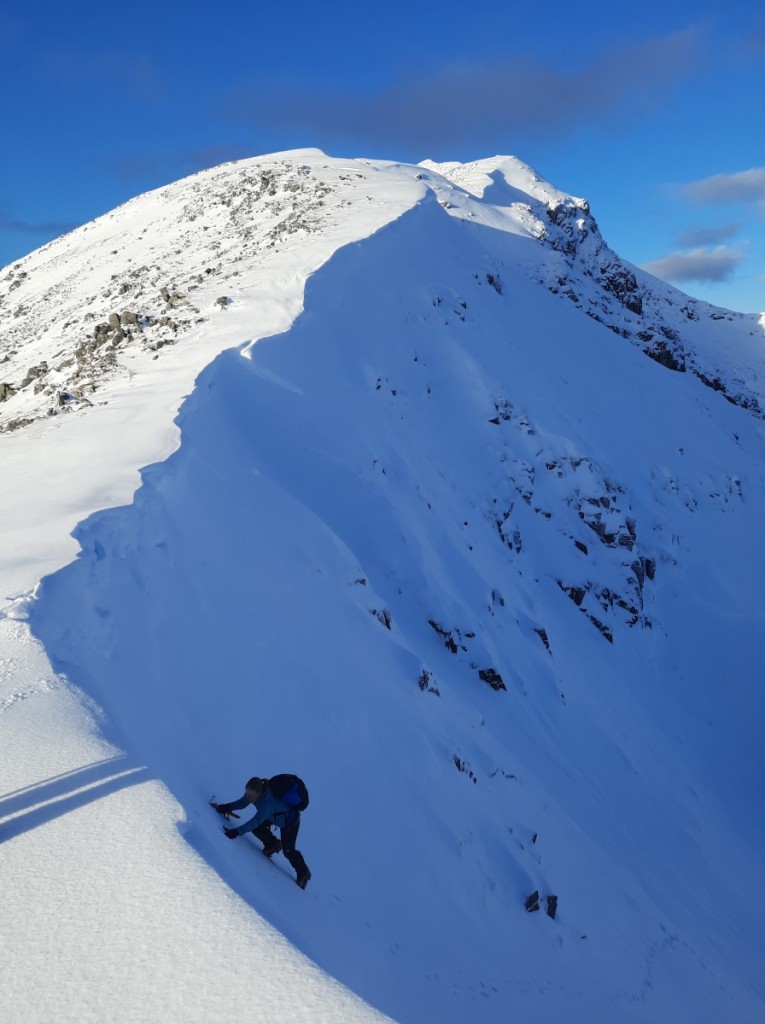
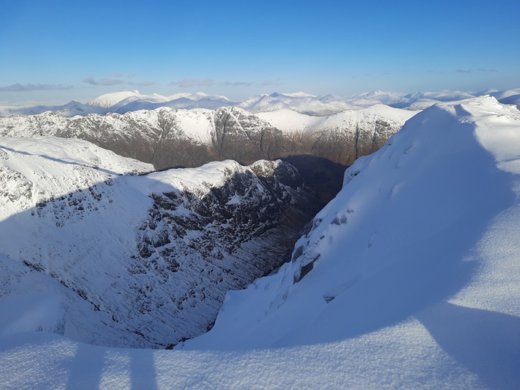
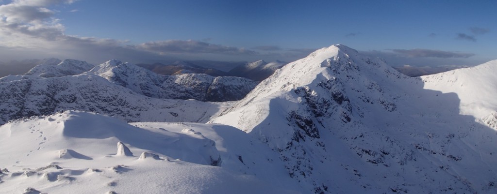
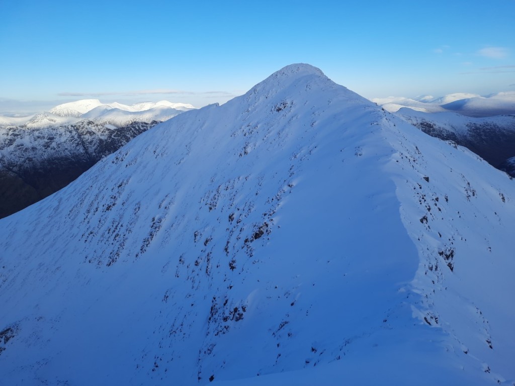
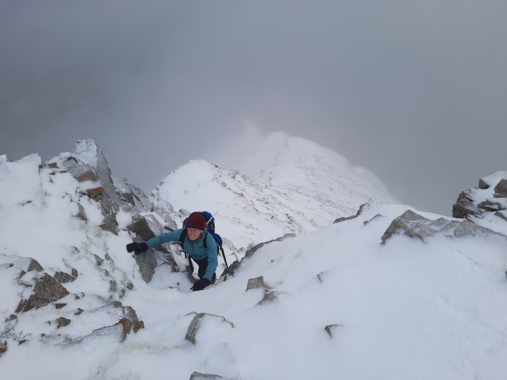
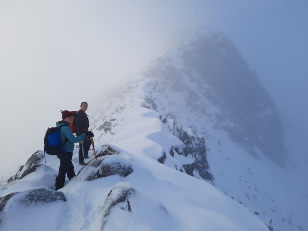
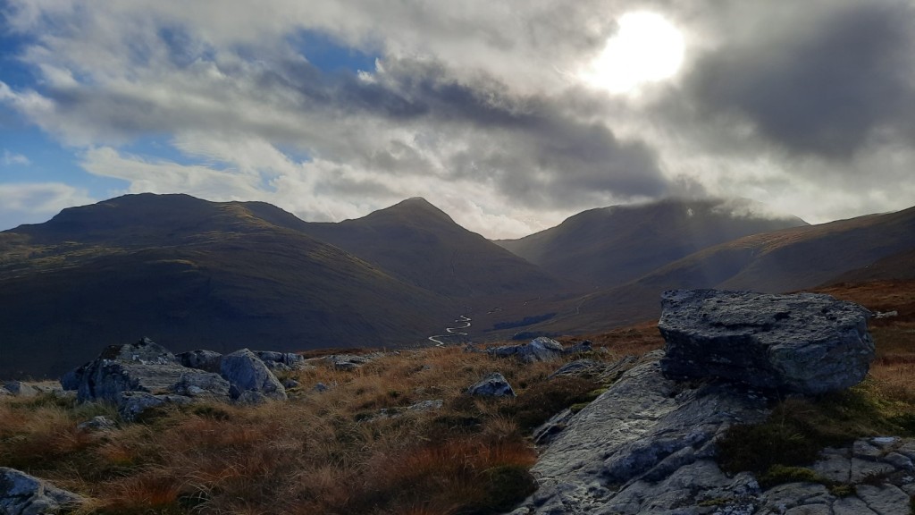
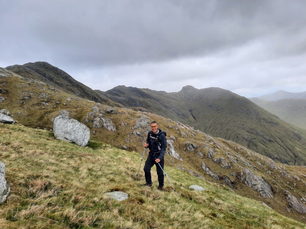
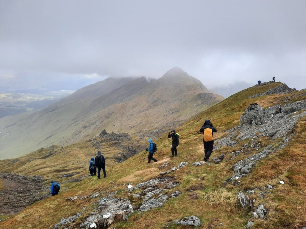
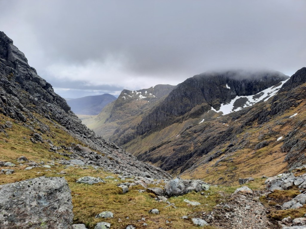
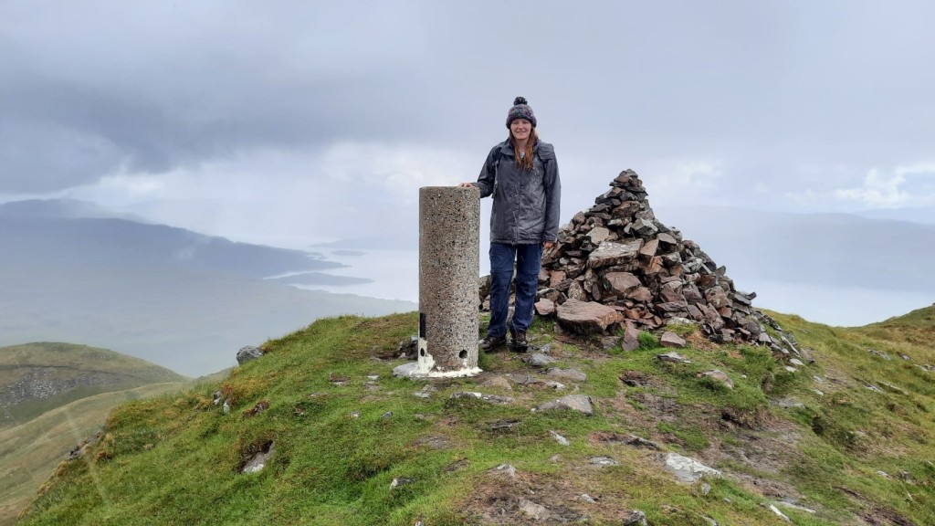
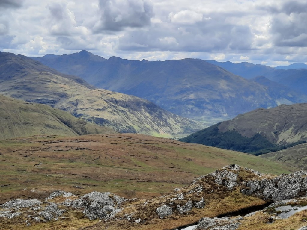
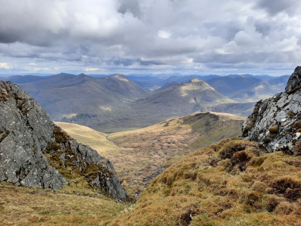
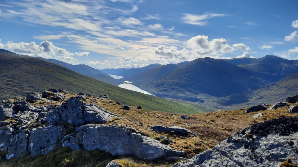
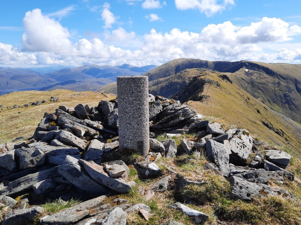
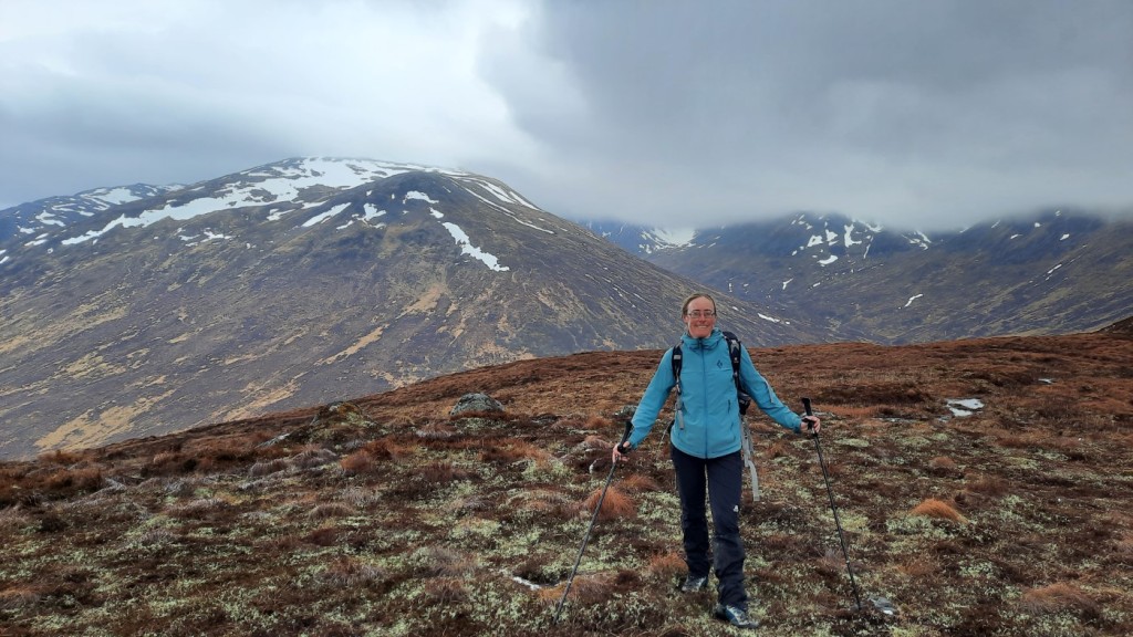
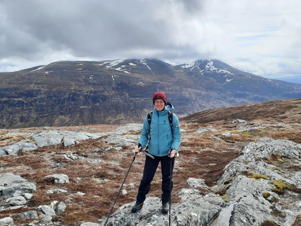
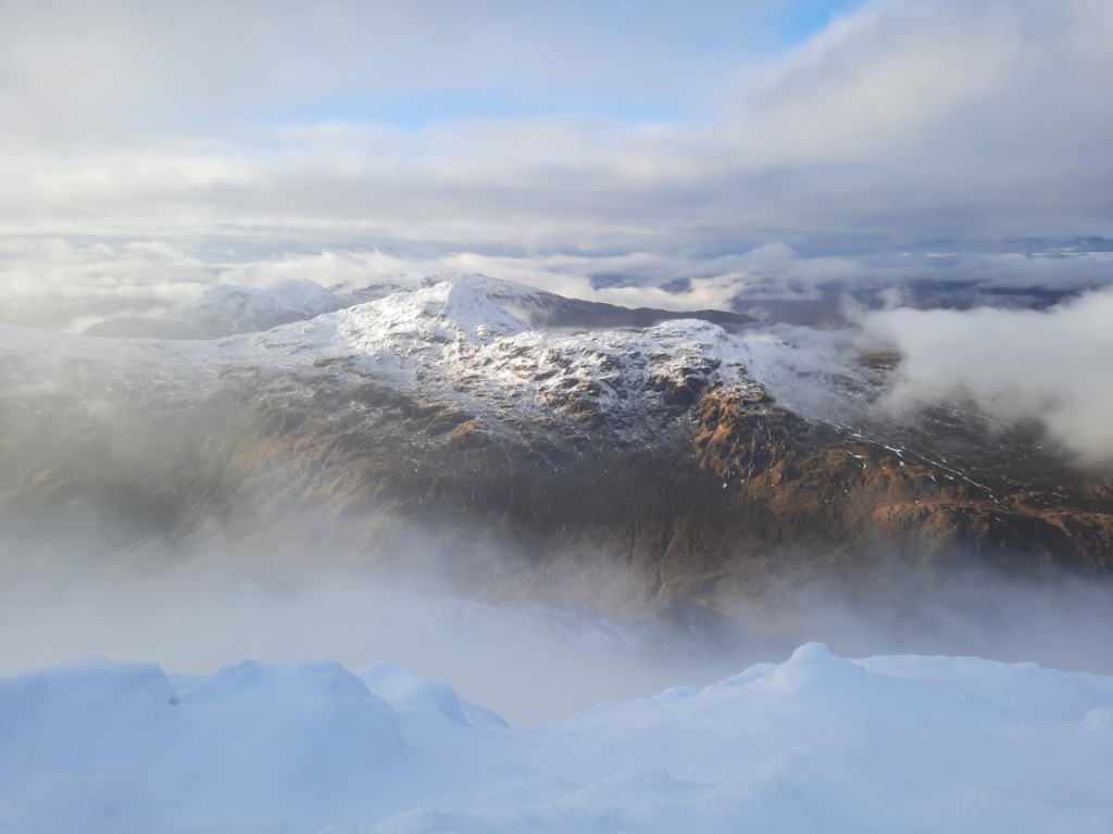
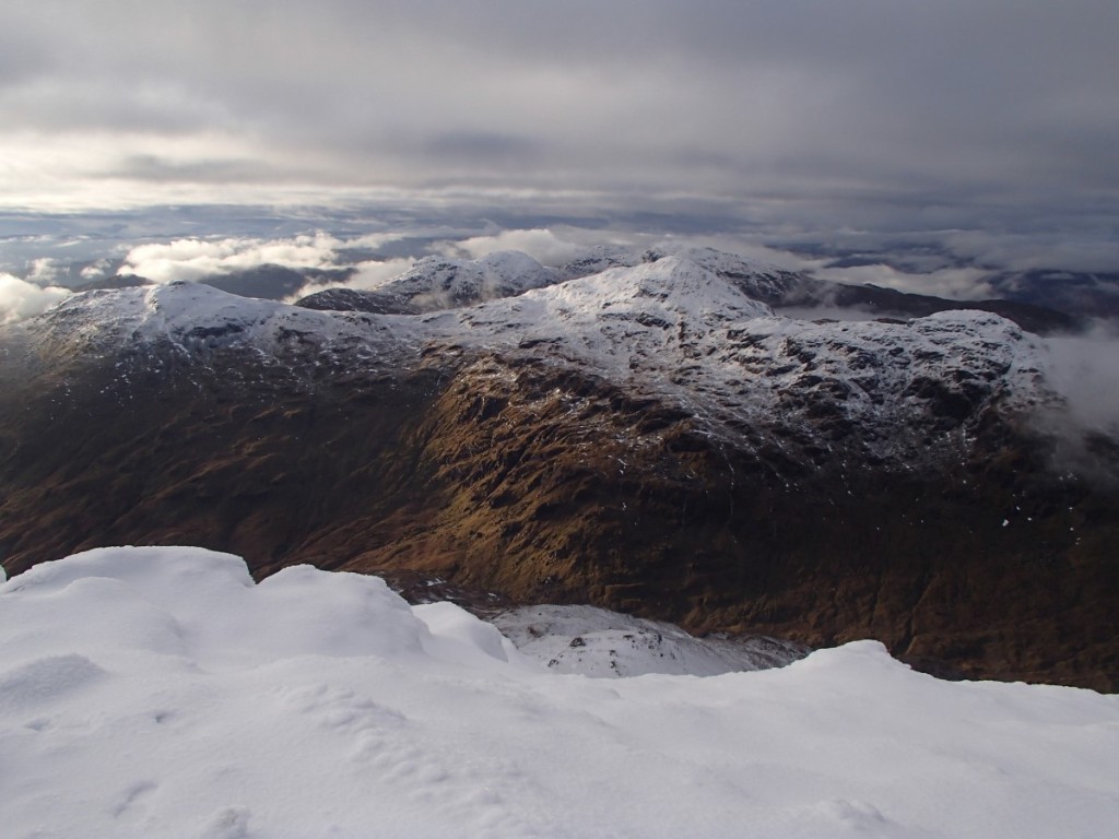
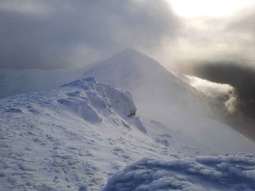
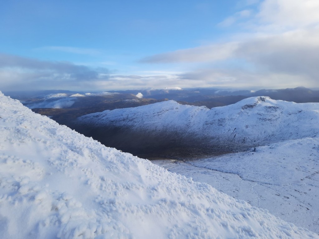
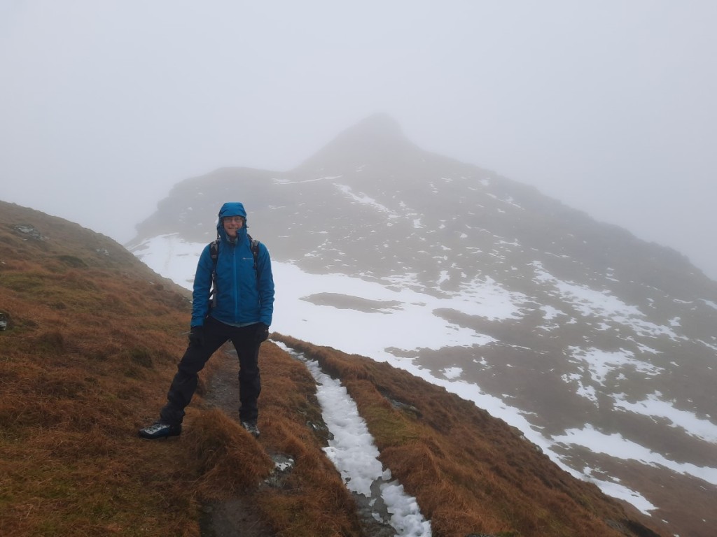
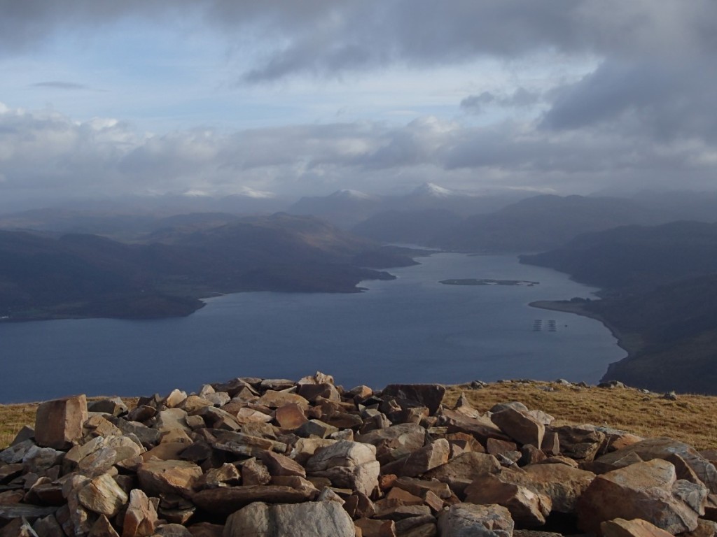
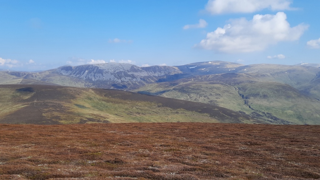
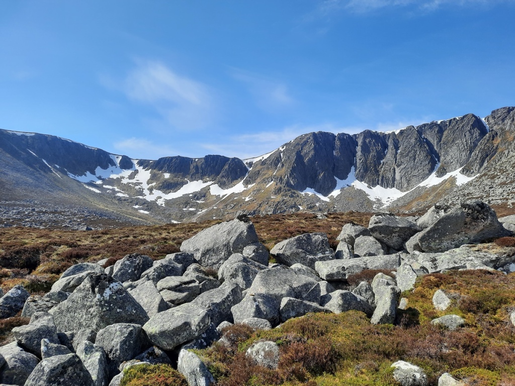
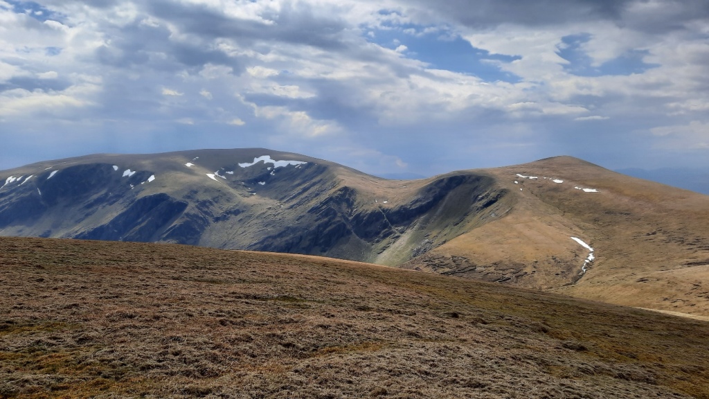
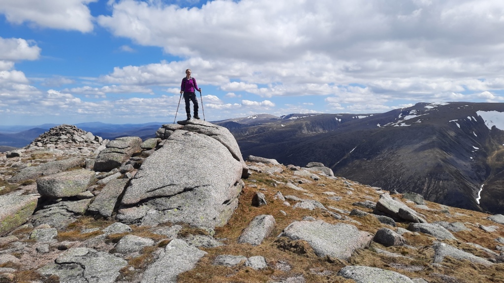
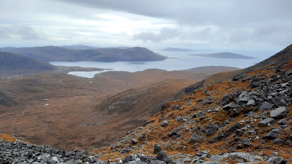
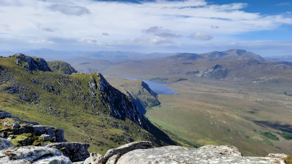
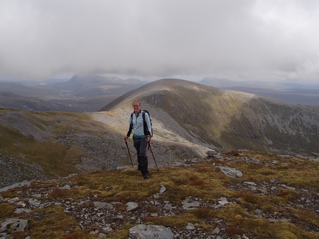
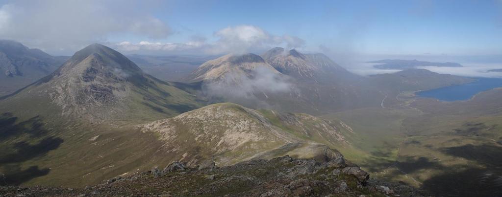
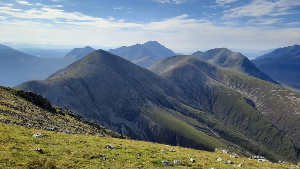
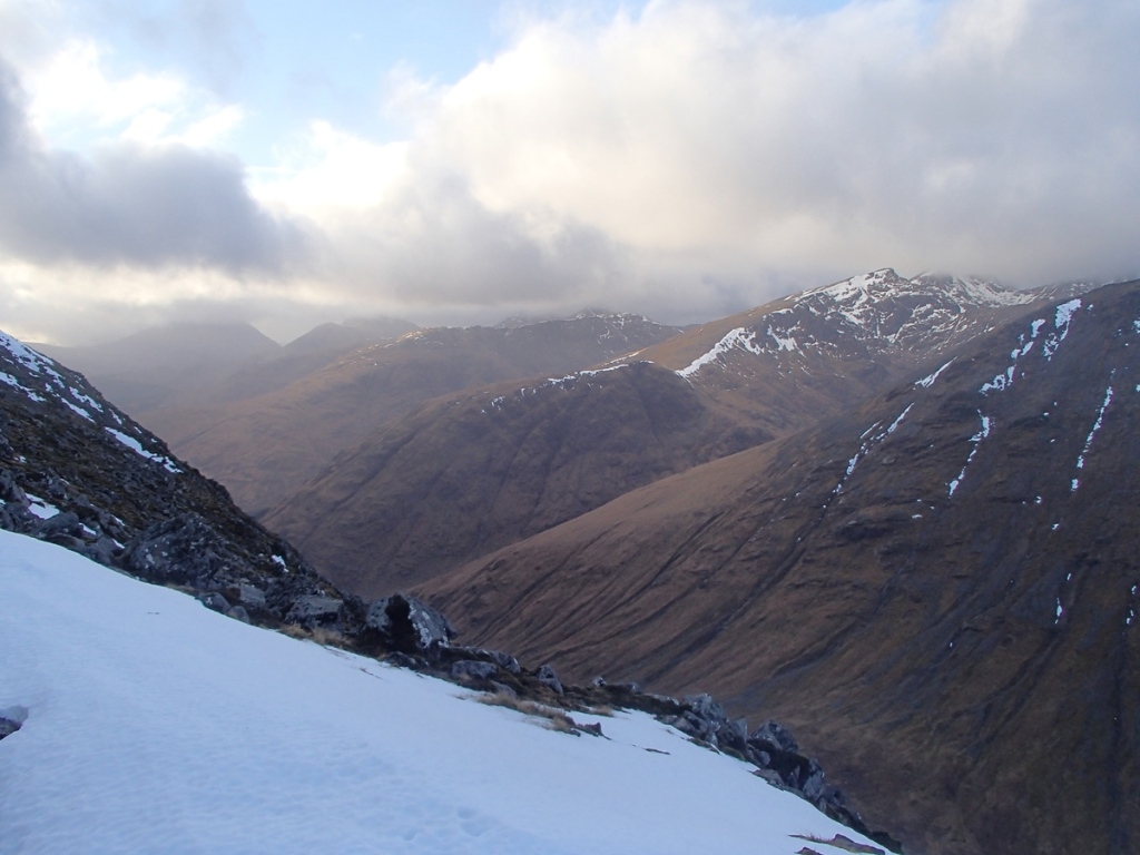
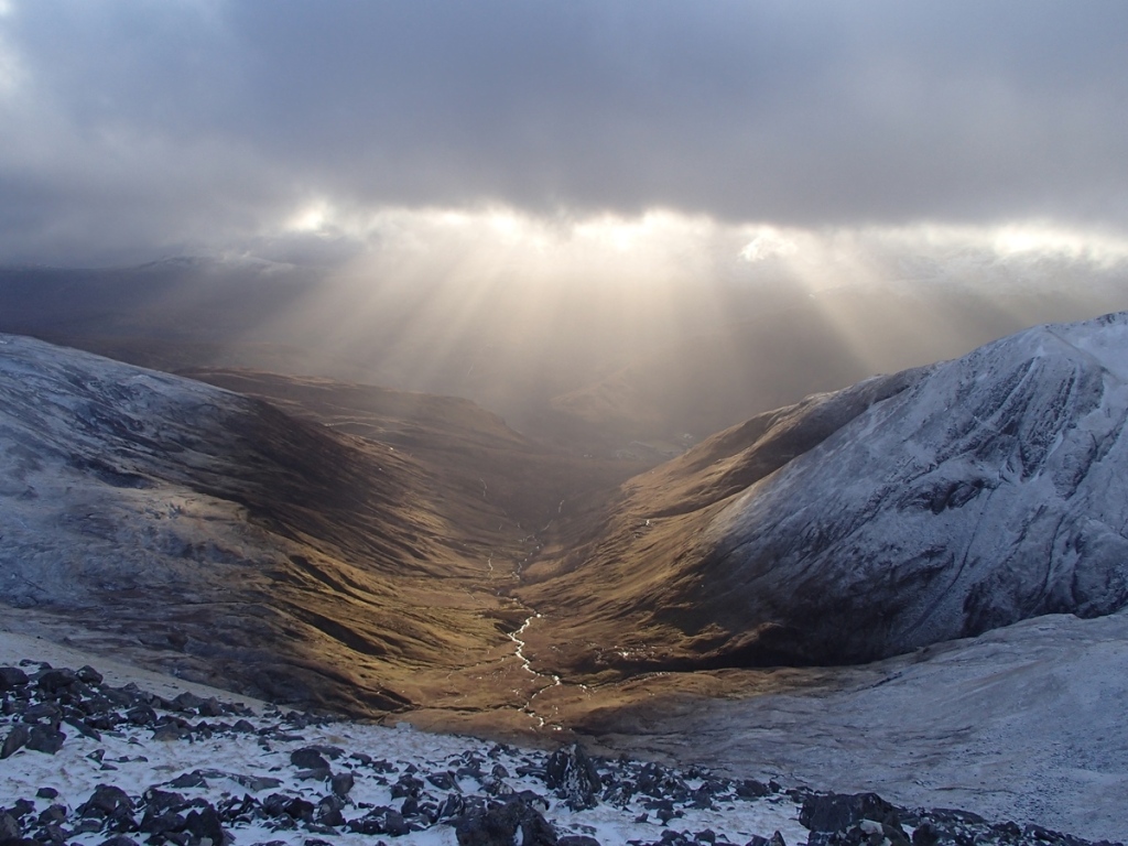
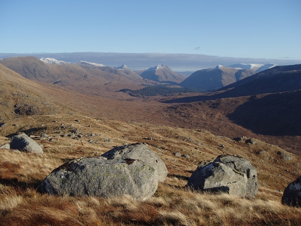
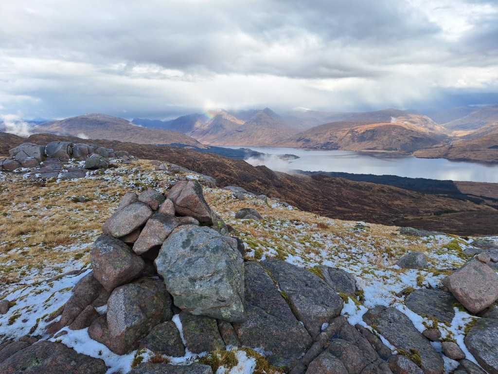
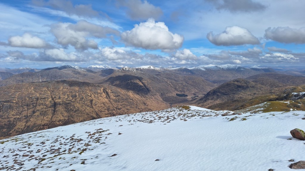
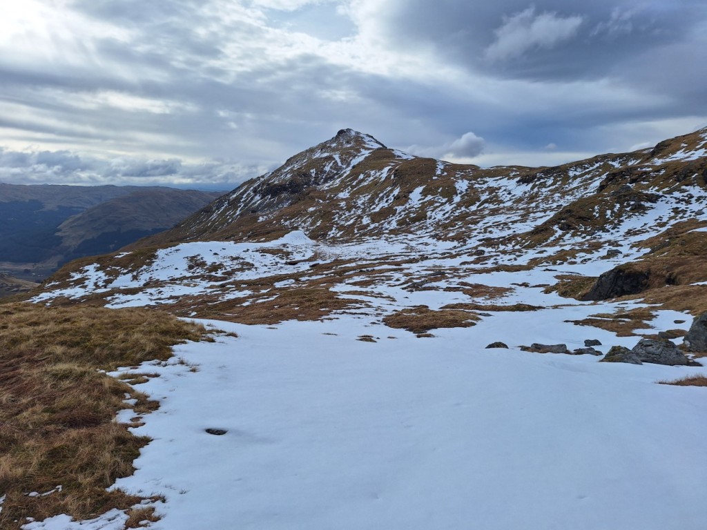
Then it was a steep and unrelenting climb of nearly 500m up the SE ridge of Beinn a’ Chochuill, significantly aided by the expected Munro-baggers’ path. The climb was essentially snow-free, but a decent cornice remained on the north side of the ridge to make the view more dramatic. I enjoyed more stunning views of Ben Cruachan as I walked west to the summit of Beinn a’ Chochuill, as well as appreciating the row of snowy peaks between Ben Starav and Stob Ghabhar to the north.

Beinn Eunaich, from the ridge of Beinn a’ Chochuill
Ben Cruachan

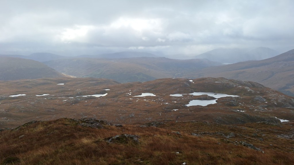
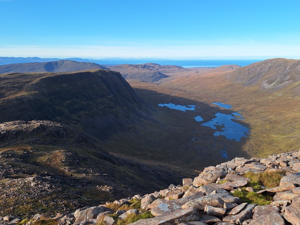
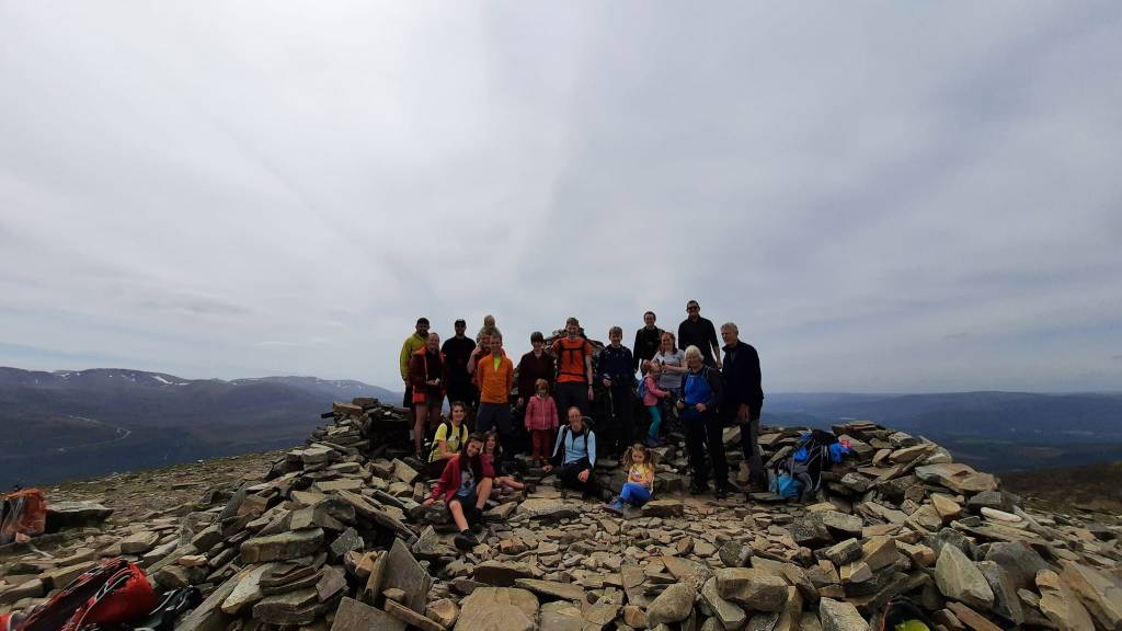
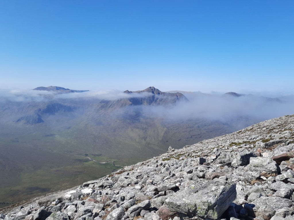
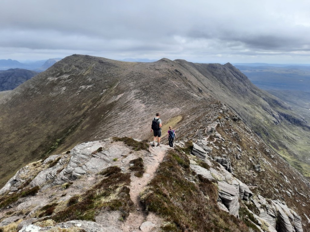
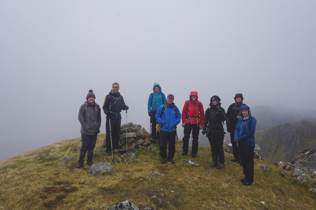
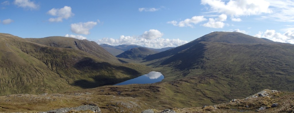
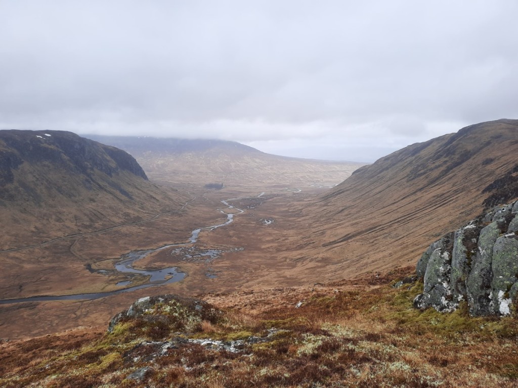
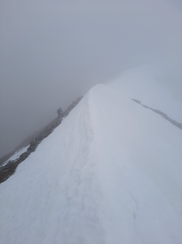
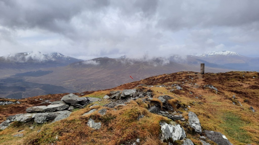
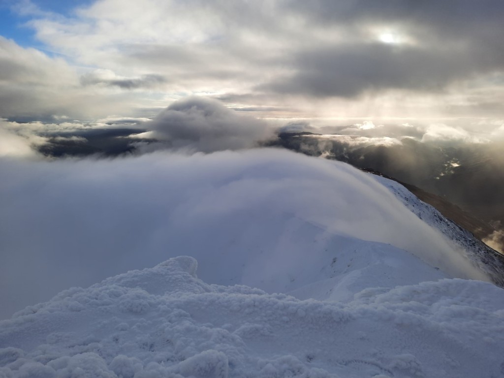
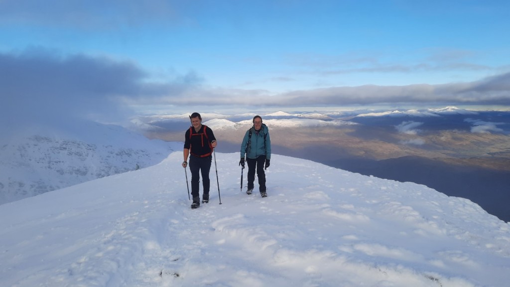
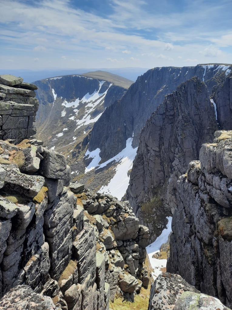
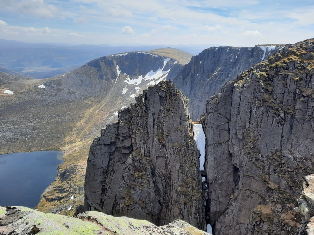
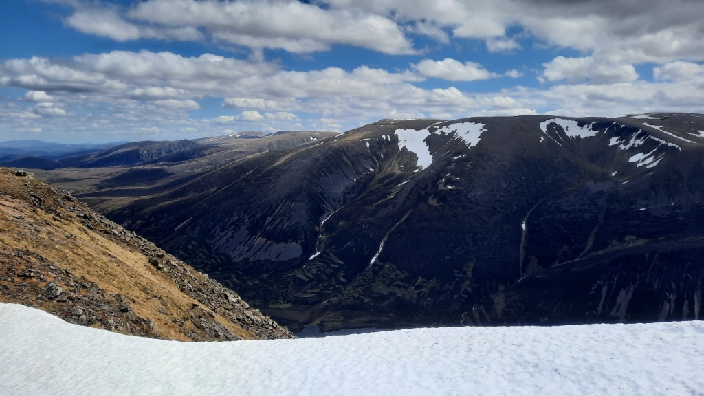
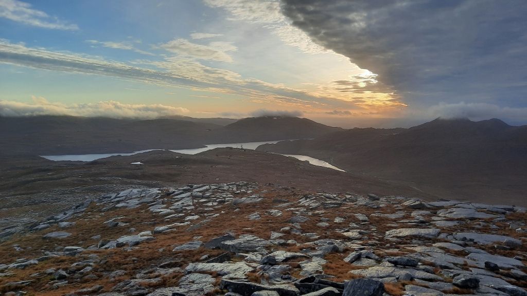
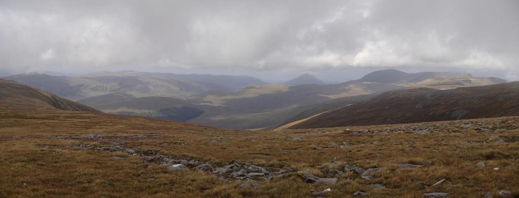
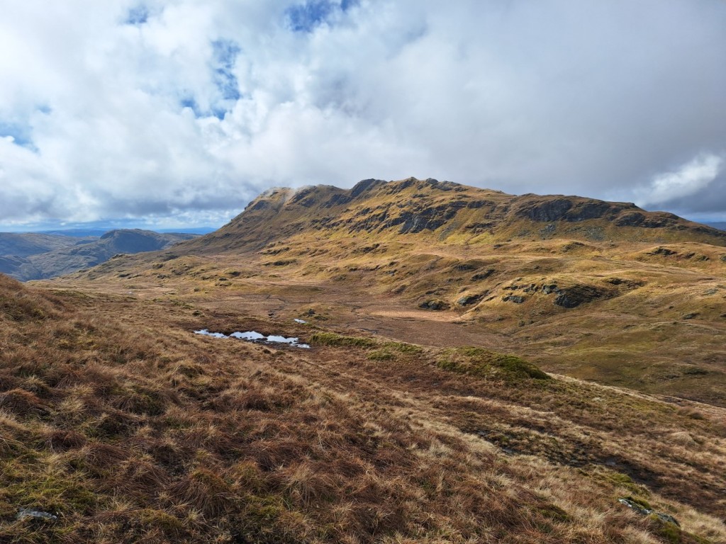
Turning back to the east, I followed the good ridge path to the second, higher Munro, Beinn Eunaich, pausing for lunch in a sheltered spot a little below the summit. As it was still quite early, I decided to continue northeast along the ridge to Meall Copagach and the Lairig Dhoireann, rather than following the masses (perhaps 15 other people that day) down the south ridge back into the valley. Although there was a lot of very steep snow on the east face of Beinn Eunaich, the descent on the ridge itself was easily negotiated without ice-axe, and the continuation was snow-free and enjoyable.

Ben Cruachan and Beinn a’ Chochuill, from Beinn Eunaich
Looking north towards Ben Starav and Stob Ghabhar
Looking back to Beinn Eunaich

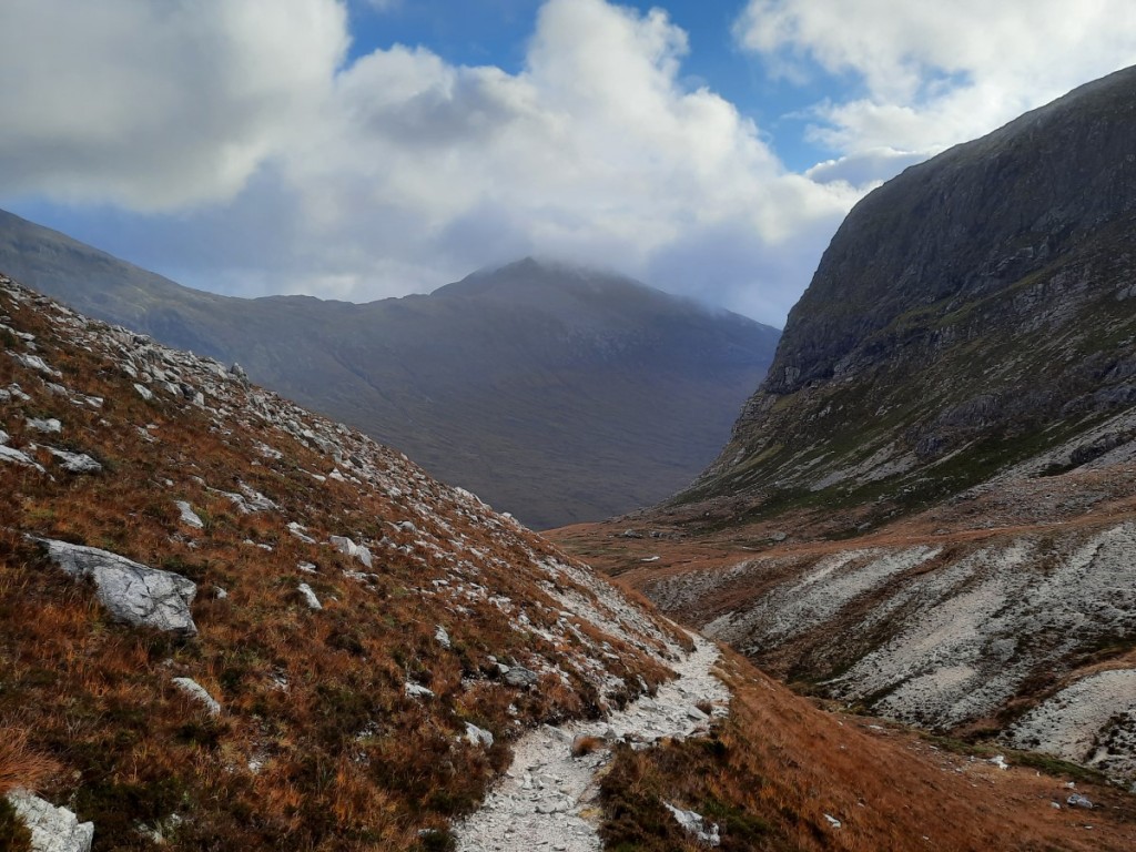
As I’d suspected, the mapped path down the valley was faint and intermittent, but it was at least well marked with cairns. Once down in Glen Strae, a few kilometres on the track and road brought me back to the car. I drove another half hour to reach Crianlarich SYHA for the night, where I was able to claim a bottom bunk in an otherwise full dorm.
Route map: https://www.plotaroute.com/route/2568631

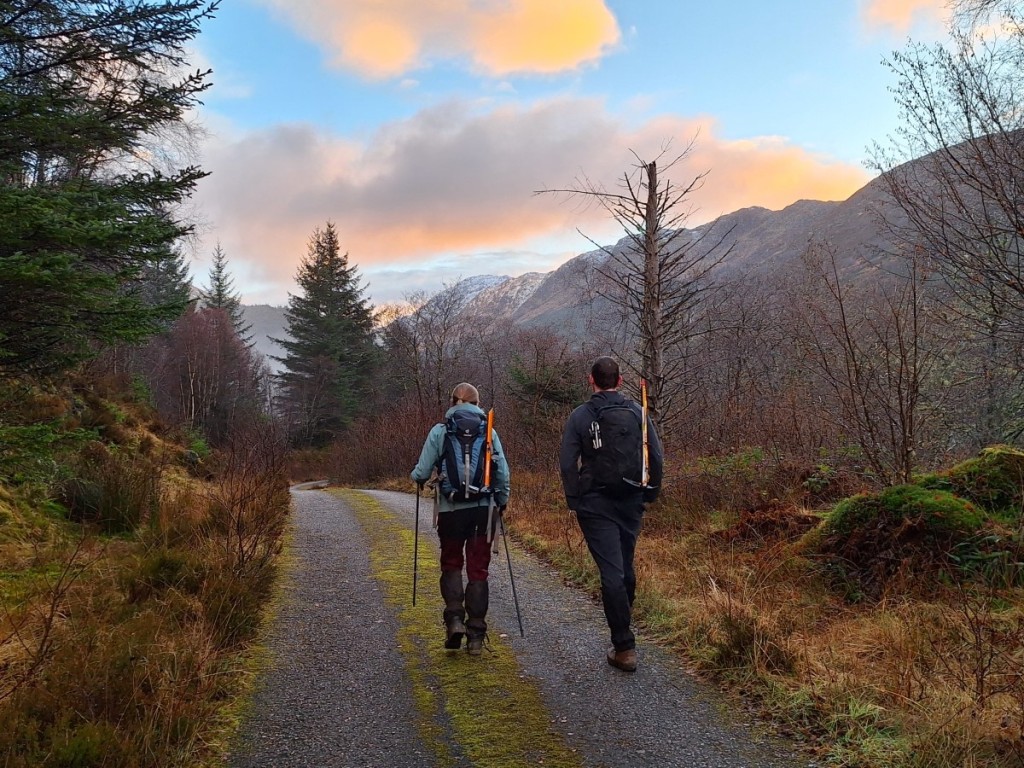
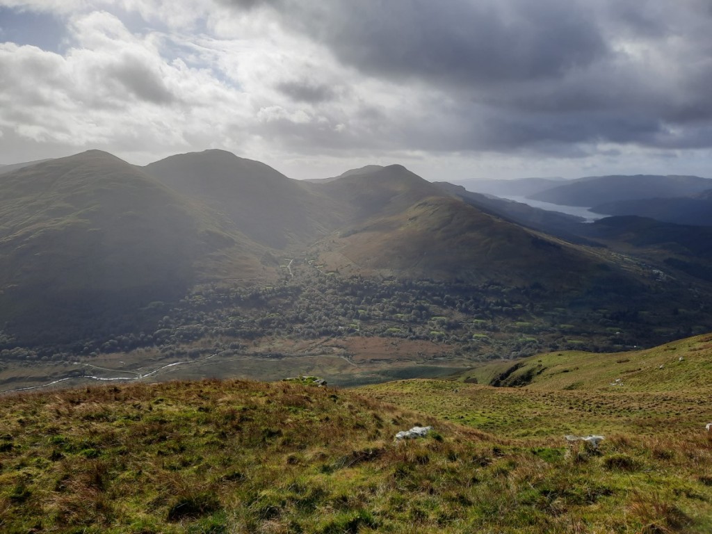
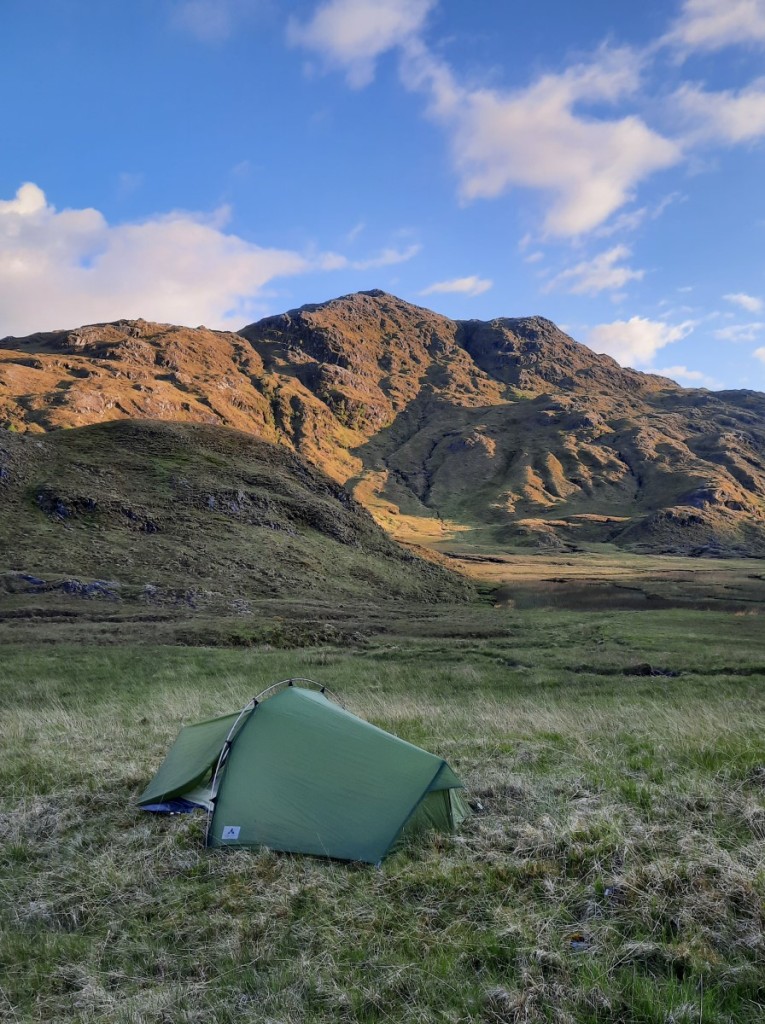
My plan for my final day in Scotland had been to visit some of the Grahams above Luss, but the mountain forecasts agreed that the far south of the National Park would probably have low cloud in the morning. Instead, therefore, I decided to walk directly from the hostel up a couple of Munros, Beinn Tulaichean and Cruach Ardrain.

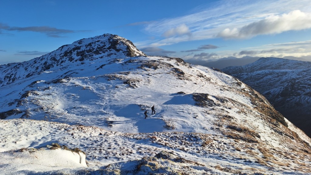
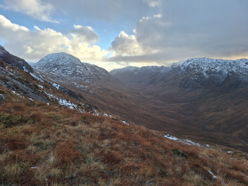
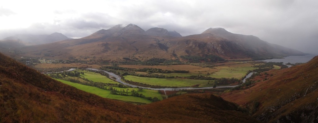
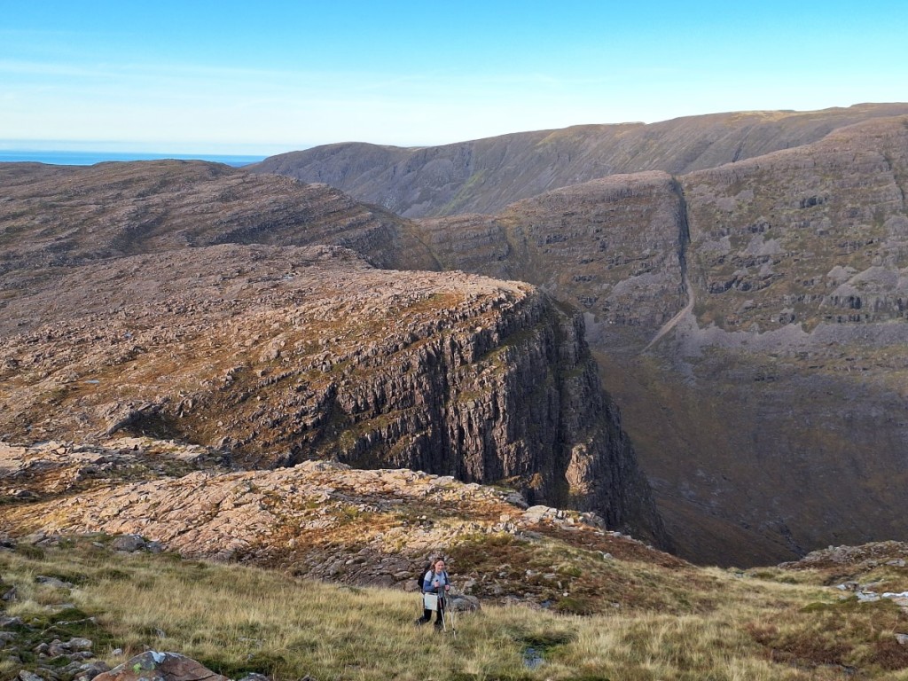
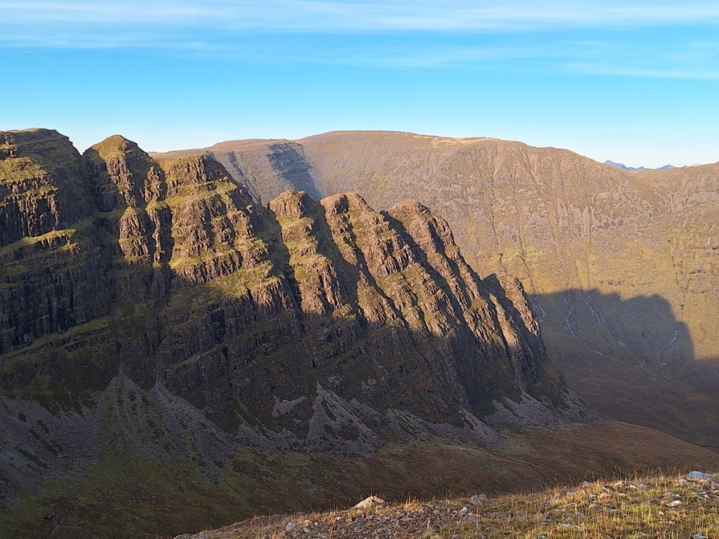
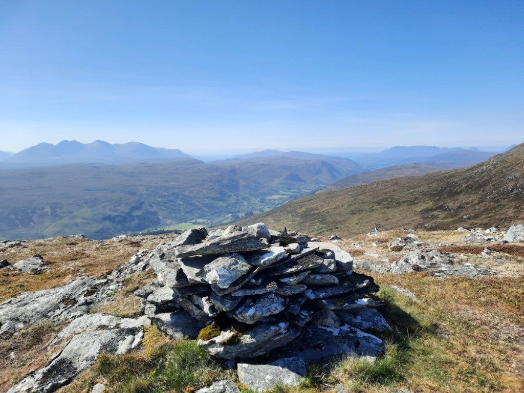
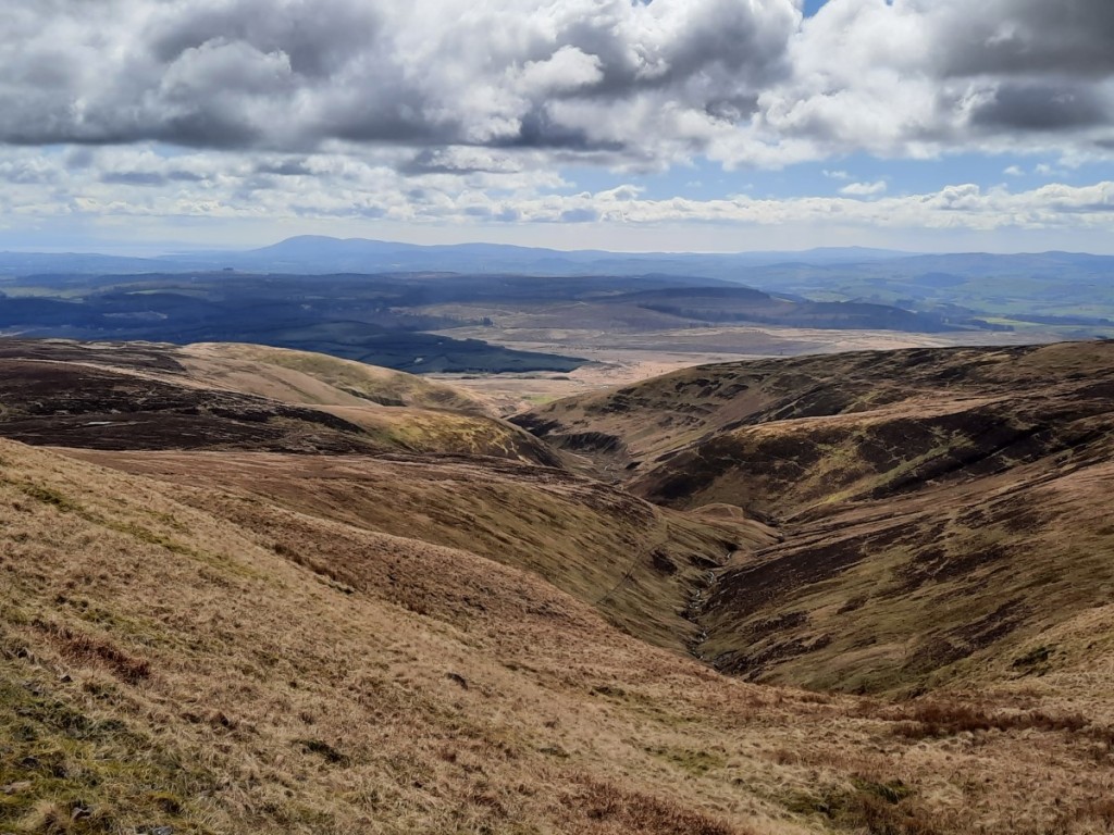
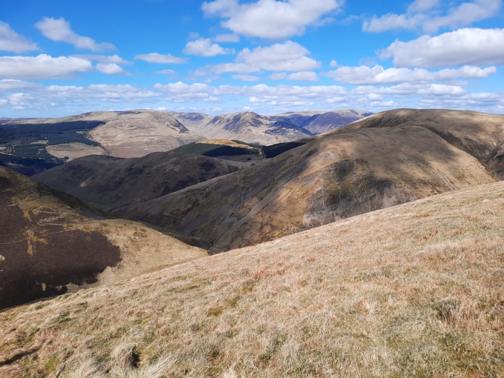
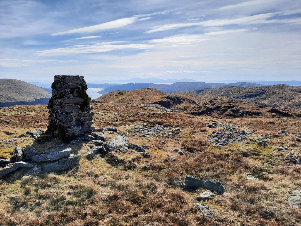
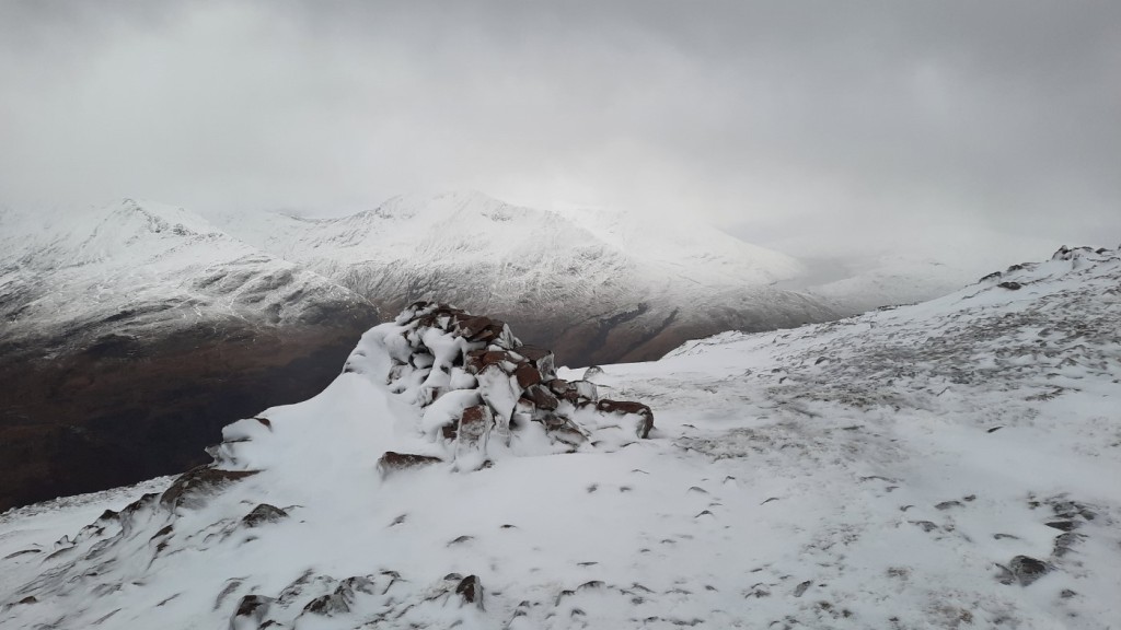
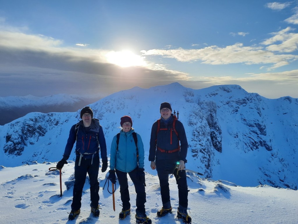
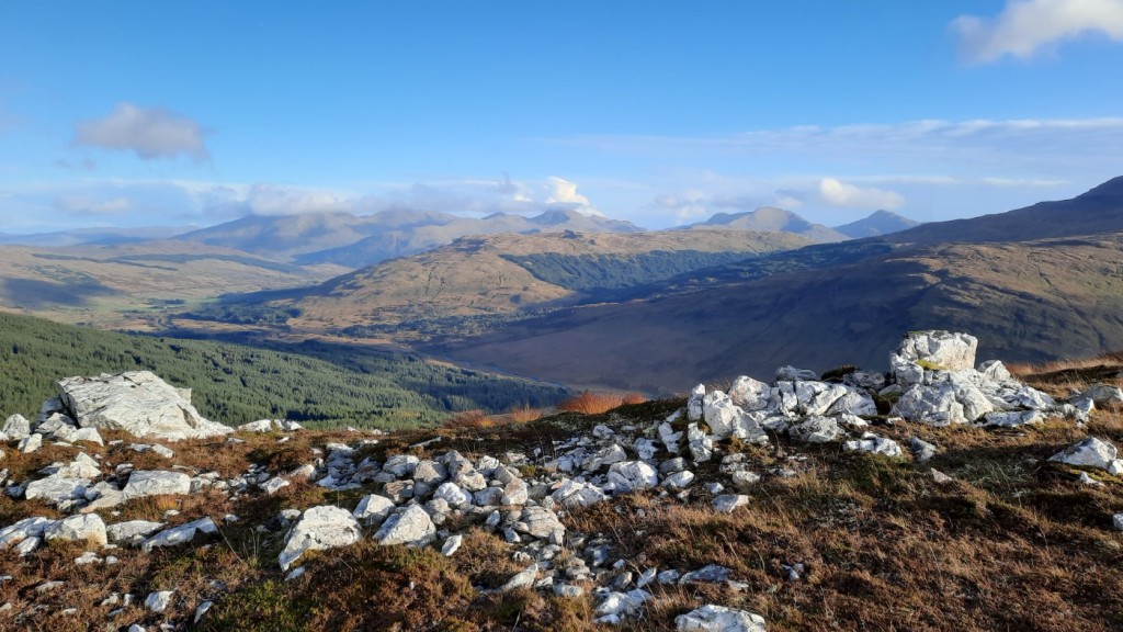
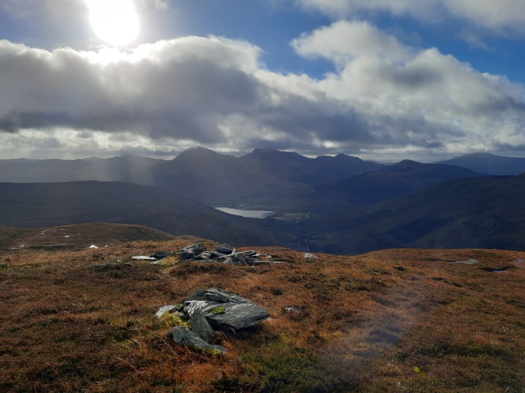
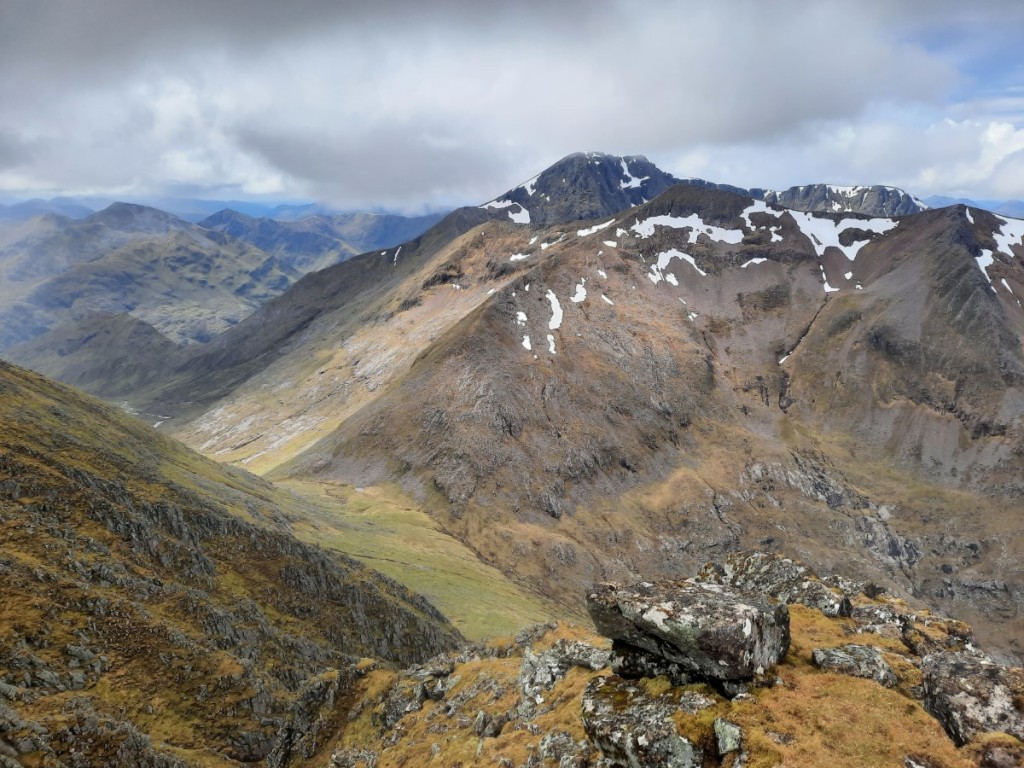
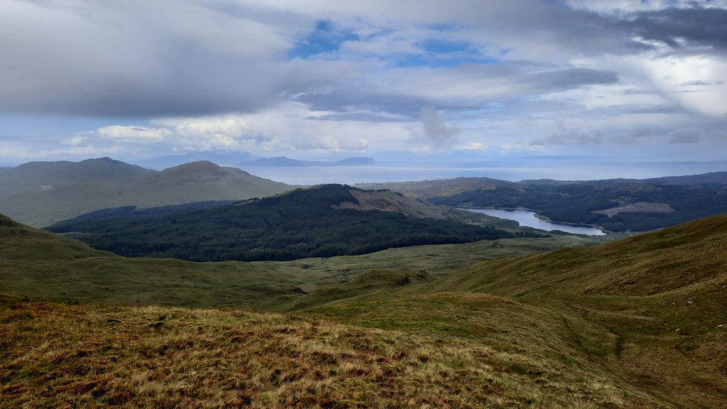
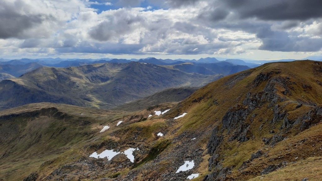
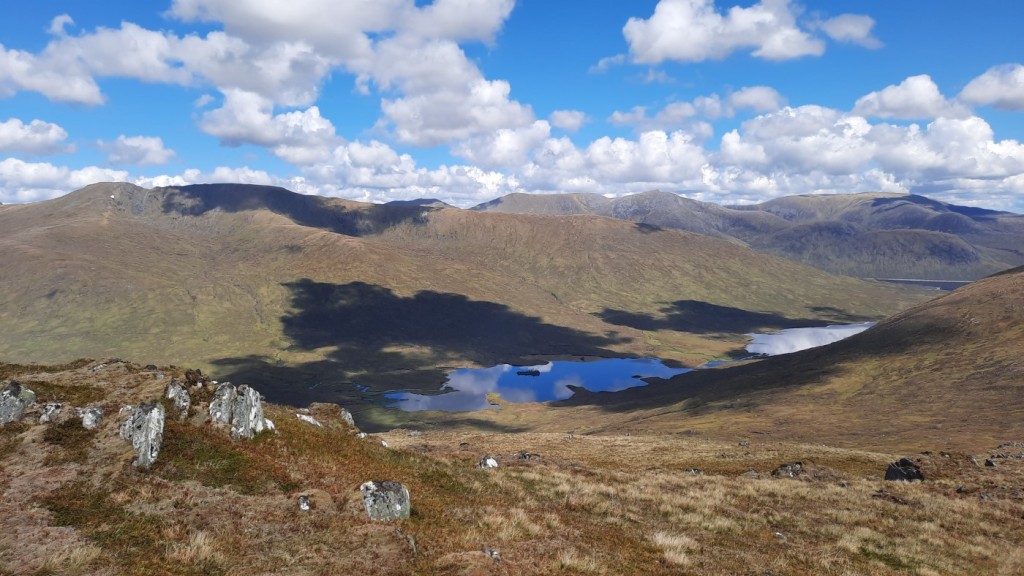
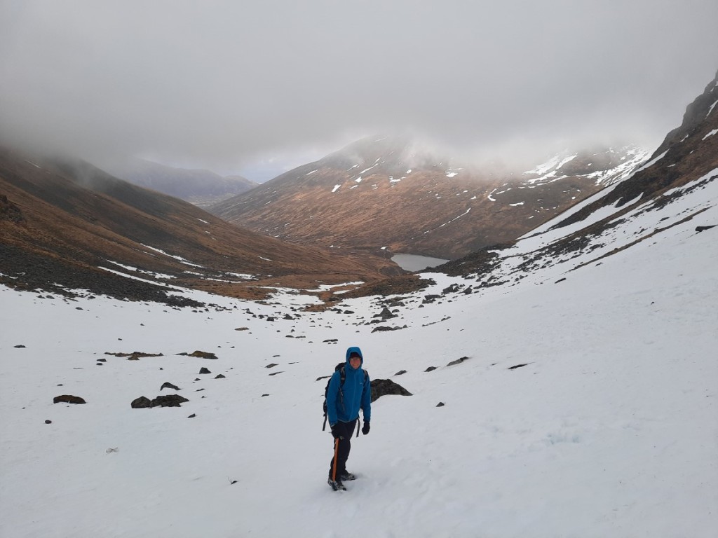
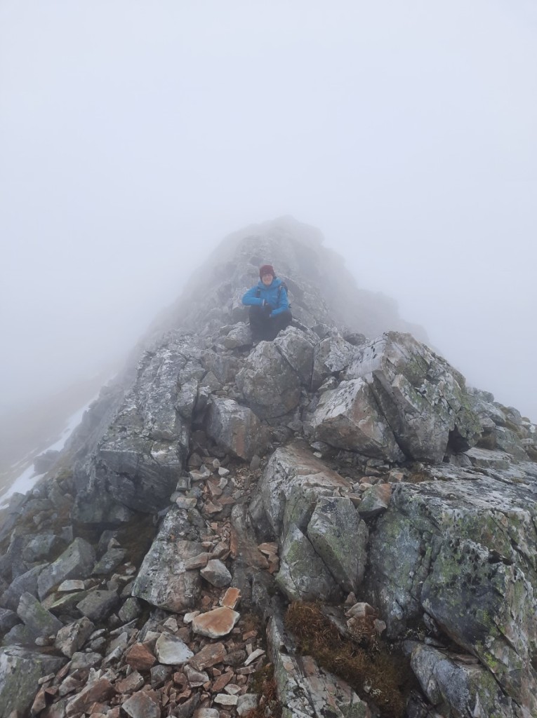
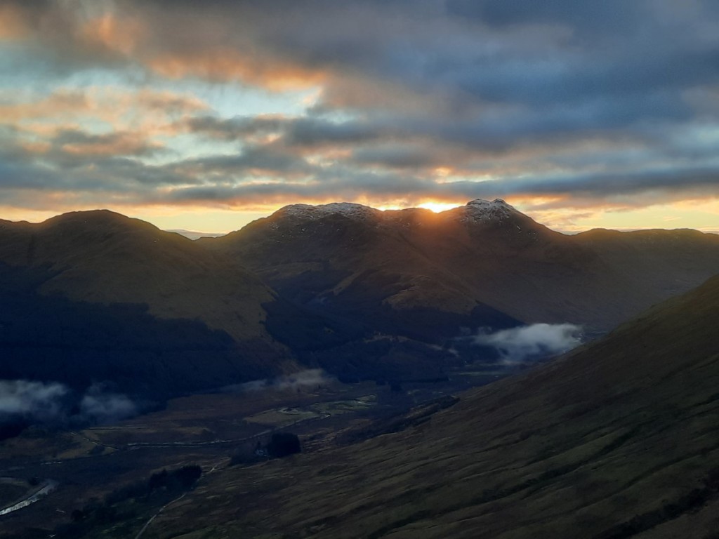
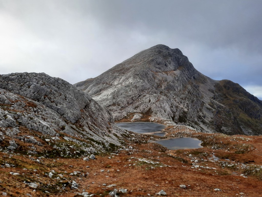
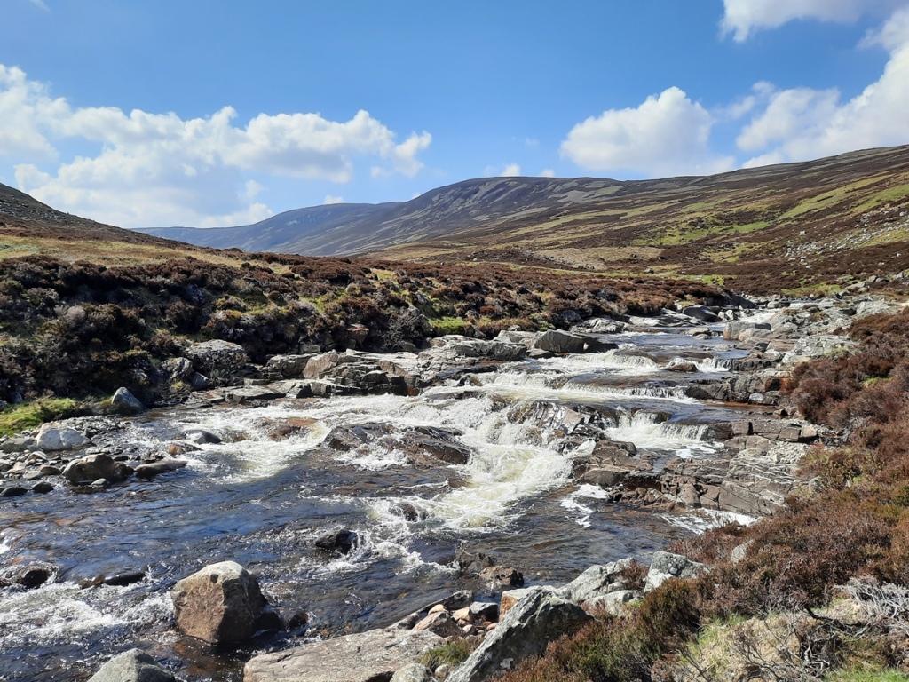
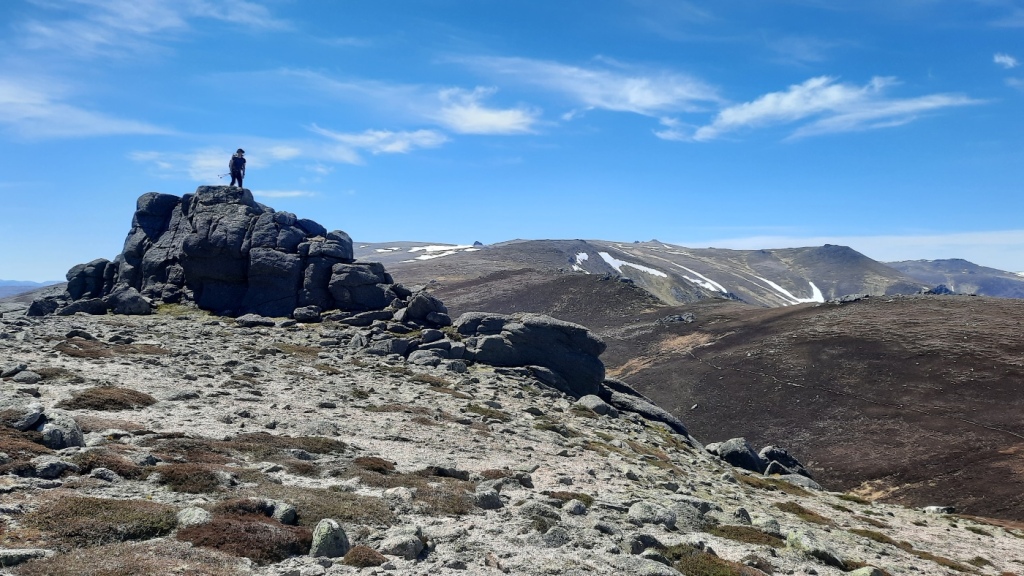
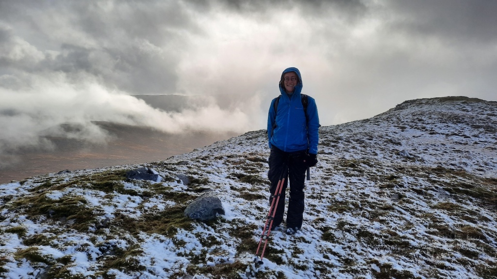
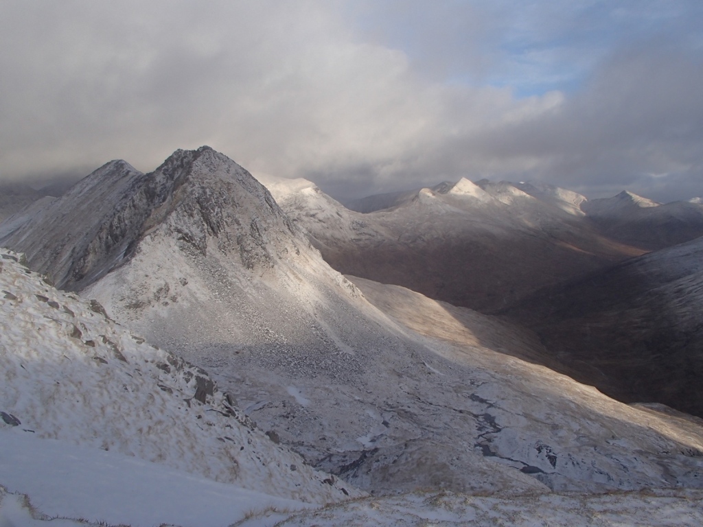
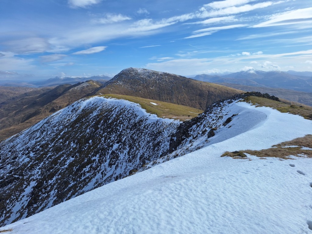
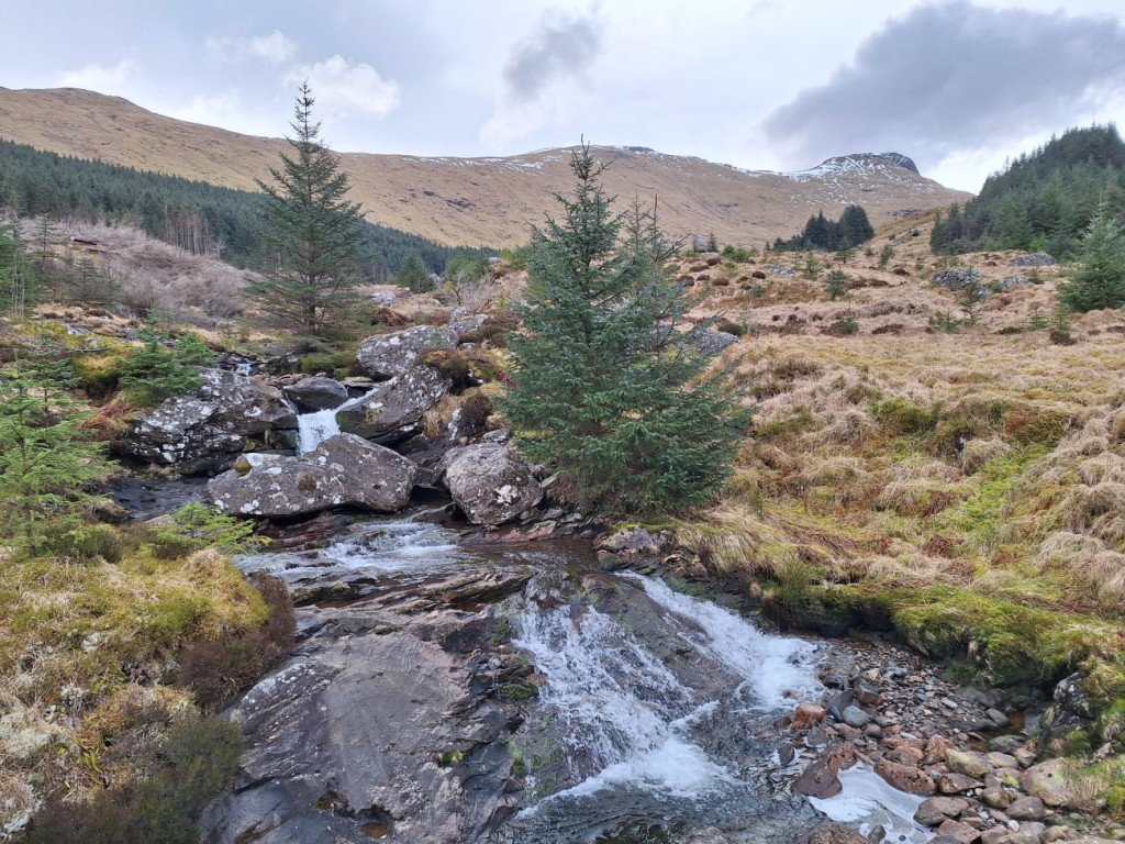
My ascent route followed forest tracks up Coire Ardrain, escaping the forest by Creag na h-Iolaire and climbing steeply from there to gain the ridge. The views of Ben More to the left and Cruach Ardrain to the right improved as I continued south to the rocky top of Stob Garbh, and the direct route to Cruach Ardrain looked pretty intimidating with a good covering of snow. Luckily I had thought of that and planned instead to contour across the corrie to the bealach with Beinn Tulaichean and climb that hill first, a route that worked well with some large, flat snowfields to cross. I saw one other walker with his dog near the summit, where I paused for a snack.

Allt Coire Ardrain
Ben More and Stob Binnein
Stob Garbh and Cruach Ardrain
Cruach Ardrain
Beinn Tulaichean

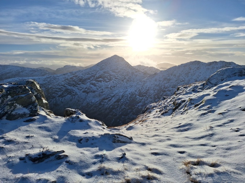
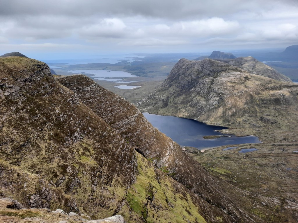
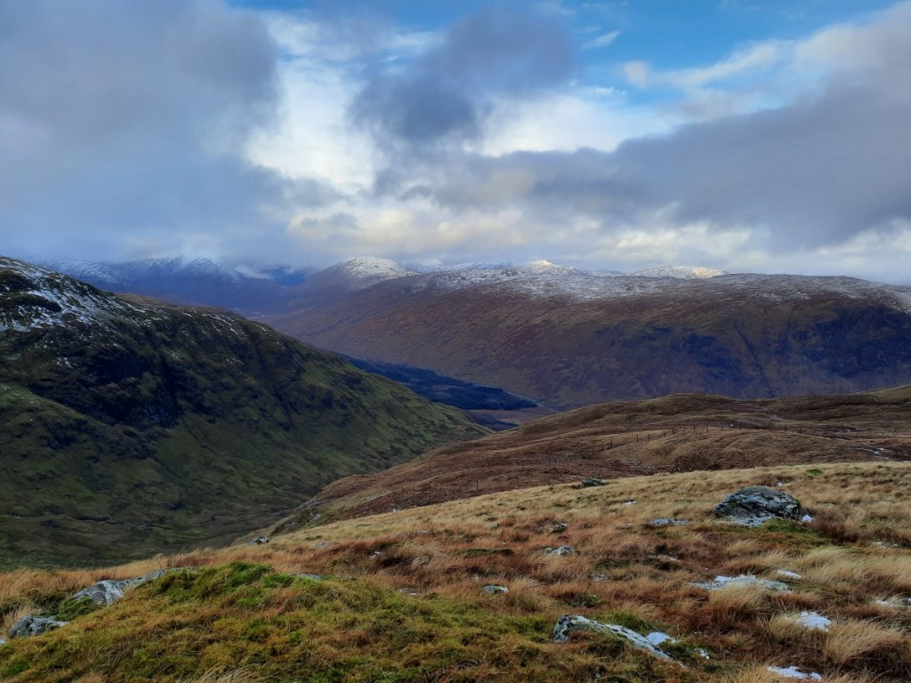
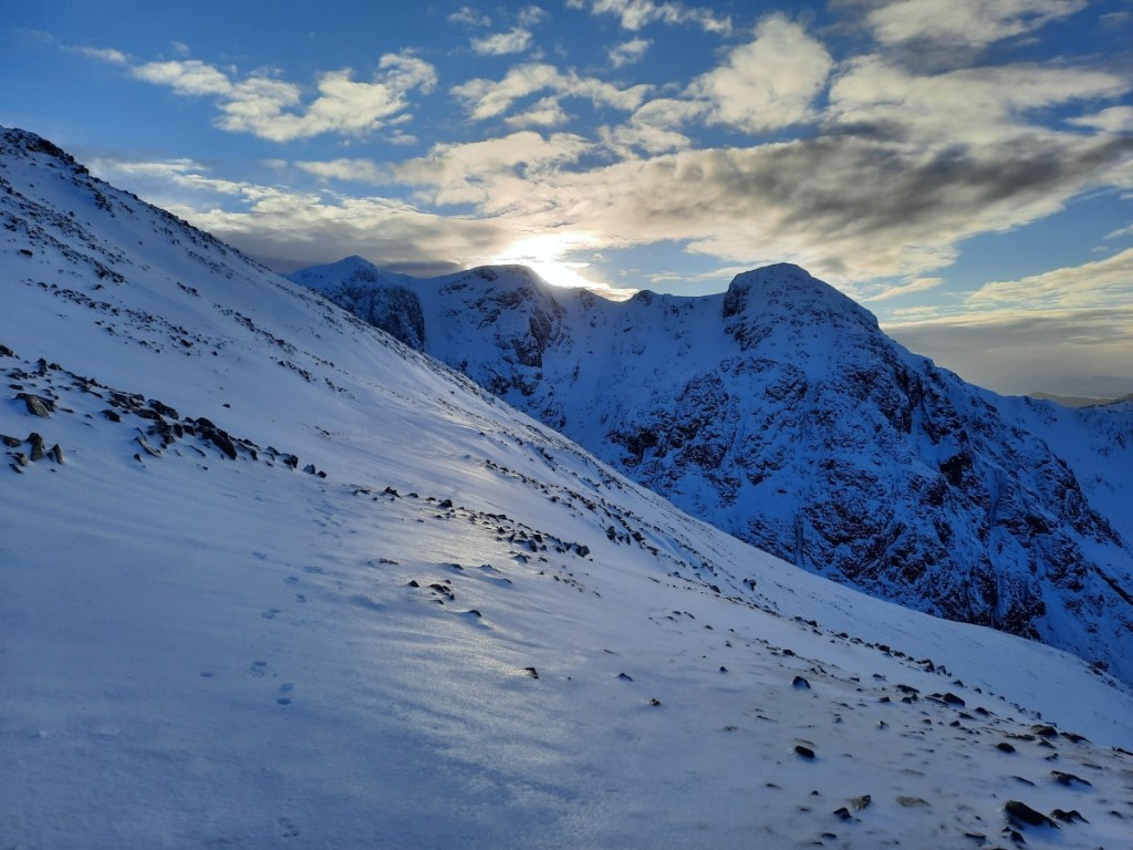
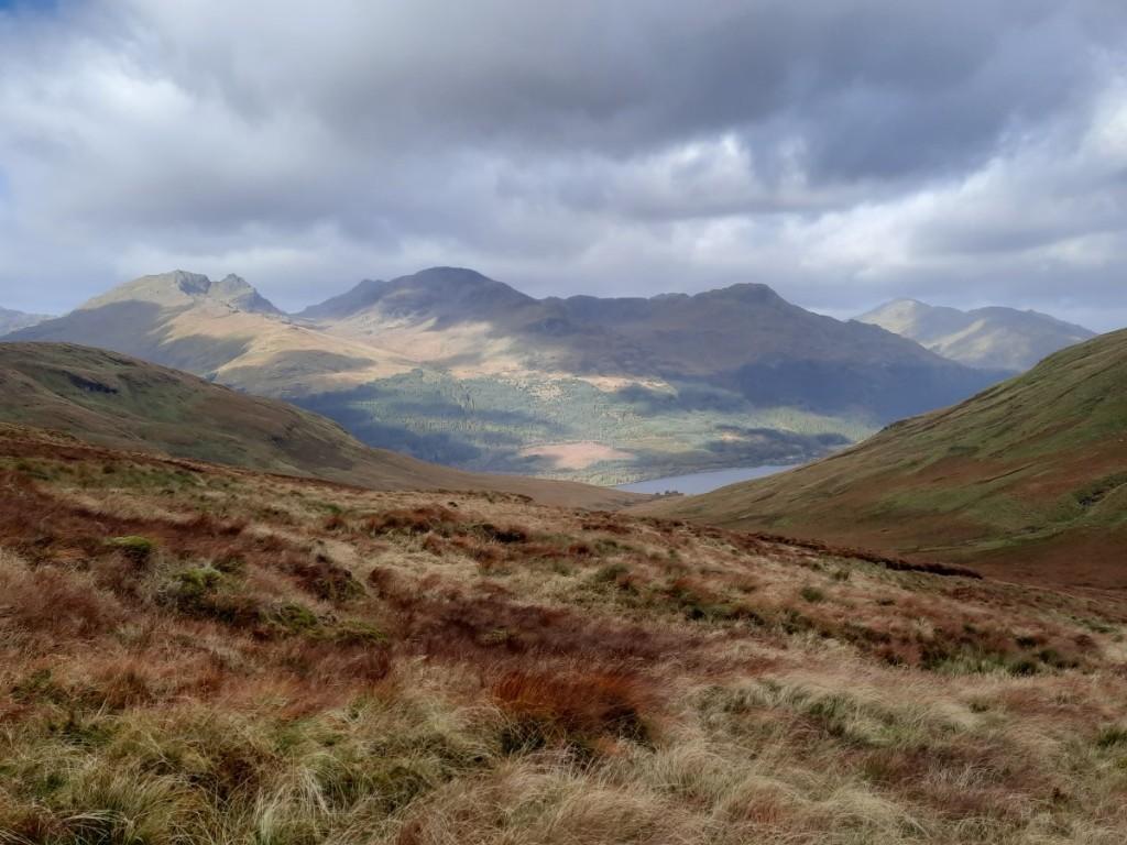
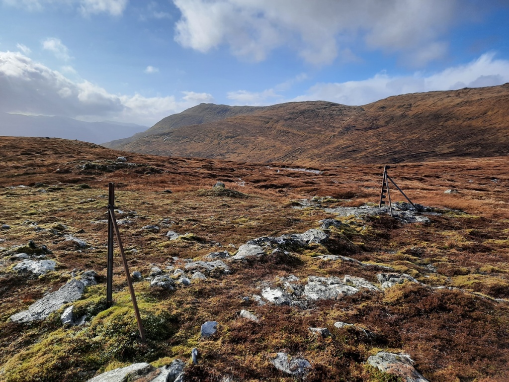
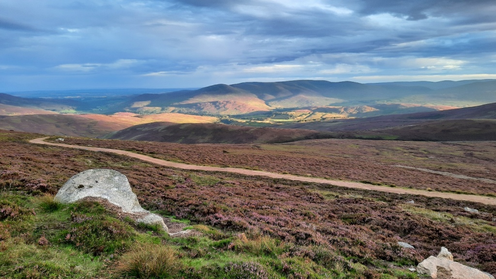
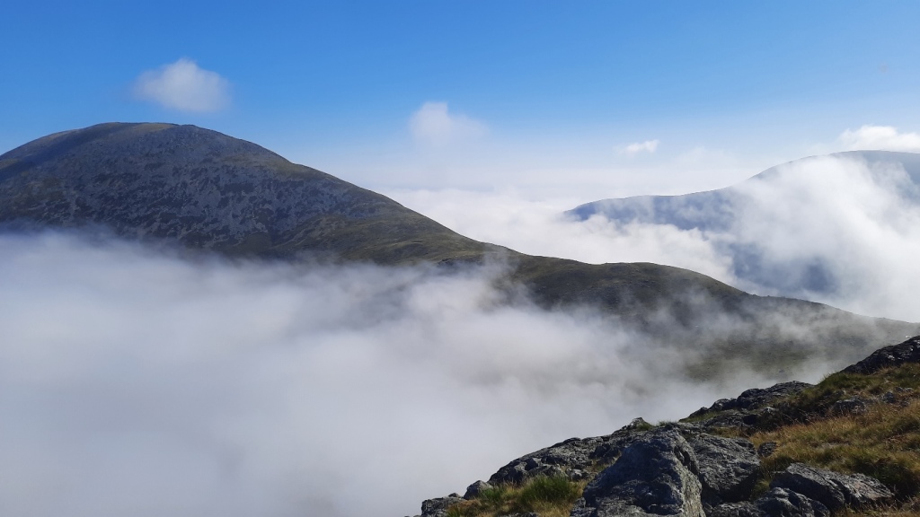
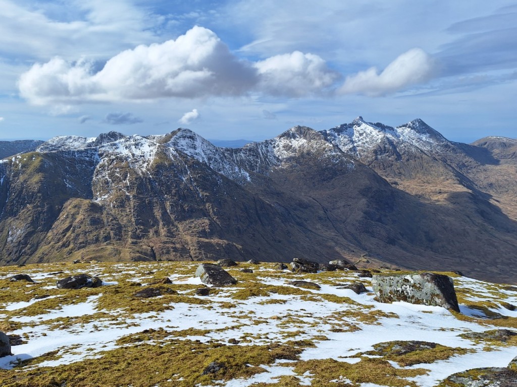
Turning back north, I followed the ridge up to Cruach Ardrain, finding some deep snow drifts near the top but nothing requiring use of the ice axe. There were good views of An Caisteal and its neighbours to the west, as well as down into Strathfillan. To return to Crianlarich, I descended the easy ridge via Meall Dhamh (where I paused for lunch) and Grey Height, passing two other solo walkers heading up. On reaching the edge of the forest, I headed northeast to pick up the end of a timber extraction track that I could see not far below, rather than going down the very boggy rides described in the guidebook.
Route map: https://www.plotaroute.com/route/2570513

The ridge back to Cruach Ardrain
Looking towards Beinn a’ Chroin and An Caisteal

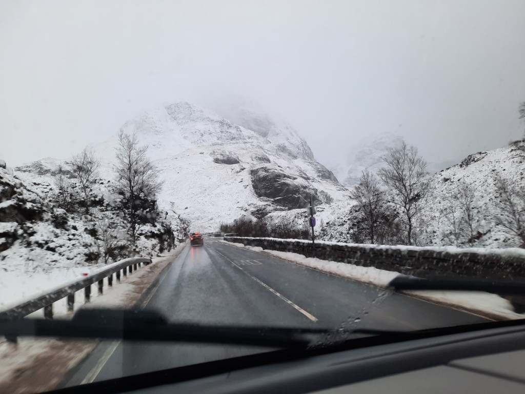
I was back at my car and on the road around 1:30pm and embarked on the drive back to Kendal. Despite some slow traffic through the Trossachs and in Cumbria, I arrived with about 20 minutes to spare before dinner with Mum, Dad, Ruth and Josh. I stayed the night at Mum and Dad’s.

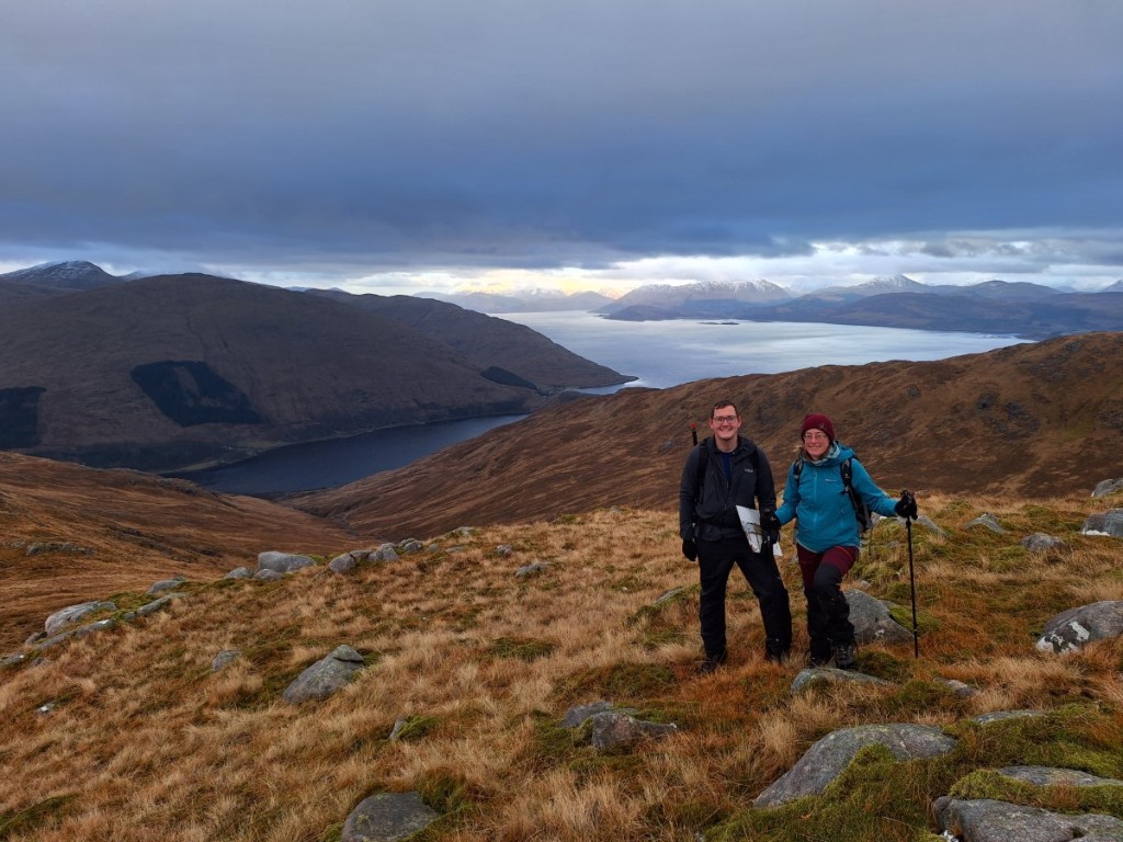
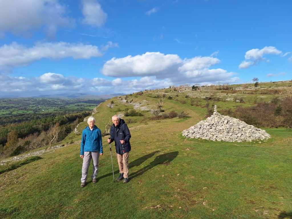
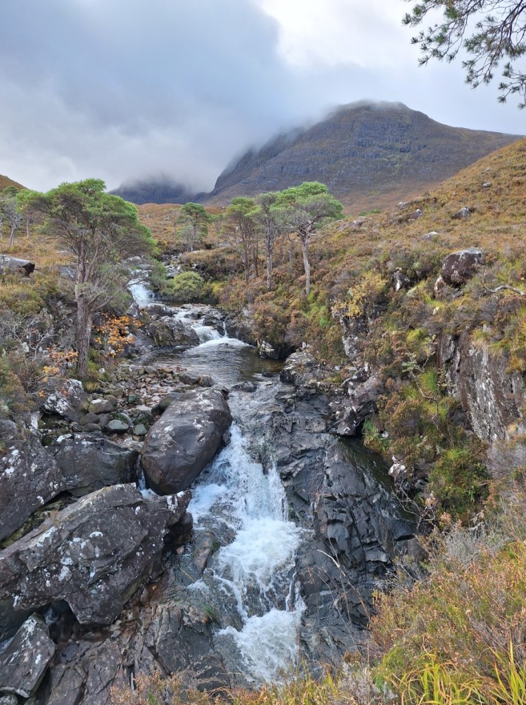
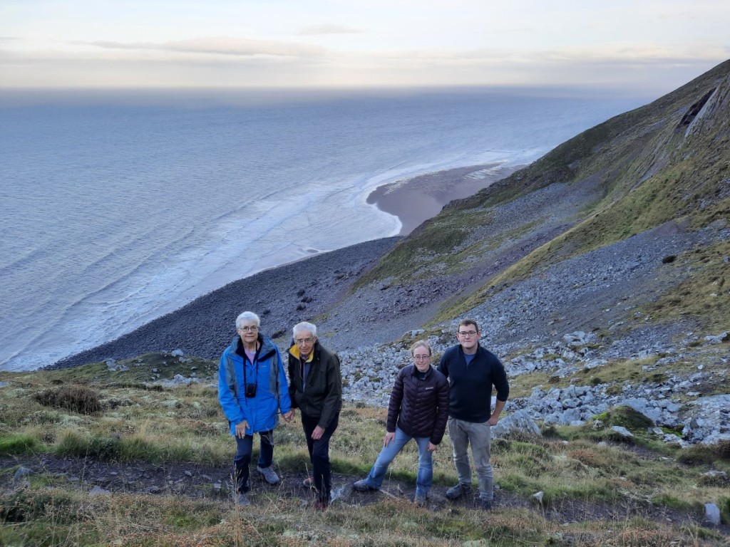
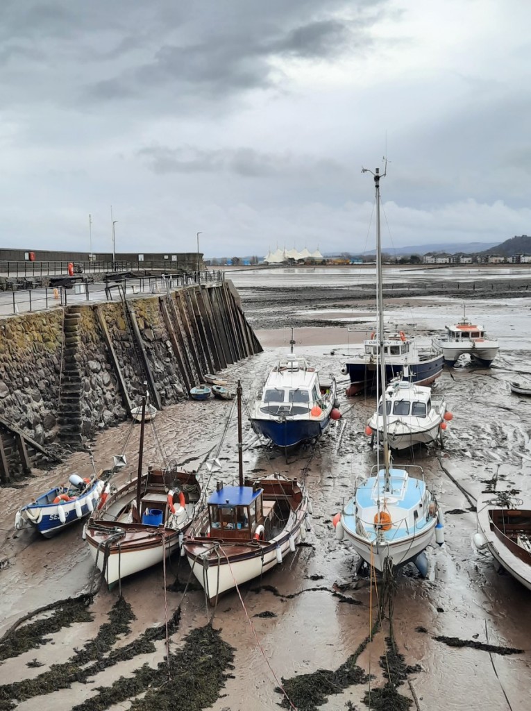
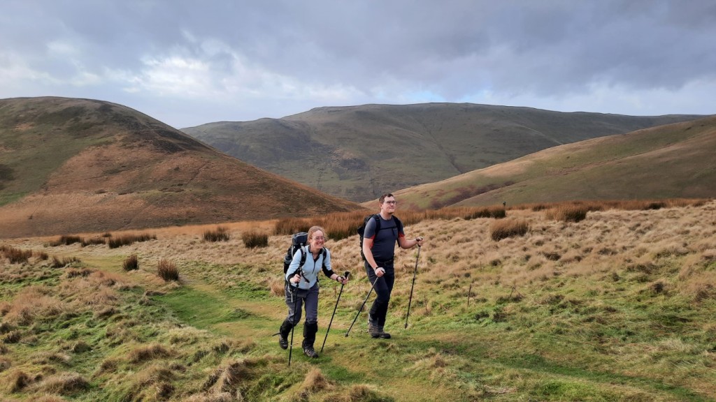
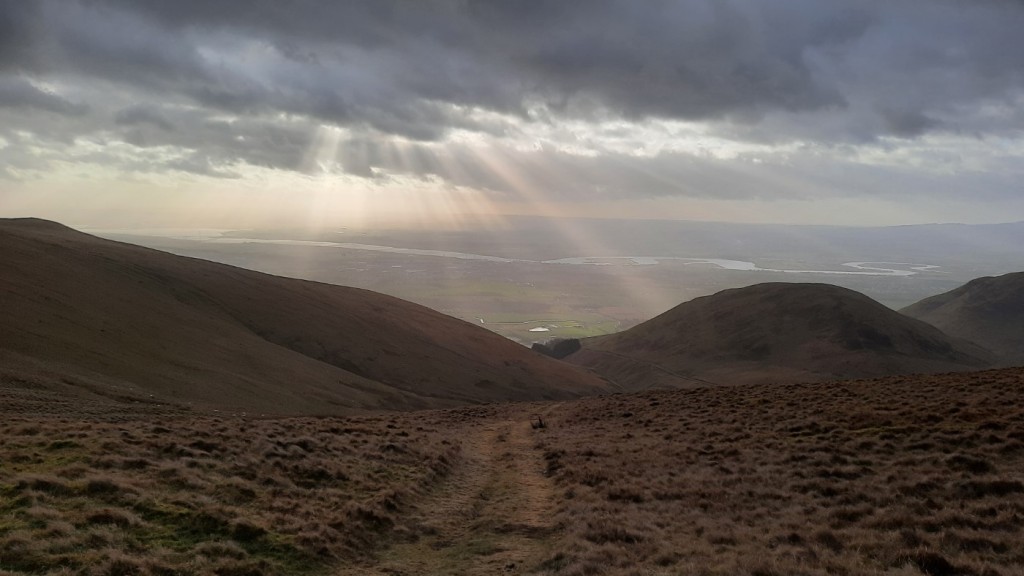
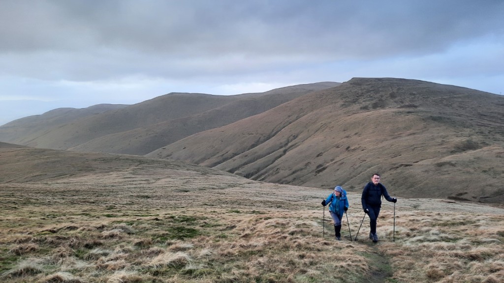
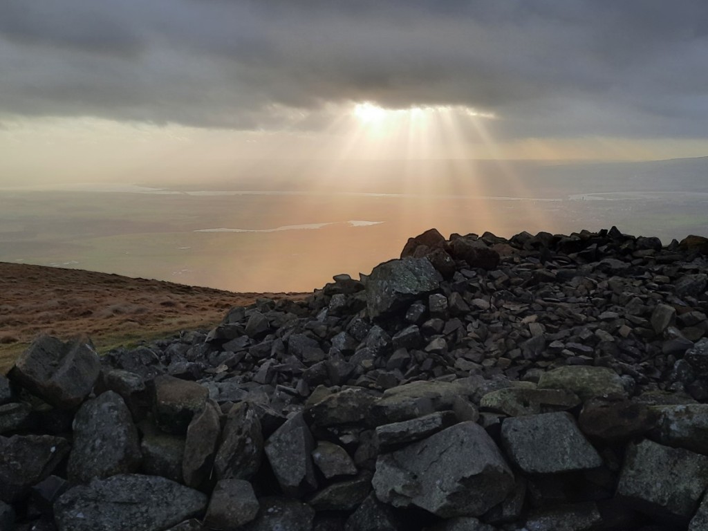
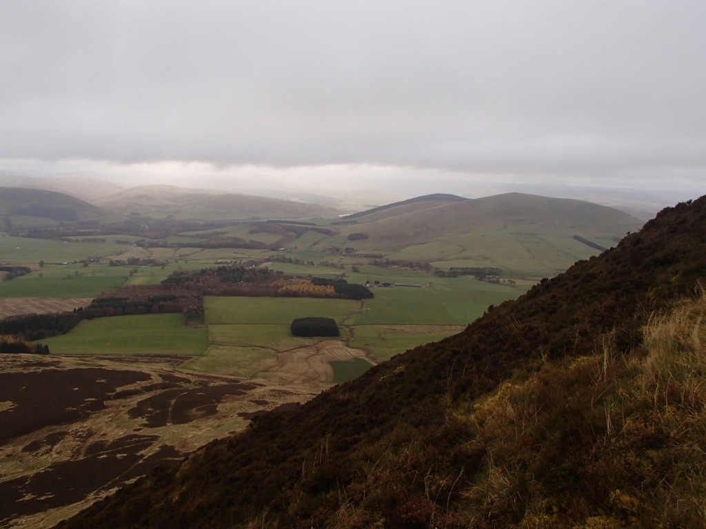
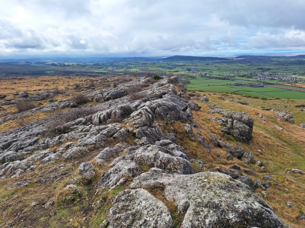
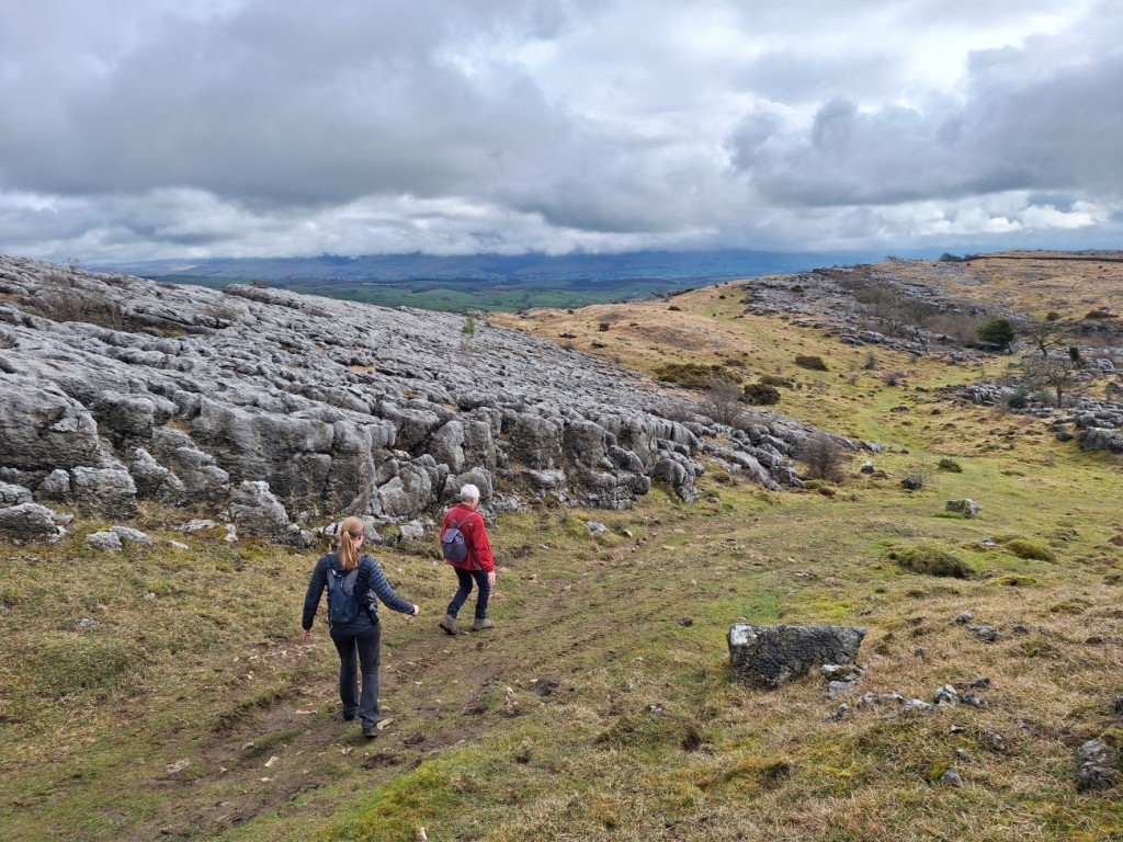
The next morning, Ruth, Mum and I went for a stroll up nearby Farleton Fell to get some fresh air before my final couple of hours’ drive home. It must be quite a few years since my previous visit to this limestone-covered hill, and it was good to refresh my acquaintance.
Route map: https://www.plotaroute.com/route/2570518

The summit of Farleton Fell
Descending from Farleton Fell

My full photo album can be viewed here. Overall, a pretty good Easter trip, with three totally dry days in Scotland and the other two only showery. I had ticked off six new Grahams and revisited four Munros. I now look forward to my next Scottish trip, to Glen Shiel in late May with the Gentian Club.

New Year in Strontian (27th December 2023 – 3rd January 2024)

For this year’s New Year break in the Highlands, Ruth, Josh and I rented a cottage in the village of Strontian, which would give a wide range of walking options across Sunart, Ardgour, Morvern and Kingairloch. After breakfast at Mum and Dad’s on Wednesday morning, I said my goodbyes then took the short drive from Kendal to Natland to meet Ruth and Josh at 8am to load Josh’s van and set off on our much longer drive! 

For the most part, the journey went well. The only significant delay was a big queue through Dumbarton where the A82 was flooded and all the traffic was being diverted through town. We wanted to go through town anyway to do our main supermarket shop at Morrison’s, but could have done without the traffic jam! It rained pretty much the entire way, so there were a lot of puddles on the road, particularly alongside Loch Lomond, but the morning snow had melted off the road by the time we came to crossing the high ground of Rannoch Moor. After a short wait and smooth crossing at the Corran Ferry, it was just a few miles to our destination, an old croft house with thick, rustic stone walls on the outside but modern décor inside and under-floor heating throughout. 

On the Corran Ferry at dusk

Thursday was forecast to be another day of frequent showers merging into continuous rain, so we didn’t think it would be much fun to climb a large hill. After breakfast looked like the least wet spell, and we used it for a 10k trail run from the cottage. We passed through Strontian village then climbed a little to follow the traversing ‘Fairies Road’ up the valley. Then we dropped down to the Strontian River and followed a loop through the attractive deciduous Ariundle Woodlands before returning down the lane. A little light rain fell at times but not enough to be unpleasant and it was good to get out for some fresh air before the heavier afternoon rain. 
Route map: https://www.plotaroute.com/route/2473008

Ruth and Josh on the Fairies Road
Strontian River

It looked like there should be some good sunny spells on Friday so we opted for a walk up one of the Ardgour Corbetts, Carn na Nathrach. This was a route that would not require fording any significant rivers after the previous two very wet days! A short drive north over the pass brought us to Kinlochan where we found a parking area a short distance up the track towards Glenhurich. We enjoyed some good sunrise colours in the sky as we set off up the forest tracks up the glen. 

Beyond the cottage at Glenhurich, we ascended more steeply on zigzagging forest tracks to reach the crest of the ridge, where a small walkers’ path marked by a pair of cairns led a couple of hundred metres through the trees to the edge of the forest. The ridge of Beinn Mheadhoin then offered an easy-angled ascent all the way to the Corbett summit, with some crunchy snow above about 550m. There were particularly good views of the parallel Meall Mor ridge to the north, with the Glenfinnan Munros and Streap becoming visible over the top as we got higher up. 

On the Beinn Mheadhoin ridge, with views to Beinn Resipol
Looking over Meall Mor towards the Glenfinnan hills

Nearer the summit, we gained views of the pointy peak of Sgurr Dhomhnuill to the south, looking much snowier than our hill. We returned the same way, with Beinn Resipol visible down the valley. 
Route map: https://www.plotaroute.com/route/2474652

The final approach to Carn na Nathrach
Sgurr Dhomhnuill

On Saturday, a storm was expected to arrive by late morning, so we got up early and were parked up by Loch Sunart at Laudale, ready to start at first light. Ruth and Josh opted to do a bike ride along the lochside track to Glencripesdale and back, while I walked up the nearby Marilyn, Beinn nam Beathrach. My route followed the track past Laudale House, then turned up Glen Laudale for a bit, before forking left onto a rougher ATV track (but still improved with proper drainage) that took me a bit further than mapped, up to around 400m. 

Beinn Resipol, from the ATV track

From there, I could see the trig point at the summit, so just made a bee-line directly for it, traversing the northern slopes of Beinn Bhan then ascending fairly steeply on short grass between small crags to the summit. I could see that the rain front was only a few miles away to the south, and it was already pretty blustery. I quickly grabbed a few photos of the view, most impressively over the sea to Rum and Skye, and over Loch Sunart to Beinn Resipol, then started my descent by the same route. 

Looking towards Rum and Skye

It didn’t take long to get back to the head of the track, by which time it was snowing lightly. The cloud was dropping fast, so it was good to have the clear path to follow, to save having to think much about navigation. Once down in the valley, the snow had turned to wet sleet, so I put on my full waterproofs for the final few kilometres along the tracks back to the van. On the shore of Loch Sunart, the easterly wind was very strong, and it was a real battle to maintain progress upwind! I was thankful that Ruth and Josh, having got back about half an hour sooner, had moved the van a little closer to Laudale House, beyond the end of the public road, to save me some time in the rain! We returned to the cottage for lunch and a leisurely afternoon indoors. 
Route map: https://www.plotaroute.com/route/2474650

New Year’s Eve was another day with showers forecast. Ruth was keen to do a hill with coastal views and I fancied bagging a Graham, so we met both objectives by heading to Kingairloch for a walk around the horseshoe of Beinn Mheadhoin. Josh was also inspired by the opportunity to pass above the huge Glensanda granite ‘superquarry’ on the south side of the hill. 

We parked by the Boathouse Restaurant, as suggested by the Graham guidebook, and set off through the Kingairloch estate with its main lodge and various associated cottages. We followed a track up to a transmitter on the lower slopes of Sgurr Shalachain, then continued on rough grass, gently then more steeply, to reach that summit, with good views east over Loch Linnhe. 

Looking up to Beinn Mheadhoin from Kingairloch
Looking over Loch Linnhe from Sgurr Shalachain

That was the majority of the hard work done for the day, as the continuation over Beinn na Greine to Beinn Mheadhoin was gentle and grassy, and did not have any significant snow cover. There were distant views of Moidart and Ardgour under cloudy skies to the north, whereas it was a lot sunnier around Glen Nevis and Glen Coe to the northeast. It looked like a day in the Mamores would have been a great choice for those based the other side of the ferry! To the south, Mull was mostly obscured by low cloud, but there were good views over the sea towards Oban, with the peaks of Scarba and Jura visible in the distance.

Beinn Mheadhoin from Beinn na Greine
Josh and Ruth on Beinn Mheadhoin

We continued around the horseshoe to Beul Choire nan Each, there gaining our first view of the quarry. Further along, a viewpoint had a sign pointing out the key features, including the “glory hole” shaft used to deliver the crushed granite 500m vertically downwards for extraction to the coast. 

Looking over the Glensanda Quarry to the sea
Sunnier conditions over Ben Nevis, the Mamores and Beinn a’ Bheithir

We found a sheltered spot for lunch, then descended easily by the ridge of Meall an Doire Dhuibh. A zigzagging stalkers path led down the final stretch to the cottage at South Corry, where we picked up tracks back to the van. We were pleased to have got away without any significant rain all day. 
Route map; https://www.plotaroute.com/route/2476267

Josh and Ruth on the descent ridge

New Year’s Day promised high cloud and we were keen to find some deeper snow so we headed to the highest hill in the area, Sgurr Dhomhnuill. The skies were quite clear as we set off from Ariundle after a very short drive up the valley, and the peak was visible in the distance. The first few miles were up good tracks through the Ariundle woodlands – with lots of attractive moss and ferns on the trees – to the old lead mines at Fee Donald, one of the places where the element strontium was discovered in the ore and named after the village. 

Moss and ferns

We crossed the fairly large stream without much difficulty and were soon on the snowy slopes of Druim Leac a’ Sgiathain, mostly following footprints left by others who had been up on previous days. A heavy shower missed us to the south, followed by dramatic light conditions towards Garbh Bheinn, with shafts of sunshine through the broken cloud swirling around its summit. 

Looking towards Sgurr a’ Chaorainn and Sgurr nan Cnamh
Dramatic light over Garbh Bheinn

Higher up, we opted to take the ridge route over the subsidiary summit of Sgurr na h-Ighinn, leaving behind the footprints that had taken the traverse route to the left. The snow was steep enough to get the ice axe out for security, but not hard enough to want crampons. 

Moody skies over Sgurr Dhomhnuill
Sgurr a’ Chaorainn and Garbh Bheinn

We dropped down to the saddle then ascended more steeply up the final cone of Sgurr Dhomhnuill. Here, the recent snow had almost eradicated traces of the previous visitors’ route, but the obvious ramps and ledges led us to the summit without difficulty. The next shower passed us by to the north! We took in the magnificent views for a while on the calm summit, then headed back down to the saddle, following our own footprints. This time we took the traverse path around the side of Sgurr na h-Ighinn, pausing for lunch part way along. It stayed dry for the descent to the mines, then a bit of light rain set in for the final few kilometres through the forest. A great winter’s day on the hill! 
Route map: https://www.plotaroute.com/route/2476269

Sgurr Dhomhnuill
The view from Sgurr Dhomhnuill towards Garbh Bheinn

For our final day, we headed west along the Ardnamurchan peninsula. I was dropped in the hamlet of Laga for another Marilyn-bagging walk, while Ruth and Josh drove out to the lighthouse and nearby beaches for a coastal stroll. Ben Laga proved to be an attractive, rocky summit, despite its modest height of just 512m. I ascended on a good track through the 10-year-old Laga Woodlands, then fairly direcly up heather and grass between the crags to the summit, with its two cairns and a small lochan. It was just below the cloud, so I was able to enjoy the views along Loch Sunart towards Ben Hiant, and also towards Beinn Resipol and Loch Shiel. 

Loch Sunart and Ben Hiant, from Ben Laga
Many lochans north of Ben Laga

I followed the ridge north and then dropped down to the end of Loch Laga, before re-ascending on easy grassy slopes to a slightly lower Marilyn, Meall nan Each (490m). This was not as interesting a peak but gave good views towards Moidart. I had lunch in the shelter of a crag, then descended south to pick up the tracks back to the road. As Ruth and Josh had said they would be about another hour, I chose to walk a couple of kilometres east to the next car park at Port nan Gall, to fill the time. It had been another day with fewer showers than forecast, and I was surprised not to have needed my waterproofs! 
Route map: https://www.plotaroute.com/route/2477128

Loch Laga and Ben Laga
Colourful forest near Port nan Gall

We got all the packing done that we could on Tuesday evening, and were able to get away by 8am on Wednesday morning. After crossing the Corran Ferry, we paused for half an hour at the younger Duffers’ cottage in Ballachulish, then continued on our way south. The drive went well, arriving in Natland around 2:30pm. I continued straight away and was home just after 5pm, in time to do most of my unpacking and get some laundry on before heading out for my usual Wednesday evening run with friends in Hartshorne! 

In summary, a good varied week in the Highlands. The weather was generally better than forecast, and the waterproofs didn’t get used very extensively at all! I ticked off one new Graham and three other new Marilyns, and revisited two Corbetts, and the day on Sgurr Dhomhnuill felt like a proper winter outing. My full photo album can be viewed on Google Photos here. 

Torridon, mostly (13th-22nd October 2023)

Mid-October brought my usual autumn week in the Highlands. This year I decided to make the driving easy by spreading the northward and southward trips over three days each. My travels commenced on the Thursday night, heading up as far as my parents’ new house in Kendal. Friday morning was a bit damp, so we had a leisurely start and an early lunch before heading out for an early-afternoon stroll on nearby Scout Scar. We were lucky to have sunshine, giving great views towards the Lake District and Morecambe Bay.

Mum and Dad on Scout Scar

After that, I continued my drive, heading up to Pitlochry Backpackers’ Hostel for the night, with a quick dinner stop at McDonalds at Stirling Services. Parking was tricky, with the town thronging with evening visitors to the ‘Enchanted Forest’ and extra restrictions on the streetside bays, but I found a space to squeeze into in the hostel car park after taking a second look on foot,

I began Saturday with a visit to Faskally Forest parkrun, just north of town. It was a beautiful sunny morning, with the early-autumn forest colours shown off to good effect across the loch. The course is a challenging one, with seven sharp ascents totalling around 100m, and some rough terrain underfoot, so I was pretty happy to finish in just under 21 minutes.

Loch Faskally

Afterwards, I drove half an hour south to the hamlet of Amulree for a walk over a pair of Grahams. The route was essentially a horseshoe of the Girron Burn. I crossed slopes of grass and heather to reach Meall Reamhar – with good views towards Glen Almond and Schiehallion – then made a steep descent and reascent across the bealach to Meall nan Caorach, followed by an easy grassy descent back to Girron. The sunshine continued, but it was pretty cold in the breeze.
Route map: https://www.plotaroute.com/route/2419214

Looking into Glen Quaich from Meall Reamhar, with Schiehallion in the distance

Once back at the car, I set off for the final section of my journey north, up to Torridon with a pause to pick up groceries at Tesco Extra in Inverness. This was the first time I’d stayed at the SYHA hostel in Torridon village, and I found it to be excellent – spacious, comfortable and well-equipped. I cooked and ate, then planned my walk for the next day, and had a good night’s sleep.

With fairly strong winds, cloud likely to be around 700m, and a possibility of frequent showers, it seemed like a good day to bag another Graham. My choice was Beinn a’ Mhuinidh, north of Kinlochewe. The guidebooks recommended an interesting route that I wouldn’t have picked out from the map alone, ascending on a small path beside the impressive waterfall on the Allt na Still, which tumbles down the crag on the southwest side of the hill. That gave access to the high western terraces, which were an impressive viewpoint for Slioch, not far away to the west.

The waterfall on Allt na Still
Slioch

The summit was just in the cloud, and quite cold in the wind, so I didn’t pause long there before descending south, soon regaining views over the plateau with its many small lochans. With the weather apparently brightening, I opted to make the small detour to the minor top of Meallan Ghobhar, before descending steeply by another small path beside the Allt Chnaimhean. This final section gave particularly good views over Kinlochewe to Beinn Eighe.
Route map: https://www.plotaroute.com/route/2419217

Lochans on the lower plateau of Beinn a’ Mhuinidh
Beinn Eighe

Monday’s forecast was a little better, with the cloud expected to lift off the higher tops in the afternoon, so I opted to walk up the pointy Corbett of Beinn Damh, via the adjacent Graham, Beinn na h-Eaglaise – a clockwise circuit of Coire Roill. The initial climb through the forest above the Torridon Hotel was easy and pleasant, with an impressive waterfall in the gorge below, and gave access to a fairly easy, rocky ascent of the northwest ridge of Beinn na h-Eaglaise. Cloud was swirling around the summit but giving intermittent views up Glen Torridon and along Upper Loch Torridon. Beinn Damh and the Glen Carron Munros were stuck in thick grey cloud though, so I had no views that way!

Allt Coire Roill
Upper Loch Torridon

The descent to the bealach at Drochaid Coire Roill was more awkward than expected, with a series of small rocky terraces to find a way through. The climb up the other side onto Beinn Damh was very steep and heathery, but I found that any scrambling was easily avoided, which was welcome in the damp and slippy conditions. The cloud didn’t seem to be showing any sign of thinning or lifting, and the visibility at the summit was very poor, such that I required a compass bearing to follow the ridge path onwards, despite that path being marked with closely-spaced cairns!

It was only when I dropped off the side of the ridge into the head of Toll Ban that I finally got clear of the cloud at around 550m. Torridon village and the loch seemed to have been in the sunshine all day, while all the mountains were in thick, damp clag! The good path made for a quick descent back to the car. Even by sunset, the cloud had not lifted off the hills, so at least I did not wish I had made a later start.
Route map: https://www.plotaroute.com/route/2419222

Sunshine over Glen Torridon

Tuesday was the one day with an excellent forecast, so it was no surprise that Amy picked that day to meet for a walk. We decided to take advantage of the fact that we had two cars available and do a linear traverse over both the Applecross Corbetts. We met, around sunrise, at Tornapress at the bottom of the Bealach na Ba road, and drove up to the top of the pass in convoy. There seemed to be a rush of traffic into Applecross at that time of the morning, but luckily almost nobody going the other way (it’s a single-track road). We left my car at the top, then drove back down in Amy’s, and north to the shores of Loch Shieldaig, where we parked at Inverbain.

Early morning sunshine on the Cuillin, from the Bealach na Ba

The stalkers’ path beside the Allt an Srathain was pretty solid and rocky to start with, but became boggy and indistinct as we approached the bealach below Croic-Bheinn. There were excellent views over the loch to the Torridon hills as we climbed. At the bealach, we turned left to cross fairly rough, grassy terrain to reach the long north ridge of Beinn Bhan, which gave improving views towards Skye on the right and the Glen Carron hills on the left.

Torridon
Looking over Loch Lundie to the Torridon and Glen Carron hills

Once past the Far North Top (the unnamed 710m ring contour), we stuck close to the eastern side of the ridge to enjoy the dramatic views over a series of steep and rocky corries: Coire Gorm Beag, Coire Gorm Mor, Coire Toll a’ Mheine, Coire an Fhamair, and Coire na Poite – lots of photo stops required!

Coire Toll a’ Mheine
Amy above Loch Lundie and Loch Shieldaig
Coire an Fhamair

Eventually we reached the summit of Beinn Bhan, then turned west for the long and rough descent to Bealach nan Arr. There were fragments of path here and there, but often they were not easy to spot from above! We traversed a terrace around the head of Coire nan Arr then continued south, climbing steadily to the transmitter on the west top of Sgurr a’ Chaorachain.

Amy on Beinn Bhan
Coire Atadail
Amy above Coire nan Arr

After a long and mostly pathless walk, it was good that the continuation to the summit of Sgurr a’ Chaorachain only involved a modest descent and reascent, and had a small path much of the way. The narrow ridge gave more superb views of the Na Ciochan ridge towards Beinn Bhan. After a short pause at the summit, we headed back to the transmitter, then easily down the access track to the Bealach na Ba, arriving a bit before sunset. That just left me to drop Amy back to Inverbain on my way back to Torridon. A fantastic day out on dramatic hills with good company and perfect weather!
Route map: https://www.plotaroute.com/route/2420319

Na Ciochan and Beinn Bhan
Returning from Sgurr a’ Chaorachain, with sunset behind Skye ahead

Wednesday was a windy but mostly dry day, with high cloud. I was sorely tempted to have a go at a traverse of Liathach with an attempt at bagging Meall Dearg, the Munro Top beyond the Northern Pinnacles, but finally decided it was too reckless in the wind. With hindsight, it might actually have been okay. Instead, however, I headed back around past Kinlochewe to bag another Graham, Beinn a’ Chearcaill, which offered fine views of the north side of Beinn Eighe.

My walk started up the good stalkers’ path up Glen Grudie, then forked right onto an unmapped path up Coire Briste, which petered out at a lochan near the bealach on the ridge. As the weather was pretty good, I opted to include the book’s suggested scenic detour to Creag na Feol, which gave grand views into the big corrie between Ruadh-stac Mor and Ruadh-stac Beag.

Beinn Eighe and Liathach, from Creag na Feol

Then it was an easy walk west across the plateau, with a tail wind, to the main summit of Beinn a’ Chearcaill. The summit area is very unusual, a huge flat sandstone slab scattered with boulders, with a cairn at the northwest end. The views into Beinn Eighe’s Coire Mhic Fhearchair, with its famous Triple Buttress, were particularly good. Beinn Dearg (with Beinn Alligin beyond) and Beinn an Eoin were also impressive to the west.

Coire Mhic Fhearchair, Sail Mhor, and Spidean a’ Choire Leith
The summit of Beinn a’ Chearcaill

Once I’d finished taking in the scene, I continued for three kilometres north along the ridge to the minor summit of A’ Choineach Beag, a better viewpoint for Loch Maree, with the Letterewe and Fisherfield hills beyond. I found an almostly totally sheltered spot below a crag to eat my lunch, then pottered back down Coire Briste and Glen Grudie to the car.
Route map: https://www.plotaroute.com/route/2421225

Loch Maree

On Thursday, the easterly winds picked up much more, as Storm Babet pushed into Scotland. The forecast predicted 108mph gusts on Liathach, so it was no day to be on the high hills! As it was dry, however, I didn’t want to write off the day entirely, and decided to see if I could get up the lee side of nearby 437m Marilyn, Seana Mheallan, which had looked attractive from Beinn na h-Eaglaise on Monday. Others on the hill-bagging website had recommended a route along the Abhainn Thrail then up one of the streams on the southwest of the hill, and that proved to be good advice. The river had several pretty sections of rapids, then a small path beside a deer fence led me up into the corrie, only leaving a straightforward and mostly sheltered climb on grass to get close to the top.

Abhainn Thrail, and Seana Mheallan

The wind was really whipping across the summit, picking up water from the small lochans to give heavy spray downwind. However, it was only a short, crouched-down dash from the last sheltered spot to the summit cairn, where I was able to brace myself against the rocks to get a few photos before beating a retreat back to the calm!
Route map: https://www.plotaroute.com/route/2422049

The summit of Seana Mheallan, with Liathach in the background
The view towards Maol Chea-dearg

I descended the same way, then drove east to Inverness, pausing in a layby for lunch near Achnasheen, and getting really poor fuel economy driving directly into the wind! I was too early to check into the SYHA hostel, so I left the car there and walked into town for a bit of a look around, passing the castle and cathedral and some of the bridges over the River Ness. I went back to the hostel, relaxed for a bit over tea and biscuits, then headed back into town in the evening for a meal out at Pizza Express – tasty!

Inverness Cathedral

Storm Babet continued on Friday, with frequent, heavy showers and more strong winds expected on the Cairngorms and Perthshire hills, so a hill day didn’t really appeal. It was dry in Inverness, so I opted for a rare flat, low-level walk along the River Ness and the Caledonian Canal. Carnarc Point gave a good view of the Kessock Bridge and the Beauly Firth at the start of the walk. Then I followed the canal all the way to Dochgarroch Lock – fairly dull walking with scenery that only changed very slowly! I had lunch there before walking back down the other side of the canal, finally heading back into the city via the attractive Ness Islands.
Route map: https://www.plotaroute.com/route/2423672

Kessock Bridge
Dochgarroch Lock
Nessie!

I spent the rest of the afternoon driving around 3 hours down to Stirling, where I again stayed in the SYHA hostel. I was feeling lazy so got fish and chips for dinner rather than cooking.

On Saturday, I found that I was just far enough west for there not to be flooding, and for the parkruns not to be cancelled! Having done Plean parkrun before, I went to University of Stirling parkrun this time. This was a two lap course, around Loch Airthrey in the middle of the university campus. It was quite drizzly as I warmed up, but pretty dry for the parkrun itself, and I ran a good time of 19:31 on the firm, mildly-undulating paths. There were a lot of other people milling around due to a university open day that morning, so I was impressed they had allowed the parkrun to go ahead!

Airthrey Loch

I spent the rest of the morning driving back down to my parents’ house. I had lunch with them, then we met up with Ruth and Josh for a stroll in nearby Levens Park. We all had dinner together, then my parents and I walked down to town for a choral concert by the Royal Northern Sinfonia and Chorus, the highlight being Mozart’s Requiem. An enjoyable performance, and it was good to see the hall where my parents go for their cultural nights out.

I rose early on Sunday, as I wanted to be in Castleton (in the Hope valley, in the Peak District) by around 8am for the second of this autumn’s Peak Raid events! The drive was predictably quiet. Once parked and registered, it was a 2km walk up the lane to the start location, with some lovely early-morning views of Mam Tor and the valley. The race itself took me over Hollins Cross and across Edale to the southern edge of Kinder Scout, then back across Edale to Rushup Edge and down to Castleton to finish. I slightly misjudged it, finishing 6 minutes late and losing a few of my hard-earned points, but still had a fun (if very tiring!) morning’s running.

Sunshine in the Hope Valley

That brought an end to a varied and relaxing week of walking and running. I hadn’t revisited any Munros this time, but did revisit three Corbetts and tick off five new Grahams, as well as two new parkruns, despite the mostly fairly poor weather. A good break before the final couple of working months of the year.

My full photo album can be found on Google Photos here.

Aviemore and Assynt (26th May – 4th June 2023)

As ever, I spent Spring Bank Holiday week in the Highlands. Even after all these years, it doesn’t lose any of its appeal! With Graham-bagging not always seeming the most exciting option on good-weather days, I interspersed a few new ticks with return visits to some of my favourite Munros and Corbetts, and I expect that’s how the pattern will continue through my Graham project.

To help make the Friday-night drive more manageable, I worked from my parents’ new house in Kendal that day, and was able to get away around 3pm for the drive up to Aviemore. Ruth had departed earlier in the campervan with Josh, and had warned of long delays on the M6 and A6 south of Penrith, so I decided the least bad option was to take the scenic route via Windermere and the Kirkstone Pass – not fast roads but I reached Penrith without sitting in any queues, probably more quickly and certainly more pleasantly than the alternatives!

The rest of the drive was straightforward, stopping for dinner in Perth and arriving at Cairngorm Lodge SYHA by 9pm. Once I’d checked in and chosen my bunk, I sought out Ruth and Josh in their van on the adjacent campsite to make plans for the next day. I would have camped myself but the Loch Morlich campsite is so expensive that it was £10 per night cheaper to have a dormitory bed in the hostel!

Saturday dawned overcast and breezy. The three of us headed to Aviemore parkrun, which turned out to be a very enjoyable course along the Speyside Way, with views of the Cairngorms. Until the turn-around point at half way, I shared the lead with one other runner, but he pulled up soon after that – presumably injured – and by the end I had a lead of over 90 seconds to the next runner. It had been more than three years since the last time I was First Finisher at a parkrun! Ruth finished in 6th place overall, surprisingly only 3rd woman!

Aviemore parkrun finish!

Afterwards, Ruth and Josh went for a bike ride, while I opted for a high walk in the Cairngorms. I parked by the ski centre at Coire Cas and, once I’d escaped the mess of ski infrastructure, enjoyed my walk up onto the plateau via the Fiacaill ridge. A short climb then led me to the windy summit of Cairn Gorm, which became clear of cloud as I approached.

I then made the long but easy traverse to Ben Macdui, with good views over Coire an t-Sneachda and towards Beinn Mheadhoin, passing quite a few other walkers and crossing a few large snow patches. The summit was in mist, so I didn’t linger long before heading back north on the direct path back to Coire Cas. Breaks in the cloud gave intermittent views over the Lairig Ghru to Cairn Toul and Braeriach.
Route map: https://www.plotaroute.com/route/2266510

Coire an t-Sneachda
Cairn Gorm

Back at the hostel, I showered and had a cup of tea before joining Ruth and Josh in the campervan for dinner. The Farrows and Hobbs-Ballses had also arrived and set up camp, so it was good to catch up with them too.

Sunday was the appointed day for Ruth’s Corbett completion on nearby Meall a’ Bhuachaille, which had been my own first Corbett, way back in January 2005, when a few of us from CUHWC did some winter skills training in the area! The group congregated at the Visitor Centre at 10am, including some from Ruth’s work plus a selection of Old Duffers and bagging friends, and quite a few of their young children. It was good that Amy + girls were able to join us, giving a chance to catch up with her too. My own choice of final Corbett last year, Streap, was a more typical example (i.e. largely pathless) and would not have been so family friendly!

The ascent route was straightforward, along the forest tracks to the Green Lochan and Ryvoan Bothy, then more steeply up the well-walked hill path to the summit. The day grew increasingly sunny, and we enjoyed good views of the main Cairngorm plateau. We had celebratory prosecco and lunch at the summit, very warm with barely a breeze! Then it was just a short walk down to the bealach and directly from there down paths to Glen More.
Route map: https://www.plotaroute.com/route/2269501

Looking towards Cairn Gorm
The summit party (photo borrowed from Ruth)

In the evening, some of the group reconvened on the beach by Loch Morlich for a relaxing barbecue in the sunshine.

On Monday, I had arranged to meet Ruth and Josh by the east end of Loch Droma – a 90-minute drive further northwest – for a walk up Cona Mheall and Beinn Dearg. When they arrived, we did a quick car faff to drop my car at our finish point, at the other end of the loch and save a little road walking at the end of the day. Then we set off north across the rough hillside to pick up a small path past Loch a’ Gharbhrain and down to the Allt a’ Gharbhrain. We had read that this river can become uncrossable in spate, but after the very dry recent weather it was a trivial crossing with a wide range of flat stepping stones to choose from!

We continued over rougher ground beside Loch Coire Lair then diagonally up the slopes of Leac an Tuadh, crossing a few steep slabs higher up to reach the foot of Coire Granda. From there, the south ridge of Cona Mheall looked a very unlikely walkers’ route but, as the book had described, the steep climb up to its crest did not involve any significant scrambling, with plenty of easy lines between the crags and buttresses. The views over Loch a’ Choire Ghranda were suitably grand as we clambered up and then traversed the narrow arete to the summit of Cona Mheall!

Cona Mheall above Coire Lair
Ruth and Josh above Leac an Tuadh
Beinn Dearg over Coire Granda
Coire Granda

After lunch in the lee of some rocks on the eastern side of the hill, we continued down to the bealach, then up the well-walked path to Beinn Dearg, passing three others as we climbed – the only others we would see that day. The descent via the SSE ridge to Loch nan Eilean gave more fine views over the corrie. After another short drop down to re-cross the Allt a’ Gharbhrain, we were just left with a short crossing of Meall Feith Dhiongaig, on easy ATV tracks, to reach the car at the dam. A great day out in these dramatic hills, by a far superior route to the standard approach up Gleann na Sguaib!
Route map: https://www.plotaroute.com/route/2268302

Beinn Dearg from the bealach
Cona Mheall over Coire Granda

We then drove the final few miles to the campsite at Ardmair Point, pausing en route through Ullapool to pick up supplies for the next few days.

Ruth and Josh decided to go for another bike ride on Tuesday, so I made it a Graham-bagging day. First on my list was Beinn Ghobhlach, a dramatic-looking hill on the peninsula between Loch Broom and Little Loch Broom. It’s only 4 miles from the campsite as the crow flies, but the drive to its foot at Badrallach required a less convenient 50-minute drive via Braemore Junction! I parked near the end of the road then set off on a rising traverse to reach the small lochans on the west ridge of Cnoc a’ Bhaid-rallaich. These, and the larger Loch na h-Uidhe and Loch na Coireig beyond, gave a great foreground to the views of Beinn Ghobhlach.

Beinn Ghobhlach

First, though, I headed up the very attractive rocky ridge to the Cnoc, which is a sub-2000-foot Marilyn in its own right, and was excited to see a couple of golden eagles flying above the bealach.

Little Loch Broom

After a snack at the summit, I descended easily to Loch a’ Bhealaich before zigzagging west then east up the slopes beyond to reach the summit of Beinn Ghobhlach. The summit itself was clear, and gave sunny views inland, but a low cloud was hanging to the northwest and obscuring views further down the peninsula. This gradually lifted and cleared as I walked around the rim of Coire Dearg, and I could see clearly over the Summer Isles as I began the descent. The pinnacles of An Teallach also put in an appearance, above a layer of cloud to the south! I dropped down all the way to the coast path, then followed that back to Badrallach.
Route map: https://www.plotaroute.com/route/2269492

Loch na Coireig and Loch na h-Uidhe, with Little Loch Broom beyond
The coast, from Beinn Ghobhlach
Coire Dearg, and An Teallach in the distance

With plenty of the afternoon remaining, and plenty of energy in the legs, I broke the drive back to Ardmair with a shorter walk up another Graham, Meall Doire Faid, above Braemore Junction. My ascent route followed paths past Home Loch then up to the northern bealach before an easy scramble up the northwest ridge. The summit was unremarkable but a great viewpoint for the Fannaichs, Fisherfield, An Teallach, Beinn Dearg and Coigach. I descended more directly down the southwestern slopes to the car.
Route map: https://www.plotaroute.com/route/2269498

Views of An Teallach and Ben More Coigach, from Meall Doire Faid

On Wednesday, Ruth and Josh fancied a scramble around the horseshoe of An Teallach. It’s my favourite of all Scottish mountains, so I was very happy to make my third ever visit! We drove back around via Braemore Juntion to park at Corriehallie, with cloud above but an expectation that it would soon burn off. Sure enough, by the time we had walked up the track and lower slopes of Sail Liath, it was breaking up to reveal patches of blue sky. Nearing the summit of that Munro Top, we were above what remained of the cloud layer, giving some dramatic views over the Fisherfield hills, particularly Beinn Dearg Mor.

Beinn Dearg Mor
Fisherfield

As we continued along the ridge towards Corrag Bhuidhe, the clouds dispersed altogether, exactly as forecast. The pinnacles, as usual, gave excellent exposed scrambling on grippy rock, and incredible airy views over the corrie up to the two Munro summits. We had the whole ridge to ourselves, only meeting a few others near the summit of Sgurr Fiona – they had all come up by the easier path from Dundonnell.

An Teallach
Corrag Bhuidhe
Ruth on the ridge
Looking back to Corrag Bhuidhe

It didn’t take long to traverse to Bidein a’ Ghlas Thuill, enjoying the views back to the pinnacles as we went. Then we were just left with the quick descent on small paths down Glas Tholl back to the road.
Route map: https://www.plotaroute.com/route/2270892

Sgurr Fiona
An Teallach

Thursday was another cycling day for Ruth and Josh, and another Graham day for me. As the morning was rather grey, and expected to brighten from the south, I opted for the easier and less interesting of my two objectives first – Beinn Bhreac, above Inverlael. Good forest tracks then upland 4×4 tracks led me very easily up to 500m on the hillside, just leaving a couple of kilometres over short grass, with the help of an ATV track, to the flat 667m summit with a small lochan. The cloud was gradually rising to give glimpses of Seana Bhraigh and the Beinn Dearg hills, although their summits only came fully into view as I descended (by the same route). It was clearer over the more-distant Fannaichs though. By the time I reached the top of the forest, I could also see An Teallach to the west. Although 14km and nearly 700m ascent, the whole walk only took me 3 hours, thanks to the very easy tracks most of the way!
Route map: https://www.plotaroute.com/route/2272268

Brightening skies over the Beinn Dearg hills

My second objective for the day was Beinn an Eoin, a craggy Graham just north of Ben More Coigach. My route started near the eastern end of Loch Lurgainn, where the one parking place was already taken so I had to begin 1km further up the road than planned. The map shows forest on the approach to Cioch Beinn an Eoin, but in reality it’s now just scattered trees. The ground remains very rough though, with various stump-holes evident! I was pleased to reach that eastern top of the ridge and have a late lunch break there in the sunshine.

Stac Pollaidh

The ridge up to the main summit of Beinn an Eoin gave superb views over Lochan Tuath to Ben More Coigach to the south, as well as north to all the other famous Assynt hills, most prominently Stac Pollaidh and Cul Beag. A steep descent and reascent led me to Sgorr Tuath, the north top, from where it was a relatively easy descending traverse south and east, around the end of the ascent ridge to reach the road and car.
Route map: https://www.plotaroute.com/route/2272270

Sgurr an Fhidhleir
Ben More Coigach
Assynt from Beinn an Eoin
Stac Pollaidh and Suilven, from Sgorr Tuath

For Friday’s walk, I was joined by Ruth and Josh on the twin Grahams of Ben More Coigach and Sgurr an Fhidhleir, the former dominating the view north from our campsite and thus an obvious objective for the trip! To enjoy the most logical horseshoe route, we drove all the way around three and a half sides of the hill to end up at the end of the road at Culnacraig, again not far from camp as the crow flies.

An unexpectedly good path led from there up into the corrie, and making easy work of the first 300m ascent. We then traversed across the ravine of Allt nan Coisiche to reach the end of the Garbh Choireachan ridge – another one that looked daunting but just required walking and optional easy scrambling in reality. As we continued along the ridge towards the summit of Ben More Coigach, we passed one of Ruth’s colleagues’ wife and son running the opposite way – small world (although we had seen their van in the car park so it wasn’t a total surprise!).

Loch Broom, from Garbh Choireachan
The ridge to Ben More Coigach

We took the scenic detour to the viewpoint of Speicein Coinnich before continuing northwest, down and back up to the pointy summit of Sgurr an Fhidhleir, surrounded on three sides by huge cliffs. This gave splendid views of Beinn an Eoin (that I had climbed the previous day) and the other Assynt hills beyond.

Beinn an Eoin, from Speicein Coinnich
Ruth and Josh below Sgurr an Fhidhleir
Looking between Sgurr an Fhidhleir and Beinn an Eoin to Stac Pollaidh
Beinn an Eoin

Ruth’s knee was getting sore, so she and Josh descended slowly by the direct path while I took the scenic route over Beinn nan Caorach and reached Culnacraig not long after them.
Route map: https://www.plotaroute.com/route/2274247
We broke the drive back to camp with a stroll on the white sandy beach and dunes at Achnahaird Bay. In the evening we popped into Ullapool for fish and chips, although we returned to camp to eat them as the seafront was a construction zone with nowhere to sit!

Achnahaird Bay

On Saturday, Ruth and Josh opted for a short walk up Stac Pollaidh and potter around Achmelvich, while I preferred a bigger hill-day and headed further north to the triple Corbett of Quinag. My previous visit had been in showers and poor visibility, so I hoped for better views this time but was disappointed that, even with a late-ish start, the morning mist was not showing much sign of breaking up as I set off from the car park. As I climbed, bright skies above gave the impression that the cloud was not thick, but it was only in the final few metres to the summit of Spidean Coinich that I broke free into the sunshine above an inversion! Banks of cloud drifting around meant there were only fleeting glimpses of the other two Corbetts.

Inversion on Spidean Coinich

After enjoying the cloudscape and chattign with a few others on the summit for a while, I continued along the narrow ridge down to Bealach a’ Chornaidh, then up the broader ridge to the second Corbett, Sail Ghorm. This was similarly situated just above a sea of cloud, which enjoyed as I ate my lunch in the sunshine.

Mist swirling around the ridge of Sail Ghorm
Sail Gharbh

The cloud finally began to break up more significantly as I made the final traverse to the third and highest summit, Sail Gharbh, giving intermittent views of both the other tops, which continued to improve as I descended to the bealach and corrie. Returning to the car mid-afternoon, it was finally getting properly sunny. Still, I had had a much better experience on Quinag to last time, even without the hoped-for views of Canisp and Suilven.
Route map: https://www.plotaroute.com/route/2274248

Spidean Coinich

Sunday was mostly spent on the 9 hour drive home. I got up quite early and was on the road by 7:45am and parked up just off the A9 at Lynebeg by 9am for a quick walk up the Graham, Carn na h-Easgainn. This must be one of the easiest Grahams as the ascent is only 3km and 300m climb, with a large track all the way. I was surprised to overtake two women near the summit, and not to have the place entirely to myself, particularly as the cloud was low and there were no views to be enjoyed that early in the day. They assured me that the views over Inverness were good! I think it cleared an hour or so later, as it was certainly clear everywhere by the time I was driving past the high Cairngorms. Sadly a later start was not really an option for me with the long drive to do.
Route map: https://www.plotaroute.com/route/2276711

Woods on the lower slopes of Carn na h-Easgainn

The roads were flowing well and I made it home by about 7:30pm after a lunch stop in Perth and dinner stop at Sandbach services. This week will certainly live long in the memory as one of my best ever summer weeks in the Highlands – sunshine most days and never any significant wind or rain, but enough breeze in camp to keep the midges at bay! That capped with great walks on some of the finest hills in the country made it a brilliant holiday.

My full photo album is available on Google Photos here.

Moffat and Dunoon (6th-11th April 2023)

With Ruth and Josh taking a trip to Madeira, my regular Easter break in the Highlands was a solo one this year. Nevertheless, I used her house as a convenient overnight stopping point on the Wednesday night. That left only a two hour drive to the foot of Thursday’s objective, Queensberry, the southernmost of the Lowther Hills.

I parked by the remote farm at Mitchellslack and soon set off up the track beside Capel Burn. Once I reached ‘The Law’, I followed smaller paths and trods up onto High Church and Wee Queensberry, surprisingly topped with a trig point while the main summit is not. A couple more kilometres of steady ascent brought me to Queesnberry itself, my first Graham of the trip. It was pretty windy but the huge cairn gave reasonable shelter as I had a snack break. You could see the Lakeland fells in the distance to the south.

High Church

I had decided to pick up a couple of extra Donalds by continuing around the Capel Burn horseshoe. The ridge to Penbreck gave easy grassy walking, followed by a steeper descent and re-ascent to Earncraig Hill. From there, there were decent paths all the way to Gana Hill, a very windy spot. A bigger track made the descent back to Capel Burn quick and easy, with a helpful footbridge to aid the crossing below The Law again.

The bealach between Penbreck and Earncraig Hill
Kenriva Burn and Criffel
Capel Burn

It was about half an hour’s drive to Moffat, where I had booked in for two nights at the campsite. Despite the wet spring, the grass was not at all waterlogged and was good even for driving and parking next to the tent. I strolled into town to pick up some provisions at the Co-op, then had a pleasant evening making tea, dinner, and more tea in the warm sunshine before sunset.

For Good Friday, I chose to climb the nearest Grahams to Moffat – three hills around the head of the Ettrick valley but more conveniently accessed from Moffat Dale. I parked at Sailfoot, where a convenient parking area has been made for walkers just over the bridge. Capel Fell was my first objective, easily reached by following the zigzagging forest tracks along Sailfoot Law then ATV tracks right up to the summit. There were lovely views north to the Corbetts of Hart Fell and White Coomb, looking good in the sunshine.

Hart Fell and White Coomb
Croft Head, from Capel Fell

I followed the easy undulating ridge over White Shank then dropped down the track to Potburn and passed by the bothy at Over Phawhope – apparently quite busy with a few visitors milling around and a couple of tents set up outside. From there, a good track led me up beside the Entertrona Burn, followed by a rougher climb up steep grass onto the next Graham, Ettrick Pen. Not the most remarkable summit but the views south over the forests to the distant Lake District hills were interesting.

The ridge to Croft Head took me over a selection of Donalds and Donald Tops, turning right at the trig point on Loch Fell to drop down to the Southern Upland Way and climb steeply back up the final hill of the day. Two ladies dressed festively in bunny ears were just leaving the summit of Croft Head as I arrived! I wished them a Happy Easter but they didn’t seem to want to chat – I guess they had just finished their own break. They were to be the only two other walkers I would see on the hill for the entire six day trip!

Capel Fell

It was an easy descent back to Selcoth and Sailfoot, marred only by squashing my fingertip quite painfully in a highly-sprung gate latch (badly bruised but not breaking the skin). After the short drive back to Moffat and refuelling stops at Gulf and Co-op, I enjoyed another evening cooking, eating and drinking at the picnic bench in the sunshine!

I got an early start on Saturday, up around 6am to have breakfast and break camp soon after 7am. My next destination was Dunoon, and I had decided to call in at Greenock parkrun on the way. I arrived in Greenock around 8:30, which gave plenty of time to pick up ferry tickets at the Co-op before heading to the esplanade for parkrun (a 9:30 start, as usual in Scotland). It was an attractive course, twice up and down the seafront, with good views over the Firth of Clyde. My improving form continued and my time of 19:22 was my fastest parkrun since January 2020. Still only good enough for 11th place out of 115 though, thanks to a strong contingent from the local running club. I didn’t hang around long after the finish, and managed to drive to Gourock in time to catch the 10:10 ferry with a few minutes to spare.

Greenock Esplanade

Making the most of the sunny day, I picked out a pair of Grahams to visit in the afternoon above Glen Lean. Starting at Corrachaive, I followed tracks up through the forest that, as described in the guidebooks, led further than shown on the map and brought me without difficulty to the top edge of the dense conifers. The ridge up to the summit of Cruach nan Capull was quite tussocky, but only a short climb, rewarded by views east over the Firth of Clyde and south over Bute to the Arran hills.

Arran, from Cruach nan Capull
Cruach nan Capull

I had a late lunch in the shelter of a small crag, then returned northwest along the ridge to pass over Mid Hill. Once across the very boggy bealach, I and ascended fairly easily beside Cruach Neuran Burn to the hill of that name, recently promoted to be a Graham following the drop in the qualifying height to 600m rather than 2000ft. I descended by the same route, except that I struggled to find the top part of the track through the forest (even though I was certain I had left the open ground at the correct point) and ended up blundering downhill in the right general direction to pick up the path a couple of zigzags lower! It had not seemed so indistinct in ascent!

Cruach Neuran, with Arran in the distance again

I drove back to Dunoon and checked into my Airbnb for the next three nights, a fairly luxurious second-floor one-bedroom flat with great views over the loch. I popped down to Morrisons for groceries then had a relaxing evening planning routes for the next few days and watching the ferries go back and forth.

Sunday was another bright day, although not as sunny as the previous three. I opted for the biggest available walk, visiting the Grahams of Beinn Mhor and Beinn Bheag, on the west side of Loch Eck. A few miles’ drive brought me to my starting point at Benmore Botanic Gardens. Good tracks and paths led most of the way from there steeply up onto the minor top of A’ Chruach. Then the gradient was easier for the continuation over the rocky tops of Cruachan Beag and Cruachan Mor, with increasingly impressive views of Clach Bheinn, an eastern spur of the main ridge. I followed the guidebook’s recommendation to include it in my itinerary and was rewarded with great views along the loch, particularly north towards Beinn Bheula (Corbett).

Creachan Beag, Clach Bheinn and Loch Eck
Clach Bheinn
Looking along Loch Eck to Beinn Bheag and Beinn Bheula

Once I’d returned to the main ridge, it was a long and gentle climb, with a helpful tailwind, all the way to the summit of Beinn Mhor, only 741m but my highest of the trip! Very strong gusts around the summit prevented me from pausing there, but I found good shelter for lunch on the descent of the impressive northeast ridge, which has several large rocky buttresses on the right hand side.

Descending towards Beinn Bheag

Once across the bealach, it was a fairly steep, mostly pathless climb back up the other side to Beinn Bheag via a couple of minor tops. This was another great viewpoint, particularly over the loch towards Beinn Ruadh, which I had selected as my destination for the following day. I returned to the bealach by roughly the same route (contouring around the tops) then followed rough trods down Bernice Glen to reach the forestry tracks. Once down by the shore of Loch Eck, it was an easy flat walk of about 7km back to the car.

Beinn Ruadh and Beinn Mhor, from Beinn Bheag

Monday was greyer, with showers forecast, so I had chosen a shorter walk and had a more leisurely start. Still, it was quite sunny when I set off from my parking spot by the lane above Whistlefield, and I got up to the summit of Sligrachan Hill, via its East Top, in sunny spells. It’s clearly a more popular place than I expected, as there were lots of traces of path, and both these tops, and a few minor ones on the way down to the bealach, had cairns. I enjoyed the views ahead to Beinn Ruadh, and back across Loch Eck to the previous day’s hills.

Mixed forest below Sligrachan Hill
Beinn Ruadh, from Sligrachan Hill

As I made my way along the ridge, a light shower passed over, but the unexpected bonus was a rainbow over the loch. The ridge gave easy walking, mostly on obvious paths, past a small lochan then up to the windy summit. I paused in a sheltered spot on the way back down, and another passing shower created an even better rainbow to enjoy while I ate my lunch.

The first rainbow
Looking over Loch Eck to Beinn Bheag
The second rainbow!

By the time I was back in the forest, it had been dry for long enough that my waterproofs had dried so I took them off. Typically, another shower passed shortly afterwards, but I managed to wait it out under some dense tree foliage, and avoid getting back to the car with wet gear.

By the late afternoon it had become sunny, so I popped out again for a stroll along the Kirn seafront, past Hafton Castle and up to Lazaretto Point and back.

Holy Loch from Lazaretto Point

Tuesday was the last day of the trip. I packed up and checked out by around 8:30am, and headed back to Glen Lean for my morning walk, up another newly-promoted Graham, Sgorach Mor. Again, the guidebooks helped me find the best route up through the forests of the lower slopes onto the open ground of the ridge. Again, my ascent was in the dry, only for a couple of heavy showers to pass over on the descent. The summit itself was the most interesting feature, being a large knoll defended on three sides by crags.

Cruach Neuran and Loch Tarsan
Cruach Neuran
Sgorach Mor

I was up and down in two and a half hours, and drove back to Dunoon to catch the ferry. The first was full though, so I had to wait an extra 20 minutes for the next. Thereafter, the drive back as far as Ruth’s was easy, with quiet roads and dry weather. After dinner, and a good chat about her trip to Madeira, I continued back to Derby, enduring strong winds and heavy rain most of the way but getting there without incident.

Overall, a productive trip, ticking off 10 Grahams, and one with mostly good weather. The Cowal peninsula proved to be a very scenic new area to explore, with good sea views from the hills despite their more modest height. I expect my next Scottish trip, at the end of May, will have more of a mix with larger hills, so it was good to get some efficient bagging done this time!

My full photo album can be viewed here, and maps of my routes at the following links:

Kinlochleven (27th December 2022 – 2nd January 2023)

For this year’s New Year trip to the Highlands, we had booked an Airbnb cottage in Kinlochleven, which would give us good access to the Mamores and the Glen Coe hills. In order that he and Ruth could take their bikes, and to have plenty of room for luggage and provisions in general, Josh drove us up in his van this year. The drive went well, without major delay, pausing for a supermarket shop and lunch at Morrison’s in Dumbarton. The roadsides were pretty snowy through the Highlands, but the road itself was clear.

Lots of snow at the top of Glen Coe

The cottage was attractively located right at the top of the village, giving views down the loch with the Corbetts of Garbh Bheinn and Mam na Gualainn either side. Soon we had unpacked the shopping, settled into our rooms and prepared dinner for the night. We had read reviews saying the cottage was chilly in winter, but the electric heating actually proved more than capable of keeping the place cosy, with or without the assistance of the woodburning stove.

Wednesday seemed to have the best forecast of the first three days, so we elected to get out at dawn for a walk in the Mamores, fairly similar to one I’d done three years previously when Ruth and I were staying in Glencoe village, but in the opposite direction and following different ridges up and down. We started alongside the Grey Mare’s Tail waterfall before gaining the grassy south ridge of Na Gruagaichean, earning ever-improving views over Loch Leven and towards Am Bodach as we climbed.

Loch Leven

At about 900m, we decided the snow was hard enough for crampons to be worthwhile – the long-awaited first use for Josh’s pair that had been carried in vain on numerous previous outings! We were in and out of the mist on the final approach to the summit, but had views enough of the time to get a good impression of the dramatic surroundings.

The ridge to Na Gruagaichean

A fairly steep descent and reascent led us to the NW Top of Na Gruagaichean, perhaps a better viewpoint than the main summit. Then it was much easier walking along the broader, gentler ridge to Stob Coire a’ Chairn, with great views of An Gearanach close-by, and the Nevis range in the distance.

Na Gruagaichean NW Top, and Aonach Beag across the glen
Am Bodach, Sgurr a’ Mhaim and Ben Nevis, from Na Gruagaichean NW Top
Ben Nevis and Carn Mor Dearg, from Stob Coire a’ Chairn

The traverse to Am Bodach was narrower and steeper again, and very enjoyable in the snow. The clouds dropped a bit as we made the final ascent to deprive us of a summit view though. We descended by the SE ridge towards Sgurr an Fhuarain, but dropped off southwest well before that minor top to follow a snowy gully down into the valley – much more pleasant than the rough heather either side. We ran out of snow at around 500m, so took our crampons off there before continuing down to meet the West Highland Way which led us back to Kinlochleven.

Am Bodach

The cloud was lower on Thursday, and a few showers were forecast, but it seemed better than Friday at least. We chose to head to a Graham, Druim na Sgriodain, on the far side of the Corran Ferry. Foot passengers go free, so we parked at the east side of the ferry, which drops you right where you need to be for this hill anyway.

The first couple of kilometres were north along the lochside road as far as the burial ground at Cille Mhaodain. From there, it was a steep ascent up fairly easy grassy terrain to gain the ridge of Sgurr na h-Eanchainne. This offered good views into Ardgour and back down to Loch Linnhe.

Looking into Ardgour
Loch Linnhe

The peak had been clear as we ascended, but was in cloud by the time we got there, so we didn’t linger long before continuing west and southwest on compass bearings past various lochans to reach the Graham summit, 4 metres higher than the more shapely Sgurr.

Ruth and Josh by a frozen lochan on Druim na Sgriodain

Descending the ridge to Meall Breac, we soon dropped back into the clear. A slightly awkward descent down a steep grassy gully brought us safely between the crags into the bottom of Coire Dubh, from where a small path led more easily down beside the waterfall of Maclean’s Towel to a transmitter mast. The sun was coming out, giving attractive views over the loch and towards Beinn a’ Bheithir. Easy tracks led the rest of the way back to the ferry.

Sunset over Loch Linnhe, from beside Maclean’s Towel

On Friday, more persistent rain was forecast. Ruth and Josh were tired and opted for a cycle ride around Loch Leven, while I headed up the nearby Corbett, Garbh Bheinn. On my previous visit, I had taken the standard route up the west ridge, so this time the east ridge would give some variety. The rain was light but persistent as I set off up the hydro tracks into Coire Mhorair, so I soon paused to put on full waterproofs.

Coire Mhorair

Once I’d reached the small reservoir at 160m, I turned more steeply up the grassy slopes to the west, and made steady but tiring progress up through increasingly-deep snow to the East Top. The Mamores to the north were mostly in cloud, but the Aonach Eagach to the south stayed clear, providing dramatic views to my left. After a short pause for a snack and to put on an extra layer, I continued up the broad, snowy ridge to the Corbett summit, which gave closer views of the craggiest parts of the Aonach Eagach, and also down the loch to the Pap of Glencoe.

Pap of Glencoe and Mam na Gualainn
Looking towards the Mamores
Snowy Aonach Eagach

I returned to Kinlochleven by the same route, the light rain never really stopping or getting heavy enough to give me a soaking, and my footprints (the only ones) making the navigation quick and straightforward! On reaching the cottage, I was surprised to find Ruth and Josh just setting out for a stroll up to a nearby waterfall, having abandoned their cycling plan due to the rain being too heavy. Clearly it had been worse in the valley than on the hill!

Saturday, New Year’s Eve, had the best weather forecast of the trip, with light winds and high cloud predicted. But we were pleasantly surprised when we got up to see that the skies were in fact cloudless! This confirmed our intention to have a go at a circuit of Bidean nam Bian, one of the more challenging peaks in Glen Coe. It was about half an hour’s drive to the start point at the Three Sisters viewpoint, where we set off a bit before sunrise but in good light. The path down to the river and up the other side into Coire Gabhail – the ‘Lost Valley’ – was mostly dry and unexpectedly ice-free, making for easy progress.

Ascending into Coire Gabhail, with views across Glen Coe

Once we’d escaped the narrow gorge, it didn’t take long to cross the flat, rocky bed of the hanging valley above and reach the snowline. After a short detour up the wrong side of the river to realise we were separated from the path by an uncrossable gully, we retraced our steps a short distance to get back on track and continue up through ever-deepening and steepening snow. The crust at lower levels was mostly firm enough to take my weight and Ruth’s, but not so often Josh’s!

Coire Gabhail, the ‘Lost Valley’

There were clearly no rocky obstacles on the route up the snow all the way to the bealach at the head of the corrie, but we could not really tell whether there was a significant cornice to cross there. I led the way, breaking the trail and kicking steps where needed! Ruth put crampons on part-way up, and Josh and I followed suit a bit later. The final section was as steep as I’m comfortable ascending without a rope, but the snow was pleasantly solid and it never felt like the foot or ice-axe placements might give way. The final metre or so turned out to be a softer cornice, but not quite vertical, and solid enough to climb over the top rather than having to cut a route through. It had been tiring work though, and I was relieved to reach the easy flat ground above, particularly when the views in all directions were such a magnificent reward! I took a few photographs and offered what advice I could as Josh and then Ruth followed me up.

Ruth and Josh, high in Coire Gabhail
Josh checking on Ruth’s progress
Ruth approaching the final cornice

Once we’d all gathered our breath and had some refreshments, we continued the walk up the easy (but very snowy) ridge to the first Munro, Stob Coire Sgreamhach. This was a super viewpoint over the two Buachailles to the east, and back over the bealach to Sgurr na h-Ulaidh and Bidean nam Bian itself.

Coire Gabhail, from Stob Coire Sgreamhach
The view of Sgurr na h-Ulaidh and Bidean nam Bian
Ruth and Josh on Stob Coire Sgreamhach, with the Buachailles in the background

We returned to the bealach then ascended easily the other side to reach the main summit of Bidean, revealing more incredible views over Stob Coire nam Beith to the west. We were amazed that nobody else had come up that day, our footprints being the only blemish in the deep, pristine snow.

Heading for Bidean, with views of Sgurr na h-Ulaidh
Looking back to Stob Coire Sgreamhach
Approaching Bidean nam Bian

The ridge onward to Stob Coire nan Lochan had the deepest snow yet, a little softer where it had accumulated on the north side of the hill, but didn’t provide any real obstacles to progress. Soon we were at that final Top, where we met a climber who had just come up by one of the easier gullies on the north side. It turned out there were quite a few climbers there, although none had made the continuation to Bidean.

Stob Coire nan Lochan
Me, Ruth and Josh on Stob Coire nan Lochan, looking back to Bidean

It did mean we had plenty of tracks to follow for a quick descent down into Coire nan Lochan to gain the path back down into Glen Coe. An enjoyable end to perhaps the best winter day I’ve had in the Highlands. In the evening, we enjoyed Toad in the Hole and Sticky Toffee Pudding for our Hogmanay dinner, but were tired from a bit day and decided not to stay up to see in the new year.

Stob Coire nam Beith, as we descended

On New Year’s Day, it looked like the best of the weather would be on the coast, so we picked the two Munros of Beinn a’ Bheithir as our objective. We started in Ballachulish and set off south up Gleann an Fhiodh. Light rain fell to start with, but soon petered out to nothing, and it stayed dry from then on. A well walked path leads up onto the ‘Schoolhouse Ridge’, the NE ridge of Sgorr Bhan.

Loch Leven below

We gained height steadily in just a thin covering of fairly grippy snow, and after a while reached the scrambly section. The crux step proved to be quite a major obstacle in winter conditions! Josh clambered up with some difficulty in his boots, and recommended that Ruth and I put our crampons on before attempting to follow. Ruth’s regular climbing experience helped her get up too, but I was less confident, chickened out and took an easier line by grassy ledges around the south side instead. From there on, the route was more straightforward, the rocky steps having a better covering of snow on the ledges which thus felt a lot more secure under the crampons!

Ruth on Schoolhouse Ridge

We had entered the cloud part way up, and didn’t get any unrestricted views as we continued along the ridge, slightly down and back up to the first Munro, Sgorr Dhearg, then more significantly down and back up to the second, Sgorr Dhonuill.

Approaching the summit of Sgorr Dhonuill

There we met two men whose footsteps we had been following since the summit of Sgorr Bhan, and chatted briefly before they continued. We had lunch on the summit, then returned to the bealach and descended easy snow slopes to the north into the corrie. Ruth found a small, well-built path that avoided the boggy ground and felled forestry on the book route. Then the final few kilometres were an easy march, gently downhill on forest tracks back to the village.

On Tuesday, we sadly had to head home. It was a sunny morning, so we had lots of awesome views to enjoy as we drove back up Glen Coe and over Rannoch Moor to Crianlarich and along Loch Lomond. Conditions got steadily less snowy as we continued south through the Southern Uplands, and there was barely any snow in sight in the English hills of the North Pennines and Lake District. The final drive home from Ruth’s house to Derby wasn’t a good one, with significant bank holiday traffic clogging the M6, but I made it eventually and without incident, with a few hours spare to get the laundry and unpacking sorted before bed and the return to work.

In summary, five excellent, contrasting days on the hill. I revisited seven Munros and a Corbett, and bagged one new Graham. Very atypically of recent New Year trips, the wind was never strong and the rain never heavy! The crampons and ice axe saw more use than they have for years, with quality winter days on the Mamores and Beinn a’ Bheithir, and of course the undoubted highlight of that perfect New Year’s Eve walk up Bidean.

Maps of our routes are available at the following links:
Na Gruagaichean to Am Bodach
Druim na Sgriodain
Garbh Bheinn
Bidean nam Bian
Beinn a’ Bheithir

My full photo album can be found here.

Crianlarich (10th-16th October 2022)

As has become my routine, I spent a solo autumn week in the Highlands. As I was coming from Snowdonia at the end of Gentian meet, I didn’t really fancy driving too far north, and settled for an extended stay at SYHA Crianlarich. This gave plenty of options for bagging new Grahams or returning to interesting Munros, according to weather and preference.

Having stayed at Ruth’s house on the Sunday night, it was only about a three-hour drive up on Monday morning. I parked in Glen Douglas to tackle the pair of Grahams on the north side, Tullich Hill and Beinn Bhreac. I had driven through a heavy shower minutes earlier on the shore of Loch Lomond, but started the walk in bright sunshine! Very long and tussocky grass made for hard going on the first ascent, so I was glad when the gradient finally eased near the summit. It was interesting to look back over the glen and see the 56 grass-rooved magazines of the ‘Defence Munitions’ facility, not shown on the OS Map! The reward at the summit was a good view over Loch Long to the Arrochar Alps.

Doune Hill and Loch Long, and the munitions magazines in the valley
The Arrochar Alps, from Tullich Hill

Thankfully the grass on the descent to An t-Sreang and reascent to Ben Reoch was shorter. A few drops of rain fell as I ascended, but the worst of the shower missed me and blew down Glen Douglas. I had lunch in the shelter of the summit rocks, with a view over Loch Lomond, then continued along the gentle ridge to Beinn Bhreac, which had some interesting crags – probably a landslip – near the top. That just left an easy descent on an ATV track down the grass to Invergroin. Then it was only a short drive to Crianlarich, where I checked into the hostel before picking up provisions at the village shop.
Route map: https://www.plotaroute.com/route/2059159

Ben Lomond and Loch Lomond

Tuesday was forecast to be a more showery day with persistent cloud at around 700m, so I opted for Graham-bagging again, hoping to stay mostly low enough to have a view. I drove up to Tyndrum then west down Glen Lochy to Corryghoil, where I found plenty of parking space at the start of the track into Succoth Lodge, as well as signs for hydro and electrical works up the valley. I hoped that these would not disrupt my plans.

Although my walk started in the dry, I had had to don my full waterproofs within a few minutes as a heavy shower passed – a repeat pattern for the day. The mixed woodlands around the Eas a’ Ghaill were attractive with the early autumn colours, with easy walking on the tracks to Succoth Lodge, then very boggy walking on the traversing track south. Eventually it became indistinct and I lost it entirely, and was glad shortly afterwards to pop out onto the firebreak that would lead up towards my first objective, Meall nan Gabhar. It turned out that a large new track had recently been built up this firebreak, for maintenance of the electricity pylons that run up it and over the moors above. This made for much quicker and dryer progress than expected! Many of the pylons had men working up them on ropes – clearly a major project given the number of personnel involved and the size of the access track.

Mixed woodland around Eas a’ Ghaill

Once I was past the main northern buttresses of Meall nan Gabhar, I struck up to the right to make my way steeply up to the ridge, a climb that was, as the guidebook had remarked, easier than it looked! A bit below the ridge, I was into the cloud, so I didn’t hang around for long as I passed over both tops and then Meall nan Tighean. Another shower passed over as I descended west towards the forest. This section unexpectedly gave the best views of the day, with Meall nan Gabhar looking quite impressive from among the trees, and also intermittent views towards Beinn na Sroine to the north, and Beinn Bhuidhe to the south.

Looking back to Meall nan Gabhar

It was helpful that I had checked the layout of the forest tracks in advance on plotaroute, as there were quite a few changes since my Landranger map was printed! Once out of the forest, the climb up to Beinn Bhalgairean was straightforward but pretty unmemorable, back in the mist, as was the easy walk out to the road along the forest tracks.
Route map: https://www.plotaroute.com/route/2059797

Wednesday was forecast to start wet but clear to give a bright and calm afternoon, so I got a late start, around 10am, for my biggest walk of the week. My first objective was the Graham, Fiarach, above Dalrigh, where I parked. The walk up was damp but easy, along forest tracks beside the attractive rivers (in spate!) then ATV tracks up the hillside and various trods along the ridge. I was in and out of the mist, so didn’t get many distant views, but the summit itself featured an unusual protruding rock dyke, running several hundred metres across the moor.

The River Fillan, at Dalrigh

The going got increasingly boggy and tussocky as I continued south then northwest to the bealach with Beinn Dubhchraig, so it was actually a relief to reach the short grass of the steep 500m climb back up. A clearer spell had given me decent views as I ascended, but a heavy shower arrived just as I reached the Munro summit and obscured the views ahead. At this point, of course, I met the well-walked Munro-baggers’ path, which at least meant I didn’t have to think too hard about the navigation towards Ben Oss. By the time I was down at the bealach, the shower had passed and it was getting sunny. Beinn Dubhchraig, Loch Oss and Ben Oss looked particularly good, glistening after the rain! A couple passed me going the other way, returning from Ben Oss having bagged it and Beinn Dubhchraig, and we chatted briefly.

Loch Oss
Beinn Dubhchraig

Another brief shower brought a drop in the cloud-base as I started to descend from Ben Oss, and I needed to use the compass for a few minutes, but cleared out again a few minutes later. I enjoyed the views down Coire Laoigh, and towards the previous day’s first hill, Meall nan Gabhar, the other side. Ben Cruachan also came into view from the summit of Ben Lui, as did the Crianlarich Munros beyond Ben Oss.

Coire Laoigh
Beinn Bhuidhe and Meall nan Gabhar

I lingered for a while on the summit taking photos and enjoying the scene, then descended by the well-walked path down the northeast ridge and into Coire Gaothach, then down beside the burn to pick up the track all the way back through Cononish to Dalrigh, finishing around half an hour before dark. It had been a great decision to start late and persevere through the morning mist and heavy showers!
Route map: https://www.plotaroute.com/route/2060686

Looking towards Ben Cruachan from the summit of Ben Lui
Looking over Ben Oss to the Crianlarich Munros

The next day had the opposite forecast, with a dry morning then rain pushing in, so I started promptly for a walk up the nearby Munro, Beinn Challuim. I found a route on walkhighlands that seemed more attractive than the guidebook route, going up via Gleann a’ Chlachain and the northwest ridge. Starting at Auchtertyre, the first few kilometres were easy walking up the track through the glen, with some low cloud patches enhancing the view back into the valley and towards Fiariach (the previous day’s Graham). A very boggy crossing of the glen followed, up to the nearly-600m Bealach Ghlas-Leathaid, right at the head of Glen Lochay.

Fiarach, from Gleann a’ Chlachain

Soon after that, I entered the mist, which was broken here and there but never cleared the summit properly. Nevertheless, the ridge was an enjoyable one, with a few dramatic slabs to climb up/around and some sections of easy scrambling on the crest. With glimpses of blue sky above, but no horizontal view, I didn’t linger long on the summit, setting off down the standard route towards Kirkton and bearing right further down, away from the path, to return instead to Auchtertyre. By the time I’d driven back to Crianlarich, the rain had arrived – well timed!
Route map: https://www.plotaroute.com/route/2061559

Cam Chreag from the slabs on the way up Beinn Challuim

Showery, windy weather was the theme of the rest of the trip! Friday seemed like it offered two relatively good weather windows, early and late, with a front passing over in the middle of the day. I bagged a Graham in each! The morning choice was Beinn Damhain, above Inveranan. The hydro track into Lairig Arnan made for an easy ascent to 350m or so, with the occasional shaft of sunshine breaking through in the east, but fairly persistent light rain falling. Then the burn up to Lochan Beinn Damhain, followed by the surprisingly rocky northeast ridge, made a pleasant onward route to the summit, just about clear of mist despite the rain. Ben Vorlich was intermittently clear in the view to the south. I returned to the car the same way.
Route map: https://www.plotaroute.com/route/2062408

The rocky ridge to Beinn Damhain
Looking over Lochan Beinn Damhain to Ben Vorlich

I kept an eye on the rainfall radar through the early afternoon and then set out around 3pm for my second walk, up Meall Odhar, west of Tyndrum. This time the lower slopes were climbed with the help of a zigzagging track through the old lead mines on Sron nan Colan. The views in all directions gradually improved as it got sunnier, and once on the ridge I could see Ben Oss and Ben Lui up the Cononish glen. The ridge to the summit gave pretty easy walking, with a path forming in a few sections – clearly this is one Graham that does get visited fairly regularly thanks to its convenient location. A little light rain unexpectedly returned as I descended the same way back to Tyndrum.
Route map: https://www.plotaroute.com/route/2062410

Ben Oss and Ben Lui
The Crianlarich Munros

The dryest part of Saturday was the middle of the day. With conditions looking less bad further east, I chose to walk up another Graham, Creag Gharbh, south of Loch Tay. Starting just outside Killin, most of the ascent is very easy, on a tarmac hydro road up to Lochan Breaclaich, then a good gravel track to within half a kilometre and a 100m ascent of the summit.

Lochan Breaclaich

The views over the expansive, flat moors to the south and east were fairly unremarkable, so the highlight of the day was definitely the summit view along Loch Tay, even though Meall nan Tarmachan and Ben Lawers the other side were not clear at that point. I continued to the eastern top of Meall Odhar, then dropped back down to the track and followed it back to the car. Above the forest, I did briefly get views of the Munros, and could see that there was a little snow above about 1100m! Then rain returned as I made the final descent through the forest.
Route map: https://www.plotaroute.com/route/2062998

Looking over Loch Tay
A little snow on Ben Lawers

Sunday would actually have offered a nice, sunny afternoon, but the necessity of driving home meant that I only had the morning available for walking. Still, I did get some sunny spells and only intermittent spots of rain on my short walk from the Glen Ogle pass up to Meall Buidhe. I followed a track up through the forest to a transmitter, then headed across the moor southeast to the summit, which gave good views south over Loch Earn to Ben Vorlich.

Looking over Loch Earn to Ben Vorlich and Stuc a’ Chroin

Continuing north to Beinn Leabhainn, I was rewarded with views Meall nan Tarmachan and Ben Lawers, with the snow-line now down having dropped to around 800m. Once I’d sat admiring it for a few minutes, sheltering behind the summit cairn from the very strong wind, I made the short descent back to the car.
Route map: https://www.plotaroute.com/route/2063903

A rainbow over Loch Tay
Snow on Meall nan Tarmachan and Ben Lawers, seen from Beinn Leabhainn

The drive home went pretty well, pausing for lunch at Abington and only delayed a few minutes by the roadworks south of Lancaster. Not a great week weather-wise, with no entirely dry days, but I feel I made good use of the less wet and windy periods. Nine new Grahams and four revisited Munros seems a reasonable haul, all things considered!

My full photo album is available on Google Photos here: https://photos.app.goo.gl/LtJ68jU27huBUjWN6

Kong Mountain Marathon (26th-28th August 2022)

Ruth and I had said many times over the years that it would be really interesting to enter a mountain marathon together and see whether we’d be a competitive pair. 2022 was the year it became a reality, and we picked the inaugural Kong Mountain Marathon, to be held on the Isle of Arran. I’ve enjoyed several of Kong’s ‘Mini Mountain Marathons’ in the Lake District over the last few years – four-hour score events – so was keen to support the organisers in their attempt to re-establish a Scottish mountain marathon following the demise of the LAMM and Highlander.

For the uninitiated: a mountain marathon is not a marathon held on mountainous terrain. It’s an endurance race held over two days (generally), with pairs of runners backpacking through the mountains via a series of checkpoints, only made known at the start of the race. The course is unmarked and you’re responsible for your own route choice and navigation, and have to carry all the kit and food required for the two days and overnight ‘mid-camp’. Generally there’s a choice of linear courses (a set of checkpoints to be visited in order) and score courses (score as many points as possible by visiting checkpoints in a time limit). For this event, we chose the middle of the three linear courses (‘B’), which we hoped would present a achievable challenge. (Even if we’d wanted, we weren’t eligible for the ‘A’ course, neither of us having previously completed a similar event.)

I took the Friday off work to make the journey up to the Highlands easy. We shopped for race provisions in Kendal in the morning, then made our way north to Ardrossan, where we enjoyed fish and chips for lunch. We then headed to the port to catch our 3:20pm ferry to Brodick, a fairly quiet and very smooth crossing, with lots of other race competitors also travelling as foot passengers.

Once on the island, it was only a 15 minute walk along the sea front to Arran Sports Association, which was the location of the event centre and base camp. We pitched our big tent (on the rugby pitch!), went to registration to collect our SI cards and commemorative T-shirts, and then enjoyed the pasta dinner offered at camp. A folk band provided ceilidh-style accompaniment inside, and the local pipe band unexpectedly (at least by us!) turned up for a rehearsal outside. We got a fairly early night to be as well rested as possible before the race.

Base camp in Brodick at sunset

On Saturday morning, we had a fairly early start to have our breakfast (bacon rolls again laid on by the race organisers) and pack up our race bags. Paring down our kit a bit compared with our regular Highland backpacking list, we easily fitted everything into 32 litre rucksacks that didn’t feel too heavy on the back. With hindsight, and with a bit of refinement, we might just about have managed with 25 litre bags (not that I own a suitable one!).

It was a couple of kilometres’ walk to the start, the other side of Brodick Bay at the Castle, and a very scenic walk along the beach in the sunshine at that. Our allocated start window was 8:30-8:45am, and we were underway promptly at the start of that period. We picked up up our maps and control cards and spent a few minutes marking on the map which 10 of the 70 controls we needed to visit that day. It turned out, as we’d guessed, that the mid-camp was in Lochranza at the north end of the island.

Our strategy was that, as the stronger runner, I would take the lead on the navigation, to allow Ruth to concentrate on just covering the ground as quickly as possible. The day started with a few fairly flat kilometres on paths into Glen Rosa, which we could mostly jog. Then the going got steeper, with a long climb up Beinn Nuis, taking a couple of diversions off the path to visit controls 2 and 3. Control 4 was by a rocky outcrop, just off the summit.

On the way up Beinn Nuis

That was pretty much the end of the path-work for the day! A descending traverse north took us over quite rough ground to control 5 at a stream junction in Garbh-choire Dubh. Then we turned west for a long, hard trudge through Glen Iorsa – exceptionally tussocky! – and past the south end of Loch Tanna to reach control 6 by the higher-level Dubh Loch. Next, heading northeast, we ascended onto Beinn Tarsuinn’s west top and control 7 (the 556m Beinn Tarsuinn, that is, not the Corbett).

Looking back across Glen Iorsa
Climbing above Loch Tanna

From there, we contoured around Beinn Tarsuinn’s east top and the slopes of Beinn Bhreac (more awkward ground) to reach the minor summit of Beinn Bhiorach (control 8). Some boggy but welcome trods eased progress from there down to control 9 by the Abhainn Bheag (river), before the trickiest navigation of the day led us down to control 10 on the coast path. That just left a flattish run-in to the finish by the castle on Loch Ranza. We were glad to reach the end of the day, but not totally exhausted, probably because the terrain had necessitated a high proportion of walking, and we’re well practiced at long, hilly walks!

We called in at download in the village hall before heading to mid-camp, a little further up the road at an outdoor centre. Soon we’d pitched our tent and done some useful refuelling and rehydration. It had stayed pretty sunny all day, but we could see that it was clouding over quite quickly, so decided to cook our dinner (flavoured couscous, as usual when backpacking) quite early, around 5pm. This proved a good decision as by 6 there were a few drops of rain falling and the midges had started to come out for dinner too! We escaped both by heading back to the village hall, where we could look at the results for the day, and see maps of all the courses. We were pleased to find that we’d finished in 6th place for Day 1, out of 43 pairs on our course. The organisers had put on a ceilidh for the evening. Like most of the race participants, we saved our energy by enjoying the music but not dancing!

Light rain continued on-and-off through the night, but had just about stopped by the time we were thinking about getting up, around 6:15am. It didn’t take very long to have our breakfast and pack up, and we were on the start line for Day 2 by around 7:15. We had thought the course would be significantly easier than Day 1, but it turned out only to be slightly shorter in distance, and with similar ascent. Lucky we hadn’t used up all our energy!

The start was up Gleann Easan Biorach for a short distance, then very steeply uphill onto the crags of Torr Nead an Eoin (control 1). We’d have located it more quickly if we’d read the control description, telling us it was above the crag, not below in the gully as I’d incorrectly inferred from the map! We then had a boggy jog on various trods along the Clachan ridge and down to the main road. It was back to walking pace as we climbed straight up the other side (via control 2 at a fence corner) to the ridge of Fionn Bhealach and very steeply back down (through heather and bracken – not much fun) to the coast near Millstone Point (control 3).

Then came the easiest running of the event, several kilometres of flat coast path to North Sannox, where control 4 was near the far side of the stepping stones across the river. Then came the main climb of the day, initially on paths to control 5 by the stream below Coire na Ciche, then much more steeply and roughly south onto Am Binnein (control 6). We were glad to reach the flatter, rockier ground of the ridge, which had traces of a path, and very good views of Goat Fell and the coast.

Ruth on Am Binnein

The hard work was now mostly done. We followed the ridge up to the summit of Goatfell (control 7 was hanging on the trig point), and then jogged down the tourist path to control 8 by Cnocan Burn. Forest paths then led us down via the final control to the finish, back at Brodick Castle. A classic finish to a great mountain expedition! We had covered a total of around 57km and 2800m ascent over the two days.

Cir Mhor and Caisteal Abhail

We were randomly selected for a kit check, so had to show the finish marshal that we did indeed have everything on the mandatory list. Then we ambled back along the beach and coast path to Brodick village to download our results. We got changed into clean clothes, then enjoyed the vegetable chilli and cakes provided for lunch, although we felt the portions were a bit disappointing!

Having taken down the base camp tent and packed our bags, we returned to the download room to check out the results, and were pleased to find that we’d gone one better to come 5th for Day 2, and that that had been enough to move us up to 5th place overall! 14 of the 43 pairs had failed to complete the full two-day course, as had 9 of the 18 on the ‘A’ course! So we were quite proud of our result on our first mountain marathon!

We caught the 4:40pm ferry back to Ardrossan and drove back to Ruth’s house for the night, and I continued to Derby on Monday morning for an afternoon of washing, drying and sorting gear.

In summary, a really enjoyable weekend in the mountains, and definitely the type of event I’ll do again. I gather that the event didn’t quite break even, so I hope that the organisers do find a way to make it profitable and organise more editions in future years. It was very well organised, with well-designed courses to provide physical and technical challenge, and deserves to be a success.

Our full route is approximately shown here: https://www.plotaroute.com/route/2019546.

The courses and my GPX track can also be seen on Routegadget: Day 1 here, Day 2 here.

A few more photos can be seen on Google Photos here.

Glen Nevis and Glen Elchaig (27th May – 3rd June 2022)

With Covid no longer restricting movements and gatherings, it was more-or-less back to normal for Spring Bank Holiday week this year, with a camping trip to the Highlands. What wasn’t normal was that a few friends were joining me for the start of the trip for my long-awaited final Corbett!

One long-term benefit of Covid has been the introduction of the option to work from home (although I rarely choose to do so!). Defining Ruth’s house as home for the day helped get my trip off to a good start by putting me north of the Manchester traffic before the Friday rush hour. Consequently, I had a good drive up to the Highlands, with a pause for dinner at the Real Food Cafe in Tyndrum, arriving in Glen Nevis to set up camp at around 8pm. With Alison and Iain not due to arrive until late evening, I headed to the pub for the rest of the evening to read and plan for the week’s walking.

Saturday was quite a bright day. Alison is also bagging Corbetts, and had proposed we walk up two Ardgour hills south of Glenfinnan. Ruth and I had done those two in combination with a third Corbett, so the shorter walk gave the opportunity for a different horseshoe with a totally new descent route for me. We parked by the bridge at Callop and set off south along the track. Soon it was time to turn off the valley path and head up the ridge of Meall na Cuartaige – pathless but fairly easy going with good views south into Ardgour. Once over the minor top, we continued up the ridge to the day’s first Corbett, Sgorr Craobh a’ Chaorainn.

Sgurr Ghiubhsachain
Looking over Ardgour towards Sgurr Dhomhnuill

From there, it was a fairly easy traverse along the ridge to Sgurr Ghiubhsachain, with a few steep slabs to negotiate towards the top. The summit gave excellent views over Loch Shiel into Moidart.

Looking over Loch Shiel into Moidart

We descended the rocky north ridge to the fishing complex at Geusachan, then followed the tracks along the loch shore and through the forest back to Callop.
Route map: https://www.plotaroute.com/route/1922867

Alison and Iain on the descent ridge above Loch Shiel

Once back in camp in Glen Nevis, and showered and changed, it was not long before my other guests started to arrive: Jeff, Helen and Ashleigh having paused for the night in the Southern Uplands and broken their drives by Loch Lomond and in Glen Coe; Ruth and Josh having done a walk up Beinn Dorain and Beinn an Dothaidh on the way up; Alan having driven across from Edinburgh after a morning parkrun. Jeff and Helen had offered to host a barbecue by their campervan (formerly Dave and Jo’s!), which gave a good chance for everyone to meet and eat together.

Jeff barbecuing

Sunday was Corbett completion day. We decided to be green and travel together in two cars to Gleann Dubh Lighe, starting the walk just after 9am and glad to get moving out of the midges after faffing with boots and gaiters in the sheltered forest car park. The first few kilometres were on large tracks up the valley, with a short pause to look around the bothy before continuing up to the bridge at the head of the mapped track.

Pretty cascades on the Dubh Lighe
Looking up the glen to Streap (the flat-looking top left of centre, surprisingly!)

From there, it was a fairly steep and unrelenting climb of 600m or so up short grass all the way to the ridge at Meall an Uillt Chaoil. Some found it tougher than others, but we all reconvened on that first top, taking the chance to admire the views south to Loch Shiel and the previous day’s Corbetts, and west over the less-often-seen Loch Beoraid. The ridge ahead to Streap, over the intervening top of Stob Coire na Cearc, was also impressive.

Jeff on the ascent
Iain on the ridge
Looking towards Loch Shiel and the previous day’s hills

We made our way north along the undulating ridge, pausing for a lunch break on Stob Coire nan Cearc, and before too long were on the final grassy arete approaching the summit. Having had a few spots of rain on-and-off as we climbed, it was great that the sun came out for a few minutes on the summit as we enjoyed champagne in plastic cups and took a few photos.

Getting closer to Streap
Me before the final grassy arete
Opening the champagne on my final Corbett, Streap! (Helen at the ready with plastic cups)
Group photo (minus Alan, who took it) – Ashleigh, Jeff, Ruth, Iain, me, Helen, Josh and Alison

Once we’d savoured the moment, aware that our dinner was booked for 6pm in Glen Nevis, we pressed on along the easier ridge east to Streap Comhlaidh, which just required a short re-ascent. Then it was a steep grassy descent back into the valley, thankfully quite pleasant underfoot with more short grass and no major tussocks or awkward bog. An ATV track led us back to the bridge and the firmer tracks from there back to the cars, which we reached at around 6pm. We called the Glen Nevis Restaurant to check that they would be happy to hold our booking, and headed straight there. A good hearty and sociable meal to end the day and conclude the celebrations.

Setting off from Streap
Glen Nevis Restaurant

Streap had proven to be a great choice of final hill – a fine day’s hillwalking, typical of the best of the Corbetts, with dramatic views in all directions , and not particularly difficult ground – enough to challenge the less experienced of my companions but to be unmanageable for them.
Route map: https://www.plotaroute.com/route/1922876

Most of the others departed on Monday morning: Jeff and Helen back home; Ruth and Josh towards Arisaig for a few days; Alan up to Glen Shiel and Glen Elchaig for a couple of days more Corbett-bagging. Ashleigh wanted a rest day, so I left her with a suggestion to visit the viaduct and memorial at Glenfinnan, and went off myself to bag a couple of Munro Tops northeast of Aonach Mor.

I started my walk at the Nevis Range ski / mountain biking centre, which I had visited for Fort William parkrun at Easter. The first couple of kilometres were zigzagging up the forest tracks. Then, as the gondola had not yet opened for the day and there were not yet any downhill bikers, I walked up the lower part of the black trail to easily escape the forest and get onto the ridge of Meall Breac. From there it was a fairly easy ascent, parallel with the bike route, with some good views over Loch Linnhe and towards Carn Mor Dearg, and on up to the lift station.

Loch Linnhe and Loch Eil

From there, I improvised a route traversing east across the ridge of Aonach an Nid and then through the valley to gain the ridge of Tom na Sroine. This gave easier going up to its 918m summit, the first of my Munro Top objectives for the day. The walking was rockier, with dramatic crags on the left hand side, for the continuation up to the second Top, Stob an Chul-Choire. There were impressive views of the Grey Corries to the east, and of the eastern crags of Aonach Mor, with many snow patches remaining, to the west.

Stob an Chul-Choire, and Aonach Mor on the right

Once over the Munro Top, the final bealach gave very dramatic views south towards Aonach Beag, the summit of which was stuck resolutely in cloud all day. I hadn’t been sure what to expect of the final climb up to Aonach Mor. It proved to be straightforward, mostly on short grass, easily avoiding a couple of snow patches and with a little mild scrambling in places, emerging very close to the summit cairn. I continued west a few paces to enjoy lunch overlooking Carn Mor Dearg and the north face of Ben Nevis, watching a shower approach over Glen Spean as I ate!

Aonach Beag
Ben Nevis, from my lunch spot on Aonach Mor

Soon after I continued walking, the shower arrived, and at 1200m turned out to be of snow rather than rain! It was only light though, and only lasted 10 minutes or so. I followed the ridge down over rough ground, back to Meall Breac and parallel with the bike track (now in light use) back down to the car park. Another good day out, actually more interesting and less awkward tops than I’d expected! I bet very few of the visitors to Aonach Mor make the detour to those ones!
Route map: https://www.plotaroute.com/route/1922883

In the evening, Ashleigh and I cooked in camp then went to the pub for the rest of the evening. The next morning, she was feeling energetic enough for a short walk. I suggested we take a bit of a road-trip west onto the Ardnamurchan peninsula, where I had had my eyes on the short walk up Ben Hiant for some time! We took a scenic drive along the coast to the Corran Ferry, then over to Strontian and along the shore of Loch Sunart, pausing in Salen for photographs.

Salen Bay

A few more miles along the minor road brought us to a good viewpoint over the beach at Camas nan Geall to Ben Hiant, which was grassier than I expected of a geologist’s mecca! It was not much further up the road to the highest point of the pass, from where we started our walk. A path gave easy walking all the way up the ridge to the summit. Sadly, although we started in the dry, light but persistent rain soon came over and lasted for an hour or so, until a bit after we’d left the summit. We had better views on the descent when it cleared out again, particularly north towards Rum and Eigg, and Skye in the distance.
Route map: https://www.plotaroute.com/route/1926556

Camas nan Geall, and Ben Hiant beyond
Ashleigh at the summit of Ben Hiant, with rain over Loch Sunart
Looking north to Rum, Eigg and Skye

Once back at the car, we continued west to the end of the road and had a look around the lighthouse at the end of the headland – the most westerly point on mainland Britain. The sun was shining by this point, giving great views over the sea to the islands, and we enjoyed an ice cream at the café before starting the drive back to Glen Nevis. We passed through a pretty torrential rainstorm on the way from Acharacle to Lochailort though! In the evening, we didn’t feel like cooking in the rain so went out for a curry in Fort William, then back to the pub for hot chocolates.

Ardnamurchan Lighthouse

Ashleigh departed home on Wednesday morning, and I also packed up camp ready to set off on a one-night backpacking expedition from Glen Elchaig over a few new Grahams and Munro Tops. After a quick stop at Morrison’s to buy provisions, a couple of hours’ drive brought me to my starting point at the head of the road at Camas-luinie to set off walking just before noon.

My first objective was Carnan Cruithneachd, a steep and rocky Graham on the south side of the valley. Rather than follow the track up and then have to ford the wide river, I followed the south bank of the river right up as far as the Allt Ban an Li-ruighe, and was surprised to find a fair path even beyond the house at Coille-righ – a good choice! Once easily across that tributary stream, I struck diagonally uphill to pick up the stalkers’ path making a rising traverse around the west of the hill – clearly very little used but easily visible on the ground and still a good aid to progress. There were good views back down the valley.

Glen Elchaig

The final approach to the summit was pathless but fairly easy over short heather, with attractive crags to weave through. The summit itself gave excellent views in all directions, and I could see most of the ground I would cover on the remainder of my expedition over the Munros of Sgurr nan Ceathreamhnan and An Socach.

The view towards An Socach and Sgurr nan Ceathreamhnan
Looking towards Beinn Fhada

After a late lunch, I continued by dropping southeast over the moorland to reach the path over Bealach na Sroine, which I followed down to the Abhainn Gaorsaic above the Falls of Glomach. Sadly I didn’t get any views of the falls this time, and I didn’t fancy a detour with already a strenuous route planned. It wasn’t tricky to cross the river above its confluence with the Allt Coire-lochain, after which it was a fairly steep and tiring climb up grass onto the ridge of Creag nan Clachan Geala. I followed the ridge all the way up to my next objective, the West Top of Sgurr nan Ceathreamhnan (a new Munro Top for me), enjoying the views into Kintail.

Coire Lochan

By the time I’d made the pleasant traverse over to the Munro summit and back, it was around 6pm, and I still had a few miles and undulations to cover to reach my planned camp, but the evening was brightening and of course there were many hours of daylight still available so that didn’t matter.

A’ Chraileag and Ciste Dhubh
Beinn Fhada and Kintail, from Sgurr nan Ceathreamhnan

The ridge north included three more new Munro Tops: Stuc Bheag, Stuc Mor and Stuc Fraoch Choire, offering good views over Coire Lochan and Loch a’ Fhraoich-choire as well as back up to the Munro. A localised shower passed over An Socach but thankfully missed me by some distance! I continued over the lower tops of Creag Ghlas and Sgurr na h-Eide before dropping down fairly steeply to camp near the summit of the pass past Loch an Droma – a very secluded spot where I expected to see nobody all night and was not disappointed! There was some good soft, dry grass for camping, a good stream for obtaining water, and not many midges.
Route map: https://www.plotaroute.com/route/1926558

Lochan a’ Fhraoich-choire, and the shower over An Socach
An Socach and Loch Mullardoch, and my camping spot in the close valley
Wild camp below Sgurr na h-Eide

After a good night’s sleep, I was up fairly early the next day and all packed up by 7:40am. It was only a short climb north to my next objective, the Graham, Carn na Breabaig – not a dramatic hill but a good viewpoint over Glen Elchaig and Loch Mullardoch in particular.

Loch Mullardoch
Loch Mhoicean and An Socach

As the weather was sunny and calm, I decided to take the longer option and walk up to An Socach rather than traversing its slopes. Some hints of path made the going easier on the fairly long ascent, and the effort was rewarded by more excellent views in all directions, including of Skye and Torridon in the distance.

The summit of An Socach, looking towards An Riabhachan
Aonach Buidhe, with Rum and Skye in the distance

A large descent and small re-ascent brought me to my final hill of the expedition, An Cruachan, which must be one of the remotest Grahams. It’s a great wild viewpoint over Loch Monar and the bigger hills beyond, particularly in the sunshine I was enjoying that day.

Lurg Mhor and Maoile Lunndaidh, from An Cruachan
Loch Monar and the Strathfarrar Munros

That just left the long walk back out through the valley, gently uphill initially to Loch Mhoicean in the saddle. As I descended to Iron Lodge, I was surprised that another walker dropped onto the path from the slopes of the Corbett, Aonach Buidhe. He had cycled most of the way in and stashed his bike at the lodge. For me, it was an easy but long-feeling 12km of track walking all the way back to Camas-luinie.
Route map: https://www.plotaroute.com/route/1926564

Back at the car, I drove the short distance down the glen to Ardelve, where I set up camp for the night before heading off to nearby Drumbuie to catch up with Amy for an hour or so, as she hadn’t been able to find childcare to enable her to attend my Corbett completion. I picked up a take-away pizza for dinner on my way back to camp on what became a disappointingly damp evening!

Friday was the final day of my trip. I packed up promptly as I wanted to fit in a short walk as well as the long drive home. The beautiful morning merited a short pause at Morvich to take a photograph over the loch.

The loch at Morvich

About 90 minutes later I was back at Fort William, and a few minutes more brought me to Inchree, just near the Corran Ferry. My objective was the Graham, Beinn na Gucaig, which was an easy walk up and down the gentle southwest ridge, surprisingly featuring a small path most of the way! There were more good sunny views over Loch Linnhe and towards Glen Coe.
Route map: https://www.plotaroute.com/route/1927815

Loch Linnhe and Garbh Bheinn

The drive home went smoothly, stopping for a break and dinner at Ruth’s house and reaching Hilton by 9pm. All set for a weekend of brass banding to celebrate the Queen’s Platinum Jubilee!

In conclusion, a super week in the Highlands with lots of the good weather that I associate with Spring Bank Holiday trips but cannot be relied upon! It was great to reach the end of my Corbett project with a dramatic walk up a fitting final hill with a good group of friends, even if most of my formerly-regular hillwalking companions aren’t available for such things at the moment thanks to having young children to entertain! Looking to the future, ticking off six Munro Tops in the week leaves me with only four left (all scrambles: three on Skye and one on Liathach), and four new Grahams takes me to 60 in total. I guess the Grahams will be my main Scottish project for the next ten years or so!

My full photo album can be enjoyed here: https://photos.app.goo.gl/CXbkv6EyRFDwCQzW7

Glen Spean (13th-18th April 2022)

I took a couple of days off work to join Ruth for a six-day long-weekend Easter break in the Highlands, based at the campsite in Roybridge. A prompt finish at work on the Tuesday afternoon and favourable traffic conditions got me into camp at a fairly civilised 10:30pm. I was glad that Ruth had arrived earlier and got the tent set up before it had started raining though!

On Wednesday, the forecast was for a grey start, with the cloud gradually lifting off the higher summits. We decided to start the trip with a walk on the Creag Meagaidh range, the main bagging objective being the far eastern Munro Top, Stob Coire Dubh. We ascended by the main Munro-baggers’ path up Carn Liath, entering the cloud at around 800m, then followed the easy-angled ridge down and back up to the Munro Top, also in the cloud but at least offering some kind of view over its corniced eastern corrie.

Looking into Coire Ardair from Na Cnapanan

We retraced our steps to Carn Liath, crossing a couple of large snowfields, then continued west over various other tops to the second Munro, Stob Poite Coire Ardair. We used our ice axes for security on a couple of the steeper slopes, but did not need crampons on the fairly soft snow. Even down at the bealach known as ‘The Window’, we had not dropped out of the cloud, so we opted to descend via Coire Ardair rather than head up onto Creag Meagaidh itself. A good covering of snow in the head of the corrie made for an enjoyable descent, breaking free of the cloud after a while to reveal impressive views of the celebrated cliffs and gullies to the south. From there, it was easy path walking all the way back to Aberarder.
Route map: https://www.plotaroute.com/route/1877040

Lots of snow at the head of Coire Ardair
The crags of Coire Ardair

We drove to Fort William to pick up supplies for the week at Morrison’s, before returning to camp for the night.

The next day, the forecast cloud level was lower, so we chose a route that would keep us fairly low for much of the day, but still tick off a Munro Top on Beinn Eibhinn. We caught the morning train from Roybridge station in to Corrour, and spent the next couple of hours walking along the south shore of Loch Ossian, with good views over the water to Beinn na Lap, and up the lower parts of Uisge Labhair.

Beinn na Lap across Loch Ossian

From there it was a fairly steep climb up to the Munro Top, Meall Glas Choire, which was just in the cloud. We continued up the ridge to the summit of Beinn Eibhinn, crossing a few more large snow patches on the way, then retraced our steps and descended via Mullach Coire nan Nead (which I had visited previously). Part way down from there to the minor top of Creagan an Amair, we dropped back out of the cloud, to reveal the best views of the day, over Strath Ossian and Loch Ossian.

Strath Ossian

Once back at the Lodge, it was just a few miles of easy track walking back along the north side of the loch to the station. We arrived with a little over half an hour to spare before the mid-afternoon northbound train was due, and it turned out to be running about half an hour late anyway. Nevertheless, we were soon back in Roybridge to cook and then head to the pub for an evening drink.
Route map: https://www.plotaroute.com/route/1877046

The weather looked more promising again on Friday, with a 90% chance of cloud free Munros by late morning, so we decided to head up onto the Grey Corries, where I needed to bag another two Munro Tops. Driving up the Lairig Leacach track a mile or so beyond Corriechoille meant the initial track approach wasn’t too long. It seemed a long way up the broad northern slopes to Stob Coire Gaibhre, in the cloud again. From there, the gradient and terrain was much easier up the ridge towards Stob Choire Claurigh. A little short of the summit, we diverted off the main ridge to follow the easterly spur to Stob Coire na Ceannain, the other Top I needed to bag. This ridge offered pleasant easy scrambling and a good feeling of exposure despite the lack of visibility! Luckily there was no snow on the crest to make it tricky.

The rocky ridge to Stob Coire na Ceannain

Having returned to the main ridge, it was only a few minutes’ further climb to the first Munro. Disappointingly, the cloud didn’t show any sign of clearing as we continued west over the various tops to the second Munro, Stob Coire an Laoigh, but the well defined rocky and snowy crest of the ridge made for an enjoyable walk anyway.

The snowiest section of the Grey Corries ridge

The wind was a bit too chilly to linger for a long time in hope of improvement, so we descended north via Beinn na Socaich, intermittently breaking out of the cloud there to give some views over the corniced eastern crags. An easy descent of the northern slopes and a more awkward crossing of the Allt Choimhlidh below the small hydro dam brought us back onto the forestry tracks that led back to the car. Even by then, the cloud hadn’t properly cleared the ridge, with only a couple of the lower saddles appearing below the cloud base. Better luck next time!
Route map: https://www.plotaroute.com/route/1877049

The best views we got towards Aonach Beag

Saturday was another day with a better forecast in the afternoon. That meant there was plenty of time in the morning for me to take the short trip to Nevis Range for a run at Fort William parkrun. This is an attractive course on the forest tracks and trails, mostly downhill in the first half but inevitably mostly uphill to the finish!

Afterwards, we opted to head to nearby Graham, Cnap Cruinn. We had previously walked half way up one very wet and windy early-January day a few years ago, so hoped for more favourable conditions to motivate us to complete the ascent this time! It turned out to be the clearest afternoon of the trip so far, with most of the surrounding Munro summits clearing at least some of the time. The hill was just high enough for the summit ridge to offer easy walking on short heather, so we made the effort to walk along to the northern end and enjoy the views before descending back to Inverlair.
Route map: https://www.plotaroute.com/route/1877052

Ruth on Cnap Cruinn, with views of the Loch Treig Munros

On Sunday, we had another leisurely morning in the campsite, reading and relaxing as the weather improved. Around 11am, I set off up the valley for walk over the two attractive Grahams south of Loch Laggan, Binnein Shios and Binnein Shuas. Ruth was suffering with a sore knee so opted for a proper rest day. I was surprised to find that the layby at the foot of the track into Corrour was almost full – popular with mountain bikers I think.

I followed the advice in the Graham guidebook and headed for the further peak first, following the forestry tracks around the back of Loch Laggan before making the very rough ascent through tussocky grass onto the ridge of Binnein Shios. As I got above the bealach, the ground improved a little, but it was still quite hard going all the way to the top, with lots of dispiriting false summits! It was worth it for the views over Loch Laggan to Creag Meagaidh though, as well as over Lochan na h-Earba and along the ridge to Binnein Shuas.

Loch Laggan and Creag Meagaidh
Creag Pitridh and Binnein Shuas

I found slightly better trods on the way down to the col, and the re-ascent the other side was on easier grassy ground. Good visibility made it easy to determine the best route up between the large crags onto the upper terraces of the second hill, which had lots of interesting rocky outcrops to appreciate, and good views back to Binnein Shios. It was only a short descent west to rejoin the track to the car, and the full descent took less than an hour.
Route map: https://www.plotaroute.com/route/1879967

Approaching the summit of Binnein Shuas

On the final morning of the trip, Ruth again chose to rest while I nipped up another nearby Graham, Creag Dhubh. This was a very short walk of only about 2.5km from the small car park by the chapel of Cille Choirill, and quite fast going as the slopes were fairly gentle and mostly short grass. The mist was swirling around most of the surrounding Munros, but broke for long enough to give decent views of the Grey Corries and Aonach Mor, as well as the Loch Treig Munros. Soon I was back at the car to start the drive back to Ruth’s house in Natland.
Route map: https://www.plotaroute.com/route/1879968

The Loch Treig Munros and Aonach Mor, from Creag Dhubh

Ruth was back at work on the Tuesday, while Rolls-Royce had a day of fixed holiday, so I stayed the Monday night at her house and spent the Tuesday morning tackling a three-hour MapRun score course on the outlying fells around Staveley, set up by Saunders as a training exercise for their main Mountain Marathon later in the year. Very enjoyable in the sunshine, although pretty exhausting as I haven’t done a three hour run or any run this hilly for several months! I was pleased to finish in second place, out of the 51 people who’ve had a go at the course since it was published in January. Clear flowing motorways made for an easy drive back to Derby after lunch at Ruth’s house.

Overall, not a bad week in the Highlands despite the disappointing cloud levels. It was generally dry and the winds were mostly light, and I ticked off four new Munro Tops (only 10 to go now!) and four new Grahams (taking me past a quarter done), as well as revisiting various Munros and Tops.

My full photo album is available on Google Photos here: https://photos.app.goo.gl/6Avmj3P6yWLMj4k47

Minehead and Callander (22nd December 2021 – 3rd January 2022)

After an enforced break from the standard routine last year, Ruth and I resumed normal service with a Christmas trip to our parents’ house in Minehead, and New Year week in the Highlands. Ruth’s boyfriend Josh joined us for both trips.

We drove down to Somerset after work on Wednesday 22nd, and the next day took a local family walk in the afternoon, starting in Bossington, walking down to the pebble beach of Porlock Bay, up to Hurlstone Point, then back around the slopes of Bossington Hill.

Mum, Dad, Ruth and Josh on the cliffs near Hurlstone Point

Route map: https://www.plotaroute.com/route/1780128

Christmas Eve was damper, so Mum and I just took a quick stroll down to Minehead seafront before listening to the carol service from King’s in the afternoon. Christmas Day was so wet that we didn’t leave the house at all! And finally, on Boxing Day morning Dad and I went for a trail run over Periton Hill. Then after lunch we tackled the long-ish drive north to Ruth’s house via mine, not meeting any significant traffic or delay.

Low tide at Minehead harbour

Our New Year destination was about as close as any in the Highlands could be, as we were staying in Callander for the week. It was less than three hours’ drive from Natland to Stirling, where we paused for a walk up to the castle, lunch in an excellent café nearby, and grocery shopping at Sainsbury’s. A further half hour’s drive brought us to our Airbnb flat close to the centre of Callander – not the prettiest property we’ve stayed in for New Year but very convenient, cosy, well-equipped and quiet.

Tuesday’s forecast was relatively promising with light winds and a good chance of cloud-free summits from mid-morning onwards, so we decided to start with the highest nearby hills, Stob Binnein and Ben More. We tackled them from the south, starting at Inverlochlarig, in order to include the two southern Munro Tops of Stob Binnein. The walk began, just before sunrise, with a steep 600m climb directly up the hillside to Stob Invercarnaig, which we were surprised was well-enough walked to have a clear path that significantly aided progress. From there, the angle eased, although we were walking in the mist as we continued up Na Staidhrichean. Above around 700m, there was a reasonable coverage of fairly crisp snow.

On the Munro Top of Stob Coire an Lochain, the cloud parted for a few moments to give glimpses of the Munros to the west, Beinn Tulaichean and Cruach Ardrain, but then closed in again. We continued up to Stob Binnein, where we were pleased that the cloud broke up more convincingly to reveal the westerly half of the view, the higher hills looking beautiful with their sunlit snow caps.

Cruach Ardrain, from Stob Binnein
Cloud shrouding Stob Coire an Lochain
Cruach Ardrain

We continued north, dropping down around 300m to the bealach between the two Munros, passing at a distance one person going the other way having ascended Ben More from the north. A steep 300m reascent, passing a few other groups going down, brought us to the summit of Ben More, which was in cloud as we arrived but cleared out as we ate our lunch in the shelter of the summit rocks, giving good views towards Ben Lawers in particular, as well as back to Stob Binnein.

Looking back to Stob Binnein
Looking southeast from Ben More

We retraced our steps down and back up to Stob Binnein and Stob Coire an Lochain, with more excellent views south and east, then turned east to follow the ridge to the other Munro Top, Meall na Dige. Nobody had been this way since the snow fell, so I broke the trail for the others. Descending southwards, we reached the snowline around an hour before sunset, and got back to the car just before dark. A great winter day in the hills!

Josh and Ruth on Stob Binnein
Sunset over Stob a’ Choin

Route map: https://www.plotaroute.com/route/1777446

Wednesday was milder, wetter and windier. Josh was working, while Ruth and I opted for an afternoon walk up the popular Trossachs Graham of Ben Venue, hoping that the best of the weather would be late in the day as forecast. We followed the standard route up from Loch Achray via Gleann Riabhach and up the ridge, staying below the cloud except for the final 100m or so, but not really seeing any distant views. The wind seemed to pick up as we approached the twin summits, which were extremely blustery, and was definitely stronger as we headed back down the valley than it had been on the ascent. We passed only one other person, a fellrunner descending.

Wet and windy on the ridge of Ben Venue

Route map: https://www.plotaroute.com/route/1777448

The wind dropped a little on Thursday, so Ruth and I headed to another Munro, Meall nan Tarmachan. This was Ruth’s choice as she hadn’t previously done the full and much-celebrated ridge. The mild weather meant there was no difficulty driving up to the top of the pass between Ben Lawers and Meall nan Tarmachan to start the walk at around 450m. We went clockwise, starting with the walk west along the traversing tracks below the ridge, in order to have the wind behind us as we returned east along the ridge.

Creag na Caillich, the western top of the Tarmachan Ridge

Sadly, once we were up on the ridge, we were persistently in the cloud and couldn’t enjoy any views. Nevertheless, the path was easy to follow with almost all the snow having melted as the summit temperatures were well above freezing. We could still appreciate the pointy summit of Meall Garbh, and the frozen lochan between there and Meall nan Tarmachan. We passed one group of three going the other way along the ridge, and a few others on the lower slopes as we descended by the main path.

Fast-melting snow patches near Meall Garbh

Route map: https://www.plotaroute.com/route/1777452

New Year’s Eve was a very wet day. Ruth and Josh opted for a quick walk up Ben Ledi, but I wasn’t very motivated by that plan as we’d done it in similar conditions a few years ago. Instead, I walked solo, directly from the flat, heading southwest to the 427m Marilyn summit of Beinn Dearg. Most of the ascent was on good forest tracks, as far as the transmitters on Ben Gullipen. Then the final kilometre or so was on a surprisingly well-walked trod along the ridge. The mist had been right down to the village, so there were again no views to enjoy. I descended past remote Lochan Balloch and along its outflow burn to reach forest tracks above Loch Venachar that led me back to Callander in a loop of around 15km.

Me on Beinn Dearg

Route map: https://www.plotaroute.com/route/1777455

New Year’s Day’s forecast in the Trossachs was no better, with storm force winds expected and frequent showers. It looked much better to the south though, so I started the day with a parkrun at Plean Country Park, just south of Stirling, while Ruth and Josh took a stroll around the park. This was a tough, rough and hilly course that made for a good challenge to start my running year! It turned out, in post-finish conversation, that the man who pipped me to 6th place had been the man we passed at a distance on descent from Stob Binnein a few days previously!

Afterwards, we headed a few miles northeast to the Ochil Hills, which we had not previously visited. We parked in Tillicoultry and started by following tracks traversing west to Silver Glen. There we picked up a large track up onto Ben Ever, and a well-trodden path from there up to Ben Cleuch, the highest hill in the range and high enough to be a Graham. For the first time since Tuesday, the cloud was above the summit, and we had good views over the surrounding peaks of the Ochils, and the Forth valley to the south.

Ascending to Ben Ever
Sunshine over the Forth valley

We had a bite to eat in the shelter of the summit cairn, then re-emerged into the strong winds to continue along the ridge, after a short detour to The Law, to Andrew Gannel Hill, then down and back up to King’s Seat Hill. A good path led from there back down the ridge to Mill Glen and Tillicoultry.

Ascending King’s Seat Hill, with Ben Cleuch in the distance
The large cairn on King’s Seat Hill

Route map: https://www.plotaroute.com/route/1778035

The final day of the trip looked a bit more promising on the high hills, with the forecast suggesting passing showers and manageable winds. We decided to tackle Ben Vorlich and Stuc a’ Chroin from the south, starting at Braeleny, just a couple of miles up the lane east of Callander. Although our walk started fairly dry, by the time we’d covered the three kilometres along the track to Arivurichardich the rain had become heavy enough to merit waterproof trousers.

Gleann a’ Chroin

It only got wetter as we ascended gradually north onto the ridge, and by that point Ruth and Josh had decided they only wanted to visit Stuc a’ Chroin (although I would still have been up for the full planned circuit). We did get a few views over Gleann an Dubh Choirein towards Ben Vorlich as we ascended, but the rain never paused, and the summit itself was well in the cloud. We didn’t stop for long at the cairn before returning the way we’d come and heading back to the flat to warm up and dry out over tea and cake.

On the ridge of Stuc a’ Chroin
Keltie Water

Route map: https://www.plotaroute.com/route/1780096

Overall, a disappointing week of weather, with only the one good day in the Highlands proper, plus one in the Ochils. We did well to stay motivated enough to get out in the hills every day despite the rain, wind and low cloud! I can add a couple of new Grahams and a couple of Munro Tops to my tally at least.

My full photo album is available on Google Photos here: https://photos.app.goo.gl/w7arSqy3cnuQmySbA

Skye and nearby (17th-23rd October 2021)

I spent a solo week up in the Highlands and was rewarded as usual with mixed October weather. I drove up as far as Stirling SYHA on the Sunday afternoon, having paced Jeff to a PB around Lichfield Half Marathon that morning. A good night’s sleep in a private room for the bargain price of £21!

Monday’s forecast was for the morning to be better than the afternoon, and for conditions to be less bad well inland, so I got a reasonably prompt start to drive up as far as Bridge of Orchy for a walk up the Graham, Meall Tairbh. I parked by the Inveroran Hotel and started off up the West Highland Way to gain the north ridge of Ben Inverveigh, which led easily all the way to its summit, with some views over Loch Tulla and the Munros to the east, surprisingly almost clear of cloud.

Loch Tulla

A short descent on grass led to the bealach, with unusual glacial drumlins and a small lochan. Then a short, steep reascent led me up to the Graham summit, Meall Tairbh. A lull in the light rain as I crossed the bealach came to an end as I reached the top, confirming my decision to descend directly to the car rather than take the fair-weather option of continuing all the way around to Beinn Suidhe – which looked much murkier!

Looking back to Ben Inverveigh on the descent from Meall Tairbh

A few hours more driving took me, via Morrison’s in Fort William, to Kyleakin, just on the far side of the Skye bridge. I had booked into the Backpackers hostel for five nights, thinking it would be a good base for walks either on the island or the mainland according to weather conditions.

On Tuesday it seemed like the best conditions would again be in the morning, and the worst conditions would be on Skye! I therefore picked a half-day walk up a Graham on the mainland: Creag Dhubh Mhor above Strathcarron. A half-hour drive brought me to Achintee where I was able to park at the bottom of the road. My ascent route started off up the path towards Bearnais bothy, with decent views over Glen Carron. It was spotting with rain for a while but happily this soon petered out to give dry conditions for a couple of hours. An easy grassy gully led up from the path onto the ridge of the hill, and from there it was only a short further ascent to the summit, with very good (if hazy) views east towards the Corbetts and Munros south of Glen Carron.

Looking over Glen Carron
Looking towards Bidein a’ Choire Sheasgaich

I was pleasantly surprised to find that the ridge walk from Creag Dhubh Mhor to its subsidiary neighbour, Carn Geuradainn, was very attractively rocky, with several small lochans improving the views. Once I’d made the twisting and undulating traverse between the two, the west ridge gave an easy descent to pick up the path (from Bendronaig Lodge bothy) back to Achintee.

Looking back to Creag Dhubh Mhor

Rain and lower cloud came back in as I descended, and I finished the walk pretty damp. I ate lunch in the car before driving a couple of miles down the road to Attadale Gardens, which kept me occupied for an hour or so with only intermittent drizzle. The autumn colours were beautiful, and there were various sculptures to find around the woods and gardens too.

Attadale Gardens

Wednesday’s forecast was a bit better, especially in the morning, so I arranged to meet up with Amy Ottway to bag a Corbett with her (a repeat Corbett for me). She lives nearby in Drumbuie but can’t often get out hillwalking due to full-time parenting duties. Fortunately her parents were currently visiting and offered to look after the girls, enabling her to come out for the day! We chose An Ruadh-stac, a very impressive rocky Corbett above Glen Carron, next to the more popular but less dramatic Munro, Maol Chean-dearg. I picked Amy up as I passed en route to Coulags, where we started our walk.

The first few kilometres of the walk are up an easy track into Coire Fionnaraich, to the bothy and a little beyond, before turning left on a steeper path up to the bealach between the Corbett and Munro. We had been sheltered from the northwesterly wind until this point, but were severely buffeted as we crossed the bealach to reach the more-sheltered rocky ridge up An Ruadh-stac! Grippy quartzite slabs make for an enjoyable climb for the final 300 vertical metres to the summit, and this section also coincided with a sunny spell that gave excellent views of all the surrounding peaks.

An intense rainbow over Coire Fionnaraich
Looking towards Fuar Tholl from near the bealach
An Ruadh-stac
Beinn Damh
Amy on the ridge

It was clouding over again by the time we reached the summit, so we only lingered long enough for a snack before starting the descent. The wind had abated quite a bit by the time we reached the exposed section, so progress was pretty quick and easy all the way down to the valley. A couple of rain showers passed over, so we paused in the bothy for a lunch break before continuing the final few kilometres to the car. It was great to spend a few hours catching up with Amy and to walk together again. I stopped at her house for a cup of tea before returning to the hostel.

Advanced weather forecasts for Thursday had looked very showery, but by the last minute it had improved a lot to predict sunny spells on the coast. I therefore chose to stay on Skye for the day’s walk, bagging the two Grahams (and one former Graham) close to the hostel. A short drive took me to the top of the pass over to Kylerhea, which is the easiest access point for these hills. I was surprised to find an intermittent but very useful trod leading up the heathery slopes of the first hill, Sgurr na Coinnich. This made progress relatively easy up to the summit, which gave very good views over the sea to the mainland hills, capped with snow (whereas there was only a very light dusting on the high ground on Skye). Beinn Sgritheall and the Knoydart hills looked particularly fine with shafts of light shining between the clouds.

Beinn Sgritheall and Knoydart

More traces of path made the descent and reascent to Beinn na Caillich pretty quick and easy, with more great views over Loch Alsh and the Sound of Sleat. I returned to the pass by almost the same route, just contouring around the summit of Sgurr na Coinnich, surprisingly passing a walker and a runner ascending as I descended. Explains why a path is forming!

Snowy peaks beyond Loch Alsh

As the weather was staying pretty fair, I continued straight up the other side of the pass onto Ben Aslak, until recently also a Graham but surveyed and found to be slightly below 2000ft. This was a less dramatic hill, but still gave good views over the sea, and also clearer views towards the Cuillin hills to the west.

The Cuillin hills, from Ben Aslak

Friday, my final walking day, had the best weather of the week. I again walked on Skye, heading a few miles west to the pair of Grahams just beyond Broadford, the easternmost peaks of the Red Cuillin. I parked near the chambered cairn to the east, and followed the track to Coire-chat-achan. From there the ascent soon became very steep, initially over short heather and grass, then boulders, then more grass on the upper slopes. It reminded me of the climb up Glamaig from Sligachan.

Beinn na Caillich

Reaching the summit of Beinn na Caillich (same name as one of yesterday’s peaks!) revealed excellent views west towards the rest of the Cuillin hills, Black and Red, as well as south to Rum and north to Raasay. A good path led across the bealach to the second Graham, Beinn Dearg Mhor, which gave slightly close and better views. Bla Bheinn and Belig looked particularly good in the foreground in the sunshine.

Raasay and Scalpay
The Cuillin hills, from Beinn na Caillich
Bla Bheinn
Belig, Garbh-bheinn, and Sgurr nan Gillean beyond

A steep scree descent led me down to the bealach with Beinn Dearg Bheag (just a HuMP), where I had lunch before descending the easy east ridge back to Coire-chat-achan and the car. Amy had invited me back around to go to their local beach, so I spent the rest of the afternoon there before returning to the hostel for dinner and an early night ready for the long Saturday drive back to Derby.

Sunrise over Kyle

No really big walks this time, thanks to poor weather at the start of the week, and the Skye hills not being very far from the road on Thursday and Friday! Nevertheless, a good relaxing break, ticking off six new Grahams and revisiting the Corbett with Amy. That takes my Graham tally neatly to 50 at the end of the trip.

Maps of my walks are available at the following links:
Meall Tairbh: https://www.plotaroute.com/route/1725049
Creag Dhubh Mhor: https://www.plotaroute.com/route/1726075
An Ruadh-stac: https://www.plotaroute.com/route/1726695
Sgurr na Coinnich: https://www.plotaroute.com/route/1727366
Beinn na Caillich: https://www.plotaroute.com/route/1728487

My full photo album is available on Google Photos here: https://photos.app.goo.gl/ozVTi6G51MV3iANVA

Cairngorms, mostly (29th May – 5th June 2021)

After an enforced gap last year, Ruth and I resumed our annual tradition of spending Spring Bank Holiday week in the Highlands. I went up with only one Corbett unbagged, but decided not to visit it this time as I’d like to leave it for an occasion when I can invite as many friends as I like to join me for the walk and for a celebratory meal afterwards. So, our objectives were a few Corbetts that were return visits for me but new for Ruth, and a few Munro Tops to satisfy my bagging needs.

I drove up as far as Ruth’s house after the motorway traffic had died down on Friday night, and we spent the Saturday morning driving up to Glen Clova, in Ruth’s car this time but sharing the driving as usual. Our objective for the day was Ben Tirran. I had just taken a quick route up and down by Loch Wharrel last time, as a second outing after a walk on Mayar and Driesh, so was keen to make a slightly bigger loop of it this time. We parked near Clova village and headed up the good pitched path to Loch Brandy, surprised to find it quite busy with other visitors. Not what one often finds on a Corbett, but it turned out hardly anyone proceeds beyond the loch and the ridge above was customarily quiet!

Loch Brandy

We continued up to Green Hill, which gave good views north to Lochnagar, which was holding quite a bit of snow after the cold Spring, and then along the very easy grassy ridge to The Goet, as the summit of Ben Tirran is known. This gave hazy views of Mount Keen and Mount Battock to the east. From there it was an easy descent over grass and short heather to Loch Wharrel, similar in character to Loch Brandy but far quieter, and then on down to the valley on intermittent paths. Route map: https://www.plotaroute.com/route/1578469

Ruth above Loch Wharrel

Once back at the car, we resolved to drive around to Glen Isla to cook by the car, then see where we could find to camp either near the head of the road or on the slopes of our morning objective, Monamenach. It turned out there was a suitably discreet spot very close to the car park, at the edge of a small conifer plantation and close to the River Isla, which meant we could use the larger tent and didn’t have to carry backpacking gear up the hill. We were pleasantly surprised not to encounter any midges as we cooked or set up camp.

The River Isla by our camping spot at Auchavan

Once we’d taken down the tent in the morning, and had breakfast by the river, we set off on a quick march up the hill, only around 3km from road to summit and all on a well-graded track, and consequently only about 45 minutes of effort. We had overtaken another walker on the way up, just nipping up to bag the Corbett before his hotel breakfast and golfing, but the hill was otherwise deserted. The sunny morning rewarded us with good views north to the adjacent Munros, Creag Leacach and Glas Maol. Last time I had made a bigger round of it by continuing over them and some of their Tops, but today we had another Corbett objective, so we didn’t linger long before descending back to the car. Route map: https://www.plotaroute.com/route/1578472

Creag Leacach and Glas Maol

The second hill of the day was Creag nan Gabhar, near Braemar, so we took a drive up Glen Shee and over the Cairnwell pass, and most of the way down the other side. I had half a memory that the car park at Auchallater was pay-and-display, and so it proved. Needless to say, we parked for free in a layby 100 yards up the road! After following the main track up Callater Burn for a couple of kilometres, we branched onto the smaller track up the north ridge of the hill, having lunch part-way, above Glen Clunie. Once past the summit, we descended east to the end of Loch Callater, where we paused a short while in the sunshine to admire the view. Then it was an easy walk back down the track to the car. Route map: https://www.plotaroute.com/route/1578479

Pretty cascades on Callater Burn
The outflow of Loch Callater

For the next four nights, we camped at the Invercauld campsite in Braemar, somewhere I hadn’t stayed for years and a more attractive site than I remembered. We were allocated a pleasant pitch by trees at the edge of the campsite. It was good to have a base camp set up that would not need to be moved each day, and the place was also well set up for social distancing, with only tents and small campers permitted to use the shared facilities.

Our camping spot in Braemar

As the weather was set fair, we decided to do our planned one-night backpacking expedition over the Monday and Tuesday. Our objectives were four remote Munro Tops on Ben Avon and Beinn a’ Bhuird, the Corbett Creag Mhor, and the Graham Cnoc Chaochan Aitinn, and we had decided the best plan of attack was to approach from the east, parking at Cock Bridge. The first few miles were along the tracks past Inchmore and over the low pass to the shooting lodge at Inchrory in Glen Avon: not the most interesting walking but quick and easy going.

The River Avon, with Meall Gaineimh beyond

Once we’d passed the Linn of Avon, we soon turned onto the hill path up the northeast ridge of Ben Avon. Part-way up, we passed the ghillie (with shotgun), who had been searching unsuccessfully for his dog that had run off. We didn’t see any sign of it – hopefully he did eventually! The good path made for easy climbing up to Meall Gaineimh – a short detour off the path but worth it for the rocky summit and views ahead to Ben Avon – and then up the ridge to our first Munro Top of the day, East Meur Gorm Craig. This was an interesting rocky ridge with impressive granite crags on its east side. From there it was just a short traverse on to the next Top, West Meur Gorm Craig, higher but less interesting than its eastern neighbour. We had first lunch in a rather blustery spot near the summit. The remainder of the ascent to the summit of Ben Avon was very easy walking, gently uphill over the tundra, passing a few snowfields thanks to the cold Spring. A very strong wind was blasting over the summit tors, but we found a good sheltered spot in the lee of the rocks for second lunch, and spent a while enjoying the views over the grand Garbh Choire separating Ben Avon from Beinn a’ Bhuird.

Ruth on the summit tor of Meall Gaineimh, with the flat plateau of Ben Avon beyond
The crags of East Meur Gorm Craig
Looking over Garbh Choire from the summit of Ben Avon

The continuation down to the bealach and back up to Cnap a’ Chleirich, our next Top, was similarly easy walking, with more good views over the corries north and south. We passed a few walkers going in the opposite direction. From there, we crossed a couple of large snowfields on the traverse to Stob an t-Sluichd, Beinn a’ Bhuird’s northern Top. This was another interesting rocky ridge, with good views west to the snowy plateau of Ben MacDui and Cairn Gorm.

Looking over the bealach to Beinn a’ Bhuird
Ruth on Stob an t-Sluichd

A 3km walk back to the south, gently uphill almost all the way, brought us to the rim of Coire nan Clach, the grand eastern corrie of Beinn a’ Bhuird, from where it was just a short walk to the summit of the Munro. We descended the easy north ridge of the hill to Cnap Leum an Easaich, then more steeply northwest past the crags of Spion Rocks to the River Avon. We hadn’t bargained upon so much snowmelt in estimating how difficult the river would be to cross, but after a few minutes deliberation of the best spot, got on with taking boots off, rolling up trousers, and wading to the other side. The water was actually only about knee deep in the deepest section, and didn’t push us too forcefully. Then we only had to walk a short distance upstream to find some suitable short grass to camp on the riverbank – an attractive location although a bit less sheltered than ideal, making for rather a noisy night after our standard Ainsley Harriet couscous dinner. Day 1 route map: https://www.plotaroute.com/route/1578490

Coire nan Clach on Beinn a’ Bhuird
Our wild camping spot by the River Avon

The next morning dawned a little cloudier, with a bit of mist over Beinn Mheadhoin. We packed up camp pretty efficiently and were soon ascending the adjacent heathery slopes, directly to the summit of our Corbett objective, Creag Mhor, again a return visit for me but a new bag for Ruth. After enjoying the views for a few minutes, we descended more gently northeast to the bothy at Faindouran Lodge, which has an attractive attic sleeping area. From there, the next few miles were along the riverside track down Glen Avon, enjoying views of yesterday’s Tops, and then another track up Glen Loin and up some zigzags right to the summit of the Graham, Cnap Chaochan Aitinn – not a very exciting peak but fairly remote and worth ticking off while we were passing so close anyway!

Ruth at the summit of Creag Mhor
Looking up Slochd Mor between Ben Avon and Beinn a’ Bhuird
Colourful mosses on Cnoc Chaochan Aitinn

We continued along the ridge for a few kilometres then dropped down fairly steeply on sheep tracks into Glen Avon to cross the footbridge opposite the lodge. That just left a reverse walk of the first few miles from the previous day, back past Inchmore to the car. Over 40 miles with backpacking gear over two days made for a pretty tiring expedition, even if most of it was on good tracks or easy tundra. It made for a very enjoyable traverse of the two Munros though, and a good remote camp, far from anywhere or anybody, and some efficient bagging too. Day 2 route map: https://www.plotaroute.com/route/1578495

After a night back at base camp in Braemar, with welcome shower facilities, we headed back east to Glen Muick for another walk collecting a few Munro Tops, this time on Lochnagar. Our route started with the standard approach up the track to Clais Rathadan, but rather than continue up the Munro path, we took a rough traverse around Meikle Pap and across the bottom of the main corrie of Lochnagar, giving fine views of the cliffs from below.

Lochnagar

Continuing across Coire na Saobhaidhe brought us fairly easily to the day’s first Top, Meall Coire na Saobhaidhe. Traces of path led from there up to Cac Carn Beag, the Munro summit, my third visit. There are very few Munros I’ve visited more than twice, but Lochnagar is certainly one that’s worth returning to. We spent a few minutes enjoying the views over the extremely impressive buttresses and gullies at the corrie rim.

Awesome buttresses and gullies
Looking over the biggest crags

Then we headed south across the plateau to the two flat Tops labelled White Mounth on the map, quite appropriately today as there were a few good snowfields. We then traversed around the head of Glas Allt to reach Cuidhe Crom, covered in unusual red boulders, and down the ridge to the day’s final Top, Little Pap. We descended the steep but very well built path down Glas Allt, past an unexpectedly impressive waterfall, to soon reach the shore of Loch Muick, from where the lakeside track led all the way back to the car park, gradually getting busier as we approached the foot of the loch and tourist terrain! We resupplied on groceries in Ballater for the remainder of the trip before returning to camp. Route map: https://www.plotaroute.com/route/1578503

Looking back over the corrie of Lochnagar from near Cuidhe Crom
The impressive waterfall on Glas Allt

On Thursday morning, we got up quite early to break camp and do the long-ish drive north, over the Lecht pass and Slochd summit to Inverness (for fuel) and on north to Ben Wyvis. We knew it’s a busy car park, so were pleased to find a few spaces still free mid-morning on a bright summer day. The first objective of the walk was Ben Wyvis’ lower Corbett neighbour, Little Wyvis: rather a rough ascent from the northwest, but not as bad as I remembered it from my previous visit. We were surprised to pass another hillwalker descending as we approached the summit ridge. The summit gave very hazy views west to the Fannaichs, An Teallach and the Beinn Dearg hills, and also southwest towards Strathfarrar and Strathconon. It’s always fun to look at these extensive mountain panoramas and remember that I’ve climbed literally all the major peaks in the view!

Ruth at the summit of Little Wyvis, with the Fannaichs and Beinn Dearg Munros in the distance, and An Teallach hazily visible in the centre far distance

Our onward route traversed east over the rough bealach, following an old fence line, to gain the long south ridge of Ben Wyvis, which we climbed all the way to the summit, the ground gradually getting easier on ever shorter grass as we gained height. Ominous grey clouds had been gradually approaching from the south, so we were pleased that when they arrived, they didn’t actually bring any rain, and in fact brought significantly clearer air, giving better views of the peaks we’d only seen hazily from Little Wyvis. More easy grass walking took us down and back up to Ben Wyvis’ northeast Top, Glas Leathad Beag, which gave unexpectedly good views back to the parent peak over its impressive northeastern corries, a few that only a very small proportion of visitors to Ben Wyvis must see!

The ridge to the Glas Leathad Beag gives views of Ben Wyvis’s impressive northeastern corries

Having traversed back up along the ridge to Tom a’ Choinnich, we descended along the rough north banks of the Allt a’ Ghairbh Bhaid, eventually reaching the forest tracks that lead back to the car park. My sore ankle didn’t really appreciate the several kilometres of tussocky, pathless descent. Another 45 minutes or so of driving took us to the attractive campsite in Cannich, where I’ve enjoyed staying a few times before, where we settled in for the final two nights of our trip. Route map: https://www.plotaroute.com/route/1578508

Ruth’s objectives for Friday were the two Corbetts south of Glen Affric. My ankle was still quite sore from the previous day’s descent, so I opted instead for a slow and easy walk along the tracks south of Loch Affric, to the bridge at Athnamulloch and back. This gave good views over the loch and up towards Mam Sodhail, and later of Mullach Fraoch-choire. Thankfully, the ankle gradually loosened as I walked. Once back at the car I walked around the two very short signed loop trails, up to a memorial and down to the River Affric, then sat at a picnic table reading until Ruth got back an hour or so later. It was a shame not to be able to accompany Ruth, but I remembered these two peaks being quite rough, particularly on the ascent, and largely pathless, so I am sure it was the right decision. Route map: https://www.plotaroute.com/route/1578510

Looking over Affric Lodge to Sgurr na Lapaich
An Tudair

On Saturday, we were again up early to break camp and make a long-ish drive to our walking destination: back to the Cairngorms, this time from Glen Feshie. My ankle felt stronger again, and I knew that the majority of the walk would be on paths, so I decided to give it a go, motivated of course by the lure of new Munro Tops. We parked in the Allt Ruadh car park, and made good progress up the footpath through the woods, and then a good unmapped path up the corrie to the bealach with Creag Mhigeachaidh. A short, pathless ascent over short heather and boulders led to the summit of Geal-charn, once a Munro in its own right, but now just a Munro Top. From there, we were back on tundra for the traverse over the next Top, Meall Buidhe, incidentally my last Munro Top in the Cairngorms, and on up to Sgoran Dubh Mor. This is a fine viewpoint over Gleann Einich to Braeriach and the northern corries of Cairn Gorm. Continuing south along the ridge to the Munro, Sgor Gaoith, gave closer views steeply down to Loch Einich, and also over the corrie towards Monadh Mor.

The summit of Sgoran Dubh Mor

We could see as we approached that the summit was busy with other walkers, as expected on a popular Cairngorm peak on a sunny Saturday. What we weren’t expecting at the summit was to find an Australian who’d ridden up on his electric bike, parked it right on the summit cairn, and cracked open a can of Tennants to celebrate. We found a peaceful spot a few hundred metres further south to eat our lunch away from the crowds, atop the crags. Our descent route by the path from Carn Ban Mor proved to be a very quick and easy one, with a well-made pitched path all the way and very easy gradients. We made good time back to the head of the road at Auchlean, and the final few kilometres back down the lane to our car park. Route map: https://www.plotaroute.com/route/1578513

Cairn Gorm and Braeriach
Looking over Loch Einich towards Monadh Mor

The drive back to Ruth’s house went smoothly, arriving around 8pm without delay. I stayed the night there before continuing to Derby on Sunday morning. Another excellent Spring Bank Holiday week in the Highlands, perhaps the snowiest we’ve had on the high peaks, and also the fewest midges in the valleys (just a few in Cannich). It was good to collect another 12 Munro Tops, leaving me with just 16 to go. Looking forward to those, as they’re scattered around a selection of very fine peaks in the west, including Liathach, the Black Cuillin, Sgurr nan Ceathreamhnan, the Grey Corries, and Ben More (Crianlarich). Maybe next year will be the year I finally get that last Corbett too?!

My full photo album from the trip is available on Google Photos here: https://photos.app.goo.gl/etYtSFM1Yj6nNSo38

Fort William and Harris (23rd-28th October 2020)

Ruth and I took a five-day trip to the Highlands to bag a few more Corbetts at the start of her half term holiday. We drove up as far as Perth on the Friday evening and stayed in a Travelodge for the night, which was far enough north for our drive to Garva Bridge, up the valley from Newtonmore, to be manageable before our walk the next day. As it turned out, the forecast was for improving conditions as the day went on, so we had quite a leisurely start and set out walking at around 10:30.

The first section was up the lane along the glen to Melgarve, getting the lower-level walking done first to give the hills time to clear a bit. From there, it was a fairly steep, pathless ascent over fairly easy ground to the ridge of Gairbeinn. A shower came through as we ascended, transitioning from rain to sleet and eventually snow as we gained height and the temperature dropped. It settled for long enough to make the ground white as we traversed the ridge over and beyond the summit, but soon melted again as the sun came out as we descended east.

The River Spey at Garva Bridge
Ruth on the ridge of Gairbeinn

A pair of parallel lines of fence posts made for easy navigation across the high plateau, and also kept us clear of the roughest and boggiest ground, so we made good time to Meall na h-Aisre, our second Corbett of the day. From there, reports on WalkHighlands had revealed that a new track had been built to service an underground cable from the nearby wind farm, not yet marked on the OS maps, and we were able to pick this up not far below the summit and follow it all the way back into the valley, leaving just a couple of km back along the lane to the car.

Looking back to Gairbeinn, the snow already having melted in the sunshine
The summit of Meall na h-Aisre

We headed to Glen Nevis SYHA for the night, where we had a smart and comfortable twin room. The next day we set ourselves two more Corbett objectives, a bit of a drive apart but each only a walk of around 3 hours. We set out from the hostel before dawn as the forecast was for the weather to deteriorate through the afternoon this time. First up was Meall Dubh, an obscure but prominent hill in the area between Glen Garry and Glen Moriston. Much of the hill has been covered with a new wind farm, and the sprawling service tracks have made the ascent of the hill from the west much quicker and easier than it used to be! We picked a route using the tracks where convenient, but cutting directly up the hillside to avoid large zigzagging detours. The tracks led us around 1km south of the summit, from where it was a simple climb up grassy ground to the summit – sadly in mist but we had enjoyed views over Loch Loyne and Glen Garry during most of the ascent. We returned by a similar route with a couple of variations that turned out to be rougher and boggier than the ascent route! A few spots of rain had blown through at times but not enough to need waterproof trousers.

Looking over Glen Garry and Glen Albyn to the Monadhliath

Second up for the day was Carn Dearg, east of Glen Roy. We parked and crossed the bridge over the River Roy at the foot of Coire na Rainich, then followed the east bank south as far as Brunachan Bothy, pleased that the rain had still not arrived. From there, it was a steep and pathless ascent up Coire Dubh and from there up the west ridge of Carn Dearg to the summit. From there it was a short walk north into the very steep head of Coire na Rainich. Once down this awkward and very slippery ground, it was an easy walk down the rest of the corrie to the car. Light, wind-blown rain gradually increased through the walk, but never amounted to much really, and we were happy to end the day without seriously-wet gear.

Coire Dubh
Colourful autumn foliage in the lower reaches of Glen Roy

On Monday we had booked onto the afternoon ferry from Uig (Skye) to Tarbert (Harris). With another early start for the drive from the hostel, this gave us just enough time to nip up a Corbett Ruth needed at the bottom of Glen Shiel – Sgurr an Airgid – in the morning. Although we set out in the dry, this was the wettest walk of the trip with light but persistent rain soon setting in. A good stalkers’ path made for easy going up to the bealach and from there up the ridge right to the summit, and an equally easy descent. Sadly, low cloud prevented views, except looking over Loch Duich from the lower slopes.

The head of Loch Duich

A further 90 minute drive got us along the coast to Kyle and all the way across Skye to Uig, with a little over an hour to spare before last check-in for the ferry. The crossing was surprisingly smooth after windy weather over the weekend, and we were greeted on the approach to Harris with a very intense rainbow over Scalpay.

A rainbow over Scalpay

Once disembarked in Tarbert, it was only a few minutes’ drive to our hostel accommodation in Drinishader. We were pleased to find that we had the whole hostel to ourselves, including use of the self-catering kitchen. We spent the evening eating, drinking tea, and drying out all our wet gear in front of the coal fire.

Another early start was called for on Tuesday, as a band of heavy rain was forecast to arrive on Harris around noon, and we were keen to get as far around the An Cliseam Horseshoe as we could before it arrived. It was only a short drive to Gleann Sgaladail from where our walk would start at sunrise (a not-too-uncivilised 7:30am!). The first part of the ascent was on the ‘Harris Walkway’ path up onto the shoulder of Tomnabhal. Easy grass and slabs led us from there to the top of Tomnabhal, with good sunrise views east over Loch Seaforth from part-way up.

Looking over Loch Seaforth to Caiteseal

The top was in cloud though, so we took a bearing down to the bealach before climbing steeply but easily back up onto the summit ridge of An Cliseam. Frustratingly, we could tell that the summit was just a few metres too low to enjoy inversion conditions, and we had to make do with just fleeting glimpses of the hills and lochs both sides. However, descending west to the next bealach brought us back out of the cloud, with very good views south to Loch a Siar and north over the corrie.

Clear views over Loch a Siar

A small but well-trodden path led us easily over Mulla Fo Dheas to Mulla Fo Thuath, where the cloud cleared out fully to give good views west to the neighbouring Graham, Uisgneabhal Mhor – looks like a good hill for another day! After a scenic lunch break looking north over Stuabhal and Loch Langabhat, we continued over Mullach an Langa and then east over pathless but fairly easy ground to Gleann Sgaladail. By then, the summit of An Cliseam had cleared and we enjoyed looking up at it, but only for a short while before we could see that the expected rain had reached the higher parts of the ridge. Pleasingly, however, we made it all the way down the valley to the car before the rain reached the lower ground, and completed the entire walk without getting wet at all! A really good day (well, morning!) in these attractive hills.

Uisgneabhal Mhor
Stuabhal and Loch Langabhat

We returned to the hostel for the afternoon to drink tea as the heavy rain passed over. As it had cleared out again by 3:30pm, we decided to pop across to the west coast to enjoy the end of the day on the celebrated white sands and dunes of Luskentyre Beach. This proved a great decision as the sunset was spectacular over the bay to the southwest. A beautiful end to the day and our short visit to Harris.

Luskentyre Beach
Sunset from Luskentyre Beach

In the morning, we caught the early ferry back to Skye. The plan had been to tick off another Corbett in Glen Shiel, but Ruth’s knee was sore and the rain was heavy and persistent, so we instead made contact with Amy Ottway to arrange to meet up for a coffee and chat in Kyle. Then the rest of the day was spent on the long drive back to Kendal, pausing in Fort William for lunch.

All in all, a really enjoyable trip, making good use of the best bits of the weather and with the full range of autumnal conditions! Five new Corbetts for me over the course of the trip leaves me with only one remaining: Streap, near Glenfinnan, which I hope to climb at Spring Bank Holiday next year.

Maps of our routes are available here:
Gairbeinn and Meall na h-Aisre: https://www.plotaroute.com/route/1330010
Meall Dubh: https://www.plotaroute.com/route/1330016
Carn Dearg: https://www.plotaroute.com/route/1330029
Sgurr an Airgid: https://www.plotaroute.com/route/1330030
An Cliseam: https://www.plotaroute.com/route/1330036

My full photo album is available on Google Photos here: https://photos.app.goo.gl/1VgLB5EvuweS4urr8

Outlying Cairngorm Corbetts (22nd-23rd August 2020)

For the final weekend of the trip, we ticked off a couple more Corbetts on the fringes of the Cairngorms. On Saturday morning it was almost two hours’ drive from our B&B in Dingwall to the foot of Ben Rinnes, so a relatively late start for the walk. Ruth was suffering from a sore glute and had been up the hill before, so opted to sit and read in the car while I made my ascent.

This must be one of the easiest Corbetts, with a fairly gentle gradient and a large and well-surfaced path all the way from car park to summit. The most memorable feature was the flowering heather on this and all the surrounding hills, which really cheered up what could have been rather a dreary view on this grey day. I reached the top in only about 50 minutes and had a bit of a look around the summit tor before finding the most sheltered spot I could for lunch. Surprisingly, having passed plenty of people going up and down during my ascent, I had the summit to myself for the entire 25 minutes or so that I lingered! A short march back down the same way took me back to the car in under two hours.

Heading up the ridge of Ben Rinnes
Sunshine on the Hills of Cromdale

We spent the afternoon making a leisurely drive around the eastern side of the Cairngorms, pausing for a stroll around the village and riverside in Ballater, and in the layby on Cairn o’ Mount to cook an early dinner on the camp stove and re-pack our backpacking bags. With a bright evening forecast and a long journey home the next day, we had decided the best plan was to walk up Mount Battock in the evening, camp on the hill, and just have a short walk out in the morning. We set off from Millden Lodge in Glen Esk – a valley I’d never previously visited – a little after 6:30pm and were able to walk briskly up the big track all the way to the summit. This is another very easy Corbett, although a significantly longer walk than Ben Rinnes. We enjoyed more flowering heather, the very long evening shadows, and later the sunset lighting the broken clouds to the west.

Evening sunshine in Glen Esk
Sunset

We returned to the spot we’d identified as the best for camping, just over half way down, and just about had enough daylight to set up camp without torches. After a decent night’s sleep, a moderate breeze meant there weren’t any midges to endure as we packed up in the morning, and it was less than an hour’s walk out to the car.

A lovely spot to wake up on the final morning of the trip

This brought to an end a remarkably dry August trip to the Highlands, throughout which we could have got away, with hindsight, without wearing waterproofs while walking. The midges were intense at times, but this didn’t detract too much from nine good walks up a contrasting set of hills.

My full photo album is available here: https://photos.app.goo.gl/SWF1TBVyU4D7VaAX6
Maps of our routes are available via the following links:
Ben Rinnes: https://www.plotaroute.com/route/1255835
Mount Battock: https://www.plotaroute.com/route/1255836

A productive week’s bagging meant nine new Corbetts bagged (plus a couple of Grahams), taking me to 216 down, only 6 to go! I shall get cracking with planning autumn trips to Harris and the Fort William area to hopefully tick off five more this year and leave just Streap for my completion day next year!

Northern Highlands (17th-21st August 2020)

After our weekend on Skye, we headed further north for the next few days of the holiday. We had a night of relative luxury at the Caledonian Hotel in Ullapool, then drove up to Assynt for a walk up Braebag, a Corbett outlier of Ben More Assynt. The main unusual attribute of the hill is its limestone geology, a rarity in the Highlands, and this was apparent straight away as we walked up Allt nan Uamh to a spring where this significant river wells up apparently from nowhere. The valley is dry beyond this point, except in spate conditions, and we passed several caves and a dry waterfall before eventually finding flowing water again high on the slopes of Braebag.

Looking down Allt nan Uamh towards Canisp
A dry waterfall further up Allt nan Uamh

Sadly the conditions that day meant that a thin sheet of cloud was flowing briskly over Braebag all day, from east to west, and from the summit we only had very fleeting glimpses of the view over Assynt, whenever a gap in the cloud passed over our location. We sheltered in the summit cairn for at least half an hour, hoping for improvement, but none came, so we descended by more-or-less the same route, taking a short detour to explore the largest caves a bit more thoroughly.

Suilven and Canisp, from the summit of Braebag

That night we camped semi-wild, in an idyllic spot just off the road at the head of Loch Assynt with a view of Ardvreck Castle.

Ardvreck Castle and Quinag, from near our camping spot

The next two days had a dry forecast so we opted to tackle the most strenuous of our planned walks for this trip, a one-night backpacking expedition from Strath Carron (the one near Lairg) to the very remote Corbetts of Carn Ban and Carn Chuinneag. We set off around 9am from Glencalvie Lodge, heading initially up the large tracks of the Alladale estate, run as a project to return the Highlands to its natural ecosystem with a hope of re-introducing wolves as the apex predator. Luckily there are not yet any wolves to trouble hillwalkers!

We were pleased to find that a branch of the track had been built onto the long ridge of An Socach, not marked on my ten-year-old map, saving us a rough slog through deep heather. The valleys either side the ridge were filled with cloud but the ridge crest was just high enough to be clear and make the navigation easy. Quite a few miles of fairly easy walking took us over the summit of An Socach, then down and back up to Bodach Beag, which gave grand views over a large corrie to our first target, Carn Ban, perhaps the most isolated of Corbetts. Another descent and re-ascent around the head of the corrie led us to the summit, where we enjoyed the views of Seana Bhraigh, the Beinn Dearg hills and Assynt as we ate our lunch.

The deep corrie between Bodach Beag and Carn Ban
Looking down Coire Mor past Seana Bhraigh to Assynt

From there the route continued south along the main ridge of Carn Ban then steeply down a zigzagging stalkers’ path into Gleann Beag. We followed the large track down the valley for a few kilometres then struck off onto rough, pathless ground again to re-ascend to Crom Loch, which we had picked out as a suitably high and breezy place for a summer wild-camp. The best patch of flattish ground we could find turned out to be close to where an upturned rowing boat had been left on the shores, which served as a comfortable bench for us! It must have been a mission to get the boat here, as it’s tussocky ground all around the loch and there’s no track nearby!

A cap of cloud on Meall a’ Chaorainn
Our very remote camping spot by Crom Loch

We were glad that the good breeze we had enjoyed all day continued as we set up camp and cooked and ate our dinner, and was enough to keep the midges totally at bay. However, mid-evening the breeze suddenly disappeared and within minutes we were forced to dive into the tent for the rest of our visit, the density of the midge swarm being the worst I’ve ever experienced. There was an audible hum as they buzzed around the outside of the tent, trying to find the tasty carbon dioxide source, and the outside of the flysheet was black with midges at times, sliding down as they clambered over each other! Conditions were not much improved in the morning, so we ate our breakfast inside and got ourselves sealed up with head nets, gloves, and trousers tucked into socks before venturing outside safely to take down the tent and pack up. Luckily our sealing proved effective!

The mist had descended overnight so, once we’d reached the western end of the loch, we needed to follow compass bearings and count paces over the fairly featureless ground for a few miles to reach the minor summit of Creag Ruadh. There we just about came out of the cloud sufficiently to be able to identify which way the ridge was leading, and follow it onward to the unexpectedly-bouldery twin summits of Carn Chuinneag, the second (and higher) of which is marked with a trig point. This brought the cross-country section of the expedition to an end, as a good stalkers’ path leads all the way down into Glen Calvie to join an estate track back to the lodge. Despite the midges overnight, it was a really enjoyable trip into a true wilderness area where we had seen almost nobody over the two days – just a pair of people in the distance in Gleann Beag and one man walking up Carn Chuinneag as we walked down.

We had blue sky above us at the summit of Carn Chuinneag, but weren’t quite high enough to enjoy any views!

For the next two nights, we stayed at the comfortable and welcoming Carnbren B&B in Lairg. This was about as convenient a base as can be found for our next two objectives, Ben Loyal (up by Tongue on the north coast) and Ben Hee (at the other end of Loch Shin to the northwest). We had a leisurely start on Thursday, enjoying the full Scottish breakfast before embarking on the one hour drive along single-track A-roads to Tongue. After a greyish start, the day became clear and sunny, particularly in the far north – perfect for what is one of the most iconic and celebrated mountains in the Highlands!

We started our walk at Ribigill, following tracks and then small paths most of the way up onto the ridge, with only the last couple of hundred metres of ascent made over steep, pathless grass! This brought us to the northern top of Sgor Chaonasaid, an impressive rocky tor with even more impressive views of Ben Hope to the west, the Kyle of Tongue to the north, and the whole of Caithness to the northeast, with Orkney visible in the distance. We enjoyed the view for a while then continued south to the highest summit, An Caisteal, then on to the south top, Beinn Bheag, before returning roughly by our route of ascent. A short but awesome walk over a really grand peak!

Ruth below Ben Loyal
Looking towards Ben Hee and Ben Hope
Ruth on Sgor Chaonasaid

We were less optimistic about conditions for Friday on Ben Hee, with frequent and heavy showers forecast, but when we set off from West Merkland it was dry and the summits almost clear. A small stalkers’ path leads up the corrie most of the way to summit, making for easy progress up the not-too-steep ground. The cloud cleared the top just as we arrived, unveiling good (but still fairly grey) views of Ben Hope, Ben Klibreck, Foinaven, Ben Stack and Quinag, to name just the most distinctive peaks. We descended by the same route, passing one other bagger on the way, an elderly gentleman who must have been in his late 70s but still making good progress over rough ground in the hills. A few spots of rain fell at times, but with hindsight we could have got away without waterproofs all day!

Patches of sunshine towards Ben Stack (the pointy peak, right of centre)
Looking north towards Ben Hope and Ben Loyal

We ended the day with a drive to Dingwall for a night in another B&B, en route to the final phase of the holiday, which was to be spent in the Cairngorms.

Maps of our routes can be seen via the following links:
Braebag: https://www.plotaroute.com/route/1255822
Carn Ban and Carn Chuinneag: https://www.plotaroute.com/route/1255830
Ben Loyal: https://www.plotaroute.com/route/1255833
Ben Hee: https://www.plotaroute.com/route/1255834

My full photo album is available here: https://photos.app.goo.gl/dvmP1CUEjo76Y2288

Skye (15th-16th August 2020)

With Covid-19 having prevented us from making our traditional trips to the Highlands at Easter and Spring Bank Holiday, Ruth and I had to venture north in midge season instead for a replacement week of Corbett-bagging. I took the Friday afternoon off work which meant that the long drive north to Glen Shiel, where we camped semi-wild near the roadside, ended at the relatively civilised hour of 9:30pm. We woke the next morning in misty, midgy conditions so opted to drive on down the valley and have breakfast in Kyle of Lochalsh, where it was sunny and midge-free!

We had arranged to meet up with Amy, a bagging friend who now lives nearby in Drumbuie, for our Saturday walk up Belig (Graham) and Garbh-bheinn (Corbett) on Skye, and she duly arrived in the chosen layby at the appointed time. We had seen as we approached Skye that many of the hills were shrouded in low-level cloud so were hopeful of inversion conditions as we set off up the lower slopes. Sure enough, after about half an hour, we began to emerge from the top of the cloud into the sunshine and for the remainder of our ascent of Belig enjoyed spectactular views over the cloud to Glamaig and the Black Cuillin.

Inversion surrounding Glas Bheinn Mhor and Beinn na Cro
Garbh-bheinn and the Black Cuillin
Ruth and Amy at the summit of Belig
Sgurr nan Each and Garbh-bheinn, with Bla Bheinn beyond

A steep descent and re-ascent took us across Bealach na Beiste to Garbh-bheinn, which was in cloud when we arrived but cleared to give great views of Bla Bheinn and the Cuillin as we enjoyed a leisurely lunch. There were more excellent views of Marsco and Glamaig as we descended the easy ridge of Druim Eadar da Choire back to the cars.

Marsco and Glamaig
Ruth and Amy on the descent from Garbh-bheinn

A map of our route can be seen here: https://www.plotaroute.com/route/1255816

Having said our goodbyes, Ruth and I headed to Broadford Backpackers Hostel for the night: we had been surprised to find a room available at short notice a couple of days before! Surprisingly but conveniently, even the self-catering kitchen was available for use.

The next morning we headed back west to Sligachan to tackle Skye’s other, better-known Corbett, Glamaig. Once again, half an hour of ascent brought us above the valley cloud, although it was not such a spectacular unbroken layer as the previous day, and the Black Cuillin was fully clear from the start. We mused as we climbed that the Glamaig fell race must not be much fun on the unrelentingly-steep scree and grass, but soon enough reached the summit and paused a while to enjoy the views over Raasay and the rest of the Cuillin hills, as well as some more-distant mainland peaks.

The Black Cuillin, from the steep scree slopes of Glamaig
Looking past Beinn Dearg Mhor and Marsco to Garbh-bheinn and Bla Bheinn
Raasay, with the distinctive peak of Dun Caan

Once we’d taken our fill, we descended equally steep ground to Bealach na Sgairde and then climbed back up to the adjacent Graham, Beinn Dearg Mhor. There the ground became easier for the continuation to Beinn Dearg Mheadhonach, and the day ended with a pleasant, easy descent along the ridge of Druim na Ruaige. A map of our route can be seen here: https://www.plotaroute.com/route/1255818

A great start to our week, with conditions just as spectacular as those we’d enjoyed eight years earlier when we bagged all the Skye Munros! Many more photos can be enjoyed on my album on Google Photos here: https://photos.app.goo.gl/ukDxReoAySqA1A3o7

Glen Coe (28th December 2019 – 4th January 2020)

Ruth and I once again headed to the Highlands for New Year week, sadly not joined by any other Duffers this year. We stayed in a cosy two-bedroom cottage, Tigh Floraidh, in Glencoe village, which gave access to a wide choice of hills to suit all conditions.

Having driven up via Carlisle parkrun and the supermarket in Dumbarton on Saturday, we were keen to get cracking with some bagging the next day, and with high winds forecast picked a relatively small Corbett above Kinlochleven, Glas Bheinn. While not the most dramatic hill, it was superbly situated for all-around views of the Mamores, the Corrour estate and the Aonach Eagach. We descended south to the Blackwater Reservoir dam then enjoyed an attractive walk down the beside the River Leven.

Looking over Loch Eilde Mor to the Mamores

Monday started very wet but was forecast to improve later. Ruth had a sore hip so opted for a rest day, while I headed up Glen Coe for an afternoon walk over Buachaille Etive Mor. Starting around midday, I ascended quickly via Coire na Tulaich, making use of my ice axe for a short distance to cross the remains of the cornice at its rim. For a few minutes I had clear views along the ridge, but I soon entered the cloud as I ascended to the northerly Munro, Stob Dearg, and remained in it throughout the traverse back along to Stob na Doire. The final few hundred metres up to Stob na Doire had a good covering of snow, the remains of a deep drift. Just as I was starting to give up on seeing more views on departing the top, the clouds broke and lifted to reveal the ridge ahead, and I was to remain in the clear for the rest of the afternoon, with superb views of the White Corries, Glen Etive and Bidean nam Bian from the second Munro, Stob na Broige.

Stob Coire Altruim, from Stob na Doire
Beinn Maol Chaluim and Bidean nam Bian

New Year’s Eve was forecast to be a fine, sunny day: the best of the week. Ruth and I had two Corbetts we wanted to bag near the bottom of Glen Etive, each a brisk half-day walk, so this seemed the best opportunity to tackle those. We set off early to reach the car park at the head of Loch Etive at sunrise and set off up Beinn Trilleachan. This proved to be quite a rough ascent over tussock grass at first, eventually reaching easier, slabby ground on the ridge. We were rewarded for our efforts with superb views across the Trilleachan Slabs to Loch Etive and Ben Cruachan, and also up Glen Etive.

Looking across the Trilleachan Slabs to Loch Etive and Ben Cruachan

We descended the same way, then drove a couple of miles up the valley to set off again for an afternoon ascent of Stob Dubh. After an easy approach along the track to Glenceitlein, this was a brutal and relentless ascent on short but very steep grass directly to the summit. However, the views over Glen Etive to the Glen Coe Munros were magnificent in the low afternoon sunshine. We made it back to the car just before sunset, and felt we’d made very good use of the daylight on the final day of 2019!

Looking over Glen Etive to Beinn Fhionnlaidh, Sgor na h-Ulaidh, Bidean nam Bian and the Buachailles
Sunset on Stob Dubh, as we approached the cottage at Glenceitlein

New Year’s Day brought a return to grey, windy weather. For a relatively short walk, we opted to climb the nearby Corbett, Mam na Gualainn, a repeat visit for me. Rather an unremarkable hill in mist, but I got a tick in a box by visiting its neighbouring Graham, Tom Mheadhoin, on the way down, which did have decent views over Loch Leven.

Thursday was a very wet and windy day. Ruth’s hip was giving trouble again, so she opted for another rest day while I ventured out for an afternoon march up Buachaille Etive Beag, which I reckoned would have a good path all the way and not involve any tricky burn-crossings. This proved correct and it was a straightforward outing, up both Munros and back to the car in around 2h20. A very thorough test for my new waterproof jacket, with heavy, wind-driven rain throughout, and a good opportunity to prove I haven’t turned into a fair-weather walker!

Friday’s forecast was for more strong winds and snow showers. With Ruth still too injured to want to do a significant walk, I was tempted to do something short, but convinced myself to venture up onto the Mamores ridge and see where I got to. I wasn’t feeling very optimistic as I walked up Coire na h-Eirghe in falling snow, with mist shrouding the peaks. However, conditions began to improve as I reached the bealach, and cleared out properly while I was on the summit of Am Bodach. While the wind was still bitterly cold and brought occasional snow flurries and quite a bit of spindrift, it wasn’t too unpleasant while heading east (out of the wind) so I continued along the very fine ridge, with mild scrambling in places, to Stob Coire a’ Chairn, then on to Na Gruagaichean and Binnein Mor. The light covering of snow and shifting sunlight in the corries made for spectactular views along the ridge in both directions and across Glen Nevis to the Grey Corries.

Sunshine in Coire na Ba
An Gearanach and the Grey Corries
Looking back to Na Gruagaichean from Binnein Mor

I descended via Sgor Eilde Beag, the one Munro Top I had not previously visited in the range, then back down the good stalkers’ paths to Kinlochleven.

Sgurr Eilde Mor and the lochan below

That concluded a mixed week, generally lacking in snow except for the dusting on the final day, but plentiful in the usual wind and rain! I was pleased to have got up major hills every day, and to have ticked off three new Corbetts (leaving just 15 yet to be bagged) and a Graham over the course of the week, as well as revisiting seven Munros and another Corbett. The path to Corbett completion is starting to look clear ahead, with plans outlined for visits to the Cairngorms and Monadhliath at Easter, and to the Western Isles and far north over Spring Bank Holiday week, which should leave only a small handful to go.

As ever, a much more extensive photo album of the trip is available on on Google Photos here: https://photos.app.goo.gl/UKFoeR3VbaFwEZjr6

Tinto, Jura and Glen Creran (7th-10th November 2019)

Left with a few days of spare holiday for the year, I took a solo long weekend trip to the southwest Highlands. I drove up as far as Ruth’s house after work on the Wednesday, then set off fairly promptly on Thursday to drive up through the Southern Uplands where I had chosen Tinto as the objective for the day’s short walk. Although the summit was just in the cloud, this proved to be a fairly attractive hill, with a few crags on the south side and good views up and down the Clyde valley.

Looking up the Clyde valley past Dungavel Hill

In the afternoon I pottered onwards to the Islay ferry terminal at Kennacraig, pausing briefly at Inveraray on the way to stretch the legs. On arriving at Port Askaig just before 8pm, it was only a couple of miles’ drive to my comfortable AirBnB accomodation in Ballygrant.

On board the MV Finlaggan to Islay

The next morning dawned cold, crisp and sunny – just what I had hoped for for my long-awaited first visit to Jura. I was the only passenger on the 7:55am ferry across to Feolin, and pretty much the only car on the road around to the Three Arch Bridge. After a rather boggy approach to Loch an t-Siob, I was glad to get onto the steeper, drier ground of the first Pap, Beinn Shiantaidh, and was able to avoid most of the scree in picking a route up to the summit. This was a fantastic viewpoint over the northern reaches of the island, and to the other two Paps waiting ahead.

Beinn a’ Chaolais and Beinn an Oir, from near the summit of Beinn Shiantaidh

The short descent down the west of the hill required care as the frosty rocks were still in deep shade and very slippery. I was happy to get onto warmer and grippier ground for the ascent of Beinn an Oir, the highest of the three Paps and just high enough to be a Corbett. Then it was a steep descent on a small path wiggling through the crags of the south ridge, followed by a very steep climb up reasonably secure scree to the third Pap, Beinn a’ Chaolais – another fine viewpoint for the other Paps, and towards Islay. On the descent I particularly enjoyed the views east over the Kintyre peninsula to Arran.

Beinn an Oir and Beinn Shiantaidh

Saturday was more of a travelling day: I took the 9:45am ferry from Port Ellen back to Kennacraig, then drove the couple of hours up the road to Oban. This didn’t really leave time for a hill walk, so I opted instead for an attractive 13.5km run along the coast to Dunstaffnage Castle and back!

To end the trip, I took a Sunday-morning walk up another Corbett, Creach Bheinn above Glen Creran. It was another beautiful sunny morning and the hill offered superb views of the water to Mull and Kingairloch and up Glen Etive. Back off the hill at noon, all that remained was the seven-hour drive back to Derby, with a dinner stop at Ruth’s.

Loch Creran, with Mull and Kingairloch beyond
Glen Etive

As ever, my full photo album is available on Google Photos: https://photos.app.goo.gl/qZiviU7z9CT4bEAf8

Only two Corbetts (and three Grahams) to show for four days in the hills, but the amazing weather on Jura and Creach Bheinn meant it was very much worth the long journeys. 204 down, 18 to go!

Alison’s Munro completion weekend (20th-21st July 2019)

From Glen Feshie it was less than an hour’s drive down the A9 and over the hill to Kinloch Rannoch where Alison had booked us bunkhouse accommodation at the Outdoor Centre for her Munro completion weekend. I was first to arrive and checked us in with the caretaker, but didn’t have to wait long before various others started arriving from Edinburgh.

Saturday started fairly early as the chosen final hill was a remote one: Beinn Bheoil, on the shoulder of Ben Alder about half way up Loch Ericht. Six of us hardier walkers opted to walk the entire way and set off walking up the track at around 8:30am, initially through forest and later along the loch shore. Superb air clarity made for great views east and north to the adjacent hills, and over Rannoch Moor towards the Glen Lyon and Bridge of Orchy hills. The remaining 19 saved time and effort by cycling as far as the end of the track, which petered out in the bog about 3km short of Benalder Cottage.

Looking along Loch Ericht to Beinn Bheoil
The walkers paused at Benalder Cottage while we waited for the cyclists to arrive

Once we’d all convened at the bothy, we ascended together up the reasonable path to Bealach Breabag, then up the ridge to Sron Coire na h-Iolaire and on to the summit of Beinn Bheoil, arriving around 2:30pm. It was great to be there to celebrate with Alison as she completed her ten-year project, and to ensure that CUHWC had a representative. I had the unique honour of being the only person to have accompanied Alison on both her first and her last Munro (and quite a lot in between)!

Looking back to Sron Coire na h-Iolaire
Alison, becoming the latest Munro ‘Compleatist’

After some celebratory fizz near the summit, we all made our way back the way we’d come, in smaller groups now so we could travel at our own pace. Keen to get the many miles behind me, I yomped ahead once we reached the track, and reached the road just as the last of the cyclists were loading their car. I was glad to be able to hitch a lift back to the bunkhouse with them rather than waiting with the midges for the other walkers to catch up!

A big day out at around 38km in total! Thankfully the weather was ideal, dry throughout with sunny spells and the cloud staying above the summit of Beinn Bheoil. Once everyone was back at base, we enjoyed a celebratory late-evening meal of chilli and cheesecake together.

On the Sunday, I opted for a short (90-minute) walk up Blath Bhalg, a Graham just east of Pitlochry, before the drive back to Derby.

Full photo album on Google Photos at: https://photos.app.goo.gl/UzzMtxejo6ESSCcS9