
For the Love of the Chase
For the Love of the Chase
Discovering the Archaeology of Dorset's Forgotten Chalk Plateau

A few miles southeast of Shaftesbury, a rather unremarkable country lane lined by open pasture and clumps of little brick cottages does something quite extraordinary. Having entered leafy a beech coppice, it swings through a series of tortuous switchbacks more reminiscent of the Pyrenees than the sleepy backwaters of the Dorset-Wiltshire border. Once out of the woods, the lane emerges to a magnificent view over the Nadder Valley from the rim of a sheer chalk scarp. To the south, miles of old-fashioned countryside rolls at a gentle incline to the sea, glinting on the horizon.
This hidden world is Cranborne Chase, a chalk plateau divided by dry combes where hamlets with names like ‘Tollard Royal’ and ‘Sixpenny Handley’ nestle around diminutive medieval churches and thatched pubs. Thanks to largely its long-time status as a royal hunting reserve, it’s a corner of England that has been largely bypassed by the modern world – and one that retains an uncommon wealth of archaeology.
Monuments on the Chase cover the entire span of British prehistory, from the dawn of the Mesolithic, when hunter-gatherers tracked aurochs though the dense, primal forest that grew here, through the first tomb-building farmers of the Neolithic era, the arrival of the Beaker folk from northern Europe, with their beautiful barrow cemeteries, to the population explosion of the Iron Age, when local farmers huddled for safety inside heavy defended hillforts.
Any one of them could provide ample material for a blog piece, but I thought for this, my second newsletter I’d offer a bumper roundup of all my favourite sites in the area, beginning with one that boasts a rather gruesome, but utterly amazing archaeological record.
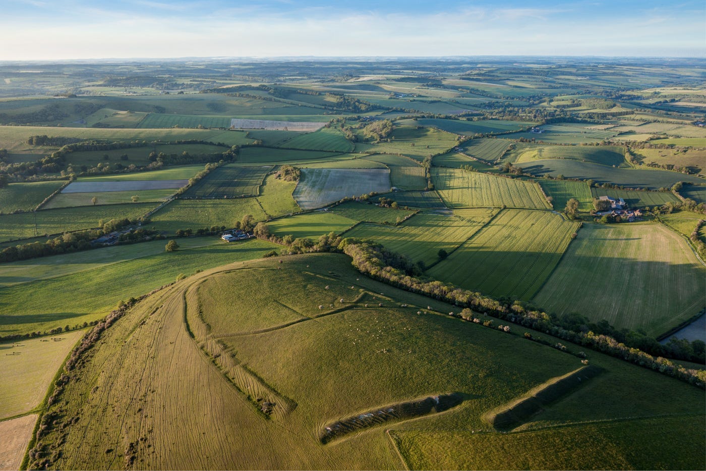
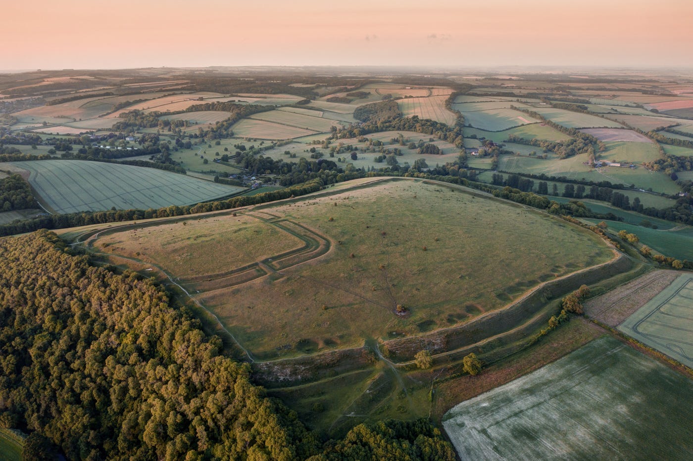
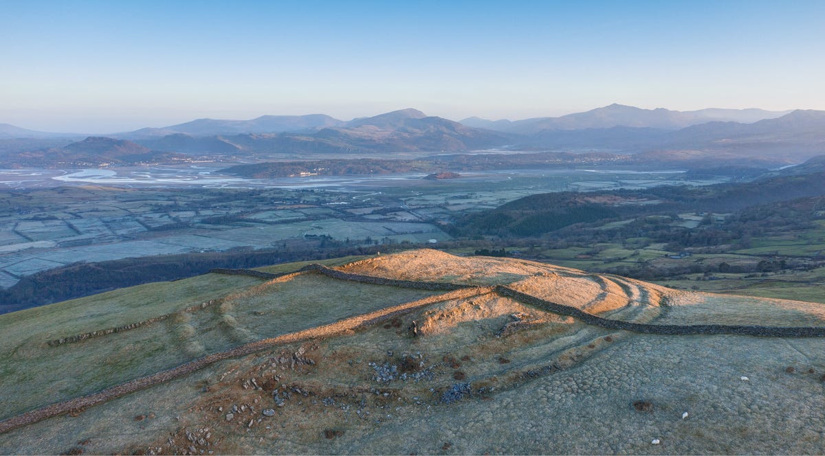
Hambledon Hill
It was by chance, in an exchange of emails about hillforts with the historian William Dalrymple, that I first learned of Hambledon Hill’s hidden treasures. The great chalk outlier, to the west of Cranborne Chase near the town of Blandford Forum, rises from the chequerboard of Blackmore Vale like a giant whale, its flanks striated with impressive Iron Age ramparts. When Willie told me he’d spent a few happy (but wet) summers digging there as an undergraduate at Edinburgh University, I assumed it was these fortifications that were the focus. In fact, the remnants of far earlier occupation on a spur to the south were the subject of the dig.
Willie suggested I get hold of a copy of the original monograph by Prof Roger Mercer, which I did (it’s published online for fee) and it proved a revelation. Hambledon, it turns out, had been a major ritual centre at the start of the Neolithic era, in the early centuries of the fourth millennium BC. Herder-farmers from the coast used to come here, presumably following the Stour River northwards from Christchurch Harbour, to perform mortuary rituals. Using flint scrapers, they’d de-flesh the bodies of the deceased and leave their bones to the ravens and rainwater. Once cleansed, the remains would then be interred in huge, stone-line tombs.
These ‘sky burials’ were performed on large circles of white compacted chalk, pitted with deep holes into which human and animal sacrifices were deposited. Barely a trace of the circles remains (they were comprehensively ploughed out shortly after Mercer’s dig ended). Nor is it possible to plot the course of the huge wooden palisades constructed in the same period for defensive purposes (a rarity in the Neolithic). But one of the two large chambered tombs remains intact on the spine of the hill, inside the deep ditches and mounds piled up by Hambledon’s Iron Age occupants three millennia later.
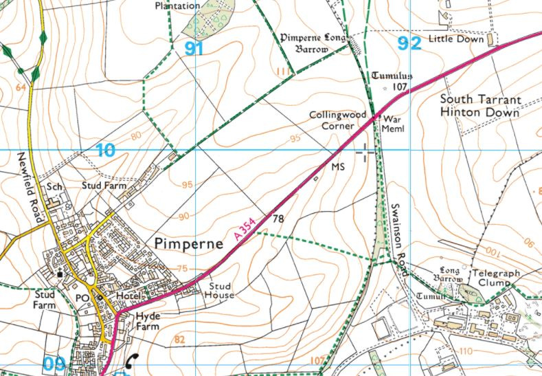
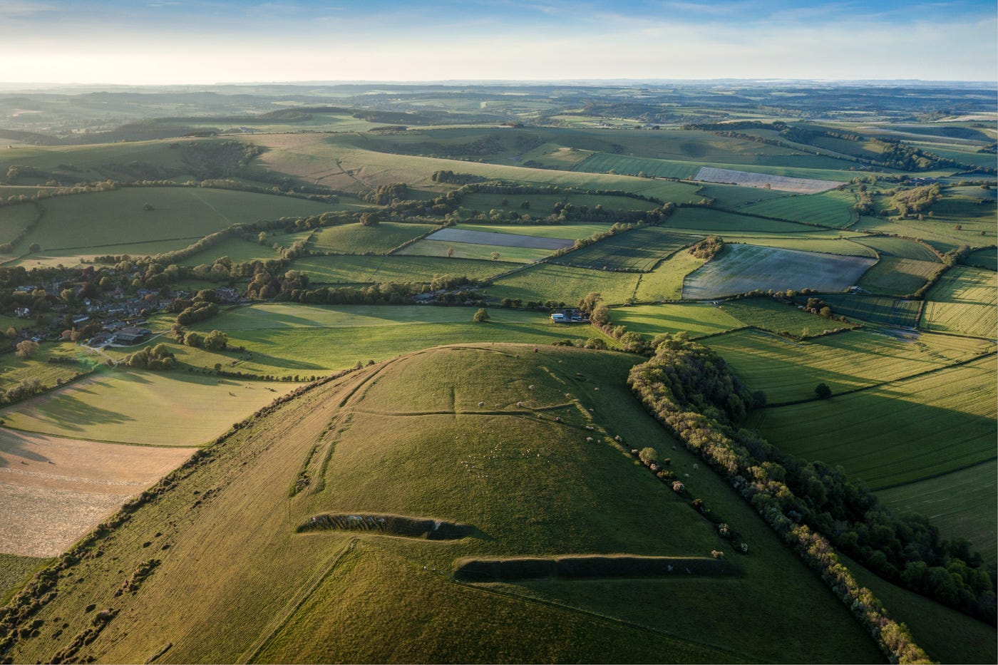
Pimperne Long Barrow
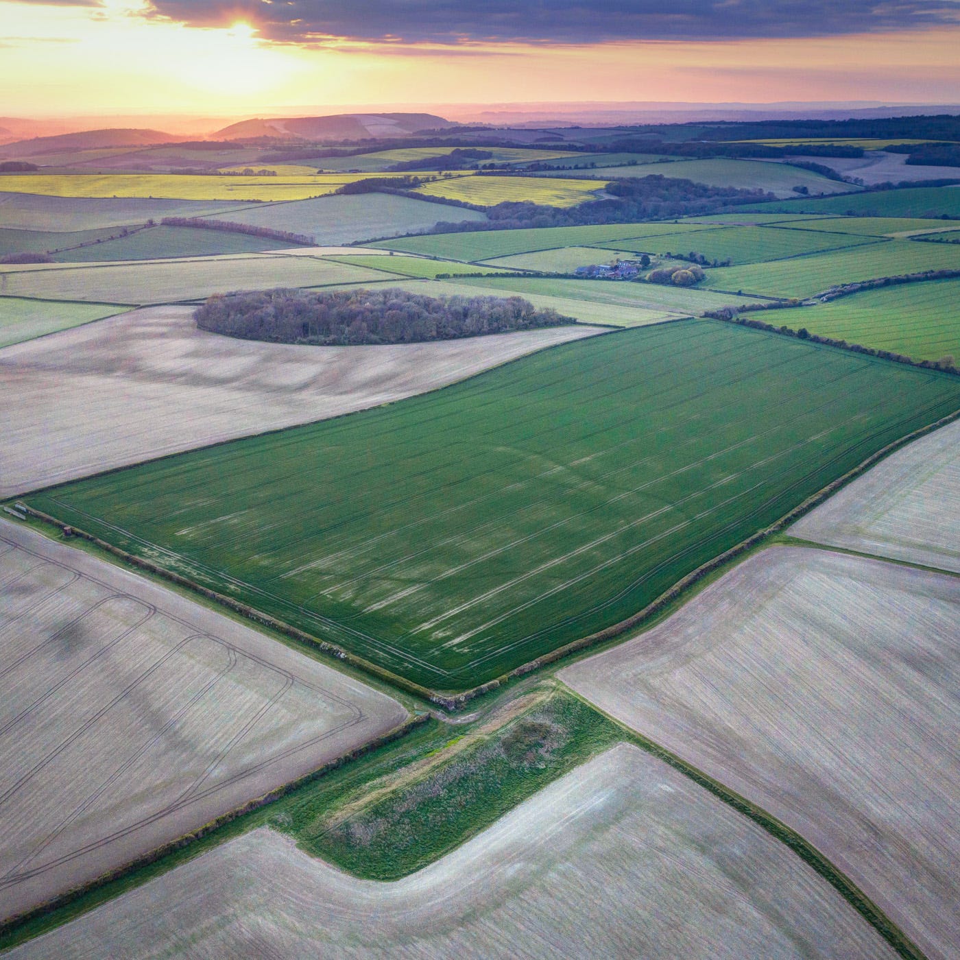
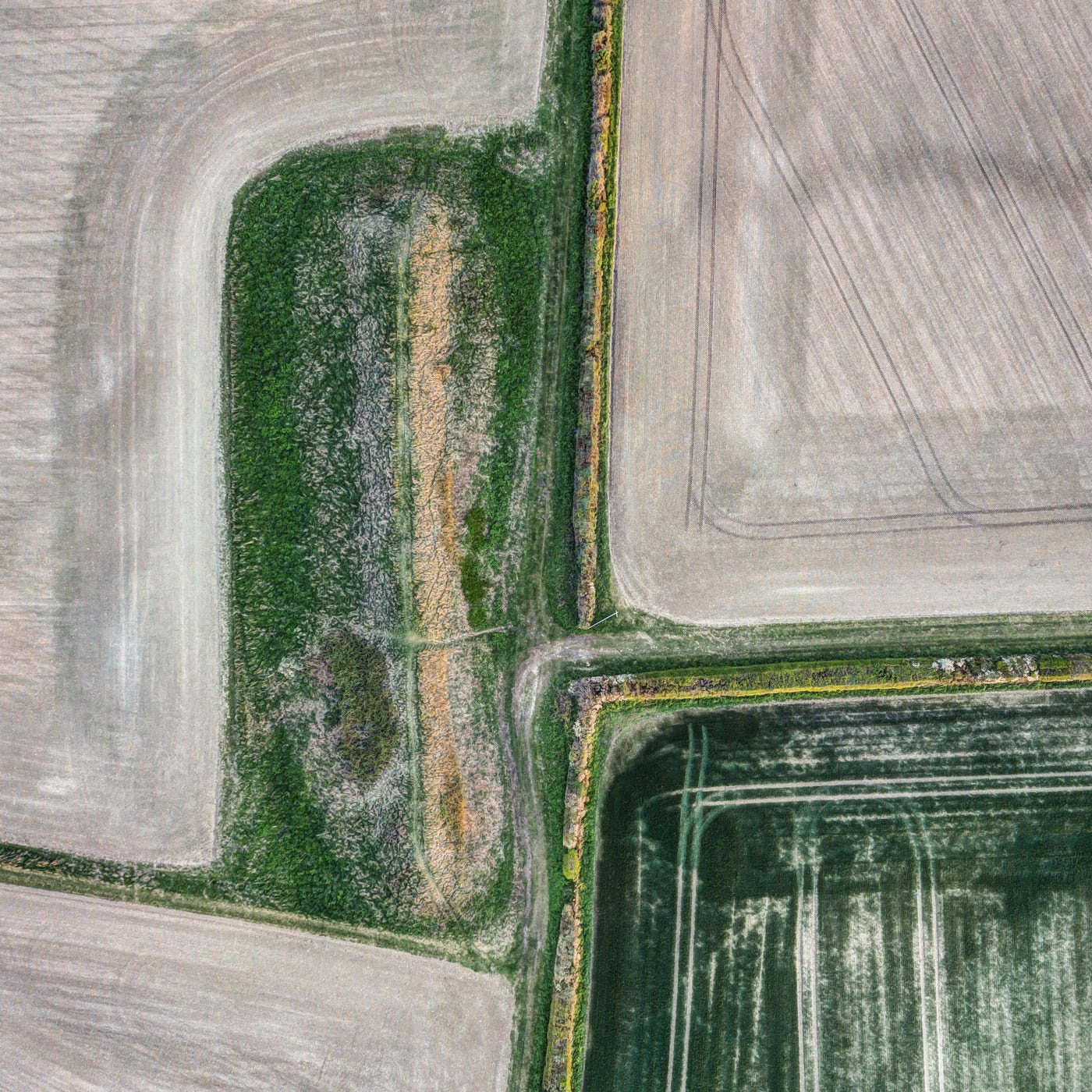
Another, even larger Neolithic tomb nestles on the western edge of Cranborne Chase, not far from Hambledon Hill, near the village of Pimperne. Over 90 metres from head to toe, it’s a whopper even by the standards of the Wessex chalklands, and probably very old. I say ‘probably’ because it’s never been excavated. Comparable in scale and form to tombs such as West Kennet, the structure is likely to hold several stone-lined niches where the remains of numerous individuals would have been placed.
Such tombs are common in southern Britain, where they’re often described as ‘long barrows’. But none are larger than this one at Pimperne, nor more photogenic. I love how it looks when viewed from directly above, the lines of hedgerows and tractor tracks striking at right angles across the flint-filled fields.
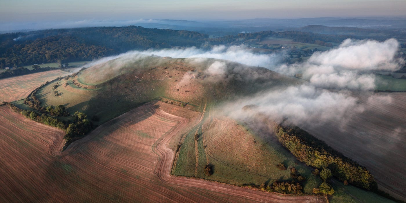
The Dorset Cursus
Sometime roughly midway through the fourth millennium BC, the focus of ceremonial activity in this area moved east from Hambledon on to the Chase proper. Quite why this happened remains a subject of debate, but the shift coincided with what is sometimes referred to as the ‘Neolithic collapse’, when the population of Britain appears to have plummeted and people deserted cultivable land in favour of herding on the uplands.
It was during this period, from roughly 3,500-3,300 BC, that Neolithic communities carved huge cursus monuments from the earth. You’ll recall from my previous blog that a particularly fine example survives to the northwest of Stonehenge. The largest and most spectacular in Britain, however, stretches across Cranborne Chase. It’s very difficult to pick out without the help of a drone or a helicopter, but at the end of a dry summer you can just about trace its course as it scythes southwest–northeast towards the Hampshire border.
The monument appears to have been built in two phases. A marked kink in the route (visible in the above photo) suggests digging work was carried out at different points simultaneously: corrections were required to join them up, as well as to incorporate pre-existing monuments and landscape features such as seasonal rivers, springs and lakes, and a series of mysterious sink holes.
No-one can say for certain what ritual purposes this vast circuit served, but the southern, ‘Gussage Cursus’ portion aligns perfectly with the mid-winter solstice. Anyone standing at its northeastern end on the 21st of December could look down the sweeping chalk-edged avenue and watch with awe as the sun set behind the long barrow on Thickthorn Down.

Church Henge, Knowlton
By the end of the fourth millennium BC, circular burial enclosures had taken the place of causewayed enclosures and cursi as the principal ceremonial centres. Comprising an inner ditch and outer bank, these ‘henges’, as we now know them, were often sited close to rivers or in natural amphitheatres. Entry tended to be via one or more earth bridges (or ‘causeways’), often (but not always) aligned with seasonal movements of the sun.
One of the finest examples in the country sits at the southern edge of Cranborne Chase, on a low hilltop edged by red-earth banks. Overlooking these, our Neolithic ancestors created an oval, wood-fenced mortuary enclosure that was later upgraded to a henge – the first of four constructed on the site.
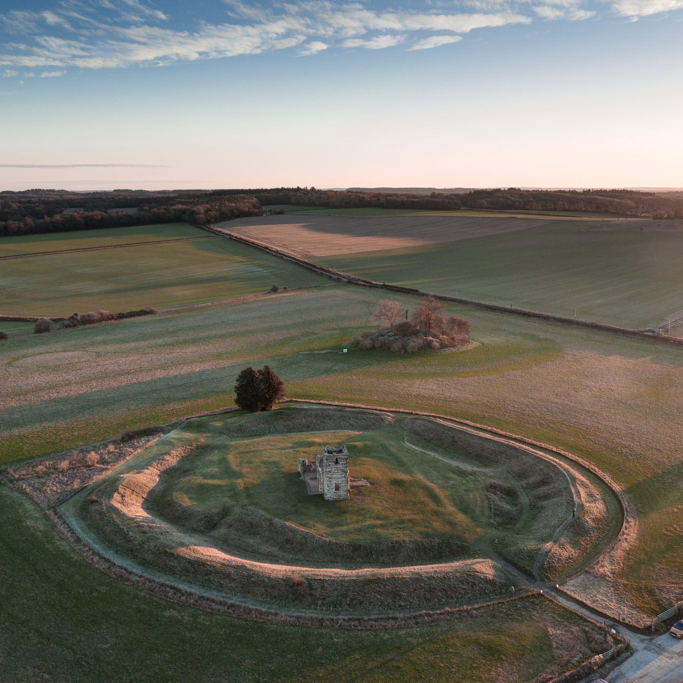
In the backyard of a farm on the nearby main road are fragments of the largest of them: a ‘mega-henge’ measuring 250m at its widest point. The real show stealer at Knowlton today, however, is ‘Church Henge’, a fully intact, 100-metre ditch-and-bank earthwork named after the 12th-century chapel the Normans later erected in the middle of it.
Knowlton sits at a geological fault line where the chalk of the Chase gives way to the Tertiary gravel and greensands of the coast. Access to the sacred site would have been most easily gained by boat via the River Stour and River Allen. The latter flows to within a few hundred metres of the henge. Pilgrims would have alighted at the foot of the red Pleistocene cliffs (eroded traces of which survive) and proceeded uphill along a trackway whose route is now followed by a country lane.
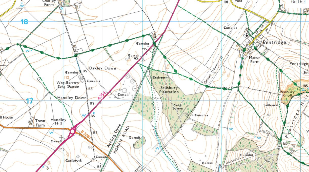
Oakley Down
Knowlton was also a major burial site in the early Bronze Age but the most impressive cemetery from this period lies beside the Dorset Cursus on Oakley Down.
Bordered by the main Shaftesbury–Salisbury Road on one side and the Roman ‘Ackling Dyke’ on the other, this striking burial ground dates from the period between 2,200 and 1,700 BC, when migrants from what is now northern France and the Low Countries were settling in Britain in fairly large numbers, bringing with them new beliefs, technologies, arts and funerary rites. The so-called ‘Beaker Folk’ are generally credited with introducing metal working to these islands (indeed, it may well have been the search for copper and tin ore that brought them here in the first place).
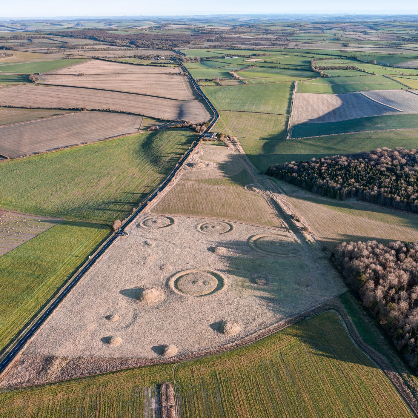
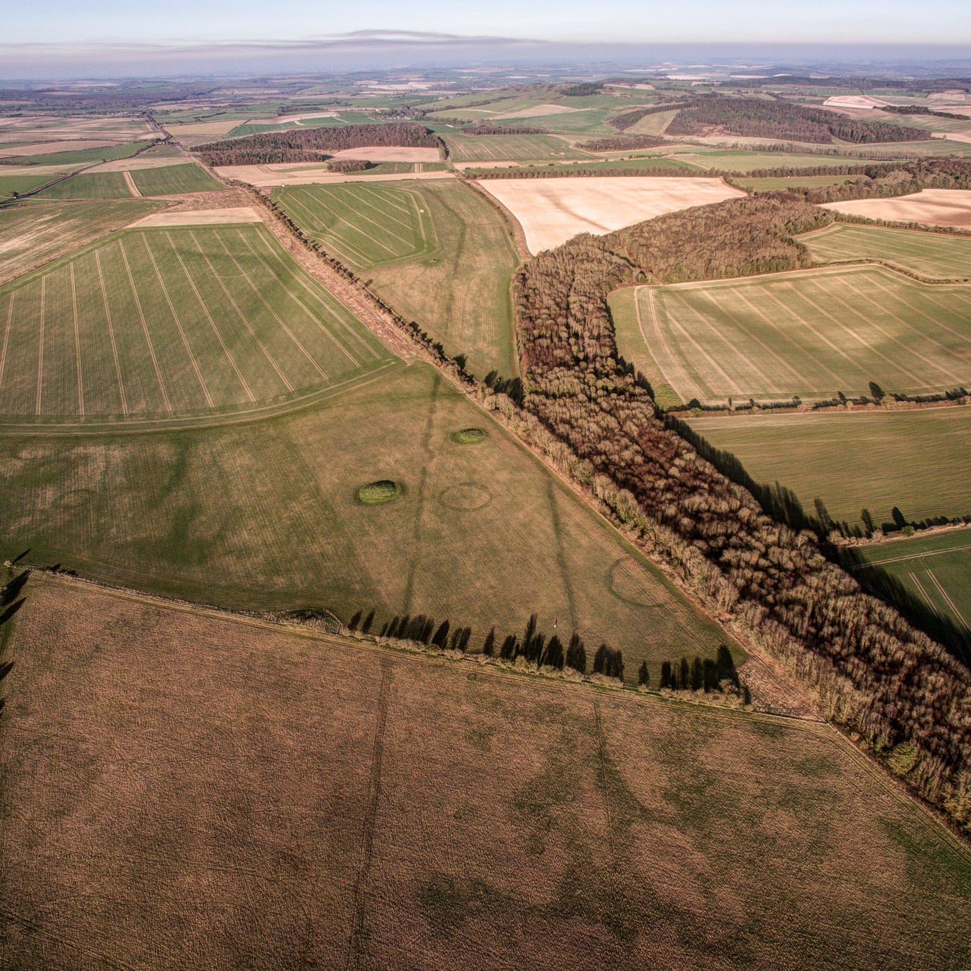
Whereas in the Neolithic, communal graves were (broadly speaking) the norm, from the early Bronze Age, individual burials predominated – at least, in the cases of high-status people, such as those whose farmsteads lay in the fields twenty minutes’ walk west of the Oakley Cemetery.
Earth mounds, or ‘barrows’, came in various forms and this group includes several of them. When excavated by Sir Richard Colt Hoare and William Cunnington at the beginning of the 19th century, both inhumations and cremations in urns were discovered, along with a wonderful array of grave goods, from amber, faience and jet jewellery to decorated copper daggers and archery paraphernalia. These items are now displayed in Devizes Museum, along with the rest of Colt-Hoare and Cunnington’s magnificent Wessex collection.
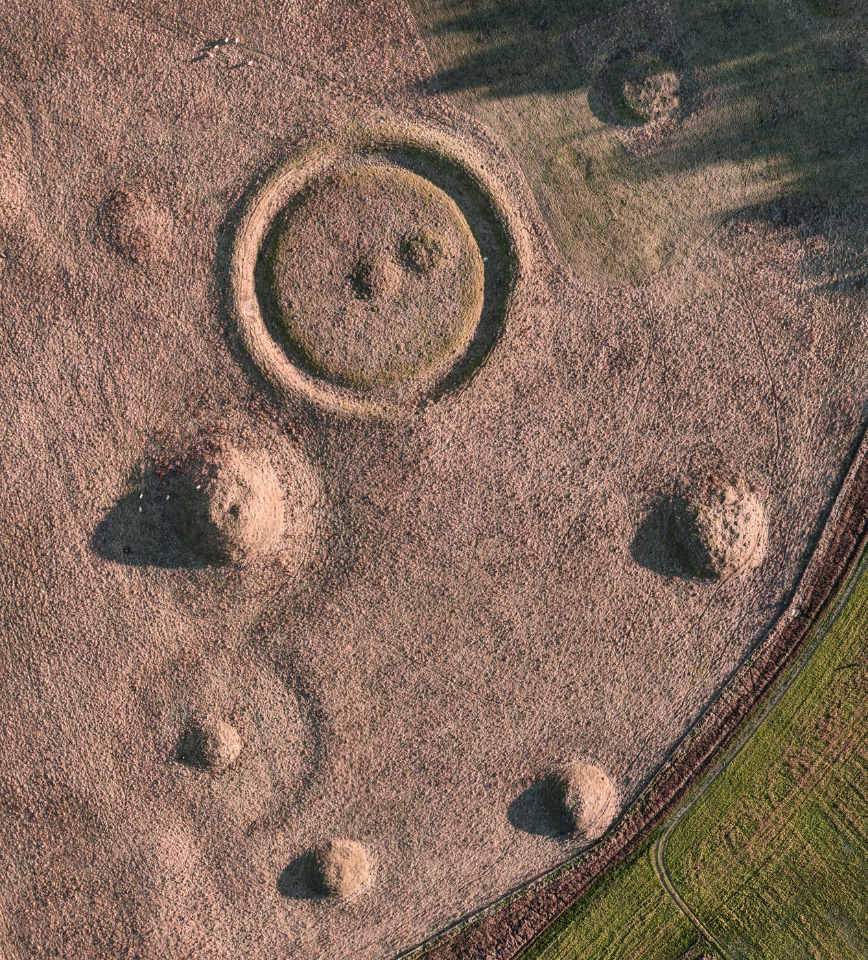
While dozens, or possibly hundreds of similar burials in the area have been lost to the plough, this triangle of ground has remained uncultivated pasture for thousands of years. Its long, bleached grass continues to nourish sheep from a nearby farm, as it doubtless did in the Bronze Age.
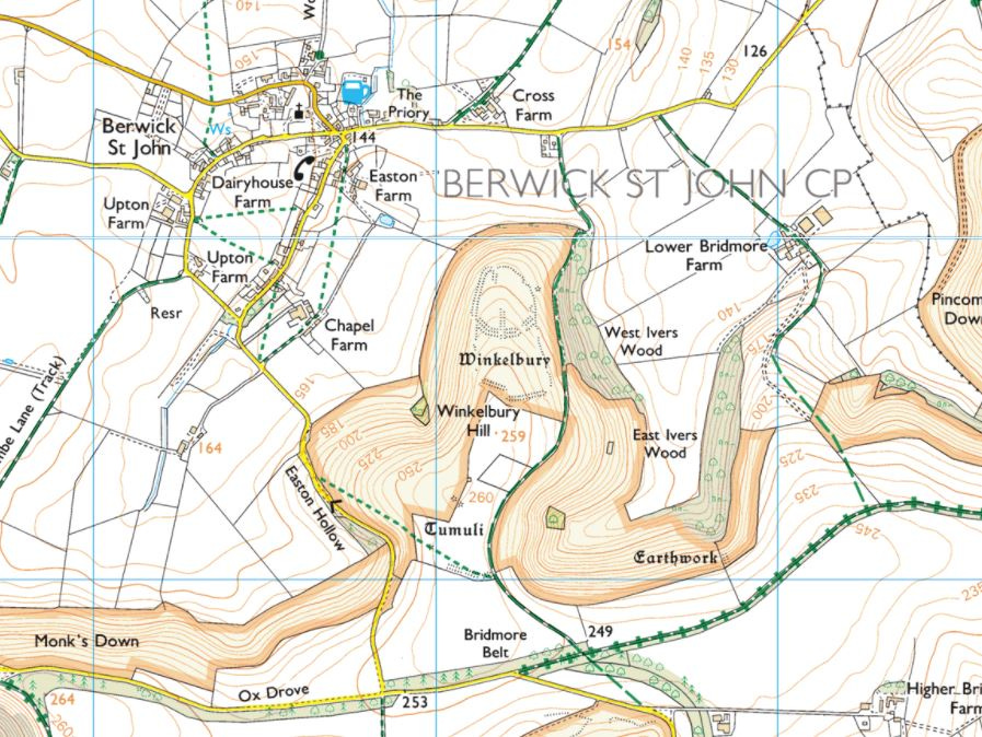
Winklebury Fort
At the start of the summer, I received an email from Prof Alice Roberts (who I’m delighted to say has offered to write the Foreward to my book!) asking if I happened to have any aerial images of Iron Age sites on Cranborne Chase. She needed some for a series of illustrated talks planned to publicize her new publication, ‘Ancestors’ (more on which later). I hadn’t even heard of these sites, so drove down there at the earliest opportunity to check them out. Both lie on or near the Rushmore Estate, which belonged to the legendary archaeologist, Augustus Henry Lane-Fox Pitt Rivers (1827–1900).
After distinguishing himself in the Crimean War, introducing muskets to the British military and amassing a vast anthropological collection during his travels overseas, Pitt Rivers inherited his uncle’s estate in 1882, becoming the first Inspector of Ancient Monuments the same year. His methodical digs on Cranborne Chase, notably of the Neolithic Wor Barrow near Oakley Down, would earn him a reputation as the founder of modern archaeology.

Inspired no doubt by his experiences in the army, one of Pitt Rivers’ first excavations on the Chase was at an intriguing hillfort on land adjacent to Rushmore, belonging to the Grove family. Surveying the Chalke Valley, Winklebury is unusual for having a series of large gaps in its defences. At least one of these was made by Pitt Rivers during the two seasons of work he carried out here, but the others appear to have been original. Perhaps the fort was never completed? Or the spaces might have been filled with timber palisades? Neither scenario was common. In fact, I can think of no other examples in Britain of broken or partial Iron Age fortifications. But the gaps are certainly prominent, as if they were created on purpose.
The remains of grain storage pits and numerous large postholes were also identified, along with a number of burials dated to the fifth and sixth century AD, during the Saxon period.

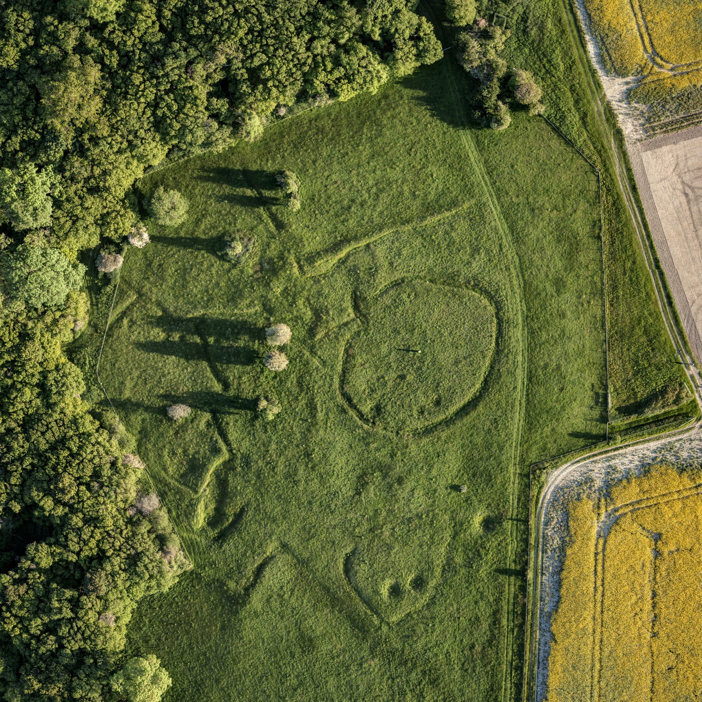
Rotherley Down
Some of Pitt Rivers’ most painstaking archaeological work was focussed on a Romano-British settlement at Rotherley Bottom, near Rushmore House, which he and his team explored in 1885 and 1886. Once the dig was finished, the trenches were not fully re-filled, ensuring the outlines of the structures and enclosures they’d unearthed remained visible.
The depressions are etched on to couple of hectares of gently shelving chalk land, at the centre of which stands a small pillar inscribed with information detailing Pitt Rivers’ finds. These included ‘(ninety) two pits, fifteen human skeletons, two British coins and numerous relics of the Roman Age’.
The settlement appears to have been a typical late-Iron Age farmstead, occupied for around three centuries, featuring grain storage pits, animal pens and the footprints of roundhouses, as well as several elements created in the Roman era, notably an under-heated floor used for malting barley (to make beer).
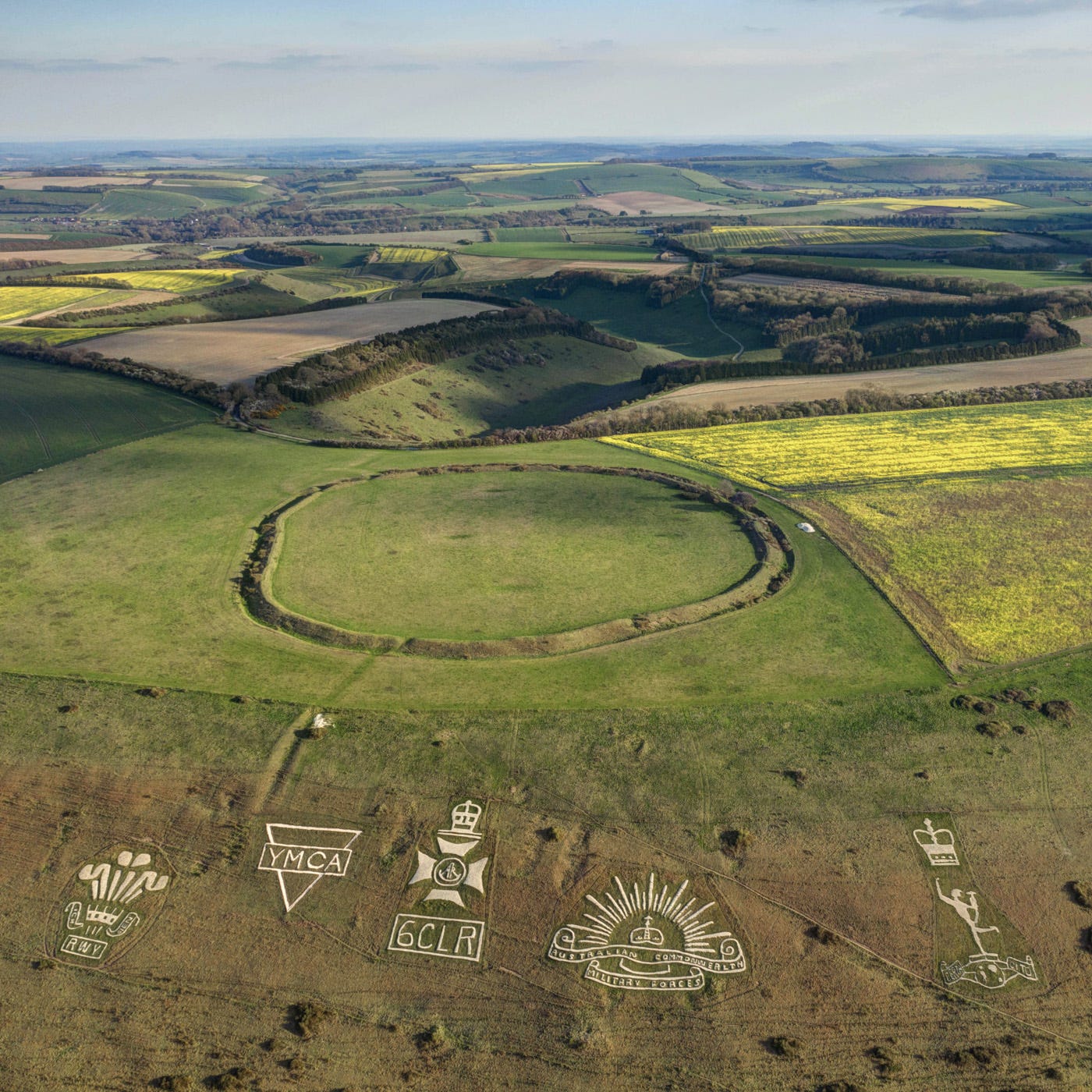
Chiselbury Ring
No account of this area’s prehistory would be complete without a mention of Chiselbury Ring, an Iron Age hillfort overlooking the Nadder Valley near the village of Fovant. It is neither particularly imposing, nor has the site yielded many noteworthy finds. But the views in all directions are spellbinding, while the chalk scarp on its northern flank is adorned with an iconic collection of huge regimental badges, created by soldiers training at a nearby camp in the runup to World War I - an installation that could have been made bespoke for a drone photographer!
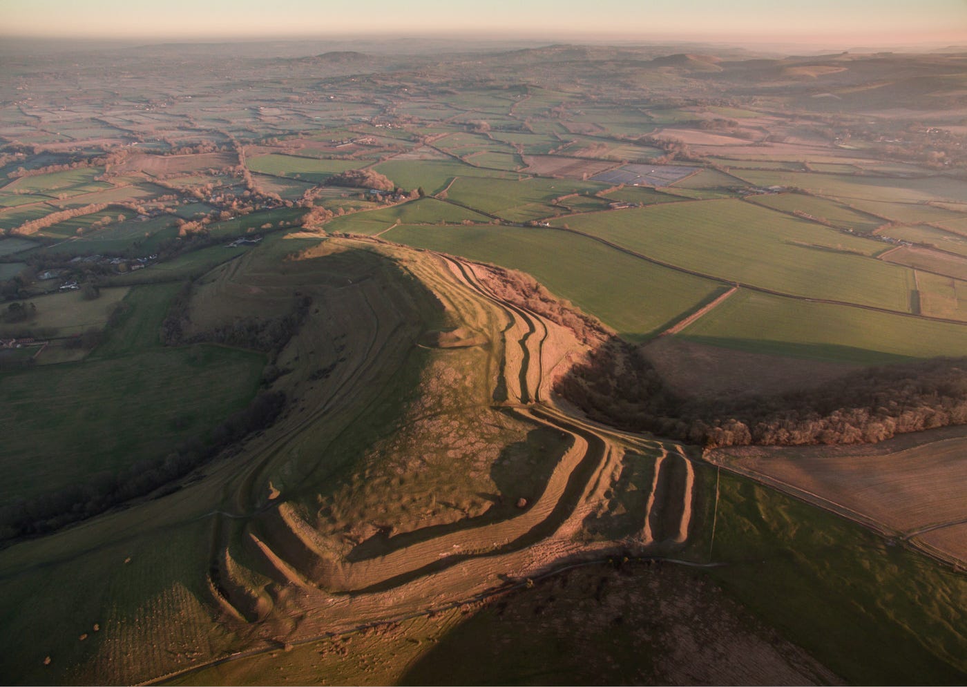
Hod Hill
Maiden Castle may be the poster boy of Dorset’s Iron Age hillforts, but Hod Hill, on the west side of Cranborne Chase near Hambledon, boasted a much larger population at the time of the Roman invasion of 43 AD. An estimated 200 households lived within its confines when the Second Legion arrived in the region to subjugate the rebellious Durotriges tribe. Evidence of violence directed towards its inhabitants was unearthed during archaeological excavations, when several balistra bolts were discovered in the remnants of the largest roundhouse, located in the centre of the fort and thought to have been that of the local chief.
The square earthwork dominating the top left corner of the fort are the vestiges of the fort the Romans built after the victory. I’m always amazed by the ease with which the invaders appear to have taken the hillforts in this area, despite their formidable scale, though in truth the mighty ramparts were probably not erected to repel Romans so much as raiding neighbours.
In the century and a half before the invasion, enemy tribes from the southeast of England were in closer contact with the Empire, trading along the Thames and across the Channel, and it is likely attacks were launched to capture slaves for sale to the Gauls, who in turn sold them on to the Romans on their southern borders.
Cley Hill
I had to include some mention of Cley Hill in this roundup. Although not geographically on Cranborne Chase, it is technically part of the Area of Outstanding Natural Beauty (AONB), and thus qualifies. Plus I’m biased. This little chalk outlier, the most westerly in Britain, is also visible from my bedroom window! I climb its grassy flanks at least once a week and have spent many happy hours flying kites from its summit and lazing in the abundant wildflowers that grow on its slopes in early summer with my children. The huge round barrow at the centre of the hill dates from the early Bronze Age.
By the time Cunnington and Colt-Hoare excavated the mound in the 1810s, it had already been plundered so we have no idea whose grave it may have been. Another, smaller one stands close by. We call them the ‘King’s Mound’ and ‘Queen’s Mound’ respectively and after twenty years living within their orbit the barrows have never lost their allure. The disturbances on the facing flank of the hill are the remnants of a Victorian clay quarry. Bissecting it are extensive Iron Age ramparts.
Museums
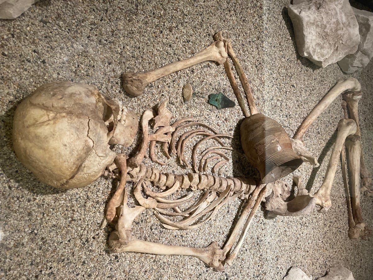
The majority of finds unearthed on Cranborne Chase are kept in two regional museums: Cunnington and Colt-Hoare’s finds, which included some of the greatest treasures from the Bronze Age ‘Wessex Graves’ on Salisbury Plain, are on display in the Wiltshire Museum in Devizes, while the Pitt Rivers collection, featuring artefacts from Winklebury and the famous ‘Amesbury Archer’ Beaker burial (pictured above), is housed in Salisbury Museum, next to the Cathedral.
Further Reading
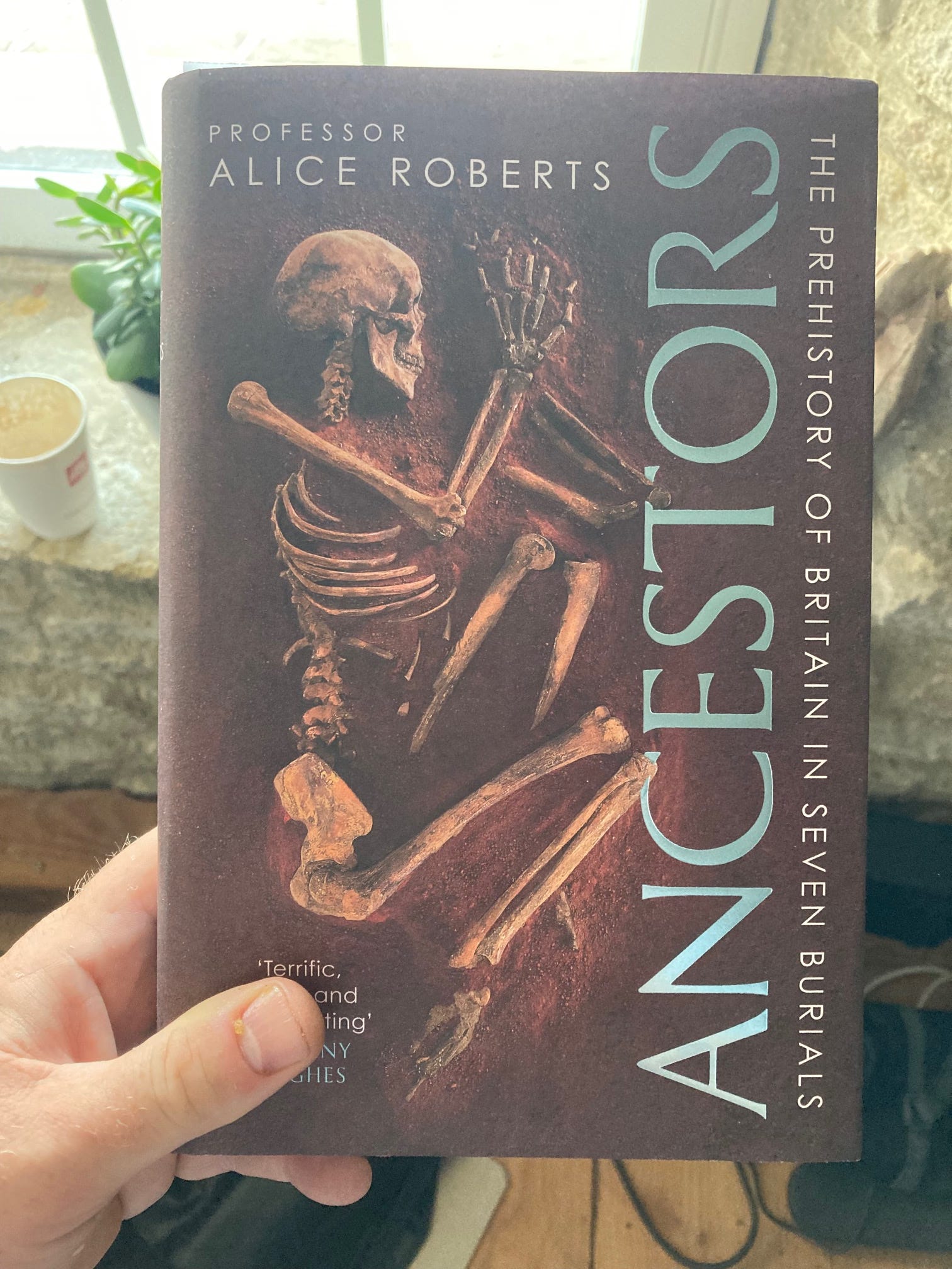
Ancestors by Alice Roberts
Describing the prehistory of Britain in seven burials, Alice Roberts’s new book offers fascinating insights into both the distant past and the ways in which archaeologists have through the ages uncovered its mysteries. A couple of chapters on Pitt Rivers feature the two sites on his Rushmore Estate mentioned in this article.
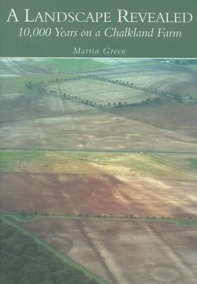
A Landscape Revealed by Martin Green
In this erudite but highly personal account of his discoveries, local farmer and archaeologist, Martin Green, gives a vivid account of the prehistory of Cranborne Chase, stretching from the Mesolithic to the Roman-British era. It’s an indispensable read if you plan to explore the area in any depth. Martin, whose land encompasses a stretch of the Dorset Cursus, has a small museum on his farm showcasing the cream of the artefacts he has unearthed over six decades of archaeological exploration.
News
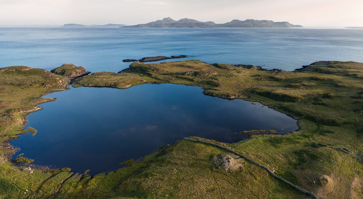
Those of you who follow me on social media may have noticed I’ve made two trips to the Highlands of Scotland since my Crowdfunder campaign ended. I still have around a dozen sites left to photograph before completing the book - mostly in the Orkneys and on Lewis. As soon as a spell of decent weather is forecast I’ll be heading north again, pausing in Derbyshire en route to mop up a couple of other locations. But I’m definitely getting there; the finish line is in sight!
Thank you to everyone who contributed to my campaign. I wouldn’t have been able to make any progress without you!
Somerset Art Works
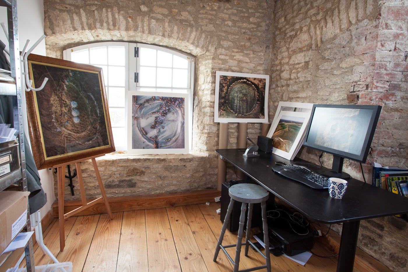
From 16th Sept to 3rd October I’ll be welcoming visitors to my studio at the Silk Mill in Frome (Thurs-Sun 10am - 5pm, Mon-Weds by appointment only). You can browse an interactive map, listings and venue details here
And there’s a short write up on me and my work here.
In addition to my full range of cards, you’ll be able to view a few large-format framed prints and browse a selection of smaller pieces offered for sale. Please drop by!
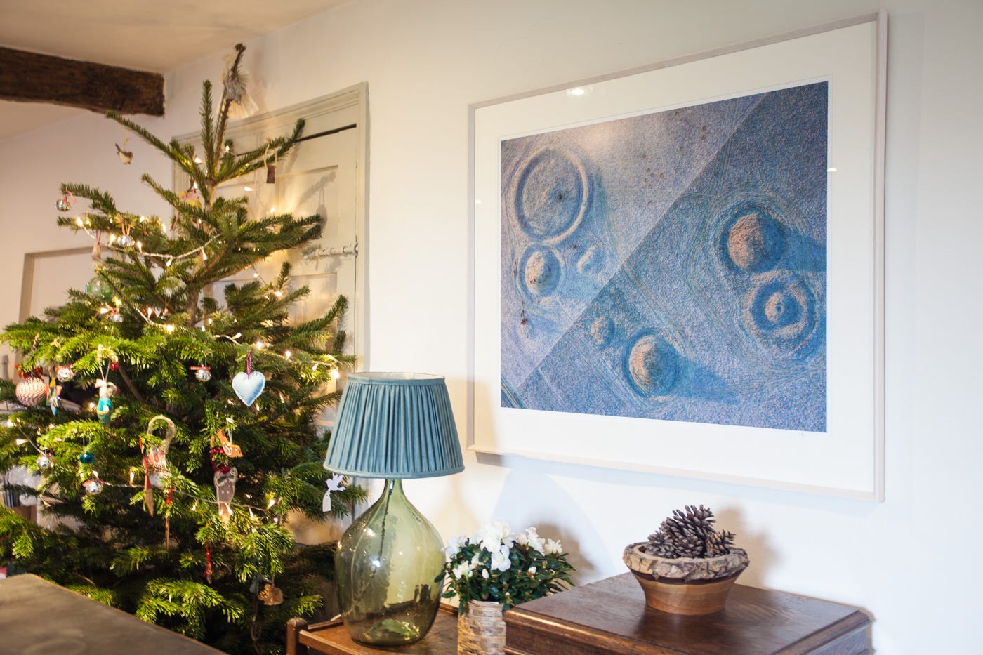
Print Sales
Some of you may have noticed I no longer sell prints online. My signature photographs are now available exclusively through select galleries, including Moorwood Art in Bruton. I do, however, plan to produce a run of smaller, more affordable prints in the run-up to Christmas. More details will appear in the next newsletter.
Thank You
I hope you enjoyed the second of my monthly newsletters. Thanks to everyone who wrote appreciative notes after receiving the previous one. I haven’t decided what the subject of the next will be yet: probably something on monuments recently visited up North. Or Cornwall, where I’m heading very soon.
Feel free to contact me via my website or Instagram if you have any queries about my work, need advice on visiting sites featured in these blogs or have suggestions of good sites for me to visit. Happy travels!