Natural Bridges
The Natural Bridges National Monument near Lake Powell, Utah is a spectacular display of three natural bridge rock formations. The area was declared a national monument in 1908 making it the first National Monument in the state. The park has a campground and several hiking trails that take you down to the bridges.
Weather Shortened
Unfortunately, when I arrived at the Natural Bridges Monument there was some severe weather rolling into the area. I didn’t think it was safe to hike down towards the bridges and instead took a driving and overlook tour of the area. With all the open area the risk of lightning strike is very real and I saw some lightning near the surrounding mesas towards the end of my trip so am glad I took the safe route. Make sure to always be safe when weather is the area!
The driving tour and the really short walks to the overlooks should take about two hours depending on how long you want to stay at each overlook. If you are planning on doing the longer hikes the trip will take a bit longer.
Sipapu Bridge
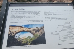
The first natural bridge that you will come upon is the Sipapu Bridge. There are actually two locations to see the bridge with one being more of an overlook and the second being more of the trailhead that offers more of a side view.
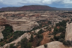
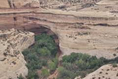
Sipapu means “Place of Emergence” and the bridge spans 220 feet tall and 268 feet wide. It is surrounded by rounded rock outcrops both above and directly across from it. The bridge is seen pretty clearly from the first overlook after hiking onto the rocks a little bit. If you decide to do the hike down to the bridge, you are looking at a 1.2 mile out and back with 360 feet of elevation change.

Horse Collar Ruins Overlook
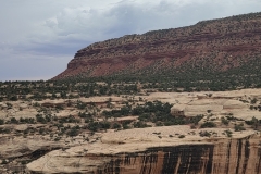
The Horse Collar Ruins Overlook is a bit of a walk to get out to and there are some ruins of cave dwellings if you make it out to the actual overlook. I did the hike for a bit but this is where the weather really had me thinking twice and I didn’t make it all the way to see the ruins. I did make it far enough to see the beauty of the canyon. The canyon floor has a decent covering of trees and vertical walls of rock. As you can see in the below picture the top side of the canyon has some peaks and mesas and the clouds were really starting to build.

Kachina Bridge
The second bridge and third stop on the driving tour is Kachina Bridge. Kachina is slightly smaller than Sipapu and stands at 210 feet tall and 204 feet wide but continues to grow today. A small stream still flows through allowing visitors to see how the construction of these amazing formations takes place. The bridge is named after the Hopi tribe’s kachina spirits. The spirits often display lightning snake displays on their bodies and some of these symbols were found carved near the base of the bridge. The hike down to the bridge is 1.3 miles and 406 feet of elevation change as an out and back.

Owachomo Bridge
The final bridge and stop of the driving tour is the Owachomo Bridge. Owachomo appears to be more of an arch than a bridge. The stream that carved it has dried up and to be a bridge the water must still be present. So Owachomo was a bridge and is now more of an arch but either way it is impressive. Owachomo is the Hopi word for “rock mound”. The left side of the bridge has a rock outcrop that gave the name. The Owachomo bridge is only 106 feet in height and spans 180 feet across. If you want to hike down to it the hike will be just 0.7 miles but 216 feet of elevation change for the out and back.

Access to Natural Bridges National Monument
Natural Bridges National Monument is a bit in the middle of nowhere but the drive is really stunning. It is located on Utah 275. If you are coming from the north there is a stretch of about 40 miles (80 roundtrip) with no services. There is an entry fee at the Monument. Twenty dollars per vehicle and fifteen dollars per night to camp. The fees are collected at the visitor center and there are restrooms and several of the stops along the park loop.
Wrapping up Natural Bridges National Monument
I was a little disappointed when I got to Natural Bridges because of the lightning in the area. I really wanted to hike down to some of the bridges but it was getting late and I saw some cloud to ground strikes around the mesas. Despite the bad weather, I did make the best of it with a driving and overlook tour!
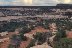
The bridges from the overlooks are still very cool and impressive. They reminded me a lot of Arches National Park with bridges spanning large gaps and forming almost perfect circles. From the overlooks there is no real choice but take in the grandeur of the entire park. The vastness of the bridges and canyons was impressive. I will just have to do a better job of checking the weather forecast the next time I drive out there!
I have added this hike and all of my hikes to my interactive map page that you can find here. If you have a suggestion or comment you can email me at fatmanlittletrails@gmail.com. Or follow me on any of the below social media platforms. Happy Hiking!


