

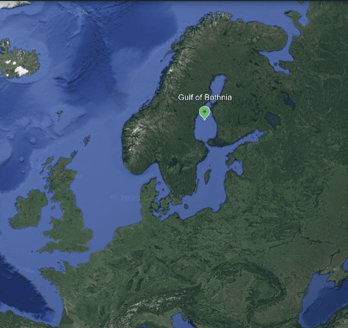
The Gulf of Bothnia in a changing environment - Reconciling fisheries and offshore wind developments
30 November 2023
The Gulf of Bothnia is now facing unprecedented pressures from many directions. The escalating geopolitical situation and climate change mitigation have increased political interest and project developers’ interest in developing offshore energy production. A sustainable green transition must be achieved by taking into account traditional maritime industries such as fishing, fish farming, tourism and maritime transport.
 The rapidly growing interest in offshore wind energy development in the Gulf of Bothnia has been widely discussed and received a lot of media attention. The offshore wind farms in various stages of planning and implementation cover large areas of both Finnish and Swedish territorial waters and exclusive economic zones. Reconciling new marine activities with traditional industries such as fishing raises concerns for the future and requires active management. Managing this fast-moving complexity is a challenge for licensing, control authorities and spatial planners at different planning levels.
During autumn 2023, workshops were organised along the Gulf of Bothnia coast in Rauma, Vaasa, Oulu and Tornio (Finland). Professional fishermen and their representative organisations, wind power developers and planners from municipalities, Centres for Economic Development, Transport and the Environment (ELY) and regional associations were invited to the workshops. The aim was to find a common vision on how to coordinate the development of commercial fishing, migratory fish and offshore wind power in a sustainable way. Discussions focused on a solution-oriented approach, i.e. identifying practical measures to support coordination.
This was approached by looking at the current situation in terms of the needs of the sectors and the information available for planning. Views were sought from fishermen on the fishery and fish-related data used in maritime spatial planning, and on the mapping of fisheries in the current maritime spatial plan. Prior to the cross-sectoral discussion, offshore wind developers and planners contributed to a discussion on how commercial fisheries and migratory fish are currently taken into account in their work. The different actors were then brought together to identify shared challenges and potential solutions.
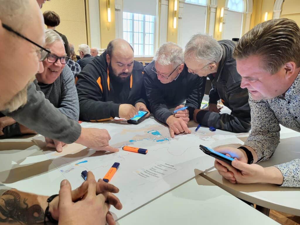
Photo caption: Professional fishermen reflect on the map designation of fisheries in the current Maritime Spatial Plan, Vaasa 31.10.2023
“The first maritime spatial plan was drawn up using the best information available at the time. Now, when reviewing the maps together with professional fishermen and wind energy operators, we received direct feedback on the timeliness of the information and the need for further information for the second round of maritime spatial planning. When we also look at the coordination of different marine activities and potential conflict areas together with the different sectors, we will get a more comprehensive picture of the needs of the sectors for planning purposes”, says Rauno Malinen, Land Use Manager and Maritime Spatial Planner of the Council of Oulu Region who hosted the workshop in Oulu.
Successful coordination requires the use of up-to-date and thematically comprehensive information in planning. More information on commercial fishing, fisheries and migratory fish should be collected or existing data should be used comprehensively, for example on the most important fishing areas (such as trawling hotspots and trap sites), fish breeding areas and migratory fish routes. Without a comprehensive knowledge base, it is challenging to address spatial conflicts between sectors.
Offshore wind development in the economic zone should take into account the siting of wind turbines and cables in areas of particular importance for trawling, so that fishing in these areas is not disturbed. There is much to reconcile in terms of both fishing and fisheries in the case of cable runs for offshore wind farms; for example, the effects on the behaviour of migratory fish are still unclear.
Important observations were raised on the labelling of the Maritime Spatial Plan. Supporting and considering the vitality of fisheries in conjunction with offshore wind development also requires updating the fisheries designation in the maritime spatial plan to highlight areas of importance for fisheries to support the potential for fisheries growth. The ecological links that indicate the most important migratory fish species in the Gulf of Bothnia were also discussed. In terms of labelling, further needs were identified and the possibility of labelling potential migratory corridors where restoration actions could be targeted was raised.
“The organisation of the workshops and the knowledge gained from them is of paramount importance to the Regional Council of Lapland. Our region borders the northernmost tip of the Baltic Sea and our land-sea interaction area is huge. In the planning process, we want to take into account the conditions for migratory fish to rise in rivers for spawning but also to go back to the sea to feedand also raise the wider issue of taking migratory fish into account in the development of offshore wind energy. The Tornionjoki is the most important salmon river in the Baltic Sea, providing catches for the entire marine area. Safeguarding the life cycle of migratory fish is a common concern for the Baltic Sea,” says Minttu Peuraniemi, maritime spatial planner at the Regional Council of Lapland who was responsible for the Tornio workshop.
Far-reaching planning in the Gulf of Bothnia must take into account changing conditions in the future. The workshops discussed the impact of climate change on commercial fishing and fisheries, using climate change modelling produced by the Finnish Environment Institute’s MeriTV project. The Gulf of Bothnia is physically and biologically diverse and therefore has a variable operating environment. Climate change will affect the Bothnian Sea, the Quark and the Bothnian Bay in different way. In summary, climate change will have an impact on commercial fishing and fisheries and thus on the future coordination of different activities. Among the issues discussed at the workshop were the effects of changing ice conditions on fishing timing and gear, changes in fish stocks, the migration of fish to new areas and the future viability of the fishing industry.

The outcome of the workshops provided a wealth of concrete ideas which will be further developed in the second round of maritime spatial planning. The material collected during the workshops will be analysed and the findings will be reported more widely in the coming months.
The reconciliation was carried out by means of a map, looking at the indications in the maritime spatial plan. Areas with coordination challenges were identified and solutions were sought together with planners, offshore wind project developers and fishermen.
The article was prepared by R. Mikkola (The Regional Council of Southwest Finland). The events were organised as part of the international projects Baltic Sea2Land (2023-2025, Interreg Baltic Sea Region) and MSP-GREEN (2022-2024, European Maritime, Fisheries and Aquaculture Fund) for the coordination of maritime spatial planning cooperation. The MSP-GREEN project contributes to align maritime spatial plans to the ambition of the European Green Deal. Project social media accounts: X (former Twitter) @BalticSea2Land and @MSPGREEN22;Linkedin /msp-green-project/

Additional links
details
-
Homepage
-
Project typeCore Project

-
ImplementationJanuary 2023 - December 2025
-
StatusOngoing
-
Contribution to EUSBSRPolicy Area Spatial Planning

-
Target groups
- International governmental organisation
- Local public authority
- National public authority
- NGO
- Regional public authority
-
Social media
-
Additional links
-
Tags