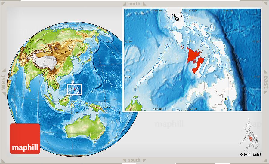
Location, Shape, Size
Region IV or Western Visayas is located in the Central Philippines with boundaries of the Visayan Sea on the east, the Cuyo East Pass on the west, the Sibuyan Sea and Romblon on the north and the Cagayan Island on the southwest. It has the coordinates of 11.0050° N, 122.5373° E. It is composed of the four provinces of Panay (sixth largest island of the Philippines with 11,520 km2), the Guimaras Island (twentieth largest island with 580 km2) and the western portion of the island of Negros and its outlying islands (Negros Island is the fourth largest island with approximately 12,706 km2). Western Visayas has a total land area of 20,223.2 sq. kms. which is approximately 6.74 percent of the total land area of the Philippines.
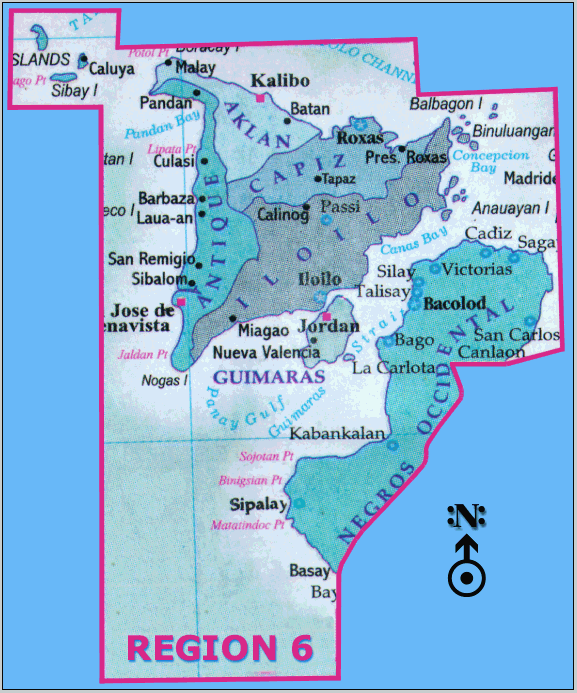
The region covers six provinces: Aklan, Antique, Capiz, Iloilo, Negros Occidental and Guimaras. The region has nine cities namely: Bacolod, Bago, Cadiz, La Carlota, Roxas, San Carlos, Silay with IloiIo City as the regional capital. Also, the region has a fragmented and elongated shape which may entail challenges in transportation and governance but at the same time may be utilized for tourism and production advantages.
Topography
Its topography is characterized by relatively wide stretches of coastal lowlands with rugged hills and mountains in the interior.
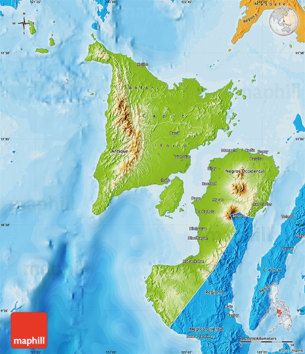

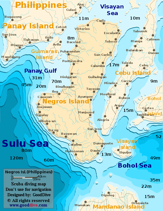
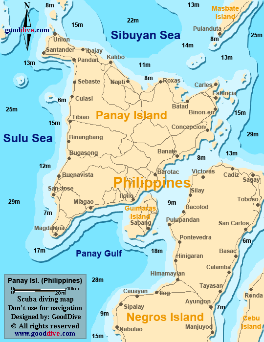
The diving maps above show the continental shelves of the islands which may serve as an indication for the wide stretches of fishing grounds.
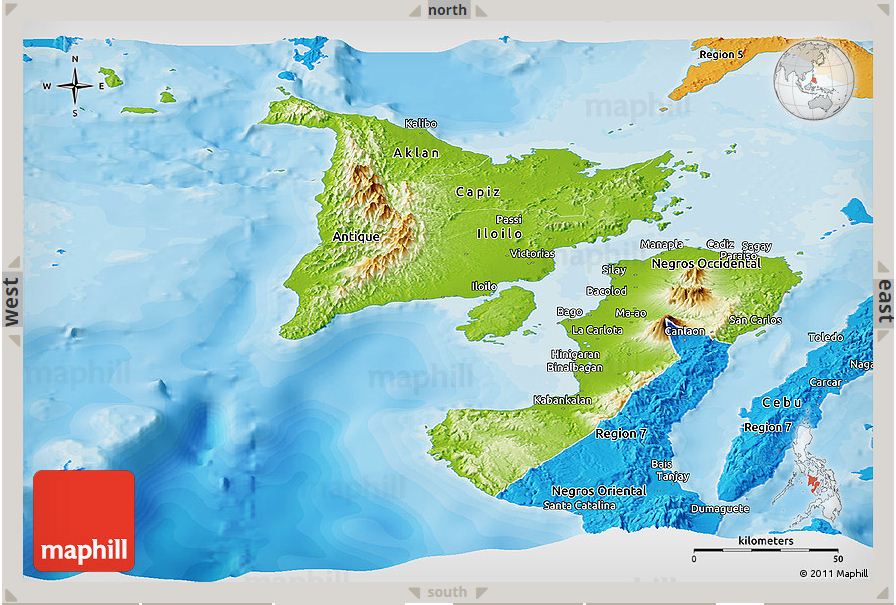
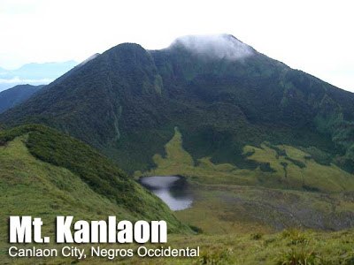
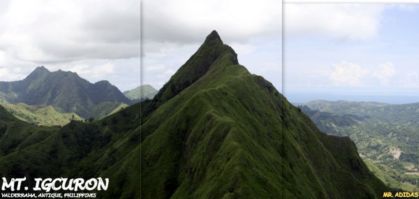
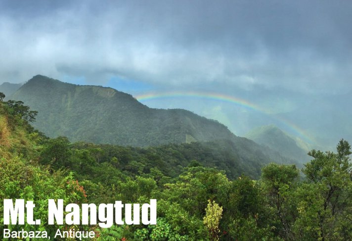
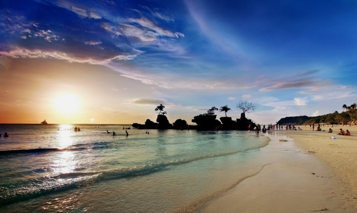
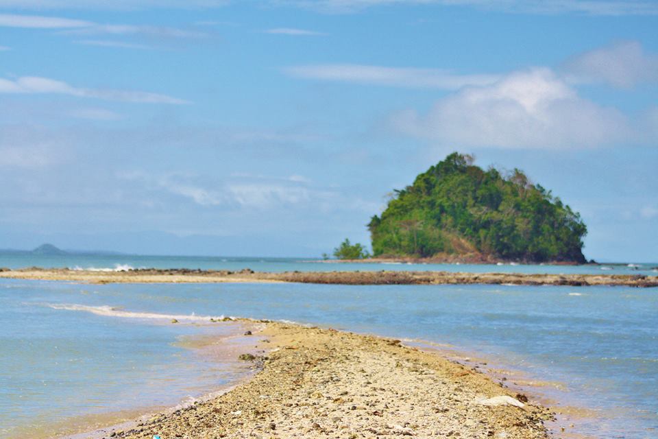
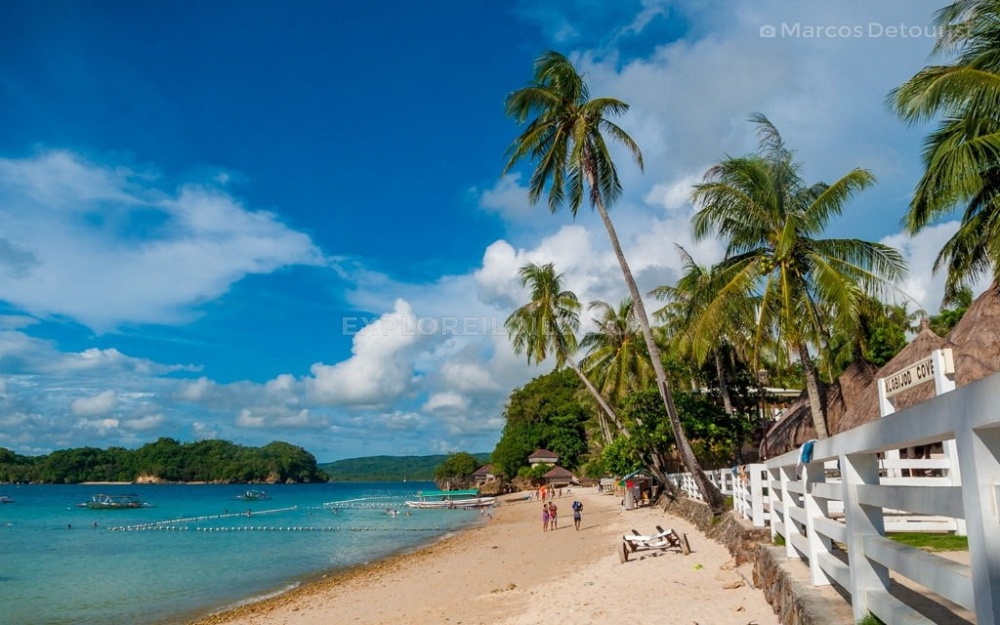
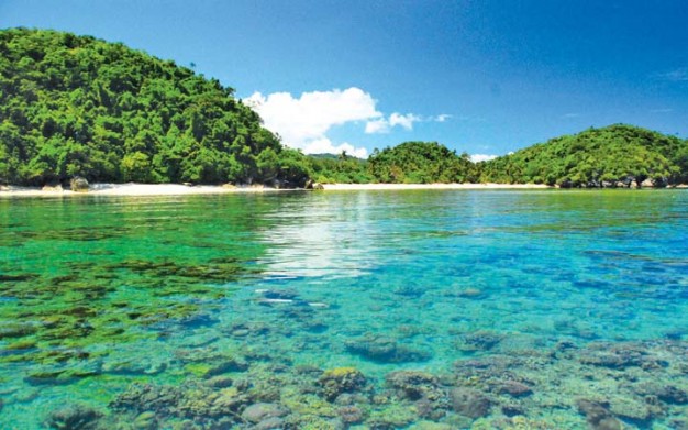
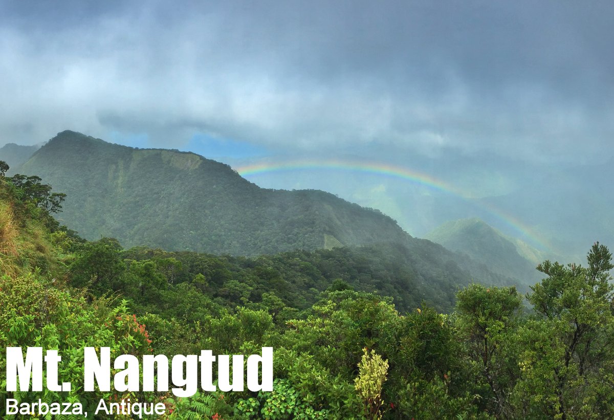
The pictures below further illustrate how the topography of Western Visayas ranges from the highest altitude of land forms down to the pristine coastal gems that aside from serving its climatic functions are also exploited for tourism and economic activities.

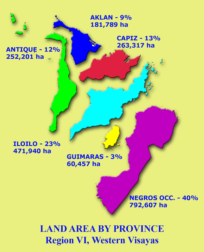
Land Area
The distribution of land area by province is shown in the picture below.
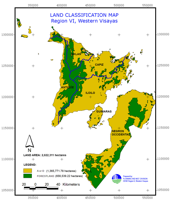
Land Classification
The total land area of Western Visayas is divided into Forestland which covers an area of 656,539.22 hectares equivalent to 32% on one hand, and Alienable and Disposable lands covering 1,365,771.78 hectares or around 68% on the other.
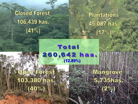
Forest Cover
Based on 2005 data of Land Evaluation Party (LEP) – DENR 6, the forest cover is measured at 260,642.74 hectares or equivalent to 12.89 percent of the total land area of the region. 5.27% of the forest cover is classified as closed forest; 5.11% as open forest; 0.28% as plantation forest and 2.23% as mangrove forest.
| Province | Forest Cover (hectares) |
| Aklan | 48,254.00 hectares |
| Antique | 72,022.25 hectares |
| Capiz | 30,208.27 hectares |
| Iloilo | 41,190.35 hectares |
| Guimaras | 68,857.87 hectares |
| Negros Occidental | 110 hectares |
Climate
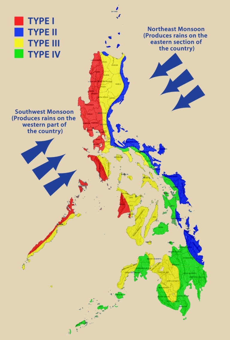
The region experiences Type I and III climate. The prevailing climatic condition in the region is a combination of humid and moist although some areas, especially the upper half of Panay, experience the wet type of climate. Higher amounts of rainfall are experienced from June to November when there are more than 15 rainy days per month. Lesser amounts of rainfall and shorter number of rainy days are experienced during the remaining months. Hot months are experienced in March & April and cold months in January, February, and December.
Land Use
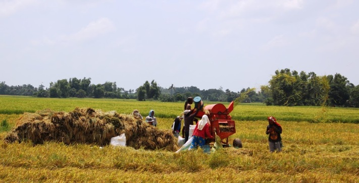
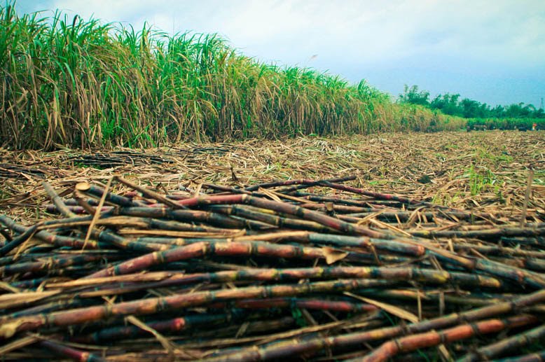
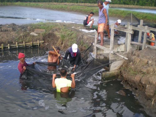
Forty-three percent of the region’s land resources is devoted to agricultural purposes. Sugar cane covers the majority of area in Negros Occidental and rainfed or irrigated palay in Panay. The region’s fishing grounds produce a large variety of marine, fishery and aquaculture products.
Agricultural Sector Production
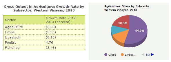
Palay production contributed 24.87 percent to the region’s agricultural output. Production wise, the region ranked 3rd among all regions. Sugarcane shared 15.39 percent and the region was the top producer. The region also ranked second in milkfish production; third in hog production; fourth in chicken production. It is also one of the country’s major exporters of prawn, tuna, and other fish products.
Industries
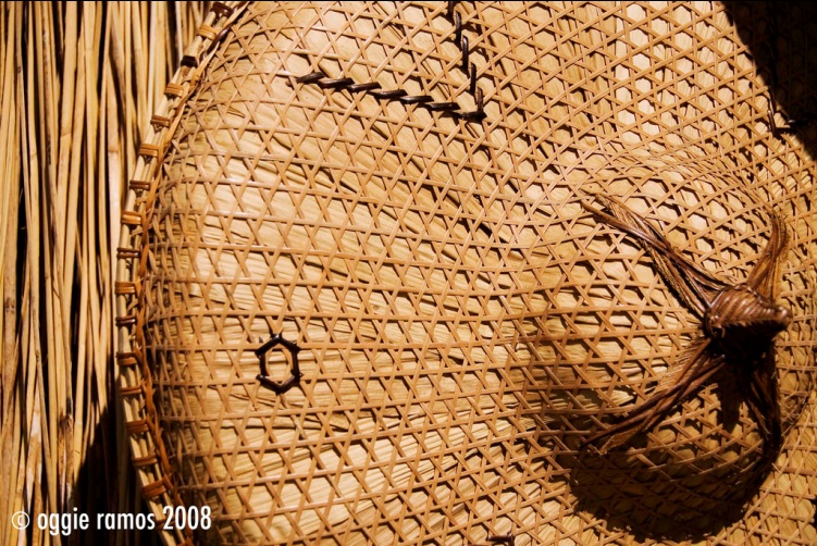
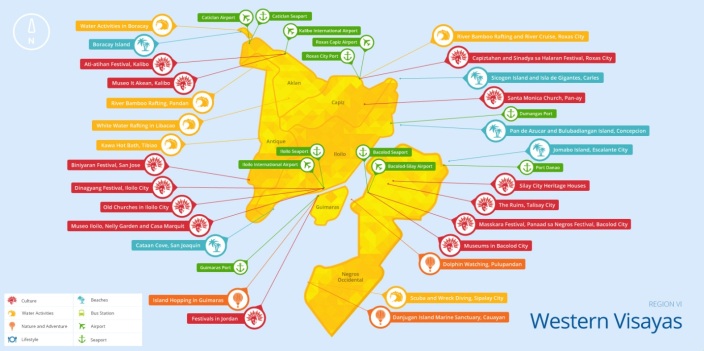
Aside from the major economic activities aforementioned, there are also other flourishing industries and businesses in the region like processing or marketing which is considered as good areas for investment. Other important businesses include cottage industries such as rattan craft, food preservation, ceramics and confectionery manufacturing. Moreover, major contributors to the region’s economic growth include, but not limited to, business process outsourcing and tourism for natural attractions and cultural heritages.


Other Resources
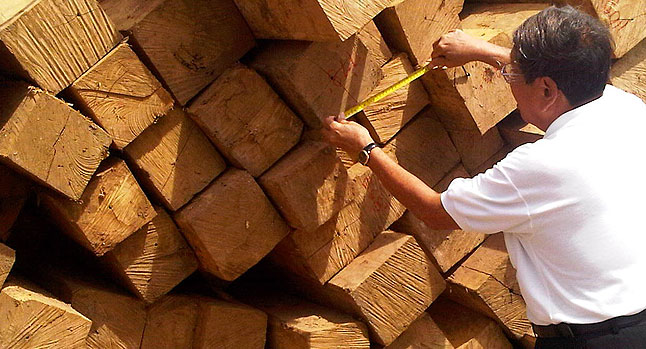
Western Visayas is one of the richest regions in the country in terms of natural resources. Its forests however have been denuded due to indiscriminate logging. Its waters abound with numerous species of fish and other marine products. Mineral resources include copper, gold, silver, clay, limestone, coal, sand and gravel and other non-metallic. Also, the region’s skilled manpower resource is also due of its greatest potential. With proper training and capability building, the people of the region can pave the way for the industrial growth and expansion of Western Visayas.

Urban Centers
The major trading and commercial centers of Western Visayas are the cities of Bacolod, Bago, Cadiz, La Carlota, San Carlos and Silay in Negros Occidental; Iloilo City in Iloilo; Roxas City in Capiz; San Jose in Antique and Kalibo in Aklan.Metropolitan Iloilo, composed of Iloilo city and the municipalities of Oton, San Miguel, Pavia and Leganes, is planned to be the center for residential, commercial, financial and industrial activities for the region.
Facilities
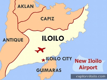
The road network of Panay is almost 2,000 kilometers. Iloilo has the longest stretch of paved roads. The region has several seaports and airports for both water and air travel. Telephone, postal and telegraphic services are available. Electricity and water supply are accessible to the population.
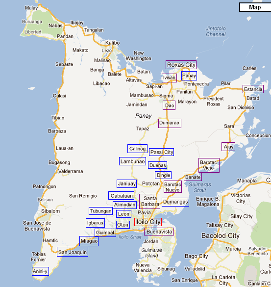
The map above shows the network of roads that connect the different provinces of Western Visayas.
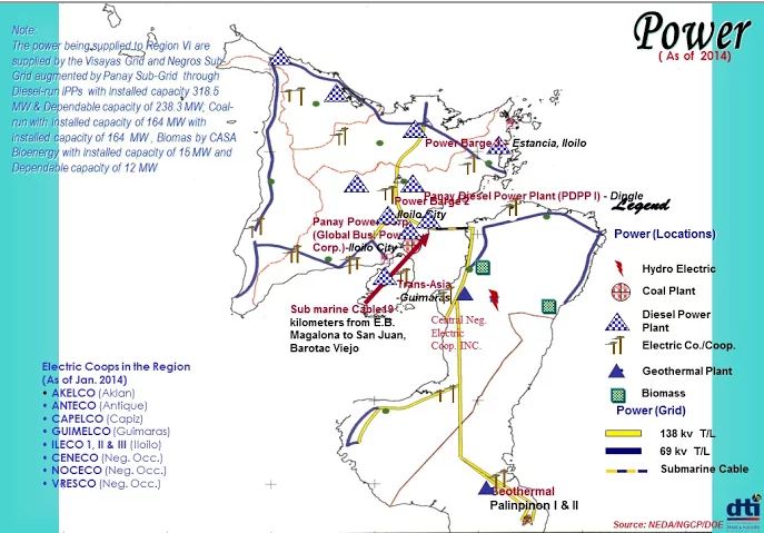
The fragmented characteristic of the region presents a challenge in energy distribution, however, concerned authorities had solved this difficulty by taking advantage of other possible sources of energy that include, but not limited to, hydroelectric, biomass, and geothermal plant.
The image above shows the seaports and airports in the region.
Demographics
According to PSA (2010), the total population of Region 6 is 7,089,739 comprising of 3,597,923 female and 3,491,816 male inhabitants. The distribution of the population per age range is as follows: 0-14yrs: 2,271,963; 15-64yrs: 4,399,419; and 65 yrs and over: 418,357. Moreover, the growth rate is 1.38.
The annual Average Family Income based on the 2012 data of inhabitants in Western Visayas is 204,000Php. Furthermore, the 2015 data for Labor Force Participation states a 62.5 participation rate with 95.8 employment rate.
History
Legend of Maragtas
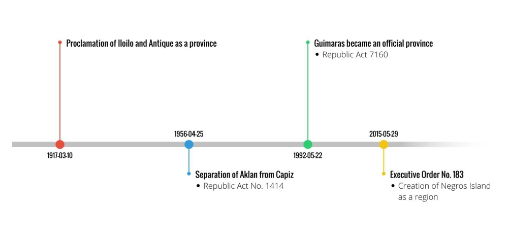
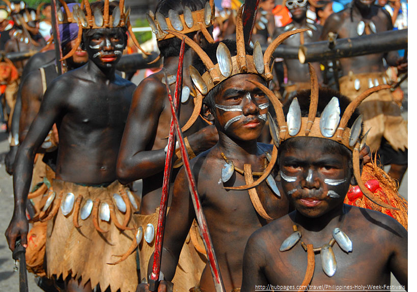
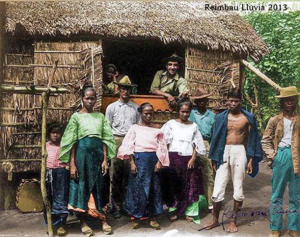
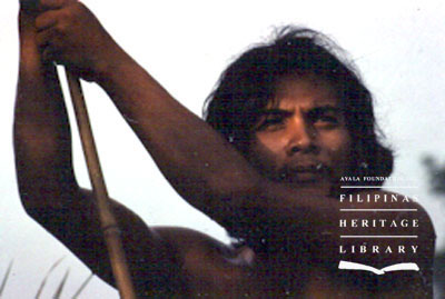
Many are the versions of the legend of Maragtas. This story may or may not be based on actual events in the remote past. They are about the ten datus or chiefs who escaped the tyranny of Datu Makatunaw of Borneo and immigrated to the island of Panay. Once there, they supposedly bought the lowland plains of the island from Marikudo, the leader of the indigenous Aytas, for the price of a solid gold salakot(hat). According to the legend, these ten chiefs and their families are the very ancestors of the entire Visayan population. This is the legend that has been celebrated yearly in the Ati-atihan festival since the late 1950s when it became a part of the annual feast of the Santo Niño in Kalibo, Aklan. Other versions, however, state that the indigenous Aytas did not naively exchanged the island for gold but instead it was with bloodshed that Malay people have successfully took possession of the land driving away the originally coastal inhabiting Aytas to the mountains.
Timeline
Aklan
Aklan province is situated in the northeastern part of Panay Island. It occupies the 9% of the total land area of the region. Having a land area of 181,789 hectares, 59% of its land is classified as alienable and disposable while the remaining 41% is classified as forestland. The present watershed in the province is called ‘Aklan River Watershed Forest Reserves’ covering an aggregate area of 23,185 hectares located in the municipalities of Madalag and Libacao. . Aklan has 17 municipalities and 327 barangays. Kalibo is considered as the capital which is located at the northwestern part of the province.
Considered as the oldest province in the country, it was originally known as “Minuro it Akean.” It is believed to have been established in the 13th century by Bornean settlers ruled by Datu Dinagandan. One of the datus who ruled Aklan named Datu Bendahara Kalantiaw issued Kalantiaw Code. It is a set of 18 laws that controlled his kingdom and his subject. Aklan became an official province on April 25, 1956 separating it from Capiz.
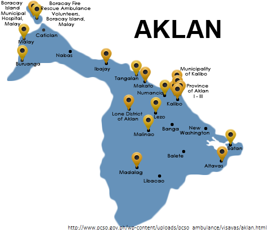
Aklanon are the main inhabitant of the province together with the Ati. They are part of the Visayan ethnic group. The native language of Aklan is also known as the Aklanon. The main economic activities in the province are agriculture, fishery, and forestry. It is known as the ‘Home of Abaca and Piña fiber.’ Root crops, rice, coconuts, poultry and swine are also among the major economic products of the province. Because of its neighboring Sibayan Sea, Aklan is also a rich fishing area. Marine resources such as seaweeds, oysters, prawns, crabs and milkfish are abundant.

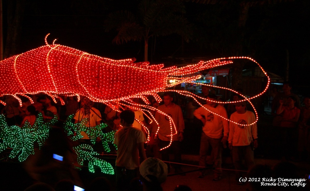
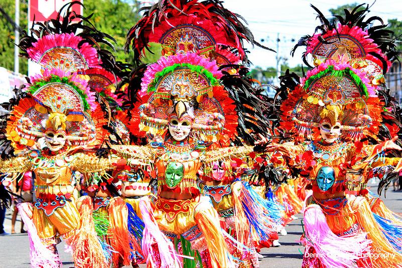
Aklan is also rich in culture and festivals. One of the major festivals present in the province is Ati-Atihan festival. The Ati-Atihan festival is celebrated in Kalibo every January. It is a two-week festival that usually ends on the third Sunday of the month. The name of the festival means ‘pretending to be like an Ati.’ With the Spanish influence, the festival is said to honor Santo Niño. The celebrants of this festival wears black soot on their faces.
Sources for Aklan (Accessed on April 11, 2016)
http://www.islandsproperties.com/places/aklan.htm
http://r6.denr.gov.ph/index.php/about-us/regional-profile
http://www.zamboanga.com/z/index.php?title=Aklan_Province,_Philippines
Antique
Antique province, on the other hand, is situated in the western part of Panay Island. It is profiled like a seahorse because of its appearance. It occupies the 12% of the total land area of the region. Having a land area of 252,201 hectares, 53% (133,566 ha) of its land is classified as alienable and disposable while the remaining 47% (118,635 ha) is classified as forestland. There are two present watersheds in the province. These are ‘Mau-it-Tipulu-an River Watershed Forest Reserve’ and ‘Dalanas River Watershed Forest Reserve’ covering a total area of 16,295 hectares located in the municipalities of Sibalom and Barbasa. Antique has 18 municipalities and 590 barangays. The municipality of San Jose de Buenavista is the capital located at the southwestern part of the province.
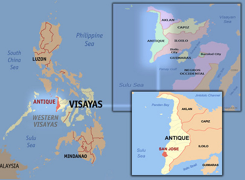
The slogan- ‘Where Mountains meet the Sea’ was formed because of the geographical location of the province. It lies between the China Sea to the west and a tall mountain range, 155 kilometers long and 33 kilometers at its widest, to the east, separating it from the rest of Panay.
Antique’s name was derived from the term “Hamtik” after “hantik-hantik”meaning large ants that are abundant in the place. It is also considered as the “Home of Sacadas” because of being a major source of migrant labor for sugar cane fields of Negros Occidental. After the division of the Panay Island, Hamtik was put under Datu Sumakwel who found a place known as Malandong, the first Malay settlement in the Philippines. It officialy became a province by the virtue of Republic Act No. 2711 on March 10, 1917.
Kiniray-a are the main inhabitant of the province together with the Ati. They are part of the Visayan ethnic group. Some of the language spoken in the province aside from English are Kiniray-a, Caluyanon, Hiligaynon, Cuyonon and Ati. The economic activities present in the province are agriculture, fishery, forestry, trade, commerce and industry. The province is also rich in mineral resources such as abundant deposits of marble.
Antique is rich in festivals. Among the festivals that it celebrates are Binirayan Festival, Kahilwayan Festival, Hiriugyon sa Bitadton Festival, and Madja-as Festival. Binirayan Festival which is a month-long colorful commemoration of the arrival of the ten datus in Panay is celebrated every end of April. It literally means “where they sailed to.” The second one, Kahilwayan Festival is celebrated every 18th -20th day of October. It is done to sort of reenact the struggle for freedom during the Spanish era. The next one, Madja-as Festival, is celebrated every 18th– 22nd day of May. It is a barangay’s religious fiesta in honor of Saint Joseph. Finally, the Madja-as Festival is culminated every 1st Saturday of March. It is named after the highest mountain in Panay Island, Mt. Madjaas in Culasi.

Sources for Antique (Accessed on April 13, 2016)
http://culasihistoryuncover.blogspot.com/
http://www.visitmyphilippines.com/index.php?title=Antique&Page=1&pid=455
http://www.zamboanga.com/z/index.php?title=Antique_Province,_Philippines
http://r6.denr.gov.ph/index.php/about-us/regional-profile
http://www.tourism.gov.ph/SitePages/InteractiveSitesPage.aspx?siteID=38
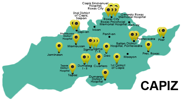
Capiz
Capiz province is located in the middle eastern part of Panay Island in between Aklan (above) and Iloilo (below). It occupies the 13% of the total land area of the region. Having a land area of 263,317 hectares, 64% (169,547.27 ha) of its land is classified as alienable and disposable while the remaining 36% (97,769.73 ha) is classified as forestland. The present watershed in the province is called ‘Pan-ay River Watershed Forest Reserve’ covering an aggregate area of 4,350 hectares found in the municipality of Tapaz. Capiz is composed of 16 municipalities and 473 barangays. Roxas City is considered as the capital which is located at the northern border of the province.
In the 16th century, Datu Bakunawa’s wife of the Aklan district gave birth to twin daughters. The name of the province was then derived from the Visayan word “Kapid” meaning twins. Due to the miscommunication with the Spaniards, it was then referred to as Capiz. It became an official province on the 25th day of April, 1956 separating it from Aklan.
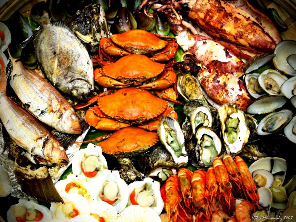
Capiznon and Ati are the main inhabitants of the province. Some of the language spoken aside from English are Capiznon and Hiligaynon. Because of its location, Capiz is called the Seafood Capital of the Philippines. It is bounded by the Mindoro Sea, the Panay, Loctugan and Ibisan rivers. The economic activities present in the province are fishery, tourism, telecommunications, broadcast communications and BPOs. The main products are seafood and the famous Capiz Shells.
Capiz is not just rich in economic opportunities but also culture. It celebrates different festivals such as Sinadya sa Halaran Festival, CAPIZtahan!, and Diwal Harvest Seafood Festival. The Sinadya sa Halaran Festival is celebrated every first weekend of December in commemoration of the Feast of the Virgin of the Immaculate Concepcion who also happens to be the patroness of the City of Roxas. CAPIZtahan! Is celebrated every April 12-15 to commemorate the foundation of Capiz’ second civil government highlighting public sector’s participation in Provincial Government’s effort for socio-cultural and tourism development. The Diwal Harvest Seafood Festival is held every 2nd week of July. The Diwal is a rare bivalve found along the coastal waters of Capiz. Every year in lieu with the celebration tons of diwal are harvested and sold in the open market.

Sources for Capiz (Accessed on April 10, 2016)
http://www.zamboanga.com/z/index.php?title=Capiz_Province,_Philippines
http://capiz.gov.ph/index.php?option=com_content&view=article&id=1:captivating-capiz&catid=25:about-capiz
http://r6.denr.gov.ph/index.php/about-us/regional-profile
http://capiznews.com/tag/capiztahan/
Guimaras
Guimaras province is an island located between the islands of Panay and Negros. It occupies only 3% of the total land area of the region. The total land area of the province is 60,457 hectares. Capiz is composed of 5 municipalities and 98 barangays. Jordan is known as the capital located at the northwestern border of the province.
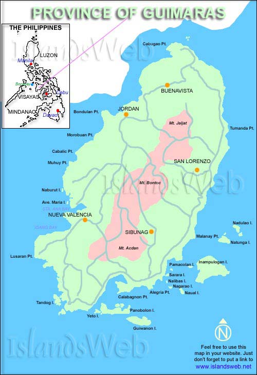
The province was named “Himal-us” after the word “panghimud-us,” meaning a struggle for survival. However, the name was changed to Guimaras after ill-fated lovers Princess Guima and the slave Aras defied tradition for their romance. Guimaras was once a sub-province of Iloilo before it became an official province on May 22, 1992 by the virtue of Republic Act 7140.
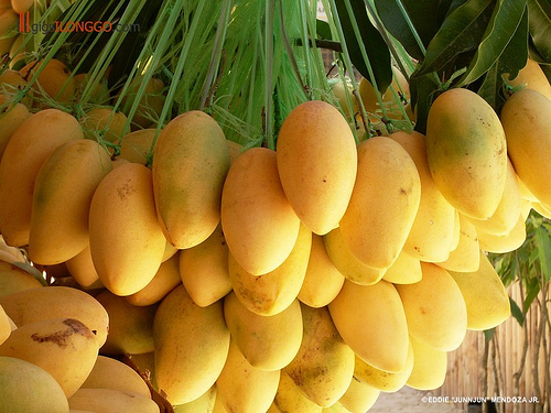
Aetas are the main inhabitant of the province. The language spoken here is Hiligaynon. The province is known as the “Mango Country” because of its 8,000 hectares of mango orchards managed by corporations and individual growers. As being said, the mango production is the main economic activity present in the province.
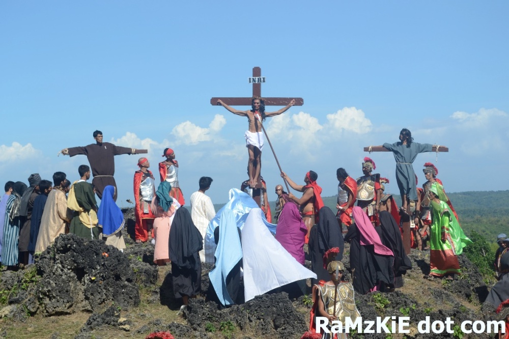
The main festivals that are being celebrated in Guimaras are Pagtaltal sa Bala-an Bukid Festival, Manggahan sa Guimaras Festival, and Bulantihan Festival. “Pagtaltal sa Bala-an Bukid” is a Lenten presentation on the hillside of Jordan, Guimaras staged by the townspeople every Good Friday. Manggahan sa Guimaras Festival is celebrated every May of the year for a sustained promotion of mango industry in the province. Lastly, the Bulantihan Festival celebrates Jordan’s major thriving industry: fishing, farming, and mango production. It is held every January of the year.

Iloilo
Iloilo province is situated in the southeastern part of Panay Island. It occupies the 43% of the total land area of the region. Having a land area of 471,940 hectares, 76% (357,857 ha) of its land is classified as alienable and disposable while the remaining 24% (57,620.89 ha) is classified as forestland. The present watershed in the province is called ‘Maasin Watershed Forest Reserve’ and ‘Jalaur River Watershed Forest Reserve’ covering an aggregate area of 15, 378 hectares located in the municipalities of Maasin and Calinog. Aklan has 42 municipalities and 1721 barangays. Iloilo City is considered as the capital which is located at the southeastern part of the province.
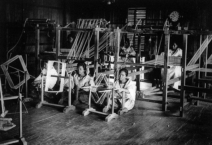
Iloilo was formerly called ‘Irong-irong’ under Dati Paiburong in the confederation of Madiaas. It is considered as the last capital of the Spanish Empire in Asia. Because of the developmemt of large scale weaving industry, it is also referred to as the ‘Textile Capital of the Philippines’. The first department stores and cinemas were also seen in the province. The official proclamation of Iloilo happened on the 10th day of March, 1917.
Illonggo and Ati are the main inhabitants of the province. One of the languages spoken in this province is Hiligaynon. Because of abundance in agricultural products, the province is referred to as “Food Basket and Rice Granary of the Western Visayas.” The economic products present in Iloilo are palay, fish and marine products, processed food, fruits and vegetables, furniture, sugar, coconut oil, lime products and cottage industry products.
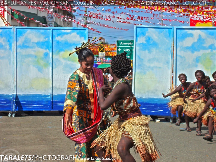
Aside from economic products, Iloilo is also undeniably rich in culture. Two of the celebrated festivals of the province are Bayluhay Festival and Dinagyang Festival. Celebrated every 3rd week of January, the festival echoes the town’s distinctive mixture of cultures and rich history. One the other hand, Dinagyang Festival is held both to honor Sto. Nino and the arrival of the Malay settlers in the Panay Island. It is celebrated every 4th Sunday of January.

Sources for Iloilo (Accessed on April 14, 2016)
http://www.tourism.gov.ph/SitePages/InteractiveSitesPage.aspx?siteID=36
http://www.iloilocity.org/history.html
Negros Occidental
The province of Negros Occidental is located in the northeastern part of Negros Island. It occupies the 40% of the total land area of the region. Having a land area of 792,607 hectares, 68% (540,385.62 ha) of its land is classified as alienable and disposable while the remaining 32% (252,221.38 ha) is classified as forestland. There are three present watersheds in the province. These are ‘Bago River Watershed Forest Reserve’, ‘Ilog-Hilabangan Watershed Forest Reserve’, and ‘Kabankalan Watershed Forest Reserve’ covering an aggregate area of 72,569 hectares and located in the Cities of Bago and San Carlos, Kabankalan and Himamaylan. Aklan has 19 municipalities and 13 cities. Bacolod City is considered as the capital which is located at the northwestern part of the province.
Negros Occidental together with Negros Oriental were once called Negros Island. The name of the island came from the word “Buglas” meaning cut-off. During 1865, Negros Occidental was raised to the category of a politico-military province and finally it was then separated to Negros Oriental on 1980.
Ati and Magahats are the main inhabitants of the province. They are also known as Ati-Man and Bukidnon. Their language is a mixture of Hiligaynon and Sugbuhanon. Because of having a large scale sugar industry, Negros Occidental is called the “Sugar Bowl of the Philippines. The main products of the province are sugarcane, crops like coffee, black pepper, ramie, and copper mines. There are also plenty of fish ponds present.
Masskara Festival and Panaad Festival are among the most popular festivals present in the province. Masskara Festival is held every third weekend of October or on the closest weekend to October 19. Because of the major sugar crisis that happened in the region, they decided to have a party to uplift the spirit of the people. On the other hand, Panaad festival is held annually during the month of April. The festival is a form of thanksgiving to Divine Providence and commemoration of a vow in exchange for a good life.

Sources for Negros Occidental (Accessed on April 15, 2016)
http://www.ethnicgroupsphilippines.com/people/ethnic-groups-in-the-philippines/magahat/
http://itsmorefuninthephilippines.com/masskara-festival/
Issues
Jalaur Mega Dam Project
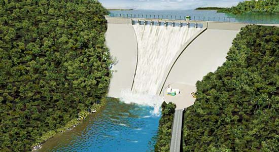
It is a P11.2-billion Mega dam project of National Irrigation Administration in partnership with Korea Export-Import Bank that is to be constructed in the headwaters of the Jalaur River in Calinog, Iloilo. According to the concerned authorities, the mega dam project, as the first large-scale reservoir dam outside Luzon, will provide uninterrupted irrigation water supply to 783,000 Ilonggo farmers consequently increasing and expanding rice and other crops production. It will also help in flood mitigation and control as well as promoting eco-tourism. As a result, it will open 17,000 local job opportunities equivalent to P1.3 billion in basic wages per year. The project will cover three dams, one of which is the Calibunan Catch Dam which is expected to be completed before Aquino’s term ends.
However, there is always an opposing view in every story. Minorities including farmers and indigenous people claim that the construction of the mega dam will affect their livelihood and right to land. Especially for the indigenous groups who do primarily their rituals in Jalaur River. Also according to militant groups, fighting beside these minorities, that the mega dam will bring forth landslides and earthquakes as it will be situated along the West Panay Fault. Flooding due to the construction also threatens to submerge and displace 18 villages of indigenous and grassroots people. Added effect of clearing the forest to give way for the dam will generate noise and air pollution.
What we intend to show here is the problem that is not remote in western visayas but can be seen in other parts of the country as well. This is the dilemma between pushing for economic growth as the authorities see it in one hand and listening to the narratives of the people in grassroots level including marginalized sectors. There seems to be a disjunction in the economic inclusivity that the government wants to achieve in its policies and projects and in the material conditions of people who are supposed to benefit from these projects. The government of the people seems to be out of touch with the lives of the people.
Of course, the solution to bring back the orientation of the State’s projects and policies to the interest of the people is a complex process and cannot be solved by merely presenting one or two point solutions. However, we can start in lobbying, for this specific issue and other related problems, that there should be immediate imposition of an environmental protection order especially if lives of the people are at stake. Also, the government should focus instead on people-oriented renewable energy projects.
Semirara Mining
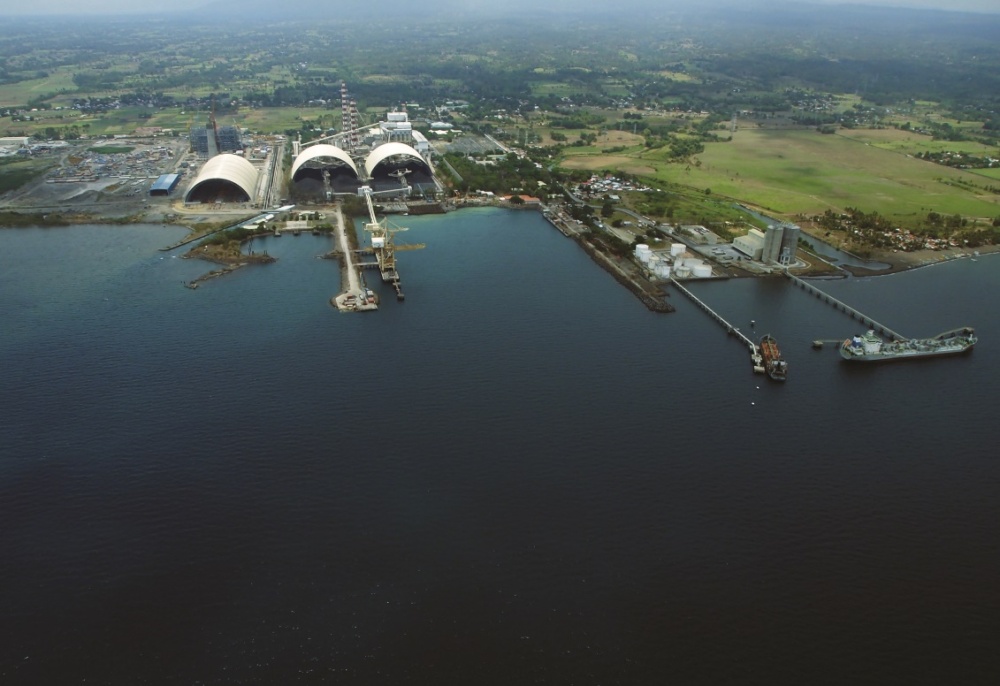
Mining in Semirara Island, Antique has been one of the economic booster of the province. It is one of the largest coal mining industry in the Philippines. Because of its large scale, it doesn’t only improve the economy by exporting the products but it also gives job opportunities to people.
However, there are negative effects that are inevitable when it comes to mining. Last year, an accident was reported that lead to the deaths of some workers. Accident is just one of the risks that the mining industry is facing. Natural resources such as mangroves, see grass and even other marine resources are also being affected with mining. There was also an alleged report on dislocation of the residents in the area because of the activity present there.
It’s hard to think of a proper solution to this problem. There’s always a trade-off. I think it’s up to the people and the government to weigh whether they should slower the rate of using the resources in the island or just continue with what they’ve already started. But they should always keep in mind the safety of the residents and what benefits both parties.
Major References:
http://www.dti.gov.ph/rog/index.php/region01-regionalprofile-6
http://r6.denr.gov.ph/index.php/about-us/regional-profile
http://countrystat.psa.gov.ph/?cont=16&r=6
Website references for images are embedded as hyperlinks in the captions.
#
