Malta’s oldest fortification

Malta’s oldest fortification

DSCN0053 pixlr signed

Mention Maltese fortifications and one’s mind is automatically transported to the impressive and extensive defensive systems designed and constructed during the period of the Knights of St. John of Jerusalem, more popularly known as the Knights of Malta.   The most impressive of the Knights’ fortifications include the walls of Valletta and Floriana, the Cottonera Lines encompassing the Three Cities of Vittoriosa, Cospicua and Senglea and the walled citadels of Mdina and Victoria on Gozo.

The British also left some impressive fortifications the most famous of which are the Victoria Lines which criss-cross the island at its widest breadth between Madliena and Fomm ir-Rih. Older medieval fortifications, some dating from the Byzantine and Arab period, are found in Vittoriosa, Mdina and the Gozo Citadel where they were incorporated into the Knights’ battlements. A couple of locations such as San Gwann also feature the remains of Roman towers which presumably had some sort of military significance, albeit of an observatory nature.

DSCN0030 pixlr signed

By far, the oldest evidence of a fortified structure to have been found in Malta is the impressive wall protecting the remains of the Bronze Age village at Borg in-Nadur in Birzebbuga on the south-eastern tip of the island of Malta.

DSCN0054 pixlr signed

Borg in-Nadur has a very interesting history. It lies at the tip of the Wied Dalam valley where around half a kilometre upstream lies Ghar Dalam, the Cave of Darkness after which the earliest phase of Maltese prehistory is named. The Ghar Dalam phase dates back to around 5000BCE and is reputed to contain the oldest evidence of human activity in the Maltese Islands: settlers who came from Sicily by crossing the 100 kilometre stretch of sea on rafts and boats bringing with them seeds, livestock, fabrics and pottery which has been matched with artefacts from a south-eastern Sicilian prehistoric site called Stentinello.

DSCN0127 hdr pixlr signed

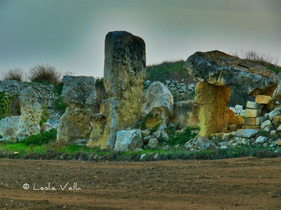
Borg in-Nadur started life around 2,500BCE as a Tarxien-phase temple. It was a relatively small and undecorated temple on a promontory overlooking the protected expanse of Marsaxlokk harbour.  After around a thousand years as a temple, the site was taken over by a new wave of Bronze-Age settlers around 1500BCE who differed principally from their Neolithic predecessors owing to their introduction of metal tools, implements and weapons to the Islands. The Bronze Age settlers occupied Borg in-Nadur for a thousand years until 500BCE when the literate Phoenicians reached these shores and transported Malta into the historic age.

The Bronze-Age settlers redeveloped the site quite extensively into a sizeable village. They recycled a lot of the stones from the temple complex and built their huts in the general area of the older temple site. Hut foundations were excavated by Margaret Murray in the 1930s but were buried once more once the necessary studies were conducted.   The village seems to have been quite large housing a few hundred residents and also featured around one hundred grain silos excavated as bell-shaped cisterns in the soft globigerina limestone around the coast.

DSCN0062 pixlr signed

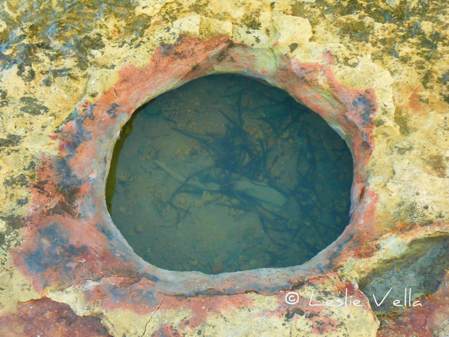
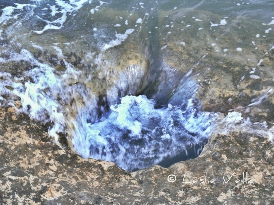
Most of the silos were destroyed in two episodes of road construction and widening in the twentieth century but a handful survive on a thin coastal stretch across the road from the main site: silos which have their own unique story to tell owing to the fact that most of them lie under sea level suggesting either a rise in sea levels over the past couple of thousand years or else land subsidence. This story is further corroborated by the presence of a single, adjacent set of cart-ruts which also lead straight into the sea.

DSCN0027 pixlr signed

Evidence indicates that the Bronze-Age inhabitants were more warlike than their predecessors, although it is not clear whether their bellicose behaviour extended to the threat of foreign seafarers or other clans inhabiting other parts of the Island.

DSCN0034 pixlr signed

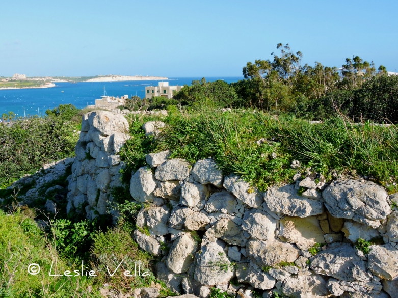
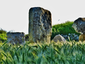
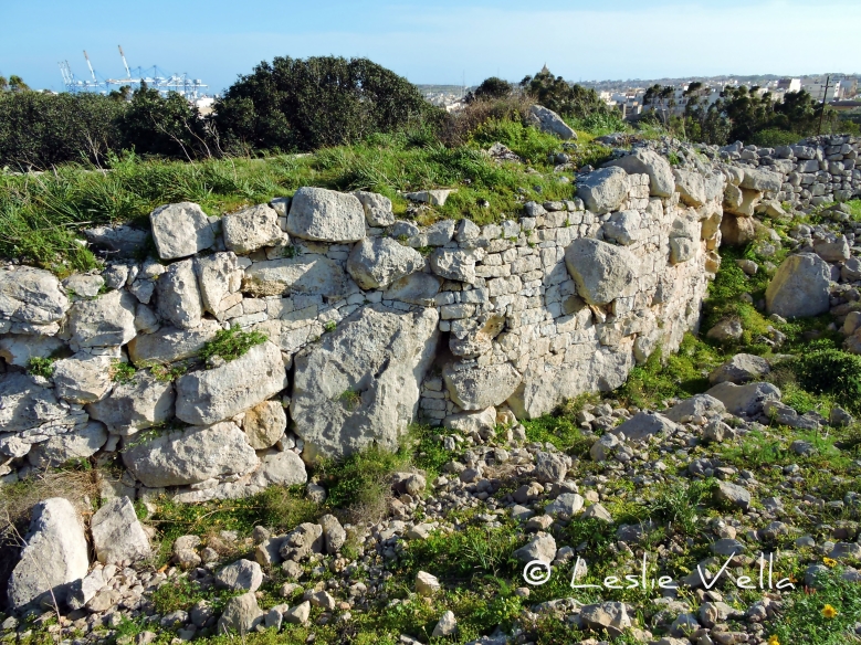
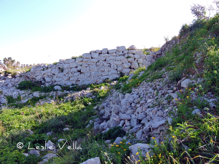
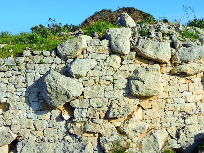
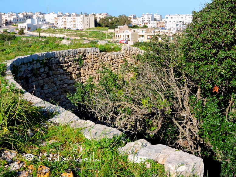
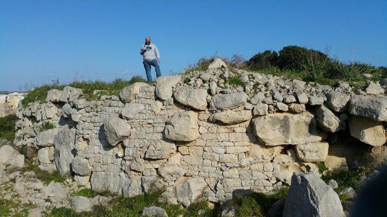
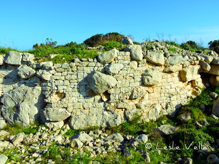
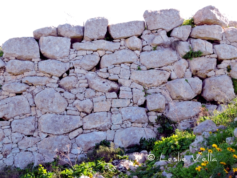
One of the most impressive and clear indications of the troubled times in which these people lived, is the extensive 4.5 metre high semi-circular wall which lies at the northern end of the Borg in-Nadur village. The wall was excavated by Murray in the 1930s and contrary to most of the dig carried out then, it was not reburied. The original remains of the wall were augmented by modern reconstructions especially in the back part. The entire structure is about 30 metres long and circa 2.5 metres thick. The most impressive aspect of this 3,500 year old wall is the huge rock boulders which are embedded within the structure: megaliths which were probably recycled and reused from the original temple.

DSCN0042 pixlr signed

An intriguing aspect of the Borg in-Nadur defensive wall is that it actually faces inland rather than towards the sea! Does this mean that the villagers were more interested in defending themselves from the enemy within or is there another unknown significance?

Whatever the interpretation, this small and relatively unknown site has its special place in Malta’s impressive list of historical treasures: the first in a 3,500 year fortress-building tradition making Malta one of the most well-defended locations in the Mediterranean.
11091143_10205331410817621_1612580066_n

The sunken silos of Birzebbuga

The sunken silos of Birzebbuga

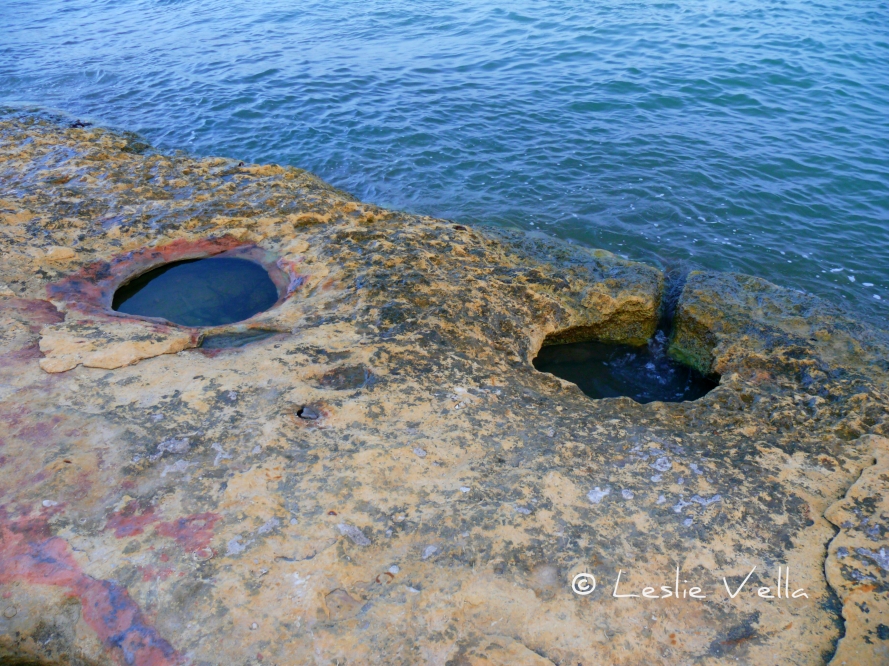
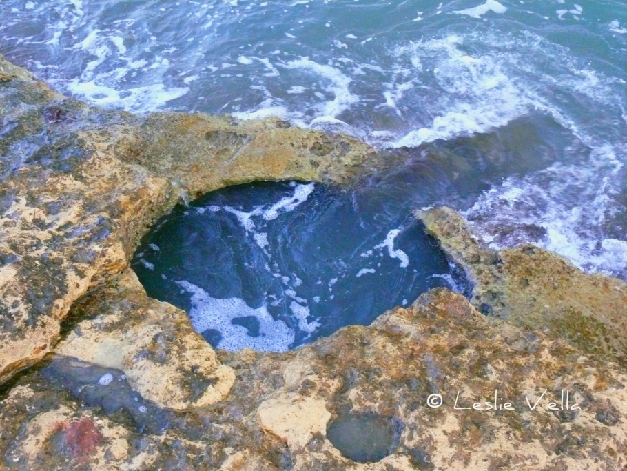
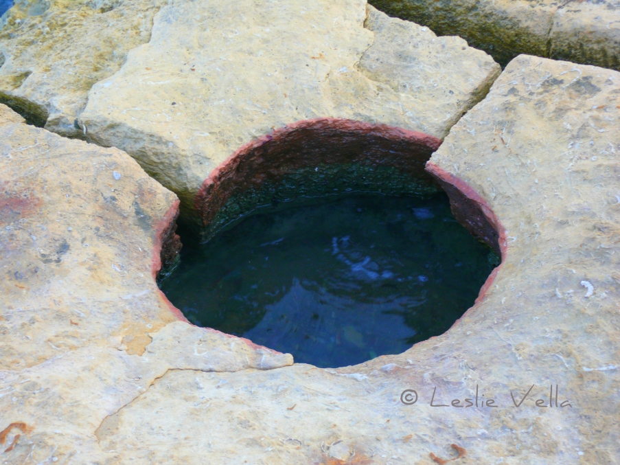
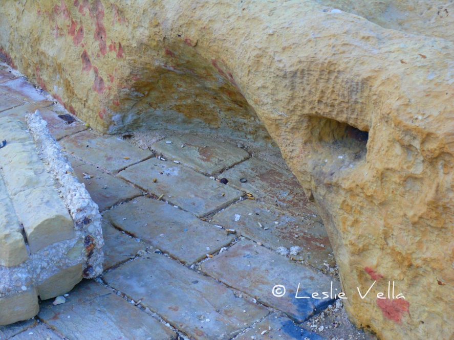
At the very entrance of the village of Birzebbuga, at the extreme south-east of Malta, lies the small but important prehistoric site of Borg in-Nadur. The site, which lies a few hundred metres away from the better known Ghar Dalam cave, started life as a late Tarxien-phase megalithic temple but was eventually occupied by Bronze-Age settlers who developed a major village complete with a still-surviving defensive wall which is reputedly Malta’s oldest surviving fortification. L1460357 hdr pixlr signed The extensive Bronze-Age village which existed during a one thousand year interval between 1500 and 500 BCE originally stood on high ground overlooking St. George’s Bay but its remains and context have today been sadly disturbed by modern development including the building of the major road into Birzebbuga which cuts through the land formerly occupied by the village near the shore. One surviving indicator of the size and extent of the Borg in-Nadur bronze-age village consists of a number of rock-cut silos which were used by the villagers to store grain. Silos of this type have also been found in similar settlements from the same period such as Bahrija and Luqa on Malta and in-Nuffara in Xaghra, Gozo.  The grain was either stored for future consumption or else as seeds for the forthcoming growing season.  Given their location so close to the sea it could also be that the grain was stored there for purposes of trade with visiting vessels. L1460359 pixlr signed These silos were dug into the rock and eventually plugged to keep the grain dry and protected from the elements. They were bell-shaped cisterns not unlike the rainwater cisterns dug by the inhabitants of the Maltese islands to capture and store rainwater during the rainy season. The Birzebbuga silos which survive today consist of a small group on an exposed patch of rocky coast which is accessible from the promenade near the small sandy beach opposite the Al Fresco restaurant. The surviving silos today consist of around fifteen but until a hundred years ago they numbered closer to one hundred. In fact no less than 32 were destroyed by the British colonial administration on 31 May 1920 so that they could build a coastal road to the village which had increased in importance due to the seaplane base which had been established at Kalafrana. A further 41 silos were destroyed some time later when the original road was widened. L1460387 pixlr signed An interesting aspect connected with the Birzebbuga grain silos is the fact that the surviving ones all lie at the very edge of the coast and that some of them are actually below sea level. Given that underwater silos are of little practical use, what the current state of the silos implies is that the coastal landscape on which they stand must have undergone some fairly substantial upheavals over the past three thousand or so years.   The silos today lie under water either due to a sea level rise of a few metres which changed their original low cliff-top location to a sea-level one or else as a result of subsidence which saw the rocky foreshore on which they were carved sink below sea level due to some tectonic cataclysm which pulled it downwards. L1460362 pixlr signed Today, the silos lie in an accessible area which is reasonably well protected from the deprivations of further development. Most of them have filled up with accumulated silt from both the land and the sea and a number of them feature recent channels which have been cut into the rock to link them directly to the sea. A couple have been sealed to prevent accidents. Evidence of past quarrying on the globigerina rock-face on which the silos are located is visible through two cross-sections of silos which still survive.   The cross-sections give a very good indication of the original bell-shape of the silos. L1460406 pixlr signed Some of the silos feature a reddish tint which was caused by fire implying that the pits were filled with flammable material which was set alight during some point. L1460394 pixlr signed The silos of Borg in-Nadur are not impressive or monumental in any way, being mere holes in the rock.  But they do bear testament to a forgotten people who inhabited this land some three thousand five hundred years ago: a warrior-like people with bronze tools who built fortified villages next to the abandoned temples of their stone-age predecessors. A people who not only were farmers and traders but also built complex food storage facilities for their grain using the concept of rock-cut cisterns which continued to be used in Malta for the same purpose until at least the 1980s of the current age. They also serve as a grim reminder related to the major risk phenomenon of our time: global warming and its effect on coastal settlements should sea levels rise. L1460398 hdr pixlr signed

Malta’s original name as told by an ancient coin

L1320630 pixlr signed

Malta’s original name as told by an ancient coin

The modern name of “Malta” derives from “Malitah” which was the Arabic corruption of the classic Graeco-Roman “Melita”.  Melita was the name of both the island and its city: names which eventually changed to “Malta” for the island and “Mdina” for the ancient Punico-Roman city which originally covered not only present day Mdina but almost one half of its suburb of Rabat too, all the way to St.Paul’s Church.  The name “Mdina” itself derives from the Arabic word “Medina” which simply means “the City”.

Given that humanity’s presence in Malta extended to at least three thousand years before the era of Graeco-Roman influence, it is only natural to speculate on what the island’s name was in such earlier times.  What the historic and prehistoric evidence tells us is that Malta was first inhabited by the prehistoric migrants from Sicily who eventually developed the highly sophisticated megalithic temple culture which gave the world its first complex monuments built in stone.  After these people mysteriously and inexplicably died out, they were replaced by a Bronze-Age prehistoric people, also migrating from Sicily, who were more warlike and defensive in nature as evidenced by the fortified remains of the Bronze Age Village at Borg in-Nadur in Birzebbuga.

Maltese prehistory (ie that period of human existence before writing was invented), gave way to historical times and their written records with the arrival of the Phoenicians; those great traders who originated from modern-day Lebanon and whose trading network extended beyond the Straits of Gibraltar to Britain in the north and West Africa in the south.  The Phoenicians’ most important contribution to global civilisation was the alphabet which used letters representing sounds instead of the more cumbersome symbols and pictograms to denote writing used previously by more ancient civilisations such as the Egyptians with their hieroglyphics and the Sumerians with their cuneiform. The Phoenicians wrote from right to left as in modern day Arabic.

The Phoenician alphabet revolutionised writing and from it evolved all the major alphabets of the ancient and classical world: Arabic, Hebrew, Greek, Latin and eventually Cyrillic.  Quite an achievement for a small people who achieved fame by establishing themselves as the used-car salesmen of the Mediterranean!

But lets get back to Malta.  So the Phoenicians arrived here with their trade and their alphabet around 800BC and eventually Malta’s lot fell under the influence of their great colony of Carthage in modern day Tunisia.  By this time, coins were introduced for the first time in Malta and the historical findings suggest that these coins were the same as the ones used within the Phoenician colonies.  The Phoenicians populated the Maltese Islands and ruled for some 600 years and such was their influence that the Maltese continued to speak their language for hundreds of years after the Roman conquest of 218BC, so much so that the Apostle Luke, writing about St. Paul’s shipwreck in Malta in the Bible’s Acts of the Apostles in 60AD describes the Maltese as “barbarians”: a description not because of their savagery but merely to highlight the fact that they spoke neither Latin nor Greek.

And here comes the subject of this story, which, you will recollect, deals with Malta’s original name as told by an ancient coin.  While all of the first coins used in Malta were imported varieties, there was a very short period of about 200 years between 212BC and 15BC, when Malta and Gozo were allowed by the Romans to mint their own bronze coins: a privilege given to Roman municipia in Sicily under whose administrative control the Maltese Islands lay.

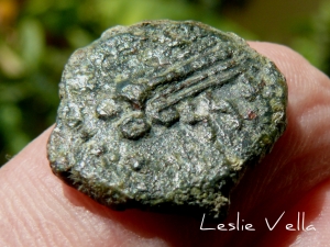
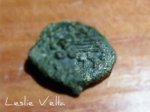
During this period around twelve different types of coins were minted, including one specifically by the Island of Gozo suggesting that the smaller island possessed a level of autonomy from Malta.  Eventually this practice was discontinued as the evolution of Rome from a Republic to an Empire under the Caesars led to a single, uniform coinage throughout the whole Empire.  The different types of coins feature the name of Malta or Gozo either in Greek or Latin but there are also a few which feature Malta’s name in Punic, the language of the Phoenicians.  The pictures in this post, of a Maltese triens coin from 85BC, show a sacrificial tripod on the reverse side, and, most importantly, Malta’s original Phoenician name as represented by the three characters:


which represent the Phoenician letters (from right to left) aleph, nun and nun or A, N and N.  The letters are reasonably visible in the photos.

L1320626 pixlr signed

The sound of the three letters, which signify Malta’s original and older name from the time of the Phoenicians, has been differently interpreted as “Ann” or “Ghonan” given that the Phoenician alphabet did not have vowels but merely consonants like the modern Arabic alphabet.  The best way to represent the word would be ‘nn.  This word best translates into “ship” or “vessel” and has been tentatively attributed to the ship-like profile of the Maltese Islands as viewed from the distance by an approaching ship.  The Hebrew word for ship which also features a similar root is oni.

Malta and Melita but also ‘nn or Ghonan.  One wonders what other names this little island had before writing was invented when the temple builders and their Bronze-age successors lived here.  A question which will probably go unresolved forever given that there are no more fantastic coins inscribed with ancient alphabets waiting to be discovered!L1320630 pixlr signed pixlr signed closeup