Malta’s oldest fortification

Malta’s oldest fortification

DSCN0053 pixlr signed

Mention Maltese fortifications and one’s mind is automatically transported to the impressive and extensive defensive systems designed and constructed during the period of the Knights of St. John of Jerusalem, more popularly known as the Knights of Malta.   The most impressive of the Knights’ fortifications include the walls of Valletta and Floriana, the Cottonera Lines encompassing the Three Cities of Vittoriosa, Cospicua and Senglea and the walled citadels of Mdina and Victoria on Gozo.

The British also left some impressive fortifications the most famous of which are the Victoria Lines which criss-cross the island at its widest breadth between Madliena and Fomm ir-Rih. Older medieval fortifications, some dating from the Byzantine and Arab period, are found in Vittoriosa, Mdina and the Gozo Citadel where they were incorporated into the Knights’ battlements. A couple of locations such as San Gwann also feature the remains of Roman towers which presumably had some sort of military significance, albeit of an observatory nature.

DSCN0030 pixlr signed

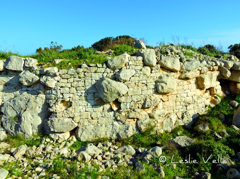
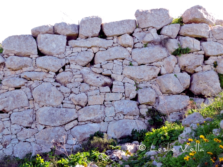
By far, the oldest evidence of a fortified structure to have been found in Malta is the impressive wall protecting the remains of the Bronze Age village at Borg in-Nadur in Birzebbuga on the south-eastern tip of the island of Malta.

DSCN0054 pixlr signed

Borg in-Nadur has a very interesting history. It lies at the tip of the Wied Dalam valley where around half a kilometre upstream lies Ghar Dalam, the Cave of Darkness after which the earliest phase of Maltese prehistory is named. The Ghar Dalam phase dates back to around 5000BCE and is reputed to contain the oldest evidence of human activity in the Maltese Islands: settlers who came from Sicily by crossing the 100 kilometre stretch of sea on rafts and boats bringing with them seeds, livestock, fabrics and pottery which has been matched with artefacts from a south-eastern Sicilian prehistoric site called Stentinello.

DSCN0127 hdr pixlr signed

Borg in-Nadur started life around 2,500BCE as a Tarxien-phase temple. It was a relatively small and undecorated temple on a promontory overlooking the protected expanse of Marsaxlokk harbour.  After around a thousand years as a temple, the site was taken over by a new wave of Bronze-Age settlers around 1500BCE who differed principally from their Neolithic predecessors owing to their introduction of metal tools, implements and weapons to the Islands. The Bronze Age settlers occupied Borg in-Nadur for a thousand years until 500BCE when the literate Phoenicians reached these shores and transported Malta into the historic age.

The Bronze-Age settlers redeveloped the site quite extensively into a sizeable village. They recycled a lot of the stones from the temple complex and built their huts in the general area of the older temple site. Hut foundations were excavated by Margaret Murray in the 1930s but were buried once more once the necessary studies were conducted.   The village seems to have been quite large housing a few hundred residents and also featured around one hundred grain silos excavated as bell-shaped cisterns in the soft globigerina limestone around the coast.

DSCN0062 pixlr signed

Most of the silos were destroyed in two episodes of road construction and widening in the twentieth century but a handful survive on a thin coastal stretch across the road from the main site: silos which have their own unique story to tell owing to the fact that most of them lie under sea level suggesting either a rise in sea levels over the past couple of thousand years or else land subsidence. This story is further corroborated by the presence of a single, adjacent set of cart-ruts which also lead straight into the sea.

DSCN0027 pixlr signed

Evidence indicates that the Bronze-Age inhabitants were more warlike than their predecessors, although it is not clear whether their bellicose behaviour extended to the threat of foreign seafarers or other clans inhabiting other parts of the Island.

DSCN0034 pixlr signed

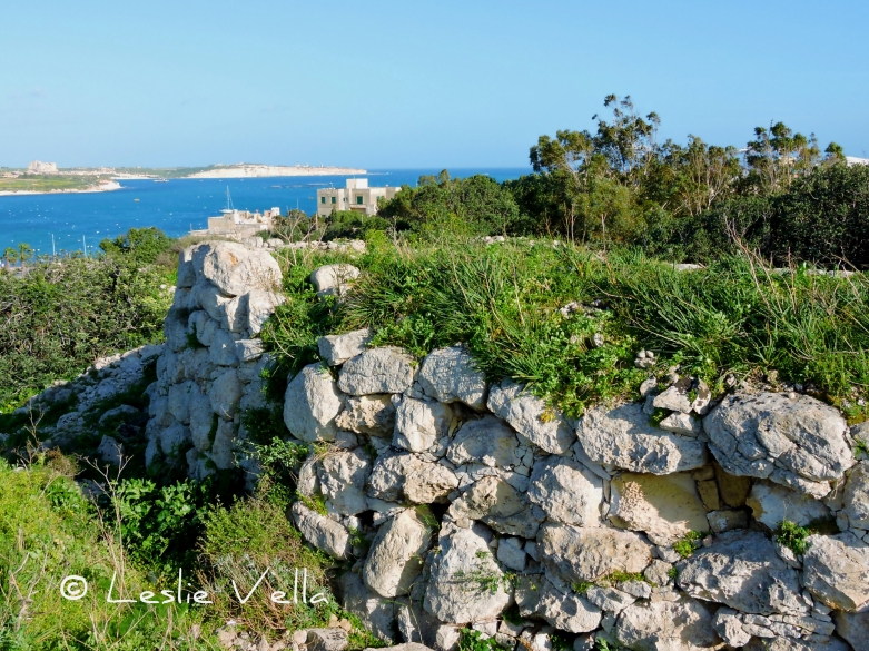
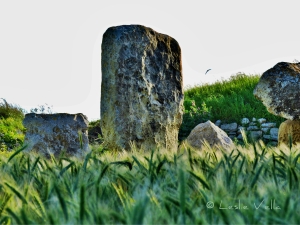
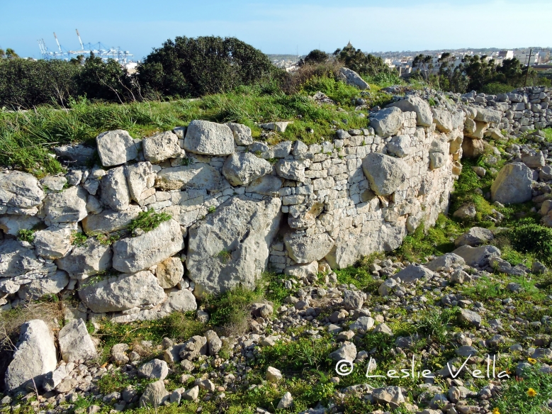
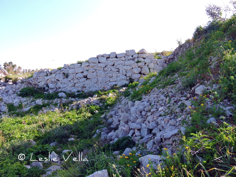
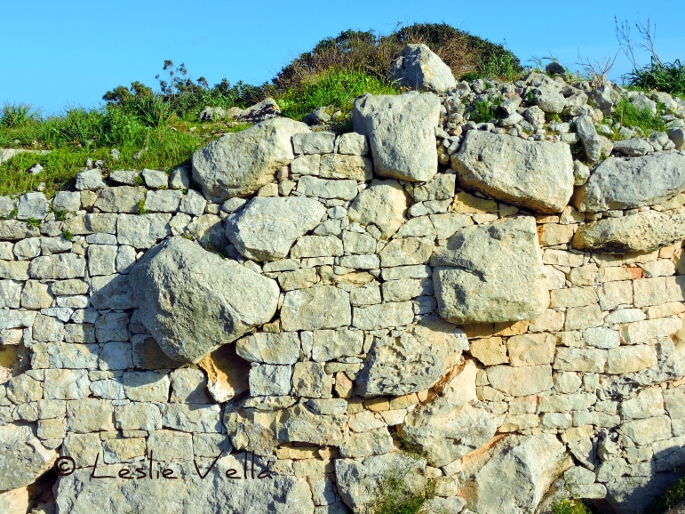
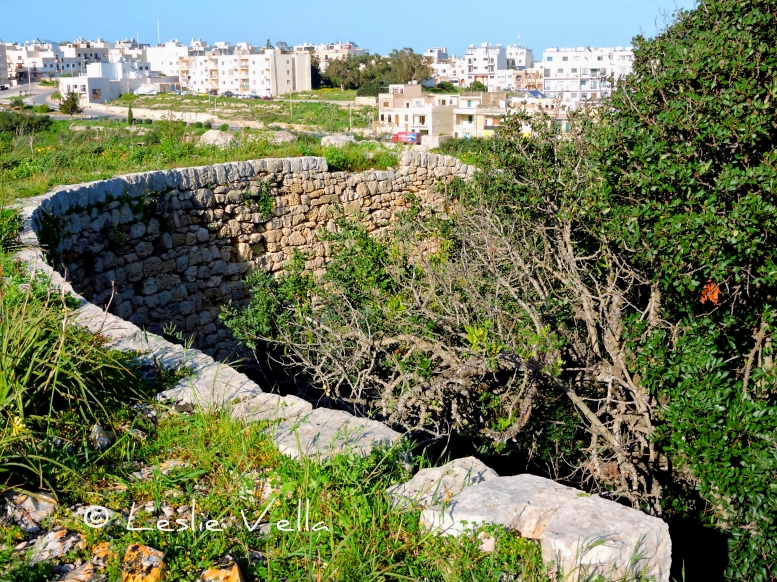
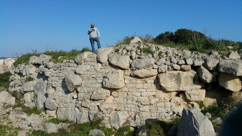
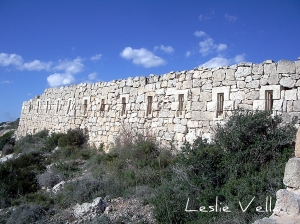
One of the most impressive and clear indications of the troubled times in which these people lived, is the extensive 4.5 metre high semi-circular wall which lies at the northern end of the Borg in-Nadur village. The wall was excavated by Murray in the 1930s and contrary to most of the dig carried out then, it was not reburied. The original remains of the wall were augmented by modern reconstructions especially in the back part. The entire structure is about 30 metres long and circa 2.5 metres thick. The most impressive aspect of this 3,500 year old wall is the huge rock boulders which are embedded within the structure: megaliths which were probably recycled and reused from the original temple.

DSCN0042 pixlr signed

An intriguing aspect of the Borg in-Nadur defensive wall is that it actually faces inland rather than towards the sea! Does this mean that the villagers were more interested in defending themselves from the enemy within or is there another unknown significance?

Whatever the interpretation, this small and relatively unknown site has its special place in Malta’s impressive list of historical treasures: the first in a 3,500 year fortress-building tradition making Malta one of the most well-defended locations in the Mediterranean.
11091143_10205331410817621_1612580066_n

The Great Wall of Malta

294234767_b2a19e4d2d_o

The Great Wall of Malta

The Chinese have their Great Wall, the French their Maginot Line and the British their Hadrian’s Wall.  Here in Malta we have plenty of walls and battlements ranging from Bronze Age ramparts to medieval defensive lines and from eighteenth century fortifications to pillboxes dating from the second world war.  However, we also have a little known wall, built by the British, which literally spans the entire island at its widest expanse literally subdividing Malta into two parts.

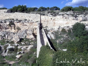
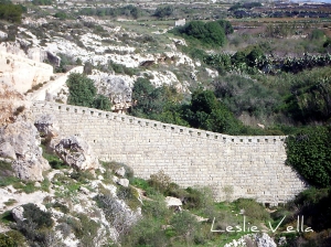
This major British fortification in Malta is known as the Victoria Lines and spans a 12 km stretch between Madliena/Bahar ic-Caghaq to the East and Kuncizzjoni/Fomm ir-Rih to the West. This fortified system consists of four forts, a number of gun batteries and an unbroken infantry line which connects them together to form a continuous defence which stretches from east coast to west coast and effectively cuts Malta into a northern and a southern half.

When the British arrived in Malta in 1800 their major task was to afford as much protection as was possible to the Grand Harbour area, particularly in view of the great technological advances made by artillery which could launch shells from a far greater distance than was the norm when the Knights built the complex fortifications around Valletta and the Three Cities.

Their major preoccupation was with the exposed sandy beaches in the north of Malta which were then seen as a strategic nuisance rather than the tourism and leisure asset they are today. Their fear was that an enemy landing in the undefended north of Malta could establish an artillery line which could inflict major damage on the harbour installations.

299947538_fde561deb9_o

After considering many options they finally decided to capitalise on a natural fault line which neatly cuts Malta into two parts at the place of its maximum width and to construct a fortified line thereby protecting the populated south from the undeveloped and exposed north. We still travel up and down this fault via various major roads in Malta such as the Bahar ic-Caghaq Coast Road between Splash and Fun and White Rocks, it-Telgha ta’ Alla w Ommu in Naxxar and Targa Gap Road outside Mosta among others.

This defensive system was built and developed over a 29-year period between 1870 and 1899 and was originally called the North West Front. It was eventually re-christened the Victoria Lines in 1897 to commemorate Queen Victoria’s diamond jubilee. The Victoria Lines consist of four forts (Pembroke, Madliena, Mosta and Bingemma) together with an unbroken low-walled infantry line linking Forts Madliena, Mosta and Bingemma along the course of the fault. The wall is a relatively unimpressive two-metre high affair in most places, but its main objective was to enable defending soldiers to fire down on the enemy below from their protected vantage point in the ridge around 150 metres above.

299947534_0b7e20712d_o

To the military history aficionado, the Victoria Lines provide yet another dimension to Malta’s millennial history as a strategically located island. They are a logical extension of the defensive works developed by the Knights and shows the extent of what lengths those who valued Malta’s location were ready to go to, to defend it from falling into enemy hands. It is a major, military architecture undertaking built before the advent of heavy machinery and still stands relatively unscathed today, more than one hundred years after it was completed.

For those who are less interested in military matters, the Victoria Lines sit atop some of Malta’s highest ground, some 200 metres above sea level, and a walk along them affords excellent views of the entire northern half of the island together with Gozo and Comino. Even distant Sicily is clearly visible on crisp winter days. Another bonus associated with a walk along the Lines is that they are set along some beautiful countryside which is generally free from excessive development. Beautiful walks are possible near Gharghur, on the Dwejra Lines overlooking Mosta and Mgarr and between Bingemma and Fomm ir-Rih.

299930159_bfbe8b6d59_o

Like a lot of our ancestors’ major efforts aimed at protecting Malta from invasion, the Victoria Lines were never tested in war. They however remain as a legacy to times gone by when conflict around our shores was a daily reality and when war, or the prospect of war, brought economic prosperity while peace brought depression and hunger.

I also value the Victoria Lines because they have probably, unwittingly, constrained development in Malta to the southern half whilst ensuring that the northern half remained relatively emptier. Having been built to resist invasion from the north to the south, their major achievement has been to suppress development from breaching their unbroken line and invading the north! For this we should be grateful as it has ensured that in spite of living on one of the most densely-populated territories on the planet we still have a beautiful, open countryside which is there for all to enjoy.

A street called Help

L1310207_tonemapped pixlr signed

A street called Help

Yesterday I took a late lunchtime stroll in Valletta.  It was a cold, grey day with a temperature of around 10 degrees with the dipping afternoon sun occasionally peering briefly from behind the shifting clouds.  Low light which plays wonders with the golden limestone of Valletta, setting it aglow as if through some ethereal flame.

I drifted to a lesser visited part of town, an area featuring entire abandoned blocks of old houses, all awaiting restoration and rehabilitation.  Old palazzos hiding forgotten wonders occasionally rise between more humble houses and blocks of apartments.  Together with the occasional conversion into a beautiful company head office or lawyers’ offices.

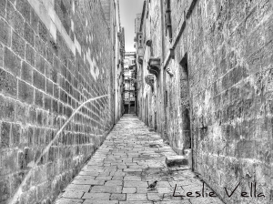
Walking along the deserted quarter, I chanced upon a street which I had never seen before, a street lying a mere twenty minutes away from my place of work.  A street enticingly and mysteriously called Triq l-Ghajnuna: Help Street.

More of a passage than a street, Help Street is neatly cobbled with original hardstone paving slabs called cangatura tal-qawwi, a type of stone that has been quarried to extinction and unfortunately dug up or tarmacked-over in many other parts of town.  A neatly pointed wall on the left and rows of tenements on the right.  Some showing obvious signs of neglect as evidenced by the bare balcony bases.

Perfect perspective leading to the perpendicular Archbishop’s Street at the top of the hill and one lonely pigeon looking for a scrap of food on a dreary winter’s day complete the picture of yet another small and mysterious part of Valletta which I felt I had to share.