Crowan Beacon
Crowan Beacon is a peak in Crowan, Cornwall, England and has an elevation of 728 feet. Crowan Beacon is situated nearby to the hamlets Burras and Farms Common.Notable Places in the Area
Carwynnen Quoit
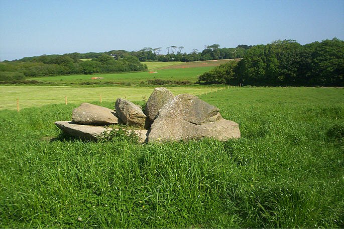
Photo: Michael Murray, CC BY-SA 2.0.
Carwynnen Quoit is a dolmen belonging to the Neolithic period, at Carwynnen near Camborne in west Cornwall.
Poldark Mine
Museum
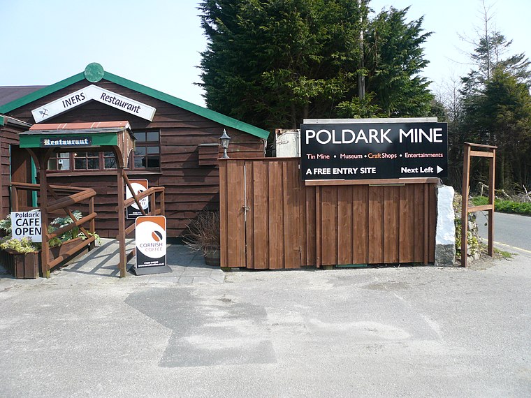
Photo: Wikimedia, CC BY-SA 3.0.
Poldark Mine is a tourist attraction near the town of Helston in Cornwall, England, UK.
King Edward Mine
Museum

Photo: Ashley Dace, CC BY-SA 2.0.
The King Edward Mine at Camborne, Cornwall, in the United Kingdom is a mine wholly owned by Cornwall Council.
Localities in the Area
Burras
Hamlet
Burras is a village in west Cornwall, England, United Kingdom, approximately five miles south of Redruth on the B3297 road.
Releath
Hamlet

Photo: Rod Allday, CC BY-SA 2.0.
Releath is a hamlet southwest of Burras in west Cornwall, England.
Lezerea
Hamlet
Photo: Jonathan Billinger, CC BY-SA 2.0.
Lezerea is a farmstead near Wendron in Cornwall, England, UK.
Crowan Beacon
- Type: Peak with an elevation of 728 feet
- Category: landform
- Location: Crowan, Cornwall, West Country, England, United Kingdom, Britain and Ireland, Europe
- View on OpenStreetMap
Latitude
50.16942° or 50° 10' 10" northLongitude
-5.27215° or 5° 16' 20" westElevation
728 feet (222 metres)Open Location Code
9C2P5P9H+Q4OpenStreetMap ID
node 1611437551OpenStreetMap Feature
natural=peakGeoNames ID
11548556Crowan Beacon Satellite Map
© OpenStreetMap, Mapbox and Maxar
Localities in the Area
- Farms CommonHamlet
- CarthewHamlet
- CrowanVillage
- Nine Maidens DownHamlet
- CalvadnackVillage
Landmarks in the Area
- Cargenwen No.2 ReservoirReservoir
- Cargenwen No.3 ReservoirReservoir
- Cargenwen No.1 ReservoirReservoir
- Boswyn ReservoirReservoir
- Hangman's BarrowArchaeological site
Popular Destinations in Cornwall
Discover Truro, Penzance, Land's End and Falmouth.
Escape to a Random Place
Discover other destinations in the world.
About Mapcarta. Thanks to Mapbox for providing amazing maps. Data © OpenStreetMap contributors and available under the Open Database License. Text is available under the CC BY-SA 4.0 license, excluding photos, directions and the map. Photo: ramsd, CC BY 2.0.