Mussaquoy
Mussaquoy is a farm in Orkney Islands, Scotland. Mussaquoy is situated close to the military facility Part of the old seaplane base, kite balloon base and wireless telegraphy station (WW1) and the passenger ship terminal Houton Ferry Terminal.Notable Places in the Area
Holm of Houton
Islet

Photo: John Ireland, CC BY-SA 2.0.
The Holm of Houton is one of the southern Orkney islands.
SMS Kronprinz
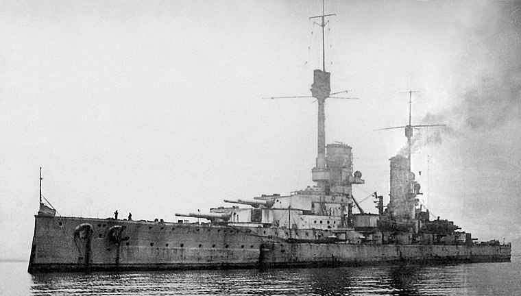
Photo: Wikimedia, Public domain.
SMS Kronprinz was the last dreadnought battleship of the four-ship König class of the German Imperial Navy. SMS Kronprinz is situated 2 miles south of Mussaquoy.
SMS Markgraf
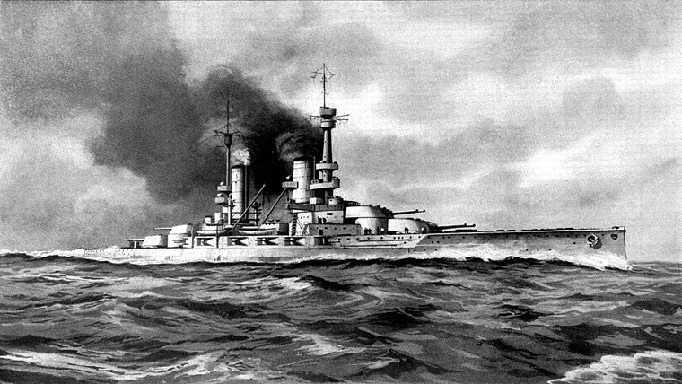
Photo: Wikimedia, Public domain.
SMS Markgraf was the third dreadnought battleship of the four-ship König class. SMS Markgraf is situated 2 miles south of Mussaquoy.
Localities in the Area
Houton
Village

Photo: Wikimedia, CC BY-SA 2.0.
Houton is a settlement 5 miles southeast of Stromness on the island of Mainland, Orkney, Scotland.
Orphir
Village

Photo: Ian Balcombe, CC BY-SA 2.0.
Orphir is a parish and settlement on Mainland, Orkney, Scotland. Orphir is situated 1½ miles northeast of Mussaquoy.
Stenness

Photo: Nachosan, CC BY-SA 3.0.
Stenness is a small, scattered village in the Orkney Islands, Scotland, on the A965 main road between Kirkwall and Stromness.
Mussaquoy
- Type: Farm
- Category: agriculture
- Location: Orkney Islands, Scotland, United Kingdom, Britain and Ireland, Europe
- View on OpenStreetMap
Latitude
58.92002° or 58° 55' 12" northLongitude
-3.17758° or 3° 10' 39" westOpen Location Code
9CCRWRCC+2XOpenStreetMap ID
way 987207803OpenStreetMap Feature
landuse=farmyardMussaquoy Satellite Map
© OpenStreetMap, Mapbox and Maxar
Other Places Named Mussaquoy
Landmarks in the Area
- Part of the old seaplane base, kite balloon base and wireless telegraphy station (WW1)Military facility, 1,300 feet southwest
- Houton Ferry TerminalPassenger ship terminal, 1,700 feet southwest
- Hill of MidlandPeak
- Site of tumulus (Lavacroon)Archaeological site, 3,100 feet east
- New cemeteryCemetery, 3,700 feet east
Places in the Area
- MyreFarm, 830 feet southeast
- Orkney LodgeHotel, 1,100 feet southwest
- GrindelayFarm, 1,500 feet northeast
- Westrow LodgeGuest house, 2,400 feet northeast
- ClowallyFarm, 3,600 feet west
Popular Destinations in Orkney Islands
Discover Kirkwall, Stromness, Hoy and South Ronaldsay.
Escape to a Random Place
Discover other farms in the world.
About Mapcarta. Thanks to Mapbox for providing amazing maps. Data © OpenStreetMap contributors and available under the Open Database License. Text is available under the CC BY-SA 4.0 license, excluding photos, directions and the map. Photo: Massimo Telò, CC BY-SA 3.0.