Since Graham’s death a lot of things have changed. For the time being, I no longer have as many barriers to leading club walks as I did eight months ago. And so I figured it is time to put back in again. One of the biggest barriers remaining is choosing somewhere new to go that’s not too horribly scrubby and is achievable in 1-3 days. This time I felt Marble Bluff and Walford Peak were appropriate candidates, although I knew little about them at the time of deciding!
It turns out they weren’t particularly popular with many other Pandani members, or perhaps it was the timing (the final weekend before Christmas), but only four people signed up initially. One pulled out with a few weeks to go, another on seeing some of the early weather forecasts and on having a decent nosebleed the evening before.
And so there were just two of us, Tim and I. I’d not met or walked with Tim, but my intel told me he was a decent guy and strong walker. He’s now the first astro-physicist I know too. We set off at the leisurely hour of 8am, me having completely forgotten it was a weekday and that all the normal people were trying to get to work at this time. It didn’t delay us too much though, and a smooth (caravan free!) drive to the Anthony River Road had us sitting in the car eating lunch just after 12, waiting for the latest rain shower to pass before donning our packs and setting off.
I was unfortunately rather distracted by an important and expected, but not all that pleasant, email. While I’m sure Tim must have noticed, he was polite enough not to let on. I tried to put it aside, there wasn’t much I could do about it without reception after all, and I found myself disliking that it was taking me away from the present moment and one thing I still really love doing. A good friend sent an email and must have known – she told me to enjoy the walk! I tried to be gentle on myself, just letting the feelings pass, noticing them as they did so. And with a lot of help from some appropriately placed inclines that were steep enough to make thinking difficult, I slowly worked my way back to the present.
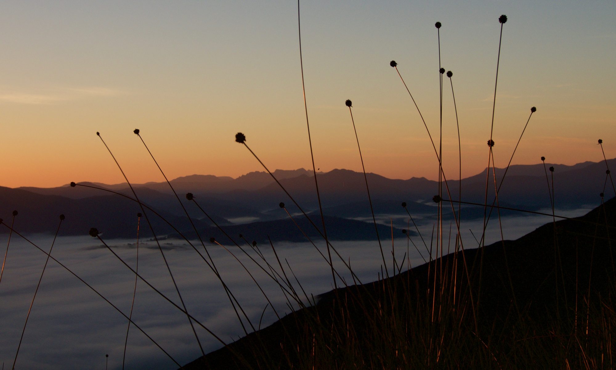
The whistlers were out, a bird of prey – perhaps a swamp harrier – flew off as we disturbed the peace with our heavy feet and laboured breath, and the rain threatened but didn’t eventuate. We’d timed our walk for a small, potentially dry window, although we weren’t taking any chances and were decked out in full wet weather gear. As it turned out it was quite warm and a few hours in we swapped jackets for sunscreen and hats.
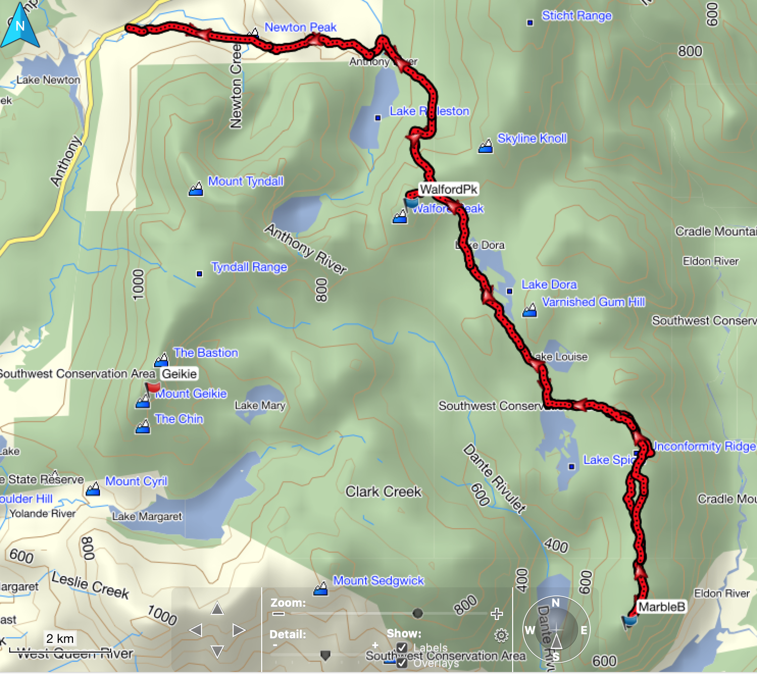
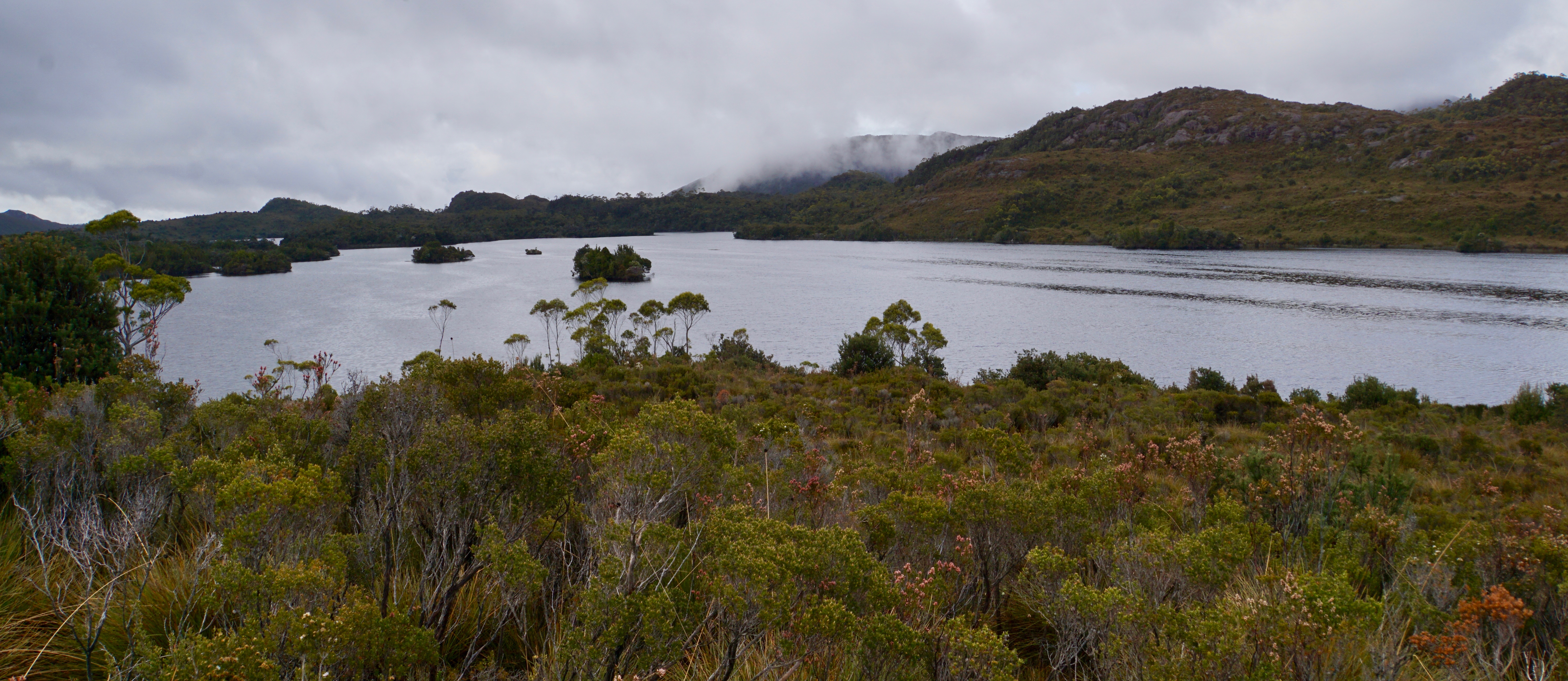
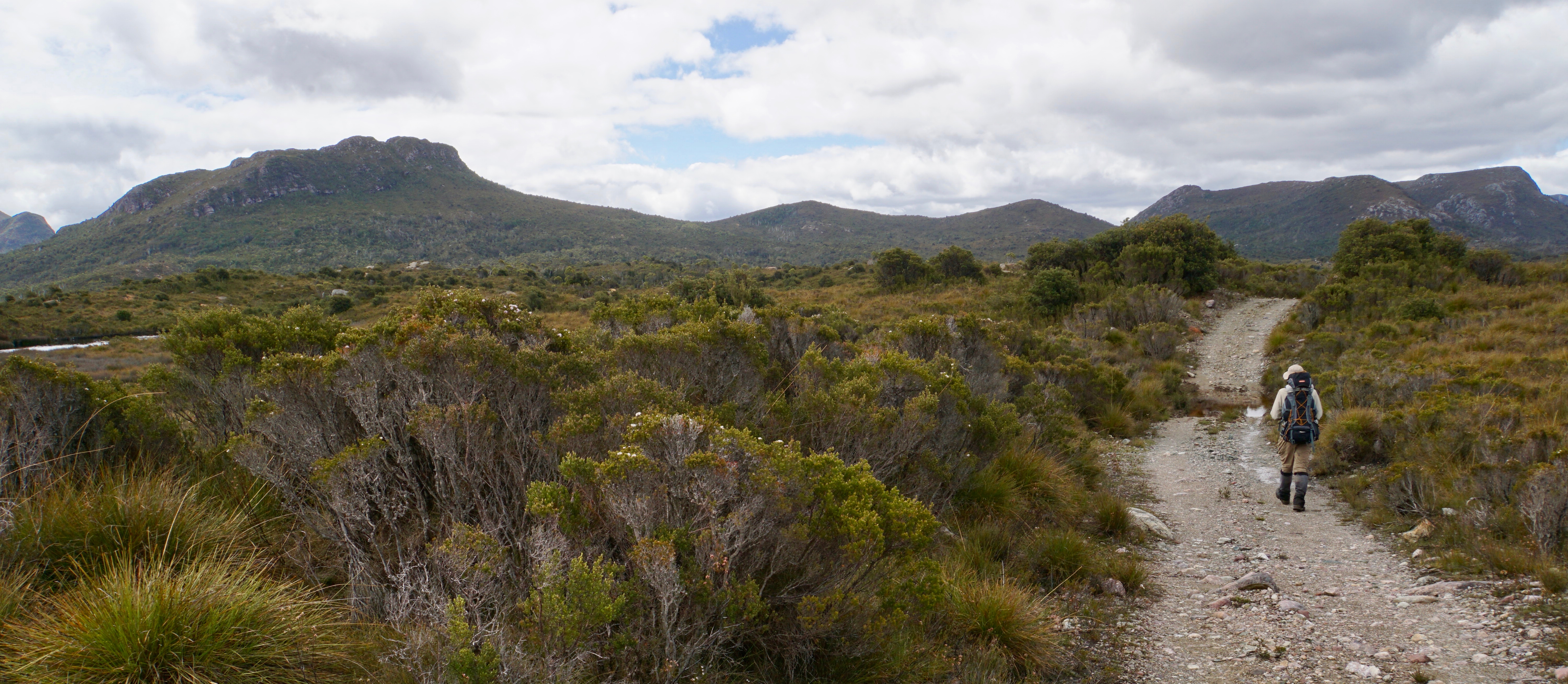
The walk in follows the Lake Spicer track – an old rocky 4WD track that’s locked at the start. You’d definitely want a 4WD, or a dirt bike, but the road is otherwise in good nick and not too overgrown. Even the rivers were remarkably tame (I had been worried on that front!). The biggest obstacles were actually the numerous pools of water that spanned the road in every poorly drained dip. They became more frequent the further we went. Some required short forays into the scrub to avoid getting boot-fulls of water. But we still made better than expected time and found ourself at Lake Spicer just shy of 3.5 hours after starting out. It was a bit early for dinner and bed, but neither of us were complaining! With the rain forecast to return there was nothing better to do except to lie there and listen to it while reading a book.
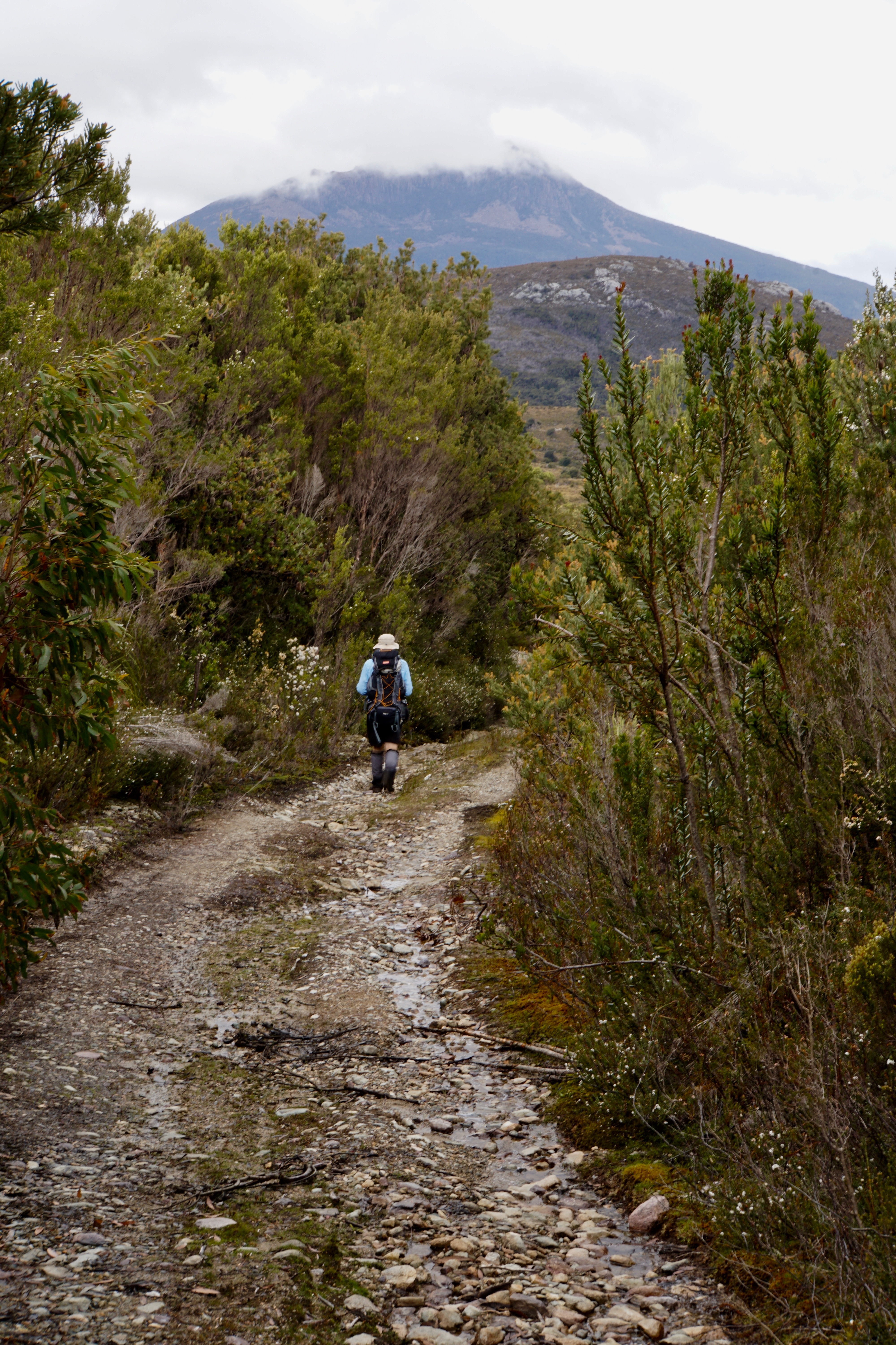
We woke to a cloudy but already much brighter morning than the day before, and were ready to set off before 8. My walk description on the program had been vague – it might have mentioned the possibility of some scrub, but also some open walking. Not having been in the area before it turned out to be a pretty accurate description.
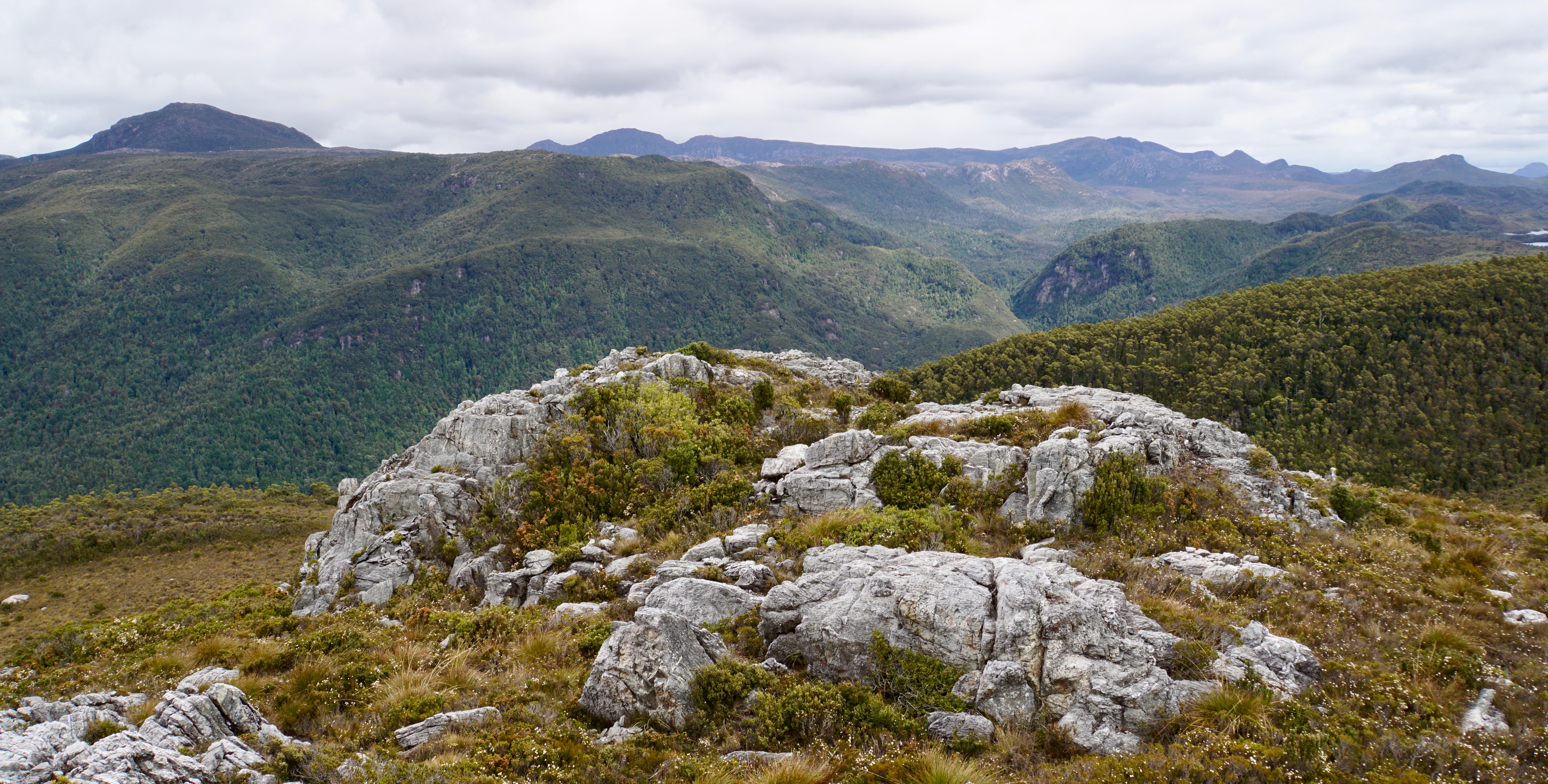
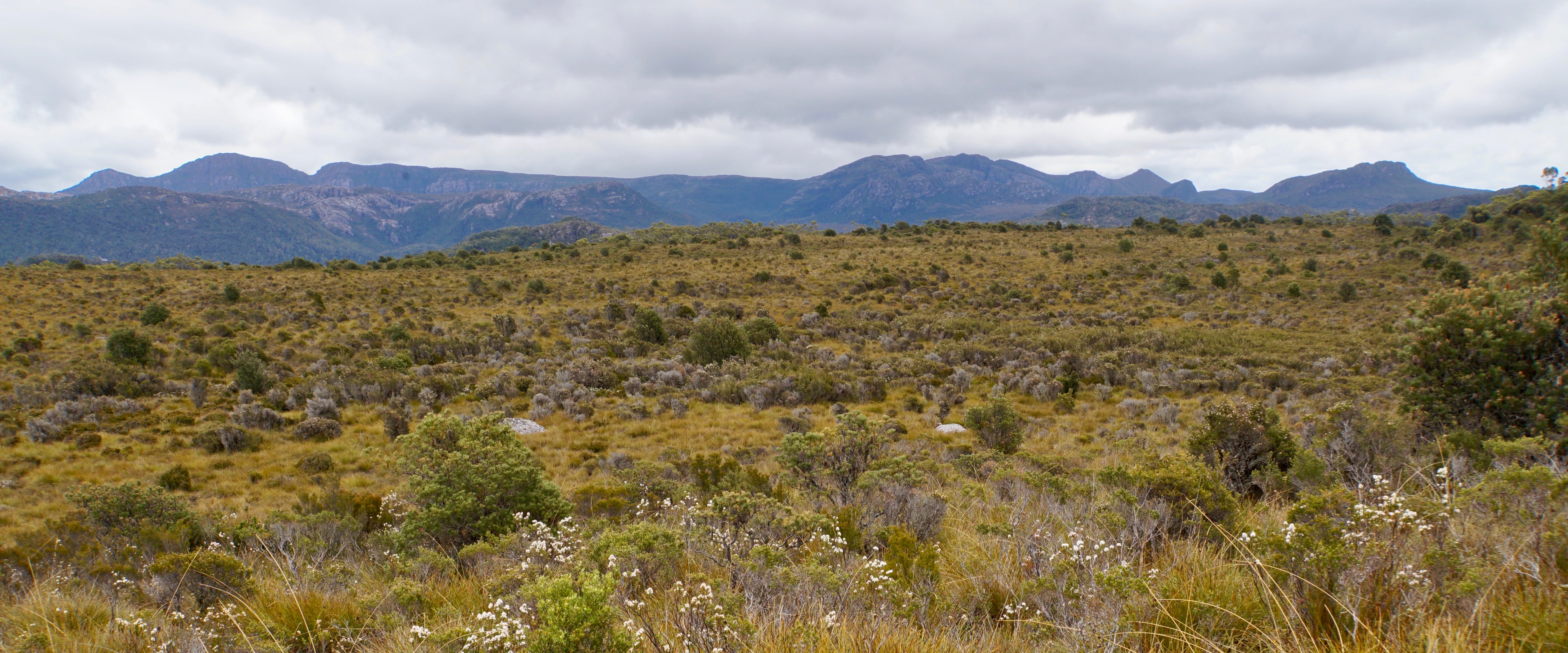
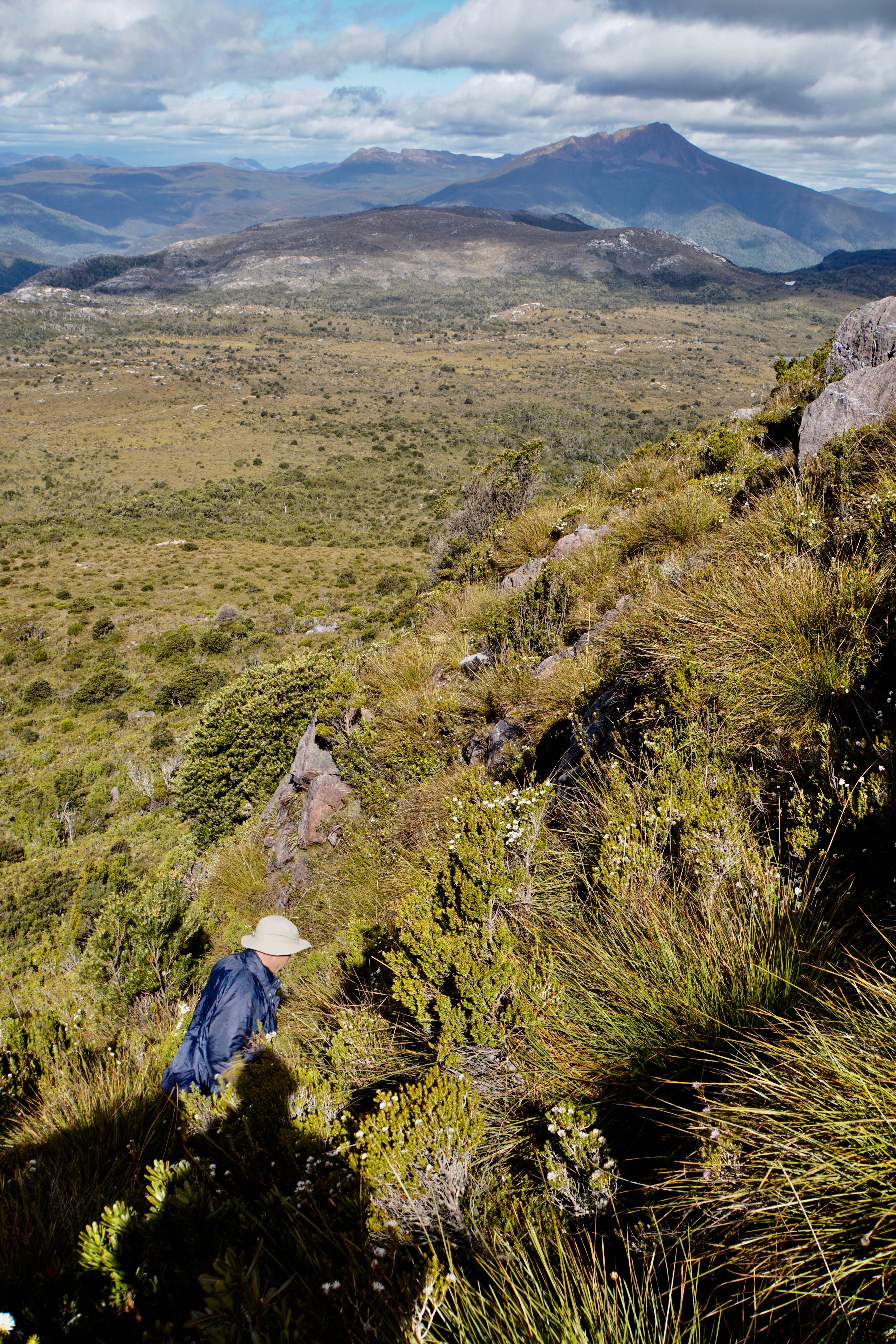
Most of the walking was a mix of button grass, tea tree and melaleuca. On the ridge it was mostly a nice height, but not so getting up. And there was a bit of a scrubby creek to cross very early on. But otherwise the going was probably better than expected as we wove our way along Unconformity Ridge. It was appropriately named, we discovered, because it wasn’t a straight forward kind of ridge to follow. And it had some funny little features and scrub patterns that meant sometimes it was much better to be off one or other side. It wouldn’t be the easiest to navigate in clag.
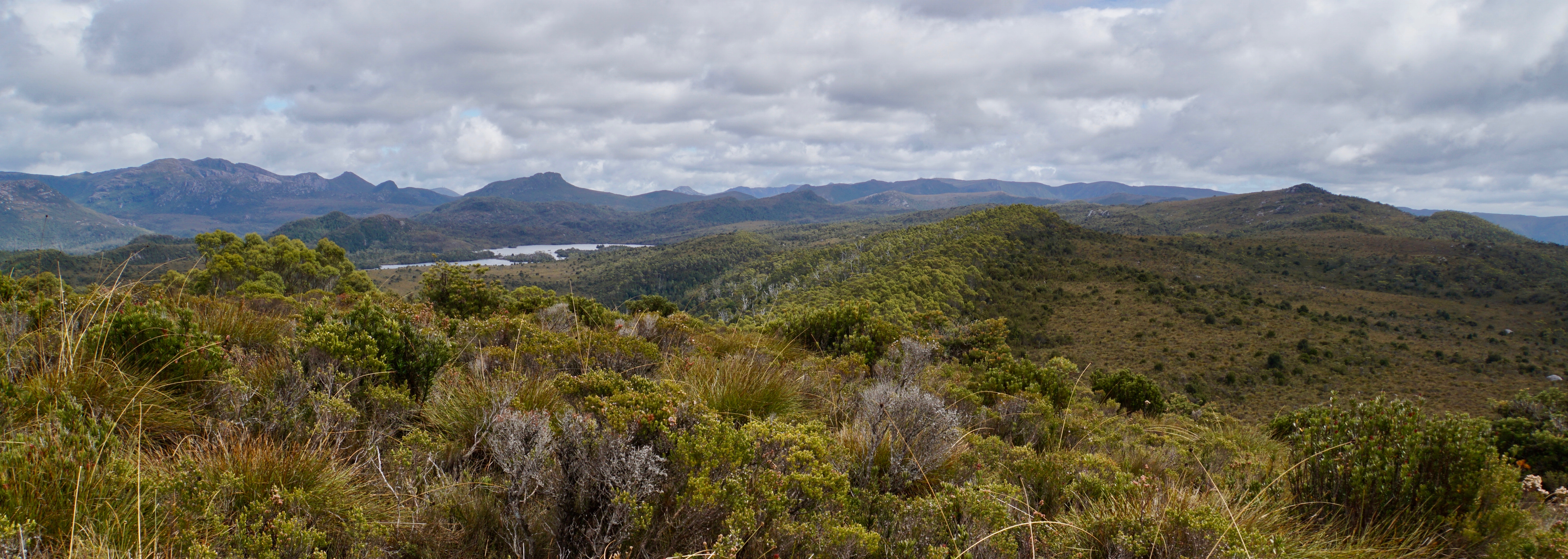
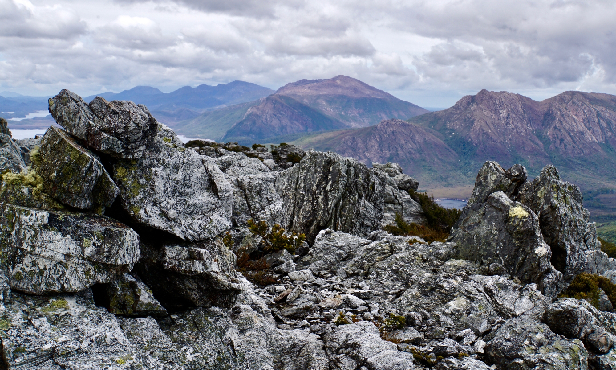
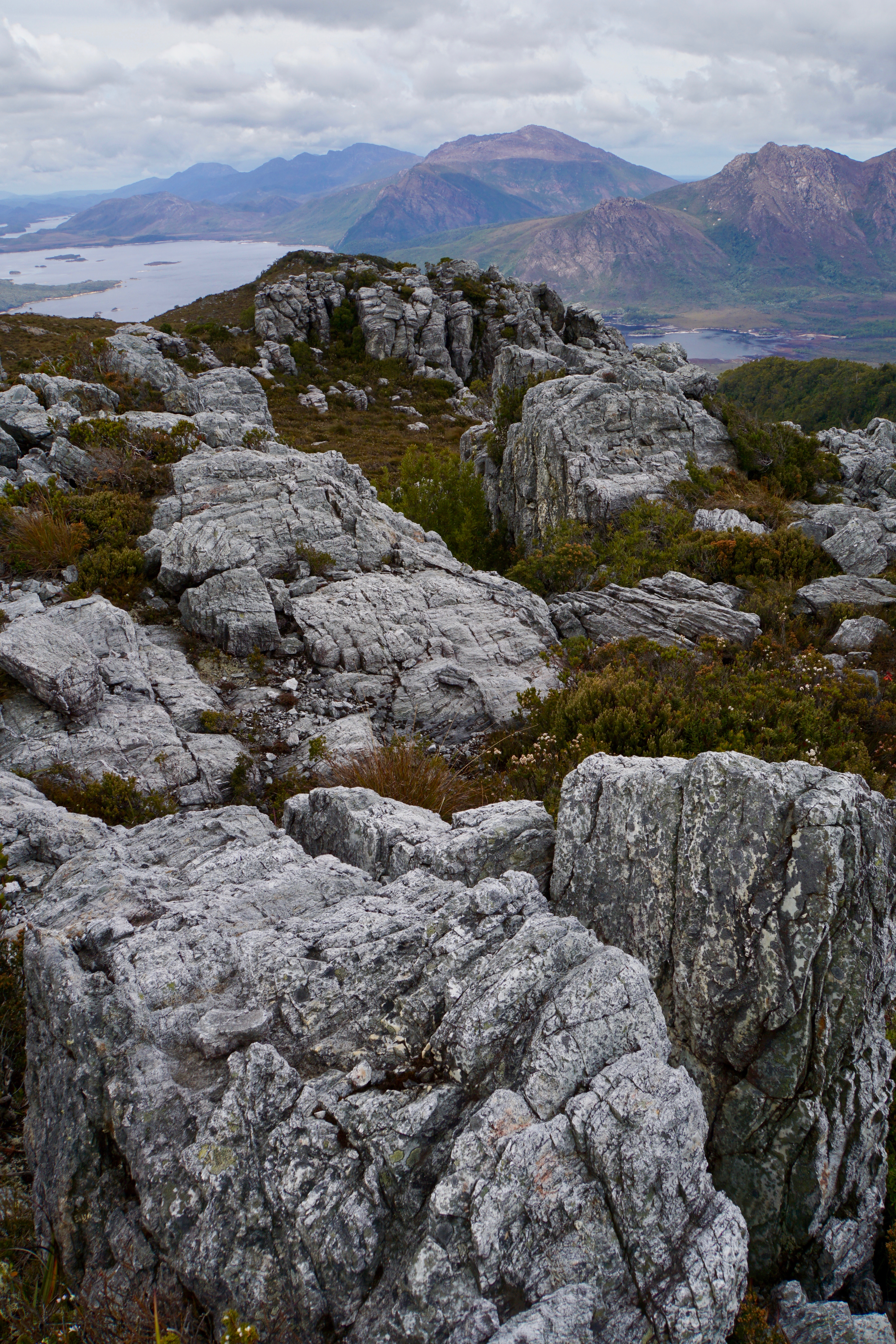
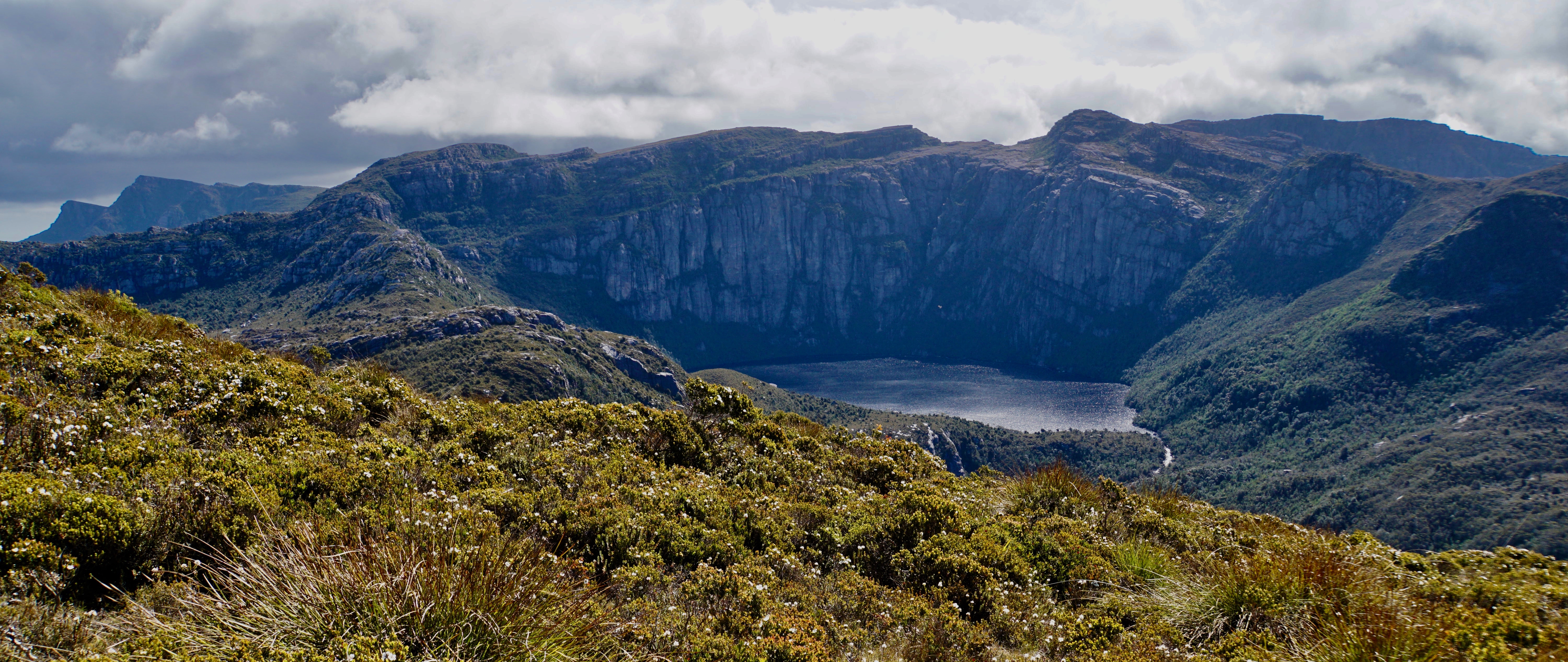
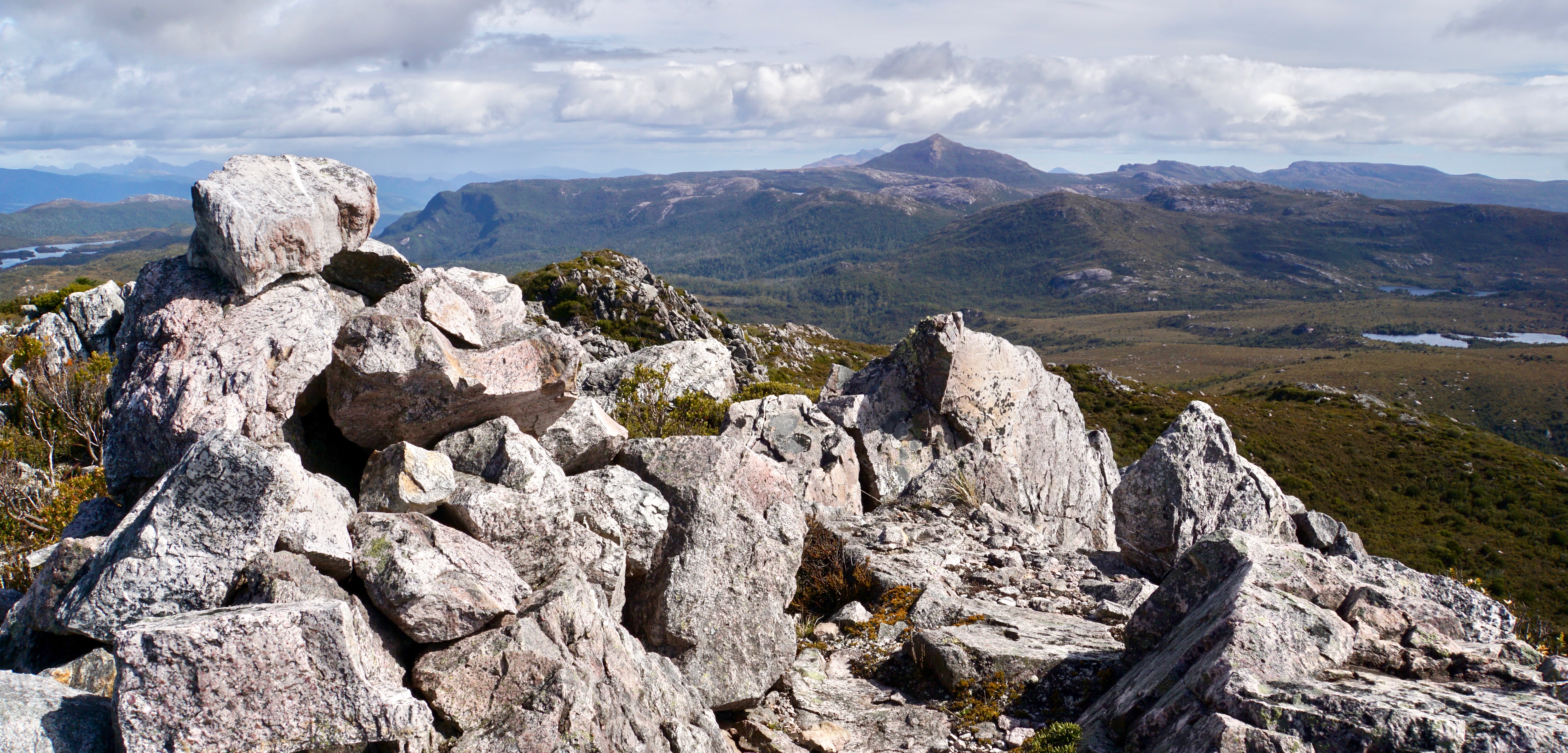
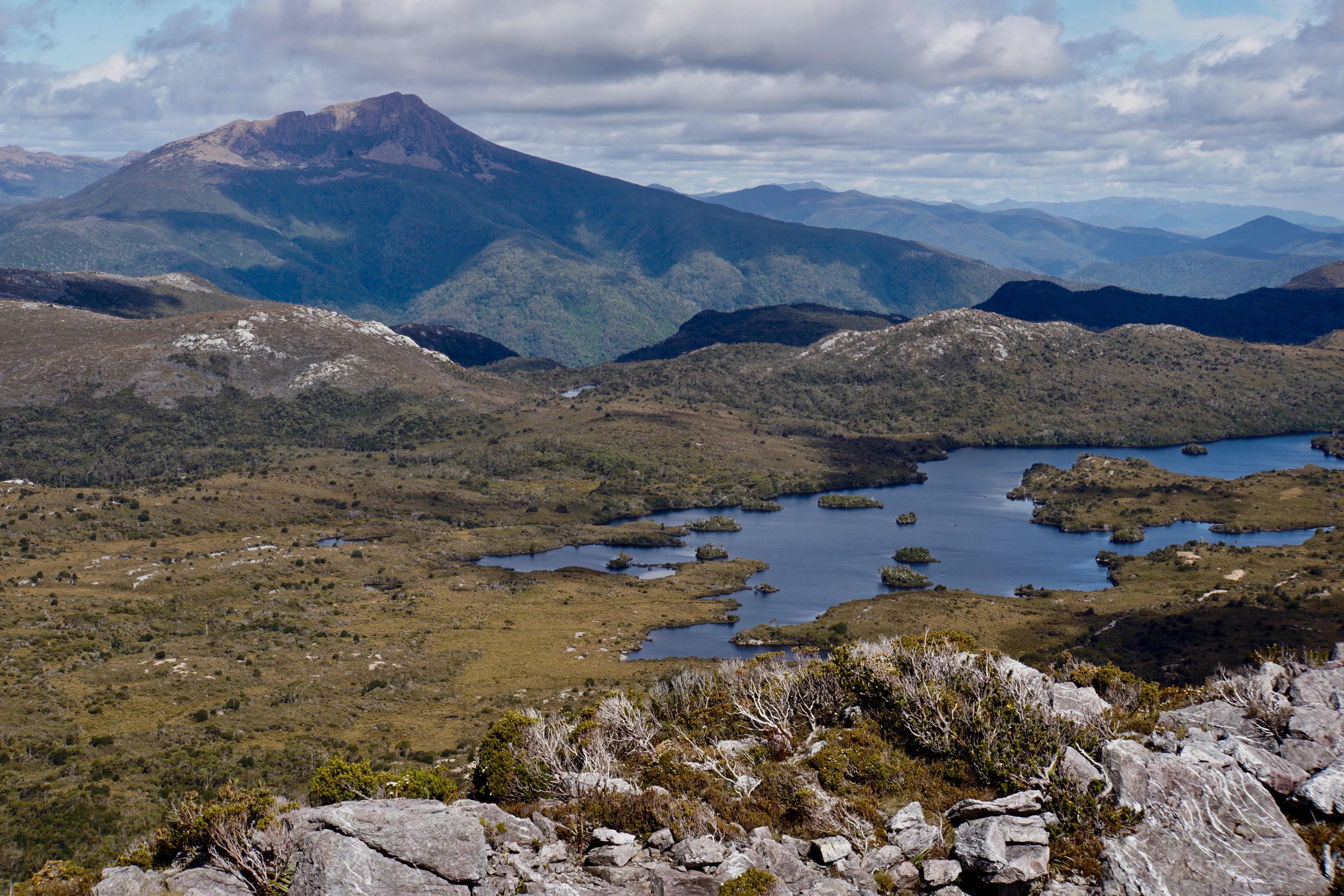
As we walked south the weather improved, the clouds slowly parting to reveal slivers of blue sky. And one by one they revealed all the mighty mountains around us. Frenchmans was still under cover when we arrived at the rocky summit of Marble Bluff, but Eldon Peak was impressive off to the northeast.
We’d made such good time, it was just shy of 11, that we decided we’d head back, pack the tents and move to the foot of Walford Peak. A check of the latest forecast cemented the plan. It was now looking wet for our walk out, so if we could also climb Walford in the evening we’d have the best weather possible for it. We scrapped tentative thoughts of climbing the Sticht Range on the way out – there wasn’t much point in the wet with no view!
And so we wandered back, the gradual loss of height making it difficult at times to know exactly where the ridge was without consulting the gps. We made it back without many unfortunate or avoidable forays into unnecessary scrub, and remained snake bite free despite probably stepping on one of the three we saw (the total tally for the trip was four)!
We were back by 1:30 and packed by 2. I found it hard to walk at anything more than a plod – partly from cumulative fatigue, partly because it was a road walk 😜! But that was ok, Tim didn’t seem to mind matching my pace, and we arrived at the saddle from which we’d climb Walford in good time. We set up tents in the middle of the road and then, because we were only something like 600m from the summit, we set off with cameras, gps and a warm item of clothing.
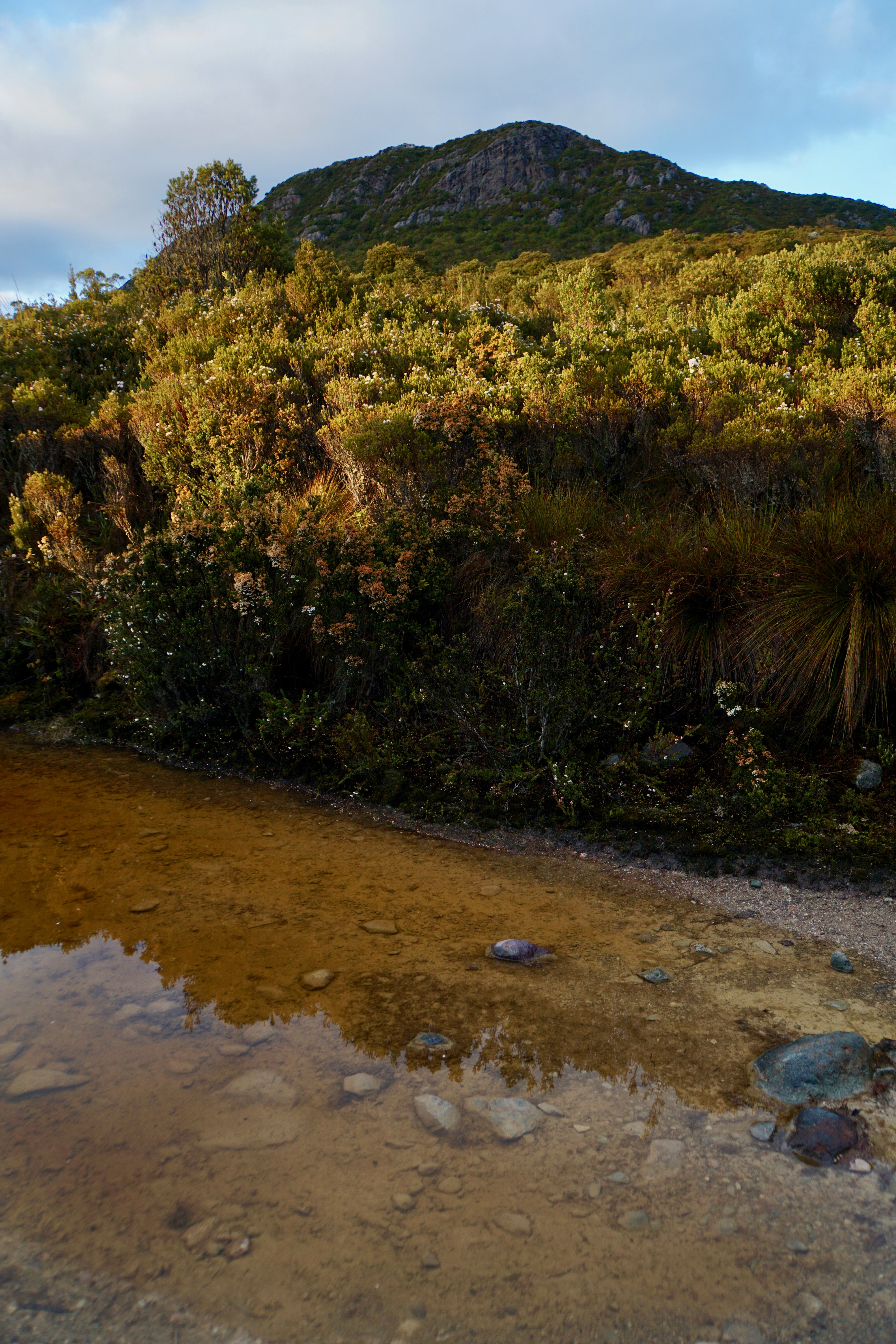
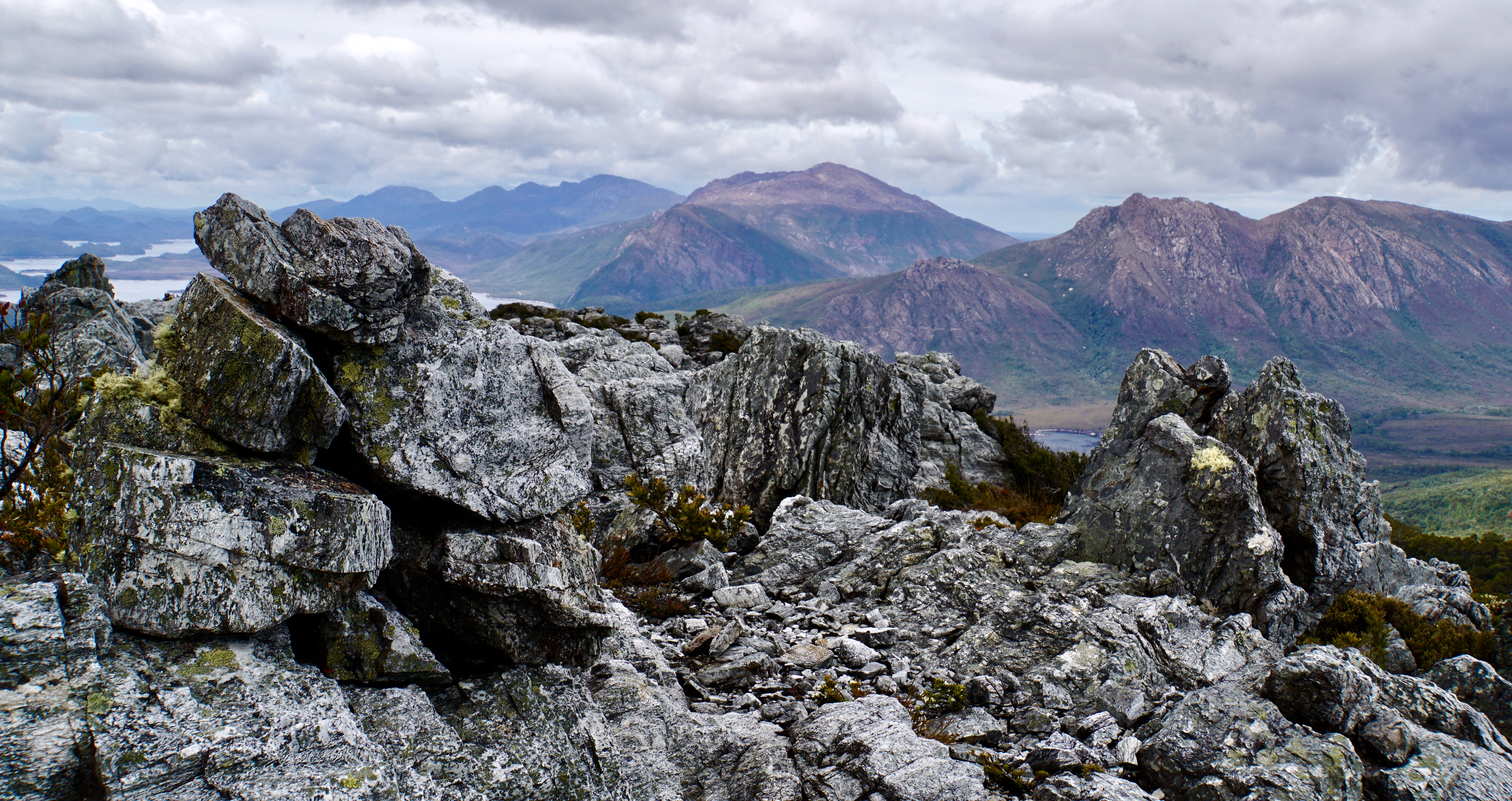
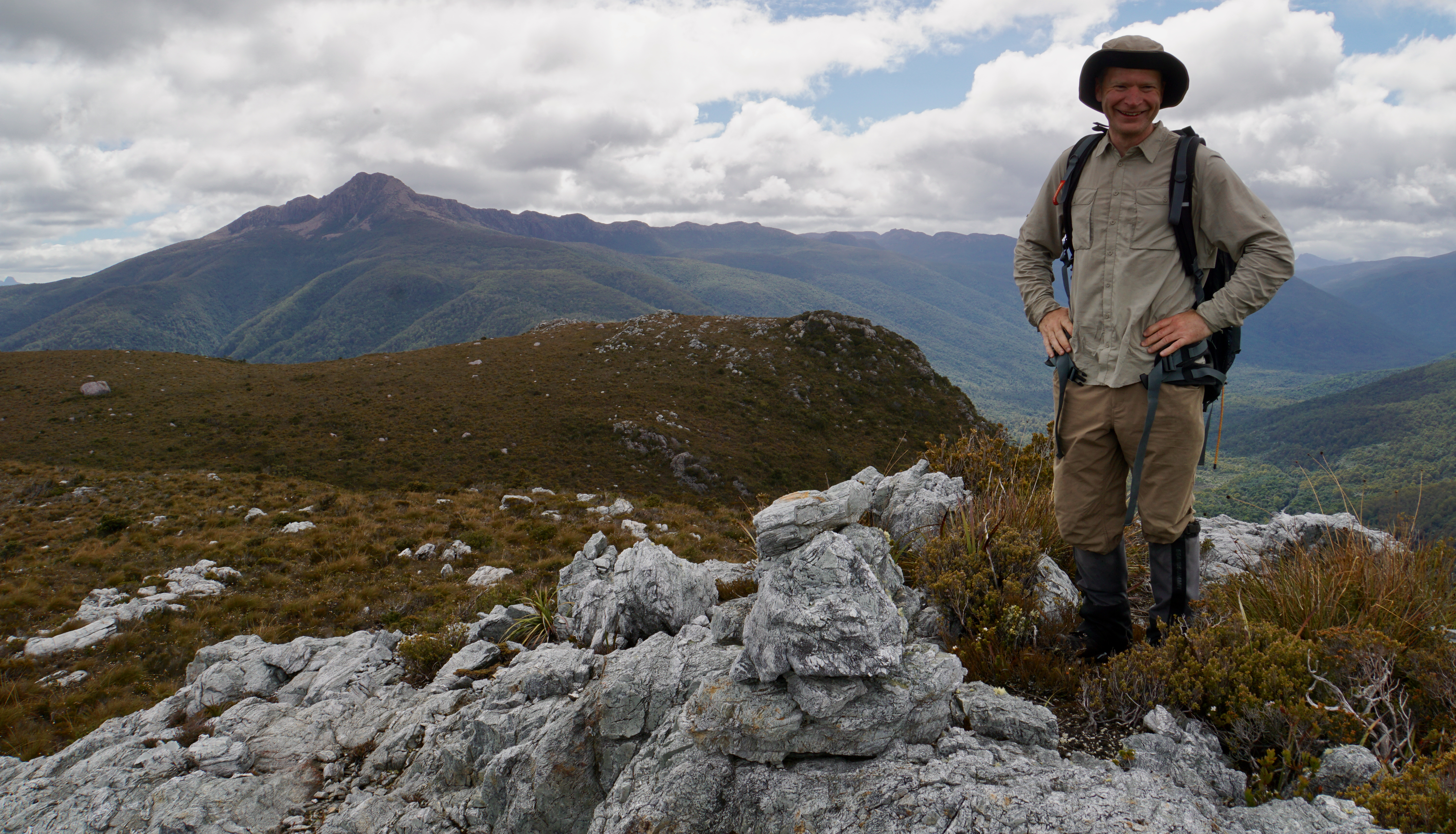
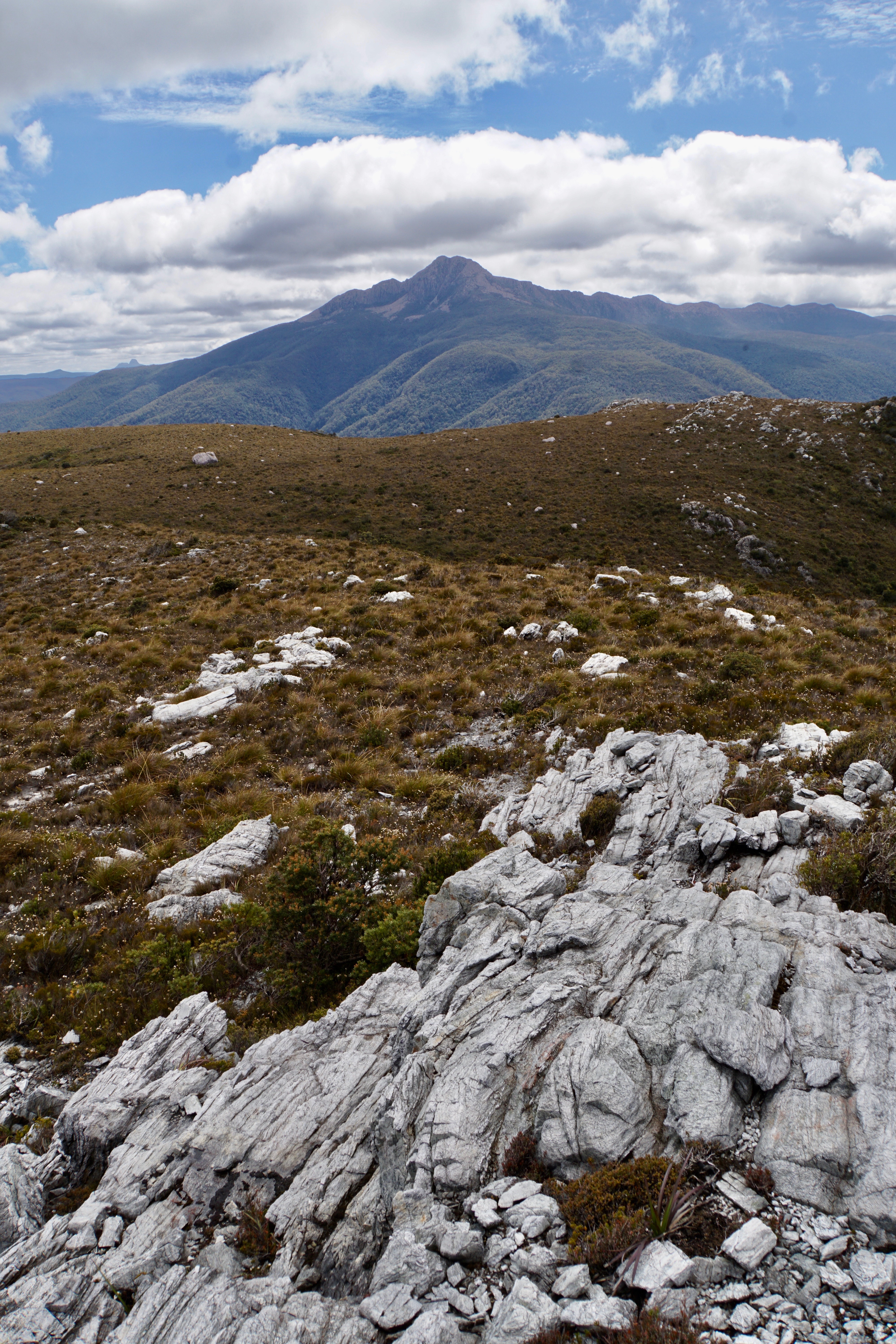
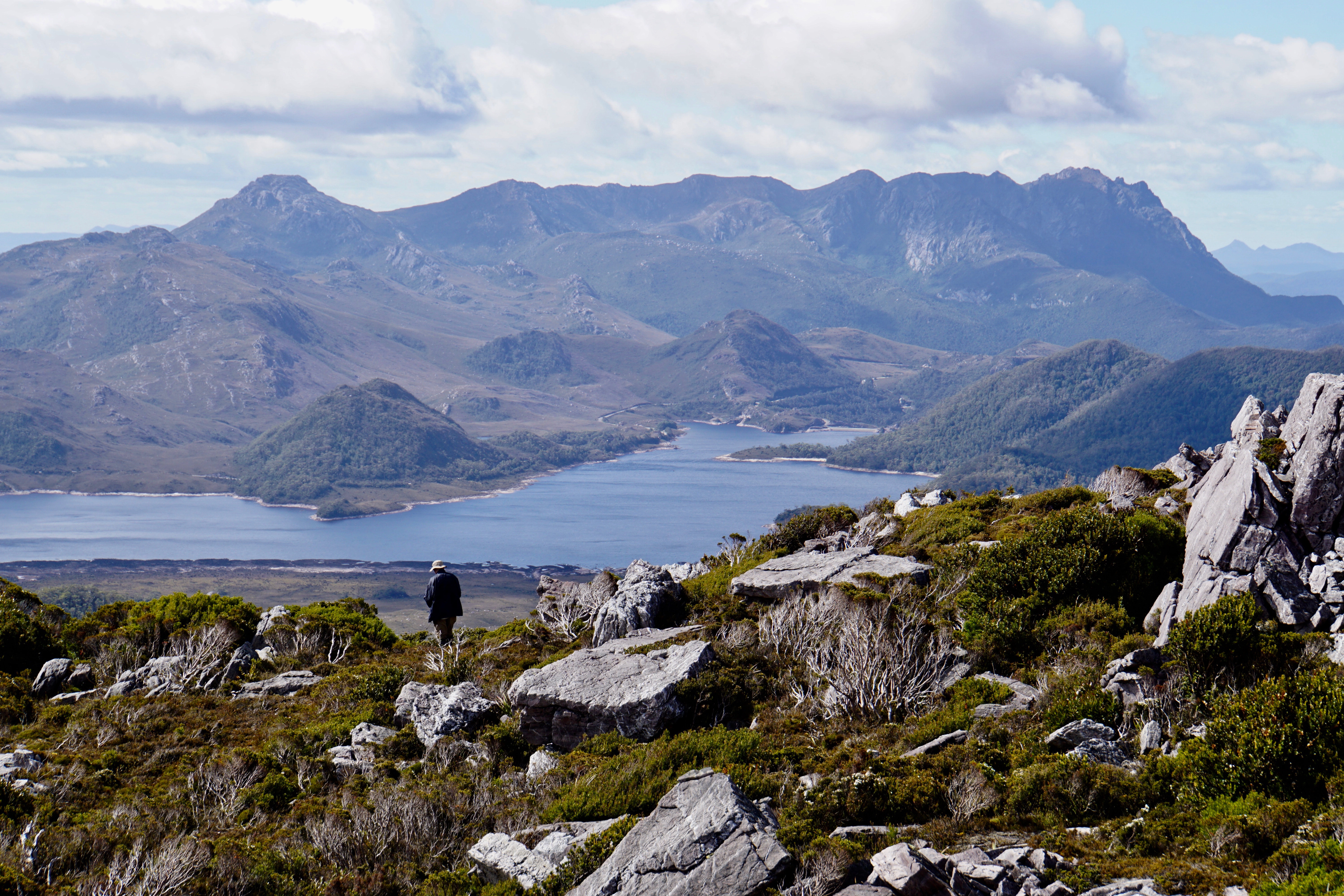
It looked scrubby to start with, but we found it easy enough to weave a way through the lower bits, and then a short way in we discovered a very feint pad. I thought it was wombat at first, but it wasn’t littered with scats and it went exactly where we wanted it to. As the scrub got thicker and it became even more defined I grew confident that we could follow it blindly and it would get us to the top. And sure enough it did. One sharp uphill, and we stood on the shoulder, greeted by a stunning view towards Mount Tyndall and the lake nestled in below the cliffs.
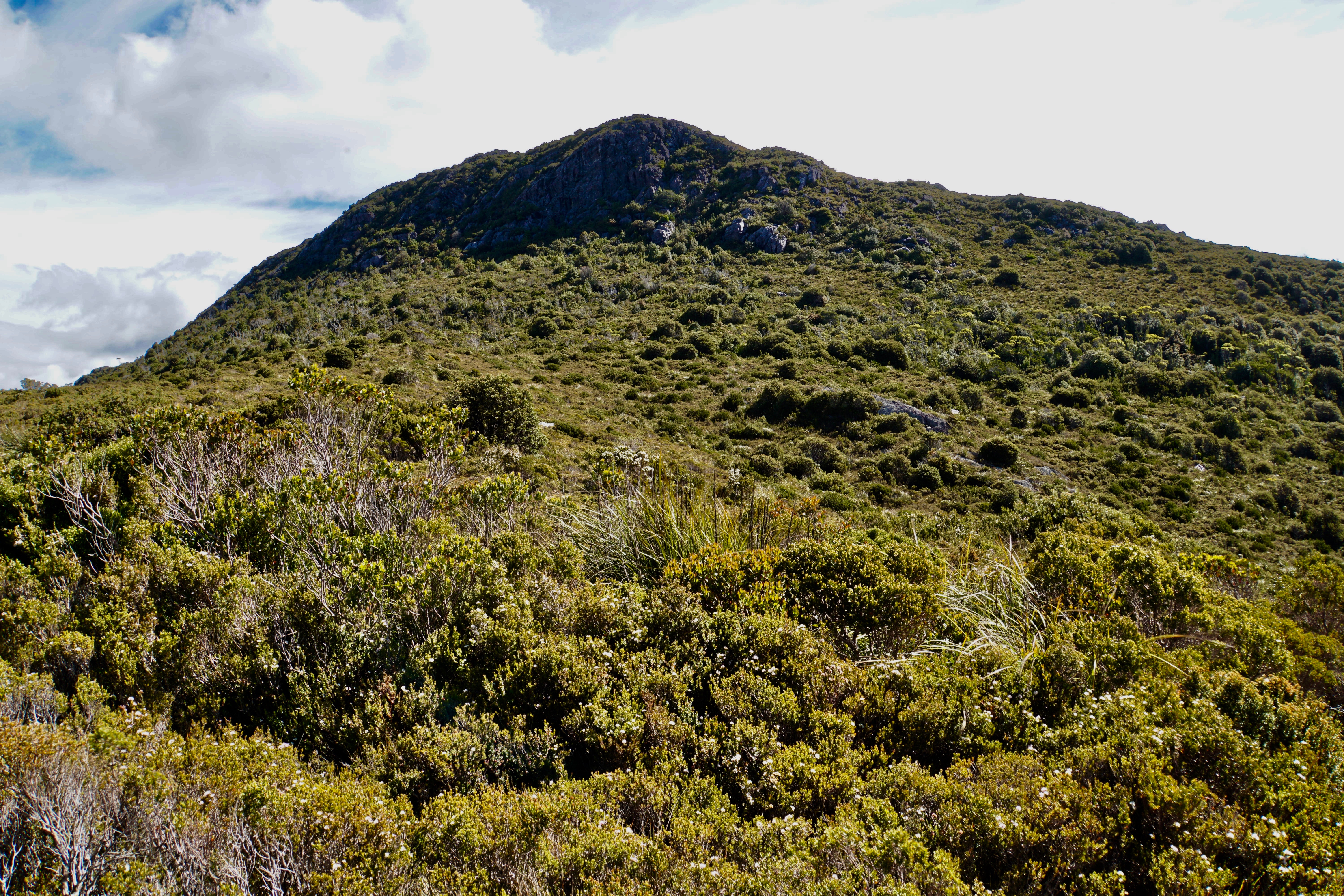
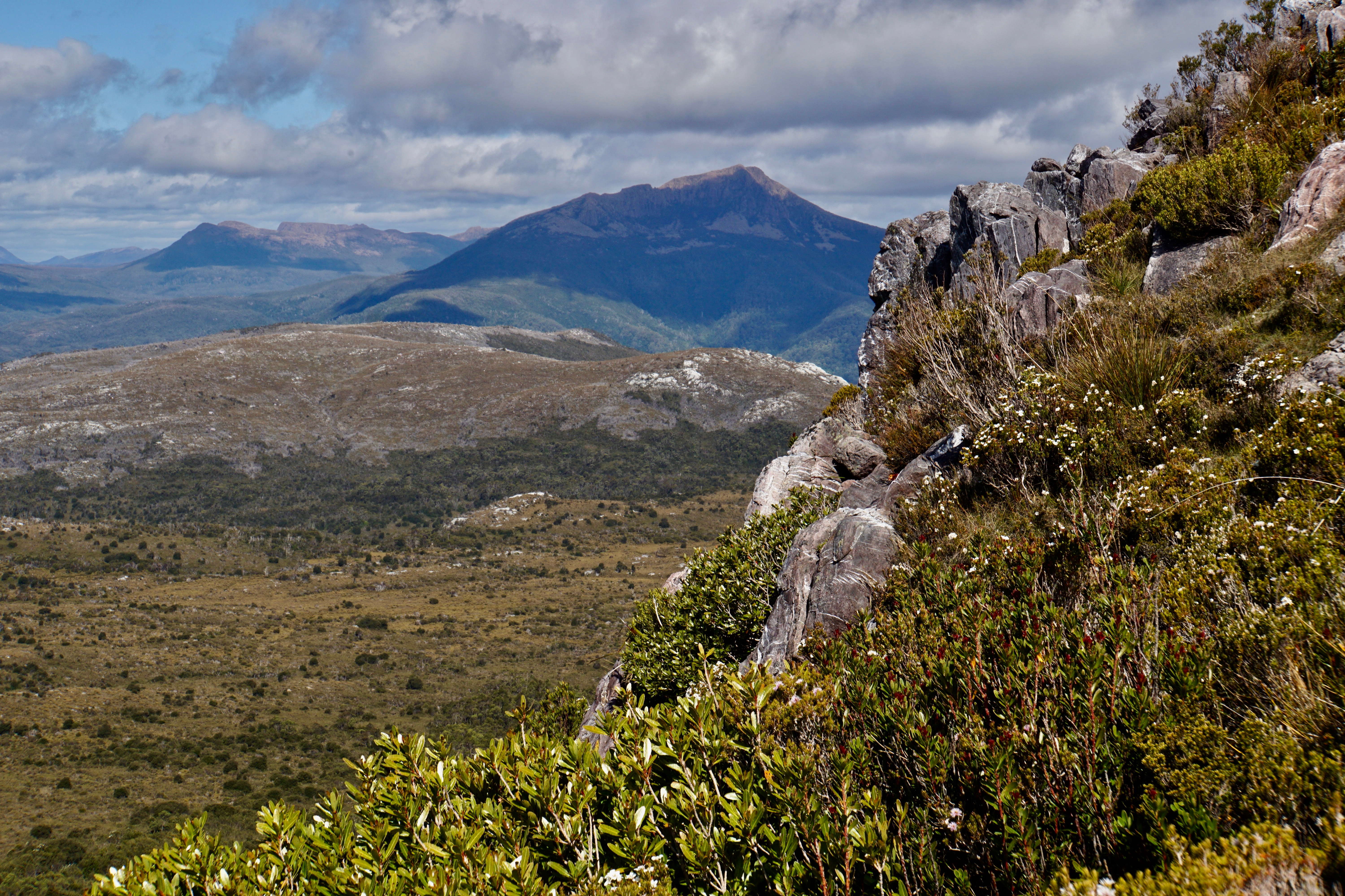
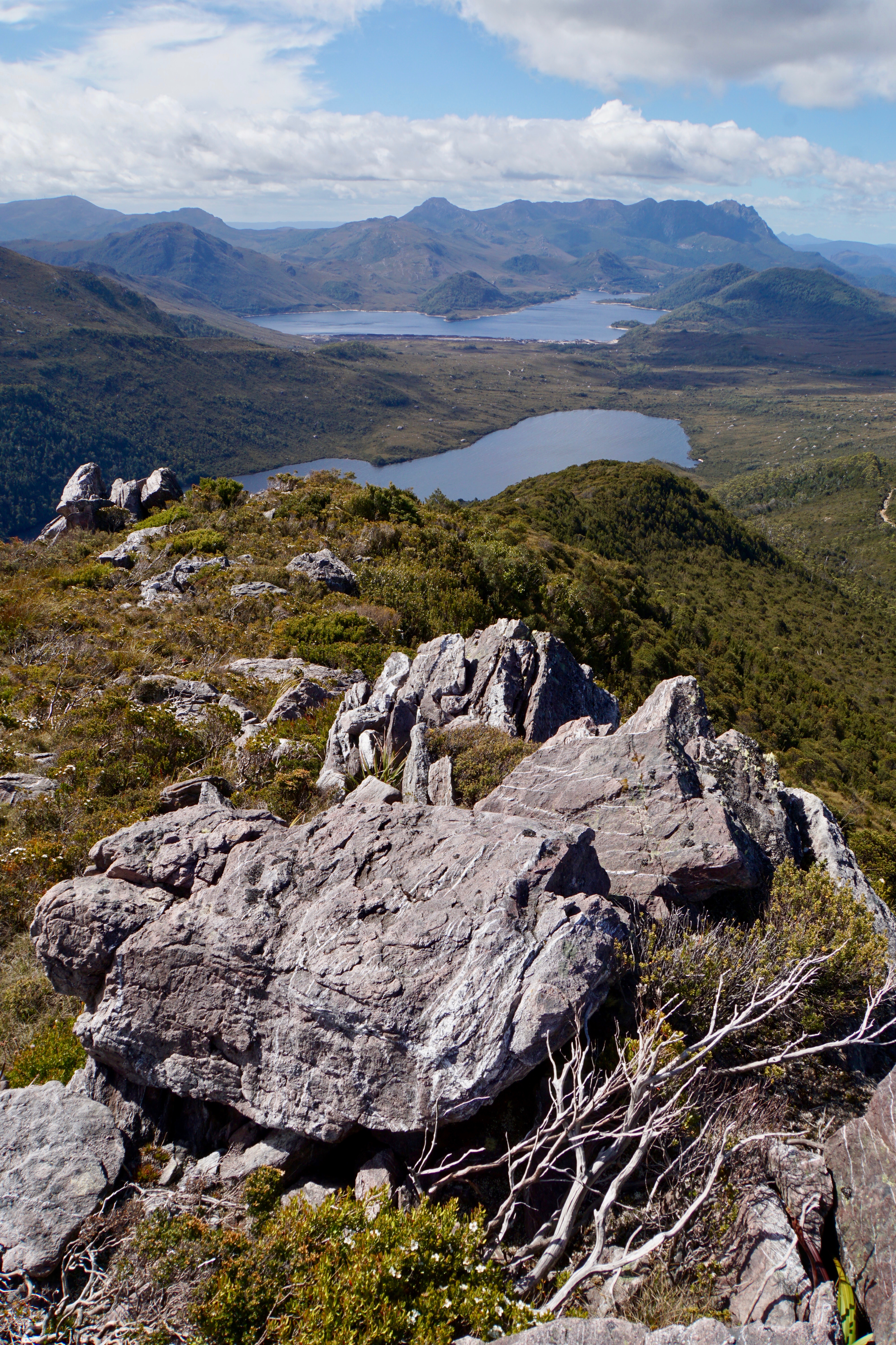
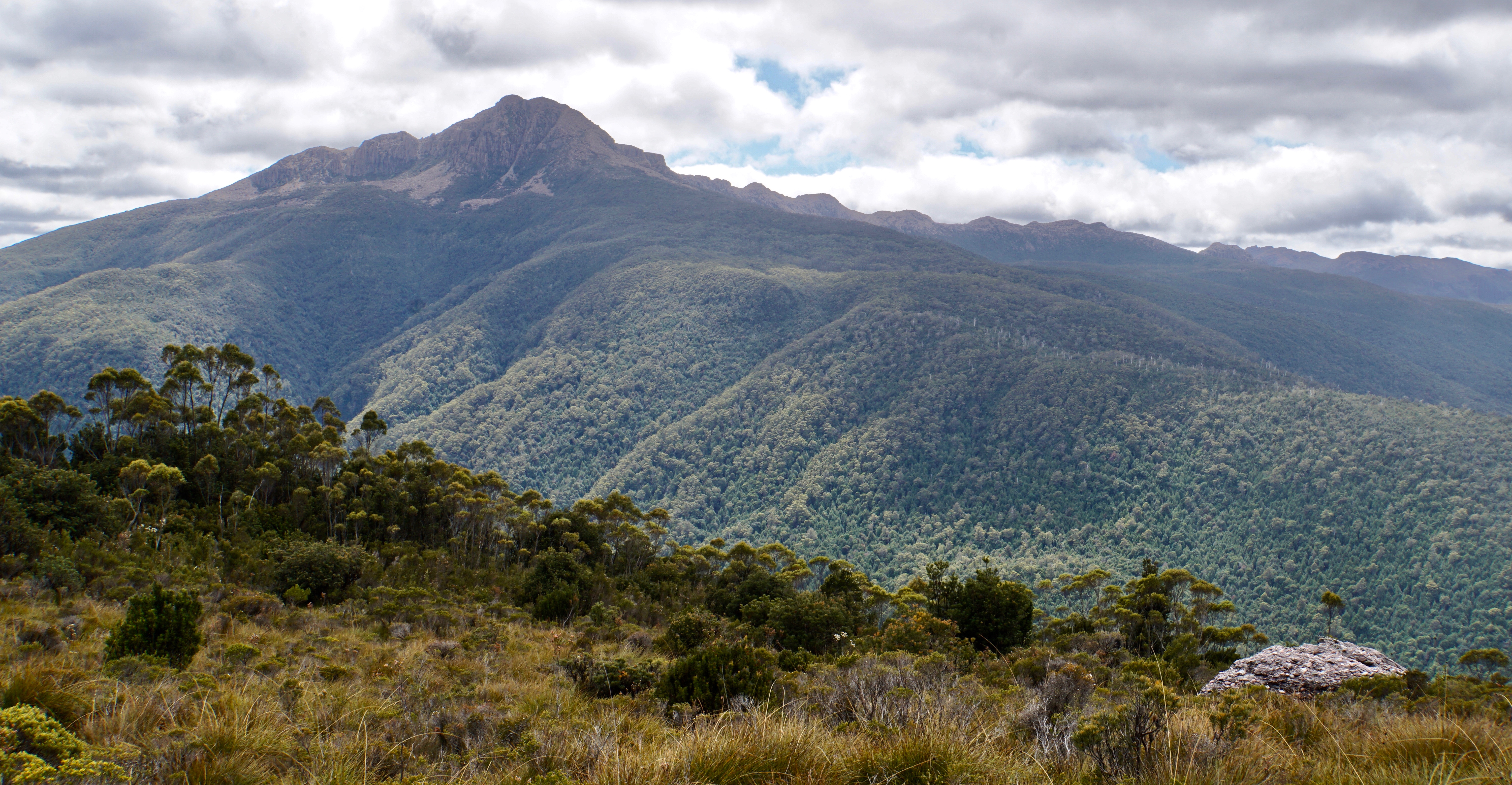
The summit was only a short distance south, with just a bit of rock hopping on quartzite to add to the fun. We were definitely on top of the world with this one, with views all around! Walford is a peak with great bang for buck if you happen to find yourself on the Lake Spicer track for some other reason.
We slipped and slid back down in something that was more like controlled falling than walking, arriving back at the tents by 5, just in time for an early dinner! We heard the sound of some kind of engine/s and wondered if we’d see the source in due course, but there was no sign of anyone that evening or the next day.
All up:
Day 1: 14km, 3:22 hrs, 593m ascent
Day 2: 19.7km, 9:15hrs, 914m ascent
Day 3: 8.6km, 1:55hrs, 171m ascent


Great walk notes and photos. You didn’t really camp on that road ?
LikeLike
Ah yes, we did! If we’d have known about the shoulder just shy of the summit on Walford we’d have carried our gear up for the second night. Hindsight is a wonderful thing!
LikeLiked by 1 person
Wonderful photos of the scenery. Thank you so much for posting this hike.
LikeLike
Another excellent walk description Becca. Dicko (Mark Dickenson) and I visited Walford and Sticht in 1987. We drove in and that vehicle sound you heard would have been a 4WD negotiating the Lake Spicer track below your campsite. We failed as well in our attempt. Walford is just a pimple off the side of the track but the views are sublime. I remember the sheer walls around Lake Huntley. We paddled in to the base of Marble Bluff in 2002. Biathlons are a marvellous means of bagging peaks.
LikeLike