
WEDNESDAY 11 AUGUST BOGGY HOLE TO STUARTS WELL 174kms
We had a good night’s sleep. Woke to a day that was warm, but with high cloud coming in rapidly.
Got up at 7.30. It took us a couple of hours to breakfast and pack up – no hurry.
Then we continued on along the Finke. Crawled past the other campers, who all appeared to be staying longer. The track at this point (the waterhole) was – obviously – up on the bank at the side of the river. But soon it was back to alternating river bed driving with criss crossing and bank driving.
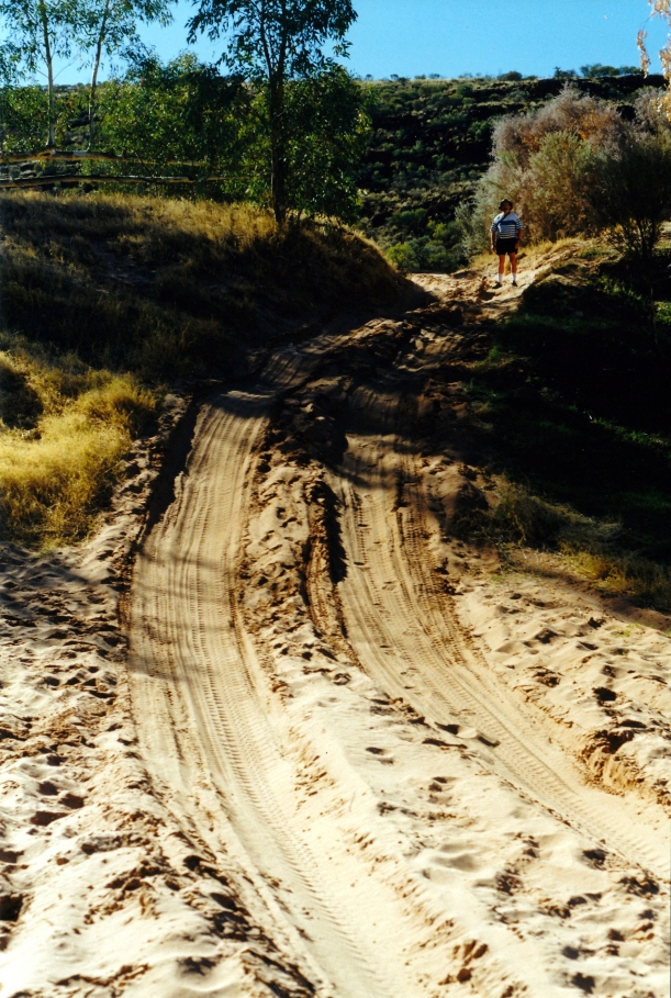
The track goes up the river bank – and some have had difficulty here
The river sections were a mix of sandy wheel ruts, then river stone sections.
A stony section of the Finke River bed
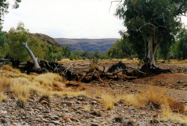
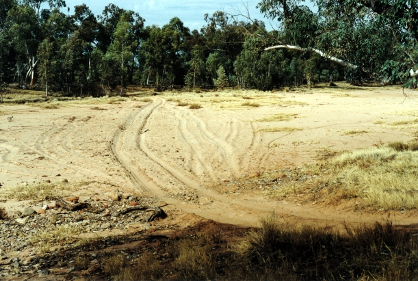
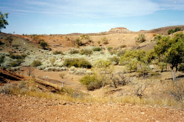
Looking back up the Finke Gorge, from the track south of Boggy Hole
Occasionally the track deviated away from the river, through higher mulga country, cutting across where there was a big bend and meeting the river again.
It certainly is a majestic river. It would be impossible to see it in full flow, except from the air, in the Finke Gorge section, but it would be quite something.
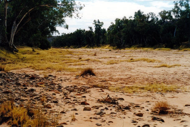
The Finke River, south of Boggy Hole, looking upstream
Truck handled the difficult conditions really well.
The track criss-crossed the river
We came to a sign that marked the exit point from the National Park – a rare man-made landmark on this route.
Leaving the National Park
It took us a couple of hours to get from Boggy Hole to the Running Waters Yards – relics from older pastoral times. It is here that the Finke swings east and the track goes west, for some 12kms.
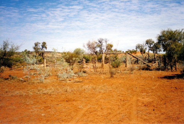
Running Waters Yards
Just before we got to the Yards, met a vehicle heading north – the only vehicle we’d encountered in two days, at that time. It was noon, and he was aiming to make Palm Valley! He had no idea of how rough and slow the track was about to become.
At the next track junction, we debated whether to keep going on the side track to Ilamurta Springs and old police station ruins, to the west. I’d have liked to go there and camp the night, but John preferred to keep going on our main objectives. So we turned to the south.
From here, the route was across low red sand dunes, in fairly flat country. The river red gums were replaced by desert oaks. On this stretch we met a group of five vehicles, towing camper trailers. They would soon be encountering difficulties on some of the sandy, rough, steep river bank sections to come. We’d thought a few of these entry and exit points a bit reminiscent of the OTL Track on Cape York! But without the water. The young couple that we spoke to yesterday, at Boggy Hole, had needed to snatch a Disco towing a camper that was stuck on that section.
John wished the group luck!
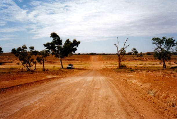
The run south to the Ernest Gikes Road
After a rather faster, but much less interesting run to the south, we came to the junction with the Ernest Giles road, and turned east. This is the unsealed route that cuts from the Kings Canyon road, across to the Stuart Highway.
We stopped to eat our lunch at the dry Palmer River crossing. The country now was markedly different to that around the Western MacDonnells to the north.
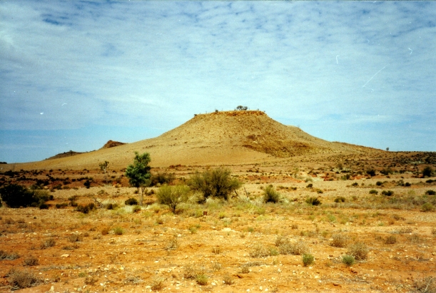
At Rogers Pass, on the Ernest Giles Road
Lunch stop at the dry Palmer River crossing on the Ernest Giles Road
The Finke Gorge was an excellent little trek and I am very glad that we did it.
Not long before we reached the main highway, we turned off to the north, to drive for 5kms along a track to the Henbury Meteorite Craters. A few thousand years ago, a meteorite heading for Earth broke up in the atmosphere and the pieces impacted here, making craters of varying sizes.
We walked the few hundred metres to look at the main crater. It was definitely worth the short detour. Without knowing its origins, one could think it was a very large, partially filled-in quarry. Or an old volcanic vent – had there been volcanoes anywhere around here!
Henbury Meteorite Crater
We were hot and thirsty by now. It was sunny, though there was some cloud still. Conditions were such as to make us look forward to the end of the day’s driving.
Reached the bitumen Stuart Highway and turned north. We soon crossed the Finke, yet again, but this time via bridge. The river here was wide, with the sandy bed we were used to, and multiple dry channels. I thought that floods here would cut the highway, for sure, given the low level bridging.
After 40kms, we came to Stuarts Well, with its roadhouse and camp area. This was 10kms north of where we wanted to turn off again, but we decided to do the extra, to refuel, and also for a convenient camp spot. This is fairly small, intended really for overnighters, like ourselves.
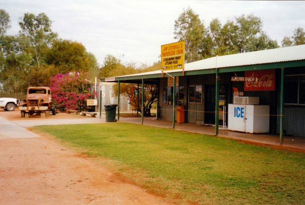
Stuarts Well Roadhouse, with its Wallara Ranch sign. Our camp area was beneath the trees in the background.
We paid $12, for a pleasant grassy place to pitch the tent – grass! There was no power but there were lots of galahs in the surrounding trees, depositing their droppings on our camp gear and Truck.
We bought ourselves a cold beer – $3 each – and sat in the shaded beer garden area for a couple of hours, while John programmed his GPS and I read.
I bought some postcards of Chambers Pillar – tomorrow’s destination.
Stuarts Well is an interesting place. The father of the man who owns it originally built Wallara Ranch, just east of Kings Canyon. It was they who, in 1961, formed the first track to Kings Canyon, and set the Ranch up as a tourism base, before the days of the current resort, on land leased from the station owner. Then in 1990 the station owner refused to negotiate reasonable terms for the lease renewal. It was believed that this was due to pressure from those who wanted to develop Kings Canyon further, and hoped to thus acquire the ranch lease cheaply. In protest, the leasee bulldozed everything they had built at Wallara, before leaving and setting up Stuarts Well.
The old Wallara Ranch sign now hangs at the front of the roadhouse, and an old truck is parked on display – with the attached frame that was used to make the first track to Kings Canyon. There is a display, inside, of the history outlined above. It made interesting reading. A story too often repeated – the “small man”/battler losing out to the power of big business.
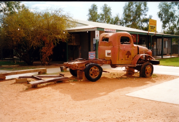
This rig pushed the first track through to Kings Canyon
I had a lovely warm shower, albeit in a cramped Atco facility.
I think I may have been a bit dehydrated from today’s heat, as I didn’t feel at all hungry. I had some lettuce, tomato and cheese, while John had a great fish and chip and salad meal at the roadhouse for $9.50.
We sat and read until bedtime at 10.30. The night was quite warm and it was pleasant sitting out. The galahs in the trees kept squabbling – or maybe protesting about the bright light from our lantern?
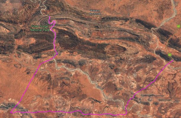
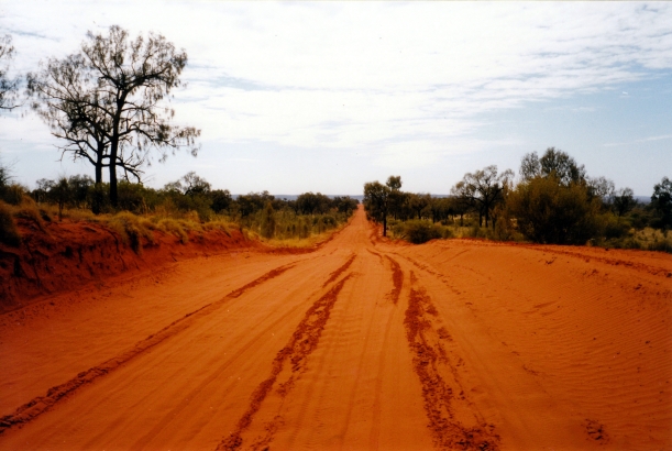
From Boggy Hole camp to Stuarts Well Roadhouse
