
The Isle of Wight is just off the south coastal of England. It’s a roughly rhomboid shape, about 40 miles East to West and 13 miles North to South at the widest point. The coastline is 57 miles long but with the required diversions the Coastal Path (in red below) is just over 70 miles long. At that length and with less than 6500ft ascent in all it is a fairly gentle introduction into long distance walking.
Towards the end of 2019 we (my wife Linda and myself) agreed that we would walk the Coastal Path as preparation for walking one of the UK National Trails. Our plan was to book a holiday cottage on the island and do the walk over four days, bussing to the start and back from the end each day. This would leave two days for Linda (an island native) to do some family history research and meet relatives.
After a false start in 2020 because of Covid restrictions we set off for the island in early May 2021. We had decided to rent a holiday cottage in Niton (between Chale and Ventnor on the map shown here) and to do the walk anti-clockwise in these stages:
1. Ventnor to Ryde (18 miles)
2. Ryde to Shalfleet (17.5 miles)
3. Shalfleet to Freshwater Bay (17 miles)
4. Freshwater Bay to Niton (14.5 miles)
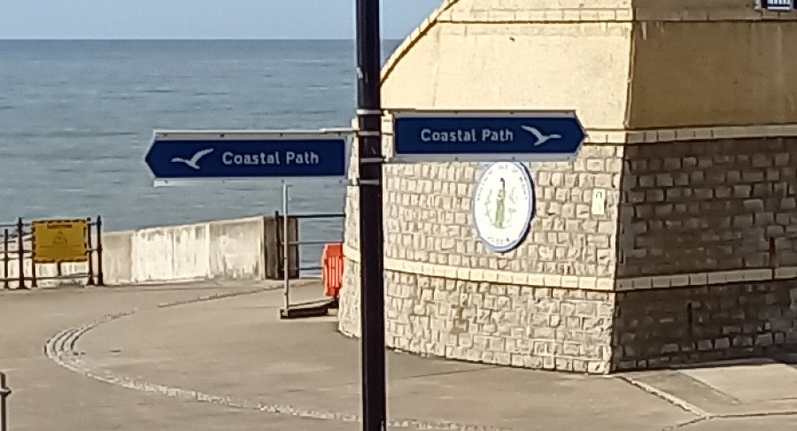
5. Niton to Ventnor (5 miles)
For the first three stages we drove into Newport and caught a bus to the day’s start point, and then a bus back to Newport to collect the car at the end of the day.
Stage four we caught a bus from Niton to Freshwater Bay and walked back to the cottage. Stage five we walked from the cottage to Ventor and then caught the bus back.
There are multi-day tourist parking permits and multi-day bus passes available which can save money. The buses were very good, clean and on time – also with USB charging in all seats.
Day One – Ventnor to Ryde (18 miles)
Day 1 was postponed for 24 hours because of heavy rain in the morning and high winds all day. Instead had a short walk up to St Catherine’s Down, down to Blackgang Chine and back along a section of the Coastal Path, just to get loosened up.
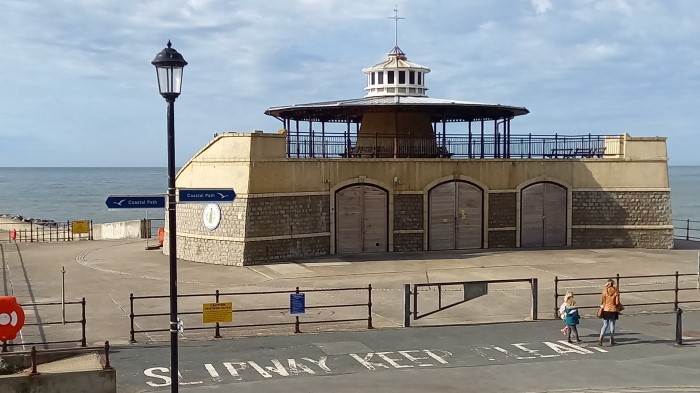
The next day we got up early, drove to Newport and caught the bus to Ventnor where we started the walk at the pier at 9am. Going anti-clockwise we walked first along the Esplanade and after about a mile we turned inland going past a very pretty little church and on into The Landslip woods. This is apparently the largest landslip of it’s type in Europe.
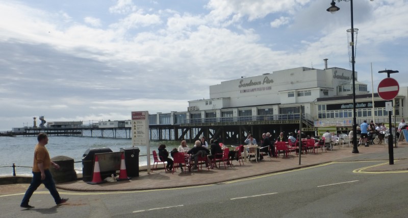
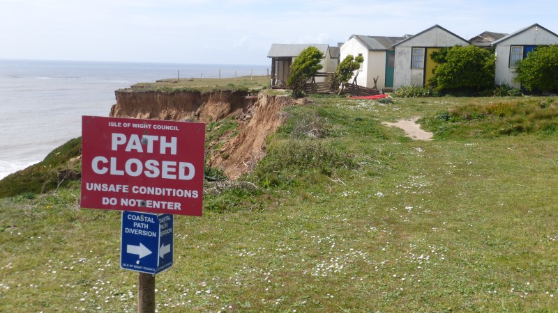
It wasn’t long before we saw our first “Path Closed” sign this a diversion down through Shanklin Old Village. We cut through the park to the cliff path and after another diversion got down to the sea wall which we followed through Shanklin and Sandown.
After passing the zoo the path climbs up Culver Down to the monument at the top where we had a rest and ate our packed lunches.
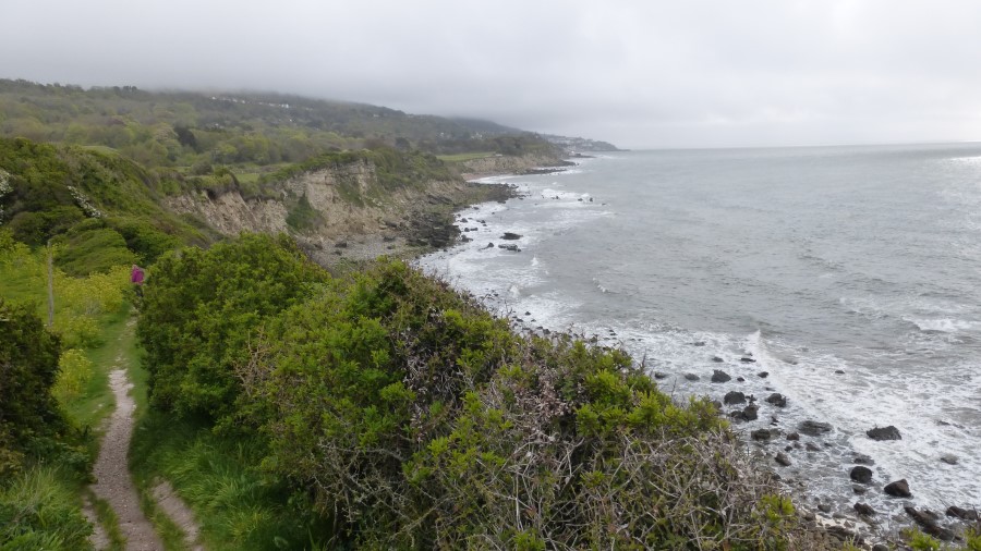
Refreshed we descended into Bembridge via a narrow path between the cliffs and chalets. The sandstone cliffs on this section have recent landslips and the path several times has short diversions around the most recent ones.
The Crab & Lobster restaurant confused us as the guide talked about going through the car-park – but there was no car-park!. Later we realised that they had converted it to outdoor dining because of the Covid rules that were in place.
We walked along the beach before turning inland and reconnecting with the route through the town and on round the harbour passing some amazing houseboats on the way.
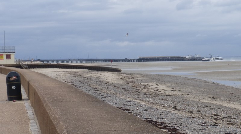
The route then crosses the harbour on a stone causeway, leads across The Duver (which looks like it used to be golf course) and heads inland before re-joining the coast in Seaview. We finished the day’s walk following the sea wall all the way to Ryde Pier where we caught the bus back to Newport.
The day included was a fair bit of concrete and tarmac walking interspersed with quiet paths and gravel lanes. The highlight for us was the view from Culver Down but we also got our first glimpses of cliff falls, of which there were many still to come.
Day Two – Ryde to Shalfleet (17.5 miles)
As Day 2 was a Monday there was a lot more traffic on the route into Newport but no delays to speak of. We caught the No. 9 to Ryde and started our second day from the pier walking along the Esplanade. Soon we were back away from the coast and walking through the outskirts on the town and it was to be some hours before we saw the coast again. The path worked it’s way inland of privately owned coastline at Quarr Abbey, past Fishbourne, through the housing estates in Wotton and finally past Osbourne House on the main road down into East Cowes. Some interesting route finding but not much in the way of views.
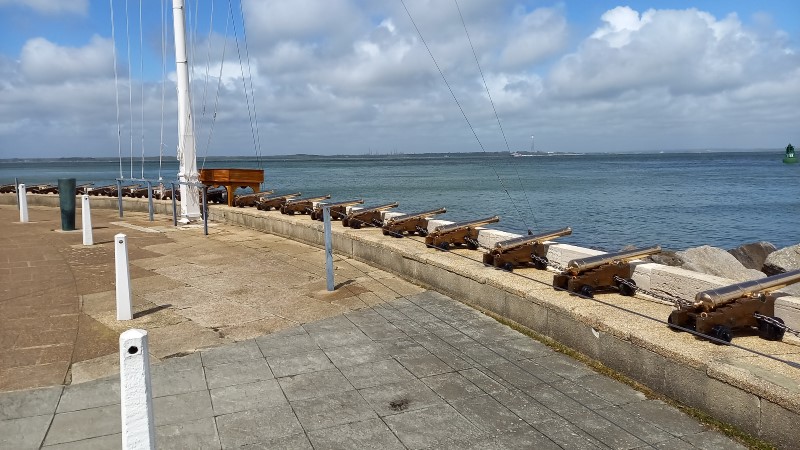
At East Cowes we rode the floating bridge across to Cowes where we paused for a sausage sandwich before finally joining the coast proper on Cowes esplanade. At this point the wind hit us and at times walking was quite difficult with the occasional blast stopping us dead in our tracks! The path follows the seawall past the Royal Yacht Squadron and some very impressive houses as far as Gurnard where it briefly leaves the coast to negotiate Gurnard cliff.
Here we were faced with another “Path Closed” sign but without any hint of a diversion. Study of the map showed the only alternative is a long (very long) road walk so we took our lives in our hands and followed the path anyway as it followed the top of coastal slope towards Thorness Bay. There was indeed a short stretch where a landslip had taken the path but it was easily negotiable and the fence had been moved back to accommodate that so quite why it was closed we’re no sure.
At Thorness Bay the path descends to the beach for a short stretch and then goes inland through a holiday camp. We stopped on the shore for our lunch, knowing that much of the rest of the route was road walking. Directions on exiting the Holiday camp were a little confusing but we found the right route more by luck rather than judgement and after crossing a few fields began the road walking section that leads through Porchfield and Locks Green towards Newtown where there is a brief respite in a National Trust reserve before more road walking from Newtown to Shalfleet.
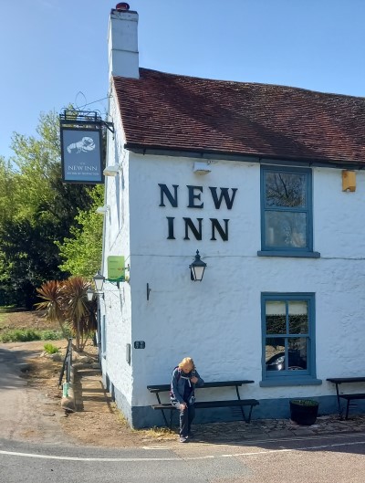
The New Inn at Shalfleet was still closed because of Covid so we were denied refreshment after a mixed bag of a day. The stretch from Gurnard to Thorness Bay was excellent walking in between the miles of tarmac that comprised the rest of the day, but not seeing the coast for most of the day had left us feeling a little short changed. However,the best was yet to come.
Day Three – Shalfleet to Freshwater Bay (17.5 miles)
We restarted at Shalfleet after a good night’s rest by again driving into Newport and catching the early bus to our start point. The walk start
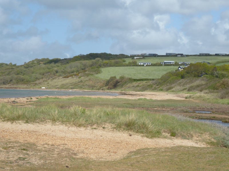
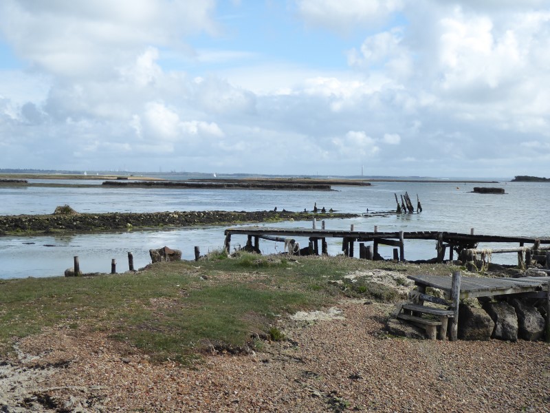
s along the road west out of Shalfleet and then crosses some fields before following forest tracks down to Hampstead quay. This section and the road walking the previous day circumnavigates the Newtown River, it’s mudflats and also an army shooting range.
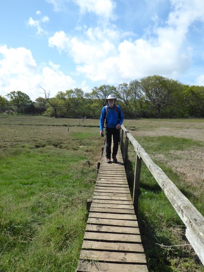
It’s at this point that we found the boardwalks that the Youtubers always feature and which lead you around the mudflats and across bogs as you head towards the coast proper.
The directions get pretty complex here – describing lots of stiles that mostly don’t exist anymore – but it’s easy to navigate nonetheless. At the coast we walked along the beach looking for the promised memorial and found it hidden in the bushes on the left. It would be easy to miss.
After a short stretch the path trends inland through the Bouldnor woods, There is always the sense the cliff top is close, but never really in easy view. Eventually we descended via another path diversion to a short stretch of beach before working our way past farms and houses up to the main road into Yarmouth.
Having paid 20p to use the toilets at the entrance to the town we walked down to the pier and had a coffee stop at the Gossips café (free toilets!) before leaving Yarmouth past the ferry terminal and over the Yar bridge. After a short walk on the seawall we turned into the Fort Victoria Country Park which is a stretch of woodland around Fort Victoria visitor centre. This led us gradually up to the top of the coastal slope and disgorged us at Cliff End Battery, which is now quit a posh looking holiday camp. From here we walked down and through a very not posh looking holiday camp and then through Colwell and back onto the coast at Colwell Chine.
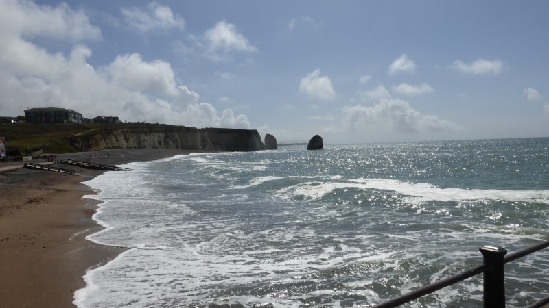
More walking along the seawall/ esplanade then, past a pier and some beachside restaurants all doing a roaring trade (must be a carpark nearby we thought) before climbing up a steep flight of wooden steps up and out of Widdick Chine. Then after yet another path diversion we climbed onto Headon Hill and our first sight of the The Needles at the most westward point of the island.
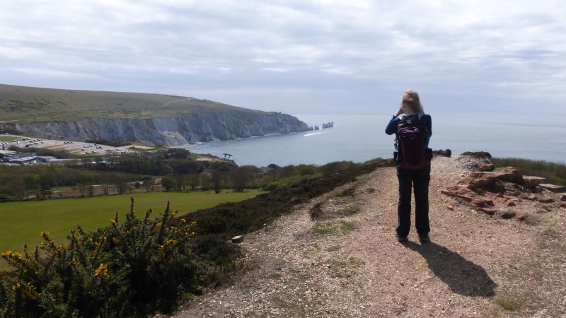
After walking along the ridge of Headon Hill we descended down into the the Needles attraction park (closed still) and then out along the cliff path to the Coastguard cottages, passing Alum Bay and some “hill cattle” on the way before we turned east and started the walk along the downs to the end of the day’s walk. The path goes up across West High Down and then Tennyson Down heading with Tennyson’s Monument on the highest point. Looking behind us we could see rain clouds approaching from the west so we put a spurt on trying to outrun them. At the monument we stopped and put on our jackets just before the heavens opened and rain chased us down into Freshwater Bay.
With no waterproof trousers we had soaked and cold legs by the time we got to the bus stop an hour before the bus was due. Not wanting to hang about in the rain we caught the bus going “the wrong way” for us to it’s terminus at the Needles carpark, and then ride it back again to Newport.
Day 3 completed and a much more interesting walk with a variety of countryside. Apart from the rain a really good day.
Day Four – Freshwater Bay to Niton (14.5 miles)
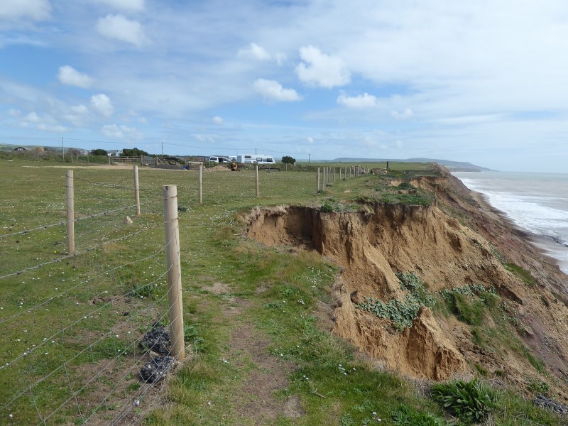
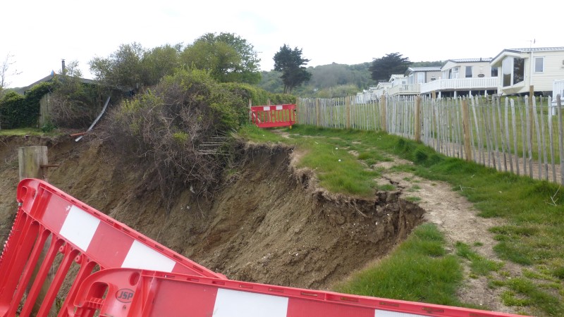
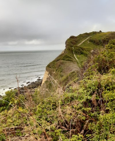
That part of the path is above the chalk cliffs and as it descends from the Down towards Compton Chine the rock changes to the clay and sandstone that was with us most of the rest of the day. Just inland is the Military Road which has been the subject of much discussion for many years as the coastal erosion has left the road in danger of being overwhelmed near Brook. Erosion is very evident all along the route and there were quite a few places where there was a judicious landward swerve of the path.
From Freshwater Bay to Chale the we followed the path as it snaked it’s way along the cliff tops. There are several chines to negotiate, mostly by walking inland around the head of the chine and then back to the cliff top. Grange Chine is an exception and requires descending into and climbing out again. At Shepherd’s Chine you need to descend into the chine, but not take the final wooden steps as they now terminate in mid-air! Instead you contour along it’s side to get past an irrigation dam, and then climb back out again. Whale Chine is a definite non-starter as far as going into it concerned with it’s very deep and sheer walls of crumbling clay!
The only diversion along the path at the moment is next to Isle of Wight Pearl, which is exactly what’s it sounds like – a place that sells pearls and associated jewellery. As we approached it we could see there were picnic tables outside with people sat at them so we decided to investigate the possibility of lunch. A large mug of coffee and an excellent baguette each later we felt ready for the afternoon’s walking. There was the challenge of having to walk through the shop (Linda likes her pendant necklaces!) but that was negotiated successfully without opening the wallet.
Nearing Chale the path leaves the cliff top in order to bypass Blackgang Chine, which is a tourist attraction. It’s not immune to erosion itself as it is significantly smaller that when we took our boys there some 30 years ago. There is a small amount of road walking to pass this but soon we were back on the cliff top path heading towards Niton. There is a very large area of landslip here and below us we could see the remains of the original road between Niton and Blackgang and also the lighthouse on St Catherine’s Point. We stopped briefly to chat to a chap who was taking photographs of Peregrine Falcons which nest close by.
From where the path crosses the road into Niton it was only a few hundred yards back to the cottage – and the last long day of walking was done.
Day Five – Niton to Ventnor (4.5 miles)
Although day five would only be a couple of hours walking we left early so that we could catch the 10:05 bus back from Ventnor to Niton, giving us as much time as possible to do other things as this was our last day before going home.
The path leaves Niton after crossing the A3055 which travels underneath the cliff top which is actually some way from the coast. The road is signposted as going to St Lawrence and Ventnor, except it doesn’t thanks to a landslip about halfway between Niton and St Lawrence the road is closed for about a hundred yards with only pedestrian access across.
The path goes along the cliff top above except that after a while it appears not to as there is a diversion sign after about a mile pointing down a narrow path that leads back down to the road.
We followed this diversion down but there were no further diversion signs, so maybe it wasn’t a diversion? We never did find out.
However we followed the road into St Lawrence until we could reconnect with the path as it descended through the town and onto the sea cliff proper.
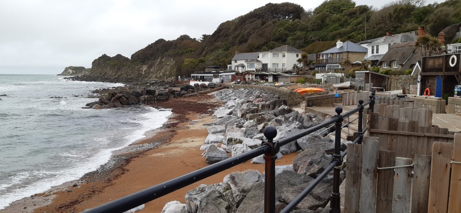
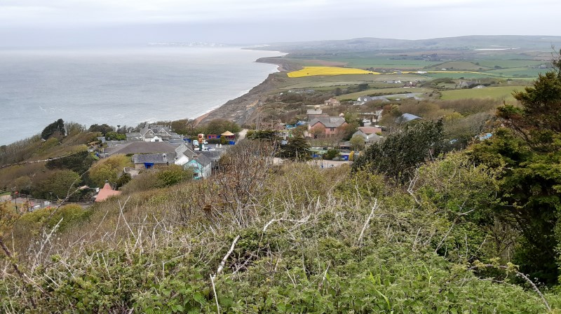
At Woody Point the path is less than a metre from the cliff edge and that together with a gusting wind made progress a little cautious for a while. The next couple of miles along the path were pleasant walking, with bushes both sides, waves crashing in the rocks below, and the harbour of Ventnor in the distance signalling the end of the walk. Before that there was a descent into and out of Steephill Cove, a slightly strange place that obviously caters heavily for tourists but also has a plethora of signs declaring areas as “Private”.
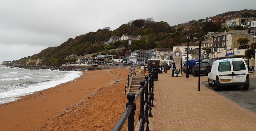
After Steephill Cove we really were on the last stretch, through the parks and down to the harbour and the completion of our walk.
Epilogue – Thoughts on the Coastal Path
If you want more information about the walk, a good place to start is Isle of Wight Tourism or Isle Of Wight Guru , where there are links to a suggested six day itinerary with pdf downloads of route descriptions. We used these extensively and found they are mostly accurate and very useful though some recent changes aren’t there and some styles, gates etc are in the description but no longer actually exist. Signposting of the route is generally very good but there are a few place where consulting an OS map is helpful, though that is not 100% up to date either. Having said that, we never had any real problems finding the route.
There are quite a few Youtubes about the walk – our favourite is from the Cool Dudes Walking Club.
The Isle of Wight isn’t exactly the least inhabited island in the UK and is a very popular place with holidaymakers. It’s not surprising therefore that large parts of the Coastal path are affected by this and there are long stretches of concrete seafronts and private coasts to be circumnavigated by road. This is particularly true on the stretches between Ventnor, Ryde and Cowes. Indeed between Ryde and Cowes there is hardly any coast in view.
The portion between Cowes and Shalfleet is more interesting until Thorness Bay. After this a lot of road walking is needed to avoid the Newtown river and Army shooting range. From Shalfleet to Freshwater the path is a mixture of forest, beach, cliff top, road and down, and we though this was the best part of the walk in terms of maintaining our interest.
Freshwater Bay to Niton and then Ventnor is the most spectacular part with great open views. It was the bit we were looking forward to most but actually once we got used to walking along the cliff top it felt a very long way of much the same thing. It is broken up by the chines and probably as it was our fourth day we’d got a bit jaded. Seeing the erosion was quite interesting, particular as parts were so close to the path.
Would we recommend anyone to do this walk? As a multi-day walk in a reasonably easy environment it’s a good shout. It’s easy to get to, there are good transport links, plenty of places to eat and lots of accommodation options. If you take more days to do it there are places to visit along the way. So yes, if that’s what you want, go for it.