2012
SK1577 : View up Tideslow Rake towards the mast on the summit of Tides Low
taken 12 years ago, near to Little Hucklow, Derbyshire, England
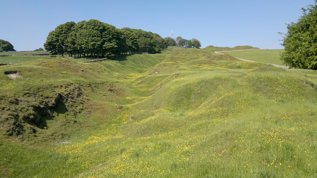
View up Tideslow Rake towards the mast on the summit of Tides Low
The radio/mobile phone mast is at the centre of the view but this picture is all about the old lead workings which have followed the deposits up and down the hillside known as Tides Low. (Low means hill in this part of Derbyshire.) "Tideslow Rake is the largest surviving site in the South Pennines where an open vegetation characteristic of substrates rich in heavy metals (in this case principally lead) occurs."
I can do no better than link this picture to a much more detailed explanation than I could possibly give. See: Link (Archive Link )
I can do no better than link this picture to a much more detailed explanation than I could possibly give. See: Link
 Map © Crown Copyright")
TIP: Click the map for more Large scale mapping
- Grid Square
- SK1577, 19 images (more nearby 🔍)
- Photographer
- Chris Morgan (more nearby)
- Date Taken
- Monday, 28 May, 2012 (more nearby)
- Submitted
- Monday, 28 May, 2012
- Subject Location
-
OSGB36:
 SK 1506 7795 [10m precision]
WGS84: 53:17.8976N 1:46.5300W - Camera Location
-
OSGB36: SK 1546 7795
- View Direction
- WEST (about 270 degrees)