2012
NX1231 : West Cairngaan
taken 12 years ago, near to Cairngaan, Dumfries And Galloway, Scotland
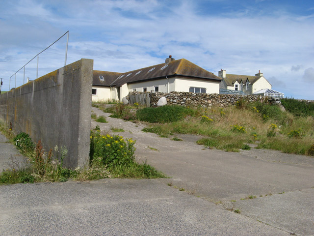
West Cairngaan
Another large farm complex in this intensively worked landscape, although the farmyard and silage clamp no longer appear to be in use. A footpath is signposted down the farm track in the valley.
 Map © Crown Copyright")
TIP: Click the map for more Large scale mapping
- Grid Square
- NX1231, 13 images (more nearby 🔍)
- Photographer
- Jonathan Wilkins (more nearby)
- Date Taken
- Sunday, 29 July, 2012 (more nearby)
- Submitted
- Monday, 27 August, 2012
- Subject Location
-
OSGB36:
 NX 1284 3192 [10m precision]
WGS84: 54:38.8532N 4:54.1372W - Camera Location
-
OSGB36: NX 1289 3185
- View Direction
- Northwest (about 315 degrees)