2014
NZ9502 : Tumulus and track Stoupe Brow moor
taken 10 years ago, near to Ravenscar, North Yorkshire, England
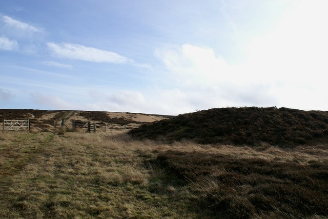
Tumulus and track Stoupe Brow moor
The prehistoric burial mound, shown on the map as tumulus, is at the northern end of Stoupe Brow Moor and is a prominent feature in the landscape. The track running off into the distance swings round the moor edge andheads towards the telecommunications mast above Ravenscar. The map does not show the track as running past the tumulus.
 Map © Crown Copyright")
TIP: Click the map for more Large scale mapping
- Grid Square
- NZ9502, 58 images (more nearby 🔍)
- Photographer
- Christopher Hall (more nearby)
- Date Taken
- Monday, 3 February, 2014 (more nearby)
- Submitted
- Wednesday, 5 February, 2014
- Subject Location
-
OSGB36:
 NZ 956 021 [100m precision]
WGS84: 54:24.3230N 0:31.6951W - Camera Location
-
OSGB36: NZ 956 021
- View Direction
- EAST (about 90 degrees)