2014
NZ1003 : Feldom Ranges
taken 10 years ago, near to Skelton, North Yorkshire, England
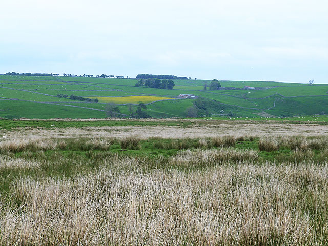
Feldom Ranges
Part of the extensive area of army ranges above Swaledale. Beyond the valley of Feldom Gill can be seen Low Feldom Farm NZ1103 with East Feldom beyond and to the right.
 Map © Crown Copyright")
TIP: Click the map for more Large scale mapping
- Grid Square
- NZ1003, 4 images (more nearby 🔍)
- Photographer
- Oliver Dixon (more nearby)
- Date Taken
- Friday, 30 May, 2014 (more nearby)
- Submitted
- Sunday, 1 June, 2014
- Subject Location
-
OSGB36:
 NZ 1012 0309 [10m precision]
WGS84: 54:25.3888N 1:50.7323W - Camera Location
-
OSGB36: NZ 1002 0303
- View Direction
- East-northeast (about 67 degrees)