2014
SE8720 : The petrifying waters of the Kell Well
taken 10 years ago, near to Alkborough, North Lincolnshire, England
The petrifying waters of the Kell Well
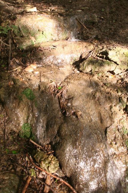
The Kell Well is a spring which runs out from between the layers of Lias rock on the western face of the hill, near the Trent, between Burton-upon-Stather and Alkborough. "Keld" derives from O.N. for spring. This is certainly an ancient site, lying close to Julian's Bower and Roman remains. It is said to petrify - these stones on the stream bed are coated with what looks like lime deposits.
See: SE8720 : Kell Well and Link
See: SE8720 : Kell Well and Link
 Map © Crown Copyright")
TIP: Click the map for more Large scale mapping
- Grid Square
- SE8720, 42 images (more nearby 🔍)
- Photographer
- Chris (more nearby)
- Date Taken
- Sunday, 8 June, 2014 (more nearby)
- Submitted
- Tuesday, 10 June, 2014
- Subject Location
-
OSGB36:
 SE 8731 2076 [10m precision]
WGS84: 53:40.5615N 0:40.7851W - Camera Location
-
OSGB36: SE 8729 2077
- View Direction
- East-southeast (about 112 degrees)