2018
SO4494 : Carding Mill Valley and Bodbury Ring: aerial 2018
taken 6 years ago, near to Church Stretton, Shropshire, England
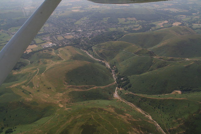
Carding Mill Valley and Bodbury Ring: aerial 2018
 Map © Crown Copyright")
TIP: Click the map for more Large scale mapping
- Grid Square
- SO4494, 303 images (more nearby 🔍)
- Photographer
- Chris (more nearby)
- Date Taken
- Saturday, 30 June, 2018 (more nearby)
- Submitted
- Saturday, 14 July, 2018
- Subject Location
-
OSGB36:
 SO 4432 9453 [10m precision]
WGS84: 52:32.7456N 2:49.3501W - Camera Location
-
OSGB36: SO 4345 9592
- View Direction
- South-southeast (about 157 degrees)