Lighthouses of Chile: Northern Patagonia

On the southwest coast of South America the Republic of Chile has one of the world's longest and most dangerous coastlines, more than 4000 km (2500 mi) long with at least 5000 rocky islands. To guard this coast the Chilean Navy has operated for many years one of the world's most active and most distinguished lighthouse services.

Chile is divided into 16 regions (regiones) and the regions are subdivided into provinces (provincias). This page includes lighthouses of the Aysén and Los Lagos Regions in the southern part of Chile. Together these regions include most of the northern half of Chilean Patagonia.

Many of the historic lighthouses of Chile are the work of George Slight (1859-1934), a Scottish engineer who moved to Chile in the 1890s and eventually became the head of the Chilean Maritime Signaling Service. In all he designed and supervised the construction of more than 70 lighthouses.

The Spanish word for a lighthouse is faro. In Spain, the word faro is usually applied only to the larger coastal lights, but in South America it is often used for all fixed lights, including towers too small to be considered lighthouses. In Spanish isla is an island, cabo is a cape, punta is a promontory or point of land, péñon is a rock, arrecife is a reef, bahía is a bay, ría is an estuary or inlet, estrecho is a strait, río is a river, and puerto is a port or harbor. Also, the Spanish word canal means a natural channel, not an artificial canal.

Chile's historic lighthouse agency, the Servicio de Señalización Marítima, is now an office within the maritime ministry known as Directemar (Dirección General del Territorio Marítimo y Marina Mercante).

ARLHS numbers are from the ARLHS World List of Lights. Admiralty numbers are from volume G of the Admiralty List of Lights & Fog Signals. U.S. NGA List numbers are from Publication 111. The Chilean light list, Lista de Faros de la Costa de Chile, is not available online.


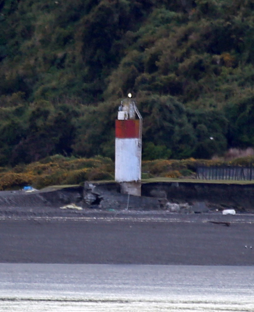
Punta Corona Light, Isla Chiloé, February 2010
ex-Panoramio Creative Commons photo by manuel1978

General Sources
Online List of Lights - Chile
Photos posted by Alexander Trabas.
Faros de Chile
Index to articles in the Spanish-language Wikipedia.
Faros Chilenos
Photos and information posted on the Argentine-based Faros del Mar web site.
Lighthouses in Chile
Photos by various photographers available from Wikimedia.
World of Lighthouses - Chile
Photos by various photographers available from Lightphotos.net.
Navionics Charts
Navigation chart for Chile.

Aysén (Aisén) Region Lighthouses

The Aysén Region is the least populous of the 16 regions, with a population barely exceeding 100,000. It includes the rugged heart of Chilean Patagonia. The Patagonian coast is deeply cut by numerous fjords. The maritime geography is similar to that of Norway and of British Columbia, and as in those cases a series of channels combine for an "inside passage" protected from the open ocean almost everywhere. The one exception is at the southern end of the Aysén Region where the Taitao Peninsula extends the mainland to the Pacific Ocean shore, interrupting the inside passage through the fjords. Ships must round Cabo Raper through the open Pacific before returning to the inside route. The Tres Montes Peninsula is the extreme southwestern end of the Taitao Peninsula, ending at Cabo Raper.

Capitán Prat Province (Inland Passage) Lighthouses
Islote Dirección
Date unknown. Active; focal plane 30 m (98 ft); white flash every 10 s. 10 m (33 ft) octagonal concrete tower, painted white with a red band. No photo available but Bing has a distant satellite view. Located on a small island in the middle of the Canal Messier (Messier Channel) about 16 km (10 mi) north of Isla Daly. Accessible only by boat. Site status unknown. ARLHS CHI-054; Admiralty G1553; NGA 2064.
Morro Cock
Date unknown. Active; focal plane 14 m (46 ft); white flash every 10 s. 8 m (26 ft) round cylindrical fiberglass tower, colored white with one narrow red horizontal band. No photo available and the light is not seen in Bing's satellite view. Located on the east side of the Canal Messier and the west side of Isla Van der Meulen. Accessible only by boat. Site status unknown. Admiralty G1555; NGA 2056.
Isla San Pedro (2?)
Date unknown. Active; focal plane 35 m (115 ft); white flash every 10 s. Approx. 9 m (30 ft) round cylindrical fiberglass tower colored white with one red horizontal band. Israel V. M. has a photo and Google has a distant satellite view. NGA lists a 4 m (13 ft) tower. This light marks the entrance to the Canal Messier and the Inland Passage for ships southbound after rounding Cabo Raper. Northbound ships must cross the Golfo de Peñas to reach the cape. The adjacent station includes an aeronautical beacon. Located atop Isla Wager on the west side of the Canal Messier entrance. Site status unknown. Admiralty G1558; NGA 2044.

Aysén Province Lighthouses
Cabo Raper
1914 (George Slight). Active; focal plane 61 m (200 ft); white flash every 5 s. 14 m (46 ft) round cylindrical concrete tower with lantern and gallery, attached to a large 1-story keeper's house. Lighthouse painted with red and white bands. Keeper's house staffed. Nicolás Binder's photo (a small portion of a panoramic view) is at right, Gabo Aravena has a 2020 photo, Ramiro Navajas has an aerial view of this spectacular site, and Google has a satellite view of the station. The construction of this famous lighthouse posed a huge engineering challenge, overcome by building a special railroad 6.5 km (4 mi) long to carry materials to the station. The cape is at the southern end of the Tres Montes peninsula overlooking the northern entrance to the Golfo de Penas. Accessible only by boat. Site status unknown. ARLHS CHI-009; Admiralty G1562; NGA 2040.

Cabo Raper Light, Golfo de Peñas, June 2019
Wikimedia Creative Commons photo by Nicolás Binder
Isla Inchemo
Date unknown. Active; focal plane 32 m (105 ft); white flash every 10 s. 4 m (13 ft) (?) round fiberglass tower colored white with one red horizontalk band. No photo available but Bing has a satellite view. The light must be tall enough to be seen above trees, so it is more likely at least 10 m (33 ft). Located at the south side of an island marking the re-entrance to the inside passage for northbound ships. Site status unknown. Admiralty G1563; NGA 2036.
Isla Auchilú
Date unknown. Active; focal plane 70 m (230 ft); white flash every 15 s. 10 m (33 ft) concrete tower, painted with horizontal red and white bands. No photo available but Bing has a distant satellite view. After rounding Cabo Raper, northbound coastwise traffic returns to the inside passage via the narrow, twisting Canal Darwin. Located on an island on the north side of the entrance to the Canal Darwin. Accessible only by boat. Site status unknown. ARLHS CHI-039; Admiralty G1564; NGA 2032.
Isla Quemada
Date unknown. Active; focal plane 8 m (26 ft); white flash every 5 s. 6 m (20 ft) octagonal concrete tower, painted white with one horizontal red band. Larry Myhre's photo is at right, Lightphotos.net also has Myhre's photo, and Bing has an indistinct satellite view. Located on an island on the north side of the Canal Darwin off the west end of Isla Quemada. Accessible only by boat. Site status unknown. Admiralty G1568; NGA 2016.
Islote Errázuriz
Date unknown. Active; focal plane 7 m (23 ft); white flash every 10 s. 6 m (20 ft) round white fiberglass tower colored white with a red horizontal band. No photo available but Bing has a satellite view. Located on a reef on the west side of the Canal Errázuriz off Isla Luz. Accessible only by boat. Site status unknown. Admiralty G1570.5; NGA 1988.
Isla Carvallo
Date unknown. Active; focal plane 12 m (39 ft); three white flashes every 9 s. 6 m (23 ft) round fiberglass tower colored white with a red horizontal band. No photo available but Bing has an indistinct satellite view. Located on an island in a narrow section of the Canal Pilcomayo, a narrow passage leading toward Puerto Aysén, the provincial capital. Accessible only by boat. Site status unknown. Admiralty G1571 NGA 1972.

Isla Quemada Light, Última Esperanza, February 2007
Flickr Creative Commons photo by Larry Myhre
Acantilado Caleta (Caleta Bluff)
Date unknown. Active; focal plane 17 m (56 ft); white flash every 10 s. 5.5 m (18 ft) round fiberglass tower colored white with a red horizontal band. No photo available but Bing has an indistinct satellite view. Located on a headland on the south side of the fjord approaching Puerto Chacabuco, the ferry terminal for Puerto Aysén. Accessible only by boat. Site status unknown. Admiralty G1571; NGA 1972.
Punta Barruel
Date unknown. Active; focal plane about 15 m (49 ft); red light, pattern unknown. Approx. 8 m (26 ft) tower. No photo available but Google has an indistinct satellite view. Located on the south side of the Río Aysén fjord approaching Puerto Aysén. Accessible only by boat. Site status unknown. Admiralty G1571.7; NGA 1980.
Islote El Morro
Date unknown. Active; focal plane 70 m (230 ft); white flash every 5 s. 7 m (23 ft) conical concrete tower painted white with a red horizontal band. No photo available but Bing has a satellite view. Located on a high island in a narrow section of the Canal Moraleda (Moraleda Channel), a long north-south passage separating the Chonos Islands from the mainland. Accessible only by boat. Site status unknown. Admiralty G1575; NGA 1956.
Cayo Blanco
Date unknown. Active; focal plane 18 m (56 ft); three white flashes every 9 s. 10 m (33 ft) octagonal concrete tower, painted white with a red horizontal band. Trabas has Jim Smith's photo (also seen at right), Larry Myhre has a view from the sea, and Bing has a satellite view. Located on a rocky reef in the southern part of the Canal Moraleda, near Puerto Frances. Accessible only by boat. Site status unknown. ARLHS CHI-053; Admiralty G1577; NGA 1932.
Islote Locos
Date unknown. Active; focal plane 45 m (148 ft); white flash every 15 s. 10 m (33 ft) round conical concrete tower, painted white with a red horizontal band. No photo available but Bing has an indistinct satellite view. The light is listed as "Islote Locos" by the light lists, but since it is has a large colony of seals it is more likely to be called Isla Lobos. Located on a small island in the entrance to the Canal Moraleda from the Golfo Corcovado in northern Aysén. Accessible only by boat. Site status unknown. ARLHS CHI-056; Admiralty G1584; NGA 1904.
Islotes Queitao
Date unknown. Active; focal plane 129 m (423 ft); white flash every 10 s. 8 m (26 ft) round cylindrical fiberglass tower, colored white with one narrow red horizontal band. No photo available but Bing has a satellite view. Located at the west end of a cluster of high rocky islands in the Golfo Corcovado marking the approach to the Canal Moraleda and the inland passage. Accessible only by boat. Site status unknown. Admiralty G1590; NGA 1884.

Cayo Blanco Light, Puerto Frances
photo copyright Jim Smith; used by permission

Los Lagos Region: Chiloé Province Lighthouses

The Los Lagos Region is at the northern end of Chile's Patagonian fjord district. Its capital, Puerto Montt, is connected by major highways to the populated central part of the country. A prominent feature of the region is the large Isla de Chiloé, a roughly rectangular island about 190 km (118 mi) long and up to 65 km (40 mi) wide; its population is about 160,000. The broad sound separating Chiloé from the mainland to the east is called the Sea of Chiloé; a scattering of islands called the Islas Desertores separates the sea into two basins, the Golfo de Ancud in the northenr half and the Golfo de Corcovado in the southern.

Canal de Chacao Southside Lighthouses
The Canal de Chacao (Chacao Channel) is the strait separating the north end of the Isla de Chiloé from the mainland. The strait leads to the Golfo de Ancud, a large sound northeast of Chiloé. The strait narrows to a minimum width of about 2 km (1.25 mi). In 2018 construction began on the Puente de Chacao, a suspension bridge across the strait; completion is projected for 2025.

**
Punta Corona
1859 (Enrique Siemen). Active; focal plane 66 m (216 ft); white flash every 10 s. 9 m (30 ft) round cylindrical tower with lantern and gallery, attached to a 1-story keeper's house. Lighthouse painted white with a single red band below the gallery; the lantern roof is also red. Keeper's house staffed. A photo is at at the top of this page, Cristopher Espinoza has a 2017 photo, Juan Sebastian Dominguez has a 2008 photo, Trabas has Helmut Martin Porath's photo of the tower, a wider view of the station is available, and Google has a satellite view. This is the oldest active lighthouse in Chile, although it appears to have been modernized. The lighthouse is at the northern end of the Isla Grande de Chiloé, marking the entrance to Ancud. Accessible by road. Site open, and the station crew will sometimes conduct tours of the tower. ARLHS CHI-013; Admiralty G1676; NGA 111-1552.
Punta Tres Cruces (2?)
Date unknown. Active; focal plane 39 m (128 ft); white flash every 15 s. 8 m (26 ft) round cylindrical fiberglass tower, colored white with one narrow red horizontal band. Abandoned 1-story keeper's house and round iron oil house. Carlos Maria Silvano's photo is at right, Trabas has Helmut Martin Porath's closeup photo, and Google has a street view and a satellite view. Located atop a bluff at the northeastern tip of the Isla de Chiloé, marking the south side of the eastern entrance to the Canal de Chacao. Site and tower closed (Navy property) but the light can be seen from the end of highway 129. ARLHS CHI-115; Admiralty G1666; NGA 1588.

Castro Area Lighthouses
Castro is a town of about 40,000 residents and the capital of Chiloé Province. The town is located on the Estero de Castro, an inlet of the Sea of Chiloé on the east side of the island.

Punta Manzano (Isla Chaulinec)
Date unknown. Active; focal plane 25 m (82 ft); white flash every 5 s. 7.5 m (25 ft) round cylindrical concrete tower, colored white with one narrow red horizontal band. No photo available and the light is inconspicuous in Google's satellite view. Located near the southeastern point of Isla Chaulinec. This light marks the southern entrance to the Canal Apiao, which leads through the Islas Desertores between the Gulfs of Corcovado and Ancud. Accessible only by boat. Site status unknown. Admiralty G1624; NGA 1804.

Punta Tres Cruces Light, Isla Chiloé
photo copyright Carlos Maria Silvano; used by permission
* Puerto Pindo (Faro Los Ángeles, Huillo)
Date unknown. Active; focal plane 8 m (26 ft); green flash every 5 s. 5.5 m (18 ft) round hourglass-shaped fiberglass tower colored white with a green band at the top. Andrés Arturo Cárcamo Mayorga has a view across the inlet entrance and Google has a satellite view.Located on the north side of the entrance to the Estero Pindo, the harbor of the Isla Quehui. Site open, tower closed. Admiralty G1631; NGA 1796.
Punta Camahue (Isla Quehui)
Date unknown. Active; focal plane 59 m (184 ft); white flash every 5 s. 5.5 m (18 ft) octagonal concrete tower painted white with one red horizontal band. Eduardo Gallardo has a 2022 closeup photo and Google has a satellite view. Located on the southwestern point of Isla Quehui. Accessible only by boat. Site status unknown. Admiralty G1630; NGA 1792.
Isla Linlinao
Date unknown. Active; focal plane 38 m (125 ft); white flash every 5 s. 5.5 m (18 ft) round hourglass-shaped fiberglass tower colored white with one red horizontal band. Trabas has a very distant photo by Carlos Maria Silvano and Google has a satellite view. Located at the eastern tip of Isla Linlinao marking the entrance to the channel leading to Castro. Accessible only by boat. Site status unknown. Admiralty G1636; NGA 1780.

Golfo Corcovado Lighthouses
The Golfo Corcovado is a broad sound between the mainland and the southern half of the Isla de Chiloé.

Isla Imelev
Date unknown. Active; focal plane 52 m (170 ft); flash every 6 s, white or red depending on direction. 8 m (26 ft) round cylindrical fiberglass tower, colored white with one narrow red horizontal band. No photo available but Google has a satellite view. Located on a small island northwest of Isla Chaulinec, at the north end of the Golfo Corcovado. Accessible only by boat. Site status unknown. Admiralty G1628; NGA 1800.
Punta Chomio (Queilén)
Date unknown. Active; focal plane 12 m (39 ft); four white flashes every 12 s. 8 m (26 ft) round cylindrical fiberglass tower, colored white with one narrow red horizontal band. Trabas has Carlos Maria Silvano's photo and Bing has a satellite view. Located on a promontory on the east coast of the Isla de Chiloé about 1.6 km (1 mi) northeast of Queilén. Accessible only by boat. Site status unknown. Admiralty G1610; NGA 1836.
Punta Centinela (Isla Tranqui)
Date unknown. Active; focal plane 32 m (105 ft); three white flashes every 9 s. 8 m (26 ft) round cylindrical fiberglass tower, colored white with one narrow red horizontal band. No photo available but the tip of the tower is seen in Google's satellite view. Located at the east end of Isla Tranqui, which projects into the Golfo Corcovado about 25 km (15 mi) northeast of the Quellón entrance. Accessible only by boat. Site status unknown. Admiralty G1606; NGA 1852.
Punta Dirección (Isla Cailín)
Date unknown. Active; focal plane 9 m (30 ft); white flash every 5 s. 6 m (20 ft) round concrete tower painted white with one red horizontal band. No photo available but Google has a satellite view. Located on Isla Cailín marking the entrance to Quellón, the principal port of the southern Isla de Chiloé. Accessible only by boat. Site open, tower closed. Admiralty G1598; NGA 1872.
Isla Laitec
Date unknown. Active; focal plane 29 m (95 ft); white flash every 5 s. 8 m (26 ft) round cylindrical fiberglass tower, colored white with one narrow red horizontal band. No photo available but the tip of the tower is seen in Google's satellite view. Located at the south end of an island off the southeastern coast of the Isla de Chiloé. Accessible only by boat. Site status unknown. Admiralty G1596; NGA 1880.
Isla Guafo
1907 (George Slight). Active; focal plane 144 m (472 ft); white flash every 10 s. 8 m (26 ft) round steel tower with lantern and gallery, mounted on a concrete base. Lighthouse painted white with a red horizontal band; lantern roof is also red. The modern 1-story station building is staffed by rotating 4-man crews who serve 4 months on station. One of Adam and Cheryl Zaricki's photos is at right, Wikimedia has another photo from their collection, Francisco Cancino has a closeup photo and a distant view, and Google has a satellite view of the station. The original 2-story keeper's house was destroyed by an intense storm in 1973. Isla Guafo is southwest of the Isla de Chiloé in the center of the Boca del Guafo, the entrance to the southern end of the Golfo Corcovado. Located at the northwestern tip of the island. Accessible only by boat. Site and tower closed. ARLHS CHI-021; Admiralty G1592; NGA 1888.

Isla Guafo Light, December 2003
photo copyright Adam and Cheryl Zaricki; used by permission

Los Lagos Region: Mainland Provinces Lighthouses

Palena Province Lighthouse
Palena Province occupies the east side of the Sea of Chiloé. It is a rugged, very scenic but sparsely populated province.

* Punta Chulao (Ayacara)
Date unknown. Active; focal plane 30 m (98 ft); white flash every 10 s. 10 m (33 ft) octagonal concrete tower, painted white with a red horizontal band. No photo available but Google has an indistinct satellite view. Located on a promontory of the mainland at the northern entrance to straits connecting the Golfo de Ancud to the Golfo Corcovado. Site open, tower closed. ARLHS CHI-066; Admiralty G1656; NGA 1676.

Llanquihue Province Lighthouses (Puerto Montt Area)
Puerto Montt is a city of about 250,000 residents; it is an important port and the capital of both the Los Lagos Region and Llanquihue Province. It faces the Seno de Reloncaví, a bay that is a northward extension of the Golfo de Ancud.
Isla Queullin (Paso Queullin)
Date unknown. Active; focal plane 14 m (46 ft); white flash every 15 s. 8.5 m (28 ft) concrete tower, painted white with a red band. Trabas has Erich Hartmann's photo, Larry Myhre has a distant view from the sea, and Google has a satellite view. Located at the tip of a sand spit extending from the west side of Isla Queullin in the center of the entrance to the Seno de Reloncaví. Site status unknown. ARLHS CHI-045; Admiralty G1692; NGA 1660.
Banco San José
Date unknown. Active; focal plane 13 m (43 ft); three red flashes, in a 2+1 pattern, every 14 s. 15 m (49 ft) triangular skeletal tower, painted red with a green horizontal band. Trabas has a distant view by Erich Hartmann and Google has a satellite view. Located on a dangerous reef in the center of the entrance to the Seno de Reloncaví, the sound leading to Puerto Montt. Accessible only by boat. Site open, tower closed. Admiralty G1693; NGA 1664.
Paso Tautil (Isla Tautil)
Date unknown. Active; focal plane 12 m (39 ft); green flash every 5 s. 12 m (39 ft) square cylindrical green skeletal tower. Haralt Opitz Vergara has a distant drone view and Google has a fuzzy satellite view. Located in a narrow pass between Isla Tautil and Isla Puluqui leading to the town of Calbuco at the southwestern corner of the Seno de Reloncaví. Accessible only by boat. Site open, tower closed. Admiralty G1710; NGA 1604.
Isla Tabón
Date unknown. Active; focal plane 73 m (240 ft); white flash every 10 s. 13 m (43 ft) concrete tower, painted white with a red band. Aracely Zamorano's photo is at right, Larry Myhre has a photo (also seen at right) and Google has a satellite view. Located near the west end of the island, which is at the northern end of the Golfo de Ancud. Site status unknown. ARLHS CHI-049; Admiralty G1684; NGA 111-1656.
Bajo Corvio (Paso Quigua)
Date unknown. Active; focal plane 11 m (36 ft); four white flashes every 12 s. 12 m (39 ft) fiberglass post light mounted on a square base. No photo available but Bing has a good satellite view. Located on a sandbar northwest of Isla Tabón. Accessible only by boat. Site open, tower closed. Admiralty G1682; NGA 1592.
Punta Barranco
Date unknown. Active; focal plane 27 m (89 ft); white flash every 12 s. 8 m (26 ft) round cylindrical fiberglass tower, colored white with one narrow red horizontal band. Trabas has Carlos Maria Silvano's photo and Google has a satellite view. Located atop a bluff on the north side of the Channel about 3 km (2 mi) west of Pargua. Site status unknown. Admiralty G1670; NGA 1576.

Isla Tabón Light, Golfo de Ancud, October 2020
Google Maps photo by Aracely Zamorano
Isla de Doña Sebastiana (Range Rear)
Date unknown. Active; focal plane 30 m (98 ft); white flash every 5 s. 14 m (46 ft) round fiberglass tower, painted with red and white horizontal bands. No photo available but Google has a satellite view. The range guides vessels leaving the Chacao Channel (Canal de Chacao). Located at the southwestern point of the island, on the north side of the Channel. Site status unknown. Admiralty G1672.1; NGA 1548.

Llanquihue Province: Lago Llanquihue Lighthouse
Lago Llanquihue, Chile's second largest lake, is a natural lake located in the Los Lagos Region. The lake has an elevation of 70 m (230 ft) above sea level.

*
Cofradía Náutica Frutillar
Date unknown. Active; focal plane 10 m (33 ft); red flash every 5 s. 8 m (26 ft) round wood tower with lantern and gallery. Lighthouse painted white, lantern black. Trabas has Carlos Maria Silvano's photo, Lightphotos.net has a closeup, and Google has a satellite view. The design of the lighthouse was inspired by the famous Brant Point Light in Nantucket, Massachusetts. Located at a small marina on the west shore of the lake just south of Frutillar. Site open, tower closed. Owner/site manager: Cofradía Náutica Frutillar. ARLHS CHI-102; Admiralty G1703.9.

Osorno Province Lighthouses
[Cabo Quedal]
Date unknown. Active; focal plane 82 m (269 ft); white flash every 15 s. 4 m (13 ft) round fiberglass tower colored white with a red horizontal band. No photo available but Google has a satellite view. Located on a prominent cape about 90 km (56 mi) north of the Chacao Channel entrance. Site status unknown (this is a very remote area). Admiralty G1720; NGA 1540.
* [Punta Moquegua (Bahía Mansa)]
Date unknown. Active; focal plane 51 m (167 ft); white flash every 10 s. 4 m (13 ft) round fiberglass tower colored white with a red horizontal band. Matias Silva has a closeup photo, a 2022 photo is available, and Google has a satellite view. Located on a steep cape at the end of the Camino El Faro south of Bahía Mansa, about 130 km (80 mi) north of the Chacao Channel entrance. Site open, tower closed. Admiralty G1722; NGA 1538.

Information available on lost lighthouses:

Notable faux lighthouses:

Adjoining pages: North: Central Chile | South: Magallanes

Return to the Lighthouse Directory index | Ratings key

Posted December 2004. Checked and revised August 7, 2023. Lighthouses: 35. Site copyright 2023 Russ Rowlett and the University of North Carolina at Chapel Hill.