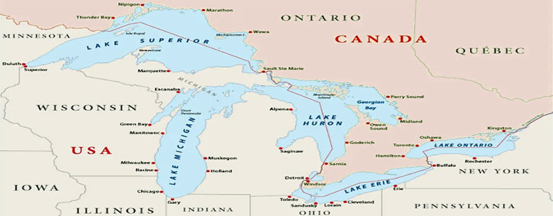
Great Lakes Map.
The Great Lakes of North America is a chain of five deep freshwater lakes in the mid-east region of North America. The lakes connect to the Atlantic Ocean via the Saint Lawrence River. These five lakes and the St. Lawrence River contain some 94,250 square miles or 20% of the world’s fresh water and form the world’s most extensive surface freshwater system.
The Great Lakes include five lakes: Superior, Michigan, Huron, Erie, and Ontario, and are generally on or near the Canada-United States border. Except for Lake Michigan, the lakes provide a natural border between the two countries,
Lake Superior, bordered by Ontario, Canada, the Upper Peninsula of Michigan, Wisconsin, and Minnesota, is the northernmost and westernmost lake and can be considered the headwater of the system. At 483 feet deep, it is the deepest lake and discharges into Lake Huron through the St. Marys River.
Lake Michigan lies south of Lake Superior, bordered by the Upper and Lower peninsulas of Michigan, Indiana, Illinois, and Wisconsin. It has a mean depth of 279 feet and flows northward into Lake Huron through a deep gorge at the Straits of Mackinac. Lake Michigan is the largest lake entirely within one country.
Lake Huron is slightly larger than Lake Michigan. Its mean depth, however, is only 195 feet. Ontario, Canada, and Michigan bound it. Its outflow goes through the St. Clair River, the shallow basin of Lake St. Clair, and the Detroit River to Lake Erie.
Lake Erie is bordered by Ontario, New York, Pennsylvania, Ohio, and lower Michigan. It is the shallowest of the Great Lakes, with a mean depth of 62 feet. Its waters discharge along the Niagara River, including a rapid plunge over Niagara Falls before reaching Lake Ontario. Some water is diverted from Lake Erie to Lake Ontario via the Welland Canal.
Lake Ontario has the smallest surface area of the system. It has, however, the second-greatest mean depth — 283 feet. It lies between Ontario and New York and discharges into the St. Lawrence River. The five Great Lakes have long been called inland seas because of their sea-like characteristics, such as rolling waves, sustained winds, strong currents, great depths, and distant horizons. Severe storms can occur over the lakes, particularly in late fall and early winter. Currents are highly variable. They respond quickly to wind changes. Winds can reach gale force and generate waves ten feet or more in height. Large areas of the surface waters freeze during winter, although open patches usually remain in the centers of the lakes.
The Great Lakes formed nearly 20,000 years ago. At the end of the last Ice Age, Canada and the northern part of the United States were covered entirely in ice. As the climate warmed, the lakes were sculpted by a glacial continental ice sheet — a large, slow-moving mass of ice and compact snow. Its movement was so powerful that it scraped the surface of the Earth and created the lake basins. As the glacier retreated, the land it had previously weighed down began to rebound and warp upward. Large chunks of ice pushed down the soil with immense weight and filled with meltwater.
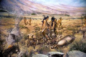
During this very long process, at least as far back as 15,000 BC, humans migrated to areas within the Great Lakes Basin. Several Paleo-Indian populations inhabited the region around 10,000 BC. The people of the Great Lakes traded with the Hopewell culture from around 1000 AD, as copper nuggets have been extracted from the region and fashioned into ornaments and weapons in the mounds of Southern Ohio.
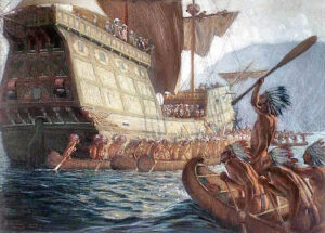
With the colonization and expansion of European peoples in North America, the lakes became an integral part of the exploration and development of the continent. It was once speculated that Vikings explored the region in the 14th century — based on discovering a broken sword, an ax, a shield boss near Nipigon Lake, Ontario, and a rune stone at Kensington, Minnesota. However, it is much more likely that the first Europeans entered the region in 1535 when the French explorer Jacques Cartier traveled up the St. Lawrence River to the site of modern Montreal to search for a route to the Orient. The Huron Indians told him of the great seas lying beyond, but the upper St. Lawrence and Lake Ontario were controlled by the Iroquois, who were unfriendly to the Europeans. Consequently, further exploration by another leading French explorer of North America, Samuel de Champlain, followed the course of the Ottawa River, Lake Nipissing, and the French River to Georgian Bay. He reached Lake Huron in 1615 and is credited with being the first European to see the Great Lakes.
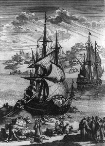
In 1634, Jean Nicolet, dispatched by Champlain to seek a route to China — led an expedition into Lake Michigan and down the length of Green Bay to the Fox River, where he encountered the Winnebago Indians. Other French explorers, including René-Robert Cavelier and Sieur de La Salle, explored the lakes, made peace with the Indians, and established early settlements. The brigantine Le Griffon, commissioned by Sieur de La Salle, was built at Cayuga Creek, near the southern end of the Niagara River, and became the first known sailing ship to travel the upper Great Lakes on August 7, 1679.
Early interest in the lakes was stimulated by the easy transportation route they offered into the continent’s heartland. The Great Lakes played a central role in the European colonization and development of North America. The value of the region’s extensive forests and fertile land was soon realized, and lumbering and agriculture became important. Large coalfields and deposits of iron, copper, salt, limestone, and other minerals were found along or near the extensive shorelines. For decades, these resources attracted people and industry.
Three significant conflicts affected the history and development of the Great Lakes. The French and Indian War (1754–63) — a struggle between the French and British to gain control of rich fur-producing lands — concluded with the cession of Canada to England. The main consequences of the American Revolution (1775–83) for the Great Lakes region were the migration of thousands of loyalists to New Brunswick, Nova Scotia, Quebec, and Ontario and the establishment of the present international boundary between the United States and Canada. During the War of 1812, Lake Erie was a primary naval battle site.
The Rush-Bagot Treaty was signed in 1818, after the War of 1812, and the Treaty of Washington later led to a complete disarmament of naval vessels in the Great Lakes. Nonetheless, both nations maintained coast guard vessels in the Great Lakes.
The Great Lakes and its rivers were the only practical means of moving people and freight during settlement. Barges from middle North America reached the Atlantic Ocean from the Great Lakes when the Welland Canal opened in 1824 and the later Erie Canal opened in 1825. A few years later, the Welland Canal opened.
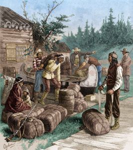
The fishing industry expanded mainly in the waters associated with the fur trade that connected Lake Erie and Lake Huron. Two major fish suppliers in the 1830s were the fur trading companies of the American Fur Company and the Hudson’s Bay Company.
The catch from these waters was sent to the growing market for salted fish in Detroit, where merchants involved in the fur trade had already gained some experience handling salted fish.
From 1844 through 1857, palace steamers carried passengers and cargo around the Great Lakes.
By 1848, the Illinois and Michigan Canal opened in Chicago, Illinois, making direct access to the Mississippi River from the lakes possible. These two canals provided an all-inland water route between New York City and New Orleans, Louisiana.
In the 19th century, the main business of many passenger lines was transporting immigrants. Many larger cities owe their existence to their position on the lakes as a freight destination and a magnet for immigrants. After railroads and surface roads developed, the freight and passenger businesses dwindled and later vanished except for ferries and a few foreign cruise ships.
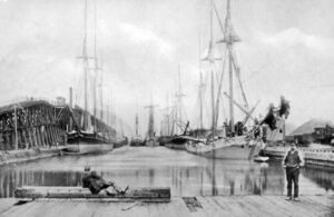
In the 19th and early 20th centuries, iron and other ores, such as copper, were shipped south, and supplies, food, and coal were shipped north. Because of the location of the coal fields in Pennsylvania and West Virginia and the general northeast track of the Appalachian Mountains, railroads naturally developed shipping routes that went due north to ports such as Erie, Pennsylvania, and Ashtabula, Ohio.
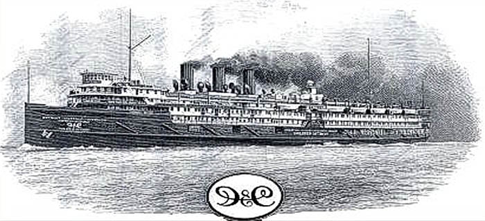
In the first half of the 20th century, sizeable luxurious passenger steamers sailed the lakes in opulence. The Detroit and Cleveland Navigation Company had several vessels at the time and hired workers from all walks of life.
The Great Lakes have provided us with invaluable resources — drinking water, food, energy, transportation, recreation, and prosperity. A plentiful water supply combined with these vast resources naturally favored the development of huge industries and large metropolitan areas around the Great Lakes.
Despite their large size, the Great Lakes are highly vulnerable. Past and present neglect of the system, such as unsustainable use, discharging of harmful chemicals, and climate change, have led to severe consequences for native species and the health of the Great Lakes. The four most significant ongoing issues facing the Great Lakes are habitat destruction, sewage pollution, river damming and diversion, and land-use runoff.
Significant changes first became noticeable in about 1900 and paralleled the buildup of the human population around the lakes, especially Lakes Erie and Ontario and the southern portion of Lake Michigan. However, the lakes have not benefited from this development and have been seriously affected by pollution.
Misuse of the lakes became all too apparent and was perhaps most clearly dramatized by the growing number of beaches closed after 1950 because of pollution. However, the less obvious accumulation of toxic substances in wildlife, especially fish and fish-eating birds, had much more severe implications. It came to be realized that pollution could directly or indirectly affect all uses — raising the cost of water treatment, killing valuable fish species, rendering other species unfit to eat, and adversely affecting the tourist industry and the value of shoreline property. Since the 1970s, authorities in Canada and the United States have undertaken a significant cooperative effort at pollution control, resulting in improved water quality and the resurgence of some fish populations.
Concern over the fate of the lakes reached a high pitch in the late 20th century, with both the U.S. and the Canadian governments and individuals investigating methods for reversing the consequences of years of misuse of the lakes’ waters.
Major urbanized areas include a band extending from Milwaukee, Wisconsin, through Chicago, Illinois, and around southern Lake Michigan; a band stretching southward from Detroit, Michigan, and then continuing along Lake Erie’s southern shore; and the Toronto-Hamilton area on the northern shore of Lake Ontario.
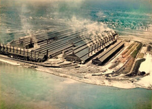
The industry of the lakes region is highly diversified. The large steel mills in Illinois, Indiana, Ohio, Michigan, and Ontario and the automobile industry centered in Detroit produce many of the continent’s steel and motor vehicles. Nonetheless, many more workers are employed in the service industry.
Although most of the virgin pine forests in the basin were felled by 1910, timber remains important and is supported by both federal and state governments. About half of the land in the counties bordering the lakes in the United States is devoted to farming, while nearly one-third of that in the bordering Canadian provinces is under agriculture. The principal crops raised are corn, soybeans, wheat, animal fodder, and fruits and vegetables; pork, beef, and dairy products are also produced. Commercial fishing was once a primary industry on the lakes, but the decline of the more desirable species led to its collapse. However, a limited amount of commercial fishing is still carried on for species such as whitefish. Emphasis has switched to sport fishing based on coho and chinook salmon, lake trout, walleye, and rainbow trout; this has grown into a significant industry.
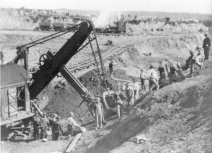
The ranges around Lake Superior — such as the Mesabi in Minnesota and the Marquette in Michigan — constitute a significant source of iron ore for the United States. Peak production occurred in 1953 when almost 100 million net tons were produced. The large deposits of rich ores have since been depleted, but low-grade taconite ores are now efficiently processed into iron ore pellets. Lake Superior’s Keweenaw Peninsula was once a significant source of copper; sources outside the lakes are now relatively more important. Sand dunes along the eastern shore of Lake Michigan are valued for their beauty and as a source of clean sand for the industry. The water supply the lakes provide for bordering industries and municipalities is essential. Hydroelectric generating stations exist on the St. Marys, Niagara, and St. Lawrence Rivers. Numerous coal-and nuclear-powered generating plants around the lakes utilize lake water for cooling.
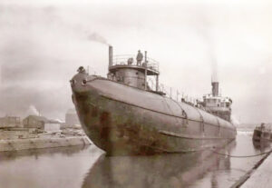
Most of the total shipping tonnage includes iron ore, coal, grain, and limestone for lake ports, but some cargo is shipped overseas through the St. Lawrence Seaway. The Welland Canal allows passage around Niagara Falls from Lake Ontario into Lake Erie and the channels and locks in the St. Marys River at Sault Ste. Marie has made Lake Superior accessible to ships up to 800 feet in length.
Since general freight today is transported by railroads and trucks, domestic ships mostly move bulk cargoes, such as iron ore, coal, and limestone, for the steel industry. Domestic bulk freight developed because of the nearby mines. It was more economical to transport the ingredients for steel to centralized plants rather than to make steel on the spot. Grain exports are also significant cargo for the lakes.
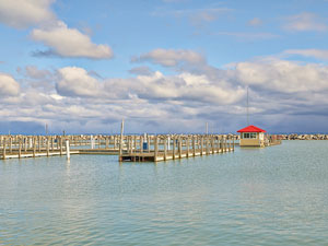
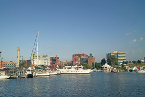
Tourism on the Great Lakes, as there is a broad spectrum of recreational opportunities. A few small cruise ships, including some sailing ships, operate on the Great Lakes. Powerboating and sailing have become popular, and numerous marinas have been built. Many other water sports, such as yachting, sea kayaking, diving, kitesurfing, and lake surfing, are practiced on the lakes. Sport, commercial, and Native American fishing represent a $4 billion-a-year industry in the United States, with salmon, whitefish, smelt, lake trout, bass, and walleye the significant catches. Many miles of high-quality, sandy beaches stretch along the lake shores. State, provincial, federal, and county lands offer hundreds of camping, picnicking, and park areas for a thriving tourist industry. Today, several ferries operate on the Great Lakes to carry passengers to various islands.
Today, the Great Lakes basin is home to approximately 40 million people, nestled among two countries, two provinces, eight states, and 64 First Nations. The world’s third-largest regional economy, the Great Lakes, supports millions of jobs and contributes billions of dollars annually to the Canadian and U.S. economies.
It has one of the world’s richest and most ecologically diverse ecosystems, encompassing forest, wetland, grassland habitats, rocky peninsulas, towering cliffs, vast marshlands, and immense sand dunes. The region is home to over 4,000 species of plants, fish, and wildlife.
Compiled by Kathy Alexander/Legends of America, updated March 2024.
Also See:
Indiana Dunes National Lakeshore, IN
National Parks, Monuments & Historic Sites
Niagara Falls National Heritage Area, NY
Sources

