


<< Our Photo Pages >> Pen-Y-Castell - Standing Stone (Menhir) in Wales in Ceredigion
Submitted by coldrum on Sunday, 12 July 2009 Page Views: 4249
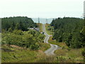
Neolithic and Bronze AgeSite Name: Pen-Y-CastellCountry: Wales County: Ceredigion Type: Standing Stone (Menhir)
Map Ref: SN69138487
Latitude: 52.446072N Longitude: 3.926982W
Condition:
| 5 | Perfect |
| 4 | Almost Perfect |
| 3 | Reasonable but with some damage |
| 2 | Ruined but still recognisable as an ancient site |
| 1 | Pretty much destroyed, possibly visible as crop marks |
| 0 | No data. |
| -1 | Completely destroyed |
| 5 | Superb |
| 4 | Good |
| 3 | Ordinary |
| 2 | Not Good |
| 1 | Awful |
| 0 | No data. |
| 5 | Can be driven to, probably with disabled access |
| 4 | Short walk on a footpath |
| 3 | Requiring a bit more of a walk |
| 2 | A long walk |
| 1 | In the middle of nowhere, a nightmare to find |
| 0 | No data. |
| 5 | co-ordinates taken by GPS or official recorded co-ordinates |
| 4 | co-ordinates scaled from a detailed map |
| 3 | co-ordinates scaled from a bad map |
| 2 | co-ordinates of the nearest village |
| 1 | co-ordinates of the nearest town |
| 0 | no data |
Be the first person to rate this site - see the 'Contribute!' box in the right hand menu.
Internal Links:
External Links:
")
A standing stone only 2'4'' high.
Coflein record:
https://www.coflein.gov.uk/en/site/303597
You may be viewing yesterday's version of this page. To see the most up to date information please register for a free account.
 (PID:111003)")
 (PID:111002)")
 (PID:67401)")
Do not use the above information on other web sites or publications without permission of the contributor.
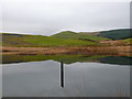
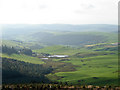
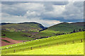
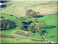
Nearby Images from Geograph Britain and Ireland:
©2014(licence)
©2008(licence)
©2013(licence)
©2008(licence)
©2005(licence)
The above images may not be of the site on this page, they are loaded from Geograph.
Please Submit an Image of this site or go out and take one for us!
Click here to see more info for this site
Nearby sites
Key: Red: member's photo, Blue: 3rd party photo, Yellow: other image, Green: no photo - please go there and take one, Grey: site destroyed
Download sites to:
KML (Google Earth)
GPX (GPS waypoints)
CSV (Garmin/Navman)
CSV (Excel)
To unlock full downloads you need to sign up as a Contributory Member. Otherwise downloads are limited to 50 sites.
Turn off the page maps and other distractions
Nearby sites listing. In the following links * = Image available
193m WSW 247° Pen-Y-Castell Hillfort Hillfort (SN68958480)
618m SSW 213° Garn Wen (NE) Cairn (SN68788436)
904m SW 222° Garn Wen Barrow Cairn (SN68518421)
1.2km SE 129° Pen-Y-Bryn-Mawr Cairn (SN70018412)
1.3km SSW 204° Stones of the Lamb* Standing Stone (Menhir) (SN68568367)
1.8km SSW 211° Cwm-Y-Darren and Twyll-Y-Mwyn Copper Mines Ancient Mine, Quarry or other Industry (SN68148335)
1.8km SE 136° Garrig Hir* Standing Stone (Menhir) (SN70378351)
2.2km SSW 212° Darren Camp* Hillfort (SN67908302)
2.2km SSW 212° Darren Camp Cairn II Cairn (SN6789183010)
2.2km SSW 212° Darren Camp Cairn I Cairn (SN6789382997)
2.4km WNW 285° Banc Troed Rhiw Seiri* Ring Cairn (SN6679385583)
2.7km N 354° Cwmere Farm Standing Stone* Standing Stone (Menhir) (SN689876)
2.9km SE 139° Carn Dolgau Cairn (SN70978266)
3.4km ESE 115° Maen Tarw* Standing Stone (Menhir) (SN7217183332)
3.5km ESE 114° Buwch a'r Llo* Standing Stones (SN72298335)
3.6km ESE 108° Castell Coch Stone* Standing Stone (Menhir) (SN72578363)
3.7km SSE 148° Esgair Nantyrarian Hillfort (SN710817)
3.7km ESE 120° Esgair Gorlan Standing Stone (Menhir) (SN72348292)
4.0km ESE 102° Gwenffrwd-Uchaf Cairns Cairn (SN73008395)
4.0km WSW 257° Bryntirion Well* Holy Well or Sacred Spring (SN65158407)
4.1km ESE 106° Disgwylfa Fach Stone Row* Stone Row / Alignment (SN73098360)
4.2km ESE 105° Disgwylfa Fach Stone 2 Standing Stone (Menhir) (SN73128366)
4.2km ESE 106° Disgwylfa Fach Stone I Standing Stones (SN73128360)
4.2km ESE 106° Glandwr Standing Stone Standing Stone (Menhir) (SN73188361)
4.3km ESE 110° Nant Geifaes Cairn (SN73188331)
View more nearby sites and additional images


 We would like to know more about this location. Please feel free to add a brief description and any relevant information in your own language.
 Wir möchten mehr über diese Stätte erfahren. Bitte zögern Sie nicht, eine kurze Beschreibung und relevante Informationen in Deutsch hinzuzufügen.
 Nous aimerions en savoir encore un peu sur les lieux. S'il vous plaît n'hesitez pas à ajouter une courte description et tous les renseignements pertinents dans votre propre langue.
 Quisieramos informarnos un poco más de las lugares. No dude en añadir una breve descripción y otros datos relevantes en su propio idioma.