


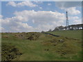
<< Our Photo Pages >> Tideslow - Chambered Cairn in England in Derbyshire
Submitted by vicky on Thursday, 09 January 2003 Page Views: 7294
Neolithic and Bronze AgeSite Name: TideslowCountry: England County: Derbyshire Type: Chambered Cairn
Nearest Town: Chapel-en-le-Frith Nearest Village: Little Hucklow
Map Ref: SK150779 Landranger Map Number: 119
Latitude: 53.297845N Longitude: 1.776403W
Condition:
| 5 | Perfect |
| 4 | Almost Perfect |
| 3 | Reasonable but with some damage |
| 2 | Ruined but still recognisable as an ancient site |
| 1 | Pretty much destroyed, possibly visible as crop marks |
| 0 | No data. |
| -1 | Completely destroyed |
| 5 | Superb |
| 4 | Good |
| 3 | Ordinary |
| 2 | Not Good |
| 1 | Awful |
| 0 | No data. |
| 5 | Can be driven to, probably with disabled access |
| 4 | Short walk on a footpath |
| 3 | Requiring a bit more of a walk |
| 2 | A long walk |
| 1 | In the middle of nowhere, a nightmare to find |
| 0 | No data. |
| 5 | co-ordinates taken by GPS or official recorded co-ordinates |
| 4 | co-ordinates scaled from a detailed map |
| 3 | co-ordinates scaled from a bad map |
| 2 | co-ordinates of the nearest village |
| 1 | co-ordinates of the nearest town |
| 0 | no data |
Internal Links:
External Links:
I have visited· I would like to visit
StanClay would like to visit
")
Have you visited this site? Please add a comment below.
You may be viewing yesterday's version of this page. To see the most up to date information please register for a free account.
")
")
")
")
Do not use the above information on other web sites or publications without permission of the contributor.
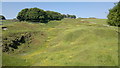
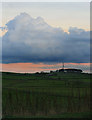
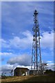
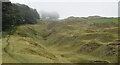
Nearby Images from Geograph Britain and Ireland:
©2012(licence)
©2011(licence)
©2012(licence)
©2023(licence)
©2013(licence)
The above images may not be of the site on this page, they are loaded from Geograph.
Please Submit an Image of this site or go out and take one for us!
Click here to see more info for this site
Nearby sites
Key: Red: member's photo, Blue: 3rd party photo, Yellow: other image, Green: no photo - please go there and take one, Grey: site destroyed
Download sites to:
KML (Google Earth)
GPX (GPS waypoints)
CSV (Garmin/Navman)
CSV (Excel)
To unlock full downloads you need to sign up as a Contributory Member. Otherwise downloads are limited to 50 sites.
Turn off the page maps and other distractions
Nearby sites listing. In the following links * = Image available
1.6km SSW 207° The Dor Well* Holy Well or Sacred Spring (SK143765)
1.6km SW 218° Ebbing and Flowing well* Holy Well or Sacred Spring (SK140766)
2.0km NE 53° Cop Low* Round Barrow(s) (SK16627912)
2.2km SW 227° Wishing Well* Ancient Cross (SK134764)
2.3km NE 56° Stan Low* Round Barrow(s) (SK169792)
2.8km NNE 30° Fissure Cave Cave or Rock Shelter (SK164803)
2.9km E 84° Burr Tor* Hillfort (SK179782)
3.0km NE 48° Hazlebadge Round Barrow 2* Round Barrow(s) (SK17257991)
3.3km NW 323° Ox Low* Round Barrow(s) (SK130805)
3.3km ENE 74° Crow Chin cairns* Cairn (SK1815578818)
3.3km NE 43° Hazlebadge Round Barrow 1* Round Barrow(s) (SK17268034)
3.4km WSW 255° The Tong* Long Barrow (SK117770)
3.6km SE 138° Peter's Stone* Natural Stone / Erratic / Other Natural Feature (SK17387525)
4.3km NW 316° Eldon Hill 2* Round Barrow(s) (SK12028099)
4.4km SW 232° Wind Low* Chambered Cairn (SK115752)
4.5km SW 222° Wormhill, Derbyshire Sculptured Stone (SK120746)
4.6km NE 44° The Grey Ditch* Misc. Earthwork (SK182812)
4.7km N 0° Cave Dale 2* Cave or Rock Shelter (SK150826)
4.7km NW 314° Eldon Hill* Round Barrow(s) (SK11568114)
4.7km NNE 30° Bath Spring Holy Well or Sacred Spring (SK174820)
4.8km SE 144° Wardlow Hay Cop* Round Barrow(s) (SK17857397)
4.9km N 358° Lady's well (Cavedale) Holy Well or Sacred Spring (SK148828)
4.9km SSE 151° Ravenscliffe Cave Cave or Rock Shelter (SK174736)
5.0km WSW 242° Bole Hill* Round Barrow(s) (SK10637555)
5.2km ENE 59° Burton Bole* Round Barrow(s) (SK194806)
View more nearby sites and additional images


 We would like to know more about this location. Please feel free to add a brief description and any relevant information in your own language.
 Wir möchten mehr über diese Stätte erfahren. Bitte zögern Sie nicht, eine kurze Beschreibung und relevante Informationen in Deutsch hinzuzufügen.
 Nous aimerions en savoir encore un peu sur les lieux. S'il vous plaît n'hesitez pas à ajouter une courte description et tous les renseignements pertinents dans votre propre langue.
 Quisieramos informarnos un poco más de las lugares. No dude en añadir una breve descripción y otros datos relevantes en su propio idioma.