<< Our Photo Pages >> Mid Float E - Standing Stone (Menhir) in Scotland in Dumfries and Galloway
Submitted by markj99 on Saturday, 26 December 2020 Page Views: 487
Neolithic and Bronze AgeSite Name: Mid Float ECountry: Scotland County: Dumfries and Galloway Type: Standing Stone (Menhir)
Nearest Town: Stranraer Nearest Village: Sanhead
Map Ref: NX06804851
Latitude: 54.794158N Longitude: 5.006768W
Condition:
| 5 | Perfect |
| 4 | Almost Perfect |
| 3 | Reasonable but with some damage |
| 2 | Ruined but still recognisable as an ancient site |
| 1 | Pretty much destroyed, possibly visible as crop marks |
| 0 | No data. |
| -1 | Completely destroyed |
| 5 | Superb |
| 4 | Good |
| 3 | Ordinary |
| 2 | Not Good |
| 1 | Awful |
| 0 | No data. |
| 5 | Can be driven to, probably with disabled access |
| 4 | Short walk on a footpath |
| 3 | Requiring a bit more of a walk |
| 2 | A long walk |
| 1 | In the middle of nowhere, a nightmare to find |
| 0 | No data. |
| 5 | co-ordinates taken by GPS or official recorded co-ordinates |
| 4 | co-ordinates scaled from a detailed map |
| 3 | co-ordinates scaled from a bad map |
| 2 | co-ordinates of the nearest village |
| 1 | co-ordinates of the nearest town |
| 0 | no data |
Internal Links:
External Links:
")
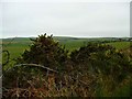
Mid Float E is a standing stone 250 yards NE of Mid Float Farm. The base of the stone is triangular c. 3x3x3 feet in cross-section. It rises to a rounded point at 5.5 feet. The flat SW face shows signs of cattle rubbing. The E face is flat and irregular. The N side of the stone is angular with sheared faces.
Canmore ID 60456 suggested there were 4 cup marks on the SW face in 1970 however a later visit in 1984 came to the conclusion that they were probably natural.
Canmore also proposed the stone may be a glacial erratic which was placed in a vertical position, presumably as a rubbing stone. However the shape of the stone and the fact that it is has a footing in the ground leads me to think it may be prehistoric. If we consider the nearby, now recumbent, standing stone at Whirlpool c. 550 yards N, it is possible there may have been an alignment.
Mid Float E is not on OS mapping.
You may be viewing yesterday's version of this page. To see the most up to date information please register for a free account.
")
")
")
")
Do not use the above information on other web sites or publications without permission of the contributor.
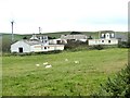
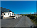
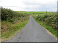
Nearby Images from Geograph Britain and Ireland:
©2007(licence)
©2018(licence)
©2013(licence)
©2019(licence)
©2007(licence)
The above images may not be of the site on this page, they are loaded from Geograph.
Please Submit an Image of this site or go out and take one for us!
Click here to see more info for this site
Nearby sites
Key: Red: member's photo, Blue: 3rd party photo, Yellow: other image, Green: no photo - please go there and take one, Grey: site destroyed
Download sites to:
KML (Google Earth)
GPX (GPS waypoints)
CSV (Garmin/Navman)
CSV (Excel)
To unlock full downloads you need to sign up as a Contributory Member. Otherwise downloads are limited to 50 sites.
Turn off the page maps and other distractions
Nearby sites listing. In the following links * = Image available
230m WSW 250° Mid Float W* Natural Stone / Erratic / Other Natural Feature (NX06584844)
503m NNW 337° Whirlpool* Standing Stone (Menhir) (NX06624898)
1.2km E 93° Kirkmadrine Church Stones* Early Christian Sculptured Stone (NX0801448389)
1.4km SSE 167° Craigencroy* Cairn (NX07064711)
1.8km E 86° Cairnweil standing stone* Standing Stone (Menhir) (NX0863748556)
3.8km S 179° Doon Castle (Broch)* Broch or Nuraghe (NX0670244683)
4.8km SSE 168° Grennan Point* Promontory Fort / Cliff Castle (NX07604377)
5.7km NW 311° Knockinaam Standing Stone* Standing Stone (Menhir) (NX02695242)
5.9km N 351° St Catherine's Well (Eldrickhill) Holy Well or Sacred Spring (NX06125442)
6.0km SE 143° Logan House* Standing Stone (Menhir) (NX10224354)
6.3km SSE 151° St Mary's Well (Logan) Holy Well or Sacred Spring (NX096428)
8.2km NNW 341° Cairn Pat* Hillfort (NX04425632)
8.3km SE 140° Chipperdingan Well (New England Bay) Holy Well or Sacred Spring (NX11904190)
8.7km NW 307° St Patrick's Well (Portpatrick) Holy Well or Sacred Spring (NX00105411)
9.1km SE 140° Terally Bay* Standing Stone (Menhir) (NX12284127)
9.8km NNW 331° Craigenlee Fell E* Cairn (NX02495728)
9.8km NNE 26° Inch Cursus Cursus (NX11505710)
9.8km NNW 329° Craigenlee Fell W* Cairn (NX02155717)
9.9km NNE 26° Inch Cursus Cursus (NX11555716)
10.0km SE 146° St Bride's Well (Kirkmaiden Parish) Holy Well or Sacred Spring (NX1240)
10.1km SSE 152° Inchmulloch Hill* Standing Stone (Menhir) (NX1113739421)
10.2km NW 313° St Kain's Well (Dunskey Glen) Holy Well or Sacred Spring (NW997558)
10.9km NW 319° Balmannoch Stone Circle (NX0057)
11.1km N 10° Galla Hill* Misc. Earthwork (NX09205941)
11.6km NE 41° Droughduil Mote* Timber Circle (NX14825687)
View more nearby sites and additional images


 We would like to know more about this location. Please feel free to add a brief description and any relevant information in your own language.
 Wir möchten mehr über diese Stätte erfahren. Bitte zögern Sie nicht, eine kurze Beschreibung und relevante Informationen in Deutsch hinzuzufügen.
 Nous aimerions en savoir encore un peu sur les lieux. S'il vous plaît n'hesitez pas à ajouter une courte description et tous les renseignements pertinents dans votre propre langue.
 Quisieramos informarnos un poco más de las lugares. No dude en añadir una breve descripción y otros datos relevantes en su propio idioma.