Sorry to say that whenever I go for a walk I think about the local geophysics – sad isn’t it! Last year, I used one of the last remaining sunny, autumn days to stroll around the SW Coastal Path Loop of the Isle of Portland, Dorset. I was rewarded with a spectacular day containing stunning geological views either side of a very pleasant lunch with my wife, Sue, at the Lobster Pot Café (highly recommended) next to Portland Bill Lighthouse on the southern tip of the island. A day or two after the walk, I spent a short time investigating what might freely be found regarding geophysical data on and around the Island.
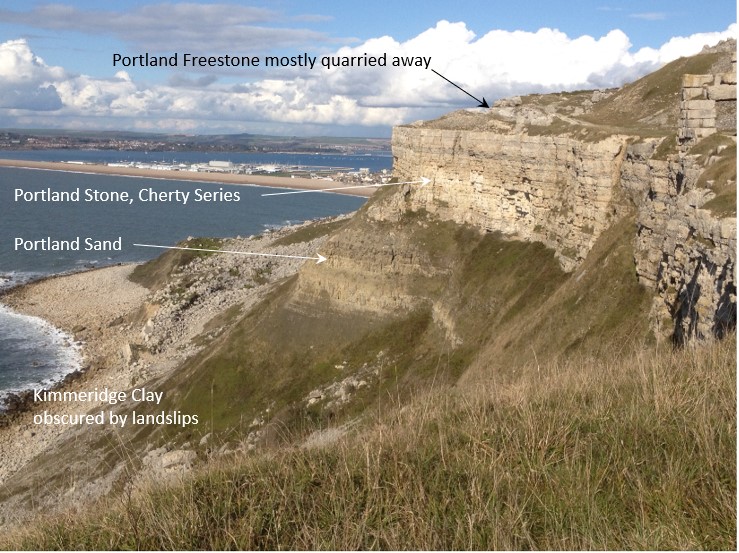
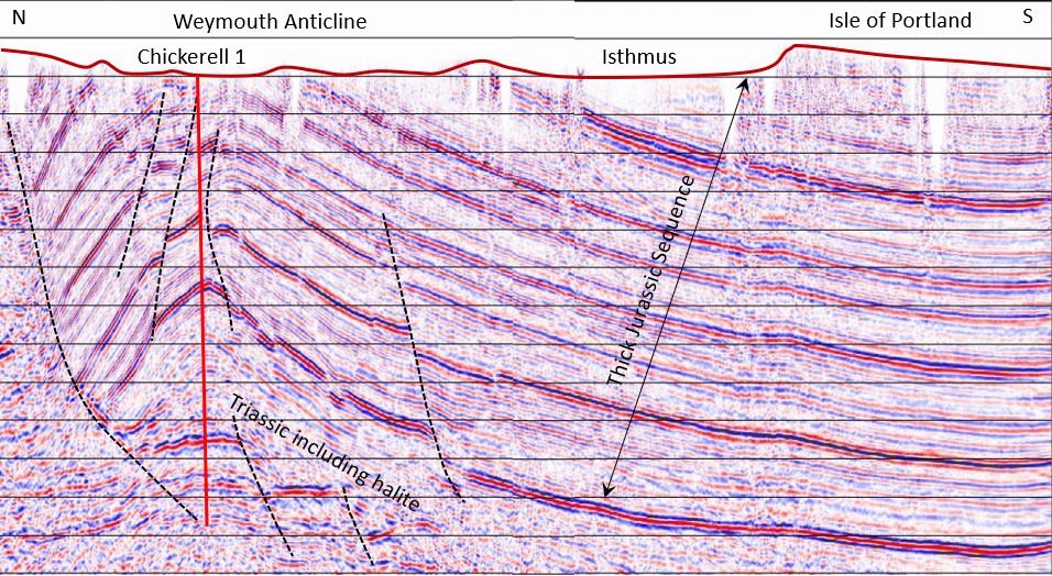
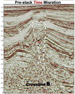
A 2D Vibroseis reflection seismic line was acquired across the island by Brabant Petroleum Limited during 1992. An image of this line can be found on the excellent UK Onshore Geophysical Library (UKOGL) website. Part of the section is shown below. The line heads south across the mainland, runs along the isthmus and up onto the Isle of Portland. Beneath the island, a thick sequence of Jurassic strata may be seen dipping southwards at low angle (~1-2°). The surface of the island generally follows this gentle regional dip and is capped by Purbeck sediments partly covering those of Portland age. The Portland limestones are high-quality building stones and have been extensively quarried for many years with widespread evidence for these workings remaining. On the mainland to the north, the seismic line displays the faulted Weymouth Anticline and shows it to be cored with thickened Triassic Halite above faulted Sherwood Sandstone, the main reservoir for the nearby Wytch Farm oilfield.
Between 2008 and 2011, a widespread high-resolution multibeam echo-sounder survey was acquired along the Dorset coast spanning approximately 800 sq km of the seabed. It was a collaborative project between the Dorset Wildlife Trust, the Maritime and Coastguard Agency, the Channel Coastal Observatory and the National Oceanographic Centre, Southampton. The survey has provided spectacular and detailed images. In many places, the seabed is scoured clean by the active tidal flows and outcropping geological patterns can be recognised. A snapshot of part of the survey is shown below with some of the more obvious features annotated. Of note, are the well-defined outcrop patterns in the north-east corner of the image. Here, Corallian rocks outcrop within the core of the Lulworth Anticline. The rocks are affected by a series of small N-S trending faults cutting the anticline. These faults may also be seen at various exposures along the Dorset cliff sections.
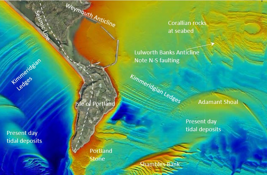
The faulting is thought to have been produced as part of a conjugate shear set associated with regional compression from the south during the Alpine Orogeny, although recent thoughts are that the slightly earlier Pyrenean Orogeny may have been primarily responsible.
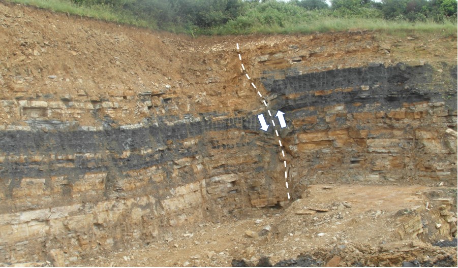
On the mainland to the north, a possible candidate for one of these northward-trending faults has been spotted on an active quarry face. The photo below was taken, looking approximately south, with the fault seen to be of reverse character and with the hanging wall on the western side.
As you may have realised from the short description above, I enjoy trying to bring together different data strands to make a coherent picture. In fact, we feel that this type of approach is one of Merlin’s great strengths. Through our team, we have access to experts in numerous and wide-ranging geological and geophysical disciplines. We enjoy integrating and blending the varied technical aspects to produce the most optimum of interpretations. Why not give us a call?
By John Donato, Principal Geophysicist
