Trip Report
Mount Baker/Easton Glacier
Small team and disciplined glacier adventure in the late season
- Sat, Aug 19, 2023
- Mount Baker/Easton Glacier
- Climbing
- Turned Around
-

- Road suitable for all vehicles
-
Late season condition. Easton glacier is currently a crevasse maze. Most part of in the lower half is iced. Steep sections in the upper half are glassy.
Navigation is challenging as condition is changing rapidly, and it's hard to establish/follow any path on ice. Would recommend saving the GPS track, but definitely testing it out instead of blindly following it.
Turned around at 10200 ft at Roman Wall, where the dense ice is glassy and steep. Would recommend ice screws and some ice climbing experience.
Filled water a bit above Sandy Camp.
As people have warned about the melting glacier, me and my friend decided to pay an exploratory visit to a glacier in late season. To us summiting isn't the goal and we agreed to around if safety margin is thin. I personally want something challenging and inspiring to close the season, and it turned out an intense but fun trip.
2:00 am: headed out from TH. The approach was uneventful. There is a bridge for creek crossing, thought this save sometime if you need to do this in the dark.
4:00 am: reached Sandy Camp. Followed the sound of water, we found a creek and filled water there. It was more obvious with daylight.
5:30 am: it took us some back and forth to find an entry into rocky section from which we can drop onto the snow, at around 6500 feet. Lessons learned: if you need to do the approach in the dark, learning key topological features before the trip would save lots of time.
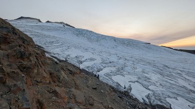
We checked out the glacier while sitting on top of the ridge watching sunrise. The glacier looked so different compared to Basic's snow2 trip back in June. It's so icy, so broken, and so terrifying! Adriana and I spent a long time there, discussing the strategy, risks, how to react and when to turn around. After long contemplation, we felt ready.
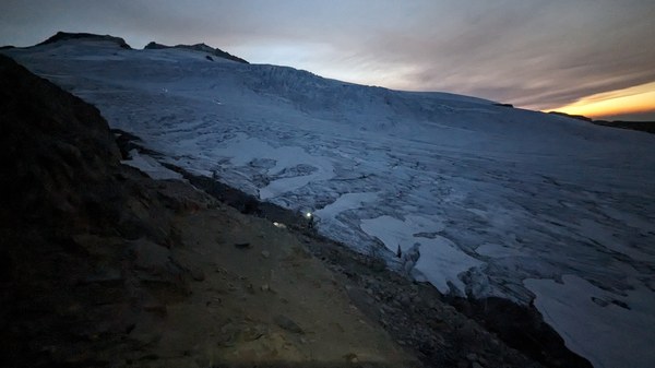
7:00 am: dropped onto glacier as a two person rope team, with several stopper knots on the rope between us. As the lighter one, it would be reasonable to have me lead the way as it's easier for Adriana to stop me if I fall.
Leg 1
Lower part of glacier was mostly iced and crevasses was messy: there was probably a crevasse every meter. It wasn't all bad here: melting snow had all crevasses exposed, we were able to obtain good purchase from crampons, and the slope was gentle. The narrower crevasses made us stay on climbers right.
At around 7000 ft we hit a nunatak, forcing us to turn left where the slope increased significantly, and so was the density of crevasse. It hard to find boot path on ice, but we were able to find an acceptable path, with flatter slope and thinner crevasses (at this point, I have accepted to embrace the presence of crevasse so close).
Leg 2
The route was easy after that steep section: flat, covered by snow in good condition, no crevasse and clear boot path. Time for a short break and delayer.
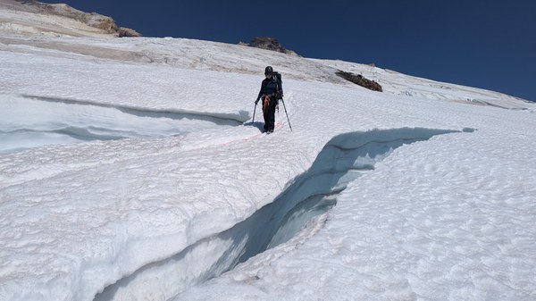
Moving up, big crevasse would show up one after another. Sometimes the boot path would stop in front of the crevasse. We realized that the boot path was from earlier when people could still cross, but now it was not reliable anymore. For every big crevasse or one the size wasn't clear from distance, I'd have to walk close to the lip to assess if the step to cross is solid, if the snow bridge is thick enough or poke the edge if we have to skirt it. Adriana held her ice axe tightly and was ready to arrest. It was too intense for photos. Unfortunately I can't prove how spectacular the blue ice is, but it's true!
Leg 3
At around 8600 ft we reached a flat snowfield again, took some rest and prepare d for the upcoming challenge: the slope appeared significantly steeper, and glacier was broken up at the bottom. The top was bare ice broken by cracks some of which were treacherously deep so slip wasn't going to be fun. Every team was slow here, mostly to move carefully on ice over cracks and to avoid sliding into one. The slope was acceptable, crampons worked well with the ice, it's not difficult to find a path with acceptable runout - the runout was never good with a huge crevasse below for sure - and no one used ice screws here. However I did find one place where a big airy stepping up pretty challenging for people like me with shorter limbs.
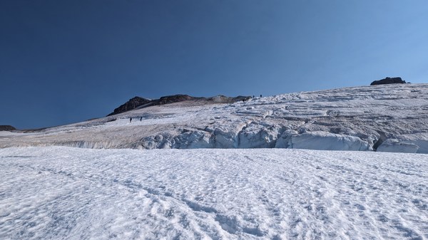
Above the icy slope was gentle snow again, with "standard" big crevasse maneuver. Then ascent following a boot path got us to the crater, which was cheering tired ppl with representative pointy rock on climbers right and Roman Wall on the left. 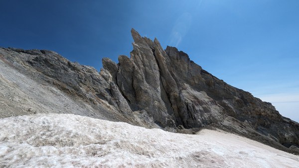
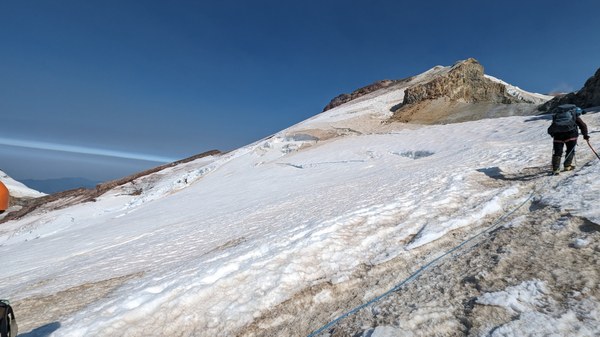
Leg 4
The route then turned to climbers left heading to Roman Wall, which turned out to be the steepest part of the route. The traverse has rock fall risk so we went fast. The ascent at roman wall is steep but manageable, snow was sprinkled by dust on top, soft enough to kick steps.
At around 10200 ft where the ascent turned to climbers left, the slope turned somewhere around 60 degree. My poking trekking poles brought back bad news: the stuff underneath the dust was dense and glassy ice. My crampons didn't feel good on it either. Adriana gave it a try, immediately regret and barely made it back. We watched a guid teaching his group how to move on steep ice with crampons but still didn't feel comfortable. The ice was just too dense and slippery to arrest a slide, which ironically was very likely to happen here, and snow picks that we brought won't punch through, and right below us was an inviting crevasse as the runout... After another long break, this felt clearly our turn around place.
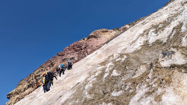
We went back to the crater, unroped, took off harness and crampons, took a long break to eat and to answer nature's call.
1:15 pm: started heading back.
Snow was soft but not too slippery for plunging steps. I poked out couple of holes on snow bridges here and there, and a bridge which we went on the way up, was already too thin - not a good idea to cross anymore .
Ice was melting fast, especially the lower half of glacier. We could hear water flowing beneath the wet ice. Here I find it harder to find the way back down compared to going up, as the view looking down was limited and we couldn't the follow the shallow crampon marks left before which had melted out by now. We spent as much time here going down as going up. Saving the track up was definitely big help.
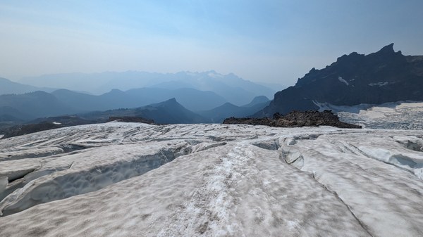
4:00 pm: back to drop off spot, took off glacier gear, rested. Time to enjoy the view which was missed from the approach in the dark, and railroad grade was breathtaking (although smoke was already obvious in sky).
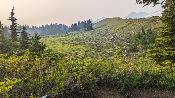
7:30 pm: back to car.
 Maggie Zhou