
Maol Chean-dearg and An Ruadh-Stac
Hillwalking route up Maol Chean-dearg and An Ruadh-Stac from Coulags
From Strath Carron, a Right-of-Way path gains the foot of these rugged hills from where a rough old stalkers path leads most of the way uphill. There's some easy rock-scrambling to enjoy on the way to An Ruadh-Stac's summit.
Route outline
| Munros | ||||
| Corbetts | ||||
| Ascent | 1400m (4590ft) | |||
| Distance | 19km (12m) | |||
| Time | 7:05hr | |||
| Start/finish | Coulags Grid Ref : NG958451 | |||
| Terrain |
| |||
| Nav |
| |||
| Effort |
| |||
| Scenery |
| |||


An Ruadh-Stac and Maol Chean-dearg sit in a wild and rugged land above Strath Carron. These mountains are comprised mainly of quartzite rock, with Maol Chean-dearg's summit topped with red sandstone.
Starting from Coulags in Strath Carron, a Right-of-Way path travels to Coire Fionnaraich, from where a rough old stalkers path leads to the lochans at a bealach at the foot of these hills. Two there-and-back routes from the bealach reach the summits, with some easy rock-scrambling to enjoy on the way to An Ruadh-Stac.
Show map
Route description
1. Getting to Coulags

Coulags
The route begins from Coulags which is a collection of a few houses by the bridge over the Fionn Abhainn on a single track section of the A890, around 6km north-east of the village of Lochcarron.
There is a parking area immediately west of the bridge with sufficient room for around 10 vehicles.
2. Bealach a' Choire Ghairbh

Coire Fionnaraich bothy below Sgorr Ruadh
From the parking area, cross the bridge over the Fionn Abhainn. Just beyond the bridge a Right-of-Way sign by a gate and barrier indicates the direction to Torridon.
Head through the gate and around the barrier to begin hiking up an estate track. The track leads to Coulags Lodge  and just before nearing this, a sign directs hillwalkers onto a rough path, into woodland and around the lodge's gardens. The path re-joins the estate track just beyond the lodge.
Follow the estate track for around 300m to meet with a bridge, to the right of which is a rougher track (there was a rather temporary sign with 'Public Footpath' here on my last visit). Hike up this rough track for around 1.5km as it climbs gently, becoming rougher to reach a bridge  over the Fionn Abhainn.
Over the bridge and onto the west bank of the Fionn Abhainn, the track has become a path, which is followed northwards for 1km to Coire Fionnarach bothy  , a grand wee shelter if waiting for weather to pass, but which is locked during stalking season.
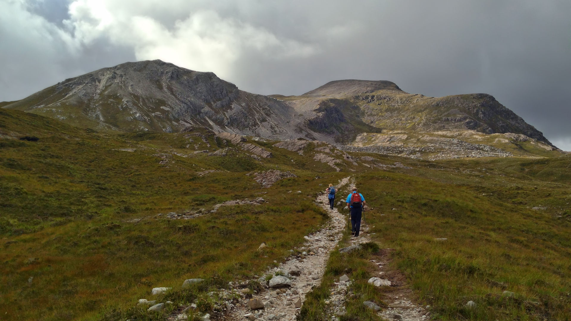
A further 2km onwards, the path comes to a junction by a cairn  , head left (west) and begin to climb uphill following a burn. The path zig-zags, crosses the burn, then becomes very eroded. The path crosses another burn, becomes less badly worn and climbs a further 100m of height to arrive at Bealach a' Choire Ghairbh
  .
.

Approaching Bealach a' Choire Ghairbh
Approaching Bealach a' Choire Ghairbh
3. Maol Chean-dearg from Bealach a' Choire Ghairbh

Maol Chean-dearg from Loch a' Mhadaidh Ruadh
At Bealach a' Choire Ghairbh, turn right and follow a boot-worn path picking a route up through quartzite scree and boulders. The path twists and turns as it climbs around 150m to gain more level ground on a spur on Maol Chean-dearg's south-eastern shoulder.
Heading north-west over uneven and stony ground, the path crosses the crest of the spur to reach the foot of a grass-covered slope  . Up the slope, the path climbs a height of 100m or so to meet with a small gap below the final pull up Maol Chean-deag.

On Maol Chean-dearg, looking to Liathach
 from where fine views are to be had.
On Maol Chean-dearg, looking to Liathach
4. An Ruadh-Stac from Bealach a' Choire Ghairbh

An Ruadh-Stac above Bealach a' Choire Ghairbh
From the highest point on Bealach a' Choire Ghairbh head southwards and pick up a path heading south-east. This path is the Right-of-Way from Annat and travels up to Bealach an Ruadh-Stac.
At the top of Bealach an Ruadh-Stac, leave the path, turn south-west and traverse some rocky ground above Loch a' Mhadaidh. A little lochan is passed near the end of the crest which leads to a short drop and the foot of An Ruadh-Stac  .
.
Above and ahead is An Ruadh-Stac's eastern shoulder, very rocky and looking quite intimidating. In dry conditions the route is actually quite straightforward.
Initially sticking to the crest, begin climbing up rocky slabs. The most straightforward line up the rock begins to veere to the left of the crest. Higher up in a bit of a nook, the route appears blocked - at this point turn back onto the crest and scramble upwards as a path forms.
With the most steep ground of the crest passed, bouldery ground with patches of heather is reached. Instead of taking a direct climb up steep scree and rocky ground, at a slant, climb south-west over some loose ground to gain the base of a grass-covered indent, which continues up to An Ruadh-Stac's summit crest at around 200m north of the summit.

Applecross hills and Skye from An Ruadh-Stac's summit
 , from where views in all directions are quite stunning !
Applecross hills and Skye from An Ruadh-Stac's summit
5. Return

Clach nan Con-fionn below Fuar Tholl
From the summits, retrace your steps back down to Bealach a' Choire Ghairbh. A detour from An Ruadh-Stac's lower crest down to Loch a' Mhadaidh Ruadh is worthwhile for the views of An Ruadh-Stac and Maol Chea-dearg reflected in the waters.
Pick up the path heading down to Coire Fionnaraich and return towards Coulags.
The weird stone met by the Fionn Abhainn, around halfway between the path junction and the bothy , is Clach nan Con-fionn (stone of Fingal's dogs) - where legend has it, warrior and poet Fionn McCuill tied his hounds.
6. Extend the route over to Sgurr Ruadh

Final pull up to Sgorr Ruadh's summit
Bagging Maol Chean-dearg from Coulags, with or without An Ruadh-Stac, is not a particularly long hike and a fine option is to extend the route over to Sgorr Ruadh and Beinn Liath Mhor.
One way to do this is to head down Maol-Chean-dearg's eastern shoulder, then northwards to cross Bealach na Lice and hike up Sgorr Ruadh's north-western shoulder from Bealach Ban. However, the deep thick heather under Maol-Chean-dearg and above Bealach na Lice is tiresome as are the boulderfields above Bealach Ban.
A quicker and easier route is to return from Maol Chean-dearg down to Coire Fionnaraich and make a direct ascent of Sgorr Ruadh, though better made in reverse. This route is described in 'Coulin Forest from Strath Carron' in 'Alternative and nearby routes' below.
Route profile »

Maps and GPX downloads »


|
Download GPX of route |
The map images above link to items on Amazon. A small commission is earned on any map purchased which helps fund the operating costs of this website.
Weather forecasts »
| Regional | MWIS - Northwest Highlands |
| Peak specific | Mountain Forecast.com Met Office YR.no |
| Seasonal | SAIS - Torridon Midge forecast |
Alternative and nearby routes »
Coulin Forest from Strath Carron | |

|
Aiming up the Coulin Forest Munros from Achnashellach makes for a rugged yet fabulous circular route. Fuar Tholl can be included in the itinerary without too much additional effort, or the route extended over to Maol Chean-dearg. Peaks : 2 Munros, 1 Corbett
Ascent : 1750m (5740ft) Distance : 21km (13m) Time : 8:10hr |
Coulin Forest from Glen Torridon | |

|
I'd guess the most popular route up Beinn Liath Mhor and Sgorr Ruadh approaches from Achnashellach. An approach from Glen Torridon however allows the Corbetts of Sgurr Dubh and Sgorr nan Lochan Uaine to be added into a route with the Munros without too much additional effort. Peaks : 2 Munros, 2 Corbetts
Ascent : 1750m (5740ft) Distance : 21km (13m) Time : 8:10hr |
Beinn Damh from Torridon | |

|
A lovely route from Loch Torridon through rhododendrons and Scot's pine woodlands, follows a decent path onto Beinn Damh's crest with its summit above mighty coires. Peaks : 1 Corbett
Ascent : 960m (3150ft) Distance : 12km (7m) Time : 4:50hr |
Liathach | |

|
Liathach, "the Grey One", is situated in the heart of the Torridon. Being the most dramatic of the Torridon Giants, Liathach's slopes are composed of terraced sandstone, above which the highest peaks are topped with quartzite blocks. Forboding on first aquantiance, there are however some chinks in Liathach's armour which has allowed rough routes and a bypass path around the scramble over the Am Fasarinen Pinnacles to develop over time. Peaks : 2 Munros
Ascent : 1280m (4200ft) Distance : 6km (4m) Time : 3:40hr |


